Aberdare: Understanding Urban Character - Cadw - Welsh ...
Aberdare: Understanding Urban Character - Cadw - Welsh ...
Aberdare: Understanding Urban Character - Cadw - Welsh ...

You also want an ePaper? Increase the reach of your titles
YUMPU automatically turns print PDFs into web optimized ePapers that Google loves.
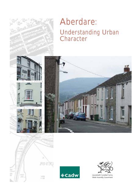
<strong>Aberdare</strong>:<br />
<strong>Understanding</strong> <strong>Urban</strong><br />
<strong>Character</strong>
<strong>Cadw</strong><br />
<strong>Welsh</strong> Assembly Government<br />
Plas Carew<br />
Unit 5/7 Cefn Coed<br />
Parc Nantgarw<br />
Cardiff CF15 7QQ<br />
Telephone: 01443 33 6000<br />
Fax: 01443 33 6001<br />
First published by <strong>Cadw</strong> 2009.<br />
ISBN 978-1-85760-272-2<br />
Crown Copyright 2009.<br />
<strong>Cadw</strong> is the <strong>Welsh</strong> Assembly Government’s historic environment service,<br />
working for an accessible and well-protected historic environment for Wales.
<strong>Aberdare</strong>:<br />
<strong>Understanding</strong> <strong>Urban</strong><br />
<strong>Character</strong><br />
1
2<br />
Acknowledgements<br />
In undertaking this study, <strong>Cadw</strong> grant-aided<br />
Glamorgan-Gwent Archaeological Trust to carry<br />
out mapping and database work for <strong>Aberdare</strong><br />
and its satellite settlements. Some of the maps<br />
generated by this work are included in this<br />
publication, and the results of the full mapping<br />
exercise, together with a database of<br />
archaeological interests, are available from<br />
Glamorgan-Gwent Archaeological Trust,<br />
www.ggat.org.uk
Contents<br />
Introduction 7<br />
Aims of the Study 7<br />
Historical Development 9<br />
Industrialization 9<br />
– The Iron Industry 9<br />
– The Rise of Coal 10<br />
– Transport Links 10<br />
<strong>Urban</strong> Growth 10<br />
Historical Topography 13<br />
The <strong>Character</strong> of Building 15<br />
A Way Forward 20<br />
<strong>Character</strong> Areas 21<br />
1. St John’s Church, Green Street –<br />
High Street Area 21<br />
– Historical Development 21<br />
– Present <strong>Character</strong> 21<br />
2. Commercial and Civic Core 21<br />
2.1 Canon Street 22<br />
– Historical Development 22<br />
– Present <strong>Character</strong> 22<br />
2.2 Victoria Street and Victoria Square 23<br />
– Historical Development 23<br />
– Present <strong>Character</strong> 23<br />
Maps pages 38–49<br />
1. The Extent of Settlement as Depicted<br />
on the tithe map, 1844<br />
2. The Extent of Settlement as Depicted<br />
on the First Edition Ordnance Survey Map,<br />
1868–90<br />
3. The Extent of Settlement as Depicted<br />
in the Second Edition Ordnance Survey<br />
Map, 1900<br />
4. The Phases of Historical Development<br />
5. Study Area showing Historic Environment<br />
Designations<br />
2.3 Cardiff Street and Market Street 24<br />
– Historical Development 24<br />
– Present <strong>Character</strong> 24<br />
2.4 Commercial Street 24<br />
– Historical Development 24<br />
– Present <strong>Character</strong> 25<br />
3. Maes y Dre 25<br />
– Historical Development 25<br />
– Present <strong>Character</strong> 25<br />
4. Foundry Town 27<br />
– Historical Development 27<br />
– Present <strong>Character</strong> 27<br />
5. Gadlys 29<br />
– Historical Development 29<br />
– Present <strong>Character</strong> 29<br />
6. Monk Street 33<br />
– Historical Development 33<br />
– Present <strong>Character</strong> 33<br />
Statement of Significance 35<br />
Sources 36<br />
Footnotes 37<br />
6. All <strong>Character</strong> Areas<br />
7. St John’s Church, Green Street and High<br />
Street (1)<br />
8. Commercial and Civic Core (2)<br />
9. Maes y Dre (3)<br />
10. Foundry Town (4)<br />
11. Gadlys (5)<br />
12. Monk Street (6)<br />
3
Introduction<br />
Aims of the Study<br />
<strong>Urban</strong> characterization aims to describe and<br />
explain the historic character of towns to give a<br />
focus to local distinctiveness and to serve as a tool<br />
for the sustainable management of the historic<br />
environment. It seeks to inform and support<br />
positive conservation and regeneration<br />
programmes, help improve the quality of planning<br />
advice, and contribute to local interpretation and<br />
education strategies.<br />
<strong>Urban</strong> characterization defines the distinctive<br />
historical character of individual towns, and<br />
identifies the variety of character within them,<br />
recognizing that this character is fundamental to<br />
local distinctiveness and pride of place, and is an<br />
asset in regeneration. It looks at how the history<br />
of a town is expressed in its plan and topography,<br />
in areas of archaeological potential, and in its<br />
architectural character. This survey is not just an<br />
audit of features, but a reconstruction of the themes<br />
and processes which have shaped the town.<br />
ABERDARE: UNDERSTANDING URBAN CHARACTER<br />
The immediate context for this study is as a<br />
contribution from <strong>Cadw</strong> towards Rhondda<br />
Cynon Taff Council’s Stage Two bid to the<br />
Heritage Lottery Fund for a Townscape Heritage<br />
Initiative in <strong>Aberdare</strong>. This initiative seeks not<br />
only the regeneration of the town through the<br />
conservation of its built environment, but also<br />
encourages greater access to, and understanding<br />
of, cultural heritage and the historic environment.<br />
Although the Townscape Heritage Initiative is<br />
focused on the <strong>Aberdare</strong> Conservation Area,<br />
this characterization study examines the historic<br />
character of the whole of the built-up area of<br />
the town, setting the conservation area in a<br />
wider context, and providing a baseline for<br />
strategic planning as well as local management.<br />
In this way, the study offers linkages to a wider<br />
regeneration agenda, including Rhondda<br />
Cynon Taff’s own regeneration strategy as well<br />
as the Heads of the Valleys Initiative and Spatial<br />
Plan objectives.<br />
Monk Street and<br />
St Elvan’s Church in<br />
about 1955 (© The<br />
Francis Frith Collection).<br />
5
ABERDARE: UNDERSTANDING URBAN CHARACTER<br />
6
Historical Development<br />
‘Few towns in South Wales exhibit more improvement<br />
in the last ten years than <strong>Aberdare</strong>. It is situated in a<br />
beautiful vale, in the midst of rich coal and iron mines,<br />
which furnish ample employment to its fast increasing<br />
population… In 1841 it had 6,471 inhabitants, and<br />
in 1851, 14,908, and it is now nearly double that<br />
number’. 1<br />
‘From an inconsiderable village, it has become a town<br />
of great importance’. 2<br />
<strong>Aberdare</strong> became a town as a direct result of<br />
industrialization, associated first with the local<br />
production of iron, and then with coal. Its growth<br />
was rapid: in 1833 it was still a village; twenty-five<br />
years later it was a town, with extensive<br />
commercial enterprise, a series of churches,<br />
chapels and urban institutions, and a Board of<br />
Health in recognition of its urban status. In the<br />
years that followed, its residential areas expanded<br />
as the population grew: ‘In the 1850’s, the parish of<br />
<strong>Aberdare</strong>, where the population increased from<br />
14,999 in 1851 to 32,299 in 1861, was the most<br />
dynamic place in Wales.’ 3<br />
That there was a medieval settlement here is still<br />
indicated by the age of the church of St John.<br />
<strong>Aberdare</strong> lay within the commote of Miskin in<br />
the hundred of Penychan, whose centre was<br />
Llantrisant, and the church here was founded as<br />
a dependent chapelry. But, notwithstanding<br />
small-scale coalworking documented from the<br />
seventeenth century, and an accompanying process<br />
of encroachment onto Hirwaun Common to the<br />
north, <strong>Aberdare</strong> was still a small village at the start<br />
of the nineteenth century.<br />
Industrialization<br />
The Iron Industry<br />
ABERDARE: UNDERSTANDING URBAN CHARACTER<br />
The beginnings of industrial growth were already<br />
apparent at the beginning of the nineteenth<br />
century: in 1803, Benjamin Malkin ‘found the village<br />
of <strong>Aberdare</strong> more populous and better arranged<br />
than I had expected. This is to be attributed to its<br />
having become a manufacturing place… I was glad<br />
to escape from the contusion of anvils, the blast of<br />
furnaces, and the whirl of wheels’. 4<br />
There were five major ironworks dominating the<br />
local economy. The first to be established in the<br />
area were the works at Hirwaun, founded in 1757<br />
as a charcoal ironworks, leased by Anthony Bacon<br />
in 1780, and by William Crawshay II in 1816.<br />
Crawshay was responsible for developing the site<br />
from two furnaces to four, and increasing its<br />
output. Llwydcoed and Abernant, founded in 1800<br />
and 1801 respectively, were managed together as<br />
the <strong>Aberdare</strong> Iron Company after 1846, continuing<br />
in production until 1875. Closest to the town, the<br />
Gadlys Ironworks opened in 1827 on land leased<br />
from the Bute estate, and continued in production<br />
until 1876. The mineral estate on which the<br />
Aberaman Ironworks was established was<br />
purchased in 1837 by Crawshay Bailey, and three<br />
furnaces were built there in 1845. The works were<br />
taken over by the Powell Dyffryn Company in<br />
1867, who exploited the mineral ground but<br />
abandoned the works.<br />
Far left: The church of<br />
St John was at the centre<br />
of the original village.<br />
Left: Kilns at the site of<br />
the former Gadlys<br />
Ironworks.<br />
Opposite: A view of<br />
<strong>Aberdare</strong> from Abernant<br />
in an engraving of 1865<br />
(By permission of<br />
Rhondda-Cynon-Taff<br />
Libraries).<br />
7
ABERDARE: UNDERSTANDING URBAN CHARACTER<br />
8<br />
The Rise of Coal<br />
All of these ironworks depended on a large<br />
mineral estate to provide the raw materials for<br />
production. One of these raw materials was coal,<br />
initially exploited primarily as the fuel for iron<br />
production. However, the qualities of the local<br />
coal and its suitability for use with steam engines<br />
assured it a wider market. In 1837, Thomas Wayne<br />
(whose father was the proprietor of the Gadlys<br />
Ironworks) sunk a pit at Abernant y Groes,<br />
Cwmbach, and established the <strong>Aberdare</strong> Coal<br />
Company, selling high-quality coal on the open<br />
market. Others followed and by 1841 coal output<br />
from the valley was 12,000 tons, by 1852, 500,000<br />
tons, and by 1870, 2,000,000 tons. The iron<br />
industry around <strong>Aberdare</strong> declined in the second<br />
half of the nineteenth century, and there were no<br />
blast furnaces in operation by 1875. However, the<br />
fortunes of the town were assured by the parallel<br />
ascent in the importance of coal, and it was this<br />
which dominated the economy of the town in the<br />
second half of the nineteenth century.<br />
Transport Links<br />
The ironworks (and later the collieries) depended<br />
for their success on the development of transport<br />
networks to connect sources of supply with the<br />
sites of production, and to link produce to markets<br />
via the port of Cardiff. In 1804, the works at<br />
Hirwaun and Abernant were connected by<br />
tramroad to the Neath–Glyneath Canal, and in<br />
1811, <strong>Aberdare</strong> was linked to the Glamorgan<br />
Canal at Abercynon. In addition, <strong>Aberdare</strong>’s<br />
growing economic status was indicated by its<br />
connection to a regional network of railways.<br />
It was first linked to the Taff Vale Railway at<br />
Abercynon in 1847, and then in 1851 the Vale<br />
of Neath Railway Company opened a branch<br />
line to <strong>Aberdare</strong>. In 1865, the line went beyond<br />
<strong>Aberdare</strong> to Cwmdare, whilst in 1863, the West<br />
Midlands Railway arrived from Pontypool. The<br />
coming of the railway may have encouraged the<br />
reorientation of the town: Canon Street and<br />
Commercial Street developed on a new axis<br />
leading to the station, diminishing the importance<br />
of the earlier High Street.<br />
<strong>Urban</strong> Growth<br />
‘The village is losing its rural character… there is<br />
a multiplication of houses in every direction’ 5<br />
There is little physical trace of pre-industrial<br />
settlement in <strong>Aberdare</strong>, although the church of<br />
St John is medieval, perhaps of about 1300. It may<br />
be assumed that early settlement lay in the vicinity<br />
of the church, which occupies a distinctive nearcircular<br />
churchyard (albeit truncated in the mid- to<br />
late twentieth century). It was in this area that at<br />
least one vernacular building survived until it was<br />
demolished for road-widening in 1875: photographs<br />
show a small cottage of traditional construction of<br />
rough boulder walls and a thatched roof.<br />
Photographs also show an earlier generation of<br />
buildings than those which survive in this area (for<br />
example, on the site of The Constitutional Club).<br />
The earliest surviving maps record the pre-urban<br />
settlement pattern, and confirm that the main<br />
locus of settlement was close to the church. Yates’<br />
map of 1799 shows development confined to the<br />
area north of the river Dare. 6 A Bute estate map<br />
of 1825 also labels this area as the site of <strong>Aberdare</strong><br />
village. The 1844 tithe map, too, shows that this was<br />
the nucleus of the pre-industrial village, the informal<br />
pattern of settlement here contrasting with the<br />
planned development characteristic of <strong>Aberdare</strong><br />
during the nineteenth century. However, twentiethcentury<br />
clearance and re-development obliterated<br />
the traces of this early part of the town.<br />
The rise of industry in the early years of the<br />
nineteenth century generated some new<br />
settlement outside this immediate area. The typical<br />
pattern of growth in early industrial communities<br />
was for small groups of houses to be built piecemeal<br />
in close proximity to the site of the works, with<br />
informal development springing up wherever<br />
marginal land was available for building. Initially,<br />
<strong>Aberdare</strong> appears to have been no exception to<br />
this: the tithe survey shows scatters of housing to<br />
the north-west of the present town centre, in the<br />
vicinity of Gadlys, alongside the road to Hirwaun,<br />
and at Trecynon. Traces of this development<br />
survive, distinguishable as small rows of low cottages<br />
— for example, at Dover Place, Gadlys Road, East<br />
Avenue, and the old Hirwaun Road.<br />
<strong>Urban</strong>ization proceeded in several distinct and<br />
deliberately planned phases. The form of urban<br />
development was a direct reflection of the
ownership structure of the area, in which two<br />
major landowners were particularly influential.<br />
One of these was Lord Bute: he claimed descent<br />
from the Earls of Pembroke who, since 1547, had<br />
been lords of the manor of Miskin in which<br />
<strong>Aberdare</strong> lay. The estate had a mineral office at<br />
Maerdy House — its name suggesting that perhaps<br />
it was the site of an earlier manorial steward’s<br />
house — near the centre of <strong>Aberdare</strong>.<br />
The church of St Elvan, built by the Bute family in<br />
1851, is the most conspicuous testimony to the<br />
Bute presence in the town; much of the urban<br />
development south of the church also owes its<br />
existence and character to the estate. An early<br />
phase of planned urban growth is shown on an<br />
estate map of 1825. The map shows land marked<br />
out in regular plots for building along the south and<br />
east sides of the mound on which St Elvans was<br />
later built. The tithe survey of 1844 confirms this<br />
layout as built: its neat plot structure contrasts with<br />
the nucleus of the earlier village in the High Street<br />
area. Also on Bute land, Cardiff Street, Bute Street,<br />
and the south side of Commercial Place (now<br />
Victoria Place) were built up to a considerable<br />
extent in the years between 1825 and 1844.<br />
ABERDARE: UNDERSTANDING URBAN CHARACTER<br />
Small industrial<br />
vernacular cottages on<br />
Gadlys Road (left) and<br />
Hirwaun Road (below).<br />
Detail from a Bute estate<br />
map of 1825, showing<br />
the Victoria Square area<br />
laid out for development<br />
(Glamorgan Record<br />
Office DBE/1).<br />
9
ABERDARE: UNDERSTANDING URBAN CHARACTER<br />
Three phases in the<br />
evolution of <strong>Aberdare</strong>:<br />
The near-circular<br />
churchyard of St John’s<br />
Church (top left), Bute<br />
development curving<br />
around the church of<br />
St Elvan, and the regular<br />
grid of Maes y Dre<br />
(Crown Copyright:<br />
RCAHMW).<br />
10<br />
Ten years later, there was another major<br />
investment in urban development on land to the<br />
north of the river Dare: Maes y Dre was the<br />
property of the Diocese of Gloucester, the second<br />
major landowner, who had owned this land since<br />
about 1540. The streets were laid out, and plots for<br />
building were leased in 1854. This development<br />
included the establishment of Canon Street, with<br />
large commercial buildings on its north side and a<br />
sizeable residential area behind it. The diocese also<br />
owned land to the north of Commercial Street<br />
(the south side was Bute estate land), and buildings<br />
here were described as cottages in the tithe survey.<br />
However, in later years, following the arrival of the<br />
railway in 1847, the street was almost certainly<br />
redeveloped for commerce.<br />
The core of the town — Canon Street,<br />
Commercial Street and Cardiff Street — was<br />
subject to periodic redevelopment in response<br />
to successive phases of commercial pressure.<br />
Historical photographs in <strong>Aberdare</strong> Library<br />
document several phases of building, rebuilding<br />
or remodelling, and it is clear that buildings within<br />
this central area have had a volatile history. In<br />
particular, some of the features that now seem<br />
particularly distinctive in the town — the ornate<br />
decorative render, for example — are revealed<br />
as secondary.<br />
Maes y Dre may have been the first of the<br />
workers’ housing areas to be developed, but by<br />
1865, the town had taken on much of its present<br />
form and most of its extent. By this time, there had<br />
been further development to the south, where<br />
Foundry Town (sometimes known as Daviestown)<br />
was developed on land which was in the<br />
ownership of Mr Griffith Davies in 1844 (part of<br />
Ynysllwyd Farm). Also, there had been extensive<br />
planned development at Gadlys. After about 1865<br />
however, the pace of expansion slowed down and<br />
was confined to relatively small additional plots of<br />
land. By the end of the century, two fields (owned<br />
by the Bute estate) adjacent to Foundry Town<br />
were being developed, and farmland on the north<br />
side of Monk Street was laid out for housing (now<br />
Pendarren Street and Clifton Street). There was<br />
also sporadic growth elsewhere, including the<br />
establishment of Tudor Street and Elm Street,<br />
about 1890–1900 and 1900–1910 respectively.<br />
Later development within the limits of the town<br />
is rare. There are some modern housing<br />
developments to the west of Monk Street and to<br />
the south-east of The Grove, but these aside, the<br />
integrity of the nineteenth-century industrial town<br />
has remained intact. Twentieth-century<br />
development has had the greatest impact in areas<br />
of redevelopment and renewal. Clearance was<br />
concentrated in the areas of Green Street and<br />
High Street, the earliest part of the settlement, and<br />
on Cardiff Street. Elsewhere, the greatest losses<br />
(and they are considerable) have been of detail.<br />
In the town centre, commercial development<br />
pressure and previous renewal work have wrought<br />
significant damage, taking a heavy toll on original<br />
detail including shop fronts, windows, and finishes.<br />
But it is the residential areas which have been the<br />
hardest hit: wall finishes, roofing materials,<br />
chimneys, and joinery detail have all fallen victim<br />
to ‘improvement’ programmes which were not<br />
informed by an understanding of historical<br />
character. Fragmentary survival of original detail is<br />
all that remains and is now a precious archive that<br />
should be recorded. From this detail it should be<br />
possible to reconstruct some sense of the distinct<br />
historical character of the different areas.
Historical Topography<br />
The town lies close to the confluence of the<br />
rivers Dare and Cynon: the historical core of the<br />
settlement lay on low ground on the north bank of<br />
the river Dare, whilst the first phase of expansion<br />
occupied the gently rising ground to its south. A<br />
dramatic intervention in the natural topography<br />
took place in 1867 with the culverting of the river<br />
Dare between High Street and Duke Street<br />
(its early course ran immediately behind the south<br />
side of Canon Street and on the line later taken by<br />
Boot Lane). Abrupt changes of level in the Gadlys<br />
Road area are probably a result of industrial activity<br />
here, and serve to create a sharp distinction with<br />
other areas of a different character. Building on the<br />
steep slopes to the south and west of the town<br />
centre required development to adapt to the<br />
contours: terraces are stepped to accommodate<br />
the slopes, in contrast to the regular terraces on<br />
the flat land of Maes y Dre.<br />
The form of development in the town is strongly<br />
influenced by patterns of landownership and use,<br />
but also by pre-existing features and routeways.<br />
Thus the near-circular churchyard of the medieval<br />
church constrained development in the historical<br />
core of the town, which is shown clearly respecting<br />
its boundary on early maps. Several roads pre-date<br />
nineteenth-century urban growth, and helped to<br />
structure it. Wind Street was shown as an old road<br />
on the Bute estate map of 1825: it ran broadly<br />
parallel to the Cardiff road, and connected with<br />
High Street via a bridge over the river Dare. It may<br />
once have been the main route south from<br />
<strong>Aberdare</strong> until it was superceded in importance by<br />
the Cardiff road, a new route established for the<br />
turnpike (there was once a toll gate at its northern<br />
end). The road to Hirwaun was also an earlier<br />
route, which provided an axis for settlement<br />
(especially the informal development associated<br />
with early phases of industrialization), whilst early<br />
development on Commercial Street may be<br />
explained by its significance as the main route to<br />
Merthyr. Monk Street was also in existence by the<br />
early nineteenth century.<br />
Later, the arrival of the railway in the Cynon valley<br />
may have spurred the further development of<br />
Commercial Street along with the newly formed<br />
Canon Street, as the central axis of the town. In<br />
ABERDARE: UNDERSTANDING URBAN CHARACTER<br />
Above: Industrial<br />
vernacular cottages<br />
betray the early origins<br />
of Wind Street.<br />
Left: Old and new streets<br />
— the curve of Wind Street<br />
contrasts with the straight<br />
line of Albert Street.<br />
Below: The commercial<br />
centre of the town (Crown<br />
Copyright: RCAHMW).<br />
11
ABERDARE: UNDERSTANDING URBAN CHARACTER<br />
Patterns of development:<br />
Monk Street (bottom)<br />
and Elizabeth Street<br />
(winding through the<br />
middle of this<br />
photograph) marked the<br />
boundaries of Griffith<br />
Davies’s land in the midnineteenth<br />
century.<br />
Beyond Elizabeth Street,<br />
the wider streets of<br />
Bute estate development<br />
stand out clearly<br />
(Crown Copyright:<br />
RCAHMW).<br />
Elizabeth Street (the<br />
curving line across<br />
the middle of this<br />
photograph) marks<br />
an old field line and<br />
ownership boundary,<br />
with the streets to either<br />
side of it developed<br />
at different times and<br />
by different people<br />
(Crown Copyright:<br />
RCAHMW).<br />
12<br />
many areas of the town, the original property<br />
boundaries within which development took place<br />
can still be clearly traced. Griffith Davies’s Foundry<br />
Town development occupies two blocks of land<br />
between Wind Street and Monk Street,<br />
interrupted by two fields belonging to the Bute<br />
estate. The boundary between his land and these<br />
fields is fossilized in the line of Elizabeth Street,<br />
and is clearly visible in the different character of<br />
housing to either side of it. Similarly, there are<br />
visible distinctions between Bute land to the<br />
north-east of Wind Street, and Davies land to<br />
its south-west. Street names give another clue<br />
to landownership: Cardiff Street, Bute Street,<br />
Dumfries Street, and Stuart Street are on Bute<br />
land; Griffith Street, Davies Terrace, and Ynysllwyd<br />
are on Griffith Davies’s land; and Canon Street,<br />
Dean Street and Gloucester Street are on Diocese<br />
of Gloucester land.<br />
Where blocks of land were big enough, new<br />
developments could lay down their own<br />
settlement patterns. The Bute estate indulged in<br />
planned development on its land to either side of<br />
Cardiff Street (between the river Cynon and Wind<br />
Street), establishing a grid of streets irrespective of<br />
earlier field boundaries. Similarly, the Diocese of<br />
Gloucester had a clean canvas for development on<br />
Glebe land to the north of the river Dare. Both of<br />
these areas are characterized by the regularity of<br />
the street grid, and this is also true on a smaller<br />
scale of the mid-nineteenth-century developments<br />
at Gadlys (perhaps also on Bute estate land).
The <strong>Character</strong> of Building<br />
‘The town is well laid out and in neatness of<br />
appearance is far ahead of any other mining town<br />
in South Wales’. 7<br />
<strong>Aberdare</strong> is sharply divided between the<br />
commercial core of the town, and the housing<br />
areas immediately adjacent to it. This leads to<br />
some abrupt contrasts of scale, even in areas<br />
that have undergone a carefully planned<br />
development process — for example, to the<br />
rear of Canon Street, and at the junction of<br />
Victoria Square and Bute Street. Even within<br />
the commercial area there are some fine<br />
distinctions in the degree of planning and the<br />
formality of development, ranging from the<br />
large-scale schemes of major landowners to<br />
more piecemeal development patterns.<br />
One of the most ambitious exercises in town<br />
planning was the Bute estate’s development<br />
around the mound later occupied by St Elvan’s<br />
Church. Here, notwithstanding the effects of<br />
reconstruction, refurbishment, and differential<br />
rates of change, the area remains characterized<br />
by large-scale building projects across several<br />
plots. Buildings of a similar style also appear<br />
elsewhere on Bute land — on Cardiff Street,<br />
for example — and were once more common.<br />
However, there are also buildings of a similar<br />
type on the north side of Canon Street on land<br />
laid out for development on behalf of the<br />
Diocese of Gloucester, showing that the two<br />
estates did not have their own signature styles.<br />
Plots were laid out for building leases and<br />
development was in the hands of leaseholders,<br />
using builders working with considerable<br />
uniformity of style.<br />
Commercial Street is much more varied and<br />
characterized by smaller units of development,<br />
perhaps reflecting its somewhat earlier origins<br />
(its present character is the result of piecemeal<br />
rebuilding in the later nineteenth century). The<br />
south side of Canon Street also exhibits greater<br />
variety, with buildings that are notably smaller in<br />
scale than those to the north.<br />
Some areas have been subject to successive<br />
bouts of redevelopment. The piecemeal pattern<br />
ABERDARE: UNDERSTANDING URBAN CHARACTER<br />
Above: Unified<br />
development<br />
characterized Bute<br />
estate building in<br />
Victoria Square.<br />
Left: Large commercial<br />
properties are<br />
characteristic of the<br />
north-west side of<br />
Canon Street.<br />
Below: The south-east<br />
side of Canon Street<br />
developed with smaller<br />
properties.<br />
13
ABERDARE: UNDERSTANDING URBAN CHARACTER<br />
Oriel windows<br />
characteristic of the later<br />
nineteenth-century<br />
redevelopment of<br />
Commercial Street.<br />
Below right: Traditional<br />
render detail.<br />
Below and bottom:<br />
The bold render detail<br />
introduced towards the<br />
end of the nineteenth<br />
century.<br />
14<br />
of building on the north-east side of Cardiff Street<br />
and on Commercial Street resulted in a mix of<br />
three-storey buildings, two-storey terraces, and<br />
small single buildings. Between about 1880 and<br />
1900, most of the smaller buildings were<br />
demolished and rebuilt as three-storey buildings.<br />
This phase either repeated the mild Georgian<br />
style of earlier building, but with a more expressive<br />
vocabulary of detail, or it introduced a mild gothic<br />
style, often with oriel windows to upper floors.<br />
Parts of Cardiff Street were subsequently<br />
redeveloped once or twice more, and a similar<br />
fate befell parts of Commercial Street.<br />
The residential areas are dominated by small<br />
houses for industrial workers, though the<br />
Diocese of Gloucester’s development at Maes y<br />
Dre included a few short rows of larger houses,<br />
characteristically on plots closest to the town<br />
centre. Within each area of development there<br />
are small variations in house size and general<br />
layout, but the distinctions between the areas<br />
are greater than those within them. However,<br />
the characteristics of each area have been<br />
severely eroded in more recent times by<br />
piecemeal alteration, and the original unity of<br />
design is now difficult to appreciate.<br />
In the commercial areas a Georgian style was<br />
favoured, characterized by symmetry and sash<br />
windows, and façades were consistently rendered.<br />
At first, this seems to have comprised a relatively<br />
simple finish with channelled ashlar at groundfloor<br />
level, scored ashlar above, and simple<br />
moulded architraves around the windows —<br />
examples include the south-west end of Canon<br />
Street. Between about 1880 and 1900, however,<br />
a very clear and distinctive <strong>Aberdare</strong> style<br />
emerged, characterized by exaggerated<br />
channelled rustication to the lower storeys,<br />
and bold detailing (including oversized quoins),<br />
though continuing the more subtle scored ashlar<br />
in upper storeys. The Boot Hotel remains an<br />
excellent example of this style and photographic<br />
evidence shows that it was once more common.<br />
There is a rich vocabulary of detail in <strong>Aberdare</strong>,<br />
notwithstanding considerable losses, including<br />
vermiculation, rustication, and variations in the<br />
treatment of cornices and architraves.<br />
A round of ‘improvement’ in the last quarter of the<br />
twentieth century introduced a standard heritage<br />
shop front, but there are many elements of earlier<br />
examples surviving and considerable variety
therein. Distinctions in building detail equate<br />
to units of development, but even within<br />
development units there was some variation —<br />
presumably matched to the needs or resources<br />
of the early tenants.<br />
In the residential areas, housing is almost invariably<br />
terraced (in long blocks wherever the natural<br />
topography would allow), and two-storeyed.<br />
Important distinctions are to be found in the<br />
planning, with some areas favouring a two-unit<br />
(double-fronted) long plan, closer to rural<br />
vernacular traditions, rather than the two-unit<br />
(single-fronted) deep plan adopted elsewhere.<br />
The Bute developments to the south made<br />
extensive use of the two-unit long plan — for<br />
example, the south-west side of Bute Street —<br />
and there are even examples of housing built<br />
virtually blind backed. Davies’s developments<br />
however — Foundry Town and Maes y Dre —<br />
adopted the deeper planning.<br />
Stone is the ubiquitous building material, but it<br />
was rarely left unfinished — at least until the<br />
very late nineteenth century when a more<br />
expressive style of rustication was adopted.<br />
Instead it was almost always rendered, and many<br />
houses which now have bare stone walls reveal<br />
traces of render or limewash on closer inspection.<br />
There are now only a very few examples of<br />
original render surviving, but enough to show that<br />
there was a wide vocabulary of render styles.<br />
There is almost enough to suggest that the detail<br />
ABERDARE: UNDERSTANDING URBAN CHARACTER<br />
Above: Two-unit<br />
(double-fronted) long<br />
plan on Bute land.<br />
Left: Two-unit (singlefronted)<br />
deep plan on<br />
Davies land.<br />
Far left: Exposed<br />
stonework with brick<br />
dressings characteristic<br />
of late nineteenthcentury<br />
housing.<br />
Left: Traces of limewash<br />
provide a clue to the<br />
original treatment of<br />
stone walls.<br />
15
ABERDARE: UNDERSTANDING URBAN CHARACTER<br />
Right and far right:<br />
Bold render detail in<br />
Maes y Dre.<br />
Right and below:<br />
Rare examples of<br />
sash windows.<br />
16<br />
varied from one area to another — for example,<br />
the exaggerated mouldings of the town centre<br />
are found in Maes y Dre, but not in Foundry Town.<br />
Virtually all the housing has lost original fenestration,<br />
and surviving sash windows are now very rare<br />
indeed. Past housing improvement in <strong>Aberdare</strong> has<br />
also consistently removed chimneys and replaced<br />
slate with concrete tile. These changes have<br />
significantly damaged the historical character and<br />
coherence of the residential areas.<br />
Another important characteristic of development<br />
within the town is the way in which it reflects<br />
the social and economic structure of the industrial<br />
community. There is a strong distinction between<br />
the tightly defined commercial centre (originally<br />
comprising houses over shops), and the<br />
residential areas of terraced housing immediately<br />
adjacent to it. At first sight, these residential areas<br />
display considerable uniformity, but there are<br />
subtle distinctions in the size of house from one<br />
street to another — for example, between<br />
Gloucester Street and Pembroke Street. More<br />
obviously, later housing developments introduced<br />
a higher standard: housing of about 1900 is<br />
characterized by a front garden and bay windows.<br />
There are good examples of this in the<br />
development to the south-west of Elizabeth<br />
Street, in Hawthorne Terrace, and Elm Grove.<br />
This is unlikely to be purely a function of rising<br />
housing standards, and probably also reflects an<br />
increasingly differentiated society. There are notably
few larger houses in <strong>Aberdare</strong>, but the higher<br />
land of Monk Street appears to have provided<br />
a more favoured location for middle-class<br />
occupancy, offering detached houses in substantial<br />
grounds. A very small middle-class suburb could<br />
also be found in Clifton Street. Elsewhere, Gadlys<br />
Terrace was another favourable location, on rising<br />
ground above the old church of St John — here<br />
are larger houses, situated in gardens, built to<br />
individual designs. Trade directories show a<br />
preponderance of gentry and private residents<br />
living in these locations.<br />
ABERDARE: UNDERSTANDING URBAN CHARACTER<br />
Bay windows and small<br />
front gardens are<br />
characteristic of some<br />
late nineteenth-century<br />
developments.<br />
Far left: Extravagant<br />
render detailing on<br />
Hawthorn Terrace.<br />
Left: Distinctive housing<br />
on Gadlys Terrace.<br />
The larger villas of<br />
Clifton Street.<br />
17
ABERDARE: UNDERSTANDING URBAN CHARACTER<br />
18<br />
A Way Forward<br />
It is perhaps wishful thinking to imagine that even<br />
with the bounty of a Townscape Heritage Initiative,<br />
the loss of character in <strong>Aberdare</strong> could now be<br />
reversed. Nevertheless, any Townscape Heritage<br />
Initiative in the town should seek to encourage<br />
and generously fund the reintroduction of correctly<br />
detailed doors and sash windows, based on a<br />
meticulous record of the few surviving examples,<br />
and the reintroduction of historic finishes, such as<br />
renders and limewashes. Though the number of<br />
enlightened owners may be few, every one would<br />
constitute a plus for the town and be worthy<br />
of celebration.<br />
We have seen that there are still characteristics<br />
surviving within <strong>Aberdare</strong> that are important to an<br />
understanding of its history and development.<br />
These include features such as the distinctive use<br />
of differing render detailing and treatments, the<br />
varieties of plan form, and, in some areas, the<br />
enclosed front gardens with their capped piers<br />
and iron railings, the bay windows, and eaves and<br />
soffit details of an Italianate character. In some<br />
parts of the town, an ongoing and extensive<br />
planting of trees and shrubs is characteristic.<br />
All of these factors contribute to making<br />
<strong>Aberdare</strong> a mining settlement like no other.<br />
These are details which need to be recognized,<br />
protected and promoted. This can be achieved<br />
by the operation of grant assistance under the<br />
Townscape Heritage Initiative, by the formation<br />
of policies and protective measures to guide<br />
decision-making in planning and developmentcontrol<br />
processes, and by integration into<br />
education and lifelong learning to enhance policies<br />
for environmental and cultural awareness.
<strong>Character</strong> Areas<br />
1. St John’s Church, Green Street–<br />
High Street Area<br />
Historical Development<br />
St John’s Church, the nucleus of the original<br />
settlement, is the only pre-industrial building<br />
to survive within the area of the town, and<br />
includes fabric dating to about 1300. It sits in a<br />
conspicuously large churchyard that was even<br />
larger before it was truncated by redevelopment<br />
in the twentieth century. Map evidence shows that<br />
this was the location of the pre-industrial village,<br />
and photographic evidence confirms the existence<br />
of earlier buildings in this area. Early development<br />
seems to have been concentrated to either side<br />
of the line of High Street, around the eastern edge<br />
of the churchyard. However, road widening and<br />
redevelopment in the nineteenth and twentieth<br />
centuries have removed any tangible evidence for<br />
early building in this area. Map evidence suggests<br />
that settlement in this area also expanded during<br />
the nineteenth century, especially in the Green<br />
Street area and on the east of High Street. The<br />
erection of chapels in this area in 1855 and 1859<br />
relate closely to the principal period of urban<br />
growth in <strong>Aberdare</strong>. Until the formation of Canon<br />
Street in 1854, High Street formed part of the<br />
principal axis of the town; the first market hall was<br />
sited here in 1831, which was in turn converted<br />
into the town hall when the new market was built<br />
in 1853.<br />
Present <strong>Character</strong><br />
Clearance in the twentieth century has left only<br />
the principal buildings — the church and the<br />
chapels — standing in the Green Street area, whilst<br />
redevelopment has contributed the library, a good<br />
modern work of 1962–63, and the Crown building<br />
of 1974. Along High Street, losses of earlier<br />
buildings (for example, those which once ringed<br />
the churchyard, as well as Ty Mawr and The Poplars<br />
superceded by the health centre) and the<br />
replacement of others have brought into<br />
prominence the larger urban buildings such as<br />
the town hall and The Constitutional Club. The<br />
Constitutional Club represents a redevelopment of<br />
ABERDARE: UNDERSTANDING URBAN CHARACTER<br />
1894 and comprises a flamboyant three-storey<br />
block flanked by two-storey buildings, including<br />
purpose-built shops, all built as a single<br />
development. Its emphatic detail is characteristic<br />
of building work in <strong>Aberdare</strong> during this period.<br />
Nos 42–43 High Street is another important<br />
survival and a reminder of the early status of the<br />
street: the cast-iron columns of its porch highlight<br />
the importance of iron in the development of<br />
the town.<br />
2. Commercial and Civic Core<br />
The main commercial centre comprises Canon<br />
Street, Commercial Street, Cardiff Street, and<br />
Victoria Square (formerly Commercial Place) — in<br />
other words, the area that encircles the mound on<br />
which St Elvan’s Church sits — with Cardiff Street<br />
providing the main entry point into the town from<br />
the south. Large commercial buildings face the<br />
main thoroughfares which are distinguishable from<br />
the residential streets which begin immediately<br />
beyond. Chapels and institutions are concentrated<br />
in this area, especially on Wind Street and Monk<br />
Street. Variations in character within the area<br />
reflect the different origins of its component parts.<br />
Nos 42–43 High Street.<br />
19
ABERDARE: UNDERSTANDING URBAN CHARACTER<br />
Large commercial<br />
buildings on Canon<br />
Street, and the Burton’s<br />
shop front cut into the<br />
earlier Queen’s Hotel.<br />
Bold render detail on<br />
Canon Street.<br />
Buildings of varied<br />
size characterize the<br />
south-east side of<br />
Canon Street.<br />
Simple render detail on<br />
Canon Street.<br />
20<br />
2.1 Canon Street<br />
Historical Development<br />
Canon Street represents a formal development on<br />
land owned by the Diocese of Gloucester and laid<br />
out for building in about 1854. The line of the river<br />
Dare, before it was culverted in 1867, originally lay<br />
to the rear of the building line on the south side of<br />
the street. The character of building suggests that<br />
plots were laid out in a single campaign, but<br />
building work undertaken by numerous individuals<br />
working on units of varying size and ambition. This<br />
is confirmed by a map of the estate of around<br />
1855, recording the names of leaseholders against<br />
individual plots of varying size. The area also<br />
exhibits some of the characteristics of a rapidly<br />
growing urban economy, with sequences of change<br />
and some rebuilding. Most eloquent perhaps is the<br />
former Queen’s Hotel, first re-rendered in the<br />
later nineteenth century with the <strong>Aberdare</strong> fashion<br />
for exaggerated detailing, and then extensively<br />
remodelled as Burtons in about 1930, with the<br />
insertion of a two-storey shop front into a<br />
mid-nineteenth-century building.<br />
Present <strong>Character</strong><br />
The north side of the street is dominated by large<br />
public buildings: The Constitutional Club on High<br />
Street at its west end, Trinity Presbyterian Church<br />
on Weatheral Street (dating to 1867, but<br />
remodelled in 1894), and Temperance Hall (built by<br />
1868). The rest of this side of the street comprises<br />
large units of development in a series of<br />
three-storey blocks, probably in commercial use<br />
from the outset. <strong>Character</strong>istic of ambitious urban<br />
development are the suave corner blocks. See, for<br />
example, no. 9 (Burtons, formerly The Queen’s<br />
Hotel), where there is little surviving detail (apart<br />
from some two and four-pane sashes), but some<br />
very striking rustication — the exaggerated<br />
rendered moulding — introducing a distinctive<br />
feature of building in the town. Another example<br />
of this suavity is the bank block between<br />
Whitcomb Street and Commercial Street, a<br />
substantial building of seven bays, perhaps<br />
comprising a bank and a house.<br />
The south side of Canon Street is rather different,<br />
comprising generally smaller-scale buildings in<br />
identifiable units of varied size. The smaller size of<br />
building perhaps reflects a less-favoured location,<br />
with the river Dare originally running close to the
ear of the buildings. Although much of the detail<br />
has been renewed, some original features do<br />
remain: early shop fronts, sash windows, and<br />
examples of early render with simple mouldings to<br />
window architraves. Enough detail survives to show<br />
that whilst the basic form of development seems<br />
to have been set out, there was considerable<br />
scope for variety within the building process —<br />
apparent even in the type of moulding used for<br />
window architraves.<br />
There is also a distinction between the east and<br />
west ends of the street. Towards the east, closest to<br />
the town centre, development is mainly on single<br />
or double plots, with some three-storey buildings,<br />
and a more ornate code of detail (for example,<br />
Dales, which has canted bays over the shop front).<br />
Towards High Street, to the west, the units of<br />
development are longer, but the buildings<br />
themselves are generally smaller. This is a good<br />
indication that away from the commercial core of<br />
the town, there was less pressure to develop.<br />
2.2 Victoria Street and Victoria Square<br />
Historical Development<br />
This area was formerly known as Commercial<br />
Place, and was developed on Bute estate land. The<br />
Bute estate map shows the formal laying out of<br />
property on the north and north-east sides of the<br />
square (the south and east sides of the mound on<br />
which St Elvan’s Church sits) in 1824. The tithe<br />
map of 1844 records this pattern of development<br />
as built, but most surviving buildings are likely to<br />
represent a second generation of building on this<br />
site in the mid- to late nineteenth century. Both<br />
maps imply that the original development was<br />
intended to be residential: the plots were set out<br />
with gardens to the front and the rear and the<br />
estate map indicated a row of cowsheds in what<br />
was later the Market Street area. It is possible that<br />
Nos 1 and 2 Victoria Square are the sole<br />
representatives of the original scheme, set back<br />
from the dominant building line.<br />
Present <strong>Character</strong><br />
The development still has some unity of style,<br />
notwithstanding piecemeal renovation schemes,<br />
with further examples of the urbane three-storey<br />
blocks similar to those of Canon Street’s north<br />
side: Barclays, The Beehive, and Compton House.<br />
ABERDARE: UNDERSTANDING URBAN CHARACTER<br />
The south side of Victoria Square displays a more<br />
varied development pattern, including some<br />
substantial urban blocks (for example, The Bute<br />
Arms), but juxtaposed with much smaller buildings.<br />
This was also Bute land, but perhaps not so<br />
systematically developed. The east side of the<br />
square (Market Street to Boot Lane) also belonged<br />
to the Bute estate and was developed in much the<br />
same way, with some large blocks, including The<br />
Boot Hotel, providing an excellent example of the<br />
bold rendering fashionable in the late nineteenth<br />
century. The Black Lion Hotel looks down on the<br />
square on its junction with Wind Street (the early<br />
road into <strong>Aberdare</strong> from the south). Its small pane<br />
sashes and pilasters may be an indication that the<br />
hotel was built in the early nineteenth century.<br />
Above: The Black Lion<br />
forms part of the<br />
commercial development<br />
of the town centre,<br />
whilst immediately<br />
beyond it, small<br />
industrial vernacular<br />
cottages follow the old<br />
line of Wind Street.<br />
Left: Nos 1 and 2<br />
Victoria Square may<br />
represent the original<br />
building line for Bute<br />
development here.<br />
Below: Formal<br />
development on a<br />
relatively large scale is<br />
characteristic of Bute<br />
estate development in<br />
Victoria Square.<br />
21
ABERDARE: UNDERSTANDING URBAN CHARACTER<br />
Some nineteenth-century<br />
detail survived extensive<br />
redevelopment on<br />
Cardiff Street.<br />
22<br />
2.3 Cardiff Street and Market Street<br />
Historical Development<br />
Cardiff Street lay on Bute land, and was probably<br />
established as a new turnpike route into the town,<br />
superceding the old road of Wind Street. The<br />
street had not been built up on the 1825 estate<br />
map, but by 1844 the street had been developed<br />
on both sides as far as Cross Street, and beyond<br />
it on the west. Early photographs show mixed<br />
development, including one tiny building on the<br />
site of nos 56–57, and modest terraces of<br />
two-storey buildings (subsequently rebuilt with<br />
three storeys) on the north-east side of the street.<br />
The absence of unity suggests that the estate was<br />
not tightly controlling the detailed development<br />
process in this area, but the hand of the estate<br />
was certainly suggested in a series of large<br />
three-storey buildings — Cardiff Castle Hotel,<br />
The Red Lion, and an elegant crescent. The<br />
influence of the estate is less discernible in<br />
surviving buildings, following considerable<br />
redevelopment in the nineteenth century.<br />
The market was built in 1853, in a development<br />
that included not only the market hall itself, but<br />
also slaughterhouses in a row opposite,<br />
reconstructed in 1903 and adapted in more<br />
recent times when converted to shops. The<br />
original development signals another major<br />
investment in the civic ambitions of <strong>Aberdare</strong> as it<br />
rose to prominence in the mid-nineteenth century.<br />
Present <strong>Character</strong><br />
The area retains some distinctive three-storey<br />
blocks and individual commercial buildings (e.g.<br />
HSBC bank), but there has been much later<br />
twentieth-century renewal. The three-storey blocks<br />
have suffered extensive renewal of detail, but<br />
traces of original character still remain: the upper<br />
storeys of No. 1 Cardiff Street retain early render<br />
with quoins.<br />
2.4 Commercial Street<br />
Historical Development<br />
Commercial Street appears to have marked a<br />
division between Bute land to the south and land<br />
owned by the Diocese of Gloucester to the north.<br />
Development of the street preceded that of<br />
Canon Street. The road was established as the<br />
route to Merthyr in the early nineteenth century,<br />
and it may have had some early importance. The<br />
tithe map marks a continuous building line to the<br />
north of the street, and sporadic development to<br />
the south. Its development as a commercial street<br />
however, has been dated to the years immediately<br />
following the arrival of the railway, around 1847 to<br />
1851, and its present architectural character is<br />
largely of the mid- to late nineteenth century. Early<br />
photographs suggest piecemeal development,<br />
comprising some substantial three-storey buildings,<br />
some of which were residential, alongside others
which were much smaller. Later redevelopment,<br />
which began at the end of the nineteenth century<br />
and continued with successive phases into the<br />
twentieth century, has imposed a more unified and<br />
completely commercial character.<br />
Present <strong>Character</strong><br />
Unlike Canon Street and Victoria Square,<br />
Commercial Street is characterized by short<br />
blocks, mainly, but not exclusively, in the Georgian<br />
style. The street includes some excellent examples<br />
of commercial architecture: the building occupied<br />
by Dorothy Perkins has a touch of the gothic<br />
and is a good example of <strong>Aberdare</strong> render, with<br />
rustication, vermiculation and good surviving detail.<br />
The Bush Inn offers another example of surviving<br />
render work, with its vermiculation, rustication, and<br />
pilasters. Superdrug is an exceptionally good shop<br />
development, with a curved angle and a good shop<br />
front of about 1850.<br />
3. Maes y Dre<br />
Historical Development<br />
Maes y Dre was former glebe land in the<br />
ownership of the Diocese of Gloucester and laid<br />
out for development in 1854. The development<br />
was clearly planned, and comprises a grid of<br />
streets with the perimeter constrained by the old<br />
High Street to the west, the Taff Vale Railway to<br />
the east, and a meandering watercourse to the<br />
north (later obliterated by the line of railways<br />
from Gadlys pit and beyond). A map of the area<br />
in 1855 shows the street layout and parcels of<br />
building land of variable size, recorded with the<br />
names of the leaseholders. It shows that building<br />
work had already commenced at the east end of<br />
Seymour Street, and sporadically elsewhere.<br />
Present <strong>Character</strong><br />
Closest to the town centre, Whitcomb Street<br />
begins with some interesting residential<br />
development: a three-storey terrace on the<br />
west side with Renaissance detail, and a<br />
lower three-storey terraced row opposite,<br />
including Glosters Arms with big overhanging<br />
eaves. Weatheral Street also begins with a small<br />
row of stylish larger houses with bay windows,<br />
but these represent development later in the<br />
ABERDARE: UNDERSTANDING URBAN CHARACTER<br />
Unusual gothic detail in<br />
a late nineteenth-century<br />
building on Commercial<br />
Street.<br />
Well-preserved detail on<br />
Commercial Street.<br />
Distinctive large terraced<br />
houses in Maes y Dre.<br />
23
ABERDARE: UNDERSTANDING URBAN CHARACTER<br />
Right: Rare examples of<br />
the varied decorative<br />
finishes once applied to<br />
housing in Maes y Dre.<br />
Distinctive render detail<br />
on the Whitcombe Inn.<br />
24<br />
nineteenth century. With these exceptions,<br />
the area has a strongly unified character,<br />
comprising long two-storey terraces generally<br />
of a standard single-fronted deep plan. Variations<br />
in detail between the terraces probably reflect the<br />
fact that many leaseholders were involved in the<br />
development of the area. There are some arched<br />
entries giving rear access, possibly for vehicles,<br />
suggesting that there may have been workshops<br />
associated with some of the houses originally.<br />
Very little detail survives: chimneys, roof coverings,<br />
and wall finishes have mainly been lost or renewed,<br />
and there are no original windows. There are<br />
some examples of exposed stonework, including<br />
stonework that may never have been rendered,<br />
and scarce examples of original render, including<br />
scored ashlar and some fine moulded detail.<br />
No. 37 Whitcombe Street provides a good<br />
example of scored ashlar render, pilasters and<br />
architraves. The Whitcombe Inn and its neighbor<br />
have interesting rendered detail, including<br />
rusticated render at ground-floor level, and there<br />
are other examples on Weatheral Street. There is<br />
some local variation in the size of house: the<br />
terraces of Gloucester Street are lower and have<br />
a shallower roof pitch than those of Weatherall<br />
Street and the various cross streets. The streets<br />
are mainly continuously built up, but some<br />
undeveloped back plots have boundary walls<br />
of unfinished stone — for example, on Dean<br />
Street and Gloucester Street.
4. Foundry Town<br />
Historical Development<br />
The area was developed on land in the ownership<br />
of the Bute estate, and on Ynysllwyd farmland<br />
belonging to Griffith Davies; the two ownerships<br />
are still reflected to some extent in the character of<br />
building. Wind Street was the early through route,<br />
pre-dating Cardiff Street which was established as the<br />
turnpike road in the early nineteenth century. As<br />
the earliest road, development along Wind Street is<br />
characteristically irregular, with short blocks and<br />
considerable variations in scale: from some very<br />
small single-unit cottages to gentry houses such as<br />
Bryn Golwg and The Mardy, with its lodges and high<br />
boundary wall. Sporadic development is shown on<br />
Wind Street in 1844. Development close to the town<br />
centre also began in the earlier nineteenth century:<br />
housing is shown on the north-west side of Bute<br />
Street on the tithe map. One terrace of this phase<br />
survives with a vernacular double-fronted long plan.<br />
Present <strong>Character</strong><br />
Foundry Town is a substantial residential area<br />
almost exclusively comprising terraced industrial<br />
workers’ housing. The natural topography imparts<br />
a distinctive character to the whole area, with steep<br />
slopes requiring a stepping of rows.<br />
Development on Bute estate land is characterized<br />
by relatively wide streets (Bute Street, Dumfries<br />
Street, and Albert Street), whereas on Davies land<br />
the streets are slightly narrower (Upper Regent<br />
Street and Bond Street). On Bute land, the house<br />
plan commonly adopted was a double-fronted long<br />
plan, closer to a rural vernacular house type, and<br />
there are some instances of houses built with virtually<br />
blind backs (e.g. at the north-west end of Dumfries<br />
Street). There are small variations in scale, but most<br />
houses have this plan form. Towards the east end of<br />
Bute Street, a single-fronted deep plan was introduced,<br />
possibly relating to phasing of development. On Davies<br />
land, this plan predominates.<br />
Very little original detail survives, but there are<br />
some examples of exposed stone retaining traces<br />
of original limewash or render. Some early street<br />
furniture survives in the form of cast-iron street<br />
signs, and these should be preserved.<br />
The largest block of Davies land (bounded by Wind<br />
Street, Monk Street and Elizabeth Street) was<br />
ABERDARE: UNDERSTANDING URBAN CHARACTER<br />
Above: The curved line<br />
of Elizabeth Street<br />
respecting an old field<br />
boundary contrasts with<br />
the straight lines of new<br />
streets laid out in the<br />
mid-nineteenth century<br />
(Crown Copyright:<br />
RCAHMW).<br />
Left: Early nineteenthcentury<br />
housing<br />
surviving on Bute Street.<br />
Left: Wide streets and<br />
two-unit long plan<br />
houses are typical of<br />
development on Bute<br />
estate land.<br />
Below left: Irregular<br />
rows of two-unit deep<br />
plan houses are typical<br />
of development on<br />
Davies land.<br />
Below: Cast-iron street<br />
signs are a distinctive<br />
feature of the town.<br />
25
ABERDARE: UNDERSTANDING URBAN CHARACTER<br />
Above: Slag from the<br />
ironworks forms a<br />
distinctive coping for<br />
garden walls.<br />
Above right: A house<br />
with a distinctive splayed<br />
angle on Davies land.<br />
Right: The line of<br />
Elizabeth Street fossilizes<br />
an old field boundary.<br />
An unusual plan form in<br />
late nineteenth-century<br />
housing with an extra<br />
window on each floor.<br />
26<br />
formerly laid out as a unified development around<br />
the spine of Ynysllwyd Street, and all junctions are<br />
marked with splayed angles. Within this overall<br />
structure, there is some variation in the type and<br />
size of house. For example, development on Jenkin<br />
Street appears slightly piecemeal and includes small<br />
single-fronted terraces (mainly exposed stone but<br />
showing traces of limewash), a single house with a<br />
front garden, a terrace set back from the street line<br />
(rock-faced with overhanging eaves), as well as some<br />
lower rows.<br />
The houses seem to have been simply detailed,<br />
probably originally with small pane sash windows<br />
and plain limewash or render finishes. By contrast,<br />
houses on Hawthorn Terrace have extravagant<br />
render detail on one side, bay windows and front<br />
gardens. They are a somewhat later development<br />
(by 1900), and were of a higher status.<br />
Elizabeth Street marked the boundary between<br />
Davies land and Bute land, and was the outer limit of<br />
urban development until the late nineteenth century.<br />
The land between Elizabeth Street and The Grove<br />
was generously laid out in a regular development of<br />
parallel rows with back lanes (the walls of the lanes<br />
contain ironworking slag ). Houses are larger than the<br />
earlier developments and there are some interesting<br />
plan forms and small variations in status — for<br />
example, some rows have bay windows. They are<br />
built using rock-faced stonework with yellow brick<br />
dressings (some now painted), and roofs here are<br />
raked rather than stepped to follow the slope.
5. Gadlys<br />
Historical Development<br />
Gadlys does not have a single coherent identity, but<br />
displays varied characteristics relating to several<br />
different patterns of growth, and perhaps different<br />
owners. At the time of the tithe survey, George<br />
Rowland Morgan owned land to the north-west<br />
of the town and was perhaps responsible for the<br />
development of the small area around Gadlys<br />
Terrace (including Morgan Street). North-west of<br />
Gadlys Road, the unified character of development<br />
suggests the hand of the Bute estate.<br />
The area includes the sites of Gadlys Ironworks to<br />
the north-east and Gadlys Pit to the south-west,<br />
and contains some of the earliest housing to<br />
survive in <strong>Aberdare</strong>, relating to the first phase of<br />
industrialization. Generally however, development,<br />
as elsewhere in the town, dates overwhelmingly to<br />
the mid- to late nineteenth century. In this area, the<br />
line of Gadlys Road and the boundary of Hirwaun<br />
Common to the north (which became <strong>Aberdare</strong><br />
Park following enclosure of the common in 1869)<br />
were pre-existing linear features which provided an<br />
axis for relatively informal development. Another<br />
linear feature which helped constrain the form of<br />
settlement was the railway from Gadlys Pit, the line<br />
of which became East Avenue.<br />
More formal planned development took place<br />
around these features, but in relatively small blocks<br />
of land and over several decades, beginning in the<br />
1850s–60s. Changing building styles within these<br />
blocks reflect the chronology of building. Gadlys<br />
Street, for example, pre-dates Oxford Street: there<br />
is a shift from render to stone in the years that<br />
separate them. After the demise of the Gadlys<br />
Ironworks and the closure of the railway line<br />
serving it (the bridge over Gadlys Road was<br />
demolished in 1912), the area around it was<br />
redeveloped and new housing built in the early<br />
twentieth century.<br />
Present <strong>Character</strong><br />
The low area between Gadlys Terrace and the<br />
church of St John is close to the original centre of<br />
settlement, but it is also closest to the ironworks<br />
and colliery. The earliest buildings here probably<br />
pre-date the formalized urban development of<br />
Foundry Town and Maes y Dre and belong to an<br />
ABERDARE: UNDERSTANDING URBAN CHARACTER<br />
early phase of industrialization in the area, probably<br />
associated with the Gadlys Ironworks of 1827.<br />
Short terraces, with no overall plan and often<br />
built alongside existing road or tramway lines,<br />
characterize this early phase. Examples include a<br />
low terrace of three two-unit long plan cottages<br />
with small windows, and a three-storey row, both<br />
on Gadlys Road (the former terrace retains the<br />
encapsulated gable of an earlier cottage and also<br />
traces of limewash on exposed stone). Other<br />
examples are the terrace on Dover Place and the<br />
terrace on East Avenue (relating to the former line<br />
of the railway from Gadlys Pit). The latter has the<br />
characteristic low storey height and shallow roof<br />
pitch associated with earlier building, but has been<br />
much altered.<br />
More formalized planned development probably<br />
followed this in the 1850s and 1860s, but was<br />
constrained by existing boundaries and features.<br />
The small development of Morgan Street and<br />
Gadlys Terrace was constrained to the west and<br />
the south by the railways from Gadlys Pit. Likewise<br />
Dowlais Street and Oxford Street respect a large<br />
open area to the south (possibly under different<br />
ownership) and the open ground (<strong>Aberdare</strong> Park)<br />
to the north. Within these constraints, a formality<br />
Gadlys Street and<br />
Oxford Street form a<br />
discrete development<br />
with its own character<br />
(Crown Copyright:<br />
RCAHMW).<br />
27
ABERDARE: UNDERSTANDING URBAN CHARACTER<br />
Right and below right:<br />
Wide streets of two-unit<br />
deep plan houses<br />
characterize the Gadlys<br />
Street and Oxford Street<br />
development.<br />
Right and far right:<br />
Rare examples of<br />
traditional render<br />
finishes.<br />
28<br />
of layout was achieved, especially in the Gadlys<br />
Street and Oxford Street development, where<br />
long rows were linked by a narrow cross-route<br />
and separated by back lanes, and the streets are<br />
notably wide.<br />
There is local variation between these streets:<br />
in plan form (single-fronted deep or doublefronted<br />
long), size (the houses on Gadlys Street<br />
are notably smaller), and in finish (rock-faced<br />
stone is used in the later houses on Oxford<br />
Street rather than render or limewash which is<br />
employed elsewhere). Virtually all original detail<br />
has been lost, including roof covering and<br />
chimneys. Very little original render has survived,
and the few decorative finishes which remain<br />
intact should be treasured. The Beehive public<br />
house on Dowlais Street retains a sense of<br />
original character, with its (renewed) public<br />
house window and a large portico porch with<br />
cast-iron columns.<br />
Morgan Street, built by 1868, represents a<br />
much smaller development and was probably<br />
envisaged as a single scheme comprising<br />
terraces that were stepped to accommodate<br />
the slope, but with variation in the type and<br />
size of house (variously single-fronted deep,<br />
or double-fronted long plans), and in the finish<br />
used. Here, some examples of original render<br />
(with traces of lining out) and decorative<br />
architraves survive.<br />
On Gadlys Terrace, the houses date to the<br />
mid-nineteenth century (by 1868) and have<br />
some pretensions: front gardens with gate piers<br />
and railings, architectural elaboration with some<br />
Italianate detail, elaborate render work, and<br />
decorative bargeboards.<br />
Maelgwyn Terrace and Lambert Terrace are a<br />
later development, built between 1900 and<br />
1920, following the closure of Gadlys Pit. They<br />
have features characteristic of later development,<br />
including broad windows with brick architraves,<br />
and rock-faced stonework bearing traces of<br />
original skim-render.<br />
ABERDARE: UNDERSTANDING URBAN CHARACTER<br />
Ann Street and Wayne Street form a single<br />
development of about 1860, comprising tall<br />
single-fronted deep plan houses, originally<br />
limewashed or rendered, but now displaying<br />
mainly exposed stone or modern finishes.<br />
Gospel Hall Terrace and Neville Terrace are<br />
larger and later, built after 1900. These houses<br />
are double-fronted with some rustic stone and<br />
brick architraves, but their original finish has largely<br />
been lost to pebble-dash.<br />
Tudor Terrace, a later build of 1900 boasting<br />
bay windows and roofed porches, is now<br />
heavily altered. Elm Grove is later in date again,<br />
built after the closure of the ironworks —<br />
furnace-waste brick was used in the garden wall<br />
Larger houses with<br />
elaborate detail on<br />
Gadlys Terrace.<br />
Paired villas with front<br />
gardens on Elm Grove.<br />
29
ABERDARE: UNDERSTANDING URBAN CHARACTER<br />
The piecemeal building<br />
pattern of Glan Road.<br />
Below: Gadlys Chapel,<br />
Railway Street.<br />
30<br />
of the end house — as higher status,<br />
middle-class housing. The houses comprise a<br />
series of pairs all to one design, with full-height<br />
bays, terracotta cresting, and red-brick walls to<br />
front gardens. No original finish or detail<br />
survives, except for a few chimneys.<br />
Through routes were less amenable to<br />
coherent planning, and the units of<br />
development were characteristically smaller<br />
and more varied. This is true on Glan Road,<br />
where the pattern of development is<br />
piecemeal, reflecting multiple ownership and<br />
absence of planning. Building appears to be<br />
mainly mid- to late nineteenth century in date,<br />
as the development is not indicated on the<br />
tithe map of 1844. There is great variety in the<br />
length of terrace and size of house, and also<br />
in the style and finish. However, render<br />
predominated, and some decorative architraves<br />
have survived.<br />
Gadlys Road has a mix of sizes and types of<br />
development coalescing as an amalgamated<br />
terrace, including some commercial buildings<br />
— for example, The White Lion public house<br />
of about 1850. There are also some grand<br />
Edwardian buildings including a shop, the<br />
former Bracchi’s, and a hall/cinema with<br />
a white glazed front. One terrace is dated<br />
‘Perseverance, 1866’, but retains very<br />
little detail.<br />
Hirwaun Road marks an early boundary,<br />
skirting the common which formerly ran up
to the Old Hirwaun Road. Although nothing is<br />
shown here on the tithe survey, the terrace of<br />
four cottages on Hirwaun Road retain a<br />
vernacular character similar to early nineteenthcentury<br />
buildings elsewhere in Gadlys, with their<br />
low two-unit long plan, and simple, squared stone<br />
with traces of limewash. As if to underscore the<br />
informality of settlement along these routes and<br />
boundaries, one pair of cottages face away from<br />
the road. The chapel beyond is dated to 1864.<br />
6. Monk Street<br />
Historical Development<br />
The line of Monk Street was in existence at the<br />
beginning of the nineteenth century as a route<br />
over the mountain to the Rhondda valley.<br />
However, with the possible exception of the<br />
area closest to the town centre, development<br />
along its line does not appear to have begun<br />
until the mid-nineteenth century. Like other<br />
route lines, this development was piecemeal and<br />
built in relatively small units of pairs and short<br />
terraces (excepting the development which<br />
formed part of Griffith Davies’s Foundry Town of<br />
the 1860s). Rising above the town, Monk Street<br />
offered favourable territory for <strong>Aberdare</strong>’s small<br />
middle-class: as the street ascends, the character<br />
of building changes from terraces to pairs of<br />
larger houses with front gardens.<br />
Beyond the north-west side of the street,<br />
development took a varied character: a series<br />
of detached houses in grounds, and streets of<br />
terraced houses. This suggests that responsibility<br />
for building lay in the hands of several owners,<br />
each making individual decisions about what kind<br />
of development to promote.<br />
Present <strong>Character</strong><br />
The various themes outlined above are still well<br />
illustrated in the surviving building stock. Towards<br />
the top of the street, housing is generally later<br />
nineteenth century in date, and larger: Craig Isaf,<br />
for example, is an unusual Edwardian<br />
development of brick and pebble-dash. There<br />
are also some large detached houses: Dan y<br />
Graig House (about 1850–60), Cae Coed<br />
(about 1870), and Fairfield House (about 1870).<br />
Below this the street is characterized by short<br />
ABERDARE: UNDERSTANDING URBAN CHARACTER<br />
terraces. A good example has rusticated gate piers<br />
with cast-iron caps, with the inscription ‘<strong>Aberdare</strong><br />
1876 W Williams Maker, Glancynon Foundry’.<br />
Pendarren Street is a late nineteenth-century<br />
terrace of painted brickwork, and Frondeg Terrace<br />
has rustic stone and gothic detail including<br />
Caernarfon arches to doors.<br />
Clifton Street, built after 1868, is a small<br />
middle-class enclave of larger houses comprising a<br />
series of detached villas or pairs, with considerable<br />
variety of detail. Notwithstanding some losses,<br />
surviving detail is of a high quality: sash windows,<br />
architraves, panelled reveals to doorways, and<br />
bargeboards. The area would warrant measures to<br />
protect this precious surviving detail, and perhaps<br />
should become a small conservation area.<br />
Left: Villas with good<br />
decorative detail on<br />
Clifton Street.<br />
Below: Larger houses<br />
on Monk Street.<br />
31
ABERDARE: UNDERSTANDING URBAN CHARACTER<br />
32
Statement of Significance<br />
<strong>Aberdare</strong> enjoyed a meteoric rise from a small<br />
village to a full-blown town over the course of a<br />
few decades in the mid-nineteenth century. This<br />
rapid growth was fuelled by the iron industry and<br />
coalmining and when they came to an end, they<br />
left behind a remarkably complete industrial town.<br />
The town’s expansion occurred in a series of<br />
coherent building campaigns, from the centre<br />
outwards. At its heart, the commercial and<br />
institutional core was established by the<br />
mid-nineteenth century; waves of subsequent<br />
remodelling and redevelopment were all<br />
contained within a strong and distinctive<br />
topographical framework. There is an abrupt<br />
distinction between the centre of the town and<br />
its residential areas. Most of these areas were laid<br />
out as planned developments. The extent to<br />
which their shape was determined by an inherited<br />
structure of landownership and use is still apparent<br />
to a remarkable degree in the street pattern as<br />
ABERDARE: UNDERSTANDING URBAN CHARACTER<br />
well as in sharp changes in the character of building<br />
from area to area. This strong historical topography<br />
is one of <strong>Aberdare</strong>’s strongest characteristics, and<br />
has proved stubbornly resistant to change.<br />
Each area had a dominant style of building.<br />
Variations in plan and layout, and even in the use<br />
of materials, are an important testimony to the<br />
distinctive development histories of the various<br />
parts of the town. However, the architectural<br />
character associated with different phases and<br />
types of development has fared badly in recent<br />
decades, and further erosion of this diversity should<br />
be avoided. But despite the damage inflicted by<br />
piecemeal ‘improvement’ work, scattered<br />
throughout the town are many examples of highly<br />
distinctive detailing. If the pattern of streets is one<br />
of the keys to understanding the history and<br />
development of the town, this vocabulary of detail<br />
is another: it adds up to a unique <strong>Aberdare</strong> style,<br />
which should be carefully preserved and vigorously<br />
promoted.<br />
33
ABERDARE: UNDERSTANDING URBAN CHARACTER<br />
34<br />
Sources<br />
Printed Sources<br />
Cynon Valley Historical Society, <strong>Aberdare</strong>: Pictures<br />
from the Past, Vol. 1 (<strong>Aberdare</strong>, 1986).<br />
Cynon Valley Historical Society, <strong>Aberdare</strong>: Pictures<br />
from the Past, Vol. 2 (<strong>Aberdare</strong>, 1992).<br />
D. L. Davies, ‘A History of the Parish of <strong>Aberdare</strong>’ in<br />
Cynon Valley Historical Society, Old <strong>Aberdare</strong>, Vol. 2<br />
(<strong>Aberdare</strong>, 1982).<br />
J. Davies, Cardiff and the Marquesses of Bute (Cardiff,<br />
1981).<br />
J. Davies, A History of Wales (Harmondsworth,<br />
1994).<br />
E. Greening, A History of <strong>Aberdare</strong> for Slow Learners<br />
(Unpublished Thesis, Caerleon, 1967).<br />
Hunt and Co., Hunt and Co.’s Directory and<br />
Topography for the Cities of Gloucester and Bristol,<br />
and the Towns of Aberayron… <strong>Aberdare</strong>… (London,<br />
1849).<br />
Kelly’s Directory of Monmouthshire and South Wales<br />
(London, 1895).<br />
S. Lewis, A Topographical Dictionary of Wales<br />
(London, 1833).<br />
B. Malkin, The Scenery, Antiquities and Biography of<br />
South Wales from Materials Collected During Two<br />
Excursions in the Year 1803 (First Edition Reprinted,<br />
Wakefield, 1970).<br />
J. Newman, The Buildings of Wales: Glamorgan<br />
(London, 1995).<br />
R. I. Parry and T. Whitney, Old <strong>Aberdare</strong> and Merthyr<br />
Tydfil in Photographs (Barry, 1976).<br />
W.W. Price, The Story of the <strong>Aberdare</strong> Valley (1946).<br />
T. W. Rammell, ‘Report to the General Board of<br />
Health on a Preliminary Inquiry into the Sewerage,<br />
Drainage and Supply of Water, and the Sanitary<br />
Condition of the Inhabitants of the Parish of<br />
<strong>Aberdare</strong>, 1853’, reprinted in Cynon Valley Historical<br />
Society, Old <strong>Aberdare</strong>, Vol. 1 (<strong>Aberdare</strong>, 1976).<br />
T. Rees, The Beauties of England and Wales, Vol. 18:<br />
South Wales (London, 1815).<br />
Scammel and Co., City of Bristol and South Wales<br />
Directory (1852).<br />
I. Slater, Slater’s Royal National and Commercial<br />
Directory and Topography of the Counties of<br />
Gloucestershire, Monmouthshire and North and South<br />
Wales (Manchester, 1858).<br />
I. Slater, Slater’s Royal National and Commercial<br />
Directory and Topography of the Counties of<br />
Gloucestershire, Monmouthshire and North and South<br />
Wales (Manchester, 1868).<br />
J. Worrall, Worrall’s Directory of South Wales<br />
(Oldham, 1875).<br />
‘<strong>Aberdare</strong>: A Descriptive and Historical Sketch,<br />
1885’, reprinted in Cynon Valley Historical Society,<br />
Old <strong>Aberdare</strong>, Vol. 1 (<strong>Aberdare</strong>, 1976).<br />
Archive Sources<br />
Plan of Proposed New Buildings at <strong>Aberdare</strong>, 1855,<br />
W. W. Price Collection, <strong>Aberdare</strong> Library.<br />
Tithe Map and Survey of <strong>Aberdare</strong>, National<br />
Library of Wales.<br />
Web Sources<br />
Gathering the Jewels: www.gtj.org.uk<br />
www.rhondda-cynon-taff.gov.uk/photos
Footnotes<br />
1. I. Slater, Slater’s Royal National and Commercial<br />
Directory and Topography of the Counties of<br />
Gloucestershire, Monmouthshire and North and South<br />
Wales (Manchester, 1858).<br />
2. I. Slater, Slater’s Royal National and Commercial<br />
Directory and Topography of the Counties of<br />
Gloucestershire, Monmouthshire and North and South<br />
Wales (Manchester, 1868).<br />
3. J. Davies, A History of Wales<br />
(Harmondsworth, 1994).<br />
4. B. Malkin, The Scenery, Antiquities and Biography of<br />
South Wales from Materials Collected During Two<br />
Excursions in the Year 1803 (First Edition Reprinted,<br />
Wakefield, 1970).<br />
5. T. Rees, The Beauties of England and Wales, Vol. 18:<br />
South Wales (London, 1815).<br />
6. Cynon Valley Historical Society, <strong>Aberdare</strong>: Pictures<br />
from the Past, Vol. 1 (<strong>Aberdare</strong>, 1986).<br />
7. ‘<strong>Aberdare</strong>: A Descriptive and Historical Sketch,<br />
1885’, reprinted in Cynon Valley Historical Society,<br />
Old <strong>Aberdare</strong>, Vol. 1 (<strong>Aberdare</strong>, 1976).<br />
ABERDARE: UNDERSTANDING URBAN CHARACTER<br />
35
ABERDARE: UNDERSTANDING URBAN CHARACTER<br />
1 The Extent of Settlement as Depicted on the Tithe Map, 1844<br />
(By permission of The National Library of Wales)<br />
36
ABERDARE: UNDERSTANDING URBAN CHARACTER<br />
2 The Extent of Settlement as Depicted on the First Edition Ordnance Survey Map, 1868–90<br />
© and database right ‘Crown Copyright and Landmark Information Group Ltd’ (All rights reserved 2009).<br />
37
ABERDARE: UNDERSTANDING URBAN CHARACTER<br />
3 The Extent of Settlement as Depicted in the Second Edition Ordnance Survey Map, 1900<br />
© and database right ‘Crown Copyright and Landmark Information Group Ltd’ (All rights reserved 2009).<br />
38
4 The Phases of Historical Development<br />
This map is reproduced from Ordnance Survey material with the permission of Ordnance Survey on behalf<br />
of the Controller of Her Majesty’s Stationery Office © Crown Copyright. Unauthorised reproduction<br />
infringes Crown copyright and may lead to prosecution or civil proceedings. Licence Number 100021874.<br />
ABERDARE: UNDERSTANDING URBAN CHARACTER<br />
39
ABERDARE: UNDERSTANDING URBAN CHARACTER<br />
5 Study Area showing Historic Environment Designations<br />
40<br />
This map is reproduced from Ordnance Survey material with the permission of Ordnance Survey on behalf<br />
of the Controller of Her Majesty’s Stationery Office © Crown Copyright. Unauthorised reproduction<br />
infringes Crown copyright and may lead to prosecution or civil proceedings. Licence Number 100021874.
6 All <strong>Character</strong> Areas<br />
This map is reproduced from Ordnance Survey material with the permission of Ordnance Survey on behalf<br />
of the Controller of Her Majesty’s Stationery Office © Crown Copyright. Unauthorised reproduction<br />
infringes Crown copyright and may lead to prosecution or civil proceedings. Licence Number 100021874.<br />
ABERDARE: UNDERSTANDING URBAN CHARACTER<br />
41
ABERDARE: UNDERSTANDING URBAN CHARACTER<br />
7 St John’s Church, Green Street and High Street (1)<br />
42<br />
This map is reproduced from Ordnance Survey material with the permission of Ordnance Survey on behalf<br />
of the Controller of Her Majesty’s Stationery Office © Crown Copyright. Unauthorised reproduction<br />
infringes Crown copyright and may lead to prosecution or civil proceedings. Licence Number 100021874.
8 Commercial and Civic Core (2)<br />
This map is reproduced from Ordnance Survey material with the permission of Ordnance Survey on behalf<br />
of the Controller of Her Majesty’s Stationery Office © Crown Copyright. Unauthorised reproduction<br />
infringes Crown copyright and may lead to prosecution or civil proceedings. Licence Number 100021874.<br />
ABERDARE: UNDERSTANDING URBAN CHARACTER<br />
43
ABERDARE: UNDERSTANDING URBAN CHARACTER<br />
9 Maes y Dre (3)<br />
44<br />
This map is reproduced from Ordnance Survey material with the permission of Ordnance Survey on behalf<br />
of the Controller of Her Majesty’s Stationery Office © Crown Copyright. Unauthorised reproduction<br />
infringes Crown copyright and may lead to prosecution or civil proceedings. Licence Number 100021874.
10 Foundry Town (4)<br />
This map is reproduced from Ordnance Survey material with the permission of Ordnance Survey on behalf<br />
of the Controller of Her Majesty’s Stationery Office © Crown Copyright. Unauthorised reproduction<br />
infringes Crown copyright and may lead to prosecution or civil proceedings. Licence Number 100021874.<br />
ABERDARE: UNDERSTANDING URBAN CHARACTER<br />
45
ABERDARE: UNDERSTANDING URBAN CHARACTER<br />
11 Gadlys (5)<br />
46<br />
This map is reproduced from Ordnance Survey material with the permission of Ordnance Survey on behalf<br />
of the Controller of Her Majesty’s Stationery Office © Crown Copyright. Unauthorised reproduction<br />
infringes Crown copyright and may lead to prosecution or civil proceedings. Licence Number 100021874.
12 Monk Street (6)<br />
This map is reproduced from Ordnance Survey material with the permission of Ordnance Survey on behalf<br />
of the Controller of Her Majesty’s Stationery Office © Crown Copyright. Unauthorised reproduction<br />
infringes Crown copyright and may lead to prosecution or civil proceedings. Licence Number 100021874.<br />
ABERDARE: UNDERSTANDING URBAN CHARACTER<br />
47
<strong>Cadw</strong> is the <strong>Welsh</strong> Assembly Government’s historic environment service,<br />
working for an accessible and well-protected historic environment for Wales.<br />
<strong>Cadw</strong><br />
<strong>Welsh</strong> Assembly Government<br />
Plas Carew<br />
Unit 5/7 Cefn Coed<br />
Parc Nantgarw<br />
Cardiff CF15 7QQ
![Datganiad Sefyllfa 2008 [pdf, 4190Kb] - Cadw](https://img.yumpu.com/17215647/1/190x135/datganiad-sefyllfa-2008-pdf-4190kb-cadw.jpg?quality=85)

![North Wales Gwynedd [pdf, 485kb] - Cadw](https://img.yumpu.com/17215232/1/184x260/north-wales-gwynedd-pdf-485kb-cadw.jpg?quality=85)
![North Wales Denbigh [pdf, 855kb] - Cadw](https://img.yumpu.com/17215220/1/184x260/north-wales-denbigh-pdf-855kb-cadw.jpg?quality=85)

![Conwy Castle - Notes for Teachers [pdf, 506kb] - Cadw](https://img.yumpu.com/17214402/1/184x260/conwy-castle-notes-for-teachers-pdf-506kb-cadw.jpg?quality=85)