

Lake Connewarre State Game Reserve - Parks Victoria
Lake Connewarre State Game Reserve - Parks Victoria
Lake Connewarre State Game Reserve - Parks Victoria

Create successful ePaper yourself
Turn your PDF publications into a flip-book with our unique Google optimized e-Paper software.
p a r k n o t e s<br />
<strong>Lake</strong> <strong>Connewarre</strong><br />
<strong>State</strong> <strong>Game</strong> <strong>Reserve</strong><br />
Visitor Guide<br />
In one of the largest estuaries in Western <strong>Victoria</strong>, <strong>Lake</strong> <strong>Connewarre</strong> <strong>State</strong> <strong>Game</strong> <strong>Reserve</strong><br />
has a variety of swamps, marshes, lakes and river areas. This complex environment has a<br />
wide range of vegetation communities providing habitat for estuarine flora and fauna unique to<br />
the area.<br />
Internationally Significant<br />
Wetlands<br />
<strong>Lake</strong> <strong>Connewarre</strong> <strong>State</strong> <strong>Game</strong> <strong>Reserve</strong> is a<br />
complex wetland ecosystem linked to the sea by<br />
the Barwon River. In 1983 the <strong>Reserve</strong> was<br />
declared by the <strong>Victoria</strong>n Government as a<br />
“wetland of international significance” under the<br />
Ramsar convention.<br />
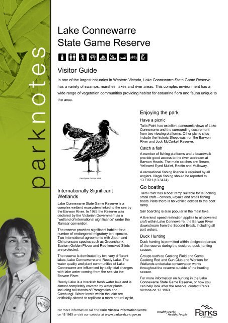
The reserve provides significant habitat for a<br />
number of endangered migratory bird species.<br />
Two international agreements with Japan and<br />
China ensure species such as Greenshank,<br />
Eastern Golden Plover and Red-knecked Stints<br />
are protected.<br />
The reserve is dominated by two very different<br />
lakes, <strong>Lake</strong> <strong>Connewarre</strong> and Reedy <strong>Lake</strong>. The<br />
water quality and plant communities of <strong>Lake</strong><br />
<strong>Connewarre</strong> are influenced by daily tidal changes<br />
with lake water coming from the sea via the<br />
Barwon River.<br />
Reedy <strong>Lake</strong> is a brackish fresh water lake and is<br />
almost completely covered by water plants<br />
including tall stands of Phragmities and<br />
Cumbungi. Water levels within the lake are<br />
artificially altered to replicate a more natural cycle.<br />
For more information call the <strong>Parks</strong> <strong>Victoria</strong> Information Centre<br />
on 13 1963 or visit our website at www.parkweb.vic.gov.au<br />
Enjoying the park<br />
Have a picnic<br />
Taits Point has excellent panoramic views of <strong>Lake</strong><br />
<strong>Connewarre</strong> and the surrounding escarpment<br />
from two viewing platforms. Other picnic sites<br />
include the historic Sheepwash on the Barwon<br />
River and Jock McCorkell <strong>Reserve</strong>.<br />
Catch a fish<br />
A number of fishing platforms and a boardwalk<br />
provide good access to the river upstream at<br />
Barwon Heads. The main catches are Bream,<br />
Yellowed Eyed Mullet, Redfin and Mulloway.<br />
A recreational fishing licence is required by all<br />
anglers. Illegal fishing should be reported to<br />
13 FISH (13 3474).<br />
Go boating<br />
Taits Point has a boat ramp suitable for launching<br />
small craft – canoes, kayaks and small fishing<br />
boats. Note there is no vehicle access to the boat<br />
ramp.<br />
Sail boarding is also popular in the main lake.<br />
A five knot speed restriction applies to all powered<br />
craft within <strong>Lake</strong> <strong>Connewarre</strong>, the Barwon River<br />
downstream from the Second Break, including all<br />
port waters.<br />
Duck Hunting<br />
Duck hunting is permitted within designated areas<br />
of the reserve during the declared duck hunting<br />
season.<br />
Groups such as Geelong Field and <strong>Game</strong>,<br />
Geelong Rod and Gun Club and Workers for<br />
Wetlands undertake conservation works<br />
throughout the reserve outside of the hunting<br />
season.<br />
For more information on hunting in the <strong>Lake</strong><br />
<strong>Connewarre</strong> <strong>State</strong> <strong>Game</strong> <strong>Reserve</strong>, or how you<br />
can help look after the reserve, contact <strong>Parks</strong><br />
<strong>Victoria</strong> on 13 1963.
BREAKWATER<br />
RD<br />
To<br />
Geelong<br />
HORSESHOE BEND ROAD<br />
Marshall<br />
BATTEN<br />
BARWON<br />
ROAD<br />
LEATHER ST<br />
TANNERY ROAD<br />
RESERVE RD<br />
BOUNDARY RD<br />
McCANNS RD<br />
C121<br />
FISHERS RD<br />
CHARLEMONT<br />
HEADS<br />
<strong>Lake</strong> <strong>Connewarre</strong><br />
<strong>State</strong> <strong>Game</strong> <strong>Reserve</strong><br />
ã<br />
N<br />
Highway<br />
Major sealed road<br />
Minor sealed road<br />
Unsealed road<br />
Vehicle track<br />
Walking track<br />
<strong>State</strong> <strong>Game</strong> <strong>Reserve</strong><br />
Other <strong>Reserve</strong>s<br />
Marine Sanctuary<br />
Water body<br />
Wetlands<br />
Recreational<br />
Facilities<br />
Barbecue-Wood<br />
Boat launching<br />
Carpark<br />
Fishing platform<br />
Park information<br />
Picnic table<br />
Seating<br />
Toilets<br />
0 0.5 1<br />
Breakwater<br />
K I L O M E T R E S<br />
Cartography by Spatial Vision 2008<br />
M/8802<br />
MELBOURNE<br />
l<br />
H<br />
ROAD<br />
GROVES RD<br />
©<br />
DANS<br />
BOUNDARY RD<br />
TOWNSEND<br />
ROAD<br />
WILSONS RD<br />
Barwon<br />
Hospital<br />
Swamps<br />
Wetlands<br />
ROAD<br />
WOODS RD<br />
Thompson<br />
River<br />
LAKE ROAD<br />
LOWER DUNEED<br />
+<br />
WHITTINGTON<br />
StAlbans<br />
Park<br />
BAENSCHS<br />
LANE<br />
ROAD<br />
GRAHAM LA<br />
BLACKGATE ROAD<br />
Creek<br />
CALDER<br />
ST<br />
COPPARDS RD<br />
RANDLES RD<br />
WELLINGTON ST<br />
SCOTTS<br />
RD<br />
<strong>Connewarre</strong><br />
+<br />
BREAMLEA<br />
ROAD<br />
BREAMLEA ROAD SHAWS LA<br />
BREAMLEA<br />
FLORA &<br />
FAUNA<br />
RESERVE<br />
MOOLAP STATION RD<br />
Second<br />
Break<br />
Hospital<br />
Swamps<br />
Wetlands<br />
Bellarine <strong>Lake</strong>s<br />
Golf Park<br />
Reedy<br />
<strong>Lake</strong><br />
LAKE RD<br />
C121<br />
+<br />
MOOLAP<br />
To Geelong<br />
HOSPITAL<br />
SWAMPS<br />
RD<br />
BLACK ROCK ROAD<br />
STACEYS RD<br />
BLUESTONE SCHOOL<br />
Tait<br />
Point<br />
WHITEHORSE RD<br />
BELCHERS<br />
LA<br />
Barwon<br />
Heads<br />
Airfield<br />
FULLER<br />
LA<br />
BARWON<br />
ROAD<br />
BELLARINE<br />
HOARES<br />
LA<br />
O’HALLORAN RD<br />
FITZGERALD RD<br />
MATTHEWS RD<br />
THIRTEENTH<br />
Campbell<br />
Point<br />
The<br />
Island<br />
MELALUKA RD<br />
La<br />
Conne<br />
HEADS<br />
C<br />
Thirteenth Beac<br />
Golf Links
OMO RD<br />
ke<br />
h<br />
B110<br />
THE AVENUE<br />
warre<br />
BEACH<br />
Leopold<br />
ASH RD<br />
LINGS RD<br />
+<br />
ROAD<br />
MOLLERS LA<br />
Murtnaghurt<br />
Lagoon<br />
STEPHENS<br />
To Wallington<br />
& Queenscliff<br />
HIGHWAY<br />
BRINSMEAD LA<br />
Barwon<br />
PDE<br />
ROAD<br />
BAWTREE RD<br />
SHEEPWASH RD<br />
LINGS RD<br />
TAITS RD<br />
Barwon Heads<br />
Golf Course<br />
GOLF LINKS RD<br />
Pacey<br />
Island<br />
BARWON<br />
HEADS<br />
EWING<br />
BLYTH<br />
DVE<br />
INSET<br />
SEE<br />
INSET<br />
BARRY<br />
LANE<br />
BASS STRAIT<br />
WALLINGTON<br />
River<br />
ROAD<br />
OCEAN GROVE<br />
BARWON HEADS<br />
CURLEWIS ROAD<br />
SWAN<br />
RHINDS ROAD<br />
Ocean<br />
Grove<br />
Golf<br />
Course<br />
Point Flinders<br />
+<br />
Wallington<br />
BARWON HEADS<br />
Fenwick<br />
SEPARATE<br />
PARKNOTE<br />
AVAILABLE<br />
SPROULES RD<br />
BAY<br />
THACKER ST<br />
ORTON ST<br />
RD<br />
OCEAN GROVE<br />
BARWON BLUFF<br />
MARINE SANCTUARY<br />
D<br />
lesea<br />
Barwon<br />
RIVER<br />
TAITS<br />
OCEAN GROVE<br />
NATURE RESERVE<br />
OCEAN GROVE<br />
PRINCES FWY<br />
Geelong<br />
l<br />
PDE<br />
SHEEPWASH<br />
ROAD<br />
To Portarlington<br />
THE PARADE<br />
MELBOURNE<br />
l Queenscliff<br />
l Portsea<br />
RIVER<br />
ROAD<br />
TUCKFIELD ST<br />
Frankstonl<br />
C129<br />
l<br />
Cowes<br />
ROAD<br />
ROAD<br />
LAKE CONNEWARRE<br />
STATE GAME RESERVE l<br />
River Parade<br />
PARADE<br />
GRUBB ROAD<br />
SHELL<br />
M<br />
RD<br />
CARR<br />
STREET<br />
River
For further information<br />
<strong>Parks</strong> <strong>Victoria</strong><br />
Information Centre<br />
Call 13 1963<br />
or visit the<br />
<strong>Parks</strong> <strong>Victoria</strong> website<br />
www.parkweb.vic.gov.au<br />
Queenscliff Visitor<br />
Information Centre<br />
55 Hesse Street<br />
Queenscliff VIC 3225<br />
Phone: (03) 5258 4843<br />
Caring for the<br />
environment<br />
Help us look after your park<br />
by following these guidelines:<br />
Please take all rubbish with<br />
you for recycling or disposal<br />
All plants, animals, historical<br />
and archaeological sites and<br />
geographic features are<br />
protected by law<br />
Dogs and other pets are not<br />
permitted in the park<br />
Firearms are prohibited<br />
No fires, including barbecues,<br />
may be lit on a day of Total Fire<br />
Ban. <strong>Lake</strong> <strong>Connewarre</strong> <strong>State</strong><br />
<strong>Game</strong> <strong>Reserve</strong> is in the<br />
Central Total Fire Ban District<br />
It is your responsibility to<br />
know if it is a day of Total<br />
Fire Ban. If in doubt call the<br />
<strong>Victoria</strong>n Bushfire<br />
Information Line<br />
on 1800 240 667<br />
Park closures - Be prepared to<br />
leave early as extreme<br />
weather may cause the<br />
closure of some park areas<br />
for public safety<br />
Collect only dead wood from<br />
the ground for campfires<br />
Vehicles, including motor bikes,<br />
may only be used on formed<br />
open roads. Drivers must be<br />
licensed and vehicles<br />
registered and roadworthy<br />
Healthy <strong>Parks</strong> Healthy People<br />
Visiting a park can improve<br />
your health, mind, body and<br />
soul. So, with over four million<br />
hectares of parkland available<br />
to <strong>Victoria</strong>ns, why not escape<br />
to a park today!<br />
Barwon River Parklands<br />
There are over 26km of walking and cycling<br />
paths along the Barwon River. There are also<br />
gold courses, fishing and viewing platforms,<br />
playgrounds, public toilets and picnic areas.<br />
The Barwon River provides for canoeing,<br />
kayaking and water skiing.<br />
Below are just a few of the places to visit along<br />
the river.<br />
Buckley Falls Park<br />
Enjoy stunning river and valley views from the<br />
lookout. Buckley Falls can be reached by car<br />
or via the sealed walking/cycling path from<br />
nearby Queens Park.<br />
Balyang Sanctuary<br />
The sanctuary is a haven for birds - swans,<br />
pelicans, Eurasian coot, dusky moorhen,<br />
Pacific black duck, mallard, pied cormorant,<br />
geese and silver gulls. Riverside walking/bike<br />
paths link Balyang Sanctuary with other parks<br />
along the Barwon River.<br />
Ocean Grove Nature Conservation <strong>Reserve</strong><br />
Explore one of the last remaining parcels of<br />
native vegetation on the Bellarine Peninsula.<br />
The reserve has an information centre that is<br />
open on weekends. A number of interesting<br />
walks start from the reserve’s picnic area.<br />
White Mangroves<br />
The banks of the Barwon River form the most<br />
western occurrence of white mangrove in<br />
Australia. White mangroves are uniquely<br />
equipped to survive in muddy and salty<br />
conditions. The mangrove root system allows the<br />
plant to breathe whilst exposed at low tide.<br />
The mangroves play an important role in the food<br />
chain and biodiversity by providing an excellent<br />
source of food and shelter for many species of<br />
fish, animals and birdlife. Looking after these plant<br />
species will ensure adequate food stocks for fish<br />
and protect fishing opportunities.<br />
Unfortunately the mangroves along the lower<br />
Barwon River are in decline due to pressure from<br />
the impact of people. Walking and fishing along<br />
the river edge damage the sensitive streamside<br />
mangroves and salt marsh communities.<br />
You can help protect the mangroves and wetlands<br />
by staying on designated walking tracks and using<br />
fishing platforms while fishing. This will ensure<br />
future food stocks for fish, animals and birdlife.<br />
Birdlife<br />
The reserve is a popular site for bird watching with<br />
one hundred and forty nine recorded species of<br />
birds. Birds such as Strawnecked and Sacred ibis<br />
along with Yellowed-billed spoonbills regularly use<br />
breeding sites in the area.<br />
The river edges and tidal mudflats along the lower<br />
Barwon River provide excellent habitat for egrets,<br />
gulls, terns, pelicans and cormorants. The tidal<br />
flow allows aquatic invertebrates and small fish to<br />
move up the river, providing a valuable food<br />
source for these species.<br />
Another significant visitor to the reserve is the<br />
Orange-bellied Parrot. Breeding in Tasmania over<br />
summer, this species migrates north via Bass<br />
Strait islands to <strong>Victoria</strong>’s coastline for the winter.<br />
It is thought that <strong>Lake</strong> <strong>Connewarre</strong> forms one of<br />
only five known over-winter sites.<br />
Be fire ready and stay safe<br />
Many parks and forests are located in high fire risk<br />
areas. On days of forecast Code Red Fire<br />
Danger this park will be closed for public<br />
safety.<br />
If you are already in the park you should leave the<br />
night before or early in the morning for your own<br />
safety.<br />
Closure signs will be erected and rangers will<br />
patrol where possible, however you may not<br />
receive a personal warning that the park is closed<br />
so check the latest conditions by calling 13 1963<br />
or visit www.parkweb.vic.gov.au.<br />
For up to date information on fires in <strong>Victoria</strong> or<br />
general fire safety advice call the <strong>Victoria</strong>n<br />
Bushfire Information Line on 1800 240 667.<br />
How to get there<br />
The reserve is situated on the Bellarine Peninsula<br />
approximately 65km south west of Melbourne and<br />
8km south east of Geelong.<br />
<strong>Lake</strong> <strong>Connewarre</strong> can be accessed from<br />
Brimsmead Lane, Mollers Lane, Wallington Road<br />
and Barwon Heads Road.<br />
Taits Point Picnic Area can be accessed from<br />
Staceys Road.<br />
Reedy <strong>Lake</strong> can be accessed via Coppards Road,<br />
Calder Street, Moolap Station Road, Whitehorse<br />
Road and O’Hallarons Road.<br />
December 2010<br />
Printed on Australian-made 100% recycled paper


