

Edition 02 of 2012. - Indian Naval Hydrographic Department
Edition 02 of 2012. - Indian Naval Hydrographic Department
Edition 02 of 2012. - Indian Naval Hydrographic Department

Create successful ePaper yourself
Turn your PDF publications into a flip-book with our unique Google optimized e-Paper software.
6. 1<br />
SECTION – VI<br />
CORRECTIONS TO SAILING DIRECTIONS (PILOTS)<br />
(Note: For hard copy in colour, kindly download from www.hydrobharat.nic.in <strong>Indian</strong> Notices to Mariners section)<br />
Bay <strong>of</strong> Bengal Pilot (INP-2)<br />
Chapter -3 (Page – 149)<br />
(Source: Dhamra Port)<br />
Article 3.41, Para 4, line 7<br />
Delete text “Port <strong>of</strong> Dhamra is being ....................................<br />
yet completed.”<br />
Insert after article 3.44<br />
Dhamra Port<br />
3.44 a<br />
Chart 3017, 3037<br />
1 General Information. The Dhamra Port Company<br />
Limited (DPCL) is a joint venture <strong>of</strong> L&T and Tata Steel.<br />
The port is one <strong>of</strong> the deepest ports <strong>of</strong> India with a depth <strong>of</strong><br />
19m which can accommodate super cape-size vessels up to<br />
180,000 DWT.<br />
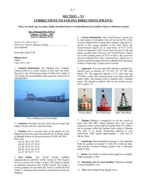
View <strong>of</strong> Dhamra port from South<br />
2 Function. Principal activities <strong>of</strong> the port are export and<br />
import <strong>of</strong> Coal, Iron Ore, and Lime Stone.<br />
3 Position. Port is located north <strong>of</strong> the mouth <strong>of</strong> river<br />
Dhamra between the main land and the lee <strong>of</strong> Kanika Sands<br />
in Bhadrak district <strong>of</strong> Orissa at position 20°49'N, 86°58'E.<br />
Port Limit<br />
(a) 20° 48' N, 86° 56' E<br />
(b) 20° 48' N, 87° <strong>02</strong>' E<br />
(c) 20° 56' N, 87° 16' E<br />
(d) 20° 56' N, 86° 55' E<br />
(e) 21° <strong>02</strong>' N, 87° 13' E<br />
4 Port Radio. The Vessel should establish<br />
communications with Port Traffic Control on VHF channel<br />
14/16, as soon as the Vessel is within VHF range for advice<br />
on berthing instruction. Port Traffic Control will assign a<br />
working channel for use while the Vessel is within the Port<br />
Limits. A listening watch should be maintained on both the<br />
channels.<br />
5 Arrival information. The Vessel/Owners' Agents are<br />
to send notice <strong>of</strong> Estimated Time <strong>of</strong> Arrival (ETA) <strong>of</strong> the<br />
Vessel at Dhamra Port on daily basis starting 7 days prior to<br />
arrival. If the voyage duration is less than 7days, the<br />
Vessel/Owners' Agents are to send notice <strong>of</strong> ETA <strong>of</strong> the<br />
Vessel on departure <strong>of</strong> the Vessel from last port <strong>of</strong> call and<br />
thence on daily basis. However, the Vessel/Owners' Agents<br />
are to start sending notice <strong>of</strong> ETA at least 3 days prior her<br />
arrival at Dhamra Port. The Vessel/Owners' Agents are to<br />
send the confirmed time <strong>of</strong> arrival at Dhamra Port anchorage<br />
at least 24 hours and 12 hours prior to arrival.<br />
6 Approach. The outer end <strong>of</strong> the channel is marked by a<br />
fairway buoy at position 20° 55’.41N, 87° 07’.25E with<br />
Racon ‘D’. The approach channel is 9.71 mile long and<br />
170-240 m wide with a turning circle at the inner end with<br />
radius 300m. The turning circle is marked with 2 cardinal<br />
buoys. The channel is marked with 10 sets <strong>of</strong> buoys as per<br />
IALA region ‘A’.<br />
Fairway Buoy Port Hand Buoy Stbd. Hand Buoy<br />
7 Pilotage Pilotage is compulsory for all the vessels <strong>of</strong><br />
more than 200 GRT calling Dhamra Port. Any Vessel<br />
required to carry a pilot under the <strong>Indian</strong> Ports Act, 1908 is<br />
not to navigate within the harbour limits unless a Dhamra<br />
Port pilot is on board. Requesting authority is port<br />
conservator. Pilot boards approximately 1 mile east <strong>of</strong><br />
fairway buoy.<br />
8 Anchorage. Recommended anchorage is well separated<br />
from the entrance <strong>of</strong> channel 7.5 mile NE <strong>of</strong> fairway buoy<br />
and provides excellent holding ground with a minimum<br />
depth <strong>of</strong> 18m.<br />
9 Berth. Two berths <strong>of</strong> 350m (each) length are available.<br />
Depth alongside is 19m.<br />
10 Maximum size <strong>of</strong> vessel handled. Maximum draught<br />
<strong>of</strong> vessel handled is 17m.<br />
11 Tide. Mean range during springs 4.0 m.


