Part 4 - Berg - Hughes Center
Part 4 - Berg - Hughes Center
Part 4 - Berg - Hughes Center

Create successful ePaper yourself
Turn your PDF publications into a flip-book with our unique Google optimized e-Paper software.
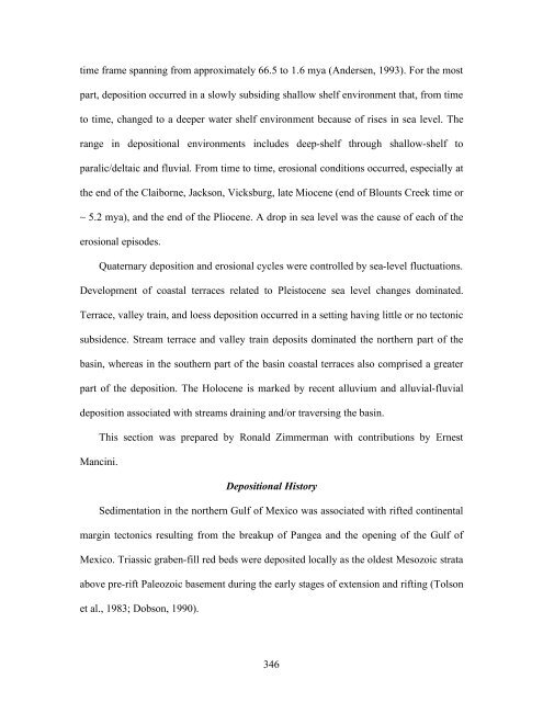
time frame spanning from approximately 66.5 to 1.6 mya (Andersen, 1993). For the most<br />
part, deposition occurred in a slowly subsiding shallow shelf environment that, from time<br />
to time, changed to a deeper water shelf environment because of rises in sea level. The<br />
range in depositional environments includes deep-shelf through shallow-shelf to<br />
paralic/deltaic and fluvial. From time to time, erosional conditions occurred, especially at<br />
the end of the Claiborne, Jackson, Vicksburg, late Miocene (end of Blounts Creek time or<br />
~ 5.2 mya), and the end of the Pliocene. A drop in sea level was the cause of each of the<br />
erosional episodes.<br />
Quaternary deposition and erosional cycles were controlled by sea-level fluctuations.<br />
Development of coastal terraces related to Pleistocene sea level changes dominated.<br />
Terrace, valley train, and loess deposition occurred in a setting having little or no tectonic<br />
subsidence. Stream terrace and valley train deposits dominated the northern part of the<br />
basin, whereas in the southern part of the basin coastal terraces also comprised a greater<br />
part of the deposition. The Holocene is marked by recent alluvium and alluvial-fluvial<br />
deposition associated with streams draining and/or traversing the basin.<br />
Mancini.<br />
This section was prepared by Ronald Zimmerman with contributions by Ernest<br />
Depositional History<br />
Sedimentation in the northern Gulf of Mexico was associated with rifted continental<br />
margin tectonics resulting from the breakup of Pangea and the opening of the Gulf of<br />
Mexico. Triassic graben-fill red beds were deposited locally as the oldest Mesozoic strata<br />
above pre-rift Paleozoic basement during the early stages of extension and rifting (Tolson<br />
et al., 1983; Dobson, 1990).<br />
346
Paleozoic (Pennsylvanian-Permian)<br />
The oldest sediments drilled in the subsurface of north Louisiana are in the late<br />
Pennsylvanian-Permian (310-250 mya) carbonate section over a Sabine Terrane (Lowrie<br />
et al., 1993). An example is found in a crestal area located in Sabine Parish, Louisiana<br />
(Zimmerman, 2000). In southern Arkansas and extending southward to the north side of<br />
the North Louisiana Salt Basin, folded Pennsylvanian-Mississippian sandstone and shale<br />
of the Ouachita are present. Imlay (1942) considered the Morehouse Formation as<br />
representing this unit of rocks in the deeper parts of the basin.<br />
Morehouse Formation<br />
One of the older sedimentary rocks drilled to date in the subsurface of north<br />
Louisiana is the gray shale with rare siltstone and limestone of the Morehouse Formation.<br />
It is found from 9,285 to 10,475 ft in depth in the Union Producing well (No. A-1 Tensas<br />
Delta), drilled in Morehouse Parish (Sec. 8, T. 22 N., R. 4 E) (Imlay, 1942; Bishop,<br />
1967). Because this well was still in the Morehouse Formation at total depth and no other<br />
wells have penetrated it, the exact thickness of the formation is unknown. This well also<br />
indicated that the Morehouse is overlain directly by Werner red beds (Hazzard et al.,<br />
1947; Scott et al., 1961). According to these authors the Morehouse was deposited prior<br />
to the Eagle Mills, and later removed in south Arkansas by pre-Werner erosion. Other<br />
geologists define the Morehouse either as a marine wedge overlying the Eagle Mills or as<br />
a downdip marine facies of that formation.<br />
According to Imlay (1942), a distinctive gastropod and assemblage of other<br />
pelecypods found in cores from the No. A-1 Tensas Delta well suggest a late Paleozoic<br />
age, probably not older than Pennsylvanian, for the Morehouse Formation. In a core from<br />
347
the same well, Pennsylvanian plant spores were recovered, which allowed Imlay (1942)<br />
to assign a middle to late Pennsylvanian age to the formation.<br />
Late Triassic-Early Jurassic (Eagle Mills)<br />
Eagle Mills Formation<br />
The Eagle Mills Formation (Fig. 315) extends in the subsurface from east Texas<br />
through south Arkansas into Alabama. However, it has not been penetrated by the drill in<br />
north Louisiana, and is absent in the Union No. A-1 Tensas Delta well (Bishop, 1967).<br />
Some early papers report the Eagle Mills to be Permian in age similar to the Morehouse<br />
and that the two formations were deposited on opposite sides of a buried ridge along the<br />
Arkansas-Louisiana line (Chapman, 1963). According to Scott et al. (1961), the Eagle<br />
Mills unconformably overlies beds of Paleozoic age and is overlapped unconformably on<br />
the north by the Jurassic Werner. These authors were unable to establish the northern<br />
depositional limit in south Arkansas, and reported that the eroded edge has been fairly<br />
well defined in the subsurface where, the Eagle Mills was found to be approximately<br />
7,000 ft thick in the Humble No. 1 Royston well in Hempstead County, Arkansas. Based<br />
on cores from this well, Scott et al. (1961) suggested a late Triassic age for the Eagle<br />
Mills. These authors observed plant fossils, including Macrotaeniopteris magnifolia, and<br />
reported that the fossils are closely comparable with those of known late Triassic rocks,<br />
particularly the Newark Group of the eastern seaboard and the Chinle Formation of<br />
Arizona.<br />
More recent work by Dawson and Callendar (1991) and based on information from<br />
several deep wells (12,000-18,000 ft) in northeast Texas and southwest Arkansas, the<br />
Eagle Mills is considered to be of Triassic-Jurassic age. The lithology given is the<br />
348
following: green, red, and pink conglomeratic lithic arenites and fine- to coarse-grained,<br />
feldspathic arenites, interbedded with red and greenish gray shales and siltstones. Lithic<br />
arenites contain basalt, chert, quartzite, and dolomite rock fragments; plagioclase is the<br />
predominant feldspar. The sandstones have low textural and mineralogic maturities.<br />
Eagle Mills red beds and associated intrusive igneous rocks (diabase and basalt dikes and<br />
sills) represent the fillings of grabens or rift basins that actively subsided during<br />
deposition in alluvial, fluvial-deltaic, and lacustrine paleoenvironments.<br />
Middle Jurassic (Werner, Louann)<br />
Werner Formation<br />
The Werner Formation unconformably overlies both the Eagle Mills and Morehouse<br />
Formations and grades into the overlying Louann Salt; north of the limit of the salt, the<br />
Werner is overlain unconformably by the Norphlet (Bishop, 1967). Hazzard et al. (1947)<br />
mentioned the Werner contains a lower red bed member consisting of red shale and<br />
sandstone, commonly conglomeratic at the base, and an upper anhydrite member of<br />
relatively pure, dense, granular anhydrite. They reported that the members are<br />
conformable, and that the Werner-Louann sequence represents a continuous cycle of<br />
deposition.<br />
The Werner anhydrite underlies the greater part of south Arkansas and is present in<br />
north Louisiana. About 50 ft of red beds and sandstone between the Werner anhydrite<br />
and the dark shale of the Morehouse in the A-1 Tensas Delta well is probably the<br />
equivalent Werner red bed member. Several workers in the region have reported apparent<br />
excessive thickness of Louann Salt as compared to the average 50 to 100 ft of underlying<br />
Werner anhydrite (Andrews, 1960).<br />
349
Louann Salt<br />
The Louann Salt conformably overlies the Werner anhydrite, and is unconformably<br />
overlain by the Upper Jurassic Norphlet (Bishop, 1967). This unconformity of unknown<br />
magnitude and the undetermined age of the Eagle Mills make it difficult to determine the<br />
exact age of the salt. However, most authors (Murray, 1961; Bishop, 1967) favored an<br />
early to middle Jurassic age for the Werner-Louann and gave the following reasons: (1)<br />
the evaporite sequence of the Sabinas basin of Mexico, which could be the sulfate<br />
concentrate of the Louann Salt, appears to be continuous with beds of the coastal<br />
province; (2) the formations underlie strata of known late Jurassic age, and there is no<br />
positive evidence for a pre-Mesozoic age; (3) they are stratigraphically equivalent to<br />
evaporites and red shale in the Mexican portion of the coastal province which have been<br />
determined to be approximately of middle Jurassic age and to overlie, at least in part,<br />
Lower Jurassic rocks (Murray, 1961); (4) thick (more than 2,000 ft) salt appears to occur<br />
only basinward from the Mexia-Talco, South Arkansas, and Pickens-Gilbertown fault<br />
system which also appears to be the approximate updip limit of thick Upper Jurassic<br />
sediments; and (5) spores of Mesozoic age have been identified from salt domes of<br />
northern Cuba which may be the same age as domes of the United States.<br />
Andrews (1960) described undisturbed bedded Louann Salt as being coarsely<br />
crystalline, free of terrigenous siliciclastic material, and containing anhydrite streaks. A<br />
core taken in the Ohio No. H-1 Waller well (Sec. 3, T. 23 N., R. 8 W) in Claiborne<br />
Parish, Louisiana, showed the salt to be white to gray in color. Other salt cores are pale<br />
pinkish orange, a color attributed to meteoric water percolating through the Norphlet<br />
during deposition. The salt core from this well shows an absence of spores and pollen and<br />
350
the high iron content seems to support the existence of the pre-Norphlet unconformity.<br />
From subsurface control, it appears as though the salt is laterally continuous and<br />
underlies parts of Texas, Arkansas, Alabama, and Mississippi, and nearly all of Louisiana<br />
(Andrews, 1960). A maximum thickness of 1,300 ft was recorded in the Placid No. 3<br />
Freeman-Smith (Sec. 14, T. 16 S., R. 13 W.), Calhoun County, Arkansas, and more than<br />
3,300 ft (still in salt at total depth of 14,890 ft) in the C.V.O.C. No. 2 Banks well (Sec.<br />
34, T. 21 N., R. 10 W.), Webster Parish, Louisiana. The thickness is believed to be<br />
associated with salt flowage, and may have been the result of basinward thickening of the<br />
salt. An original deposition of about 5,000 ft of bedded salt has been postulated but<br />
because of the topographically irregular floor of the basin, the thickness was not uniform<br />
(Parker and McDowell, 1955; Andrews, 1960). Bishop (1967) reported that precipitation<br />
of as much as 5,000 ft of Louann Salt was the result of concentrated marine waters<br />
flowing periodically into the basin, more or less isolated from the open sea by barrier<br />
bars. The CaCO3 and CaSO4 were precipitated, and the produced concentrated brines of<br />
NaCl were deposited in the basin.<br />
Upper Jurassic Louark (Norphlet, Smackover, Haynesville-Buckner)<br />
Norphlet Formation<br />
The Norphlet unconformably overlies the Louann Salt and older units near the<br />
margins of the basin where the Louann was not deposited or has been removed by<br />
erosion. Based on the relation of the Norphlet to the overlying Smackover, it has been<br />
assigned to the Upper Jurassic (Hazzard et al., 1947; Bishop, 1967). The Norphlet of<br />
Arkansas, Louisiana, and Texas attains a maximum thickness of about 150 ft and is<br />
composed primarily of red and gray shale and sandstone. The northernmost area of<br />
351
Norphlet deposition, in southern Arkansas and northeastern Texas, is characterized by<br />
gravel with interbedded red and gray mudstone and is largely fluvial. Basinward, the<br />
Norphlet is believed to be composed of lagoonal deposits that are transitional with the<br />
lower Smackover; a minor diastem may separate the fluvial equivalents of these rocks<br />
from the limestone of the Smackover.<br />
Smackover Formation<br />
Producing Parishes<br />
Bossier, Webster<br />
Claiborne, Lincoln, Union<br />
The Smackover Formation conformably overlies the Norphlet. It consists mainly of<br />
carbonate mud with pyrite and carbonaceous material deposited in a quiet, toxic<br />
environment and non-skeletal carbonate grains deposited in a shallow water environment<br />
(Hazzard et al., 1947; Bishop, 1968, 1971). It is reported that the deposition of these<br />
non-skeletal particles in the late Smackover sea is similar to those of the present Bahama<br />
Banks. Likewise, pellet-mud was deposited in warm, quiet, shallow, water followed by<br />
slight differential uplift causing turbulence in local areas, and deposition of mixed facies.<br />
Dickinson’s (1969) work was used successfully in predicting productive trends, and<br />
for reconstructing the environment of deposition of the upper Smackover section (late<br />
Jurassic) at North Haynesville field, Claiborne Parish, Louisiana. The oolitic limestone<br />
(mudstone, wackestone, packstone) and pelletoid "B" reservoir studied was believed to<br />
contain an estimated 16 million barrels of oil in place. Analysis of dry holes in North<br />
Haynesville field indicates that nondeposition or complete cementation of the reservoir<br />
facies is more important than present structure in limiting the productive area. However,<br />
352
only those wells favorably located with respect to present structure, as well as to structure<br />
during deposition and diagenesis, are productive.<br />
According to Moore and Druckman (1981), the upper Smackover is a blanket ooid<br />
grainstone 300 to 400 ft thick and covering approximately 4,000 sq mi in east Texas,<br />
southern Arkansas and northern Louisiana. Their work in burial diagenesis of the<br />
Smackover indicates that porosity is affected to a greater degree by burial diagenetic<br />
processes than by depositional environment processes. They indicate zones with porosity<br />
values ranging from 11 to 22%, and permeabilities of 1 to 100 millidarcys at the site of<br />
some of the larger upper Smackover discoveries of the 1960s, such as Walker Creek<br />
field, that eventually led to new exploration across the entire Smackover fairway.<br />
Zimmerman’s (1992) study of the sparsely drilled area in the northeast corner of<br />
Louisiana indicates that the extensively fractured intervals observed in Smackover<br />
conventional cores in the area can be attributed to wrench and normal faulting. Although<br />
located on the border of the North Louisiana Salt Basin, this area is an example of<br />
tectonic fracturing that may have future exploration and production potential in the<br />
Smackover interval.<br />
In summary and regarding reservoir conditions of the Smackover in north Louisiana,<br />
depth to pay ranges from 8,600 to 11,600 ft with net pay of producing intervals ranging<br />
from 20 to 120 ft. The oolitic and pisolitic limestones tend to be tight with porosities of<br />
11 to 22% and permeability less than 1 to 100 md. The hydrocarbons produced are<br />
generally 42º to 53º API gravity crudes and condensates.<br />
353
Haynesville-Buckner Formation<br />
Producing Parishes<br />
Bossier, Claiborne<br />
Forgotson and Forgotson (1976) described the Haynesville in southern Arkansas and<br />
northern Louisiana, as red shales and pink to white sandstones that grade laterally into the<br />
Gilmer Limestone in East Texas and basinward into black shale lithologically similar to<br />
the Bossier Shale. In some areas, the Haynesville or Gilmer Limestone (commonly called<br />
Cotton Valley Lime) rests unconformably on the Smackover Formation. The Buckner<br />
Member of the Haynesville (primarily red shale, sandstone, anhydrite, and limestone<br />
lenses) is transitional with the underlying Smackover limestone. According to Salvador<br />
(1987), the lower Buckner (Kimmeridgian) section reflects depositional environments<br />
that are less marine or shallower water marine than those of the underlying Oxfordian<br />
Smackover, because the Buckner consists of evaporitic deposits and associated red beds<br />
formed in hypersaline coastal lagoons or sabkhas. At North Haynesville field, most of the<br />
thick Buckner consists largely of red and greenish-gray mudstone and shale with varying<br />
amounts of nodular anhydrite and with a few thin beds of white to red, anhydritic<br />
sandstone (Bishop, 1971).<br />
In Texas, Louisiana, and Arkansas, Dickinson (1968a, 1968b, 1969) divided the<br />
Buckner into two members, each of which is gradational with the Smackover in different<br />
areas. The lower is predominantly anhydrite and anhydritic mudstone, and was deposited<br />
in an evaporite basin north of a chain of salt-cored anticlines. The upper member consists<br />
largely of red and greenish-gray mudstone and shale with nodular anhydrite. Several<br />
zones of calcarenites similar to those of the Smackover are present in a general east-west<br />
trend area, and at least one of them, the "A" zone, extends regionally across most of<br />
354
northern Louisiana. Dickinson stated that the lower member of the Buckner is time-<br />
equivalent to part of the upper member of the Smackover, but the upper Buckner grades<br />
basinward into the Bossier Formation. The Buckner calcarenite zones coalesce at the<br />
south edge of the Haynesville field to form a bank up to 600 ft thick, which extends<br />
regionally along the basinward edge of the shelf slope, a zone of active subsidence.<br />
Dickinson (1969) stated that the older zones of the Buckner calcarenite appear to be<br />
limited to the south flanks of Haynesville and Red Rock fields, and that the "A" zone is<br />
developed on a regional scale across North Louisiana and is known to extend from Texas<br />
nearly to Mississippi. The trends vary from east to west to northwest, with a beach<br />
deposit forming at the seaward edge of the shelf-slope break during the Buckner<br />
regression.<br />
In summary, the Haynesville-Buckner consists of fine-grained sandstones, shales,<br />
bedded anhydrite, and oolitic limestone that were deposited in a shallow marine<br />
environment. Hydrocarbons were primarily sourced from the underlying Smackover<br />
Formation basinal deposits and are stratigraphically trapped in multiple, stacked, ooid<br />
shoal pinch-outs. With respect to the reservoirs, the depth to top of pay is from 9,400 to<br />
10,750 ft. Porosity ranges from 9 to 16% and permeability from 50 to 400 md. Produced<br />
hydrocarbons consist of 42º API gravity oil, condensate, and gas.<br />
Upper Jurassic (Cotton Valley)<br />
Cotton Valley Group<br />
Producing Parishes<br />
355
Caddo, Bossier, Webster, Claiborne, Lincoln,<br />
Union, Ouachita, De Soto, Bienville, Winn,<br />
Natchitoches, Jackson, Morehouse<br />
The Cotton Valley Group in southern Arkansas and northern Louisiana has been<br />
extensively studied (Crider, 1938; Imlay, 1943; Swain, 1944; Forgotson, 1954; Sloane,<br />
1958; Mann and Thomas, 1964; Thomas and Mann, 1966; Collins, 1980; Coleman and<br />
Coleman, 1981; Eversull, 1985; Zimmerman, 2000). The Cotton Valley consists of the<br />
Schuler and Bossier formations and lies unconformably on the Louark Group. The<br />
uppermost Schuler Formation, predominantly composed of sandstone and siltstone, is<br />
unconformable to and oversteps the Bossier Formation (mainly shale) near the basin<br />
margins. Continuous deposition occurred in the deeper parts of the basin. The basal<br />
Cretaceous Coahuilan Series rests unconformably on the Schuler Formation of the Upper<br />
Jurassic Cotton Valley Group. Swain and Anderson (1993), in ascending order, divided<br />
the Cotton Valley Group into the Millerton, Shongaloo, and Dorcheat formations. They<br />
defined the Millerton as dominantly a siliciclastic shelf unit that was deposited over the<br />
Haynesville Formation and used it in place of the Bossier Shale. These authors described<br />
the Shongaloo Formation as typical foreshelf and shelf edge silty shales and sandstones,<br />
in part, calcareous. They assigned the name Dorcheat Formation to the uppermost unit<br />
below the Hosston Formation and used it in reference to the Schuler.<br />
Kornfeld (1985) described the sandstones of the upper Cotton Valley Group of<br />
Mississippi, northern Louisiana, and eastern Texas as being deposited on a stable but<br />
subsiding shelf. The quartz-rich regressive sandstones are described as being deposited in<br />
a complex of deltaic and marine systems. The sediments of the Cotton Valley fluvial-<br />
deltaic systems were derived from Paleozoic and younger highlands to the north and<br />
356
northwest. These sandstones accumulated on the shelf where they were subsequently<br />
reworked. Kornfeld (1985) stated that proximal destructive delta systems existed in<br />
northern Louisiana and northeastern Texas and that another system consisting of barrier<br />
beaches and bars was located centrally between them.<br />
Environments of deposition located landward from the open Gulf to the south and<br />
paralleling the late Jurassic Gulf of Mexico coastline included a longshore barrier island<br />
in northern Louisiana and a coastal lagoon in southern Arkansas. Sands to the barrier<br />
island were supplied by a delta that was formed by the ancestral Mississippi River in<br />
northeastern Louisiana and adjacent Mississippi (Thomas and Mann, 1966). The<br />
description by these authors and others of the open and shallow marine systems together<br />
with the nearshore coastal features typify the lithofacies of the formations within the<br />
Cotton Valley Group. Updip in southern Arkansas, the uppermost Schuler Formation<br />
pinches out. Of interest are the thick downdip marine deposits in northern Louisiana that<br />
include the following formations: Bossier Shale, Terryville Sandstone, Hicos Shale,<br />
Knowles Limestone, and Schuler Formation. The sedimentary characteristics of the<br />
formations that comprise the group in northern Louisiana are summarized below.<br />
Bossier Shale (Millerton Formation)<br />
The open marine basin deposits of the Bossier Shale are found in northern Louisiana<br />
and consist of dark-gray, fossiliferous, calcareous shale. A wedge of this marine shale<br />
pinches out updip in southernmost Arkansas. It attains a maximum thickness of 2,000 ft<br />
(610 m). The marine shale grades eastward into red shale and sandstone in northeastern<br />
Louisiana (Swain, 1944; Forgotson, 1954). The Haynesville Formation conformably<br />
underlies the Bossier; and where the Haynesville is absent, the Bossier rests on the<br />
357
Smackover limestone. The Bossier grades upward into the overlying Terryville<br />
Formation.<br />
Terryville Sandstone<br />
The Terryville, which consists of regressive massive white quartzose sandstones,<br />
extends from Ouachita Parish westward through southern Caddo Parish, Louisiana (Mann<br />
and Thomas, 1964). It was deposited as an offshore sand barrier island that separated the<br />
open sea on the south from a coastal lagoon on the north (Forgotson, 1954; Sloane,<br />
1958). The Terryville attains a maximum thickness of about 1,400 ft (426 m). Only a few<br />
thin, dark gray shale beds occur in this sandstone sequence. The Terryville interval<br />
consists of five sandstone tongues; each of the tongues is composed of one to five<br />
regionally extensive blanket sandstone beds, which are 10 to 50 ft (3-15 m) thick. Oyster<br />
beds occur at the pinch-out edges of some of the sandstones. The Terryville Sandstone<br />
interfingers with and grades northward into the overlying and laterally equivalent Hico<br />
Shale.<br />
Hico Shale<br />
In northern Louisiana, the Hico Shale consists mainly of dark gray shale and a few<br />
thin beds of silty limestone, siltstone, and sandstone. Locally, thin beds of carbonaceous<br />
and pyritic sandstone and shale are present. The dark shales of the Hico are believed to be<br />
a lagoonal facies that accumulated adjacent to the Terryville barrier island (Forgotson,<br />
1954).<br />
Knowles Limestone<br />
The Knowles Limestone in Louisiana, which consists of alternating dark gray,<br />
argillaceous limestone and gray shale, is 300 to 400 ft thick (Mann and Thomas, 1964).<br />
Thin lenses of sandstone occur within, and locally supplant, some of the limestone units.<br />
358
The limestones are 10 to 100 ft thick and are interbedded with shales that are 10 to 30 ft<br />
thick. Similar to the other underlying Cotton Valley units, the Knowles in Louisiana<br />
grades northward into terrestrial red beds of the Schuler Formation in Arkansas, and in<br />
some areas of Louisiana it is overlain conformably by the Cretaceous Hosston Formation.<br />
Schuler Formation (Dorcheat Formation)<br />
The Schuler Formation consists mainly of shale, but in Arkansas toward the pinch-<br />
out of the unit it contains increasing amounts of sandstone (Forgotson, 1954). In fact,<br />
near the pinch-out, the formation is entirely sandstone and pebble conglomerate. In<br />
southern Arkansas, there is a predominance of nearshore to nonmarine lenticular, fine-<br />
grained, red and gray sandstone and shale or mudstone. The lenticular red beds probably<br />
accumulated as coastal plain deposits on the coastal side of a lagoon. The red terrigenous<br />
siliciclastic sediments extend south in northeastern Louisiana and western Mississippi,<br />
where the Schuler is almost totally sandstone. According to Forgotson (1954), a large<br />
delta was responsible for the thickness and distribution of the sandstones in northeastern<br />
Louisiana and western Mississippi. The Hosston Formation overlies the Schuler<br />
Formation disconformably.<br />
Approximately 45 reservoirs exist within the Cotton Valley Group. The optimum<br />
producing reservoirs consist of fine- to medium-grained, massive barrier bar sandstone<br />
and shallow marine oolitic limestone of the Terryville and Knowles formations,<br />
respectively. In northern Louisiana, depth to the top of the pay zones range from 3,600 to<br />
14,500 ft. Net pay of the reservoirs ranges from 10 to 60 ft with porosities of 9 to 18%<br />
and permeabilities of 1 to 300 md. The produced hydrocarbons are typically 41º API<br />
gravity oil, condensate, and gas.<br />
359
Lower Cretaceous Coahuila (Hosston, Sligo)<br />
The Sligo and Hosston Formations belong to the Lower Cretaceous Coahuilan<br />
Series. The Pearsall, the basal formation of the Trinity Group, conformably overlies the<br />
Sligo. The Sligo, consisting of gray to black shale and limestone, grades transitionally<br />
downward into the red sandstones and shales of the Hosston. Basinward, both units<br />
thicken and the base of the Sligo occurs stratigraphically lower.<br />
Hosston Formation<br />
Producing Parishes<br />
Caddo, Bossier, Webster, Claiborne,<br />
Union, Lincoln, De Soto, Bienville,<br />
Red River, Natchitoches, Jackson,<br />
Ouachita, Caldwell<br />
Deposition of predominantly fluvial-deltaic sediments continued during the early<br />
Cretaceous in the basin. During Hosston time this deposition included a large variety of<br />
lithologies from delta plain to shallow marine shelf environments. According to Rogers<br />
(1987), the Hosston Formation overlies the Dorcheat and is of early Cretaceous age. The<br />
Hosston Formation contains the early Cretaceous marker spore Cicatricosisporites<br />
angicanalis, and the Cretaceous dinoflagellate Oligosphaeridium complex. To the west in<br />
Texas, Blount et al. (1986) were able to identify the following five major lithofacies in<br />
the Hosston Formation of Trawick field, Nacogdoches County, Texas: (1) a clean, cross-<br />
bedded, tidal-channel facies; (2) a sandy, bioturbated, tidal-flat facies; (3) thin, rapidly<br />
deposited crevasse-splay deposits; (4) interdistributary bay sands, silts, and muds; and (5)<br />
partly reworked distal-deltaic sandstones. These workers observed distribution<br />
differences between the upper and lower Hosston. In the lower Hosston, the channel,<br />
360
crevasse splay, and interdistributary bay facies were common, and in the upper Hosston a<br />
marginal marine delta-fringe system existed.<br />
The predominant arenaceous siliciclastics of the Hosston range from<br />
claystones/shales, siltstones, very fine-grained sandstones to conglomerates resulting in<br />
prolific hydrocarbon reservoirs that can be found from Texas, across Northern Louisiana<br />
and into Mississippi (Beckman and Bloomer, 1953; Cullom et al., 1962; Gorrod, 1980;<br />
Saucier et al., 1985; Garner et al., 1987). The thickness of the Hosston varies from a few<br />
hundred ft to over 3,500 ft in Jackson Parish. Minor limestones and conglomerates, as<br />
well as some lignites, are also present in the Hosston (Granata, 1963; Saucier et al. 1985).<br />
In the Pine Island field, Caddo Parish, the non-marine beds of the Hosston are located<br />
between 3,900 and 5,900 ft in depth. Hosston reservoirs can be reached at drilling depths<br />
of less than 10,000 ft (3,000 m) over most of the productive trend in Texas and<br />
Louisiana. The thickness of the Hosston ranges from a few hundred feet near the zone of<br />
truncation in south Arkansas to over 3,500 ft in southern Jackson Parish, Louisiana<br />
(Cullom et al., 1962). Accompanying the change in thickness there is also a change in<br />
character of the formation from predominantly coarse red sandstones, often cherty,<br />
interbedded with red shales in south Arkansas, to finer grained white sandstones and<br />
siltstones interbedded with gray, green and red shales and oolitic limestones in the deeper<br />
parts of the North Louisiana Salt Basin.<br />
In Texas, the Travis Peak Formation (Hosston equivalent) was deposited as a<br />
complex of fluvial and deltaic systems that rapidly prograded over a broad, shallow shelf<br />
more than 100 miles (160 km) wide. Aggradation resulted in braided stream deposits that<br />
were more than 2,000 ft (600 m) thick. The entire complex is considered a fluvial-deltaic<br />
361
system that includes a variety of depositional environments associated with the transition<br />
from the continental braided stream deposits to shallow-marine carbonate shelf deposits<br />
of the overlying Sligo Formation.<br />
Zimmerman and Goddard (2001), studying an area that includes parts of and extends<br />
to the south of the basin, reported there were four wells that completely penetrate the<br />
formation. The penetrations are located in a shallower shelf area along the eastern margin<br />
of the Sabine Uplift in Sabine and Natchitoches Parishes. These four wells provide facies<br />
control for the updip portion of the Hosston Formation. Farther downdip, deeper water<br />
facies were interpreted in the eight wells found to have penetrated the entire upper half of<br />
the Hosston interval. These eight wells, located in the deeper part of the study area, plus<br />
one additional well that penetrated the lower Hosston Formation in extreme southwest<br />
Mississippi, provide the main control for understanding deeper water Hosston deposition.<br />
It is noted that there are no known conventional cores available from any of the downdip<br />
wells, and the depositional environments are based on well-log interpretations. However,<br />
two wells, one updip in Red River Parish and one in Zwolle field, located in Sabine<br />
Parish, just southeast of the Sabine Uplift, encountered a shaly facies with Bossier-like<br />
lithology. Based on that data and a detailed facies interpretation, Zimmerman and<br />
Goddard (2001) concluded that depositional environments in the downdip area were<br />
deeper water and quite different from those found in the shallower updip Hosston.<br />
In the past, in order to evaluate the hydrocarbon potential of the Hosston in<br />
unexplored areas, an attempt was made to predict what sort of environment might have<br />
existed for this formation in the deeper, sparsely drilled parts of the basin (Cullom et al.,<br />
1962). It was determined from sandstone-limestone percentage maps that some of the<br />
362
etter Hosston fields in north Louisiana were located in Bienville, Webster, Jackson,<br />
Caldwell, and Ouachita Parishes. The more favorable environments were then<br />
extrapolated to the southeast into Caldwell, Richland and Franklin Parishes, and with less<br />
certainty to the southwest into De Soto and Red River Parishes.<br />
Based on these earlier studies, operators in north Louisiana and east Texas are now<br />
aware that the Hosston Formation has characteristically low porosity and permeability<br />
values and that both environment of deposition and diagenesis control variations in<br />
reservoir quality of these sandstones (Swain, 1944; Saucier, et al., 1985; Dutton and<br />
Finley, 1988). Late-stage diagenetic events include cementation by calcite and anhydrite<br />
as well as isolated occurrences of intergranular albite cementation. Channel sands of the<br />
lower Hosston maintain the highest consistent reservoir qualities. The oil and gas<br />
accumulations discovered to date are found predominantly in fine- to medium-grained<br />
sandstone reservoirs (approximately 40) from alluvial, fluvial-deltaic, and shallow marine<br />
shelf depositional environments. The porosities (10 to 26%) and permeabilities (10 to 250<br />
md) observed in the gas prone reservoirs of Bassfield field in Mississippi, and fields in<br />
east Texas and northern Louisiana are the result of excessive compaction and<br />
cementation (Dutton and Finley, 1988; Mitchell-Tapping, 1981).<br />
The Lower Cretaceous Travis Peak Formation of east Texas as well as its equivalent,<br />
the Hosston Formation of northern Louisiana and Mississippi, is a gas-bearing sandstone<br />
that has low permeability and requires hydraulic fracture treatment to produce gas at<br />
economic rates (Dutton and Finley, 1988; Dutton et al., 1990, 1993; Davies et al., 1991).<br />
Although a few thin zones near the top of the Travis Peak in east Texas have permeability<br />
363
greater than 90 md, most of the Travis Peak has permeability of less than 0.1 md.<br />
Porosity in sandstones ranges from 3 to 17% but is mostly less than 8%.<br />
Oil and gas accumulations in the Hosston are closely associated with salt-cored<br />
structures in east Texas and north Louisiana. It is an important source of oil and gas-<br />
distillate in many fields of north Louisiana and east Texas, with production generally<br />
coming from three zones, the upper 300 ft, the middle 300 ft and the basal 200 ft. The<br />
depths to the reservoirs in Caldwell, Richland and Franklin Parishes are estimated to<br />
range between 4,000 and 13,700 ft.<br />
Sligo Formation<br />
Producing Parishes<br />
Caddo, Bossier, Webster, Ouachita,<br />
Claiborne, Lincoln, De Soto, Bienville,<br />
Natchitoches, Winn<br />
The Hosston is transitional with the limestone and dark gray shale of the Sligo<br />
Formation. Early workers (Breedlove and Ogden, 1955; Nichols 1958; Murray, 1961)<br />
reported an early Cretaceous age for the Sligo and correlated this unit with the Nuevo<br />
Leon Stage of the Upper Coahuilan Series. These workers published thicknesses for the<br />
Sligo of less than 100 ft in south Arkansas and greater than 500 ft in central Louisiana.<br />
According to Hermann (1971), the Sligo in Rapides Parish of central Louisiana forms a<br />
large bioherm of least 450 ft thick. This main reef trends northerly through eastern<br />
Natchitoches, western Grant, and western Winn Parishes. The northern extent of the reef<br />
trend turns eastward through northern Winn, southern Jackson, and central Caldwell<br />
Parishes. The reef facies thins in Caldwell Parish.<br />
Nichol’s (1958) description for the Sligo in the "Ark-La-Tex" region is as follows:<br />
gray to brown shales, limy shales and limestones, locally contain lentils of dark gray<br />
364
oolitic argillaceous fossiliferous and sandy limestones and light to dark gray and brown<br />
fossiliferous shales. The oolitic to pseudo-oolitic limestones, where porous and well<br />
developed, are good petroleum reservoirs. Nichol (1958) considered the depositional<br />
sequence to be from a shallow water, neritic, or perhaps lagoonal, environment between a<br />
transitional, deltaic environment in south Arkansas and a biohermal reef trend in central<br />
Louisiana. There is some disagreement among petroleum geologists concerning the<br />
contact between the Sligo and overlying Pine Island Formation. Hermann (1971) picked<br />
the top of the Sligo at the top of the reef limestone.<br />
Using paleontology, well data, and 2-D seismic, Forgotson and Forgotson (1975)<br />
considered the Sligo Formation a transgressive carbonate sequence with shelf edge and<br />
dolomitic reef-crest zones, trending approximately east-west through Vernon, Rapides,<br />
and Avoyelles Parishes. This Sligo trend is considered a reef complex, consisting of reef,<br />
fore-reef, back-reef, and inter-reef deposits. Forgotson and Forgotson (1975) showed the<br />
back-reef and patch-reef zones extending from the northern boundary of these parishes to<br />
approximately the southern boundary of De Soto, Red River, Bienville, Jackson,<br />
Ouachita, and Franklin Parishes. The limestone may be oolitic or pseudo-oolitic, and is<br />
productive in many areas where porosity is present. The distribution of the Sligo extends<br />
across east Texas, Louisiana, and Arkansas where it is mainly calcareous, but grades into<br />
a predominantly arenaceous facies in Mississippi. It is sometimes referred to as the Pettet<br />
Limestone; a term that refers to a productive, porous, pelletal-ooid limestone.<br />
To date, the Sligo limestone has produced both gas and oil in Louisiana, Texas,<br />
Arkansas, and Mississippi. Throughout the region, the depth to top of limestone pay<br />
ranges from 3,000 to 8,000 ft. Net pay is generally between 10 and 160 ft. The Sligo<br />
365
contains approximately 13 producing reservoirs in northern Louisiana. Porosity ranges<br />
from 16 to 20% and permeability from 9 to 100 md. The produced hydrocarbons are<br />
typically 25º to 46º API gravity oils, condensate, and gas.<br />
Bailey’s (1978) brief historical account of early drilling activity at Black Lake field<br />
in Natchitoches Parish gives insight as to the rather slow pace of Sligo development. The<br />
first well to show the existence of Sligo reefs was Hunt’s Goodpine Lumber Co. #F-24,<br />
drilled in 1942. Later, between 1947 and 1949, the limits of the hydrocarbon trap were<br />
defined by four additional wells. The first well discovered 160 ft of Sligo reef, with 80 ft<br />
of water-wet porosity. The second well found no reef facies and no porosity in the Sligo.<br />
The third well penetrated 52 ft of wet reefal limestone about two miles south of the field<br />
and the fourth well found no reef and no porosity, only one mile north. Because of these<br />
rather poor results, it was not until 1958 that interest was renewed in the area and drilling<br />
began less than three miles west of the field. Again, no reef and no porosity were found.<br />
Then a well drilled some three miles east of original production, encountered almost 200<br />
ft of Sligo reef, of which 130 ft was porous and water-wet. By this time, both downdip<br />
porosity and the updip permeability barriers were known to exist, and preliminary<br />
structure maps indicated the possibility of structural closure or nosing trend. In spite of<br />
the presence of the elements of a structural-stratigraphic trap, interest was again lost and<br />
Black Lake field remained undeveloped for several more years.<br />
It was not until 1963 that a seismic survey, verified the existence of strong nosing in<br />
the Black Lake field area. The first drill test encountered water with a slight show of oil<br />
in the Sligo reef. The next well was lost because of drilling problems. At a distance of<br />
100 ft away another hole was drilled and the perforated interval (7,990-8,000 ft) tested at<br />
366
2.65-MMcf gas/day and 459 bbls of 45.8° API oil on an 11/64-inch choke, with a tubing<br />
pressure of 2,409 lb. and a gas/oil ratio of 5780 cf/bbl. Finally, in January 1966,<br />
commercial production in Black Lake field began after 24 years of drilling activity.<br />
Hermann (1971) mentions that after the successes of Black Lake field only minor<br />
production occurred in the Sligo in northern Louisiana.<br />
Lower Cretaceous Comanche/Trinity (Pine Island, James, Rodessa, Ferry Lake,<br />
Mooringsport)<br />
Pearsall Formation<br />
According to Forgotson (1963), the Pearsall Formation is the lowest of the units of<br />
the Lower Cretaceous Trinity Stage. In southern Arkansas, north Louisiana, and east<br />
Texas, it is subdivided, in ascending order, into the basal Pine Island Shale, the James<br />
(Cow Creek) Limestone, and the Bexar Shale. In Louisiana, these members are<br />
nearshore, sandy facies along the updip margin of deposition and cannot be subdivided.<br />
The Rodessa, Ferry Lake, and Mooringsport formations overlie the Pearsall. The Rodessa<br />
and Mooringsport comprise separate platform sequences. Anhydrite beds occur<br />
throughout the Rodessa. The Ferry Lake Anhydrite reflects a regional episode and is used<br />
as a marker bed throughout the northern Gulf (Petty, 1995; Montgomery et al., 2002).<br />
Pine Island Formation<br />
Producing Parishes<br />
Lincoln, Ouachita<br />
The Pine Island consists predominantly of calcareous black shale with interbedded<br />
fine-grained sandstone and minor crystalline limestone layers associated with lagoonal to<br />
nearshore marine environments. The widespread nature of the marine shales of the Pine<br />
Island is interpreted by Yurewicz et al. (1993) as regional transgressive deposits. The<br />
367
Pine Island shale, averaging 250 ft in thickness, is widely distributed in Arkansas and<br />
Louisiana and located in the subsurface between 4,000 and 7,000 ft. Minor production<br />
has been reported from its basal Causey, Hogg and Woodruff sandstone reservoirs<br />
(Breedlove et al., 1953; Crump, 1953; Whitfield, 1963). The first well drilled in the Pine<br />
Island found gas and salt water in a sandstone from 5,315 to 5,340 ft at the base of the<br />
formation, but the second in the Causey sandstone was the first commercial gas producer.<br />
Net pay of the reservoir sandstone ranges from 30 to 60 ft with porosity of 10 to 15% and<br />
permeability from 10 to 200 md. Hydrocarbons produced are typically 24º to 30º API<br />
gravity oil, condensate, and gas.<br />
James Formation<br />
Producing Parishes<br />
Bossier, Webster, Claiborne, Lincoln<br />
De Soto, Bienville, Jackson<br />
The James Formation (late Aptian age) overlies the Pine Island Shale and was<br />
deposited in a moderately low energy open shelf environment. The James consists of<br />
burrowed argillaceous miliolid lime mudstone, wackestone, and packstone (Yurewicz<br />
et al., 1993). According to Forgotson (1957), the term “James limestone" was first<br />
applied in the year 1926 to a section of calcareous sandstone that was cored in Union<br />
Parish, Louisiana, from 3,827 to 3,917 ft. Forgotson (1957) described the James as sandy<br />
and chalky, fossiliferous limestone, fine- to medium-grained, and calcareous sandstone<br />
with gray shale interbeds. However, its lithology is quite variable throughout the region,<br />
changing westward to black marl and shale in northwest Louisiana and northeast Texas.<br />
In southwest Arkansas, the James consists of a fossiliferous, dense limestone and red and<br />
368
gray shale. In southern North Louisiana and East Texas, it is characterized by porous,<br />
oolitic, and fossiliferous or fossiliferous-fragmental limestone.<br />
Hermann (1976) described the James as reef-like deposits within an arcuate trend in<br />
Winn and Natchitoches Parishes, Louisiana. His description of the James is as follows:<br />
The principal limestone varieties within this trend are light-colored, pelletal-miliolid<br />
calcarenite, pelletal calcarenite, pelmicrite, and caprinid biosparite. On well logs the<br />
limestone is characterized by a leftward excursion of the spontaneous-potential curve<br />
giving the zone the massive look of a reef section as much as 300 ft (91 m) thick in one<br />
test well. However, the limestone appears to be nonreef in origin. Isopach studies have<br />
shown that the James is a detrital deposit that accumulated in low areas. The trend<br />
probably contains local patch-reef developments as indicated by the presence of a few<br />
caprinid zones, but it does not appear to be a true reef trend as generally defined.<br />
Southwest, south, and east of the main trend the James consists principally of interbedded<br />
gray argillaceous micrite and gray shale, and on the north and northwest it consists of<br />
some combination of interbedded gray micrite, oomicrite, oosparite, quartz sandstone,<br />
and gray shale.<br />
The James Limestone produces from numerous fields from east Texas, through<br />
Louisiana to southern Mississippi. Production is mainly from rudist-coral-stromatoporoid<br />
reef facies on salt-related structural highs in the interior salt basins of east Texas, north<br />
Louisiana (Chatham field), and Mississippi (Hermann, 1976). When Chatham field was<br />
discovered in 1960, original estimates were 400 million bbl oil in place, of which at least<br />
230 million bbl are recoverable. The few test wells that have cored the James massive-<br />
limestone interval indicate that porosity ranges from 10 to 15%, but is generally less than<br />
369
10%. Calcite-lined vugs and intergranular openings are the main porosity types.<br />
Permeability likewise is generally low, commonly being less than 0.1 md but reaching as<br />
high as 100 md in small intervals. The hydrocarbons produced are light oils and<br />
condensates, as well as gas in porous limestone intervals. Because of the combination<br />
stratigraphic-structural anomalies present in the area, the James was considered an<br />
excellent exploration target (Hermann, 1976).<br />
Rodessa Formation<br />
Producing Parishes<br />
Caddeo, Bossier, Webster, Claiborne,<br />
Lincoln, Bienvilole, De Soto, Red River<br />
The term Rodessa Formation includes the strata above the James Limestone and<br />
below the base of the Ferry Lake Anhydrite (Roberts and Lock, 1988). The type well for<br />
the formation is located in Rodessa Field, Caddo Parish, Louisiana (Forgotson, 1957). In<br />
the type well, the Rodessa interval is at depths of 5,320 to 5,805 ft. In this part of<br />
Louisiana, the Rodessa Formation consists of oolitic and crystalline limestones, lenticular<br />
fine-grained sandy limestone, anhydrite, coquinoid limestones and gray shales.<br />
Southward from the type area in northwest Louisiana, the limestones of the Rodessa have<br />
reduced porosity and grade into dense, crystalline limestones. The Rodessa siliciclastics<br />
were derived from the craton to the north. Ostracode assemblages in the Rodessa are<br />
typical of open-to-restricted shelf environmental conditions. Yurewicz et al. (1993)<br />
described the Rodessa in east Texas as typically skeletal–peloid-oncoid packstone that<br />
grades downdip into skeletal grainstone and packstone shoals and rudist and coral-red<br />
algae at the platform margin.<br />
370
According to Roberts and Lock (1988), in 1982 a well in Sligo field, Boissier Parish<br />
was perforated through the intervals 4,360 to 4,366 ft and 4,442 to 4,446 ft with initial<br />
production of 68 bbls of 41.8 API gravity oil per day through a 14/64 choke. Between<br />
September 1982 and June 1987, total production was 38,951 bbls of oil and 28,846 Mcf<br />
casing head gas. Only 900 bbls were produced in the first six months of 1987. Of the two<br />
zones perforated, the upper is in miliolid packstone with up to 5 md permeability and<br />
16% porosity (moldic and intercrystalline). The lower is dolomitized and has<br />
permeabilities of up to 15 md and porosities of up to 15%. The Rodessa also produces<br />
from a light-gray, porous, chalky, pseudo-oolitic, fossiliferous limestone with a few<br />
streaks of white, fine-grained sandstone in the western half of the field. This reservoir is<br />
about 25 ft thick, has a porosity of 20%, and produces from an area of approximately<br />
19,000 acres.<br />
Other Rodessa reservoirs are productive in northern Louisiana (Frizzel, 1987). Depth<br />
to the top of pay ranges from 3,700 to 6,000 ft. Net pay is generally 10 to 30 ft thick.<br />
Reservoir porosity ranges from 10 to 26% and permeability from 10 to 650 md.<br />
Hydrocarbons produced are typically 34º to 41º API gravity oil, condensate, and gas.<br />
Ferry Lake Anhydrite<br />
Producing Parishes<br />
Caddo, De Soto, Bossier<br />
The Lower Cretaceous Ferry Lake Anhydrite is one of the most distinctive,<br />
widespread sedimentary units within the Gulf Coastal Plain. The formation extends from<br />
east Texas across southern Arkansas, northern Louisiana, central Mississippi, and<br />
southern Alabama, and to south Florida where it has been correlated with anhydrite beds<br />
of the Punta Gorda Formation (Forgotson, 1957). The approximately 250 foot thick Ferry<br />
371
Lake Anhydrite was deposited above the Rodessa in an extensive lagoonal sea. It is<br />
believed that the thickness of individual beds accumulating within the lagoon were<br />
controlled mainly by water depth, development of a restrictive barrier, subsidence,<br />
duration of each evaporative pulse, and areal salinity variation (Forgotson, 1957; Pittman,<br />
1985). The Ferry Lake is described as consisting of white to gray, finely crystalline<br />
anhydrite that contains minor amounts of interbedded gray to black shale, dense<br />
limestone, and dolomite. The type well is the Gulf Refining Company's Gas Unit No. 1,<br />
in Jeems Bayou Field, Caddo Parish, Louisiana, with the top placed at 3,823 ft and the<br />
base 4,072 ft.<br />
Only minor production has been reported to date from fractured intervals within the<br />
Ferry Lake Anhydrite from scattered fields within the interior salt basins. Kimball et al.<br />
(1989) described hydrocarbon production in Caddo-Pine Island field from the thin<br />
Haygood Limestone, found near the base of the Ferry Lake Anhydrite. The high<br />
resistivities of the anhydrite beds require the use of porosity logs such as sonic logs,<br />
micrologs, or neutron density logs, in order to adequately evaluate the formation. Where<br />
production has been found, pay depths range from 3,000 to 4,000 ft. Net pay is only 20 to<br />
50 ft thick with minor porosity and low permeability.<br />
Mooringsport Formation<br />
Producing Parishes<br />
Caddo, Bossier, De Soto<br />
Red River<br />
The Mooringsport Formation (early Albian age) consists of shallow marine<br />
carbonates that are predominantly crystalline and fossiliferous limestone interbedded<br />
with sandstone, red beds, anhydrite, and shale (Yurewicz et al., 1993). It is located above<br />
372
the Ferry Lake Anhydrite in the Mooringsport field area of Caddo Parish, Louisiana. In<br />
the Union Producing Company's Noel Estate well No. 1-A, the Mooringsport occurs at a<br />
depth of 3,565 ft (Forgotson, 1957). McNamee (1969) included the Mooringsport and<br />
Upper Glen Rose formations as part of the Glen Rose Reef Complex in Texas and<br />
Louisiana. The Mooringsport (Rusk equivalent of Texas) has been extended into<br />
Mississippi. Adams (1985) placed the Mooringsport in the upper section of the Glen Rose<br />
Subgroup. He described six depositional environments in the Mooringsport, including<br />
basin, forereef, reef, bank margin, bank interior and restricted shelf. Adams (1985)<br />
reported that relatively rapid subsidence/sea level rise is responsible for the vertical<br />
growth of the Mooringsport reef complex of up to 1,600 ft thick.<br />
In the areas where the Mooringsport produces in northern Louisiana, the depth to top<br />
of pay ranges from 3,000 to 5,000 ft with net pays of 10 to 30 ft. Porosity of 10 to 20%<br />
and permeability of 10 to 500 md are common. According to Baria (1981), in the deeper<br />
reservoirs (13,400 ft) in some areas of Waveland field, Mississippi, porosity and<br />
permeability are both related to primary intergranular and intraparticulate pore space in<br />
shoal or shallow bank deposits. In this field, porosity varies from 10 to 17%, and<br />
permeability averages about 7 md. In these reservoirs, fractures are an important factor<br />
controlling the prolonged and prolific production at Waveland field. The produced<br />
hydrocarbons are primarily gas and condensate.<br />
Lower Cretaceous Comanche (Fredericksburg/Washita-Paluxy, Walnut, Goodland)<br />
Fredericksburg Group<br />
Producing Parishes<br />
Caddo, De Soto<br />
373
Sabine, Franklin, Tensas<br />
Shallow water platform Fredericksburg deposition occurred over most of east Texas,<br />
but farther to the east in northern Louisiana the section is partially truncated (Granata,<br />
1963). In northern Louisiana the Middle-Upper Albian Paluxy, Walnut and Goodland<br />
formations are considered part of the Fredericksburg Group. The younger Upper Albian–<br />
Lower Cenomanian Washita Group is truncated and, in some cases, cannot be<br />
differentiated from the Fredericksburg Group in areas of Louisiana. Early workers like<br />
Spofford (1945), placed the Paluxy at the base of Fredericksburg (Walnut clays) and<br />
observed from well study that the Paluxy trended northwest and southeast through Caddo<br />
Parish and northern De Soto Parish. To the west, the Goodland limestone, and the<br />
overlying Washita limestones and shales were also recognized in wells. Cullom et al.<br />
(1962) divided the Washita-Fredericksburg section into a lower Walnut Formation and an<br />
upper Goodland Formation. The former consists of dark shales and dense gray crystalline<br />
to earthy limestones found above the top of the Trinity and the latter unit consists of<br />
porous and non-porous light gray to tan crystalline, fossiliferous shallow water<br />
limestones and interbedded dark marine shales. The top of the Goodland is marked by the<br />
unconformity between beds of Comanchean and those of Gulfian age. According to these<br />
authors, post-Comanchean truncation on the south flank of the South Arkansas Uplift was<br />
cited as being responsible for the erosion of the beds of Washita age. Across the southern<br />
platform area, between 700 and 1,200 ft of Comanchean section is missing due to the<br />
uplift and truncation that accompanied the South Arkansas Uplift. Granata (1963)<br />
reported that the entire Washita Group is only present in a narrow band in east Texas that<br />
trends north into Arkansas but thins east and is no longer present at the north Louisiana<br />
374
order. According to Granata (1963), the end of Comanchean time was characterized by<br />
uplift and erosion across east Texas, southern Arkansas, north Louisiana and across into<br />
west central portions of Mississippi. With the retreat of the seas in this region, workers<br />
estimate that up to 10,000 ft of sediments were removed by erosion in southwest<br />
Arkansas alone.<br />
Minor hydrocarbon production occurs in Washita-Fredericksburg reservoirs. Depth<br />
to top of the pay ranges from 2,300 to 9,800 ft. The net pay of mostly gas prone<br />
carbonates is 10 to 30 ft thick. Although porosity can range from 10 to 30%, permeability<br />
tends to be low.<br />
Upper Cretaceous Gulf Series (Tuscaloosa, Austin, Taylor, Navarro)<br />
Tuscaloosa Group<br />
Producing Parishes<br />
Bienville, Webster, Red River, Natchitoches,<br />
Bossier, De Soto, Richland, Franklin,<br />
Tensas, Concordia<br />
According to Granata (1963), deposition of Woodbine in Texas and Tuscaloosa in<br />
Louisiana began with the advance of the Gulfian seas over Lower Cretaceous<br />
Comanchean formations. From northwestern Louisiana and eastward, the Tuscaloosa<br />
thickens from 100 to almost 1,000 ft at the Mississippi border (Cullom et al., 1962). In<br />
northern Louisiana, the Upper Cretaceous consists of the Eagle Ford and Tuscaloosa<br />
Group, including Upper, Middle and Lower Tuscaloosa formations. The sequence<br />
consists mostly of red and gray shales, red and gray mudstones, gray siltstones, and fine-<br />
to medium-grained sandstones, that contain silt, ash, glauconite, mica and/or calcite.<br />
Conglomerates and/or pebbly sandstones and occasional thin, tan to gray fossiliferous<br />
limestones are also present.<br />
375
Across northern Louisiana in the producing fields of Bienville, Richland, Franklin,<br />
Tensas and Concordia Parishes, the Tuscaloosa consists of fine- to coarse-grained quartz<br />
arenites and fossiliferous clays, ashy sands, red beds, gray shales, and minor chert gravels<br />
deposited in fluvial-deltaic to shallow marine environments. Generally, the Tuscaloosa is<br />
overlain by the shaly Eagle Ford Formation that averages approximately 100 ft in<br />
thickness (Lenert and Kidda, 1958; Morrow, 1958; Rogers, 1958). Production is from the<br />
basal sandstones of the lower Tuscaloosa where net porous sand ranges from 90 to 250 in<br />
thickness (Cullom et al., 1962). Depth to the top of the sandstone reservoirs across the<br />
region ranges from 2,400 to 9,700 ft. Production of 24º to 46º API gravity oil,<br />
condensate, and gas is derived from quality reservoirs with porosities of 25 to 30% and<br />
permeabilities ranging from 200 to 2,000 md.<br />
Austin Group<br />
Producing Parishes<br />
Caddo, Bossier, Webster,<br />
Claiborne, Union<br />
The basal sediments of the Austin Group were deposited over a truncated surface of<br />
the Tuscaloosa Group (Forgotson, 1958a). In north Louisiana, the Austin Group includes<br />
the Brownstown and Tokio formations, with a thickness that ranges from zero on the<br />
Monroe Uplift to over 2,000 ft in Central Louisiana (Cullom et al., 1962). These shallow<br />
marine deposits consist mainly of medium- to coarse-grained glauconitic carbonaceous<br />
and argillaceous sandstone and alternating chalky, shaly and silty units. Carbonates that<br />
replace the sands and shales to the south typically are chalk or marl and have poor<br />
definition on well logs. Ogier (1963) described the Tokio Formation as consisting of<br />
coarse, gray and brown crossbedded quartz and dark gray lignitic fossiliferous clay. In<br />
376
Caddo Parish, it attains a thickness of 620 ft on top of the Brownstown Formation. A<br />
number of reservoir quality sands exist within the Tokio and produce in Caddo, Bossier,<br />
and Webster Parishes. Located at depths of 2,400 to 3,100 ft, these reservoirs have<br />
porosities of 20 to 35% and permeabilities of 200 to 450 md. The overlying Brownstown<br />
Formation consists of dark gray calcareous clay or marl with sandy marl and fine-grained<br />
sand. The reservoir quality sands are reported to be located near the top of the formation<br />
in Caddo Parish (Ogier, 1963).<br />
On the southern edge of the basin and overlying the Washita-Fredericksburg and<br />
parts of the older Cretaceous barrier reef system (Glen Rose), a band of Austin Chalk<br />
extends from Texas through Vernon Parish to the southwestern corner of Mississippi and<br />
beyond to the southeast. In this area of southernmost north Louisiana, approximately 50<br />
miles south of the nearest shallow piercement salt dome in the North Louisiana Salt<br />
Basin, the Austin Chalk consists primarily of compacted argillaceous foraminiferal and<br />
coccolith limestone (biomicrite) with interbeds of marl and bentonitic marl. Hydrocarbon<br />
targets in the chalk include the fractured basal section of the Austin. The hydrocarbon<br />
bearing target section is approximately 180 to 400 ft in thickness and encountered at drill-<br />
depths of 12,500 to 17,500 ft (Zimmerman, 1998). According to Zimmerman (1998), the<br />
reservoirs within this Texas-Louisiana trend generally have a dual pore system which is<br />
derived from a microporous matrix and fractures that yield low porosity and low<br />
permeability reservoirs with high water content and less than 50% residual oil<br />
saturations. In-situ matrix porosities and permeabilities are generally less than 5% and<br />
0.05 millidarcies, respectively. Reservoir development is through long lateral (horizontal)<br />
wellbores.<br />
377
Taylor Group<br />
Producing Parishes<br />
Caddo, Bossier, Webster, Claiborne,<br />
Bienville, De Soto, Red River, Sabine<br />
The Taylor Group averages 300 ft thick in north Louisiana and includes the Saratoga<br />
Chalk, Marlbrook Marl, Annona Chalk, and the more siliciclastic Ozan Formation<br />
(Cullom et al., 1962). These are primarily shallow marine deposits consisting of hard,<br />
gray glauconitic fossiliferous chalk, calcareous shale, marl, fine-grained sandstone and<br />
siltstone on the Sabine Uplift and in south Arkansas. In Vernon Parish, these deposits<br />
were probably deeper water limestones. In Sabine Parish, production of light oil and<br />
condensate from the Saratoga and Annona has been reported (Cameron, 1963; Woods,<br />
1963). Where Taylor reservoirs produce in northern Louisiana they are located from<br />
1,250 to 2,900 ft in depth. Production of light oil and condensate is derived from the<br />
deeper reservoirs with fracture porosity of 20 to 33% and permeability ranging from 100<br />
to 1000 md. Farther to the north in Caddo Parish, the basal siliciclastic Ozan Formation is<br />
productive. The Ozan productive interval is called the Buckrange, located at 1,750 ft in<br />
the subsurface and averaging 30 ft thick. The reservoir consists of fine- to medium-<br />
grained calcareous and argillaceous sandstone interbedded with calcareous shale.<br />
According to Cullom et al. (1962), the greatest overall concentration of sands in the Ozan<br />
Formation is in southern Arkansas and northwest Louisiana, but coarse siliciclastics may<br />
be present to the south of the Sabine Uplift as well.<br />
Navarro Group<br />
Producing Parishes<br />
Caddo, Bossier,<br />
Claiborne, Union<br />
378
The uppermost sequence of the Gulfian Series is the Navarro Group consisting of the<br />
Nacotoch and Arkadelphia formations. The Nacatoch is a shallow marine deposit<br />
consisting predominantly of fine- to medium-grained unconsolidated quartz sandstone,<br />
sandy limestone, clay, marl, and shale. Sandstones tend to be glauconitic, ashy and<br />
argillaceous. The Arkadelphia also consists of shallow marine sediments, mainly light<br />
gray chalk/marl with calcareous, micaceous sandstone, and minor volcanic ash. The<br />
Navarro attains a maximum thickness of 600 ft in northwestern Louisiana. It thins<br />
southeasterly and gradually disappears in Natchitoches and Grant Parishes (Cullom et al.,<br />
1962). The Nacotoch is reported to have produced gas in shallow sandstones at depths of<br />
960 ft in Caddo and Bossier Parishes. Where the Navarro produces, the reservoirs are<br />
located from 300 to 2,200 ft in depth. They have porosities of 20 to 28% and permeability<br />
of 200 to 2,500 md.<br />
The Monroe Gas Rock Formation, originally described in the Monroe Gas field by<br />
Stroud and Shayes (1923), is a shallow marine deposit consisting of hard white and gray<br />
sandy chalk that produces in the Monroe Gas field in northeastern Louisiana. Other upper<br />
Cretaceous secondary reservoirs in the Monroe field area are the Arkadelphia, Nacatoch,<br />
and Ozan formations. Sourced through fracture systems from the Smackover, the Monroe<br />
Gas field is the largest gas field in Louisiana with a cumulative production of more than<br />
7.3 trillion cubic feet of gas produced from the field since its discovery in 1916<br />
(Zimmerman and Sassen, 1993). Its areal extent covers more than 365 square miles over<br />
a portion of a 25-township area within adjoining parts of 3 northeastern Louisiana<br />
Parishes: Union, Morehouse, and Ouachita. Depth to the top of the gas rock ranges from<br />
379
2,000 to 2,500 ft with net pay of 10 to 70 ft. The porosity of the reservoir is from 5 to<br />
25% and permeability can be as high as 500 md (Bebout et al., 1992).<br />
Tertiary Paleocene-Eocene (Midway, Wilcox)<br />
Midway Group<br />
According to Murray (1955), the end of the Cretaceous is characterized by an<br />
interruption of deposition, accompanied by withdrawal of the seas, resulting in a<br />
widespread regional unconformity at the base of the Paleocene in the Coastal Plain<br />
province. Before the Cretaceous seas withdrew, they covered all of the Coastal Plain and<br />
much of the Central Interior of North America. Continued retreat of the early Tertiary<br />
seas in the Coastal Plain area is also evident because of appreciable quantities of later<br />
Midwayan, shallow-water, lignitic, arenaceous to argillaceous, marginal marine deposits.<br />
In outcrops from eastern Texas, Rainwater (1964) identified the Midway as including<br />
shallow marine to moderately deepwater environments consisting of prodeltaic marine<br />
silts and clays that are very carbonaceous and with marine fossils.<br />
Alexander (1935) in a study of well cuttings from wells drilled in southwest<br />
Arkansas and northwest Louisiana was able to identify the Midway section based upon<br />
his correlations of ranges of foraminifera. The only microfossils observed by Alexander<br />
(1935) in the upper, silty, non-calcareous Midway shales of this region are small species<br />
of Ammobaculites and Spiroplectammina. Highly calcareous shales, commonly marly or<br />
chalky in character, and rich in microfauna, are usually encountered within a few feet,<br />
after the first hyaline foraminifera appear. Cores from the Midway in Bossier and<br />
Webster Parishes, Louisiana, were also used to recognize and describe the lower part of<br />
the Midway Group as predominantly calcareous, with true chalk occurring as lenses in<br />
380
Arkansas and Louisiana. This study showed that the Midway Group ranges in thickness<br />
in southwest Arkansas and northwest Louisiana from about 400 to 600 ft, and that the<br />
basal, calcareous portion ranges in thickness from 40 to about 100 ft. The change from<br />
the calcareous, marly or chalky, shales of the lower Midway to the dark, steel-gray, finely<br />
laminated, silty shales or mudstones of the upper Midway, is apparently transitional<br />
(Alexander, 1935).<br />
Murray (1955) stated that the contact between the Midway and the underlying<br />
Cretaceous strata in southern Arkansas is marked by a bed of white to gray ash, having a<br />
maximum observed thickness of about 6 ft. This bed of volcanic ash has been extensively<br />
used as a marker for the Midway-Cretaceous contact. In wells examined in southwestern<br />
Arkansas and northwestern Louisiana, this bentonite bed was observed to lie either at the<br />
top, or in the uppermost part of the lower, calcareous section of the Midway.<br />
Wilcox Group<br />
Because of prolific hydrocarbon production from numerous reservoirs in Texas,<br />
Louisiana and Mississippi, the Wilcox Group of Paleocene/Eocene age, has been<br />
extensively studied (Echols and Malkin, 1948; Fisher and McGowen, 1967; Galloway,<br />
1968; McCulloh and Eversull, 1986; Sassen et al., 1988; Tye et al., 1988, 1991; Echols,<br />
1991; Echols and Goddard, 1992, 1993; Glawe, et al., 1999). Sourced primarily from the<br />
northeast and northwest, the Wilcox in northern Louisiana reaches a thickness of 1,000 ft;<br />
and where production exists in Winn Parish, it is 2,200 ft thick. In Colgrade field, the<br />
reservoirs are at a depth of 1,500 ft with porosities of 15 to 35% and permeability of 200<br />
to 600 md (Nelson, 1963). In Nanichtoches Parish, the Wilcox reservoirs are at a depth of<br />
5,100 to 5,800 feet. Southeast of the North Louisiana Salt Basin, the Wilcox is oil<br />
381
productive in east-central Louisiana and adjoining southwest Mississippi (Echols, 1991).<br />
Echols (1991) estimated that over one billion barrels of oil remains in place for this area.<br />
The reservoirs are unstructured deltaic facies. The North Louisiana Salt Basin is filled<br />
with about 3,600 ft of deltaic sediments of the Wilcox Group, which is subdivided into<br />
upper, middle, and lower intervals. Wilcox production has totaled about one billion<br />
barrels of oil since the initial Wilcox discovery in the early 1940's. The Wilcox is<br />
considered a thick sequence of complexly interbedded, continental to deltaic deposits that<br />
consist of seven principal component facies of a delta system, including the (1) bar-finger<br />
sand facies, (2) interdistributary bay mud-silt facies, (3) distributary channel sand facies,<br />
(4) prodelta mud facies, (5) distributary mouth bar-delta front sand facies, (6)<br />
interdistributary deltaic plain sand-mud-lignite facies, and (7) destructional phase sand-<br />
mud-lignite facies (Galloway, 1968). Tye et al. (1991) divided the Wilcox into five<br />
lithostratigraphic units on the basis of sedimentary processes and resistivity-log character,<br />
and mapped unit thicknesses and sand content in 22 parishes. Tye et al. (1991) showed<br />
the units varied from 115 to 1,000 ft in thickness and the sand content ranged from 25 to<br />
60%.<br />
Tertiary Eocene, Oligocene, post-Oligocene (Claiborne, Jackson, Vicksburg)<br />
Tertiary Strata<br />
The Eocene Claiborne Group overlies the Wilcox Group and outcrops in many parts<br />
of north-central Louisiana and in southern Arkansas. In ascending order the group<br />
consists of the following units: 1) Cane River, consisting mainly of glauconitic very<br />
fossiliferous clay; 2) Sparta, a predominantly sandy sequence with interbedded clay<br />
382
lenses; 3) Cook Mountain, fossiliferous marine clay unit, and 4) Cockfield, composed<br />
mainly of fine-grained sands and silts (Andersen, 1960, 1993).<br />
The Eocene Jackson Group outcrops in a line trending northeast from the southern<br />
part of Sabine Parish through Grant and La Salle Parishes. Therefore, in northern<br />
Louisiana, this group is absent at the surface where only Claiborne and Wilcox Groups<br />
are present. The Jackson consists of fossiliferous clay and limestone and thick clays.<br />
The Oligocene Vicksburg and post-Oligocene strata form thin outcrop slivers that<br />
more or less parallel the older Jackson Group in Sabine, Natchitoches, Grant, La Salle<br />
and Catahoula Parishes. The Vicksburg consists of a basal crossbedded sand, a middle<br />
fossiliferous bentonic clay, and an upper marly clay unit. The Miocene strata consist of<br />
fine- to medium-grained sand overlain by a bentonitic clay and silt unit (Fleming)<br />
(Andersen, 1960, 1993). The depositional history in northern Louisiana is completed by a<br />
Pleistocene sedimentary sequence consisting of “terraces and valley trains” that can be<br />
observed mainly along the Red and Ouachita Rivers, and their tributaries, and as Recent<br />
alluvium that unconformably overlies the Tertiary deposits (Murray, 1948; Andersen,<br />
1960, 1993).<br />
This section was prepared by Donald Goddard with contributions by Ernest Mancini.<br />
Burial History<br />
Understanding burial history is important to interpreting the geohistory of a basin.<br />
Burial history is critical to petroleum system identification and assists in determining the<br />
generation, expulsion and migration of hydrocarbons in the basin.<br />
Study of the wells, regional cross sections (Figs. 3-13), and burial history profiles<br />
(Figs. 41-82) indicate that there are differences in the geohistory for various areas of the<br />
383
North Louisiana Salt Basin. The structure maps constructed on top of the Cotton Valley<br />
(Fig. 14), on top of the Lower Cretaceous (Fig. 15) and on top of the Upper Cretaceous<br />
(Fig. 16) show the configuration of the basin. The cross sections and isopach maps of the<br />
interval from the top of the Smackover to the top of the Cotton Valley (Fig. 17) and of<br />
the interval from the top of the Cotton Valley to the top of the Lower Cretaceous (Fig.<br />
18) show that the area updip or along the northern margin of the basin is characterized by<br />
a thinner stratigraphic section, and the area downdip or along the southern margin of the<br />
basin is characterized by a thicker stratigraphic section. The formation lithology maps<br />
illustrate lithologic changes in the various units (Figs. 21-40). Although an unconformity<br />
is present at the base of the Upper Cretaceous section throughout the basin (Figs. 3-13),<br />
this unconformity is particularly developed in Lower Cretaceous strata onlapping the<br />
Monroe Uplift as illustrated by the isopach map of the interval from the top of the Lower<br />
Cretaceous to the top of the Upper Cretaceous (Fig. 19), by the map that shows the<br />
erosional thickness of the total Lower Cretaceous section (Fig. 20), and by the cross<br />
sections.<br />
Thermal Maturation History<br />
The thermal history of a basin is critical to petroleum identification and is a crucial<br />
element as to whether the basin has hydrocarbons in commercial quantities and as to<br />
whether these hydrocarbons are oil, natural gas or both. Thermal maturity modeling,<br />
which builds on burial history modeling, assists in this hydrocarbon determination. In the<br />
North Louisiana Salt Basin, Smackover oil has not been produced below 12,000 feet.<br />
Study of the thermal maturation history profiles (Figs. 87-128) indicates that in the<br />
North Louisiana Salt Basin hydrocarbon generation and maturation trends are evident.<br />
384
Maps of present day heat flow (Fig. 83), of lithospheric stretching beta factors (Fig. 84),<br />
and plots of vitrinite reflectance values (Figs. 85-86) were prepared to assist with this<br />
analysis. The generation of hydrocarbons from Smackover lime mudstone was initiated<br />
at 6,000 to 8,500 feet during the Early Cretaceous and continued into the Tertiary, using a<br />
transient heat flow model (Table 1). Organic carbon contents of up to 1.80% have been<br />
recorded from the Smackover for this basin. The dominant kerogen types in the<br />
Smackover are amorphous and microbial with herbaceous. These Smackover lime<br />
mudstone beds exhibit thermal alteration indices of 3 - to 3 + . Hydrocarbon expulsion from<br />
Smackover source rocks commenced during the Early Cretaceous and continued into the<br />
Tertiary with peak expulsion chiefly in the Early to Late Cretaceous.<br />
Basin Modeling and Petroleum System Identification<br />
Basin modeling is crucial to petroleum system identification. In basin modeling,<br />
regional hydrocarbon flow patterns generally are discerned from two-dimensional<br />
models. Petroleum system characterization assists in the recreation of the history of the<br />
hydrocarbons within a specific geologic system in a basin. Knowledge of the petroleum<br />
system can greatly facilitate the development of improved exploration strategies for<br />
hydrocarbons in a basin. From the basin modeling and petroleum system characterization,<br />
petroleum systems identified as potential for the North Louisiana Salt Basin have been<br />
identified for this study.<br />
The burial and thermal maturation histories of the strata in this basin are consistent<br />
with its rift-related geohistory. Source rock analysis and geohistory, thermal maturity and<br />
hydrocarbon expulsion modeling indicate that lime mudstone of the Upper Jurassic<br />
Smackover Formation served as an effective regional petroleum source rock in the North<br />
385
Louisiana Salt Basin. Lower Cretaceous lime mudstone was an effective local petroleum<br />
source rock in the South Florida Basin, and these rocks are possible source beds in the<br />
North Louisiana Salt Basin given the proper organic facies. Upper Jurassic strata were<br />
effective source rocks in Mexico and the East Texas Salt Basin; therefore, these strata are<br />
possible source beds in this basin given the proper organic facies. Upper Cretaceous<br />
marine shale probably is not a source bed in this basin given the thickness and organic<br />
facies of this unit. Lower Tertiary shale and lignite have been reported to have been<br />
source beds in south Louisiana and southwestern Mississippi, but these beds have not<br />
been subjected to favorable burial and thermal maturation histories required for<br />
petroleum generation in the North Louisiana Salt Basin.<br />
Comparative Basin Evaluation<br />
The origin and evolution of the North Louisiana Salt Basin and Mississippi Interior<br />
Salt Basin are comparable, and Upper Jurassic Smackover lime mudstone beds are the<br />
main petroleum source rock in both of these basins (Table 1). There is a significant<br />
difference in the geohistories of these basins. This difference is the elevated heat flow the<br />
strata in the North Louisiana Salt Basin experienced in the Cretaceous. This event is<br />
primarily due to reactivation of upward movement, igneous activity, and erosion<br />
associated with the Monroe and Sabine Uplifts.<br />
The difference is the heat flow values between the North Louisiana Salt Basin (1.25<br />
HFU) and the Mississippi Interior Salt Basin (1.09 HFU) results in the generation of<br />
hydrocarbons being initiated at depths of 6,000 to 8,500 feet for the North Louisiana Salt<br />
Basin and hydrocarbon generation commencing at depths of 8,000 to 11,000 feet for the<br />
Mississippi Interior Salt Basin using a transient heat flow model (Table 1). This elevated<br />
386
heat flow results in thermogenic gas generation being initiated at a depth of 12,000 feet<br />
for the North Louisiana Salt Basin compared to a depth of 16,500 feet for the Mississippi<br />
Interior Salt Basin.<br />
Initial Resource Reservoir Assessment<br />
The assessment of the undiscovered and underdeveloped reservoirs of the North<br />
Louisiana Salt Basin was made based on the oil and gas production reported from the<br />
reservoirs in the North Louisiana Salt Basin and from the reservoirs in the Mississippi<br />
Interior Salt Basin (Table 2), and on the results from the basin analysis study of these<br />
basins. The potential undiscovered reservoirs in the North Louisiana Salt Basin are<br />
Triassic Eagle Mills sandstone and deeply buried Upper Jurassic sandstone and<br />
limestone. Potential underdeveloped reservoirs include Lower Cretaceous sandstone and<br />
limestone and Upper Cretaceous sandstone.<br />
Smackover Petroleum System<br />
The Smackover petroleum system was characterized for the Mississippi Interior<br />
Salt Basin in Mancini et al. (2003) and in our 2006 DOE report on the resource<br />
assessment of the deep gas resource of the onshore interior salt basins for the North<br />
Louisiana Salt Basin (Mancini et al., 2006, 2008). The description of this petroleum<br />
system is summarized as follows. The underburden rocks include Paleozoic crystalline<br />
and sedimentary rocks, Upper Triassic to Lower Jurassic graben-fill red beds, Middle<br />
Jurassic evaporates, and Upper Jurassic siliciclastics, and the overburden strata consist of<br />
Upper Jurassic, Cretaceous, and Tertiary deposits (Mancini et al., 2003, 2008) (Fig. 328).<br />
Lower to middle lime mudstone beds of the Upper Jurassic Smackover Formation serve<br />
as the regional source rocks for the onshore salt basins (Oehler, 1984; Sassen et al.,<br />
387
Table 2. Oil and gas production form the North Louisiana and Mississippi Interior<br />
Salt Basins.<br />
388
Figure 328. Sequence-stratigraphic framework for the central and eastern Gulf coastal<br />
plain illustrating the transgressive and regressive (T-R) sequences recognized and the<br />
major petroleum seal rocks identified (modified from Mancini et al., 2006, 2008).<br />
389
1987; Claypool and Mancini, 1989; Mancini et al., 2003, 2005, 2008). Present-day<br />
Smackover microbial and amorphous lime mudstone beds average less than 1% total<br />
organic carbon (Table 1). To adjust for the loss of organic carbon caused by the thermal<br />
maturation process, Li (2006) used the conversion of Daly and Edman (1987). The use of<br />
this conversion indicates that the original total organic carbon in the Smackover was<br />
reduced by 1.5 to 1.8 times during the thermal maturation process. Reservoir rocks<br />
include Upper Jurassic, Cretaceous, and Tertiary continental, coastal, nearshore, marine<br />
shelf, and deep-marine siliciclastics and nearshore marine, shelf, ramp, and reef<br />
carbonates (Mancini et al., 2003, 2008) (Fig. 328 and Table 3). Petroleum seal rocks<br />
consist of Upper Jurassic and Lower Cretaceous anhydrite and shale, Upper Cretaceous<br />
chalk and shale, and lower Tertiary shale (Mancini et al., 2003, 2008) (Fig. 328).<br />
Petroleum traps include structural, stratigraphic, and combination structural-stratigraphic.<br />
Salt related structures are common and consist of pillows and diapers (<strong>Hughes</strong>, 1968;<br />
Lobao and Pilger, 1985) (Figs. 329-332).<br />
Bossier Petroleum System<br />
Upper Jurassic (Tithonian) to Lower Cretaceous (Berriasian) Bossier shale beds<br />
have been described as source rocks in the East Texas Salt Basin by Ridgley et al. (2006),<br />
and Hermann et al. (1993) reported that gas in the Ruston Field of north Louisiana was<br />
sourced by Cotton Valley shale beds. A preliminary evaluation of the Bossier in the<br />
North Louisiana Salt Basin indicated that these shale beds were possible source rocks in<br />
this basin given the proper organic facies and sufficient total organic carbon contents for<br />
they have experienced the required thermal conditions for thermogenic hydrocarbon<br />
390
Table 3. Sedimentary and petrophysical characteristics of the reservoirs in the onshore<br />
interior salt basins, central and eastern Gulf Coastal Plain.<br />
391
Figure 329. Cross section A–A’. Geologic model based on seismic and well log<br />
information. See Figure 1 for location of seismic line.<br />
Figure 330. Cross section B-B’. Geologic model based on seismic and well log<br />
information. See Figure 1 for location of seismic line.<br />
392
Figure 331. Cross section C-C’. Geologic model based on seismic and well log<br />
information. See Figure 1 for location of seismic line.<br />
Figure 332. Cross section D-D’. Geologic model based on seismic and well log<br />
information. See Figure 1 for location of seismic line.<br />
393
generation (Table 4). The following characterization of the Bossier shale beds is based on<br />
the geological studies (Tables 5-8 and Figs. 333-341) by Don Goddard and Marty Horn at<br />
LSU and geochemical analyses (Table 9 and Figs. 342-348) by Suhas Talukdar with<br />
Baseline Resolution, Inc. The Bossier shale beds are thermally mature and represent<br />
petroleum source rocks that generated and potentially expelled mostly gas and some oil.<br />
These shale beds at their present maturity level have mostly low to moderate total organic<br />
carbon contents and Type III kerogen. Original kerogen types in the immature stage, as<br />
assessed by kerogen petrography, were mainly gas-prone Type III and some oil and gas<br />
prone Type II/III. The principal macerals are partly oxidized, unstructured amorphous<br />
organic matter (liptinite) and vitrinite in varying proportions. Amorphous material was<br />
derived from degraded marine algal and humic matter (higher plant material). Visual<br />
kerogen data support the predominantly gas prone nature of the source rocks. Vitrinite<br />
reflectance (Ro) values (0.94 % to 2.62%) and thermal alteration indices (TAI) (2 + to 3 + )<br />
suggest that these source rocks entered the late oil window to main gas maturity window<br />
and thus have generated mostly gas with some oil. Thin section petrography of<br />
geochemically analyzed intervals documents the following rock types: muddy fine-<br />
grained sandstone, laminated fine-grained sandstone, sandy mudstone, and silty<br />
mudstone. These combined analytical results indicate that abundant woody organic<br />
material of continental origin was deposited in offshore areas in association with fine<br />
siliciclastic sediments in a marine prodelta environment during the Late Jurassic to Early<br />
Cretaceous. The thickness and widespread deposition of predominantly gas-prone source<br />
rocks within this basin and their high thermal maturity led to potential sourcing of mainly<br />
394
Table 4. Organic geochemical analyses of potential Bossier source rocks, North Louisiana Salt Basin.<br />
395
Table 5. Cotton Valley-Bossier Group wells selected for analyses.<br />
(Ser#) & API#<br />
1) (107545)<br />
171110003800<br />
4) (162291)<br />
170492011000<br />
6b) (166680)<br />
171272085700<br />
7) (164798)<br />
171272082000<br />
OP/Well<br />
Sample<br />
Name (LA Parish) Depth (Ft)<br />
PAN AM (Union) 9,347<br />
Venzina<br />
9,357<br />
Green # 1<br />
9,372<br />
AMOCO<br />
Davis Bros.<br />
EXXON<br />
Pardee<br />
AMOCO CZ<br />
5-7<br />
(Jackson) 10,944<br />
10,945<br />
10,948<br />
12,956<br />
12,976<br />
(Winn) 16,195<br />
16,200<br />
16,400<br />
(Winn) 15,601<br />
15,608<br />
16,413<br />
16,418<br />
16,431<br />
16,432<br />
396
Figure 333. Regional map showing the north-south and west-east cross sections with<br />
cored (red) and selected wells (white) that penetrate the Cotton Valley – Bossier Group<br />
within the North Louisiana Salt Basin.<br />
397
Table 6. Cotton Valley-Group samples in Vernon Field selected for analyses.<br />
Serial. #API Operator Well Name Field Sec TWP RGE Parish<br />
Sample<br />
Depth<br />
(Ft)<br />
1) 232316 Anadarko Stewart Vernon 34 16N 03W Jackson 11,805'<br />
1704920665<br />
Harrison 34<br />
#2<br />
2) 226742<br />
1704920390<br />
3) 224274<br />
1704920332<br />
4) 231813<br />
1704920649<br />
Anadarko Davis Bros 29<br />
#2ALT<br />
Anadarko Fisher 16<br />
#1ALT<br />
Anadarko Beasley 9<br />
#2ALT<br />
Vernon 29 16N 02W Jackson 14,035'<br />
15,120'<br />
Vernon 16 16N 02W Jackson 13,175'<br />
13,770'<br />
Vernon 9 16N 02W Jackson 11,348'<br />
398
Figure 334. Map of Vernon Field, Jackson Parish with sampled wells highlighted in red.<br />
399
Table 7. Wells used to construct the north-south stratigraphic cross<br />
section.<br />
Operator Well Field Sec Twp Rge Parish TD(Ft)<br />
1) Pan Am Venzina<br />
2) Chevron Oil<br />
3) Arkla Expor<br />
(Mobil)<br />
4) Anadarko<br />
Petr.<br />
5) Cabot Oil &<br />
Gas<br />
Eliza<br />
Lewis<br />
Dunn<br />
wc<br />
(Bernice) 22 21N 03W Union<br />
Hico-<br />
Knowles 31 20N 03W Lincoln<br />
Tomlinson<br />
#1 Clay 10 17N 03W Lincoln<br />
Fisher 16<br />
#2ALT Vernon 16 16N 02W Jackson<br />
Knight et<br />
al 1 #1<br />
6b) Exxon Pardee #1<br />
Clear<br />
Branch<br />
East<br />
1 14N 02W Jackson<br />
Sikes 36 13N 01W Winn<br />
7) Amoco Prod C Z.5-7 Wildcat 5 11N 01W Winn<br />
Table 8. Wells used to construct the west-east stratigraphic cross<br />
section<br />
Operator Well Field Sec Twp Rge Parish<br />
1) JW<br />
Operating<br />
Cupples<br />
18-12<br />
ALT<br />
Elm<br />
Grove 3 16N 13W Caddo<br />
2) Tenneco Oil<br />
Baker #1<br />
Lake<br />
Bistineau 12 16N 10W Bienville<br />
3) Franks &<br />
Bear<br />
Broyles Bardin #1 Creek 8 16N 06W Bienville<br />
4) J-W<br />
Operating<br />
Davis<br />
Brothers<br />
21-1<br />
Davis<br />
Driscoll 21 16N 04W Bienville<br />
5) Amoco Prod Bros 8-3<br />
#1 Vernon 8 16N 03W Jackson<br />
6a) Anadarko Fisher 16<br />
Petr.<br />
#1ALT Vernon 16 16N 02W Jackson<br />
7) Cabot Oil &<br />
Gas<br />
8) Burlington<br />
Res.<br />
Weyerh<br />
Co. 15-1 Vernon 15 16N 01W Jackson<br />
Donner<br />
13-1<br />
Cheniere<br />
Creek 13 16N 02E Ouachita<br />
400<br />
11,031<br />
12,197<br />
12,457<br />
14,055<br />
15,918<br />
19,500<br />
17,992<br />
TD(Ft)<br />
10,612<br />
11,123<br />
12,550<br />
16,900<br />
13,250<br />
14,100<br />
13,778<br />
13,992<br />
Top<br />
Bossier<br />
(Ft.)<br />
9,270<br />
9,925<br />
Base<br />
Bossier<br />
(Ft.)<br />
9,930<br />
10,495<br />
11,780 na<br />
11,980<br />
12,785<br />
15,775<br />
13,000<br />
14,890<br />
17,310<br />
15,600 na<br />
Top<br />
Bossier<br />
(Ft.)<br />
9,578<br />
8,495<br />
11,770<br />
12,120<br />
11,970<br />
12,000<br />
11,895<br />
11,090<br />
Base<br />
Bossier<br />
(Ft.)<br />
10,160<br />
9,120<br />
12,365<br />
12,930<br />
12,725<br />
13,013<br />
12,930<br />
12,150
Figure 335. Electric logs from cored wells in the North Louisiana Salt Basin with major<br />
stratigraphic boundaries (Cotton Valley, Bossier & Haynesville) and depths for samples<br />
analyzed in the present study.<br />
401
Figure 336. Electric logs for wells selected from Vernon Field, Jackson Parish showing<br />
depths where samples chosen for analysis. The Anadarko Davis Bros 29-2Alt sample at<br />
15,120 ft depth is not shown at the scale of the electric logs.<br />
402
Figure 337. (A) North-south stratigraphic cross section showing the cored wells together<br />
with other wells that penetrate the Cotton Valley - Bossier Group, and (B) west-east<br />
stratigraphic cross section showing the cored wells together with other wells that<br />
penetrate the Cotton Valley - Bossier Group.<br />
403
Figure 338. Thin section micrographs of the Cotton Valley – Bossier and Haynesville<br />
rocks that were described petrographically from the Amoco Davis well (A&B), Amoco<br />
CZ 5-7 (C&D), and Exxon Pardee wells (E).<br />
404
Figure 339. Amoco Davis well electric log in Jackson Parish showing sample depths<br />
within the Cotton Valley interval and within the Haynesville Formation accompanied by<br />
thin section micrographs.<br />
405
Figure 340. Amoco CZ 5-7 well electric log showing sample depths within the Bossier<br />
Shale with corresponding thin section micrographs.<br />
406
Figure 341. Exxon Pardee well electric log (Winn Parish) showing sample depths within<br />
the Bossier Shale and corresponding thin section micrograph.<br />
407
Table 9. Total organic carbon, rock–eval pyrolysis and vitrinite reflectance analytical<br />
results.<br />
Cotton Valley-Bossier Group and Haynesville Cores<br />
Analyzed in North Louisiana Salt Basin<br />
Well<br />
Rock<br />
Sample<br />
AMOCO DAVIS Cotton V.<br />
AMOCO DAVIS Cotton V.<br />
AMOCO DAVIS Cotton V.<br />
AMOCO DAVIS Haynesville<br />
AMOCO DAVIS Haynesville<br />
AMOCO CZ 5-7 Bossier<br />
AMOCO CZ 5-7 Bossier<br />
AMOCO CZ 5-7 Bossier<br />
AMOCO CZ 5-7 Bossier<br />
AMOCO CZ 5-7 Bossier<br />
AMOCO CZ 5-7 Bossier<br />
EXXON PARDEE Bossier<br />
EXXON PARDEE Bossier<br />
EXXON PARDEE Bossier<br />
PAN AM VENZINA Bossier<br />
PAN AM VENZINA Bossier<br />
PAN AM VENZINA Bossier<br />
STWERTHARRISON Cotton V.<br />
FISHER 16-1 Bossier<br />
FISHER 16-1 Bossier<br />
DAVIS Bros 29-2 Bossier<br />
DAVIS Bros 29-2 Bossier<br />
BEASLEY 9-#2 Cotton V.<br />
Sample<br />
Depth<br />
(Ft)<br />
TOC<br />
Wt.<br />
%<br />
S1<br />
mg/g<br />
S2<br />
mg/g<br />
408<br />
S3<br />
mg/g<br />
Tmax HI OI<br />
S1/<br />
TOC<br />
10,944 0.46 0.14 0.12 0.09 331 26 20 30 0.54<br />
10,945 0.25 0.04 0.04 0.12 442 17 46 17 0.49<br />
10,948 0.11 0.02 0.04 0.11 424 35 98 18 0.33<br />
12,956 0.43 0.1 0.08 0.22 304 19 20 43 0.56<br />
12,976 0.61 0.11 0.07 0.02 313 11 3 18 0.61<br />
15,601 0.27 0.04 0.06 0.13 375 21 50 15 0.42<br />
15,608 0.28 0.02 0.04 0 307 14 0 7 0.33<br />
16,413 0.23 0.04 0.05 0.14 379 22 58 18 0.45<br />
16,418 0.34 0.05 0.07 0.11 355 21 32 15 0.42<br />
16,431 0.34 0.06 0.1 0.37 329 29 109 18 0.38<br />
16,432 0.28 0.05 0.09 0.15 375 31 55 18 0.37<br />
16,195 0.19 0.18 0.27 0.12 370 147 62 96 0.39<br />
16,200 0.35 0.21 0.29 0.29 322 83 83 60 0.42<br />
16,400 0.35 0.19 0.16 0.16 328 46 46 54 0.54<br />
9347 0.5 0.06 0.26 0.44 442 52 88 12 0.19<br />
9357 0.45 0.19 0.43 0.22 451 94 48 41 0.3<br />
9372 0.39 0.1 0.24 0.32 449 62 83 26 0.29<br />
11,805 2.8 0.26 0.52 0.19 491 19 7 9 0.33<br />
13,175 0.51 0.17 0.09 0.57 406 18 112 33 0.65<br />
13,770 0.56 0.16 0.16 0.13 436 29 23 29 0.5<br />
14,035 0.68 0.87 0.44 0.49 359 65 72 128 0.66<br />
15,120 0.75 0.53 0.32 0.5 360 42 66 70 0.62<br />
11,348 4.46 1.31 2.2 0.47 464 49 11 29 0.37<br />
PI TAI<br />
% Ro<br />
VITK<br />
3.5-<br />
3.7 1.73<br />
3.5-<br />
3.7 1.77<br />
3.7-<br />
3.8 2.62<br />
3.7-<br />
3.8 2.06<br />
2.8-<br />
3.0 0.91<br />
2.8-<br />
3.0 0.96<br />
2.8-<br />
3.0 0.96
Figure 342. Diagram of S 2 versus TOC. The majority of the wells analyzed plot<br />
below the HI 200 line and lie in the III and IV fields, with TOCs ranging from 0.1<br />
to 0.6 wt % (B=Bossier, CV=Cotton Valley, H=Haynesville).<br />
409
Figure 343. HI versus OI diagram. The majority of data plot between the III and<br />
IV fields, indicating they are mostly gas generative rocks. Haynesville and some<br />
Cotton Valley samples tend to be more oil prone (B=Bossier, CV=Cotton Valley,<br />
H= Haynesville).<br />
410
Figure 344. Ro versus depth plot. % Ro of the analyzed samples increases with<br />
depth, placing them within the main gas window (B=Bossier, H=Haynesville).<br />
411
Figure 345. Rock-Eval pyrolysis analyses (Tmax), and organic maturation<br />
parameters (%Ro, TAI, kerogen coloration) obtained from visual kerogen<br />
analysis. Values obtained from the Cotton Valley – Bossier Group and<br />
Haynesville Formation samples (yellow) fall between the oil window and the<br />
principal zone of gas formation (modified after Senftle and Landis, 1991).<br />
412
Figure 346. Visual kerogen analyses of Amoco Davis well sampled at 12,956 ft depth<br />
(A) and the Amoco Davis well at 12,976 ft depth (B).<br />
413
Figure 347. Visual kerogen analyses of Exxon Pardee well sampled at 16,400 depth (A)<br />
and the Amoco CZ 5-7 well at 16,431 depth (B).<br />
414
Figure 348. Visual kerogen analysis of the Pan Am Venzina well sampled at 9,347(A),<br />
9,357’(B) and 9,372 (C) depths.<br />
415
gas with some oil, not only within the Bossier shale, but also in overlying Upper Jurassic<br />
and Lower Cretaceous reservoirs, particularly in the Bossier and Cotton Valley.<br />
The Bossier petroleum system includes essentially the same underburden and<br />
overburden rocks as the Smackover petroleum system. The petroleum source rocks are<br />
the Bossier shale beds. Generation of hydrocarbons was initiated in the late Early<br />
Cretaceous with the generation of secondary, non-associated thermogenic gas<br />
commencing in the Late Cretaceous (Figs. 349-351). Hydrocarbon expulsion appears<br />
minimal suggesting the Bossier has potential as a shale gas reservoir (Fig. 352).<br />
Sandstones within the Bossier and in the Cotton Valley Group also probably acted as<br />
reservoirs for the hydrocarbons that were expelled from the Bossier shale beds.<br />
Hydrocarbon Flow Pathway Modeling<br />
Hydrocarbon flow pathway modeling indicates that Smackover hydrocarbons were first<br />
generated and expelled in the Early Cretaceous from the southern part of the North<br />
Louisiana Salt Basin and migrated north and updip into the areas of the Sabine Uplift,<br />
Monroe Uplift, and northern parts of the basin (Figs. 353-355). Hydrocarbons, essentially<br />
thermogenic gas, generated and expelled in the late Early Cretaceous from the Bossier<br />
followed the same flow pathways as Smackover hydrocarbons (Figs. 356-367). However,<br />
expulsion modeling (Fig. 352) indicates that much of the gas generated from the gas-<br />
prone Type III kerogen in this source rock was retained in the Bossier and was not<br />
expelled. The low total organic carbon content of the Bossier contributed to the<br />
accumulation of in situ thermogenic gas. The IES PetroMod® 2D software application<br />
was used for the hydrocarbon flow pathway modeling. No thermogenic hydrocarbon<br />
expulsion occurred in the immediate vicinity of the Monroe Uplift, and the main source<br />
416
Figure 349. Index map showing location of the well studied to characterize source<br />
potential of the Bossier Formation.<br />
417
Figure 350. Burial history profile for well 1712720281, used in characterizating the<br />
Bossier Formation. See Figure 349 for location of well.<br />
418
Figure 351. Thermal maturation profile for well 1712720281, North Louisiana Salt<br />
Basin.<br />
419
Figure 352. Hydrocarbon expulsion plot for well 1712720281, North Louisiana Salt<br />
Basin.<br />
420
Figure 353. (A) Thermal-maturity and migration modeling at the initiation of oil<br />
expulsion during the Early Cretaceous in the southern part of the basin based on the<br />
geologic model constructed from cross section D-D’. (B) Thermal-maturity and<br />
migration modeling at peak dry-gas expulsion during the early Late Cretaceous in the<br />
southern part of the basin. See Figure 2 for the location of cross section D-D’.<br />
421
Figure 354. (A) Thermal-maturity and migration modeling at the initiation of oil<br />
expulsion during the Early Cretaceous in the southern part of the basin based on the<br />
geologic model constructed from cross section J-J’. (B) Thermal-maturity and migration<br />
into the Monroe uplift area during the early Eocene from the southern part of the basin.<br />
See Figure 2 for location of the cross section J-J’.<br />
422
Figure 355. (A) Thermal-maturity and migration modeling at the time of oil expulsion<br />
during the Early Cretaceous in the southern part of the basin based on the geologic model<br />
constructed from seismic cross section D-D’. (B) Thermal-maturity and migration<br />
modeling at peak dry-gas expulsion during the early Late Cretaceous in the southern part<br />
of the basin. See Figure 1 for location of seismic cross section D-D’.<br />
423
Figure 356. Cross section A-A’ showing potential onset of oil expulsion from the<br />
Bossier in the Sabine Uplift area. See Figure 2 for location of cross section.<br />
Figure 357. Cross section A-A’ showing potential gas expulsion from the Bossier in the<br />
Sabine Uplift area. See Figure 2 for location of cross section.<br />
424
Figure 358. Cross section D-D’ showing potential onset of oil expulsion from the<br />
Bossier in the North Louisiana Salt Basin. See Figure 2 for location of cross section.<br />
Figure 359. Cross section D-D’ showing potential peak gas expulsion from the Bossier<br />
in the North Louisiana Salt Basin. See Figure 2 for location of cross section.<br />
425
Figure 360. Cross section J-J’ showing potential onset of oil expulsion from the Bossier<br />
south of the Monroe uplift. See Figure 2 for location of cross section.<br />
Figure 361. Cross section of J-J’ showing potential peak gas expulsion from the Bossier<br />
south of the Monroe Uplift. See Figure 2 for location of cross section.<br />
426
Figure 362. Cross section K-K’ showing potential onset of oil expulsion from the<br />
Bossier in the northern part of the North Louisiana Salt Basin. See Figure 2 for location<br />
of cross section.<br />
Figure 363. Cross section K-K’ showing no gas expulsion to date from Bossier in the<br />
northern part of the North Louisiana Salt Basin. See Figure 2 for location of cross<br />
section.<br />
427
Figure 364. Seismic cross section B-B’ showing potential onset of oil expulsion from the<br />
Bossier in the North Louisiana Salt Basin. See Figure 1 for location of cross section.<br />
Figure 365. Seismic cross section B-B’ showing potential onset of oil expulsion from the<br />
Bossier in the North Louisiana Salt Basin. See Figure 1 for location of cross section.<br />
428
Figure 366. Seismic cross section D-D’ showing potential onset of oil expulsion from the<br />
Bossier in the southern part of the North Louisiana Salt Basin. See Figure 1 for location<br />
of cross section.<br />
Figure 367. Seismic cross section D-D’ showing potential peak gas expulsion from the<br />
Bossier in the southern part of the North Louisiana Salt Basin. See Figure 1 for location<br />
of cross section.<br />
429
of secondary, non-associated thermogenic gas is generated from source beds in<br />
the southern part of the basin (Mancini et al., 2008). This modeling supports the<br />
conclusion of Zimmerman and Sassen (1993) that vertical as well as lateral migration is<br />
important in the North Louisiana Salt Basin.<br />
Refined Resource Reservoir Assessment<br />
The refined assessment of the undiscovered and underdeveloped reservoirs based on<br />
basin analysis and petroleum system characterization and modeling indicates that the<br />
potential undiscovered reservoirs in the North Louisiana Salt Basin are subsalt Triassic<br />
Eagle Mills sandstone and deeply buried Upper Jurassic to Lower Cretaceous sandstone,<br />
shale, and limestone. Potential underdeveloped reservoirs include Lower Cretaceous<br />
sandstone and limestone and Upper Cretaceous sandstone. The potential Upper<br />
Cretaceous sandstone reservoirs are transgressive backstepping facies associated with a<br />
transgressive-regressive sequence (Fig. 328). These facies onlap onto the Monroe Uplift,<br />
resulting in a combination structural and stratigraphic trap (Figs. 11-13 and 331).<br />
Technology Transfer<br />
Several presentations on the results of this work have been made at the annual<br />
meetings of the American Association of Petroleum Geologists and Gulf Coast<br />
Association of Geological Societies by Mancini, Li, Goddard, and Barnaby. Technology<br />
transfer workshops have been conducted in Shreveport, Louisiana; Jackson, Mississippi;<br />
and Tuscaloosa, Alabama and a fourth workshop is planned for Shreveport in September.<br />
Research results from this project have been published in the Bulletin of the American<br />
Association of Petroleum Geologists (1 paper by Mancini et al., 2008) and in the<br />
Transactions of the Gulf Coast Association of Geological Societies (5 papers-1 by<br />
430
Mancini et al., 2005, 2 by Li, 2006, 1 by Barnaby, 2006, and 1 by Goddard et al. 2008, in<br />
press). These papers are as follows:<br />
Barnaby, R., 2006, Modeling of the burial and thermal history, organic maturation, and<br />
oil expulsion of the North Louisiana petroleum system, Gulf Coast Association of<br />
Geological Societies Trans. 56: 23-25.<br />
Goddard, D.A, Mancini, E.A., Horn, M.R., and Talukdar, S.C., 2008, Hydrocarbon<br />
generating potential: Jurassic Cotton Valley-Bossier Group, North Louisiana Salt Basin,<br />
Gulf Coast Association of Geological Societies Trans. 58 (in press).<br />
Li, P., 2006a, Modeling of thermal maturity history of strata in the North Louisiana Salt<br />
Basin area, Gulf Coast Association of Geological Societies Trans. 56: 439-454.<br />
Li, P., 2006b, Reconstruction of burial history of strata in the North Louisiana Salt Basin<br />
area, Gulf Coast Association of Geological Societies Trans. 56: 455-472.<br />
Mancini, E.A., Li, P., Goddard, D.A., and Zimmerman, R.K., 2005, Petroleum source<br />
rocks of the onshore interior salt basins, north central and northeastern Gulf of Mexico,<br />
Gulf Coast Association of Geological Societies Trans. 55:486-504.<br />
Mancini, E.A., Li., P., Ramirez, V.O., Goddard, D.A., and Talukdar, S.C., 2008,<br />
Mesozoic (Upper Jurassic-Lower Cretaceous) deep gas reservoir play, central and eastern<br />
Gulf Coastal Plain, USA, Am. Assoc. Petroleum Geologists Bull. 92:283-308.<br />
Work Planned<br />
A technology transfer workshop is scheduled for Shreveport, Louisiana for<br />
September 25, 2008 on the final results of the project, including the Smackover and<br />
Bossier petroleum systems.<br />
431
RESULTS AND DISCUSSION<br />
Geologic History<br />
The geologic history of the North Louisiana Salt Basin is directly linked to the<br />
evolution of the Gulf of Mexico basin (Wood and Walper, 1974). The Gulf of Mexico is<br />
a divergent margin basin dominated by extensional tectonics and wrench faulting (Pilger,<br />
1981; Miller, 1982; Klitgord et al., 1984; Van Siclen, 1984; Pindell, 1985; Salvador,<br />
1987; Winker and Buffler, 1988; Buffler, 1991). The origin of the Gulf of Mexico basin<br />
consists of phases of crustal extension and thinning, of rifting and sea-floor spreading,<br />
and of thermal subsidence (Nunn, 1984).<br />
Sawyer et al. (1991) proposed the following as a model for the evolution of the Gulf<br />
of Mexico and related onshore interior salt basins based on the distribution of crust type.<br />
A Late Triassic-Early Jurassic early rifting phase is typified by half-grabens bounded by<br />
listric normal faults and filled with nonmarine red bed sediments and volcanics. A Middle<br />
Jurassic phase of rifting, crustal attenuation and the formation of transitional crust is<br />
characterized by a pattern of alternating basement paleotopographic highs and lows and<br />
the accumulation of thick salt deposits. A Late Jurassic phase of sea-floor spreading and<br />
oceanic crust formation is typified by an extensive marine transgression as a result of<br />
crustal cooling and subsidence. Subsidence continued into the Early Cretaceous and a<br />
carbonate shelf margin developed along the tectonic hinge zone of differential subsidence<br />
between thick transitional crust and thin transitional crust.<br />
This depositional pattern was interrupted by a time of igneous activity and global<br />
sea-level fall during the Late Cretaceous (mid-Cenomanian) that produced a major drop<br />
in sea level and resulted in the exposure of the shallow Cretaceous platform margin that<br />
432
immed the Gulf (Salvador, 1991a). This mid-Cenomanian unconformity is well<br />
developed in the North Louisiana Salt Basin.<br />
The Mesozoic and Cenozoic sediments of the northern Gulf of Mexico<br />
accumulated as a seaward-dipping wedge in differentially subsiding basins (Martin,<br />
1978). Basement cooling and subsidence resulted in an infilling of the accommodation<br />
space. Structural elements that affected the deposition of these sediments included<br />
basement features associated with plate movement and features formed due to the<br />
movement of Jurassic salt. The graben system that developed is a result of rifting, and its<br />
geometry is a reflection of the direction of plate separation (MacRae and Watkins, 1996).<br />
The Lower Cretaceous shelf margin corresponds to a major basement hinge. This feature<br />
dominated carbonate deposition throughout the Early Cretaceous.<br />
The chief positive basement features that influenced the distribution and nature of<br />
Mesozoic deposits in the onshore central Gulf Coastal Plain area are the Sabine Uplift<br />
and Monroe Uplift. Paleotopography had a significant impact on the distribution of<br />
sediment, and positive areas within basins and along basin margins provided sources for<br />
Mesozoic terrigenous sediments (Mancini et al., 1985a). The North Louisiana Salt Basin,<br />
which is a major negative structural feature, is classified as the interior fracture portion of<br />
a margin sag basin using the classification of Kingston et al. (1983). This extensional<br />
basin was associated with early rifting linked with wrench faulting and was actively<br />
subsiding depocenters throughout the Mesozoic and into the Cenozoic.<br />
Movement of the Jurassic Louann Salt has produced an array of structural features<br />
(Martin, 1978). Salt-related structures include diapirs, articlines, and extensional fault and<br />
half graben systems. Structural features resulting from halokinesis include the regional<br />
433
peripheral fault trend and numerous salt domes and anticlines. The regional peripheral<br />
fault trend consists of a series of en echelon extensional faults and half grabens that are<br />
associated with salt movement. Structural deformation related to salt movement was<br />
initiated probably during the Late Jurassic (Dobson and Buffler, 1997).<br />
Sedimentation in the northern Gulf of Mexico was associated with rifted<br />
continental margin tectonics. Syn-rift Triassic graben-fill red-beds of the Eagle Mills<br />
Formation were deposited locally as the oldest Mesozoic strata above pre-rift Paleozoic<br />
basement during the early stages of extension and rifting (Tolson et al., 1983; Dobson,<br />
1990).<br />
The syn-rift Middle Jurassic Werner Formation and Louann Salt are evaporite<br />
deposits that formed during the initial transgression of marine water into the Gulf of<br />
Mexico (Salvador, 1987). Basement structure influenced the distribution and thickness of<br />
Louann Salt, resulting in thick salt in the interior salt basins, and salt being absent over<br />
basement paleohighs (Wilson, 1975; Cagle and Khan 1983, Dobson, 1990; Dobson and<br />
Buffler, 1991). The updip limit of thick salt and the location of the extensional faults<br />
associated with the regional peripheral fault trend coincide with a basement hinge line<br />
and occur in the northern part of these salt basins and subbasins (Mancini and Benson,<br />
1980; Dobson, 1990; Dobson and Buffler, 1991).<br />
The distribution of the Late Jurassic post-rift deposits of the Norphlet, Smackover,<br />
Haynesville and Cotton Valley have been affected by basement paleotopography<br />
(Mancini and Benson, 1980; Dobson, 1990; Dobson and Buffler, 1991). The Norphlet<br />
Formation consists of alluvial fan and plain, fluvial and wadi, eolian sheet, dune and<br />
interdune and marine shoreface siliciclastic sediments (Mancini et al., 1985b; Dobson,<br />
434
1990). The Smackover Formation, which was deposited on a ramp surface during the<br />
major Jurassic marine transgression in the Gulf, includes intertidal to subtidal laminated<br />
and microbial lime mudstone, subtidal peloidal wackestone and packstone, subtidal<br />
microbial boundstone, and subtidal to intertidal peloidal, ooid, oncoidal packstone and<br />
grainstone interbedded with fenestral lime mudstone (Mancini and Benson, 1980;<br />
Benson, 1988; Dobson, 1990). This transgression has been attributed to emplacement of<br />
oceanic crust in the Gulf and the resulting thermal subsidence due to crustal cooling<br />
(Nunn, 1984; Winker and Buffler, 1988). The Haynesville Formation consists of<br />
subaqueous to subaerial anhydrite, shelf to shoreline limestone, shale, and sandstone and<br />
eolian, fluvial, and alluvial sandstone (Tolson et al., 1983, Mann, 1988; Mancini et al.,<br />
1997). The Cotton Valley Group includes fluvial-deltaic and delta destructive sandstone<br />
and shale (Moore, 1983; Tolson, et al., 1983; Dobson, 1990). Deposition of the Early<br />
Cretaceous Knowles Limestone has been interpreted as the precursor to the development<br />
of the Lower Cretaceous carbonate shelf margin (Dobson, 1990).<br />
The Early Cretaceous in the northern Gulf of Mexico consists of fluvial-deltaic to<br />
coastal siliciclastic sedimentation updip and the development of a broad carbonate shelf<br />
with a low-relief margin downdip at the boundary between thick transitional crust and<br />
thin transitional crust (Eaves, 1976; Winker and Buffler, 1988; McFarlan and Menes,<br />
1991; Sawyer et al., 1991). The development of a carbonate shelf margin during the Early<br />
Cretaceous, which does not conform to the basement structure, is the result of a<br />
combination of a change in the slope of the basement that is marked by a crustal hinge<br />
zone and Jurassic sediment depositional patterns (Dobson, 1990; Sawyer et al., 1991).<br />
The hinge zone has formed as a result of differential subsidence across the crustal<br />
435
oundary between thick transitional crust and thin transitional crust (Corso, 1987).<br />
Although Jurassic Norphlet, Smackover and Haynesville depositional patterns are greatly<br />
affected by basement paleotopography, sediments, such as the Lower Cretaceous<br />
Knowles Limestone, reflect an infilling of the basement low areas and a general<br />
progradation of the ramp margin (Dobson, 1990). This progradation has been interpreted<br />
by Dobson (1990) to produce a change from a carbonate ramp to a rimmed platform<br />
margin. The hiatus between the Cotton Valley Group-Knowles Limestone and the<br />
Hosston Formation is represented by most of the Valanginian Stage. This unconformity<br />
and hiatus are recognized throughout the Gulf Coast (McFarlan and Menes, 1991).<br />
The Lower Cretaceous shelf margin was exposed during the early Late Cretaceous<br />
by a major lowering of sea level. This sea-level fall has been attributed to a combination<br />
of igneous activity and global sea-level fall (Salvador, 1991a). A Late Cretaceous marine<br />
transgression followed this regional erosional event, and this transgression in<br />
combination with the Laramide orogeny affected deposition from the Late Cretaceous to<br />
the Cenozoic (Salvador, 1991a). Throughout the Cenozoic, the western Gulf was the site<br />
of significant fluvial, deltaic and coastline siliciclastic sediment influx, while the eastern<br />
Gulf experienced principally carbonate deposition (Salvador, 1991a).<br />
Petroleum Systems<br />
Three active petroleum source rocks have been reported from the onshore north<br />
central and northeastern Gulf of Mexico area. The Upper Jurassic (Oxfordian) Smackover<br />
lime mudstone beds have been described as serving as source rocks in the North<br />
Louisiana Salt Basin (Sassen et al., 1987). The Upper Cretaceous (Cenomanian-<br />
Turonian) Tuscaloosa marine shale beds have been reported as serving as source rocks in<br />
436
Mississippi (Koons et al., 1974). The Lower Cretaceous (Albian) Sunniland lime<br />
mudstone beds have been described as serving as source rocks in south Florida (Palacas,<br />
1978; Palacas et al., 1984). In addition, Sassen (1990) reported that lower Tertiary<br />
(Paleocene/Eocene) Midway, Wilcox, and Sparta shale beds are source rocks in southern<br />
Louisiana and that Paleocene/Eocene Wilcox lignite beds may be a petroleum source in<br />
southwestern Mississippi. Upper Jurassic (Tithonian) shale and carbonate beds are source<br />
rocks in Mexico (Mancini et al., 2001), and Upper Jurassic (Tithonian) to Lower<br />
Cretaceous (Berriasian) Bossier shale beds have been reported as source rocks in the East<br />
Texas Salt Basin (Ridgley et al., 2006).<br />
From source rock and oil characterization studies and from burial and thermal<br />
maturation history modeling, Claypool and Mancini (1989), Mancini et al., (1999), and<br />
the results from this work, have shown that the Paleocene/Eocene shale and lignite beds<br />
have not been subjected to favorable burial and thermal maturation histories required for<br />
petroleum generation in the North Louisiana Salt Basin or Mississippi Interior Salt Basin.<br />
The Upper Cretaceous Tuscaloosa marine shale beds were an effective local petroleum<br />
source rock in parts of the Mississippi Interior Salt Basin but not in the North Louisiana<br />
Salt Basin. The uppermost Jurassic strata and the Lower Cretaceous lime mudstone and<br />
shale beds are possible source beds in parts of the North Louisiana Salt Basin and<br />
Mississippi Interior Salt Basin given the proper organic facies.<br />
Based on this assessment of potential petroleum source rocks the Upper Jurassic<br />
Smackover lime mudstone beds were determined to be the principal petroleum source<br />
rock. Further, organic geochemical analyses, including C15+ chromatograms and<br />
biomarker data of the oils produced from Upper Jurassic, Lower Cretaceous and Upper<br />
437
Cretaceous reservoirs have shown that the oils produced from the Upper Jurassic, Lower<br />
Cretaceous and many of the Upper Cretaceous reservoirs were generated from organic<br />
matter that accumulated and was preserved in association with the Smackover lime<br />
mudstone beds (Koons et al., 1974; Claypool and Mancini, 1989; Mancini et al., 2001).<br />
The organic rich and laminated Smackover lime mudstone beds are the petroleum<br />
source rocks for most of the oils (Oehler, 1984; Sassen et al., 1987; Claypool and<br />
Mancini, 1989; Mancini et al., 2003). Organic geochemical analyses of the Smackover<br />
source beds and of the oils indicate that the Jurassic oils and many of the Cretaceous oils<br />
originated from the organic matter associated with the Smackover lime mudstone beds.<br />
Smackover samples from the lower and middle lime mudstone beds average 0.81%<br />
total organic carbon according to Claypool and Mancini (1989). Organic carbon contents<br />
of up to 1.54% for the North Louisiana Salt Basin and 9.30% for the Mississippi Interior<br />
Salt Basin have been reported by Sassen et al. (1987) and Sassen and Moore (1988).<br />
Because much of the Smackover has experienced advanced levels of thermal maturity,<br />
the total organic carbon values were higher in the past prior to the generation of crude oil<br />
(Sassen and Moore 1988).<br />
The dominant kerogen types in the Smackover are algal (microbial) and microbial-<br />
derived amorphous (Oehler 1984; Sassen et al. 1987; Claypool and Mancini, 1989). In<br />
updip areas near the paleoshoreline, the Smackover includes herbaceous and woody<br />
kerogen (Wade et al. 1987). The dominant kerogen types in the North Louisiana Salt<br />
Basin are amorphous (microbial) and herbaceous. In the center areas of basins,<br />
Smackover samples exhibit thermal alteration indices of 2 to 4 (Oehler 1984; Sassen<br />
et al. 1987; Claypool and Mancini, 1989). These values represent an equivalent vitrinite<br />
438
eflectance (Ro) of 0.55 to 4.0% (Sassen and Moore 1988). The thermal alteration<br />
indices for the North Louisiana Salt Basin are chiefly in the 3 range.<br />
The generation of crude oil from the source rocks in the North Louisiana Salt Basin<br />
and Mississippi Interior Salt Basin has been interpreted to have been initiated at a level of<br />
thermal maturity of 0.55% Ro (435°C Tmax; 2 TAI) and concluded at a level of thermal<br />
maturity of 1.5% Ro (470°C Tmax; 3 TAI) (Nunn and Sassen 1986; Sassen and Moore<br />
1988). This requires a depth of burial of 9,840 ft according to Driskill et al. (1988). Nunn<br />
and Sassen (1986) reported that the generation of crude oil was initiated at a depth of<br />
11,500 ft. The generation of crude oil was determined to have been initiated from basinal<br />
Smackover lime mudstone beds in the Early Cretaceous, and the generation and<br />
migration of low to intermediate gravity crude oil is interpreted to have continued into<br />
Cenozoic time (Nunn and Sassen 1986; Driskill et al. 1988; Sassen and Moore 1988).<br />
Updip Smackover lime mudstone beds have been reported to have generated low gravity<br />
crude oil beginning in the Late Cretaceous or 20 my later than the basinal lime mudstone<br />
(Driskill et al. 1988). At a depth of burial of 16,400 to 19,700 ft, the basinal Smackover<br />
lime mudstone beds were determined to be over-mature for the generation of crude oil<br />
(Nunn and Sassen 1986; Driskill et al. 1988). The low to intermediate gravity crude oils<br />
that migrated into reservoirs were subjected to thermal cracking with increasing depth of<br />
burial and time (Sassen and Moore 1988; Claypool and Mancini 1989).<br />
From burial history and thermal maturation history profiles for wells in the North<br />
Louisiana Salt Basin, hydrocarbon generation and maturation trends can be observed. In<br />
wells in much of the North Louisiana Salt Basin, the generation of hydrocarbons from<br />
Smackover lime mudstone was initiated at 6,000 to 8,500 ft during the Early Cretaceous<br />
439
from the southern part of the basin and continued into the Tertiary. Present-day total<br />
organic carbon contents average 0.58% with original total organic contents probably<br />
averaging approximately 1%.<br />
Hydrocarbon expulsion and migration from Smackover source rocks in the North<br />
Louisiana Salt Basin commenced during the Early Cretaceous and continued into the<br />
Tertiary with peak expulsion mainly in the Early to Late Cretaceous. The hydrocarbon<br />
expulsion profiles for the wells are in agreement with the thermal maturation profiles.<br />
The timing of commencement of oil expulsion is consistent with the tectonic,<br />
depositional, burial and thermal histories of the basin. Hydrocarbon flow pathway<br />
modeling supports an intermediate range migration process for Smackover crude oil.<br />
Smackover hydrocarbon migration into overlying strata was facilitated by vertical<br />
migration along faults. Evans (1987), Sassen (1990) and Zimmerman and Sassen (1993)<br />
also published information in support of combined intermediate range and vertical<br />
hydrocarbon migration in this area. Smackover hydrocarbons migrated into Upper<br />
Jurassic, Cretaceous, and lower Tertiary sandstone and carbonate reservoirs. Upper<br />
Jurassic and Lower Cretaceous anhydrite and shale, Upper Cretaceous chalk and shale,<br />
and lower Tertiary shale acted as effective petroleum seal rocks.<br />
Hydrocarbons, mainly thermogenic gas, were generated from Upper Jurassic to<br />
Lower Cretaceous Bossier shale beds. The Type III kerogen in these beds is gas prone,<br />
and the total organic carbon content in this shale is low. These factors resulted in a<br />
saturation threshold that was not adequate to promote expulsion. Therefore, most of the<br />
gas generated probably was retained in the Bossier making this formation a potential gas<br />
shale reservoir.<br />
440
Comparative Basin Analysis<br />
The origins of the North Louisiana and Mississippi Interior Salt Basins are<br />
comparable in that the geohistory of these basins is directly linked to the evolution of the<br />
Gulf of Mexico. These basins, which are major negative structural features, are classified<br />
as the interior fracture portion of a margin sag basin of Kingston et al. (1983). The timing<br />
of tectonic events and the nature of the structural styles control the type and size of<br />
petroleum traps formed and the volume of hydrocarbons contained within these traps.<br />
Halokinesis of Jurassic Louann Salt has produced a complex of structural features. The<br />
dominant structural styles are salt-supported anticlines, normal faults, and combination<br />
structural and stratigraphic features. Salt-supported anticlinal and domal structures<br />
include low-relief salt pillows, turtle structures, and deep and shallow piercement domes.<br />
Normal faulting is associated with the northern basin margin and listric down-to-the-<br />
basin faults (state-line fault complex) and faulted salt features. Combination structural<br />
and stratigraphic features include large regional domal structures, such as the Sabine and<br />
Monroe Uplifts.<br />
The main difference in the geohistories of the North Louisiana and the Mississippi<br />
Interior Salt Basins is the elevated heat flow the strata in the North Louisiana Salt Basin<br />
experienced in the Cretaceous due primarily to the reactivation of upward movement,<br />
igneous activity, and erosion associated with the Monroe and Sabine Uplifts. The Jackson<br />
Dome in the Mississippi Interior Salt Basin is a similar phenomenon, but the effects of<br />
this igneous intrusion are on a much lower level geographically.<br />
441
Reservoir Assessment<br />
Comparison of the geohistory and production history of the North Louisiana Salt<br />
Basin to those of the Mississippi Interior Salt Basin indicates that potential undiscovered<br />
and underdeveloped reservoirs are present in the North Louisiana Salt Basin. From an<br />
assessment of the undiscovered and underdeveloped reservoirs of the Mississippi Interior<br />
Salt Basin by Mancini et al. (2000), the Norphlet, Smackover, Haynesville, Cotton<br />
Valley, Hosston/Sligo, Rodessa/Mooringsport/Paluxy, Dantzler/Andrew/Fredericksburg-<br />
Washita, Tuscaloosa and Eutaw reservoirs were characterized as being productive<br />
throughout most of this basin. Reservoirs with a limited areal extent of production<br />
included the Selma Chalk, Wilcox sandstone, and James Limestone. Potential reservoirs<br />
in this basin were identified as subsalt Triassic Eagle Mills sandstone and Lower<br />
Cretaceous carbonates. Lower Cretaceous Hosston/Sligo, Rodessa/Mooringsport/Paluxy,<br />
and Dantzler/Fredericksburg-Washita sandstone facies and Upper Cretaceous Tuscaloosa<br />
and Eutaw sandstone facies were determined to be underdeveloped reservoirs having<br />
high potential for hydrocarbon productivity.<br />
In the North Louisiana Salt Basin, the subsalt Triassic Eagle Mills sandstone and<br />
deeply buried Upper Jurassic sandstone, shale, and limestone facies of the Smackover,<br />
Haynesville, Bossier, and Cotton Valley are identified as potential undiscovered<br />
reservoirs. Upper Jurassic units account for 20% of the current oil production and 38% of<br />
the current gas production in the Mississippi Interior Salt Basin. The depositional and<br />
diagenetic histories of these strata in the North Louisiana Salt Basin are interpreted to be<br />
similar to those in the Mississippi Interior Salt Basin. These units currently account for<br />
some 10% of the oil production and some 10% of the gas production in the North<br />
442
Louisiana Salt Basin. Potential underdeveloped reservoirs include Lower Cretaceous<br />
sandstone facies (Hosston, Paluxy) and limestone facies (Sligo, James, Rodessa,<br />
Mooringsport, and Fredericksburg) and Upper Cretaceous sandstone facies of the Austin<br />
(Tokio), Taylor (Ozan), and Navarro (Nacatoch) Groups.<br />
Exploration Strategies<br />
Knowledge of the geohistory of the North Louisiana and Mississippi Interior Salt<br />
Basins and an understanding of the concepts of sequence stratigraphy (transgressive-<br />
regressive sequences) in association with information regarding lithofacies associations,<br />
diagenesis, and petroleum systems facilitates the design of new exploration strategies for<br />
these basins. For example, in the North Louisiana Salt Basin, secondary, non-associated<br />
thermogenic gas is expected to be preserved in Upper Jurassic and Lower Cretaceous<br />
deeply buried transgressive and regressive reservoirs. These potential reservoirs include<br />
Cotton Valley and Hosston sandstone facies, Bossier shale facies, and Smackover and<br />
Sligo carbonate facies at depths greater than 20,000 ft (Mancini et al., 2006, 2008).<br />
Porosity is predicted at this depth and to consist of a combination of depositional and<br />
diagenetic (fracture) types in Cotton Valley and Hosston shallow nearshore and deep<br />
marine sandstone facies. Porosity is predicted to be mainly diagenetic (vuggy and<br />
fracture) in Smackover and Sligo carbonate nearshore, marine shelf, ramp, and reef<br />
facies.<br />
In addition, the knowledge of the geohistory of the North Louisiana Salt Basin and<br />
the use of transgressive-regressive sequences, as recognized in well log signatures and<br />
seismic reflection profiles, is of assistance in targeting combination structural and<br />
stratigraphic traps and specific reservoir facies in a transgressive-regressive sequence.<br />
443
For example, Upper Cretaceous sandstone reservoirs are recognized as transgressive<br />
backstepping facies in transgressive-regressive sequences that onlap onto the Monroe<br />
Uplift that serves as a combination structural and stratigraphic trap. Also, an<br />
understanding of the Bossier petroleum system has resulted in the identification of the<br />
Bossier as a potential undiscovered shale gas reservoir in the North Louisiana Salt Basin.<br />
CONCLUSIONS<br />
The principal research efforts of the project have been the determination of the<br />
tectonic, depositional, burial and thermal maturation histories of the North Louisiana Salt<br />
Basin, basin modeling (geohistory, thermal maturation, hydrocarbon expulsion,<br />
hydrocarbon flow pathway), petroleum system study (identification, characterization,<br />
modeling), comparative basin evaluation, and assessment of the undiscovered and<br />
underdeveloped reservoirs in the North Louisiana Salt Basin.<br />
Existing information, including 2-D seismic sections, on the North Louisiana Salt<br />
Basin has been evaluated and an electronic database has been developed. Regional cross<br />
sections have been prepared. Structure, isopach, and formation lithology maps have been<br />
constructed on key surfaces and of key intervals, respectively. Seismic data, well logs,<br />
cross sections, subsurface maps and burial history, thermal maturation history and<br />
hydrocarbon expulsion profiles have been used in evaluating the tectonic history,<br />
depositional history, burial history and thermal maturation history of the basin.<br />
The origin of the North Louisiana Salt Basin is comparable to the origin of the<br />
Mississippi Interior Salt Basin. The geohistory of these basins is directly linked to the<br />
evolution of the Gulf of Mexico. The timing of tectonic events and the nature of the<br />
structural styles control the type and size of petroleum traps formed and the volume of<br />
444
hydrocarbons contained within these traps. The dominant structural styles are salt-<br />
supported anticlines, normal faults, and combination structural-stratigraphic features.<br />
Combination structural-stratigraphic features include large regional domal structures,<br />
such as the Sabine and Monroe Uplifts.<br />
The main difference in the geohistories of the North Louisiana Salt Basin and the<br />
Mississippi Interior Salt Basin is the elevated heat flow the strata in the North Louisiana<br />
Salt Basin experienced in the Cretaceous due primarily to reactivation upward movement,<br />
igneous activity, and erosion associated with the Monroe and Sabine Uplifts. The Jackson<br />
Dome in the Mississippi Interior Salt Basin is a similar phenomenon, but the effects of<br />
this igneous intrusion are on a much lower level geographically.<br />
The Upper Jurassic Smackover petroleum system is the principal petroleum system in<br />
these basins. The underburden, source, overburden, reservoir, and seal rocks associated<br />
with this petroleum system are a result of the rift-related geohistory. The generation of oil<br />
and gas from Smackover lime mudstone was initiated during the Early Cretaceous in the<br />
southern part of the basins and continued into the Tertiary. Hydrocarbon expulsion and<br />
migration commenced during the Early Cretaceous and continued into the Tertiary.<br />
Vertical and lateral migration is important to the productivity of these basins. In the<br />
North Louisiana Salt Basin, petroleum reservoirs include continental, coastal, and marine<br />
sandstone facies and nearshore marine, shelf, ramp, and reef carbonate facies. Seal rocks<br />
include Upper Jurassic and Lower Cretaceous anhydrite and shale, Upper Cretaceous<br />
chalk and shale, and lower Tertiary shale.<br />
445
The Upper Jurassic to Lower Cretaceous Bossier petroleum system had the potential<br />
to generate gas from thermally mature shale containing Type III kerogen giving the<br />
Bossier high potential as a shale gas reservoir in the North Louisiana Salt Basin.<br />
Potential undiscovered reservoirs in the North Louisiana Salt Basin are subsalt<br />
Triassic Eagle Mills sandstone and Upper Jurassic to Lower Cretaceous sandstone, shale,<br />
and limestone. Potential underdeveloped reservoirs include Lower Cretaceous sandstone<br />
and limestone and Upper Cretaceous sandstone.<br />
Knowledge of basin geohistory and of the concepts of sequence stratigraphy and<br />
petroleum systems facilitates the design of new exploration strategies for the targeting of<br />
combination structural and stratigraphic traps and specific reservoir facies in a<br />
transgressive-regressive sequence. In the North Louisiana Salt Basin, Upper Cretaceous<br />
sandstone reservoirs are recognized as transgressive backstepping facies in transgressive-<br />
regressive sequences that onlap onto the Monroe Uplift that serves as a combination<br />
structural and stratigraphic trap, thermogenic gas is predicted to occur in Upper Jurassic<br />
to Lower Cretaceous transgressive and regressive deeply buried (>20,000 ft) porous<br />
sandstone and carbonate facies, and the Bossier Formation is identified as a potential<br />
shale gas reservoir as a result of petroleum system study.<br />
REFERENCES<br />
Adams, G.S., 1985, Depositional history and diagenesis of the middle Glen Rose reef<br />
complex (lower Cretaceous), east Texas and Louisiana: Unpublished Master’s<br />
Thesis, Louisiana State University, 200 p.<br />
Alexander, C.I., 1935, Stratigraphy of Midway Group (Eocene) of southwest Arkansas<br />
and northwest Louisiana: AAPG Bulletin, v. 19, no. 5, p. 696-699.<br />
446
Andersen, H.V., 1960, Geology of Sabine Parish, Louisiana Geological Survey,<br />
Geological Bulletin No. 34, 164 p.<br />
Andersen, H.V., 1993, Geology of Natchitoches Parish: Louisiana Geological Survey,<br />
Geological Bulletin No. 44, 227 p.<br />
Andrews, D.I., 1960, The Louann Salt and its relationship to Gulf Coast salt domes:<br />
GCAGS Trans., v. 10, p. 215-240.<br />
Bailey, J., 1978, Black Lake Field Natchitoches Parish, Louisiana: a review, GCAGS<br />
Trans., v. 28, p. 11-24.<br />
Baria, L.R., 1981, Waveland field: an analysis of facies, diagenesis, and hydrodynamics<br />
in the Mooringsport reservoirs: GCAGS Trans., v. 31, p. 19-30.<br />
Benson, D.J., 1988, Depositional history of the Smackover Formation in Southwest<br />
Alabama: GCAGS Trans., v. 48, p. 197-205.<br />
Bearden, B.L., Mancini, E.A., and Puckett, T.M., 2000, Salt anticline play in the<br />
Mississippi Interior Salt Basin: GCAGS Trans., v. 50, p. 261-268.<br />
Bebout, D.G., and Garrett, C.M., et al., 1992, Upper Cretaceous Gas Rock—Louisiana<br />
and Mississippi: Atlas of Major Central and Eastern Gulf Coast Gas Reservoirs,<br />
Bureau of Economic Geology, University of Texas, p. 51.<br />
Beckman, M.W., and Bloomer, P.A., 1953, Athens Field, Claiborne Parish, Louisiana:<br />
Shreveport Geological Society; Reference Report on Certain Oil and Gas Fields of<br />
North Louisiana, South Arkansas, Mississippi and Alabama, v. III, no. 2, p. 41-53.<br />
Bishop, W.F., 1967, Age of pre-Smackover Formations, North Louisiana and South<br />
Arkansas: AAPG Bulletin v. 51, p. 244-250.<br />
447
Bishop, W.F., 1968, Petrology of upper Smackover Limestone in North Haynesville<br />
Field, Claiborne Parish, Louisiana: AAPG Bulletin, v. 52, no. 1, p. 92-128.<br />
Bishop, W.F., 1971, Geology of Upper Member of Buckner Formation, Haynesville Field<br />
area, Claiborne Parish, Louisiana: AAPG Bulletin, v. 55, p. 566-580.<br />
Breedlove, R.L., Jones, J.P., and Jackson, A.M., 1953, Ruston Field, Lincoln Parish,<br />
Louisiana: Shreveport Geological Society; Reference Report on Certain Oil and Gas<br />
Fields of North Louisiana, South Arkansas, Mississippi and Alabama, v. III, no. 2,<br />
p. 87-94.<br />
Breedlove, R.L, and Ogden, R.H., 1955, A study of the Crain trend of the Pettet<br />
Formation in the Bethany area of Texas and Louisiana: GCAGS Trans., v. 5, p. 221.<br />
Buffler, R.T., 1991, Early evolution of the Gulf of Mexico basin, in D. Goldthwaite, ed.,<br />
An Introduction to Central Gulf Coast geology, New Orleans, New Orleans<br />
Geological Society, p. 1-15.<br />
Buffler, R.T., and Sawyer, D.S., 1985, Distribution of crust and early history, Gulf of<br />
Mexico basin: GCAGS Trans., v. 35, p. 333-344.<br />
Cagle, J.W., and Khan, M.A., 1983, Smackover-Norphlet stratigraphy, South Wiggins<br />
Arch, Mississippi and Alabama: GCAGS Trans., v. 33, p. 23-29.<br />
Cameron, L.G., 1963, Pendleton—Many—Ft. Jesup Field, Sabine Parish Louisiana:<br />
Shreveport Geological Society; Report on Selected North Louisiana and South<br />
Arkansas Oil and Gas Fields, v. V, p. 160-176.<br />
Chapman, J.J., 1963, Deeper oil possibilities of South Arkansas and North Louisiana:<br />
AAPG Bulletin, v. 47, p. 1992-1996.<br />
448
Claypool, G.E., and E.A. Mancini, 1989, Geochemical relationships of petroleum in<br />
Mesozoic reservoirs to carbonate source rocks of Jurassic Smackover Formation,<br />
southwestern Alabama, AAPG Bulletin, v. 73, p. 904-924.<br />
Coleman, J.L., and Coleman, C.J. 1981, Stratigraphic, sedimentologic and diagenetic<br />
framework of the Jurassic Cotton Valley Terryville massive sandstone complex,<br />
North Louisiana: GCAGS Trans., v. 31, p. 71-80.<br />
Collins, S.E., 1980, Jurassic Cotton Valley and Smackover reservoir trends, East Texas,<br />
North Louisiana, and South Arkansas: AAPG Bulletin, v. 64, p. 1004-1013.<br />
Corso, W., 1987, Development of the Early Cretaceous northwest Florida carbonate<br />
platform: Unpublished Ph. D. dissertation, University of Texas, 136 p.<br />
Crider, A.F., 1938, Geology of Bellevue oil field, Bossier Parish, Louisiana: AAPG<br />
Bulletin, v. 22, p. 1658-1681.<br />
Crump, J.H., 1953, Hico Field, Lincoln Parish: Shreveport Geological Society; Reference<br />
Report on Certain Oil and Gas Fields of North Louisiana, South Arkansas,<br />
Mississippi and Alabama, v. III, p. 75-81.<br />
Cullom, T., Granata, W., Gayer, S., Heffner, R., Pike, S., Hermann, L., Meyertons, C.,<br />
and Sigler, G., 1962, The basin frontiers and limits for exploration in the Cretaceous<br />
System of central Louisiana: GCAGS Trans., v. 12, p. 97-115.<br />
Davies D.K., Williams, B.P., and Vessell, R.K., 1991, Reservoir models for meandering<br />
and straight fluvial channels; examples from the Travis Peak Formation: GCAGS<br />
Trans., v. 41, p. 152-174.<br />
Daly, A.R., and J.D. Edman. 1987, Loss of organic carbon from source rocks during<br />
thermal maturation (abs.): AAPG Bulletin, v. 71, p. 456.<br />
449
Dawson, W.C., and Callender, C.A., 1991, Petrography and diagenesis of Eagle Mills<br />
sandstones, subsurface—northeast Texas and southwest Arkansas: AAPG Bulletin,<br />
v. 75, p. 558.<br />
Dickinson, K.A., 1968a, Upper Jurassic stratigraphy of some adjacent parts of Texas,<br />
Louisiana, and Arkansas: USGS Prof. Paper 594-E, 25 p.<br />
Dickinson, K.A., 1968b, Petrology of Buckner Member of Haynesville Formation in<br />
adjacent parts of Texas, Louisiana, and Arkansas: Jour. Sed. Petrology, v. 38,<br />
p. 555-557.<br />
Dickinson, K.A., 1969, Upper Smackover carbonate rocks in northeastern Texas, and<br />
adjoining parts of Arkansas and Louisiana: GCAGS Trans., v. 19, p. 175-187.<br />
Dobson, L.M., 1990, Seismic stratigraphy and geologic history of Jurassic rocks,<br />
northeastern Gulf of Mexico: Unpublished Master’s Thesis, The University of<br />
Texas, Austin, 165 p.<br />
Dobson, L.M., and R.T. Buffler, 1991, Basement rocks and structure, northeast Gulf of<br />
Mexico: AAPG Bulletin, v. 75, p. 1521.<br />
Driskill, B.W., J.A. Nunn, R. Sassen, and R.H. Pilger, Jr., 1988, Tectonic subsidence,<br />
crustal thinning and petroleum generation in the Jurassic trend of Mississippi,<br />
Alabama and Florida: GCAGS Trans., v. 38, p. 257-265.<br />
Dutton, S.P., Clift, S.J., Hamilton, D.S., Hamlin, H.S., and Hentz, T.F., 1993, Major low-<br />
permeability sandstone gas reservoirs in the continental United States: Bureau of<br />
Economic Geology, University of Texas/GRI Report of Investigations No. 211,<br />
221 p.<br />
450
Dutton, S.P, and Finley, R.J., 1988, Controls on reservoir quality in tight sandstones of<br />
the Travis Peak Formation, east Texas SPE Paper #15220.<br />
Dutton, S.P., Laubach, S.E., Tye, R.S., Baumgardner, R.W., and Harrington, K.L., 1990,<br />
Geology of the Lower Cretaceous Travis Peak Formation, East Texas-depositional<br />
history, diagenesis, structure, and reservoir engineering implications: Bureau of<br />
Economic Geology, University of Texas/GRI Topical Report 90/0090, 170 p.<br />
Eaves, E., 1976, Citronelle oil field, Mobile County, Alabama: AAPG Memoir 24,<br />
p. 259-275.<br />
Echols, D.J., and Malkin, D., 1948, Wilcox (Eocene) stratigraphy, a key to production:<br />
AAPG Bulletin, v. 32, p. 11-33.<br />
Echols, J.B., 1991, Sea level high stand shales and thin-stacked deltas, Paleocene Middle<br />
Wilcox of central Louisiana and Mississippi: GCAGS Trans., v. 41, p. 221-236.<br />
Echols, J.B., and Goddard, D.A., 1992, Sea level fluctuations, Paleocene Middle Wilcox<br />
stratigraphy and hydrocarbon distribution in east-central Louisiana: GCAGS Trans.,<br />
v. 42, p. 333-340.<br />
Echols, J.B., and Goddard, D.A., 1993, Lower Wilcox reservoir characteristics: evidence<br />
for bypassed and subjacent hydrocarbon potential, east central Louisiana (abs):<br />
AAPG Bulletin, v. 77, no. 13, p. 96.<br />
Evans, R., 1987, Pathways of migration of oil and gas in the south Mississippi Salt Basin:<br />
GCAGS Trans., v. 37, p. 75-76.<br />
Eversull, L.G., 1985, Depositional systems and distribution of Cotton Valley blanket<br />
sandstones in northern Louisiana: GCAGS Trans., v. 35, p. 49-57.<br />
451
Fisher, W.L., and McGowen, J.H., 1967, Depositional systems in the Wilcox Group of<br />
Texas and their relationship to occurrence of oil and gas: GCAGS Trans., v. 17,<br />
p. 105-125.<br />
Forgotson, J.M., 1954, Regional stratigraphic analysis of Cotton Valley Group of Upper<br />
Gulf Coastal Plain: AAPG Bulletin, v. 38, p. 2476-2499.<br />
Forgotson, J.M., 1957, Stratigraphy of Comanchean Cretaceous Trinity Group: AAPG<br />
Bulletin, v. 41, p. 2328-2363.<br />
Forgotson, J.M., 1958, The basal sediments of the Austin Group and the stratigraphic<br />
position of the Tuscaloosa Formation of central Louisiana: GCAGS Trans., v. 8,<br />
p. 117-125.<br />
Forgotson, J.M., 1963, Depositional history and paleotectonic framework of Comanchean<br />
Cretaceous Trinity Stage, Gulf Coast Area: AAPG Bulletin, v. 47, no. 1, p. 69-103.<br />
Forgotson, J.M., Jr., and Forgotson, J.M., 1975, "Porosity pod": concept for successful<br />
stratigraphic exploration of fine-grained sandstones: AAPG Bulletin, v. 59,<br />
p. 1113-1125.<br />
Forgotson, J.M., and Forgotson, J.M., Jr., 1976, Definition of Gilmer Limestone, Upper<br />
Jurassic formation, northeast Texas: AAPG Bulletin, v. 60, p. 1119-1123.<br />
Frizzel, L.G., 1987, North Shongaloo—Red Rock Field, Hill Sand (Rodessa), Webster<br />
Parish, Louisiana: Shreveport Geological Society Report on Selected Oil and Gas<br />
Fields, ARK-LA-TEX and Mississippi, v. Vll, p. 80-84.<br />
Galloway, W.E., 1968, Depositional systems of the Lower Wilcox Group, North-Central<br />
Gulf Coast Basin: GCAGS Trans., v. 18, p. 275-289.<br />
452
Gamble, J.D., 1986, A study of the Jurassic sediments within a wildcat well, Madison<br />
Parish, Louisiana: Unpublished Master’s Thesis, University of Southwestern<br />
Louisiana, 166 p.<br />
Garner, N., Franks, C., and Livingston, J., 1987, Cotton Plant Field-Hosston, T13N-R2E,<br />
Caldwell Parish Louisiana: Shreveport Geol. Soc., Report on Selected Oil & Gas<br />
Fields, v. 7, p. 62-65.<br />
Glawe, L.N., Young, L.M., and Roberts, H.H., 1999, Petrology, paleontology, and<br />
paleoenvironments of Wilds and Lower Nichols sands; Paleocene Wilcox units of<br />
Louisiana: GCAGS Trans., v. 49, p. 265-273.<br />
Gorrod, H.M., 1980, Clear Branch Field-Hosston, T-14 & 15N, R-1 & 2W, Jackson<br />
Parish, Louisiana: Shreveport Geol. Soc., Report on Selected Oil & Gas Fields, v. 6,<br />
p. 58-62.<br />
Granata, W.H., 1963, Cretaceous stratigraphy and structural development of the Sabine<br />
Uplift Area, Texas and Louisiana: Reference Report of the Shreveport Geological<br />
Society, v. 5, p. 50-96.<br />
Hazzard, R.T., Spooner, W.C., and Blanpied, B.W., 1947, Notes on the stratigraphy of<br />
the formations which underlie the Smackover Limestone in south Arkansas,<br />
northeast Texas, and north Louisiana: Shreveport Geological Society 1945<br />
Reference Report, v. 2, p. 483-503.<br />
Herrmann, L.A., 1971, Lower Cretaceous Sligo reef trends in central Louisiana: GCAGS<br />
Trans., v. 21, p. 187-198.<br />
Hermann, L.A., 1976, James Limestone in Winn and Natchitoches Parishes, Louisiana:<br />
AAPG Bulletin, v. 60, p. 1611.<br />
453
Hermann, L.A., J.A. Lott, and R.E. Davenport, 1991, Ruston field-USA Gulf Coast<br />
Basin, Louisiana: AAPG Special Volume; Structural Traps V, p. 151-186.<br />
<strong>Hughes</strong>, D.L., 1968, Salt tectonics as related to several Smackover fields along the<br />
northeast rim of the Gulf of Mexico basin: GCAGS Trans., v. 18, p. 320-330.<br />
Imlay, R.W., 1942, Late Paleozoic age of Morehouse Formation of northeastern<br />
Louisiana: AAPG Bulletin, v. 29, p. 451-453.<br />
Imlay, R.W., 1943, Jurassic formations of Gulf Region: AAPG Bulletin, v. 27,<br />
p. 1407-1533.<br />
Johnson, O.H., Jr., 1961, The Monroe Uplift: GCAGS Trans., v. 8, p. 24-37.<br />
Kidwell, A.L., 1951, Mesozoic igneous activity in the northern Gulf Coastal Plain:<br />
GCAGS Trans., v. 1, p. 182-199.<br />
Kimball, C.E., Anderson, E.G., Sartin, A.A., and Young, L.M., 1989, Petrology and<br />
hydrocarbon potential of the Ferry Lake Anhydrite, Caddo Pine Island Field, Caddo<br />
Parish, Louisiana: GCAGS Trans., v. 39, p. 141-151.<br />
Kingston, D.R., Dishroon, C.P., and Williams, P.A., 1983, Global basin classification<br />
system: AAPG Bull., v. 67, p. 2175-2193.<br />
Klitgord, K.D., Popence, P., and Schouten, H., 1984, Florida: a Jurassic transform plate<br />
boundary: Jour. Geophysical Res., v. 89, p. 7753-7772.<br />
Klitgord, K.D., and Schouten, H., 1980, Mesozoic evolution of the Atlantic, Caribbean,<br />
and Gulf of Mexico (abs.), in Pilger, R.H. Jr., ed., Proceedings of a Symposium, The<br />
origin of the Gulf of Mexico and the early opening of the Central North Atlantic<br />
Ocean: School of Geoscience, LSU, Baton Rouge, LA., p. 100-101.<br />
454
Koons, C.B., J.G. Bond, and F.L. Peirce, 1974, Effects of depositional environment and<br />
postdepositional history on chemical composition of Lower Tuscaloosa oils: AAPG<br />
Bulletin, v. 58, p. 1272-1280.<br />
Kornfeld, I.E., 1985, Depositional environments and hydrocarbon occurrence of Upper<br />
Jurassic Cotton Valley sandstones, Mississippi, Louisiana, and Texas: AAPG<br />
Bulletin, v. 69, p. 275.<br />
Kupfer, D.A., Crowe, C.T., and Hessenbruch, J.M., 1976, North Louisiana Basin and salt<br />
movements (halokinetics): GCAGS Trans., v. 26, p. 94-110.<br />
Lenert, H.A., and Kidda, M.K., 1958, Baskinton Field, Franklin Parish Louisiana:<br />
Shreveport Geological Society Reference Report of Certain Oil and Gas Fields,<br />
v. IV, p. 120-122.<br />
Li, P., 2006, Modeling of thermal maturity history of strata in the North Louisiana Salt<br />
Basin area: GCAGS Trans., v. 56, p. 439-454.<br />
Lobao, J.J., and Pilger, R.H., 1985, Early evolution of salt structures in the North<br />
Louisiana Salt Basin: GCAGS Trans., v. 35, p. 189-198.<br />
Louisiana Geological Survey, 2000, Folio Series No. 8, stratigraphic charts of Louisiana.<br />
Lowrie, A., Sullivan, N.M., Krotzer, C., Carter, J., Lerche, I., and Petersen, K., 1993,<br />
Tectonic and depositional model of the north Louisiana-south Arkansas basin:<br />
GCAGS Trans., v. 43, p. 231-238.<br />
MacRae, G., and Watkins, J.S., 1996, Desoto Canyon Salt Basin: tectonic evolution and<br />
salts structural styles, in J.O. Jones, and R.L. Freed, eds., Structural Framework of<br />
the Northern Gulf of Mexico, A Special Publication of GCAGS, Austin, GCAGS, p.<br />
53-61.<br />
455
Mancini, E.A., M. Badali, T.M. Puckett, J.C. Llinas, and W.C. Parcell, 2001, Mesozoic<br />
carbonate petroleum systems in the northeastern Gulf of Mexico area, in Petroleum<br />
Systems of Deep-Water Basins: GCS-SEPM Foundation 21 st Annual Research<br />
Conference, p. 423-451.<br />
Mancini, E.A., and D.J. Benson, 1980, Regional stratigraphy of Upper Jurassic<br />
Smackover carbonates of southwest Alabama: GCAGS Trans., v. 30, p. 151-163.<br />
Mancini, E.A., M.L. Epsman, and D.D. Stief, 1997, Characterization and evaluation of<br />
the Upper Jurassic Frisco City sandstone reservoir in southwestern Alabama utilizing<br />
Fullbore Formation MicroImager technology: GCAGS Trans., v. 47, p. 329-33.<br />
Mancini, E.A., D.A. Goddard, R. Barnaby, and P. Aharon, 2006, Resource assessment of<br />
the in-place and potentially recoverable deep natural gas resource of the onshore<br />
interior salt basins, north central and northeastern Gulf of Mexico: U.S. Department<br />
of Energy Final Technical Report, Project Number DE-FC26-3NT41875, 173 p.<br />
Mancini, E.A., P. Li, D.A. Goddard, V. Ramirez, and S.C. Talukdar, 2008, Mesozoic<br />
(Upper Jurassic-Lower Cretaceous) deep gas reservoir play, central and eastern Gulf<br />
coastal plain: AAPG Bulletin, v. 93, p. 283-308.<br />
Mancini, E.A., P. Li, D.A. Goddard, and R.K. Zimmerman, 2005, Petroleum source rocks<br />
of the onshore interior salt basins, north central and northeastern Gulf of Mexico:<br />
GCAGS Trans., v. 55, 486-504.<br />
Mancini, E.A., Mink, R.M., and Bearden, B.L., 1985a, Upper Jurassic Norphlet<br />
hydrocarbon potential along the regional peripheral fault trend in Mississippi,<br />
Alabama, and the Florida Panhandle: GCAGS Trans., v. 35, p. 225-232.<br />
456
Mancini, E.A., Mink, R.M., Bearden, B.L., and Wilkerson, R.P., 1985b, Norphlet<br />
Formation (Upper Jurassic) of southwestern and offshore Alabama; environments of<br />
deposition and petroleum geology: AAPG Bull., v. 69, p. 881-898.<br />
Mancini, E.A., Parcell, W.C., Puckett, T.M., and Benson, D.J., 2003, Upper Jurassic<br />
(Oxfordian) Smackover carbonate petroleum system characterization and modeling,<br />
Mississippi interior salt basin area, northeastern Gulf of Mexico, USA: Carbonates<br />
and Evaporites, v. 18, p. 125-150.<br />
Mancini, E.A., Puckett, T.M., and Parcell, W.C., 1999, Modeling of the burial and<br />
thermal histories of strata in the Mississippi interior salt basin: GCAGS Trans.,<br />
v. 49, p. 332-341.<br />
Mancini, E.A., Puckett, T.M., Parcell, W.C., and Panetta, B., 1999, Basin analysis of the<br />
Mississippi interior salt basin and petroleum system modeling of the Jurassic<br />
Smackover Formation, Easter Gulf Coastal Plain; U.S. Department of Energy<br />
Topical Reports 1 and 2, Project DE-FG22-96BC14946, 425 p.<br />
Mann, S.D., 1988, Subaqueous evaporites of the Buckner Member, Haynesville<br />
Formation, northeastern Mobile County, Alabama: GCAGS Trans., v. 38, p. 187-<br />
196.<br />
Mann, C. J., and Thomas, W.A., 1964, Cotton Valley Group (Jurassic) nomenclature,<br />
Louisiana and Arkansas: GCAGS Trans., v. 14, p. 143-152.<br />
Martin, R.G., 1978, Northern and eastern Gulf of Mexico continental margin:<br />
stratigraphic and structural framework: AAPG Studies in Geology, v. 7, p. 21-42.<br />
457
McCulloh, R.P., and Eversull, L.G., 1986, Shale-filled channel system in the Wilcox<br />
Group (Paleocene-Eocene), north-central south Louisiana: GCAGS Trans., v. 36,<br />
p. 213-218.<br />
McFarlan, E., Jr., and L.S. Menes, 1991, Lower Cretaceous, in A. Salvador, ed., The Gulf<br />
of Mexico Basin: Decade of North American Geology: Boulder, Geological Society<br />
of America, p. 181-204.<br />
McNamee, D.F., 1969, The Glen Rose reef complex of east Texas and central Louisiana:<br />
GCAGS Trans., v. 19, p. 11-21.<br />
Miller, J.A., 1982, Structural control of Jurassic sedimentation in Alabama and Florida:<br />
AAPG Bull., v. 66, p. 1289-1301.<br />
Mink, R.M., Tew, B.H., Mann, S.D., Bearden, B.L., and Mancini, E.A., 1990, Norphlet<br />
and pre-Norphlet geologic framework of Alabama and panhandle Florida coastal<br />
waters area and adjacent federal waters area: Geological Survey of Alabama Bull.<br />
140, 58 p.<br />
Mitchell-Tapping, H.J., 1981, Petrophysical properties of the Sligo Formation of northern<br />
Louisiana and Arkansas: GCAGS. Trans., v. 31, p 155-166.<br />
Montgomery, S.L., Petty, A.J., and Post, P.J., 2002, James Limestone, northeastern Gulf<br />
of Mexico: Refound opportunity in a Lower Cretaceous trend: AAPG Bulletin, v. 86,<br />
p. 381-398.<br />
Moore, C.H., and Druckman, Y., 1981, Burial diagenesis and porosity evaluation, upper<br />
Jurassic Smackover, Arkansas and Louisiana: AAPG Bulletin, v. 65, p. 597-628.<br />
Moore, T., 1983, Cotton Valley depositional systems of Mississippi: GCAGS Trans.,<br />
v. 33, p. 163-167.<br />
458
Morrow, E.H., 1958, Topy Creek Field, Bienville Parish, Louisiana: Shreveport<br />
Geological Society Reference Report of Certain Oil and Gas Fields, v. IV,<br />
p. 117-119.<br />
Murray, G.E., 1948, Geology of Red River and Desoto Parishes, Louisiana Geological<br />
Survey, Geological Bulletin No. 25, 312 p.<br />
Murray, G.E., 1955, Midway Stage, Sabine Stage, and Wilcox Group: AAPG Bulletin,<br />
v. 39, p. 671-696.<br />
Murray, G.E., 1961, Geology of the Atlantic and Gulf coastal province of North America:<br />
New York, Harper and Bros., 692 p.<br />
Nelson, N.E., 1963, Colgrade Field Winn Parish, Louisiana: GCAGS Trans., v. 13,<br />
p. 3-7.<br />
Nichols, J.L., 1958, Sligo stratigraphy of North Louisiana, Arkansas and east Texas:<br />
Shreveport Geological Society Reference Report on Certain Oil and Gas Fields,<br />
v. IV, p. 124.<br />
Nunn, J.A., 1984, Subsidence histories for the Jurassic sediments of the northern Gulf<br />
Coast: thermal-mechanical model: Third Annual Research Conf., Gulf Coast<br />
Section, SEPM Foundation, p. 309-322.<br />
Nunn, J.A., and R. Sassen, 1986, The framework of hydrocarbon generation and<br />
migration, Gulf of Mexico continental slope: GCAGS Trans., v. 36, p. 257-262.<br />
Nunn, J.A., Scardina, A.D., and Pilger, R.H., Jr., 1984, Thermal evolution of the north-<br />
central Gulf Coast: Tectonics, v. 7, p. 723-740.<br />
Oehler, J.H., 1984, Carbonate source rocks in the Jurassic Smackover trend of<br />
Mississippi, Alabama, and Florida, in J.G. Palacas, ed., Petroleum Geochemistry and<br />
459
Source Rock Potential of Carbonate Rocks, AAPG Studies in Geology, v. 18,<br />
p. 63-69.<br />
Ogier, S.H., 1963, Stratigraphy of the Upper Cretaceous Tokio Formation, Caddo Parish,<br />
Louisiana: Shreveport Geological Society: Report on Selected North Louisiana and<br />
South Arkansas Oil and Gas Fields, v. V, p. 97-107.<br />
Palacas, J.G., 1978, Preliminary assessment of organic carbon content and petroleum<br />
source rock potential of Cretaceous and Lower Tertiary carbonates, South Florida<br />
Basin: GCAGS Trans., v. 28, p. 357-381.<br />
Palacas, J.G., D.E. Anders, and J.D. King, 1984, South Florida Basin—A prime example<br />
of carbonate source rocks for petroleum, in J.G. Palacas, ed., Petroleum<br />
Geochemistry and Source Rock Potential of Carbonate Rocks: AAPG Studies in<br />
Geology, v. 18, p. 71-96.<br />
Parker, T.J., and McDowell, A.N., 1955, Model studies of salt-dome tectonics: AAPG<br />
Bulletin, no. 12, v. 39, p. 2384-2470.<br />
Petty, A.J., 1995, Ferry Lake, Rodessa, and Punta Gorda Anhydrite bed correlation,<br />
Lower Cretaceous, offshore eastern Gulf of Mexico: GCAGS Trans., v. 45,<br />
p. 487-493.<br />
Pilger, R.H., Jr., 1981, The opening of the Gulf of Mexico: implications for the tectonic<br />
evolution of the northern Gulf Coast: GCAGS Trans., v. 31, p. 377-381.<br />
Pindell, J.L., 1985, Alleghenian reconstruction and subsequent evolution of the Gulf of<br />
Mexico, Bahamas, and Proto-Caribbean: Tectonics, v. 4, p. 1-39.<br />
Pittman, J.G., 1983, Paleoenvironments of Lower Cretaceous DeQueen Formation of<br />
southwestern Arkansas: AAPG Bulletin, v. 67, p. 535.<br />
460
Pitman, J.C., 1985, Correlation of beds within the Ferry Lake Anhydrite of the Gulf<br />
Coastal Plain: GCAGS Trans., v. 35, p. 251-260.<br />
Rainwater, E.H., 1964, Transgressions and regressions in the Gulf Coast Tertiary:<br />
GCAGS Trans., v. 14, p. 217-230.<br />
Ridgley, J.L., J.D. King, and M.L. Pawlewicz, 2006, Geochemistry of natural gas and<br />
condensates and source rock potential of the Jurassic Bossier Formation and adjacent<br />
formations, East Texas Salt Basin, in The Gulf Coast Mesozoic Sandstone Gas<br />
Province Symposium Volume: East Texas Geological Society Symposium, Tyler,<br />
Texas, p. 5-1 to 5-37.<br />
Roberts, J.L., and Lock, B.E., 1988, The Rodessa Formation in Bossier Parish Louisiana:<br />
lithofacies analysis of a hydrocarbon productive shallow water clastic-carbonate<br />
sequence: GCAGS Trans., v. 38, p. 103-111.<br />
Rogers, R.L., 1958, Killens Ferry Field, Franklin and Tensas Parishes, Louisiana:<br />
Shreveport Geological Society Reference Report of Certain Oil and Gas Fields,<br />
v. IV, p. 137-140.<br />
Rogers, R.L., 1987, Palynological age determination for Dorcheat and Hosston<br />
Formations—Jurassic-Cretaceous Boundary in northern Louisiana: AAPG Bulletin,<br />
v. 71, p. 1121.<br />
Salvador, A., 1987, Late Triassic-Jurassic paleography and origin of Gulf of Mexico<br />
basin: AAPG Bulletin, v. 71, p. 419-451<br />
Salvador, A., 1991a, The Gulf of Mexico Basin: decade of North American geology, v.<br />
DNAG, v. J: Boulder, Colorado, GSA, 568 p.<br />
461
Salvador, A., 1991b, Triassic-Jurassic, in A. Salvador, ed., The Gulf of Mexico Basin,<br />
Boulder, Colorado, GSA, p. 131-180.<br />
Sassen, R., Tye, R.S., Chinn, E.W., and Lemoine, R.C., 1988, Origin of crude oil in the<br />
Wilcox trend of Louisiana and Mississippi: evidence of long-range migration:<br />
AAPG Bulletin, v. 72, p. 1122-1123.<br />
Sassen, R., 1990, Lower Tertiary and Upper Cretaceous source rocks in Louisiana and<br />
Mississippi: implications to Gulf of Mexico crude oil: AAPG Bulletin, v. 74,<br />
p. 857-878.<br />
Sassen, R., and C.H. Moore, 1988, Framework of hydrocarbon generation and destruction<br />
in eastern Smackover trend: AAPG Bulletin, v. 72, p. 649-663.<br />
Sassen, R., C.H. Moore, and F.C. Meendsen, 1987, Distribution of hydrocarbon source<br />
potential in the Jurassic Smackover Formation: Organic Geochemistry, v. 11,<br />
p. 379-383.<br />
Saucier, A.E., Finley, R.J., and Dutton, S.P., 1985, The Travis Peak (Hosston) Formation<br />
of east Texas and north Louisiana: SPE/DOE Paper #13850, Conference on Low<br />
Permeability Gas Reservoirs, Denver, Colorado. p. 15.<br />
Sawyer, D.S., Buffler, R.T., and Pilger, Jr., R.H., 1991, The crust under the Gulf of<br />
Mexico, in A. Salvadore, ed., The Gulf of Mexico Basin: decade of North American<br />
Geology, Boulder, GSA, p. 53-72.<br />
Scardina, A.D., 1982, Tectonic subsidence history of the North Louisiana Salt Basin: in<br />
LSU Publications in Geology and Geophysics, Gulf Coast Studies, v. 2, 34 p.,<br />
Louisiana State University, Baton Rouge, LA.<br />
462
Scott, K.R., Hayes, W.E., and Fietz, R.P., 1961, Geology of the Eagle Mills Formation:<br />
GCAGS Trans., v. 11, p. 1-14.<br />
Senftle, J.T., and C.R. Landis, 1991, Vitrinite reflectance as a tool to assess thermal<br />
maturity, in R.K. Merrill, ed., Source and migration processes and evaluation<br />
techniques: AAPG Treatise of Petroleum Geology, p. 119-126.<br />
Shearer, H.K., 1938, Developments in south Arkansas and north Louisiana in 1937:<br />
AAPG Bulletin, v. 22, p. 719-727.<br />
Sloane, B.J., Jr., 1958, The subsurface Jurassic Bodcaw Sand in Louisiana: Louisiana<br />
Geological Survey Bulletin, 33 p.<br />
Spofford, H.N., 1945, Holly Field, De Soto Parish, Louisiana: AAPG Bulletin, v. 29,<br />
p. 96-100.<br />
Stroud, B.K., and Shayes, F.P., 1923, The Monroe Gas Field, Louisiana: AAPG Bulletin,<br />
v. 7, p. 565-574.<br />
Swain, F.M., 1944, Stratigraphy of Cotton Valley beds of northern Gulf Coastal Plain:<br />
AAPG Bulletin, v. 28, p. 577-614.<br />
Swain F.M., and Anderson, E.G., 1993, Stratigraphy and Ostracoda of the Cotton Valley<br />
Group, north central Louisiana: Louisiana Geological Survey, Geological Bulletin<br />
No. 45, 239 p.<br />
Tew, B.H., Mink, R.M., Mann, S.D., Bearden, B.L., and Mancini, E.A., 1991, Geologic<br />
framework of Norphlet and pre-Norphlet strata of the onshore and offshore eastern<br />
Gulf of Mexico area: GCAGS Trans., v. 41, p. 590-600.<br />
Thomas, W.A., and Mann, C.J., 1966, Late Jurassic depositional environments, Louisiana<br />
and Arkansas: AAPG Bulletin, v. 50, p. 178-182.<br />
463
Tolson, J.S., C.W. Copeland, and B.L. Bearden, 1983, Stratigraphic profiles of Jurassic<br />
strata in the western part of the Alabama Coastal Plain: Geological Survey of<br />
Alabama Bulletin 122, 425 p.<br />
Tye, R.S., Moslow, T.F., Kimbrell, W.C., and Wheeler, C.W., 1991, Lithostratigraphy<br />
and production characteristics of the Wilcox Group (Paleocene-Eocene) in central<br />
Louisiana: AAPG Bulletin, v. 75, v. 11, p. 1675-1713.<br />
Tye, R.S., Wheeler, C.W., Kimbrell, W.C., and Moslow, T.F., 1988, Lithostratigraphic<br />
framework and production history of Wilcox in central Louisiana: AAPG Bulletin,<br />
v. 72, p. 255.<br />
Van Siclen, D.C., 1984, Early opening of initially-closed Gulf of Mexico and central<br />
North Atlantic Ocean: GCAGS Trans., v. 34, p. 265-275.<br />
Wade, W.J., R. Sassen, and E. Chinn, 1987, Stratigraphy and source potential of the<br />
Smackover Formation of the northern Manila embayment, southwest Alabama:<br />
GCAGS Trans., v. 37, p. 277-285.<br />
Weeks, W.B., 1938, South Arkansas stratigraphy with emphasis on the older coastal plain<br />
beds: AAPG Bulletin, v. 22, p. 953-983.<br />
Whitfield, M., 1963, A subsurface study of the Pine Island Formation of north central<br />
Louisiana: Shreveport Geological Society; Report on Selected North Louisiana and<br />
South Arkansas Oil and Gas Fields, v. V, p. 19-49.<br />
Wilson, G.V., 1975, Early differential subsidence and configuration of the northern Gulf<br />
Coast basin in Southwest Alabama and Northwest Florida: GCAGS Trans., v. 25,<br />
p. 196-206.<br />
464
Winker, C.D., and Buffler, R.T., 1988, Paleogeographic evolution of early deep-water<br />
Gulf of Mexico and margins, Jurassic to Middle Cretaceous (Comanchaean): AAPG<br />
Bulletin, v. 72, p. 318-346.<br />
Wood, M.L., and Walper, J.L., 1974, The evolution of the interior Mesozoic basin and<br />
the Gulf of Mexico: GCAGS Trans., v. 24, p. 31-41.<br />
Woods, D.J., 1963, Fractured chalk oil reservoirs, Sabine Parish, Louisiana: GCAGS<br />
Trans., v. 13, p. 127-138.<br />
Yurewicz, D.A., Marler, T.B., Meyerholtz, K.A., and Siroky, F.X., 1993, Early<br />
Cretaceous carbonate platform, north rim of the Gulf of Mexico, Mississippi and<br />
Louisiana, in J. A. Toni Simo, R. W. Scott, and J. P. Masse, eds., Cretaceous<br />
carbonate platforms: AAPG Memoir 56, p. 81-96.<br />
Zimmerman, R.K., 1992, Fractured Smackover Limestone in northeast Louisiana,<br />
implication for hydrocarbon exploitation: GCAGS Trans., v. 42, p. 401-412.<br />
Zimmerman, R.K., 1995, Evidence and effects of wrench faulting, north central Gulf<br />
Coast region: GCAGS Trans., v. 45, p. 629-635.<br />
Zimmerman, R.K., and R. Sassen, 1993, Hydrocarbon transfer pathways from Smackover<br />
source rocks to younger reservoir traps in the Monroe Gas Field, northeast<br />
Louisiana: Gulf Coast Association of Geological Societies Transactions, v. 43,<br />
p. 473-480.<br />
Zimmerman, R.K., 1998, Chronology of oil generation in Louisiana's fractured Austin<br />
Chalk deep horizontal drilling trend: GCAGS Trans., v. 48, p. 517-525.<br />
465
Zimmerman, R.K., 1999a, A potential Louisiana Haynesville-Cotton Valley pinnacle reef<br />
trend predicted from palinspastic reconstructions (abs.): AAPG Annual Convention<br />
Proceedings, San Antonio, Texas, p. A-160.<br />
Zimmerman, R.K., 1999b, Potential oil generation capacity of the north Louisiana<br />
hydrocarbon system: GCAGS Trans., v. 49, p. 532-540.<br />
Zimmerman, R.K., 2000, Predicting a north Louisiana Jurassic pinnacle reef trend from<br />
palinspastic reconstruction: Louisiana State University Basin Research Institute<br />
Bulletin, v. 9, p. 1-17.<br />
Zimmerman, R.K., and Goddard, D. A., 2001, A north Louisiana gas-prone Hosston<br />
slope-basin sand trend: GCAGS Trans., v. 51, p. 423-432.<br />
Zimmerman, R.K., and Sassen, R.A., 1993, Hydrocarbon migration pathways from<br />
Smackover source rocks to younger reservoir traps in the Monroe Gas Field,<br />
northeast Louisiana: GCAGS Trans., v. 43, p. 473-480.<br />
466