Cultural History of Charlie Vettiner Park - Louisville Metro Government
Cultural History of Charlie Vettiner Park - Louisville Metro Government
Cultural History of Charlie Vettiner Park - Louisville Metro Government

Create successful ePaper yourself
Turn your PDF publications into a flip-book with our unique Google optimized e-Paper software.
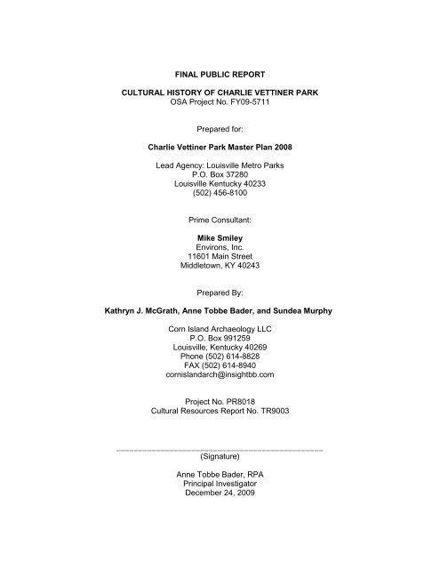
FINAL PUBLIC REPORT<br />
CULTURAL HISTORY OF CHARLIE VETTINER PARK<br />
OSA Project No. FY09-5711<br />
Prepared for:<br />
<strong>Charlie</strong> <strong>Vettiner</strong> <strong>Park</strong> Master Plan 2008<br />
Lead Agency: <strong>Louisville</strong> <strong>Metro</strong> <strong>Park</strong>s<br />
P.O. Box 37280<br />
<strong>Louisville</strong> Kentucky 40233<br />
(502) 456-8100<br />
Prime Consultant:<br />
Mike Smiley<br />
Environs, Inc.<br />
11601 Main Street<br />
Middletown, KY 40243<br />
Prepared By:<br />
Kathryn J. McGrath, Anne Tobbe Bader, and Sundea Murphy<br />
Corn Island Archaeology LLC<br />
P.O. Box 991259<br />
<strong>Louisville</strong>, Kentucky 40269<br />
Phone (502) 614-8828<br />
FAX (502) 614-8940<br />
cornislandarch@insightbb.com<br />
Project No. PR8018<br />
<strong>Cultural</strong> Resources Report No. TR9003<br />
_______________________________________________<br />
(Signature)<br />
Anne Tobbe Bader, RPA<br />
Principal Investigator<br />
December 24, 2009
Contents<br />
<strong>Cultural</strong> <strong>History</strong> <strong>of</strong> <strong>Charlie</strong> <strong>Vettiner</strong> <strong>Park</strong><br />
INTRODUCTION ..................................................................................................................................................... 1<br />
ENVIRONMENTAL AND CULTURAL CONTEXTS ....................................................................................................... 6<br />
ENVIRONMENTAL CONTEXT .............................................................................................................................................. 6<br />
Physiography ......................................................................................................................................................... 6<br />
Geological Resources ............................................................................................................................................ 7<br />
Soils ....................................................................................................................................................................... 7<br />
Flora and Fauna .................................................................................................................................................... 9<br />
PREHISTORIC CULTURAL CONTEXT ................................................................................................................................... 10<br />
Paleoindian Period (10000 to 8000 B.C.) ............................................................................................................ 10<br />
Archaic Period (8000 to 900 B.C.) ....................................................................................................................... 12<br />
Woodland Period (900 B.C. to A.D. 900) ............................................................................................................. 16<br />
Mississippian (A.D. 900-1838) ............................................................................................................................. 20<br />
HISTORIC CULTURAL CONTEXT ........................................................................................................................................ 21<br />
Early Settlers ....................................................................................................................................................... 22<br />
African American Population .............................................................................................................................. 25<br />
Religion ............................................................................................................................................................... 26<br />
Civil War Activities .............................................................................................................................................. 26<br />
Communities ....................................................................................................................................................... 29<br />
Transportation .................................................................................................................................................... 34<br />
Industry ............................................................................................................................................................... 37<br />
Epidemics and Disasters ...................................................................................................................................... 40<br />
Famous People: <strong>Charlie</strong> <strong>Vettiner</strong> ......................................................................................................................... 40<br />
BACKGROUND RESEARCH .................................................................................................................................... 60<br />
ARCHAEOLOGICAL RECORDS CHECK AND LITERATURE REVIEW ............................................................................................... 60<br />
HISTORIC STRUCTURES RECORDS CHECK AND LITERATURE REVIEW ........................................................................................ 68<br />
CEMETERY REVIEW ....................................................................................................................................................... 69<br />
HISTORIC MAP REVIEW ................................................................................................................................................. 70<br />
DEED AND GENEALOGICAL DATA ..................................................................................................................................... 78<br />
ORAL HISTORY ............................................................................................................................................................. 84<br />
FORMATION AND HISTORICAL DEVELOPMENT OF THE PARK .............................................................................. 86<br />
FORMATION AND USE OF CHENOWETH PARK .................................................................................................................... 87<br />
Rainbow Chain <strong>of</strong> <strong>Park</strong>s ...................................................................................................................................... 87<br />
Formation <strong>of</strong> Chenoweth <strong>Park</strong> ............................................................................................................................ 94<br />
RENAMING FOR CHARLIE VETTINER .................................................................................................................................. 98<br />
LANDUSE AT CHARLIE VETTINER PARK TODAY .................................................................................................................. 104<br />
CULTURAL RESOURCES INVENTORY ................................................................................................................... 112<br />
ARCHAEOLOGICAL RESOURCES ...................................................................................................................................... 112<br />
Prehistoric Sites ................................................................................................................................................. 112<br />
Historic Sites ...................................................................................................................................................... 113<br />
Quarry ............................................................................................................................................................... 134<br />
HISTORIC RESOURCES.................................................................................................................................................. 135<br />
CEMETERIES .............................................................................................................................................................. 137<br />
TRADITIONAL CULTURAL PROPERTIES ............................................................................................................................. 142<br />
ii | P a g e
<strong>Cultural</strong> <strong>History</strong> <strong>of</strong> <strong>Charlie</strong> <strong>Vettiner</strong> <strong>Park</strong><br />
CONCLUSIONS AND RECOMMENDATIONS ......................................................................................................... 143<br />
REFERENCES CITED ............................................................................................................................................. 147<br />
iii | P a g e
Figures<br />
<strong>Cultural</strong> <strong>History</strong> <strong>of</strong> <strong>Charlie</strong> <strong>Vettiner</strong> <strong>Park</strong><br />
FIGURE 1. VIEW OF EASTERN JEFFERSON COUNTY SHOWING LOCATION OF CHARLIE VETTINER PARK. .................................................. 2<br />
FIGURE 2. SEGMENT OF JEFFERSONTOWN, KY USGS 7.5' TOPOGRAPHIC MAP SHOWING PROJECT APE. ............................................. 3<br />
FIGURE 3. ENTRANCE TO CHARLIE VETTINER PARK. ................................................................................................................... 4<br />
FIGURE 4. PHYSIOGRAPHIC REGIONS OF KENTUCKY. .................................................................................................................. 7<br />
FIGURE 5. SOILS MAPPED FOR CHARLIE VETTINER PARK (NRCS 2008). ........................................................................................ 8<br />
FIGURE 6. CONFEDERATE MARTYRS MONUMENT LOCATED IN JEFFERSONTOWN CEMETERY. ........................................................... 28<br />
FIGURE 7. MONUMENT FOR THE CONFEDERATE MARTYRS. ...................................................................................................... 29<br />
FIGURE 8. THE TUCKER FAMILY. COURTESY OF TUCKER DESCENDANT VICKI MITCHELL. .................................................................. 34<br />
FIGURE 9. 1895 RAILROAD MAP SHOWING COMMUNITIES IN SOUTHEASTERN JEFFERSON COUNTY. ................................................. 35<br />
FIGURE 10. PHOTO OF CHARLOTTE BLANKENBAKER STANDING WHERE SPROWL ROAD IS NOW. THE BUCHANAN HOUSE (THE BLUE<br />
BLANKENSHIP DANCE COMPANY HOUSE) IS BEHIND HER ON TAYLORSVILLE ROAD, AND THE INTERURBAN TRACKS CAN BE SEEN ON<br />
THE GROUND BEHIND HER (PERMISSION OF TOM LOVETT). .............................................................................................. 36<br />
FIGURE 11. INTERURBAN LINE THAT RAN TO JEFFERSONTOWN IN 1907. COURTESY OF THE UNIVERSITY OF LOUISVILLE SPECIAL<br />
COLLECTIONS, A. W. TERHUNE COLLECTION, ULPA 1987.70.47, HTTP://DIGITAL.LIBRARY.LOUISVILLE.EDU/U?/KYIMAGES,43 .. 37<br />
FIGURE 12. 1928 PHOTO OF VETTINER ON THE WESTERN UNIVERSITY FOOTBALL TEAM. PHOTO COURTESY OF BECKY WALKER. ............ 41<br />
FIGURE 13. CHARLIE VETTINER IN 1929 AS WESTERN UNIVERSITY’S GUARD. PHOTO COURTESY OF BECKY WALKER. ........................... 42<br />
FIGURE 14. CHARLIE VETTINER AS REFEREE. PHOTO COURTESY OF BECKY WALKER. ....................................................................... 43<br />
FIGURE 15. 1950 STAFF OF THE JCPRB. .............................................................................................................................. 45<br />
FIGURE 16. BROCHURE FOR THE OPENING OF THE FAIRDALE PLAYTORIUM. .................................................................................. 48<br />
FIGURE 17. BROCHURE FROM THE CHUCKLES PROGRAM. ......................................................................................................... 50<br />
FIGURE 18. 1955 TRIP TO CUBA. PHOTO COURTESY OF BECKY WALKER. .................................................................................... 51<br />
FIGURE 19. BROCHURE FROM THE YOUTH AMBASSADORS PROGRAM. ........................................................................................ 52<br />
FIGURE 20. EXAMPLE OF ACTIVITIES PROVIDED BY THE JCPRB IN 1964 (JCPRB YEARBOOK 1964). ................................................ 54<br />
FIGURE 21. FURTHER ACTIVITIES SPONSORED BY THE JCPRB. NOTE THE GINGERBREAD VILLAGE AT CHENOWETH PARK. ...................... 55<br />
FIGURE 22. 1965 NCAA RULEBOOK VETTINER CO-AUTHORED. ................................................................................................ 56<br />
FIGURE 23. 1965 RULEBOOK CREDITS. ................................................................................................................................. 57<br />
FIGURE 24. VETTINER UP TO "BAT" IN THE 1988 DAINTY COMPETITION. PHOTO COURTESY OF BECKY WALKER. ................................. 58<br />
FIGURE 25. VETTINER WITH GEORGE HAUCK WITH THE 1988 DAINTY CHAMPIONSHIP TROPHY. PHOTO COURTESY OF BECKY WALKER. ... 59<br />
FIGURE 26. ARCHAEOLOGICAL SURVEYS WITHIN 2-KM OF THE CURRENT PROJECT APE. .................................................................. 62<br />
FIGURE 27. 1858 BERGMANN MAP WITH PERTINENT LANDOWNERS NOTED. ............................................................................... 71<br />
FIGURE 28. CLOSE UP OF THE 1858 BERGMANN MAP WITH “MASSACRE OF THE HOLT FAM. BY INDIANS” NOTED NORTH OF DENNY’S RUN.<br />
............................................................................................................................................................................ 72<br />
FIGURE 29. 1879 FAIRMOUNT AND SEATONVILLE PAGE OF THE BEERS AND LANAGAN ATLAS WITH VICINITY OF CHARLIE VETTINER PARK<br />
NOTED. .................................................................................................................................................................. 73<br />
FIGURE 30. 1907 MAP WITH LOCATION OF CHARLIE VETTINER PARK OUTLINED AND LOCATION OF A RESIDENCE (RESIDENCE 1) NOTED. . 74<br />
FIGURE 31. PAGES 58 AND 59 OF THE 1913 ATLAS WITH PROPERTY OWNERS DEPICTED. ............................................................... 75<br />
FIGURE 32. 1951 USGS 15' LOUISVILLE QUADRANGLE WITH LOCATION OF CHARLIE VETTINER PARK NOTED. .................................... 76<br />
FIGURE 33. 1960 7.5’ USGS JEFFERSONTOWN TOPOGRAPHIC QUADRANGLE SHOWING COUNTY PARK. .......................................... 77<br />
FIGURE 34. FORMER MILLER RESIDENCE. ............................................................................................................................. 84<br />
FIGURE 35. VIEW OF WATERFALLS AT THE PARK DURING THE EARLY 1900S. PHOTO COURTESY OF CAROLE CHAMBERS DAVIS. .............. 86<br />
FIGURE 36. PLAYGROUND EQUIPMENT CIRCA 1985. PHOTO COURTESY OF BECKY WALKER. ........................................................... 87<br />
FIGURE 37. RAINBOW CHAIN OF PARKS AS OF 1964 (JCPRB 1964 YEARBOOK). ......................................................................... 88<br />
FIGURE 38. ACREAGE OF PARKS WITHIN THE RAINBOW CHAIN OF PARKS (JCPRB YEARBOOK 1964). ............................................... 89<br />
FIGURE 39. LISTING OF ALL PLAYGROUNDS WITHIN THE COUNTY—INCLUDING PARKS AND SCHOOLYARDS (JCPRB YEARBOOK 1964). .... 90<br />
FIGURE 40. PARK PLANNING IN PROGRESS (JEFFERSON REPORTER, MAY 25, 1958). .................................................................... 94<br />
FIGURE 41. ED YOUNG JR. AND CHARLIE VETTINER PLANNING THE NEW PARK (JEFFERSON REPORTER, MAY 25, 1958). ..................... 95<br />
FIGURE 42. MODEL AIRPLANE FIELD INCLUDED A PAVED RUNWAY. ............................................................................................. 96<br />
FIGURE 43. USE OF THE MODEL AIRPLANE FIELD IN 1960. ........................................................................................................ 97<br />
FIGURE 44. VETTINER ARRIVING BY HELICOPTER TO THE DEDICATION. ......................................................................................... 99<br />
FIGURE 45. FLYER FOR THE DEDICATION OF CHENOWETH PARK AS CHARLIE VETTINER PARK. ........................................................ 100<br />
iv | P a g e
<strong>Cultural</strong> <strong>History</strong> <strong>of</strong> <strong>Charlie</strong> <strong>Vettiner</strong> <strong>Park</strong><br />
FIGURE 46. DEDICATION OF THE PARK AND ORIGINAL PLAQUE. PHOTOS COURTESY OF BECKY WALKER. ........................................... 101<br />
FIGURE 47. DEDICATION OF THE CHARLIE VETTINER GOLF COURSE. ......................................................................................... 102<br />
FIGURE 48. MONUMENT AND REPLACEMENT PLAQUE COMMEMORATING CHARLIE VETTINER. ...................................................... 103<br />
FIGURE 49. MAP OF CURRENT AMENITIES AT CHARLIE VETTINER PARK. .................................................................................... 104<br />
FIGURE 50. PICNIC AREA AND IMPOUNDED LAKE LOCATED IN THE PARK. .................................................................................... 105<br />
FIGURE 51. ADDITIONAL VIEW OF LAKE. .............................................................................................................................. 105<br />
FIGURE 52. LANDUSE AT PARK: PLAYGROUND AND BASKETBALL. .............................................................................................. 106<br />
FIGURE 53. LANDUSE AT PARK: BASEBALL. ........................................................................................................................... 107<br />
FIGURE 54. NON-MOTORIZED SAIL PLANE CLUB UTILIZES A LARGE FLYING FIELD AT VETTINER PARK. ................................................ 107<br />
FIGURE 55. PICNIC PAVILIONS. .......................................................................................................................................... 108<br />
FIGURE 56. TENNIS COURTS. ............................................................................................................................................ 109<br />
FIGURE 57. DISC GOLF COURSE......................................................................................................................................... 109<br />
FIGURE 58. DOG RUN. .................................................................................................................................................... 110<br />
FIGURE 59. SMALL ROCKSHELTER PRESENT NEAR THE LAKE AT VETTINER PARK. .......................................................................... 113<br />
FIGURE 60. SEGMENT OF THE 1951 USGS 15’ TOPOGRAPHIC QUADRANGLE SHOWING RESIDENCES. ............................................. 114<br />
FIGURE 61. HOUSE SITE AND OUTBUILDINGS VISIBLE ON PARK MAP. ALSO VISIBLE ARE A WELL TO THE SOUTHEAST AND A FENCED<br />
ENCLOSURE TO THE SOUTH. (JEFFERSON COUNTY PLAT MAP). ......................................................................................... 115<br />
FIGURE 62. VIEW OF HOUSE SITE IN THE FALL OF 2008. ........................................................................................................ 116<br />
FIGURE 63. FOUNDATION REMNANTS OBSERVED AT RESIDENCE 1 IN 2008. .............................................................................. 117<br />
FIGURE 64. PORTION OF FOUNDATIONS, ORNAMENTAL TREE, AND WELLHEAD. ........................................................................... 118<br />
FIGURE 65. POSSIBLE WALKWAY NEXT TO ORNAMENTAL TREE. ................................................................................................ 119<br />
FIGURE 66. SMALL SQUARE FOUNDATION REMNANTS. ........................................................................................................... 120<br />
FIGURE 67. WELL HEAD NEAR FORMER RESIDENCE. .............................................................................................................. 120<br />
FIGURE 68. CROCKERY RECOVERED FROM HISTORIC SITES WITHIN CHARLIE VETTINER PARK. .......................................................... 121<br />
FIGURE 69. CERAMIC ARTIFACTS RECOVERED FROM A HISTORIC HOUSE SITE IN CHARLIE VETTINER PARK. ......................................... 122<br />
FIGURE 70. ARCHITECTURAL DEBRIS RECOVERED AT CHARLIE VETTINER PARK. ............................................................................ 123<br />
FIGURE 71. METAL ARTIFACTS RECOVERED FROM A HISTORIC SITE. ........................................................................................... 123<br />
FIGURE 72. GLASS ARTIFACTS RECOVERED FROM A HISTORIC SITE AT CHARLIE VETTINER PARK. ...................................................... 123<br />
FIGURE 73. SEGMENT OF JEFFERSON COUNTY PLAT MAP SHOWING STRUCTURES IN THE AREA OF THE PRESENT-DAY PICNIC PAVILION. ... 124<br />
FIGURE 74. VIEW OF THE FOOTPRINT OF THE ELIZABETH (MILLER) AND TIMMY ELDRIDGE HOUSE CURRENTLY LOCATED IN THE TURN-<br />
AROUND NEAR THE PICNIC PAVILION. ......................................................................................................................... 125<br />
FIGURE 75. FOUNDATION STONES REMAINING FROM MILLER HOUSE NEAR THE PICNIC PAVILION. ................................................... 126<br />
FIGURE 76. COVERED CISTERN NEAR PICNIC PAVILION. USED FORMERLY TO WATER LIVESTOCK BY THE MILLER FAMILY. ...................... 127<br />
FIGURE 77. COURIER JOURNAL PHOTOGRAPH OF RESIDENCE 2, WHICH CAME TO BE KNOWN AS THE GINGERBREAD HOUSE. ............... 128<br />
FIGURE 78. SEGMENT OF JEFFERSON COUNTY PLAT MAP SHOWING TWO GRAVEL DRIVES. ............................................................ 130<br />
FIGURE 79. SPRINGHOUSE FOUNDATION. ............................................................................................................................ 131<br />
FIGURE 80. SPRING AT THE SPRINGHOUSE LOCATION. ............................................................................................................ 132<br />
FIGURE 81. WHITEWARE FRAGMENT RECOVERED FROM NEAR SPRINGHOUSE. ............................................................................ 133<br />
FIGURE 82. DRILL HOLES. ................................................................................................................................................. 134<br />
FIGURE 83. ABANDONED MAINTENANCE BUILDING AND PILES OF MULCH. ................................................................................. 135<br />
FIGURE 84. CURRENT MAINTENANCE BUILDING. ................................................................................................................... 136<br />
FIGURE 85. THE SAMUEL FREDERICK/SHADBURN CEMETERY. ................................................................................................. 137<br />
FIGURE 86. MINDI KING WETZEL FROM CORN ISLAND ARCHAEOLOGY DOCUMENTS GRAVESTONE. ................................................ 138<br />
FIGURE 87. HEADSTONE OF SAMUEL F. STIVERS. .................................................................................................................. 139<br />
FIGURE 88. ANOTHER HEADSTONE IN UNREADABLE SHAPE. .................................................................................................... 140<br />
FIGURE 89. SET OF THREE HEADSTONES; UNREADABLE. .......................................................................................................... 141<br />
v | P a g e
Tables<br />
<strong>Cultural</strong> <strong>History</strong> <strong>of</strong> <strong>Charlie</strong> <strong>Vettiner</strong> <strong>Park</strong><br />
TABLE 1. SOIL TYPES TYPICAL OF THE CHARLIE VETTINER PARK .................................................................................................... 9<br />
TABLE 2. SITES WITH PALEOINDIAN EVIDENCE WITHIN THE SALT RIVER MANAGEMENT AREA .......................................................... 12<br />
TABLE 3. SITES WITH EARLY ARCHAIC COMPONENTS NEAR THE CHARLIE VETTINER PARK ................................................................ 13<br />
TABLE 4. SITES WITH MIDDLE ARCHAIC COMPONENT IN SOUTHERN JEFFERSON COUNTY, KENTUCKY ................................................ 14<br />
TABLE 5. SELECTED SITES WITH LATE ARCHAIC COMPONENTS IN JEFFERSON COUNTY, KENTUCKY .................................................... 15<br />
TABLE 6. SITES WITH EARLY WOODLAND COMPONENTS NEAR CHARLIE VETTINER PARK ................................................................. 17<br />
TABLE 7. SITES WITH MIDDLE WOODLAND COMPONENTS IN JEFFERSON COUNTY, KENTUCKY ......................................................... 18<br />
TABLE 8. SELECTED SITES WITH LATE WOODLAND COMPONENTS IN JEFFERSON COUNTY, KENTUCKY ................................................ 19<br />
TABLE 9. SITES WITH MISSISSIPPIAN COMPONENTS IN THE FALLS OF THE OHIO REGION ................................................................. 21<br />
TABLE 10. SUMMARY OF EARLY NAMES FOR GEOGRAPHIC FEATURES IN THE AREA ....................................................................... 30<br />
TABLE 11. SURVEYS WITHIN 2-KM BUFFER OF CHARLIE VETTINER PARK PROJECT AREA. .................................................................. 63<br />
TABLE 12. SUMMARY OF ARCHAEOLOGICAL SITES WITHIN 2-KM OF CHARLIE VETTINER PARK ......................................................... 67<br />
TABLE 13. HISTORIC MAPS REVIEWED.................................................................................................................................. 70<br />
TABLE 14. CHILDREN OF JOHN AUGUSTUS ............................................................................................................................. 79<br />
TABLE 15. CHILDREN OF SAMUEL FREDERICK ......................................................................................................................... 81<br />
TABLE 16. CHILDREN OF CAROLINE FREDERICK ....................................................................................................................... 82<br />
TABLE 17. RAINBOW CHAIN OF PARKS IN 1964 ..................................................................................................................... 93<br />
TABLE 18. SUMMARY OF INSCRIPTIONS FOR SAMUEL FREDERICK/SHADBURN CEMETERY ............................................................. 138<br />
vi | P a g e
Abbreviations<br />
<strong>Cultural</strong> <strong>History</strong> <strong>of</strong> <strong>Charlie</strong> <strong>Vettiner</strong> <strong>Park</strong><br />
ac acre(s)<br />
ACHP Advisory Council on Historic Preservation<br />
A.D. after the birth <strong>of</strong> Christ<br />
AMSL above mean sea level<br />
B.C. before the birth <strong>of</strong> Christ<br />
BHT backhoe trench<br />
BP before present<br />
bs below surface<br />
ca. circa<br />
CFR Code <strong>of</strong> Federal Regulations<br />
cm centimeter(s)<br />
CRM cultural resources management<br />
e.g. example<br />
FCR fire-cracked rock<br />
FR Federal Register<br />
FS Field Site<br />
ft foot (feet)<br />
GIS Geographic Information System<br />
GPS Global Positioning System<br />
GSV ground surface visibility<br />
ha hectare<br />
IAW in accordance with<br />
JF Jefferson County<br />
m meter(s)<br />
mi mile(s)<br />
mm millimeter(s)<br />
NA not applicable<br />
n.d. no date<br />
NHPA National Historic Preservation Act <strong>of</strong> 1966<br />
NRHP National Register <strong>of</strong> Historic Places<br />
OSA Office <strong>of</strong> State Archaeology<br />
PI PI Principal Investigator<br />
PL Public Law<br />
ROW Right-<strong>of</strong>-way<br />
RPA Registered Pr<strong>of</strong>essional Archaeologist<br />
SHPO State Historic Preservation Office<br />
SOI Secretary <strong>of</strong> the Interior<br />
SOW Statement (Scope) <strong>of</strong> Work<br />
STP(s) shovel test probe(s)<br />
USC United States Code<br />
USGS United States Geological Survey<br />
UTM Universal Transverse Mercator<br />
YR Yellow-Red (Munsell Color)<br />
vii | P a g e
Abstract<br />
<strong>Cultural</strong> <strong>History</strong> <strong>of</strong> <strong>Charlie</strong> <strong>Vettiner</strong> <strong>Park</strong><br />
In October, 2008, Corn Island Archaeology, LLC (CIA) was retained by Environs Inc. to provide<br />
cultural resources services related to the preparation <strong>of</strong> a Master Plan for <strong>Charlie</strong> <strong>Vettiner</strong> <strong>Park</strong><br />
in eastern Jefferson County, Kentucky. Environs is developing the Master Plan at the request <strong>of</strong><br />
<strong>Louisville</strong> <strong>Metro</strong> <strong>Park</strong>s. Currently, there is no such plan to provide for future development <strong>of</strong> the<br />
park. As part <strong>of</strong> this overall effort, CIA was tasked with researching existing conditions relative to<br />
cultural resources, including historic structures, archaeological sites, and cemeteries.<br />
Specifically, CIA prepared an inventory <strong>of</strong> known (recorded) cultural resources within the park;<br />
assessed the potential for intact, unknown archaeological sites to be present; and developed<br />
archaeological and historical contexts to allow informed interpretation <strong>of</strong> these resources.<br />
<strong>Charlie</strong> <strong>Vettiner</strong> <strong>Park</strong> encompasses some 283 acres in an upland rural and suburban setting <strong>of</strong><br />
southeastern Jefferson County. The park is located south <strong>of</strong> Taylorsville Road along Mary Dell<br />
Lane <strong>of</strong>f Billtown Road at 5550 <strong>Charlie</strong> <strong>Vettiner</strong> <strong>Park</strong> Road, 40299. This is a rapidly developing<br />
area southeast <strong>of</strong> the city <strong>of</strong> Jeffersontown; it is surrounded by new residential subdivisions<br />
along with those created in the 1960s and 1970s. Several small streams, one <strong>of</strong> which is<br />
impounded to form a small lake, feed Chenoweth Run to the east. Established in 1957, it was<br />
originally known as Chenoweth <strong>Park</strong>. Currently, <strong>Charlie</strong> <strong>Vettiner</strong> <strong>Park</strong> <strong>of</strong>fers the following<br />
amenities and facilities: ball fields, basketball, disc golf, dog run, fishing lake, walking path,<br />
picnic shelter and tables, playground, restrooms, tennis courts, volleyball, and sail plane flying<br />
field. An adjacent 18-hole golf course was not considered as part <strong>of</strong> the area <strong>of</strong> potential effects<br />
(APE) for this project.<br />
No pr<strong>of</strong>essional archaeological surveys have been conducted within the park boundaries. Nor are<br />
there archaeological sites within the park that have been recorded with the OSA. As a result <strong>of</strong> this<br />
investigation, however, it is considered there is a moderate to high potential for undiscovered<br />
prehistoric and high potential for historic archaeological sites to be present within some areas <strong>of</strong><br />
the park. No historic structures remain on the property, although a number <strong>of</strong> structures are<br />
depicted on historic maps. Historic-period archaeological sites are expected to be present at these<br />
locations. These include three residences with associated outbuildings and wellheads, a quarry<br />
location, and a springhouse. These house locations can be identified by the stone foundations still<br />
visible on the ground surface and/or sunken depressions. Other house sites may exist, including<br />
one associated with the John Shadburn family.<br />
Other resources are also located within the park boundaries. These include a stone monument<br />
honoring <strong>Charlie</strong> <strong>Vettiner</strong>. The monument was emplaced during the 1985 dedication ceremony at<br />
which time the park was <strong>of</strong>ficially renamed. One small family cemetery related to the Frederick,<br />
Stivers, and Shadburn families is located within the park boundaries. This cemetery is enclosed by<br />
fencing along <strong>Charlie</strong> <strong>Vettiner</strong> <strong>Park</strong> Road. Additional interments, however, may be located outside<br />
the confines <strong>of</strong> the cemetery. No traditional cultural property has been identified within the park<br />
boundaries.<br />
viii | P a g e
<strong>Cultural</strong> <strong>History</strong> <strong>of</strong> <strong>Charlie</strong> <strong>Vettiner</strong> <strong>Park</strong><br />
1<br />
INTRODUCTION<br />
In October, 2008, Corn Island Archaeology, LLC (CIA) was retained by Environs Inc. to provide<br />
cultural resources services related to the preparation <strong>of</strong> a Master Plan for <strong>Charlie</strong> <strong>Vettiner</strong> <strong>Park</strong> in<br />
eastern Jefferson County, Kentucky. Environs is developing the Master Plan at the request <strong>of</strong><br />
<strong>Louisville</strong> <strong>Metro</strong> <strong>Park</strong>s. Currently, there is no such plan to provide for future development <strong>of</strong> the<br />
park. As part <strong>of</strong> this overall effort, CIA was tasked with researching existing conditions relative to<br />
cultural resources, including historic structures, archaeological sites, and cemeteries. Specifically,<br />
CIA prepared an inventory <strong>of</strong> known (recorded) cultural resources within the park; assessed the<br />
potential for intact, unknown<br />
archaeological sites to be present; and<br />
developed archaeological and historical<br />
contexts to allow informed interpretation <strong>of</strong><br />
these resources. This information will<br />
allow <strong>Metro</strong> <strong>Park</strong>s to make informed<br />
decisions relative to cultural resources<br />
compliance laws and regulations as they<br />
design and implement plans for future<br />
development.<br />
Project Location<br />
<strong>Charlie</strong> <strong>Vettiner</strong> <strong>Park</strong> encompasses some 283 acres in an upland rural and suburban setting <strong>of</strong><br />
southeastern Jefferson County (Figure 1). Situated in a rapidly developing area southeast <strong>of</strong> the<br />
city <strong>of</strong> Jeffersontown, it is surrounded by new residential subdivisions along with those created<br />
in the 1960s and 1970s. Several small streams, one <strong>of</strong> which is impounded to form a small lake,<br />
feed Chenoweth Run to the east (Figure 2). The park is located south <strong>of</strong> Taylorsville Road<br />
along Mary Dell Lane <strong>of</strong>f Billtown Road at 5550 <strong>Charlie</strong> <strong>Vettiner</strong> <strong>Park</strong> Road, 40299 (Figure 3).<br />
Established in 1957, it was originally known as Chenoweth <strong>Park</strong>. Currently, <strong>Charlie</strong> <strong>Vettiner</strong><br />
<strong>Park</strong> <strong>of</strong>fers the following amenities and facilities: ball fields, basketball, disc golf, dog run, fishing<br />
lake, walking path, picnic shelter and tables, playground, restrooms, tennis courts, volleyball, and<br />
sail plane flying field. An adjacent 18-hole golf course was not considered as part <strong>of</strong> the area <strong>of</strong><br />
potential effects (APE) for this project.<br />
1 | P a g e
<strong>Cultural</strong> <strong>History</strong> <strong>of</strong> <strong>Charlie</strong> <strong>Vettiner</strong> <strong>Park</strong><br />
Figure 1. View <strong>of</strong> eastern Jefferson County showing location <strong>of</strong> <strong>Charlie</strong> <strong>Vettiner</strong> <strong>Park</strong>.<br />
2 | P a g e
<strong>Cultural</strong> <strong>History</strong> <strong>of</strong> <strong>Charlie</strong> <strong>Vettiner</strong> <strong>Park</strong><br />
Figure 2. Segment <strong>of</strong> Jeffersontown, KY USGS 7.5' topographic map showing project<br />
APE.<br />
3 | P a g e
Project Statement <strong>of</strong> Work<br />
<strong>Cultural</strong> <strong>History</strong> <strong>of</strong> <strong>Charlie</strong> <strong>Vettiner</strong> <strong>Park</strong><br />
Figure 3. Entrance to <strong>Charlie</strong> <strong>Vettiner</strong> <strong>Park</strong>.<br />
This cultural resources study entailed the following tasks:<br />
Conduct a records check at relevant state and local agencies to compile an inventory <strong>of</strong><br />
known or recorded cultural resources, both archaeological and historic, within the project<br />
area;<br />
Review drawings, aerials, historical maps, documents, and local histories for information on<br />
potential archaeological site locations;<br />
Conduct site visits to perform simple visual inspections <strong>of</strong> the project areas to assess the<br />
degree <strong>of</strong> historic disturbances and the potential for encountering intact archaeological<br />
remains;<br />
Prepare prehistoric and historic contexts specific to the project areas within southeastern<br />
Jefferson County;<br />
Provide management recommendations relevant to the need for future archaeological and<br />
historic field studies, if any; and<br />
Identify potential avenues for public interpretation <strong>of</strong> the cultural resources <strong>of</strong> the property.<br />
In addition to providing narrative in summary form for the Master Plans, CIA prepared this<br />
expanded report detailing the cultural history <strong>of</strong> the project area. The report provides photo<br />
documentation <strong>of</strong> the project area and complete mapping <strong>of</strong> all known archaeological sites,<br />
previously surveyed areas, historic properties, and potentially sensitive archaeological areas.<br />
4 | P a g e
<strong>Cultural</strong> <strong>History</strong> <strong>of</strong> <strong>Charlie</strong> <strong>Vettiner</strong> <strong>Park</strong><br />
Information regarding the specific locations <strong>of</strong> archaeological sites must be withheld from<br />
versions <strong>of</strong> this report intended for public consumption.<br />
Findings<br />
As a result <strong>of</strong> this research, it was learned that no pr<strong>of</strong>essional archaeological surveys have been<br />
conducted within the park boundaries. There are no archaeological sites within the park that have<br />
been recorded with the OSA. As a result <strong>of</strong> this investigation, however, it is considered there is a<br />
moderate to high potential for undiscovered prehistoric sites and high potential for historic<br />
archaeological sites to be present within some areas <strong>of</strong> the park. Three historic archaeological sites<br />
were documented to be present within the boundaries <strong>of</strong> the park; one other site also is suspected.<br />
Documented locations include three residences and associated outbuildings identified on historic<br />
maps. These locations can be identified by the stone foundations still visible on the ground surface<br />
and/or sunken depressions. No historic structures, however, currently remain on the property.<br />
Informant interviews suggested there may be a springhouse located near or in the fishing lake; field<br />
reconnaissance confirmed its location. One stone monument is also located on the property. This<br />
monument was emplaced in 1985 to honor the contributions <strong>Charlie</strong> <strong>Vettiner</strong> made to park and<br />
recreation development. In addition to these resources, one small family cemetery related to the<br />
Frederick, Stivers, and Shadburn families is enclosed by fencing along <strong>Charlie</strong> <strong>Vettiner</strong> <strong>Park</strong> Road.<br />
No traditional cultural property has been identified within the park boundaries.<br />
Project Scheduling and Staffing<br />
The project staff meets the requirements for pr<strong>of</strong>essional archaeologists as detailed in the<br />
Secretary <strong>of</strong> the Interior standards. Ms. Anne Tobbe Bader, MA RPA served as the Principal<br />
Investigator for the project. Ms. Kathryn McGrath, MA RPA, Ms. Christina Pfau, Ms. Sundea<br />
Murphy, and Ms. Bader performed the background research and literature review. Ms. Melinda<br />
King Wetzel, MA RPA prepared the graphics and conducted cemetery documentation. Additional<br />
biographical material pertaining to <strong>Charlie</strong> <strong>Vettiner</strong> was shared by <strong>Charlie</strong> <strong>Vettiner</strong>‘s granddaughter,<br />
Ms. Becky Walker. Field reconnaissance was completed by Ms. Bader, Ms. McGrath, Ms. Wetzel,<br />
Ms. Patricia Tobbe, Mr. Perry Harrell, Mr. Daniel Herth, and Ms. Nicole Coomer.<br />
5 | P a g e
<strong>Cultural</strong> <strong>History</strong> <strong>of</strong> <strong>Charlie</strong> <strong>Vettiner</strong> <strong>Park</strong><br />
Environmental and <strong>Cultural</strong> Contexts<br />
The study <strong>of</strong> prehistoric and historic cultures extends beyond the study <strong>of</strong> the actual material<br />
remains <strong>of</strong> a society to provide an understanding <strong>of</strong> the ways in which that society interacted<br />
with its environment. Throughout time, the natural landscape has influenced human use, and<br />
was in turn affected by that use. This interrelationship is reflected in both the natural and cultural<br />
(standing structures, cemeteries, archaeological sites) resources <strong>of</strong> the area.<br />
The cultural landscape approach provides a framework for understanding the entire landuse<br />
history <strong>of</strong> a property. It is the foundation for establishing a broader context for evaluating the<br />
significance <strong>of</strong> cultural resources, because the significance <strong>of</strong> any given cultural resource is not<br />
determined in isolation. Rather, it is achieved by examining the entire context <strong>of</strong> the landscape<br />
and interrelationships among its constituent components.<br />
The cultural landscape approach attempts to identify linkages between cultural and natural<br />
resources. It is based on the analysis <strong>of</strong> the spatial relationships between natural and human<br />
features on the landscape. By looking at the distributions <strong>of</strong> cultural resources and their<br />
correlation with environmental factors such as landform, vegetation, drainage, etc., patterns in<br />
the locations <strong>of</strong> these resources can sometimes be defined. These patterns can then provide for<br />
more efficient management <strong>of</strong> cultural resources by better predicting where such resources are<br />
likely to occur.<br />
Environmental Context<br />
The physical environment is one <strong>of</strong> many factors that influenced the cultural development <strong>of</strong> an<br />
area. An awareness <strong>of</strong> the natural setting and available resources <strong>of</strong> an area allows informed<br />
interpretations <strong>of</strong> cultural issues such as settlement patterns and sedentism, as well as resource<br />
utilization and exploitation. The following environmental context provides data on regional<br />
ecological patterns such as floral distributions and communities, regional geomorphology, soils,<br />
and hydrology. An understanding <strong>of</strong> the natural setting <strong>of</strong> an area allows informed<br />
interpretations on such cultural issues as prehistoric/historic settlement patterns, resource<br />
availability and exploitation, and more. The discussion is aimed at identifying those aspects <strong>of</strong><br />
the natural environment that may have influenced the cultural development <strong>of</strong> the area.<br />
Physiography<br />
2<br />
<strong>Charlie</strong> <strong>Vettiner</strong> <strong>Park</strong> lies in rural eastern Jefferson County at the extreme western extent <strong>of</strong> the<br />
Outer Bluegrass Physiographic Region (Figure 4). Except for the valley along Floyd‘s Fork that<br />
runs generally northeast-southwest and is as much as 0.5 mile wide, the topography <strong>of</strong> this part<br />
<strong>of</strong> Jefferson County is comprised <strong>of</strong> gently sloping ridges or sloping narrow ridges separated by<br />
narrow valleys with strongly sloping to steep walls (Zimmerman 1966:7). Elevation is 710 to 600<br />
ft AMSL. Within the park, relief is characterized by rolling hilltops and steep ravines along<br />
drainages. Some portions <strong>of</strong> the uplands, such as those covered by loess deposits, may be<br />
fairly level. Portions <strong>of</strong> these uplands may also exhibit sinkholes.<br />
6 | P a g e
<strong>Cultural</strong> <strong>History</strong> <strong>of</strong> <strong>Charlie</strong> <strong>Vettiner</strong> <strong>Park</strong><br />
Figure 4. Physiographic Regions <strong>of</strong> Kentucky.<br />
Eastern Jefferson County is drained by Floyd‘s Fork, a major tributary <strong>of</strong> the Salt River. The<br />
uplands are dissected by a complex <strong>of</strong> small creeks, such as Chenoweth Run, Razor Branch,<br />
and Shinks Branch (Figure 6) that ultimately empty into Floyd‘s Fork that drains an area <strong>of</strong> 122<br />
square miles, or 31 percent <strong>of</strong> Jefferson County. Drainages at the <strong>Charlie</strong> <strong>Vettiner</strong> <strong>Park</strong> exhibit a<br />
radial pattern on the north, east, and south; headwaters <strong>of</strong> many intermittent tributaries to<br />
Chenoweth Run originate from the park‘s uplands.<br />
Geological Resources<br />
The hardrock geology <strong>of</strong> the Jefferson County area consists <strong>of</strong> alternate layers <strong>of</strong> limestone,<br />
sandstone and shale, all <strong>of</strong> which range from a few feet to several hundred feet in thickness<br />
(Zimmerman 1966). The majority <strong>of</strong> the strata within the area have a slight tilt, exposing different<br />
formations at progressively higher levels. The tilt increases upwards from the southwest to the<br />
northeast, exposing older strata covered elsewhere by later Lower Mississippian-aged strata.<br />
Silurian and Ordovician-aged deposits <strong>of</strong> limestone and calcareous shale exist beneath the<br />
uplands <strong>of</strong> eastern Jefferson County (Zimmerman 1966:131). These deposits consist <strong>of</strong><br />
<strong>Louisville</strong>, Sellersburg, and Jeffersonville Limestones, as well as Waldron Shale.<br />
Identification <strong>of</strong> the underlying geological resources can provide information on the resources<br />
available to historic and prehistoric populations. Mapping for the area includes Silurian<br />
formations on the uplands and Ordovician formations exposed in stream valleys. From upper to<br />
lower, the Silurian formations include the <strong>Louisville</strong> Limestone, Waldron Shale, Laurel Dolomite,<br />
Osgood Formation and Brassfield Dolomite. The Ordovician Drakes Formation underlies these.<br />
Of these, the Brassfield Dolomite and the Laurel Dolomite are known to contain cherts exploited<br />
by prehistoric populations.<br />
Soils<br />
Project Area<br />
Soils develop from five formational factors including the parent material, climate, relief, plant and<br />
animal influence, and time. The parent material <strong>of</strong> the Outer Bluegrass physiographic region<br />
includes alluvium on floodplains; alluvium and colluvium on terraces; and limestone, dolomites,<br />
7 | P a g e
<strong>Cultural</strong> <strong>History</strong> <strong>of</strong> <strong>Charlie</strong> <strong>Vettiner</strong> <strong>Park</strong><br />
shales, and older alluvium on the uplands plains. Glacial outwash and glacial drift are additional<br />
parent materials in the northern part <strong>of</strong> this region.<br />
Soils within the project area are contained within the Beasley-Fairmount-Russellville Association<br />
(Zimmerman 1966:6). Soils <strong>of</strong> this association occupy gently sloping to sloping hillsides and<br />
strongly sloping, steep hillsides over limestone. Beasley silt loam series soils account for about<br />
45 percent <strong>of</strong> the association. These soils are deep and well drained (Zimmerman 1966:7).<br />
They typically have a surface layer <strong>of</strong> brown silt loam with a yellowish brown silty clay subsoil.<br />
Excellent agricultural soils are found within this association in the valley <strong>of</strong> Floyd‘s Fork. For this<br />
reason, large farms (between 120-180 acres in 1966) are located within areas <strong>of</strong> this soil<br />
association. Development has been slow to come to this part <strong>of</strong> the county. However, more<br />
recently, upscale residential subdivisions have been sited in the area.<br />
The local soils developed from limestone and calcareous shale bedrock as well as wind-blown<br />
loess additions (Zimmerman 1966). All had been in agricultural use until landuse changed to<br />
park status. Due to this landuse and the hilly terrain, some series have been eroded down to<br />
subsoil. Soils mapped for the parks are shown in Figure 5 and summarized in Table 1. Soils in<br />
the majority <strong>of</strong> the park conform to the Crider silt loam. Nicholson silt loam developed upslope <strong>of</strong><br />
the Crider; Beasley, Shrouts, and Faywood soils are located downslope.<br />
Figure 5. Soils mapped for <strong>Charlie</strong> <strong>Vettiner</strong> <strong>Park</strong> (NRCS 2008).<br />
8 | P a g e
Parent<br />
Material<br />
loess over<br />
limestone<br />
alluvium over<br />
limestone<br />
calcareous<br />
shales and/or<br />
siltstones<br />
limestone<br />
and shale<br />
fill or<br />
disturbed<br />
land<br />
wd=well drained<br />
mwd=moderately well drained<br />
Flora and Fauna<br />
<strong>Cultural</strong> <strong>History</strong> <strong>of</strong> <strong>Charlie</strong> <strong>Vettiner</strong> <strong>Park</strong><br />
Table 1. Soil Types Typical <strong>of</strong> the <strong>Charlie</strong> <strong>Vettiner</strong> <strong>Park</strong><br />
Soil Series and Map Unit<br />
Crider silt loam<br />
2-6% and 6-12% slopes<br />
(CrB and CrC)<br />
Nicholson silt loam,<br />
2-6% slopes<br />
(NnB)<br />
Boonewood silt loam,<br />
occasionally flooded<br />
(Bo)<br />
Beasley silt loam, 2-6% and<br />
6-12% slopes, eroded and<br />
severely eroded<br />
(BeB and BeC)<br />
Shrouts silt loam,<br />
6-12% slopes, severely<br />
eroded<br />
(ShC3)<br />
Faywood silt loam,<br />
12-25% slope,<br />
(FaD)<br />
Faywood-Shrouts-Beasley<br />
complex,<br />
25-50% slope<br />
(FsF)<br />
Urban land<br />
(Ua, UagB, UmC)<br />
Landscape<br />
Position<br />
Characteristics<br />
Drainage<br />
Class<br />
broad uplands loess to 30 in (76 cm) wd<br />
ridgetops<br />
floodplains<br />
narrow ridges<br />
shoulder slopes<br />
<strong>of</strong> ridges<br />
16-30 in (40.6-<br />
76.4cm) to fragipan<br />
silt loam to bedrock<br />
at 30-34 in (76.2-86.4<br />
cm)<br />
upper horizons<br />
eroded away<br />
more shallow depth<br />
to bedrock than<br />
Beasley—20-40 in<br />
(50.8-101.6 cm)<br />
mwd<br />
wd<br />
wd<br />
wd<br />
sideslopes silt loam to silty clay wd<br />
sideslopes silt loam to silty clay wd<br />
various various<br />
The diverse nature <strong>of</strong> the geologic and geomorphologic deposits in the greater Jefferson County<br />
area led to a diverse biological system. Historically, the Outer Bluegrass supported an array <strong>of</strong><br />
plant and animal species, many <strong>of</strong> which have been driven from the area through urban<br />
development. The species present in the Outer Bluegrass region <strong>of</strong> Kentucky remained<br />
relatively constant until modern times when Europeans began to severely modify the regional<br />
ecology (Delcourt and Delcourt 1981). The American chestnut, common during prehistoric times<br />
as a canopy tree, has been reduced to an understory tree by a blight introduced into North<br />
America in historic times (Kricher 1988:58). The black bear, bobcat, and other animal species<br />
are no longer found in Jefferson County. Populations <strong>of</strong> mink, fox, and most other animals have<br />
been reduced, due to the loss <strong>of</strong> habitat and hunting.<br />
The area known today as Kentucky was once covered by Mixed Hardwood Forests at this time<br />
(Delcourt and Delcourt 1981). This type <strong>of</strong> forest would contain a wide variety <strong>of</strong> forest<br />
communities. Oak-Hickory Forests would have been found in warm exposed areas, Beech-<br />
Maple Forests would occur in cool, moist shaded areas, and along streams and river valleys<br />
9 | P a g e
<strong>Cultural</strong> <strong>History</strong> <strong>of</strong> <strong>Charlie</strong> <strong>Vettiner</strong> <strong>Park</strong><br />
Northern Riverine Forests would have been present (Kricher 1988:72). Oak-Hickory Forests<br />
commonly contain a wide variety <strong>of</strong> flora. The trees that may have been present historically<br />
include a different species <strong>of</strong> oaks and hickories, American chestnut, dogwood, sassafras,<br />
hophornbeam, and hackberry. Tuliptrees, elm, sweetgum, shagbark hickory, and red maple also<br />
may have been present, especially in moist areas. The understory may have contained<br />
mountain laurel, a variety <strong>of</strong> blueberries, and deer berry among other plants. Herbs may have<br />
included wintergreen, wild sarsaparilla, wood-sorrel, mayapple, rue-anemone, jack-in-the-pulpit,<br />
and trout lilies to name a few (Kricher 1988:57).<br />
A wide variety <strong>of</strong> fauna would also have been present from the early Holocene to early historic<br />
times. Mammals that thrived in Oak-Hickory Forests may have included the gray squirrel, fox<br />
squirrel, whitetail deer, raccoon, beaver, woodchuck, a variety <strong>of</strong> mice, striped skunks, mink,<br />
otter, fox, black bear, and bobcats. Bird species would likely have included red-tailed hawks,<br />
ruffed grouse, great horned and eastern screech owl, pileated woodpecker, wild turkeys, and<br />
blue jay among others (Kricher 1988:12). A variety <strong>of</strong> ducks and geese also could have been<br />
present during the Fall and Spring migrations.<br />
Climate<br />
Today, Kentucky has a temperate climate. Jefferson County has a wide range in temperature,<br />
rainfall, wind, and humidity throughout all seasons. In the county, the temperature rises to 90<br />
degrees or higher on about 49 days in an average year, while a temperature <strong>of</strong> 100 degrees is<br />
reached only once a year in June, July, August or September. Freezing temperatures occur on<br />
about 92 nights an average winter and a daily freeze-thaw cycle is normal for cold weather. The<br />
average length <strong>of</strong> the growing season for the county, from the last light freeze in spring to the<br />
first light freeze in the fall, ranges from 200 days in the western part <strong>of</strong> the county to 175 days in<br />
the eastern part <strong>of</strong> the county. The average annual rainfall for Jefferson County is 41.32 inches<br />
with the wettest month being March averaging 4.59 inches <strong>of</strong> rain (Zimmerman 1966:131). The<br />
driest month <strong>of</strong> the year in Jefferson County is October with only 2.25 in falling on average.<br />
Prehistoric <strong>Cultural</strong> Context<br />
<strong>Cultural</strong> change is a slow and continual process; therefore, archaeologists typically divide the<br />
long period <strong>of</strong> human history into regionally distinct cultural periods. As discussed below,<br />
archaeologists recognize four broadly defined prehistoric periods for the Eastern Woodlands.<br />
The sections below review the prehistoric cultural groups that may have been present in the<br />
project APE over the past 12,000 years. Each group occurred during specific periods <strong>of</strong> time<br />
and generally ranged across the Eastern North American woodlands. The temporal and regional<br />
variants within the Falls region, however, must still be discovered, analyzed and interpreted.<br />
Data recovered during the present project will aid these investigations. Overall, trends evident<br />
from the earliest (Paleoindian) to the latest (Mississippian) period include an increase in<br />
sedentism, increase in social complexity, and increase in dependence on agriculture. These<br />
trends have been explored by many in the social sciences such as Lewis Morgan, Leslie White,<br />
and Robert Wright (Wright 2000).<br />
Paleoindian Period (10000 to 8000 B.C.)<br />
Although the lithic material associated with Paleoindians is the earliest dated material recovered<br />
from humans in North America, it is also one <strong>of</strong> the most impressive. As with many cultural<br />
adaptations, the technology and the Paleoindians themselves had a long history <strong>of</strong> evolution in<br />
10 | P a g e
<strong>Cultural</strong> <strong>History</strong> <strong>of</strong> <strong>Charlie</strong> <strong>Vettiner</strong> <strong>Park</strong><br />
the Old World before migrating to the New World. Artifacts found in both Old World and New<br />
World assemblages include fluted points, polyhedral cores, prismatic blades, and the piéces<br />
esquillèe. Additional artifacts associated with Paleoindians include an extensive unifacial toolkit<br />
that included scrapers, gravers, and limacés (slug-shaped unifaces) (Dragoo 1973).<br />
As the wealth <strong>of</strong> data from Paleoindian sites have accumulated, it has become apparent that<br />
groups prior to Clovis lived in North America. From Cactus Hill and Meadowcr<strong>of</strong>t Rockshelter in the<br />
East to Pendejo Cave in the Southwest, dates prior to 10,000 B.C. have been documented. With<br />
regard to the Falls <strong>of</strong> the Ohio region, however, no conclusive evidence for pre-Clovis populations<br />
has been documented so researchers follow the Paleoindian subperiods defined by Tankersley<br />
(1996): Early Paleoindian, Middle Paleoindian, and Late Paleoindian. Evidence for pre-Clovis<br />
occupations may lie within the 20,000 year old Tazewell deposits along the Ohio River or along the<br />
Salt River drainage.<br />
Early Paleoindian (9,500-9,000 B.C.). The Early Paleoindian period is represented by<br />
magnificent Clovis spear points, polyhedral cores, and prismatic blades. Subsistence included<br />
megafauna such as the mammoth within prairie habitats and mastodons within forested habitats.<br />
Although there is scant archaeological evidence <strong>of</strong> Paleoindian social complexity, following<br />
arguments by Wright (2000), subsistence strategies that included procuring quantities <strong>of</strong> meat<br />
larger than one or two families could use quickly suggest higher levels <strong>of</strong> group cohesion and<br />
social complexity. Within Jefferson County, mammoth and mastodon remains have been found in<br />
Wisconsinan gravel deposits at depths between three and eight meters (Granger, DiBlasi, and<br />
Braunbeck 1976:20). The earliest Paleoindian occupation may likely lie therein.<br />
Middle Paleoindian (9,000-8,500 B.C.). The Middle Paleoindian period is represented<br />
in the Southeast by Cumberland, Beaver Lake, Quad, and Suwannee projectile point/knives<br />
(PPK). During this subperiod, local raw materials were chosen more <strong>of</strong>ten. Perhaps related to<br />
this expanded use <strong>of</strong> material type, reduction strategies included bipolar reduction. Artifact types<br />
associated with the Middle Paleoindian include limacés, and scrapers and gravers exhibiting a<br />
spur or protrusion. Longworth-Gick (15JF243) is one site within Jefferson County that contained<br />
evidence <strong>of</strong> Middle Paleoindian occupation.<br />
Late Paleoindian (8,500-8,000 B.C.). The Late Paleoindian Period is represented by<br />
side-notched points such as Dalton. It is during this subperiod that the greatest change in<br />
mobility and diet occurred. During this subperiod, diet appears to have become even more<br />
varied as the climate became more temperate. Although some rockshelter sites contain<br />
evidence <strong>of</strong> Early Paleoindian Clovis occupations such as at Miles Rockshelter Site 15JF671<br />
(Bader et al. n.d.) and Wolfe Shelter Site 15CU21 (Lane et al. 1995), the Dalton culture is <strong>of</strong>ten<br />
reported to be the first to routinely take advantage <strong>of</strong> rockshelters (Tankersley 1996; Walthall<br />
1998).<br />
Many items that were found in later prehistoric periods have not been recovered from<br />
Paleoindian contexts due to preservation. <strong>Cultural</strong> traits represented by that material culture<br />
were also assumed to be absent from the Paleoindian repertoire. Artifacts <strong>of</strong> botanical remains<br />
and bone or ivory ornamentation are some examples. Paleoindian material recovered from sites<br />
with better preservation such as rockshelters, bogs, and springs, however, are helping to<br />
change the picture <strong>of</strong> Paleoindian cultural adaptations.<br />
Subsistence strategies <strong>of</strong> the Paleoindian populations, for example, have also become more<br />
complex as more data have been analyzed. Although <strong>of</strong>ten portrayed as relying predominantly<br />
on megafauna such as the mastadonts (some evidence comes from Loy and Dixon 1998), data<br />
11 | P a g e
<strong>Cultural</strong> <strong>History</strong> <strong>of</strong> <strong>Charlie</strong> <strong>Vettiner</strong> <strong>Park</strong><br />
from sites with optimal preservation reveals a more complex story. From the earliest sites such<br />
as Cactus Hill, the exploitation <strong>of</strong> game such as rabbit, bear, deer, and elk was documented by<br />
blood residue analysis (NPS 2007a). Data from Meadowcr<strong>of</strong>t Rockshelter suggest possible<br />
botanical resources used by Paleoindians included hickory, walnut, and hackberry (Carr,<br />
Adovasio, and Pedler 2001). As noted previously, as rockshelters were chosen as habitation<br />
sites more <strong>of</strong>ten during the Late Paleoindian time, data revealed a greater variety <strong>of</strong> patch<br />
resources were exploited than previously realized, particularly non-migratory forest-dwelling<br />
species such as squirrel and turkey or edge-dwelling deer (Walthall 1998).<br />
As <strong>of</strong> the 1990 preservation plan, 24 Paleoindian sites had been documented for the Salt River<br />
Management Area. Site types include rockshelters such as Miles Rockshelter (15JF671), Howe<br />
Valley Rockshelter (15HD12), and 15Me32 as well as open habitation sites along the Ohio River<br />
such as Longworth-Gick (15JF243) (Table 2). Based on this data, Paleoindian sites may be<br />
encountered in area rockshelters or buried in floodplain deposits.<br />
Table 2. Sites with Paleoindian Evidence within the Salt River Management Area<br />
Site Site Type Watershed Diagnostics Reference<br />
Longworth-Gick<br />
(15JF243)<br />
15MD402<br />
Howe Valley<br />
Rockshelter (15HD12)<br />
open<br />
habitation<br />
open<br />
habitation<br />
w/mound<br />
Ohio River<br />
Cumberland<br />
PPK<br />
Boisvert et al. 1979:282<br />
Salt River Clovis Bader 2001<br />
rockshelter Tankersley 1990<br />
15Me32 rockshelter Tankersley 1990<br />
Miles Rockshelter<br />
(15JF671)<br />
rockshelter<br />
Archaic Period (8000 to 900 B.C.)<br />
Cedar Creek,<br />
tributary to<br />
Floyd‘s Fork<br />
Clovis PPK Bader et al. n.d.<br />
Over the course <strong>of</strong> the Archaic period, populations developed new cultural traits and<br />
adaptations, including the use <strong>of</strong> pottery and use <strong>of</strong> seed and grain crops. A more sedentary<br />
lifestyle can be interpreted from the use <strong>of</strong> heavy stone bowls and storage pits during this<br />
period. Three subperiods have been defined for the Archaic Period: Early Archaic (8000 B.C. to<br />
6000 B.C.), Middle Archaic (6000 B.C. to 3000 B.C.), and Late Archaic (3000 B.C. to 900 B.C.).<br />
Early Archaic (8000 to 6000 B.C.). A number <strong>of</strong> new styles <strong>of</strong> projectile points suggests<br />
regional cultural growth during the Early Archaic. Diagnostic projectile point types include Kirk<br />
Corner-notched, Charleston Corner-notched, and LeCroy Bifurcate. Beveling along blade<br />
edges, grinding along basal edges, and serrations along margins are common. Material types<br />
might include high-quality Galconda/Harrison County chert for Charleston Corner-notched<br />
projectile point/knives (Bader et al. n.d.) or Muldraugh/Knobs chert for the Kirk Corner-notched<br />
projectile point/knives (Bader 2001).<br />
Hunting gear included the atlatl. Although the portions made <strong>of</strong> antler and wood deteriorate too<br />
rapidly to recover from most archaeological deposits, the lithic bannerstones do not. Having had<br />
much labor and energy put into their manufacture, these items also were <strong>of</strong>ten items <strong>of</strong> trade or<br />
12 | P a g e
<strong>Cultural</strong> <strong>History</strong> <strong>of</strong> <strong>Charlie</strong> <strong>Vettiner</strong> <strong>Park</strong><br />
tribute. In addition, from sites such as Windover, Florida where preservation was exceptional,<br />
the Early Archaic assemblages had also included bone projectile points, the antler atlatl hooks,<br />
and wooden canoes (NPS 2007b). The Early Archaic component at the Ashworth Rockshelter<br />
(15BU236) in Bullitt County yielded bone needles as well as an antler pressure flaker (Jeffries<br />
1990).<br />
A number <strong>of</strong> sites in the region provide comparative data for Early Archaic movements within<br />
Jefferson County (Table 3). According to Fenton and Huser (1994), Early Archaic sites in<br />
southwestern Jefferson County are most likely deeply buried along Ohio River terraces between<br />
440 and 445 ft AMSL. In southeastern Jefferson County, Early Archaic deposits might be found<br />
within large floodplains <strong>of</strong> Floyds Fork or within rockshelters. Human remains may be<br />
encountered within these deposits.<br />
Table 3. Sites with Early Archaic Components near the <strong>Charlie</strong> <strong>Vettiner</strong> <strong>Park</strong><br />
Site Site Type Watershed Diagnostics Reference<br />
15JF138<br />
Ashworth Rockshelter<br />
(15BU236)<br />
McNeeley Lake<br />
(15JF200)<br />
Durrett Cave<br />
(15JF201)<br />
Cooper Cave<br />
(15JF537)<br />
Miles Rockshelter<br />
(15JF671)<br />
Longworth-Gick<br />
(15JF243)<br />
CN=Corner-notched<br />
open<br />
habitation<br />
Kirk CN<br />
rockshelter Floyd‘s Fork Ashworth CN<br />
rockshelter<br />
rockshelter<br />
-cave<br />
rockshelter<br />
-cave<br />
rockshelter<br />
open<br />
habitation<br />
Pennsylvania Run,<br />
tributary <strong>of</strong> Floyd‘s<br />
Fork<br />
Pennsylvania Run,<br />
tributary <strong>of</strong> Floyd‘s<br />
Fork<br />
Pennsylvania Run,<br />
tributary <strong>of</strong> Floyd‘s<br />
Fork<br />
Cedar Creek,<br />
tributary <strong>of</strong> Floyd‘s<br />
Fork<br />
Ohio River<br />
Charleston CN<br />
Kirk<br />
Charleston CN<br />
Kirk<br />
Charleston CN<br />
Kirk CN<br />
MacCorkle<br />
Thebes<br />
Kirk<br />
LeCroy<br />
Kanawha<br />
Granger and<br />
DiBlasi 1975<br />
DiBlasi 1981<br />
Granger 1985<br />
Granger 1985<br />
Bader et al. n.d.<br />
Bader et al. n.d.<br />
Boisvert et al.<br />
1979:282<br />
Collins and Driskell<br />
1979<br />
Middle Archaic (6000 to 3000 B.C.). During the Middle Archaic period, the climate<br />
became warmer and drier than today. Known as the Hypsithermal, this climate change led to<br />
vast changes in ecological conditions. Species that may have held on since glaciation or that<br />
had expanded into riskier microhabitats would have died out. Prairie ecosystems would have<br />
expanded eastward into a larger portion <strong>of</strong> Kentucky. Just as there are relic communities left<br />
from glaciation, there are probably relic communities left from the expansion <strong>of</strong> prairie habitats<br />
during the Hypsithermal.<br />
Due to this environmental change, the natural resources available to the Middle Archaic people<br />
changed, leading to a marked change in residency and subsistence from the Early Archaic. This<br />
period <strong>of</strong> restricted natural resources gave rise to more permanent settlements, one indication<br />
<strong>of</strong> which is the presence <strong>of</strong> storage pits. Parry and Kelly (1987, in Andrefsky 2005) propose<br />
other clues in the lithic assemblage that indicate increased sedentism: less reliance on formal<br />
13 | P a g e
<strong>Cultural</strong> <strong>History</strong> <strong>of</strong> <strong>Charlie</strong> <strong>Vettiner</strong> <strong>Park</strong><br />
tools, and greater use <strong>of</strong> retouch and expedient-use tools. Middle Archaic lithic assemblages fit<br />
this model.<br />
Subsistence patterns also changed during this period <strong>of</strong> climate change. Across the Eastern<br />
North American Woodlands, Middle Archaic populations can be identified by their extensive<br />
exploitation <strong>of</strong> shellfish. Shell mounds and shell-laden horizons, in addition to the appearance <strong>of</strong><br />
netsinkers and fishhooks in the Middle Archaic toolkit, document this change to riverine<br />
resources. In addition, mortars and pestles document the processing <strong>of</strong> mast resources such as<br />
walnuts and hickory.<br />
Diagnostic projectile point types <strong>of</strong> the Middle Archaic period include Kirk Stemmed, White<br />
Springs, Stanly, and Morrow Mountain. Additional items in a Middle Archaic assemblage might<br />
include woven fabrics, atlatls, bone and antler tools, awls, red ocher, marine shell, and copper.<br />
Burials <strong>of</strong> canine companions have been documented (Lewis and Kneberg 1958).<br />
Middle Archaic site locations are expected in rockshelters and lowlands in tributaries and main<br />
stream valleys. According to Fenton and Huser (1994), Middle Archaic sites also occur in surficial<br />
deposits along ridgetops. Based on evidence from tributaries <strong>of</strong> Floyd‘s Fork, a clustering <strong>of</strong><br />
occupations within the same drainage is also expected. Sites containing a Middle Archaic<br />
component in Jefferson County are listed in Table 4.<br />
Table 4. Sites with Middle Archaic Component in Southern Jefferson County, Kentucky<br />
Site Site Type Watershed Diagnostics Reference<br />
15JF143<br />
15JF214<br />
Miles<br />
Rockshelter<br />
(15JF671)<br />
McNeeley Lake<br />
(15JF200)<br />
Durrett Cave<br />
(15JF201)<br />
Rosenberger<br />
(15JF18)<br />
Villiers<br />
(15JF110)<br />
Spadie<br />
(15JF14)<br />
open<br />
habitation<br />
open<br />
habitation<br />
rockshelter Cedar Creek<br />
rockshelter<br />
rockshelter<br />
open<br />
habitation<br />
open<br />
habitation<br />
open<br />
habitation<br />
Pennsylvania<br />
Run<br />
Pennsylvania<br />
Run<br />
Big Sandy Granger and DiBlasi 1975<br />
Big Sandy Granger and DiBlasi 1975<br />
Matanzas<br />
Big Sandy II<br />
Big Sandy Merom<br />
Brewerton<br />
Salt River SN<br />
Salt River SN<br />
Big Sandy<br />
Bader et al. n.d.<br />
Granger 1985<br />
Granger 1985<br />
Ohio River Jefferies 1990<br />
Ohio River Jefferies 1990<br />
Ohio River Jefferies 1990<br />
Late Archaic (3000 to 900 B.C.). During this period, populations increased, maintained<br />
even more permanent settlements, and developed new technologies. In the Southeastern<br />
United States, the first evidence <strong>of</strong> pottery, a fiber-tempered ware, can be attributed to Late<br />
Archaic groups. In the Falls <strong>of</strong> the Ohio region, diagnostic projectile point/knives include<br />
McWhinney, Karnak, Merom, Bottleneck, and Ledbetter. Raw materials used for these are<br />
usually poor-quality, local materials. A variety <strong>of</strong> groundstone tools have been recovered,<br />
including three-quarter grooved axes. Bone and antler tools are well represented from Late<br />
14 | P a g e
<strong>Cultural</strong> <strong>History</strong> <strong>of</strong> <strong>Charlie</strong> <strong>Vettiner</strong> <strong>Park</strong><br />
Archaic sites, and include atlatl hooks, fishhooks, awls, pins, and antler projectile points. The<br />
extensive trade/tribute networks that were maintained as evidenced by the recovery <strong>of</strong> steatite,<br />
copper, and marine shell at Late Archaic sites suggest stronger leadership. Social stratification<br />
is also suggested by more extensive mortuary practices, such as found at the KYANG Site<br />
(15JF267).<br />
Subsistence during the Late Archaic included oily and starchy seed crops such as<br />
lambsquarters (Chenopodium berlandieri Moq. ssp. jonesianum), sunflower (Helianthus annuus<br />
var. macrocarpus), and ragweed (Ambrosia trifida) (Crites 1993; Gremillion 1995; Riley et al.<br />
1990). Squash (Cucurbita pepo ssp ovifera) also became domesticated. Within Jefferson<br />
County, archaeological evidence for the diet <strong>of</strong> Late Archaic peoples has come from sites such<br />
as Lone Hill (15JF562/15JF10), Arrowhead Farm (15JF237), and Old Clarksville (12CL1). Floral<br />
resources included mast resources such as black walnut, butternut, and hickory. Freshwater<br />
resources included Rangia sp, an introduced snail species from the lower Mississippi Valley,<br />
drumfish (Applodinotus grunniens), and catfish (Ictalarus sp.) (Janzen 1971).<br />
Late Archaic sites include a diverse range <strong>of</strong> types, including shallow, upland, lithic scatters;<br />
hillside rockshelter/cave sites; and deep middens along the major rivers (Table 5). Janzen<br />
(1977) proposed a settlement pattern <strong>of</strong> seasonal migrations between ecosystems. Granger<br />
(1988) follows this out and proposes that groups timed their migrations to be near the Ohio<br />
River for spring fish runs, used sites such as Lone Hill, KYANG, and Minor‘s Lane during the<br />
summer and fall, and, in southwestern Jefferson County, made forays into the Knobs to acquire<br />
fresh supplies <strong>of</strong> Muldraugh/Knobs chert. Janzen (1977) also proposes that Late Archaic<br />
subsistence strategies were scheduled in such a way as to enable the exploitation <strong>of</strong> several<br />
microenvironments, which thereby reduced the need for seasonal movement and led to<br />
increased sedentism. In addition to the storage pits typical <strong>of</strong> the Middle Archaic period, Late<br />
Archaic sites included features such as rock hearths and dark middens--further evidence <strong>of</strong> the<br />
decline in mobility.<br />
In southeastern Jefferson County, sites containing a Late Archaic occupation are expected<br />
within buried deposits on terraces or floodplains along Floyds Fork and Chenoweth Run.<br />
Rockshelters may also have Late Archaic occupations. Although not expected on eroded<br />
ridgetops, an ephemeral lithic scatter is possible.<br />
Table 5. Selected Sites with Late Archaic Components in Jefferson County, Kentucky<br />
Site Site Type Watershed Diagnostics Reference<br />
Miles Rockshelter<br />
(15JF671)<br />
McNeeley Lake<br />
(15JF200)<br />
Durrett Cave<br />
(15JF201)<br />
Minor‘s Lane<br />
KYANG<br />
(15JF267)<br />
Lone Hill<br />
(15JF562/15JF10)<br />
rockshelter Cedar Creek<br />
rockshelter Pennsylvania<br />
Run<br />
rockshelter Pennsylvania<br />
Run<br />
open<br />
habitation<br />
open<br />
habitation<br />
open<br />
habitation<br />
McWhinney<br />
Turkey-tail<br />
McWhinney (Rowlett,<br />
KYANG Stemmed)<br />
(n=26)<br />
Bader et al. n.d.<br />
Granger 1985<br />
McWhinney (Rowlett) Granger 1985<br />
McWhinney<br />
Granger 1988:168; Janzen<br />
2008<br />
Bader and Granger 1989;<br />
Granger 1988:168<br />
Bader 2007; Janzen 1977,<br />
2008<br />
15 | P a g e
<strong>Cultural</strong> <strong>History</strong> <strong>of</strong> <strong>Charlie</strong> <strong>Vettiner</strong> <strong>Park</strong><br />
Site Site Type Watershed Diagnostics Reference<br />
15JF674<br />
Arrowhead Farm<br />
(15JF237)<br />
Rosenberger<br />
(15JF18)<br />
Villiers<br />
(15JF110)<br />
Spadie<br />
(15JF14)<br />
Hornung<br />
(15JF60)<br />
open<br />
habitation<br />
open<br />
habitation<br />
open<br />
habitation<br />
open<br />
habitation<br />
open<br />
habitation<br />
open<br />
habitation<br />
Kreinbrink 2005<br />
Ohio River Mocas 1976<br />
Ohio River<br />
McWhinney, Merom-<br />
Trimble, and<br />
Brewerton-like<br />
Ohio River Merom-Trimble<br />
Ohio River<br />
Ohio River<br />
Woodland Period (900 B.C. to A.D. 900)<br />
Lamoka<br />
Brewerton-like<br />
Collins et al. 1979; Jefferies<br />
1990<br />
Collins et al. 1979; Jefferies<br />
1990<br />
Collins et al. 1979; Jefferies<br />
1990<br />
Janzen 1977, 2008; Jefferies<br />
1990<br />
Trends established in the Late Archaic, such as increased social complexity and inequality,<br />
coupled with sophisticated mortuary practices, continued during the Woodland and culminated in<br />
the Adena and Hopewell cultural traditions. In some ways, the Woodland lifestyle was a<br />
continuation <strong>of</strong> earlier Later Archaic and some cultural traditions spanned the Late Archaic and<br />
Early Woodland periods. Technological innovations serve to differentiate the Woodland from the<br />
Archaic as a developmental stage. Among these is the manufacture and use <strong>of</strong> ceramics. The<br />
ungrooved celt replaced the Archaic grooved axe, and bone beamers took the place <strong>of</strong><br />
endscrapers (Railey 1990:248, 1996).<br />
The period is also noted by the appearance <strong>of</strong> social or ritual spaces aside from the domestic<br />
dwellings, including earthen enclosures and burial mounds. Upstream from the Falls <strong>of</strong> the Ohio, a<br />
complex social system labeled Adena appeared in the late Early Woodland around 500 B.C. and<br />
continued into the early Middle Woodland when it intensified into the Hopewell Tradition. The<br />
Woodland period is divided into Early (1,000 - 200 B.C.), Middle (200 B.C. - A.D. 500), and Late<br />
(A.D. 500 - 1000).<br />
Early Woodland (1000 B.C. to 200 B.C.). Differences between Woodland sub-periods<br />
are largely distinguished by changes in ceramic styles. Early Woodland pottery is generally thick<br />
and grit-tempered; vessel exteriors exhibit cordmarking fabric impressions, or are plain. In the<br />
Falls <strong>of</strong> the Ohio region, the grit-tempered cordmarked Fayette Thick is representative <strong>of</strong> Early<br />
Woodland ceramic assemblages (Mocas 1995). Early Woodland projectile points include a<br />
variety <strong>of</strong> stemmed and notched types, including Kramer, Wade, Adena, Gary, and Turkey-tail,<br />
as well as Cogswell Stemmed (Justice 1987). Early Woodland sites in the Outer Bluegrass<br />
regions are found primarily along the region‘s rolling ridgetops particularly near springs and<br />
other critical resources (Railey 1996:85). Domestic structures varied in shape between oval,<br />
circular, square, and rectangular. To the east in the mountain regions <strong>of</strong> the state, these groups<br />
extensively exploited rockshelters and occupied many for long periods <strong>of</strong> time.<br />
Although the emphasis <strong>of</strong> subsistence practices during this period remained on hunting and<br />
gathering, the continued development <strong>of</strong> the horticulture <strong>of</strong> weedy annuals marks a divergence<br />
from the earlier period (Railey 1990:250). Plant species in the Eastern Agricultural Complex<br />
(EAC) tended for their seeds included goosefoot (Chenopodium berlandieri var. jonesianum),<br />
erect knotweed (Polygonum erectum), little barley (Hordeum pusillum), maygrass (Phalaris<br />
16 | P a g e
<strong>Cultural</strong> <strong>History</strong> <strong>of</strong> <strong>Charlie</strong> <strong>Vettiner</strong> <strong>Park</strong><br />
caroliniana), sumpweed (Iva annua var. macrocarpa), and sunflower (Helianthus annuus).<br />
Species propagated for their fruit include cucurbit (Cucurbita sp.). In addition, maize has been<br />
reported from a few Early Woodland sites in Ohio and West Virginia (Wymer 1992) as well as<br />
Kentucky at the Hornung Site (15JF60).<br />
The regional phase identified for Early Woodland period is the Riverwood Phase. Sites in Bullitt<br />
and Jefferson counties containing an Early Woodland component are summarized in Table 6.<br />
Table 6. Sites with Early Woodland Components near <strong>Charlie</strong> <strong>Vettiner</strong> <strong>Park</strong><br />
Site Site Type Watershed Diagnostics Reference<br />
Riverwood/KOA<br />
(15BU33)<br />
Hornung<br />
(15JF60)<br />
15JF214<br />
15JF311<br />
15JF316<br />
15JF322<br />
15JF325<br />
Arrowhead Farm<br />
(15JF237)<br />
Rosenberger<br />
(15JF18)<br />
Miles<br />
Rockshelter<br />
(15JF671)<br />
rockshelter Salt River Janzen 1977; Bader 2007<br />
open<br />
habitation<br />
open<br />
habitation<br />
open<br />
habitation<br />
open<br />
habitation<br />
open<br />
habitation<br />
Salt River/Ohio<br />
River<br />
Pond Creek<br />
Ohio River<br />
Salt River plain (grittempered,<br />
thick,<br />
undecorated)<br />
Adena and Motley<br />
PPK‘s<br />
Adena or Motley<br />
PPK‘s<br />
Janzen 1977<br />
Granger and DiBlasi 1975<br />
Granger, DiBlasi, and<br />
Braunbeck 1976<br />
Ohio River Mocas 1976<br />
Ohio River Collins et al. 1979<br />
rockshelter Cedar Creek contracting stemmed Bader et al. n.d.<br />
Middle Woodland (B.C. 200 to 500). The Middle Woodland period is largely marked by<br />
changes in ceramic style. While Early Woodland pottery was thick and crude, some Middle<br />
Woodland ceramics were designed for ritual or ceremonial use and exhibited thin walls and<br />
elaborate decorations (Muller 1986:84-85). Middle Woodland ceramics include conoidal and<br />
barrel-shaped jars with flat, rounded, or pointed bottoms, with plain, cordmarked, dowelimpressed,<br />
or fabric-impressed surfaces. In the Falls <strong>of</strong> the Ohio region, the grit-tempered,<br />
cordmarked Fayette Thick ceramics became less numerous and limestone-tempered Falls Plain<br />
become more prevalent (Mocas 1995). Decoration in the form <strong>of</strong> nodes, zoned incised<br />
punctuation, or incised dentate stamping have been recovered from sites <strong>of</strong> this period (Railey<br />
1990:251, 1996:89). Projectile points typical <strong>of</strong> the period include expanded-stem points and<br />
shallow-notched points, including Snyders, Steuben, Lowe Flared Base, Chesser, and Bakers<br />
Creek (Railey 1990:252). Middle Woodland peoples continued to rely on hunting, gathering, and<br />
an intensified form <strong>of</strong> horticulture that emphasized the native plant species <strong>of</strong> the EAC. Wymer<br />
(1992) found that the Middle Woodland populations relied more on these seed crops than later<br />
groups. In addition, maize has been recovered and dated from the Harness Mound in Ohio<br />
(Wymer 1992). These additions to the diet may have had repercussion throughout the social,<br />
political, and economic spheres, changes that are discussed below.<br />
Settlement patterns appear to change through time, with small, scattered settlements occurring<br />
early in the period and an increase in nucleation associated with larger base camps later in the<br />
17 | P a g e
<strong>Cultural</strong> <strong>History</strong> <strong>of</strong> <strong>Charlie</strong> <strong>Vettiner</strong> <strong>Park</strong><br />
period. Ritual spaces, including Adena tradition burial mounds and later Hopewell tradition earthen<br />
enclosures are associated with Middle Woodland sites (Railey 1990:251-252, 1996). Large-scale<br />
mound construction is indicative <strong>of</strong> significant community effort and politically complex, ranked<br />
societies. Social stratification also is evident by the burials, which were becoming increasingly more<br />
elaborate. Although Clay (1992) had argued Adena political systems were not controlled by chiefs<br />
or ―Big Men‖, Wright‘s (2000) interpretation <strong>of</strong> the role <strong>of</strong> Big Men to solidify intra-group identity and<br />
inter-group détente appears to apply to the Adena. The logic <strong>of</strong> non-zero sum games found in<br />
Wright (2000) is actually foreshadowed by Clay‘s conclusions <strong>of</strong> Adena manifestations in the Ohio<br />
Valley:<br />
. . . it is suggested that cooperative mortuary ritual in Adena, most importantly the<br />
construction <strong>of</strong> burial mounds, reflects just this tendency for dispersed social groups<br />
in the time period ca. 400 B.C.-1 A.D. to buffer local shortages in goods within a<br />
larger social environment becoming more densely populated and competitive.<br />
Through alliances with other groups, patterns <strong>of</strong> potential economic reciprocity were<br />
established and access to dispersed environmental resources…was assured,<br />
cemented…. Finally, the grave goods represent items <strong>of</strong> exchange, pay<strong>of</strong>fs<br />
preserving symmetry in reciprocity between exchanging groups (Clay 1992:80).<br />
These alliances are visible in the archaeological record by the exotic materials found on Adena<br />
and Hopewell sites. Characteristic artifacts include the following: gorgets, incised stone and clay<br />
tablets; platform pipes; barite and galena bars; copper earspools, bracelets, and beads; and<br />
bone and shell beads (Webb and Snow 1974).<br />
The temporal division between Adena and Hopewell earthworks is not as well defined in the<br />
Bluegrass as it is farther north along the Ohio River. Researchers are increasingly treating Adena<br />
and Hopewell sites in Kentucky as a single ceremonial tradition (Railey 1996:97-101) or as an<br />
organization type (Clay 1991). Within the Falls <strong>of</strong> the Ohio region, the Middle Woodland<br />
Adena/Hopewell manifestation is identified as the Zorn Phase. Sites containing Middle Woodland<br />
components are summarized in Table 7.<br />
Table 7. Sites with Middle Woodland Components in Jefferson County, Kentucky<br />
Site Site Type Watershed Diagnostics Reference<br />
Arrowhead<br />
Farm<br />
(15JF237)<br />
Hunting Creek<br />
(15JF268)<br />
Zorn Avenue<br />
(15JF250)<br />
open<br />
habitation<br />
open<br />
habitation<br />
open<br />
habitation<br />
Ohio River Crab Orchard ceramics Mocas 1976<br />
Harrods<br />
Creek<br />
Ohio River<br />
prismatic flake blades,<br />
dentate stamped sherd,<br />
Falls Plain ceramics, and<br />
Snyders PPK‘s<br />
―Hopewellian elements‖<br />
Falls Plain ceramics<br />
Snyders PPK‘s<br />
Bader 2007<br />
Mocas 1992<br />
Bader 2007<br />
Mocas 1992<br />
Janzen 2008<br />
Late Woodland (AD 500 to 900). The transition between the Middle and Late Woodland<br />
periods is poorly understood. The Late Woodland period is generally perceived to be a period <strong>of</strong><br />
decline in the importance <strong>of</strong> the ritual that characterized the Middle Woodland period. Earthwork<br />
construction stopped and long-distance exchange collapsed dramatically (Railey 1996:110). Late<br />
Woodland societies apparently developed along different lines regionally, but all seem to have<br />
18 | P a g e
<strong>Cultural</strong> <strong>History</strong> <strong>of</strong> <strong>Charlie</strong> <strong>Vettiner</strong> <strong>Park</strong><br />
depended initially upon the exploitation <strong>of</strong> local wild resources and the domesticated plants <strong>of</strong><br />
earlier times. The cultivation <strong>of</strong> maize characterized the latter portion <strong>of</strong> the period. Unlike the<br />
nucleated villages <strong>of</strong> the Newtown Phase in Ohio (Railey 1991), Late Woodland societies in the<br />
Falls <strong>of</strong> the Ohio area were small and dispersed and located in a variety <strong>of</strong> environmental settings.<br />
Sites containing a Late Woodland component in Jefferson County, Kentucky are summarized in<br />
Table 8.<br />
Table 8. Selected Sites with Late Woodland Components in Jefferson County, Kentucky<br />
Site Site Type Watershed Diagnostics Reference<br />
Arrowhead<br />
Farm<br />
(15JF237)<br />
Hunting<br />
Creek<br />
(15JF268)<br />
McNeeley<br />
Lake Site<br />
(15JF200)<br />
SARA Site<br />
(15JF187)<br />
Muddy Fork<br />
Site<br />
Miles<br />
Rockshelter<br />
(15JF671)<br />
Custer Site<br />
(15JF732)<br />
open<br />
habitation<br />
open<br />
habitation<br />
rockshelter<br />
open<br />
habitation<br />
open<br />
habitation<br />
Ohio River<br />
Harrods Creek<br />
Pennsylvania<br />
Run<br />
shell-tempered<br />
ceramics<br />
triangular ppks<br />
Rowe/Bakers Creek<br />
shell-tempered<br />
ceramics<br />
shell-tempered<br />
ceramics<br />
triangular ppks<br />
Mocas 1976; Bader 2007<br />
Bader 2007<br />
Bader 2007<br />
Ohio River Mocas 1995<br />
Beargrass<br />
Creek<br />
rockshelter Cedar Creek<br />
open<br />
habitation<br />
Ohio River<br />
Lowe Flared Base;<br />
Madison Triangular;<br />
sandstone/quartz<br />
tempered cordmarked<br />
ceramics<br />
shell-tempered<br />
ceramics<br />
triangular ppks<br />
Limestone-siltstone<br />
tempered cordmarked<br />
ceramics;<br />
Lowe Flared Base ppks<br />
Janzen 2004, 2008<br />
Bader et al. n.d.<br />
Murphy and Bader n.d.<br />
Late Woodland artifact assemblages do not differ significantly from those <strong>of</strong> the Middle Woodland,<br />
with the exception that there is a lack <strong>of</strong> ceramics decorated with Hopewellian motifs and other<br />
ceremonial or exotic objects (Railey 1990:256). Late Woodland ceramics are generally cordmarked<br />
jars with little decoration.<br />
Projectile points initially consisted <strong>of</strong> expanded-stemmed points such as Lowe Flared Base. With<br />
the technological development <strong>of</strong> the bow and arrow, however, small triangular arrow points<br />
appeared. Odell (1988) proposed that experimentation with the new technology began much<br />
earlier—around A.D. 1—and that many <strong>of</strong> the first arrows were flakes. Seeman (1992), on the<br />
other hand, suggests the first culture to use the bow and arrow was the Jack‘s Reef Horizon<br />
around A.D. 700. Whether this is reflected in data from the Falls <strong>of</strong> the Ohio remains to be seen.<br />
Subsistence continued to rely predominantly on hunting and generalized gathering, but the plants<br />
comprising the EAC continued to be important. It is during this period that maize becomes more<br />
important in the diet, as does cucurbits (squash) over most <strong>of</strong> the seed crops <strong>of</strong> the EAC. Only<br />
goosefoot and sunflower continued to be propagated (Wymer 1992). In place <strong>of</strong> the starchy seeds,<br />
19 | P a g e
<strong>Cultural</strong> <strong>History</strong> <strong>of</strong> <strong>Charlie</strong> <strong>Vettiner</strong> <strong>Park</strong><br />
Late Woodland populations included ―sumac, elderberry, raspberry, honey locust, and others‖ in<br />
their diet (Wymer 1992:66).<br />
Mississippian (A.D. 900-1838)<br />
As population densities across North America reached threshold levels and inter- and intravillage<br />
social structures became more complex, a chiefdom-level social system developed. This<br />
social system developed as one village (and one person/group within that village) became more<br />
economically and politically influential among surrounding villages. The Mississippian chiefdom<br />
system coalesced at the confluence <strong>of</strong> the Ohio and Mississippi rivers. Its influence<br />
encompassed vast portions <strong>of</strong> North America, including the Falls <strong>of</strong> the Ohio. Significant<br />
research questions that may be addressed by new data from Jefferson County include the<br />
relationship between Mississippian groups living within the Falls <strong>of</strong> the Ohio area and those at<br />
the Mississippian heartland near present day St. Louis. In addition, the relationship between the<br />
local Mississippian groups and the Fort Ancient groups upstream near present day Cincinnati is<br />
another important avenue <strong>of</strong> research. Perhaps the Falls <strong>of</strong> the Ohio served as a buffer zone<br />
between the two contemporary groups; perhaps the area saw much conflict between the two.<br />
The Mississippian period has been divided into two sub-periods: Early Mississippian (A.D. 900-<br />
1300) and Late Mississippian (1300-1700). The following summarizes data from Lewis (1996).<br />
Artifacts diagnostic <strong>of</strong> the Mississippian culture include new lithic tools such as notched hoes<br />
that exhibit bright polishes from their use in maize agriculture and shell-tempered ceramics that<br />
were made into new forms like jars, saltpans, and hooded bottles. Ceramic decorations<br />
characteristic <strong>of</strong> this period included incising (later) and red filming (earlier).<br />
Settlement patterns typical <strong>of</strong> the Mississippian culture consist <strong>of</strong> fortified villages with<br />
secondary hamlets in the outlying areas (Kreisa 1995). Within the primary village, a platform<br />
mound and plaza area became the center <strong>of</strong> religious and political influence. Structures within<br />
villages reflected social inequality as well as craft specialization. Mississippian houses can be<br />
identified by their rectangular rather than round footprint, trench manufacturing technique, and<br />
wattle-and-daub debris.<br />
Subsistence practices are one <strong>of</strong> the most recognized changes occurring during this time<br />
period. It is not until the Mississippian and Fort Ancient cultures come to rely upon maize as a<br />
major staple that subsistence practices change from hunting, gathering, and horticulture to<br />
agriculture. As mentioned previously, however, maize had been brought into the upper Ohio<br />
Valley earlier. In addition, as Yerkes (1987) emphasizes, subsistence practices from previous<br />
periods continued and some technologies from the previous periods were adapted to the new<br />
practice. Plant knives used with EAC domesticates help make the leap to an agricultural-based<br />
society smoother.<br />
The sudden collapse <strong>of</strong> Mississippian culture is attributed to the introduction <strong>of</strong> European<br />
diseases by the 1500‘s, with much <strong>of</strong> the demise occurring between A.D. 1500 and 1700 (Lewis<br />
1996). Data from the Falls <strong>of</strong> the Ohio region may provide information on whether this demise<br />
happened here concurrently with villages to the west.<br />
As at Otter Creek (Hale 1981), Mississippian houses could be encountered in floodplain settings<br />
near <strong>Charlie</strong> <strong>Vettiner</strong> <strong>Park</strong>. Table 9 summarizes sites with Mississippian components in the<br />
Falls <strong>of</strong> Ohio region.<br />
20 | P a g e
<strong>Cultural</strong> <strong>History</strong> <strong>of</strong> <strong>Charlie</strong> <strong>Vettiner</strong> <strong>Park</strong><br />
Table 9. Sites with Mississippian Components in the Falls <strong>of</strong> the Ohio Region<br />
Site Site Type Diagnostics Reference<br />
15JF143<br />
15JF214<br />
15JF306<br />
15JF323<br />
15JF327<br />
15JF331<br />
Green Street<br />
(15JF95)<br />
Prather Site<br />
(12CL4)<br />
Shippingport<br />
Island<br />
(15JF702)<br />
open habitation projectile points Granger and DiBlasi 1975<br />
open habitation projectile points<br />
Granger, DiBlasi, and<br />
Braunbeck 1976<br />
mound mound Young 1910, in Bader 2007<br />
mound platform mound<br />
open habitation ceramics<br />
Historic <strong>Cultural</strong> Context<br />
Munson and McCullough<br />
2006<br />
French and Bader 2004;<br />
French et al. 2006<br />
The land that became Kentucky was inhabited by a number <strong>of</strong> historic Native American tribes,<br />
including the Chickasaw in the western portion, Shawnee through the central portion, and<br />
Cherokee through the Cumberland River valley but primarily in the eastern portion <strong>of</strong> the state.<br />
The Shawnee, for example, had had a substantial village at the mouth <strong>of</strong> the Cumberland River<br />
around Smithland. From about 1710, this western Shawnee group was pushed out by allied<br />
Cherokee and Chickasaw. The resulting migration led across the state to West Virginia, with<br />
many semi-permanent settlements throughout the central portion <strong>of</strong> the state. Throughout the<br />
1730s and 1740s, these groups continued to migrate northward to the Scioto River valley in<br />
Ohio (Mahr 1960).<br />
Native American presence during the early historic period most <strong>of</strong>ten consisted <strong>of</strong> scouting<br />
parties, hunting parties, and raids. In addition, native groups continued to exploit resources such<br />
as the salt licks and the abundant wildlife. The ever-increasing flow <strong>of</strong> non-natives into the<br />
region was an intrusion that proved impossible to stem. Raiding during the period from the<br />
1780s to 1790s was especially active, particularly for the northern area <strong>of</strong> the state. During the<br />
Revolutionary War, British agents encouraged the harassment <strong>of</strong> settlements in Kentucky. One<br />
appalling example is the 1781 Long Run Massacre in eastern Jefferson County, which had been<br />
instigated by British trader Alexander McKee and Mohawk Joseph Brant. Many natives in this<br />
200-person force were Huron, a tribe also from the northeastern U.S (Kentucky Genealogy<br />
2008; Painted Stone Settlers, Inc. 2008).<br />
After the close <strong>of</strong> the Revolutionary War, however, participants and the motives behind<br />
skirmishes changed. Many <strong>of</strong> the raiding parties that scoured Kentucky after the war consisted<br />
<strong>of</strong> Shawnee and other Ohio tribes in retaliation for deeds committed by George Rogers Clark‘s<br />
campaigns into the Ohio country, including the 1782 destruction <strong>of</strong> villages at Chillicothe and<br />
Piqua Town. Other atrocities such as the Gnadenhutten Massacre <strong>of</strong> converted Moravian<br />
Delaware Indians by other parties in 1782 likewise led to increased friction throughout Kentucky,<br />
including Jefferson County.<br />
Shawnee claims to the territory that became Kentucky were ceded to the Virginia colony after<br />
Lord Dunmore‘s War and formalized in the Treaty <strong>of</strong> Fort Stanwix in 1768 (Ohio <strong>History</strong> Central<br />
21 | P a g e
<strong>Cultural</strong> <strong>History</strong> <strong>of</strong> <strong>Charlie</strong> <strong>Vettiner</strong> <strong>Park</strong><br />
2008). Cherokee claims to Central and Eastern Kentucky were ceded to the North Carolina<br />
colony in 1775 with the Treaty <strong>of</strong> Sycamore Shoals (Tennessee Encyclopedia <strong>of</strong> <strong>History</strong> and<br />
Culture 2008). Today, although no federally recognized tribe is identified within Kentucky,<br />
consultation with or notification to interested parties is necessary during many governmental<br />
procedures, particularly with reference to the National Historic Preservation Act (NHPA) and<br />
National Environmental Policy Act (NEPA) (King 2008).<br />
Euro-American historic exploration <strong>of</strong> the area began during the 1770s. The Falls <strong>of</strong> the Ohio<br />
area, at present day <strong>Louisville</strong>, was surveyed in 1773 by Captain Thomas Bullitt. The area was<br />
re-examined the following year by John Floyd. Around 1775, Thomas Denton led a surveying<br />
party into the Salt River country. By the time the American Revolution erupted, pioneer leaders<br />
including Bullitt, James Harrod, Daniel Boone, and Michael Stoner were establishing small<br />
settlements in the interior <strong>of</strong> Kentucky (Kramer 2001).<br />
Land grants spurred settlement. An early documented settlement occurred in July 1776 when<br />
Samuel Pearman <strong>of</strong> the Virginia-based Shane, Sweeney, and Company travelled to the mouth<br />
<strong>of</strong> Salt River. The party claimed several thousand acres along the Ohio and Salt rivers (Kramer<br />
2001). General George Rogers Clark landed at Corn Island at the Falls <strong>of</strong> the Ohio in 1778 with<br />
a regiment <strong>of</strong> troops and several families. Shortly afterwards, Clark and his regiment left behind<br />
the families on Corn Island as they began their campaign in the Illinois country and eventually<br />
captured the British forts <strong>of</strong> Kaskaskia, Cahokia, and Vincennes. A year later, the settlers on<br />
Corn Island moved to the Kentucky mainland and established the town <strong>of</strong> <strong>Louisville</strong> (Kramer<br />
1980:41-51). Among the families in the group was the Chenoweth family, who later influenced<br />
the development <strong>of</strong> Jeffersontown (Pirtle 1909).<br />
Kentucky remained part <strong>of</strong> Virginia until 1792 at which time it was incorporated. Jefferson<br />
County was one <strong>of</strong> three original counties <strong>of</strong> Kentucky. Named for Thomas Jefferson, it was<br />
originally created in 1780 by the Virginia General Assembly. The population <strong>of</strong> the county<br />
originally concentrated around the Falls <strong>of</strong> the Ohio River. Rivers and streams provided the<br />
easiest and earliest routes <strong>of</strong> transportation for early travelers. These, along with buffalo traces<br />
and Native American trails served as the primary arteries <strong>of</strong> travel. At those places where<br />
streams and roads intersected, villages became established. This occurred not only because <strong>of</strong><br />
the intersection <strong>of</strong> various routes but because it was in these locations that goods and<br />
passengers were loaded and unloaded as they changed the mode <strong>of</strong> conveyance (Kramer<br />
2001:59). Settlement soon extended into tributary streams such as Beargrass Creek, and by<br />
1780, six fortified stations were established along its banks.<br />
Early Settlers<br />
Among the earliest landowners in the vicinity were those <strong>of</strong> the Tyler family. According to the<br />
Church <strong>of</strong> Jesus Christ <strong>of</strong> Latter-day Saints (LDS) records, Edward Tyler, Sr. was born in<br />
August 9, 1719 in Ann Arundel County, Maryland. After a few relocations in Maryland and<br />
Virginia, he moved to Kentucky in 1780 (Jobson 1977:12). He married Nancy Ann Langley in<br />
Upper Marlboro, Frederick County, Virginia in about 1750. According to the LDS records, their<br />
ten children were born in Maryland or Virginia between 1751 and 1769. They included:<br />
Robert Langley (c. 1751-1815 or 1840)<br />
Elizabeth (Betsy) (b. ~1753, 1756, or 1761)<br />
Delilah (1755 or 1765 to 1797)<br />
William ―Walking Billy‖ (1755 or 1756 to 1836)<br />
22 | P a g e
<strong>Cultural</strong> <strong>History</strong> <strong>of</strong> <strong>Charlie</strong> <strong>Vettiner</strong> <strong>Park</strong><br />
Nancy (b. ~1757 or 1763 to 1838)<br />
Mary (b. ~1761 or 1769)<br />
Priscilla (b. ~ 1765 or 1769)<br />
Ellen (Eleanor) (b. ~1765 or 1767)<br />
Edward Tyler, Jr (1767 to 1840)<br />
Moses (1769 to 1839)<br />
At least four <strong>of</strong> the sons—Moses, Robert, William, and Edward Tyler Jr.--settled in the area near<br />
what would become Jeffersontown. Edward Tyler, Sr. had received a 1,000-acre Revolutionary<br />
War grant. Stern (1986) documents Edward Tyler, Sr. obtaining land in 1785. Robert obtained<br />
land from his father in 1789, and Moses Tyler settled on land to the north in 1792. Moses Tyler<br />
obtained additional land to the north and west from his brother William in 1794 and from William<br />
Goose in 1801. The land <strong>of</strong> Moses Tyler eventually became the Blackacre Nature Preserve<br />
through a donation from the McCauley Smith family in 1979. Here, a stone house, stone<br />
springhouse, and log barn dating to the 1790s are attributed to Moses and his wife, Phoebe. A<br />
whiskey distillery is known to have been on the property, as were quarries, a smokehouse, loom<br />
house, possible slave quarters and slave cemetery, corn crib, and windmill pump (Stern 1986).<br />
After Moses‘ death, the property was transferred to son Presley and his wife, Jane. The large<br />
brick residence at Blackacre was built by them in 1844 (Stottman 2000). One <strong>of</strong> the structures<br />
on the property has reportedly been used as a stagecoach inn during their tenure on the farm.<br />
Farm roads <strong>of</strong> today were thought to have been important transportation corridors from the<br />
<strong>Louisville</strong> and Taylorsville Turnpike (now Taylorsville Road) northward (Stern 1986).<br />
The estates <strong>of</strong> these Tyler families continued to remain rural in character and continued as<br />
agricultural property types through to the twentieth century. In the 1980s, the properties <strong>of</strong><br />
Moses Tyler, Robert Tyler, and Edward Tyler, Sr. were documented and nominated to the<br />
NRHP as the Tyler Settlement Historic District (Stern 1986). The age <strong>of</strong> significance was noted<br />
as extending from 1790 to 1930. Areas <strong>of</strong> significance included transportation,<br />
exploration/settlement, and architecture. Within this district is included the Moses Tyler-Presley<br />
Tyler Farm (JF298), The Robert Tyler Farm (JF259), the Tyler-Sweeney Farm (JF260), and the<br />
Tyler Settlement Transportation System (JF689). They do not appear to have been evaluated<br />
during preparation <strong>of</strong> the 1990 NRHP context, Agriculture in <strong>Louisville</strong> and Jefferson County,<br />
1800-1930 (Thames 1990).<br />
Peter and James A’Sturgus both appear to be early settlers in Jefferson County. In the spring<br />
<strong>of</strong> 1780, Peter A‘Sturgus built a station on land owned by Col. William Christian on Beargrass<br />
Creek. Today, this area is home to the Oxmoor Shopping Center (Hammon 1978:157). The<br />
A‘Sturgus family made contributions to the Jeffersontown area as well—Chenoweth Run had<br />
once been called Asturgus‘s Run, possibly after a James A‘Sturgus (Jobson 1977). Early land<br />
warrants to Alexander Breckinridge in 1792 refer to Asturgus‘s Run as does the 1819 map <strong>of</strong><br />
the county by Munsell (Thomas 1971:42). Prior to 1792, however, the stream had had another<br />
name—Elk Run, so called in 1779 by Squire Boone and Harrod (Jobson 1977:6). According to<br />
records <strong>of</strong> The Church <strong>of</strong> Jesus Christ <strong>of</strong> Latter-day Saints, Peter A‘sturgus appears to have<br />
been born in 1756 or 1759 in Jefferson County, Kentucky or Nelson County, Virginia (more<br />
likely). James A‘Sturgus is recorded as born in 1749 in Jefferson County, Kentucky, but this too<br />
appears to be a very early date to have been in Kentucky. Peter married Nancy Tyler, daughter<br />
<strong>of</strong> Jeffersontown landowner Edward Tyler; the couple had one daughter—Margaret Asturgus-who<br />
was born about 1781 in Jefferson County, Kentucky.<br />
23 | P a g e
<strong>Cultural</strong> <strong>History</strong> <strong>of</strong> <strong>Charlie</strong> <strong>Vettiner</strong> <strong>Park</strong><br />
Richard Chenoweth is another early settler who had a great amount <strong>of</strong> influence on the early<br />
development <strong>of</strong> <strong>Louisville</strong> and the outlying area around Jeffersontown. According to records <strong>of</strong><br />
The Church <strong>of</strong> Jesus Christ <strong>of</strong> Latter-day Saints, Richard Chenoweth was born in 1734 at<br />
Chenowith Manor in Baltimore County, Maryland. Some records suggest his heritage traces<br />
back to Charles Calvert, the 3 rd Lord Baltimore. He had served as a captain under George<br />
Rogers Clark and also served as a sheriff; he was with Clark when the first settlement at Corn<br />
Island was established in 1778 (Pirtle 1909). Chenoweth was instrumental in finishing the<br />
building <strong>of</strong> the second, larger Fort Nelson in <strong>Louisville</strong> in 1782 (Hammon 1978; Jobson 1977).<br />
Chenoweth claimed 2000 ac along a tributary <strong>of</strong> Floyd‘s Fork, but his claim overlapped with that<br />
<strong>of</strong> Col. William Fleming. Fleming won the land, but Chenoweth‘s name became associated with<br />
the waterway. In 1771, Chenoweth married Margaret (Peggy) McCarthy in Jefferson County,<br />
Kentucky. All <strong>of</strong> their children were born there; they included the following:<br />
Gideon (b. 1772)<br />
Mildred (~1774-1835)<br />
Jane, (b.~1776)<br />
Levi (~1779-1789)<br />
Naomi (b.~1780)<br />
Margaret (~1781-1781)<br />
Tabitha (b.~1783)<br />
Mary (b.~1785)<br />
Ann (b.~1792)<br />
Thomas (b. 1775)<br />
James P. (1777-1852)<br />
The Chenoweth family‘s experience has been highlighted <strong>of</strong>ten as an exemplary early frontier<br />
experience in Kentucky—exemplary as in an example <strong>of</strong> the tragedy that frontier life in Kentucky<br />
could entail. Although much <strong>of</strong> Kentucky had been settled by American settlers, Native<br />
American groups to the north and west continued to harass the stations and cabin sites<br />
surrounding <strong>Louisville</strong>. The year 1789 saw a number <strong>of</strong> forays into the Pond Settlements from<br />
Indiana around the Salt River drainage (Pirtle 1909). Other forays came from the east, including<br />
one to Chenoweth‘s station east <strong>of</strong> Middletown. Here, the family and six militiamen holed up in<br />
the stone springhouse. Native forces, however, overtook the structure. One son, two daughters,<br />
and two militiamen were killed. Richard was wounded, and Peggy was tomahawked and<br />
scalped (Hammon 1978:165). Richard lived until 1803; Peggy lived until 1825.<br />
A number <strong>of</strong> other settlers were influential in the development <strong>of</strong> the Jeffersontown area. William<br />
Goose Sr. arrived in Jeffersontown around 1790 from Pennsylvania. Originally, his name is<br />
believed to have been Wilhelm Gantz (Johnston 1997; Greater Jeffersontown Historical Society<br />
2008); plausible genealogical lines trace back to York, Pennsylvania and then to Germany. In<br />
Jeffersontown, William found employment as a wheelwright, wagon maker, and furniture maker.<br />
His property included a home on the northwest corner <strong>of</strong> Watterson Trail and College Drive;<br />
additional lands lay near Rehl Road and Blankenbaker Lane (Johnston 1997). The large<br />
Blankenbaker (Blankenbeker) family also came into the area at about the same time.<br />
The Hoke family appeared on the scene from York, Pennsylvania around 1795. Members<br />
included Revolutionary War veteran Andrew Hoke and sons Jacob Hoke (1771-1843) and<br />
Adam Hoke. Andrew purchased Colonel Frederick Geiger‘s 400-acre property and constructed<br />
a stone house in 1799. Andrew Hoke was influential in the formation and development <strong>of</strong> the<br />
German Reformed Presbyterian Church. According to LDS records, the Hoke family came from<br />
24 | P a g e
<strong>Cultural</strong> <strong>History</strong> <strong>of</strong> <strong>Charlie</strong> <strong>Vettiner</strong> <strong>Park</strong><br />
Manheim Germany and settled in York, Pennsylvania. Jacob‘s wife, Catherine Reissinger (var.<br />
Rissinger) (1780-1832) was also from York, Pennsylvania. They married in 1799 in Jefferson<br />
County, Kentucky and had one son, another Jacob Hoke (1807-1876). This Jacob married into<br />
the Brentlinger family, marrying Rosanna Brentlinger (1807-1876) in 1831.<br />
African American Population<br />
According to Kleber (1992), African American populations entered Kentucky during the years <strong>of</strong><br />
early exploration as slaves. Slaves represented a large portion <strong>of</strong> the population with wealthy<br />
Virginians owning the best lands and the most slaves (Yater 1992:465). By the time <strong>of</strong> the first<br />
census, 1790, the population <strong>of</strong> African Americans in Jefferson County included 903 slaves and<br />
5 freemen (Hudson 1999). Almost from the beginning, the African American population was<br />
higher in the <strong>Louisville</strong> area than in the rest <strong>of</strong> the state, although the average slave-holding<br />
family in the <strong>Louisville</strong> area owned just 4.3 slaves—a much lower number than the averages for<br />
North Carolina (6.7), Maryland (7.5), and South Carolina (12.1). The largest percentage <strong>of</strong><br />
African American population prior to the Civil War was in 1820, when the 4,824 slaves and 29<br />
freemen comprised 38.1 percent <strong>of</strong> the Jefferson County population.<br />
In the <strong>Louisville</strong> area, industries using slave labor included hemp plantations such as<br />
Farmington, saltworks such as Mann‘s Lick, and riverboats such as the Rob’t E. Lee. Much <strong>of</strong><br />
the time, this was a labor force rented from a slave master. Construction <strong>of</strong> the Johnson/Bates<br />
house, built between 1842 and 1851, was one brick home in the area using rented slave labor<br />
(O‘Malley 1987). Other times, slaves in <strong>Louisville</strong> were permitted to hire themselves out; jobs<br />
might have included waiters in area hotels, musicians on riverboats, work in factories, work as<br />
blacksmiths, and bricklayers in construction work (O‘Brien 2001:825-826) Jobs also have been<br />
documented by the insurance companies that <strong>of</strong>fered policies for slaves; insurance policies<br />
were issued to owners in Jefferson and Shelby counties for slaves working as firemen or<br />
servants on steamboats travelling to New Orleans, in the logging industry, and in agriculture<br />
(California Department <strong>of</strong> Insurance 2008). Slave schedules, census data, and wills provide<br />
insight into African Americans living and working on area farms. The 1860 slave schedule<br />
included only seven slaves owned by a John Shadburn in District 2, including four female<br />
individuals aged 55, 23, 12, and 3; and three male individuals aged 19, 16, and 6. No additional<br />
information on these individuals was encountered.<br />
The education <strong>of</strong> the rural Jefferson County African American population was a high priority<br />
during the early twentieth century. Funds for the construction <strong>of</strong> new schools devoted to African<br />
American education were obtained from the Julius Rosenwald Fund. Rosenwald was a quarterowner<br />
<strong>of</strong> the Sears Roebuck Company. His philanthropic endeavors supported many Jewish<br />
and African American causes, including five schools in Jefferson County beginning in 1920<br />
(Greater Jeffersontown Historical Society 2008). Based on the vision <strong>of</strong> Booker T. Washington,<br />
the schools emphasized vocational training and self-help initiatives. A community was required<br />
to raise a portion <strong>of</strong> the funds necessary. In 1929, funds went to the Jeffersontown Colored<br />
School (Turley-Adams 2006), (JF686), which had been started in a church basement in 1875.<br />
The new Rosenwald-funded school was located at 10400 Shelby Street and later became the<br />
home <strong>of</strong> the Alexander-Ingram School and Standard Electric Company. It became a NRHP<br />
property in 1985 (Greater Jeffersontown Historical Society 2008).<br />
25 | P a g e
Religion<br />
<strong>Cultural</strong> <strong>History</strong> <strong>of</strong> <strong>Charlie</strong> <strong>Vettiner</strong> <strong>Park</strong><br />
Religion was an important facet <strong>of</strong> early settlers‘ lives, although it has been estimated that, prior<br />
to 1800, only 10% <strong>of</strong> citizens actively attended church (Crews 1987:33). Prior to establishing a<br />
church building, area residents <strong>of</strong>ten met at one another‘s homes for service. For many years,<br />
services at home or at the church building were conducted by circuit riders. The oldest<br />
congregation is that <strong>of</strong> the Chenoweth Run Baptist Church, who began meeting at a residence<br />
in 1792 (Jobson 1977). The first building for this congregation was a structure built in 1797 on<br />
land donated to Moses Tyler by William Fleming. This church was located south <strong>of</strong> <strong>Charlie</strong><br />
<strong>Vettiner</strong> <strong>Park</strong> east <strong>of</strong> Billtown Road where Chenoweth Run Cemetery is located. Early members<br />
included the Tyler, Donaldson, White, Freeman, Brant, Applegate, and Seaton families. One<br />
African American, Jack, is reported to have moved from the Cedar Creek Baptist Church in<br />
Nelson County to this one; it was not known if Jack was a freeman or slave (Johnston 1994).<br />
One <strong>of</strong> the earliest cemeteries in the area was established here. John Mundell, who died in<br />
1806, holds the unfortunate distinction <strong>of</strong> being the earliest interment at Chenoweth Run<br />
Cemetery (Johnston 1994).<br />
Over the following 200 years, the Chenoweth Run Baptist Church had many changes, including<br />
a split into two separate churches. During the early nineteenth century, many churches split<br />
during the Great Revival or Second Great Awakening as there were two rival leaders—those<br />
following Thomas Campbell and son Alexander and those following Barton Stone. Issues at the<br />
time included evangelism and constraints imposed by the denominations <strong>of</strong> the time. Those in<br />
the movement sought freedom from human-imposed doctrines and rituals. Followers <strong>of</strong> the<br />
Campbells were known as Campellites or Disciples <strong>of</strong> Christ; those following Stone were known<br />
as Stoneites or New Lights (Restoration Movement 2008). By 1832, these two movements<br />
merged, but the unification does not seem to have penetrated Jefferson County quickly. It was<br />
not until 1850 that Chenoweth Run Baptist Church split into Cedar Springs Church <strong>of</strong> Christ,<br />
located near the intersection <strong>of</strong> Billtown and Seatonville Roads, and Cedar Creek Church <strong>of</strong><br />
Jesus Christ, which relocated to Bardstown Road. The latter became the Cedar Creek Baptist<br />
Church in 1892 and is known as such today.<br />
Churches in the area formed by African American congregations included the First Baptist<br />
Church, the Union Church, and St. Paul‘s Methodist Church, which was built on the site <strong>of</strong> the<br />
previous Union Church in 1886 (Johnston 1997). The Union Church had been constructed on<br />
land given for the purpose by Peter Funk in 1848; men from other churches who served as<br />
trustees <strong>of</strong> the Union Church included James T. Stratton, John R. Moore, and William Tyler<br />
(Jobson 1977:60).<br />
In Jeffersontown, one <strong>of</strong> the earliest churches was the Lutheran Church, begun in 1795. In<br />
1798, this church included a log structure and cemetery at 9705 Taylorsville Road. In 1818,<br />
members included Valentine Conrad, the Funk family, the Jacob Brentlinger family,<br />
Blankenbakers, Goose family, Yenowines, Zilhart, and Augustus Frederick. In 1799, however,<br />
this church also split with a number <strong>of</strong> the congregation beginning the German Reformed<br />
Presbyterian Church. Trustees in this church included Daniel Ammer (Omer) and Adam Hoke;<br />
members included Funk, Kalfus, Leatherman, and Evinger (Jobson 1977; Johnston 1997).<br />
Civil War Activities<br />
Kentucky had a unique position during the Civil War. Although the state was a Union state,<br />
many believed <strong>Louisville</strong> could maintain neutrality (Yater 1979). Many supported the<br />
26 | P a g e
<strong>Cultural</strong> <strong>History</strong> <strong>of</strong> <strong>Charlie</strong> <strong>Vettiner</strong> <strong>Park</strong><br />
Confederate cause. Southern Jefferson County was no exception. Many in the area joined<br />
Confederate troops; these appear to include John Shadburn and William Bell <strong>of</strong> the<br />
Jeffersontown area and George Ash, Moses F. Johnson, and Jacob Cyrus Johnson <strong>of</strong> the Fern<br />
Creek area. Others such as Noah Cartwright served in the Union army. Individuals that actively<br />
supported the Confederate cause risked losing their property. A number <strong>of</strong> acts issued between<br />
1861 and 1864 confiscated property in Confederate states and from Confederate individuals.<br />
These included the First Confiscation Act in 1861, the Second Confiscation Act in 1862, and the<br />
Captured and Abandoned Property Acts 1863 and 1864. Many <strong>of</strong> these acts, however, were<br />
repealed in 1865 (Bush 2008a). Had these acts been enforced, many in the Jeffersontown area<br />
would have lost property or been prosecuted.<br />
During the Civil War and afterward, guerilla bands also spread through the area seizing<br />
supplies; many <strong>of</strong> these had been associated with Capt. John Hunt Morgan--Morgan‘s Raiders.<br />
Much <strong>of</strong> the activity <strong>of</strong> these bands occurred in Brandenburg, Boston, New Haven, and<br />
Bardstown (Bush 2008b). Area residents believed to have served with Morgan was George W.<br />
Ash <strong>of</strong> Cedar Creek/Ashville and Moses F. Johnson <strong>of</strong> Fern Creek (Johnston 1994:12; O‘Malley<br />
1987:23). After Morgan‘s death in 1864, these bands became marauding gangs with little<br />
leadership; these were particularly prominent in the area between 1864 and 1865. Over the<br />
years, Morgan‘s Raiders and other bands robbed individuals, pilfered goods, burned railroad<br />
bridges, captured steamboats, and damaged telegraph lines.<br />
A gang reportedly related to Sue Mundy (Jerome Clarke), and possibly Henry Magruder,<br />
travelled through the area robbing and wreaking havoc in 1864 (Wheeler 2007). From<br />
Seatonville, the gang travelled to Fern Creek, to Buechel, and then toward Jeffersontown—<br />
possibly along Six Mile Lane, which had many productive truck farms. They were stopped by a<br />
posse led by Oliver Curry, whom they had robbed earlier. It is likely that it was during this<br />
excursion that a Union soldier was killed near Jeffersontown by a gang associated with Sue<br />
Mundy. As a consequence, four Confederate soldiers were publicly executed in accordance with<br />
General Burbridge‘s Order Number 59. Published in July <strong>of</strong> 1864, Order Number 59 was<br />
described early on as ―a stream <strong>of</strong> golden sunshine‖ to quell unruly gangs but quickly became a<br />
―reign <strong>of</strong> terror‖ (Bush 2008a). This execution in Jeffersontown reinforced sympathies with the<br />
Confederate cause and fostered continued conflict with Union supporters. Magruder and Clarke<br />
were finally caught and hung in 1865.<br />
After the Civil War, many in <strong>Louisville</strong> still sympathized more with the Southern cause. For those<br />
in Jeffersontown, the execution <strong>of</strong> the four Confederate soldiers due to Order Number 59 was<br />
remembered. For those in <strong>Louisville</strong>, the occupation by northern troops did not always go well.<br />
Troops were <strong>of</strong>ten unruly. Resentment built up. On the periphery <strong>of</strong> the urban area, tensions still<br />
ran high between those on the two sides, particularly in the early years after the war and even<br />
more specifically on July 4 th . One tragic example <strong>of</strong> this tension was the death <strong>of</strong> John Seabolt<br />
at the 1866 Fourth <strong>of</strong> July picnic (Jobson 1977).<br />
In the following years, many plaques and monuments to Civil War veterans were established.<br />
Four <strong>of</strong> these in Jefferson County became listed in the NRHP, including the John B. Castleman<br />
statue, the Confederate Martyrs Monument (Figure 6 and Figure 7), the 32 nd Indiana<br />
Monument, and the Union Monument. Another plaque dedicated the Cherokee Golf Course to<br />
Confederate Capt. William Hunt (Jefferson County Archives 2009).<br />
27 | P a g e
<strong>Cultural</strong> <strong>History</strong> <strong>of</strong> <strong>Charlie</strong> <strong>Vettiner</strong> <strong>Park</strong><br />
Figure 6. Confederate Martyrs Monument located in Jeffersontown Cemetery.<br />
28 | P a g e
Communities<br />
<strong>Cultural</strong> <strong>History</strong> <strong>of</strong> <strong>Charlie</strong> <strong>Vettiner</strong> <strong>Park</strong><br />
Figure 7. Monument for the Confederate Martyrs.<br />
Towns in the vicinity <strong>of</strong> <strong>Charlie</strong> <strong>Vettiner</strong> <strong>Park</strong> grew up in different ways. Many <strong>of</strong> the earliest<br />
towns in the area grew up around the estates <strong>of</strong> wealthy landowners such as the Tylers. Some,<br />
such as Seatonville, grew up around an industry such as the Mundell/Funk mill. Others grew in<br />
a more haphazard way along the turnpikes as did Fern Creek and Fisherville. Often, these<br />
towns evolved through many stages, and names have changed over the years (Table 10). Old<br />
maps, wills, and deeds <strong>of</strong>ten refer to these former names.<br />
29 | P a g e
<strong>Cultural</strong> <strong>History</strong> <strong>of</strong> <strong>Charlie</strong> <strong>Vettiner</strong> <strong>Park</strong><br />
Table 10. Summary <strong>of</strong> Early Names for Geographic Features in the Area<br />
Name Known Today Previous Name(s)<br />
Billtown Road Funk‘s Mill Road<br />
Seatonville Road<br />
Beulah Church and Seatonville Road<br />
(1913 Atlas)<br />
Taylorsville Road <strong>Louisville</strong> and Taylorsville Turnpike<br />
Jeffersontown Brunerstown<br />
Seatonville Malott (mid-1800s to 1919)<br />
Chenoweth Run<br />
Fisherville<br />
Elk Run (by Squire Boone, by 1779)<br />
A‘Sturgus Run (after James or Peter A‘Sturgus,<br />
late 1700s)<br />
Curreys (ca. 1833 after the postmaster);<br />
renamed to Fisherville in 1845 or 1847<br />
Jeffersontown (Brunerstown). Jeffersontown was founded in 1797 by Abraham<br />
Bruner <strong>of</strong> Pennsylvania. As described by Wade (1959), there was a flurry <strong>of</strong> town-building<br />
activity on the frontier during the late 1700s. Many migrated from Eastern states to found their<br />
own town. It was also in 1797 that Philip Buckner founded nearby Middletown. Both settlements<br />
were in the eastern section <strong>of</strong> the county, which is not surprising considering the land in<br />
southwestern Jefferson County consisted <strong>of</strong> low-lying and flood-prone river plains. The town<br />
was known for a while as Brunerstown after Bruner, who was <strong>of</strong> German descent. The town was<br />
laid out in 1805. Farming, both small farmsteads and large plantations, played a significant role<br />
in the early development <strong>of</strong> the area. By 1860, small farms predominated and a number <strong>of</strong><br />
agricultural associations were formed. Agriculture remained important until the post World War II<br />
spread <strong>of</strong> urbanization (Yater 1992:466). In 1882, Jeffersontown had a population <strong>of</strong> about 350.<br />
Fern Creek was originally settled in 1778 when James Guthrie obtained a Revolutionary<br />
War grant. By 1841, his 1200 acres were divided amongst his heirs (Courier-Journal and<br />
<strong>Louisville</strong> Times 1989). The location was also a stagecoach stop on the way to Bardstown.<br />
Then, in 1838, the route became a turnpike and included tollgates in the Fern Creek area.<br />
With its abundance <strong>of</strong> productive farms and its strategic location along the Bardstown Pike, Fern<br />
Creek was visited <strong>of</strong>ten by both Union and Confederate troops. A Confederate training camp<br />
was thought to have been located west <strong>of</strong> Bardstown Road near the Bullitt County line (Wheeler<br />
2007). Bush (2008a) identifies a few camps located in southern Jefferson County. Camp James<br />
was an encampment <strong>of</strong> the 9 th Pennsylvania. Camp James was located ―fifteen miles from Fern<br />
Creek‖; its exact location was not mentioned. Camp Hay‘s Spring was located on Mt.<br />
Washington Road; the 8 th Kentucky and 23 rd Kentucky Infantry had camped there. Camp<br />
Browne was also located near Camp James on Fern Creek. Camp Sigel was another camp in<br />
southern Jefferson County; its exact location was not known. Perhaps in addition to these,<br />
Thomas (1971:116) depicts an image <strong>of</strong> a ―pro-Secessionist State Guard [that] held its first<br />
encampment on the County Fair Grounds in August, 1860‖.<br />
30 | P a g e
<strong>Cultural</strong> <strong>History</strong> <strong>of</strong> <strong>Charlie</strong> <strong>Vettiner</strong> <strong>Park</strong><br />
Local landowner Noah Cartwright enlisted in the Union army as a captain and returned to Fern<br />
Creek as a lieutenant colonel. His regiment, the 15 th Regiment, Kentucky Infantry, was active<br />
from December 14, 1861 to its mustering out in <strong>Louisville</strong> on January 14, 1865. During this<br />
service, the regiment participated in conflicts from Kentucky to Alabama, including Perryville,<br />
Stone‘s River, Chickamauga, Resaca, Peach Tree creek, and Jonesboro. During 1862, the<br />
regiment occupied Bowling Green, advanced to Murfreesboro, and participated in the capture <strong>of</strong><br />
Huntsville. By October, they were back in Kentucky countering Confederate General Bragg‘s<br />
invasion. It would not be surprising if the 15 th Kentucky Infantry also passed through Fern Creek<br />
on its way to Perryville. After Perryville, the regiment was sent south again until it returned to<br />
<strong>Louisville</strong> in 1865 (NPS 2009).<br />
Activity in the Fern Creek area was most intense in 1862 prior to the battle <strong>of</strong> Perryville. By the<br />
fall <strong>of</strong> that year, Confederate General Kirby Smith had taken Frankfort and Lexington;<br />
Confederate General Bragg‘s troops occupied Bardstown. In a diversionary maneuver that<br />
succeeded in confusing his opponents, US General Buell sent a small force toward Lexington<br />
and Frankfort and as many as 58,000 troops toward Bardstown (Sanders 2005). On October 1,<br />
1862, some or all <strong>of</strong> these Union troops moved south through Fern Creek. Among them appears<br />
to have been the 3 rd Kentucky Infantry, who camped at Fern Creek and was involved in a<br />
skirmish with a Confederate outpost. Bush (2008a:71) states: ―At Fern Creek, Union soldiers<br />
overran a Confederate outpost. Thirteen miles out, on the Bardstown Pike, five hundred<br />
Confederate cavalrymen attacked the 60 th Indiana Cavalry. In a field, Union soldiers captured<br />
four hundred Rebel prisoners and marched them toward <strong>Louisville</strong>.‖ It is not surprising that<br />
Federal troops encountered a Confederate outpost at Fern Creek; the home <strong>of</strong> Jacob Johnson<br />
was known to have Confederate sympathies; Union guns were trained on the home for a portion<br />
<strong>of</strong> the war, probably during 1862 or afterward (O‘Malley 1987).<br />
(Wheeler 2007) puts the October 1 skirmish at Hawkins‘ Oakdale farm across from Glenmary.<br />
This source suggests it was the 4 th Indiana Cavalry that met with 500 Confederate cavalry.<br />
Wheeler suggests at least some <strong>of</strong> the Federal troops withdrew back north along Bardstown<br />
Road, but were thought to have buried fallen Union soldiers on Oakdale Farm property. Another<br />
encounter is reported to have occurred October 3, 1862 in Mt. Washington, with the Federal<br />
advance continuing south to Bardstown the next day. There, they encountered the 8 th Texas<br />
Cavalry (Bush 2007). It is presumed these troops continued on to the Battle <strong>of</strong> Perryville, which<br />
took place to the east on October 8.<br />
After the Civil War, many residences and businesses continued to be located along the<br />
Bardstown Road corridor, and the Fern Creek area became known as Stringtown until about<br />
1870 (Ryan 1972). During a preliminary survey <strong>of</strong> the cultural resources <strong>of</strong> Floyd‘s Fork,<br />
Granger (1982) summarized ―stringtowns‖ as follows:<br />
―a community form found throughout Kentucky. Stringtowns first appeared in Kentucky in<br />
the 1780‘s, growing along the major pioneer trails, and later, along the principle roads in<br />
areas <strong>of</strong> moderate-sized farms, but are rarely found in either very poor or very wealthy<br />
rural areas. A stringtown typically consists <strong>of</strong> houses, a few stores, perhaps a church or<br />
two, and a school, all located along a single main street. Occasionally, they were platted<br />
into formal towns and intersecting side streets were added.‖<br />
During the early twentieth century, many from the city rode the interurban out to visit the area<br />
and enjoy a Sunday dinner at the Nicholson Hotel. The Nicholson Hotel originally had been built<br />
by Noah Cartwright, a prominent area farmer. Later, Mrs. Lillie Nicholson became famous for<br />
her cooking and many celebrities came to visit (Ryan 1972). According to this article, celebrities<br />
31 | P a g e
<strong>Cultural</strong> <strong>History</strong> <strong>of</strong> <strong>Charlie</strong> <strong>Vettiner</strong> <strong>Park</strong><br />
included ―Al Jolson, Lana Turner, Babe Ruth, and Jack Dempsey‖. Although the interurban line<br />
ceased in 1933, the hotel remained open until 1962.<br />
Hikes Point. Hikes Point lies in an area that was settled in 1791 by George Hikes, a<br />
Revolutionary War veteran. Hikes was born thirty years previous in Lancaster County,<br />
Pennsylvania. He moved to Jefferson County on land he purchased from William Meriwether,<br />
after serving in the Revolutionary War with James Cook's Company <strong>of</strong> Fourth Battalion <strong>of</strong> Militia.<br />
He was married to Barbara Oleweiler, and had four sons: John, Jacob, Andrew, and George<br />
and three daughters. Hikes built and operated grist and saw mills as the community developed.<br />
In addition, a cloth industry developed in the early 1800s.<br />
Hikes built several homes on his land in eastern Jefferson County. These include a stone home<br />
named Two Mile Town. The structure that is now occupied by St. Michael's Antioch Church is<br />
one <strong>of</strong> the original stone houses <strong>of</strong> the Hikes Family. A small family cemetery is located along<br />
Hikes Lane on the grounds <strong>of</strong> this house. Later this structure was willed to Andrew Hikes,<br />
George's youngest son (Jefferson Count, Kentucky Will Book 2, page 484.) Another <strong>of</strong> the<br />
extant original Hikes family houses is currently occupied by John E's Restaurant at the corner <strong>of</strong><br />
Bardstown Road and Hikes Lane that opened in the 1980s. This structure incorporates a<br />
nineteenth century log cabin. Portions <strong>of</strong> the log walls have been covered with plaster, but some<br />
are exposed and can still be seen. A larger Hikes family cemetery lies to the south side <strong>of</strong> the<br />
building.<br />
The early 1900s saw development claim much <strong>of</strong> the land surrounding the Hikes homesteads.<br />
This accelerated after World War II. Roy McMahan purchased the Eberle family farm in the area<br />
in 1946 and built several subdivisions and shopping centers. Since that time, Hikes Point has<br />
long been a strong retail area (Wikipedia, accessed January 2009).<br />
Fisherville is an unincorporated town situated along the banks <strong>of</strong> Floyd‘s Fork in<br />
eastern Jefferson County. It was settled in the early nineteenth century primarily by farmers<br />
from Virginia and Pennsylvania. The town was originally called Curreys (around 1833) after the<br />
first postmaster, Edward Currey. The town was renamed for Robert Fisher 1 in 1845 or 1847<br />
(Rennick 1984:101; Kleber 2001:293). Robert, along with his father John Fisher, came to the<br />
area in 1835 and established a five-story grist mill (archaeological site 15JF551) as well as a<br />
sawmill (historic structure JF672) along the banks <strong>of</strong> Floyd‘s Fork (Meyer et al. 2007). The mill<br />
was razed in 1920, and its timbers used to construct a livery stable (Runyon 1989:46).<br />
The development <strong>of</strong> the small community was similar to other ―stringtowns‖. Settlement<br />
occurred along a three quarters <strong>of</strong> a mile stretch on Old Taylorsville Road where it crossed<br />
Floyd‘s Fork between English Station Road and Fisherville Road. One half <strong>of</strong> the town<br />
contained the business, while the residential areas lay in the other (Kleber 2001:293). However,<br />
the Fisher mill was the most important commercial and industrial establishment along Floyds<br />
Fork, and the success <strong>of</strong> the Fisher milling operation and the economic vitality <strong>of</strong> Fisherville<br />
were directly linked for almost three quarters <strong>of</strong> a century (Meyer et al. 2007).<br />
Of interest to this investigation, Peter Smith acquired Robert Fisher‘s mill in 1864 and later sold<br />
the property to Henry Smith (Meyer et al. 2007). The Smiths were a prominent local family, and<br />
almost certainly related to the family interred in Shakes Run Cemetery. In 1874, Smith sold the<br />
Fisherville mill property out <strong>of</strong> the Smith family. It was purchased by Stephen Beard, who<br />
1 Some sources say Richard Fisher (Meyer et al. 2007).<br />
32 | P a g e
<strong>Cultural</strong> <strong>History</strong> <strong>of</strong> <strong>Charlie</strong> <strong>Vettiner</strong> <strong>Park</strong><br />
continued to operate the mill as its last owner until 1914. Upon the decease <strong>of</strong> Beard, both the<br />
mill and Fisherville entered a decline. His heirs sold the property in 1921, and the mill was<br />
demolished shortly after (Meyer et al. 2007).<br />
During the late nineteenth and early twentieth centuries, Fisherville was booming. In addition to<br />
other business enterprises, the town was a popular resort destination for Louisvillians. The<br />
arrival <strong>of</strong> the Southern Railroad in 1888 provided an easy ride to the town. Two hotels were<br />
present, namely, the Curry Hotel and the Blue Rock Hotel. The latter hotel was established as a<br />
health spa when townsfolk discovered mineral waters in the locale. Visitation declined after<br />
1914 when the mineral water well dried up. Both hotels were eventually demolished, and rail<br />
service discontinued. Later attempts to revive the town‘s reputation with Louisvillians as a<br />
recreation place failed, although Floyd‘s Fork continued to draw the local fishermen and women.<br />
River camps grew up along its bank; ruins and probable archaeological deposits remain along<br />
the stream in Floyd‘s Fork <strong>Park</strong>.<br />
The town was bypassed by new Taylorsville Road in the early 1980s, apparently sealing the<br />
town‘s fate (Kleber 2001:293). The area continued to be a magnet only to anglers and local<br />
youth. Local folklore remained rich in ghost legends, particularly pertaining to the stunning<br />
railroad trestle over Pope Lick Creek. With stories <strong>of</strong> ghost trains and goatmen, the area was a<br />
draw for playwrights and filmmakers as well as area youth. Ron Schildnecht produced The<br />
Legend <strong>of</strong> the Pope Lick Monster in 1988, and Naomi Wallace‘s Trestle at Pope Lick Creek<br />
became a 1984 movie as well as a play.<br />
Today, the Fisherville area is growing again. Businesses that supply the traffic from <strong>Louisville</strong> to<br />
Taylorsville Lake are prosperous. The Eastwood fire department has constructed a new station,<br />
and an industrial park has been developed nearby on English Station Road (Runyon 1989:46).<br />
In addition, the continued development <strong>of</strong> the Floyd‘s Fork drainage for recreational sports such<br />
as canoeing and fishing will no doubt reinvigorate the community. Part <strong>of</strong> the City <strong>of</strong> <strong>Park</strong>s<br />
initiative, canoe launch and take-out spots at William F. Miles and Floyd‘s Fork <strong>Park</strong> have been<br />
completed and used since 2007.<br />
Tucker Station. Tucker Station was a depot location on the Southern Railway line in<br />
1910. Many remember the grocery store located in the village that served those on the outskirts<br />
<strong>of</strong> Jeffersontown. Information on the Tucker family was provided by family genealogist, Vicki<br />
Mitchell. The Tucker family included Hazael Tucker (1806-1875) and his wife, Nancy Cooper<br />
Tucker (1814-1896); sons Charles Tucker (1839-1923) and Albert Tucker (1848-1928); and<br />
daughter Frances Rebecca Hart Tucker (1841-1912). Pictured in Figure 8 are Nancy Jane<br />
Cooper Tucker; two <strong>of</strong> her sons, Albert and Newton Tucker and their wives; two grandchildren,<br />
Albert's sons William Virgil and Thomas Alonzo; and a great-grandchild, Owen Day Tucker<br />
(1891-1957).<br />
33 | P a g e
<strong>Cultural</strong> <strong>History</strong> <strong>of</strong> <strong>Charlie</strong> <strong>Vettiner</strong> <strong>Park</strong><br />
Figure 8. The Tucker Family. Courtesy <strong>of</strong> Tucker descendant Vicki Mitchell.<br />
In the front row, left to right are: Owen Day Tucker and Nancy Jane Cooper Tucker. Standing in<br />
the back row, left to right are: William Virgil Tucker (1874-1944); Thomas Alonzo Tucker (1876-<br />
1914); Albert E. Tucker (1848-1906); Effie Ella Barnett Tucker (1860-1931); Newton Minor<br />
Tucker (1851-1936); and Mary C. Jones (1848-1911).<br />
Transportation<br />
Construction on the <strong>Louisville</strong> and Taylorsville Pike was begun in 1849 under the direction <strong>of</strong><br />
Mr. Andrew Hoke. During this time, stagecoach companies competed for business; at times, this<br />
competition became less than friendly. Along these stagecoach lines, businesses<br />
complementary to the operation sprung up. Barns <strong>of</strong>fered water, feed, and replacement horses.<br />
Taverns served many important functions, including meetings that today occur at libraries,<br />
community centers, law <strong>of</strong>fices, or boardrooms <strong>of</strong>ten occurred at the local tavern. Two <strong>of</strong> the<br />
most famous were Cross Keys Tavern in Shelby County and Bell‘s Tavern near Mammoth Cave<br />
(Coleman Jr. 1935). During the latter half <strong>of</strong> the nineteenth century, many problems arose<br />
throughout the state with the semi-private companies that ran the turnpikes (Clark 1977). Many,<br />
such as Bardstown Road, ceased operation during this time. This was also the time that<br />
stagecoach runs were dying out, as many passengers chose to travel by the railroads instead <strong>of</strong><br />
by stagecoach (Coleman, Jr. 1935).<br />
34 | P a g e
<strong>Cultural</strong> <strong>History</strong> <strong>of</strong> <strong>Charlie</strong> <strong>Vettiner</strong> <strong>Park</strong><br />
Railroad. Railroad systems proliferated after the <strong>Louisville</strong> & Nashville was chartered in<br />
1850; in addition to L & N, companies included the Chesapeake & Ohio and one called the Lou.<br />
& E. Tenn., VA, & GA line (Figure 9). During the early twentieth century, companies included<br />
Southern Railway, the Illinois Central, and the Baltimore and Ohio. The Southern Railway line<br />
ran south out <strong>of</strong> <strong>Louisville</strong> then east through Buechel, Jeffersontown, Tucker Station, Fisherville,<br />
and Shelbyville. This line, in combination with the interurban line, helped Jeffersontown grow.<br />
Figure 9. 1895 Railroad Map showing communities in southeastern Jefferson County.<br />
Interurban. During the early twentieth century, an interurban rail line shuttled people<br />
and supplies between <strong>Louisville</strong> and its periphery. Jeffersontown was the first <strong>of</strong> five lines built<br />
by the <strong>Louisville</strong> & Interurban Railroad Company (L&I); service extended from May 2, 1904 to<br />
December 1, 1932. By 1911 the <strong>Louisville</strong> & Interurban had merged with the <strong>Louisville</strong> &<br />
Eastern and become the <strong>Louisville</strong> Railway (Calvert 2001:418). Lines such as those to<br />
35 | P a g e
<strong>Cultural</strong> <strong>History</strong> <strong>of</strong> <strong>Charlie</strong> <strong>Vettiner</strong> <strong>Park</strong><br />
Jeffersontown operated on an hourly schedule; passengers could board a car at the local loop<br />
and ride to the downtown terminal located at Jefferson Street between Third and Fourth Streets<br />
(Calvert 2001; Fern Creek Woman‘s Club 2004). Interurban lines that once ran alongside<br />
Taylorsville Road are visible in Figure 10.<br />
Figure 10. Photo <strong>of</strong> Charlotte Blankenbaker standing where Sprowl Road is now. The<br />
Buchanan House (the blue Blankenship Dance Company house) is behind her on<br />
Taylorsville Road, and the interurban tracks can be seen on the ground behind her<br />
(Permission <strong>of</strong> Tom Lovett).<br />
From Jeffersontown, stations included Owing, Sub Station (located at 4545 Taylorsville, now<br />
Schumann Antiques), Lowe, Lennert, Breckinridge Loop (located at Bowman Field), Doup‘s<br />
Point (located at the intersection <strong>of</strong> Bardstown Road and Taylorsville Road), City Limits, and<br />
Terminal Station (Wyatt 1928). Figure 11 shows the line and also gives an idea <strong>of</strong> how rural the<br />
area was during this time.<br />
36 | P a g e
<strong>Cultural</strong> <strong>History</strong> <strong>of</strong> <strong>Charlie</strong> <strong>Vettiner</strong> <strong>Park</strong><br />
Seventy years after their demise, discussions <strong>of</strong> reviving light rail systems such as the<br />
interurban lines pervade many budget and planning meetings. Moving the working population<br />
into and out <strong>of</strong> the <strong>Louisville</strong> center without dependence on automobiles is a problem every<br />
urban center must face as it becomes larger and more congested.<br />
Figure 11. Interurban line that ran to Jeffersontown in 1907. Courtesy <strong>of</strong> the University <strong>of</strong><br />
<strong>Louisville</strong> Special Collections, A. W. Terhune Collection, ULPA 1987.70.47,<br />
http://digital.library.louisville.edu/u?/kyimages,43<br />
Industry<br />
Jeffersontown had many shops and craftsmen. Metal items were worked by tinners and<br />
blacksmiths. Stores selling hardware included that <strong>of</strong> E.G. Hewitt in 1915. A feedstore was<br />
essential to a town amidst an agricultural region. The creamery in town was located on the<br />
corner <strong>of</strong> Watterson Trail and Billtown Road (Johnston 1997). Here, dairymen Charles D. Tyler<br />
& Sons would sell their buttermilk and butter. A roller mill processed coal, plaster, and cement in<br />
1910. Citizens need the help <strong>of</strong> tailor Frederick Stucky and weaver Zeriah Stivers for their<br />
apparel and Valentine and William Conrad for their crockery (Jobson 1977).<br />
37 | P a g e
<strong>Cultural</strong> <strong>History</strong> <strong>of</strong> <strong>Charlie</strong> <strong>Vettiner</strong> <strong>Park</strong><br />
Mills. Jeffersontown boasted several mills. One mill was located in Jeffersontown across<br />
from the intersection <strong>of</strong> Watterson Trail and College Drive. This mill was owned by William<br />
Goose, Jr. and Henry Woolet (Johnston 1997). Augustus Frederick built mills just below the<br />
town around 1800. By 1882, the stream powering the mill was barely strong enough to turn the<br />
grindstone, ―such having been the effect <strong>of</strong> clearing the lands on the creeks and rivulets‖<br />
(Williams Volume II, 1882:23). August Frederick‘s mills are believed to have included a sawmill<br />
and a gristmill; he also operated a distillery on Chenoweth Run (Frederick 1976; Johnston<br />
1994:11-12). According to these sources, August Frederick is believed to have received 266<br />
acres from Alexander Breckinridge in 1797. The mills were built on opposite sides <strong>of</strong> Chenoweth<br />
Run; the distillery was well-known in the area for making peach brandy.<br />
Early mills located in Seatonville were important to the area. The Mundells had established a<br />
mill in Seatonville sometime prior to the Funk brothers‘ purchase <strong>of</strong> it in 1792. According to LDS<br />
records, John Mundell (Mundel, Mundle) was born in 1752 in New Castle County, Delaware and<br />
died in Jeffersontown in 1806. He is interred at Chenoweth Run Cemetery (Johnston 1994).<br />
Exactly when the mill was first built is unclear, but the mill provided necessary supplies to area<br />
residents, particularly those in Jeffersontown.<br />
Many sources have Peter and his brothers John and Joseph coming to Kentucky in about 1792<br />
and taking over the operation <strong>of</strong> the Mundell mill (Johnston 1997:25; Williams 1882). According<br />
to LDS records, John Funk was born in 1767 in York, Pennsylvania. John Funk married<br />
Margaret Yenawine in 1802 in Jefferson County, Kentucky and died in Jefferson County in<br />
1817. These records identify a Peter Funk as being born in Jefferson County, Kentucky on<br />
August 14, 1782, but his relationship to the Funk family <strong>of</strong> Seatonville is unclear; the date<br />
appears to make him too young at the time <strong>of</strong> mill ownership. Peter Funk is known to have<br />
served in the Battle <strong>of</strong> Tippecanoe with the Battalion <strong>of</strong> Kentucky Light Dragoons in 1811<br />
(Johnston 1997:25). The old mill was replaced in 1832, and was believed to have been<br />
operating until 1876 (Williams 1882). Billtown Road had once been called Funk‘s Mill Road.<br />
Pottery. Historic records and 20 th century newspaper accounts indicate that Valentine<br />
and William Conrad operated a pottery located in "downtown" Jeffersontown on the corner <strong>of</strong><br />
Water and Main streets, now Watterson Trail and College Street (Jobson 1977), on the same<br />
lots occupied by a historic house known most commonly as the Seaton House. This tends to be<br />
confirmed by a 1936 newspaper account (Taylor 1936) that details the discovery <strong>of</strong> a mass <strong>of</strong><br />
broken pottery dating to the early days that were found during repairs to the Seaton House<br />
located on Lots 59 and 60 <strong>of</strong> the city. The description <strong>of</strong> the find is not inconsistent with that <strong>of</strong> a<br />
waster pile. Much later, in 1974, another newspaper article reports the discovery <strong>of</strong> the kiln itself<br />
during the construction <strong>of</strong> an addition to the same house (Anonymous 1974). Recent<br />
investigations by Corn Island Archaeology LLC confirmed the presence <strong>of</strong> a redware operation<br />
during a public archaeology demonstration during the 2008 Gaslight Festival. Nothing is<br />
recorded in the histories or literature regarding the actual operation <strong>of</strong> the pottery, nor are there<br />
any written descriptions <strong>of</strong> the wares produced. However, archaeological investigations have<br />
revealed that the Conrads produced a type <strong>of</strong> redward heret<strong>of</strong>ore unknown to Kentucky. The<br />
redware consisted <strong>of</strong> colorful slip-trailed redware in the Germanic tradition seen in the Mid-<br />
Atlantic states. Deep pie plates, bowls, pitchers, and jars were produced decorated with a<br />
variety <strong>of</strong> floral and sinuous line motifs. In addition, undecorated, utilitarian jars and other vessel<br />
forms were also produced. The wares <strong>of</strong> Valentine Conrad are said to have been traded as far<br />
south as New Orleans (Bader 2002:91-107).<br />
38 | P a g e
Agriculture<br />
<strong>Cultural</strong> <strong>History</strong> <strong>of</strong> <strong>Charlie</strong> <strong>Vettiner</strong> <strong>Park</strong><br />
Truck Farming. The practice <strong>of</strong> truck farming—growing a surplus to be sent <strong>of</strong>f to<br />
markets by the railroad or by truck—was a significant part <strong>of</strong> the culture <strong>of</strong> southern Jefferson<br />
County‘s agricultural area. In order to place the <strong>Charlie</strong> <strong>Vettiner</strong> <strong>Park</strong> within this larger culture, a<br />
summary <strong>of</strong> truck farming is pertinent.<br />
A September 22, 1901 New York Times article summarized the rise <strong>of</strong> truck farming across the<br />
country at that time. During the late 1800s, this change in agriculture was due to three factors.<br />
First, farm families were able to grow more produce than they needed. Second, the railroad<br />
system was well-developed and more efficient. Third, the development <strong>of</strong> refrigerated cars<br />
allowed produce to be transported farther. ―Many millions <strong>of</strong> dollars have found new investment<br />
and thousands <strong>of</strong> people employment‖ state the article. According to the article, the average<br />
truck farm size across the nation ranged from 75 to 100 ac, but even 10-ac patches were<br />
pr<strong>of</strong>itable. It was typical for truck farms to grow up around urban centers with New York, Boston,<br />
and Philadelphia being typical markets. Similarly, truck farms grew up on the periphery <strong>of</strong> the<br />
<strong>Louisville</strong> urban area. South <strong>of</strong> <strong>Louisville</strong> is the area known as the Wet Woods. Although<br />
swampy at the time <strong>of</strong> early exploration, adequate draining left a soil rich in nutrients.<br />
During the early 1900s, truck farming crops generally consisted <strong>of</strong> easily transported items—<br />
―lettuce, cucumbers, radishes, parsley, spinach, tomatoes, beets, and parsnips‖; cabbage in<br />
particular was a popular transport (New York Times 1901). In the Jeffersontown area, however,<br />
crops included apples, pears, peaches, grapes, and especially strawberries. Other crops<br />
included onions and wheat. The 1906-1907 Kentucky Hand Book, produced by the Department<br />
<strong>of</strong> Agriculture, stated:<br />
The territory lying from eight to fourteen miles from the city is largely devoted to fruit<br />
growing and truck gardening. The small fruit industry is very extensive and no place in<br />
the world raises finer berries than those grown in Middletown, Jeffersontown, and Fern<br />
Creek region. Strawberries are grown at Fern Creek in 1899 and exhibited in <strong>Louisville</strong>,<br />
seven <strong>of</strong> which would fill a quart box. Farming proper is carried on quite extensively in<br />
portions <strong>of</strong> the county, but the whole county is rapidly being occupied by fruit-growers<br />
and truck gardeners (Vreeland 1908:482).<br />
Notable families cultivating these types included Fegenbush, Breckinridge, Kaufman, Johnson,<br />
Tobbe, Korfhage, Martin, and Mogan. Families involved with truck crops specifically included<br />
the following: ―Swan, Schneiters, Fegenbush, Farmers, Bates, Hags, Bryant Williams, Blair,<br />
Edward Schafer, Tobbe, Peers, Smiths, Stouts, Zeiglers, S. Anderson, Seabolt, Ash, Briscoe,<br />
Reinsteadler, George Schureck, Moses Johnson, Bisch<strong>of</strong>f‘s, E. C. and J. Miller, other Millers,<br />
Slaughter, Woodrow, Shakes‖ (Fern Creek 1976:208). Notable farms near Jeffersontown<br />
included a number <strong>of</strong> large truck farms located along Six Mile Lane, such as those <strong>of</strong> Dravo and<br />
Bryan. Frank and Margaret Seabolt Dravo bought their farm on Six Mile Lane from Valentine<br />
Conrad in 1858. The Dravo family founded the Diamond Fruit Farm, the largest fruit farm in<br />
Jefferson County (Johnston 1997).<br />
Consequences <strong>of</strong> the agricultural trend begun by small family-run truck farms have been varied.<br />
For better or worse, some land that had previously been cheep became more expensive (New<br />
York Times 1901). In addition, more produce could be obtained out <strong>of</strong> season, which would be<br />
better for consumers‘ health. These trends that started in the late 1800s, however, led to the<br />
agribusiness years <strong>of</strong> the mid- to late twentieth century. Disadvantages <strong>of</strong> such a system<br />
included produce developed for transport rather than taste, a loss <strong>of</strong> family farms that was the<br />
39 | P a g e
<strong>Cultural</strong> <strong>History</strong> <strong>of</strong> <strong>Charlie</strong> <strong>Vettiner</strong> <strong>Park</strong><br />
basis <strong>of</strong> truck farming, and a degeneration <strong>of</strong> soil quality. Finally, in more recent years, many<br />
factions have redeveloped the earlier truck farming methods. Soils are managed sustainably.<br />
Produce is nurtured for taste and quality rather than for transport. Markets are justifiably more<br />
local, thereby nurturing the relationship between the farmer and the consumer.<br />
Fairgrounds. In addition to producing for markets, many in the Fern Creek area wanted<br />
a place to showcase their goods a little closer to home. The Farmers and Fruit Growers<br />
Association was formed; one outcome <strong>of</strong> this association was the beginnings <strong>of</strong> the Jefferson<br />
County Fair Association (Fern Creek Woman‘s Club 1976). This in turn led to the creation <strong>of</strong><br />
fairgrounds on first Beulah Church Road and secondly on what became known as Fairgrounds<br />
Road. At the second location, the fairgrounds included a racetrack, grandstand brought from the<br />
earlier 1903 Exposition in St. Louis, and a merry-go-round. In its heyday, it was a county fair<br />
hard to beat.<br />
The society put up a shed two hundred feet long at Fern City, on grounds in all<br />
comprising fifteen acres <strong>of</strong> land, and fenced the whole. …The success <strong>of</strong> this enterprise<br />
was guaranteed to the people <strong>of</strong> Jeffersontown last year (1882), when the most<br />
sanguine expectations were realized. Fruits, vegetables, and everything, in fact, raised<br />
and manufactured by farmers and their wives, graced the tables at this fair, and much<br />
encouragement was given to agriculturalists in attendance (Williams, Volume II<br />
1882:23).<br />
Epidemics and Disasters<br />
The town <strong>of</strong> Jeffersontown and surrounding area was ravaged by a number <strong>of</strong> natural,<br />
incendiary, and epidemiological disasters during its history. Fires destroyed portions <strong>of</strong> the town<br />
in 1921 and again in 1925 (Johnston 1997). A devastating tornado flew through the <strong>Louisville</strong><br />
area in 1890, causing much <strong>of</strong> the area to be rebuilt. Epidemics <strong>of</strong> various kinds hit the<br />
<strong>Louisville</strong> area <strong>of</strong>ten. Smallpox hit in 1804 and 1817; yellow fever hit in 1822 and again in 1878;<br />
and cholera hit in 1832, 1833, 1849, and 1852 (Baird 2001). These changes in population<br />
demographics are probably reflected in local cemeteries as well as shifts from downtown<br />
Jeffersontown to the rural area. Such was the experience <strong>of</strong> the Bryan family (Johnston 1997).<br />
Famous People: <strong>Charlie</strong> <strong>Vettiner</strong><br />
<strong>Charlie</strong> <strong>Vettiner</strong> is a native Louisvillian who greatly influenced the developed <strong>of</strong> parks and<br />
recreation on the city, county, state, and national levels. A brief biography was prepared by Ms.<br />
Becky Walker, which was donated to <strong>Metro</strong> <strong>Park</strong>s. <strong>Vettiner</strong>‘s early life is included in this source<br />
as are many <strong>of</strong> the awards and honors he received later in life. The following section addresses<br />
<strong>Vettiner</strong>‘s role regarding athletics, the Jefferson County Playgrounds and Recreation Board, and<br />
the community. Photos and memorabilia are provided courtesy <strong>of</strong> Becky Walker.<br />
<strong>Vettiner</strong>‘s involvement with physical education and recreation began while still in college at<br />
Western Teachers College (Jeffersonian 1946). There, <strong>Vettiner</strong> was on state championship<br />
football and baseball teams (Figure 12). In addition, he was also on the track, basketball, and<br />
tennis teams.<br />
40 | P a g e
<strong>Cultural</strong> <strong>History</strong> <strong>of</strong> <strong>Charlie</strong> <strong>Vettiner</strong> <strong>Park</strong><br />
Figure 12. 1928 photo <strong>of</strong> <strong>Vettiner</strong> on the Western University football team. Photo courtesy<br />
<strong>of</strong> Becky Walker.<br />
41 | P a g e
<strong>Cultural</strong> <strong>History</strong> <strong>of</strong> <strong>Charlie</strong> <strong>Vettiner</strong> <strong>Park</strong><br />
Figure 13. <strong>Charlie</strong> <strong>Vettiner</strong> in 1929 as Western University’s guard. Photo courtesy <strong>of</strong><br />
Becky Walker.<br />
42 | P a g e
<strong>Cultural</strong> <strong>History</strong> <strong>of</strong> <strong>Charlie</strong> <strong>Vettiner</strong> <strong>Park</strong><br />
After graduation, <strong>Vettiner</strong> coached basketball in Hardyville and then taught physical education at<br />
Fairdale High School for twelve years. Additional roles included top-ranked basketball referee<br />
and a member <strong>of</strong> the Kentucky Athletic Association (Figure 14).<br />
Figure 14. <strong>Charlie</strong> <strong>Vettiner</strong> as referee. Photo courtesy <strong>of</strong> Becky Walker.<br />
Following his years involved with high school athletics, <strong>Vettiner</strong> accepted a position at the<br />
University <strong>of</strong> <strong>Louisville</strong> to create an athletic program. This experience undoubtedly was a<br />
foundation for his later accomplishments with the Jefferson County Playground and Recreation<br />
Board.<br />
43 | P a g e
<strong>Cultural</strong> <strong>History</strong> <strong>of</strong> <strong>Charlie</strong> <strong>Vettiner</strong> <strong>Park</strong><br />
From 1943 to 1945, <strong>Vettiner</strong> became involved with county-level recreation. He was appointed<br />
supervisor for Highland <strong>Park</strong> and Valley <strong>Park</strong>; later, he was hired as assistant supervisor then<br />
supervisor for the Jefferson County Playground and Recreation Board. During these years,<br />
<strong>Vettiner</strong> also worked for the war effort at Jeff Boat & Machine Co.<br />
Jefferson County Playground and Recreation Board (JCPRB)<br />
In 1944, the JCPRB was created as a joint venture between the Jefferson County Fiscal Court<br />
and the Board <strong>of</strong> Education in order to provide recreational activities to members <strong>of</strong> the county.<br />
Staff <strong>of</strong> the JCPRB, Fiscal Court, Board <strong>of</strong> Education, and committee leaders in 1950 were<br />
found within a brochure (Figure 15). The initial vision came from R. C. McDowell, the<br />
Jeffersonian editor; additional early support came from Mac Sanders and E. P. White (Jefferson<br />
Reporter 1969). <strong>Vettiner</strong> was hired in 1946 ―to locate suitable park property (and) see what [he]<br />
could do about getting it developed‖. <strong>Vettiner</strong> did that and much more. The programs <strong>of</strong> the<br />
JCPRB blossomed into a unique network <strong>of</strong> physical education, recreation, entertainment, and<br />
even international relations.<br />
During the post WW II years, a number <strong>of</strong> social factors had been changing, including an<br />
increase in population during the baby-boom years. Another factor was the migration out <strong>of</strong><br />
cities into suburban county lands. Some social factors sound similar to today—worries about the<br />
sedentism <strong>of</strong> children; worries about the loss <strong>of</strong> the neighborhood sandlot; worries about the<br />
cohesion <strong>of</strong> families. All <strong>of</strong> these factors set the stage for the success <strong>of</strong> the JCPRB. <strong>Vettiner</strong><br />
was the right person at the right time. In a 1950 Courier-Journal article, Joe Creason states:<br />
During the last four or five years the County department has gained nation-wide<br />
recognition, and persons have come from all corners <strong>of</strong> the land to study its work.<br />
Possibly the main reason for the success <strong>of</strong> the program here is the ability <strong>of</strong><br />
Charley <strong>Vettiner</strong>, the director, and his staff to take entirely new ideas in the field<br />
<strong>of</strong> rural recreation and make them work. At least a dozen brand new and original<br />
play plans have been put into use in this county, plans which now can be found<br />
carbon-copied in many other states.<br />
44 | P a g e
<strong>Cultural</strong> <strong>History</strong> <strong>of</strong> <strong>Charlie</strong> <strong>Vettiner</strong> <strong>Park</strong><br />
Figure 15. 1950 staff <strong>of</strong> the JCPRB.<br />
45 | P a g e
<strong>Cultural</strong> <strong>History</strong> <strong>of</strong> <strong>Charlie</strong> <strong>Vettiner</strong> <strong>Park</strong><br />
<strong>Vettiner</strong> had a vision, which he spelled out in his 1956 book, A New Horizon <strong>of</strong> Recreation.<br />
Primary to this vision was a decentralized organization. <strong>Vettiner</strong> emphasized that physical<br />
recreation was a basic human need and as such should be supported by the public. To this end,<br />
the JCPRB was an organization that ran by democratic principles: interested communities had<br />
to accept responsibility for the programs they wanted, and they had to help raise some funds for<br />
these activities. In turn, the JCPRB would provide pr<strong>of</strong>essional support and additional funding.<br />
Many recreational directors came to be inspired by <strong>Vettiner</strong>‘s vision. One member <strong>of</strong> the<br />
National Recreation Association stated: ―It‘s more than a recreation plan; it‘s good government.<br />
Although City recreation has a 50-year tradition behind it, County recreation work is only two or<br />
three years old, and Jefferson County is best <strong>of</strong> the pioneers‖ (<strong>Louisville</strong> Times 1948). The<br />
director <strong>of</strong> the physical education department <strong>of</strong> Florida State University stated: ―This is a story<br />
<strong>of</strong> a rural people who discovered that life with an organized recreation program is a different sort<br />
<strong>of</strong> thing from life without it, and that the difference is in themselves‖ (<strong>Louisville</strong> Times 1953). Just<br />
something <strong>Vettiner</strong> would want to hear.<br />
In addition to laying out <strong>Vettiner</strong>‘s vision <strong>of</strong> organization, his 1956 book outlines a typical budget<br />
for the program, summarizes hurdles and suggested methods to surpass them, training issues,<br />
protocols, job descriptions, and even the Manual <strong>of</strong> Operations for summer camps. The volume<br />
has been used by as many as 180 colleges (Creason 1950). ―It is truly a program to be<br />
patterned after‖ stated one recreation planner from the Tennessee State Division <strong>of</strong> <strong>Park</strong>s<br />
(<strong>Louisville</strong> Times 1948). Other cities emulating <strong>Vettiner</strong>‘s plan included Rochester, New York<br />
and Norfolk, Virginia. <strong>Vettiner</strong> also travelled throughout the state working with communities such<br />
as Hazard, Kentucky in setting up recreation programs <strong>of</strong> their own.<br />
In addition to his 1956 book, the JCPRB program was honored in many publications as a model<br />
for others. In 1959, <strong>Vettiner</strong> presented the model to the 1960 White House Conference on<br />
recreation (<strong>Vettiner</strong> 1959). In this report, <strong>Vettiner</strong> suggested a number <strong>of</strong> changes that would<br />
pr<strong>of</strong>essionalize recreation. This was the dawn <strong>of</strong> the development <strong>of</strong> sports management<br />
programs, and <strong>Vettiner</strong> was part <strong>of</strong> that development. In order to accomplish this<br />
pr<strong>of</strong>essionalization, <strong>Vettiner</strong> proposed three necessary changes. First, <strong>Vettiner</strong> asked for a<br />
state-level recreation board that would operate independently <strong>of</strong> the Commissioner <strong>of</strong><br />
Conservation. This state-level direction would support blossoming programs throughout the<br />
state much as the JCPRB had done within Jefferson County. Second, <strong>Vettiner</strong> emphasized the<br />
need for education to address the physical being as well as the intellectual being. He proposed<br />
a partnership <strong>of</strong> county recreation programs with the Board <strong>of</strong> Education. Third, <strong>Vettiner</strong><br />
believed a program had to be able to support paid staff, not just rely on volunteer help<br />
throughout all levels.<br />
Data on the early success <strong>of</strong> the program was summarized in a 1949 recreation study<br />
(Community Chest <strong>of</strong> <strong>Louisville</strong> and Jefferson County, Health and Welfare Council 1949). In the<br />
study year <strong>of</strong> 1946, there were 11 communities participating in the program; within the next two<br />
years, the number jumped to 26. Participating individuals were predominantly 15 to 18 year old<br />
males. Communities included the following: Camp Taylor, Fincastle, Valley Station, St.<br />
Matthews, Shively, Jeffersontown, Okolona, Anchorage, Middletown, Coral Ridge, and<br />
Newberg. Although the majority <strong>of</strong> participants in the program were white, 13% were African<br />
American. Within this group, however, females were twice more likely to participate than males,<br />
a reverse <strong>of</strong> what was found in the white population.<br />
The board consisted <strong>of</strong> five members appointed by the County Judge. In 1955, these members<br />
included Chairman L. M. ―Max‖ Sanders, Msgr. Joseph A. Newman, Nelson Hornbeck, Edward<br />
Ruby, Ben Cregor. In addition, <strong>Vettiner</strong> served as Director and Oakley Brown served as<br />
46 | P a g e
<strong>Cultural</strong> <strong>History</strong> <strong>of</strong> <strong>Charlie</strong> <strong>Vettiner</strong> <strong>Park</strong><br />
Assistant Director. Members in 1958 included Robert Kirchdorfer, Oakley Brown, Harold Carig,<br />
Maggie Jekel, Lou Leedy, R.C. McDowell, James H. McLain, and Charles Spear.<br />
Activities. As the activities supported by the JCPRB aimed to be tailored to the<br />
community, there were a myriad <strong>of</strong> programs over the years. These included nature-oriented<br />
programs, physical education programs, camping programs, and social programs. Natureoriented<br />
programs including many boating and fishing events such as the Small Fry Fishing<br />
Derby at Land <strong>of</strong> Lakes and the Water Regatta held at Tom Wallace Lake at Jefferson Memorial<br />
Forest (Courier-Journal 1948, 1958). Farm Field Day was another program <strong>of</strong> the JCPRB.<br />
Social programs included husking bees and square dancing. In order to make these functions<br />
as easy <strong>of</strong> possible for community groups, the JCPRB came up with a program called the Flying<br />
Squadrons. A group could call for the Flying Squadron to come to their group and facilitate an<br />
event such as a Barbershop quartet, square dance, party night, play night, or movie night.<br />
These were <strong>of</strong>ten led by teachers who could make an extra income.<br />
The Junior Olympics Village was one <strong>of</strong> the physical recreational programs. This was modeled<br />
on that <strong>of</strong> Ancient Greece—competitors lived together in camaraderie as well as competition. It<br />
not only fulfilled functions that today are filled by high school sports team competitions, but also<br />
Boys or Girls State and mock-UN experiences. Students participating in the village conducted<br />
elections and fulfilled citizenship responsibilities while at the three-day event. Other physical<br />
educational programs included the use <strong>of</strong> school gymnasiums on Sundays, table tennis<br />
tournaments, bicycle safety rodeos, and junior golf tournaments. <strong>Vettiner</strong> also helped spearhead<br />
community efforts to create such facilities as the Fairdale Playtorium in 1949 (Figure 16).<br />
47 | P a g e
<strong>Cultural</strong> <strong>History</strong> <strong>of</strong> <strong>Charlie</strong> <strong>Vettiner</strong> <strong>Park</strong><br />
Figure 16. Brochure for the opening <strong>of</strong> the Fairdale Playtorium.<br />
48 | P a g e
<strong>Cultural</strong> <strong>History</strong> <strong>of</strong> <strong>Charlie</strong> <strong>Vettiner</strong> <strong>Park</strong><br />
Camping opportunities were an important part <strong>of</strong> the program. <strong>Vettiner</strong> outlined numerous<br />
camping activities and guidelines in 1956. His aim was to make camping as easy as possible for<br />
everyone. Two <strong>of</strong> the most successful programs included Camp Summerlong and Camp Kool<br />
Breeze. Camp Summerlong, located at Valley <strong>Park</strong>, was begun in 1948 and served the white<br />
public. Camp Kool Breeze, located in Newburg, was begun by 1951 and served the African<br />
American public. According to articles, it appears this was during years <strong>of</strong> segregation just prior<br />
to the 1954 Brown vs. Board <strong>of</strong> Education ruling to end segregation (Courier-Journal 1951).<br />
Camp-on-Tour, another successful program, was begun in 1949 with an excursion to the Great<br />
Smoky Mountains for which the participants raised $3000. In 1950, the Camp-on-Tour<br />
journeyed to Niagara Falls, in 1951 to Canada, and in 1952 to Lake Michigan. In addition, a<br />
Camp-on-Rails program enabled many African American participants to visit Detroit.<br />
Additional programs also served the African American public. As with other communities, any<br />
community could form a committee to work with JCPRB to develop recreation plans for their<br />
own community. African American communities with committees included Newburg, Harrods<br />
Creek, Berrytown, Jeffersontown, and Griffytown. Activities developed for these areas include<br />
ping-pong, folk dancing, choral music, games, track and field events, checkers, arts and crafts,<br />
sewing, and drama. Recreation leaders at various times for the Harrods Creek group included<br />
Juanita Blakey, Robert L. Graves, Frank Clay Jr., Dorothy Cox, and Hays Kennedy. The<br />
Newburg committee was led by Nelson Goodwin, and the Jeffersontown group was led by<br />
James Wilson. Many times, these separate programs came together to perform holiday<br />
programs, such as at Thanksgiving or Christmas. Although living within a world <strong>of</strong> segregation,<br />
these African American programs were some <strong>of</strong> the most vibrant programs.<br />
Also important to <strong>Vettiner</strong> was the inclusion <strong>of</strong> the disabled public. Those with handicaps such<br />
as blindness, arthritis, and polio were always included in the programs developed by the<br />
JCPRB. At times, classes were developed to address their needs more adequately. These<br />
classes were held at Newburg, Buechel, Fincastle, and Middletown.<br />
Activities during 1953 and 1954 included a showboat on the Ohio River that journeyed for a<br />
week. Participants performed variety shows in order to raise funds. The Chuckles entertainment<br />
group became quite a name in town (Figure 17).<br />
49 | P a g e
<strong>Cultural</strong> <strong>History</strong> <strong>of</strong> <strong>Charlie</strong> <strong>Vettiner</strong> <strong>Park</strong><br />
Figure 17. Brochure from the Chuckles program.<br />
50 | P a g e
<strong>Cultural</strong> <strong>History</strong> <strong>of</strong> <strong>Charlie</strong> <strong>Vettiner</strong> <strong>Park</strong><br />
Perhaps the most sensational program was the Youth Ambassadors <strong>of</strong> Good Will program.<br />
Following the success <strong>of</strong> the Camp-on-Tour events, in 1955, 80 members <strong>of</strong> the Youth<br />
Ambassadors group flew to Cuba on a mission to form positive relationships (Harry Shaw 1955)<br />
(Figure 18 and Figure 19).<br />
Figure 18. 1955 Trip to Cuba. Photo courtesy <strong>of</strong> Becky Walker.<br />
51 | P a g e
<strong>Cultural</strong> <strong>History</strong> <strong>of</strong> <strong>Charlie</strong> <strong>Vettiner</strong> <strong>Park</strong><br />
Figure 19. Brochure from the Youth Ambassadors program.<br />
52 | P a g e
<strong>Cultural</strong> <strong>History</strong> <strong>of</strong> <strong>Charlie</strong> <strong>Vettiner</strong> <strong>Park</strong><br />
Members <strong>of</strong> the group raised the $22,000 to finance the trip. At the time, many were highly<br />
skeptical <strong>of</strong> the proposed trip and the ability to raise such funds. With their experiences from<br />
Camp Summerlong, Camp-on-Tour, and the Showboat, participants succeeded in raising the<br />
funds. The program underscores two <strong>of</strong> many facets <strong>of</strong> <strong>Vettiner</strong>‘s vision: 1) fiscal responsibility<br />
in which participants raise their own funds, and 2) recreation includes character-building not just<br />
diversions to boredom. The article states: ―<strong>Vettiner</strong> was determined to put into practice what the<br />
Jefferson County program has been trying to teach—that world peace depends upon<br />
international understanding.‖ In his 1956 book, <strong>Vettiner</strong> states:<br />
… there are numerous opportunities for recreational programs to accomplish<br />
something besides providing a lighthearted escape form inactivity and boredom<br />
at the moment. Particularly as it applies to young people, recreation provides a<br />
wonderful vehicle for teaching—teaching valuable lessons that will help in the<br />
formation <strong>of</strong> strong character (<strong>Vettiner</strong> 1956:239).<br />
Every year, new programs may be devised depending on the needs <strong>of</strong> the communities. There<br />
seemed to be no end to the options—music groups, space clubs, a folk festival (Figure 20 and<br />
Figure 21). In contrast to other programs, however, one called Wedocare promoted recreation<br />
inside the home rather than out. Proposed by Max Sanders, the goal <strong>of</strong> the Wedocare program<br />
―means simply that, beginning with the family circle, those taking part do care enough to agree<br />
to spend one full evening a month at home in fireside entertainment, and, further, that the<br />
parents agree to spend one afternoon or evening at a recreation or play center for school<br />
functions in which their children are interested‖ (Creason 1950). After signing a pledge card, a<br />
family could receive a kit with a game, a puzzle, or books to use on their night at home. At the<br />
time <strong>of</strong> the article in 1950, 150 families had signed up to participate.<br />
53 | P a g e
<strong>Cultural</strong> <strong>History</strong> <strong>of</strong> <strong>Charlie</strong> <strong>Vettiner</strong> <strong>Park</strong><br />
Figure 20. Example <strong>of</strong> activities provided by the JCPRB in 1964 (JCPRB Yearbook 1964).<br />
54 | P a g e
<strong>Cultural</strong> <strong>History</strong> <strong>of</strong> <strong>Charlie</strong> <strong>Vettiner</strong> <strong>Park</strong><br />
Figure 21. Further activities sponsored by the JCPRB. Note the Gingerbread Village at<br />
Chenoweth <strong>Park</strong>.<br />
Today, the social needs addressed by the JCPRB are addressed in other ways. Local libraries,<br />
community centers, and church youth programs <strong>of</strong>fer many activities focused on teen<br />
involvement. Boy Scout and Girl Scout groups <strong>of</strong>fer programs focused on skill-building character<br />
development. Local sports leagues fulfill physical education needs. <strong>Metro</strong><strong>Park</strong>s fulfills much <strong>of</strong><br />
the JCPBR legacy. One entity to be the umbrella under which these needs are fulfilled on the<br />
scale <strong>of</strong> <strong>Vettiner</strong>‘s system, however, does not exist. <strong>Vettiner</strong>‘s system was fluid and relied on<br />
public involvement and direction. The very nature and expectations are different in the publicgovernment<br />
encounters <strong>of</strong> today. The vision <strong>of</strong> <strong>Charlie</strong> <strong>Vettiner</strong> promoted public involvement in<br />
the design, implementation, and funding <strong>of</strong> programs with the JCPRB functioning as enablers.<br />
He was on the forefront <strong>of</strong> the pr<strong>of</strong>essionalization <strong>of</strong> sports programs. Most importantly, he<br />
came along right at a time when the country needed more activities for the baby-boomer youth;<br />
the programs provided mentoring and valuable social opportunities as well as recreation.<br />
In later years, <strong>Charlie</strong> <strong>Vettiner</strong> did not rest. In 1965, <strong>Vettiner</strong> was Vice-Chairman <strong>of</strong> the<br />
committee that wrote the NCAA rulebook (Figure 22 and Figure 23).<br />
55 | P a g e
<strong>Cultural</strong> <strong>History</strong> <strong>of</strong> <strong>Charlie</strong> <strong>Vettiner</strong> <strong>Park</strong><br />
Figure 22. 1965 NCAA rulebook <strong>Vettiner</strong> co-authored.<br />
56 | P a g e
<strong>Cultural</strong> <strong>History</strong> <strong>of</strong> <strong>Charlie</strong> <strong>Vettiner</strong> <strong>Park</strong><br />
Figure 23. 1965 rulebook credits.<br />
57 | P a g e
<strong>Cultural</strong> <strong>History</strong> <strong>of</strong> <strong>Charlie</strong> <strong>Vettiner</strong> <strong>Park</strong><br />
In 1988, <strong>Vettiner</strong> won the coveted Dainty Championship in Schnitzelburg (Figure 24 and Figure<br />
25).<br />
Figure 24. <strong>Vettiner</strong> up to "bat" in the 1988 dainty competition. Photo courtesy <strong>of</strong> Becky<br />
Walker.<br />
58 | P a g e
<strong>Cultural</strong> <strong>History</strong> <strong>of</strong> <strong>Charlie</strong> <strong>Vettiner</strong> <strong>Park</strong><br />
Figure 25. <strong>Vettiner</strong> with George Hauck with the 1988 dainty championship trophy. Photo<br />
courtesy <strong>of</strong> Becky Walker.<br />
59 | P a g e
<strong>Cultural</strong> <strong>History</strong> <strong>of</strong> <strong>Charlie</strong> <strong>Vettiner</strong> <strong>Park</strong><br />
3<br />
BACKGROUND RESEARCH<br />
To accomplish the project objectives, background research was conducted. This included local<br />
histories; archived records; internet data such as census data; deed records; genealogical and<br />
family data; historic industries; place names; and – to the extent possible – oral histories from local<br />
informants. This background research was informative in ascertaining the potential for significant<br />
historic archaeological remains to be present in the vicinity <strong>of</strong> the proposed project. It was also an<br />
important step towards developing an expanded context that will prove to be useful for interpreting<br />
the historic significance <strong>of</strong> the project area. The following sources were researched, among others:<br />
Office <strong>of</strong> State Archaeology data<br />
Kentucky Historic Farms documentation<br />
Jefferson County Archives<br />
Jeffersontown Historical Museum<br />
<strong>Louisville</strong> Free Public Library<br />
Filson Club<br />
<strong>Louisville</strong> <strong>Metro</strong> Planning Commission<br />
<strong>Louisville</strong> Courier-Journal<br />
Other local newspaper articles<br />
The <strong>Louisville</strong> Encyclopedia<br />
Information filed at <strong>Metro</strong> <strong>Park</strong>s <strong>of</strong>fices<br />
Fern Creek Women‘s Club<br />
Published books and journal articles<br />
Internet sources<br />
Early and historic maps<br />
USGS topographic maps<br />
Census Records<br />
Genealogical data<br />
Personal interviews<br />
Old photographs<br />
Archaeological Records Check and Literature Review<br />
The archaeological records housed at the OSA were examined to identify any previous<br />
pr<strong>of</strong>essionally performed archaeological studies within the park boundaries as well as the presence<br />
<strong>of</strong> recorded archaeological sites within the park. The purpose <strong>of</strong> this was to identify those areas<br />
that may yet require survey in relation to any planned future development. Archaeological reports<br />
detailing nearby previous studies in the park vicinity were researched for information on landuse,<br />
soil, and environmental data that would facilitate an informed assessment <strong>of</strong> the potential for<br />
archaeological sites to be discovered within the park itself and to determine, to the degree possible,<br />
specific areas that are likely to be archaeologically sensitive.<br />
The results <strong>of</strong> the background research conducted at the Kentucky OSA are presented in this<br />
60 | P a g e
<strong>Cultural</strong> <strong>History</strong> <strong>of</strong> <strong>Charlie</strong> <strong>Vettiner</strong> <strong>Park</strong><br />
section. The background research consisted <strong>of</strong> a records check and a review <strong>of</strong> gray literature<br />
documenting previous cultural resources management investigations in the project vicinity. The<br />
results <strong>of</strong> the records search request were received from the Kentucky OSA on October 15, 2008.<br />
A literature review was then performed to determine the presence, density, and environmental<br />
settings <strong>of</strong> recorded archaeological sites in and nearby the current project APE as well as<br />
archaeological surveys that have been conducted within a 2-kilometer (km) radius.<br />
No pr<strong>of</strong>essional archaeological surveys have been conducted within the boundaries <strong>of</strong> <strong>Charlie</strong><br />
<strong>Vettiner</strong> <strong>Park</strong>. Eleven archaeological surveys have been conducted within a 2-km radius <strong>of</strong> the<br />
park; these pr<strong>of</strong>essional archaeological investigations provide an indication <strong>of</strong> the nature <strong>of</strong> the<br />
cultural resources in the general park vicinity (Table 11).<br />
Previous Archaeological Investigations<br />
In 1985, American Engineering Company <strong>of</strong> Lexington, Kentucky contracted with Janzen, Inc. to<br />
complete an archaeological assessment prior to the completion <strong>of</strong> the I-64 and Blankenbaker<br />
Lane interchange (Janzen 1985). Background research found that one site, 15JF335, had been<br />
located in the vicinity <strong>of</strong> the interchange but had been destroyed by previous road construction.<br />
For the 1985 project, a pedestrian survey was completed, and an isolated find consisting <strong>of</strong> two<br />
flakes and one site (15JF536) were identified. Site 15JF536 consisted <strong>of</strong> a scatter <strong>of</strong> lithic<br />
debris. A separate report regarding historic structures in the area was prepared. No additional<br />
subsurface investigation was deemed necessary, and site 15JF536 was determined ineligible<br />
for listing in the NRHP.<br />
In 1990, a 3-ac (1.21 ha) parcel was survey by the University <strong>of</strong> Kentucky Program for <strong>Cultural</strong><br />
Resource Assessment in anticipation for a new Jeffersontown post <strong>of</strong>fice (Rossen 1990). The<br />
project area was subjected to subsurface testing as well as pedestrian survey. Although located<br />
along historic roadways near historic Jeffersontown, no cultural materials were encountered.<br />
Archival research also confirmed the absence <strong>of</strong> historic structures within the project area. The<br />
project was cleared for completion.<br />
In 2001, <strong>Cultural</strong> Horizons, Inc. assessed the potential for the extension <strong>of</strong> Blankenbaker<br />
<strong>Park</strong>way to affect cultural resources (Stallings and Elmore 2001). Of the 11-acre (4.45 ha)<br />
project area, only the northern quarter was found to be undisturbed. This portion was subjected<br />
to subsurface testing. No cultural materials were encountered, and the project was cleared.<br />
In 2002, AMEC Earth & Environmental, Inc. examined the project area for the proposed youth<br />
football league complex on Grassland Drive (King and Bader 2002). Field methods included<br />
pedestrian survey as well as subsurface testing. One site, 15JF692, was encountered. Materials<br />
recovered from the site included 1 bifacial tool fragment, 1 unifacial endscraper, 18 debitage,<br />
and 2 tested cobbles. As all material was recovered from the ground surface, the site was<br />
determined ineligible, and the project proceeded.<br />
Also in 2002, <strong>Cultural</strong> Resource Analysts, Inc. conducted an assessment <strong>of</strong> cultural resources<br />
within the proposed Silver Oak housing development for Redwing Ecological Services, Inc<br />
(Allgood 2002). The survey was necessary for the project to remain in compliance with Section<br />
404 <strong>of</strong> the Clean Water Act. CRA surveyed the 20 ac (6.69 ha) project area using subsurface<br />
testing in areas not extremely sloping or eroded. No sites were encountered. One non-site<br />
locality (NSL 1) consisted <strong>of</strong> a concrete pad similar to those associated with dairy farms, but no<br />
associated archaeological deposits reflecting a barn were recovered. The project was cleared<br />
for completion.<br />
61 | P a g e
<strong>Cultural</strong> <strong>History</strong> <strong>of</strong> <strong>Charlie</strong> <strong>Vettiner</strong> <strong>Park</strong><br />
Figure 26. Archaeological surveys within 2-km <strong>of</strong> the current project APE.<br />
62 | P a g e
Survey and Reports<br />
Section 106 Surveys<br />
Janzen, Donald<br />
1985 An Archaeological Assessment <strong>of</strong><br />
the I-64 Interchange with Blankenbaker<br />
Lane Project, Jefferson County, Kentucky<br />
Rossen, Jack<br />
1990 A <strong>Cultural</strong> Resource Assessment <strong>of</strong><br />
a Three Acre Post Office Site in<br />
Jeffersontown, Jefferson County,<br />
Kentucky<br />
Stallings, Richard and Chris Elmore<br />
2001 A Phase I Archaeological Survey <strong>of</strong><br />
the Blankenbaker <strong>Park</strong>way Extension,<br />
Jefferson County, Kentucky<br />
King, Melinda J and Anne T. Bader<br />
2002 2002 Phase I Archaeological Survey <strong>of</strong> 8.5<br />
Acres on Grassland Drive, Jefferson<br />
County, Kentucky.<br />
Allgood, Jessica<br />
2002 An Archaeological Survey <strong>of</strong> the<br />
Proposed Silver Oak Housing Project<br />
Sections 3 and 4 in Jefferson County,<br />
Kentucky<br />
Breetzke, David<br />
2006 Abbreviated Phase I Archaeology<br />
Report for the Saratoga Cellular Tower,<br />
Jefferson County, Kentucky<br />
Breetzke, David<br />
2007 Abbreviated Phase I Archaeology<br />
Report for the Saratoga Cellular Tower,<br />
Jefferson County, Kentucky<br />
<strong>Cultural</strong> <strong>History</strong> <strong>of</strong> <strong>Charlie</strong> <strong>Vettiner</strong> <strong>Park</strong><br />
Table 11. Surveys within 2-km buffer <strong>of</strong> <strong>Charlie</strong> <strong>Vettiner</strong> <strong>Park</strong> project area.<br />
Survey ID<br />
SHPO ID<br />
577287<br />
056-075<br />
578473<br />
056-107<br />
582280<br />
056-201<br />
582499<br />
056-206<br />
584180<br />
056-245<br />
584708<br />
056-285<br />
Site(s) reported Summary NRHP Recommendation<br />
15JF536 lithic scatter<br />
none<br />
none<br />
15JF692<br />
none<br />
none<br />
none<br />
lithic material from disturbed<br />
context, no cultural affiliation<br />
one non-site feature (concrete<br />
pad) encountered<br />
site ineligible;<br />
project proceeds<br />
no cultural resources;<br />
project proceeds<br />
no cultural resources;<br />
project proceeds<br />
site ineligible;<br />
project proceeds<br />
nothing eligible;<br />
project proceeds<br />
no cultural resources;<br />
project proceeds<br />
no cultural resources;<br />
project proceeds<br />
63 | P a g e
Other Surveys and Reports<br />
Bader, Anne<br />
1995 Investigation <strong>of</strong> the Miller<br />
Springhouse Site, 15JF653, Jefferson<br />
County, Kentucky<br />
Granger, Joseph and Anne Bader<br />
Late 1990s<br />
Delineation <strong>of</strong> a historic cemetery along<br />
Holloway Lane<br />
Prybylski, Matthew E.<br />
2000 Archaeological Investigations at the<br />
Joseph Hite Cemetery, Jeffersontown<br />
Kentucky<br />
Bader, Anne<br />
2008 Public Archaeology at the Conrad<br />
House (15JF740)<br />
<strong>Cultural</strong> <strong>History</strong> <strong>of</strong> <strong>Charlie</strong> <strong>Vettiner</strong> <strong>Park</strong><br />
None 15JF653<br />
NA Early historic cemetery<br />
581980<br />
056-198<br />
15JF684<br />
Scatter <strong>of</strong> historic artifacts<br />
around residence;<br />
documentation <strong>of</strong> test<br />
excavations at spring house<br />
Several marked stones; many<br />
field stone markers and<br />
unmarked graves<br />
backhoe trenches excavated<br />
around perimeter <strong>of</strong> cemetery;<br />
ineligible; site destroyed<br />
not assessed; likely<br />
eligible<br />
not Section 106<br />
no project proceeded<br />
NA 15JF740 1803-1828 redware kiln site eligible<br />
64 | P a g e
<strong>Cultural</strong> <strong>History</strong> <strong>of</strong> <strong>Charlie</strong> <strong>Vettiner</strong> <strong>Park</strong><br />
In 2006, Environment and Archaeology, LLC performed an archaeological assessment <strong>of</strong> a 0.08<br />
ac (0.03 ha) project area associated with the construction <strong>of</strong> the Saratoga wireless<br />
communications tower for Terracon (Breetzke 2006). The tower site is located at 11412<br />
Taylorsville Road adjacent to the Davis Memorial Baptist Church parking lot. Subsurface testing<br />
was conducted in undisturbed areas, but no cultural resources were identified. The project was<br />
cleared for completion.<br />
In 2007, Environment and Archaeology, LLC performed an archaeological assessment <strong>of</strong> a 0.63<br />
ac (0.26 ha) project area associated with the construction <strong>of</strong> the Saratoga wireless<br />
communications tower for Terracon (Breetzke 2007). The project area was located north <strong>of</strong><br />
Taylorsville Road at 11407 Taylorsville Road. The footprint <strong>of</strong> the tower site extended 100 ft by<br />
55 ft (30 m by 17 m ) and included 0.13 ac (0.05 ha). The area for a 443-ft (135-m) access road<br />
was included in the survey. Field methods included subsurface testing in undisturbed areas. A<br />
separate report regarding historic structures in the area was prepared. No cultural resources<br />
were encountered with regard to the archaeological survey and the project proceeded.<br />
Among the eleven documented archaeological investigations are three that were pr<strong>of</strong>essionally<br />
conducted but were not performed in response to Section 106 <strong>of</strong> the National Historic Preservation<br />
Act (NHPA) compliance requirements. These projects entailed public education and privately<br />
requested investigations related to cemetery delineation.<br />
In 1995, Anne Bader became aware <strong>of</strong> a nineteenth century rural historic residential and farmstead<br />
site that was being destroyed due to the construction <strong>of</strong> a modern upscale residential subdivision.<br />
With the permission <strong>of</strong> the landowner and developer, Philip Leigh, Bader used the opportunity to<br />
study the site and educate the public. Specifically, a Girl Scout troop and other interested adult<br />
public assisted in collecting a large artifact scatter revealed by the construction disturbance <strong>of</strong> the<br />
front and side yards surrounding an extant (but soon to be demolished) historic house. During the<br />
two-day survey, artifacts representing the 1851 to 1950 period were collected, including<br />
―whiteware, edgeware, flow blue, pearlware, flat and curved glass, stoneware, brick, bone, and<br />
metal‖. Additional brick was not collected. In addition, a stone springhouse was measured, drawn,<br />
and photographed and a single 1-x-1-m test unit was excavated at the springhouse. The site,<br />
designated 15JF653, was recorded with the state but was destroyed before any further<br />
investigation could be conducted. According to historic mapping, it appears to have been<br />
associated with the Miller family, long-time residents <strong>of</strong> the Jeffersontown area. The artifacts and<br />
known history <strong>of</strong> the area led to the following conclusions:<br />
This site is situated on a broad, relatively flat ridge top along the Fern Creek<br />
drainage. The site is comprised <strong>of</strong> a mid-late nineteenth century homestead and<br />
associated stone springhouse. Early, the farm was the residence <strong>of</strong> the Miller<br />
family. Later, it became a horse farm. A permanent spring supplied adequate<br />
water supply. The residence is mentioned in many <strong>of</strong> the early histories <strong>of</strong> the<br />
area. It had now been totally destroyed by the construction <strong>of</strong> the Monticello<br />
subdivision.<br />
During the late 1990s, Joseph Granger and Anne Bader were called in by a local developer to<br />
investigate the limits <strong>of</strong> a small cemetery located nearby an ongoing development site. This was<br />
required by the Jefferson County Planning Commission. The cemetery was relocated on a slight<br />
hilltop within a wooded area near the terminus <strong>of</strong> Holloway Lane along Watterson Trail. The<br />
understory was thick, but one headstone with an inscription was identified, along with several<br />
cruder markers whose inscriptions were no long legible. In addition, numerous graves were<br />
marked merely by small unmodified limestone field stones. Fieldwork consisted <strong>of</strong> shallow<br />
65 | P a g e
<strong>Cultural</strong> <strong>History</strong> <strong>of</strong> <strong>Charlie</strong> <strong>Vettiner</strong> <strong>Park</strong><br />
backhoe trenches along the eastern and southern perimeters <strong>of</strong> the cemetery to ensure that no<br />
unmarked graves were present outside <strong>of</strong> the wooded area. A 30-foot buffer was established<br />
around the graves, and the site was left undisturbed.<br />
In 2000, parcels surrounding the Joseph Hite Cemetery (JF742; 15JF684) were being<br />
developed by the Watterson Woods Development Company (Prybylski 2000). At their request<br />
as well as the request <strong>of</strong> the Watterson Woods Home Association and Jefferson County<br />
Commissioner Russ Maple, trenches surrounding the cemetery were excavated and the<br />
headstones within the cemetery were documented. Matthew Prybylski and M. Jay Stottman <strong>of</strong><br />
the Kentucky Archaeological Survey monitored the excavation <strong>of</strong> four backhoe trenches<br />
surrounding the cemetery to check for additional interments outside the cemetery boundaries,<br />
as is <strong>of</strong>ten the case with interments <strong>of</strong> slaves. According to archival research, the Joseph Hite<br />
family owned 18 African-American slaves. Although no additional interments were encountered<br />
outside the cemetery boundaries, archival research provided much information about the Hite<br />
family and the cemetery. The Hite family included three sons—Isaac, Abraham, and Joseph-that<br />
migrated to Kentucky to settle on their father‘s Revolutionary War land grant or on land they<br />
had surveyed. Eventually, Joseph Hite owned over 1000 acres. Structures within this parcel<br />
included a log home near the Joseph Hite Cemetery and a later ―I‖-house. Interments within the<br />
cemetery had been made between 1828 and 1839 and included at least six individuals. As a<br />
side note, this property was later occupied by Henry Watterson and was the site <strong>of</strong> his famous<br />
summer home Mansfield.<br />
In September <strong>of</strong> 2008, Corn Island Archaeology LLC conducted surface collection and test<br />
excavation at the site <strong>of</strong> an early redware kiln (Bader n.d.). The previously unrecorded site – now<br />
designated 15JF740 – consists <strong>of</strong> an early brick residence and adjacent yards. Portions <strong>of</strong> the<br />
house date to the 1790s. The investigation was conducted as a public archaeological project that<br />
coincided with the annual Gaslight Festival. Archaeological displays were presented and public<br />
participation in the excavations was encouraged. The house may have been constructed by<br />
William and Valentine Conrad, but was certainly occupied by Valentine until around 1814. The<br />
Conrads were redware potters, and test excavations revealed kiln furniture and abundant waster<br />
sherds. The actual kiln site may have been largely destroyed by a 1978 addition to the house.<br />
Archaeological Sites<br />
During the records checks, no recorded archaeological sites were identified within the boundaries<br />
<strong>of</strong> <strong>Charlie</strong> <strong>Vettiner</strong> <strong>Park</strong>, and only five archaeological sites have been recorded within a 2-km<br />
radius <strong>of</strong> the park. Other sites located outside that radius also provide an indication <strong>of</strong> the types <strong>of</strong><br />
resources that may yet be found in the vicinity. Table 12 summarizes sites documented during<br />
these surveys as well as those identified by other means. Most <strong>of</strong> these sites were described<br />
above. In addition to these resources, one additional site warrants discussion. Site 15JF9 was<br />
recorded by the University <strong>of</strong> Kentucky in 1932 during a statewide survey <strong>of</strong> archaeological<br />
resources (Webb and Funkhouser 1932:200). According to tradition, a large village site was once<br />
located near the present site <strong>of</strong> Jeffersontown, on Beargrass Creek. Graves, mounds, and large<br />
numbers <strong>of</strong> artifacts, including broken pottery, flint, and shell, were common finds. The site was<br />
reportedly well-known and collected by many amateurs. Recent attempts to relocate this site<br />
suggest it may have been located along the present-day Hurstbourne Lane corridor west<br />
northwest <strong>of</strong> downtown Jeffersontown (Bader 2003:31).<br />
Evidence <strong>of</strong> prehistoric habitation is ubiquitous, however, across the area, especially along<br />
Beargrass Creek. One locus <strong>of</strong> intense occupation centered in the upland along the South Fork<br />
66 | P a g e
<strong>Cultural</strong> <strong>History</strong> <strong>of</strong> <strong>Charlie</strong> <strong>Vettiner</strong> <strong>Park</strong><br />
<strong>of</strong> Beargrass in the area <strong>of</strong> present-day Jeffersontown. One explanation for this may be found in<br />
the following statement:<br />
The high fertile ground <strong>of</strong> the Jeffersontown area, far removed from the<br />
swampland at the Falls <strong>of</strong> the Ohio, was a natural magnet for settlers (Sinclair<br />
and Browning 1965).<br />
Table 12. Summary <strong>of</strong> Archaeological Sites within 2-km <strong>of</strong> <strong>Charlie</strong> <strong>Vettiner</strong> <strong>Park</strong><br />
Site Reference Summary<br />
15JF9<br />
15JF653<br />
(Miller Site)<br />
15JF684<br />
(Joseph Hite<br />
Cemetery; JF742)<br />
15JF692<br />
Webb and<br />
Funkhouser 1932<br />
site form<br />
Bader 1995<br />
Prybylski 2000<br />
King and Bader<br />
2002<br />
Reported a group <strong>of</strong> prehistoric earthen<br />
mounds. According to report, site was not<br />
relocated, but is somewhere on<br />
Jeffersontown 7.5‘ quadrangle; suspected<br />
destroyed<br />
Historic Farm, Residence<br />
(1851-1950)<br />
Historic Cemetery<br />
(1801-1900)<br />
lithic material from disturbed context and<br />
no cultural affiliation<br />
15JF740 Bader 2008 Redware kiln site (1803-1828)<br />
Outside 2-km<br />
boundary<br />
NRHP<br />
Recommendation<br />
None made at that<br />
time<br />
inventory site, was<br />
never evaluated<br />
due to destruction<br />
not assessed, but<br />
likely eligible<br />
ineligible<br />
Not assessed, but<br />
likely eligible<br />
15JF536 Janzen 1985 lithic scatter ineligible<br />
15JF335 Janzen 1985<br />
vicinity <strong>of</strong> Blankenbaker Lane and I-64 but<br />
destroyed<br />
previously<br />
destroyed by<br />
interchange<br />
The area along the South Fork <strong>of</strong> Beargrass Creek appears to be one <strong>of</strong> unusually high<br />
prehistoric site density. The density <strong>of</strong> prehistoric occupation in this area should not be<br />
surprising. The area is well watered, with numerous springs feeding the Beargrass. The<br />
generally wide, shallow Beargrass enters a deep gorge west <strong>of</strong> Taylorsville Road; a cavern<br />
67 | P a g e
<strong>Cultural</strong> <strong>History</strong> <strong>of</strong> <strong>Charlie</strong> <strong>Vettiner</strong> <strong>Park</strong><br />
system reportedly follows this route from Taylorsville Road to Bardstown Road in the city <strong>of</strong><br />
Beuchel, where rock outcrops containing local Harrodsburg chert are exposed. This would have<br />
been another attraction to prehistoric tool makers.<br />
Although few sites have been <strong>of</strong>ficially recorded with the OSA between Fern Creek and the<br />
South Fork <strong>of</strong> Beargrass, collectors have long been aware <strong>of</strong> the almost continuous occurrence<br />
<strong>of</strong> artifacts. Over the past few years, the development <strong>of</strong> the Hurstbourne <strong>Park</strong>way corridor in<br />
eastern Jefferson County has accelerated, adversely impacting well-known and historically<br />
significant structures and estates along with numerous unrecorded prehistoric resources. One<br />
area, in particular, near Six Mile Lane has been drastically affected. This section <strong>of</strong> the<br />
Hurstbourne corridor, between Taylorsville and Bardstown Roads, was developed without the<br />
requirement <strong>of</strong> prior environmental or cultural studies. As a result, several late prehistoric sites<br />
that produced abundant late prehistoric materials have been lost. Surface collections were<br />
gathered by amateurs and collectors from these sites as the area was developed<br />
Bennett Young (1910:29) reports that a very large stone box cemetery was once located south<br />
<strong>of</strong> this area on property owned by one Mr. Armstrong. This property was located ―along the<br />
Bardstown Turnpike six miles out <strong>of</strong> <strong>Louisville</strong> in Jefferson County.‖ The ground had long been<br />
cultivated, but a ―few strokes <strong>of</strong> the spade or the grubbing hoe‖ would turn up human bones at<br />
any point, along with arrowheads and fragments <strong>of</strong> pottery. An 1879 map <strong>of</strong> Jefferson County<br />
shows two Armstrong farms about ―six miles out‖ on the Bardstown Pike, however (Beers and J.<br />
Lanagan 1879). They are in proximity to each other, but one is located within the drainage <strong>of</strong><br />
Fern Creek, while the second is in the drainage <strong>of</strong> the South Fork <strong>of</strong> Beargrass Creek. The<br />
former is located near the site <strong>of</strong> the present day Rest Haven Cemetery; the latter lies less than<br />
2 kilometers (about a mile) away along Hikes Lane.<br />
A 1930 newspaper article reports on a site that might coincide with the Young report. The story<br />
relates the finding <strong>of</strong> a prehistoric burial on a dairy farm at Hikes Lane (Eschrich 1939).<br />
According to the account, what appears to be a flexed burial was found on the Schneiter<br />
(Snyder) farm. Numerous ―flints, stones, and pottery shards‖ were recovered nearby. The<br />
Schneiter‘s claim, however, that ―elk horns, bits <strong>of</strong> turtle shell, ornamental bear teeth, teeth <strong>of</strong><br />
other animals, mussel shells, bones and bits <strong>of</strong> pottery‖ were also found in the grave, along with<br />
a gorget found on the chest <strong>of</strong> the skeleton. The site was located atop a long ridge in ―extremely<br />
fertile soil.‖ A large capacity spring and small cave were located nearby. A midden was easily<br />
recognized by the landowners as a deposit <strong>of</strong> dark soil. The site was visited by Lucien Beckner,<br />
a former geology pr<strong>of</strong>essor at the University <strong>of</strong> <strong>Louisville</strong>, who concluded that the site was a<br />
burial ground associated with a village that occupied the high ground around the spring.<br />
All <strong>of</strong> this information suggests the area surrounding <strong>Charlie</strong> <strong>Vettiner</strong> <strong>Park</strong> would be one in<br />
which prehistoric archaeological remains would have been present. An archaeological survey<br />
may result in the discovery <strong>of</strong> these remains.<br />
Historic Structures Records Check and Literature Review<br />
The historic structures files and databases housed at <strong>Louisville</strong> <strong>Metro</strong> Planning were reviewed<br />
to obtain information on standing structures, and any demolished structures, located at <strong>Charlie</strong><br />
<strong>Vettiner</strong> <strong>Park</strong> The types <strong>of</strong> structures sought included residences, bridges, stone fences, etc. In<br />
addition to compiling an inventory <strong>of</strong> known or recorded significant cultural resources within the<br />
park, the identification <strong>of</strong> standing historic structures would also provide data on the locations <strong>of</strong><br />
unrecorded archaeological deposits associated with these structures.<br />
68 | P a g e
<strong>Cultural</strong> <strong>History</strong> <strong>of</strong> <strong>Charlie</strong> <strong>Vettiner</strong> <strong>Park</strong><br />
No NRHP-listed or otherwise significant historic structures are located on the park property.<br />
Indeed, aside from several rusting metal maintenance buildings and a wooden picnic pavilion,<br />
no structures <strong>of</strong> any kind are currently present on the park. These are <strong>of</strong> modern construction<br />
with no historical significance. However, there is a stone monument present along <strong>Charlie</strong><br />
<strong>Vettiner</strong> <strong>Park</strong> Road. At the present time, this bears a memorial to <strong>Charlie</strong> <strong>Vettiner</strong>. However, the<br />
monument was constructed before the park was renamed and bore a different plaque prior to<br />
the renaming. The monument was a popular structure in the early days <strong>of</strong> the park, and one <strong>of</strong><br />
the authors remembers climbing on it on numerous occasions. It was a common spot for taking<br />
group photographs. However, the structure is <strong>of</strong> modern age and is not likely eligible for listing<br />
to the NRHP. This structure is further discussed in Section 5 <strong>of</strong> this report.<br />
There are 26 properties in the Jeffersontown and Fern Creek areas that are currently listed on<br />
the NRHP. The closest <strong>of</strong> these to <strong>Charlie</strong> <strong>Vettiner</strong> <strong>Park</strong> is the Confederate Martyrs Monument<br />
in the Jeffersontown Cemetery near the intersection <strong>of</strong> Billtown Road and Watterson Trail. This<br />
monument marks the gravesite <strong>of</strong> four Confederate soldiers who were executed during the Civil<br />
War by Union forces. It was listed in 1997.<br />
Among the NRHP listed residences are the Leatherman House at 360 College Drive in<br />
Jeffersontown; the Stucky House at 3504 Marlin Drive; the Hazael Tucker House and Farm at<br />
2406 Tucker Station Road; the Tway House at 1021 Watterson Trail; and the Yenowne-<br />
Kennedy House at 4420 Taylorsville Road. The Tyler Settlement Rural Historic District is<br />
bounded roughly by the Southern Railroad, Taylorsville Road, and Jeffersontown City. It<br />
encompasses the Moses Tyler House at 3200 Tucker Station Road and the Robert Tyler Place<br />
at 1203 Taylorsville Road (National Register <strong>of</strong> Historic Places 2008). Numerous other historic<br />
structures are present in the vicinity <strong>of</strong> the park. Many <strong>of</strong> these are vernacular rural residences<br />
that are listed on the county inventory but which have not been evaluated for eligibility for listing<br />
to the NRHP.<br />
Cemetery Review<br />
Historic maps were examined for cemetery locations. Cemetery records on file at the <strong>Louisville</strong><br />
<strong>Metro</strong> Planning Commission were researched to identify the locations <strong>of</strong> any small family<br />
graveyards present on the property currently or in the past. In particular, dates <strong>of</strong> the cemetery use<br />
were sought along with the family names <strong>of</strong> those interred. Information was also sought on the<br />
number <strong>of</strong> graves present due to the fact that many old cemeteries contain unmarked graves or<br />
those marked only with a small field stone. In addition, tombstones are commonly removed from<br />
old cemeteries.<br />
The small cemetery located within the park was investigated during the records search. This<br />
cemetery is associated with the occupations <strong>of</strong> the Shadburn, Frederick, and Stivers families and is<br />
discussed in detail below in Section 5 <strong>of</strong> this report.<br />
69 | P a g e
<strong>Cultural</strong> <strong>History</strong> <strong>of</strong> <strong>Charlie</strong> <strong>Vettiner</strong> <strong>Park</strong><br />
Historic Map Review<br />
A series <strong>of</strong> historic maps were reviewed in relation to this project (Table 13). The purpose <strong>of</strong> this<br />
method was to identify any former structures, roads, or other landuse <strong>of</strong> the park area over time.<br />
Table 13. Historic Maps Reviewed<br />
Date Name Publisher Notes on APE<br />
1858<br />
1879<br />
1907<br />
1913<br />
1951<br />
Post<br />
1958<br />
1960<br />
1966<br />
1984<br />
Map <strong>of</strong> Jefferson County<br />
Kentucky<br />
Atlas <strong>of</strong> Jefferson and Oldham<br />
Counties, Kentucky<br />
USGS 7.5‘ Topographic<br />
quadrangle<br />
New Map <strong>of</strong> <strong>Louisville</strong> and<br />
Jefferson County<br />
<strong>Louisville</strong> 15‘ USGS<br />
Topographic quadrangle<br />
G. T. Bergmann,<br />
Surveyor, <strong>Louisville</strong>,<br />
KY<br />
D. G. Beers and J.<br />
Lanagan,<br />
Philadelphia, PA<br />
USGS<br />
<strong>Louisville</strong> Title<br />
Company<br />
USGS<br />
Jefferson County Deed Book Plat Map<br />
Jeffersontown 7.5 ‗ USGS<br />
Topographic quadrangle<br />
USDA Soil Survey <strong>of</strong> Jefferson<br />
County, Kentucky<br />
Jeffersontown 7.5 ‗ USGS<br />
Topographic quadrangle<br />
USGS<br />
USDA<br />
USGS<br />
Shows residences <strong>of</strong> William Bell and John<br />
Shadburn; also states ―Massacre <strong>of</strong> Holt fam<br />
by Indians‖. Residence <strong>of</strong> Shadburn appears to<br />
be north <strong>of</strong> other documented residences in<br />
later maps. This may be in the vicinity <strong>of</strong> the<br />
current maintenance building.<br />
Shows residence <strong>of</strong> P.H. Moss located in the<br />
vicinity <strong>of</strong> the park.<br />
Shows one structure located near the entrance<br />
(identified as Residence 1 within this report).<br />
Land is subdivided more; property boundaries<br />
<strong>of</strong> Parrot, Jones, and Haylor visible, but no<br />
residences are depicted.<br />
Shows three residences and four outbuildings;<br />
no lake to the west is depicted. These<br />
residences are identified as Residences 1, 2,<br />
and 3 within this report.<br />
Shows existing (or proposed) recreational and<br />
maintenance structures and facilities at the<br />
park.<br />
Shows cemetery and two residences; no<br />
outbuildings. The lake appears for the first<br />
time.<br />
Shows cemetery and two residences—<br />
Residences 1 and 2 within this report.<br />
Shows the picnic pavilion and one outbuilding<br />
(possibly a restroom or maintenance shed).<br />
70 | P a g e
1858 G. T. Bergman Map<br />
<strong>Cultural</strong> <strong>History</strong> <strong>of</strong> <strong>Charlie</strong> <strong>Vettiner</strong> <strong>Park</strong><br />
The earliest map examined was the 1858 Bergmann map (Figure 27). Although this map<br />
documents the locations <strong>of</strong> residences, it does not record property boundaries. The residence <strong>of</strong><br />
William Bell is depicted to the north in an area that appears to be located within the park‘s golf<br />
course. The residence <strong>of</strong> John Shadburn, husband <strong>of</strong> Caroline Frederick Stivers, is located on<br />
the 1858 Bergmann map. The John Shadburn residence identified on the 1858 map may<br />
represent another historic archaeological site present within the boundaries <strong>of</strong> the park. This<br />
location appears to be farther east than the Residence 1 location and farther north than<br />
Residence 2.<br />
William Bell<br />
John Shadburn<br />
Figure 27. 1858 Bergmann map with pertinent landowners noted.<br />
71 | P a g e
<strong>Cultural</strong> <strong>History</strong> <strong>of</strong> <strong>Charlie</strong> <strong>Vettiner</strong> <strong>Park</strong><br />
Figure 28. Close up <strong>of</strong> the 1858 Bergmann map with “Massacre <strong>of</strong> the Holt fam. by<br />
Indians” noted north <strong>of</strong> Denny’s Run.<br />
The 1858 map also records ―Massacre <strong>of</strong> the Holt Fam. by Indians‖ along the park‘s main<br />
drainage (Figure 28). No additional information was discovered during this investigation, but<br />
this suggests a contact-period archaeological site is present along in this area <strong>of</strong> the park.<br />
72 | P a g e
1879 Beers and Lanagan<br />
<strong>Cultural</strong> <strong>History</strong> <strong>of</strong> <strong>Charlie</strong> <strong>Vettiner</strong> <strong>Park</strong><br />
The 1879 Beers and Lanagan atlas shows plenty <strong>of</strong> settlement in the vicinity <strong>of</strong> the park (Figure<br />
29). Names in the area where the park would be located include J.H. Weller, J. S. Ford, P.H.<br />
Moss, L. J. Swan, and Mrs. Burkhart. The Moss residence appears to be located within the park<br />
boundaries on land that may have included a Shadburn house and the Shadburn/Samuel<br />
Frederick cemetery. Although deed research acquired information back to 1856 for the Weller<br />
property, data on the P.H. Moss property was not encountered.<br />
Deed research shed some light on ownership following publication <strong>of</strong> this atlas. Property owners<br />
<strong>of</strong> tracts that became <strong>Charlie</strong> <strong>Vettiner</strong> <strong>Park</strong> included Clarence K. Sprowl, Thomas S. and Emma<br />
Buckman, Robert H. and Romania Morse, and John C. and Carrie G. Stelsly. Much <strong>of</strong> this land<br />
appears to have been bought up by Luther Swan through the twentieth century.<br />
Figure 29. 1879 Fairmount and Seatonville page <strong>of</strong> the Beers and Lanagan atlas with<br />
vicinity <strong>of</strong> <strong>Charlie</strong> <strong>Vettiner</strong> <strong>Park</strong> noted.<br />
73 | P a g e
1907 USGS 7.5’ Topographic Map<br />
<strong>Cultural</strong> <strong>History</strong> <strong>of</strong> <strong>Charlie</strong> <strong>Vettiner</strong> <strong>Park</strong><br />
Property owners were not depicted on the 1907 map (Figure 30). One structure, however, is<br />
now located within the boundaries <strong>of</strong> the park at the approximate location <strong>of</strong> a structure that<br />
became known as the Miller House (Residence 1 in this report). According to deed research,<br />
property owners <strong>of</strong> tracts that became <strong>Charlie</strong> <strong>Vettiner</strong> <strong>Park</strong> included George and Anna Miller,<br />
George L. and Amy W. Bowles, William Swan, and Thomas O. Weller.<br />
Figure 30. 1907 Map with location <strong>of</strong> <strong>Charlie</strong> <strong>Vettiner</strong> <strong>Park</strong> outlined and location <strong>of</strong> a<br />
residence (Residence 1) noted.<br />
74 | P a g e
1913 Atlas<br />
<strong>Cultural</strong> <strong>History</strong> <strong>of</strong> <strong>Charlie</strong> <strong>Vettiner</strong> <strong>Park</strong><br />
Copies <strong>of</strong> the 1913 atlas were found at the University <strong>of</strong> <strong>Louisville</strong> Digital Archives Collection (Figure 31). Property owners noted<br />
within the area that became <strong>Charlie</strong> <strong>Vettiner</strong> <strong>Park</strong> include Alice Betcher (widow), Luther Swan, Harvey Stout, Emma Wine, Anna L.<br />
Miller, Robert and Sarah Parrot, Henry Haylor, James C. Bowles, and George L. Jones. Houses, unfortunately, are not depicted on<br />
the 1913 atlas. During subsequent years, the properties were owned by F. C. and Mary E. Fischer, J.H. and Nannie P. Ellingsworth,<br />
J.M. and Mary A. Williams, and Alex P. and Belle Miller. Eventually, these were purchased by Luther Swan.<br />
Figure 31. Pages 58 and 59 <strong>of</strong> the 1913 Atlas with property<br />
owners depicted.<br />
75 | P a g e
1951 USGS 15’ Topographic Map<br />
<strong>Cultural</strong> <strong>History</strong> <strong>of</strong> <strong>Charlie</strong> <strong>Vettiner</strong> <strong>Park</strong><br />
According to the 1951 source, there have been additional structures on the property (Figure<br />
32). Residence 1, located just east <strong>of</strong> where Mary Dell Lane crosses over a tributary, had been<br />
previously identified on the 1907 map. According to this 1951 map, two outbuildings also were<br />
present across the street. Two additional residences are depicted to the east. According to deed<br />
research, some park property was at this time owned by the heirs <strong>of</strong> Luther E. Swan, whose will<br />
was dated 1950. According to interviews with Mr. Tom Lovett who worked on the property,<br />
Residence 1 came to be owned by Hampton and Drucilla Miller, and Residence 2 was built for<br />
their daughter Elizabeth and husband Timmy Eldridge.<br />
Figure 32. 1951 USGS 15' <strong>Louisville</strong> quadrangle with location <strong>of</strong> <strong>Charlie</strong> <strong>Vettiner</strong> <strong>Park</strong><br />
noted.<br />
76 | P a g e
<strong>Cultural</strong> <strong>History</strong> <strong>of</strong> <strong>Charlie</strong> <strong>Vettiner</strong> <strong>Park</strong><br />
Figure 33. 1960 7.5’ USGS Jeffersontown Topographic Quadrangle showing county park.<br />
By the time <strong>of</strong> the 1960 topographic quadrangle, two structures are visible—Residence 1 and<br />
Residence 2. The third residence is not documented. A tributary has been impounded to create<br />
one <strong>of</strong> the park‘s small fishing lakes.<br />
77 | P a g e
<strong>Cultural</strong> <strong>History</strong> <strong>of</strong> <strong>Charlie</strong> <strong>Vettiner</strong> <strong>Park</strong><br />
Deed and Genealogical Data<br />
Many prominent early landowners had ties to the park property. Families include the John<br />
Augustus, Samuel, and Caroline Frederick families, and the families <strong>of</strong> Miller, Burkhart, Swan,<br />
Weller, Ford, Bell, Sprowl, and Morse.<br />
Frederick Family<br />
The Frederick family was a prominent landowner and influential member <strong>of</strong> Jeffersontown,<br />
particularly in the German Lutheran church. John Augustus Frederick came to Jefferson<br />
County from Webachhausen, Parish <strong>of</strong> St. Lawrence, Germany. He was influential in the<br />
beginnings <strong>of</strong> the German Lutheran church in Jeffersontown. Augustus died in 1827 at age 67;<br />
or 66 years, 10 months, and 7 days according to W.K. Frederick (Frederick 1969). His wife was<br />
Katherine Bruner Frederick, daughter <strong>of</strong> the prominent Bruner family <strong>of</strong> Jeffersontown. She died<br />
in 1816 at age 59 years. Their graves lie in the Jeffersontown Lutheran Church lot. Other<br />
Fredericks in this cemetery include George A (d. 1836) and Petery (d. 1838, age 16 years).<br />
According to the will <strong>of</strong> Augustus, the family included many descendants (Filson Club <strong>History</strong><br />
Quarterly 1988). Sons included Augustus, Samuel, John (deceased), Joseph (deceased),<br />
Andrew (deceased), Waller/Walter P.S., George, and John P. Y. Daughters included Margaret,<br />
who married Thomas Moore, and Christina, who married Walter Pearce.<br />
Within this document, his wife‘s name is mentioned as Polly, and one step-daughter is<br />
identified: Dorothea Meddis. Augustus‘s second wife was Mary or Polly (Walker) Meddis (1779-<br />
1817) (Frederick 1969; www.familysearch.org). Also mentioned are grandchildren, including<br />
Emily and Augustus, children <strong>of</strong> Andrew; and Catharine Easum and Elizabeth Moore. Also<br />
within the household were an undisclosed number <strong>of</strong> slaves. Land holdings at the time <strong>of</strong> his<br />
death included 110 ac on Floyds Fork, 130 ac from Benjamin Sebastian, 200 ac from Alexander<br />
Breckinridge, 90 ac from Robert Breckinridge, and 91 ac from the heirs <strong>of</strong> Thomas Cannon<br />
(Filson Club <strong>History</strong> Quarterly 1988:317). Children <strong>of</strong> John Augustus are summarized in (Table<br />
14).<br />
78 | P a g e
Name<br />
Date <strong>of</strong><br />
Birth<br />
John 1783<br />
Joseph 1785<br />
Katherine<br />
George<br />
Samuel 1791<br />
Andrew<br />
Christiana<br />
Jacob<br />
Augustus 1800<br />
Margaret<br />
Walter Percy 1818<br />
<strong>Cultural</strong> <strong>History</strong> <strong>of</strong> <strong>Charlie</strong> <strong>Vettiner</strong> <strong>Park</strong><br />
Table 14. Children <strong>of</strong> John Augustus<br />
Marriage Date and<br />
Spouse<br />
1806<br />
Jane Kelly<br />
1806<br />
Sally Seaton<br />
1806<br />
Benjamin Tyler<br />
1809<br />
Mildred Neville<br />
1815<br />
Louisa Swearingen<br />
1833<br />
Louisa (Brown,<br />
Frederick, then Furnace)<br />
1815<br />
Frances P. Stucky*<br />
(1806-1890)<br />
1813<br />
Walter Pearce<br />
1819<br />
Elizabeth Locke<br />
1824<br />
Catherine (Taylor)<br />
Cawthorne<br />
1821<br />
Thomas D. Moore<br />
1836<br />
Emily Dale<br />
(1819-1875/6)<br />
Children<br />
Richard, Margaret, George<br />
A., Rebecca (Hart)<br />
Catherine (1825) who<br />
married William Easom<br />
see<br />
Table 15<br />
Emily (Bailey, then Garr),<br />
Augustus<br />
Jackson Jefferson, Emily,<br />
John Julius, Benjamin<br />
Franklin, Augustus,<br />
Catherine (Conn), Robert,<br />
Ella<br />
Marietta (Finley), Margaret<br />
Ann (unmarried), Henry<br />
Samuel, Rueben Augustus,<br />
John Peter, Sarah Elizabeth<br />
(Norris), William Wallace,<br />
Walter Scott, James<br />
Alexander, Emily Alice,<br />
Edward, Rebecca, Charles,<br />
Delancy, Hallie (Vannata,<br />
then Kinkhart/Kinkord)<br />
Date <strong>of</strong><br />
Death<br />
1816<br />
1834<br />
1820<br />
1869<br />
1837<br />
1890 or<br />
1891<br />
John Peter 1821 1838<br />
*remarried in 1822 to Stephen Chenowith<br />
Augustus Frederick was a large landowner southeast <strong>of</strong> Jeffersontown. It is believed he<br />
originally acquired 266 acres from Alexander Breckinridge in 1797 and 69 acres from William<br />
Fleming in 1800 (Frederick 1976; Jobson 1977; Johnston 1994:11-12). According to these<br />
sources, Augustus Frederick operated a sawmill, a gristmill, and a distillery on Chenoweth Run.<br />
The mills were built on opposite sides <strong>of</strong> Chenoweth Run; the distillery was well-known in the<br />
area for making peach brandy (Frederick 1976).<br />
79 | P a g e
<strong>Cultural</strong> <strong>History</strong> <strong>of</strong> <strong>Charlie</strong> <strong>Vettiner</strong> <strong>Park</strong><br />
Samuel Frederick appears to have been born in 1791 on a farm south <strong>of</strong> Jeffersontown, which<br />
may have included land where the Samuel Frederick Cemetery is now located (Johnston<br />
1997:44). He married twice. His first wife was Louisa Swearingen (1798-1832) whom he married<br />
on May 30, 1815. His second marriage was to Louisa (Brown) Furnace, the widow <strong>of</strong> William<br />
Furnace, on October 20, 1833. Although no map <strong>of</strong> his land holding could be acquired, his land<br />
holdings were known to have bordered the John Kelly estate, lands <strong>of</strong> Hiram Mallott, Zilhart,<br />
Alexander Reed, and what would become Billtown Road (Filson Club <strong>History</strong> Quarterly<br />
1988:451). It is unclear whether this estate remained in the hands <strong>of</strong> his second wife, Louisa<br />
Brown Furnace, whether she received 1/3 <strong>of</strong> the land as her dower, whether the estate was<br />
divided between the children, or whether the land was sold <strong>of</strong>f. Louisa Brown Furnace Frederick<br />
went on to remarry twice more—to Leonard George, Jr. in 1838 and John R. Moore. These<br />
names, however, do not appear in the vicinity on the 1858 map. In later years, portions <strong>of</strong> the<br />
Samuel Frederick estate were owned by Martin Burkhart, then Henry and Elizabeth (Dickey)<br />
Haylor (Johnston 1988:119). According to this source, it eventually became owned by the<br />
Scharfenberger family. A portion <strong>of</strong> the Henry Haylor land in 1913 appears to be in the area<br />
where the <strong>Charlie</strong> <strong>Vettiner</strong> Golf Course would be located.<br />
Children <strong>of</strong> Samuel and Louisa Swearingen are summarized in Table 15. Son William Henry<br />
Harrison Frederick was buried in Cave Hill Cemetery, an honor befitting a two-term<br />
Congressman such as himself. Son Samuel Jr. (1829-1887) is known to have married Laura O.<br />
Smith January 15, 1854. She is also one <strong>of</strong> the interments in the Samuel Frederick Cemetery at<br />
<strong>Charlie</strong> <strong>Vettiner</strong> <strong>Park</strong> (Jobson 1988). According to Warren Kellar Frederick‘s book <strong>of</strong> the<br />
Frederick family (Frederick 1976), Samuel Frederick Jr. remarried to Mary Lamb and became a<br />
pioneer in Missouri. He is also buried, however, in what Warren Frederick calls the ―Shadburn<br />
Cemetery‖ (Samuel Frederick Cemetery) (Frederick 1976). According to this source, Richard<br />
may also have been buried in this cemetery, although his death was believed to have occurred<br />
in Central or South America due to a logging accident.<br />
80 | P a g e
Name Date <strong>of</strong> Birth<br />
Caroline 1816<br />
Joseph 1818<br />
William Henry<br />
Harrison<br />
1820<br />
Abiga 1823<br />
Etna 1825<br />
Susan 1827<br />
Samuel Jr 1829<br />
<strong>Cultural</strong> <strong>History</strong> <strong>of</strong> <strong>Charlie</strong> <strong>Vettiner</strong> <strong>Park</strong><br />
Table 15. Children <strong>of</strong> Samuel Frederick<br />
Marriage Date and<br />
Spouse<br />
1931<br />
Gideon Stivers<br />
(1808-1844)<br />
John Shadburn<br />
(1812-1864)<br />
1838<br />
Sophia/Sophie Clark<br />
1843<br />
Nancy (Chrisler) Noel<br />
1841<br />
Agnes Sherley<br />
1838<br />
Felix Stivers (brother<br />
<strong>of</strong> Gideon)<br />
1871<br />
Charles Finley/Fenley<br />
(1822-1869)<br />
1854<br />
Laura Smith<br />
(1834-1855)<br />
Children<br />
Date <strong>of</strong><br />
Death<br />
see Table 16 1846<br />
Mary Louise (Bullitt),<br />
Hamilton Pope, Fielden<br />
Chrisler, Emma Furnace<br />
(Glover), Samuel,<br />
William Henry<br />
Jane Louise<br />
(Merriwether), Mary<br />
(Schooler), Matilda<br />
Agnes, Lewis<br />
Henry Manny, Ellen<br />
(Hoke, Mary/Molly<br />
(Hoke), Thomas H.,<br />
Florence (Moore then<br />
Brown), Samuel, and<br />
Bell<br />
Mary Lamb three children, deceased<br />
1838<br />
1890<br />
1872<br />
1904<br />
1871<br />
1887<br />
Richard* 1831 1852<br />
81 | P a g e
<strong>Cultural</strong> <strong>History</strong> <strong>of</strong> <strong>Charlie</strong> <strong>Vettiner</strong> <strong>Park</strong><br />
Daughter Caroline Frederick married Gideon Stivers (1808-1844) in 1831. According to<br />
Frederick (1969), Gideon was a cooper by trade. They had seven children. Data for these<br />
individuals are summarized in Table 16; information derived from Fern Creek Woman‘s Club<br />
(1976) and Frederick (1969, 1976).<br />
Father Name<br />
Gideon Stivers,<br />
Sr.<br />
(1808-1844)<br />
John Shadburn<br />
(?-1863)<br />
Lydia Ann<br />
Stivers<br />
Damaris Stivers<br />
Samuel F.<br />
Stivers<br />
Dr. Gideon J.<br />
Stivers, Jr.<br />
Louisa Jane<br />
Stivers<br />
Andrew Stivers<br />
Susan S. Stivers<br />
Table 16. Children <strong>of</strong> Caroline Frederick<br />
Date <strong>of</strong><br />
Birth<br />
1834<br />
Marriage Date<br />
and Spouse<br />
George<br />
Beckley<br />
Children<br />
Henry Fred Beckley<br />
(2/2/1852)<br />
Date <strong>of</strong><br />
Death<br />
1836 N/A N/A 1838<br />
1839<br />
1859<br />
Margaret Bailey<br />
Isora<br />
(Alderson)<br />
Berryman<br />
1848<br />
John Forman<br />
Betty Shadburn 1844 Harry Lackland<br />
Frederick, Nettie,<br />
and Emma Stivers<br />
Price Clay, Sterling,<br />
Benjamine Sidney,<br />
Ethal Parsons, Lee<br />
Allen Sr.<br />
1899<br />
1913<br />
Missouri<br />
At least one <strong>of</strong> their children died in infancy--Samuel F. Stivers, who died in 1838. He is buried<br />
at the Samuel Frederick Cemetery at <strong>Charlie</strong> <strong>Vettiner</strong> <strong>Park</strong> and was the only legible grave<br />
marker in 2008 (Jobson 1988). Two children are known to have grown to adulthood, married,<br />
and had children: Dr. Gideon J. Stivers (1839-1899) and Lydia Ann Stivers Beckley (Fern Creek<br />
Woman‘s Club 1976:116; Frederick 1969). No data was found pertaining to Damaris, Andrew,<br />
and Susan. These may have been infant mortalities and may be buried within the Samuel<br />
Frederick Cemetery.<br />
Shadburn Family<br />
After Gideon‘s death in 1841, Caroline remarried. She married John Shadburn, a local farmer,<br />
on January 25 1844. By the fall <strong>of</strong> 1844, Caroline had another child, Betty Shadburn. Betty<br />
married Harry Lackland and appears to have died in 1913 in Missouri. Caroline‘s death occurred<br />
March 29, 1946 while Betty was still an infant. The residence <strong>of</strong> John Shadburn appears on the<br />
1858 Bergmann map; its location appears to be within <strong>Charlie</strong> <strong>Vettiner</strong> park.<br />
82 | P a g e
<strong>Cultural</strong> <strong>History</strong> <strong>of</strong> <strong>Charlie</strong> <strong>Vettiner</strong> <strong>Park</strong><br />
Records in The Church <strong>of</strong> Jesus Christ <strong>of</strong> Latter-day Saints document a John Shadburn born in<br />
1798 (www.familysearch.org). Johnston (1994:45) documents his parents as Amos (b. 1755)<br />
and Jane Falls; siblings include a Joseph and Sara. The LDS records and Johnston (1994) also<br />
indicate he was married previously to Elizabeth Weathers (1801-before 1844) on June 21, 1821;<br />
children from this marriage included a John B. Shadburn (b. 1823), Sarah Jane Shadburn (b.<br />
1823), and George W. Shadburn (b. approximately 1832). The son John appears to have<br />
moved north to Jeffersonville, Indiana and become a policeman. Children <strong>of</strong> George W. and his<br />
wife Susan (Kelley) also include a John Shadburn, born in 1855. One other marriage is<br />
recorded by LDS records for Shadburn. This marriage was to Louisa Tyler on August 29, 1847.<br />
One child was listed on this record: that <strong>of</strong> Richard Shadburn, born about 1848.<br />
Shadburn‘s death occurred in 1864 (Frederick 1976) or 1863 (Johnston 1994; LDS records).<br />
According to Frederick 1976, he was shot in the head and killed as he was serving as a<br />
sergeant in the Confederate Army. The NPS Civil War Sailors and Soldiers System database,<br />
however, only lists a John Shadburn serving in the Union army. This source documents a John<br />
F. Shadburn serving with the 1 st Battalion, <strong>Louisville</strong> Provost Guard, Kentucky Volunteers, and a<br />
John T. Shadburn serving with the 34 th Regiment, Kentucky Infantry. The 1 st Battalion was a unit<br />
<strong>of</strong> military police; roles <strong>of</strong> provost guard units included prisoner guards, defense against raiding<br />
parties or guerilla bands, and keeping order between citizens and military. The latter became<br />
increasingly important in <strong>Louisville</strong>; the Union forces stationed there were not known to be<br />
orderly (Bush 2008a). In October <strong>of</strong> 1862--in response to Confederate General Bragg‘s invasion<br />
<strong>of</strong> Kentucky--the 1 st Battalion was subsumed in the 34 th Regiment, Kentucky Infantry. The<br />
records that list these two John Shadburns may refer to the same individual; handwriting <strong>of</strong> the<br />
―F‖ and ―T‖ middle initial may have been misread. The 34 th Regiment served in Munfordville in<br />
1862, Bowling Green in 1863, Knoxville, Morristown, Tazewell, and Cumberland Gap through<br />
1864, and in Knoxville when mustered out in 1865 (NPS 2009). The John T. Shadburn record<br />
confirms he was mustered out as a sergeant. According to Shadburn‘s birth records, he would<br />
have been approximately 63 years <strong>of</strong> age by 1861. Interestingly, another area landowner who<br />
also may have served in these same regiments at a similar age was Samuel Brentlinger,<br />
previous landowner <strong>of</strong> Twin Meadows <strong>Park</strong>/Mahoney Property, a newly acquired <strong>Metro</strong> <strong>Park</strong><br />
located nearby.<br />
Other Families<br />
Additional families were illuminated by deed research. One <strong>of</strong> the most well-known families was<br />
the Miller family. In 1957, when Jefferson County bought large parcels for the park, the land<br />
was owned by the Hensly family but still called the Old Miller Farm. George W. and Anne L.<br />
Miller began acquiring land in 1894 and 1895 with purchases from Emma and J.W. Wing (DB<br />
440x518 and 444x341). They owned the farm until George‘s death in about 1951; Anne had<br />
died the previous year. The farm was sold to James Raymond and Edith Taylor in 1951 by heirs<br />
<strong>of</strong> George and Anne, including Emma Miller Lucas, Florence Miller Roman and husband W.R.,<br />
and Hampton C. and Drusilla M. Miller (DB 2735x170). The Miller family owned other property in<br />
the immediate area. One former Miller residence is still occupied today; it is located along<br />
Chenoweth <strong>Park</strong> Road (Figure 34).<br />
83 | P a g e
<strong>Cultural</strong> <strong>History</strong> <strong>of</strong> <strong>Charlie</strong> <strong>Vettiner</strong> <strong>Park</strong><br />
Figure 34. Former Miller residence.<br />
Prior to the Miller ownership, parcels had been owned by the Burkhart family. Portions <strong>of</strong> their<br />
estate had been purchased from Emma and J. W. Wing; Emma had been the wife <strong>of</strong> Charles<br />
Burkhart.<br />
Another large parcel was purchased from heirs <strong>of</strong> Luther Swan. The Swan family had begun<br />
purchasing property in the area in 1903 from Thomas S. and Emma Buckman (DB590x70).<br />
Additional parcels were purchased through the 1920s from families such as Ellingsworth, Cook,<br />
and Miller. The Ellingsworth parcel traces back to Fisher, Bowles, Stelsly, Lewis, and--in 1890—<br />
Ford. The Cook parcel traces back to Betcher, Morse, Weller, Batman, Seas, Parris, Thompson,<br />
and—in 1856—Isem. Adjacent landowners at this time included ―heirs <strong>of</strong> Samuel Frederick‖ (DB<br />
96x144).<br />
Oral <strong>History</strong><br />
Attempts were made by CIA to locate long-term residents <strong>of</strong> the <strong>Charlie</strong> <strong>Vettiner</strong> <strong>Park</strong> area to<br />
conduct interviews regarding their remembrances <strong>of</strong> the park and its previous residents. Most<br />
were unsuccessful. However, Mr. Tom Lovett, current President <strong>of</strong> the Greater Jeffersontown<br />
Historical Society, was very helpful. Mr. Lovett recalls working at the Miller farm during his high<br />
school years. He is now retired. His experiences there provided much detail about the locations<br />
<strong>of</strong> buildings, family relationships, and farm activities.<br />
84 | P a g e
<strong>Cultural</strong> <strong>History</strong> <strong>of</strong> <strong>Charlie</strong> <strong>Vettiner</strong> <strong>Park</strong><br />
The farm was reached via Mary Dell Lane. A gate was built across the road, which one could<br />
open from the car without getting out by pulling on a weighted rope. Mr. Lovett stated that the<br />
larger house (called Residence 1 in this report) was located near the current entrance to the<br />
park. It had been occupied by Mr. Hampton Miller and his wife Drucilla. Hampton was one <strong>of</strong><br />
three heirs <strong>of</strong> George and Anna Miller who had owned the property for many years. The earlier<br />
and larger Miller residence was said to be located at the end <strong>of</strong> a long gravel driveway, but it is<br />
unclear where this might have been.<br />
At the time their daughter (Elizabeth) married Timmy Eldridge, a second, smaller house was<br />
built near the site <strong>of</strong> the current large picnic pavilion (referred to as Residence 2 below). Timmy<br />
Eldridge was said to have been in an organization such as the Merchant Marines, had a knack<br />
for inventing, and was the brain behind the gate-keeping device. Additional information about<br />
the buildings on this farm is provided in a later section <strong>of</strong> this report.<br />
For now, it suffices to say that the Millers were truck farmers who also had livestock. Much <strong>of</strong><br />
what is now <strong>Charlie</strong> <strong>Vettiner</strong> <strong>Park</strong> was in pasture. Corn was grown just east <strong>of</strong> the location <strong>of</strong><br />
Residence 2. Mr. Miller had a truck garden in which he grew cabbage, okra, tomatoes, potatoes,<br />
and the like. Mr. Lovett recalled helping pick the ripened vegetables and loading them into Mr.<br />
Miller‘s small International pick-up to deliver to the Hay Market downtown. Mrs. Miller did quite a<br />
bit <strong>of</strong> canning. Mr. Lovett also assisted with hay baling.<br />
The Millers also had horses, a mule, chickens, pigs, and dairy cattle. The livestock were housed<br />
in a large barn near the smaller house. A large concrete pad was located at this barn. Tobacco<br />
was hung up inside, and an interior corn crib held the feed corn. No silo was known to have<br />
been present. A large cistern was located nearby for the animals. Mr. Miller had one particularly<br />
large horse that he rode to Jeffersontown on business. The cows were milked, and the milk was<br />
stored in a small springhouse located near the lake to keep it cool. The milk was sold to a local<br />
distributor. Neighbors included Mr. Ormsby, who also raised tobacco, and two women known as<br />
Mossy and Peggy Weber. Mr. Lovett remembers trips to the Jeffersontown blacksmith, a man<br />
named Katzman.<br />
In addition to Mr. Lovett, much <strong>Vettiner</strong> family history, photographs, and <strong>Vettiner</strong>‘s own<br />
scrapbooks were shared by Becky Walker, granddaughter <strong>of</strong> <strong>Charlie</strong> <strong>Vettiner</strong>. This material was<br />
incorporated into the report, and a brief biography composed by Ms. Walker was donated to<br />
<strong>Metro</strong> <strong>Park</strong>s.<br />
85 | P a g e
<strong>Cultural</strong> <strong>History</strong> <strong>of</strong> <strong>Charlie</strong> <strong>Vettiner</strong> <strong>Park</strong><br />
4<br />
Formation and Historical Development <strong>of</strong> the <strong>Park</strong><br />
Prior to becoming a park, the land had been in agricultural use. Although it is uncertain what<br />
crops were raised historically, crops that do well in the soil types found at the property include<br />
alfalfa, corn, soybean, tobacco, and truck or orchard crops (Zimmerman 1966). This area south<br />
<strong>of</strong> Jeffersontown has been known to be a dairy farm area; farms such as those <strong>of</strong> Charles D.<br />
Tyler and Sons delivered milk, buttermilk, and butter to their Jeffersontown Creamery in 1912<br />
(Johnston 1997:103).<br />
In addition to agriculture, natural features such as the waterfall in Figure 35 were popular spots<br />
to gather. This photograph shows Carl William Miller and Melton Tyler in the front row and<br />
Elmer Stout, Hampton Miller, and Conner Stout in the back row. Photo was taken by William<br />
Cleary.<br />
Figure 35. View <strong>of</strong> waterfalls at the park during the early 1900s. Photo courtesy <strong>of</strong> Carole<br />
Chambers Davis.<br />
86 | P a g e
<strong>Cultural</strong> <strong>History</strong> <strong>of</strong> <strong>Charlie</strong> <strong>Vettiner</strong> <strong>Park</strong><br />
Formation and Use <strong>of</strong> Chenoweth <strong>Park</strong><br />
Today‘s ambitious Ring <strong>of</strong> <strong>Park</strong>s imitative that will follow the Floyds Fork drainage is not the first<br />
such endeavor. During the 1950s, <strong>Charlie</strong> <strong>Vettiner</strong> continued the vision <strong>of</strong> the JCPR, envisioning<br />
a Rainbow Chain <strong>of</strong> <strong>Park</strong>s surrounding the <strong>Louisville</strong> center. The chain would be<br />
complementary to the more urban Olmsted parks. The component parks <strong>of</strong> the system were<br />
attributed the name because <strong>of</strong> the colorful atmosphere being developed for their infrastructure.<br />
Replacing the old drab green picnic tables will be the modernistic red, white, and blue<br />
table tops with [unreadable] <strong>of</strong> orange and green.<br />
The drab garbage cans were to be replaced with ―gaily colored receptacles <strong>of</strong> red, white, and<br />
blue‖ (Jeffersonian 1959) (Figure 36).<br />
Figure 36. Playground equipment circa 1985. Photo courtesy <strong>of</strong> Becky Walker.<br />
Rainbow Chain <strong>of</strong> <strong>Park</strong>s<br />
The Rainbow Chain <strong>of</strong> <strong>Park</strong>s was to extend from Jefferson Memorial Forest and Waverly <strong>Park</strong><br />
in the west to Belle Island <strong>Park</strong>, located on Six Mile Island, in the northeast (Figure 37).<br />
Chenoweth <strong>Park</strong> was the first link established in that chain (Jeffersonian 1959).<br />
87 | P a g e
<strong>Cultural</strong> <strong>History</strong> <strong>of</strong> <strong>Charlie</strong> <strong>Vettiner</strong> <strong>Park</strong><br />
Figure 37. Rainbow Chain <strong>of</strong> <strong>Park</strong>s as <strong>of</strong> 1964 (JCPRB 1964 Yearbook).<br />
88 | P a g e
<strong>Cultural</strong> <strong>History</strong> <strong>of</strong> <strong>Charlie</strong> <strong>Vettiner</strong> <strong>Park</strong><br />
Figure 38. Acreage <strong>of</strong> parks within the Rainbow Chain <strong>of</strong> <strong>Park</strong>s (JCPRB Yearbook 1964).<br />
89 | P a g e
<strong>Cultural</strong> <strong>History</strong> <strong>of</strong> <strong>Charlie</strong> <strong>Vettiner</strong> <strong>Park</strong><br />
Figure 39. Listing <strong>of</strong> all playgrounds within the county—including parks and schoolyards<br />
(JCPRB Yearbook 1964).<br />
90 | P a g e
<strong>Cultural</strong> <strong>History</strong> <strong>of</strong> <strong>Charlie</strong> <strong>Vettiner</strong> <strong>Park</strong><br />
The JCPRB Yearbook for 1964 provided additional information on the acreage (Figure 38),<br />
playgrounds (Figure 39), and amenities (Table 17) for each park in the Rainbow Chain.<br />
Following is a history <strong>of</strong> the Rainbow Chain <strong>of</strong> <strong>Park</strong>s, as included in the 1964 yearbook:<br />
Because <strong>of</strong> the great consciousness <strong>of</strong> the people <strong>of</strong> Jefferson County regarding their<br />
dire need <strong>of</strong> parks beyond the city limits, this report deals with what actually exists in the<br />
way <strong>of</strong> parks in the county outside the city. We must come to appreciate that a<br />
closeness <strong>of</strong> harmony and cooperation must exist between the people <strong>of</strong> the city and<br />
county to render the best recreational service, and that the old idea <strong>of</strong> barriers<br />
separating people <strong>of</strong> one area from another must be dispensed with because, regardless<br />
<strong>of</strong> whether we are city or country residents, we are even now one community<br />
recreationally in everyday life and activities, if not synchronized as well as we might<br />
hope.<br />
The American frontier has gone. People have moved from the land, which means that<br />
those <strong>of</strong> us interested in the development <strong>of</strong> parks realize that we must now bring the<br />
land to the people. Land for leisure and recreation is vital today, especially in a<br />
population center as exists in the area <strong>of</strong> <strong>Louisville</strong> and Jefferson County. Money spent<br />
in parks today is a good investment because it means better people <strong>of</strong> tomorrow.<br />
The child <strong>of</strong> today needs the woods and meadows, a place to camp and to learn<br />
firsthand the wonders <strong>of</strong> nature and <strong>of</strong> conservation. From now on, man is totally<br />
dependent on public parks for an opportunity to enjoy living with their natural resources.<br />
With this in mind and with everybody realizing that there is a great upsurge <strong>of</strong> interest in<br />
the outdoors, fishing, swimming, boating, golf, camping and family picnics, we realize the<br />
vital necessity for the development <strong>of</strong> our program <strong>of</strong> parks in Jefferson County.<br />
As far back as 1949, it was evident that the City <strong>of</strong> <strong>Louisville</strong> was growing out into<br />
Jefferson County and that potential county park land was disappearing as one new<br />
building project followed another. The time was rapidly coming when it would be too late<br />
to build parks for our increasing population unless somebody took the lead and acted<br />
immediately.<br />
The Board‘s Superintendent started ―beating the drums for parks‖ in 1949 when this<br />
County‘s population, outside the City‘s limits, was only 80,000. Both the Recreation<br />
Board and the Fiscal Court regarded his pleadings to buy park ground lightly until the<br />
local press gave strong support in 1956. Now the County‘s 80,000 population had<br />
increased to 245,000 and the capacity <strong>of</strong> <strong>Louisville</strong>‘s parks had reached the saturation<br />
point.<br />
In 1956, the reluctance and grave doubts as to the sanity <strong>of</strong> the Recreation<br />
Superintendent, the Fiscal Court indicated an interest in the development <strong>of</strong> a system <strong>of</strong><br />
large parks. The Fiscal Court and Recreation Board was instructed to locate potential<br />
park property which the Fiscal Court could purchase. This was the beginning <strong>of</strong> the<br />
Rainbow Chain <strong>of</strong> County <strong>Park</strong>s.<br />
In 1959 the ―PARK BALL‖ started to roll when the Fiscal Court bought 108.5 acres <strong>of</strong><br />
ground, which is now one <strong>of</strong> the most beautiful parks in the United States—<br />
CHENOWETH PARK, which lies exactly midway between Fern Creek and<br />
Jeffersontown. This ―PARK BALL‖ picked up momentum fast. Now a ―Chain <strong>of</strong> <strong>Park</strong>s‖<br />
circles Jefferson County, Kentucky like a Rainbow.<br />
91 | P a g e
<strong>Cultural</strong> <strong>History</strong> <strong>of</strong> <strong>Charlie</strong> <strong>Vettiner</strong> <strong>Park</strong><br />
Jefferson county now has a beautiful ―Chain <strong>of</strong> Rainbow <strong>Park</strong> Land‘ because park<br />
action, while taken late, was still in time and the people will be well served in the future<br />
by major parks as they are now served by playgrounds and minor parks.<br />
The Jefferson County Playground and Recreation board has drawn wide praise because<br />
it did not hesitate to acquire park ground on the County line and even cross the line into<br />
another county to provide adequate park space desperately needed by its rapidly<br />
increasing population.<br />
It is now important that our undeveloped parks be developed rapidly because:<br />
1. Increase leisure time causes problems unless this time is wisely used. Unless<br />
wisely directed, leisure time means more time for adults to brood—so more parks<br />
mean fewer mental institutions. The energies <strong>of</strong> youth mean more delinquency<br />
unless this energy is released wholesomely in our parks and on our playgrounds.<br />
2. A community commits economic suicide if it does not develop parks and<br />
recreation facilities for employees.<br />
92 | P a g e
<strong>Park</strong><br />
Acreage<br />
(1964)<br />
<strong>Cultural</strong> <strong>History</strong> <strong>of</strong> <strong>Charlie</strong> <strong>Vettiner</strong> <strong>Park</strong><br />
Table 17. Rainbow Chain <strong>of</strong> <strong>Park</strong>s in 1964<br />
Date <strong>of</strong><br />
Opening<br />
Amenities<br />
Skyview <strong>Park</strong> 15+ 1950* “ball diamond, pavilion, and play apparatus”<br />
Highview <strong>Park</strong> 20+ 1956* “ball diamond, picnic area, play apparatus”<br />
Chenoweth <strong>Park</strong><br />
(<strong>Charlie</strong> <strong>Vettiner</strong> <strong>Park</strong>)<br />
108 1959<br />
Hounz Lane <strong>Park</strong> 17+ 1960<br />
Carrie Gaulbert Cox<br />
<strong>Park</strong><br />
50+ 1962<br />
Tom Wallace Lake 204 1963<br />
McNeely Lake 75 1963<br />
Belle Island <strong>Park</strong> (Six<br />
Mile Island)<br />
160 1963<br />
Long Run <strong>Park</strong> 453 1964<br />
Waverly Hills 301 1965<br />
Forest View 585 1965<br />
Riverfront <strong>Park</strong> 73+<br />
in<br />
development<br />
at the time<br />
“ball diamond, basketball, pavilion, picnic area, tot lots, lake, fishing, ten<br />
area, historic cemetery. Plans call for tennis, all-purpose building,<br />
Gingerbread Village (a little Disneyland) for children”<br />
“s<strong>of</strong>tball diamond, basketball, recreation building, picnic areas, tot lot,<br />
winter ice skating, fishing in Goose Creek”<br />
includes “public boat-launching, picnic areas, tot lot, winter ice skating,<br />
and practice driving. Plans include enlarging the boat-launch area and<br />
adding miniature golf and lawn bowling”<br />
“fishing lake, picnic areas, hiking trails, camping, play apparatus. Plans<br />
include a bridle trail”<br />
“shelters, hiking trails, 18-acre fishing lake, boating, picnic area, tot lots,<br />
playground, play apparatus.<br />
plans included enlarged docking facilities to accommodate the Belle <strong>of</strong><br />
<strong>Louisville</strong> as well as an airstrip<br />
plan had included a lodge, bridle trails, and swimming pool in addition to a<br />
golf course and ball diamonds<br />
“nine-hole golf course, riding trails, picnic areas, a six-acre fishing lake<br />
and bathing beach, ball diamonds, camp sites and hiking trails. Birdwatchers<br />
and „sitters and lookers‟ will especially enjoy this woodland<br />
area”<br />
“camping, picnicking, a lake for fishing and swimming and boating,<br />
archery, riding, and hiking trails”<br />
located in the Dixie Highway area; “boater‟s dream”<br />
*As Chenoweth <strong>Park</strong> was listed as the first park in the Rainbow Chain <strong>of</strong> <strong>Park</strong>s, it appears Skyview <strong>Park</strong> and Highview <strong>Park</strong> were<br />
in existence prior to the Rainbow Chain <strong>of</strong> <strong>Park</strong>s.<br />
Information from JCPRB 1964, pps. 88-89.<br />
93 | P a g e
Formation <strong>of</strong> Chenoweth <strong>Park</strong><br />
<strong>Cultural</strong> <strong>History</strong> <strong>of</strong> <strong>Charlie</strong> <strong>Vettiner</strong> <strong>Park</strong><br />
<strong>Charlie</strong> <strong>Vettiner</strong> had come to the county recreation department in 1946 from teaching physical<br />
education at the University <strong>of</strong> <strong>Louisville</strong>. Quickly becoming its supervisor, <strong>Vettiner</strong> had a wealth<br />
<strong>of</strong> energy and vision for supervised rural recreation (Shafer 1985). The idea for Chenoweth <strong>Park</strong><br />
to become the first <strong>of</strong> the links in the Rainbow Chain began in 1957. The first land acquisition<br />
occurred in May <strong>of</strong> that year when Fiscal Court purchased approximately 100 ac from Robert B.<br />
and Dorothy C. Hensly. The parcel had long been known as the ―old Miller farm‖ in reference to<br />
the landowners <strong>of</strong> the first half <strong>of</strong> the twentieth century. Its potential had been assessed by<br />
<strong>Vettiner</strong>; its 2-ac spring-fed lake, waterfall, and rolling uplands were ideal features for a park. At<br />
the time, <strong>Vettiner</strong> recommended a residence on the property be demolished and all structures<br />
be built new to reduce maintenance costs. Other costs for the operation <strong>of</strong> the park would be<br />
financed by fees (Heiman 1958). Newspaper articles following the park‘s planning stages<br />
(Figure 40 and Figure 41).<br />
Figure 40. <strong>Park</strong> planning in progress (Jefferson Reporter, May 25, 1958).<br />
94 | P a g e
<strong>Cultural</strong> <strong>History</strong> <strong>of</strong> <strong>Charlie</strong> <strong>Vettiner</strong> <strong>Park</strong><br />
Figure 41. Ed Young Jr. and <strong>Charlie</strong> <strong>Vettiner</strong> planning the new park (Jefferson Reporter,<br />
May 25, 1958).<br />
The development <strong>of</strong> the park proceeded through 1958. By May <strong>of</strong> that year, landscape<br />
architects Berg & Dahl had developed preliminary plans (Jeffersonian 1958). Proposed landuse<br />
included a tennis court, basketball court, two s<strong>of</strong>tball diamonds, tent camping areas, a<br />
swimming pool, a lodge, and a nine-hole golf course through the central portion <strong>of</strong> the park. The<br />
Chenoweth name came from a poll taken by Fiscal Court in July <strong>of</strong> 1958; out <strong>of</strong> 328 votes,<br />
Chenoweth won with 176. Other names considered included Watterson <strong>Park</strong>, Miller <strong>Park</strong>, and<br />
Rees Dickson <strong>Park</strong>, Highview <strong>Park</strong>, and Zach Taylor <strong>Park</strong> (Courier-Journal 1958).<br />
Chenoweth <strong>Park</strong> was finally dedicated on July 4, 1959. At that time, the park included 112.5 ac.<br />
By 1983, Chenoweth <strong>Park</strong> included 283.41 acres. Opening festivities included picnics, a fishing<br />
derby, entertainment groups, and junior Olympics. Playground equipment, tables, and even<br />
trashcans were all brightly colored in order to emphasize the Rainbow Chain <strong>of</strong> <strong>Park</strong>s. Access<br />
was primarily <strong>of</strong>f Easum Road, with arrangements being made to use the Mary Dell Lane<br />
access in the near future (Jeffersonian 1959).<br />
After becoming a park, landuse changed from agricultural use to recreational use. These<br />
recreational uses have included playgrounds, tennis, volleyball, basketball, and baseball. The<br />
95 | P a g e
<strong>Cultural</strong> <strong>History</strong> <strong>of</strong> <strong>Charlie</strong> <strong>Vettiner</strong> <strong>Park</strong><br />
acquisition <strong>of</strong> additional lands and development <strong>of</strong> the golf course extended from 1969 to 1971.<br />
A fitness trail once looped the southern portion <strong>of</strong> the park. In order to be accommodating to<br />
local hobbies, land was set aside for a model airplane field (Figure 42 and Figure 43). Fishing<br />
in the park‘s ponds has always been encouraged. They were stocked with channel catfish,<br />
bass, and bluegill.<br />
Figure 42. Model airplane field included a paved runway.<br />
Photo courtesy <strong>of</strong> Ed Wilson.<br />
96 | P a g e
<strong>Cultural</strong> <strong>History</strong> <strong>of</strong> <strong>Charlie</strong> <strong>Vettiner</strong> <strong>Park</strong><br />
Figure 43. Use <strong>of</strong> the model airplane field in 1960.<br />
Photos courtesy <strong>of</strong> Ed Wilson.<br />
97 | P a g e
<strong>Cultural</strong> <strong>History</strong> <strong>of</strong> <strong>Charlie</strong> <strong>Vettiner</strong> <strong>Park</strong><br />
One <strong>of</strong> the most memorable functions at the park was the Gingerbread Village. As quoted in<br />
Courier-Journal articles, Jim Smith, special assistant to County Judge-Executive Bremer Ehrler<br />
remembers: ―And long before everyone had Santa Claus in shopping centers, he [<strong>Vettiner</strong>] had<br />
[an] annual Christmas Village in the park with Santa and Mrs. Claus arriving in unique ways—<br />
sometimes on a wharf by boat, sometimes by helicopter‖ (French 1985). Such lavish entrances<br />
made quite memorable events to area youth.<br />
Renaming for <strong>Charlie</strong> <strong>Vettiner</strong><br />
Many quotes from <strong>Vettiner</strong> exemplify why <strong>Vettiner</strong> was honored by renaming a park in his name.<br />
The following were excerpted from a 1969 Jefferson Reporter article:<br />
I feel that this parks and recreation work comes as close to ministry<br />
<strong>of</strong> Christianity as anything else.<br />
My obsession in life has been parks and recreation.<br />
This is the place I can best fill to help people; at least I know <strong>of</strong> no<br />
better way. Youth destroys itself not while it is busy at school or at<br />
work, but in its idle hours.<br />
This is my contribution to humanity. I can help more this way than<br />
any other.<br />
As a result <strong>of</strong> this passion, Chenoweth Run <strong>Park</strong> was rededicated to honor <strong>Charlie</strong> <strong>Vettiner</strong> on<br />
October 13, 1985 (Figure 44 and (Figure 45). A monument and plaque enumerating the<br />
reasons for this honor were installed and dedicated at this time (Figure 46). The plaque states:<br />
He devoted his vision, creativity, skills and dedication so that generations<br />
henceforth would be assured adequate park and recreational facilities. <strong>Charlie</strong><br />
<strong>Vettiner</strong>’s leadership focused national attention upon Jefferson County as one <strong>of</strong><br />
the finest local parks and recreation systems in the nation. A teacher, a leader, a<br />
visionary, <strong>Charlie</strong> <strong>Vettiner</strong> inspired and demanded community participation to<br />
enhance maximum use <strong>of</strong> this county’s resources for recreation.<br />
The golf course was dedicated as well (Figure 47). Unfortunately, the original plaque was stolen<br />
in the years following the dedication ceremony (Becky Walker, personal communication 2009).<br />
A replacement plaque was added in subsequent years (Figure 48).<br />
98 | P a g e
<strong>Cultural</strong> <strong>History</strong> <strong>of</strong> <strong>Charlie</strong> <strong>Vettiner</strong> <strong>Park</strong><br />
Figure 44. <strong>Vettiner</strong> arriving by helicopter to the dedication.<br />
99 | P a g e
<strong>Cultural</strong> <strong>History</strong> <strong>of</strong> <strong>Charlie</strong> <strong>Vettiner</strong> <strong>Park</strong><br />
Figure 45. Flyer for the dedication <strong>of</strong> Chenoweth <strong>Park</strong> as <strong>Charlie</strong> <strong>Vettiner</strong> <strong>Park</strong>.<br />
100 | P a g e
<strong>Cultural</strong> <strong>History</strong> <strong>of</strong> <strong>Charlie</strong> <strong>Vettiner</strong> <strong>Park</strong><br />
Figure 46. Dedication <strong>of</strong> the park and original plaque. Photos courtesy <strong>of</strong> Becky Walker.<br />
101 | P a g e
<strong>Cultural</strong> <strong>History</strong> <strong>of</strong> <strong>Charlie</strong> <strong>Vettiner</strong> <strong>Park</strong><br />
Figure 47. Dedication <strong>of</strong> the <strong>Charlie</strong> <strong>Vettiner</strong> Golf Course.<br />
102 | P a g e
<strong>Cultural</strong> <strong>History</strong> <strong>of</strong> <strong>Charlie</strong> <strong>Vettiner</strong> <strong>Park</strong><br />
Figure 48. Monument and replacement plaque commemorating <strong>Charlie</strong> <strong>Vettiner</strong>.<br />
103 | P a g e
<strong>Cultural</strong> <strong>History</strong> <strong>of</strong> <strong>Charlie</strong> <strong>Vettiner</strong> <strong>Park</strong><br />
Landuse at <strong>Charlie</strong> <strong>Vettiner</strong> <strong>Park</strong> Today<br />
Many activities enjoyed in the past are still enjoyed today, although changes have continued<br />
throughout the park‘s history as the preferences <strong>of</strong> the public have changed (Figure 49). In<br />
addition to picnics, playgrounds, and fishing (Figure 50 through Figure 55), the park has grown<br />
to include tennis (Figure 56), a popular and challenging disc golf course (Figure 57), a fitness<br />
run, and a dog run (Figure 58). Populations have also changed to include the increasing<br />
Hispanic population <strong>of</strong> Jefferson County.<br />
Amenities<br />
Ballfield<br />
Basketball<br />
Disc golf<br />
Dog Run (fenced <strong>of</strong>f-leash area)<br />
Fishing lake<br />
Walking path (0.25 mile)<br />
Picnic shelter<br />
Picnic tables<br />
Playground<br />
Restrooms<br />
Tennis (5)<br />
Volleyball (2)<br />
Figure 49. Map <strong>of</strong> current amenities at <strong>Charlie</strong> <strong>Vettiner</strong> <strong>Park</strong>.<br />
104 | P a g e
<strong>Cultural</strong> <strong>History</strong> <strong>of</strong> <strong>Charlie</strong> <strong>Vettiner</strong> <strong>Park</strong><br />
Figure 50. Picnic area and impounded lake located in the park.<br />
Figure 51. Additional view <strong>of</strong> lake.<br />
105 | P a g e
<strong>Cultural</strong> <strong>History</strong> <strong>of</strong> <strong>Charlie</strong> <strong>Vettiner</strong> <strong>Park</strong><br />
Figure 52. Landuse at park: playground and basketball.<br />
106 | P a g e
<strong>Cultural</strong> <strong>History</strong> <strong>of</strong> <strong>Charlie</strong> <strong>Vettiner</strong> <strong>Park</strong><br />
Figure 53. Landuse at park: baseball.<br />
Figure 54. Non-motorized sail plane club utilizes a large flying field at <strong>Vettiner</strong> <strong>Park</strong>.<br />
107 | P a g e
<strong>Cultural</strong> <strong>History</strong> <strong>of</strong> <strong>Charlie</strong> <strong>Vettiner</strong> <strong>Park</strong><br />
Figure 55. Picnic pavilions.<br />
108 | P a g e
<strong>Cultural</strong> <strong>History</strong> <strong>of</strong> <strong>Charlie</strong> <strong>Vettiner</strong> <strong>Park</strong><br />
Figure 56. Tennis courts.<br />
Figure 57. Disc golf course.<br />
109 | P a g e
<strong>Charlie</strong> <strong>Vettiner</strong> Disc Golf Course<br />
<strong>Cultural</strong> <strong>History</strong> <strong>of</strong> <strong>Charlie</strong> <strong>Vettiner</strong> <strong>Park</strong><br />
Figure 58. Dog run.<br />
Much <strong>of</strong> the history <strong>of</strong> the <strong>Charlie</strong> <strong>Vettiner</strong> Disc Golf Course is entwined with the history <strong>of</strong> the<br />
sport within <strong>Louisville</strong> and Kentucky. Knowledge <strong>of</strong> this history lies within the hearts and minds<br />
<strong>of</strong> many members <strong>of</strong> the disc clubs that have come and gone over the years, but is especially<br />
connected to David Greenwell. Greenwell has been a member <strong>of</strong> many club incarnations,<br />
including the present <strong>Louisville</strong> Disc Golf Club; has been inducted in the Disc Golf Hall <strong>of</strong> Fame;<br />
and has held 14 World Titles. Greenwell has also been an integral force in the location, design,<br />
and construction <strong>of</strong> the <strong>Charlie</strong> <strong>Vettiner</strong> Disc Golf Course as well as many others in the region.<br />
David Greenwell provided the following information on the history <strong>of</strong> the course and the sport.<br />
Disc golf as a sport has seen an increase in popularity within the region as well as<br />
internationally. Greenwell estimates there are approximately 3,000 to 4,000 courses worldwide.<br />
Countries with courses include Japan, Russia, France, and Holland, but the sport appears to be<br />
especially popular in Japan and the Scandinavia countries. Within the region, Greenwell cited a<br />
number <strong>of</strong> courses, including those he has designed. In Indiana, these courses included<br />
Metzger <strong>Park</strong> in Evansville, the Fun Farm in Lanesville, and Old English Golf Course in English.<br />
In Kentucky, courses included ones in Lexington, Danville, Georgetown, Elizabethtown, and<br />
Lebanon.<br />
110 | P a g e
<strong>Cultural</strong> <strong>History</strong> <strong>of</strong> <strong>Charlie</strong> <strong>Vettiner</strong> <strong>Park</strong><br />
Kentucky obtained its first disc golf course in 1978 when Ed Headrick designed the state‘s first<br />
course at Otter Creek <strong>Park</strong>. Although this course has since succumbed to funding issues, many<br />
more courses have been constructed throughout Kentucky and Indiana. The first course in<br />
<strong>Louisville</strong> was constructed in 1981 at Iroquois <strong>Park</strong>. It was also designed by Ed Headrick.<br />
Another course was not contemplated in <strong>Louisville</strong> until 1999, when David Greenwell, Hubert<br />
―Trooper‖ Holder, and Bob Elliott became members <strong>of</strong> a Task Force selected by <strong>Metro</strong> <strong>Park</strong>s to<br />
identify a replacement location for the Iroquois course. Land on which the Iroquois course lay<br />
was to be used for additions to the Iroquois Amphitheater and new parking lot. Due to public<br />
outcry, however, the Iroquois course was retained and continues to be a popular course today.<br />
Development <strong>of</strong> a second disc golf course in <strong>Louisville</strong> continued to be contemplated. The task<br />
force considered three parks for the location <strong>of</strong> this new course: McNeely Lake, Waverly Hills,<br />
and <strong>Charlie</strong> <strong>Vettiner</strong> park. Only <strong>Charlie</strong> <strong>Vettiner</strong> appeared to be an acceptable location.<br />
McNeeley Lake had a long distance from the parking area to the proposed course location.<br />
Waverly Hills had too many elevation changes.<br />
Once <strong>Charlie</strong> <strong>Vettiner</strong> was chosen, the specific course design was deliberated. Designs were<br />
completed by David Greenwell for three areas: 1) from the dog run around to the maintenance<br />
building, 2) around the lakes and up to the tennis courts, and 3) the present location around the<br />
periphery <strong>of</strong> the park. Once the design was accepted by <strong>Metro</strong> <strong>Park</strong>s, work entailed the clearing<br />
<strong>of</strong> dense secondary growth as well as the trash removal from an old, unauthorized dump<br />
discovered within the woods. Greenwell estimates he spent between 2300 and 2400 volunteer<br />
hours over a 10-year period clearing the site and constructing the course. Most <strong>of</strong> the work<br />
clearing the fairways was completed in 2001 or 2002 with the help <strong>of</strong> Wolford and six<br />
Guatemalan laborers. This was perhaps the most difficult portion <strong>of</strong> the development.<br />
Funding and support for the completion <strong>of</strong> the <strong>Charlie</strong> <strong>Vettiner</strong> Disc Golf Course have been<br />
spotty over the years. A change came in 2005 with the addition <strong>of</strong> funds for the course‘s<br />
completion. These efforts are still continuing. Goals <strong>of</strong> most recent years have involved<br />
completion <strong>of</strong> course elements in compliance with the American Disabilities Act, including the<br />
emplacement <strong>of</strong> wide bridges to accommodate golf carts. The course continues to be developed<br />
and maintained. It already has a reputation as a challenging course on a pr<strong>of</strong>essional level as<br />
well as an amateur level and has been the location <strong>of</strong> such A-tier events as the 2009 New<br />
Albanian <strong>Charlie</strong> <strong>Vettiner</strong> Open.<br />
111 | P a g e
<strong>Cultural</strong> <strong>History</strong> <strong>of</strong> <strong>Charlie</strong> <strong>Vettiner</strong> <strong>Park</strong><br />
CULTURAL RESOURCES INVENTORY<br />
In addition to conducting records searches and literature reviews, CIA conducted a walkover <strong>of</strong><br />
the entire property to identify existing resources at <strong>Charlie</strong> <strong>Vettiner</strong> <strong>Park</strong> and to assess the<br />
potential for intact cultural resources to be present. A simple visual ground surface inspection <strong>of</strong><br />
the project area was performed to identify above-ground indicators <strong>of</strong> human activity such as<br />
structural foundations, refuse dumps, wells and cisterns, gravestones, quarry pits, and earthen<br />
and stone mounds. Erosional gullies, drainages, and exposed stream banks were also<br />
examined for evidence <strong>of</strong> past cultural activity. No digging or invasive activities occurred as part<br />
<strong>of</strong> the provided services.<br />
Prehistoric Sites<br />
Archaeological Resources<br />
5<br />
As discussed in Section 3 above, there are no recorded archaeological sites within the<br />
boundaries <strong>of</strong> <strong>Charlie</strong> <strong>Vettiner</strong> <strong>Park</strong>. However, the park has not been subjected to a pr<strong>of</strong>essional<br />
field survey to identify such resources. The implementation <strong>of</strong> a Phase I level archaeological<br />
survey in the future may result in the discovery <strong>of</strong> archaeological sites. The area <strong>of</strong> the park<br />
would likely have been an attractive area for prehistoric occupation. As described in 1882:<br />
The southeast part <strong>of</strong> the county becomes more broken as it nears the knobs along Salt<br />
river, but it is also productive and like-wise healthful, with varied and beautiful scenery,<br />
making it a favorite region for the better sort <strong>of</strong> private residences (Williams, Volume I<br />
1882: 66).<br />
The area was well watered by the presence <strong>of</strong> the small streams that feed nearby Chenoweth<br />
Run. An ―everlasting spring‖ is still present and feeds the small fishing lake (Heiman 1958).<br />
Natural resources would have been abundant prehistorically. The geological resources<br />
underlying the park include formations known to have chert deposits desirable to Native<br />
American populations. Therefore, prehistoric sites are expected within the park. Based on<br />
previous surveys <strong>of</strong> similar locations in the area, however, the sites are expected to consist <strong>of</strong><br />
surface lithic scatters. Larger, more significant sites are expected to occur south in the Floyds<br />
Fork drainage or east in the Chenoweth Run drainage.<br />
This appears to be justified by statements made in a 1958 newspaper article. According to the<br />
article, ―<strong>Vettiner</strong> said …many arrowheads found in the area indicate considerable prehistoric<br />
use‖ (Heiman 1958). Other reported finds have been made in the areas <strong>of</strong> Jeffersontown and<br />
Fern Creek, but they have not been <strong>of</strong>ficially recorded with the OSA.<br />
While no prehistoric sites were identified during the pedestrian survey <strong>of</strong> <strong>Vettiner</strong> <strong>Park</strong>, one<br />
small rockshelter was observed near the lake (Figure 59). Such landscape features are known<br />
to have a high potential for containing evidence <strong>of</strong> prehistoric occupation. The rockshelter at<br />
112 | P a g e
<strong>Cultural</strong> <strong>History</strong> <strong>of</strong> <strong>Charlie</strong> <strong>Vettiner</strong> <strong>Park</strong><br />
<strong>Vettiner</strong> <strong>Park</strong> was 7 meters (23 feet) wide, 2 meters (6.5 feet) tall, and nearly three meters (10<br />
feet) deep. No artifacts were found on the floor <strong>of</strong> the shelter, and no excavation was attempted<br />
to confirm the shelter as an archaeological site. Historic utilization <strong>of</strong> the shelter appears likely<br />
as well. One piece <strong>of</strong> whiteware was noted on the ground surface, and several drill holes<br />
indicate that rock was quarried nearby (see more below). The location needs to be further<br />
examined by a pr<strong>of</strong>essional archaeologist under proper permit issued by the Kentucky Office <strong>of</strong><br />
State Archaeology.<br />
Historic Sites<br />
Figure 59. Small rockshelter present near the lake at <strong>Vettiner</strong> <strong>Park</strong>.<br />
No historic period archaeological sites have been recorded with the OSA. However, at least four<br />
- and potentially more - such sites are present in the park.<br />
Evidence <strong>of</strong> historic period Native American activity may also be located within <strong>Charlie</strong> <strong>Vettiner</strong><br />
<strong>Park</strong>. A quote from <strong>Vettiner</strong> states: ―The park tract is supposed to have been the scene <strong>of</strong> an<br />
Indian massacre or two in pioneer times” (Heiman 1958). The site <strong>of</strong> the massacre has not been<br />
located, but the event has been corroborated by Jobson (1977). This source documents a map<br />
made prior to 1858 that included the notation ―Massacre <strong>of</strong> the Holt Family by Indians‖. The<br />
113 | P a g e
<strong>Cultural</strong> <strong>History</strong> <strong>of</strong> <strong>Charlie</strong> <strong>Vettiner</strong> <strong>Park</strong><br />
family appears to have included at least John Holt Sr. and son John Holt, who survived the<br />
attack, bought some land along Floyds Fork in 1793, and died in 1805 (Jobson 1977:84). The<br />
location was noted as the headwaters <strong>of</strong> Denny‘s Run, ―a stream which courses southeast<br />
through Chenoweth <strong>Park</strong>‖. This appears to be the main stream along the northern boundary<br />
with the golf course. As there are a number <strong>of</strong> headwaters to this stream, it is still difficult to<br />
ascertain the exact location <strong>of</strong> the massacre. The location may have been closer to Billtown<br />
Road where houses are now located, or north in the golf course area.<br />
A number <strong>of</strong> historic period archaeological sites are related to nineteenth and early twentieth<br />
century occupation <strong>of</strong> the area. These sites are both known from ground surface indications<br />
revealed in the walk-over <strong>of</strong> the park and suspected based on indications on historic mapping<br />
(Figure 60) and newspaper articles. These residences were labeled Residence 1, Residence 2,<br />
and Residence 3.<br />
Residence 1<br />
Residence 2<br />
Residence 3<br />
Figure 60. Segment <strong>of</strong> the 1951 USGS 15’ topographic quadrangle showing residences.<br />
Residence 1. A two-story frame house and supporting dependencies were once present<br />
at the end <strong>of</strong> what is now Mary Dell Lane near the entrance to the park (Figure 61). Today the<br />
house is no longer present. However, evidence <strong>of</strong> it remained visible on the ground surface in<br />
2008. The visible remains included stone foundations, a well, a possible privy or cistern pit, and<br />
a concrete walkway.<br />
114 | P a g e
<strong>Cultural</strong> <strong>History</strong> <strong>of</strong> <strong>Charlie</strong> <strong>Vettiner</strong> <strong>Park</strong><br />
The history <strong>of</strong> the house has been difficult to trace. The farmhouse appeared at the end <strong>of</strong> an<br />
unimproved drive on the 1907, 1951, and 1960 USGS topographic maps, but was gone by the<br />
time the 1984 USGS topographic map was prepared. In 1958, the park was purchased from one<br />
Robert Hensley (Heiman 1958, Jefferson County Deed Book 3450, page 559). County plat<br />
maps showed the L-shaped house along with several small outbuildings and a larger<br />
rectangular structure that may represent a barn. A large fenced enclosure was also located in<br />
this area (Figure 61).<br />
Figure 61. House site and outbuildings visible on park map. Also visible are a well to the<br />
southeast and a fenced enclosure to the south. (Jefferson County plat map).<br />
During the early years <strong>of</strong> the twentieth century, the property that eventually became <strong>Charlie</strong><br />
<strong>Vettiner</strong> <strong>Park</strong> was well known locally as the ―old Miller farm‖ (Heiman 1958). During the latter<br />
part <strong>of</strong> the nineteenth century, 1879 mapping indicates the property may have been occupied by<br />
the Hensley, Taylor, Miller, and Burkhart/Johnson families.<br />
The earliest reference found for the area is the 1858 G.T. Bergman map. This map documents<br />
the locations <strong>of</strong> two residences in the area that would become <strong>Charlie</strong> <strong>Vettiner</strong> <strong>Park</strong>. The<br />
residence <strong>of</strong> John Shadburn, husband <strong>of</strong> Caroline Frederick Stivers, is depicted. Also, the<br />
residence <strong>of</strong> William Bell to the north is indicated in an area that might be located within the<br />
115 | P a g e
<strong>Cultural</strong> <strong>History</strong> <strong>of</strong> <strong>Charlie</strong> <strong>Vettiner</strong> <strong>Park</strong><br />
current area <strong>of</strong> the park‘s golf course. The Shadburn residence is located farther east than the<br />
farmhouse remains documented within the park, however, suggesting another archaeological<br />
site may be located within the boundaries <strong>of</strong> the park (see more below).<br />
A small family cemetery located to the north contains interments dating as early as the 1830s,<br />
suggesting the house was present at this early date. Among the families interred in the<br />
cemetery are members <strong>of</strong> the Frederick, Stivers, and Shadburn families, suggesting they were<br />
the earliest occupants <strong>of</strong> the property (see more below).<br />
In October, 2008, CIA staff examined the site <strong>of</strong> the former house (Figure 62). Currently, it<br />
serves as a gravel turnaround and parking area with trash receptacles. At the time, the area<br />
was in short, mowed grass. While ground surface visibility was non-existent, evidence <strong>of</strong> the<br />
former house and dependencies was visible.<br />
Figure 62. View <strong>of</strong> house site in the Fall <strong>of</strong> 2008.<br />
Of the visible remains <strong>of</strong> the house, stone foundation footers could be traced (Figure 63 and<br />
Figure 64). Concrete walkways also were observed (Figure 65). Emplaced stones in a square<br />
configuration were present as well (Figure 66). These are <strong>of</strong> unknown function but must be<br />
related to the house based on their proximity. Nearby these footers was an old well head<br />
(Figure 67). In addition to the structural remnants, ornamental trees remained at and nearby the<br />
house complex.<br />
116 | P a g e
<strong>Cultural</strong> <strong>History</strong> <strong>of</strong> <strong>Charlie</strong> <strong>Vettiner</strong> <strong>Park</strong><br />
Figure 63. Foundation remnants observed at Residence 1 in 2008.<br />
117 | P a g e
<strong>Cultural</strong> <strong>History</strong> <strong>of</strong> <strong>Charlie</strong> <strong>Vettiner</strong> <strong>Park</strong><br />
Figure 64. Portion <strong>of</strong> foundations, ornamental tree, and wellhead.<br />
118 | P a g e
<strong>Cultural</strong> <strong>History</strong> <strong>of</strong> <strong>Charlie</strong> <strong>Vettiner</strong> <strong>Park</strong><br />
Figure 65. Possible walkway next to ornamental tree.<br />
119 | P a g e
<strong>Cultural</strong> <strong>History</strong> <strong>of</strong> <strong>Charlie</strong> <strong>Vettiner</strong> <strong>Park</strong><br />
Figure 66. Small square foundation remnants.<br />
Figure 67. Well head near former residence.<br />
120 | P a g e
<strong>Cultural</strong> <strong>History</strong> <strong>of</strong> <strong>Charlie</strong> <strong>Vettiner</strong> <strong>Park</strong><br />
Numerous historic artifacts were found on the ground surface at the site (Figure 68, Figure 69,<br />
Figure 70, Figure 71, and Figure 72). These artifacts exhibited a full range <strong>of</strong> functional types<br />
indicative <strong>of</strong> a rural residence, including kitchen artifacts as well as architectural debris. The<br />
artifacts are consistent with late nineteenth through mid-twentieth century occupations.<br />
Figure 68. Crockery recovered from historic sites within <strong>Charlie</strong> <strong>Vettiner</strong> <strong>Park</strong>.<br />
121 | P a g e
<strong>Cultural</strong> <strong>History</strong> <strong>of</strong> <strong>Charlie</strong> <strong>Vettiner</strong> <strong>Park</strong><br />
Figure 69. Ceramic artifacts recovered from a historic house site in <strong>Charlie</strong> <strong>Vettiner</strong> <strong>Park</strong>.<br />
122 | P a g e
<strong>Cultural</strong> <strong>History</strong> <strong>of</strong> <strong>Charlie</strong> <strong>Vettiner</strong> <strong>Park</strong><br />
Figure 70. Architectural debris recovered at <strong>Charlie</strong> <strong>Vettiner</strong> <strong>Park</strong>.<br />
Figure 71. Metal artifacts recovered from a historic site.<br />
Figure 72. Glass artifacts recovered from a historic site at <strong>Charlie</strong> <strong>Vettiner</strong> <strong>Park</strong>.<br />
123 | P a g e
<strong>Cultural</strong> <strong>History</strong> <strong>of</strong> <strong>Charlie</strong> <strong>Vettiner</strong> <strong>Park</strong><br />
Other structural remains may be buried at <strong>Charlie</strong> <strong>Vettiner</strong> <strong>Park</strong>. The remains <strong>of</strong> two additional<br />
house sites may be encountered within the park. The 1858, 1951, and 1960 maps depicted<br />
additional residences in the vicinity. These are discussed in more detail below.<br />
Residence 2. The Gingerbread House. The map portrayed in Figure 73 indicated two<br />
structures near the current picnic pavilion at the turnaround at the end <strong>of</strong> Mary Dell Lane. The<br />
structures were not present on the 1907 map. A residence and two outbuildings were depicted<br />
on the 1951 15‘ USGS topographic quadrangle. The 1960 7.5‘ quad shows only the residence.<br />
The updated 1960 Jeffersontown USGS map, completed in 1984, showed a new structure: the<br />
current picnic pavilion, in this location.<br />
Figure 73. Segment <strong>of</strong> Jefferson County plat map showing structures in the area <strong>of</strong> the<br />
present-day picnic pavilion.<br />
Information obtained from Mr. Tom Lovett was consistent with the data derived from the<br />
mapping. Mr. Lovett stated the residence was owned by Mr. Hampton Miller and his wife<br />
Drucilla. The house may have been built after the marriage <strong>of</strong> their daughter Elizabeth to Timmy<br />
124 | P a g e
<strong>Cultural</strong> <strong>History</strong> <strong>of</strong> <strong>Charlie</strong> <strong>Vettiner</strong> <strong>Park</strong><br />
Eldridge. The house was twentieth century in age, likely dating to the early-mid portion <strong>of</strong> the<br />
century.<br />
According to Mr. Lovett, the house was a small, one-story frame structure with a cellar. The<br />
house was equipped with an indoor cistern and water pump. A large barn was located behind<br />
the house. A large cistern was associated with the barn, for the watering <strong>of</strong> the livestock. This<br />
had been covered with a concrete slab that was still present.<br />
The footprint <strong>of</strong> this structure could still be seen surrounding a large depression within the turnaround<br />
at the picnic pavilion (Figure 74). Foundation stones were also apparent (Figure 75)<br />
along with smaller depressions that might reflect a well, cistern, or privy pit.<br />
Figure 74. View <strong>of</strong> the footprint <strong>of</strong> the Elizabeth (Miller) and Timmy Eldridge house<br />
currently located in the turn-around near the picnic pavilion.<br />
125 | P a g e
<strong>Cultural</strong> <strong>History</strong> <strong>of</strong> <strong>Charlie</strong> <strong>Vettiner</strong> <strong>Park</strong><br />
Figure 75. Foundation stones remaining from Miller house near the picnic pavilion.<br />
126 | P a g e
<strong>Cultural</strong> <strong>History</strong> <strong>of</strong> <strong>Charlie</strong> <strong>Vettiner</strong> <strong>Park</strong><br />
In addition to structural foundations, a cistern remained in place at the time <strong>of</strong> a field check<br />
(Figure 76). This feature was located near the southeast corner <strong>of</strong> the current picnic pavilion.<br />
According to Mr. John Lovett who worked the farm as a boy for the Millers, the cistern was used<br />
to water livestock. A large barn was once located at the site; a small limestone foundation lies<br />
nearby the cistern, and was likely part <strong>of</strong> the barn.<br />
Figure 76. Covered cistern near picnic pavilion. Used formerly to water livestock by the<br />
Miller family.<br />
In the 1960s after the property had been acquired by the county and established as a park, the<br />
house became known locally as the Gingerbread or Christmas House because it was painted<br />
red with green trim and served as the focal point <strong>of</strong> an annual Gingerbread Village.<br />
Amy Inskeep, with the Courier-Journal Archives, found one photograph <strong>of</strong> the house located at<br />
this location (Figure 77). The photograph was published September 28, 1966 with a caption<br />
that read:<br />
The Gingerbread House at Chenoweth <strong>Park</strong> will soon be nothing but crumbs, as<br />
the Jefferson County Playground and Recreation Board yesterday received<br />
permission to demolish the old structure. Used as a reception center for<br />
thousands <strong>of</strong> youngsters by Mr. and Mrs. Claus the last three years, it is to be<br />
replaced by a building in better condition. Sept. 27, 1966.<br />
127 | P a g e
<strong>Cultural</strong> <strong>History</strong> <strong>of</strong> <strong>Charlie</strong> <strong>Vettiner</strong> <strong>Park</strong><br />
Figure 77. Courier Journal photograph <strong>of</strong> Residence 2, which came to be known as the<br />
Gingerbread House.<br />
128 | P a g e
<strong>Cultural</strong> <strong>History</strong> <strong>of</strong> <strong>Charlie</strong> <strong>Vettiner</strong> <strong>Park</strong><br />
Residence 3. A third residence was indicated on USGS mapping for the area. The<br />
1951 15‘ quadrangle indicates a lone structure (no outbuildings) south <strong>of</strong> the complex<br />
surrounding the current larger picnic pavilion (Figure 60). In 1951, the structure was located at<br />
the end <strong>of</strong> a gravel drive. This drive is also depicted below in Figure 78. The location at the end<br />
<strong>of</strong> the drive would be southeast <strong>of</strong> the current tennis courts.<br />
CIA staff walked the area to find remnants <strong>of</strong> the drive and foundations. No obvious remains <strong>of</strong><br />
the drive were found except in the immediate area <strong>of</strong> the shelter. Several sinkholes were noted<br />
near where the gravel drive may have terminated. In this area, a large slab <strong>of</strong> limestone and a<br />
single concrete block were observed, but no in situ foundations were apparent. The drive<br />
leading to this location may have changed over time; the drive indicated on the 1951<br />
topographic mapping appears to have been more at a right angle to the paved roadway than the<br />
drive indicated on the plat maps. If this is so, the actual house location may be farther to the<br />
west, possibly in the area <strong>of</strong> the current dog park. Some indications <strong>of</strong> the roadbed <strong>of</strong> the<br />
second, shorter drive were found in the field. However, no structural remains <strong>of</strong> any sort were<br />
identified at the end <strong>of</strong> this feature.<br />
129 | P a g e
<strong>Cultural</strong> <strong>History</strong> <strong>of</strong> <strong>Charlie</strong> <strong>Vettiner</strong> <strong>Park</strong><br />
Area <strong>of</strong> concrete<br />
block and stone<br />
slabs, as well as<br />
two sinkholes<br />
Second drive.<br />
No visible<br />
remains.<br />
Figure 78. Segment <strong>of</strong> Jefferson County plat map showing two gravel drives.<br />
Springhouse. According to local sources, a small springhouse was once located in the<br />
vicinity <strong>of</strong> the lake (Figure 79). No indication <strong>of</strong> the springhouse is apparent on any <strong>of</strong> the<br />
mapping. The current lake is in fact fed by a large ―everlasting‖ spring (Heiman 1958) (Figure<br />
80). Numerous other springs are indicated on the small stream system (called Denny‘s Run on<br />
the 1858) and drainages that feed the current lake. Topographic mapping indicated the lake was<br />
built between 1951 and 1960. It is therefore tempting to suggest the lake was built just prior to<br />
1958 when the park was established for recreational and fishing purposes. However, long-term<br />
local residents insist it has been there for a much longer period <strong>of</strong> time<br />
This springhouse was likely built in connection with the house discussed above as the Hampton<br />
and Drucilla Miller residence (Residence 1). It was used, as well, by later members <strong>of</strong> the Miller<br />
family who occupied the structure discussed above as the Elizabeth (Miller) and Tommy<br />
Eldridge House/Gingerbread House (Residence 2). The milk obtained from the Miller cattle was<br />
stored in this place to keep it cool.<br />
130 | P a g e
<strong>Cultural</strong> <strong>History</strong> <strong>of</strong> <strong>Charlie</strong> <strong>Vettiner</strong> <strong>Park</strong><br />
The area around the lake was examined by CIA for remains <strong>of</strong> the springhouse; foundations<br />
and one historic ceramic artifact were found (Figure 81).<br />
Figure 79. Springhouse foundation.<br />
131 | P a g e
<strong>Cultural</strong> <strong>History</strong> <strong>of</strong> <strong>Charlie</strong> <strong>Vettiner</strong> <strong>Park</strong><br />
Figure 80. Spring at the springhouse location.<br />
132 | P a g e
<strong>Cultural</strong> <strong>History</strong> <strong>of</strong> <strong>Charlie</strong> <strong>Vettiner</strong> <strong>Park</strong><br />
Figure 81. Whiteware fragment recovered from near springhouse.<br />
133 | P a g e
Quarry<br />
<strong>Cultural</strong> <strong>History</strong> <strong>of</strong> <strong>Charlie</strong> <strong>Vettiner</strong> <strong>Park</strong><br />
There is some indication that rock may have been quarried to a limited degree in the area <strong>of</strong> the<br />
lake, or possibly that blasting <strong>of</strong> rock occurred in connection with the creation <strong>of</strong> the lake.<br />
Several drill holes were observed near the rockshelter (Figure 82). No obvious quarries were<br />
identified during the field survey, but the limestone that was used to build the structural<br />
foundations evident throughout the park was likely obtained from the immediate area. This was<br />
a common practice in rural areas, and one such large, water-filled quarry is located to the west<br />
along Mary Dell Lane near Billtown Road. It is possible that the location <strong>of</strong> the limestone source<br />
is now underwater in the late. It is also possible that rock was blasted during the construction <strong>of</strong><br />
the lake itself.<br />
Figure 82. Drill holes.<br />
134 | P a g e
<strong>Cultural</strong> <strong>History</strong> <strong>of</strong> <strong>Charlie</strong> <strong>Vettiner</strong> <strong>Park</strong><br />
Historic Resources<br />
No standing structures <strong>of</strong> historical, architectural, or aesthetic significance are present within the<br />
park. Currently, only five structures stand on the property. These include two maintenance<br />
buildings, two open picnic shelters, and a restroom facility. The maintenance building presented<br />
in Figure 83 is rusted and generally in poor condition. It is no longer used, and has not been<br />
used for some time. In recent years, it had become a haven for teenagers to congregate late at<br />
night. Currently, piles <strong>of</strong> debris and mulch from storm damage have been received at this<br />
location.<br />
Figure 83. Abandoned maintenance building and piles <strong>of</strong> mulch.<br />
The current maintenance building is located along Chenoweth <strong>Park</strong> Road (Figure 843). As with<br />
the prior building, it is constructed <strong>of</strong> sheet metal and is modern. It has no historical significance.<br />
135 | P a g e
<strong>Cultural</strong> <strong>History</strong> <strong>of</strong> <strong>Charlie</strong> <strong>Vettiner</strong> <strong>Park</strong><br />
Figure 84. Current maintenance building.<br />
136 | P a g e
<strong>Cultural</strong> <strong>History</strong> <strong>of</strong> <strong>Charlie</strong> <strong>Vettiner</strong> <strong>Park</strong><br />
Cemeteries<br />
One small family cemetery is located within the boundaries <strong>of</strong> <strong>Charlie</strong> <strong>Vettiner</strong> <strong>Park</strong>. CIA visited<br />
this cemetery in October 2008 to record information on the family and temporal affiliations <strong>of</strong> the<br />
graves.<br />
Samuel Frederick-Shadburn Cemetery<br />
The Samuel Frederick-Shadburn Cemetery (C769) is located along the main road <strong>of</strong> <strong>Charlie</strong><br />
<strong>Vettiner</strong> <strong>Park</strong> (Figure 85). A field check was performed in October <strong>of</strong> 2008, but only one stone<br />
could be read (Figure 86). Interments in the cemetery were recorded in Jobson (1988:44-45).<br />
They are summarized from that source in Table 18. Interments began in 1834 and continued to<br />
1860. Notable features included the sarcophagus—presumably the 1834 interment <strong>of</strong> Samuel<br />
Frederick. In 2008, the inscription <strong>of</strong> Samuel F. Stivers could be read (Figure 87), but many<br />
others could not (Figure 88 and Figure 89).<br />
According to family historian Warren K. Frederick, the Samuel Frederick Cemetery had<br />
previously been called the Shadburn Cemetery. In his discussion <strong>of</strong> Samuel‘s daughter,<br />
Caroline Frederick, Warren K. Frederick states: ―after his [Gideon Stivers‘] death, she married<br />
again to Sargent [sic] John Shadburn. I judge that this is the reason that some <strong>of</strong> the Fredericks<br />
are buried in the Shadburn private cemetery‖ (Frederick 1969). Considering this information, it is<br />
suspicious that no Shadburn is listed by Jobson within the cemetery; this suggests there may be<br />
more interments than those identified. Some may be outside the walls <strong>of</strong> the present cemetery<br />
fencing.<br />
Figure 85. The Samuel Frederick/Shadburn Cemetery.<br />
137 | P a g e
<strong>Cultural</strong> <strong>History</strong> <strong>of</strong> <strong>Charlie</strong> <strong>Vettiner</strong> <strong>Park</strong><br />
Figure 86. Mindi King Wetzel from Corn Island Archaeology documents gravestone.<br />
Table 18. Summary <strong>of</strong> Inscriptions for Samuel Frederick/Shadburn Cemetery<br />
Additional<br />
Name Birth Date Death Date<br />
Information<br />
Recorded<br />
Samuel Frederick 19 Aug 1834 43 y.<br />
Louisa Frederick* illegible illegible Consort <strong>of</strong> Samuel<br />
Laura O.** 24 May 1834 23 Jul 1855 Consort <strong>of</strong> Samuel<br />
Joseph Frederick 12 Oct 1838 20 y 8m 20d.<br />
James A. Frederick 15 Sep 1853 5 Jan 1850 Son <strong>of</strong> W.P. & E. +<br />
Emily A. Frederick 12 Dec 1855 7 Mar 1860 Dau <strong>of</strong> W.P. & E. +<br />
Samuel F. Stivers 27 Apr 1838<br />
18m. Son <strong>of</strong> Gideon &<br />
Caroline<br />
*one <strong>of</strong> the two wives <strong>of</strong> Samuel Sr. named Louisa. Most likely, it is the grave <strong>of</strong> Louisa Swearingen, who<br />
preceded him in death in 1832.<br />
**wife <strong>of</strong> Samuel Jr.<br />
+children <strong>of</strong> Walter Percy & Emily (Dale) Frederick; Walter was a brother <strong>of</strong> Samuel Frederick.<br />
138 | P a g e
<strong>Cultural</strong> <strong>History</strong> <strong>of</strong> <strong>Charlie</strong> <strong>Vettiner</strong> <strong>Park</strong><br />
Figure 87. Headstone <strong>of</strong> Samuel F. Stivers.<br />
139 | P a g e
<strong>Cultural</strong> <strong>History</strong> <strong>of</strong> <strong>Charlie</strong> <strong>Vettiner</strong> <strong>Park</strong><br />
Figure 88. Another headstone in unreadable shape.<br />
140 | P a g e
<strong>Cultural</strong> <strong>History</strong> <strong>of</strong> <strong>Charlie</strong> <strong>Vettiner</strong> <strong>Park</strong><br />
Figure 89. Set <strong>of</strong> three headstones; unreadable.<br />
Other Frederick family cemeteries are located in the area. One is located ―one mile south or<br />
west <strong>of</strong> Eastwood Station on Shelbyville on the Fisherville Road‖ (Frederick 1932:125). Another<br />
is the Levi A. Frederick/Ellingsworth Cemetery (C760), located just south <strong>of</strong> the park on land<br />
that had belonged to the Frederick family. Dates in this cemetery range from 1865 to 1901<br />
(MLPC files 2008). Other Stivers cemeteries are also located in the area, particularly west<br />
toward Fern Creek.<br />
141 | P a g e
<strong>Cultural</strong> <strong>History</strong> <strong>of</strong> <strong>Charlie</strong> <strong>Vettiner</strong> <strong>Park</strong><br />
Traditional <strong>Cultural</strong> Properties<br />
Historic properties that can be nominated to the National Register <strong>of</strong> Historic Places include<br />
those locations, structures, districts, and objects that perpetuate the cultural beliefs, rituals, and<br />
traditions <strong>of</strong> extant cultural communities. This type <strong>of</strong> historic property is identified as a<br />
traditional cultural property (TCP). The identification and documentation <strong>of</strong> TCPs has been<br />
summarized in National Register Bulletin 38, which can be accessed at<br />
http://www.nps.gov/history/nr/publications/bulletins/nrb38/. TCPs are different from other historic<br />
properties nominated to the NRHP in a number <strong>of</strong> ways. First, in order to identify TCPs, the<br />
intangible cultural rituals, beliefs, and traditions <strong>of</strong> a cultural group must be understood. Only the<br />
tangible cultural property may be recommended to the NRHP, however. Second, the<br />
identification <strong>of</strong> a TCP relies on an emic approach rather than the etic approach useful for the<br />
identification <strong>of</strong> other historic properties. As such, the identification <strong>of</strong> TCPs relies on<br />
consultation with the cultural communities in question. As recommended by Bulletin 38, cultural<br />
groups may include Native American groups, rural communities, ethnic groups, urban<br />
neighborhoods, a socioeconomic community, or an artist community. There may be others,<br />
depending on the circumstances.<br />
Most important to this project, the bulletin states the following about rural communities:<br />
―Examples <strong>of</strong> properties possessing such significance include…a rural community whose<br />
organization, buildings and structures, or patterns <strong>of</strong> land use reflect the cultural traditions<br />
valued by its long-tem residents‖. A number <strong>of</strong> communities in the Jeffersontown-Fern Creek-<br />
Seatonville triangle might fit this definition, but no TCPs appear to exist within the park property.<br />
142 | P a g e
<strong>Cultural</strong> <strong>History</strong> <strong>of</strong> <strong>Charlie</strong> <strong>Vettiner</strong> <strong>Park</strong><br />
6<br />
CONCLUSIONS and RECOMMENDATIONS<br />
The cultural resources evaluation has involved a number <strong>of</strong> entities, including public, private,<br />
and personal. State-level, county-level, and city-level public records included those found at the<br />
Office <strong>of</strong> State Archaeology, <strong>Metro</strong> <strong>Park</strong>s, Jefferson County archives, Jeffersontown Library and<br />
Museum, University <strong>of</strong> <strong>Louisville</strong> Digital Archives, and <strong>Louisville</strong> <strong>Metro</strong> Planning Commission.<br />
Private collections include those housed at the Filson Historical Society and in-house<br />
references. Most importantly, personal experiences and knowledge <strong>of</strong> Carole Davis and Tom<br />
Lovett, members <strong>of</strong> the Greater Jeffersontown Historical Society, and members <strong>of</strong> the <strong>Vettiner</strong><br />
family provided a unique perspective other records could not provide.<br />
Summary<br />
Over its long history, occupants <strong>of</strong> the park property encountered many changes. From the early<br />
frontier settlement period <strong>of</strong> the late 1700s to the Civil War activity in the area between 1862<br />
and 1865 to the economic changes from truck farming to family farm to public park, the historic<br />
landuse at the property exemplifies cultural patterns occurring during these periods in the Fern<br />
Creek-Seatonville-Jeffersontown triangle in particular and in <strong>Louisville</strong> in general. On a much<br />
broader scale, the data reflect patterns <strong>of</strong> settlement in Kentucky as well as migration patterns<br />
from the Pennsylvania and Maryland colonies to the area.<br />
The historical context demonstrated that the cultural landscape <strong>of</strong> the park existed within a swirl<br />
<strong>of</strong> cultural activity flowing between Fern Creek, Jeffersontown, and Seatonville. Although<br />
additional influences have come from the urban center <strong>of</strong> <strong>Louisville</strong>, much <strong>of</strong> the pulse in the<br />
property‘s vicinity has been the interaction between families, shops such as farriers and<br />
coopers, industries such as gristmills and sawmills, and churches.<br />
As a result <strong>of</strong> this research, it was learned that no pr<strong>of</strong>essional archaeological surveys have<br />
been conducted within the park boundaries. There are no archaeological sites within the park<br />
that have been recorded with the OSA. However, prehistoric sites may be present, particularly<br />
near the spring-fed ponds, sinkholes, and tributaries to Chenoweth Run. One contact-period<br />
massacre was thought to have occurred along the stream within the park, but whether this<br />
location is within park boundaries is unknown. There may be four historic house sites within the<br />
park. These include approximately four associated outbuildings, one quarry, and one<br />
springhouse. Residence 1 was once located near the entrance to the park. Residence 2 was<br />
located near the current picnic pavilion. Both <strong>of</strong> these had been inhabited by the Miller family.<br />
Residence 3 was located south <strong>of</strong> Residence 2. No other information on this house site was<br />
obtained. In addition to these, the John and Caroline Shadburn house, indicated by an 1858<br />
map, may be located in the northeastern area <strong>of</strong> the park. The William Bell house, also located<br />
on an 1858 map, appears to have been located in the golf course area. The P.H. Moss<br />
residence is located on an 1879 map; this may be one the three identified house sites.<br />
Archaeological remains <strong>of</strong> two <strong>of</strong> the house sites have been verified (Residences 1 and 2); no<br />
additional archaeological sites have been identified. No traditional cultural properties have been<br />
identified within the park property.<br />
143 | P a g e
<strong>Cultural</strong> <strong>History</strong> <strong>of</strong> <strong>Charlie</strong> <strong>Vettiner</strong> <strong>Park</strong><br />
One historic cemetery, attributable to the Frederick, Stivers, and Shadburn families, is located<br />
within the park; areas surrounding the marked boundary <strong>of</strong> the cemetery may include additional<br />
interments.<br />
Recommendations<br />
Archaeological Resources. The summary <strong>of</strong> previous archaeological investigations<br />
within the vicinity <strong>of</strong> <strong>Charlie</strong> <strong>Vettiner</strong> <strong>Park</strong> demonstrated that sites in the area generally occur<br />
along reliable water sources such as Floyd‘s Fork and its tributaries. Uplands surrounding these<br />
major waterways may also have sites, but interior uplands may be more sparsely populated.<br />
This suggests sites near the park may be located east along Chenoweth Run. Judging by the<br />
known sites and prehistoric context, temporal periods and site types most likely encountered<br />
include Middle Archaic, Late Archaic, Early Woodland, or Middle Woodland lithic scatters.<br />
An archaeological survey could accomplish a number <strong>of</strong> tasks:<br />
document the archaeological remnants <strong>of</strong> historic structures identified on maps<br />
document prehistoric landuse around the springs, sinkholes, and uplands <strong>of</strong> the park<br />
document additional features such as outbuildings, privies, and springhouses<br />
remote sensing methods could assess the presence <strong>of</strong> interments outside the cemetery<br />
as well as outbuildings and features associated with the historic structures<br />
In addition, talking with local informants could draw out knowledge <strong>of</strong> sites, rockshelters, and<br />
collections from farms such as <strong>Charlie</strong> <strong>Vettiner</strong> <strong>Park</strong>.<br />
Historic Resources. With regard to the historic context <strong>of</strong> the area, additional studies<br />
could illuminate many <strong>of</strong> the trends touched on here. These could include the following:<br />
Further study could better document genealogical information <strong>of</strong> the families involved,<br />
particularly those <strong>of</strong> the Holt, Denny, Shadburn, Stivers, and Frederick families.<br />
Relationships among past landowners and their socioeconomic, religious, and political<br />
affiliations could be documented.<br />
Further study <strong>of</strong> industries and craftsmen in the area would add to the overall context <strong>of</strong><br />
the area. These were vital services in the early communities and were <strong>of</strong>ten among the<br />
first settlers. The role <strong>of</strong> apprenticeships in these crafts could be studied as could the<br />
economic system in which they worked. Economic relationships between these villages<br />
on the periphery and the <strong>Louisville</strong> urban center could be investigated as could the role<br />
<strong>of</strong> bartering amongst the various families within the villages.<br />
The diversity <strong>of</strong> community patterns could be further studied. Within the Jeffersontown-<br />
Fern Creek-Seatonville triangle, communities originated and developed in a variety <strong>of</strong><br />
ways. Jeffersontown was envisioned, chartered, and laid out as a planned community by<br />
Bruner. Communities such as Fern Creek and Fisherville developed as stringtowns<br />
along major routes. Others such as Seatonville developed surrounding a major industry<br />
such as the mill.<br />
Again, communication with local informants could add depth and details to much <strong>of</strong> the<br />
context. The collection <strong>of</strong> family history, identification <strong>of</strong> the locations <strong>of</strong> demolished<br />
structures, and documentation <strong>of</strong> photographs and records are all possible targets.<br />
144 | P a g e
<strong>Cultural</strong> <strong>History</strong> <strong>of</strong> <strong>Charlie</strong> <strong>Vettiner</strong> <strong>Park</strong><br />
Additional oral history information could be collected from those in the area that<br />
remember working on the farms previously located at <strong>Charlie</strong> <strong>Vettiner</strong> <strong>Park</strong>. More<br />
information could be gathered from those that remember the Gingerbread House and<br />
other activities initiated by <strong>Charlie</strong> <strong>Vettiner</strong>. In addition, such methods <strong>of</strong> investigation are<br />
the only way to discover or confirm TCPs that might exist in the area.<br />
Public interpretation could highlight a variety <strong>of</strong> these themes and take various forms.<br />
The following are suggestions, but the possibilities are by no means limited to these. Additional<br />
vision could come from partnerships with community groups. From school groups completing<br />
class projects; to church and community groups looking for service projects; to 4-H, Boy Scout,<br />
and Girl Scout groups completing badges; community input adds to the depth <strong>of</strong> the finished<br />
work. CIA recommends the following possibilities:<br />
The prehistoric landuse <strong>of</strong> the vicinity could be highlighted, particularly with respect to<br />
the Floyd‘s Fork drainage, salt licks, use <strong>of</strong> upland springs, and buffalo trails. Should an<br />
archaeological survey identify no prehistoric landuse <strong>of</strong> the property, this valuable<br />
negative evidence would contribute to the overall interpretation <strong>of</strong> prehistoric landuse in<br />
southeastern Jefferson County.<br />
Studies <strong>of</strong> the industries in the area could lead to interpretive booklets. Possible topics<br />
might include the craft <strong>of</strong> the blacksmith, cooper, wheelwright, stonemason, and miller.<br />
These skilled settlers were valuable members <strong>of</strong> the community and much <strong>of</strong> the<br />
knowledge about their work can be lost quickly. Learning about these skills is an interest<br />
<strong>of</strong> many individuals and frontier technology groups. The activities associated with these<br />
industries also can provide a more tangible hook to get students involved in local history.<br />
The importance <strong>of</strong> Taylorsville Road as one <strong>of</strong> the first major arteries into <strong>Louisville</strong><br />
could be further documented and promoted as Heritage Tourism. Many themes could be<br />
interpreted within a context <strong>of</strong> the route. As a link to markets in <strong>Louisville</strong>, the route was<br />
vital to truck farmers and livestock drovers. During the twentieth and twenty-first<br />
centuries, the route again proved its worth as an interurban stop or automobile<br />
thoroughfare for those needing an excursion out <strong>of</strong> the city, a respite at mineral springs<br />
in Fisherville, or for those needing to reach jobs and supplies in <strong>Louisville</strong>.<br />
Civil War activities in the area could be further documented and interpreted. Primary<br />
sources and family documentation could be scoured. The route and influence <strong>of</strong><br />
Confederate outposts, sympathizers, and guerilla bands in the Jeffersontown-Fern<br />
Creek-Seatonville triangle could be investigated further as could the number, timing, and<br />
participants <strong>of</strong> General Buell‘s move south to Bardstown and then to Perryville. Again,<br />
the interpretation could lead to inclusion in heritage tourism programs.<br />
Initiate a series <strong>of</strong> booklets called Pr<strong>of</strong>iles <strong>of</strong> <strong>Louisville</strong>. Choose one or more individuals<br />
from each <strong>Metro</strong> <strong>Park</strong> Master Plan to study in more detail. For each individual, complete<br />
a more thorough biography, including influences in their development and their influence<br />
on <strong>Louisville</strong>. As the Pr<strong>of</strong>iles booklets are completed for the parks, they should be<br />
representative <strong>of</strong> a variety <strong>of</strong> cultural landscapes, an echo <strong>of</strong> Rademacher‘s (2004)<br />
identification <strong>of</strong> Olmsted‘s original parks as representative <strong>of</strong> the natural landscapes <strong>of</strong><br />
<strong>Louisville</strong>: Cherokee <strong>Park</strong>‘s stream to ridgetop topography, Shawnee <strong>Park</strong>‘s floodplain<br />
topography, and Iroquois <strong>Park</strong>‘s knobs topography. For <strong>Charlie</strong> <strong>Vettiner</strong> <strong>Park</strong>, Caroline<br />
Frederick Stivers Shadburn would pr<strong>of</strong>ile three <strong>of</strong> the influential families <strong>of</strong> the area. In<br />
145 | P a g e
<strong>Cultural</strong> <strong>History</strong> <strong>of</strong> <strong>Charlie</strong> <strong>Vettiner</strong> <strong>Park</strong><br />
addition, a continued a biography <strong>of</strong> <strong>Charlie</strong> <strong>Vettiner</strong> would contribute to the context <strong>of</strong><br />
recreation on the local, state, and national levels.<br />
The culture history <strong>of</strong> <strong>Charlie</strong> <strong>Vettiner</strong> <strong>Park</strong> has developed from a foundation based in<br />
agriculture. Therefore, trends in agricultural practices could also be interpreted and<br />
compared to other works such as the Agriculture in <strong>Louisville</strong> and Jefferson County,<br />
1800-1930 context found within the NRHP <strong>Louisville</strong> and Jefferson County, Kentucky<br />
Multiple Property Listing. The context can be found at<br />
http://www.nr.nps.gov/iwisapi/explorer.dll?IWS_SCHEMA=Cover&IWS_LOGIN=1&IWS_<br />
REPORT=100000008 Property types ―Gentleman Farm‖ and ―Middle Class Farms‖ were<br />
defined therein, but it may be necessary to define additional property types for the<br />
present study area. The Jeffersontown-Fern Creek-Seatonville triangle was an important<br />
contributor to the truck farming economy surrounding <strong>Louisville</strong> from the nineteenth to<br />
twentieth centuries. Some families continue into the twenty-first century. Documentation<br />
could highlight changes occurring in the area over time, characteristics <strong>of</strong> various scales<br />
<strong>of</strong> agriculture, and varieties <strong>of</strong> the crops that were grown. Agricultural trends throughout<br />
Kentucky have varied from subsistence farms <strong>of</strong> the early settlement period, to estate<br />
and plantation farms <strong>of</strong> the nineteenth century, to the truck farming economy <strong>of</strong> the late<br />
nineteenth to early twentieth centuries, to the growth <strong>of</strong> agribusiness during the mid- to<br />
late twentieth century. A more recent trend includes a return to an emphasis on market<br />
farms operating in a sustainable way supplying an urban center. The cultures particular<br />
to subsistence farming, plantation farms, truck farming, agribusiness, and market<br />
farming could be interpreted.<br />
146 | P a g e
<strong>Cultural</strong> <strong>History</strong> <strong>of</strong> <strong>Charlie</strong> <strong>Vettiner</strong> <strong>Park</strong><br />
7<br />
REFERENCES CITED<br />
Allgood, Jessica L.<br />
2002 An Archeological Survey <strong>of</strong> the Proposed Silver Oak Housing Project Sections 3 and 4 in<br />
Jefferson County, Kentucky. <strong>Cultural</strong> Resource Analysts, Inc. Report submitted to<br />
Redwing Ecological Services, Inc.<br />
Andrefsky, W., Jr.<br />
2005 Lithics: Macroscopic Approaches to Analysis. Second Edition. Cambridge Manuals in<br />
Archaeology. Cambridge University Press.<br />
Bader, Anne Tobbe<br />
1995 Salvage Excavations at the Conrad/Dravo Site: An Experiment in Public Archaeology.<br />
KyOPA Newsletter 2(2):7-9. Lexington, Kentucky.<br />
2001 Integrated <strong>Cultural</strong> Resources Management Plan for the U.S. Army Armor Center and<br />
Fort Knox Fort Knox, Kentucky. Submitted to the U.S. Army Corps <strong>of</strong> Engineers,<br />
<strong>Louisville</strong> District.<br />
2002 A Possible Moravian Potter in Jefferson County, Kentucky. In Ohio Valley Historical<br />
Archaeology 17(2002):91-107.<br />
2003 Late Prehistoric Occupation at the Falls <strong>of</strong> the Ohio River: Somewhat More than<br />
Speculation, Somewhat Less than Conviction. In Currents <strong>of</strong> Change, Journal <strong>of</strong> the<br />
Falls <strong>of</strong> the Ohio Archaeological Society, Volume 1, No. 1., pp. 3-42. Edited by Anne<br />
Tobbe Bader and Sundea Murphy. Clarksville, Indiana.<br />
2007 Phase III Data Recovery and Construction Monitoring <strong>of</strong> the Lone Hill Site<br />
(15JF562/15JF10), Jefferson County, KY. Report submitted to the Corradino Group. MS<br />
on file at the Office <strong>of</strong> State Archaeology, Lexington, KY.<br />
Bader, Anne T., and Joseph E. Granger<br />
1989 Recent Archaeological Investigations on the Kentucky Air National Guard Site (15Jf267)<br />
Jefferson County, Kentucky. Granger Consultants, <strong>Louisville</strong>. Report Submitted to the<br />
Kentucky Air National Guard Air Technician Detachment.<br />
Bader, A. T., J. Granger, K. J. McGrath, and E. Hardesty, Jr<br />
n.d. A Phase II Archaeological Evaluation <strong>of</strong> the Miles Rockshelter Site, 15JF671, Jefferson<br />
County, Kentucky. Report submitted to the Regional Airport Authority.<br />
Baird, Nancy D.<br />
2001 Epidemics. In The <strong>Louisville</strong> Encyclopedia. The University Press <strong>of</strong> Kentucky, Lexington.<br />
147 | P a g e
<strong>Cultural</strong> <strong>History</strong> <strong>of</strong> <strong>Charlie</strong> <strong>Vettiner</strong> <strong>Park</strong><br />
Beers, D.G. and J. Lanagan<br />
1879 Atlas <strong>of</strong> Jefferson and Oldham County, Kentucky. Philadelphia.<br />
Boisvert, R. A., B. N. Driskell, K. W. Robinson, S. D. Smith, and L. F. Duffield<br />
1979 Materials Recovered. In Excavations at Four Archaic Sites in the Lower Ohio River<br />
Valley, Jefferson County, Kentucky, vol. 1, edited by M. B. Collins, pp. 60-418.<br />
Occasional Papers in Anthropology No. 1. University <strong>of</strong> Kentucky, Department <strong>of</strong><br />
Anthropology.<br />
Breetzke, David<br />
2006 Abbreviated Phase I Archaeology Report for the Saratoga Cellular Tower, Jefferson<br />
County, Kentucky. Environment & Archaeology, LLC. Report submitted to Terracon.<br />
2007 Abbreviated Phase I Archaeology Report for the Saratoga Cellular Tower, Jefferson<br />
County, Kentucky. Environment & Archaeology, LLC. Report submitted to Terracon.<br />
Bush, Bryan S.<br />
2007 Lieutenant James Hardin, 15 th and 3 rd Kentucky Union Infantries. Electronic document,<br />
accessed January 21, 2009.<br />
http://www.bryansbush.com/hub.php?page=articles&layer=a0711.<br />
2008a <strong>Louisville</strong> and the Civil War. The <strong>History</strong> Press, Charleston, SC.<br />
2008b Guerilla Warfare in Kentucky. Electronic document, accessed January 22, 2009<br />
http://www.bryansbush.com/hub.php?page=articles&layer=a0807<br />
California Department <strong>of</strong> Insurance<br />
2008 Consumers: Slavery Era Insurance Registry. Accessed December 23, 2008.<br />
http://www.insurance.ca.gov/0100-consumers/0300-public-programs/0200-slavery-erainsur/<br />
Calvert, James Burnley<br />
2001 Interurbans. In The Encyclopedia <strong>of</strong> <strong>Louisville</strong>, ed. by John E. Kleber, pps. 418-420. The<br />
University Press <strong>of</strong> Kentucky.<br />
Carr, K. W., J. M. Adovasio, and D. R. Pedler<br />
2001 Paleoindian Populations in Trans-Appalachia: The View from Pennsylvania. In<br />
Archaeology <strong>of</strong> the Appalachian Highlands. Lynne P. Sullivan and Susan C. Prezzano,<br />
eds., pp. 67-102. The University <strong>of</strong> Tennessee Press, Knoxville.<br />
Clark, Thomas D.<br />
1977 Agrarian Kentucky. The University Press <strong>of</strong> Kentucky, Lexington.<br />
Clay, R. Berle<br />
1991 Adena Ritual Development: An Organizational Type in a Temporal Perspective. In The<br />
Human Landscape in Kentucky’s Past: Site Structure and Settlement Patterns, edited by<br />
C. Stout and C. K. Hensley, pp. 30-39. Kentucky Heritage Council, Lexington, KY.<br />
1992 Chiefs, Big Men, or What?: Economy, Settlement Patterns, and Their Bearing on Adena<br />
Political Models. In <strong>Cultural</strong> Variability in Context: Woodland Settlements <strong>of</strong> the Mid-Ohio<br />
148 | P a g e
<strong>Cultural</strong> <strong>History</strong> <strong>of</strong> <strong>Charlie</strong> <strong>Vettiner</strong> <strong>Park</strong><br />
Valley, M. F. Seeman, ed. MCJA Special Papers, The Kent State University Press, Kent,<br />
OH.<br />
Coleman, Jr, J. Winston<br />
1995 Stage-Coach Days in the Bluegrass. University Press <strong>of</strong> Kentucky, Lexington. Originally<br />
published by Standard Press in 1935.<br />
Collins, M. and B. Driskell<br />
1979 Summary and Conclusions. In Excavations at Four Archaic Sites in the Lower Ohio<br />
River Valley, Jefferson County, Kentucky. edited by M. B. Collins, pp. 1023-1042.<br />
Occasional Papers in Anthropology No. 1. University <strong>of</strong> Kentucky, Department <strong>of</strong><br />
Anthropology, Lexington, KY.<br />
Community Chest <strong>of</strong> <strong>Louisville</strong> and Jefferson County, Health and Welfare Council<br />
1949 Recreation in <strong>Louisville</strong> and Jefferson County. Health and Welfare Council <strong>of</strong> the<br />
Community Chest <strong>of</strong> <strong>Louisville</strong> and Jefferson County. <strong>Louisville</strong>, KY.<br />
Courier-Journal<br />
1948 Splash! Jefferson County Puts on its First Water Regatta and Swam into Success. July<br />
18, 1948.<br />
1951 New Recreation Events Announced for Negroes. May 10, 1951.<br />
1954 More than 100 Youngsters Take Part in Fishing Derby at Land <strong>of</strong> Lakes. May 16, 1954.<br />
1958 <strong>Park</strong>‘s Naming Delayed in Case Donor Comes With Someone To Memorialize. Courier-<br />
Journal, July 3, 1958.<br />
Courier-Journal and <strong>Louisville</strong> Times<br />
1989 Fern Creek. In A Place in Time. Published jointly by the Courier-Journal and the<br />
<strong>Louisville</strong> Times. <strong>Louisville</strong>, KY.<br />
Creason, Joe<br />
1950 Wedocare Means Just That: The County Recreation Department‘s Done it Again,<br />
Offering a Plan to Make Family Life More Enjoyable. Courier-Journal. March 12, 1950.<br />
Crews, Clyde F.<br />
1987 American Holy Land: A <strong>History</strong> <strong>of</strong> the Archdiocese <strong>of</strong> <strong>Louisville</strong>. Michael Glazier, Inc.<br />
Wilmington, DE.<br />
Crites<br />
1993 Domesticated Sunflower in Fifth Millennium BP Temporal Context: New Evidence from<br />
Middle Tennessee. American Antiquity 58: 146-148.<br />
DiBlasi, Phillip J.<br />
1981 A New Assessment <strong>of</strong> the Archaeological Significance <strong>of</strong> the Ashworth Site (15BU236):<br />
A Study in the Dynamics <strong>of</strong> Archaeological Investigation in <strong>Cultural</strong> Resource<br />
Management. Master’s Thesis, Interdisciplinary Studies, University <strong>of</strong> <strong>Louisville</strong>,<br />
<strong>Louisville</strong>, KY.<br />
Dragoo, Don W.<br />
149 | P a g e
<strong>Cultural</strong> <strong>History</strong> <strong>of</strong> <strong>Charlie</strong> <strong>Vettiner</strong> <strong>Park</strong><br />
1973 Wells Creek—An Early Mann Site in Stewart County, Tennessee. In Archaeology <strong>of</strong><br />
Eastern North America Vol 1(1):1-56. Braun-Brumfield, Inc., Ann Arbor.<br />
Eschrich, J.L.<br />
1939 ‗Good Indian‘ Discovered on Dairy Farm, Buried with Relics Near Ancient Village. The<br />
<strong>Louisville</strong> Courier-Journal, June 17, 1939.<br />
Fenton, J. and W. Huser<br />
1994 Phase I Archaeological Survey <strong>of</strong> Alternate B <strong>of</strong> the Proposed Greenbelt Highway<br />
Extension. Survey Report No. (056-152). MS on file at the Office <strong>of</strong> State Archaeology,<br />
Lexington, KY.<br />
Fern Creek Woman‘s Club<br />
1976 Fern Creek: Lore & Legacy 200 Years. Consolidated Printing Service, Inc.<br />
2004 Fern Creek: Lore & Legacy 200 Years, Volume II. Consolidated Printing Service, Inc.<br />
Filson Club <strong>History</strong> Quarterly<br />
1988 Early Kentucky Settlers: the records <strong>of</strong> Jefferson County, Kentucky from the Filson Club<br />
<strong>History</strong> Quarterly. Baltimore.<br />
Frederick, Warren K.<br />
1932 <strong>History</strong> <strong>of</strong> some <strong>of</strong> the churches in Jefferson County and names and dates <strong>of</strong> births and<br />
deaths copied from monuments in church and private cemeteries in Jefferson County.<br />
Published by the author. <strong>Louisville</strong>, KY.<br />
1969 John Augustus Frederick: Genealogy and Obituaries. Manuscript on file at the Filson<br />
Historical Society. <strong>Louisville</strong>, KY.<br />
1976 The Frederick Family. Manuscript copied from the original owned by Delancy L.<br />
Frederick on file at the Filson Historical Society, <strong>Louisville</strong>, KY.<br />
French, Mary Ann<br />
1985 <strong>Park</strong> gets new name, honoring <strong>Vettiner</strong> for a job well done. Courier-Journal, October 14,<br />
1985.<br />
French, Michael W. and Anne T. Bader<br />
2004 Preliminary Archaeological Investigations at the Shippingport Site (15JF702), at the<br />
McAlpine Locks and Dam, <strong>Louisville</strong>, Kentucky (2003-2004 Field Season). AMEC Earth<br />
& Environmental, Inc., <strong>Louisville</strong>.<br />
French, Michael W., Anne T. Bader, and Susan C. Andrews<br />
2006 Intensive Archaeological Investigation at the Shippingport Site (15JF702), at the<br />
McAlpine Locks and Dam, <strong>Louisville</strong> Kentucky (2005-2006 Field Season). Second<br />
Interim Report. AMEC Earth & Environmental, Inc. Submitted to USACE.<br />
Granger, J. E.<br />
1982 Analysis <strong>of</strong> <strong>Cultural</strong> Resources in the Floyds Fork Valley. Report partially prepared. Ms<br />
on file at <strong>of</strong>fices <strong>of</strong> Corn Island Archaeology, LLC, Jeffersontown, KY.<br />
1985 Archaeology at McNeely Lake: A Survey and Planning Study. University <strong>of</strong> <strong>Louisville</strong><br />
Archaeological Survey. Report submitted to <strong>Metro</strong>politan <strong>Park</strong>s Department.<br />
150 | P a g e
<strong>Cultural</strong> <strong>History</strong> <strong>of</strong> <strong>Charlie</strong> <strong>Vettiner</strong> <strong>Park</strong><br />
1988 Later/Terminal Archaic Settlement in the Falls <strong>of</strong> the Ohio River Region <strong>of</strong> Kentucky: An<br />
Examination <strong>of</strong> Components, Phases, and Clusters. In Paleoindian and Archaic<br />
Research in Kentucky, ed. Charles D. Hockensmith, David Pollack, and Thomas N.<br />
Sanders, pp. 153-203. Kentucky Heritage Council, Frankfort.<br />
Granger, J. E. and P. J. DiBlasi<br />
1975 Archaeological Reconnaissance <strong>of</strong> Jefferson Freeway Sections 1-6, 9 and 10, Jefferson<br />
County, Kentucky. Report submitted to Kentucky Department <strong>of</strong> Transportation. MS on<br />
file at the Office <strong>of</strong> State Archaeology, Lexington, KY.<br />
Granger, J. E., P. J. DiBlasi, and B. K. Braunbeck<br />
1976 An Archaeological Reconnaissance <strong>of</strong> the Jefferson Freeway Connector/Extension,<br />
Jefferson County, KY. Report submitted to Kentucky Department <strong>of</strong> Transportation. Ms<br />
on file at the Office <strong>of</strong> State Archaeology, Lexington, KY.<br />
Greater Jeffersontown Historical Society<br />
2008 Historic Jeffersontown. Brochure produced by the Greater Jeffersontown Historical<br />
Society.<br />
Gremillion, Kristen J.<br />
1995 Botanical Contents <strong>of</strong> Pale<strong>of</strong>eces from two Eastern Kentucky Rockshelters. In Current<br />
Archaeological Research in Kentucky: Volume Three. J. F. Doershuk, C. A. Bergman,<br />
and D. Pollack, eds. Kentucky Heritage Council.<br />
Hale, J. R.<br />
1981 Toward a Research and Management Design: <strong>Cultural</strong> Resources Studies in the Falls<br />
Region <strong>of</strong> Kentucky, Volume II: A Survey <strong>of</strong> Archaeological Sites in Otter Creek <strong>Park</strong>,<br />
Meade County, Kentucky.<br />
Hammon, Neal O.<br />
1978 Early <strong>Louisville</strong> and the Beargrass Stations. The Filson <strong>History</strong> Quarterly 52(2):147-159.<br />
Heiman, Lee<br />
1958 County Hopes To Open Part <strong>of</strong> <strong>Park</strong> Near Jeffersontown In a Few Weeks. Courier-<br />
Journal, May 25, 1958.<br />
Hudson, J. Blaine<br />
1999 Slavery in Early <strong>Louisville</strong> and Jefferson County, Kentucky, 1780-1812. In The Filson<br />
Club <strong>History</strong> Quarterly 73(3):249-283).<br />
Janzen, Donald E.<br />
1971 Excavations at the Falls <strong>of</strong> the Ohio River Region. The Filson Club Historical Quarterly<br />
45 (4):373-380.<br />
1977 An Examination <strong>of</strong> Late Archaic Development in the Falls <strong>of</strong> the Ohio River Area. In For the<br />
Director: Research Essays in Honor <strong>of</strong> James B. Griffin. Edited by Charles L. Cleland.<br />
Museum <strong>of</strong> Anthropology, University <strong>of</strong> Michigan, Anthropological Papers No. 61: 123-143.<br />
151 | P a g e
<strong>Cultural</strong> <strong>History</strong> <strong>of</strong> <strong>Charlie</strong> <strong>Vettiner</strong> <strong>Park</strong><br />
1985 An Archaeological Assessment <strong>of</strong> the I-64 Interchange with Blankenbaker Lane Project<br />
Jefferson County, Kentucky. Janzen, Inc. Report submitted to American Engineering<br />
Company.<br />
2004 Ceramics from the Muddy Fork Site in Jefferson County, Kentucky. In Currents <strong>of</strong> Change,<br />
Journal <strong>of</strong> the Falls <strong>of</strong> the Ohio Archaeological Society, Fall 2004, 2(2):57-68. Clarksville,<br />
IN.<br />
2008 Unearthing the Past, The Archaeology <strong>of</strong> the Falls <strong>of</strong> the Ohio River Region. Butler Books,<br />
<strong>Louisville</strong>, Kentucky.<br />
Jefferies, R. W.<br />
1990 Archaic Period. In The Archaeology <strong>of</strong> Kentucky: Past Accomplishments and Future<br />
Directions: Volume One, edited by D. Pollack, pp. 143-246. Kentucky Heritage Council,<br />
State Historic Preservation Comprehensive Plan Report No. 1. Kentucky Heritage<br />
Council, Lexington.<br />
Jeffersonian<br />
1946 <strong>Vettiner</strong> on Staff <strong>of</strong> County Recreation. February 15, 1946.<br />
1958 Plan For County <strong>Park</strong> Unfolded. May 29, 1958.<br />
1959 New County <strong>Park</strong> To Be Opened Saturday. July 2, 1959.<br />
Jefferson Reporter<br />
1969 <strong>Charlie</strong> <strong>Vettiner</strong> Builds <strong>Park</strong>s. July 17, 1969.<br />
Jobson, Robert C.<br />
1977 A <strong>History</strong> <strong>of</strong> Early Jeffersontown and Southeastern Jefferson County, Kentucky.<br />
Gateway Press, Inc. Baltimore<br />
1988 Cemetery Records <strong>of</strong> Kentucky. Ancestors, Inc. Printers and Distributers. <strong>Louisville</strong>, KY.<br />
Johnston, Joellen Tyler<br />
1994 Chenoweth Run Cemetery. Ms. on file at Corn Island Archaeology, LLC., <strong>Louisville</strong>, KY.<br />
1997 Jeffersontown, Kentucky: The first 200 years. ImagePrinter, Inc., <strong>Louisville</strong>.<br />
Justice, Noel D.<br />
1987 Stone Age Spear and Arrow Points <strong>of</strong> the Midcontinental and Eastern United States: A<br />
Modern Survey and Reference. Indiana University Press, Bloomington.<br />
Kentucky Genealogy<br />
2008 Long Run Massacre and Floyd‘s Defeat. Accessed August 21, 2008.<br />
http://www.kentuckianagenealogy.org/boards/messages/687/692.html?962221260<br />
King, Thomas F.<br />
2008 <strong>Cultural</strong> Resource Laws & Practice. Altamira Press, New York.<br />
152 | P a g e
<strong>Cultural</strong> <strong>History</strong> <strong>of</strong> <strong>Charlie</strong> <strong>Vettiner</strong> <strong>Park</strong><br />
King, Melinda J. and Anne T. Bader<br />
2002 Phase I Archaeological Survey <strong>of</strong> 8.5 acres on Grassland Drive, Jeffersontown,<br />
Kentucky. AMEC Earth & Environmental, Inc. Report submitted to City <strong>of</strong> Jeffersontown.<br />
Kleber, John E. (Editor)<br />
1992 The Kentucky Encyclopedia. The University Press <strong>of</strong> Kentucky, Lexington.<br />
2001 Encyclopedia <strong>of</strong> <strong>Louisville</strong>. The University <strong>of</strong> Kentucky Press, Lexington.<br />
Kramer, Carl<br />
1980. The City-Building Process: Urbanization in Central and Southern <strong>Louisville</strong>, 1772-1932.<br />
Ph.D. dissertation. Department <strong>of</strong> <strong>History</strong>, University <strong>of</strong> Toledo.<br />
2001 Historic Context, in Integrated <strong>Cultural</strong> Resources Management Plan for the U.S. Army<br />
Armor Center and Fort Knox, Fort Knox, Kentucky. Prepared for the U.S. Army Corps <strong>of</strong><br />
Engineers <strong>Louisville</strong> District by AMEC Earth & Environmental, <strong>Louisville</strong>.<br />
Kreinbrink, J.<br />
2005 Site 15JF674 Phase II Evaluation, Jefferson County, Kentucky: Management Summary<br />
and Mitigation Plan. Natural & Ethical Environmental Solutions, LLC, West Chester,<br />
Ohio.<br />
Kreisa, P.P.<br />
1995 Mississippian Secondary Centers along the Lower Ohio River Valley: An Overview <strong>of</strong><br />
Some Sociopolitical Implications. In Current Archaeological Research in Kentucky:<br />
Volume Three. J. F. Doershuk, C. A. Bergman, and D. Pollack, eds, pp.161-178.<br />
Kentucky heritage Council, Lexington.<br />
Kricher, J. C.<br />
1988 A Field Guide to Eastern Forests: North America. Houghton Mifflin Company, Boston.<br />
Lane, L., D. Stanford, T. Dillehay, C. V. Haynes, C. Shields, and M. French<br />
1995 Early Paleoindians and eastern U.S. Rockshelters: Findings and Implications <strong>of</strong> Test<br />
Excavations at Wolfe Shelter (15CU21). In Current Archaeological Research in<br />
Kentucky: Volume Three, J.F. Doershuk, C. A. Bergman, and D. Pollack, eds, pp. 1-21.<br />
Kentucky Heritage Council, Lexington.<br />
Lewis, R. Barry<br />
1996 Kentucky Archaeology. The University Press <strong>of</strong> Kentucky, Lexington.<br />
Lewis, T. M. N. and M. Kneberg<br />
1958 Tribes that Slumber: Indians <strong>of</strong> the Tennessee Region. The University <strong>of</strong> Tennessee<br />
Press, Knoxville.<br />
<strong>Louisville</strong> Times<br />
1948 County Recreation Plan Given Visitor‘s Okeh as Dixie Model. July 13, 1948.<br />
1953 Recreation Setup in County Called One <strong>of</strong> Best. February 19, 1953.<br />
1962 <strong>Vettiner</strong> Locks 6 Employees in <strong>Park</strong> Jobs. April 25, 1962.<br />
153 | P a g e
<strong>Cultural</strong> <strong>History</strong> <strong>of</strong> <strong>Charlie</strong> <strong>Vettiner</strong> <strong>Park</strong><br />
County <strong>Park</strong> Fiscal Policy Criticized and Defended. April 26, 1962.<br />
Recreation Board Legality Probed. April 27, 1962.<br />
<strong>Park</strong> Board, Cook Discussing Legality. May 10, 1962.<br />
Loy, Thomas H. and E. James Dixon<br />
1998 Blood Residues on Fluted Points from Eastern Beringia. American Antiquity 63(1):21-46.<br />
Mahr, August C.<br />
1960 Shawnee Names and Migrations in Kentucky and West Virginia. In The Ohio Journal <strong>of</strong><br />
Science 60(3):155-164.<br />
Meyer, Richard, Jacky Taylor, and Adriane Fowler<br />
2007 Historic Context. Floyd’s Fork Master Plan. Ms. on file at John Milner Associates,<br />
<strong>Louisville</strong> <strong>of</strong>fice.<br />
Mocas, S. T.<br />
1976 Excavations at Arrowhead Farm (15Jf237). University <strong>of</strong> <strong>Louisville</strong> Archaeological<br />
Survey. <strong>Louisville</strong>.<br />
1977 Excavations at the Lawrence Site (15Tr33), Trigg County, Kentucky. Manuscript on file,<br />
University <strong>of</strong> <strong>Louisville</strong> Archaeological Survey, <strong>Louisville</strong>.<br />
1992 Falls Plain: A Middle Woodland Ceramic Type from the Falls <strong>of</strong> the Ohio River Region.<br />
In Current Archaeological Research in Kentucky: Volume Two, D. Pollack and A. G.<br />
Henderson, eds, pp. 55-78. Kentucky Heritage Council, Lexington, KY.<br />
1995 The Sara Site (15JF187): An Early Late Woodland Site in the Falls <strong>of</strong> the Ohio River<br />
Region. In Current Archaeological Research in Kentucky: Volume Three, Doershuck,<br />
J.F, C. A. Bergman, and D. Pollack, eds, pp 113-135. Kentucky Heritage Council,<br />
Lexington, Kentucky.<br />
Muller, J. D.<br />
1986 Archaeology <strong>of</strong> the Lower Ohio River Valley. Academic Press, New York.<br />
Munson, Cheryl Ann and Robert G. McCullough<br />
2006 Archaeological Investigations at the Prather Site, Clark County, Indiana: The 2005<br />
Survey and Excavations. Indiana University-Purdue University Fort Wayne, Fort Wayne,<br />
Indiana.<br />
Murphy, Sundea and Anne T. Bader<br />
n.d. Excavations at the Custer Site.<br />
National <strong>Park</strong> Service<br />
2007a Property Types. Accessed on March 9, 2008.<br />
http://www.nps.gov/history/seac/outline/02-paleoindian/se_paleo/08-property.htm<br />
2007b Archaic Period. Accessed on March 9, 2008. http://www.nps.gov/history/seac/outline/03archaic/index.htm<br />
154 | P a g e
<strong>Cultural</strong> <strong>History</strong> <strong>of</strong> <strong>Charlie</strong> <strong>Vettiner</strong> <strong>Park</strong><br />
2009 Civil War Sailors and Soldiers System. Electronic document accessed February 8, 2009.<br />
http://www.itd.nps.gov/cwss/soldiers.cfm<br />
National Register <strong>of</strong> Historic Places<br />
2008 http://www.nps.gov/nr/<br />
Natural Resources Conservation Service<br />
2008 Custom Soil Resource Report for Jefferson County.<br />
http://websoilsurvey.nrcs.usda.gov/app/.<br />
New York Times<br />
1901 Growth <strong>of</strong> Truck Farming: How the ‘In Season’ for Fruit and Vegetables has been<br />
Greatly Extended. Accessed December 15, 2008.<br />
http://query.nytimes.com/mem/archivefree/pdf?_r=1&res=9D03E4DE1E39EF32A25751C2A96F9C946097D6CF<br />
O‘Brien, Mary Lawrence Bickett<br />
2001 Slavery in <strong>Louisville</strong> 1820-1860. In The Encyclopedia <strong>of</strong> <strong>Louisville</strong>, ed. by John Kleber.<br />
The University Press <strong>of</strong> Kentucky. Lexington.<br />
Odell, G.H.<br />
1988 Addressing Prehistoric Hunting Practices Through Stone Tool Analysis. American<br />
Anthropologist 90:335-356.<br />
O‘Malley, Nancy<br />
1987 Middle Class Farmers on the Urban Periphery. Archaeological Report 162, Program for<br />
<strong>Cultural</strong> Resource Assessment, University <strong>of</strong> Kentucky. Report submitted to Kentucky<br />
Transportation Cabinet.<br />
Painted Stone Settlers, Inc.<br />
2008 <strong>History</strong> <strong>of</strong> Painted Stone Station. Accessed August 20, 2008.<br />
http://www.paintedstonesettlers.org/html/detailed_history.html<br />
Parry, W.J. and R.L. Kelly<br />
1987 Expedient Core Technology and Sedentism. In The Organization <strong>of</strong> Core Technology,<br />
J.K. Johnson and C.A. Morrow, eds, pp. 285-304. Westview Press. Boulder, Colorado.<br />
Pirtle, Alfred<br />
1909 The Chenoweth Family Massacre. Ms. on file, Filson Historical Society. <strong>Louisville</strong>, KY.<br />
Pollack, David, Editor.<br />
1990 The Archaeology <strong>of</strong> Kentucky: Past Accomplishments and Future Directions. Kentucky<br />
Heritage Council State Historic Preservation Comprehensive Plan Report No. 1.<br />
Frankfort, Kentucky.<br />
Prybylski, Matthew E.<br />
2000 Archaeological Investigations at the Joseph Hite Cemetery Jeffersontown, Jefferson<br />
County, Kentucky. Kentucky Archaeological Survey. Report submitted to Russ Maple,<br />
Jefferson County Commissioner.<br />
155 | P a g e
<strong>Cultural</strong> <strong>History</strong> <strong>of</strong> <strong>Charlie</strong> <strong>Vettiner</strong> <strong>Park</strong><br />
Railey, J. A.<br />
1990 Chapter 5: Woodland Period. In The Archaeology <strong>of</strong> Kentucky: Past Accomplishments<br />
and Future Directions: Volume One, edited by D. Pollack, pp. 247-374. Kentucky<br />
Heritage Council, State Historic Preservation Comprehensive Plan Report No. 1.<br />
Kentucky Heritage Council, Lexington.<br />
1996 Woodland Cultivators. In Kentucky Archaeology, edited by R. B. Lewis, pp. 79-125.<br />
University <strong>of</strong> Kentucky Press, Lexington.<br />
Rennick, R. M.<br />
1984 Kentucky Place Names. The University Press <strong>of</strong> Kentucky, Lexington.<br />
Restoration Movement<br />
2008 Barton Warren Stone. Electronic document accessed January 30, 2009.<br />
http://www.therestorationmovement.com/stone,bw.htm<br />
Riley, Thomas J., Richard Edging, and Jack Rossen<br />
1990 Cultigens in Prehistoric Eastern North America: Changing Paradigms. Current<br />
Anthropology 31(5).<br />
Rossen, Jack<br />
1990 A <strong>Cultural</strong> Resource Assessment <strong>of</strong> a Three Acre Post Office Site in Jeffersontown,<br />
Jefferson County, Kentucky. Program for <strong>Cultural</strong> Resource Assessment, University <strong>of</strong><br />
Kentucky. Report submitted to U.S. Postal Service.<br />
Runyon, Keith L.<br />
1989 Fisherville. In A Place in Time, Nina Woolfoort and Jean Porter, eds, pp. 46-47. The<br />
Courier-Journal, <strong>Louisville</strong>.<br />
Ryan, Ed<br />
1972 ‗Stringtown‘ was strung out along Bardstown Road. Courier-Journal, June 26, 1972.<br />
Sanders, Stuart W.<br />
2005 Kentucky’s Civil War: 1861-1865, ed. by Rose, Jerlene Back. Home in Kentucky, Inc.<br />
Clay City, KY.<br />
Sanders, Thomas N. (Editor)<br />
2006 Specifications for Conducting Fieldwork and Preparing <strong>Cultural</strong> Resource Assessment<br />
Reports. Issued by the Kentucky State Historic Preservation Office Kentucky Heritage<br />
Council Site Protection Program. Issued 1991, Revised 2001. Edition 2.5 Updated<br />
August 2006. Frankfort, Kentucky.<br />
Seaton, Oren Andrew, Editor<br />
1906 The Seaton Family with Genealogies and Biographies. Crane & Co., Topeka.<br />
Seeman, Mark F.<br />
1992 The Bow and Arrow, The Intrusive Mound Complex, and a Late Woodland Jack‘s Reef<br />
Horizon in the mid-Ohio Valley. In <strong>Cultural</strong> Variability in Context, Mark F. Seeman, ed,<br />
pp. 41-51. MCJA Special Paper No. 7. Kent State University Press.<br />
156 | P a g e
<strong>Cultural</strong> <strong>History</strong> <strong>of</strong> <strong>Charlie</strong> <strong>Vettiner</strong> <strong>Park</strong><br />
Shafer, Sheldon<br />
1985 County will name a park in honor <strong>of</strong> Charles <strong>Vettiner</strong>. Courier-Journal, August 20, 1985.<br />
Shaw, Harry<br />
1955 Kentucky Conquers Cuba. Courier-Journal, July 24, 1955.<br />
Sinclair, W. and H. Browning<br />
1965 Once sleepy Jeffersontown is Growing Up: Our Suburbs…Then and Now. The <strong>Louisville</strong><br />
Times, November 6, 1965.<br />
Stallings, Richard and Chris Elmore<br />
2001 A Phase I Archaeological Survey <strong>of</strong> the Blankenbaker <strong>Park</strong>way Extension, Jefferson<br />
County, Kentucky. <strong>Cultural</strong> Horizons, Inc. Report submitted to Presnell Associates, Inc.<br />
Stern, Douglas<br />
1986 Jefferson County Multiple Resource Area Addition: Tyler Settlement Rural Historic<br />
District. NRHP nomination form prepared by Land and Community Associates for the<br />
Jefferson County Office <strong>of</strong> Historic Preservation and Archives.<br />
Stottman, M. Jay<br />
2000 Archaeological Investigations <strong>of</strong> the proposed Renovation <strong>of</strong> a Stone house at Blackacre<br />
State Nature Preserve, Jefferson County, Kentucky. Report prepared for Kentucky State<br />
Nature Preserves Commission. Kentucky Archaeological Survey, Lexington.<br />
Tankersley, K. B.<br />
1990 Chapter 3: Paleoindian Period. In The Archaeology <strong>of</strong> Kentucky: Past Accomplishments<br />
and Future Directions: Volume One, edited by D. Pollack, pp. 73-142. Kentucky Heritage<br />
Council, State Historic Preservation Comprehensive Plan Report No. 1. Kentucky<br />
Heritage Council, Lexington.<br />
1996 Ice Age Hunters and Gatherers. In Kentucky Archaeology, edited by Barry Lewis, pp. 21-<br />
38. University <strong>of</strong> Kentucky Press, Lexington.<br />
Taylor, Hewitt<br />
1936 Salubrious Suburbia No. 2, Jeffersontown. Herald Post, August 22, 1936. <strong>Louisville</strong>.<br />
Thames, Mark<br />
1990 Agriculture in <strong>Louisville</strong> and Jefferson County, 1800-1930. NRHP context associated<br />
with the <strong>Louisville</strong> and Jefferson County, Kentucky, Multiple Property Listing. Jefferson<br />
County Historic Preservation and Archives Division.<br />
Thomas, Samuel W.<br />
1971 Views <strong>of</strong> <strong>Louisville</strong> since 1766. The Courier-Journal and The <strong>Louisville</strong> Times, <strong>Louisville</strong>,<br />
KY.<br />
Turley-Adams, Alicestyne<br />
2006 Historic Overview <strong>of</strong> the James T. Taylor Sub-division and the Historic Communities <strong>of</strong><br />
Prospect, Harrods Creek Jefferson County, Kentucky. Ms. on file at RiverFields, Inc.<br />
<strong>Louisville</strong>, Kentucky.<br />
157 | P a g e
<strong>Cultural</strong> <strong>History</strong> <strong>of</strong> <strong>Charlie</strong> <strong>Vettiner</strong> <strong>Park</strong><br />
<strong>Vettiner</strong>, <strong>Charlie</strong><br />
1956 A New Horizon <strong>of</strong> Recreation: A Modern Procedure for Planners and students <strong>of</strong> County-<br />
Wide Recreation. A New Horizon <strong>of</strong> Recreation, <strong>Louisville</strong>, KY<br />
1959 A Study <strong>of</strong> Recreation in Kentucky Prepared for the White House Conference March 27-<br />
April 2. Washington, D.C. [Kentucky‘s White House Recreation Study Committee]<br />
Vreeland, Hubert<br />
1908 Kentucky Hand Book. Kentucky Department <strong>of</strong> Agriculture. Originally published by Globe<br />
Printing in 1908. Electronic document accessed January 30, 2009.<br />
http://books.google.com/books?id=lFYmAAAAMAAJ&pg=PA180&dq=Kentucky+Hand+Bo<br />
ok+1907#PPP9,M1<br />
Wade, Richard C.<br />
1959 The Urban Frontier: Pioneer Life in Early Pittsburgh, Cincinnati, Lexington, <strong>Louisville</strong>,<br />
and St. Louis. The University <strong>of</strong> Chicago Press.<br />
Walthall, John A.<br />
1998 Rockshelters and Hunter-Gatherer Adaptations to the Pleistocene/Holocene Transition.<br />
American Antiquity 63(2):223-238.<br />
Webb, W. S. and C. E. Snow<br />
1974 The Adena People. The University <strong>of</strong> Tennessee Press, Knoxville. Originally published<br />
in The University <strong>of</strong> Kentucky Reports in Anthropology and Archaeology, Volume VI,<br />
1945, Lexington.<br />
Webb, William S. and William D. Funkhouser<br />
1932 Archaeological Survey <strong>of</strong> Kentucky. Reports in Archaeology and Anthropology, Volume<br />
II. Department <strong>of</strong> Anthropology and Archaeology, University <strong>of</strong> Kentucky, Lexington.<br />
Wheeler, Howard<br />
2007 Wheeler’s Notes about early Fern Creek, Kentucky and Surrounding Areas. Memoirs<br />
written up by Janice Wheeler Jones. Ms. on file at the Fern Creek Library.<br />
Williams, L.A. and Company<br />
1882 <strong>History</strong> <strong>of</strong> the Ohio Falls Counties with Illustrations and Biographical Sketches. Volumes I<br />
and II. Cleveland, Ohio.<br />
Wright, R.<br />
2000 Nonzero: The Logic <strong>of</strong> Human Destiny. Pantheon Books, NY.<br />
Wyatt, R. H.<br />
1928 Schedule <strong>of</strong> Trains Between <strong>Louisville</strong> and All Stations on Jeffersontown and Fern Creek<br />
Divisions. Gibbs-Inman Co., <strong>Louisville</strong>.<br />
Wymer, D.A.<br />
1992 Trends and Disparities: The Woodland Paleoethnobotanical Record <strong>of</strong> the Mid-Ohio<br />
Valley. In <strong>Cultural</strong> Variability in Context: Woodland Settlements <strong>of</strong> the Mid-Ohio Valley,<br />
M. F. Seeman, ed., pp. 65-76. MCJA Special Papers, The Kent State University Press,<br />
Kent, OH.<br />
158 | P a g e
<strong>Cultural</strong> <strong>History</strong> <strong>of</strong> <strong>Charlie</strong> <strong>Vettiner</strong> <strong>Park</strong><br />
Yater, George H.<br />
1992 Jefferson County. In The Kentucky Encyclopedia, J. Kleber, ed., pp. 464-467. The<br />
University Press <strong>of</strong> Kentucky.<br />
Yerkes, Richard W.<br />
1987 Prehistoric Life on the Mississippi Floodplain. Chicago: University <strong>of</strong> Chicago Press.<br />
Young, Colonel Bennett H.<br />
1910 The Prehistoric Men <strong>of</strong> Kentucky. John P. Morton, <strong>Louisville</strong>, Kentucky.<br />
Zimmerman, W. H.<br />
1966 Soil Survey: Jefferson County, Kentucky. United States Department <strong>of</strong> Agriculture. U. S.<br />
<strong>Government</strong> Printing Office.<br />
159 | P a g e