nottingham trent left bank flood alleviation scheme - Planning ...
nottingham trent left bank flood alleviation scheme - Planning ...
nottingham trent left bank flood alleviation scheme - Planning ...
Create successful ePaper yourself
Turn your PDF publications into a flip-book with our unique Google optimized e-Paper software.
NOTTINGHAM TRENT LEFT BANK<br />
FLOOD ALLEVIATION SCHEME<br />
DESIGN AND ACCESS STATEMENT<br />
FOR PROPOSED FLOOD DEFENCE WORKS IN<br />
ATTENBOROUGH, EREWASH AND RYLANDS<br />
BEING SUBMITTED<br />
AS PART OF THE PLANNING APPLICATION<br />
TO BROXTOWE BOROUGH COUNCIL<br />
FINAL VERSION<br />
OCTOBER 2008
Environment Agency<br />
Contents<br />
Nottingham Trent Left Bank FAS<br />
Design and Access Statement<br />
1. INTRODUCTION 3<br />
2. SCHEME BACKGROUND 3<br />
3. ATTENBOROUGH, EREWASH AND RYLANDS 5<br />
4. ALIGNMENT OPTIONS CONSIDERED FOR THE STRAND 7<br />
5 PLANNING POLICY 9<br />
6. USE 10<br />
7. AMOUNT 10<br />
8. LAYOUT 10<br />
9. SCALE 10<br />
10. LANDSCAPE DESIGN 11<br />
11. APPEARANCE 12<br />
12. ACCESS AND INCLUSIVITY 12<br />
13. SUMMARY 13
Nottingham Trent Left Bank FAS<br />
Design and Access Statement<br />
The final alignment chosen is considered to be the best route possible having taken account of<br />
government policy, the consultation process, planning guidance and the many significant local<br />
constraints.<br />
In April 2007 we published proposals for the Nottingham Trent Left Bank FAS and made two<br />
applications for planning permission, one to Broxtowe Borough Council and the other to<br />
Erewash Borough Council. In June 2007 we received planning permission from Erewash<br />
Borough Council. In November 2007 new information became available through the Greater<br />
Nottingham Strategic Flood Risk Assessment. This information has improved the accuracy of<br />
our <strong>flood</strong> predictions and this has resulted in some changes to the <strong>scheme</strong>. At the same time as<br />
we made our planning applications to Erewash and Broxtowe Borough Councils in April 2007<br />
we also published an ES. We have revised the document from April 2007 to produce a further<br />
ES for our current proposals.<br />
The 27km length of the River Trent under consideration passes through the areas of four LPAs.<br />
The <strong>scheme</strong> has been split into four <strong>scheme</strong> areas which correspond to the LPA boundaries as<br />
illustrated in Figure 1. It is important to understand that the whole of the <strong>left</strong> <strong>bank</strong> of the River<br />
Trent through Nottingham is what is termed, a single <strong>flood</strong> cell. This means that <strong>flood</strong> waters<br />
entering at its upstream end could, in theory, <strong>flood</strong> the whole cell. Therefore, only upon<br />
completion of the entire works will all of the <strong>flood</strong> cell be protected.<br />
Figure 1: Extent of the Nottingham Trent Left Bank Flood Alleviation Scheme<br />
Environment Agency Page 4
3. ATTENBOROUGH, EREWASH AND RYLANDS<br />
Nottingham Trent Left Bank FAS<br />
Design and Access Statement<br />
Figure 2 shows the layout of the <strong>scheme</strong> within Broxtowe Borough Council’s area of jurisdiction.<br />
It consists of the Attenborough, Erewash and Rylands districts, and also indicates where works<br />
are proposed. Of these works only the elements detailed in Table 1 require planning permission.<br />
Figure 2: Broxtowe Borough Council area of Nottingham Trent Left Bank Flood<br />
Alleviation Scheme consisting of the Attenborough, Erewash and Rylands districts<br />
In the Erewash area there are currently only isolated sections of existing <strong>flood</strong> defences and the<br />
proposed works are required to prevent the River Trent from backing up the River Erewash and<br />
<strong>flood</strong>ing properties within the <strong>scheme</strong>’s defended <strong>flood</strong> cell. It is important to note that the<br />
proposed works within Erewash are designed to prevent <strong>flood</strong>ing from the River Trent. The<br />
reduction of <strong>flood</strong> risk from the River Erewash will be an additional benefit to this primary<br />
purpose.<br />
The Attenborough area consists mainly of the Attenborough Gravel Pits Site of Special Scientific<br />
Interest (SSSI) and Nature Reserve (Attenborough SSSI), Attenborough Village, the Cemex<br />
Works to the north of the village and the Long Lane residential area of Beeston. The village of<br />
Attenborough currently has no formal <strong>flood</strong> defences. A railway em<strong>bank</strong>ment acts as the <strong>flood</strong><br />
defence for the communities of Long Eaton and Beeston but only protects against a <strong>flood</strong> with a<br />
4% annual probability of occurrence.<br />
Rylands is immediately downstream from the Attenborough SSSI. Currently <strong>flood</strong> protection in<br />
the Rylands area is provided by a combination of high ground and formal defences adjacent to<br />
the Siemens industrial site, but the existing <strong>flood</strong> defences in the vicinity of Beeston Lock do not<br />
provide <strong>flood</strong> protection against the <strong>flood</strong> event with a 1% annual probability of occurrence.<br />
Environment Agency Page 5
Nottingham Trent Left Bank FAS<br />
Design and Access Statement<br />
Trent Left Bank Flood Alleviation Scheme. For further details on the in depth consultation<br />
regarding alternative alignments through Attenborough and the entire <strong>scheme</strong> please refer to<br />
Appendices B and E of the Environmental Statement.<br />
5 PLANNING POLICY<br />
The following is a summary of more detailed applicable policies found within the Broxtowe<br />
Borough Council Local Plan. These policies have been saved by virtue of a letter dated 27 th<br />
September 2007 from Government Office for the East Midlands (GOEM).<br />
Broxtowe Local Plan (Adopted September 2004)<br />
Policy / Provisions & Requirements<br />
Para.<br />
E3 <strong>Planning</strong> permission will only be<br />
granted for development within or in the<br />
vicinity of a conservation area which<br />
preserves or enhances the character<br />
and appearance of the area having<br />
regard to its location, scale, design and<br />
materials.<br />
E16 <strong>Planning</strong> permission will not be granted<br />
for development on or adjoining local<br />
nature reserves or Sites of Importance<br />
for Nature Conservation, which would<br />
damage or devalue their interest,<br />
unless there are special reasons which<br />
outweigh the recognised value of the<br />
sites. Where it is accepted that there<br />
are special reasons for development<br />
which outweigh the local value of the<br />
site, the applicant shall minimise harm<br />
to the site’s features. Compensation for<br />
the loss of the site’s features of interest<br />
will be required, secured by planning<br />
conditions or negotiated planning<br />
obligations. Wherever opportunities<br />
arise, appropriate measures should be<br />
taken to enable the improvement or<br />
creation of Sites of Importance for<br />
Nature Conservation.<br />
Comment<br />
In considering options for the route of the<br />
new <strong>flood</strong> defence components within<br />
Broxtowe, one of the key considerations<br />
was the need to balance impacts upon<br />
the Conservation Area at Attenborough<br />
Village with the Attenborough SSSI.<br />
The main impact will be from the wall<br />
along The Strand. Having regard for the<br />
diverse range of walled enclosures within<br />
the village the refined design of the<br />
proposed wall will reflect the character<br />
and appearance of the Conservation<br />
Area. The road will be reprofiled to<br />
reduce the visual height of the wall and it<br />
will also be screened by a replacement<br />
hedge on the reinstated road verge.<br />
The route and design of the overall<br />
<strong>scheme</strong> has evolved to reduce impact on<br />
SINCs.<br />
Environment Agency Page 9
10. LANDSCAPE DESIGN<br />
Nottingham Trent Left Bank FAS<br />
Design and Access Statement<br />
Where trees, hedgerows or shrubs need to be removed during development they will be<br />
replaced with similar species upon completion. Where possible a mixture of young and more<br />
mature trees (native species) will be planted to accelerate the re-establishment of vegetation.<br />
Where there are existing footpaths or cycleways along <strong>flood</strong> defence em<strong>bank</strong>ments that will<br />
have to be temporarily diverted during the works they will be reinstated to the existing or<br />
improved standard.<br />
Details of the comprehensive mitigation and improvement measures that will be undertaken as<br />
part of the <strong>scheme</strong> to reduce the effects on receptors are described fully in the Environmental<br />
Statement (See Appendix F). It will be noted that the external materials of the proposed wall<br />
around Attenborough village have been the subject of discussions with the local planning<br />
authority. For the reach of the wall along the sensitive setting of The Strand, the surrounding<br />
ground levels will be reprofiled and a new hedgerow, comprising native species, will be<br />
introduced on The Strand facing side of the wall (see Plates 1 and 2). In addition, local ground<br />
levels will be raised beside the proposed <strong>flood</strong> wall adjacent to Ireton House and St Mary’s<br />
Church. All these measures will “soften” the impact of the wall and help its assimilation into the<br />
local environment.<br />
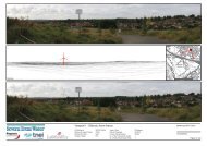
Plate 1: Visualisation of the proposed <strong>flood</strong> wall and hedge to be planted along The<br />
Strand, Attenborough<br />
Environment Agency Page 11
Nottingham Trent Left Bank FAS<br />
Design and Access Statement<br />
Plate 2: Visualisation of the proposed <strong>flood</strong> wall along The Strand from the cricket<br />
ground side<br />
11. APPEARANCE<br />
Flood em<strong>bank</strong>ments will be grass-seeded which will not only be complementary to the existing<br />
amenity character of the area, but will also allow general recreational use, such as dog walking,<br />
to continue in the area.<br />
The <strong>flood</strong> walls will have a rough textured surface to allow small mammals to climb the wall to<br />
escape from <strong>flood</strong>s.<br />
12. ACCESS AND INCLUSIVITY<br />
In some places along the length of the <strong>flood</strong> defences, for example at the Village Green in<br />
Attenborough the Environment Agency are planning to install <strong>flood</strong> gates in the <strong>flood</strong> wall. This<br />
is to allow access to be maintained once the defence works have been installed whilst ensuring<br />
that the integrity of the <strong>flood</strong> defences is not compromised.<br />
Where there are existing footpaths or cycleways along <strong>flood</strong> defence em<strong>bank</strong>ments that will<br />
have to be temporarily diverted during the works, they will be reinstated to the existing or<br />
improved standard either along, or adjacent, to the <strong>flood</strong> defence.<br />
The <strong>scheme</strong> is designed to be low maintenance. Planned inspections of the <strong>flood</strong> walls and<br />
em<strong>bank</strong>ments will be required annually. An access easement, up to 5m wide, will be maintained<br />
alongside all <strong>flood</strong>walls for maintenance and inspection purposes. Crests on raised and new<br />
em<strong>bank</strong>ments will be a minimum of 3m wide for maintenance and inspection access. Sluices<br />
and other structures will be inspected and maintained in accordance with Environment Agency<br />
procedures and the manufacturer’s recommendations.<br />
Environment Agency Page 12
13. SUMMARY<br />
Nottingham Trent Left Bank FAS<br />
Design and Access Statement<br />
Should the proposed <strong>flood</strong> defence improvements not proceed, there will be long-term adverse<br />
effects of <strong>flood</strong>ing on Attenborough, Erewash and Rylands as well as other parts of the Greater<br />
Nottingham conurbation. The standard of protection currently provided to the majority of the<br />
<strong>scheme</strong> area is less than that recommended by the Department of Environment, Farming and<br />
Rural Affairs (Defra). Over time, the existing defences in Rylands and Erewash would<br />
deteriorate and the risk of <strong>flood</strong>ing would increase for the whole <strong>scheme</strong> area.<br />
The proposed works will result in an improved standard of protection for a total of 3,191<br />
properties and businesses in Attenborough, Erewash and Rylands. This has additional<br />
associated benefits for property values, development opportunities and reduced insurance<br />
premiums.<br />
Much of the <strong>scheme</strong> enjoys permitted development rights and only a few elements require<br />
formal planning permission. The siting and scale of those elements are, to some extent, dictated<br />
initially by engineering considerations, but all these components have also been subsequently<br />
influenced by design and environmental considerations.<br />
Accordingly the <strong>scheme</strong> subject of the current planning application is considered to comply with<br />
acknowledged design and access requirements.<br />
Environment Agency Page 13
Tennis Courts<br />
GHAM ROAD<br />
een<br />
St Leonard's<br />
Riding School<br />
Manor<br />
Garage<br />
SOMERSET CLOS E<br />
Drain<br />
HIGH ROAD<br />
EVESHAM COURT<br />
Outfall<br />
Track<br />
ETL<br />
NORFOLK AVENUE<br />
Pond<br />
TOTON<br />
Pond<br />
Golden Brook<br />
Drain<br />
ETL<br />
ETL<br />
CONNERY MEWS<br />
GREGSON<br />
Golden Brook<br />
River Erewash<br />
MINTON<br />
NOTTINGHAM ROAD<br />
River Erewash<br />
RIVER EREWASH<br />
P:\108806 - Left Bank Detailed Design\60_Generated documents\62_Generated Drawings\MapInfo\<strong>Planning</strong> 2008 Drawings\Figures BR1-3\Broxtowe figures.WOR<br />
SWINEY WAY<br />
Outfalls<br />
BM 28.33m<br />
Sewage Works<br />
Attenborough Junction<br />
Track<br />
Chilwell Retail Park<br />
SWINEY WAY<br />
River Erewash<br />
Sewage Works<br />
Water<br />
The Corn Mill<br />
at Chilwell<br />
BARTON LANE<br />
Chilwell Retail Park<br />
Attenborough<br />
Landing Stages<br />
Slipway<br />
Attenborough<br />
Sailing Club<br />
Def<br />
SL<br />
27.7m<br />
0005<br />
Sewage Works<br />
PAISLEY GROVE<br />
Sewage Works<br />
MP 121.25<br />
CR<br />
Track<br />
River<br />
Depot<br />
Track<br />
NOTTINGHAM ROAD<br />
SL<br />
Erewash<br />
BRAILSFORD WAY<br />
Hotel<br />
Def<br />
BARTON LANE<br />
Pond<br />
Co Const Bdy<br />
Und<br />
Pond<br />
TIS SINGTON CLOSE<br />
ELDON ROAD<br />
Depot<br />
Water<br />
BARTON LANE<br />
ATTENBOROUGH<br />
NATURE RESERVE<br />
Path (um)<br />
Depot<br />
Water<br />
Water<br />
5600<br />
26.8m<br />
<strong>Planning</strong> permission granted<br />
under separate application<br />
for this hatched area<br />
Water<br />
River Trent<br />
BM 30.65m<br />
27.1m<br />
Path<br />
Path<br />
27.1m<br />
ST MARYS CLOSE<br />
RIVER TRENT<br />
Def<br />
Attenborough Nature<br />
Ponds<br />
MP 6.5<br />
Water<br />
Reserve<br />
8342<br />
The Cottage<br />
27.1m<br />
Track<br />
27.1m<br />
River Erewash<br />
The Bungalow<br />
Track<br />
CHURCH LANE<br />
BM 28.97m<br />
Water<br />
27.1m<br />
C<br />
Copyright Black & Veatch 2008<br />
This map is reproduced from the OS map by the Environment Agency with<br />
the permission of the controller of Her Majesty's Stationary Office, Crown<br />
Copyright. Unauthorised reproduction infringes Crown Copyright and may<br />
lead to prosecution or civil proceeding Licence Number 100026380, 2008.<br />
Designed<br />
Checked<br />
Drawn<br />
Checked<br />
Reviewed<br />
Scale :<br />
Date:<br />
Date:<br />
Date:<br />
Date:<br />
Date:<br />
Rev. Nature of Revision<br />
Drawn Chkd. Rvwd. Appd. Date<br />
WORKING AREA<br />
AB<br />
SB<br />
JP<br />
AB<br />
SB<br />
WORKS REQUIRING<br />
PLANNING PERMISSION<br />
NOTTINGHAM TRENT LEFT BANK<br />
FLOOD ALLEVIATION SCHEME<br />
Sections Requiring <strong>Planning</strong> Permission<br />
and Working Areas<br />
Broxtowe Borough Council Sheet 1 of 4<br />
Contract no. Approved:<br />
Date: Contract<br />
drawing no.<br />
108806 SB Oct 08<br />
Drawing no.<br />
Oct 08<br />
Oct 08<br />
Oct 08<br />
Oct 08<br />
Oct 08<br />
1:5,000 (at A3)<br />
Figure BR.1
RT<br />
OSE<br />
M ROAD<br />
CLOSE<br />
WAY<br />
GOMERY CLOSE<br />
BRAILSFORD WAY<br />
RANSON ROAD<br />
Hotel<br />
CURSLEY WAY<br />
RUSSELL GARDENS<br />
STANILAND<br />
NEWALL DRIVE<br />
BARTON LANE<br />
CLOSE<br />
GOWAN CLOSE<br />
WHITTON<br />
ABLARD GARDENS<br />
TIS SINGTON CLOSE<br />
CLOSE<br />
RANSON ROAD<br />
TOPLIFF ROAD<br />
HARTHILL CLOSE<br />
HENNESSEY<br />
CL<br />
HADDON CRESCENT<br />
HOOK CLOSE<br />
Lavelle<br />
Court<br />
CHATSWORTH AVENUE<br />
ELDON ROAD<br />
BURGH HALL CLOSE<br />
Depot<br />
HADDON CRESCENT<br />
CHILWELL<br />
NOTTINGHAM ROAD<br />
Water<br />
ATTENBOROUGH LANE<br />
BARRATT LANE<br />
Blue Bell<br />
BYE PASS ROAD<br />
CHILWELL<br />
Attenborough<br />
Attenborough<br />
BYE PASS ROAD<br />
Blue Bell<br />
BARRATT<br />
BARTON LANE<br />
RIVERDALE ROAD<br />
CROFTON ROAD<br />
Attenborough<br />
P:\108806 - Left Bank Detailed Design\60_Generated documents\62_Generated Drawings\MapInfo\<strong>Planning</strong> 2008 Drawings\Figures BR1-3\Broxtowe figures.WOR<br />
LANE<br />
Depot<br />
BARRATT CRESCENT<br />
Water<br />
CLARENCE ROAD<br />
Hall<br />
5600<br />
26.8m<br />
Path<br />
BARRATT LANE<br />
27.4m<br />
Path<br />
Water<br />
ATTENBOROUGH LANE<br />
BM 30.65m<br />
IRETON GROVE<br />
27.1m<br />
Path<br />
ST MARYS CLOSE<br />
Path<br />
ELM AVENUE<br />
27.4m<br />
Attenborough<br />
27.1m<br />
Path<br />
27.1m<br />
LC<br />
ST MARYS CLOSE<br />
BRAMBLE<br />
CLOSE<br />
BM 27.60m<br />
26.8m<br />
Water<br />
27.4m<br />
Station<br />
Attenborough Nature<br />
Reserve<br />
27 1<br />
TENNYSON DRIVE<br />
27.1m<br />
LONG LANE<br />
CHURCH LANE<br />
BM 28.97m<br />
Water<br />
MILTON CRESCENT<br />
27.1m<br />
26.8m<br />
St Mary's Church<br />
ALLENDALE AVENUE<br />
THE PADDOCK<br />
GORDON CL OSE<br />
26.5m<br />
Playing Field<br />
SHADY LANE<br />
Tennis Courts<br />
Path<br />
Path<br />
Path<br />
Path<br />
El Sub Sta<br />
The<br />
SP<br />
2<br />
Chestnuts<br />
Playing<br />
1<br />
Field<br />
0073<br />
Pavilion<br />
28.3m<br />
15<br />
15<br />
0032<br />
19<br />
Path<br />
2<br />
0594<br />
FERNDALE CLOSE<br />
Field House<br />
1<br />
SP<br />
REIGATE DRIVE<br />
Sunnyside<br />
Path (um)<br />
13<br />
REIGATE CLOSE<br />
79<br />
5<br />
25<br />
19<br />
LONG LANE<br />
21<br />
4<br />
3<br />
87<br />
ETL<br />
BM 28.89m<br />
23<br />
KELSEY CL<br />
7<br />
35<br />
THE STRAND<br />
8<br />
Works<br />
Long Acres<br />
Sports Ground<br />
Pond<br />
FB<br />
Ch Inst<br />
37<br />
Pavilion<br />
Car Park<br />
41<br />
WB<br />
WB<br />
45<br />
49<br />
LC<br />
Pavilion<br />
Bowling Green<br />
Conveyor<br />
51<br />
ATTENBOROUGH<br />
NATURE RESERVE<br />
Path<br />
Conveyor<br />
Water<br />
Path<br />
Drain<br />
Conveyor<br />
3243<br />
3290<br />
3657<br />
Pond<br />
Water<br />
3900<br />
FB<br />
4370<br />
Path (um)<br />
Path (um)<br />
26.5m<br />
BM 27.35m<br />
26.8m<br />
FB<br />
Attenborough Nature Reserve<br />
Barton<br />
Island<br />
5308<br />
Pond<br />
27.1m<br />
RIVER TRENT<br />
MP 7.5<br />
27.1m<br />
6500<br />
Pond<br />
Path (um)<br />
Pond<br />
C<br />
Copyright Black & Veatch 2008<br />
This map is reproduced from the OS map by the Environment Agency with<br />
the permission of the controller of Her Majesty's Stationary Office, Crown<br />
Copyright. Unauthorised reproduction infringes Crown Copyright and may<br />
lead to prosecution or civil proceeding Licence Number 100026380, 2008.<br />
Designed<br />
Checked<br />
Drawn<br />
Checked<br />
Reviewed<br />
Scale :<br />
Date:<br />
Date:<br />
Date:<br />
Date:<br />
Date:<br />
Rev. Nature of Revision<br />
Drawn Chkd. Rvwd. Appd. Date<br />
WORKING AREA<br />
AB<br />
SB<br />
JP<br />
AB<br />
SB<br />
WORKS REQUIRING<br />
PLANNING PERMISSION<br />
NOTTINGHAM TRENT LEFT BANK<br />
FLOOD ALLEVIATION SCHEME<br />
Sections Requiring <strong>Planning</strong> Permission<br />
and Working Areas<br />
Broxtowe Borough Council Sheet 2 of 4<br />
Contract no. Approved:<br />
Date: Contract<br />
drawing no.<br />
108806 SB Oct 08<br />
Drawing no.<br />
Oct 08<br />
Oct 08<br />
Oct 08<br />
Oct 08<br />
Oct 08<br />
1:5,000 (at A3)<br />
Figure BR.2
Path<br />
26.8m<br />
BYE BYE PASS PASS ROAD ROAD<br />
27.4m<br />
Station<br />
TENNYSON DRIVE<br />
LONG LANE<br />
QUEENS ROAD WEST<br />
QUEENS ROAD WEST<br />
MILTON CRESCENT<br />
CLARKE'S LANE<br />
CLARKE'S LANE<br />
Playing Field<br />
ALLENDALE AVENUE<br />
GORDON CL OSE<br />
ABINGDON ABINGDON GARDENS GARDENS<br />
Chilwell Manor Golf Course<br />
Playing Field<br />
Path<br />
Path<br />
El El<br />
Sub Sub<br />
Sta Sta<br />
El Sub Sta<br />
The<br />
SP<br />
BEESTON<br />
2<br />
Chestnuts<br />
Playing<br />
Field<br />
0073<br />
Pavilion<br />
28.3m<br />
Church<br />
Path<br />
Playing Field<br />
0594<br />
FERNDALE CLOSE<br />
Field House<br />
REIGATE CLO<br />
79<br />
5<br />
THE GREEN<br />
CLARKE'S LANE<br />
19<br />
LONG LANE<br />
4<br />
87<br />
MEADOW GARDENS<br />
KELSEY<br />
ETL<br />
CL<br />
BM 28.89m<br />
23<br />
KELSEY CL<br />
LONG LANE<br />
SP<br />
7<br />
Chilwell Manor Golf Course<br />
Works<br />
THE DRIVE<br />
MANOR AVENUE<br />
Long Acres<br />
Attenborough<br />
WB<br />
WB<br />
QUEENS ROAD WEST<br />
Chilwell Manor Golf Course<br />
49<br />
LC<br />
LADYBRIDGE CLOSE<br />
LUNE CLOS E<br />
MEADOW LA NE<br />
QUORN CLOSE<br />
LONG LANE<br />
DERW ENT CLOSE<br />
Chilwell Manor Golf Course<br />
P:\108806 - Left Bank Detailed Design\60_Generated documents\62_Generated Drawings\MapInfo\<strong>Planning</strong> 2008 Drawings\Figures BR1-3\Broxtowe figures.WOR<br />
Conveyor<br />
51<br />
Path<br />
Conveyor<br />
Water<br />
Drain<br />
Conveyor<br />
3290<br />
3657<br />
Attenborough Nature Reserve<br />
FB<br />
TRENT CRESCENT<br />
4370<br />
GLENDALE COURT<br />
CLIFTON CRESCENT<br />
BARKE R'S LANE<br />
FB<br />
MEADOW LANE<br />
Attenborough<br />
Attenborough<br />
Attenborough<br />
BARKER'S LANE<br />
MEADOW LANE<br />
WHEATLEY GROVVE<br />
WHEATLEY<br />
GROVE<br />
Chilwell Manor Golf Course<br />
Pond<br />
BURNHAM AVENUE<br />
Path (um)<br />
Attenborough Nature Reserve<br />
ATTENBOROUGH<br />
NATURE RESERVE<br />
Water<br />
Pond<br />
Allotment Gardens<br />
Water<br />
Pond<br />
Attenborough Nature Reserve<br />
Water<br />
9200<br />
Foot Bridge<br />
27.1m<br />
RIVER TRENT<br />
26.8m<br />
26.5m<br />
BM 26.55m<br />
River Trent<br />
BEESTON<br />
Attenborough Attenborough Nature Nature Reserve Reserve<br />
26.5m<br />
Water Water<br />
Attenborough Nature Reserve<br />
Path<br />
FB<br />
Backwater<br />
Pond<br />
Foot Bridge<br />
Caravan Site<br />
BM 27.26m<br />
EILEEN ROAD<br />
Path<br />
River Trent<br />
Trentside<br />
Works Works<br />
Allotment Allotment Gardens Gardens<br />
Allotment Gardens<br />
ETL<br />
RYAN WAY<br />
AMBER ROAD<br />
Landing Stage<br />
JAKE ROAD<br />
Caravan Site<br />
26.2m<br />
JOHNS ROAD<br />
BM 26.76m<br />
Club<br />
Beeston Marina<br />
RIVERSIDE ROAD<br />
RIVERSIDE ROAD<br />
BEESTON<br />
RIVERSIDE ROAD<br />
RYLANDS<br />
NELSON NELSON ROAD ROAD<br />
C<br />
Copyright Black & Veatch 2008<br />
This map is reproduced from the OS map by the Environment Agency with<br />
the permission of the controller of Her Majesty's Stationary Office, Crown<br />
Copyright. Unauthorised reproduction infringes Crown Copyright and may<br />
lead to prosecution or civil proceeding Licence Number 100026380, 2008.<br />
Designed<br />
Checked<br />
Drawn<br />
Checked<br />
Reviewed<br />
Scale :<br />
Date:<br />
Date:<br />
Date:<br />
Date:<br />
Date:<br />
Rev. Nature of Revision<br />
Drawn Chkd. Rvwd. Appd. Date<br />
WORKING AREA<br />
AB<br />
SB<br />
JP<br />
AB<br />
SB<br />
WORKS REQUIRING<br />
PLANNING PERMISSION<br />
NOTTINGHAM TRENT LEFT BANK<br />
FLOOD ALLEVIATION SCHEME<br />
Sections Requiring <strong>Planning</strong> Permission<br />
and Working Areas<br />
Broxtowe Borough Council Sheet 3 of 4<br />
Contract no. Approved:<br />
Date: Contract<br />
drawing no.<br />
108806 SB Oct 08<br />
Drawing no.<br />
Oct 08<br />
Oct 08<br />
Oct 08<br />
Oct 08<br />
Oct 08<br />
1:5,000 (at A3)<br />
Figure BR.3
Attenborough Nature Reserve<br />
26.5m<br />
Water<br />
Attenborough Nature Reserve<br />
Path<br />
Water<br />
FB<br />
Beeston<br />
Sailing Club<br />
Backwater<br />
Pond<br />
Foot Bridge<br />
Caravan Site<br />
BM 27.26m<br />
EILEEN ROAD<br />
Path<br />
River Trent<br />
BEESTON<br />
Trentside<br />
Allotment Gardens<br />
Allotment Gardens<br />
ETL<br />
RYAN WAY<br />
AMBER ROAD<br />
Landing Stage<br />
Works<br />
JAKE ROAD<br />
RYLANDS<br />
Caravan Site<br />
26.2m<br />
JOHNS ROAD<br />
BM 26.76m<br />
Club<br />
Beeston Marina<br />
RIVERSIDE ROAD<br />
BEESTON<br />
RIVERSIDE ROAD<br />
RYLANDS<br />
NELSON ROAD<br />
TRENT VALE ROAD<br />
Sports Ground<br />
Sports Ground<br />
PO<br />
TRAFALGAR ROAD<br />
Depot<br />
Towing Path<br />
BM 25.50m<br />
TRENT ROAD<br />
VICTORY ROAD<br />
Caravan Site<br />
Beeston<br />
Rylands<br />
School<br />
SOUTH ROAD<br />
BM 25.67m<br />
Landing<br />
Stage<br />
Sports Ground<br />
Towing Path<br />
Beeston Rylands<br />
School<br />
Landing Stage<br />
TRENT VA LE ROAD<br />
SOUTH ROAD<br />
VICTORY ROAD<br />
RYLANDS<br />
RIVERSIDE ROAD<br />
South<br />
Court<br />
BEESTON<br />
WEIR<br />
P:\108806 - Left Bank Detailed Design\60_Generated documents\62_Generated Drawings\MapInfo\<strong>Planning</strong> 2008 Drawings\Figures BR1-3\Broxtowe figures.WOR<br />
Weir<br />
Weir<br />
BIRCH AVENUE<br />
SOUTH ROAD<br />
Beeston<br />
Lock<br />
TRENT ROAD<br />
Sloping Masonry<br />
GRENVILLE ROAD<br />
Sloping Masonry<br />
TRENT ROAD<br />
Sand and Shingle<br />
Beeston Trent Vale Infants School<br />
Boat and<br />
Horses<br />
BEESTON<br />
Jolly<br />
Anglers<br />
TRENT ROAD<br />
RYLANDS<br />
River Trent<br />
DUNSMORE CLOSE<br />
Longlands<br />
CANAL SIDE<br />
Close<br />
Beeston Canal<br />
Weir Field Recreation Ground<br />
MEADOW ROAD<br />
BEESTON<br />
ROY AV ENUE<br />
WEST<br />
LON GLA NDS<br />
ROAD<br />
CRESCENT<br />
RYLANDS CLOSE<br />
Sand and<br />
Shingle<br />
Appleton Court<br />
THORNDIKE CLOSE<br />
Track<br />
BEECH AVENUE<br />
APPLETON ROAD<br />
CANAL SIDE<br />
EAST<br />
Beeston Canal<br />
CRESCENT<br />
ELSWICK DRIVE<br />
ACASTER CLOSE<br />
CANAL SIDE<br />
Mud<br />
Boro Const & UA<br />
River<br />
9599<br />
Co Const Bdy<br />
Bdy<br />
Trent<br />
CR<br />
BEESTON RYLANDS<br />
BEESTON<br />
RYLANDS<br />
LEYTON CRESCENT<br />
LOCKWOOD CLOSE<br />
Recreation Ground<br />
MEADOW ROAD<br />
CANAL SIDE<br />
ELSWICK DRIVE<br />
SUFFOLK<br />
AV ENUE<br />
CORNWALL AVENUE<br />
Recreation Ground<br />
Sewage Works<br />
Beeston Canal<br />
ETL<br />
Track<br />
Refuse Tip<br />
River Trent<br />
RIVER TRENT<br />
25.3m<br />
Pumping<br />
Station<br />
MILLDALE CLOSE<br />
Clifton Grove<br />
Refuse Tip<br />
Cycl e Track and Towing Path<br />
Clifton<br />
Tank<br />
Shingle<br />
CRESCENT<br />
GROVESIDE<br />
Works<br />
Rugby Ground<br />
Tanks<br />
Tanks<br />
EIGHTH AVENUE<br />
LEABROOK CLOSE<br />
Beeston Canal<br />
BEESTON<br />
ETL<br />
ETL<br />
Rugby Ground<br />
Rugby Ground<br />
ETL<br />
ETL<br />
EIGHTH AVENUE<br />
Works<br />
C<br />
Copyright Black & Veatch 2008<br />
This map is reproduced from the OS map by the Environment Agency with<br />
the permission of the controller of Her Majesty's Stationary Office, Crown<br />
Copyright. Unauthorised reproduction infringes Crown Copyright and may<br />
lead to prosecution or civil proceeding Licence Number 100026380, 2008.<br />
Designed<br />
Checked<br />
Drawn<br />
Checked<br />
Reviewed<br />
Scale :<br />
Date:<br />
Date:<br />
Date:<br />
Date:<br />
Date:<br />
Rev. Nature of Revision<br />
Drawn Chkd. Rvwd. Appd. Date<br />
WORKING AREA<br />
AB<br />
SB<br />
JP<br />
AB<br />
SB<br />
WORKS REQUIRING<br />
PLANNING PERMISSION<br />
NOTTINGHAM TRENT LEFT BANK<br />
FLOOD ALLEVIATION SCHEME<br />
Sections Requiring <strong>Planning</strong> Permission<br />
and Working Areas<br />
Broxtowe Borough Council Sheet 4 of 4<br />
Contract no. Approved:<br />
Date: Contract<br />
drawing no.<br />
108806 SB Oct 08<br />
Drawing no.<br />
Oct 08<br />
Oct 08<br />
Oct 08<br />
Oct 08<br />
Oct 08<br />
1:5,000 (at A3)<br />
Figure BR.4


