AONB LCAR S1 P1-10 FINAL - the Cotswolds Area of Outstanding ...
AONB LCAR S1 P1-10 FINAL - the Cotswolds Area of Outstanding ...
AONB LCAR S1 P1-10 FINAL - the Cotswolds Area of Outstanding ...

You also want an ePaper? Increase the reach of your titles
YUMPU automatically turns print PDFs into web optimized ePapers that Google loves.
2 Evolution <strong>of</strong> <strong>the</strong> Landscape<br />
During <strong>the</strong> late Bronze Age <strong>the</strong> deterioration in <strong>the</strong> climate<br />
to colder, wetter conditions forced upland communities to<br />
relocate to <strong>the</strong> lowlands, placing habitable land under<br />
increasing amounts <strong>of</strong> pressure.<br />
2.8.5<br />
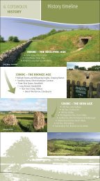
Iron Age (c.750 BC – AD 43)<br />
Iron working was one <strong>of</strong> a series <strong>of</strong> new technologies<br />
introduced to Britain from <strong>the</strong> continent in <strong>the</strong> Iron Age<br />
period. Population growth led to competition for land and<br />
<strong>the</strong> development <strong>of</strong> a more territorial society, hillforts and<br />
defensive enclosures being clear manifestations <strong>of</strong> this in<br />
<strong>the</strong> landscape. Hillforts <strong>the</strong>mselves are both defensible and<br />
symbolic, occupying as <strong>the</strong>y do strategic and prominent<br />
locations for maximum effect.<br />
Single rampart camps, most probably cattle pounds<br />
or sheep folds, have been identified throughout <strong>the</strong><br />
<strong>Cotswolds</strong> such as at Norbury, Colesbourne and Radbury<br />
Ring. These may have represented safe havens for cattle<br />
during times <strong>of</strong> conflict or simply enclosed areas to bring<br />
cattle toge<strong>the</strong>r for trading or feasting purposes.<br />
The most readily identifiable features <strong>of</strong> <strong>the</strong> Iron Age<br />
landscape, however, are <strong>the</strong> large hillforts which are likely<br />
to represent tribal centres in which ‘council’ meetings were<br />
held, trade and production controlled, and supplies stored<br />
in above ground granaries and clay lined pits predominantly<br />
for use during <strong>the</strong> winter period, as well as during times<br />
<strong>of</strong> unrest. The hillforts would have been at <strong>the</strong> centre <strong>of</strong><br />
a widespread pattern <strong>of</strong> settlement with small, primarily<br />
RAMPARTS OF PAINSWICK BEACON<br />
24<br />
<strong>Cotswolds</strong> <strong>AONB</strong> Partnership<br />
agricultural, farmsteads and hamlets located throughout<br />
<strong>the</strong> landscape. A number <strong>of</strong> <strong>the</strong>se would have been<br />
surrounded by a simple ditch, and perhaps a stock pro<strong>of</strong><br />
fence, although <strong>the</strong> remains <strong>of</strong> <strong>the</strong>se are difficult to interpret<br />
in <strong>the</strong> landscape. Perhaps <strong>the</strong> simplest way to locate <strong>the</strong>se<br />
pre-Roman settlements is to identify place names ending in<br />
<strong>the</strong> suffix ‘bury’. Although <strong>the</strong> name derives from <strong>the</strong> Saxon<br />
period, <strong>the</strong> suffix attests to <strong>the</strong> presence <strong>of</strong> earthworks<br />
that were still visible at <strong>the</strong> time <strong>of</strong> Saxon settlement.<br />
Archaeological investigation <strong>of</strong> many sites containing <strong>the</strong><br />
‘bury’ suffix has unear<strong>the</strong>d late Iron Age or early Roman<br />
remains although many o<strong>the</strong>r sites await archaeological<br />
confirmation <strong>of</strong> <strong>the</strong>ir pre-Roman origins 13 .<br />
Hillforts <strong>of</strong> various sizes have been identified at Uley,<br />
Painswick, Leckhampton Hill, Sodbury, Crickley and<br />
Shenberrow. Excavations at Bagendon, where ditches<br />
enclose an area <strong>of</strong> approximately 200 acres, indicate<br />
that <strong>the</strong> fort was located in a pastoral landscape in<br />
which cattle, sheep and pigs were all grazed. The site<br />
interestingly contained a coin mint and must <strong>the</strong>refore<br />
have been an important local centre.<br />
Little is known about <strong>the</strong> political or territorial organisation<br />
<strong>of</strong> <strong>the</strong> area until just prior to <strong>the</strong> Roman conquest<br />
although it is believed that one tribe, <strong>the</strong> Dobunni,<br />
occupied lands stretching from <strong>the</strong> upper Upper Thames<br />
valley to <strong>the</strong> Severn.<br />
2.8.6<br />
Roman and Romano British Period 14<br />
(AD 43 – AD 4<strong>10</strong>)<br />
In <strong>the</strong> <strong>Cotswolds</strong>, as was <strong>the</strong> case for much <strong>of</strong> England, <strong>the</strong><br />
Roman invasion was followed by a rapid implementation <strong>of</strong><br />
centralised administration based on towns and villas,<br />
supported by a network <strong>of</strong> forts. Roman army engineers<br />
also built substantial roads with metalled and cambered<br />
surfaces to expedite <strong>the</strong> movement <strong>of</strong> soldiers, food,<br />
equipment and materials. Naturally <strong>the</strong>se roads were also<br />
exploited as trade and communication routes. In <strong>the</strong><br />
<strong>Cotswolds</strong> <strong>the</strong> road network appears to have grown around<br />
<strong>the</strong> main routes <strong>of</strong> Ermin Street, which linked GLEVVM<br />
(Gloucester) to CORINIVM (Cirencester), and Fosse Way,<br />
which extended north eastwards from AQUA SULIS (Bath)<br />
to Cirencester and subsequently to Stow-on-<strong>the</strong>-Wold and<br />
Moreton-in-Marsh. O<strong>the</strong>r notable Roman roads crossing<br />
<strong>the</strong> <strong>AONB</strong> include Akeman Street, and Ryknild Street, which<br />
13. Bryan Walters (1992) Ancient Dean and The Wye Valley<br />
14. The principal source <strong>of</strong> information in this section is Ge<strong>of</strong>f Sindrey<br />
(1990) Roman Dean – The Forest <strong>of</strong> Dean in <strong>the</strong> Roman Period and<br />
Bryan Walters (1992) Ancient Dean and The Wye Valley