AONB LCAR S1 P1-10 FINAL - the Cotswolds Area of Outstanding ...
AONB LCAR S1 P1-10 FINAL - the Cotswolds Area of Outstanding ...
AONB LCAR S1 P1-10 FINAL - the Cotswolds Area of Outstanding ...

You also want an ePaper? Increase the reach of your titles
YUMPU automatically turns print PDFs into web optimized ePapers that Google loves.
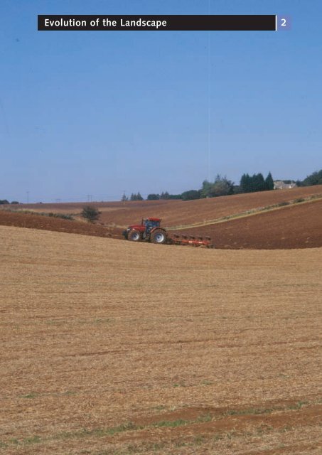
Evolution <strong>of</strong> <strong>the</strong> Landscape<br />
2
2 Evolution <strong>of</strong> <strong>the</strong> Landscape<br />
2.1<br />
Introduction<br />
The intricate interplay <strong>of</strong> numerous physical and human influences has shaped <strong>the</strong><br />
landscape as it is experienced today. An understanding <strong>of</strong> <strong>the</strong>se influences is central<br />
to <strong>the</strong> assessment process and provides a sound basis on which to define and describe<br />
landscape character.<br />
PHYSICAL INFLUENCES<br />
2.2<br />
Geology 4,5<br />
2.2.1<br />
Introduction<br />
The geological structure <strong>of</strong> <strong>the</strong> <strong>Cotswolds</strong>, and <strong>the</strong><br />
juxtaposition and succession <strong>of</strong> rocks, is fundamental<br />
to <strong>the</strong> form and structure <strong>of</strong> <strong>the</strong> landscape. While <strong>the</strong><br />
underlying solid geology is responsible for <strong>the</strong> principal<br />
pattern and elevation <strong>of</strong> <strong>the</strong> landform, it is <strong>the</strong> differential<br />
responses <strong>of</strong> <strong>the</strong> various rock strata to <strong>the</strong> effects <strong>of</strong><br />
erosion and wea<strong>the</strong>ring processes that have altered <strong>the</strong><br />
form <strong>of</strong> <strong>the</strong> landscape, influencing drainage and soils, and<br />
in turn <strong>the</strong> subsequent patterns <strong>of</strong> land cover and land<br />
use. The deposition <strong>of</strong> material during <strong>the</strong> most recent<br />
Quaternary era has also been important in moulding and<br />
modifying landform patterns.<br />
A simplified geological map illustrating <strong>the</strong> general pattern<br />
<strong>of</strong> solid rocks and drift deposits within <strong>the</strong> <strong>AONB</strong> is shown<br />
on Figure 6.<br />
The geological structure <strong>of</strong> <strong>the</strong> <strong>Cotswolds</strong> is relatively<br />
simple and consists <strong>of</strong> bands <strong>of</strong> clay, sand and limestone<br />
superimposed on one ano<strong>the</strong>r and gently tilted in Tertiary<br />
times. Jurassic Limestones have had <strong>the</strong> most significant<br />
influence on <strong>the</strong> form <strong>of</strong> <strong>the</strong> landscape and indeed <strong>the</strong><br />
area represents one <strong>of</strong> <strong>the</strong> best-known sections <strong>of</strong> <strong>the</strong><br />
outcrop <strong>of</strong> Oolitic Limestone that extends across England<br />
from Lyme Bay in Dorset to <strong>the</strong> North Sea coast.<br />
Whilst at a superficial level, <strong>the</strong> <strong>Cotswolds</strong> might be seen<br />
as a contiguous unit <strong>of</strong> broadly similar character, local<br />
variations have had a significant impact on <strong>the</strong> landscape<br />
and local landscape character. These are discussed in<br />
greater detail in Section 3 for each <strong>of</strong> <strong>the</strong> 19 landscape<br />
character type descriptions. An introduction to <strong>the</strong><br />
geological framework within <strong>the</strong> <strong>AONB</strong> follows.<br />
12<br />
<strong>Cotswolds</strong> <strong>AONB</strong> Partnership<br />
2.2.2<br />
Jurassic Geology<br />
Rocks deposited during <strong>the</strong> Jurassic period underlie <strong>the</strong><br />
majority <strong>of</strong> <strong>the</strong> <strong>Cotswolds</strong> <strong>AONB</strong>. These were laid down<br />
between 135 and 180 million years ago at a time when<br />
<strong>the</strong> area that is now <strong>the</strong> centre <strong>of</strong> England was submerged<br />
beneath a vast but relatively shallow ocean. The ocean<br />
was surrounded by islands, areas <strong>of</strong> land that now<br />
comprise uplands in Cornwall, Devon and <strong>the</strong> Mendips.<br />
To <strong>the</strong> south-east stretched a landmass linking <strong>the</strong> London<br />
area and East Anglia to a large continent (Hyrcinia). The<br />
sedimentary rocks <strong>of</strong> <strong>the</strong> <strong>Cotswolds</strong> were formed in <strong>the</strong><br />
subtropical shallows that existed on <strong>the</strong> fringes <strong>of</strong> this<br />
ocean, with mud, pebbles, broken shells and fossilised<br />
tissue laid down to form an elaborate series <strong>of</strong> clays and<br />
limestone.<br />
Three distinct divisions within <strong>the</strong> Jurassic are represented<br />
within <strong>the</strong> <strong>Cotswolds</strong>, each resulting in contrasting<br />
landforms and landscape features. The oldest rocks<br />
comprise <strong>the</strong> Lower Jurassic Lias Group (clays, siltstones,<br />
shales and limestones), followed by <strong>the</strong> Middle Jurassic<br />
Inferior Oolite (limestones, clays and sandstones), and<br />
finally <strong>the</strong> Great Oolite (comprising mainly limestones and<br />
occasional musdstones), culminating in <strong>the</strong> Cornbrash<br />
Formation.<br />
Lower Jurassic: Lias Group<br />
In 1999 a re-classification <strong>of</strong> <strong>the</strong> Lower Jurassic was<br />
published in a British Geological Survey Research Report 6 ,<br />
and <strong>the</strong> previously familiar terms <strong>of</strong> Lower, Middle and<br />
Upper Lias have now been replaced by <strong>the</strong> Lias Group,<br />
and described in terms <strong>of</strong> lithostratigraphical formations.<br />
4. William Dreghorn (1967) Geology Explained in <strong>the</strong> Severn Vale and<br />
<strong>Cotswolds</strong><br />
5. Ed. Charles and Alice Mary Hadfield (1973) The <strong>Cotswolds</strong>: A New Study<br />
6. Cox, Sumbler and Ivimey-Cook (1999) A formational Framework for<br />
<strong>the</strong> Lower Jurassic <strong>of</strong> England and Wales (onshore area), British<br />
Geological Survey Research Report No RR/99/01
In ascending order <strong>the</strong>se comprise <strong>the</strong> Blue Lias,<br />
Charmouth Mudstone, Dyrham Formation, Marlstone<br />
Rock, Whitby Mudstone and Bridport Sand formations.<br />
This new classification and rock formations within <strong>the</strong> Lias<br />
Group form <strong>the</strong> basis <strong>of</strong> <strong>the</strong> descriptions used throughout<br />
this report. Notwithstanding this change in terminology, <strong>the</strong><br />
characteristics and surface expression <strong>of</strong> <strong>the</strong> succession <strong>of</strong><br />
rocks represented within <strong>the</strong> Lias Group remain unchanged.<br />
The Lias Group rocks outcrop at <strong>the</strong> base <strong>the</strong> main<br />
<strong>Cotswolds</strong> escarpment at <strong>the</strong> junction with <strong>the</strong> Triassic<br />
mudstones and form extensive exposures along <strong>the</strong><br />
nor<strong>the</strong>rn stretch <strong>of</strong> <strong>the</strong> escarpment, north <strong>of</strong> Stroud.<br />
These are <strong>of</strong>ten rich in fossilized molluscs and <strong>the</strong> bones<br />
<strong>of</strong> primitive marine creatures.<br />
The Charmouth Mudstone, corresponding to <strong>the</strong> previous<br />
nomenclature <strong>of</strong> Lower Lias Clay, makes excellent bricks<br />
and was <strong>of</strong>ten used to line mill pools in <strong>the</strong> clothing<br />
districts. For <strong>the</strong>se reasons <strong>the</strong> clay was mined at a number<br />
<strong>of</strong> sites in <strong>the</strong> Stour basin and at <strong>the</strong> foot <strong>of</strong> <strong>the</strong> scarp.<br />
However, soils derived from <strong>the</strong> clay are heavy, cold and<br />
frequently waterlogged. As a consequence, agriculture at<br />
<strong>the</strong> base <strong>of</strong> <strong>the</strong> scarp and in <strong>the</strong> vale is <strong>of</strong>ten limited to<br />
pasture.<br />
Above <strong>the</strong>se clays are lighter sandy or micacious clays,<br />
loams and sandstones <strong>of</strong> <strong>the</strong> Dyrham Formation. These<br />
are <strong>of</strong>ten exposed on <strong>the</strong> floor and sides <strong>of</strong> many <strong>of</strong><br />
<strong>the</strong> valleys draining <strong>the</strong> plateau, where <strong>the</strong>y create lush<br />
meadowland. Above this rock unit sits <strong>the</strong> Marlstone Rock<br />
formation, which has had an important influence on <strong>the</strong><br />
character <strong>of</strong> <strong>the</strong> <strong>Cotswolds</strong> <strong>AONB</strong> landscape to <strong>the</strong> east<br />
<strong>of</strong> <strong>the</strong> Evenlode. It is <strong>of</strong>ten referred to as Ironstone as it is<br />
rich in Limonite and has historically been mined for iron<br />
ore. At outcrop it produces a brash <strong>of</strong> rust-brown<br />
ferruginous, commonly sandy ironstone.<br />
Iron in <strong>the</strong> Marlstone Rock gives buildings in <strong>the</strong> area a<br />
distinctive warm brown colour, varied by dark olive and<br />
purple stones and an occasional frosting caused by white<br />
lichens. The distinctive local vernacular and colour <strong>of</strong> <strong>the</strong><br />
building stone ensures that <strong>the</strong> ‘Ironstone villages’, located<br />
on or in <strong>the</strong> vicinity <strong>of</strong> <strong>the</strong> Marlstone Rock formation,<br />
contrast strongly with <strong>the</strong> more familiar villages built from<br />
Oolitic limestone to <strong>the</strong> south and west within <strong>the</strong> main<br />
area <strong>of</strong> <strong>the</strong> <strong>AONB</strong>.<br />
The Marlstone Rock is harder than <strong>the</strong> Lias Group<br />
formations above and below it, and as a result can <strong>of</strong>ten<br />
be observed as a wooded terrace on <strong>the</strong> escarpment such<br />
as <strong>the</strong> stretches between Wotton-under-Edge and Dursley,<br />
and from Cheltenham to Chipping Campden. In <strong>the</strong><br />
valleys <strong>the</strong> Marlstone Rock terrace can <strong>of</strong>ten be observed<br />
2.2.2<br />
carrying <strong>the</strong> valley road. At Painswick, <strong>the</strong> town is sited<br />
immediately above a large Marlstone Rock ledge that<br />
forms a distinctive spur between two deep valleys. The<br />
Marlstone Rock formation is also responsible for forming<br />
<strong>the</strong> distinctive escarpment in <strong>the</strong> north east <strong>of</strong> <strong>the</strong><br />
<strong>Cotswolds</strong> <strong>AONB</strong>, notably at Edge Hill.<br />
Ano<strong>the</strong>r feature <strong>of</strong> <strong>the</strong> Marlstone Rock is <strong>the</strong> spring-line<br />
that may be observed beneath it. The Marlstone Rock acts<br />
as a reservoir, holding water that seeps into it from <strong>the</strong><br />
layers <strong>of</strong> rock above. Beneath <strong>the</strong> Marlstone Rock are <strong>the</strong><br />
impermeable layers <strong>of</strong> <strong>the</strong> Whitby Mudstone clays and<br />
<strong>the</strong>refore springs are forced out at this level. The spring<br />
line is marked by numerous towns and villages such as<br />
Dodington, Horton, Wotton-under-Edge, Stinchcombe and<br />
Dursley, all <strong>of</strong> which sit on <strong>the</strong> Marlstone Rock terrace. The<br />
spring-line also determines <strong>the</strong> site <strong>of</strong> many villages within<br />
valleys on <strong>the</strong> Dip-Slope such Ebrington, Maugersbury,<br />
Upper Slaughter, and Naunton as to name but a few.<br />
Soils derived from <strong>the</strong> Marlstone Rock are light and loamy<br />
and make excellent corn-land. As a result, farmland nor<strong>the</strong>ast<br />
and east <strong>of</strong> <strong>the</strong> Evenlode tends to be predominantly<br />
used for arable production.<br />
Middle Jurassic: Inferior Oolite<br />
The Inferior Oolite series forms <strong>the</strong> upper portion <strong>of</strong> <strong>the</strong><br />
Cotswold escarpment plateau areas <strong>of</strong> <strong>the</strong> high wold in<br />
<strong>the</strong> north <strong>Cotswolds</strong> above <strong>the</strong> 250m contour. Here it<br />
forms <strong>the</strong> highest hills such as Ham Hill, Cleeve Cloud,<br />
Charlton King’s Common, <strong>the</strong> area around Belas Knap<br />
and Broadway Hill. Promontories such as Nottingham Hill<br />
and Haresfield Beacon are also capped by Inferior Oolite.<br />
Uplifting and erosion to <strong>the</strong> east has meant that <strong>the</strong>se<br />
strata have almost entirely worn away.<br />
The creamy buff coloured Inferior Oolite has historically<br />
been quarried for building stone and can be observed<br />
in numerous villages on <strong>the</strong> high wold where it has<br />
wea<strong>the</strong>red to form gold and grey buildings that are<br />
mottled with white and yellow lichens. Freestones and<br />
Peagrits provide particularly good building stone especially<br />
<strong>the</strong> Yellow Guiting Stone, which wea<strong>the</strong>rs to a rich golden<br />
colour. This continues to be quarried at Coscombe Quarry<br />
above Stanway, Bourton Hill and Westington.<br />
The Lower Limestone and <strong>the</strong> Lower and Upper<br />
Freestones <strong>of</strong> <strong>the</strong> Lower Inferior Oolite have historically<br />
been extensively quarried from <strong>the</strong> escarpment. Indeed,<br />
<strong>the</strong> landscape here is pockmarked and scarred by<br />
numerous former quarry sites. Although <strong>the</strong>se rocks do<br />
not split in any preferred direction, <strong>the</strong>y can be readily cut<br />
into cubes and carved if desired and consequently were<br />
Landscape Character Assessment 13<br />
2
2 Evolution <strong>of</strong> <strong>the</strong> Landscape<br />
formerly much in demand for building stone. Indeed most<br />
<strong>of</strong> <strong>the</strong> scarp quarries exploited <strong>the</strong> Freestones, including<br />
<strong>the</strong> large quarry at Leckhampton Hill, which supplied<br />
much <strong>of</strong> <strong>the</strong> stone used to build Cheltenham including <strong>the</strong><br />
Royal Crescent and <strong>the</strong> Montpellier Rotunda. Perhaps <strong>the</strong><br />
most well known feature formed from Inferior Oolite is <strong>the</strong><br />
Devil’s Chimney, located at Leckhampton Quarry. This rock<br />
pinnacle formed <strong>of</strong> Lower Freestone, was probably left<br />
by 17th and 18th century quarrymen as some form <strong>of</strong><br />
monument. However, <strong>the</strong> structure may be lost in <strong>the</strong><br />
future due to erosion along vertical joints.<br />
Numerous quarries and stone mines were also worked in<br />
<strong>the</strong> vicinity <strong>of</strong> Bath. It is from <strong>the</strong>se sites that <strong>the</strong> Freestone<br />
that was used to build Regency Bath was obtained.<br />
Writing in <strong>the</strong> mid 18th century E. Owen commented that<br />
“There is no stone that differs so much in its bed, after<br />
it has been wrought and exposed to <strong>the</strong> air as <strong>the</strong> Bath<br />
freestone. While it is in <strong>the</strong> ground, it is s<strong>of</strong>t, moist,<br />
yellowish, and almost crumbly and it seems very little<br />
more than congealed sand and that not well concreted<br />
toge<strong>the</strong>r. But when it has been some time exposed to <strong>the</strong><br />
air and is thoroughly dried, it becomes, white, hard, firm<br />
and an excellent stone.”<br />
Once abandoned, many <strong>of</strong> <strong>the</strong> <strong>of</strong> <strong>the</strong> deep shafts and<br />
mines in <strong>the</strong> vicinity <strong>of</strong> Bath were used by <strong>the</strong> military<br />
during and after <strong>the</strong> Second World War. Box Freestone<br />
quarry which runs for approximately thirty miles, is<br />
one example. At Monkton Farleigh an old abandoned<br />
underground quarry became <strong>the</strong> site <strong>of</strong> <strong>the</strong> biggest<br />
Second World War ammunition depot in Europe.<br />
Soils derived from Inferior Oolite are delicate, thin and<br />
light calcareous loams. They are <strong>of</strong>ten full <strong>of</strong> stones and<br />
indeed were <strong>of</strong>ten referred to as ‘stone brash’ by 18th<br />
century agricultural specialists.<br />
Between <strong>the</strong> Inferior and Great Oolite is a thin layer <strong>of</strong><br />
clay called Fuller’s Earth, its name referring to its use as<br />
an agent for cleansing wool and felting cloth, with <strong>the</strong><br />
activity undertaken at fulling mills. Soils derived from<br />
Fuller’s Earth are sticky and wet and are <strong>of</strong>ten marked<br />
by patches <strong>of</strong> woodland.<br />
Middle Jurassic: Great Oolite and Cornbrash<br />
The Great Oolite Series forms much <strong>of</strong> <strong>the</strong> dip-slope and<br />
shows a relatively consistent thickness throughout <strong>the</strong><br />
<strong>Cotswolds</strong> <strong>of</strong> approximately 60 m in depth although <strong>the</strong><br />
individual formations within it thicken, thin and die out<br />
laterally. At one time Great Oolite rocks would have<br />
covered <strong>the</strong> whole <strong>of</strong> <strong>the</strong> <strong>Cotswolds</strong>, however, tilting<br />
14<br />
<strong>Cotswolds</strong> <strong>AONB</strong> Partnership<br />
led to denundation <strong>of</strong> <strong>the</strong> western flank. The Great Oolite<br />
Series still occupies extensive areas <strong>of</strong> <strong>the</strong> High Wold<br />
Dip-Slope and <strong>the</strong> Dip-Slope Lowlands below <strong>the</strong> 250 m<br />
contour.<br />
Fewer quarries were worked on <strong>the</strong> dip-slope. Where <strong>the</strong>y<br />
did exist, <strong>the</strong>y were usually shallow workings which are<br />
conspicuous today as slight depressions, known locally<br />
as delves, and are <strong>of</strong>ten completely overgrown, or cloaked<br />
in copses. These workings generally provided fissile<br />
limestone, which when fresh is usually cream coloured<br />
but which, over time wea<strong>the</strong>rs to varying tints <strong>of</strong> buff to<br />
brown. In Painswick, for example, buildings have a silvery<br />
quality, whereas in Minchinhampton, a cold grey character<br />
in <strong>the</strong> stone is prevalent. These, however, contrast to <strong>the</strong><br />
buildings <strong>of</strong> Bath where <strong>the</strong> Great Oolite building stone<br />
has matured to a warm, honey coloured appearance.<br />
Indeed, Ralph Allen, <strong>the</strong> creator <strong>of</strong> 18th century Bath,<br />
was so keen to use this particular rock type that he<br />
opened quarries on Monkton Down and constructed<br />
a tramway to bring cut rock to <strong>the</strong> town.<br />
Building stone derived from <strong>the</strong> Great Oolite has also<br />
helped to build a great many important buildings. From<br />
1260 Great Oolite was quarried from <strong>the</strong> vicinity <strong>of</strong><br />
Burford by Oxford University in order to build many <strong>of</strong><br />
its colleges, and quarries at Taynton supplied <strong>the</strong> stone<br />
that built <strong>the</strong> tower <strong>of</strong> Merton Chapel (c.13<strong>10</strong>), Blenheim<br />
Palace (1705-1722), Magdalen Bridge (1832-1833) and<br />
<strong>the</strong> Bodlian Library extension (1939). Forest Marble is also<br />
an important stone derived from <strong>the</strong> Great Oolite. This<br />
is generally found between Badminton and <strong>the</strong> Evenlode<br />
Valley and in <strong>the</strong> vicinity <strong>of</strong> Wychwood Forest, from where<br />
it derives its name. This is a very hard freestone and is<br />
suitable for sculpture. Indeed, Forest Marble has been<br />
used extensively in Oxford for Cornices and Plinths.<br />
Stone slates are also quarried at locations on <strong>the</strong> Dip-<br />
Slope, largely from <strong>the</strong> thin fissile limestones at <strong>the</strong> base<br />
<strong>of</strong> <strong>the</strong> Great Oolite. Perhaps <strong>the</strong> most famous are <strong>the</strong><br />
Stonesfield Slates and <strong>the</strong> <strong>Cotswolds</strong> Slates which are<br />
obtained from <strong>the</strong> fringes <strong>of</strong> <strong>the</strong> Great Oolite. Historically<br />
<strong>the</strong> stone was dug in <strong>the</strong> Autumn and spread out on <strong>the</strong><br />
ground for winter frosts to invade <strong>the</strong> thin films <strong>of</strong> water<br />
within <strong>the</strong> stone to weaken it so that in spring a blow<br />
from a mallet would be enough to split <strong>the</strong> stone into<br />
slates. In <strong>the</strong> village <strong>of</strong> Stonesfield quarries were small<br />
enterprises and <strong>the</strong> spreading <strong>of</strong> <strong>the</strong> stone in <strong>the</strong> fields was<br />
carried out by almost <strong>the</strong> entire village. Towards <strong>the</strong> end<br />
<strong>of</strong> <strong>the</strong> 19th century <strong>the</strong> practice <strong>of</strong> mining <strong>the</strong> slates was<br />
in decline. However, sustained demand caused slates to be<br />
stripped <strong>of</strong>f <strong>the</strong> ro<strong>of</strong>s <strong>of</strong> barns, cottages and farmhouses.<br />
The Great Oolite in <strong>the</strong> vicinity <strong>of</strong> Stonesfield yields many
fossils, including those <strong>of</strong> primitive mammals, dinosaur and<br />
fossil plants. These were <strong>of</strong>ten sold to passing scientists by<br />
quarrymen.<br />
Perhaps one <strong>of</strong> <strong>the</strong> most conspicuous features <strong>of</strong> <strong>the</strong> dipslope,<br />
which indicate <strong>the</strong> nature <strong>of</strong> <strong>the</strong> underlying geology,<br />
is <strong>the</strong> stone walls, which enclose many <strong>of</strong> <strong>the</strong> Cotswold<br />
fields. Some <strong>of</strong> <strong>the</strong> stones would have been picked up by<br />
farmers from <strong>the</strong>ir fields but generally <strong>the</strong>y were obtained<br />
from narrow quarries at <strong>the</strong> edge <strong>of</strong> <strong>the</strong> fields, <strong>the</strong> shallow<br />
workings <strong>of</strong> which can <strong>of</strong>ten be seen.<br />
In <strong>the</strong> south-eastern section <strong>of</strong> <strong>the</strong> <strong>AONB</strong>, to <strong>the</strong> west<br />
<strong>of</strong> Malmesbury and in <strong>the</strong> vicinity <strong>of</strong> <strong>the</strong> village <strong>of</strong><br />
Biddestone, a thin bed <strong>of</strong> coarse, crumbly shelly limestone<br />
underlies <strong>the</strong> area on <strong>the</strong> perimeter <strong>of</strong> <strong>the</strong> Upper Jurassic<br />
Oxford Clay Vale. This comprises <strong>the</strong> Cornbrash Formation<br />
<strong>the</strong> youngest rock unit in <strong>the</strong> Great Oolite. It is associated<br />
with a lower lying undulating landscape at <strong>the</strong> transition<br />
with <strong>the</strong> more extensive and flatter Thames basin. The<br />
limestone is overlain by brown marl, which is so fine for<br />
arable farming that it has been known as Cornbrash since<br />
<strong>the</strong> 18th century.<br />
2.2.3<br />
Quaternary Geology<br />
After <strong>the</strong> last <strong>of</strong> <strong>the</strong> Great Oolite formations were laid<br />
down, <strong>the</strong> receding sea and <strong>the</strong> slowly rising crust <strong>of</strong> <strong>the</strong><br />
earth began to expose <strong>the</strong>m as a giant whale back shoal<br />
which at some point was also tilted in a south-east<br />
direction so that <strong>the</strong> north-western flank sloped down<br />
steeply, and a much gentler dip-slope was left on <strong>the</strong><br />
south-eastern flank. On ei<strong>the</strong>r side <strong>of</strong> this landmass,<br />
<strong>the</strong> building <strong>of</strong> England continued with fur<strong>the</strong>r cycles <strong>of</strong><br />
inundation, deposition and erosion. However, eventually<br />
<strong>the</strong> <strong>Cotswolds</strong> were uplifted clear <strong>of</strong> all future inundations<br />
resulting in numerous faults.<br />
With <strong>the</strong> Jurassic landmass now fully exposed to rain and<br />
wind, <strong>the</strong> processes <strong>of</strong> erosion could act upon it. Surface<br />
water was absorbed by <strong>the</strong> porous rocks, issuing at spring<br />
lines to form streams and rivers, with spring sapping<br />
contributing to <strong>the</strong> progressive headward erosion <strong>of</strong><br />
<strong>the</strong> valleys. Those flowing south-east down <strong>the</strong> dip-slope<br />
formed long spacious valleys. Rivers flowing north and<br />
west, however, followed steeper courses down <strong>the</strong><br />
escarpment and carved deep channels cutting back into<br />
<strong>the</strong> plateau, forming deep combes. These processes were<br />
greatly reinforced by <strong>the</strong> onset <strong>of</strong> <strong>the</strong> Ice Age about one<br />
million years ago.<br />
2.2.5<br />
Successive advances and recessions <strong>of</strong> <strong>the</strong> ice spanned 0.5<br />
million years with long intervals <strong>of</strong> milder climate. Glaciers<br />
never extended across <strong>the</strong> <strong>Cotswolds</strong> but severe climate<br />
would have led to tundra conditions and only a limited<br />
vegetation cover (sedges, lichens and perhaps a few dwarf<br />
birch). Glacial meltwaters led to violent torrents <strong>of</strong> water,<br />
which carved out deep valleys.<br />
It is onto this basic framework <strong>of</strong> hills and valleys that<br />
deposits <strong>of</strong> <strong>the</strong> Holocene and Pleistocene periods were laid<br />
down by rivers and streams. The deposits vary in depth up<br />
to 30 metres and have created locally different landscapes<br />
to those associated with <strong>the</strong> underlying Jurassic bedrock.<br />
Glacial deposits, river terrace materials, and alluvium occur<br />
on areas <strong>of</strong> lower ground creating s<strong>of</strong>t, gently undulating<br />
landscapes, whilst on <strong>the</strong> slopes <strong>the</strong>re are extensive deposits<br />
<strong>of</strong> head material <strong>of</strong> periglacial origin arising from <strong>the</strong><br />
accumulation <strong>of</strong> solifluction debris. Landslips also mask<br />
<strong>the</strong> lower slopes <strong>of</strong> many sections <strong>of</strong> <strong>the</strong> escarpment and<br />
some outliers, such as on <strong>the</strong> slopes <strong>of</strong> Doverow Hill near<br />
Stonehouse, and on Bredon Hill, and along <strong>the</strong> section <strong>of</strong><br />
<strong>the</strong> escarpment between Saintbury Hill south-westwards to<br />
Dowdeswell Wood. These generally occur where mudstone,<br />
and to a lesser extent sandstone formations crop out on a<br />
slope, with rotational slipping <strong>of</strong> <strong>the</strong> limestone capped rocks<br />
forming multiple terrace-like features.<br />
2.2.4<br />
Observing Geological Features in <strong>the</strong> Landscape<br />
Although not always apparent on <strong>the</strong> surface, <strong>the</strong> nature<br />
<strong>of</strong> <strong>the</strong> underlying geology can <strong>of</strong>ten be observed in <strong>the</strong><br />
distribution and variety <strong>of</strong> materials used in <strong>the</strong><br />
construction <strong>of</strong> vernacular buildings and by identifying<br />
diagnostic landscape features such as landslips on areas<br />
<strong>of</strong> <strong>the</strong> escarpment where s<strong>of</strong>ter and more easily wea<strong>the</strong>red<br />
Lower Jurassic Lias Group rocks are prevalent. Even where<br />
no obvious clues are apparent, <strong>the</strong> absence <strong>of</strong> features<br />
might also provide an indication as to <strong>the</strong> nature <strong>of</strong> <strong>the</strong><br />
underlying geology. For example, in <strong>the</strong> vale landscapes<br />
where thick deposits <strong>of</strong> drift material cloak <strong>the</strong> underlying<br />
solid geology, hedges and half-timbered houses<br />
predominate over stone houses and boundary walls.<br />
2.2.5<br />
Historical Links: William Smith<br />
A review <strong>of</strong> <strong>the</strong> geology <strong>of</strong> <strong>the</strong> <strong>Cotswolds</strong> would be<br />
incomplete without <strong>the</strong> mention <strong>of</strong> William Smith, <strong>of</strong>ten<br />
referred to as <strong>the</strong> ‘Fa<strong>the</strong>r <strong>of</strong> English Geology’. This<br />
extraordinary man was born in modest circumstances<br />
in Churchill on <strong>the</strong> eastern perimeter <strong>of</strong> <strong>the</strong> <strong>Cotswolds</strong>.<br />
His early years led him to observe <strong>the</strong> effects <strong>of</strong> <strong>the</strong><br />
Jurassic Limestone within his local environment. Later,<br />
as a surveyor and canal engineer, he was able to examine<br />
Landscape Character Assessment 15<br />
2
2 Evolution <strong>of</strong> <strong>the</strong> Landscape<br />
and painstakingly record <strong>the</strong> stratigraphical sequence <strong>of</strong><br />
rocks based on careful observation <strong>of</strong> <strong>the</strong> fossil record. A<br />
resident <strong>of</strong> Bath for some years, his detailed observations<br />
enabled him to prepare <strong>the</strong> first geological map <strong>of</strong><br />
<strong>the</strong> area. He subsequently went on to draw <strong>the</strong> first<br />
Geological Map <strong>of</strong> England and Wales. The representation<br />
<strong>of</strong> <strong>the</strong> Jurassic Limestone ‘stone belt’ on this remarkable<br />
historic map is particularly striking. There must be many<br />
parts <strong>of</strong> <strong>the</strong> <strong>Cotswolds</strong> that Smith would have visited and<br />
made his observations, <strong>the</strong> findings <strong>of</strong> which would<br />
subsequently have contributed to a radical change in <strong>the</strong><br />
understanding <strong>of</strong> geology, and <strong>the</strong> science <strong>of</strong> stratigraphy.<br />
2.3<br />
Landform<br />
The landform within <strong>the</strong> <strong>AONB</strong> closely reflects <strong>the</strong><br />
underlying geological structure (Figures 5 and 6). Three<br />
principal landform features may be identified within <strong>the</strong><br />
<strong>AONB</strong>: <strong>the</strong> escarpment; <strong>the</strong> escarpment valleys and<br />
outliers; and <strong>the</strong> high wold and dip-slope.<br />
2.3.1<br />
The Escarpment<br />
The escarpment is a dramatic landscape feature defining<br />
<strong>the</strong> outcrop <strong>of</strong> <strong>the</strong> Jurassic Limestone. It rises sharply to<br />
form a distinctive boundary with <strong>the</strong> undulating vale<br />
landscapes bordering <strong>the</strong> Severn Vale, and <strong>the</strong> Vale <strong>of</strong><br />
Evesham to <strong>the</strong> north. South <strong>of</strong> Hawkesbury <strong>the</strong><br />
escarpment is less than <strong>10</strong>0 m high, but at Cleeve Hill it<br />
reaches 330m AOD, <strong>the</strong> highest point in <strong>the</strong> <strong>AONB</strong>. The<br />
Inferior Oolite is <strong>the</strong> main scarp-forming rock in <strong>the</strong> north,<br />
whilst in <strong>the</strong> south this becomes thinner with Great Oolite<br />
forming <strong>the</strong> highest relief. At <strong>the</strong> base <strong>of</strong> <strong>the</strong> scarp slope<br />
Lias Group shales, sandstones and siltstones <strong>of</strong> <strong>the</strong> Lower<br />
Jurassic are exposed. These are s<strong>of</strong>t and easily wea<strong>the</strong>red<br />
and as a result have slumped or been eroded to form<br />
hummocky ground, stream valleys, and bays at <strong>the</strong> foot <strong>of</strong><br />
<strong>the</strong> escarpment, blurring <strong>the</strong> transition into <strong>the</strong> undulating<br />
landscapes <strong>of</strong> <strong>the</strong> Severn Vale which are underlain by<br />
Triassic rocks. The presence <strong>of</strong> <strong>the</strong> Lias Group Marlstone<br />
Rock, however, has resulted in <strong>the</strong> formation <strong>of</strong> secondary<br />
escarpments and fur<strong>the</strong>r localised landslips.<br />
2.3.2<br />
Escarpment Valleys and Outliers<br />
The escarpment has been progressively eroded sou<strong>the</strong>astwards<br />
as a result <strong>of</strong> fluvial and periglacial processes<br />
over many thousands <strong>of</strong> years. The retreat has followed<br />
lines <strong>of</strong> weakness, which has resulted in <strong>the</strong> creation <strong>of</strong><br />
deep, wide valleys in <strong>the</strong> vicinity <strong>of</strong> Stroud and Bath, and<br />
to a lesser extent at Winchcombe. The erosion <strong>of</strong> <strong>the</strong><br />
escarpment and its eastern retreat has also resulted in<br />
16<br />
<strong>Cotswolds</strong> <strong>AONB</strong> Partnership<br />
<strong>the</strong> creation <strong>of</strong> distinct ‘outliers’ such as Bredon Hill and<br />
Oxenton Hill. These were once part <strong>of</strong> <strong>the</strong> escarpment<br />
that lay fur<strong>the</strong>r to <strong>the</strong> west, but are now left isolated.<br />
2.3.3<br />
The High Wold and Dip-Slope<br />
In general terms, <strong>the</strong> limestone forms a discrete unit <strong>of</strong><br />
elevated land defined by <strong>the</strong> distinctive escarpment to <strong>the</strong><br />
west, from which <strong>the</strong> landscape ‘dips’ gently to <strong>the</strong> sou<strong>the</strong>ast.<br />
Whilst large table-like plateau areas are evident, and<br />
indeed characteristic <strong>of</strong> much <strong>of</strong> <strong>the</strong> landscape on <strong>the</strong><br />
high wold, <strong>the</strong> gently sloping dip-slope is prevalent, and<br />
evident as one travels from west to east. In <strong>the</strong> extreme<br />
south-east <strong>of</strong> <strong>the</strong> <strong>Cotswolds</strong> <strong>AONB</strong> in <strong>the</strong> vicinity <strong>of</strong> Bath<br />
<strong>the</strong>re is a transition to a lower area <strong>of</strong> Dip-Slope lowland<br />
forming <strong>the</strong> margin to <strong>the</strong> low-lying Thames Basin. This<br />
progression from high wold to dip-slope and dip-slope<br />
lowland is <strong>the</strong>refore a continuum, ra<strong>the</strong>r than a distinct<br />
division with clearly evident boundaries.<br />
Superimposed on this simplified structure <strong>the</strong> surface<br />
expression is <strong>of</strong>ten more complex, particularly in <strong>the</strong> west,<br />
as a result <strong>of</strong> <strong>the</strong> effect <strong>of</strong> a series <strong>of</strong> east-west fault lines<br />
and some significant folding. The effect <strong>of</strong> structural faults<br />
and folding is also evident in <strong>the</strong> north-eastern part <strong>of</strong> <strong>the</strong><br />
<strong>AONB</strong>, resulting in a complex topography <strong>of</strong> hills and<br />
valleys, isolated hills, and distinctive escarpment features<br />
associated with <strong>the</strong> Lias Group and Marlstone Rock<br />
outcrop in particular.<br />
2.4<br />
Drainage<br />
Drainage patterns are also closely linked to variations in<br />
geology. A notable feature <strong>of</strong> <strong>the</strong> escarpment slope is<br />
<strong>the</strong> high number <strong>of</strong> springs. These arise as a result <strong>of</strong> <strong>the</strong><br />
differential permeability <strong>of</strong> <strong>the</strong> Oolites and underlying Lias,<br />
with springs occurring at <strong>the</strong> junction <strong>of</strong> <strong>the</strong>se two rock<br />
series, and notably at <strong>the</strong> outcrop <strong>of</strong> <strong>the</strong> Marlstone Rock.<br />
Rivers that form on <strong>the</strong> scarp slope flow westwards into<br />
<strong>the</strong> Severn Vale and are generally short in length, such<br />
as <strong>the</strong> Cam and <strong>the</strong> Little Avon which flows through<br />
Wotton-under-Edge. Notable exceptions are <strong>the</strong> Frome<br />
and <strong>the</strong> Bristol Avon, both <strong>of</strong> which have cut through<br />
<strong>the</strong> escarpment in a series <strong>of</strong> steep sided valleys within<br />
which <strong>the</strong> towns <strong>of</strong> Stroud and Bath are situated. The<br />
size and course alignment <strong>of</strong> <strong>the</strong>se rivers is indicative <strong>of</strong><br />
a possible earlier capture <strong>of</strong> <strong>the</strong> headwaters <strong>of</strong> a number<br />
<strong>of</strong> watercourses that at one time flowed eastwards.
A number <strong>of</strong> rivers flow south-eastwards across <strong>the</strong> strike<br />
<strong>of</strong> <strong>the</strong> dip-slope. These comprise <strong>the</strong> Churn, Coln, Leach,<br />
Windrush and Evenlode, all <strong>of</strong> which are tributaries <strong>of</strong> <strong>the</strong><br />
Thames. Where <strong>the</strong> underlying limestone bedrock is<br />
particularly permeable, sections <strong>of</strong> <strong>the</strong> rivers and <strong>the</strong>ir<br />
tributary streams exist as dry valleys for many months <strong>of</strong><br />
<strong>the</strong> year. In prolonged periods <strong>of</strong> wet wea<strong>the</strong>r, however,<br />
<strong>the</strong> increased surface run <strong>of</strong>f and raised water table results<br />
in <strong>the</strong> leng<strong>the</strong>ning <strong>of</strong> <strong>the</strong>se intermittent watercourses and<br />
<strong>the</strong> re-establishment <strong>of</strong> surface flow. The dry valleys are<br />
known locally as Slads or Slades, and ephemeral<br />
watercourses are also referred to as winterbournes.<br />
A number <strong>of</strong> features associated with river systems within<br />
<strong>the</strong> <strong>Cotswolds</strong> illustrate <strong>the</strong> effect <strong>of</strong> geomorphological<br />
processes. The landscape geometry <strong>of</strong> many <strong>of</strong> <strong>the</strong> rivers<br />
on <strong>the</strong> Cotswold dip-slope display ‘underfit’ characteristics<br />
demonstrated by <strong>the</strong> substantially greater wavelength <strong>of</strong><br />
valley meanders compared to <strong>the</strong> stream meanders, and<br />
<strong>the</strong> large scale <strong>of</strong> <strong>the</strong> valley form in comparison to <strong>the</strong> size<br />
<strong>of</strong> <strong>the</strong> watercourse. The valley morphology suggests an<br />
adjustment to <strong>the</strong> much higher discharges that would have<br />
been prevalent during <strong>the</strong> late glacial period, arising from<br />
surges <strong>of</strong> glacial meltwaters, and post glacial (Holocene)<br />
arctic tundra conditions. Valley meanders in a number <strong>of</strong><br />
sections are up to ten times greater than stream meander<br />
wavelengths, such as in <strong>the</strong> Leach Valley.<br />
Headward erosion <strong>of</strong> rivers lying in close proximity on <strong>the</strong><br />
escarpment and dip-slope also demonstrate <strong>the</strong> process<br />
<strong>of</strong> <strong>the</strong> formation <strong>of</strong> outliers. This is particularly evident at<br />
Langley Hill to <strong>the</strong> west <strong>of</strong> Winchcombe.<br />
Historically, patterns <strong>of</strong> drainage have had a significant<br />
impact on <strong>the</strong> location <strong>of</strong> settlements, <strong>the</strong> obvious need<br />
for permanent water dictating where villages can feasibly<br />
be sited. Many villages in <strong>the</strong> <strong>AONB</strong> are <strong>the</strong>refore located<br />
at bridging points on rivers and streams, at spring heads,<br />
or in valleys around shallow wells.<br />
2.5<br />
Soils and Agricultural Capacity<br />
The soils <strong>of</strong> <strong>the</strong> <strong>Cotswolds</strong> vary greatly in character<br />
depending on <strong>the</strong>ir origins. Most soils are derived from<br />
<strong>the</strong> underlying limestone bedrock and are alkaline in<br />
nature. Within <strong>the</strong> valleys, however, alluvium and<br />
scattered glacial deposits form a varied base material.<br />
Soil type and fertility are two <strong>of</strong> <strong>the</strong> principal determinants<br />
<strong>of</strong> agricultural capacity. Differences across <strong>the</strong> <strong>AONB</strong> are<br />
clearly evident and correspond closely to <strong>the</strong> nature <strong>of</strong><br />
<strong>the</strong> underlying soils and landscape.<br />
2.6.1<br />
On <strong>the</strong> high wold and dip-slope <strong>the</strong> Jurassic limestones<br />
give rise to thin, brashy soils that are <strong>of</strong>ten reddish in<br />
colour and may be low in calcium carbonate due to<br />
leaching. The Agricultural Land Classification for <strong>the</strong><br />
<strong>Cotswolds</strong> (Figure 7) indicates that only limited areas<br />
<strong>of</strong> <strong>the</strong> highest grade soils, classified as Grade 1 and 2,<br />
are present. These occur in <strong>the</strong> north <strong>of</strong> <strong>the</strong> <strong>AONB</strong> near<br />
Chipping Campden, toge<strong>the</strong>r with a fur<strong>the</strong>r isolated<br />
pocket <strong>of</strong> Grade 1 and 2 soils to <strong>the</strong> south-east <strong>of</strong> Tetbury,<br />
in <strong>the</strong> sou<strong>the</strong>rn part <strong>of</strong> <strong>the</strong> <strong>AONB</strong>. Although not within<br />
this ‘best and most versatile’ category <strong>of</strong> soils, <strong>the</strong> majority<br />
<strong>of</strong> <strong>the</strong> <strong>AONB</strong> soils are never<strong>the</strong>less well drained, aerated<br />
soils and <strong>of</strong> a sufficient quality to warrant classification<br />
as Grade 3 status in <strong>the</strong> Agricultural Land Classification.<br />
Historically, <strong>the</strong>se areas proved ideal for sheep farming.<br />
More recently <strong>the</strong>ir friable nature has been utilised<br />
increasingly for arable farming, with low fertility levels<br />
overcome through <strong>the</strong> application <strong>of</strong> artificial fertilisers.<br />
By contrast, in <strong>the</strong> valley bottoms alluvium and clay<br />
deposits form deeper soils that are generally less well<br />
drained. Whilst arable farming is frequent, permanent<br />
pasture for summer grazing is <strong>the</strong> prevalent land use.<br />
These tend to be classified as Grade 4 agricultural land,<br />
<strong>the</strong> same grade as much <strong>of</strong> <strong>the</strong> escarpment where steep<br />
slopes and <strong>the</strong> shallow nature <strong>of</strong> <strong>the</strong> soils limit agriculture.<br />
2.6<br />
Biodiversity<br />
The distribution <strong>of</strong> wildlife habitats and natural features<br />
throughout <strong>the</strong> <strong>AONB</strong> is determined by <strong>the</strong> nature <strong>of</strong> <strong>the</strong><br />
underlying geology, landform, past land use patterns and<br />
<strong>the</strong> cultural history <strong>of</strong> individual areas. The following<br />
section details <strong>the</strong> origins <strong>of</strong> <strong>the</strong> nature conservation<br />
interest <strong>of</strong> <strong>the</strong> <strong>AONB</strong> and some <strong>of</strong> <strong>the</strong> main habitats<br />
that may be identified.<br />
2.6.1<br />
Evolution <strong>of</strong> <strong>Cotswolds</strong> Habitats – Natural<br />
Colonisation and <strong>the</strong> Impact <strong>of</strong> Humans<br />
The <strong>Cotswolds</strong>, like <strong>the</strong> rest <strong>of</strong> Britain, acquired most <strong>of</strong> its<br />
present day species <strong>of</strong> flora and fauna by re-colonisation<br />
following wholesale exterminations during <strong>the</strong> Pleistocene<br />
ice ages, such as <strong>the</strong> last glaciation 25,000 -12,000 years<br />
ago. During this period glacial ice stretched over much<br />
<strong>of</strong> Wales to <strong>the</strong> west and <strong>the</strong> north <strong>of</strong> England. The<br />
<strong>Cotswolds</strong> was on <strong>the</strong> fringes <strong>of</strong> <strong>the</strong> ice fields and<br />
<strong>the</strong>refore permafrost covered much <strong>of</strong> <strong>the</strong> area.<br />
At intervals in <strong>the</strong> Pleistocene, un-glaciated land<br />
connected sou<strong>the</strong>rn England with continental Europe.<br />
These areas served as refuges for plants and animals,<br />
Landscape Character Assessment 17<br />
2
2 Evolution <strong>of</strong> <strong>the</strong> Landscape<br />
which were later able to spread back into Britain as <strong>the</strong> ice<br />
and tundra conditions receded northwards. Over time <strong>the</strong><br />
climax community formed. For <strong>the</strong> <strong>Cotswolds</strong>, this would<br />
appear to be a complex woodland mosaic with Lime and<br />
Ash as <strong>the</strong> predominant tree species although unwooded<br />
areas might also have existed in natural woodland<br />
clearings, and on unstable landscapes such as river<br />
banks and steep scarp slopes.<br />
This ‘wildwood’ was formed by <strong>the</strong> time <strong>the</strong> Mesolithic<br />
hunter-ga<strong>the</strong>rers - <strong>the</strong> first agents <strong>of</strong> landscape change -<br />
began to manipulate and domesticate <strong>the</strong> natural<br />
environment between <strong>10</strong>,000 and 5,000 Before Present<br />
(BP). These communities are thought to have been<br />
nomadic and occupied seasonal hunting camps. Despite<br />
<strong>the</strong>ir high mobility, however, evidence suggests that areas<br />
<strong>of</strong> wild wood were burnt to create clearings for more<br />
efficient hunting. It was also in this period that land that<br />
connected Britain to <strong>the</strong> continent was submerged, leaving<br />
Britain as an island.<br />
More rapid and pronounced change to <strong>the</strong> natural<br />
environment has occurred since settled agrarian lifestyles<br />
were adopted approximately 4000 BC. The 6000 years since<br />
<strong>the</strong> start <strong>of</strong> <strong>the</strong> Neolithic period has seen <strong>the</strong> removal <strong>of</strong> all<br />
traces <strong>of</strong> <strong>the</strong> native wild wood, <strong>the</strong> extinction <strong>of</strong> numerous<br />
native species and <strong>the</strong> introduction <strong>of</strong> non-native species <strong>of</strong><br />
plants and animals, perhaps most significantly domesticated<br />
plants and animals. The impact <strong>of</strong> accidental introductions<br />
can also not be underestimated. For example, <strong>the</strong> 12th<br />
century saw <strong>the</strong> introduction <strong>of</strong> <strong>the</strong> black rat. This was <strong>the</strong><br />
main reservoir for <strong>the</strong> bubonic plague, which in 1348 is<br />
thought to have killed as much as half <strong>the</strong> population. This<br />
dramatic fall in <strong>the</strong> population <strong>of</strong> <strong>the</strong> <strong>Cotswolds</strong> created a<br />
shortage <strong>of</strong> labour and resulted in a major shift from cereal<br />
growing to sheep rearing, thus providing <strong>the</strong> catalyst for<br />
<strong>the</strong> promotion <strong>of</strong> <strong>the</strong> wool trade and <strong>the</strong> subsequent rich<br />
inheritance <strong>of</strong> Cotswold churches and stone houses.<br />
2.6.2<br />
Semi Natural Habitats <strong>of</strong> <strong>the</strong> <strong>Cotswolds</strong><br />
The bulk <strong>of</strong> <strong>the</strong> <strong>Cotswolds</strong> is formed from Jurassic<br />
limestone. Similar to chalk, <strong>the</strong> Oolitic limestone contains<br />
a very high proportion <strong>of</strong> calcium carbonate, which has<br />
a significant effect on both <strong>the</strong> physical and chemical<br />
properties <strong>of</strong> soils, which tend to be light, well aerated,<br />
well drained and markedly alkaline. The result is <strong>the</strong><br />
absence <strong>of</strong> plants that are intolerant <strong>of</strong> limy material in <strong>the</strong><br />
soil (calcifuges). By contrast calciphile vegetation is more<br />
or less restricted to soils such as those that exist within <strong>the</strong><br />
<strong>AONB</strong>, and as a consequence <strong>the</strong> <strong>Cotswolds</strong> represents<br />
one <strong>of</strong> <strong>the</strong> finest areas in Britain for calciphile vegetation.<br />
18<br />
<strong>Cotswolds</strong> <strong>AONB</strong> Partnership<br />
The dependence <strong>of</strong> animals on limestone and chalk soils<br />
is usually more indirect, faunal species generally being<br />
attracted to specific areas by <strong>the</strong> presence or absence<br />
<strong>of</strong> specific plants and or o<strong>the</strong>r animals. For example<br />
<strong>the</strong> Chalk-hill blue and Small Blue butterflies depend<br />
on <strong>the</strong>ir larval food chiefly on <strong>the</strong> horseshoe vetch and<br />
are <strong>the</strong>refore found in <strong>the</strong> habitats <strong>of</strong> this plant.<br />
The woodlands <strong>of</strong> <strong>the</strong> <strong>AONB</strong> fall into two main groups –<br />
<strong>the</strong> semi natural beech woods <strong>of</strong> <strong>the</strong> steep escarpment<br />
slopes, and <strong>the</strong> great variety <strong>of</strong> mixed deciduous<br />
woodlands on <strong>the</strong> Cotswold Dip-Slope. The beech woods<br />
occur almost exclusively on <strong>the</strong> Inferior Oolite and strongly<br />
resemble <strong>the</strong> beech-hangers <strong>of</strong> <strong>the</strong> chalk downs. Ground<br />
flora is typically sparse due to <strong>the</strong> dense woodland canopy<br />
cutting <strong>of</strong>f a great deal <strong>of</strong> light, <strong>the</strong> deep leaf-litter and <strong>the</strong><br />
massing <strong>of</strong> fine roots close to <strong>the</strong> surface. Animal life on<br />
<strong>the</strong>se escarpment woods is also somewhat limited, chiefly<br />
on account <strong>of</strong> <strong>the</strong> sparseness <strong>of</strong> <strong>the</strong> ground vegetation.<br />
The dip-slope woods are mostly situated along <strong>the</strong> sides<br />
<strong>of</strong> <strong>the</strong> main valleys where <strong>the</strong> soil is deeper than<br />
elsewhere. Many <strong>of</strong> <strong>the</strong> woods have been radically altered<br />
by human interference and <strong>the</strong> variety <strong>of</strong> tree species<br />
greatly increased. In many instances this has resulted in a<br />
less dense canopy than beech woods and greater amount<br />
<strong>of</strong> light reaching <strong>the</strong> woodland floor, in turn leading to<br />
a rich and varied field layer and faunal assemblage.<br />
Oolitic downland communities tend to be present in <strong>the</strong><br />
<strong>Cotswolds</strong> wherever <strong>the</strong>re is steep uncultivated ground<br />
free from woodland. They are <strong>the</strong>refore most commonly<br />
found on areas <strong>of</strong> <strong>the</strong> escarpment overlooking <strong>the</strong> Severn<br />
Vale and on <strong>the</strong> sides <strong>of</strong> <strong>the</strong> numerous dry valleys on <strong>the</strong><br />
dip-slope where <strong>the</strong> land is too steep for cultivation and<br />
has remained for many centuries as rough grazing for<br />
sheep and cattle. The calcareous ‘downland’ soils, termed<br />
rendzinas, are shallow, well drained, alkaline and fertile.<br />
The typical landcover is grassland managed by grazing.<br />
In <strong>the</strong> absence <strong>of</strong> grazing, <strong>the</strong> finer grasses tend to<br />
disappear and coarser grasses begin to dominate <strong>the</strong><br />
sward and eliminate typical downland herbs. Through<br />
<strong>the</strong> process <strong>of</strong> natural succession, scrub vegetation leading<br />
to a secondary woodland cover subsequently develops.<br />
The influence <strong>of</strong> humans on <strong>the</strong> <strong>Cotswolds</strong> landscape<br />
and <strong>the</strong> creation <strong>of</strong> a semi-natural environment is perhaps<br />
most evident in <strong>the</strong> vast areas <strong>of</strong> agricultural land and<br />
settlements. Whilst <strong>the</strong>se may be regarded as wholly<br />
artificial, marginal habitats are present.<br />
For example, roadside verges in <strong>the</strong> open countryside<br />
<strong>of</strong>ten assume many <strong>of</strong> <strong>the</strong> characteristics <strong>of</strong> limestone<br />
downland. However, many verges are adjacent to<br />
farmland and may be sprayed to limit <strong>the</strong> growth
<strong>of</strong> agricultural weeds, thus reducing <strong>the</strong> variety <strong>of</strong> plant<br />
life and animals that can exist <strong>the</strong>re. Hedges too <strong>of</strong>fer<br />
extensive habitats and a haven for many species. Indeed<br />
<strong>the</strong>se linear habitats are also important as <strong>the</strong>y <strong>of</strong>ten form<br />
part <strong>of</strong> wide network linking woodlands and various o<strong>the</strong>r<br />
semi natural habitats with each o<strong>the</strong>r. Scattered hedgerow<br />
trees are also valuable, not least because <strong>the</strong>y encourage<br />
<strong>the</strong> breeding <strong>of</strong> kestrels and little owls.<br />
Quarries, too, <strong>of</strong>fer important habitats. Many old open<br />
quarries when left to regenerate <strong>the</strong>mselves acquire a<br />
number <strong>of</strong> calciphile plants, some <strong>of</strong> which prefer <strong>the</strong> stony<br />
ground and scree and loose stone, as well as <strong>the</strong> tops <strong>of</strong><br />
ancient stone walls. A notable example is <strong>the</strong> Cotswold<br />
Penny-cress, a rare British plant restricted as a native to<br />
<strong>the</strong> nor<strong>the</strong>rn <strong>Cotswolds</strong>. Some <strong>of</strong> <strong>the</strong> best Cotswold stone<br />
was mined from underground, especially in <strong>the</strong> area<br />
surrounding Bath, <strong>the</strong> mine at Monkton Combe being a<br />
notable example, in <strong>the</strong> vicinity <strong>of</strong> Nailsworth, and o<strong>the</strong>r<br />
‘edge’ localities. Evidence <strong>of</strong> underground mines also occur<br />
within <strong>the</strong> heart <strong>of</strong> <strong>the</strong> <strong>Cotswolds</strong>, such as at Barnsley<br />
and Sherborne. These former mines, penetrating far<br />
underground, provide winter refuges for several species<br />
<strong>of</strong> bat including <strong>the</strong> greater and lesser horseshoe bats.<br />
Important aquatic habitats are also present in <strong>the</strong> <strong>Cotswolds</strong>.<br />
The majority <strong>of</strong> rivers run in a south-easterly direction where<br />
<strong>the</strong>y join <strong>the</strong> Thames. For most <strong>of</strong> <strong>the</strong>ir course <strong>the</strong>y traverse<br />
Oolitic limestone. However, a number, notably <strong>the</strong> Evenlode<br />
and Windrush, have cut deep valleys into <strong>the</strong> underlying<br />
Lias. The water <strong>of</strong> all <strong>the</strong>se rivers is alkaline which has a<br />
strong influence over flora and fauna. The banks <strong>of</strong> many<br />
dip-slope streams are fringed with alders; willows, especially<br />
crack willow, are also common. Marginal vegetation is <strong>of</strong>ten<br />
TOPIC KEY FEATURES<br />
2.6.4<br />
dominated by a dense growth <strong>of</strong> reed grass and yellow flag<br />
iris, with marsh marigold flowering in pr<strong>of</strong>usion. Lakes have<br />
been constructed in a number <strong>of</strong> dip-slope valleys. These<br />
pools <strong>of</strong>ten silt up at <strong>the</strong> upstream end where wet alderwillow<br />
(carr) woodland develops. An interesting example<br />
is Rendcombe Lake, which was made in <strong>the</strong> 1860s by<br />
damming <strong>the</strong> River Churn.<br />
2.6.3<br />
English Nature – Natural <strong>Area</strong>s<br />
The influence <strong>of</strong> various factors has created a number<br />
<strong>of</strong> distinct semi natural habitats and features <strong>of</strong> nature<br />
conservation interest. At a very broad scale <strong>the</strong>se have<br />
been identified by English Nature, which has divided<br />
England into a number <strong>of</strong> Natural <strong>Area</strong>s, each with a<br />
characteristic association <strong>of</strong> wildlife and natural features.<br />
These areas provide a way <strong>of</strong> interpreting <strong>the</strong> ecological<br />
variations in terms <strong>of</strong> natural features and illustrate <strong>the</strong><br />
distinctions between one area and ano<strong>the</strong>r. Each Natural<br />
<strong>Area</strong> possesses a unique identity resulting from <strong>the</strong><br />
interaction <strong>of</strong> natural and human influences. Natural <strong>Area</strong>s<br />
provide a framework for <strong>the</strong> planning and implementation<br />
<strong>of</strong> nature conservation objectives and Biodiversity Action<br />
Plan (BAP) targets. Many Natural <strong>Area</strong>s share boundaries<br />
with <strong>the</strong> Countryside Agency’s Countryside Character <strong>Area</strong>s<br />
and indeed <strong>the</strong> <strong>Cotswolds</strong> Natural <strong>Area</strong> is contiguous with<br />
<strong>the</strong> <strong>Cotswolds</strong> Countryside Character <strong>Area</strong>.<br />
The following table identifies <strong>the</strong> main topics and<br />
associated features for <strong>the</strong> <strong>Cotswolds</strong> Natural <strong>Area</strong>.<br />
2.6.4<br />
Table 2.1: Natural <strong>Area</strong>s in <strong>the</strong> <strong>Cotswolds</strong><br />
Natural <strong>Area</strong> 7<br />
Earth Heritage • <strong>Cotswolds</strong> scarp and clay vales<br />
• Limestone exposures in <strong>Cotswolds</strong> scarp and crest<br />
• Cotswold stone buildings and walls<br />
Woodland • Internationally important lowland beech and yew woodland on scarp slopes<br />
and in valleys<br />
• Well distributed, significant lowland oak and mixed deciduous woodland<br />
• Characteristic lowland wood pasture and parkland<br />
• Some large blocks <strong>of</strong> conifer plantation<br />
Lowland Grass and Heath • Nationally significant lowland calcareous grassland (on limestone)<br />
• Neutral grassland including species-rich meadows and pasture on lower slopes<br />
• Remnant wet grasslands along river valleys<br />
7. English Nature (1999) Natural <strong>Area</strong>s in <strong>the</strong> South West Region<br />
Landscape Character Assessment 19<br />
2
2 Evolution <strong>of</strong> <strong>the</strong> Landscape<br />
It is clear, <strong>the</strong>refore, that <strong>the</strong> <strong>Cotswolds</strong> <strong>AONB</strong> is a<br />
valuable wildlife resource. The landscape’s complex and<br />
diverse geology combined with a long history <strong>of</strong> changing<br />
agricultural land use has resulted in a wide range <strong>of</strong> seminatural<br />
and manmade habitats supporting a wealth <strong>of</strong><br />
species: The main features include:<br />
• Extensive woodland habitats <strong>of</strong> both native and nonnative<br />
species, including a large number <strong>of</strong> ancient<br />
woodlands;<br />
• Species rich grassland habitats <strong>of</strong> varied character<br />
supporting important plant, invertebrate and bird<br />
populations;<br />
• Rivers, streams, artificial lakes and ponds and associated<br />
wetlands with important populations <strong>of</strong> birds, water<br />
vole, and otter; and<br />
• Ancient hedgerow networks <strong>of</strong> vital importance for<br />
<strong>the</strong> movement <strong>of</strong> wildlife through <strong>the</strong> landscape.<br />
The importance <strong>of</strong> <strong>the</strong> wildlife resource is reflected in<br />
<strong>the</strong> abundance <strong>of</strong> designated sites, which include sites<br />
<strong>of</strong> European (Special <strong>Area</strong> <strong>of</strong> Conservation [SAC]), and<br />
National (Site <strong>of</strong> Special Scientific Interest [SSSI] and<br />
National Nature Reserve [NNR]) importance.<br />
HUMAN INFLUENCES<br />
2.7<br />
Introduction and Review<br />
2.7.1<br />
Many <strong>of</strong> <strong>the</strong> landscapes and landscape features<br />
found within <strong>the</strong> <strong>AONB</strong> are a direct result <strong>of</strong> <strong>the</strong><br />
interaction between humans and <strong>the</strong>ir environment.<br />
The spatial distribution <strong>of</strong> natural resources across <strong>the</strong><br />
<strong>Cotswolds</strong>, notably water, building stone and timber, has<br />
had a pr<strong>of</strong>ound influence on <strong>the</strong> development, distribution<br />
and visual characteristics <strong>of</strong> agriculture, settlement and<br />
infrastructure, all <strong>of</strong> which are key elements in defining<br />
landscape character. Certain events and activities have left<br />
more visible traces than o<strong>the</strong>rs. For example, <strong>the</strong> effects<br />
<strong>of</strong> hundreds <strong>of</strong> years <strong>of</strong> Bronze Age settlement and<br />
agriculture are largely invisible in <strong>the</strong> landscape, whereas<br />
remnants <strong>of</strong> funerary and ritual monuments, each<br />
probably constructed over a very short period, present<br />
perhaps some <strong>of</strong> <strong>the</strong> most potent and visible historic<br />
landscape monuments in <strong>the</strong> <strong>AONB</strong>.<br />
20<br />
<strong>Cotswolds</strong> <strong>AONB</strong> Partnership<br />
In many instances modern development and landscape<br />
management have eradicated all evidence <strong>of</strong> what has<br />
gone before. Never<strong>the</strong>less, despite <strong>the</strong> scarcity <strong>of</strong> finds<br />
and sites which provide an insight into <strong>the</strong> every day lives<br />
<strong>of</strong> our ancestors, a great deal can be understood about <strong>the</strong><br />
evolution <strong>of</strong> <strong>the</strong> <strong>Cotswolds</strong> landscape by observing those<br />
elements <strong>of</strong> <strong>the</strong> past that survive as above ground features<br />
today.<br />
The concept <strong>of</strong> ‘time depth’ indicates <strong>the</strong> successive trends<br />
<strong>of</strong> landscape change and acknowledges that <strong>the</strong> modern<br />
landscape is a palimpsest <strong>of</strong> <strong>the</strong> historic events and<br />
processes <strong>of</strong> <strong>the</strong> past. A typical example might include<br />
<strong>the</strong> remnants <strong>of</strong> small irregular fields around some ancient<br />
villages (perhaps prehistoric in origin) surviving alongside<br />
large rectilinear fields from <strong>the</strong> parliamentary enclosure<br />
movement <strong>of</strong> <strong>the</strong> 18th and 19th centuries, or ridge and<br />
furrow surviving in <strong>the</strong> manicured areas <strong>of</strong> turf within a<br />
parkland or beneath areas <strong>of</strong> pasture that have not been<br />
ploughed in recent times.<br />
The <strong>Cotswolds</strong> Historic Landscape Characterisation (HLC),<br />
completed in 1999 has been a significant reference point in<br />
understanding <strong>the</strong> evolution <strong>of</strong> <strong>the</strong> <strong>Cotswolds</strong> landscape,<br />
and patterns <strong>of</strong> landscape character. The HLC identifies a<br />
number <strong>of</strong> Historic Landscape Types that represent surviving<br />
fragments <strong>of</strong> past activity in <strong>the</strong> modern landscape.<br />
Whilst <strong>the</strong> HLC was an important overlay in <strong>the</strong> process <strong>of</strong><br />
identifying landscape character types, an understanding <strong>of</strong><br />
<strong>the</strong> evolution <strong>of</strong> <strong>the</strong> <strong>Cotswolds</strong> landscape was significantly<br />
enhanced by background research into <strong>the</strong> processes,<br />
events and socio-political history <strong>of</strong> <strong>the</strong> study area. A<br />
general introduction to <strong>the</strong> evolution <strong>of</strong> <strong>the</strong> <strong>Cotswolds</strong><br />
landscape follows. Processes, events and features that are<br />
specific to a particular landscape are discussed in greater<br />
detail, where applicable, in <strong>the</strong> descriptive text associated<br />
with <strong>the</strong> relevant landscape character types and areas.<br />
2.8<br />
The Evolution <strong>of</strong> <strong>the</strong> <strong>Cotswolds</strong><br />
Landscape up to 1945<br />
2.8.1<br />
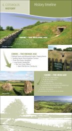
Palaeolithic (c.500,000 – 8,000 BC)<br />
Palaeolithic culture flourished during <strong>the</strong> Pleistocene when<br />
glaciations were interspersed with long periods <strong>of</strong> more<br />
hospitable climate. Britain was still joined to <strong>the</strong> continent<br />
at this stage enabling populations to move south during<br />
periods <strong>of</strong> intense cold such as <strong>the</strong> last glaciation 25,000 –<br />
12,000 years ago and return northwards to follow <strong>the</strong><br />
herds as conditions became more hospitable. It is known<br />
that Palaeolithic communities made forays into <strong>the</strong>
Thames and Severn Valleys during <strong>the</strong> last interglacial<br />
interlude, and hand-axes have been found near Lechlade<br />
and Hanborough.<br />
There is little evidence that communities penetrated <strong>the</strong><br />
<strong>Cotswolds</strong> uplands. However, it is not unreasonable to<br />
assume that Palaeolithic hunters extended <strong>the</strong>ir search<br />
for food across <strong>the</strong> entire <strong>AONB</strong>.<br />
2.8.2<br />
Mesolithic (c.8,000 – 4,000 BC)<br />
At <strong>the</strong> end <strong>of</strong> <strong>the</strong> last Ice Age around 8,500 BC <strong>the</strong><br />
climate improved, resulting in a retreat <strong>of</strong> <strong>the</strong> glacial ice<br />
sheets that stretched over much <strong>of</strong> Wales to <strong>the</strong> west, and<br />
<strong>the</strong> permafrost that had covered <strong>the</strong> <strong>Cotswolds</strong>. Sea level<br />
rise at this time resulted in <strong>the</strong> separation <strong>of</strong> Britain from<br />
<strong>the</strong> Continent, and at a more local level <strong>the</strong> widening <strong>of</strong><br />
<strong>the</strong> Severn estuary. Gradually a cover <strong>of</strong> woodland would<br />
have established across <strong>the</strong> landscape. At first this would<br />
have been dominated by birch although gradually <strong>the</strong><br />
‘wildwood’ <strong>of</strong> climax species would have developed. This<br />
would have comprised <strong>of</strong> a complex mosaic dominated by<br />
ash and lime on <strong>the</strong> upland areas with alder bordering wet<br />
and riverine landscapes. Unwooded areas would have<br />
been restricted to particularly steep slopes, rock outcrops<br />
or unstable landscapes such as river banks 8 . The presence<br />
<strong>of</strong> grazing animals would also have had an effect on <strong>the</strong><br />
extent and density <strong>of</strong> <strong>the</strong> woodland cover, with more open<br />
areas and glades also occurring.<br />
It was in <strong>the</strong> woodlands <strong>of</strong> <strong>the</strong> <strong>Cotswolds</strong> that Mesolithic<br />
communities would have established seasonal hunting<br />
camps and exploited migrating herds <strong>of</strong> large herbivores.<br />
These nomadic communities moved through <strong>the</strong> hills and<br />
valleys in search <strong>of</strong> food and suitable places to establish<br />
temporary settlements. These were probably seasonal<br />
camps comprising simple shelters made from wood, thatch<br />
or skins. Interestingly Mesolithic hunters possessed a more<br />
complex tool kit to <strong>the</strong>ir Palaeolithic ancestors that included<br />
skin boats, fish hooks and much improved flint tools and<br />
microliths. It is thanks to this that Mesolithic culture<br />
flourished and communities were able to spread out across<br />
<strong>the</strong> landscape and begin to alter <strong>the</strong> natural environment<br />
to suit <strong>the</strong>ir particular needs. Indeed, it is believed that<br />
areas <strong>of</strong> <strong>the</strong> wildwood were burnt to create clearings or<br />
glades to encourage and attract grazing animals such as<br />
wild cattle and red deer 9 , which <strong>the</strong>y could hunt using<br />
8. Martin Bell and Micheal J C Walker (1992) Late Quarternary<br />
Environmental Change<br />
2.8.3<br />
bows and arrows and spears. There is also evidence that by<br />
this time dogs had been domesticated, probably to assist<br />
with herding animals during <strong>the</strong> hunt.<br />
Due to <strong>the</strong> ephemeral nature <strong>of</strong> <strong>the</strong>ir temporary dwellings,<br />
little evidence for Mesolithic occupation survives in <strong>the</strong><br />
archaeological record. Often <strong>the</strong> only clue to <strong>the</strong> presence<br />
<strong>of</strong> Mesolithic communities in <strong>the</strong> <strong>AONB</strong> has been in <strong>the</strong><br />
form <strong>of</strong> flint and chert implements, used as tools and<br />
weapons, discovered in plough soil on <strong>the</strong> High Wold.<br />
O<strong>the</strong>r tools <strong>of</strong> wood, bone and antler were also used.<br />
However, <strong>the</strong>se only survive under certain waterlogged<br />
conditions such as in peat layers and as such are not known<br />
in <strong>the</strong> <strong>Cotswolds</strong>. The finds <strong>of</strong> flint, whilst providing a clue<br />
as to <strong>the</strong> pattern <strong>of</strong> Mesolithic movement and settlement<br />
in <strong>the</strong> landscape, also represent a clear indication <strong>of</strong> wellestablished<br />
trade and exchange networks. High quality and<br />
easily worked flint is found many kilometres to <strong>the</strong> east<br />
<strong>of</strong> <strong>the</strong> <strong>Cotswolds</strong> and so implements that were discovered<br />
on <strong>the</strong> plateau indicate that trade or bartering over great<br />
distances was taking place.<br />
2.8.3<br />
Neolithic (c.4,000 – 2,500 BC)<br />
The Mesolithic – Neolithic transition saw <strong>the</strong> gradual change<br />
from hunting and ga<strong>the</strong>ring towards settled agrarian<br />
lifestyles, <strong>the</strong> shift being likely to represent <strong>the</strong> adoption <strong>of</strong><br />
agricultural practices as a result <strong>of</strong> trade with <strong>the</strong> continent<br />
ra<strong>the</strong>r than colonisation <strong>of</strong> Britain by farming communities.<br />
In <strong>the</strong> archaeological record <strong>the</strong> Neolithic transition is <strong>of</strong>ten<br />
identified by <strong>the</strong> occurrence <strong>of</strong> new artefact types such<br />
as querns, sickles, pottery and polished stone axes.<br />
Environmental remains also mirror <strong>the</strong> change in food<br />
procurement practices, large-scale woodland clearance<br />
and <strong>the</strong> introduction <strong>of</strong> domesticated sheep, cattle and<br />
cereals being identified in <strong>the</strong> archaeological record.<br />
As is <strong>the</strong> case for <strong>the</strong> Mesolithic, settlement sites are<br />
difficult to identify. However, <strong>the</strong> activity <strong>of</strong> Neolithic<br />
communities is more readily identified in <strong>the</strong> landscape<br />
as a result <strong>of</strong> <strong>the</strong>ir beliefs and burial traditions, with<br />
megalithic and landscape monuments a clear indication<br />
<strong>of</strong> Neolithic activity in <strong>the</strong> <strong>AONB</strong>.<br />
The styles <strong>of</strong> Neolithic tombs vary from region to region <strong>10</strong> ,<br />
which may indicate <strong>the</strong> presence <strong>of</strong> distinct tribal<br />
groupings or cultures across Britain. The chalk-lands and<br />
lowlands <strong>of</strong> sou<strong>the</strong>rn and eastern Britain are generally<br />
characterised by long mounds, which were <strong>of</strong>ten piled up<br />
over simple timber structures. Chambered Tombs in <strong>the</strong><br />
9. Martin Bell and Micheal J C Walker (1992) Late Quarternary<br />
Environmental Change <strong>10</strong>. Micheal Parker Pearson (1993) Bronze Age Britain<br />
Landscape Character Assessment 21<br />
2
2 Evolution <strong>of</strong> <strong>the</strong> Landscape<br />
NOTGROVE LONG BARROW<br />
<strong>Cotswolds</strong> are <strong>of</strong>ten faced with dry stone masonry using<br />
<strong>the</strong> local limestone and sometimes contain internal stone<br />
built chambers, which may have remained in use for<br />
centuries. Tribal affiliations, or at least some form <strong>of</strong><br />
perceived sense <strong>of</strong> sameness, may be reflected in <strong>the</strong> fact<br />
that Cotswold stone was incorporated in <strong>the</strong> famous long<br />
mound at West Kennet although it is not clear whe<strong>the</strong>r<br />
<strong>the</strong> tombs builders transported <strong>the</strong> stone here or whe<strong>the</strong>r<br />
it was carried to <strong>the</strong> area by earlier glacial episodes. The<br />
re-constructed chambered tomb at Belas Knap, above<br />
Winchcombe provides a good example <strong>of</strong> <strong>the</strong> original<br />
appearance <strong>of</strong> <strong>the</strong>se features.<br />
Archaeologists consider that <strong>the</strong> concern shown by<br />
Neolithic people for <strong>the</strong>ir dead can be interpreted as a<br />
belief in <strong>the</strong> power <strong>of</strong> ancestors and <strong>the</strong> use <strong>of</strong> this power<br />
to support territorial claims on <strong>the</strong> landscape by sedentary,<br />
farming communities. The location <strong>of</strong> Neolithic tombs in<br />
<strong>the</strong> landscape may help to support this belief; for example,<br />
<strong>the</strong> string <strong>of</strong> long barrows and chambered tombs such as<br />
Hetty Peglar’s Tump and Belas Knap occupy prominent<br />
and dramatic locations overlooking <strong>the</strong> Severn and<br />
Evesham Vales respectively. It is not unreasonable to see<br />
<strong>the</strong>se as markers demarcating a particular territory for<br />
<strong>the</strong> communities that were probably living in <strong>the</strong> valleys<br />
<strong>of</strong> <strong>the</strong> dip-slope to <strong>the</strong> east.<br />
It is likely that during <strong>the</strong> Neolithic increasingly large<br />
areas <strong>of</strong> woodland were cleared for cultivation and it is<br />
within open landscapes that <strong>the</strong>se impressive landscape<br />
monuments would gain visual prominence. However,<br />
evidence for this is patchy. Charcoal taken from beneath<br />
<strong>the</strong> Nympsfield Long Barrow has been dated to around<br />
2200 BC and indicates that a wooded landscape <strong>of</strong><br />
hawthorn, hazel beech, ash, horse chestnut, cherry, oak,<br />
yew, elder and alder was present prior to its construction.<br />
One can infer from <strong>the</strong> site <strong>of</strong> such a monument that part<br />
<strong>of</strong> its drama and power came from its wide visibility<br />
and to achieve this much <strong>of</strong> <strong>the</strong> local woodland would<br />
have needed to be felled, and potentially kept from<br />
22<br />
<strong>Cotswolds</strong> <strong>AONB</strong> Partnership<br />
regenerating by extensive grazing <strong>of</strong> sheep or cattle.<br />
Excavations <strong>of</strong> <strong>the</strong> long barrow at Ascott-under-<br />
Wychwood in <strong>the</strong> Evenlode Valley, dated to approximately<br />
2800 BC, confirm this. Analysis <strong>of</strong> <strong>the</strong> findings also<br />
revealed that prior to its construction, <strong>the</strong> site had been<br />
subject to a pattern <strong>of</strong> settlement and abandonment from<br />
<strong>the</strong> Mesolithic period and that in between occupation<br />
phases, forest and scrub was allowed to regenerate.<br />
The absence <strong>of</strong> Neolithic settlement sites in <strong>the</strong><br />
archaeological record for <strong>the</strong> <strong>Cotswolds</strong> partly relates to<br />
<strong>the</strong>ir ephemeral nature, but also probably points to <strong>the</strong><br />
importance <strong>of</strong> water in establishing a suitable place to set<br />
up a permanent settlement. Most villages were likely to<br />
have been sited in valleys, in view <strong>of</strong> <strong>the</strong> monuments<br />
located on <strong>the</strong> hills above, and also located close to<br />
permanent springs. The concern for a reliable source <strong>of</strong><br />
water has to a great extent governed <strong>the</strong> site <strong>of</strong> existing<br />
villages and towns. It is likely, <strong>the</strong>refore, that Neolithic<br />
villages are simply buried beneath <strong>the</strong> valley villages that<br />
exist throughout <strong>the</strong> <strong>Cotswolds</strong> today. Contrary to this<br />
picture, however, is <strong>the</strong> discovery <strong>of</strong> a causewayed camp<br />
on Crickley Hill. This encampment was encircled by two<br />
interrupted ditches, <strong>the</strong> stone outcast from which was<br />
piled into embankments on <strong>the</strong> outer sides. Although no<br />
occupation evidence such as post-holes or storage-pits<br />
have been discovered which can be attributed to this<br />
period, <strong>the</strong> discovery <strong>of</strong> hundreds <strong>of</strong> flint arrowheads<br />
embedded in <strong>the</strong> ramparts proves that <strong>the</strong> site was at least<br />
used as a place <strong>of</strong> refuge. Traces <strong>of</strong> a burned palisade atop<br />
<strong>the</strong> defences are co-incident with <strong>the</strong> termination <strong>of</strong> this<br />
first occupation period, which is thought to have lasted<br />
between 3,500 and 2,500 BC.<br />
BELAS KNAP
2.8.4<br />
Bronze Age (c.2,500 – 750 BC)<br />
Metal working technology, along with new types <strong>of</strong> flinttool<br />
and pottery design, was introduced from Europe at <strong>the</strong><br />
start <strong>of</strong> this period. Cereal crops and stock rearing remained<br />
<strong>the</strong> mainstays <strong>of</strong> <strong>the</strong> economy, although changes in social<br />
organisation were reflected in <strong>the</strong> increased number <strong>of</strong><br />
ceremonial and burial sites which many archaeologists now<br />
see in <strong>the</strong> context <strong>of</strong> ritual landscapes. Burial practices also<br />
evolved, <strong>the</strong> use <strong>of</strong> cremations and round barrows replacing<br />
<strong>the</strong> chambered tombs and long barrows <strong>of</strong> <strong>the</strong> Neolithic.<br />
TREE COVERED BARROW IN THE DIKLER VALLEY<br />
A fine example <strong>of</strong> a Bronze Age round barrow has been<br />
discovered at Nympsfield. Termed <strong>the</strong> Soldiers Grave, <strong>the</strong><br />
barrow contains a single chamber and contained fifteen<br />
burials. Perhaps <strong>the</strong> most important burial site in <strong>the</strong><br />
<strong>Cotswolds</strong>, however, is <strong>the</strong> a group or cemetery <strong>of</strong> five<br />
barrows close to a Neolithic long barrow near Snowshill.<br />
Stone circles are also a feature <strong>of</strong> <strong>the</strong> Bronze Age ritual<br />
landscape. Two are known in <strong>the</strong> <strong>Cotswolds</strong> 11 , <strong>the</strong> most<br />
impressive being that <strong>of</strong> <strong>the</strong> Rollright Stones. The second<br />
is nearby at Cornwell where four complete rings and a<br />
single stone have been found.<br />
Isolated Bronze Age stone monuments are also important<br />
landscape features. These are scattered across <strong>the</strong><br />
landscape and may mark territorial boundaries or meeting<br />
11. Josceline Finberg (1977) The <strong>Cotswolds</strong><br />
12. Josceline Finberg (1977) The <strong>Cotswolds</strong><br />
ROLLRIGHT STONES<br />
2.8.4<br />
places or may simply be <strong>the</strong> upstanding remains <strong>of</strong> o<strong>the</strong>r<br />
monument types that have long since been lost such<br />
as <strong>the</strong> Hoar Stone near Enstone which represents <strong>the</strong><br />
remnants <strong>of</strong> a chambered tomb. Examples <strong>of</strong> Bronze Age<br />
monoliths include <strong>the</strong> Kiftsgate Stone above Chipping<br />
Campden, traditionally recognised as <strong>the</strong> meeting point for<br />
<strong>the</strong> Kiftsgate Hundred; <strong>the</strong> Longstone on Minchinhampton<br />
Common; <strong>the</strong> Tinglestone in Gatcombe Park; <strong>the</strong><br />
Gricklestone in Old Sodbury Parish; and <strong>the</strong> Hangman’s<br />
Stone, which marks <strong>the</strong> point where two parishes meet 12 .<br />
These ritual monuments are obviously <strong>the</strong> most dramatic<br />
features <strong>of</strong> <strong>the</strong> period in <strong>the</strong> landscape. However, perhaps<br />
<strong>of</strong> equal importance and drama are <strong>the</strong> Bronze Age field<br />
systems that can be traced across parts <strong>of</strong> <strong>the</strong> <strong>Cotswolds</strong> in<br />
crop marks from <strong>the</strong> air. These, such as <strong>the</strong> systems <strong>of</strong> West<br />
Littleton Down north east <strong>of</strong> Bath, and <strong>the</strong> seventy acres <strong>of</strong><br />
systems between Eastleach and Aldsworth, indicate that<br />
local will and labour was being organised on a massive scale<br />
in order to divide up <strong>the</strong> landscape into distinct holdings.<br />
HOAR STONE<br />
Landscape Character Assessment 23<br />
2
2 Evolution <strong>of</strong> <strong>the</strong> Landscape<br />
During <strong>the</strong> late Bronze Age <strong>the</strong> deterioration in <strong>the</strong> climate<br />
to colder, wetter conditions forced upland communities to<br />
relocate to <strong>the</strong> lowlands, placing habitable land under<br />
increasing amounts <strong>of</strong> pressure.<br />
2.8.5<br />
Iron Age (c.750 BC – AD 43)<br />
Iron working was one <strong>of</strong> a series <strong>of</strong> new technologies<br />
introduced to Britain from <strong>the</strong> continent in <strong>the</strong> Iron Age<br />
period. Population growth led to competition for land and<br />
<strong>the</strong> development <strong>of</strong> a more territorial society, hillforts and<br />
defensive enclosures being clear manifestations <strong>of</strong> this in<br />
<strong>the</strong> landscape. Hillforts <strong>the</strong>mselves are both defensible and<br />
symbolic, occupying as <strong>the</strong>y do strategic and prominent<br />
locations for maximum effect.<br />
Single rampart camps, most probably cattle pounds<br />
or sheep folds, have been identified throughout <strong>the</strong><br />
<strong>Cotswolds</strong> such as at Norbury, Colesbourne and Radbury<br />
Ring. These may have represented safe havens for cattle<br />
during times <strong>of</strong> conflict or simply enclosed areas to bring<br />
cattle toge<strong>the</strong>r for trading or feasting purposes.<br />
The most readily identifiable features <strong>of</strong> <strong>the</strong> Iron Age<br />
landscape, however, are <strong>the</strong> large hillforts which are likely<br />
to represent tribal centres in which ‘council’ meetings were<br />
held, trade and production controlled, and supplies stored<br />
in above ground granaries and clay lined pits predominantly<br />
for use during <strong>the</strong> winter period, as well as during times<br />
<strong>of</strong> unrest. The hillforts would have been at <strong>the</strong> centre <strong>of</strong><br />
a widespread pattern <strong>of</strong> settlement with small, primarily<br />
RAMPARTS OF PAINSWICK BEACON<br />
24<br />
<strong>Cotswolds</strong> <strong>AONB</strong> Partnership<br />
agricultural, farmsteads and hamlets located throughout<br />
<strong>the</strong> landscape. A number <strong>of</strong> <strong>the</strong>se would have been<br />
surrounded by a simple ditch, and perhaps a stock pro<strong>of</strong><br />
fence, although <strong>the</strong> remains <strong>of</strong> <strong>the</strong>se are difficult to interpret<br />
in <strong>the</strong> landscape. Perhaps <strong>the</strong> simplest way to locate <strong>the</strong>se<br />
pre-Roman settlements is to identify place names ending in<br />
<strong>the</strong> suffix ‘bury’. Although <strong>the</strong> name derives from <strong>the</strong> Saxon<br />
period, <strong>the</strong> suffix attests to <strong>the</strong> presence <strong>of</strong> earthworks<br />
that were still visible at <strong>the</strong> time <strong>of</strong> Saxon settlement.<br />
Archaeological investigation <strong>of</strong> many sites containing <strong>the</strong><br />
‘bury’ suffix has unear<strong>the</strong>d late Iron Age or early Roman<br />
remains although many o<strong>the</strong>r sites await archaeological<br />
confirmation <strong>of</strong> <strong>the</strong>ir pre-Roman origins 13 .<br />
Hillforts <strong>of</strong> various sizes have been identified at Uley,<br />
Painswick, Leckhampton Hill, Sodbury, Crickley and<br />
Shenberrow. Excavations at Bagendon, where ditches<br />
enclose an area <strong>of</strong> approximately 200 acres, indicate<br />
that <strong>the</strong> fort was located in a pastoral landscape in<br />
which cattle, sheep and pigs were all grazed. The site<br />
interestingly contained a coin mint and must <strong>the</strong>refore<br />
have been an important local centre.<br />
Little is known about <strong>the</strong> political or territorial organisation<br />
<strong>of</strong> <strong>the</strong> area until just prior to <strong>the</strong> Roman conquest<br />
although it is believed that one tribe, <strong>the</strong> Dobunni,<br />
occupied lands stretching from <strong>the</strong> upper Upper Thames<br />
valley to <strong>the</strong> Severn.<br />
2.8.6<br />
Roman and Romano British Period 14<br />
(AD 43 – AD 4<strong>10</strong>)<br />
In <strong>the</strong> <strong>Cotswolds</strong>, as was <strong>the</strong> case for much <strong>of</strong> England, <strong>the</strong><br />
Roman invasion was followed by a rapid implementation <strong>of</strong><br />
centralised administration based on towns and villas,<br />
supported by a network <strong>of</strong> forts. Roman army engineers<br />
also built substantial roads with metalled and cambered<br />
surfaces to expedite <strong>the</strong> movement <strong>of</strong> soldiers, food,<br />
equipment and materials. Naturally <strong>the</strong>se roads were also<br />
exploited as trade and communication routes. In <strong>the</strong><br />
<strong>Cotswolds</strong> <strong>the</strong> road network appears to have grown around<br />
<strong>the</strong> main routes <strong>of</strong> Ermin Street, which linked GLEVVM<br />
(Gloucester) to CORINIVM (Cirencester), and Fosse Way,<br />
which extended north eastwards from AQUA SULIS (Bath)<br />
to Cirencester and subsequently to Stow-on-<strong>the</strong>-Wold and<br />
Moreton-in-Marsh. O<strong>the</strong>r notable Roman roads crossing<br />
<strong>the</strong> <strong>AONB</strong> include Akeman Street, and Ryknild Street, which<br />
13. Bryan Walters (1992) Ancient Dean and The Wye Valley<br />
14. The principal source <strong>of</strong> information in this section is Ge<strong>of</strong>f Sindrey<br />
(1990) Roman Dean – The Forest <strong>of</strong> Dean in <strong>the</strong> Roman Period and<br />
Bryan Walters (1992) Ancient Dean and The Wye Valley
for part <strong>of</strong> its course occupied <strong>the</strong> alignment <strong>of</strong> a prehistoric<br />
trackway. Despite <strong>the</strong>ir low survival rates, Roman roads can<br />
be traced in <strong>the</strong> landscape in <strong>the</strong> course <strong>of</strong> modern roads,<br />
footpaths and lanes and in <strong>the</strong> lines <strong>of</strong> hedges and field<br />
boundaries. Their alignments are important and tangible<br />
traces <strong>of</strong> ancient occupation and communication.<br />
The peace and stability <strong>of</strong>fered by centralised Roman<br />
administration gave a great prosperity to <strong>the</strong> <strong>Cotswolds</strong><br />
and luxurious villas were built all over <strong>the</strong> <strong>AONB</strong>. These<br />
varied in size and opulence from modest farmhouses to<br />
large and impressive country houses. Estates and land<br />
holdings surrounding <strong>the</strong>se residences were organised<br />
to provide food for <strong>the</strong> inhabitants <strong>of</strong> <strong>the</strong> villa and its<br />
workers, but perhaps more importantly to trade in <strong>the</strong><br />
local urban centres and supply <strong>the</strong> army, defending <strong>the</strong><br />
frontiers. Wool and corn production were <strong>the</strong> principal<br />
activities on <strong>the</strong>se vast rural estates and enabled <strong>the</strong>ir<br />
owners to generate great wealth, which was displayed in<br />
<strong>the</strong> construction <strong>of</strong> impressive civic buildings and temples<br />
in <strong>the</strong> towns and ever more elaborate mosaics, formal<br />
gardens and impressive buildings on <strong>the</strong>ir rural estates.<br />
Large and impressive villas were located at North Leigh,<br />
Frocester, Woodchester and Witcombe where walls and<br />
fine pavements are still visible. A collection <strong>of</strong> rich villas<br />
was also sited in <strong>the</strong> valleys <strong>of</strong> <strong>the</strong> Upper Coln and Churn,<br />
including Chedworth, one <strong>of</strong> <strong>the</strong> best-preserved villa sites<br />
in <strong>the</strong> country. In <strong>the</strong> south <strong>of</strong> <strong>Cotswolds</strong> a number <strong>of</strong><br />
o<strong>the</strong>r villa sites have been identified including <strong>the</strong> two<br />
villas recently excavated at Bradford-on-Avon and at<br />
Horton at <strong>the</strong> foot <strong>of</strong> <strong>the</strong> escarpment where <strong>the</strong> villa<br />
fills in an important gap in understanding <strong>the</strong> importance<br />
<strong>of</strong> <strong>the</strong> region in <strong>the</strong> Romano-British period.<br />
Beyond <strong>the</strong>se well-organised rural estates, <strong>the</strong> countryside<br />
was well settled, principally in small rural villages and<br />
towns. These would have been where <strong>the</strong> majority <strong>of</strong> <strong>the</strong><br />
rural population lived and worked, tending fields much<br />
as <strong>the</strong>y would have done prior to <strong>the</strong> Roman invasion.<br />
The Roman empire was in decline from <strong>the</strong> 4th century<br />
and after AD 400 <strong>the</strong> economy is likely to have been<br />
almost completely agricultural and rural. By <strong>the</strong> middle <strong>of</strong><br />
<strong>the</strong> 5th century, <strong>the</strong> Roman armies having left and much<br />
<strong>of</strong> <strong>the</strong> infrastructure increasingly falling out <strong>of</strong> use, local<br />
governance had replaced direct Roman rule. For <strong>the</strong><br />
majority <strong>of</strong> those living in <strong>the</strong> <strong>Cotswolds</strong>, lifestyles would<br />
have reverted to something appearing very similar to that<br />
<strong>of</strong> <strong>the</strong>ir Iron Age predecessors.<br />
2.8.7<br />
Saxon Period (AD 4<strong>10</strong> – AD <strong>10</strong>66)<br />
2.8.7<br />
Shortly after <strong>the</strong> decline <strong>of</strong> Roman control in Britain,<br />
<strong>the</strong> Angles, Jutes and Saxons began to invade and settle<br />
in England. Following gradual incursions into British<br />
territories, <strong>the</strong> battle <strong>of</strong> Dyrham in 577 ensured <strong>the</strong><br />
West Saxons had control over <strong>the</strong> townships <strong>of</strong> Bath,<br />
Cirencester and Gloucester, shortly after extending <strong>the</strong>ir<br />
control to cover <strong>the</strong> <strong>Cotswolds</strong> and <strong>the</strong> Severn Vale.<br />
Perhaps <strong>the</strong> most notable landscape features to arise from<br />
<strong>the</strong> Saxon period were churches and monastic sites that<br />
were being founded from <strong>the</strong> end <strong>of</strong> <strong>the</strong> 7th century. At a<br />
time when <strong>the</strong> majority <strong>of</strong> buildings were simple thatched<br />
structures, <strong>the</strong>se buildings would have gained a symbolic<br />
resonance and marked <strong>the</strong> permanence <strong>of</strong> <strong>the</strong> new<br />
religious order. Saxon ministers and monasteries are known<br />
to have been established at numerous locations including<br />
Bath, Gloucester, Tetbury, Withington, Bibury and<br />
Hawkesbury. Malmesbury, founded by an Irish scholar, was<br />
a particularly important site and acted as a powerhouse<br />
<strong>of</strong> learning during <strong>the</strong> westward expansion <strong>of</strong> Wessex.<br />
In <strong>the</strong> absence <strong>of</strong> significant archaeological evidence, place<br />
names are also perhaps <strong>the</strong> most direct link to understanding<br />
<strong>the</strong> spread <strong>of</strong> Saxon settlement across <strong>the</strong> district.<br />
Some time after 600 <strong>the</strong> Saxons began to establish <strong>the</strong>ir<br />
settlements and most are likely to have been very small<br />
comprising perhaps a homestead in a clearing on <strong>the</strong> edge<br />
<strong>of</strong> <strong>the</strong> forest, and maybe taking advantage <strong>of</strong> surviving<br />
Roman fields. These settlements are evident in place<br />
names ending with ham (a dwelling or homestead), and<br />
‘tun’ or ‘ton’ (a farm or enclosed land). Elsewhere, names<br />
containing ‘Hlaw’ indicates a burial mound or hill and<br />
‘Stow’, a sacred place.<br />
It is thought that <strong>the</strong> influx <strong>of</strong> Saxon settlers expanded <strong>the</strong><br />
area <strong>of</strong> cultivated land in <strong>the</strong> <strong>Cotswolds</strong>, which would have<br />
in many instances been done at <strong>the</strong> expense <strong>of</strong> woodland.<br />
Place names containing <strong>the</strong> suffix ‘leigh’ or ‘ley’ indicates<br />
such settlements. The absence <strong>of</strong> such names on <strong>the</strong> high<br />
wold is thought to indicate that, in very general terms, this<br />
upland landscape was already substantially clear by <strong>the</strong><br />
time <strong>of</strong> <strong>the</strong> Saxon incursions 15 . This is confirmed by <strong>the</strong><br />
absence <strong>of</strong> major Anglo Saxon settlements containing <strong>the</strong><br />
element ‘wold’, itself derived from ‘wald’, meaning forest.<br />
There are a number <strong>of</strong> alternative <strong>the</strong>ories for <strong>the</strong><br />
derivation <strong>of</strong> <strong>the</strong> name ‘<strong>Cotswolds</strong>’. In accordance with<br />
15. Josceline Finberg (1977) The <strong>Cotswolds</strong><br />
Landscape Character Assessment 25<br />
2
2 Evolution <strong>of</strong> <strong>the</strong> Landscape<br />
<strong>the</strong> ‘English Places Names’ definition, however, <strong>the</strong> name<br />
Cotswold is thought to date to <strong>the</strong> early Anglo Saxon<br />
period, and is understood to refer to an area <strong>of</strong> wooded<br />
land held by <strong>the</strong> Saxon Cot. He also held a valley (dean),<br />
which has subsequently become known as Cutsdean. In<br />
<strong>the</strong> later Anglo Saxon period ‘wold’ changed its meaning<br />
and came to describe treeless upland pasture. Gradually<br />
<strong>the</strong> term Cotswold became an appropriate name for<br />
landscapes that stretched over much <strong>of</strong> <strong>the</strong> uplands and<br />
indeed in subsequent centuries, <strong>the</strong> term Coteswaud,<br />
Coteswold and Cottyswolde were all used to describe<br />
areas <strong>of</strong> land in <strong>the</strong> <strong>AONB</strong> and much later still began<br />
to be used to describe a much wider geographical area.<br />
The first known use <strong>of</strong> <strong>the</strong> term is attributed to Giraldus<br />
Cambrensis (1146-1223) a cleric and writer who used<br />
<strong>the</strong> term ‘Montana de Codesuualt’ to describe <strong>the</strong> land<br />
between Blockley and Evesham. 16<br />
The uplands had been extensively grazed and settled since<br />
<strong>the</strong> Neolithic. Evidence suggests, however, that from <strong>the</strong><br />
8th century, sheep became increasingly important. Downs<br />
are <strong>the</strong> most important indicators <strong>of</strong> sheep husbandry; <strong>the</strong><br />
Anglo Saxon term ‘Dun’ referring to hill pasture. Therefore,<br />
many villages had <strong>the</strong>ir downs, that were unfenced<br />
uplands, shared by villagers. Names such as Hawling<br />
Down, Northleach Down and Blockley Downs indicate <strong>the</strong>ir<br />
presence, although many were ploughed up and enclosed<br />
during <strong>the</strong> late 18th and early 19th centuries.<br />
Almost all traces <strong>of</strong> Saxon settlements has been removed<br />
from <strong>the</strong> landscape or covered by subsequent development.<br />
The ‘headland’, a bank that formed at <strong>the</strong> edge <strong>of</strong> village<br />
fields, is taken as an indication that where present, many <strong>of</strong><br />
<strong>the</strong> fields that contain ridge and furrow in <strong>the</strong> vale at <strong>the</strong><br />
foot <strong>of</strong> <strong>the</strong> scarp could have originated in <strong>the</strong> Saxon period.<br />
2.8.8<br />
Medieval Period (AD <strong>10</strong>66 – AD 1500)<br />
Following <strong>the</strong> defeat <strong>of</strong> Harold at Hastings in <strong>10</strong>66 William<br />
<strong>the</strong> Conqueror ei<strong>the</strong>r killed or dispossessed <strong>the</strong> majority <strong>of</strong><br />
English earls and thanes and allocated confiscated lands to<br />
his followers. This was to ensure <strong>the</strong> security <strong>of</strong> this part<br />
<strong>of</strong> <strong>the</strong> kingdom, and was part <strong>of</strong> a wider policy <strong>of</strong> creating<br />
powerful lordships that could provide money and military<br />
support to defend against uprisings and invaders, and<br />
maintain order over <strong>the</strong> local population.<br />
To achieve this, castles were built at a number <strong>of</strong> strategic<br />
locations. The early types were Motte and Bailey castles<br />
positioned to control important routes. There are some<br />
16. An<strong>the</strong>a Jones (1994) The <strong>Cotswolds</strong><br />
26<br />
<strong>Cotswolds</strong> <strong>AONB</strong> Partnership<br />
ST MICHAELS CHURCH IN DUNTISBOURNE ROUS IS OF NORMAN<br />
CONSTRUCTION ALTHOUGH SOME EVIDENCE OF SAXON<br />
ARCHITECTURE REMAINS<br />
good examples in <strong>the</strong> <strong>AONB</strong> including castles at Ascottunder-Wychwood,<br />
Brailes and Ratley, where impressive<br />
earthworks can still be seen. Where a more durable castle<br />
and a potent symbol <strong>of</strong> authority was required, strongholds<br />
were rebuilt <strong>of</strong> stone as at Castle Combe. This hilltop was<br />
also <strong>the</strong> site <strong>of</strong> an Iron Age Promontory fort, which was<br />
occupied between <strong>10</strong>0 BC, and AD50. It was also later<br />
re-occupied by <strong>the</strong> Saxons at some time before 600 AD.<br />
O<strong>the</strong>r former stone castle sites have been identified<br />
at Beverstone and Brimpsfield. Both were destroyed by<br />
Edward II’s army, which was instructed to ensure that<br />
“not one stone should stand upon ano<strong>the</strong>r”.<br />
The Normans were also great church builders (and rebuilders)<br />
and numerous churches in <strong>the</strong> <strong>AONB</strong> contain<br />
Norman architecture. Village churches were also built or<br />
rebuilt on a grander scale. St. Johns at Elkstone is noted<br />
for its Norman architecture.<br />
While holding court at nearby Gloucester in <strong>the</strong> winter<br />
<strong>of</strong> <strong>10</strong>85, William established <strong>the</strong> concept <strong>of</strong> <strong>the</strong> Domesday<br />
Book, <strong>the</strong> particulars <strong>of</strong> which provide an invaluable<br />
glimpse <strong>of</strong> <strong>the</strong> contemporary landscape.<br />
For example it has been estimated that at <strong>the</strong> start <strong>of</strong> <strong>the</strong><br />
Norman period arable production was prevalent and may<br />
have extended to up to two-thirds <strong>of</strong> <strong>the</strong> land surface.<br />
Up to half <strong>of</strong> <strong>the</strong> arable land would have been left fallow,<br />
grazed by villagers’ animals partly in order to restore <strong>the</strong><br />
soil’s fertility. The summer scene would <strong>the</strong>refore have been<br />
a patchwork <strong>of</strong> browns and greens with sweeps <strong>of</strong> yellow<br />
where cornfields were ripening. Open areas would have<br />
been interspersed with woodland. There would have been<br />
few large woodlands in <strong>the</strong> <strong>Cotswolds</strong> except those clinging<br />
to <strong>the</strong> steep, uncultivable slopes along <strong>the</strong> escarpment and<br />
within valleys. Smaller copses and woodland would,<br />
however, have been located throughout <strong>the</strong> landscape<br />
and provided valuable timber for buildings and fuel.
Arable farming was organised on <strong>the</strong> Open Field System,<br />
and located close to <strong>the</strong> village. Beyond <strong>the</strong>se were areas<br />
<strong>of</strong> permanent pasture, an essential part <strong>of</strong> an arable<br />
economy where plough oxen could be grazed in <strong>the</strong><br />
afternoon after a morning in <strong>the</strong> fields. Meadows along<br />
<strong>the</strong> floodplain <strong>of</strong> rivers were also important as <strong>the</strong>se could<br />
be mown for hay and provide winter feed for animals.<br />
Interestingly, <strong>the</strong> downs, communally grazed by villagers’<br />
sheep were largely omitted from <strong>the</strong> Domesday survey as<br />
<strong>the</strong>se did not provide <strong>the</strong> manor with income and were<br />
<strong>the</strong>refore not recorded. This might imply that sheep were<br />
not an important commodity in Norman times. This is not<br />
<strong>the</strong> case, however, as sheep and in particular wool was<br />
<strong>of</strong> principal importance. Indeed, <strong>Cotswolds</strong> wool was<br />
regarded as <strong>the</strong> some <strong>of</strong> best in Europe commanding<br />
<strong>the</strong> highest prices in Italy and <strong>the</strong> Ne<strong>the</strong>rlands.<br />
Sheep were kept on hill pasture in <strong>the</strong> summer, and<br />
in winter were kept in <strong>the</strong> valleys where stocks <strong>of</strong> hay,<br />
peas and beans were available. An example <strong>of</strong> this<br />
‘transhumance’ was employed on <strong>the</strong> land owned by<br />
Westminster Abbey, where sheep spent <strong>the</strong> summer on<br />
Bourton-on-<strong>the</strong>-Hill, moving to Moreton-in-Marsh during<br />
<strong>the</strong> winter. By <strong>the</strong> end <strong>of</strong> <strong>the</strong> 14th century this process<br />
was phased out in favour <strong>of</strong> carrying meadow hay to<br />
<strong>the</strong> flocks during <strong>the</strong> winter.<br />
NORTHLEACH ‘WOOL CHURCH’ WITH PERPENDICULAR<br />
DETAILING<br />
From <strong>the</strong> 13th century <strong>the</strong> wool trade was expanding<br />
and began to have an ever-increasing influence on <strong>the</strong><br />
landscape. Expansion was facilitated by <strong>the</strong> Black Death,<br />
an epidemic <strong>of</strong> bubonic plague that struck between<br />
1348-9. This killed nearly one third <strong>of</strong> <strong>the</strong> population<br />
<strong>of</strong> <strong>the</strong> <strong>Cotswolds</strong> and reduced <strong>the</strong> pool <strong>of</strong> labour available<br />
to cultivate <strong>the</strong> land. Much corn land was <strong>the</strong>refore<br />
reconverted to sheep grazing and a number <strong>of</strong> villages,<br />
such as Pinnock Caslett, Lower Harford, Hawling, Roel and<br />
Upton were deserted or destroyed by landlords. Widford is<br />
STANWAY TITHE BARN<br />
2.8.8<br />
ano<strong>the</strong>r example <strong>of</strong> a deserted village. The name Widford<br />
comes from <strong>the</strong> old English ‘withig ford’ meaning ‘<strong>the</strong><br />
ford by <strong>the</strong> willows’. In <strong>the</strong> 14th century, <strong>the</strong> community<br />
consisted <strong>of</strong> 13 houses close to <strong>the</strong> church, a mill, manor<br />
house and farm buildings. It is thought that <strong>the</strong> Black<br />
Death was <strong>the</strong> most likely culprit in <strong>the</strong> demise <strong>of</strong><br />
Widford. The community never recovered, leaving <strong>the</strong><br />
tiny church and a few grassy hummocks as <strong>the</strong> only<br />
evidence <strong>of</strong> its existence.<br />
The wealth generated by merchants and landholders from<br />
<strong>the</strong> wool and cloth trade have had a pr<strong>of</strong>ound and lasting<br />
influence on <strong>the</strong> Cotswold landscape. Perhaps <strong>the</strong> most<br />
enduring symbol <strong>of</strong> <strong>the</strong> wealth this trade generated are <strong>the</strong><br />
‘Wool Churches’ that are located throughout <strong>the</strong> landscape.<br />
These all share <strong>the</strong> English Perpendicular style, <strong>the</strong>ir towers<br />
<strong>of</strong>ten <strong>the</strong> only element to help locate villages in valleys<br />
when viewed from <strong>the</strong> surrounding hills. Large and<br />
impressive churches were built in <strong>the</strong> main wool towns such<br />
as Northleach, Burford and Chipping Campden. However,<br />
smaller village churches also received perpendicular detailing<br />
and additions from wealthy benefactors. Ti<strong>the</strong> barns were<br />
also constructed and are an impressive legacy <strong>of</strong> Medieval<br />
architecture. Many were built by <strong>the</strong> abbeys, such as <strong>the</strong><br />
Frocester Ti<strong>the</strong> Barn built by <strong>the</strong> Abbot <strong>of</strong> Gloucester in<br />
c1300 to store wool clip and corn, and <strong>the</strong> ti<strong>the</strong> barn at<br />
Stanway built by <strong>the</strong> Abbot <strong>of</strong> Tewkesbury.<br />
O<strong>the</strong>r manifestations <strong>of</strong> <strong>the</strong> success <strong>of</strong> <strong>the</strong> wool trade<br />
in <strong>the</strong> landscape were to do with <strong>the</strong> processes <strong>of</strong> cloth<br />
manufacture. Throughout <strong>the</strong> valleys draining <strong>the</strong> High<br />
Wold, streams were dammed to harness waterpower for<br />
fulling mills. Their location in <strong>the</strong> landscape indicates <strong>the</strong><br />
two principal requirements for <strong>the</strong>ir successful operation,<br />
ie clean flowing water and Fuller’s Earth, a thin band <strong>of</strong><br />
clay outcropping on <strong>the</strong> escarpment and in valleys. The<br />
first recorded fulling mill in England (1185) was at Barton<br />
Landscape Character Assessment 27<br />
2
2 Evolution <strong>of</strong> <strong>the</strong> Landscape<br />
at Temple Guiting and was probably located adjacent to a<br />
corn mill. Fulling mills were also recorded a few years later<br />
at Bourton-on-<strong>the</strong> Water, Sherbourne, Kingswood and<br />
Wotton-under-Edge indicating <strong>the</strong> expansion <strong>of</strong> <strong>the</strong> cloth<br />
trade in <strong>the</strong> area during <strong>the</strong> medieval period.<br />
2.8.9<br />
Early Modern Period (AD 1500 – 1750)<br />
The largest single event to influence <strong>the</strong> Cotswold<br />
landscape in <strong>the</strong> 16th century was <strong>the</strong> Dissolution <strong>of</strong> <strong>the</strong><br />
Monasteries (1536-1540). Prior to <strong>the</strong> dissolution wealthy<br />
merchants and clothiers who had generated significant<br />
wealth over <strong>the</strong> past century or so in <strong>the</strong> trade <strong>of</strong> undyed<br />
broadcloth, found few means by which to display <strong>the</strong>ir<br />
wealth. However, following <strong>the</strong> dissolution, <strong>the</strong>y were<br />
able to consolidate <strong>the</strong>ir success by <strong>the</strong> acquisition <strong>of</strong> large<br />
tracts <strong>of</strong> land that was formerly owned by <strong>the</strong> monasteries<br />
and build fine new houses, <strong>of</strong>ten from <strong>the</strong> very stones<br />
<strong>of</strong> <strong>the</strong> abbey ruins <strong>the</strong>y had also purchased. They were<br />
also able to establish great parks on <strong>the</strong> lands <strong>the</strong>y had<br />
acquired. This led to <strong>the</strong> first flowering <strong>of</strong> <strong>the</strong> Cotswold<br />
style <strong>of</strong> domestic building.<br />
The period also saw <strong>the</strong> long established land use<br />
traditions <strong>of</strong> <strong>the</strong> past evolve from a subsistence way <strong>of</strong><br />
life to <strong>the</strong> use <strong>of</strong> agriculture as very much more <strong>of</strong> an<br />
economic enterprise. The new class <strong>of</strong> gentry, keen to<br />
increase <strong>the</strong>ir wealth, began to purchase <strong>the</strong> open fields<br />
which <strong>the</strong>y consolidated into single holdings that were<br />
easier to manage and capable <strong>of</strong> generating yet more<br />
wealth. New technologies and methods were embraced<br />
and new crops such as Sanfoin were widely used to raise<br />
production, this being a fodder crop that made it possible<br />
to carry even more sheep on a given area <strong>of</strong> land.<br />
There was a marked increase in <strong>the</strong> extent <strong>of</strong> woodland in<br />
<strong>the</strong> <strong>Cotswolds</strong> during this period. The new mansions and<br />
parks that were springing up across <strong>the</strong> area (estimated to<br />
be at least <strong>10</strong>0 17 ) were planted with trees for shelter, to<br />
line drives, provide fuel and give cover for game. A fine<br />
example is <strong>the</strong> early woodland planting undertaken at<br />
Cirencester Park by Richard Master, physician to Elizabeth<br />
I, which was created on <strong>the</strong> lands previously in <strong>the</strong><br />
ownership <strong>of</strong> Cirencester Abbey.<br />
During <strong>the</strong> 17th century fur<strong>the</strong>r changes occurred in how<br />
<strong>the</strong> rural landscape was farmed and administered. The<br />
ancient rights <strong>of</strong> ‘copyholders’, that is villagers whose right<br />
to hold land was recorded on <strong>the</strong> copyholds held in <strong>the</strong><br />
17. David Verey in Stan Fagg (2003) The Evolution <strong>of</strong> <strong>the</strong> Landscape<br />
<strong>of</strong> <strong>the</strong> <strong>Cotswolds</strong>, Research report for Latham Architects<br />
28<br />
<strong>Cotswolds</strong> <strong>AONB</strong> Partnership<br />
TYPICAL HIGH WOLD ROAD<br />
manor court, were gradually replaced by ‘lifeholds’. In effect<br />
this made farmers tenants who would lease <strong>the</strong> land <strong>the</strong>y<br />
farmed from <strong>the</strong> Lord <strong>of</strong> <strong>the</strong> Manor. Over time, fewer and<br />
fewer tenants farmed larger portions <strong>of</strong> land. It was at this<br />
time that enclosures started in earnest although <strong>the</strong> process<br />
became much accelerated in <strong>the</strong> 18th and 19th centuries.<br />
Prior to enclosure, farming practices had for centuries been<br />
dictated by custom as a result <strong>of</strong> <strong>the</strong> copyhold system which<br />
frustrated farmers who were keen to improve <strong>the</strong> output<br />
<strong>of</strong> <strong>the</strong>ir land. However, Enclosure allowed farmers to<br />
consolidate <strong>the</strong>ir holdings into a single unit and build<br />
farmhouses, <strong>of</strong>ten surrounded by trees to provide shelter<br />
and beautify <strong>the</strong>ir setting. Many shelterbelts were planted<br />
alongside <strong>the</strong> new ‘enclosure roads’ that were built to link<br />
<strong>the</strong> new farms to <strong>the</strong> existing road network. These roads<br />
were specified as being 40ft (12m) wide leaving verges<br />
on ei<strong>the</strong>r side that could be planted with trees or left to<br />
develop naturally into scrub woodland. It is <strong>the</strong>se belts<br />
<strong>of</strong> trees that provided much needed cover on exposed<br />
landscapes such as <strong>the</strong> high wold. Whilst Enclosure proved<br />
beneficial to a minority <strong>of</strong> increasingly wealthy landowners,<br />
<strong>the</strong> landless labourers were thrown into poverty.<br />
2.8.<strong>10</strong><br />
Industrialisation and <strong>the</strong> Modern Period<br />
(AD1750 – 1945)<br />
After 1760 <strong>the</strong> pace <strong>of</strong> enclosure accelerated, effectively<br />
creating <strong>the</strong> patchwork landscape <strong>of</strong> hedged and walled<br />
fields, interspersed with stone farmhouses, that we see<br />
today. The Napoleonic War (1799-1815), and growing<br />
urban populations in <strong>the</strong> ever-expanding industrial cities,<br />
increased <strong>the</strong> demand for food and caused fur<strong>the</strong>r land<br />
to be enclosed. Indeed, between 1800 and 1840, <strong>the</strong> few<br />
remaining open fields and commons were enclosed. In<br />
response to increased demand wealthy landowners became<br />
deeply involved in improving and reorganizing <strong>the</strong>ir farms<br />
in order to maximise efficiency. A number also provided<br />
new cottages in local villages. These cottages were <strong>of</strong>ten<br />
built in <strong>the</strong> traditional style from locally available materials
and using local labour. So strong was <strong>the</strong> local vernacular<br />
style that <strong>the</strong>se cottages are <strong>of</strong>ten indistinguishable from<br />
cottages that date to <strong>the</strong> 16th and 17th century. It is to<br />
<strong>the</strong>se ‘golden years’ that many people return to as ‘<strong>the</strong> hey<br />
day’ <strong>of</strong> <strong>the</strong> <strong>Cotswolds</strong> rural landscape. However, in <strong>the</strong> late<br />
19th century <strong>the</strong> <strong>Cotswolds</strong> saw a decline in agriculture,<br />
which resulted in <strong>the</strong> great cornlands to be seeded to grass,<br />
understocked pastures become covered in scrub, and walls<br />
began to fall into disrepair.<br />
WORCESTER LODGE, BADMINTON<br />
A minority <strong>of</strong> wealthy landowners and gentry in <strong>the</strong><br />
<strong>Cotswolds</strong>, who had already established great houses<br />
and parks, began to fur<strong>the</strong>r beautify <strong>the</strong>ir surroundings<br />
according to <strong>the</strong> tastes and fashions <strong>of</strong> <strong>the</strong> day.<br />
Throughout <strong>the</strong> <strong>Cotswolds</strong> numerous parks and gardens<br />
date from this period and display <strong>the</strong> smooth, landscaped<br />
gardens and parks associated with <strong>the</strong> style <strong>of</strong> Lancelot<br />
‘Capability’ Brown (1716-1783) and <strong>the</strong> rugged, natural<br />
scenery endorsed by Humphry Repton (1752-1818).<br />
Whilst <strong>the</strong>se parks are <strong>of</strong>ten surrounded by tall stone<br />
walls, <strong>the</strong>ir impact on <strong>the</strong> wider landscape cannot be<br />
underestimated, parkland planting, follies or estate<br />
buildings <strong>of</strong>ten being evident in <strong>the</strong> landscape some<br />
distance from <strong>the</strong> house and parkland boundary.<br />
Throughout <strong>the</strong> Mediaeval and Early Modern period,<br />
<strong>the</strong> wool and cloth trade had essentially been a cottage<br />
industry. However, from <strong>the</strong> beginning <strong>of</strong> <strong>the</strong> 19th century<br />
mills were steadily enlarged or rebuilt to accommodate<br />
new machinery as <strong>the</strong> industry became increasingly<br />
mechanised. These were sited adjacent to <strong>the</strong> fast flowing<br />
streams draining <strong>the</strong> High Wold as great quantities <strong>of</strong><br />
clean water were required to produce high quality cloth,<br />
and <strong>the</strong> fulling mills also needed water for power. These<br />
requirements essentially tied <strong>the</strong> mills to <strong>the</strong> valleys. It is<br />
to this period that <strong>the</strong> valley <strong>of</strong> <strong>the</strong> Frome and Avon saw<br />
rapid expansion; indeed between 1790 and 1825 over 200<br />
new mills were opened in <strong>the</strong> south <strong>Cotswolds</strong>. A fine<br />
2.8.<strong>10</strong><br />
example is Longfords Mill. Milling began on <strong>the</strong> site as<br />
early as c.1300 and both corn grinding and fulling were<br />
being carried out <strong>the</strong>re by 1650. In 1806 a dam was<br />
constructed to form a large lake (Gatcombe Water).<br />
The period also saw a number <strong>of</strong> new settlements that<br />
were established to house cloth workers. These were<br />
generally sited on marginal land, not valued for agriculture<br />
on <strong>the</strong> steep valley sides close to <strong>the</strong> mills. Cut into <strong>the</strong><br />
hillsides were rows <strong>of</strong> terraces and interspersed between<br />
houses were areas for tenter frames on which lengths <strong>of</strong><br />
cloth could be stretched. The plain three storey loom<br />
houses and terraced cottages <strong>of</strong> <strong>the</strong> period may still be<br />
identified in villages such as Sheepscombe, Painswick and<br />
all along <strong>the</strong> Frome Golden Valley. A good example <strong>of</strong> an<br />
industrial settlement is Chalford with a mix <strong>of</strong> mills, big<br />
houses for <strong>the</strong> wealthy, and terraces <strong>of</strong> workers cottages<br />
with areas in between for <strong>the</strong> tenter frames.<br />
Within <strong>the</strong>se settlements terraced houses were built by<br />
speculators and were let to workers. The newly arrived<br />
railways and canals were able to bring in cheap new<br />
building materials from great distances, as well as coal<br />
from <strong>the</strong> Forest <strong>of</strong> Dean enabling <strong>the</strong> 19th century<br />
mills to be steam powered. Houses were <strong>of</strong>ten <strong>of</strong> poor<br />
construction using <strong>the</strong> imported brick and slate.<br />
Towards <strong>the</strong> middle <strong>of</strong> <strong>the</strong> 19th century competition from<br />
foreign markets resulted in <strong>the</strong> virtual collapse <strong>of</strong> <strong>the</strong> cloth<br />
trade. Many mills ceased production and thousands <strong>of</strong><br />
people were thrown out <strong>of</strong> work. However, <strong>the</strong><br />
agricultural and industrial depression <strong>of</strong> <strong>the</strong> mid to late<br />
19th century was short-lived and <strong>the</strong> Great War (1914-<br />
1918) brought about rapid but temporary revival to <strong>the</strong><br />
area’s fortunes. Indeed many <strong>of</strong> <strong>the</strong> mills that once<br />
produced cloth were converted to produce agricultural and<br />
DERELICT MILL BUILDINGS IN THE VALLEY TO THE EAST OF<br />
NAILSWORTH<br />
Landscape Character Assessment 29<br />
2
2 Evolution <strong>of</strong> <strong>the</strong> Landscape<br />
o<strong>the</strong>r essential equipment. The revival essentially saved<br />
<strong>the</strong>se industrial buildings from dereliction and ensured<br />
<strong>the</strong>ir survival as features <strong>of</strong> <strong>the</strong> modern landscape.<br />
The pattern <strong>of</strong> <strong>the</strong> rural landscape from <strong>the</strong> Great War<br />
onwards was again undergoing significant change;<br />
mechanical reapers, steam traction engines and later,<br />
tractors replaced human effort and horse power in <strong>the</strong><br />
fields. Beyond <strong>the</strong> farm, steamrollers coated <strong>the</strong> <strong>Cotswolds</strong><br />
roads with tarmac, and in <strong>the</strong> towns fine Lias pavements<br />
gave way to concrete and asphalt. It is this period <strong>of</strong><br />
transition that Laurie Lee describes in his book ‘Cider<br />
with Rosie’.<br />
Similar to <strong>the</strong> Great War, World War II saw increased<br />
pressure on domestic agriculture and again <strong>Cotswolds</strong><br />
pastures were ploughed up for grain production. The<br />
tractor, now widely in use, was <strong>the</strong> major agent <strong>of</strong><br />
landscape change at <strong>the</strong> time.<br />
“Mechanisation is being developed increasingly on <strong>the</strong><br />
Plateau, and very large fields... makes this economically<br />
possible... <strong>the</strong> face <strong>of</strong> Gloucestershire will alter considerably<br />
as a result <strong>of</strong> <strong>the</strong> increased use <strong>of</strong> machines”. 18<br />
SECOND WORLD WAR AIRCRAFT HANGAR<br />
The wartime landscape also saw <strong>the</strong> introduction <strong>of</strong> large<br />
airfields. Many have disappeared; however, <strong>the</strong> tarmac<br />
runways and hangars <strong>of</strong> <strong>the</strong> larger establishments still<br />
dominate <strong>the</strong> dip-slope landscape.<br />
18. Gordon E. Payne, Gloucestershire: A Physical, Social and Economic<br />
Survey and Plan<br />
30<br />
<strong>Cotswolds</strong> <strong>AONB</strong> Partnership<br />
2.9<br />
Recent History: (1945 – Present)<br />
Since <strong>the</strong> end <strong>of</strong> <strong>the</strong> Second World War <strong>the</strong> <strong>Cotswolds</strong><br />
has witnessed many changes that reflect national trends,<br />
notably population growth, increased mechanisation, and<br />
greater personal affluence, mobility and leisure time. In <strong>the</strong><br />
past 60 years <strong>the</strong> <strong>AONB</strong> has seen changes so pr<strong>of</strong>ound and<br />
far reaching that <strong>the</strong>y are comparable in scale to <strong>the</strong> those<br />
witnessed by <strong>the</strong> generations present at <strong>the</strong> time that <strong>the</strong><br />
open fields were replaced by a patchwork landscape <strong>of</strong><br />
enclosed fields and small isolated farmsteads. Some <strong>of</strong> <strong>the</strong><br />
changes have been gradual and <strong>of</strong>ten imperceptible, but<br />
over a period <strong>of</strong> decades <strong>the</strong> effects are significant. As a<br />
consequence, <strong>the</strong> landscape that we see today within parts<br />
<strong>of</strong> <strong>the</strong> <strong>AONB</strong> is no longer a reflection <strong>of</strong> <strong>the</strong> traditional<br />
image so <strong>of</strong>ten associated with <strong>the</strong> <strong>Cotswolds</strong>, <strong>of</strong> a<br />
landscape with a timeless quality, and a pastoral retreat.<br />
The most significant changes that have occurred within <strong>the</strong><br />
<strong>Cotswolds</strong> in <strong>the</strong> post war period, and <strong>the</strong>ir consequent<br />
effect on landscape character, are summarised below.<br />
Agricultural Change<br />
• As petrol and materials were released from war<br />
production, agriculture became increasingly mechanised.<br />
Large machinery such as combine harvesters and tractors<br />
required large scale sheds to be constructed and field<br />
entrances to be widened. In many areas, field boundaries<br />
were removed in order to maximise efficiency.<br />
• Ploughing up <strong>of</strong> extensive areas <strong>of</strong> <strong>the</strong> <strong>Cotswolds</strong>, and<br />
<strong>the</strong> conversion <strong>of</strong> permanent pasture for sheep grazing<br />
to arable cultivation for cereal production, has resulted<br />
in <strong>the</strong> most significant landscape change in <strong>the</strong><br />
<strong>Cotswolds</strong>, particularly within <strong>the</strong> high wold and dipslope.<br />
In 1983 <strong>the</strong>re was only a 2% cover <strong>of</strong> permanent<br />
pasture, compared to some 40% immediately prior<br />
to World War II, which gives an indication <strong>of</strong> <strong>the</strong> scale<br />
<strong>of</strong> <strong>the</strong> change that has taken place. Sheep pastures, so<br />
long a feature <strong>of</strong> <strong>the</strong> high wolds, are now a mosaic <strong>of</strong><br />
arable fields, with seasonal variations reflected in <strong>the</strong><br />
changing pattern <strong>of</strong> ploughed field and cereal crops.<br />
• An increase in <strong>the</strong> intensive rearing <strong>of</strong> beef and dairy<br />
cattle has replaced <strong>the</strong> once extensive flocks <strong>of</strong> sheep.<br />
While sheep are still present <strong>the</strong>ir numbers are vastly<br />
depleted. Manifestations in <strong>the</strong> landscape are sometimes<br />
evident in large scale milking parlours or feeding sheds<br />
in close proximity to traditional farmhouses.
• Increased mechanisation and intensification <strong>of</strong> farming,<br />
including grassland improvement, has resulted in a<br />
shift to silage ra<strong>the</strong>r than hay production. There has<br />
subsequently been a reduction in <strong>the</strong> variety <strong>of</strong> grassland<br />
species present. Tall silos, and black and increasingly<br />
bright green silage bails are now evident in many fields<br />
as opposed to stacks <strong>of</strong> <strong>the</strong> more traditional hay bails.<br />
• Since joining <strong>the</strong> European Union, European directives,<br />
and <strong>the</strong> Common Agricultural Policy (CAP) in particular,<br />
administered more recently through <strong>the</strong> England Rural<br />
Development Programme (ERDP) have had a major<br />
influence on farming. Landscape change has occurred<br />
as a direct result <strong>of</strong> financial incentives and subsidies,<br />
influencing and directing farmers’ activities, and<br />
encouraging <strong>the</strong> growth <strong>of</strong> subsidy supported crops,<br />
for example oilseed rape and linseed oil. The arresting<br />
colours <strong>of</strong> <strong>the</strong>se crops alone have a significant albeit<br />
seasonal effect on landscape character.<br />
• There has been focused efforts to promote environmental<br />
enhancement work within farms through a range <strong>of</strong><br />
agri-environment schemes and incentives, with enhanced<br />
levels <strong>of</strong> grant focused on <strong>the</strong> two Environmentally<br />
Sensitive <strong>Area</strong>s (ESAs) within <strong>the</strong> <strong>AONB</strong>, comprising<br />
The <strong>Cotswolds</strong> Hills and Upper Thames Tributaries ESAs.<br />
• Farm diversification in recent years has occurred in<br />
response to increasingly difficult economic conditions<br />
for farming, including <strong>the</strong> effects <strong>of</strong> lowering returns<br />
for products, and <strong>the</strong> uncertainty associated with <strong>the</strong><br />
recent BSE and Foot and Mouth crises.<br />
• A significant decline in <strong>the</strong> dry stone wall network has<br />
occurred through lack <strong>of</strong> maintenance and replacement,<br />
resulting in intermittent patterns <strong>of</strong> neglect and poor<br />
maintenance where farms have allowed walls to fall into<br />
disrepair.<br />
• A progressive loss <strong>of</strong> hedgerows and walls associated<br />
with field amalgamation took place up to and principally<br />
during <strong>the</strong> 1960s and 70s, followed by a levelling <strong>of</strong>f <strong>of</strong><br />
<strong>the</strong> rate <strong>of</strong> removal, and some consolidation <strong>of</strong> <strong>the</strong><br />
hedgerow network.<br />
• There has been a decline in <strong>the</strong> extent <strong>of</strong> traditional<br />
methods <strong>of</strong> hedgerow management, notably hedge<br />
laying and hand trimming, and <strong>the</strong> retention <strong>of</strong> selected<br />
standards left to grow at intervals. The principal changes<br />
in <strong>the</strong> character <strong>of</strong> hedges has resulted from <strong>the</strong><br />
increasing use <strong>of</strong> mechanical flail cutters resulting in<br />
standard ‘A’ shaped hedges bordering many roads. By<br />
contrast, many miles <strong>of</strong> hedgerow are left un-managed<br />
and have grown out and become over-mature and gappy.<br />
2.9<br />
• Roadside verges, once rich in a wide variety <strong>of</strong> wild<br />
flowers, display a range <strong>of</strong> conditions arising from<br />
ei<strong>the</strong>r intensive, or lack <strong>of</strong> management. Grass verges<br />
bordering many roads are regularly mown, although<br />
generally only to a single width, and sprayed with<br />
herbicides, reducing <strong>the</strong>ir biodiversity and visual appeal.<br />
In o<strong>the</strong>r areas, however, <strong>the</strong> opposite has occurred<br />
and wide verges have been left to colonise, fur<strong>the</strong>r<br />
increasing <strong>the</strong> sense <strong>of</strong> enclosure, <strong>the</strong> self-regenerated<br />
scrub vegetation merging with <strong>the</strong> adjacent hedgerows,<br />
and engulfing and concealing stone walls.<br />
Forestry and Woodland<br />
• There has been a decline in <strong>the</strong> extent <strong>of</strong> ancient<br />
woodland in response to agricultural intensification, with<br />
clear felling and conversion <strong>of</strong> woodlands to intensive<br />
forestry production, notably during <strong>the</strong> 1960s and 70s.<br />
• Planting <strong>of</strong> geometric coniferous woodland for<br />
shelterbelts and game coverts has continued, notably<br />
within <strong>the</strong> high wold and dip-slope.<br />
• Loss <strong>of</strong> English Elms occurred during <strong>the</strong> 1970s and<br />
early 80s as a result <strong>of</strong> Dutch Elm disease, resulting<br />
in a notable change in landscape character, particularly<br />
within <strong>the</strong> dip-slope and dip-slope lowland.<br />
• A deterioration or lack <strong>of</strong> management <strong>of</strong> some <strong>of</strong> <strong>the</strong><br />
beech woods on <strong>the</strong> escarpment has occurred.<br />
• A progressive maturation <strong>of</strong> many post enclosure beech<br />
and conifer copses, shelterbelts and roadside tree belts<br />
has occurred. These are an important element <strong>of</strong> <strong>the</strong><br />
landscape, particularly on <strong>the</strong> high wold and dip-slope<br />
and <strong>the</strong>ir loss will have a significant impact on landscape<br />
character.<br />
• Woodland and tree planting incentive schemes have<br />
resulted in <strong>the</strong> planting <strong>of</strong> many acres <strong>of</strong> woodland.<br />
Whilst this is <strong>of</strong> obvious benefit to local wildlife, <strong>the</strong><br />
shape, location and species composition <strong>of</strong> new<br />
plantings has led to a number being inappropriate<br />
to <strong>the</strong>ir landscape setting, and discordant with <strong>the</strong><br />
local landscape character.<br />
Landscape Character Assessment 31<br />
2
2 Evolution <strong>of</strong> <strong>the</strong> Landscape<br />
Biodiversity<br />
• There has been an irreplaceable loss <strong>of</strong> semi-natural<br />
habitats including areas <strong>of</strong> common land and species rich<br />
limestone grassland, now converted to arable production.<br />
• Loss <strong>of</strong> wetland, water meadows and river margin<br />
habitats has occurred as a result <strong>of</strong> <strong>the</strong> effects <strong>of</strong><br />
nitrate-rich run <strong>of</strong>f, abstraction, and drainage associated<br />
with agricultural intensification.<br />
Development Pressures<br />
• Despite stringent controls <strong>of</strong> building development,<br />
<strong>the</strong>re is evidence <strong>of</strong> inappropriate materials, style<br />
and layouts that do not accord with <strong>the</strong> ‘Cotswold<br />
vernacular’. These adversely affect <strong>the</strong> o<strong>the</strong>rwise<br />
remarkable unity and charm <strong>of</strong> <strong>the</strong> many settlements.<br />
• Pressure for edge development can adversely affect<br />
<strong>the</strong> historic form <strong>of</strong> <strong>the</strong> villages and mask <strong>the</strong> direct<br />
relationship with geology, landform and land use.<br />
Inappropriate village edge development can <strong>of</strong>ten<br />
have a significant impact on <strong>the</strong> wider landscape<br />
setting <strong>of</strong> a settlement.<br />
• Within <strong>the</strong> rural landscape, an increasing number <strong>of</strong><br />
modern, industrial scale farm buildings constructed<br />
in prefabricated materials conflict in form and scale<br />
with <strong>the</strong> more traditional <strong>Cotswolds</strong> stone barns.<br />
• At a local level, <strong>the</strong>re is evidence <strong>of</strong> a creeping<br />
‘suburbanisation’ within house curtilages, within which<br />
<strong>the</strong>re is no direct control eg window design and garden<br />
treatments. Such changes, whilst having only a minimal<br />
impact locally, when viewed over a wide area, can have<br />
a significant impact on how a landscape is perceived.<br />
• Demands for new housing both from affluent ‘incomers’<br />
and young local people will continue to exert pressure<br />
to establish new housing. There is a need for affordable<br />
housing in particular to ensure that rural communities<br />
can remain intact.<br />
• Within agricultural land, <strong>the</strong> construction <strong>of</strong> modern and<br />
<strong>of</strong>ten large ‘industrial’ scale agricultural buildings impact<br />
on <strong>the</strong> landscape and contrast with <strong>the</strong> more traditional<br />
vernacular stone farmsteads and field barns.<br />
32<br />
<strong>Cotswolds</strong> <strong>AONB</strong> Partnership<br />
Quarrying<br />
• As recently as <strong>the</strong> 1930s numerous Cotswold quarries<br />
were still being worked by hand. In <strong>the</strong> post war period,<br />
however, a limited number <strong>of</strong> larger scale mechanical<br />
quarries have been established in response to increased<br />
demand for crushed aggregate for road building, as well<br />
as <strong>the</strong> continued requirement for locally sourced<br />
‘dimension’ stone for building purposes.<br />
• Compared to <strong>the</strong> number <strong>of</strong> quarries that once extended<br />
across <strong>the</strong> <strong>Cotswolds</strong>, <strong>the</strong> remaining working quarries<br />
are relatively small in number. They are large in scale,<br />
and <strong>the</strong>refore likely to affect, and be visible from <strong>the</strong><br />
surrounding area for a long period. Quarries are generally<br />
located in fairly remote areas, however, and detached from<br />
settlements. As a consequence <strong>the</strong>ir ‘area <strong>of</strong> influence’ is<br />
confined, but <strong>the</strong> effects <strong>of</strong> heavy traffic generated through<br />
quarrying activities is a source <strong>of</strong> potential disturbance.<br />
Infrastructure<br />
• Following <strong>the</strong> publication <strong>of</strong> <strong>the</strong> Beeching Report in <strong>the</strong><br />
1960s, <strong>the</strong> network <strong>of</strong> minor railway lines that crossed<br />
<strong>the</strong> <strong>AONB</strong> was significantly reduced, leaving a legacy<br />
<strong>of</strong> disused railway lines. Some <strong>of</strong> <strong>the</strong>se have been<br />
absorbed into agricultural land, o<strong>the</strong>rs still bear witness<br />
to <strong>the</strong>ir earlier function with embankments and cuttings<br />
still crossing <strong>the</strong> landscape, and remnants <strong>of</strong> bridges<br />
remaining. The railway perimeters are <strong>of</strong>ten rich in<br />
wildlife interest.<br />
TELECOMMUNICATIONS MAST ON THE COTSWOLDS<br />
HIGH WOLD<br />
• A number <strong>of</strong> major infrastructure elements, notably high<br />
voltage power lines and telecommunication masts, have<br />
been erected within <strong>the</strong> <strong>AONB</strong> and where <strong>the</strong>y occur,<br />
<strong>the</strong>se large vertical elements have a major impact on<br />
<strong>the</strong> landscape. In recent years, a growing number <strong>of</strong><br />
radio and mobile phone masts presents a fur<strong>the</strong>r impact<br />
on <strong>the</strong> landscape and a threat to landscape character.
• Although <strong>the</strong> road network within <strong>the</strong> <strong>Cotswolds</strong> <strong>AONB</strong><br />
has remained largely unchanged since 1945, a series <strong>of</strong><br />
road improvements, including bypasses and trunk road<br />
improvements have had a major effect locally as well<br />
as in <strong>the</strong> wider landscape. Improvements to <strong>the</strong> A417(T)<br />
undertaken in 1997 included <strong>the</strong> construction <strong>of</strong> a<br />
major new road bridge across <strong>the</strong> River Churn north<br />
<strong>of</strong> Baunton, with sections in deep cutting across <strong>the</strong><br />
limestone terrain.<br />
• Over <strong>the</strong> past <strong>10</strong>–15 years or so, local road<br />
‘improvements’ have resulted in a fur<strong>the</strong>r suburbanising<br />
effect, and loss <strong>of</strong> local character. The provision <strong>of</strong><br />
concrete kerbs, a plethora <strong>of</strong> road signs including <strong>the</strong><br />
ubiquitous ‘brown signs’, lighting, and insensitive traffic<br />
calming measures have all contributed to a standardising<br />
effect on many <strong>of</strong> <strong>the</strong> rural roads and village entrances.<br />
Renewable Energy<br />
• There is limited evidence <strong>of</strong> <strong>the</strong> growth <strong>of</strong> Bi<strong>of</strong>uels –<br />
notably Short Rotation Coppice <strong>of</strong> Willow and Poplar,<br />
Miscanthus and straw. An increase in <strong>the</strong> production<br />
<strong>of</strong> <strong>the</strong>se crops is most likely to result from <strong>the</strong> stimulus<br />
<strong>of</strong> enhanced government incentives linked to <strong>the</strong><br />
renewable energy targets. The shallow, light soils on<br />
<strong>the</strong> high wold and dip-slope generally precludes <strong>the</strong><br />
economic viability <strong>of</strong> <strong>the</strong> growth <strong>of</strong> <strong>the</strong>se crops. Within<br />
<strong>the</strong> lower valleys, however, notably <strong>the</strong> Windrush and<br />
Evenlode, soils are deeper and wetter and may <strong>the</strong>refore<br />
be more likely to support bi<strong>of</strong>uel crops and hence be<br />
subject to landscape change.<br />
WIND TURBINE ON NYMPSFIELD PLATEAU<br />
2.9.1<br />
• A single wind turbine has been erected east <strong>of</strong><br />
Nympsfield and is indicative <strong>of</strong> <strong>the</strong> potential and<br />
significant landscape impact that wind turbine clusters<br />
would have on <strong>the</strong> landscape, bearing in mind that <strong>the</strong><br />
most favourable locations for such developments would<br />
be on <strong>the</strong> more elevated and open, and hence visually<br />
prominent, sections <strong>of</strong> <strong>the</strong> high wold and escarpment<br />
edge.<br />
Recreation and Tourism<br />
CAR PARKING AT PAINSWICK BEACON<br />
• Greater affluence and leisure time, particularly in <strong>the</strong> last<br />
two decades, has placed considerable pressures on <strong>the</strong><br />
<strong>Cotswolds</strong>. The <strong>AONB</strong> attracts an increasing number <strong>of</strong><br />
visitors throughout <strong>the</strong> year. During <strong>the</strong> peak period, <strong>the</strong><br />
most popular venues suffer from <strong>the</strong> adverse effect <strong>of</strong><br />
visitor pressure, congested roads and inappropriate<br />
parking. These factors increasingly detract from <strong>the</strong><br />
‘rural tranquillity’ that visitors seek.<br />
• The tourism industry has provided an outlet for farm<br />
diversification, and additional sources <strong>of</strong> income,<br />
through <strong>the</strong> provision <strong>of</strong> accommodation and ‘holiday<br />
homes’ through <strong>the</strong> conversion <strong>of</strong> farm buildings, and<br />
development <strong>of</strong> managed leisure activities, eg horse<br />
trekking.<br />
• Implementation <strong>of</strong> <strong>the</strong> CROW Act is likely to result in<br />
greater access across farmland and former commonland,<br />
although <strong>the</strong> visual impact <strong>of</strong> such uses is likely to be<br />
negligible.<br />
Landscape Character Assessment 33<br />
2
2 Evolution <strong>of</strong> <strong>the</strong> Landscape<br />
2.9.1<br />
Planning Context: <strong>AONB</strong> designation<br />
Planning Guidance and legislation tiered down from <strong>the</strong><br />
national to local level, exerts considerable influence and<br />
provides <strong>the</strong> framework within which landscape change<br />
can be positively managed.<br />
The <strong>Cotswolds</strong> was designated as an <strong>AONB</strong> in 1966, in<br />
recognition <strong>of</strong> <strong>the</strong> highly valued and outstanding quality<br />
<strong>of</strong> a landscape that is <strong>of</strong> national as well as local interest.<br />
Boundary revisions confirmed in 1990 resulted in an<br />
extension to <strong>the</strong> designated area, and deletion <strong>of</strong> a few<br />
small areas that were considered to no longer meet <strong>the</strong><br />
stringent standards required for <strong>AONB</strong> inclusion.<br />
The <strong>AONB</strong> designation was one <strong>of</strong> <strong>the</strong> most significant<br />
events in <strong>the</strong> post war period for <strong>the</strong> <strong>Cotswolds</strong> in that it<br />
introduced a statutory designation <strong>of</strong> national importance<br />
that provided much greater weight in terms <strong>of</strong> planning<br />
control and protection <strong>of</strong> <strong>the</strong> landscape from injurious<br />
effects. Through <strong>the</strong> setting up <strong>of</strong> <strong>the</strong> Joint Advisory<br />
Committee, and subsequently <strong>the</strong> <strong>AONB</strong> Partnership<br />
in 1999, a body was established for <strong>the</strong> management<br />
<strong>of</strong> landscape change. Issues regarding planning control<br />
remain with <strong>the</strong> Partnership Authorities that extend across<br />
<strong>the</strong> <strong>AONB</strong>. Never<strong>the</strong>less, each Authority is mindful <strong>of</strong> <strong>the</strong><br />
additional protection required in respect <strong>of</strong> this nationally<br />
designated landscape. As a consequence, development<br />
plan policies include specific or restrictive clauses that<br />
seek to restrain inappropriate development, as well as<br />
encouraging positive development that is sympa<strong>the</strong>tic<br />
to <strong>the</strong> character <strong>of</strong> <strong>the</strong> <strong>AONB</strong>.<br />
2.9.2<br />
Recent Planning Control<br />
In more recent times, and particularly since <strong>the</strong> early 1990s<br />
and <strong>the</strong> Rio Summit, <strong>the</strong> formal recognition <strong>of</strong> ‘sustainable<br />
development’ has permeated from national down to<br />
local government and had significant effects on <strong>the</strong><br />
development planning system, particularly in terms <strong>of</strong><br />
visions and aspirations. In <strong>the</strong> first years <strong>of</strong> <strong>the</strong> 21st<br />
century, <strong>the</strong> concept <strong>of</strong> sustainability has transcended into<br />
‘Quality <strong>of</strong> Life’, a concept that is equally <strong>of</strong> importance in<br />
a nationally protected landscape like <strong>the</strong> <strong>Cotswolds</strong> as in<br />
an urban area. The requirements and targets are different,<br />
but <strong>the</strong> aspirations remain to protect, manage and<br />
enhance quality in a wide range <strong>of</strong> interrelated fields <strong>of</strong><br />
interest. The challenge is to match <strong>the</strong>se ‘holistic’<br />
aspirations to implementation. Within <strong>the</strong> <strong>Cotswolds</strong>, <strong>the</strong>re<br />
is an opportunity, through <strong>the</strong> emerging Management<br />
Plan, to develop and disseminate integrated management<br />
guidelines that meet sustainable targets. The concept<br />
is also consistent with <strong>the</strong> emerging Regional Spatial<br />
34<br />
<strong>Cotswolds</strong> <strong>AONB</strong> Partnership<br />
Strategies that encourages a stronger emphasis on place<br />
and character. Visions, and <strong>the</strong>ir delivery through more<br />
practical guidelines, can in turn be integrated into <strong>the</strong><br />
current cyclical reviews <strong>of</strong> Structure, Unitary and Local<br />
Plans for <strong>the</strong> Partnership local authorities that extend<br />
across <strong>the</strong> <strong>AONB</strong>, and <strong>the</strong>ir replacement by Local<br />
Development Frameworks.