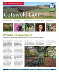
AONB LCAR S1 P1-10 FINAL - the Cotswolds Area of Outstanding ...
AONB LCAR S1 P1-10 FINAL - the Cotswolds Area of Outstanding ...
AONB LCAR S1 P1-10 FINAL - the Cotswolds Area of Outstanding ...

You also want an ePaper? Increase the reach of your titles
YUMPU automatically turns print PDFs into web optimized ePapers that Google loves.
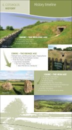
2 Evolution <strong>of</strong> <strong>the</strong> Landscape<br />
and painstakingly record <strong>the</strong> stratigraphical sequence <strong>of</strong><br />
rocks based on careful observation <strong>of</strong> <strong>the</strong> fossil record. A<br />
resident <strong>of</strong> Bath for some years, his detailed observations<br />
enabled him to prepare <strong>the</strong> first geological map <strong>of</strong><br />
<strong>the</strong> area. He subsequently went on to draw <strong>the</strong> first<br />
Geological Map <strong>of</strong> England and Wales. The representation<br />
<strong>of</strong> <strong>the</strong> Jurassic Limestone ‘stone belt’ on this remarkable<br />
historic map is particularly striking. There must be many<br />
parts <strong>of</strong> <strong>the</strong> <strong>Cotswolds</strong> that Smith would have visited and<br />
made his observations, <strong>the</strong> findings <strong>of</strong> which would<br />
subsequently have contributed to a radical change in <strong>the</strong><br />
understanding <strong>of</strong> geology, and <strong>the</strong> science <strong>of</strong> stratigraphy.<br />
2.3<br />
Landform<br />
The landform within <strong>the</strong> <strong>AONB</strong> closely reflects <strong>the</strong><br />
underlying geological structure (Figures 5 and 6). Three<br />
principal landform features may be identified within <strong>the</strong><br />
<strong>AONB</strong>: <strong>the</strong> escarpment; <strong>the</strong> escarpment valleys and<br />
outliers; and <strong>the</strong> high wold and dip-slope.<br />
2.3.1<br />
The Escarpment<br />
The escarpment is a dramatic landscape feature defining<br />
<strong>the</strong> outcrop <strong>of</strong> <strong>the</strong> Jurassic Limestone. It rises sharply to<br />
form a distinctive boundary with <strong>the</strong> undulating vale<br />
landscapes bordering <strong>the</strong> Severn Vale, and <strong>the</strong> Vale <strong>of</strong><br />
Evesham to <strong>the</strong> north. South <strong>of</strong> Hawkesbury <strong>the</strong><br />
escarpment is less than <strong>10</strong>0 m high, but at Cleeve Hill it<br />
reaches 330m AOD, <strong>the</strong> highest point in <strong>the</strong> <strong>AONB</strong>. The<br />
Inferior Oolite is <strong>the</strong> main scarp-forming rock in <strong>the</strong> north,<br />
whilst in <strong>the</strong> south this becomes thinner with Great Oolite<br />
forming <strong>the</strong> highest relief. At <strong>the</strong> base <strong>of</strong> <strong>the</strong> scarp slope<br />
Lias Group shales, sandstones and siltstones <strong>of</strong> <strong>the</strong> Lower<br />
Jurassic are exposed. These are s<strong>of</strong>t and easily wea<strong>the</strong>red<br />
and as a result have slumped or been eroded to form<br />
hummocky ground, stream valleys, and bays at <strong>the</strong> foot <strong>of</strong><br />
<strong>the</strong> escarpment, blurring <strong>the</strong> transition into <strong>the</strong> undulating<br />
landscapes <strong>of</strong> <strong>the</strong> Severn Vale which are underlain by<br />
Triassic rocks. The presence <strong>of</strong> <strong>the</strong> Lias Group Marlstone<br />
Rock, however, has resulted in <strong>the</strong> formation <strong>of</strong> secondary<br />
escarpments and fur<strong>the</strong>r localised landslips.<br />
2.3.2<br />
Escarpment Valleys and Outliers<br />
The escarpment has been progressively eroded sou<strong>the</strong>astwards<br />
as a result <strong>of</strong> fluvial and periglacial processes<br />
over many thousands <strong>of</strong> years. The retreat has followed<br />
lines <strong>of</strong> weakness, which has resulted in <strong>the</strong> creation <strong>of</strong><br />
deep, wide valleys in <strong>the</strong> vicinity <strong>of</strong> Stroud and Bath, and<br />
to a lesser extent at Winchcombe. The erosion <strong>of</strong> <strong>the</strong><br />
escarpment and its eastern retreat has also resulted in<br />
16<br />
<strong>Cotswolds</strong> <strong>AONB</strong> Partnership<br />
<strong>the</strong> creation <strong>of</strong> distinct ‘outliers’ such as Bredon Hill and<br />
Oxenton Hill. These were once part <strong>of</strong> <strong>the</strong> escarpment<br />
that lay fur<strong>the</strong>r to <strong>the</strong> west, but are now left isolated.<br />
2.3.3<br />
The High Wold and Dip-Slope<br />
In general terms, <strong>the</strong> limestone forms a discrete unit <strong>of</strong><br />
elevated land defined by <strong>the</strong> distinctive escarpment to <strong>the</strong><br />
west, from which <strong>the</strong> landscape ‘dips’ gently to <strong>the</strong> sou<strong>the</strong>ast.<br />
Whilst large table-like plateau areas are evident, and<br />
indeed characteristic <strong>of</strong> much <strong>of</strong> <strong>the</strong> landscape on <strong>the</strong><br />
high wold, <strong>the</strong> gently sloping dip-slope is prevalent, and<br />
evident as one travels from west to east. In <strong>the</strong> extreme<br />
south-east <strong>of</strong> <strong>the</strong> <strong>Cotswolds</strong> <strong>AONB</strong> in <strong>the</strong> vicinity <strong>of</strong> Bath<br />
<strong>the</strong>re is a transition to a lower area <strong>of</strong> Dip-Slope lowland<br />
forming <strong>the</strong> margin to <strong>the</strong> low-lying Thames Basin. This<br />
progression from high wold to dip-slope and dip-slope<br />
lowland is <strong>the</strong>refore a continuum, ra<strong>the</strong>r than a distinct<br />
division with clearly evident boundaries.<br />
Superimposed on this simplified structure <strong>the</strong> surface<br />
expression is <strong>of</strong>ten more complex, particularly in <strong>the</strong> west,<br />
as a result <strong>of</strong> <strong>the</strong> effect <strong>of</strong> a series <strong>of</strong> east-west fault lines<br />
and some significant folding. The effect <strong>of</strong> structural faults<br />
and folding is also evident in <strong>the</strong> north-eastern part <strong>of</strong> <strong>the</strong><br />
<strong>AONB</strong>, resulting in a complex topography <strong>of</strong> hills and<br />
valleys, isolated hills, and distinctive escarpment features<br />
associated with <strong>the</strong> Lias Group and Marlstone Rock<br />
outcrop in particular.<br />
2.4<br />
Drainage<br />
Drainage patterns are also closely linked to variations in<br />
geology. A notable feature <strong>of</strong> <strong>the</strong> escarpment slope is<br />
<strong>the</strong> high number <strong>of</strong> springs. These arise as a result <strong>of</strong> <strong>the</strong><br />
differential permeability <strong>of</strong> <strong>the</strong> Oolites and underlying Lias,<br />
with springs occurring at <strong>the</strong> junction <strong>of</strong> <strong>the</strong>se two rock<br />
series, and notably at <strong>the</strong> outcrop <strong>of</strong> <strong>the</strong> Marlstone Rock.<br />
Rivers that form on <strong>the</strong> scarp slope flow westwards into<br />
<strong>the</strong> Severn Vale and are generally short in length, such<br />
as <strong>the</strong> Cam and <strong>the</strong> Little Avon which flows through<br />
Wotton-under-Edge. Notable exceptions are <strong>the</strong> Frome<br />
and <strong>the</strong> Bristol Avon, both <strong>of</strong> which have cut through<br />
<strong>the</strong> escarpment in a series <strong>of</strong> steep sided valleys within<br />
which <strong>the</strong> towns <strong>of</strong> Stroud and Bath are situated. The<br />
size and course alignment <strong>of</strong> <strong>the</strong>se rivers is indicative <strong>of</strong><br />
a possible earlier capture <strong>of</strong> <strong>the</strong> headwaters <strong>of</strong> a number<br />
<strong>of</strong> watercourses that at one time flowed eastwards.