Project Environment - Department of Environment
Project Environment - Department of Environment
Project Environment - Department of Environment

Create successful ePaper yourself
Turn your PDF publications into a flip-book with our unique Google optimized e-Paper software.
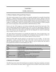
The general contour <strong>of</strong> the area shows that the topography commences from a depth <strong>of</strong> 0 feet<br />
near the shoreline to a maximum height <strong>of</strong> 2.5 feet throughout the property. This leveled contour<br />
<strong>of</strong> the project site is as a result <strong>of</strong> previous land clearing activities. Forecasted activities include<br />
elevating the land some 1-4 feet.<br />
Past topographical data concluded that this area was somewhat similar to its present state when<br />
compared to the neighboring topography and land properties. The area was also conducive <strong>of</strong><br />
lush mangrove forest with perennial swamp lands. This particular contour remains flat<br />
throughout the area.<br />
The eastern portion <strong>of</strong> the island is more indicative <strong>of</strong> continuous wave action and sand<br />
transportation dynamics. At this point, general topography is constant with a sand dune<br />
formation that has evolved over the years. These dunes generally have a sharp crest that<br />
gradually slope downwards as one goes inland.<br />
2.2.3 Soil<br />
The subsoil investigation was carried out on the site <strong>of</strong> the proposed development <strong>of</strong> the Pelican<br />
Point Marina and Yacht Club. Probing were conducted on land at various strategic locations and<br />
also carried out in the sea where the proposed marina is to be constructed.<br />
This report describes the site investigation carried out at the site and presents technical<br />
recommendations for the design <strong>of</strong> the structural facilities based on the findings, and also <strong>of</strong> the<br />
associated hazards such as hurricanes and seismic activity that can possibly be encountered at<br />
this site.<br />
The soils investigation for Pelican Point Marina and Yacht Club was carried out and supervised<br />
by Mr. Alberto A. Rosado, a Civil and Structural Engineer assisted by two technicians in<br />
February 2007.<br />
The programme <strong>of</strong> probing was as follows:<br />
BH # 1, 2, 3, 4, 5 February 2007<br />
SB # 1, 2, 3, 4 February 2007<br />
Probes Numbers BH1, BH2, BH3, BH4 and BH5 were conducted on the property upon which<br />
the resort development is being proposed. A development proposal was used to locate the probes<br />
where the main building structures are being considered.<br />
Probes Numbers SB1, SB2, SB3, and SB4 were conducted in the sea immediately in front <strong>of</strong> the<br />
property where the marina for the resort development is being proposed.<br />
The equipment used for this investigation was a Mackintosh Probe manufactured by Engineering<br />
Laboratory Equipment. The probe locations are indicated on the Probe Location Plan (See Fig.<br />
2.2). A more detailed site investigation is presented in Chapter 9 <strong>of</strong> this document.<br />
2-4