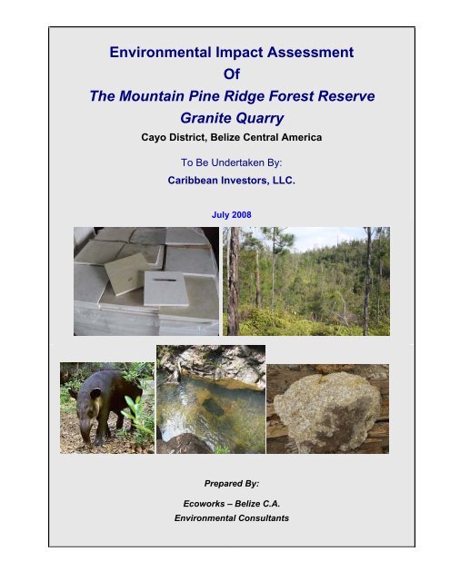
Environmental Impact Assessment Of The Mountain Pine Ridge ...
Environmental Impact Assessment Of The Mountain Pine Ridge ...
Environmental Impact Assessment Of The Mountain Pine Ridge ...

You also want an ePaper? Increase the reach of your titles
YUMPU automatically turns print PDFs into web optimized ePapers that Google loves.
<strong>Environmental</strong> <strong>Impact</strong> <strong>Assessment</strong><br />
<strong>Of</strong><br />
<strong>The</strong> <strong>Mountain</strong> <strong>Pine</strong> <strong>Ridge</strong> Forest Reserve<br />
Granite Quarry<br />
Cayo District, Belize Central America<br />
To Be Undertaken By:<br />
Caribbean Investors, LLC.<br />
July 2008<br />
Prepared By:<br />
Ecoworks – Belize C.A.<br />
<strong>Environmental</strong> Consultants<br />
i
THE ENVIRONMENTAL IMPACT ASSESSMENT TEAM 1<br />
THOM GRIMSHAW<br />
PROJECT COORDINATOR, EDITOR, AQUATIC RESOURCE & REMOTE SENSING<br />
SPECIALIST, ECOWORKS ENVIRONMENTAL CONSULTING SERVICES<br />
ARLENE MAHEIA<br />
CO-EDITOR<br />
ECOWORKS ENVIRONMENTAL CONSULTING SERVICES<br />
DR. COLIN YOUNG<br />
ECOYSYSTEM SPECIALIST,<br />
GALEN UNIVERSITY<br />
DAVID TZUL<br />
BIRD SPECIALIST,<br />
CHA CREEK RESORT<br />
SHERRY GIBBS<br />
ARCHAEOLOGISTS,<br />
INSTITUTE OF ARCHAELOGY<br />
1 Team References Are Shown In Addendum 1.<br />
ii
CONTENTS<br />
TITLE PAGE<br />
COVER PAGE II<br />
EIA TEAM II<br />
CONTENTS III<br />
LIST OF TABLES VIII<br />
LIST OF ILLUSTRATIONS IX<br />
LIST OF TEXT BOXES XI<br />
LIST OF ABBREVIATIONS XII<br />
EXECUTIVE SUMMARY 1<br />
DEVELOPMENT PROFILE 1<br />
WILDLIFE PROFILE AND CONSERVATION PLAN 6<br />
LEGAL, POLICY AND ADMINISTRATIVE FRAMEWORK 6<br />
International Conventions and Treaties 6<br />
National Development Guidelines 8<br />
Laws of Belize 8<br />
IMPACTS AND MITIGATION 11<br />
1 THE PROJECT DESCRIPTION 13<br />
PROJECT CHARACTERISTICS 13<br />
Project Objectives, Ownership, Location & Land Tenure 13<br />
<strong>The</strong> Mining Process 18<br />
Material Transport and Processing 20<br />
Air & Noise Pollution Management 20<br />
Site Decommissioning & Rehabilitation Plan 24<br />
Staff Requirements 24<br />
Water Supply & Treatment 25<br />
Solid Waste Management Plan 25<br />
Power Requirements 25<br />
Management Structure For <strong>The</strong> Overall Development 26<br />
2 THE PROJECT ENVIRONMENT 28<br />
METEOROLOGICAL AND HYDROLOGICAL CHARACTERISTICS 28<br />
Hurricanes 30<br />
Rainfall Volume 30<br />
Groundwater Volume 30<br />
Surface Water Quality 33<br />
Conclusions & Recommendations 33<br />
GEOLOGY 34<br />
Geologic Setting 34<br />
Geomorphology & Topography 34<br />
Tectonics 36<br />
Stratigraphy 36<br />
Soil Structure & Classification 36<br />
Soil Percolation 39<br />
Test Boring of Granite Basement Rock 42<br />
iii<br />
Continue…
TITLE<br />
CONTENTS<br />
(Continued…)<br />
Conclusions & Recommendations 42<br />
FLORA AND FAUNA 43<br />
Aquatic Habitat and Wildlife 43<br />
Conclusions 43<br />
Terrestrial Habitats 45<br />
<strong>Assessment</strong> Methodology 45<br />
Land Use History 46<br />
Results 46<br />
Woodland and <strong>Pine</strong> <strong>Ridge</strong> 46<br />
Oak Thicket 46<br />
Tiger Fern Thicket 49<br />
Results & Recommendations 49<br />
Terrestrial Wildlife 52<br />
Flora 52<br />
Avian Fauna 52<br />
<strong>Assessment</strong> Methodology 52<br />
Results 52<br />
Terrestrial Fauna 52<br />
HISTORICAL AND CONTEMPORARY LAND USE 60<br />
Cultural History of <strong>Mountain</strong> <strong>Pine</strong> <strong>Ridge</strong> 60<br />
Archaeological Survey of the Mining Site 60<br />
Methodology 60<br />
Results 61<br />
Conclusion & Recommendations 61<br />
Contemporary Land Use 69<br />
3 MINING OPERATIONS AND SITE REHABILITATION 72<br />
MATERIAL SUPPLY OPTIONS 73<br />
Area Stratigraphy And Material Supply Options 73<br />
Material Yield, Quarry Waste And Final Grade 75<br />
SOIL AND OVERBURDEN REMOVAL IMPACTS AND MITIGATION MEASURES 76<br />
Physical <strong>Impact</strong>s 76<br />
Biological <strong>Impact</strong>s 76<br />
Water Resource <strong>Impact</strong>s 78<br />
Monitoring Requirements 78<br />
GRANITE MINING AND EXTRACTION IMPACTS AND MITIGATION MEASURES 79<br />
Physical <strong>Impact</strong>s 79<br />
Biological <strong>Impact</strong>s 81<br />
Water Resource <strong>Impact</strong>s 82<br />
Monitoring Requirements 82<br />
MINING WASTE TREATMENT IMPACTS AND MITIGATION MEASURES 83<br />
Physical <strong>Impact</strong>s 83<br />
Biological <strong>Impact</strong>s 83<br />
iv<br />
PAGE<br />
Continued…
CONTENTS<br />
(Continued)<br />
TITLE PAGE<br />
Water Resource <strong>Impact</strong>s 83<br />
Monitoring Requirements 85<br />
SITE DECOMISSIONING AND REHABILITATION IMPACTS AND MITIGATION MEASURES 86<br />
Physical <strong>Impact</strong>s 86<br />
Biological <strong>Impact</strong>s 86<br />
Water Resource <strong>Impact</strong>s 86<br />
Monitoring Requirements 86<br />
4 AIR & NOISE POLLUTION 90<br />
SOURCES OF AND INFLUENCES ON AIR AND NOISE POLLUTION 90<br />
AIR AND NOISE POLLUTION IMPACTS AND MITIGATION MEASURES 91<br />
Air Pollution 91<br />
Noise Pollution 93<br />
Monitoring Requirements 93<br />
5 TRANSPORTATION 95<br />
MATERIAL-BASED TRANSPORTATION PLAN 95<br />
MATERIAL IMPACTS AND MITIGATION MEASURES 98<br />
Physical <strong>Impact</strong>s 98<br />
Biological <strong>Impact</strong>s 98<br />
Water Resource <strong>Impact</strong>s 100<br />
Monitoring Requirements 100<br />
6 LIQUID WASTE PRODUCTION AND MANAGEMENT 102<br />
EFFLUENT CLASSIFICATION AND VOLUME ESTIMATE 102<br />
TREATMENT OPTION AND SITE REMEDIATION CAPACITY 103<br />
Treatment Options 103<br />
Leach Field Site Selection and Design Plan 103<br />
Settling Pond Runoffs 103<br />
DOMESTIC EFFLUENT IMPACTS AND MITIGATION MEASURES 104<br />
Physical <strong>Impact</strong>s 104<br />
Biological <strong>Impact</strong>s 104<br />
Water Resource <strong>Impact</strong>s 104<br />
Monitoring Requirements 106<br />
7 SOLID WASTE MANAGEMENT 108<br />
COMPOSITION, VOLUME, AND TREATMENT OPTIONS FOR SOLID WASTE GENERATION 108<br />
SOLID WASTE TREATMENT IMPACTS AND MITIGATION MEASURES 110<br />
Physical <strong>Impact</strong>s 110<br />
Biological <strong>Impact</strong>s 110<br />
Water Resource <strong>Impact</strong>s 110<br />
Monitoring Requirements 110<br />
8 ENERGY USE 113<br />
ENERGY REQUIRMENTS AND SUPPLY OPTIONS 113<br />
ENERGY USE IMPACTS AND MITIGATION MEASURES 114<br />
v<br />
Continued…
CONTENTS<br />
(Continued)<br />
TITLE PAGE<br />
Fuel <strong>Impact</strong>s<br />
Health and Safety <strong>Impact</strong>s 114<br />
Pollution <strong>Impact</strong>s 116<br />
Monitoring Requirements 116<br />
9 WILDLIFE 118<br />
SITE HABITAT AND WILDLIFFE SPECIES 118<br />
WILDLIFE IMPACTS AND MITIGATION MEASURES 118<br />
Terrestrial Habitat <strong>Impact</strong>s 118<br />
Species-Specific <strong>Impact</strong>s 121<br />
Monitoring Requirements 122<br />
10 CULTURE, CUSTOMS, AND SOCIAL FACTORS 124<br />
CULTURAL IMPACT RISKS 124<br />
CUSTOM AND SOCIAL CHARACTERISTICS 124<br />
Employment Characteristics 124<br />
Customs and Culture 125<br />
Health Care Provision 125<br />
Climate Change 125<br />
Concerns of Residential Tourism Establishments 125<br />
Concerns of Relevant Governmental Departments 126<br />
BENEFITS, IMPACTS AND MITIGATION MEASURES 127<br />
Cultural <strong>Impact</strong>s 127<br />
Social <strong>Impact</strong>s 127<br />
Human Health <strong>Impact</strong>s 127<br />
Human Safety <strong>Impact</strong>s 127<br />
Monitoring Requirements 130<br />
11.1 DISASTER MANAGEMENT-Specific to Personal Injury, Operational Safety & Security 132<br />
HUMAN HEALTH AND SAFETY PLAN 132<br />
EXPLOSION MANAGEMENT PLAN 133<br />
FIRE PREPAREDNESS PLAN 134<br />
11.2 DISASTER MANAGEMENT -Specific to Equip. Malfunction, Shutdown & Traffic Incident 135<br />
PREPAREDNESS PLAN FOR EQUIPMENT MALFUNCTION AND SHUTDOWN EVENTS 135<br />
ROAD TRAFFIC INCIDENT PREPAREDNESS PLAN 136<br />
11.3 DISASTER MANAGEMENT-Specific to Hurricanes & Related Natural Disasters 137<br />
HURRICANE PREPAREDNESS ACTION PLAN 137<br />
Hurricane Characteristics 137<br />
Stage I: Preliminary Alert 138<br />
Stage II: Red I-Watch 138<br />
Stage III: Red II-Warning 144<br />
Stage IV: All Clear 144<br />
12 ALTERNATIVES FOR DEVELOPMENT 145<br />
EXAMINATION OF ALTERNATIVES TO DEVELOPMENT 145<br />
Siting Options 145<br />
vi<br />
Continued…
CONTENTS<br />
(Continued)<br />
TITLE PAGE<br />
Material Supply Options 145<br />
Material-Based Transportation Options 147<br />
Liquid Waste Treatment Options<br />
Solid Waste Treatment Options 147<br />
Energy Use Options 148<br />
13 MITIGATION MEASURES AND MONITORING PLANS 149<br />
MITIGATION MEASURES FOR THE PROPOSED DEVELOPMENT 149<br />
Construction and Habitat <strong>Impact</strong>s 149<br />
Soil and Overburden Removal <strong>Impact</strong>s 149<br />
Granite Mining and Extraction <strong>Impact</strong>s 155<br />
Mining Waste Treatment <strong>Impact</strong>s 156<br />
Site Decommissioning and Rehabilitation <strong>Impact</strong>s 156<br />
Air & Noise Pollution <strong>Impact</strong>s 156<br />
Material-Based Transportation <strong>Impact</strong>s 157<br />
Liquid Waste Discharge <strong>Impact</strong>s 158<br />
Solid Waste Storage <strong>Impact</strong>s 159<br />
Energy Use <strong>Impact</strong>s 159<br />
Wildlife <strong>Impact</strong>s 160<br />
Culture, Customs & Social <strong>Impact</strong>s 160<br />
CUMULATIVE IMPACTS 161<br />
MONITORING PLANS FOR THE PROPOSED DEVELOPMENT 163<br />
Soil & Overburden Removal Monitoring Requirements 163<br />
Granite Mining and Extraction Monitoring Requirements 163<br />
Mining Waste Treatment Monitoring Requirements 163<br />
Site Decommissioning and Rehabilitation Monitoring Requirements 163<br />
Air & Noise Pollution Monitoring Requirements 163<br />
Material-Based Transportation Monitoring Requirements 163<br />
Liquid Waste Monitoring Requirements 163<br />
Solid Waste Monitoring Requirements 167<br />
Energy Monitoring Requirements 167<br />
Wildlife Monitoring Requirements 167<br />
Culture, Customs & Social Monitoring Requirements 167<br />
REPORT ADDENDA NUMBER<br />
PREPARER’S RESUMES 1<br />
CARIBBEAN INVESTORS INCORPORATION CERTIFICATE 2<br />
CARIBBEAN MARBLE INCORPORATION CERTIFICATE 3<br />
DOE COMMUNICATIONS 4<br />
FORESTRY CAMPING PERMIT 5<br />
MINING LICENSE 6<br />
LAWS OF BELIZE 7<br />
WATER QUALITY TEST RESULTS 8<br />
vii<br />
147<br />
Continued…
CONTENTS<br />
(Continued)<br />
TITLE NUMBER<br />
ADDENDA<br />
CHAN KEE KWON REPORT 9<br />
BLASTER’S LICENSE 10<br />
STAKEHOLDER SURVEY 11<br />
NGO SURVEY 12<br />
BLASTING SAFETY GUIDELINES 13<br />
LITERATURE CITED 14<br />
viii<br />
…End
LIST OF TABLES PRESENTED<br />
NUMBER TITLE PAGE<br />
CONTENTS lll<br />
LIST OF TABLES PRESENTED Vll<br />
LIST OF ILLUSTRATIONS PRESENTED lX<br />
LIST OF TEXT BOXES Xl<br />
LIST OF ABBREVIATIONS Xll<br />
1 PRIMARY CHARACTERISTICS OF THE GRANITE MINING PROJECT 5<br />
2 LEGISLATION RELEVANT TO THE DEVELOPMENT 9<br />
3 KEY DEVELOPMENT IMPACTS AND MITIGATION MEASURES 12<br />
4 WATER QUALITY PARAMATERS FOR PINOL CREEK 33<br />
5 PLANT SPECIES OF THE 40-ACRE MOUNTAIN PINE RIDGE PROPERTY 50<br />
6 PLANTS THAT PROVIDE FOOD FOR BIRDS 54<br />
7 BIRDS THAT NESTS IN PINE SAVANNAS 54<br />
8 BIRD SPECIES ENCOUNTERED IN OR NEAR THE 40-ACRE MOUNTAIN PINE RIDGE PROPERTY 55<br />
9 TERRESTRIAL FAUNA OF THE MOUNTAIN PINE RIDGE FOREST RESERVE 58<br />
10 SPECIES OF CONSERVATION VALUE IN MOUNTAIN PINE RIDGE FOREST RESERVE 59<br />
11 BOREHOLE SURVEY RESULTS FOR THE PROPOSED MINING SITE ON OAK BURN LINE ROAD 74<br />
12 MITIGATION MATRIX OF SOIL AND OVERBURDEN REMOVAL IMPACTS 77<br />
13 MITIGATION MATRIX OF GRANITE MINING AND EXTRACTION IMPACTS 80<br />
14 MITIGATION MATRIX OF MINING WASTE TREATMENT IMPACTS 84<br />
15 MITIGATION MATRIX OF SITE DECOMISSIONING AND REHABILITATION IMPACTS 87<br />
16 MITIGATION MATRIX OF AIR & NOISE POLLUTION IMPACTS 92<br />
17 MITIGATION MATRIX OF MATERIAL-BASED TRANSPORTATION IMPACTS 99<br />
18 EFFLUENT DISCHARGE ESTIMATES FOR THE MINING SITE 102<br />
19 MITIGATION MATRIX OF LIQUID WASTE TREATMENT IMPACTS 105<br />
20 MUNICIPAL SOLID WASTE PRODUCTION ESTIMATES FOR THE ENTIRE DEVELOPMENT 109<br />
21 MITIGATION MATRIX OF SOLID WASTE TREATMENT IMPACTS 111<br />
22 ENERGY REQUIREMENTS FOR THE ENTIRE DEVELOPMENT 113<br />
23 MITIGATION MATRIX OF ENERGY SUPPLY/USAGE IMPACTS 115<br />
24 SUMMARY OF WILDLIFE PROFILE FOR THE PROPOSED DEVELOPMENT SITE 119<br />
25 MITIGATION MATRIX OF WILDLIFE IMPACTS 120<br />
26 MITIGATION MATRIX OF CULTURAL AND SOCIAL IMPACTS 128<br />
27 PROCEDURES WHICH SHOULD BE IMPLEMENTED ON OR BEFORE JUNE 1 EACH YEAR 141<br />
28 WORK PLAN TO BE IMPLEMENTED DURING HURRICANE WARNING PHASES l AND ll 142<br />
29 COMPONENT-SPECIFIC HURRICANE PREPAREDNESS PLAN FOR THE MINING SITE 143<br />
30 SUMMARY OF DEVELOPMENT ALTERNATIVES AND IMPACTS 146<br />
31 SUMMARY MITIGATION MATRIX OF DEVELOPMENT IMPACTS 150<br />
32 MONITORING PLAN FOR THE ENTIRE DEVELOPMENT 164<br />
ix<br />
…End
LIST OF ILLUSTRATIONS PRESENTED<br />
NUMBER TITLE PAGE<br />
1 LOCATION OF THE PROPOSED DEVELOPMENT SITE 2<br />
2 2000 LANDSAT 7 SATELLITE IMAGE OF THE MINING SITE 3<br />
3 1:50,000 SCALE TOPOGRAPHIC LOCATION MAP OF THE MINING SITE 4<br />
4 WILDLIFE OF THE PROJECT DEVELOPMENT SITE 7<br />
5 1:50,000 SCALE TOPOGRAPHIC MAP OF THE PROJECT SITE 14<br />
6 LOCATION MAP OF THE QUARRY SITE WITHIN THE MOUNTAIN PINE RIDGE REGION OF BELIZE 15<br />
7 AERIAL VIEW OF THE 40-ACRE MINING SITE LOOKING NORTHEAST ALONG PINOL TRACK 16<br />
8 GROUND VIEW OF THE MINING SITE 17<br />
9 GROUND VIEW OF THE MINING SITE AND MATERIAL SAMPLES 19<br />
10 RELATIVE ELEVATION MODEL OF THE 40-ACRE MINING SITE 21<br />
11 TRANSVERSE CUT-AWAY THROUGH RIDGELINE AT MINING SITE 22<br />
12 THE FACTORY FLOOR AND FINISHED QUARRY PRODUCTS 23<br />
13 MANAGEMENT STRUCTURE OF CARIBBEAN MARBLE AND CONCRETE MANUFACTURING LTD 27<br />
14 HURRICANES AND TROPICAL STORMS CROSSING INTO WEST-CENTRAL BELIZE 29<br />
15 ANNUAL PROBABILITY OF TROPICAL STORMS: 1944-1999 31<br />
16 MEAN MONTHLY RAINFALL AT AUGUSTINE, MOUNTAIN PINE RIDGE 30<br />
17 ANNUAL RAINFALL ISOPLETHS FOR BELIZE 32<br />
18 GEOLOGICAL MAP FOR THE PROJECT AREA 35<br />
19 PRINCIPLE FAULT SYSTEMS IN THE VICINITY OF THE PROJECT SITE 37<br />
20 GROUNDWATER FLOW & WEATHERING ALONG SIDESLOPES 36<br />
21 AERIAL VIEW OF THE PROJECT SITE TOPOGRAPHIC SURVEY ALIGNMENT 38<br />
22 LOCATION OF PERCOLATION TEST SITES AND BOREHOLE SURVEY SITES 40<br />
23 SOIL PERCOLATION TEST SITES EXAMINED IN MAY 2008 AT THE DEVELOPMENT SITE 41<br />
24 AQUATIC WILDLIFE AT THE PINOL CREEK BRIDGE CROSSING 43<br />
25 AERIAL VIEW OF THE 40-ACRE MINING SITE ROAD 47<br />
26 HABITAT TYPES OF THE DEVELOPMENT SITE 48<br />
27 IMPORTANT FLORA TYPICAL OF THE DEVELOPMENT SITE 53<br />
28 TERRESTRIAL FAUNA OF THE MOUNTAIN PINE RIDGE FOREST RESERVE 57<br />
29 CULTURAL SITES IN THE VICINITY OF THE MOUNTAIN PINE RIDGE 62<br />
30 HPA SITE 4 NORTH VIEW(ABOVE), WEST VIEW(BELOW) 63<br />
31 HPA SITE 4 FEATURES(ABOVE) AND CONTEXT(BELOW) 64<br />
32 HPA SITE 4 LITHIC, SIDE A (ABOVE), AND SIDE B (BELOW) 65<br />
33 HPA SITE 6 CONTEXT (ABOVE), GRANITE FRAGMENTS (BELOW) 66<br />
34 HPA SITE 6 CLOSEUP OF GRANITE FRAGMENTS (ABOVE), CONTEXT (BELOW) 67<br />
35 HPA SITE 8 GRANITE FRAGMENTS POSITION IN RESPECT OF WEATHERING 68<br />
36 TOURISM FACILITIES IN THE VICINITY OF THE PROJECT SITE 70<br />
37 ZONE OF FRACTURING AND DEFORM-ATION AROUND AN EXPLOSION IN ROCK 79<br />
38 SOUND ATTENUATION OF EQUIPMENT NOISE 91<br />
39 PROPOSED TRUCKING ROUTE FOR MINNED GRANITE BLOCKS 96<br />
40 TOURISM DESTINATIONS ALONG THE PROPOSED TRANSPORTATION ROUTE 97<br />
41 LEACH FIELD DESIGN 103<br />
42 THE FOUR FLAGS OF HURRICANE STATUS IN BELIZE 139<br />
x<br />
Continued…
LIST OF ILLUSTRATIONS PRESENTED<br />
(Continued…)<br />
NUMBER TITLE PAGE<br />
43 HURRICANE TRACKING CHART FOR THE BELIZE REGION 140<br />
44 MONITORING PLAN FOR THE ENTIRE DEVELOPMENT 166<br />
LIST OF TEXT BOXES PRESENTED<br />
xi<br />
… End<br />
NUMBER TITLE PAGE<br />
1 KEY RECOMMENDATIONS 71<br />
2 KEY SITE DECOMISSIONING & REHABILITATION IMPACTS & MITIGATION RECOMMENDATIONS 88<br />
3 KEY AIR/NOISE POLLUTION IMPACTS & MITIGATION RECOMMENDATIONS 94<br />
4 KEY MATERIAL-BASED TRANSPORT IMPACTS & MITIGATION RECOMMENDATIONS 101<br />
5 KEY LIQUID WASTE DISCHARGE IMPACTS & MITIGATION RECOMMENDATIONS 107<br />
6 KEY SOLID WASTE TREATMENT IMPACTS AND MITIGATION RECOMMENDATIONS 112<br />
7 KEY ENERGY SUPPLY/USE IMPACTS AND MITIGATION RECOMMENDATIONS 117<br />
8 KEY WILDLIFE IMPACTS AND MITIGATION RECOMMENDATIONS 123<br />
9 SUMMARY OF CULTURAL AND SOCIAL IMPACTS AND MITIGATION RECOMMENDATIONS 131
Ac Acres (area)<br />
AIA Archaeological <strong>Impact</strong> <strong>Assessment</strong><br />
BEL Belize Electricity Limited<br />
BERT Belize Emergency Response Team<br />
BNMS Belize National Meteorological Service<br />
BP Before Present<br />
BRL Barrier Reef Lagoon<br />
BTU British <strong>The</strong>rmal Units<br />
COD Chemical Oxygen Demand<br />
CG Confluent growth<br />
DOE Department of the Environment<br />
EIA <strong>Environmental</strong> <strong>Impact</strong> <strong>Assessment</strong><br />
ft Feet, Foot<br />
gal Gallon(s)<br />
GPM Gallons per Minute<br />
ha Hectares (area)<br />
HPA High Probability Area<br />
hr, hrs Hour(s) (time)<br />
in Inches<br />
kg Kilograms<br />
km Kilometers<br />
kW Kilowatt<br />
lb Pound (weight)<br />
M Millions, Meters<br />
mg Milligram<br />
min Minute (time)<br />
mm Millimeters<br />
mph Miles per Hour<br />
MSW Municipal Solid Waste<br />
mt Metric Ton<br />
mW Megawatts<br />
LIST OF ABBREVIATIONS<br />
NEMO National Emergency Management Organization<br />
NICH National Institute of Culture and History<br />
NOAA National Oceanic and Atmospheric Administration<br />
PFR Preliminary Field Reconnaissance<br />
ppm parts per million<br />
RBA Rapid Biological <strong>Assessment</strong><br />
RWS Rudimentary (Rural) Water System<br />
TNTC Too Numerous To Count<br />
TSS Total Suspended Solids<br />
xii
EXECUTIVE SUMMARY<br />
DEVELOPMENT PROFILE<br />
<strong>The</strong> project planned for development is being proposed by Caribbean Marble and Concrete<br />
Manufacturing Limited (CMCML), a wholly-owned subsidiary of Caribbean Investors Limited, both of<br />
which are limited liability companies duly registered in Belize (see Addenda 2 - 3). <strong>The</strong> company is<br />
proposing to extract granite boulders and blocks from a 40-acre (16-Ha) parcel of land measuring<br />
200 x 810 meters that is located in the northwest quadrant of the <strong>Mountain</strong> <strong>Pine</strong> <strong>Ridge</strong> Forest<br />
Reserve, approximately 12.5 miles (20 Km) southeast of San Antonio Village in the Cayo District of<br />
Belize. <strong>The</strong> site extends southwest from Oak Burn Line Road, along an unnamed track between<br />
two upper branches of Pinol Creek, which discharges directly into the Macal River, upstream and<br />
across the divide from Vaqueros Creek, which supplies nearby San Antonio Village (see<br />
Illustrations 1-3). Tenure of the site is effected by a license to occupy the site from the Belize<br />
Forestry Department (pending environmental review), and Mining License No 20 dated 5 October,<br />
2007 (see Addendum 4), the latter of which conveys the right to enter, occupy and mine the<br />
subject property for a period of 5 years.<br />
<strong>The</strong> overall mining plan will entail removal of soil and overburden from the quarry zone using heavy<br />
machinery to push off the soil fraction and weathered overburden that has been cut away from the<br />
underlying fresh granite. Fresh, solid and/or fracture free granite blocks averaging 12 cubic meters<br />
(15 tons) each will subsequently be cut and blasted from the basement granite batholith to a mean<br />
depth of < 55 meters below the surface of the southwestern half of the mining site and thereafter<br />
transported to the factory in Belmopan for cutting and polishing into export grade product.<br />
Extracted, 15 ton granite blocks will be transported from the mining site to a milling factory located<br />
at Mile 46.2 on the Western Highway (Belmopan City), cut & polish the boulders and blocks into<br />
finished floor tiles, bricks, counter-tops and other building products, and subsequently export them<br />
for sale in the US and other international markets.<br />
Block-laden tractor-trailers will travel along the unsurfaced Oak Burn Line and Chiquibul Roads for<br />
a distance of approximately 20 miles (30 Kms) to Georgeville, and thereafter for a distance of<br />
approximately 15 miles (25 Km) to Mile 46.2 on the Western Highway at the entrance onto George<br />
Price Boulevard, and a short distance along the Boulevard to CMCML’s factory site. Transportation<br />
load at maximum development is estimated on the basis of an assumed mining yield of 300 cubic<br />
meters per day, which at a specific gravity for granite of 2.69 would translate to 807 tons per day, 5<br />
days a week, 52 weeks per year, for an overall annual extraction rate of approximately 210,000<br />
tons per annum. Given a mean depth to fresh granite in the area of 12 meters, the total soil and<br />
overburden volume likely to be removed from the fresh granite surface of the mining site would be<br />
expected to be on the order of: 200 x 405 x 12, or approximately 1 million cubic meters; while the<br />
total fresh granite yield is expected to be on the order of 200 x 405 x 43, or 3.5 million cubic meters.<br />
Approximately 75% of the quarried block is lost to handling and processing waste (which is recycled<br />
into concrete mix and chip stone), indicating the export grade yield from half the mining site is on<br />
the order of 875,000 tons. Hence, the mining life of half of this area is on the order of 4. 2 years.<br />
<strong>The</strong> <strong>Mountain</strong> <strong>Pine</strong> <strong>Ridge</strong> Granite Quarry EIA / Ecoworks Page 1 of 167
ILLUSTRATION 1:<br />
LOCATION OF THE PROPOSED DEVELOPMENT<br />
<strong>The</strong> <strong>Mountain</strong> <strong>Pine</strong> <strong>Ridge</strong> Granite Quarry EIA / Ecoworks Page 2 of 167
ILLUSTRATION 2:<br />
2000 LANDSAT-7 SATELLITE IMAGE OF THE MINING SITE POSITION WITHIN THE<br />
MOUNTAIN PINE RIDGE REGION OF BELIZE<br />
<strong>The</strong> <strong>Mountain</strong> <strong>Pine</strong> <strong>Ridge</strong> Granite Quarry EIA / Ecoworks Page 3 of 167
ILLUSTRATION 3:<br />
1:50,000 SCALE TOPOGRAPHIC LOCATION MAP OF THE MINING SITE AND<br />
TOURISM AMMENITIES WITHIN THE MOUNTAIN PINE RIDGE REGION OF BELIZE<br />
<strong>The</strong> <strong>Mountain</strong> <strong>Pine</strong> <strong>Ridge</strong> Granite Quarry EIA / Ecoworks Page 4 of 167
TABLE 1<br />
PRIMARY CHARACTERISTICS OF THE GRAINTE MINING PROJECT<br />
FEATURE PARAMETER<br />
Subject Request: <strong>Environmental</strong> Clearance for Development<br />
Type of Development: Granite Mining Operation<br />
Total Capital Investment: > US $ 25 m<br />
Labor and Management: Local, with limited expatriate management support<br />
Land Characteristics<br />
Total Property Area 40 Acres<br />
Workable Land Unit 35 Acres<br />
Development Plan 35 Acres<br />
Development Plan as Percent of Workable Land Unit 100%<br />
Design Capacity<br />
Maximum Human Occupation (Management & Staff) < 120<br />
Employment<br />
Construction Phase > 120<br />
Operating Phase > 120<br />
Wildlife<br />
Number of Dependent Species:<br />
Endangered, Threatened or Vulnerable Species<br />
> 89<br />
Ecosystems / Plants: <strong>Pine</strong> Savanna / ~60 Sp.<br />
Reptiles: Inland, Non-Specific<br />
Birds: Inland, Non-Specific / ~40 Sp.<br />
Mammals:<br />
~30 Sp./ 11 of which are listed by IUCN To Range From Vulnerable to<br />
Endangered<br />
<strong>The</strong> <strong>Mountain</strong> <strong>Pine</strong> <strong>Ridge</strong> Granite Quarry EIA / Ecoworks Page 5 of 167
<strong>The</strong> total number of staff to be engaged in mining, processing and export will be approximately 120<br />
persons who will be divided approximately equally between the mining and factory site. Potable<br />
water supply for the development will be obtained from a combination of rainwater capture in<br />
cisterns, direct supply from Pinol Creek, and direct supply from the Belmopan municipal water<br />
supply system. Effluent discharge from the development will be treated by septic tank and leach<br />
field facilities. Solid waste management will rely on partial source separation, with combustible and<br />
bio-degradable waste being treated onsite, and all other solid waste being stored at the regional<br />
solid waste storage facility closest to either Cayo or Belmopan, in keeping with the national solid<br />
waste management plan.<br />
WILDLIFE PROFILE AND CONSERVATION PLAN<br />
A rapid biological assessment (RBA) of the proposed development site established that three<br />
habitat types common to the <strong>Mountain</strong> <strong>Pine</strong> <strong>Ridge</strong> region of Belize were extent at the mining site,<br />
which included Woodland and <strong>Pine</strong> <strong>Ridge</strong>; Oak Thicket; and Tiger Fern Thicket. <strong>The</strong> overall<br />
taxonomic diversity of plants on the 40-acre property was low but typical for the ecosystem type(s)<br />
represented, with a combined total of 59 plant species representing 49 genera and 35 families<br />
found to be extent on the property. Wildlife diversity of the project site was equally low but typical<br />
for the ecosystem types represented, with the most important transient species of conservation<br />
interest including a range of Mammals (e.g. Tailed Deer, Baird’s Tapir, Jaguar, Ocelot, and etc.),<br />
along with the year round or seasonal occurrence of some 38 species of birds common to the<br />
<strong>Mountain</strong> <strong>Pine</strong> <strong>Ridge</strong> region of Belize (see Illustration 4). Consequently, development of the<br />
mining site as a granite quarry is not anticipated to create any direct or unmitigated impacts on<br />
wildlife species of particular conservation interest.<br />
LEGAL, POLICY AND ADMINISTRATIVE FRAMEWORK<br />
<strong>The</strong> legal, policy and administrative framework relevant to the proposed development delineate the<br />
obligations and responsibilities of the project proponent as well as those of the Government of<br />
Belize with respect to conservation practice. This framework is loosely embodied by international<br />
conventions and treaties, the laws of Belize (Revised 2000), and policy guidelines developed by<br />
national institutions from time to time.<br />
International Conventions and Treaties<br />
<strong>The</strong>re are a number of international conventions and treaties that Belize has enjoined which are<br />
principally concerned with conservation practices and compliance at the national level (see Table<br />
2). <strong>The</strong> key conventions of particular relevance to the proposed development concern the<br />
International Convention on Biological Diversity, and the Central American Biodiversity<br />
Convention, which specifically address conservation of biodiversity, sustainable use and sharing<br />
the benefits of biodiversity.<br />
<strong>The</strong> <strong>Mountain</strong> <strong>Pine</strong> <strong>Ridge</strong> Granite Quarry EIA / Ecoworks Page 6 of 167
ILLUSTRATION 4: WILDLIFE OF THE PROJECT DEVELOPMENT SITE<br />
Left Column, top to bottom: <strong>Pine</strong>, Savanna and Riverine forests (respectively) of the project site. Center Column, top to bottom: An<br />
unidentified passion flower, Chamedoria sp. seed cluster, and unidentified hedge flower. Right Column, top to bottom: White-Tailed Deer<br />
(Odocoileus virginianus), Puma (Puma concolor), and Baird’s Tapir (Tapirus bairdii).<br />
<strong>The</strong> <strong>Mountain</strong> <strong>Pine</strong> <strong>Ridge</strong> Granite Quarry EIA / Ecoworks Page 7 of 167
<strong>The</strong> proposed development does not materially contravene these conventions as a result of its<br />
nominal footprint within the greater protected area of <strong>Mountain</strong> <strong>Pine</strong> <strong>Ridge</strong> Forest Reserve and<br />
the fully reversible, short term duration of any impact it may impose on area wildlife. CITES<br />
(Convention on International Trade in Endangered Species) guidelines for conservation of rare,<br />
threatened and endangered species will also be adhered to by the proposed development as no<br />
ranked or protected species will be captured, traded or eliminated by the proposed development.<br />
Consequently none of the proposed development’s activities are anticipated to present any<br />
unmitigated conflict(s) with Belize’s existing framework of conservation conventions and treaties.<br />
National Development Guidelines<br />
No development guidelines have been formally drafted for the <strong>Mountain</strong> <strong>Pine</strong> <strong>Ridge</strong> area of Belize<br />
outside of those enshrined in the Forests and Mining Acts (Chapters 213 and 226, respectively in<br />
the Laws of Belize, Revised 2000). Rather, tacit policy has been to require a designated permitting<br />
procedure be followed as dictated by both the above-referenced Acts, and the <strong>Environmental</strong><br />
Protection Act (Chapter 328, in the Laws of Belize, Revised 2000), which together cause the<br />
proponent to mitigate any significant environmental impacts posed by the proposed development;<br />
thereby creating an enabling mechanism for procurement of the economic opportunity and hence,<br />
positive social impact that environmentally responsible mining of Belize’s mineral resources for<br />
export can provide to the nation of Belize.<br />
Laws of Belize<br />
<strong>The</strong> governing component of the legal framework is provided by the Substantive Laws of Belize,<br />
revised in 2000, the principle acts of which that are likely to be relevant to the proposed<br />
development being itemized in Table 2. Key points of contact between Belize’s national legislation<br />
and the proposed development include the following:<br />
<strong>The</strong> Forestry Act (Chapter 213) provides for the collection of fees for the removal of timber<br />
species such as the few pine stems located within the mining site. <strong>The</strong>re is also a camping<br />
permit requirement for the over-night occupation of any area within the Reserve. A temporary<br />
camping permit has been issued to the project proponent for a period of 6 months to afford<br />
production of the required environmental impact assessment of the proposed development,<br />
which expires on 6 October, 2008 (see Addendum 5) <strong>The</strong> Act includes mineral resources under<br />
the category of forest products but defers the right to collect a royalty for the removal of such<br />
materials to the Geology and Petroleum Department.<br />
<strong>The</strong> Mines and Minerals Act (Chapter 226) has issued and prospecting license to the proposed<br />
development, under which authority the mining site was identified; and has subsequently issued<br />
a mining license to the proposed development for the extraction of granite (see Addendum 6),<br />
subject to the payment of processing fees, an environmental bond, and royalties to the<br />
Government of Belize.<br />
<strong>The</strong> <strong>Mountain</strong> <strong>Pine</strong> <strong>Ridge</strong> Granite Quarry EIA / Ecoworks Page 8 of 167
TABLE 2<br />
LEGISLATION RELEVANT TO THE DEVELOPMENT<br />
(For a complete listing of the substantive laws of Belize, revised 2000, see Addendum 7)<br />
INTERNATIONAL CONVENTIONS AND TREATIES:<br />
Convention on Biological Diversity<br />
Protocol Concerning Specially Protected Areas and Wildlife<br />
Land-Based Sources of Pollution Protocol<br />
Convention for the Conservation of Biodiversity and Protection of Priority Areas in Central<br />
America<br />
Central American Biodiversity Convention<br />
Agreement on Co-Operation for the Protection and the Improvement of the Environment and<br />
the Conservation of Natural Resources in the Border Zone<br />
CITES<br />
LAWS OF BELIZE:<br />
TITLE V Social Services, Health and Education:<br />
<strong>The</strong> Social Security Act Chapter 44<br />
TITLE VI Revenue and Currency:<br />
<strong>The</strong> Customs Regulation Act Chapter 49<br />
<strong>The</strong> Income and Business Tax Act Chapter 55<br />
<strong>The</strong> Land Tax Act Chapter 58<br />
<strong>The</strong> Sales Tax Act Chapter 63<br />
TITLE XIII National Status:<br />
<strong>The</strong> Aliens Registration Act Chapter 160<br />
TITLE XVI Property and Land Law:<br />
<strong>The</strong> Aliens Landholding Act Chapter 179<br />
<strong>The</strong> Belize Land Development Authority Act Chapter 181<br />
<strong>The</strong> Lands Utilization Act Chapter 188<br />
<strong>The</strong> Landlord and Tenant Act Chapter 189<br />
<strong>The</strong> Law of Property Act Chapter 190<br />
<strong>The</strong> Strata Titles Act Chapter 196<br />
Continued…<br />
<strong>The</strong> <strong>Mountain</strong> <strong>Pine</strong> <strong>Ridge</strong> Granite Quarry EIA / Ecoworks Page 9 of 167
TABLE 2<br />
LEGISLATION RELEVANT TO THE DEVELOPMENT<br />
(Continued)<br />
TITLE XVIII Forests, Agriculture, Livestock and Fisheries:<br />
<strong>The</strong> Forest Act, Chapter 213<br />
<strong>The</strong> Pesticides Control Act Chapter 216<br />
<strong>The</strong> Wildlife Protection Act Chapter 220<br />
TITLE XIX Resources and Utilities:<br />
<strong>The</strong> Water and Sewerage Act Chapter 222<br />
<strong>The</strong> Solid Waste Management Authority Act Chapter 224<br />
<strong>The</strong> Mines and Minerals Act Chapter 226<br />
TITLE XXIII Commercial Law:<br />
<strong>The</strong> Companies Act Chapter 250<br />
<strong>The</strong> Limited Liability Partnerships Act Chapter 258<br />
TITLE XXVIII Labor and Trade Unions:<br />
<strong>The</strong> Labor Act Chapter 297<br />
<strong>The</strong> Wages Council Act Chapter 302<br />
<strong>The</strong> Workmen’s Compensation Act Chapter 303<br />
TITLE XXXII <strong>Environmental</strong> Regulation and Control, Culture and History:<br />
<strong>The</strong> <strong>Environmental</strong> Protection Act Chapter 328<br />
Statutory Instrument No. 94 of 1995 (Effluent Limitations)<br />
Statutory Instrument No. 107 of 1995 (<strong>Environmental</strong> <strong>Impact</strong> <strong>Assessment</strong>s)<br />
Statutory Instrument No. 56 of 1996 (Pollution Regulations)<br />
…End<br />
<strong>The</strong> <strong>Mountain</strong> <strong>Pine</strong> <strong>Ridge</strong> Granite Quarry EIA / Ecoworks Page 10 of 167
<strong>The</strong> <strong>Environmental</strong> Protection Act (Chapter 328) confers authority to the Department of the<br />
Environment for the regulation of pollution, effluent discharge limitations and environmental<br />
impact assessments. In particular, effluent regulations under this act define select parametric<br />
limits for effluent discharge as being < 50 ppm BOD5 (at 20 °C), < 100 ppm COD, < 100 ppm<br />
total suspended solids (TSS), < 2,000 ppm total dissolved solids (TDS), < 3 ppm for nitrates<br />
(NO3 - ), < 1 ppm for total ammonium (NH4 + ), < 5 ppm for phosphate (PO4 3- ), and 0-10 MPN/100<br />
ml for total Coloform and total fecal Coloform bacteria.<br />
Background (pre-existing) values for these parameters were 5 - 6 ppm for Total Suspended<br />
Solids (TSS); 1 ppm for total nitrogen; and 0.14 – 0.08 for phosphate (see Addendum 8),<br />
suggesting that background levels were below regulatory standards, and therefore should be<br />
supplanted as standards for the proposed development site. <strong>The</strong> batchplant planned for use<br />
will have ex-plant effluent below COD and TSS regulatory standards.<br />
IMPACTS AND MITIGATION<br />
<strong>The</strong> primary unavoidable impacts of the proposed development concern short term modification of<br />
existing soil equilibrium, reduction of 3 habitat types common to the <strong>Mountain</strong> <strong>Pine</strong> <strong>Ridge</strong> region of<br />
Belize, and human and acoustic perturbation of area wildlife.<br />
<strong>The</strong> degradation of the <strong>Mountain</strong> <strong>Pine</strong> <strong>Ridge</strong> and Western Highway road surfaces; reduction in<br />
highway safety from airborne road dust suspension and reduced traffic visibility on <strong>Mountain</strong> <strong>Pine</strong><br />
<strong>Ridge</strong> roads; aggravated liberation of erosion products into <strong>Mountain</strong> <strong>Pine</strong> <strong>Ridge</strong> creeks and<br />
streams; and perturbation of area wildlife by air and noise pollution emanating from the<br />
transportation corridor, constitute potentially important direct impacts that can be brought about by<br />
the proposed mining and material-based transportation activities and in turn reduce area tourism<br />
quality, but which may also be partially or wholly mitigated by a number of proposed measures.<br />
<strong>The</strong> positive social impacts of the project include the creation of jobs and foreign exchange for<br />
Belize (see Table 3). <strong>The</strong> initial phase of this development is anticipated to create 120 mining,<br />
mechanic, trucking, processing and administrative jobs and return in excess of US $ 25 M in net<br />
foreign exchange per year at full-scale development. <strong>The</strong> company is presently seeking<br />
environmental clearance for the proposed development, which is the subject of the environmental<br />
impact assessment presented herein. <strong>The</strong> project is scheduled to commence full-scale operations<br />
immediately on notification of clearance.<br />
<strong>The</strong> <strong>Mountain</strong> <strong>Pine</strong> <strong>Ridge</strong> Granite Quarry EIA / Ecoworks Page 11 of 167
POSITIVE IMPACT<br />
OPPORTUNITIES<br />
Jobs and Foreign Exchange<br />
Revenues<br />
TABLE 3<br />
KEY DEVELOPMENT IMPACTS AND MITIGATION MEASURES<br />
NEGATIVE IMPACT<br />
RISKS<br />
Reduction of 3 common forest<br />
types and area tourism quality<br />
MITIGATING COUNTER IMPACT<br />
MEASURES<br />
Provide assistance with area road<br />
maintenance and rehabilitation of the<br />
mining site following use<br />
<strong>The</strong> <strong>Mountain</strong> <strong>Pine</strong> <strong>Ridge</strong> Granite Quarry EIA / Ecoworks Page 12 of 167
1. THE PROJECT DESCRIPTION<br />
Maps at appropriate scales must be provided with proper labels and legends to illustrate the general settings of the<br />
project related development sites as well as surrounding areas likely to be affected. <strong>The</strong>se maps shall include<br />
topographic contours, where available, as well as location of major surface waters, roads, parks or reserves, political<br />
boundaries, protected areas and existing adjacent land uses (tourism, agricultural, industrial). Additionally the<br />
following should be provided:<br />
1. Give the general project location and coordinates of the proposed site for the extraction process and overburden<br />
storage and or disposal site.<br />
2. Provide the following plans:<br />
a. Illustrate clearly on a 1:25,000 scaled map, with legible legend, the project location and siting of the<br />
development, storage site(s), land ownership, and a description of the land tenure of the project area;<br />
b. Identify existing and proposed access road(s), and transportation routes.<br />
3. Describe the activities/facilities provided in the plans above.<br />
4. Describe the processes involved in the development of this project including; site preparation, Granite rock<br />
prospecting, open cast mining/quarrying operations (including machinery and equipments to be used), extraction<br />
and production operations.<br />
5. Provide outline of the overall management structure anticipated for the proposed activities; and<br />
6. Describe the overall development plan and present the rational/justification behind the identification and selection<br />
of project location (project justification).<br />
PROJECT CHARACTERISTICS<br />
Project Objectives, Ownership, Location & Land Tenure<br />
<strong>The</strong> project objectives are to extract granite boulders and blocks from a mining site located in the<br />
northwestern section of the <strong>Mountain</strong> <strong>Pine</strong> <strong>Ridge</strong> Forest Reserve; transport the blocks to a milling<br />
factory located at Mile 46.2 on the Western Highway (Belmopan City); cut & polish the boulders and<br />
blocks into finished floor tiles, bricks, counter-tops and other building products; and subsequently<br />
export them for sale in the US and other international markets. <strong>The</strong> project developer is Caribbean<br />
Marble and Concrete Manufacturing Limited (CMCML), a wholly-owned subsidiary of Caribbean<br />
Investors Limited, both of which are limited liability companies duly registered in Belize (see<br />
Addenda 2 - 3).<br />
<strong>The</strong> project site lies approximately 12.5 miles (20 Km) southeast of San Antonio Village by road, or<br />
approximately half the distance by air, in the Cayo District of Belize (see Illustrations 5 - 8). More<br />
specifically, the project site is located on a 40-acre (16-Ha) parcel of the Reserve extending<br />
southwest from Oak Burn Line Road, along an unnamed trail and between two upper branches of<br />
Pinol Creek, which discharges directly into the Macal River, upstream and across the divide from<br />
Vaqueros Creek, which supplies nearby San Antonio Village.<br />
<strong>The</strong> <strong>Mountain</strong> <strong>Pine</strong> <strong>Ridge</strong> Granite Quarry EIA / Ecoworks Page 13 of 167
ILLUSTRATION 5: 1:50,000 SCALE TOPOGRAPHIC MAP OF THE PROJECT SITE<br />
<strong>The</strong> <strong>Mountain</strong> <strong>Pine</strong> <strong>Ridge</strong> Granite Quarry EIA / Ecoworks Page 14 of 167
ILLUSTRATION 6:<br />
LOCATION MAPS OF THE QUARRY SITE WITHIN THE MOUNTAIN PINE RIDGE REGION OF BELIZE<br />
<strong>The</strong> <strong>Mountain</strong> <strong>Pine</strong> <strong>Ridge</strong> Granite Quarry EIA / Ecoworks Page 15 of 167
ILLUSTRATION 7: AERIAL VIEW OF THE 40-ACRE MINING SITE LOOKING NORTHEAST ALONG PINOL TRACK<br />
Quarry<br />
Site<br />
<strong>The</strong> <strong>Mountain</strong> <strong>Pine</strong> <strong>Ridge</strong> Granite Quarry EIA / Ecoworks Page 16 of 167
ILLUSTRATION 8: GROUND VIEW OF THE MINING SITE<br />
Note: Upper Left, Workers Facilities Site. Lower Left, Hillslope across Pinol Creek. Upper Right, Pinol Track. Lower Right, Pinol Creek flow through concrete bridge.<br />
<strong>The</strong> <strong>Mountain</strong> <strong>Pine</strong> <strong>Ridge</strong> Granite Quarry EIA / Ecoworks Page 17 of 167
<strong>The</strong> area in general is comprised of massive round hills with an underground of a massive<br />
formation of hard, salt & pepper, yellow to pink, coarse orthoclase-biotitic granite (see Illustration<br />
9). In May of 2005, CMCML was awarded a prospecting license and undertook bore-hole testing of<br />
the San Luis and Pinol Line region of the <strong>Mountain</strong> <strong>Pine</strong> <strong>Ridge</strong>, the results from which are shown in<br />
Addendum 9. <strong>The</strong> test results established the mineral composition of the granite to be 50%<br />
feldspar, 20-40% quartz, and 1-10% mica, with good, fresh granite found at 3-15 meters depth and<br />
showing thin quartz veining (see Illustration 9). In general, granite tends to be easily weathered<br />
leaving quarts crystal into sand and otherwise forming round, smooth mountaintops or ridges as are<br />
typical of the <strong>Mountain</strong> <strong>Pine</strong> <strong>Ridge</strong>. <strong>Mountain</strong>tops of Cretaceous Limestone on the other hand,<br />
which surround the <strong>Mountain</strong> <strong>Pine</strong> <strong>Ridge</strong>, form more sharpened peaks.<br />
Topographic and bore-hole survey of the 200 x 810 meter, 40-acre parcel elected for mining has a<br />
maximum local relief of approximately 70 meters, such that if the topsoil and weathered overburden<br />
are removed, there would remain a vertical (granite) height on the order of 43 meters down to the<br />
level of Pinol Creek, and hence mineable granite volume after soil and overburden removal on the<br />
order of 200 x 405 x 43, or 3.5 million cubic meters from the southeastern half of the property, and<br />
before losses to processing.<br />
Tenure of the site is effected by CMCML’s provisional license to occupy the site from the Belize<br />
Forestry Department the continuance of which is subject to the proponent receiving environmental<br />
clearance for the proposed mining initiative, and a 5-year Mining License No 20 dated 5 October,<br />
2007 (see Addenda 5 - 6).<br />
<strong>The</strong> Mining Process<br />
<strong>The</strong> mining process commences with the removal of an average of 11.8 meters of topsoil and<br />
overburden from the curved margin of the granite formation with a bulldozer and/or excavator (see<br />
Illustration 9). <strong>The</strong> covering materials are pushed into a retention birme formed along the up-slope<br />
side of the excavation, which is then reseeded with locally available (Cardi) rice to prevent rainfall<br />
runoffs from eroding topsoils into the adjacent branches of Pinol Creek. <strong>The</strong> exposed underlying<br />
granite is then power-washed and examined for veins and general condition. Non-potable water for<br />
power washing and related activities will be supplied from either or both branches of Pinol Creek.<br />
If the exposed granite is not deemed suitable for extraction, the excavation is simply reburied and<br />
reseeded with rice to assist with natural vegetation recovery, and the excavations are then<br />
reconvened at another location within the mining site.<br />
If the exposed granite is deemed suitable for extraction, a line of 5 - 10 cm holes perhaps 2 -3<br />
meters apart and positioned at right angles (back & bottom) are bored into the granite to a depth of<br />
3-5 meters for placement of dynamite charges, which are subsequently detonated to fracture off the<br />
rounded ‘shoulder-block’. Block integrity is further promoted by the placement of cut lines between<br />
holes, which are designed to facilitate and control block fracture during detonation. <strong>The</strong><br />
acquisition, handling and detonation of dynamite will be managed by a licensed Belizean explosives<br />
specialist having experience with hard stone extraction (see Addendum 10).<br />
<strong>The</strong> <strong>Mountain</strong> <strong>Pine</strong> <strong>Ridge</strong> Granite Quarry EIA / Ecoworks Page 18 of 167
ILLUSTRATION 9: GROUND VIEW OF THE MINING SITE & MATERIAL SAMPLES<br />
Note: Upper Left, Shoulder slope at quarry site. Lower Left, Exposed shoulder stone. Upper Right, Mottled yellow granite. Lower Right, Mottled pink granite.<br />
<strong>The</strong> <strong>Mountain</strong> <strong>Pine</strong> <strong>Ridge</strong> Granite Quarry EIA / Ecoworks Page 19 of 167
<strong>The</strong> initial shoulder-block is removed with a 15+ ton capacity hydraulic hoist, placed onto a transport<br />
carrier, and then delivered to the factory for further processing. <strong>The</strong> process is then repeated,<br />
proceeding transversely across the crown of the granite ridge and perpendicular to the long axis of<br />
the ridgeline in which it located. Removal of each successive transverse cross-section is then<br />
repeated in a similar fashion along the length of the ridgeline to the extent of the designated mining<br />
area and to the forecast depth above the mean elevation of the Pinol Creek tributaries bounding the<br />
granite ridgeline to the northeast and southwest (see Illustrations 10 - 11).<br />
Material Transport & Processing<br />
Block-laden tractor-trailers will travel along the unsurfaced Oak Burn Line and Chiquibul Roads for<br />
a distance of approximately 20 miles (30 Kms) to Georgeville, and thereafter for a distance of<br />
approximately 15 miles (25 Km) to Mile 46.2 on the Western Highway at the entrance onto George<br />
Price Boulevard, and a short distance along the Boulevard to CMCML’s factory site. Transportation<br />
load at maximum development is estimated on the basis of an assumed mining yield of 300 cubic<br />
meters per day, a specific gravity for granite of 2.69 would be equal to 807 tons per day, 5 days a<br />
week, 52 weeks per year, for an overall annual extraction rate of approximately 210,000 tons per<br />
annum.<br />
Processing the quarried stone blocks will largely entail their cutting into 12-Inch square floor & wall<br />
tiles, bricks and custom kitchen counter tops (see Illustration 12). Approximately 75% of the<br />
quarry load will be lost to processing waste (which is recycled into concrete mix) resulting in an<br />
equivalent reduction in transport distance to the Belize City Port, and hence bringing the total<br />
transportation distance to 75 miles per trip (i.e. quarry to port) x 20 trips per day x 260 days per<br />
year, or approximately 390,000 miles per annum; 45% of which will be on the unsurfaced Oak Burn<br />
Line and Chiquibul Roads, and 55% will be on the surfaced Western Highway.<br />
Air & Noise Pollution Management<br />
Air pollution from mining activities is not anticipated to significantly extend beyond the immediate<br />
cutting and boring environment at the stone surface, owing principally to the high specific gravity of<br />
the material being mined, which limits its capacity for airborne travel. Workers working directly in<br />
the vicinity of the cutting and boring operations however will be issued breathing masks for regular<br />
use during such operations to prevent inhalation of granite dust particles. Air pollution in the form of<br />
dust clouds may be likely to form, particularly in dry weather, from tractor-trailer travel on<br />
unsurfaced roads within the <strong>Mountain</strong> <strong>Pine</strong> <strong>Ridge</strong>. Consequently, trucks will be required to be fully<br />
lighted, and be equipped with mud flaps and cargo covers at all times, and will be further be<br />
required to limit travel speeds under dry weather conditions to < 30 miles per hour in order to<br />
reduce safety risks associated with passing tractor-trailers by area residents, tourists and tourist<br />
operators traveling in lighter duty vehicles.<br />
<strong>The</strong> <strong>Mountain</strong> <strong>Pine</strong> <strong>Ridge</strong> Granite Quarry EIA / Ecoworks Page 20 of 167
<strong>The</strong> <strong>Mountain</strong> <strong>Pine</strong> <strong>Ridge</strong> Granite Quarry EIA / Ecoworks Page 21 of 167<br />
ILLUSTRATION 10:
<strong>The</strong> <strong>Mountain</strong> <strong>Pine</strong> <strong>Ridge</strong> Granite Quarry EIA / Ecoworks Page 22 of 167<br />
ILLUSTRATION 11:
ILLUSTRATION 12: THE FACTORY FLOOR & FINISHED QUARRY PRODUCTS<br />
Note: Upper Left, One of several block-cutting machines. Lower Left, Trimming Units. Upper Right, One of several polishing machines. Lower Right Finished tile product..<br />
<strong>The</strong> <strong>Mountain</strong> <strong>Pine</strong> <strong>Ridge</strong> Granite Quarry EIA / Ecoworks Page 23 of 167
Noise pollution will result from cutting, boring and blasting activities and routine machine operating<br />
activities taking place at the mining site; and from tractor-trailer operating activities along road<br />
alignments. Noise resulting from cutting, boring and blasting activities is anticipated to be<br />
intermittent, occurring on a weekly or bi-weekly basis only, and otherwise are not anticipated to<br />
travel extensively beyond the mining site owing to the dampening effect of the granite material itself,<br />
as well as its sub-grade extraction. Routine machine operation and tractor-trailer transport are not<br />
anticipated to produce noise levels significantly in excess or routine highway noise levels, or<br />
approximately 60 db, however, workers in either case will be issued protective gear during working<br />
hours to offset any risk of hearing loss. In all cases, noise travel will be least during daylight hours<br />
when air density is least, and therefore all of the above-referenced noise producing activities will be<br />
kept to daylight hours of operation.<br />
Site Decommissioning & Rehabilitation Plan<br />
All stone dust, rubble and fragments not suited to processing for export will either be passed<br />
through a crusher for the production and sale of graded chip stone, or will be mixed with previously<br />
removed overburden and topsoil to prevent the formation of eroding, subterranean, high-velocity<br />
groundwater travel zones. Overburden and topsoils will be bladed over the exposed granite<br />
basement rock in their pre-removal orientation, graded into a low-erosion profile, and then<br />
compacted into place prior to being re-seeded with milpa rice to further reduce erosion and to<br />
promote natural re-colonization of the area by local vegetation. <strong>The</strong> transverse section mined<br />
previously to the section being actively mined will be used for heavy equipment access; and the<br />
transverse section mined prior to those two sections will be decommissioned and rehabilitated with<br />
spoil from the two subsequent sections.<br />
Assuming then that each transverse section might span as much as 150 meters width (i.e. between<br />
the branches of Pinol Creek) by 100 meters length (i.e. along the long axis of the ridgeline), then<br />
not more than approximately 3.75 acres of land surface would be expected to be actively mined at<br />
any given time, and not more than 10 acres (i.e. three adjoining transverse sections), would be<br />
expected to be in the process of being mined, filled or rehabilitated at any given time.<br />
Staff Requirements<br />
A total of 65 mining staff are estimated to be engaged by CMCML at full scale operation, and<br />
another 55 personnel will be engaged in administration, sales, machine and transport operations<br />
between the mining site and the factory floor. No staff are anticipated to reside at the mining site.<br />
A total of 4 watchmen will occupy 3 shifts / day, 7 days per week, but also will not be present for<br />
more than 12 hours during any single shift at the mining site.<br />
<strong>The</strong> <strong>Mountain</strong> <strong>Pine</strong> <strong>Ridge</strong> Granite Quarry EIA / Ecoworks Page 24 of 167
Water Supply & Treatment<br />
Total potable water-demand estimate at capacity occupancy, based on an assumed usage rate of<br />
0.57 M 3 (15 gal) per staff per day x 120 staff, or approximately 68.4 M 3 /Day, or 17,784 M 3 per year<br />
approximately half of which will occupy the mining site, and half the factory site, before<br />
consideration of water needs for rock surface washing. Rock surface wash-water requirements<br />
are presently estimated to be on the order of 10 M 3 per day, or 2,600 M 3 per year. <strong>The</strong>refore, the<br />
combined freshwater requirement for the mining site is estimated to be on the order of 44.2<br />
M 3 /Day (11,500 M 3 /Yr), while that of the factory site is estimated to be on the order of 34.2 M 3 /Day<br />
(8,892 M 3 /Yr).<br />
Water requirements will be supplied to the mining site by extraction from one or more of the upper<br />
branches of Pinol Creek which border the project site to the north and south; and to the factory site<br />
by the Belmopan municipal water supply system. <strong>The</strong> branch north of the mining site flows year<br />
round, expressing a dry weather flow in excess of 1-2 M 3 per minute from ground water seepage<br />
alone. As such, the proposed rate of extraction represents < 1% of the Creeks overall daily flow<br />
through its northern branch along the margin of the project site in dry weather.<br />
Solid Waste Management Plan<br />
<strong>The</strong> proposed development will be responsible for the handling and transport of its entire production<br />
of municipal solid waste. All domestic solid waste (i.e. trash and garbage) will be source separated<br />
into organic, paper and non-biodegradable fractions. Organic waste originating from food and<br />
beverages will be buried for composting with leaf litter and tree trash. Paper trash will be<br />
incinerated in a closed incinerator to prevent lighted ash from presenting a fire risk to the wider<br />
<strong>Mountain</strong> <strong>Pine</strong> <strong>Ridge</strong> Forest Reserve.<br />
Non-toxic non-biodegradable waste, including glass, plastic and metal cans, bottle tops, foil wraps,<br />
etc. will be bundled and transported to the nearest designated Municipal Solid Waste Storage sites<br />
specified by the National Solid Waste Management Program. Toxic, non-biodegradable waste<br />
such as spent machine oil and batteries will be stored in sealed 55 gallon drums, which in turn will<br />
be stored within a bund having 110% storage capacity volume, until they can be removed for safe<br />
long term storage at the nearest designated Municipal Solid Waste Storage sites specified by the<br />
National Solid Waste Management Program.<br />
Power Requirements<br />
Routine electrical power requirements for operation of food processing equipment and security<br />
lighting at the kitchen camp will be met with a simple 10 KVA diesel-electric plan which will be<br />
maintained within a bund having 110% volume capacity of the fuel supply tank and engine oil<br />
reserve. Electrical needs for power tools used in block sawing and boring operations, as well as<br />
spot maintenance of heavy machinery, will be met with self-contained, portable generators.<br />
<strong>The</strong> <strong>Mountain</strong> <strong>Pine</strong> <strong>Ridge</strong> Granite Quarry EIA / Ecoworks Page 25 of 167
Chemical energy requirements in the form of diesel fuel for operation of heavy equipment engaged<br />
in land clearing, boulder extraction, and boulder transport between the mining site and the<br />
processing factor in Belmopan; as well as petroleum-based lubricants will be stored within a fuel<br />
bund having 110% storage volume capacity.<br />
Management Structure For <strong>The</strong> Overall Development<br />
<strong>The</strong> management entity responsible for the entire development will be Caribbean Marble and<br />
Concrete Manufacturing Limited. <strong>The</strong> in-country project manager responsible for the day to day<br />
mining operation is Mr. Daniel Kim. <strong>The</strong> project will be likely to engage some 120 staff at capacity<br />
operation, the majority of which will be comprised of Belizean-born residents living in the vicinity of<br />
the mining and factory sites. <strong>The</strong> organizational plan for the entire operation is shown in<br />
Illustration 13, with inset numbers representing the approximate number of subordinate staff<br />
working within each section of the projects operations.<br />
<strong>The</strong> <strong>Mountain</strong> <strong>Pine</strong> <strong>Ridge</strong> Granite Quarry EIA / Ecoworks Page 26 of 167
ILLUSTRATION 13:<br />
MANAGEMENT STRUCTURE OF CARIBBEAN MARBLE AND CONCRETE MANUFACTURING LIMITED<br />
<strong>The</strong> <strong>Mountain</strong> <strong>Pine</strong> <strong>Ridge</strong> Granite Quarry EIA / Ecoworks Page 27 of 167
2. THE PROJECT ENVIRONMENT<br />
Provide details of the basic physical environment of the project site and zone of influence. This should include:<br />
1. Topography: including degree of slopes, drainage patterns around project site, and flood hazard;<br />
2. Include a map outlining the boundaries of zone of influence in relation to protected areas, surrounding villages<br />
and communities etc.<br />
3. Climate, hydrology and meteorology: including rainfall average per year, prevailing wind patterns;<br />
4. Geology: description of the characteristics of landform, land surface including exposed rock types, types of<br />
unconsolidated materials exposed (sediments), watershed, rivers, tributaries, if they can be determined by field<br />
mapping.<br />
5. Provide physical description of surrounding receiving water bodies including creeks and rivers and provide a<br />
baseline on the current water quality, both surface and ground water, of the project area. Parameters to be<br />
tested should include, but not limited to the following:<br />
• pH<br />
• Temperature<br />
• Dissolved Oxygen<br />
• Nitrates<br />
• Sulfates & Phosphates<br />
• Phosphates<br />
• Total Suspended Solids<br />
• Hardness<br />
6. Provide information on soils: soil fertility, agricultural value;<br />
7. Assess the current land use of project site and adjacent properties including existing road infrastructure.<br />
8. Assess the potential effect that the developmental activities will have on any local wells and springs, aquifer or<br />
nearby water bodies, particularly as it relates to disposal of waste and overburden.<br />
9. Provide a description of the existing socio-economic conditions, giving a brief overview of the socio-economic<br />
background to the study area.<br />
METEOROLOGICAL AND HYDROLOGICAL CHARACTERISTICS<br />
Hurricanes<br />
Review of National Oceanic and Atmospheric Administration (NOAA) data for hurricane and tropical<br />
storm landfalls in Belize has established that at least 4 hurricanes traveled across western Belize in<br />
the vicinity of the <strong>Mountain</strong> <strong>Pine</strong> <strong>Ridge</strong> area, and subsequently on to one or more neighboring<br />
countries between 1960 and present. <strong>The</strong>se cyclones included Hurricanes Abby (1960), Hattie<br />
(1961), Fifi (1974) and Greta (1978), which in general passed through western Belize as Category 2<br />
Storms (96 - 110 mph), and therefore undoubtedly imposed rainfall-borne impacts on the <strong>Mountain</strong><br />
<strong>Pine</strong> <strong>Ridge</strong> area of Belize (see Illustration 14).<br />
<strong>The</strong> <strong>Mountain</strong> <strong>Pine</strong> <strong>Ridge</strong> Granite Quarry EIA / Ecoworks Page 28 of 167
ILLUSTRATION 14: HURRICANES & TROPICAL STORMS CROSSING INTO WEST-CENTRAL BELIZE<br />
<strong>The</strong> <strong>Mountain</strong> <strong>Pine</strong> <strong>Ridge</strong> Granite Quarry EIA / Ecoworks Page 29 of 167
NOAA forecasts for the region are based on the historical occurrence of tropical storms and<br />
hurricanes from 1944-1999 and these analyses indicate that named tropical storm and hurricane<br />
occurrence in Belize peaks in September of each year; and the maximum probability of a named<br />
tropical storm occurring in Belize is < 10 % for the month of September and < 4 % for the month of<br />
September for a tropical cyclone (see Illustration 15).<br />
Rainfall Volume<br />
Belize National Meteorological Service<br />
(BNMS) weather station located at<br />
Augustine is the nearest BNMS rainfall<br />
monitoring station to the mining site. Mean<br />
monthly rainfall rates for Augustine<br />
(<strong>Mountain</strong> <strong>Pine</strong> <strong>Ridge</strong>) for a 10 year<br />
average were reported by King et al 1992<br />
to range between 50 mm (2 In) and 210 mm<br />
(8 In) per month as shown in Illustration<br />
16.<br />
mm / Month<br />
ILLUSTRATION 16:<br />
MEAN MONTHLY RAINFALL AT AUGSTINE,<br />
MOUNTAIN PINE RIDGE<br />
250<br />
<strong>The</strong> <strong>Mountain</strong> <strong>Pine</strong> <strong>Ridge</strong> Granite Quarry EIA / Ecoworks Page 30 of 167<br />
200<br />
150<br />
100<br />
50<br />
0<br />
Jan<br />
Feb<br />
Mar<br />
Apr<br />
May<br />
Jun<br />
Jul<br />
Month<br />
Aug<br />
Sep<br />
Oct<br />
Nov<br />
Dec<br />
Annual rainfall for the <strong>Mountain</strong> <strong>Pine</strong> <strong>Ridge</strong> at Augustine varied between the total reported by King<br />
et al 1992 for the 10-year period of review of 1,376 mm or 54 inches to approximately 1,778 mm or<br />
70 inches over a 30 year period averaged by the National Meteorological Service (see Illustration<br />
17).<br />
Groundwater Volume<br />
Kwon (2005) noted that weathering zone depth above the granite batholith of the <strong>Mountain</strong> <strong>Pine</strong><br />
<strong>Ridge</strong> area of Belize was likely to be closely linked to rainwater penetration and groundwater runoff<br />
into creek flows, such that dry creeks in dry weather should provide good indication of low<br />
groundwater flows and shallow weathering, while flowing creeks in dry weather should provide good<br />
indication of high groundwater flows and more deeply developed weathering; while noting the<br />
ample water flows through Pinol Creek in dry weather.<br />
Buckalew et al (1995) reported that groundwater yields in the vicinity of the mining site at 60 ft<br />
depth would be expected to range from < 0.004 cubic meters per minute, to > 0.04 cubic meters per<br />
minute. Although specifically unchallenged in the vicinity of the mining site, the observed surface<br />
flow of Pinol Creek at approximately 2 M 3 per minute during field inspection in May is in keeping<br />
with both Kwon and Buckalew et al’s reporting on surface water yield in the area, the latter of whom<br />
forecast surface flows to range from < 0.04 to > 400 cubic meters per minute annually. Taken<br />
together, the reported and observed findings indicated that annual rainfall, acting in conjunction with<br />
groundwater seepage into Pinol Creek are likely to be more than sufficient to meet the potable and<br />
wash water requirements identified for the proposed development (see Page X).
ILLUSTRATION 15:<br />
ANNUAL PROBABILITY OF TROPICAL<br />
STORMS: 1944 – 1999:<br />
Above: Annual probability of named storm<br />
occurrence by geographic region.<br />
Center: Annual Probability of hurricane<br />
occurrence by geographic region.<br />
Below: Annual probability of intense<br />
hurricane occurrence by geographic region.<br />
Source: (US) National Weather Service, 2007<br />
<strong>The</strong> <strong>Mountain</strong> <strong>Pine</strong> <strong>Ridge</strong> Granite Quarry EIA / Ecoworks Page 31 of 167
ILLUSTRATION 17:<br />
<strong>The</strong> <strong>Mountain</strong> <strong>Pine</strong> <strong>Ridge</strong> Granite Quarry EIA / Ecoworks Page 32 of 167
Surface Water Quality<br />
Two water quality samples were collected<br />
from Pinol Creek, which in turn we assayed<br />
at the Bowen & Bowen Water Quality<br />
Laboratory in Ladyville (see Addenda 8 &<br />
Table 4). <strong>The</strong>se assays established the<br />
water in Pinol Creek to be pristine, with few<br />
suspended solids, slightly acidic pH (in<br />
keeping with area soils), and relatively low<br />
alkalinity, total nitrogen and phosphorus.<br />
Conclusions & Recommendations<br />
TABLE 4:<br />
WATER QUALITY PARAMETERS FOR PINOL CREEK<br />
Parameter 7-Apr-08 7-May-08<br />
Total Suspended Solids 5 6<br />
pH 6.56 6.53<br />
Alkalinity 7.8 0<br />
Total Nitrogen 1 1<br />
Phosphorus 0.14 0.08<br />
Given these above-described meteorological and hydrological characteristics of the mining site, the<br />
project proponent will need to:<br />
1. Ensure that vertical structures are designed to withstand Cat-2 hurricane wind speeds up<br />
to 100 knots;<br />
2. Ensure disturbed soils are either covered with well established vegetation or synthetic<br />
cover to prevent their erosion during each hurricane season;<br />
3. Ensure a hurricane preparedness plan, as presented herein (see Page 137) is adopted &<br />
implemented by staff to minimize risk to property and life during these seasonal events;<br />
and<br />
4. Ensure that exposed sediments are quickly stabilized with either natural vegetation or<br />
artificial (synthetic) land-cover to limit sediment travel into Pinol Creek, particularly<br />
during the hurricane season each year.<br />
<strong>The</strong> <strong>Mountain</strong> <strong>Pine</strong> <strong>Ridge</strong> Granite Quarry EIA / Ecoworks Page 33 of 167
GEOLOGY<br />
Geologic Setting<br />
<strong>The</strong> mining site is located on approximately 40 acres of land within the 73,000+ acre <strong>Mountain</strong> <strong>Pine</strong><br />
<strong>Ridge</strong> area of the Maya <strong>Mountain</strong>s in Belize (see Illustration 18). <strong>The</strong> <strong>Mountain</strong> <strong>Pine</strong> <strong>Ridge</strong> (MPR)<br />
area is predominantly composed of Pennsylvanian to Middle Permian, variably metamorphosed<br />
sediments and at least two mineralogically similar granitic bodies (Dawe 1984), now believed to<br />
have been formed in the late Silurian, some 400 MYA (Cornic 2003). <strong>The</strong> MPR region is flanked by<br />
late Cretaceous limestones and early Tertiary sediments of the Vaca plateau approximately 6.4 Km<br />
to the west, and the late Pennsylvania to Permian Santa Rosa Group sediments 11.2 Km to the<br />
east. <strong>The</strong> material of interest consists of hard, salt & pepper, yellow to pink, coarse orthoclasebiotitic<br />
granite, which in the western region of the Maya <strong>Mountain</strong>s is comprised of 50% feldspar,<br />
20-40% quartz, and 1-10% mica.<br />
Geomorphology & Topography<br />
<strong>The</strong> landscape of the mining site and prospecting area in general is comprised of low rounded hills<br />
and rolling plains, which contrast the jagged peaks of limestone that flank the granite formation of<br />
the MPR region. <strong>The</strong> rolling plains, which persist at 505 meters above MSL at the junction of Oak<br />
Burn Line and Pinol Creek Roads, are variously bisected by deeply scoured creeks that often<br />
present the adjoining plains as distinct ridges.<br />
Surface soils on these plains chiefly consist of low agricultural value sandy loams derived from the<br />
weathering of granite to quartz sand, intermittent remnants of which persist as isolated 10-20 ton<br />
boulders of hard granite strewn across the soil surface, showing manganiferous staining from<br />
weathering (King et al 1992). Dawe (1984), and more recently Kwon (2005) suggested that existing<br />
creeks in the vicinity of the mining site may be indicative of tectonic valleys owing to their overall<br />
alignment and tendency to co-occur with more heavily weathered granite faces produced by subsoil<br />
water-contact & leaching. Together, soils and weathered overburden at the mining site extend from<br />
3 to 15 meters depth over the hard fresh granite basement rock.<br />
Invert elevation determined by instrument survey at 1880826 N, 290752 E on Pinol Creek was<br />
measured at 435 meters above MSL, thereby indicating the immediate mining area to have a total<br />
vertical relief of 70 meters i.e. 505 - 435 = 70), and practical mining depth (to the surface water level<br />
of Pinol Creek) on the order of 55 meters, 11.8 meters depth of which consists of soil and<br />
weathered overburden to fresh granite. <strong>The</strong> balance to creek level would therefore be on the order<br />
of 43 meters (to 435 meters above MSL), and the 200 x 810 meter extent of the mining license area<br />
would then be expected to present a mineable granite yield on the order of 3.5 million cubic meters,<br />
before handling losses to blasting, handling and transport.<br />
<strong>The</strong> <strong>Mountain</strong> <strong>Pine</strong> <strong>Ridge</strong> Granite Quarry EIA / Ecoworks Page 34 of 167
ILLUSTRATION 18: GEOLOGICAL MAP FOR THE PROJECT AREA<br />
Key:<br />
Geologic maps of Belize (Cornec, 2003). Left, the Cooma-Cairn fault and other large faults in the mining region shown in the red frame. Note<br />
location of project site near to recorded earthquake epicenters shown as yellow points. Right: the red field within the yellow frame designates the late<br />
Silurian plutons, comprised of diorite-granodiorite, granodiorite, quartz monzonite, granite and muscovite granite, and Aplite & dolerite dikes of the<br />
mining region.<br />
<strong>The</strong> <strong>Mountain</strong> <strong>Pine</strong> <strong>Ridge</strong> Granite Quarry EIA / Ecoworks Page 35 of 167
Tectonics<br />
<strong>The</strong> granite batholith on which the mining site is located consists of an uplifted fault block of precretaceous<br />
basement, consisting of a synclinorium trending east-northeast and plunging to the west<br />
about 10 degrees (Bateson & Hall, 1977). <strong>The</strong> site lies some 5 Km southeast of the still-active<br />
Northern Boundary Fault, and is divided to the east by the 6-kilometer deep Cooma-Cairn dip-slip<br />
fault; to the north and south by at least two large perpendicular faults (the latter three most likely<br />
originating in the Paleozoic); and thereafter by numerous lesser faults and joints (of unknown, but<br />
probably more recent age). Displacements of some faults are shown by offset quartz veins, which<br />
indicate the area to have been tectonically affected after vein formation (Holland, 2002). <strong>The</strong> larger<br />
fault systems along with two earthquake epicenters recorded between 1900 and 1999 lying<br />
approximately 6 – 8 kilometers southwest and northwest (respectively) from the mining site were<br />
mapped by Cornic (2003).<br />
Illustration 19 shows the mining site itself to be positioned centrally among the latter three larger<br />
above-referenced faults, at approximately 2.5 Km distance. <strong>The</strong> coarse grained granite of the<br />
<strong>Mountain</strong> <strong>Pine</strong> <strong>Ridge</strong> exhibits microfractures and fault displacements that are likely the result of the<br />
granites position within a zone of abundant faulting, but mineral alteration within the infilled<br />
microfractures were taken by Dawe (1984) to be indicative of hydrothermal alteration. Inspections<br />
by other researchers (e.g. Holland 2002) indicate some fractures intermittently to be infilled with<br />
quartz at intervals ranging from a few centimeters to more than a meter, which also governs<br />
material suitability for mining and processing into finished products.<br />
Dawe (1984) and later Kwon (2005) surmised<br />
the mining site were probably tectonic valleys<br />
(owing to their alignments), comprised of<br />
structural joints, fractures or dislocation zones<br />
that have been secondarily influenced by<br />
groundwater weathering along the granite<br />
surface, causing soils and overburden to deepen<br />
on side slopes (see Illustration 20), and area<br />
creek flows to persist throughout the dry season<br />
that creek alignments immediately adjacent to.<br />
Stratigraphy<br />
Soil Structure & Classification<br />
ILLUSTRATION 20: GROUNDWATER FLOW &<br />
WEATHERING ALONG SIDESLOPES<br />
King et al 1992 report the soils of the project site to largely consist of Stopper suite Pinol subsuite<br />
soils, which consist of the colluvial and hillwash soils formed on the granites off the <strong>Mountain</strong> <strong>Pine</strong><br />
<strong>Ridge</strong>. King et al further report there is considerable variation in the Pinol subsuite, with the main<br />
soils of slopes on the more melanocratic granites characterized by bright red and yellow colors and<br />
moderate depth with a very diffuse gradation to the underlying weathering granite; and the topsoil of<br />
stable sites being either shallow and moderately dark, or lacking melanized topsoil altogether (see<br />
Illustration 21: Upper left photo: deeper soils of the side slope at the mining site; Upper right photo:<br />
shallow soil of the top slope at the mining site).<br />
<strong>The</strong> <strong>Mountain</strong> <strong>Pine</strong> <strong>Ridge</strong> Granite Quarry EIA / Ecoworks Page 36 of 167
ILLUSTRATION 19:<br />
PRINCIPLE FAULT SYSTEMS IN THE VICINITY OF THE PROJECT SITE<br />
<strong>The</strong> <strong>Mountain</strong> <strong>Pine</strong> <strong>Ridge</strong> Granite Quarry EIA / Ecoworks Page 37 of 167
ILLUSTRATION 21: AERIAL VIEW OF PROJECT SITE TOPOGRAPHIC SURVEY ALIGNMENT<br />
<strong>The</strong> <strong>Mountain</strong> <strong>Pine</strong> <strong>Ridge</strong> Granite Quarry EIA / Ecoworks Page 38 of 167
Topsoil textures in the Pinol subsuite vary from loamy coarse sand to clay loam, but mainly occur in<br />
the sandy loam-sandy clay loam range and are weak or moderate crumb or fine blocky with a<br />
tendency to break to single grain in the coarsest soils or to fine crumb in most of the others.<br />
Subsoil colors tend to get redder with depth, a common sequence being brownish yellow over<br />
yellowish red, with textures varying from sandy loam to clay, with sandy clay being predominant.<br />
Lower subsoil becomes more mottled with depth and grades into variegated red, white, yellow and<br />
brown weathering granite, but also may demonstrate manganiferous staining from weathering,<br />
particularly along joint planes. (see Illustration 21: Lower left photo: surface boulders with<br />
manganiferous staining from weathering; Lower right photo: weathering granite along Pinol Creek).<br />
In the western <strong>Mountain</strong> <strong>Pine</strong> <strong>Ridge</strong>, there is a discontinuous band of deeper and wetter granitic<br />
soils, apparently formed in hillwash or alluvium deposited by streams flowing westwards towards<br />
the Macal River. Beneath shallow darkened topsoil, the profile consists of pale colored loamy sandsandy<br />
clay. Matrix colors are yellow, light grey or white, often with yellow, brown and black mottles.<br />
<strong>The</strong> soil is moist in the upper horizons but quite wet at depth. Subsoil structures are weakly blocky<br />
and consistencies are friable-loose. <strong>The</strong> wet lower subsoil continues to well below 1.5 meters<br />
depth, sometimes taking on greenish tinges’ in the matrix colors.<br />
Pinol subsuite soils can be readily distinguished from related varieties by the presence of plentiful<br />
angular quartz grit in the solum and the presence of underlying weathering granite rather than<br />
medasediments. Further, Pinol subsuite soils demonstrate more pronounced subsoil compaction,<br />
are associated with pine savanna rather than broadleaf forest, and are generally restricted to the<br />
<strong>Mountain</strong> <strong>Pine</strong> <strong>Ridge</strong> at altitudes of 500 meters above MSL. <strong>The</strong>re are also a number of limitations<br />
to their agricultural suitability, which include compaction and acidity, which make inhospitable root<br />
environments; as well as nutrient deficiencies and imbalances. <strong>The</strong>se characteristics also impede<br />
soil suitability for timber production, as the logging return on pine is on the order of 50 to 70 years.<br />
King et al (1992) went on to recommend that soils of the <strong>Mountain</strong> <strong>Pine</strong> <strong>Ridge</strong> in general should be<br />
maintained under forest, with greater attention paid to their suitability for recreation and tourism.<br />
Moreover all systems of management should take note of erodibility of the soils, especially in view<br />
of the importance of the <strong>Mountain</strong> <strong>Pine</strong> <strong>Ridge</strong> as a major source of surface water for much of<br />
central Belize.<br />
Soil Percolation<br />
Two in situ soil percolation tests were conducted on the project site (see Illustrations 22 - 23), and<br />
returned findings that were consistent with the reported soil stratigraphy for the area. <strong>The</strong> first test<br />
was conducted near to the camp site at the northeastern corner of the mining site, which returned a<br />
percolation rate of approximately 25 meters per hour. compared with the findings of the remaining<br />
two test sites that were approximately equal at approximately 7 meters per day. <strong>The</strong> second test<br />
was conducted near to the material excavation site at the southwestern portion of the mining site,<br />
which returned a percolation rate of approximately 50 meters per hour, and was a likely result of the<br />
coarse-grained soil at the site. Both percolation rate returns are adequate for leachfield use;<br />
however the faster rate of the second site, which is consistent with the test site being located on the<br />
side slope rather than plain of the pine savanna, suggests percolation in this area may worsen area<br />
potential for subsoil erosion, and hence be unsuitable for locating sewage leachfields.<br />
<strong>The</strong> <strong>Mountain</strong> <strong>Pine</strong> <strong>Ridge</strong> Granite Quarry EIA / Ecoworks Page 39 of 167
ILLUSTRATION 22:<br />
LOCATION OF PERCOLATION TEST SITES AND BOREHOLE SURVEY SITES<br />
<strong>The</strong> <strong>Mountain</strong> <strong>Pine</strong> <strong>Ridge</strong> Granite Quarry EIA / Ecoworks Page 40 of 167
ILLUSTRATION 23: SOIL PERCOLATION TEST SITES EXAMINED IN MAY 2008 AT THE DEVELOPMENT SITE<br />
Left Column: Percolation Test Site 2 (top photo), and close-up of coarse soil grain produced from granite weathering (bottom photo). Right Column: Percolation<br />
results for Test Site 1 near to camp, and Test Site 2, near to extraction area.<br />
<strong>The</strong> <strong>Mountain</strong> <strong>Pine</strong> <strong>Ridge</strong> Granite Quarry EIA / Ecoworks Page 41 of 167
Test Boring <strong>Of</strong> Granite Basement Rock<br />
<strong>The</strong> key mining site selection parameters utilized by CMCML include depth of the weathering zone<br />
(i.e. depth to fresh, non-weathered, granite); thickness or depth of the fresh granite; lateral extent<br />
(length and width) of the fresh granite; and utility (i.e. venation density). Two sites were examined<br />
in respect of these parameters, the first of which was in the San Luis area (see Addenda 9), which<br />
was noted to display numerous outcrops of readily accessible gray coarse-grained granite, and the<br />
second of which was in the Oak Burn Line area (see Addenda 9), which was noted to display<br />
numerous surface boulders of weathering grey to pink, coarse-grained granite. Both sites were<br />
extensive surveyed by test boring to determine depth to weathering overburden and fresh granite,<br />
as well as fracture influence. <strong>The</strong> surveys ultimately led to the selection of the latter, Oak Burn site<br />
for its significantly higher overall utility (47% vs. 14%).<br />
Conclusions & Recommendations<br />
Given the preceding considerations, the following recommendations should be observed by the<br />
project proponent.<br />
5. Intermittent surveys for blast-related noise, shockwave and/or fault travel should be<br />
conducted at various times of day and under various weather conditions and seasons in<br />
the vicinity of the three closest tourism destinations during the first year of operation to<br />
determine if activity adjustments need to be made to offset such impacts; and<br />
6. <strong>The</strong> coarse, friable nature of the subsoil in the vicinity of the mining site, while suitable<br />
for septic leach field development, are highly prone to erosion and therefore will need to<br />
be quickly stabilized with compaction, and artificial or natural landcover following their<br />
removal from underlying rock.<br />
<strong>The</strong> <strong>Mountain</strong> <strong>Pine</strong> <strong>Ridge</strong> Granite Quarry EIA / Ecoworks Page 42 of 167
FLORA AND FAIUNA<br />
Aquatic Habitat & Wildlife<br />
Pinol Creek was sampled for aquatic wildlife below the southwestern margin of the mining site<br />
boundary above a bridge crossing on Pinol Creek track. <strong>The</strong> understorey of the bridge crossing<br />
was established on local boulders, forming an upstream impoundment pond and spillway which<br />
was sampled with a 3/8 inch mesh cotton seine.<br />
Benthos in the impoundment pond above the bridge<br />
crossing consisted of numerous individuals of two<br />
unidentified species of clean, live and healthy aquatic<br />
plants, which overlay decaying individuals of the same<br />
species that were covered with a clumpy layer of brown<br />
detridus (rather than silt or sediment), lending further<br />
support to the clean water status of Pinol Creek (see<br />
continuation of Illustration 24 on the following page).<br />
Two species of unidentified aquatic plants were<br />
collected during this survey effort, along with 4 species<br />
of fish (represented by numerous individuals), and an<br />
unidentified tadpole hatch. <strong>The</strong> four species of fish<br />
included 2 Charicins, Astyanax aeneus and Brycon<br />
guatemalensis; and 2 Poeciliids, Xiphophorus helleri and<br />
Heterandria bimaculata (see continuation of Illustration<br />
24 on the following page).<br />
<strong>The</strong> four fish species collected are good indicator<br />
species of high environmental water quality, and further<br />
testify to the essentially continuous, clear-flowing water<br />
quality of Pinol Creek, which is sustained in dry weather<br />
from groundwater flows across the granite batholith (see<br />
Illustration 20, Page 36).<br />
Conclusions<br />
ILLUSTRATION 24:<br />
AQUATIC WILDLIFE AT THE PINOL<br />
CREEK BRIDGE CROSSING<br />
Continued…<br />
<strong>The</strong> survey findings lend further support to the water quality findings presented in Table 4 that Pinol<br />
Creek in the vicinity of the proposed development is pristine, and the proponent will therefore need<br />
to insure:<br />
7. Neither liquid waste nor eroded sediments are permitted to degrade the background<br />
water quality of Pinol Creek.<br />
<strong>The</strong> <strong>Mountain</strong> <strong>Pine</strong> <strong>Ridge</strong> Granite Quarry EIA / Ecoworks Page 43 of 167
ILLUSTRATION 24:<br />
AQUATIC WILDLIFE AT THE PINOL CREEK BRIDGE CROSSING (Continued)<br />
Above Left, Unidentified aquatic plant species (1) in Pinol Creek at track crossing, and Right, Unidentified<br />
aquatic plant species (2) from same location. Note background organic turbidity collected at bridge<br />
crossing. Center Left, the Characin, Astyanax aeneus, and Right, Brycon guatemalensis. Bottom Left,<br />
the Poeciliid Xiphophorus helleri, and Right, Heterandria bimaculata.<br />
…End<br />
<strong>The</strong> <strong>Mountain</strong> <strong>Pine</strong> <strong>Ridge</strong> Granite Quarry EIA / Ecoworks Page 44 of 167
Terrestrial Habitats<br />
<strong>Assessment</strong> Methodology<br />
A rapid vegetation and bird assessment of a 40-acre property located in the <strong>Mountain</strong> <strong>Pine</strong> <strong>Ridge</strong><br />
area was conducted by Botanical Ecologist Dr. Colin Young in an effort to document species<br />
present. During the assessment, all ecosystem types with the exception of the grassy fields were<br />
surveyed for plants. Because of the small size of the property (ca. 40 acres) and the homogenous<br />
nature of the ecosystem types, the “walk in the woods” approach (Phillips and Gentry 1993; Young,<br />
2005) was employed rather than transects. <strong>The</strong> walk-in-the-woods approach involved crisscrossing<br />
the property, usually in a straight line while recording species as they were encountered. “Walk in<br />
the woods” was discontinued when no new species were being encountered in each of the<br />
ecosystem type identified. An effort was made to include all life forms (trees, shrubs, vines, lianas,<br />
herbs) present to the extent possible in order to accurately describe the vegetation found on the<br />
property. Because of the inherent complexity in identifying sedges, grasses and rushes, little<br />
attention was dedicated to identifying these life forms on the property beyond the familial<br />
classification.<br />
Land Use History<br />
<strong>The</strong> property is located in the <strong>Mountain</strong> <strong>Pine</strong> <strong>Ridge</strong> Forest Reserve and can be characterized as a<br />
typical Neotropical savanna. Up until recently, the property has received minimal anthropogenic<br />
impacts except for fires that may have been intentionally set by hunters and the occasional logging<br />
of Caribbean <strong>Pine</strong> (Pinus caribaea) in the past. Based on a through walk-through of the property,<br />
old pine stumps cut with chain saws were evident; these stumps numbered approximately 6-10 per<br />
hectare and appeared old. Thus, minimal logging did occur in the past.<br />
<strong>Of</strong> particular significance is the devastating effects that the Southern <strong>Pine</strong> Beetle (Dendroctomus<br />
frontalis), had on the adult pine trees on the property; based on observations, mortality of large pine<br />
trees approached 80% or more. This was not surprising considering that the mortality rate of pine<br />
tress for the entire area was 80% (Walden, n. d.). Consequently, the number of dead logs was<br />
abundant of the property leading to a very high fire load. <strong>The</strong> vast majority of pines now occurring<br />
on the property are young trees that regenerated after the <strong>Pine</strong> Beetle was controlled. <strong>The</strong> high<br />
mortality of the dominant tree species definitely impacted and modified the ecosystem, including<br />
avian diversity.<br />
However, within the last few weeks, a portion of the southern segment of the property has been<br />
completed transformed as the owners search and extract the underlying granite. To obtain granite<br />
located below the surface, the complete removal of the top soil and vegetation was necessary. As a<br />
result, the vegetation of this area could not be ascertained; however, it is unlikely that removed<br />
vegetation differed significantly from the remainder of the property.<br />
<strong>The</strong> <strong>Mountain</strong> <strong>Pine</strong> <strong>Ridge</strong> Granite Quarry EIA / Ecoworks Page 45 of 167
Results<br />
Based on field visits to the property in April of 2008, three habitat types were identified on the<br />
project site (see Illustration 25 - 26). <strong>The</strong>se ecosystem types are subtypes that occur within a<br />
savanna ecosystem and included: Woodland and <strong>Pine</strong> <strong>Ridge</strong>, Oak Thicket and Tiger Fern Thicket.<br />
A short description of these habitat types is presented below and is identified based on their<br />
species composition and relative abundance of plant species. Species ‘typical’ of the habitat types<br />
are used to identify the vegetation type. <strong>The</strong> descriptions of the habitat types discussed here are<br />
taken directly from Bridgewater et al. (2002) publication entitled “Vegetation of Savannas and<br />
Wetlands in Belize.”<br />
Woodland and <strong>Pine</strong> <strong>Ridge</strong><br />
This subtype is Pinus caribaea-dominated with the larger trees attaining 15m forming a broken<br />
canopy (see Illustration 26). <strong>The</strong> woodland is conspicuously denser and has a far greater<br />
abundance of pine than pine–palmetto savanna, but is still considered a savanna subtype because<br />
of it’s typically savanna floristic composition. <strong>The</strong>se denser pine areas usually show signs of<br />
burning. Quercus oleoides, Curatella americana and occasionally Guazuma ulmifolia are associates<br />
which, together with sparse shrubby Byrsonima crassifolia, Semialarium mexicanum, Calliandra<br />
houstoniana, Clidemia sericea, and clumps of Acoelorraphe wrightii, form an open understorey. <strong>The</strong><br />
dry and very sandy soils support an open herbaceous layer.<br />
Oak Thicket<br />
Bridgewater et al (2002) description of this ecosystem sub-type is herein used with modifications<br />
reflecting the presence and or relative abundance of species on the property. Oak thicket is a<br />
“dense, sometimes impenetrable, thicket, the characteristic feature being dominance of the canopy<br />
by Live Oak (Quercus oleoides) reaching 15m (see Illustration 26). This type of vegetation<br />
appears to form over deeper drier soils. Other common associates, which form the understorey<br />
within this ecosystem are craboo (Byrsonima crassifolia), Myrica sp., yaha (Curatella americana),<br />
Pigeon grape (Parathesis cubana), hairy tom (Clidemia sericea), Miconia albicans, Palicourea<br />
triphylla, and poor man sand paper (Davilla kunthii). On the property, these understorey species,<br />
with the exception of D. kunthii and C. sericea were in extremely low abundance.<br />
Even though, Bridgewater et al (2002) report that “oak thickets have the greatest diversity of woody<br />
species amongst the savanna subtypes, due to the presence of elements from both the pine–<br />
palmetto savanna and forest floras,” the diversity within the oak thicket on the property was<br />
extremely low and may reflect the inherent differences between savannas in the Rio Bravo area<br />
and the savanna habitats of the <strong>Mountain</strong> <strong>Pine</strong> <strong>Ridge</strong> Area.<br />
<strong>The</strong> <strong>Mountain</strong> <strong>Pine</strong> <strong>Ridge</strong> Granite Quarry EIA / Ecoworks Page 46 of 167
ILLUSTRATION 25: AERIAL VIEW OF THE 40-ACRE MINING SITE LOOKING NORTHEAST ALONG PINOL CREEK ROAD<br />
Quarry<br />
Site<br />
<strong>The</strong> <strong>Mountain</strong> <strong>Pine</strong> <strong>Ridge</strong> Granite Quarry EIA / Ecoworks Page 47 of 167
ILLUSTRATION 26:<br />
HABITAT TYPES OF THE DEVELOPMENT SITE<br />
First Row: Woodland and <strong>Pine</strong> <strong>Ridge</strong> habitat. Second Row: Oak Thicket. Third Row: Tiger Fern<br />
Thicket.<br />
<strong>The</strong> <strong>Mountain</strong> <strong>Pine</strong> <strong>Ridge</strong> Granite Quarry EIA / Ecoworks Page 48 of 167
Tiger Fern Thicket<br />
This ecosystem is characterized by large monotypic stands of the tiger fern (Dicranopteris<br />
pectinata); this species dominated a significant portion of the property but is mostly restricted to the<br />
eastern side of the property where is dominated the slopes heading towards the creek (see<br />
Illustration 26). This species was in such abundance that it was difficult to walk through the thicket<br />
without a machete. Occasional Pinus caribaea and Davilla kunthiii species are found within these<br />
dense stands.<br />
Results & Recommendations<br />
<strong>The</strong> taxonomic diversity of plants located on the 40-acre property was low but typical for this<br />
ecosystem type. <strong>The</strong> plant species composition of the property consisted on 59 plant species<br />
representing 49 genera and 35 families (see Table 5). <strong>The</strong> high generic diversity, based on the<br />
number of families, indicate that many genera were presented by only one species, as is typical of<br />
this type of ecosystems. Although the species diversity was low, the relative abundance of certain<br />
the following species were extremely high: Pinus caribaea, Davilla kunthii, Brysonimia crassifolia,<br />
Dicranopteris pectinata, Miconia spp. <strong>The</strong> Melastomataceae had the highest species richness (9<br />
species), followed by the Myrtaceae (5 species) and Clausiaceae (4 species). On note, two<br />
endemic species (Dalechampia schippii and Schippia concolor) to Belize occurred on this site in<br />
relatively high abundance; these species are known to be common in this type of habitat.<br />
<strong>The</strong> property was very characteristic of this type of savanna found in the <strong>Mountain</strong> <strong>Pine</strong> <strong>Ridge</strong> area;<br />
however, the property was too small for the number of sub-forest types to occur. Two species,<br />
Dalechampia schippii and Schippia concolor are endemic to Belize and since both occur in healthy<br />
population on and around the property an extra effort should be made to minimize complete<br />
destruction of these species.<br />
Savanna habitats in Belize play an important ecological role despite their relatively low species<br />
richness when compared to broadleaf forests. Consequently, efforts should be made to minimize<br />
the destruction or conversion of this forest type.<br />
8. Ensure appropriate license, restrictions and fee schedules of the Belize Forestry<br />
Department concerning the clearing and/or removal of <strong>Pine</strong> and other forest products are<br />
adheared to.<br />
<strong>The</strong> <strong>Mountain</strong> <strong>Pine</strong> <strong>Ridge</strong> Granite Quarry EIA / Ecoworks Page 49 of 167
TABLE 5:<br />
PLANT SPECIES OF THE 40-ACRE MOUNTAIN PINE RIDGE PROPERTY<br />
Botanical Name Common Name Family<br />
Metopium brownei Black Poisonwood Anacardiaceae<br />
Xylopia frutescens Polewood Annonaceae<br />
Acoelorraphe wrightii Palmetto Arecaceae<br />
Schippia concolor Silver Thatch Palm Arecaceae<br />
Aster sp. Unknown Asteraceae<br />
Tillandsia balbisiana Bromeliad Bromeliaceae<br />
Tillandsia sp. Bromeliad Bromeliaceae<br />
Chrysobalanus icaco Coco Plum Chrysobalanaceae<br />
Clethra occidentalis Oak Clethraceae<br />
Clusia massoniana Clusia Clusiaceae<br />
Calophyllum brasiliense Santa Maria Clusiaceae<br />
Vismia baccifera Ring worm bush Clusiaceae<br />
Hypericum sp. Unknown Clusiaceae<br />
Cuscuta sp. Unknown Cucutaceae<br />
Cyathea sp. Tree Fern Cyatheaceae<br />
Zamia loddigesii Bull Rush Cycadaceae<br />
Sclera bracteata Cutting Grass Cyperaceae<br />
Eleocharis interstincta Sedge Cyperaceae<br />
Curatella americana Cow tongue Dilleniaceae<br />
Davilla kunthii Poor Mans Sandpaper Dilleniaceae<br />
Dalechampia schippii Unknown Euphorbiaceae<br />
Mimosa sp. Unknown Fabaceae<br />
Inga sp. Bri-bri Fabaceae<br />
Quercus oleoides Live oak Fabaceae<br />
Quercus insignis Oak Fabaceae<br />
Casearia sp. Unknown Flacourtiaceae<br />
Dicranopteris pectinata Tiger Fern Gleicheniaceae<br />
Scutellaria longifolia Wild Mint Lamiaceae<br />
Cassytha filiformis Jaundice Ti-tie Lauraceae<br />
Struthanthus cassythoides Scorn the Earth Loranthaceae<br />
Byrsonima crassifolia Craboo Malpighiaceae<br />
Bellucia pentamera Black Maya Melastomataceae<br />
Climedia sericea Hairy Tom Melastomataceae<br />
Climedia hirta Hairy tom Melastomataceae<br />
Henriettea sp. Wild guava Melastomataceae<br />
Miconia sp. Sugar Loaf Melastomataceae<br />
Miconia albicans <strong>Pine</strong> Ride Sirin Melastomataceae<br />
Miconia argentea White Maya Melastomataceae<br />
Miconia calvescens Unknown Melastomataceae<br />
Miconia prasina Serin Melastomataceae<br />
Parathesis cubana Unknown Myrsinaceae<br />
Stylogyne turbacensis Unknown Myrsinaceae<br />
Myrcia cerifera Tea Box Myrtaceae<br />
Myrica splendens Unknown Myrtaceae<br />
Eugenia sp.? Unknown Myrtaceae<br />
Continued…<br />
<strong>The</strong> <strong>Mountain</strong> <strong>Pine</strong> <strong>Ridge</strong> Granite Quarry EIA / Ecoworks Page 50 of 167
TABLE 5:<br />
PLANT SPECIES OF THE 40-ACRE MOUNTAIN PINE RIDGE PROPERTY<br />
(Continued)<br />
Botanical Name Common Name Family<br />
Eugenia sp. Unknown Myrtaceae<br />
Calyptranthes sp.? Unknown Myrtaceae<br />
Unknown Orchid Orchidaceae<br />
Pinus caribea Caribbean <strong>Pine</strong> Pinaceae<br />
Unknown Sour Grass Poaceae<br />
Paspulum sp. Grass Poaceae<br />
Tripsacum latifolium Grass Poaceae<br />
Roupala montana Unknown Proteaceae<br />
Cassipourea guianensis High Ride Waterwood Rhizophoraceae<br />
Spermacoce verticillata Unknown Rubiaceae<br />
Simarouba glauca Negrito Simaroubaceae<br />
Smilax sp. Unknown Smilacaceae<br />
Citharexylum crassifolium Citroxullum sp. Verbenaceae<br />
Vochysia hondurensis Yemeri Vochysiaceae<br />
…End<br />
<strong>The</strong> <strong>Mountain</strong> <strong>Pine</strong> <strong>Ridge</strong> Granite Quarry EIA / Ecoworks Page 51 of 167
Terrestrial Wildlife<br />
Flora<br />
Important flora of the project site is shown in Illustrations 27 - 28. <strong>The</strong>se include Silver Thatch<br />
Palm; unknown, Dalechampia schippii; Caribbean <strong>Pine</strong>, Craboo, Live oak, and Palmetto. Additional<br />
flora of importance includes those that are used by birds for food since many migrant and resident<br />
birds are attracted to the fruits that grow on native plants (see Table 6). <strong>The</strong> Poor Man’s Sandpaper<br />
(Davilla kunthii) and Craboo tree (Byrsonima crassifolia) are two very common species on the<br />
project site that produces bright flowers and fruits that attracts a myriad of resident bird species.<br />
Additionally, Belize’s pine savanna ecosystems are very important to Belize’s resident birds during<br />
breeding season, when they nest and raise their young (see Table 7). Common plants that birds<br />
use for nest building in savannah habitats are Caribbean <strong>Pine</strong>, Live oak, Palmetto, and Craboo.<br />
Important plant species also include those that are endemic to Belize; two recognized species<br />
include Unknown; Dalechampia schippii and Silver Thatch Palm, Schippia concolor which both<br />
occurred in healthy population on and around the property. <strong>The</strong> Silver Thatch Palm is used by<br />
Belizeans for thatching baskets and other products. Furthermore, there are three species of plants<br />
present on the project site that is of conservation interest in Belize. Two species; Palmetto,<br />
Schippia concolor and Oak, Quercus spp. are listed as vulnerable by IUCN and Caribbean <strong>Pine</strong><br />
(Pinus caribea) is protected under Belize Forest laws.<br />
Avian Fauna<br />
<strong>Assessment</strong> Methodology<br />
Bird species were recorded opportunistically as they were encountered or heard while on the<br />
property. However, to increase sightings, surveys were conducted from 3-6pm and from 5:30am-<br />
8:30 am so as to record crepuscular species present on the property. <strong>The</strong> 40-acre property was<br />
crisscrossed, usually in straight lines. At every 20 meters of so, point counts were counted. In<br />
addition to point counts, birds species encountered near the property were also recorded.<br />
Results<br />
In general, the avian richness was very low on the property; however, the habitats are known to<br />
inhabit a number of species. <strong>The</strong> taxonomic diversity of birds included 38 species representing 35<br />
genera and 20 families were recorded in or near the property (see Table 8). <strong>The</strong> large amount of<br />
noise generated from the heavy machinery may have accounted for reduced sightings of some<br />
species. <strong>The</strong> avian diversity recorded on the property is also very characteristics of the bird diversity<br />
normally found in the <strong>Mountain</strong> <strong>Pine</strong> <strong>Ridge</strong> area.<br />
Terrestrial Fauna<br />
Terrestrial fauna was not included in this assessment, but investigations by a number of<br />
researchers in recent years have been conducted and are compiled by Belize Biodiversity<br />
Information System and Meerman 2005.<br />
<strong>The</strong> <strong>Mountain</strong> <strong>Pine</strong> <strong>Ridge</strong> Granite Quarry EIA / Ecoworks Page 52 of 167
ILLUSTRATION 27:<br />
IMPORTANT FLORA TYPICAL OF THE DEVELOPMENT SITE<br />
Left Column (Top-Bottom), Craboo,<br />
Byrsonima crassifolia, Palmetto,<br />
Acoelorraphe wrightiii, and Live oak,<br />
Quercus oleoides.<br />
Right Column (Top-Bottom) Caribbean<br />
<strong>Pine</strong>, Pinus caribea, Unknown, Dalechampia<br />
schippii, and Silver Thatch Palm, Schippia<br />
concolor.<br />
<strong>The</strong> <strong>Mountain</strong> <strong>Pine</strong> <strong>Ridge</strong> Granite Quarry EIA / Ecoworks Page 53 of 167
TABLE 6:<br />
PLANTS THAT PROVIDE FOOD FOR BIRDS<br />
(Taken from Bird Without Borders Recommendations for Landowners)<br />
PLANT SPECIES (part of<br />
plant that birds feed on)<br />
Bri bri(fruit)<br />
Inga sp.<br />
Craboo(fruit)<br />
Brysonima crassifolia<br />
Palmetto(fruit)<br />
Acoelorraphe wrightii<br />
Polewood(fruit)<br />
Xylopia frutescens<br />
Sandpaper vine(fruit)<br />
Family Dilleniaceae<br />
White maya (fruit)<br />
Miconia argentea<br />
RESIDENT BIRD SEEN FEEDING ON<br />
PLANT<br />
Brown Jay (Cyanocorax morio, Piam-piam)<br />
Buff-throated Saltator(Saltator maximus)<br />
Yellow-tailed Oriole(Icterus mesomelas,<br />
Banana Bird)<br />
Black-cowled Oriole(Icterus prosthemelas,<br />
Banana Bird)<br />
Brown Jay (Cyanocorax morio, Piam-piam)<br />
Tropical Mockingbird (Mimus gilvus,<br />
Nightingale)<br />
Hepatic Tanager (Piranga flava, Pepper Bird)<br />
Ochre-bellied Flycatcher (Mionectes<br />
oleaginous)<br />
Blue-gray Tanager(Thraupis episcopus,<br />
Bluebird)<br />
Yellow-winged Tanager( Thraupis abbas)<br />
White-fronted Parrot(Amazona albifrons,<br />
Corn-eater)<br />
Yellow-throated Euphonia (Euphonia<br />
hirundinacea)<br />
Clay-colored Robin(Turdus grayi, Brown<br />
Cusco)<br />
TABLE 7:<br />
BIRDS THAT NESTS IN PINE SAVANNAS<br />
(Taken from Bird Without Borders Recommendations for Landowners)<br />
BIRDS<br />
Fork-tailed Flycatcher (Tyrannus savana)<br />
White-collared Seedeater(Sporophilia torqueola)<br />
Green-backed Sparrow(Arremonops chloronotus)<br />
Ruddy Ground-Dove (Columbina talpacoti)<br />
Mangrove vireo(Vireo pallens semiflavus)<br />
PLANT SPECIES<br />
MIGRANT BIRD SEEN<br />
FEEDING ON PLANT<br />
Gray Catbird (Dumetella<br />
carolinensis)<br />
Nests in Craboo(Brysonima crassifolia), but mainly<br />
Caribbean <strong>Pine</strong>, (Pinus caribea)<br />
Nests mainly in Palmetto(Acoelorraphe wrightii)<br />
Builds nests on the ground<br />
Builds nests on the ground<br />
Nests in most trees<br />
Tropical Kingbird (Tyrannus melancholicus) Nests in Caribbean <strong>Pine</strong> (Pinus caribea)<br />
<strong>The</strong> <strong>Mountain</strong> <strong>Pine</strong> <strong>Ridge</strong> Granite Quarry EIA / Ecoworks Page 54 of 167
TABLE 8:<br />
BIRD SPECIES ENCOUNTERED IN OR NEAR THE 40-ACRE MOUNTAIN PINE RIDGE PROPERTY<br />
Scientific Name Common Name Family<br />
Ortalis vetula Plain Chachalaca Cracidae<br />
Amazona albifrons White-fronted Parrot Psittacidae<br />
Piculus rubiginosus Golden-olive Woodpecker Picidae<br />
Cyanocorax morio Brown Jay Corvidae<br />
Cyanocorax yncas Green Jay Corvidae<br />
Stelgidopteryx serripennis Northern Rough-Winged Swallow Hirundinidae<br />
Thryothorus maculipectus Spot-breasted Wren Troglodytidae<br />
Basileuterus rufifrons Rufous-capped Warbler Parulidae<br />
Geothlypis poliocephala Gray-crowned Yellowthroat Parulidae<br />
Aimophila rufescens Rusty Sparrow Emberizidae<br />
Cathartes aura Turkey Vulture Cathartidae<br />
Coragyps atratus Black Vulture Cathartidae<br />
Buteo jamaicensis Red-tailed Hawk Accipitridae<br />
Elanoides forficatus Swallow-tailed Kite Accipitridae<br />
Tyto alba Barn Owl Strigidae<br />
Otus guatemalae Vermiculated Screech Owl Strigidae<br />
Amazilia candida Azure-crowned Hummingbird Trochilidae<br />
Melanerpes formicivorous Acorn Woodpecker Picidae<br />
Dryocopus lineatus Lineated Woodpecker Picidae<br />
Thamnophilus doliatus Barred Antshrike Thamnophilidae<br />
Camptostoma imberbe Northern Beardless-Tyrannulet Tyrannidae<br />
Contopus pertinax Greater Pewee Tyrannidae<br />
Empidonax minimus Least Flycatcher Tyrannidae<br />
Contopus virens Eastern Wood-Pewee Tyrannidae<br />
Myiodynastes luteiventris Sulphur-bellied Flycatcher Tyrannidae<br />
Myiarchus tuberculifer Dusky-capped Flycatcher Tyrannidae<br />
Tyrannus couchii Couch's Kingbird Tyrannidae<br />
Tyrannus savana Fork-tailed Flycatcher Tyrannidae<br />
Vireo plumbeus Plumbeous Vireo Vireonidae<br />
Polioptila caerulea Blue-grey Gnatcatcher Turdidae<br />
Turdus grayi Clay-colored Robin Turdidae<br />
Dendroica graciae Grace's Warbler Parulidae<br />
Setophaga ruticilla American Redstart Parulidae<br />
Euphonia affinis Scrub Euphonia Thraupidae<br />
Sporophila torqueola White-collared Seedeater Emberizidae<br />
Arremonops rufivirgatus Olive Sparrow Emberizidae<br />
Spizella passerina Chipping Sparrow Emberizidae<br />
Carduelis notata Black-headed Siskin Fringillidae<br />
<strong>The</strong> <strong>Mountain</strong> <strong>Pine</strong> <strong>Ridge</strong> Granite Quarry EIA / Ecoworks Page 55 of 167
<strong>The</strong> <strong>Mountain</strong> <strong>Pine</strong> <strong>Ridge</strong> area is richly inhabited with biologically diverse species of terrestrial<br />
fauna including a wide range of both small and large mammals, for example; several species of<br />
bats too numerous to mention, the five cats of the jungle, various opossums and squirrels, and<br />
several amphibians and reptiles (Wildlife <strong>Impact</strong> <strong>Assessment</strong> for the proposed Macal River Upper<br />
Storage Facility, Minty 20001). Several of these terrestrial species are protected under the Belize<br />
Wildlife Protection Act which includes the Yucatan Spider Monkey, Giant Anteater, Wooly<br />
Opossum, Striped Hog-nosed Skunk, Neotropical River Otter, Jaguar, Puma, Ocelot, Margay, and<br />
Jaguarundi (Belize Wildlife Protection Act).<br />
<strong>The</strong> five feline species that exist in Belize: Jaguar (Panthera onca), Puma (Puma concolor), Ocelot<br />
(Leopardus pardalis), Margay (Leopardus wiedii) and Jaguarundí (Herpailurus yagouaroundi) can<br />
be seen with relative frequency in the <strong>Mountain</strong> <strong>Pine</strong> <strong>Ridge</strong> Forest Reserve; all of these species’<br />
status are classified under CITES and IUCN (See Illustration 28 & Table 9).Other fauna<br />
distributed in the reserve includes two additional mammals, Baird’s tapir (Tapirus bairdii) which is<br />
active mostly at night foraging along river banks and forest clearings and white-lipped peccary<br />
(Tayassu pecari) which inhabits the scrub forests(Belize Biodiversity Information System).<br />
Interestingly, most of the amphibians and reptiles are usually found in humid premontane and<br />
lowland forests, but this eco-region, <strong>Mountain</strong> <strong>Pine</strong> <strong>Ridge</strong> is the home of the endemic frog, Rana<br />
juliani which can be expected to inhabit the fast-flowing streams that pass in the area; this species<br />
is near threatened in Belize and has an extremely limited range (see Illustration 28 & Table 10). A<br />
second endangered frog, Eleutherodactylus sandersoni is also reported to have been spotted<br />
several times in the <strong>Mountain</strong> <strong>Pine</strong> <strong>Ridge</strong> area (Meerman, 2005).<br />
During site visits in April and May of 2008, none of these species were observed, perhaps in<br />
response to the recent transformation of the southern part of the project site as the owners search<br />
and extract the underlying granite. Furthermore, the noise generated from the heavy machinery<br />
may have also accounted for lack of sighting of some species. Interestingly, during one site visit<br />
some unknown animal prints were observed along an old logwood trail heading away from the<br />
project site and towards the Pinol Creek Bridge.<br />
<strong>The</strong> poor representation of terrestrial vertebrate fauna at the project site and the conservation<br />
status of these important species establish that the project proponent should make every effort<br />
to:<br />
9. Advise staff of the ecological value of these species, as well as the importance of<br />
limiting any potentially negative human interactions with individual animals that might<br />
occasionally stray into the project site. <strong>The</strong>se considerations have particular<br />
significance in regard to the feeding of wildlife, the unrestrictive use of rodenticides,<br />
the killing of snakes and/or the catching of any species for pets.<br />
<strong>The</strong> <strong>Mountain</strong> <strong>Pine</strong> <strong>Ridge</strong> Granite Quarry EIA / Ecoworks Page 56 of 167
ILLUSTRATION 28<br />
TERRESTRIAL FAUNA OF THE MOUNTAIN PINE RIDGE FOREST RESERVE<br />
Upper right, Baird’s Tapir (Tapirus bairdii)<br />
Second, Jaguar (Panthera onca). Third,<br />
Puma (Puma concolor).Fourth, endemic<br />
Rana juliani.<br />
Upper left and center, unknown prints<br />
encountered on abandoned trail. Lower left,<br />
White-Tailed Deer ( Odocoileus virginianus).<br />
<strong>The</strong> <strong>Mountain</strong> <strong>Pine</strong> <strong>Ridge</strong> Granite Quarry EIA / Ecoworks Page 57 of 167
TABLE 9:<br />
TERRESTRIAL FAUNA OF THE MOUNTAIN PINE RIDGE FOREST RESERVE<br />
(Belize Biodiversity Information System)<br />
Scientific Name Common Name<br />
MAMMALIA<br />
MAMMALS<br />
Primates Monkeys<br />
Ateles geoffroyi Yucatan Spider Monkey<br />
Didelphimorphia American Opossums<br />
Micoureus alstonia Alston’s Mouse Opossum<br />
Caluromys derbianus Wooly Opossum<br />
Didelphis marsupialis Common Opossum<br />
Xenarthra Edentates<br />
Myrmecophaga tridactyla Giant Anteater<br />
Cabassous centralis Northern Naked-Tailed Armadillo<br />
Dasypus novemcinctus Nine-banded Armadillo<br />
Rodentia Rodents<br />
Agouti paca Paca, Gibnut<br />
Sciurus deppei vivax Deppe's Squirrel<br />
Glaucomys volans Southern flying Squirrel<br />
Sciurus yucatanensis Yucatan Squirrel<br />
Coendou mexicanus Mexican Porcupine<br />
Carnivora Carnivores<br />
Urocyon cinereoargenteus Grey Fox<br />
Procyon lotor Northern Raccoon<br />
Bassariscus sumichrasti Cacomiste, Central American Ringtail<br />
Mustela frenata Long-Tailed Weasel<br />
Conepatus semistriatus Striped Hog-Nosed Skunk, Polecat<br />
Eira barbara Tayra, Bush dog<br />
Leopardus pardalis Ocelot, Tiger cat<br />
Leopardus wiedii Margay, Tiger cat<br />
Herpailurus yagouaroundi Jaguarundi, Halari<br />
Puma concolor Puma<br />
Panthera onca Jaguar, Tiger<br />
Perissodactyla Odd-Toed Ungulates<br />
Tapirus bairdii Baird’s Tapir, <strong>Mountain</strong> Cow<br />
Artiodactyla Even-Toed Ungulates<br />
Pecari tajacu Collared Peccary<br />
Dicotyles pecari White-Lipped Peccary<br />
Odocoileus virginianus White-Tailed Deer<br />
Mazama americana Red Brocket Deer<br />
AMPHIBIANS<br />
Rana juliani Unknown<br />
Eleutherodactylus sandersoni Unknown<br />
<strong>The</strong> <strong>Mountain</strong> <strong>Pine</strong> <strong>Ridge</strong> Granite Quarry EIA / Ecoworks Page 58 of 167
TABLE 10:<br />
SPECIES OF CONSERVATION VALUE IN MOUNTAIN PINE RIDGE FOREST RESERVE<br />
(Belize list of species of conservation concern, Meerman 2005)<br />
Scientific Name Common Name<br />
Status in<br />
Belize Conservation Characteristics<br />
MAMMALIA MAMMALS<br />
Primates Monkeys<br />
Ateles geoffroyi Central American Spider Monkey Vulnerable CITES l, IUCN: Vulnerable<br />
Didelphimorphia American Opossums<br />
Micoureus alstonia Alston’s Mouse Opossum Data Deficient CITES l<br />
Caluromys<br />
derbianus Wooly Opossum Data Deficient CITES l<br />
Xenarthra Edentates<br />
Myrmecophaga<br />
tridactyla Giant Anteater Data Deficient CITES ll<br />
Cabassous centralis Northern Naked-Tailed Armadillo Data Deficient CITES lll, IUCN: Data Deficient<br />
Rodentia Rodents<br />
Sciurus deppei vivax Deppe's Squirrel Data Deficient CITES lll<br />
Carnivora Carnivores<br />
Bassariscus<br />
Cacomiste, Central American<br />
sumichrasti<br />
Ringtail Data Deficient CITES l<br />
Eira barbara Tayra, Bush dog Data Deficient CITES lll<br />
Lutra longicaudis Neotropical River Otter Vulnerable CITES l<br />
Leopardus pardalis Ocelot, Tiger cat Vulnerable CITES l, IUCN: Vulnerable<br />
Leopardus wiedii<br />
Herpailurus<br />
Margay, Tiger cat Vulnerable CITES l, IUCN: Vulnerable<br />
yagouaroundi Jaguarundi, Halari LC CITES l, IUCN: Intermediate<br />
Puma concolor Puma Near Threatened CITES ll, IUCN: Near Threatened<br />
Panthera onca Jaguar, Tiger Near Threatened CITES l, IUCN: Near Threatened<br />
Perissodactyla Odd-Toed Ungulates<br />
Tapirus bairdii Baird’s Tapir, <strong>Mountain</strong> Cow Vulnerable CITES l, IUCN: Endangered<br />
Artiodactyla Even-Toed Ungulates<br />
Pecari tajacu Collared Peccary Data Deficient CITES ll<br />
Dicotyles pecari White-Lipped Peccary Vulnerable CITES ll, IUCN: Vulnerable<br />
Odocoileus<br />
virginianus White-Tailed Deer CITES lll<br />
Mazama americana Red Brocket Deer CITES lll<br />
AMPHIBIANS<br />
Rana juliani<br />
Eleutherodactylus<br />
Unknown<br />
Near<br />
Threatened IUCN: Near Threatened<br />
sandersoni Unknown Data Deficient IUCN: Endangered<br />
<strong>The</strong> <strong>Mountain</strong> <strong>Pine</strong> <strong>Ridge</strong> Granite Quarry EIA / Ecoworks Page 59 of 167
HISTORICAL AND CONTEMPORARY LAND USE<br />
Culture History of the <strong>Mountain</strong> <strong>Pine</strong> <strong>Ridge</strong><br />
<strong>The</strong> <strong>Mountain</strong> <strong>Pine</strong> <strong>Ridge</strong> Fore Reserve (MPRFR) consists primarily of a typical Neotropical<br />
savannah within the geologic region referred to as the <strong>Mountain</strong> <strong>Pine</strong> <strong>Ridge</strong> Region. While the soils<br />
within this geologic zone are not suited to arable farming, evidence for human visitation/occupation<br />
in the MPR has been documented from the Archaic period (2500 BC); and example of which<br />
includes a fragment of an Archaic Lowe point being recently found along the banks of Rio Frio,<br />
within 1 km from the Douglas D’Silva Forestry Station (Awe and Lohse, in press).<br />
It is believed that the ancient Maya would have utilized this area for hunting; the collection of pine<br />
(pinus caribaea), of which residue, collected from paleobotanical samples, and torch fragments<br />
have been collected from cave sites (Awe 2007); and the mining of slate for non-utilitarian artifacts<br />
and granite for manufacturing manos and metates. In addition to this ‘indirect’ evidence, a shrine<br />
site, consisting of a platform structure, 2 possible altars and scattered artifacts, has been reported<br />
near Rio On, roughly 4 kilometres from Douglas D’Silva Forestry Station (Bullard 1963). One of the<br />
altars was located in front of a granite outcrop, suggesting the natural outcrop may have had sacred<br />
representation (Bullard 1963). Other such cultural features include cairns, both prehistoric<br />
(Thompson 1938) and historic (Awe 2007), however, these features provide limited information<br />
unless accompanied by artifacts (figure). Historic cairns erected by Colonel Despard in 1780 are<br />
located mainly in the Baldy Beacon and Cooma areas of the MPRFR. <strong>The</strong>se reportedly marked the<br />
British Honduras settlement’s southern boundary (Awe 2007).<br />
Within an extension of the limestone based Vaca Plateau into the granitic borders of the MPR,<br />
referred to as the ‘borderland zone’ (Pendergast 1970), are the Rio Frio caves which are recorded<br />
to have been utilized by the ancient Maya (Mason 1928, Pendergast 1970). Within other<br />
‘borderland zones’, house mounds and agricultural terraces have been recorded (Awe 2007).<br />
Archaeological Survey <strong>Of</strong> <strong>The</strong> Mining Site<br />
Methodology<br />
An archaeological assessment of a property in the <strong>Mountain</strong> <strong>Pine</strong> <strong>Ridge</strong> Forest Reserve (MPRFR),<br />
intended to be partially mined by Caribbean Investment Limited, was conducted during May 2008.<br />
This property consists of 40 acres of which an estimated 10 acres will be the immediate mining site<br />
for subsurface granite. Such an assessment is required prior to any development in order to<br />
inspect the property for potential cultural resources (prehistoric and historic). All cultural resources<br />
of Belize are protected under the National Institute of Culture and History (NICH) Act, Chapter 331<br />
of the Revised Edition 2000. <strong>The</strong> property owner should make all provisions to protect and/or<br />
document any such resources prior to development.<br />
<strong>The</strong> <strong>Mountain</strong> <strong>Pine</strong> <strong>Ridge</strong> Granite Quarry EIA / Ecoworks Page 60 of 167
A map study (see Illustration 29) and overview assessment were conducted prior to field work to<br />
determine the potential location of any cultural resources within and around the property, and to<br />
identify any high probability areas (HPA). HPAs were determined to be granite outcrops that may<br />
have associated cairn features and artifact scatters.<br />
An archaeological impact assessment was conducted in the immediate mining site locating and<br />
investing HPAs. <strong>The</strong> area was easily traversed with transect lines walked parallel and<br />
perpendicular to the Pinol Line on either side. Visibility was excellent for the identification of<br />
HPAs/granite outcrops. Ground surface visibility was fair to good and around the HPAs some<br />
clearing of vegetation and scrapping of the surface was required. <strong>The</strong> HPAs were concentrated in<br />
the southern portion of the immediate mining site. GPS coordinates and photos were taken for all<br />
HPAs. In the remainder of the property a preliminary field reconnaissance (PFR) was conducted<br />
down the slopes.<br />
Results<br />
Within the 10 HPAs there were three interesting features. HPA 4 (16Q0291850; 1881400) is<br />
located roughly 15 metres (m) west of the current edge of the quarry. It consists of a large granitic<br />
outcrop with numerous boulders. On a low flat boulder, located to the south of the large outcrop, 4<br />
small rocks were located which showed signs of antiquity based on the homogenous weathering of<br />
the rocks and boulder, indicating they had not been recently placed nor had they been moved. In<br />
front of the large outcrop a possible lithic was located. It is a crudely shaped unidentified stone that<br />
gives the impression it might have served as a ‘mining’ tool used to pry apart shattered chunks of<br />
granite (see Illustration 30 - 32).<br />
HPA 6 (16Q0291935; 1881600) is a very large area consisting of various sized granite boulders<br />
with a slight depressing (less than 1 m in depth) within the centre of this 15-20 m area. <strong>The</strong>re are<br />
hundreds of broken/shattered fragments of varying size around the boulders. Some of the<br />
fragments look to be the result of a recent event, based on the colour of the rock. Others, however,<br />
appear to be from antiquity because of the weathered appearance. It is possible this area may be<br />
the result of an ancient granite quarry (see Illustration 33 - 33). HPA 8 (16Q0291955; 1881665) is<br />
similar to HPA 4 in that there is a low flat boulder with 2 rocks sitting on the surface that had been<br />
recently moved based on the patterns on the boulder (see Illustration 35).<br />
Conclusions & Recommendations<br />
Developers need to recognize that cultural resources are protected by law and thus, should<br />
continue mining with caution so as to not destroy any cultural resources. It is recommended that<br />
all three of the HPAs (HPA 4; HPA 6; HPA 8) with potential cultural significance be further<br />
investigated, which would include the complete clearing of vegetation around the granite outcrop<br />
and shovel testing or surface scrapping to identify any potential cultural resources.<br />
<strong>The</strong> <strong>Mountain</strong> <strong>Pine</strong> <strong>Ridge</strong> Granite Quarry EIA / Ecoworks Page 61 of 167
ILLUSTRATION 29:<br />
<strong>The</strong> <strong>Mountain</strong> <strong>Pine</strong> <strong>Ridge</strong> Granite Quarry EIA / Ecoworks Page 62 of 167
ILLUSTRATION 30:<br />
HPA SITE 4 NORTH VIEW (ABOVE), WEST VIEW (BELOW)<br />
<strong>The</strong> <strong>Mountain</strong> <strong>Pine</strong> <strong>Ridge</strong> Granite Quarry EIA / Ecoworks Page 63 of 167