Final Environmental Impact Assessment Report - DWA Home Page
Final Environmental Impact Assessment Report - DWA Home Page
Final Environmental Impact Assessment Report - DWA Home Page

Create successful ePaper yourself
Turn your PDF publications into a flip-book with our unique Google optimized e-Paper software.
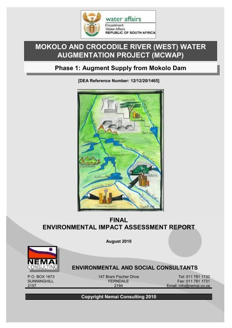
MOKOLO AND CROCODILE RIVER (WEST) WATER<br />
AUGMENTATION PROJECT (MCWAP)<br />
P.O. BOX 1673<br />
SUNNINGHILL<br />
2157<br />
Phase 1: Augment Supply from Mokolo Dam<br />
[DEA Reference Number: 12/12/20/1465]<br />
FINAL<br />
ENVIRONMENTAL IMPACT ASSESSMENT REPORT<br />
August 2010<br />
ENVIRONMENTAL AND SOCIAL CONSULTANTS<br />
147 Bram Fischer Drive<br />
FERNDALE<br />
2194<br />
Copyright Nemai Consulting 2010<br />
Tel: 011 781 1730<br />
Fax: 011 781 1731<br />
Email: info@nemai.co.za
MCWAP Phase 1: Augment Supply from Mokolo Dam<br />
TITLE AND APPROVAL PAGE<br />
Project name: Mokolo and Crocodile River (West) Water Augmentation Project<br />
(MCWAP) - Phase 1: Augment Supply from Mokolo Dam<br />
<strong>Report</strong> Title: <strong>Final</strong> <strong>Environmental</strong> <strong>Impact</strong> <strong>Assessment</strong> <strong>Report</strong> – MCWAP<br />
Phase 1<br />
Authors: D Henning, S Pienaar<br />
DEA reference no.: 12/12/20/1465<br />
<strong>DWA</strong> report reference no.: P RSA A000/00/10009<br />
Status of report: <strong>Final</strong><br />
First issue: June 2010<br />
<strong>Final</strong> issue: August 2010<br />
PSP<br />
Approved for PSP by:<br />
D Henning<br />
Study Leader<br />
PROJECT COORDINATION & MANAGEMENT TEAM<br />
Approved for PCMT by:<br />
S C Vogel<br />
Project Coordinator & Manager<br />
DEPARTMENT WATER AFFAIRS (<strong>DWA</strong>)<br />
Approved for <strong>DWA</strong> by:<br />
O J S van den Berg<br />
Chief Engineer: Options Analysis North<br />
L S Mabuda<br />
Chief Director: Integrated Water<br />
Resources Planning<br />
<strong>Final</strong> EIA <strong>Report</strong> i
MCWAP Phase 1: Augment Supply from Mokolo Dam<br />
UITVOERENDE OPSOMMING<br />
PROJEK AGTERGROND EN MOTIVERING<br />
Groot ontwikkelings word beplan vir die Waterberg Steenkool velde in die Lephalale area.<br />
As ʼn direkte gevolg van die voorgenoemde ontwikkelings sal die water aanvraag in die<br />
Lephalale area noemenswaardig toeneem oor die volgende 20 jaar.<br />
Weens die beperkte beskikbaarheid van water in die Lephalale area het die Departement<br />
van Waterwese (<strong>DWA</strong>) die Mokolo en Krokodilrivier (Wes) Wateraanvullingsprojek<br />
(MKWAP) Uitvoerbaarheid Studie van stapel gestuur om opsies vir die voorsiening in die<br />
water behoeftes te ondersoek. Die fases vir die voorgestelde infrastruktuur vir die oordrag<br />
van water vanaf die Mokolodam en Krokodilrivier (Wes) word hieronder getabuleer.<br />
Oorsig van MKWAP komponente<br />
Komponent Kort samevatting<br />
Parallelle pyplyn ter aanvulling vanaf Mokolodam om aan die groeiende water behoeftes te<br />
voldoen vir die interim periode totdat die oordragpyplyne vanaf die Krokodilrivier (Wes)<br />
geïmplementeer kan word. Fase 1 bestaan uit die volgende:<br />
Fase 1<br />
• Styglyn vanaf Mokolodam na Wolvenfontein balanseerdamme;<br />
• Gravitasielyn vanaf Wolvenfontein balanseerdamme na Matimba kragstasie;<br />
• ʼn Nuwe gravitasielyn vanaf Matimba kragstasie na Steenbokpan; en<br />
• Drukbreektenk by Rietspruitnek.<br />
Oordrag skema vanaf Krokodilrivier (Wes) by Vlieëpoort naby Thabazimbi, na Lephalale area<br />
via ʼn sisteem bestaande uit:<br />
• ʼn Stuwal en onttrekkingswerke, insluitende ʼn balanseerdam, ontslikkingswerke, en ʼn<br />
hoëdruk pompstasie by Vlieëpoort (naby Thabazimbi);<br />
Fase 2<br />
• Oordragskema (ongeveer 100 km);<br />
• Drukbreekreservoir;<br />
• Operasionele Storingsdam; en<br />
• ʼn Leweringstelsel wat bestaan uit ʼn gravitasiepyplyn (ongeveer 30km) vanaf die<br />
Operasionele Storingsdam na die Steenbokpan area.<br />
Die bottelnek op die bestaande pyplyn wat aan Exxaro behoort en wat strek vanaf die<br />
Mokolodam tot by Lephalale moet verwyder word. Dit sluit in die konstruksie van die eerste<br />
Verwydering van 9km van die nuwe gravitasie pyplyn (vir MKWAP Fase 1) vanaf Wolvenfontein<br />
Bottelnek balanseerdamme, met inlaste tot die bestaande pyplyn. Die doelwit van die verwydering van<br />
die bottelnek is om die hidroliese gradiënt by Rietspruitnek te verbeter, waar die bestaande<br />
pyplyn bo-oor ʼn hoogte punt gaan.<br />
<strong>Final</strong> EIA <strong>Report</strong> ii
MCWAP Phase 1: Augment Supply from Mokolo Dam<br />
Die doelwit van MKWAP is om die voorsiening van water aan nuwe verbruikers te<br />
bewerkstellig sonder om te impakteer op die regmatige toekennings van bestaande<br />
verbruikers. Dit sal bereik word deur:<br />
• Allokasie van die addisionele lewering vanuit Mokolodam en die gebruik daarvan<br />
deur middel van die Fase 1 infrastruktuur;<br />
• Die allokasie van surplus terugvloeie in die Krokodilrivier (Wes) en die gebruik<br />
daarvan deur middel van die Fase 2 infrastruktuur;<br />
• In geval van die voorgenoemde nie voldoende is nie kan die water in die<br />
Krokodilsisteem aangevul word met terugvloeie vanuit die Vaalrivier.<br />
Die volgende verbruikers moet gelisensieer word vir Fase 1:<br />
1. Die dorp Lephalale wat huidiglik water gebruik wat geallokeer is aan Grootegelukmyn<br />
en Eskom. Exxaro en Eskom lewer tans water aan die huishoudelike verbruikers<br />
namens die munisipaliteit;<br />
2. Exxaro (voorheen Yskor) se Grootegelukmyn, vir myngebruik alleenlik;<br />
3. Eskom se Matimba kragstasie, vir kragstasie gebruik alleenlik; en<br />
4. Eskom se Medupi kragstasie, vir kragstasie gebruik alleenlik.<br />
MKWAP is deur die Nasionale Departement van Omgewingsake as ‘n Strategiese<br />
Belangrike Ontwikkeling geïdentifiseer, wat gedefinieer word as infrastruktuur<br />
ontwikkelings deur staatsentiteite wat ‘n noemenswaardige bydrae maak tot die<br />
Nasionale ekonomiese ontwikkeling van Suid Afrika.<br />
OMVANGSBEPALING EN OIB PROSES<br />
MKWAP bestaan uit sekere aktiwiteite wat goedkeuring vereis in terme van die Nasionale<br />
Wet op Omgewingsbestuur (Wet No. 107 van 1998) (NEMA). Die proses wat gevolg word<br />
om goedkeuring te verkry word geneem ingevolge die Omgewing Impak Bepaling (OIB)<br />
Regulasies (Staatskennisgewing No. R385, R386 en R387 van 21 April 2006),<br />
geproklameer in terme van Hoofstuk 5 van NEMA. Die OIB besluitnemende owerheid is<br />
die Nasionale Departement van Omgewingsake, aangesien die projek aansoeker (<strong>DWA</strong>)<br />
ʼn Nasionale Departement is. Nemai Consulting is aangestel deur <strong>DWA</strong> as die<br />
<strong>Final</strong> EIA <strong>Report</strong> iii
MCWAP Phase 1: Augment Supply from Mokolo Dam<br />
onafhanklike Omgewingsimpakbepalings Praktisyn (OIP) om die<br />
Omgewingsimpakondersoek uit te voer vir MKWAP.<br />
Tydens konsultasie met DEA, voor die aanvang van die projek, is daar besluit om ‘n Klas<br />
Aansoek in te dien vir die drie MKWAP sub-projekte, waar afsonderlike omgewings<br />
bepalings uitgevoer word vir elke komponent.<br />
MKWAP Omgewings Ondersoeke<br />
MKWAP Komponente Omgewingsbepalings Proses DEA Verwysings Nr.<br />
Fase 1 Omvangsbepaling en OIB 12/12/20/1465<br />
Fase 2 Omvangsbepaling en OIB 12/12/20/1466<br />
Verwydering van Bottelnek Basiese Bepaling 12/12/20/1467<br />
Die Omvangsbepaling fase wat uitgevoer was gedurende die eerste deel van die<br />
omgewingsbepaling proses, het die benadering voorsien wat gevolg moet word vir die<br />
uitvoering van die OIB vir MKWAP Fase 1 deur belangrike kwessies te identifiseer wat<br />
verdere inagneming en prioritisering vereis het.<br />
PROJEK LIGGING<br />
Die hoofroete vir die voorgestelde pyplyn roete begin by Mokolodam, in die suid-oostelike<br />
punt van die projekarea, waarna dit hoofsaaklik die roete volg van die bestaande Exxaro<br />
pyplyn, in ʼn noord-westelike rigting tot by die Zeeland Watersuiweringswerke en daarna<br />
die Matimba aftappunt. Hierna draai die pyplynroete in ʼn westelike rigting tot by<br />
Steenbokpan. Die totale lengte van die roete is ongeveer 80km<br />
PROJEK KOMPONENTE<br />
Die hoof skema komponente vir MKWAP Fase 1 is opgesom in die tabel wat volg.<br />
<strong>Final</strong> EIA <strong>Report</strong> iv
MCWAP Phase 1: Augment Supply from Mokolo Dam<br />
Opsomming van hoofkomponente van die skema vir MKWAP Fase 1<br />
Hoëdruk pompstasie<br />
900mm: Styglyn<br />
ALTERNATIEWE<br />
1000mm: gravitasielyn<br />
Komponente<br />
800mm: gravitasielyn (aftappunt na Medupi)<br />
900mm: gravitasielyn (Medupi aftappunt na leweringstelsel konneksie)<br />
800mm: gravitasielyn (Steenbokpan aftappunt na Matimba konneksie)<br />
1900mm: gravitasielyn (leweringstelsel konneksie na Steenbokpan)<br />
Die volgende alternatiewe is in ag geneem vir die pyplyn roete:<br />
• Styglyn - Mokolodam tot Wolvenfontein balanseerdamme<br />
o Alternatief – Hoofroete<br />
Die eerste deel van die hoofroete vanaf Mokolodam verskil van die roete van die<br />
bestaande Exxaro pyplyn, waar dit die roete van die toegangspad volg op die plaas<br />
Witbank 647LQ vir ± 1.3km (hoofsaaklik in ‘n noordwestelike rigting) tot by die punt<br />
waar Alternatiewe A en B split.<br />
o Alternatief A<br />
Vanaf die hoofroete bly Alternatief A langsaan die toegangspad oor die plase Witbank<br />
647LQ en Wolvenfontein 645LQ tot en met waar die lyn aansluit by die Wolvenfontein<br />
balanseerdamme.<br />
o Alternatief B<br />
Alternatief B beweeg weg vanaf die toegangspad om ‘n bestaande kraglyn te volg vir<br />
± 300m oor die plaas Witbank 647LQ. Die roete draai dan verder noordwaarts en loop<br />
vir ± 1.4km oor die plaas Wolvenfontein 645LQ. Hierna draai die roete in ‘n suid-<br />
westelike rigting en loop vir ‘n verdere ± 1.6km op die laasgenoemde plaas tot by die<br />
Wolvenfontein balanseerdamme.<br />
<strong>Final</strong> EIA <strong>Report</strong> v
MCWAP Phase 1: Augment Supply from Mokolo Dam<br />
• Gravitasielyn (vanaf Wolvenfontein balanseerdamme na die Matimba aftap)<br />
o Alternatief – Hoofroete<br />
Vanaf die Wolvenfontein balanseerdamme volg die hoofroete die bestaande Exxaro<br />
pyplyn tot by die Matimba kragstasie aftap op die plaas Grootestryd 465LQ.<br />
• Gravitasielyn (Matimba kragstasie tot Steenbokpan)<br />
o Alternatief – Hoofroete<br />
Vanaf die aftappunt vanuit die Wolvenfontein-Matimba gravitasielyn, loop die<br />
leweringslyn weswaarts langsaan die bestaande pad vir ± 2km oor die plaas Hanglip<br />
508LQ, tot by die split tussen Alternatiewe C en D. Van waar Alternatiewe C en D<br />
weer bymekaar uitkom, loop die hoofroete verder weswaarts tot by Steenbokpan.<br />
o Alternatief C<br />
Vanaf die plaas Hanglip 508LQ, loop Alternatief C in ‘n westelike rigting langsaan ‘n<br />
bestaande pad (nuwe pad om Medupi kragstasie) vir ± 1.3km. Daarna kruis die lyn<br />
oor verskeie plase tot by die plaas Kringgatspruit 318LQ.<br />
o Alternatief D<br />
Vanaf die plaas Hanglip 508LQ, loop Alternatief D in ‘n suid-westelike rigting langsaan<br />
‘n bestaande pad vir ± 3.7km tot by die plaas Naauw Ontkomen 509LQ. Daarna volg<br />
die roete die bestaande spoorlyn verder oor verskeie plase.<br />
PROJEK LEWENSIKLUS<br />
Die OIB verslag voorsien ‘n oorsig van die projek en beskryf die hoof aktiwiteite<br />
gedurende die verskillende fases van die projek lewensiklus.<br />
OMGEWINGSOORSIG<br />
Om impakte te minimaliseer, is probeer om die voorgestelde Fase 1 pyplyn roete langs<br />
bestaande ontwikkelings grense (bv. plaasgrense) en liniêre-tipe infrastruktuur te hou en<br />
ook om die sterilisering van areas vir potensiele toekomstige ontwikkeling (stedelik,<br />
nywerheid, mynbou ens.) te vermy. Die omgewing word hier as minder sensitief geag,<br />
soos byvoorbeeld:<br />
<strong>Final</strong> EIA <strong>Report</strong> vi
MCWAP Phase 1: Augment Supply from Mokolo Dam<br />
• Pyplyne (met verwysing na die bestaande Exxaro pyplyn vanaf die Wolvenfontein<br />
balanseerdamme na Zeeland Watersuiweringswerke),<br />
• Paaie,<br />
• Treinspore,<br />
• Transmissie lyne, en<br />
• Industriële korridors.<br />
ʼn 200m Korridor (m.a.w. 100m weerskante van die middellyn) is ingesluit in die studie<br />
area, wat vir enige moontlike afwykings van die voorgestelde roete binne hierdie korridor<br />
voorsiening maak.<br />
Die OIB Verslag gee ʼn algemene beskrywing van die stand van die omgewing in die<br />
projekarea, en verduidelik ook die area en terrein-spesifieke omgewingsfaktore wat<br />
ondersoek was deur die spesialiste. Sodoende word die sensitiewe omgewingsfaktore en<br />
die elemente van die omgewing wat moontlik geaffekteer kan word deur die projek beter<br />
verstaan. Die volgende omgewingsfaktore word in die verslag beskryf:<br />
• Klimaat<br />
• Topografie<br />
• Oppervlak water<br />
• Geologie en grond<br />
• Geohidrologie<br />
• Flora<br />
• Fauna<br />
• Sosio-Ekonomiese<br />
Aspekte<br />
• Beplanning<br />
• Landbou Potensiaal<br />
• Lug Kwaliteit/ Gehalte<br />
• Geraas<br />
• Argeologiese en Kulturele kenmerke<br />
• Infrastruktuur en dienste<br />
• Vervoer<br />
• Visueel<br />
• Toerisme<br />
OPSOMMING VAN SPESIALIS STUDIES<br />
Die OIB Verslag voorsien ‘n sinopsis van die volgende spesialis studies:<br />
• Ekologiese Studie – Terrestrieel –<br />
<strong>Final</strong> EIA <strong>Report</strong> vii
MCWAP Phase 1: Augment Supply from Mokolo Dam<br />
Alternatief B is die gekose opsie, waar Alternatief A moontlik kan lui na impakte op<br />
twee sensitiewe Euphorbia spesies in die kloof deur rotsstortings. Alternatief C, wat<br />
suid van die nuwe pad rondom Medupi kragstasie loop wat reeds versteur is, is ook<br />
die gekose roete. Die studie sluit in flora en fauna (soogdiere, voëls, reptiele en<br />
amfibieë).<br />
• Ekologiese Studie – Akwaties<br />
Alternatief B (suidelike opsie) is gekose omdat dit minder impak sal hê op die<br />
ekologiese integriteit van die akwatiese sisteme in die area. Geen voorkeur word<br />
verleen aan Alternatiewe C of D vanuit ‘n akwatiese perspektief nie. Generiese<br />
versagtende maatreëls vir vleilande word voorsien.<br />
• Verkeersbestuursplan<br />
Die volg van bestaande paaie deur die pyplyn, wat aanvaar word as minder<br />
sensitiewe roetes, veroorsaak dat die projekarea goeie toegang geniet. Beste<br />
praktyke word voorsien vir die bestuur van verkeersaspekte.<br />
• Erfenis Impak Studie<br />
Erfenisbronne langsaan die hoofroete sluit in ‘n begraafplaas en plaashuis op die<br />
plaas Goedgedacht 602LQ, informele grafte op die plaas Sterkfontein 642LQ, Hennie<br />
de Lange se Kafee Theunispan en Steenbokpan Bosveld Drankwinkel.<br />
• Ekonomiese Impak Studie<br />
Die ekonomiese impakte van MKWAP in die Mokolo opvangsgebied word opgesom<br />
hieronder.<br />
MKWAP –<br />
Konstruksie Fase<br />
MKWAP –<br />
Bedryfsfase<br />
Aktiwiteit<br />
Intensiteit van<br />
Impak<br />
Beesboerdery Laag Tydelik<br />
Wildsboerdery en gepaardgaande aktiwiteite Laag Tydelik<br />
Besproeiing (water afnames) Geen Tydelik<br />
Besigheidstoerisme Medium Tydelik<br />
Lephalale Munisipaliteit Medium Tydelik<br />
Tydperk<br />
Beesboerdery Laag Permanent<br />
Wildsboerdery en gepaardgaande aktiwiteite Laag Permanent<br />
Besproeiing (water her-allokasie risiko) Medium Permanent<br />
Besigheidstoerisme Laag Permanent<br />
Lephalale Munisipaliteit Laag Permanent<br />
<strong>Final</strong> EIA <strong>Report</strong> viii
MCWAP Phase 1: Augment Supply from Mokolo Dam<br />
• Sosiale Impak Studie<br />
Die Sosiale Impak Studie het gebruik gemaak van ‘n multi-faset benadering om die<br />
bestaande sosiale omgewing te verstaan en om die moontlike sosiale impakte (bv.<br />
toegang, misdaad en sekuriteit, grensdrade, impakte op boerdery aktiwiteite, ens.)<br />
gedurende die konstruksie en bedryfsfases te bepaal.<br />
• Visuele Impak Studie<br />
Twee studie areas is in ag geneem, naamlik:<br />
o Die alternatiewe korridors vanaf Mokolodam tot Wolvenfontein balanseerdamme;<br />
en<br />
o Die drukbreektenk by Rietspruitnek, op die plaas Fancy 556LQ.<br />
Versagtende maatreëls word voorsien om die visuele impakte van die projek te<br />
verminder.<br />
ONTLEDING VAN ALTERNATIEWE<br />
‘n Vergelykende ontleding van die verskillende pyplyn roetes is uitgevoer, wat gebaseer<br />
is op die voordele en nadele geassosieer met elke opsie. Die ontleding is uitgevoer deur<br />
tegniese bydraes en bevindinge van die spesialiste.<br />
Die volgende gekose alternatiewe roetes is geïdentifiseer na die vergelykende ontleding:<br />
• Styglyn (Mokolodam tot Wolvenfontein balanseerdamme) – Alternatief B; en<br />
• Gravitasielyn (Matimba kragstasie tot Steenbokpan) – Alternatief C.<br />
IMPAK BEPALING<br />
Impakte was as volg geïdentifiseer:<br />
• Ontleding van projek beskrywing en die omliggende omgewingsfaktore;<br />
• Impakte geassosieer met aktiwiteite bevat in Staatskennisgewing Nommer R386 en<br />
R387;<br />
• Impakte geïdentifiseer deur omgewingsowerhede;<br />
• Bevindinge van die spesialiste; en<br />
• Kommentaar ontvang tydens die openbare deelname proses.<br />
<strong>Final</strong> EIA <strong>Report</strong> ix
MCWAP Phase 1: Augment Supply from Mokolo Dam<br />
Die impakte geassosieer met gelyste aktiwiteite en wat geïdentifiseer is deur<br />
omgewingsowerhede word bespreek op ‘n kwalitatiewe vlak.<br />
Ten einde die impakte geassosieer met MKWAP beter te verstaan, was die aktiwiteite en<br />
omgewingsaspekte tydens die projek lewensiklus geïdentifiseer. Die volgende<br />
noemenswaardige omgewingsimpakte van MKWAP Fase 1 word op ‘n kwantitatiewe vlak<br />
ontleed en versagtende maatreëls word voorsien.<br />
Pertinente omgewingsimpakte van MKWAP Fase 1<br />
KONSTRUKSIE FASE<br />
Faktor Impak<br />
Oppervlak<br />
Waterbronne<br />
• Pyplyn kruisings van die Mokolorivier (sytak), Rietspruit (sytak en hooftak), Kutangspruit (sytak<br />
Grond • Erosie by steil hellings.<br />
en hooftak) en Sandlooprivier (sytak en hooftak) kan die struktuur van die riviere verander, die<br />
oewer plantegroei beskadig, lui na toename in siltasie (water kwaliteit verslegting) en die<br />
akwatiese diere benadeel (bv. verstopping van kieue).<br />
• Verlies van bogrond.<br />
• Impakte geassosieer met skepping van leengroewe.<br />
• Impakte geassosieer met skietwerke.<br />
• Impakte geassosieer met wegdoening van groot hoeveelhede oortollige materiaal.<br />
Grondwater • Versteuring van die akwifer, veroorsaak deur skietwerke<br />
Flora • Impakte op beskermde spesies.<br />
Fauna • Stroping.<br />
• Skade aan oewer plantegroei by rivier kruisings.<br />
• Verlies van biodiversiteit deur indringerspesies.<br />
• Verhinder beweging van diere.<br />
• Verhoed toegang tot suipingspunte.<br />
• Beskadiging deur konstruksie aktiwiteite.<br />
• Verlies van diere deur swak toegangsbeheer.<br />
Lug • Impakte geassosieer met stof vanaf grond paaie, vervoer van materiaal.<br />
Geraas • Impakte geassosieer met geraas vanaf konstruksie aktiwiteite (bv. voertuie, kragopwekkers).<br />
Visuele<br />
Kwaliteit<br />
Veiligheid en<br />
Sekuriteit<br />
• Impakte op visuele kwaliteit van die area as gevolg van slordige terrein en konstruksie<br />
aktiwiteite<br />
• Impakte geassosieer met ineenstorting van groef.<br />
• Impakte geassosieer met swak toegangsbeheer.<br />
• Kriminele aktiwiteite geassosieerd met konstruksie.<br />
Afval • Impakte geassosieer met swak / geen ablusie fasiliteite.<br />
• Lug, grond en water besoedeling as gevolg van swak bestuur van afval.<br />
<strong>Final</strong> EIA <strong>Report</strong> x
MCWAP Phase 1: Augment Supply from Mokolo Dam<br />
Konstruksie<br />
Kamp<br />
Sosio-<br />
ekonomiese<br />
aspekte<br />
• Impakte geassosieer met die ligging van die kamp – visuele impak, verwydering van<br />
plantegroei, stroping, sekuriteit.<br />
• Impakte geassosieer met swak storing van materiaal.<br />
Beskadiging van eiendom, insluitend strukture, drade, hekke, diere.<br />
Impakte geassosieer met die tydelike konstruksie serwituut.<br />
Verlies van inkomste (bv. tydelike verlies van landbou grond, invloed op ekotoerisme aktiwiteite) as<br />
gevolg van konstruksie aktiwiteite.<br />
Impakte geassosieer met toename in persone was opsoek is na werksgeleenthede.<br />
Verbruik van plaaslike arbeid en verskaffers, sover moontlik (positiewe impak).<br />
Beskadiging van eiendom en risiko vir persone afkomstig vanaf Phumolong Gemeenskap Trust.<br />
Erfenis • Beskadiging van erfenis bronne.<br />
Infrastruktuur<br />
en Dienste<br />
• Beskadiging van bestaande rivier kruising by Rietspruit hooftak en oostelike sytak.<br />
• Steuring van verkeer langs paaie (veral R510, toegangspad na Mokolodam en nuwe pad om<br />
Medupi).<br />
• Beskadiging van grondpaaie na Wolvenfontein deur swaar konstruksie voertuie.<br />
• Steuring van verkeer as gevolg van verbruik van R510 en hoof padnetwerk deur vervoer van<br />
pype.<br />
BEDRYFSFASE<br />
Faktor Impak<br />
Oppervlak<br />
Waterbronne<br />
• Impakte geassosieer met beskadiging van pyplyn.<br />
• Erosie tydens vrylating van water.<br />
Flora • Verspreiding van indringerspesies.<br />
Fauna • Versteuring van beweging van akwatiese biota by rivier kruisings.<br />
Sosio-<br />
ekonomiese<br />
aspekte<br />
Visuele<br />
Kwaliteit<br />
Infrastruktuur<br />
en Dienste<br />
Instandhoudi<br />
ng<br />
Landbou<br />
Potensiaal<br />
• Impakte geassosieer met die moontlike beperking of inkorting van water verbruik stroomaf van<br />
Mokolodam.<br />
OPENBARE DEELNAME<br />
• Impakte geassosieer met beperkings op grond gebruik op permanente serwituut.<br />
• Visuele impakte geassosieer met bogrondse strukture (bv. klepkaste elke 500m langs roete;<br />
pyplyn merkers; Drukbreektenk).<br />
• Verbruik van pyplyn toegangspad kan dalk erosie veroorsaak en die padoppervlak beskadig.<br />
• Konstruksie-verwante impakte vir enige instandhoudingswerke.<br />
• Impakte geassosieer met grondgebruikbeperkings binne serwituut.<br />
• Landbou-ekonomiese impakte.<br />
• Moontlike impakte of voedselsekuriteit.<br />
ʼn Volledige verslag word voorsien van die openbare deelname proses wat gevolg is vir<br />
die OIB fase van MKWAP Fase 1.<br />
<strong>Final</strong> EIA <strong>Report</strong> xi
MCWAP Phase 1: Augment Supply from Mokolo Dam<br />
Die doel van openbare deelname vir MKWAP sluit in:<br />
1. Om Belanghebbende en Geaffekteerde Partye (B&GP’e) die geleentheid te bied<br />
om inligting rakende MKWAP te verkry;<br />
2. Om B&GP’e die geleentheid te bied om hulle menings, kwessies en<br />
bekommernisse te opper;<br />
3. Om B&GP’e die geleentheid te bied om maatreëls voor te stel om ongunstige<br />
impakte te vermy of te minimaliseer, sowel as om positiewe impakte geassosieer<br />
met MKWAP te vergroot; en<br />
4. Om <strong>DWA</strong> en die projekspan die geleentheid te gee om die behoeftes,<br />
bekommernisse en aanbevelings van B&GP’e te inkorporeer in die projek.<br />
Bo-en-behalwe openbare deelname geassosieer met die OIB protokol, word ʼn breër<br />
Openbare Deelname Proses ook uitgevoer vir MKWAP om te verseker dat omvattende<br />
konsultasie prosedures gevolg word. Die mees prominente belangegroep, inagnemend<br />
die kwessies rondom die waterbeskikbaarheid en die grondgebruik tipe, wat in die<br />
projekarea voorkom is die Landbousektor.<br />
OMGEWINGSIMPAKVERKLARING<br />
Deur bestaande liniêre-tipe infrastruktuur te volg en die impakte te bestuur deur die<br />
voorgestelde versagtende maatreëls, en om te verseker dat die projek voldoen aan die<br />
voorwaardes van die Reserwe en bestaande waterregte (deur die watergebruik<br />
magtigingsproses), kan daar tot die gevolgtrekking gekom word dat daar geen rede is<br />
waarom die projek nie kan voortgaan nie. Dit kan ook aanbeveel word dat die projek<br />
goedkeuring kan ontvang, gebaseer op die bevindinge van die spesialiste en die impak<br />
bepaling, met die nodige voldoening aan die geïdentifiseerde versagtende maatreëls.<br />
<strong>Final</strong> EIA <strong>Report</strong> xii
MCWAP Phase 1: Augment Supply from Mokolo Dam<br />
EXECUTIVE SUMMARY<br />
PROJECT BACKGROUND AND MOTIVATION<br />
Major developments are planned for the Waterberg coalfields that are located in the<br />
Lephalale area. As a direct result of the aforementioned developments, the demand for<br />
water in the Lephalale area will significantly increase over the next 20 years.<br />
Due to the limited availability of water in the Lephalale area, the Department of Water<br />
Affairs (<strong>DWA</strong>) commissioned a feasibility study of the Mokolo Crocodile (West) Water<br />
Augmentation Project (MCWAP) to establish how the future water demands could be<br />
met. The phases for the proposed infrastructure for transferring water from the Mokolo<br />
Dam and Crocodile River (West) are tabulated below.<br />
Overview of MCWAP Components<br />
Component Brief Overview<br />
Phase 1<br />
Phase 2<br />
De-bottlenecking<br />
An underground pipeline parallel to the existing pipeline, to augment the supply from Mokolo<br />
Dam. This is to supply in the growing water requirement and also to supply more water for the<br />
interim period until a transfer pipeline from the Crocodile River (West) can be implemented. The<br />
system will utilise the available yield from Mokolo Dam. Phase 1 consists of the following:<br />
• Rising main from Mokolo Dam to Wolvenfontein balancing dam;<br />
• Gravity line from Wolvenfontein to Matimba Power Station;<br />
• Gravity line from Matimba Power Station to Steenbokpan; and<br />
• Break pressure tank at Rietspruitnek.<br />
Transfer scheme from the Crocodile River (West) at Vlieëpoort near Thabazimbi to the Lephalale<br />
area via a system consisting of:<br />
• A weir and abstraction infrastructure, including a balancing dam, desilting woks, and a high<br />
lift pumpstation at Vlieëpoort (near Thabazimbi);<br />
• Transfer system (approximately 100 km of underground pipeline): consisting of various<br />
alternative pipeline routes;<br />
• A Break Pressure Reservoir;<br />
• An Operational Reservoir; and a<br />
• Delivery system, consisting of alternative routes for a gravity pipeline (underground) running from<br />
the Operational Reservoir to the Steenbokpan area, connecting to the Phase 1 works.<br />
De-bottlenecking of the existing pipeline that stretches from Mokolo Dam to Lephalale, which<br />
belongs to Exxaro. This entails the construction of the first 9km of the proposed underground<br />
gravity pipeline (for Phase 1) from Wolvenfontein balancing dam, with interconnections to the<br />
existing pipeline. The intention of the de-bottlenecking is to improve the hydraulic gradient at<br />
Rietspruitnek, where the existing pipeline passes over a high point.<br />
<strong>Final</strong> EIA <strong>Report</strong> xiii
MCWAP Phase 1: Augment Supply from Mokolo Dam<br />
The objective of the MCWAP is to enable the supply of water to the new users without<br />
impacting on the legal entitlements of the existing users. This will be achieved by:<br />
• Allocating the additional yield from the Mokolo Dam and utilise it through Phase 1<br />
infrastructure;<br />
• Allocating surplus return flow in the Crocodile River (West) and utilise it through<br />
Phase 2 infrastructure; and<br />
• In the case of the aforementioned not being adequate, the water in the Crocodile<br />
system can be augmented from return flows in the Vaal River.<br />
The following users will need to be licensed for Phase 1:<br />
1. The Town of Lephalale that are currently using water allocated to the Grootegeluk<br />
mine and Eskom. Exxaro and Eskom are currently supplying water to domestic users<br />
on behalf of the municipality;<br />
2. Grootegeluk mine of Exxaro (previously Iscor) for mine use only;<br />
3. Matimba Power Station of Eskom for power station use only; and<br />
4. Medupi Power Station of Eskom for power station use only.<br />
MCWAP was identified by the National Department of <strong>Environmental</strong> Affairs as a<br />
Strategically Important Development (SID), which is defined as infrastructure<br />
developments by State Owned Entities that contribute or will contribute significantly to the<br />
national economic growth of South Africa.<br />
SCOPING AND EIA PROCESS<br />
MCWAP entails certain activities that require authorisation in terms of the National<br />
<strong>Environmental</strong> Management Act (No. 107 of 1998) (NEMA). The process for seeking<br />
authorisation is undertaken in accordance with the <strong>Environmental</strong> <strong>Impact</strong> <strong>Assessment</strong><br />
(EIA) Regulations (Government Notice No. R385, R386 and R387 of 21 April 2006),<br />
promulgated in terms of Chapter 5 of NEMA. The EIA decision-making authority is DEA,<br />
as the project proponent (i.e. <strong>DWA</strong>) is a national department. Nemai Consulting was<br />
<strong>Final</strong> EIA <strong>Report</strong> xiv
MCWAP Phase 1: Augment Supply from Mokolo Dam<br />
appointed by <strong>DWA</strong> as the independent <strong>Environmental</strong> <strong>Assessment</strong> Practitioner (EAP) to<br />
undertake the environmental assessment for MCWAP.<br />
Following pre-consultation with DEA it was decided to submit a Class Application for the<br />
three MCWAP sub-projects, where separate environmental assessments are being<br />
undertaken for each component.<br />
MCWAP <strong>Environmental</strong> <strong>Assessment</strong>s<br />
MCWAP Component <strong>Environmental</strong> <strong>Assessment</strong> Process DEA Reference No.<br />
Phase 1 Scoping and EIA 12/12/20/1465<br />
Phase 2 Scoping and EIA 12/12/20/1466<br />
De-bottlenecking Basic <strong>Assessment</strong> 12/12/20/1467<br />
The Scoping phase, which was completed as part of the initial stage of the overall<br />
environmental assessment process, served to define the Terms of Reference for the<br />
subsequent EIA phase by identifying key issues that needed further consideration and<br />
prioritisation.<br />
PROJECT LOCATION<br />
The main route for the proposed pipeline commences from Mokolo Dam, in the south-<br />
east of the project area. From there it predominantly follows the route of the existing<br />
Exxaro pipeline in a north-westerly direction up to the Zeeland Water Treatment Works<br />
(WTW) and thereafter to the Matimba / Medupi off take. The alignment then turns<br />
westerly and continues until Steenbokpan. The total length is approximately 80km.<br />
PROJECT COMPONENTS<br />
The major scheme components for MCWAP Phase 1 are summarised in the table to<br />
follow.<br />
<strong>Final</strong> EIA <strong>Report</strong> xv
MCWAP Phase 1: Augment Supply from Mokolo Dam<br />
ALTERNATIVES<br />
Summary of major scheme components for MCWAP Phase 1<br />
High lift pump station<br />
900mm: rising main<br />
1000mm: gravity main<br />
800mm: gravity main (T-off to Medupi)<br />
Component<br />
900mm: gravity main (Medupi T-off to delivery pipeline connection)<br />
800mm: gravity main (Steenbokpan T-off to Matimba connection)<br />
1900mm: gravity main (delivery connection to Steenbokpan)<br />
The following alternatives to the pipeline alignment were considered:<br />
• Rising Main - Mokolo Dam to Wolvenfontein Balancing Dam<br />
o Alternative – Main Route<br />
From Mokolo Dam the Main Route follows the existing access road on the Farm<br />
Witbank 647LQ for ± 1.3km (in a predominantly north-westerly direction) until it<br />
reaches the split between Alternatives A and B.<br />
o Alternative A<br />
From the Main Route, Alternative A stays parallel to the access road over the Farms<br />
Witbank 647LQ and Wolvenfontein 645LQ until it reaches the Wolvenfontein<br />
balancing dam.<br />
o Alternative B<br />
Alternative B leaves the access road to follow an existing power line for ± 300m over<br />
the Farm Witbank 647LQ. The route then turns in a more northerly direction and<br />
continues for ± 1.4km on the Farm Wolvenfontein 645LQ. The alignment then turns in<br />
a south-westerly direction and runs for another ± 1.6km on the last-mentioned farm<br />
until it reaches the Wolvenfontein balancing dam.<br />
<strong>Final</strong> EIA <strong>Report</strong> xvi
MCWAP Phase 1: Augment Supply from Mokolo Dam<br />
• Gravity Line - Wolvenfontein Balancing Dam to Matimba Power Station<br />
o Alternative – Main Route<br />
From the Wolvenfontein balancing dam, the Main Route follows the route of the<br />
existing Exxaro pipeline. It continues to the Matimba Power Station termination point,<br />
situated on the Farm Grootestryd 465LQ.<br />
• Gravity Line - Matimba Power Station to Steenbokpan<br />
This section of the MCWAP Phase 1 pipeline is a new line (i.e. no existing parallel<br />
pipeline as is the case as described above with the Exxaro pipeline).<br />
o Alternative – Main Route<br />
From the tee off from the Wolvenfontein-Matimba gravity pipeline, the delivery line<br />
travels westwards along the existing road for ± 2km over Portion 3 and the Remainder<br />
of the Farm Hanglip 508LQ, until the split between Alternatives C and D. From where<br />
Alternatives C and D converge, the Main Route continues westwards until it reaches<br />
Steenbokpan.<br />
o Alternative C<br />
From the split on the Farm Hanglip 508LQ, Alternative C continues westwards<br />
alongside a secondary road (constructed to accommodate the Medupi Power<br />
Station) for a further ± 1.3km before crossing over various farms until Kringgatspruit<br />
318LQ.<br />
o Alternative D<br />
From the split on the Farm Hanglip 508LQ, Alternative D continues south-westerly<br />
along a secondary road for ± 3.7km until it reaches the Farm Naauw Ontkomen<br />
509LQ where it turns further south-west to follow alongside the railway line. From here<br />
it traverses various farms (continuing parallel to the railway line):<br />
PROJECT LIFE-CYCLE<br />
A project description is provided in the EIA report, listing the primary activities during the<br />
pre-construction, construction, operation and decommissioning phases of the project.<br />
<strong>Final</strong> EIA <strong>Report</strong> xvii
MCWAP Phase 1: Augment Supply from Mokolo Dam<br />
PROFILE OF THE RECEIVING ENVIRONMENT<br />
To minimise impacts, the proposed route attempts to remain alongside existing<br />
development footprints (e.g. farm boundaries) and linear-type infrastructure and also to<br />
avoid sterilization of areas for potential future development (urban, industrial, mining etc).<br />
The environment is regarded as less sensitive alongside existing developments, such as:<br />
• Pipelines (i.e. existing Exxaro Pipeline from the Wolvenfontein balancing dam to<br />
Zeeland WTW),<br />
• Roads,<br />
• Railway lines,<br />
• Transmission lines; and<br />
• Industrial corridors.<br />
A 200m corridor (i.e. 100m on either side of the centre line) was adopted as the study<br />
area, which allows for possible deviations (deemed technically feasible) from the<br />
proposed alignment within this corridor based on on-ground constraints and sensitive<br />
features.<br />
The EIA <strong>Report</strong> provides a general description of the status quo of the receiving<br />
environment in the project area, and also provides local and site-specific discussions on<br />
those environmental features investigated by the respective specialists. This allows for an<br />
appreciation of sensitive environmental features and possible receptors of the effects of<br />
the proposed project. The following environmental features are discussed:<br />
• Climate<br />
• Topography<br />
• Surface Water<br />
• Geology and Soil<br />
• Geohydrology<br />
• Flora<br />
• Fauna<br />
• Socio-Economic Aspects<br />
• Agricultural Potential<br />
• Air Quality<br />
• Noise<br />
• Archaeological and Cultural Features<br />
• Infrastructure and Services<br />
• Transportation<br />
• Visual Quality<br />
• Tourism<br />
<strong>Final</strong> EIA <strong>Report</strong> xviii
MCWAP Phase 1: Augment Supply from Mokolo Dam<br />
• Planning & Land Use<br />
SUMMARY OF SPECIALIST STUDIES<br />
A synopsis of the following specialist studies is provided in the EIA <strong>Report</strong>:<br />
• Ecological Study – Terrestrial –<br />
In terms of the pipeline route options, Alternatives B (prevents impacts to two<br />
sensitive Euphorbia species in the kloofs from falling rocks and disturbance to<br />
sensitive fauna species within the Waterberg Biosphere) and C (south of the new road<br />
around the Medupi power station in the already degraded area) are preferred. No fatal<br />
flaws identified. Sub-sections for study include:<br />
o Flora;<br />
o Mammalogy;<br />
o Avifauna;<br />
o Herpetology;<br />
• Ecological Study – Aquatic<br />
Alternative B (the southern alternative) is preferred above Alternative A, as it will<br />
impinge the least on the ecological integrity of the localised aquatic systems. The<br />
study did not allocate preference between Alternatives C and D from an aquatic<br />
conservation perspective. General mitigation measures which are applicable to all<br />
wetland areas are provided.<br />
• Traffic Management Plan<br />
The alignment along existing road infrastructure was an influential factor in the route<br />
selection process, as these sections would be less environmentally sensitive due to<br />
the environment already being disturbed. This proposed route alignment therefore<br />
enjoys good accessibility from the existing road network. Best practices are provided<br />
in the high-level Traffic Management Plan.<br />
• Heritage <strong>Impact</strong> <strong>Assessment</strong><br />
Along the Main Route identified heritage resources included a cemetery and<br />
farmhouse on the Farm Goedgedacht 602LQ, informal graves on the Farm<br />
Sterkfontein 642LQ, Hennie de Lange’s Kafee Theunispan and Steenbokpan Bosveld<br />
Drankwinkel.<br />
<strong>Final</strong> EIA <strong>Report</strong> xix
MCWAP Phase 1: Augment Supply from Mokolo Dam<br />
• Economic Study<br />
The economic impacts of MCWAP in the Mokolo Catchment is summarised as<br />
follows:<br />
Activity<br />
Intensity of<br />
<strong>Impact</strong><br />
Duration<br />
MCWAP -Construction Cattle Farming Low Temporary<br />
Game farming and Related Activities Low Temporary<br />
Irrigation (water reduction) None Temporary<br />
Business Tourism Medium Temporary<br />
Lephalale Local Municipality Medium Temporary<br />
MCWAP - Operational Cattle Farming Low Permanent<br />
Game farming and Related Activities Low Permanent<br />
Irrigation Farming (water re-allocation<br />
risk)<br />
• Social <strong>Impact</strong> <strong>Assessment</strong><br />
Medium Permanent<br />
Business Tourism Low Permanent<br />
Lephalale Local Municipality Low Permanent<br />
The SIA employed a multi-faceted methodological technique to scope the base line<br />
social environment within which the project will unfold and to identify and assess the<br />
likely social impacts of the project across both the construction and operational<br />
phases. In this manner the impacts (e.g. access issues, crime and security, fencing,<br />
impact on farming operations, etc.) were assessed in accordance with a recognised<br />
technique.<br />
• Visual <strong>Impact</strong> <strong>Assessment</strong><br />
There are two study areas. The one study area entails the area covered by the<br />
alternative corridors from the Mokolo Dam rising main towards the Wolvenfontein<br />
balancing dams. The second study area is around the Break Pressure Tank at<br />
Rietspruitnek on the Farm Fancy 556LQ. Mitigation measures are provided to reduce<br />
or alleviate the intrusive contrast between the proposed project components and<br />
activities, and the receiving landscape to a point where it is acceptable to visual and<br />
landscape receptors.<br />
<strong>Final</strong> EIA <strong>Report</strong> xx
MCWAP Phase 1: Augment Supply from Mokolo Dam<br />
ANALYSIS OF ALTERNATIVES<br />
A comparative analysis of the alternative alignment corridors is undertaken, based on the<br />
advantages and disadvantages associated with each option. The analysis was completed<br />
through technical (i.e. engineering) input and environmental specialists’ findings.<br />
Based on the comparative analysis, and consensus amongst the specialists, the following<br />
alternatives were regarded as preferable:<br />
• Rising Main (Mokolo Dam to Wolvenfontein Balancing Dams) – Alternative B; and<br />
• Gravity Line (Matimba Power Station to Steenbokpan) – Alternative C.<br />
IMPACT ASSESSMENT<br />
<strong>Impact</strong>s were identified as follows:<br />
• An appraisal of the project description and the receiving environment;<br />
• <strong>Impact</strong>s associated with listed activities contained in GN No. R386 and R387;<br />
• Issues highlighted by environmental authorities;<br />
• Findings from specialist studies; and<br />
• Comments received during public participation.<br />
The impacts associated with the listed activities and raised by environmental authorities<br />
are discussed on a qualitative level.<br />
In order to understand the impacts related to MCWAP’s components, the activities and<br />
environmental aspects associated with the project life-cycle were identified. The following<br />
significant environmental impacts associated with MCWAP Phase 1 are assessed<br />
quantitatively and concomitant mitigation measures are provided.<br />
<strong>Final</strong> EIA <strong>Report</strong> xxi
MCWAP Phase 1: Augment Supply from Mokolo Dam<br />
Significant environmental impacts associated with MCWAP Phase 1<br />
CONSTRUCTION PHASE<br />
Feature <strong>Impact</strong><br />
Watercourses • The pipeline crossings of the Mokolo River (tributary only), Rietspruit (tributary and main stem),<br />
Kutangspruit (tributary and main stem) and Sandloop River (tributary and main stem) could<br />
lead to the alteration of the structure (i.e. bed and banks), damage to the riparian habitat, lead<br />
to increased siltation (water quality deterioration) and adversely affect aquatic biota (e.g.<br />
clogging of gills, influence movement).<br />
Soil • Erosion on steep slopes.<br />
• Loss of topsoil.<br />
• <strong>Impact</strong>s associated with the establishment of borrow pits.<br />
• Blasting-related impacts.<br />
• <strong>Impact</strong>s associated with the disposal of large quantity of spoil material.<br />
Geohydrology • Disturbance of the aquifer from blasting<br />
Flora • Damage to / removal of protected trees and medicinal plants.<br />
Fauna • Poaching.<br />
• Damage to riparian vegetation at river crossings.<br />
• Encroachment by exotic species, with subsequent loss of biodiversity.<br />
• Obstruction of movement.<br />
• Preventing access to watering points.<br />
• Harm from construction activities.<br />
• Loss of animals due to improper access control.<br />
Air • <strong>Impact</strong>s associated with the dust from use of dirt roads, transportation of fill and spoil material<br />
and from bare areas.<br />
Noise • <strong>Impact</strong>s associated with the noise emanating from construction activities (e.g. vehicle<br />
movement, trenching, generators).<br />
Aesthetics • <strong>Impact</strong>s to visual quality of the area through poor housekeeping and construction-related<br />
Safety and<br />
Security<br />
activities.<br />
• <strong>Impact</strong>s associated with trench collapse.<br />
• <strong>Impact</strong>s associated with the uncontrolled access.<br />
• Criminal activities associated with construction.<br />
Waste • <strong>Impact</strong>s associated with the use of veld for ablution purposes.<br />
Construction<br />
camp<br />
• Land, air and water pollution through poor waste management practises.<br />
• <strong>Impact</strong>s associated with the siting of construction camp – visually obtrusive, vegetation<br />
clearing, poaching, security.<br />
• <strong>Impact</strong>s associated with the improper storage of material.<br />
<strong>Final</strong> EIA <strong>Report</strong> xxii
MCWAP Phase 1: Augment Supply from Mokolo Dam<br />
Socio-<br />
economic<br />
aspects<br />
• Damages to property, including structures, fencing, gates, animals.<br />
• <strong>Impact</strong>s associated with the establishment of temporary construction servitude.<br />
• Loss of income (e.g. temporary loss of agricultural land, influence to eco-tourism activities) due<br />
to construction-related activities.<br />
• <strong>Impact</strong>s associated with the influx of job seekers.<br />
• Use of local labourers and suppliers, as far as possible (positive impact).<br />
• Damage to property and risk to residents of the Phumolong Community Trust.<br />
Heritage • Damage to heritage resources.<br />
Infrastructure<br />
and Services<br />
• Damage to existing river crossings at the Rietspruit main stem and eastern tributary.<br />
• Influence to traffic along roads (particularly R510, access road to Mokolo Dam, and new road<br />
around Medupi).<br />
• Damage to dirt road to Wolvenfontein through use by heavy vehicles.<br />
• Traffic disruptions due to use of R510 and major road network by trucks delivering pipe<br />
material.<br />
OPERATIONAL PHASE<br />
Feature <strong>Impact</strong><br />
Watercourses • <strong>Impact</strong>s associated with the de-stabilisation of encased pipeline at river crossing or tie-ins at<br />
riverbanks.<br />
• Erosion during scouring.<br />
Flora • Spreading of exotic vegetation and associated loss of biodiversity.<br />
Fauna • Obstruction of movement of aquatic biota at river crossings.<br />
Socio-<br />
economic<br />
aspects<br />
• <strong>Impact</strong>s associated with the potential restriction or curtailment of water use downstream of the<br />
Mokolo Dam.<br />
• <strong>Impact</strong>s associated with land use restrictions as a result of registration of permanent servitude<br />
/ extension of existing Exxaro pipeline servitude.<br />
Aesthetics • Visual impacts associated with aboveground infrastructure (i.e. access/valve chambers at<br />
Infrastructure<br />
and Services<br />
Operation &<br />
Maintenance<br />
Agricultural<br />
Potential<br />
approximately 500m intervals along the route; pipeline markers; Break Pressure Tank).<br />
• Continual use of maintenance road will lead to erosion and damage to road surface.<br />
• Construction-related impacts for any maintenance related work to pipeline infrastructure.<br />
• <strong>Impact</strong>s associated with land use restrictions within servitude.<br />
• Agro-economical impact.<br />
• Possible impacts to food security.<br />
<strong>Final</strong> EIA <strong>Report</strong> xxiii
MCWAP Phase 1: Augment Supply from Mokolo Dam<br />
PUBLIC PARTICIPATION<br />
The EIA <strong>Report</strong> provides a full account of the public participation process that was<br />
followed for the EIA phase for MCWAP Phase 1.<br />
The purpose of public participation for MCWAP includes:<br />
1. Providing Interested and Affected Parties (I&APs) with an opportunity to obtain<br />
information about MCWAP;<br />
2. Allowing I&APs to present their views, issues and concerns regarding MCWAP;<br />
3. Granting I&APs an opportunity to recommend measures to avoid or reduce<br />
adverse impacts and enhance positive impacts associated with MCWAP; and<br />
4. Enabling <strong>DWA</strong> and the project team to incorporate the needs, concerns and<br />
recommendations of I&APs into the project.<br />
Over-and-above public participation associated with the EIA protocol, a broader Public<br />
Involvement Process (PIP) is also being conducted for MCWAP to ensure that<br />
comprehensive, inclusive and robust consultative procedures are followed. The<br />
Agricultural Sector is the most prominent interest group, considering the issues<br />
surrounding water availability and the land use type encountered in the project area.<br />
ENVIRONMENTAL IMPACT STATEMENT<br />
By following existing linear infrastructure and managing the impacts through the<br />
advocated mitigation measures, ensuring conformance to the Reserve conditions and<br />
upholding existing water use entitlements (through the water use authorisation process),<br />
it can be concluded that there are no fatal flaws associated with the project. It is also<br />
concluded that authorisation can be issued, based on the findings of the specialists and<br />
the impact assessment, through the compliance with the identified mitigation measures.<br />
<strong>Final</strong> EIA <strong>Report</strong> xxiv
MCWAP Phase 1: Augment Supply from Mokolo Dam<br />
TABLE OF CONTENTS<br />
TITLE AND APPROVAL PAGE I<br />
UITVOERENDE OPSOMMING II<br />
EXECUTIVE SUMMARY XIII<br />
TABLE OF CONTENTS XXV<br />
LIST OF ACRONYMS & ABBREVIATIONS XXXIV<br />
1 DOCUMENT ROADMAP 1<br />
2 PROJECT BACKGROUND AND MOTIVATION 3<br />
2.1 Increased Need for Water in the Lephalale Area 3<br />
2.2 Water Requirements 4<br />
2.3 Meeting the Increased Water Demands 7<br />
2.4 Water Resources of Mokolo River 12<br />
3 SCOPING AND EIA PROCESS 16<br />
3.1 <strong>Environmental</strong> <strong>Assessment</strong> Triggers 16<br />
3.2 <strong>Environmental</strong> <strong>Assessment</strong> Authorities 16<br />
3.3 EIA Process 16<br />
3.4 MCWAP’s Qualification as a SID Project 18<br />
4 ENVIRONMENTAL ASSESSMENT PRACTITIONER 19<br />
5 PROJECT LOCATION 21<br />
6 PROJECT DESCRIPTION 24<br />
6.1 MCWAP Phase 1 Project Components 24<br />
6.2 Abstraction Pump Station at Mokolo Dam 25<br />
<strong>Final</strong> EIA <strong>Report</strong> xxv
MCWAP Phase 1: Augment Supply from Mokolo Dam<br />
6.3 Power Supply 26<br />
6.4 Pipeline 27<br />
6.4.1 Rising mains from Mokolo Dam (new and existing) 27<br />
6.4.2 Wolvenfontein Balancing Dam (existing) 28<br />
6.4.3 Gravity pipelines (new and existing) 29<br />
6.4.4 Pipeline Route 30<br />
6.4.5 Pipeline Termination Points 35<br />
6.4.6 Pipeline Specifications 36<br />
6.4.7 First Order Cathodic Protection and AC Mitigation 37<br />
6.5 Break Pressure Tank at Rietspruitnek 37<br />
6.6 Pre-construction Phase 38<br />
6.7 Construction Phase 39<br />
6.7.1 Methodology – Normal 39<br />
6.7.2 Methodology – Watercourse Crossings 41<br />
6.7.3 Construction Programme 42<br />
6.7.4 Construction Camps 42<br />
6.7.5 Borrow Pits 46<br />
6.8 Operational Phase 52<br />
6.8.1 General 52<br />
6.8.2 Operation and Maintenance Philosophy 53<br />
6.8.3 Maintenance 55<br />
6.9 Decommissioning Phase 57<br />
6.10 Screened Alternatives 58<br />
6.10.1 Eskom switch yard 58<br />
6.10.2 Alternative Water Resources 58<br />
6.10.3 Transfer Scheme 60<br />
6.10.4 Pipeline Routing 62<br />
6.10.5 No Go Option 64<br />
6.10.6 Alternatives Suggested by Interested and Affected Parties 64<br />
6.11 De-bottlenecking 65<br />
6.12 Institutional Arrangements 66<br />
7 PROFILE OF THE RECEIVING ENVIRONMENT 68<br />
7.1 Climate 70<br />
7.1.1 Temperature 71<br />
7.1.2 Precipitation 71<br />
7.1.3 Wind 72<br />
<strong>Final</strong> EIA <strong>Report</strong> xxvi
MCWAP Phase 1: Augment Supply from Mokolo Dam<br />
7.2 Topography 73<br />
7.3 Surface Water 74<br />
7.3.1 Watercourses 74<br />
7.3.2 Impoundments 78<br />
7.3.3 Pans and Wetlands 78<br />
7.3.4 Water Users 80<br />
7.3.5 Ecological Status 81<br />
7.3.6 Water Quality 82<br />
7.4 Geology and Soil 82<br />
7.5 Geohydrology 84<br />
7.6 Flora 85<br />
7.6.1 Terrestrial 85<br />
7.6.2 Riparian 89<br />
7.7 Fauna 89<br />
7.7.1 Terrestrial 89<br />
7.7.2 Aquatic 91<br />
7.8 Socio-Economic Aspects 93<br />
7.8.1 Abbreviated Socio-Economic Profile 93<br />
7.8.2 Expected Investments in Lephalale Area 96<br />
7.8.3 Projected Population Growth for Lephalale Municipality 98<br />
7.9 Planning & Land Use 99<br />
7.10 Agricultural Potential 101<br />
7.11 Air Quality 101<br />
7.12 Noise 102<br />
7.13 Archaeological and Cultural Features 103<br />
7.14 Infrastructure and Services 104<br />
7.14.1 Water 104<br />
7.14.2 Sanitation 104<br />
7.15 Transportation 105<br />
7.15.1 Electricity 107<br />
7.16 Visual Quality 107<br />
7.17 Tourism 108<br />
<strong>Final</strong> EIA <strong>Report</strong> xxvii
MCWAP Phase 1: Augment Supply from Mokolo Dam<br />
8 SUMMARY OF SPECIALIST STUDIES 111<br />
8.1 Ecological Study – Terrestrial 112<br />
8.1.1 Flora 112<br />
8.1.2 Mammalogy 113<br />
8.1.3 Avifauna 115<br />
8.1.4 Herpetology 117<br />
8.2 Ecological Study – Aquatic 118<br />
8.2.1 Methods of Investigation 119<br />
8.2.2 Results & Discussions 119<br />
8.3 Traffic Management Plan 127<br />
8.4 Heritage <strong>Impact</strong> <strong>Assessment</strong> 130<br />
8.5 Economic Study 131<br />
8.5.1 Background 132<br />
8.5.2 Major Regional and Local Economic <strong>Impact</strong>s 132<br />
8.5.3 Mitigation Measures to Support the Lephalale Local Municipality 133<br />
8.5.4 Rationale for Water Augmentation in the Waterberg Region 134<br />
8.5.5 Sectoral <strong>Impact</strong>s/Externalities due to the Water Development 135<br />
8.6 Social <strong>Impact</strong> <strong>Assessment</strong> 137<br />
8.6.1 Overview 138<br />
8.7 Visual <strong>Impact</strong> <strong>Assessment</strong> 140<br />
9 ANALYSIS OF ALTERNATIVES 147<br />
10 IMPACT ASSESSMENT 154<br />
10.1 Overview 154<br />
10.1.1 <strong>Impact</strong>s associated with Listed Activities 154<br />
10.1.2 Issues raised by <strong>Environmental</strong> Authorities 156<br />
10.1.3 Project Activities and <strong>Environmental</strong> Aspects 163<br />
10.1.4 Significant <strong>Environmental</strong> <strong>Impact</strong>s 165<br />
10.1.5 <strong>Impact</strong> <strong>Assessment</strong> Methodology 168<br />
10.1.6 <strong>Impact</strong> Mitigation 169<br />
10.2 Watercourses 170<br />
10.2.1 <strong>Impact</strong> Overview 170<br />
10.2.2 <strong>Impact</strong> <strong>Assessment</strong> 173<br />
10.3 Geology and Soil 176<br />
10.3.1 <strong>Impact</strong> Overview 176<br />
10.3.2 <strong>Impact</strong> <strong>Assessment</strong> 177<br />
<strong>Final</strong> EIA <strong>Report</strong> xxviii
MCWAP Phase 1: Augment Supply from Mokolo Dam<br />
10.4 Geohydrology 178<br />
10.4.1 <strong>Impact</strong> Overview 178<br />
10.4.2 <strong>Impact</strong> <strong>Assessment</strong> 179<br />
10.5 Flora 180<br />
10.5.1 <strong>Impact</strong> Overview 180<br />
10.5.2 <strong>Impact</strong> <strong>Assessment</strong> 181<br />
10.6 Fauna 182<br />
10.6.1 <strong>Impact</strong> Overview 182<br />
10.6.2 <strong>Impact</strong> <strong>Assessment</strong> 183<br />
10.7 Socio-Economic Aspects 183<br />
10.7.1 <strong>Impact</strong> Overview 183<br />
10.7.2 <strong>Impact</strong> <strong>Assessment</strong> 187<br />
10.8 Archaeological and Cultural Features 189<br />
10.8.1 <strong>Impact</strong> Overview 189<br />
10.8.2 <strong>Impact</strong> <strong>Assessment</strong> 190<br />
10.9 Visual Quality 190<br />
10.9.1 <strong>Impact</strong> Overview 190<br />
10.9.2 <strong>Impact</strong> <strong>Assessment</strong> 191<br />
10.10 Positive <strong>Impact</strong>s 192<br />
10.11 Cumulative <strong>Impact</strong>s 193<br />
10.11.1 Watercourse Crossings 193<br />
10.11.2 Development corridor 193<br />
10.11.3 Noise 193<br />
10.11.4 Air 194<br />
10.11.5 Traffic 194<br />
10.11.6 Social Aspects 194<br />
11 LEGISLATION AND GUIDELINES CONSIDERED 195<br />
11.1 Legislation 195<br />
11.2 <strong>Environmental</strong> Authorisations Required 197<br />
12 PUBLIC PARTICIPATION – EIA PHASE 199<br />
12.1 Maintenance of the I&APs Database 200<br />
12.2 Notification – Approval of Scoping <strong>Report</strong> 201<br />
12.3 Appraisal of Alternatives Suggested by I&APs 201<br />
<strong>Final</strong> EIA <strong>Report</strong> xxix
MCWAP Phase 1: Augment Supply from Mokolo Dam<br />
12.4 Comments and Response <strong>Report</strong> 202<br />
12.5 Review of Draft EIA <strong>Report</strong> 203<br />
12.5.1 Notification 203<br />
12.5.2 Lodging and Distribution of Draft EIA <strong>Report</strong> 203<br />
12.5.3 Public Meetings 204<br />
12.5.4 Commenting on the Draft EIA <strong>Report</strong> 206<br />
12.5.5 Authorities Meeting 206<br />
12.6 Notification of DEA Decision 206<br />
12.7 Broader Public Involvement Process 207<br />
12.8 Landowner Consent 210<br />
13 ASSUMPTIONS, UNCERTAINTIES AND GAPS IN KNOWLEDGE 211<br />
14 EIA CONCLUSIONS AND RECOMMENDATIONS 212<br />
14.1 Sensitive <strong>Environmental</strong> Features 212<br />
14.2 Main Categories of <strong>Impact</strong>s 213<br />
14.3 <strong>Environmental</strong> <strong>Impact</strong> Statement 214<br />
14.4 Key Recommendations 215<br />
14.5 Conditions for Authorisation 215<br />
15 REFERENCES 217<br />
LIST OF TABLES<br />
TABLE 1: MCWAP PHASE 1 EIA REPORT ROADMAP 1<br />
TABLE 2: DEVELOPMENT SCENARIO PROJECTS USED TO DETERMINE WATER REQUIREMENTS 5<br />
TABLE 3: TOTAL ANNUAL WATER REQUIREMENTS FOR MAJOR USER GROUPS ) 6<br />
TABLE 4: MCWAP COMPONENTS 7<br />
TABLE 5: MCWAP ENVIRONMENTAL ASSESSMENTS 17<br />
TABLE 6: SCOPING AND EIA TEAM MEMBERS 20<br />
TABLE 7: SUMMARY OF MAJOR SCHEME COMPONENTS FOR MCWAP PHASE 1 (<strong>DWA</strong>F, 2008A) 24<br />
TABLE 8: OVERVIEW OF POTENTIAL SITES FOR CONSTRUCTION CAMPS 44<br />
TABLE 9: OVERVIEW OF POTENTIAL SITES FOR BORROW PITS 48<br />
TABLE 10: MCWAP MAINTENANCE ASPECTS 56<br />
TABLE 11: AVERAGE DAILY MAXIMUM TEMPERATURE (°C) FOR STATION [0674341 8] - LEPHALALE 71<br />
<strong>Final</strong> EIA <strong>Report</strong> xxx
MCWAP Phase 1: Augment Supply from Mokolo Dam<br />
TABLE 12: AVERAGE DAILY MINIMUM TEMPERATURE (°C) FOR STATION [0674341 8] - LEPHALALE 71<br />
TABLE 13: MONTHLY RAINFALL (MM) FOR STATION [0674341 8] - LEPHALALE 72<br />
TABLE 14: WATERCOURSE CROSSINGS 76<br />
TABLE 15: MOKOLO DAM YIELD ANALYSIS RESULTS (<strong>DWA</strong>F, 2008D) 80<br />
TABLE 16: WATER QUALITY DATA AT MOKOLO DAM (23°59’07"S, 27°43’25"E), FOR 1972 – 2009 82<br />
TABLE 17: ALL FISH SPECIES HISTORICALLY RECORDED IN THE MOKOLO CATCHMENT (RHP, 2008) 91<br />
TABLE 18: SOCIO-ECONOMIC PROFILE OF LEPHALALE LOCAL MUNICIPALITY (CONNINGARTH, 2010) 93<br />
TABLE 19: COMPARATIVE ANALYSIS OF ALTERNATIVES FOR MCWAP PHASE 1 RISING MAIN ALIGNMENT 149<br />
TABLE 20: COMPARATIVE ANALYSIS OF ALTERNATIVES FOR MCWAP PHASE 1 GRAVITY MAIN ALIGNMENT 152<br />
TABLE 21: IMPACTS ASSOCIATED WITH THE KEY LISTED ACTIVITIES 155<br />
TABLE 22: ISSUES RAISED BY ENVIRONMENTAL AUTHORITIES (IN CHRONOLOGICAL ORDER) 156<br />
TABLE 23: ACTIVITIES ASSOCIATED WITH MCWAP DURING PROJECT LIFE-CYCLE 163<br />
TABLE 24: ENVIRONMENTAL ASPECTS ASSOCIATED WITH MCWAP ACTIVITIES DURING PROJECT LIFE-CYCLE 164<br />
TABLE 25: SIGNIFICANT ENVIRONMENTAL IMPACTS ASSOCIATED WITH MCWAP PHASE 1 166<br />
TABLE 26: IMPACTS ON THE ECONOMIC ACTIVITIES IN THE MOKOLO CATCHMENT 186<br />
TABLE 27: ENVIRONMENTAL STATUTORY FRAMEWORK FOR MCWAP PHASE 1 195<br />
TABLE 28: LOCATIONS FOR REVIEW OF THE DRAFT EIA REPORT 204<br />
TABLE 29: MEETINGS HELD FOR MCWAP PIP AND PUBLIC PARTICIPATION 208<br />
LIST OF FIGURES<br />
FIGURE 1: FAULT LINES OF THE WATERBERG COALFIELD 4<br />
FIGURE 2: DEMAND PROJECTION PER USER FOR PLANNING SCENARIO 9 (18 MAY 2009) 6<br />
FIGURE 3: MCWAP SCHEMATIC LAYOUT 8<br />
FIGURE 4: PROJECTED ANNUAL WATER REQUIREMENT AND PLANNED TRANSFER CAPACITY (SCENARIO 9) 10<br />
FIGURE 5: PROJECTED MONTHLY WATER REQUIREMENT FOR PHASE 1 11<br />
FIGURE 6: ALLOCABLE WATER VERSUS DEMANDS WITHOUT MCWAP PHASE 2 15<br />
FIGURE 7: OVERVIEW OF SCOPING AND EIA PROCESS 17<br />
FIGURE 8: MUNICIPAL MAP 21<br />
FIGURE 9: LOCALITY MAP 23<br />
FIGURE 10: ENTRANCE TO EXISTING PUMP STATION 25<br />
FIGURE 11: POWER SUPPLY TO MOKOLO DAM 26<br />
FIGURE 12: AERIAL VIEW OF WOLVENFONTEIN BALANCING DAMS 29<br />
FIGURE 13: NORTHERN VIEW OF ROUTE FROM MOKOLO DAM 31<br />
FIGURE 14: NORTH-WESTERLY VIEW OF ROUTE ALONG R510 (EXISTING EXXARO PIPELINE RUNS TO THE LEFT) 32<br />
FIGURE 15: AERIAL VIEW OF ZEELAND WTW 35<br />
FIGURE 16: BREAK PRESSURE TANK AT RIETSPRUITNEK 38<br />
<strong>Final</strong> EIA <strong>Report</strong> xxxi
MCWAP Phase 1: Augment Supply from Mokolo Dam<br />
FIGURE 17: TYPICAL TRENCH EXCAVATION AND PIPE INSTALLATION ACTIVITIES 39<br />
FIGURE 18: TYPICAL EXAMPLES OF CHAMBERS (LEFT - DURING CONSTRUCTION; RIGHT – COMPLETED) 40<br />
FIGURE 19: TYPICAL VIEWS OF REINSTATED (LEFT) AND REHABILITATED (RIGHT) PIPELINE ROUTES 40<br />
FIGURE 20: TYPICAL RIVER CROSSING SHOWING CONCRETE ENCASED PIPE SECTION 41<br />
FIGURE 21: POTENTIAL SITES FOR CONSTRUCTION CAMPS 43<br />
FIGURE 22: PROPOSED SITES FOR MCWAP PHASE 1 BORROW PITS 47<br />
FIGURE 23: CRUMP WEIR AND ROCK SPILLWAY AT MOKOLO DAM 59<br />
FIGURE 24: DE-BOTTLENECKING SECTION 65<br />
FIGURE 25: AERIAL VIEW OF THE FIRST SECTION OF THE PIPELINE ROUTE, FROM MOKOLO DAM 68<br />
FIGURE 26: AERIAL VIEW OF THE SECOND SECTION OF THE PIPELINE ROUTE 68<br />
FIGURE 27: AERIAL VIEW OF THE THIRD SECTION OF THE PIPELINE ROUTE 69<br />
FIGURE 28 AERIAL VIEW OF THE FOURTH SECTION OF THE PIPELINE ROUTE 69<br />
FIGURE 29: WIND ROSE FOR THE LEPHALALE WEATHER STATION 72<br />
FIGURE 30: NORTH-WESTERLY VIEW OF RIETSPRUITNEK 73<br />
FIGURE 31: STEEP TERRAIN ALONG ROUTE 74<br />
FIGURE 32: MAIN SURFACE WATER RESOURCES IN THE PROJECT AREA 75<br />
FIGURE 33: NORTHERN VIEW OF MOKOLO RIVER DOWNSTREAM OF THE MOKOLO DAM 75<br />
FIGURE 34: SOUTH-EASTERN VIEW OF THE MOKOLO DAM SPILLWAY 78<br />
FIGURE 35: LOCATIONS OF WETLANDS AND NON-PERENNIAL PANS ALONG PIPELINE ROUTE 79<br />
FIGURE 36: GENERAL GEOLOGY OF THE PROJECT AREA 83<br />
FIGURE 37: VEGETATION TYPES ALONG PIPELINE ROUTE 86<br />
FIGURE 38: TYPICAL VEGETATION ASSOCIATED WITH LIMPOPO SWEET BUSHVELD ALONGSIDE ROUTE 87<br />
FIGURE 39: TYPICAL VEGETATION ASSOCIATED WITH WATERBERG MOUNTAIN BUSHVELD ALONGSIDE ROUTE 87<br />
FIGURE 40: TYPICAL VEGETATION ASSOCIATED CENTRAL SANDY BUSHVELD ALONGSIDE ROUTE 88<br />
FIGURE 41: DENSE RIPARIAN ZONE 90<br />
FIGURE 42: PRESENT ECONOMIC ACTIVITY IN LEPHALALE (CONNINGARTH, 2010) 96<br />
FIGURE 43: PROJECTED POPULATION GROWTH FOR THE LEPHALALE MUNICIPALITY (CONNINGARTH, 2010) 98<br />
FIGURE 44: NORTH-EASTERN VIEW OF MATIMBA POWER STATION AND ASH DUMP 102<br />
FIGURE 45: MAJOR TRANSPORTATION NETWORK IN REGION 106<br />
FIGURE 46: NORTH-WESTERLY VIEW OF ROUTE ALONG R510 106<br />
FIGURE 47: WATERBODY BESIDE HILL, ON THE FARM FANCY 556LQ 108<br />
FIGURE 48: WATERBERG BIOSPHERE RESERVE (SOURCE: WWW.WATERBERGBIOSPHERE.ORG) 110<br />
FIGURE 49: MAP OF AVIFAUNA SENSITIVITY (GALAGO ENVIRONMENTAL, 2010) 117<br />
FIGURE 50: EXTENT OF WETLANDS, ASSOCIATED BUFFER ZONE - FANCY 556LQ 123<br />
FIGURE 51: EXTENT OF WETLAND AND ASSOCIATED BUFFER ZONE - GOEDGEDACHT 602LQ 124<br />
FIGURE 52: EXTENT OF THE WETLAND AND ASSOCIATED BUFFER ZONE - STERKFONTEIN 642LQ 125<br />
<strong>Final</strong> EIA <strong>Report</strong> xxxii
MCWAP Phase 1: Augment Supply from Mokolo Dam<br />
FIGURE 53: EXTENT OF THE WETLAND AND ASSOCIATED BUFFER ZONE - TOULON 643LQ 126<br />
FIGURE 54: MAP OF HERITAGE RESOURCES ALONG ROUTE 131<br />
FIGURE 55: VIA RESULTS FOR ALTERNATIVE A 144<br />
FIGURE 56: VIA RESULTS FOR ALTERNATIVE B 145<br />
FIGURE 57: VIA RESULTS FOR BREAK PRESSURE TANK AT RIETSPRUITNEK 146<br />
FIGURE 58: LAYOUT OF MCWAP PHASE 1 ALIGNMENT ALTERNATIVES 147<br />
FIGURE 59: MITIGATION HIERARCHY 169<br />
FIGURE 60: PUBLIC PARTICIPATION PROCESS FOR MCWAP PHASE 1 200<br />
FIGURE 61: PUBLIC MEETINGS (MOGOL CONFERENCE ROOM – TOP; ASHANTE VENUE – BOTTOM) 205<br />
LIST OF APPENDICES<br />
APPENDIX A : Amended Plan of Study for MCWAP Phase 1 EIA<br />
APPENDIX B : Correspondence received from <strong>Environmental</strong> Authorities – Scoping <strong>Report</strong><br />
APPENDIX C : Curricula Vitae of EAPs<br />
APPENDIX D : Technical Drawings<br />
APPENDIX E : Detailed Route Maps<br />
APPENDIX F : Typical trench geometry<br />
APPENDIX G : Typical river crossing<br />
APPENDIX H : Specialist Studies<br />
• APPENDIX H1 - Ecological Study – Terrestrial<br />
• APPENDIX H2 - Ecological Study – Aquatic<br />
• APPENDIX H3 - Traffic Management Plan<br />
• APPENDIX H4 - Heritage <strong>Impact</strong> <strong>Assessment</strong><br />
• APPENDIX H5 - Economic <strong>Impact</strong> <strong>Assessment</strong><br />
• APPENDIX H6 - Social <strong>Impact</strong> <strong>Assessment</strong><br />
• APPENDIX H7 - Visual <strong>Impact</strong> <strong>Assessment</strong><br />
APPENDIX I : Declarations by Specialists<br />
APPENDIX J : Spatial Development Framework<br />
APPENDIX K : <strong>Environmental</strong> Management Plan<br />
APPENDIX L : I&APs Database<br />
APPENDIX M : Newspaper Advertisements – Scoping Approval<br />
APPENDIX N : Correspondence received from I&APs<br />
• APPENDIX N1 - Scoping Phase<br />
• APPENDIX N2 - EIA Phase<br />
APPENDIX O : Correspondence received from <strong>Environmental</strong> Authorities – EIA <strong>Report</strong><br />
APPENDIX P : Comments and Response <strong>Report</strong><br />
APPENDIX Q : Newspaper Advertisements – Notification of Review of Draft EIA <strong>Report</strong><br />
APPENDIX R : Minutes of Public Meetings – Presentation of Draft EIA <strong>Report</strong><br />
APPENDIX S : <strong>Report</strong> on matters raised by the Agricultural Sector<br />
<strong>Final</strong> EIA <strong>Report</strong> xxxiii
MCWAP Phase 1: Augment Supply from Mokolo Dam<br />
LIST OF ACRONYMS & ABBREVIATIONS<br />
AGIS Agricultural Geo-Referenced Information System<br />
BID Background Information Document<br />
BPEO Best Practicable <strong>Environmental</strong> Option<br />
°C Degrees Celsius<br />
CW RMA Crocodile (West) River Management Authority<br />
DEA Department of <strong>Environmental</strong> Affairs<br />
DEAT Department of <strong>Environmental</strong> Affairs and Tourism<br />
DEDET Department of Economic Development Environment and Tourism<br />
DMR Department of Mineral Resources<br />
<strong>DWA</strong> Department of Water Affairs<br />
<strong>DWA</strong>F Department of Water Affairs and Forestry<br />
EAP <strong>Environmental</strong> <strong>Assessment</strong> Practitioner<br />
EIA <strong>Environmental</strong> <strong>Impact</strong> <strong>Assessment</strong><br />
EI&S Ecological Importance and Sensitivity<br />
EMP <strong>Environmental</strong> Management Plan<br />
EWR Ecological Water Requirements<br />
FGD Flue Gas Desulphurisation<br />
GDACEL Gauteng Department of Agriculture, Conservation, Environment and Land Affairs<br />
GIS Geographical Information System<br />
GN Government Notice<br />
ha Hectare<br />
HFY Historic Firm Yield<br />
I&AP Interested and Affected Party<br />
IDP Integrated Development Plan<br />
IPP Independent Power Producer<br />
km Kilometre<br />
kV Kilovolt<br />
l Litres<br />
l/s Litres per second<br />
LIHRA Limpopo Heritage Resources Authority<br />
m Metre<br />
m/s Metres per second<br />
m 3 Cubic metre<br />
MAR Mean Annual Runoff<br />
Ml Mega litre<br />
<strong>Final</strong> EIA <strong>Report</strong> xxxiv
MCWAP Phase 1: Augment Supply from Mokolo Dam<br />
mm Millimetre<br />
Mm 3 Million cubic metres<br />
Mm 3 /a Million cubic metres per annum<br />
MCWAP Mokolo Crocodile (West) Water Augmentation Project<br />
MVA Mega Volt Amperes<br />
NAFU National African Farmers' Union<br />
NEMA National <strong>Environmental</strong> Management Act (No. 107 of 1998)<br />
NWRS National Water Resources Strategy<br />
OHS Occupational Health and Safety<br />
OS Operational Reservoir<br />
PIP Public Involvement Process<br />
PLC Programmable Logic Controller<br />
PMF Probable Maximum Flood<br />
PSC Project Steering Committee<br />
RI Recurrence Intervals<br />
RDM Resource Directed Measures<br />
RHP River Health Programme<br />
SAHRA South African Heritage Resources Agency<br />
SANBI South African National Biodiversity Institute<br />
SANDF South African National Defence Force<br />
SANS South African National Standards<br />
SASAqS South African Society for Aquatic Scientists<br />
SCADA Systems Control and Data Acquisition<br />
SDF Spatial Development Framework<br />
SIA Social <strong>Impact</strong> <strong>Assessment</strong><br />
SID Strategically Important Development<br />
SMA Scheme Management Authority<br />
TAU Transvaal Agricultural Union<br />
TCTA Trans-Caledon Tunnel Authority<br />
TDS Total Dissolved Solids<br />
ToR Terms of Reference<br />
UNESCO United Nations Educational, Scientific and Cultural Organization<br />
VIA Visual <strong>Impact</strong> <strong>Assessment</strong><br />
VSD Variable Speed Drive<br />
WMA Water Management Area<br />
WRC Water Research Commission<br />
WTW Water Treatment Works<br />
<strong>Final</strong> EIA <strong>Report</strong> xxxv
MCWAP Phase 1: Augment Supply from Mokolo Dam<br />
1 DOCUMENT ROADMAP<br />
This EIA <strong>Report</strong> for the proposed Mokolo Crocodile (West) Water Augmentation Project<br />
(MCWAP) Phase 1 aims to satisfy the requirements stipulated in Government Notice<br />
(GN) No. R385 (21 April 2006), regulation 32(2). Table 1 presents the document’s<br />
composition, in terms of the aforementioned requirements.<br />
Table 1: MCWAP Phase 1 EIA <strong>Report</strong> Roadmap<br />
Chapter Title<br />
2<br />
3<br />
4<br />
Project<br />
Background and<br />
Motivation<br />
Scoping and EIA<br />
Process<br />
<strong>Environmental</strong><br />
<strong>Assessment</strong><br />
Practitioner<br />
Correlation<br />
with G.N.<br />
No. R385<br />
G.N. No. R385 Description<br />
R32(2)(f) A description of the need and desirability of the proposed activity.<br />
– –<br />
R32(2)(a)<br />
Details of –<br />
(i) the EAP who compiled the report; and<br />
(ii) the expertise of the EAP to carry out an environmental impact<br />
assessment.<br />
5 Project Location R32(2)(c) A description of the location of the activity.<br />
6<br />
Project<br />
Description<br />
R32(2)(b)<br />
R32(2)(c)<br />
A detailed description of the proposed activity.<br />
A description of the property on which the activity is to be<br />
undertaken and the route of the linear activity.<br />
7<br />
Profile of the<br />
Receiving<br />
Environment<br />
R32(2)(d)<br />
A description of the environment that may be affected by the<br />
activity.<br />
8<br />
Summary of<br />
Specialist Studies<br />
R32(2)(i)<br />
A summary of the findings and recommendations of any specialist<br />
reports.<br />
A description identified potential alternatives to the proposed<br />
9<br />
Analysis of<br />
Alternatives<br />
R32(2)(f)<br />
activity, including advantages and disadvantages that the proposed<br />
activity or alternatives may have on the environment and the<br />
community that may be affected by the activity.<br />
R32(2)(h)<br />
A description and comparative assessment of all alternatives<br />
identified during the environmental impact assessment process.<br />
A description of the manner in which the physical, biological, social,<br />
R32(2)(d) economic and cultural features of the environment may be affected<br />
by the proposed activity.<br />
10<br />
<strong>Impact</strong><br />
<strong>Assessment</strong><br />
R32(2)(g)<br />
An indication of the methodology used in determining the<br />
significance of potential environmental impacts.<br />
(j) a description of all environmental issues that were identified<br />
during the environmental impact assessment process, an<br />
R32(2)(j) assessment of the significance of each issue and an indication of<br />
the extent to which the issue could be addressed by the adoption of<br />
mitigation measures;<br />
<strong>Final</strong> EIA <strong>Report</strong> 1
MCWAP Phase 1: Augment Supply from Mokolo Dam<br />
Chapter Title<br />
11<br />
12<br />
13<br />
14<br />
Appendix<br />
K<br />
Appendix<br />
H<br />
Legislation and<br />
Guidelines<br />
Considered<br />
Public<br />
Participation<br />
Assumptions,<br />
Uncertainties and<br />
Gaps in<br />
Knowledge<br />
EIA Conclusions<br />
and<br />
Recommendations<br />
Correlation<br />
with G.N.<br />
No. R385<br />
R32(2)(k)<br />
– –<br />
G.N. No. R385 Description<br />
An assessment of each identified potentially significant impact,<br />
including –<br />
(i) cumulative impacts;<br />
(ii) the nature of the impact;<br />
(iii) the extent and duration of the impact;<br />
(iv) the probability of the impact occurring;<br />
(v) the degree to which the impact can be reversed;<br />
(vi) the degree to which the impact may cause irreplaceable loss of<br />
resources; and<br />
(vii) the degree to which the impact can be mitigated.<br />
R32(2)(e) Details of the public participation process.<br />
R32(2)(l)<br />
A description of any assumptions, uncertainties and gaps in<br />
knowledge.<br />
An opinion as to whether the activity should or should not be<br />
R32(2)(m) authorised, and if the opinion is that it should be authorised, any<br />
conditions that should be made in respect of that authorisation.<br />
R32(2)(n) An environmental impact statement<br />
R32(2)(o) An <strong>Environmental</strong> Management Plan.<br />
R32(2)(p)<br />
N/A N/A R32(2)(q)<br />
Copies of any specialist reports and reports on specialised<br />
processes.<br />
Any specific information that may be required by the competent<br />
authority.<br />
<strong>Final</strong> EIA <strong>Report</strong> 2
MCWAP Phase 1: Augment Supply from Mokolo Dam<br />
2 PROJECT BACKGROUND AND MOTIVATION<br />
2.1 Increased Need for Water in the Lephalale Area<br />
The Lephalale municipal area falls in the Limpopo catchment area. The Mokolo<br />
(previously known as the Mogol) and the Lephalala (also referred to as the Phalala) rivers<br />
run through the municipal area to the north, with the Matlabas River running along the<br />
south eastern boundary and the Mogalakwena River along the eastern boundary. All four<br />
rivers feed into the Limpopo River, which forms the north western border of South Africa<br />
with Botswana and is thus an international watercourse.<br />
The Mokolo Dam (formerly known as the Hans Strijdom Dam) was constructed in the late<br />
1970s and completed in July 1980, to supply water to Matimba Power Station,<br />
Grootegeluk Mine, Lephalale (Ellisras) Municipality and for irrigation downstream of the<br />
dam. Based on the water infrastructure, the current water availability and water use<br />
allows only limited spare yield existing for future allocations for the anticipated surge in<br />
economic development in the area.<br />
Large parts of the Mokolo River<br />
catchment area are located on the<br />
Waterberg coalfields (refer to Figure 1)<br />
where, according to preliminary<br />
estimates, almost half of South Africa’s<br />
in-situ coal reserves are situated. As<br />
such, the Waterberg has long been<br />
considered the country’s major coal<br />
resource for the future, especially once<br />
Box 1: Why is water needed in Lephalale?<br />
Water demand will increase in the in the Lephalale area<br />
due to the following planned and anticipated consequential<br />
developments due to the Waterberg coalfields:<br />
• Construction of Eskom’s Medupi Power Station<br />
(presently underway);<br />
• Development of further Eskom power stations;<br />
• Possible development of power stations by<br />
Independent Power Producers (IPPs);<br />
• Extension of the Exxaro mining operations and further<br />
mines;<br />
• Possible petrochemical industries to be developed<br />
around the coal field further west of Lephalale;<br />
• Possible exploitation of gas; and<br />
• Accelerated growth in the population in the area.<br />
the current mining areas in the Witbank-Highveld coalfields of the Mpumalanga province<br />
have been depleted (<strong>DWA</strong>F, 2008d). As a result, major developments are planned for<br />
the Lephalale area. As a direct result of the above developments, the demand for water<br />
in the Lephalale area will significantly increase over the next 20 years.<br />
<strong>Final</strong> EIA <strong>Report</strong> 3
MCWAP Phase 1: Augment Supply from Mokolo Dam<br />
Southern Coal Line<br />
Eenzaamheid Fault<br />
2.2 Water Requirements<br />
Grootwater Fault<br />
Zoetfontein Fault<br />
Daarby DaarbyFault Fault<br />
Figure 1: Fault lines of the Waterberg Coalfield<br />
Water requirements scenarios were developed using water use projections provided by<br />
the large users (i.e. Eskom, Exxaro and Sasol). The projected water requirements for the<br />
local municipality were derived using the existing number of households in Lephalale and<br />
adding the projected growth in households as a result of the establishment of new mines,<br />
power stations and coal-to-liquid fuel facilities. A planning horison until 2030 was<br />
considered.<br />
Further work on the demands indicates that fewer power stations may be constructed<br />
during the period until 2030 and that the demands may grow slower as initially<br />
anticipated. This may lead to a total demand of about 140 Mm 3 /a in 2030 instead of the<br />
198 million cubic metres per annum (Mm 3 /a) shown in Table 3.<br />
<strong>Final</strong> EIA <strong>Report</strong> 4
MCWAP Phase 1: Augment Supply from Mokolo Dam<br />
The water requirement forecast for the interim period (i.e. period during which water will<br />
be delivered from Mokolo Dam only – MCWAP Phase 1) was adjusted to match the<br />
quantity that can be safely abstracted up to the end of 2014.<br />
According to the MCWAP Phase 2 Feasibility Stage report (<strong>DWA</strong>, 2008b), MCWAP was<br />
sized to transfer the water requirements for the Scenario 9 development projection.<br />
Projects that were considered during the preparation of Scenario 9 curve are tabulated<br />
below. Due to the dynamic nature of MCWAP’s planning process, the exact scenario and<br />
concomitant details may change depending on the requirements of the end users and<br />
their ability to raise funds for the investment. Further work on the demands indicates that<br />
fewer power stations may be constructed during the period until 2030 and that the<br />
demands may grow slower as initially anticipated.<br />
The implications are that the sizing of the MCWAP infrastructure may vary, however the<br />
proposed siting and alignment of the fixed and linear infrastructure should remain the<br />
same if the planning scenario is updated.<br />
Table 2: Development scenario projects used to determine water requirements<br />
No. Proponent Details<br />
1 Eskom Matimba, Medupi + 4 coal fired power stations power stations<br />
2<br />
Independent Power<br />
Producers (IPPs)<br />
Equivalent of 1 Eskom power station<br />
3 Exxaro Matimba coal supply + further projects<br />
4 Coal mining Allowance for 4 additional coal mines each supplying a power station<br />
5 Sasol Mafutha 1 Coal to Liquid Fuel (CTL) plant and associated coal mine<br />
6 Municipality<br />
Estimate based on projected growth in households for construction and<br />
permanent workforce<br />
The annual water requirements for the abovementioned projects are shown in Table 3<br />
and the resultant annual demand is presented in Figure 2.<br />
<strong>Final</strong> EIA <strong>Report</strong> 5
MCWAP Phase 1: Augment Supply from Mokolo Dam<br />
Annual Demand (Mm 3 /a)<br />
Table 3: Total annual water requirements (Mm 3 /a) for major user groups – based on<br />
250<br />
200<br />
150<br />
100<br />
planning Scenario 9 (18 May 2009) (<strong>DWA</strong>, 2008b)<br />
Year 2009 2010 2011 2012 2013 2014 2015 2020 2025 2030<br />
Eskom 4.3 4.3 4.9 6.8 9.3 10.9 14.3 50.9 77.6 77.6<br />
IPP’s - 0.4 0.9 0.9 1.5 4.4 13.2 15.6 15.6 15.6<br />
Coal Mining (Power) - - 1.1 2.7 4.4 5.3 6.8 14.1 20.0 20<br />
Exxaro Projects 3.0 3.2 3.7 4.7 6.6 9.2 10.8 16.9 16.2 19.2<br />
Sasol (Mafutha 1) - - 0.4 6.1 6.6 9.9 25.2 43.5 43.5 44.0<br />
Municipality 5.6 5.9 7.7 10.4 12.0 13.6 14.5 20.4 21.2 21.6<br />
Total 12.9 13.8 18.7 31.7 40.4 53.4 84.8 161.4 194.1 198.0<br />
Irrigation + Mokolo River 10.4 10.4 10.4 10.4 10.4 10.4 10.4 10.4 10.4 10.4<br />
Total + Irrigation 23.3 24.2 29.1 42.1 50.8 63.8 95.2 171.8 204.5 208.4<br />
50<br />
0<br />
2009 2011 2013 2015 2017 2019 2021 2023 2025 2027 2029<br />
Year<br />
Figure 2: Demand Projection per User for planning Scenario 9 (18 May 2009)<br />
Mafutha 1<br />
Domestic<br />
Mining Other<br />
Mining PG<br />
IPP<br />
Eskom<br />
<strong>Final</strong> EIA <strong>Report</strong> 6
MCWAP Phase 1: Augment Supply from Mokolo Dam<br />
2.3 Meeting the Increased Water Demands<br />
Due to the limited availability of water in the Lephalale area, the Department of Water<br />
Affairs (<strong>DWA</strong>) commissioned a feasibility study of the Mokolo Crocodile (West) Water<br />
Augmentation Project (MCWAP) to establish how the future water demands could be<br />
met. The phases for the proposed infrastructure for transferring water from the Mokolo<br />
Dam and Crocodile River (West) are tabulated below (refer to Figure 3).<br />
Table 4: MCWAP Components<br />
Component Brief Overview<br />
Phase 1<br />
Phase 2<br />
Debottlenecking<br />
An underground pipeline parallel to the existing pipeline, to augment the<br />
supply from Mokolo Dam. This is to supply in the growing water<br />
requirement and also to supply more water for the interim period until a<br />
transfer pipeline from the Crocodile River (West) can be implemented. The<br />
system will utilise the available yield from Mokolo Dam. Phase 1 consists<br />
of the following:<br />
• Rising main from Mokolo Dam to Wolvenfontein balancing dam;<br />
• Gravity line from Wolvenfontein to Matimba Power Station;<br />
• Gravity line from Matimba Power Station to Steenbokpan; and<br />
• Break pressure tank at Rietspruitnek.<br />
Transfer scheme from the Crocodile River (West) at Vlieëpoort near<br />
Thabazimbi to the Lephalale area via a system consisting of:<br />
• A weir and abstraction infrastructure, including a balancing dam,<br />
desilting woks, and a high lift pumpstation at Vlieëpoort (near<br />
Thabazimbi);<br />
• Transfer system (approximately 100 km of underground pipeline):<br />
consisting of various alternative pipeline routes;<br />
• A Break Pressure Reservoir;<br />
• An Operational Reservoir; and a<br />
• Delivery linem, consisting of alternative routes for a gravity pipeline<br />
(underground) running from the Operational Reservoir to the<br />
Steenbokpan area, connecting to the Phase 1 works.<br />
Note: options to phase the capacity of the transfer pipeline (Phase<br />
2A and 2B) was also investigated.<br />
De-bottlenecking of the existing pipeline that stretches from Mokolo Dam<br />
to Lephalale, which belongs to Exxaro. This entails the construction of the<br />
first 9km of the proposed underground gravity pipeline (for Phase 1) from<br />
Wolvenfontein balancing dam, with interconnections to the existing<br />
pipeline. The intention of the de-bottlenecking is to improve the hydraulic<br />
gradient at Rietspruitnek, where the existing pipeline passes over a high<br />
point.<br />
<strong>Final</strong> EIA <strong>Report</strong> 7
MCWAP Phase 1: Augment Supply from Mokolo Dam<br />
Steenbokpan<br />
TR<br />
Terminal Reservoirs<br />
TR TR TR<br />
Break<br />
Pressure or<br />
Surge<br />
Reservoir<br />
Balancing<br />
Dam<br />
P<br />
P<br />
R<br />
Vlieëpoort<br />
Weir<br />
R<br />
Central Route<br />
R<br />
TR<br />
Operational<br />
Reservoir<br />
P Medupi<br />
Legend:<br />
TR<br />
Figure 3: MCWAP schematic layout<br />
Grootegeluk<br />
Crocodile River (West)<br />
Alternative Routes<br />
River<br />
Railway<br />
Lephalale/<br />
Zeeland<br />
<strong>Final</strong> EIA <strong>Report</strong> 8<br />
P<br />
Matimba<br />
TR<br />
Wolwefontein<br />
R Reservoir<br />
P Pumpstation<br />
P<br />
TR<br />
Weir<br />
Dam<br />
R<br />
Mokolo River<br />
P<br />
P<br />
Mokolo Dam<br />
Mokolo Scheme<br />
Crocodile River (West)<br />
Scheme<br />
Existing Mokolo Pipeline<br />
Terminal Reservoir<br />
(MCWAP Controlled)<br />
Powerstation<br />
Provincial Road
MCWAP Phase 1: Augment Supply from Mokolo Dam<br />
Based on development Scenario 9, the net water requirements for the respective phases<br />
of the project were calculated as follows (<strong>DWA</strong>, 2008b): (The adjusted amounts for<br />
Scenario 11 is also showed.)<br />
Phase 1:<br />
• Long term yield of the Mokolo Dam = 39.1 Mm 3 /a at 99,5% assurance and 43,8 Mm 3 /a at<br />
mixed assurance;<br />
• Irrigation allocation = 10.4 Mm 3 /a and provision of 4Mm³/a for reserve at mixed<br />
assurance;<br />
• Long term augmentation from the Mokolo Dam = 29.4 Mm 3 /a at mixed assurance of<br />
supply , as will be dealt with through the water use licensing process of <strong>DWA</strong>;<br />
• Peak capacity of the existing Exxaro pipeline = 17.98 Mm 3 /a;<br />
• Average capacity of the existing Exxaro pipeline (incorporating 20% reliability allowance<br />
and 2% losses) = 14.7 Mm 3 /a;<br />
• Average capacity of the Mokolo system following the de-bottlenecking of the first 9.0 km<br />
(incorporating 10% reliability allowance and 2% losses) = 20.3 Mm 3 /a;<br />
• Capacity of new pipeline from Mokolo Dam 30.5 Mm 3 /a;<br />
• Losses on the Mokolo Scheme will result in a slight reduction in the volume of water<br />
ultimately delivered to end users. These losses are allowed for in the transfer capacity of<br />
the Crocodile River (West) Scheme to ensure that the total net water requirements of all<br />
end users are supplied by the combined project.<br />
Phase 2:<br />
• 2030 net water requirement - Scenario 9 = 198 Mm 3 /a and Scenario 11 = 136.7 Mm 3 /a;<br />
• Long term minimum augmentation from the Mokolo Dam = as above;<br />
• Ultimate (Scenario 9) annual Phase 2 transfer capacity: 198 – 29.4 = 168.6 Mm 3 /a<br />
(excluding system losses and reliability and redundancy requirements); and<br />
• Ultimate (Scenario 11) annual Phase 2A transfer capacity: 136.7 – 29.4 = 107. 3 Mm 3 /a<br />
and 136.7 – 29.4 = 107.3 Mm 3 /a.<br />
The demands for Scenario 9 and 11 and the required capacity of the infrastructure are<br />
illustrated in Figure 4. The reduction of the demand to that of Scenario 11 will require a<br />
reduced transfer capacity for Phase 2A of 107.3 Mm 3 /a, but the capacity of Phase 1<br />
works will not be affected.<br />
<strong>Final</strong> EIA <strong>Report</strong> 9
MCWAP Phase 1: Augment Supply from Mokolo Dam<br />
Figure 4: Projected Annual Water Requirement and Planned Transfer Capacity (Scenario 9)<br />
<strong>Final</strong> EIA <strong>Report</strong> 10
Mm 3 /a<br />
MCWAP Phase 1: Augment Supply from Mokolo Dam<br />
The projected monthly water requirement for Phase 1 users only, without the initial<br />
requirements of the users dependant on phase 2, is shown below.<br />
60<br />
50<br />
40<br />
30<br />
20<br />
10<br />
0<br />
Projected Monthly Water requirements for Phase 1<br />
Capacity 20,3<br />
Capacity 30,5<br />
July 2012<br />
2009 2010 2011 2012 2013 2014 2015 2016<br />
Capacity 95% Probable Mokolo + Croc Yield (High) Projected Demand<br />
Figure 5: Projected Monthly Water Requirement for Phase 1<br />
Appendix S contains a report on the matters raised by the Agricultural Sector. The<br />
purpose of this report is to provide a brief description of the water resources situation and<br />
planning processes followed by <strong>DWA</strong> whereby the proposed project to augment water<br />
supplies to the Lephalale area was derived at.<br />
July 2013<br />
New and<br />
existing line<br />
<strong>Final</strong> EIA <strong>Report</strong> 11
MCWAP Phase 1: Augment Supply from Mokolo Dam<br />
2.4 Water Resources of Mokolo River<br />
The Mokolo Dam was constructed in 1970’s with the purpose to supply water to the<br />
Matimba Power Station, Grootegeluk mine and the domestic use of what would later<br />
become a municipality. Provision was made to supply a volume of 10,4 Mm 3 /a to<br />
stabilise/augment the irrigation that is taking place downstream of the dam from the river<br />
and the alluvium aquifer.<br />
It was found that due to the change in land use upstream from the dam from irrigation to<br />
game farming, more water was flowing to the dam and that the yield of the dam is now<br />
higher than that calculated in the 1970s. The upstream irrigation decreased from<br />
approximately 13 500 ha in 1970 to approximately 8 500 ha currently. The yield of the<br />
dam is now calculated as 39,1 Mm 3 /a at 99,5% assurance. At a mixed assurance more<br />
water can be allocated.<br />
The allocation of water to the users from Mokolo Dam will need to be dealt with through<br />
the licensing process in accordance to the requirements of the National Water Act (Act 36<br />
of 1998). The available yield of the Mokolo Dam and the Phase 1 works enables the<br />
following:<br />
1. Supply more water from the dam on a sustainable basis without impacting on the legal<br />
entitlement of the existing users.<br />
2. To transfer the water from the irrigation to other users on a temporary and short-term<br />
basis if required. This can serve as a bridging arrangement until MCWAP Phase 2 is<br />
commissioned. This measure will need to be on the basis of compensation being paid<br />
to irrigators.<br />
The objective of the MCWAP is to enable the supply of water to the new users without<br />
impacting on the legal entitlements of the existing users. This will be achieved by:<br />
• Allocating the additional yield from the Mokolo Dam and utilise it through Phase 1<br />
infrastructure;<br />
<strong>Final</strong> EIA <strong>Report</strong> 12
MCWAP Phase 1: Augment Supply from Mokolo Dam<br />
• Allocating surplus return flow in the Crocodile River (West) and utilise it through<br />
Phase 2 infrastructure; and<br />
• In the case of the aforementioned not being adequate, the water in the Crocodile<br />
system can be augmented from return flows in the Vaal River.<br />
The <strong>DWA</strong> embarked on a process to determine the Reserve requirements and to<br />
determine the operating rules for the Mokolo River. The outcome of these will feed into<br />
the licensing process of the <strong>DWA</strong> and the operationalising of the system.<br />
The following users will need to be licensed for Phase 1:<br />
1. The Town of Lephalale that are currently using water allocated to the Grootegeluk<br />
mine and Eskom. Exxaro and Eskom are currently supplying water to domestic users<br />
on behalf of the municipality;<br />
2. Grootegeluk mine of Exxaro (previously Iscor) for mine use only;<br />
3. Matimba Power Station of Eskom for power station use only; and<br />
4. Medupi Power Station of Eskom for power station use only.<br />
The irrigation users’ allocation will not change and does not need to be licensed at this<br />
stage.<br />
The MCWAP project is currently envisaged with a rapid implementation of Phase 2 to be<br />
commissioned shortly after Phase 1. This is important as the yield from Mokolo Dam can<br />
only support limited development. The demands for scenario 9 is shown as Figure 2 and<br />
represents the implementation of the developments listed in Table 2 and is to be supplied<br />
by water through a Phase 1 and a Phase 2 at the full capacity as described. It is however<br />
possible that some of the power station developments listed in Table 2 may be delayed<br />
due to the current global economic downturn, the shortage of funding, the view taken by<br />
the Department of Energy on future coal fired Power Generation in the Integrated<br />
Resource Plan, etc. Figure 4 represents a possible lower scenario that delays certain<br />
prospective developments to a timeframe beyond the current horizon. These lower<br />
demands may impact on the project with regard to the required capacity of the<br />
infrastructure. That means that the pipe diameters for Phase 2(A) may be slightly smaller.<br />
<strong>Final</strong> EIA <strong>Report</strong> 13
MCWAP Phase 1: Augment Supply from Mokolo Dam<br />
It will also put some less pressure on the availability of water in the Crocodile River<br />
(West) for abstraction from 168 to 110 Mm 3 /a and decrease the possible transfers from<br />
the Vaal River System.<br />
A risk/sensitivity analysis was performed to analyse the situation where the Phase 2<br />
works cannot proceed in good time and where the water supply from Mokolo Dam only,<br />
will need to supply in the requirements. This represents a “worst case” scenario for the<br />
utilisation of Mokolo Dam. For such a situation it is clear that the demands as originally<br />
projected in scenario 9 cannot be sustained and the demands of the Table 2 possible<br />
developments must then be tailored according to the water that can be made available on<br />
a sustainable basis from Mokolo Dam. The users that can be considered for supply from<br />
Mokolo Dam only are:<br />
• Existing irrigation allocation;<br />
• Lower growth in the existing Lephalale town;<br />
• Existing Matimba Power Station;<br />
• Exxaro Mine;<br />
• Medupi Power Station with no Flue Gas Desulphurisation (FGD); and<br />
• The FGD requirements for Medupi Power Station.<br />
These are graphically shown in Figure 6.<br />
Some additional local sources are identified as possible contingency water resources and<br />
include the increased utilisation of the existing return flows of the Lephalale Municipality<br />
and the deep ground water aquifer along the Eenzaamheid fault. These resources are<br />
considered as small in relation to the Phase 2 capacity and cannot serve as an<br />
alternative to Phase 2, but are considered to be important as a contingency measure.<br />
[Separate EIA processes will need to be executed for those once investigated in more<br />
detail and implementation is required].<br />
A graphical representation of a water balance for such a measure is indicated in Figure 6<br />
including a provision for the Reserve. From Figure 6 it is clear that the FGD technology<br />
at Medupi Power Station cannot be fully implemented without MCWAP Phase 2 in place<br />
<strong>Final</strong> EIA <strong>Report</strong> 14
MCWAP Phase 1: Augment Supply from Mokolo Dam<br />
or without the full return flow and ground water resources in place. The recommended<br />
engineering approach is that the FGD implementation should commence when Phase 2<br />
is committed to and the implementation thereof already initiated.<br />
Operating rules for Mokolo Dam will need to be implemented in order to set the rules of<br />
determining how and when restrictions are applied during times of drought. The<br />
determination of these is currently the subject of a study with consideration of the current<br />
operating rules utilised by the Irrigation Board.<br />
Projected Annual Demands (Mm 3 /a)<br />
50<br />
40<br />
30<br />
20<br />
10<br />
0<br />
Mokolo Allocable Water<br />
Medupi FGD<br />
Exxaro<br />
Medupi PS<br />
Matimba PS<br />
Lephalale Municipality<br />
Irrigation<br />
Provision for Reserve<br />
plus return flows and groundwater<br />
2009 2010 2011 2012 2013 2013 2014 2015 2016 2017 2018 2019 2020 2021 2022 2023 2024 2025<br />
Figure 6: Allocable water versus demands without MCWAP Phase 2<br />
Assumption:<br />
- Return flows fully utilised<br />
(3.6 Mm3 Assumption:<br />
- Return flows fully utilised<br />
(3.6 Mm /a) 3 /a)<br />
<strong>Final</strong> EIA <strong>Report</strong> 15
MCWAP Phase 1: Augment Supply from Mokolo Dam<br />
3 SCOPING AND EIA PROCESS<br />
3.1 <strong>Environmental</strong> <strong>Assessment</strong> Triggers<br />
MCWAP entails certain activities that require authorisation in terms of the National<br />
<strong>Environmental</strong> Management Act (No. 107 of 1998) (NEMA). Refer to Section 11 for<br />
further discussion on the project’s legal framework.<br />
3.2 <strong>Environmental</strong> <strong>Assessment</strong> Authorities<br />
The <strong>Environmental</strong> <strong>Assessment</strong> decision-making authority is the National Department of<br />
<strong>Environmental</strong> Affairs (DEA), as the project proponent (i.e. <strong>DWA</strong>) is a national<br />
department. The Minister of Justice and Constitutional Development will act as the appeal<br />
authority.<br />
The Limpopo Department of Economic Development, Environment and Tourism (DEDET)<br />
is regarded as a key authority during the execution of the EIA, and all documentation will<br />
thus be forwarded to this Department.<br />
DEA issued approval for the MCWAP Phase 1 Scoping <strong>Report</strong> on 03 February 2010 and<br />
requested an amended Plan of Study for the EIA (as contained in Appendix A), which<br />
was approved on 25 March 2010. Copies of the aforementioned correspondence, as well<br />
as a letter (dated 08 January 2010) received from DEDET pertaining to the Scoping<br />
<strong>Report</strong>, are contained in Appendix B.<br />
3.3 EIA Process<br />
The process for seeking authorisation for the listed activities is undertaken in accordance<br />
with the <strong>Environmental</strong> <strong>Impact</strong> <strong>Assessment</strong> (EIA) Regulations (GN No. R385, R386 and<br />
R387 of 21 April 2006), promulgated in terms of Chapter 5 of NEMA.<br />
<strong>Final</strong> EIA <strong>Report</strong> 16
Focus of this<br />
document<br />
MCWAP Phase 1: Augment Supply from Mokolo Dam<br />
As explained, MCWAP is divided into three main components, namely de-bottlenecking<br />
of the existing Exxaro pipeline, Phase 1 and Phase 2 (see Table 4). Following pre-<br />
consultation with DEA it was decided to submit a Class Application for the three<br />
aforementioned sub-projects, where separate environmental assessments were<br />
undertaken for each MCWAP component, as shown in Table 5.<br />
Table 5: MCWAP <strong>Environmental</strong> <strong>Assessment</strong>s<br />
<br />
MCWAP Component <strong>Environmental</strong> <strong>Assessment</strong> Process<br />
DEA Reference<br />
No.<br />
Phase 1 Scoping and EIA 12/12/20/1465<br />
Phase 2 Scoping and EIA 12/12/20/1466<br />
De-bottlenecking Basic <strong>Assessment</strong> 12/12/20/1467<br />
The environmental assessment for MCWAP Phase 1, which is the focus of this report, is<br />
thus a Scoping and EIA process. An outline of the process is provided in Figure 7.<br />
SCOPING PHASE<br />
EIA PHASE<br />
Application Form<br />
Public Participation<br />
Prepare Scoping <strong>Report</strong><br />
Public Review<br />
Submit Scoping <strong>Report</strong><br />
DEA Review<br />
Public Participation<br />
Prepare EIA <strong>Report</strong><br />
Public Review<br />
Submit EIA <strong>Report</strong><br />
DEA Review<br />
DEA Decision<br />
Notify I&APs<br />
We are here<br />
<strong>Environmental</strong> <strong>Assessment</strong> Practitioner<br />
Public<br />
DEA<br />
Figure 7: Overview of Scoping and EIA process<br />
<strong>Final</strong> EIA <strong>Report</strong> 17
MCWAP Phase 1: Augment Supply from Mokolo Dam<br />
The Scoping phase, which was completed as part of the initial stage of the overall<br />
environmental assessment process, served to define the Terms of Reference for the<br />
subsequent EIA phase by identifying key issues that need further consideration and<br />
prioritisation. A crucial element of the Terms of Reference was to identify and provide the<br />
scope of the requisite specialist studies triggered during Scoping.<br />
3.4 MCWAP’s Qualification as a SID Project<br />
MCWAP was endorsed by the Department of Public Enterprise as a Strategically<br />
Important Development (SID), which is defined as infrastructure developments by State<br />
Owned Entities that contribute or will contribute significantly to the national economic<br />
growth of South Africa.<br />
An EIA application for a SID project is afforded a shorter processing period by DEA than<br />
that prescribed in the EIA Regulations (2006).<br />
<strong>Final</strong> EIA <strong>Report</strong> 18
MCWAP Phase 1: Augment Supply from Mokolo Dam<br />
4 ENVIRONMENTAL ASSESSMENT PRACTITIONER<br />
Nemai Consulting was appointed by <strong>DWA</strong> as the independent <strong>Environmental</strong><br />
<strong>Assessment</strong> Practitioner (EAP) to undertake the environmental assessment for MCWAP.<br />
In accordance with Regulation 32(2)(a) of GN No. R. 385 of 21 April 2006, this section<br />
provides an overview of Nemai Consulting and the company’s experience with EIAs, as<br />
well as the details and experience of the EAPs that form part of the Scoping and EIA<br />
team.<br />
Nemai Consulting is an independent, specialist environmental, social development and<br />
Occupational Health and Safety (OHS) consultancy, which was founded in December<br />
1999. The company is directed by a team of experienced and capable environmental<br />
engineers, scientists, ecologists, sociologists, economists and analysts. The company<br />
has offices in Randburg (Gauteng), Rustenburg (North West Province), and Durban<br />
(KwaZulu Natal).<br />
Previous examples of related environmental assessments completed by Nemai<br />
Consulting are as follows:<br />
1. Installation of the P1 water pipeline from Randfontein (Gauteng) to Rustenburg<br />
(North West), for Rand Water;<br />
2. Raising of Hazelmere Dam (KwaZulu-Natal), for <strong>DWA</strong>F;<br />
3. Edenville Bulk Water Supply (Free State), for Ngwathe Local Municipality;<br />
4. Mhlabatshane Dam (KwaZulu-Natal), for Ugu District Municipality;<br />
5. Mooi-Mngeni Transfer Scheme Fish-barrier EIA (KwaZulu-Natal), for <strong>DWA</strong>F; and<br />
6. Blanket environmental consultant to Johannesburg Water (Gauteng) on all water<br />
(including pipelines and reservoirs) and sanitation projects for the 2003/2004 and<br />
2004/2005 financial years, which included in excess of 50 EIAs.<br />
<strong>Final</strong> EIA <strong>Report</strong> 19
MCWAP Phase 1: Augment Supply from Mokolo Dam<br />
The members of Nemai Consulting that are involved with the MCWAP Phase 1 Scoping<br />
and EIA process are captured in Table 6 below, and their respective Curricula Vitae are<br />
contained in to Appendix C.<br />
Table 6: Scoping and EIA Team Members<br />
Name Duties<br />
Ms D. Naidoo Project Director<br />
Mr D. Henning • Project Manager<br />
• Compiling Scoping and EIA <strong>Report</strong>s<br />
Mr S. Pienaar Public Participation Coordinator<br />
Mr C. Chidley Quality Reviewer<br />
<strong>Final</strong> EIA <strong>Report</strong> 20
MCWAP Phase 1: Augment Supply from Mokolo Dam<br />
5 PROJECT LOCATION<br />
The study area is situated in the Limpopo Province, and falls under the Waterberg District<br />
Municipality and Lephalale Local Municipality. The geographical area of the municipality<br />
is 19 605 km 2 .<br />
Thabazimbi<br />
Thabazimbi<br />
Thabazimbi<br />
Waterberg<br />
Waterberg<br />
Waterberg<br />
Lephalale<br />
Lephalale<br />
Lephalale<br />
Modimolle<br />
Modimolle<br />
Modimolle<br />
Mogalakwena<br />
Mogalakwena<br />
Mogalakwena<br />
Bela-Bela<br />
Bela-Bela<br />
Bela-Bela<br />
Figure 8: Municipal Map<br />
Mookgopong<br />
Mookgopong<br />
Mookgopong<br />
Legend<br />
Local Municipality<br />
District Municipality<br />
MCWAP Phase 1<br />
Main Route<br />
Alternative A<br />
Alternative B<br />
Alternative C<br />
Alternative D<br />
Scale 1:2000000<br />
0 15 30 45 60 75 km<br />
<strong>Final</strong> EIA <strong>Report</strong> 21<br />
N
MCWAP Phase 1: Augment Supply from Mokolo Dam<br />
Refer to the locality map contained in Figure 9 for the discussion to follow. The main<br />
route for the proposed pipeline commences from Mokolo Dam, in the south-east of the<br />
project area. From there it predominantly follows the route of the existing Exxaro pipeline<br />
in a north-westerly direction up to the Zeeland Water Treatment Works (WTW) and<br />
thereafter to the Matimba / Medupi off take. The alignment then turns westerly and<br />
continues until Steenbokpan. The total length is approximately 80km. A detailed route<br />
description is provided in Section 6.4.4.<br />
<strong>Final</strong> EIA <strong>Report</strong> 22
MCWAP Phase 1: Augment Supply from Mokolo Dam<br />
N<br />
Steenbokpan<br />
Scale 1:250000<br />
Legend<br />
Exxaro Pipeline<br />
Matimba Power Station<br />
Medupi Power Station<br />
Zeeland WWTW<br />
Wolvenfontein Balancing Dam<br />
MCWAP Phase 1<br />
Main Route<br />
Alternative A<br />
Alternative B<br />
Alternative C<br />
Alternative D<br />
0 1.5 3 4.5 6 7.5 km<br />
Rietspruitnek<br />
Figure 9: Locality Map<br />
R510 R510 R510 R510 R510 R510 R510 R510 R510<br />
RIETSPRUIT<br />
RIETSPRUIT<br />
RIETSPRUIT<br />
RIETSPRUIT<br />
RIETSPRUIT<br />
RIETSPRUIT<br />
RIETSPRUIT<br />
RIETSPRUIT<br />
RIETSPRUIT<br />
Marapong<br />
Onverwacht<br />
BULSPRUIT<br />
BULSPRUIT<br />
BULSPRUIT<br />
BULSPRUIT<br />
BULSPRUIT<br />
BULSPRUIT<br />
BULSPRUIT<br />
BULSPRUIT<br />
BULSPRUIT<br />
Lephalale<br />
R518 R518 R518 R518 R518 R518 R518 R518 R518<br />
<strong>Final</strong> EIA <strong>Report</strong> 23<br />
MOKOLO MOKOLO MOKOLO MOKOLO MOKOLO MOKOLO MOKOLO MOKOLO MOKOLO<br />
R33 R33 R33 R33 R33 R33 R33 R33 R33<br />
POER POER POER POER POER POER POER POER POER SE SE SE SE SE SE SE SE SE LOOP LOOP LOOP LOOP LOOP LOOP LOOP LOOP LOOP<br />
Mokolo Dam<br />
TAMBOTIERIVIER<br />
TAMBOTIERIVIER<br />
TAMBOTIERIVIER<br />
TAMBOTIERIVIER<br />
TAMBOTIERIVIER<br />
TAMBOTIERIVIER<br />
TAMBOTIERIVIER<br />
TAMBOTIERIVIER<br />
TAMBOTIERIVIER
MCWAP Phase 1: Augment Supply from Mokolo Dam<br />
6 PROJECT DESCRIPTION<br />
Even though it is regarded as one single project, three separate environmental<br />
assessments are being undertaken for the three sub-components of MCWAP (i.e. Phase<br />
1, Phase 2 and De-bottlenecking), as discussed in Section 2. The focus of this EIA<br />
<strong>Report</strong> is MCWAP Phase 1.<br />
6.1 MCWAP Phase 1 Project Components<br />
The major scheme components for MCWAP Phase 1 are summarised in Table 7.<br />
Table 7: Summary of major scheme components for MCWAP Phase 1 (<strong>DWA</strong>F, 2008a)<br />
Component Description<br />
High lift pump station • Static head 221m<br />
• Total head pumped (peak) = 262.9m<br />
• Proposed Design Flow = 1 423 l/s<br />
900mm: rising main 5 681m<br />
1000mm: gravity main 35 856m<br />
800mm: gravity main (T-off to Medupi) 7 590m<br />
900mm: gravity main (Medupi T-off to delivery pipeline<br />
connection)<br />
800mm: gravity main (Steenbokpan T-off to Matimba<br />
connection)<br />
30 347m<br />
1 936m<br />
1900mm: gravity main (delivery connection to Steenbokpan) 13 870m<br />
*Note: The exact specifications of the scheme components may change during the design stage<br />
of the project.<br />
The various MCWAP Phase 1 scheme components are discussed in the sections to<br />
follow. The technical information was primarily extracted from the MCWAP Phase 1<br />
Feasibility <strong>Report</strong> (<strong>DWA</strong>F, 2008a).<br />
<strong>Final</strong> EIA <strong>Report</strong> 24
MCWAP Phase 1: Augment Supply from Mokolo Dam<br />
6.2 Abstraction Pump Station at Mokolo Dam<br />
Refer to plans contained in Appendix D.<br />
A new pump station will be constructed at the<br />
Mokolo Dam directly downstream of the<br />
existing pump station. The top of the pump<br />
well as well as electrical infrastructure<br />
(switchgear, gantry crane, access road, etc)<br />
of the pump station will be sited above the<br />
maximum tailwater level directly downstream<br />
of the dam, so as to ensure that the pump<br />
station is not flooded during a Probable<br />
Maximum Flood (PMF) event. The new station will take water directly from Mokolo Dam<br />
via one suction pipeline connected to both outlet pipes from the dam, giving 100%<br />
standby capacity for the outlet works.<br />
The new pump station together with the existing pump station will have to provide the<br />
total requirements until the completion of the Crocodile River Transfer Scheme (MCWAP<br />
Phase 2) (currently October 2015). The existing pump station is likely to be<br />
decommissioned over time due to the inherent flood risk and ageing works.<br />
The pump station will by its design be capable of delivering the widest range of flows at a<br />
high efficiency by means of variable speed drives (VSD's).<br />
As the dam will in effect act as a large settling tank, no de-silting structures will be<br />
required.<br />
All pump sets will be controlled via a Programmable Logic Controller (PLC) either locally<br />
or from a remote control centre.<br />
Figure 10: Entrance to existing pump station<br />
<strong>Final</strong> EIA <strong>Report</strong> 25
MCWAP Phase 1: Augment Supply from Mokolo Dam<br />
6.3 Power Supply<br />
A new bulk power supply line as well as a new<br />
substation will be required to feed the new<br />
pump station. Refer to Figure 11 for the<br />
discussion to follow. The environmental<br />
authorisation for the aforementioned activities<br />
fall outside of the ambit of the MCWAP<br />
application and the requisite approvals will be<br />
sought by Eskom.<br />
The existing 33kV line feeding from Waterberg<br />
substation will be upgraded to a 132kV line, but<br />
utilized as a 33kV line (existing 3.3kV pump<br />
station) until the new voltage level is required<br />
(new pump station). The substation will be<br />
converted to either a 132/33/3.3kV or a<br />
132/3.3kV substation. This is applicable to both<br />
the upgrading of the new substation, and/or to building a new substation. The capacity of<br />
this line after the upgrade will be more than 100MVA, and will form part of Eskom’s<br />
network strengthening.<br />
A new 132kV line is planned from Bulge River substation to Mokolo dam. Both the<br />
substation and line is in Eskom’s Concept Release Approval stage. The line route is not<br />
finalised as yet.<br />
Redundant power supply from the planned upgrade of the existing Waterberg line (with<br />
anticipated surplus for Mokolo Dam) and the planned new Bulge River line will ensure a<br />
reliable supply to Mokolo Dam with adequate capacity.<br />
41.34km<br />
Bulge<br />
Substation<br />
Waterberg<br />
Substation<br />
Mokolo Pump<br />
Station<br />
15.7km<br />
Figure 11: Power Supply to Mokolo Dam<br />
The present switch yard is unsuitable for extension for the following reasons:<br />
<strong>Final</strong> EIA <strong>Report</strong> 26
MCWAP Phase 1: Augment Supply from Mokolo Dam<br />
• The switch yard will be fully submerged by the tailwater level at PMF (depth of<br />
submergence ± 1,0m).<br />
• New transformers will be installed for the new pump station. The existing<br />
transformers are at 3,3 KV which is unlikely to be chosen for the new motors.<br />
An extension to the yard will be required, which cannot be done during operation of the<br />
existing switch yard. It is therefore proposed that an entirely new switch yard be<br />
constructed. Furthermore, because of the history of unreliability of the existing power line<br />
due to lightning strikes and bush fires (the existing lines are supported on wooden poles),<br />
an additional new power supply is strongly recommended. The final decision on the<br />
location of the switch yard lies with Eskom.<br />
6.4 Pipeline<br />
Note that all pipelines referred to will be installed below-ground.<br />
6.4.1 Rising mains from Mokolo Dam (new and existing)<br />
There will be two rising mains from Mokolo Dam to Wolvenfontein balancing dam,<br />
namely:<br />
• The existing rising main will be retained. It currently has an accepted annual<br />
average capacity of 14.7 Mm 3 /a (570 l/s). For permanent retention the internal<br />
lining will need to be refurbishment once the Crocodile River Transfer Scheme<br />
becomes operational; and<br />
• A new pipeline with a design capacity to supply the interim to long-term water<br />
requirement for Phase 1.<br />
The economics of the retention of the existing Exxaro-owned rising main for the long term<br />
has not yet been investigated, as the pipeline will need to be decommissioned for at least<br />
3 months. It is recommended that it be investigated after the Crocodile River Transfer<br />
System becomes operational. Should refurbishment of the existing rising main be<br />
<strong>Final</strong> EIA <strong>Report</strong> 27
MCWAP Phase 1: Augment Supply from Mokolo Dam<br />
warranted, the two pipelines will be interconnected so that both can be used to reduce<br />
the overall energy consumption and either used as and when necessary.<br />
The philosophy employed in selecting the route of the new pipelines was to remain<br />
alongside existing linear infrastructure where the environment has already been<br />
disturbed, thus minimising the potential environmental impacts, and also to avoid<br />
sterilization of areas for potential future development (urban, industrial, mining etc).<br />
The following facilities and structures normally associated with pipelines will be installed<br />
en-route:<br />
• Air valves;<br />
• Scour valves;<br />
• Pipe access points;<br />
• Road crossings;<br />
• River crossings;<br />
• Cathodic protection system;<br />
• AC-mitigating system;<br />
• Protective measures required to curb surge in a pipeline such as, reflux valves,<br />
surge tank(s);<br />
• Any bulk off-takes that may be agreed on by <strong>DWA</strong>; and<br />
• Farmers off-takes (directly impacted landowners only) following negotiations with<br />
<strong>DWA</strong>.<br />
6.4.2 Wolvenfontein Balancing Dam (existing)<br />
This Wolvenfontein Balancing Dam consist of two compartments for purposes of normal<br />
operation and maintenance, and:<br />
• Has top entry and bottom outlets, and<br />
• Has level indication linked to the high lift pump station as well as the interim and<br />
final control rooms for normal operational purposes.<br />
<strong>Final</strong> EIA <strong>Report</strong> 28
MCWAP Phase 1: Augment Supply from Mokolo Dam<br />
The capacity of the two compartments<br />
is approximately 52,000 m³, which will<br />
result in approximately 10 hours of<br />
storage under the peak 2014<br />
requirements.<br />
The inlet and outlet structures are likely<br />
to be upgraded to cater for the<br />
increased throughput.<br />
6.4.3 Gravity pipelines (new and existing)<br />
The gravity pipeline system delivers water into the terminal reservoirs serving the<br />
consumers supplied from the Mokolo Dam Scheme (i.e. Lephalale / Zeeland WTW,<br />
Grootegeluk Mine, Matimba Power Station, Medupi Power Station and can be used to<br />
supply in some initial demand of Steenbokpan, Eskom and Sasol consumers).<br />
The Steenbokpan link, which constitutes the section of the gravity pipe tee off from the<br />
Wolvenfontein-Matimba gravity pipeline at the Steenbokpan/Lephalale Road T-section,<br />
will be operated in reverse for the long-term to provide water from the Crocodile River to<br />
the users such as Medupi and Exxaro.<br />
The following facilities and structures normally associated with pipelines will be installed<br />
en-route:<br />
• Air valves;<br />
• Scour valves;<br />
• Pipe access points;<br />
• Cross connections;<br />
• Road crossings;<br />
• River crossings;<br />
• Cathodic protection system;<br />
• AC-mitigating system;<br />
Figure 12: Aerial view of Wolvenfontein balancing dams<br />
<strong>Final</strong> EIA <strong>Report</strong> 29
MCWAP Phase 1: Augment Supply from Mokolo Dam<br />
• Protective measures required to curb surge in a pipeline such as, reflux valves,<br />
surge tank(s);<br />
• Any bulk off-takes that may be agreed on by <strong>DWA</strong>; and<br />
• Farmers off-takes (directly impacted landowners only) following negotiations with<br />
<strong>DWA</strong>.<br />
6.4.4 Pipeline Route<br />
For detailed maps on the pipeline route, please refer to Appendix E.<br />
The following aspects were considered in defining the MCWAP Phase 1 pipeline route:<br />
• <strong>Impact</strong>s to the social, biophysical and economic environment;<br />
• Existing servitudes;<br />
• Abstraction and water supply locations;<br />
• Existing roads, as well as boundaries between landowners along the routes;<br />
• Historical and planned future mining activities in the area, both sub-surface and open<br />
cast;<br />
• Site constraints, potential watercourse crossings, road and railway crossings; and<br />
• Geotechnical overview.<br />
An overview of the pipeline route alternatives follows below. All distances provided should<br />
be regarded as approximates, as they are based on a desktop estimate from a<br />
Geographical Information System (GIS). Where the pipeline follows linear infrastructure<br />
(e.g. roads) and between farm boundaries, the exact route still needs to be finalised in<br />
terms of which side of the aforementioned features it will run alongside to.<br />
<strong>Final</strong> EIA <strong>Report</strong> 30
MCWAP Phase 1: Augment Supply from Mokolo Dam<br />
• Rising Main - Mokolo Dam to Wolvenfontein Balancing Dam<br />
o Alternative – Main Route<br />
The initial section of the Main Route from Mokolo Dam follows the existing access<br />
road (see Figure 13) on the Farm Witbank 647LQ for ± 1.3km (in a predominantly<br />
north-westerly direction) until it reaches the split between Alternatives A and B.<br />
This route is a deviation from the alignment of the existing Exxaro pipeline, where the<br />
last-mentioned follows the narrow valley for a large section and presents difficulties for<br />
construction and more significant impacts to the ecological environment.<br />
Wolvenfontein<br />
Balancing Dam<br />
Legend<br />
Main Route<br />
Alternative A<br />
Alternative B<br />
Existing Pump House<br />
Mokolo Dam Wall<br />
Figure 13: Northern view of route from Mokolo Dam<br />
Access Road<br />
<strong>Final</strong> EIA <strong>Report</strong> 31<br />
N
MCWAP Phase 1: Augment Supply from Mokolo Dam<br />
o Alternative A<br />
From the Main Route, Alternative A stays parallel to the access road over the Farms<br />
Witbank 647LQ and Wolvenfontein 645LQ for ± 4.5km until it reaches the<br />
Wolvenfontein balancing dam.<br />
o Alternative B<br />
Alternative B leaves the access road to follow an existing power line for ± 300m over<br />
the Farm Witbank 647LQ. The route then turns in a more northerly direction and<br />
continues for ± 1.4km on the Farm Wolvenfontein 645LQ. The alignment then turns in<br />
a south-westerly direction and runs for another ± 1.6km on the last-mentioned farm<br />
until it reaches the Wolvenfontein balancing dam.<br />
• Gravity Line - Wolvenfontein Balancing Dam to Matimba Power Station<br />
o Alternative – Main Route<br />
From the Wolvenfontein balancing dam, the Main Route follows the route of the<br />
existing line along a secondary road over the Farm Wolvenfontein 645LQ for a further<br />
± 1.8km. It continues along the secondary road over the Farm Toulon 643LQ for ±<br />
1.8km, and turns away more sharply to the north as it crosses a tributary of the<br />
Rietspruit.<br />
The route crosses over the Farm Wolvenfontein 645LQ for ± 4.7km. It follows the<br />
existing access road over the Farm Toulon 643LQ for ± 1.8km, where it turns away<br />
more sharply to the north as it crosses a<br />
tributary of the Rietspruit.<br />
The route runs for ± 3.2km on the Farm<br />
Sterkfontein 642LQ, where it crosses the<br />
main stem of the Rietspruit. At the<br />
boundary of the Farm Nooitverwacht<br />
635LQ, the route turns northwards and<br />
travels alongside the R510 (see Figure<br />
Figure 14: North-westerly view of route along<br />
R510 (existing Exxaro pipeline runs to the left)<br />
<strong>Final</strong> EIA <strong>Report</strong> 32
MCWAP Phase 1: Augment Supply from Mokolo Dam<br />
14), on the boundaries of the Farms Goedgedacht 602LQ and Fancy 556LQ. After ±<br />
7km the route turns westwards along the access road of the existing Exxaro pipeline.<br />
The route passes over the Rietspruitnek ridge on the Farm Fancy 556LQ.<br />
For the following 7km the route remains alongside the Exxaro access road, and<br />
traverses the Farms Fourieskloof 557LQ (Portion 1) and Goedehoop 552LQ. At the<br />
boundary of the Farm Grootgenoeg 529LQ, the route turns north-easterly and<br />
traverses this property for ± 2.5km. It then crosses over ± 650m of the Farm Zeeland<br />
526LQ.<br />
Hereafter the route changes to a northerly direction, and travels along the boundaries<br />
of the following Farms:<br />
• Zeeland 526LQ and Fancy 518LQ for ± 2.7km;<br />
• Wellington 519LQ and Worchester 520LQ for ± 3km; and<br />
• Zwartwater 507LQ and Altoostyd 506LQ for ± 2.8km.<br />
The route then turns north-westerly along a secondary road and splits on Portion 3 of<br />
the Farm Hanglip 508LQ, where it continues to the Matimba Power Station<br />
termination point, situated on the Farm Grootestryd 465LQ.<br />
• Gravity Line - Matimba Power Station to Steenbokpan<br />
This section of the MCWAP Phase 1 pipeline is a new line (i.e. no existing parallel<br />
pipeline as is the case as described above with the Exxaro pipeline). During the<br />
design phase the timing of the construction of this section will be optimised.<br />
o Alternative – Main Route<br />
From the tee off from the Wolvenfontein-Matimba gravity pipeline, the delivery line<br />
travels westwards along the existing road for ± 2km over Portion 3 and the Remainder<br />
of the Farm Hanglip 508LQ, until the split between Alternatives C and D.<br />
From where Alternatives C and D converge, the Main Route continues north-westerly<br />
along the boundaries of the following Farms:<br />
<strong>Final</strong> EIA <strong>Report</strong> 33
MCWAP Phase 1: Augment Supply from Mokolo Dam<br />
• Kringgatspruit 318LQ and Enkeldraai 314LQ for ± 2.8km;<br />
• Loopleegte 302LQ and Taaiboschpan 320LQ for ± 570m; and<br />
• Loopleegte 302LQ and Minnaarspan 322LQ for ± 4.5km.<br />
The line then turns south-westerly to follow the boundaries of the Farms Zandbult<br />
300LQ and Minnaarspan 322LQ for ± 2.9km, and thereafter Vangpan 294LQ and<br />
Toezicht 323LQ for ± 5.4km.<br />
The route finally turns north-westwards, and crosses over the Farm Theunispan<br />
293LQ for ± 2.4km before it reaches Steenbokpan.<br />
o Alternative C<br />
From the split on the Farm Hanglip 508LQ, Alternative C continues alongside a<br />
secondary road (constructed to accommodate the Medupi Power Station) for a<br />
further ± 1.3km before crossing over the following farms:<br />
• Naauw Ontkomen 509LQ for ± 4km (alongside secondary road);<br />
• Eenzaamheid 512LQ for ± 5km (alongside secondary road);<br />
• Hieromtrent 460LQ for ± 414m (alongside secondary road);<br />
• Boundary of Vaalpensloop 313LQ and Vergulde Helm 316LQ for ± 3.4km<br />
(alongside secondary road);<br />
• Boundary of Hooikraal 315LQ and Buffelsjagt 317LQ for ± 2.4km (alongside<br />
access road); and<br />
• Kringgatspruit 318LQ for ± 1.8km.<br />
o Alternative D<br />
From the split on the Farm Hanglip 508LQ, Alternative D continues south-westerly<br />
along a secondary road for ± 3.7km until it reaches the Farm Naauw Ontkomen<br />
509LQ where it turns further south-west to follow alongside the railway line. From here<br />
it traverses the following farms (continuing parallel to the railway line):<br />
• Naauw Ontkomen 509LQ for ± 4.3km;<br />
• Eenzaamheid 512LQ for ± 940m;<br />
• Kaffirsdraai 513LQ for ± 3.1km;<br />
<strong>Final</strong> EIA <strong>Report</strong> 34
MCWAP Phase 1: Augment Supply from Mokolo Dam<br />
• Vergulde Helm 316LQ for ± 1.9km;<br />
• Buffelsjagt 317LQ for ± 1.3km;<br />
• Buffelsjagt 317LQ and Enkeldraai 314LQ (on the boundaries) for ± 1.1km;<br />
• Kringgatspruit 318LQ for ± 265m; and<br />
• Buffelsjagt 317LQ and Enkeldraai 314LQ (on the boundaries) for ± 1.1km.<br />
Alternative D then turns away from the railway line to travel on the boundary of the<br />
Farms Kringgatspruit 318LQ and Enkeldraai 314LQ for ± 4.4km.<br />
6.4.5 Pipeline Termination Points<br />
The users will be responsible for the construction of the respective pipelines and storage<br />
dams from the central termination point or en-route at take-off points to their storage<br />
facilities. According to <strong>DWA</strong>F (2008a), the proposed Phase 1 pipeline was designed to<br />
supply water to the following termination points.<br />
• Zeeland WTW<br />
An interconnection will be provided to supply water to Zeeland WTW, situated on the<br />
Farm Zeeland 526LQ. This<br />
interconnection will also be utilised<br />
when refurbishment of the existing<br />
pipeline takes place. It is<br />
envisaged that the refurbishment<br />
will take place shortly after<br />
commissioning of the Crocodile<br />
River (West) Transfer Scheme.<br />
There will thus be sufficient<br />
capacity through the new pipeline<br />
to completely dry the existing pipeline for refurbishment.<br />
Zeeland WTW<br />
Figure 15: Aerial view of Zeeland WTW<br />
<strong>Final</strong> EIA <strong>Report</strong> 35
MCWAP Phase 1: Augment Supply from Mokolo Dam<br />
A 16 - 18 day storage dam will have to be provided at Zeeland WTW to ensure<br />
redundancy for themselves and to the downstream users. The storage dam will be<br />
funded and implemented by the user.<br />
• Matimba Power Station and Grootegeluk Mine<br />
The gravity pipeline will terminate at the existing manifold west of Matimba Power<br />
Station, on the Farm Grootestryd 465LQ.<br />
• Medupi Power Station<br />
It was assumed that Medupi’s water requirements until the Crocodile transfer is<br />
operational be supplied at the Matimba termination point. Eskom is currently in the<br />
process of designing and constructing a 600mm pipe that will transfer water from the<br />
existing Matimba manifold to a proposed new raw water dam to be constructed just<br />
south of Medupi power station. The storage dam will be funded and implemented by<br />
the user.<br />
• Steenbokpan Area<br />
Due to the fact that the exact locations of the future infrastructure of the end users<br />
have not yet been finalized, only a termination point was allowed for at Steenbokpan<br />
for the feasibility planning. When final locations are confirmed for the detail design,<br />
take-off points will be provided on the main pipeline.<br />
6.4.6 Pipeline Specifications<br />
Pipe diameter : Different ranges up to 2400 mm<br />
Pipe material : Steel pipes with welded joints. Pipes to be lined and coated to safeguard against<br />
rusting (and associated impacts on water quality) and lengthen their lifespan.<br />
Installation : • Underground, with a minimum cover above the pipe of 1.0m.<br />
• Access/valve chambers will be located at approximately 500 m intervals along the<br />
route. It will be concrete structures protruding slightly above natural ground level.<br />
Servitude Width : Typically up to 40 m to allow for future expansion.<br />
Servitude<br />
Conditions<br />
: • Permanent access to the pipeline servitude will be required after construction.<br />
• Pipeline markers (concrete posts) will be installed at changes in direction and at<br />
regular intervals along the route<br />
• Farming activities (stock and crop farming) can continue within the servitude area<br />
after construction, taking cognisance of the need for permanent access to the<br />
pipeline servitude.<br />
<strong>Final</strong> EIA <strong>Report</strong> 36
MCWAP Phase 1: Augment Supply from Mokolo Dam<br />
6.4.7 First Order Cathodic Protection and AC Mitigation<br />
Cathodic protection and AC mitigation will be necessary where the proposed pipeline<br />
route runs parallel to and crosses (a) existing and proposed future high voltage powerline<br />
routes, and (b) electrified railway lines. Cathodic protection is also required in corrosive<br />
soil and groundwater environments.<br />
AC mitigation is necessary, as mutual interference effects between the pipeline and a<br />
high voltage powerline could result in the following:<br />
• Danger to safety of personnel under normal operation and fault conditions;<br />
• Risk to the pipeline integrity under fault conditions;<br />
• Risk of AC-enhanced corrosion under normal operation; and<br />
• Risk of damage to the coating from electrical stress under fault conditions.<br />
6.5 Break Pressure Tank at Rietspruitnek<br />
A Break Pressure Tank with storage capacity between 3000 m 3 and 5000m 3 may be<br />
required for the optimum hydraulic solution at Rietspruitnek, on the Farm Fancy 556LQ<br />
(refer to Figure 16).<br />
It is envisaged that this structure, if required, will be a water retaining, reinforced concrete<br />
structure (tank diameter 25m-35m, height 5 -10m) with a flat concrete roof.<br />
The structure can be constructed on the southern side of the existing pipeline servitude to<br />
mitigate potential visual impact.<br />
<strong>Final</strong> EIA <strong>Report</strong> 37
MCWAP Phase 1: Augment Supply from Mokolo Dam<br />
Main Route<br />
6.6 Pre-construction Phase<br />
Figure 16: Break Pressure Tank at Rietspruitnek<br />
The main activities during the pre-construction phase include inter alia the following:<br />
• Detailed engineering design.<br />
• Detailed geotechnical investigations.<br />
• Geophysical investigations.<br />
• Survey and mark construction servitude.<br />
• Survey and map topography for determination of post-construction landscape,<br />
rehabilitation and shaping.<br />
Break Pressure Tank<br />
• Survey river cross-sections for post-construction river bank reinstatement.<br />
• Confirmation of sensitive terrestrial habitats where special care needs to be taken.<br />
• Possible removal of trees within construction servitude.<br />
• Possible further phases of heritage site investigation and fencing of heritage sites.<br />
<strong>Final</strong> EIA <strong>Report</strong> 38
MCWAP Phase 1: Augment Supply from Mokolo Dam<br />
• Confirmation of arrangements with individual landowners and/or land users (both<br />
farmers and mining houses) for managing and mitigating issues such as possible loss<br />
of access, water supply lines, fencing and gate dimensions for traversing servitude,<br />
traversing patterns of game and/livestock over servitude, access to game<br />
and/livestock drinking points, security, opening and closing of gates and access to<br />
private property.<br />
• Confirmation of the location and condition of all buildings, assets and structures within<br />
the servitude.<br />
• Determining and documenting the road conditions for all identified haul roads.<br />
• Procurement process for Contractors.<br />
6.7 Construction Phase<br />
6.7.1 Methodology – Normal<br />
The methodology for the installation of the pipeline is as follows:<br />
• Site clearing;<br />
• Remove topsoil in the area where construction will take place and stockpile<br />
separately for later re-instatement.<br />
• Excavate pipe trench; refer to the construction servitude diagram contained in<br />
Appendix F for an illustration of the typical trench geometry.<br />
• Install and compact pipe bedding.<br />
• Install pipe sections by means of side booms (special cranes) and weld joints.<br />
Figure 17: Typical trench excavation and pipe installation activities<br />
<strong>Final</strong> EIA <strong>Report</strong> 39
MCWAP Phase 1: Augment Supply from Mokolo Dam<br />
• Repair field joints and backfill and compact pipe trench in layers.<br />
• Construct air and scour valves. Air valves, which are generally positioned at high<br />
points along the route, release air from the pipeline as it fills, allow air into the<br />
pipeline when it is draining and ‘bleed’ off air during normal operations. The scour<br />
valves serve to drain water from the pipeline (typically during maintenance), and<br />
are located a low points along the route for drainage purposes. A detailed<br />
hydraulic analysis for the positioning of the valves will be performed as part of the<br />
detail design.<br />
• Construct access chambers.<br />
Figure 18: Typical examples of chambers (left - during construction; right – completed)<br />
• Re-shape the impacted area to its original topography and replace stripped topsoil.<br />
Figure 19: Typical views of reinstated (left) and rehabilitated (right) pipeline routes<br />
• Install final Cathodic Protection measures.<br />
• Install AC mitigation measures.<br />
• Install pipeline markers (concrete posts) at changes in direction and at regular<br />
intervals along the route.<br />
<strong>Final</strong> EIA <strong>Report</strong> 40
MCWAP Phase 1: Augment Supply from Mokolo Dam<br />
• Rehabilitation.<br />
6.7.2 Methodology – Watercourse Crossings<br />
Watercourse crossings will generally consist of pipe sections encased in concrete in<br />
accordance with the relevant <strong>DWA</strong> criteria, as illustrated in Appendix G. The typical<br />
construction methodology for a river crossing is as follows:<br />
An earthen berm (coffer dam) and temporary bypass canal is constructed to divert<br />
the water around the construction site.<br />
The trench is excavated across the dry river channel<br />
A concrete bedding is constructed first, followed by the installation and restraining<br />
of the pipe to prevent flotation. Encasement is completed by the construction of<br />
further concrete lifts.<br />
Once the concrete has set, the temporary coffer dam is removed and the bypass<br />
canal backfilled to re-instate the flow.<br />
The impacted area is re-shaped to its original topography.<br />
The disturbed area is rehabilitated.<br />
If erosion of the disturbed river banks is a concern, suitable measures will be<br />
implemented to ensure the stabilisation of the river structure.<br />
Figure 20: Typical river crossing showing concrete encased pipe section<br />
<strong>Final</strong> EIA <strong>Report</strong> 41
MCWAP Phase 1: Augment Supply from Mokolo Dam<br />
6.7.3 Construction Programme<br />
At an average construction rate of 50 m per day for rocky areas and restricted work<br />
space in close proximity of the existing pipeline and 150 m per day for all other sections<br />
and allowing for start-up time and the annual break, the total construction period for the<br />
pipelines will be approximately 24 months. Note that the aforementioned distances and<br />
durations should be regarded as estimates only.<br />
Indicative implementation dates for the construction phase are as follows:<br />
• Commencement of construction : First Quarter 2011<br />
• Commissioning : <strong>Final</strong> Quarter 2012<br />
6.7.4 Construction Camps<br />
The following potential sites have been identified for the location of construction camps<br />
(shown in Figure 21):<br />
• Portion 1 of the Farm Vangpan 294LQ;<br />
• Zeeland 526LQ;<br />
• Portion 1 of the Farm Fourieskloof 557LQ;<br />
• Portion 3 of the Farm Wolvenfontein 645LQ; and<br />
• Portion 5 of the Farm Witbank 647LQ.<br />
<strong>Final</strong> EIA <strong>Report</strong> 42
MCWAP Phase 1: Augment Supply from Mokolo Dam<br />
Figure 21: Potential sites for construction camps<br />
Note that only site no. 6, which is vacant land next to Mokolo Dam, will possibly be<br />
utilised for accommodation for core personnel. The remaining sites are for facilities only.<br />
It is anticipated that provision will be made for the following facilities at the construction<br />
camps:<br />
• Concrete Batching Plants;<br />
• Site Offices;<br />
• Parking;<br />
1<br />
4<br />
• Materials testing laboratory;<br />
• Workshops and Stores;<br />
• Reinforcing Steel Bending Yard;<br />
• Weather Station;<br />
2<br />
5<br />
<strong>Final</strong> EIA <strong>Report</strong> 43<br />
3<br />
6
MCWAP Phase 1: Augment Supply from Mokolo Dam<br />
• Sand and crushed stone stockpile areas;<br />
• Areas for the handling of hazardous substances;<br />
• An explosives storage magazine;<br />
• Wash bays for construction plant;<br />
• Radio communication infrastructure;<br />
• Facilities for the bulk storage and dispensing of fuel for construction vehicles,<br />
• Ablution facilities; and<br />
• A solid waste disposal facility (main camps only).<br />
In terms of the solid waste disposal facility listed above, the main camps would be<br />
required to have a waste management area where waste from site will be handed in,<br />
sorted, weighed and placed in skips and recycling containers for removal to service<br />
providers and appropriate registered landfill sites (hazardous and general sites<br />
separately).<br />
Table 8 provides a brief overview of each site, based on current land use, sensitivity and<br />
access.<br />
Table 8: Overview of potential sites for construction camps<br />
Site No Site Description<br />
1 • Disturbed from previous<br />
agricultural practices undertaken<br />
on site.<br />
• Currently used for cattle grazing.<br />
Preferred by landowner above site<br />
no. 2.<br />
• Site accessed from Steenbokpan<br />
– Lephalale tar road.<br />
Farm Details & Photograph<br />
(where available)<br />
Site 1 - Farm Vangpan294 LQ<br />
<strong>Final</strong> EIA <strong>Report</strong> 44
MCWAP Phase 1: Augment Supply from Mokolo Dam<br />
Site No Site Description<br />
2 • Disturbed from previous<br />
agricultural practices undertaken<br />
on site.<br />
• Currently used for game farming.<br />
• Site accessed from Steenbokpan<br />
– Lephalale tar road /<br />
Steenbokpan – Soutpan gravel<br />
road<br />
3 • Disturbed from activities at<br />
Zeeland Water Treatment Works.<br />
• Clearing of vegetation required.<br />
• Site accessed from existing<br />
access road from Onverwaght.<br />
4 • Small unused section of farm.<br />
• Currently used for cattle grazing.<br />
• Site accessed from Kuipersbult<br />
gravel road.<br />
Farm Details & Photograph<br />
(where available)<br />
Site 2 - Farm Vangpan294 LQ<br />
Site 3 - Farm Zeeland 521 LQ<br />
Site 4 - Farm Fourieskloof 1/557 LQ<br />
<strong>Final</strong> EIA <strong>Report</strong> 45
MCWAP Phase 1: Augment Supply from Mokolo Dam<br />
Site No Site Description<br />
5 • Forms part of the Sable Hills Eco<br />
Park development.<br />
• Position of existing borrow pit.<br />
• Potential visual impacts at access<br />
point to Sable Hills Eco Park.<br />
• Site accessed from existing<br />
Mokolo Dam access road.<br />
6 • Vacant land next to Mokolo Dam.<br />
6.7.5 Borrow Pits<br />
• Previously disturbed area, which<br />
was used for residential dwellings.<br />
Site accessed from existing<br />
Mokolo Dam access road.<br />
• Anticipated site for<br />
accommodation of core personnel.<br />
• Situated outside of 1:200 year<br />
floodline of the Mokolo River.<br />
Farm Details & Photograph<br />
(where available)<br />
Site 5 - Farm Wolvenfontein 3/645 LQ<br />
Farm Witbank 5/647 LQ<br />
Suitable soft material for use as bedding, selected or general soft backfill for the pipeline<br />
will need to be sourced from borrow pits.<br />
Note that the EIA does not make provision for the detailed assessment of the borrow pits.<br />
Authorisation is required for the proposed borrow pits, in terms of the Minerals and<br />
Petroleum Resources Development Act (No. 28 of 2002), and the process will be<br />
administered by the Department of Mineral Resources (DMR).<br />
The locations of the proposed borrow pits for MCWAP Phase 1 are shown in Figure 22<br />
and Table 9.<br />
<strong>Final</strong> EIA <strong>Report</strong> 46
N<br />
Scale 1:200000<br />
MCWAP Phase 1: Augment Supply from Mokolo Dam<br />
1<br />
Legend<br />
Borrow Pits<br />
MCWAP Phase 1<br />
Main Route<br />
Alternative A<br />
Alternative B<br />
Alternative C<br />
Alternative D<br />
2<br />
3<br />
0 1.5 3 4.5 6 7.5 km 15<br />
Figure 22: Proposed sites for MCWAP Phase 1 Borrow Pits<br />
4<br />
5<br />
<strong>Final</strong> EIA <strong>Report</strong> 47<br />
6<br />
9<br />
8<br />
7<br />
10<br />
11<br />
12<br />
14<br />
13
MCWAP Phase 1: Augment Supply from Mokolo Dam<br />
Table 9: Overview of potential sites for borrow pits<br />
Site<br />
No<br />
Description<br />
1. • Disturbed from previous<br />
agricultural practices undertaken<br />
on site.<br />
• Currently used as a game farm.<br />
• Site accessed from Steenbokpan<br />
– Soutpan gravel road, or the<br />
Steenbokpan – Lephalale tar road.<br />
• Landowner also has an existing<br />
sand mining permit for a portion of<br />
the area and plans to start a<br />
commercial sand mine.<br />
2. • Currently used as a game farm.<br />
• Overall area accessed from<br />
Steenbokpan – Soutpan gravel<br />
road, or the Steenbokpan –<br />
Lephalale tar road. No direct<br />
access.<br />
3. • Disturbed from previous<br />
agricultural practices undertaken<br />
on site.<br />
• Site accessed from Steenbokpan<br />
– Lephalale tar road.<br />
• Farm used as a cattle- and game<br />
farm.<br />
Farm Details &<br />
Photograph (where available)<br />
Farm Vangpan 1/294 LQ<br />
Farm Toezicht 323LQ<br />
Farm Buffelsjaght 317 LQ<br />
<strong>Final</strong> EIA <strong>Report</strong> 48
MCWAP Phase 1: Augment Supply from Mokolo Dam<br />
Site<br />
No<br />
Description<br />
4. • Natural veld.<br />
• Site accessed from Steenbokpan<br />
– Lephalale tar road.<br />
• Farm used as a cattle- and game<br />
farm.<br />
5. • Natural veld.<br />
• Location directly next to Medupi<br />
Power Station.<br />
• Site accessed from Steenbokpan<br />
– Lephalale tar road.<br />
• Land currently vacant<br />
6. • Falls within in Matimba ash<br />
dump’s progress line. Will<br />
therefore be forming part of ash<br />
dump in future.<br />
• Should this location be selected it<br />
must be confirmed with ESKOM<br />
when the ash dump will progress<br />
up to the borrow pit.<br />
• Location directly next to new<br />
Medupi Power Station.<br />
• Site accessed from Steenbokpan<br />
– Lephalale tar road as well as<br />
existing secondary roads created<br />
by ESKOM.<br />
• Strict access security on premises<br />
and access first to be arranged<br />
with ESKOM.<br />
Farm Details &<br />
Photograph (where available)<br />
Farm Vergulde Helm 316 LQ<br />
Farm Eenzaamheid 512 LQ<br />
Farm Zwartwater 507 LQ<br />
<strong>Final</strong> EIA <strong>Report</strong> 49
MCWAP Phase 1: Augment Supply from Mokolo Dam<br />
Site<br />
No<br />
Description<br />
7. • Next to Zeeland WTW<br />
• Natural veld with disturbed areas<br />
in between.<br />
• Site accessed from existing gravel<br />
road from Onverwaght.<br />
• Farm used as a cattle- and game<br />
farm.<br />
8. • Site partially accessed from<br />
Kuipersbult gravel road, further<br />
access still to be provided.<br />
• Farm used as a cattle- and game<br />
farm.<br />
9. • Site accessed from Kuipersbult<br />
gravel road.<br />
• Farm used as a cattle- and game<br />
farm.<br />
10. • Disturbed from previous<br />
agricultural practices undertaken<br />
on site.<br />
• Site accessed from R510 tar road.<br />
• Farm used as a cattle- and game<br />
farm.<br />
• Larger area open area than No.<br />
10.<br />
Farm Details &<br />
Photograph (where available)<br />
Farm Zeeland R/526LQ<br />
Farm Goedehoop 529 LQ<br />
No photograph available<br />
Farm Fourieskloof 1/557 LQ<br />
No photograph available<br />
Farm Goedgedaght 6/602 LQ<br />
<strong>Final</strong> EIA <strong>Report</strong> 50
MCWAP Phase 1: Augment Supply from Mokolo Dam<br />
Site<br />
No<br />
Description<br />
11. • Disturbed from previous<br />
agricultural practices undertaken<br />
on site.<br />
• Site accessed from R510 tar road.<br />
• Farm used as a game farm.<br />
12. • Disturbed from previous<br />
agricultural practices undertaken<br />
on site.<br />
• Site accessed from Mokolo Dam<br />
gravel road.<br />
• Farm used as a cattle- and game<br />
farm.<br />
• Landowner has earth moving<br />
equipment for hire.<br />
13. • Old borrow pit currently still in use<br />
by landowner to source sand.<br />
• Site accessed from Mokolo Dam<br />
gravel road.<br />
• Farm is rezoned to Sable Hills Eco<br />
Park and consists out of<br />
residential stands surrounded by a<br />
game farm.<br />
Farm Details &<br />
Photograph (where available)<br />
Farm Sterkfontein 3/642 LQ<br />
Farm Toulon 643 LQ<br />
No photograph available<br />
Farm Wolvenfontein R/645 LQ<br />
<strong>Final</strong> EIA <strong>Report</strong> 51
MCWAP Phase 1: Augment Supply from Mokolo Dam<br />
Site<br />
No<br />
Description<br />
14. • Old borrow pit.<br />
• Site accessed from Mokolo Dam<br />
gravel road.<br />
• Land currently vacant.<br />
15. • Old borrow pit in area.<br />
• Site accessed from Mokolo Dam<br />
gravel road.<br />
• Land currently vacant.<br />
6.8 Operational Phase<br />
6.8.1 General<br />
Farm Details &<br />
Photograph (where available)<br />
Farm Wolvenfontein 3/645 LQ<br />
Farm Wolvenfontein 2/645 LQ<br />
Key activities to by undertaken as part of the operation and maintenance of the scheme<br />
include the following:<br />
• Create access track along servitude (same as existing track for Exxaro pipeline), with<br />
suitable stormwater protection. Access will be required for a 10-ton truck with a<br />
portable crane for lifting of manhole covers.<br />
• Conduct routine maintenance inspections of the project infrastructure (including the<br />
cathodic protection system).<br />
<strong>Final</strong> EIA <strong>Report</strong> 52
MCWAP Phase 1: Augment Supply from Mokolo Dam<br />
• Scouring of pipeline, where the water conveyed and stored within this system will be<br />
released into the receiving watercourses along the alignment from scour valves. A<br />
detail hydraulic analysis will be conducted to determine the optimum positioning of the<br />
scour valves.<br />
• Undertake maintenance and repair works, where necessary.<br />
• Ongoing consultation with directly affected parties.<br />
6.8.2 Operation and Maintenance Philosophy<br />
The information contained in this section was extracted from the Operation and<br />
Maintenance Philosophy <strong>DWA</strong>F (2009b), and it provides an overview of the MCWAP<br />
operational phase. For the sake of completeness, operational matter pertaining to<br />
MCWAP Phase 2 are also included in the discussions to follow.<br />
Operation of Mokolo Dam<br />
The Mokolo Dam will remain a <strong>DWA</strong> asset and will be operated by <strong>DWA</strong> (or <strong>DWA</strong> may<br />
opt to appoint an agent to operate the dam). Abstraction from the dam will be undertaken<br />
based on operating rules, which <strong>DWA</strong> will develop in consultation with representatives of<br />
all water users. Such rules will typically include an allocation to each user/user group<br />
based on the dam level at a decided date (currently April) of each year and the level of<br />
assurance at which water is allocated to different users. In the development of these<br />
operating rules the same principles will be applied as those in other large water resource<br />
systems such as the Vaal River system, including releases to comply with the conditions<br />
of the Reserve. The process is to assess the risk of non-supply based on the dam level<br />
and estimated demands on the dam for the year. Restrictions may be implemented if<br />
necessary, if it is a period of low flow and low dam level, to ensure supply to the users (in<br />
accordance to their assurance) and households. This measure is to protect all users.<br />
Mitigation measures (e.g. compensation to affected water users) will not be implemented<br />
should the cause of restriction be natural (e.g. drought - a period of reduced runoff).<br />
Compensation is only relevant in the case of a temporary or a permanent reallocation of<br />
water from irrigation to other users (i.e. the “lease” or procurement of the water<br />
allocation).<br />
<strong>Final</strong> EIA <strong>Report</strong> 53
MCWAP Phase 1: Augment Supply from Mokolo Dam<br />
Operational Control Centre<br />
The information contained in this section was extracted from the Operation and<br />
Maintenance Philosophy (<strong>DWA</strong>F, 2009b).<br />
Since it is envisaged that both transfer systems (i.e. Crocodile River and Mokolo Dam)<br />
will be managed by the same MCWAP Scheme Management Authority (SMA), it is<br />
proposed that both the transfer schemes are controlled and managed from one<br />
operational control centre.<br />
This control centre will comprise the administration offices, a central control room, stores<br />
and workshops, and will be conveniently located more or less at the centre of the<br />
operational activities (e.g. Lephalale).<br />
A communications network will link the operations control room to all the main<br />
components of both transfer systems, including security. The communications network is<br />
proposed to be a fibre-optic cable from the control centre to each site, with a backup<br />
system such as a GSM network.<br />
The control and operation of all sites will be monitored and managed by means of a<br />
SCADA (Systems Control And Data Acquisition) system from the control room. The<br />
following facilities will also be provided:<br />
• Full operational control of all sites<br />
• Monitoring of river releases and flows as provided by the Crocodile (West) River<br />
Management Authority (CW RMA)<br />
• The control of the abstraction of surplus river flows into off-channel storage to<br />
optimize water usage.<br />
It is envisaged that the operational control centre from which all the sites, together with<br />
the functions that will be monitored and controlled/operated at each site, will be manned<br />
on a 24 hr day basis.<br />
<strong>Final</strong> EIA <strong>Report</strong> 54
MCWAP Phase 1: Augment Supply from Mokolo Dam<br />
The following functions will be performed:<br />
1. Abstraction Pump Station at Mokolo Dam -<br />
• Monitor the water level in Mokolo Dam;<br />
• Start and stop the high lift and booster pumps;<br />
• Change the flow by means of the variable speed drives (VSD’s) on the high lift<br />
pumps;<br />
• Monitor the “general health” of all the mechanical & electrical equipment;<br />
• Monitor all security and control access;<br />
• Monitor the flow from the high lift pump station;<br />
2. Rising mains from Mokolo Dam (new and existing) -<br />
• Monitor the cathodic protection system (i.e. transformer rectifier installations if<br />
installed) and AC mitigation;<br />
• Open and close relevant inter-connecting valves as may be required;<br />
3. Wolvenfontein Balancing Dam (existing) -<br />
• Flow into the reservoir;<br />
• Flow out of the reservoir;<br />
• The water level in both the reservoir compartments. The operational one(s)<br />
will be used to manage the pumping rate from the high lift pump station;<br />
• Security installations and control access;<br />
4. Gravity pipelines (New and Existing) -<br />
• Read all revenue water meters;<br />
• Monitor the cathodic protection system (i.e. transformer rectifier installations if<br />
installed).<br />
6.8.3 Maintenance<br />
Maintenance is generally divided into the three major engineering disciplines namely:<br />
mechanical; electrical and civil. For each of these disciplines maintenance will be<br />
categorised as follows:<br />
• Routine planned maintenance;<br />
• Major Breakdown repairs; and<br />
• Minor breakdown repairs.<br />
<strong>Final</strong> EIA <strong>Report</strong> 55
MCWAP Phase 1: Augment Supply from Mokolo Dam<br />
These are expanded on below.<br />
Table 10: MCWAP Maintenance Aspects<br />
Routine planned<br />
maintenance<br />
Major breakdown<br />
repairs<br />
Minor breakdown<br />
repairs<br />
Routine planned<br />
maintenance<br />
Major breakdown<br />
repairs<br />
Mechanical<br />
A schedule of routine maintenance will be compiled to cover all mechanical components such as:<br />
• Exchange of pump and motor unit(s);<br />
• Bearing replacements;<br />
• Water and oil seal adjustment and replacement;<br />
• Servicing (lubrication, oil changing and or refilling);<br />
• Inspection and repair of leaks<br />
• Painting of components such as valves, pipes and gates<br />
• Inspection and repair of valves and gate seals in the pump stations, weirs and the de-gritting<br />
and de-silting channels at the abstraction works<br />
• Inspection and repair of any hydraulic piping<br />
• All gates, sluices, and valves.<br />
In certain instances maintenance functions will be based on efficiency monitoring of pump sets and<br />
other mechanical components.<br />
Routine maintenance will generally be done by any one or a combination of the following:<br />
• Staff exchanging strategic spares units and taking old units in for refurbishment or<br />
replacement<br />
• Contractors doing maintenance repairs<br />
• Contractors doing SCADA maintenance on call out<br />
• Pump contractors servicing/maintaining units on a regular basis.<br />
These repairs will include the rectification of faults shown by SCADA, such as:<br />
• Bearing faults<br />
• Power supply breakdowns<br />
• Rectifying loss of efficiency on pump sets.<br />
These breakdown repairs can be done by any of the methods listed for routine planned<br />
maintenance (see above).<br />
These repairs will cover mechanical components such as:<br />
• Exchange of pump and motor unit(s);<br />
• Bearing replacements;<br />
• Water and oil seal adjustment and replacement;<br />
• Repair of leaks<br />
• Repair of all gates, sluices, and valves<br />
• Inspection and repair of any hydraulic piping.<br />
Breakdowns of this nature can be done by staff or large/small contractors (i.e. mechanics, etc.)<br />
Electrical<br />
A schedule of routine maintenance will be compiled to cover all electrical components such as:<br />
• Checking/servicing transformer oils,<br />
• Switchgear components,<br />
• Routine calibration of instruments and<br />
• Routine cleansing of equipment depending on design.<br />
In certain instances maintenance functions could be based on efficiency monitoring of electrical<br />
motors and components.<br />
These maintenance inspections and resulting actions can be done by any of the methods listed for<br />
mechanical routine planned maintenance (see above)<br />
These repairs will cover the rectification of faults shown by SCADA, such as:<br />
• Power supply breakdowns<br />
<strong>Final</strong> EIA <strong>Report</strong> 56
MCWAP Phase 1: Augment Supply from Mokolo Dam<br />
Minor breakdown<br />
repairs<br />
Routine planned<br />
maintenance<br />
Major breakdown<br />
repairs<br />
Minor breakdown<br />
repairs<br />
• Motor faults.<br />
6.9 Decommissioning Phase<br />
These maintenance repairs can be done by any of the repair units listed for mechanical routine<br />
planned maintenance (see above)<br />
Breakdowns of the following nature can be done by staff or large/small contractors (i.e. electricians,<br />
etc.)<br />
• Replacement of lights and bulbs,<br />
• Repair of light and other switches,<br />
• Faulty control units,<br />
• Replacement of transducers and switches and<br />
• Repair of wiring faults.<br />
Civil<br />
A schedule of routine maintenance will be compiled to cover all components such as:<br />
• Five yearly dam safety inspections of river abstraction works and other qualifying reservoirs,<br />
subject to being delegated to MCWAP SMA;<br />
• Regular inspection and repair of pipelines and chambers including fencing, gates, access<br />
roads, road crossings, etc.;<br />
• Regular painting of valves and pipes in chambers;<br />
• Inspection and repair of pipe linings at intervals (say 5 years);<br />
• Inspection and repair of all reservoir embankments, structural and other concrete elements of<br />
all the principal components mentioned above. This will include checking for leaks and<br />
leakage rates from all reservoirs;<br />
• Inspect and repair erosion and flood damage caused at any of the principal components;<br />
• Keeping the pipeline servitudes free of shrubs and trees;<br />
• Painting of buildings, and<br />
• Maintenance of building services.<br />
These maintenance inspections and resulting actions can be done by any of the methods listed for<br />
mechanical routine planned maintenance (see above)<br />
These repairs will include aspects such as:<br />
• Repair of leaks in reservoir linings<br />
• Structural repairs to the abstraction works structures<br />
• Fighting of veld fires<br />
• Repair major erosion damage.<br />
These maintenance repairs can be done by any of the repair units listed for mechanical routine<br />
planned maintenance (see above)<br />
These repairs will include aspects such as:<br />
• Repairs to buildings and structures (i.e. safety handrails, doors, roofs, windows, etc).<br />
These maintenance repairs can be done by any of the repair units listed for mechanical routine<br />
planned maintenance (see above)<br />
Decommissioning of the pipeline is not envisaged, under suitable maintenance, as pipes<br />
are usually removed or refurbished in South Africa instead of being decommissioned.<br />
However, should decommissioning be required the activity will need to comply with the<br />
appropriate environmental legislation and best practices.<br />
<strong>Final</strong> EIA <strong>Report</strong> 57
MCWAP Phase 1: Augment Supply from Mokolo Dam<br />
6.10 Screened Alternatives<br />
Alternatives considered during the technical pre-feasibility and feasibility studies and<br />
initial environmental screening are discussed in this section. The options taken forward<br />
from Scoping to the EIA phase are examined and evaluated in Section 9.<br />
6.10.1 Eskom switch yard<br />
Two alternative positions for the Eskom switch yard, options 1 and 2 (as shown in<br />
Appendix D), include the following (<strong>DWA</strong>F, 2008a):<br />
• Option 1 is on higher ground close to the existing yard, and<br />
• Option 2 is just behind the proposed new pump station.<br />
Option 2 is preferred because it is the most suitable for supply to the pump station switch<br />
rooms because of its proximity. It will however be more expensive in the sense that the<br />
yard terrace will have to be benched into the hillside behind the pump station.<br />
Option 1, although the terrain is fairly level, has the following disadvantages:<br />
• It is approximately 200m away, and<br />
• The cables need to cross a stream between the switch yard to the pump station,<br />
which may be inundated by up to 6m by the tailwater downstream of the dam<br />
when a flood occurs.<br />
Option 1 poses a greater risk because of the route thereof and the longer length of<br />
cabling required. The final decision on the location of the switch yard lies with Eskom.<br />
6.10.2 Alternative Water Resources<br />
Alternative water resources to those described in this report were considered and found<br />
to be inadequate or not feasible. These water resources include:<br />
• Ground water resources in the Lephalale area -<br />
<strong>Final</strong> EIA <strong>Report</strong> 58
MCWAP Phase 1: Augment Supply from Mokolo Dam<br />
Current studies are being done by <strong>DWA</strong> as well as the Water Research<br />
Commission (WRC) on the potential of the groundwater in the Lephalale area.<br />
Although the results of these studies are not yet available, preliminary indications<br />
are that water can be abstracted from of a deep aquifer. The sustainable yield is<br />
expected to be between 2 and 3 Mm 3 /a, which will be insufficient to be utilised as<br />
an alternative resource in the long-term water requirement of the area (<strong>DWA</strong>F,<br />
2008a). Although this resource was found to be inadequate for the volumes<br />
required, some of it can possibly be used as a local resource;<br />
• Raising of the Mokolo Dam on Mokolo River -<br />
The dam raising options that were assessed are (<strong>DWA</strong>F, 2008c):<br />
(1) Raising of FSL without raising the dam embankment. On the basis of<br />
preliminary analyses it appears as if the present total freeboard of 10.0m is<br />
more than what is required. Therefore it is possible to raise the existing FSL<br />
to some extent without having to raise the crest of the rockfill embankment.<br />
This will avoid the likely problem of not finding sufficient quantities of suitable<br />
soil for the clay core within economical haul distances.<br />
(2) Raise the embankment crest by 12.0m to reduced level (RL) 934.00<br />
corresponding to the deck level of the intake tower.<br />
Figure 23: Crump weir and rock spillway at Mokolo Dam<br />
<strong>Final</strong> EIA <strong>Report</strong> 59
MCWAP Phase 1: Augment Supply from Mokolo Dam<br />
For the two raising options two spillway options were assessed:<br />
(i) A straight uncontrolled concrete ogee type spillway, and<br />
(ii) A reinforced concrete labyrinth spillway. Because of the better discharge<br />
characteristics of a labyrinth spillway an approximately 3m increase in FSL<br />
can be achieved.<br />
This was found to be problematic as it does not provide adequate volumes of<br />
water and comes at a high cost. It also requires a long lead time in terms of the<br />
protocols that need to be followed with the neighbouring countries. As such it was<br />
not considered as a feasible option at this stage for the current fast track<br />
developments, but may be considered at a later development phase. The raising<br />
of Mokolo Dam was thus discarded as a solution.<br />
• Water transfer from rivers beyond the borders of South Africa -<br />
It was found that the cost and the time frames required for such development<br />
renders it not feasible.<br />
6.10.3 Transfer Scheme<br />
The following two most viable options of transferring water from the Mokolo Dam to the<br />
end users were identified and investigated during the MCWAP pre-feasibility study<br />
(<strong>DWA</strong>F, 2008b):<br />
1. Option 1: Construct a pump station and new pipeline from Mokolo Dam to<br />
Zeeland, Matimba and Medupi power stations as well as Steenbokpan. This<br />
pipeline will be constructed parallel (or close) to the existing pipeline for most of<br />
the route. A total length of 83 700m (including the rising main from the Mokolo<br />
Dam and the gravity main to the end consumers) will be required including the<br />
extension to Steenbokpan.<br />
2. Option 2: Construct a weir, abstraction works and a high lift pump station<br />
downstream of Mokolo Dam as well as a pipeline to deliver water to Zeeland,<br />
Matimba and Medupi power stations as well as Steenbokpan. This option includes<br />
<strong>Final</strong> EIA <strong>Report</strong> 60
MCWAP Phase 1: Augment Supply from Mokolo Dam<br />
a mass gravity concrete weir in the Mokolo River approximately 41 km<br />
downstream of Mokolo Dam between the farms Sandier 559LQ and Rivers<br />
Bend 591LQ and immediately downstream of the confluence of the Rietspruit.<br />
This site was selected on the basis that it is located at the end of the deep and<br />
narrow valley section with only a small amount of developed irrigation along the<br />
river, and a short rising main to Zeeland. The objective was to minimise river<br />
losses and to limit the degree of water resource management that would be<br />
required. The low-lift pump station to abstract the sediment laden water from the<br />
river, located on the left flank of the weir, will be provided with 2 pumping bays to<br />
each accommodate a 750 ℓ/s submersible pump. Degritting and desilting facilities<br />
to remove coarse sediment and a balancing dam with 4 hours storage capacity will<br />
be provided between the low and high-lift pump stations. Water will be pumped<br />
from the high-lift pump station to the Zeeland WTW, Matimba raw water dam and<br />
Steenbokpan area. The total length of pipeline will be approximately 63.23 km.<br />
From an engineering and environmental perspective, Option 1 (i.e. Mokolo Dam pipeline<br />
option) was considered as preferable due to the following reasons:<br />
a) The Option 1 pipeline route will mostly follow the existing Exxaro pipeline<br />
alignment, which is already disturbed. Option 2 will create more environmental<br />
disturbance by clearing a new area for the pipeline.<br />
b) For Option 2, the weir will impact on the flow of the river and therefore the<br />
migration of fish species. The change in the flow speed will also lead to the<br />
alteration of the riverine habitat. The possibility also exists that some terrestrial<br />
ecosystems next to the river may be inundated. The weir will also result in the<br />
increase in the 1:100 year flood line, which will make some of the adjacent land<br />
unavailable for use for landowners. It is therefore foreseen that some of the land<br />
along the river will have to be acquired by the client.<br />
c) The capital cost of Option 2 is estimated to be marginally less than that of Option<br />
1, but the implementation time with the weir included renders it unfeasible.<br />
d) Higher risk attached to the cost and construction of the weir in the river due to the<br />
very limited geotechnical information available and uncertainties concerning river<br />
losses.<br />
<strong>Final</strong> EIA <strong>Report</strong> 61
MCWAP Phase 1: Augment Supply from Mokolo Dam<br />
e) Option 2 will require a larger transfer from Crocodile River (West) (i.e. MCWAP<br />
Phase 2) with the associated operational and maintenance costs.<br />
f) Option 2 has a higher overall operational cost due to the cost of the water lost in<br />
the river.<br />
g) Due to the high water losses expected along the river between the Mokolo Dam<br />
and the proposed weir site, Option 2 may not have sufficient water to provide in<br />
the interim water requirement until the Phase 2 infrastructure can be implemented.<br />
Option 1 was thus regarded as the more feasible alternative.<br />
6.10.4 Pipeline Routing<br />
The following alternatives to the pipeline alignment were considered (<strong>DWA</strong>F, 2008a):<br />
a) Rising main (from Mokolo Dam to Wolvenfontein balancing dams) -<br />
The first 5.7km (±) of the route from Mokolo Dam deviates from the alignment of<br />
the existing Exxaro pipeline due to the following reasons:<br />
• The existing route:<br />
o Traverses very rugged terrain;<br />
o Has very steep crossfalls;<br />
o Has rock outcrop over about 90% of its length;<br />
o Is often on a bench blasted into the side slope;<br />
o Has no soft material for bedding/backfill; and<br />
o Limits the number of working fronts to two (i.e. from either end).<br />
• To follow the existing route would:<br />
o Require extensive blasting right next to the existing pipe;<br />
o Result in a very low production rate, due to having to limit blast loadings;<br />
o Impose a very real risk of damage to the existing pipe;<br />
o Result in risk of erosion and damage if it were placed on the downslope<br />
side of the existing pipe; and<br />
o All pipes and backfill material would have to be hauled in along the pipe<br />
route. The cover over the existing pipe is insufficient for heavy equipment<br />
to be used across it. There is insufficient space to provide for the trench<br />
<strong>Final</strong> EIA <strong>Report</strong> 62
MCWAP Phase 1: Augment Supply from Mokolo Dam<br />
for the new pipe and to provide space to haul along the route, next to the<br />
existing pipe.<br />
In particular, the production rate along the alternative routes (Alternatives A and B)<br />
is estimated to be about three times that achievable along the existing pipe route.<br />
Conditions along the access road are similar, with extensive outcrop present, but<br />
crossfalls are generally less steep and access is possible along the whole route<br />
(allowing work on multiple fronts). A “normal” production rate should be possible<br />
along this route.<br />
The following alignment options for the rising main were considered:<br />
1. Alternative A: Follows existing access road to Mokolo Dam.<br />
2. Alternative B: This alternative alignment was suggested by the landowner of<br />
the Farms Wolvenfontein 645LQ and Witbank 647LQ, and the routes follows<br />
an existing power line for ± 300m and then greenfields for the remainder of the<br />
route until Wolvenfontein balancing dams.<br />
b) Gravity Main (from Wolvenfontein balancing dam to Matimba take-off) –<br />
An alternative alignment was considered to follow Road R510 to Lephalale. This<br />
was investigated to eliminate passing through the high point at Rietspruitnek. This<br />
option is not regarded as preferable due to the steep rocky slopes on the north-<br />
eastern side of the road and the spruit on the south-eastern side which leaves no<br />
space for the gravity pipeline.<br />
c) Gravity Main (between the Farms Hanglip 508LQ to Kringgatspruit 318LQ) –<br />
In general, the alignment of the pipeline to Steenbokpan was selected to be south<br />
of the coalfield, thus not sterilizing the coal. The two alignment alternatives for the<br />
gravity main to Steenbokpan include:<br />
1. Alternative C: Chosen to follow alignment of new Steenbokpan tar road that<br />
runs north of Medupi Power Station, but south of the coalfield. This will<br />
minimize further impact on the environment and other services.<br />
<strong>Final</strong> EIA <strong>Report</strong> 63
MCWAP Phase 1: Augment Supply from Mokolo Dam<br />
2. Alternative D: Follows the railway line to the south of Medupi Power Station<br />
and farm boundaries to minimize the impact on environment. Less favourable<br />
route as higher quantities of hard rock excavation will be required. Is also<br />
further away from coalfield where water will be used in mining operations i.e.<br />
distance to supply point from pipeline and associated cost. In addition, it would<br />
also require more AC mitigation.<br />
6.10.5 No Go Option<br />
The Mokolo Dam is considered to be the only viable source of water that can satisfy the<br />
water requirements of some of the users and can possibly be used to also supply some<br />
water for other users in the interim period until the Crocodile River (West) Transfer<br />
System (i.e. MCWAP Phase 2) has been constructed.<br />
The no go option will have the following implications:<br />
• The development of new power stations is of high strategic importance with tight<br />
timeframes. Commissioning of the first generation unit is planned for beginning 2012<br />
and additional water needs to be available by mid 2012 according to the expected<br />
water requirements. Without the implementation of MCWAP Phase 1, this will not be<br />
able to take place until Phase 2 is executed, subject to a separate authorisation.<br />
Provision of additional electricity by Eskom would thus be delayed by about 4 years,<br />
with severe implications for the national economy.<br />
• The absence of water will suppress development, with associated socio-economic<br />
implications on a national scale.<br />
6.10.6 Alternatives Suggested by Interested and Affected Parties<br />
The following concerns were raised by an Interested and Affected Party (I&AP), during<br />
the Scoping phase of the project, regarding the proposed MCWAP Phase 1 route:<br />
• Mr. G. Viljoen has indicated that the Sable Hills Eco Park is to be developed on the<br />
Farms Wolvenfontein 645LQ and Witbank 647LQ. In consultation with a blasting<br />
expert, concerns have been raised by Mr. G. Viljoen regarding the impact of the route<br />
along the Mokolo Dam access road to the envisaged development, which include<br />
<strong>Final</strong> EIA <strong>Report</strong> 64
MCWAP Phase 1: Augment Supply from Mokolo Dam<br />
inter alia matters related to visual impacts (along construction footprint and in ravine),<br />
rehabilitation, ecology as well as access and future usage of the road.<br />
6.11 De-bottlenecking<br />
An option to phase the construction of the MCWAP Phase 1 pipeline by first increasing<br />
the capacity of the existing gravity section from Wolvenfontein balancing dam with<br />
interconnections to a new pipeline for the first 9 kilometres (i.e. MCWAP De-bottlenecking<br />
– see Figure 24) is being considered to overcome the interim capacity constraints whilst<br />
the full Phase 1 is being constructed.<br />
Phase 1 Pipeline Route<br />
De-bottlenecking Section<br />
Figure 24: De-bottlenecking section<br />
The intention of the de-bottlenecking of the existing Exxaro pipeline is to improve the<br />
hydraulic gradient at Rietspruitnek, where the existing pipeline passes over a ridge<br />
<strong>Final</strong> EIA <strong>Report</strong> 65
MCWAP Phase 1: Augment Supply from Mokolo Dam<br />
(approximately 16.5km from the Wolvenfontein balancing dam). By utilising the existing<br />
pump station at Mokolo Dam water can then be delivered at a rate higher than the<br />
capacity of the existing pipeline.<br />
A separate environmental assessment, in the form of a Basic <strong>Assessment</strong> (DEA ref. no.<br />
12/12/20/1467), was conducted for the abovementioned de-bottlenecking project.<br />
Authorisation for the de-bottlenecking project was granted by DEA on 24 February 2010.<br />
6.12 Institutional Arrangements<br />
The information contained in this section was extracted from Institutional Arrangements<br />
and River Management (<strong>DWA</strong>F, 2009a), which forms part of the MCWAP feasibility<br />
study.<br />
Presently the main parties to the MCWAP are the owner, <strong>DWA</strong>, and the Trans-Caledon<br />
Tunnel Authority (TCTA) as their Implementing Agent, and the main users, being Eskom,<br />
Exxaro, Sasol and the Municipality of Lephalale. Other interested and affected parties<br />
are the existing users supplied from the Mokolo Dam and the existing users supplied from<br />
the Crocodile River (West) downstream of the Vaalkop, Roodekopjes and Klipvoor dams.<br />
These users rely on releases from these dams and accruals from the catchments<br />
downstream of the dams.<br />
The total MCWAP will be managed and operated by a suitable and representative<br />
authority, with the duty to implement the policies, functions and responsibilities<br />
associated with this scheme to supply water to the users in the area.<br />
Three distinctly different functions must be performed by the Authority, namely:<br />
• Management of the river flows in the Crocodile River (West); (part of Phase 2)<br />
• Abstracting water from the Mokolo Dam (Phase 1) and the Crocodile River (West) at<br />
Vlieëpoort and managing its supply and distribution to the users supplied by the<br />
MCWAP; and<br />
• Operating and maintaining the MCWAP infrastructure.<br />
<strong>Final</strong> EIA <strong>Report</strong> 66
MCWAP Phase 1: Augment Supply from Mokolo Dam<br />
Exxaro currently operate and maintain the existing raw water supply to the mine, Matimba<br />
Power Station and the Lephalale town. The intention is that Exxaro continue to do so<br />
also until <strong>DWA</strong> is in position to perform the function with the implementation of Phase 1.<br />
<strong>Final</strong> EIA <strong>Report</strong> 67
MCWAP Phase 1: Augment Supply from Mokolo Dam<br />
7 PROFILE OF THE RECEIVING ENVIRONMENT<br />
Aerial perspectives of the proposed MCWAP Phase 1 pipeline routes are shown below.<br />
Main Route<br />
Alternative A<br />
Alternative B<br />
Figure 25: Aerial view of the first section of the pipeline route, from Mokolo Dam<br />
Main Route<br />
Figure 26: Aerial view of the second section of the pipeline route<br />
<strong>Final</strong> EIA <strong>Report</strong> 68
MCWAP Phase 1: Augment Supply from Mokolo Dam<br />
Main Route<br />
Alternative C<br />
Alternative D<br />
Figure 27: Aerial view of the third section of the pipeline route<br />
Main Route<br />
Alternative C<br />
Alternative D<br />
Figure 28 Aerial view of the fourth section of the pipeline route<br />
To minimise impacts, the proposed route attempts to remain alongside existing<br />
development footprints (e.g. farm boundaries) and linear-type infrastructure and also to<br />
avoid sterilization of areas for potential future development (urban, industrial, mining etc).<br />
The environment is regarded as less sensitive alongside existing developments, such as:<br />
<strong>Final</strong> EIA <strong>Report</strong> 69
MCWAP Phase 1: Augment Supply from Mokolo Dam<br />
• Pipelines (i.e. existing Exxaro Pipeline from the Wolvenfontein balancing dam to<br />
Zeeland WTW),<br />
• Roads,<br />
• Railway lines,<br />
• Transmission lines; and<br />
• Industrial corridors.<br />
A 200m corridor (i.e. 100m on either side of the centre line) was adopted as the study<br />
area, which allows for possible deviations (deemed technically feasible) from the<br />
proposed alignment within this corridor based on on-ground constraints and sensitive<br />
features.<br />
The sub-sections below provide a general description of the status quo of the receiving<br />
environment in the project area, and also provide local and site-specific discussions on<br />
those environmental features investigated by the respective specialists. However, the<br />
reader is referred to Section 8 for more elaborate explanations of the specialist studies<br />
and their findings. This allows for an appreciation of sensitive environmental features and<br />
possible receptors of the effects of the proposed project. The potential impacts to the<br />
receiving environment are discussed further in Section 10.<br />
7.1 Climate<br />
As is common accepted practice, the potential impact of climate change to river flows has<br />
been considered in the hydrological modelling, where a margin for error in the future<br />
predictions has been considered. This is based on historical data of wet and dry periods<br />
for the area, as well as all known water use that affects river runoff. The potential impact<br />
of drastic changes in the regional climate has not been recorded and can only be<br />
estimated.<br />
Information on climatic conditions contained in the sub-sections to follow was obtained<br />
from the South African Weather Service for the weather station in Lephalale.<br />
<strong>Final</strong> EIA <strong>Report</strong> 70
MCWAP Phase 1: Augment Supply from Mokolo Dam<br />
7.1.1 Temperature<br />
Average daily maximum and minimum temperatures for Lephalale for the last ten years<br />
are tabulated below. The region is characterised by moderate fluctuations in seasonal<br />
temperature, with a high of 36.6°C and a low of 2.7°C.<br />
Table 11: Average Daily Maximum Temperature (°C) for station [0674341 8] - Lephalale<br />
Year JAN FEB MAR APR MAY JUN JUL AUG SEP OCT NOV DEC<br />
1999 31.7 33.0 31.5 30.1 26.8 24.7 23.7 27.1 28.0 30.4 31.7 *<br />
2000 29.9 32.4 28.1 26.0 24.3 22.7 22.9 26.6 29.7 31.5 31.5 33.4<br />
2001 34.8 30.9 29.8 28.2 26.4 24.5 23.2 28.2 30.0 30.3 27.7 31.3<br />
2002 34.7 34.0 33.9 31.0 27.7 23.1 25.1 27.7 29.3 32.5 34.7 35.1<br />
2003 36.6 36.4 35.0 32.2 27.7 22.9 24.5 26.5 30.8 32.7 33.5 35.3<br />
2004 32.6 30.5 28.1 27.7 25.9 23.1 23.7 28.1 29.5 32.2 35.0 31.3<br />
2005 33.6 34.7 32.1 28.7 28.0 26.3 24.9 28.4 32.4 33.4 32.8 30.5<br />
2006 31.1 30.9 27.2 27.6 24.5 23.9 25.3 25.2 29.4 33.0 31.9 34.1<br />
2007 32.6 35.3 33.2 28.5 26.1 24.0 23.2 27.3 31.9 28.8 30.3 28.8<br />
2008 29.7 33.4 30.6 29.2 27.4 25.3 24.1 28.4 31.5 33.9 31.5 32.4<br />
2009 31.6 30.8 28.9 29.4 26.5 * * * * * * *<br />
* No data available at time of request<br />
Table 12: Average Daily Minimum Temperature (°C) for station [0674341 8] - Lephalale<br />
Year JAN FEB MAR APR MAY JUN JUL AUG SEP OCT NOV DEC<br />
1999 20.0 19.5 18.9 15.0 11.3 6.3 7.3 9.0 12.6 15.2 19.6 *<br />
2000 19.4 21.0 19.1 14.6 8.1 8.8 4.7 7.8 13.3 16.9 17.9 19.5<br />
2001 20.0 20.0 18.3 15.3 9.5 6.5 6.0 10.4 13.5 16.1 17.5 20.1<br />
2002 21.2 20.6 19.1 15.5 10.0 7.1 4.2 11.6 12.9 17.9 19.2 22.2<br />
2003 22.4 23.3 19.9 16.6 10.4 9.4 5.6 8.4 13.5 17.9 20.7 21.3<br />
2004 21.2 20.0 19.3 15.6 10.1 6.4 3.7 9.1 11.8 16.7 20.2 19.8<br />
2005 21.1 20.4 18.3 15.9 10.7 7.6 5.4 11.5 14.4 17.4 19.4 18.3<br />
2006 20.3 20.0 17.2 13.1 6.9 5.4 5.7 7.1 11.5 17.1 18.1 19.8<br />
2007 18.6 19.0 17.6 13.4 6.1 4.4 2.7 6.4 13.6 15.2 15.8 17.3<br />
2008 19.2 18.7 17.9 11.8 10.4 6.4 5.8 8.9 12.0 17.6 19.3 19.9<br />
2009 20.5 19.3 17.0 12.3 9.8 * * * * * * *<br />
* No data available at time of request<br />
7.1.2 Precipitation<br />
The monthly rainfall for Lephalale for the last ten years is tabulated below. The area is<br />
classified as semi-arid and precipitation occurs mainly in the summer, with the maximum<br />
rainfall experienced during November - March. The mean annual precipitation ranges<br />
between 350 and 400mm.<br />
<strong>Final</strong> EIA <strong>Report</strong> 71
MCWAP Phase 1: Augment Supply from Mokolo Dam<br />
Table 13: Monthly Rainfall (mm) for station [0674341 8] - Lephalale<br />
Year JAN FEB MAR APR MAY JUN JUL AUG SEP OCT NOV DEC Total<br />
1999 24.4 57 32 12 20 0 0.6 0 1.6 21.2 90.6 * 259.4<br />
2000 86 64.4 104.8 102.4 9.4 9 0.2 0 0.2 0 25.8 62.6 464.8<br />
2001 21.4 74.4 16.8 11.2 7.2 21.4 0 0.2 0.2 18.2 142 104.6 417.6<br />
2002 26 9 8.6 107.2 43 5.6 0.8 0.6 3 47 0.4 57.2 308.4<br />
2003 83.6 31 9.2 0.4 0 22.8 0 0 1.6 21 20.2 48 237.8<br />
2004 98.4 94.8 121.4 41 9 0 0 0 0 9 14.4 107.4 495.4<br />
2005 9.8 17.4 3.2 35.2 0 0 0 0 0 0 73.4 42.4 181.4<br />
2006 143.6 68.8 52.2 12.4 11 0 0 2 1.6 3.2 42 81.4 418.2<br />
2007 11.8 24.2 47.4 36.6 0 0.2 1.4 0 30.2 90.2 113.4 74.6 430<br />
2008 142.4 0 60.8 1.2 11 0 1 0 0 15.2 166.2 80.8 478.6<br />
2009 116.8 62 69.8 0.6 4.8 * * * * * * * **<br />
Average 69.5 45.7 47.8 32.7 10.5 5.9 0.4 0.3 3.8 22.5 68.8 73.2 369.2<br />
* No data available at time of request<br />
7.1.3 Wind<br />
Refer to Figure 29 for the wind rose at the Lephalale weather station. The prevailing wind<br />
direction over a 10-year period (1998 – 2009) is east-northeast.<br />
Figure 29: Wind rose for the Lephalale weather station<br />
<strong>Final</strong> EIA <strong>Report</strong> 72
MCWAP Phase 1: Augment Supply from Mokolo Dam<br />
7.2 Topography<br />
The terrain morphology consists mainly of table lands along the first section of the<br />
pipeline route from Mokolo Dam, in the south-eastern part of the MCWAP Phase 1<br />
project area. From there, the terrain transforms to plains for the last section of the transfer<br />
line and for the entire route along the delivery line. This area comprises flat and<br />
undulating topography.<br />
The most noteworthy topographical feature includes the ridge where the pipeline route<br />
traverses Rietspruitnek, at the point where the pipeline exits the Mokolo River valley (see<br />
Figures 30 and 31).<br />
Figure 30: North-westerly view of Rietspruitnek<br />
Topographical features like ridges are not preferred for the pipeline route or associated<br />
structures due to the influence to the hydraulic gradient and the prevention of impacts to<br />
environmental features such as aesthetics, soil (erosion), and biodiversity (usually high<br />
on ridges). However, two steep areas are traversed by the route, namely along the initial<br />
section from Mokolo Dam and at Rietspruitnek (see Figure 31).<br />
NN<br />
NN<br />
<strong>Final</strong> EIA <strong>Report</strong> 73
MCWAP Phase 1: Augment Supply from Mokolo Dam<br />
N<br />
Legend<br />
5m Contours<br />
MCWAP Phase 1<br />
Scale 1:200000<br />
Main Route<br />
Alternative A<br />
Alternative B<br />
Alternative C<br />
Alternative D<br />
0 1.5 3 4.5 6 7.5 km<br />
7.3 Surface Water<br />
7.3.1 Watercourses<br />
Figure 31: Steep terrain along route<br />
Figure 32 shows the main watercourses in the project area.<br />
MCWAP Phase 1 falls within the Limpopo Water Management Area (WMA), which<br />
represents part of the South African portion of the Limpopo Basin which is also shared by<br />
Botswana, Zimbabwe and Mozambique.<br />
Rietspruitnek<br />
The pipeline route is situated in the Mokolo River catchment (quaternary catchments<br />
A42G, A42H and A42J) and Limpopo River catchment (quaternary catchment A41E).<br />
<strong>Final</strong> EIA <strong>Report</strong> 74
N<br />
MCWAP Phase 1: Augment Supply from Mokolo Dam<br />
Scale 1:250000<br />
Legend<br />
Mokolo Dam<br />
Perennial Rivers<br />
Non-perennial Rivers<br />
MCWAP Phase 1<br />
Main Route<br />
Alternative A<br />
Alternative B<br />
Alternative C<br />
Alternative D<br />
0 1.5 3 4.5 6 7.5 km<br />
KUTANGSPRUIT<br />
KUTANGSPRUIT<br />
KUTANGSPRUIT<br />
KUTANGSPRUIT<br />
KUTANGSPRUIT<br />
KUTANGSPRUIT<br />
KUTANGSPRUIT<br />
KUTANGSPRUIT<br />
KUTANGSPRUIT<br />
Figure 32: Main surface water resources in the project area<br />
The Mokolo River (also known as the Mogol or Mogolo River) rise in the western part of<br />
the Waterberg (between 1200 and 1600 metres<br />
above mean sea level). It originates in a<br />
flattish, open area with numerous koppies and<br />
flows through a steep gorge emerging above<br />
the town of Vaalwater. Here the river flows<br />
through a relatively flat area until it enters the<br />
Mokolo Dam. From there, it flows through<br />
another gorge before entering the Limpopo<br />
Plain, near the junction with the Rietspruit.<br />
From this point, the Mokolo River flows through<br />
SANDLOOP<br />
SANDLOOP<br />
SANDLOOP<br />
SANDLOOP<br />
SANDLOOP<br />
SANDLOOP<br />
SANDLOOP<br />
SANDLOOP<br />
SANDLOOP<br />
KOFFIEWATERSPRUIT<br />
KOFFIEWATERSPRUIT<br />
KOFFIEWATERSPRUIT<br />
KOFFIEWATERSPRUIT<br />
KOFFIEWATERSPRUIT<br />
KOFFIEWATERSPRUIT<br />
KOFFIEWATERSPRUIT<br />
KOFFIEWATERSPRUIT<br />
KOFFIEWATERSPRUIT<br />
Figure 33: Northern view of Mokolo River<br />
downstream of the Mokolo Dam<br />
flat sandy areas until it reaches the Limpopo River (River Health Programme, 2006).<br />
RIETSPRUIT<br />
RIETSPRUIT<br />
RIETSPRUIT<br />
RIETSPRUIT<br />
RIETSPRUIT<br />
RIETSPRUIT<br />
RIETSPRUIT<br />
RIETSPRUIT<br />
RIETSPRUIT<br />
BULSPRUIT<br />
BULSPRUIT<br />
BULSPRUIT<br />
BULSPRUIT<br />
BULSPRUIT<br />
BULSPRUIT<br />
BULSPRUIT<br />
BULSPRUIT<br />
BULSPRUIT<br />
<strong>Final</strong> EIA <strong>Report</strong> 75<br />
MOKOLO MOKOLO MOKOLO MOKOLO MOKOLO MOKOLO MOKOLO MOKOLO MOKOLO<br />
MALMANIERSRIVIER<br />
MALMANIERSRIVIER<br />
MALMANIERSRIVIER<br />
MALMANIERSRIVIER<br />
MALMANIERSRIVIER<br />
MALMANIERSRIVIER<br />
MALMANIERSRIVIER<br />
MALMANIERSRIVIER<br />
MALMANIERSRIVIER<br />
TAMBOTIERIVIER<br />
TAMBOTIERIVIER<br />
TAMBOTIERIVIER<br />
TAMBOTIERIVIER<br />
TAMBOTIERIVIER<br />
TAMBOTIERIVIER<br />
TAMBOTIERIVIER<br />
TAMBOTIERIVIER<br />
TAMBOTIERIVIER<br />
POER POER POER POER POER POER POER POER POER SE SE SE SE SE SE SE LOOP LOOP LOOP LOOP LOOP LOOP LOOP LOOP LOOP<br />
RIETSPRUIT<br />
RIETSPRUIT<br />
RIETSPRUIT<br />
RIETSPRUIT<br />
RIETSPRUIT<br />
RIETSPRUIT<br />
RIETSPRUIT<br />
RIETSPRUIT<br />
RIETSPRUIT
MCWAP Phase 1: Augment Supply from Mokolo Dam<br />
The main tributaries joining the Mokolo River downstream of the Mokolo Dam are:<br />
Rietspruit, Poer se Loop, and Tamboti River. The Mokolo River is a major tributary of the<br />
Limpopo River and commands a total catchment area of over 8 000 km 2 with a total<br />
natural mean annual runoff (MAR) of almost 300 Mm 3 /a. The towns of Lephalale and<br />
Vaalwater are situated in the Mokolo Catchment. Agriculture (irrigation) is the major water<br />
user in the catchment.<br />
The watercourse crossings along the proposed pipeline routes are presented in the table<br />
to follow.<br />
Table 14: Watercourse Crossings<br />
Watercourse Habitat description Alternative Route Property detail<br />
Tributary of the Sandloop Drainage line D Vergulde Helm 316LQ<br />
Main stem of the Sandloop Drainage line Main Route Boundary - Wellington 519LQ<br />
and Worcester 520LQ<br />
Tributaries - Sandloop Drainage line Main Route Boundary - Wellington 519LQ<br />
and Worcester 520LQ<br />
Drainage line Main Route Boundary - Wellington 519LQ<br />
and Worcester 520LQ<br />
Main stem - Kutangspruit Drainage line Main Route Fourieskloof 557LQ<br />
Tributaries - Kutangspruit Drainage line Main Route Goedehoop 552LQ<br />
Drainage line Main Route Goedehoop 552LQ<br />
Wetland Main Route Fancy 556LQ<br />
Tributaries - Rietspruit Drainage line Main Route Fancy 556LQ<br />
Drainage line Main Route Fancy 556LQ<br />
Drainage line Main Route Fancy 556LQ<br />
Drainage line Main Route Goedgedacht 602LQ<br />
Drainage line Main Route Goedgedacht 602LQ<br />
Drainage line Main Route Goedgedacht 602LQ<br />
Drainage line /<br />
Wetland<br />
Main Route Goedgedacht 602LQ<br />
Main stem - Rietspruit Drainage line /<br />
Main Route (De- Sterkfontein 642LQ<br />
Wetland<br />
bottlenecking section)<br />
Tributaries - Rietspruit Drainage line /<br />
Main Route (De- Toulon 643LQ<br />
Wetland<br />
bottlenecking section)<br />
Drainage line Main Route Wolvenfontein 645LQ<br />
Tributaries - Mokolo River Drainage line A Wolvenfontein 645LQ<br />
Drainage line A Wolvenfontein 645LQ<br />
Drainage line B Wolvenfontein 645LQ<br />
Drainage line B Wolvenfontein 645LQ<br />
Drainage line A Witbank 647LQ<br />
Drainage line A Witbank 647LQ<br />
<strong>Final</strong> EIA <strong>Report</strong> 76
MCWAP Phase 1: Augment Supply from Mokolo Dam<br />
Refer to Section 8.2 for a synopsis of the Wetlands and Watercourse Crossings Survey<br />
for MCWAP Phase 1 (Enviross CC, 2010) and the de-bottlenecking section (Enviross,<br />
2009), as contained in Appendix H2. The study categorised the watercourse crossings<br />
according to the habitat unit that they were associated with, which included the following:<br />
• Drainage lines:<br />
The majority of the drainage lines are channels that carry surface water runoff<br />
during rainfall events and do not represent any established aquatic or wetland<br />
systems. Where the proposed pipeline alignment follows alongside a roadway, the<br />
majority of these drainage channels occur as culvert drains that merely allow for free<br />
drainage within the road reserve and do not represent ecologically sensitive<br />
habitats.<br />
• Perennial streams:<br />
The only perennial stream crossed by the route is the Rietspruit complex within the<br />
southern area of the proposed pipeline alignment. However, a mountain stream<br />
(tributary of Mokolo River) on the Farm Witbank 647LQ that flows for the majority of<br />
the year supports an ecologically significant kloof habitat unit downstream.<br />
• Pan wetlands:<br />
Only one pan wetland was identified that could potentially be impacted by the Main<br />
Route on the Farm Zandbult 300LQ. Upon closer inspection, it was found that the<br />
boundaries of this wetland occur a distance from the proposed pipeline route and<br />
will therefore not be impacted if the present proposed pipeline route is followed.<br />
• Wetlands:<br />
Along the de-bottlenecking section, the following wetland crossings occur:<br />
o Toulon 643LQ – tributary of Rietspruit;<br />
o Sterkfontein 642LQ – main stem of Rietspruit; and<br />
o Goedgedacht 602L – tributary of Rietspruit.<br />
The Main Route for MCWAP Phase 1 traverses wetlands on the Farms<br />
Goedgedacht 602L (tributary of Rietspruit) and Fancy 556LQ (tributary of<br />
Kutangspruit).<br />
<strong>Final</strong> EIA <strong>Report</strong> 77
MCWAP Phase 1: Augment Supply from Mokolo Dam<br />
7.3.2 Impoundments<br />
The Mokolo Dam (formerly known as the Hans Strijdom Dam) is the largest dam in the<br />
Figure 34: South-eastern view of the Mokolo<br />
Dam spillway<br />
associated with the assurance of irrigation water.<br />
catchment, and was commissioned in 1980 for<br />
the purpose of supplying water to the nearby<br />
Grootegeluk coal mine, Matimba dry-cooled<br />
power station, the towns of Lephalale and<br />
Onverwacht, Marapong township and an<br />
irrigation scheme located downstream of the<br />
dam. The dam has a long term firm yield of<br />
39.1 Mm 3 /a at 99.5% assurance of supply of<br />
which 10.4 Mm 3 /a is allocated for irrigation<br />
(<strong>DWA</strong>F, 2008a) at the normal assurance<br />
Raw Water is conveyed from Mokolo Dam via an existing Exxaro Raw Water pipeline to<br />
the Zeeland WTW. The purification plant is operated and maintained by Exxaro’s<br />
Grootegeluk Mine and provides potable water through a separate potable water pipeline<br />
to the Grootegeluk Mine and the Lephalale Municipality. Raw water is transported via the<br />
existing Exxaro raw water pipeline to the Lephalale Municipality, Onverwacht and the<br />
Grootegeluk mine (Digby Wells & Associates, 2009) and the Matimba Power Station. As<br />
discussed in Section 6.4.4, the proposed MCWAP Phase 1 pipeline follows the same<br />
alignment of the Exxaro pipeline from the Wolvenfontein balancing dams to the Zeeland<br />
WTW. This MCWAP Phase 1 deals with the extension of supply of raw water from<br />
Mokolo Dam.<br />
7.3.3 Pans and Wetlands<br />
Figure 35 indicates the location of wetlands and non-perennial pans along the pipeline<br />
route, as identified on a desktop level through an appraisal of the topographical map and<br />
the National Wetlands Map II of the South African National Biodiversity Institute (SANBI),<br />
which was extracted from the National Land Cover 2000 dataset.<br />
<strong>Final</strong> EIA <strong>Report</strong> 78
MCWAP Phase 1: Augment Supply from Mokolo Dam<br />
Refer to Section 8.2 for a synopsis of the Wetlands and Watercourse Crossings Survey<br />
for MCWAP Phase 1 (Enviross CC, 2010) and the de-bottlenecking section (Enviross,<br />
2009), as contained in Appendix H2. The wetlands situated along the Main Route<br />
(excluding the de-bottlenecking section) are discussed further, based on the specialist’s<br />
findings. The wetland on the Farm Fancy 556LQ is part of an unchannelled valleybottomed<br />
wetland that formed part of the feeder headwaters of the nearby Kutangspruit.<br />
It is not regarded as an ecologically sensitive wetland, however, excavation through the<br />
wetland should be undertaken in an ecologically sensitive manner. On the Farm<br />
Goedgedacht 602LQ the two converging streams that flow from the west form part of the<br />
Rietspruit and join this river within close proximity to the R510. The slow-flowing water<br />
and high degree of vegetation cover has allowed for a system that supports an<br />
exceptionally high diversity and density of various frog species. This also is attributed to<br />
the good water quality of the system. Crossing the watercourse at the existing Exxaro<br />
pipeline crossing point would minimise the impacts to this system.<br />
N<br />
Scale 1:200000<br />
Legend<br />
Wetland<br />
Non-perennial Pan<br />
MCWAP Phase 1<br />
Main Route<br />
Alternative A<br />
Alternative B<br />
Alternative C<br />
Alternative D<br />
0 1.5 3 4.5 6 7.5 km<br />
Figure 35: Locations of wetlands and non-perennial pans along pipeline route<br />
<strong>Final</strong> EIA <strong>Report</strong> 79
MCWAP Phase 1: Augment Supply from Mokolo Dam<br />
7.3.4 Water Users<br />
In order to obtain estimates of the current and future water resources capability of the<br />
Mokolo River system, <strong>DWA</strong> Directorate: National Water Resource Planning<br />
commissioned the Updating the Hydrology and Yield Analysis in the Mokolo River<br />
Catchment (<strong>DWA</strong>F, 2008d). The study included the following two components:<br />
• Updating the Hydrology and Yield Analysis in the Mokolo River Catchment: Yield<br />
Analysis study; and<br />
• Updating the Hydrology and Yield Analysis in the Mokolo River Catchment: Planning<br />
Analysis study. This component included a planning analysis with the main objective<br />
of developing a detailed Water Resources Planning Model configuration of the entire<br />
Mokolo River system.<br />
The main objective of the Yield Analysis study was to estimate the water resources<br />
supply capability of the Mokolo River system with a greater level of confidence for a<br />
variety of situations. The Mokolo Dam yield analysis results for the scenario with most<br />
reliable representation of the current-day situation are summarised in Table 15 below.<br />
The Historic Firm Yield (HFY) and the Long-term stochastic yields at the various<br />
Recurrence Intervals (RI) are illustrated.<br />
Table 15: Mokolo Dam Yield Analysis Results (<strong>DWA</strong>F, 2008d)<br />
(Mm 3 /a)<br />
HFY<br />
RI<br />
(years)<br />
1:200<br />
(99.5%)<br />
Yield (Mm 3 /a), at indicated RI<br />
(assurance of supply shown in brackets)<br />
1:100<br />
(99%)<br />
1:50<br />
(98%)<br />
1:20<br />
(95%)<br />
38.7 1:224 39.1 44.6 50.7 66.8<br />
The HFY of the Mokolo Dam is 38.7 Mm 3 /a and occurs at a high recurrence interval of<br />
1:224 years. The 1:200 year RI yield available from the Mokolo Dam under current day<br />
conditions is 39.1 Mm 3 /a and was accepted for further planning purposes. This is<br />
considerably higher than the total allocation made so far from Mokolo Dam of 28.6 Mm 3 /a<br />
(<strong>DWA</strong>F, 2008d).<br />
<strong>Final</strong> EIA <strong>Report</strong> 80
MCWAP Phase 1: Augment Supply from Mokolo Dam<br />
Box 2: River Management System<br />
As part of the new development the current system of river management and abstraction control will need<br />
to be upgraded. The river management and operating rules that has been applied over many years in other<br />
catchments such as the Vaal system and the Crocodile River (East) and Komati River system will need to<br />
be evaluated and components of it applied to a system for the Crocodile River. This will also be to the<br />
benefit of the existing users.<br />
The operating rules and river management system will need to be developed and implemented with the<br />
active participation and leadership of the Irrigation Board and Agri-Forum. This is specifically relevant for<br />
Phase 2.<br />
7.3.5 Ecological Status<br />
The Intermediate Reserve Determination study for the Mokolo River Catchment (<strong>DWA</strong>F,<br />
2007) is currently being finalised. As part of the Intermediate Reserve Determination, the<br />
ecological consequences (i.e. driver and biota responses) to a range of operational<br />
scenarios (i.e. flow scenarios other than the present which could be implemented in<br />
future) are predicted (<strong>DWA</strong>, 2010). The primary objective of the study is to implement a<br />
Resource Directed Measures (RDM) assessment yielding results at an intermediate level<br />
of confidence for the Mokolo sub-catchment, taking into account water resource<br />
management aspects.<br />
Box 3: The “Reserve”<br />
The Reserve is central to water resource management and enjoys priority of use according to the National Water Act<br />
(No. 36 of 1998) (NWA). The Reserve relates to the quantity and quality of water required to satisfy the following two<br />
elements:<br />
• The Basic Human Needs Reserve, which provides for essential needs of individuals; and<br />
• The Ecological Reserve, which relates to the water required to protect the functional integrity of aquatic<br />
ecosystems.<br />
The intended users of the MCWAP water will need to apply for a water use authorisation, in terms of Section 21 of the<br />
NWA. The water use authorisation process will duly consider the determination and implementation of the Reserve,<br />
according to Section 16-18 of the NWA.<br />
According to the River Health Programme (2006), the status of the major rivers in the<br />
project area, in terms of their Ecostatus and Ecological Importance and Sensitivity (EIS),<br />
are as follows:<br />
• Mokolo (downstream of Mokolo Dam) – Ecostatus = fair; EIS = moderate; and<br />
• Rietspruit – Ecostatus = fair; EIS = moderate.<br />
<strong>Final</strong> EIA <strong>Report</strong> 81
MCWAP Phase 1: Augment Supply from Mokolo Dam<br />
7.3.6 Water Quality<br />
Water quality in the Mokolo River is considered to be good (River Health Programme,<br />
2006). Contributing factors include the mountainous nature of the upper reaches and the<br />
prevalence of game reserves. Table 16 provides water quality data, as obtained near the<br />
spillway at the Mokolo Dam, for the period 1972 – 2009.<br />
Table 16: Water Quality Data (90 th percentile) at Mokolo Dam (23°59’07"S, 27°43’25"E), for<br />
1972 – 2009 (source: www.dwaf.gov.za/iwqs/wms/data/a42/a42_90335)<br />
Variable Value (90 th Percentile)<br />
Conductivity 10.82 mS/m<br />
TDS 74.6 mg/l<br />
pH 7.71<br />
Calcium 8.98 mg/l<br />
Magnesium 3.26 mg/l<br />
Potassium 2.63 mg/l<br />
Sodium 7.89 mg/l<br />
TAlkalinity 34.58 mg/l<br />
Chloride 9.15 mg/l<br />
Fluoride 0.25 mg/l<br />
Silica 4.43 mg/l<br />
Sulphate 10.43 mg/l<br />
NH4(N) 0.09 mg/l<br />
NO3(N) 0.21 mg/l<br />
PO4(P) 0.03 mg/l<br />
According to <strong>DWA</strong>F (2004), the rapid and uncontrolled growth of informal settlements is a<br />
source of concern with regard to the surface and groundwater quality in the Mokolo<br />
Catchment. There are approximately 450 informal structures located in informal<br />
settlements in Lephalale Town (southeast of the urban core) and Marapong (Lephalale<br />
Local Municipality, 2010).<br />
7.4 Geology and Soil<br />
A general description of the geological conditions in the project area is provided below.<br />
Refer to the maps contained in Figures 36 for the discussion to follow.<br />
<strong>Final</strong> EIA <strong>Report</strong> 82
N<br />
MCWAP Phase 1: Augment Supply from Mokolo Dam<br />
The majority of the pipeline route is underlain by the Waterberg Group, where the<br />
geology consists of quartzite and sandstone. The Karoo Super Group is found in the<br />
region of the Zeeland WTW, which consists of sandstone and shale. A small portion of<br />
the route is underlain by the Cleremont Formation of the Kransberg Sub-group south-<br />
west of the Wolvenfontein balancing dams, consisting of quartzite.<br />
Large coal deposits are found in the area (see Figure 1), in the form of the Waterberg<br />
coalfield. The coal seams mined at the Grootegeluk Mine form part of the Upper<br />
(Volksrust formation) and Middle Ecca (Vryheid formation) with an average coal thickness<br />
of 115 meters.<br />
Scale 1:200000<br />
Legend<br />
General Geology<br />
Mudrock<br />
Rhyolite, Felsite, Quartzite<br />
Sand, Calcrete, Perricrete<br />
Sandstone<br />
Shale<br />
Shale, Coal<br />
MCWAP Phase 1<br />
Main Route<br />
Alternative A<br />
Alternative B<br />
Alternative C<br />
Alternative D<br />
0 1.5 3 4.5 6 7.5 km<br />
Figure 36: General geology of the project area<br />
<strong>Final</strong> EIA <strong>Report</strong> 83
MCWAP Phase 1: Augment Supply from Mokolo Dam<br />
Refer to Section 6.7.5 for an overview of the locations of the proposed borrow pits. The<br />
majority of spoil (i.e. excess rock and soil) will be used to rehabilitate the areas where<br />
material will be mined from the approved borrow pits.<br />
Key geotechnical considerations for the project, as obtained from <strong>DWA</strong> (2008a), include:<br />
• Rock occurs at shallow depths (generally less than 1 m) at the position where the<br />
construction of the new Mokolo Dam pump station is proposed and the structure will<br />
be founded entirely on rock.<br />
• Rising Main from Mokolo Dam to Wolvenfontein Reservoir -<br />
Excavation will be almost exclusively in rock and bedding and soft backfill will have to<br />
be hauled into this part of the route. Extensive blasting will be necessary and care will<br />
have to be exercised to avoid damage from flyrock. The blasted rock will bulk<br />
significantly and the excess material will be spoiled in an environmentally acceptable<br />
manner.<br />
• Gravity Main from Wolvenfontein Reservoir to Matimba -<br />
This section of the route exhibits far more favourable geotechnical conditions, with<br />
much less rock present and adequate sources of bedding and soft backfill material<br />
available. In the north excavation depths are expected to be of the order of 2m or<br />
more.<br />
• No significant constraints are anticipated on the pipeline route extending westwards<br />
from the Matimba Manifold towards Steenbokpan. Soft material should be readily<br />
available and haul distances should be reasonable.<br />
Where geotechnical constraints are encountered along the final pipeline alignment,<br />
suitable engineering solutions will be identified to improve sub-surface conditions for the<br />
laying of the pipe.<br />
7.5 Geohydrology<br />
According to the Water Resources <strong>Report</strong> (<strong>DWA</strong>F, 2008d), a primary aquifer occurs in<br />
the Lephalala River alluvium. The basin of the Lephalala River consists of coarse-grained<br />
alluvial sand with inter-bedded lenses of finer clay/shale material. This aquifer is primarily<br />
<strong>Final</strong> EIA <strong>Report</strong> 84
MCWAP Phase 1: Augment Supply from Mokolo Dam<br />
used for irrigation and is recharged during the rainy season. This is also significantly<br />
recharged from surface flow in the river. The quality of the water in this aquifer is<br />
regarded as good with TDS < 500 mg/ℓ. Groundwater in the area, however, occurs mainly<br />
in the fractured secondary aquifers located in the rocks of the Waterberg Group and the<br />
Karoo Supergroup.<br />
Groundwater is the main source of water supply to rural communities and is also used<br />
widely for irrigation purposes in the Limpopo WMA. The groundwater use in the Mokolo<br />
catchment is 11 Mm 3 /a (<strong>DWA</strong>F, 2004).<br />
Current studies are being done by <strong>DWA</strong> as well as the Water Research Commission<br />
(WRC) on the potential of the groundwater in the project area. Although the results of<br />
these studies are not yet available, preliminary indications are that water can be<br />
abstracted from a deep aquifer (150m to 300m deep). The yield is expected to be<br />
between 2 and 3 Mm 3 /a, which will be insufficient to be utilised as an alternate resource<br />
in the long-term water requirement of the area (<strong>DWA</strong>F, 2008d), but can be utilised as an<br />
additional resource or contingency during drought conditions.<br />
As mentioned, the Intermediate Reserve Determination study for the Mokolo River<br />
Catchment (<strong>DWA</strong>F, 2007) is currently being undertaken.<br />
7.6 Flora<br />
7.6.1 Terrestrial<br />
The project area is situated within the Savanna Biome and Central Bushveld Bioregion.<br />
According to Low & Rebelo (1996), a “biome” is a broad ecological unit representing<br />
major life zones of large natural areas, and in South Africa these are defined mainly by<br />
vegetation structure and climate. The Savanna Biome is characterised by a grassy<br />
ground layer and a distinct upper layer of woody plants.<br />
As shown in Figure 37, the delivery line and northern section of the transfer line extends<br />
over the Limpopo Sweet Bushveld. A small section of the delivery line crosses Western<br />
<strong>Final</strong> EIA <strong>Report</strong> 85
MCWAP Phase 1: Augment Supply from Mokolo Dam<br />
Sandy Bushveld. The southern portion of the transfer line is located in Waterberg<br />
Mountain Bushveld and Central Sandy Bushveld.<br />
N<br />
Scale 1:200000<br />
Legend<br />
Vegetation Type<br />
Central Sandy Bushveld<br />
Limpopo Sweet Bushveld<br />
Waterberg Mountain Bushveld<br />
Western Sandy Bushveld<br />
MCWAP Phase 1<br />
Main Route<br />
Alternative A<br />
Alternative B<br />
Alternative C<br />
Alternative D<br />
0 1.5 3 4.5 6 7.5 km<br />
Figure 37: Vegetation types along pipeline route<br />
Mucina & Rutherford (2006) explain the abovementioned vegetation types as follows:<br />
• The Limpopo Sweet Bushveld (see Figure 38) occurs mainly on plains and<br />
sometimes undulating or irregular topographical area. The veld type is<br />
characterised by short open woodland with previously disturbed areas dominated<br />
by thickets of Acacia erubescens, Acacia Mellifera and Dichrostachys cinerea that<br />
are almost impenetrable. The veld type has no endemic taxa and is considered<br />
least threatened. Although only about 1% is statutorily conserved the abundance<br />
of game farms in the area adds to the low transformation figure of about 5%.<br />
<strong>Final</strong> EIA <strong>Report</strong> 86
MCWAP Phase 1: Augment Supply from Mokolo Dam<br />
Figure 38: Typical vegetation associated with Limpopo Sweet Bushveld alongside route<br />
• The Waterberg Mountain Bushveld (see Figure 39) generally occurs on rugged<br />
mountains with vegetation ranging from Faurea seligna – Protea Caffra bushveld<br />
on the higher slopes through broad leaved deciduous bushveld on rocky mid- and<br />
footslopes to Burkea Africana – Terminalia sericea savannah in the lower lying<br />
valleys as well as on deeper sands on the plateau. The grass layer is moderately<br />
developed or well developed. Endemic taxa to this veld type include tall shrub<br />
Grewia rogersii, Pachystigma triflorum and herb Oxygonum dregeanum. This veld<br />
type is regarded as least threatened with about 9% statutorily conserved. Only<br />
about 3% of the veld type is transformed.<br />
Figure 39: Typical vegetation associated with Waterberg Mountain Bushveld alongside route<br />
<strong>Final</strong> EIA <strong>Report</strong> 87
MCWAP Phase 1: Augment Supply from Mokolo Dam<br />
• The Central Sandy Bushveld (see Figure 40) exist in low undulating areas,<br />
sometimes between mountains, and sandy plains and catenas supporting tall,<br />
deciduous Terminalia sericea and Burkea africana woodland on deep sandy soil<br />
and low, broadleaved Combretum woodland on shallow, rocky or gravely soil. The<br />
most important taxa, endemic to this region are Mosdenia leptostachys and<br />
Oxygonum dregeanum. The veld type in general is classified a vulnerable and<br />
poorly protected with only approximately 4.5 % conserved. Approximately 24% of<br />
the veld type is transformed, including 19% agriculture and 5% urban and built up<br />
areas.<br />
Figure 40: Typical vegetation associated Central Sandy Bushveld alongside route<br />
• The Western Sandy Bushveld vegetation type varies from tall open woodland to<br />
low woodland with broad-leaved as well as microphylous tree species being<br />
dominant. Dominant species include Acacia erubences on the flatter areas,<br />
Combretum apiculatum on shallow gravely soils and Terminalia sericea on deep<br />
sandy areas. This vegetation type does not have any endemic species and is<br />
about 4% transformed.<br />
Refer to Section 8.1.1 for a synopsis of the Flora <strong>Assessment</strong> for MCWAP Phase 1<br />
(Galago <strong>Environmental</strong>, 2010), as contained in Appendix H1. From this study an<br />
inventory of the plant species recorded in the study area is provided. Of the 201 plant<br />
species recorded on the pipeline route, 12 species were reported to have medicinal<br />
<strong>Final</strong> EIA <strong>Report</strong> 88
MCWAP Phase 1: Augment Supply from Mokolo Dam<br />
properties. The diversity of alien species is low because of the natural condition of the<br />
vegetation. No Orange Listed or Red Data species were found on the study site. The<br />
study found that the vegetation along the Phase 1 route, outside the existing Exxaro pipe<br />
reserve, has a high conservation priority. Most of the areas adjacent to the pipeline zone<br />
are primary natural vegetation; consequently ample connectivity with natural vegetation<br />
exists. Protected trees occurring in the study area are Acacia erioloba, Adansonia<br />
digitata, Boscia albitrunca, Combretum imberbe and Sclerocarya birrea subsp. africana.<br />
7.6.2 Riparian<br />
According to the River Health Programme (2006), the status of the riparian vegetation for<br />
the Mokolo River (downstream of Mokolo Dam) is fair and for the Rietspruit it is good.<br />
Dominant riparian species along the Mokolo River include the river bushwillow<br />
(Combretum erythrophylum), water berries (Syzygium spp.) and the sweet thorn (Acacia<br />
karroo). Alien species encountered in the riparian area include the rattlebox (Sesbania<br />
punicea) and the syringa (Melia azedarach).<br />
The River Health Programme (2006) identified small populations of the highly invasive<br />
alien weed parrots feather (Myriophyllum aquaticum) in pools below Mokolo Dam, as well<br />
as within the dam itself.<br />
7.7 Fauna<br />
7.7.1 Terrestrial<br />
The greater area was historically commonly used for cattle grazing. Game farms are now<br />
more common, with an associated high faunal biodiversity. Various mammal species (e.g.<br />
buffalo) have been introduced through this practice. Proper conservation measures on<br />
game farms also afford protection to other species that naturally occur in the area, which<br />
include leopard, warthog, baboon and aardvark.<br />
<strong>Final</strong> EIA <strong>Report</strong> 89
MCWAP Phase 1: Augment Supply from Mokolo Dam<br />
The riverine areas (see Figure 41) and<br />
ridges in the area are regarded as significant<br />
in terms of the habitat that they provide to<br />
fauna. Riparian zones also serves as<br />
important corridors to allow for animal<br />
migration.<br />
Refer to Section 8.1 for a synopsis of the<br />
Mammal, Avifauna and Herpetofauna Habitat<br />
<strong>Assessment</strong> for MCWAP Phase 1 (Galago <strong>Environmental</strong>, 2010), as contained in<br />
Appendix H1. Key findings from these assessments follow:<br />
• Mammals:<br />
o From a mammal habitat perspective, all four major habitats are present along<br />
the pipeline route, i.e. terrestrial, arboreal, moisture-dependent and rupiculous.<br />
o The ecological repair of the proposed development site is presently<br />
ecologically disturbed as result of the past installation of the existing Exxaro<br />
pipeline.<br />
o Most of the species of the resident diversity are common and widespread,<br />
• Avifauna:<br />
although several rare and/or endangered species were recorded (observed or<br />
deduced to occur at least on some farms along the development site, or to be<br />
occasional visitors). Ten “Data Deficient”, eight “Near Threatened”, four<br />
“Vulnerable”, two “Rare” and one “Endangered” species were listed.<br />
o Of the 337 bird species recorded for the 2327CB, 2327DA and 2327DC<br />
quarter degree grid cell, 314 (93.1%) are likely to occur on the proposed route<br />
and 100 (31.8%) of these bird species were actually observed on the study<br />
site.<br />
Figure 41: Dense riparian zone<br />
o The biodiversity indices indicate that the largest bird diversity is likely to occur<br />
within the river and riparian vegetation habitat system, followed by the<br />
woodland habitat and the cultivated fields and fallow lands.<br />
o Sensitive areas for the five Red Data species include the Rietspruit (Half-<br />
collared Kingfisher and White-backed Night-Heron) and Mokolo River<br />
<strong>Final</strong> EIA <strong>Report</strong> 90
MCWAP Phase 1: Augment Supply from Mokolo Dam<br />
downstream of Mokolo Dam (African Finfoot, Yellow-billed Stork and Black<br />
Stork).<br />
• Herpetofauna:<br />
o The herpetofauna mainly consists of widespread, common Bushveld species<br />
7.7.2 Aquatic<br />
with slight variation due to the presence of sandy substrate, stony to rocky<br />
terrain, water, bush and trees. However, since the pipeline is proposed to run<br />
parallel to existing linear infrastructure along which the natural vegetation and<br />
fauna has been altered, the potential damage to the current herpetofauna is<br />
considered to be relatively low.<br />
It should be noted that sand mining is taking place in the lower sections of the Mokolo<br />
River around Lephalale, with associated impacts to the structure and function of the river<br />
and the overall aquatic health. According to the River Health Programme (RHP) (2006),<br />
the sand mining appears to be uncontrolled and needs to be more carefully regulated to<br />
minimise the negative impacts on the river system.<br />
According to the RHP (2006), the status of the aquatic fauna (i.e. fish and macro-<br />
invertebrates) for the Mokolo River (downstream of Mokolo Dam) and Rietspruit is fair.<br />
The Mokolo Dam has a large population of two alien fish species, namely the largemouth<br />
bass (Micropterus salmoides) and the common carp (Cyprinus carpio).<br />
Table 17 contains a list of all the fish species historically recorded in the Mokolo<br />
catchments.<br />
Table 17: All fish species historically recorded in the Mokolo catchment (RHP, 2008)<br />
Species English Common Name<br />
Amphilius uranoscopus Common mountain catfish<br />
Anguilla bengalensis labiata African mottled eel<br />
Anguilla mossambica Longfin eel<br />
Aplocheilichthys johnstoni Johnston’s topminnow<br />
Barbus afrohamiltoni Hamilton's barb<br />
<strong>Final</strong> EIA <strong>Report</strong> 91
MCWAP Phase 1: Augment Supply from Mokolo Dam<br />
Species English Common Name<br />
Barbus annectens Broadstriped barb<br />
Barbus bifrenatus Hyphen barb<br />
Barbus brevipinnis Shortfin barb<br />
Barbus eutaenia Orangefin barb<br />
Barbus lineomaculatus Line-spotted barb<br />
Barbus marequensis Largescale yellowfish<br />
Barbus paludinosus Straightfin barb<br />
Barbus radiatus Beira barb<br />
Barbus trimaculatus Threespot barb<br />
Barbus unitaeniatus Longbeard barb<br />
Barbus viviparus Bowstripe barb<br />
Chetia flaviventris Canary Kurper<br />
Chiloglanis paratus Sawfin rock catlet<br />
Chiloglanis pretoriae Shortspine suckermouth<br />
Clarias gariepinus Sharptooth catfish<br />
Labeo cylindricus Redeye labeo<br />
Labeo molybdinus Leaden labeo<br />
Labeo rosae Rednose labeo<br />
Labeo ruddi Silver labeo<br />
Marcusenius macrolepidotus Bulldog<br />
Mesobola brevianalis River sardine<br />
Micralestes acutidens Silver robber<br />
Oreochromis mossambicus Mozambique tilapia<br />
Petrocephalus wesselsi Churchill<br />
Pseudocrenilabrus philander Southern mouthbrooder<br />
Schilbe intermedius Silver catfish<br />
Synodontis zambezensis Brown squeaker<br />
Tilapia rendalli Redbreast tilapia<br />
Tilapia sparrmanii Banded tilapia<br />
Indicator fish species of the Mokolo Catchment include the following (RHP, 2006):<br />
• Red data species -<br />
The only red data fish currently listed for the Mokolo Catchment is the shortfin barb<br />
(Barbus brevipinnis);<br />
• Flow-dependant species -<br />
In the Mokolo River, only three species of fish require permanent flow for all stages<br />
of their life cycle and all occur in the critical reaches of riffles and rapids, namely<br />
the common mountain catfish (Amphilius uranoscopus), the orangefin barb<br />
(Barbus eutaenia) and the shortspine suckermouth (Chiloglanis pretoriae).<br />
<strong>Final</strong> EIA <strong>Report</strong> 92
MCWAP Phase 1: Augment Supply from Mokolo Dam<br />
• Migratory species<br />
Two species of eel, the longfin eel and the african mottled eel (Anguilla<br />
mossambica and Anguilla bengalensis labiata) are known to have been<br />
widespread in the Mokolo Catchment but are now very scarce.<br />
• Economically important indigenous species<br />
All of the fish of the Mokolo River provide a recognised nutritional benefit to local<br />
communities and some have value for recreational fisherman. However, largescale<br />
yellowfish (Labeobarbus marequensis) as with all other yellowfish, is rapidly<br />
becoming recognised as a desirable sporting fish.<br />
The Reserve for the Mokolo Catchment will include management objectives for inter alia<br />
the fish biodiversity of the Mokolo River.<br />
7.8 Socio-Economic Aspects<br />
Refer to Section 8.5 for a synopsis of the Economic <strong>Impact</strong> <strong>Assessment</strong> (Conningarth,<br />
2010), as contained in Appendix H5. This section contains an extract from this study<br />
regarding the study area’s socio-economic environment.<br />
7.8.1 Abbreviated Socio-Economic Profile<br />
The socio-economic profile of the Lephalale Local Municipality is provided in the table to<br />
follow.<br />
Table 18: Socio-economic profile of Lephalale Local Municipality (Conningarth, 2010)<br />
Aspect Categories Number %<br />
Population 2001 96 104<br />
2004 97 640<br />
2006 98 678<br />
2010 100 787<br />
Annual % growth 0.53%<br />
Citizenship South Africa 94 337 98%<br />
SADC Countries 1 691 2%<br />
<strong>Final</strong> EIA <strong>Report</strong> 93
MCWAP Phase 1: Augment Supply from Mokolo Dam<br />
Aspect Categories Number %<br />
Annual household income No income 5 081 18%<br />
R1 - R4 800 5 977 21%<br />
R4 801 - R 9 600 6 945 25%<br />
R9 601 - R 19 200 3 721 13%<br />
R19 201 - R 38 400 2 592 9%<br />
R38 401 - R 76 800 2 101 7%<br />
R76 801 - R153 600 1 136 4%<br />
R153601-R307200 478 2%<br />
R307201-R614400 126 0%<br />
R614401-R1228800 52 0%<br />
R1228801-R2457600 45 0%<br />
R2 457 601 , more 17 0%<br />
Not Applicable 30 0%<br />
Employment status Employed 28 673 49%<br />
Unemployed 5 273 9%<br />
Not Economically Active 25 039 42%<br />
Work type Paid employee 26 021 44%<br />
Paid family worker 724 1%<br />
Self-employed 1 239 2%<br />
Employer 579 1%<br />
Unpaid worker 110 0%<br />
Not applicable 30 314 51%<br />
Industry Agric relate work 9 488 33%<br />
Mining, Quarrying 1 724 6%<br />
Manufacturing 1 180 4%<br />
Electricity/gas/water 735 3%<br />
Construction 1 015 4%<br />
Wholesale/Retail 2 367 8%<br />
Transport/Communication 613 2%<br />
Business Services 906 3%<br />
Community Services 3 252 11%<br />
Private Household 5 713 20%<br />
Undetermined 1 677 6%<br />
Spatial data Area (square km) 19 601.41<br />
Density 5.14<br />
<strong>Final</strong> EIA <strong>Report</strong> 94
MCWAP Phase 1: Augment Supply from Mokolo Dam<br />
The 2010 population of the Lephalale Local Municipality is 100 787 with an anticipated<br />
growth of 0.53%, if the development does not take place. The annual household income<br />
of the majority of the people is between R4 801 - R 9 600 per annum which comprises<br />
25% of the population and 5 081 which is 18%, have no income. The employment status<br />
reflects that 49% (28 673) are employed, 9% (5 273) are unemployed and 42% (25 039)<br />
are not economically active. The majority of the people employed in industry are<br />
employed in agriculturally related work.<br />
The 2010 population of Lephalale Town is 1 838 with an anticipated growth of 0.53% if<br />
the anticipated development projects do not materialise. The annual household income<br />
of the majority of the people is between R38 401 - R 76 800 per annum which comprises<br />
24% of the population and 76 which is 8%, have no income. The employment status<br />
reflects that 71% (1 048) are employed, 5% (74) are unemployed and 24% (3 560) are<br />
not economically active. The majority of the people employed in industry are employed in<br />
the electric, gas and water sector.<br />
Refer to Figure 42, which reflects the structure of Lephalale’s local economy. The<br />
Lephalale Local Municipality is mainly a mining and industrial town. Its economy is<br />
dominated by electricity generation which currently contributes approximately 67% of the<br />
local gross domestic product with the trade and accommodation, mining and services<br />
sectors at 4%, 7% and 10% respectively. Due to the possible Sasol petro-chemical<br />
development the manufacturing sector will grow significantly. However, as far as the<br />
other economic sectors (excluding electricity and Sasol) are concerned, the growth will<br />
only occur as a result of their dependency on these anchor projects, namely electricity<br />
and petro-chemicals. The more employment is created by the anchor projects, the larger<br />
the demand for trade, financial and business services will be (Conningarth, 2010).<br />
<strong>Final</strong> EIA <strong>Report</strong> 95
MCWAP Phase 1: Augment Supply from Mokolo Dam<br />
Figure 42: Present Economic Activity in Lephalale (Conningarth, 2010)<br />
7.8.2 Expected Investments in Lephalale Area<br />
As mentioned, there are a number of planned and anticipated consequential<br />
developments in the Lephalale Municipality associated with the rich coal reserves in the<br />
Waterberg coal field. These developments include (amongst others) the development of<br />
additional power stations by Eskom, the potential development of coal to liquid facilities<br />
by Sasol and the associated growth in mining activities and residential development.<br />
According to Conningarth (2010), the economic impacts that could realistically be<br />
expected from these large capital investment projects in the mining, electricity generation<br />
and petro chemical sectors, will have a significant effect on Lephalale in the foreseeable<br />
future. An overview of these major investments, as extracted from Conningarth (2010),<br />
follows.<br />
<strong>Final</strong> EIA <strong>Report</strong> 96
MCWAP Phase 1: Augment Supply from Mokolo Dam<br />
• Power Generation:<br />
o Matimba and Medupi -<br />
The existing Matimba power station is designed to generate 4 000 MW and is the<br />
largest direct dry-cooled power station in the world. Coal is supplied to Matimba<br />
by means of a conveyer belt system from the Grootegeluk mine. Eskom has<br />
already started constructing another new power station, namely Medupi. This<br />
power station is slightly bigger than Matimba and produces 4 800 MW. For<br />
purposes of reducing pollution, Medupi is equipped with the new Flue Gas<br />
Desulphurisation technology. Important to note is that the Medupi new technology<br />
sulphur cleaning process uses 1,33 times more water than the process used by<br />
Matimba.<br />
o Future -<br />
Additional to Matimba and Medupi up to three new Eskom power stations CF3,<br />
CF4 and CF5 are planned for the future as well as a further two by independent<br />
power producers envisaged by the private sector. According to available<br />
information these power stations will be slightly bigger than Medupi, but will use<br />
the same technology as Medupi. Decisions on the implementation of further power<br />
stations after Medupi must still be taken.<br />
• Coal–to-Liquid Fuel Plants:<br />
The Lephalale area was selected by Sasol to access the vast coal reserves in the<br />
Waterberg coal fields for its Maphuta coal-to-liquid fuel projects. According to<br />
information obtained the construction of two new Sasol coal-to-liquid fuel plants,<br />
Mafutha 1 and 2, are envisaged in the project area. Decisions on the<br />
implementation of Project Mafutha must still be taken.<br />
• Mining:<br />
Exxaro’s Grootegeluk Colliery is currently the only commercial coal mining operation<br />
in the Waterberg Basin.<br />
o Current -<br />
At present annual production of Grootegeluk coal mine is 15.3 Mt/a. It is the<br />
largest open cast coal mine of its kind in the world. The mine is now being<br />
expanded to supply the new Medupi power station with coal.<br />
o Future -<br />
<strong>Final</strong> EIA <strong>Report</strong> 97
MCWAP Phase 1: Augment Supply from Mokolo Dam<br />
Without the Matimba and other power stations to consume the high-ash coal, the<br />
Grootegeluk coal mine and envisaged other possible mines will not be<br />
economically viable. The low grade Waterberg coal with its high ash content and<br />
low yields is a significant stumbling block to further development from coal, other<br />
than power generation and coal-to-liquid fuel plants.<br />
7.8.3 Projected Population Growth for Lephalale Municipality<br />
The graph below indicates the expected resultant population growth in the Lephalale<br />
Municipality if the anticipated development materialises (as projected).<br />
Figure 43: Projected Population Growth for the Lephalale Municipality (Conningarth, 2010)<br />
From the preceding graph it is evident that a huge population growth is expected for<br />
Lephalale district. Currently the population is in the order of 110 000, including present<br />
construction workers, and will increase fourfold to just under 400 000 in a space of 20<br />
years. This would put huge demands on the delivering of services by the municipality<br />
and as already stated this should be red flagged as a priority attention by the relevant<br />
government organisations involved.<br />
<strong>Final</strong> EIA <strong>Report</strong> 98
MCWAP Phase 1: Augment Supply from Mokolo Dam<br />
7.9 Planning & Land Use<br />
The population of Lephalale can be grouped according to the geographic area, with the<br />
majority residing in rural villages within the Lephalala River catchment, the urban<br />
population found in the Lephalale/Onverwacht/Marapong town between the Mokolo River<br />
and the coal mine, and the farming community living dispersed over the municipal area.<br />
This project serves the urban population and the industries that is / will be developed on<br />
farm land. It does not serve or affect the rural areas, which are taken care of through the<br />
Municipality’s Integrated Development Planning (IDP) process.<br />
According to the SDF (Lephalale Local Municipality, 2006), the prevalent spatial pattern<br />
in the Lephalale Municipality can be attributed to historic policies and development<br />
initiatives, economic potential of land, land ownership and management, culture and<br />
topography. The proposed development in Lephalale is shown in the map contained in<br />
Appendix J, which forms part of the latest SDF that is still in draft format.<br />
Most of the pipeline route passes privately owned land, which is mainly used for<br />
agricultural purposes comprising a mixture of cultivated lands, livestock farms and game<br />
farms, with the latter constituting the dominant land use type.<br />
From the Mokolo Dam the proposed route predominantly follows the existing Exxaro<br />
pipeline until the Matimba off take, with sections of the route also running adjacent to<br />
other infrastructure such as roads and a powerline. Along the link to Steenbokpan, the<br />
pipeline again attempts to remain alongside existing infrastructure (i.e. roads and railway<br />
line) for large sections of the alternative routes.<br />
A construction servitude (typically 40 m wide) will temporarily be required during the<br />
construction phase of the project. The permanent servitude will be dependent on future<br />
upgrading requirements, but will also typically be 40m wide. The existing servitude for the<br />
Exxaro pipeline will need to be widened to make provision for the MCWAP Phase 1<br />
pipeline. The negotiations with the landowners for the registration of the servitude will be<br />
<strong>Final</strong> EIA <strong>Report</strong> 99
MCWAP Phase 1: Augment Supply from Mokolo Dam<br />
undertaken by TCTA, and the land rights acquisition strategy will adhere to all statutory<br />
requirements.<br />
Services coordination and wayleave approvals will be undertaken with the relevant<br />
custodians of the infrastructure, which includes inter alia Eskom, Spoornet (apply for<br />
permission to use rail access road during construction and for future maintenance access<br />
to the pipeline and confirm future upgrade/electrification planning for the rail), National<br />
Roads Agency (apply for a concession to use road reserve as temporary construction<br />
servitude where pipeline is located parallel, and apply for access to pipeline servitude<br />
from road reserve), Limpopo Roads and Lephalale Municipality.<br />
Permanent access along the pipeline servitude will be required after construction. An<br />
access road parallel to the pipeline will be provided within this servitude. Pipeline markers<br />
(concrete posts) will be installed at changes in direction and at regular intervals along the<br />
route.<br />
Following the installation of the pipeline, the servitude can still be utilised by the<br />
landowner for certain types of land use, for examples grazing and planting of certain<br />
crops. However, the use of the land covering the servitude will be subject to certain<br />
restrictions. In this regard, certain activities will not be permitted such as the planting of<br />
trees, excavation over the pipeline, building of structures and installation of services.<br />
Certain landowners have also requested that the servitude be fenced off. The restrictions<br />
associated with the utilisation of the servitude and the requirements of the landowners will<br />
be discussed during the necessary negotiations between TCTA and the directly affected<br />
landowners.<br />
In Steenbokpan, the pipeline route travels through an area that belongs to the Phumolong<br />
Community Trust. A meeting was held with representatives from this trust, and it was<br />
confirmed that dwellings would not be affected by the pipeline, and that the area was<br />
used for grazing purposes.<br />
<strong>Final</strong> EIA <strong>Report</strong> 100
MCWAP Phase 1: Augment Supply from Mokolo Dam<br />
7.10 Agricultural Potential<br />
According to the Agricultural Geo-Referenced Information System (AGIS), the study area<br />
has a low agricultural potential. In general the Lephalale area is regarded as arid.<br />
Irrigation is hence limited to the Mokolo River area. A large portion of the project area<br />
consists of sandy soils, which drain rapidly due to poor water retention capability, and are<br />
thus associated with low agricultural potential.<br />
The majority of the project area is characterised by game farms, with grazing land<br />
encountered along the gravity line (mostly in the Steenbokpan region).<br />
Loss of agricultural land in the development footprint (i.e. extent of servitude) is not<br />
considered to be a significant impact at this stage, as the route predominantly remains<br />
alongside existing linear infrastructure. Agricultural activities will also be permitted within<br />
the servitude, under certain restrictions.<br />
7.11 Air Quality<br />
The air quality in the project area can be regarded as good, based on the non-obtrusive<br />
land use types (i.e. game farms) encountered within the vicinity of the pipeline route.<br />
Obvious sources of air quality pollution in the region include the following:<br />
• Emissions from Matimba power station (stacks) and its associated ash dump (see<br />
Figure 44);<br />
• Grootegeluk coal mining operations;<br />
• Urban-related emissions from the town of Lephalale;<br />
• Dust from agricultural lands, bare areas and use of dirt roads;<br />
• Tailpipe emissions from vehicles travelling along the road network;<br />
• Burning of mine waste dumps, as a result of spontaneous combustion (Golder<br />
Associates, 2009);<br />
• Burning of wood and lower grade coal for household purposes in areas without<br />
electricity; and<br />
<strong>Final</strong> EIA <strong>Report</strong> 101
MCWAP Phase 1: Augment Supply from Mokolo Dam<br />
• Veld fires.<br />
Matimba Power<br />
Station<br />
Ash Dump<br />
Figure 44: North-eastern view of Matimba Power Station and ash dump<br />
No specialist air quality study was undertaken for MCWAP Phase 1, as it is not deemed<br />
necessary for the type of activities associated with this project. Mitigation measures are<br />
included in the <strong>Environmental</strong> Management Plan (EMP) to ensure that the air quality<br />
impacts during the construction phase (e.g. dust from use of dirt roads) are suitably<br />
managed.<br />
7.12 Noise<br />
Noise in the region emanates primarily from the following sources:<br />
• Mining operations at the Grootegeluk Mine;<br />
• Operations at the Matimba power station and ash dump;<br />
• Farming operations (e.g. use of farming equipment);<br />
• Vehicles on the road network; and<br />
• Trains utilising the coal haul railway line.<br />
<strong>Final</strong> EIA <strong>Report</strong> 102<br />
NN
MCWAP Phase 1: Augment Supply from Mokolo Dam<br />
The ridges in the south-eastern part of the route serve as noise attenuation features,<br />
although the ambient noise levels are insignificant on the surrounding area.<br />
Noise that emanates from construction activities will be addressed through targeted best<br />
practices for noise management in the EMP. For the operational phase, measures will be<br />
implemented to attenuate noise from the new pump station at Mokolo Dam in order to<br />
remain within regulated standards. The pump station will be situated in the valley and the<br />
noise level from this pump station is not expected to be significant.<br />
7.13 Archaeological and Cultural Features<br />
The Waterberg is rich in cultural heritage, boasting a World Heritage Site. Bushmen<br />
entered Waterberg around two thousand years ago, and they produced rock paintings at<br />
Lapalala within the Waterberg. Early Iron Age settlers in Waterberg were Bantu, who<br />
brought cattle to the region. Later people left the first Stone Age artifacts recovered in<br />
northern South Africa. Starting about the year 1300 AD, Nguni settlers arrived with new<br />
technologies, emanating from the Iron Age.<br />
A Phase 1 Heritage <strong>Impact</strong> <strong>Assessment</strong>, in accordance with the South African Heritage<br />
Resources Act (No. 25 of 1999), was conducted. Refer to Section 8.4 for a synopsis of<br />
the Heritage <strong>Impact</strong> <strong>Assessment</strong> for MCWAP Phase 1 (Marais-Botes, 2010), as<br />
contained in Appendix H4. Along the Main Route alternative, identified heritage<br />
resources included a cemetery and farmhouse on the Farm Goedgedacht 602LQ,<br />
informal graves on the Farm Sterkfontein 642LQ, Hennie de Lange’s Kafee Theunispan<br />
and Steenbokpan Bosveld Drankwinkel.<br />
In order to reduce the impact to the environment, the pipeline route was selected to follow<br />
existing linear infrastructure. The potential for heritage resources along the existing<br />
Exxaro pipeline and other linear infrastructure is anticipated to be minimal due to the<br />
previous disturbances that would have been caused during the construction of this<br />
infrastructure.<br />
<strong>Final</strong> EIA <strong>Report</strong> 103
MCWAP Phase 1: Augment Supply from Mokolo Dam<br />
7.14 Infrastructure and Services<br />
7.14.1 Water<br />
Lephalale Local Municipality<br />
According to Lephalale Local Municipality (2006), a very high percentage of communities<br />
in Limpopo Province are still below 50% of RDP standards in terms of water supply. In<br />
the Waterberg District Municipality, about 235 688 of people do not have access to water<br />
at least 98% of the time. On the other hand about 130 000 people still have to walk more<br />
than 200m to fetch water from the nearby water sources.<br />
In Lephalale Municipality, one-third of households do not have access to water in the<br />
dwelling or yard, but have to make use of community standpipes. In Marapong, this figure<br />
is somewhat lower (15% of households make use of community standpipes), more than<br />
half of households have a tap in the yard, and one-third of households have access to<br />
water inside their dwelling. In Ward 3 and the town Lephalale, approximately 75% of<br />
households have access to water inside their dwelling, while 20% have a tap in the yard.<br />
The remainder makes use of community standpipes (Lephalale Local Municipality, 2006).<br />
MCWAP Phase 1 proposes infrastructure for the bulk conveyance of water to the<br />
intended end users of bulk raw water in the greater Lephalale area. These users will need<br />
to provide their own storage and treatment facilities and delivery systems for the supplied<br />
raw water.<br />
7.14.2 Sanitation<br />
In Lephalale Municipality, 20% of households have no access to sanitation services, 50%<br />
make use of pit latrines, while 30% have flush toilets. In Marapong and the town of<br />
Lephalale, virtually all households have flush toilets. In Ward 3, 85% of households have<br />
flush toilets, 5% make use of pit latrines, and slightly less than 10% have no access to<br />
sanitation services (Lephalale Local Municipality, 2006).<br />
Sewage discharged from the Ellisras/Onverwacht area is treated at the Paarl Sewage<br />
Treatment Works. According to the Lephalale Local Municipality (2010), the Treatment<br />
<strong>Final</strong> EIA <strong>Report</strong> 104
MCWAP Phase 1: Augment Supply from Mokolo Dam<br />
Works can currently treat 3, 25 Ml sewage per day and presently it has no spare capacity.<br />
The process to upgrade the works by 6 Ml per day had been initiated at the time of<br />
preparation of this report.<br />
Suitable sanitation is to be provided on the construction site and at all areas where<br />
persons will be accommodated during the construction phase. Measures to ensure the<br />
provision of adequate sanitation must consider the possibility that the Paarl Sewage<br />
Treatment Works may not have been upgraded at the time of construction, where the<br />
necessary authorisation will be required for a portable sewage treatment works.<br />
7.15 Transportation<br />
The major transportation network in the region is shown in Figure 45.<br />
The N1 and N11 national roads run well to the east of the project area. Provincial roads in<br />
Lephalale, which serve as links between Thabazimbi, Vaalwater, Ellisras and Mokopane<br />
include (Lephalale Local Municipality, 2007):<br />
• P84/1 (Vaalwater/Ellisras/Botswana);<br />
• P19/2 (Ellisras/Marken) that links with (Mokopane); and<br />
• P198/1 (Vaalwater/Ellisras).<br />
The majority of the movement in the municipality occurs between the Mokerong-area and<br />
Lephalale where most of the business facilities are located, and along the road networks<br />
to Thabazimbi, Mokopane and Gauteng.<br />
A number of District Roads link with the Main roads, and there are also a number of<br />
internal roads, which grant access to farms and settlements.<br />
Lephalale is also serviced with a north/south railway line, which transports coal from<br />
Grootgeluk Mine. An airport is situated in Lephalale and is maintained by the South<br />
African National Defence Force (SANDF) (Lephalale Local Municipality, 2007).<br />
<strong>Final</strong> EIA <strong>Report</strong> 105
N<br />
MCWAP Phase 1: Augment Supply from Mokolo Dam<br />
Scale 1:600000<br />
Legend<br />
Railway Line<br />
MCWAP Phase 1<br />
Main Route<br />
Alternative A<br />
Alternative B<br />
Alternative C<br />
Alternative D<br />
0 5 10 15 20 25 km<br />
Thabazimbi<br />
Thabazimbi<br />
Thabazimbi<br />
Figure 45: Major Transportation Network in Region<br />
The proposed gravity main from<br />
Wolvenfontein balancing dams to Matimba<br />
take-off travels alongside the R510 (see<br />
Figure 46) for a distance of 6.8km (±). From<br />
Matimba, Alternative C follows the new<br />
Steenbokpan tar road that runs north of<br />
Medupi Power Station (south of coalfield).<br />
The pipeline also follows lower order roads<br />
for a large portion of the route. The alignment<br />
adjacent to existing linear infrastructure was<br />
R510 R510 R510 R510 R510 R510 R510 R510 R510<br />
Lephalale<br />
Lephalale<br />
Lephalale<br />
R518 R518 R518 R518 R518 R518 R518 R518 R518<br />
R33 R33 R33 R33 R33 R33 R33 R33 R33<br />
Figure 46: North-westerly view of route along<br />
R510<br />
<strong>Final</strong> EIA <strong>Report</strong> 106<br />
Vaalw Vaalw Vaalwater<br />
Vaalwater ater ater
MCWAP Phase 1: Augment Supply from Mokolo Dam<br />
a decisive factor during the route selection process, as these sections were deemed to be<br />
environmentally less sensitive.<br />
Care must be taken to minimise disturbance to the access road to Mokolo Dam, which<br />
serves as the only means to access the pump station at the dam.<br />
Refer to Section 8.3 for a synopsis of the Traffic Management Plan (Inroads, 2010), as<br />
contained in Appendix H3.<br />
7.15.1 Electricity<br />
Electricity is largely generated and distributed by ESKOM. Sources of electricity and<br />
energy include:<br />
• Grid electricity from Matimba power station, in Lephalale;<br />
• Non-grid electricity (petrol and diesel generators); and<br />
• Alternative sources of energy (e.g. batteries, paraffin, coal, wood, candles, gas)<br />
In the municipality, the percentage of households using electricity for lighting = 68.2%,<br />
cooking = 35.1% and heating = 40.6 (Census 2001 - Statistics South Africa, 2008).<br />
A new bulk power supply line as well as a new substation will be required to feed the new<br />
pump station at Mokolo Dam and to upgrade the supply to other users in the area. The<br />
environmental authorisation for the aforementioned infrastructure will be undertaken by<br />
Eskom.<br />
7.16 Visual Quality<br />
Game farms are prevalent in the project area, which afford a high-level of aesthetic<br />
appeal to the region. The visual quality of the area is further enhanced by watercourses,<br />
undisturbed vegetation and the ridges along the south-eastern part of the pipeline route.<br />
<strong>Final</strong> EIA <strong>Report</strong> 107
MCWAP Phase 1: Augment Supply from Mokolo Dam<br />
The aesthetic quality of the immediate area<br />
flanking the proposed route is partly degraded<br />
due to the existence of infrastructure such as<br />
roads, railway lines and the Exxaro pipeline.<br />
Refer to Section 8.7 for a synopsis of the<br />
Visual <strong>Impact</strong> <strong>Assessment</strong> (VIA) for MCWAP<br />
Phase 1 (Axis Landscape Architecture, 2010),<br />
as contained in Appendix H7. The study<br />
focussed on two areas, namely the area<br />
covered by the alternative corridors from the Mokolo Dam towards the Wolvenfontein<br />
balancing dams and the proposed footprint of the BPR at Rietspruitnek. The VIA did not<br />
consider the remainder of the project area, as the pipeline will be underground, it follows<br />
existing linear infrastructure, and mitigation measures to manage impacts to the aesthetic<br />
quality as well as rehabilitation measures for the affected area are included the EMP.<br />
7.17 Tourism<br />
Tourism is a key economic sector within Lephalale as well as the Limpopo Province. An<br />
abundance of tourism activities are available in Lephalale, including hunting, bird<br />
watching, fishing, horse riding, hiking, etc.<br />
The main tourism attractions in Lephapale include the following (Lephalale Local<br />
Municipality, 2007):<br />
• A sporting centre (Lephalale town);<br />
• An events venue (Lephalale town);<br />
• Game watching -<br />
o D’Nyala Nature Reserve;<br />
o Ferroland Private Game Reserve;<br />
o Mokolo Dam Nature Reserve and adjoining areas;<br />
o Lapalala Wilderness and adjoining areas;<br />
Figure 47: Waterbody beside hill, on the Farm<br />
Fancy 556LQ<br />
<strong>Final</strong> EIA <strong>Report</strong> 108
MCWAP Phase 1: Augment Supply from Mokolo Dam<br />
o Marakele National Park, Welgevonden Game Reserve and adjoining areas;<br />
and<br />
o Wonderkop Reserve and adjoining areas.<br />
There has been a large-scale shift from cattle farming to ecotourism-based land use and<br />
hunting in the Lephalale area, with numerous lodges, chalets and other forms of bush-<br />
accommodation also available.<br />
The Mokolo Dam basin and surrounding land was proclaimed as a provincial nature<br />
reserve in 1993, and covers an area of 4 600Ha (including the dam surface area). The<br />
dam is characterised by dense wooded mountains and surrounding cliffs. The mountains<br />
mainly comprise of sandstone. The reserve plays an important role in providing outdoor<br />
recreation, including both land and water orientated activities.<br />
The Mokolo Dam lies within the core area within the Waterberg Biosphere Reserve (see<br />
Figure 48). According to UNESCO (2009), Biosphere reserves are areas of terrestrial<br />
and coastal marine ecosystems which are internationally recognized under UNESCO’s<br />
Man and the Biosphere Programme. Biosphere Reserves are protected areas and they<br />
promote and demonstrate a balanced relationship between people and nature. The<br />
Waterberg Biosphere Reserve stretches from Marakele National Park in the south west to<br />
Wonderkop nature reserve in the north east the small town of Vaalwater borders on the<br />
reserve.<br />
No national game parks are directly affected by the MCWAP Phase 1 infrastructure.<br />
Indirect impacts to game reserves from the project include the following:<br />
• Visual impacts from construction along roads (e.g. R510);<br />
• Use of surrounding road network by construction and delivery vehicles, which are also<br />
used by visitors to the reserves.<br />
With the Mokolo Dam basin situated in the core zone of the Waterberg Biosphere,<br />
provision will need to be made in the EMP for any specific requirements and conditions<br />
from the Waterberg Biosphere Reserve Management Committee and UNESCO.<br />
<strong>Final</strong> EIA <strong>Report</strong> 109
MCWAP Phase 1: Augment Supply from Mokolo Dam<br />
Towns<br />
N1<br />
N11<br />
Main<br />
Buffer<br />
Core<br />
Transition<br />
Figure 48: Waterberg Biosphere Reserve (source: www.waterbergbiosphere.org)<br />
Through public participation, the chairmen of the Waterberg Biosphere Reserve and<br />
Waterberg Nature Conservancy were notified about the proposed project.<br />
<strong>Final</strong> EIA <strong>Report</strong> 110
MCWAP Phase 1: Augment Supply from Mokolo Dam<br />
8 SUMMARY OF SPECIALIST STUDIES<br />
A crucial element of the Plan of Study for the EIA prepared during the Scoping phase was<br />
to provide the Terms of Reference for the requisite specialist studies triggered during<br />
Scoping. According to Münster (2005), a ‘trigger’ is “a particular characteristic of either<br />
the receiving environment or the proposed project which indicates that there is likely to be<br />
an issue and/or potentially significant impact associated with that proposed development<br />
that may require specialist input”. The necessary specialist studies triggered by the<br />
findings of the MCWAP Phase 1 Scoping process, aimed at addressing the identified key<br />
issues and compliance with legal obligations, include:<br />
• Ecological Study – Terrestrial;<br />
• Ecological Study – Aquatic;<br />
• Traffic Management Plan;<br />
• Heritage <strong>Impact</strong> <strong>Assessment</strong>;<br />
• Socio-Economic Study;<br />
• Social <strong>Impact</strong> <strong>Assessment</strong>; and<br />
• Visual <strong>Impact</strong> <strong>Assessment</strong>.<br />
For the inclusion of the findings of the specialist studies into the EIA report, the following<br />
guideline was used: Guideline for the review of specialist input in EIA processes<br />
(Keatimilwe & Ashton, 2005). Key considerations included:<br />
• Ensuring that the specialists have adequately addressed I&APs’ issues;<br />
• Ensuring that the specialists’ input is relevant, appropriate and unambiguous; and<br />
• Verifying that information regarding the receiving ecological, social and economic<br />
environment has been accurately reflected and considered.<br />
The specialist studies were used to complete the description of the receiving environment<br />
(Section 7) in a more detailed and site-specific manner. Section 9 provides a<br />
comparative analysis of the alternative MCWAP Phase 1 alignments, which includes<br />
evaluations by the respective specialists and Section 10 discusses the potential impacts<br />
<strong>Final</strong> EIA <strong>Report</strong> 111
MCWAP Phase 1: Augment Supply from Mokolo Dam<br />
to the environmental features, taking into consideration the findings and<br />
recommendations of the specialists.<br />
A synopsis of each specialist study follows below. Refer to Appendix I for declarations<br />
from the respective specialists, stating their independence and that the information<br />
presented in the EIA <strong>Report</strong> is a true reflection of their studies.<br />
8.1 Ecological Study – Terrestrial<br />
Details of the nominated specialist follow:<br />
Organisation: Galago <strong>Environmental</strong><br />
Specialist<br />
Name: Vanessa Marais Dr. J.V. Van Dr. I.L.<br />
Mr. W.D.<br />
Greuning Rautenbach Haacke<br />
Discipline: • Coordinator Flora • Mammalogy Herpetology<br />
• <strong>Environmental</strong><br />
• zoological<br />
<strong>Impact</strong>s<br />
review<br />
Qualifications: BL Landscape Pri. Sci. Nat: Pri.Sci. Nat Pri. Sci. Nat:<br />
Architecture<br />
D.Sc<br />
Ph.D, T.H.E.D. M.Sc<br />
No. of years experience: 16 40 45 50<br />
8.1.1 Flora<br />
This section provides a synopsis of the Flora <strong>Assessment</strong> for MCWAP Phase 1, as<br />
undertaken by Galago <strong>Environmental</strong> (2010), which is contained in Appendix H1.<br />
An inventory of the plant species recorded in the study area is provided. Of the 201 plant<br />
species recorded on the pipeline route, 12 species were reported to have medicinal<br />
properties. The diversity of alien species is low because of the natural condition of the<br />
vegetation. No Orange Listed or Red Data species were found on the study site.<br />
An overview of the vegetation types follows:<br />
• Limpopo Sweet Bushveld - Except for the zone running through the town of<br />
Steenbokpan and the developed areas near Lephalale, the vegetation along the<br />
pipeline route can be regarded as sensitive and has a high conservation value.<br />
<strong>Final</strong> EIA <strong>Report</strong> 112
MCWAP Phase 1: Augment Supply from Mokolo Dam<br />
The occurrence of protected trees such as Sclerocarya birrea is of importance.<br />
Two baobab trees occur near Medupi, in proximity to alignment Alternative C.<br />
• Waterberg Mountain Bushveld - The zone along the existing pipeline is already<br />
transformed; therefore it is not sensitive.<br />
• Central Sandy Bushveld - The vegetation along this intended pipe route is<br />
natural primary savannah and regarded ecologically sensitive. The rare species<br />
Euphorbia waterbergensis and Euphorbia tortirama were reported to occur in this<br />
area but were not found.<br />
Although the vegetation map of Mucina and Rutherford (2006) also shows a very<br />
small section of Western Sandy Bushveld along the pipeline route, refining the<br />
vegetation through detailed surveys could not distinguish between Western Sandy<br />
Bushveld and Limpopo Sweet Bushveld and the area was therefore classified as<br />
Limpopo Sweet Bushveld.<br />
In general, the vegetation along the Phase 1 route, outside the existing Exxaro pipe<br />
reserve, has a high conservation priority. Most of the areas adjacent to the pipeline zone<br />
are primary natural vegetation; consequently ample connectivity with natural vegetation<br />
exists. Protected trees occurring in the study area are Acacia erioloba, Adansonia<br />
digitata, Boscia albitrunca, Combretum imberbe and Sclerocarya birrea subsp. africana.<br />
In terms of the pipeline route options, Alternatives B (prevents impacts to two sensitive<br />
Euphorbia species in the kloofs from falling rocks and disturbance to sensitive fauna<br />
species within the Waterberg Biosphere) and C (south of the new road around the<br />
Medupi power station in the already degraded area) are preferred.<br />
8.1.2 Mammalogy<br />
This section provides a synopsis of the Mammal Habitat <strong>Assessment</strong> for MCWAP Phase<br />
1, as undertaken by Galago <strong>Environmental</strong> (2010), which is contained in Appendix H1.<br />
<strong>Final</strong> EIA <strong>Report</strong> 113
MCWAP Phase 1: Augment Supply from Mokolo Dam<br />
Criteria used to gauge the probability of occurrence of mammals on the study site<br />
included known distribution range, habitat preference and the qualitative and quantitative<br />
presence of suitable habitat.<br />
From a mammal habitat perspective, all four major habitats are present along the pipeline<br />
route, i.e. terrestrial, arboreal, moisture-dependent and rupiculous. The latter is restricted<br />
to the servitude route passing through the Waterberg outlier between the Mokolo Dam<br />
and Lephalele.<br />
The ecological repair of all four major mammal habitat types immediately adjacent to the<br />
proposed development site vary from good to pristine. It should be emphasized that the<br />
ecological repair of the existing Exxaro pipeline reserve is presently ecologically disturbed<br />
as a result of the past installation of the existing pipe line, consisting mostly of the<br />
disturbed grassland as well as main roads or access roads.<br />
The mammal richness of the area is inordinately high. This can be ascribed to the<br />
extensive area through which the pipeline will traverse, the ecological complexity of the<br />
area, and the aggressive conservation measures applied on game-fenced farms with<br />
proper management.<br />
An inventory of the mammals which were observed or deduced to occur at least on some<br />
farms along the development site, or to be occasional visitors, is provided. Most of the<br />
species of the resident diversity are common and widespread, although several rare<br />
and/or endangered species were recorded. Ten “Data Deficient”, eight “Near<br />
Threatened”, four “Vulnerable”, two “Rare” and one “Endangered” species were listed.<br />
It is most likely that adjacent to the existing route an additional narrow strip of natural<br />
bushveld will be used for the new pipeline and converted into grassland eventually<br />
supporting pioneer vegetation; but this is preferable to an independent route through<br />
pristine veld.<br />
<strong>Final</strong> EIA <strong>Report</strong> 114
MCWAP Phase 1: Augment Supply from Mokolo Dam<br />
In terms of the pipeline route options, Alternatives B (as opposed to Alternative A which<br />
may cause large quantities of rocks and debris to roll down the slopes during excavation<br />
and blasting) and C (south of the new road around the Medupi power station in the<br />
already degraded area) are preferred.<br />
8.1.3 Avifauna<br />
This section provides a synopsis of the Avifauna Habitat <strong>Assessment</strong> for MCWAP Phase<br />
1, as undertaken by Galago <strong>Environmental</strong> (2010), which is contained in Appendix H1.<br />
Criteria used to assess the probability of occurrence of Red Data and other bird species<br />
on the study site included known distribution range, habitat preference and the presence<br />
of suitable habitat on site, including the presence of food.<br />
Within the vegetation types found along the proposed pipeline route, three major bird<br />
habitat systems were identified, namely:<br />
1. River and riparian vegetation -<br />
The Mokolo River and Rietspruit are sensitive habitats for bird species that depend on<br />
them for food, water and breeding purposes. The dominant vegetation within the<br />
riparian zone includes/consists of large Acacia and broadleaved trees, which grow<br />
taller due to the availability of water when compared to trees further away from the<br />
river. This riparian vegetation will favour bird species typically associated with a<br />
bushveld habitat. These include a great variety of arboreal passerines.<br />
2. Broadleaved woodland and Rocky ridges -<br />
The longest stretch of the proposed pipeline route will run through and along areas<br />
with woodland habitat, which varies between broadleaved woodland, mixed Acacia<br />
and broadleaved woodland, Acacia-dominated woodland, and open woodland with<br />
small scattered Acacia trees. The bird species within this habitat generally include a<br />
great variety of arboreal passerines as well as arboreal non-passerines. Many of<br />
these species make use of the thorny nature of these trees to build their nests. Acacia<br />
trees generally attract many insects and in turn attract a good diversity of typical<br />
Acacia savanna bird species.<br />
3. Cultivated fields and pastures -<br />
<strong>Final</strong> EIA <strong>Report</strong> 115
MCWAP Phase 1: Augment Supply from Mokolo Dam<br />
The proposed pipeline route will run past areas that consist of recovering cultivated<br />
fields, now overgrown by grasses and encroached by small thorn trees, resembling<br />
arid thornveld.<br />
An inventory of the avifauna anticipated to occur in the study area is provided. Of the 337<br />
bird species recorded for the 2327CB, 2327DA and 2327DC quarter degree grid cell, 314<br />
(93.1%) are likely to occur on the proposed route and 100 (31.8%) of these bird species<br />
were actually observed on the study site.<br />
The biodiversity indices indicate that the largest bird diversity is likely to occur within the<br />
river and riparian vegetation habitat system, followed by the woodland habitat and the<br />
cultivated fields and fallow lands.<br />
A total of 18 Red Data bird species have been recorded within the 2327CB, 2327DA and<br />
2327DC quarter degree grid cell. One, the Red-billed Oxpecker, was observed on and<br />
surrounding the study site during the time of the survey. The Half-collared Kingfisher, Kori<br />
Bustard, African Finfoot, Black-winged Pratincole, Cape Vulture, Tawny Eagle and Martial<br />
Eagle indicate a high reporting rate for one or more of the quarter degree grid cell, White-<br />
backed Vulture, Secretarybird, Lesser Flamingo and Yellow-billed Stork indicate a<br />
medium reporting rate, Lappet-faced Vulture, Bateleur, White-backed Night Heron,<br />
Greater Flamingo and Black Stork a low reporting rate and Marabou Stork and Red-billed<br />
Oxpecker a very low reporting rate.<br />
Sensitive areas for the five Red Data species include:<br />
• Mokolo River and Rietspruit – Half-collared Kingfisher and White-backed Night-Heron<br />
(refer to Figure 49); and<br />
• Mokolo River (downstream of Mokolo Dam) – African Finfoot, Yellow-billed Stork and<br />
Black Stork.<br />
Apart from the river and riparian vegetation, the proposed pipeline route will only have a<br />
negative impact during the construction phase where it will cut through the woodland<br />
habitat system areas and, in many sections, follow an existing pipeline. After the pipeline<br />
<strong>Final</strong> EIA <strong>Report</strong> 116
MCWAP Phase 1: Augment Supply from Mokolo Dam<br />
is covered and rehabilitated correctly, the bird species mostly depending on grassland<br />
habitat will return to the area. Bird species that depend on woodland habitat will overfly<br />
the pipeline section which is rehabilitated to grassland.<br />
Figure 49: Map of avifauna sensitivity (Galago <strong>Environmental</strong>, 2010)<br />
In terms of the pipeline route options, Alternatives B and C (south of the new road around<br />
the Medupi power station) are preferred.<br />
8.1.4 Herpetology<br />
This section provides a synopsis of the Herpetofauna Habitat <strong>Assessment</strong> for MCWAP<br />
Phase 1, as undertaken by Galago <strong>Environmental</strong> (2010), which is contained in<br />
Appendix H1.<br />
As the majority of reptiles and amphibians are secretive, nocturnal and/or poikilothermic<br />
or seasonal, distributional ranges and the presence of suitable habitats were used to<br />
<strong>Final</strong> EIA <strong>Report</strong> 117
MCWAP Phase 1: Augment Supply from Mokolo Dam<br />
deduce the presence or absence of these species based on authoritative tomes, scientific<br />
literature, field guides, atlases and databases.<br />
An inventory of the reptiles and amphibians that could occur on the site is provided. In<br />
general, the habitat types through which the proposed pipelines are to be constructed are<br />
very suitable for relatively high species diversity. The herpetofauna mainly consists of<br />
widespread, common Bushveld species with slight variation due to the presence of sandy<br />
substrate, stony to rocky terrain, water, bush and trees. However, since the pipeline is<br />
proposed to run parallel to existing power and pipelines, or road servitudes along which<br />
the natural vegetation and fauna has been altered, the potential damage to the current<br />
herpetofauna is considered to be relatively low. As these strips are narrow, re-<br />
colonisation by suitable species will take place in the altered habitat.<br />
The presence of crocodiles in the Mokolo Dam as well as the river below the dam wall<br />
was reported. Each larger pool is reported to have a large, resident, territorial individual.<br />
Crocodiles are a protected species and the abstraction of water from the dam and river<br />
must therefore ensure that enough water is released for the ecological Reserve to ensure<br />
the continued existence of the crocodiles.<br />
In terms of the pipeline route options, Alternatives B and C (south of the new road around<br />
the Medupi power station) are preferred.<br />
8.2 Ecological Study – Aquatic<br />
This section provides a synopsis of the Wetlands and Watercourse Crossings Survey for<br />
MCWAP Phase 1, as undertaken by Enviross (2010), which is contained in Appendix<br />
H2.<br />
Details of the nominated specialist follow:<br />
Specialist<br />
Organisation: Enviross <strong>Environmental</strong> <strong>Impact</strong> Studies CC<br />
Name: Mathew James Ross<br />
Qualifications: M.Sc – Aquatic Health (UJ).<br />
<strong>Final</strong> EIA <strong>Report</strong> 118
MCWAP Phase 1: Augment Supply from Mokolo Dam<br />
Presently completing a PhD – Aquatic Health (UJ).<br />
No. of years experience: 6<br />
Affiliation (if applicable): • South African Society for Aquatic Scientists (SASAqS)<br />
• Aquatox Forum (Environmentek, CSIR)<br />
8.2.1 Methods of Investigation<br />
Wetlands<br />
The wetland delineation assessment included review of topographical maps and aerial<br />
photographs and an ‘on-site’ evaluation of the wetland condition and associated<br />
vegetation structure condition. This included the general aquatic ecological integrity of<br />
the wetland itself as well as the identification of any sensitive biota that are potentially<br />
dependant on the wetland (if applicable). The wetland delineation procedure was<br />
undertaken in accordance with the following guideline: A practical field procedure for<br />
identification and delineation of wetlands and riparian areas (<strong>DWA</strong>F, 2005).<br />
Watercourse Crossings<br />
All watercourse crossings for the Phase 1 pipeline that were indicated on the 1:50 000<br />
topographical maps were examined during the field assessment. Observations and site<br />
photographs were taken to evaluate the potential overall impacts of the proposed pipeline<br />
crossing at each point.<br />
8.2.2 Results & Discussions<br />
The watercourse crossings for the proposed Phase 1 pipeline were categorised<br />
according to the habitat unit that they were associated with. These included:<br />
• Drainage lines;<br />
• Perennial and non-perennial streams;<br />
• Pan wetlands; and<br />
• Wetland crossings.<br />
Drainage lines<br />
The majority of the water crossings pertaining to Phase 1 of the MCWAP pipeline<br />
comprised of drainage lines emanating from nearby hills and mountains. The vast<br />
majority of these drainage lines were observed to be merely drainage channels that<br />
<strong>Final</strong> EIA <strong>Report</strong> 119
MCWAP Phase 1: Augment Supply from Mokolo Dam<br />
carried surface water runoff during rainfall events and did not represent any established<br />
aquatic or wetland systems. Where the proposed pipeline alignment follows alongside a<br />
roadway, the majority of these drainage channels occur as culvert drains that merely<br />
allow for free drainage within the road reserve and do not represent ecologically sensitive<br />
habitats.<br />
<strong>Impact</strong>s emanating from the proposed pipeline crossings at these points will be limited to<br />
the potential creation and aggravation of existing soil erosion. Disturbances of the rock<br />
and soil layers, together with vegetation stripping will lead to the occurrence of soil<br />
erosion and aggravate existing soil erosion potential within the area.<br />
Perennial and non-perennial streams<br />
The only perennial streams associated with the Phase 1 pipeline include the Rietspruit<br />
complex within the southern area of the proposed pipeline alignment.<br />
There was a mountain stream that was identified on the Farm Witbank 647LQ that flows<br />
for the majority of the year, only drying up for short periods during the dry season. This is<br />
therefore a semi-permanent system and cannot be regarded as a strictly perennial<br />
stream. The stream does, however, support an ecologically significant kloof habitat unit<br />
downstream that has been reported to incorporate plant species of conservational<br />
significance. The preservation of the ecological integrity and functionality of this steam is<br />
therefore imperative to conserving the habitat downstream of the proposed crossing site.<br />
The proposed crossing point also coincides with an existing powerline servitude and is<br />
considered as the ideal crossing point.<br />
Pan wetlands<br />
There was only one pan wetland that was identified that could potentially be impacted by<br />
the proposed alignment of the Phase 1 pipeline. This was identified on the Farm<br />
Zandbult 300LQ using the 1:50 000 topographical maps of the area. Upon closer<br />
inspection, it was found that the boundaries of this wetland occur a distance from the<br />
proposed pipeline route and will therefore not be impacted if the present proposed<br />
pipeline route is followed.<br />
<strong>Final</strong> EIA <strong>Report</strong> 120
MCWAP Phase 1: Augment Supply from Mokolo Dam<br />
Wetland crossings<br />
The wetland on the Farm Fancy 556LQ (refer to Figure 50) was part of an unchannelled<br />
valley-bottomed wetland that formed part of the feeder headwaters of the nearby<br />
Kutangspruit, which flowed into the Rietspruit located further to the northeast. This was a<br />
temporary wetland area that was fed through lateral seepage zones as well as surface<br />
water drainage during rainfall events. The outer edges of this wetland were delineated<br />
and a 50m conservation buffer designated to it. It was not regarded as an ecologically<br />
sensitive wetland; however, excavation through the wetland should be undertaken in an<br />
ecologically sensitive manner. Soil erosion, once again, is thought to be the greatest<br />
potential impact emanating from the pipeline excavations and incorrect soil reinstatement<br />
following the construction phase.<br />
On the Farm Goedgedacht 602LQ (refer to Figure 51) the two converging streams that<br />
flow from the west form part of the Rietspruit and join this river within close proximity to<br />
the R510. The site is located high up in the catchment, and, together with the topography<br />
of the area, hillside seepage wetlands were expected to be relatively common. The<br />
streams were found to be supplemented by an extensive seepage zone. The position in<br />
the catchment meant that these streams and wetlands had retained good water quality.<br />
The streams and associated flood zones were generally dominated by reeds (Phragmites<br />
sp.), sedge and grass species. The channels were generally inundated with vegetation<br />
due to the small volume of water within the channel as well as the general lack of<br />
floodwaters. The slow-flowing water and high degree of vegetation cover has allowed for<br />
a system that supports and exceptionally high diversity and density of various frog<br />
species. This also is attributed to the good water quality of the system.<br />
On the Farm Sterkfontein 642LQ (refer to Figure 52) the proposed pipeline alignment<br />
traverses a dam that has been constructed along the main stem of the Rietspruit. There<br />
was a high degree of water lilies (Nymphaea mexicana) – an exotic species that could<br />
become problematic if allowed to escape into natural watercourses. The Rietspruit was<br />
found to have a good Present Ecological State and therefore it is recommended that the<br />
<strong>Final</strong> EIA <strong>Report</strong> 121
MCWAP Phase 1: Augment Supply from Mokolo Dam<br />
pipeline crossing point be undertaken at a point of the least ecological impact, which<br />
would be the existing Exxaro pipeline crossing downstream of the dam wall.<br />
The stream on the Farm Toulon 643LQ (refer to Figure 53) are fed by lateral seepage<br />
zones (evident by the high inclusion of iron oxide precipitates within the water). These<br />
streams have a very small catchment area and therefore do not readily flood during<br />
rainfall events. Therefore vegetation is allowed to inundate the watercourse, providing<br />
important habitat for (especially) numerous frog species. This section of the proposed<br />
pipeline route is a cattle farm and the cattle have had a moderate impact on the<br />
ecological integrity of the streams.<br />
General Conclusions & Recommendations<br />
The alignment alternative B (on the farms Witbank 647LQ and Wolvenfontein 645LQ) is<br />
considered the best alignment option from an aquatic ecological perspective. It is also<br />
recommended that a bridge structure be built to accommodate the river crossing at this<br />
point to limit the disturbance of the riverbed as far as possible. If the aforementioned<br />
recommendations are not technically feasible, certain environmental objectives are<br />
provided in terms of erosion protection, reinstatement of the watercourse’s structure and<br />
pollution prevention.<br />
The persistence of the wetlands within the area is reliant on the retention of the correct<br />
soil layers. Excavations and the subsequent disturbances of the natural soil stratification<br />
will affect the natural hydrology of the wetlands and therefore impact on the overall<br />
ecological integrity of these wetlands. Correct reinstatement of these soil layers is<br />
therefore absolutely imperative to retention of the wetland ecosystem functionality.<br />
General mitigation measures which are applicable to all wetland areas are provided. The<br />
impacts associated with watercourse crossings could be mitigated by proper state of the<br />
art design and construction techniques (refer to Section 10.2 for specific measures).<br />
The study did not allocate preference between Alternatives C and D from an aquatic<br />
conservation perspective.<br />
<strong>Final</strong> EIA <strong>Report</strong> 122
MCWAP Phase 1: Augment Supply from Mokolo Dam<br />
Figure 50: Extent of wetlands, associated buffer zone and interaction with the proposed pipeline alignment route - Fancy 556LQ (Enviross, 2010)<br />
<strong>Final</strong> EIA <strong>Report</strong> 123
MCWAP Phase 1: Augment Supply from Mokolo Dam<br />
Figure 51: Extent of wetland and associated buffer zone - Goedgedacht 602LQ (Enviross, 2009)<br />
<strong>Final</strong> EIA <strong>Report</strong> 124
MCWAP Phase 1: Augment Supply from Mokolo Dam<br />
Figure 52: Extent of the wetland and associated buffer zone - Sterkfontein 642LQ (Enviross, 2009)<br />
<strong>Final</strong> EIA <strong>Report</strong> 125
MCWAP Phase 1: Augment Supply from Mokolo Dam<br />
Figure 53: Extent of the wetland and associated buffer zone - Toulon 643LQ (Enviross, 2009)<br />
<strong>Final</strong> EIA <strong>Report</strong> 126
MCWAP Phase 1: Augment Supply from Mokolo Dam<br />
8.3 Traffic Management Plan<br />
This section provides a synopsis of the Traffic Management Plan for MCWAP Phase 1<br />
(Kitso Engineers, 2010), as contained in Appendix H3.<br />
Note that Kitso Engineers replaced Inroads Consulting, which is reflected in the Amended<br />
Plan of Study for MCWAP Phase 1 EIA (Appendix A) as the nominated specialist for the<br />
Traffic Management Plan.<br />
Details of the nominated specialist follow:<br />
Specialist<br />
Organisation: Kitso Engineers<br />
Name: Pule Khudunyane<br />
Qualifications: B.Sc. (Hons) Applied Science (Transportation Planning)<br />
No. of years experience: 7 years<br />
Affiliation (if applicable): • Engineering Council of South Africa<br />
• South African Institution of Civil Engineering<br />
The alignment along existing road infrastructure was an influential factor in the route<br />
selection process, as these sections would be less environmentally sensitive due to the<br />
environment already being disturbed. This proposed route alignment therefore enjoys<br />
good accessibility from the existing road network.<br />
Best practices in the high-level Traffic Management Plan include the following:<br />
• Warning Area<br />
This is the area of the construction works that is used to alert motorists of impending<br />
temporary conditions that will require particular care. A stepped reduction in speed<br />
will inevitably be required within this area. This stepped reduction should occur to 20<br />
km/hr decrements and in reasonable intervals (minimum 200 metres), until the speed<br />
for which the traffic control is designed is indicated. This final speed limit should be<br />
repeated at least once as good practice.<br />
The length of the advance warning area should relate directly to measured approach<br />
speeds, and a reasonable distance must be allowed for speed reduction. In situations<br />
<strong>Final</strong> EIA <strong>Report</strong> 127
MCWAP Phase 1: Augment Supply from Mokolo Dam<br />
of high traffic volumes, a generous length will be required as more time is needed to<br />
take in the sign message and to react accordingly. The advance warning area will<br />
become longer in the event of a combination of higher approach speeds and high<br />
traffic volumes.<br />
• Transition Area<br />
This is the area in which the motorist is required to take an action. This action can be<br />
in instances where the is a shift of position on the roadway without a reduction in the<br />
number of lanes (diversion), merge of two lanes into one (lane drop), crossing of the<br />
central median (crossover), or entering a detour that is completely separate from the<br />
construction works.<br />
The transition area must be clearly demarcated using delineator plates and should<br />
confirm to the layout, if any, depicted on the guidance signs preceding it. In more<br />
complex roadworks, these should be broken down into a number of standard<br />
transition areas. Care should be taken that no signing for subsequent transition<br />
conditions is included within a specific transition area.<br />
The length of a transition area will depend on the approach speed of traffic and the<br />
amount of shift in alignment involved by the transition.<br />
• Stabilising Area<br />
The purpose of a stabilising area is to allow traffic flow to stabilise after negotiating a<br />
transition area, and before reaching another change of condition. In the instance of<br />
where more than one transition area is required to achieve the final traffic<br />
configuration, the signing of subsequent transitions should be located within the<br />
stabilising area(s).The stabilising area is normally defined by delineator plates.<br />
• Buffer Zone<br />
The buffer zone is the limiting form of a stabilising area. It is normally used between a<br />
transition area and the actual work area. In a situation involving more than one<br />
transition area the buffer zone will occur after the transition area closest to the work<br />
area. The buffer zone can be relatively short, but should be a minimum of 50 metres.<br />
<strong>Final</strong> EIA <strong>Report</strong> 128
MCWAP Phase 1: Augment Supply from Mokolo Dam<br />
The principal function of a buffer zone is to separate the traffic from the workers at the<br />
site in the interests of worker safety. The provision of a longitudinal buffer zone,<br />
together with a lateral buffer zone, should be considered as fundamental to effective<br />
worker safety.<br />
• Work Area<br />
The work area can be adequately defined by delineators in the less complex<br />
conditions. However, where there is a risk to traffic or workers for vehicles entering the<br />
work area, temporary barriers of a standard sufficient to prevent vehicle penetration<br />
should be put in place.<br />
In the event that traffic is relocated well away from the work area, in cases such as<br />
detours, then little action is required along the length of the work area other than to<br />
protect the workers and construction vehicles.<br />
In the event of detours resulting in two-way traffic flow, special attention should be<br />
given to the definition of the line separating the two traffic flows. Under normal<br />
conditions, the normal treatment should involve the marking of a temporary dividing or<br />
no overtaking line where appropriate. This line can be supplemented with temporary<br />
road studs where applicable.<br />
If the detour running parallel to the work area uses asymmetrical lane configurations,<br />
then drivers should continuously be reminded of these conditions by using appropriate<br />
lane arrangement signs. If this condition exists for a considerable distance, these<br />
signs should be repeated at regular intervals with the addition of a distance plate<br />
indicating the remaining extent of the condition.<br />
• Termination Area<br />
This area involves the return of traffic to normal flow conditions. For simple cases, a<br />
relatively short taper or delineator signs will suffice. In more complex situations, a<br />
reverse crossover may be required. This should follow the same principles given for<br />
such conditions at the commencement of the construction works. Clear signage will<br />
<strong>Final</strong> EIA <strong>Report</strong> 129
MCWAP Phase 1: Augment Supply from Mokolo Dam<br />
also be provided at the end of the construction section indicating that traffic flow<br />
reverts to normal traffic regulation.<br />
8.4 Heritage <strong>Impact</strong> <strong>Assessment</strong><br />
This section provides a synopsis of the Heritage <strong>Impact</strong> <strong>Assessment</strong> for MCWAP Phase<br />
1 (Marais-Botes, 2010), as contained in Appendix H4.<br />
Details of the nominated specialist follow:<br />
Specialist<br />
Name: Leonie Marais-Botes<br />
Qualifications: BA Hons (Cultural History) (UP)<br />
Post Grad Dip in Museum Science (UP)<br />
Post Grad Dip in Heritage (WIts)<br />
No. of years experience: 15<br />
Affiliation (if applicable): N/A<br />
In order to establish heritage significance the following method was employed:<br />
• Investigation of primary resources (archival information);<br />
• Investigation of secondary resources (literature and maps);<br />
• Physical evidence (site investigation); and<br />
• Determining heritage significance.<br />
The main types and ranges of heritage resources that were identified in the study area<br />
include:<br />
• Ruins that were identified from the Surveyor General’s 1 : 50 000 topographical maps;<br />
• Family cemetery;<br />
• Unmarked graves; and<br />
• Heritage structures.<br />
Along the Main Route alternative, identified heritage resources included a cemetery and<br />
farmhouse on the Farm Goedgedacht 602LQ, informal graves on the Farm Sterkfontein<br />
642LQ, Hennie de Lange’s Kafee Theunispan and Steenbokpan Bosveld Drankwinkel<br />
(refer to Figure 54). Although the primary objective is to ensure that none of these<br />
<strong>Final</strong> EIA <strong>Report</strong> 130
MCWAP Phase 1: Augment Supply from Mokolo Dam<br />
heritage resources are adversely affected by the project, permits will be obtained from<br />
LIHRA under the National Heritage Resources Act (No. 25 of 1999) if heritage resources<br />
are to be impacted on. Refer to Section 10.8 for further mitigation measures.<br />
Steenbokpan<br />
Bosveld<br />
Drankwinkel<br />
N<br />
Scale 1:200000<br />
Legend<br />
Heritage Sites<br />
MCWAP Phase 1<br />
Main Route<br />
Alternative A<br />
Alternative B<br />
Alternative C<br />
Alternative D<br />
0 1.5 3 4.5 6 7.5 km<br />
Hennie de Lange’s Cafe<br />
Farmhouse<br />
8.5 Economic Study<br />
Figure 54: Map of Heritage Resources along route<br />
This section provides a synopsis of the Economic <strong>Impact</strong> <strong>Assessment</strong> (Conningarth,<br />
2010), as contained in Appendix H5, from a MCWAP Phase 1 perspective.<br />
Details of the nominated specialist follow:<br />
Specialist<br />
Organisation: Conningarth Economists<br />
Name: William Mullins<br />
Qualifications: B. Sc [UED] (Free State University)<br />
No. of years experience: 10<br />
Affiliation (if applicable): N/A<br />
Farmhouse<br />
Family Cemetery<br />
Informal Graves<br />
<strong>Final</strong> EIA <strong>Report</strong> 131
MCWAP Phase 1: Augment Supply from Mokolo Dam<br />
8.5.1 Background<br />
The study by Conningarth is to determine the specific local and regional economic and<br />
socio-economic impacts of MCWAP. The study is restricted to the Mokolo River and the<br />
main stem of the Crocodile River (West) downstream of the Hartebeespoort Dam (i.e.<br />
MCWAP Phase 2).<br />
The study has two distinct approaches; one being the integrated part of the EIA. A further<br />
dimension of the study is the determination of the justification of the regional location and<br />
the macro-economic impact of the proposed new developments in the areas involved.<br />
The water augmentation infrastructure is a critical cost element of the total development.<br />
The specific EIA concerns the augmentation from the Mokolo Dam and the Crocodile<br />
River (West), which in effect not only entails the construction of a number of pipelines and<br />
weirs, but also the secondary impacts that this water infrastructure will have on the area<br />
such as impact on irrigation, game farming and tourism.<br />
The economic impacts that could reasonably be expected from these developments, the<br />
several large capital investment projects in the mining, electricity generation and coal-to-<br />
liquid industries foreseen in and around Lephalale, will have a significant if not dramatic<br />
effect on Lephalale in the foreseeable future. Lephalale will probably become the next<br />
energy hub of Southern Africa. All these possibilities could change the composition of the<br />
region permanently from a rural bushveld area into a very large town.<br />
Note that although development scenario projects (i.e. planning Scenario 9 and 11) were<br />
used to determine water requirements, the exact scenario and concomitant details may<br />
change depending on the requirements of the end users and their ability to raise funds for<br />
the investment. MCWAP’s planning process thus takes place in a dynamic environment.<br />
8.5.2 Major Regional and Local Economic <strong>Impact</strong>s<br />
The primary objective of this macro-economic study has been to measure the nature and<br />
magnitude of the economic and socio-economic impacts that will result from the total<br />
<strong>Final</strong> EIA <strong>Report</strong> 132
MCWAP Phase 1: Augment Supply from Mokolo Dam<br />
development project. The macro-economic impacts emanating from the project have<br />
proven to be quite significant. The following is a brief summary of the most important<br />
macro-economic aggregates that have been impacted upon by the total development<br />
project.<br />
The essence of the national, regional and local economic impacts expressed in the year<br />
2009 prices, if the proposed developments all materialised can be summarised as<br />
follows:<br />
• The impact of the total development project on the GDP of Limpopo will amount to a<br />
positive contribution of R115.5 billion in constant prices.<br />
• On an annual basis, the total development project could sustain 288 281 employment<br />
opportunities provincially in Limpopo.<br />
• The total positive impact on provincial household income amounts to R64.2 billion of<br />
which R19.4 billion (30%) is earmarked for the lower-income households. The impact<br />
on the low income households come through the linkages that the total development<br />
project has with other sectors of the economy i.e. agriculture, textiles, clothing, etc.<br />
through the buying of materials and the payment of salaries in the system as a whole.<br />
It is very important that the impact of the total development project on the South African<br />
economy be reviewed periodically because external conditions can change rapidly. For<br />
instance, global economic developments impacted negatively on the South African<br />
economy in 2009.<br />
8.5.3 Mitigation Measures to Support the Lephalale Local Municipality<br />
The Lephalale Local Municipality is mainly a mining and industrial town. Its economy is<br />
dominated by electricity generation which currently contributes approximately 67% to the<br />
GDP of the Lephalale Local Municipality.<br />
The demand for infrastructure, financial planning, governance capacity and<br />
institutionalisation of legally enabling processes are vast and deserves priority status in<br />
the impacted area should this proposed electricity and infrastructural development<br />
<strong>Final</strong> EIA <strong>Report</strong> 133
MCWAP Phase 1: Augment Supply from Mokolo Dam<br />
materialise. The Lephalale Local Municipality will have to act as a facilitator and catalyst<br />
for the envisaged developments in its vicinity.<br />
The total economy of Lephalale Local Municipality will probably quadruple and it is<br />
estimated that the current population will grow from 100 000 to over 400 000. It is<br />
important to understand that the need for service delivery (water, sanitation, electricity,<br />
etc.) by the municipality will have to grow accordingly.<br />
The extent to which the large investment envisaged can take place with the local<br />
communities living in harmony and functioning in an appropriate and efficient way will, to<br />
a large extent depend on the effectiveness of the Lephalale Local Municipality. It is<br />
important that additional priority be given to the extension of the capacity of the<br />
municipality. This will be a function of the Department of Provincial and Local<br />
Government (DPLG), the Limpopo Province and Government Developmental Agencies<br />
such as the Development Bank of Southern Africa (DBSA).<br />
As mitigation measure it is proposed that a task team under the guidance of DPLG and<br />
supported by the government structures involved, be appointed. The objective of the task<br />
team should be to assist, guide and provide the necessary funding to the Lephalale Local<br />
Municipality to ensure that the necessary municipal services be put in place to ensure<br />
that the new infrastructural development proceeds effectively and efficiently. It is<br />
important to note that in national interest, the power generation should be developed<br />
efficiently and timeously, to meet the electricity needs of the national economy.<br />
8.5.4 Rationale for Water Augmentation in the Waterberg Region<br />
Current Water Situation in the Waterberg Region<br />
The Waterberg region is part of the Bushveld which can be classified as a hot and an arid<br />
region. Due to the irrigation that currently exist in the region, which stems from the<br />
climate conducive to agriculture production and its current mining development, based on<br />
the vast mineral deposits present, the current water availability and water use in the<br />
Waterberg region is relatively in balance. This argument also applies to the broader<br />
<strong>Final</strong> EIA <strong>Report</strong> 134
MCWAP Phase 1: Augment Supply from Mokolo Dam<br />
Bushveld region of which it forms part and from which an argument can be put forward as<br />
to where its future water allocations can be drawn from.<br />
Water Demand for the Development<br />
The major projects envisaged for the Waterberg region include a possible four additional<br />
power stations by Eskom, a possible petro chemical project of Sasol, the coal mines<br />
which will feed Eskom and the investment in water development which will be financed<br />
mainly by <strong>DWA</strong>.<br />
The economic impacts that could reasonably be expected due to the several large capital<br />
investment projects in the mining, electricity generation and coal-to-liquid industries<br />
foreseen in and around Lephalale, will have a significant if not dramatic effect on<br />
Lephalale in the foreseeable future.<br />
The demand for water will increase drastically due to the above mentioned potential<br />
projects. The current use of water could increase nearly tenfold by 2030. As already<br />
indicated, the current supply of water from the Waterberg region as well as the<br />
surrounding bushveld area will not be able to accommodate this massive water demand.<br />
The additional water supply infrastructure as proposed is therefore seen as an absolute<br />
necessity for this project. The proposed water infrastructure can be summarised as<br />
follows:<br />
• The present Mokolo-Matimba water transfer will be doubled to 39.1 million m 3 from the<br />
Mokolo Dam as Phase 1 of the water augmentation scheme.<br />
• The shortfall of 158 million m 3 (Scenario 9 estimate) will be augmented as Phase 2<br />
from the Crocodile River (West) catchment.<br />
8.5.5 Sectoral <strong>Impact</strong>s/Externalities due to the Water Development<br />
The huge water demand, the limited availability of water in the area as well as the fact<br />
that available water is not in close proximity to the project development, requires that<br />
water be prioritised and be sourced from regions afar. The consequence of this is the<br />
<strong>Final</strong> EIA <strong>Report</strong> 135
MCWAP Phase 1: Augment Supply from Mokolo Dam<br />
secondary impacts that arise on current and future water users, inside and outside the<br />
Waterberg region. The impacts are on irrigation, game farming and livestock.<br />
Irrigation<br />
The irrigation cost impacts result from the possible reduced water supply to farms within<br />
the Mokolo River catchment affected by the implementation of the water transfer system.<br />
The construction phase will not impact on the water supply to the irrigation farmers<br />
downstream of the Mokolo Dam if, however, during the operational phase the<br />
augmentation out of the Crocodile River (West) is not in place, the farmers could lose<br />
water to the supply to Medupi during periods of drought or water shortages. It could either<br />
be permanent or for a year or two depending on when Phase 2 is implemented.<br />
As mitigation measures for the impact on irrigation the following is proposed:<br />
• That a proper river management and control plan should be compiled and<br />
implemented by <strong>DWA</strong>, to ensure proper coordination and effective water usage. One<br />
of the outcomes must be the management of the available storage capacity for<br />
maximum efficiency.<br />
• That the final decisions on mitigation of the impact on irrigation be made only after the<br />
completion of the Crocodile (West) Reconciliation Study, when the final results are<br />
available on the availability of water.<br />
• The irrigators’ legal water entitlements should be timeously determined and<br />
communicated to the user farmers. New allocations must be made such that they do<br />
not impact on legal entitlements of existing users and the project must be managed<br />
accordingly. In the unlikely event that existing users’ entitlements are impacted,<br />
appropriate compensation must be paid<br />
Game Farming, Associated Eco-Tourism and Cattle Farming<br />
The impact of the water augmentations projects, both the construction and operational<br />
phases will have a low impact on game farming and related activities if properly<br />
managed. In the area directly affected by the development it is foreseen that although<br />
the breeding of game and game farming will continue, the farmers could temporally lose<br />
the additional income from eco-tourism during the construction phase only.<br />
<strong>Final</strong> EIA <strong>Report</strong> 136
MCWAP Phase 1: Augment Supply from Mokolo Dam<br />
The impact of the water augmentations projects, both the construction and operational<br />
phases will have a very low impact on cattle farming, if properly managed.<br />
The following general mitigation measures are proposed for game farming, associated<br />
eco-tourism and cattle farming:<br />
• Coordination between game farmers and inspection and maintenance staff of the<br />
pipeline is essential. A part of the contract with the pipeline constructors is that,<br />
before construction commences, a consulting forum be established with<br />
representation of all the impacted stakeholders and that regular monthly meetings be<br />
held to oversee and address all issues of importance, throughout the construction<br />
period.<br />
• The entire industrial sites properly and effectively fenced. The responsible developers<br />
and authorities are to ensure that this is complied with.<br />
Business Tourism<br />
Both the water augmentation and future developments will be beneficial for the business<br />
tourist activities, the impact will be high and permanent. As this is a private sector activity<br />
no mitigation measures are proposed.<br />
Macro-Economic <strong>Impact</strong>s<br />
The Macro-economic impacts (2009 – 2030) on the Lephalale area, including the Mokolo<br />
catchment economy, of all identified capital investment on the construction and operation<br />
of the augmentation pipelines and the weirs, irrigation, game farming, hunting and<br />
tourism are positive impacts in terms of GDP and employment opportunities<br />
8.6 Social <strong>Impact</strong> <strong>Assessment</strong><br />
This section provides a synopsis of the Social <strong>Impact</strong> <strong>Assessment</strong> (SIA) (Dr Neville Bews<br />
& Associates, 2010) for MCWAP Phase 1, as contained in Appendix H6.<br />
<strong>Final</strong> EIA <strong>Report</strong> 137
MCWAP Phase 1: Augment Supply from Mokolo Dam<br />
Details of the nominated specialist follow:<br />
Specialist<br />
Organisation: Dr. Neville Bews & Associates<br />
Name: Neville Bews<br />
Qualifications: • BA (Hons) (Unisa)<br />
• Henley Post-Graduate certificate in Management (United<br />
Kingdom)<br />
• MA (cum laude) (RAU)<br />
• D. Litt et Phil (RAU)<br />
No. of years experience: Over 25 years in Human Resource Management and 10 in Social<br />
<strong>Impact</strong> <strong>Assessment</strong>s<br />
Affiliation (if applicable): International Association of <strong>Impact</strong> Assessors South Africa IAIAsa<br />
8.6.1 Overview<br />
The SIA employed a multi-faceted methodological technique to scope the base line social<br />
environment within which the project will unfold and to identify and assess the likely social<br />
impacts of the project across both the construction and operational phases. In this<br />
manner the following impacts were identified and assessed in accordance with a<br />
recognised impact assessment technique:<br />
• Access issues<br />
• Crime and security<br />
• Disturbance of Cultural, Spiritual and Religious Sites<br />
• Dust and Pollutants<br />
• Economic Effects on a Cumulative Basis<br />
• Fencing<br />
• Fire hazards<br />
• <strong>Impact</strong> on Farming Operations<br />
• Job Creation<br />
• Noise<br />
• Relocation<br />
• Sense of Place<br />
• Services Infrastructure and Provisions<br />
• SMME opportunities<br />
• STDs, HIV and AIDS Risk<br />
<strong>Final</strong> EIA <strong>Report</strong> 138
MCWAP Phase 1: Augment Supply from Mokolo Dam<br />
• Social Stability<br />
• Traffic Disruption During Construction and Maintenance<br />
• Do Nothing Alternative<br />
In respect of these impacts, it was found that 3 were positive and 15 were negative and<br />
that all of the negative impacts can, to a greater or lesser degree, be mitigated in an effort<br />
to reduce their effect. Of the 3 positive impacts one, the economic effect on a cumulative<br />
basis, was associated with the operational phase of the project and as such is considered<br />
to be of a long-term, and possibly even of a permanent nature. Although this impact is<br />
addressed at a more in-depth level in the economic report the social consequences of<br />
this impact are also noted in the SIA due to their importance in respect of this project. The<br />
remaining 2 positive impacts, job creation and small medium and micro enterprise<br />
opportunities, are mainly associated with the construction phase of the project.<br />
Of the fifteen negative impacts, on an overall basis, these too will have a much greater<br />
effect during the construction phase of the project. During construction the issues of<br />
access across construction sites, the risk of the spread of STDs, HIV and AIDS and<br />
impact on farming operations are probably the most significant negative impacts of the<br />
project, apart from the do nothing alternative.<br />
Considering the do nothing option, it is quite clear that if nothing is done and if the project<br />
does not proceed there are likely to be significant and severe social impacts on a regional<br />
and national basis. These impacts are associated with increased risk to the security of<br />
water at a regional level and the supply of electricity at a national level. It is important,<br />
however, to consider these risks in the light of any uncertainty regarding access to water,<br />
that the project may create for communities living downstream of the dam and to balance<br />
the regional and national interests against the rights and interests of these affected<br />
communities.<br />
<strong>Final</strong> EIA <strong>Report</strong> 139
MCWAP Phase 1: Augment Supply from Mokolo Dam<br />
8.7 Visual <strong>Impact</strong> <strong>Assessment</strong><br />
This section provides a synopsis of the Visual <strong>Impact</strong> <strong>Assessment</strong> (VIA) for MCWAP<br />
Phase 1 (Axis Landscape Architecture, 2010), as contained in Appendix H7.<br />
Details of the nominated specialist follow:<br />
Specialist<br />
Organisation: Axis Landscape Architecture<br />
Name: Gerhard Griesel<br />
Qualifications: Masters Degree In Landscape Architecture (University of Pretoria);<br />
ML(Prof)<br />
No. of years experience: 5<br />
Affiliation (if applicable): Member of the South African Council of Landscape Architects<br />
(SACLAP)<br />
There are two study areas. The one study area entails the area covered by the alternative<br />
corridors from the Mokolo Dam rising main towards the Wolvenfontein balancing dams.<br />
The second study area is around the Break Pressure Tank at Rietspruitnek on the Farm<br />
Fancy 556LQ.<br />
A broad overview of the approach and methodology used in the VIA is provided below:<br />
• The extent of the study area is determined;<br />
• The site is visited to establish a photographic record of the site, views and areas of<br />
particular visual quality and or -value;<br />
• The project components and activities are described and assessed as potential<br />
elements of visual and landscape impacts;<br />
• The receiving environment is described in terms of its prevailing landscape- and<br />
visual character;<br />
• Landscape- and visual receptors that may be affected by the proposed project are<br />
identified and described; and<br />
• Mitigation measures are proposed to reduce adverse impacts.<br />
The cleared servitude and built tank will be the most visible and permanent project<br />
components. The cleared servitude will create a broad linear line element accentuated by<br />
<strong>Final</strong> EIA <strong>Report</strong> 140
MCWAP Phase 1: Augment Supply from Mokolo Dam<br />
disturbed soil, rocks on the edges and low growing grassland vegetation within a<br />
homogenous bushveld character with medium to high growing vegetation. The BPT will<br />
have an industrial character enforced by the concrete appearance and shape of the tank.<br />
The cleared servitude emphasizes the linear character of the pipe line and the size and<br />
position of the tank will not be easily absorbed in the background when viewed from<br />
distances greater than 1 km.<br />
The study area falls within the Waterberg Tourism Region which forms part of the five<br />
tourism regions in Limpopo. This region is renowned for exceptional vistas, mountain<br />
gorges, clear streams and rolling bushveld hills and rich in indigenous species of plant<br />
and animal life.<br />
Figures 55 to 57 reflect the results of a visibility assessment, carried out using GIS<br />
software. The results provide a clear interpretation of the extent of the visual influence<br />
and also provide an indication of the land use that can be expected in the affected areas.<br />
Through the integration of different GIS datasets it is possible to identify areas along the<br />
alternative corridors and BPT that may cause higher impacts. This is however based in<br />
the topography and does not take into account the vegetation. Alternative B’s greatest<br />
advantage is the vegetation cover that it is afforded along its alignment.<br />
Key findings from the VIA include:<br />
• Landscape Character Sensitivity<br />
The topography around the study areas is typical of the area in general and is strongly<br />
rolling. Hills formed by resistant granite with deeply incised drainage lines result in a<br />
strongly rolling terrain, often with very steep gradients. The study areas is<br />
characterised by game farming, residential development and some agricultural<br />
activities. This gives the area its unique value. The surrounding game farming and<br />
tourism activities preserve this unique landscape character.<br />
• Significance of <strong>Impact</strong>s & Viewer Sensitivity<br />
The impacts to the visual receptors are as follows:<br />
o Residents<br />
<strong>Final</strong> EIA <strong>Report</strong> 141
MCWAP Phase 1: Augment Supply from Mokolo Dam<br />
The servitude of Alternative A will be highly visible from some vantage points and<br />
erven in the Sable Hills Eco Park. Alternative B will only be visible while driving on<br />
the local roads at the end of the servitude next to the dam. During the construction<br />
phase the severity and visual intrusion of Alternative A will be high due to the<br />
exposed soil and enlarged servitude while Alternative B will be moderate due to<br />
the screening by the vegetation and topography. The severity during the<br />
operational phase will still be high due to the change in vegetation and exposed<br />
rocks but can be mitigated to moderate. The severity for Alternative B will be low<br />
due to the topography and vegetation that encloses the major part of this<br />
alternative.<br />
The surrounding farm residents will experience limited intrusion on their views due<br />
to the presence of the proposed servitudes and BPT. It is unpractical to discuss all,<br />
but they are recognised as the general population of the study area and are<br />
identified as affected visual receptors.<br />
o Tourists<br />
The study area is renowned for its biodiversity and Bushveld landscapes. These<br />
characteristics provide the basis for the tourism industry which plays a major role<br />
in the economy of the Limpopo Province. The entire study area is considered to<br />
have a high tourism potential.<br />
o Motorists<br />
The major route in the study area is the R510 connecting the towns, tourism<br />
destinations and farms. The secondary road network in the study area carries a<br />
much lower volume of motorists. Many of the roads are gravel roads which are<br />
mostly utilized by the local residents. Their duration of views will be temporary and<br />
it is expected that the visual intrusion that they will experience will be low.<br />
Mitigation measures are provided to reduce or alleviate the intrusive contrast between the<br />
proposed project components and activities, and the receiving landscape to a point where<br />
it is acceptable to visual and landscape receptors.<br />
<strong>Final</strong> EIA <strong>Report</strong> 142
MCWAP Phase 1: Augment Supply from Mokolo Dam<br />
Alternative B is regarded as the preferred alternative. Its alignment along the ridge and<br />
dense vegetation is considered to cause the least impact on the landscape character due<br />
to the visibility of the landscape. The impact of Alternative B on visual receptors varies<br />
between residents, tourists and motorists. Alternative B’s great advantage lies in the less<br />
significant landscape and visual impact on the residents as compared to the other<br />
alternative.<br />
The impact of the BPT is moderately low on the residents, tourists and motorists and the<br />
impact can be easily mitigated to low. It is recommended that soil and rock berms be<br />
created that are rehabilitated with salvaged plants and trees around the tank to form a<br />
visual barrier.<br />
<strong>Final</strong> EIA <strong>Report</strong> 143
MCWAP Phase 1: Augment Supply from Mokolo Dam<br />
Figure 55: VIA results for Alternative A (Axis Landscape Architecture, 2010)<br />
<strong>Final</strong> EIA <strong>Report</strong> 144
MCWAP Phase 1: Augment Supply from Mokolo Dam<br />
Figure 56: VIA results for Alternative B (Axis Landscape Architecture, 2010)<br />
<strong>Final</strong> EIA <strong>Report</strong> 145
MCWAP Phase 1: Augment Supply from Mokolo Dam<br />
Figure 57: VIA results for Break Pressure Tank at Rietspruitnek (Axis Landscape Architecture, 2010)<br />
<strong>Final</strong> EIA <strong>Report</strong> 146
MCWAP Phase 1: Augment Supply from Mokolo Dam<br />
9 ANALYSIS OF ALTERNATIVES<br />
Following environmental screening and the MCWAP Phase 1 Scoping process, the<br />
following alignment alternatives were identified (refer to Figure 58):<br />
• Rising Main (Mokolo Dam to Wolvenfontein Balancing Dams) –<br />
o Alternative A; and<br />
o Alternative B.<br />
• Gravity Line (Matimba Power Station to Steenbokpan) –<br />
o Alternative C; and<br />
o Alternative D.<br />
Legend<br />
MCWAP Phase 1<br />
Main Route<br />
Alternative A<br />
Alternative B<br />
Alternative C<br />
Alternative D<br />
Figure 58: Layout of MCWAP Phase 1 alignment alternatives<br />
<strong>Final</strong> EIA <strong>Report</strong> 147
MCWAP Phase 1: Augment Supply from Mokolo Dam<br />
A comparative analysis of the alternative alignment corridors follows, based on the<br />
advantages and disadvantages associated with each option. The analysis was completed<br />
through technical (i.e. engineering) input and environmental specialists’ findings.<br />
<strong>Final</strong> EIA <strong>Report</strong> 148
Alternative A<br />
Alternative B<br />
Alternative A<br />
MCWAP Phase 1: Augment Supply from Mokolo Dam<br />
Table 19: Comparative analysis of alternatives for MCWAP Phase 1 rising main alignment<br />
Advantages Disadvantages<br />
Technical Matters<br />
Route is less steep compared to section of Alternative B.<br />
Percentage vegetation (large trees 60%) to be removed, but less than<br />
Alternative B.<br />
Existing access road can be used (only upgraded)<br />
Route proposed and preferred by landowner.<br />
Shorter route, which is preferable.<br />
Estimated capital costs R8 million less than Alternative A.<br />
Estimated operational costs are cheaper.<br />
Route not in proximity of existing infrastructure and will result in faster<br />
construction rate (i.e. does not require controlled blasting).<br />
Will create a break in the dense vegetation that can be used for fire<br />
management.<br />
The route follows a road and road construction has already disturbed<br />
small sections along the route.<br />
Terrestrial Ecology<br />
A slightly longer route.<br />
Total excavation and area to rehabilitation therefore slightly more<br />
compared to Alternative B.<br />
Longer length of access road to be upgraded.<br />
Estimated capital cost R8 million more than Alternative B and higher<br />
operational cost.<br />
Route argued to have a visual impact on proposed Sable Hills Echo<br />
Park.<br />
Access road provides only access to pump station and is also used<br />
during fire fighting. Access will be thus be disrupted during<br />
construction (blasting).<br />
The need to maintain a safe public access route at all times will be<br />
difficult to ensure during the construction stage.<br />
Route alignment very steep in sections.<br />
Poor job conditions for approximately 23% of the route.<br />
Production rate expected to be slightly less than Alternative A.<br />
Percentage vegetation (large trees 70%) to be removed.<br />
Length of access road for maintenance to be constructed substantially<br />
longer.<br />
New route will create a further “divide” on eco estate i.e. visual impact.<br />
The steep gradient of the surrounding area is host to sensitive plants<br />
and fauna habitats.<br />
The sides of this route are very steep and extra cutting next to the<br />
road for the pipeline could cause rocks to roll down the slope and<br />
destroy red listed plants in the kloof or sensitive fauna habitats.<br />
<strong>Final</strong> EIA <strong>Report</strong> 149
Alternative B<br />
Alternative A<br />
Alternative B<br />
Alternative A<br />
MCWAP Phase 1: Augment Supply from Mokolo Dam<br />
Advantages Disadvantages<br />
Most of the route runs along the ridge summit and not through drainage<br />
lines.<br />
This route will have minimal impacts on sensitive flora or fauna habitat.<br />
Aquatic Ecology<br />
Blasting and cutting to put the pipeline underground could impact on<br />
fauna during the construction phase.<br />
Boulders and materials taken from the trenches could form barriers for<br />
movement of fauna if left in the natural veld areas.<br />
Follows an existing roadway. Topographical features will require large amount of earth works.<br />
Blasting to accommodate trenching will impact on sensitive kloof<br />
Will impinge less on sensitive mountain streams.<br />
Will not impinge on downstream sensitive kloof habitat particular to Alt<br />
A.<br />
This alternative will occur on a greater amount of flatter topography,<br />
thereby decreasing the potential for soil erosion.<br />
Much of the proposed alternative follows an existing powerline<br />
servitude.<br />
By following the access road, the visual impact could be lesser than<br />
creating a new scar through the bush<br />
–<br />
Visual Quality<br />
habitat unit associated with alignment route.<br />
The servitude of Alternative A will be highly visible from some vantage<br />
points and erven in the Sable Hills Eco Park.<br />
During the construction phase the severity and visual intrusion of<br />
Alternative A will be high due to the exposed soil and enlarged<br />
servitude.<br />
The scar of the existing road will be substantially wider than its current<br />
state if the pipeline is to be laid alongside it.<br />
The severity during the operational phase will still be high due to the<br />
change in vegetation and exposed rocks but can be mitigated to<br />
moderate.<br />
<strong>Final</strong> EIA <strong>Report</strong> 150
Alternative B<br />
Alternative A<br />
Alternative B<br />
MCWAP Phase 1: Augment Supply from Mokolo Dam<br />
Advantages Disadvantages<br />
Alternative B will only be visible while driving on the local roads at the<br />
end of the servitude next to the dam.<br />
During the construction phase the severity and visual intrusion of<br />
Alternative B will be moderate due to the screening of the vegetation<br />
and topography.<br />
The severity for Alternative B during the operational phase will be low<br />
due to the topography and vegetation that encloses the major part of<br />
this alternative.<br />
Social Environment<br />
A new scar will be created through a greenfields area that may be<br />
visible from high points and from the air.<br />
– Reduction in property value of certain stands of the Sable Hills Eco<br />
Park due to visual impact.<br />
Greater disruption of access to landowner than Alternative B.<br />
The need to maintain a safe public access route at all times will be<br />
Alternative B identified in consultation with landowner to minimise visual<br />
impact to Sable Hills Eco Park.<br />
difficult to ensure during the construction stage.<br />
Alternative A Existing road – no new access road to be created. Greater disruption of access to Mokolo Dam.<br />
Alternative B<br />
Substantially less impact to existing access road to Mokolo Dam than<br />
Alternative A.<br />
–<br />
Traffic<br />
Majority of route is greenfields, which will require new access road.<br />
<strong>Final</strong> EIA <strong>Report</strong> 151
Alternative C<br />
Alternative D<br />
Alternative C<br />
Alternative D<br />
MCWAP Phase 1: Augment Supply from Mokolo Dam<br />
Table 20: Comparative analysis of alternatives for MCWAP Phase 1 gravity main alignment<br />
Advantages Disadvantages<br />
Technical Matters<br />
Follows alignment of new tarred road to Steenbokpan.<br />
Route runs north of fault line; will therefore sterilize a small section of<br />
Route preferred by industrial users.<br />
coal reserves.<br />
Follow existing infrastructure – railway line and farm boundaries Will in future cross other mining infrastructure (pipelines from raw<br />
water dam to Medupi) which will be problematic in terms of<br />
maintenance and management of servitudes.<br />
Further away from coalfield where water will be used in mining<br />
operations i.e. distance to supply point from pipeline and associated<br />
cost.<br />
There are large tracts of land already disturbed by the new road and the<br />
construction site of the Medupi Power Station.<br />
Most of the route is accessible by the new road and construction site<br />
Terrestrial Ecology<br />
There are two Boabab trees that were relocated on this route that the<br />
new route will have to avoid, since they cannot be relocated again.<br />
Existing Marula trees on the Farm Kringgatspruit 318 LQ to be<br />
avoided, if possible.<br />
The route goes mostly along the railway line and existing pipeline route. Most of this route traverses pristine vegetation<br />
The area along the railway line and existing pipeline route is already<br />
rehabilitated and the pipeline will disturb new sensitive vegetation.<br />
Construction activities along the route will provide access to the area,<br />
which could cause poaching and other impacts if not controlled.<br />
Social Environment<br />
Alternative C – –<br />
Alternative D<br />
– Higher quantities of hard rock excavation will be required which<br />
means more noise pollution due to anticipated blasting activities.<br />
Alternative C<br />
Easier access to site. Potential disruption of traffic along newly constructed road around<br />
Medupi Power Station.<br />
Alternative D Avoidance of newly constructed road around Medupi Power Station. Use of railway servitude as access road.<br />
Traffic<br />
<strong>Final</strong> EIA <strong>Report</strong> 152
MCWAP Phase 1: Augment Supply from Mokolo Dam<br />
By conducting the comparative analysis, the Best Practicable <strong>Environmental</strong> Option<br />
(BPEO) can be selected with technical and environmental justification. Münster (2005)<br />
defines BPEO as the alternative that “provides the most benefit or causes the least<br />
damage to the environment as a whole, at a cost acceptable to society, in the long term<br />
as well as in the short term”. Based on the comparative analysis, and consensus<br />
amongst the specialists, the following alternatives are considered as preferable:<br />
• Rising Main (Mokolo Dam to Wolvenfontein Balancing Dams) – Alternative B; and<br />
• Gravity Line (Matimba Power Station to Steenbokpan) – Alternative C.<br />
<strong>Final</strong> EIA <strong>Report</strong> 153
MCWAP Phase 1: Augment Supply from Mokolo Dam<br />
10 IMPACT ASSESSMENT<br />
10.1 Overview<br />
This section focuses on the pertinent environmental impacts that could potentially be<br />
caused by MCWAP Phase 1 during the pre-construction, construction and operation<br />
phases of the project.<br />
The impacts to the environmental features are linked to the project activities, which in<br />
broad terms include the physical infrastructure (emphasis on construction and operation<br />
stages), construction camps, borrow areas and the transferring of water.<br />
<strong>Impact</strong>s were identified as follows:<br />
• An appraisal of the project description and the receiving environment;<br />
• <strong>Impact</strong>s associated with listed activities contained in GN No. R386 and R387;<br />
• Issues highlighted by environmental authorities;<br />
• Findings from specialist studies; and<br />
• Comments received during public participation.<br />
10.1.1 <strong>Impact</strong>s associated with Listed Activities<br />
As mentioned, MCWAP Phase 1 requires authorisation for certain activities listed in the<br />
EIA Regulations (2006), which serves as triggers for the environmental assessment<br />
process. The impacts associated with the key listed activities follows (note that list is not<br />
exhaustive – refer to complete list under Section 11).<br />
<strong>Final</strong> EIA <strong>Report</strong> 154
MCWAP Phase 1: Augment Supply from Mokolo Dam<br />
Table 21: <strong>Impact</strong>s associated with the key listed activities<br />
GN No. R. 386 of 21 April 2006<br />
Listed Activities Potential <strong>Impact</strong> Overview<br />
1(k) The construction of facilities or infrastructure, including<br />
associated structures or infrastructure, for the bulk transportation<br />
of sewage and water, including storm water, in pipelines with -(a)<br />
an internal diameter of 0,36 metres or more; or(b) a peak<br />
throughput of 120 litres per second or more.<br />
1(m) The construction of facilities or infrastructure, including<br />
associated structures or infrastructure, for any purpose in the one<br />
in ten year flood line of a river or stream, or within 32 metres from<br />
the bank of a river or stream where the flood line is unknown,<br />
excluding purposes associated with existing residential use, but<br />
including - canals; channels; bridges; dams; and weirs.<br />
4 The dredging, excavation, infilling, removal or moving of soil,<br />
sand or rock exceeding 5 cubic meters from a river, tidal lagoon,<br />
tidal river, lake, in-stream dam, floodplain or wetland.<br />
7 The above ground storage of a dangerous good, including petrol,<br />
diesel, liquid petroleum gas or paraffin, in containers with a<br />
combined capacity of more than 30 cubic metres but less than 1<br />
000 cubic metres at any one location or site..<br />
15 The construction of a road that is wider than 4 metres or that has<br />
a reserve wider than 6 metres excluding roads that fall within the<br />
ambit of another listed activity or which are access roads of less<br />
than 30 metres long.<br />
GN No. R. 387 of 21 April 2006<br />
• <strong>Impact</strong>s associated with the footprint of the<br />
physical infrastructure.<br />
• Regional and national benefits linked to<br />
the transfer of water from Mokolo Dam to<br />
end users.<br />
• Adverse impacts should the legal<br />
entitlement of existing water users be<br />
impacted upon.<br />
• Effects to resource quality (i.e. flow,<br />
habitat, biota and water quality) of<br />
watercourses from pipeline crossings.<br />
• Effects to resource quality (i.e. flow,<br />
habitat, biota and water quality) of<br />
watercourses from pipeline crossings.<br />
• Pollution of bio-physical environment<br />
through poor practices associated with<br />
onsite storage of dangerous goods.<br />
• Access roads to the construction site,<br />
borrow pits and construction camps. In<br />
most cases, access is easily available from<br />
existing road network and access road<br />
alongside Exxaro pipeline.<br />
Listed Activities Potential <strong>Impact</strong> Overview<br />
1(c) The construction of facilities or infrastructure, including<br />
associated structures or infrastructure, for the above ground<br />
storage of a dangerous good, including petrol, diesel, liquid<br />
petroleum gas or paraffin, in containers with a combined capacity<br />
of 1 000 cubic metres or more at any one location or site<br />
including the storage of one or more dangerous goods, in a tank<br />
farm.<br />
1(n) The construction of facilities or infrastructure, including<br />
associated structures or infrastructure, for the transfer of 20 000<br />
cubic metres or more water between water catchments or<br />
impoundments per day.<br />
2 Any development activity, including associated structures and<br />
infrastructure, where the total area of the developed area is, or is<br />
intended to be, 20 hectares or more.<br />
• Pollution of bio-physical environment<br />
through poor practices associated with<br />
onsite storage of dangerous goods.<br />
• Beneficial and adverse impacts linked to<br />
the transfer of water from Mokolo Dam to<br />
end users.<br />
• <strong>Impact</strong>s associated with the overall<br />
physical footprint of the project<br />
infrastructure (including pipeline,<br />
chambers, BPR, pump station).<br />
The potential impacts linked to the listed activities are addressed in the assessment to<br />
follow.<br />
<strong>Final</strong> EIA <strong>Report</strong> 155
MCWAP Phase 1: Augment Supply from Mokolo Dam<br />
10.1.2 Issues raised by <strong>Environmental</strong> Authorities<br />
The issues highlighted by environmental authorities during meetings and contained in<br />
correspondence received (refer to Appendix B) are captured in the table to follow.<br />
Table 22: Issues raised by <strong>Environmental</strong> Authorities (in chronological order)<br />
Authority Issues Raised Response / Proposed Resolution<br />
DEA Meeting (17 August 2009):<br />
Limpopo<br />
Department of<br />
Agriculture<br />
• <strong>Report</strong>s needed to clearly describe the<br />
need (i.e. motivation) and desirability<br />
(i.e. most suitable siting for<br />
infrastructure).<br />
• All relevant authorities needed to be<br />
regarded as I&APs, and should receive<br />
copies of the draft Scoping and EIA<br />
<strong>Report</strong>s. Requested a list of the<br />
authorities and representatives who<br />
received a copy of the reports. 40-day<br />
review period had to be granted for<br />
Interested and Affected Parties to<br />
review the draft reports.<br />
• Any draft reports that undergo<br />
substantial amendments need to again<br />
be placed in the public domain for 30<br />
days before it is submitted to DEA.<br />
• Designs needed for all river crossings<br />
and wetland delineation to be<br />
undertaken.<br />
• Department of Agriculture needs to<br />
comment on the Scoping and EIA<br />
<strong>Report</strong>s on the potential impact to crop<br />
production and food security<br />
Correspondence (07 December 2009):<br />
• Specialist Geo-hydrological Study<br />
required.<br />
Project motivation provided in Section2 and<br />
selection of infrastructure locations discussed in<br />
Section 6.<br />
• Draft reports provided to -<br />
o DEA;<br />
o DEDET;<br />
o DMR;<br />
o <strong>DWA</strong> (Regional Office);<br />
o SAHRA;<br />
o Department of Agriculture;<br />
o Waterberg District Municipality;<br />
o Lephalale Local Municipality.<br />
Noted. Not applicable thus far for MCWAP Phase 1.<br />
• Process for watercourse crossings discussed in<br />
Section 6.7.2 and typical drawings contained in<br />
Appendix G.<br />
• Wetland delineation undertaken as part of the<br />
Wetlands and Watercourse Crossings Survey<br />
for MCWAP Phase 1, conducted by Enviross<br />
(2010) (contained in Appendix H2).<br />
• Draft reports provided to Department of<br />
•<br />
Agriculture.<br />
<strong>Impact</strong> on crop production and food security<br />
addressed in Economic Study.<br />
Groundwater will not be a major/alternative source<br />
for MCWAP. It is however an important local source<br />
that needs to be utilised optimally. The deep water<br />
boreholes can be utilised conjunctively with the<br />
surface water in a well-managed process<br />
<strong>DWA</strong> and the WRC study found that there was<br />
limited interaction between the shallow alluvium<br />
close to the Mokolo River and the deep water<br />
geological formations along the Eenzaamheid fault.<br />
<strong>Final</strong> EIA <strong>Report</strong> 156
MCWAP Phase 1: Augment Supply from Mokolo Dam<br />
Authority Issues Raised Response / Proposed Resolution<br />
Limpopo<br />
Department of<br />
Agriculture<br />
• Specialist water quality study (current<br />
and expected future) required.<br />
• Additional security services for personal<br />
safety, theft and fires have to be<br />
addressed (during construction).<br />
Correspondence (11 December 2009):<br />
Total <strong>Impact</strong> of proposed MCWAP<br />
development<br />
• Queried whether the content of the<br />
Scoping reports for all the development<br />
phases, the Public Participation<br />
involvement and meetings or<br />
correspondence, sufficiently conveyed<br />
the total impact to Interested and<br />
Affected Parties.<br />
Development must take place within<br />
Terms of Reference (ToR)<br />
• The proposed development must take<br />
place within very clear and definite<br />
agreed upon Terms of Reference with<br />
and between all Interested and Affected<br />
Parties. Breaching the ToR by any party<br />
should be addressed in a manner<br />
suitable and agreed upon by the<br />
Interested and Affected Parties. Clear<br />
compensation and remuneration must<br />
be agreed to prior to any works to<br />
commence.<br />
Assurance of Water Quality<br />
• Concerns with regard to the water<br />
quality in rivers and the possible<br />
detrimental effect that it will have.<br />
• Suggested that assurance is provided<br />
and supported (backed up) by an<br />
agreed upon compensation strategy<br />
that will be activated with immediate<br />
effect as soon as water quality<br />
specifications are found to deviate from<br />
agreed norms. Interested and Affected<br />
parties should be informed on various<br />
compensation strategies that could be<br />
tabled and negotiated.<br />
Study not deemed necessary, as the quality of the<br />
Crocodile River (MCWAP Phase 2) will be<br />
consumptively used by end users and not be mixed<br />
with the water from Mokolo Dam.<br />
Provision made in EMP for management of security<br />
and fires.<br />
All the impacts of the water supply through the<br />
MCWAP are communicated. There is a separate<br />
EMF process running that deals with the other<br />
impacts of other developments on a holistic basis.<br />
EIA <strong>Report</strong>, which was prepared subsequent to<br />
comments received, provides a more detailed<br />
description of the potential impacts and associated<br />
mitigation measures.<br />
Landowners’ input will be incorporated in the final<br />
specifications for each separate property and each<br />
landowner must also sign off on the condition of the<br />
property after construction and rehabilitation has<br />
been completed. A full time independent<br />
<strong>Environmental</strong> Control Officer (ECO) will be<br />
appointed to monitor all construction activities in<br />
accordance with the <strong>Environmental</strong> Management<br />
Plan (EMP) and <strong>Environmental</strong> Authorisation (if<br />
received).<br />
Individual negotiations with landowners will take<br />
place during project implementation which will<br />
commence after <strong>Environmental</strong> Authorisation is<br />
issued. Compensation will be determined in<br />
accordance with existing legal processes and<br />
practices and the Expropriation Act (Act 63 of 1975).<br />
Pertains to MCWAP Phase 2.<br />
As the quality of the Crocodile River (Phase 2) will<br />
be consumptively used by users and not be mixed<br />
with the water from Mokolo Dam the issue of water<br />
quality is not relevant to the Debottlenecking and<br />
Phase 1 where the better quality water from Mokolo<br />
Dam will be used. The water quality control of the<br />
return flows in the catchment will be performed by<br />
the relevant authorities as part of the operation as it<br />
is already in place.<br />
Pertains to MCWAP Phase 2.<br />
<strong>DWA</strong> embarked on a separate study called:<br />
”Implementation and Maintenance of the<br />
Reconciliation Strategy for the Crocodile West<br />
Water Supply System”, which will deal with inter alia<br />
the water availability, water quality and management<br />
strategies for the Crocodile River (West) system.<br />
<strong>Final</strong> EIA <strong>Report</strong> 157
MCWAP Phase 1: Augment Supply from Mokolo Dam<br />
Authority Issues Raised Response / Proposed Resolution<br />
Assurance of Water Quantity<br />
• Emphasised importance of water<br />
quantity issues.<br />
• Suggested that a specialised study be<br />
conducted that would address the<br />
inconsistent discussions, reports,<br />
tables, graphs, modelling and<br />
projections posed and discussed at<br />
most of the Public Participation<br />
meetings. This study by an independent<br />
Specialist Hydrologist should<br />
investigate the total cycle that water<br />
follows within the proposed<br />
development – including return flows.<br />
Feeding the population of RSA<br />
• Agriculture was, is and is supposed to<br />
continue feeding the population of this<br />
country. Concerned that large type<br />
Industries are receiving undeserved<br />
and tunnel type attention. It must be<br />
understood that a Natural Resource has<br />
a certain limited ability / potential.<br />
Should development take place without<br />
considering the limitations / potentials of<br />
water as a natural resource, we as a<br />
country will in future pay dearly for our<br />
mistakes. We are primarily fed and<br />
nourished from our existent natural<br />
resources, which needs to be protected.<br />
Nemai to ensure that concerns are<br />
addressed<br />
• Requested that matters beyond the<br />
EAPs jurisdiction be listed and<br />
presented to all Interested and Affected<br />
Parties in advance. This will ensure<br />
that expectations are not created when<br />
matters are raised and not satisfactory<br />
dealt with.<br />
Transparent futuristic planning<br />
• Projectteam to be totally transparent<br />
towards all Interested and Affected<br />
Parties by making known the total<br />
futuristic planning and development that<br />
could take place due to the MCWAP.<br />
Consultation with the Agricultural Sector via the<br />
Project Steering Committee (PSC), Agri Forum and<br />
various working groups will continue taking place.<br />
The objective of the MCWAP is to ensure that the<br />
legal entitlement of all existing users will not be<br />
impacted on.<br />
Pertains to MCWAP Phase 2.<br />
<strong>DWA</strong> embarked on a separate study called:<br />
”Implementation and Maintenance of the<br />
Reconciliation Strategy for the Crocodile West<br />
Water Supply System”, which will deal with inter alia<br />
the water availability, water quality and management<br />
strategies for the Crocodile River (West) system.<br />
The importance of food security is acknowledged.<br />
The objective of the MCWAP is to not impact on the<br />
legal entitlement of existing (irrigation) users.<br />
Current possible illegal use and over utilisation of<br />
the water resource may be impacted on. The<br />
possible food production in this area that may be<br />
impacted on is not significant from a macro<br />
economic perspective.<br />
The use of land for the pipeline route will not impact<br />
significantly as the pipes are buried and the surface<br />
will be utilisable for agricultural purposes.<br />
At the public meetings it was explained that certain<br />
aspects are not EIA issues but in the ambit of the<br />
National Water Act (Act 36 of 1998). Issues such as<br />
the Reserve, the water quantity and quality of water<br />
use etc. are regulated by the aforementioned act.<br />
Other matters relate to Health and Safety, Mining<br />
and Minerals, etc.<br />
Development scenario projects used to determine<br />
water requirements and the total annual water<br />
requirements (Mm 3 /a) for major user groups (based<br />
on planning Scenario 9 and 11) are provided in the<br />
EIA <strong>Report</strong>.<br />
Due to the dynamic nature of MCWAP’s planning<br />
process, the exact scenario and concomitant details<br />
may change depending on the requirements of the<br />
end users and their ability to raise funds for the<br />
investment.<br />
<strong>Final</strong> EIA <strong>Report</strong> 158
MCWAP Phase 1: Augment Supply from Mokolo Dam<br />
Authority Issues Raised Response / Proposed Resolution<br />
Cost of water: Agricultural use vs.<br />
Industrial use<br />
• It is sincerely hoped that a new type<br />
pricing structure that will somehow<br />
contribute towards the compensation of<br />
the Interested and Affected parties who<br />
could be facing water limitations would<br />
be negotiated and agreed upon<br />
LEDET Correspondence (08 January 2010):<br />
• Potential disturbance of the aquifer or<br />
contamination of groundwater during<br />
construction stage.<br />
• Plan for the maintenance of<br />
underground pipes to avoid bursting.<br />
• Clarity is required regarding the<br />
decommissioning of the pipeline.<br />
• Geotechnical study required to confirm<br />
geological stability.<br />
• Listed mitigation measures and<br />
recommendations pertaining to-<br />
o Monitoring and eradication<br />
programme for invasive plant<br />
species;<br />
o Rehabilitation with indigenous<br />
species;<br />
o Permit requirements for impacts to<br />
protected flora species.<br />
o Management of impacts at<br />
watercourse crossings;<br />
o Demarcated buffer/flood areas to<br />
be regarded as no-go zone;<br />
o Stormwater management;<br />
o Conformance to SAHRA<br />
requirements; and<br />
o Restricting activities to demarcated<br />
pipeline reserve.<br />
The pricing strategy of <strong>DWA</strong> provides for cost<br />
recovery of infrastructure that will be paid by the<br />
large users for the new pipeline of about R12.00/m³.<br />
It also provides for the return on assets charge to be<br />
paid on existing infrastructure for e.g. the Dam. The<br />
total can be in the order of R15.00/m 3 . Currently the<br />
irrigators mainly pay a limited amount for the costs<br />
of the Irrigation Board and other nominal charges of<br />
about R235.00./ha or R0.035/m 3 .<br />
• Protection of groundwater during construction<br />
stage addressed in EMP.<br />
• Suitable pipeline coating to ensure resistance to<br />
soil stress for clay areas, low current density for<br />
cathodic protection and high electrical stress<br />
resistance for AC interference.<br />
• A schedule of routine maintenance will be<br />
compiled to cover all mechanical components<br />
including inspection and repair of leaks.<br />
Decommissioning of neither the existing old or new<br />
pipeline is envisaged, under suitable maintenance.<br />
Since the economics of the retention of the existing<br />
Exxaro rising main for the long term has not yet<br />
been investigated, it is recommended that it be<br />
investigated after the Crocodile River Transfer<br />
System becomes operational. Should refurbishment<br />
of the existing rising main be warranted, the two<br />
pipelines will be interconnected so that both can be<br />
used to reduce the overall energy consumption and<br />
either used as and when necessary.<br />
• Detailed geotechnical investigation to be<br />
conducted to confirm stability, as part of the<br />
design phase.<br />
• Key geotechnical considerations from<br />
Feasibility study discussed in Section 7.4.<br />
Mitigation measures incorporated into EMP.<br />
Note that the demarcation of buffer/flood areas as<br />
no-go zone would not be possible at the points<br />
where the pipeline needs to traverse watercourses.<br />
However, mitigation measures are included in the<br />
EIA to safeguard the resource quality (i.e. flow,<br />
water quality, habitat and biota) at these points.<br />
<strong>Final</strong> EIA <strong>Report</strong> 159
MCWAP Phase 1: Augment Supply from Mokolo Dam<br />
Authority Issues Raised Response / Proposed Resolution<br />
LEDET Correspondence (15 July 2010):<br />
• The appropriate agency must implement<br />
an ongoing monitoring and eradication<br />
programme for all invasive and weedy<br />
plant species growing within 200m of<br />
the route.<br />
• It is also recommended that plants<br />
(naturally growing along the route) that<br />
may be destroyed during construction<br />
be used for re-vegetation/landscaping<br />
purposes. Should some of these plant<br />
be listed as protect species, a permit<br />
must be acquired from the relevant<br />
authority prior to any removal and/or<br />
relocation of such plants.<br />
Plant species that are considered to be invaders or<br />
weeds (in terms of CARA) in the project area are to<br />
be controlled within the construction area for the<br />
duration of the construction phase of the project<br />
including the rehabilitation phase through the<br />
implementation of a weed management programme.<br />
The project’s responsibility for control of such<br />
species is limited to the work area during the<br />
construction phase, infestations on adjacent<br />
properties resulting from the project activities and<br />
weed management is to be addressed on an<br />
ongoing maintenance basis for a few years into the<br />
operation phase due to the follow up required for the<br />
management of these invader plant species.<br />
The area to be managed will not be able to extend<br />
outside the boundary of the construction area as<br />
these areas remain private property and may not be<br />
accessed by any person who is working on the<br />
project. Owners of the properties adjacent to the<br />
alignment are reluctant to allow any form of work by<br />
project participants outside of the designated work<br />
area due to concerns related to safety, security and<br />
illegal access as well as disruptions to their use of<br />
their property for game farming, stock farming and<br />
associated hunting and tourism activities.<br />
The project has undertaken to implement a<br />
vegetation baseline study of the pipeline route. This<br />
is to be done over and above the specialist study of<br />
the EIA and is aimed at identification of protected<br />
species and sensitive vegetation communities that<br />
require particular protection during the construction<br />
phase. Plants which can be use for revegetation are<br />
to be identified on a species level and a reasonable<br />
number of these may be used for reinstatement but<br />
it should be noted that there are a limited number of<br />
species which are suitable for removal, storage and<br />
replanting due to many species not adapting well to<br />
replanting. The specialists advice on this matter will<br />
be used as a guideline. The removal of protected<br />
species and clearing of indigenous trees will be<br />
done with the appropriate permits from the relevant<br />
authority.<br />
Where plants of interest to SANBI are found but<br />
cannot be protected on site these will be offered to<br />
SANBI for their collection to promote the protection<br />
of biodiversity. SANBI will be notified of this<br />
opportunity in good time and the offer will be subject<br />
to their ability to remove these plants prior to the<br />
onset of the construction activities.<br />
<strong>Final</strong> EIA <strong>Report</strong> 160
MCWAP Phase 1: Augment Supply from Mokolo Dam<br />
Authority Issues Raised Response / Proposed Resolution<br />
• Where the pipeline is proposed to<br />
traverse a wetland or river, measures<br />
are required to ensure that the pipeline<br />
has minimal effect on the flow of water<br />
through the wetland or river, e.g. by<br />
running the pipeline over a high level<br />
bridge or box culverts. During<br />
construction, the disturbance of the<br />
wetland adjacent to the crossing site<br />
must be minimized.<br />
• No activity such as temporary housing,<br />
temporary ablution, disturbance of<br />
natural habitat, storing of equipment or<br />
any other use of the buffer/flood zone,<br />
may be permitted during the<br />
construction phase. The demarcated<br />
buffer/flood zone must be fenced during<br />
construction phase to prevent any<br />
misinterpretation of demarcated no-go<br />
zone.<br />
Where the pipeline is routed through wetland areas<br />
or rivers, there are specific construction methods<br />
that can be used to minimise adverse environmental<br />
impacts. The preferred solution would take account<br />
of the technically feasibility, the geotechnical<br />
conditions and the sensitivity of the environment.<br />
The standard construction method is open trench<br />
excavation. In this situation, the environmental<br />
impact is restricted to the period of construction<br />
disturbance. Rehabilitation measures can be<br />
successfully applied after the pipe has been laid.<br />
Constructing a bridge over each wetland and river is<br />
expensive and the structure has distinct visual<br />
impacts, with perpetual maintenance requirements.<br />
The pipeline attached to the bridge is also exposed<br />
to vandalism and weathering. Constructing box<br />
culverts in a wetland or river is the least<br />
environmentally desirable option. This structure may<br />
permanently change the water flow regime in the<br />
wetland or river, if not properly designed and<br />
implemented.<br />
The accommodation of river flow through flume<br />
pipes across the construction path during<br />
construction in stream courses and wetlands is<br />
preferred over the use of diversion channels. This<br />
results in less damage to the stability of soils in<br />
these erosion sensitive areas and limits the distance<br />
over which water management is to be managed.<br />
These sensitive areas are to enjoy full protection as<br />
no go zones during the phase of construction where<br />
works are not to take place in these demarcated<br />
area. At this time and after completion of works<br />
through these areas it is possible to fence them off<br />
but it is to be noted that when construction activities<br />
need to cross water courses of wetlands in order to<br />
install the pipeline and do associated works such as<br />
rehabilitation these will not be no go areas but will<br />
be treated as limited access areas for task specific<br />
work crews only. No housing, storage or ablution<br />
facilities will be allowed within the sensitive areas<br />
and their buffer zones.<br />
<strong>Final</strong> EIA <strong>Report</strong> 161
MCWAP Phase 1: Augment Supply from Mokolo Dam<br />
Authority Issues Raised Response / Proposed Resolution<br />
• No surface storm water generated as a<br />
result of the pipeline development may<br />
be directed directly into any natural<br />
drainage system.<br />
• No activity may take place outside of the<br />
demarcated pipeline reserve.<br />
• All recommendations in the specialist<br />
studies conducted and provided as part<br />
of the EIAR for the proposed<br />
development dated June 2010 must be<br />
strictly adhered to.<br />
The generation of surface storm water as a result of<br />
construction activities requires clarification as storm<br />
water is considered to be rainfall runoff which is not<br />
generated by any of the construction activities. The<br />
control of drainage from the construction site and<br />
construction related activities is to be managed in a<br />
responsible manner which will serve to limit the<br />
contamination of surrounding areas with excessive<br />
silt etc. Drainage control structures are to be<br />
installed and maintained to limit impacts of erosion<br />
and drainage on both the servitude and adjacent<br />
areas.<br />
Where water drains from the construction area it is<br />
to be in a controlled manner. Silt curtains or traps<br />
will be provided to break the erosion potential of the<br />
water and to reduce suspended solids to an<br />
acceptable level. In the event of an exceptional<br />
rainfall event of flood this will be dealt with as an<br />
incident.<br />
The work area is to be demarcated at the survey<br />
phase of the project and will be fully fenced for the<br />
duration of construction activities to prevent the<br />
activities outside of the pipeline servitude. Only<br />
official access points are to be used by all plant and<br />
personnel. No trespassing on private property or<br />
works outside of the designated site areas will be<br />
allowed.<br />
Recommendations made in the specialist studies<br />
have been considered and where these have been<br />
taken into consideration in the EIR and EIA EMP<br />
these will be addressed in the Construction EMP<br />
and project contract documentation. Possible,<br />
practical technical solutions provided by the<br />
engineering team and developed in conjunction with<br />
environmental input will be considered where these<br />
present more environmentally sound solutions<br />
compared to those presented in the EIA specialist<br />
reports. The environmental objectives of the EIA<br />
specialist study recommendations will be retained.<br />
In order to ensure sound environmental<br />
management these and other requirements for<br />
environmental protection are integrated into the<br />
projects contract documentation which is legally<br />
binding on the appointed Contractor and other<br />
associated project participants.<br />
<strong>Final</strong> EIA <strong>Report</strong> 162
MCWAP Phase 1: Augment Supply from Mokolo Dam<br />
10.1.3 Project Activities and <strong>Environmental</strong> Aspects<br />
MCWAP Phase 1 includes the following major scheme components:<br />
• High lift pump station;<br />
• Rising main from Mokolo Dam to Wolvenfontein Balancing Dams; and<br />
• Gravity main from Wolvenfontein Balancing Dams to terminal points.<br />
In order to understand the impacts related to the project’s components it is necessary to<br />
unpack the activities associated with the project life-cycle, as shown below:<br />
Table 23: Activities associated with MCWAP during project life-cycle<br />
Pre-construction<br />
Project Activities<br />
• Detailed engineering design<br />
• Detailed geotechnical investigations<br />
• Geophysical investigations<br />
• Survey and mark construction servitude<br />
• Survey and map topography for determination of post-construction landscape, rehabilitation and<br />
shaping<br />
• Survey river cross-sections for post-construction river bank reinstatement<br />
• Possible removal of trees within construction servitude<br />
• Arrangements with individual landowners and/or land users<br />
• Procurement process for Contractors<br />
Construction<br />
Project Activities<br />
• <strong>Environmental</strong> awareness creation<br />
• Ongoing consultation with affected parties<br />
• Site clearing<br />
• Site establishment<br />
• Prepare access<br />
• Fencing arrangements<br />
• Establish construction camps<br />
• Storage and handling of material<br />
• Construction employment<br />
• Diverting utilities<br />
• Building<br />
• Blasting<br />
• Mixing of concrete<br />
• Cut and cover activities<br />
• Concrete work<br />
<strong>Final</strong> EIA <strong>Report</strong> 163
MCWAP Phase 1: Augment Supply from Mokolo Dam<br />
• Spoil material generation and management<br />
• Refuelling<br />
• Wastewater management<br />
• Create and manage borrow pits<br />
• Management of topsoil<br />
• Waste management<br />
• Management of flora<br />
• Management of fauna<br />
• River crossings<br />
• Managing construction sites<br />
Operation<br />
Project Activities<br />
• Water use from Mokolo Dam<br />
• Access arrangements and requirements<br />
• Routine maintenance inspections<br />
• Pipeline scouring<br />
• Repair and maintenance works<br />
• Ongoing consultation with directly affected parties<br />
<strong>Environmental</strong> aspects are regarded as those components of an organisation’s activities,<br />
products and services that are likely to interact with the environment. The following<br />
environmental aspects have been identified for MCWAP Phase 1, which are linked to the<br />
project activities:<br />
Table 24: <strong>Environmental</strong> Aspects associated with MCWAP activities during project life-<br />
cycle<br />
Pre-construction<br />
<strong>Environmental</strong> Aspects<br />
• Construction site planning and layout<br />
• Management of geotechnical investigations<br />
Construction<br />
<strong>Environmental</strong> Aspects<br />
• <strong>Environmental</strong> awareness creation<br />
• Ongoing consultation with affected parties<br />
• Site clearing<br />
• Site establishment<br />
• Management of access<br />
• Fencing arrangements<br />
• Disruptions to existing services<br />
• Management of topsoil<br />
<strong>Final</strong> EIA <strong>Report</strong> 164
MCWAP Phase 1: Augment Supply from Mokolo Dam<br />
• Management of trenching<br />
• Management of storage and handling of material<br />
• Management of storage and handling of hazardous material<br />
• Management of borrow pits and quarries<br />
• Management of blasting<br />
• Management of workshop and equipment maintenance<br />
• Management of labour force<br />
• Management of ablution facilities<br />
• Management of construction camp and eating areas<br />
• Management of waste<br />
• Management of water<br />
• Management of pollution generation potential<br />
• Management of flora<br />
• Management of fauna<br />
• Management of watercourses<br />
• Management of archaeological and cultural features<br />
• Management of reinstatement and rehabilitation<br />
Operation<br />
<strong>Environmental</strong> Aspects<br />
• Restriction / curtailment of water allocations, under certain conditions<br />
• Management of access, routine maintenance and maintenance works<br />
• Management of leaks<br />
• Management of pipeline scouring<br />
10.1.4 Significant <strong>Environmental</strong> <strong>Impact</strong>s<br />
<strong>Environmental</strong> impacts are the change to the environment resulting from an<br />
environmental aspect, whether desirable or undesirable. Note that it is not the intention of<br />
the impact assessment to evaluate all potential environmental impacts associated by the<br />
project’s environmental aspects, but rather to focus on the potentially significant direct<br />
and indirect impacts identified during the Scoping phase and any additional issues<br />
uncovered during the EIA stage. The significant environmental impacts are listed in Table<br />
25.<br />
The EMP aims to comprehensively address the project’s impacts to the environment.<br />
The positive impacts and cumulative impacts associated with MCWAP Phase 1 are<br />
discussed in Sections 10.10 and 10.11, respectively.<br />
<strong>Final</strong> EIA <strong>Report</strong> 165
MCWAP Phase 1: Augment Supply from Mokolo Dam<br />
Table 25: Significant environmental impacts associated with MCWAP Phase 1<br />
CONSTRUCTION PHASE<br />
Feature <strong>Impact</strong><br />
Watercourses • The pipeline crossings of the Mokolo River (tributary only), Rietspruit (tributary and main stem),<br />
Kutangspruit (tributary and main stem) and Sandloop River (tributary and main stem) could<br />
lead to the alteration of the structure (i.e. bed and banks), damage to the riparian habitat, lead<br />
to increased siltation (water quality deterioration) and adversely affect aquatic biota (e.g.<br />
clogging of gills, influence movement).<br />
Soil • Erosion on steep slopes.<br />
• Loss of topsoil.<br />
• <strong>Impact</strong>s associated with the establishment of borrow pits.<br />
• Blasting-related impacts.<br />
• <strong>Impact</strong>s associated with the disposal of large quantity of spoil material.<br />
Geohydrology • Disturbance of the aquifer from blasting<br />
Flora • Damage to / removal of protected trees and medicinal plants.<br />
Fauna • Poaching.<br />
• Damage to riparian vegetation at river crossings.<br />
• Encroachment by exotic species, with subsequent loss of biodiversity.<br />
• Obstruction of movement.<br />
• Preventing access to watering points.<br />
• Harm from construction activities.<br />
• Loss of animals due to improper access control.<br />
Air • <strong>Impact</strong>s associated with the dust from use of dirt roads, transportation of fill and spoil material<br />
and from bare areas.<br />
Noise • <strong>Impact</strong>s associated with the noise emanating from construction activities (e.g. vehicle<br />
movement, trenching, generators).<br />
Aesthetics • <strong>Impact</strong>s to visual quality of the area through poor housekeeping and construction-related<br />
Safety and<br />
Security<br />
activities.<br />
• <strong>Impact</strong>s associated with trench collapse.<br />
• <strong>Impact</strong>s associated with the uncontrolled access.<br />
• Criminal activities associated with construction.<br />
• Occupational health and safety impacts during construction.<br />
Waste • <strong>Impact</strong>s associated with the use of veld for ablution purposes.<br />
Construction<br />
camp<br />
• Land, air and water pollution through poor waste management practises.<br />
• <strong>Impact</strong>s associated with the siting of construction camp – visually obtrusive, vegetation<br />
clearing, poaching, security.<br />
• <strong>Impact</strong>s associated with the improper storage of material.<br />
<strong>Final</strong> EIA <strong>Report</strong> 166
MCWAP Phase 1: Augment Supply from Mokolo Dam<br />
Socio-<br />
CONSTRUCTION PHASE<br />
Feature <strong>Impact</strong><br />
economic<br />
aspects<br />
• Damages to property, including structures, fencing, gates, animals.<br />
• <strong>Impact</strong>s associated with the establishment of temporary construction servitude.<br />
• Loss of income (e.g. temporary loss of agricultural land, influence to eco-tourism activities) due<br />
to construction-related activities.<br />
• <strong>Impact</strong>s associated with the influx of job seekers.<br />
• Use of local labourers and suppliers, as far as possible (positive impact).<br />
• Damage to property and risk to residents of the Phumolong Community Trust.<br />
Heritage • Damage to heritage resources.<br />
Infrastructure<br />
and Services<br />
• Damage to existing river crossings at the Rietspruit main stem and eastern tributary.<br />
• Influence to traffic along roads (particularly R510, access road to Mokolo Dam, and new road<br />
around Medupi).<br />
• Damage to dirt road to Wolvenfontein through use by heavy vehicles.<br />
• Traffic disruptions due to use of R510 and major road network by trucks delivering pipe<br />
material.<br />
OPERATIONAL PHASE<br />
Feature <strong>Impact</strong><br />
Watercourses • <strong>Impact</strong>s associated with the de-stabilisation of encased pipeline at river crossing or tie-ins at<br />
riverbanks.<br />
• Erosion during scouring.<br />
Flora • Spreading of exotic vegetation and associated loss of biodiversity.<br />
Fauna • Obstruction of movement of aquatic biota at river crossings.<br />
Socio-<br />
economic<br />
aspects<br />
• <strong>Impact</strong>s associated with the potential restriction or curtailment of water use downstream of the<br />
Mokolo Dam.<br />
• <strong>Impact</strong>s associated with land use restrictions as a result of registration of permanent servitude<br />
/ extension of existing Exxaro pipeline servitude.<br />
Aesthetics • Visual impacts associated with aboveground infrastructure (i.e. access/valve chambers at<br />
Infrastructure<br />
and Services<br />
Operation &<br />
Maintenance<br />
Agricultural<br />
Potential<br />
approximately 500m intervals along the route; pipeline markers; Break Pressure Tank).<br />
• Continual use of maintenance road will lead to erosion and damage to road surface.<br />
• Construction-related impacts for any maintenance related work to pipeline infrastructure.<br />
• <strong>Impact</strong>s associated with land use restrictions within servitude.<br />
• Agro-economical impact.<br />
• Possible impacts to food security.<br />
<strong>Final</strong> EIA <strong>Report</strong> 167
MCWAP Phase 1: Augment Supply from Mokolo Dam<br />
10.1.5 <strong>Impact</strong> <strong>Assessment</strong> Methodology<br />
The impacts and the proposed management thereof are first discussed on a qualitative<br />
level and thereafter quantitatively assessed by using the methodology provided below.<br />
Where applicable, the impact assessments and significance ratings provided by the<br />
respective specialists are included.<br />
For the methodology of the impact assessment, the analysis is conducted on a<br />
quantitative basis with regard to the nature, extent, magnitude, duration, probability and<br />
significance of the impacts. The following definitions and scoring system apply:<br />
Nature (/Status)<br />
The project could have a positive, negative or neutral impact on the environment.<br />
Extent<br />
• Local - extend to the site and its immediate surroundings.<br />
• Regional - impact on the region but within the province.<br />
• National - impact on an interprovincial scale.<br />
• International - impact outside of South Africa.<br />
Magnitude<br />
Degree to which impact may cause irreplaceable loss of resources.<br />
• Low - natural and social functions and processes are not affected or minimally affected.<br />
• Medium - affected environment is notably altered; natural and social functions and processes continue<br />
albeit in a modified way.<br />
• High - natural or social functions or processes could be substantially affected or altered to the extent<br />
that they could temporarily or permanently cease.<br />
Duration<br />
• Short term - 0-5 years.<br />
• Medium term - 5-11 years.<br />
• Long term - impact ceases after the operational life cycle of the activity either because of natural<br />
processes or by human intervention.<br />
• Permanent - mitigation either by natural process or by human intervention will not occur in such a way<br />
or in such a time span that the impact can be considered transient.<br />
Probability<br />
• Almost certain - the event is expected to occur in most circumstances.<br />
• Likely - the event will probably occur in most circumstances.<br />
• Moderate - the event should occur at some time.<br />
• Unlikely - the event could occur at some time.<br />
• Rare/Remote - the event may occur only in exceptional circumstances.<br />
Significance<br />
Provides an overall impression of an impact’s importance, and the degree to which it can be mitigated. The<br />
range for significance ratings is as follows-<br />
0 - <strong>Impact</strong> will not affect the environment. No mitigation necessary.<br />
1- No impact after mitigation.<br />
2- Residual impact after mitigation / some loss of populations and habitats of non-threatened species.<br />
3- <strong>Impact</strong> cannot be mitigated / exceeds legal or regulatory standard / increases level of risk to public<br />
health / extinction of biological species, loss of genetic diversity, rare or endangered species, critical<br />
habitat.<br />
<strong>Final</strong> EIA <strong>Report</strong> 168
MCWAP Phase 1: Augment Supply from Mokolo Dam<br />
10.1.6 <strong>Impact</strong> Mitigation<br />
<strong>Impact</strong>s are to be managed by assigning suitable mitigation measures. According to<br />
DEAT (2006), the objectives of mitigation are to:<br />
• Find more environmentally sound ways of doing things;<br />
• Enhance the environmental benefits of a proposed activity;<br />
• Avoid, minimise or remedy negative impacts; and<br />
• Ensure that residual negative impacts are within acceptable levels.<br />
Mitigation should strive to abide by the following<br />
hierarchy – (1) prevent; (2) reduce; (3) rehabilitate;<br />
and/or (4) compensate for the environmental<br />
impacts.<br />
The proposed mitigation of the impacts includes<br />
specific measures identified by the technical team<br />
(including engineering solutions) and environmental<br />
specialists, stipulations of environmental authorities and environmental best practices.<br />
The mitigation measures that follow in the subsequent sections are not intended to be<br />
exhaustive, but rather focus on the significant impacts indentified. The <strong>Environmental</strong><br />
Management Plan (EMP) (refer to Appendix K) provides a comprehensive list of<br />
mitigation measures, which extends beyond the impacts evaluated in the body of the EIA<br />
<strong>Report</strong>.<br />
Box 4: Overview of the EMP<br />
Figure 59: Mitigation Hierarchy<br />
The scope of the MCWAP Phase 1 EMP is as follows:<br />
• Establish management objectives during the project life-cycle in order to enhance benefits and minimise adverse<br />
environmental impacts;<br />
• Provide targets for management objectives, in terms of desired performance;<br />
• Describe actions required to achieve management objectives;<br />
• Outline institutional structures and roles required to implement the EMP;<br />
• Provide legislative framework;<br />
• Description of requirements for record keeping, reporting, review, auditing and updating of the EMP.<br />
All liability for the implementation of the EMP (as well as the EIA findings and environmental authorisation) lies with<br />
the Developer (i.e. <strong>DWA</strong>) and the implementer (i.e. TCTA).<br />
<strong>Final</strong> EIA <strong>Report</strong> 169
MCWAP Phase 1: Augment Supply from Mokolo Dam<br />
10.2 Watercourses<br />
10.2.1 <strong>Impact</strong> Overview<br />
For the discussion to follow, watercourses are considered as rivers, streams, natural<br />
channels (perennial and seasonal), wetlands and dams. The Mokolo River (tributary<br />
only), Rietspruit (tributary and main stem), Kutangspruit (tributary and main stem) and<br />
Sandloop River (tributary and main stem) will be traversed by the proposed pipeline<br />
route. This could cause impacts to the “resource quality” of the affected watercourses (i.e.<br />
rivers, streams, drainage lines, wetlands, pans), which is defined by the National Water<br />
Act (No. 36 of 1998) as the following:<br />
• Quantity, pattern, timing, water level and assurance of instream flow;<br />
• Water quality, including physical, chemical and biological characteristics of the water;<br />
• Character and condition of the instream and riparian habitat; and<br />
• Characteristics, condition and distribution of the aquatic biota.<br />
<strong>Impact</strong>s to the resource quality of the affected watercourses (including rivers, streams,<br />
natural channels, wetlands) could include:<br />
• Damage to / loss or habitat (both instream and inriparian zone) within the works area;<br />
• Destabilisation of morphology (i.e. river structure);<br />
• Reduction of water quality through sedimentation and poor construction practices;<br />
• Alteration of the flow regime caused by temporary diversions;<br />
• Reduction in biodiversity of aquatic biota; and<br />
• Wetlands may be susceptible to erosion during the clearing and trenching activities.<br />
The general approach is to position the pipeline structure on stable founding conditions<br />
and to protect the pipeline installation against erosion and flood damage. In addition, the<br />
crossings of the various watercourses will remain as close as possible to the existing<br />
crossing points of the Exxaro pipeline.<br />
During the maintenance of the pipeline the water conveyed and stored within this system<br />
will be released into the receiving watercourses along the alignment from scour valves. A<br />
<strong>Final</strong> EIA <strong>Report</strong> 170
MCWAP Phase 1: Augment Supply from Mokolo Dam<br />
detail hydraulic analysis will be conducted to determine the optimum positioning of the<br />
scour valves. During scouring, measures need to be implemented to manage erosion of<br />
the structures of the receiving watercourses. Although water quality in the Mokolo River is<br />
considered to be good (River Health Programme, 2006), further consideration will need to<br />
be given to managing potential impact to the receiving watercourses should the water<br />
quality of the water transported in the pipeline pose a risk.<br />
At the time when the EIA <strong>Report</strong> was prepared, the exact locations of the cathodic<br />
protection points were unknown. Similar impacts and mitigations measures will apply for<br />
related infrastructure should watercourses possibly be affected.<br />
The Mokolo Dam has a yield of 39,1 Mm3/a at a 99,5% assurance of supply. At a mixed<br />
assurance of supply about 44 Mm3/a can allocated. Of this, 10,4 Mm3/a is allocated at a<br />
mixed assurance of supply for the stabilisation of irrigation from the Mokolo River<br />
downstream of Mokolo Dam. The balance is available to augment the water<br />
requirements of the existing and possible new areas such as the Lephalale Municipality,<br />
Matimba Power Station, Exxaro’s Grootegeluk mine, Medupi Power Station and water for<br />
construction purposes<br />
Water use authorisation will be required for end users of transferred water, in terms of<br />
Section 21 of the National Water Act (No. 36 of 1998). In accordance with Section 27 of<br />
this Act, the following factors need to be taken into consideration by <strong>DWA</strong> before an<br />
authorisation may be issued:<br />
1. Existing lawful water uses;<br />
2. The need to redress the results of past racial and gender discrimination;<br />
3. Efficient and beneficial use of water in the public interest;<br />
4. The socio-economic impact of the water use or uses if authorised; or of the failure to<br />
authorise the water use or uses;<br />
5. Any catchment management strategy applicable to the relevant water resource;<br />
6. The likely effect of the water use to be authorised on the water resource and on other<br />
water users;<br />
7. The class and the resource quality objectives of the water resource;<br />
<strong>Final</strong> EIA <strong>Report</strong> 171
MCWAP Phase 1: Augment Supply from Mokolo Dam<br />
8. Investments already made and to be made by the water user in respect of the water<br />
use in question;<br />
9. The strategic importance of the water use to be authorised;<br />
10. The quality of water in the water resource which may be required for the Reserve and<br />
for meeting international obligations; and<br />
11. The probable duration of any undertaking for which a water use is to be authorised.<br />
Abstraction from the dam will be undertaken based on operating rules, which <strong>DWA</strong> will<br />
develop in consultation with representatives of all water users. Such rules will typically<br />
include an allocation to each user/user group based on the dam level at a decided date<br />
(currently April) of each year and the level of assurance at which water is allocated to<br />
different users. In the development of these operating rules the same principles will be<br />
applied as those in other large water resource systems such as the Vaal River system,<br />
including releases to comply with the conditions of the Reserve. The process is to assess<br />
the risk of non-supply based on the dam level and estimated demands on the dam for the<br />
year. Restrictions may then be implemented should it be necessary, if it is a period of low<br />
flow and low dam level, to ensure supply to the users in accordance to their assurance.<br />
This measure is to protect all users.<br />
Mitigation measures (e.g. compensation to affected water users) will not be implemented<br />
should the cause of restriction be natural (e.g. drought - a period of reduced runoff).<br />
Compensation is only relevant in the case of a temporary or a permanent reallocation of<br />
water from irrigation to other users (i.e. the “lease” or procurement of the water<br />
allocation).<br />
Temporary or permanent reallocation of water use downstream of Mokolo Dam will<br />
impact existing lawful entitlement of water users, which is regarded as a key<br />
environmental issue associated with the project, and has been raised by many I&APs<br />
(including the Mokolo Irrigation Board) during public participation. The associated<br />
potential impacts are considered further under the social and socio-economic<br />
environmental features. This will only occur in the situation that the contingency measure<br />
<strong>Final</strong> EIA <strong>Report</strong> 172
MCWAP Phase 1: Augment Supply from Mokolo Dam<br />
is required and will happen with agreed compensation. It is not the intention to utilize this<br />
option, but it can be utilised as a contingency measure.<br />
10.2.2 <strong>Impact</strong> <strong>Assessment</strong><br />
<strong>Environmental</strong> Feature 1. Flow<br />
Relevant Alternatives & Activities All alternatives; watercourse crossings; construction camps<br />
Project life-cycle Construction phase<br />
Potential <strong>Impact</strong> Proposed Management Objectives / Mitigation Measures<br />
• Alteration of the<br />
flow regime<br />
caused by<br />
instream and<br />
riparian<br />
construction<br />
activities;<br />
• Wetlands may<br />
be susceptible to<br />
erosion during<br />
the clearing and<br />
trenching<br />
activities.<br />
1.1. Minimise construction footprint in wetland (e.g. pipeline to traverse watercourses<br />
perpendicularly).<br />
1.2. The construction works areas should be narrower at watercourse, riparian habitat and<br />
wetland buffer crossings, where topsoil and excavated material should be stored outside<br />
of these areas.<br />
1.3. Manage flow passing through running track to minimise disturbance to flow regime and to<br />
prevent erosion.<br />
1.4. Prevent possible erosion caused by temporary instream diversion.<br />
1.5. Remove diversion following pipeline installation and reinstate and rehabilitate affected<br />
works area.<br />
1.6. Flow to remain unaltered following construction, except at riverbanks if stabilisation<br />
structures are required.<br />
1.7. Construction camps to be located not closer than 50m from edge of riparian habitat /<br />
wetland buffer zone.<br />
+/- <strong>Impact</strong>s Extent Magnitude Duration Probability Significance<br />
Before Mitigation –- local medium short-term likely 2<br />
After Mitigation –- local low-medium short-term moderate 1<br />
<strong>Environmental</strong> Feature 2. River Morphology<br />
Relevant Alternatives & Activities All alternatives; watercourse crossings; maintenance<br />
Project life-cycle Construction & operation phases<br />
Potential <strong>Impact</strong> Proposed Management Objectives / Mitigation Measures<br />
• Destabilisation of<br />
morphology (i.e. river<br />
structure);<br />
• Erosion of watercourse<br />
structure during scouring<br />
events;<br />
• Damage to / loss of<br />
habitat (both instream and<br />
in the riparian zone) within<br />
the works area.<br />
2.1. Repeat mitigation measures 1.1 – 1.7.<br />
2.2. Select most appropriate crossing point based on geotechnical conditions.<br />
2.3. Select most appropriate crossing point based on sensitivity of riparian habitat<br />
(e.g. protected trees, large trees that afford bank stabilitation) and instream<br />
habitat, depending on technical feasibility.<br />
2.4. Excavate trench across dry river channel.<br />
2.5. Provide concrete bedding as stable foundation for the pipeline.<br />
2.6. Ensure proper anchoring of pipeline to prevent flotation.<br />
2.7. Encase pipeline with concrete.<br />
2.8. Reinstate (shaping) and rehabilitate (indigenous riparian vegetation) affected<br />
areas. Install suitable buttressing to prevent future erosion, if required.<br />
2.9. Trench walls are to be stabilized using battering, shoring and bracing or<br />
similar techniques depending on the stability of the trench sides.<br />
2.10. Measures to be implemented to dissipate energy of water released during<br />
scouring events.<br />
<strong>Final</strong> EIA <strong>Report</strong> 173
MCWAP Phase 1: Augment Supply from Mokolo Dam<br />
2.11. The soil that is removed during the excavations should be stored in the layers<br />
in which they were removed. The storage of this soil should also be done in<br />
such a manner so as to not smother the vegetation and to allow for a quicker<br />
recovery of the affected vegetation. Upon completion of the laying of the<br />
pipeline, the soil should be replaced in the trench in the layer order in which<br />
they were removed. After filling in the trench, the affected area should be<br />
carefully reinstated to avoid channel formation through surface water<br />
favouring excavated areas. The bare soil should then be revegetated with<br />
species specific to the area.<br />
+/- <strong>Impact</strong>s Extent Magnitude Duration Probability Significance<br />
Before Mitigation –- local medium permanent likely 2<br />
After Mitigation –- local low-medium short-term moderate 1<br />
<strong>Environmental</strong> Feature 3. Water Quality<br />
Relevant Alternatives & Activities<br />
All alternatives; watercourse crossings; construction camps;<br />
maintenance<br />
Project life-cycle Construction phase & operation phases<br />
Potential <strong>Impact</strong> Proposed Management Objectives / Mitigation Measures<br />
• Contamination of surface<br />
water through sedimentation<br />
from instream works, siltladen<br />
runoff from disturbed<br />
areas, and improper<br />
practices (e.g. poor<br />
management of waste water<br />
and disposal of solid waste).<br />
• Possible reduction in water<br />
quality of the receiving<br />
watercourses due to scouring<br />
through sedimentation and<br />
poorer quality water<br />
transported in the pipeline.<br />
3.1. Repeat mitigation measures 1.1 – 1.7 and 2.2 – 2.12.<br />
3.2. Temporary diversion and other dewatering techniques (e.g. pumping) to<br />
maintain a dry works area.<br />
3.3. Where necessary, install instream silt traps during construction within the<br />
watercourse channel and along the riparian habitat. Instream silt traps<br />
are to be maintained and serviced on a regular basis. The style of silt trap<br />
will depend on materials used and the water movement patterns. If silt<br />
traps are not deemed feasible, other suitable measures need to be taken<br />
to limit the suspension of unnaturally high sediment volumes in the<br />
stream.<br />
3.4. Implement suitable stormwater measures during construction to manage<br />
ingress of runoff into watercourses.<br />
3.5. Ensure proper storage of material (including fuel, paint) that could cause<br />
water pollution. Ensure proper storage and careful handling of hazardous<br />
substances with spill prevention materials at hand.<br />
3.6. Ensure proper waste management and housekeeping.<br />
3.7. Reduce sediment loads in water from dewatering operations. All<br />
dewatering should be done through temporary sediment traps<br />
constructed out of various geo-textiles and hay bales. These are to be<br />
serviced regularly and removed when no longer in use. Materials can be<br />
re-used.<br />
3.8. In all areas where working with flowing water floating booms are to the<br />
installed across the stream flow downstream of the works.<br />
3.9. Manage impacts to water quality of receiving watercourses due to<br />
scouring.<br />
+/- <strong>Impact</strong>s Extent Magnitude Duration Probability Significance<br />
Before Mitigation –- local medium short-term likely 2<br />
After Mitigation –- local low-medium short-term moderate 1<br />
<strong>Final</strong> EIA <strong>Report</strong> 174
MCWAP Phase 1: Augment Supply from Mokolo Dam<br />
<strong>Environmental</strong> Feature 4. Aquatic Biota<br />
Relevant Alternatives & Activities All alternatives; watercourse crossings; maintenance<br />
Project life-cycle Construction phase<br />
Potential <strong>Impact</strong> Proposed Management Objectives / Mitigation Measures<br />
• Clogging of gills from<br />
increased silt loads;<br />
• Alteration of habitat;<br />
• Disturbance to migration<br />
patterns;<br />
• Poaching / illegal fishing.<br />
4.1. Repeat mitigation measures 1.1 – 1.7, 2.2 – 2.12 and 3.2 – 3.9.<br />
4.2. Temporary diversion to allow for movement of aquatic fauna, as far as<br />
possible.<br />
4.3. <strong>Environmental</strong> induction of all construction workers and implementation<br />
of disciplinary procedures for non-compliance.<br />
+/- <strong>Impact</strong>s Extent Magnitude Duration Probability Significance<br />
Before Mitigation –- local medium short-term likely 2<br />
After Mitigation –- local low-medium short-term moderate 1<br />
<strong>Environmental</strong> Feature 5. Pans and Wetlands<br />
Relevant Alternatives & Activities All alternatives; watercourse crossings; maintenance<br />
Project life-cycle Construction & operation phase<br />
Potential <strong>Impact</strong> Proposed Management Objectives / Mitigation Measures<br />
Damage to wetlands from<br />
crossings, including erosion,<br />
loss of vegetation, adverse<br />
effects to biota, and disturbance<br />
of flow.<br />
5.1. Repeat mitigation measures 1.1 – 1.7, 2.2 – 2.12 and 3.2 – 3.9.<br />
5.2. A roadway through the wetland zones will have to be established in order<br />
to excavate a trench for the pipeline. A servitude roadway already exists<br />
due to the existing water pipeline along this route. Vehicular movement<br />
should be limited only to this roadway.<br />
5.3. The soil that is removed during the excavations should be stored in the<br />
layers in which they were removed. The storage of this soil should also<br />
be done on a geotextile so as to not smother the vegetation and to allow<br />
for a quicker recovery of the affected vegetation. This is important as the<br />
area is regarded as being generally arid and the regeneration of<br />
vegetation is therefore slow.<br />
5.4. Upon completion of the laying of the pipeline, the soil should be replaced<br />
in the trench in the layer order in which they were removed. It is<br />
important to realise that wetland functionality relies substantially on<br />
movement of soil water.<br />
5.5. After filling in the trench, the affected area should be carefully reinstated<br />
to avoid channel formation through surface water favouring excavated<br />
areas. The bare soil should then be revegetated with species from the<br />
surrounding area – seeded or planted.<br />
5.6. Undertake de-compaction of the area, depending on how long the area<br />
was active and how compacted the soils have become.<br />
5.7. No dumping of any materials or storage of any equipment should be<br />
allowed within the wetland zones.<br />
5.8. The construction area footprint should be maintained at a bare minimum<br />
to negate the potential ecological impacts.<br />
5.9. Attempt to limit traffic to essential vehicles and plant were there area<br />
alternative access routes. Expedite construction activities in watercourse<br />
through forward planning of the works and the preparation of locationspecific<br />
method statements.<br />
<strong>Final</strong> EIA <strong>Report</strong> 175
MCWAP Phase 1: Augment Supply from Mokolo Dam<br />
+/- <strong>Impact</strong>s Extent Magnitude Duration Probability Significance<br />
Before Mitigation –- local medium-high short-term likely 3<br />
After Mitigation –- local medium short-term unlikely 2<br />
<strong>Environmental</strong> Feature 6. Water Users<br />
Relevant Alternatives & Activities All<br />
Project life-cycle Operation phase<br />
Potential <strong>Impact</strong> Proposed Management Objectives / Mitigation Measures<br />
<strong>Impact</strong>s to lawfully entitled water<br />
users through temporary /<br />
permanent reallocation of water<br />
use downstream of Mokolo<br />
Dam.<br />
6.1. To be considered as a contingency measure.<br />
6.2. Abstractions based on <strong>DWA</strong> operating rules - include allocation to each<br />
user based on the dam level at a decided date (currently April) of each<br />
year and the level of assurance at which water is allocated to different<br />
users.<br />
6.3. Compliance with the conditions of the Reserve, as determined and<br />
administered under the National Water Act (No. 36 of 1998).<br />
+/- <strong>Impact</strong>s Extent Magnitude Duration Probability Significance<br />
Before Mitigation –- local medium-high short-term unlikely 3<br />
After Mitigation –- local medium short-term unlikely 2<br />
10.3 Geology and Soil<br />
10.3.1 <strong>Impact</strong> Overview<br />
Suitable soft material for use as bedding, selected or general soft backfill for the pipeline<br />
will need to be sourced from borrow pits. Permits are required for the proposed borrow<br />
pits, in terms of the Minerals and Petroleum Resources Development Act (No. 28 of<br />
2002).<br />
Blasting will be required, based on geotechnical conditions encountered. All blasting will<br />
comply with the relevant legislation and SANS stipulations. Specific mitigation measures<br />
are contained in the EMP, including the use of blast mats to safeguard against fly-rock,<br />
and the protection of property and accompanying monitoring practices.<br />
A large quantity of spoil material, including excess rock and soil, will need to be disposed<br />
of during the installation of the pipeline. Best practices will be employed, which will<br />
<strong>Final</strong> EIA <strong>Report</strong> 176
MCWAP Phase 1: Augment Supply from Mokolo Dam<br />
include the filling of existing and new borrow pits, and the landscaping and rehabilitation<br />
(including the management of drainage to limit erosion risks) of these areas.<br />
Two steep areas are traversed, namely along the initial section from Mokolo Dam<br />
(Alternatives A and B) and at Rietspruitnek (Main Route). Due to the steep gradients of<br />
these sections, erosion (at cleared areas, trenches, stockpiles, access roads) may take<br />
place during and after rainfall events. Suitable stormwater management will be<br />
undertaken during the construction and operation phases to prevent the occurrence of<br />
erosion.<br />
Soil may be polluted by poor storage of construction material, spillages and inadequate<br />
housekeeping practices. Specific mitigation measures are contained in the EMP, where<br />
the primary objective is the effective and safe management of materials on site, in order<br />
to minimise the impact of these materials on the natural environment. The same objective<br />
applies to the correct management and handling of hazardous substances (e.g. fuel).<br />
Scour valves will be installed at the low points along the alignment to assist with de-<br />
watering of the pipeline for maintenance and inspection. A detail hydraulic analysis will be<br />
conducted to determine the optimum positioning of the scour valves. Measures need to<br />
be implemented to manage soil erosion due to scouring events.<br />
10.3.2 <strong>Impact</strong> <strong>Assessment</strong><br />
<strong>Environmental</strong> Feature 8. Geology & Soil<br />
Relevant Alternatives & Activities All alternatives; borrow pits<br />
Project life-cycle Construction phase<br />
Potential <strong>Impact</strong> Proposed Management Objectives / Mitigation Measures<br />
Improper disposal of large<br />
quantity of spoil material.<br />
8.1. Spoil material that is not contaminated (e.g. fuel spillages) to be used to<br />
fill borrow pits and quarries. Surplus material to be suitably disposed of.<br />
+/- <strong>Impact</strong>s Extent Magnitude Duration Probability Significance<br />
Before Mitigation –- local medium-high short-term<br />
almost<br />
certain<br />
After Mitigation –- local low short-term unlikely 1<br />
<strong>Final</strong> EIA <strong>Report</strong> 177<br />
3
MCWAP Phase 1: Augment Supply from Mokolo Dam<br />
<strong>Environmental</strong> Feature 9. Geology & Soil<br />
Relevant Alternatives & Activities<br />
Project life-cycle Construction & operation phase<br />
Main Route; Alternative A; Alternative B; borrow pits; construction<br />
camps<br />
Potential <strong>Impact</strong> Proposed Management Objectives / Mitigation Measures<br />
Soil erosion on steep slopes. 9.1. Stabilisation of cleared areas to prevent and control erosion. The<br />
method chosen (e.g. watering, planting, retaining structures,<br />
commercial anti-erosion compounds) will be selected according to the<br />
site specific conditions. Drainage management should also be<br />
implemented to ensure the minimization of potential erosion.<br />
9.2. Acceptable reinstatement and rehabilitation to prevent erosion during<br />
operation phase.<br />
+/- <strong>Impact</strong>s Extent Magnitude Duration Probability Significance<br />
Before Mitigation –- local medium-high short-long likely 3<br />
After Mitigation –- local low short-term unlikely 1<br />
<strong>Environmental</strong> Feature 10. Geology & Soil<br />
Relevant Alternatives & Activities All alternatives<br />
Project life-cycle Operation phase<br />
Potential <strong>Impact</strong> Proposed Management Objectives / Mitigation Measures<br />
Soil erosion due to scouring (i.e.<br />
periodic discharging of the<br />
pipeline).<br />
10.1. Manage soil erosion during scouring events.<br />
+/- <strong>Impact</strong>s Extent Magnitude Duration Probability Significance<br />
Before Mitigation –- local medium short-term<br />
almost<br />
certain<br />
After Mitigation –- local low short-term unlikely 1<br />
10.4 Geohydrology<br />
10.4.1 <strong>Impact</strong> Overview<br />
Blasting activities are strictly controlled by the EMP. Where blasting is anticipated in close<br />
proximity to boreholes, the landowner should be consulted with and mitigation measures<br />
to be implemented should be discussed. Mitigation measures should include:<br />
• Pump testing of boreholes prior to blasting to determine yields, in order to determine<br />
the impact of blasting activities on borehole yields.<br />
<strong>Final</strong> EIA <strong>Report</strong> 178<br />
3
MCWAP Phase 1: Augment Supply from Mokolo Dam<br />
• Implement special methods to limit potential damage to boreholes in areas where<br />
blasting will take place.<br />
• Implementation of controlled blasting or mechanical excavation techniques in areas<br />
where normal blasting techniques could potentially damage or destroy boreholes. No<br />
uncontrolled blasting is to be allowed, as all blasts are to be properly planned and<br />
controlled to achieve the desired rock breaking for the trench type required.<br />
• Implementing standard monitoring practices for monitoring of blast shock. This<br />
includes borehole testing before blasting and thereafter once the shock waves have<br />
dissipated and the soils have settled properly. This is to identify any resulting damage.<br />
The blasting activities will also be guided by the findings of the detailed geotechnical<br />
investigations.<br />
Preventative measures will be implemented to ensure the safeguarding of groundwater<br />
from potential contamination during the construction stage. As mentioned, the primary<br />
objective stipulated in the EMP is the effective and safe management of materials on site,<br />
in order to minimise the impact of these materials on the natural environment.<br />
10.4.2 <strong>Impact</strong> <strong>Assessment</strong><br />
<strong>Environmental</strong> Feature 11. Geohydrology<br />
Relevant Alternatives & Activities All alternatives; borrow pits<br />
Project life-cycle Construction phase<br />
Potential <strong>Impact</strong> Proposed Management Objectives / Mitigation Measures<br />
Disturbance to the aquifer from<br />
blasting.<br />
11.1. Strict control of blasting activities to safeguard boreholes and aquifer.<br />
11.2. Water supply from borehole can be replaced with supply from pipeline,<br />
following necessary negotiations.<br />
+/- <strong>Impact</strong>s Extent Magnitude Duration Probability Significance<br />
Before Mitigation –- local high permanent unlikely 3<br />
After Mitigation –- local low short-term unlikely 1<br />
<strong>Final</strong> EIA <strong>Report</strong> 179
MCWAP Phase 1: Augment Supply from Mokolo Dam<br />
10.5 Flora<br />
10.5.1 <strong>Impact</strong> Overview<br />
As mentioned, the pipeline route was selected to follow existing linear infrastructure (e.g.<br />
roads, existing pipeline) and farm boundaries, where the motivation was that these<br />
corridors were regarded as less sensitive than previously undisturbed areas, and also to<br />
avoid sterilizing areas for potential future development such as urban, industrial and<br />
mining.<br />
A temporary construction servitude will be established along the pipeline route, wherein<br />
vegetation will be cleared to allow for trenching and the installation of the pipeline and<br />
building of chambers. The areas earmarked for the construction camps and borrow pits<br />
will also need to be cleared of vegetation. Riparian vegetation will be cleared during the<br />
crossing of the Rietspruit and its tributaries.<br />
Apart from the areas adjacent to existing linear disturbances, the vegetation along the<br />
Phase 1 pipeline route has a high conservation priority, mainly due to the game farms<br />
that are prevalent in the region. Of the floral species recorded along the route, 12 species<br />
with medicinal properties were identified. During the clearing of the construction footprint,<br />
access roads and at the construction camps and borrow pits, vegetation will be removed.<br />
This may include the disturbance or removal of protected species. As far as reasonably<br />
practical, these species will be avoided and will be demarcated as no-go areas. The<br />
following species were highlighted by the biodiversity specialist (Galago <strong>Environmental</strong>,<br />
2010) as important: Acacia erioloba, Adansonia digitata, Boscia albitrunca, Combretum<br />
imberbe, Sclerocarya birrea subsp. caffra. A qualified and / or appropriately experienced<br />
botanist or experienced person who knows the specific vegetation type well will mark<br />
protected trees when the route is pegged and the necessary permits will be obtained<br />
under the National Forests Act (No. 84 of 1998) if avoidance is not possible.<br />
According to Galago <strong>Environmental</strong> (2010), the banks of the Mokolo River close to the<br />
pump station, the Rietspruit as well as seepage lines in the Waterberg are deemed<br />
sensitive and should be expeditiously rehabilitated following the installation of the<br />
<strong>Final</strong> EIA <strong>Report</strong> 180
MCWAP Phase 1: Augment Supply from Mokolo Dam<br />
pipeline. The biodiversity specialist highlighted that a key ecological concern is the<br />
potential deleterious effect of the abstraction at Mokolo Dam on the downstream Mokolo<br />
River system, as the river provides a unique habitat to a range of narrowly specialized<br />
species and also acts as a dispersal corridor (Galago <strong>Environmental</strong>, 2010). As part of<br />
Intermediate Reserve Determination for the Mokolo River, the riparian vegetation<br />
specialist assessed the response on the marginal and other riparian zones to operational<br />
scenarios (<strong>DWA</strong>, 2010). The Reserve includes provisions for the maintenance of the<br />
riparian vegetation.<br />
Potential impacts to the riparian habitat and the associated mitigation measures are<br />
discussed under Section 10.2.<br />
10.5.2 <strong>Impact</strong> <strong>Assessment</strong><br />
<strong>Environmental</strong> Feature 12. Flora<br />
Relevant Alternatives & Activities All alternatives; borrow pits, construction camps<br />
Project life-cycle Construction phase<br />
Potential <strong>Impact</strong> Proposed Management Objectives / Mitigation Measures<br />
Disturbance to protected flora<br />
species.<br />
12.1. A qualified and / or appropriately experienced botanist or experienced<br />
person who knows the specific vegetation type well will mark protected<br />
trees when the route is pegged and the necessary permits will be<br />
obtained under the National Forests Act (No. 84 of 1998) if avoidance<br />
is not possible. Protected trees as well as other protected species are<br />
to be identified and protected or relocated where possible.<br />
+/- <strong>Impact</strong>s Extent Magnitude Duration Probability Significance<br />
Before Mitigation –- local medium-high short-term likely 3<br />
After Mitigation –- local medium short-term likely 1<br />
<strong>Environmental</strong> Feature 13. Flora<br />
Relevant Alternatives & Activities All alternatives; borrow pits, construction camps<br />
Project life-cycle Construction phase<br />
Potential <strong>Impact</strong> Proposed Management Objectives / Mitigation Measures<br />
Encroachment of alien plants<br />
and noxious weeds.<br />
13.1. All weeds including alien plants and noxious weeds must be removed<br />
during the entire lifespan of the project.<br />
13.2. Inspect rehabilitated area at three monthly intervals during the first and<br />
second growing season to determine the efficacy of rehabilitation<br />
measures.<br />
<strong>Final</strong> EIA <strong>Report</strong> 181
MCWAP Phase 1: Augment Supply from Mokolo Dam<br />
+/- <strong>Impact</strong>s Extent Magnitude Duration Probability Significance<br />
Before Mitigation –- local medium-high short-term likely 3<br />
After Mitigation –- local medium short-term likely 1<br />
10.6 Fauna<br />
10.6.1 <strong>Impact</strong> Overview<br />
According to Galago <strong>Environmental</strong> (2010), displacement of indigenous vegetation by<br />
more vigorous pioneer flora will not have a noticeable effect on vertebrates. Vertebrates<br />
rely on vegetative cover for nourishment and refuge, and are not concerned about<br />
specific plant species compositions. Animals are further more mobile to find more suitable<br />
micro-habitats. It is not expected that there will be a loss of rupiculous habitat in<br />
mountainous areas of the route.<br />
The pipeline will not cause a loss of protected fauna and should furthermore not have a<br />
significant effect on small vertebrate populations (Galago <strong>Environmental</strong>, 2010), should<br />
strict control measures be implemented.<br />
With game farming constituting the dominant land use along the pipeline route, the<br />
management of potential impacts (e.g. interference with hunting, game viewing and other<br />
eco-tourism activities, disturbance and risk of harm to game animals, disturbance to<br />
breeding patterns of animals, temporary movement of game fences, risk of poaching, loss<br />
of animals due to improper access control and loss of habitat) demands special attention.<br />
The pipeline is predominantly aligned alongside existing linear infrastructure (e.g. roads,<br />
existing pipeline) and farm boundaries. This approach attempts to limit the disturbance to<br />
game farms, where the game fence can be temporarily moved and erected on the<br />
boundary of the construction servitude. Specific provisions are included in the EMP to<br />
manage impacts to animals on game farms, and the related objectives and mitigation<br />
measures are included in the assessment below.<br />
<strong>Final</strong> EIA <strong>Report</strong> 182
MCWAP Phase 1: Augment Supply from Mokolo Dam<br />
10.6.2 <strong>Impact</strong> <strong>Assessment</strong><br />
<strong>Environmental</strong> Feature 14. Fauna<br />
Relevant Alternatives & Activities All alternatives; borrow pits, construction camps<br />
Project life-cycle Construction phase<br />
Potential <strong>Impact</strong> Proposed Management Objectives / Mitigation Measures<br />
Disturbance to animals on game<br />
farms.<br />
14.1. Adequate consultation with landowner to determine specific<br />
requirements in terms of access, fences, game, existing infrastructure<br />
along pipeline route, etc.;<br />
14.2. Proper access control to be maintained;<br />
14.3. Ensure that fences damaged or removed during the construction<br />
activities of the proposed pipeline are adequately restored of rebuilt to<br />
an acceptable standard;<br />
14.4. Strict control of blasting to protect game animals;<br />
14.5. Suitable screening of construction area and safeguarding of trench on<br />
game farms;<br />
14.6. Allowance for migration of animals to watering points on game farms;<br />
and<br />
14.7. Stringent and dedicated control of poaching.<br />
+/- <strong>Impact</strong>s Extent Magnitude Duration Probability Significance<br />
Before Mitigation –- local medium-high short-term likely 3<br />
After Mitigation –- local medium short-term unlikely 2<br />
10.7 Socio-Economic Aspects<br />
10.7.1 <strong>Impact</strong> Overview<br />
The possible adverse impacts of MCWAP Phase 1 to the socio-economic environment<br />
are mainly associated (but not limited to) with the following:<br />
• Construction-related issues (e.g. influx of job seekers; damage to private property;<br />
reduction in eco-tourism activities); and<br />
• <strong>Impact</strong>s during the operation stage, including those linked to water management (e.g.<br />
water use restrictions / curtailments downstream of Mokolo Dam) and compensation<br />
for the registration of the final servitude.<br />
Various provisions are included in the EMP to ensure adequate control of the impacts<br />
that pertain to socio-economic aspects, and certain of these measures are reiterated<br />
below:<br />
<strong>Final</strong> EIA <strong>Report</strong> 183
MCWAP Phase 1: Augment Supply from Mokolo Dam<br />
• TCTA and the Engineer must negotiate with the landowners and adjacent landowners<br />
for permission and the right to make use of access roads / private roads during the<br />
construction and operational phases.<br />
• The landowner should formally request information regarding the construction<br />
programme and details on the preparation of the site for construction, as well as<br />
details on the construction activities which will be undertaken on the landowner’s<br />
property, prior to the commencement of construction activities. The construction<br />
activity details could include the following:<br />
a) Layout plan showing the exact location of the proposed pipeline, the width of the<br />
construction and final servitude, the location of the air valves, scour valves and<br />
pipe access points;<br />
b) Activities involved in the preparation of the site to commence with construction<br />
activities, and the timeframe in which this will be undertaken;<br />
c) Details on the temporary fencing which will be erected on site during the<br />
construction phase, e.g. fencing alongside the construction servitude or trenches,<br />
around construction camp sites, and temporary perimeter fences;<br />
d) Details on repairs and re-construction of permanent fencing which was damaged<br />
or removed during the construction activities. This should include details on the<br />
materials which will be used and proposed construction timeframe;<br />
e) Details on how fencing will be maintained, frequency of inspections, and the<br />
response timeframe for the repair of damaged fencing;<br />
These matters need to be agreed upon upfront by the Engineer and TCTA in the form of<br />
a baseline survey and questionnaire to identify special conditions and needs to be met.<br />
The negotiations with the landowners for the registration of the servitude will be<br />
undertaken by TCTA, as the project’s implementing agent. TCTA’s land rights acquisition<br />
strategy will adhere to all statutory requirements, as per the Promotion of Administrative<br />
Justice Act (No. 99 of 2000), the Expropriation Act (No. 63 of 1975) and the National<br />
Water Act (No. 36 of 1998). Determination of compensation will be done in terms of<br />
Section 12 of the Expropriation Act (No. 63 of 1975), which in case of the servitude right<br />
will include an amount to make good actual financial losses caused by the expropriation<br />
of the right. In case of servitude rights, in principle, compensation is payable for both<br />
<strong>Final</strong> EIA <strong>Report</strong> 184
MCWAP Phase 1: Augment Supply from Mokolo Dam<br />
temporary (during construction and rehabilitation) and permanent servitude rights, as may<br />
be required. In the case of existing permanent servitudes (where applicable), the<br />
available rights will need to be investigated. Although the Right of Use to the land will<br />
belong to the infrastructure custodian, the landowner will still be permitted access and<br />
certain use of the servitude area (depending on the limitations specified in the servitude<br />
agreement).<br />
I&APs (especially the Mokolo Irrigation Board) have expressed significant concern about<br />
the availability of water in the Mokolo Dam to cater for the MCWAP Phase 1<br />
requirements, whilst still ensuring that the needs of the downstream agricultural water<br />
users can be met. The legal entitlement of water use from the dam will not be reduced.<br />
Abstraction from the dam will be undertaken based on operating rules which <strong>DWA</strong> will<br />
develop, which will typically include an allocation to each user based on the dam level at<br />
a decided date (currently April) of each year and the level of assurance at which water is<br />
allocated to different users, whilst at the same time giving due consideration to meeting<br />
the Reserve requirements. The process is to assess the risk of non-supply based on the<br />
dam level and estimated demands on the dam for the year. Restrictions may then be<br />
implemented should it be necessary, if it is a period of low flow and low dam level, to<br />
ensure supply to the users in accordance to their assurance. This measure is to protect<br />
all users.<br />
A water conservation and demand management strategy will also be considered, which<br />
aims to ensure effective and sustainable use of available water sources through water<br />
conservation, loss management and demand management. The objective of MCWAP is<br />
not to infringe on current water use entitlements (in terms of Section 32 of the National<br />
Water Act, No. 36 of 1998), including the entitlements and rights of the environment (i.e.<br />
the Reserve).<br />
The economic impact of the project (according to Conningarth, 2010), is summarised in<br />
the table to follow.<br />
<strong>Final</strong> EIA <strong>Report</strong> 185
MCWAP Phase 1: Augment Supply from Mokolo Dam<br />
Table 26: <strong>Impact</strong>s on the Economic Activities in the Mokolo Catchment<br />
Activity<br />
Intensity of<br />
<strong>Impact</strong><br />
Duration<br />
MCWAP -Construction Cattle Farming Low Temporary<br />
Game farming and Related Activities Low Temporary<br />
Irrigation (water reduction) None Temporary<br />
Business Tourism Medium Temporary<br />
Lephalale Local Municipality Medium Temporary<br />
MCWAP - Operational Cattle Farming Low Permanent<br />
Game farming and Related Activities Low Permanent<br />
Irrigation Farming (water re-allocation<br />
risk)<br />
Medium Permanent<br />
Business Tourism Low Permanent<br />
Lephalale Local Municipality Low Permanent<br />
The Macro-economic impacts (2009 – 2030) on the Lephalale area, including the Mokolo<br />
catchment economy, of all identified capital investment on the construction and operation<br />
of the augmentation pipelines and the weirs, irrigation, game farming, hunting and<br />
tourism are positive impacts in terms of GDP and employment opportunities<br />
(Conningarth, 2010).<br />
<strong>Final</strong> EIA <strong>Report</strong> 186
MCWAP Phase 1: Augment Supply from Mokolo Dam<br />
10.7.2 <strong>Impact</strong> <strong>Assessment</strong><br />
<strong>Environmental</strong> Feature 15. Socio-economic aspects<br />
Relevant Alternatives & Activities All alternatives; borrow pits, construction camps<br />
Project life-cycle Construction phase<br />
Potential <strong>Impact</strong> Proposed Management Objectives / Mitigation Measures<br />
• No / poor access granted to<br />
landowners to properties.<br />
15.1. Adequate consultation with landowner to determine specific<br />
requirements in terms of access, fences, game, existing infrastructure<br />
along pipeline route, etc.;<br />
15.2. Make provision for landowners to access their properties.<br />
15.3. Make provision for landowners to access firebreak roads.<br />
15.4. Speed limits to be strictly adhered to.<br />
15.5. The movement of any vehicles and/or personnel outside of designated<br />
working areas will not be permitted.<br />
15.6. Access roads to be maintained in a suitable condition.<br />
15.7. Suitable erosion protective measures to be implemented for access<br />
roads during the construction phase.<br />
15.8. Damage to the existing access roads as a result of construction<br />
activities will be repaired to the satisfaction of TCTA and the Engineer,<br />
and in accordance with agreements with landowners (where relevant).<br />
15.9. Ensure that central service nodes such as schools, clinics, water<br />
sources, places of worship, etc. remain easily and safely accessible.<br />
15.10. Traffic safety measures (e.g. traffic warning signs, flagmen) to be<br />
implemented.<br />
15.11. Proper access control to be maintained to protect game and<br />
livestock, in accordance with agreements with landowners (where<br />
relevant).<br />
• Damage to fencing. 15.12. Any damaged fencing is to be replaced to meet pre-existing<br />
conditions.<br />
15.13. All fences erected for construction purposes (e.g. fences around<br />
camp sites, fencing around trenches, etc.) should be inspected on a<br />
daily basis to detect whether any damage has occurred, and should be<br />
repaired immediately, to prevent animals from escaping, to prevent<br />
easy access for poaching, and intrusion by predators.<br />
15.14. On farms or in areas where livestock / game occur, erect fences<br />
according to appropriate specifications (depending on the type on<br />
animals that occur on the farms) for the construction camps and<br />
construction servitude to protect animals from construction-related<br />
activities.<br />
15.15. Where necessary, electrified fences on game farms should be<br />
erected according to appropriate specifications depending on the type<br />
of animals that occur on the property. Safety precautions should be<br />
implemented for electrified fences. All electrified fences should comply<br />
with minimum safety standards.<br />
15.16. Where necessary, game screens should be erected to minimise<br />
construction-related impacts (e.g. noise) to animals on game farms<br />
<strong>Final</strong> EIA <strong>Report</strong> 187
MCWAP Phase 1: Augment Supply from Mokolo Dam<br />
• Disruption of existing<br />
services.<br />
• An increase in the risk of<br />
criminal activity due to an<br />
influx of workers during the<br />
construction and operational<br />
phases.<br />
• <strong>Impact</strong>s<br />
operations.<br />
to farming<br />
15.17. Identify and record existing services, including reticulation.<br />
15.18. Conform to requirements of relevant service providers (e.g. Telkom,<br />
Eskom, water, sewerage, roads) and Exxaro (for existing pipeline)<br />
when working within servitudes of existing services.<br />
15.19. Immediately notify service providers of disturbance to services.<br />
Rectify disturbance to services, in consultation with service providers.<br />
Maintain a record of all disturbances and remedial actions on site.<br />
15.20. Notify landowners of any disruptions to essential services.<br />
15.21. Deviate landowners’ existing services (e.g. reticulation, irrigation<br />
lines), where possible, to accommodate construction avidities<br />
15.22. Prevent trespassing of construction workers on private property.<br />
15.23. Construction workers to clearly identifiable.<br />
15.24. Adequate consultation with landowner to determine specific<br />
requirements in terms of farming operations.<br />
15.25. If and where feasible, coordinate construction activities with farming<br />
activities, to minimise disruptions in respect of both sets of activities.<br />
+/- <strong>Impact</strong>s Extent Magnitude Duration Probability Significance<br />
Before Mitigation –- local medium-high short-term likely 3<br />
After Mitigation –- local medium short-term unlikely 2<br />
<strong>Environmental</strong> Feature 16. Socio-economic aspects<br />
Relevant Alternatives & Activities All alternatives; borrow pits, construction camps<br />
Project life-cycle Construction phase<br />
Potential <strong>Impact</strong> Proposed Management Objectives / Mitigation Measures<br />
• Job creation.<br />
• Direct opportunities for<br />
Small Medium and Micro<br />
Enterprise (SMMEs)<br />
16.1. Establish a ‘labour and employment desk’.<br />
16.2. Create opportunities for the employment of women.<br />
16.3. Where possible use labour-intensive methods of construction.<br />
16.4. Use local labour as far as possible.<br />
16.5. Develop a community labour agreement with targets for employment<br />
and for progression.<br />
16.6. Training of labour to benefit individuals beyond completion of the<br />
project.<br />
16.7. Preference to be given to local SMMEs, as far as practicable.<br />
+/- <strong>Impact</strong>s Extent Magnitude Duration Probability Significance<br />
Before Mitigation + local low short-term unlikely 1<br />
After Mitigation + local medium short-term unlikely 2<br />
<strong>Final</strong> EIA <strong>Report</strong> 188
MCWAP Phase 1: Augment Supply from Mokolo Dam<br />
<strong>Environmental</strong> Feature 17. Socio-economic aspects<br />
Relevant Alternatives & Activities Main Route<br />
Project life-cycle Construction phase<br />
Potential <strong>Impact</strong> Proposed Management Objectives / Mitigation Measures<br />
Damage to property and risk to<br />
residents of the Phumolong<br />
Community Trust, if dwellings<br />
encroach upon construction<br />
footprint.<br />
17.1. Preventative measures to ensure that dwellings of the Phumolong<br />
Community Trust in Steenbokpan do no encroach onto permanent<br />
servitude.<br />
17.2. Resettlement must be conducted in terms of international best practice<br />
and accompanied by a comprehensive resettlement action plan.<br />
+/- <strong>Impact</strong>s Extent Magnitude Duration Probability Significance<br />
Before Mitigation + local low short-term unlikely 1<br />
After Mitigation + local medium short-term unlikely 2<br />
10.8 Archaeological and Cultural Features<br />
10.8.1 <strong>Impact</strong> Overview<br />
In order to reduce the impact to the environment, the pipeline route was selected to follow<br />
existing linear infrastructure. The potential for heritage resources along the existing<br />
Exxaro pipeline and other linear infrastructure is anticipated to be minimal due to the<br />
previous disturbances that would have been caused during the construction of this<br />
infrastructure.<br />
A Phase 1 Heritage <strong>Impact</strong> <strong>Assessment</strong>, in accordance with Section 38 of the South<br />
African Heritage Resources Act (No. 25 of 1999), was conducted as the project exceeds<br />
300m in length.<br />
The Limpopo Heritage Resources Authority (LIHRA) was consulted and has indicated (in<br />
a letter dated 11 November 2009, included in Appendix B) that “the LIHRA established<br />
no facts to challenge the proposed development”.<br />
The primary objective of the EMP in terms of archaeology / historical resources is to<br />
ensure that no artifacts of historical or cultural value are negatively impacted, damaged or<br />
destroyed.<br />
<strong>Final</strong> EIA <strong>Report</strong> 189
MCWAP Phase 1: Augment Supply from Mokolo Dam<br />
10.8.2 <strong>Impact</strong> <strong>Assessment</strong><br />
<strong>Environmental</strong> Feature 18. Archaeological and Cultural Features<br />
Relevant Alternatives & Activities All alternatives; borrow pits, construction camps<br />
Project life-cycle Construction phase<br />
Potential <strong>Impact</strong> Proposed Management Objectives / Mitigation Measures<br />
Disturbance of heritage<br />
resources.<br />
18.1. Should remains and/or artefacts be discovered on the site during<br />
earthworks, all work will cease in the area affected and the Contractor<br />
will immediately inform the Construction Manager.<br />
18.2. Should any heritage resources be exposed during excavation or be<br />
found on site, a registered heritage specialist must be called to site for<br />
inspection.<br />
18.3. Should any heritage resources be exposed during excavation or be<br />
found on site, the relevant heritage resource agency (i.e. LIHRA) must<br />
be informed about the finding.<br />
18.4. Under no circumstances may any heritage material be destroyed or<br />
removed from site.<br />
18.5. Should any remains be found on site that is potentially human remains,<br />
the South African Police Service should also be contacted.<br />
+/- <strong>Impact</strong>s Extent Magnitude Duration Probability Significance<br />
Before Mitigation –- local medium-high short-term unlikely 2<br />
After Mitigation –- local low short-term unlikely 1<br />
10.9 Visual Quality<br />
10.9.1 <strong>Impact</strong> Overview<br />
Construction activities will be visually obtrusive against the bushveld backdrop. A<br />
temporary construction servitude will be established along the pipeline route, wherein<br />
vegetation will be cleared to allow for trenching and the installation of the pipeline and<br />
building of chambers. The areas earmarked for the construction camps will also need to<br />
be cleared of vegetation. The borrow pits required to source suitable fill material will also<br />
be unsightly whilst they remain un-rehabilitated.<br />
Where possible, development corridors (i.e. where there is existing linear infrastructure<br />
such as roads and the existing pipeline) and farm boundaries were selected as alignment<br />
criteria for the pipeline. This approach was adopted to inter alia minimise the visual<br />
impact of the pipeline.<br />
<strong>Final</strong> EIA <strong>Report</strong> 190
MCWAP Phase 1: Augment Supply from Mokolo Dam<br />
The VIA for MCWAP Phase 1 (Axis Landscape Architecture, 2010), only concentrated on<br />
the following:<br />
• Alternatives A and B, where the last-mentioned was identified as an option<br />
following concerns raised by the landowner regarding installing the pipeline along<br />
the access road to Mokolo Dam (i.e. Alternative A). According to Axis Landscape<br />
Architecture (2010), the servitude of Alternative A will be highly visible from some<br />
vantage points and erven in the Sable Hills Eco Park. Alternative B will only be<br />
visible while driving on the local roads at the end of the servitude next to the dam.<br />
During the construction phase the severity and visual intrusion of Alternative A will<br />
be high due to the exposed soil and enlarged servitude while Alternative B will be<br />
moderate due to the screening of the vegetation and topography.<br />
• Break Pressure Tank at Rietspruitnek, situated on the Farm Fancy 556LQ.<br />
The VIA did not consider the remainder of the project area, as the pipeline will be<br />
underground and it follows existing linear infrastructure. Mitigation measures are<br />
prescribed in the EMP to ensure that the visual appearance of the construction site is not<br />
an eyesore the adjacent areas. Examples include the erection of a suitable fence and<br />
screen during construction and the reinstatement and rehabilitation of the development<br />
footprint.<br />
10.9.2 <strong>Impact</strong> <strong>Assessment</strong><br />
<strong>Environmental</strong> Feature 19. Visual Quality<br />
Relevant Alternatives & Activities All alternatives; borrow pits, construction camps<br />
Project life-cycle Construction phase<br />
Potential <strong>Impact</strong> Proposed Management Objectives / Mitigation Measures<br />
Reduction in visual quality due<br />
to construction activities.<br />
19.1. Suitable screening of works area.<br />
19.2. Construction camps to be situated in areas with reduced impact to<br />
tourists.<br />
19.3. Ongoing housekeeping to maintain a tidy construction area.<br />
19.4. Proper reinstatement and rehabilitation of construction area.<br />
+/- <strong>Impact</strong>s Extent Magnitude Duration Probability Significance<br />
Before Mitigation –- local medium-high short-term likely 2<br />
After Mitigation –- local medium short-term likely 1<br />
<strong>Final</strong> EIA <strong>Report</strong> 191
MCWAP Phase 1: Augment Supply from Mokolo Dam<br />
<strong>Environmental</strong> Feature 20. Visual Quality<br />
Relevant Alternatives & Activities Main Route – Operational Reservoir<br />
Project life-cycle Operation phase<br />
Potential <strong>Impact</strong> Proposed Management Objectives / Mitigation Measures<br />
Reduction of visual quality of<br />
area surrounding BPT<br />
20.1. Reduction in visual impact (e.g. screening, blending, etc.).<br />
+/- <strong>Impact</strong>s Extent Magnitude Duration Probability Significance<br />
Before Mitigation –- local medium long-term likely 2<br />
After Mitigation –- local medium long-term likely 1<br />
10.10 Positive <strong>Impact</strong>s<br />
To allow for a balanced impact evaluation of MCWAP Phase 1, the various positive<br />
effects and outcomes that may be brought about by the project need to be considered.<br />
The potential positive impacts may include the following:<br />
• Water provision for major strategic developments in the industrial and mining sectors;<br />
• Water provision for commercial and domestic developments;<br />
• Employment creation and skills transfer (mainly during the construction phase);<br />
• Opportunities for local Contractors, suppliers and informal traders (mainly during the<br />
construction phase);<br />
• Through adequate negotiations, directly affected landowners can apply for water<br />
take-off points for domestic and stock-watering purposes only;<br />
• Possible opportunity to rehabilitate previous Exxaro pipeline footprint; and<br />
• The area cleared as a permanent servitude would create a break in the dense<br />
vegetation that will serve as a firebreak belt and may be of use as an access route in<br />
times of emergency. This also provides an anti-poaching patrol corridor if the<br />
landowner chooses to use it in this manner.<br />
Mitigation measures to promote the project’s positive impacts are included in the EMP.<br />
<strong>Final</strong> EIA <strong>Report</strong> 192
MCWAP Phase 1: Augment Supply from Mokolo Dam<br />
10.11 Cumulative <strong>Impact</strong>s<br />
Box 5: What is a “Cumulative <strong>Impact</strong>”?<br />
According to GN No. R. 385 (2006), “cumulative impact”, in relation to an activity, means the impact of an<br />
activity that in itself may not be significant but may become significant when added to the existing and<br />
potential impacts eventuating from similar or diverse activities or undertakings in the area.<br />
10.11.1 Watercourse Crossings<br />
Where the pipeline follows existing linear infrastructure, and thus traverses watercourses<br />
alongside existing crossings, a cumulative impact may be caused to the water resource<br />
quality (i.e. flow, water quality, aquatic biota and habitat). By implementing the mitigation<br />
measures contained in the EMP and in Section 10.1, which includes the maintenance of<br />
a dry works area and adequate reinstatement (including erosion protection) and<br />
rehabilitation measures, these impacts should be managed at a satisfactory level. By<br />
crossing watercourses alongside existing infrastructure, the overall impact to the<br />
receiving water environment should be less that creating a new crossing point.<br />
10.11.2 Development corridor<br />
Cumulative impacts are possible when increasing the footprints of existing linear<br />
developments (e.g. pipeline, roads, power lines). However, the adoption of a<br />
development corridor aims to lessen the impacts to environmental features such as visual<br />
quality, flora, fauna, socio-economic aspects, heritage resources, especially when<br />
considered from a macro scale. Individual landowners on smaller farms could be<br />
detrimentally affected by increased development corridors, which needs to be<br />
considered.<br />
10.11.3 Noise<br />
The new pump station at Mokolo Dam together with the existing pump station will have to<br />
provide the total requirements until the completion of the Crocodile River Transfer<br />
Scheme. The two operational pump stations would lead to an incremental increase in<br />
noise levels. With the adoption of the noise attenuation measures and mitigation<br />
<strong>Final</strong> EIA <strong>Report</strong> 193
MCWAP Phase 1: Augment Supply from Mokolo Dam<br />
measures included in the EMP, and considering the remoteness of the pump stations, the<br />
impacts should be adequately mitigated. Noise measurements during the operational<br />
stage would prescribe any additional interventions required to ensure that noise levels<br />
remain within regulated ranges.<br />
10.11.4 Air<br />
During construction, cumulative effects to air quality could be caused by the construction<br />
activities associated with the various developments along the delivery line (from<br />
Lephalale to Steenbokpan). However, dust from the pipeline installation should be<br />
sufficiently managed by the measures included in the EMP.<br />
10.11.5 Traffic<br />
Heavy vehicle construction traffic for the delivery of material and transportation of soil to-<br />
and-from borrow pits and the transportation of construction workers will lead to an<br />
increase in traffic on the regional transportation network. With the implementation of the<br />
Traffic Management Plan and consultation with the road infrastructure authorities,<br />
impacts should be ameliorated to tolerable levels.<br />
10.11.6 Social Aspects<br />
In a regional context, the various developments earmarked for the greater Waterberg<br />
District will lead to the influx of job seekers, with potential cumulative impacts. The<br />
mitigation measures contained in the SIA and EMP are deemed suitable to manage these<br />
impacts.<br />
<strong>Final</strong> EIA <strong>Report</strong> 194
MCWAP Phase 1: Augment Supply from Mokolo Dam<br />
11 LEGISLATION AND GUIDELINES CONSIDERED<br />
11.1 Legislation<br />
The legislation that has possible bearing on MCWAP Phase 1 is captured in Table 26<br />
below. Note: this list does not attempt to provide an exhaustive explanation, but rather an<br />
identification of the most appropriate sections from pertinent legislation.<br />
Table 27: <strong>Environmental</strong> Statutory Framework for MCWAP Phase 1<br />
Legislation Relevance<br />
Constitution of the Republic of<br />
South Africa, (No. 108 of 1996)<br />
•<br />
•<br />
Chapter 2 – Bill of Rights.<br />
Section 24 – environmental rights.<br />
National <strong>Environmental</strong><br />
Management Act (No. 107 of 1998)<br />
• Section 24 – <strong>Environmental</strong> Authorisation (control of activities<br />
which may have a detrimental effect on the environment).<br />
• Section 28 – Duty of care and remediation of environmental<br />
damage.<br />
• <strong>Environmental</strong> management principles.<br />
• Authorities – DEA and DEDET.<br />
GN No. R. 385 of 21 April 2006 • Process for undertaking Scoping and the EIA.<br />
GN No. R. 386 of 21 April 2006 1 The construction of facilities or infrastructure, including<br />
associated structures or infrastructure, for:<br />
(k) the bulk transportation of sewage and water, including storm<br />
water, in pipelines with -(a) an internal diameter of 0,36 metres<br />
or more; or(b) a peak throughput of 120 litres per second or<br />
more;<br />
(m) any purpose in the one in ten year flood line of a river or<br />
stream, or within 32 metres from the bank of a river or stream<br />
where the flood line is unknown, excluding purposes<br />
associated with existing residential use, but including - canals;<br />
channels; bridges; dams; and weirs;<br />
4 The dredging, excavation, infilling, removal or moving of soil,<br />
sand or rock exceeding 5 cubic meters from a river, tidal<br />
lagoon, tidal river, lake, in-stream dam, floodplain or wetland.<br />
7 The above ground storage of a dangerous good, including<br />
petrol, diesel, liquid petroleum gas or paraffin, in containers<br />
with a combined capacity of more than 30 cubic metres but<br />
less than 1 000 cubic metres at any one location or site.<br />
12 The transformation or removal of indigenous vegetation of 3<br />
hectares or more or of any size where the transformation or<br />
removal would occur within a critically endangered or an<br />
endangered ecosystem listed in terms of section 52 of the<br />
National <strong>Environmental</strong> Management: Biodiversity Act, 2004<br />
(Act No. 10 of 2004).<br />
15 The construction of a road that is wider than 4 metres or that<br />
has a reserve wider than 6 metres excluding roads that fall<br />
within the ambit of another listed activity or which are access<br />
roads of less than 30 metres long.<br />
<strong>Final</strong> EIA <strong>Report</strong> 195
MCWAP Phase 1: Augment Supply from Mokolo Dam<br />
Legislation Relevance<br />
16 The transformation of undeveloped, vacant or derelict land to –<br />
establish infill development covering an area of 5 hectares or<br />
more, but less than 20 hectares; or residential, mixed, retail,<br />
commercial, industrial or institutional use where such<br />
development does not constitute infill and where the total area<br />
to be transformed is bigger than 1 hectare.<br />
20 The transformation of an area zoned for use as public open<br />
space or for a conservation purpose to another use.<br />
GN No. R. 387 of 21 April 2006 1 The construction of facilities or infrastructure, including<br />
associated structures or infrastructure, for:<br />
(c) the above ground storage of a dangerous good, including<br />
petrol, diesel, liquid petroleum gas or paraffin, in containers with<br />
a combined capacity of 1 000 cubic metres or more at any one<br />
location or site including the storage of one or more dangerous<br />
goods, in a tank farm;<br />
(n) the transfer of 20 000 cubic metres or more water between<br />
water catchments or impoundments per day;<br />
(o) the final disposal of general waste covering an area of 100<br />
square metres or more or 200 cubic metres or more of<br />
airspace.<br />
2 Any development activity, including associated structures and<br />
infrastructure, where the total area of the developed area is, or<br />
is intended to be, 20 hectares or more.<br />
7 Reconnaissance, exploration, production and mining as<br />
provided for in the Mineral and Petroleum Resources<br />
Development Act, 2002 (Act No. 28 of 2002), as amended in<br />
respect of such permits and rights.<br />
10 Any process or activity identified in terms of section 53(1) of the<br />
National <strong>Environmental</strong> Management: Biodiversity Act, 2004<br />
National Water Act (No. 36 of<br />
1998)<br />
Environment Conservation Act<br />
(No. 73 of 1989):<br />
National <strong>Environmental</strong><br />
Management Air Quality Act (No.<br />
39 of 2004)<br />
National <strong>Environmental</strong><br />
Management: Biodiversity Act,<br />
2004 (No. 10 of 2004)<br />
National <strong>Environmental</strong><br />
Management: Protected Areas Act<br />
(No. 57 of 2003)<br />
National Forests Act (No. 84 of<br />
1998)<br />
(Act No. 10 of 2004).<br />
• Chapter 3 – Protection of water resources.<br />
• Section 6 to 18 – The Reserve.<br />
• Section 19 – Prevention and remedying effects of pollution.<br />
• Section 20 – Control of emergency incidents.<br />
• Chapter 4 – Water use.<br />
• Watercourse crossings.<br />
• Authority – <strong>DWA</strong>.<br />
• <strong>Environmental</strong> protection and conservation.<br />
• Section 25 – Noise regulation.<br />
• Section 20 – Waste management.<br />
• Authority – DEA<br />
• Air quality management<br />
• Section 32 – dust control.<br />
• Section 34 – noise control.<br />
• Authority – DEA.<br />
• Management and conservation of the country’s biodiversity.<br />
• Protection of species and ecosystems.<br />
• Authority – DEA.<br />
• Protection and conservation of ecologically viable areas<br />
representative of South Africa's biological diversity and natural<br />
landscapes.<br />
• Section 15 – authorisation required for impacts to protected<br />
trees.<br />
<strong>Final</strong> EIA <strong>Report</strong> 196
MCWAP Phase 1: Augment Supply from Mokolo Dam<br />
Legislation Relevance<br />
• Authority – <strong>DWA</strong>.<br />
Minerals and Petroleum Resources • Permit required for borrow pits.<br />
Development Act (No. 28 of 2002) • Authority – Department of Mineral Resources (DMR).<br />
Occupational Health & Safety Act • Provisions for Occupational Health & Safety<br />
(No. 85 of 1993)<br />
• Authority – Department of Labour.<br />
National Heritage Resources Act • Section 34 – protection of structure older than 60 years.<br />
(No. 25 of 1999)<br />
• Section 35 – protection of heritage resources.<br />
• Section 36 – protection of graves and burial grounds.<br />
• Section 38 – Heritage <strong>Impact</strong> <strong>Assessment</strong> for linear development<br />
exceeding 300m in length; development exceeding 5 000m 2 in<br />
extent.<br />
• Authority – LIHRA<br />
Conservation of Agricultural • Control measures for erosion.<br />
Resources Act (No. 43 of 1983) • Control measures for alien and invasive plant species.<br />
• Authority – Department of Agriculture.<br />
World Heritage Convention Act<br />
(No. 49 of 1999)<br />
• Protection of World Heritage Sites.<br />
National Road Traffic Act (No. 93<br />
of 1996)<br />
• Authority – Department of Transport<br />
Tourism Act of 1993 • Authority – South African Tourism Board<br />
Limpopo <strong>Environmental</strong> • Management and protection of the environment in the Limpopo<br />
Management Act (No. 7 of 2003) Province.<br />
11.2 <strong>Environmental</strong> Authorisations Required<br />
From the relevant legislation listed in Section 11.1, the following environmental<br />
authorisations will be required for MCWAP Phase 1:<br />
1. Approval required from DEA for listed activities associated with the project.<br />
Scoping and EIA conducted under NEMA, in accordance with the EIA Regulations<br />
(GN No. R385, R386 and R387 of 21 April 2006).<br />
2. Permit to be obtained under National Forests Act (No. 84 of 1998) if protected<br />
trees are to be cut, disturbed, damaged, destroyed or removed.<br />
3. Permit to be obtained from LIHRA under the National Heritage Resources Act (No.<br />
25 of 1999) if heritage resources are to be impacted on.<br />
4. <strong>Environmental</strong> Management Programme to be submitted for approval to DMR for<br />
borrow pits, under the Minerals and Petroleum Resources Development Act (No.<br />
28 of 2002).<br />
5. Water use authorisation for end users of transferred water, in terms of Section 21<br />
of the National Water Act (No. 36 of 1998).<br />
<strong>Final</strong> EIA <strong>Report</strong> 197
MCWAP Phase 1: Augment Supply from Mokolo Dam<br />
Should portable sewage treatment works be required, based on the available capacity of<br />
the Paarl Sewage Treatment Works at the time of construction, then the necessary<br />
authorisation must be sought in terms of the National Water Act (No. 36 of 1998) and<br />
NEMA, if applicable.<br />
<strong>Final</strong> EIA <strong>Report</strong> 198
MCWAP Phase 1: Augment Supply from Mokolo Dam<br />
12 PUBLIC PARTICIPATION – EIA PHASE<br />
The purpose of public participation for MCWAP includes:<br />
1. Providing I&APs with an opportunity to obtain information about MCWAP;<br />
2. Allowing I&APs to present their views, issues and concerns regarding MCWAP;<br />
3. Granting I&APs an opportunity to recommend measures to avoid or reduce adverse<br />
impacts and enhance positive impacts associated with MCWAP; and<br />
4. Enabling <strong>DWA</strong> and the project team to incorporate the needs, concerns and<br />
recommendations of I&APs into the project.<br />
Box 6: What is an “I&AP”?<br />
According to GN GN No. R. 385 (2006), “Interested and Affected Party” (I&AP) means an party<br />
contemplated in section 24(4)(d) of the NEMA, and which in terms of that section includes –<br />
(a) any person, group of persons or organisation interested in or affected by an activity; and<br />
(b) any organ of state that may have jurisdiction over any aspect of the activity.<br />
The public participation process that was followed for MCWAP Phase 1 is governed by<br />
NEMA and GN No. R. 385. The amended Plan of Study for the EIA (refer to Appendix A)<br />
stipulates the activities to be undertaken as part of the public participation for MCWAP<br />
Phase 1, in accordance with regulatory requirements, which forms the basis of the<br />
discussions to follow. Note that the public participation conducted for the Scoping phase<br />
will not receive attention in this section as it was comprehensively discussed in the<br />
Scoping <strong>Report</strong>. Emphases will thus primarily be placed on the EIA public participation<br />
process.<br />
Figure 60 outlines the public participation process undertaken for the MCWAP Phase 1<br />
Scoping and <strong>Environmental</strong> <strong>Impact</strong> <strong>Assessment</strong> phases.<br />
<strong>Final</strong> EIA <strong>Report</strong> 199
MCWAP Phase 1: Augment Supply from Mokolo Dam<br />
Advertisements<br />
Onsite Notices<br />
BIDs & Reply Forms<br />
Public Open Days<br />
I&APs Database<br />
Public Review of<br />
Scoping <strong>Report</strong><br />
Notification of<br />
Scoping Approval<br />
Notification of<br />
Public Review<br />
Public Review of<br />
EIA <strong>Report</strong><br />
Public Meetings<br />
Notification of<br />
Decision<br />
Scoping Phase<br />
EIA Phase<br />
• Die Beeld<br />
• Kwevoel<br />
• Daily Sun<br />
• The Star<br />
Note: * - dates may change during course of EIA<br />
14 - 15/05/09<br />
Mogol Conference Room, Lephalale<br />
28/05/09<br />
Authorities, stakeholders,<br />
landowners, general<br />
02/11/09 - 11/12/09<br />
March 2010<br />
June 2010<br />
17/06/10 - 27/07/10<br />
29 June 2010<br />
14 - 15/05/09<br />
November 2010*<br />
Figure 60: Public Participation Process for MCWAP Phase 1<br />
12.1 Maintenance of the I&APs Database<br />
The database of I&APs (refer to Appendix L), which contains particulars of inter alia<br />
authorities, stakeholders, landowners and members of the general public, was<br />
maintained during the EIA phase. Note that the directly affected landowners were<br />
<strong>Final</strong> EIA <strong>Report</strong> 200
MCWAP Phase 1: Augment Supply from Mokolo Dam<br />
identified using the information provided by Exxaro for their existing pipeline from Mokolo<br />
Dam, through a deed search on all the affected properties within a 200m corridor for the<br />
pipeline route, and through discussions held with the Agricultural Sector, Councillors and<br />
known landowners. For the water users downstream of the Mokolo Dam, extensive<br />
consultation was been undertaken with the Mokolo Irrigation Board especially through<br />
Working Groups.<br />
12.2 Notification – Approval of Scoping <strong>Report</strong><br />
Advertisements were placed in the following newspapers as notification that the Scoping<br />
<strong>Report</strong> had been approved by DEA (refer to copies of the newspaper advertisements<br />
contained in Appendix M):<br />
• Regional newspapers –<br />
o Die Beeld (Afrikaans) on 11 March 2010; and<br />
o The Star (English) on 11 March 2010.<br />
• Local newspaper –<br />
o Kwevoel (Afrikaans) on 12 March 2010; and<br />
o Mogol Pos (Afrikaans) on 12 March 2010.<br />
In addition, all I&APs on the database were notified of the approval of the Scoping <strong>Report</strong><br />
and commencement of the EIA phase via fax, email or registered mail.<br />
12.3 Appraisal of Alternatives Suggested by I&APs<br />
Notable comments received regarding deviations from the proposed pipeline alignment<br />
include a proposed alternative route suggested by the landowner of the Farms<br />
Wolvenfontein 645LQ and Witbank 647LQ. To accommodate the recommendations from<br />
the I&AP, Alternative B was incorporated into the EIA and was evaluated from a technical<br />
and environmental perspective. The comparative analysis found Alternative B to be the<br />
preferred option (as opposed to Alternative A).<br />
<strong>Final</strong> EIA <strong>Report</strong> 201
MCWAP Phase 1: Augment Supply from Mokolo Dam<br />
12.4 Comments and Response <strong>Report</strong><br />
Note that during the initial notification period of the Scoping process, comments were<br />
received after the specified cut-off date of 19 June 2009, which excludes comments on<br />
the Draft Scoping <strong>Report</strong>, and these comments were included in the final Scoping <strong>Report</strong><br />
submitted to DEA. The Scoping Comments and Response <strong>Report</strong> stipulated that these<br />
comments would be attended to during the EIA phase, and that the comments would only<br />
appear in the EIA Comments and Response <strong>Report</strong>, which would be lodged in the public<br />
domain.<br />
The correspondence received from I&APs during the EIA phase is included in Appendix<br />
N, where distinction is made between correspondence received during the various<br />
milestones achieved during the Scoping (Appendix N1) and EIA (Appendix N2) phases.<br />
Appendix O contains comments received from authorities on the EIA <strong>Report</strong>.<br />
The EIA Comments and Response <strong>Report</strong> (contained in Appendix P) provides a<br />
comprehensive summary of comments, issues and queries received from I&APs at the<br />
following stages of the EIA process:<br />
• Scoping process notification;<br />
• After the cut-off date of the Scoping process notification (as explained above);<br />
• Review period of the Draft Scoping <strong>Report</strong>, including public meetings;<br />
• Broader PIP during EIA phase;<br />
• Individual landowner meetings;<br />
• After scoping approval notification; and<br />
• Review period of Draft EIA <strong>Report</strong>, including public meetings.<br />
The EIA Comments and Response <strong>Report</strong> also attempts to addresses the comments<br />
through input from the project team.<br />
<strong>Final</strong> EIA <strong>Report</strong> 202
MCWAP Phase 1: Augment Supply from Mokolo Dam<br />
12.5 Review of Draft EIA <strong>Report</strong><br />
12.5.1 Notification<br />
I&APs were notified as follows of the opportunity to review the Draft EIA <strong>Report</strong> :<br />
1. A notification letter of the Draft EIA <strong>Report</strong> was forwarded to I&APs; and<br />
2. The following newspaper advertisements were placed as notification in June 2010<br />
(refer to copies of the newspaper advertisements contained in Appendix Q):<br />
• Regional newspapers –<br />
o Die Beeld (Afrikaans) on 11 June 2010;<br />
o The Star (English) – the first advertisement was placed on 11 June 2010,<br />
however the dates of the public meetings were incorrect and a revised<br />
advertisement was placed on 18 June 2010 as rectification;<br />
• Local newspaper –<br />
o Kwevoel (Afrikaans) on 11 June 2010;<br />
o Mogol Pos (Afrikaans) on 10 June 2010.<br />
12.5.2 Lodging and Distribution of Draft EIA <strong>Report</strong><br />
The Draft EIA <strong>Report</strong> was placed at the locations provided in Table 28 to allow the I&APs<br />
to review the document. A forty-day review period (from 17 June 2010 until 27 July<br />
2010) was granted.<br />
Copies of the Draft EIA <strong>Report</strong> were provided to the following authorities (refer to<br />
comments received in Appendix O):<br />
• DEA;<br />
• LEDET;<br />
• DMR;<br />
• <strong>DWA</strong> Regional Office;<br />
• SAHRA – Limpopo;<br />
• Lephalale Local Municipality;<br />
• Waterberg District Municipality; and<br />
• Limpopo Department of Agriculture.<br />
<strong>Final</strong> EIA <strong>Report</strong> 203
MCWAP Phase 1: Augment Supply from Mokolo Dam<br />
In addition, copies were also provided to representatives from the following groups from<br />
the Agricultural Sector:<br />
• Agri Lephalale;<br />
• Lephalale District Agricultural Union;<br />
• Mokolo Irrigation Board;<br />
• Transvaal Agricultural Union (TAU);<br />
• Crocodile River West Irrigation Board;<br />
• Makoppa Irrigation Board; and<br />
• Hartbeespoort Irrigation Board.<br />
Table 28: Locations for review of the Draft EIA <strong>Report</strong><br />
Copy<br />
No.<br />
Location Address Tel No.<br />
1 Lephalale Local Municipal office Lephalale Civic Centre, corner of Joe Slovo 014 763 2193<br />
2 Lephalale Public Library and Dou Water St, Lephalale<br />
014 762 1453<br />
3 Lephalale Dept of Agriculture Cnr Chris Hani Street and Groote Geluk St 014 763 2137<br />
4 Agri Lephalale Office 6A Jacobus St 014 763 1888<br />
5 Lephalale District Agricultural Union NTK Landmerk Gebou, Louis Botha Ave 014 763 3263<br />
6 Mokolo Irrigation Board Ellisras Hardeware Gebou, Office No. 4,<br />
Stroh St<br />
014 763 3095<br />
7 Steenbokpan Winkel Steenbokpan 014 766 0167<br />
8 Transvaal Agricultural Union (TAU) Obaro, Warmbadweg, Thabazimbi 072 549 8579<br />
9 Crocodile River West Irrigation Board Koedoeskop 014 785 0610<br />
10 Makoppa Irrigation Board G. Fritz, Farm Fairfield, Makoppa 083 469 3777<br />
11 Hartbeespoort Irrigation Board Nick Fourie, Brits 082 332 3223<br />
12 Pretoria Central Library Cnr Van der Walt and Vermeulen St 012 358 8954<br />
The Draft EIA <strong>Report</strong> was also placed on the <strong>DWA</strong> website<br />
(http://www.dwaf.gov.za/projects.asp).<br />
12.5.3 Public Meetings<br />
Public meetings were held to present the MCWAP Phase 1 Draft EIA <strong>Report</strong> on 29 June<br />
2010 at the Mogol Conference Room in Lephalale (09h00 – 12h00) and the Ashante<br />
venue in the vicinity of the Mokolo Dam (15h00 – 18h00) (refer to minutes of meetings<br />
contained in Appendix R and photographs contained in Figure 61):<br />
<strong>Final</strong> EIA <strong>Report</strong> 204
MCWAP Phase 1: Augment Supply from Mokolo Dam<br />
All I&APs were notified via email, fax or post regarding the details of the meeting.<br />
Advertisements were also placed in local and regional newspapers (same as listed in<br />
Section 12.2) in June 2010 as notification of the public meeting.<br />
Figure 61: Public Meetings (Mogol Conference Room – top; Ashante venue – bottom)<br />
The aims of the meetings included the following:<br />
• To present the project details (i.e. scheme components);<br />
• To present the findings of the specialist studies;<br />
• To address key issues raised during the Scoping Phase;<br />
<strong>Final</strong> EIA <strong>Report</strong> 205
MCWAP Phase 1: Augment Supply from Mokolo Dam<br />
• To elaborate on the potential environmental impacts (qualitative and quantitative),<br />
and the proposed mitigation of these impacts;<br />
• To present the findings of the comparative analysis of the alternatives;<br />
• To explain the EIA process; and<br />
• To allow for queries and concerns to be raised, and for the project team to<br />
respond.<br />
12.5.4 Commenting on the Draft EIA <strong>Report</strong><br />
For remarks on the Draft EIA <strong>Report</strong> the reviewer was requested to complete a Comment<br />
Sheet, which accompanied the report. I&APs were notified that the completed Comment<br />
Sheets needed to be forwarded to Nemai Consulting on or before 27 July 2010.<br />
In accordance with regulation 59 of Government Notice No. R. 385 of 21 April 2006, the<br />
comments received from I&APs (including correspondence and completed Comment<br />
Sheets) from the review of the Draft EIA <strong>Report</strong> are included in Appendix N2 and have<br />
also been incorporated into the Comments and Response <strong>Report</strong> (see Section 12.4).<br />
12.5.5 Authorities Meeting<br />
A Scoping-phase authorities meeting was held on 14 July 2009 with DEA, DEDET, DMR,<br />
<strong>DWA</strong> and the Waterberg District Municipality, and apologies were tendered by local<br />
authorities.<br />
The intention is to convene an EIA-phase authorities meeting with the submission of the<br />
EIA <strong>Report</strong> to DEA.<br />
12.6 Notification of DEA Decision<br />
All I&APs will be notified via email, fax or post within 10 days after having received written<br />
notice from DEA on the final decision for MCWAP Phase 1 EIA <strong>Report</strong>. Advertisements<br />
will also be placed in local and regional newspapers regarding the Department’s decision.<br />
<strong>Final</strong> EIA <strong>Report</strong> 206
MCWAP Phase 1: Augment Supply from Mokolo Dam<br />
These notifications will include the appeal procedure to the decision and key reasons for<br />
the decision. A copy of the decision would be provided to I&APs on request.<br />
12.7 Broader Public Involvement Process<br />
Over-and-above public participation associated with the EIA protocol, a broader Public<br />
Involvement Process (PIP) is also being conducted for MCWAP to ensure that<br />
comprehensive, inclusive and robust consultative procedures are followed. The process<br />
aims to also adhere to the <strong>DWA</strong>F Generic Public Participation Guidelines (2001).<br />
The Agricultural Sector is the most prominent interest group, considering the issues<br />
surrounding water availability and the land use type encountered in the project area.<br />
From the overall MCWAP perspective, key members from this sector include (inter alia):<br />
• Lephalale District Agricultural Union;<br />
• Transvaal Agricultural Union (TAU);<br />
• Agri SA;<br />
• National African Farmers' Union (NAFU);<br />
• Mokolo Irrigation Board;<br />
• Crocodile West Irrigation Board;<br />
• Hartebeespoort Dam Irrigation Board;<br />
• Makoppa farmers; and<br />
• Steenbokpan Farmers Association.<br />
In recognition of the above-mentioned, the project team engaged with this sector prior to<br />
the initiation of the EIA process. On 27 January 2009 a meeting was convened with<br />
representatives from the Agricultural Sector, in order to establish an Agricultural Forum.<br />
This forum, which has been active since March 2009, grants the Agricultural Sector an<br />
opportunity to collectively engage with <strong>DWA</strong> and the project team regarding planning<br />
aspects and the impacts of MCWAP on this interest group. Working groups have also<br />
been held with the irrigation boards, which allowed for more technically-orientated<br />
discussions.<br />
<strong>Final</strong> EIA <strong>Report</strong> 207
MCWAP Phase 1: Augment Supply from Mokolo Dam<br />
Appendix S contains a report on the matters raised by the Agricultural Sector. The<br />
purpose of this report is to provide a brief description of the water resources situation and<br />
planning processes followed by <strong>DWA</strong> whereby the proposed project to augment water<br />
supplies to the Lephalale area was derived at. The purpose of the report is further also to<br />
group and consolidate the array of questions, matters and concerns raised by the<br />
representatives of the Agricultural Sector, discuss it and to provide response to these<br />
matters. In most instances this report serves to briefly confirm the responses already<br />
provided at meeting(s) of the Agri-Forum and Crocodile and Mokolo working groups. With<br />
the above objective in mind the report serves to exchange information regarding the<br />
planning processes already followed, the water resources available and the processes<br />
that will still follow.<br />
A Project Steering Committee (PSC) chaired by <strong>DWA</strong> was established for MCWAP, and<br />
meetings have been held on 03 February 2009 (PSC Meeting no.1) and 03 March 2010<br />
(PSC Meeting no.2). The purpose of the meetings was to allow for the sharing of<br />
information, to ensure improved coordination, and to provide a platform for high-level<br />
discussions between the intended water users, affected parties and various relevant<br />
government departments and stakeholders.<br />
Separate meetings were held with landowners that are directly affected by the project<br />
infrastructure. These meetings served to identify concerns of I&APs, and to guide the<br />
technical and environmental investigations.<br />
A summary of the meetings held under the overall MCWAP Public Participation and PIP<br />
is tabulated below.<br />
Table 29: Meetings held for MCWAP PIP and Public Participation<br />
MCWAP Phase 1 Project Meetings<br />
No. Date MCWAP Component Audience/ Party / Landowner Venue<br />
1. 27-01-09 Phase 1, 2 and De-bottlenecking Thabazimbi – Lephalale Agri sector Ben Alberts Nature Reserve<br />
2. 03/02/09 Project Steering Committee All Stakeholders Lephalale Palm Hotel<br />
3. 05-03-09 Phase 1 & De-bottlenecking Mokolo Dam – Lephalale – Steenbokpan Ashante Conference Venue<br />
affected landowners<br />
4. 06-03-09 Phase 1, 2 and De-bottlenecking Thabazimbi – Lephalale Water Forum Rra Dtau Game Lodge<br />
<strong>Final</strong> EIA <strong>Report</strong> 208
MCWAP Phase 1: Augment Supply from Mokolo Dam<br />
MCWAP Phase 1 Project Meetings<br />
No. Date MCWAP Component Audience/ Party / Landowner Venue<br />
5. 06-03-09 Phase 1, 2 and De-bottlenecking Thabazimbi – Lephalale <strong>Environmental</strong><br />
Forum<br />
Rra Dtau Game Lodge<br />
6. 26-05-09 Phase 1 & De-bottlenecking Mokolo Working Group Koedoeskop Agricultural<br />
Union Hall<br />
7. 26-05-09 Phase 1, 2 and De-bottlenecking Thabazimbi – Lephalale Agri Sector – Koedoeskop Agricultural<br />
Agri Forum<br />
Union Hall<br />
8. 28-05-09 Phase 1 Mokolo Dam – Lephalale – Steenbokpan Mogol Conference Room<br />
affected landowners<br />
9. 28-05-09 Phase 1 & De-bottlenecking Mokolo Dam – Lephalale – Steenbokpan Ashante Conference Venue<br />
affected landowners<br />
10. 22-06-09 Phase 1 Farm Witbank/ Wolvenfontein R/645 Farm Witbank<br />
11. 22-06-09 Phase 1 & De-bottlenecking Farm Goedgedaght Ashante Conference Venue<br />
12. 22-06-09 Phase 1 & De-bottlenecking Farms Fancy, Fourieskloof &<br />
Goedehoop<br />
Waterfall Lodge<br />
13. 22-06-09 Phase 1 Farms Fancy and Worcester Farm: Fancy<br />
14. 08-07-09 Phase 1 Farm Fourieskloof Modimolle (Nylstroom)<br />
15. 08-07-09 Phase 1 & De-bottlenecking Farm Wolvenfontein 3/645 Farm Wolvenfontein 3/645<br />
16. 08-07-09 Phase 1 Farm Zeeland R/526 Farm Zeeland R/526<br />
17. 08-07-09 Phase 1 Farms Buffelsjagt, Enkeldraai &<br />
Kringgatspruit<br />
Farm Buffelsjagt<br />
18. 08-07-09 Phase 1 Farm Worcester Mogol Klub<br />
19. 10-07-09 Phase 1 & Phase 2 Steenbokpan Area Steenbokpan Agricultural<br />
Union Hall<br />
20. 10-07-09 Phase 1 & Phase 2 Farm Theunispan 23/293 - Phomulong<br />
Community Trust<br />
Steenbokpan Winkel<br />
21. 14-07-09 Phase 1 Farm Taaiboschpan Aurecon Offices - Centurion<br />
22. 17-07-09 Phase 1 & De-bottlenecking Farm Wolvenfontein 1/645 KV3 Offices - Pretoria<br />
23. 28-07-09 De-bottlenecking Phase Farm Sterkfontein 3/642 KV3 Offices - Pretoria<br />
24. 22-09-10 Phase 1 & Phase 2 Farm Taaiboschpan Aurecon Offices - Centurion<br />
25. 05-11-09 Phase 1 & De-bottlenecking Farm Wolvenfontein 3/645 Aurecon Offices, Centurion<br />
26. 12-11-09 Phase 1 Phase 1 Public Meeting Mogol Klub, Lephalele<br />
27. 12-11-09 De-bottlenecking De-bottleneckiong Public Meeting Ashante Conference Venue<br />
28. 13-11-09 Phase 1 Farm Wolvenfontein 3/645 (Site Visit) Farm Wolvenfontein 3/645<br />
29. 13-11-09 Phase 1 Farm Fancey (Site Visit) Farm Fancey<br />
30. 13-01-10 Phase 1 Farm Hanglip 1&3/508 Maxis, Lephalale<br />
31. 14-01-10 Phase 1 & Phase 2 Farm Vangpan 294 Farm Vangpan 294<br />
32. 31-01-10 Phase 1 & Phase 2 Farm Theunispan 23/293 - Phomulong<br />
Community Trust<br />
Farm Theunispan<br />
33. 01-03-10 Phase 1 & De-bottlenecking Mokolo Working Group Mokolo Irrigation Board<br />
Offices<br />
34. 25-03-10 Phase 1, 2 and De-bottlenecking Thabazimbi – Lephalale Agri Sector –<br />
Agri Forum<br />
Thaba Nkwe, Thabazimbi<br />
35. 23-06-10 MCWAP Construction<br />
• Department of Agriculture<br />
Ashante Conference Venue<br />
Management Workshop • Representatives from Agricultural<br />
Sector<br />
36. 29-06-10 Phase 1 public meetings to<br />
37. 29-06-10 present Draft EIA <strong>Report</strong><br />
I&APs<br />
Mogol Conference Room<br />
Ashante Conference Venue<br />
<strong>Final</strong> EIA <strong>Report</strong> 209
MCWAP Phase 1: Augment Supply from Mokolo Dam<br />
12.8 Landowner Consent<br />
In terms of regulation 16(1) of GN No. R. 385 of 21 April 2006, landowner consent is<br />
required if the applicant (i.e. <strong>DWA</strong>) is not the owner of the land on which the proposed<br />
activity is to be undertaken. According to regulation 16(3), this stipulation does not apply<br />
to a linear activity provided the applicant “has given notice of the proposed activity to the<br />
owners of the land on which the activity is to be undertaken as soon as the proposed<br />
route or route alternatives have been identified”. The last mentioned provision was<br />
attended to during public participation. Landowner consent will thus not be sought for the<br />
linear components of MCWAP Phase 1.<br />
For the Break Pressure Tank on the Farm Fancy 556LQ, all site inspections were<br />
undertaken with prior consent of the landowner. However, the landowner refused to sign<br />
the Landowner Consent Form without the clarification of matters pertaining to future<br />
water costs, which are attended to in the Comments and Response <strong>Report</strong>.<br />
<strong>Final</strong> EIA <strong>Report</strong> 210
MCWAP Phase 1: Augment Supply from Mokolo Dam<br />
13 ASSUMPTIONS, UNCERTAINTIES AND GAPS IN KNOWLEDGE<br />
It should be noted that the sizing and exact location of the MCWAP-related infrastructure<br />
takes place within a dynamic planning environment, with role-players such as the<br />
intended end users of the transferred water, affected landowners, authorities and other<br />
stakeholders. The information presented in this EIA <strong>Report</strong> is consistent with what was<br />
communicated to I&APs during public participation.<br />
The approach adopted during the environmental assessment included the appraisal of a<br />
200m-wide corridor (i.e. 100m on either side of the centre line). This allows for<br />
reasonable deviations from the proposed alignment within this corridor, based on<br />
potential onsite constraints (e.g. existing structures, geotechnical conditions, sensitive<br />
environmental features).<br />
The final design will endeavour to align the pipeline as close as possible to existing linear<br />
infrastructure, within the confines of servitude restrictions and site-specific limitations.<br />
Although the placement of the pipeline in relation to the infrastructure (i.e. north, south,<br />
east or west) is not specified in the EIA <strong>Report</strong>, every feasible attempt will be made to<br />
select the alignment with the least overall impact (i.e. BPEO).<br />
The following gaps in knowledge accompany the MCWAP Phase 1 EIA:<br />
• For the VIA, the level of assessment excludes surveys to establish viewer preference<br />
and thereby their sensitivity. Viewer sensitivity is determined by means of a commonly<br />
used rating system (Axis Landscape Architecture, 2010).<br />
• Although a detailed floral assessment for the identification of exact locations of<br />
protected species was not conducted, a floral survey will be undertaken prior to<br />
construction to identify and mark protected species.<br />
<strong>Final</strong> EIA <strong>Report</strong> 211
MCWAP Phase 1: Augment Supply from Mokolo Dam<br />
14 EIA CONCLUSIONS AND RECOMMENDATIONS<br />
14.1 Sensitive <strong>Environmental</strong> Features<br />
Cognisance must be taken of the following sensitive environmental features, for which<br />
mitigation measures are included in the EIA <strong>Report</strong> and EMP:<br />
• Steep areas encountered along the pipeline route include the section on the Farm<br />
Witbank 647LQ and at Rietspruitnek on the Farm Fancy 556LQ. Measures to prevent<br />
erosion would need to be adopted for these areas.<br />
• Watercourse crossings, namely at the Mokolo River (tributary only), Rietspruit<br />
(tributary and main stem), Kutangspruit (tributary and main stem) and Sandloop River<br />
(tributary and main stem), could adversely affect resource quality by altering flow,<br />
reducing water quality, altering habitat and impacting on aquatic biota. These impacts<br />
could be exacerbated during the rainy season, if suitable mitigation measures are not<br />
in place. Accepting that the objectives and measures included in the EMP pertaining<br />
to reinstatement and rehabilitation of the watercourses are adopted and implemented,<br />
the potential impacts should be temporary and restricted to the construction phase.<br />
Specific management requirements and measures are listed in the EMP to address<br />
the construction-related impacts to the resource quality of the affected watercourses.<br />
• For groundwater resources, care must be taken when blasting in close proximity to<br />
boreholes.<br />
• Apart from the areas adjacent to existing linear disturbances, the vegetation along the<br />
Phase 1 pipeline route has a high conservation priority, especially on game farms.<br />
Important flora species along the route include Acacia erioloba, Adansonia digitata,<br />
Boscia albitrunca, Combretum imberbe, Sclerocarya birrea subsp. caffra. Maintaining<br />
floral biodiversity by managing exotic species is also crucial.<br />
• Animals on game farms require specific measures to ensure that risks and<br />
disturbances are adequately managed.<br />
• Special care should be exercised to minimise traffic disruptions along the R510 road,<br />
access road to Mokolo Dam, the new road around the Medupi power station in the<br />
<strong>Final</strong> EIA <strong>Report</strong> 212
MCWAP Phase 1: Augment Supply from Mokolo Dam<br />
already degraded area and other lower order roads which are situated alongside to<br />
the pipeline route.<br />
• Informal dwellings in Steenbokpan in the area that belongs to the Phumolong<br />
Community Trust.<br />
• Heritage resources identified along the pipeline route include:<br />
o Cemetery on the Farm Goedgedacht;<br />
o Farm house on the Farm Goedgedacht;<br />
o Hennie de Lange’s Kafee Theunispan; and<br />
o Steenbokpan Bosveld Drankwinkel.<br />
Although the primary objective is to ensure that none of these heritage resources are<br />
adversely affected by the project, permits will be obtained from LIHRA under the<br />
National Heritage Resources Act (No. 25 of 1999) if heritage resources are to be<br />
impacted on.<br />
14.2 Main Categories of <strong>Impact</strong>s<br />
There are two main categories of impacts, coupled with the related I&AP issues, namely:<br />
• <strong>Impact</strong>s associated with the development of the physical infrastructure -<br />
Through the assessment of the potentially significant impacts during the pre-<br />
construction, construction, and operation phases of the physical infrastructure, which<br />
included the evaluations undertaken during the specialist studies, it can be concluded<br />
that impacts can be mitigated to a satisfactory level by adopting the mitigation<br />
measures recommended by the specialists and contained in the EMP.<br />
• <strong>Impact</strong>s linked to water transfer and the potential restriction / curtailment of<br />
water use and reduction in water levels downstream of Mokolo Dam -<br />
MCWAP is endorsed by the Department of Public Enterprise as a Strategically<br />
Important Development (SID), due to the national strategic importance of the intended<br />
developments (notably the power stations) that serve as the primary end users of the<br />
transferred water.<br />
<strong>Final</strong> EIA <strong>Report</strong> 213
MCWAP Phase 1: Augment Supply from Mokolo Dam<br />
Restrictions may be implemented should it be necessary (i.e. if it is a period of low<br />
flow and low dam level) to ensure supply to the water users in accordance to their<br />
assurance. This measure is to protect all users.<br />
Downstream of Mokolo Dam, the water requirements of the water users and aquatic<br />
ecosystem (in terms of quantity and quality) are secured through existing entitlements<br />
(i.e. Existing Lawful Use – Section 32 of the National Water Act, No. 36 of 1998) and<br />
the Reserve, respectively.<br />
A River Management System downstream of Mokolo Dam will form part of the<br />
jurisdiction of the Mokolo Irrigation Board.<br />
Mitigation measures are also included in the EMP and recommended by the specialist<br />
studies to manage impacts associated with reduced water levels due to the operation<br />
of the scheme.<br />
A water conservation and demand management strategy will be considered, which<br />
aims to ensure effective and sustainable use of available water sources through water<br />
conservation, loss management and demand management. The objective of MCWAP<br />
is not to infringe on current water use entitlements, including the entitlements and<br />
rights of the environment (i.e. the Reserve).<br />
14.3 <strong>Environmental</strong> <strong>Impact</strong> Statement<br />
By following existing linear infrastructure and managing the impacts through the<br />
advocated mitigation measures, ensuring conformance to the Reserve conditions and<br />
upholding existing water use entitlements (through the water use authorisation process),<br />
it can be concluded that there are no fatal flaws associated with the project. It is also<br />
concluded that authorisation can be issued, based on the findings of the specialists and<br />
the impact assessment, through the compliance with the identified mitigation measures.<br />
<strong>Final</strong> EIA <strong>Report</strong> 214
MCWAP Phase 1: Augment Supply from Mokolo Dam<br />
14.4 Key Recommendations<br />
The following key recommendations accompany the EIA for MCPWA Phase 1:<br />
a) From the comparative analysis, which included concurrence by the specialists,<br />
Alternatives B and C are supported as the preferred options to minimise impacts to<br />
the environment.<br />
b) The project should proceed under a strict compliance monitoring system, as instructed<br />
by the EMP.<br />
c) On the Farm Sterkfontein 642LQ the Rietspruit was found to have a good Present<br />
Ecological State and therefore it is recommended that the pipeline crossing be<br />
undertaken as close of possible to the existing Exxaro pipeline crossing point, in<br />
order to minimise impacts to the watercourse system.<br />
d) <strong>Environmental</strong> impacts within the Waterberg Biosphere must be strictly managed.<br />
e) Prevent disturbance to family cemetery located on the Farm Goedgedacht 602LQ.<br />
Alternatively, if the graves are of an historic nature and need to be exhumed and<br />
relocated the prescribed process must be followed in consultation with LIHRA<br />
(Marais-Botes, 2010).<br />
f) It is advocated that mechanisms be identified whereby water users and <strong>DWA</strong> (within<br />
its legislated mandate) can contribute to the goals and objectives of the Waterberg<br />
Biosphere Reserve, in consultation with the Management Committee and UNESCO.<br />
g) Should the informal dwellings in the area that belongs to the Phumolong Community<br />
Trust encroach upon the pipeline construction servitude in the future, suitable<br />
relocation would need to be undertaken in consultation with the trust and other<br />
appropriate authorities. Ensure that future encroachment on the permanent servitude<br />
is prohibited.<br />
14.5 Conditions for Authorisation<br />
The following conditions are regarded as critical mitigation measures emanating from the<br />
EIA:<br />
• Ongoing communication with the affected landowners and stakeholders (including<br />
Exxaro) during the implementation of the project.<br />
<strong>Final</strong> EIA <strong>Report</strong> 215
MCWAP Phase 1: Augment Supply from Mokolo Dam<br />
• Prior to any construction, undertake necessary negotiations with directly affected<br />
landowners and establish requirements for access, fencing, game requirements,<br />
existing reticulation, etc.<br />
• Ensure compliance with the Reserve, as determined and administered under the<br />
National Water Act (No. 36 of 1998).<br />
• Implement MCWAP in accordance with TCTA ISO 14001 aligned <strong>Environmental</strong><br />
Management System. Refer to institutional and staffing arrangements included in<br />
EMP.<br />
• Diligent compliance monitoring of the EMP, environmental authorisation and other<br />
relevant environmental legislation by an Independent ECO is crucial to ensure<br />
compliance with the stipulated management measures.<br />
• River crossings to be suitably stabilised to prevent damage to the structure and<br />
function of the affected watercourses.<br />
• Suitable flow diversion required to maintain dry works areas for river crossings.<br />
• A qualified and / or appropriately experienced botanist or experienced person who<br />
knows the specific vegetation type will mark protected trees when the route is pegged<br />
and the necessary permits must be obtained under the National Forests Act (No. 84 of<br />
1998) if avoidance is not possible.<br />
• Suitable fencing and access control required to protect animals on game farms.<br />
• Strict security measures to be implemented.<br />
• During scouring of the pipeline, measures need to be implemented to manage erosion<br />
in the receiving watercourses.<br />
• Should portable sewage treatment works be required, then the necessary<br />
authorisation must be sought in terms of the National Water Act (No. 36 of 1998) and<br />
NEMA (if applicable).<br />
<strong>Final</strong> EIA <strong>Report</strong> 216
MCWAP Phase 1: Augment Supply from Mokolo Dam<br />
•<br />
15 REFERENCES<br />
Axis Landscape Architecture. 2010. MCWAP Phase 1 Augment The Supply From Mokolo<br />
Dam - Visual <strong>Impact</strong> <strong>Assessment</strong>. MCWAP Phase 1 EIA Specialist <strong>Report</strong>.<br />
Department of <strong>Environmental</strong> Affairs and Tourism (DEAT). 2005a. Guideline 3: General<br />
Guide to the <strong>Environmental</strong> <strong>Impact</strong> <strong>Assessment</strong> Regulations, 2005. Integrated<br />
<strong>Environmental</strong> Management Guideline Series. Department of <strong>Environmental</strong> Affairs and<br />
Tourism (DEAT), Pretoria.<br />
Department of <strong>Environmental</strong> Affairs and Tourism (DEAT). 2005b. Guideline 4: Public<br />
Participation, in terms of the EIA Regulations. Integrated <strong>Environmental</strong> Management<br />
Guideline Series. Department of <strong>Environmental</strong> Affairs and Tourism (DEAT), Pretoria.<br />
Department of Water Affairs. 2008a. Mokolo Crocodile (West) Water Augmentation<br />
Project (MCWAP) Feasibility Study. Phase 1 Feasibility Stage. Prepared by Africon in<br />
association with Kwezi V3 Engineers, Vela VKE, WRP Consulting Engineers and<br />
specialists. Department of Water Affairs and Forestry (<strong>DWA</strong>F), Pretoria.<br />
Department of Water Affairs. 2008b. Mokolo Crocodile (West) Water Augmentation<br />
Project (MCWAP) Feasibility Study. <strong>Report</strong> 12, Phase 2 Feasibility Stage. Prepared by<br />
Africon in association with Kwezi V3 Engineers, Vela VKE, WRP Consulting Engineers<br />
and specialists. Department of Water Affairs (<strong>DWA</strong>), Pretoria.<br />
Department of Water Affairs. 2010. Intermediate Reserve Determination Study for the<br />
Surface and Groundwater Resources in the Mokolo Catchment, Limpopo Province:<br />
Ecological, Goods & Services and Socio-Economic Consequences of Various<br />
Operational Scenarios <strong>Report</strong>. Volume 2 – Ecological and Goods & Services<br />
Consequences of Operational Scenarios. Prepared by Rivers for Africa and Clean<br />
Stream Biological Services, edited by Louw, MD and Koekemoer, S. RDM <strong>Report</strong> no.<br />
26/8/3/10/14/0010.<br />
<strong>Final</strong> EIA <strong>Report</strong> 217
MCWAP Phase 1: Augment Supply from Mokolo Dam<br />
Department of Water Affairs and Forestry. 2001. Generic Public Participation Guidelines,<br />
<strong>DWA</strong>F, September 2001. Department of Water Affairs and Forestry (<strong>DWA</strong>F), Pretoria.<br />
Department of Water Affairs and Forestry. 2004. Internal Strategic Perspective: Limpopo<br />
Water Management Area. Prepared by Goba Moahloli Keeve Steyn (Pty) Ltd, in<br />
association with Tlou & Matji (Pty) Ltd and Golder Associates (Pty) Ltd.on behalf of the<br />
Directorate: National Water Resource Planning. <strong>Report</strong> No. P WMA 01/000/00/0304.<br />
Department of Water Affairs and Forestry (<strong>DWA</strong>F), Pretoria.<br />
Department of Water Affairs and Forestry. 2007. Intermediate Reserve Determination<br />
Study for the Surface and Groundwater Resources in the Mokolo Catchment, Limpopo<br />
Province. Study being executed by Water for Africa, Inception <strong>Report</strong> Project No WP<br />
9132. Department of Water Affairs and Forestry (<strong>DWA</strong>F), Pretoria.<br />
Department of Water Affairs and Forestry. 2008a. Mokolo Crocodile (West) Water<br />
Augmentation Project (MCWAP) Feasibility Study. Phase 1A: Feasibility Stage Prepared<br />
by Africon in association with Kwezi V3 Engineers, Vela VKE and specialists. Department<br />
of Water Affairs and Forestry (<strong>DWA</strong>F), Pretoria.<br />
Department of Water Affairs and Forestry. 2008b. Mokolo Crocodile (West) Water<br />
Augmentation Project (MCWAP) Feasibility Study. Mokolo River Development Options<br />
Prepared by Africon in association with Kwezi V3 Engineers, Vela VKE and specialists.<br />
Department of Water Affairs and Forestry (<strong>DWA</strong>F), Pretoria.<br />
Department of Water Affairs and Forestry. 2008c. Mokolo Crocodile (West) Water<br />
Augmentation Project (MCWAP) Feasibility Study. Dams, Abstraction Weirs and River<br />
Works <strong>Report</strong>. Prepared by Africon in association with Kwezi V3 Engineers, Vela VKE<br />
and specialists. Department of Water Affairs and Forestry (<strong>DWA</strong>F), Pretoria.<br />
Department of Water Affairs and Forestry. 2008d. Mokolo Crocodile (West) Water<br />
Augmentation Project (MCWAP) Feasibility Study. Water Resources <strong>Report</strong>. Prepared by<br />
<strong>Final</strong> EIA <strong>Report</strong> 218
MCWAP Phase 1: Augment Supply from Mokolo Dam<br />
Africon in association with Kwezi V3 Engineers, Vela VKE, WRP Consulting Engineers<br />
and specialists. Department of Water Affairs and Forestry (<strong>DWA</strong>F), Pretoria.<br />
Department of Water Affairs and Forestry. 2009a. Mokolo Crocodile (West) Water<br />
Augmentation Project (MCWAP) Feasibility Study. Institutional Arrangements and River<br />
Management. <strong>Report</strong> 8: Institutional Part 1. Prepared by Africon in association with Kwezi<br />
V3 Engineers, Vela VKE, WRP Consulting Engineers and specialists. Department of<br />
Water Affairs and Forestry (<strong>DWA</strong>F), Pretoria.<br />
Department of Water Affairs and Forestry. 2009b. Mokolo Crocodile (West) Water<br />
Augmentation Project (MCWAP) Feasibility Study. Operation & Maintenance Philosophy.<br />
<strong>Report</strong> 8: Institutional Part 3. Prepared by Africon in association with Kwezi V3<br />
Engineers, Vela VKE, WRP Consulting Engineers and specialists. Department of Water<br />
Affairs and Forestry (<strong>DWA</strong>F), Pretoria.<br />
Digby Wells & Associates. 2009. <strong>Environmental</strong> <strong>Impact</strong> <strong>Assessment</strong> and <strong>Environmental</strong><br />
Management Plan for the Zeeland Water Treatment Works. EXXARO COAL (PTY) LTD.<br />
REF: 12/1/9/-7/1(E) – W2. June 2009.<br />
Enviross, 2009. MCWAP: Debottlenecking Pipeline Section, Lephalale. Wetland<br />
Delineation and Ecological Survey. MCWAP De-bottlenecking Basic <strong>Assessment</strong><br />
Specialist <strong>Report</strong>.<br />
Enviross, 2010. MCWAP PHASE 1: Wetlands & Watercourse Survey. MCWAP Phase 1<br />
EIA Specialist <strong>Report</strong>.<br />
Galago <strong>Environmental</strong>. 2010. Flora and Fauna Habitat <strong>Assessment</strong> – MCWAP PHASE<br />
1. MCWAP Phase 1 EIA Specialist <strong>Report</strong>.<br />
Golder Associates. 2009. <strong>Environmental</strong> <strong>Impact</strong> <strong>Assessment</strong> for the Proposed<br />
Wastewater Treatment Works At Exxaro Grootegeluk Coal Mine, Near Lephalale,<br />
Limpopo Province. June 2009.<br />
<strong>Final</strong> EIA <strong>Report</strong> 219
MCWAP Phase 1: Augment Supply from Mokolo Dam<br />
Lephalale Local Municipality. 2006. Spatial Development Framework. Prepared by<br />
Winterbach, Potgieter & Vennote Planners.<br />
Lephalale Local Municipality. 2007. Integrated Development Plan, 2007/2008 Financial<br />
Year.<br />
Lephalale Local Municipality. 2010. Integrated Development Plan Review, 2009/2010<br />
Financial Year.<br />
Marais-Botes. L. 2010. Heritage <strong>Impact</strong> <strong>Assessment</strong> for the Proposed Mokolo and<br />
Crocodile River (West): Water Augmentation Project (MCWAP) – Phase 1: Augment<br />
Supply From Mokolo Dam. MCWAP Phase 1 EIA Specialist <strong>Report</strong>.<br />
Mucina, L. and Rutherford, M.C. 2006. The Vegetation of South Africa, Lesotho and<br />
Swaziland. Strelitzia 19. South African National Biodiversity Institute, Pretoria.<br />
Münster, F. 2005. Guideline for determining the scope of specialist involvement in EIA<br />
processes: Edition 1. CSIR <strong>Report</strong> No ENV-S-C 2005 053 A. Republic of South Africa,<br />
Provincial Government of the Western Cape, Department of <strong>Environmental</strong> Affairs &<br />
Development Planning, Cape Town.<br />
Nemai Consulting. 2010. Draft Social <strong>Impact</strong> <strong>Assessment</strong> – MCWAP Phase 1. MCWAP<br />
Phase 1 EIA Specialist <strong>Report</strong>.<br />
Neville Bews & Associates, 2010. Draft Social <strong>Impact</strong> <strong>Assessment</strong> <strong>Report</strong>. MCWAP<br />
Phase 1.<br />
River Health Programme. 2006. State-of-Rivers <strong>Report</strong>. The Mokolo River System.<br />
Department of <strong>Environmental</strong> Affairs and Tourism (DEAT), Pretoria.<br />
<strong>Final</strong> EIA <strong>Report</strong> 220
MCWAP Phase 1: Augment Supply from Mokolo Dam<br />
River Health Programme. 2008. An Exploratory Biomonitoring Survey of the Matlabas<br />
River Catchment. Limpopo Province. Part 1. Fish, Invertebrates and Eco-Status.<br />
Department of <strong>Environmental</strong> Affairs and Tourism (DEAT), Pretoria.<br />
UNESCO. 2009. World Network of Biosphere Reserves.<br />
Websites:<br />
www.dwaf.gov.za/iwqs/wms/data/a42/a42_90335<br />
www.waterbergbiosphere.org<br />
<strong>Final</strong> EIA <strong>Report</strong> 221