South Africa - Inkaba.org
South Africa - Inkaba.org
South Africa - Inkaba.org

Create successful ePaper yourself
Turn your PDF publications into a flip-book with our unique Google optimized e-Paper software.
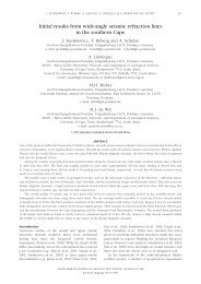
Comparing 1960’s Karoo basin seismic data with recent data<br />
(<strong>Inkaba</strong> ye<strong>Africa</strong> Line), to identify and correlate Karoo seismic<br />
stratigraphy on a more regional basis<br />
1 Lynise Esterhuizen, 2 Ge<strong>org</strong>e Smith<br />
1 Department of Geological Sciences, University of Cape Town, Rondebosch 7701, <strong>South</strong> <strong>Africa</strong><br />
lynise04@hotmail.co.za,<br />
2 Department of Geological Sciences, University of Cape Town, Rondebosch 7701, <strong>South</strong> <strong>Africa</strong><br />
ge<strong>org</strong>e.smith@uct.ac.za<br />
ABSTRACT<br />
The project entails comparing 1960’s Karoo basin seismic data with recent data (<strong>Inkaba</strong> ye<strong>Africa</strong> Line), to identify<br />
and correlate Karoo seismic stratigraphy on a more regional basis.<br />
Due to the recent interest in shale gas exploration in the Karoo basin of <strong>South</strong> <strong>Africa</strong>, there is an interest in reinterpreting<br />
old 1960's seismic lines of SOEKOR (now archived by PASA). This project entails comparing these<br />
lines with a recent <strong>Inkaba</strong> ye<strong>Africa</strong> near vertical reflection line across the southern Karoo Basin (Lindeque, 2008),<br />
and tying the reflections to the known litho-stratigraphy, based on outcrop mapping and borehole data. It forms<br />
part of a shale gas project to identify the location and depths of the Whitehill and Prince Albert Formations. The<br />
differences in appearance and quality between the old and new data are outlined.<br />
The old Karoo seismic images are of poor quality, but were enhanced by two-dimensional convolutional filtering.<br />
Thereafter, the sections were re-interpreted using the recent seismic data and existing well-data as a guide.<br />
The <strong>Inkaba</strong> ye<strong>Africa</strong> seismic line shows much deeper penetration, with depths of up to 50km through the crust and<br />
across the Moho. The older data only shows the upper most crustal layers down to approximately 10km.<br />
The comparison of the two sets of data shows the differences in processing and how seismic acquisition quality has<br />
improved since the early 1960's. The data also indicate where the old data can still be of good use after significant<br />
but time-consuming enhancement using modern filtering techniques.<br />
Reference:<br />
Lindeque, A.S, 2008, Deep Crustal profile across the southern Karoo Basin, <strong>South</strong> <strong>Africa</strong>, Unpublished Masters Thesis in the<br />
Department of Geological Sciences, University of Cape Town<br />
KEYWORDS: Karoo basin, seismic data, image enhancement<br />
26