Mesozoic stratigraphy of northeastern Chihuahua, Mexico
Mesozoic stratigraphy of northeastern Chihuahua, Mexico
Mesozoic stratigraphy of northeastern Chihuahua, Mexico

Create successful ePaper yourself
Turn your PDF publications into a flip-book with our unique Google optimized e-Paper software.
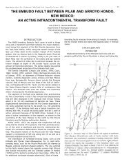
NEW MEXICO GEOLOGICAL SOCIETY—TWENTIETH FIELD CONFERENCE 95<br />
type locality recently proposed by Brunson (1954, p. 37) is<br />
located in Flat Canyon, at the northern rim <strong>of</strong> the Finlay<br />
Mountains. The Finlay Limestone is 130 m thick in the<br />
Juarez Mountains (Cordoba, 1968) and 75 m thick in Sierra<br />
de la Alcaparra. In Trans-Pecos Texas the Finlay Limestone<br />
rests disconformably on the Cox Sandstone ( Underwood,<br />
1963; Brand and DeFord, 1958 p. 376); however, in<br />
<strong>northeastern</strong> <strong>Chihuahua</strong> this disconformity has not been<br />
found. The Finlay Limestone contains abundant Dictyconus<br />
wallnutensis ( Carsey ) 40 m above the base <strong>of</strong> unit. The<br />
lower part <strong>of</strong> the Finlay has Toucasia sp. and Caprinuloidea<br />
sp. The lower beds have Exogyra sp. and Ostrea sp. In addition,<br />
I have collected Gryphaea mucronata Gabb, and<br />
Lunatia sp. and Pecten sp. from the lower beds at Sierra de<br />
Juarez.<br />
The age <strong>of</strong> Finlay Limestone is Albian because it is between<br />
Albian formations.<br />
The Finlay Limestone in Sierra Banco de Lucero is probably<br />
represented by the middle part <strong>of</strong> the Ahumada Formation<br />
(see isometric diagram, fig. 2.)<br />
Benevides Formation.—The Benevides Formation was<br />
proposed by Amsbury (1957) for a 50 m section <strong>of</strong> dark<br />
gray shale and yellowish calcarenite that crops out near<br />
Rancho Benevides in the Pinto Canyon area, Presidio<br />
County, Texas.<br />
Underwood (1963) mapped the formation between the<br />
Finlay and Espy Limestone as Benevides in the Eagle<br />
Mountains and vicinity. Haenggi (1966) mapped the same<br />
unit in the El Cuervo area, Rodriguez, (1969) in Sierra de<br />
la Alcaparra, and I in the Sierra Juarez.<br />
The measured thicknesses <strong>of</strong> the Benevides are 260 m<br />
in the El Cuervo area, 40 m in the Eagle Mountains, 220<br />
m in Sierra de San Ignacio, and 180 m in Sierra del Hueso.<br />
R. K. DeFord's graduate students measured 243 m, 154 m,<br />
and 212 m in three different parts <strong>of</strong> the Sierra Pilares, in<br />
the border range in <strong>Chihuahua</strong> (1958) .<br />
The Benevides has yielded a large number <strong>of</strong> fossils and<br />
in the above mentioned localities different workers have<br />
collected:<br />
Bendanticeras sp. cfr. B. beudanti (Hitzel )<br />
Eopachydiscus sp.<br />
Pervinquieria equidistans (Cragin )<br />
Venezoliceras sp. cfr. V. trinitense Gabb<br />
Adkinsites bravoensis (Bose)<br />
Idiohamites fremonti ( Marcou )<br />
Manuaniceras sp. aff. M. multifidum ( Steinmann )<br />
Prohysteroceras sp. cfr. P. austinense (Romer)<br />
Adkinsites diazi Young<br />
Diploceras sp. cf. D. fredericksburgense Scott<br />
Craginites serratescens (Cragin )<br />
Oxytropidoceras bravoense<br />
Exogyra texana Römer<br />
Pecten sp.<br />
Nerinea sp.<br />
Epiaster sp.<br />
Caprinuloidea sp.<br />
The ammonites from the Benevides in <strong>northeastern</strong> <strong>Chihuahua</strong><br />
indicate that the formation is middle to late Albian<br />
in age.<br />
The Benevides lithology wedges out and in Sierra Banco<br />
de Lucero is probably represented by part <strong>of</strong> the Lucero<br />
Formation (see isometric diagram fig. 2) .<br />
Loma Plata Limestone.—Amsbury (1957) proposed this<br />
name for a sequence 240 m thick <strong>of</strong> gray, nodular, limestone<br />
that crops out in the Pinto Canyon area in Presidio<br />
County, Texas where it is interbedded with massive limestone<br />
with chert stringers and several rudistid horizons.<br />
In <strong>northeastern</strong> <strong>Chihuahua</strong> the strata above the Benevides<br />
Formation are lithologically similar to Amsbury's<br />
Loma Plata. The limestone contains abundant Caprinuloidea<br />
sp. and Enhallaster sp. as well as numerous unidentified<br />
gastropods; none <strong>of</strong> these fossils is suitable to assign a<br />
definite age to the unit.<br />
The Loma Plata Limestone is 500 m thick at El Cuervo<br />
area, 178 m in Sierra de San Ignacio, about 100 m in Sierra<br />
de la Alcaparra, and 150 m in Sierra Banco de Lucero. The<br />
section exposed at El Cuervo is overlain by the Del Rio<br />
Formation but the upper part <strong>of</strong> the Loma Plata in many<br />
sierras has been eroded.<br />
The age <strong>of</strong> the Loma Plata Limestone is Late Albian-<br />
Early Cenomanian; it is underlain by Albian beds (Benevides<br />
Formation) and overlain by Early Cenomanian beds<br />
(Del Rio Formation); the Albian-Cenomanian boundary<br />
is within the formation. Loma Plata is a continuous body<br />
in <strong>northeastern</strong> <strong>Chihuahua</strong> and may be correlated with the<br />
Espy Limestone <strong>of</strong> the Eagle Mountains.<br />
REFERENCES CITED<br />
Amsbury, D. L., 1957, in Keroher et al, 1966; Lexicon <strong>of</strong> Geological<br />
Names. U.S. Geol. Survey. Bull. 1200, pt. 1.<br />
Brand, J. P. and Deford, R. K., 1958, Comanchean Stratigraphy <strong>of</strong><br />
Kent quadrangle, Trans-Pecos, Texas: Am Assoc. Pet. Geol. Bull.,<br />
v. 42, pp. 371-386, 2 figs. reprinted as Texas Univ. Bur. Econ.<br />
Geol. Rept. Inv. No. 34.<br />
Brunson, W.E., 1954, Type sections <strong>of</strong> Cox-Finlay formations, Hudspeth<br />
County, Trans-Pecos, Texas: Texas Univ. M.A. thesis, 108<br />
p., 19 figs., 1 pl., 1 tbl.<br />
Burckardt, C., 1930, Etude sinthetique sur le Mesozoique mexicain:<br />
Soc. Paleont. Suisse, Mem., v. 49-50, 280 p.<br />
Burrows, R. E., 1910, Geology <strong>of</strong> northern <strong>Mexico</strong>: Soc. Geol. Mex.,<br />
Bol., v. 7, p. 85-103.<br />
Caire, L. F., 1966, Estratigrafia de la Hoja San Ignacio, Estado de<br />
<strong>Chihuahua</strong> : Univ. Nal. Autón. <strong>Mexico</strong>, Fac. de Ingenieria, thesis.<br />
Córdoba, D. A., 1966, Informes GeolOgicos de las Hojas del Estado<br />
de <strong>Chihuahua</strong>: Univ. Nal. Autón. <strong>Mexico</strong>, Inst. Geologia, (Un-<br />
published ).<br />
Córdoba, D. A., 1968, The Juarez Mountains in West: Texas Geol.<br />
Soc. Guide Book, Delaware Basin Exploration, p. 85-86.<br />
Córdoba, D. A. 1969, Hoja Ciudad Juarez 13 R-a ( 3) con Resumen<br />
de la Geologia de la Hoja Ciudad Juarez: Univ. Nal. Autón. <strong>Mexico</strong>,<br />
Inst. Geologia, Carta Geológica de <strong>Mexico</strong>, Serie de 1:100,000.<br />
DeFord, R. K., 1958, Cretaceous platform and geosyncline, Culberson<br />
and Hudspeth counties, Trans-Pecos Texas: Permian Section,<br />
Soc. Econ. Paleontologists and Mineralogists, Guidebook 1958<br />
Field Trip, April 10-12, 1958, Van Horn, Texas.<br />
Gillerman, E., 1953, Fluorspar deposits <strong>of</strong> the Eagle Mountains, Trans-<br />
Pecos, Texas: U.S. Geol. Survey, Bull. 987, 98 p.<br />
Guzman, J. E. and DeCserna, Z., 1963, Tectonic history <strong>of</strong> <strong>Mexico</strong>,<br />
in backbone <strong>of</strong> the Americas: Am. Assoc. Petroleum Geologists,<br />
Memoir, p. 113-119.<br />
Haenggi, P. T., 1966, Geology <strong>of</strong> El Cuervo area, <strong>northeastern</strong> <strong>Chihuahua</strong>,<br />
<strong>Mexico</strong>: Texas Univ. Ph.D. dissertation, 403 p. 37 figs., 7<br />
pls. 22 tbls.