Final Conservation Plan - Kildare.ie
Final Conservation Plan - Kildare.ie
Final Conservation Plan - Kildare.ie
You also want an ePaper? Increase the reach of your titles
YUMPU automatically turns print PDFs into web optimized ePapers that Google loves.
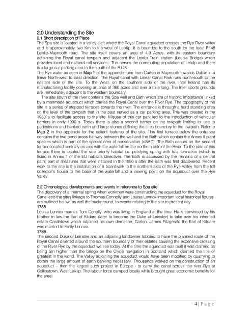
2.0 Understanding the Site<br />
2.1 Short description of Place<br />
The Spa site is located in a valley cleft where the Royal Canal aqueduct crosses the Rye River valley<br />
and is approximately two Km to the west of Leixlip. It is bounded to the south by the local R148<br />
Leixlip-Maynooth road. The site itself covers an area of 4.9 Acres, with its eastern boundary<br />
adjoining the Royal canal towpath and adjacent the Leixlip Train station (Louisa Bridge) which<br />
provides local and national rail services. This serves the commuting population of Leixlip and there<br />
is a large car parking area to the south of the R148.<br />
The Rye water as seen in Map 1 of the appendix runs from Carton in Maynooth towards Dublin in a<br />
linear North-west to East direction. The Royal canal with Linear Canal Park runs north-south to the<br />
eastern side of the site. To the West, on the southern side of the river, Intel Ireland has its<br />
manufacturing facility covering an area of 360 acres and over a mile long. The Intel sports grounds<br />
are immediately adjacent to the western boundary.<br />
The site south of the river contains the Spa well and Bath which are of historic importance linked<br />
by a manmade aqueduct which carr<strong>ie</strong>s the Royal Canal over the River Rye. The topography of the<br />
site is a ser<strong>ie</strong>s of stepped terraces towards the river. The entrance is through a hard standing area<br />
on the level of the towpath that in the past served as a car parking area. This was created in the<br />
1980`s to facilitate access to the site. Misuse of this car park led to the introduction of vehicular<br />
barr<strong>ie</strong>rs in early 1990`s. Today there is also a second barr<strong>ie</strong>r on the towpath limiting its use to<br />
pedestrians and banked earth and large stones defining the sites boundary to the towpath. Refer to<br />
Map 2 in the appendix for the sal<strong>ie</strong>nt features of the site. This first terrace below the entrance<br />
contains the two pond areas halfway between the well and the Bath which contain the Annex II plant<br />
spec<strong>ie</strong>s which is part of the special area of conservation (cSAC). The Bath occurs on the second<br />
terrace located centrally on axis with the waterfall on the northern side of the River. To the side of this<br />
terrace there is located the rare priority habitat i.e. petrifying spring with tufa formation (which is<br />
listed in Annex 1 of the EU habitats Directive). The Bath is accessed by the remains of a central<br />
path; part of measures that were installed in the 1980 s after the Bath was first discovered. Recent<br />
work to the site is the installation of a boardwalk to the northern side of the Rye Valley from the toll<br />
collector‟s house to the base of the waterfall and a v<strong>ie</strong>wing point on the aqueduct over the Rye<br />
Valley.<br />
2.2 Chronological developments and events in reference to Spa site.<br />
The discovery of a thermal spring when workmen were constructing the aqueduct for the Royal<br />
Canal and the sites linkage to Thomas Connolly and Louisa Lennox important local historical figures<br />
are outlined below, as well the background, to events relating to the site to present day.<br />
1758<br />
Louisa Lennox marr<strong>ie</strong>s Tom Conolly, who was living in England at the time. He is convinced by his<br />
brother in law the Earl of <strong>Kildare</strong> (later to become the Duke of Leinster) to take over his inherited<br />
estate Castletown which adjoined his own demesne, Carton. James Fitzgerald the Earl of <strong>Kildare</strong><br />
was marr<strong>ie</strong>d to Emily Lennox.<br />
1786<br />
The second Duke of Leinster and an adjoining landowner lobb<strong>ie</strong>d to have the planned route of the<br />
Royal Canal diverted around the southern boundary of their estates causing the expensive crossing<br />
of the River Rye by the aqueduct we see today. At the time the aqueduct was built it was claimed as<br />
being 5m higher than the bridge on the Clyde navigation in Scotland which claimed the title of<br />
greatest in the world. The Valley adjoining the aqueduct would have been modif<strong>ie</strong>d by quarrying to<br />
obtain the large amount of earth banking necessary. Thousands worked on the construction of an<br />
aqueduct – then the largest such project in Europe - to carry the canal across the river Rye at<br />
Collinstown, West Leixlip. The labour force camped locally while brought great economic benefits for<br />
the area.<br />
4 | P a g e


