Baldwin Park Civic Center Plaza - ULI Los Angeles - Urban Land ...
Baldwin Park Civic Center Plaza - ULI Los Angeles - Urban Land ...
Baldwin Park Civic Center Plaza - ULI Los Angeles - Urban Land ...

Create successful ePaper yourself
Turn your PDF publications into a flip-book with our unique Google optimized e-Paper software.
RA<br />
NTY<br />
Lancaster<br />
Palmdale<br />
Santa Via Vincent Grade/<br />
Clarita Princessa Acton<br />
Sylmar/San Fernando<br />
Van Nuys<br />
Sun Valley<br />
Burbank-Bob Hope<br />
LOS ANGELES<br />
Airport Downtown Burbank COUNTY<br />
Glendale<br />
LA Union Station<br />
Cal State L.A.<br />
El Monte<br />
<strong>Baldwin</strong> <strong>Park</strong><br />
Montebello/Commerce<br />
Covina<br />
Commerce<br />
Pomona (North) SAN BERNARDINO<br />
Norwalk/Santa Fe Springs Industry<br />
COUNTY<br />
Claremont<br />
Buena <strong>Park</strong><br />
Montclair<br />
Fullerton<br />
Downtown<br />
Upland<br />
Pomona<br />
Placentia<br />
Rancho Cucamonga<br />
Future Station<br />
Fontana<br />
E. Ontario<br />
Rial<br />
Anaheim<br />
W. Corona<br />
Anaheim<br />
Pedley<br />
Orange Canyon<br />
N. Main<br />
Corona<br />
Santa Ana<br />
Tustin<br />
Rivers<br />
La<br />
Irvine<br />
RIVE<br />
C<br />
no<br />
Laguna Niguel/<br />
Mission Viejo<br />
RANGE<br />
UNTY<br />
1/10 9:58:24 AM<br />
A <strong>ULI</strong> Advisory Services Technical Assistance Panel Report<br />
23<br />
101<br />
5<br />
rillo<br />
Moorpark<br />
Simi Valley<br />
Chatsworth<br />
Newhall<br />
Northridge<br />
118<br />
IC OCEAN<br />
N<br />
MAP NOT TO SCALE<br />
405<br />
210<br />
10<br />
14<br />
605<br />
60<br />
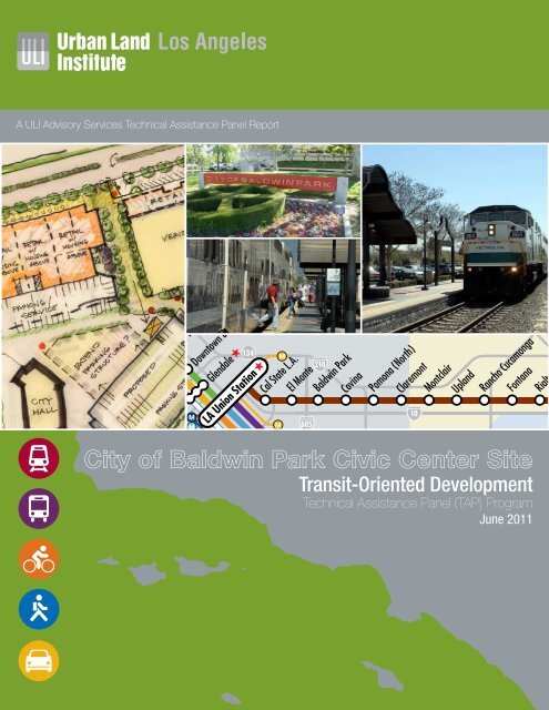
City of <strong>Baldwin</strong> 710 <strong>Park</strong> 605 <strong>Civic</strong> <strong>Center</strong> Site<br />
405 110<br />
15 91<br />
57<br />
LAX Airport<br />
Transit-Oriented Development<br />
105<br />
metrolinktrains.com<br />
91<br />
134<br />
210<br />
405<br />
5<br />
22<br />
John Wayne<br />
Airport<br />
55<br />
10<br />
Technical Assistance Panel (TAP) Program<br />
June 2011<br />
55<br />
405<br />
5<br />
91<br />
15<br />
15
<strong>ULI</strong> <strong>Los</strong> <strong>Angeles</strong> Mission Statement<br />
At the <strong>Urban</strong> <strong>Land</strong> Institute, our mission is to provide leadership in the responsible use of land and in creating<br />
and sustaining thriving communities worldwide. <strong>ULI</strong> <strong>Los</strong> <strong>Angeles</strong>, a district council of the <strong>Urban</strong> <strong>Land</strong> Institute,<br />
carries forth that mission as the preeminent regional real estate organization providing inclusive and trusted<br />
leadership influencing public policy and practice.<br />
About the <strong>ULI</strong> <strong>Los</strong> <strong>Angeles</strong> Technical Assistance Panels<br />
In keeping with the <strong>Urban</strong> <strong>Land</strong> Institute mission, Technical Assistance Panels are convened to provide pro-bono<br />
planning and development assistance to public officials and local stakeholders of communities and nonprofit<br />
organizations who have requested assistance in addressing their land use challenges.<br />
A group of diverse professionals representing the full spectrum of land use and real estate disciplines typically<br />
spend one day visiting and analyzing the built environments, identifying specific planning and development<br />
issues, and formulating realistic and actionable recommendations to move initiatives forward in a fashion<br />
consistent with the applicant’s goals and objectives.<br />
Staff and Panel Members<br />
TAP Client<br />
City of <strong>Baldwin</strong> <strong>Park</strong><br />
Panel Chair<br />
Vanessa Delgado<br />
Director of Development, Primestor<br />
Panelists<br />
John Adams<br />
Project Principal, Gensler<br />
Loren Bloch<br />
President, Community Dynamics<br />
Claudia Gutierrez<br />
Associate, Sheppard Mullin Richter and Hampton, LLP<br />
Mark Herwick, AICP<br />
Supervising Regional Planner, County of <strong>Los</strong> <strong>Angeles</strong><br />
Department of Regional Planning<br />
Melani Smith<br />
President, Principal - Planning and <strong>Urban</strong> Design, Melendrez<br />
Judith Taylor<br />
Principal, Pro Forma Advisors LLC<br />
TAP Committee Chair<br />
Jonathan Curtis<br />
Principal, Trevear Holdings LLC<br />
TOD Summit TAP Advisor<br />
Robert Gardner<br />
Managing Director, RCLCO<br />
<strong>ULI</strong> Project Staff<br />
Gail Goldberg<br />
Executive Director, <strong>ULI</strong> <strong>Los</strong> <strong>Angeles</strong><br />
Christine Aure<br />
Director, <strong>ULI</strong> <strong>Los</strong> <strong>Angeles</strong><br />
Ciara Contreras<br />
Project Manager, <strong>ULI</strong> <strong>Los</strong> <strong>Angeles</strong><br />
Stephen Sampson<br />
Graphic Designer<br />
Robert Andrews<br />
Analyst<br />
John Dlugolecki<br />
Photographer
Table of<br />
Contents<br />
Executive Summary 2<br />
Assignment & Process 4<br />
Background 6<br />
Analysis 8<br />
Findings 9<br />
Recommendations 13<br />
Implementation 16<br />
Funding Sources 18<br />
Acknowledgements 19<br />
Panel Members 20<br />
1
Executive<br />
Summary<br />
2 City of <strong>Baldwin</strong> <strong>Park</strong> <strong>Civic</strong> <strong>Center</strong> Transit-Oriented Development Technical Assistance Panel Program<br />
<strong>Baldwin</strong> <strong>Park</strong> is located in the eastern portion of <strong>Los</strong> <strong>Angeles</strong> County<br />
approximately 15 miles east of downtown <strong>Los</strong> <strong>Angeles</strong> and bounded by<br />
Irwindale on the north, West Covina on the east, El Monte on the west<br />
and Industry, West Covina and unincorporated County areas on the<br />
south. The <strong>Civic</strong> <strong>Center</strong> is located within the Central Business District.<br />
It is an 11-acre site adjacent to the Cruz Baca Transit <strong>Center</strong> Metrolink<br />
Station and serviced by both Foothill Transit and MTA. The site,<br />
bounded by Pacific Avenue, Ramona Boulevard and Bogart Avenue,<br />
includes the Verizon building, a 2-story commercial office building and<br />
a single story retail commercial building.<br />
Given the unique make-up of City residents as well as the location<br />
of existing cluster of uses, the downtown <strong>Baldwin</strong> <strong>Park</strong> area is well<br />
positioned to become a mixed-use destination with active local-serving<br />
commercial uses for <strong>Baldwin</strong> <strong>Park</strong> residents and residents of other<br />
nearby cities. <strong>Baldwin</strong> <strong>Park</strong>’s Central Business District has the potential<br />
to be an attractive and popular destination. The project site can be used<br />
to better connect the Metrolink station to downtown, and at the same<br />
time bring additional commercial and residential opportunities to the<br />
area. As such, the Panel focused on creating a pedestrian-friendly core<br />
that will provide a pleasant environment for residents and visitors to<br />
shop and engage in entertainment activities.<br />
The Panel’s vision is to revitalize <strong>Baldwin</strong> <strong>Park</strong>’s <strong>Civic</strong> <strong>Center</strong> area<br />
by creating a main street environment through enhanced pedestrian<br />
linkages between the community’s primary assets and activity nodes.<br />
Strategies recommended to achieve this vision include: 1) leveraging<br />
existing assets and improving linkages, 2) site improvements and<br />
development opportunities and 3) development of future housing.
The <strong>Baldwin</strong> <strong>Park</strong> Transit <strong>Center</strong> is surrounded by a variety of community<br />
assets that can be leveraged to promote pedestrian traffic and downtown<br />
development. Specific programming and improvement ideas that are both<br />
feasible and encourage utilization of the area include plantings, pots,<br />
outdoor furnishings, public art and a farmer’s market.<br />
The Panel supports a two phase process to implement its vision for <strong>Baldwin</strong><br />
<strong>Park</strong>’s Central Business District and <strong>Civic</strong> <strong>Center</strong> area. The first phase is<br />
centered on creating a framework for improvement through zoning, an<br />
environmental impact report and the site’s specific plan. These actions will<br />
expedite the development process and create incentives for developers<br />
to carry out the City’s vision. The second phase is related to the actual<br />
development and implementation of the TAP panel’s vision for the <strong>Civic</strong><br />
<strong>Center</strong> and the Central Business District.<br />
The goal of future developments should include the desire to create a<br />
stronger downtown presence and better environment for users arriving<br />
by car, train or foot. Additionally, the introduction of housing directly<br />
adjacent to the Metrolink station will provide immediate and easy access<br />
to trains serving employment centers throughout the <strong>Los</strong> <strong>Angeles</strong> and San<br />
Bernardino county areas. Housing will also increase pedestrian activity in<br />
the area, particularly at night and on weekends, as local residents utilize<br />
shops, restaurants, and other retail centers.<br />
3
Assignment & Process<br />
Key Issues<br />
Revitalize <strong>Baldwin</strong> <strong>Park</strong>’s Downtown Central Business<br />
District and <strong>Civic</strong> <strong>Center</strong> into a pedestrian-friendly urban<br />
center with quality retail, dining, shopping, entertainment<br />
and other amenities. The City of <strong>Baldwin</strong> <strong>Park</strong>’s vision for<br />
the area is to:<br />
• Create a pedestrian-friendly and vibrant urban<br />
center with quality retail, dining, shopping, and<br />
entertainment uses and other amenities, which<br />
offer exciting opportunities for the community<br />
and visitors.<br />
• Establish a pedestrian district through<br />
development regulations, public improvements,<br />
and street design that establishes a pedestrian<br />
link between the <strong>Civic</strong> <strong>Center</strong>, Metrolink<br />
Station and the Downtown Central Business<br />
District.<br />
• Encourage development, both public and<br />
private sector, which stimulate pedestrian<br />
activity and connection, economic development<br />
and the creation of a highly-valued community<br />
asset.<br />
4 City of <strong>Baldwin</strong> <strong>Park</strong> <strong>Civic</strong> <strong>Center</strong> Transit-Oriented Development Technical Assistance Panel Program<br />
A Metrolink train arrives at the Cruz Baca Trans<strong>Center</strong> in <strong>Baldwin</strong> <strong>Park</strong>.<br />
Key Questions/Considerations<br />
The City of <strong>Baldwin</strong> <strong>Park</strong> requested that the <strong>ULI</strong> panel<br />
review the City’s existing planning efforts and provide<br />
feedback and further direction to achieve the City’s<br />
goal of creating a pedestrian-friendly urban center. The<br />
issues that were addressed during this effort include the<br />
following:<br />
1. Given the City’s vision, what urban design<br />
and infrastructure improvements can be<br />
implemented to the remainder of the <strong>Civic</strong><br />
<strong>Center</strong> site to maximize land use and the<br />
transit-oriented development experience?<br />
2. What are some private development options<br />
and appropriate land uses (long term vs. short<br />
term, and regional-serving versus localserving)<br />
that should be encouraged at the <strong>Civic</strong><br />
<strong>Center</strong> site?<br />
3. What specific improvements concerning the<br />
Metrolink Station platform can be implemented<br />
to address safety concerns and improve<br />
pedestrian access to the <strong>Civic</strong> <strong>Center</strong> site and<br />
Downtown Central Business District?<br />
4. Considering the above, what changes should<br />
be made to existing plans and what are the<br />
potential delivery methods for implementation<br />
to achieve the City’s goals?
Technical Assistance Panel (TAP)<br />
Process<br />
<strong>ULI</strong> representatives met with representatives<br />
from the City of <strong>Baldwin</strong> <strong>Park</strong> to determine<br />
the scope of the panel assignment. The panel<br />
members were selected based upon their ability<br />
to address the stated objectives for the program<br />
provided by the client. Prior to the day-long<br />
program, panel members reviewed background<br />
materials prepared by the City of <strong>Baldwin</strong> <strong>Park</strong>.<br />
The TAP process is a day-long event. In the<br />
morning panel members tour the study area<br />
with representatives and later meet with key<br />
stakeholders, work through an intensive analysis<br />
on the specified issues, and present their<br />
findings to the general public.<br />
The panel begins the day with a detailed tour of the study area.<br />
Panelists interview Lorraine O’Brien, Vice President of the<br />
<strong>Baldwin</strong> <strong>Park</strong> Historical Society.<br />
John Adams shares his understanding of the study area with the panel.<br />
TAP Panel of Experts<br />
<strong>ULI</strong> convened a panel of professionals who represented a variety of disciplines<br />
connected with land use and real estate development, such as architecture and<br />
design, real estate development, economic analysis, real estate law, and development<br />
financing methods. Members were selected with the intent of convening a robust array<br />
of professional expertise relevant to the City’s objectives for the study and who had<br />
local working knowledge of the sub-region where the study area was located. All panel<br />
members were volunteers and were not compensated for their time.<br />
TAP panelists have a broad range of backgrounds and bring a unique skill set to address the key questions posed.<br />
5
The <strong>Baldwin</strong> <strong>Park</strong> <strong>Civic</strong> <strong>Center</strong> study area and surrounding context.<br />
Background<br />
Overview<br />
<strong>Baldwin</strong> <strong>Park</strong> is located in the eastern portion of <strong>Los</strong> <strong>Angeles</strong> County approximately<br />
15 miles east of downtown <strong>Los</strong> <strong>Angeles</strong>. <strong>Baldwin</strong> <strong>Park</strong> is bounded by Irwindale on<br />
the north, West Covina on the east, El Monte on the west and Industry, West Covina,<br />
and unincorporated <strong>Los</strong> <strong>Angeles</strong> County areas on the south. According to the most<br />
recent California Department of Finance estimates, the City’s 2010 population was<br />
estimated to be 81,604 persons. <strong>Baldwin</strong> <strong>Park</strong> is predominantly a residential bedroom<br />
<strong>Baldwin</strong> <strong>Park</strong> <strong>Civic</strong><br />
<strong>Center</strong> Study Area<br />
Regional location of the <strong>Baldwin</strong> <strong>Park</strong> <strong>Civic</strong> <strong>Center</strong> Station study area.<br />
6 City of <strong>Baldwin</strong> <strong>Park</strong> <strong>Civic</strong> <strong>Center</strong> Transit-Oriented Development Technical Assistance Panel Program<br />
Metrolink staff brief panelists on the future plans for the station.<br />
View looking east from the Cruz Baca Transit Station.<br />
community though there are a number of well-defined<br />
commercial districts found within the City including the<br />
Central Business District.<br />
Central Business District & <strong>Civic</strong> <strong>Center</strong><br />
The Central Business District encompasses<br />
approximately 130 acres in the City’s downtown core,<br />
including commercial development along Maine Avenue<br />
and Ramona Boulevard, residential development<br />
generally west of Maine Avenue and north of Ramona<br />
Boulevard and industrial development in the eastern<br />
portion of the district area.<br />
The <strong>Civic</strong> <strong>Center</strong> Site is located within the Central<br />
Business District. It is an 11-acre site adjacent to the<br />
Cruz Baca Transit <strong>Center</strong> Metrolink Station and serviced<br />
by both Foothill Transit and MTA. The site, bounded by<br />
Pacific Avenue, Ramona Boulevard and Bogart Avenue,<br />
includes the Verizon building, a 2-story commercial<br />
office building and a single story retail commercial<br />
building.<br />
Transportation<br />
<strong>Baldwin</strong> <strong>Park</strong> is well served by two freeways: I-605 (the<br />
San Gabriel River Freeway), which provides north-south<br />
regional circulation along the western boundary of the<br />
City, and I-10 (the San Bernardino Freeway), which<br />
accommodates high daily volumes of east-west travel<br />
along the southern portion of the City. Together, these
interstates provide connections to essentially every<br />
other freeway in the region.<br />
The <strong>Baldwin</strong> <strong>Park</strong> train station just southeast of City<br />
Hall provides an important stop for the Metrolink San<br />
Bernardino line. Weekday train service between San<br />
Bernardino and <strong>Los</strong> <strong>Angeles</strong> Union Station allows<br />
commuters to disembark for places of employment in<br />
<strong>Baldwin</strong> <strong>Park</strong> and adjacent cities, and for <strong>Baldwin</strong> <strong>Park</strong><br />
residents to travel easily to jobs in other communities<br />
along the line. The San Bernardino line also provides<br />
connections to Ventura County trains and the Burbank<br />
Airport/Glendale area. Thus, City residents can use the<br />
train to travel some distance from home for recreation<br />
or business.<br />
Development Activities over the Last Five Years<br />
Over the past five years, the Community Development<br />
Commission (CDC) has initiated several projects to<br />
address conditions of blight in the Central Business<br />
District. During this time, the CDC has focused on<br />
increasing housing opportunities for all segments of<br />
the community and improving the overall economic<br />
health of the community by attracting new businesses<br />
and assisting existing business to expand. Significant<br />
CDC accomplishments in non-housing and mixed-use<br />
activities in the Central Business District include:<br />
Arts and Recreation <strong>Center</strong>: The former Central School<br />
Auditorium, built in 1936 and located adjacent to City<br />
Hall, was completely renovated by the City and opened<br />
in 2007 as the Arts and Recreation <strong>Center</strong> (ARC). The<br />
ARC includes: a dance studio; arts and crafts studio;<br />
exhibit gallery; small indoor amphitheater; and outdoor<br />
nature and picnic area. The ARC is also the new home<br />
for the <strong>Baldwin</strong> <strong>Park</strong> Historical Society Museum.<br />
Julia McNeill Senior <strong>Center</strong>: Expansion of senior center<br />
located at the <strong>Baldwin</strong> <strong>Park</strong> Community <strong>Center</strong> at<br />
<strong>Baldwin</strong> <strong>Park</strong> Boulevard and Ramona Boulevard was completed in 2007. Improvements<br />
include: additional office and storage space; two large recreation rooms; a lounge area;<br />
and a reception area with fireplace.<br />
<strong>Baldwin</strong> <strong>Park</strong> Transit <strong>Center</strong>: The<br />
proposed project includes the<br />
construction of a new transit center<br />
that will serve patrons using public bus<br />
transit and the nearby Metrolink Station.<br />
Project-related improvements include:<br />
a 5-story parking structure, information<br />
kiosk; rest rooms; pedestrian amenities;<br />
bus parking and layover areas; and<br />
a pedestrian bridge that will connect<br />
the proposed parking structure with<br />
the existing Cruz Baca Transit <strong>Center</strong><br />
Metrolink Station. The existing Cruz<br />
Baca Transit <strong>Center</strong> is located to the<br />
south of the proposed project site, on<br />
the south side of Bogart Avenue.<br />
In addition to these accomplishments,<br />
the CDC entered into an Exclusive<br />
Negotiating Agreement (ENA) with a Bisno<br />
Development, LLC to analyze the feasibility<br />
Metrolink boarding platform for the Cruz Baca Transit<br />
station.<br />
of the potential revitalization of the City’s downtown core and Central Business District.<br />
The ambitious project included 8,000 residential units, 750,000 square-feet of retail<br />
and entertainment space; 3.0 million square-feet of commercial space; a 300-room full<br />
service hotel; and 1,000-student charter school. However, due to the economic market<br />
condition, the project analysis and the ENA were terminated in November 2008.<br />
After the collapse of the proposed Bisno Development project, <strong>Baldwin</strong> <strong>Park</strong> has<br />
refocused its attention on the new transit center and its impact on the Central Business<br />
District. The City recognizes the train station as one key component of its program to<br />
enhance the downtown and create a mixed-use, vibrant community center. Creating<br />
a convenient pedestrian link from the station to City Hall and downtown will make it<br />
easier for commuters to linger and patronize local shops, restaurants and businesses.<br />
The transit center’s location is also expected to encourage people to live downtown in<br />
new residences. Thus, enhancing the train station and its relationship to downtown will<br />
help meet local and regional transportation goals, as well as work toward fulfilling the<br />
City’s vision for an urban village downtown.<br />
Metro buses connect <strong>Baldwin</strong> <strong>Park</strong> to the greater <strong>Los</strong> <strong>Angeles</strong> region. TAP panelists (left to right) Mark Herwick, Loren Bloch, Melani Smith & Claudia Gutierrez conduct a series of<br />
stakeholder interviews.<br />
7
Existing retail conditions within the study area.<br />
Analysis<br />
Overview<br />
Given the unique make-up of City residents as well as the location of existing cluster<br />
of uses, the downtown <strong>Baldwin</strong> <strong>Park</strong> area is well positioned to become a mixed-use<br />
destination with active local-serving commercial uses for <strong>Baldwin</strong> <strong>Park</strong> residents and<br />
residents of other nearby cities. The project site can be used to better connect the<br />
Metrolink station to downtown, and at the same time bring additional commercial and<br />
residential opportunities to the area.<br />
Current Market Conditions<br />
<strong>Baldwin</strong> <strong>Park</strong> is a family-oriented middle-class community with strong market metrics.<br />
The housing stock of <strong>Baldwin</strong> <strong>Park</strong> is primarily owner-occupied, as about 60.0% of its<br />
residents own their own homes, while about 34% of households rent. Almost 80% of<br />
homes within <strong>Baldwin</strong> <strong>Park</strong> are single-family, with an average value of approximately<br />
$307,000. Multi-family units make up about 20% of the housing stock and apartment<br />
rents average approximately $1,144. <strong>Baldwin</strong> <strong>Park</strong> residents have average household<br />
incomes of almost $60,000, but much of their spending occurs in the adjacent<br />
communities.<br />
The existing commercial uses are dominated by small local-serving medical office<br />
and professional services in older office buildings and quick service eateries. There<br />
is a lack of neighborhood-serving retail uses, such as grocery, apparel, and sit-down<br />
restaurants within the 1-mile area of the project site. The downtown area has had high<br />
vacancies, particularly in its newer larger retail parcels, for several years and vacancies<br />
in all uses have been exacerbated by the recent recession. However, it is important<br />
to note that the small-format storefronts that make up the “heart” of the downtown<br />
area are doing fairly well and the City anticipates the opening of a full service grocery<br />
store summer 2011. Proposed development at the project site should create better<br />
connections to these areas and leverage and compliment their success.<br />
8 City of <strong>Baldwin</strong> <strong>Park</strong> <strong>Civic</strong> <strong>Center</strong> Transit-Oriented Development Technical Assistance Panel Program<br />
Potential pedestrian access points exist to connect to the transit<br />
station.<br />
Project Site’s Market Potential<br />
A broad survey performed by the TAP Panel<br />
reveals that residents within 3 miles of the<br />
project site could support almost 530,000<br />
square feet of additional general merchandise,<br />
92,000 square feet of clothing, 375,000 square<br />
feet of electronics stores, and over 100,000<br />
square feet in full-service and limited service<br />
eating places. The project site would be well<br />
positioned to capture one or more full-service<br />
restaurants and other amenities desired by the<br />
community, such as coffee, yogurt and juice<br />
shops.<br />
As noted above, the current office market is<br />
primarily local-serving office uses. It is possible<br />
that the site could capture a larger general<br />
employment-oriented office user, such as a<br />
bank branch or an institutional use, as a medical<br />
training facility or private university (or perhaps<br />
a Cal State LA) branch.<br />
Despite the current housing crisis, residential<br />
demand is likely to improve in the next two years<br />
due to Southern California’s traditional growth<br />
patterns (more people moving in than out). The<br />
Southern California Association of Governments<br />
estimates that there will be 2,400 new<br />
households added to cities within 3 miles of the<br />
project site over the next 15 years. The project<br />
site is well positioned to capture a fair share<br />
of this growth for reasonably priced, attractive<br />
market-rate for-sale, $300,000 to $500,000 1 .<br />
Also, the City may want to consider partnerships<br />
with other institutions such as faculty or student<br />
housing for Cal State LA or workforce housing.<br />
1- It should be noted that to keep the construction cost<br />
and eventual home price affordable it is advised to build<br />
product of four stories, or under and to limit the need for<br />
subterranean parking.
Some existing buildings are a challenge to permeability<br />
between Ramona and the Metrolink Station.<br />
The <strong>Baldwin</strong> <strong>Park</strong> <strong>Civic</strong> <strong>Center</strong> is the heart of the City.<br />
The wide sidewalks along the retail corridor is pedestrian friendly.<br />
Findings<br />
Across Ramona Boulevard is <strong>Park</strong> <strong>Plaza</strong>, a primary retail center for the area<br />
During the course of the TAP project, the panelists had the opportunity to tour the<br />
site and surrounding community, as well as interview elected officials, City staff,<br />
business owners, property developers and local residents of the City of <strong>Baldwin</strong><br />
<strong>Park</strong>. After gathering information, the panel conducted a SWOT analysis to determine<br />
the strengths, weaknesses, opportunities and threats of <strong>Baldwin</strong> <strong>Park</strong>’s <strong>Civic</strong> <strong>Center</strong><br />
and surrounding community. Strengths and weaknesses explore internal aspects<br />
of the project or elements that can be controlled or changed by new development.<br />
Opportunities and threats evaluate external influences that can affect the project, but<br />
most are beyond the control of those associated with the project, such as factors<br />
relating to the economy like interest rates or credit market conditions.<br />
From the site visit, stakeholder interviews and additional site research, the TAP panel<br />
determined the following strengths, weaknesses, opportunities and threats for the<br />
<strong>Baldwin</strong> <strong>Park</strong> <strong>Civic</strong> <strong>Center</strong> and downtown area:<br />
Strengths<br />
The <strong>Baldwin</strong> <strong>Park</strong> <strong>Civic</strong> <strong>Center</strong> is the heart of the City—the core of the communities<br />
revitalizing downtown. A place for shopping, recreation and leisure, City government,<br />
and local and regional transit connectivity, the <strong>Civic</strong> <strong>Center</strong> provides a unifying<br />
identity for residents who feel a strong sense of pride and affinity for the friendly,<br />
small town atmosphere of the area. The adjacency of the City Hall complex to the Cruz<br />
Baca Transit <strong>Center</strong> Metrolink Station immediately south of Bogart Avenue and to the<br />
resurgent <strong>Park</strong> <strong>Plaza</strong> on Maine shopping center directly north of Ramona Boulevard<br />
make the <strong>Civic</strong> <strong>Center</strong> a cornerstone for walkable and vibrant community and retail<br />
experiences throughout the downtown. The active Metrolink Station will be even more<br />
integrated with the <strong>Civic</strong> <strong>Center</strong> when the soon-to-be built five-story parking structure<br />
and connecting pedestrian bridge next to City Hall is completed. Additionally, the new<br />
parking structure will provide more opportunities for residents throughout <strong>Baldwin</strong><br />
<strong>Park</strong> to make the <strong>Civic</strong> <strong>Center</strong> and downtown a destination for the variety services and<br />
features that they offer.<br />
9
The strong community life in the immediate vicinity<br />
of the <strong>Civic</strong> <strong>Center</strong> is evident in the very active use<br />
of Morgan <strong>Park</strong> with its collection of recreation and<br />
community service buildings, active and passive<br />
recreation opportunities, and spaces for events and<br />
gatherings. The public improvements along Ramona<br />
Boulevard and Maine Avenue, including intersection<br />
pavers, modernized signal structures, and bike lane<br />
striping create an environment focused on more than<br />
just automobile use—an expression of “complete<br />
streets” that acknowledges the importance of pedestrians<br />
and bicyclists. The mature street trees provide a green<br />
lushness along Ramona Boulevard and complement the<br />
scenic vistas of the snow capped San Gabriel Mountains<br />
on the northern horizon.<br />
The nearly 38,000 residents within the one mile radius of<br />
the <strong>Baldwin</strong> <strong>Park</strong> <strong>Civic</strong> <strong>Center</strong> are primarily young Latino<br />
families with a robust median household income of more<br />
than $52,000. This serves the revitalizing downtown<br />
well, providing the density and purchasing power<br />
necessary for retail success and office development.<br />
The stable single and multi-family residences in the<br />
vicinity of the <strong>Civic</strong> <strong>Center</strong> provide the scale of ridership<br />
that makes the Metrolink Station a success as well as<br />
generate the demand for retail and government services<br />
that the improvements in the <strong>Civic</strong> <strong>Center</strong> provide. The<br />
City of <strong>Baldwin</strong> <strong>Park</strong> is a leader in the movement to<br />
revitalize downtown and is well positioned to facilitate<br />
development in the <strong>Civic</strong> <strong>Center</strong> through its ownership of<br />
key parcels.<br />
10 City of <strong>Baldwin</strong> <strong>Park</strong> <strong>Civic</strong> <strong>Center</strong> Transit-Oriented Development Technical Assistance Panel Program<br />
Morgan <strong>Park</strong> and Community <strong>Center</strong> is both a community and regional asset.<br />
Weaknesses<br />
The City of <strong>Baldwin</strong> <strong>Park</strong> adopted its General Plan in 2002 with an express goal of<br />
revitalizing the downtown and improving the pedestrian environment. To reach this<br />
goal the land use map includes a mixed use category to facilitate complementary<br />
higher density housing and local serving retail in the immediate area surrounding<br />
the <strong>Civic</strong> <strong>Center</strong>. However, to meet this goal, the Zoning Code must be brought into<br />
consistency with the General Plan—a mixed use zone must be prepared to fully<br />
implement the mixed use plan category.<br />
While the new parking structure in the <strong>Civic</strong> <strong>Center</strong> will provide new parking<br />
opportunities, its location sandwiched between City Hall and behind the buildings<br />
facing Ramona Boulevard, make it somewhat inaccessible due to lack of easy<br />
recognizable ingress and egress points by the automobile-using public. Also, the<br />
Existing community assets surrounding the study area.
Vanessa Delgado, Christine Aure & Judith Taylor review market data in<br />
developing SWOT analysis.<br />
multiuser intent of the parking structure as well as the<br />
ambiguity of how much the parking structure will serve<br />
the ridership of the regionally connecting Metrolink<br />
service versus the local connecting bus transit service<br />
along Ramona may cause use conflicts that will not<br />
ultimately support increased transit use and pedestrian<br />
activity.<br />
The existing parking standards of the Zoning Code are<br />
very heavily weighted towards automobile dependency.<br />
The existing parking standards are not conducive to<br />
shaping an environment that draws people out of their<br />
cars and encourages walking. The intent of the General<br />
Plan is transit-oriented development in the vicinity of<br />
the <strong>Civic</strong> <strong>Center</strong> and relaxing parking requirements in<br />
mixed use areas will allow for creative and dynamic<br />
housing and retail development that places more<br />
emphasis on walking and biking for personal mobility.<br />
Central to creating a pedestrian-friendly <strong>Civic</strong> <strong>Center</strong><br />
is ensuring safety and accessibility for the walking<br />
public—these are particularly difficult issues that<br />
Ramona Boulevard presents. Ramona Boulevard is a<br />
very wide thoroughfare geared towards swift and steady<br />
east-west automobile movement without any options<br />
for pedestrian crossing aside from major intersections<br />
such as at Maine Avenue—even there pedestrians<br />
are pressured to cross the street quickly with “Don’t<br />
Walk” signals flashing almost as soon as someone<br />
sets foot off the curb. The lack of direct, safe pedestrian<br />
accessibility from the Metrolink Station north through<br />
the <strong>Civic</strong> <strong>Center</strong> across Ramona Boulevard to the <strong>Park</strong><br />
<strong>Plaza</strong> on Maine shopping center severely limits the<br />
potential for activating a robust walkable link between<br />
amenities on either side of the boulevard.<br />
The City of <strong>Baldwin</strong> <strong>Park</strong> is in a fortuitous position to have ownership of a number of<br />
parcels in the <strong>Civic</strong> <strong>Center</strong>; however, a significantly large parcel adjacent to the new<br />
parking structure is in private ownership by the telecommunications company Verizon,<br />
which is not in position to relinquish ownership. The large building that Verizon owns<br />
is nondescript without any interesting visual features for passersby. It is effectively an<br />
oversized telecommunications switching and operations facility that is out of character<br />
with the intent of the General Plan vision for the <strong>Civic</strong> <strong>Center</strong>. This building limits the<br />
continuity of the pedestrian experience and the retail expectations along the perimeter<br />
of the <strong>Civic</strong> <strong>Center</strong> facing Ramona Boulevard.<br />
Opportunities<br />
The parking spaces that front the buildings of the <strong>Civic</strong> <strong>Center</strong> along Ramona<br />
Boulevard are ripe for creative repurposing. The parking spaces are a remnant of an<br />
earlier time in the history of <strong>Baldwin</strong> <strong>Park</strong> when rail transit was also a viable, relied<br />
upon transportation mode. The spaces were once the alignment for the Pacific Electric<br />
Red Car system, which connected communities throughout southern California prior<br />
to World War II via a private rail system. As times changed, so did the City and the<br />
alignment was reconfigured as parking spaces. The 21st century recognition that<br />
reliance on personal transportation modes other than automobiles opens up new ideas<br />
for using space once committed only to uses of the four wheel kind.<br />
By rethinking the off street parking in front of the <strong>Civic</strong> <strong>Center</strong> along Ramona<br />
Boulevard, the available land could be recaptured for retail development and pedestrian<br />
amenities. The <strong>Civic</strong> <strong>Center</strong> could in effect be moved closer to Ramona Boulevard,<br />
making it more visible and connecting it more closely with the <strong>Park</strong> <strong>Plaza</strong> on Maine<br />
shopping center. Any lost parking opportunities would be captured in the new parking<br />
structure, which in turn would function to centralize and guide pedestrians through<br />
the <strong>Civic</strong> <strong>Center</strong> linkage between the Metrolink Station and the <strong>Park</strong> <strong>Plaza</strong> on Maine<br />
shopping center.<br />
Development of the pedestrian linkage through the <strong>Civic</strong> <strong>Center</strong> would complement<br />
the emergence of a lifestyle oriented center in <strong>Baldwin</strong> <strong>Park</strong>. It would encompass<br />
established and newly developed “mom and pop” retail establishments catering to<br />
personal services such as exercise and yoga and local cultural amenities as well as<br />
regionally recognized gourmet coffee purveyors and sit down restaurants.<br />
The pedestrian linkage from the Metrolink Station through the <strong>Civic</strong> <strong>Center</strong> could<br />
be scalable (i.e. ready for improvements as funds and work plans come on line).<br />
Food carts and pop up coffee shops or other retail kiosks could be strategically<br />
placed at the entrance of the <strong>Civic</strong> <strong>Center</strong> parking structure. The linkage could be<br />
<strong>Park</strong>ing spaces that front along Ramona Boulevard are ripe for creative repurposing.<br />
11
landscaped as necessary to improve its visual appeal<br />
as well as contribute to shade and cooling strategies<br />
for pedestrians. The linkage could also be configured<br />
to embrace the intersection of Ramona Boulevard and<br />
Maine Avenue to provide a wayfinding connection to<br />
the neighborhood serving retail in the vicinity of the<br />
intersection and further west to Morgan <strong>Park</strong>.<br />
The existing park and ride lot between Bogart Avenue<br />
and Downing Avenue that serves the Metrolink Station<br />
is expansive and will be made accessible to the <strong>Civic</strong><br />
<strong>Center</strong> with the new pedestrian bridge. It provides a<br />
sound opportunity to be reconfigured with housing,<br />
while still retaining the existing parking spaces. The park<br />
and ride lot is owned by the Metropolitan Transportation<br />
Authority and a joint development agreement could<br />
be initiated with the City of <strong>Baldwin</strong> <strong>Park</strong> to facilitate<br />
suitable housing development that could include<br />
workforce housing. Housing in the park and ride lot<br />
could be configured to take advantage of the impressive<br />
views of the San Gabriel Mountains. Development in the<br />
park and ride lot would be a catalyst for further transitoriented<br />
style residential or mixed use development<br />
in the <strong>Civic</strong> <strong>Center</strong> area. Furthermore, development of<br />
higher density housing in the park and ride lot would<br />
serve as a transition from the mixed use identified in the<br />
General Plan south of Downing Avenue and facilitate<br />
pedestrian movement toward the <strong>Civic</strong> <strong>Center</strong> through<br />
wayfinding to the pedestrian bridge.<br />
Threats<br />
Successful retail is crucial to a walkable, revitalized<br />
downtown. As the heart of the revitalizing downtown<br />
<strong>Baldwin</strong> <strong>Park</strong>, development of the <strong>Civic</strong> <strong>Center</strong> must<br />
consider and nurture those businesses which are<br />
already thriving while simultaneously planning for and<br />
encouraging those businesses that will contribute to a<br />
lifestyle oriented environment. This delicate balance, if<br />
not carefully implemented, may not be achieved.<br />
The City of <strong>Baldwin</strong> <strong>Park</strong> is business friendly, but must<br />
assure that established and well performing businesses<br />
are not squeezed out by a land use and development<br />
program keyed towards transit-oriented development<br />
and lifestyle amenities. Careful attention must be paid to<br />
coordinating the services and products of new retail and<br />
commercial businesses with those of existing successful<br />
businesses to ensure that they complement each other<br />
and establish a varied and robust business environment<br />
and dynamic streetscape and shopping experience.<br />
12 City of <strong>Baldwin</strong> <strong>Park</strong> <strong>Civic</strong> <strong>Center</strong> Transit-Oriented Development Technical Assistance Panel Program<br />
The edges diagram highlights the continuity around the study area with solid lines and impediments to<br />
connectivity with the zigzag lines<br />
Pedestrian safety is the bedrock requirement for vibrant transit-oriented development<br />
and a fully accessible <strong>Civic</strong> <strong>Center</strong>. The City has taken steps to improve the pedestrian<br />
environment at the intersection of Ramona Boulevard and Maine Avenue, however, the<br />
focus on automobile movement, albeit necessary, is still privileged as evidenced by the<br />
short duration walk signal that does not have a countdown timer. With no mid block<br />
controlled pedestrian crossings along Ramona Boulevard, those choosing—though<br />
unwisely—to cross the wide thoroughfare for direct access to services are in imminent<br />
danger.<br />
Pedestrian safety is of particular concern at both entrances to the Metrolink park<br />
and ride lot. The pedestrian entrance at the east end of the park and ride lot at the<br />
intersection of Ramona Boulevard and Downing Avenue is very confusing and quite<br />
dangerous. The rail alignment is perpendicular to Ramona Boulevard and offers no<br />
clear wayfinding for safe pedestrian passage across Ramona Boulevard. The entrance<br />
at the west end of the park and ride lot which fronts Pacific Avenue is not as confusing,<br />
however there is not a true sense of pedestrian safety when walking across the track.<br />
While there is pedestrian crosswalk striping at both entrances of the park and ride lot,<br />
there are few significant sidewalk improvements, particularly at the east end, or the<br />
latest pedestrian signage and gate technology advocated by Metrolink in its current<br />
design guidelines.<br />
A pedestrian-friendly <strong>Civic</strong> <strong>Center</strong> requires a policy commitment to shift towards a<br />
multimodal approach that incentivizes walkability and the concentration of services<br />
and amenities around a distinctive node. The current parking standard of the Zoning<br />
Code requires too much parking (if fully built-out), limiting the cities goal to create<br />
a pedestrian friendly core. Within the <strong>Civic</strong> <strong>Center</strong> and immediately surrounding<br />
community reduction of parking requirements could open up additional square footage<br />
for the type of housing and retail development conducive to a pedestrian-friendly<br />
environment. Additionally, a strategy must be developed to lure reluctant commercial<br />
enterprises to sell property or repurpose buildings to fit the vision of the <strong>Civic</strong> <strong>Center</strong>.
Recommendations<br />
Vision<br />
Revitalize <strong>Baldwin</strong> <strong>Park</strong>’s <strong>Civic</strong> <strong>Center</strong> District by creating a main<br />
street environment through enhanced pedestrian linkages between the<br />
community’s primary assets and activity nodes<br />
Vision Strategies<br />
To realize the vision, the panel suggests:<br />
I. Leveraging existing assets and improving linkages<br />
II. Site improvements and development opportunities<br />
III. Future housing<br />
Vision Strategy I: Leveraging Existing Assets & Improving Linkages<br />
Leveraging Existing Assets: The <strong>Baldwin</strong> <strong>Park</strong> Transit <strong>Center</strong> is surrounded by a variety<br />
of community assets that can be leveraged to promote pedestrian traffic and downtown<br />
development. These include the <strong>Civic</strong> <strong>Center</strong> and Arts and Recreation <strong>Center</strong> sites<br />
directly to the north, as well as the underutilized retail space adjacent to the centers<br />
on the south side of Ramona Boulevard, both east and west of Pacific Avenue. Slightly<br />
further away, to the northwest lies the Morgan <strong>Park</strong> and Community <strong>Center</strong>, an active<br />
community destination, visited by about 1,000 community members per day. Storefront<br />
retail wraps the park and community center around the northwest corner of Ramona<br />
and Maine Ave. The <strong>Park</strong> <strong>Plaza</strong> retail center sits at the northeast corner of Ramona<br />
and Maine. The center is conventionally designed and automobile oriented, with an<br />
abundance of surface parking as its main visual feature. Residential neighborhoods are<br />
located south of the Metrolink alignment, and north of the park and community center.<br />
After an extensive data gathering phase panelist begin to deliberate over their final recommendations to the City.<br />
Improving Linkages: The City’s policy guidance<br />
for the Central Business District seeks a walkable<br />
pedestrian friendly environment. However, traveling by<br />
foot is difficult because of poor linkages between the<br />
City’s downtown core assets. The area is comprised<br />
of narrow sidewalks and rough conditions, making<br />
it uncomfortable to navigate the area on foot. The<br />
Metrolink tracks are also difficult to cross. Bogart<br />
Avenue itself is devoid of character, with few on street<br />
plantings or furnishing. There is convenient parking<br />
directly adjacent to the Metrolink station, but it is<br />
provided on a fee basis. North of Ramona, there is<br />
a free park and ride lot, but due to the poor linkages<br />
and difficulties associated with crossing the track on<br />
Ramona, the lot is widely underutilized.<br />
The width of Ramona Boulevard itself, an arterial<br />
highway with a 100’ right of way, coupled with at<br />
least a 50’ setback to the storefront retail spaces north<br />
and south of it; create a significant, long crossing<br />
distance for pedestrians. Furthermore, pedestrian<br />
appeal is limited by parking areas running parallel<br />
to Ramona Boulevard. This lot isolates the buildings<br />
from Ramona’s street edge, while also creating an auto<br />
oriented environment for pedestrians to negotiate.<br />
As a result of these factors, the City must focus on<br />
improving linkages within the area; improving the areas<br />
walkability and curb appeal will ensure that pedestrians<br />
are drawn off the transit center’s pedestrian bridge<br />
over Bogart Avenue into the <strong>Civic</strong> <strong>Center</strong> and Central<br />
Business District. In order to breakdown the physical<br />
barriers and impediments to pedestrian circulation in<br />
the transit center’s area, the following design ideas<br />
should be considered:<br />
a Ramona Boulevard/Maine Ave/Pacific<br />
Ave: Provide highly visible crosswalk paving,<br />
add countdown pedestrian signals and extend the<br />
pedestrian crossing or “green” time on Ramona<br />
Boulevard.<br />
b Ramona Boulevard Frontage Roads (both<br />
north and south): Consider removing a lane<br />
of angled parking adjacent to the buildings and<br />
replacing it with a wider pedestrian promenade<br />
with furniture, special paving, planting and<br />
lighting. Should it be desirable to test this<br />
concept prior to implementing it permanently,<br />
temporary planting in pots could be used as<br />
barriers to auto access, furnishings could be<br />
placed, and the asphalt surface painted, in order<br />
to extend the public realm and provide gathering<br />
areas and outdoor dining potential. (See San<br />
13
Francisco’s Pavement to <strong>Park</strong>s program as a model<br />
for this concept: http://sfpavementtoparks.sfplanning.<br />
org/)<br />
c Rail crossings: Work with Metrolink to implement<br />
state of the art pedestrian safety features, such as<br />
modern crossing signals and timers. In addition, the<br />
City should improve the sidewalks and track surface in<br />
those crossing areas.<br />
d <strong>Civic</strong> <strong>Center</strong> Long – Term Recommendations:<br />
Ensure that any redevelopment on the site, including<br />
implementation of the new parking garage creates a<br />
mid block pedestrian paseo through the site. Paseos<br />
add to the pedestrian interest and overall architectural<br />
quality of the area by providing outdoor space<br />
for restaurants and cafes. Paseos are particularly<br />
beneficial for narrow parcels, such as the proposed<br />
walkthrough linking to the Metrolink station to<br />
Ramona Boulevard, as it is difficult to arrange this area<br />
into a fully functional retail space or park.<br />
e <strong>Civic</strong> <strong>Center</strong> – Interim Solutions: In order to improve<br />
the pedestrian friendliness of the site in the interim,<br />
consider periodically programming the frontage roads<br />
with Farmer’s Markets and other community festivals.<br />
Also existing fencing around City owned parcels on<br />
the site (e.g. the unused area behind the building at the<br />
EXISTING - RAMONA BLVD LOOKING EAST<br />
POTENTIAL - RAMONA BLVD LOOKING EAST<br />
~20’ ACTIVATED<br />
SIDEWALK EDGE<br />
~80’ WIDE EXISTING PARKING<br />
WITH DRIVE AISLE<br />
~60’ WIDE PARKING<br />
WITH DRIVE AISLE<br />
14 City of <strong>Baldwin</strong> <strong>Park</strong> <strong>Civic</strong> <strong>Center</strong> Transit-Oriented Development Technical Assistance Panel Program<br />
southeast corner of Ramona and Pacific) could be improved or the fencing<br />
set back and landscaping installed behind the sidewalk. Finally, though there<br />
appears to be a citywide wayfinding signage program, which is evident on<br />
Ramona Boulevard itself, an additional layer of signage could be provided on<br />
and near the <strong>Civic</strong> <strong>Center</strong> site itself. It is unclear to drivers where to access<br />
the site and its parking. Finally, taking advantage of the bicycle facility<br />
provided on Ramona Boulevard, bicycle racks should be installed both on<br />
the <strong>Civic</strong> <strong>Center</strong> site and adjacent to the Metrolink station if they are missing.<br />
Vision Strategy 2: Site Improvements & Development Opportunities<br />
Site Improvements: As noted in Vision Strategy 1, the <strong>Civic</strong> <strong>Center</strong> and<br />
Central Business District offer ample opportunities for the City to make immediate<br />
improvements. Many of the solutions are cost effective and encourage utilization of<br />
the area. Temporary programming and improvement ideas include plantings, pots,<br />
furnishing, art and a farmer’s market.<br />
Development Opportunities: In addition to immediate site improvements,<br />
there are tremendous opportunities to create a pedestrian friendly core through<br />
future developments. The goal of future developments should include the desire<br />
to create a stronger downtown presence and better environment for users, arriving<br />
by car, train or foot. Development ideas should also focus on creating a strong<br />
connection between the Metrolink station and the surrounding area, as the station<br />
is expected to bring a lot of pedestrian traffic to the area. To achieve these goals,<br />
the City should focus on a few simple, but important principles, including:<br />
RAMONA BOULEVARD ~80’ WIDE EXISTING PARKING<br />
WITH DRIVE AISLE<br />
RAMONA BOULEVARD ~20’ ACTIVATED<br />
BUILDING FACE<br />
SIDEWALK EDGE<br />
MOVES FORWARD ~60’<br />
Existing and proposed sections for Ramona Boulevard looking east.
a. Mark the corner and activate the corner of Ramona and Pacific. Develop<br />
a mixed use project on the corner of Ramona and Pacific Avenue. The<br />
project would create a strong public corner, activated by a vibrant retail<br />
use like a coffee house and a family sit-down restaurant. The restaurant/<br />
retail base would occupy some of the existing parking lot and create a more<br />
appropriate plaza/sidewalk outdoor dining space along Ramona. Housing<br />
or commercial space would be created on the upper 2 -3 floors of this<br />
development, while the rear of the site would accommodate parking and<br />
access to the housing/office above.<br />
b. The mixed use development along Ramona would occupy much of the<br />
underutilized space of the existing parking lot. The height of the project<br />
should be about three-to-four stories, creating a strong “marker” at this key<br />
corner that would announce to visitors that they are entering <strong>Baldwin</strong> <strong>Park</strong>’s<br />
downtown core.<br />
c. Develop a strip of retail north of the Verizon switch station. Develop<br />
the underutilized parking lot along Ramona and create a more active<br />
environment. Infill the parking lot and leave a wide sidewalk zone, adequate<br />
for outdoor dining (approx. 20 feet). Work with Verizon to build-out the<br />
existing building façade with appropriate commercial space which is<br />
currently dead space as there is no retail access, windows or store frontage.<br />
d. Connect the corner of Ramona and Pacific to the Metrolink Station.<br />
Create a strong and activated pedestrian Paseo that runs along the<br />
new parking structure, with strong visual orientation devices and some<br />
small retail to activate the space in the interior of the block. Significant<br />
lighting, wayfinding and landscape will make the paseo feel like an urban<br />
streetscape.<br />
SG<br />
REL<br />
AIIC AVUE<br />
SAUS<br />
GE &<br />
YG<br />
LMNT, IL<br />
AIIC AVUE<br />
A LEAD<br />
REL ITH<br />
G/OFIE<br />
OVE<br />
(3-4 SOIS)<br />
AG/<br />
SERIE<br />
I Y<br />
L<br />
ARS & REC<br />
NTER<br />
XTD<br />
AG<br />
STUCURE<br />
ART AVUE<br />
PSD<br />
REL<br />
SG<br />
VEIN<br />
G<br />
AG<br />
STUCURE<br />
e. Expand the parking structure. Remove City Hall’s<br />
storage area, and utilize the space to expand the<br />
proposed parking structure. This will offset any loss of<br />
parking spaces on the narrow lots running alongside<br />
Ramona Boulevard.<br />
Vision Strategy 3: Housing Opportunity<br />
Housing communities located adjacent or over public<br />
rail stations are common throughout the nation. The<br />
introduction of housing directly adjacent to the Metrolink<br />
station will provide immediate and easy access to trains<br />
serving employment centers throughout the <strong>Los</strong> <strong>Angeles</strong> and<br />
San Bernardino county areas. Housing will also increase<br />
pedestrian activity in the area, particularly at night and on<br />
weekends, as local residents utilize shops, restaurants and<br />
other retail centers.<br />
The concept architectural study in this report envisions a<br />
community of two-story townhomes located over two levels<br />
of parking, with elevated parking reserved for the townhome<br />
residents and surface level parking reserved for general<br />
ridership on Metrolink. This profile transforms the otherwise<br />
underutilized surface parking lot into an engaging residential<br />
massing that complements the urban architectural rhythm<br />
throughout the City’s <strong>Civic</strong> <strong>Center</strong> site.<br />
NW/<br />
XTDD<br />
COFE/<br />
REL<br />
G<br />
D<br />
PDSTN OINTD<br />
SO O AG &<br />
SAN<br />
PSTN BGE<br />
OVER TN TAS<br />
G AVUE<br />
OFIE<br />
ART AVUE<br />
METK ATOM<br />
SG AG OT<br />
OKORE G<br />
OVER METK<br />
AG, IL<br />
METK L MNT METK L MNT<br />
OKORE G<br />
OVER METK<br />
AG, IL N 30 0 60 120<br />
BALDWIN PARK TOD CONCEPT PLAN<br />
15
SAUS<br />
GE &<br />
YG<br />
LMNT, IL<br />
S<br />
AIIC AVUE<br />
AVUE<br />
A LEAD<br />
REL ITH<br />
G/OFIE<br />
OVE<br />
(3-4 SOIS)<br />
AG/<br />
SERIE<br />
AG/<br />
SERIE<br />
I Y<br />
L<br />
ARS & REC<br />
NTER<br />
XTD<br />
AG<br />
STUCURE<br />
ART AVUE<br />
PSD<br />
REL<br />
SG<br />
VEIN<br />
G<br />
AG<br />
STUCURE<br />
NW/<br />
XTDD<br />
COFE/<br />
REL<br />
G<br />
D<br />
PDSTN OINTD<br />
SO O AG &<br />
SAN<br />
PSTN BGE<br />
OVER TN TAS<br />
G AVUE<br />
ART AVUE<br />
METK ATOM<br />
METK L MNT METK<br />
OKORE G<br />
OVER METK<br />
The housing project over the Metrolink station<br />
would maintain existing parking, as the site<br />
would be decked-over, creating one level of<br />
residential parking, and 2-levels of housing.<br />
Residential parking could be secured, and<br />
amenities such as pools and fitness could exist<br />
above the parking deck, creating a safe, inviting<br />
place in this downtown setting in the heart of<br />
the community. The total height of the new<br />
project would be about 3-to-4 stories total (see<br />
section) which blend in well with the adjacent<br />
single family community and will take advantage<br />
of the complementary uses in the area as well<br />
as the stunning views of the nearby mountains.<br />
Prospective tenants for the development include<br />
locale residents or families. The site could also<br />
be developed in conjunction with Cal State<br />
<strong>Los</strong> <strong>Angeles</strong>, creating a workforce and student<br />
housing development.<br />
A LEAD<br />
REL ITH<br />
G/OFIE<br />
OVE<br />
(3-4 SOIS)<br />
&<br />
G<br />
T, IL<br />
I Y<br />
L<br />
SG A<br />
16 City of <strong>Baldwin</strong> <strong>Park</strong> <strong>Civic</strong> <strong>Center</strong> Transit-Oriented Development Technical Assistance Panel Program<br />
ARS & REC<br />
NTER<br />
XTD<br />
AG<br />
STUCURE<br />
ART AVUE<br />
PSD<br />
REL<br />
AG<br />
STUCURE<br />
OFIE<br />
OKORE G<br />
OVER METK Implementation<br />
AG, IL<br />
AG, IL 30 0 60 120<br />
The proposed development envisions a community of twostory<br />
townhomes located over two levels of parking.<br />
SG<br />
VEIN<br />
G<br />
NW/<br />
XTDD<br />
COFE/<br />
REL<br />
G<br />
D<br />
PDSTN OINTD<br />
SO O AG &<br />
SAN<br />
PSTN BGE<br />
OVER TN TAS<br />
G AVUE<br />
OFIE<br />
ART AVUE<br />
METK ATOM<br />
The proposed design focuses on creating a strong connection<br />
between the Metrolink station and the surrounding area.<br />
SG AG OT<br />
OKORE G<br />
OVER METK<br />
AG, IL<br />
METK L MNT METK L MNT<br />
A Road Map for Success<br />
Introduction - Phasing Strategy<br />
Introduction<br />
The TAP panel has created a two phase process to implement its vision for <strong>Baldwin</strong> <strong>Park</strong>’s<br />
Central Business N District and <strong>Civic</strong> <strong>Center</strong> area. The first phase is centered on creating a<br />
framework for improvement through zoning, an environmental impact report and the site’s<br />
BALDWIN PARK specific TOD CONCEPT plan. These PLAN actions will expedite the development process and create incentives<br />
for developers to carry out the City’s vision. The second phase is related to the actual<br />
development and implementation of the TAP panel’s vision for the <strong>Civic</strong> <strong>Center</strong> and the<br />
Central Business District.<br />
Phase I<br />
Years 0 - 3<br />
Update zoning ordinance to include a mixed used zone: A key step toward facilitating<br />
new development in the district is the update of the zoning ordinance. State law requires<br />
consistency between the zoning ordinance and the general plan. Currently, the City is out<br />
of compliance with this requirement. Having this inconsistency creates an impediment in<br />
development as applicants have to go through a more complicated process in order to obtain<br />
necessary entitlements. By updating the zoning ordinance the City will create a clear path<br />
toward its desired use of properties within the district.<br />
Create a specific plan overlay for the district: Similarly, creation of a specific plan<br />
for the district is a mechanism that would give the City the ability to set forth in greater detail<br />
land uses and design guidelines. The specific plan would allow the City to be more thoughtful<br />
about the unique nature of the district and create regulations that make sense for this district.<br />
Another advantage of creating a specific plan is that the City can build in flexibility for future<br />
goals as the plan can contain design guidelines that give potential developers a feel for what<br />
the spirit of the district is but also provide flexibility to create a project that is financially<br />
feasible. Flexibility components could include the ability to shift density within a site, to<br />
average out floor area and implement creative parking solutions given the proximity to public<br />
transit.
Complete EIR: In order to expedite development<br />
within the district, the City should consider<br />
commencing the process for completing an<br />
environmental impact report (EIR) now. The EIR would<br />
likely be required in connection with the updating<br />
of the zoning ordinance and it is a lengthy process.<br />
The advantage of having a recent EIR in place is<br />
that potential developers could rely on that EIR for<br />
completion of their projects. This would result in a<br />
significant time saving that is very valuable in the<br />
industry.<br />
Create incentives for developers: As discussed earlier,<br />
the City should, prior to the issuance of a Request for<br />
Proposals (RFP), prepare a fully approved and adopted:<br />
• Mixed Use District Master Plan featuring<br />
development standards consistent with the City’s<br />
transit-oriented vision for the site<br />
• Zoning ordinance which conforms with the<br />
General Plan<br />
• EIR which carefully considers all impacts of the<br />
master plan and zoning ordinance<br />
A comprehensive Mixed Use District Master Plan with<br />
explicit development standards and a approved EIR<br />
will assist in promoting the future development of new<br />
projects. Under this plan, developers benefit from clear<br />
design guidelines and avoid costly entitlement risk<br />
related to specific project approvals.<br />
In addition to conducting an EIR, the City should look<br />
to expedite the preliminary design review process<br />
and create a process to fast track a developer’s formal<br />
entitlement application. This approach will maximize<br />
the efficiency of the entitlement process, minimize the<br />
developer’s perceived risks, and enhance the value<br />
which the developer assigns to the property they will<br />
purchase from the City.<br />
Create a Business Improvement District: A business improvement district (BID) is<br />
a powerful public-private partnership tool that allows for a tax or fee assessment<br />
on property within a defined area. The <strong>Baldwin</strong> <strong>Park</strong> <strong>Civic</strong> <strong>Center</strong> would benefit<br />
immensely from establishing a BID. Revenues from the property assessment would<br />
be directed back to the <strong>Civic</strong> <strong>Center</strong> to finance a wide range of services such as<br />
construction and maintenance of streetscapes and pedestrian linkages; providing<br />
security; economic development; marketing the area; and special events.<br />
Through the services provided by the <strong>Civic</strong> <strong>Center</strong> BID, community and stakeholder<br />
support for the area will build. The <strong>Civic</strong> <strong>Center</strong> identity will be heightened through<br />
a BID developed program of activities such as posting banners identifying the<br />
area; wayfinding strategies to ease access through pedestrian linkages to retail<br />
establishments, the parking structure and pedestrian bridge, and the Metrolink Station;<br />
and a Farmers Market. Each of these activities and similar ones that may be developed<br />
will help to build the identity of the <strong>Civic</strong> <strong>Center</strong> by stimulating cultural and community<br />
activity in the area and further contribute to its economic development.<br />
Phase II<br />
Years 3+<br />
• Creation of mixed use project at the corner of Maine and Ramona<br />
• Development of the Metrolink Station parking lot with housing<br />
• Expansion of commercial uses in front of the Verizon building<br />
• Expansion of the parking structure and demolition of storage facility<br />
Melani Smith presents the panel’s recommendations to City officials. The panel’s preliminary sketch of the recommendations for the <strong>Baldwin</strong> <strong>Park</strong> <strong>Civic</strong> <strong>Center</strong> Station.<br />
17
Funding Sources<br />
18 City of <strong>Baldwin</strong> <strong>Park</strong> <strong>Civic</strong> <strong>Center</strong> Transit-Oriented Development Technical Assistance Panel Program<br />
Funding Sources<br />
There are numerous funding sources available to<br />
carry out the redevelopment of <strong>Baldwin</strong> <strong>Park</strong>’s Central<br />
Business District and <strong>Civic</strong> <strong>Center</strong>. While current<br />
economic and political dynamics have put local, state<br />
and federal funding sources at risk, options remain,<br />
including:<br />
• Develop Mixed Use District Master Plan and<br />
a zoning ordinance that is consistent with the<br />
General Plan Fee<br />
• Sell City owned parcels located in the subject<br />
development site to private builder developers<br />
for fair market value in order to offset the costs<br />
of assembling privately owned parcels within<br />
the subject property.<br />
• Utilize conventional debt and equity<br />
• Utilize annual CDBG allocations to help fund<br />
public improvements, and utilize HUD’s<br />
Section 108 Program to borrow against future<br />
allocations of CDBG funding<br />
• Establish assessment districts to fund the cost<br />
of infrastructure development<br />
• Apply to the Metro Call for Projects to fund<br />
transportation related improvements<br />
• Create affordable housing within some of the<br />
mixed-use developments, and utilize publicprivate<br />
applications to third-party sources<br />
of funding such as the State of California’s<br />
Multifamily Housing Program, State and<br />
Federal Low Income Housing Tax Credits, <strong>Los</strong><br />
<strong>Angeles</strong> County’s Housing Innovation Fund<br />
and City of Industry Program Funds<br />
• Leverage income streams generated from<br />
onsite parking facilities, including a possible<br />
surcharge fee<br />
• Establish a business improvement district to<br />
support the ongoing vitality of the development<br />
and surrounding area<br />
Taken together, a blend of a carefully selected array of<br />
these and other sources promise financial viability for<br />
future redevelopment activities.
Acknowledgements<br />
The TAP wishes to thank the City of <strong>Baldwin</strong><br />
<strong>Park</strong> including Vijay Singhal, Chief Executive<br />
Officer; Marc Castagnola, Community<br />
Development Manager; Amy Harbin, City<br />
Planner; Melecio Picazo, Senior Redevelopment<br />
Projects Coordinator; and William Galvez;<br />
Public Works Director, for their commitment<br />
and support for the preparation of this report.<br />
The TAP is also thankful for the participation<br />
of the following stakeholders and community<br />
members:<br />
• Maryam Mojabi, P.E., Rail Crossings<br />
Engineer, Metrolink<br />
• Thurman Hodges, Manager, LACMTA<br />
• Brad Pearl, Vice President, NewMark<br />
Merrill<br />
• Brian Dickinson, General Manager,<br />
Valley County Water District<br />
• Bryan Urias, Vice President, Upper<br />
SGV Municipal Water District<br />
• Lorraine O’Brien, Vice President, BP<br />
Historical Society<br />
Acknowledgements<br />
Brian Dickinson of the Valley County Water District shares his insights regarding the site context with the panel.<br />
19
Panel Members<br />
Panel Chair<br />
Vanessa Delgado<br />
Director of Development, Primestor<br />
Ms. Delgado is responsible for managing Primestor West Coast projects<br />
through the development cycle, community and government relations<br />
and marketing. Prior to joining Primestor, Ms. Delgado consulted<br />
for a number of public and private clients, including the Community<br />
Redevelopment Agency of the City of <strong>Los</strong> <strong>Angeles</strong>. She also worked in<br />
redevelopment for the cities of Anaheim, Downey and Pico Rivera. Ms.<br />
Delgado received her undergraduate education at Stanford University<br />
and completed a masters of Public Administration at the University of<br />
Southern California (USC). She received additional training in Real Estate<br />
Finance and Development at UCLA and through the Ross Program at the<br />
Lusk <strong>Center</strong> at USC. Ms. Delgado currently serves as a Commissioner for<br />
the Small Craft Harbor (Marina del Rey) representing <strong>Los</strong> <strong>Angeles</strong> County<br />
Board of Supervisors Member Gloria Molina and is a Board Member for<br />
Mercy Housing, California.<br />
Panel Members<br />
John Adams<br />
Project Principal, Gensler<br />
Mr. Adams is a principal and leader of Gensler’s <strong>Los</strong> <strong>Angeles</strong> design<br />
practice, where he has spent the last 17 years as an architect, real<br />
estate strategist and planner. This experience has instilled in him<br />
a comprehensive understanding of large-scale urban mixed-use,<br />
redevelopment, corporate campus and entertainment projects. His<br />
passion is leading large teams on complex projects that transform<br />
urban environments John leverages his knowledge of urban design,<br />
construction and real estate development to help clients and communities.<br />
John’s recent project experience includes his role as design manager<br />
for the 54-story, 2,000,000-square-foot Hotel & Residences Tower at<br />
L.A. LIVE, and the 800,000-square-foot 2000 Avenue of the Stars office<br />
building, both in <strong>Los</strong> <strong>Angeles</strong>.<br />
Vanessa Delgado presents the panel’s recommendations to city and elected officials.<br />
20 City of <strong>Baldwin</strong> <strong>Park</strong> <strong>Civic</strong> <strong>Center</strong> Transit-Oriented Development Technical Assistance Panel Program<br />
Loren Bloch<br />
President, Community Dynamics<br />
Mr. Block oversees the company’s strategic planning and operations.<br />
Having earned his Bachelor of Arts degree from Stanford University in<br />
1976, Loren entered the building industry as a laborer and carpenter’s<br />
apprentice. He worked his way up through the ranks of construction<br />
management at Watt Industries for three years where he helped manage<br />
building and sales for a major housing tract in Antelope Valley. Loren<br />
subsequently directed the construction of infill apartment buildings<br />
and low rise commercial centers for a <strong>Los</strong> <strong>Angeles</strong> based developer<br />
until 1986, when he founded Community Dynamics. As the Company’s<br />
President, Loren has presided over the development, build-out and<br />
sale of homes valued at nearly $500 million. And in public-private<br />
partnerships with progressive cities, financial institutions and inspired<br />
design teams, he has pioneered some of the most innovative and uplifting<br />
affordable homeownership communities in the United States. A native of<br />
<strong>Los</strong> <strong>Angeles</strong>, Loren resides in Santa Monica with his wife Ping, who runs<br />
a non-profit organization focused on the interplay of healing and the arts.<br />
Their daughter Lian is a graduate student at UC Berkeley. And their son<br />
Jake is a freshman at USC’s Thornton School of Music. Loren currently<br />
serves as a member of the Board of Directors for the Boys & Girls Club of<br />
Santa Monica.<br />
Claudia Gutierrez<br />
Associate, Sheppard Mullin Richter and Hampton, LLP<br />
Ms. Gutierrez is an associate in the Real Estate, <strong>Land</strong> Use and Natural<br />
Resources practice group in the firm’s <strong>Los</strong> <strong>Angeles</strong> office. Ms. Gutierrez’s<br />
legal practice spans over multiple areas of real estate including purchase<br />
and sale, land use and development. Claudia has extensive experience<br />
advising clients on complex, cutting-edge real estate transactions.<br />
Within real estate, Claudia has extensive experience in negotiating<br />
complex Purchase and Sale Agreements, Covenants, Conditions and<br />
Restrictions Agreements and Reciprocal Easement Agreements for<br />
commercial, mixed use and affordable housing projects. Claudia’s<br />
development practice focuses on public/private partnerships, multi-use<br />
projects, redevelopment, relocation, prevailing wage, transit-oriented<br />
projects and public financing. In connection with such projects, Claudia<br />
has successfully negotiated multiple Disposition and Development<br />
Agreements and Owner Participation Agreements with redevelopment<br />
agencies in multiple jurisdictions. In addition, Claudia has substantial<br />
experience advising clients on the California Community Redevelopment<br />
Law, Subdivision Map Act, the California Environmental Quality Act and<br />
the Polanco Redevelopment Act. Claudia also has significant experience<br />
in obtaining and negotiating land use entitlements for complex projects<br />
throughout California. She works closely with clients and consultants<br />
on all aspects of land use due diligence and entitlement, which includes<br />
analysis of local zoning ordinances, general plans, redevelopment agency<br />
plans and related land use restrictions. In addition, Claudia participated<br />
in the Southern California Leadership Network’s Leadership L.A. Class<br />
of 2009 Fellows program, in partnership with the <strong>Los</strong> <strong>Angeles</strong> Area<br />
Chamber of Commerce.
Mark Herwick<br />
Supervising Regional Planner, County of <strong>Los</strong> <strong>Angeles</strong><br />
Department of Regional Planning<br />
Mr. Herwick managed the development and preparation of the 2008<br />
County of <strong>Los</strong> <strong>Angeles</strong> Draft General Plan and is now revising the<br />
County’s Transit-Oriented Districts Ordinance. In 2010 he coordinated<br />
with <strong>ULI</strong> <strong>Los</strong> <strong>Angeles</strong> as it launched its inaugural TOD TAP Program,<br />
which yielded TAP Reports for two County Transit-Oriented Districts—<br />
the Slauson Blue Line Station and the Vermont Green Line Station.<br />
Mr. Herwick manages diverse advance planning projects that range<br />
from oversight of a community prepared countywide oak woodlands<br />
management plan to the comprehensive revision of the County’s<br />
Significant Ecological Areas Program and the preparation of ordinances<br />
to implement General Plan policy.<br />
Mr. Herwick is a Board Member of the <strong>Los</strong> <strong>Angeles</strong> Region Planning<br />
History Group at the Huntington Library. He completed his doctoral<br />
work in the School of <strong>Urban</strong> Studies and Planning at Portland State<br />
University and during that time was Book Review Manager for the<br />
Journal of the American Planning Association.<br />
Melani Smith<br />
President, Principal - Planning and <strong>Urban</strong> Design, Melendrez<br />
Ms. Smith brings to her work at Meléndrez communication,<br />
management, leadership, and facilitation skills born out of a diverse<br />
background in urban planning, marketing and public relations. As<br />
Principal and Director of Meléndrez’s planning practice, Smith works<br />
at regional, community and site-specific scales, from engaging<br />
project stakeholders, visioning, and creating conceptual and master<br />
plans and design guidelines, through to grant writing for funding and<br />
implementation. Sensitivity to long term livability and sustainability of<br />
the urban environment is a cornerstone of Meléndrez philosophy. Key<br />
issues, including walkability and bicycle friendliness, placemaking,<br />
and resource and energy conservation are addressed as a core part of<br />
each planning assignment the firm undertakes. Melani is President of<br />
the Downtown Breakfast Club in <strong>Los</strong> <strong>Angeles</strong>, was recently appointed to<br />
Mayor Villaraigosa’s Design Advisory Panel in the City of <strong>Los</strong> <strong>Angeles</strong>,<br />
and in 2007 she was appointed to the City of Long Beach’s Planning<br />
commission.<br />
Panel Members<br />
TAP Panelists (left to right) - Judith Taylor, ProForma Advisors; Claudia Gutierrez; Sheppard Mullin<br />
Richter and Hampton, LLP; Panel Chair Vanessa Delgado, Primestor; Mark Herwick, AICP, County<br />
of <strong>Los</strong> <strong>Angeles</strong> Department of Regional Planning; Robert Andrews, TAP Report Analyst; Loren Bloch,<br />
Community Dynamics; Melani Smith, Melendrez; John Adams, Gensler.<br />
Judith Taylor<br />
Principal, Pro Forma Advisors LLC<br />
With 10 years in the fields of land use consulting, redevelopment and<br />
community development, Judith Taylor has broad experience providing<br />
land use economic analysis to inform community plans, specific plans,<br />
revitalization strategies and the entitle process. Formerly with Economics<br />
Research Associates and the Economics practice at AECOM, Ms. Taylor’s<br />
specialties include fiscal impact analysis; economic impact analysis; market<br />
analysis of retail office, residential and industrial uses; and economic<br />
strategy and funding strategy development. Ms. Taylor has a breadth of<br />
experience providing customized analysis for her clients and has worked<br />
with public agencies such as the City of San Diego, the City of <strong>Los</strong> <strong>Angeles</strong><br />
Redevelopment Agency and the City of Corona. Additionally, she has<br />
worked with private developers, such as Sudberry Properties, Pardee Homes<br />
and Hines. Judith is also an industry expert in economic impact analysis<br />
and led the evaluation and guidance on several high profile sports and<br />
entertainment venues and events, such as the proposed City of Industry<br />
Stadium, Cirque du Soleil and Disney theme parks. Judith Taylor received<br />
a Master in Public Policy and <strong>Urban</strong> Planning from Harvard University’s<br />
School of Government in 2002 and received her B.A. in Economics from<br />
Stanford University. Judith is a member of <strong>ULI</strong> and APA.<br />
21
At the <strong>Urban</strong> <strong>Land</strong> Institute, our mission is to provide leadership in the responsible use<br />
of land and in creating and sustaining thriving communities worldwide<br />
601 S. Figueroa, Suite 500<br />
<strong>Los</strong> <strong>Angeles</strong>, CA 90017<br />
213-542-4694<br />
www.uli-la.org<br />
<strong>ULI</strong> <strong>Los</strong> <strong>Angeles</strong>, a district council of the <strong>Urban</strong> <strong>Land</strong> Institute, carries forth<br />
that mission as the preeminent real estate forum in Southern California,<br />
facilitating the open exchange of ideas, information and experiences among<br />
local, national and international industry leaders and policy makers.<br />
Established in 1936, <strong>ULI</strong> is a nonprofit education and research institute<br />
with over 40,000 members across the globe –1,500 here in the Greater <strong>Los</strong><br />
<strong>Angeles</strong> area. As a nonpartisan organization, the Institute has long been<br />
recognized as one of America’s most respected and widely quoted sources<br />
of objective information on urban planning, growth, and development.<br />
The membership of <strong>ULI</strong> <strong>Los</strong> <strong>Angeles</strong> represents the entire spectrum of<br />
land use and real estate development disciplines. They include developers,<br />
builders, investors, architects, public officials, planners, real estate<br />
brokers, appraisers, attorneys, engineers, lenders, academics and students.<br />
Members of the <strong>Urban</strong> <strong>Land</strong> Institute in the counties of <strong>Los</strong> <strong>Angeles</strong>,<br />
Ventura, Kern, San Luis Obispo, and Santa Barbara are automatically<br />
members of <strong>ULI</strong> <strong>Los</strong> <strong>Angeles</strong>.<br />
v1.3-201100825<br />
A Document of <strong>ULI</strong> <strong>Los</strong> <strong>Angeles</strong><br />
© Copyright 2011