Slauson Station - ULI Los Angeles - Urban Land Institute
Slauson Station - ULI Los Angeles - Urban Land Institute
Slauson Station - ULI Los Angeles - Urban Land Institute

You also want an ePaper? Increase the reach of your titles
YUMPU automatically turns print PDFs into web optimized ePapers that Google loves.
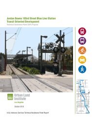
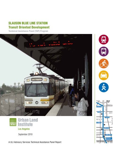
SLAUSON BLUE LINE STATION<br />
Transit Oriented Development<br />
Technical Assistance Panel (TAP) Program<br />
September 2010<br />
A <strong>ULI</strong> Advisory Services Technical Assistance Panel Report
About the <strong>ULI</strong> <strong>Los</strong> <strong>Angeles</strong> Technical Assistance Panel<br />
In keeping with the <strong>Urban</strong> <strong>Land</strong> <strong>Institute</strong> mission, Technical Assistance Panels are convened to<br />
provide pro-bono planning and development assistance to public officials and local stakeholders of<br />
communities and nonprofit organizations who have requested assistance in addressing their land<br />
use challenges.<br />
A group of diverse professionals representing the full spectrum of land use and real estate<br />
disciplines typically spend one day visiting and analyzing the built environments, identifying specific<br />
planning and development issues, and formulating realistic and actionable recommendations to<br />
move initiatives forward in a fashion consistent with the applicant’s goals and objectives.<br />
Staff and Panel Members<br />
TAP Client<br />
County of <strong>Los</strong> <strong>Angeles</strong><br />
Department of Regional Planning<br />
Panel Chair<br />
Jonathan Watts<br />
Principal, Cuningham Group<br />
Panelists<br />
Ryan Aubry<br />
Sr. Consultant, Kosmont Companies<br />
Brent Gaulke<br />
Vice President, Acquisitions/Development,<br />
Gerding Edlen<br />
Taylor Mammen<br />
Vice President, RCLCO<br />
Sunil Parab<br />
Project Architect, HNTB<br />
Paul Silvern<br />
Partner, HR&A Advisors, Inc.<br />
TAP Committee Chair<br />
Jonathan Curtis<br />
Principal, Trevear Holdings LLC<br />
TOD Summit TAP Advisor<br />
Robert Gardner<br />
Managing Director, RCLCO<br />
<strong>ULI</strong> Project Staff<br />
Katherine Perez<br />
Executive Director, <strong>ULI</strong> <strong>Los</strong> <strong>Angeles</strong><br />
Christine Aure<br />
Project Manager, <strong>ULI</strong> <strong>Los</strong> <strong>Angeles</strong><br />
Ciara Contreras<br />
Project Manager, <strong>ULI</strong> <strong>Los</strong> <strong>Angeles</strong><br />
Stephen Sampson<br />
Intern, <strong>ULI</strong> <strong>Los</strong> <strong>Angeles</strong><br />
John Dlugolecki<br />
Photographer
Table of<br />
Contents<br />
Executive Summary 2<br />
Assignment & Process 4<br />
Background 6<br />
Analysis 9<br />
Findings 12<br />
Recommendations 14<br />
Implementation 17<br />
Funding Sources 24<br />
Acknowledgements 24<br />
Panel Members 25<br />
1
Executive<br />
Summary<br />
2 <strong>Slauson</strong> Blue Line <strong>Station</strong> Transit Oriented Development Technical Assistance Panel Program<br />
The Metro Blue line opened in 1990 and has 22 stations along its<br />
22-mile long route from downtown <strong>Los</strong> <strong>Angeles</strong> south to downtown<br />
Long Beach. When it first opened, many believed the Blue Line could<br />
serve as a potential economic catalyst for many South <strong>Los</strong> <strong>Angeles</strong><br />
communities that had suffered years of disinvestment and economic<br />
stagnation. Twenty years later, certain stations along the Blue Line have<br />
seen little economic redevelopment, and expectations for community<br />
revitalization in these areas has not been realized.<br />
The <strong>Slauson</strong> <strong>Station</strong> in the unincorporated community of Florence-<br />
Firestone is one site that has failed to benefit from economic<br />
redevelopment or community revitalization from the Blue Line’s<br />
presence. The <strong>Los</strong> <strong>Angeles</strong> County Department of Regional Planning<br />
engaged the <strong>Urban</strong> <strong>Land</strong> <strong>Institute</strong> (<strong>ULI</strong>) <strong>Los</strong> <strong>Angeles</strong> District Council<br />
in a Technical Assistance Panel (TAP) to study ways to maximize<br />
development opportunities for the <strong>Slauson</strong> <strong>Station</strong> and surrounding<br />
community. The TAP was convened at Lillian Street Elementary School<br />
on February 19, 2010, utilizing experts in architecture, planning,<br />
development, and market economics to determine the main challenges<br />
and opportunities, offer solutions, and develop a roadmap for success<br />
for the <strong>Slauson</strong> <strong>Station</strong>.<br />
The TAP evaluated the area within a half mile radius around the<br />
<strong>Slauson</strong> <strong>Station</strong>, encompassing an area the County established<br />
through its zoning code in 1999 as a Transit Oriented District (TOD),<br />
and found numerous opportunities and challenges. The Blue Line<br />
and <strong>Slauson</strong> <strong>Station</strong> connects the neighborhood to major job centers<br />
and regional destinations such as downtown <strong>Los</strong> <strong>Angeles</strong> to the<br />
north and downtown Long Beach to the south, and the TAP found
that community stakeholders are engaged and have a vested interest in the<br />
area’s improvement. However, the <strong>Station</strong>’s above grade boarding platform,<br />
the unusual mix of uses in the study area, the barrier of <strong>Slauson</strong> Avenue<br />
itself, the apparent lack of coordination between agencies, and safety issues<br />
are tremendous challenges for the <strong>Station</strong>’s success and the community’s<br />
revitalization around it.<br />
The TAP members believe the <strong>Slauson</strong> <strong>Station</strong> can be improved and that the<br />
station area can become a revitalizing catalyst for the Florence-Firestone<br />
community. The TAP’s vision for the enhanced <strong>Slauson</strong> <strong>Station</strong> includes:<br />
• A multimodal hub that provides a safe, convenient transit facility<br />
to connect from one mode of transportation to another. This hub<br />
will encourage transit ridership by making it more attractive to<br />
commuters and discretionary users within and surrounding the<br />
TOD;<br />
• Improved pedestrian connections to adjacent neighborhoods<br />
throughout the TOD will encourage transit ridership by providing<br />
safe and convenient walking options;<br />
• Immediate and comprehensive safety measures that will increase<br />
ridership and usability of the station and will encourage new<br />
development activities in the area;<br />
• Establishment of an industrial business improvement district;<br />
• Development of parking at the station; and,<br />
• A phased plan for targeted development activities.<br />
3
Assignment & Process<br />
Key Issues<br />
In the absence of redevelopment activities that would<br />
spark community revitalization efforts, the County of <strong>Los</strong><br />
<strong>Angeles</strong> Department of Regional Planning requested that<br />
a TAP be convened to study the reasons why the <strong>Slauson</strong><br />
<strong>Station</strong> has not stimulated new development and to offer<br />
ideas and a plan for future investment and development.<br />
The Department of Regional Planning identified the<br />
following objectives the TAP should consider while<br />
addressing the future of the <strong>Slauson</strong> <strong>Station</strong> and<br />
surrounding community:<br />
1. Examine strategies to maximize the full<br />
potential of the <strong>Slauson</strong> <strong>Station</strong> TOD to<br />
establish transit and pedestrian supportive<br />
development, improve pedestrian access to<br />
transit facilities, improve public safety, retain<br />
and enhance its job producing capacity, and<br />
reduce congestion, vehicle miles traveled, and<br />
greenhouse gas emissions.<br />
2. Consider a strategy to meet the <strong>Station</strong>’s<br />
potential through coordinated efforts by the<br />
<strong>Los</strong> <strong>Angeles</strong> County Economic Development<br />
Corporation, Metro, the County of <strong>Los</strong><br />
<strong>Angeles</strong>, the cities of <strong>Los</strong> <strong>Angeles</strong>, Vernon,<br />
and Huntington Park, private and nonprofit<br />
developers, and community residents.<br />
4 <strong>Slauson</strong> Blue Line <strong>Station</strong> Transit Oriented Development Technical Assistance Panel Program<br />
The Department of Regional Planning requested<br />
that the TAP consider the following key issues<br />
when studying the Blue Line <strong>Slauson</strong> <strong>Station</strong>:<br />
• The need to create a vision for the<br />
<strong>Slauson</strong> <strong>Station</strong> TOD;<br />
• The lack of investment and<br />
development in the TOD;<br />
• Improving access to the above-grade,<br />
raised train platform;<br />
• How to integrate the current mix of<br />
industrial uses in a <strong>Station</strong> Area Plan;<br />
• Improving public safety around the<br />
station and in the TOD;<br />
• The need for job creation and<br />
economic investment in the<br />
community;<br />
• Improving urban design for aesthetic<br />
and safety reasons;<br />
• Improving infrastructure; and,<br />
• Identifying potential funding<br />
mechanisms.
TAP Process<br />
<strong>ULI</strong> representatives met with representatives<br />
from the Department of Regional Planning to<br />
determine the scope of the panel assignment.<br />
The panel members werewas selected based<br />
upon their ability to address the stated<br />
objectives for the program provided by the<br />
client. Prior to the day-long program, panel<br />
members reviewed background materials<br />
prepared by the Department of Regional<br />
Planning.<br />
The TAP process is a day-long event. In the<br />
morning panel members tour the study area<br />
with representatives and later meet with key<br />
stakeholders, work through an intensive analysis<br />
on the specified issues, and present their<br />
findings to the general public.<br />
TAP members examining <strong>Slauson</strong> <strong>Station</strong> and surrounding area<br />
TAP Panel of Experts<br />
<strong>ULI</strong> convened a panel of professionals who represented a variety of disciplines connected<br />
with land use and real estate development, such as architecture and design, real<br />
estate development, economic analysis, and development financing methods. Members<br />
were selected with the intent of convening a robust array of professional expertise<br />
relevant to the County’s objectives for the study and who had local working knowledge<br />
of the sub-region where the study area was located. All panel members were volunteers<br />
and were not compensated for their time.<br />
Lillian Street Elementary School—site where the <strong>Slauson</strong> Blue Line <strong>Station</strong> TAP was convened<br />
5
The <strong>Slauson</strong> <strong>Station</strong> TOD has seen little development<br />
activity since its inception, signaling a need for more<br />
aggressive policy actions. The Department of Regional<br />
Planning believes that the work of the <strong>ULI</strong> <strong>Los</strong> <strong>Angeles</strong><br />
District Council TAP will create a successful plan to<br />
<strong>Slauson</strong> <strong>Station</strong><br />
Study Area<br />
Background<br />
Regional location of <strong>Slauson</strong> <strong>Station</strong> study area<br />
6 <strong>Slauson</strong> Blue Line <strong>Station</strong> Transit Oriented Development Technical Assistance Panel Program<br />
View looking west along <strong>Slauson</strong> Avenue toward <strong>Slauson</strong> Blue Line <strong>Station</strong><br />
make the <strong>Slauson</strong> <strong>Station</strong> TOD a model for<br />
transit oriented development in <strong>Los</strong> <strong>Angeles</strong><br />
County. The TAP utilized best practices of<br />
transit oriented development and the expertise<br />
of its members to evaluate the conditions of<br />
the <strong>Slauson</strong> <strong>Station</strong> TOD and to formulate the<br />
recommendations of this report.<br />
The <strong>Slauson</strong> Blue Line <strong>Station</strong> is located in<br />
the unincorporated community of Florence-<br />
Firestone at the intersection of East <strong>Slauson</strong><br />
Avenue and Randolph Street. While the<br />
existing <strong>Slauson</strong> <strong>Station</strong> TOD is wholly within
Industrial use along <strong>Slauson</strong> Avenue<br />
unincorporated <strong>Los</strong> <strong>Angeles</strong> County, the<br />
station’s half mile radius study area is located<br />
at the convergence of several jurisdictional<br />
boundaries including the City of <strong>Los</strong> <strong>Angeles</strong><br />
to the north and west and the cities of Vernon<br />
and Huntington Park to the east. The <strong>Slauson</strong><br />
Avenue corridor is also a part of the Community<br />
Redevelopment Agency of the City of <strong>Los</strong><br />
<strong>Angeles</strong> (CRA/LA) Council District Nine<br />
Corridors Recovery Redevelopment Project Area.<br />
Within the half mile radius of the <strong>Slauson</strong><br />
<strong>Station</strong>, the land uses are predominantly light<br />
industrial and mixed residential. The 9.2 acre<br />
parcel adjacent to the west of the station is<br />
owned by the <strong>Los</strong> <strong>Angeles</strong> Department of Water<br />
and Power (DWP) and is used as a utility<br />
storage yard. The slightly smaller triangular 6.8<br />
acre parcel adjacent to the east of the station is<br />
owned by Union Pacific and is used for tractor<br />
trailer storage. The parcels directly to the north<br />
and east of the station along <strong>Slauson</strong> Avenue<br />
are light industrial uses that continue east into<br />
the City of Huntington Park. The majority of the<br />
Bus routes serving the area<br />
52ND ST<br />
53RD ST<br />
63RD ST<br />
HOOPER<br />
AV<br />
HOOPER AV<br />
HOOPER AV<br />
LATHAM ST<br />
ASCOT AV<br />
58TH PL<br />
58TH DR<br />
59TH ST<br />
59TH PL<br />
60TH ST<br />
61ST ST<br />
62ND ST<br />
UP RR<br />
PARMELEE AV<br />
LOS ANGELES<br />
58TH ST<br />
BNSF RR<br />
SLAUSON AV<br />
GAGE AV<br />
64TH ST<br />
COMPTON AV<br />
COMPTON AV<br />
SLAUSON SENIOR<br />
MULTIPURPOSE<br />
CENTER<br />
54TH ST<br />
55TH ST<br />
56TH ST<br />
57TH ST<br />
AUGUSTUS HAWKINS<br />
NATURAL PARK<br />
MAKEE AV<br />
50TH ST<br />
51ST ST<br />
52ND ST<br />
53RD ST<br />
FORTUNA ST<br />
MIRAMONTE<br />
BLVD<br />
MORGAN AV<br />
50TH PL<br />
CONVERSE AV<br />
65TH ST<br />
remaining parcels to the south and west of the station are zoned for multifamily<br />
residential uses, however, these parcels are mostly developed with single-family<br />
residences.<br />
The <strong>Slauson</strong> <strong>Station</strong> is well served by six Metro Bus Lines that include the 55, 355<br />
(Limited), 108, 110, 358 (Limited), and 611 (Huntington Park Shuttle). However, the<br />
<strong>Slauson</strong> <strong>Station</strong> lacks bike connections. The nearest classified bike route is along<br />
51st Street in the City of <strong>Los</strong> <strong>Angeles</strong>, which is outside the half mile radius study<br />
area. Though bike racks are available for use by transit riders at the station platform<br />
they get minimal use due to safety and crime issues in the area.<br />
There are two recreational facilities within the study area: the <strong>Slauson</strong> Senior<br />
Multipurpose Center and the Augustus F. Hawkins Natural Park. The Augustus<br />
LONG BEACH AV<br />
SOUTH AV<br />
METRO BLUE LINE & UP RR<br />
METRO BLUE<br />
LINE &<br />
UP RR<br />
n¤<br />
LONG BEACH AV<br />
RANDOLPH ST<br />
METRO<br />
BLUE LINE &<br />
UP RR<br />
JUNCTION ST<br />
DUARTE ST<br />
STAUNTON AV<br />
HOLMES AV<br />
HOLMES AV<br />
Existing <strong>Slauson</strong> <strong>Station</strong> TOD and station-adjacent parcels<br />
nm<br />
60TH ST<br />
BANDERA ST<br />
58TH PL<br />
LILLIAN STREET<br />
ELEMENTARY<br />
SCHOOL<br />
61ST ST<br />
62ND ST<br />
63RD ST<br />
LILLIAN ST<br />
BNSF RR<br />
MCGARRY ST<br />
ALBA ST<br />
WILMINGTON AV<br />
ALAMEDA ST<br />
ALAMEDA ST<br />
UP RR<br />
GAGE AV<br />
64TH ST<br />
ALAMEDA ST<br />
UP RR<br />
1ST ST<br />
SLAUSON AV<br />
LAURA AV<br />
UP RR<br />
51ST ST<br />
BELGRAVE AV<br />
52ND ST<br />
VERNON<br />
RANDOLPH ST<br />
55TH ST<br />
57TH ST<br />
HUNTINGTON PARK<br />
REGENT ST<br />
REGENT ST<br />
2ND ST<br />
CLARENDON AV<br />
Half mile radius study area for the <strong>Slauson</strong> Blue Line <strong>Station</strong><br />
COTTAGE ST<br />
ANDERSON ST<br />
INGLEWOOD<br />
LADERA HEIGHTS / VIEWPARK -<br />
WINDSOR HILLS<br />
§¨¦ 405<br />
LOS<br />
ANGELES<br />
DEL<br />
AIRE<br />
REDONDO<br />
BEACH<br />
n¤<br />
nm<br />
LENNOX<br />
COUNTY OF LOS A<br />
TRANSIT-ORIENTED<br />
SLAUSON ST<br />
LEGEND<br />
HAWTHORNE<br />
LAWNDALE<br />
INGLEWOOD<br />
HAWTHORNE<br />
7<br />
SLAUSON STATION (ME<br />
ELEMENTARY SCHOOL<br />
PARCEL BOUNDARIES<br />
EXISTING TRANSIT-ORIE<br />
PROPOSED GENERAL P<br />
ZONING CODES (COUNTYWIDE)<br />
R-1 - SINGLE-FAMILY RESIDENCE<br />
R-2 - TWO-FAMILY RESIDENCE<br />
R-3-()U - LIMITED MULTIPLE RESIDENCE<br />
R-4-()U - UNLIMITED RESIDENCE<br />
R-A - RESIDENTIAL AGRICULTURE<br />
RPD - RESIDENTIAL PLANNED DEV.<br />
A-1 - LIGHT AGRICULTURE<br />
A-2 - HEAVY AGRICULTURE<br />
A-2-H - HEAVY AGRI. INCLU. HOG RANCHES<br />
C-H - COMMERCIAL HIGHWAY<br />
C-1 - RESTRICTED BUSINESS<br />
C-2 - NEIGHBORHOOD COMMERCIAL<br />
C-3 - UNLIMITED COMMERCIAL<br />
C-M - COMMERCIAL MANUFACTURING<br />
C-R - COMMERCIAL RECREATION<br />
CPD - COMMERCIAL PLANNED DEV.<br />
M-1 - LIGHT MANUFACTURING<br />
D-2 - DESERT-MOUNTAIN<br />
ALONDRA PARK<br />
§¨¦ 105<br />
HAWTHORNE<br />
ISLAND<br />
LOS ANGELES<br />
AREA<br />
MAPPED<br />
WEST ATHENS -<br />
WESTMONT<br />
GARDENA<br />
IT - INSTIT<br />
SP - SPEC<br />
M-1.5 - RE<br />
MPD - MA<br />
M-2 - HEA<br />
M-3 - UNC<br />
M-4 - UNL<br />
M-2.5 - AIR<br />
B-1 - BUF<br />
B-2 - COR<br />
R-R - RES<br />
W - WATE<br />
P-R - RES<br />
SR-D - SC<br />
O-S - OPE<br />
A-C - ART<br />
MXD - MIX<br />
PROPOSED LAND USE POLICY (CO<br />
CM - MAJOR COMMERCIAL<br />
CN - NEIGHBORHOOD COMMERCIAL<br />
H18 - MEDIUM DENSITY RES. (9-18 DU/AC)<br />
H30 - URBAN RESIDENTIAL (18-30 DU/AC)<br />
H50 - URBAN MEDIUM RES. (30-50 DU/AC)<br />
H9 - SUBURBAN HIGH DENSITY RES. (0-9 DU/AC) RL - RU<br />
IL - LIGHT INDUSTRIAL<br />
PROPOSED GENER<br />
TOD OVERL<br />
FLORENCE-FIRE<br />
OS-BLM - BUREAU OF LAND MANAGEMENT<br />
4-INCH RESOLUTION IMAGERY: LOS ANGELES REGION<br />
IMAGERY ACQUISITION CONSORTIUM, 2008<br />
OS-C - O<br />
OS-MR -<br />
OS-PR -<br />
OS-W - W<br />
P - PUB<br />
TC - TRA<br />
VERMONT<br />
Map prepared by DRP GIS Section / August 2010<br />
§¨¦ 110<br />
LOS ANGELES COUN<br />
Department of Regional Pl<br />
320 W. Temple St.<br />
<strong>Los</strong> <strong>Angeles</strong>, CA 9001<br />
0 150 300 450<br />
FEET<br />
\\Gisps1\PROJECTS_GISPS1\DRP_ADVANCE_PLANNING\general_plan\map_documents\tod\<strong>ULI</strong>_applicatio<br />
W
View along the east side of <strong>Slauson</strong> <strong>Station</strong><br />
F. Hawkins Natural Park was acquired by the City<br />
of <strong>Los</strong> <strong>Angeles</strong> from the Santa Monica Mountains<br />
Conservancy. It is a well maintained 8.5 acre park with<br />
lush green plants and walking paths. The park provides<br />
much needed green space for the region and the local<br />
community, but it lacks a visible connection to the street<br />
and the rail station.<br />
History of the Metro Blue Line<br />
The Metro Blue Line is a north-south light-rail line in<br />
the <strong>Los</strong> <strong>Angeles</strong> County Metro Rail System connecting<br />
downtown <strong>Los</strong> <strong>Angeles</strong> to downtown Long Beach. The<br />
Blue Line is the oldest and longest rail line in the Metro<br />
Rail system, and is the second busiest light rail line in<br />
the United States, averaging around 80,000 weekday<br />
boardings. The Blue Line opened in 1990 at a cost of<br />
$877 million. The line runs in the median of city streets<br />
in Downtown <strong>Los</strong> <strong>Angeles</strong> and in much of Long Beach<br />
proper, and for the most part was built along the former<br />
Pacific Electric Railway alignment.<br />
County of <strong>Los</strong> <strong>Angeles</strong> Transit Oriented<br />
Development Initiative along the Metro<br />
Blue Line<br />
The <strong>Los</strong> <strong>Angeles</strong> County Department of Regional<br />
Planning began a program in 1996 to develop and<br />
implement transit oriented development at four Metro<br />
Blue Line <strong>Station</strong>s in the unincorporated communities<br />
of Florence-Firestone and Willowbrook. Focusing on<br />
the geographic areas within one quarter to one half mile<br />
radius of the Blue Line <strong>Station</strong>s, the County prepared the<br />
<strong>Land</strong> Use and Economic Development Strategies Blue<br />
Line Transit Oriented District Study (Blue Line Strategy<br />
8 <strong>Slauson</strong> Blue Line <strong>Station</strong> Transit Oriented Development Technical Assistance Panel Program<br />
Report), which provided the overall land use<br />
vision, development goals, and objectives for<br />
the four Blue Line <strong>Station</strong>s and surrounding<br />
neighborhoods. The Blue Line Strategy Report<br />
laid the foundation for the adoption of the<br />
Transit Oriented Districts (TOD) Ordinance in<br />
1999 (Part 8, Section 22.44.400) to establish the<br />
<strong>Slauson</strong> <strong>Station</strong> TOD and three others along the<br />
Blue Line. The intent of the TOD Ordinance is to<br />
promote transit oriented and pedestrian oriented<br />
development, to increase transit use, to manage<br />
traffic congestion, and to improve air quality.<br />
County of <strong>Los</strong> <strong>Angeles</strong> Transit<br />
Oriented Districts Program<br />
The Department of Regional Planning is<br />
completing a comprehensive update to the<br />
County’s General Plan. The General Plan Update<br />
includes the proposed Transit Oriented Districts<br />
Program, which is a major component of the<br />
County’s regional strategy to increase affordable,<br />
multifamily housing opportunities. The Program<br />
is also intended to meet local and State<br />
climate change goals to reduce greenhouse<br />
gas emissions and improve air quality through<br />
land use and transportation strategies that are<br />
pedestrian friendly and reduce vehicle miles<br />
traveled. The Program further demonstrates<br />
the County’s commitment to community and<br />
economic development through smart growth.<br />
View looking north from <strong>Slauson</strong> <strong>Station</strong>
Demographics and Employment<br />
The demographic and economic conditions<br />
surrounding the <strong>Slauson</strong> <strong>Station</strong> help describe<br />
important real estate development opportunities<br />
and constraints for the area. In other words,<br />
the population, household, and employment<br />
characteristics of the area within one half mile<br />
of the station, within the context of broader<br />
area and metropolitan trends, are the important<br />
drivers of market demand for housing, retail,<br />
and employment land uses. Evaluating the<br />
housing, retail, and employment land use<br />
supply, specifically in terms of identifying any<br />
gaps or surpluses between demand and supply<br />
further helps identify specific opportunities<br />
to successfully encourage private sector<br />
participation in developing transit oriented<br />
development uses at the <strong>Slauson</strong> <strong>Station</strong>.<br />
Demographers estimate that approximately<br />
13,000 people live within one half mile of the<br />
<strong>Slauson</strong> <strong>Station</strong>, indicating a relatively high<br />
population density of 26 persons per gross<br />
acre. The population has grown slightly since<br />
2000, when the estimated population was<br />
approximately 12,000. At an average of 4.6<br />
persons per household, local households are<br />
significantly larger than the city average of 2.9<br />
persons per household. Local households also<br />
have lower than average incomes; the median<br />
household income for the <strong>Slauson</strong> <strong>Station</strong><br />
half-mile radius study area is $31,000. These<br />
demographic conditions therefore describe<br />
a relatively congested neighborhood with<br />
potentially limited income capacity to support<br />
new real estate development.<br />
The <strong>Slauson</strong> <strong>Station</strong> area features relatively<br />
high job density as well, with an estimated<br />
3,400 jobs. Approximately one-third (1,030) of<br />
these jobs are in manufacturing, which is not<br />
surprising given the industrial land uses in the<br />
eastern portion of the area, but a remarkably<br />
high figure given the region’s declining<br />
industrial base. Retail jobs come second (850<br />
jobs), dominated by auto dealers and gas<br />
stations, apparel and accessory stores, and<br />
home furniture and equipment. The industrial<br />
employers located in the area generally have<br />
little connection to local residents and have not<br />
been involved in community development and<br />
revitalization efforts.<br />
Analysis<br />
Local residents report that most of their working neighbors<br />
commute to jobs located elsewhere in the region, such as<br />
downtown <strong>Los</strong> <strong>Angeles</strong>, Vernon, Huntington Park, or Long<br />
Beach, rather than to jobs in the immediate vicinity. The<br />
current recession has been hard on local residents. Based<br />
on interviews with stakeholders, the TAP estimates that the<br />
unemployment rate for the Florence-Firestone community<br />
to be between 17 to 19 percent, with many more<br />
households suffering from “underemployment” as well.<br />
Residential Market Conditions<br />
In addition to industrial uses, residential uses dominate<br />
the study area and generally feature single-family units<br />
on small lots, often with accessory dwelling units.<br />
Between 67% and 73% of residents are renters, and the<br />
area features a relatively high occupancy rate of 93%.<br />
Demographers estimate the area’s median home value to<br />
be $248,280, or eight times the median income. According<br />
to actual sales data, however, the median value of homes<br />
sold in the area during 2009 was lower, closer to $160,000<br />
(approximately $120 to $130 per square foot). No matter<br />
which amount more accurately describes the value of<br />
homes in the area, it is likely that most residents who rent<br />
could not afford to purchase the homes they live in.<br />
The gap between housing purchase power and housing<br />
prices for existing homes, and new units explains why there<br />
has been relatively little housing development in recent<br />
years. Only 12 new residential units (1 single-family, 4<br />
duplexes and 1 triplex) and one service station have been<br />
built in the <strong>Slauson</strong> <strong>Station</strong> TOD since its establishment in<br />
1999. Even during the historically high peak of the recent<br />
Industrial use in <strong>Slauson</strong> <strong>Station</strong> study area<br />
9
Housing built since establishment of <strong>Slauson</strong> <strong>Station</strong> TOD<br />
real estate cycle, only one residential development took<br />
place within the larger study area—32 new market and<br />
affordable detached single family units along Gage<br />
Avenue between Compton and Converse. Developed<br />
on an abandoned railroad right-of-way three years ago,<br />
this project benefited from, and was likely only possible,<br />
due to the financing provided by the Community<br />
Development Commission of the County of <strong>Los</strong> <strong>Angeles</strong><br />
(LACDC).<br />
It is likely that residential development as part of a<br />
transit oriented development strategy for the <strong>Slauson</strong><br />
<strong>Station</strong> TOD will probably occur only over the long<br />
term following an established record of primarily public<br />
investment in the area, particularly immediately around<br />
the station. Even when the residential real estate market<br />
stabilizes and begins to grow, public assistance of some<br />
form to residential developers will likely be necessary to<br />
facilitate development.<br />
Retail Market Conditions<br />
Relatively few retail stores were observed when visiting<br />
the study area. It is possible that many “retail” jobs are<br />
potentially located in industrial land uses in which both<br />
manufacturing or assembling and sales to the general<br />
public take place.<br />
New commercial center at Gage and Compton Avenues<br />
10 <strong>Slauson</strong> Blue Line <strong>Station</strong> Transit Oriented Development Technical Assistance Panel Program<br />
While there is limited retail in the <strong>Slauson</strong><br />
<strong>Station</strong> TOD study area, new high quality retail<br />
strip centers are located nearby. This includes<br />
a new retail center at the northwest corner of<br />
Compton Avenue and Gage Avenue, which is<br />
about three quarters of a mile from the <strong>Slauson</strong><br />
<strong>Station</strong>, as well as the La Alameda Center at the<br />
southwest corner of Alameda Boulevard and<br />
Florence Avenue, a little more than a mile from<br />
the station. Both centers include well known<br />
national retailer tenants. Grocery stores are<br />
notably absent within one mile of the <strong>Slauson</strong><br />
<strong>Station</strong>, and those that do exist one mile beyond<br />
the station are primarily discount grocers such<br />
as Superior Groceries and Food 4 Less. Even<br />
given this limited supply of local retail, local<br />
household expenditures likely limit new retail<br />
development potential.<br />
Opportunities may exist for new retail to capture<br />
consumers along the heavily traveled <strong>Slauson</strong><br />
Avenue. There may also be opportunities<br />
for niche retailers such as Latino grocers or<br />
artisans. In the recent economic downturn,<br />
retailers have been hit very hard and are likely<br />
to be extremely cautious regarding future<br />
expansion plans, and new stores are most likely<br />
to be built in areas considered to be prime<br />
locations. Therefore, the <strong>Slauson</strong> <strong>Station</strong> TOD,<br />
with its lower incomes and perceived crime, is<br />
Commercial use at <strong>Slauson</strong> and Compton Avenues<br />
Local retail along Compton Avenue
going to have a difficult time attracting major<br />
retailers to open new stores.<br />
In addition to the lack of grocery stores,<br />
sit-down restaurants are also sparse in the<br />
<strong>Slauson</strong> <strong>Station</strong> TOD study area. Given the high<br />
population and job density of the neighborhood<br />
there are a number of successful food trucks<br />
operating on vacant lots and gas station sites<br />
along <strong>Slauson</strong> Avenue. Some of these locations<br />
include extensive outdoor bench seating, some<br />
covered by tents. These “pop-up” restaurant<br />
locations help to improve safety in the areas<br />
in which they are located by providing “eyes<br />
on the street” of the operators and customers.<br />
Their presence may also help to support a given<br />
location’s viability for a future brick and mortar<br />
restaurant location. With retail development<br />
limited for the near- to medium-term, integrating<br />
food truck parking or other “pop-up” retail in the<br />
immediate vicinity of the <strong>Slauson</strong> <strong>Station</strong> may<br />
serve to increase pedestrian traffic and improve<br />
the perceived safety of the area. It is important<br />
to note that local policies and perceptions<br />
regarding food trucks are politically sensitive<br />
and may change. The panel members see this as<br />
a location where there are few local restaurants<br />
operating and it would benefit from the presence<br />
of food trucks in the short term to activate the<br />
street.<br />
Industrial Market Conditions<br />
The study area’s local industrial market, located<br />
near the boundary of the Central <strong>Los</strong> <strong>Angeles</strong><br />
and Vernon industrial submarkets, is comprised<br />
of smaller, diverse users and is reflective of the<br />
industrial patterns in the Florence-Firestone<br />
community. This is primarily a result of the<br />
irregularly sized industrial parcels in the study<br />
area, as well as aging production capacity.<br />
Heavy industrial activities are common in the<br />
area, including dangerous and noxious uses, as<br />
well as small manufacturing, recycling, metal<br />
A recycling center on the north side of <strong>Slauson</strong> Avenue<br />
Industrial use in <strong>Slauson</strong> <strong>Station</strong> study area<br />
fabrication, and low-level garment shops. Current and future users value the local<br />
industrial market assets of proximity to downtown <strong>Los</strong> <strong>Angeles</strong> and relatively less<br />
regulated environment.<br />
Despite the upheaval in the commercial real estate industry locally and nationwide,<br />
the Central <strong>Los</strong> <strong>Angeles</strong> market maintains a 3.3 percent vacancy rate indicating the<br />
structural lack of industrial supply. There is a strong demand for warehouse and<br />
distribution space throughout the greater <strong>Los</strong> <strong>Angeles</strong> region due to activity from the<br />
<strong>Los</strong> <strong>Angeles</strong> and Long Beach ports. Despite the current recession in which port activity<br />
has declined precipitously, demand for strategically located infill distribution space is<br />
still relatively strong.<br />
The small parcels and aging buildings immediately around the <strong>Slauson</strong> <strong>Station</strong> do<br />
not accommodate users that may require space in excess of 100,000 square feet.<br />
The 204-acre Goodyear Tract, located three quarters of a mile west of the <strong>Slauson</strong><br />
<strong>Station</strong>, has the potential to be redeveloped for such uses. It is located in the City of<br />
<strong>Los</strong> <strong>Angeles</strong> and within a CRA/LA redevelopment project area and has been a focus of<br />
the City’s and CRA/LA’s initiative to attract cleantech manufacturing to <strong>Los</strong> <strong>Angeles</strong>.<br />
Whether distribution or cleantech manufacturing jobs end up on the Goodyear Tract,<br />
the <strong>Slauson</strong> <strong>Station</strong> may benefit as the nearest Metro Blue Line <strong>Station</strong>.<br />
11
Findings<br />
A Strengths, Weaknesses, Opportunities, and Threats<br />
(SWOT) analysis was conducted to evaluate the <strong>Slauson</strong><br />
<strong>Station</strong> and surrounding community. Strengths and<br />
weaknesses explore internal aspects of the project or<br />
elements that can be controlled or changed by new<br />
development. Opportunities and threats evaluate external<br />
influences that can affect the project. Most opportunities<br />
and threats are beyond the control of those associated<br />
with the project, such as factors relating to the economy<br />
like interest rates or loan availability. From the site visit,<br />
stakeholder interviews, and additional site research, the<br />
TAP determined the following strengths, weaknesses,<br />
opportunities and threats for the <strong>Slauson</strong> <strong>Station</strong> TOD<br />
study area.<br />
Strengths<br />
The <strong>Slauson</strong> <strong>Station</strong> connects the community to major<br />
job centers and regional destinations in both downtown<br />
<strong>Los</strong> <strong>Angeles</strong> and Long Beach. There is an established<br />
and engaged residential community that is a part of<br />
the station area that would like to see improvements<br />
in the community. Particular strengths from a market<br />
perspective include the station area, a centralized cluster<br />
of light industrial jobs, and the proximity to the Alameda<br />
Corridor and the 101 Freeway.<br />
12 <strong>Slauson</strong> Blue Line <strong>Station</strong> Transit Oriented Development Technical Assistance Panel Program<br />
Weaknesses<br />
The <strong>Slauson</strong> <strong>Station</strong> TOD half mile radius study<br />
area is governed by fractured leadership and<br />
is regulated by a multitude of jurisdictions<br />
with little or no coordinated planning efforts.<br />
The complex jurisdictional environment of the<br />
study area presents challenges to holistically<br />
plan for and encourage development. The<br />
elevated station does not help to create a sense<br />
of place. The station area feels constrained and<br />
there is limited accessibility for pedestrians<br />
due to narrow sidewalks and a lack of nearby<br />
crosswalks. Also, while the open space amenity<br />
offered by the Augustus F. Hawkins Natural<br />
Park is in close proximity to the station, easy<br />
pedestrian access is difficult and anecdotally,<br />
the TAP members learned that there is limited<br />
usage by local residents due to the park’s lack of<br />
active recreation spaces, such as soccer fields<br />
or basketball courts. Weak market conditions<br />
are a liability for the area, particularly when<br />
combined with low population growth, low<br />
household spending, and low overall demand.<br />
The juxtaposition of residential and industrial<br />
land uses poses a challenge in accommodating<br />
transit oriented development.<br />
There is insufficient demographic and economic<br />
growth data available for the area. A developer<br />
or investor group would not be able to determine<br />
the feasibility of investing or locating in the area.<br />
Industrial use in <strong>Slauson</strong> <strong>Station</strong> study area<br />
Based on stakeholder interviews and additional<br />
research, this TOD area is low on the priority<br />
list for the County as well as the other adjacent<br />
jurisdictions, in part because of the lack of<br />
communication and interagency coordination<br />
for the area. Involvement by Union Pacific and<br />
the City of <strong>Los</strong> <strong>Angeles</strong> DWP is unclear for the<br />
parcels directly south and west of the station.
Vibrant street life is a hallmark of good transit oriented development<br />
Opportunities<br />
The high vehicular traffic and bus stops<br />
along <strong>Slauson</strong> Avenue supports intermodal<br />
connectivity to the station. The Metro Blue<br />
Line has high ridership numbers, but boarding<br />
and exiting numbers at the <strong>Slauson</strong> <strong>Station</strong><br />
are comparably lower than at other Blue Line<br />
stations. There is an opportunity to increase<br />
boarding at the <strong>Slauson</strong> <strong>Station</strong> by providing<br />
safe parking and a safe, clean station. These<br />
simple steps could be the catalyst for new TOD<br />
development. From a physical standpoint, the<br />
station area has opportunities for improved<br />
residential connectivity that would further<br />
encourage residents to walk to the station. With<br />
the density of people living in the immediate<br />
area, increasing connectivity to the station<br />
would lead to a potential increase in ridership<br />
and create the opportunity for housing<br />
redevelopment in specific areas. An increase<br />
in transit users at <strong>Slauson</strong> station would also<br />
provide opportunities for new local-serving<br />
retail. Based on discussions from stakeholder<br />
interviews, there appears to be a strong sense<br />
of community pride, which bodes well for<br />
future projects that engage the community.<br />
DWP parcel adjacent to <strong>Slauson</strong> <strong>Station</strong><br />
Augustus F. Hawkins Natural Park<br />
Fostering dialogue and coordination between CRA/LA, the surrounding cities and the<br />
County would lead to a more comprehensive and integrated approach for the future of<br />
the station. Coordination with DWP and Union Pacific to facilitate ground leases on<br />
their station-adjacent parcels could result in new revenue sources for those entities.<br />
The DWP parcel provides a tremendous opportunity to create much of the necessary<br />
parking, ticketing and retail envisioned for the station.<br />
Littered vacant land east of <strong>Slauson</strong> <strong>Station</strong><br />
Threats<br />
Elements that pose a threat to future development of the <strong>Slauson</strong> <strong>Station</strong> TOD<br />
study area include the economy and the prolonged after effects of the recession.<br />
Coordination among the various jurisdictions in the study area constitutes a major<br />
threat to future success. The lack of a coordinated development approach to the TOD<br />
area and its infrastructure could lead to a disjointed project that does not meet the<br />
needs of the community and its stakeholders.<br />
Clearly, safety is the single greatest threat to its immediate recovery into a vital<br />
and thriving station. Negative perceptions of the area from outside investors and<br />
developers could slow the development process, along with the uncertainty of the<br />
ability to utilize adjacent sites for development. Also, how the community and local<br />
businesses would react to proposed change could pose a threat to future development.<br />
13
Recommendations<br />
14 <strong>Slauson</strong> Blue Line <strong>Station</strong> Transit Oriented Development Technical Assistance Panel Program<br />
Vision<br />
The TAP members believe the <strong>Slauson</strong> <strong>Station</strong><br />
can be improved to become an essential amenity<br />
for the Florence-Firestone community. The TAP<br />
members envision a safe, attractive multimodal<br />
transportation hub with increased ridership and<br />
better pedestrian connections within the TOD.<br />
The station would then serve as a catalyst for<br />
increased neighborhood retail, security and<br />
safety, jobs in clean industry, and the possibility<br />
of some mixed use development in the future.<br />
Vision Strategies<br />
The TAP identified the following six strategies<br />
to improve the <strong>Slauson</strong> <strong>Station</strong> TOD that will<br />
help to bring about the vision for a transit and<br />
pedestrian hub that will increase ridership and<br />
enhance community character:<br />
1. Create a Multimodal Transit Node.<br />
2. Increase and Improve Pedestrian<br />
Connections to Surrounding Residential<br />
Neighborhoods.<br />
3. Improve the Safety Conditions in the<br />
<strong>Station</strong> Area.<br />
4. Establish an Industrial Business<br />
Improvement District.<br />
5. Develop a Parking Facility in the TOD.<br />
6. Increase Public Investment in the<br />
Residential Market.<br />
Strategy 1: Create a Multimodal Transit<br />
Node<br />
The envisioned <strong>Slauson</strong> <strong>Station</strong> would serve<br />
as a multimodal hub, which provides a<br />
convenient facility to connect from one mode<br />
of transportation to another, and encourages<br />
transit ridership by making transit options more<br />
attractive to commuters and discretionary users<br />
within and surrounding the TOD. Developing<br />
<strong>Slauson</strong> <strong>Station</strong> as a node of activity, moreover,<br />
would help establish it as a magnet for the<br />
significant automobile traffic along <strong>Slauson</strong><br />
Avenue, potentially increasing the need for new<br />
retail investment at the station. In addition to<br />
supporting multimodal access to the <strong>Slauson</strong><br />
<strong>Station</strong>, public investments to improve the<br />
street environment along <strong>Slauson</strong> Avenue and<br />
at nearby intersections would serve to benefit<br />
locally-oriented retail establishments.
The following list identifies proposed new facilities at the <strong>Slauson</strong> <strong>Station</strong> that will help<br />
to create a multimodal transit hub:<br />
• Surface parking plaza at the existing triangle parcel owned by Union Pacific.<br />
• Secured bike storage facility.<br />
• Drop off and pick up facility for auto and transit bus users with a secured and<br />
sheltered space for people to wait for the bus, a taxi or a car.<br />
• Enhanced lighting and surveillance.<br />
• Extend <strong>Slauson</strong> <strong>Station</strong> architectural elements so that they cross <strong>Slauson</strong><br />
Avenue to provide a clear presence of the station to users along the <strong>Slauson</strong><br />
corridor. <strong>Station</strong> architecture can help create a better transition from street<br />
level to the raised platform and connect to parking, bike storage and drop off<br />
facilities. There is also the opportunity for an additional stair to be located<br />
on the north side of <strong>Slauson</strong> to allow users from the north to safely cross<br />
<strong>Slauson</strong> and gain direct access to the platform.<br />
Strategy 2: Increase and Improve Pedestrian Connections<br />
Improved pedestrian connections to adjacent neighborhoods throughout the TOD will<br />
encourage transit ridership by providing a safe and convenient walking option. To<br />
create these connections, the panel proposes the following design interventions:<br />
• Add station entrance to the north side of <strong>Slauson</strong> Avenue.<br />
• Incorporate traffic calming devices within the vicinity of the station to<br />
indicate to an approaching motorist the gateway of a pedestrian zone. These<br />
devices could be textured surfaces on the road, medians at the crossings<br />
with trees, or wider sidewalks with trees that narrow vehicular lanes.<br />
• Identify and develop pedestrian connections to adjacent residential<br />
neighborhoods. Pedestrian connections shall have appropriate sidewalk<br />
widths with tree canopy and adequate streetlights, intersections with<br />
pedestrian friendly crosswalks, particularly to the southwest of the station<br />
Strategy 3: Improve the Safety Conditions in the <strong>Station</strong> Area<br />
The station design and the pedestrian circulation system around the station are unsafe<br />
and leads to decreased usage of the station and transit. The County should collaborate<br />
with Metro to ensure the necessary lighting and safety measures are implemented to<br />
alleviate these concerns. The waiting areas at street level for bus connections must<br />
also be improved and made safer. With improved design and safety measures, the<br />
station could become attractive enough to support future retail uses.<br />
Strategy 4: Establish an Industrial Business Improvement District<br />
The County, in collaboration with the CRA/LA and the City of <strong>Los</strong> <strong>Angeles</strong>, should<br />
seek the establishment of an industrial business improvement district (BID) for the<br />
industrial, eastern side of the study area. It should have as a primary objective the<br />
integration and involvement of employers and land owners in a transit oriented plan.<br />
Public attention to the area therefore should emphasize a gradual transition toward<br />
users that would benefit from (and therefore provide benefits to) the <strong>Slauson</strong> <strong>Station</strong><br />
nearby.<br />
A bike-share station complements a transit node<br />
15
16 <strong>Slauson</strong> Blue Line <strong>Station</strong> Transit Oriented Development Technical Assistance Panel Program<br />
Strategy 5: Develop a Parking Facility in the TOD<br />
Developing parking at the <strong>Slauson</strong> <strong>Station</strong> would provide the convenience required to<br />
increase ridership and create a safe way to access the station. This facility would also<br />
include a bus stop and safe bicycle parking to encourage other forms of transport to<br />
the station. Connectivity to the station should be increased by improving sidewalks<br />
and streetscapes and, where feasible, re-establishing pedestrian connections through<br />
existing dead ends caused by the DWP lot and the rail line itself.<br />
Strategy 6: Increase Public Investment in the Residential Market<br />
Investment in residential development by the public sector is important as the real<br />
estate cycle improves and demand once again pushes market-supported home prices<br />
and rents beyond the costs of construction. Residential development, including rental<br />
apartments, condominiums, townhouses, or clustered detached units, is most likely<br />
to take place on large vacant parcels west of the station, including, if available, the<br />
DWP site. Additional small-scale new residential development could occur on the<br />
limited vacant parcels in the area as well, such as adjacent to the commercial uses on<br />
Compton Avenue, and would further serve to add vitality to the area.
Panelists discuss a phasing strategy for the study area<br />
Implementation<br />
A Road Map for Success<br />
Introduction - Phasing Strategy<br />
The TAP used the strategies developed following its<br />
analysis of the <strong>Slauson</strong> <strong>Station</strong> study area to guide<br />
development of the following implementation steps.<br />
Due to the current development challenges that<br />
exist at the <strong>Slauson</strong> <strong>Station</strong> TOD and surrounding<br />
community, as well as the poor private and public sector<br />
economic environment, the TAP recommends a ten<br />
year, three-phased approach to implementation of its<br />
recommendations.<br />
The TAP envisions a timeline where Phase I can be<br />
implemented within the first year, Phase II in years two<br />
and three, and that Phase III can be implemented in<br />
years four through ten. Phases I and II primarily lay the<br />
foundations for the broader development opportunities<br />
laid out in Phase III.<br />
17
18 <strong>Slauson</strong> Blue Line <strong>Station</strong> Transit Oriented Development Technical Assistance Panel Program
Goal<br />
The first phase of the implementation strategy<br />
lays the groundwork for improving the <strong>Slauson</strong><br />
<strong>Station</strong>. Phase I is based on the assumption<br />
that readily available parking and improved<br />
safety will increase ridership and create new<br />
development opportunities. Phase I also takes<br />
into account the current constraints of the site<br />
and allows for a plan to be implemented in a<br />
relatively short timeframe with minimal capital<br />
expenditure. The panel anticipates that this<br />
phase will enliven the <strong>Slauson</strong> <strong>Station</strong> and<br />
provide the framework necessary for long term<br />
development.<br />
The panel strongly suggests completing the<br />
following four objectives over the first year of<br />
implementation:<br />
1. Create an attractive and safe<br />
multimodal transit station;<br />
2. Test development strategy concepts<br />
and organizational concepts;<br />
3. Apply any changes to the planning<br />
guidelines and zoning policies<br />
necessary to allow for future<br />
development of the site; and,<br />
4. <strong>Institute</strong> public agency and community<br />
organization efforts.<br />
Phase I<br />
Year 1<br />
Objectives<br />
Objective 1: Create an attractive and safe multimodal transit station.<br />
As the first step, the County of <strong>Los</strong> <strong>Angeles</strong> should provide leadership and develop a<br />
budget to implement the following actions:<br />
• Add lighting, security cameras, improve the elevator enclosure, increase<br />
police presence, and add other safety measures;<br />
• Enter into a short-term ground lease with Union Pacific for their adjacent<br />
property and create 200 surface parking stalls; and,<br />
• Work with informal food vendors to establish retail use on site.<br />
Objective 2: Test development strategy concepts and organizational<br />
concepts.<br />
Further market analysis and assessment will determine the feasibility of future higher<br />
density development. Research to be conducted will gather data on the <strong>Slauson</strong><br />
<strong>Station</strong> ridership characteristics, demand for local industrial businesses to form an<br />
industrial BID, and parking conditions and demand. There will also be a need to<br />
work with land owners to form community advocacy groups as well as beginning<br />
discussions with DWP and Union Pacific on leasing or acquisition of their strategic<br />
parcels.<br />
Objective 3: Apply any changes to the planning guidelines and zoning<br />
policies to allow for future development of the site.<br />
The Department of Regional Planning should initiate the creation of a <strong>Slauson</strong><br />
<strong>Station</strong> TOD <strong>Station</strong> Area Plan and Program Environmental Impact Report.<br />
Objective 4: <strong>Institute</strong> public agency and community coordination efforts.<br />
The <strong>Los</strong> <strong>Angeles</strong> County Department of Regional Planning should coordinate a<br />
working group of representatives from the various public agencies with direct<br />
ties to the <strong>Slauson</strong> <strong>Station</strong> TOD study area, including the <strong>Los</strong> <strong>Angeles</strong> County<br />
Supervisors Offices for the First and Second Districts, the LACDC, and the CRA/<br />
LA. The County should also discuss land leasing and relocation potentials with<br />
DWP and the operator of the adjacent industrial land uses. The County should also<br />
begin to lay the groundwork for a BID and redevelopment area designation for the<br />
<strong>Slauson</strong> <strong>Station</strong> TOD. During this phase, the County can start the process of talking<br />
to property owners and soliciting interest about a BID for the area.<br />
19
20 <strong>Slauson</strong> Blue Line <strong>Station</strong> Transit Oriented Development Technical Assistance Panel Program
Goal<br />
Phase II puts the building blocks in place for<br />
Phase III. The panel suggests the completion<br />
of the <strong>Slauson</strong> <strong>Station</strong> TOD Specific Plan and<br />
Program EIR will help to lower the entitlement<br />
risk associated with private development.<br />
Research work would continue through Phase<br />
II and would determine the appropriately<br />
configured parking garage for the needed<br />
capacity of transit users and to support groundlevel,<br />
target retail tenants.<br />
The panel strongly suggests completing the<br />
following four objectives during Phase II of<br />
implementation:<br />
1. Continue physical improvements in<br />
the <strong>Slauson</strong> <strong>Station</strong> Area;<br />
2. Continue to test and begin to<br />
implement development strategy<br />
concepts and organizational concepts;<br />
3. Finalize changes to the planning<br />
guidelines and zoning policies<br />
necessary to allow for future<br />
development of the site; and,<br />
4. Begin to implement actions based<br />
on public agency and community<br />
organization efforts.<br />
Phase II<br />
Years 2-3<br />
Objectives<br />
Objective 1: Continue physical improvements in the <strong>Slauson</strong> <strong>Station</strong><br />
area.<br />
Collaborating with Metro, the CRA/LA, the City of <strong>Los</strong> <strong>Angeles</strong>, and the County<br />
Supervisor’s Offices, the Department of Regional Planning should coordinate a plan<br />
to implement the following physical improvements at the <strong>Slauson</strong> <strong>Station</strong>:<br />
• Bus Stop: The north end of the DWP land adjacent to the station could be<br />
utilized as a bus stop to encourage connections between the Metro Blue<br />
Line and Bus Lines and should include various small transit-serving retail<br />
uses such as ticket sales, newsstands, and coffee kiosks.<br />
• Invest in physical improvements on <strong>Slauson</strong>: Incorporate traffic calming<br />
devices along the <strong>Slauson</strong> corridor to indicate a pedestrian zone, using<br />
textured surfaces on the road at crossing, medians at the crossings with<br />
trees, or wider sidewalks with trees that narrow vehicular lanes.<br />
• Create walkways and bike paths from residential neighborhoods that<br />
connect to the station: Begin work on creating improved access ways<br />
to the transit station from residential areas. To improve the pedestrian<br />
experience, the following interventions are encouraged: An inviting street<br />
canopy of trees, street lights, and wider sidewalks.<br />
Objective 2: Continue to test and begin to implement development<br />
strategy concepts and organizational concepts.<br />
• Work with DWP and the industrial properties adjacent to the station to gain<br />
access to the land to make necessary long term changes.<br />
• Begin looking for retail prospects for ground floor retail space.<br />
• Complete the parking structure construction drawings and financing plans.<br />
Objective 3: Finalize changes to the planning guidelines and zoning<br />
policies necessary to allow for future development of the site.<br />
Complete the <strong>Slauson</strong> <strong>Station</strong> TOD <strong>Station</strong> Area Plan, and eliminate parking<br />
requirements around the station.<br />
Objective 4: Begin to implement actions based on public agency and<br />
community organization efforts.<br />
Work on the formation of a BID with property and business owners. Industrial areas<br />
can be created in three areas by location – land to the east of the station along<br />
<strong>Slauson</strong>, on the southwest corner of Alameda, and the southern section along<br />
Alameda.<br />
21
22 <strong>Slauson</strong> Blue Line <strong>Station</strong> Transit Oriented Development Technical Assistance Panel Program
Goal<br />
The goal of Phase III is to improve the existing<br />
land uses which will allow for higher density<br />
mixed use development near the station, and to<br />
promote higher density residential development<br />
near the station while enhancing the single<br />
family neighborhood south of Lillian Street<br />
Elementary School and the DWP facility.<br />
The panel strongly suggests completing the<br />
following three objectives over Phase III of<br />
implementation:<br />
1. Finalize physical improvements to the<br />
station, adjacent parcels, and pedestrian<br />
infrastructure.<br />
2. Utilize strategic and innovative planning<br />
and zoning policies and incentives to<br />
encourage new development in the<br />
station area.<br />
3. Transition collaborative development<br />
focus toward area on the fringe and<br />
adjacent to the station area.<br />
Phase III<br />
Years 4-10<br />
Objectives<br />
Objective 1: Finalize physical improvements to the station, adjacent<br />
parcels, and pedestrian infrastructure.<br />
Construction of a parking garage at the north end of the DWP site with street-level<br />
retail will provide the parking needed to incentivize successful development.<br />
• Construct a three-story parking garage adjacent to the transit station with<br />
street-level retail.<br />
• Develop a bus stop with accessory retail to the west of the station.<br />
• After the development of the parking garage, convert the Union Pacific<br />
property into a green park and playing field.<br />
• On the DWP site, work to establish a pedestrian pathway to improve access<br />
for residents to the station.<br />
Objective 2: Utilize strategic and innovative planning and zoning policies<br />
and incentives to encourage new development in the station area.<br />
The Department of Regional Planning should work to encourage high-density, cleaner<br />
industrial uses along the Alameda Corridor and set the stage for high density mixed<br />
use development near the station.<br />
• Publish an RFP to encourage private development and create further<br />
incentives for development.<br />
• Create mixed use projects on the commercially zoned parcels fronting<br />
<strong>Slauson</strong> and west of the DWP site, using the parking structure as an<br />
incentive.<br />
• Transition uses in the light manufacturing zones along Wilmington Avenue<br />
toward cleaner industrial uses.<br />
Objective 3: Transition collaborative development focus toward areas on<br />
the fringe and adjacent to the station area.<br />
• In collaboration with the CRA/LA, <strong>Los</strong> <strong>Angeles</strong> County should initiate a<br />
corridor planning effort on Compton Avenue that creates a denser retail and<br />
restaurant setting with more neighborhood services.<br />
• Create a multi-tenant industrial park targeted to small users with higher<br />
density employment.<br />
23
Funding Sources &<br />
Acknowledgements<br />
Funding Sources<br />
There are numerous funding sources available to the<br />
County and other agencies for enhancements to the<br />
transit station and the surrounding areas. Due to time<br />
constraints of the one day panel format, greater detail<br />
and focus on the funding sources was not included in<br />
the scope of the assignment. Strategies to attain and<br />
utilize these revenue streams will be highlighted in a<br />
forthcoming report from <strong>ULI</strong> <strong>Los</strong> <strong>Angeles</strong>.<br />
Below is a short list of sources that the County should<br />
explore:<br />
• Metro Call for Projects<br />
• SCAG Compass Blueprint (Planning Studies)<br />
• County General Fund Capital Projects<br />
• County CDBG Funds<br />
• Revenue Bonds<br />
• Certificates of Participation<br />
• Assessment District<br />
• New Market Tax Credits<br />
• Other Federal Funds<br />
• Other State Funds<br />
• Foundation Funding<br />
• Private Bank Financing<br />
• County Loan Programs<br />
• County Business Loan Program<br />
• County Development Loan Program<br />
• County Business Expansion Loan Program<br />
• County Float Loan Program<br />
• County Technology Loan Program<br />
• County Section 108 Loan Program<br />
24 <strong>Slauson</strong> Blue Line <strong>Station</strong> Transit Oriented Development Technical Assistance Panel Program<br />
Acknowledgements<br />
The TAP wishes to thank the <strong>Los</strong> <strong>Angeles</strong><br />
County Department of Regional Planning<br />
including Richard Bruckner, Director; Mark<br />
Herwick, AICP, Supervising Regional Planner;<br />
and Travis Seawards, AICP, Regional Planner,<br />
for their commitment and support for the<br />
preparation of this report. The TAP is also<br />
thankful for the participation of the following<br />
stakeholders and community members:<br />
• Edgar Cisneros, Southeast Deputy,<br />
Office of Supervisor Gloria Molina<br />
• Roy Mata, Project Manager,<br />
Community Development Commission<br />
of the County of <strong>Los</strong> <strong>Angeles</strong><br />
• Paula Delgado-Trejo, Community<br />
Leadership – Public Safety<br />
• Matt Mason, CRA/LA<br />
• Alexander Kalamaros, Joint<br />
Development Program, Metro<br />
• Nelia Custodio, Metro<br />
• Lupe Valdez, Director of Government<br />
Affairs and Community Relations,<br />
Union Pacific<br />
• Marie Cobian, City of <strong>Los</strong> <strong>Angeles</strong><br />
Department of Planning<br />
• Rob Gilmore, LA PLAN, LAEDC
Panel Chair<br />
Jonathan Watts, AIA, NCARB, LEED AP<br />
Principal, Cuningham Group<br />
Mr. Watts is a Principal at Cuningham Group Architecture, P.A. and a is<br />
a licensed architect with over 23 years experience working on a variety of<br />
project types including entertainment, housing, mixed-use urban infill,<br />
hotels, corporate office etc. Cuningham Group is a 180-person firm with<br />
offices in LA, Minneapolis, Bakersfield, Las Vegas, Biloxi, Madrid, Spain<br />
and Seoul, Korea. Mr. Watts’ specialties include: design of complex<br />
mixed-use urban infill projects, entertainment design, hospitality design,<br />
urban planning and strategic thinking.<br />
Panel Members<br />
Ryan Aubry MRED, LEED Green Associate<br />
Sr. Consultant, Kosmont Companies<br />
Mr. Aubrey is a Senior Consultant with Kosmont Companies. For over 10<br />
years he has advised public agencies and private developers on issues<br />
relating to urban infill development including policy analysis, financial<br />
underwriting, site acquisition, and construction. He has also served as<br />
a project manager for a development firm focused on the creation of<br />
workforce housing. At Kosmont, he is involved with structuring public/<br />
private transactions, formulating economic development strategies,<br />
and conducting return on investment analysis for sustainable retrofit<br />
improvements. Mr. Aubrey holds a Master of Real Estate Development<br />
degree from the University of Southern California and a Master of <strong>Urban</strong><br />
Geography degree from the University of California, Santa Barbara.<br />
Brent Gaulke<br />
Vice President, Acquisitions/Development, Gerding Edlen<br />
Mr. Gaulke is Vice President of Acquisitions/Development for<br />
Gerding Edlen and manages the <strong>Los</strong> <strong>Angeles</strong> office. Mr. Gaulke’s core<br />
responsibilities include managing the selection of property acquisitions<br />
in California, overseeing the pre-development and pre-acquisition<br />
process and managing project budgets throughout the development or<br />
re-development stages. Prior to Gerding Edlen, Mr. Gaulke was in charge<br />
of property acquisition and development for Kemper Co. in Portland,<br />
Oregon. Mr. Gaulke received a Masters of Architecture from the University<br />
of Oregon and a Bachelor of Science from the University of California.<br />
Taylor Mammen<br />
Vice President, RCLCO<br />
Mr. Mammen is Vice President of RCLCO where he directs and manages<br />
assignments for a broad array of real estate product types, including<br />
market and financial analysis of master-planned communities, resort<br />
projects (from RV parks to ski resorts), and urban mixed-use projects.<br />
Taylor is particularly involved in RCLCO’s advisory services for complex,<br />
multi-use, large-scale real estate and/or economic development projects,<br />
including master planned communities and “new cities,” urban mixeduse<br />
developments, and redevelopment/revitalization strategies. He has<br />
managed assignments of similar large scope across the Western United<br />
States and Hawaii. Mr. Mammen received his Masters in City Planning<br />
from the Massachusetts <strong>Institute</strong> of Technology and a Bachelor of Arts in<br />
Political Science from Brigham Young University.<br />
Panel Members<br />
Sunil Parab AIA, LEED AP,<br />
Senior Project Architect, HNTB<br />
Mr. Parab, is a licensed Senior Project Architect at HNTB in <strong>Los</strong><br />
<strong>Angeles</strong> with over 18 years of experience working working on sports<br />
and entertainment, aviation, transportation, and urban design projects.<br />
Mr. Parab worked as an urban designer to develop a concept for the<br />
proposed pedestrian linkage between <strong>Los</strong> <strong>Angeles</strong> Union <strong>Station</strong><br />
and the Civic Center. He has worked on the design of light rail and<br />
commuter lines and also worked on the master plan for transit-oriented<br />
development at the Del Mar <strong>Station</strong> in Pasadena, California. Mr.<br />
Parab holds a Masters degree in Architecture and a Masters degree in<br />
Community and Regional Planning from Iowa State University.<br />
Paul Silvern<br />
Partner, HR&A Advisors, Inc.<br />
Mr. Silvern is Vice President at HR&A Advisors, Inc. and is the<br />
executive in charge of the firm’s <strong>Los</strong> <strong>Angeles</strong> area office. In 30 years of<br />
experience he has directed the analysis of major international airport<br />
expansion plans, military base re-use conversions, television and film<br />
studio expansions, hotels, office parks, high-rise office buildings,<br />
industrial developments, shopping centers, hospital complexes,<br />
university campus expansions, urban infill residential developments,<br />
mixed-use developments, and a wide range of planning and urban<br />
policy initiatives. He is frequently retained to prepare or critique<br />
housing, population, employment, public school facilities, and<br />
economic and fiscal impacts studies for environmental documents.<br />
He is also skilled at drafting and critiquing development fee systems<br />
and fee justification studies. His clients include major development<br />
organizations as well as numerous local governments and metropolitan<br />
planning organizations. Mr. Silvern holds a B.A. in Architecture from the<br />
University of Illinois and an M.A. in Architecture and <strong>Urban</strong> Planning<br />
from UCLA.<br />
TAP Panelists (left to right) - Sunil Parab, Taylor Mammen, Brent Gaulke, Paul<br />
Silvern, Ryan Aubry, Jonathan Watts<br />
25
At the <strong>Urban</strong> <strong>Land</strong> <strong>Institute</strong>, our mission is to provide leadership in the responsible use<br />
of land and in creating and sustaining thriving communities worldwide.<br />
601 S. Figueroa, Suite 500<br />
<strong>Los</strong> <strong>Angeles</strong>, CA 90017<br />
213-542-4694<br />
www.uli-la.org<br />
<strong>ULI</strong> <strong>Los</strong> <strong>Angeles</strong>, a district council of the <strong>Urban</strong> <strong>Land</strong> <strong>Institute</strong>, carries forth<br />
that mission as the preeminent real estate forum in Southern California,<br />
facilitating the open exchange of ideas, information and experiences among<br />
local, national and international industry leaders and policy makers.<br />
Established in 1936, <strong>ULI</strong> is a nonprofit education and research institute<br />
with over 40,000 members across the globe –1,500 here in the Greater <strong>Los</strong><br />
<strong>Angeles</strong> area. As a nonpartisan organization, the <strong>Institute</strong> has long been<br />
recognized as one of America’s most respected and widely quoted sources<br />
of objective information on urban planning, growth, and development.<br />
The membership of <strong>ULI</strong> <strong>Los</strong> <strong>Angeles</strong> represents the entire spectrum of<br />
land use and real estate development disciplines. They include developers,<br />
builders, investors, architects, public officials, planners, real estate<br />
brokers, appraisers, attorneys, engineers, lenders, academics and students.<br />
Members of the <strong>Urban</strong> <strong>Land</strong> <strong>Institute</strong> in the counties of <strong>Los</strong> <strong>Angeles</strong>,<br />
Ventura, Kern, San Luis Obispo, and Santa Barbara are automatically<br />
members of <strong>ULI</strong> <strong>Los</strong> <strong>Angeles</strong>.<br />
A Document of <strong>ULI</strong> <strong>Los</strong> <strong>Angeles</strong><br />
Produced by Cuningham Group Architecture, P.A.