Vermont Green Line Station - ULI Los Angeles - Urban Land Institute
Vermont Green Line Station - ULI Los Angeles - Urban Land Institute
Vermont Green Line Station - ULI Los Angeles - Urban Land Institute

Create successful ePaper yourself
Turn your PDF publications into a flip-book with our unique Google optimized e-Paper software.
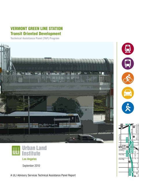
VERMONT GREEN LINE STATION<br />
Transit Oriented Development<br />
Technical Assistance Panel (TAP) Program<br />
September 2010<br />
A <strong>ULI</strong> Advisory Services Technical Assistance Panel Report
About the <strong>ULI</strong> <strong>Los</strong> <strong>Angeles</strong> Technical Assistance Panel<br />
In keeping with the <strong>Urban</strong> <strong>Land</strong> <strong>Institute</strong> mission, Technical Assistance Panels are convened to provide pro-bono<br />
planning and development assistance to public officials and local stakeholders of communities and nonprofit<br />
organizations who have requested assistance in addressing their land use challenges.<br />
A group of diverse professionals representing the full spectrum of land use and real estate disciplines typically<br />
spend one day visiting and analyzing the built environments, identifying specific planning and development<br />
issues, and formulating realistic and actionable recommendations to move initiatives forward in a fashion<br />
consistent with the applicant’s goals and objectives.<br />
Staff and Panel Members<br />
TAP Client<br />
County of <strong>Los</strong> <strong>Angeles</strong><br />
Department of Regional Planning<br />
Panel Chair<br />
Jeffrey Lambert, AICP<br />
Community Development Director, City of Ventura<br />
Panelists<br />
Karl Fielding<br />
Environmental Planner, PBS&J<br />
Ehud Mouchly<br />
Owner, READI, LLC<br />
Walter Okitsu<br />
Managing Director, Crain & Associates<br />
Eric Olsen<br />
Principal, Thomas P. Cox: Architects<br />
Patricia Smith, ASLA, AICP<br />
Principal, Patricia Smith<br />
Alex Sunquist<br />
Senior Consultant, RCLCO<br />
Woodie Tescher<br />
Principal Technical Professional/Planning + <strong>Urban</strong> Design,<br />
PBS&J<br />
John Waldron<br />
Principal, W+W Architects<br />
TAP Committee Chair<br />
Jonathan Curtis<br />
Principal, Trevear Holdings LLC<br />
TOD Summit TAP Advisor<br />
Robert Gardner<br />
Managing Director, RCLCO<br />
<strong>ULI</strong> Project Staff<br />
Katherine Perez<br />
Executive Director, <strong>ULI</strong> <strong>Los</strong> <strong>Angeles</strong><br />
Christine Aure<br />
Project Manager, <strong>ULI</strong> <strong>Los</strong> <strong>Angeles</strong><br />
Ciara Contreras<br />
Project Manager, <strong>ULI</strong> <strong>Los</strong> <strong>Angeles</strong><br />
Stephen Sampson<br />
Intern, <strong>ULI</strong> <strong>Los</strong> <strong>Angeles</strong><br />
John Dlugolecki<br />
Photographer
Table of<br />
Contents<br />
Executive Summary 2<br />
Assignment & Process 4<br />
Background 6<br />
Analysis 8<br />
Findings 9<br />
Recommendations 11<br />
Implementation 14<br />
Funding Sources 22<br />
Acknowledgements 23<br />
Panel Members 24<br />
1
Executive<br />
Summary<br />
2 <strong>Vermont</strong> <strong>Green</strong> <strong>Line</strong> <strong>Station</strong> Transit Oriented Development Technical Assistance Panel Program<br />
The Metro <strong>Green</strong> <strong>Line</strong> opened in 1995 and has 14 stations along<br />
its 20-mile long route from the City of Norwalk west to the City of<br />
Redondo Beach. The <strong>Green</strong> <strong>Line</strong> is entirely grade separated and<br />
for most of its route it follows the median of the Glenn Anderson<br />
Freeway (I-105). The <strong>Green</strong> <strong>Line</strong> <strong>Vermont</strong> <strong>Station</strong> is located in the<br />
unincorporated community of West Athens-Westmont. The County of<br />
<strong>Los</strong> <strong>Angeles</strong> Department of Regional Planning, through its proposed<br />
Transit Oriented Districts Program, seeks to utilize the existing assets<br />
of the <strong>Vermont</strong> Transit <strong>Station</strong> to revitalize the West Athens-Westmont<br />
community by improving pedestrian accessibility and attracting smart,<br />
green, and sustainable transit oriented development.<br />
The Department of Regional Planning engaged the <strong>Urban</strong> <strong>Land</strong><br />
<strong>Institute</strong> (<strong>ULI</strong>) <strong>Los</strong> <strong>Angeles</strong> District Council in a Technical Assistance<br />
Panel (TAP) to study ways to maximize development opportunities<br />
for the <strong>Vermont</strong> <strong>Station</strong> and the surrounding community. The TAP<br />
was convened at the Audrey and Sydney Irmas Youth Activity Center<br />
on March 26, 2010, utilizing experts in architecture, planning,<br />
development, and market economics to determine the main challenges<br />
and opportunities, offer solutions, and develop a roadmap for success<br />
for the <strong>Vermont</strong> <strong>Station</strong>.<br />
The TAP evaluated the area within a half mile radius around the<br />
<strong>Vermont</strong> <strong>Station</strong>, encompassing an area the County established<br />
through its zoning code in 2005 as a Transit Oriented District<br />
(TOD), and found numerous opportunities and challenges. While<br />
the <strong>Vermont</strong> <strong>Station</strong> TOD has seen very little new development since<br />
its establishment, the larger half mile radius study area has recently<br />
benefited from significant public investments, such as new County
facilities along Imperial Highway and the expansion of <strong>Los</strong> <strong>Angeles</strong><br />
Southwest College. The TAP developed a strategic plan to enhance the<br />
<strong>Vermont</strong> <strong>Station</strong>’s sense of arrival and utility by creating a connecting<br />
network of attractive pedestrian corridors stretching from the station into<br />
surrounding residential neighborhoods, along commercial corridors, and<br />
to schools and civic facilities. Making the <strong>Vermont</strong> TOD a focal point of<br />
community identity is one of the primary goals of this TAP.<br />
The TAP believes an opportunity exists to create a community center at<br />
the <strong>Vermont</strong> <strong>Station</strong> by expanding the street level plaza and improving the<br />
pedestrian and transit user experience. In addition, the TAP recommends<br />
treating the station as an anchor for two active nodes—a proposed mixed<br />
use urban center to the north at <strong>Vermont</strong> Avenue and Imperial Highway, and<br />
a smaller neighborhood-serving center to the south at <strong>Vermont</strong> Avenue and<br />
120th Street. Because the community suffers from a lack of open space, an<br />
enhanced linear park along the <strong>Vermont</strong> Avenue median would help serve as<br />
the backbone that connects these two active nodes. New housing and mixed<br />
use infill development between these nodes can bolster retail and pedestrian<br />
activity along the <strong>Vermont</strong> Avenue corridor, and a green connector along the<br />
existing Union Pacific rail right of way immediately south of the station can<br />
create east-west pedestrian and bicycle linkages.<br />
It is the TAP’s concern that the <strong>Vermont</strong> <strong>Station</strong> and adjacent neighborhoods<br />
lack a unified identity and is not a recognized destination center. Currently<br />
the community assets feel detached and isolated. As a result, the County<br />
is urged to improve both the efficacy and design of the station to establish<br />
a sense of place, improve connectivity from adjoining neighborhoods, and<br />
ultimately invigorate the West Athens-Westmont community.<br />
3
Assignment & Process<br />
Key Issues<br />
The County of <strong>Los</strong> <strong>Angeles</strong> Department of Regional<br />
Planning requested that a TAP be convened to study the<br />
<strong>Vermont</strong> <strong>Station</strong> and to offer ideas and a plan for future<br />
investment and development in the station area. The<br />
Department of Regional Planning identified the following<br />
objectives the TAP should consider while addressing<br />
the future of the <strong>Vermont</strong> <strong>Station</strong> and surrounding<br />
community:<br />
1. Examine strategies and opportunities to<br />
enhance the connections and linkages between<br />
the community’s assets. The West Athens-<br />
Westmont community is comprised of a<br />
strong coalition of community members that<br />
are committed to working proactively with<br />
the County on revitalization efforts. There are<br />
strong opportunities to strategically enhance<br />
the connections between community assets,<br />
such as <strong>Los</strong> <strong>Angeles</strong> Southwest College,<br />
the Audrey and Sydney Irmas Youth Activity<br />
Center, churches, and schools, via improved<br />
pedestrian linkages and transit access to the<br />
<strong>Vermont</strong> <strong>Station</strong>.<br />
2. Consider strategies to maximize the full<br />
potential of the <strong>Vermont</strong> <strong>Station</strong> TOD to<br />
establish transit and pedestrian supportive<br />
4 <strong>Vermont</strong> <strong>Green</strong> <strong>Line</strong> <strong>Station</strong> Transit Oriented Development Technical Assistance Panel Program<br />
<strong>Vermont</strong> <strong>Station</strong> users wait to make their transit connections<br />
development, improve pedestrian access to<br />
transit facilities, improve public safety; create<br />
new economic and housing opportunities; and<br />
reduce congestion and greenhouse emissions<br />
by decreasing vehicle miles traveled.<br />
3. Consider a strategy for meeting the <strong>Vermont</strong><br />
<strong>Station</strong>’s potential through coordinated<br />
efforts by the <strong>Los</strong> <strong>Angeles</strong> County Economic<br />
Development Corporation, Metro, County of<br />
<strong>Los</strong> <strong>Angeles</strong> Department of Regional Planning<br />
and Department of Public Works, City of <strong>Los</strong><br />
<strong>Angeles</strong>, <strong>Los</strong> <strong>Angeles</strong> Southwest College and<br />
other private and nonprofit developers, as well<br />
as community stakeholders and residents.<br />
The Department of Regional Planning requested that the<br />
TAP consider the following key issues when studying the<br />
<strong>Vermont</strong> <strong>Station</strong>:<br />
• Specific urban design and infrastructure<br />
improvements that can be implemented to<br />
improve pedestrian accessibility to the station<br />
and connecting bus transit, to address safety<br />
concerns, and to create within the surrounding<br />
neighborhoods a greater sense of community<br />
ownership and connection to the station.<br />
• The degree to which significant community<br />
assets need to be leveraged to spur community<br />
and economic development and work as a<br />
catalyst for development at the periphery of the<br />
<strong>Vermont</strong> <strong>Station</strong> TOD.
• Approaches to better integrate and link<br />
the community’s existing assets with<br />
the <strong>Vermont</strong> <strong>Station</strong> TOD.<br />
• In lieu of private investment, public<br />
funding mechanisms that <strong>Los</strong> <strong>Angeles</strong><br />
County can utilize and leverage to<br />
spur desirable development and<br />
redevelopment activities at the<br />
<strong>Vermont</strong> <strong>Station</strong> TOD and surrounding<br />
community.<br />
• Potential implementation strategies.<br />
The panel’s brainstorming for the implementation phasing<br />
TAP Process<br />
<strong>ULI</strong> representatives met with representatives<br />
from the Department of Regional Planning to<br />
determine the scope of the panel assignment.<br />
The panel members were selected based upon<br />
their ability to address the stated objectives<br />
for the program provided by the client. Prior<br />
to the day-long program, panel members<br />
reviewed background materials prepared by the<br />
Department of Regional Planning.<br />
The TAP process is a day-long event. In the<br />
morning panel members tour the study area<br />
with representatives and later meet with key<br />
stakeholders, work through an intensive analysis<br />
on the specified issues, and present their<br />
findings to the general public.<br />
TAP Panel of Experts<br />
<strong>ULI</strong> convened a panel of professionals who represented<br />
a variety of disciplines connected with land use and real<br />
estate development, such as architecture and design, real<br />
estate development, economic analysis, and development<br />
financing methods. Members were selected with the<br />
intent of convening a robust array of professional<br />
expertise relevant to the County’s objectives for the study<br />
and who had local working knowledge of the sub-region<br />
where the study area was located. All panel members<br />
were volunteers and were not compensated for their time.<br />
Panel members discuss their understanding of the study area<br />
Audrey and Sydney Irmas Youth Activity Center—site where the <strong>Vermont</strong> <strong>Green</strong> <strong>Line</strong> <strong>Station</strong> TAP was convened<br />
5
Metro Park<br />
and Ride<br />
<strong>Vermont</strong> <strong>Green</strong><br />
<strong>Line</strong> <strong>Station</strong><br />
The <strong>Vermont</strong> <strong>Station</strong> TOD has experienced very little new development activity since<br />
its inception and the Department of Regional Planning believes that the work of the <strong>ULI</strong><br />
<strong>Los</strong> <strong>Angeles</strong> District Council TAP will create a successful plan to make the <strong>Vermont</strong><br />
<strong>Station</strong> TOD a model for transit oriented development in <strong>Los</strong> <strong>Angeles</strong> County. The<br />
TAP utilized best practices of transit oriented development and the expertise of its<br />
members to evaluate the conditions of the <strong>Vermont</strong> <strong>Station</strong> TOD and to formulate the<br />
recommendations of this report.<br />
<strong>Vermont</strong> <strong>Station</strong><br />
Study Area<br />
Background<br />
Regional location of <strong>Vermont</strong> <strong>Station</strong> study area<br />
6 <strong>Vermont</strong> <strong>Green</strong> <strong>Line</strong> <strong>Station</strong> Transit Oriented Development Technical Assistance Panel Program<br />
<strong>Vermont</strong> Avenue<br />
Existing <strong>Vermont</strong><br />
<strong>Station</strong> TOD<br />
Imperial Highway<br />
120th Street<br />
I-105 Freeway<br />
Half mile radius study area for the <strong>Vermont</strong> <strong>Green</strong> <strong>Line</strong> <strong>Station</strong><br />
<strong>Station</strong> users may use the nearby park and ride lot on <strong>Vermont</strong> Avenue<br />
Panelists tour the study area<br />
In 2005, the County of <strong>Los</strong> <strong>Angeles</strong> established the<br />
<strong>Vermont</strong> <strong>Station</strong> TOD in the West Athens-Westmont<br />
community, a 3.1 square mile unincorporated area with a<br />
population of more than 41,000 residents. The northern<br />
and eastern borders of the community are adjacent to<br />
the City of <strong>Los</strong> <strong>Angeles</strong>. To the west are the cities of<br />
Inglewood and Hawthorne, and to the south lies the City<br />
of Gardena. The Metro <strong>Green</strong> <strong>Line</strong> <strong>Vermont</strong> <strong>Station</strong><br />
boarding platform is physically located in the I-105<br />
freeway median below the <strong>Vermont</strong> Avenue overpass. The<br />
eastern portion of the station is under the jurisdiction of<br />
the City of <strong>Los</strong> <strong>Angeles</strong> and the western portion is within<br />
the jurisdiction of the County.<br />
The <strong>Vermont</strong> <strong>Station</strong> study area is a one half mile radius<br />
around the station, the boundaries being 110th Street<br />
to the north, 123rd Street to the south, Figueroa Street<br />
to the east, and Normandie Avenue to the west. Existing<br />
land uses in the study area consist of low to medium<br />
density residential neighborhoods with commercial<br />
and public uses along <strong>Vermont</strong> Avenue and Imperial<br />
Highway. <strong>Vermont</strong> Avenue is an underperforming<br />
commercial corridor with many shallow lots, which has<br />
facilitated the conversion of many commercial parcels<br />
to non-commercial uses such as multifamily low rise<br />
buildings and churches. Along Imperial Highway is the<br />
recently completed County complex that includes the<br />
new <strong>Los</strong> <strong>Angeles</strong> County Sheriff’s Department South <strong>Los</strong><br />
<strong>Angeles</strong> <strong>Station</strong> and a Public Works branch office.
An underutilized 155 space park and ride lot located<br />
north of the station on <strong>Vermont</strong> Avenue is Caltrans<br />
owned and Metro operated. A consent decree<br />
established during the planning of the I-105 freeway<br />
requires that free parking be maintained adjacent to the<br />
station and this lot serves that purpose.<br />
The West Athens-Westmont community is comprised<br />
of two Census Designated Places (CDP). The West<br />
Athens CDP has a population of 9,100; 2,100 families;<br />
and nearly 2,000 persons per square mile. Ethnic<br />
composition is made up of 10% White, 65% African<br />
American, and 23% Latino. The Westmont CDP has a<br />
population of about 32,000; 7,100 families; and about<br />
5,500 persons per square mile. Ethnic composition is<br />
made up of 12% White, 58% African American, and<br />
29% Latino.<br />
The average weekday ridership at the <strong>Vermont</strong> <strong>Station</strong><br />
is approximately 2,000 riders eastbound, and 1,200<br />
westbound. The <strong>Vermont</strong> <strong>Station</strong> offers connectivity<br />
to surface transit along <strong>Vermont</strong> Avenue in both<br />
directions. Connecting bus lines along the <strong>Vermont</strong><br />
corridor include the Gardena Bus <strong>Line</strong> 2, Metro<br />
Bus <strong>Line</strong>s 204, 206, 209, and the Metro Rapid 754.<br />
(see image below). According to Metro, the average<br />
daily bus boarding’s (connections from the <strong>Green</strong><br />
<strong>Line</strong>) are 998 (northbound) and 688 (southbound).<br />
The community is also serviced by the Rosewood<br />
Smart Shuttle operated by the County of <strong>Los</strong> <strong>Angeles</strong><br />
Department of Public Works.<br />
Currently there is no open space located within the<br />
<strong>Vermont</strong> <strong>Station</strong> TOD. The nearest park, Helen Keller<br />
Park, is located about one mile south of the TOD.<br />
Chester L. Washington golf course is one of the largest<br />
open space parcels in the West Athens-Westmont<br />
community, but it is not linked to the <strong>Vermont</strong> <strong>Station</strong><br />
Bus routes serving the study area<br />
TOD for ready accessibility by transit users. <strong>Los</strong> <strong>Angeles</strong> Southwest College boasts<br />
some of the best sports facilities in the state. In 1984 the site was selected by the<br />
Olympic Committee to be an official training facility for participating athletes. Today,<br />
however, it is only available for student activities and private groups able to pay for<br />
facility use permits.<br />
History of the Metro <strong>Green</strong> <strong>Line</strong><br />
The Metro <strong>Green</strong> <strong>Line</strong> is an east-west lightrail<br />
line in the <strong>Los</strong> <strong>Angeles</strong> County Metro Rail<br />
System connecting the City of Norwalk with<br />
the City of Redondo Beach. The <strong>Green</strong> <strong>Line</strong><br />
was established as part of a consent decree<br />
signed by Caltrans to allow construction of the<br />
I-105 freeway. The <strong>Green</strong> <strong>Line</strong> was originally<br />
conceived to serve bedroom communities along<br />
its alignment for the now defunct aerospace<br />
industry. Construction of the <strong>Green</strong> <strong>Line</strong> began<br />
in 1987 and it opened in 1995 at a cost of $718<br />
million. It has an average of nearly 40,000<br />
weekday boardings. The present extent of the<br />
<strong>Green</strong> <strong>Line</strong> is often criticized for its lack of direct<br />
connection to major terminus points, such as to<br />
the <strong>Los</strong> <strong>Angeles</strong> International Airport and to the<br />
Norwalk/Santa Fe Springs Metrolink station.<br />
<strong>Vermont</strong> <strong>Station</strong> information kiosk<br />
County of <strong>Los</strong> <strong>Angeles</strong> Transit Oriented Development Initiative<br />
along the Metro <strong>Green</strong> <strong>Line</strong><br />
In 1998 the County of <strong>Los</strong> <strong>Angeles</strong> Department of Regional Planning began a<br />
program to develop Transit Oriented Districts at the Metro <strong>Green</strong> <strong>Line</strong> <strong>Station</strong>s in<br />
its unincorporated communities—the <strong>Vermont</strong> <strong>Station</strong> in West Athens-Westmont<br />
and the Hawthorne <strong>Station</strong> in Lennox. The Regional Planning staff engaged the local<br />
community to develop the Draft <strong>Green</strong> <strong>Line</strong> Transit-Oriented Districts <strong>Land</strong> Use,<br />
Housing and Economic Development Strategy Report (<strong>Green</strong> <strong>Line</strong> Strategy Report).<br />
The report provides the overall land use vision, development goals, and objectives for<br />
the <strong>Green</strong> <strong>Line</strong> <strong>Station</strong> TODs, and serves as the foundation for updates to the County’s<br />
Transit Oriented Districts Ordinance. Minimal new development has occurred in the<br />
<strong>Vermont</strong> <strong>Station</strong> TOD since its establishment in 2005. Only thirteen permits have been<br />
processed and from that yielded just two new single family residences. The County<br />
is concerned about the lack of development in the TOD and has committed to further<br />
examining how transit oriented development strategies may be tailored for the TOD to<br />
increase opportunities for successful development.<br />
County of <strong>Los</strong> <strong>Angeles</strong> Transit Oriented Districts Program<br />
The Department of Regional Planning is completing a comprehensive update to<br />
the County’s General Plan. The General Plan Update includes the proposed Transit<br />
Oriented Districts Program, which is a major component of the County’s regional<br />
strategy to increase affordable, multifamily housing opportunities. The Program is<br />
also intended to meet local and State climate change goals to reduce greenhouse<br />
gas emissions and improve air quality through land use and transportation strategies<br />
that are pedestrian friendly and reduce vehicle miles traveled. The Program further<br />
demonstrates the County’s commitment to community and economic development<br />
through smart growth.<br />
7
Range of employment centers that study area residents commute to for work<br />
Analysis<br />
Demographics and Employment<br />
Approximately 12,000 people live within a one half mile radius of the <strong>Vermont</strong> <strong>Station</strong>,<br />
comprising roughly 3,300 households. Overall, household sizes in the station area<br />
are quite large, with an average household size of 3.7 persons, as compared to the<br />
County average of approximately 3.0 persons per household. Local median household<br />
incomes, on the other hand, are lower than the County average. Demographers<br />
estimate that the 2009 median household income in the <strong>Vermont</strong> <strong>Station</strong> area was<br />
around $34,000, versus $54,000 for <strong>Los</strong> <strong>Angeles</strong> County.<br />
The U.S. Census Bureau indicates that the average unemployment rate for the West<br />
Athens-Westmont community is slightly more than 20%. The average unemployment<br />
rate for the County is just over 13%<br />
There are approximately 900 jobs in the <strong>Vermont</strong> <strong>Station</strong> study area, half of which<br />
are in the public sector. These public sector jobs are primarily related to education or<br />
social services. Of private sector jobs, roughly 40% are retail-oriented, and most of<br />
these are in food stores (e.g., the local Ralphs grocery store) or fast food restaurants.<br />
Relative to the number of households in the <strong>Vermont</strong> <strong>Station</strong> study area, local jobs are<br />
very scarce. The local jobs-to-households ratio is 0.28, while the same ratio for <strong>Los</strong><br />
<strong>Angeles</strong> County is 1.39. Generally, a low local jobs-to-households ratio, such as that<br />
for the <strong>Vermont</strong> <strong>Station</strong> study area, indicates that residents must commute outside<br />
of the community to other parts of the region for work. This may also indicate that<br />
the <strong>Green</strong> <strong>Line</strong> may still serve its originally intended purpose of providing a transit<br />
commuting option to non-local jobs for bedroom communities along its alignment,<br />
such as West Athens-Westmont. Information from the U.S. Census Bureau shows that<br />
local residents work in areas as far away as downtown <strong>Los</strong> <strong>Angeles</strong> and Long Beach.<br />
8 <strong>Vermont</strong> <strong>Green</strong> <strong>Line</strong> <strong>Station</strong> Transit Oriented Development Technical Assistance Panel Program<br />
Multifamily housing stock within the study area<br />
Single family housing stock within the study area<br />
Residential Market Conditions<br />
Almost half (1,600) of the estimated 3,400<br />
residential units in the <strong>Vermont</strong> <strong>Station</strong> study<br />
area are single family detached homes, and most<br />
of these are well maintained. Two thirds of the<br />
remaining 1,800 units can be found in low-rise<br />
buildings containing fewer than 20 units each.<br />
In 2009, renters comprised 65% of the area’s<br />
residential market, which is higher than the<br />
County average of 52%. Few recent residential<br />
developments exist in the study area, with the<br />
exception of a couple of relatively new multifamily<br />
properties. Thus, the <strong>Vermont</strong> <strong>Station</strong><br />
area represents a challenging environment<br />
for private sector investment in residential<br />
real estate development in particular. Private<br />
developers are likely to require development<br />
incentives and public assistance as part of a<br />
clear public sector commitment in the area.<br />
Retail Market Conditions<br />
Although little to no office or industrial space<br />
exists within a half mile radius of the <strong>Vermont</strong><br />
<strong>Station</strong>, some retail space does exist. This<br />
retail space is, however, quite limited. With the<br />
exception of a Ralphs grocery store located<br />
at the corner of <strong>Vermont</strong> Avenue and 120th<br />
Street, most retail space exists in either old strip<br />
centers or “mom and pop” stores along <strong>Vermont</strong><br />
Avenue and Imperial Highway.
The local Ralphs grocery store has proven to<br />
be a strong retail draw to the area, however, it<br />
is clear from demographic data that most retail<br />
expenditures by local residents occur outside<br />
the study area. In fact, with the exception of<br />
local grocery stores and gas stations, all other<br />
retail expenditure categories show a significant<br />
leakage outside the half mile radius of the<br />
<strong>Vermont</strong> <strong>Station</strong> study area. Although this<br />
leakage might normally suggest an opportunity<br />
for new development, local household incomes<br />
and expenditures likely limit new retail<br />
development in the near- to mid-term. Add to<br />
that the cautiousness of most retailers following<br />
the recent economic downturn and it becomes<br />
clear that any retail development would likely<br />
be long-term in nature. An initial analysis does,<br />
however, reveal a potential market opportunity<br />
for a sit-down restaurant in the area. Very likely,<br />
such an establishment would be located in<br />
high-traffic areas such as the corner of <strong>Vermont</strong><br />
Avenue and Imperial Highway.<br />
Findings<br />
A new County of <strong>Los</strong> <strong>Angeles</strong> facility is within the study area View looking north on <strong>Vermont</strong> toward the park and ride lot<br />
Gateway entry to the <strong>Vermont</strong> <strong>Green</strong> <strong>Line</strong> <strong>Station</strong><br />
A Strengths, Weaknesses, Opportunities, and Threats (SWOT) analysis was conducted<br />
to evaluate the <strong>Vermont</strong> <strong>Station</strong> and surrounding community. Strengths and<br />
weaknesses explore internal aspects of the project or elements that can be controlled<br />
or changed by new development. Opportunities and threats evaluate external influences<br />
that can affect the project. Most opportunities and threats are beyond the control of<br />
those associated with the project, such as factors relating to the economy like interest<br />
rates or loan availability. From the site visit, stakeholder interviews, and additional site<br />
research, the TAP determined the following strengths, weaknesses, opportunities and<br />
threats for the <strong>Vermont</strong> <strong>Station</strong> TOD study area.<br />
Strengths<br />
The existing transit station and established infrastructure, as well as involved<br />
community stakeholders provide a good opportunity for effective localized planning in<br />
the <strong>Vermont</strong> <strong>Station</strong> TOD. Recent investments by the County, including a new Sheriff’s<br />
<strong>Station</strong>, and the proximity to <strong>Los</strong> <strong>Angeles</strong> Southwest College provide incentives to<br />
maximize connections to the <strong>Vermont</strong> <strong>Station</strong>. Wide streets, such as <strong>Vermont</strong> Avenue<br />
and Imperial Highway, allow for sufficient traffic flow and bus connections. The Ralph’s<br />
grocery store on <strong>Vermont</strong> Avenue south of the <strong>Vermont</strong> <strong>Station</strong> provides a local market<br />
for the community, while the well-maintained, relatively dense and stable single family<br />
residential population provides a user-base for the light rail transit system.<br />
Weaknesses<br />
Traditional mixed use and dense TOD development conflicts with the preexisting<br />
single-family community character of the neighborhood. The current station design<br />
is visually unattractive and uninviting, and being located at the <strong>Vermont</strong> Avenue<br />
underpass exposes riders to unwelcome levels of noise and pollution. The lack of<br />
wide sidewalks and neglected streetscape along <strong>Vermont</strong> Avenue inhibits pedestrian<br />
access to the station from neighboring residential areas. The station area lacks a clear<br />
sense of identity or central nodes where commercial activity occurs and pedestrians<br />
gather. Shallow commercial lots along <strong>Vermont</strong> Avenue and Imperial Highway near the<br />
station pose a problem when identifying and assembling parcels for redevelopment.<br />
The consent decree requiring the availability of the park and ride lot limits the<br />
redevelopment potential of that site, and the Union Pacific railroad corridor south of<br />
9
the I-105 freeway acts as a barrier between residents<br />
south of it and the transit station. Community members<br />
state that local crime and lack of safety discourages<br />
pedestrian activity in the station area.<br />
Opportunities<br />
Despite weaknesses, opportunities are prevalent. The<br />
width of <strong>Vermont</strong> Avenue provides a major opportunity<br />
for streetscape enhancement and traffic realignment.<br />
Vacant and underutilized lots within one quarter<br />
mile of the station provide excellent redevelopment<br />
opportunities and potential. The park and ride lot is<br />
severely underutilized and could be improved to enhance<br />
its function through improved safety measures as well<br />
as considering strategies to integrate other appropriate<br />
uses while at the same time maintaining the 155 parking<br />
spaces required by the consent decree. There may also<br />
be opportunities to reconfigure and synchronize the<br />
local shuttle route to maximize service and improve<br />
community linkages to the rail station. The Ralphs<br />
grocery store could be redesigned and expanded to<br />
intensify the use by attracting additional tenants and<br />
expanding the store front along both 120th Street and<br />
<strong>Vermont</strong> Avenue. This parcel has the potential to be a<br />
strong anchor for the southern part of the TOD area.<br />
Connectivity with <strong>Los</strong> <strong>Angeles</strong> Southwest College could<br />
be enhanced, and improvements to the <strong>Vermont</strong> <strong>Station</strong><br />
could create a more aesthetically pleasing and inviting<br />
portal.<br />
10 <strong>Vermont</strong> <strong>Green</strong> <strong>Line</strong> <strong>Station</strong> Transit Oriented Development Technical Assistance Panel Program<br />
The width of <strong>Vermont</strong> Avenue provides an opportunity for streetscape enhancements<br />
Threats<br />
Threats to these opportunities are strong. There is a non-existent market currently in<br />
place to support transit oriented development in the <strong>Vermont</strong> <strong>Station</strong> area. Funding for<br />
transit service can be volatile, sometimes leading to unexpected long-term decreases<br />
in funding availability. Added to this, the fact that sales tax revenues are down, there is<br />
instability in available public money and private investment. These economic factors<br />
threaten to prevent any potential projects from getting off the ground. Additionally,<br />
some members of the existing community are resistant to change and may not<br />
embrace all the proposed improvements to the TOD. Public funding for housing is also<br />
restricted, as it can be difficult to secure funds when building housing within 500 feet<br />
of a freeway.<br />
Vacant lots within the study area provide excellent redevelopment opportunities
Recommendations<br />
“Building on a sense of place and creating a<br />
pedestrian friendly transit station”<br />
IMPERIAL HIGHWAY<br />
105 FREEWAY (WESTBOUND)<br />
105 FREEWAY (EASTBOUND)<br />
VERMONT AVE<br />
VERMONT AVE<br />
VERMONT<br />
STATION<br />
BOARDING<br />
PLATFORMS<br />
ENHANCED<br />
STATION<br />
ENTRIES<br />
Vision for a more pedestrian friendly <strong>Vermont</strong> <strong>Station</strong> TOD<br />
Vision<br />
The West Athens-Westmont community does not<br />
have a prominent and recognizable community center.<br />
The TAP’s vision is to create a community identity<br />
through the enhancement of the <strong>Vermont</strong> <strong>Station</strong> and<br />
its surrounding amenities. This commonly held identity<br />
can encourage private investment and community<br />
building and would serve to enhance the economic<br />
opportunities for its residents. The West Athens-<br />
Westmont community can share a common gathering<br />
place that would consist of the <strong>Vermont</strong> <strong>Station</strong>, a<br />
<strong>Vermont</strong> Avenue linear park, and a new urban mixed<br />
use node.<br />
Vision Strategies<br />
The <strong>Vermont</strong> <strong>Station</strong> TOD area has a number of existing<br />
community assets, and there are opportunities to<br />
further develop “nodes” and a greater sense of place<br />
at existing commercial centers in the TOD. The TAP<br />
recommends developing and strengthening the links<br />
between these assets and nodes by creating an identity<br />
that bridges the gap created by the I-105 freeway while<br />
preserving and protecting the existing single family<br />
neighborhoods. The TAP identified the following four<br />
strategies to improve the <strong>Vermont</strong> <strong>Station</strong> TOD to<br />
bring about the vision for a transit and pedestrian hub<br />
that will increase ridership and enhance community<br />
character:<br />
1. Develop the <strong>Vermont</strong> Avenue I-105 freeway<br />
overpass and the <strong>Vermont</strong> <strong>Green</strong> <strong>Line</strong><br />
<strong>Station</strong> into a multi-modal plaza, reducing<br />
the excessively wide center median<br />
and expanding the sidewalks to link the<br />
community north and south of the freeway.<br />
2. Improve the <strong>Vermont</strong> Avenue median into a<br />
linear park to create a sense of identity and<br />
place for the community.<br />
3. Encourage transit supportive higher<br />
density mixed use development at the<br />
existing commercial nodes while buffering<br />
and protecting the existing single family<br />
neighborhoods.<br />
4. Improve internal circulation systems within<br />
the community to increases linkages with the<br />
transit station.<br />
11
Strategy 1: Develop a Multimodal Plaza<br />
Develop the <strong>Vermont</strong> Avenue freeway overpass<br />
and the <strong>Vermont</strong> <strong>Green</strong> <strong>Line</strong> <strong>Station</strong> into a<br />
multi-modal plaza, reducing the excessively<br />
wide center median and expanding the sidewalks<br />
to link the community north and south of the<br />
freeway.<br />
<strong>Vermont</strong> Avenue features an exceptionally wide<br />
right-of-way of 170 to 180 feet. The median<br />
island, which was a former railroad right-ofway,<br />
is 60 feet wide. The <strong>Vermont</strong> Avenue<br />
freeway overpass provides bus stops and bus<br />
layover zones for Metro and Gardena Transit<br />
lines, as well as various shuttles. Because<br />
<strong>Vermont</strong> Avenue needs no more than 100 feet<br />
to accommodate all its lanes of traffic as well<br />
as curbside parking, the excessive right-of-way<br />
provides many opportunities for developing<br />
pedestrian-oriented space.<br />
This plaza should be developed with an<br />
attractive landscaped space with amenities for<br />
people gathering before boarding the train.<br />
Currently, riders wait for the train above the<br />
platform to avoid the deafening environment<br />
caused by the I-105 freeway. Expanding the<br />
sidewalk and building a plaza at street level<br />
above the platform provides a safe, public space<br />
for members of the community. Enhancement<br />
of the <strong>Vermont</strong> <strong>Station</strong> entry portal itself, as it<br />
is unappealing today, will create an inviting and<br />
more pleasant experience for transit users.<br />
12 <strong>Vermont</strong> <strong>Green</strong> <strong>Line</strong> <strong>Station</strong> Transit Oriented Development Technical Assistance Panel Program<br />
Street furnishings are a feature of vibrant pedestrian streetscapes<br />
Strategy 2: Improve the <strong>Vermont</strong> Avenue Median<br />
Improve the <strong>Vermont</strong> Avenue median by developing a linear park to create a sense<br />
of identity and place for the community.<br />
The TAP recommends retaining the wide median to accommodate a new linear<br />
park as the station area lacks significant open space. In addition to improvements<br />
of the <strong>Vermont</strong> Avenue freeway overpass, converting the existing median into<br />
a linear park will create open space the community can use and benefit from,<br />
while at the same time creating an identifiable landmark for the West Athens-<br />
Westmont community. However, because providing a linear park on the freeway<br />
overpass would be economically infeasible due to structural limitations, the TAP<br />
recommends narrowing the striped median on the overpass and transferring that<br />
width to the sidewalks adjacent to the <strong>Vermont</strong> <strong>Station</strong> entrances on each side of<br />
the overpass.<br />
The 10 foot sidewalk on the overpass’s east side and the 15 foot sidewalk on the<br />
west side could each be widened to 22 feet. No traffic capacity would be lost with<br />
the narrowing of <strong>Vermont</strong> Avenue. The median islands immediately to the north<br />
and south of the I-105 freeway would be narrowed only a slight amount to allow<br />
for the traffic lane transitions, as shown in the sketch highlighting the panel’s<br />
recommendations (page 13). The wider sidewalks immediately adjacent to the<br />
<strong>Vermont</strong> <strong>Station</strong> entrances would offer an excellent opportunity to provide for street<br />
beautification, as well as amenities for transferring bus riders.<br />
Existing streetscape conditions along <strong>Vermont</strong> Avenue
Strategy 3: Encourage Higher Density Mixed Use Development<br />
Encourage higher density mixed use on existing commercial nodes to create<br />
transit supportive commercial uses while buffering and protecting the existing<br />
single family neighborhoods.<br />
There are opportunities for planning transit-related mixed use development at the<br />
<strong>Vermont</strong> Avenue and Imperial Highway intersection. The close proximity to the<br />
<strong>Vermont</strong> <strong>Station</strong>, the commercial zoning of the area, and the larger dimensions<br />
of the properties make the location appropriate for such development. South of<br />
Imperial Highway, along <strong>Vermont</strong> Avenue, where the existing Metro park and ride<br />
lot is located, is a particularly good location for this type of development given its<br />
immediate proximity to the station. For instance, a mixed use development could<br />
be established with a parking basement that provides parking for new residents<br />
and for current users of the park and ride spaces. Appealing commercial space<br />
could be provided at the first floor, possibly enclosing a plaza with opportunities<br />
for outdoor dining, and convenience retail. In conjunction with the proposed<br />
widening of the <strong>Vermont</strong> Avenue sidewalk at the station entry, such a plaza could<br />
make a pleasant location for waiting for transit. Multiple stories of residences may<br />
be planned for the levels above the first floor.<br />
Similarly, other parcels at the <strong>Vermont</strong> Avenue and Imperial Highway intersection<br />
have good potential for transit-related mixed use buildings. Some commercial<br />
space should be retained on the first floors, and interesting entry lobbies and<br />
outdoor plazas have the potential to further encourage pedestrian activity at the<br />
intersection.<br />
Another consideration is to cul-de-sac or re-route the existing diagonal street<br />
(Southwest Boulevard) at the northeast corner of the <strong>Vermont</strong> Avenue and<br />
Imperial Highway intersection to create more useable space. Furthermore, the<br />
TAP recommends intensification of development on properties at the northeast<br />
intersection of <strong>Vermont</strong> Avenue and 120th Street to create a neighborhoodserving<br />
node. Connecting this node with the <strong>Vermont</strong> Avenue and Imperial<br />
Highway node with multifamily and/or mixed use development would establish a<br />
pedestrian corridor extending north and south from the <strong>Vermont</strong> <strong>Station</strong> into the<br />
community.<br />
Pedestrian friendly streetscapes are business friendly<br />
Strategy 4: Coordinate Local Community Shuttles to<br />
Increase Linkages with <strong>Vermont</strong> <strong>Station</strong><br />
The <strong>Vermont</strong> Avenue corridor is a major arterial served<br />
by public transit that links the West Athens-Westmont<br />
community to neighboring city centers in <strong>Los</strong> <strong>Angeles</strong><br />
County. Investing in additional public or privately operated<br />
shuttles, jitneys, or share taxis to and from the <strong>Vermont</strong><br />
<strong>Station</strong> will allow for improved circulation within the<br />
community and greater use of the station. For example,<br />
students of <strong>Los</strong> <strong>Angeles</strong> Southwest College commute from<br />
neighboring cities accessible to Metro light rail transit. There<br />
is a large concentration of students residing in Inglewood<br />
and Hawthorne, both of which have a Metro <strong>Green</strong> <strong>Line</strong><br />
<strong>Station</strong>. Shuttling students from <strong>Los</strong> <strong>Angeles</strong> Southwest<br />
College to the station can create incentives for student<br />
and faculty use; hence reducing the amount of traffic and<br />
greenhouse gas emissions within the area.<br />
Panel recommendations for an improved pedestrian experience along <strong>Vermont</strong> Avenue<br />
13
Implementation<br />
A Road Map for Success<br />
Introduction - Phasing Strategy<br />
The <strong>ULI</strong> TAP recommends a comprehensive strategy of public realm improvements<br />
and public and private development projects that capitalize on the presence of<br />
the <strong>Vermont</strong> <strong>Station</strong> and will enhance the economic vitality and livability of the<br />
surrounding West Athens-Westmont community. Recognizing that the community is<br />
largely developed and the importance of preserving and enhancing existing residential<br />
neighborhoods, the strategies are focused on selected infill and re-use sites and public<br />
rights-of-way.<br />
While the vision encompasses a broad spectrum of actions that would be implemented<br />
over a number of years, there are important strategies that can be initiated in the near<br />
term. These short term strategies plant the seeds for transformative change. The TAP<br />
recommends a phased approach to implementation of its recommendations based<br />
on its understanding of current and projected funding opportunities and market<br />
conditions.<br />
The TAP’s implementation actions are divided into three phases:<br />
• Phase I: Years 1 - 5<br />
• Phase II: Years 6 - 9<br />
• Phase III: Years 10 and beyond<br />
14 <strong>Vermont</strong> <strong>Green</strong> <strong>Line</strong> <strong>Station</strong> Transit Oriented Development Technical Assistance Panel Program<br />
LEGEND<br />
Panelist Eric Olsen sketches out the team’s vision for a successful TOD<br />
<strong>Station</strong><br />
<strong>Vermont</strong> Avenue<br />
Commercial (Imperial Hwy)<br />
Retail Nodes<br />
Existing conditions diagram<br />
Government Center<br />
Schools/Colleges<br />
Neighborhoods
Goal 1: Create a Vibrant Multi-Modal <strong>Station</strong><br />
Plaza<br />
The immediate <strong>Vermont</strong> <strong>Green</strong> <strong>Line</strong> <strong>Station</strong> area should<br />
be improved to create a more inviting environment<br />
for transit users and as an attractive amenity for<br />
surrounding commercial districts and residential<br />
neighborhoods.<br />
Actions<br />
• The width of <strong>Vermont</strong> Avenue affords the<br />
opportunity to reconfigure travel lanes, expand<br />
sidewalks, install landscaping and streetscape<br />
amenities, and add small food or retail kiosks that<br />
contribute to the sense of a pedestrian transitplaza.<br />
• Redesign the entry portal, access stairways and<br />
elevators, and train boarding platform to improve<br />
their visual and physical quality and buffer<br />
transit users from excessive levels of noise and<br />
pollution.<br />
• Sidewalks along both sides of <strong>Vermont</strong> Avenue<br />
should be widened and improved to make them<br />
attractive places for pedestrians to walk, patronize<br />
local businesses, and enjoy their community.<br />
The addition of trees, landscaping, benches,<br />
pedestrian-scaled lighting, public art, and<br />
wayfinding signage are illustrative of the types of<br />
such improvements.<br />
Goal 2: Improve the Pedestrian Experience<br />
The pedestrian experience along Imperial Highway<br />
and <strong>Vermont</strong> Avenue needs improvement to facilitate<br />
usability and safety.<br />
Phase I<br />
Years 1 - 5<br />
Actions<br />
• Improve the image and character of Imperial Highway by reconstructing and<br />
landscaping its median, currently separated from travel lanes by painted lines.<br />
• Restripe <strong>Vermont</strong> Avenue north of the I-105 freeway to accommodate bicycle<br />
lanes that would tie into the bicycle lanes proposed by the City of <strong>Los</strong> <strong>Angeles</strong><br />
further north along <strong>Vermont</strong> Avenue.<br />
• Additional study is needed to determine whether restriping could be<br />
accommodated with the existing 44 to 45 foot wide southbound cross section<br />
on the County’s side of <strong>Vermont</strong> Avenue or whether the median would have to<br />
be narrowed 3 to 4 feet to accommodate wider lanes. The City of <strong>Los</strong> <strong>Angeles</strong><br />
northbound cross section (54 to 55 feet wide) can easily accommodate a bicycle<br />
lane and could even include a protected bicycle lane in some segments. To<br />
accommodate bicycle lanes south of the I-105 freeway, the median would have<br />
to be narrowed by 5 to 8 feet on each side to accommodate the same cross<br />
section as proposed north of the I-105 freeway.<br />
• Redesign sidewalks on the west side of <strong>Vermont</strong> Avenue to:<br />
Provide 8 foot wide stormwater infiltration parkways and 7 to 8 foot wide<br />
walkways.<br />
Plant large-scale open-canopy street trees an average of 30 to 40 feet apart in<br />
the center of the new stormwater infiltration parkways.<br />
Add pedestrian-scale street lights to provide supplemental illumination at night<br />
and community identity during the day time.<br />
Over time, attract new ground floor uses in existing buildings and new<br />
development projects to provide ground floor commercial activity oriented to<br />
the sidewalk. New development projects may set back a few feet to provide more<br />
space along the sidewalk for outdoor commercial activities, including outdoor<br />
dining.<br />
• Coordinate with the City of <strong>Los</strong> <strong>Angeles</strong> to provide similar improvements on<br />
the east side of <strong>Vermont</strong> Avenue since a “double-sided” street is more likely to<br />
succeed in attracting new development and activity than a single-sided street.<br />
Existing cross section of <strong>Vermont</strong> Avenue north of the <strong>Vermont</strong> <strong>Green</strong> <strong>Line</strong> <strong>Station</strong><br />
15
• The sidewalk on the I-105 freeway overpass is currently an average of 10<br />
feet wide, narrower than the sidewalks to the north and south. The sidewalk<br />
on the west side is approximately 12 feet wide, while the sidewalk on<br />
the east side is approximately 8 to 10 feet wide. To provide safer, more<br />
comfortable access to the <strong>Vermont</strong> <strong>Station</strong>, the sidewalks can be widened<br />
to 18 to 20 feet. Using a far more gradual rate of transition than is currently<br />
provided where the median narrows at 120th Street, the median could be<br />
gradually narrowed by up to 5 feet on the west side and up to 8 feet on the<br />
east side, starting less than 100 feet north and south of the I-105 freeway<br />
ramps.<br />
Goal 3: Develop a Mixed Use Transit Supportive Node at the<br />
Southwest Corner of <strong>Vermont</strong> Avenue and Imperial Highway<br />
The County should pursue the designation of the station area, commercial<br />
corridors, and other appropriate properties as a Redevelopment Project Area.<br />
This would provide additional tools and incentives for property acquisition, and<br />
roadway, streetscape, and other improvements.<br />
LEGEND<br />
<strong>Station</strong> Improvements<br />
Imperial Highway Median<br />
Improvements<br />
Mixed Use Parcels<br />
<strong>Vermont</strong> Avenue Streetscape<br />
Improvements<br />
Phase I implementation diagram<br />
16 <strong>Vermont</strong> <strong>Green</strong> <strong>Line</strong> <strong>Station</strong> Transit Oriented Development Technical Assistance Panel Program<br />
Displaced parking spaces from the Metro lot would<br />
be consolidated into a new parking structure where<br />
spaces are shared with adjoining development.<br />
• Initiate processes leading to the assembly of<br />
the properties, oversee the preparation of a<br />
development plan, and develop a financing<br />
program.<br />
• Develop guidelines for the design, scale, and<br />
character of new housing to be constructed and<br />
for the renovation and improvement of existing<br />
housing in the residential neighborhoods. These<br />
should ensure that changes in the neighborhoods<br />
are respectful of and positively contribute to their<br />
distinguishing character and qualities.<br />
Actions<br />
• Consolidate and redevelop the properties at the southwest corner of<br />
<strong>Vermont</strong> Avenue and Imperial Highway for commercial uses and/or mixed<br />
use projects with housing located above or behind ground level retail uses.<br />
The northern parcels are underdeveloped and southern parcels contain<br />
a Metro park and ride lot. Cumulatively, these provide sufficient acreage<br />
for the development of one or more projects of the intensity and scale to<br />
induce redevelopment of parcels surrounding the intersection, as well as<br />
to establish a robust center of community activity, which is now absent. A transit supportive node would facilitate seamless transfers for riders<br />
Goal 4: Increase Public Amenities<br />
Additional public-oriented uses should be developed at<br />
the County Government Center and within the station<br />
area.<br />
Actions<br />
• Additional public-oriented uses should be<br />
developed at the County Government Center. This<br />
could include work-force housing for employees<br />
at the site, reducing commutes from outlying<br />
communities, and additional amenities to serve<br />
adjoining neighborhoods.<br />
• Implement a shuttle route to provide access to<br />
and from the <strong>Vermont</strong> <strong>Station</strong> to <strong>Los</strong> <strong>Angeles</strong><br />
Southwest College, the <strong>Los</strong> <strong>Angeles</strong> County<br />
Sheriff’s South <strong>Los</strong> <strong>Angeles</strong> <strong>Station</strong> and adjacent<br />
civic facilities, and other key destinations within<br />
the West Athens-Westmont community. The<br />
route can be adjusted over time to serve newly<br />
developed projects.
Ralphs grocery is a significant asset in the <strong>Vermont</strong> <strong>Station</strong> study area<br />
Goal 1: Expand Mixed Use Transit Supportive<br />
Development at the Intersections of <strong>Vermont</strong><br />
Avenue and Imperial Highway, and <strong>Vermont</strong><br />
Avenue and 120th Street<br />
By this time, it is assumed that commercial and/<br />
or mixed use projects would be constructed on the<br />
southwest block of the <strong>Vermont</strong> Avenue and Imperial<br />
Highway intersection, as well as at adjoining blocks<br />
northwest, northeast, and southeast of the intersection.<br />
These projects would provide a mix of uses and scale of<br />
development contributing to a sense of a defined center<br />
of activity and identity for the surrounding community<br />
north of the I-105 freeway and cumulatively, with<br />
intensified development at the intersection of <strong>Vermont</strong><br />
Avenue and 120th Street, would create a robust,<br />
complementary array of pedestrian-friendly community<br />
assets, businesses, and housing types throughout the<br />
TOD well served by rail and bus transit.<br />
Actions<br />
• Close Southwest Boulevard on the northeast<br />
corner of the <strong>Vermont</strong> Avenue and Imperial<br />
Highway intersection to create a cul-de-sac,<br />
and consolidate properties fronting onto<br />
<strong>Vermont</strong> Avenue and Imperial Highway to<br />
accommodate a public plaza surrounded by<br />
cafes and other pedestrian-oriented uses. These<br />
may be integrated into mixed use structures that<br />
transition in scale and height with adjoining<br />
single family neighborhoods.<br />
• Intensify properties northeast of the intersection<br />
of <strong>Vermont</strong> Avenue and 120th Street for<br />
neighborhood-serving commercial and/<br />
or a mixed use development projects with<br />
housing located above or to the rear of ground<br />
level commercial uses. This may involve<br />
reconstruction of or additions to the existing<br />
Ralphs grocery market, with possible expansion<br />
on properties to the east of the existing site.<br />
Redevelopment of this site, in conjunction with<br />
Phase II<br />
Years 6 - 9<br />
the County facilities and school to the west, would establish a distinct activity<br />
node serving residential neighborhoods located south of the I-105 freeway.<br />
Goal 2: Develop Additional Housing<br />
Properties fronting onto <strong>Vermont</strong> Avenue from 120th Street north to <strong>Vermont</strong><br />
<strong>Station</strong> contain multifamily residential uses that would be retained or intensified by<br />
additional housing in single use structures or buildings with ground level retail uses.<br />
Establishment of a Redevelopment Project Area, initiated in Phase I, sets the stage for<br />
improvement with increased development of market rate and mixed income housing.<br />
In today’s economy, while there is a lack of private investment, the absence of market<br />
demand can be overcome by induced demand through economic incentives.<br />
Actions<br />
• Include mixed income projects in the transit oriented district that include<br />
subsidized low-income, moderate-income, and middle-income workforce<br />
housing. Among other incentives, two types of funding sources will be<br />
particularly useful:<br />
- Low income housing tax credits – LIHTC – for rental housing<br />
- New markets tax credits – NMTC – for for-sale housing<br />
• The TAP recommends that the County intensify housing production in mixed<br />
use projects. The County is encouraged to take advantage of the presence of<br />
schools, chain groceries and other community-serving retail within the <strong>Vermont</strong><br />
<strong>Station</strong> study area to attract new residents. The area can serve as a bedroom<br />
community for the major employment centers in the <strong>Los</strong> <strong>Angeles</strong> County<br />
southern basin. Opportunistic sites include housing production at the southwest<br />
corner of <strong>Vermont</strong> Avenue and Imperial Highway and the northeast corner of<br />
<strong>Vermont</strong> Avenue and 120th Street.<br />
Phase II focuses on developing vacant and underutilized parcels for additional housing and infill<br />
17
• The County should also consider the feasibility of encouraging and promoting<br />
employer-assisted housing production by large employers, public or private,<br />
that exist or may locate within the study area.<br />
• Vacant and underutilized properties west of <strong>Vermont</strong> Avenue between Imperial<br />
Highway and the I-105 freeway, that are adjacent to the County facilities complex<br />
(which includes the new Sheriff’s Department South <strong>Los</strong> <strong>Angeles</strong> <strong>Station</strong> and<br />
a Public Works branch office) on Imperial Highway would be intensified for<br />
multifamily residential housing. Characterized by its existing mix of unit types<br />
and densities, infill projects would provide additional housing opportunities for<br />
residents in proximity to the <strong>Vermont</strong> <strong>Station</strong> and be located and designed to<br />
achieve greater consistency with community character. It is recommended that<br />
an east-west landscaped pedestrian pathway be established midway between<br />
Imperial Highway and the I-105 freeway to foster walking and as an amenity for<br />
adjoining housing development.<br />
A linear park creates useable open space that complements transit oriented development<br />
18 <strong>Vermont</strong> <strong>Green</strong> <strong>Line</strong> <strong>Station</strong> Transit Oriented Development Technical Assistance Panel Program<br />
Model cross section of <strong>Vermont</strong> Avenue with streetscape improvements including a linear park in the median<br />
The width of the existing medians lend themselves to creating a linear park
Goal 3: Construct a <strong>Line</strong>ar Park<br />
Action<br />
• Redevelop the <strong>Vermont</strong> Avenue median as<br />
a linear park to serve adjoining residential<br />
neighborhoods and as an amenity for<br />
the commercial and mixed use projects<br />
located along its length. The median can<br />
be redesigned as a park, similar to the<br />
linear park proposed by the City of <strong>Los</strong><br />
<strong>Angeles</strong> further north along <strong>Vermont</strong><br />
Avenue. The median north of the I-105<br />
freeway is 60 feet wide, while the median<br />
to south is 80 feet wide. With a 10 foot<br />
side berm/low fence and landscaped<br />
buffer along each median curb line to<br />
separate median park users from traffic,<br />
the activity zone at the center of the<br />
median would be 40 to 60 feet wide. This<br />
width is adequate for a variety of passive<br />
and active recreational activities.<br />
A linear park serves as a visual buffer for a busy roadway<br />
Conceptual drawing of a linear park with landscaping and other improvements<br />
19
Phase III<br />
Years 10 and beyond<br />
Goal 1: Continue to Increase Community Amenities and Linkages<br />
Action<br />
• Improve the Union Pacific Railroad corridor parallel to and along the south<br />
side of the I-105 freeway as a pedestrian and biking trail linked with adjoining<br />
residential neighborhoods. <strong>Land</strong>scaping and other improvements would<br />
enhance its visual quality as an edge and amenity for adjoining residential<br />
neighborhoods.<br />
Goal 2: Continue Infill Development<br />
Action<br />
• Develop additional commercial and residential infill projects consistent with the<br />
image and character of the community.<br />
Mixed Use/<br />
Shared Parking<br />
County Government<br />
Center<br />
LEGEND<br />
Public Use Facilities/School<br />
Cul-de-Sac<br />
Pedestrian Oriented Neighborhood Village<br />
Commercial/<br />
Mixed Use<br />
Phase III buildout of <strong>Vermont</strong> <strong>Station</strong> TOD<br />
Residential Infill<br />
<strong>Line</strong>ar Park<br />
Pedestrian Pathway<br />
20 <strong>Vermont</strong> <strong>Green</strong> <strong>Line</strong> <strong>Station</strong> Transit Oriented Development Technical Assistance Panel Program<br />
A linear park can become a community asset<br />
<strong>Line</strong>ar parks serve as excellent pedestrian linkages
Initial concept of a pedestrian oriented neighborhood village<br />
A linear park in the <strong>Vermont</strong> Avenue median would create new green<br />
space and pedestrian amenities adjacent to <strong>Vermont</strong> <strong>Station</strong><br />
Examples of linear parks are explained by panelist Patricia Smith<br />
TAP members discuss their recommendations at the public presentation<br />
21
Funding Sources<br />
Panelists preparing the public presentation of recommendations<br />
22 <strong>Vermont</strong> <strong>Green</strong> <strong>Line</strong> <strong>Station</strong> Transit Oriented Development Technical Assistance Panel Program<br />
Funding Sources<br />
There are numerous funding sources available to the<br />
County and other agencies for enhancements to the<br />
transit station and the surrounding areas. Due to time<br />
constraints of the one day panel format, greater detail<br />
and focus on the funding sources was not included in<br />
the scope of the assignment. Strategies to attain and<br />
utilize these revenue streams will be highlighted in a<br />
forthcoming report from <strong>ULI</strong> <strong>Los</strong> <strong>Angeles</strong>.<br />
Below is a short list of sources that the County should<br />
explore:<br />
• Metro Call for Projects<br />
• SCAG Compass Blueprint (Planning Studies)<br />
• County General Fund Capital Projects<br />
• County CDBG Funds<br />
• Revenue Bonds<br />
• Certificates of Participation<br />
• Assessment District<br />
• New Market Tax Credits<br />
• Other Federal Funds<br />
• Other State Funds<br />
• Foundation Funding<br />
• Private Bank Financing<br />
• County Loan Programs<br />
• County Business Loan Program<br />
• County Development Loan Program<br />
• County Business Expansion Loan Program<br />
• County Float Loan Program<br />
• County Technology Loan Program<br />
• County Section 108 Loan Program
Acknowledgements<br />
The TAP wishes to thank the <strong>Los</strong> <strong>Angeles</strong><br />
County Department of Regional Planning<br />
including Richard Bruckner, Director; Mark<br />
Herwick, AICP, Supervising Regional Planner;<br />
and Travis Seawards, AICP, Regional Planner,<br />
for their commitment and support for the<br />
preparation of this report. The TAP is also<br />
thankful for the participation of the following<br />
stakeholders and community members:<br />
• Jack Daniels, <strong>Los</strong> <strong>Angeles</strong> Southwest<br />
College<br />
• Dan Rosenfeld, Office of Supervisor<br />
Ridley-Thomas<br />
• Henry Porter, Community Liaison<br />
• Bill Johnson, Community<br />
Development Commission of the<br />
County of <strong>Los</strong> <strong>Angeles</strong><br />
• Blair Babcock, Community<br />
Development Commission of the<br />
County of <strong>Los</strong> <strong>Angeles</strong><br />
• Alex Kalamaros, Joint Development<br />
Program, Metro<br />
• John Zeigler, County of <strong>Los</strong> <strong>Angeles</strong><br />
Department of Public Works<br />
• Vicente Aguilar, County of <strong>Los</strong><br />
<strong>Angeles</strong> Department of Public Works<br />
Acknowledgements<br />
County staff introducing the TAP’s public presentation of recommendations<br />
23
Panel Members<br />
Panel Chair<br />
Jeffrey Lambert, AICP<br />
Community Development Director, City of Ventura<br />
Mr. Lambert is the Community Development Director for the City of<br />
Ventura. He grew up on the East Coast and received his Bachelor of<br />
Arts from Clark University in 1985. He received his Master of Planning<br />
from USC in 1988 and his membership to the American <strong>Institute</strong> of<br />
Certified Planners (AICP) in 1990. Mr. Lambert has an extensive<br />
planning background; he started as a Planning Technician in March<br />
1986 in West Hollywood. In 1988 he started working for a consultant<br />
company representing clients on land use matters. Later he joined Kaiser<br />
Permanente where he managed real estate assets, obtained approvals for<br />
new and expanded medical facilities for the Southern California Region,<br />
and represented the organization before local public bodies such as<br />
planning commissions and city councils.<br />
Panel Members<br />
Karl Fielding<br />
Environmental Planner, PBS&J<br />
Mr. Fielding is an Environmental Planner with PBS&J, an environmental<br />
consulting firm. He is responsible for conducting research and assisting<br />
in the preparation of environmental documents and technical studies for<br />
environmental impact reports. This research has ranged from analyzing<br />
project-specific environmental issues to interpreting and applying local,<br />
state, and federal land use policies and laws. Mr. Fielding has conducted<br />
CEQA and NEPA research and analysis on a wide variety of projects,<br />
including the California High-Speed Trail Project EIR/EIS, San Francisco<br />
to San Jose Section; and the Exposition Corridor Transit Project Phase<br />
2 for the Metro Exposition <strong>Line</strong> Construction Authority in <strong>Los</strong> <strong>Angeles</strong>,<br />
California. Mr. Fielding is also an active member of the Association of<br />
Environmental Professionals (AEP) and the <strong>Urban</strong> <strong>Land</strong> <strong>Institute</strong> (<strong>ULI</strong>),<br />
having served as Programs Chair for <strong>ULI</strong> LA’s FutureBuild LA in 2009 and<br />
currently serving as Program Director for FutureBuild LA in 2010.<br />
Ehud Mouchly<br />
Principal, READI, LLC<br />
Mr. Mouchly is the owner of <strong>Los</strong> <strong>Angeles</strong>-based READI, LLC, a real estate<br />
development and investment management company. He has over 30<br />
years of experience in development, redevelopment, asset management<br />
and financing of sustainable infill projects, workforce housing and<br />
employer-assisted housing, master planned communities and mixed<br />
use development. Over the years he has held senior management<br />
positions with development organizations, home building companies and<br />
consulting firms. He has been an active <strong>ULI</strong> member for many years and<br />
has served as Council Chairman, Vice Chairman and District Council<br />
Executive Committee member. He is an occasional author, instructor and<br />
speaker on real estate matters in the U.S. and overseas, and serves as an<br />
adjunct professor in the MRED program at USC.<br />
24 <strong>Vermont</strong> <strong>Green</strong> <strong>Line</strong> <strong>Station</strong> Transit Oriented Development Technical Assistance Panel Program<br />
Walter Okitsu<br />
Managing Director, Crain & Associates<br />
Mr. Okitsu is the Managing Director for Crain & Associates and has<br />
worked in the traffic engineering and transportation planning field for over<br />
28 years. Crain & Associates specializes in transportation consulting<br />
services related to land development and transportation improvement<br />
projects. Mr. Okitsu holds an M.S. in Engineering from the University<br />
of California, Berkeley, specializing in Transportation Engineering<br />
(1981); a B.S. in Civil Engineering from California State University, <strong>Los</strong><br />
<strong>Angeles</strong> (1994); and a B.S. in Mathematics-Computer Science from the<br />
University of California, <strong>Los</strong> <strong>Angeles</strong> (1979). Licenses and certifications<br />
include: Professional Civil Engineer (C52655), State of California,<br />
1994; Professional Traffic Engineer (T1406), State of California, 1985;<br />
Professional Traffic Operations Engineer (PTOE) certification from the<br />
Transportation Professionals Certification Board; and Professional<br />
Transportation Planner (PTP) certification from the Transportation<br />
Professionals Certification Board.<br />
Eric Olsen, AIA LEED AP<br />
Principal, TCA (Thomas P. Cox: Architects, Inc.)<br />
Mr. Olsen is a Partner in TCA’s <strong>Los</strong> <strong>Angeles</strong>-based office, specializing in<br />
master planning, urban design, and architecture for high-density housing,<br />
mixed-use, and TOD environments. Mr. Olsen is an award-winning<br />
design architect, with projects recognized by the AIA and the Congress for<br />
New <strong>Urban</strong>ism, among others. His 15-year experience at TCA includes<br />
architectural team leadership from planning through construction of<br />
a variety of high-density housing typologies and densities. Eric holds<br />
a bachelor’s degree from UCLA and a master of architecture from<br />
California State Polytechnic University, Pomona. His most recent project<br />
is Westgate Pasadena, a sustainably designed, mixed-use TOD in Old<br />
Pasadena.<br />
Patricia Smith, ASLA, AICP<br />
Principal, Patricia L. Smith<br />
Ms. Smith is a principal at Patricia Smith and has more than 25 years<br />
experience providing urban design, planning and landscape architecture<br />
services to private and public sector clients. Her recent focus has been<br />
on: urban design guidelines for existing urban environments where infill<br />
development at higher intensity must be integrated into the existing<br />
fabric and landscape improvements in the public domain as they relate to<br />
adjacent development; streetscape improvements, including street trees<br />
and other pedestrian amenities, pocket parks and landscaped medians;<br />
parks; and school landscaping, converting asphalt to play fields and<br />
natural landscaping. She has also worked with CRA/LA, and the City of<br />
<strong>Los</strong> <strong>Angeles</strong> Departments of Planning, Transportation, and Public Works<br />
to develop new street standards for downtown <strong>Los</strong> <strong>Angeles</strong> and a new<br />
specific plan for Warner Center that combines development standards and<br />
street standards to create “complete streets.”
Alexander Sundquist<br />
Senior Consultant, RCLCO<br />
Mr. Sundquist is a senior consultant based in the RCLCO <strong>Los</strong><br />
<strong>Angeles</strong> office. Alex has provided market-driven recommendations<br />
and strategic planning advice on a wide variety of high-profile real<br />
estate developments, including: luxury condominium high-rises in<br />
<strong>Los</strong> <strong>Angeles</strong>, large-scale mixed-use projects in Las Vegas, pioneering<br />
master-planned communities in Phoenix, high-rise office-condos in<br />
Miami, and resorts and branded hotel residences in a number of U.S.<br />
markets. A native of Sweden, Alex has lived in seven different countries<br />
and visited approximately 30 others. He received a Master’s in Business<br />
Administration from the UCLA Anderson School of Management, as<br />
well as a Bachelor’s in Neuroscience from Pomona College. Alex is<br />
an active member of the <strong>Urban</strong> <strong>Land</strong> <strong>Institute</strong>’s (<strong>ULI</strong>) Young Leaders<br />
Group.<br />
Woodie Tescher<br />
Principal Technical Professional/Planning + <strong>Urban</strong> Design,<br />
PBS&J<br />
Mr. Tescher brings more than 30 years of award winning urban design,<br />
planning, and public facilitation experience to PBS&J and oversees all<br />
urban planning and design programs throughout California. He has<br />
completed projects for a diversity of public and private clients, often<br />
involving the coordination of multidisciplinary teams in challenging,<br />
complex planning and design assignments. Mr. Tescher is recognized<br />
for advancing the state-of-the-art in developing planning and design<br />
approaches that enhance environmental sustainability, neighborhood<br />
livability, and commercial and community center vitality, including<br />
pedestrian-oriented, transit-oriented, mixed-use, live-work, and<br />
traditional residential neighborhoods. Mr. Tescher is Project Manager<br />
for the City of <strong>Los</strong> <strong>Angeles</strong> General Plan Framework and New<br />
Community Plan Implementation Program. The Program involves<br />
the preparation of the framing policy document for all General Plan<br />
elements and the City’s 35 community plans. The Plan implements<br />
a smart growth strategy transforming the city’s historic patterns of<br />
sprawl by directing growth into approximately three percent of the<br />
city, preserving single family neighborhoods and intensifying lands in<br />
proximity to transit stations and underused commercial corridors and<br />
centers and industrial districts. PBS&J and Mr. Tescher currently are<br />
consulting with the City of <strong>Los</strong> <strong>Angeles</strong> in developing a template for the<br />
content, organization, and format of community plans for consistency<br />
with the General Plan Framework and to address compelling current<br />
issues such as climate change and sustainability.<br />
Panel Members<br />
John Waldron<br />
Principal, W+W Architects<br />
Mr. Waldron is a partner at Waldron + Waldron Architects, and brings over<br />
25 years of experience in the design, planning and entitlement of complex<br />
mixed-use infill projects both domestically and internationally. He does this<br />
by developing win-win projects for his clients and the communities they<br />
build in. Each project is shaped by their environment and formed around<br />
unique places for the community and the people they serve. Specializing<br />
in retail, multifamily, mixed-use and transit oriented developments, John<br />
works with clients, cities, agencies and communities to design projects<br />
that meet the financial objectives of the client, while at the same time<br />
blending into and embrace their location and environment. He does this<br />
by developing common project goals and objectives among the projects<br />
stakeholders and then working towards building consensus on a project.<br />
These projects have varied greatly in size and location; however, they<br />
all shared the common challenge of developing a new project within an<br />
established community and, adding value through thoughtful design and the<br />
development of unique people places.<br />
TAP Panelists (left to right) - Eric Olsen, Woodie Tescher, John Waldron, Patricia Smith, Jeffery<br />
Lambert, Ehud Mouchly, Ronald Altoon (guest of the panel), Alexander Sundquist, Karl Fielding,<br />
(not pictured: Walter Okitsu)<br />
25
At the <strong>Urban</strong> <strong>Land</strong> <strong>Institute</strong>, our mission is to provide leadership in the responsible use<br />
of land and in creating and sustaining thriving communities worldwide.<br />
601 S. Figueroa, Suite 500<br />
<strong>Los</strong> <strong>Angeles</strong>, CA 90017<br />
213-542-4694<br />
www.uli-la.org<br />
<strong>ULI</strong> <strong>Los</strong> <strong>Angeles</strong>, a district council of the <strong>Urban</strong> <strong>Land</strong> <strong>Institute</strong>, carries forth<br />
that mission as the preeminent real estate forum in Southern California,<br />
facilitating the open exchange of ideas, information and experiences among<br />
local, national and international industry leaders and policy makers.<br />
Established in 1936, <strong>ULI</strong> is a nonprofit education and research institute<br />
with over 40,000 members across the globe –1,500 here in the Greater <strong>Los</strong><br />
<strong>Angeles</strong> area. As a nonpartisan organization, the <strong>Institute</strong> has long been<br />
recognized as one of America’s most respected and widely quoted sources<br />
of objective information on urban planning, growth, and development.<br />
The membership of <strong>ULI</strong> <strong>Los</strong> <strong>Angeles</strong> represents the entire spectrum of<br />
land use and real estate development disciplines. They include developers,<br />
builders, investors, architects, public officials, planners, real estate<br />
brokers, appraisers, attorneys, engineers, lenders, academics and students.<br />
Members of the <strong>Urban</strong> <strong>Land</strong> <strong>Institute</strong> in the counties of <strong>Los</strong> <strong>Angeles</strong>,<br />
Ventura, Kern, San Luis Obispo, and Santa Barbara are automatically<br />
members of <strong>ULI</strong> <strong>Los</strong> <strong>Angeles</strong>.<br />
A Document of <strong>ULI</strong> <strong>Los</strong> <strong>Angeles</strong>