THE SIEGE OF QUEBEC - McMaster University
THE SIEGE OF QUEBEC - McMaster University
THE SIEGE OF QUEBEC - McMaster University

You also want an ePaper? Increase the reach of your titles
YUMPU automatically turns print PDFs into web optimized ePapers that Google loves.
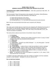
16 EARLY PRINTED MAPS <strong>OF</strong> CANADA IV.<br />
ENTRY VANDER AA. Second state. 1729.<br />
Map title: Quebec<br />
Ref: Kershaw v.1, p. 250, ENTR Y 281, Plate 185.<br />
ENTRY 1015. JEFFERYS. 1759. First state.<br />
Plate: 775.<br />
Map title: A CORRECT PLAN / <strong>OF</strong> <strong>THE</strong> /<br />
ENVIRONS <strong>OF</strong> <strong>QUEBEC</strong>, / AND <strong>OF</strong> <strong>THE</strong> /<br />
BATTLE fought on the 13 th . September, 1759: /<br />
Together with a particular Detail of / — / Engraved<br />
by THOMAS JEFFERYS, / Geographer to His<br />
MAJESTY.<br />
Map size: 40.9 x 88.7 cm.<br />
Published in: A General Topography of North<br />
America —. London For R. Sayer & T. Jefferys 1768.<br />
LC G 1105 .J4 1768 Vault; G3454 .Q4 1759 .J<br />
Vault; BN du Q G3452 Q4 R1 1762 4H d; NMC<br />
21042, 54105.<br />
Ref: BN du Q # 948.<br />
Engraved outside the neat-line, bottom left, is<br />
“ Published According to Act of Parliament by<br />
Thos. Jefferys, the Corner of S t . Martins Lane<br />
Charing Crofs.”. There is an engraved portion<br />
pasted over at the left-hand side, just north of<br />
“ADMIRAL HOLMES’s DIVISION ”, showing the<br />
changed battle lines on the Plains of Abraham with<br />
the English boats landing troops.<br />
ENTRY 1016. JEFFERYS. 1759. First state.<br />
Map title: An AU<strong>THE</strong>NTIC PLAN / of the /<br />
RIVER S T . LAURENCE / from / Sillery, to the Fall<br />
of Montmorenci, / with the Operations of the /<br />
<strong>SIEGE</strong> of <strong>QUEBEC</strong> / under the Command of /<br />
Vice-Adm l . Saunders &Major Gen l . Wolfe / down<br />
to the 5.Sep r . 1759 / Drawn by a CAPTAIN in his<br />
Majefties Navy