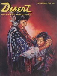
1 - Desert Magazine of the Southwest
1 - Desert Magazine of the Southwest
1 - Desert Magazine of the Southwest

Create successful ePaper yourself
Turn your PDF publications into a flip-book with our unique Google optimized e-Paper software.
MY HEAD dangled backwards into<br />
<strong>the</strong> river. One leg remained looped<br />
over a fallen tree. My backpack prevented<br />
any useful movement. How, I<br />
wondered, did a middle-aged woman<br />
ever get into such a situation?<br />
The situation was a backpacking trip<br />
down <strong>the</strong> Virgin River from <strong>the</strong> headwaters<br />
through <strong>the</strong> spectacular canyon<br />
called "The Narrows" to <strong>the</strong> Temple <strong>of</strong><br />
Sinawava. I was soon rescued from <strong>the</strong><br />
above ignominious position by my husband<br />
Glenn, and we continued on our<br />
way.<br />
Hiking <strong>the</strong> river is not really an arduous<br />
trip by <strong>the</strong> standards <strong>of</strong> <strong>the</strong> experts,<br />
but it is somewhat strenuous, and<br />
it does take some advance planning.<br />
Good hikers can "do" <strong>the</strong> upper part <strong>of</strong><br />
<strong>the</strong> river in a day. However, we wanted<br />
to savor <strong>the</strong> experience and to absorb <strong>the</strong><br />
atmosphere and that takes time.<br />
We first started thinking about <strong>the</strong> trip<br />
when we visited Zion National Park in<br />
by RUTH CAROL CUSHMAN<br />
OWN<br />
IRON RiVER<br />
1970. We had taken all <strong>the</strong> day hikes to<br />
<strong>the</strong> east and west rims, to Angel's<br />
Landing, to Weeping Rocks, to <strong>the</strong><br />
Emerald Pools, to <strong>the</strong> waterfalls, and<br />
finally to <strong>the</strong> end <strong>of</strong> <strong>the</strong> trail at <strong>the</strong> beginning<br />
<strong>of</strong> <strong>the</strong> Narrows <strong>of</strong> <strong>the</strong> Virgin River.<br />
There we stopped. It was May, <strong>the</strong><br />
waters were too high, and we were not<br />
prepared for a backpacking trip. But we<br />
vowed to come back.<br />
In September, 1973, we were back.<br />
According to <strong>the</strong> brochures September is<br />
<strong>the</strong> ideal month to hike <strong>the</strong> Virgin River<br />
as <strong>the</strong> danger <strong>of</strong> flash flooding is past.<br />
This is a very real danger in July and<br />
August, and at that time <strong>of</strong> year <strong>the</strong> park<br />
<strong>of</strong>ficials discourage hikes in <strong>the</strong> canyon.<br />
September is our favorite month for a vacation,<br />
anyway, because <strong>of</strong> <strong>the</strong> splendor<br />
<strong>of</strong> <strong>the</strong> fall foliage, <strong>the</strong> crispness <strong>of</strong> <strong>the</strong><br />
wea<strong>the</strong>r and <strong>the</strong> lack <strong>of</strong> crowds. So for<br />
months we had been looking forward to<br />
exploring <strong>the</strong> upper regions <strong>of</strong> <strong>the</strong> Virgin<br />
River.<br />
The day before we arrived it started to<br />
rain. We hopefully donned ponchos and<br />
splashed into <strong>the</strong> park headquarters.<br />
"Well," said <strong>the</strong> ranger, "I won't forbid<br />
you to go, but I don't advise it ei<strong>the</strong>r."<br />
Being a timid soul and afraid <strong>of</strong> things<br />
like flash floods, I prevailed on Glenn to<br />
delay <strong>the</strong> trip for a few days until we<br />
could see what <strong>the</strong> wea<strong>the</strong>r would do.<br />
We took a detour to <strong>the</strong> North Rim <strong>of</strong><br />
Grand Canyon, hiked down to Roaring<br />
Springs and Ribbon Falls, and when we<br />
returned to Zion a week later, <strong>the</strong> wea<strong>the</strong>r<br />
was perfect.<br />
Logistics for <strong>the</strong> trip were not difficult<br />
to arrange. We had studied <strong>the</strong> USGS<br />
map before leaving Boulder and had all<br />
<strong>the</strong> necessary gear (packs, tent, sleeping<br />
bags, extra clothing and food) with us.<br />
We checked in with <strong>the</strong> ranger who gave<br />
us fire permits and estimated <strong>the</strong> distance<br />
to be about 12 miles. Next we<br />
stopped at <strong>the</strong> lodge in <strong>the</strong> park to arrange<br />
for transportation to <strong>the</strong> headwaters<br />
at Chamberlain's Ranch as we<br />
planned to leave our car at <strong>the</strong> parking<br />
lot where we would eventually emerge.<br />
At <strong>the</strong> lodge <strong>the</strong> distance down <strong>the</strong> river<br />
increased to 17 miles. As we bumped<br />
over <strong>the</strong> pot-holed road leading to our<br />
jumping-<strong>of</strong>f point, our driver emphatically<br />
declared <strong>the</strong> distance was at least 21<br />
miles. Naturally, at <strong>the</strong> end <strong>of</strong> <strong>the</strong> trip we<br />
agreed with <strong>the</strong> latter estimate. Although<br />
<strong>the</strong> maps show that <strong>the</strong> park estimate<br />
is more nearly correct, <strong>the</strong> mapmakers<br />
do not allow for <strong>the</strong> hundreds <strong>of</strong><br />
times you criss-cross <strong>the</strong> river instead <strong>of</strong><br />
hiking straight down <strong>the</strong> center or for <strong>the</strong><br />
excursions into intriguing side canyons.<br />
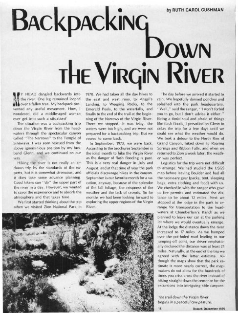
The trail down <strong>the</strong> Virgin River<br />
begins in a peaceful cow pasture.<br />
16 <strong>Desert</strong>/ December 1976