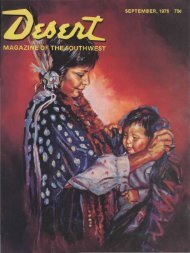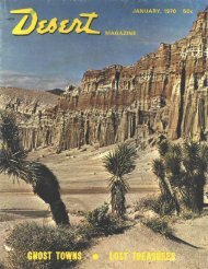
1 - Desert Magazine of the Southwest
1 - Desert Magazine of the Southwest
1 - Desert Magazine of the Southwest

You also want an ePaper? Increase the reach of your titles
YUMPU automatically turns print PDFs into web optimized ePapers that Google loves.
Pass was steep and slow, but <strong>the</strong> men<br />
knew that <strong>the</strong> worst was over. They had<br />
challenged <strong>the</strong> Sierra Nevadas and won!<br />
The feasibility <strong>of</strong> <strong>the</strong> new route was<br />
fur<strong>the</strong>r demonstrated when, on August<br />
3rd, a month and a day after its departure<br />
from Pleasant Valley, <strong>the</strong> wagon<br />
train was overtaken by a party <strong>of</strong> 13 more<br />
Mormons with pack animals. The latearriving<br />
group had left <strong>the</strong> mines a mere<br />
five days before.<br />
The wagon train continued in a nor<strong>the</strong>asterly<br />
direction, intercepting <strong>the</strong> old<br />
Truckee Trail in <strong>the</strong> vicinity <strong>of</strong> Nevada's<br />
Humboldt Sink. They <strong>the</strong>n followed <strong>the</strong><br />
established route <strong>the</strong> remainder <strong>of</strong> <strong>the</strong><br />
way to Salt Lake Valley, arriving September<br />
29, 1848. However, while <strong>the</strong><br />
Mormons were camped along <strong>the</strong><br />
Humboldt River, a party <strong>of</strong> 18 westwardbound<br />
wagons rolled into <strong>the</strong>ir camp.<br />
The next day on <strong>the</strong> trail <strong>the</strong>y met an<br />
,even longer train <strong>of</strong> Argonauts heading<br />
for <strong>the</strong> gold fields. Road information was<br />
exchanged with <strong>the</strong> two groups, and it is<br />
believed both wagon trains followed <strong>the</strong><br />
new trail into California.<br />
- From that modest beginning, <strong>the</strong> flow<br />
<strong>of</strong> emigrant traffic via <strong>the</strong> Mormon or<br />
Carson Road, as it became known, continued<br />
to 9row. The register <strong>of</strong> immigration<br />
for <strong>the</strong> summer season <strong>of</strong> 1854 tallied<br />
808 wagons/ 30,015 head <strong>of</strong> cattle,<br />
1,903 horses and mules, and 8,550 sheep<br />
23 .. .<br />
passing that way. Guide books traced<br />
and recommended <strong>the</strong> route. A directory<br />
<strong>of</strong> stations for <strong>the</strong> year 1854 listed 40<br />
ranches and businesses between Mormon<br />
Station (Genoa, Nevada) and<br />
Placerville catering to <strong>the</strong> needs <strong>of</strong> <strong>the</strong><br />
emigrant travelers. Among <strong>the</strong>m, Walgamot<br />
and French advertised "accommodations<br />
for all" at <strong>the</strong>ir Red Lake<br />
House, 40 miles west <strong>of</strong> Mormon Station,<br />
and Shipley and Dupont <strong>of</strong>fered<br />
lodging and supplies at Tragedy Spring.<br />
For ano<strong>the</strong>r decade emigrants bound<br />
for <strong>the</strong> golden state continued to travel<br />
<strong>the</strong> Carson Road, but each year <strong>the</strong>ir<br />
numbers dwindled. As early as 1855 a<br />
survey had been taken to find a better<br />
and lower route over <strong>the</strong> Sierras. Much<br />
<strong>of</strong> <strong>the</strong> Mormon-Carson Trail was at elevations<br />
over 7,000 feet, <strong>the</strong> highest point<br />
was above 9,000 feet. Deep snow made<br />
<strong>the</strong> road utterly impassable for many<br />
months each year.<br />
By 1857, a spine-jarring, but passable<br />
wagon road had been built over <strong>the</strong><br />
Johnson Cut<strong>of</strong>f Route (present-day U.S.<br />
Highway 50), <strong>the</strong>n over Lu<strong>the</strong>r Pass to<br />
<strong>the</strong> Carson Valley in Nevada. The highest<br />
pass on <strong>the</strong> new route was more than<br />
2,000 feet lower than <strong>the</strong> summit on <strong>the</strong><br />
Carson Road. As <strong>the</strong> Johnson Road was<br />
improved, it diverted more and more<br />
traffic from <strong>the</strong> old Mormon Trail. With<br />
<strong>the</strong> passage <strong>of</strong> time, parts <strong>of</strong> <strong>the</strong> old trail<br />
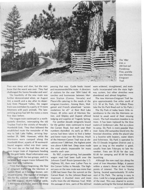
The '49er<br />
tree, a<br />
200-foot-tall<br />
Ponderosa<br />
Pine, and <strong>the</strong><br />
new Mormon-<br />
Emigrant<br />
Trail.<br />
were widened, straightened, and eventually<br />
incorporated into <strong>the</strong> state highway<br />
system, but o<strong>the</strong>r stretches were<br />
abandoned and almost forgotten.<br />
The new Mormon-Emigrant Trail begins<br />
approximately five miles south <strong>of</strong><br />
U.S. 50 at Sly Park. (At Pollock Pines<br />
take <strong>the</strong> Sly Park Road exit to Sly Park.)<br />
The Sly Park <strong>of</strong> today bears little resemblance<br />
to <strong>the</strong> site <strong>the</strong> Mormons selected<br />
to await word <strong>of</strong> <strong>the</strong>ir missing<br />
scouts. The lush mountain meadow is no<br />
more. It has been replaced by <strong>the</strong> blue<br />
waters <strong>of</strong> Jenkinson Lake. But as a place<br />
to camp, Sly Park is more popular than<br />
ever. Some 250 campsites blend into <strong>the</strong><br />
forested shoreline, while <strong>the</strong> placid lake<br />
is a favorite with boaters, water skiers<br />
and fishermen. Sly Park is operated by<br />
<strong>the</strong> El Dorado Irrigation District and is<br />
open as long as <strong>the</strong> wea<strong>the</strong>r is good,<br />
usually from late February to late November.<br />
Fees are $1.50 for day use,<br />
$3.00 for camping and $1.00 for boat<br />
launching.<br />
Although <strong>the</strong> new road zips along <strong>the</strong><br />
crest <strong>of</strong> Iron Mountain Ridge, it passes<br />
within a stone's throw <strong>of</strong> two historic<br />
points <strong>of</strong> interest. The first is Stump<br />
Spring, located approximately 10 miles<br />
east <strong>of</strong> Sly Park. The spring is easy to<br />
miss. Look for a large graded area north<br />
<strong>of</strong> <strong>the</strong> road. This was cleared to accommodate<br />
parking for <strong>the</strong> formal dedication