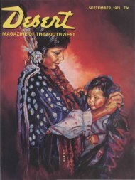
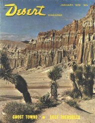
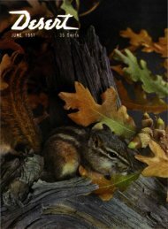
Desert Magazine of the Southwest
Desert Magazine of the Southwest
Desert Magazine of the Southwest

You also want an ePaper? Increase the reach of your titles
YUMPU automatically turns print PDFs into web optimized ePapers that Google loves.
nf trie San Ysidros <strong>of</strong>fers o<strong>the</strong>r rugged<br />
palm canyons, too. Indian Canyon to <strong>the</strong><br />
! outh, in addition to its own handful <strong>of</strong><br />
' Vashingtonias, has three tributaries<br />
with palms; Cougar Canyon, <strong>the</strong> Valley<br />
<strong>of</strong> <strong>the</strong> Thousand Springs, and Deering<br />
Canyon. All are within three miles <strong>of</strong><br />
Sheep Canyon's South Fork.<br />
Abundant relics <strong>of</strong> aboriginal culture<br />
are part <strong>of</strong> <strong>the</strong> lure <strong>of</strong> Coyote Canyon,<br />
(:ollins Valley, and <strong>the</strong> San Ysidros, and<br />
Indians still occupy <strong>the</strong> Los Coyotes Re-<br />
servation a few miles to <strong>the</strong> southwest.<br />
Pottery fragments, grinding holes, shel-<br />
t :r caves, trails, rock markers, picto-<br />
Mileage Log<br />
0.0 Christmas Circle in Borrego Springs.<br />
Drive east toward Salton Sea on<br />
Palm Canyon Drive (San Diego<br />
County Road S22).<br />
0.5 Turn left on Di Giorgio Road.<br />
5.2 Pavement ends. Four-wheel-drive<br />
recommended from this point on.<br />
5.8 Enter Anza-Borrego <strong>Desert</strong> State<br />
Park.<br />
8.9 Fork. Turn left, crossing Coyote<br />
Creek.<br />
10.0 Cross Coyote Creek a second time.<br />
10.1 "Living fence" <strong>of</strong> ocotillos parallels<br />
left side <strong>of</strong> road.<br />
11.7 Road drops into Coyote Creek.<br />
Water, mud and rocks for next fourtenths<br />
<strong>of</strong> a mile as roadway winds<br />
through Lower Willows.<br />
12.1 (Approximate mileage.) Roadway<br />
climbs left bank and leaves Coyote<br />
Creek.<br />
12.5 (Approximate mileage.) Fork. Bear<br />
left. (Right branch leads to Salvador<br />
Canyon.)<br />
12.8 (Approximate mileage.) Fork. Bear<br />
right. (Left branch ends over a mile<br />
away at Santa Catarina Spring historical<br />
marker.)<br />
14.5 (Approximate mileage.) Fork. Bear<br />
left.<br />
15.0 (Approximate mileage.) Sheep Canyon<br />
Primitive Camp. South Fork<br />
palms are visible straight ahead.<br />
Elevation at oasis about 2000 feet.<br />
graphs and mescal pits (depressions in<br />
v h ich <strong>the</strong> hearts <strong>of</strong> <strong>the</strong> mescal or century<br />
plant were roasted for food) can be seen;<br />
unbroken ollas (clay pots) are sometimes<br />
discovered under overhanging boulders.<br />
It is to be hoped that park visitors will<br />
not violate <strong>the</strong> law by damaging or re-<br />
moving such signs <strong>of</strong> previous habita-<br />
tion. Important finds should be reported<br />
tn a ranger.<br />
Leaving <strong>the</strong> nor<strong>the</strong>rn San Ysidro<br />
S lountains, we'li return to Borrego<br />
Springs and hike to a large oasis near <strong>the</strong><br />
s lu<strong>the</strong>rn tip <strong>of</strong> <strong>the</strong> range—Borrego Palm<br />
Canyon. •<br />
D sert/November 1978<br />
Exploring Calif. Bywayi<br />
#tl in and around<br />
Los Angeles<br />
Exploring Calif. Byways<br />
«VI Owens Valley<br />
Exploring Historic<br />
California<br />
Exploring <strong>the</strong> Unspoiled<br />
West Vol. 1<br />
Wyoming, Montana,<br />
British Columbia,<br />
Alaska, Utah, Calif.,<br />
Colorado, Idaho,<br />
Nevada<br />
. '!•! B I N • •<br />
Exploring <strong>the</strong> Unspoiled<br />
West Vol. 2<br />
New Mexico, Arizona,<br />
Mexico, Oregon,<br />
Washington, Alaska,<br />
Hawaii, California<br />
• • -<br />
Exploring Calif. Byways<br />
#lll <strong>Desert</strong> Country<br />
Exploring Calif. Byways<br />
#VII An Historic<br />
Sketchbook<br />
Exploring Calif. Byways<br />
#IV Mountain Country<br />
.: . , - . . : = !i<br />
Guidebook to <strong>the</strong><br />
Colorado <strong>Desert</strong><br />
<strong>of</strong> California<br />
A Special<br />
Guidebook<br />
Offering!<br />
Great reading about <strong>the</strong> West from<br />
<strong>the</strong> pens <strong>of</strong> such authors as<br />
Russ Leadabrand, Choral Pepper,<br />
Marjorie Camphouse and <strong>the</strong> Society <strong>of</strong><br />
American Travel Writers.<br />
Informative little books that will make<br />
your future trips more enjoyable.<br />
Well illustrated, paperback.<br />
Supplies are limited.<br />
ONLY . .<br />
ORDER TODAY FROM<br />
$195<br />
Exploring Calif. Byways<br />
#V Historical Sites<br />
QttlOt&CQH to FHI<br />