Tuolumne River Flow-Inundation Report - U.S. Fish and Wildlife ...
Tuolumne River Flow-Inundation Report - U.S. Fish and Wildlife ...
Tuolumne River Flow-Inundation Report - U.S. Fish and Wildlife ...
You also want an ePaper? Increase the reach of your titles
YUMPU automatically turns print PDFs into web optimized ePapers that Google loves.
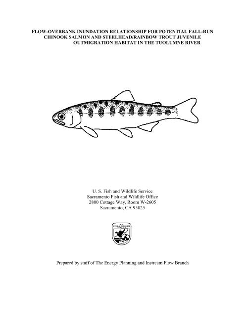
FLOW-OVERBANK INUNDATION RELATIONSHIP FOR POTENTIAL FALL-RUN<br />
CHINOOK SALMON AND STEELHEAD/RAINBOW TROUT JUVENILE<br />
OUTMIGRATION HABITAT IN THE TUOLUMNE RIVER<br />
U. S. <strong>Fish</strong> <strong>and</strong> <strong>Wildlife</strong> Service<br />
Sacramento <strong>Fish</strong> <strong>and</strong> <strong>Wildlife</strong> Office<br />
2800 Cottage Way, Room W-2605<br />
Sacramento, CA 95825<br />
Prepared by staff of The Energy Planning <strong>and</strong> Instream <strong>Flow</strong> Branch
CVPIA INSTREAM FLOW INVESTIGATIONS<br />
TUOLUMNE RIVER FALL-RUN CHINOOK SALMON<br />
AND STEELHEAD/RAINBOW TROUT OUTMIGRATION HABITAT<br />
PREFACE<br />
The following is the final report for the U.S. <strong>Fish</strong> <strong>and</strong> <strong>Wildlife</strong> Service’s investigations on<br />
anadromous salmonid outmigration habitat in the <strong>Tuolumne</strong> <strong>River</strong> between La Grange Dam <strong>and</strong><br />
river mile 22, using existing Geographic Information System (GIS) data. This current study is<br />
part of the Central Valley Project Improvement Act (CVPIA) Instream <strong>Flow</strong> Investigations.<br />
Title 34, Section 3406(b)(1)(B) of the CVPIA, P.L. 102-575, requires the Secretary of the<br />
Interior to determine instream flow needs for anadromous fish for all Central Valley Project<br />
controlled streams <strong>and</strong> rivers, based on recommendations of the U.S. <strong>Fish</strong> <strong>and</strong> <strong>Wildlife</strong> Service,<br />
after consultation with the California Department of <strong>Fish</strong> <strong>and</strong> Game. The purpose of these<br />
investigations is to provide scientific information to the U.S. <strong>Fish</strong> <strong>and</strong> <strong>Wildlife</strong> Service (USFWS)<br />
Central Valley Project Improvement Act Program to assist in developing such recommendations<br />
for Central Valley rivers.<br />
Written comments or information can be submitted to:<br />
Mark Gard, Senior Biologist<br />
Energy Planning <strong>and</strong> Instream <strong>Flow</strong> Branch<br />
U.S. <strong>Fish</strong> <strong>and</strong> <strong>Wildlife</strong> Service<br />
Sacramento <strong>Fish</strong> <strong>and</strong> <strong>Wildlife</strong> Office<br />
2800 Cottage Way, Room W-2605<br />
Sacramento, CA 95825<br />
Mark_Gard@fws.gov<br />
USFWS, SFWO, Energy Planning <strong>and</strong> Instream <strong>Flow</strong> Branch<br />
<strong>Tuolumne</strong> <strong>River</strong> <strong>Flow</strong>-<strong>Inundation</strong> <strong>Report</strong><br />
August 19, 2008<br />
ii
ACKNOWLEDGMENTS<br />
The database used for this study was provided by Scott McBain of McBain <strong>and</strong> Trush, Arcata,<br />
California, with the permission of Turlock Irrigation District (TID) <strong>and</strong> Modesto Irrigation<br />
District (MID). Invaluable assistance concerning the history of the data <strong>and</strong> location of<br />
documentation was provided by Brian Powell, Becky McBain, Darren Mierau, Tim Ford, Noah<br />
Hume, Rafael Real de Asua <strong>and</strong> Dirk Pedersen. Data analysis <strong>and</strong> report preparation were<br />
performed by Bill Pelle <strong>and</strong> Mark Gard. Funding was provided by the Central Valley Project<br />
Improvement Act.<br />
ABSTRACT<br />
A preliminary flow-overbank inundation area relationship was derived for the lower <strong>Tuolumne</strong><br />
<strong>River</strong> downstream of La Grange Dam with the view that, with restoration, the inundated former<br />
natural floodplain could provide habitat for outmigrating juvenile rainbow/steelhead trout <strong>and</strong><br />
fall-run Chinook salmon. ARC GIS data used for this study was originally developed as part of<br />
the Federal Energy Regulatory Commission hydro-relicensing proceedings for the Don Pedro<br />
Project (Project No. 2299). The GIS layers used were first developed from aerial photos taken at<br />
flows between 100 <strong>and</strong> 8,400 cubic feet per second (cfs) from 1988 through 1995. In our<br />
analyses, shape files were edited to remove isl<strong>and</strong>s <strong>and</strong> isolated pond areas, which are actually<br />
gravel pits. Total area was then recalculated for all the remaining polygons for each flow/layer.<br />
A curve was then generated by plotting area in acres versus flow. The initiation of overbank<br />
flow occurs between 1,100 cfs <strong>and</strong> 3,100 cfs. In addition, there were several flooded gravel pits<br />
that were not connected to the river until flows exceeded somewhere between 620 <strong>and</strong> 1,100 cfs,<br />
one large pit that was not connected to the river until flows exceeded somewhere between<br />
4,030 <strong>and</strong> 5,300 cfs, <strong>and</strong> two large pits that were not connected to the river until flows exceeded<br />
somewhere between 5,300 <strong>and</strong> 8,400 cfs. Studies suggest that these pits may contain exotic<br />
predator species, particularly large mouth bass, <strong>and</strong> concerns have been raised by others that<br />
flow connectivity between these pits <strong>and</strong> the river could result in predation or introduce predators<br />
to the river. However, there is substantial evidence that the benefits of floodplain inundation far<br />
outweigh the potential negative benefits of connectivity to these mine pits <strong>and</strong> there is no<br />
evidence that predatory refugia in off-channel mine pits contributes to in-channel predation of<br />
juvenile salmonids. It is hoped that these results of this study, combined with existing <strong>and</strong> future<br />
investigations, may provide input for ongoing restoration planning efforts for the lower<br />
<strong>Tuolumne</strong> <strong>River</strong>.<br />
USFWS, SFWO, Energy Planning <strong>and</strong> Instream <strong>Flow</strong> Branch<br />
<strong>Tuolumne</strong> <strong>River</strong> <strong>Flow</strong>-<strong>Inundation</strong> <strong>Report</strong><br />
August 19, 2008<br />
iii
INTRODUCTION<br />
In response to substantial declines in anadromous fish populations, the Central Valley Project<br />
Improvement Act (CVPIA) provided for enactment of all reasonable efforts to double sustainable<br />
natural production of anadromous fish stocks including the four races of Chinook salmon (fall,<br />
late-fall, winter, <strong>and</strong> spring runs), steelhead, white <strong>and</strong> green sturgeon, American shad <strong>and</strong><br />
striped bass. For the <strong>Tuolumne</strong> <strong>River</strong>, the Central Valley Project Improvement Act Anadromous<br />
<strong>Fish</strong> Restoration Plan calls for supplementing Federal Energy Regulatory Commission (FERC)<br />
agreement flows as needed to improve conditions for all life history stages of Chinook salmon<br />
(USFWS 1995). Restoration efforts by the CVPIA, 4-Pumps Mitigation Agreement, <strong>and</strong> the<br />
California Water Policy Council <strong>and</strong> Federal Ecosystem Directorate (CALFED) Ecosystem<br />
Restoration Program since 1992 have increased the production of Chinook salmon in the<br />
Sacramento <strong>River</strong> Basin; whereas Chinook salmon production has declined in the San Joaquin<br />
<strong>River</strong> Basin, which includes the Stanislaus, <strong>Tuolumne</strong>, <strong>and</strong> Merced rivers. Population trends<br />
analyses for the San Joaquin <strong>River</strong> Basin suggest that salmon recruitment, which is the number<br />
of salmon that survive to the adult stage, is highly correlated with the magnitude <strong>and</strong> duration of<br />
spring flows when the fish were subyearling juveniles rearing in the tributaries (Mesick <strong>and</strong><br />
Marston 2007). The number of smolt-sized outmigrants from the Stanislaus <strong>and</strong> <strong>Tuolumne</strong><br />
rivers is also highly correlated with flow magnitude between February <strong>and</strong> mid-June (Mesick et<br />
al. 2007). These results suggest that fry survival in the tributaries is highest during prolonged<br />
periods of flooding <strong>and</strong> that adult recruitment is highly dependent on fry survival in the<br />
tributaries. It is likely that prolonged flooding affects fry survival by providing autochthonous<br />
food resources, providing refuge from predators, reducing water temperatures particularly during<br />
downstream migrations in May <strong>and</strong> June, slowing the rate of disease infestation, diluting<br />
contaminants, <strong>and</strong> reducing entrainment (Mesick et al. 2007). Some of these benefits such as<br />
increased food resources <strong>and</strong> refuge from predators could be provided either by higher flows<br />
inundating existing floodplains or by constructing lower-elevation floodplains that become<br />
inundated on an annual basis with existing flows. However, other benefits such as reduced water<br />
temperatures <strong>and</strong> contaminant dilution would probably only occur during high flows.<br />
In January 2007 the USFWS Anadromous <strong>Fish</strong> Restoration Program office requested a study of<br />
floodplain inundation as a function of flow for the entire anadromous reach on the <strong>Tuolumne</strong>,<br />
Stanislaus, Merced, or San Joaquin rivers, using existing data. The objective of this study was to<br />
evaluate floodplain inundation area on the lower <strong>Tuolumne</strong> <strong>River</strong> at flows ranging from low flow<br />
summer conditions (100 cfs) to flood conditions (8,400 cfs). Results from this study will<br />
eventually be added to larger modeling studies with two larger/broader objectives. First, the data<br />
will be used for analyses of the relationship between floodplain inundation <strong>and</strong> tributary smolt<br />
production. Second, the estimated amount of available functional floodplain habitat will be used<br />
to estimate the amount of habitat to be restored to achieve the doubling goal for Chinook salmon.<br />
USFWS, SFWO, Energy Planning <strong>and</strong> Instream <strong>Flow</strong> Branch<br />
<strong>Tuolumne</strong> <strong>River</strong> <strong>Flow</strong>-<strong>Inundation</strong> <strong>Report</strong><br />
August 19, 2008<br />
1
Figure 1. Lower <strong>Tuolumne</strong> <strong>River</strong> study area.<br />
USFWS, SFWO, Energy Planning <strong>and</strong> Instream <strong>Flow</strong> Branch<br />
<strong>Tuolumne</strong> <strong>River</strong> <strong>Flow</strong>-<strong>Inundation</strong> <strong>Report</strong><br />
August 19, 2008<br />
2
The lower <strong>Tuolumne</strong> <strong>River</strong> was chosen for this study, as appropriate GIS data was available for<br />
the reach between La Grange Dam at river mile (RM) 52 <strong>and</strong> just upstream of the Santa Fe<br />
Bridge, at RM 21.5, near the town of Empire (Figure 1). This area was selected for the study<br />
because snorkeling surveys suggest that most fall-run Chinook salmon <strong>and</strong> rainbow trout rear in<br />
this reach (Turlock Irrigation District (TID) <strong>and</strong> Modesto Irrigation District (MID) 2005).<br />
With headwaters in Yosemite National Park, the <strong>Tuolumne</strong> <strong>River</strong> is part of the San Joaquin<br />
<strong>River</strong> system, which empties into the Sacramento-San Joaquin Delta. The lower <strong>Tuolumne</strong><br />
begins at La Grange Dam, a diversion <strong>and</strong> reregulating facility located a short distance<br />
downstream of New Don Pedro Dam, which impounds the Don Pedro Reservoir (FERC 1996).<br />
The channel <strong>and</strong> floodplain of the lower <strong>Tuolumne</strong> <strong>River</strong> has undergone enormous changes in<br />
response to reduction in flood regime, trapping of sediment by the New Don Pedro Reservoir,<br />
operation of gold dredgers, aggregate extraction from the active channel <strong>and</strong> floodplain, <strong>and</strong><br />
encroachment of agriculture into the riparian zone. Capture of floodplain gravel pits by the<br />
active channel has had significant effects on channel morphology, turning many reaches from<br />
lotic to basically lentic ponds <strong>and</strong> ditch-like channels (FERC 1996). The altered channel <strong>and</strong><br />
former floodplain of the study reach is also characterized by dredge tailings <strong>and</strong> rip-rap<br />
(TID/ MID 2005).<br />
METHODS<br />
The method used in this study is similar to a demonstration flow assessment, as described in<br />
Clackamas Instream <strong>Flow</strong>/Geomorphology Subgroup (CIFGS 2003). Direct observation of river<br />
habitat conditions are recorded at several flows <strong>and</strong> habitat is delineated in the field at each flow.<br />
Several other alternative methods, which were not selected for use in this study, are available to<br />
evaluate outmigrant flows. An empirical, <strong>and</strong> probably the most widely-used technique to<br />
evaluate rearing habitat utility at outmigrant flows, is the use of screw traps. Also available are<br />
passage studies, where transects are placed at relatively shallow areas, water surface elevation<br />
(WSEL) <strong>and</strong> discharge data are collected at a range of flows, <strong>and</strong> a Physical Habitat Simulation<br />
System (PHABSIM) (Milhous et al. 1989) program is used to establish stage-discharge<br />
relationships. This information is then used to determine what flow results in depths at the<br />
minimum required for passage of the target species/life-stage. This method, however, seems to<br />
be more commonly used for determining upstream migration flows for adults <strong>and</strong> is described in<br />
more detail in USFWS (1994).<br />
To develop a flow regime which will accommodate the habitat needs of anadromous species<br />
inhabiting streams it is necessary to determine the relationship between stream flow <strong>and</strong> habitat<br />
availability for each life stage of those species. The ARC GIS program, developed by ESRI, was<br />
used to calculate area inundated at a range of flows, as one way of establishing this relationship.<br />
Assumptions of this method included: 1) that there is a linear change in area between measured<br />
data; 2) that the water’s edge data was sufficiently accurate to calculate the change in inundated<br />
area with change in flow; <strong>and</strong> 3) that the relationship between inundated area <strong>and</strong> flow did not<br />
significantly change over the period of time in which the data was collected.<br />
USFWS, SFWO, Energy Planning <strong>and</strong> Instream <strong>Flow</strong> Branch<br />
<strong>Tuolumne</strong> <strong>River</strong> <strong>Flow</strong>-<strong>Inundation</strong> <strong>Report</strong><br />
August 19, 2008<br />
3
ARC GIS data used for this study were originally developed by EA Engineering, Science <strong>and</strong><br />
Technology for TID/MID, as part of the 1992 <strong>Fish</strong>eries Study <strong>Report</strong> that was included in the<br />
FERC hydrolicensing proceedings for the New Don Pedro Project - Project No. 2299 (TID/MID<br />
1992). The specific study in the report was an assessment of spawning gravel availability as a<br />
measure of potential spawning habitat. The data was also included in the 2005 Ten Year<br />
Summary <strong>Report</strong> by TID/MID for the FERC (TID/MID 2005).<br />
Background information on the aerial photos <strong>and</strong> initial GIS development is given in TID/MID<br />
(1992). Those photos were taken during 1986-1991 at La Grange with flows ranging from<br />
96-622 cfs. TID/MID (2005) lists all the aerial photos with added flows ranging from 1,070-<br />
8,400 cfs. The photos at these higher flows were taken in 1992-1995 <strong>and</strong> were used to make four<br />
additional GIS layers. The GIS mapping products were described <strong>and</strong> provided, on CD, in<br />
TID/MID (2005), Appendix F. The mapping at flows below 1,000 cfs was done by EA (1992).<br />
The later wetted perimeter data at the higher flows came from HJW Geospatial, Inc. (Rafael Real<br />
de Asua, personal communication 2007). Polygons <strong>and</strong> wetted perimeters were h<strong>and</strong>-drawn,<br />
digitized <strong>and</strong> georeferenced using l<strong>and</strong>marks found both in the photographs <strong>and</strong> on the 7.5<br />
minute USGS topographic quadrangles, as control points. A summary of flows with year of data<br />
collection is included in Table 1. A more detailed description of development of the layers can<br />
be found in the full reports.<br />
Table 1. Timing of flow photogrammetry.<br />
<strong>Flow</strong> (cfs) Year Photographed<br />
100 1988<br />
230 1986<br />
620 1991<br />
1,100 1992<br />
3,100 1993<br />
5,300 1995<br />
8,400 1995<br />
As we were only interested in inundated areas connected to the main channel for our<br />
calculations, preliminary edits were made to the shapefiles to remove isl<strong>and</strong> <strong>and</strong> isolated pond<br />
area polygons. The majority, if not all, of these “ponds” are gravel pits <strong>and</strong> dredging scars of<br />
various sizes with a water table connection to the river itself. Some of the larger of these are<br />
visible in Figure 1. For the sake of simplicity, the terms “pits” <strong>and</strong> “ponds” are used to describe<br />
any depressions in the former floodplain caused by dredge mining <strong>and</strong> gravel operations <strong>and</strong><br />
subject to filling with water at some flow. <strong>Flow</strong>s/layers used for the analysis were 100, 230, 620,<br />
1,100, 3,100, 5,300 <strong>and</strong> 8,400 cfs.<br />
More subjective secondary modifications were then made in an attempt to clean up the data for<br />
the purpose of this study. Here we tried to reconcile instances of disagreement between layers,<br />
which were relatively small compared to the total area of the study reach 1 . Although photos<br />
1 The decision to edit does in no way infer that the original data was flawed. Modifications were made as the data<br />
was being used for a purpose other than that for which it was originally intended.<br />
USFWS, SFWO, Energy Planning <strong>and</strong> Instream <strong>Flow</strong> Branch<br />
<strong>Tuolumne</strong> <strong>River</strong> <strong>Flow</strong>-<strong>Inundation</strong> <strong>Report</strong><br />
August 19, 2008<br />
4
were taken over the span of almost 10 years, the authors feel that it was appropriate for the<br />
intended analyses to edit the layers to try to approach some semblance of consistency. When<br />
there was lack of agreement between layers, other adjacent flows were examined to determine<br />
which layer(s) would be modified <strong>and</strong> which would be used as a model for the change. Editing<br />
was generally needed when the wetted perimeter on a lesser flow layer extended farther than that<br />
of a greater flow. In this case these layers would be compared with the adjacent layers above<br />
<strong>and</strong> below <strong>and</strong> a judgment made on which of the first two layers was more in agreement with the<br />
others. The perimeter of the layer in lesser agreement was then modified. In addition, some<br />
small, disconnected, areas in the 100 <strong>and</strong> 230 cfs layers were modified to provide continuity of<br />
flow in the main, or low-flow, channel. In some instances the perimeters were directly over each<br />
other in channel areas with relatively steep channel banks.<br />
USGS georeferenced topo layers <strong>and</strong> National Agricultural Imagery Program (NAIP) imagery<br />
taken at known flows were used for the truthing of features <strong>and</strong> identifying locations on the<br />
polygon layers. The U.S. Department of Agriculture acquires the NAIP imagery during the<br />
agricultural growing seasons in the continental U.S. A primary goal of the NAIP program is to<br />
enable availability of digital ortho photography within a year of acquisition. Most of the NAIP<br />
imagery was taken on June 11 <strong>and</strong> 12, 2005, when discharges below La Gr<strong>and</strong>e Dam were<br />
4,030 cfs <strong>and</strong> 4,070 cfs respectively. The approximately 5 mile area from La Grange dam to<br />
about RM 47, however, was flown on June 29 with the discharge at 2,680 cfs.<br />
After modifications to all layers were finished, total area in acres was recalculated for all the<br />
remaining polygons for each flow/layer. Area versus discharge was plotted for all flows in<br />
MS Excel 2003. After review of this plot, it was decided to focus on the area of inundation out<br />
of the channel to simulate overbank areas. The three lowest flows were dropped <strong>and</strong> the area<br />
value at 1,100 cfs was subtracted from the remaining higher three values. The resulting<br />
overbank area values were then plotted versus discharge.<br />
In addition, the original, unedited, wetted perimeter polygon layers <strong>and</strong> NAIP imagery were<br />
examined to explore at what flows the pits began filling with water <strong>and</strong> at what flows they<br />
possibly connected with the channel.<br />
RESULTS<br />
The area versus discharge curve including in-river channel is displayed in Figure 2, with the<br />
tabular data in Table 2. This area includes the area of the. A primary inflection is seen around<br />
1,000 cfs, which suggests that this is the minimum point where flows may begin to become<br />
“overbank”, or out of the channel <strong>and</strong> into the former floodplain. However, as there is no data<br />
between 1,100 <strong>and</strong> 3,100 cfs the actual initiation of overbank flow is between these two values.<br />
USFWS, SFWO, Energy Planning <strong>and</strong> Instream <strong>Flow</strong> Branch<br />
<strong>Tuolumne</strong> <strong>River</strong> <strong>Flow</strong>-<strong>Inundation</strong> <strong>Report</strong><br />
August 19, 2008<br />
5
A r e a ( a c r e s )<br />
1800<br />
1600<br />
1400<br />
1200<br />
1000<br />
800<br />
600<br />
400<br />
0 2000 4000 6000 8000 10000<br />
Discharge (cfs)<br />
Figure 2. Lower <strong>Tuolumne</strong> inundated area as a function of discharge.<br />
Table 2. Lower <strong>Tuolumne</strong> inundated area versus discharge.<br />
Discharge (cfs) Area (acres)<br />
100 493<br />
230 519<br />
620 562<br />
1,100 596<br />
3,100 1,109<br />
5,300 1,419<br />
8,400 1,675<br />
USFWS, SFWO, Energy Planning <strong>and</strong> Instream <strong>Flow</strong> Branch<br />
<strong>Tuolumne</strong> <strong>River</strong> <strong>Flow</strong>-<strong>Inundation</strong> <strong>Report</strong><br />
August 19, 2008<br />
6
The plot in Figure 3 shows only the amount of acreage of potential overbank area inundated,<br />
without the in-channel acreage (as shown in Figure 2). <strong>Inundation</strong> is seen to continue to increase<br />
with discharge from around 1,000 cfs up to the maximum studied flow of 8,400 cfs. The greatest<br />
rate of increase in overbank area occurred between 1,000 to 3,100 cfs. The rate of increase in<br />
area, however, decreases as discharge rises, as may be expected with an increase in the slope of<br />
the floodplain as distance from the channel increases. As this decrease in rate of inundation<br />
appears relatively steady, a second inflection point, that might indicate a strong point of<br />
diminishing returns from further increases in discharge, is not seen. This would seem to indicate<br />
that the entire formerly floodplain area was not yet inundated at 8,400 cfs. Further inspection of<br />
the topographic layers overlaid with the 8,400 cfs wetted perimeter layer supports this premise.<br />
Looking at the original EA wetted perimeter polygons with increasing flows, ponds first appear<br />
in the 1,100 cfs layer, indicating that the pits begin to fill somewhere between 620 <strong>and</strong> 1,100 cfs<br />
(Figures 4 <strong>and</strong> 5). Pits at river mile (RM) 30.5 were seen to be captured by flow in the channel<br />
somewhere between 3,100 <strong>and</strong> 5,300 cfs (Figures 6 <strong>and</strong> 7). However, with the exception of this<br />
area, gravel pits, <strong>and</strong> any other unconnected low areas outside of the channel, are not seen to be<br />
captured even at the 5,300 cfs level. We were unable to discern what happens to the pits at the<br />
8,400 cfs level, as they were not included in the original GIS layer, although overlays of the<br />
8,400 cfs layer with the NAIP imagery indicated two additional pits that were connected to the<br />
main channel at flows between 5,300 <strong>and</strong> 8,400 cfs: 1) a 41 acre pit at RM 36; <strong>and</strong> 2) a 14.3 acre<br />
pit at RM 34.5.<br />
The NAIP imagery showed water in the pits at all flows in which the photos were taken. To give<br />
an example of how the pit areas appear, the same RM 30.5 area shown in Figures 4 <strong>and</strong> 5 is<br />
shown in Figure 8. In addition, the large pit also seen in Figures 4 <strong>and</strong> 5 is not seen to be<br />
connected to the main channel at 4,030 to 4,070 cfs, the range of flows at which the area was<br />
photographed. This is in agreement with the wetted perimeter data <strong>and</strong> suggests that the<br />
minimum flow at which the pit may be connected with the channel is closer to 4,050 cfs, rather<br />
than 3,100 cfs.<br />
DISCUSSION<br />
With regards to the influence of flood-induced <strong>and</strong> anthropogenic geomorphological changes<br />
that have occurred since the data used for this study was collected, we are assuming here that,<br />
due to the size of the study reach, changes to the channel <strong>and</strong> former floodplain since the data<br />
were collected are small relative to the size of the reach. In addition, considering “natural”<br />
geomorphological changes, there is some evidence to suggest that while the locations <strong>and</strong> sizes<br />
of hydrological features, such as me<strong>and</strong>ers, riffles <strong>and</strong> bars, in alluvial reaches may change, the<br />
flow-habitat relationship does not (USFWS 2003).<br />
The observed inflection point at 1,100 cfs is thought to be largely an effect of TID/MID removal<br />
of dredge tailings during the construction of New Don Pedro Dam (Scott McBain, personal<br />
communication 2007). It is important to point out, however, that while 1,100 cfs was used as the<br />
point at which flows became overbank, due to the inflection point in the original plot, this flow<br />
could actually be somewhere in between 1,100 <strong>and</strong> 3,300 cfs, the next highest data point. In<br />
addition “bankful” should not be confused with “bankful discharge”, which has been defined as<br />
USFWS, SFWO, Energy Planning <strong>and</strong> Instream <strong>Flow</strong> Branch<br />
<strong>Tuolumne</strong> <strong>River</strong> <strong>Flow</strong>-<strong>Inundation</strong> <strong>Report</strong><br />
August 19, 2008<br />
7
Overbank Area (acres) ..<br />
1200<br />
1000<br />
800<br />
600<br />
400<br />
200<br />
0<br />
1000 3000 5000 7000 9000<br />
USFWS, SFWO, Energy Planning <strong>and</strong> Instream <strong>Flow</strong> Branch<br />
<strong>Tuolumne</strong> <strong>River</strong> <strong>Flow</strong>-<strong>Inundation</strong> <strong>Report</strong><br />
August 19, 2008<br />
8<br />
Discharge (cfs)<br />
Figure 3. Lower <strong>Tuolumne</strong> overbank inundated area as a function of discharge.<br />
“the amount of stream flow that is equal to a peak flow event that occurs on average every 1.2 to<br />
2 years.” This flow might not be literally to the top of the stream banks (Ellis-Sugai <strong>and</strong> Godwin<br />
2002). A hydrograph of mean daily flows from 1970-2007 is given in Figure 9.<br />
Benefits to fish populations from floodplain inundation are thought to be linked to reduced<br />
predation rates, increased habitat availability, <strong>and</strong> increased food supply (Bennett <strong>and</strong> Moyle<br />
1996). Most of the energy that drives aquatic food chains in rivers is derived from terrestrial<br />
sources (Allan 1995) <strong>and</strong> aquatic productivity is related to flood magnitude <strong>and</strong> the area<br />
inundated in some rivers (Large <strong>and</strong> Petts 1996). Flooding, particularly the rising limb of the<br />
hydrograph, typically results in high concentrations of both dissolved <strong>and</strong> particulate organic<br />
matter being released into the river (Allan 1995). Juvenile salmonids that utilize floodplain<br />
habitats on the Yolo Bypass (Sommer et al. 2001) <strong>and</strong> the Cosumnes <strong>River</strong> (Jeffres 2006),<br />
consume more prey <strong>and</strong> grow faster than those in mainstem habitats. It is also theorized that<br />
higher flows have multiple indirect effects on growth through other factors such as reduced water<br />
temperatures (Sommer et al. 2001) <strong>and</strong> the timing of smoltification. Further work by Sommer<br />
et al. (2005) on the Yolo Bypass gave additional evidence that outmigrating juvenile Chinook
Figure 4. 620 cfs wetted perimeter between RM 30 <strong>and</strong> 31. No ponds visible.<br />
Figure 5. 1,100 cfs wetted perimeter between RM 30 <strong>and</strong> 31. Ponds visible, but<br />
not connected.<br />
USFWS, SFWO, Energy Planning <strong>and</strong> Instream <strong>Flow</strong> Branch<br />
<strong>Tuolumne</strong> <strong>River</strong> <strong>Flow</strong>-<strong>Inundation</strong> <strong>Report</strong><br />
August 19, 2008<br />
9
Figure 6. 3,100 cfs wetted perimeter RM 30.5. Ponds visible, disconnected.<br />
Figure 7. 5,300 cfs ponds visible <strong>and</strong> connected to channel RM 30.5.<br />
USFWS, SFWO, Energy Planning <strong>and</strong> Instream <strong>Flow</strong> Branch<br />
<strong>Tuolumne</strong> <strong>River</strong> <strong>Flow</strong>-<strong>Inundation</strong> <strong>Report</strong><br />
August 19, 2008<br />
10
Figure 8. 4,030 – 4,070 cfs ponds visible <strong>and</strong> connected to channel RM 30.5.<br />
Figure 9. Mean daily flows for the <strong>Tuolumne</strong> <strong>River</strong> below Lagrange,<br />
1970-2007.<br />
USFWS, SFWO, Energy Planning <strong>and</strong> Instream <strong>Flow</strong> Branch<br />
<strong>Tuolumne</strong> <strong>River</strong> <strong>Flow</strong>-<strong>Inundation</strong> <strong>Report</strong><br />
August 19, 2008<br />
11
salmon benefit from time spent in floodplain habitat with benefits overall outweighing risk from<br />
str<strong>and</strong>ing. This reinforces the belief that seasonal habitat should be considered as part of<br />
restoration plans for the species. We expect steelhead would benefit from seasonal floodplain<br />
habitat in a similar way as salmon.<br />
Floodplain inundation may affect the timing of smoltification by increasing growth rates. The<br />
smolting process is triggered by a combination of conditions, such as body size, rate of growth,<br />
increasing day length, <strong>and</strong> increasing water temperatures (summarized in Quinn 2005). There is<br />
a smoltification window during spring, after which slow growing, small individuals lose their<br />
ability to smoltify. It is possible that by increasing food resources, floodplain inundation<br />
increases juvenile growth rates so that smoltification begins earlier during the spring, when water<br />
temperatures <strong>and</strong> other factors in the lower river are more conducive to their survival.<br />
While the gravel pits/ponds were not the original focus of this study some discussion of their<br />
possible role in predator prey interactions, <strong>and</strong> how these might affect floodplain restoration<br />
efforts is called for. It is assumed that flood flows reduce predation by numerous largemouth<br />
bass 2 , smallmouth bass, striped bass, <strong>and</strong> Sacramento pikeminnow that occur in the <strong>Tuolumne</strong><br />
<strong>River</strong> <strong>and</strong> the other San Joaquin tributaries (TID/MID 2005, Mesick et al. 2007). Studies suggest<br />
that these pits may contain exotic predator species, particularly large mouse bass (McBain <strong>and</strong><br />
Trush, Stillwater Sciences 2006), <strong>and</strong> concerns have been raised by others that flow connectivity<br />
between these pits <strong>and</strong> the river could result in predation or introduce predators to the river.<br />
However, there is substantial evidence that the benefits of floodplain inundation far outweigh the<br />
potential negative benefits of connectivity to these mine pits <strong>and</strong> there is no evidence that<br />
predatory refugia in off-channel mine pits contributes to in-channel predation of juvenile<br />
salmonids. No predation studies have been conducted in off-channel pits that are connected to<br />
the river only at high flows. All of the predation studies in the San Joaquin Basin, such as<br />
McBain <strong>and</strong> Trush, Stillwater Sciences (2006), were conducted in in-channel pits during dry <strong>and</strong><br />
normal water years when base flow releases were made. There is no reason to assume that<br />
predation is a source of mortality in off-channel pits that are connected only during flood flows,<br />
because predation would be inhibited by the high turbidity, low temperatures, <strong>and</strong> high velocities<br />
that occur during flooding. The McBain <strong>and</strong> Trush, Stillwater Sciences (2006) predation study<br />
was not conclusive regarding effects of predation, given that only three largemouth bass <strong>and</strong> one<br />
smallmouth bass were caught <strong>and</strong> tracked. None of these fish had juvenile salmon in their<br />
stomachs <strong>and</strong> only one moved into an off-channel pond after it had been tagged (McBain <strong>and</strong><br />
Trush, Stillwater Sciences 2006). Floodplain inundation may provide refuge for juvenile<br />
salmonids from predators that inhabit in-channel mining pits (Orr 1997, Mesick et al. 2007).<br />
Results from this study show connectivity with a single, but relatively large (15.75 acres), pit at<br />
RM 30.5, at flows beginning somewhere between 4,030 <strong>and</strong> 5,300 cfs. This area may need to be<br />
examined more closely to determine if a large mouth bass population currently exists, <strong>and</strong> if so,<br />
to find the flow at which connectivity begins <strong>and</strong> determine if restoration actions are needed to<br />
isolate this pit from the main channel at flows greater than 4,030 cfs. Factors to consider in<br />
evaluating the need to isolate this mining pit include: 1) that the pit represents less than two<br />
percent of the overbank area inundated at 5,300 cfs; <strong>and</strong> 2) that previous restoration activities<br />
which isolated a large pond from the <strong>Tuolumne</strong> <strong>River</strong> did not reduce predation rates or improve<br />
the survival of juvenile salmon in the <strong>Tuolumne</strong> <strong>River</strong> (Mesick et al. 2007). Similar factors<br />
2 Micropterus salmoides (also referred to as black bass).<br />
USFWS, SFWO, Energy Planning <strong>and</strong> Instream <strong>Flow</strong> Branch<br />
<strong>Tuolumne</strong> <strong>River</strong> <strong>Flow</strong>-<strong>Inundation</strong> <strong>Report</strong><br />
August 19, 2008<br />
12
should be considered for the two pits that connect to the main channel at flows between 5,300<br />
<strong>and</strong> 8,400 cfs.<br />
It seems apparent that using spring pulse flows to benefit outmigrating juvenile salmonids on the<br />
lower <strong>Tuolumne</strong> <strong>River</strong> need to be combined with consideration of the pits/ponds both in <strong>and</strong> out<br />
of the channel. While pulse flows establish connectivity with gravel pits outside the channel,<br />
these same higher flows increase velocity <strong>and</strong> might make the instream pools less of a trap for<br />
the juveniles <strong>and</strong> assist their downstream progress. A possible next step could be to establish a<br />
stage-discharge relationship at the bottom of the study reach <strong>and</strong> conduct a 2D instream flow<br />
study of the entire reach. This would allow an evaluation of current hydrological <strong>and</strong><br />
topographical conditions, in addition to providing more precise information on the inundationdischarge<br />
relationship, as results would be less incremental than those presented in this study.<br />
The results of this study suggest that flows in excess of 1,100 to 3,100 cfs will begin to inundate<br />
overbank habitat for anadromous salmonids, with resulting benefits for increased survival <strong>and</strong><br />
growth of outmigrant anadromous salmonids. Further increases of flows, up to at least 8,400 cfs,<br />
would be expected to have additional incremental benefits in terms of increased overbank habitat<br />
<strong>and</strong> thus increased survival <strong>and</strong> growth of outmigrant anadromous salmonids. While habitat<br />
restoration efforts that lowered overbank areas to enable inundation at flows less than 1,100 cfs<br />
would be expected to increase food resources <strong>and</strong> refuge from predators, in a similar manner to<br />
increases in outmigrant flows, such efforts would not provide other benefits of higher outmigrant<br />
flows, such as reduced water temperatures <strong>and</strong> contaminant dilution.<br />
REFERENCES<br />
Allan, J.D. 1995. Stream ecology: structure <strong>and</strong> function of running waters. Chapman & Hall,<br />
London. 388 pp.<br />
Bennett, W.A., <strong>and</strong> Moyle, P.B. 1996. Where have all the fishes gone? Interactive factors<br />
producing fish declines in the Sacramento– San Joaquin Estuary. In San Francisco Bay:<br />
the ecosystem. Edited by J.T. Hollibaugh. American Association for the Advancement of<br />
Science, San Francisco, CA. pp. 519–542.<br />
Clackamas Instream <strong>Flow</strong>/Geomorphology Subgroup (CIFGS). 2003. Estimating salmonid<br />
habitat availability in the lower oak grove fork using expert habitat mapping, summary of<br />
methods <strong>and</strong> preliminary results. <strong>Report</strong> prepared by McBain <strong>and</strong> Trush Inc., Arcata,<br />
California, for Clackamas Instream <strong>Flow</strong>/Geomorphology Subgroup, March 5, 2003.<br />
EA Engineering, Science <strong>and</strong> Technology. 1992. <strong>Fish</strong>eries Study <strong>Report</strong>. <strong>Report</strong> of Turlock<br />
Irrigation District <strong>and</strong> Modesto Irrigation District, Pursuant to Article 39 of the License<br />
for the Don Pedro Project. Vol. IV<br />
Ellis-Sugai, B <strong>and</strong> D.C. Godwin. 2002. Going with the flow: underst<strong>and</strong>ing effects of l<strong>and</strong><br />
management on rivers, floods <strong>and</strong> floodplains. Oregon State University. pp 38.<br />
USFWS, SFWO, Energy Planning <strong>and</strong> Instream <strong>Flow</strong> Branch<br />
<strong>Tuolumne</strong> <strong>River</strong> <strong>Flow</strong>-<strong>Inundation</strong> <strong>Report</strong><br />
August 19, 2008<br />
13
Federal Energy Regulatory Commission. 1996. Final Environmental Impact Statement.<br />
Reservoir release requirements for fish at the New Don Pedro Project, California, FERC<br />
Project No. 2299-024.<br />
Jeffres, C.A. 2006. Ephemeral floodplain habitats provide best growth conditions for juvenile<br />
Chinook salmon in a California river. M.S. Thesis. University of California, Davis.<br />
Large, A.R.G. <strong>and</strong> G. Petts. 1996. Rehabilitation of <strong>River</strong> Margins. In G. Petts <strong>and</strong> P. Calow<br />
editors. <strong>River</strong> restoration: selected extracts from the <strong>River</strong>s h<strong>and</strong>book. Blackwell<br />
Science Ltd., Oxford. Pages 106-123.<br />
McBain, S. 2007. Personal communication. McBain <strong>and</strong> Trush, Arcata, CA.<br />
McBain <strong>and</strong> Trush, Stillwater Sciences. 2006. Lower <strong>Tuolumne</strong> <strong>River</strong> predation assessment<br />
final report. Prepared for the <strong>Tuolumne</strong> <strong>River</strong> Technical Advisory Committee, Turlock<br />
<strong>and</strong> Modesto Irrigation districts, USFWS Anadromous <strong>Fish</strong> Restoration Program <strong>and</strong><br />
California Bay-Delta Authority.<br />
Mesick, C.F. <strong>and</strong> D. Marston. 2007. Provisional Draft: Relationships between fall-run<br />
Chinook salmon recruitment to the major San Joaquin <strong>River</strong> tributaries <strong>and</strong> streamflow,<br />
Delta exports, the Head of the Old <strong>River</strong> Barrier, <strong>and</strong> tributary restoration projects from<br />
the early 1980s to 2003.<br />
Mesick, C.F., J. McLain, D. Marston, <strong>and</strong> T. Heyne. Draft limiting factor analyses &<br />
recommended studies for fall-run Chinook salmon <strong>and</strong> rainbow trout in the <strong>Tuolumne</strong><br />
<strong>River</strong>. <strong>Report</strong> submitted to the Federal Energy Regulatory Commission. March 2007.<br />
Milhous, R.T., M.A. Updike <strong>and</strong> D.M. Schneider. 1989. Physical habitat simulation system<br />
reference manual - version II. Instream <strong>Flow</strong> Information Paper No. 26. U. S. <strong>Fish</strong> <strong>and</strong><br />
<strong>Wildlife</strong> Service Biological <strong>Report</strong> 89(16).<br />
Orr, B.K. 1997. Ecosystem health <strong>and</strong> salmon restoration: a broader perspective. 1997<br />
Proceedings of the Congress – International Association for Hydraulic Research.<br />
Quinn, T. P. 2005. The behavior <strong>and</strong> ecology of Pacific salmon <strong>and</strong> trout. University of<br />
Washington Press, Seattle.<br />
Real de Asua, R. 2007. Personal communication. Stillwater Sciences, Berkeley, CA.<br />
Sommer, T. R., M. L. Nobriga, W. C. Harrell, W. Batham, <strong>and</strong> W. J. Kimmerer. 2001.<br />
Floodplain rearing of juvenile Chinook salmon: evidence of enhanced growth <strong>and</strong><br />
survival. Canadian Journal of <strong>Fish</strong>eries <strong>and</strong> Aquatic Sciences 58:325–333.<br />
Sommer, T.R, W.C. Harrell <strong>and</strong> M.L. Nobriga. 2005. Habitat use <strong>and</strong> str<strong>and</strong>ing risk of juvenile<br />
Chinook salmon on a seasonal floodplain.<br />
USFWS, SFWO, Energy Planning <strong>and</strong> Instream <strong>Flow</strong> Branch<br />
<strong>Tuolumne</strong> <strong>River</strong> <strong>Flow</strong>-<strong>Inundation</strong> <strong>Report</strong><br />
August 19, 2008<br />
14
Turlock Irrigation District <strong>and</strong> Modesto Irrigation District. 1992. <strong>Report</strong> of Turlock Irrigation<br />
District <strong>and</strong> Modest Irrigation District pursuant to article 39 of the license for the Don<br />
Pedro Project, Appendix 6, Attachment B (in Vol. IV).<br />
Turlock Irrigation District <strong>and</strong> Modesto Irrigation District. 2005. 2005 Ten Year Summary<br />
<strong>Report</strong> pursuant to Paragraph (G) of the 1996 FERC Order issued July 31, 1996. <strong>Report</strong><br />
to Federal Energy Regulatory Commission for FERC Project No. 2299-024.<br />
U.S. <strong>Fish</strong> <strong>and</strong> <strong>Wildlife</strong> Service. 1994. The relationship between instream flow, adult<br />
immigration, <strong>and</strong> spawning habitat availability for fall-run Chinook salmon in the upper<br />
San Joaquin <strong>River</strong>, California. U.S. <strong>Fish</strong> <strong>and</strong> <strong>Wildlife</strong> Service, Sacramento, CA.<br />
U.S. <strong>Fish</strong> <strong>and</strong> <strong>Wildlife</strong> Service. 1995. Working paper on restoration needs: habitat restoration<br />
actions to double natural production of anadromous fish in the Central Valley of<br />
California. Volume 1. May 9, 1995. Prepared for the U. S. <strong>Fish</strong> <strong>and</strong> <strong>Wildlife</strong> Service<br />
under the direction of the Anadromous <strong>Fish</strong> Restoration Program Core Group. U.S. <strong>Fish</strong><br />
<strong>and</strong> <strong>Wildlife</strong> Service, Stockton, CA.<br />
U.S. <strong>Fish</strong> <strong>and</strong> <strong>Wildlife</strong> Service. 2003. Comparison of PHABSIM <strong>and</strong> 2-D modeling of habitat<br />
for steelhead <strong>and</strong> fall-run Chinook salmon <strong>and</strong> spawning in the lower American <strong>River</strong>.<br />
U.S. <strong>Fish</strong> <strong>and</strong> <strong>Wildlife</strong> Service, Sacramento, CA.<br />
USFWS, SFWO, Energy Planning <strong>and</strong> Instream <strong>Flow</strong> Branch<br />
<strong>Tuolumne</strong> <strong>River</strong> <strong>Flow</strong>-<strong>Inundation</strong> <strong>Report</strong><br />
August 19, 2008<br />
15


