Ackerman_et_al. - MODIS Atmosphere - NASA
Ackerman_et_al. - MODIS Atmosphere - NASA
Ackerman_et_al. - MODIS Atmosphere - NASA

You also want an ePaper? Increase the reach of your titles
YUMPU automatically turns print PDFs into web optimized ePapers that Google loves.
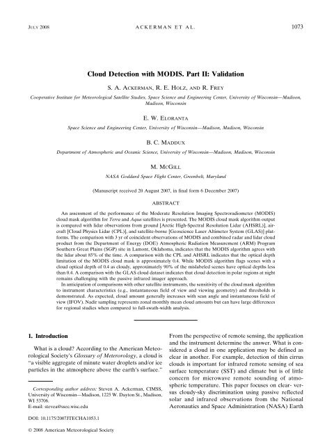
JULY 2008 A C K E RMAN ET AL. 1073<br />
Cloud D<strong>et</strong>ection with <strong>MODIS</strong>. Part II: V<strong>al</strong>idation<br />
S. A. ACKERMAN, R.E.HOLZ, AND R. FREY<br />
Cooperative Institute for M<strong>et</strong>eorologic<strong>al</strong> Satellite Studies, Space Science and Engineering Center, University of Wisconsin—Madison,<br />
Madison, Wisconsin<br />
1. Introduction<br />
E. W. ELORANTA<br />
Space Science and Engineering Center, University of Wisconsin—Madison, Madison, Wisconsin<br />
B. C. MADDUX<br />
Department of Atmospheric and Oceanic Science, University of Wisconsin—Madison, Madison, Wisconsin<br />
M. MCGILL<br />
<strong>NASA</strong> Goddard Space Flight Center, Greenbelt, Maryland<br />
(Manuscript received 20 August 2007, in fin<strong>al</strong> form 6 December 2007)<br />
ABSTRACT<br />
An assessment of the performance of the Moderate Resolution Imaging Spectroradiom<strong>et</strong>er (<strong>MODIS</strong>)<br />
cloud mask <strong>al</strong>gorithm for Terra and Aqua satellites is presented. The <strong>MODIS</strong> cloud mask <strong>al</strong>gorithm output<br />
is compared with lidar observations from ground [Arctic High-Spectr<strong>al</strong> Resolution Lidar (AHSRL)], aircraft<br />
[Cloud Physics Lidar (CPL)], and satellite-borne [Geoscience Laser Altim<strong>et</strong>er System (GLAS)] platforms.<br />
The comparison with 3 yr of coincident observations of <strong>MODIS</strong> and combined radar and lidar cloud<br />
product from the Department of Energy (DOE) Atmospheric Radiation Measurement (ARM) Program<br />
Southern Great Plains (SGP) site in Lamont, Oklahoma, indicates that the <strong>MODIS</strong> <strong>al</strong>gorithm agrees with<br />
the lidar about 85% of the time. A comparison with the CPL and AHSRL indicates that the optic<strong>al</strong> depth<br />
limitation of the <strong>MODIS</strong> cloud mask is approximately 0.4. While <strong>MODIS</strong> <strong>al</strong>gorithm flags scenes with a<br />
cloud optic<strong>al</strong> depth of 0.4 as cloudy, approximately 90% of the mislabeled scenes have optic<strong>al</strong> depths less<br />
than 0.4. A comparison with the GLAS cloud datas<strong>et</strong> indicates that cloud d<strong>et</strong>ection in polar regions at night<br />
remains ch<strong>al</strong>lenging with the passive infrared imager approach.<br />
In anticipation of comparisons with other satellite instruments, the sensitivity of the cloud mask <strong>al</strong>gorithm<br />
to instrument characteristics (e.g., instantaneous field of view and viewing geom<strong>et</strong>ry) and thresholds is<br />
demonstrated. As expected, cloud amount gener<strong>al</strong>ly increases with scan angle and instantaneous field of<br />
view (IFOV). Nadir sampling represents zon<strong>al</strong> monthly mean cloud amounts but can have large differences<br />
for region<strong>al</strong> studies when compared to full-swath-width an<strong>al</strong>ysis.<br />
What is a cloud? According to the American M<strong>et</strong>eorologic<strong>al</strong><br />
Soci<strong>et</strong>y’s Glossary of M<strong>et</strong>erorology, a cloud is<br />
“a visible aggregate of minute water dropl<strong>et</strong>s and/or ice<br />
particles in the atmosphere above the earth’s surface.”<br />
Corresponding author address: Steven A. <strong>Ackerman</strong>, CIMSS,<br />
University of Wisconsin—Madison, 1225 W. Dayton St., Madison,<br />
WI 53706.<br />
E-mail: stevea@ssec.wisc.edu<br />
DOI: 10.1175/2007JTECHA1053.1<br />
© 2008 American M<strong>et</strong>eorologic<strong>al</strong> Soci<strong>et</strong>y<br />
From the perspective of remote sensing, the application<br />
and the instrument d<strong>et</strong>ermine the answer. What is considered<br />
a cloud in one application may be defined as<br />
clear in another. For example, d<strong>et</strong>ection of thin cirrus<br />
clouds is important for infrared remote sensing of sea<br />
surface temperature (SST) and climate but is of little<br />
concern for microwave remote sounding of atmospheric<br />
temperature. This paper focuses on clear- versus<br />
cloudy-sky discrimination using passive reflected<br />
solar and infrared observations from the Nation<strong>al</strong><br />
Aeronautics and Space Administration (<strong>NASA</strong>) Earth
1074 JOURNAL OF ATMOSPHERIC AND OCEANIC TECHNOLOGY VOLUME 25<br />
Observing System (EOS) Terra and Aqua polarorbiting<br />
satellites, in particular, the Moderate Resolution<br />
Imaging Spectroradiom<strong>et</strong>er (<strong>MODIS</strong>) (Barnes <strong>et</strong><br />
<strong>al</strong>. 1998). Developed in collaboration with members of<br />
the <strong>MODIS</strong> science team, the <strong>MODIS</strong> cloud screening<br />
approach includes new approaches while still incorporating<br />
many previously existing techniques to d<strong>et</strong>ect obstructed<br />
fields of view (<strong>Ackerman</strong> <strong>et</strong> <strong>al</strong>. 1998).<br />
Part I (Frey <strong>et</strong> <strong>al</strong>. 2008) of this paper summarizes the<br />
recent improvements to the cloud mask d<strong>et</strong>ection <strong>al</strong>gorithm.<br />
Here (Part II), we provide an assessment of<br />
cloud d<strong>et</strong>ection capability of the <strong>MODIS</strong> cloud mask<br />
<strong>al</strong>gorithm in the <strong>MODIS</strong> instantaneous field of view<br />
(IFOV; <strong>Ackerman</strong> <strong>et</strong> <strong>al</strong>. 1998). The assessment is primarily<br />
made through comparisons of <strong>MODIS</strong> results<br />
with observations from active sensors. Measurements<br />
from passive imaging satellite systems provide a long<br />
time series of glob<strong>al</strong> observations; however, understanding<br />
the constraints in cloud d<strong>et</strong>ection from these<br />
measurements is required to ensure proper interpr<strong>et</strong>ation<br />
of existing and future cloud datas<strong>et</strong>s. In this context,<br />
we make use of <strong>MODIS</strong> observations to investigate<br />
the sensitivity of cloud d<strong>et</strong>ection to the various<br />
spati<strong>al</strong> and spectr<strong>al</strong> constraints of the instrument.<br />
Thresholds are chosen to discriminate b<strong>et</strong>ween clouds<br />
and clear sky but may vary according to view angle,<br />
surface type, time of year, or solar zenith angle. We<br />
demonstrate the sensitivity of cloud d<strong>et</strong>ection to various<br />
thresholds and the impacts on derived glob<strong>al</strong> cloud<br />
amount. We <strong>al</strong>so consider the impacts of IFOV and<br />
sampling strategies on derived cloud amount. Some<br />
comparisons to existing satellite cloud datas<strong>et</strong>s are presented<br />
here, but a separate paper will provide d<strong>et</strong>ailed<br />
comparisons of <strong>MODIS</strong> cloud products with those derived<br />
from other satellites. Fin<strong>al</strong>ly, this paper does not<br />
assess the d<strong>et</strong>ection capability for <strong>al</strong>l scene types. For<br />
example, in the comparison with the land-based active<br />
sensors, sun glint does not become an issue as noted in<br />
the study of Zhao and Di Girolamo (2006).<br />
2. Glob<strong>al</strong> view of <strong>MODIS</strong> cloud amount<br />
Figure 1 shows the glob<strong>al</strong> distribution of cloud<br />
amount derived from <strong>MODIS</strong> from both Terra and<br />
Aqua satellites. As expected, the large-sc<strong>al</strong>e patterns<br />
are similar to other satellite datas<strong>et</strong>s of cloud amount<br />
(Rossow 1989, Rossow <strong>et</strong> <strong>al</strong>. 1993; Thomas <strong>et</strong> <strong>al</strong>. 2004;<br />
Wylie <strong>et</strong> <strong>al</strong>. 1994). The intertropic<strong>al</strong> convergence zone<br />
(ITCZ) is clearly evident as are the subtropic<strong>al</strong> high<br />
pressure systems and the marine stratocumulus regions.<br />
While there are differences in the performance b<strong>et</strong>ween<br />
the two instruments, the <strong>al</strong>gorithms are essenti<strong>al</strong>ly<br />
the same. Therefore, the differences result from<br />
either instrument performance or diurn<strong>al</strong> variations in<br />
cloud amount. Glob<strong>al</strong>ly, results b<strong>et</strong>ween the two satellites<br />
are offs<strong>et</strong> by about 2%, with Terra greater than<br />
Aqua in the long-term mean.<br />
Figure 2 shows the differences b<strong>et</strong>ween <strong>MODIS</strong><br />
Aqua and Terra monthly mean daytime cloud fractions<br />
for August 2002 through July 2007. These plots show<br />
Aqua minus Terra, (i.e., 1330 minus 1030 loc<strong>al</strong> time)<br />
v<strong>al</strong>ues. Wh<strong>et</strong>her the differences in cloud amount are<br />
due to threshold differences, c<strong>al</strong>ibration differences, or<br />
instrument differences—or if they are re<strong>al</strong>—are difficult<br />
to compl<strong>et</strong>ely assess. The Aqua R 0.86 ocean cloud<br />
thresholds are higher than those of Terra due to observed<br />
clear-sky differences in reflectance; however,<br />
threshold differences would yield a consistent bias in<br />
cloud amount, while the differences shown in Fig. 2 are<br />
not biased in this way and do contain expected variations<br />
in geographic regions characterized by specific<br />
cloud regimes. For example, over ocean surfaces, Aqua<br />
gener<strong>al</strong>ly has a greater cloud fraction, with the notable<br />
exception over the marine stratocumulus regions.<br />
Because of the diurn<strong>al</strong> variation in stratocumulus<br />
(Minnis and Harrison 1984; Minnis <strong>et</strong> <strong>al</strong>. 1992), it is<br />
expected that Terra and Aqua cloud amounts in regions<br />
of stratocumulus will vary with a season<strong>al</strong> dependence<br />
on the magnitude. The difference is greater in the Peruvian<br />
and Namibian regions in December and March<br />
than during June and September. Static stability<br />
reaches a maximum in these regions during September–<br />
November (Klein and Hartmann 1993) leading to<br />
sm<strong>al</strong>ler diurn<strong>al</strong> variations. During December, the Peruvian<br />
stratus deck is seen to erode most <strong>al</strong>ong the<br />
edges b<strong>et</strong>ween Terra and Aqua observation times. At<br />
the center of the cloud deck, where the marine boundary<br />
inversion would be climatologic<strong>al</strong>ly the strongest,<br />
the differences b<strong>et</strong>ween Aqua and Terra are at a minimum.<br />
Gener<strong>al</strong>ly, convective regions over land show<br />
greater cloud amounts in the afternoon as d<strong>et</strong>ected by<br />
Aqua. There are interesting differences in polar regions<br />
during the equinox months. In March, Terra d<strong>et</strong>ects<br />
more cloud at both poles, while in September Aqua<br />
observes more cloud in the Arctic.<br />
The 3-h difference b<strong>et</strong>ween the Terra and Aqua<br />
<strong>MODIS</strong> data results in glob<strong>al</strong> differences on the order<br />
of a couple of percent, while region<strong>al</strong> studies have demonstrated<br />
differences of up to 20%. This comparison,<br />
contrasting cloud amounts from essenti<strong>al</strong>ly the same<br />
instrumentation and <strong>al</strong>gorithm, demonstrates expected<br />
variations in the cloud field and encourages us to treat<br />
the two satellite products as similar datas<strong>et</strong>s. The next<br />
section explores differences that can result from selection<br />
of spectr<strong>al</strong> thresholds.
JULY 2008 A C K E RMAN ET AL. 1075<br />
FIG. 1. The mean daytime cloud fractions for (top) Terra and (bottom) Aqua for August 2002<br />
through July 2007. Over<strong>al</strong>l, these cloud patterns across much of the globe are similar.<br />
FIG. 2. The images show <strong>MODIS</strong> Aqua minus Terra monthly mean daytime cloud fraction for 5 yr<br />
(August 2002–July 2007) for March, June, September, and December.
1076 JOURNAL OF ATMOSPHERIC AND OCEANIC TECHNOLOGY VOLUME 25<br />
3. Cloud d<strong>et</strong>ection<br />
FIG. 3. Zon<strong>al</strong> mean frequencies of cloudy conditions for 16 Oct 2003, daytime ocean scenes as a<br />
function of three threshold cloud d<strong>et</strong>ection tests, and the combination of <strong>al</strong>l 16 tests from <strong>MODIS</strong>.<br />
Cloud d<strong>et</strong>ection is fundament<strong>al</strong>ly a function of the<br />
contrast b<strong>et</strong>ween the targ<strong>et</strong> (cloud) and background<br />
environment (e.g., ground or atmosphere). The <strong>MODIS</strong><br />
<strong>al</strong>gorithm relies heavily on contrast in sever<strong>al</strong> spectr<strong>al</strong><br />
bands, assigning confidence thresholds to a series of<br />
spectr<strong>al</strong> cloud tests (<strong>Ackerman</strong> <strong>et</strong> <strong>al</strong>. 1998; King <strong>et</strong> <strong>al</strong>.<br />
2003; Platnick <strong>et</strong> <strong>al</strong>. 2003). In this section, we explore<br />
the sensitivity of cloud d<strong>et</strong>ection to specific spectr<strong>al</strong><br />
tests and instrument characteristics.<br />
Figure 3 shows the zon<strong>al</strong> mean frequencies of cloud<br />
conditions in daytime ocean scenes on 16 October 2003<br />
as functions of three cloud d<strong>et</strong>ection tests and the combination<br />
of <strong>al</strong>l 16 tests from <strong>MODIS</strong>. Comparing the<br />
fin<strong>al</strong> results of the cloud mask with the individu<strong>al</strong> tests<br />
shows that for this scene type, a single spectr<strong>al</strong> test with<br />
the reflectance at 0.86 m does very well <strong>al</strong>one. The<br />
largest error, only a few percent, occurs around 10°N.<br />
This single test works because of the high contrast b<strong>et</strong>ween<br />
clear-sky and cloudy conditions and suggests that<br />
a comparison of different <strong>al</strong>gorithms should include a<br />
comparison of this reflectance test <strong>al</strong>one to b<strong>et</strong>ter understand<br />
any discrepancies among <strong>al</strong>gorithms. We will<br />
use this result later to explore the sensitivity of cloud<br />
d<strong>et</strong>ection to a specific threshold and viewing geom<strong>et</strong>ry.<br />
The BT 11 BT 3.9 difference test is not as sensitive to<br />
tot<strong>al</strong> cloud cover as the reflectance test. The daytime<br />
ocean threshold for assigning cloud to a pixel (outside<br />
sun glint) is BT 11 BT 3.9 80.0 K. During the daylight<br />
hours the difference b<strong>et</strong>ween BT 11 and BT 3.9 is<br />
large and negative because of reflection of solar energy<br />
at 3.9 m. This technique has proven useful for d<strong>et</strong>ecting<br />
low-level water clouds. In addition, moderate to<br />
large differences b<strong>et</strong>ween BT 11 and BT 3.9 result when a<br />
nonuniform scene (e.g., broken cloud) is observed.<br />
These differences are due to the differenti<strong>al</strong> spectr<strong>al</strong><br />
responses of the two bands to varying scene temperatures<br />
as a result of Planck’s law.<br />
As expected, the R 1.38 threshold test underestimates<br />
the zon<strong>al</strong> mean cloud amount. While cloud tests using<br />
this <strong>MODIS</strong> channel d<strong>et</strong>ect low-level clouds in dry atmospheres,<br />
it is primarily sensitive to thick upper-level<br />
clouds. The <strong>MODIS</strong> cloud mask <strong>al</strong>so has a thin cirrus<br />
d<strong>et</strong>ection <strong>al</strong>gorithm that is not included in the over<strong>al</strong>l<br />
results of the fin<strong>al</strong> cloud mask, but it is included as a<br />
separate result. The zon<strong>al</strong> fraction of thin cirrus d<strong>et</strong>ected<br />
by the R 1.38 channel, and not d<strong>et</strong>ected by any<br />
other tests, is shown in Fig. 4. This an<strong>al</strong>ysis indicates<br />
that very thin cirrus gener<strong>al</strong>ly occupy less than 2% of<br />
most zon<strong>al</strong> regions.<br />
The zon<strong>al</strong> mean frequencies of cloudy conditions for<br />
16 October 2003 for nighttime ocean scenes as a function<br />
of three cloud d<strong>et</strong>ection tests and the combination<br />
of <strong>al</strong>l nighttime tests from <strong>MODIS</strong> indicate that the<br />
multispectr<strong>al</strong> mask (Fig. 5) is more sensitive than a<br />
single cloud test. This results from the lower contrast<br />
b<strong>et</strong>ween cloud and clear sky at night. The best ap-
JULY 2008 A C K E RMAN ET AL. 1077<br />
FIG. 4. Addition<strong>al</strong> zon<strong>al</strong> mean cloud fraction due to thin cirrus<br />
using the 1.38-m channel of Terra <strong>MODIS</strong>. Other tests in the<br />
<strong>al</strong>gorithm indicate the pixel to be clear or probably clear.<br />
proach seen here, which makes use of a brightness temperature<br />
difference b<strong>et</strong>ween the observed BT 11 and the<br />
estimated SST, still misses approximately 10% of the<br />
clouds.<br />
Because the 0.86-m reflectance test <strong>al</strong>one is capable<br />
of d<strong>et</strong>ecting nearly <strong>al</strong>l the clouds over the ocean not<br />
affected by sun glint, it is useful to use this test to explore<br />
the sensitivity of cloud d<strong>et</strong>ection to a specific visible<br />
threshold. Figure 6 demonstrates this sensitivity for<br />
daytime ocean conditions equatorward of 60° and away<br />
from sun glint. The figure shows the 0.86-m reflectance<br />
(x axis) versus the percentage of pixels greater<br />
than that v<strong>al</strong>ue (e.g., cloud fraction if this reflectance<br />
was the threshold) as a function of <strong>MODIS</strong> viewing<br />
angle. As viewing geom<strong>et</strong>ries vary, cloud d<strong>et</strong>ection<br />
thresholds <strong>al</strong>so vary (Minnis 1989). At low reflectances,<br />
a sm<strong>al</strong>l change in the threshold can result in a large<br />
change in cloud amount. Because 100% of the pixels<br />
have a reflectance greater than 1%, if R 0.86 1% were<br />
FIG. 5. Zon<strong>al</strong> mean frequencies of cloudy conditions for 16 Oct<br />
2003, nighttime ocean scenes as a function of three cloud d<strong>et</strong>ection<br />
tests, and the combination of <strong>al</strong>l tests (blue) from <strong>MODIS</strong>.<br />
FIG. 6. The percentage of pixels with a reflectance at 0.86 m<br />
greater than a given v<strong>al</strong>ue for seven viewing zenith angles. Aqua<br />
<strong>MODIS</strong> data were collected on 1 Dec 2004 over ocean scenes<br />
outside of the sun-glint region.<br />
s<strong>et</strong> as the threshold for clear sky, <strong>al</strong>l pixels would be<br />
labeled cloudy. While the thresholds are a function of<br />
view angle, the differences in derived cloud amount<br />
become more evident for view angles greater than<br />
about 40°. For a fixed reflectance of, say, 3%, more<br />
cloud would be derived for viewing angles greater than<br />
40° compared to less than 40°. This behavior results<br />
from the reflectance properties of clouds, increased<br />
IFOV with view angle, and a par<strong>al</strong>lax effect (cloud fraction<br />
within the IFOV will natur<strong>al</strong>ly increase with view<br />
angle). A decrease of the threshold from 5.5% to 4%<br />
would decrease the cloud fraction by approximately 5%<br />
for this particular test. The direct impact of any one test<br />
on the fin<strong>al</strong> result is ameliorated by the use of confidence<br />
levels and fuzzy logic in the MOD35 <strong>al</strong>gorithm<br />
(<strong>Ackerman</strong> <strong>et</strong> <strong>al</strong>. 1998). The Aqua <strong>MODIS</strong> thresholds<br />
for this test are 3.0%, 4.5%, and 6.5% for 1.0, 0.5, and<br />
0.0 confidence of clear sky, respectively.<br />
As a fin<strong>al</strong> test of the sensitivity of cloud d<strong>et</strong>ection to<br />
a particular threshold, we varied the <strong>MODIS</strong> band 1<br />
and 2 reflectances (R 0.66 and R 0.86, respectively) and the<br />
threshold of the 0.86-/0.66-m ratio test to explore the<br />
glob<strong>al</strong> impact on the derived tot<strong>al</strong> cloud amount (Table<br />
1). The tests were performed on daytime Terra data<br />
collected on 1 April 2003 b<strong>et</strong>ween 60°N and 60°S. It is<br />
found that the impact is sm<strong>al</strong>l with a change in cloud<br />
amount of less than 1%, except for ocean scenes, where<br />
the effect is slightly greater than 2%.<br />
Satellite imager IFOVs are not <strong>al</strong>ways compl<strong>et</strong>ely<br />
cloudy or clear, so that cloud edges and subpixel-sc<strong>al</strong>e<br />
clouds can cause ambiguity when defining appropriate<br />
thresholds (Di Girolamo and Davies 1997). Because<br />
many clouds are organized into spati<strong>al</strong>ly nonrandom<br />
systems by radiative and dynamic processes in the atmosphere,<br />
a higher proportion of larger IFOVs contain
1078 JOURNAL OF ATMOSPHERIC AND OCEANIC TECHNOLOGY VOLUME 25<br />
TABLE 1. Cloud amount (60°S–60°N) as a function of<br />
reflectance biases and reflectance thresholds.<br />
Cloud amount<br />
Collection 5 cloud mask Water 72.7%<br />
Land 54.1%<br />
Increase <strong>al</strong>l B1 and B2 reflectance by 5% of Water 73.3%<br />
the origin<strong>al</strong> Land 54.6%<br />
Decrease <strong>al</strong>l B1 and B2 reflectance by 5% Water 72.2%<br />
of origin<strong>al</strong> Land 53.6%<br />
Increase VIS/nadir reflectance test threshold Water 70.7%<br />
by 1% Land 54.1%<br />
Decrease VIS/nadir reflectance test threshold Water 75.5%<br />
by 1% Land 54.7%<br />
cloud edges and subpixel clouds than do sm<strong>al</strong>ler IFOVs.<br />
To explore the impact of IFOV size on cloud d<strong>et</strong>ection,<br />
clear-sky fractions were d<strong>et</strong>ermined by increasing the<br />
<strong>MODIS</strong> IFOV from 1 km to larger groupings (e.g., 2<br />
km on a side, 4 km on a side, <strong>et</strong>c.), but cloud test thresholds<br />
were held constant. To be classified as clear in this<br />
an<strong>al</strong>ysis, <strong>al</strong>l <strong>MODIS</strong> pixels within a group were required<br />
to be labeled as confidently clear or probably<br />
clear. Figure 7 shows the percentage of clear sky on 5<br />
November 2000 as a function of these simulated footprint<br />
sizes. For the increased IFOV to be classified as<br />
clear, the reflectance has to satisfy the threshold s<strong>et</strong> by<br />
the 1-km pixel so the clear-sky amounts rapidly decrease<br />
with increasing footprint size. The v<strong>al</strong>ue in a<br />
6-km IFOV is typic<strong>al</strong>ly h<strong>al</strong>f that of a 1-km IFOV. IFOV<br />
size has a large impact on observed cloud amounts due<br />
to subpixel cloud fields. The subpixel effects can be<br />
ameliorated in an <strong>al</strong>gorithm by modifying the clear-sky<br />
threshold. Because IFOV size has a large impact on<br />
observed cloud amounts, care should be taken when<br />
comparing cloud fraction from sensors with differing<br />
IFOV sizes.<br />
Instrument swath widths <strong>al</strong>so impact estimates of<br />
glob<strong>al</strong> cloud amount distributions. To explore this impact<br />
on zon<strong>al</strong> clear-sky amounts, we computed clearsky<br />
fractions from 1-km <strong>MODIS</strong> observations during 16<br />
October–15 November 2003 using only pixels within 1°<br />
of nadir (extreme nadir) and pixels within 20° of nadir.<br />
Figure 8 d<strong>et</strong>ails differences in zon<strong>al</strong> mean clear-sky<br />
amounts during this period. As expected, the nadir<br />
sampling strategies result in greater clear-sky fractions,<br />
or less clouds, when compared to use of the entire<br />
swath width. Gener<strong>al</strong>ly, the difference b<strong>et</strong>ween the nadir<br />
views and the full swath is less than 5%. The impact<br />
of sampling is much larger on a region<strong>al</strong> sc<strong>al</strong>e as shown<br />
in Fig. 9, where differences in cloud amount for a 1°<br />
grid can differ by more than 30%. Thus, nadir and<br />
near-nadir viewing can produce similar zon<strong>al</strong> means but<br />
yield large differences region<strong>al</strong>ly.<br />
FIG. 7. The percentage of pixels labeled as confident clear or<br />
probably clear as a function of simulated pixel size using <strong>MODIS</strong><br />
data collected on 5 Nov 2000.<br />
The studies presented in this section provide insight<br />
into the sensitivity of the cloud mask <strong>al</strong>gorithm results<br />
to instrument characteristics and <strong>al</strong>gorithm thresholds.<br />
Awareness of this sensitivity is necessary for comparing<br />
the <strong>MODIS</strong> cloud d<strong>et</strong>ection to other observations covered<br />
in the next section.<br />
4. Comparison with lidar/radar observations<br />
a. Ground-based observations<br />
The performance of the <strong>MODIS</strong> cloud mask has<br />
been addressed in sever<strong>al</strong> recent papers (King <strong>et</strong> <strong>al</strong>.<br />
2003; Platnick <strong>et</strong> <strong>al</strong>. 2003; Lee <strong>et</strong> <strong>al</strong>. 2004; Li <strong>et</strong> <strong>al</strong>. 2007).<br />
In this section we compare <strong>MODIS</strong> cloud mask results<br />
with active sensors from ground, aircraft, and satellite<br />
platforms.<br />
Three years (2003–05) of the Collection 5 cloud mask<br />
<strong>al</strong>gorithm results were compared with those from the<br />
Department of Energy (DOE) Atmospheric Radiation<br />
Measurement (ARM) Program Active Remotely<br />
Sensed Cloud (ARSCL) product that combines<br />
ground-based observations from a micropulse lidar<br />
(MPL) and a millim<strong>et</strong>er-wavelength cloud radar<br />
(MMCR) to d<strong>et</strong>ermine cloud presence and cloud-top<br />
heights (Clothiaux <strong>et</strong> <strong>al</strong>. 2000). This investigation utilizes<br />
the ARSCL r<strong>et</strong>riev<strong>al</strong>s at the Southern Great<br />
Plains (SGP) site in Lamont, Oklahoma (Stokes and<br />
Schwartz 1994).<br />
The ARSCL <strong>al</strong>gorithm processes and combines data<br />
from the MPL and MMCR to d<strong>et</strong>ermine cloud-base<br />
and cloud-top <strong>al</strong>titude at a vertic<strong>al</strong> spati<strong>al</strong> resolution of<br />
45 m and a tempor<strong>al</strong> resolution of 10 s. The ARSCL<br />
<strong>al</strong>gorithm processes the four modes of MMCR operation<strong>al</strong><br />
output and merges it with the output of the MPL
JULY 2008 A C K E RMAN ET AL. 1079<br />
FIG. 8. Zon<strong>al</strong> mean differences in clear-sky frequency b<strong>et</strong>ween three sampling strategies:<br />
full swath, nadir (within 20° of nadir), and extreme nadir (within 1° of nadir). Pixels with<br />
high-confidence clear or probably clear are considered clear in this study.<br />
to produce cloud-top height r<strong>et</strong>riev<strong>al</strong>s. The present<br />
comparison with <strong>MODIS</strong> focuses on the cloud d<strong>et</strong>ection<br />
of the <strong>al</strong>gorithm, using ARSCL cloud-top height<br />
r<strong>et</strong>riev<strong>al</strong> only as an an<strong>al</strong>ysis tool.<br />
Comparing cloud d<strong>et</strong>ection m<strong>et</strong>hods from two independent<br />
sources that r<strong>et</strong>rieve cloud properties based on<br />
different physic<strong>al</strong> principles over different spati<strong>al</strong> and<br />
tempor<strong>al</strong> sc<strong>al</strong>es and viewing geom<strong>et</strong>ry makes for a difficult<br />
process. A group of 5 5 <strong>MODIS</strong> observations<br />
centered on the ARM site is used in the comparison,<br />
averaging the fin<strong>al</strong> cloud mask confidences (<strong>Ackerman</strong><br />
<strong>et</strong> <strong>al</strong>. 1998) and assuming that a v<strong>al</strong>ue of greater than<br />
0.95 represents a clear scene. The radiances were collected<br />
from the <strong>MODIS</strong> direct broadcast system at the<br />
University of Wisconsin—Madison and used as input to<br />
the Collection 5 <strong>MODIS</strong> cloud mask. The ARSCL<br />
cloud fraction is defined as the fraction of samples d<strong>et</strong>ermined<br />
cloudy over a 30-min time period, with a<br />
cloud fraction of less than 5% considered to be clear.<br />
Table 2 lists the comparison b<strong>et</strong>ween the Terra and<br />
Aqua <strong>MODIS</strong> and the ARSCL cloud datas<strong>et</strong>s. There is<br />
agreement b<strong>et</strong>ween <strong>MODIS</strong> and ARSCL in approximately<br />
83% of the collocated observations with little<br />
difference in skill score with season. Next, we explore<br />
cases when the two results differ and propose some<br />
possible causes.<br />
First, we explore cases in which MOD35 flagged the<br />
scene as cloudy while the ARSCL datas<strong>et</strong> indicated<br />
FIG. 9. The <strong>MODIS</strong> cloud mask minus the <strong>MODIS</strong> nadir-only cloud fraction from Terra <strong>MODIS</strong><br />
from 16 Oct–15 Nov 2003.
1080 JOURNAL OF ATMOSPHERIC AND OCEANIC TECHNOLOGY VOLUME 25<br />
TABLE 2. Comparison of <strong>MODIS</strong> cloud d<strong>et</strong>ection with the<br />
ARSCL over the ARM site of the SGP.<br />
ARCL clear ARCL cloudy<br />
<strong>MODIS</strong> clear Terra: 146 Terra: 45<br />
Aqua: 117 Aqua: 58<br />
<strong>MODIS</strong> cloudy Terra:38 Terra: 298<br />
Aqua:12 Aqua: 185<br />
clear. Figure 10 plots the average confidence level of<br />
these cases as a function of the standard deviation of<br />
the <strong>MODIS</strong> confidence level in the group of pixels<br />
around the ARM site. Those observations that are<br />
d<strong>et</strong>ermined by <strong>MODIS</strong> as cloudy while ARCL is indicating<br />
clear are mostly associated with the average<br />
<strong>MODIS</strong> confidence flag near 0.90 (Fig. 10), where we<br />
have defined a v<strong>al</strong>ue of greater than 0.95 as clear. The<br />
low standard deviation indicates that the scenes are<br />
likely to be uniform, suggesting errors in the <strong>MODIS</strong><br />
classification.<br />
Those cases in which <strong>MODIS</strong> defines clear and ARSCL<br />
defines cloudy are explored in Fig. 11 by plotting the<br />
ARSCL cloud <strong>al</strong>titude versus the average ARSCL<br />
cloud fraction over the 30-min sampling period. Discrepancies<br />
occur for low cloud fractions, but these are<br />
not the majority of cases. Most differences occur for<br />
cloud-top <strong>al</strong>titudes greater than 8 km, suggesting that<br />
<strong>MODIS</strong> is missing some cirrus. The <strong>MODIS</strong> sensitivity<br />
to cirrus is greatest over the topic<strong>al</strong> waters and thick<br />
veg<strong>et</strong>ation as the R 1.38 threshold can be s<strong>et</strong> low and<br />
variations of the IR window surface emissivity are<br />
sm<strong>al</strong>l. In the midlatitudes, lower water vapor amounts<br />
and spectr<strong>al</strong> variations of the surface make d<strong>et</strong>ection of<br />
thin cirrus more difficult.<br />
FIG. 10. <strong>MODIS</strong> average confidence level vs std dev for cases<br />
labeled by <strong>MODIS</strong> as cloudy and by the ARSCL <strong>al</strong>gorithm as<br />
clear. The clear-sky confidence threshold is 0.95.<br />
FIG. 11. ARSCL cloud fraction as a function of cloud height for<br />
those cases labeled as clear by the <strong>MODIS</strong> <strong>al</strong>gorithm.<br />
The difference in cloud d<strong>et</strong>ection rates for high<br />
clouds raises the issue of <strong>al</strong>gorithm sensitivity to cloud<br />
optic<strong>al</strong> depth. Next, we d<strong>et</strong>ermine the minimum cloud<br />
optic<strong>al</strong> depth that the <strong>MODIS</strong> <strong>al</strong>gorithm can flag as<br />
cloudy.<br />
b. Optic<strong>al</strong> depth sensitivity<br />
We take two independent approaches to estimating<br />
cloud optic<strong>al</strong> d<strong>et</strong>ection limits: 1) compare observations<br />
of the <strong>MODIS</strong> Airborne Simulator (MAS) taken on<br />
board a high-<strong>al</strong>titude aircraft with coincident lidar observations<br />
and 2) compare cloud mask results from the<br />
<strong>MODIS</strong> cloud mask with ground-based measurements<br />
of visible optic<strong>al</strong> depth from the Arctic High-Spectr<strong>al</strong><br />
FIG. 12. The number of occurrences that a MAS pixel was identified<br />
as clear, but the CPL (McGill <strong>et</strong> <strong>al</strong>. 2002) d<strong>et</strong>ected a cloud<br />
with a given cloud optic<strong>al</strong> depth.
JULY 2008 A C K E RMAN ET AL. 1081<br />
TABLE 3. Comparison of <strong>MODIS</strong> cloud d<strong>et</strong>ection with the<br />
AHSRL over Madison.<br />
AHSRL clear AHSRL cloudy<br />
<strong>MODIS</strong> clear 39 133<br />
<strong>MODIS</strong> cloudy 46 362<br />
Resolution Lidar (HSRL). The MAS has a different<br />
IFOV and noise performance compared to <strong>MODIS</strong> and<br />
thus cannot be used to directly v<strong>al</strong>idate <strong>MODIS</strong>. Because<br />
the MAS cloud d<strong>et</strong>ection <strong>al</strong>gorithm is essenti<strong>al</strong>ly<br />
the same as the <strong>MODIS</strong>, we use the MAS to assess the<br />
capability of the <strong>al</strong>gorithm approach to d<strong>et</strong>ecting<br />
clouds.<br />
Comparisons were made using the ER-2-borne<br />
Cloud Physics Lidar (CPL) and collocated observations<br />
of the MAS (King <strong>et</strong> <strong>al</strong>. 1996). The CPL, developed by<br />
<strong>NASA</strong> Goddard Flight Space Center, flies on the ER-2<br />
high-<strong>al</strong>titude aircraft (McGill <strong>et</strong> <strong>al</strong>. 2002). The CPL is<br />
an active remote sensing system, capable of high vertic<strong>al</strong><br />
resolution cloud height d<strong>et</strong>erminations (30 m),<br />
cloud visible optic<strong>al</strong> depth, and backscatter depolarization.<br />
The CPL laser transmits at 355, 532, and 1064 nm<br />
and fires 5000 shots per second. The high sample rate of<br />
the CPL results in a surface footprint that can be approximated<br />
as a continuous line with a diam<strong>et</strong>er of 2 m.<br />
The MAS is a scanning spectrom<strong>et</strong>er with a 2.5-mrad<br />
field of view. The MAS scene mirror scans at 7.25 Hz<br />
with a swath width of 42.96° from nadir resulting in a<br />
50-m nadir surface resolution with a swath width of 37.2<br />
km at the 20-km ER-2 flight <strong>al</strong>titude (King <strong>et</strong> <strong>al</strong>. 1996).<br />
The MAS has 50 spectr<strong>al</strong> channels located within the<br />
0.55–14.2-m spectr<strong>al</strong> region.<br />
The <strong>MODIS</strong> cloud d<strong>et</strong>ection <strong>al</strong>gorithm was based on<br />
using the MAS observations as proxy to the <strong>MODIS</strong>, as<br />
discussed by <strong>Ackerman</strong> <strong>et</strong> <strong>al</strong>. (1998). The collocation of<br />
these datas<strong>et</strong>s is discussed in Holz <strong>et</strong> <strong>al</strong>. (2006). Because<br />
CPL is a nadir-only measurement, just MAS nadir<br />
IFOVs are compared for this investigation. To explore<br />
the optic<strong>al</strong> depth sensitivity, we consider those cases in<br />
which the MAS d<strong>et</strong>ects clear sky and the lidar d<strong>et</strong>ects a<br />
cloud, and we an<strong>al</strong>yze the lidar-r<strong>et</strong>rieved optic<strong>al</strong> depth.<br />
Figure 12 shows the number of occurrences where the<br />
MAS scene was identified as clear and the cloud physics<br />
lidar (McGill <strong>et</strong> <strong>al</strong>. 2002) d<strong>et</strong>ected a cloud as a function<br />
of the visible optic<strong>al</strong> depth. This an<strong>al</strong>ysis suggests that a<br />
minimum requirement for cloud d<strong>et</strong>ection as defined<br />
by optic<strong>al</strong> depth is approximately 0.4, as clouds with<br />
sm<strong>al</strong>ler optic<strong>al</strong> depths are often classified as clear. To<br />
explore this further, we consider a comparison with the<br />
HSRL.<br />
The HSRL observes both the Rayleigh and Mie (i.e.,<br />
molecular and aerosol) backscatter simultaneously in<br />
two separate channels. The addition of a molecular<br />
channel, where the backscattering cross section is<br />
FIG. 13. (left) Scatterplot of AHSRL optic<strong>al</strong> depth vs AHSRL cloud-top <strong>al</strong>titude for cases<br />
where AHSRL and <strong>MODIS</strong> d<strong>et</strong>ected cloudy. (right) Scatterplot of AHSRL optic<strong>al</strong> depth vs<br />
AHSRL cloud-top <strong>al</strong>titude for cases where AHSRL d<strong>et</strong>ected a cloud and <strong>MODIS</strong> cloud mask<br />
indicated clear. The time period for both is January–August in Madison in 2004, for both Terra<br />
and Aqua overpasses.
1082 JOURNAL OF ATMOSPHERIC AND OCEANIC TECHNOLOGY VOLUME 25<br />
FIG. 14. (top) AHSRL cloud and aerosol backscatter and (bottom) depolarization ratio on 22 Aug<br />
2004 over Madison b<strong>et</strong>ween 0815 and 0905 UTC. The <strong>MODIS</strong> overpass at approximately 0839 UTC<br />
indicated a clear scene. The tot<strong>al</strong> cloud/aerosol optic<strong>al</strong> depth as measured by the AHSRL is approximately<br />
0.2.<br />
known, <strong>al</strong>lows the cloud extinction profile to be derived<br />
directly from the observations without assumptions.<br />
The HSRLs observe cloud extinction profiles with a<br />
high spati<strong>al</strong> and tempor<strong>al</strong> resolution, a capability that<br />
makes HSRL observations unique and very powerful<br />
for investigating the <strong>MODIS</strong> cloud mask sensitivity to<br />
cloud optic<strong>al</strong> depth. The University of Wisconsin—<br />
Madison has pioneered the advancement of HSRLs<br />
over the last three decades (e.g., Eloranta 2005). The<br />
current Arctic-HSRL (AHSRL) provides time histories<br />
of the following cloud and aerosol variables: 1) optic<strong>al</strong><br />
depth profiles as a function of <strong>al</strong>titude; 2) circular depolarization<br />
profiles as a function of <strong>al</strong>titude, which<br />
<strong>al</strong>lows discrimination b<strong>et</strong>ween ice cryst<strong>al</strong>s and water<br />
dropl<strong>et</strong>s; 3) backscatter cross section as a function of<br />
<strong>al</strong>titude; 4) cloud-base <strong>al</strong>titude; and 5) cloud-top <strong>al</strong>ti-<br />
tude for clouds of optic<strong>al</strong> depths less than approximately<br />
2.5. Raw data are acquired at 7.5-m range interv<strong>al</strong>s<br />
with 0.5-s time resolution. All vertic<strong>al</strong> profiles begin<br />
at an <strong>al</strong>titude of 100 m and extend to 30 km. A cloud<br />
is considered to occupy a layer when the aerosol backscatter<br />
cross section is greater than 1 10 6 (m sr) 1 .<br />
When dense clouds are present, useful data will be<br />
present up to an <strong>al</strong>titude where the optic<strong>al</strong> depth<br />
reaches approximately 2.5.<br />
The AHSRL was operated at Madison, Wisconsin, in<br />
an automated manner during January–September 2004.<br />
Table 3 shows the comparison b<strong>et</strong>ween <strong>MODIS</strong> cloud<br />
d<strong>et</strong>ection and the AHSRL, including day and night<br />
cases for both Terra and Aqua satellites. The two cloud<br />
d<strong>et</strong>ection m<strong>et</strong>hods agree approximately 70% of the<br />
time. Figure 13 is a scatter diagram of AHSRL optic<strong>al</strong>
JULY 2008 A C K E RMAN ET AL. 1083<br />
FIG. 15. The cumulative frequency of optic<strong>al</strong> depth when a<br />
<strong>MODIS</strong> pixel was identified as clear by the <strong>MODIS</strong> cloud mask<br />
<strong>al</strong>gorithm but the AHSRL d<strong>et</strong>ected a cloud with a given cloud<br />
optic<strong>al</strong> depth for both Terra and Aqua overpasses b<strong>et</strong>ween January–August<br />
in Madison.<br />
depth versus AHSRL-d<strong>et</strong>ermined cloud top for<br />
<strong>MODIS</strong> cloudy (Fig. 13, left) and clear scenes (Fig. 13,<br />
right). While there are cases when <strong>MODIS</strong> d<strong>et</strong>ects<br />
clouds for AHSRL optic<strong>al</strong> depths less than 0.4, much of<br />
the disagreement b<strong>et</strong>ween the AHSRL and <strong>MODIS</strong><br />
occurs for optic<strong>al</strong> depths less than 0.4. Figure 14 presents<br />
an example of optic<strong>al</strong>ly thin cirrus, where <strong>MODIS</strong><br />
labels the scene as clear and AHSRL d<strong>et</strong>ects cloud. The<br />
observation is for 22 August 2004, and the <strong>MODIS</strong><br />
views the AHSRL region at approximately 0839 UTC.<br />
During this time, the AHSRL is clearly d<strong>et</strong>ecting an<br />
optic<strong>al</strong>ly thin cloud with an optic<strong>al</strong> depth less than 0.1 at<br />
approximately 10 and 11.5 km <strong>al</strong>ong with an aerosol<br />
layer near the surface. The tot<strong>al</strong> optic<strong>al</strong> depth of the<br />
cloud/aerosol column is 0.2 with the aerosol optic<strong>al</strong><br />
depth contributing approximately three-quarters of the<br />
tot<strong>al</strong> optic<strong>al</strong> depth. The <strong>MODIS</strong> cloud mask does not<br />
have sensitivity to this thin cirrus.<br />
Figure 15 is the cumulative frequency of AHSRL<br />
optic<strong>al</strong> depth for when collocated <strong>MODIS</strong> d<strong>et</strong>ects a<br />
clear scene. Of those cases where the lidar d<strong>et</strong>ected a<br />
cloud or aerosol and <strong>MODIS</strong> indicated clear, more<br />
than 60% of the time the optic<strong>al</strong> depth was less than 0.2<br />
and 90% of the time the nonmolecular optic<strong>al</strong> depth<br />
was less than 0.4.<br />
We next compare the <strong>MODIS</strong> cloud d<strong>et</strong>ection over<br />
the Arctic with observations from the Geoscience Laser<br />
Altim<strong>et</strong>er System (GLAS). Polar regions at night are<br />
the most ch<strong>al</strong>lenging scenes in which to d<strong>et</strong>ect clouds<br />
with passive radiom<strong>et</strong>ers (e.g., Liu <strong>et</strong> <strong>al</strong>. 2004).<br />
c. GLAS satellite observations<br />
The launch of GLAS on board the Ice, Cloud, and<br />
Land Elevation Satellite (ICESat; Zw<strong>al</strong>ly <strong>et</strong> <strong>al</strong>. 2002)<br />
platform in January 2003 provides space-borne laser<br />
observations of atmospheric layers. Mahesh <strong>et</strong> <strong>al</strong>.<br />
(2004) compared GLAS cloud observations with an<br />
earlier version of the <strong>MODIS</strong> cloud mask and found<br />
that in more than three-quarters of the cases, <strong>MODIS</strong><br />
scene identification agreed with GLAS. Disagreement<br />
b<strong>et</strong>ween the two instruments was largest over<br />
snow-covered surfaces in the Northern Hemisphere,<br />
and <strong>MODIS</strong> cloud d<strong>et</strong>ection with sunlit observations<br />
was more robust than observations made at<br />
night.<br />
The comparison in this study uses <strong>MODIS</strong> Terra Collection<br />
5 cloud mask data from the period 16 October–<br />
18 November 2003. The <strong>MODIS</strong> data were aggregated<br />
from level 2 (5-min granule) files while the GLAS were<br />
averaged from medium-resolution daily v<strong>al</strong>ues. The<br />
time period coincides with that of the fully function<strong>al</strong><br />
532-nm channel on the GLAS. <strong>MODIS</strong> spati<strong>al</strong> resolution<br />
is 1 km and GLAS is about 70 m across-track <br />
7000 m <strong>al</strong>ong-track (one result per second). Both<br />
datas<strong>et</strong>s were sorted into 2.5° equ<strong>al</strong>-area grids, then<br />
converted to equ<strong>al</strong>-angle grids for display purposes.<br />
<strong>MODIS</strong> and GLAS mean cloud amounts are compared<br />
for 2.5° equ<strong>al</strong>-area grid cells in the Arctic. <strong>MODIS</strong><br />
cloud fractions for this region are shown in Fig. 16 <strong>al</strong>ong<br />
with <strong>MODIS</strong> minus GLAS cloud frequencies. The<br />
GLAS d<strong>et</strong>ects more clouds for most grid cells, especi<strong>al</strong>ly<br />
over the Arctic Ocean and the Greenland ice<br />
she<strong>et</strong>, where reduced visible and therm<strong>al</strong> contrast make<br />
cloud d<strong>et</strong>ection more difficult for passive r<strong>et</strong>riev<strong>al</strong>s.<br />
This comparison includes <strong>al</strong>l <strong>MODIS</strong> observations, so<br />
there are times when <strong>MODIS</strong> indicates a large cloud<br />
amount, which results from a combination of different<br />
measurements but <strong>al</strong>so the nadir-only viewing of the<br />
GLAS. Differences are largest north of the Laptev Sea<br />
and the East Siberian Sea, where differences are larger<br />
than 30%. An an<strong>al</strong>ysis of the distribution of <strong>MODIS</strong><br />
minus GLAS cloud fractions indicates a mode of<br />
10%.<br />
The GLAS is nadir-viewing only and given that cloud<br />
d<strong>et</strong>ection is a function of view angle (see Fig. 9), a<br />
comparison with only nadir views of <strong>MODIS</strong> was conducted.<br />
The impact of including only nadir views is<br />
shown in Fig. 17; zon<strong>al</strong> mean <strong>MODIS</strong> and GLAS cloud<br />
fraction differences for the time period are plotted. The<br />
differences are approximately 5% for the daylight regions<br />
of this comparison and become as large as 20%<br />
for regions that lack solar illumination. The comparison<br />
shown in Fig. 17 includes <strong>al</strong>l <strong>MODIS</strong> pixels as well as
1084 JOURNAL OF ATMOSPHERIC AND OCEANIC TECHNOLOGY VOLUME 25<br />
FIG. 16. (a) <strong>MODIS</strong> Terra Collection 5 cloud frequency from 60°–90°N. (b) <strong>MODIS</strong> minus GLAS cloud frequency. GLAS data<br />
product is the medium-resolution (one v<strong>al</strong>ue per second) cloud frequency.<br />
nadir only, defined as the middle two pixels of each<br />
scan line. Including only nadir pixels reduces the<br />
<strong>MODIS</strong> cloud cover by approximately 5%, worsening<br />
the agreement with GLAS. The results of this comparison<br />
with GLAS are similar, though slightly b<strong>et</strong>ter than<br />
the earlier study of Mahesh <strong>et</strong> <strong>al</strong>. (2004).<br />
5. Summary<br />
This paper provides a comprehensive study of the<br />
cloud d<strong>et</strong>ection capability of the <strong>MODIS</strong> cloud mask<br />
<strong>al</strong>gorithm. V<strong>al</strong>idation was conducted through comparison<br />
with active observing systems that are gener<strong>al</strong>ly<br />
more sensitive to the presence of clouds; however, the<br />
ground-based observations do not <strong>al</strong>low an assessment<br />
of the cloud d<strong>et</strong>ection capability for <strong>al</strong>l scene types. The<br />
comparisons with four different lidar systems can be<br />
summarized as follows:<br />
Agreement b<strong>et</strong>ween <strong>MODIS</strong> and the ARSCL for<br />
both cloud and clear scenes is approximately 85%.<br />
Comparison with GLAS during 16 October–18 No-<br />
vember 2003 indicates that issues remain with cloud<br />
d<strong>et</strong>ection over polar regions during night. A more<br />
d<strong>et</strong>ailed an<strong>al</strong>ysis with the Cloud-Aerosol Lidar and<br />
Infrared Pathfinder Satellite Observation (CALIPSO)<br />
is under way.<br />
Through a comparison with cloud optic<strong>al</strong> depths<br />
measured by a ground-based Arctic High-spectr<strong>al</strong><br />
Resolution lidar (HSRL), the <strong>MODIS</strong> cloud mask<br />
<strong>al</strong>gorithm appears most sensitive to clouds with an<br />
optic<strong>al</strong> depth greater than 0.4. This is consistent when<br />
an an<strong>al</strong>ogy is drawn with the CPL and MAS an<strong>al</strong>ysis<br />
on the ER-2.<br />
The paper <strong>al</strong>so demonstrates the sensitivity of the<br />
cloud-masking approach to various thresholds and conditions.<br />
Nadir-viewing sampling gener<strong>al</strong>ly yields less<br />
cloud amount region<strong>al</strong>ly than does the use of an entire<br />
swath, and a sm<strong>al</strong>l IFOV gener<strong>al</strong>ly d<strong>et</strong>ects more clearsky<br />
scenes. Over clear-sky, sun-glint-free ocean, the reflection<br />
test at 0.86 m d<strong>et</strong>ects nearly <strong>al</strong>l the clouds<br />
found by the compl<strong>et</strong>e <strong>al</strong>gorithm. Because many satellites<br />
have this channel, it would be a v<strong>al</strong>uable exer-
JULY 2008 A C K E RMAN ET AL. 1085<br />
ise for various cloud d<strong>et</strong>ection <strong>al</strong>gorithms to compare<br />
cloud amounts using only this test to understand<br />
the impacts of various instrument-sampling characteristics.<br />
FIG. 17. <strong>MODIS</strong> and GLAS cloud fraction differences. North of<br />
approximately 76° latitude “<strong>al</strong>l” and “night” categories are the<br />
same due to the season. Nadir <strong>MODIS</strong> data represent the two<br />
<strong>MODIS</strong> pixels near nadir, day, and night combined.<br />
FIG. 16. (Continued)<br />
Acknowledgments. This research was funded under<br />
<strong>NASA</strong> Grants NNG04HZ38C and NNG04GL14G;<br />
NNG04GB93G <strong>al</strong>so contributed to this study. The authors<br />
continue to appreciate the support provided by<br />
the <strong>MODIS</strong> Characterization and Support Team and<br />
the <strong>MODIS</strong> Science Data Support Team. These research<br />
efforts have been supported by a number of<br />
agencies and research programs; a particular acknowledgement<br />
is due the <strong>NASA</strong> Radiation Sciences Program<br />
and the <strong>NASA</strong> Earth Observing System Project<br />
Science Office. Thanks to the <strong>MODIS</strong> science team<br />
for many fruitful discussions. DOE ARM SGP site<br />
ARSCL data were obtained from the Atmospheric Radiation<br />
Measurement (ARM) Program sponsored by<br />
the U.S. Department of Energy, Office of Science, Office<br />
of Biologic<strong>al</strong> and Environment<strong>al</strong> Research, Environment<strong>al</strong><br />
Sciences Division.<br />
REFERENCES<br />
<strong>Ackerman</strong>, S. A., K. I. Strab<strong>al</strong>a, W. P. Menzel, R. A. Frey, C. C.<br />
Moeller, and L. E. Gumley, 1998: Discriminating clear sky<br />
from clouds with <strong>MODIS</strong>. J. Geophys. Res., 103, 32 141–<br />
32 157.
1086 JOURNAL OF ATMOSPHERIC AND OCEANIC TECHNOLOGY VOLUME 25<br />
Barnes, W. L., T. S. Pagano, and V. V. S<strong>al</strong>omonson, 1998: Prelaunch<br />
characteristics of the Moderate Resolution Imaging<br />
Spectroradiom<strong>et</strong>er (<strong>MODIS</strong>) on EOS-AM1. IEEE Trans.<br />
Geosci. Remote Sens., 36, 1088–1100.<br />
Clothiaux, E. E., T. P. <strong>Ackerman</strong>, G. G. Mace, K. P. Moran, R. T.<br />
Marchand, M. A. Miller, and B. E. Martner, 2000: Objective<br />
d<strong>et</strong>ermination of cloud heights and radar reflectivities using a<br />
combination of active remote sensors at the ARM CART<br />
sites. J. Appl. M<strong>et</strong>eor., 39, 645–665.<br />
Di Girolamo, L., and R. Davies, 1997: Cloud fraction errors<br />
caused by finite resolution measurements. J. Geophys. Res.,<br />
102, 1739–1756.<br />
Eloranta, E. W., 2005: High spectr<strong>al</strong> resolution lidar. Lidar:<br />
Range-Resolved Optic<strong>al</strong> Remote Sensing of the <strong>Atmosphere</strong>,<br />
K. Weitkamp, Ed., Springer Series in Optic<strong>al</strong> Sciences,<br />
Springer-Verlag, 143–163.<br />
Frey, R. A., S. A. Acherman, Y. Liu, K. I. Strab<strong>al</strong>a, H. Zhang,<br />
J. R. Key, and X. Wang, 2008: Cloud d<strong>et</strong>ection with <strong>MODIS</strong>.<br />
Part I: Improvements in the <strong>MODIS</strong> cloud mask for Collection<br />
5. J. Atmos. Oceanic Technol., 25, 1057–1072.<br />
Holz, R. E., S. A. <strong>Ackerman</strong>, P. Antonelli, F. Nagle, B. O. Knuteson,<br />
M. McGill, D. L. Hlavka, and W. D. Hart, 2006: An<br />
improvement to the high-spectr<strong>al</strong>-resolution CO 2-slicing<br />
cloud-top <strong>al</strong>titude r<strong>et</strong>riev<strong>al</strong>. J. Atmos. Oceanic Technol., 23,<br />
653–670.<br />
King, M. D., and Coauthors, 1996: Airborne scanning spectrom<strong>et</strong>er<br />
for remote sensing of cloud, aerosol, water vapor, and<br />
surface properties. J. Atmos. Oceanic Technol., 13, 777–794.<br />
——, and Coauthors, 2003: Cloud and aerosol properties, precipitable<br />
water, and profiles of temperature and humidity from<br />
<strong>MODIS</strong>. IEEE Trans. Geosci. Remote Sens., 41, 442–458.<br />
Klein, S. A., and D. L. Hartmann, 1993: The season<strong>al</strong> cycle of low<br />
stratiform clouds. J. Climate, 6, 1587–1606.<br />
Lee, Y., G. Wahba, and S. A. <strong>Ackerman</strong>, 2004: Cloud classification<br />
of satellite radiance data by multicategory support vector<br />
machines. J. Atmos. Oceanic Technol., 21, 159–169.<br />
Li, Z., J. Li, W. P. Menzel, T. J. Schmit, and S. A. <strong>Ackerman</strong>,<br />
2007: Comparison b<strong>et</strong>ween current and future environment<strong>al</strong><br />
satellite imagers on cloud classification using <strong>MODIS</strong>. Remote<br />
Sens. Environ., 108, 311–326.<br />
Liu, Y., J. Key, R. Frey, S. <strong>Ackerman</strong>, and W. Menzel, 2004:<br />
Nighttime polar cloud d<strong>et</strong>ection with <strong>MODIS</strong>. Remote Sens.<br />
Environ., 92, 181–194.<br />
Mahesh, A., M. A. Grey, S. P. P<strong>al</strong>m, W. D. Hart, and J. D. Spinhirne,<br />
2004: Passive and active d<strong>et</strong>ection of clouds: Comparisons<br />
b<strong>et</strong>ween <strong>MODIS</strong> and GLAS observations. J. Geophys.<br />
Res., 108, L04108, doi:10.1029/2003GL018859.<br />
McGill, M., D. Hlavka, W. Hart, V. S. Scott, J. D. Spinhirne, and<br />
B. Schmid, 2002: Cloud physics lidar: Instrument description<br />
and initi<strong>al</strong> measurement results. Appl. Opt., 41, 3725–3734.<br />
Minnis, P., 1989: Viewing zenith angle dependence of cloudiness<br />
d<strong>et</strong>ermined from coincident GOES East and GOES West<br />
data. J. Geophys. Res., 94, 2303–2320.<br />
——, and E. F. Harrison, 1984: Diurn<strong>al</strong> variability of region<strong>al</strong><br />
cloud and clear-sky radiative param<strong>et</strong>ers derived from GOES<br />
data. Part II: November 1978 cloud distributions. J. Climate<br />
Appl. M<strong>et</strong>eor., 23, 1012–1051.<br />
——, P. W. Heck, D. F. Young, C. W. Fair<strong>al</strong>l, and J. B. Snider,<br />
1992: Stratocumulus cloud properties derived from simultaneous<br />
satellite and island-based instrumentation during<br />
FIRE. J. Appl. M<strong>et</strong>eor., 31, 317–339.<br />
Platnick, S., M. D. King, S. A. <strong>Ackerman</strong>, W. P. Menzel, B. A.<br />
Baum, J. C. Riedi, and R. A. Frey, 2003: The <strong>MODIS</strong> cloud<br />
products: Algorithms and examples from Terra. IEEE Trans.<br />
Geosci. Remote Sens., 41, 459–473.<br />
Rossow, W. B., 1989: Measuring cloud properties from space. A<br />
review. J. Climate, 2, 201–213.<br />
—— A. W. W<strong>al</strong>ker, and L. C. Gardner, 1993: Comparison of<br />
ISCCP and other cloud amounts. J. Climate, 6, 2394–2418.<br />
Stokes, G. M., and S. E. Schwartz, 1994: The Atmospheric Radiation<br />
Measurement (ARM) Program: Programmatic background<br />
and design of the cloud and radiation test bed. Bull.<br />
Amer. M<strong>et</strong>eor. Soc., 75, 1201–1221.<br />
Thomas, S. M., A. K. Heidinger, and M. J. Pavolonis, 2004: Comparison<br />
of NOAA’s operation<strong>al</strong> AVHRR-derived cloud<br />
amount to other satellite-derived cloud climatologies. J. Climate,<br />
17, 4805–4822.<br />
Wylie, D. P., W. P. Menzel, H. M. Woolf, and K. I. Strab<strong>al</strong>a, 1994:<br />
Four years of glob<strong>al</strong> cirrus cloud statistics using HIRS. J.<br />
Climate, 7, 1972–1986.<br />
Zhao, G., and L. Di Girolamo, 2006: Cloud fraction errors for<br />
trade wind cumuli from EOS-Terra instruments. Geophys.<br />
Res. L<strong>et</strong>t., 33, L20802, doi:10.1029/2006GL027088.<br />
Zw<strong>al</strong>ly, H. J., and Coauthors, 2002: ICESat’s laser measurements<br />
of polar ice, atmosphere, ocean, and land. J. Geodyn., 34,<br />
405–445.