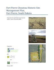
- Page 3: The Blaine Site Research Report No.
- Page 6 and 7: c○2008 by the South Dakota State
- Page 9 and 10: Acknowledgments The Archaeological
- Page 11 and 12: Contents Abstract . . . . . . . . .
- Page 13 and 14: CONTENTS xi 8 References Cited 187
- Page 15 and 16: List of Figures 1.1 Location of 39C
- Page 17 and 18: List of Tables 1.1 Results of test
- Page 19 and 20: Chapter 1 INTRODUCTION TO THE PROJE
- Page 21 and 22: 1.2. HISTORY OF INVESTIGATIONS AT 3
- Page 23: 1.2. HISTORY OF INVESTIGATIONS AT 3
- Page 27 and 28: 2.1. THE BLACK HILLS ENVIRONMENT 9
- Page 29 and 30: 2.1. THE BLACK HILLS ENVIRONMENT 11
- Page 31 and 32: 2.1. THE BLACK HILLS ENVIRONMENT 13
- Page 33 and 34: 2.1. THE BLACK HILLS ENVIRONMENT 15
- Page 35 and 36: 2.2. THE SITE ENVIRONMENT 17 Figure
- Page 37 and 38: 2.2. THE SITE ENVIRONMENT 19 game,
- Page 39 and 40: Chapter 3 ARCHAEOLOGICAL CONTEXT OF
- Page 41 and 42: 3.2. PREVIOUS INVESTIGATIONS 23 fro
- Page 43 and 44: 3.2. PREVIOUS INVESTIGATIONS 25 The
- Page 45 and 46: 3.3. PREHISTORY OF THE BLACK HILLS
- Page 47 and 48: 3.3. PREHISTORY OF THE BLACK HILLS
- Page 49 and 50: 3.3. PREHISTORY OF THE BLACK HILLS
- Page 51 and 52: 3.3. PREHISTORY OF THE BLACK HILLS
- Page 53 and 54: 3.3. PREHISTORY OF THE BLACK HILLS
- Page 55 and 56: Chapter 4 RESEARCH ORIENTATION 4.1
- Page 57 and 58: 4.3. FUNCTIONAL SITE TYPES 39 Figur
- Page 59 and 60: 4.3. FUNCTIONAL SITE TYPES 41 Table
- Page 61 and 62: 4.3. FUNCTIONAL SITE TYPES 43 resou
- Page 63 and 64: 4.4. THE RESOURCE BASE 45 the ripen
- Page 65 and 66: 4.5. SETTLEMENT AND SUBSISTENCE MOD
- Page 67 and 68: 4.5. SETTLEMENT AND SUBSISTENCE MOD
- Page 69 and 70: 4.5. SETTLEMENT AND SUBSISTENCE MOD
- Page 71 and 72: 4.5. SETTLEMENT AND SUBSISTENCE MOD
- Page 73 and 74: 4.5. SETTLEMENT AND SUBSISTENCE MOD
- Page 75 and 76:
4.5. SETTLEMENT AND SUBSISTENCE MOD
- Page 77 and 78:
4.5. SETTLEMENT AND SUBSISTENCE MOD
- Page 79 and 80:
4.5. SETTLEMENT AND SUBSISTENCE MOD
- Page 81 and 82:
4.5. SETTLEMENT AND SUBSISTENCE MOD
- Page 83 and 84:
4.6. LITHIC RAW MATERIAL STUDIES 65
- Page 85 and 86:
4.6. LITHIC RAW MATERIAL STUDIES 67
- Page 87 and 88:
4.6. LITHIC RAW MATERIAL STUDIES 69
- Page 89 and 90:
4.7. SUMMARY 71 based on horse past
- Page 91 and 92:
Chapter 5 RESULTS 5.1 The Blaine Si
- Page 93 and 94:
5.1. THE BLAINE SITE EXCAVATIONS 75
- Page 95 and 96:
5.2. RADIOCARBON DATES 77 Figure 5.
- Page 97 and 98:
5.3. FEATURES 79 domly distributed
- Page 99 and 100:
5.3. FEATURES 81 Table 5.2: continu
- Page 101 and 102:
5.3. FEATURES 83 Figure 5.6. Featur
- Page 103 and 104:
5.3. FEATURES 85 Figure 5.9. Featur
- Page 105 and 106:
5.3. FEATURES 87 Figure 5.12. Featu
- Page 107 and 108:
5.3. FEATURES 89 Figure 5.16. Featu
- Page 109 and 110:
5.3. FEATURES 91 Figure 5.18. Featu
- Page 111 and 112:
5.4. CERAMICS 93 Table 5.5. Compari
- Page 113 and 114:
5.4. CERAMICS 95 The rimfield area
- Page 115 and 116:
5.5. LITHIC TOOLS 97 Missouri and e
- Page 117 and 118:
5.5. LITHIC TOOLS 99 Table 5.6. Too
- Page 119 and 120:
5.5. LITHIC TOOLS 101 Figure 5.23.
- Page 121 and 122:
5.5. LITHIC TOOLS 103 Figure 5.25.
- Page 123 and 124:
5.5. LITHIC TOOLS 105 point (#1637)
- Page 125 and 126:
5.6. LITHIC DEBITAGE 107 The remain
- Page 127 and 128:
5.6. LITHIC DEBITAGE 109 Table 5.8.
- Page 129 and 130:
5.8. TOOL KIT ANALYSIS 111 (Trateba
- Page 131 and 132:
5.9. LITHIC SOURCE ANALYSIS 113 spu
- Page 133 and 134:
5.9. LITHIC SOURCE ANALYSIS 115 A v
- Page 135 and 136:
5.9. LITHIC SOURCE ANALYSIS 117 The
- Page 137 and 138:
5.9. LITHIC SOURCE ANALYSIS 119 and
- Page 139 and 140:
5.9. LITHIC SOURCE ANALYSIS 121 and
- Page 141 and 142:
5.9. LITHIC SOURCE ANALYSIS 123 Tab
- Page 143 and 144:
5.9. LITHIC SOURCE ANALYSIS 125 Tab
- Page 145 and 146:
5.10. UNMODIFIED ROCK 127 of exotic
- Page 147 and 148:
5.11. FAUNAL MATERIAL 129 Table 5.1
- Page 149 and 150:
5.12. FLORAL MATERIAL 131 Identific
- Page 151 and 152:
Chapter 6 GEOARCHAEOLOGICAL INVESTI
- Page 153 and 154:
6.4. RESULTS 135 possible, samples
- Page 155 and 156:
6.4. RESULTS 137 Figure 6.1. Geomor
- Page 157 and 158:
6.4. RESULTS 139 Figure 6.3. Compos
- Page 159 and 160:
6.4. RESULTS 141 Figure 6.4. Unit N
- Page 161 and 162:
6.4. RESULTS 143 Comparable pre-Kay
- Page 163 and 164:
6.4. RESULTS 145 Figure 6.7. Pedon
- Page 165 and 166:
6.4. RESULTS 147 Figure 6.9. Geomor
- Page 167 and 168:
6.4. RESULTS 149 Figure 6.11. Geomo
- Page 169 and 170:
6.4. RESULTS 151 Figure 6.13. Unit
- Page 171 and 172:
6.4. RESULTS 153 Figure 6.15. Unit
- Page 173 and 174:
6.4. RESULTS 155 Figure 6.17. Unit
- Page 175 and 176:
6.4. RESULTS 157 Figure 6.19. Unit
- Page 177 and 178:
6.4. RESULTS 159 Figure 6.20. Unit
- Page 179 and 180:
6.4. RESULTS 161 Table 6.1. Sedimen
- Page 181 and 182:
6.4. RESULTS 163 Figure 6.23. Windo
- Page 183 and 184:
6.4. RESULTS 165 Figure 6.24. Unit
- Page 185 and 186:
6.4. RESULTS 167 Figure 6.25. Grain
- Page 187 and 188:
6.5. CONCLUSIONS 169 within the pro
- Page 189 and 190:
Chapter 7 SUMMARY AND CONCLUSIONS 7
- Page 191 and 192:
7.1. SUMMARY OF INTERPRETATIONS 173
- Page 193 and 194:
7.2. SETTLEMENT PATTERN RESEARCH HY
- Page 195 and 196:
7.2. SETTLEMENT PATTERN RESEARCH HY
- Page 197 and 198:
7.2. SETTLEMENT PATTERN RESEARCH HY
- Page 199 and 200:
7.3. SUBSISTENCE ECONOMY RESEARCH H
- Page 201 and 202:
7.4. CONCLUSIONS 183 examined from
- Page 203 and 204:
7.4. CONCLUSIONS 185 served in area
- Page 205 and 206:
Chapter 8 References Cited Aaberg,
- Page 207 and 208:
189 1977 Forty-seven Trips: A Case
- Page 209 and 210:
191 DeMallie, Raymond J., editor 19
- Page 211 and 212:
193 1984 Cultural Resource Investig
- Page 213 and 214:
195 1982 Ceramics from the Highwalk
- Page 215 and 216:
197 1988 Geology of the Frazier Sit
- Page 217 and 218:
199 1941 Indian Picture Writing in
- Page 219 and 220:
201 Roper, Donna C., editor 1981 Pr
- Page 221 and 222:
203 United States Department of Agr
- Page 223 and 224:
Appendix A Supplemental Data 205
- Page 225 and 226:
Table A.1: continued Period Site Da
- Page 227 and 228:
Table A.1: continued Period Site Da
- Page 229 and 230:
Table A.1: continued Period Site Da
- Page 231 and 232:
Table A.1: continued Period Site Da
- Page 233 and 234:
Table A.2: continued Excavation Uni
- Page 235 and 236:
Table A.2: continued Excavation Uni
- Page 237 and 238:
Table A.2: continued Excavation Uni
- Page 239 and 240:
Table A.2: continued Excavation Uni
- Page 241 and 242:
Table A.2: continued Excavation Uni
- Page 243 and 244:
Table A.2: continued Excavation Uni
- Page 245 and 246:
Table A.2: continued Excavation Uni
- Page 247 and 248:
Table A.2: continued Excavation Uni
- Page 249 and 250:
A.1. TOOL DESCRIPTIONS FROM 39CU114
- Page 251 and 252:
A.1. TOOL DESCRIPTIONS FROM 39CU114
- Page 253 and 254:
A.1. TOOL DESCRIPTIONS FROM 39CU114
- Page 255 and 256:
A.1. TOOL DESCRIPTIONS FROM 39CU114
- Page 257 and 258:
A.1. TOOL DESCRIPTIONS FROM 39CU114
- Page 259 and 260:
A.1. TOOL DESCRIPTIONS FROM 39CU114
- Page 261 and 262:
A.1. TOOL DESCRIPTIONS FROM 39CU114
- Page 263 and 264:
A.1. TOOL DESCRIPTIONS FROM 39CU114
- Page 265 and 266:
A.1. TOOL DESCRIPTIONS FROM 39CU114
- Page 267 and 268:
A.1. TOOL DESCRIPTIONS FROM 39CU114
- Page 269 and 270:
A.1. TOOL DESCRIPTIONS FROM 39CU114
- Page 271 and 272:
A.1. TOOL DESCRIPTIONS FROM 39CU114
- Page 273 and 274:
A.1. TOOL DESCRIPTIONS FROM 39CU114
- Page 275 and 276:
A.2. FAUNAL DATA FROM 39CU1144 257
- Page 277 and 278:
A.2. FAUNAL DATA FROM 39CU1144 259
- Page 279 and 280:
A.2. FAUNAL DATA FROM 39CU1144 261
- Page 281:
A.2. FAUNAL DATA FROM 39CU1144 263