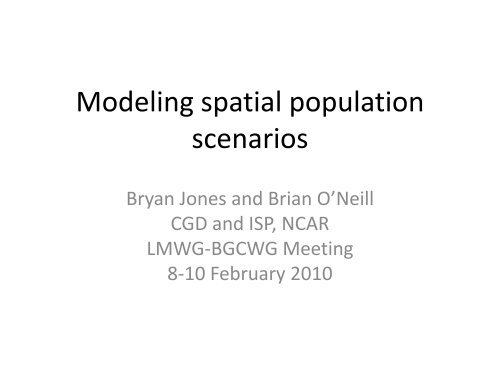
Modeling spatial population scenarios
Modeling spatial population scenarios
Modeling spatial population scenarios

Create successful ePaper yourself
Turn your PDF publications into a flip-book with our unique Google optimized e-Paper software.
<strong>Modeling</strong> <strong>spatial</strong> <strong>population</strong><br />
<strong>scenarios</strong><br />
Bryan Jones and Brian O’Neill<br />
CGD and ISP, NCAR<br />
LMWG-BGCWG Meeting<br />
8-10 February 2010
Introduction and Outline<br />
• The iPETS integrated assessment model<br />
• Land use and <strong>spatial</strong> <strong>population</strong><br />
• Toward a <strong>spatial</strong> scenario generator<br />
– Understand a leading methodology (IIASA)<br />
• Apply to hypothetical, 1-D <strong>population</strong> distribution<br />
– Test against historical observations<br />
– Explore modifications<br />
– Goals for 2010
iPETS: Global, regionally disaggregated IA Model<br />
(Integrated Population-Economy-Technology-Science Model)<br />
Population<br />
Households<br />
PET<br />
Terrestrial<br />
Ecosystems<br />
ISAM<br />
Supply of<br />
Land<br />
Labor, Land,<br />
Capital<br />
Food and other<br />
goods<br />
LU Emissions<br />
CO 2 and Climate<br />
Producers<br />
Energy<br />
Emissions<br />
Ocean, Sea ice,<br />
Atmosphere
iPETS: Global, regionally disaggregated IA Model<br />
(Integrated Population-Economy-Technology-Science Model)<br />
Demographic<br />
Module<br />
• Population<br />
• Urbanization<br />
• Households<br />
• Spatial Distribution<br />
Population<br />
Household<br />
s<br />
PET<br />
Terrestrial<br />
Ecosystems<br />
ISAM<br />
Supply of<br />
Land<br />
Labor, Land,<br />
Capital<br />
Food and other<br />
goods<br />
LU Emissions<br />
CO 2 and Climate<br />
Producers<br />
Energy<br />
Emissions<br />
Ocean, Sea ice,<br />
Atmosphere
IIASA Methodology<br />
1. Cells are classified as rural or urban.<br />
2. Population change regime (r) is defined for rural and urban areas.<br />
3. Potential is calculated for each cell according to:<br />
v<br />
i<br />
=<br />
m<br />
j,<br />
u<br />
2<br />
j= 1 Dij<br />
∑<br />
P<br />
n<br />
k , r<br />
2<br />
k = 1 Dik<br />
∑<br />
4. For each time step, additional <strong>population</strong> is allocated<br />
proportional to cell potential such that:<br />
P<br />
t+<br />
1<br />
i<br />
=<br />
P<br />
t<br />
i<br />
+ ( P<br />
t+<br />
1<br />
A<br />
+<br />
−<br />
P<br />
t<br />
A<br />
P<br />
)<br />
v<br />
t<br />
i<br />
J A<br />
∑ j=<br />
1<br />
• Calculation of potential for cell i does not include the <strong>population</strong> of cell i.<br />
• Rural/urban <strong>population</strong> gain/loss is allocated separately.<br />
• Cell potential used as a measure of attractiveness: geographic proximity to<br />
<strong>population</strong> is a proxy for all socio-economic characteristics that determine<br />
“attractiveness”.<br />
v<br />
t<br />
j
Application to Hypothetical Population Distribution<br />
Tested the model on a hypothetical 1-dimensional <strong>population</strong><br />
distribution to explore general trends in <strong>population</strong> allocation and the<br />
implications of changes in certain parameters.<br />
Findings<br />
• When <strong>population</strong> growth is positive, the model tends to move towards a<br />
uniform <strong>spatial</strong> allocation.<br />
• When <strong>population</strong> growth is negative, the model tends to move towards a<br />
concentrated <strong>spatial</strong> allocation.<br />
• Population growth generally occurs in areas that are currently defined as urban,<br />
or are immediately adjacent to existing urban areas.<br />
• The classification of a cell as urban/rural has a dramatic affect on the projected<br />
<strong>population</strong> in that cell, largely a result of exogenous urban/rural growth<br />
projections.
Test Against Historical Data<br />
Using the state of Iowa as the study region, the IIASA methodology is<br />
applied in an attempt to replicate historical data.<br />
• Areal units are counties (in place of grid cells).<br />
• Time period: 1950-2000<br />
Observed county <strong>population</strong> in 1950 serves as the initial distribution.<br />
• Observed decennial census data (1950-2000) are used to determine r.<br />
Total urban/rural <strong>population</strong> change are therefore fixed at the observed<br />
levels.<br />
• An attempt to replicate 2000 county-level <strong>population</strong> structure moving<br />
forward from 1950.<br />
• The model was run seven times using various methods to re-classify counties<br />
as urban or rural over time.<br />
The results in this presentation consider the <strong>population</strong> density threshold<br />
of 100 persons/mi² to classify/reclassify a county as urban or rural.
Results: Prediction Error
Historical Test: Findings and Implications<br />
• Population change is allocated too uniformly within the urban and rural regions.<br />
Population growth is under-estimated in some urban corridors.<br />
Population loss is under-estimated in the most remote rural counties.<br />
• Difficult for rural cells to reach the density threshold necessary to be reclassified.<br />
Due to low rate of rural growth.<br />
The model is likely to miss potential suburban growth that occurs in rural areas<br />
adjacent to urban centers.<br />
• The model does not allow for <strong>population</strong> growth/decline to occur simultaneously<br />
across cells in the same category.<br />
The model cannot account for <strong>population</strong> redistribution within rural areas, a<br />
common rural phenomena in which people congregate in larger regional<br />
centers.<br />
• Cells located nearer to the regional borders are subject to lower potentials,<br />
relative to cells located in the center of the region.<br />
Potential border or “coastal” effect in which growth occurring near regional<br />
borders (or on the coast) is under-predicted.
v<br />
i<br />
m P<br />
α<br />
P<br />
λ n P<br />
α<br />
P<br />
λ<br />
= ∑<br />
i j,<br />
u<br />
+ ∑<br />
i k , r<br />
D<br />
β<br />
D<br />
β<br />
j= 1 ij k = 1 ik<br />
⎛<br />
⎜<br />
⎜<br />
⎝<br />
Cell Potential Parameters<br />
α<br />
Parameter Description IIASA Value Test Range<br />
α<br />
λ β<br />
γ<br />
Weight of cell i’s <strong>population</strong>, higher values<br />
lead to more concentrated change. 0 0-2<br />
Weight of cell j’s <strong>population</strong>, higher<br />
values lead to more dispersed growth. 1 0-2<br />
Distance weight, higher values lead to<br />
more concentrated change. 2 1-3<br />
Either 1 (<strong>population</strong> gain), or -1<br />
(<strong>population</strong> loss). Allocates gain or loss<br />
with theoretical appropriateness.<br />
⎞<br />
⎟<br />
⎟<br />
⎠<br />
γ<br />
1 1,-1
∆ % Error<br />
< -20%<br />
-20% to -10%<br />
-10% to 0%<br />
0% to 10%<br />
> 10%<br />
Results: Change in Prediction Error<br />
γ r<br />
γ<br />
u<br />
= −1<br />
= 1<br />
α<br />
= 1
Rural with border effects<br />
Rural, no border effects<br />
and no urban influence<br />
Hypothetical Study Area<br />
Rural with urban influence<br />
Urban
0.05<br />
0.04<br />
0.04<br />
0.03<br />
0.03<br />
0.02<br />
0.02<br />
0.01<br />
0.01<br />
0.00<br />
Distribution of Population and Potential<br />
when varying the β parameter.<br />
0 10 20 30 40 50 60 70<br />
% Pop<br />
% Pot (2)<br />
% Pot (1)<br />
% Pot (3)
Next Steps<br />
• Parameterization of factors affecting potential calculation and allocation rule<br />
using hypothetical study area (allow tuning/calibrating model to data).<br />
• Alternative methods for re-classifying cells as urban/rural.<br />
• Allow aggregate growth rate (r) to vary within the urban/rural region as a<br />
function of density or distance.<br />
• Add a third broad <strong>population</strong> category; “suburban”.<br />
Future Plans<br />
• Developing a model that can produce plausible alternative <strong>spatial</strong> <strong>population</strong><br />
<strong>scenarios</strong> given assumptions concerning future aggregate demographic change.<br />
• Explore the link between <strong>spatial</strong> <strong>population</strong> <strong>scenarios</strong> and urban land cover.
Modifying the IIASA Methodology<br />
Two changes were applied to the IIASA methodology:<br />
1. Including the <strong>population</strong> of each cell i in the calculation of its own potential.<br />
2. Allocating <strong>population</strong> loss using the inverse of cell potential.<br />
Potentially:<br />
• Increasing the concentration of <strong>population</strong> growth by increasing the relative<br />
potential of already highly populated cells.<br />
Improving ability to capture rapid urban growth.<br />
• Increasing the concentration of rural growth in areas adjacent to urban areas.<br />
• Increasing the concentration of <strong>population</strong> loss in those cells with the lowest<br />
potential (usually the most remote cells).<br />
• Allowing for simultaneous growth/decline to take place within rural regions by<br />
concentrating growth in cells with the highest potential, and decline in those<br />
with the lowest.<br />
• Decreasing the impact of the border effect, particularly in areas of concentrated<br />
coastal development.
Methodological Changes: Findings and Implications<br />
• The adjustments did produce improvements in the right direction, however not<br />
at the level necessary to eliminate the issues that have been identified.<br />
• Urban <strong>population</strong> allocation is more concentrated.<br />
• Rural <strong>population</strong> growth is more concentrated in areas adjacent to urban<br />
centers, while <strong>population</strong> loss is more concentrated in remote areas.<br />
• The model projected both growth and decline within the rural region over the<br />
entire period.<br />
• However, <strong>population</strong> growth in rural cells was still too small to allow any of them<br />
to reach the density threshold necessary for reclassification.<br />
• The initial urban/rural classification (and rule for re-classification over time)<br />
appears to remain the largest factor affecting <strong>population</strong> change.
R Rural Cell<br />
U Urban Cell<br />
Cell i<br />
Rural cell k<br />
Urban cell j<br />
Not included<br />
Cell Potential: Examples<br />
A B B<br />
R R R R R R R R R R R R R R R<br />
R R R R R R R R R R R R R R R<br />
R R R R R R R R R R R R R R R<br />
R R R R R R R U U U R R R R R<br />
R R R R R R R R U U R R R R R<br />
R R R R R R R R U U R R R R R<br />
R R R R R R R R R R R R R R R<br />
R R R R R R R R R R R R R R R<br />
R R R R R R R R R R R R R R R<br />
R R R R R R R R R R R R R R R<br />
R R R R R R R R R R R R R R R<br />
R R R R R R R R U U U R R R R<br />
U R R R R R R R U U U R R R R<br />
U R R R R R R R R U R R R R R<br />
R R R R R R R R R R R R R R R<br />
R R R R R R R R R R R R R R R<br />
R R R R R R R R R R R R R R R<br />
R R R R R R R R R R R R R R R<br />
R R R R R R R U U U R R R R R<br />
R R R R R R R R U U R R R R R<br />
R R R R R R R R U U R R R R R<br />
R R R R R R R R R R R R R R R<br />
R R R R R R R R R R R R R R R<br />
R R R R R R R R R R R R R R R<br />
R R R R R R R R R R R R R R R<br />
R R R R R R R R R R R R R R R<br />
R R R R R R R R U U U R R R R<br />
U R R R R R R R U U U R R R R<br />
U R R R R R R R R U R R R R R<br />
R R R R R R R R R R R R R R R<br />
Spatial/Theoretical Implications<br />
The classification of a cell as rural/urban has a large impact on the<br />
calculation of potential for all cells within the urban window.<br />
• Inclusion in window<br />
• Size of <strong>population</strong><br />
The classification of a cell as rural/urban has a no impact on the<br />
calculation of potential for cell i.<br />
Possible border/coastal effects.<br />
• The interior urban area (B) has a larger rural window than the border urban<br />
area (C).<br />
Proximity to <strong>population</strong> as an indicator of future growth/decline.<br />
Suggests that future urban development will take place almost exclusively<br />
in areas that are either currently urban, or are adjacent to existing urban<br />
areas.
Results: Assuming constant r = 5%<br />
Cell Pop(0) Pop(50) ∆ Pop % ∆ Pop ∆ %Pop<br />
A 13 10,287 10,274 79032% 0.88%<br />
B 53 15,762 15,709 29640% 1.32%<br />
C 187 22,018 21,831 11674% 1.73%<br />
D 564 30,395 29,831 5289% 2.09%<br />
E 1,455 41,839 40,384 2776% 2.19%<br />
F 3,205 56,805 53,600 1672% 1.75%<br />
G 6,027 74,711 68,684 1140% 0.49%<br />
H 9,680 93,433 83,753 865% -1.53%<br />
I 13,273 109,410 96,137 724% -3.73%<br />
J 15,543 118,709 103,166 664% -5.19%<br />
K 15,543 118,709 103,166 664% -5.19%<br />
L 13,273 109,410 96,137 724% -3.73%<br />
M 9,680 93,433 83,753 865% -1.53%<br />
N 6,027 74,711 68,684 1140% 0.49%<br />
O 3,205 56,805 53,600 1672% 1.75%<br />
P 1,455 41,839 40,384 2776% 2.19%<br />
Q 564 30,395 29,831 5289% 2.09%<br />
R 187 22,018 21,831 11674% 1.73%<br />
S 53 15,762 15,709 29640% 1.32%<br />
T 13 10,287 10,274 79032% 0.88%<br />
Notes<br />
The trends are the same as those we saw previously, just exaggerated<br />
due to the larger rate of growth.
Results: Assuming constant r = -5%<br />
Cell Pop(0) Pop(50) ∆ Pop % ∆ Pop ∆ %Pop<br />
A 13 0 -13 -100% -0.01%<br />
B 53 0 -53 -100% -0.05%<br />
C 187 0 -187 -100% -0.19%<br />
D 564 0 -564 -100% -0.56%<br />
E 1,455 0 -1,455 -100% -1.46%<br />
F 3,205 0 -3,205 -100% -3.21%<br />
G 6,027 0 -6,027 -100% -6.03%<br />
H 9,680 494 -9,186 -95% -3.26%<br />
I 13,273 1,363 -11,910 -90% 4.44%<br />
J 15,543 1,990 -13,553 -87% 10.32%<br />
K 15,543 1,990 -13,553 -87% 10.32%<br />
L 13,273 1,363 -11,910 -90% 4.44%<br />
M 9,680 494 -9,186 -95% -3.26%<br />
N 6,027 0 -6,027 -100% -6.03%<br />
O 3,205 0 -3,205 -100% -3.21%<br />
P 1,455 0 -1,455 -100% -1.46%<br />
Q 564 0 -564 -100% -0.56%<br />
R 187 0 -187 -100% -0.19%<br />
S 53 0 -53 -100% -0.05%<br />
T 13 0 -13 -100% -0.01%<br />
Notes<br />
The lightly populated exterior cells quickly empty out.<br />
Population becomes concentrated in the interior cells.<br />
Potential remains greater in the interior cells, so these cells suffer more<br />
absolute <strong>population</strong> loss at each time step.