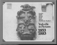
historical walking tour of - Toronto Public Library
historical walking tour of - Toronto Public Library
historical walking tour of - Toronto Public Library

You also want an ePaper? Increase the reach of your titles
YUMPU automatically turns print PDFs into web optimized ePapers that Google loves.
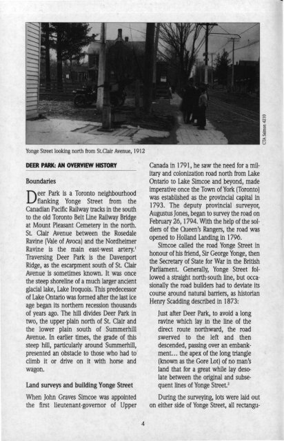
Yonge Street looking north from St.Clair Avenue, 1912<br />
DEER PARK: AN OVERVIEW HISTORY<br />
Boundaries<br />
eer Park is a <strong>Toronto</strong> neighbourhood<br />
Dflanking Yonge Street from the<br />
Canadian Pacific Railway tracks in the south<br />
to the old <strong>Toronto</strong> Belt Line Railway Bridge<br />
at Mount Pleasant Cemetery in the north.<br />
St. Clair Avenue between the Rosedale<br />
Ravine (Vale <strong>of</strong> Avoca) and the Nordheimer<br />
Ravine is the main east·west artery.!<br />
Traversing Deer Park is the Davenport<br />
Ridge, as the escarpment south <strong>of</strong> St. Clair<br />
Avenue is sometimes known. It was once<br />
the steep shoreline <strong>of</strong> a much larger ancient<br />
glacial lake, Lake Iroquois. This predecessor<br />
<strong>of</strong> Lake Ontario was formed after the last ice<br />
age began its northern recession thousands<br />
<strong>of</strong> years ago. The hill divides Deer Park in<br />
two, the upper plain north <strong>of</strong> St. Clair and<br />
the lower plain south <strong>of</strong> Summerhill<br />
Avenue. In earlier times, the grade <strong>of</strong> this<br />
steep hill, particularly around Summerhill,<br />
presented an obstacle to those who had tol<br />
climb it or drive on it with horse and<br />
wagon.<br />
Land surveys and building Yonge Street<br />
When John Graves Simcoe was appointed<br />
the first lieutenant·governor <strong>of</strong> Upper<br />
4<br />
Canada in 1791, he saw the need for a mil·<br />
itary and colonization road north from Lake<br />
Ontario to Lake Simcoe and beyond, made<br />
imperative once the Town <strong>of</strong> York (<strong>Toronto</strong>)<br />
was established as the provincial capital in<br />
1793. The deputy provincial surveyor,<br />
Augustus Jones, began to survey the road on<br />
February 26, 1794. With the help <strong>of</strong> the sol·<br />
diers <strong>of</strong> the Queen's Rangers, the road was<br />
opened to Holland Landing in 1796.<br />
Simcoe called the road Yonge Street in<br />
honour <strong>of</strong> his friend, Sir George Yonge, then<br />
the Secretary <strong>of</strong> State for War in the British<br />
Parliament. Generally, Yonge Street fol·<br />
lowed a straight north·south line, but occa·<br />
sionally the road builders had to deviate its<br />
course around natural barriers, as historian<br />
Henry Scadding described in 1873:<br />
Just after Deer Park, to avoid a long<br />
ravine which lay in the line <strong>of</strong> the<br />
direct route northward, the road<br />
swerved to the left and then<br />
descended, passing over an embank·<br />
ment. .. the apex <strong>of</strong> the long triangle<br />
(known as the Gore Lot) <strong>of</strong> no man's<br />
land that for a great while lay deso·<br />
late between the original and subse·<br />
quent lines <strong>of</strong> Yonge Street. 2<br />
During the surveying, lots were laid out<br />
on either side <strong>of</strong> Yonge Street, all rectangu·