Download Gis Project Management Msc Thesis - Unigis
Download Gis Project Management Msc Thesis - Unigis
Download Gis Project Management Msc Thesis - Unigis

Create successful ePaper yourself
Turn your PDF publications into a flip-book with our unique Google optimized e-Paper software.
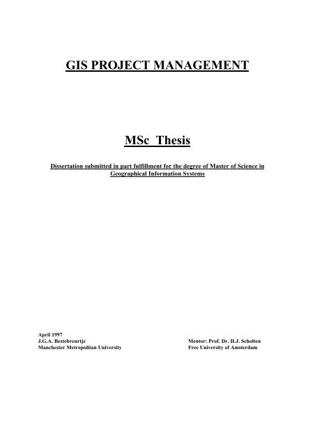
GIS PROJECT MANAGEMENT<br />
MSc <strong>Thesis</strong><br />
Dissertation submitted in part fulfillment for the degree of Master of Science in<br />
Geographical Information Systems<br />
April 1997<br />
J.G.A. Bestebreurtje Mentor: Prof. Dr. H.J. Scholten<br />
Manchester Metropolitan University Free University of Amsterdam
Master <strong>Thesis</strong>: GIS <strong>Project</strong> management Final Version<br />
ABSTRACT<br />
Recent studies concerning GIS show that it is the fastest growing segment (both hard &<br />
software) of the graphical computer market. 70% of private organizations expect to use GIS<br />
as a strategic tool within their company.<br />
Like a product, GIS in an organization has a life cycle. According to the model of Nolan this<br />
life cycle starts with awareness and ends when full integration with other information systems<br />
is achieved. Until recently project management for GIS projects was mainly about projects<br />
which were considered to be experimental. The requirements for such projects differ from the<br />
requirements for projects which are strategic for a company. Strategic GIS projects require a<br />
project manager with thorough understanding of issues such as: planning, knowledge of the<br />
objectives of the project, project environment and politics.<br />
There is little experience with such GIS projects. However the question “ How to manage a<br />
GIS project effectively” has to be answered for strategically positioned GIS projects to be<br />
succesfull.<br />
It is important for project managers to understand the relationship between the position of<br />
GIS in an organisation (Nolan Model) in relationship to the importance of GIS for the<br />
organisation (Mc Farlan). The way a GIS project should be handled depends, to a large<br />
extend, on these two positionings.<br />
A combination of IT methodologies such as Structured Analysis and Design, project<br />
management methodologies such as PRINCE and Hewlett-Packards Customer <strong>Project</strong> Life<br />
Cycle 2 combined with best practices are proposed in order to provide a framework, for<br />
project managers, to handle GIS projects which are considered strategic for the organisation.<br />
This framework, based on prior experience and through evaluation of a complex GIS project<br />
has been shown, in some respects, to work.<br />
There is still some uncertainty since there is little experience in the market with strategic GIS<br />
projects so there are not a lot of “best practices” to learn from and to further evaluate the<br />
proposed approach available.<br />
© 1997 Hans Bestebreurtje, MSc UNIGIS<br />
2
Master <strong>Thesis</strong>: GIS <strong>Project</strong> management Final Version<br />
TABLE OF CONTENTS<br />
ABSTRACT Page 2<br />
TABLE OF CONTENTS Page 3<br />
DISCLAIMER Page 5<br />
INTRODUCTION Page 6<br />
1 PROJECT LIFE CYCLE Page 11<br />
1.1. Introduction Page 11<br />
1.1.1 Product life cycle Page 11<br />
1.1.2 Life Cycle of an IT system/IT project Page 13<br />
1.1.3 Strategic position of a Geographic Information System<br />
in the Organization Page 15<br />
1.1.4 Information Needs Page 20<br />
1.2. Summary Page 22<br />
2 METHODOLOGIES Page 24<br />
2.1. Introduction Page 24<br />
2.2. General Page 25<br />
2.3. Information System Development Methodologies Page 27<br />
2.4. The Roaring Nineties Page 31<br />
2.5. Choosing the appropriate development methodology<br />
for a GIS project Page 39<br />
2.5.1 Rapid Application Development/Joint Application<br />
Development Page 41<br />
2.6. Summary Page 44<br />
3 PROJECT MANAGEMENT FOR GIS Page 46<br />
3.1. Introduction Page 46<br />
3.2. General Page 47<br />
3.3. The project stages Page 50<br />
3.4. <strong>Project</strong> Initiation Page 51<br />
3.4.1 Responsibilities of the <strong>Project</strong> manager Page 52<br />
3.5. The <strong>Project</strong> Initiation Document (PID) Page 55<br />
3.5.1 PID:The background of the project Page 56<br />
3.5.2 PID:Mission, Objective and Strategy Page 56<br />
3.5.3 PID: Scope Page 57<br />
3.5.4 PID: Constraints Page 58<br />
3.5.5 PID: Organization of the project Page 58<br />
3.5.6 PID: The <strong>Project</strong> Plan’s Page 60<br />
3.5.7 PID: Deliverables, Milestones and Acceptance Criteria Page 62<br />
3.5.8 Present PID and Kick-off meeting Page 66<br />
3.6. Detailed Plans/Work Structure Breakdown Page 66<br />
3.7. Monitoring Page 75<br />
3.7.1 General Page 75<br />
3.7.2 Progress Meeting Page 75<br />
3.8. Risk <strong>Management</strong> Page 76<br />
3.8.1 General Page 76<br />
3.8.2 The four phase approach Page 78<br />
© 1997 Hans Bestebreurtje, MSc UNIGIS 3
Master <strong>Thesis</strong>: GIS <strong>Project</strong> management Final Version<br />
3.8.3 Assessment Page 81<br />
3.9. Change requests, expectations and deviations Page 83<br />
3.9.1 General Page 83<br />
3.9.2 Change Control Page 84<br />
3.10. Exceptions Page 85<br />
3.11. Threats in a project Page 86<br />
3.12. <strong>Project</strong> Closure Page 89<br />
3.12.1 General Page 89<br />
3.12.2 Acceptance testing Page 89<br />
3.12.3 <strong>Project</strong> Closure Meeting Page 90<br />
3.13. Quality Review Page 90<br />
3.14. Training Page 93<br />
3.15. Support Page 94<br />
3.16. Summary Page 95<br />
4 THE SPATIAL COMPONENT; ARE GIS PROJECTS DIFFERENT? Page 96<br />
4.1. Introduction Page 96<br />
4.2. The G in GIS Page 96<br />
4.3. The IS in GIS Page 97<br />
4.4. What is so special about GIS? Page 99<br />
4.5. The acquiring of Geo Information Page 104<br />
4.6. Are GIS project different? Page 106<br />
4.7. Conclusion Page 107<br />
5 MANAGING A REAL PROJECT - THE MILGIS PROJECT Page 108<br />
5.1. Introduction Page 108<br />
5.2. Approach Page 109<br />
5.3. Content of the MILGIS PID Page 109<br />
5.3.1 MILGIS PID - Background Page 110<br />
5.3.2 MILGIS PID - Mission, Objectives, Strategy Page 111<br />
5.3.3 MILGIS PID - Scope of Work Page 113<br />
5.3.4 MILGIS PID -Constraints Page 115<br />
5.3.5 MILGIS PID -Methods Page 116<br />
5.3.6 MILGIS PID <strong>Project</strong> Organization Page 117<br />
5.3.7 MILGIS PID <strong>Project</strong> Plan Page 121<br />
5.4. MILGIS Risks Page 128<br />
5.5. MILGIS Quality Page 129<br />
5.6. Does the proposed methodology work? Page 131<br />
6 CONCLUSIONS Page 134<br />
6.1. Introduction Page 134<br />
6.2. The importance of Life Cycle and Methodologies Page 134<br />
6.3. <strong>Project</strong> management for GIS Page 135<br />
6.4. Area for further research Page 135<br />
ADDENDUM Page 137<br />
-Risk <strong>Management</strong> Checklist Page 138<br />
REFERENCES Page 142<br />
© 1997 Hans Bestebreurtje, MSc UNIGIS 4
Master <strong>Thesis</strong>: GIS <strong>Project</strong> management Final Version<br />
DISCLAIMER<br />
The results presented in this thesis are based on my own research in the Department of<br />
Regional Economics of the Free University of Amsterdam. All assistance received from other<br />
individuals and organizations has been acknowledged and full reference is made to all<br />
published and unpublished sources used.<br />
This thesis has not been submitted previously for a degree at any Institution.<br />
Lieren, April 1997<br />
J.G.A. Bestebreurtje<br />
© This document contains information that is copyright<br />
protected by Hewlett-Packard and other owners.<br />
All rights reserved.<br />
© 1997 Hans Bestebreurtje, MSc UNIGIS 5
Master <strong>Thesis</strong>: GIS <strong>Project</strong> management Final Version<br />
INTRODUCTION<br />
In the last decade computer systems which can handle large amounts of “Geographic<br />
Information” have become sufficiently powerful and inexpensive to be used on a wide scale.<br />
Currently even personal computers are well suited to be used in GIS environments. The<br />
field of Geographical or Spatial data is very wide and GIS systems can be used for many<br />
different purposes.<br />
Some of the more important fields of application are:<br />
{ Land & Property Systems;<br />
{ Environmental <strong>Management</strong>;<br />
{ Socioeconomic Analyzis;<br />
{ Telecommunications;<br />
{ Health.<br />
More and more data are becoming available in a digital format. Investments in the field of<br />
data communication are huge and enable the transfer of large amounts of data all over the<br />
world.<br />
Internet's and Intra net's are increasing the availability of information for large parts of<br />
society. And these developments change the way organizations think and act.<br />
Well designed GIS systems will enable quick and easy access to these large volumes of data<br />
and enable organization to use them to gather information either for their own benefit or for<br />
the public benefit in order to:<br />
{ Provide services;<br />
{ Increase competitiveness<br />
{ Provide information.<br />
According to Littlejohn (1996), the GIS market is growing at 18-30% per year.<br />
© 1997 Hans Bestebreurtje, MSc UNIGIS 6
Master <strong>Thesis</strong>: GIS <strong>Project</strong> management Final Version<br />
Many organizations nowadays recognize that geographic information can serve as an<br />
important resource. A successfully implemented GIS can also enable the “non” GIS<br />
population to be more effective without increasing the complexity of their work.<br />
GIS however is a complex information technology which requires a lot of planning in order<br />
to have a successful implementation. There is a lack of experience in large GIS project<br />
design and implementation and many questions have to be considered when performing a<br />
GIS project<br />
some of these are:<br />
{ What are the mission, vision and objectives of the project?<br />
{ What has to be achieved by means of this project;<br />
{ How do I build such a GIS system?<br />
{ What are the experiences (best practices) in this field?<br />
This thesis is about the project management aspects of GIS and the way to handle this<br />
complexity from a project managers point of view. This is accomplished by providing some<br />
theoretical background, a practical approach towards a GIS project and a case study of a<br />
complex GIS environment.<br />
Objectives of the thesis<br />
The objectives of the thesis are:<br />
♦ To examine the life cycle of GIS projects;<br />
♦ To explain the importance of the model of McFarlan and the position of GIS in this<br />
model;<br />
♦ To look at some methodologies which are useful in GIS projects in relation to the GIS<br />
life cycle;<br />
© 1997 Hans Bestebreurtje, MSc UNIGIS 7
Master <strong>Thesis</strong>: GIS <strong>Project</strong> management Final Version<br />
♦ To clarify if there is a difference between project management in general and project<br />
management in GIS projects;<br />
♦ To describe the practical implications for approaching and handling a GIS project;<br />
♦ To examine an actual case and compare this with the approach put forward in this thesis.<br />
Problem Statement<br />
The problem which this thesis addresses is:<br />
How to manage a GIS project effectively?<br />
At several places in the thesis the following question will be addressed: “Is there a<br />
difference between a “state of the art” IS project and a GIS project” in order to clarify if<br />
GIS project management differs from IT-project management in general.<br />
Scope of this thesis<br />
This thesis deals primarily with the “how” question of GIS project management. What are<br />
the generic processes and tools which are available? Which methodologies are useful? What<br />
are the consequences of the GIS project life cycle and what are the roles and responsibilities<br />
of a GIS project manager.<br />
The “what” questions, dealing with specific processes, tools, architectures, the advantages<br />
or disadvantages of certain software packages are not part of this thesis.<br />
Also this thesis will not provide a methodology for all GIS projects. It will present only one<br />
way to handle a GIS project and share best practices. As DeMarco and Lister (1987) :<br />
“Methodologies provide unification and prevent common mistakes but training, tools and<br />
the exchange of “best practices” are just as important”.<br />
© 1997 Hans Bestebreurtje, MSc UNIGIS 8
Master <strong>Thesis</strong>: GIS <strong>Project</strong> management Final Version<br />
Document Overview<br />
This document overview clarifies the structure of this Master <strong>Thesis</strong> and the outlines of the<br />
chapters that are included.<br />
The Abstract contains the main elements, my findings and arguments. The Introduction<br />
provides information on the changes that are currently happening in the GIS environment<br />
and that have influence on the way GIS project management is handled. Furthermore the<br />
objectives, scope and the problem statement are part of the Introduction.<br />
Chapter 1-4 are the core of this document. They each cover an important element necessary<br />
for GIS project management. Two main aspects are covered in every chapter:<br />
♦ Principles: The theory provided on the element;<br />
♦ Findings:The reality related to this element. These findings are partly from literature and<br />
partly a distillation of my own experience.<br />
At the beginning of each chapter is a small introduction which clarifies the relationship of<br />
the particular chapter in the light of the overall problem, the sequence of the arguments and<br />
the specific contributions I have made.<br />
Chapter 5 is a case study of an actual project called MILGIS. It consist of a secondary<br />
analysis of documents and project plans on the MILGIS project and interviews conducted<br />
with several people involved. The findings are compared with the proposed GIS project<br />
management approach developed in chapter 3. Reasons why the MILGIS project deviated<br />
from the proposed project approach are noticed and discussed.<br />
In chapter 6 conclusions are drawn and the developments made from the findings in this<br />
thesis are described.<br />
© 1997 Hans Bestebreurtje, MSc UNIGIS 9
Master <strong>Thesis</strong>: GIS <strong>Project</strong> management Final Version<br />
The structure of the <strong>Thesis</strong> is also be represented graphically (figure 1):<br />
Figure 1: Structure of <strong>Thesis</strong><br />
Risk<br />
Assesement<br />
p<br />
o<br />
s<br />
i<br />
t<br />
i<br />
o<br />
n<br />
i<br />
n<br />
g<br />
<strong>Project</strong> Life Cycle<br />
1<br />
Methodology<br />
2<br />
Life Cycle Position<br />
Methodology fit<br />
<strong>Project</strong> <strong>Management</strong><br />
3<br />
Are GIS <strong>Project</strong>s<br />
Different?<br />
4<br />
MILGIS Case Study<br />
5<br />
Conclusions<br />
6<br />
Theory<br />
Practice<br />
Reflection<br />
Validation<br />
In the <strong>Thesis</strong> the assumption is made that the GIS project to be managed is either strategic<br />
or mission critical. As the graphic representation shows the theoretical chapters are<br />
necessary to understand the position in the life-cycle of the project and also to determine<br />
which methodology is the most appropriate.<br />
© 1997 Hans Bestebreurtje, MSc UNIGIS 10<br />
p<br />
o<br />
s<br />
i<br />
t<br />
i<br />
o<br />
n<br />
i<br />
n<br />
g
Master <strong>Thesis</strong>: GIS <strong>Project</strong> management Final Version<br />
1 PROJECT LIFE CYCLE<br />
1.1. Introduction<br />
GIS projects fail because they are not conducted in the right manner. Running out of<br />
planned budget, not being ready on time, not providing the expected functionality are the<br />
symptoms of failure. KPMG has a lot of experience with complex IT projects and in one of<br />
there recent publications they make the following statement on this subject:<br />
“In the past few years the nature of IT project changed from establishing efficiency<br />
improvement to support and renewal of processes, products and culture” (Roelofs et al,<br />
1996).<br />
The management of a GIS project has to be aware of changing project requirements and<br />
take account of two principle factors:<br />
{ The importance of understanding the GIS life cycle( this chapter);<br />
{ The methodology which is appropriate (the next chapter).<br />
1.1.1 Product life cycle<br />
“There is a time for every season under heaven, a time to be born .......... a time to die”<br />
The life cycle of an information project is always the same. Initial awareness is the start of<br />
every life cycle, maturity the end. The difficult part is to find out which position GIS has at a<br />
particular point in time in a particular organization.<br />
Though there is much literature on the life cycle principle there is only very limited<br />
information on the influence of the life cycle position of GIS in an organization and the way<br />
a GIS project consequently should be handled. Based on the limited experience of the<br />
author in the GIS field and his broader experience with project management within Hewlett-<br />
Packard the relationship between the life cycle position and the way to handle the GIS<br />
project is discussed in this chapter.<br />
© 1997 Hans Bestebreurtje, MSc UNIGIS 11
Master <strong>Thesis</strong>: GIS <strong>Project</strong> management Final Version<br />
One model of a life cycle of a product is that of Nolan (Davis and Olsen, 1987) (Figure 2)<br />
Figure 2: Nolan’s Model of the Life Cycle<br />
ADAPTION<br />
RATE<br />
1 2 3<br />
SATURATION<br />
LEVEL<br />
1) Initial Awareness<br />
2) Accelerated Introduction<br />
3) Drive to Maturity<br />
4) Complete Market Coverage<br />
The life of a product starts after being developed by initial awareness. Customers become<br />
© 1997 Hans Bestebreurtje, MSc UNIGIS 12<br />
4<br />
TIME<br />
aware of the existence of the product mostly because of marketing activities. After this<br />
awareness there is a period of accelerated growth and the products reaches it’s maturity<br />
phase. The maximum penetration in the market will be reached and finally there will be<br />
replacements or more modern products become available and a process of deterioration will<br />
start.<br />
For a company, it is of importance to be aware of the life cycle of their products. Research<br />
and development should be in line with the life cycle enabling a company to introduce new<br />
or improved products before the maximum market coverage is reached. The total life cycle<br />
differs considerably between products. A Boeing 747 has a life cycle of several decades
Master <strong>Thesis</strong>: GIS <strong>Project</strong> management Final Version<br />
whereas a personal (486) computer’s life cycle is less then one year. For this reason the time<br />
to develop a new plane is considerably longer than to the time to develop a new PC.<br />
To put this into a different perspective; a delay of 6 months due to wrong engineering of a<br />
plane is probably acceptable. For a PC producer this will be the differences between success<br />
and failure as the competion has had enough time to overtake it’s position.<br />
1.1.2 Life Cycle of an IT system/IT project.<br />
IT systems have a life cycle similar to products. For this reason the development of any IT<br />
systems is limited in time. It is, of course, important to know what this model looks like<br />
since this describes the period of time available to develop and build a system.<br />
The model of Nolan has been developed by Davis and Ohlsen (1987) into a six phase model<br />
(Figure 3):<br />
Figure 3: Model of Nolan for <strong>Project</strong>s<br />
USE OF THE INFORMATION SYSTEM<br />
x<br />
x<br />
1 2 3 4 5 6<br />
x =Transition from phase<br />
T T+1<br />
x<br />
DEVELOPMENT PHASE<br />
MODEL OF NOLAN WITH 6 PHASES<br />
(DAVIS & OLSEN 1987)<br />
© 1997 Hans Bestebreurtje, MSc UNIGIS 13<br />
x<br />
x
Master <strong>Thesis</strong>: GIS <strong>Project</strong> management Final Version<br />
1 Start A small group of people are using<br />
thesystem, limited and decentralized<br />
control,minimum planning.<br />
2 Diffusion More experimenting, more acceptance,<br />
number of users increases.<br />
3 <strong>Management</strong> Organizational steps are taken to ensure<br />
possibilities for intensified use and cost<br />
control.<br />
4 Integration The information system is integrated in the<br />
organization.<br />
5 Data Orientation Integration with other information systems<br />
in the organization.<br />
6 Maturity System is fully integrated and successfully<br />
fulfills expected tasks.<br />
This 6 phase model is applicable to GIS as well. It is a good way to determine the position<br />
of GIS in an organization. Depending on the position in the model the demands during a<br />
GIS project will differ. This issue will be examined more fully when looking at the strategic<br />
position of a GIS project later in this chapter. It is important to understand that it is<br />
impossible to skip a phase in project planning since neither the organization nor the people<br />
in the organization are able to do this. The experiences of every previous phase are needed<br />
to step into the next phase.<br />
For example in the beginning of the 1980’s the first word processors were introduced. The<br />
word processor in it’s initial stage had only very few users and little organization and doing<br />
© 1997 Hans Bestebreurtje, MSc UNIGIS 14
Master <strong>Thesis</strong>: GIS <strong>Project</strong> management Final Version<br />
away with these first word processors would not have caused a great disturbance. The word<br />
processor was in it start or initial phase. A company which decided that word processors<br />
was the way to go and which got rid of all typewriters would have problems such as:<br />
{No procedures in place (word processors are different from typewriters);<br />
{High training costs of secretaries;<br />
{Extremely high costs of equipment, not commonly available;<br />
{No internal acceptance.<br />
1.1.3 Strategic position of a Geographic Information System in the Organization.<br />
A recent Dutch study “ <strong>Gis</strong>, noodzaak of luxe? “ (Grothe et al. 1994) looking at the the<br />
position of GIS in 2500 private organizations in 1993 showed the following results:<br />
Organization Use of GIS<br />
{ Utility companies; 67%<br />
{ Trade and retail companies; 47%<br />
{ Transport and communication; 58%<br />
{ Financial services; 60%<br />
{ Business services. 44%<br />
{ Utility companies; 67%<br />
The position of GIS systems in these organizations is as follows:<br />
Use of GIS<br />
52% 11% 16% 21%<br />
Startup Diffusion <strong>Management</strong> Integration<br />
The results show that about half of all GIS systems in the surveyedcompanies are in a<br />
startup phase. 11% are used more frequently by a larger group of users. In 16% of cases<br />
© 1997 Hans Bestebreurtje, MSc UNIGIS 15
Master <strong>Thesis</strong>: GIS <strong>Project</strong> management Final Version<br />
the GIS has become so important that measures are being taken in the organizational and<br />
financial field to control investments. Finally 21% of all GIS systems are fully integrated into<br />
the organization. The last two phases Data-orientation and Maturity out of the Nolan model<br />
were no part of this survey nor was a distinction made between the types of organisations<br />
and the use of GIS in the different phases. Grothe et al (1994) explains this in the following<br />
way: The 4 phase growth model was modified into a 6 phase model due to the fact that,<br />
through rapid technology changes the stadium of maturity will never be reached. It is even<br />
hard to reach the phase of integration. After a technological renewal a new lifecycle starts.<br />
The survey looks at GIS in a general sence and defines GIS as “an automated information<br />
system that can handle spatial data, including thematic mapping, automated mapping and<br />
facility management type systems”. The way organisations use GIS in different phases was<br />
no part of the survey.<br />
In general the importance of the GIS to the organisation is less if the GIS is in a startup<br />
phase compared to the integration phase. <strong>Management</strong> will in pay more attention and give<br />
more support to systems which are in a management or integration stage because their<br />
relative importance for the company is much greater.<br />
An other way to look at GIS in an organization is according to the model of McFarlan and<br />
McKenney (1983) which describes the strategic position of applications. Grothe et al.<br />
(1993) examined the position of the GIS according to this model (Figure 4).<br />
© 1997 Hans Bestebreurtje, MSc UNIGIS 16
Master <strong>Thesis</strong>: GIS <strong>Project</strong> management Final Version<br />
Figure 4: Strategic Position of GIS, Mc Farlan and McKenney Model<br />
Little<br />
Strategic Influence<br />
Present Application<br />
Much<br />
Strategic Position of GIS<br />
28%<br />
Operation<br />
Support<br />
Tool<br />
1%<br />
Vital<br />
Strategic Influence<br />
New Applications<br />
49%<br />
Intermediary<br />
22%<br />
Strategic<br />
development<br />
direction<br />
New GIS applications are first tested and are considered to be in the intermediary or<br />
experimental fase. From this point on two things can happen; either the application is<br />
considered to be strategic and might even move on to become a vital application for the<br />
organization. The other possibility is that the application becomes an operation support tool<br />
without strategic or vital value.<br />
The same applies of course to GIS applications which are in use. If such an application is<br />
either strategic or vital the influence of the application is considerable. The amount of<br />
attention from higher levels of management for strategic or vital applications is larger than<br />
the amount of attention a operation support tool will get.<br />
It’s important to realize that the position in the above model determines the importance of<br />
the GIS for the organization. Companies are willing put a lot of effort (resources & money)<br />
into applications (projects) which have a strategic or vital position. Consequently there are<br />
always strict time-constrains in such projects. A project realizing an intermediary or<br />
experimental application will not have the same kind of resources and constraints.<br />
© 1997 Hans Bestebreurtje, MSc UNIGIS 17<br />
Much
Master <strong>Thesis</strong>: GIS <strong>Project</strong> management Final Version<br />
Intermediary applications can become strategic when they are successful or will never be<br />
used or will become an operation support tool, which is bound to disappear in case they do<br />
not have the potential to move into the strategic stage. A basic description of the stages is:<br />
Stage Description<br />
Support GIS is usable for support on a operational level, there is no<br />
strategic influence of GIS.<br />
Strategic GIS is essential for strategic purposes at present. This influence<br />
will either diminish as GIS becomes a Support tool or will<br />
increase if it becomes Vital.<br />
Intermediary GIS is a Support tool at present but there is the expectation<br />
that it might become Strategic.<br />
Vital GIS is essential for the organization at presence and in the near<br />
future.<br />
An other way to look at the model is as shown in Figure 5 follows:<br />
Figure 5: Strategic Position of GIS and the effect of funding<br />
Recourse<br />
Use<br />
High<br />
normal development<br />
direction<br />
Strategic Position of GIS<br />
High<br />
22%<br />
Strategic<br />
1%<br />
Vital<br />
F<br />
u<br />
n<br />
d<br />
s<br />
Benefits<br />
Generated<br />
F<br />
u<br />
n<br />
d<br />
s<br />
49%<br />
Intermediary<br />
28%<br />
Operation<br />
Support<br />
Tool<br />
It’s important to look at the flow of the funds in this model. Most funds to develop new<br />
applications are granted either to replace systems which have become operation support<br />
tools. There are also funds available to add to vital applications. It’s not common to invest a<br />
lot in operation support tools, this money is often used to invest in intermediary tools which<br />
either replace or add to the environment. There is also a tendency to invest a lot in strategic<br />
applications which might become vital applications in time.<br />
© 1997 Hans Bestebreurtje, MSc UNIGIS 18<br />
Low
Master <strong>Thesis</strong>: GIS <strong>Project</strong> management Final Version<br />
Though it goes beyond the scope of this chapter it is important to notice that the demands<br />
on the IT system being developed vary in every quadrant. Neglecting this fact will lead to<br />
project failure since every quadrant has it’s own demands.<br />
Vital systems are often also called mission critical and have very strict demands concerning<br />
support in case of problems. Sometimes there is even demand for a standby system which<br />
can become operational immediately after a system failure. This aspect has to be taken into<br />
account during the design. The same demand is very unlikely if the system is intermediary or<br />
experimental. A recent KPMG study (Roelofs et al, 1996) relates 4 types of IT projects to<br />
the Nolan curve:<br />
Type of <strong>Project</strong> Position in the Nolan Curve<br />
1 - IT as a tool Start/Diffusion<br />
2 - IT as a management instrument <strong>Management</strong><br />
3 - IT as an improvement instrument Integration<br />
4 - IT as a strategic weapon Data Orientation/Maturity<br />
A type 4 project is far more complex than a type 1 project and requires a different way of<br />
project management. A type 1 project could be the installation and configuration of a<br />
Mapping system non automated processes. A type 4 project would link to the strategic<br />
goals of the organization and require a high level of involvement of senior management.<br />
Type 4 projects are complex and have, due to their complexity a high failure risk.<br />
Furthermore they are usually very costly. One result of the survey “GIS, noodzaak of<br />
luxe?” (Grothe et al.,1994) was that GIS will have a strategic function in an increasing<br />
number of companies. GIS will become embedded in the MIS (<strong>Management</strong> Information<br />
System) of companies..<br />
In this thesis the author concentrates on these strategic (type 4) projects these are the kind<br />
of GIS projects which are demanded by the customers. As the study of Grothe et al (1994)<br />
shows 49% of GIS applications are in the intermediary quadrant the logical development<br />
direction is into the strategic quadrant. In the past years many intermediar GIS projects have<br />
© 1997 Hans Bestebreurtje, MSc UNIGIS 19
Master <strong>Thesis</strong>: GIS <strong>Project</strong> management Final Version<br />
been accomplished the experience with the, far more complex demands, strategic GIS<br />
projects is far more limited.<br />
1.1.4 Information Needs<br />
An other way to look at information systems by looking at information needs in relation to<br />
the position where they will be implemented in the organization. To do this “triangle<br />
diagrams” which represent the different levels in the organization are used (Figure 6). These<br />
diagrams do not represent organizational structures they focus on the information need<br />
which varies depending on the functions.<br />
Figure 6: Information Needs in Organizations<br />
E<br />
R&M<br />
O<br />
A)<br />
FUNCTIONS<br />
E<br />
R&M<br />
O<br />
C)<br />
DATA<br />
CHARACTARISTICS<br />
EXECUTIVE<br />
RESEARCH &<br />
MANAGEMENT<br />
OPERATIONAL<br />
LOW<br />
VOLUME<br />
UNSTRUCTURED EXTERNAL<br />
HIGH<br />
VOLUME<br />
STRUCTURED INTERNAL<br />
(Source: Reeve and Cornelius, 1993, p 38)<br />
© 1997 Hans Bestebreurtje, MSc UNIGIS 20<br />
E<br />
R&M<br />
O<br />
B)<br />
INFORMATION<br />
FLOWS<br />
E<br />
R&M<br />
O<br />
D)<br />
INFORMATION<br />
SYSTEMS<br />
INFORMATION DECISION<br />
DATA<br />
EXECUTIVE<br />
INFORMATION<br />
SYSTEMS<br />
MANAGEMENT<br />
INFORMATION SYSTEMS<br />
IMPLEMENTATION<br />
TRANSACTION<br />
PROCESSING,FACILITIS<br />
MANAGEMENT<br />
Figure a. shows the different levels in an organization, Executive, Research & <strong>Management</strong>,<br />
Operational.<br />
Figure b. shows that on an operational level there is a need for data and implementation<br />
whereas at the executive level there is a need for decision and information.
Master <strong>Thesis</strong>: GIS <strong>Project</strong> management Final Version<br />
In figure c. the characteristics of the data involved are low volume, unstructured and<br />
external at the executive level and the opposite at the operational level.<br />
Finally figure d. looks at the kind of information systems needed at the different levels<br />
ranging from executive information systems for the top executives to transaction processing<br />
at the operational level.<br />
The information triangle translated to a GIS environment is represented in Figure 7:<br />
Figure 7: Information Triangle for GIS<br />
E<br />
R&M<br />
O<br />
Geographical<br />
Information<br />
Systems<br />
Spatial inputs to EIS<br />
Spatial Modelling, Policy GIS<br />
Spatial Decision Support Systems<br />
Operational Information<br />
Processes in GIS<br />
SOURCE: Reeve and Cornelius, 1993<br />
Depending on the position in the triangle the demands on the GIS will be different. However<br />
it is important to realize that many information systems cover large parts of the triangle and<br />
have to fulfill the needs of all levels involved.<br />
In order to develop an appropriate information system a thorough investigation must be<br />
undertaken based on the mission of the organization, on analysis of the information needs at<br />
every level and on the translation of all of this into an information strategy and an<br />
information architecture.<br />
© 1997 Hans Bestebreurtje, MSc UNIGIS 21
Master <strong>Thesis</strong>: GIS <strong>Project</strong> management Final Version<br />
1.2. Summary<br />
Understanding the theoretical principles of the life cycle of an (G)IS in an organization is of<br />
importance when enrolling in a GIS project. The position of GIS on the 6 phases model of<br />
Nolan determines largely the available funds, demands on the project and the management<br />
attention for the project. A Dutch study (Grothe et al, 1994) shows that within private<br />
organizations 70% of the respondents use or expect to use GIS as an strategic tool.<br />
This implies that GIS projects linked to the business goals of the organization will receive a<br />
lot of attention. Every organization ought to have fundamental business objectives which<br />
lead to a vision and mission. These can be translated into a Business/Function strategy. The<br />
IS and IT strategies have to be in line with the Business/Function strategy and, in today's<br />
business climate, information technology must deliver tangible results that support the<br />
overall business strategy and goals.<br />
For a GIS project manager it is important to understand the business strategy in relation to<br />
the GIS project which is conducted and he must be able to answer the next important<br />
question: How does my project support the organizations vision and how does it help to<br />
achieve it’s business goals?<br />
Once the position of GIS in the organization is clear it is important to handle the project in a<br />
structured way. A project manager has to “build” his project organization keeping this in<br />
mind. In order to have a successful project it must be:<br />
{ On schedule;<br />
{ Within budget;<br />
{ Of good quality;<br />
{ Complete;<br />
{ Accepted by the customer.<br />
© 1997 Hans Bestebreurtje, MSc UNIGIS 22
Master <strong>Thesis</strong>: GIS <strong>Project</strong> management Final Version<br />
Choosing an appropriate methodology to do these things is critical in accomplishing this<br />
difficult task.. In the next chapter methodologies for GIS projects are discussed.<br />
© 1997 Hans Bestebreurtje, MSc UNIGIS 23
Master <strong>Thesis</strong>: GIS <strong>Project</strong> management Final Version<br />
2 METHODOLOGIES<br />
2.1. Introduction<br />
Clients experience project failure due to:<br />
{ Inadequate definition of requirements;<br />
{ Changing requirements;<br />
{ Unrealistic time scale;<br />
{ Underestimating project costs;<br />
{ Incorrect choice of supplier.<br />
© 1997 Hans Bestebreurtje, MSc UNIGIS<br />
(Source: Input, 1994)<br />
Although project managers are usually intelligent people different project managers make<br />
the same mistakes over and over again. IT projects are getting more complex due to<br />
business management and technological developments. A standard framework or<br />
methodology describing the way to perform the project management tasks diminishes at<br />
least the chance of “common” mistakes.<br />
GIS is in the context of particular interest because:<br />
{ It is a new technology and there is relatively little experience of implementing it;<br />
{ It is not well understood;<br />
{ It has some particular characteristics which affects the choice of methodology.<br />
In the literature on GIS there is only limited reference to the use of methodologies in GIS<br />
projects. As described in chapter 1, GIS is moving from the experimental phase in the life<br />
cycle to the strategic position. The demands on GIS projects and GIS project managers are<br />
changing accordingly and a structured project approach is becoming more important.<br />
24
Master <strong>Thesis</strong>: GIS <strong>Project</strong> management Final Version<br />
In this chapter (and the next chapters) the author focuses on GIS projects which are<br />
strategic of vital and are complex in the sense that several departments are involved.<br />
To determine which methodology to use for such GIS projects is not easy. It could even be<br />
a question of how to adapt the “best available” methodology.<br />
Based on literature studies and Rapid Application Development experiences within Hewlett<br />
Packard the author discusses the use of methodologies for GIS projects. Based on the<br />
characteristics of GIS projects which are strategic a recommendation which methodology to<br />
use is made. Finally these recommendations are tested by reference to a specific extensive<br />
GIS project in which the author was involved.<br />
2.2. General<br />
A methodology is a standard framework describing the way a certain task, in this case<br />
project management, can be handled. A project management methodology can be used as a<br />
foundation for doing projects and it describes all the steps which have to be taken. in a<br />
project. Also the way things can be handled, methods are described. Methods are either<br />
descriptive or normative.<br />
♦ Descriptive = describing reality<br />
♦ Normative = explaining how reality should look<br />
Whether a descriptive or a normative method is appropriate depends on the situation, the<br />
kind of problem, the kind of users involved and the development environment.<br />
For this reason it makes a lot of sense to proceed on the basis of a work strategy which at<br />
least describes the objectives and provides an argument about the choice of methods since:<br />
“Strategies are general approaches for achieving an objective; methods are the detailed<br />
means for doing it”. (Davis and Olsen, 1987)<br />
© 1997 Hans Bestebreurtje, MSc UNIGIS<br />
25
Master <strong>Thesis</strong>: GIS <strong>Project</strong> management Final Version<br />
Along with methods come techniques and tools. Techniques determine for which specific<br />
problems which solutions can be used and which tools are available. Schematically the<br />
sequence is shown in Figure 8:<br />
METHODOLOGY<br />
WORK STRATEGY<br />
METHODS/TECHNIQUES<br />
(AUTOMATED)TOOLS<br />
© 1997 Hans Bestebreurtje, MSc UNIGIS<br />
SOURCE:<br />
BEMELMANS,1994<br />
Figure 8: Methodology Sequence<br />
Building a GIS is a complex task. It involves both technical issues such as databases,<br />
appropriate hard & software and non-technical issues such as involvement and acceptance.<br />
A project manager has to take all issues into account. The idea that there is a methodology,<br />
a solution or for that matter a single GIS package on the market which fits all GIS projects<br />
is a grave mistake as is the idea that every project needs a customized package and<br />
experiences from previous projects would not be valuable.<br />
Huxhold and Levinghson (1995) consider that the best ways for a GIS project to fail once<br />
the vision has been established is:<br />
♦ By comparing various commercial products and decide which one is the “best”;<br />
♦ To assume that most commercial products are so similar that a comparison of capabilities<br />
is not necessary and select one based upon price, popularity or some other factor.<br />
In order to avoid such failure there is a need for a structured analyses of the specific<br />
organizational, technical and environmental issues involved and a assessment of products<br />
and systems in the light of this. Methodologies are available to help with this difficult task.<br />
26
Master <strong>Thesis</strong>: GIS <strong>Project</strong> management Final Version<br />
2.3. Information System Development Methodologies<br />
There is a wide variety of methodologies available. Reeve and Cornelius (1993) discuss the<br />
ones described in figure 9:<br />
TRADITIONAL SYSTEMS<br />
ANALYSES<br />
1) <strong>Project</strong> Analyses<br />
2) Feasibility Study<br />
3) System Investigation<br />
4) Systems Analyses<br />
5) Systems Design<br />
6) Implementation<br />
7) Review<br />
INFORMATION SYSTEM DEVELOPMENT METHODOLOGIES<br />
ETHICS<br />
SOFTWARE ENGINEERING<br />
1) User Requirements<br />
2) Software Requirements<br />
3) General Architecture<br />
4) Detailed Design<br />
5) Testing & Transfer<br />
6) Operational Maintenance<br />
1) Systems Analysis<br />
2) Socio-Technical Systems Design<br />
© 1997 Hans Bestebreurtje, MSc UNIGIS<br />
INFORMATION<br />
ENGINEERING<br />
3) Social System Solutions 3) Technical System Solutions<br />
4) Compatibility & Ranking<br />
5) Detailed Design<br />
Figure 9: Methodologies<br />
1) Business Strategy Planning<br />
2) Information Strategy Planning<br />
3) Business Area Planning<br />
4) Business System Design<br />
5) Technical Design<br />
6) Construction<br />
7) Production<br />
STRUCTURED SYSTEMS<br />
ANALYSIS & DESIGN<br />
1) Analysis of Current System<br />
2) Specification Required System<br />
3) User Selection Service Levels<br />
4) Detailed Data Design<br />
5) Detailed Procedure Design<br />
6) Physical Design Control<br />
PROTOTYPING<br />
1) Preliminary Analyses<br />
2) Build Prototype<br />
3) Evaluate Prototype<br />
either<br />
4) Switch to Conventional 4) Complete Prototype<br />
Lifecycle<br />
Source: GIS in Organisations, Derek Reeve & Sarah Cornelius, 1993, p135<br />
These are only a few of the methods which are available. Which one is the best to use is<br />
difficult to answer. It is a question of the kind of project,of the preferences of the<br />
organization in which the project is taking place and, of course, of personal preferences.<br />
27
Master <strong>Thesis</strong>: GIS <strong>Project</strong> management Final Version<br />
It is however important to understand the relation between the designer and the method as<br />
shown in figure10.<br />
QUALITY<br />
OF THE<br />
DESIGNER<br />
THE QUALITY OF AN INFORMATION SYSTEM<br />
RELATION BETWEEN DESIGNER AND METHOD<br />
LOW<br />
HIGH<br />
Figure 10: Quality of an Information System<br />
© 1997 Hans Bestebreurtje, MSc UNIGIS<br />
QUALITY OF OF THE METHOD<br />
LOW<br />
LOUSY I.S.<br />
GOOD I.S.<br />
HIGH<br />
BAD I.S.<br />
EXCELLENT I.S.<br />
SOURCE:BEMMELMANS, 1994<br />
The conclusion from figure is simple; it’s more important to have a good designer than to<br />
have a good method. Methods don’t create information systems, designers do! A good<br />
designer takes care that the involved parties understand what is being designed thus making<br />
it possible for the involved parties to understand if this design is according to their wishes<br />
and fullfills the technological, economical and organisatorial requirements. The<br />
methodology supporting the designer, according to Bemmelmans (1994) should support the<br />
designer in doing this and the metlod should both be effective en efficient.<br />
If possible both designer and method should be good. Nevertheless methodologies are<br />
important for projects and before choosing a method it is important to look at the way of<br />
thinking behind it since this will have a great impact on the outcome of the methodology.<br />
28
Master <strong>Thesis</strong>: GIS <strong>Project</strong> management Final Version<br />
Some major paradigm's are:<br />
{ Objectives versus inter subjective reality; do all people see reality in the same way or are<br />
the requirements of a user different from a designer or a systems manager;<br />
{ Total versus partial; do we build a total solution or do we build modules;<br />
{ Deduction versus induction, do we take the present situation as reference or do we<br />
anticipate on a new organization;<br />
{ Departmental versus functions, do we design per department or do we build on a<br />
functional level;<br />
{ Top down / bottom up, do we design the system from the general idea into detail level or<br />
visa versa.<br />
The methodology we choose to use for a GIS project should also consider user involvement<br />
because the users are the true customers of the system. Communication and understanding<br />
the different interests is the key to success because of the dangers of misunderstanding the<br />
requirements of the principal, the end-user, the builders and others involved. These interests<br />
will most likely not be in line with each other. For a successful project however all involved<br />
must understand each other’s issues and at least understand, and preferably agree to, the<br />
approach taken. Figure 11 shows some of the complexity of role interactions but is highly<br />
simplified.<br />
© 1997 Hans Bestebreurtje, MSc UNIGIS<br />
29
Master <strong>Thesis</strong>: GIS <strong>Project</strong> management Final Version<br />
Figure 11: Role Interactions<br />
Role Interactions<br />
Requirements<br />
Customers<br />
Customer Service,<br />
Distribution<br />
Services<br />
Usage Trends<br />
Design, Build, Integrate<br />
© 1997 Hans Bestebreurtje, MSc UNIGIS<br />
End Users<br />
Tools, Processes<br />
Builder Administrator<br />
Target Architecture, Guidelines, Requirements<br />
Productivity<br />
Company's IT<br />
Infrastructure<br />
Strategic<br />
Planner<br />
Funding, Business Needs<br />
Support, Service<br />
Control, Maintain<br />
Status<br />
Policies<br />
Source: Hewlett-Packard<br />
Gererally ,the end-user is interested in a easy to use application which will enable him to do<br />
his job more easily. However if not properly informed he will be afraid of loosing his job<br />
because of the project and if this fear isn’t taken away he will not become a supporter.<br />
The customers are interested in the quality of the service which they will get because of the<br />
application. They do not care if the user finds it hard or difficult to use.<br />
The builder is interested in guidelines, requirements and the target architecture and he will<br />
not be very pleased if suddenly the requirements change which might happen if the end-<br />
users finds out that it is not a usable system.<br />
To understand all these interactions is still rather easy. However when politics come into<br />
place, and they do in any project of substantial scale, totally different interactions are<br />
important and these are much more difficult to manage. Methodologies assist in managing<br />
the technical issues of projects; politics and role-interactions are managed through<br />
experience and understanding.<br />
30
Master <strong>Thesis</strong>: GIS <strong>Project</strong> management Final Version<br />
2.4. The Roaring Nineties<br />
“When a student told professor Einstein, These are the same questions as on last years<br />
test, the professor responded: Oh yes, but the answers are different this year”.<br />
Many organizations are confronted with a rapidly changing business environments and are<br />
trying to find appropriate strategies to cope with this.<br />
Strategies such as:<br />
{ Cost cutting;<br />
{ Protectionism;<br />
{ Financial restructuring.<br />
often do not provide solutions as they are not unique and can easily be duplicated by the<br />
competition. The only way to survive in the long run is to constantly add value to ones<br />
product weather this is a car or a map or the provision of information.<br />
In practice this means faster time to market, increase quality, constant innovation and<br />
reacting to the customer demands quickly.<br />
As Tom Peters (1987) said: “No company is safe....There is no such thing as a ’solid’ or<br />
even substantial, lead over one’s competitors. Too much is changing for anyone to be<br />
complacent. Moreover the ‘champ to chump’ cycles are growing ever shorter.”<br />
Because of changes in Business <strong>Management</strong> and new technologies which become available<br />
the role of Information Technology has changed drastically in the last decade. Development<br />
of new information systems has become much more complex. Developments like Internet<br />
create opportunities (but also threats) which were not imaginable only a few years ago.<br />
Most methodologies and methods however were developed in the late 1960’s and early<br />
1970’s and nearly all of those incorporate the “waterfall” approach (Figure 12).<br />
© 1997 Hans Bestebreurtje, MSc UNIGIS<br />
31
Master <strong>Thesis</strong>: GIS <strong>Project</strong> management Final Version<br />
This approach is highly dependent on the ability to create very good and detailed<br />
requirement definitions and specification.<br />
Figure 12: Waterfall Model<br />
Time<br />
fix error<br />
RB-IIP<br />
Waterfall - A phased approach<br />
Req. Definition<br />
Design<br />
fix error<br />
fix error<br />
Build<br />
© 1997 Hans Bestebreurtje, MSc UNIGIS<br />
fix error<br />
Implement<br />
User<br />
User<br />
Acceptance Acceptance<br />
Maintenance<br />
To use succesfully a methodology based on the “waterfall” approach the following<br />
assumptions must be valid:<br />
{ Pre specification is possible;<br />
{ Change is expensive;<br />
{ Good communications;<br />
{ Static model is adequate;<br />
{ User’s understanding is complete;<br />
{ User’s know (ahead of time) what they want.<br />
It is typical for these kinds of methodologies that the moment of user acceptance is late in<br />
the development cycle. It is not possible to change the solution at this stage without a lot of<br />
effort and expense. The easiest opportunity to change is in the requirements definition<br />
32
Master <strong>Thesis</strong>: GIS <strong>Project</strong> management Final Version<br />
phase. Try to imagine the impact of such a methodology in a GIS environment. This would<br />
mean that the GIS users should have a complete understanding of the entire system. GIS is<br />
evolving very rapidly and new functionality is added to GIS systems every few months.<br />
Furthermore only in the last 10 years GIS has been available on affordable hardware<br />
platforms so there is not much knowledge about completed complex GIS projects. Also<br />
what was advanced a year ago is considered to be basic the next because of the tremendous<br />
development speed of GIS.<br />
“In most projects, the first system built is barely usable... There is no alternative but to<br />
start again, smarting but smarter.. The discard and redesign may be done in one lump, or<br />
it may be done piece by piece.. it will be done... The management question therefore, is not<br />
whether to build a pilot system and plan to throw it away. You will do that. The only<br />
question is whether to plan in advance to build a throwaway, or to promise to deliver the<br />
throwaway to customers.”<br />
(Brooks,1995)<br />
Nowadays it seems that change, death and taxes are the only certainty in life and we know<br />
that during nearly every project the original requirements change and the ability to adhere to<br />
this will decide the success or failure of the project.<br />
Traditional business planning as done by most companies takes the following steps:<br />
{ Business plan;<br />
{ Information plan;<br />
{ Automation plan;<br />
{ <strong>Project</strong> Plans.<br />
© 1997 Hans Bestebreurtje, MSc UNIGIS<br />
33
Master <strong>Thesis</strong>: GIS <strong>Project</strong> management Final Version<br />
The business plan normally does not take into account the possibilities or pitfalls in the<br />
information and automation plans, there is no feedback whatsoever. As a consequence more<br />
and more organization are trying to establish a business plan using “business to IT<br />
alignment”. This is a process that ensures that all company strategies (business strategy, IS-<br />
strategy) are in line with each other. (Figure 13)<br />
Figure 13: Evolution of Business and IT Planning<br />
Business Plan<br />
Information Plan<br />
Evolution of Business and<br />
IT Planning<br />
Automation Plan<br />
<strong>Project</strong>s<br />
VISION<br />
Fundamental<br />
Business<br />
Objectives<br />
© 1997 Hans Bestebreurtje, MSc UNIGIS<br />
VISION<br />
E<br />
D<br />
U<br />
C<br />
A<br />
T<br />
I<br />
O<br />
N<br />
(Roadmap: process model)<br />
Business/Function<br />
Strategy<br />
NEEDS ASSESEMENT<br />
Information<br />
Systems<br />
Strategy<br />
TARGET<br />
ARCHITECTURE<br />
Technology<br />
Strategy:<br />
Implementation/<br />
DEPLOYMENT<br />
IT<br />
Strategy:<br />
TRANSITION<br />
PLANNING<br />
DEVELOPMENT/Pilot<br />
SUPPORT/MANAGEMENT<br />
of Applications, Systems,<br />
Networks, Users<br />
Implementation<br />
Proliferation<br />
Traditional Modern Source: Hewlett-Packard,1995<br />
In the past projects were defined after all the other plans were established. The present<br />
business demands are for a more flexible way of handling projects.<br />
At the highest level there are the mission and vision of the organization which provide the<br />
fundamental business objectives. The business strategy which is in line with mission, vision<br />
34<br />
P<br />
R<br />
O<br />
J<br />
E<br />
C<br />
T<br />
S
Master <strong>Thesis</strong>: GIS <strong>Project</strong> management Final Version<br />
and objectives, interacts with the IS and IT strategy. This means that all strategies support<br />
and strengthen each other. In this way the information systems are directly linked to the<br />
organizations strategy and are the most effective. It’s obvious that GIS-projects have to fit<br />
to this model as well. For this reason a GIS project manager should be aware of these<br />
business fundamentals.<br />
In the Arthur Young Practical Guide for Information Engineering (1987) seven objectives<br />
are listed when developing organization wide information systems:<br />
1. Responsive and accurate support to the information needs of senior managers by<br />
developing information systems that are of strategic importance to the organization;<br />
2. Focus of the IS team on relating information system activities and products to the<br />
organization goals and critical success factors they support;<br />
3. Providing senior management with an increased understanding of, and a greater<br />
ability, to control the organization's information systems;<br />
4. Assistance to the organization in gaining and maintaining a competitive advance in the<br />
marketplace by identifying strategic use of information technology;<br />
5. Decreasing the time required to bring new applications into productive use, and<br />
reducing the maintenance problems associated with keeping them cost effective and<br />
productive;<br />
6. Involving users more effectively in information systems development through the<br />
increased use of techniques such as joint application development and proto typing ;<br />
7. Improving the quality of information systems software by increasing the rigor of<br />
methods used to create it, and by basing the systems design on data and activity<br />
models of the underlying business.<br />
© 1997 Hans Bestebreurtje, MSc UNIGIS<br />
35
Master <strong>Thesis</strong>: GIS <strong>Project</strong> management Final Version<br />
Reeve and Cornelius (1993) write:<br />
♦ Information Systems are the servants of business needs (not the other way around);<br />
♦ Information Technology is the servant of information requirement (not the other way<br />
around).<br />
Though both statements are true it does make sense to align the strategies in order to gain<br />
advantage. As shown in figure 14 there are several ways to ensure alignment.<br />
Figure 14: Business to IT alignment<br />
Driving Towards Business Results<br />
Path<br />
Strategy<br />
Processes<br />
Technology<br />
Process change only improvement<br />
Technology change only improvement<br />
Combining process and technology change improvement<br />
Technology enabled strategy and execution New business<br />
(step change)<br />
© 1997 Hans Bestebreurtje, MSc UNIGIS<br />
Business<br />
Results<br />
Potential<br />
business impact<br />
Source:Hewlett-Packard 1995<br />
Through process change, technology change or a combination of both it is possible to<br />
improve the business result. A real breakthrough can only be reached adopting a technology<br />
36
Master <strong>Thesis</strong>: GIS <strong>Project</strong> management Final Version<br />
enabled strategy. For example if a new company strategy is to “provide the customer with<br />
information on the status of their order and order volume” this can be done by changing the<br />
reporting process of the order administration. Adding a new order-tracking system could<br />
provide customers with a on-line information system with the actual order status of the<br />
moment. In this case the process changes and the technology enables the change, thus<br />
improving the total process.<br />
The urge to fundamental analyses and radical redesign of business processes to drastically<br />
improve an organizations performance to meet today’s competitive requirements, in terms<br />
of costs, quality, service and speed, is common in many organizations. This process, which<br />
is sometimes also called Business Process Re-engineering, is using the process and<br />
technology change to achieve breakthrough results.<br />
The way IT is being used has an influence on the business impact of the IT systems. Where<br />
organizations in the past used IT in a purely functional or cross functional way the demands<br />
of the nineties make it necessary for many organizations either to use IT in a process<br />
management way or ultimately redesign their entire processes.<br />
The importance of this should not be underestimated; if the expectation of the principal of a<br />
project and that of the organization are not in line there is bound to be a problem. An IT<br />
project has an impact on the organization. Depending on the kind of project, the impact can<br />
be different. (Figure 15)<br />
© 1997 Hans Bestebreurtje, MSc UNIGIS<br />
37
Master <strong>Thesis</strong>: GIS <strong>Project</strong> management Final Version<br />
Figure 15: Four Stages of IT Impact<br />
High<br />
Potential<br />
Business<br />
Impact<br />
Low<br />
Four Stages of IT Impact<br />
Low<br />
Business Process change<br />
© 1997 Hans Bestebreurtje, MSc UNIGIS<br />
Stage 2: Cross-functional integration:<br />
Computer systems are integrated but<br />
functional organisation persists<br />
Stage 1: Functional automation:<br />
Computer systems automate functions<br />
independently<br />
Stage 4: Process redesign:<br />
IT enables processes to be<br />
redesigned<br />
Stage 3: Process management:<br />
Functional organisation is supplemented<br />
by direct management of processes,<br />
enabled by IT<br />
High<br />
Hewlett-Packard , 1995<br />
GIS projects can be in different stages of this model. Complex GIS projects not only require<br />
information from different departments within the organization but also demand a certain<br />
organizational structure around the information. If a total GIS systems uses 3 different<br />
departments as an information source it is necessary to make appointments about, for<br />
instance, the moment to update, the way the GIS database can be used and the ownership of<br />
the data.<br />
Only providing data is often not enough, organizational appointments have to be made.<br />
If a GIS is used to reach a breakthrough, for instance using a GIS and GPS to provide<br />
information to a fleet of trucks for optimal routing and availability of cargo, this will also<br />
38
Master <strong>Thesis</strong>: GIS <strong>Project</strong> management Final Version<br />
require strict appointment with the purchase and sales departments and the truckers<br />
themselves.<br />
2.5. Choosing the appropriate development methodology for a GIS project.<br />
Choosing the appropriate development methodology depends on the situation. The “one fits<br />
all” methodology unfortunately does not exist.<br />
Currently, combinations of information engineering and proto typing are used. The basic<br />
thought behind information engineering is that data is the most stable factor when<br />
developing an information system. This method specially is useful in a project with the<br />
following characteristics:<br />
♦ High uncertainty of specifications;<br />
♦ Need of decision support systems;<br />
♦ Low expertise in this field of current users;<br />
♦ High level of uncertainty concerning the exact specifications of GIS.<br />
On the other hand if a current system has to be replaced the best choice of a method is<br />
probably SSADM (Structured Analysis and Design) which was produced by CCTA a UK<br />
government agency (Reeve and Cornelius, 1993). SSADM presumes that there is an<br />
existing manual or computersystem and analyses first the existing system and, on that basis,<br />
specifications for the new system are made.<br />
In general, traditional System Analysis takes a lot of time which makes this methodology<br />
less and less popular. A project analysis and feasibility study easily takes 0.5 - 1 years of<br />
time. Considering the fact that product life cycles are diminishing all the time this is often<br />
much too long.<br />
The next table shows traditional versus Rapid Application Development times. Traditional<br />
in this case means that, for instance the prototype is a limited program that simulates the<br />
© 1997 Hans Bestebreurtje, MSc UNIGIS<br />
39
Master <strong>Thesis</strong>: GIS <strong>Project</strong> management Final Version<br />
required functionality of a very simple application (a mainframe approach). A client-server<br />
pilot is a sophisticated version of the production system that is functional from the beginning<br />
but is limited in number of users, speed and functions.<br />
DEVELOPMENT TIME: TRADITIONAL VERSUS RAPID APPLICATION<br />
Phase Traditional Client-server<br />
feasibility prototype 1-6 months pilot system 1-3 weeks<br />
final user specifications 1-6 months continuous<br />
system design 3 months - 1 year included in the pilot system<br />
coding 6 months - 3 years production system 9 - 20<br />
© 1997 Hans Bestebreurtje, MSc UNIGIS<br />
weeks<br />
testing and revision 3 months - 1 year for most continuous, 1 week for most<br />
changes<br />
changes<br />
total time 1 - 6 years 10 - 20 weeks<br />
(Adapted from Donevan, 1994)<br />
In order to use of techniques to best effect most systems currently are designed as client-<br />
server systems. Whereas the life cycle of a mainframe is > 10 years the life cycle of a PC<br />
(with the same power as the mainframe of less then 10 years ago!) which is being used as a<br />
client in a server client configuration may be less then 1 year.<br />
The life cycle is getting shorter and shorter due to the development of more advanced, and<br />
resource consuming, software. If, in a project, we foresee development times of several<br />
years we can be sure that all hardware will be outdated by the time the project is finished.<br />
Furthermore it is important to undertake development is such a way that it is possible to use<br />
technological innovations in the field of our project. Also it is very likely that innovations<br />
will enable to do things which nobody was aware of when the project started. If the chosen<br />
methodology enables this, it is of great help. Van den Berg (1996) of the province of<br />
Utrecht says in a interview concerning GIS: “You know what you want, if you see what is<br />
possible. However a GIS environment will be used to the utmost if users, up front, explain<br />
what they expect in the field of information, analysis and presentation. This is a dilemma”.<br />
40
Master <strong>Thesis</strong>: GIS <strong>Project</strong> management Final Version<br />
How to handle such a dilemma? On of the ways is using Rapid Application Development<br />
and Joint Application Development Methodologies.<br />
2.5.1 Rapid Application Development/Joint Application Development<br />
Probably the most difficult task in a project is to define what has to be built. In order to do<br />
this the client has to tell what the GIS system should look like.<br />
But in practice: ‘They don’t know! ‘ because also for them it is the first system of this kind<br />
so they lack the knowledge which comes from experience. “There is no question; the<br />
geographic information represents a critical element of the information technology<br />
structure. But we find ourselves struggling with what that means and how it can be<br />
implemented” (Odenwalder, quoted by Wilson, 1996). Of course there is usually a rough<br />
idea about the kind of solution they are looking for but to specify exactly what it should<br />
look like is often impossible. Nevertheless there has to be consensus on this issue since it<br />
provides the criteria on which the project will be accepted or not. The basic problem is the<br />
knowledge base of the client at the beginning of the project as represented in Figure 16:<br />
Figure 16: <strong>Project</strong> Life Cycle<br />
PROJECT<br />
LIFE CYCLE<br />
PLANNING DELIVERY SUPPORT<br />
DEFINE BUILD USE<br />
KB - Knowledge<br />
THE SOLUTION<br />
© 1997 Hans Bestebreurtje, MSc UNIGIS<br />
Time<br />
Knowledge<br />
41
Master <strong>Thesis</strong>: GIS <strong>Project</strong> management Final Version<br />
The moment the client needs to know most, during specification, the amount of knowledge<br />
is very limited. The result is often a set of unworkable specifications with which the<br />
principal tries to describe every situation. <strong>Project</strong> managers have learnt through many<br />
disappointments that such projects generally fail. The knowledge base of the clients can be<br />
considered in terms of white spots and black spots of knowledge.<br />
Figure 17 shows the 4 knowledge quadrants:<br />
Figure 17: Knowledge base of the client<br />
UNKNOWN<br />
KNOWN<br />
As shown there are 4 situations:<br />
KNOWLEDGE BASE OF THE CLIENT<br />
U/K<br />
3<br />
K/K<br />
2<br />
© 1997 Hans Bestebreurtje, MSc UNIGIS<br />
KNOWN UNKNOWN<br />
U/U<br />
4<br />
K/U<br />
1<br />
1. Known/Unknown, there is an awareness that some things about the GIS are not<br />
known at the moment and have to be found out during the project;<br />
2. Known/Known, these are the things which are certain; it is a GIS for 3 departments<br />
with 40 users;<br />
42
Master <strong>Thesis</strong>: GIS <strong>Project</strong> management Final Version<br />
3. Unknown/Known, the things which have to be assumed as the client knows he/she<br />
does not know; number of objects is not known but will not be above 2 million<br />
objects;<br />
4. Unknown/Unknown, the things which the client doesn’t know he/she doesn't know;<br />
e.g. due to a reorganization the clients department will stop existing.<br />
In this context it is not so difficult to understand why creating functional and technical<br />
specifications is a difficult task.<br />
For these reasons Rapid Application Development (RAD) and Joint Application<br />
Development (JAD) has become widely applied in the last few years. RAD and JAD make it<br />
possible to work in a itterative way thus gaining knowledge of the Unknowns in Figure 17<br />
during the proces.<br />
Human beings almost never perform a complex task correctly the first time. However,<br />
people are extremely good at making a mediocre beginning and then making small<br />
refinements and improvements. RAD and JAD make use of this principle. RAD is one of the<br />
Software Development Life Cycle Methodologies (Martin, 1995) that produces quality<br />
applications in a short time.<br />
RAD is characterized by:<br />
{ Iterative development approach;<br />
{ Heavy emphasis on enterprise and data modeling;<br />
{ Use of automated tools for rapid proto typing and code generation;<br />
{ Active end-user involvement throughout life cycle;<br />
{ Relies on reusable code, forms modules.<br />
© 1997 Hans Bestebreurtje, MSc UNIGIS<br />
(Baum, 1992)<br />
43
Master <strong>Thesis</strong>: GIS <strong>Project</strong> management Final Version<br />
The heart of RAD is rapid prototyping ; creating a working model from the requirements to<br />
verify business functions and operational characteristics. As users are heavily involved in<br />
this process they give constant input, have a lot of involvement and consequently accept the<br />
end results.<br />
RAD starts with Joint Application Development. “The basis idea of JAD is to select key<br />
end-users and conduct workshops that progress through a structured set for planning and<br />
designing a system” (Martin, 1995).<br />
During the JAD sessions a system is planned and designed. Based on this design a prototype<br />
is build. This prototype can have the following functions:<br />
1 Learn during building;<br />
2 Proof of concept;<br />
3 Introduction and testing of new concepts;<br />
4 Understanding the true complexity.<br />
Prototypes can either be thrown away or evolve. The constant feedback and feedback loops<br />
provide an optimal possibility to reach the maximum end-result by constant interaction with<br />
and acceptance from the client.<br />
2.6. Summary<br />
There is little experience with complex GIS projects which are strategic of nature. Rapidly<br />
changing business environments require organizations to find appropriate strategies.<br />
Implementing GIS can be one of these strategies. Traditional methodologies like the<br />
Waterfall approach require a detailed user understanding of what the end result should look<br />
like.<br />
© 1997 Hans Bestebreurtje, MSc UNIGIS<br />
44
Master <strong>Thesis</strong>: GIS <strong>Project</strong> management Final Version<br />
GIS projects have usually a few key characteristics:<br />
{ High uncertainty of exact specifications;<br />
{ Limited experience of users;<br />
{ Moving into “new” fields of automation.<br />
For this reason a iterative approach like Rapid Application Development is suitable as a<br />
methodology for GIS projects. In chapter 3 the way actually to implement such a<br />
methodology in a GIS project is described.<br />
© 1997 Hans Bestebreurtje, MSc UNIGIS<br />
45
Master <strong>Thesis</strong>: GIS <strong>Project</strong> management Final Version<br />
3 PROJECT MANAGEMENT FOR GIS<br />
3.1. Introduction<br />
The previous chapters describe the life cycle of GIS projects and the methodologies which<br />
are useful. But how to apply this knowledge when doing an actual project?<br />
Based on the life cycle and methodology principles outlined above in this chapter an<br />
approach towards an actual project is proposed. The assumption is made that the GIS<br />
project is of a strategic nature and involves several departments of an organization.<br />
Finding the appropriate guidelines is not easy. Not many GIS projects of this magnitude of<br />
complexity have been conducted and even fewer have been documented. The approach in<br />
this chapter is based primarily upon the PRINCE handbook (Bradley, 1993) for project<br />
management which is primarily meant for Government projects. PRINCE is an abbreviation<br />
of PRojects IN Controled Environments and is the standard project management method<br />
for Government (in the UK) IT departments approved by the CCTA. Basically PRINCE is<br />
the definition of the products to be produced by a project. When using the Structured<br />
Systems Analysis Design Methodology (SSADM) PRINCE is the project management<br />
methodology to be used. SSADM however is, as argued in chapter 2, not always applicable<br />
to GIS projects. Methodologies like RAD/JAD have to be used. By extension PRINCE is<br />
not always applicable. The argument here is that a specificific management approach for<br />
strategic GIS needs to be developed. This involved combining PRINCE with “The<br />
Customer <strong>Project</strong> Life Cycle”(Hewlett-Packard, 1995) which is the mandatory project<br />
management approach of Hewlett-Packard and taking account of the issues described in<br />
“Managing Geographic Information Systems <strong>Project</strong>s (Huxhold et al, 1995), and<br />
<strong>Management</strong> van Complexe IT projecten (Roelofs et al, 1996) of KPMG. Additionally the<br />
© 1997 Hans Bestebreurtje, MSc UNIGIS 46
Master <strong>Thesis</strong>: GIS <strong>Project</strong> management Final Version<br />
authors own experiences is used to genereate a set of guidelines to handle GIS projects.<br />
Issues like <strong>Project</strong> Initiation, Deliverables, Monitoring and Risk management are discussed.<br />
3.2. General<br />
In this chapter a practical approach towards GIS project management is described. The<br />
importance of a <strong>Project</strong> Initiation Document, Quality Control Procedures and Monitoring of<br />
the project is clarified.<br />
What is a project: A unique set of activities with a defined time frame, with a well defined<br />
goal, with acceptance criteria, with known risks which are all established at the beginning<br />
of the project.<br />
Huxhold et al. (1995) mentions some interesting facts about IT projects by referring to a<br />
1989 study by Croswell who found that relatively few GIS installations in the USA and<br />
Canada are fully successful.<br />
Some other statistics show the same:<br />
♦ 25% of all major IT projects are not completed (Jones, 1981);<br />
♦ 15% of major IT projects deliver products which are never used (De Marco and<br />
Lister, 1987).<br />
The reasons for this, which they all mention, are mostly not technological but institutional<br />
(sociological). Starting a project is easy, ending it successfully isn't. <strong>Project</strong> management is<br />
not an easy job and the difficulty of most projects is underestimated.<br />
One could compare a project with somebody's dream of what the future might look like.<br />
Somebody else has to make the dream come true and as everybody knows there are not only<br />
beautiful dreams but also nightmares!<br />
When a GIS project manager is being told that “this is an easy project to do” he always has<br />
to think of the knowledge base:<br />
© 1997 Hans Bestebreurtje, MSc UNIGIS 47
Master <strong>Thesis</strong>: GIS <strong>Project</strong> management Final Version<br />
Figure 18: The <strong>Project</strong> Life Cycle<br />
PROJECT<br />
LIFE CYCLE<br />
PLANNING DELIVERY SUPPORT<br />
DEFINE BUILD USE<br />
time<br />
THE SOLUTION<br />
Knowledge<br />
As Figure 18 shows at the very beginning of the project, when the specifications have to be<br />
defined the knowledge base is the smallest. How about the knowledge base of the customer?<br />
His/her knowledge base is not much different because all the work still has to be done and<br />
the sum of the work often looks less complex than the parts. Yet specifying the parts in an<br />
appropriate manner is of paramount importance.Many customers ask for project<br />
management but also would like to have some process managegement as well. It is<br />
important to know the difference between a process and a project. A process (Figure 19)<br />
has the following sequence:<br />
© 1997 Hans Bestebreurtje, MSc UNIGIS 48
Master <strong>Thesis</strong>: GIS <strong>Project</strong> management Final Version<br />
Figure 19: Process <strong>Management</strong> & <strong>Project</strong> <strong>Management</strong><br />
Define<br />
the<br />
Process<br />
Process <strong>Management</strong><br />
Plan<br />
the<br />
<strong>Project</strong><br />
<strong>Project</strong><br />
Control<br />
the<br />
<strong>Project</strong><br />
<strong>Management</strong><br />
Improve<br />
the<br />
Process<br />
Many projects don’t start with a clearly defined requirement specification. Often there is a<br />
need to look at the process as well. If the process is not working properly there might be a<br />
need to improve it. Without doing this the project might be endangered. This is especially<br />
the case if the project also requires organizational changes (different job, different<br />
responsibilities). In practice many project managers also manage processes that will enable<br />
the project to succeed. Nowadays not many projects start with a full set of functional<br />
specifications and it is increasingly important to be aware of the underlying processes.<br />
© 1997 Hans Bestebreurtje, MSc UNIGIS 49
Master <strong>Thesis</strong>: GIS <strong>Project</strong> management Final Version<br />
3.3. The project stages<br />
Many inexperienced project managers make the mistake of starting a project by taking a<br />
piece of paper or a product like MS-PROJECT and filling in the blanks. This is not project<br />
management!<br />
Looking at a project the following stages can always be recognized:<br />
1. Planning;<br />
2. Delivery;<br />
3. Support.<br />
The main focus of this thesis is on planning and delivery though support will be discussed<br />
briefly later on.<br />
The urge to jump the delivery phase is only human but needs to be avoided if the project is<br />
to be successful. Specially the planning stage where the objectives of the project are clearly<br />
stated and are agreed upon is of paramount importance.<br />
How does a project start? Some examples are:<br />
♦ Champion; somebody in the organization who is very enthusiastic about the<br />
possibilities of GIS will start a decision making process;<br />
♦ <strong>Management</strong>; on the basis of their strategic planning process, contacts with other<br />
organizations management recognizes the need for a GIS;<br />
♦ Customer demand; customers of the organization ask questions which can only be<br />
handled if a GIS is used;<br />
♦ External consultant; an external party which has been invited to give advice<br />
proposes a GIS to solve certain problems/questions in the organization.<br />
© 1997 Hans Bestebreurtje, MSc UNIGIS 50
Master <strong>Thesis</strong>: GIS <strong>Project</strong> management Final Version<br />
3.4 <strong>Project</strong> Initiation<br />
In the GIS <strong>Project</strong> <strong>Management</strong> Handbook British Columbia Ministry of Forest (date<br />
unknown) a <strong>Project</strong> Sponsor is mentioned: “This person is the promoter of the project. His<br />
role is to “represent” the project to management, and secure priority and recourses for the<br />
project. He also acts as the supervisor for the project manager.” It is obvious that such a<br />
person is needed in projects but in large complicated projects it is better to have a project<br />
board.<br />
According to the PRINCE-handbook (Bradley, 1993) the ideal project organization looks as<br />
follows (Figure 20):<br />
Figure 20: The <strong>Project</strong> Organization<br />
Team Leader<br />
Team<br />
Stage Manager<br />
<strong>Project</strong> Organisation<br />
Team Leader<br />
I.S. Steering Committee<br />
<strong>Project</strong> board<br />
<strong>Project</strong> Manager<br />
Stage Manager<br />
Team Leader Team Leader<br />
Stage Manager<br />
© 1997 Hans Bestebreurtje, MSc UNIGIS 51
Master <strong>Thesis</strong>: GIS <strong>Project</strong> management Final Version<br />
If the project is highly visible, risky and of strategic or mission critical importance to the<br />
organization, it is very important to establish an IS steering committee. This committee is<br />
responsible for the overall objective's of the organizations business and keeping the project<br />
in line.<br />
Subjects such as : Hardware strategy (PC’s, Mini’s or Mainframe);<br />
Software strategy (Windows, NT or UNIX);<br />
Application strategy (Arc/Info or System 9);<br />
Staff strategy (hire or freelance).<br />
will be covered by the IS-steering committee.<br />
They however are not involved in the day to day business of the project. For this purpose<br />
the project board is established. This board should consist of people at the management<br />
level as they have to make decisions on recourses, budget etc.<br />
The project board should have the following managers:<br />
1. Executive, he/she is the link with the steering committee and has the role of project<br />
sponsor;<br />
2. Senior User, representing the users of the system ensuring support for the project at<br />
the users level;<br />
3. Senior Technician, representing the parts of the organization which will take care of<br />
the technical implementations.<br />
The project manager reports to the project board.<br />
3.4.1 Responsibilities of the <strong>Project</strong> manager<br />
To get a good idea about the responsibility of a project manager take a look at the job<br />
advertisements in some magazines:<br />
{Translate customer demands into realizable and manageable product specifications;<br />
© 1997 Hans Bestebreurtje, MSc UNIGIS 52
Master <strong>Thesis</strong>: GIS <strong>Project</strong> management Final Version<br />
{Give advice in the field of product improvement;<br />
{Meet with other involved departments and suppliers;<br />
{Guard budget and time lines;<br />
{Make detailed project plans; Lead one or more projects;<br />
{Give verbal and written reports to the management;<br />
{Look at details without forgetting the big picture;<br />
{Meet predefined project objectives;<br />
It is the responsibility of the project manager to define the roles and ensure the availability of<br />
internal and external recourses so the proposed solution can be delivered.<br />
There are 2-kinds of project managers:<br />
{ Internal; somebody appointed from the own organization;<br />
{ External, somebody hired from the outside on a temporal assignment.<br />
Sometimes a combination with an internal and external project manager is chosen.<br />
One problem Internal project managers fase is the risk of becoming a “if you have a spare<br />
minute” project manager who still has their own previous job to fulfill as well. Don’t be<br />
fooled, managing a project is almost never a part-time job. A second common mistake<br />
internal project managers make, which is not uncommon to external project managers as<br />
well, is to forget demanding senior management involvement in the project.<br />
In a good project organization is a big part of the work. In order to define the required<br />
organization one has to look at the work which has to be accomplished. It is very tempting<br />
at this point to go into details but there is no need for this yet. The work which has to be<br />
done in the project must be split into major phases, activities, sub activities and tasks.<br />
Depending on the level of complexity it might be worthwhile to appoint one or more stage<br />
managers which are responsible for parts of the project. A stage manager is technically<br />
© 1997 Hans Bestebreurtje, MSc UNIGIS 53
Master <strong>Thesis</strong>: GIS <strong>Project</strong> management Final Version<br />
responsible to deliver the products of one or more stages. Often the project manager also<br />
has the role of stage manager.(Figure 21)<br />
Figure 21: <strong>Project</strong>->Stage->Steps<br />
<strong>Project</strong> Stage Steps<br />
Stage M anager<br />
<strong>Project</strong> M anager or<br />
<strong>Project</strong>manager<br />
Teams<br />
So on a macro level the project is divided into stages which are divided into steps. Steps are<br />
carried out by teams (which, depending on the complexity of the work, might be only one<br />
man or a team with a team leader). It is likely also that internal recourses are needed. In the<br />
<strong>Project</strong> Initiation Document, which is mentioned later on in this chapter, there should be a<br />
list of needed recourses mentioning the required skills and, appropriate, the names of<br />
specific individuals if they are essential for the success of the project.<br />
It is important to seek agreement on the organizational structure which is being used for the<br />
project since it is a representation of the resources needed in the project.<br />
Being a project manager is not a part-time job unless it is an unimportant project.<br />
There is a tendency to underestimate the importance of good project management which in<br />
general is regarded as being a overhead and very costly. A good project manager will<br />
however ensure that a project is completed according to plan, within budget, within time<br />
and will create an acceptance level for the project in the organization.<br />
© 1997 Hans Bestebreurtje, MSc UNIGIS 54
Master <strong>Thesis</strong>: GIS <strong>Project</strong> management Final Version<br />
Always remember: Success has many fathers, failure just has a stepmother. Get the<br />
appropriate management involved! For this reason the very first thing a project manager has<br />
to do is to establish a <strong>Project</strong> Initiation Document.<br />
3.5 The <strong>Project</strong> Initiation Document (PID)<br />
A “<strong>Project</strong> Initiation Document (PID)” describes the environment in which the project will<br />
take place, the mission and objectives of the project, the business case and the risk analysis.<br />
Also the responsibilities of the project manager and the quality insurance plan are described<br />
thus forming an insurance that the necessary prerequisites to make the project successful are<br />
met.<br />
A PID should at least contain the following items:<br />
♦ Background of the project;<br />
♦ Mission & Objectives;<br />
♦ Scope;<br />
♦ Constrains;<br />
♦ Organization of the project;<br />
♦ <strong>Project</strong> Plan's;<br />
♦ Deliverables, milestones and acceptance criteria.<br />
♦ Risk Analysis<br />
This is also a good time to remember that many people will participate in the project and<br />
they all will produce documents. A project manager has to think of a method to ensure<br />
document and version control by using unique reference and version numbers. Though there<br />
are many methods and examples to think of it is always smart to adapt the method used in<br />
the company one is performing the project for since this method is commonly used and<br />
understood.<br />
© 1997 Hans Bestebreurtje, MSc UNIGIS 55
Master <strong>Thesis</strong>: GIS <strong>Project</strong> management Final Version<br />
Don’t underestimate the importance of this issue. Try to imagine a group of people with<br />
different versions of the same document all providing output but leaving the project<br />
manager the task to combining it all and find out what their comments means.<br />
3.5.1 PID:The background of the project<br />
The background of the project provides a frame of reference and explains the present<br />
situation with something about the history of the organization or department where the<br />
project is taking place.<br />
The background description together with the mission and objectives ensures that there is a<br />
shared vision among all involved.<br />
This shared vision also helps to put all things which are being demanded from the<br />
organization and the project staff into the right perspective.<br />
3.5.2 PID:Mission, Objective and Strategy<br />
In order to understand the goals of the project often a very thorough understanding of what<br />
is demanded in the project is needed. This might require a lot of investigation. Nevertheless<br />
without this understanding it is not clear what needs to be achieved. A project manager<br />
needs to be clear about they way they have to go and what is the goal. In Alice in<br />
Wonderland the Chesire Cat tells Alice that it does not matter which way she is going if she<br />
doesn’t know where she wants to go. It is obvious that a project manager ought to know<br />
where he is going to and for that reason there needs to be a common understanding on the:<br />
{ Mission - Why are we doing this project?<br />
{ Objective - What will be done?<br />
{ Strategy - How we reach the objective?<br />
Also once these have become clear they must be checked with the project board and the IS<br />
steering committee. At this point of the investigation it also has to be clear what the life<br />
© 1997 Hans Bestebreurtje, MSc UNIGIS 56
Master <strong>Thesis</strong>: GIS <strong>Project</strong> management Final Version<br />
cycle position of GIS is within the organization. Is it an experimental system or is the<br />
system of strategic value. Strategic GIS projects have different expectation levels from<br />
senior management and require more involvement of these senior levels. These aspects<br />
should be reflected in the PID as well.<br />
3.5.3 PID: Scope<br />
The challenge of a project manager is to manage complexity. Figure 22 shows the<br />
viewpoints which are possible.<br />
Figure 22: Viewpoints<br />
Process<br />
View<br />
BUILDING<br />
SYSTEMS<br />
Processes<br />
Organisational<br />
View<br />
People<br />
Open<br />
Systems<br />
Technologies<br />
MANAGING<br />
SYSTEMS<br />
USING<br />
SYSTEMS<br />
Technology<br />
Functional<br />
View<br />
source:<br />
Hewlett-Packard,1995<br />
gh<br />
There are many ways to look at a project and depending on whether or not the viewpoint is<br />
organizational, process- or functionally oriented the requirements and demands will be<br />
different. In order to manage such a process the project manager has to know and get<br />
agreement upon the scope of the project.<br />
© 1997 Hans Bestebreurtje, MSc UNIGIS 57
Master <strong>Thesis</strong>: GIS <strong>Project</strong> management Final Version<br />
Requests for proposals are often a perfect example of nonrealistic scopes with requirements<br />
such as: Build a GIS with sufficient performance for 10 users with a user-friendly user<br />
interface. Beware; this will prove to be an impossible task to accomplish until; GIS,<br />
sufficient performance, user and user friendly are clearly defined.<br />
For one customer a beautiful system might be a combination of Arc/View and Arc/Info<br />
whereas somebody else might consider a pink painted PC as being a beautiful system.<br />
Make sure it is clear what it is the customer is asking for and agree upon this. Also know<br />
what are the unknowns of the project and de-scope them. Don’t make the mistake of being<br />
responsible in a project for undefined issues unless you did a thorough risk assessment. (See<br />
the chapter on Risks).<br />
3.5.4 PID: Constraints<br />
It is important to clarify which are the constrains in a project. For instance if the project is<br />
on the basis of fixed price the full financial responsibility is in the hands of the project<br />
manager. However formal change request will lead to additional costs.<br />
If there is a fixed end date for the project and an overdue penalty is part of the project plan<br />
this can only be accepted if the resources needed from the organization are available at the<br />
stated moments in the project plan. The same applies also if for instance the computer room<br />
has to be reorganized and this is not ready when planned.<br />
3.5.5 PID: Organization of the project<br />
In order to define the required project organization it is important to look at all the aspects<br />
which have to be taken into account and the work which has to be accomplished. There are<br />
many things to take care of! Figure 23 shows the Work structure Breakdown.<br />
© 1997 Hans Bestebreurtje, MSc UNIGIS 58
Master <strong>Thesis</strong>: GIS <strong>Project</strong> management Final Version<br />
Figure 23:Work Structure Breakdown<br />
METRICS<br />
ROLES<br />
TOOLS<br />
WORK STRUCTURE<br />
BREAKDOWN<br />
PROJECT<br />
TECHNIQUES<br />
METHODOLOGY<br />
CONFLICTS<br />
DELIVERABLES<br />
WORKFLOW<br />
Work structure Breakdown - A detailed description of the work to be done.<br />
Conflicts - Conflicts which have to be resolved.<br />
Deliverables - What has to be delivered during the project.<br />
Work flow - Dependencies between activities.<br />
Techniques - Standard approaches for the problem.<br />
Tools - Supporting technologies like MS-<strong>Project</strong>, Word<br />
Processor etc.<br />
Roles - Resources and skills needed.<br />
Metrics - Quality measuring techniques<br />
© 1997 Hans Bestebreurtje, MSc UNIGIS 59
Master <strong>Thesis</strong>: GIS <strong>Project</strong> management Final Version<br />
3.5.6 PID: The <strong>Project</strong> Plan’s<br />
In the PID there is a project plan. This however is not a chance to get into details In this<br />
stage the project plan needs to be high level. It has to be made quickly (but<br />
thoroughly) and will identify:<br />
♦ Major project stages;<br />
♦ Major deliverables/milestones;<br />
♦ Type of resources needed;<br />
♦ Costs;<br />
♦ Time estimates;<br />
♦ Key assumptions ;<br />
♦ Prerequisites;<br />
♦ Risks;<br />
♦ Quality Control.<br />
Though quality control is mentioned as the last point it is certainly not the least important of<br />
this list as we will see later on.<br />
To acquire the above information and put it into a plan is not an easy task. The phrase<br />
“drowning in data without getting any information” might easily become true.<br />
When asked, the organization will provide tremendous amount of data, reports, idea’s etc.<br />
but often it is not hard to understand that there are many way’s to approach the problem.<br />
A few years ago the way to find out what to do was by a traditional approach like the<br />
Waterfall method which was described at an earlier stage.<br />
It is not unlikely that GIS projects require different and more modern methods.<br />
It is sensible to choose a methodology which is in line with the problem to solve.<br />
© 1997 Hans Bestebreurtje, MSc UNIGIS 60
Master <strong>Thesis</strong>: GIS <strong>Project</strong> management Final Version<br />
Figure 24: Methodology Selection<br />
Size<br />
<strong>Project</strong><br />
TO SELECT A METHOD CONSIDER:<br />
Structured Analysys<br />
And<br />
Structured Design<br />
Internal to the group<br />
May be fix-and-code<br />
or Structured design/<br />
Structured Analysis<br />
Full Life-Cycle<br />
Methods along with<br />
OO, CASE tools etc.<br />
Structured Analysys,<br />
Design, RAD/RAP<br />
(JAD)<br />
Complexity<br />
High<br />
Stratgic<br />
Importance<br />
Low<br />
HP-WHITE PAPER,1994<br />
As the graph (Figure 24) shows, and as was mentioned in chapter 1, JAD or Joint<br />
Application Development is a good approach when implementing a new emerging<br />
technology such as GIS.<br />
Remember, implementing is much more than just configuring new tools but it also can have<br />
major organizational impacts. Business Process Re engineering (try to find an business<br />
magazine in which this is not mentioned) was invented because of this. JAD as a<br />
methodology is suitable if:<br />
♦ The customer does not exactly know what to expect of GIS;<br />
♦ The situation which has to be resolved by using the GIS isn’t clear;<br />
♦ It is not known what things to expect during implementation.<br />
© 1997 Hans Bestebreurtje, MSc UNIGIS 61
Master <strong>Thesis</strong>: GIS <strong>Project</strong> management Final Version<br />
“The basic idea behind JAD is to select key end-users and conduct workshops that<br />
progress through a structured set of steps for planning and designing a system” (James<br />
Martin, 1995).<br />
During the JAD workshop, consensus is reached on the business requirements (scope).<br />
Furthermore there is a large amount of involvement during the workshop which will ensure<br />
greater acceptance levels afterwards. The rules of a JAD session are:<br />
♦ No egos;<br />
♦ Only constructive comments;<br />
♦ Only one person speaks at a time;<br />
♦ Facilitator (project manager) is neutral;<br />
♦ Team sets the rules;<br />
♦ Agenda will be followed.<br />
At the end of the JAD workshop the deliverables/ tasks and requirements should be defined.<br />
This list has then to be agreed with the project board!<br />
3.5.7 PID: Deliverables, Milestones and Acceptance Criteria<br />
A description is made of every deliverable. This can be a final product but also the<br />
functional specification of a certain product. It has to be clear, and agreed upon, what will<br />
be ready at which moment in time. The outcome of a JAD workshop or a RAD prototype<br />
could also be a deliverable. The deliverable has to be described so it is clear to everybody<br />
what has to be made. Also the time line and the acceptance and possibly the quality criteria<br />
have to be written down.<br />
A deliverable flow diagram also is an important part of the project documentation.<br />
It is important to define and agree upon deliverables and milestones during a project. A<br />
deliverable is the proof of an accomplished effort and it is:<br />
© 1997 Hans Bestebreurtje, MSc UNIGIS 62
Master <strong>Thesis</strong>: GIS <strong>Project</strong> management Final Version<br />
♦ Tangible;<br />
♦ Visible;<br />
♦ Measurable;<br />
♦ Quantifiable.<br />
Of the various reasons for defining deliverables in the PID the two most important are:<br />
1. To agree upon milestones with the project board which can be accepted at a certain<br />
moment in time;<br />
2. To have visible milestones in the project.<br />
In order to make the deliverables tangible, visible, measurable and quantifiable they have to<br />
be specified and acceptance criteria have to be created and agreed upon. It is not enough to<br />
state that a GIS has to create maps Deliverable definitions are required saying something<br />
like: “The GIS has to be PC based on Arc View providing a connection to a central Arc/Info<br />
system”.<br />
Sometimes it is not clear what a deliverable should be. In this case it is possible to use Joint<br />
Application Development Techniques( JAD). JAD is one of the methodologies which were<br />
developed by James Martin (1995). The basic idea of JAD is to select key end-users and<br />
conduct workshops that progress through a structured set of steps for planning and<br />
designing a system.<br />
One of the results of such a workshops is a list of deliverables.<br />
The next problem is to find out if the objectives of the deliverables are met? For this reason<br />
there must be an acceptance plan. In the acceptance plan there can, for instance, be an<br />
acceptance test which has to be performed in order to show that criteria are met. It is not a<br />
good idea to delay the content of the acceptance plan until later in the project. A phenomena<br />
called “Creeping Elegance (constantly adding functionality requirements)” can have<br />
© 1997 Hans Bestebreurtje, MSc UNIGIS 63
Master <strong>Thesis</strong>: GIS <strong>Project</strong> management Final Version<br />
devastating effects. During development the idea’s about the project can change. Where<br />
“having a connection between two systems” was the original goal, after some time, due to<br />
performance reasons, it could to become a “high speed connection with possibilities for file<br />
compression routines included”. New functionality is always possible but it is a change to<br />
the original scope of the project and it must be made clear that it will have effects in term of<br />
costs, time, recourses needed or a combination of these.<br />
Having deliverables also makes it necessary to have a quality plan in place which tracks<br />
technical, financial and time performance. For each major deliverable there should be a plan<br />
how to track the Progress and quality. It is obvious of course that it makes sense to place<br />
quality/metrics control into the hands of somebody other than the person who is responsible<br />
for the progress of the specific deliverable. Metrics are important in controlling all aspects of<br />
a project from direct control of implementation to monitoring of milestones. This is<br />
illustrated by the following table which shows the response times of the metrics needed by<br />
the different players.<br />
Primary User Engineers <strong>Project</strong> Manager <strong>Project</strong> <strong>Project</strong><br />
Manager Manager<br />
Use of Data Understand & Identify trends & Adjust Adjust Plans,<br />
Change Potential Problem Schedules Revise Estimates<br />
Software Work<br />
Products<br />
Areas<br />
Optimum Seconds- Hours Weeks Months<br />
Timing Minutes<br />
(Source:Practical Software Metrics for <strong>Project</strong>s and Process Improvement, Grady 1992.)<br />
As the table shows an engineer needs immediate feedback whereas a project manager,<br />
depending on the kind of issue, needs either hourly inputs or weekly/monthly updates. If all<br />
goes well no response is needed but if there is a problem the engineer should be informed<br />
immediately so appropriate action can be taken. It is not enough to wait until the milestone<br />
date to find out what's wrong and why the milestone was not reached in due time. A project<br />
© 1997 Hans Bestebreurtje, MSc UNIGIS 64
Master <strong>Thesis</strong>: GIS <strong>Project</strong> management Final Version<br />
manager keeps track of the progress all the time so he can see a problem develop. Metrics<br />
are the tools which allow this process to work.!<br />
Based upon the information acquired a Work Breakdown Structure is made. The project is<br />
broken down into sub-projects based on deliverables. For this purpose, automated tools are<br />
handy. A complete Work Breakdown Structure (Figure 25) will have the following<br />
elements:<br />
Figure 25: Work Breakdown Structure<br />
Work Breakdown Structure<br />
<strong>Project</strong> plan<br />
technical resource<br />
Stage plan<br />
technical resource<br />
Detail plan<br />
technical resource<br />
Individual work plan<br />
technical<br />
Source: Bradley, 19993<br />
At the highest level is the project plan which is broken down in stages. The stages are<br />
broken down in details and if necessary there is an individual technical work plan. At all<br />
levels the technical issues and the needed resources are described. The project plan should<br />
be the consolidation of all lower levels.<br />
© 1997 Hans Bestebreurtje, MSc UNIGIS 65
Master <strong>Thesis</strong>: GIS <strong>Project</strong> management Final Version<br />
In the PID it is not necessary to go into great detail with the work structure breakdown. It is<br />
sufficient if the major steps are described. If necessary detailed plans of every step can be<br />
made and added to the project file. After the deliverables, milestones, acceptance criteria<br />
and a work structure breakdown are made the plan has to be presented to the principal.<br />
3.5.8 Present PID and Kick-off meeting<br />
The PID has to be presented to the project board and they have to agree upon the plan. If<br />
the project board disagrees on the PID it has to be redone until agreement is reached.<br />
This is of the utmost importance since the PID is a major management tool for controlling<br />
the project. An external kick-off meeting together with the management and representatives<br />
of the client is the next step. (NB: those who will be affected by the project should also be<br />
involved). Such a meeting stipulates the importance all parties see in the project.<br />
Furthermore it is a chance to share the goals of the project with all involved and is an<br />
opportunity to introduce the key project members. Schedules, milestones, plans, roles and<br />
responsibilities should be shared.<br />
A kick-off meeting should also be a time of celebration which is a chance to share the<br />
enthusiasm of the organization and project team towards this project.<br />
3.6 Detailed Plans/Work Structure Breakdown<br />
In the PID there is a work structure breakdown and a resource list. Depending on the<br />
complexity of the stages more detailed plans can be made describing each step. The<br />
principles are just the same as those used in the PID. The level of detail depends on several<br />
factors such as the complexity of the work, the size of the engagement and the experience<br />
of the staff involved. After getting an overview of the activities and tasks involved, two of<br />
the most important and difficult assignments of the project manager are to:<br />
- Quantify the resources needed;<br />
© 1997 Hans Bestebreurtje, MSc UNIGIS 66
Master <strong>Thesis</strong>: GIS <strong>Project</strong> management Final Version<br />
- Estimate time & costs.<br />
There is software available on the market which enable a project manager to do this in a<br />
very structured way.<br />
Basically there are two “charts” which are the basis for estimates:<br />
♦ Gantt Chart; a representation of all tasks and their time relationships;<br />
♦ PERT (Program Evaluation and Review Technique) Chart; a representation of<br />
beginning, end, duration and resources needed to accomplish tasks.<br />
A PERT Chart shows the relationship between the tasks whereas the Gantt Chart shows the<br />
time constrains. In the following example data has been used from “The <strong>Project</strong><br />
<strong>Management</strong> Handbook” of the British Columbia Ministry of Forest (date unknown) on a<br />
project in which there is a need for reports and maps showing the “waste” potential (the<br />
acceptable amount of waste) in a certain area. The list of activities/recourses is used as input<br />
for MS-<strong>Project</strong>, a planning tool.<br />
The following diagrams (figure 26 & 27) show :<br />
♦ Basic Input;<br />
♦ List of relationships.<br />
© 1997 Hans Bestebreurtje, MSc UNIGIS 67
Master <strong>Thesis</strong>: GIS <strong>Project</strong> management Final Version<br />
Figure 26 Basic Input<br />
ID Task Name Duration<br />
1 <strong>Download</strong> files 3h<br />
2 Contact Pedologist 2h<br />
3 Get terrain maps 4h<br />
4 Get programming info 4h<br />
5 Define Terrain database 6h<br />
6 Design terrain attribute list 1h<br />
7 Assign GIS levels 4h<br />
8 Translate forrest data 4h<br />
9 Digitize terrain maps 10d<br />
10 Enter terrain attributes 2d<br />
11 Produce update maps 2d<br />
12 Digitize update map 2d<br />
13 Mass-wasting program 2d<br />
'96 May 19, '96 May 26, '96 Ju<br />
T F S S M T W T F S S M T W T F S S M T<br />
© 1997 Hans Bestebreurtje, MSc UNIGIS 68<br />
GO<br />
GO<br />
PM<br />
PM<br />
RP,PP<br />
RP,PP<br />
RP,PP<br />
GO= GIS Operator, RP = Regional Pedologist, PP= <strong>Project</strong> Programmer, PM=<br />
<strong>Project</strong>manager..<br />
Figure 27: List of Relationships<br />
ID Task Name Duration<br />
1 <strong>Download</strong> files 8h<br />
2 Contact Pedologist 8h<br />
3 Get terrain maps 8h<br />
4 Get programming info 8h<br />
5 Define Terrain database 8h<br />
6 Design terrain attribute list 8h<br />
7 Assign GIS levels 16h<br />
8 Translate forrest data 16h<br />
9 Digitize terrain maps 11d<br />
10 Enter terrain attributes 3d<br />
11 Produce update maps 3d<br />
12 Digitize update map 3d<br />
13 Mass-wasting program 3d<br />
GO<br />
GO<br />
GO<br />
GO<br />
GO<br />
'96 May 19, '96 May 26, '96 Ju<br />
T F S S M T W T F S S M T W T F S S M T<br />
GO<br />
PM<br />
GO<br />
PM<br />
RP,PP<br />
RP,PP<br />
RP,PP<br />
G
Master <strong>Thesis</strong>: GIS <strong>Project</strong> management Final Version<br />
Unfortunately tools have no knowledge about the data. Even in this time of sophisticated IT<br />
systems the project manager has to provide information. This requires a lot off skill and<br />
experience. It is a major problem to estimate the time taken to complete tasks. Experience<br />
elsewhere often is of little value but everybody seems to be an expert. His or her son<br />
installed Encarta in only 15 minutes so installing a package like Arc/Info should take no<br />
more than a day. Though tempting to listen to such “experts” it is important to remember<br />
that the total in general looks more simple than the separate parts. This point is well made in<br />
“The Mythical Man-Month” (Brooks, 1995) which compares the difference in effort to<br />
create a:<br />
1. Program, ready to run by the author on the system on which it was developed;<br />
2. Programming product, a program that can be run, is tested, repaired and can by<br />
extended by anybody and which can be used in many operating environments and is<br />
well documented;<br />
3. Programming system; a collection of interacting programs coordinated in function<br />
and duplicated in format;<br />
4. Programming systems product, a programming systems which is truly useful object,<br />
tested, repaired, and documented and which can be used in many operating<br />
environments.<br />
Most projects require programming systems products whereas most people think that they<br />
only require a program. As the following picture (Figure 28) shows a programming systems<br />
product requires at least 9x the effort building compared to a complex program.<br />
© 1997 Hans Bestebreurtje, MSc UNIGIS 69
Master <strong>Thesis</strong>: GIS <strong>Project</strong> management Final Version<br />
Figure 28: Evolution of the programming systems product<br />
Evolution of the programming systems product<br />
A Program<br />
A Programming<br />
Product<br />
(Generalization,<br />
Testing<br />
x3<br />
Documentation,<br />
Maintenance)<br />
x3<br />
A Programming<br />
System<br />
(Interfaces Systems<br />
Integration)<br />
A Programming<br />
Systems Product<br />
Source: Brooks, 1995<br />
Brooks does not compare the effort involved in turning A Programming Product of A<br />
Programming System into A Programming Systems Product in the figure. However he<br />
writes that this will take 9 times the effort of writing a program.<br />
An experienced project manager uses some “rules of the thumb” if they have to give an<br />
estimation on the duration of a task which he understands but has no actual experience with:<br />
Take the time you believe it will cost, multiply this with factor 3 and in general this will<br />
reflect the actual time needed to do the task.<br />
It is very important to discuss with the customer what his “documentation standards” are;<br />
what has to be documented and to what extent.. Making documentation is a profession as<br />
well and many projects fail either financially or totally because the documentation didn’t get<br />
enough attention. The size of this work should not be underestimated. Additionally if<br />
resources from the customer are needed it is important to agree this with the customer. Also<br />
it might be necessary to give training to personal of the customer either to get them involved<br />
in the project or to give them the necessary background to work with the system.<br />
© 1997 Hans Bestebreurtje, MSc UNIGIS 70
Master <strong>Thesis</strong>: GIS <strong>Project</strong> management Final Version<br />
It is important to clarify what the project will not attempt to do. As John Tuman jr. the<br />
president of <strong>Management</strong> Technology Groups Inc.put it being able to say: “No we don’t<br />
intend to address this particular problem” is critical when clarifying roles and<br />
responsibilities. In the work structure breakdown every identified task should have a<br />
recourse and a cost estimate:<br />
TASK RESOURCE DURATION COSTS<br />
Define Data Model Senior Programmer 100 hours 120$/hours 12000<br />
Discuss with<br />
Modelers<br />
GIS Specialist 60 hours 150$/hour 9000<br />
Build Data Model Senior Programmer 250 hours 125$/hour 31000<br />
Coordination <strong>Project</strong> Manager 40 hours 200$/hour 8000<br />
The required skill set of the resource needed has to be defined so there can be no<br />
misunderstanding about this. For instance a senior GIS programmer is somebody with at<br />
least 5 years experience with Arc/Info and not somebody of 60 years or older. Similar<br />
specifications are needed for needed recourses from within the organization.<br />
After defining the input to the analysis the next step is to specify the interdependencies of<br />
the tasks. Like building a house; it is unrealistic to place the roof before the walls are ready.<br />
However it is possible to make the necessary preparations, or even start building in case of a<br />
prefab-roof, during the creation of the walls.<br />
The next example shows what good planning can do:<br />
Activity Duration Total<br />
Creating the walls 12 weeks week 1 - 12<br />
building & placing the roof 4 weeks week 12-16<br />
total time needed 16 weeks 16 weeks<br />
Activity Duration Total<br />
Creating the walls 12 weeks week 1-12<br />
roof preparation 2 weeks week 10-12<br />
roof placement 2 weeks week 12-14<br />
total time needed 16 weeks 14 weeks<br />
© 1997 Hans Bestebreurtje, MSc UNIGIS 71
Master <strong>Thesis</strong>: GIS <strong>Project</strong> management Final Version<br />
By knowing the interdependencies of the tasks it is possible to make a planning in which<br />
certain activities go in parallel thus diminishing the total time needed for the completion of<br />
the project. The best way to do this is to work backwards from the point that the project is<br />
completed. It has to become clear what are the predecessors of certain tasks, what are their<br />
duration and earliest starting and latest acceptable starting dates. By means of this input it<br />
becomes clear what the total duration of the project is and how the critical path looks.<br />
Figure 29: Critical Path<br />
<strong>Download</strong> files<br />
1 3h<br />
5/21/96 5/21/96<br />
Get terrain maps<br />
3 4h<br />
5/21/96 5/21/96<br />
As this PERT chart (figure 29) shows activity nr 2 can only start after the completion of<br />
activity number 3. Activity 10 can start after the completion of 8, 9, 2,3,and 4.<br />
Imagine doing this on a sheet of paper specially if changes must be made in the planning!<br />
There is a tendency to believe that by adding resources it is possible to shorten the needed<br />
time for a project. This sometimes is valid but it depends greatly on the nature of the<br />
project. Getting a baby will take something like 9 months but even when putting 9 women<br />
to work it will not become 1 month! Or how about 9 dentist trying to pull 1 tooth<br />
The next graphs (figure 30,31 and 32 show the effect of increasing resources, the effect<br />
depends on the kind of task:<br />
Contact Pedologist<br />
2 2h<br />
5/21/96 5/21/96<br />
Get programming info<br />
4 4h<br />
5/21/96 5/21/96<br />
Digitize terrain maps<br />
9 10d<br />
5/21/96 6/4/96<br />
Define Terrain database<br />
5 6h<br />
5/22/96 5/22/96<br />
Translate forrest data<br />
8 4h<br />
6/4/96 6/5/96<br />
Design terrain attribute list<br />
6 1h<br />
5/22/96 5/22/96<br />
Digitize update map<br />
12 2d<br />
6/5/96 6/7/96<br />
Enter terrain attributes<br />
10 2d<br />
6/5/96 6/7/96<br />
Assign GIS levels<br />
7 4h<br />
5/22/96 5/23/96<br />
© 1997 Hans Bestebreurtje, MSc UNIGIS 72
Master <strong>Thesis</strong>: GIS <strong>Project</strong> management Final Version<br />
Figure 30,31 & 32: Types of Task<br />
M onths<br />
Months<br />
PERFECTLY PARTITIONAL TASK<br />
UNPARTITIONAL TASK<br />
© 1997 Hans Bestebreurtje, MSc UNIGIS 73<br />
M en<br />
Men<br />
TASK WITH COMPLEX INTERRELATIONSHIPS<br />
Months<br />
Men
Master <strong>Thesis</strong>: GIS <strong>Project</strong> management Final Version<br />
As the graphs (Brooks, 1995) show, increasing resources do not always mean that the total<br />
time needed will be shorter. In certain cases the duration of a project will increase when the<br />
number of people working on it grows (and so will the costs).<br />
On the basis of the work structure breakdown and it’s related costs, recourses and time<br />
constrains a discussion with the project board or sponsor can be held about the project and<br />
it’s milestones . By doing this the customer stays involved in the project.<br />
Whenever a discussion starts about the duration, costs etc. remember there is a firm<br />
relationship between quality, costs/budget and time( figure 33):<br />
Figure 33 Relationship between Costs, Budget, Quality and Time<br />
Cost/<br />
Budget<br />
Quality<br />
Finding the right combination of technical performance, financial performance and working<br />
within a given time schedule to provide the necessary quality easy. The customer has to be<br />
made aware of “quick and dirty” principles if he starts pushing to the limits. Also keep this<br />
picture in mind if requests for changes are made. Make sure they are de-scoped from the<br />
original project.<br />
© 1997 Hans Bestebreurtje, MSc UNIGIS 74<br />
Time
Master <strong>Thesis</strong>: GIS <strong>Project</strong> management Final Version<br />
3.7 Monitoring<br />
3.7.1 General<br />
After spending 90% of the available time and 80% of the available money only 15% of the<br />
work is done. Though this seems ridiculous these things happen all the time. Without a<br />
mechanism for adequate monitoring and reporting it is very difficult to keep track of a<br />
project.<br />
Most GIS projects are costly, complex and last over a long period of time. Furthermore<br />
there is relatively little experience in the field of GIS projects as it is a new field compared to<br />
other IS projects such as financial applications. Without a well established plan to control<br />
the progress of a GIS project problems will occur. It is not enough to have only the normal<br />
project reporting of the project team members. It is also necessary to have formal meetings<br />
progress meetings to ensure that it is given enough and regularly attention.<br />
3.7.2 Progress Meeting<br />
The objective of the progress meeting is to measure the actual progress against the project<br />
plan and to address eventual problems. Progress meetings should be held at regular intervals<br />
(e.g. weekly) and both the project manager and stage managers should be present.<br />
During the meeting at least the following issues have to be covered<br />
♦ Progress of each activity against the project plan;<br />
♦ Review of the total engagement against schedule, costs, open issues, quality review<br />
status, known problems;<br />
♦ Customer relationship<br />
The end result of the meeting should be a progress report containing the results of the<br />
meeting, any alternative plans and (if necessary) a new schedule. Furthermore a brief<br />
overview should be sent to the project board to inform them on the progress.<br />
© 1997 Hans Bestebreurtje, MSc UNIGIS 75
Master <strong>Thesis</strong>: GIS <strong>Project</strong> management Final Version<br />
3.8 Risk <strong>Management</strong><br />
3.8.1 General<br />
“<strong>Project</strong> Risk is the cumulative effect of the changes of uncertain occurrences adversely<br />
affecting objectives” (<strong>Project</strong> <strong>Management</strong> Institute, 1992).<br />
The goal of risk management is to identify project risks and develop strategies to reduce or<br />
to enable steps to avoid risks.<br />
Risk management is a part of everyday life and it is something which is done on a every day<br />
basis. Think of driving a car through rush-hour traffic when you are late for an appointment,<br />
most people drive at a different speed and take more risks compared with the Sunday<br />
afternoon trip with the family to visit relatives. The benefits of the higher speed to reach the<br />
appointment in time are seen as making the extra risk acceptable.<br />
Nobody will send a 5 year old child with a purse full on his bicycle to the middle of town to<br />
buy a color television set. There are to many risks involved:<br />
♦ Traffic accident;<br />
♦ Diversion;<br />
♦ Wrong Television;<br />
♦ Theft of purse or television;<br />
♦ etc.<br />
Yet if the child would be 18 years old many of the risks, which still exist , have different<br />
values and the chances they will occur are much smaller. Risk management is about<br />
identifying risks and assessing the changes and impact if they occur.<br />
INPUT, an independent market intelligence organization studied project success factors, by<br />
means of questionnaires and interviews, in Europe and the USA. Their study revealed 4<br />
major factors why projects fail:<br />
© 1997 Hans Bestebreurtje, MSc UNIGIS 76
Master <strong>Thesis</strong>: GIS <strong>Project</strong> management Final Version<br />
1. Initial requirements are inadequately defined;<br />
2. Poor management by vendor;<br />
3. Inadequate risk evaluation at the start of the project;<br />
4. Lack of user involvement during the course of the project.<br />
(INPUT:1994)<br />
In chapter 1 of this thesis the principle of de-scoping and the principle of the known-<br />
unknowns was mentioned. Risk management tries to quantify the risks associated with this.<br />
The Scope of Risk <strong>Management</strong> is shown in figure 34.<br />
Figure 34 Scope of Risk <strong>Management</strong><br />
NO<br />
INFORMATION<br />
(UNKNOWN<br />
UNKNOWNS)<br />
TOTAL<br />
UNCERTAINTY<br />
GENERAL<br />
UNCERTAINTY<br />
PARTIAL<br />
INFORMATION<br />
(KNOWN<br />
UNKNOWNS)<br />
SPECIFIC<br />
UNCERTAINTY<br />
COMPLETE<br />
INFORMATION<br />
(KNOWNS)<br />
SCOPE OF PROJECT RISK MANAGEMENT*<br />
* NOTE: IN THIS RANGE THE INFORMATION TO BE SOUGHT IS KNOWN<br />
TOTAL<br />
CERTAINTY<br />
Realize that risk management does not eliminate the risk but anticipates it and enables<br />
managers to take decisions beforehand; risk management isn’t crisis management.<br />
Risk can be handled in a proactive and a reactive manner.<br />
© 1997 Hans Bestebreurtje, MSc UNIGIS 77
Master <strong>Thesis</strong>: GIS <strong>Project</strong> management Final Version<br />
Proactive means taking steps to avoid the risk; reactive means defining actions to take if the<br />
risks actually emerges.<br />
Imagine building a system with the following objective:<br />
‘Keeping a fleet of trucks on the road and making sure vehicles arrive as quickly and a safely<br />
as possible at their destination’. A powerful combination of GIS and GPS can accomplish<br />
this task.<br />
Though there is undoubtedly a lot of pressure involved in putting such a system in place the<br />
results of a malfunction could be enormous. For this reason there should be a proactive<br />
approach: The software will be tested up front. This probably will be done by means of a<br />
live-test where the systems and the “old” planning mechanism will work simultaneously for<br />
some time looking for faults in the new software and thus diminishing the risks.<br />
A reactive approach to this same problem would be an action plan which comes in place if<br />
there is a problem with the software. In this case probably both strategies will be necessary<br />
since testing is never 100% . In fact the approach which is taken depends much more on the<br />
impact of the risk then on the chances it will actually occur; for a piece of software used to<br />
control a nuclear power plant it is not acceptable to test only 95% of the code, for a Internet<br />
Web browser one might wonder if even 60% of the code was tested.<br />
3.8.2 The four phase approach<br />
Basically there are 4 phases in Risk management:<br />
1. Identification;<br />
2. Assessment;<br />
3. Response;<br />
4. Documentation.<br />
© 1997 Hans Bestebreurtje, MSc UNIGIS 78
Master <strong>Thesis</strong>: GIS <strong>Project</strong> management Final Version<br />
Identification:<br />
How does a project manager know if there is a risk?<br />
There are some general project risk situations which are good signals:<br />
♦ The project sponsor/board does not recognize that every project is an exercise in<br />
risk;<br />
♦ The project is very different from the last one;<br />
♦ There is a feeling of uneasiness;<br />
♦ The project scope, objectives and deliverables are not clearly defined or understood;<br />
♦ There are a large number of possible alternatives;<br />
♦ Some, or all technical data is lacking;<br />
♦ Standards for performance are unrealistic or absent;<br />
♦ Costs, schedules and performance are not expressed in ranges;<br />
♦ The future timing of events is vague;<br />
♦ Prototype of a key element is missing;<br />
♦ High R&D component;<br />
♦ Similar projects are delayed or have failed;<br />
♦ Wide variations of bids were received;<br />
♦ No appropriate contingency planning;<br />
♦ Someone starts “heading for the best” without any plan.<br />
(Source: <strong>Project</strong> <strong>Management</strong> Institute, 1992)<br />
© 1997 Hans Bestebreurtje, MSc UNIGIS 79
Master <strong>Thesis</strong>: GIS <strong>Project</strong> management Final Version<br />
In order to get a good idea of the project risks a brainstorm session is a good tool. In such<br />
a session a group of experts using the available information look at both the vulnerability<br />
and potential risks.<br />
For vulnerability risks the confidence level of the experts can be used. Vulnerability<br />
addresses questions such as; Is it possible to access an Oracle Database with ArcView and<br />
can we build the desired program? Depending on their experience experts should be able to<br />
tell about such risks.<br />
For potential risks a “What if” analysis is the appropriate way to do an assessment.<br />
The following probability and impact matrix can be used:<br />
Probability<br />
High HL HM HH<br />
Medium ML MM MH<br />
Low LL LM LH<br />
Low Medium High Impact<br />
HH<br />
You can manage the cause -> Pro-active plan<br />
You can’t manage the cause -> Contingency plan<br />
MM<br />
Mostly contingency plan<br />
LL<br />
Don’t worry<br />
LH Do the utmost if it occurs ( e.g.World war III)<br />
A preventive action plan will: Reduce the potential of the risk.<br />
A contingency plan will: Reduce the impact of the risk.<br />
© 1997 Hans Bestebreurtje, MSc UNIGIS 80
Master <strong>Thesis</strong>: GIS <strong>Project</strong> management Final Version<br />
The problem is of course selecting the right approach. It is basically very simple, all project<br />
risks are characterized by the following three risk factors:<br />
1 Risk event: What might happen to the project;<br />
2 Risk probability How likely is the event to occur;<br />
3 Amount at stake The severity of the consequences.<br />
The formula is: Risk event = Risk Probability * Amount at Stake.<br />
On the basis of the outcome of this formula a decision must be made whether a preventive<br />
action or a contingency plan is appropriate. During the assessment more information on all<br />
the mentioned factors is gathered.<br />
3.8.3 Assessment<br />
Remember: An unidentified risk is a threat, a defined risk is an opportunity.<br />
Risk is natural; there is no way to diminish all the risks but the consequences of the risks can<br />
be accessed. A simple assessment is shown in Figure 35:<br />
© 1997 Hans Bestebreurtje, MSc UNIGIS 81
Master <strong>Thesis</strong>: GIS <strong>Project</strong> management Final Version<br />
Figure 35 ImpactAnalysis<br />
R<br />
I<br />
S<br />
K<br />
F<br />
A<br />
C<br />
T<br />
O<br />
R<br />
IMPACT ANALYSIS MATRIX SEQUENCE<br />
EVENT STEP<br />
IDENTIFY ANALYSE RESPOND DOCUMENT<br />
PROBAILITY STEP<br />
CONSEQUENCE STEP<br />
1<br />
2<br />
PROCESS<br />
Step 1: Select events to be examined by organizing a brainstorm session;<br />
Step 2: Analyze the probability based on the methodology described before.<br />
© 1997 Hans Bestebreurtje, MSc UNIGIS 82<br />
3<br />
STEP<br />
4<br />
STEP<br />
5<br />
Source:<strong>Project</strong> <strong>Management</strong> Institute, 1992<br />
Imagine the situation were final planning may start after the scope is defined and there is a<br />
final approval: If there is a probability of 80% that the scope of the GIS project is defined by<br />
next month and the chance of final approval is 70% the chance that both events will occurs<br />
is: Pr(event1)*Pr(event2)=Pr(both events)<br />
0.8 * 0.7= 0.56 = 56%<br />
So the chance that the scope will be defined and the project will be approved is only 56%.<br />
If only scope or approval is needed to start the project planning the picture looks quite<br />
different:
Master <strong>Thesis</strong>: GIS <strong>Project</strong> management Final Version<br />
Pr(no scope) * Pr(no approval) = Pr(no planning)<br />
0.2 * 0.3 = 0.06 (6%)<br />
Based on these kind of calculations (which in practice are often a bit more complex) it is<br />
possible to look at probability and associated costs.<br />
Step 4: Defining a response.<br />
Knowing the consequences of a risk makes it possible to develop a suitable response. Such a<br />
response could be e.g.: gather more info, find additional funds, find assurance company to<br />
assure certain risks.<br />
Step 5: Conclusions & recommendations.<br />
In the last step conclusions and recommendations are made to clarify the risks involved.<br />
This results should be taken into the project planning and communicated with the project<br />
board. Based on the outcome of this communication the decision to run or even stop the<br />
project can be made.<br />
3.9 Change requests, expectations and deviations<br />
3.9.1 General<br />
That change is the only certainty in this uncertain world is a popular statement. Though this<br />
is undoubtedly true it is not acceptable for a project or for the project manager.<br />
After the PID is made and agreed upon all changes have to happen in a controlled<br />
environment. Not so long ago organizations in charge of project management refused to<br />
accept request for change from their principals or they charged ridiculous prices to<br />
implement changes. For GIS projects the situation is very different. Remember most GIS<br />
projects, until a few years ago, could be found in the ‘experimental’ square of the McFarlan<br />
Model. Changes were not a big issue since everybody recognized that this was necessary.<br />
© 1997 Hans Bestebreurtje, MSc UNIGIS 83
Master <strong>Thesis</strong>: GIS <strong>Project</strong> management Final Version<br />
As GIS projects move into the strategical or mission critical square it becomes very<br />
important to control the requested changes by the customer.<br />
Even with techniques like “Rapid Application Design” at a certain moment in time<br />
everybody has to agree upon the functional and technical design and all changes have to be<br />
examined.<br />
3.9.2 Change Control<br />
The customer, for whom the GIS system is made, is of course in control of the change.<br />
After all his organization has to work with the system and get the necessary results out of it.<br />
Asking for changes is very tempting:<br />
1. Could you add this functionality as well?<br />
2. I’d like to have a push button over here;<br />
3. Could you present this data as well?<br />
4. etc.<br />
Many of the requests at first glance seem to be easy to realize. For reasons of customer<br />
satisfaction, often without further analysis, the changes are made.<br />
This is very dangerous, looking at the examples above the following questions are relevant:<br />
1 How will this affect the other parts of the application?<br />
2 Maintenance could become more complex;<br />
3 Performance of the system might diminish;<br />
4 etc.<br />
If change occurs the following questions have to be addressed:<br />
♦ What is the impact of the change (time/costs)?<br />
♦ What are the risks involved with this change for the entire project?<br />
♦ Is this an essential change?<br />
© 1997 Hans Bestebreurtje, MSc UNIGIS 84
Master <strong>Thesis</strong>: GIS <strong>Project</strong> management Final Version<br />
♦ What additions are necessary and who is responsible for the result?<br />
Every change should be properly documented on a change request form (see addendum) and<br />
be signed off for approval by the project board.<br />
3.10 Exceptions<br />
Even it the planning is suburb, everybody agrees, and the project looks like a dream-case<br />
exceptions will happen. Nobody can foresee the unforeseen but if the unexpected happens<br />
action has to be taken to resolve the problem.<br />
Basically the steps are simple:<br />
1 Identify the problem;<br />
2 Describe the reasons how the problem started;<br />
3 Access the impact on the project (time/costs/quality/etc.);<br />
4 Make a recommendation how to solve the problem;<br />
5 Access the impact of the recommendation on the project;<br />
6 Describe any other options (if appropriate);<br />
7 Access the impact of the other options on the project;<br />
8 Inform and involve the project board;<br />
9 Gain approval for the solution proposed;<br />
10 Incorporate solution in the project plan.<br />
Exceptions should be very well documented. An example exception form can be found in<br />
the addendum.<br />
An example of an exception could be:<br />
In a GIS project the digitizing will be done by the digitizing department of the organization.<br />
It will take 3 persons four months.<br />
© 1997 Hans Bestebreurtje, MSc UNIGIS 85
Master <strong>Thesis</strong>: GIS <strong>Project</strong> management Final Version<br />
Another project however slipped dramatically and due to the penalty clauses in this project<br />
it is necessary to put all resources on this project.<br />
Problem:<br />
Due to unavailability of Digitizing Department digitizing will start in July instead of March.<br />
Reason:<br />
Other priorities set by company management.<br />
Impact:<br />
6 months delay in the project as other resources have to be rescheduled as well.<br />
Financial impact is an additional costs of..............<br />
Recommendation.:<br />
Have an external company do the digitizing.<br />
Impact:<br />
<strong>Project</strong> costs will increase with.............<br />
Option:<br />
Hire free lance digitizing staff.<br />
Impact:<br />
Difficult to find and often of low quality<br />
Recommendation:<br />
Not a good alternative.<br />
3.11 Threats in a project<br />
In the article "Software Engineering in GIS Development" Williams and Bury make the<br />
following two statements:<br />
♦ Modern GIS systems are as complex as the problems they're intended to solve;<br />
© 1997 Hans Bestebreurtje, MSc UNIGIS 86
Master <strong>Thesis</strong>: GIS <strong>Project</strong> management Final Version<br />
♦ The implementation of a GIS system should be engineered just like any large<br />
software system.<br />
GIS, MIS or any other large project within a company or within government is a risky<br />
endeavor and unless carefully planned doomed to fail in one way or another.<br />
A few of the risks involved in projects are:<br />
♦ Unclear Business Objectives, the objective of a project should be clear otherwise<br />
the expectation level isn't in line with reality;<br />
♦ Unclear Requirements, if it is not clear what a system is expected to do the results<br />
will be poor. A system for financial planning for one person might mean a multi-<br />
million dollar SAP system and for others a Lotus spreadsheet;<br />
♦ Unrealistic Objectives, often companies expect projects to solve problems which<br />
actually require organizational or process changes;<br />
♦ Poor Planning, large projects tend to be very complex both from an organizational<br />
and from a financial point of view. A planning methodology and lots of experience<br />
are required to get good and realistic planning in place;<br />
♦ Unclear Deliverables, Depending on the point of view the deliverables might be<br />
looked upon in different ways causing wrong expectations.<br />
♦ Lack of ownership, unless there is involvement of all parts of the organization<br />
involved they won't feel any responsibility towards the project or might even feel<br />
threatened by the project;<br />
♦ Ineffective Tracking, a formal tracking method is needed to avoid situations where<br />
95% of the time and money is spent and only 15% of the project is done;<br />
© 1997 Hans Bestebreurtje, MSc UNIGIS 87
Master <strong>Thesis</strong>: GIS <strong>Project</strong> management Final Version<br />
♦ Creeping Elegance, though tempting it is very dangerous to change the functional<br />
specifications during the process to improve the end result. This phenomena called<br />
creeping elegance might complicate the entire project and give major future<br />
support problems.<br />
As GIS matures the expectations of customers change and they will expect the same from a<br />
GIS project manager as from any other project manager.<br />
There are two way to tackle this challenge:<br />
♦ On intuition;<br />
♦ With a structured method / methodology.<br />
Companies quickly find out that intuition alone isn't enough so there is a preference to<br />
handle projects through a methodology.<br />
However always remember that a methodology can never be an excuse not to think! As De<br />
Marco and Lister (1987) say: “Methodologies encourage people to start thinking in a<br />
paranoid defensive way. The last project which had 1 ton of documentation was a mess so<br />
this project has to produce 2 ton’s of documentation. Voluminous documentation is often<br />
part of the problem and not the solution”.<br />
The answers lies in a combination of methodology, responsibility and motivation.<br />
Basically there are only 2 questions for a project manager:<br />
♦ What do I have to build?<br />
♦ How do I build it?<br />
A project manager who has a clear view and can answer these questions will succeed.<br />
© 1997 Hans Bestebreurtje, MSc UNIGIS 88
Master <strong>Thesis</strong>: GIS <strong>Project</strong> management Final Version<br />
3.12 <strong>Project</strong> Closure<br />
3.12.1 General<br />
It is difficult to come to a formal end of a GIS project. There are several reason for this<br />
including:<br />
♦ No acceptance criteria defined at the beginning of the project;<br />
♦ Arguments about the objectives, scope and deliverables between project manager<br />
and organization;<br />
♦ Extra functionality (changes) introduced during the project with no proper<br />
risk/cost/time assessment;<br />
♦ No formal procedure for project-ending was agreed upon.<br />
If possible every project plan should have deliverables and milestones. The project manager<br />
and the project board agree upon milestones and deliverables. If necessary the project<br />
manager negotiates with the project board which actions are necessary before a deliverable<br />
is accepted.<br />
Quality management will be very helpful to ensure that criteria are met. At the end of the<br />
project the entire solution has to be delivered and accepted formally.<br />
3.12.2 Acceptance testing<br />
If the acceptance test is not agreed upon at the beginning of the project a project manager<br />
can be in trouble. For this reason a test plan has to be established and agreed upon at the<br />
beginning of the project.<br />
Such a plan should at least contain:<br />
{ What aspects of the solution will be measured;<br />
{ What are the conditions of the test;<br />
© 1997 Hans Bestebreurtje, MSc UNIGIS 89
Master <strong>Thesis</strong>: GIS <strong>Project</strong> management Final Version<br />
{ When will the solution be accepted, denied or partly denied;<br />
{ Who will sign for agreement;<br />
{ What will be the procedure if the parties don’t agree;<br />
As user expectations change during the project the acceptance plan is a good development<br />
guide line. A successful acceptance test should be signed off.<br />
3.12.3 <strong>Project</strong> Closure Meeting<br />
Though a successful acceptance test often is sufficient to end the project a formal project<br />
closure meeting should be conducted.<br />
During such a meeting the following actions have to be conducted:<br />
♦ Confirm completion of all deliverables;<br />
♦ Close all open issues;<br />
♦ Make sure that the solution can move into a support mode;<br />
♦ Sign a formal acceptance letter with the principal.<br />
During this meeting the project manager, stage managers and the project board and<br />
executive steering committee have to be present.<br />
3.13 Quality Review<br />
In their book “People ware” De Marco and Lister (1987) make the following statement on<br />
quality: “Quality is free but only for those who want to pay for it”. What they mean with<br />
this statement is the following; organizations who are not prepared to spent money on<br />
quality or live by the rule:” quality, but only if there is time” will get what they what they are<br />
asking for -> no quality at all!<br />
Nevertheless it is important to take care about quality assurance throughout the project. In “<br />
Assessment and Control of Software Risks” Jones (1994) says: “ Costly and late projects<br />
© 1997 Hans Bestebreurtje, MSc UNIGIS 90
Master <strong>Thesis</strong>: GIS <strong>Project</strong> management Final Version<br />
invest most of the extra work and time in finding and repairing errors in specifications, in<br />
design, in implementation”. The data he uses shows a strong correlation between lack of<br />
systematic quality control and schedule disasters.<br />
For this reason a quality plan must contain at least the following:<br />
♦ Quality assurance procedures and measures;<br />
♦ Major deliverables to be tested and reviewed;<br />
♦ Time plan;<br />
♦ Review team members must be in place.<br />
The quality criteria or measures should be documented in the technical specifications of the<br />
product. Sometimes the client has specified quality matters such as MTBF (Mean Time<br />
Between Failure) of MTBR (Mean Time Between Repair) figures as a quality measure.<br />
The quality review team should look at the product they are reviewing and not the errors<br />
they find based upon:<br />
1. Their understanding of what the product should be;<br />
2. Quality criteria as stated in the product plan.<br />
The review has to be a formal process done in a methodological way resulting in a list<br />
containing the errors the team found and agreed upon so they can be corrected in a later<br />
stage.<br />
The end result of the review can be 3-fold:<br />
♦ Completed; the deliverable will be formally accepted;<br />
♦ Follow-up required; a time-limit and the actions to be taken must be agreed<br />
upon;<br />
♦ Rescheduled, a new quality review will be done for this deliverable as it did<br />
not meet specifications and needs major rework.<br />
© 1997 Hans Bestebreurtje, MSc UNIGIS 91
Master <strong>Thesis</strong>: GIS <strong>Project</strong> management Final Version<br />
In the addendum there is an example quality review form which can be used in projects.<br />
Quality reviews are no threat to a project manager. Junior project managers tend to<br />
postpone quality reviews until the end of the project and find out, often very late or even<br />
too late, what went wrong. It is worthwhile, if possible, to do a quality review as early as<br />
possible for instance over the specification or the design.<br />
The idea behind this is that it proves to be cheaper to repair failures in a early stage of the<br />
project.(Figure 36)<br />
Figure 36: Error Correction Costs<br />
Costs<br />
30<br />
25<br />
20<br />
15<br />
10<br />
5<br />
0<br />
Error Correction Costs<br />
Specify Design Code<br />
Phase<br />
Test Install Operate<br />
Source: B.Boehm, "Software Engineering economics, 1981"<br />
This picture shows that a failure which is noticed in the operating phase is 5 times more<br />
expensive to repair compared to a failure noticed in the specification phase. Quality reviews<br />
are a way to ensure that mistakes are noticed as soon as possible thus diminishing costs.<br />
© 1997 Hans Bestebreurtje, MSc UNIGIS 92
Master <strong>Thesis</strong>: GIS <strong>Project</strong> management Final Version<br />
3.14 Training<br />
The importance of training people is often underestimated. Training and education should be<br />
in line with the activities in the project plan. Though it seems to be very inexpensive to do,<br />
“training on the job”, which in reality often means working via a trial and error approach,<br />
can never replace the benefits of formal training.Adequate training will enable those who<br />
receive the training to do their job more effectively.<br />
Huxhold and Levinsohn (1995) provide a sample education and training program which can<br />
be of help deciding what training is required:<br />
Sample Education and Training Program<br />
Who Topics Purpose Forum When<br />
Senior GIS orientation Benefits and Half-day At start of GIS<br />
management and<br />
implications of GIS seminar (GIS planning and<br />
process Implementation implementation demonstration) implementation<br />
Business Unit GIS orientation Familiarization In-house At start of GIS<br />
Managers Implementation<br />
seminars planning<br />
process<br />
Allocation of GIS conference Prior to GIS<br />
resources<br />
attendance implementation<br />
GIS fundamentals/<br />
In-house<br />
application<br />
seminar During<br />
Implementation<br />
Non technical GIS orientation Familiarization GIS concepts At start of GIS<br />
end users<br />
course<br />
planning<br />
training<br />
In-house<br />
seminar<br />
Applications Capabilities Vendor training Prior to Needs<br />
limitations<br />
during<br />
installation<br />
Analysis<br />
Operations GIS orientation Task of technology GIS concept Prior to Needs<br />
staff<br />
Task and<br />
competence for course<br />
Analysis/<br />
technology GIS operation Vendor training Functional Specs<br />
specific training<br />
On-the-job<br />
training<br />
installation<br />
Technology<br />
Systems staff GIS orientation GIS design GIS concepts Prior to analysis and<br />
Analyses and techniques course<br />
design tasks.<br />
design<br />
competence Vendor training Prior to system<br />
GIS development Software<br />
Systems installation and<br />
tools<br />
customization course<br />
testing<br />
<strong>Project</strong> team GIS orientation GIS concepts GIS courses Prior to project start<br />
Prior to GIS<br />
implementation<br />
GIS project design<br />
and management<br />
GIS management<br />
competence<br />
Mentoring<br />
program<br />
facilitated by a<br />
GIS expert<br />
© 1997 Hans Bestebreurtje, MSc UNIGIS 93
Master <strong>Thesis</strong>: GIS <strong>Project</strong> management Final Version<br />
3.15 Support<br />
The final step in the project is to make sure that the solution will be supported and<br />
procedures are in place for changes. Also the appropriate contracts for hard-, software and<br />
application support have to be in place. The support plan must address the customers stated<br />
requirements. Detailed approach plans for specific situations must be in place. Typical parts<br />
of a support plan could be:<br />
♦ Warranty criteria;<br />
♦ Maintenance plan;<br />
♦ Hard/Software support plan;<br />
♦ Reliability (Mean time between failure/Mean time to repair);<br />
♦ Contingency plans;<br />
♦ Software changes/improvement plan.<br />
In the support plan also the costs of labor by contractors on the developed product for<br />
maintenance or change requests can be included. The content of the support plan, as stated,<br />
depends on the customer requirements. If the system has to be functional for 100% during<br />
weekdays between 0.800 - 17.00 hours it might be necessary to have a fall-back system. In<br />
the support plan the necessary actions, such as be the purchase of a fall-back system should,<br />
be mentioned.<br />
© 1997 Hans Bestebreurtje, MSc UNIGIS 94
Master <strong>Thesis</strong>: GIS <strong>Project</strong> management Final Version<br />
3.16 Summary<br />
In this chapter a practical approach to handle GIS projects is introduced. When the position<br />
of GIS on the life cycle is determend and a methodology is chosen the question “in what<br />
way has the project to be conducted” remains. By putting a lot of emphasis on the project<br />
initiation, the involvement of the appropriate levels of the principals senior management, by<br />
clearly defining the milestones and deliverables and by doing risk management it is possible<br />
to create a controlled GIS project environment.<br />
A GIS project conducted in this way has a good change of being:<br />
♦ On time;<br />
♦ Within budget;<br />
♦ On specification;<br />
♦ Useful to the customer.<br />
Yet two important questions remain:<br />
1. Are GIS projects different from other IT projects?;<br />
2. Will the proposed approach actually work?<br />
In the next two chapters these questions will be discussed.<br />
© 1997 Hans Bestebreurtje, MSc UNIGIS 95
Master <strong>Thesis</strong>: GIS <strong>Project</strong> management Final Version<br />
4 THE SPATIAL COMPONENT; ARE GIS PROJECTS DIFFERENT?<br />
4.1. Introduction<br />
This thesis explores the best ways to handle a GIS project. It is important to understand if<br />
GIS projects differ from other IT projects in order to determine the best way to handle a<br />
GIS project. In this chapter, through literature study and from own experience of the author<br />
a comparison between GIS projects and other complex IT projects is made.<br />
GIS projects are considered “special” because of several reasons such as:<br />
{ GIS is a new technology;<br />
{ The term GIS can mean a lot of different things, it is not well defined;<br />
{ GIS is considered to be difficult.<br />
Based on the above assumptions the questions “Are GIS projects different?” is approached<br />
and answered.<br />
4.2. The G in GIS<br />
“Geographic Information” is information which can be related to specific locations on the<br />
Earth. It covers an enormous range including the distribution of natural resources, the<br />
influence of pollution's, description of infrastructures such as buildings, utility and<br />
transport services, patterns of land-use and the health, wealth, employment, housing and<br />
voting habits of people.<br />
Most human activity depends on geographic information: on knowing where things are and<br />
understanding how they relate to each other.<br />
( Handling Geographic Information, Report of the Committee of Inquiry chaired by Lord<br />
Chorley, Departement of the Environment, 1987).<br />
Many Information Systems in use by companies and organizations deal with information<br />
which has a spatial component. Any database containing addresses or location codes has<br />
© 1997 Hans Bestebreurtje, MSc UNIGIS 96
Master <strong>Thesis</strong>: GIS <strong>Project</strong> management Final Version<br />
some of these characteristics yet we don’t call such a system a Geographic Information<br />
System.<br />
♦ Until only a few years ago systems capable of doing GIS tasks like spatial analysys<br />
were not available or extraordinary expensive. The recent price decreases of computer<br />
systems and the tremendous performance improvements have changed this situation<br />
dramatically in the last decade and made GIS affordable. Applications which were<br />
considered to require mainframe capacity nowadays run smoothly on a Pentium PC.<br />
Suddenly it is possible for any organization to have an information system with a<br />
spatial component; a GIS.<br />
4.3. The IS in GIS<br />
Information Systems can have different roles in an organization. According to Strobl (1995)<br />
they can be:<br />
♦ Operational Support of processes; getting the data needed in the process. Or to put it<br />
in a more simple way; automating the day to day processes like a database of clients<br />
or in case of a GIS the catalog of a collection of maps;<br />
♦ Documentation of records, documenting the available records of an organization;<br />
♦ External information; providing information about activities and records of an<br />
organization for marketing or sales purposes;<br />
♦ MIS; <strong>Management</strong> Information Systems; supporting management in providing<br />
information.<br />
Most IS systems can be put in one of these 4 categories.<br />
The position of an IS system in the organization depends on the category in which it is<br />
placed and can be either:<br />
© 1997 Hans Bestebreurtje, MSc UNIGIS 97
Master <strong>Thesis</strong>: GIS <strong>Project</strong> management Final Version<br />
♦ Central; for the entire organization or a large part of the organization e.g. a customer<br />
DBMS;<br />
♦ Departmental; only used in a specific department e.g. a marketing DBMS;<br />
♦ Specialist Group; only used for a very specific purpose e.g. a CAD system;<br />
♦ IT infrastructure; the basic infrastructure of the entire IT operation e.g. a network<br />
management system;<br />
♦ Outsourced; considered to be a non-core operation of the organization and placed in<br />
external hands e.g. a salary payment system.<br />
When looking at GIS on basis of these categories it is not so difficult to understand why<br />
GIS is considered to be different from “normal” IS systems.<br />
Most IT managers haven’t got the faintest idea what a GIS system is. What they know is<br />
that it has to do with maps or drawings. For this reason GIS and CAD are often placed in<br />
the same category: difficult and only useful for the specialist but no part of the central IS<br />
environment.<br />
This positioning of GIS is both an advantage and a disadvantage.<br />
Why an advantage?<br />
“Many of the first GIS projects were undertaken by departments without the involvement of<br />
a central IT/IS department. A lot of freewheeling was done by GIS enthusiasts who had<br />
knowledge and idea’s about Spatial Information but not so much knowledge about IT and<br />
IS strategies and practices. Nor did they see GIS as a part of the Corporate Information<br />
Strategy “ (Grimshaw, 1991). The projects they did however turned out to be successful<br />
and enabled organizations to do things, like complex spatial analysis, which were almost<br />
impossible in the past and often of strategic importance to the organizations.<br />
© 1997 Hans Bestebreurtje, MSc UNIGIS 98
Master <strong>Thesis</strong>: GIS <strong>Project</strong> management Final Version<br />
Why a disadvantage?<br />
“More than with other sectors of automation in GIS there is a tendency to abandon the IT<br />
profession, somebody who has had a small course in programming should be able to build a<br />
system”. (Corsten, 1996, Manager of Urbidata interviewed by Mom of VI Matrix<br />
magazine).<br />
GIS implementations that are ad hoc developments primarily designed to improve the<br />
operations of the organization are potentially under utilizing the benefits of GIS. Managers<br />
need to see GIS among a range of management support tools, in a way that other<br />
information systems might be viewed (Grimshaw, 1991). After the successes in the 1980’s<br />
the expectation levels of an organization on GIS are increasing. Results presented by Grothe<br />
et al (1994) and Grothe and Scholten (1996) show that GIS is moving from being<br />
experimental to being strategic or even mission-critical. In this process the demands put on a<br />
GIS project become higher and higher. IT specialists are needed (as well) to make such<br />
projects successful even though they might have been a burden in the past. Without the<br />
involvement of IT and IS specialist it is not possible to integrate GIS with the other IS<br />
systems in the organization as for this the cooperation of the IS and IT department is needed<br />
4.4. What is so special about GIS?<br />
There are several descriptions of GIS.:<br />
♦ “A GIS is a powerful set of tools for collecting, storing, retrieving at will,<br />
transforming and displaying spatial data from the real word. (Burrough, 1986)”.<br />
♦ “A System for capturing, checking, manipulating, analyzing and displaying data which<br />
are spatially referenced to the Earth (Departement of the Environment,1987).”<br />
© 1997 Hans Bestebreurtje, MSc UNIGIS 99
Master <strong>Thesis</strong>: GIS <strong>Project</strong> management Final Version<br />
♦ “ A Geographic Information System is a decision support system that integrates<br />
spatially referenced data in a problem-solving environment (i.e. application). (Grupe,<br />
1990).”<br />
♦ “ The total of actions and tools that will lead in doing task and taking decisions in<br />
relation to spatial questions to the supply of relevant information. (translated from<br />
Scholten, 1991).<br />
The difference between the above descriptions are considerable and shows that the field of<br />
GIS are broad and complex. Huxhold and Levinsohn (1995) show some of this complexity<br />
in what they call the GIS paradigm which is shown in Figure 37:<br />
Figure 37: The GIS Paradigm<br />
The Elements of the GIS implementation framework<br />
Technology<br />
Data<br />
<strong>Management</strong><br />
GIS<br />
Paradigm<br />
Applications<br />
Source: Managing Geographic Information System <strong>Project</strong>s<br />
GIS projects have to do with a combination of applications, technology and data<br />
management. It is important to mention that some of these don’t have to have any spatial<br />
component at all. An application could be a database with information on a object which is<br />
© 1997 Hans Bestebreurtje, MSc UNIGIS 100
Master <strong>Thesis</strong>: GIS <strong>Project</strong> management Final Version<br />
geo referenced in an other database. What obviously is missing in this framework is the<br />
organization, the people in the organization and their functions.<br />
One model which includes these and which makes it more easy both to understand why GIS<br />
projects are complex and to see the speed in which things are developing can be found in the<br />
GIS-house concept of Grothe et al (1994)( Figure 38). In 1996 the same authors presented<br />
a similar study in which a new picture was shown showing a street of GIS houses (Figure<br />
39) connected through a data-highway such as Internet.<br />
The complexity of such a concept is far greater but this actually shows the tremendous<br />
speed with which the GIS market and the demands towards GIS projects are changing.<br />
Figure 38: The GIS House<br />
The GIS House on the GIS Highway,<br />
a Geo-Information Infrastructure.<br />
GIS-Products<br />
Geographic<br />
Data<br />
Attribute<br />
Data<br />
GIS-Products<br />
Geographic<br />
Data<br />
Attribute<br />
Data<br />
Electronic Highway<br />
GIS-Products<br />
Geographic<br />
Data<br />
Attribute<br />
SOURCE:GIS IN DE PUBLIEKE SECTOR<br />
1996<br />
© 1997 Hans Bestebreurtje, MSc UNIGIS 101<br />
Data
Master <strong>Thesis</strong>: GIS <strong>Project</strong> management Final Version<br />
Figure 39: The GIS House on the GIS Highway<br />
Hardware<br />
Software<br />
Agreements<br />
Organization<br />
Persons<br />
Finances<br />
THE GIS HOUSE<br />
MANAGEMENT PRODUCTION/APPLICATION<br />
GIS-Products<br />
Geographic<br />
Data<br />
Attribute<br />
Data<br />
Finances<br />
Persons<br />
Hardware<br />
Software<br />
Agreements<br />
Organization<br />
SOURCE:GIS,NOODZAAK OF LUXE?<br />
The GIS house gives an organizational view on the geo-information provision within an<br />
organization and consists of 4 components (Grothe and Scholten,1996):<br />
1 Foundation Geometric and topological information;<br />
2 Building blocks Important administrative c.q. thematic and<br />
© 1997 Hans Bestebreurtje, MSc UNIGIS 102<br />
1994<br />
temporary attribute information;<br />
3 Roof The added value which GIS provides for the<br />
organization;<br />
4 Cement The connections between 1,2 and 3 which<br />
consist out of all agreements which enable<br />
the house to be build. These are personal,<br />
financial, technical and organizational agreements.
Master <strong>Thesis</strong>: GIS <strong>Project</strong> management Final Version<br />
The second layer of the GIS-house is the layer were the attribute data is. Van Oogen (1995)<br />
distinguishes between the following kinds of attribute data:<br />
♦ Identifying; to make the entity unique;<br />
♦ Describing; to describe the entity;<br />
♦ Geometrical; to describe location, topology;<br />
♦ Graphical; to describe an entity of a nonstandard type like a graph or a<br />
photography;<br />
♦ Meta; to describe information about information about information like<br />
age, creator, scale, dependability factors.<br />
Depending on the goals of the project, the data available within the organization this can be<br />
more or less complex. GIS-projects providing “Data warehouse” facilities such as the NSDI<br />
(National Spatial Data Initiative) (Schell, 1995) initiative in the USA or the National<br />
Clearing House (RAVI, 1995) initiatives in the Netherlands are about creating national or<br />
even international information infrastructures which consists of several GIS-houses where<br />
every GIS-house in it self might be a combination of other GIS-houses connected via a data<br />
highway.<br />
This is not utopia, these developments are happening at the moment. The challenge and<br />
complexity is huge because this has never been done before for any IS.<br />
Except that there is a lot of experience in building for instance a “Financial Application<br />
House” this has been done many times before. All the snags and pitfalls are known. With<br />
GIS houses this experience isn’t there yet. As mentioned in chapter 2 the first step in a<br />
project life cycle is planning. During the planning the project is defined. In order to define<br />
how to build the GIS house the organization has to rely on the knowledge base.<br />
Unfortunately the knowledge base for GIS houses isn’t that big as not many have been built<br />
so it is likely that there many unknowns. In the building phase but certainly during the usage<br />
© 1997 Hans Bestebreurtje, MSc UNIGIS 103
Master <strong>Thesis</strong>: GIS <strong>Project</strong> management Final Version<br />
of such a systems this will become obvious. Depending on the way the system was built<br />
(traditional or client-server) it will be more or less difficult to make changes needed.<br />
However companies are expecting not only a GIS house, they need a GIS street or even a<br />
small village. This requires much more than just putting hardware, software and an<br />
application together. There also has to be a good understanding about the organizational<br />
impacts and matters like ownership of data, data quality and the establishing of Meta-<br />
information which is Information about the Information.<br />
4.5. The acquiring of Geo Information<br />
The Common Data Model from “Managing Geographic Information Systems” (Huxhold<br />
and Levinghson, 1995) has the following requirements:<br />
♦ Shared geo positioning;<br />
♦ Standard data definition;<br />
♦ Explicit entity relationship;<br />
♦ Planned data distribution;<br />
♦ Standards for data communication;<br />
♦ Data maintenance processes.<br />
The difference between most other projects and GIS projects is that the required<br />
standardization mostly goes beyond the department and often even beyond the organization.<br />
Compared with the implementation of a financial system such as SAP-R3 for example a GIS<br />
implementation is more difficult since there are only few standardization rules for GIS<br />
whereas financial applications have many rules. Furthermore, financial packages are<br />
regularly only dependent on data from within their own organization. Something which does<br />
not apply to GIS where in many cases data is needed from several other organizations.<br />
© 1997 Hans Bestebreurtje, MSc UNIGIS 104
Master <strong>Thesis</strong>: GIS <strong>Project</strong> management Final Version<br />
Exchange of Geo Information, which is necessary for a successful system, is only possible if<br />
a number of standards, are in place: (Figure 40)<br />
Figure 40: Standardization of Meta Information<br />
STANDARISATION OF META INFORMATION<br />
Information * definition<br />
* technical exchange format<br />
* representation<br />
Processes * activities to aquire,manage,<br />
process information<br />
Software * standard application<br />
(application) * standard functionality<br />
Software * datacom protocol<br />
(system) * query language<br />
© 1997 Hans Bestebreurtje, MSc UNIGIS 105<br />
Q<br />
A<br />
L<br />
I<br />
T<br />
Y<br />
SOURCE:NEXPRI<br />
In addition, quality is a constant issue. For a successful GIS project it is important to know<br />
which data exchange will take place and hence which data exchange agreements and<br />
standards are used.. A GIS project manager who underestimates this will have a problem.<br />
Additionally, are questions concerning ownership of data (copyright) and the associated<br />
costs.<br />
Data exchange and standardization issues are also important in other types projects but they<br />
are nearly always so in GIS. The Open Geodata Inter operability Specification (OGIS) of
Master <strong>Thesis</strong>: GIS <strong>Project</strong> management Final Version<br />
the Open GIS Consortium (Schell, 1995) might be a first step on a long way to<br />
standardization. However the speed with which things are developing isn’t very promising.<br />
4.6. Are GIS projects different?<br />
GIS projects are new in the sense that there is only limited experience with them. The field<br />
of GIS is very broad and the possibilities seem to be nearly limitless. It is not yet so clear<br />
however what is feasible to do with a GIS and what is not.<br />
GIS projects are generally complex and often very expensive. There is a tendency among<br />
professionals (both GIS and non GIS) to focus strongly on the visual (graphical) aspects of<br />
these systems. For the GIS specialist this is fairly logical as this what he understands best.<br />
The non GIS-IT professional compares GIS with CAD as he also only understands the<br />
graphical parts of the system.<br />
GIS projects have kept out of the mainstream of IS projects until now since they are<br />
considered to be “different and complex” but this is the fate of every new technology.<br />
Due to the very rapid technology development and the increasing interest in GIS suddenly<br />
there are difficult multi departmental or even multi organization GIS projects which have<br />
become feasible but there is little or no experience in how to handle such projects.<br />
As a matter fact there isn’t that much experience with other non-GIS projects with<br />
comparable magnitude and complexity as well.<br />
A conclusion is that GIS projects are not all that different from other projects without a<br />
spatial component. However there is yet little project management experience in doing GIS<br />
projects which are strategic and developments enabling new solutions are advancing rapidly.<br />
This problem is further compounded by the tendency of GIS and non-GIS specialist to trade<br />
GIS as something “special” which prevents an exchange of general project management<br />
experiences and knowledge. GIS projects are different in the sense that spatial data enables<br />
© 1997 Hans Bestebreurtje, MSc UNIGIS 106
Master <strong>Thesis</strong>: GIS <strong>Project</strong> management Final Version<br />
specialized types of analysis which can be performed with them. Forthinham (1996) says:<br />
“The defining characteristic of spatial data - the thing that makes it special- is that it is<br />
tied to locations. This means that each piece of data has a unique set of relationships with<br />
all other pieces of data”.<br />
4.7. Conclusion<br />
GIS projects are complex IT projects. Their magnitude of complexity is so high that there is<br />
little project management experience available. In this sense they are different but this is not<br />
because of the spatial component but because of the complexity level.<br />
The spatial component, which gives a unique relationship of each piece of data to every<br />
other piece of data is not found in other IT environments. In this way GIS projects are<br />
different because of the things which can be accomplished by using a GIS due to this unique<br />
data linkage.<br />
© 1997 Hans Bestebreurtje, MSc UNIGIS 107
Master <strong>Thesis</strong>: GIS <strong>Project</strong> management Final Version<br />
5. MANAGING A REAL PROJECT - THE MILGIS PROJECT.<br />
5.1 Introduction<br />
In chapter 3 a framework was put forward for effective management of a GIS project. The<br />
importance was discussed of knowing where the project is in the GIS project-life cycle and<br />
the choice of an appropriate methodology which fits the problem to tackle. Nevertheless<br />
there still is an important question to answer: Does this work for an actual GIS project?<br />
This chapter is about an actual GIS project called the MILGIS project. It is based on the<br />
following material:<br />
♦ The MILGIS project plan (Scholten,1991),<br />
♦ Van GIS projecten naar structuur (Scholten, 1993),<br />
♦ The Environmental Geographical Information System of the Netherlands and its<br />
Organisational Implications (EGIS, 1990),<br />
♦ Visualisatie van de Milieuproblematiek (Ormeling et al 1993),<br />
♦ European Groundwater Treats Analyzed with GIS (Thewessen et al 1992)<br />
In addition discussions took place with several people who played an important role in the<br />
project.<br />
Using the available material the information was analyzed in terms of project management<br />
structure which is proposed in this thesis. Whenever there is information missing or different<br />
from what might be expected comments are made trying to explain the deviations. In order<br />
to get a better understanding why certain steps were taken those involved were interviewed.<br />
Their remarks are included as comments.<br />
© 1997 Hans Bestebreurtje, MSc UNIGIS 108
Master <strong>Thesis</strong>: GIS <strong>Project</strong> management Final Version<br />
5.2. Approach<br />
The case study is the “MILGIS” (Environmental GIS) project of the National Institute of<br />
Public Health and Environmental Protection which started in the late 1980s.<br />
Though the original project plan “MILGIS 1990-1993” did not have the same structure as<br />
the <strong>Project</strong> Initiation Document (PID) which is mentioned earlier in the thesis, it has many<br />
similarities. To keep a clear and understandable structure in this chapter the “MILGIS”<br />
project plan was put in the PID format. Deviations from the way a project should be<br />
approached according to this thesis and the actual way the “MILGIS” project was handled<br />
are commented.<br />
Comments in Italic format.<br />
5.3. Content of the MILGIS PID<br />
The content of the PID is as follows:<br />
{ Introduction;<br />
{ <strong>Project</strong> Environment: - Background<br />
{ <strong>Project</strong> Organization;<br />
- Objectives<br />
- Scope<br />
- Constrains<br />
- Methods<br />
{ <strong>Project</strong> Plans -Work Structure Breakdown<br />
{ Risk Analyses<br />
{ Quality Control<br />
- Deliverables<br />
- Resource Overview<br />
© 1997 Hans Bestebreurtje, MSc UNIGIS 109
Master <strong>Thesis</strong>: GIS <strong>Project</strong> management Final Version<br />
5.3.1. MILGIS PID - Background<br />
In 1984 an institute was created (through mergers) in the Netherlands called “ The National<br />
Institute of Public Health and Environmental Protection” abbreviated as RIVM. This<br />
institute is part of the Ministry of Public Health, Welfare and Culture.<br />
A third of the capacity of this institute is devoted to environmental research.<br />
This research is done by separate laboratories which generally worked independently of each<br />
other but were faced with the challenge to produce an environmental forecast report for the<br />
Dutch government every 2 years. The first report called “Concern for Tomorrow”<br />
(Langeweg) was published in 1988.<br />
Environmental research at the RIVM is divided into the sectors air, soil and water, radiation<br />
and waste. Research is done by specialized laboratories in each field supported by organic<br />
and inorganic analytical laboratories as shown in figure 41.<br />
Figure 41: RIVM Laboratories<br />
Laboratories involved in building the MILGIS System<br />
Environmental<br />
Toxic<br />
Public<br />
Health<br />
Environmental<br />
Forecast<br />
Waste<br />
Emmisions<br />
MILGIS<br />
Soil and<br />
Groundwater<br />
Radiation<br />
Air<br />
In order to reach a multidisciplinary integrated approach it was necessary to find a way to<br />
make the different laboratories which were responsible for air, water, soil, radiation, waste<br />
© 1997 Hans Bestebreurtje, MSc UNIGIS 110
Master <strong>Thesis</strong>: GIS <strong>Project</strong> management Final Version<br />
etc. work together. From the environmental point of view there were 3 strategic projects at<br />
the RIVM:<br />
1 Environmental Forecasts; Once every 2 year the institute has to produce a “State<br />
of the Environment” investigation;<br />
2 Environmental Quality Monitoring Networks; the RIVM was given<br />
a coordinating role in managing environmental quality and sampling networks<br />
for the Netherlands;<br />
3 European Environmental Agency; the European Community was planning to<br />
establish an “European Environmental Agency” in which the RIVM would play an<br />
important role.<br />
These strategic projects will produce large amounts of data and will require a lot of<br />
reporting. Managing and integrating all this data could not be accomplished with the<br />
available data management systems at the RIVM.<br />
For this reason A GIS concept was introduced in the RIVM in the late 1980’s. The project<br />
was called “MILGIS” (MIL=MILIEU=ENVIRONMENT).<br />
There was only little GIS experience within the institute. After some internal work an<br />
external project manager was appointed who had the difficult job of establishing a GIS<br />
system which could accomplish this difficult task.<br />
5.3.2. MILGIS PID - Mission, Objectives, Strategy<br />
The mission of the MILGIS project is “ the development of a multi-user GIS as basis for<br />
data management, data distribution, data analysys and data presentation which has to be<br />
fully integrated in the production process of the RIVM”.<br />
Comment: Though this mission answers the question “why are we doing this<br />
project?” it is rather complex and highly ambitious. It is of the utmost importance<br />
© 1997 Hans Bestebreurtje, MSc UNIGIS 111
Master <strong>Thesis</strong>: GIS <strong>Project</strong> management Final Version<br />
to have a very straight forward mission which can be understood by everybody<br />
involved which is agreed upon with the principal of the project. This mission can<br />
easely be misunderstood the mentioned points can be interpreted in different<br />
ways. What is fully integrated? What is meant by the bais for data management,<br />
data distribution and data presentation. What data distribution, management and<br />
presentation is meant here?<br />
As stated in chapter 3, Mission, Vision and Objectives should provide a<br />
“Common Understanding” so it is clear to all involved what it is that has to be<br />
accomplished.<br />
The objectives were 4-fold:<br />
1 Sort out, maintenance and integration of large quantities of information with a<br />
spatial component;<br />
2 Make the information mentioned under 1 available for several users;<br />
3 Analyse this spatial information;<br />
4 Present the information by means of maps.<br />
Comment: In chapter 3 was stated that a good objective is measurable. This does<br />
not apply to the above objectives. E.g. point 1 could be quantified, what are large<br />
amounts of data in this case? What kind of analysys is ment under 3? However it<br />
is important to realize that this project plan was written for a partly potential<br />
hostile public. Keeping some objectives a bit vaque can be a strategy. However<br />
more clarification is necessary in a PID.<br />
© 1997 Hans Bestebreurtje, MSc UNIGIS 112
Master <strong>Thesis</strong>: GIS <strong>Project</strong> management Final Version<br />
The strategy of the “MILGIS” project was to provide a central basic database accesable to<br />
all.<br />
To this strategy the same objections apply as to the mission and objectives. It is<br />
all rather vaque and multi-interpretabel. A strategy should be clear and explain<br />
how the objectives will be reached.<br />
5.3.3. MILGIS PID - Scope of Work.<br />
The scope of work is structuring data and making it easily accessible to all users. In order to<br />
do this a four level approach was chosen for the MILGIS project:<br />
♦ Level 1: MILGIS, Structuring data and making it accessible to all users;<br />
♦ Level 2: LABGIS, Laboratory data of primary processes used or generated according<br />
to their specific research;<br />
♦ Level 3: Analytical <strong>Gis</strong>, Analytical tools which can be used in addition to the models<br />
of level 2;<br />
♦ Level 4; Presentation GIS, Output environment for levels 1,2 and 3.<br />
© 1997 Hans Bestebreurtje, MSc UNIGIS 113
Master <strong>Thesis</strong>: GIS <strong>Project</strong> management Final Version<br />
Figure 42: 4 Level Integration<br />
THE INTEGRATION OF THE 4 LEVELS<br />
LABGIS<br />
MILGIS<br />
ANALYTICAL GIS<br />
PRESENTATION GIS<br />
SOURCE: EGIS '90 P. 61<br />
As shown in figure 42 level 1,2 and 3 supply output for level 4, the presentation level.<br />
The important parts of the work are:<br />
♦ Information planning, which data will and can be used and for which processes. This<br />
work has to be done at the laboratory level;<br />
♦ DBMS design based on the information planning a DBMS structure has to be<br />
described;<br />
♦ Technical infrastructure supporting the four level approach;<br />
♦ Methods and Techniques which are necessary to learn to think in a “GIS” manner;<br />
♦ Presentation Techniques, which technique can and will be used?<br />
♦ Meta-Information, the amount of data will be huge. In order to have an optimal<br />
information structure a Meta-Information System must be in place.<br />
© 1997 Hans Bestebreurtje, MSc UNIGIS 114
Master <strong>Thesis</strong>: GIS <strong>Project</strong> management Final Version<br />
Comment: This is a scope of work which does give the major activities of the<br />
project. The only observation could be that no de-scoping, telling what the project<br />
will not accomplish, was done.<br />
5.3.4. MILGIS PID -Constraints<br />
It is of importance to identify the constrains that might limit the freedom of action and<br />
which have to be resolved before the project starts so it can become a successful project.<br />
If this, for one reason or the other, can not be achieved is it wise to de-scope the constraints<br />
and their influences from the project.<br />
Some constrains of the RIVM project were:<br />
♦ Availability of sufficient funds during several years; per year 1.5 million guilders had<br />
to be available. This money had to be available for a period of 5 years.<br />
♦ Resources to assist within the laboratories to start the GIS projects; people have to<br />
be assigned to this job;<br />
♦ An network infrastructure with sufficient bandwidth (Local Area Network); this<br />
has to be available in time. A some of the leading laboratories had departments in<br />
different buildings which caused a major technical obstacle;<br />
♦ Willingness of laboratory heads to participate and share data with other<br />
laboratories.<br />
Comment: . The plans of the RIVM were very ambitious and would clearly take<br />
some years. Within governmental institutions it is uncertain if funds will be<br />
available next year unless this has been very explicitly arranged for. The external<br />
project manager who was appointed to do this job made the availability of funds<br />
over a few years a demand for accepting the job.<br />
© 1997 Hans Bestebreurtje, MSc UNIGIS 115
Master <strong>Thesis</strong>: GIS <strong>Project</strong> management Final Version<br />
There was little experience with GIS at the RIVM. It was in the first stages of the<br />
life-cycle. The MILGIS project had a very ambitious end-goal. Yet as stated in<br />
chapter 1 it takes time to move from an Diffusion Phase to a Maturity phase<br />
which was desired for the RIVM. This will take some years and for this reason a<br />
certainty of availability of funds over several years is needed.<br />
Some of the mentioned constraints need to be quantified This can happen as part<br />
of the project plans. The involved laboratories operate somewhat independently<br />
of each other. In some cases they even compete.<br />
However today's environmental problems require an integrated, multi<br />
disciplinary approach. Cooperation with other institutes is also necessary.<br />
5.3.5. MILGIS PID -Methods<br />
In the MILGIS project plan there is no mentioning of a methodology which will be used to<br />
do the project.<br />
Comment: The approach which was taken in the MILGIS project was based partly on<br />
the Waterfall method, which was familiar to the RIVM, and partly on pro to-typing. In<br />
the early nineties methodologies like JAD/RAD, which would have been very suited for<br />
this project (they are ideal if the functional design is hard to define and involvement of<br />
parties is necessary) were not commonly used.<br />
© 1997 Hans Bestebreurtje, MSc UNIGIS 116
Master <strong>Thesis</strong>: GIS <strong>Project</strong> management Final Version<br />
5.3.6. MILGIS PID <strong>Project</strong> Organization<br />
There are at least 7 laboratories involved which have to participate in order to create a<br />
central MILGIS system. This means that a LABGIS, the GIS environment in the<br />
laboratories, had to be established in those 7 laboratories (figure 43).<br />
Figure 43: MILGIS Laboratories<br />
Involved Laboratories to build a MILGIS System<br />
Environmental<br />
Toxic<br />
Public<br />
Health<br />
Environmental<br />
Forecast<br />
Waste<br />
Emmisions<br />
MILGIS<br />
The organization of the project should support the objective to have a LABGIS<br />
environment in the mentioned laboratories.<br />
Soil and<br />
Groundwater<br />
Radiation<br />
Comment: Before this project started the RIVM did some tests with GIS using a<br />
DeltaMap (now called GenaMap) system and they had already some experience<br />
with the problems associated with establishing a GIS. The RIVM knew they<br />
couldn’t do this difficult job themselves and they contacted an external expert in<br />
the field of GIS who had a lot of hands-on experience with another government<br />
agency. Furthermore the external project manager ,Prof. Dr. H.J. Scholten, was<br />
also very well known in the academic GIS field.<br />
Air<br />
© 1997 Hans Bestebreurtje, MSc UNIGIS 117
Master <strong>Thesis</strong>: GIS <strong>Project</strong> management Final Version<br />
The organizational structure which was as follows (Figure 44):<br />
In this structure the chairman of the Steering Committee was the Director of Environment<br />
of the RIVM. He could make sure that all necessary steps were taken to enable MILGIS at<br />
the laboratory level as all laboratory heads reported to him. In the Steering Committee were<br />
also 2 Directors of the laboratories most interested in the project. In addition there were the<br />
IS manager, the manager of the Environmental Forecast Bureau and the project manager<br />
MILGIS. Reporting to the Steering Committee was the <strong>Project</strong> group MILGIS of which the<br />
<strong>Project</strong> manager of MILGIS was chairman. Next to him the IS-heads of the 2 most involved<br />
laboratories were present and a representative of the Task force MILGIS. The Task force<br />
MILGIS, reporting to the <strong>Project</strong> group MILGIS was responsible for the actual work and<br />
was formed out of experts of the various groups. These experts were freed from all other<br />
activities and had to perform the actual tasks. The project leader of MILGIS was also<br />
member of the Task force MILGIS. The structure is represented in figure 44.<br />
© 1997 Hans Bestebreurtje, MSc UNIGIS 118
Master <strong>Thesis</strong>: GIS <strong>Project</strong> management Final Version<br />
Figure 44: MILGIS Organization<br />
The structure for the MILGIS project made it possible to bring serious problems to the<br />
highest hierarchical level within the Environmental sector of the RIVM, the Head Director,<br />
who was chairman of the Steering committee. All involved Laboratory Directors reported<br />
directly to him.<br />
MILGIS ORGANISATION<br />
Steering Commitee MILGIS<br />
Head Director Sector Environment/ Director LBG / Director LLO /Head Informatics Dept. / Head Environmental Bureau / <strong>Project</strong>manager MILGIS<br />
<strong>Project</strong>group MILGIS<br />
RIS Head LBG/ RIS Head LLO / Taskforce MILGIS Representative /<strong>Project</strong>manager MILGIS<br />
Taskforce MILGIS<br />
Experts in specific fields of MILGIS / <strong>Project</strong>manager MILGIS<br />
The Head Director Environment had an interest in having a successful MILGIS project<br />
since he himself was responsible for the total activities of the Environmental Departments of<br />
the RIVM. This structure is shown in Figure 45.<br />
same person<br />
same person<br />
© 1997 Hans Bestebreurtje, MSc UNIGIS 119
Master <strong>Thesis</strong>: GIS <strong>Project</strong> management Final Version<br />
Figure 45: RIVM Organizational Structure<br />
Director Lab<br />
1<br />
RIVM Organistional Structure<br />
Director Lab<br />
2<br />
Director Lab<br />
3<br />
Head<br />
Director<br />
Environment<br />
Director LBG<br />
(4)<br />
Comment: Though is seemed sensible at first glance to have the project leader of<br />
MILGIS present in the Steering committee, in the project group and the task force<br />
MILGIS this caused a lot of trouble.<br />
Head<br />
ISC/Head<br />
BMTV<br />
Director Lab<br />
5<br />
Director Lab<br />
6<br />
As described earlier the different levels are used for different functions:<br />
Steering Committee : Hard-/Software Strategy, Application<br />
Strategy, Staff Strategy (hiring of<br />
freelance);<br />
Director LLO<br />
(7)<br />
<strong>Project</strong> Group (Board): Day to Day business of the project;<br />
<strong>Project</strong> Manager: Responsible for the project.<br />
By making the project manager a part of both the <strong>Project</strong> Group and the Steering<br />
Committee his role became very unclear. Talking to him in 1996 he also sees this<br />
© 1997 Hans Bestebreurtje, MSc UNIGIS 120
Master <strong>Thesis</strong>: GIS <strong>Project</strong> management Final Version<br />
as one of the major problems he had as he was involved in all decision making<br />
levels. When a decision on a database for the entire RIVM had to be taken the<br />
project came to a stand still. In a “normal” project the project manager would<br />
have asked the <strong>Project</strong> Group to solve this problem whereas the <strong>Project</strong> Group<br />
would have asked the Steering Committee to make a decision. As the project<br />
manager was a member of all groups he was not able to ask this in such a blunt<br />
way. The decision on the database slowed down the project for many months!<br />
5.3.7. MILGIS PID <strong>Project</strong> Plan<br />
The project plan covers the entire project and provides a guideline against which progress<br />
can be measured.<br />
A good project plan will identify:<br />
♦ Major project stages;<br />
♦ Major deliverables and milestones;<br />
♦ Resource list and time estimates;<br />
♦ Costs.<br />
Comment: To describe the project plan of the entire MILGIS project would go<br />
beyond the scope of this thesis. In this chapter the implementation of LABGIS and<br />
MILGIS at the Laboratory of Soil and Groundwater Research (LBG) is used for<br />
the case study. LBG was the first laboratory were a LABGIS was establish which<br />
served as a pilot environment for MILGIS. The following parts of the MILGIS<br />
PID focus primarily on the project plans of the LBG.<br />
© 1997 Hans Bestebreurtje, MSc UNIGIS 121
Master <strong>Thesis</strong>: GIS <strong>Project</strong> management Final Version<br />
The research agenda of the laboratory of Soil and Groundwater research included: Pesticide<br />
Leaching and the relationship in the Groundwater Quality as a problem of the quality and<br />
availability of drinking water.<br />
The leaching of pesticides is one of the major causes for groundwater contamination. In<br />
environmental forecasts it is of importance to predict the influence of the use of pesticides<br />
on the quality of groundwater. Furthermore such a system is also useful to determine if a<br />
pesticide can or can not be used in a certain area.<br />
Major project stages:<br />
The major stages of this project were (see figure 46):<br />
♦ Design of the data model;<br />
♦ Conversion of raw data;<br />
♦ Implementation of the process models into the spatial model;<br />
♦ Creation of a MetaMap library;<br />
♦ Presentation of results;<br />
♦ Comparison of the model results with the actual monitoring data;<br />
♦ Presentation of the MetaMap.<br />
© 1997 Hans Bestebreurtje, MSc UNIGIS 122
Master <strong>Thesis</strong>: GIS <strong>Project</strong> management Final Version<br />
Figure 46: Major <strong>Project</strong> Stages<br />
When zooming into the major stages the major activities will become clear e.g. in the Data<br />
Model Design .The purpose is to design a data model that is directly related to the process<br />
models & raw data. This means establishing a spatial database with the following<br />
characteristics:<br />
P<br />
R<br />
O<br />
C<br />
E<br />
S<br />
S<br />
M<br />
O<br />
D<br />
E<br />
L<br />
S<br />
ENVIRONMENTALIST<br />
♦ A uniform resolution for thematical, statistical and graphical data;<br />
♦ A unique location definition of the administrative regions;<br />
♦ One unique location definition of all boundaries shared by the different themes to<br />
reach a consistent spatial relation;<br />
Data Model<br />
Design<br />
Spatial<br />
Database<br />
Spatial Analysis<br />
Meta Map<br />
Result<br />
GIS Expert<br />
MONITORING<br />
DATA<br />
EXTERNAL<br />
INSTITUTES<br />
© 1997 Hans Bestebreurtje, MSc UNIGIS 123<br />
R<br />
A<br />
W<br />
D<br />
A<br />
T<br />
A<br />
Source: GIS Europe April 1992
Master <strong>Thesis</strong>: GIS <strong>Project</strong> management Final Version<br />
♦ A common geographical feature type (polygons) for all themes;<br />
♦ One “equal area” geodetic projection;<br />
♦ A structure with a minimum of redundant data.<br />
Some of the complexity involved in doing this is shown in Figure 47 which follows:<br />
There are many types of data, point, statistical, political, polygons, grid etc. which have to<br />
be combined.<br />
Figure 47: Pesticide Leaching<br />
SOIL PESTICIDE<br />
CHARACTERIST<br />
ICS<br />
AMOUNT<br />
LEACHED<br />
(POLYGON)<br />
TEMPERATE<br />
(POINT)<br />
TEMPERATURE<br />
(GRID)<br />
SENSITIVITY<br />
(POLYGON)<br />
Comment: In order to define deliverables and milestones it is often necessary to<br />
zoom into the major project stages. In the project plan MILGIS this is only done<br />
on a very high level. The database project stage for instance were identified with<br />
the following 4 steps:<br />
PRECIPITATION<br />
(POINT)<br />
PRECIPITATION<br />
(GRID)<br />
PRECIPITATION<br />
EXCESS<br />
(GRID)<br />
LAND USE<br />
(STATISTICAL)<br />
LANDUSE<br />
(POLYGONS)<br />
LEACHING<br />
(POLYGON)<br />
ADMINISTR.<br />
REGIONS<br />
(POLITICAL)<br />
LOAD<br />
(COUNTRY)<br />
(STATISTICAL)<br />
load PER ADMIN.<br />
REGION<br />
(POLYGONS)<br />
AVERAGE LOAD<br />
AT AGRICULTURAL<br />
LAND (POLYGON)<br />
RAW<br />
DATA<br />
DATA<br />
INTEGRA<br />
TION<br />
SPATIAL<br />
ANALYSIS<br />
RESULT<br />
source:GIS Europe April 1992<br />
© 1997 Hans Bestebreurtje, MSc UNIGIS 124
Master <strong>Thesis</strong>: GIS <strong>Project</strong> management Final Version<br />
1) Functional design;<br />
2) Technical design;<br />
3) Implementation;<br />
4) Maintenance.<br />
In the approach described in this thesis more detail is necessary to reach the goal<br />
of the PID document: to reach a common understanding of what has to be<br />
accomplished and the major steps to take.<br />
The information to go into a greater detail level was available in other<br />
publication on the MILGIS project like the GIS Europe magazine of April 1992<br />
which had an article on the LBG project.<br />
It is important to remember that the project plan MILGIS was partly written as a<br />
“political” document and for this reason couldn’t be as detailed as was<br />
desirable. Going into details would have caused a lot of discussion within the<br />
RIVM as many laboratories were opposed to the MILGIS approach as it forced<br />
them to make their data available to other interested laboratories. At detail level<br />
this would all have to be described.<br />
Deliverables and Milestones<br />
In the project plan MILGIS the following phases (deliverables) were mentioned:<br />
Phase Time period<br />
Info Analyses 1990<br />
Database 1990 - 1991<br />
Technical Infrastructure<br />
1990 - 1991<br />
-maintenance<br />
- continuous<br />
Methods and Techniques 1990<br />
Presentation 1990 - 1991<br />
Meta Information 1990 - 1993<br />
Comment: This is not sufficient for a PID. Actual tangible deliverables should be<br />
mentioned. It is not enough to state that in the period 1990-1991 a database has<br />
© 1997 Hans Bestebreurtje, MSc UNIGIS 125
Master <strong>Thesis</strong>: GIS <strong>Project</strong> management Final Version<br />
to be in place. It makes sence to describe what kind of a database this should be.<br />
What kind of data should be in it and which are the parties involved in filling the<br />
database.<br />
Resources and Time estimates.<br />
In the project plan the following resources and time estimates were made:<br />
Resources needed for the Laboratory of Soil and Groundwater Research<br />
LABGIS and MILGIS implementation.<br />
Phase 1990 1991 1992 1993<br />
Info Analyses 26 weeks - - -<br />
Database 20 weeks 25 weeks - -<br />
Technical<br />
Infrastructure<br />
4 weeks 14 weeks - -<br />
Methods and 13 weeks - - -<br />
Techniques<br />
Presentation 4 weeks 15 weeks - -<br />
Meta Information 6 weeks 10 weeks 3 weeks 3 weeks<br />
Comment: Though this overview gives an impression of the total number of man-<br />
weeks which is needed to accomplish the job it does not give any information on<br />
the level/type of resource required. In a project plan this should be defined like<br />
this:<br />
week 36-37 GIS <strong>Project</strong>manager<br />
week 36-39 Database designer<br />
week 33-36 Information Analyst<br />
This gives the detail level which is needed to enable the creation of PERT and<br />
GANTT charts and to identify critical paths and resources.<br />
© 1997 Hans Bestebreurtje, MSc UNIGIS 126
Master <strong>Thesis</strong>: GIS <strong>Project</strong> management Final Version<br />
Costs<br />
In the project plan MILGIS a yearly amount of 1.5 million guilders (period 1989 - 1992) is<br />
mentioned. The division between the following laboratories is as follows in K guilders:<br />
Year MILGIS/<br />
LABGIS<br />
Analytical Presentation Applications Additional Maintenance<br />
‘89 750 150 100 30 80 85<br />
‘90 650 300 15 30 110 155<br />
‘91 750 150 50 150 150 225<br />
‘92 600 200 30 170 150 300<br />
MILGIS/LABGIS = hardware/software/DBMS/ArcInfo;<br />
Analytical = hardware/software/SPANS;<br />
Presentation = hardware/software/MapInfo/Atlas Graphic;<br />
Applications = DBMS applications, graphic conversions, user interface etc;<br />
Additional = Explotation, travel etc;<br />
Maintenance = Hardware & Software Maintenance.<br />
There is no further specification towards the laboratory. In practice most of the money goes<br />
to the LBG laboratory as this is both the first LABGIS environment and the pilot MILGIS<br />
environment.<br />
Comment: The way used in the project plan MILGIS to do cost-estimates is very<br />
rough and shows that the MILGIS environment was highly experimental so no<br />
real cost allocations were possible.<br />
Normally it is possible to make a work structure breakdown per main activity. In<br />
the project plan this was done by giving an overview of the number of weeks<br />
needed for every main activity and by a table which mentions the costs over the<br />
years.<br />
In order to be aware of the consequenses of deviatons and change requests more<br />
detail is necessary and GANTT and PERT charts have to be available. It must be<br />
possible for a project manager to check progress versus costs on a frequent basis.<br />
© 1997 Hans Bestebreurtje, MSc UNIGIS 127
Master <strong>Thesis</strong>: GIS <strong>Project</strong> management Final Version<br />
Remember MILGIS is not a research project it is the basis of the environmental<br />
report the RIVM has to produce every two years. In the PERT and GANTT charts<br />
it will become clear if the deadlines are reasonable and which is the critical path.<br />
5.4. MILGIS Risks<br />
Risks are not mentioned in the project plan MILGIS. Howerver there are several other<br />
publications on the MILGIS project which give information on this subject.<br />
The information which follows can be found in:<br />
“The Environmental Geographical Information System of the Netherlands and its<br />
Organisational Implication. (Van Beurden and Scholten, 1990).<br />
The following risks to the MILGIS project were identified:<br />
♦ Integrety of the database design, all databases (MILGIS, LABGIS, Analytical GIS,<br />
Presentation GIS) had to work seperately but had to be designed to work towards<br />
the conceptual data model (The Taskforce MILGIS had to look after this);<br />
♦ Data management planning, agreement has to be reached on the responsibilities,<br />
agreements between laboratories have to be established, authorisation levels have to<br />
be agreed up<br />
In the article “Implications of introducing a GIS (Van Beurden and Scholten , 1990) it says:<br />
“ The most important factor in the GIS development at the RIVM is formed by people, who<br />
have to operate and manage. Every laboratory will have to form a special group for GIS;<br />
structure that group and integrate that group in the laboratory At the same time a separate<br />
MILGIS group is formed to co-ordinate laboratory activities and to handle the MILGIS<br />
level”. This was a difficult task to accomplish in what was, until that moment, a separate<br />
group of laboratories.<br />
© 1997 Hans Bestebreurtje, MSc UNIGIS 128
Master <strong>Thesis</strong>: GIS <strong>Project</strong> management Final Version<br />
Comment: This is not an easy case to do a risk assessement. The task which had<br />
to be accomplished had never been done before in the Netherlands. There was no<br />
previous experience.<br />
Based on present knowledge it would be possible to do a risk assessement for<br />
instance by using the tool on risk assessement which can be found in the<br />
addendum.<br />
One of the obvious dangers in the MILGIS project is from people which Donovan<br />
(1994) calls CRABS. “CRABS are the people who prevent you from doing new<br />
things, CRABS will always try to hold back those who climb towards the top of the<br />
basket. You can recognize them by their lack of constructive criticism or<br />
alternatives. Remember CRABS can only move sideways or backwards. If you<br />
can’t convince them to reform you should isolate or remove them.<br />
5.5. MILGIS Quality<br />
Quality was of eminent importance. The RIVM is a reseach institute with very close<br />
relationships with the academic world. At the start of the MILGIS project there was<br />
sceptisism about whether or not:<br />
1. Models in GIS could provide the same results with the same resolution as the<br />
models used until then in the laboratories;<br />
2. Maps quality was sufficient.<br />
© 1997 Hans Bestebreurtje, MSc UNIGIS 129
Master <strong>Thesis</strong>: GIS <strong>Project</strong> management Final Version<br />
1. In order to check the reliability of the GIS models their results were compared with the<br />
models used until then by the laboratories. If necessary adjustments were made;<br />
2. The “Vakgroep Kartografie” of the University of Utrecht got the assignment to examine<br />
and comment on the material and it’s quality. A reasonably positive report on this issue was published in 1<br />
Comment: Quality was an important issue in this project. More emphasis could<br />
have been placed on quality control during the implementation using the<br />
following Total Quality Control principle<br />
Plan -> Do -> Check -> Act -> Plan -> Do ->................... etc.<br />
Using this method will improve the end result as at an earlier stage as normally<br />
there is feedback on the perceived quality of the deliverable.<br />
Final Comment: The MILGIS project started in 1989. At that time , certainly in<br />
Europe, there was very little experience with such projects. For instance MILGIS<br />
was the very first Arc/Info implementation on a workstation in Europe. By having<br />
an experienced projectmanager, sufficient funds and high level organisational<br />
support the MILGIS project turned out to be a success.<br />
Already in 1991 it was used to produce parts of the “Nationale Milieuverkenning<br />
1990-2010 (RIVM, 1991) the forecast of the environment until 2010. At the<br />
moment, in 1996, it is on of the biggest GIS sites in the Netherlands. Furthermore<br />
it is part of the “Clearinghouse” project which is the European/Dutch alternative<br />
to the National Spatial Data Infrastructure which is being realized in the USA.<br />
Of course there were problems and major set-backs. For instance the GIS<br />
products which could be produced in the Laboratory of Soil and Groundwater<br />
© 1997 Hans Bestebreurtje, MSc UNIGIS 130
Master <strong>Thesis</strong>: GIS <strong>Project</strong> management Final Version<br />
research were so successfull and needed that the other laboratory perceived this<br />
as a threat.<br />
Looking back members of the project staff nowadays realize that the other<br />
Laboratories were not sufficently involved in the MILGIS project. If this would<br />
have been the case implementation of LABGIS throughout the other Laboratories<br />
would have been easier.<br />
One important reason of the success was the fact that at the very early stages of<br />
the MILGIS project a project plan was made which described the mission,<br />
objectives and goals of the project but also the necessary funding and personal<br />
involvement. Furthermore there was involvement of senior management. The<br />
project plan allowed room for learning through proto-typing thus acknowledging<br />
the fact that not all difficulties involved in creating a MILGIS were known.<br />
5.6. Does the proposed methodology work?<br />
The MILGIS project was not carried out according to the methodology proposed in chapter<br />
3. However when the available projectplans of the MILGIS project are analysed, a task<br />
which was done in this chapter, it is clear that major parts of the project were carried out in<br />
line with the proposed framework.<br />
A weak point in the MILGIS project was the mission statement being: “The development of<br />
a multi-user GIS as a basis for data-management, data-distribution, data-analysis and<br />
data-presentation which has to be fully integrated into the production process of the<br />
RIVM”.<br />
© 1997 Hans Bestebreurtje, MSc UNIGIS 131
Master <strong>Thesis</strong>: GIS <strong>Project</strong> management Final Version<br />
This obviously was a “Mission Impossible” and the required situation does not exist at this<br />
very moment at the RIVM.<br />
The proposed project management approach needs clear objectives which can and will be<br />
measured during the project. For the MILGIS project measuable objectives were only partly<br />
set. One of the reasons for this was that the end-result of the project was, due to a lack of<br />
experience with GIS, difficult to determine. Int the proposed projectmanagement approach<br />
for GIS projects Rapid Application Development and Joint Application Development<br />
techniques are used to establish ovjectives in case were the end result is unclear.<br />
In the MILGIS project prototyping did take place and there was a lot of discussion between<br />
Steering Commitee, <strong>Project</strong> Groups and the <strong>Project</strong>manager about the desired end results.<br />
Or as Scholten (1996), the projectmanager of MILGIS, says: “Geodan worked from it’s<br />
beginning intuitively with an itterative development approach. The charecteristic of this<br />
method is that the solution for the information system is developed in a evolutionary and<br />
cyclical way”. (Scholten is one of the directors of Geodan).<br />
This way of working was used in the MILGIS project and it comes very close to the<br />
proposed framework in this thesis.<br />
When using the proposed project management approach to analyse a project like the<br />
MILGIS project it is possible to find missing pieces of information in for instance the<br />
projectplan. Furthermore it becomes clear if important questions like:<br />
♦ Are the objectives measurable;<br />
♦ Are the parts which are not under controle by the project de-scoped;<br />
♦ What are the risks involved in this project.<br />
are adressed in a satisfactory way.<br />
Using the proposed methodology is not a quarantee for a succesfull project but it does<br />
address many of the important issues for a projectmanager. When used to analyse a project<br />
© 1997 Hans Bestebreurtje, MSc UNIGIS 132
Master <strong>Thesis</strong>: GIS <strong>Project</strong> management Final Version<br />
which already took place it can be used to find the weak spots in the projectplans thus<br />
providing learning material for future projects.<br />
© 1997 Hans Bestebreurtje, MSc UNIGIS 133
Master <strong>Thesis</strong>: GIS <strong>Project</strong> management Final Version<br />
6. CONCLUSIONS<br />
6.1. Introduction<br />
The management of GIS projects is not an easy job. Although GIS is being considered as a<br />
strategic application or a future strategic application by many organizations it is perceived as<br />
being complex and inaccessible. <strong>Project</strong>-managers involved in strategic GIS projects have the<br />
difficult task to “establish a good working GIS that is integrated into the organization”.<br />
The objective of this study is to address the project issues of a strategic GIS project. This is<br />
done by addressing the overall problem statement which is “How to manage a GIS project<br />
effectively?”.<br />
6.2. The importance of Life Cycle and Methodologies<br />
Two of the unknowns at the beginning of this thesis were; if life cycle principles had any<br />
influence on GIS projects and if the position in the life cycle had any influence on the<br />
methodology to be used.<br />
A study called “GIS, noodzaak of luxe?” (Grothe et al, 1994) investigated where GIS is<br />
located in the Mc Farlan raster whereas “<strong>Management</strong> van complexe IT projecten” (Roelofs<br />
et al, 1996) places the Mc Farlan raster into the Nolan curve. The conclusion is that GIS<br />
projects are moving into the strategic quadrant of the Mc Farlan grid. At present most GIS<br />
projects for organizations are experimental. The major difference between experimental and<br />
strategic projects are the emphasis in strategic projects on being:<br />
♦ On schedule;<br />
♦ Within budget;<br />
♦ Good Quality;<br />
♦ Complete;<br />
♦ Accepted by the customer.<br />
© 1997 Hans Bestebreurtje, MSc UNIGIS 134
Master <strong>Thesis</strong>: GIS <strong>Project</strong> management Final Version<br />
In order to accomplish this, strategic projects need a much more structured approach<br />
compared to experimental projects. Methodologies are often used to handle such<br />
environments because they provide a general framework for entire projects.<br />
There is not a lot of experience with strategic GIS projects and no specific GIS methodology<br />
is known.<br />
6.3. <strong>Project</strong> management for GIS<br />
The assumption is that the position on the life cycle of GIS within the organization is of<br />
influence on the way the GIS project should be handled. The question is how this affects GIS<br />
projects which are considered by the organization to be strategic.<br />
By combining existing methodologies for IT projects, project management and best<br />
practices, a framework for strategic GIS projects was established. This framework was used<br />
to evaluate a existing GIS project.<br />
Conclusions are that strategic GIS projects can be managed through a methodology based<br />
upon the same principals as other IT projects however GIS projects have some specifics<br />
which have to be taken into consideration.<br />
Contrary to belief in some parts of the GIS society GIS projects are not special however they<br />
are very complex and GIS knowledge is necessary to understand the environment.<br />
The proposed framework seems to work but there are still many unknowns specially where it<br />
concerns best practices in the specific field of strategic GIS projects.<br />
6.4. Area for further research<br />
An important aspect of GIS project management for strategic projects is the sharing of<br />
information. In general, all the information on a project is held in 3-ring project binders<br />
which are being distributed to the project members.<br />
This results in documents becomming lost and out of sequence and there are often major<br />
problems concerning the latest revision of certain documents. New technologies like the<br />
© 1997 Hans Bestebreurtje, MSc UNIGIS 135
Master <strong>Thesis</strong>: GIS <strong>Project</strong> management Final Version<br />
Internet provide a possibility to address this problem of project documentation in a different<br />
way. By placing all project information on the Internet and the use of pull (user has to take<br />
action) and push (user does not have to take action) techniques it is possible to ensure that<br />
every project member has the most recent information at all times. Furthermore by defining<br />
“user profiles” it might also be possible to distribute information on the progress of the<br />
project to those involved in the project in a very structured manner on a “needs to know”<br />
basis. Some preliminary work in this field by Hewlett-Packard on a concept called “The<br />
WebNoteBook” (1997) showed a cost reduction in software development projects of several<br />
millions!<br />
For the first time in history technology enables different users (PC and Workstation) to use a<br />
common interface (Webbrowser) and the Internet to access information without the worries<br />
of compatibility of programs. The potential of a “webified” project file could be quite<br />
substantial and further research is needed.<br />
© 1997 Hans Bestebreurtje, MSc UNIGIS 136
Master <strong>Thesis</strong>: GIS <strong>Project</strong> management Final Version<br />
ADDENDUM<br />
In this chapter there is a RISK assessment form for the MILGIS project.<br />
© 1997 Hans Bestebreurtje, MSc UNIGIS 137
Master <strong>Thesis</strong>: GIS <strong>Project</strong> management Final Version<br />
Risk <strong>Management</strong> Checklist<br />
Other Headings:MILGIS Status: Document<br />
No.:<br />
Stage:Finished Original Date:Nov 1996<br />
<strong>Project</strong> Manager:HJS Change Date:/<br />
Sub-project Manager: Author:HB Version<br />
No.:1<br />
The risk factors, ie those factors which affect the probability that the project will be completed on time<br />
and within budget, and will produce a quality deliverable, come from four sources: project<br />
management, project staff, the nature of the project itself, and the maturity of the departments<br />
management culture. These factors are itemized below, in the form of pairs of statements typifying<br />
low and high risk, on either side of a scale of 1 to 4. One number of the scales is ringed to indicate the<br />
assessment of the risk attached to each factor. The ringed figure is multiplied by the weighting factor<br />
inserted in column (d) to the figure in column (e).<br />
<strong>Project</strong> <strong>Management</strong><br />
1. Full-time, experienced project<br />
manager<br />
Scale<br />
1 Low<br />
4 High<br />
1 2 3 4<br />
2. User management is experienced and 1 2 3 4<br />
likely to be active participants<br />
<strong>Project</strong> Staff<br />
3. Users expected to be of good quality, 1 2 3 4<br />
actively involved, with relevant knowledge<br />
of the system.<br />
4. High standard of supervision and<br />
narrow span of control<br />
1 2 3 4<br />
Inexperienced or part-time project<br />
manager<br />
Inexperienced user management,<br />
with little participation expected<br />
Little user involvement and little<br />
relevant knowledge expected<br />
Span of supervision too wide and<br />
level of control inadequate<br />
5. The technical team is experienced, of<br />
good quality and with appropriate skills 1 2 3 4 Inexperienced team lacking the<br />
appropriate skills<br />
6. Staff are dedicated to project 1 2 3 4 Staff have other responsibilities such<br />
as system maintenance<br />
(d) (e)<br />
Weighting<br />
used (with<br />
suggested<br />
range)<br />
2_________<br />
_<br />
(5-7)<br />
__3_______<br />
_<br />
(4-6)<br />
__3_______<br />
_<br />
(3-5)<br />
__3_______<br />
_<br />
(4-6)<br />
________4_<br />
_<br />
(2-4)<br />
__9_______<br />
_<br />
(3-5)<br />
7. Low staff turnover 1 2 3 4 High staff turnover ____2_____<br />
_<br />
The nature of the project<br />
8. Staff are experience in quality reviews 1 2 3 4<br />
and committed to their use<br />
9. A typical system development cycle,<br />
with requirements definition, system<br />
specification, system design, etc.<br />
1 2 3 4<br />
No quality reviews carried out in the<br />
past<br />
A system development cycle having<br />
no formal definition, systems design<br />
and build merge, etc.<br />
(4-6)<br />
___3______<br />
_<br />
(4-6)<br />
____2_____<br />
_<br />
(2-4)<br />
© 1997 Hans Bestebreurtje, MSc UNIGIS 138<br />
Total<br />
(bxd)<br />
10_____<br />
_<br />
12_____<br />
_*<br />
9______<br />
*<br />
12_____<br />
__<br />
8______<br />
_<br />
9______<br />
_<br />
8______<br />
_<br />
12_____<br />
__<br />
4______<br />
_
Master <strong>Thesis</strong>: GIS <strong>Project</strong> management Final Version<br />
10. No unique or new features 1 2 3 4 Pioneering, new hardware or<br />
software, etc.<br />
11. Current main operators will be<br />
affected minimally<br />
1 2 3 4<br />
12. Hardware and software<br />
1 2 3 4<br />
requirements determined and documents<br />
based on proven standards<br />
13. Little or no modification to existing<br />
application software<br />
14. Little or no development work being<br />
undertaken concurrently<br />
15. Little or no dependence on existing<br />
or developing systems not under the<br />
control of staff on this project<br />
16. <strong>Project</strong> duration of one year or less,<br />
or small number of workdays compared<br />
with other completed projects<br />
17. Little constraint on completion date<br />
beyond availability of resources<br />
18. Plans and estimates are based on<br />
reliable data<br />
19. Investment appraisal and estimates<br />
prepared and well documented, using<br />
proven standards<br />
Significant impact on mainstream<br />
operations<br />
Requirements not documented, or<br />
based on proven standards; limited<br />
safety margins for contingencies<br />
____4_____<br />
_<br />
(2-4)<br />
__4_______<br />
_<br />
(3-5)<br />
__4_______<br />
_<br />
(2-4)<br />
1 2 3 4 Extensive modification needed ____4_____<br />
_<br />
1 2 3 4<br />
1 2 3 4<br />
1 2 3 4<br />
Other projects being developed<br />
concurrently<br />
Dependent on other facilities not<br />
under the control of staff on this<br />
project<br />
<strong>Project</strong> duration more than one year,<br />
or large number of workdays<br />
(2-5)<br />
__3_______<br />
_<br />
(2-5)<br />
__3_______<br />
_<br />
(3-6)<br />
_________4<br />
_<br />
(2-4)<br />
1 2 3 4 Mandatory completion date ___3______<br />
_<br />
1 2 3 4<br />
1 2 3 4<br />
20. Suppliers are established and stable.1 2 3 4<br />
Planning and estimation date are<br />
unreliable<br />
Approximations used or estimates<br />
not properly documented, or based<br />
on proven standards<br />
Suppliers are not established or<br />
stable.<br />
(3-5)<br />
___3______<br />
_<br />
(3-6)<br />
___4______<br />
_<br />
(3-5)<br />
___3______<br />
_<br />
(2-4)<br />
21. Few user departments 1 2 3 4 Several user departments ____4_____<br />
_<br />
22. The work affects few sites, which are<br />
easily accessible to the team<br />
The maturity of the departmental organization<br />
23. A well developed set of standards is<br />
in use<br />
(4-6)<br />
1 2 3 4 Many, or remote, sites are involved ____4_____<br />
_<br />
(4-6)<br />
1 2 3 4 Few standards are available _____4____<br />
_<br />
(2-4)<br />
24. A well defined quality policy exists 1 2 3 4 The quality policy is ill-defined ___3______<br />
_<br />
25. Clear delegation of authority is<br />
practiced<br />
26. Clear limitations of liability<br />
documented. No intellectual property<br />
rights given to client.<br />
1 2 3 4<br />
1 2 3 4<br />
© 1997 Hans Bestebreurtje, MSc UNIGIS 139<br />
8______<br />
_<br />
12_____<br />
__<br />
8______<br />
_<br />
8______<br />
_<br />
6______<br />
_<br />
9______<br />
_<br />
8______<br />
_<br />
9______<br />
_<br />
9______<br />
_<br />
12_____<br />
__<br />
6______<br />
_<br />
16_____<br />
__<br />
16_____<br />
__<br />
8______<br />
_<br />
9______<br />
_<br />
(3-5)<br />
Centralization management with little__2_______<br />
delegation<br />
_<br />
(4-6)<br />
8______<br />
_<br />
Liability not clearly documented.<br />
Intellectual property rights assigned<br />
to client.<br />
____2_____<br />
_<br />
(4-6)<br />
8______<br />
_<br />
________ _______
Master <strong>Thesis</strong>: GIS <strong>Project</strong> management Final Version<br />
High risk is greater than __205_____<br />
___<br />
Low risk if less than __158_____<br />
___<br />
Totals:<br />
__79______<br />
(total of column (d) x 2.6)<br />
(total of column (d) x 2.0)<br />
My assessment of the risk of this project is:<br />
Very High ________<br />
246<br />
Acceptable ________<br />
High ________ Low ________<br />
© 1997 Hans Bestebreurtje, MSc UNIGIS 140<br />
_246___<br />
___
Master <strong>Thesis</strong>: GIS <strong>Project</strong> management Final Version<br />
My recommendation for the risks identified by 3 or 4 marking against any of the above factors are<br />
attached (or in the <strong>Project</strong> Initiation Document if appropriate).<br />
Signed: ____________________________ Date: ____________<br />
(<strong>Project</strong> Manager)<br />
(source: Ministry of Forest & Hewlett-<br />
Packard) CPLC<br />
© 1997 Hans Bestebreurtje, MSc UNIGIS 141
Master <strong>Thesis</strong>: GIS <strong>Project</strong> management Final Version<br />
REFERENCES<br />
Arthur Young Information<br />
Technology Group.<br />
1987, The Arthur Young Practical<br />
Guide to Information Engineering,<br />
John Wilegand Sons, New York.<br />
Baum, D. 1992, This truly express lane<br />
(RAP/RAD) approach to application<br />
development, Datamation September<br />
15th issue.<br />
Bemelmans,T.M.A. 1994, Bestuurlijke Informatiesystemen<br />
en automatisering,Kluwer<br />
Beurden van A.U.C.J and H.J.<br />
Scholten.<br />
Bedrijfswetenschappen,Deventer.<br />
1990, The Environmental<br />
Geographical Information System of<br />
the Netherlands and its Organizational<br />
Implications, EGIS’90 Proceedings,<br />
EGIS foundation Utrecht.<br />
Boehm, B.W. 1981, Software Engineering<br />
Economics, Prentice Hall, Engelwoods<br />
Cliffs<br />
Bradley, K. 1993, Prince: A Practical Handbook,<br />
Butterworth-Heinemann Ltd. Linacre<br />
House, Jordan Hill Oxford.<br />
British Columbia Ministry of GIS <strong>Project</strong> <strong>Management</strong> Handbook.<br />
Forests (o.J.)<br />
Brooks jr,F.P. 1995, The Mythical Man-Month,<br />
Essays on Software Engineering<br />
Anniversary Edition,Addison-Wesley<br />
Publishing Company Inc, Amsterdam<br />
Burrough, P.A. 1986, Principles of geographical<br />
information systems for land resource<br />
assessement, Claredon Press, Oxford.<br />
Davis, G.B.S. and Olsen, 1987, <strong>Management</strong> Informatie<br />
M.H.<br />
Systemen, Academic Service,<br />
Schoonhoven.<br />
DeMarco,T. and Lister, T. 1987, Peopleware: Produktieve<br />
projecten en teams, Educare B.V.<br />
Drachten.<br />
Department of the<br />
1987, Handling Geographic<br />
Environment.<br />
Information, Report of the Committee<br />
of Inquiry Chaired by Lord Chorley,<br />
H.M.S.O. London.<br />
Donovan, J.J. 1994, Business Re-engineering with<br />
Information Technology, 1st ed.,<br />
Prentice-Hall, Inc., New Jersey<br />
Fortheringham, S. 1996, The ties that bind, GIS Europe<br />
Magazine,Labute Limited, Cambridge.<br />
© 1997 Hans Bestebreurtje, MSc UNIGIS 142
Master <strong>Thesis</strong>: GIS <strong>Project</strong> management Final Version<br />
Geodan 1996, Geodata, De iteratieve aanpak:<br />
snel met toepassingen aan de slag,<br />
Grothe, M., Scholten, H.J.<br />
and Beek Van der,M.<br />
Geodan BV, Amsterdam.<br />
1994, GIS, noodzaak of luxe?: Een<br />
verkenning naar het gebruik van<br />
geografische informatiesystemen bij<br />
private ondernemingen in Nederland.,<br />
Koninklijk Nederlands Aardrijkskundig<br />
Genootschap/Vakgroep Ruimtelijke<br />
Economie Vrije Universiteit<br />
Amsterdam, Utrecht, Netherlands.<br />
Grothe, M. and Scholten, H.J. 1996, GIS in de publieke sector: Een<br />
inventarisatie naar gebruik van geoinformatie<br />
en GIS bij de Nederlandse<br />
overheid, Nederlandse Geografische<br />
Studies 204, Utrecht/Amsterdam.<br />
Grimshaw, D.J. 1991, GIS, a strategic business tool?,<br />
GIS Europe Magazine.<br />
Grupp, F.H. 1990, Geographic Informationsystems,<br />
an emerging component of decision<br />
support,Journal of Information<br />
Systems <strong>Management</strong>.<br />
Hewlett-Packard 1995, Customer <strong>Project</strong> Life Cycle 2,<br />
Hewlett-Packard (internal document),<br />
Mountain View.<br />
Hewlett-Packard 1992, The open systems road map:<br />
Making the most of the open<br />
opportunity, Hewlett-Packard<br />
Company, Palo Alto<br />
Hewlett-Packard. 1994, Custom <strong>Project</strong> Life Cycle<br />
Methodology, Hewlett-Packard<br />
Company, Palo Alto.<br />
Hewlett-Packard 1994, Whitepaper on methodologies,<br />
Mountain View.<br />
Hewlett-Packard 1997, The WebNoteBook, Internal<br />
Presentation,Hewlett-Packard, Palo<br />
Huxhold, W.E. and<br />
Levinsohn, A.G.<br />
Alto.<br />
1995, Managing Geographic<br />
Information Systems <strong>Project</strong>s;1st ed.,<br />
Oxford University Press, Inc., New<br />
York.<br />
INPUT 1994, Managing Risks in System<br />
Development Contracts, INPUT - an<br />
independent market intelligence<br />
organization.<br />
Jones, C. 1994, Assessment and Control of<br />
Software Risks, , Prentice Hall,<br />
Engelwood Cliffs.<br />
© 1997 Hans Bestebreurtje, MSc UNIGIS 143
Master <strong>Thesis</strong>: GIS <strong>Project</strong> management Final Version<br />
Kusse B. and Padding P.<br />
(editors)<br />
1990, The Environmental<br />
Geographical Information System of<br />
the Netherlands, RIVM, Bilthoven.<br />
Langeweg, F. 1988, Concern for Tommorow,<br />
National Environmental Forecast 1985<br />
- 2010, RIVM/Samson, Alphen a/d<br />
Rijn<br />
Littlejohn, M. 1996, Towards a European<br />
Geographic Infrastructure (EGII),<br />
Jaarboek Geo-Informatie 1996, RAVI,<br />
Amersfoort.<br />
Martin, James. 1995, Rapid Application Development,<br />
Mc Farlan, F.W. and Mc<br />
Kenney, J.L.<br />
Mac Millan, New York.<br />
1983, Corporate Information Systems<br />
<strong>Management</strong>: the issues facing senior<br />
executives, Richard Irwin, Homewood.<br />
Mom, P. 1996, Draagvlak is kritische succesfactor<br />
voor GIS-projectmanagement,VI<br />
Matrix juni 1996,<br />
Nolan, R.L.S. and Gibson,<br />
C.F.<br />
Alphen a/d Rijn.<br />
1974, Managing the four stages of<br />
EDP growth, Havard Business Review<br />
(p76-88).<br />
Oogen van, C. 1995, Standaarisatie van Geo-<br />
Informatie, Nexpri Onderzoeksdag<br />
1995, Nexpri, Utrecht.<br />
Ormeling, F.J. 1993, Visualisatie van de<br />
Milieuproblematiek, Internal report,<br />
not published.<br />
Peters, T.J. 1987, Thriving on Chaos, Knopf, New<br />
York.<br />
<strong>Project</strong> <strong>Management</strong> Institute 1992, <strong>Project</strong> and Program Risk<br />
<strong>Management</strong> “ A Guide to Managing<br />
<strong>Project</strong> Risks and Opportunities”,<br />
Preliminary Edition, <strong>Project</strong><br />
<strong>Management</strong> Institute, Upper Darby.<br />
Reeve,D and Cornelius,S 1993, GIS in Organisations,UNIGIS<br />
Module 10, Manchester Metropolitan<br />
University,Manchester<br />
R. Barr 1996, Desperately seeking solutions,<br />
GIS Europe Magazine August 1996<br />
p14-15, Labute Limited, Cambridge.<br />
R.M. Wideman Fellow 1992, <strong>Project</strong> and Program Risk<br />
<strong>Management</strong>,A guide to Managing<br />
<strong>Project</strong> Risks and Opportunities,<br />
<strong>Project</strong> <strong>Management</strong> Institute, Upper<br />
Darby.<br />
© 1997 Hans Bestebreurtje, MSc UNIGIS 144
Master <strong>Thesis</strong>: GIS <strong>Project</strong> management Final Version<br />
RAVI 1995, Nationale geoinformatiestructuur<br />
(NGII),<br />
Overlegorgaan voor<br />
Vastgoedinformatie, RAVI,<br />
Rijksinstituut voor<br />
Volksgezondheid en<br />
Milieuhygiene.<br />
Roelofs, J.C. , La Haye,<br />
M.W., Schotgerrits, A.H.J.B.<br />
Amersfoort.<br />
1991, Nationale Milieuverkenning<br />
1990 - 2010, Rijksinstituut voor<br />
Volksgezondheid en Milieuhygiene,<br />
Tjeenk Willink bv, Alphen a/d Rijn.<br />
1996, <strong>Management</strong> van Complexe IT<br />
projecten, KPMG/Samson<br />
Bedrijfsinformatie, Alphen a/d Rijn.<br />
Schell, D. 1995, Open<strong>Gis</strong>, Geo Info Systems.<br />
Scholten, H.J. 1991, Het vakgebied der Ruimtelijke<br />
Informatica; de wetenschappelijke en<br />
maatschappelijke relevantie van de<br />
ruimtelijke component van informatica,<br />
Rede uitgesproken ter aanvaarding van<br />
het ambt als hoogleraar in de<br />
ruimtelijke informatica aan de faculteit<br />
der Economische Wetenschappen en<br />
Economie, Vrije Universiteit,<br />
Amsterdam.<br />
Scholten, H.J. 1991, The MILGIS projectplan,<br />
Internal RIVM document.<br />
Scholten, H.J. 1993, Van GIS projecten naar<br />
structuur, Internal RIVM document.<br />
Strobl.J. 1995, Modul 13 Hochschullehrgang<br />
“Geographische Informationssysteme”,<br />
<strong>Project</strong>management und<br />
organisatorische Aspekte, Institut fur<br />
Geographie der Universitat Salzburg,<br />
Thewessen, T., Van de Velde,<br />
R. and Verlouw, H.<br />
Salzburg.<br />
1992, European Groundwater Threats<br />
Analyzed with GIS, GIS Europe April<br />
1992 p28-33.<br />
Williams D. and Bury G. no date, Software Engineering in GIS<br />
Development. FTP file from NAES,<br />
Lakehurst, New York.<br />
Wilson, J.D. 1996, Enterprise wide Implementations<br />
Transcend GIS Boundaries, GIS<br />
World October 1996, Fort Collins<br />
© 1997 Hans Bestebreurtje, MSc UNIGIS 145