

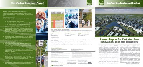
East Werribee Employment Precinct Newsletter - Growth Areas ...
East Werribee Employment Precinct Newsletter - Growth Areas ...
East Werribee Employment Precinct Newsletter - Growth Areas ...

Create successful ePaper yourself
Turn your PDF publications into a flip-book with our unique Google optimized e-Paper software.
PROPOSED CHANGES TO THE WYNDHAM PLANNING SCHEME<br />
The draft amendment makes a number of changes to the Planning Scheme to<br />
facilitate the development and use of land within the Urban <strong>Growth</strong> Zone (Schedule<br />
12).<br />
Specifically the draft amendment:<br />
<strong>East</strong> <strong>Werribee</strong> <strong>Employment</strong> <strong>Precinct</strong><br />
PRECINCT STRUCTURE PLAN<br />
• Incorporates three new documents into the planning scheme by listing them in<br />
the Schedule to Clause 81.01:<br />
• <strong>East</strong> <strong>Werribee</strong> <strong>Employment</strong> <strong>Precinct</strong> Structure Plan<br />
• <strong>East</strong> <strong>Werribee</strong> <strong>Employment</strong> <strong>Precinct</strong> Development Contributions Plan<br />
• <strong>East</strong> <strong>Werribee</strong> <strong>Employment</strong> <strong>Precinct</strong> Native Vegetation <strong>Precinct</strong> Plan<br />
• Rezones land within the amendment area from Special Use Zone Schedule 5<br />
(SUZ5) and Farming Zone Schedule 2 (FZ2) to Urban <strong>Growth</strong> Zone (UGZ).<br />
• Introduces and applies Schedule 12 to the Urban <strong>Growth</strong> Zone (UGZ12) to land in<br />
the amendment area. This zone sets out the land use and development controls<br />
for the precinct. The zone requires land use and development to be generally in<br />
accordance with the incorporated <strong>East</strong> <strong>Werribee</strong> <strong>Employment</strong> <strong>Precinct</strong> Structure<br />
Plan.<br />
• Removes Schedule 5 to the Special Use Zone (SUZ5) from the Wyndham Planning<br />
Scheme.<br />
• Removes Schedule 4 to the Development Plan Overlay (DPO4) from the Wyndham<br />
Planning Scheme. This requires changes to Planning Scheme Maps 11DPO, 12DPO,<br />
16DPO and 17DPO.<br />
• Removes the Design and Development Overlay Schedule 1 (DDO1) from the<br />
amendment area. This requires changes to Planning Scheme Maps 11DDO,<br />
12DDO, 16DDO and 17DDO.<br />
• Introduces and applies Schedule 12 to the Development Contributions Plan<br />
Overlay (DCPO12) to land in the amendment area. The overlay requires that<br />
development within the amendment area is subject to the provisions of the<br />
incorporated <strong>East</strong> <strong>Werribee</strong> <strong>Employment</strong> <strong>Precinct</strong> Development Contributions<br />
Plan.<br />
• Provides for public open space contributions for land in the <strong>East</strong> <strong>Werribee</strong><br />
<strong>Employment</strong> <strong>Precinct</strong> Structure Plan area when land is subdivided by amending<br />
the Schedule to Clause 52.01.<br />
• Lists the <strong>East</strong> <strong>Werribee</strong> <strong>Employment</strong> <strong>Precinct</strong> Native Vegetation <strong>Precinct</strong> Plan (<strong>East</strong><br />
<strong>Werribee</strong> <strong>Employment</strong> NVPP) in the Schedule to Clause 52.16 to manage native<br />
vegetation in the precinct.<br />
• Updates the Schedule to Clause 61.01 to make the Minister for Planning the<br />
responsible authority for considering and determining certain types of applications<br />
within the <strong>East</strong> <strong>Werribee</strong> <strong>Employment</strong> <strong>Precinct</strong> Structure Plan area.<br />
• Updates the Schedule to Clause 61.03 to include Planning Scheme Map 16DCPO<br />
and 17DCPO.<br />
• Updates the schedule to Clause 66.04 to include the <strong>Growth</strong> <strong>Areas</strong> Authority as a<br />
referral authority for subdivision in accordance with the provisions of UGZ12.<br />
WHERE TO INSPECT THE DETAILS AND HAVE YOUR SAY<br />
You may inspect the plans for the <strong>East</strong> <strong>Werribee</strong> <strong>Employment</strong> <strong>Precinct</strong> and supporting documentation on the GAA website www.gaa.vic.gov.au or<br />
during office hours at:<br />
GROWTH AREAS AUTHORITY<br />
Level 29<br />
35 Collins Street<br />
MELBOURNE VIC 3000<br />
COLLECTION NOTICE FOR CONSULTATION / SUBMISSIONS<br />
Consultation, including receiving submissions, is necessary for the GAA to perform its functions<br />
of planning, use, development and protection of land in the growth areas under s46AS of the<br />
Planning and Environment Act 1987.<br />
The primary purpose of submissions is to ensure a consultative process that gives all parties an<br />
opportunity to inform the development and refinement of a <strong>Precinct</strong> Structure Plan, and the<br />
GAA considers that it is important that all submissions received are made available as part of the<br />
consultation process.<br />
Accordingly, submissions will be made available for public inspection at the premises of the<br />
<strong>Growth</strong> <strong>Areas</strong> Authority (GAA) until two months after gazettal of the resulting planning scheme<br />
CONTACT US<br />
<strong>Growth</strong> <strong>Areas</strong> Authority<br />
Level 29, 35 Collins Street, Melbourne VIC 3000<br />
Phone: (03) 9651 9600 Fax: (03) 9651 9623<br />
info@gaa.vic.gov.au www.gaa.vic.gov.au<br />
Printed with vegetable-based inks, using an alcohol-free<br />
process, on Australian Made 100% Recycled Paper<br />
WYNDHAM CITY CIVIC CENTRE<br />
Municipal Offices<br />
45 Princes Highway WERRIBEE 3030<br />
Phone: (03) 9205 2200<br />
The <strong>Growth</strong> <strong>Areas</strong> Authority is always interested in<br />
your views about our programs and initiatives, and the<br />
issues covered in this newsletter.<br />
If you would you like to receive regular email updates<br />
on the work of the <strong>Growth</strong> <strong>Areas</strong> Authority, please<br />
register via our website www.gaa.vic.gov.au<br />
WERRIBEE DEVELOPMENT<br />
CENTRE<br />
2/10 Watton Street WERRIBEE 3030<br />
Phone: (03) 9205 2200<br />
INFORMATION SESSIONS<br />
Details of public information sessions can be found on the <strong>Growth</strong> <strong>Areas</strong> Authority website: www.gaa.vic.gov.au or by calling the GAA on 9651 9600<br />
MAKING A SUBMISSION<br />
Any person who may be affected by the draft amendment may make their views known in writing to the GAA. The closing date for comments is<br />
Monday 11 February, 2013.<br />
Comments must be made in writing, referencing the <strong>East</strong> <strong>Werribee</strong> <strong>Employment</strong> <strong>Precinct</strong> Structure Plan and sent to the GAA at the postal address<br />
below or via email to amendments@gaa.vic.gov.au<br />
FURTHER INFORMATION<br />
GROWTH AREAS AUTHORITY<br />
Paul Byrne, Director Economic Planning and Development<br />
paul.byrne@gaa.vic.gov.au<br />
Stuart Miles, Structure Planning Manager<br />
stuart.miles@gaa.vic.gov.au<br />
amendment. Submissions will also be made available electronically to relevant local councils and<br />
other involved government organisations in addition to developers, landowners, other submitters<br />
and interested parties on request during the same period as above. Information contained within<br />
submissions may also be used for other planning purposes undertaken by the GAA such as corridor<br />
plans and biodiversity studies<br />
Further information on privacy of information can be found at www.gaa.vic.gov.au or by phoning<br />
the GAA (9651-9600).<br />
Copyright: By making a submission, authors give permission for copies of their submissions to be<br />
made public and provided to interested parties.<br />
This publication may be of assistance to you but the<br />
<strong>Growth</strong> <strong>Areas</strong> Authority and its employees do not<br />
guarantee that the publication is without flaw of<br />
any kind or is wholly appropriate for your particular<br />
purposes and therefore disclaims all liability for any<br />
error, loss or other consequence which may arise from<br />
you relying on any information in this publication.<br />
<strong>East</strong> <strong>Werribee</strong> <strong>Employment</strong> <strong>Precinct</strong><br />
PRECINCT STRUCTURE PLAN<br />
partners in creating new communities<br />
Conceptual image : LAB architecture<br />
NOVEMBER 2012<br />
A new chapter for <strong>East</strong> <strong>Werribee</strong><br />
Innovation, jobs and liveability<br />
The <strong>East</strong> <strong>Werribee</strong> <strong>Employment</strong> <strong>Precinct</strong> structure plan (PSP) will allow<br />
the development of a mixed use business precinct that will create<br />
opportunities for 50,000 jobs, most of which will be white collar. These<br />
jobs will be in a new Town Centre and Commercial <strong>Precinct</strong>s, a Health and<br />
Learning <strong>Precinct</strong>, and new Enterprise and Business precincts focussed on<br />
a new interchange at Sneydes Road. Approximately 7,000 new homes<br />
will also be provided to provide local homes for the workers and business<br />
leaders at <strong>East</strong> <strong>Werribee</strong>, and to ensure that the area is a lively and bustling<br />
place in the evenings and at weekends. <strong>East</strong> <strong>Werribee</strong> <strong>Employment</strong><br />
<strong>Precinct</strong> will be an attractive place to invest, work and live, with a new lake<br />
and waterway system, a heritage park/botanic gardens, and excellent new<br />
sports facilities and local parks.<br />
The plan relates to the former State Research Farm on both sides of the<br />
Maltby Bypass, and south of Princes Highway, but excludes the area<br />
already planned in Point Cook West. The future urban structure plan<br />
overleaf gives more details.<br />
Most of the land covered by the PSP is owned by the State Government,<br />
and has been used for agriculture and food related research for about<br />
100 years. This has led to the area becoming a centre for research and<br />
education, with the University of Melbourne Faculty of Veterinary Science,<br />
Victoria University, and CSIRO being located on the site. The precinct is<br />
also home to a range of medical facilities including the <strong>Werribee</strong> Mercy<br />
Hospital. The PSP provides the opportunity for similar highly valued<br />
employment opportunities to grow over time in the area to create a<br />
modern, high quality place to work, to live and to relax after work and<br />
at weekends.<br />
The PSP links the area to wider metropolitan Melbourne through proposals<br />
for a new freeway interchange at Sneydes Road, and for a future proposed<br />
train station at Derrimut Road. Once completed, the interchange will take<br />
the pressure off traffic through Point Cook and unlock the 774ha <strong>East</strong><br />
<strong>Werribee</strong> site, which currently has no access to the freeway despite having<br />
3km of freeway frontage.<br />
The GAA has developed the draft <strong>East</strong> <strong>Werribee</strong> <strong>Employment</strong> <strong>Precinct</strong><br />
structure plan in consultation with Wyndham City Council. Before<br />
finalising the plan, the <strong>Growth</strong> <strong>Areas</strong> Authority (GAA) wishes to hear your<br />
views.<br />
Please send your comments to the GAA by Monday 11 February, 2013.<br />
See plan overleaf for proposed layout and details...
<strong>East</strong> <strong>Werribee</strong> <strong>Employment</strong> <strong>Precinct</strong><br />
PRECINCT STRUCTURE PLAN<br />
partners in creating new communities<br />
THE PLAN<br />
The <strong>East</strong> <strong>Werribee</strong> <strong>Employment</strong> <strong>Precinct</strong> structure plan covers an area of 774<br />
hectares or approximately 1910 acres.<br />
VISION<br />
<strong>East</strong> <strong>Werribee</strong> will combine with the <strong>Werribee</strong> City Centre and grow to form<br />
the Capital of Melbourne’s New West: a focal point of economic, cultural<br />
and environmental excellence. Serviced by three train stations including<br />
a proposed new station at Derrimut Road, a new freeway interchange at<br />
Sneydes Road, and highly attractive tree lined boulevards; <strong>East</strong> <strong>Werribee</strong><br />
will be a regional centre for high skilled employment and services, with an<br />
emphasis on research, technology, education, health, business services and<br />
advanced clean manufacturing, integrated with a diverse range of high quality<br />
supporting dwellings.<br />
<strong>East</strong> <strong>Werribee</strong> will feature a unique waterway and parkland setting, including<br />
an innovative and highly sustainable lake and a new heritage park/botanic<br />
gardens which will provide an opportunity for workers and residents to relax<br />
and enjoy themselves.<br />
<strong>East</strong> <strong>Werribee</strong> consists of the following eight precincts:<br />
<strong>East</strong> <strong>Werribee</strong> Town Centre<br />
Commercial <strong>Precinct</strong>s<br />
Health and Learning <strong>Precinct</strong><br />
Enterprise <strong>Precinct</strong><br />
Interchange Business <strong>Precinct</strong><br />
Lakeside <strong>Precinct</strong><br />
Wattle Avenue New Community<br />
Point Cook South West New Community<br />
A Vision for each of these precincts is set out in the relevant section of the<br />
<strong>Precinct</strong> Structure Plan.<br />
FUTURE TRANSPORT NETWORK<br />
Access to the Princes Freeway and delivery of new arterial roads is a key<br />
aspect of planning the <strong>East</strong> <strong>Werribee</strong> <strong>Employment</strong> <strong>Precinct</strong>. Unlocking the<br />
site’s access to the Princes Freeway through development of a Sneydes Road<br />
interchange is a priority. This will improve existing access problems for<br />
residents of local areas such as Point Cook. Sneydes Road will be redesigned<br />
as an attractive boulevard, similar to Royal Parade or St Kilda Road, and this<br />
tree lined theme will continue through much of the precinct. Public transport,<br />
walking and cycling will form important elements of the transport network in<br />
this busy and bustling precinct.<br />
DRAFT PLANNING SCHEME AMENDMENT<br />
An amendment (C179) is being proposed to incorporate the plan and make<br />
other associated changes to the Wyndham Planning Scheme. The proposed<br />
changes are outlined overleaf.<br />
precinct area<br />
urban growth boundary<br />
town centre<br />
commercial precinct<br />
health and learning precinct<br />
interchange business precinct<br />
enterprise precinct<br />
medium/high density residential<br />
conventional density residential<br />
school<br />
community facilities<br />
open space (see details plan 7)<br />
heritage<br />
permanent water<br />
freeway & interchange<br />
primary arterial road<br />
secondary arterial road<br />
boulevard connector street<br />
connector street<br />
access street (indicative location)<br />
reserve for potential future<br />
grade separation of arterial road<br />
rail line & station<br />
proposed station<br />
shared pedestrian/cycle bridge<br />
easement<br />
utilities<br />
WERRIBEE<br />
CITY<br />
CENTRE<br />
future urban structure<br />
1:15,000 @ A3<br />
V121115<br />
0 200 400 600 800 1,000<br />
WERRIBEE PLAZA<br />
DERRIMUT ROAD<br />
SNEYDES ROAD<br />
Heritage<br />
Area<br />
Local<br />
Town<br />
Centre<br />
<strong>East</strong> <strong>Werribee</strong><br />
Town Centre<br />
Proposed<br />
State<br />
Primary<br />
School<br />
(P-6)<br />
HEATHS ROAD<br />
PRINCES HIGHWAY<br />
LAKESIDE AVENUE<br />
University<br />
of<br />
Melbourne<br />
Mercy<br />
Hospital<br />
Victoria<br />
University<br />
DUNNINGS ROAD<br />
Suzanne<br />
Cory School<br />
MORRIS ROAD<br />
PRINCES PRINCES FREEWAY FREEWAY<br />
Hoppers<br />
Crossing<br />
HOPPERS LANE<br />
Local<br />
Town<br />
Centre<br />
Wyndham<br />
Sporting<br />
Complex<br />
Hoppers Crossing<br />
Town Centre<br />
Transition<br />
Melbourne<br />
Water<br />
Pumping<br />
Station<br />
MALTBY MALTBY BYPASS BYPASS<br />
Potential<br />
Non-Gov.<br />
Primary<br />
School<br />
Proposed<br />
State<br />
School<br />
(P-9)<br />
POINT COOK<br />
WEST PSP<br />
Local<br />
Town<br />
Centre


