

Lockerbie Native Vegetation Precinct Plan - Growth Areas Authority
Lockerbie Native Vegetation Precinct Plan - Growth Areas Authority
Lockerbie Native Vegetation Precinct Plan - Growth Areas Authority

You also want an ePaper? Increase the reach of your titles
YUMPU automatically turns print PDFs into web optimized ePapers that Google loves.
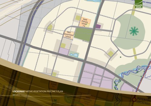
HUME FREEWAY<br />
State<br />
Primary<br />
School<br />
LOCKERBIE NATIVE VEGETATION PRECINCT PLAN<br />
MAY 2012<br />
P-6<br />
Non<br />
Government<br />
School<br />
State<br />
Primary<br />
School<br />
P-6<br />
State<br />
Secondary<br />
School<br />
7-12<br />
POTENTIAL<br />
LOCKERBIE S
ii<br />
LOCKERBIE NATIVE VEGETATION PRECINCT PLAN
CONTENTS<br />
INTRODUCTION 3<br />
1.0 PURPOSE 3<br />
2.0 VEGETATION PROTECTION OBJECTIVESTO BE ACHIEVED 5<br />
3.0 THE NATIVE VEGETATIONTO BE PROTECTED 5<br />
3.1 Specific requirements for subdivisions, buildings and works within 50 metres of native vegetation ‘to be protected’ as identified in the NVPP Tables 1 and 2 and areas shown to be<br />
protected on Map 2 in this NVPP 5<br />
4.0 NATIVE VEGETATIONTHAT CAN BE REMOVED DESTROYED OR LOPPED 9<br />
4.1 Conditions for removal of native vegetation 9<br />
4.2 Requirements for removal of native vegetation 10<br />
5.0 REFERENCE DOCUMENTS 13<br />
6.0 ACRONYMS 13<br />
LOCKERBIE NATIVE VEGETATION PRECINCT PLAN<br />
1
2<br />
LOCKERBIE NATIVE VEGETATION PRECINCT PLAN<br />
Gunns Gully Road<br />
Donnybrook Road<br />
map 1<br />
area to which this NVPP Applies<br />
lockerbie NVPP<br />
Hume Freeway<br />
6<br />
1<br />
KALKALLO<br />
TOWNSHIP<br />
(Not included in PSP)<br />
24 25<br />
26<br />
23<br />
13<br />
2<br />
27<br />
28<br />
8<br />
20<br />
14<br />
7<br />
3<br />
29<br />
R1<br />
21<br />
31<br />
30<br />
33<br />
36 34<br />
37 35<br />
38<br />
39 40 41<br />
32<br />
4<br />
22<br />
9<br />
16<br />
17 18<br />
19<br />
Merri Creek<br />
12<br />
15<br />
11<br />
10<br />
5<br />
22<br />
<strong>Native</strong> <strong>Vegetation</strong> <strong>Precinct</strong> <strong>Plan</strong> Area<br />
Property Reference Number<br />
Area not included in NVPP
INTRODUCTION<br />
This is the <strong>Lockerbie</strong> <strong>Native</strong> <strong>Vegetation</strong> <strong>Precinct</strong> <strong>Plan</strong> (‘the <strong>Lockerbie</strong><br />
NVPP’) listed under the Schedule to Clause 52.16 of the Hume <strong>Plan</strong>ning<br />
Scheme.<br />
The removal, destruction or lopping of native vegetation in accordance<br />
with this <strong>Native</strong> <strong>Vegetation</strong> <strong>Precinct</strong> <strong>Plan</strong> does not require a permit<br />
provided conditions and requirements specified in this <strong>Native</strong><br />
<strong>Vegetation</strong> <strong>Precinct</strong> <strong>Plan</strong> are met.<br />
The <strong>Lockerbie</strong> NVPP applies to land within the ‘NVPP boundary’ shown<br />
in NVPP Map 1.<br />
The prescription and requirements for protection and offset under the<br />
Biodiversity Conservation Strategy for the Grassy Eucalypt Woodland<br />
of the Victoria Volcanic <strong>Plan</strong> and habitat of the Striped Legless Lizard<br />
and Golden Sun Moth have been considered in preparing the<br />
<strong>Lockerbie</strong> NVPP. The loss is directly related to the removal, destruction<br />
or lopping of native vegetation.<br />
1.0 PURPOSE<br />
The purpose of the <strong>Lockerbie</strong> NVPP is:<br />
• To apply a holistic, landscape wide approach to retention<br />
and removal of native vegetation within the <strong>Lockerbie</strong> <strong>Native</strong><br />
<strong>Vegetation</strong> <strong>Precinct</strong> <strong>Plan</strong> area (the area identified in Map 1).<br />
• To specify the native vegetation to be protected and the native<br />
vegetation that can be removed, destroyed or lopped.<br />
• To ensure that areas set aside to protect native vegetation are<br />
managed to conserve ecological values in accordance with the<br />
<strong>Lockerbie</strong> <strong>Precinct</strong> Structure <strong>Plan</strong>.<br />
• To ensure that the removal, destruction or lopping of native<br />
vegetation is in accordance with the three-step approach to<br />
achieve a sustainable ecological benefit as set out in Victoria’s<br />
<strong>Native</strong> <strong>Vegetation</strong> Management – a Framework for Action, DSE<br />
2002.<br />
• To set out the works or other necessary actions required to offset<br />
the removal, destruction or lopping of native vegetation.<br />
• To streamline the planning approvals process through a<br />
landscape approach to native vegetation protection and<br />
management.<br />
LOCKERBIE NATIVE VEGETATION PRECINCT PLAN<br />
3
4<br />
LOCKERBIE NATIVE VEGETATION PRECINCT PLAN<br />
Gunns Gully Road<br />
Donnybrook Road<br />
6<br />
1<br />
KALKALLO<br />
TOWNSHIP<br />
(Not included in PSP)<br />
map 2<br />
native vegetation to be protected & which can be removed<br />
lockerbie NVPP<br />
Hume Freeway<br />
HZ71<br />
HZ5<br />
HZ7<br />
HZ4<br />
24 25<br />
HZ6<br />
26<br />
HZ92<br />
HZ42<br />
23<br />
13<br />
2<br />
ST65<br />
HZ40<br />
HZ41<br />
HZ82<br />
ST74<br />
27<br />
28<br />
8<br />
HZ36<br />
HZ91<br />
20<br />
HZ84<br />
HZ35<br />
HZ87<br />
14<br />
HZ86<br />
7<br />
3<br />
HZ55<br />
HZ94 HZ93<br />
29<br />
HZ57<br />
HZ38<br />
HZ72<br />
HZ75<br />
21<br />
HZ74<br />
31<br />
HZ76<br />
HZ33<br />
HZ39<br />
HZ90<br />
HZ34<br />
HZ119<br />
HZ3<br />
30<br />
R1<br />
33 32<br />
36<br />
37<br />
34<br />
35<br />
38<br />
39 40 41<br />
HZ2<br />
HZ1<br />
4<br />
HZ62<br />
HZ78<br />
HZ32<br />
HZ37<br />
HZ73<br />
HZ80<br />
HZ118<br />
ST53<br />
HZ77<br />
22<br />
HZ116<br />
HZ117<br />
HZ9<br />
HZ81<br />
9<br />
16<br />
17 18<br />
19<br />
HZ56<br />
HZ10<br />
HZ8<br />
HZ58<br />
HZ15<br />
HZ79<br />
HZ12<br />
12<br />
15<br />
ST19<br />
11<br />
10<br />
HZ11<br />
HZ13<br />
HZ70<br />
HZ64<br />
HZ14<br />
HZ59<br />
HZ66<br />
5<br />
HZ63<br />
HZ61<br />
HZ60<br />
22<br />
<strong>Precinct</strong> Structure <strong>Plan</strong> Area<br />
Remnant patches to be retained<br />
Remnant patches to be removed<br />
Scattered Trees to be retained<br />
Scattered Trees to be removed<br />
Property Reference Number<br />
Area not included in NVPP
2.0 VEGETATION PROTECTION<br />
OBJECTIVESTO BE ACHIEVED<br />
The objectives of this <strong>Native</strong> <strong>Vegetation</strong> <strong>Precinct</strong> <strong>Plan</strong> (NVPP) are to:<br />
• Protect and manage native vegetation.<br />
• Manage the native vegetation to be protected for conservation<br />
purposes and allow for passive recreation such as cycling and<br />
walking on the edge of native vegetation where appropriate,<br />
without damaging the vegetation.<br />
• Manage the native vegetation to be protected for conservation<br />
purposes and allow for passive recreation such as cycling and<br />
walking on the edge of native vegetation where appropriate,<br />
without damaging the vegetation.<br />
• Protect the connectivity of native vegetation within the Merri<br />
Creek corridor.<br />
• Protect and manage native vegetation and scattered trees<br />
identified ‘to be protected’ as they present genetic lineage of<br />
site-adapted local plant species and communities, provide<br />
existing habitat for indigenous fauna species, function to<br />
link habitat across the landscape, and provide a focus for<br />
revegetation activities.<br />
• Protect and manage the long-term health and habitat value of<br />
the native vegetation specified ‘to be protected’ and identified<br />
offset areas.<br />
• Maximise the ability of native vegetation to persist without<br />
human intervention.<br />
• Provide for the protection of revegetated areas of native<br />
vegetation as required by the responsible authority and offset<br />
sites.<br />
Table 1: Habitat Zones to be protected<br />
PROPERTY DETAILS<br />
HABITAT<br />
EPBC LISTED EVC DESCRIPTION SIZE<br />
ZONE<br />
EGOLOGICAL<br />
STREET ADDRESS PARCEL DESCRIPTION COMMUNITY NO. AND INITIALS IN HECTARES<br />
3.0 THE NATIVE VEGETATIONTO BE<br />
PROTECTED<br />
The native vegetation to be protected is described in NVPP Tables 1<br />
and 2 and shown on NVPP Map 2 and should not be removed.<br />
The native vegetation shown as ‘to be protected’ is based ona landscape<br />
wide approach to retention and removal of native vegetation rather<br />
than a site by site approach.<br />
Decisions relating to the removal of areas of individual trees and/or<br />
areas of native vegetation have been made in a holistic manner taking<br />
into account habitat zones which are proposed to be protected. The ad<br />
hoc removal of native vegetation which is identified ‘to be protected’<br />
should be avoided as it may undermine the holistic and landscape<br />
wide approach of the NVPP.<br />
In this NVPP, the protection of a tree (including a tree in a habitat zone<br />
or a scattered tree) refers to a protection area of twice the canopy<br />
diameter of the tree(s).<br />
Protection of a scattered tree means that the protection area must be:<br />
• Protected from adverse impacts, grazing, burning, and soil<br />
disturbance.<br />
• Managed to retain fallen timber, control weeds, and provide<br />
intervention and or management if necessary to ensure<br />
adequate natural regeneration or planting can occur.<br />
• Protected from earthworks, compaction during construction or<br />
adverse modification of existing drainage patterns.<br />
Unless otherwise stated in writing from the Department of<br />
Sustainability and Environment.<br />
CONSERVATION<br />
STATUS<br />
LEAST CONCERN,<br />
ENDANGERED ETC<br />
CONSERVATION<br />
SIGNIFICANCE<br />
LOW, HIGH ETC<br />
NUMBER OF VLOTS,<br />
LOTS WITHIN<br />
HABITAT ZONE<br />
1440 Hume Hwy, Donnybrook, 3064 Lot 1 TP239265 HZ8 (68) CGW 0.58 Endangered Very High 21<br />
1440 Hume Hwy, Donnybrook, 3064 Lot 1 TP239265 HZ9 (649) SKS 0.54 Endangered Very High 0<br />
1440 Hume Hwy, Donnybrook, 3064 Lot 1 TP239265 HZ10 (68) CGW 0.56 Endangered Very High 7<br />
110 Dwyer St, Kalkallo, 3064 Lot 1 LP132995 HZ37 NTGVVP (55) PGW 0.59 Endangered High 0<br />
300 Hume Hwy, Beveridge, 3753 Lot 2 LP123742 HZ63 (68) CGW 0.37 Endangered High 5<br />
300 Hume Hwy, Beveridge, 3753 Lot 2 LP123742 HZ64 (68) CGW 0.37 Endangered Very High 6<br />
1440 Hume Hwy, Donnybrook, 3064 Lot 1 TP239265 HZ79 (68) CGW 0.37 Endangered Very High 13<br />
1440 Hume Hwy, Donnybrook, 3064 Lot 1 TP239265 HZ80 (68) CGW 0.64 Endangered High 18<br />
1440 Hume Hwy, Donnybrook, 3064 Lot 1 TP239265 HZ81 NTGVVP (55) PGW 0.14 Endangered High 0<br />
40 Dwyer St, Kalkallo, 3064 Lot 2 LP132995 HZ90 NTGVVP (649) SKS 2.99 Endangered High 0<br />
130 Springs Rd, Donnybrook, 3064 Lot 1 TP220528 HZ116 NTGVVP (649) SKS 0.33 Endangered Very High 0<br />
130 Springs Rd, Donnybrook, 3064 Lot 1 TP220528 HZ117 NTGVVP (55) PGW 1.19 Endangered High 0<br />
LOCKERBIE NATIVE VEGETATION PRECINCT PLAN<br />
3.1 SPECIFIC REQUIREMENTS FOR SUBDIVISIONS,<br />
BUILDINGS AND WORKS WITHIN 50 METRES<br />
OF NATIVE VEGETATION ‘TO BE PROTECTED’ AS<br />
IDENTIFIED IN THE NVPP TABLES 1 AND 2 AND<br />
AREAS SHOWN TO BE PROTECTED ON MAP 2 IN<br />
THIS NVPP<br />
The following requirements must be included on all planning permits<br />
for subdivision, building and or, works or vegetation removalworks<br />
proposed within 50 metres of native vegetation identified as ‘to be<br />
protected’ in NVPP Tables 1 and 2 and Map 2 of this <strong>Native</strong> <strong>Vegetation</strong><br />
<strong>Precinct</strong> <strong>Plan</strong> unless otherwise agreed to in writing by the Department<br />
of Sustainability and Environment:<br />
• Only the native vegetation which is identified for removal in the<br />
incorporated <strong>Native</strong> <strong>Vegetation</strong> <strong>Precinct</strong> <strong>Plan</strong> (NVPP) applying<br />
to the land may be removed, lopped or destroyed unless this<br />
permit also authorises the removal of native vegetation.<br />
• Prior to the commencement of works within 50 metres of native<br />
vegetation ‘to be protected’ in the <strong>Native</strong> <strong>Vegetation</strong> <strong>Precinct</strong><br />
<strong>Plan</strong> referred to in the Schedule to Clause 52.16, a highly visible<br />
vegetation protection fence must be erected around twice the<br />
canopy distance of each scattered tree and more than 2 metres<br />
from areas of all other native vegetation which have been<br />
identified to be protected unless otherwise agreed to in writing<br />
by the Department of Sustainability and Environment.<br />
• Any construction stockpiles, fill and machinery must be placed<br />
away from areas supporting native vegetation and drainage<br />
lines to the satisfaction of the responsible authority.<br />
• All earthworks must be undertaken in a manner that will<br />
minimise soil erosion and adhere to Construction Techniques for<br />
Sediment Pollution Control (EPA 1991) or updated version.<br />
• Any public open space infrastructure or trails are to be<br />
located outside a protection area of a scattered tree or habitat<br />
zone at an appropriate buffer distance. Public open space<br />
infrastructure provided within 50 meters of native vegetation<br />
(including scattered trees and habitat zones) shown as to be<br />
protected must be constructed and designed to ensure that<br />
the native vegetation is protected from adverse impacts during<br />
construction unless otherwise agreed to in writing by the<br />
Department of Sustainability and Environment.<br />
• To minimise the risk of trees which are identified in this NVPP<br />
as to be protected having to be removed at a later time, public<br />
use areas are to be located so that the native vegetation shown<br />
as to be protected in this NVPP is not so close as to present<br />
a structural failure hazard or pose a risk to personal safety or<br />
property.<br />
• No earthworks, compaction or modification of existing drainage<br />
patterns may be undertaken which present a risk to any remnant<br />
trees, understorey, or revegetation areas.<br />
5
6<br />
LOCKERBIE NATIVE VEGETATION PRECINCT PLAN<br />
Table 2: Scattered Trees to be protected<br />
PROPERTY DETAILS<br />
STREET ADDRESS PARCEL DESCRIPTION<br />
TREE ID SPECIES<br />
CONSERVATION<br />
STATUS<br />
LEAST CONCERN,<br />
ENDANGERED ETC<br />
CONSERVATION<br />
SIGNFICANCE<br />
Y- LONGITUDE X - LATITUDE<br />
HIGH, LOW ETC GPS CO-ORDINATES GPS CO-ORDINATES<br />
805 Donnybrook Rd, Donnybrook 3064 Lot 1 TP443550 1 Eucalyptus camaldulensis Endangered Low 144.955 -37.5445<br />
805 Donnybrook Rd, Donnybrook 3064 Lot 1 TP443550 2 Eucalyptus camaldulensis Endangered High 144.955 -37.5444<br />
805 Donnybrook Rd, Donnybrook 3064 Lot 1 TP443550 3 Eucalyptus camaldulensis Endangered High 144.956 -37.5435<br />
805 Donnybrook Rd, Donnybrook 3064 Lot 1 TP443550 4 Eucalyptus camaldulensis Endangered High 144.956 -37.5434<br />
1440 Hume Hwy, Donnybrook 3064 Lot 1 TP239265 5 Eucalyptus camaldulensis Endangered Low 144.956 -37.5431<br />
1440 Hume Hwy, Donnybrook 3064 Lot 1 TP239265 6 Eucalyptus camaldulensis Endangered Low 144.956 -37.543<br />
1440 Hume Hwy, Donnybrook 3064 Lot 1 TP239265 7 Eucalyptus camaldulensis Endangered Low 144.956 -37.543<br />
1440 Hume Hwy, Donnybrook 3064 Lot 1 TP239265 8 Eucalyptus camaldulensis Endangered Low 144.957 -37.5429<br />
1440 Hume Hwy, Donnybrook 3064 Lot 1 TP239265 9 Eucalyptus camaldulensis Endangered Low 144.957 -37.5428<br />
1440 Hume Hwy, Donnybrook 3064 Lot 1 TP239265 10 Eucalyptus camaldulensis Endangered High 144.957 -37.5427<br />
1440 Hume Hwy, Donnybrook 3064 Lot 1 TP239265 11 Eucalyptus camaldulensis Endangered High 144.957 -37.5427<br />
1440 Hume Hwy, Donnybrook 3064 Lot 1 TP239265 12 Eucalyptus camaldulensis Endangered Low 144.957 -37.5427<br />
1440 Hume Hwy, Donnybrook 3064 Lot 1 TP239265 13 Eucalyptus camaldulensis Endangered Low 144.957 -37.5427<br />
1440 Hume Hwy, Donnybrook 3064 Lot 1 TP239265 14 Eucalyptus camaldulensis Endangered High 144.958 -37.5426<br />
1440 Hume Hwy, Donnybrook 3064 Lot 1 TP239265 15 Eucalyptus camaldulensis Endangered High 144.958 -37.5425<br />
1440 Hume Hwy, Donnybrook 3064 Lot 1 TP239265 16 Eucalyptus camaldulensis Endangered Low 144.964 -37.5328<br />
1440 Hume Hwy, Donnybrook 3064 Lot 1 TP239265 17 Eucalyptus camaldulensis Endangered Low 144.964 -37.5377<br />
1440 Hume Hwy, Donnybrook 3064 Lot 1 TP239265 18 Eucalyptus camaldulensis Endangered Low 144.963 -37.5471<br />
1440 Hume Hwy, Donnybrook 3064 Lot 1 TP239265 20 Eucalyptus camaldulensis Endangered Low 144.959 -37.5426<br />
1450 Hume Hwy, Kalkallo 3064 Lot 2 LP123742 45 Stag Endangered High 144.954 -37.5489<br />
300 Hume Hwy, Beveridge 3753 Lot 2 LP123742 46 Eucalyptus viminalis Endangered Very high 144.954 -37.5489<br />
300 Hume Hwy, Beveridge 3753 Lot 2 LP123742 47 Eucalyptus camaldulensis Endangered High 144.96 -37.5413<br />
300 Hume Hwy, Beveridge 3753 Lot 2 LP123742 48 Eucalyptus camaldulensis Endangered Low 144.959 -37.5409<br />
300 Hume Hwy, Beveridge 3753 Lot 2 LP123742 49 Eucalyptus camaldulensis Endangered Low 144.96 -37.54<br />
300 Hume Hwy, Beveridge 3753 Lot 2 LP123742 50 Eucalyptus camaldulensis Endangered Low 144.959 -37.5237<br />
300 Hume Hwy, Beveridge 3753 Lot 2 LP123742 51 Eucalyptus camaldulensis / Eucalyptus Ovata Hybrid Endangered High 144.96 -37.5228<br />
300 Hume Hwy, Beveridge 3753 Lot 2 LP123742 52 Eucalyptus camaldulensis Endangered Low 144.96 -37.5222<br />
705-725 Donnybrook Rd, Kalkallo 3064 Lot 1 TP102426 54 Eucalyptus camaldulensis Endangered Low 144.96 -37.5216<br />
1440 Hume Hwy, Donnybrook 3064 Lot 2 PS533467 55 Eucalyptus camaldulensis Endangered Low 144.96 -37.5215<br />
1440 Hume Hwy, Donnybrook 3064 Lot 2 PS533467 56 Eucalyptus camaldulensis Endangered Low 144.96 -37.5215<br />
1440 Hume Hwy, Donnybrook 3064 Lot 2 PS533467 57 Eucalyptus camaldulensis Endangered Low 144.981 -37.514<br />
1440 Hume Hwy, Donnybrook 3064 Lot 2 PS533467 58 Eucalyptus camaldulensis Endangered High 144.979 -37.5134<br />
1440 Hume Hwy, Donnybrook 3064 Lot 2 PS533467 59 Stag Endangered High 144.98 -37.5133<br />
1440 Hume Hwy, Donnybrook 3064 Lot 2 PS533467 60 Acacia melanoxylon Endangered High 144.98 -37.5133<br />
1440 Hume Hwy, Donnybrook 3064 Lot 2 PS533467 61 Eucalyptus camaldulensis Endangered Low 144.98 -37.5132<br />
1440 Hume Hwy, Donnybrook 3064 Lot 2 PS533467 62 Eucalyptus camaldulensis Endangered Low 144.981 -37.513<br />
1440 Hume Hwy, Donnybrook 3064 Lot 2 PS533467 63 Eucalyptus camaldulensis Endangered High 144.98 -37.5127<br />
1440 Hume Hwy, Donnybrook 3064 Lot 2 PS533467 64 Eucalyptus camaldulensis Endangered High 144.962 -37.5568<br />
1440 Hume Hwy, Donnybrook 3064 Lot 2 PS533467 66 Eucalyptus camaldulensis Endangered High 144.962 -37.5568<br />
1440 Hume Hwy, Donnybrook 3064 Lot 2 PS533467 67 Stag Endangered High 144.962 -37.5567<br />
1440 Hume Hwy, Donnybrook 3064 Lot 2 PS533467 68 Eucalyptus camaldulensis Endangered Low 144.963 -37.5565<br />
1440 Hume Hwy, Donnybrook 3064 Lot 2 PS533467 69 Eucalyptus camaldulensis Endangered Low 144.955 -37.5505<br />
1440 Hume Hwy, Donnybrook 3064 Lot 2 PS533467 70 Eucalyptus camaldulensis Endangered Low 144.955 -37.5505
Table 2: Scattered Trees to be protected (con’t)<br />
PROPERTY DETAILS<br />
STREET ADDRESS PARCEL DESCRIPTION<br />
TREE ID SPECIES<br />
CONSERVATION<br />
STATUS<br />
LEAST CONCERN,<br />
ENDANGERED ETC<br />
LOCKERBIE NATIVE VEGETATION PRECINCT PLAN<br />
CONSERVATION<br />
SIGNFICANCE<br />
Y- LONGITUDE X - LATITUDE<br />
HIGH, LOW ETC GPS CO-ORDINATES GPS CO-ORDINATES<br />
1440 Hume Hwy, Donnybrook 3064 Lot 2 PS533467 71 Eucalyptus camaldulensis Endangered Low 144.955 -37.5505<br />
1440 Hume Hwy, Donnybrook 3064 Lot 2 PS533467 72 Eucalyptus camaldulensis Endangered High 144.955 -37.5504<br />
1440 Hume Hwy, Donnybrook 3064 Lot 2 PS533467 73 Eucalyptus camaldulensis Endangered Low 144.955 -37.5502<br />
1440 Hume Hwy, Donnybrook 3064 Lot 2 PS533467 75 Eucalyptus camaldulensis Endangered Low 144.955 -37.5502<br />
1440 Hume Hwy, Donnybrook 3064 Lot 2 PS533467 76 Eucalyptus camaldulensis Endangered Low 144.954 -37.5502<br />
1440 Hume Hwy, Donnybrook 3064 Lot 2 PS533467 77 Eucalyptus camaldulensis Endangered High 144.954 -37.5501<br />
1440 Hume Hwy, Donnybrook 3064 Lot 2 PS533467 78 Eucalyptus camaldulensis Endangered Low 144.954 -37.5501<br />
1440 Hume Hwy, Donnybrook 3064 Lot 2 PS533467 79 Eucalyptus camaldulensis Endangered High 144.954 -37.5501<br />
1440 Hume Hwy, Donnybrook 3064 Lot 2 PS533467 80 Eucalyptus camaldulensis Endangered Low 144.954 -37.5501<br />
1440 Hume Hwy, Donnybrook 3064 Lot 2 PS533467 81 Eucalyptus camaldulensis Endangered Low 144.954 -37.5498<br />
1440 Hume Hwy, Donnybrook 3064 Lot 2 PS533467 82 Eucalyptus camaldulensis Endangered High 144.962 -37.5568<br />
1440 Hume Hwy, Donnybrook 3064 Lot 2 PS533467 83 Eucalyptus camaldulensis Endangered High 144.961 -37.5567<br />
1440 Hume Hwy, Donnybrook 3064 Lot 2 PS533467 84 Eucalyptus camaldulensis Endangered High 144.961 -37.5563<br />
1440 Hume Hwy, Donnybrook 3064 Lot 2 PS533467 85 Eucalyptus camaldulensis Endangered Low 144.961 -37.5563<br />
1440 Hume Hwy, Donnybrook 3064 Lot 2 PS533467 86 Eucalyptus camaldulensis Endangered Low 144.961 -37.5562<br />
1440 Hume Hwy, Donnybrook 3064 Lot 2 PS533467 87 Eucalyptus camaldulensis Endangered Low 144.961 -37.5561<br />
1440 Hume Hwy, Donnybrook 3064 Lot 2 PS533467 88 Eucalyptus camaldulensis Endangered Low 144.96 -37.5558<br />
1440 Hume Hwy, Donnybrook 3064 Lot 2 PS533467 89 Eucalyptus camaldulensis Endangered Low 144.961 -37.5558<br />
1440 Hume Hwy, Donnybrook 3064 Lot 2 PS533467 90 Stag Endangered High 144.961 -37.5558<br />
1440 Hume Hwy, Donnybrook 3064 Lot 2 PS533467 91 Eucalyptus camaldulensis Endangered Low 144.961 -37.5558<br />
1440 Hume Hwy, Donnybrook 3064 Lot 2 PS533467 92 Eucalyptus camaldulensis Endangered Low 144.96 -37.5557<br />
1440 Hume Hwy, Donnybrook 3064 Lot 2 PS533467 93 Eucalyptus camaldulensis Endangered Low 144.961 -37.5557<br />
1440 Hume Hwy, Donnybrook 3064 Lot 2 PS533467 94 Eucalyptus camaldulensis Endangered High 144.96 -37.5553<br />
1440 Hume Hwy, Donnybrook 3064 Lot 2 PS533467 95 Stag Endangered High 144.96 -37.5552<br />
1440 Hume Hwy, Donnybrook 3064 Lot 2 PS533467 96 Eucalyptus camaldulensis Endangered Low 144.96 -37.5552<br />
1440 Hume Hwy, Donnybrook 3064 Lot 2 PS533467 97 Eucalyptus camaldulensis Endangered Low 144.96 -37.5551<br />
1440 Hume Hwy, Donnybrook 3064 Lot 2 PS533467 98 Eucalyptus camaldulensis Endangered Low 144.962 -37.5549<br />
1440 Hume Hwy, Donnybrook 3064 Lot 2 PS533467 99 Eucalyptus camaldulensis Endangered High 144.959 -37.5542<br />
1440 Hume Hwy, Donnybrook 3064 Lot 2 PS533467 100 Eucalyptus camaldulensis Endangered High 144.959 -37.554<br />
40 Dwyer St, Kalkallo 3064 Lot 2 LP132995 101 Eucalyptus camaldulensis Endangered High 144.959 -37.5538<br />
40 Dwyer St, Kalkallo 3064 Lot 2 LP132995 102 Eucalyptus camaldulensis Endangered High 144.959 -37.5536<br />
40 Dwyer St, Kalkallo 3064 Lot 2 LP132995 103 Eucalyptus camaldulensis Endangered Low 144.958 -37.5536<br />
40 Dwyer St, Kalkallo 3064 Lot 2 LP132995 104 Eucalyptus camaldulensis Endangered High 144.958 -37.5535<br />
40 Dwyer St, Kalkallo 3064 Lot 2 LP132995 105 Eucalyptus camaldulensis Endangered Low 144.958 -37.5535<br />
40 Dwyer St, Kalkallo 3064 Lot 2 LP132995 106 Eucalyptus camaldulensis Endangered Low 144.958 -37.5533<br />
40 Dwyer St, Kalkallo 3064 Lot 2 LP132995 107 Eucalyptus camaldulensis Endangered High 144.958 -37.5533<br />
40 Dwyer St, Kalkallo 3064 Lot 2 LP132995 108 Eucalyptus camaldulensis Endangered Low 144.958 -37.5531<br />
40 Dwyer St, Kalkallo 3064 Lot 2 LP132995 109 Eucalyptus camaldulensis Endangered High 144.958 -37.553<br />
40 Dwyer St, Kalkallo 3064 Lot 2 LP132995 110 Eucalyptus camaldulensis Endangered High 144.957 -37.5528<br />
110 Springs Rd, Donnybrook Rd 3064 Lot 1 TP220528 137 Eucalyptus camaldulensis Endangered Low 144.975 -37.5308<br />
110 Springs Rd, Donnybrook Rd 3064 Lot 1 TP220528 138 Eucalyptus camaldulensis Endangered high 144.976 -37.5306<br />
110 Springs Rd, Donnybrook Rd 3064 Lot 1 TP220528 139 Eucalyptus camaldulensis Endangered Low 144.957 -37.5305<br />
110 Springs Rd, Donnybrook Rd 3064 Lot 1 TP220528 140 Eucalyptus camaldulensis Endangered Low 144.957 -37.5109<br />
7
8<br />
LOCKERBIE NATIVE VEGETATION PRECINCT PLAN<br />
Table 2: Scattered Trees to be protected (con’t)<br />
PROPERTY DETAILS<br />
STREET ADDRESS PARCEL DESCRIPTION<br />
TREE ID SPECIES<br />
CONSERVATION<br />
STATUS<br />
LEAST CONCERN,<br />
ENDANGERED ETC<br />
CONSERVATION<br />
SIGNFICANCE<br />
Y- LONGITUDE X - LATITUDE<br />
HIGH, LOW ETC GPS CO-ORDINATES GPS CO-ORDINATES<br />
130 Springs Rd, Donnybrook 3064 Lot 1 TP402980 141 Eucalyptus camaldulensis Endangered High 144.957 -37.5526<br />
130 Springs Rd, Donnybrook 3064 Lot 1 TP402980 142 Eucalyptus camaldulensis Endangered High 144.957 -37.5525<br />
130 Springs Rd, Donnybrook 3064 Lot 1 TP818429 143 Eucalyptus camaldulensis Endangered High 144.956 -37.5513<br />
130 Springs Rd, Donnybrook 3064 Lot 1 TP232537 144 Eucalyptus camaldulensis Endangered High 144.956 -37.5508<br />
130 Springs Rd, Donnybrook 3064 Lot 1 TP818429 145 Eucalyptus camaldulensis Endangered High 144.974 -37.525<br />
130 Springs Rd, Donnybrook 3064 Lot 1 TP232537 146 Eucalyptus camaldulensis Endangered Low 144.974 -37.5249<br />
130 Springs Rd, Donnybrook 3064 Lot 1 TP232537 147 Eucalyptus camaldulensis Endangered High 144.974 -37.5246<br />
130 Springs Rd, Donnybrook 3064 Lot 1 TP232537 148 Eucalyptus camaldulensis Endangered High 144.974 -37.5245<br />
130 Springs Rd, Donnybrook 3064 Lot 1 TP232537 149 Eucalyptus camaldulensis Endangered Low 144.974 -37.5245<br />
130 Springs Rd, Donnybrook 3064 Lot 1 TP232537 150 Eucalyptus camaldulensis Endangered High 144.974 -37.5244<br />
130 Springs Rd, Donnybrook 3064 Lot 1 TP232537 151 Eucalyptus camaldulensis Endangered Low 144.974 -37.5244<br />
130 Springs Rd, Donnybrook 3064 Lot 1 TP232537 152 Eucalyptus camaldulensis Endangered High 144.974 -37.5243<br />
130 Springs Rd, Donnybrook 3064 Lot 1 TP232537 153 Eucalyptus camaldulensis Endangered High 144.974 -37.5242<br />
130 Springs Rd, Donnybrook 3064 Lot 1 TP232537 154 Eucalyptus camaldulensis Endangered Low 144.974 -37.524<br />
130 Springs Rd, Donnybrook 3064 Lot 1 TP232537 155 Eucalyptus camaldulensis Endangered Low 144.975 -37.5232<br />
130 Springs Rd, Donnybrook 3064 Lot 1 TP232537 156 Eucalyptus camaldulensis Endangered Low 144.975 -37.5232<br />
200 Donovans Lane, Beveridge, 3753 Lot 1 LP113763 All scattered trees TBC TBC TBC TBC TBC<br />
200 Donovans Lane, Beveridge, 3753 Lot 2 LP113763 All scattered trees TBC TBC TBC TBC TBC
4.0 NATIVEVEGETATIONTHAT CAN BE<br />
REMOVED, DESTROYED OR LOPPED<br />
The native vegetation described in Table 3 and Table 4 and shown<br />
as ‘native vegetation that can be removed’ in NVPP Map 2 can be<br />
removed, destroyed or lopped under Clause 52.16 subject to the<br />
requirements and conditions set out in this NVPP.<br />
The <strong>Lockerbie</strong> NVPP area contains suitable habitat for Striped Legless<br />
Lizard (Delmar impar) and Golden Sun Moth (Synemon plana). The<br />
application of the Prescriptions for these species requires the removal<br />
of native vegetation that is habitat to be offset, and for salvage and<br />
translocation of Striped Legless Lizard.<br />
Conditions for removal of habitat that is native vegetation have been<br />
included in Section 4.1 of the this NVPP to implement the requirements<br />
of the Prescriptions for Golden Sun Moth and Striped Legless Lizard.<br />
4.1 CONDITIONS FOR REMOVAL OF NATIVE<br />
VEGETATION<br />
• Only the native vegetation which is identified for removal in<br />
the incorporated <strong>Lockerbie</strong> NVPP applying to the land may be<br />
removed, lopped or destroyed without a permit.<br />
• The native vegetation (habitat zones or scattered trees) which<br />
is shown as vegetation which can be removed in Table 3 and<br />
4 and Map 2 of this <strong>Native</strong> <strong>Vegetation</strong> <strong>Precinct</strong> <strong>Plan</strong> may be<br />
removed if the removal of the native vegetation is offset in<br />
accordance with the offset targets set out in Table 5 and 6 of the<br />
<strong>Native</strong> <strong>Vegetation</strong> <strong>Precinct</strong> <strong>Plan</strong> and those offsets are secured<br />
to the satisfaction of the Department of Sustainability and<br />
Environment and the responsible authority.<br />
• Where large old trees (LOTs,) very large old trees (VLOTs) and<br />
offsets are not identified (or marked as ‘TBC’) in Table 2, the<br />
person proposing to remove, destroy or lop the trees must<br />
submit to the responsible authority a description of the number<br />
and size of each VLOT and LOT in order to determine the offset<br />
for that habitat zone in accordance with the Victoria’s <strong>Native</strong><br />
<strong>Vegetation</strong> Management – A Framework for Action, DSE 2002<br />
and Port Phillip & Westernport Catchment Management<br />
<strong>Authority</strong>, 2006. This applies to property 4 and 5 within the<br />
<strong>Lockerbie</strong> NVPP<br />
• Before the removal, destruction or lopping of any native<br />
vegetation within any property (identified by the PSP Property<br />
Number in Map 2 of the <strong>Lockerbie</strong> NVPP) the owner of the<br />
land from which the native vegetation is being removed must<br />
provide offsets consistent with this <strong>Native</strong> <strong>Vegetation</strong> <strong>Precinct</strong><br />
<strong>Plan</strong> by either:<br />
• Providing an allocated credit extract issued by the<br />
Department of Sustainability and Environment; or<br />
• Preparing and submitting an Offset <strong>Plan</strong> to the satisfaction<br />
of the Department of Sustainability and Environment and<br />
have the Offset <strong>Plan</strong> approved by responsible authority<br />
• Where an Offset <strong>Plan</strong> is approved:<br />
• Before the removal, destruction or lopping of any<br />
native vegetation, the owner of the land from which<br />
the native vegetation is being removed must provide<br />
on-title security for the Offset Site to the satisfaction<br />
of Department of Sustainability and Environment that<br />
provides for the implementation of the Offset <strong>Plan</strong> and<br />
pay the reasonable costs of the preparation, execution<br />
and registration of any on-title agreement; and<br />
• Offsets must be initiated within 12 months of approval<br />
of the Offset <strong>Plan</strong> or before the removal of Very High<br />
Conservation Significance vegetation, whichever is earlier,<br />
and be implemented according to the schedule of works<br />
in the Offset <strong>Plan</strong> to the satisfaction of the Responsible<br />
<strong>Authority</strong>.<br />
LOCKERBIE NATIVE VEGETATION PRECINCT PLAN<br />
• Prior to the commencement of any buildings or works or<br />
the removal of any vegetation offsets for Golden Sun Moth<br />
habitat on the land must be provided to the satisfaction of the<br />
Department of Sustainability and Environment.<br />
• Prior to removal of any native vegetation a contributory fee<br />
for Matted Flax Lily must be provided to the satisfaction of the<br />
Department of Sustainability and Environment.<br />
• Prior to the commencement of any buildings or works for<br />
the removal of any vegetation a contributory habitat fee for<br />
Growling Grass Frog Category 2 habitat on the land must be<br />
provided to the satisfaction of the Department of Sustainability<br />
and Environment.<br />
• Prior to the commencement of any building or works for the<br />
removal of any vegetation offsets for Striped Legless Lizard<br />
habitat must be provided to the satisfaction of the Department<br />
of Sustainability and Environment.<br />
• The Salvage and Translocation of Striped Legless Lizard in the<br />
Urban <strong>Growth</strong> <strong>Areas</strong> of Melbourne: Strategic Approach (DSE<br />
2011) and Salvage and Translocation of Striped Legless Lizard<br />
in the Urban <strong>Growth</strong> Aras of Melbourne: Operational <strong>Plan</strong><br />
(DSE 2011) must be implemented to the satisfaction of the<br />
Secretary of the Department of Sustainability and Environment<br />
before during and after the carrying out of any buildings or<br />
works or native vegetation removal and all specifications and<br />
requirements of the approved <strong>Plan</strong> must be complied with.<br />
• Prior to the commencement of any buildings or works, a<br />
fully costed Growling Grass Frog translocation/salvage plan<br />
must be prepared to the satisfaction of the Department of<br />
Sustainability and Environment and be submitted to and<br />
approved by the responsible authority. The approved Growling<br />
Grass Frog translocation/salvage plan must be implemented<br />
to the satisfaction of the Department of Sustainability and<br />
Environment and the responsible authority.<br />
• Prior to the commencement of any works, a fully costed<br />
Matted Flax Lily translocation and/or propagation and ex situ<br />
conservation plan must be reprepared to the satisfaction of the<br />
Department of Sustainability and Environment. The plan must<br />
be submitted to and endorsed by the Responsible <strong>Authority</strong>.<br />
When approved, the plan will be endorsed and will then form<br />
part of the permit.<br />
• The approved Matted Flax Lily translocation/propagation plan<br />
must be implemented to the satisfaction of the Department of<br />
Sustainability and Environment.<br />
9
10<br />
LOCKERBIE NATIVE VEGETATION PRECINCT PLAN<br />
4.2 REQUIREMENTS FOR REMOVAL OF NATIVE<br />
VEGETATION<br />
Offsets must be provided in accordance with Victoria’s <strong>Native</strong><br />
<strong>Vegetation</strong> Management, A Framework for Action (DSE 2002) for the<br />
removal of any native vegetation within the NVPP area.<br />
• An Offset <strong>Plan</strong> must show offsets in relation to all native<br />
vegetation within the property which this NVPP allows to be<br />
removed. The offsets are to be as set out in this NVPP. An Offset<br />
<strong>Plan</strong> must be prepared in accordance with the DSE Offset <strong>Plan</strong><br />
Template available from DSE.<br />
• An offset site must be secured through an appropriate<br />
mechanism to the satisfaction of the DSE. Where an offset is<br />
secured via an agreement, the agreement must be registered on<br />
the title of the land and provide for a native vegetation offset in<br />
accordance with the endorsed offset <strong>Plan</strong>.<br />
• Before the removal, destruction or lopping of any native<br />
vegetation, native vegetation to be removed in accordance with<br />
this NVPP must be clearly marked on site to the satisfaction of<br />
the responsible authority whilst works are being undertaken<br />
within the vicinity.<br />
• Before the felling of any trees with nest or hollows the tree must<br />
be examined for fauna by a suitably qualified zoologist. If native<br />
fauna species are found, they must be salvaged and relocated<br />
where possible to the nearest suitable habitat, in consultation<br />
with the Department of Sustainability and Environment.<br />
• Any construction stockpiles, fill and machinery must be placed<br />
away from areas supporting native vegetation to be protected<br />
and drainage lines to the satisfaction of the responsible<br />
authority.<br />
• Prior to the commencement of any works including vegetation<br />
removal, a highly visible vegetation protection fence must be<br />
erected around twice the canopy distance of each scattered tree<br />
and more than 2 metres from areas of all other native vegetation<br />
which has been identified to be protected in the <strong>Native</strong><br />
<strong>Vegetation</strong> <strong>Precinct</strong> <strong>Plan</strong> referred to in the Schedule to Clause<br />
52.16 unless otherwise agreed to in writing by the Department<br />
of Sustainability and Environment and to the satisfaction of the<br />
responsible authority.<br />
Note: A range of mechanisms can be used to secure an offset. These<br />
include an on title agreement, transfer of land to public land, or Crown<br />
land. Examples of on title agreements are: a Section 173 Agreement<br />
under the <strong>Plan</strong>ning and Environment Act 1987, a Section 69 of the<br />
Conservation Forest and Lands Act 1987 or under the Victorian<br />
Conservation Trust Act 1972].<br />
The plan must also provide for the procedures for the collection of any<br />
payments (Clause 52.16-2 of the <strong>Plan</strong>ning Scheme).<br />
Table 3: Habitat Zones which can be removed<br />
PROPERTY DETAILS<br />
SIZE EPBC LISTED<br />
HABITAT ZONE EVC DESCRIPTION<br />
EGOLOGICAL<br />
STREET ADDRESS PARCEL DESCRIPTION IN HECTARES COMMUNITY<br />
NUMBER OF<br />
VLOTS, LOTS<br />
WITHIN HABITAT<br />
ZONES<br />
805 Donnybrook Rd, Donnybrook 3064 Lot 1 TP443550 HZ1 PGW Plains Grassy Woodland (55) 0.35 0<br />
805 Donnybrook Rd, Donnybrook 3064 Lot 1 TP443550 HZ2 PGW Plains Grassy Woodland (55) 0.18 0<br />
805 Donnybrook Rd, Donnybrook 3064 Lot 1 TP443550 HZ3 PGW Plains Grassy Woodland (55) 0.34 0<br />
1450 Hume Hwy, Kalkallo 3064 Lot 1 LP123742 HZ4 PGW Plains Grassy Woodland (55) 1.42 0<br />
1450 Hume Hwy, Kalkallo 3064 Lot 1 LP123742 HZ5 PGW Plains Grassy Woodland (55) 0.18 0<br />
1450 Hume Hwy, Kalkallo 3064 Lot 1 LP123742 HZ6 PGW Plains Grassy Woodland (55) 1.03 0<br />
1450 Hume Hwy, Kalkallo 3064 Lot 1 LP123742 HZ7 PGW Plains Grassy Woodland (55) 0.1 0<br />
1440 Hume Hwy, Donnybrook 3064 Lot 1 TP239265 HZ11 SKS Stony Knoll Shrubland (649) 0.13 0<br />
1440 Hume Hwy, Donnybrook 3064 Lot 1 TP239265 HZ12 PGW Plains Grassy Woodland (55) 1.81 NTGVVP 0<br />
1440 Hume Hwy, Donnybrook 3064 Lot 1 TP239265 HZ13 PGW Plains Grassy Woodland (55) 0.62 NTGVVP 0<br />
1440 Hume Hwy, Donnybrook 3064 Lot 1 TP239265 HZ14 PGW Plains Grassy Woodland (55) 3.54 NTGVVP 0<br />
1440 Hume Hwy, Donnybrook 3064 Lot 1 TP239265 HZ15 PGW Plains Grassy Woodland (55) 4.44 0<br />
110 Dwyer St, Kalkallo 3064 Lot 1 LP132995 HZ32 SKS Stony Knoll Shrubland (649) 0.21 NTGVVP 0<br />
110 Dwyer St, Kalkallo 3064 Lot 1 LP132995 HZ33 PGW Plains Grassy Woodland (55) 5.3 NTGVVP 0<br />
110 Dwyer St, Kalkallo 3064 Lot 1 LP132995 HZ34 PGW Plains Grassy Woodland (55) 1.82 NTGVVP 0<br />
110 Dwyer St, Kalkallo 3064 Lot 1 LP132995 HZ35 PGW Plains Grassy Woodland (55) 0.92 NTGVVP 0<br />
110 Dwyer St, Kalkallo 3064 Lot 1 LP132995 HZ36 PGW Plains Grassy Woodland (55) 2.23 NTGVVP 0<br />
110 Dwyer St, Kalkallo 3064 Lot 1 LP132995 HZ38 SKS Stony Knoll Shrubland (649) 0.69 NTGVVP 0<br />
110 Dwyer St, Kalkallo 3064 Lot 1 LP132995 HZ39 SKS Stony Knoll Shrubland (649) 0.15 NTGVVP 0<br />
110 Dwyer St, Kalkallo 3064 Lot 1 LP132995 HZ40 PGW Plains Grassy Woodland (55) 1.37 NTGVVP 0<br />
110 Dwyer St, Kalkallo 3064 Lot 1 LP132995 HZ41 SKS Stony Knoll Shrubland (649) 0.23 NTGVVP 0<br />
110 Dwyer St, Kalkallo 3064 Lot 1 LP132995 HZ42 SKS Plains Grassy Woodland (55) 1.61 NTGVVP 0<br />
300 Hume Hwy, Beveridge 3753 Lot 2 LP123742 HZ55 PGW Plains Grassy Woodland (55) 0.63 NTGVVP 0<br />
300 Hume Hwy, Beveridge 3753 Lot 2 LP123742 HZ56 PGW Plains Grassy Woodland (55) 1.14 NTGVVP 0<br />
300 Hume Hwy, Beveridge 3753 Lot 2 LP123742 HZ57 PGW Plains Grassy Woodland (55) 0.14 NTGVVP 0<br />
300 Hume Hwy, Beveridge 3753 Lot 2 LP123742 HZ58 PGW Plains Grassy Woodland (55) 1.6 NTGVVP 0<br />
300 Hume Hwy, Beveridge 3753 Lot 2 LP123742 HZ59 PGW Plains Grassy Woodland (55) 0.26 NTGVVP 0<br />
300 Hume Hwy, Beveridge 3753 Lot 2 LP123742 HZ60 PGW Plains Grassy Woodland (55) 0.4 NTGVVP 0<br />
300 Hume Hwy, Beveridge 3753 Lot 2 LP123742 HZ61 PGW Plains Grassy Woodland (55) 0.74 NTGVVP 0<br />
300 Hume Hwy, Beveridge 3753 Lot 2 LP123742 HZ62 PGW Plains Grassy Woodland (55) 3.06 NTGVVP 0<br />
1440 Hume Hwy, Donnybrook 3064 Lot 1 TP239265 HZ66 SKS Stony Knoll Shrubland (649) 0.2 NTGVVP 0<br />
1440 Hume Hwy, Donnybrook 3064 Lot 2 PS533467 HZ70 PGW Plains Grassy Woodland (55) 5.75 NTGVVP 0<br />
1440 Hume Hwy, Kalkallo 3064 Lot 2 PS533467 HZ71 PGW Plains Grassy Woodland (55) 0.62 0<br />
1440 Hume Hwy, Kalkallo 3064 Lot 2 PS533467 HZ72 SKS Stony Knoll Shrubland (649) 0.04 0<br />
1440 Hume Hwy, Kalkallo, 3064 Lot 2 PS533467 HZ73 SKS Stony Knoll Shrubland (649) 1.54 NTGVVP 0<br />
1440 Hume Hwy, Kalkallo 3064 Lot 2 PS533467 HZ74 SKS Stony Knoll Shrubland (649) 1.25 0<br />
1440 Hume Hwy, Kalkallo 3064 Lot 2 PS533467 HZ75 SKS Stony Knoll Shrubland (649) 0.1 0<br />
1440 Hume Hwy, Kalkallo 3064 Lot 2 PS533467 HZ76 SKS Stony Knoll Shrubland (649) 0.1 0<br />
1440 Hume Hwy, Kalkallo, 3064 Lot 2 PS533467 HZ77 SKS Stony Knoll Shrubland (649) 0.5 0<br />
1440 Hume Hwy, Kalkallo 3064 Lot 2 PS533467 HZ78 SKS Stony Knoll Shrubland (649) 0.31 0<br />
40 Dwyer St, Kalkallo 3064 Lot 2 LP132995 HZ82 SKS Stony Knoll Shrubland (649) 0.03 NTGVVP 0<br />
40 Dwyer St, Kalkallo 3064 Lot 2 LP132995 HZ84 SKS Stony Knoll Shrubland (649) 1.35 NTGVVP 0
Table 3: Habitat Zones which can be removed (continued)<br />
PROPERTY DETAILS<br />
SIZE EPBC LISTED<br />
HABITAT ZONE EVC DESCRIPTION<br />
EGOLOGICAL<br />
STREET ADDRESS PARCEL DESCRIPTION IN HECTARES COMMUNITY<br />
Table 4: Scattered Trees which can be removed<br />
PROPERTY DETAILS<br />
TREE ID SPECIES<br />
X - LATITUDE Y- LONGITUDE<br />
STREET ADDRESS PARCEL DESCRIPTION GPS CO-ORDINATES GPS CO-ORDINATES<br />
1440 Hume Hwy, Donnybrook, 3064 Lot 1 TP239265 19 Eucalyptus camaldulensis -37.5453 144.964<br />
300 Hume Hwy, Beveridge, 3753 Lot 2 LP123742 53 Eucalyptus camaldulensis -37.5221 144.961<br />
1440 Hume Hwy, Kalkallo, 3064 Lot 2 PS533467 65 Eucalyptus camaldulensis -37.5568 144.962<br />
1440 Hume Hwy, Kalkallo, 3064 Lot 2 PS533467 74 Eucalyptus camaldulensis -37.5502 144.954<br />
NUMBER OF<br />
VLOTS, LOTS<br />
WITHIN HABITAT<br />
ZONES<br />
40 Dwyer St, Kalkallo, 3064 Lot 2 LP132995 HZ86 SKS Stony Knoll Shrubland (649) 0.17 NTGVVP 0<br />
40 Dwyer St, Kalkallo 3064 Lot 2 LP132995 HZ87 SKS Stony Knoll Shrubland (649) 0.22 NTGVVP 0<br />
40 Dwyer St, Kalkallo 3064 Lot 2 LP132995 HZ91 SKS Stony Knoll Shrubland (649) 0.32 NTGVVP 0<br />
40 Dwyer St, Kalkallo 3064 Lot 2 LP132995 HZ92 SKS Stony Knoll Shrubland (649) 0.76 NTGVVP 0<br />
40 Dwyer St, Kalkallo 3064 Lot 2 LP132995 HZ93 SKS Stony Knoll Shrubland (649) 0.89 NTGVVP 0<br />
40 Dwyer St, Kalkallo 3064 Lot 2 LP132995 HZ94 SKS Stony Knoll Shrubland (649) 3.34 NTGVVP 0<br />
110 Springs Rd, Donnybrook 3064 Lot 1 TP220528 HZ118 PGW Plains Grassy Woodland (55) 0.74 NTGVVP 0<br />
Springs Rd, Donnybrook 3064 Lot 1 TP369724 HZ119 PGW Plains Grassy Woodland (55) 0.09 NTGVVP 0<br />
LOCKERBIE NATIVE VEGETATION PRECINCT PLAN<br />
11
12<br />
LOCKERBIE NATIVE VEGETATION PRECINCT PLAN<br />
Table 5: Offset Requirements for Habitat Zones to be removed<br />
PROPERTY DETAILS<br />
HABITAT ZONE<br />
EVC PATCH<br />
SIZE (HA)<br />
CONSERVATION<br />
SIGNFICANCE<br />
STREET ADDRESS PARCEL DESCRIPTION NO. AND NAME LOW, HIGH ETC<br />
LOSS<br />
(HABITAT<br />
HECTARES TO<br />
BE REMOVED)<br />
NET GAIN<br />
MULTIPLIER<br />
805 Donnybrook Rd, Donnybrook 3064 Lot 1 TP443550 HZ1 PGW Plains Grassy Woodland (55) 0.35 High 0.06 1.5 0.9<br />
OFFSET TARGET<br />
(HABITAT HECTARES)<br />
OFFSET TO BE<br />
ACHIEVED<br />
805 Donnybrook Rd, Donnybrook 3064 Lot 1 TP443550 HZ2 PGW Plains Grassy Woodland (55) 0.18 High 0.03 1.5 0.045<br />
805 Donnybrook Rd, Donnybrook 3064 Lot 1 TP443550 HZ3 PGW Plains Grassy Woodland (55) 0.34 High 0.04 1.5 0.06<br />
1450 Hume Hwy, Kalkallo 3064 Lot 1 LP123742 HZ4 PGW Plains Grassy Woodland (55) 1.42 High 0.13 1.5 0.195<br />
1450 Hume Hwy, Kalkallo 3064 Lot 1 LP123742 HZ5 PGW Plains Grassy Woodland (55) 0.18 High 0.02 1.5 0.03<br />
1450 Hume Hwy, Kalkallo 3064 Lot 1 LP123742 HZ6 PGW Plains Grassy Woodland (55) 1.03 High 0.11 1.5 0.165<br />
1450 Hume Hwy, Kalkallo 3064 Lot 1 LP123742 HZ7 PGW Plains Grassy Woodland (55) 0.1 High 0.01 1.5 0.15<br />
1440 Hume Hwy, Donnybrook 3064 Lot 1 TP239265 HZ11 SKS Stony Knoll Shrubland (649) 0.13 High 0.05 1.5 0.075<br />
1440 Hume Hwy, Donnybrook 3064 Lot 1 TP239265 HZ12 PGW Plains Grassy Woodland (55) 1.81 High 0.36 1.5 0.54<br />
1440 Hume Hwy, Donnybrook 3064 Lot 1 TP239265 HZ13 PGW Plains Grassy Woodland (55) 0.62 High 0.12 1.5 0.18<br />
1440 Hume Hwy, Donnybrook 3064 Lot 1 TP239265 HZ14 PGW Plains Grassy Woodland (55) 3.54 High 0.85 1.5 1.275<br />
1440 Hume Hwy, Donnybrook 3064 Lot 1 TP239265 HZ15 PGW Plains Grassy Woodland (55) 4.44 High 0.67 1.5 1.005<br />
110 Dwyer St, Kalkallo 3064 Lot 1 LP132995 HZ32 SKS Stony Knoll Shrubland (649) 0.21 Very high 0.08 2 0.16<br />
110 Dwyer St, Kalkallo 3064 Lot 1 LP132995 HZ33 PGW Plains Grassy Woodland (55) 5.3 High 1.22 1.5 1.83<br />
110 Dwyer St, Kalkallo 3064 Lot 1 LP132995 HZ34 PGW Plains Grassy Woodland (55) 1.82 High 0.42 1.5 0.63<br />
110 Dwyer St, Kalkallo 3064 Lot 1 LP132995 HZ35 PGW Plains Grassy Woodland (55) 0.92 High 0.17 1.5 0.255<br />
110 Dwyer St, Kalkallo 3064 Lot 1 LP132995 HZ36 PGW Plains Grassy Woodland (55) 2.23 High 0.42 1.5 0.63<br />
110 Dwyer St, Kalkallo 3064 Lot 1 LP132995 HZ38 SKS Stony Knoll Shrubland (649) 0.69 Very high 0.25 2 0.5<br />
110 Dwyer St, Kalkallo 3064 Lot 1 LP132995 HZ39 SKS Stony Knoll Shrubland (649) 0.15 Very high 0.04 2 0.08<br />
110 Dwyer St, Kalkallo 3064 Lot 1 LP132995 HZ40 PGW Plains Grassy Woodland (55) 1.37 High 0.34 1.5 0.51<br />
110 Dwyer St, Kalkallo 3064 Lot 1 LP132995 HZ41 SKS Stony Knoll Shrubland (649) 0.23 High 0.06 1.5 0.9<br />
110 Dwyer St, Kalkallo 3064 Lot 1 LP132995 HZ42 SKS Stony Knoll Shrubland (649) 1.61 High 0.4 1.5 0.6<br />
300 Hume Hwy, Beveridge 3753 Lot 2 LP123742 HZ55 PGW Plains Grassy Woodland (55) 0.63 High 0.1 1.5 0.15<br />
300 Hume Hwy, Beveridge 3753 Lot 2 LP123742 HZ56 PGW Plains Grassy Woodland (55) 1.14 High 0.23 1.5 0.345<br />
300 Hume Hwy, Beveridge 3753 Lot 2 LP123742 HZ57 PGW Plains Grassy Woodland (55) 0.14 High 0.02 1.5 0.03<br />
300 Hume Hwy, Beveridge 3753 Lot 2 LP123742 HZ58 PGW Plains Grassy Woodland (55) 1.6 High 0.26 1.5 0.39<br />
300 Hume Hwy, Beveridge 3753 Lot 2 LP123742 HZ59 PGW Plains Grassy Woodland (55) 0.26 High 0.07 1.5 0.105<br />
300 Hume Hwy, Beveridge 3753 Lot 2 LP123742 HZ60 PGW Plains Grassy Woodland (55) 0.4 High 0.11 1.5 0.165<br />
300 Hume Hwy, Beveridge 3753 Lot 2 LP123742 HZ61 PGW Plains Grassy Woodland (55) 0.74 High 0.2 1.5 0.03<br />
300 Hume Hwy, Beveridge 3753 Lot 2 LP123742 HZ62 PGW Plains Grassy Woodland (55) 3.06 High 0.61 1.5 0.915<br />
1440 Hume Hwy, Donnybrook 3064 Lot 1 TP239265 HZ66 SKS Stony Knoll Shrubland (649) 0.2 Very high 0.08 2 0.16<br />
1440 Hume Hwy, Donnybrook 3064 Lot 2 PS533467 HZ70 PGW Plains Grassy Woodland (55) 5.75 High 1.84 1.5 2.76<br />
1440 Hume Hwy, Kalkallo 3064 Lot 2 PS533467 HZ71 PGW Plains Grassy Woodland (55) 0.62 High 0.06 1.5 0.09<br />
1440 Hume Hwy, Kalkallo 3064 Lot 2 PS533467 HZ72 SKS Stony Knoll Shrubland (649) 0.04 High 0.01 1.5 0.015<br />
1440 Hume Hwy, Kalkallo, 3064 Lot 2 PS533467 HZ73 SKS Stony Knoll Shrubland (649) 1.54 Very high 0.64 2 1.28<br />
1440 Hume Hwy, Kalkallo 3064 Lot 2 PS533467 HZ74 SKS Stony Knoll Shrubland (649) 1.25 High 0.48 1.5 0.72<br />
1440 Hume Hwy, Kalkallo 3064 Lot 2 PS533467 HZ75 SKS Stony Knoll Shrubland (649) 0.1 High 0.02 1.5 0.03<br />
1440 Hume Hwy, Kalkallo 3064 Lot 2 PS533467 HZ76 SKS Stony Knoll Shrubland (649) 0.1 High 0.02 1.5 0.03<br />
1440 Hume Hwy, Kalkallo, 3064 Lot 2 PS533467 HZ77 SKS Stony Knoll Shrubland (649) 0.5 Very high 0.21 2 0.42<br />
1440 Hume Hwy, Kalkallo 3064 Lot 2 PS533467 HZ78 SKS Stony Knoll Shrubland (649) 0.31 High 0.1 1.5 0.15<br />
40 Dwyer St, Kalkallo 3064 Lot 2 LP132995 HZ82 SKS Stony Knoll Shrubland (649) 0.03 Very high 0.01 2 0.02<br />
40 Dwyer St, Kalkallo 3064 Lot 2 LP132995 HZ84 SKS Stony Knoll Shrubland (649) 1.35 Very high 0.46 2 0.92<br />
40 Dwyer St, Kalkallo 3064 Lot 2 LP132995 HZ86 SKS Stony Knoll Shrubland (649) 0.17 High 0.03 1.5 0.045
Table 5: Offset Requirements for Habitat Zones to be removed (continued)<br />
PROPERTY DETAILS<br />
HABITAT ZONE<br />
EVC PATCH<br />
SIZE (HA)<br />
CONSERVATION<br />
SIGNFICANCE<br />
STREET ADDRESS PARCEL DESCRIPTION NO. AND NAME LOW, HIGH ETC<br />
Table 6: Offset Requirements for Scattered Trees to be removed<br />
PROPERTY DETAILS<br />
LOT AND STREET ADDRESS PARCEL DESICRIPTION<br />
5.0 REFERENCE DOCUMENTS<br />
EVC NO. &<br />
NAME<br />
NO. AND<br />
NAME<br />
CONSERVATION<br />
SIGNFICANCE<br />
LOW, HIGH ETC<br />
LOSS OF<br />
VLOTS<br />
INCL. TREE<br />
NUMBER<br />
LOSS OF<br />
LOTS<br />
INCL. TREE<br />
NUMBER<br />
LOSS OF<br />
MOTS<br />
INCL. TREE<br />
NUMBER<br />
LOSS OF<br />
SMALL TREES<br />
INCL. TREE<br />
NUMBER<br />
OFFSET TO<br />
BE ACHIEVED<br />
RECRUITMENT/<br />
REVEGETATION<br />
OFFSET TO<br />
BE ACHIEVED<br />
PROTECTION OF<br />
TREES TARGET<br />
DBH<br />
PATCH OR<br />
SCATTERED TREE<br />
1440 Hume Hwy, Donnybrook, 3064 Lot 1 TP239265 N/A High 19 Recruit 30 new trees Protect 5 other LOTs >120cm Scattered tree No<br />
300 Hume Hwy, Beveridge, 3753 Lot 2 LP123742 N/A High 53 Recruit 20 new trees Protect 4 other LOTs b/w 80 - 119cm Scattered tree No<br />
1440 Hume Hwy, Kalkallo, 3064 Lot 2 PS533467 N/A High 65 Recruit 30 new trees Protect 5 other LOTs >120cm Scattered tree No<br />
1440 Hume Hwy, Kalkallo, 3064 Lot 2 PS533467 N/A High 74 Recruit 30 new plants Protect 5 other LOTs >120cm Scattered tree No<br />
6.0 ACRONYMS<br />
CGW – Creekline Grassy Woodland<br />
EPBC Act – Environment Protection and Biodiversity Act 1999 (cwlth)<br />
EVC – Ecological <strong>Vegetation</strong> Class<br />
Ha – Hectares<br />
Hha – Habitat Hectares<br />
HZ – Habitat Zone<br />
LOT – Large Old Tree<br />
MOT – Medium Old Tree<br />
PGW – Plains Grassy Woodland<br />
SKS – Stony Knoll Shrubland<br />
LOSS<br />
(HABITAT<br />
HECTARES TO<br />
BE REMOVED)<br />
NET GAIN<br />
MULTIPLIER<br />
OFFSET TARGET<br />
(HABITAT HECTARES)<br />
OFFSET TO BE<br />
ACHIEVED<br />
40 Dwyer St, Kalkallo 3064 Lot 2 LP132995 HZ87 SKS Stony Knoll Shrubland (649) 0.22 High 0.07 1.5 0.105<br />
40 Dwyer St, Kalkallo 3064 Lot 2 LP132995 HZ91 SKS Stony Knoll Shrubland (649) 0.32 High 0.12 1.5 0.18<br />
40 Dwyer St, Kalkallo 3064 Lot 2 LP132995 HZ92 SKS Stony Knoll Shrubland (649) 0.76 Very high 0.33 2 0.66<br />
40 Dwyer St, Kalkallo 3064 Lot 2 LP132995 HZ93 SKS Stony Knoll Shrubland (649) 0.89 High 0.32 1.5 0.48<br />
40 Dwyer St, Kalkallo 3064 Lot 2 LP132995 HZ94 SKS Stony Knoll Shrubland (649) 3.34 High 0.79 1.5 1.185<br />
110 Springs Rd, Donnybrook 3064 Lot 1 TP220528 HZ118 PGW Plains Grassy Woodland (55) 0.74 High 0.16 1.5 0.24<br />
Springs Rd, Donnybrook 3064 Lot 1 TP369724 HZ119 PGW Plains Grassy Woodland (55) 0.09 High 0.02 1.5 0.03<br />
<strong>Growth</strong> <strong>Areas</strong> <strong>Authority</strong> Biodiversity Assessment Report: Contract Area 57 – <strong>Lockerbie</strong> Kalkallo, SMEC Australia Pty Ltd, 27 April 2012<br />
LOCKERBIE NATIVE VEGETATION PRECINCT PLAN<br />
TBC - To be confirmed<br />
VLOT – Very Large Old Tree<br />
NVPP – <strong>Native</strong> <strong>Vegetation</strong> <strong>Precinct</strong> <strong>Plan</strong><br />
DEAD<br />
(STAG<br />
TREE)<br />
13
<strong>Growth</strong> <strong>Areas</strong> <strong>Authority</strong> Level 29, 35 Collins Street MELBOURNE VIC 3000<br />
www.gaa.vic.gov.au<br />
partners in creating new communities


