Monitoring the Bullhead - European Commission
Monitoring the Bullhead - European Commission
Monitoring the Bullhead - European Commission

Create successful ePaper yourself
Turn your PDF publications into a flip-book with our unique Google optimized e-Paper software.
Appendix 2. HABSCORE data input sheet<br />
Site habitat record<br />
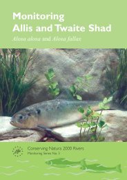
<strong>Monitoring</strong> <strong>the</strong> <strong>Bullhead</strong><br />
Site identification Site code Catchment<br />
Site name NGR River name Survey date<br />
Riparian shading of <strong>the</strong> site<br />
What percentage of <strong>the</strong> water surface of <strong>the</strong> site is overhung by riparian vegetation? Estimate this<br />
percentage, for <strong>the</strong> three vegetation classes indicated, to <strong>the</strong> nearest 5%.<br />
Deciduous trees & shrubs<br />
Migratory access<br />
Coniferous trees Herbaceous vegetation<br />
What is <strong>the</strong> accessibility of <strong>the</strong> site ?<br />
Always accessible<br />
Sometimes accessible<br />
Never accessible<br />
Substrate embeddedness<br />
Salmon Sea trout<br />
What is <strong>the</strong> degree of substrate embededdness throughout <strong>the</strong> site? Tick one box.<br />
High Medium Low<br />
Flow conditions<br />
Briefly describe <strong>the</strong> prevailing flow conditions (as observed at <strong>the</strong> time of <strong>the</strong> HABSCORE survey).<br />
Upstream land-use considerations<br />
What is <strong>the</strong> principal land-use immediately upstream of <strong>the</strong> site? Tick appropriate box(es).<br />
Moor / heathland Coniferous woodland Deciduous woodland Improved pasture<br />
Urban development Rough pasture Industrial land Arable land<br />
Tips / waste O<strong>the</strong>r<br />
Potential impacts<br />
Are <strong>the</strong>re likely to be any impacts at <strong>the</strong> site from <strong>the</strong> following sources? Tick appropriate box(es).<br />
pH effects Stocking Pollution Migration barriers<br />
Habitat modification River engineering Low flows Flow regulation<br />
O<strong>the</strong>r<br />
Width and depth profile at bottom stop net<br />
Record widths to <strong>the</strong> nearest 0.1m and depths to <strong>the</strong> nearest 1.0cm.<br />
Channel width<br />
Depth at ¼ channel width<br />
Depth at ½ channel width<br />
Depth at ¾ channel width<br />
Section dimensions<br />
Record section lengths and widths to <strong>the</strong> nearest 0.1 m and depths to <strong>the</strong> nearest 1 cm.<br />
Section length<br />
Section width<br />
Depth at ¼ channel width<br />
Depth at ½ channel width<br />
Depth at ¾ channel width<br />
23