

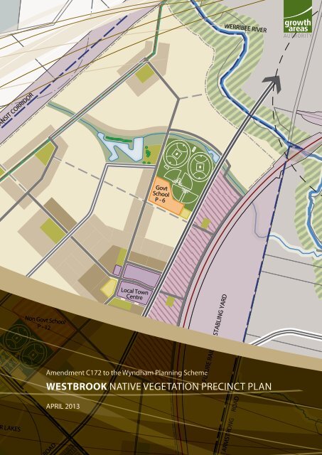
westbrook native vegetation precinct plan - Growth Areas Authority
westbrook native vegetation precinct plan - Growth Areas Authority
westbrook native vegetation precinct plan - Growth Areas Authority

Create successful ePaper yourself
Turn your PDF publications into a flip-book with our unique Google optimized e-Paper software.
ANSIT CORRIDOR<br />
LAKES<br />
Non Govt School<br />
P - 12<br />
OAD<br />
Local Town<br />
Centre<br />
Govt<br />
School<br />
P - 6<br />
Amendment C172 to the Wyndham Planning Scheme<br />
FUTURE RAILWAY STABLING YARD<br />
WERRIBEE RIVER<br />
WESTBROOK NATIVE VEGETATION PRECINCT PLAN<br />
APRIL 2013<br />
ARMSTRONG ROAD
i<br />
WESTBROOK NATIVE VEGETATION PRECINCT PLAN<br />
CONTENTS<br />
1.0 INTRODUCTION<br />
2.0 PURPOSE<br />
3.0 VEGETATION PROTECTION OBJECTIVES TO BE ACHIEVED<br />
4.0 THE NATIVE VEGETATION TO BE PROTECTED<br />
4.1 Property Specific Requirements for Consideration of Applications to Remove<br />
Protected Native Vegetation<br />
4.2 Specific Requirements for Subdivision, Buildings and Works or Vegetation Removal<br />
Within 50m of Native Vegetation to be Protected as Identified in NVPP Tables 1 & 2<br />
and shown to be Protected on NVPP Map 2 of this Native Vegetation Precinct Plan.<br />
5.0 NATIVE VEGETATION WHICH CAN BE REMOVED, DESTROYED OR<br />
LOPPED<br />
5.1 Condition for Removal of Native Vegetation<br />
5.2 Requirements of Native Vegetation<br />
5.3 Procedures for the Collection of Any Payment<br />
6.0 REFERENCE DOCUMENT<br />
7.0 ACRONYMS<br />
TABLES<br />
Table 1 Habitat Zones to be protected<br />
Table 2 Scattered Trees to be protected<br />
Table 3 Habitat Zones which can be removed<br />
Table 4 Scattered Trees which can be removed<br />
Table 5 Offset Requirements for Habitat Zones to be removed<br />
Table 6 Offset Requirements for Scattered Trees which may be removed<br />
PLANS<br />
Map 1 Area to which the NVPP applies<br />
Map 2 Native <strong>vegetation</strong> to be protected and which can be removed<br />
3 April 2013 3:03 PM
1.0 INTRODUCTION<br />
This is the Westbrook Native Vegetation Precinct Plan (‘the Westbrook NVPP’) listed under the<br />
Schedule to Clause 52.16 of the Wyndham Planning Scheme incorporated into the Wyndham<br />
Planning Scheme pursuant to Clause 81.01.<br />
The removal, destruction or lopping of <strong>native</strong> <strong>vegetation</strong> in accordance with this Native Vegetation<br />
Precinct Plan does not require a permit provided conditions and requirements specified in this<br />
Native Vegetation Precinct Plan are met.<br />
The Westbrook Native Vegetation Precinct Plan applies to land within the NVPP Area shown on<br />
NVPP Map 1, which comprises land within the Westbrook Precinct Structure Plan.<br />
For areas within Melbourne’s Strategic Assessment, the NVPP regulates the protection and<br />
offset of communities listed for protection under the Environment Protection and Biodiversity<br />
Conservation Act 1999 (EPBC Act 1999) and State <strong>native</strong> <strong>vegetation</strong>. Current EPBC approvals<br />
conducted under part 10 of the EPBC Act are based on the retention and implementation of<br />
identified offsets for communities listed under the EPBC Act in this NVPP (refer to Table 1).<br />
Within the Westbrook NVPP, the requirement for protection and offset for the Natural Temperate<br />
Grassland of the Victorian Volcanic Plain, Golden Sun Moth habitat, Growling Grass Frog habitat,<br />
Striped Legless Lizard habitat and threatened flora, including Spiny Rice Flower as outlined in<br />
the draft Biodiversity Conservation Strategy in <strong>native</strong> <strong>vegetation</strong> has been considered as part of<br />
this NVPP.<br />
2.0 PURPOSE<br />
WESTBROOK NATIVE VEGETATION PRECINCT PLAN<br />
The purpose of the Westbrook Native Vegetation Precinct Plan is to:<br />
• Apply a holistic, landscape wide approach to retention and removal of <strong>native</strong> <strong>vegetation</strong>,<br />
within the Westbrook NVPP Area as identified in NVPP Map 1.<br />
• Specify the <strong>native</strong> <strong>vegetation</strong> to be protected and the <strong>native</strong> <strong>vegetation</strong> that can be removed,<br />
destroyed or lopped.<br />
• Ensure that areas set aside to protect <strong>native</strong> <strong>vegetation</strong> are managed to conserve ecological<br />
values in accordance with the Westbrook Precinct Structure Plan.<br />
• Ensure that <strong>native</strong> <strong>vegetation</strong> specified to be protected is consistent with conserving the<br />
ecological values of these areas and is in accordance with Melbourne’s Strategic Assessment<br />
(under part 10 of the Environment Protection and Biodiversity Conservation Act 1999) and<br />
Victoria’s Vegetation Management – a Framework for Action (DSE 2002).<br />
• Set out the works or other necessary actions required to offset the removal, destruction or<br />
lopping of <strong>native</strong> <strong>vegetation</strong>.<br />
• Streamline the <strong>plan</strong>ning approvals process through a Precinct wide landscape approach to<br />
<strong>native</strong> <strong>vegetation</strong> protection and management.<br />
1
12.<br />
MOUNTAIN VIEW QUARRY<br />
Precinct Structure Plan Area<br />
Transit Corridors<br />
Railway Line<br />
Railway Station<br />
Future Railway Station<br />
PSP Property Boundaries<br />
PSP Property ID Numbers<br />
dwg UD1-001rev L | 12.03.13<br />
drawn MJ |<br />
OUTER METROPOLITAN TRANSIT CORRIDOR<br />
BALLAN ROAD<br />
1.<br />
w estb r o o k p s p 9 2 >PLAN 1 NVPP<br />
WESTBROOK NATIVE VEGETATION PRECINCT PLAN<br />
6.<br />
2.<br />
9.<br />
7.<br />
MANOR LAKES<br />
PSP 41<br />
3.<br />
8.<br />
MANOR LAKES<br />
4.<br />
5.<br />
10.<br />
12.<br />
11.<br />
Govt School<br />
P-12<br />
Catholic<br />
School<br />
P - 6<br />
WERRIBEE RIVER<br />
RAILWAY STABLING YARD<br />
11.<br />
ARMSTRONG ROAD<br />
MANOR LAKES<br />
TOWN CENTRE<br />
TARNEIT WEST<br />
BALLAN ROAD<br />
PSP 40<br />
Map 1, Area to which the NVPP applies<br />
Prepared by Roberts Day, Suite 2, 33 Chessell St, South Melbourne, VIC 3205<br />
0m 200m 400m 600m<br />
Scale 1:20,000@ A4<br />
800m 1km N<br />
2<br />
3 April 2013 3:03 PM
3.0 VEGETATION PROTECTION OBJECTIVES TO BE ACHIEVED<br />
The objectives of this Native Vegetation Precinct Plan are:<br />
• Protect and manage <strong>native</strong> <strong>vegetation</strong> shown as ‘to be protected’ including floristic<br />
communities and species listed under the state Flora and Fauna Guarantee Act 1988 and<br />
ecological communities and species listed under the Environment Protection and Biodiversity<br />
Conservation Act 1999.<br />
• Manage the <strong>native</strong> <strong>vegetation</strong> to be protected for conservation purposes and allow for passive<br />
recreation such as walking and cycling on the edge of conservation areas, where appropriate,<br />
without damaging <strong>native</strong> <strong>vegetation</strong>.<br />
• Protect and manage the habitat zones and scattered trees identified ‘to be protected’, as they<br />
represent the genetic lineage of site-adapted local <strong>plan</strong>t species and communities, provide<br />
existing habitat for indigenous fauna species, function to link habitat across the landscape,<br />
and provide a focus for re<strong>vegetation</strong> activities.<br />
• Maximise the ability of <strong>native</strong> <strong>vegetation</strong> to persist without human interception.<br />
• Protect and manage the long-term health and habitat value of the <strong>native</strong> <strong>vegetation</strong> specified<br />
to be protected in identified offset areas.<br />
• Provide for the protection of revegetated areas of <strong>native</strong> <strong>vegetation</strong> on offset sites as required<br />
by the responsible authority.<br />
3.1 Requirements under the Melbourne Strategic Assessment<br />
The Victorian Government entered into an agreement with the Commonwealth Government,<br />
under section 146 of the EPBC Act, to conduct a strategic assessment of the potential impact of the<br />
‘Delivering Melbourne’s newest sustainable communities’ on matters of national environmental<br />
significance (the Melbourne Strategic Assessment). This NVPP includes Federally listed <strong>native</strong><br />
<strong>vegetation</strong> communities and species habitat that have been protected under this agreement as<br />
indicated by the column ‘EPBC Act listed ecological community’ in Table 1 and 3. Further removal<br />
of these Federally listed <strong>native</strong> <strong>vegetation</strong> communities and species habitats (that are shown<br />
to be protected in this NVPP) is in breach of approval issued under the Melbourne’s Strategic<br />
Assessment and will require further consideration under the EPBC Act.<br />
4.0 THE NATIVE VEGETATION TO BE PROTECTED<br />
WESTBROOK NATIVE VEGETATION PRECINCT PLAN<br />
The <strong>native</strong> <strong>vegetation</strong> to be protected is described in NVPP Tables 1 and 2 and shown on NVPP<br />
Map 2 and should not be removed.<br />
The <strong>native</strong> <strong>vegetation</strong> shown as ‘to be protected’ is based on a landscape wide approach to<br />
retention and removal of <strong>native</strong> <strong>vegetation</strong> rather than a site by site approach.<br />
Decisions relating to the removal of areas of individual trees and / or areas of <strong>native</strong> <strong>vegetation</strong><br />
have been made in a holistic manner taking into account habitat zones and scattered trees which<br />
are proposed to be protected. The ad hoc removal of <strong>native</strong> <strong>vegetation</strong> which is identified as ‘to<br />
be protected’ may undermine the holistic and landscape wide approach of the NVPP.<br />
In this NVPP, the protection area of a tree (including a tree in a habitat zone or a scattered tree)<br />
refers to an area of twice the canopy diameter of the tree(s) at its widest point.<br />
Protection of a scattered tree means that the protection area must be:<br />
• Protected from adverse impacts, grazing, burning, and soil disturbance.<br />
• Managed to retain fallen timber, control weeds, and provide intervention and or management<br />
if necessary to ensure adequate natural regeneration or <strong>plan</strong>ting can occur.<br />
• Protected from earthworks, compaction during construction or adverse modification of<br />
existing drainage patterns.<br />
These protection measures may be varied if adequate justification is provided and agreed to in<br />
writing by the Department of Sustainability and Environment.<br />
3
10.<br />
47.<br />
T2.<br />
dwg UD1-010 rev A | 04.07.12<br />
drawn MJ |<br />
MOUNTAIN VIEW QUARRY<br />
54.<br />
37.<br />
100.<br />
98.<br />
32.<br />
42.<br />
1.<br />
Precinct Structure Plan Area<br />
Transit Corridors<br />
PSP Property Boundaries<br />
Habitats to be protected<br />
Habitats that can be removed<br />
PSP Property ID Numbers<br />
Habitat Zone ID Numbers<br />
Scattered Trees to be protected<br />
Scattered Trees ID Numbers<br />
BALLAN ROAD<br />
38.<br />
55.<br />
72.<br />
71.<br />
99.<br />
91.<br />
1.<br />
68.<br />
67.<br />
6.<br />
66.<br />
83.<br />
93.<br />
82.<br />
2.<br />
3.<br />
43.<br />
75.<br />
w estbr o ok p s p 92 >PLAN 10 NVPP<br />
WESTBROOK NATIVE VEGETATION PRECINCT PLAN<br />
OUTER METROPOLITAN TRANSIT CORRIDOR<br />
69.<br />
40.<br />
72.<br />
33.<br />
70.<br />
72.<br />
41.<br />
57. 34.<br />
39.<br />
2.<br />
7.<br />
96.<br />
73.<br />
35.<br />
9.<br />
7.<br />
MANOR LAKES<br />
PSP 41<br />
3.<br />
74.<br />
8.<br />
36.<br />
8.<br />
MANOR LAKES<br />
46.<br />
12.<br />
97.<br />
4.<br />
58.<br />
92.<br />
10. 45.<br />
T8. T9.<br />
T7. T6.<br />
T5. T4.<br />
T3.<br />
9.<br />
T2.<br />
10.<br />
56.<br />
11.<br />
85.<br />
16.<br />
59.<br />
20.<br />
5.<br />
13.<br />
76.<br />
60.<br />
80.<br />
61.<br />
15.<br />
86.<br />
53.<br />
44.<br />
12.<br />
23.<br />
51.<br />
14.<br />
24.<br />
87.<br />
11.<br />
Govt School<br />
P-12<br />
4.<br />
84.<br />
90.<br />
89.<br />
26.<br />
22.<br />
52.<br />
47.<br />
19.<br />
95.<br />
64.<br />
Catholic<br />
School<br />
P - 6<br />
WERRIBEE RIVER<br />
49.<br />
5.<br />
81.<br />
17.<br />
94.<br />
T10.<br />
6.<br />
78.<br />
RAILWAY STABLING YARD<br />
29.<br />
0<br />
scale 1:20,000 @ A4<br />
11.<br />
31.<br />
ARMSTRONG ROAD<br />
MANOR LAKES<br />
TOWN CENTRE<br />
200m 400m 600m 800m 1km<br />
TARNEIT WEST<br />
BALLAN ROAD<br />
PSP 40<br />
Map 2, Native <strong>vegetation</strong> to be protected and removed<br />
Prepared by Roberts Day, Suite 2, 33 Chessell St, South Melbourne, VIC 3205<br />
0m 200m 400m 600m<br />
Scale 1:20,000@ A4<br />
800m 1km N<br />
4<br />
3 April 2013 3:03 PM
WESTBROOK NATIVE VEGETATION PRECINCT PLAN<br />
Habitat Zones in Property 5 – Habitat Zone 53, Property 8 – Habitat Zones 4, 94 and 95, Property<br />
9 – Habitat Zone 5 and Property 11 – Habitat Zone 31 are identified to be protected in this NVPP.<br />
They are to be protected within the Growling Grass Frog Corridor along the Werribee River, and<br />
fencing should be employed to ensure minimal disturbance to the patch.<br />
On Properties 5, 8, 9 and 11 trails to be provided through the Growling Grass Frog Corridor (HZ<br />
4, 5, 31, 53, 94 and 95) are to be designed to minimise impacts to <strong>vegetation</strong> to the satisfaction<br />
of the Department of Sustainability and Environment.<br />
Any public open space infrastructure or trails are to be located outside a protection area of a<br />
scattered tree or habitat zone at an appropriate buffer distance. Public open space infrastructure<br />
provided within 15 metres of <strong>native</strong> <strong>vegetation</strong> (including scattered trees and habitat zones)<br />
shown as to be protected must be constructed and designed to ensure that the <strong>native</strong> <strong>vegetation</strong><br />
is protected from adverse impact during construction or pressure from trampling either before<br />
or after construction unless otherwise agreed to in writing by the Department of Sustainability<br />
and Environment.<br />
To minimise the risk to trees identified as ‘scattered trees to be protected’, having to be removed<br />
at a later time, public use areas including playgrounds, barbeques etc should be located at a<br />
minimum distance of 15 metres away from identified scattered trees so as not to pose a risk to<br />
personal safety or property.<br />
4.1. PROPERTY SPECIFIC REQUIREMENTS FOR CONSIDERATION OF APPLICATIONS TO<br />
REMOVE PROTECTED NATIVE VEGETATION<br />
Clause 52.16-3 allows an application to be made for the removal of protected <strong>native</strong> <strong>vegetation</strong>.<br />
This NVPP recognises that permits for further <strong>native</strong> <strong>vegetation</strong> removal may be reasonably<br />
sought for the land listed below:<br />
• Native <strong>vegetation</strong> shown on NVPP Map 2 located within the Outer Metropolitan Transit<br />
Corridor (OMTC) Public Acquisition Overlay 5 (PAO5) (identified as Habitat Zones 37, 38, 39,<br />
40, 41, 54, 67, 28, 69, 70, 71, 72 and 100) will require a <strong>plan</strong>ning permit for removal, once<br />
the land is acquired by VicRoads for the purpose of construction of the Outer Metropolitan<br />
Ring Road. The removal is to be to the minimum extent necessary for the project. Offsets<br />
for the <strong>native</strong> <strong>vegetation</strong> removal will be in accordance within this NVPP and DSE’s Native<br />
Vegetation Time Stamping Data.<br />
• Other <strong>native</strong> <strong>vegetation</strong> shown on NVPP Map 2 to be protected will require a <strong>plan</strong>ning permit<br />
for removal. The <strong>vegetation</strong> concentrated along Werribee River or in close proximity to it may<br />
be removed in relation to the construction of the bridge crossings shown on Plan 5 in the<br />
Westbrook Precinct Structure Plan; however removal must be kept to the minimum required<br />
for the project. Any removal must be to the satisfaction of the Department of Sustainability<br />
and Environment.<br />
• Offsets for the <strong>native</strong> <strong>vegetation</strong> removal will be in accordance with this NVPP and DSE’s<br />
Native Vegetation Time Stamping Data.<br />
5
6<br />
WESTBROOK NATIVE VEGETATION PRECINCT PLAN<br />
4.2. CONDITIONS FOR SUBDIVISIONS, BUILDINGS AND WORKS OR VEGETATION<br />
REMOVAL WITHIN 50M OF NATIVE VEGETATION TO BE PROTECTED AS IDENTIFIED IN<br />
NVPP TABLES 1 & 2 AND SHOWN TO BE PROTECTED ON NVPP MAP 2 OF THIS NATIVE<br />
VEGETATION PRECINCT PLAN<br />
The following conditions must be included on all <strong>plan</strong>ning permits for subdivision, buildings and<br />
works or <strong>vegetation</strong> removal within 50 metres of <strong>native</strong> <strong>vegetation</strong> identified ‘to be protected’<br />
in NVPP Tables 1 and 2 and on NVPP Map 2 of this NVPP unless otherwise agreed in writing by<br />
the Department of Sustainability and Environment:<br />
• Only the <strong>native</strong> <strong>vegetation</strong> which is identified for removal in the incorporated NVPP applying<br />
to the land may be removed, destroyed or lopped unless this permit also authorises the<br />
removal of <strong>native</strong> <strong>vegetation</strong>.<br />
• Prior to the commencement of works within 15 metres of <strong>native</strong> <strong>vegetation</strong> identified as<br />
‘<strong>native</strong> <strong>vegetation</strong> to be protected’ on NVPP Map 2 in the this NVPP applying to the land, a<br />
highly visible <strong>vegetation</strong> protection fence must be erected around twice the canopy distance<br />
of each scattered tree and more than 2 metres from areas of all other <strong>native</strong> <strong>vegetation</strong><br />
which have been identified as to be protected in the NVPP referred to in the Schedule to<br />
Clause 52.16 unless otherwise agreed to in writing by the Department of Sustainability and<br />
Environment.<br />
• Any:<br />
• Works carried out in respect of any subdivision;<br />
• Construction of buildings and associated works; and<br />
• Removal, lopping or destruction of <strong>native</strong> <strong>vegetation</strong> on the land as authorised by the<br />
NVPP.<br />
must be carried out in accordance with all of the requirements set out in the incorporated<br />
NVPP applying to the land to the satisfaction of the Responsible <strong>Authority</strong>.<br />
NVPP Table 1 Habitat Zones to be protected<br />
PSP<br />
PROPERTY<br />
NUMBER<br />
NVPP Table 2 Scattered Trees to be protected<br />
PSP<br />
PROPERTY<br />
NUMBER<br />
“PROPERTY DETAILS<br />
INCLUDING PARCEL DESCRIPTION”<br />
“PROPERTY DETAILS<br />
INCLUDING PARCEL DESCRIPTION”<br />
TREE<br />
ID<br />
NO.<br />
HABITAT<br />
ZONE ID<br />
SPECIES<br />
EVC NAME & NO.<br />
8 772 BALLAN ROAD WYNDHAM VALE 3024 (3\TP225189) 4 Floodplain Riparian Woodland (EVC 56)<br />
10 772 BALLAN ROAD WYNDHAM VALE 3024 (3\TP225189) 5 Plains Grassland (EVC 132)<br />
11 772 BALLAN ROAD WYNDHAM VALE 3024 (1\TP447745) 31 Plains Grassland (EVC 132)<br />
5 1000 BALLAN ROAD WYNDHAM VALE 3024 (11\LP200501) 53 Floodplain Riparian Woodland (EVC 56)<br />
8 772 BALLAN ROAD WYNDHAM VALE 3024 (1\TP225189) 94 Floodplain Riparian Woodland (EVC 56)<br />
8 772 BALLAN ROAD WYNDHAM VALE 3024 (1\TP225189) 95 Floodplain Riparian Woodland (EVC 56)<br />
SIZE OF<br />
TREE (LOT,<br />
MOT)<br />
8 772 BALLAN ROAD WYNDHAM VALE 3024 (1\TP225189) 1 Allocasuarina luehmannii (Buloke) LOT<br />
8 772 BALLAN ROAD WYNDHAM VALE 3024 (1\TP225189) 2 Allocasuarina luehmannii (Buloke) LOT<br />
8 772 BALLAN ROAD WYNDHAM VALE 3024 (1\TP225189) 3 Allocasuarina luehmannii (Buloke) LOT<br />
8 772 BALLAN ROAD WYNDHAM VALE 3024 (1\TP225189) 4 Allocasuarina luehmannii (Buloke) LOT<br />
8 772 BALLAN ROAD WYNDHAM VALE 3024 (1\TP225189) 5 Allocasuarina luehmannii (Buloke) MOT<br />
8 772 BALLAN ROAD WYNDHAM VALE 3024 (1\TP225189) 6 Allocasuarina luehmannii (Buloke) LOT<br />
8 772 BALLAN ROAD WYNDHAM VALE 3024 (1\TP225189) 7 Allocasuarina luehmannii (Buloke) LOT<br />
8 772 BALLAN ROAD WYNDHAM VALE 3024 (1\TP225189) 8 Allocasuarina luehmannii (Buloke) LOT<br />
8 772 BALLAN ROAD WYNDHAM VALE 3024 (1\TP225189) 9 Allocasuarina luehmannii (Buloke) LOT<br />
9 772 BALLAN ROAD WYNDHAM VALE 3024 (3\TP225189) 10 Allocasuarina luehmannii (Buloke) LOT<br />
3 April 2013 3:03 PM
SIZE<br />
HA<br />
• Any construction stockpiles, fill and machinery must be placed away from areas supporting<br />
<strong>native</strong> <strong>vegetation</strong> and drainage lines to the satisfaction of the Responsible <strong>Authority</strong>.<br />
• All earthworks must be undertaken in a manner that will minimise soil erosion and adhere to<br />
Construction Techniques for Sediment Pollution Control (EPA 1991) or updated version.<br />
• Any public open space infrastructure or trails are to be located outside a protection area<br />
of a scattered tree or habitat zone at an appropriate buffer distance. Public open space<br />
infrastructure provided within 15 metres of <strong>native</strong> <strong>vegetation</strong> (including scattered trees and<br />
habitat zones) shown as to be protected must be constructed and designed to ensure that<br />
the <strong>native</strong> <strong>vegetation</strong> is protected from adverse impacts during construction unless otherwise<br />
agreed to in writing by the Department of Sustainability and Environment.<br />
• To minimise the risk to trees identified as ‘scattered trees to be protected’, having to be<br />
removed at a later time, public use areas including playgrounds, barbeques etc are to be<br />
located so that they are not too close to the scattered trees and therefore likely to present a<br />
structural failure hazard or pose a risk to personal safety or property.<br />
• No earthworks, compaction or modification of existing drainage patterns may be undertaken<br />
which present a risk to any remnant trees, understorey, or re<strong>vegetation</strong> areas.<br />
EPBC ACT LISTED<br />
ECOLOGICAL<br />
COMMUNITY<br />
EVC NAME &<br />
NO.<br />
HABITAT<br />
HECTARES<br />
CONSERVATION STATUS<br />
LEAST CONCERN,<br />
ENDANGERED ETC<br />
WESTBROOK NATIVE VEGETATION PRECINCT PLAN<br />
CONSERVATION STATUS<br />
LEAST CONCERN,<br />
ENDANGERED ETC<br />
CONSERVATION<br />
SIGNIFICANCE<br />
LOW, HIGH ETC<br />
CONSERVATION<br />
SIGNIFICANCE LOW,<br />
HIGH ETC<br />
GPS<br />
COORDINATES<br />
X-LATITUDE<br />
NO OF LOTS<br />
WITHIN<br />
HABITAT ZONE<br />
0.02 - 0.01 Endangered Very High 56<br />
0.28 NTGVVP 0.15 Endangered Very High 0<br />
1.41 NTGVVP 0.34 Endangered Very High 0<br />
0.18 - 0.06 Endangered Very High 0<br />
1.39 - 0.85 Endangered Very High 0<br />
0.19 - 0.12 Endangered Very High 0<br />
GPS<br />
COORDINATES<br />
Y-LONGITUDE<br />
Plains Woodland (EVC 803) Protected High 2465116.445 2406245.718<br />
Plains Woodland (EVC 803) Protected High 2465082.615 2406236.562<br />
Plains Woodland (EVC 803) Protected High 2465104.052 2406289.92<br />
Plains Woodland (EVC 803) Protected High 2465104.229 2406303.95<br />
Plains Woodland (EVC 803) Protected High 2465110.115 2406316.961<br />
Plains Woodland (EVC 803) Protected High 2465099.4 2406326.453<br />
Plains Woodland (EVC 803) Protected High 2465099.307 2406332.769<br />
Plains Woodland (EVC 803) Protected High 2465085.075 2406350.823<br />
Plains Woodland (EVC 803) Protected High 2465201.647 2406346.73<br />
Plains Grassy Wetland (EVC 125 Protected High 2465608.642 2406500.087<br />
7
8<br />
WESTBROOK NATIVE VEGETATION PRECINCT PLAN<br />
5.0 NATIVE VEGETATION WHICH CAN BE REMOVED, DESTROYED OR<br />
LOPPED<br />
5.1. CONDITIONS FOR REMOVAL OF NATIVE VEGETATION<br />
The <strong>native</strong> <strong>vegetation</strong> described in Table 3 and shown in Map 2 as <strong>native</strong> <strong>vegetation</strong> that ‘can be<br />
removed’, can be removed, destroyed or lopped under Clause 52.16-3 of the Wyndham Planning<br />
Scheme subject to the following conditions:<br />
1. Only the <strong>native</strong> <strong>vegetation</strong> which is identified for removal in the incorporated NVPP applying<br />
to the land may be removed, lopped or destroyed without a permit.<br />
2. Before the removal, destruction or lopping of any <strong>native</strong> <strong>vegetation</strong> (identified by the<br />
Property Number in Map 2 of the Westbrook NVPP) the owner of the land from which the<br />
<strong>native</strong> <strong>vegetation</strong> is being removed must provide offsets for all <strong>native</strong> <strong>vegetation</strong> within<br />
that property in accordance with Table 3 unless otherwise agreed to in writing with the<br />
Department of Sustainability and Environment. Removal of <strong>native</strong> <strong>vegetation</strong> must be<br />
offset to the satisfaction of the Department of Sustainability and Environment as follows:<br />
• EVCs Plains Grassland and Creekline Tussock Grassland of the Victorian Volcanic Plains<br />
– by providing an allocated credit extract for credits from the Western Grasslands<br />
Reserve issued by the Department of Sustainability and Environment.<br />
• For <strong>native</strong> <strong>vegetation</strong> identified as ‘Grassy Eucalypt Woodland’ or ‘Not Grassy Eucalypt<br />
Woodland (but retains tree canopy of former GEW)’ in the Biodiversity Conservation<br />
Strategy (Figure 19 and 20) – by providing an allocated credit extract issued by the<br />
Department of Sustainability and Environment for the extent of <strong>native</strong> <strong>vegetation</strong><br />
removed for credits from the Grassy Woodland Reserve.<br />
• For all other <strong>native</strong> <strong>vegetation</strong> by either:<br />
» Providing an allocated credit extract issued by the Department of Sustainability and<br />
Environment for the extent of <strong>native</strong> <strong>vegetation</strong> removed; or<br />
» Preparing and submitting an Offset Plan to the satisfaction of the Department<br />
of Sustainability and Environment and have the Offset Plan approved by<br />
the Responsible <strong>Authority</strong> in accordance with Victoria’s Native Vegetation<br />
Management: A Framework for Action.<br />
3. Where an Offset Plan is approved:<br />
• Before the removal, destruction or lopping of any <strong>native</strong> <strong>vegetation</strong>, the owner of<br />
the land from which the <strong>vegetation</strong> is being removed must arrange for the owner<br />
of the approved offset site to register an agreement on the land title securing the<br />
offset site in perpetuity. The owner of the land from which the <strong>vegetation</strong> is being<br />
removed must pay the reasonable costs of the preparation, execution and registration<br />
of the on-title agreement. The on-title security must provide for the implementation<br />
of the Offset Plan and be to the satisfaction of the Department of Sustainability and<br />
Environment.<br />
• Offsets must be implemented according to the schedule of works in the Offset Plan to<br />
the satisfaction of the Department of Sustainability and Environment.<br />
4. Before the removal, destruction or lopping of any <strong>native</strong> <strong>vegetation</strong>, any <strong>native</strong> <strong>vegetation</strong> to<br />
be removed must be clearly marked on site to the satisfaction of the Responsible <strong>Authority</strong><br />
whilst works are being undertaken within the vicinity.<br />
5. Before felling of any trees with nest or hollows, the tree must be examined for fauna by a<br />
suitably qualified zoologist. If <strong>native</strong> fauna species are found, they must be salvaged and<br />
relocated where possible, to the nearest suitable habitat, in consultation of the Department<br />
of Sustainability and Environment.<br />
3 April 2013 3:03 PM
6. Any construction stockpiles and machinery must be placed away from areas supporting<br />
<strong>native</strong> <strong>vegetation</strong> to be protected and drainage lines to the satisfaction of the Responsible<br />
<strong>Authority</strong>.<br />
7. Prior to the commencement of any works, a highly visible <strong>vegetation</strong> protection fence<br />
must be erected around twice the canopy of each scattered tree and more than 2 metres<br />
from all other <strong>native</strong> vegetated areas which have been identified to be protected in this<br />
Native Vegetation Precinct Plan unless otherwise agreed to in writing by the Department of<br />
Sustainability and Environment and to the satisfaction of the Responsible <strong>Authority</strong>.<br />
8. Prior to the removal of any <strong>native</strong> <strong>vegetation</strong> compensatory habitat fees for Spiny Rice<br />
Flower habitat within the lot must be provided to the satisfaction of the Department of<br />
Sustainability and Environment. All patches of <strong>native</strong> <strong>vegetation</strong> are deemed to be Spiny<br />
Rice Flower habitat in accordance with the Biodiversity Conservation Strategy. The fee for<br />
Spiny Rice Flower habitat within a lot is to be calculated based on the area of all <strong>native</strong><br />
<strong>vegetation</strong> patches illustrated in <strong>plan</strong>s and tables incorporated in the Westbrook Native<br />
Vegetation Precinct Plan.<br />
9. Prior to the commencement of any buildings or works or removal of any <strong>native</strong> <strong>vegetation</strong>,<br />
a contributory habitat fee for Growling Grass Frog Category 2 habitat on the land must be<br />
provided to the satisfaction of the Department of Sustainability and Environment. Growling<br />
Grass Frog Category 2 habitat is illustrated in Plan 7 Threatened Species Action Plan of the<br />
Westbrook PSP<br />
10. Where <strong>native</strong> <strong>vegetation</strong> removal will impact on an area identified on the Threatened Species<br />
Action Plan (Plan 7) in the Westbrook Precinct Structure Plan as Golden Sun Moth habitat<br />
the following condition applies:<br />
a. Prior to the removal of <strong>native</strong> <strong>vegetation</strong> compensatory habitat fees for Golden Sun<br />
Moth habitat within the lot must be provided to the satisfaction of the Department<br />
of Sustainability and Environment. The fee for Golden Sun Moth habitat within a lot<br />
is to be calculated based on the habitat area illustrated in Plan 7 - Threatened Species<br />
Action Plan of the Westbrook PSP.<br />
11. Where <strong>native</strong> <strong>vegetation</strong> removal will impact on an area of land identified as potential<br />
habitat for Striped Legless Lizard on the Threatened Species Action Plan (Plan 7) in the<br />
Westbrook Precinct Structure Plan the following condition applies:<br />
a. The Salvage and Translocation of Striped Legless Lizard in the Urban <strong>Growth</strong> <strong>Areas</strong><br />
of Melbourne: Strategic Approach (DSE 2011) and Salvage and Translocation<br />
of Striped Legless Lizard in the Urban <strong>Growth</strong> <strong>Areas</strong> of Melbourne: Operational<br />
Plan (DSE 2011) must be implemented to the satisfaction of the Secretary of the<br />
Department of Sustainability and Environment before, during and after the carrying<br />
out of any buildings or works or <strong>native</strong> <strong>vegetation</strong> removal and all specifications and<br />
requirements of the approved <strong>plan</strong> must be complied with.<br />
5.2. PROCEDURES FOR COLLECTION OF ANY PAYMENT<br />
No payments are necessary or specified.<br />
WESTBROOK NATIVE VEGETATION PRECINCT PLAN<br />
9
10<br />
WESTBROOK NATIVE VEGETATION PRECINCT PLAN<br />
NVPP Table 3 Habitat Zones which can be removed<br />
PSP<br />
PROPERTY<br />
NUMBER<br />
PROPERTY DETAILS<br />
INCLUDING PARCEL DESCRIPTION<br />
HABITAT ZONE<br />
ID<br />
6 PRIVATE ROAD RESERVE 1<br />
6 PRIVATE ROAD RESERVE 2<br />
7 772 BALLAN ROAD WYNDHAM VALE 3024 (2\TP225189) 3<br />
9 772 BALLAN ROAD WYNDHAM VALE 3024 (3\TP225189) 6<br />
7 772 BALLAN ROAD WYNDHAM VALE 3024 (2\TP225189) 7<br />
9 772 BALLAN ROAD WYNDHAM VALE 3024 (3\TP225189) 8<br />
8 772 BALLAN ROAD WYNDHAM VALE 3024 (1\TP225189) 9<br />
10 772 BALLAN ROAD WYNDHAM VALE 3024 (2\TP682546) 10<br />
10 772 BALLAN ROAD WYNDHAM VALE 3024 (2\TP682546) 11<br />
10 772 BALLAN ROAD WYNDHAM VALE 3024 (2\TP682546) 12<br />
10 772 BALLAN ROAD WYNDHAM VALE 3024 (2\TP682546) 13<br />
10 772 BALLAN ROAD WYNDHAM VALE 3024 (2\TP682546) 14<br />
11 772 BALLAN ROAD WYNDHAM VALE 3024 (1\TP447745) 15<br />
11 772 BALLAN ROAD WYNDHAM VALE 3024 (1\TP447745) 16<br />
11 772 BALLAN ROAD WYNDHAM VALE 3024 (1\TP447745) 17<br />
11 772 BALLAN ROAD WYNDHAM VALE 3024 (1\TP447745) 19<br />
11 772 BALLAN ROAD WYNDHAM VALE 3024 (1\TP447745) 20<br />
11 772 BALLAN ROAD WYNDHAM VALE 3024 (1\TP447745) 22<br />
12 772 BALLAN ROAD WYNDHAM VALE 3024 (1\TP682546) 23<br />
12 772 BALLAN ROAD WYNDHAM VALE 3024 (1\TP682546) 24<br />
12 772 BALLAN ROAD WYNDHAM VALE 3024 (1\TP682546) 26<br />
11 772 BALLAN ROAD WYNDHAM VALE 3024 (1\TP447745) 29<br />
1 1000 BALLAN ROAD WYNDHAM VALE3024 (7\LP200501) 32<br />
2 1000 BALLAN ROAD WYNDHAM VALE3024 (8\LP200501) 33<br />
2 1000 BALLAN ROAD WYNDHAM VALE3024 (8\LP200501) 34<br />
3 1000 BALLAN ROAD WYNDHAM VALE3024 (9\LP200501) 35<br />
4 1000 BALLAN ROAD WYNDHAM VALE3024 (10\LP200501) 36<br />
1 1000 BALLAN ROAD WYNDHAM VALE3024 (7\LP200501) 37<br />
2 1000 BALLAN ROAD WYNDHAM VALE3024 (8\LP200501) 38<br />
2 1000 BALLAN ROAD WYNDHAM VALE3024 (8\LP200501) 39<br />
2 1000 BALLAN ROAD WYNDHAM VALE3024 (8\LP200501) 40<br />
2 1000 BALLAN ROAD WYNDHAM VALE3024 (8\LP200501) 41<br />
6 PRIVATE ROAD RESERVE 42<br />
6 BALLAN ROAD RESERVE 43<br />
10 772 BALLAN ROAD WYNDHAM VALE 3024 (2\TP682546) 44<br />
10 772 BALLAN ROAD WYNDHAM VALE 3024 (2\TP682546) 45<br />
10 772 BALLAN ROAD WYNDHAM VALE 3024 (2\TP682546) 46<br />
11 772 BALLAN ROAD WYNDHAM VALE 3024 (1\TP447745) 47<br />
11 772 BALLAN ROAD WYNDHAM VALE 3024 (1\TP447745) 49<br />
12 772 BALLAN ROAD WYNDHAM VALE 3024 (1\TP682546) 51<br />
12 772 BALLAN ROAD WYNDHAM VALE 3024 (1\TP682546) 52<br />
1 1000 BALLAN ROAD WYNDHAM VALE3024 (7\LP200501) 54<br />
2 1000 BALLAN ROAD WYNDHAM VALE3024 (8\LP200501) 55<br />
10 772 BALLAN ROAD WYNDHAM VALE 3024 (2\TP682546) 56<br />
6 PRIVATE ROAD RESERVE 57<br />
8 772 BALLAN ROAD WYNDHAM VALE 3024 (1\TP225189) 58<br />
8 772 BALLAN ROAD WYNDHAM VALE 3024 (1\TP225189) 59<br />
12 772 BALLAN ROAD WYNDHAM VALE 3024 (1\TP682546) 60<br />
12 772 BALLAN ROAD WYNDHAM VALE 3024 (1\TP682546) 61<br />
12 772 BALLAN ROAD WYNDHAM VALE 3024 (1\TP682546) 64<br />
1 1000 BALLAN ROAD WYNDHAM VALE3024 (7\LP200501) 66<br />
1 1000 BALLAN ROAD WYNDHAM VALE3024 (7\LP200501) 67<br />
2 1000 BALLAN ROAD WYNDHAM VALE3024 (8\LP200501) 68<br />
3 April 2013 3:03 PM
EVC NAME &<br />
NO.<br />
WESTBROOK NATIVE VEGETATION PRECINCT PLAN<br />
EPBC ACT LISTED<br />
ECOLOGICAL COMMUNITY<br />
SIZE<br />
HA<br />
HABITAT<br />
HECTARES<br />
NO OF LOTS<br />
WITHIN HABITAT<br />
ZONE<br />
Plains Grassland (EVC 132) NTGVVP 0.03 0.01 0<br />
Plains Grassland (EVC 132) NTGVVP 0.00 0.00 0<br />
Plains Grassland (EVC 132) NTGVVP 0.64 0.32 0<br />
Plains Grassy Wetland (EVC 125) - 0.93 0.46 0<br />
Plains Grassland (EVC 132) NTGVVP 0.39 0.19 0<br />
Plains Grassland (EVC 132) NTGVVP 23.17 14.60 0<br />
Plains Woodland (EVC 803) Grassy Eucalypt Woodland 0.85 0.40 2 LOT<br />
Plains Grassland (EVC 132) NTGVVP 15.49 9.60 0<br />
Plains Grassland (EVC 132) NTGVVP 0.66 0.41 0<br />
Plains Grassland (EVC 132) NTGVVP 0.32 0.20 0<br />
Plains Grassland (EVC 132) NTGVVP 0.90 0.49 0<br />
Plains Grassland (EVC 132) NTGVVP 0.43 0.24 0<br />
Plains Grassland (EVC 132) NTGVVP 1.61 0.71 0<br />
Plains Grassland (EVC 132) NTGVVP 1.22 0.54 0<br />
Plains Grassland (EVC 132) NTGVVP 0.89 0.31 0<br />
Plains Grassland (EVC 132) NTGVVP 0.27 0.09 0<br />
Plains Grassland (EVC 132) NTGVVP 2.29 1.01 0<br />
Plains Grassland (EVC 132) NTGVVP 0.44 0.14 0<br />
Plains Grassland (EVC 132) NTGVVP 0.35 0.13 0<br />
Plains Grassland (EVC 132) NTGVVP 1.74 0.64 0<br />
Plains Grassland (EVC 132) NTGVVP 0.29 0.11 0<br />
Plains Grassland (EVC 132) NTGVVP 0.54 0.07 0<br />
Plains Grassland (EVC 132) NTGVVP 0.16 0.07 0<br />
Plains Grassland (EVC 132) NTGVVP 1.86 0.73 0<br />
Plains Grassland (EVC 132) NTGVVP 0.48 0.17 0<br />
Plains Grassland (EVC 132) NTGVVP 9.39 3.29 0<br />
Plains Grassland (EVC 132) NTGVVP 8.68 3.04 0<br />
Plains Grassland (EVC 132) NTGVVP 0.06 0.02 0<br />
Plains Grassland (EVC 132) NTGVVP 0.04 0.02 0<br />
Plains Grassland (EVC 132) NTGVVP 0.05 0.02 0<br />
Plains Grassland (EVC 132) NTGVVP 0.76 0.42 0<br />
Plains Grassland (EVC 132) NTGVVP 0.06 0.02 0<br />
Plains Grassland (EVC 132) NTGVVP 0.00 0.00 0<br />
Plains Grassland (EVC 132) NTGVVP 0.00 0.00 0<br />
Plains Grassland (EVC 132) NTGVVP 0.89 0.46 0<br />
Plains Grassland (EVC 132) NTGVVP 1.95 1.07 0<br />
Plains Grassland (EVC 132) NTGVVP 5.16 3.46 0<br />
Plains Grassland (EVC 132) NTGVVP 3.81 1.52 0<br />
Plains Grassland (EVC 132) NTGVVP 0.08 0.02 0<br />
Plains Grassland (EVC 132) NTGVVP 0.58 0.19 0<br />
Plains Grassland (EVC 132) NTGVVP 0.33 0.07 0<br />
Plains Grassland (EVC 132) NTGVVP 0.06 0.02 0<br />
Plains Grassland (EVC 132) NTGVVP 0.00 0.00 0<br />
Plains Grassland (EVC 132) NTGVVP 0.14 0.09 0<br />
Plains Grassland (EVC 132) NTGVVP 0.37 0.17 0<br />
Plains Grassy Wetland (EVC 125) - 21.89 10.73 0<br />
Plains Grassland (EVC 132) NTGVVP 0.75 0.30 0<br />
Plains Grassland (EVC 132) NTGVVP 0.16 0.06 0<br />
Plains Grassland (EVC 132) NTGVVP 6.68 1.34 0<br />
Plains Grassland (EVC 132) NTGVVP 4.79 0.96 0<br />
Plains Grassland (EVC 132) NTGVVP 0.54 0.21 0<br />
Plains Grassland (EVC 132) NTGVVP 0.01 0.01 0<br />
Plains Grassland (EVC 132) NTGVVP 0.13 0.07 0<br />
11
12<br />
WESTBROOK NATIVE VEGETATION PRECINCT PLAN<br />
PSP<br />
PROPERTY<br />
NUMBER<br />
PROPERTY DETAILS<br />
INCLUDING PARCEL DESCRIPTION<br />
HABITAT ZONE<br />
ID<br />
2 1000 BALLAN ROAD WYNDHAM VALE3024 (8\LP200501) 69<br />
3 1000 BALLAN ROAD WYNDHAM VALE3024 (9\LP200501) 70<br />
1 1000 BALLAN ROAD WYNDHAM VALE3024 (7\LP200501) 71<br />
2 1000 BALLAN ROAD WYNDHAM VALE3024 (8\LP200501) 72<br />
7 772 BALLAN ROAD WYNDHAM VALE 3024 (2\TP225189) 73<br />
9 772 BALLAN ROAD WYNDHAM VALE 3024 (3\TP225189) 74<br />
7 772 BALLAN ROAD WYNDHAM VALE 3024 (2\TP225189) 75<br />
10 772 BALLAN ROAD WYNDHAM VALE 3024 (2\TP682546) 76<br />
12 772 BALLAN ROAD WYNDHAM VALE 3024 (1\TP682546) 78<br />
10 772 BALLAN ROAD WYNDHAM VALE 3024 (2\TP682546) 81<br />
6 PRIVATE ROAD RESERVE 82<br />
6 PRIVATE ROAD RESERVE 83<br />
9 772 BALLAN ROAD WYNDHAM VALE 3024 (3\TP225189) 84<br />
10 772 BALLAN ROAD WYNDHAM VALE 3024 (2\TP682546) 85<br />
12 772 BALLAN ROAD WYNDHAM VALE 3024 (1\TP682546) 86<br />
11 772 BALLAN ROAD WYNDHAM VALE 3024 (1\TP447745) 87<br />
12 772 BALLAN ROAD WYNDHAM VALE 3024 (1\TP682546) 89<br />
12 772 BALLAN ROAD WYNDHAM VALE 3024 (1\TP682546) 90<br />
5 1000 BALLAN ROAD WYNDHAM VALE3024 (11\LP200501) 92<br />
6 PRIVATE ROAD RESERVE 93<br />
7 772 BALLAN ROAD WYNDHAM VALE 3024 (1\TP225189) 96<br />
10 772 BALLAN ROAD WYNDHAM VALE 3024 (2\TP682546) 97<br />
1 1000 BALLAN ROAD WYNDHAM VALE3024 (7\LP200501) 98<br />
1 1000 BALLAN ROAD WYNDHAM VALE3024 (7\LP200501) 99<br />
1 1000 BALLAN ROAD WYNDHAM VALE3024 (7\LP200501) 100<br />
NVPP Table 4 Scattered Trees Which Can Be Removed<br />
PSP<br />
PROPERTY<br />
NUMBER<br />
PROPERTY DETAILS<br />
INCLUDING PARCEL DESCRIPTION<br />
There are no scattered trees to be removed<br />
TREE ID<br />
NO.<br />
SPECIES<br />
3 April 2013 3:03 PM
EVC NAME &<br />
NO.<br />
EPBC ACT LISTED<br />
ECOLOGICAL COMMUNITY<br />
SIZE<br />
HA<br />
HABITAT<br />
HECTARES<br />
NO OF LOTS<br />
WITHIN HABITAT<br />
ZONE<br />
Plains Grassland (EVC 132) NTGVVP 0.05 0.02 0<br />
Plains Grassland (EVC 132) NTGVVP 0.00 0.00 0<br />
Plains Grassland (EVC 132) NTGVVP 5.49 2.47 0<br />
Plains Grassland (EVC 132) NTGVVP 6.18 2.78 0<br />
Plains Grassland (EVC 132) NTGVVP 0.46 0.23 0<br />
Plains Grassland (EVC 132) NTGVVP 7.66 3.68 0<br />
Plains Grassland (EVC 132) NTGVVP 1.74 0.91 0<br />
Plains Grassland (EVC 132) NTGVVP 0.52 0.29 0<br />
Plains Grassland (EVC 132) NTGVVP 1.90 0.76 0<br />
Plains Grassland (EVC 132) NTGVVP 0.96 0.59 0<br />
Plains Grassland (EVC 132) NTGVVP 0.00 0.00 0<br />
Plains Grassland (EVC 132) NTGVVP 0.06 0.03 0<br />
Plains Grassland (EVC 132) NTGVVP 2.59 1.53 0<br />
Plains Grassland (EVC 132) NTGVVP 0.20 0.11 0<br />
Plains Grassland (EVC 132) NTGVVP 0.71 0.26 0<br />
Plains Grassland (EVC 132) NTGVVP 5.29 2.12 0<br />
Plains Grassland (EVC 132) NTGVVP 1.32 0.42 0<br />
Plains Grassland (EVC 132) NTGVVP 0.15 0.06 0<br />
Floodplain Riparian Woodland (EVC 56) - 0.93 0.33 0<br />
Plains Grassland (EVC 132) NTGVVP 0.01 0.00 0<br />
Plains Grassland (EVC 132) NTGVVP 31.43 20.43 0<br />
Plains Grassland (EVC 132) NTGVVP 0.13 0.07 0<br />
Plains Grassland (EVC 132) NTGVVP 0.03 0.01 0<br />
Plains Grassland (EVC 132) NTGVVP 0.35 0.15 0<br />
Plains Grassland (EVC 132) NTGVVP 0.02 0.01 0<br />
SIZE OF TREE<br />
(LOT, MOT)<br />
EVC NAME<br />
NO.<br />
WESTBROOK NATIVE VEGETATION PRECINCT PLAN<br />
GPS COORDINATES<br />
X-LATITUDE<br />
GPS COORDINATES<br />
Y-LONGITUDE<br />
13
NVPP Table 5 Offset Requirements for Habitat Zones to be removed<br />
PSP<br />
PROPERTY<br />
NUMBER<br />
14<br />
WESTBROOK NATIVE VEGETATION PRECINCT PLAN<br />
PROPERTY DETAILS<br />
INCLUDING PARCEL DESCRIPTION<br />
HABITAT<br />
ZONE<br />
ID<br />
EVC NAME &<br />
NO.<br />
HABITAT<br />
SCORE<br />
CONSERVATION<br />
STATUS<br />
6 PRIVATE ROAD RESERVE 1 Plains Grassland (EVC 132) 45 Endangered<br />
6 PRIVATE ROAD RESERVE 2 Plains Grassland (EVC 132) 45 Endangered<br />
7 772 BALLAN ROAD WYNDHAM VALE 3024 (2\TP225189) 3 Plains Grassland (EVC 132) 50 Endangered<br />
9 772 BALLAN ROAD WYNDHAM VALE 3024 (3\TP225189) 6 Plains Grassy Wetland (EVC 125) 49 Endangered<br />
7 772 BALLAN ROAD WYNDHAM VALE 3024 (2\TP225189) 7 Plains Grassland (EVC 132) 50 Endangered<br />
9 772 BALLAN ROAD WYNDHAM VALE 3024 (3\TP225189) 8 Plains Grassland (EVC 132) 63 Endangered<br />
8 772 BALLAN ROAD WYNDHAM VALE 3024 (1\TP225189) 9 Plains Woodland (EVC 803) 47 Endangered<br />
10 772 BALLAN ROAD WYNDHAM VALE 3024 (2\TP682546) 10 Plains Grassland (EVC 132) 62 Endangered<br />
10 772 BALLAN ROAD WYNDHAM VALE 3024 (2\TP682546) 11 Plains Grassland (EVC 132) 62 Endangered<br />
10 772 BALLAN ROAD WYNDHAM VALE 3024 (2\TP682546) 12 Plains Grassland (EVC 132) 62 Endangered<br />
10 772 BALLAN ROAD WYNDHAM VALE 3024 (2\TP682546) 13 Plains Grassland (EVC 132) 55 Endangered<br />
10 772 BALLAN ROAD WYNDHAM VALE 3024 (2\TP682546) 14 Plains Grassland (EVC 132) 55 Endangered<br />
11 772 BALLAN ROAD WYNDHAM VALE 3024 (1\TP447745) 15 Plains Grassland (EVC 132) 44 Endangered<br />
11 772 BALLAN ROAD WYNDHAM VALE 3024 (1\TP447745) 16 Plains Grassland (EVC 132) 44 Endangered<br />
11 772 BALLAN ROAD WYNDHAM VALE 3024 (1\TP447745) 17 Plains Grassland (EVC 132) 35 Endangered<br />
11 772 BALLAN ROAD WYNDHAM VALE 3024 (1\TP447745) 19 Plains Grassland (EVC 132) 32 Endangered<br />
11 772 BALLAN ROAD WYNDHAM VALE 3024 (1\TP447745) 20 Plains Grassland (EVC 132) 44 Endangered<br />
11 772 BALLAN ROAD WYNDHAM VALE 3024 (1\TP447745) 22 Plains Grassland (EVC 132) 32 Endangered<br />
12 772 BALLAN ROAD WYNDHAM VALE 3024 (1\TP682546) 23 Plains Grassland (EVC 132) 37 Endangered<br />
12 772 BALLAN ROAD WYNDHAM VALE 3024 (1\TP682546) 24 Plains Grassland (EVC 132) 37 Endangered<br />
12 772 BALLAN ROAD WYNDHAM VALE 3024 (1\TP682546) 26 Plains Grassland (EVC 132) 37 Endangered<br />
11 772 BALLAN ROAD WYNDHAM VALE 3024 (1\TP447745) 29 Plains Grassland (EVC 132) 13 Endangered<br />
1 1000 BALLAN ROAD WYNDHAM VALE3024 (7\LP200501) 32 Plains Grassland (EVC 132) 44 Endangered<br />
2 1000 BALLAN ROAD WYNDHAM VALE3024 (8\LP200501) 33 Plains Grassland (EVC 132) 39 Endangered<br />
2 1000 BALLAN ROAD WYNDHAM VALE3024 (8\LP200501) 34 Plains Grassland (EVC 132) 35 Endangered<br />
3 1000 BALLAN ROAD WYNDHAM VALE3024 (9\LP200501) 35 Plains Grassland (EVC 132) 35 Endangered<br />
4 1000 BALLAN ROAD WYNDHAM VALE3024 (10\LP200501) 36 Plains Grassland (EVC 132) 35 Endangered<br />
1 1000 BALLAN ROAD WYNDHAM VALE3024 (7\LP200501) 37 Plains Grassland (EVC 132) 35 Endangered<br />
2 1000 BALLAN ROAD WYNDHAM VALE3024 (8\LP200501) 38 Plains Grassland (EVC 132) 55 Endangered<br />
2 1000 BALLAN ROAD WYNDHAM VALE3024 (8\LP200501) 39 Plains Grassland (EVC 132) 35 Endangered<br />
2 1000 BALLAN ROAD WYNDHAM VALE3024 (8\LP200501) 40 Plains Grassland (EVC 132) 55 Endangered<br />
2 1000 BALLAN ROAD WYNDHAM VALE3024 (8\LP200501) 41 Plains Grassland (EVC 132) 35 Endangered<br />
6 PRIVATE ROAD RESERVE 42 Plains Grassland (EVC 132) 35 Endangered<br />
6 BALLAN ROAD RESERVE 43 Plains Grassland (EVC 132) 45 Endangered<br />
10 772 BALLAN ROAD WYNDHAM VALE 3024 (2\TP682546) 44 Plains Grassland (EVC 132) 51 Endangered<br />
10 772 BALLAN ROAD WYNDHAM VALE 3024 (2\TP682546) 45 Plains Grassland (EVC 132) 55 Endangered<br />
10 772 BALLAN ROAD WYNDHAM VALE 3024 (2\TP682546) 46 Plains Grassland (EVC 132) 67 Endangered<br />
11 772 BALLAN ROAD WYNDHAM VALE 3024 (1\TP447745) 47 Plains Grassland (EVC 132) 40 Endangered<br />
11 772 BALLAN ROAD WYNDHAM VALE 3024 (1\TP447745) 49 Plains Grassland (EVC 132) 27 Endangered<br />
12 772 BALLAN ROAD WYNDHAM VALE 3024 (1\TP682546) 51 Plains Grassland (EVC 132) 32 Endangered<br />
12 772 BALLAN ROAD WYNDHAM VALE 3024 (1\TP682546) 52 Plains Grassland (EVC 132) 20 Endangered<br />
1 1000 BALLAN ROAD WYNDHAM VALE3024 (7\LP200501) 54 Plains Grassland (EVC 132) 35 Endangered<br />
2 1000 BALLAN ROAD WYNDHAM VALE3024 (8\LP200501) 55 Plains Grassland (EVC 132) 55 Endangered<br />
10 772 BALLAN ROAD WYNDHAM VALE 3024 (2\TP682546) 56 Plains Grassland (EVC 132) 67 Endangered<br />
6 PRIVATE ROAD RESERVE 57 Plains Grassland (EVC 132) 45 Endangered<br />
8 772 BALLAN ROAD WYNDHAM VALE 3024 (1\TP225189) 58 Plains Grassy Wetland (EVC 125) 49 Endangered<br />
8 772 BALLAN ROAD WYNDHAM VALE 3024 (1\TP225189) 59 Plains Grassland (EVC 132) 40 Endangered<br />
3 April 2013 3:03 PM
CONSERVATION<br />
SIGNIFICANCE<br />
LOW, HIGH ETC<br />
LOSS<br />
(HECTARES)<br />
LOSS<br />
(HABITAT<br />
HECTARES)<br />
WESTBROOK NATIVE VEGETATION PRECINCT PLAN<br />
LIKE FOR LIKE<br />
REQUIREMENTS (EVC OR<br />
THREATENED SPECIES)<br />
NET GAIN<br />
MULTIPLIER<br />
NET GAIN<br />
TARGET<br />
OFFSET<br />
TO BE<br />
ACHIEVED<br />
LOSS<br />
OF LOTS<br />
WITHIN<br />
HABITAT<br />
ZONE<br />
Very High 0.01 0.01 NTG Offset to WGR 2 0.03 0<br />
Very High 0.00 0.00 NTG Offset to WGR 2 0.00 0<br />
Very High 0.32 0.32 NTG Offset to WGR 2 0.64 0<br />
Very High 0.46 0.46 Plains Grassy Wetland (EVC 125) 2 0.91 0<br />
Very High 0.19 0.19 NTG Offset to WGR 2 0.39 0<br />
Very High 14.60 14.60 NTG Offset to WGR 2 29.19 0<br />
OFFSET<br />
TO BE<br />
ACHIEVED<br />
FOR LOTS:<br />
PROTECTION<br />
OF TREES<br />
TARGET<br />
Very High 0.40 0.40 Grassy Eucalypt Woodland 2 0.80 2 LOT Protect 16 LOTs<br />
Very High 9.60 9.60 NTG Offset to WGR 2 19.21 0<br />
Very High 0.41 0.41 NTG Offset to WGR 2 0.82 0<br />
Very High 0.20 0.20 NTG Offset to WGR 2 0.40 0<br />
Very High 0.49 0.49 NTG Offset to WGR 2 0.99 0<br />
Very High 0.24 0.24 NTG Offset to WGR 2 0.48 0<br />
Very High 0.71 0.71 NTG Offset to WGR 2 1.42 0<br />
Very High 0.54 0.54 NTG Offset to WGR 2 1.08 0<br />
Very High 0.31 0.31 NTG Offset to WGR 2 0.62 0<br />
Very High 0.09 0.09 NTG Offset to WGR 2 0.17 0<br />
Very High 1.01 1.01 NTG Offset to WGR 2 2.01 0<br />
Very High 0.14 0.14 NTG Offset to WGR 2 0.28 0<br />
Very High 0.13 0.13 NTG Offset to WGR 2 0.26 0<br />
Very High 0.64 0.64 NTG Offset to WGR 2 1.28 0<br />
Very High 0.11 0.11 NTG Offset to WGR 2 0.22 0<br />
Very High 0.07 0.07 NTG Offset to WGR 2 0.14 0<br />
Very High 0.07 0.07 NTG Offset to WGR 2 0.14 0<br />
Very High 0.73 0.73 NTG Offset to WGR 2 1.45 0<br />
Very High 0.17 0.17 NTG Offset to WGR 2 0.33 0<br />
Very High 3.29 3.29 NTG Offset to WGR 2 6.57 0<br />
Very High 3.04 3.04 NTG Offset to WGR 2 6.08 0<br />
Very High 0.02 0.02 NTG Offset to WGR 2 0.04 0<br />
Very High 0.02 0.02 NTG Offset to WGR 2 0.05 0<br />
Very High 0.02 0.02 NTG Offset to WGR 2 0.04 0<br />
Very High 0.42 0.42 NTG Offset to WGR 2 0.84 0<br />
Very High 0.02 0.02 NTG Offset to WGR 2 0.04 0<br />
Very High 0.00 0.00 NTG Offset to WGR 2 0.00 0<br />
Very High 0.00 0.00 NTG Offset to WGR 2 0.00 0<br />
Very High 0.46 0.46 NTG Offset to WGR 2 0.91 0<br />
Very High 1.07 1.07 NTG Offset to WGR 2 2.15 0<br />
Very High 3.46 3.46 NTG Offset to WGR 2 6.91 0<br />
Very High 1.52 1.52 NTG Offset to WGR 2 3.05 0<br />
Very High 0.02 0.02 NTG Offset to WGR 2 0.04 0<br />
Very High 0.19 0.19 NTG Offset to WGR 2 0.37 0<br />
Very High 0.07 0.07 NTG Offset to WGR 2 0.13 0<br />
Very High 0.02 0.02 NTG Offset to WGR 2 0.04 0<br />
Very High 0.00 0.00 NTG Offset to WGR 2 0.00 0<br />
Very High 0.09 0.09 NTG Offset to WGR 2 0.19 0<br />
Very High 0.17 0.17 NTG Offset to WGR 2 0.33 0<br />
Very High 10.73 10.73 Plains Grassy Wetland (EVC 125) 2 21.46 0<br />
Very High 0.30 0.30 NTG Offset to WGR 2 0.60 0<br />
15
PSP<br />
PROPERTY<br />
NUMBER<br />
PROPERTY DETAILS<br />
INCLUDING PARCEL DESCRIPTION<br />
HABITAT<br />
ZONE<br />
ID<br />
EVC NAME &<br />
NO.<br />
HABITAT<br />
SCORE<br />
CONSERVATION<br />
STATUS<br />
12 772 BALLAN ROAD WYNDHAM VALE 3024 (1\TP682546) 60 Plains Grassland (EVC 132) 37 Endangered<br />
12 772 BALLAN ROAD WYNDHAM VALE 3024 (1\TP682546) 61 Plains Grassland (EVC 132) 20 Endangered<br />
12 772 BALLAN ROAD WYNDHAM VALE 3024 (1\TP682546) 64 Plains Grassland (EVC 132) 20 Endangered<br />
1 1000 BALLAN ROAD WYNDHAM VALE3024 (7\LP200501) 66 Plains Grassland (EVC 132) 40 Endangered<br />
1 1000 BALLAN ROAD WYNDHAM VALE3024 (7\LP200501) 67 Plains Grassland (EVC 132) 55 Endangered<br />
2 1000 BALLAN ROAD WYNDHAM VALE3024 (8\LP200501) 68 Plains Grassland (EVC 132) 55 Endangered<br />
2 1000 BALLAN ROAD WYNDHAM VALE3024 (8\LP200501) 69 Plains Grassland (EVC 132) 35 Endangered<br />
3 1000 BALLAN ROAD WYNDHAM VALE3024 (9\LP200501) 70 Plains Grassland (EVC 132) 35 Endangered<br />
1 1000 BALLAN ROAD WYNDHAM VALE3024 (7\LP200501) 71 Plains Grassland (EVC 132) 45 Endangered<br />
2 1000 BALLAN ROAD WYNDHAM VALE3024 (8\LP200501) 72 Plains Grassland (EVC 132) 45 Endangered<br />
7 772 BALLAN ROAD WYNDHAM VALE 3024 (2\TP225189) 73 Plains Grassland (EVC 132) 50 Endangered<br />
9 772 BALLAN ROAD WYNDHAM VALE 3024 (3\TP225189) 74 Plains Grassland (EVC 132) 48 Endangered<br />
7 772 BALLAN ROAD WYNDHAM VALE 3024 (2\TP225189) 75 Plains Grassland (EVC 132) 52 Endangered<br />
10 772 BALLAN ROAD WYNDHAM VALE 3024 (2\TP682546) 76 Plains Grassland (EVC 132) 55 Endangered<br />
12 772 BALLAN ROAD WYNDHAM VALE 3024 (1\TP682546) 78 Plains Grassland (EVC 132) 40 Endangered<br />
10 772 BALLAN ROAD WYNDHAM VALE 3024 (2\TP682546) 81 Plains Grassland (EVC 132) 62 Endangered<br />
6 PRIVATE ROAD RESERVE 82 Plains Grassland (EVC 132) 45 Endangered<br />
6 PRIVATE ROAD RESERVE 83 Plains Grassland (EVC 132) 45 Endangered<br />
9 772 BALLAN ROAD WYNDHAM VALE 3024 (3\TP225189) 84 Plains Grassland (EVC 132) 59 Endangered<br />
10 772 BALLAN ROAD WYNDHAM VALE 3024 (2\TP682546) 85 Plains Grassland (EVC 132) 55 Endangered<br />
12 772 BALLAN ROAD WYNDHAM VALE 3024 (1\TP682546) 86 Plains Grassland (EVC 132) 37 Endangered<br />
11 772 BALLAN ROAD WYNDHAM VALE 3024 (1\TP447745) 87 Plains Grassland (EVC 132) 40 Endangered<br />
12 772 BALLAN ROAD WYNDHAM VALE 3024 (1\TP682546) 89 Plains Grassland (EVC 132) 32 Endangered<br />
12 772 BALLAN ROAD WYNDHAM VALE 3024 (1\TP682546) 90 Plains Grassland (EVC 132) 37 Endangered<br />
5 1000 BALLAN ROAD WYNDHAM VALE3024 (11\LP200501) 92 Floodplain Riparian Woodland (EVC 56) 35 Endangered<br />
6 PRIVATE ROAD RESERVE 93 Plains Grassland (EVC 132) 35 Endangered<br />
7 772 BALLAN ROAD WYNDHAM VALE 3024 (1\TP225189) 96 Plains Grassland (EVC 132) 65 Endangered<br />
10 772 BALLAN ROAD WYNDHAM VALE 3024 (2\TP682546) 97 Plains Grassland (EVC 132) 55 Endangered<br />
1 1000 BALLAN ROAD WYNDHAM VALE3024 (7\LP200501) 98 Plains Grassland (EVC 132) 44 Endangered<br />
1 1000 BALLAN ROAD WYNDHAM VALE3024 (7\LP200501) 99 Plains Grassland (EVC 132) 43 Endangered<br />
1 1000 BALLAN ROAD WYNDHAM VALE3024 (7\LP200501) 100 Plains Grassland (EVC 132) 45 Endangered<br />
NVPP Table 6 Offset Requirements for Scattered Trees which may be removed<br />
PSP PROPERTY<br />
NUMBER<br />
PROPERTY DETAILS<br />
INCLUDING PARCEL DESCRIPTION<br />
There are no scattered trees to be removed<br />
16<br />
WESTBROOK NATIVE VEGETATION PRECINCT PLAN<br />
EVC NAME &<br />
NO.<br />
CONSERVATION SIGNIFICANCE<br />
LOW, HIGH ETC<br />
3 April 2013 3:03 PM
CONSERVATION<br />
SIGNIFICANCE<br />
LOW, HIGH ETC<br />
LOSS<br />
(HECTARES)<br />
LOSS<br />
(HABITAT<br />
HECTARES)<br />
LIKE FOR LIKE<br />
REQUIREMENTS (EVC OR<br />
THREATENED SPECIES)<br />
NET GAIN<br />
MULTIPLIER<br />
NET GAIN<br />
TARGET<br />
OFFSET<br />
TO BE<br />
ACHIEVED<br />
LOSS<br />
OF LOTS<br />
WITHIN<br />
HABITAT<br />
ZONE<br />
Very High 0.06 0.06 NTG Offset to WGR 2 0.12 0<br />
Very High 1.34 1.34 NTG Offset to WGR 2 2.67 0<br />
Very High 0.96 0.96 NTG Offset to WGR 2 1.92 0<br />
Very High 0.21 0.21 NTG Offset to WGR 2 0.43 0<br />
Very High 0.01 0.01 NTG Offset to WGR 2 0.01 0<br />
Very High 0.07 0.07 NTG Offset to WGR 2 0.15 0<br />
Very High 0.02 0.02 NTG Offset to WGR 2 0.03 0<br />
Very High 0.00 0.00 NTG Offset to WGR 2 0.00 0<br />
Very High 2.47 2.47 NTG Offset to WGR 2 4.94 0<br />
Very High 2.78 2.78 NTG Offset to WGR 2 5.56 0<br />
Very High 0.23 0.23 NTG Offset to WGR 2 0.46 0<br />
Very High 3.68 3.68 NTG Offset to WGR 2 7.36 0<br />
Very High 0.91 0.91 NTG Offset to WGR 2 1.81 0<br />
Very High 0.29 0.29 NTG Offset to WGR 2 0.57 0<br />
Very High 0.76 0.76 NTG Offset to WGR 2 1.52 0<br />
Very High 0.59 0.59 NTG Offset to WGR 2 1.19 0<br />
Very High 0.00 0.00 NTG Offset to WGR 2 0.00 0<br />
Very High 0.03 0.03 NTG Offset to WGR 2 0.05 0<br />
Very High 1.53 1.53 NTG Offset to WGR 2 3.06 0<br />
Very High 0.11 0.11 NTG Offset to WGR 2 0.22 0<br />
Very High 0.26 0.26 NTG Offset to WGR 2 0.52 0<br />
Very High 2.12 2.12 NTG Offset to WGR 2 4.23 0<br />
Very High 0.42 0.42 NTG Offset to WGR 2 0.85 0<br />
Very High 0.06 0.06 NTG Offset to WGR 2 0.11 0<br />
Very High 0.33 0.33 Floodplain Riparian Woodland (EVC 56) 2 0.65 0<br />
Very High 0.00 0.00 NTG Offset to WGR 2 0.00 0<br />
Very High 20.43 20.43 NTG Offset to WGR 2 40.86 0<br />
Very High 0.07 0.07 NTG Offset to WGR 2 0.15 0<br />
Very High 0.01 0.01 NTG Offset to WGR 2 0.03 0<br />
Very High 0.15 0.15 NTG Offset to WGR 2 0.30 0<br />
Very High 0.01 0.01 NTG Offset to WGR 2 0.01 0<br />
LOSS: NO. OF LARGE OLD TREES<br />
INCLUDING TREE ID<br />
WESTBROOK NATIVE VEGETATION PRECINCT PLAN<br />
LOSS: NO. OF MEDIUM OLD TREES<br />
INCLUDING TREE ID<br />
OFFSET<br />
TO BE<br />
ACHIEVED<br />
FOR LOTS:<br />
PROTECTION<br />
OF TREES<br />
TARGET<br />
LOSS: NO. OF SMALL OLD TREES<br />
INCLUDING TREE ID<br />
17
18<br />
WESTBROOK NATIVE VEGETATION PRECINCT PLAN<br />
6.0 REFERENCE DOCUMENT<br />
Biodiversity Assessment Report (Native Vegetation) Melton - Wyndham Investigation<br />
Area: Section B (Biosis 2010)<br />
‘Delivering Melbourne’s Newest Sustainable Communities’ (Department of Planning<br />
and Victorian Communities, December 2009).<br />
Draft Biodiversity Conservation Strategy for Melbourne’s <strong>Growth</strong> <strong>Areas</strong> (DSE November<br />
2011)<br />
Scattered Tree Data PSP 92 (Brett Lane & Associates May 2012)<br />
Time Stamping Native Vegetation Data (DSE November 2011)<br />
7.0 ACRONYMS<br />
AH Aquatic Herbland<br />
CGW Creekline Grassy Woodland<br />
CTG Creekline Tussock Grassland<br />
EVC Ecological Vegetation Class<br />
EPBC Act Environment Protection and Biodiversity Act 1999 (cwlth)<br />
ES Escarpment Shrubland<br />
Ha Hectares<br />
Hha Habitat Hectares<br />
HZ Habitat Zone<br />
LOT Large Old Tree<br />
LS Lignum Swamp<br />
NTGVVP Natural Temperate Grasslands of the Victorian Volcanic Plain<br />
NVPP Native Vegetation Precinct Plan<br />
PGhs Plains Grassland Heavier Soils<br />
PG Plains Grassland<br />
SKS Stony Knoll Shrubland<br />
TBC To be confirmed<br />
WGR Western Grassland Reserve<br />
3 April 2013 3:03 PM
<strong>Growth</strong> <strong>Areas</strong> <strong>Authority</strong> Level 29, 35 Collins Street MELBOURNE VIC 3000<br />
www.gaa.vic.gov.au<br />
partners in creating new communities


