

Native Vegetation Precinct Plan - City of Greater Geelong
Native Vegetation Precinct Plan - City of Greater Geelong
Native Vegetation Precinct Plan - City of Greater Geelong

Create successful ePaper yourself
Turn your PDF publications into a flip-book with our unique Google optimized e-Paper software.
Figure 2.1<br />
Figure 2.2<br />
Figure 2.3<br />
Figure 2.5<br />
Figure 2.4<br />
Figure 2.6<br />
S25<br />
nm<br />
BOUNDARY ROAD<br />
Legend<br />
Scattered Trees<br />
Status<br />
nm Remove<br />
nm Retain<br />
<strong>Precinct</strong> Boundary<br />
Indicative Offset Site<br />
Revegetation Areas<br />
Proposed Parcel Boundaries<br />
Proposed Sewer<br />
Alternative Sewer Alignment<br />
Waterways<br />
Proposed Wetlands<br />
Roadways<br />
nm<br />
nm<br />
nm<br />
T39<br />
S27(G) S27(G)<br />
S27(G)<br />
nm<br />
M30<br />
¹<br />
1:5,000<br />
FINAL<br />
0 45 90 180<br />
Metres<br />
CONSULTANT:<br />
AIRPORT ROAD<br />
S28(G)S28(G)<br />
nm nmnmnmnm nmnm<br />
S28(G)S28(G)<br />
S28(G)<br />
nm<br />
T1<br />
PROJECT:<br />
WSP ENVIRONMENT AND ENERGY<br />
Level 1/250 Victoria Pde, East Melbourne VIC 3002<br />
T + 61 3 9412 5100 F + 61 3 9412 5199<br />
Website: www.wspenvironmental.com.au<br />
Armstrong Creek West <strong>Native</strong> <strong>Vegetation</strong> <strong>Precinct</strong> <strong>Plan</strong><br />
nmnm<br />
TITLE:<br />
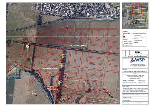
Figure 2.2<br />
Status <strong>of</strong> Scattered Indigenous<br />
Trees within the Armstrong<br />
Creek West <strong>Precinct</strong><br />
T88T87<br />
T86S66<br />
nmnmnmnm nm nm nm nm<br />
T90T89<br />
S56<br />
S55<br />
T92<br />
M7 M8 M6<br />
M5<br />
nmnm nmnm<br />
nm<br />
M22<br />
nm<br />
T2<br />
nm<br />
T3<br />
DRAWN BY: Christine Spits<br />
CHECKED BY: Christopher White<br />
APPROVED BY: Christopher White<br />
DATA SOURCE:<br />
DATE: 26/08/2011<br />
DATE: 26/08/2011<br />
DATE: 26/08/2011<br />
Data Source: ‘VICMAP_IMAGERY’© The State <strong>of</strong> Victoria, Department <strong>of</strong> Sustainability<br />
and Environment Cadastral Line- Vicmap Property (VMPROP_CAD_LINE/) © The State<br />
<strong>of</strong> Victoria, Department <strong>of</strong> Sustainability and Environment. Roads- (ROAD100/ROAD100)<br />
© The State <strong>of</strong> Victoria, Department <strong>of</strong> Sustainability and Environment.<br />
‘VICMAP_HYDRO (HY_WATERCOURSE) © The State <strong>of</strong> Victoria, Department <strong>of</strong><br />
Sustainability and Environment<br />
ARMSTRONG CREEK<br />
nm<br />
T41<br />
GEOGRAPHIC COORDINATE SYSTEM: GCS_GDA_1994<br />
DATUM: D_GDA_1994<br />
Drawing No. 2 <strong>of</strong> 6<br />
nm<br />
nm<br />
Revision. 004<br />
Sheet Size. A3


