

Native Vegetation Precinct Plan - City of Greater Geelong
Native Vegetation Precinct Plan - City of Greater Geelong
Native Vegetation Precinct Plan - City of Greater Geelong

You also want an ePaper? Increase the reach of your titles
YUMPU automatically turns print PDFs into web optimized ePapers that Google loves.
Figure 3.1<br />
Figure 3.2<br />
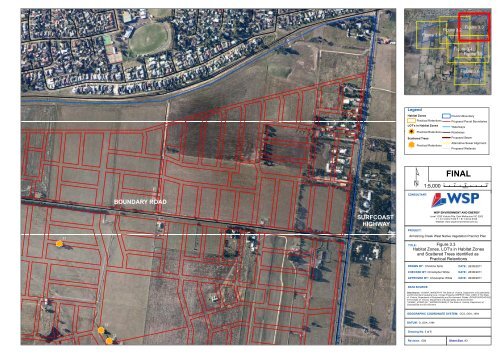
Figure 3.3<br />
Figure 3.4<br />
Figure 3.5<br />
Figure 3.6<br />
Legend<br />
Habitat Zones<br />
Practical Retentions<br />
LOT's in Habitat Zones<br />
nm !<br />
Practical Retentions<br />
<strong>Precinct</strong><br />
Scattered Trees<br />
Practical Retentions<br />
nm<br />
Boundary<br />
Proposed Parcel Boundaries<br />
Waterways<br />
Roadways<br />
Proposed Sewer<br />
Alternative Sewer Alignment<br />
Proposed Wetlands<br />
¹<br />
1:5,000<br />
FINAL<br />
0 45 90 180<br />
Metres<br />
BOUNDARY ROAD<br />
CONSULTANT:<br />
nm<br />
T1<br />
SURFCOAST<br />
HIGHWAY<br />
WSP ENVIRONMENT AND ENERGY<br />
Level 1/250 Victoria Pde, East Melbourne VIC 3002<br />
T + 61 3 9412 5100 F + 61 3 9412 5199<br />
Website: www.wspenvironmental.com.au<br />
PROJECT:<br />
Armstrong Creek West <strong>Native</strong> <strong>Vegetation</strong> <strong>Precinct</strong> <strong>Plan</strong><br />
Figure 3.3<br />
Habitat Zones, LOT's in Habitat Zones<br />
and Scattered Trees identified as<br />
Practical Retentions<br />
TITLE:<br />
DRAWN BY: Christine Spits<br />
CHECKED BY: Christopher White<br />
APPROVED BY: Christopher White<br />
DATE: 26/08/2011<br />
DATE: 26/08/2011<br />
DATE: 26/08/2011<br />
DATA SOURCE:<br />
Data Source: ‘VICMAP_IMAGERY’© The State <strong>of</strong> Victoria, Department <strong>of</strong> Sustainability<br />
and Environment Cadastral Line- Vicmap Property (VMPROP_CAD_LINE/) © The State<br />
<strong>of</strong> Victoria, Department <strong>of</strong> Sustainability and Environment. Roads- (ROAD100/ROAD100)<br />
© The State <strong>of</strong> Victoria, Department <strong>of</strong> Sustainability and Environment.<br />
‘VICMAP_HYDRO (HY_WATERCOURSE) © The State <strong>of</strong> Victoria, Department <strong>of</strong><br />
Sustainability and Environment<br />
GEOGRAPHIC COORDINATE SYSTEM: GCS_GDA_1994<br />
nm<br />
T2<br />
T3<br />
nm<br />
DATUM: D_GDA_1994<br />
Drawing No. 3 <strong>of</strong> 6<br />
Revision. 004<br />
Sheet Size. A3


