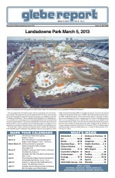
April 16, 2010 - Glebe Report
April 16, 2010 - Glebe Report
April 16, 2010 - Glebe Report

Create successful ePaper yourself
Turn your PDF publications into a flip-book with our unique Google optimized e-Paper software.
Community parks of the <strong>Glebe</strong><br />
by Carol MacLeod<br />
The 2.56 hectare park at 10 Fifth Avenue and bounded by Fifth, O’Connor,<br />
Lansdowne Park and the Driveway, is the major recreation space in the <strong>Glebe</strong>.<br />
Variously called the community or recreation park by residents, it has been<br />
identified as Sylvia Holden Park on city maps and in documents as Lansdowne<br />
Community Park. Many of us were dismayed to see this land (whatever its<br />
name) included in the scope of the overall “front lawn” design for Lansdowne<br />
Park, despite resolutions to the contrary from city council.<br />
Where is the real Sylvia Holden Park? How does this community park fit<br />
into our park system? In order to address some of these concerns, I turned to<br />
city officials. Questions about <strong>Glebe</strong> parks, and Sylvia Holden Park in particular,<br />
were referred to city staff responsible for the Lansdowne Park project.<br />
I also relied on the city’s website, the Parks and Recreation Master Plan (in<br />
process) and particularly, the Greenspace Master Plan: Strategies for Ottawa’s<br />
Urban Greenspaces.<br />
The Parks, Recreation and Culture Department lists parks by sector,<br />
east and west, along a divide formed by the Rideau Canal and the Rideau<br />
River. <strong>Glebe</strong> parks are the following:<br />
• Brown’s Inlet (65 Craig, 2.7 ha)<br />
• Capital (10 Ella, 0.4 ha)<br />
• Central, aka Patterson’s Creek (19 Clemow, 0.8 ha)<br />
• Chamberlain (80 Chamberlain, 0.88 ha)<br />
• <strong>Glebe</strong> Community Centre and St. James Tennis (690 Lyon, 0.42 ha)<br />
• <strong>Glebe</strong> Memorial (75 Glendale, 0.71 ha)<br />
• Lansdowne (945 Bank, 15.6 ha)<br />
• Lionel Britton (19 Fifth, 0.09 ha)<br />
• Senator Eugene Forsey (964 Bronson, 0.2 ha) and,<br />
• finally Sylvia Holden (10 Fifth, 2.56 ha).<br />
Interestingly enough, Lansdowne Community Park is not listed. The City of<br />
Ottawa Park Inventory <strong>Report</strong> was revised some time between March 9 and<br />
March 29, <strong>2010</strong>; the description for Sylvia Holden Park (945 Bank Street,<br />
0.46 ha) was changed and Central (no address given, 2.97 Ha) and Lansdowne<br />
Community Park (10 Fifth, 2.56 ha) were added.<br />
A Brief History<br />
Dan Chenier, Department of Parks, Recreation and Culture, explained by<br />
email that the old City of Ottawa officially approved Sylvia Holden Park as a<br />
park in 1994, based on a document entitled: “Excerpt from the <strong>Glebe</strong> <strong>Report</strong>-<br />
Multi-purpose Park planned for Holmwood/Bank.” That document, apparently<br />
prepared in 1975 and submitted to the then-Board of Control of the old city,<br />
was not approved at that time for reasons unknown. The part of the park with<br />
baseball diamonds, wading pools, swings and day care building “is undedicated<br />
parkland, commonly referred to as Lansdowne Community Park and not<br />
part of Sylvia Holden Park.” Sylvia Holden at the corner of Bank and Holmwood<br />
is a passive park.<br />
One recommendation of the Lansdowne Park Development Strategy, approved<br />
by Council in 1984, was to develop a community play area in the<br />
northeast section of Lansdowne. Work was completed in 1990-1991. In “Lansdowne<br />
Community Park”, the city operates a wading pool program, which<br />
includes supervised water play, arts and craft activities by the pool and special<br />
events from late June to late August. In 2009, the “Lansdowne Community<br />
Park” wading pool recorded 20,493 users over the summer, the busiest in the<br />
City. The two baseball diamonds in this park are booked seven days a week<br />
from May to July, and five days a week for August and September. The <strong>Glebe</strong><br />
Little League is the main user group. The park includes a fenced dog park, one<br />
of only two the city operates.<br />
Do we have enough greenspace?<br />
The City of Ottawa Official Plan sets a target of 4.0 hectares of total greenspace<br />
per 1,000 population. This includes natural land, open space and leisure<br />
land, including “federal land recognized by the NCC as a park.” (The Greenbelt<br />
is excluded.) Two hectares of this is to be park and leisure land. According<br />
to the Greenspace Master Plan, the “Inner Area” of which we are part has less<br />
than 2 hectares of greenspace per 1,000 in total, with half of that being park.<br />
This is the lowest in the city. The western boundary of the <strong>Glebe</strong> for the purpose<br />
of figuring total parkland is the O Train line, Carling and Bronson.<br />
To calculate total greenspace in a community, the Greenspace Master Plan<br />
includes both “primary” lands and “active and passive open space in public<br />
ownership identified in the 2005 Land Use Survey.”<br />
Photo: Elaine Marlin<br />
<strong>Glebe</strong> <strong>Report</strong> <strong>April</strong> <strong>16</strong>, <strong>2010</strong> 23<br />
Distribution of parks and greenspace sub-areas of urbam Ottawa<br />
Primary lands are defined as including “the natural landscapes and major<br />
rivers that are recognized as having high environmental quality or rarity”<br />
and specifically include “public parks, sports fields, river access points, major<br />
pathway corridors, children’s play areas and civic squares owned by municipal,<br />
provincial and federal agencies”. For the <strong>Glebe</strong>, most designated city<br />
parks and NCC lands bordering the Rideau Canal, including all land around<br />
Dow’s Lake as far as the O Train track are included in this definition.<br />
Supporting lands are “intended for uses other than the provision of open<br />
space and leisure, but allow for public access and contribute to the overall<br />
greenspace experience….” These include municipal forests, school grounds,<br />
grounds of public facilities and institutions, some utility infrastructure and<br />
transit and abandoned rail corridors. Examples are Lansdowne Park (included<br />
in the city’s lists of its parks), and parcels of NCC land west of the Driveway,<br />
the cutoff from Bank to the Driveway at Wilton, and surrounding the westbound<br />
lane of the Driveway from Bank Street to Bronson. Elsewhere in the<br />
Greenspace Master Plan, they are said to include “tributaries to rivers, isolated<br />
natural features, and habitats that link the primary areas … public lands that<br />
potentially contribute to leisure opportunities because they permit public access.”<br />
The map of Open Space and Leisure Land in the Greenspace Master<br />
Plan appears to suggest that, in the <strong>Glebe</strong>, this includes the community centre,<br />
all our school lands, Central Park, Lansdowne and parts of the Dow’s Lake<br />
lands occupied by the Pavilion and Department of National Defence.<br />
The current population of the <strong>Glebe</strong> approaches 11,000. Thus, according<br />
to the Official Plan, we should have 44 hectares of greenspace, of which 22<br />
should be park and leisure land. Excluding the Lansdowne Park Complex, not<br />
to be confused with the Lansdowne Community Park, and including the tot lot<br />
and St. James tennis courts at the community centre, the <strong>Glebe</strong> has, in total,<br />
12.19 hectares of city-owned parks in our neighbourhood or a ratio of 1.1082<br />
hectares per 1,000 population.<br />
Recreational facilities<br />
As for recreational facilities in our community of 11,000, we have rooms<br />
at the community centre. We use our schools. We have six tennis courts, two<br />
baseball diamonds, two basketball courts, one soccer field, a spray pad, a splash<br />
pad and wading pool, half a dozen banks of swings, a community-maintained<br />
outdoor rink in winter (a second is maintained in the Mutchmor play yard) and<br />
a dog park. We have no indoor recreation centres, fitness centres, pools (standard:<br />
1:35,000 residents) or indoor skating (standard: 1:22,000). Our nearest<br />
recreational facilities, Brewer Pool and the Plant Bath, Brewer Rink and Tom<br />
Brown Arena, serve a total population well over 70,000.<br />
Despite the relative lack of recreational facilities, we are expected to absorb<br />
increased population as a result of a policy of densification. And council<br />
wonders why we react with concern when faced with the potential loss of our<br />
largest recreational park?<br />
Our parks are part of the legacy passed on from active community volunteers<br />
such as Sylvia Holden; we can best honour that legacy by remaining vigilant<br />
stewards of those lands so that the next generation may enjoy them.<br />
Both Elaine Marlin and Carol MacLeod have been active for many years<br />
in creating and sustaining volunteer organizations in the <strong>Glebe</strong>, to the great<br />
benefit of all those living in the area. We thank them for their ongoing contributions<br />
to the community.<br />
A great gift -<br />
A wonderful keepsake<br />
House<br />
Portraits<br />
$175.00<br />
by Donna Edwards<br />
613-233-4775<br />
Courtesy of Greenspace master plan