

Preventive Resettlement of Populations at Risk of Disaster - GFDRR
Preventive Resettlement of Populations at Risk of Disaster - GFDRR
Preventive Resettlement of Populations at Risk of Disaster - GFDRR

Create successful ePaper yourself
Turn your PDF publications into a flip-book with our unique Google optimized e-Paper software.
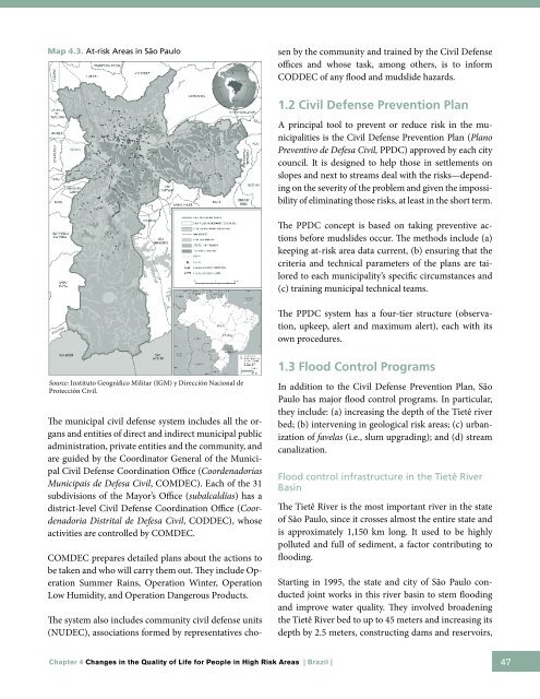
Map 4.3. At-risk Areas in São Paulo<br />
The system also includes community civil defense units<br />
(NUDEC), associ<strong>at</strong>ions formed by represent<strong>at</strong>ives chosen<br />
by the community and trained by the Civil Defense<br />
<strong>of</strong>fices and whose task, among others, is to inform<br />
CODDEC <strong>of</strong> any flood and mudslide hazards.<br />
1.2 Civil Defense Prevention Plan<br />
A principal tool to prevent or reduce risk in the municipalities<br />
is the Civil Defense Prevention Plan (Plano<br />
Preventivo de Defesa Civil, PPDC) approved by each city<br />
council. It is designed to help those in settlements on<br />
slopes and next to streams deal with the risks—depending<br />
on the severity <strong>of</strong> the problem and given the impossibility<br />
<strong>of</strong> elimin<strong>at</strong>ing those risks, <strong>at</strong> least in the short term.<br />
The PPDC concept is based on taking preventive actions<br />
before mudslides occur. The methods include (a)<br />
keeping <strong>at</strong>-risk area d<strong>at</strong>a current, (b) ensuring th<strong>at</strong> the<br />
criteria and technical parameters <strong>of</strong> the plans are tailored<br />
to each municipality’s specific circumstances and<br />
(c) training municipal technical teams.<br />
The PPDC system has a four-tier structure (observ<strong>at</strong>ion,<br />
upkeep, alert and maximum alert), each with its<br />
own procedures.<br />
Source: Instituto Geográfico Militar (IGM) y Dirección Nacional de<br />
Protección Civil.<br />
The municipal civil defense system includes all the organs<br />
and entities <strong>of</strong> direct and indirect municipal public<br />
administr<strong>at</strong>ion, priv<strong>at</strong>e entities and the community, and<br />
are guided by the Coordin<strong>at</strong>or General <strong>of</strong> the Municipal<br />
Civil Defense Coordin<strong>at</strong>ion Office (Coordenadorias<br />
Municipais de Defesa Civil, COMDEC). Each <strong>of</strong> the 31<br />
subdivisions <strong>of</strong> the Mayor’s Office (subalcaldías) has a<br />
district-level Civil Defense Coordin<strong>at</strong>ion Office (Coordenadoria<br />
Distrital de Defesa Civil, CODDEC), whose<br />
activities are controlled by COMDEC.<br />
COMDEC prepares detailed plans about the actions to<br />
be taken and who will carry them out. They include Oper<strong>at</strong>ion<br />
Summer Rains, Oper<strong>at</strong>ion Winter, Oper<strong>at</strong>ion<br />
Low Humidity, and Oper<strong>at</strong>ion Dangerous Products.<br />
1.3 Flood Control Programs<br />
In addition to the Civil Defense Prevention Plan, São<br />
Paulo has major flood control programs. In particular,<br />
they include: (a) increasing the depth <strong>of</strong> the Tietê river<br />
bed; (b) intervening in geological risk areas; (c) urbaniz<strong>at</strong>ion<br />
<strong>of</strong> favelas (i.e., slum upgrading); and (d) stream<br />
canaliz<strong>at</strong>ion.<br />
Flood control infrastructure in the Tietê River<br />
Basin<br />
The Tietê River is the most important river in the st<strong>at</strong>e<br />
<strong>of</strong> São Paulo, since it crosses almost the entire st<strong>at</strong>e and<br />
is approxim<strong>at</strong>ely 1,150 km long. It used to be highly<br />
polluted and full <strong>of</strong> sediment, a factor contributing to<br />
flooding.<br />
Starting in 1995, the st<strong>at</strong>e and city <strong>of</strong> São Paulo conducted<br />
joint works in this river basin to stem flooding<br />
and improve w<strong>at</strong>er quality. They involved broadening<br />
the Tietê River bed to up to 45 meters and increasing its<br />
depth by 2.5 meters, constructing dams and reservoirs,<br />
Chapter 4 Changes in the Quality <strong>of</strong> Life for People in High <strong>Risk</strong> Areas | Brazil |<br />
47


