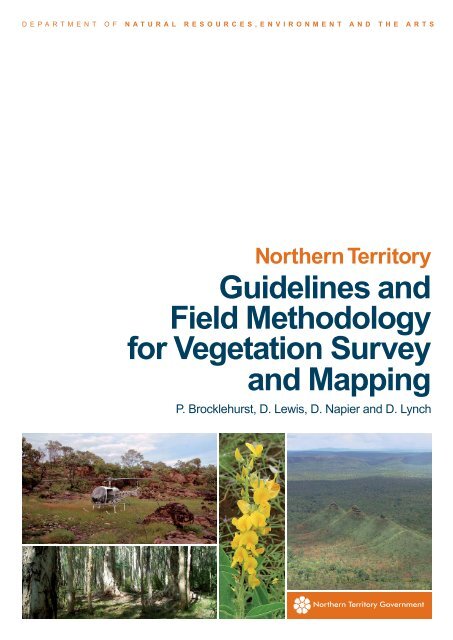
Guidelines and Field Methodology for Vegetation Survey and Mapping
Guidelines and Field Methodology for Vegetation Survey and Mapping
Guidelines and Field Methodology for Vegetation Survey and Mapping

You also want an ePaper? Increase the reach of your titles
YUMPU automatically turns print PDFs into web optimized ePapers that Google loves.
DEPARTMENT OF NATURAL RESOURCES,ENVIRONMENT AND THE ARTS<br />
Northern Territory<br />
<strong>Guidelines</strong> <strong>and</strong><br />
<strong>Field</strong> <strong>Methodology</strong><br />
<strong>for</strong> <strong>Vegetation</strong> <strong>Survey</strong><br />
<strong>and</strong> <strong>Mapping</strong><br />
P. Brocklehurst, D. Lewis, D. Napier <strong>and</strong> D. Lynch
ISBN 1 92077242 1<br />
TECHNICAL REPORT NO. 02/2007D<br />
Northern Territory<br />
<strong>Guidelines</strong> <strong>and</strong> <strong>Field</strong> <strong>Methodology</strong><br />
<strong>for</strong> <strong>Vegetation</strong> <strong>Survey</strong> <strong>and</strong> <strong>Mapping</strong><br />
P. Brocklehurst, D. Lewis, D. Napier <strong>and</strong> D. Lynch<br />
L<strong>and</strong> <strong>and</strong> <strong>Vegetation</strong><br />
L<strong>and</strong> <strong>and</strong> Water Division<br />
This report may be cited as:<br />
Brocklehurst, P., Lewis, D., Napier, D., Lynch, D. (2007) Northern Territory <strong>Guidelines</strong> <strong>and</strong> <strong>Field</strong><br />
<strong>Methodology</strong> <strong>for</strong> <strong>Vegetation</strong> <strong>Survey</strong> <strong>and</strong> <strong>Mapping</strong>. Technical Report No. 02/2007D. Department of Natural<br />
Resources, Environment <strong>and</strong> the Arts, Palmerston, Northern Territory.<br />
This report is available from the DNRETA Library Resource Centre, First Floor Goyder Centre, Palmerston<br />
<strong>and</strong> can be accessed on the DNRETA website in PDF <strong>for</strong>mat:<br />
http://www.nt.gov.au/nreta/naturalresources/nativevegetation/vegmapping/methodology.html<br />
Inquiries should be directed to:<br />
Peter Brocklehurst<br />
Phone: +61 88999 3623<br />
Fax: +61 88999 3667<br />
e-mail: peter.brocklehurst@nt.gov.au<br />
Donna Lewis<br />
Phone: +61 88999 3690<br />
Fax: +61 88999 3667<br />
e-mail: donna.lewis@nt.gov.au<br />
L<strong>and</strong> <strong>and</strong> <strong>Vegetation</strong><br />
L<strong>and</strong> <strong>and</strong> Water Division<br />
Department of Natural Resources, Environment <strong>and</strong> the Arts<br />
4 th Floor Goyder Centre<br />
25 Chung Wah Terrace<br />
PO Box 30<br />
Palmerston NT 0831<br />
Australia
PREFACE<br />
This document describes the st<strong>and</strong>ard methods <strong>for</strong> collecting, describing, classifying <strong>and</strong><br />
mapping vegetation in the Northern Territory compliant with the Australian Soil <strong>and</strong> L<strong>and</strong><br />
<strong>Survey</strong> <strong>Field</strong> H<strong>and</strong>books (‘Yellow Book’ McDonald et al., 1990 & ‘Blue Book’ Gunn et al.,<br />
1988) <strong>and</strong> in accordance with national st<strong>and</strong>ards of the National <strong>Vegetation</strong> In<strong>for</strong>mation<br />
System.<br />
This report is divided into two Sections: Section A - <strong>Guidelines</strong> <strong>and</strong> Section B - <strong>Field</strong><br />
<strong>Methodology</strong>. Section A contains background in<strong>for</strong>mation <strong>and</strong> the principles pertaining to<br />
vegetation survey <strong>and</strong> mapping. Section B describes methods <strong>for</strong> on-ground field<br />
assessment. In<strong>for</strong>mation contained in this document is not an exhaustive treatment of all<br />
vegetation survey <strong>and</strong> mapping aspects. Reference is given to appropriate publications<br />
throughout.<br />
The main objective is to recommend <strong>and</strong> promote the use of consistent methods,<br />
procedures <strong>and</strong> terminologies on vegetation survey <strong>and</strong> mapping to an Australian st<strong>and</strong>ard<br />
across all agencies in the Northern Territory. Amendments will be progressively made to<br />
comply with future national initiatives <strong>and</strong> developments.<br />
Northern Territory <strong>Guidelines</strong> <strong>and</strong> <strong>Field</strong> <strong>Methodology</strong><br />
<strong>for</strong> <strong>Vegetation</strong> <strong>Survey</strong> <strong>and</strong> <strong>Mapping</strong><br />
i
ACKNOWLEDGEMENTS<br />
The <strong>Guidelines</strong> <strong>and</strong> <strong>Field</strong> <strong>Methodology</strong> were made possible through the endeavours of<br />
numerous staff members of the L<strong>and</strong> <strong>and</strong> Water Division. Particular thanks go to Jason<br />
Hill, Dave Howe, Graeme Owen <strong>and</strong> Chris Mangion <strong>for</strong> providing content on soil <strong>and</strong><br />
l<strong>and</strong><strong>for</strong>m in<strong>for</strong>mation to Australian st<strong>and</strong>ards <strong>and</strong> comment on the <strong>Guidelines</strong> <strong>and</strong> <strong>Field</strong><br />
<strong>Methodology</strong> as a whole. Francis Wait is thanked <strong>for</strong> proof reading <strong>and</strong> editing the final<br />
draft of this document.<br />
Various Divisions of NRETA are acknowledged <strong>for</strong> providing comment including Ian Cowie<br />
<strong>and</strong> Dale Dixon of the Northern Territory Herbarium. Alison Derry <strong>and</strong> Keith Ferdin<strong>and</strong>s of<br />
the Weed Management Branch are recognised <strong>for</strong> providing up-to date in<strong>for</strong>mation on<br />
collecting weeds data in the NT.<br />
Northern Territory <strong>Guidelines</strong> <strong>and</strong> <strong>Field</strong> <strong>Methodology</strong><br />
<strong>for</strong> <strong>Vegetation</strong> <strong>Survey</strong> <strong>and</strong> <strong>Mapping</strong><br />
ii
CONTENTS<br />
PREFACE .............................................................................................................I<br />
ACKNOWLEDGEMENTS............................................................................ II<br />
LIST OF FIGURES ........................................................................................ VI<br />
LIST OF TABLES ........................................................................................... VI<br />
ACRONYMS ................................................................................................... VII<br />
SECTION A: GUIDELINES ......................................1<br />
1.0 INTRODUCTION.................................................................................. 1<br />
2.0 BACKGROUND................................................................................... 2<br />
3.0 PRINCIPLES AND TERMS.................................................................. 3<br />
3.1 <strong>Survey</strong> Design................................................................................................................................. 4<br />
3.2 <strong>Mapping</strong> <strong>and</strong> Map Production ....................................................................................................... 5<br />
3.3 Classification Systems <strong>and</strong> NVIS.................................................................................................. 5<br />
4.0 MAPPING PROCEDURES .................................................................. 7<br />
4.1 Map Scale ........................................................................................................................................ 7<br />
4.2 Interpretive Material........................................................................................................................ 7<br />
4.3 Defining Map Units ......................................................................................................................... 8<br />
4.4 Mosaics............................................................................................................................................ 9<br />
4.5 Accuracy Assessment ................................................................................................................... 9<br />
5.0 NVIS CLASSIFICATION FRAMEWORK AND NOMENCLATURE.. 10<br />
5.1 NVIS Structural Classification..................................................................................................... 10<br />
6.0 DATA ANALYSIS AND MAP ATTRIBUTION.................................... 16<br />
6.1 Floristic Analysis .......................................................................................................................... 16<br />
6.2 Structural Classification .............................................................................................................. 17<br />
6.3 Polygon/Map Attribution .............................................................................................................. 17<br />
6.4 Reporting....................................................................................................................................... 17<br />
7.0 DATA STORAGE .............................................................................. 18<br />
Northern Territory <strong>Guidelines</strong> <strong>and</strong> <strong>Field</strong> <strong>Methodology</strong><br />
<strong>for</strong> <strong>Vegetation</strong> <strong>Survey</strong> <strong>and</strong> <strong>Mapping</strong><br />
iii
7.1 Meta Data....................................................................................................................................... 18<br />
7.2 Site Data......................................................................................................................................... 18<br />
7.3 Polygon/Map Data......................................................................................................................... 19<br />
7.4 Database Integration .................................................................................................................... 20<br />
8.0 PRODUCTS....................................................................................... 22<br />
9.0 FUTURE DEVELOPMENTS.............................................................. 23<br />
9.1 <strong>Vegetation</strong> Condition.................................................................................................................... 23<br />
9.2 Non Native <strong>Vegetation</strong> Types ...................................................................................................... 25<br />
9.3 Definitive <strong>Vegetation</strong> Types......................................................................................................... 25<br />
9.4 Ecosystem Regionalisation......................................................................................................... 26<br />
9.5 Web Server Data Input Forms ..................................................................................................... 27<br />
SECTION B: FIELD METHODOLOGY .................. 28<br />
1.0 INTRODUCTION ............................................................................... 28<br />
2.0 SAMPLE SITES ................................................................................ 29<br />
2.1 Site Types <strong>and</strong> Dimensions......................................................................................................... 29<br />
2.2 Site Selection <strong>and</strong> Sampling Intensity........................................................................................ 30<br />
3.0 DESCRIBING VEGETATION............................................................ 31<br />
3.1 Species .......................................................................................................................................... 31<br />
3.2 <strong>Vegetation</strong> Profiles: Stratum Concept........................................................................................31<br />
3.3 Cover.............................................................................................................................................. 34<br />
3.4 Height............................................................................................................................................. 35<br />
3.5 Basal Area ..................................................................................................................................... 36<br />
3.6 Foliage Projective Cover.............................................................................................................. 37<br />
3.7 Growth Form ................................................................................................................................. 38<br />
4.0 PHYSICAL ENVIRONMENT ............................................................. 39<br />
4.1 Integrated In<strong>for</strong>mation.................................................................................................................. 39<br />
4.2 L<strong>and</strong><strong>for</strong>m Element <strong>and</strong> Pattern ................................................................................................... 39<br />
4.3 L<strong>and</strong> Surface ................................................................................................................................. 40<br />
4.4 Soil ................................................................................................................................................. 40<br />
5.0 FIELD DATA VARIABLES................................................................ 42<br />
5.1 Habitat Sheet................................................................................................................................. 44<br />
5.2 Flora Sheet .................................................................................................................................... 51<br />
5.3 Foliage Projective Cover Sheet................................................................................................... 52<br />
Northern Territory <strong>Guidelines</strong> <strong>and</strong> <strong>Field</strong> <strong>Methodology</strong><br />
<strong>for</strong> <strong>Vegetation</strong> <strong>Survey</strong> <strong>and</strong> <strong>Mapping</strong><br />
iv
GLOSSARY.......................................................................................................53<br />
REFERENCES................................................................................................. 58<br />
APPENDICES ........................................................ 62<br />
APPENDIX 1: Primary <strong>Vegetation</strong> Datasets ..................................................................................... 62<br />
APPENDIX 2: Overview of <strong>Vegetation</strong> <strong>Survey</strong> <strong>and</strong> <strong>Mapping</strong> Procedures..................................... 63<br />
APPENDIX 3: Cover <strong>and</strong> Structural Formation Comparisons <strong>for</strong> Common Classification<br />
Systems ............................................................................................................................................... 64<br />
APPENDIX 4: Height Class Comparison <strong>for</strong> Common Classification Systems ........................... 65<br />
APPENDIX 5: Comparison of Classification Systems Codes <strong>and</strong> Descriptions.......................... 66<br />
APPENDIX 6: <strong>Vegetation</strong> <strong>Survey</strong> Report Formats........................................................................... 68<br />
APPENDIX 7: Metadata Attributes .................................................................................................... 72<br />
APPENDIX 8: Preliminary NT <strong>Vegetation</strong> Condition Indicators <strong>for</strong> Forests <strong>and</strong> Woodl<strong>and</strong>s ..... 73<br />
APPENDIX 9: Example of Eucalyptus Open Forest Synthetic Benchmark .................................. 74<br />
APPENDIX 10: Definitive <strong>Vegetation</strong> Types Database Attributes - Example................................ 75<br />
APPENDIX 11: IUCN Red List Categories ........................................................................................ 79<br />
APPENDIX 12: Directions <strong>for</strong> the Collection of NT Weeds............................................................. 80<br />
APPENDIX 13: NT Weeds Data Collection Sheet............................................................................. 81<br />
APPENDIX 14: L<strong>and</strong><strong>for</strong>m Element <strong>and</strong> Pattern Codes <strong>and</strong> Descriptions ..................................... 82<br />
APPENDIX 15: Common Soil Orders in the NT................................................................................ 84<br />
APPENDIX 16: <strong>Field</strong> Data Pro<strong>for</strong>ma - Habitat Sheet........................................................................ 85<br />
APPENDIX 17: <strong>Field</strong> Data Pro<strong>for</strong>ma - Flora Sheet........................................................................... 87<br />
APPENDIX 18: <strong>Field</strong> Data Pro<strong>for</strong>ma - <strong>Vegetation</strong> Foliage Projective Cover................................. 90<br />
APPENDIX 19: NT Site Procedure <strong>and</strong> Equipment List .................................................................. 91<br />
Northern Territory <strong>Guidelines</strong> <strong>and</strong> <strong>Field</strong> <strong>Methodology</strong><br />
<strong>for</strong> <strong>Vegetation</strong> <strong>Survey</strong> <strong>and</strong> <strong>Mapping</strong><br />
v
LIST OF FIGURES<br />
Figure 1. Comparison of NT vegetation data stored in numerous databases................................................ 18<br />
Figure 2. Proposed NRVIS data model. ......................................................................................................... 21<br />
Figure 3. Cumulative scoring method............................................................................................................. 25<br />
Figure 4. Sub-strata vegetation profiles <strong>for</strong> two vegetation communities (ESCAVI, 2003). ........................... 33<br />
Figure 5. <strong>Vegetation</strong> profile height types (ESCAVI, 2003). ............................................................................ 36<br />
Figure 6. Foliage projective cover transect set up <strong>and</strong> design. ...................................................................... 37<br />
LIST OF TABLES<br />
Table 1. Summary of primary vegetation datasets, 2006. ................................................................................ 2<br />
Table 2. <strong>Vegetation</strong> mapping terminology. ....................................................................................................... 3<br />
Table 3. Data resolution at various scales. ....................................................................................................... 9<br />
Table 4. The NVIS In<strong>for</strong>mation Hierarchy. ...................................................................................................... 11<br />
Table 5. NVIS height class codes <strong>and</strong> descriptions........................................................................................12<br />
Table 6. NVIS cover class codes <strong>and</strong> descriptions.........................................................................................12<br />
Table 7. NVIS growth <strong>for</strong>m codes <strong>and</strong> descriptions........................................................................................ 12<br />
Table 8. NVIS Classification System structural <strong>for</strong>mation classes. ................................................................ 14<br />
Table 9. NVIS height classes <strong>and</strong> corresponding growth <strong>for</strong>ms. .................................................................... 15<br />
Table 10. Recommended sampling intensity <strong>for</strong> various scales of mapping.................................................. 30<br />
Table 11. Traditional stratum codes <strong>and</strong> NVIS sub stratum codes <strong>and</strong> descriptions. .................................... 32<br />
Table 12. Cover <strong>and</strong> abundance measures....................................................................................................34<br />
Table 13. Description of height types <strong>for</strong> stratum <strong>and</strong> growth <strong>for</strong>m. ............................................................... 35<br />
Table 14. Basal area count <strong>and</strong> suggested transect length............................................................................ 38<br />
Table 15. <strong>Vegetation</strong> site data core attributes. ............................................................................................... 42<br />
Table 16. Data recorded on field data pro<strong>for</strong>mas <strong>for</strong> sampling full sites, check sites <strong>and</strong> road notes. .......... 43<br />
Northern Territory <strong>Guidelines</strong> <strong>and</strong> <strong>Field</strong> <strong>Methodology</strong><br />
<strong>for</strong> <strong>Vegetation</strong> <strong>Survey</strong> <strong>and</strong> <strong>Mapping</strong><br />
vi
ACRONYMS<br />
ANZLIC<br />
BRS<br />
DEH<br />
DEM<br />
DVT<br />
ERIN<br />
ESCAVI<br />
GIS<br />
GPS<br />
IBRA<br />
IUCN<br />
NDVI<br />
NFI<br />
NLWRA<br />
NRETA<br />
NRVIS<br />
NT<br />
NTG<br />
NVIS<br />
RAVS<br />
SLATS<br />
VAST<br />
WoNS<br />
Australian <strong>and</strong> New Zeal<strong>and</strong> L<strong>and</strong> In<strong>for</strong>mation Council<br />
Bureau of Rural Sciences<br />
Department of Environment <strong>and</strong> Heritage<br />
Digital Elevation Model<br />
Definitive <strong>Vegetation</strong> Type<br />
Environmental Resources In<strong>for</strong>mation Centre<br />
Executive Steering Committee <strong>for</strong> Australian <strong>Vegetation</strong> In<strong>for</strong>mation<br />
Geographic In<strong>for</strong>mation System<br />
Global Positioning System<br />
Interim Biogeographic Regionalisation <strong>for</strong> Australia<br />
International Union <strong>for</strong> the Conservation of Nature<br />
Normalised Difference <strong>Vegetation</strong> Index<br />
National Forest Inventory<br />
National L<strong>and</strong> <strong>and</strong> Water Resources Audit<br />
Dept. Natural Resources Environment <strong>and</strong> the Arts<br />
Natural Resource <strong>Vegetation</strong> In<strong>for</strong>mation System<br />
Northern Territory<br />
Northern Territory Government<br />
National <strong>Vegetation</strong> In<strong>for</strong>mation System<br />
Resource Assessment <strong>Vegetation</strong> System<br />
State-wide L<strong>and</strong>cover <strong>and</strong> Trees Study<br />
<strong>Vegetation</strong> Assets States <strong>and</strong> Transitions<br />
Weeds of National Significance<br />
Northern Territory <strong>Guidelines</strong> <strong>and</strong> <strong>Field</strong> <strong>Methodology</strong><br />
<strong>for</strong> <strong>Vegetation</strong> <strong>Survey</strong> <strong>and</strong> <strong>Mapping</strong><br />
vii
SECTION A: GUIDELINES
SECTION A: GUIDELINES<br />
1.0 INTRODUCTION<br />
This Section provides in<strong>for</strong>mation on vegetation survey <strong>and</strong> mapping in the Northern Territory (NT)<br />
as currently practised by L<strong>and</strong> <strong>and</strong> <strong>Vegetation</strong> of Department of Natural Resources, Environment<br />
<strong>and</strong> the Arts (NRETA). The <strong>Guidelines</strong> provide methods <strong>for</strong> the capture, interpretation <strong>and</strong><br />
management of vegetation data <strong>and</strong> in<strong>for</strong>mation in compliance with national st<strong>and</strong>ards of the<br />
National <strong>Vegetation</strong> In<strong>for</strong>mation System (NVIS) Framework (NLWRA, 2001; ESCAVI, 2003).<br />
A brief outline of each chapter is provided below.<br />
• Chapter 2 provides an historic synopsis of vegetation data collection in the NT.<br />
• Chapter 3 describes common principals <strong>and</strong> terminology associated with vegetation<br />
survey <strong>and</strong> mapping.<br />
• Chapter 4 explains vegetation mapping procedures with reference to other literature.<br />
• Chapter 5 outlines <strong>and</strong> describes vegetation classification systems <strong>and</strong> the NVIS<br />
nomenclature.<br />
• Chapter 6 outlines the processes involved in vegetation data analysis <strong>and</strong> map<br />
attribution.<br />
• Chapter 7 summarises the procedures required to document vegetation datasets<br />
(metadata) <strong>and</strong> the storage of site <strong>and</strong> polygon vegetation data.<br />
• Chapter 8 lists the products that can be generated from the derivation of vegetation<br />
survey <strong>and</strong> mapping data.<br />
• Chapter 9 describes future developments relative to native vegetation <strong>and</strong> the current<br />
status of national initiatives.<br />
Northern Territory <strong>Guidelines</strong> <strong>and</strong> <strong>Field</strong> <strong>Methodology</strong><br />
<strong>for</strong> <strong>Vegetation</strong> <strong>Survey</strong> <strong>and</strong> <strong>Mapping</strong><br />
1
SECTION A: GUIDELINES<br />
2.0 BACKGROUND<br />
<strong>Vegetation</strong> data is required <strong>for</strong> a number of purposes <strong>and</strong> at different levels of detail <strong>and</strong> similarly is<br />
required at various scales <strong>and</strong> levels of attribute in<strong>for</strong>mation. Historically, the CSIRO L<strong>and</strong><br />
Research Series <strong>and</strong> various sections of the <strong>for</strong>mer NT Conservation Commission have been the<br />
primary providers of NT vegetation data, <strong>and</strong> responsible <strong>for</strong> the provision of vegetation, l<strong>and</strong><br />
unit/system mapping, floristic <strong>and</strong> biodiversity surveys.<br />
Increasingly fine scale mapping is required <strong>for</strong> management purposes at scales such as 1:25 000<br />
<strong>and</strong> 1:50 000. Little spatial coverage of pure vegetation mapping is available at these scales <strong>for</strong><br />
most of the NT (Table 1). A comprehensive list of primary vegetation datasets is provided in<br />
Appendix 1. L<strong>and</strong> unit <strong>and</strong> l<strong>and</strong> system mapping contain vegetation in<strong>for</strong>mation, however due to<br />
their integrated nature, polygon boundaries rarely equate with homogeneous vegetation<br />
communities.<br />
Table 1. Summary of primary vegetation datasets, 2006.<br />
Scale Area km 2 % NT Coverage Significance<br />
≤ 1:50 000 7 662 0.6 local<br />
1:100 000-1:250 000 100 898 7.5 regional<br />
1:1 000 000 1 346 200 100 national<br />
In the NT a number of private <strong>and</strong> NT Government (NTG) agencies collect vegetation data <strong>for</strong><br />
various purposes. Biodiversity Conservation of NRETA collects <strong>and</strong> describes vegetation data with<br />
little emphasis on stratum <strong>and</strong> species dominance. Data is generally collected in conjunction with<br />
fauna surveys <strong>for</strong> habitat recognition <strong>and</strong> is usually at the association level (NVIS Level V). Data is<br />
stored in an Access database that includes floristics, structural characteristics <strong>and</strong> environmental<br />
in<strong>for</strong>mation.<br />
The NT Herbarium is also a primary collector of floristic data, mostly with in<strong>for</strong>mation on minimal<br />
structural characteristics <strong>and</strong> only broad descriptive in<strong>for</strong>mation. In some instances data is<br />
collected in conjunction with Biodiversity Conservation data. The NT Herbarium maintains the<br />
floristic taxonomic specimen database (Holtze/Platypus) <strong>for</strong> the NT which will eventually be linked<br />
to various environmental databases across NRETA. Also maintained is a site database that<br />
incorporates a complete species list identified within 20m by 20m quadrats <strong>and</strong> geo-referenced<br />
data. A survey specific database <strong>for</strong> Nitmiluk National Park is also maintained <strong>and</strong> incorporates<br />
structural, floristic <strong>and</strong> environmental in<strong>for</strong>mation.<br />
The NT, unlike many other States, has been mapping vegetation <strong>for</strong> a relatively short period of<br />
time so vegetation <strong>and</strong> l<strong>and</strong> unit surveys are commonly of unmapped regions. There<strong>for</strong>e very few<br />
areas have been re-assessed or mapped to record temporal changes in vegetation structure,<br />
composition or condition.<br />
Historically, the NT has mapped type <strong>and</strong> extent of vegetation with little emphasis on vegetation<br />
condition. Site disturbance attributes such as grazing, fire <strong>and</strong> introduced plants are recorded,<br />
although are difficult to extrapolate spatially <strong>and</strong> temporally across the l<strong>and</strong>scape.<br />
Over the last 70 years fire regimes <strong>and</strong> introduced flora <strong>and</strong> fauna are considered to have had<br />
some impact on native vegetation although the extent of these impacts are yet to be fully<br />
understood.<br />
For future developments on vegetation condition refer to Chapter 9.1.<br />
Northern Territory <strong>Guidelines</strong> <strong>and</strong> <strong>Field</strong> <strong>Methodology</strong><br />
<strong>for</strong> <strong>Vegetation</strong> <strong>Survey</strong> <strong>and</strong> <strong>Mapping</strong><br />
2
SECTION A: GUIDELINES<br />
3.0 PRINCIPLES AND TERMS<br />
<strong>Vegetation</strong> in its most general term refers to the plant cover of the earth. Numerous terms are used<br />
to describe vegetation by practitioners of the science (Table 2). Some terminology is very specific<br />
while others are quite general. The following NVIS definition has been adopted as the underlying<br />
definition <strong>for</strong> NT vegetation survey <strong>and</strong> mapping; ‘A vegetation community is an assemblage of<br />
plant species which are structurally <strong>and</strong> floristically similar <strong>and</strong> <strong>for</strong>m a repeating unit across the<br />
l<strong>and</strong>scape’. It is this repeating unit in theory that is to be mapped, quantified <strong>and</strong> described.<br />
Throughout this document the term vegetation community will be used.<br />
Table 2. <strong>Vegetation</strong> mapping terminology.<br />
Term Description Source<br />
<strong>Vegetation</strong><br />
<strong>Vegetation</strong><br />
Type<br />
All plants within a specified area. It is usually considered generally<br />
<strong>and</strong> not taxonomically. Lawrence, 1995<br />
A community that has a floristically uni<strong>for</strong>m structure <strong>and</strong><br />
composition, often described by its dominant species.<br />
Meagher, 1991<br />
<strong>Vegetation</strong><br />
Type<br />
Plant<br />
Community<br />
Plant<br />
Community<br />
<strong>Vegetation</strong><br />
Community<br />
Alliance<br />
Society<br />
In NVIS, a vegetation type is commonly represented by a<br />
vegetation description.<br />
A natural aggregate of different species of organisms existing in<br />
the same environment. While species within the community<br />
interact with each other, <strong>for</strong>ming food chains <strong>and</strong> other ecological<br />
systems, they do not generally interact with species in other<br />
communities.<br />
Is composed of a mixture of populations of different species, each<br />
of which has a finite longevity.<br />
For the purposes of NVIS, a community is described as an<br />
assemblage of plant species which are structurally <strong>and</strong> floristically<br />
similar <strong>and</strong> <strong>for</strong>m a repeating unit across the l<strong>and</strong>scape. See also<br />
vegetation type above.<br />
A group of floristically related associations of similar structure.<br />
The alliance takes its name from the most characteristic dominant<br />
species of its component associations.<br />
Or<br />
A series of climax plant communities which have (i) the same<br />
structural characteristics, (ii) related species as dominants in the<br />
upper most stratum, <strong>and</strong> (iii) possibly the same or related species<br />
in the understorey, can be grouped together under one alliance.<br />
A series of climax plant communities which have (i) the same<br />
structural characteristics, (ii) the same species as dominants in the<br />
uppermost stratum, <strong>and</strong> (iii) the same species prominent in the<br />
understorey, can be grouped together as a society<br />
ERIN*<br />
Meagher, 1991<br />
Specht & Specht,<br />
2002<br />
NVIS**<br />
Beadle & Costin, 1952<br />
Beadle & Costin, 1952<br />
Structural<br />
Formation<br />
A series of climax plant communities which have a similar<br />
assemblage of life <strong>for</strong>ms in the overstorey stratum, although<br />
showing considerable diversity in the composition of the species<br />
that are prominent in both the overstorey <strong>and</strong> understorey.<br />
Beadle & Costin,<br />
1952; Specht et al.,<br />
1974 & 1995<br />
Northern Territory <strong>Guidelines</strong> <strong>and</strong> <strong>Field</strong> <strong>Methodology</strong><br />
<strong>for</strong> <strong>Vegetation</strong> <strong>Survey</strong> <strong>and</strong> <strong>Mapping</strong><br />
3
SECTION A: GUIDELINES<br />
Structural<br />
Formation<br />
Formation classes defined by growth <strong>for</strong>m <strong>and</strong> crown separation<br />
(woody plants) or foliage cover (ground stratum), <strong>and</strong> qualified by<br />
height class (i.e. NVIS In<strong>for</strong>mation Hierarchy Level II – Structural<br />
Formation; refer to Chapter 5.1).<br />
Walker & Hopkins,<br />
1990<br />
Association<br />
Association<br />
An association is defined as a climax community of which the<br />
dominant stratum has a qualitatively uni<strong>for</strong>m floristic composition<br />
<strong>and</strong> which exhibits uni<strong>for</strong>m structure as a whole.<br />
OR<br />
A series of climax plant communities which have (i) the same<br />
structural characteristics, (ii) the same species as dominants in the<br />
uppermost stratum, though (iii) possibly different floristic<br />
composition in the understorey, can be grouped together as an<br />
association.<br />
For each stratum, the association description of the vegetation<br />
type should include floristic in<strong>for</strong>mation <strong>for</strong> the dominant <strong>and</strong>/or<br />
diagnostic species (maximum of three species per stratum) plus<br />
the structural <strong>for</strong>mation (dominant growth <strong>for</strong>m, cover, height are<br />
combined). A maximum of three strata (upper, mid & ground;<br />
Walker & Hopkins, 1990) are allowed <strong>and</strong> the dominant stratum is<br />
indicated by a plus symbol “+” (i.e. NVIS In<strong>for</strong>mation Hierarchy<br />
Level V – Association; refer to Chapter 5.1).<br />
Beadle & Costin, 1952<br />
NVIS**<br />
Sub-<br />
Association<br />
A sub division of the association determined by a variation in the<br />
most important subordinate stratum of the association, without<br />
significant qualitative changes in the dominant stratum.<br />
Beadle & Costin, 1952<br />
Sub-<br />
Association<br />
In NVIS, <strong>for</strong> each layer/sub-stratum, the sub-association<br />
description of the vegetation type should include floristic<br />
in<strong>for</strong>mation <strong>for</strong> the dominant <strong>and</strong>/or diagnostic species (maximum<br />
of five species per sub-stratum) plus the structural <strong>for</strong>mation<br />
(dominant growth <strong>for</strong>m, cover & height) are combined. A maximum<br />
of eight sub strata are allowed <strong>and</strong> the dominant sub-stratum is<br />
indicated by a plus symbol “+” (i.e. NVIS In<strong>for</strong>mation Hierarchy<br />
Level VI – Sub-association; refer to Chapter 5.1).<br />
* ERIN: Department of Environment <strong>and</strong> Heritage – Environmental Resources In<strong>for</strong>mation Network<br />
** NVIS: Department of Environment <strong>and</strong> Heritage – National <strong>Vegetation</strong> In<strong>for</strong>mation System<br />
NVIS**<br />
3.1 <strong>Survey</strong> Design<br />
The design <strong>and</strong> implementation of a survey depend on:<br />
1. The purpose of a survey is influenced by the scale of mapping <strong>and</strong> data detail<br />
required. This is clearly defined at the beginning including geographic extent, type of<br />
mapping <strong>and</strong> classification system, <strong>and</strong><br />
2. Resources available including funds, staff, equipment <strong>and</strong> vehicles.<br />
The major steps involved include:<br />
1. Establishing the aims <strong>and</strong> objectives of a survey <strong>and</strong> required outputs;<br />
2. Defining the methods <strong>and</strong> procedures to conduct the survey <strong>and</strong> analyse data;<br />
3. Undertaking an in<strong>for</strong>mation search <strong>for</strong> available material <strong>and</strong> data to assist with all<br />
components of the survey;<br />
4. Undertaking the survey (preliminary mapping, field survey, data analysis, final<br />
mapping & attribution), <strong>and</strong><br />
5. Presentation of results (reports, maps, & meta-data requirements).<br />
Northern Territory <strong>Guidelines</strong> <strong>and</strong> <strong>Field</strong> <strong>Methodology</strong><br />
<strong>for</strong> <strong>Vegetation</strong> <strong>Survey</strong> <strong>and</strong> <strong>Mapping</strong><br />
4
SECTION A: GUIDELINES<br />
Currently, the majority of vegetation mapping in the NT is in an exploratory phase where new areas<br />
are being mapped rather than existing mapped areas being remapped. The NT there<strong>for</strong>e<br />
generates vegetation maps with static single point descriptions that rarely provide an assessment<br />
of baseline condition or trend in vegetation communities.<br />
For a diagrammatical overview of vegetation survey <strong>and</strong> mapping procedures refer to Appendix 2.<br />
3.2 <strong>Mapping</strong> <strong>and</strong> Map Production<br />
For the purpose of this document, the term unique mapping area <strong>and</strong> map unit can be used<br />
interchangeably. A map unit refers to the predefined delineation of vegetation communities<br />
visualised from interpretive material.<br />
It is important to note the mapping of vegetation is not an exact science, rather an applied science<br />
that imposes boundaries on a transition or continuum; often temporal as well as spatial. It attempts<br />
to capture, within a unique mapping area, boundaries that are not always distinctly definable in<br />
nature. This boundary or transition zone is called an ecotone <strong>and</strong> is often found to be more<br />
species-rich than either of the communities it separates. An ecotone can be recognised as a<br />
community itself, although it is generally difficult to delineate on interpretive material. <strong>Vegetation</strong><br />
maps are produced assuming communities are established in a manner that can be visualised<br />
through interpretation of remote sensing data such as aerial photography or satellite imagery at a<br />
point in time. The boundary shown on a map between two vegetation communities is there<strong>for</strong>e a<br />
compromise.<br />
3.3 Classification Systems <strong>and</strong> NVIS<br />
<strong>Vegetation</strong> classification systems aim to characterise <strong>and</strong> st<strong>and</strong>ardise vegetation descriptions to<br />
allow comparison <strong>and</strong> meaningful groupings of plant species. Many different classification systems<br />
exist although most rely on various combinations of floristic <strong>and</strong> structural attributes (i.e. cover,<br />
height & growth <strong>for</strong>m). Some classification systems also incorporate environmental variables such<br />
as climate <strong>and</strong> edaphic factors.<br />
<strong>Vegetation</strong> community composition <strong>and</strong> structure may vary in both time <strong>and</strong> space (Beadle &<br />
Costin, 1952) making attempts to classify vegetation into classes or categories somewhat arbitrary.<br />
Classification is a compromise between the preservation of naturally occurring vegetation<br />
communities as fluctuating entities <strong>and</strong> the need to subdivide them into units <strong>for</strong> descriptive,<br />
comparison or mapping purposes.<br />
There is an intimate relationship between classification <strong>and</strong> mapping; classification strongly affects<br />
a map <strong>and</strong> the purpose of generating a map determines the appropriate classification (Kuchler &<br />
Zonneveld, 1988).<br />
A diverse range of vegetation survey, classification <strong>and</strong> mapping systems are used across<br />
Australia making it difficult to compare <strong>and</strong> join vegetation datasets across State <strong>and</strong> Territory<br />
borders. As a result the need <strong>for</strong> a nationally consistent framework <strong>for</strong> vegetation survey <strong>and</strong><br />
mapping was recognised.<br />
Northern Territory <strong>Guidelines</strong> <strong>and</strong> <strong>Field</strong> <strong>Methodology</strong><br />
<strong>for</strong> <strong>Vegetation</strong> <strong>Survey</strong> <strong>and</strong> <strong>Mapping</strong><br />
5
SECTION A: GUIDELINES<br />
The NVIS was developed to address this problem. Through partnerships between States,<br />
Territories <strong>and</strong> the Australian Government NVIS aims to develop:<br />
• St<strong>and</strong>ards <strong>for</strong> the classification, attribution <strong>and</strong> storage of vegetation spatial data<br />
(polygons);<br />
• Nationally consistent st<strong>and</strong>ards <strong>for</strong> the survey <strong>and</strong> mapping of vegetation including data<br />
collection <strong>and</strong> classification (revised ‘Yellow Book’; Hnatiuk et al., in press & revised ‘Blue<br />
Book’; Thackway et al., in press), <strong>and</strong><br />
• A number of national vegetation in<strong>for</strong>mation products.<br />
NRETA is in the process of implementing the NVIS polygon attribute database. Once completed, it<br />
will provide on-line vegetation in<strong>for</strong>mation <strong>and</strong> be linked to currently available vegetation mapping.<br />
St<strong>and</strong>ards <strong>for</strong> the classification, attribution <strong>and</strong> storage of vegetation spatial data can be accessed<br />
from the following link:<br />
http://www.deh.gov.au/erin/nvis/avam/<br />
National vegetation in<strong>for</strong>mation products include:<br />
Map of the major vegetation groups in Australia:<br />
http://www.deh.gov.au/erin/nvis/publications/major-veg-map.html.<br />
Major vegetation groups <strong>and</strong> their status <strong>for</strong> the NT by bioregion:<br />
http://audit.ea.gov.au/ANRA/vegetation/docs/Native_vegetation/nat_veg_nt.cfm.<br />
L<strong>and</strong> <strong>and</strong> <strong>Vegetation</strong> of NRETA adhere to the national st<strong>and</strong>ards developed by NVIS <strong>and</strong><br />
encourage other vegetation survey <strong>and</strong> mapping agencies to adopt them. The NVIS framework is<br />
explained in more detail in Chapter 5.0.<br />
Northern Territory <strong>Guidelines</strong> <strong>and</strong> <strong>Field</strong> <strong>Methodology</strong><br />
<strong>for</strong> <strong>Vegetation</strong> <strong>Survey</strong> <strong>and</strong> <strong>Mapping</strong><br />
6
SECTION A: GUIDELINES<br />
4.0 MAPPING PROCEDURES<br />
This chapter provides a summary of the in<strong>for</strong>mation on procedures used <strong>for</strong> the mapping<br />
component of vegetation surveys. It is a large topic <strong>and</strong> only some issues are discussed here. For<br />
further detail on this subject refer to Chapter 6 <strong>and</strong> 7 in the Australian Soil <strong>and</strong> L<strong>and</strong> <strong>Survey</strong><br />
H<strong>and</strong>book: <strong>Guidelines</strong> <strong>for</strong> Conducting <strong>Survey</strong>s ‘Blue Book’ (Gunn et al., 1988). For an overview of<br />
vegetation survey <strong>and</strong> mapping procedures refer to Appendix 2.<br />
4.1 Map Scale<br />
The amount of detail that can be shown on a map is mostly a function of scale: detail diminishes as<br />
the scale decreases. The in<strong>for</strong>mation on a small scale map is usually more generalised than on a<br />
large scale map. As the scale controls the linework/mapping unit detail, it also has a strong bearing<br />
on the level of attribute detail.<br />
Broad floristic <strong>for</strong>mations (i.e. NVIS In<strong>for</strong>mation Hierarchy Level III – Broad Floristic Formation;<br />
refer to Chapter 5.1) are readily shown at small scales, where as small vegetation communities<br />
(i.e. NVIS In<strong>for</strong>mation Hierarchy Level VI – Sub-association; refer to Chapter 5.1) require larger<br />
scale mapping (i.e. more spatial detail). This is reflected in the degree of homogeneity in the<br />
mapping unit. Often mapping will contain vegetation communities that are too small to define at the<br />
prescribed scale, these areas are mapped as mosaics.<br />
In other words, hierarchies of observation scale present problems as scale can be changed in a<br />
continuous manner, although hierarchies of vegetation classification systems emphasise the<br />
importance of distinguishing vegetation communities <strong>and</strong> describing them at a particular scale. For<br />
this reason, vegetation maps at different scales cannot be readily compared. If the scale is<br />
changed, both attributes (vegetation community description data) <strong>and</strong> line work may require<br />
reinterpretation.<br />
As well as determining the smallest area to be shown on a map, scale also influences the sampling<br />
intensity required <strong>and</strong> the homogeneity of the resulting map units. Prior to generating the mapping,<br />
size <strong>and</strong> scale of the final version of the map should be determined. Traditionally, the final scale of<br />
a map is double the scale of the interpretive material (i.e. 1:25,000 scale aerial photography<br />
produces a final map scale of 1:50,000). Often the availability, cost <strong>and</strong> resolution of the interpretive<br />
material may influence the final map scale.<br />
4.2 Interpretive Material<br />
The interpretive material used depends on available data, funding <strong>and</strong> the purpose of a survey.<br />
Two broad approaches are used to create vegetation maps (Neldner et al., 2003):<br />
1. Visual interpretation of patterns on aerial photography or image analysis of spatial or<br />
spectral attributes using satellite imagery, <strong>and</strong><br />
2. Modelling patterns of the vegetation <strong>for</strong> a region using numerical relationships<br />
between site-based vegetation data <strong>and</strong> independent environmental variables to<br />
predict the environmental domains of individual species.<br />
Northern Territory <strong>Guidelines</strong> <strong>and</strong> <strong>Field</strong> <strong>Methodology</strong><br />
<strong>for</strong> <strong>Vegetation</strong> <strong>Survey</strong> <strong>and</strong> <strong>Mapping</strong><br />
7
SECTION A: GUIDELINES<br />
Historically the NT adopted the first approach by using aerial photography <strong>and</strong> more recently<br />
satellite imagery <strong>for</strong> interpretation. Aerial photography involves stereoscopic interpretation of<br />
patterns on contact prints <strong>and</strong> then transferred to a geo-referenced digital base such as<br />
topographic maps. Aerial photography provides reasonable resolution, although is expensive.<br />
More recently digital aerial photography with on screen digitising <strong>and</strong> attribution has been used in<br />
conjunction with traditional stereoscopy methods. The process of scanning, geo-rectifying <strong>and</strong><br />
generating mosaics to produce the digital aerial photography is time consuming. Fortunately future<br />
aerial photography will be flown digitally <strong>and</strong> geo-referenced to some degree. Software allowing 3D<br />
vision is available <strong>for</strong> on screen digitising, however is expensive. As an alternative, contact prints<br />
(stereo pairs) <strong>and</strong> a stereoscope are used to delineate unique mapping areas then digitised on<br />
screen using a Geographic In<strong>for</strong>mation System (GIS). This is a tedious <strong>and</strong> time consuming<br />
process.<br />
If aerial photography is the interpretive base, the oldest available is recommended to provide<br />
in<strong>for</strong>mation on vegetation prior to clearing or modification. Pre-clearing <strong>and</strong> present vegetation can<br />
be mapped <strong>and</strong> updated with recent satellite imagery or l<strong>and</strong> clearing data. The use of old aerial<br />
photography will depend on the purpose of a vegetation survey. The disadvantage of using old<br />
photography may potentially limit field navigation <strong>and</strong> site location.<br />
Innovative interpretive materials (i.e. high resolution satellite imagery) are becoming increasingly<br />
available. Some possess comparable resolutions to aerial photography (eg. SPOT5, QuickBird,<br />
IKONOS, ASTER, ALOS) <strong>and</strong> will potentially replace traditional aerial photography methods in the<br />
future.<br />
Higher powered computers combined with enhanced GIS specifications <strong>and</strong> the increasing<br />
integration of GIS with remote sensing has made computer based mapping more efficient. These<br />
methods still only provide a ‘pattern’ <strong>and</strong> require considerable ground-truthing. Ancillary data such<br />
as Digital Elevation Models (DEM) <strong>and</strong> Normalised Difference <strong>Vegetation</strong> Index (NDVI) can assist<br />
in mapping <strong>and</strong> field survey components; they can also be used <strong>for</strong> modelling.<br />
4.3 Defining Map Units<br />
The essential purpose of the mapping phase is to define unique mapping units, which are definable<br />
on the interpretive materials (by texture, colour, tone, canopy spacing, spectral signature etc), are<br />
a repeating unit /pattern across the mapped area, <strong>and</strong> which correlate to a greater or lesser degree<br />
with something tangible in the real world (i.e. a homogeneous vegetation community or a<br />
classification of that vegetation community). The boundaries marked should identify apparent<br />
changes in the vegetation communities.<br />
Each map unit/polygon is assigned a preliminary map unit code prior to field survey <strong>and</strong> reevaluated<br />
<strong>and</strong> attributed following field survey, analysis <strong>and</strong> classification of field data. Boundaries<br />
should also be checked in the field <strong>for</strong> attribute <strong>and</strong> spatial accuracy.<br />
Various protocols <strong>and</strong> specific <strong>for</strong>mula exist <strong>for</strong> a minimum map unit size. Generally whatever<br />
correlates to an area larger than two by two millimetres on interpretive material is acceptable (eg.<br />
two by two millimetres on 1:50 000 aerial photography equates to 100 by 100 metres or one<br />
hectare on the ground; Table 3).<br />
Northern Territory <strong>Guidelines</strong> <strong>and</strong> <strong>Field</strong> <strong>Methodology</strong><br />
<strong>for</strong> <strong>Vegetation</strong> <strong>Survey</strong> <strong>and</strong> <strong>Mapping</strong><br />
8
SECTION A: GUIDELINES<br />
Table 3. Data resolution at various scales.<br />
Description Size on Map 1:25 000 1:50 000 1:100 000 1:250 000 1:1 000 000<br />
Surface area of the<br />
smallest mapped<br />
feature<br />
Minimal area width <strong>for</strong><br />
linear features 1mm<br />
wide (on the ground)<br />
2 x 2 mm 0.25 ha 1.0 ha 4 ha 25 ha 400 ha or<br />
4 km 2<br />
1 mm 25 m 50 m 100 m 250 m 1 km<br />
Source: Neldner <strong>and</strong> Butler (in prep)<br />
4.4 Mosaics<br />
Mosaic map units incorporate more than one vegetation community within a map unit boundary.<br />
Mosaics should be noted during the interpretation phase <strong>and</strong> were possible a percent proportion<br />
subscribed to each component vegetation community within the one map unit boundary. If the<br />
mosaic components are too small to map, or they are not feasible to map even as mosaics, they<br />
should still be assessed in the field <strong>and</strong> described in the survey report.<br />
For example, Queensl<strong>and</strong> mapping is attributed with a code to provide a floristic association<br />
(i.e. NVIS In<strong>for</strong>mation Hierarchy Level VI - Sub-association; refer to Chapter 5.1) <strong>and</strong> the<br />
proportion it occupies in each map unit. Each polygon is there<strong>for</strong>e individually assessed as<br />
opposed to identifying similar unique mapping areas <strong>and</strong> vegetation groupings as done in the NT.<br />
Map polygons are labelled with the dominant vegetation community. Spatially smaller units within<br />
the polygon boundary are referred to in the survey report.<br />
The NVIS framework allows <strong>for</strong> mosaic mapping units (ESCAVI, 2003; refer to Chapter 5.0).<br />
4.5 Accuracy Assessment<br />
On completion of a survey, the final mapping units should be assessed <strong>for</strong> reliability <strong>and</strong> accuracy.<br />
Maps should also be validated <strong>for</strong> spatial <strong>and</strong> attribute accuracy.<br />
Spatial accuracy refers to the accuracy of a map in terms of real world coordinates (georeferencing)<br />
usually measured in metres. It is applied to the entire map <strong>and</strong> individual polygon<br />
boundaries. Spatial accuracy can be assessed using global positioning system (GPS) ground<br />
control points or by comparison with geo-referenced GIS coverage’s (eg. satellite imagery,<br />
cadastral boundaries, digital topographic maps). Spatial accuracy can be corrected or improved<br />
with a selected geo-referenced base using GIS.<br />
Attribute accuracy is an estimate of how accurately vegetation communities have been depicted<br />
within map units. The process requires ground-truthing; a simple method is to select one hundred<br />
sites on a stratified r<strong>and</strong>om basis covering the survey area <strong>and</strong> individual vegetation communities.<br />
The sites are visited <strong>and</strong> evaluated to determine the correspondence with the assigned vegetation<br />
community. Accuracy can be measured as an overall percentage. Depending on scale, a map is<br />
rarely 100% correct at any given site location.<br />
For more detail refer to the Australian Soil <strong>and</strong> L<strong>and</strong> <strong>Survey</strong> H<strong>and</strong>book: <strong>Guidelines</strong> <strong>for</strong> Conducting<br />
<strong>Survey</strong>s ‘Blue Book’ (Gunn et al., 1988).<br />
Northern Territory <strong>Guidelines</strong> <strong>and</strong> <strong>Field</strong> <strong>Methodology</strong><br />
<strong>for</strong> <strong>Vegetation</strong> <strong>Survey</strong> <strong>and</strong> <strong>Mapping</strong><br />
9
SECTION A: GUIDELINES<br />
5.0 NVIS CLASSIFICATION FRAMEWORK AND<br />
NOMENCLATURE<br />
Classification plays an important role in vegetation survey <strong>and</strong> mapping. The primary goal of a<br />
classification system is to define patterns <strong>and</strong> simplify complex vegetation data.<br />
Traditionally, NRETA L<strong>and</strong> <strong>and</strong> <strong>Vegetation</strong> have used a modified Carnahan/Specht (1981)<br />
classification system <strong>for</strong> pure vegetation mapping where vegetation is characterised by the tallest<br />
stratum. The tallest stratum is also considered to be the dominant stratum, provided canopy cover<br />
values are greater than 5%. For l<strong>and</strong> unit mapping in the NT the Walker <strong>and</strong> Hopkins (1990)<br />
classification system also characterises vegetation by the tallest stratum. The two classification<br />
systems rely on slightly different criteria <strong>and</strong> once applied to a map are not directly comparable.<br />
Similarly at the national level, State <strong>and</strong> Territory agencies involved in vegetation survey <strong>and</strong><br />
mapping have used different classification systems. Recognising this, a national st<strong>and</strong>ard, the<br />
NVIS framework, <strong>for</strong> classifying vegetation map units <strong>and</strong> descriptions was developed.<br />
The principle objective of vegetation survey is to identify vegetation communities with similar<br />
characteristics (i.e. floristic, structural <strong>for</strong>mation & environmental attributes) by:<br />
1. Describing vegetation communities at a recognised classification level (i.e. NVIS<br />
In<strong>for</strong>mation Hierarchy Level V – Association & Level VI - Sub-association; refer to<br />
Chapter 5.1) <strong>for</strong> survey reports;<br />
2. Attributing preliminary unique mapping areas at a recognised classification level<br />
(generally Level V – Association; refer to Chapter 5.1) to establish regional patterns of<br />
vegetation community distribution, <strong>and</strong><br />
3. Providing an underst<strong>and</strong>ing of ecosystem relationships by identifying links between<br />
individual species distribution <strong>and</strong> co-occurrence with a set of environmental factors<br />
(i.e. physical, biological & disturbance attributes).<br />
To achieve the above, field data is analysed <strong>and</strong> classified into floristic <strong>and</strong> structural groupings<br />
using a recognised classification system.<br />
5.1 NVIS Structural Classification<br />
The NVIS framework is based on an in<strong>for</strong>mation hierarchy of six levels (Table 4) <strong>and</strong> a structural<br />
classification system. The purpose of the hierarchy is to define <strong>and</strong> st<strong>and</strong>ardise structural <strong>and</strong><br />
floristic map unit in<strong>for</strong>mation, provide a framework <strong>for</strong> quality control <strong>and</strong> assurance of vegetation<br />
description in<strong>for</strong>mation <strong>and</strong> generate outputs at various levels (eg. map products).<br />
The NVIS In<strong>for</strong>mation Hierarchy (ESCAVI, 2003) has been adopted by NRETA L<strong>and</strong> <strong>and</strong><br />
<strong>Vegetation</strong> to map <strong>and</strong> describe vegetation communities in the NT. A database has been built to<br />
accommodate this (refer to Chapter 7.3). A large amount of historic NT vegetation data has been<br />
translated into the NVIS classification system. Future vegetation mapping should adhere to the<br />
NVIS classification system.<br />
Northern Territory <strong>Guidelines</strong> <strong>and</strong> <strong>Field</strong> <strong>Methodology</strong><br />
<strong>for</strong> <strong>Vegetation</strong> <strong>Survey</strong> <strong>and</strong> <strong>Mapping</strong><br />
10
SECTION A: GUIDELINES<br />
Table 4. The NVIS In<strong>for</strong>mation Hierarchy.<br />
Level Description Species Growth <strong>for</strong>m Cover Height<br />
I CLASS* - 1 dominant<br />
growth <strong>for</strong>m <strong>for</strong><br />
the dominant<br />
stratum<br />
- -<br />
Example Tree<br />
II STRUCTURAL<br />
FORMATION*<br />
III<br />
IV<br />
V<br />
VI<br />
Example<br />
BROAD<br />
FLORISTIC<br />
FORMATION**<br />
Example<br />
SUB-<br />
FORMATION**<br />
Example<br />
ASSOCIATION**<br />
Example<br />
SUB-<br />
ASSOCIATION**<br />
Example<br />
- 1 dominant<br />
growth <strong>for</strong>m <strong>for</strong><br />
the dominant<br />
stratum<br />
Open woodl<strong>and</strong><br />
1 dominant genus<br />
name <strong>for</strong> the dominant<br />
stratum<br />
1 dominant<br />
growth <strong>for</strong>m <strong>for</strong><br />
dominant stratum<br />
Eucalyptus open woodl<strong>and</strong><br />
1 dominant genus 1 dominant<br />
name <strong>for</strong> each stratum growth <strong>for</strong>m <strong>for</strong><br />
(max 3 strata; i.e. <strong>for</strong> each stratum<br />
U, M, G where (max 3 strata)<br />
substantially present)<br />
1 cover class <strong>for</strong><br />
the dominant<br />
stratum<br />
1 cover class <strong>for</strong><br />
dominant stratum<br />
1 cover class <strong>for</strong><br />
each stratum (max<br />
3 strata)<br />
1 height<br />
class <strong>for</strong> the<br />
dominant<br />
stratum<br />
1 height<br />
class <strong>for</strong><br />
dominant<br />
stratum<br />
1 height<br />
class <strong>for</strong><br />
each<br />
stratum<br />
(max 3<br />
strata)<br />
+Eucalyptus open woodl<strong>and</strong>\Petalostigma tall sparse shrubl<strong>and</strong>\Sorghum<br />
tussock grassl<strong>and</strong><br />
Up to 3 dominant Up to 3 dominant 1 cover class code<br />
species <strong>for</strong> each growth <strong>for</strong>ms <strong>for</strong> <strong>for</strong> each stratum<br />
stratum (max 3 strata; each stratum (max 3 strata; i.e.<br />
i.e. <strong>for</strong> U, M, G where (max 3 strata; i.e. <strong>for</strong> U, M, G where<br />
present)<br />
<strong>for</strong> U, M, G where present)<br />
present)<br />
1 height<br />
class code<br />
<strong>for</strong> each<br />
stratum<br />
(max 3<br />
strata; i.e.<br />
<strong>for</strong> U, M, G<br />
where<br />
present)<br />
U+ ^Eucalyptus miniata, Eucalyptus tetrodonta, Erythrophleum chlorostachys<br />
\^tree\7\r;M ^Petalostigma pubescens, Buchanania obovata, Planchonia<br />
careya\^shrub\4\r;G ^Sorghum plumosum, Heteropogon triticeus, Chrysopogon<br />
latifolius\^tussock grass\2\c<br />
Up to 5 dominant<br />
species <strong>for</strong> each substratum<br />
(i.e. <strong>for</strong> U1,<br />
U2, U3, M1, M2, M3,<br />
G1, G2 where<br />
present)<br />
Indicate characteristic<br />
genus in each substratum<br />
with an up<br />
arrow or hat “^”. Must<br />
match characteristic<br />
growth <strong>for</strong>m.<br />
* Walker <strong>and</strong> Hopkins (1990)<br />
** NVIS (defined <strong>for</strong> the NVIS In<strong>for</strong>mation Hierarchy)<br />
+ indicates dominant stratum<br />
Up to 5 dominant<br />
growth <strong>for</strong>ms <strong>for</strong><br />
each sub-stratum.<br />
Indicate<br />
characteristic<br />
growth <strong>for</strong>m with<br />
an up arrow or<br />
hat “^”. Must<br />
match<br />
characteristic<br />
genus.<br />
1 cover class code<br />
<strong>for</strong> each substratum<br />
1 height<br />
class code<br />
<strong>for</strong> each<br />
sub-stratum<br />
U+ ^Eucalyptus miniata, Eucalyptus tetrodonta, Erythrophleum chlorostachys,<br />
Corymbia foelscheana, Corymbia polysciada \^tree\7\r;M ^Petalostigma<br />
pubescens, Buchanania obovata, Planchonia careya, Livistona humilis,<br />
Terminalia gr<strong>and</strong>iflora\^shrub,palm,tree\4\r;G ^Sorghum plumosum,<br />
Heteropogon triticeus, Chrysopogon latifolius, Distichostemon hispidulus,<br />
Erythrophleum chlorostachys\^tussock grass,<strong>for</strong>b,tree\2\c<br />
Northern Territory <strong>Guidelines</strong> <strong>and</strong> <strong>Field</strong> <strong>Methodology</strong><br />
<strong>for</strong> <strong>Vegetation</strong> <strong>Survey</strong> <strong>and</strong> <strong>Mapping</strong><br />
11
SECTION A: GUIDELINES<br />
The NVIS structural classification is built from three components including height (linked to growth<br />
<strong>for</strong>ms; Table 5), cover classes (Table 6) <strong>and</strong> growth <strong>for</strong>ms (Table 7). NVIS classification crown<br />
cover categories ‘r’ <strong>and</strong> ‘bi’ have been modified in the NT (Table 8). Open woodl<strong>and</strong>s need to have<br />
a cover of 5% or greater there<strong>for</strong>e category ‘r’ is 5-20% rather than 0.25-20% <strong>and</strong> category ‘bi’<br />
0-5%.<br />
Table 5. NVIS height class codes <strong>and</strong> descriptions.<br />
Height Code<br />
Description<br />
8 Height range >30 m - Trees, Vines (in M & U), Palms (single-stemmed), Epiphytes.<br />
7 Height range 10-30 m - Trees, Vines (in M & U), Palms (single-stemmed), Mallee, Mallee<br />
Shrub, Epiphytes.<br />
6 Height range 2 m - Cycads, Grass-trees, Tree-ferns, Shrubs, Heath Shrub,<br />
Chenopod Shrub, Ferns, Samphire, Palms (multi-stemmed), Tussock <strong>and</strong> Hummock Grasses,<br />
Sedges, Rushes, Forbs, Epiphytes (in G), Vines (in G).<br />
3 Height range 1-2 m - Cycads, Grass-trees, Tree-ferns, Shrubs, Heath Shrub,<br />
Chenopod Shrub, Ferns, Samphire, Palms (multi-stemmed), Tussock <strong>and</strong> Hummock Grasses,<br />
Sedges, Rushes, Forbs, Epiphytes (in G), Vines (in G).<br />
2 Height range 0.5-1 m - Cycads, Grass-trees, Tree-ferns, Shrubs, Heath Shrub,<br />
Chenopod Shrub, Ferns, Samphire, Palms (multi-stemmed), Tussock <strong>and</strong> Hummock Grasses,<br />
Sedges, Rushes, Forbs, Liverwort, Lichen, Moss, Seagrasses.<br />
1 Height range < 0.5 m - Cycads, Xanthorrhoea, Shrubs, Heath Shrub,<br />
Chenopod Shrub, Ferns, Samphire, Tussock <strong>and</strong> Hummock Grasses,<br />
Sedges, Rushes, Forbs, Lichen, Bryophyte, Seagrasses, Epiphytes (in G), Vines (in G).<br />
Unknown<br />
Source: ESCAVI (2003)<br />
Unknown<br />
Table 6. NVIS cover class codes <strong>and</strong> descriptions.<br />
Cover Code<br />
Description<br />
d Foliage cover 70-100% - Crown cover 80-100% - Ground cover 70-100%<br />
c Foliage cover 30-70% - Crown cover 50-80% - Ground cover 30-70%<br />
i Foliage cover 10-30% - Crown cover 20-50% - Ground cover 10-30%<br />
r Foliage cover < 10% - Crown cover 0.25-20% - Ground cover
SECTION A: GUIDELINES<br />
S<br />
Y<br />
Z<br />
C<br />
U<br />
Shrub<br />
Mallee Shrub<br />
Heath Shrub<br />
Chenopod Shrub<br />
Samphire Shrub<br />
Woody plants multi-stemmed at the base (or within 200mm from ground<br />
level) or if single stemmed, less than 2m.<br />
Commonly less than 8m tall, usually with 5 or more trunks, of which at least 3<br />
of the largest do not exceed 100mm at breast height (1.3m).<br />
Shrub usually less than 2m, with sclerophyllous leaves having high fibre:<br />
protein ratios <strong>and</strong> with an area of nanophyll or smaller (less than 225 sq. m.).<br />
Often a member of the following families: EPACRIDACEAE, MYRTACEAE,<br />
FABACEAE <strong>and</strong> PROTEACEAE. Commonly occur in nutrient-poor<br />
substrates.<br />
Single or multi-stemmed, semi-succulent shrub of the family<br />
CHENOPODIACEAE exhibiting drought <strong>and</strong> salt tolerance.<br />
Genera (of Tribe SALICORNIOIDEAE, viz: Halosarcia, Pachycornia,<br />
Sarcocornia, Sclerostegia, Tecticornia <strong>and</strong> Tegicornia) with articulate<br />
branches, fleshy stems <strong>and</strong> reduced flowers within the CHENOPODIACEAE<br />
family, succulent chenopods. Also genus Sueda.<br />
G Tussock Grass<br />
Forms discrete but open tussocks usually with distinct individual shoots, or if<br />
not, then <strong>for</strong>ming a hummock. These are common agricultural grasses.<br />
H Hummock Grass<br />
Coarse xeromorphic grass with a mound-like <strong>for</strong>m often dead in the middle;<br />
genera are Triodia <strong>and</strong> Plectrachne.<br />
W Other grass<br />
Member of the family POACEAE, but having neither a distinctive tussock nor<br />
hummock appearance.<br />
V Sedge<br />
Herbaceous, usually perennial erect plant generally with a tufted habit <strong>and</strong> of<br />
the families CYPERACEAE (true sedges) or RESTIONACEAE (node<br />
sedges).<br />
R Rush<br />
Herbaceous, usually perennial erect monocot that is neither a grass nor<br />
sedge. For the purposes of NVIS, rushes include the monocotyledon families<br />
JUNCACEAE, TYPHACEAE, LILIACEAE, IRIDACEAE, XYRIDACEAE <strong>and</strong><br />
the genus Lom<strong>and</strong>ra (i.e. “graminoid” or grass-like genera).<br />
F Forb<br />
Herbaceous or slightly woody, annual or sometimes perennial plant (usually a<br />
dicotyledon).<br />
D Tree-fern<br />
Characterised by large <strong>and</strong> usually branched leaves (fronds), arborescent<br />
<strong>and</strong> terrestrial; spores in sporangia on the leaves.<br />
E Fern<br />
Ferns <strong>and</strong> fern allies. Characterised by large <strong>and</strong> usually branched leaves<br />
(fronds), herbaceous <strong>and</strong> terrestrial to aquatic; spores in sporangia on the<br />
leaves.<br />
B Bryophyte<br />
Mosses <strong>and</strong> Liverworts. Mosses are small plants usually with slender leafbearing<br />
stem with no true vascular tissue. Liverworts are often moss-like in<br />
appearance or consisting of a flat, ribbon-like green thallus.<br />
N Lichen<br />
Composite plant consisting of fungus living symbiotically with algae; without<br />
true roots, stems or leaves.<br />
K Epiphyte<br />
Epiphytes, mistletoes <strong>and</strong> parasites. Plant with roots attached to the aerial<br />
portions of other plants. Often could also be another growth <strong>for</strong>m, such as<br />
fern or <strong>for</strong>b.<br />
L Vine Climbing, twining, winding or sprawling plants usually with a woody stem.<br />
P Palm<br />
Palms <strong>and</strong> other arborescent monocotyledons. Members of the<br />
ARECACEAE or the genus P<strong>and</strong>anus (P<strong>and</strong>anus is often multi-stemmed).<br />
X Grass-tree Australian grass trees. Members of the family XANTHORROEACEAE.<br />
A Cycad Members of the families CYCADACEAE <strong>and</strong> ZAMIACEAE.<br />
J Seagrass<br />
Flowering angiosperms <strong>for</strong>ming sparse to dense mats of material at the subtidal<br />
<strong>and</strong> down to 30m below MSL. Occasionally exposed.<br />
Q Aquatic<br />
Plant growing in an inl<strong>and</strong> waterway or wetl<strong>and</strong> with the majority of its<br />
biomass under water <strong>for</strong> most of the year. Fresh, saline or brackish water.<br />
O Lower Plant Alga, fungus.<br />
Source: ESCAVI (2003)<br />
The three components are combined to generate structural <strong>for</strong>mation classes (Table 8).<br />
Northern Territory <strong>Guidelines</strong> <strong>and</strong> <strong>Field</strong> <strong>Methodology</strong><br />
<strong>for</strong> <strong>Vegetation</strong> <strong>Survey</strong> <strong>and</strong> <strong>Mapping</strong><br />
13
Table 8. NVIS Classification System structural <strong>for</strong>mation classes.<br />
SECTION A: GUIDELINES<br />
Cover Characteristics<br />
Foliage cover * 70-100 30-70 10-30 80 50-80 20-50 0.25-20 80 50-80 20-50 0.25-20
SECTION A: GUIDELINES<br />
The structural <strong>for</strong>mation classes in conjunction with a height qualifier (Table 9) <strong>and</strong> species<br />
in<strong>for</strong>mation are used to generate Levels I to VI of the NVIS In<strong>for</strong>mation Hierarchy (Table 4).<br />
A program SAVEG version 1.1 has been built to allow entry of the three components <strong>and</strong> species<br />
in<strong>for</strong>mation to build the six level NVIS hierarchy automatically. For manual building of the hierarchy<br />
<strong>and</strong> full details of NVIS <strong>and</strong> core attributes see the NVIS Australian <strong>Vegetation</strong> Attribute Manual<br />
Version 6.0 (ESCAVI, 2003).<br />
Comparisons of common classifications systems <strong>and</strong> criteria (Walker & Hopkins, 1990; Specht,<br />
1970; NVIS) are provided in two categories: cover <strong>and</strong> structural <strong>for</strong>mation (Appendix 3) <strong>and</strong> height<br />
classes (Appendix 4). Appendix 5 is a useful table to translate codes <strong>and</strong> descriptions from the<br />
Walker <strong>and</strong> Hopkins (1990) classification system to NVIS.<br />
Table 9. NVIS height classes <strong>and</strong> corresponding growth <strong>for</strong>ms.<br />
Height<br />
Class<br />
Height<br />
Height<br />
Range (m)<br />
tree, vine (M<br />
& U), palm<br />
(single<br />
stemmed).<br />
shrub, heath<br />
shrub,<br />
chenopod<br />
shrub, ferns,<br />
samphire<br />
shrub, cycad,<br />
tree-fern,<br />
grass-tree,<br />
palm (multistemmed)<br />
Applicable Growth Forms<br />
tree mallee,<br />
mallee shrub<br />
tussock<br />
grass,<br />
hummock<br />
grass, other<br />
grass,<br />
sedge, rush,<br />
<strong>for</strong>bs, vine<br />
(G)<br />
8 >30 Tall NA NA NA NA<br />
7 10-30 Mid NA Tall NA NA<br />
6
SECTION A: GUIDELINES<br />
6.0 DATA ANALYSIS AND MAP ATTRIBUTION<br />
Data analysis <strong>and</strong> map attribution can be complex processes. This is a large topic <strong>and</strong> only a brief<br />
outline of how NRETA L<strong>and</strong> <strong>and</strong> <strong>Vegetation</strong> does this is provided. Four main steps are involved in<br />
data analysis <strong>and</strong> map attribution:<br />
1. Floristic Analysis: Determine floristic affinities between sites to produce floristic<br />
groupings.<br />
2. Structural Classification: Assign structural attributes to floristic groups <strong>and</strong> place<br />
them into a classification system.<br />
3. Polygon Attribution: Relate structural <strong>and</strong> floristic groups to the mapping.<br />
4. Reporting: Document vegetation community descriptions, floristic lists with frequency<br />
of occurrence, structural summary <strong>and</strong> environmental attributes in a survey report.<br />
6.1 Floristic Analysis<br />
Various numerical techniques have been devised to sort floristic data in an attempt to define<br />
homogenous plant assemblages. The approach used <strong>and</strong> outputs resulting from analysis is<br />
primarily influenced by the level of site data detail, the accuracy required <strong>for</strong> the scale of mapping<br />
<strong>and</strong> the time of year data is collected. The process is iterative where a number of analyses are<br />
per<strong>for</strong>med on the same dataset or sub sets of data. Of the many analytical techniques available,<br />
those commonly used <strong>for</strong> vegetation data are relatively simple, employing some type of association<br />
technique, <strong>and</strong> generally biased towards floristics.<br />
Association analysis is a statistical technique <strong>for</strong> generating floristic groupings based on<br />
presence/absence <strong>and</strong>/or abundance of species derived from site data. Sites are partitioned into<br />
two groups on the basis of their possession of species (i.e. species showing the highest overall<br />
association with other species). The analysis proceeds by treating each subset of sites as an initial<br />
set <strong>and</strong> further sub-dividing until resultant subsets represent a series of sites with reasonably<br />
uni<strong>for</strong>m species composition (Specht & Specht, 2002). During the primary analysis, sites are<br />
grouped purely on species association <strong>and</strong> abundances. Further exploration of the data may<br />
include environmental attributes.<br />
Preferably the person who collects the data should also analyse it given floristic analysis often<br />
requires expert input to produce final site groupings.<br />
Five steps are used to determine floristic site groupings:<br />
1. Presence/absence on a subset of data based on frequency of occurrence <strong>for</strong> the upper<br />
stratum (eg. species occurring in more than 5% of sites);<br />
2. Quantitative measure using basal area <strong>for</strong> the upper stratum;<br />
3. Repeat step one <strong>for</strong> the ground stratum <strong>and</strong> compare with output groupings <strong>for</strong> the<br />
upper stratum;<br />
4. Repeat steps one <strong>and</strong> two <strong>for</strong> the mid stratum <strong>and</strong> compare with output groupings <strong>for</strong><br />
upper <strong>and</strong> ground strata/sub strata, <strong>and</strong><br />
5. Undertake a number of analyses <strong>for</strong> a series of subset data to decide the total number<br />
of groupings (vegetation communities). Note: the larger the dataset, the more analysis<br />
required.<br />
Northern Territory <strong>Guidelines</strong> <strong>and</strong> <strong>Field</strong> <strong>Methodology</strong><br />
<strong>for</strong> <strong>Vegetation</strong> <strong>Survey</strong> <strong>and</strong> <strong>Mapping</strong><br />
16
SECTION A: GUIDELINES<br />
<strong>Vegetation</strong> site data can be analysed using statistical packages including PATN,<br />
PRIMER, SYSTAT. PATN is the most powerful <strong>and</strong> has recently been released in a windows<br />
<strong>for</strong>mat, suitable <strong>for</strong> large datasets. For smaller datasets SYSTAT <strong>and</strong> PRIMER are adequate <strong>for</strong><br />
association analysis. For further in<strong>for</strong>mation refer to Belbin (1988); Specht <strong>and</strong> Specht (2002);<br />
Clarke <strong>and</strong> Gorley (2001) <strong>and</strong> Hill (1979).<br />
6.2 Structural Classification<br />
The structure of vegetation at each site is evaluated on the basis of floristic groupings derived from<br />
the association analysis. A final group is assigned to each site incorporating both structural <strong>and</strong><br />
floristic in<strong>for</strong>mation. The structural in<strong>for</strong>mation is determined by height <strong>and</strong> cover values coupled<br />
with growth <strong>for</strong>m then translated to the NVIS classification system structural <strong>for</strong>mation <strong>and</strong> height<br />
classes (Table 8 & 9). For each grouping of sites, floristic in<strong>for</strong>mation <strong>and</strong> structural <strong>for</strong>mation <strong>and</strong><br />
height classes define the vegetation community description.<br />
Site groupings may also be appraised based on environmental attributes such as soil <strong>and</strong><br />
l<strong>and</strong><strong>for</strong>m. Assigning the final site groupings is often iterative.<br />
6.3 Polygon/Map Attribution<br />
Preliminary map units are then evaluated according to the final vegetation community groupings.<br />
<strong>Mapping</strong> units may need to be split or amalgamated, or boundaries altered to reflect the final<br />
vegetation group. In some instances, vegetation communities determined from the association<br />
analysis may not relate to a mapping area boundary or may be too small to map (dependant on<br />
scale). These spatially small vegetation communities need to be described in the survey report <strong>and</strong><br />
attributed on the final map as a mosaic.<br />
6.4 Reporting<br />
Once final vegetation communities are determined, floristic <strong>and</strong> structural in<strong>for</strong>mation is<br />
downloaded from the site database to describe each vegetation community. In<strong>for</strong>mation<br />
summarised from the site data include modal growth-<strong>for</strong>m, mean cover, mean height <strong>and</strong> cover<br />
<strong>and</strong> height ranges <strong>for</strong> up to three dominant strata. This in<strong>for</strong>mation places vegetation communities<br />
into a classification system <strong>and</strong> <strong>for</strong>ms the vegetation community description <strong>for</strong> survey reports <strong>and</strong><br />
polygon attribution. The in<strong>for</strong>mation should be described at the association (NVIS Level V) or subassociation<br />
level (NVIS Level VI) provided adequate sites <strong>and</strong> data have been sampled.<br />
<strong>Vegetation</strong> communities are described textually <strong>and</strong> tabularly in a survey report including the<br />
following in<strong>for</strong>mation. For vegetation survey report <strong>for</strong>mat examples refer to Appendix 6.<br />
• Structural classification code <strong>and</strong> description <strong>for</strong> the dominant stratum;<br />
• Dominant species <strong>and</strong> frequency of occurrence <strong>for</strong> each stratum/ sub stratum;<br />
• Number of sites representing community <strong>and</strong> list of corresponding sites;<br />
• Common species list with frequency of occurrence <strong>for</strong> each stratum/ sub stratum;<br />
• Average <strong>and</strong> mean heights <strong>and</strong> height ranges <strong>for</strong> each stratum/sub stratum;<br />
• Average <strong>and</strong> mean cover <strong>and</strong> cover ranges <strong>for</strong> each stratum/sub stratum;<br />
• Dominant growth <strong>for</strong>m <strong>for</strong> each stratum/sub stratum;<br />
• Structural classification code <strong>for</strong> each stratum/sub stratum, <strong>and</strong><br />
• Environmental in<strong>for</strong>mation (i.e. l<strong>and</strong><strong>for</strong>m, soils, drainage).<br />
Northern Territory <strong>Guidelines</strong> <strong>and</strong> <strong>Field</strong> <strong>Methodology</strong><br />
<strong>for</strong> <strong>Vegetation</strong> <strong>Survey</strong> <strong>and</strong> <strong>Mapping</strong><br />
17
SECTION A: GUIDELINES<br />
7.0 DATA STORAGE<br />
7.1 Meta Data<br />
Metadata provides a structured description <strong>and</strong> summary of a dataset. All vegetation survey <strong>and</strong><br />
mapping projects on completion should be placed on the NT Spatial Data Directory <strong>and</strong> completed<br />
to ANZLIC st<strong>and</strong>ards (ANZLIC, 2001). The majority of NT survey reports contain metadata defining<br />
content, currency, access, availability <strong>and</strong> quality of the data.<br />
The NVIS data base also contains basic metadata in<strong>for</strong>mation (ESCAVI, 2003).<br />
7.2 Site Data<br />
Numerous vegetation site databases exist in the NT. The data is stored in various <strong>for</strong>mats <strong>and</strong> at<br />
different locations.<br />
<strong>Vegetation</strong> data across NRETA is currently stored in a number of databases including Database<br />
<strong>for</strong> Ecological Community Data (DECODA), Resource Assessment <strong>Vegetation</strong> System (RAVS),<br />
Microsoft Excel <strong>and</strong> Access <strong>and</strong> various ARC/INFO-ARCMAP data <strong>for</strong>mats. A significant amount<br />
of vegetation data is not currently digital equating to 34% of all known NT vegetation datasets<br />
(Figure 1).<br />
A vegetation site data inventory was undertaken to establish the extent <strong>and</strong> quality of NT data by<br />
Brocklehurst (2003). Approximately 30,000 sites from 240 surveys were assessed. A simple<br />
Access database was designed to store metadata in<strong>for</strong>mation containing a number of look up<br />
fields (Appendix 7). Future NT vegetation site data should be entered into this database as a<br />
st<strong>and</strong>ard survey procedure in the NT. A web accessible front end is to be developed.<br />
Digital Data Storage Systems<br />
19%<br />
3%0% 7%<br />
2%<br />
25%<br />
15%<br />
2%<br />
27%<br />
DECODA/ARCINFO DECODA nil<br />
RAVS Foxpro-Access Access<br />
Excel Oracle Unknown<br />
Figure 1. Comparison of NT vegetation data stored in numerous databases.<br />
Northern Territory <strong>Guidelines</strong> <strong>and</strong> <strong>Field</strong> <strong>Methodology</strong><br />
<strong>for</strong> <strong>Vegetation</strong> <strong>Survey</strong> <strong>and</strong> <strong>Mapping</strong><br />
18
SECTION A: GUIDELINES<br />
Resource Assessment <strong>Vegetation</strong> In<strong>for</strong>mation System (RAVS)<br />
L<strong>and</strong> <strong>and</strong> <strong>Vegetation</strong> of NRETA recognised the inconsistency of vegetation site data management<br />
<strong>and</strong> initiated the development of a corporate vegetation site database.<br />
RAVS is an oracle database that has spatial links to map units based on individual survey <strong>and</strong> site<br />
in<strong>for</strong>mation. RAVS is presently a dichotomy controlled database in a multi document interface<br />
window environment allowing users to access contents of multiple tables simultaneously.<br />
RAVS stores core <strong>and</strong> optional attributes pertaining to:<br />
• <strong>Survey</strong> (site ID, survey ID/type, quadrat size, NVIS code/description);<br />
• Geo-referencing (zone, coordinates, datum, aspect, aerial photograph, topographic<br />
map sheet/scale);<br />
• Physical environment (soil, geology, drainage);<br />
• Disturbance (grazing, fire);<br />
• L<strong>and</strong><strong>for</strong>m (element, pattern);<br />
• Ground cover (bare soil, vegetation litter, rock, gravel, crust, vegetation);<br />
• Broad vegetation structure (stratum summary, growth <strong>for</strong>m, crown separation), <strong>and</strong><br />
• Floristics <strong>and</strong> structural <strong>for</strong>mation (plant species, cover, height, basal area).<br />
<strong>Vegetation</strong> site data core attributes have been defined in Lewis et al., (in prep).<br />
Species are stored against a taxonomic code where the taxonomy is irregularly updated. Updating<br />
taxonomic lists requires reloading the current dataset <strong>and</strong> making editions to accommodate<br />
taxonomic revisions. The NT Herbarium maintains a taxonomic plant name database <strong>and</strong> regularly<br />
updates it. This database will be incorporated into RAVS to overcome the issue of intermittently<br />
reloading <strong>and</strong> editing datasets.<br />
RAVS will require modification to incorporate other attributes <strong>and</strong> the NVIS polygon database<br />
through:<br />
• Incorporating NVIS <strong>and</strong> other attributes into RAVS;<br />
• Developing input/output routines from RAVS to analytical packages such as the windows<br />
based PATN, <strong>and</strong><br />
• Developing input/output routines from RAVS to the NVIS database.<br />
7.3 Polygon/Map Data<br />
NVIS polygon database<br />
The NVIS polygon database was primarily developed to provide a st<strong>and</strong>ard method of polygon<br />
attribution within a st<strong>and</strong>ard classification framework. The database contains a large number of<br />
attributes covering vegetation, survey procedure, environmental parameters, meta-data,<br />
references <strong>and</strong> provides a hierarchy of detail, from summary in<strong>for</strong>mation to well detailed floristic<br />
in<strong>for</strong>mation.<br />
The NVIS database is currently being developed within NRETA to become the main storage <strong>and</strong><br />
attribution tool <strong>for</strong> vegetation polygon mapping datasets. It resides on an oracle plat<strong>for</strong>m <strong>and</strong> will<br />
be linked to digital mapping, providing more on-line vegetation detail than presently available. A<br />
large number of NT vegetation surveys have already been translated into the NVIS classification<br />
system <strong>and</strong> reside in the database.<br />
Northern Territory <strong>Guidelines</strong> <strong>and</strong> <strong>Field</strong> <strong>Methodology</strong><br />
<strong>for</strong> <strong>Vegetation</strong> <strong>Survey</strong> <strong>and</strong> <strong>Mapping</strong><br />
19
SECTION A: GUIDELINES<br />
The NVIS Version 3.0 vegetation data set, resident on NRETA servers, represents the most up to<br />
date st<strong>and</strong>ardised broad scale mapping of the whole NT. Two polygon coverage’s exist; vegetation<br />
pre-clearing <strong>and</strong> vegetation extant. The dataset is essentially the NT <strong>Vegetation</strong> Map (1:1,000,000)<br />
with monsoon vine-<strong>for</strong>ests, melaleuca <strong>for</strong>ests, lancewood <strong>for</strong>ests, mangrove <strong>for</strong>ests <strong>and</strong> clearing<br />
imbedded. Attribution is as per the NVIS In<strong>for</strong>mation Hierarchy (Table 4).<br />
A recently developed program (SAVEG Version 1.1) has been designed to allow entry of structural<br />
<strong>and</strong> species in<strong>for</strong>mation to build the six level NVIS In<strong>for</strong>mation Hierarchy automatically. Various<br />
xml <strong>and</strong> Microsoft Access input <strong>and</strong> output routines have been developed to process other core<br />
attributes. For manual building of the hierarchy <strong>and</strong> <strong>for</strong> full detail of the NVIS framework <strong>and</strong> core<br />
attributes see the NVIS Australian <strong>Vegetation</strong> Attribute Manual Version 6.0 (ESCAVI, 2003).<br />
http://www.deh.gov.au/erin/nvis/publications/avam/index.html<br />
NRETA Polygon Data<br />
For individual vegetation surveys, GIS data is currently stored in the NRETA Spatial Data Directory<br />
<strong>and</strong> will be made available on the website through NRETA Maps.<br />
http://nretaintranet.nt.gov.au/onlinesystems/nretamaps.html<br />
7.4 Database Integration<br />
The RAVS site database <strong>and</strong> NVIS polygon data base are currently being integrated. The model is<br />
referred to as the Natural Resources <strong>Vegetation</strong> In<strong>for</strong>mation System (NRVIS) <strong>and</strong> is designed to<br />
provide the following efficiencies:<br />
• Proficient entry of site data;<br />
• Data manipulation <strong>and</strong> output to various analysis packages (i.e. PATN, TWINSPAN,<br />
PRIMER);<br />
• Input from analysis packages;<br />
• Calculation of floristic <strong>and</strong> structural statistics based on groupings of site data;<br />
• Automated output of summary data into survey report <strong>for</strong>mats, <strong>and</strong><br />
• Automated output of data into the NVIS polygon database.<br />
The aim of NRVIS is to automate future inclusions of NVIS spatial <strong>and</strong> attribute data in an<br />
Australian-wide vegetation dataset. Site data will be derived from RAVS then analysed to develop<br />
linkages with NVIS attributes to provide polygon attribution back into RAVS with updated plant<br />
names from the yet to be developed Bio-link database (Figure 2).<br />
Northern Territory <strong>Guidelines</strong> <strong>and</strong> <strong>Field</strong> <strong>Methodology</strong><br />
<strong>for</strong> <strong>Vegetation</strong> <strong>Survey</strong> <strong>and</strong> <strong>Mapping</strong><br />
20
SECTION A: GUIDELINES<br />
DATA ENTRY<br />
Manual, Batch/Script<br />
MANAGMENT SYSTEM<br />
ORACLE<br />
RAVS INTERFACES NT DVT<br />
Other Databases<br />
NVIS<br />
B<br />
I<br />
O<br />
L<br />
I<br />
N<br />
K<br />
T<br />
A<br />
X<br />
O<br />
N<br />
O<br />
M<br />
I<br />
C<br />
SPATIAL<br />
SYSTEM<br />
ORACLE<br />
GIS<br />
INFORMATION<br />
XML Export<br />
D<br />
B<br />
A<br />
S<br />
E<br />
Internet<br />
Reports<br />
Document<br />
Worksheet<br />
Figure 2. Proposed NRVIS data model.<br />
Source: Lewis (2006)<br />
There are three main stages to the NRVIS development:<br />
1. Develop an in<strong>for</strong>mation database incorporating simple menu interfaces <strong>for</strong> the following<br />
capabilities: navigation, data entry, editing, importing <strong>and</strong> exporting. This has been<br />
developed May 2005;<br />
2. Provide spatial linkages to other databases such as BIOLINK (NT Herbarium<br />
taxonomic specimen database), RAVS <strong>and</strong> NT definitive vegetation types (refer to<br />
Chapter 9.3), <strong>and</strong><br />
3. Create a visualisation interface tool between the three stages <strong>for</strong> NRETA view only<br />
including a web based version.<br />
NRETA is committed to establishing the NVIS attribute framework <strong>and</strong> the NRVIS database as part<br />
of the corporate vegetation management system. NRVIS will be used to store polygon data on a<br />
project survey basis <strong>and</strong> in a <strong>for</strong>mat suitable <strong>for</strong> transferring to relevant agencies (i.e.<br />
Commonwealth). Application <strong>and</strong> database components will be maintained on the corporate<br />
server. At a later stage it is envisaged a developed, distributed system can be accessed by the<br />
Commonwealth on NRETA servers. Similarly, a database containing in<strong>for</strong>mation on a systematic<br />
taxonomy of vegetation types (i.e. definitive vegetation types; refer to Chapter 9.3) has been<br />
developed <strong>and</strong> will need to be linked to the NRVIS in the future.<br />
Northern Territory <strong>Guidelines</strong> <strong>and</strong> <strong>Field</strong> <strong>Methodology</strong><br />
<strong>for</strong> <strong>Vegetation</strong> <strong>Survey</strong> <strong>and</strong> <strong>Mapping</strong><br />
21
SECTION A: GUIDELINES<br />
8.0 PRODUCTS<br />
A number of products can be developed <strong>and</strong> made available from the vegetation data <strong>and</strong><br />
environmental attributes collected.<br />
Common products produced from a vegetation survey may include:<br />
• <strong>Vegetation</strong> community maps at given scales;<br />
• Supplementary survey report, <strong>and</strong><br />
• Interactive CD’s (maps, survey report & site photos).<br />
Interpretive products are more recently being generated <strong>and</strong> may include the following (dependant<br />
on data collected):<br />
• Threatened flora;<br />
• Introduced plants;<br />
• Pasture potential;<br />
• Sensitive ecosystems;<br />
• L<strong>and</strong><strong>for</strong>m, <strong>and</strong><br />
• Soil drainage.<br />
For primary vegetation mapping datasets in the NT go to:<br />
http://www.nt.gov.au/nreta/naturalresources/nativevegetation/vegmapping/datasets.html<br />
For more in<strong>for</strong>mation on data products in the NT go to NRETA Maps:<br />
http://nretaintranet.nt.gov.au/onlinesystems/nretamaps.html?submit.x=40&submit.y=11<br />
For NVIS products generated <strong>for</strong> use at a national scale go to:<br />
http://www.deh.gov.au/erin/nvis/mvg/index.html<br />
For the Australian Native <strong>Vegetation</strong> Assessment 2001 major vegetation groups <strong>and</strong> their status in<br />
the NT go to. http://audit.ea.gov.au/ANRA/vegetation/docs/Native_vegetation/nat_veg_nt.cfm<br />
Northern Territory <strong>Guidelines</strong> <strong>and</strong> <strong>Field</strong> <strong>Methodology</strong><br />
<strong>for</strong> <strong>Vegetation</strong> <strong>Survey</strong> <strong>and</strong> <strong>Mapping</strong><br />
22
SECTION A: GUIDELINES<br />
9.0 FUTURE DEVELOPMENTS<br />
9.1 <strong>Vegetation</strong> Condition<br />
The NT covers a range of environments <strong>and</strong> climatic regimes from arid to tropical. Ecosystem<br />
function varies across this region. In comparison to other States <strong>and</strong> Territories, the NT still has<br />
large areas of native vegetation. This vegetation although not pristine, could be regarded as<br />
relatively 'intact' with fire <strong>and</strong> grazing (feral & domestic) perceived as the greatest modifiers. The<br />
degree of vegetation ‘intactness’, or lack of, across the whole NT has not yet been assessed.<br />
There is a growing dem<strong>and</strong> <strong>for</strong> in<strong>for</strong>mation on vegetation condition, <strong>for</strong> various purposes at local,<br />
regional <strong>and</strong> national levels. In collaboration with the Department of Environment <strong>and</strong> Heritage<br />
(DEH - Australian Government), a pilot study is being undertaken to develop a set of on-ground<br />
indicators to reflect the condition of NT vegetation types, specifically in terms of bio-diversity.<br />
Indicators will reflect the degree of difference from a 'benchmark type' of vegetation. The<br />
‘benchmark type’ represents its most natural or least disturbed state. <strong>Vegetation</strong> condition<br />
indicators have been developed, or are in the process of development by all States <strong>and</strong> Territories.<br />
There are three components to developing an assessment <strong>for</strong> vegetation condition:<br />
1. Develop on-ground vegetation condition indicators, methods <strong>for</strong> field assessment <strong>and</strong><br />
describe condition classes or ‘states’;<br />
2. Define the ‘benchmark’ vegetation types <strong>and</strong> criteria that the indicators are measured<br />
against, <strong>and</strong><br />
3. Spatially extrapolate vegetation condition classes across the l<strong>and</strong>scape <strong>for</strong> each<br />
benchmark vegetation type.<br />
<strong>Vegetation</strong> Condition Indicators<br />
A preliminary list of indicators <strong>and</strong> their score weightings have been developed <strong>for</strong> the woodl<strong>and</strong><br />
<strong>and</strong> <strong>for</strong>est vegetation types in the NT (Appendix 8). Indicators <strong>for</strong> the non-woody grassl<strong>and</strong>s are to<br />
be developed. Riparian condition indicators <strong>and</strong> methods <strong>for</strong> assessment have been developed;<br />
Tropical Rapid Appraisal of Riparian Condition (TRARC) (Dixon et al., 2006).<br />
The indicators are based on quantitative analysis of vegetation structural components, growth<br />
<strong>for</strong>ms <strong>and</strong> perceived disturbance at a site <strong>and</strong> scored to a maximum of 100. On the basis of the<br />
score, the vegetation will be placed within five condition classes (low to high).<br />
Northern Territory <strong>Guidelines</strong> <strong>and</strong> <strong>Field</strong> <strong>Methodology</strong><br />
<strong>for</strong> <strong>Vegetation</strong> <strong>Survey</strong> <strong>and</strong> <strong>Mapping</strong><br />
23
SECTION A: GUIDELINES<br />
The indicators developed <strong>for</strong> the NT are relatively simple in comparison to those developed by<br />
other States <strong>and</strong> Territories. They are selected based on what would best reflect, or highlight the<br />
possible processes leading to modification of a particular vegetation type, with the least number of<br />
measurements needed in the field (ie have been subjectively selected to target modifying<br />
processes).<br />
A preliminary field assessment method has been developed consisting of one to a number of 100<br />
metre transects. Growth <strong>for</strong>ms <strong>and</strong> canopy cover are measured at intervals along each transect.<br />
Regeneration counts are made in 100x50 metre quadrat placed adjacent to transect. Two basal<br />
area sweeps are used measure tree density <strong>and</strong> health. The method is based on a modified<br />
SLATS (State-wide L<strong>and</strong>-cover <strong>and</strong> Trees Study) approach (Kuhnell et al., 1998).<br />
For more in<strong>for</strong>mation follow the links.<br />
L<strong>and</strong> <strong>and</strong> Water Australia TRARC Technical Guideline 2006 <strong>and</strong> score sheets.<br />
http://savanna.ntu.edu.au/publications/lwa_trarc_guide.html<br />
TRARC User Manual will be hosted at:<br />
http://savanna.cdu.edu.au/<br />
Benchmark <strong>Vegetation</strong> Types<br />
<strong>Vegetation</strong> condition indicator values measured in the field are compared to the values expected<br />
<strong>for</strong> each ‘benchmark’ vegetation type <strong>and</strong> scored accordingly. The values <strong>for</strong> each indicator <strong>and</strong><br />
vegetation type need to be identified be<strong>for</strong>e comparisons can be made. A number of approaches<br />
have been tried using existing site data <strong>for</strong> a number of vegetation types. The definitive vegetation<br />
types (refer to Chapter 9.3) were also considered as the basis <strong>for</strong> benchmark types. Both<br />
approaches proved too complex, would create too many benchmark types <strong>and</strong> be extremely time<br />
consuming to develop benchmark criteria <strong>for</strong> all vegetation types in the NT.<br />
Alternatively, ‘synthetic’ vegetation types <strong>for</strong> each major structural vegetation type existing in the<br />
NT will be produced. The synthetic vegetation types are a series of ‘condition’ states that the<br />
vegetation may reflect, either temporally or due to recent anthropogenic change. The premise is<br />
that these ‘condition’ states are reflected in the structural components of the vegetation <strong>and</strong><br />
represent the best condition ‘state’ of a vegetation type through to the poorest. One of these<br />
‘condition’ states can be used to determine the benchmark criteria (see Appendix 9 <strong>for</strong> an<br />
example).<br />
The ‘synthetic’ approach is biased towards the structural attributes of vegetation rather than<br />
species occurrence. It is perceived due to the relative ‘intactness’ of NT vegetation, the majority of<br />
dominant species of the defining strata should still be present.<br />
Spatial Extrapolation of Condition Classes<br />
Spatially extrapolating the condition of vegetation measured at a site across the whole range of a<br />
vegetation type is problematic. Given most of the NT lacks in fine scale mapping, it is difficult to<br />
extrapolate from site based assessment across the whole range of a particular vegetation type as<br />
done with other methods such as Habitat Hectares (Parkes et al., 2003).<br />
For various approaches to this refer to Ecological Management <strong>and</strong> Restoration: Linking Science<br />
<strong>and</strong> Practice – <strong>Mapping</strong> <strong>Vegetation</strong> Condition Volume 7 Supplement 1 (June, 2006).<br />
An interim method at the l<strong>and</strong>scape level has been developed. It is a top down approach using<br />
various spatial data sets that can be used as surrogates <strong>for</strong> condition (eg. fire frequencies). Each<br />
dataset is scored against criteria as indicated in Figure 3. The criteria <strong>for</strong> all datasets can be<br />
combined to provide an overall condition score. Alternatively, datasets can be pre-classified into<br />
categories based on VAST (<strong>Vegetation</strong> Assets, States & Transitions) approach (Thackway &<br />
Lesslie, 2005 & 2006).<br />
Northern Territory <strong>Guidelines</strong> <strong>and</strong> <strong>Field</strong> <strong>Methodology</strong><br />
<strong>for</strong> <strong>Vegetation</strong> <strong>Survey</strong> <strong>and</strong> <strong>Mapping</strong><br />
24
SECTION A: GUIDELINES<br />
Satellite plat<strong>for</strong>ms are also suitable <strong>for</strong> assessments across large areas <strong>and</strong> <strong>for</strong> monitoring over<br />
time, although are limited in the characteristics of vegetation they can detect. These plat<strong>for</strong>ms can<br />
be used to detect broad changes in cover (i.e. NDVI) to reflect changes on the ground. Both<br />
approaches are suitable <strong>for</strong> highlighting regions where modification of vegetation is taking place<br />
<strong>and</strong> can be researched in more detail.<br />
Condition of habitat / ecosystem / vegetation type<br />
G<br />
G<br />
G<br />
FIRE<br />
WEEDS<br />
M<br />
B<br />
M<br />
G<br />
B<br />
S<br />
B<br />
G<br />
Condition:<br />
G = Good<br />
M = Moderate<br />
B = Bad<br />
S = Severe<br />
M<br />
FERALS<br />
G<br />
Figure 3. Cumulative scoring method.<br />
NOTE: The vegetation condition initiative in the NT is in the early stages <strong>and</strong> will continue to be<br />
developed. Indicators, benchmarks <strong>and</strong> processes contained herein are subject to change.<br />
9.2 Non Native <strong>Vegetation</strong> Types<br />
National definitions <strong>for</strong> non native vegetation <strong>and</strong> l<strong>and</strong> cover types are presently being developed<br />
by the Bureau of Rural Sciences (BRS), Australian Government. Once finalised, categories should<br />
be used to attribute areas currently blank, or poorly attributed on NT vegetation datasets.<br />
Categories <strong>for</strong> clearing l<strong>and</strong> attribution will include urban areas, horticultural <strong>and</strong> agricultural l<strong>and</strong>.<br />
9.3 Definitive <strong>Vegetation</strong> Types<br />
The <strong>Vegetation</strong> <strong>Survey</strong> of the NT (Wilson et al., 1990) described a st<strong>and</strong>ard list of 112 vegetation<br />
communities <strong>for</strong> the whole NT. Since then there have been numerous vegetation <strong>and</strong> floristic<br />
surveys. These surveys have described new vegetation communities as well as redescribing<br />
existing vegetation communities. Though the quality <strong>and</strong> level of descriptions vary, there are many<br />
descriptions of the same vegetation communities. The need to develop a framework <strong>for</strong> a<br />
consistent list of vegetation community descriptions was recognised.<br />
The definitive vegetation type (DVT) concept was developed to provide both a local <strong>and</strong> nationally<br />
recognised systematic taxonomy of vegetation types in the NT. A DVT can be described as a<br />
representative or typical example of a vegetation community at the association level (NVIS Level<br />
VI) compiled from existing vegetation data.<br />
Northern Territory <strong>Guidelines</strong> <strong>and</strong> <strong>Field</strong> <strong>Methodology</strong><br />
<strong>for</strong> <strong>Vegetation</strong> <strong>Survey</strong> <strong>and</strong> <strong>Mapping</strong><br />
25
SECTION A: GUIDELINES<br />
A preliminary list of 367 DVT was generated from published <strong>and</strong> unpublished vegetation survey<br />
reports (Brocklehurst & Gibbons, 2003). A number of other States already have listings of DVT at<br />
either the association (NVIS Level V) or sub-association (NVIS Level VI).<br />
Advantages of the DVT concept will:<br />
• Provide a systematic taxonomy of NT vegetation communities <strong>and</strong> associated<br />
environmental attributes, distribution <strong>and</strong> conservation status;<br />
• Assist in vegetation mapping once criteria is developed <strong>for</strong> the recognition of vegetation<br />
communities in the field (i.e. full site characterisation wont be required);<br />
• Assist in defining national vegetation types <strong>and</strong> provide equivalence across borders;<br />
• Potentially assist in developing benchmarks <strong>for</strong> vegetation condition monitoring (i.e. change<br />
in species composition, structural parameters, threatening processes etc.);<br />
• Update the 112 vegetation community descriptions <strong>for</strong> the <strong>Vegetation</strong> <strong>Survey</strong> of the NT by<br />
Wilson et al. (1990), <strong>and</strong><br />
• Link to the NRVIS polygon database to provide more detail <strong>and</strong> allow a seamless<br />
integration of NT vegetation surveys <strong>and</strong> national datasets.<br />
A database <strong>for</strong> storage of NT DVT has been developed <strong>and</strong> is based primarily on the New South<br />
Wales Royal Botanic Gardens <strong>and</strong> Queensl<strong>and</strong> Herbarium model. A technical report is being<br />
produced to explain the database <strong>and</strong> entry methods.<br />
The process of compiling the DVT from source data highlighted the need <strong>for</strong> adopting a st<strong>and</strong>ard<br />
technique <strong>for</strong> analysis <strong>and</strong> written descriptions of vegetation communities in the NT. Many of the<br />
written descriptions in survey reports are data deficient <strong>and</strong> do not reflect the detail collected in<br />
field data. Many of the descriptions could be NVIS compliant provided reports included all the detail<br />
available.<br />
DVT will continually be enhanced as the knowledge base exp<strong>and</strong>s. For attributes contained in the<br />
DVT database refer to Appendix 10.<br />
9.4 Ecosystem Regionalisation<br />
Regional ecosystems were defined by Sattler <strong>and</strong> Williams (1999) as vegetation communities in a<br />
bioregion that are consistently associated with a particular combination of geology, l<strong>and</strong><strong>for</strong>m <strong>and</strong><br />
soil.<br />
An interim regionalisation has been produced <strong>for</strong> the NT based on the Queensl<strong>and</strong> approach by<br />
integrating soils, l<strong>and</strong><strong>for</strong>m <strong>and</strong> geology with the NVIS Version 3.0 vegetation dataset. However a<br />
new data set, the Integrated L<strong>and</strong> Systems of the NT, will prove useful as a base <strong>for</strong> future<br />
attempts at ecosystem regionalisation.<br />
Applications of regional ecosystems are generally <strong>for</strong> management purposes rather than<br />
vegetation mapping per se. For example, the same vegetation community could be split into a<br />
number of regional ecosystems based on other l<strong>and</strong>scape features (i.e. soil & l<strong>and</strong><strong>for</strong>m).<br />
Ecosystem regionalisation in the NT will place individual vegetation surveys into a broader context<br />
of environmental <strong>and</strong> l<strong>and</strong>scape parameters.<br />
Compared with the Queensl<strong>and</strong> regional ecosystem definitions (Neldner et al., 1999) there is<br />
presently no ecosystem regionalisation <strong>for</strong> the NT.<br />
For regional ecosystems of Queensl<strong>and</strong> go to:<br />
http://www.epa.qld.gov.au/nature_conservation/biodiversity/regional_ecosystems/<br />
Northern Territory <strong>Guidelines</strong> <strong>and</strong> <strong>Field</strong> <strong>Methodology</strong><br />
<strong>for</strong> <strong>Vegetation</strong> <strong>Survey</strong> <strong>and</strong> <strong>Mapping</strong><br />
26
SECTION A: GUIDELINES<br />
9.5 Web Server Data Input Forms<br />
A future development is the construction of input <strong>for</strong>ms using Oracle Application Express<br />
to allow external entry into various vegetation databases via the web <strong>and</strong> direct entry into<br />
Oracle tables. This would potentially overcome current systems of using proprietary<br />
software such as Info Mapper required on individual workstations. For example, a <strong>for</strong>m can<br />
be developed to mirror current field data pro<strong>for</strong>mas allowing data entry to proceed as per<br />
field sheets<br />
An advantage of this development once instigated includes simpler <strong>and</strong> more efficient data<br />
entry <strong>and</strong> would allow external data entry. It may also assist with data acquisition across<br />
agencies.<br />
The development of data input <strong>for</strong>ms is envisaged <strong>for</strong> the RAVS <strong>and</strong> DVT’s databases.<br />
Future <strong>for</strong>ms could also be progressed <strong>for</strong> the NRVIS system provided preliminary trials<br />
are successful.<br />
Northern Territory <strong>Guidelines</strong> <strong>and</strong> <strong>Field</strong> <strong>Methodology</strong><br />
<strong>for</strong> <strong>Vegetation</strong> <strong>Survey</strong> <strong>and</strong> <strong>Mapping</strong><br />
27
SECTION B: FIELD METHODOLOGY
SECTION B: FIELD METHODOLOGY<br />
1.0 INTRODUCTION<br />
This section describes the st<strong>and</strong>ard field methods <strong>for</strong> vegetation assessment in the Northern<br />
Territory (NT) compliant with the Australian Soil <strong>and</strong> L<strong>and</strong> <strong>Survey</strong> <strong>Field</strong> H<strong>and</strong>books (‘Yellow Book’<br />
Speight et al., 1990; ‘Blue Book’ Gunn et al., 1988) <strong>and</strong> in accordance with national st<strong>and</strong>ards of<br />
the National <strong>Vegetation</strong> In<strong>for</strong>mation System (NVIS).<br />
A brief outline of each chapter is provided below.<br />
• Chapter 2 provides descriptions of sample sites including types, dimensions, selection<br />
<strong>and</strong> sampling intensity.<br />
• Chapter 3 describes the attributes collected to describe <strong>and</strong> classify vegetation.<br />
• Chapter 4 describes additional attributes to collect pertaining to the physical<br />
environment.<br />
• Chapter 5 outlines field data variables <strong>and</strong> core attributes.<br />
<strong>Field</strong> survey methods have been refined over a number of years across the Department of Natural<br />
Resources, Environment <strong>and</strong> the Arts (NRETA). Other agencies are encouraged to adopt these<br />
guidelines <strong>and</strong> field methodology to ensure the future classification of vegetation data is consistent<br />
across the NT <strong>and</strong> nationally.<br />
The purpose of vegetation survey field assessment is to:<br />
1. Provide fixed reference points (site data) <strong>for</strong> the description of delineated map units;<br />
2. Provide quantitative <strong>and</strong>/or qualitative vegetation community descriptions, <strong>and</strong><br />
3. Define the nature of abiotic components <strong>and</strong> relationships (physical environment).<br />
<strong>Vegetation</strong> condition assessment may need to be incorporated into vegetation survey field<br />
assessment in the future (refer to Section A - <strong>Guidelines</strong>, Chapter 9.1).<br />
Northern Territory <strong>Guidelines</strong> <strong>and</strong> <strong>Field</strong> <strong>Methodology</strong><br />
<strong>for</strong> <strong>Vegetation</strong> <strong>Survey</strong> <strong>and</strong> <strong>Mapping</strong><br />
28
SECTION B: FIELD METHODOLOGY<br />
2.0 SAMPLE SITES<br />
2.1 Site Types <strong>and</strong> Dimensions<br />
Three types of sites are used to assess vegetation. Each type varies in level of detail <strong>and</strong> purpose:<br />
Full Characterisation Sites<br />
Full characterisation sites are assessed <strong>for</strong> newly mapped regions. Sites are commonly 20x20<br />
metres with the collection of full floristic <strong>and</strong> structural in<strong>for</strong>mation. However, in vegetation<br />
communities such as lineal riparian communities, quadrat size may need to change (eg. 10X50<br />
metres). The 20x20 metre quadrat is deemed a sufficient size to recognise the majority of ground<br />
<strong>and</strong> mid strata/sub strata species, provided adequate sites are sampled <strong>for</strong> a particular map unit. A<br />
basal sweep using a basal wedge (bitterlich gauge) is used to determine dominance of woody<br />
species in <strong>for</strong>ests <strong>and</strong> woodl<strong>and</strong>s. The basal sweep extends beyond the quadrat boundaries to<br />
provide a better representation of the overstorey stratum (refer to Chapter 3.5).<br />
Site data ideally includes a complete species list with associated cover <strong>and</strong> height values, growth<br />
<strong>for</strong>ms, structural composition by strata, environmental attributes, disturbance <strong>and</strong> location<br />
in<strong>for</strong>mation. The completeness of a species list is dependant on the observers’ familiarity with flora<br />
<strong>and</strong> the time available to survey a site. Recent surveys collect field data enabling sub-association<br />
(NVIS level VI) attribution providing the scale of mapping is appropriate. Previous survey data was<br />
collected at both association <strong>and</strong> sub-association levels (NVIS level V & IV respectively).<br />
When deemed appropriate site survey may include a 100m transect to determine foliage projective<br />
cover according to methodologies in <strong>Mapping</strong> the Forest Cover of the Northern Territory<br />
(NORFOR) (Meakin et al., 2002; refer to Chapter 3.6).<br />
Check Sites<br />
Check sites are less detailed <strong>and</strong> used to characterise vegetation once a sufficient number of full<br />
characterisation sites have been recorded <strong>for</strong> a particular vegetation community. A basal sweep is<br />
undertaken to determine species dominance. Cover <strong>and</strong> height values are estimated or measured<br />
<strong>for</strong> two to three dominant species in either the dominant or all strata/sub strata. Location<br />
in<strong>for</strong>mation is also recorded.<br />
Check sites can also be used to validate mapping prior to full characterisation site sampling.<br />
Road notes<br />
Road notes are useful to substantiate mapping patterns recorded from a vehicle whilst in motion.<br />
Cover <strong>and</strong> height estimates <strong>for</strong> two to three dominant species in either the dominant or all<br />
strata/sub strata are recorded.<br />
Northern Territory <strong>Guidelines</strong> <strong>and</strong> <strong>Field</strong> <strong>Methodology</strong><br />
<strong>for</strong> <strong>Vegetation</strong> <strong>Survey</strong> <strong>and</strong> <strong>Mapping</strong><br />
29
SECTION B: FIELD METHODOLOGY<br />
2.2 Site Selection <strong>and</strong> Sampling Intensity<br />
Sample sites are selected <strong>and</strong> located to cover the geographic range <strong>and</strong> variation of each map<br />
unit within a survey area. Various sample design strategies are used <strong>for</strong> vegetation survey<br />
including the placement of sites on a r<strong>and</strong>om basis, stratified r<strong>and</strong>om, grid or purposive. The<br />
purposive approach is used <strong>for</strong> the majority of surveys conducted by NRETA L<strong>and</strong> <strong>and</strong> <strong>Vegetation</strong><br />
where a preliminary map is generated to assist in site selection.<br />
Protocols have been <strong>for</strong>mulated <strong>and</strong> published in the Australian Soil <strong>and</strong> L<strong>and</strong> <strong>Survey</strong> H<strong>and</strong>book:<br />
<strong>Guidelines</strong> <strong>for</strong> Conducting <strong>Survey</strong>s – Blue Book (Gunn et al., 988) <strong>for</strong> the number of sites required<br />
at a particular scale of mapping (Table 10).<br />
Table 10. Recommended sampling intensity <strong>for</strong> various scales of mapping.<br />
Scale of Published Map<br />
Area in Hectares<br />
represented by 1cm 2<br />
on map<br />
Recommended<br />
Sampling Density 1km 2<br />
Example:<br />
<strong>Mapping</strong> 1000 km 2<br />
No. of Sites<br />
1:5 000 0.25 100 100 000<br />
1:10 000 1 25 25 000<br />
1:25 000 6.25 4 4 000<br />
1:50 000 25 1 1 000<br />
1:100 000 100 0.25 250<br />
1:250 000 625 0.04 40<br />
1:1 000 000 10 000 0.003 3<br />
Source: Gunn et al. (1988)<br />
In the NT, the recommended number of sites required <strong>for</strong> a particular scale of mapping may not<br />
always be possible as areas are vast <strong>and</strong> access difficult. The use of preliminary mapping to target<br />
areas can reduce site number requirements. As a general rule, when few new species are being<br />
identified in a vegetation community across a survey area, sampling intensity can be considered<br />
adequate.<br />
Sites can be selected prior to field work from preliminary mapping or during field survey. The<br />
geographic ranges of each discrete map unit should be assessed by sampling adequate sites.<br />
Edge effects resulting from disturbance such as development (i.e. roads) or natural phenomena<br />
(i.e. fire) should also be considered during site placement. As field survey proceeds <strong>and</strong> the<br />
character of a map unit becomes clear <strong>and</strong> remains consistent, sites are assessed in new patterns.<br />
The use of Global Positioning System (GPS) technologies in recent years has improved the ability<br />
of locating predetermined sites <strong>and</strong> provides fairly accurate geo-referencing of sampled sites. GPS<br />
can also assist general navigation within a survey area <strong>and</strong> combined with computer based GIS,<br />
allow the viewing of preliminary mapping <strong>and</strong>/or interpretive data in real time.<br />
For more detail on sample design, intensity <strong>and</strong> adequacy refer to Chapter 5 of the Australian Soil<br />
<strong>and</strong> L<strong>and</strong> <strong>Survey</strong> H<strong>and</strong>book: <strong>Guidelines</strong> <strong>for</strong> Conducting <strong>Survey</strong>s ‘Blue Book’ (Gunn et al., 1988);<br />
Neldner <strong>and</strong> Butler (in prep); Neldner et al. (1995) <strong>and</strong> Neldner et al. (in press).<br />
Northern Territory <strong>Guidelines</strong> <strong>and</strong> <strong>Field</strong> <strong>Methodology</strong><br />
<strong>for</strong> <strong>Vegetation</strong> <strong>Survey</strong> <strong>and</strong> <strong>Mapping</strong><br />
30
SECTION B: FIELD METHODOLOGY<br />
3.0 DESCRIBING VEGETATION<br />
NRETA L<strong>and</strong> <strong>and</strong> <strong>Vegetation</strong> employ a physiognomic-floristic approach to vegetation description<br />
<strong>and</strong> classification. The approach is based on a st<strong>and</strong>ard methodology initially developed <strong>for</strong> the<br />
<strong>Vegetation</strong> <strong>Survey</strong> of the NT (Wilson et al., 1990) <strong>and</strong> exp<strong>and</strong>ed in accordance with national<br />
st<strong>and</strong>ards. The physiognomy refers to the broad structural features of the vegetation including<br />
cover <strong>and</strong> height values, growth <strong>for</strong>ms <strong>and</strong> stratum. The floristic component refers to the species<br />
composition at a site.<br />
3.1 Species<br />
Species composition is a fundamental component of a vegetation community. A species list is an<br />
essential element of a vegetation survey <strong>and</strong> defining floristic assemblages is a major step in the<br />
analysis of site data. The analysis of site data using statistical packages is influenced by the<br />
number of species at a site.<br />
All species occurring at a site should be recorded if possible. The occurrence of species at any one<br />
time is dependent on seasonality, stages of community succession <strong>and</strong> degree of disturbance.<br />
Depending on the purpose of a survey, sites may need revisiting to record full floristic in<strong>for</strong>mation.<br />
Reference should be made on the site sheet as to the adequacy of the species list at the time of<br />
sampling.<br />
Unrecognised species should be collected <strong>for</strong> identification in the NT Herbarium.<br />
Flora of Conservation Significance<br />
Flora of conservation significance or species meeting a range of criteria (i.e. Data Deficient) as per<br />
the International Union <strong>for</strong> the Conservation of Nature Red List Categories (IUCN, 2001) should be<br />
collected to voucher in the NT Herbarium <strong>and</strong> consequently recorded on the Holtze taxonomic<br />
specimen database.<br />
IUCN categories are listed in Appendix 11. For a list of NT threatened species refer to:<br />
http://www.nt.gov.au/nreta/wildlife/threatened/index.html<br />
Weeds<br />
Weeds of National Significance (WoNS) <strong>and</strong> NT Declared Weeds should be recorded. Weed data<br />
collected should be made available to the Weed Management Branch of NRETA <strong>for</strong> updating the<br />
NT weeds database. Core attributes <strong>and</strong> supplementary data collection sheets have recently been<br />
developed <strong>for</strong> recording weed data in the NT (refer to Appendix 12 <strong>for</strong> directions & Appendix 13 <strong>for</strong><br />
weeds field sheet).<br />
For a list of WoNS refer to:<br />
http://www.weeds.org.au/natsig.htm<br />
For a list of NT Declared Weeds refer to:<br />
http://www.nt.gov.au/nreta/naturalresources/weeds/ntweeds/declared.html<br />
3.2 <strong>Vegetation</strong> Profiles: Stratum Concept<br />
Users find vegetation in<strong>for</strong>mation easier to underst<strong>and</strong> when vegetation communities are portrayed<br />
with simple structural <strong>and</strong> floristic descriptors. While no one classification system will satisfy all<br />
purposes, consensus on describing <strong>and</strong> mapping vegetation favours a system based on:<br />
• structural <strong>for</strong>mation, (eg. growth <strong>for</strong>m: tree, grass etc.);<br />
• height (growth <strong>for</strong>m measured in metres), <strong>and</strong><br />
• cover (percent cover of each growth <strong>for</strong>m).<br />
Northern Territory <strong>Guidelines</strong> <strong>and</strong> <strong>Field</strong> <strong>Methodology</strong><br />
<strong>for</strong> <strong>Vegetation</strong> <strong>Survey</strong> <strong>and</strong> <strong>Mapping</strong><br />
31
SECTION B: FIELD METHODOLOGY<br />
These are provided <strong>for</strong> each stratum (layers of vegetation) <strong>and</strong> are complemented by floristic<br />
in<strong>for</strong>mation (McKenzie et al., 2006).<br />
The vertical profile of vegetation is categorised by stratum, which in theory correspond to natural<br />
‘clusters’ of plant material (Figure 4). These ‘clusters’ obviously have overlap <strong>and</strong> thus strict<br />
depiction in terms of height <strong>and</strong> cover can be subjective making delineation difficult or arbitrary.<br />
<strong>Vegetation</strong> survey in the NT has traditionally recognised three strata, if they exist (i.e. upper, mid &<br />
lower/ground). As some vegetation structures can be complex (more so in southern regions),<br />
national guidelines were implemented to recognise a possible eight strata/sub strata (Table 11).<br />
This has been incorporated in field sheets used by NRETA L<strong>and</strong> <strong>and</strong> <strong>Vegetation</strong>. The number of<br />
strata/sub strata existing or recognisable at a site can vary depending on vegetation complexity<br />
<strong>and</strong> observer perception. Distinct layering in some instances may not occur (eg. rain<strong>for</strong>est) where<br />
the vegetation profile is continuous from the canopy downwards.<br />
Table 11. Traditional stratum codes <strong>and</strong> NVIS sub stratum codes <strong>and</strong> descriptions.<br />
Traditional<br />
Stratum<br />
Code<br />
(Walker &<br />
Hopkins,<br />
1990)<br />
NVIS<br />
Sub-<br />
Stratum<br />
Code<br />
Description<br />
Traditional<br />
Stratum<br />
Name<br />
Growth<br />
Forms*<br />
Height<br />
Classes*<br />
Not allowed<br />
U<br />
U1<br />
Tallest tree substratum.<br />
For <strong>for</strong>ests <strong>and</strong><br />
woodl<strong>and</strong>s this<br />
will generally be<br />
the dominant<br />
stratum.<br />
For a continuum<br />
(eg. no distinct or<br />
discernible<br />
layering in the<br />
vegetation) the<br />
tallest stratum<br />
becomes the<br />
defining substratum.<br />
Upper, tree<br />
Overstorey/Canopy<br />
(If only one tree<br />
layer occurs it is<br />
coded U1).<br />
Trees, tree<br />
mallees,<br />
palms,<br />
vines<br />
(mallee<br />
shrubs)<br />
Also:<br />
epiphytes,<br />
lichens.<br />
8,7,6 (5). Grasses,<br />
shrubs & low<br />
mallee<br />
shrubs.<br />
U2<br />
Sub-canopy layer,<br />
second tree layer.<br />
U3<br />
Sub-canopy layer,<br />
third tree layer.<br />
M<br />
M1<br />
M2<br />
M3<br />
Tallest shrub<br />
layer.<br />
Second shrub<br />
layer.<br />
Third shrub layer.<br />
Mid, shrub (if only<br />
one mid layer<br />
occurs it is coded<br />
M1).<br />
Shrubs, low<br />
trees,<br />
mallee<br />
shrubs,<br />
vines, (low<br />
shrubs, tall<br />
grasses, tall<br />
<strong>for</strong>bs, tall<br />
sedges)<br />
grass-trees,<br />
tree-ferns,<br />
cycads,<br />
palms.<br />
(6) 5,4,3. Mid & low<br />
grasses,<br />
sedges,<br />
rushes &<br />
<strong>for</strong>bs.<br />
Mid & tall<br />
trees/ palms.<br />
Northern Territory <strong>Guidelines</strong> <strong>and</strong> <strong>Field</strong> <strong>Methodology</strong><br />
<strong>for</strong> <strong>Vegetation</strong> <strong>Survey</strong> <strong>and</strong> <strong>Mapping</strong><br />
32
SECTION B: FIELD METHODOLOGY<br />
G<br />
G1<br />
G2<br />
Tallest ground<br />
species.<br />
Ground.<br />
Lower, ground (if<br />
only one ground<br />
layer occurs it is<br />
coded G1).<br />
Also:<br />
epiphytes,<br />
lichens.<br />
* Refer to Table 7 <strong>for</strong> Growth Forms <strong>and</strong> Table 9 <strong>for</strong> Height Classes. Source: ESCAVI (2003)<br />
Grasses,<br />
<strong>for</strong>bs,<br />
sedges,<br />
rushes,<br />
vines,<br />
lichens,<br />
epiphytes,<br />
low shrubs,<br />
ferns,<br />
bryophytes,<br />
cycads,<br />
grass-trees,<br />
aquatics,<br />
seagrasses.<br />
(4,3) 2,1. Trees, treemallees<br />
&<br />
palms.<br />
Generally no more than five strata should be identified in NT savannah regions. In some areas less<br />
than three strata may exist. It is recommended to maintain the description of three traditional<br />
strata, adding additional strata/sub strata if they are obvious <strong>and</strong> discernable (Figure 4).<br />
Figure 4. Sub-strata vegetation profiles <strong>for</strong> two vegetation communities (ESCAVI, 2003).<br />
Once strata/sub strata have been recognised, overall cover, height values <strong>and</strong> species are<br />
recorded. The combination of height <strong>and</strong> cover values of a particular stratum defines the structural<br />
<strong>for</strong>mation.<br />
Northern Territory <strong>Guidelines</strong> <strong>and</strong> <strong>Field</strong> <strong>Methodology</strong><br />
<strong>for</strong> <strong>Vegetation</strong> <strong>Survey</strong> <strong>and</strong> <strong>Mapping</strong><br />
33
SECTION B: FIELD METHODOLOGY<br />
3.3 Cover<br />
Cover is defined as the proportion of a site covered by a particular species or vegetation strata.<br />
Cover can be expressed as a real value (estimated or measured) or placed into a predefined cover<br />
class category (Mueller-Dombois & Ellenberg, 1974; Causton, 1988). Table 12 outlines a variety of<br />
cover type measures.<br />
Cover is normally expressed as a percentage where the maximum cover of any one species is 100<br />
percent. The most common practice is an estimation of cover, although a number of methods can<br />
be used to reduce observer bias or error (eg. crown separation ratio methods & point-intercept<br />
techniques).<br />
It is recommended to estimate or measure cover values in the field rather than placing it directly<br />
into a predefined cover class as this degrades the value of the data (i.e. entry of values rather than<br />
classes allows re-classification of the data if required).<br />
Table 12. Cover <strong>and</strong> abundance measures.<br />
Cover Type<br />
Crown or<br />
Canopy Cover %<br />
Foliage Cover %<br />
Percentage<br />
Cover<br />
Foliage<br />
Projective Cover<br />
Description<br />
• Crown cover is defined as the percentage of the sample site within the<br />
vertical projection of the periphery of the crowns. In this case crowns are<br />
treated as opaque (Walker & Hopkins, 1990).<br />
• Crown cover is estimated using the mean gap between crowns divided by<br />
mean crown width - crown separation ratio (Walker & Hopkins, 1990) or by<br />
visual estimate.<br />
• Foliage cover is defined as the percentage of the sample site occupied by the<br />
vertical projection of foliage <strong>and</strong> branches (if woody) (Walker & Hopkins,<br />
1990).<br />
• For ground vegetation, it is measured using line intercept methods. It will, to<br />
some degree take into account the thickness of a tussock or hummock of<br />
grass.<br />
• % crown cover x crown type (Walker & Hopkins, 1990).<br />
• The percentage of a strictly defined quadrat area, covered by vegetation,<br />
generally applicable <strong>for</strong> the ground vegetation that has been estimated rather<br />
than measured using line intercept methods. It does not necessarily take into<br />
account thickness of a tussock or hummock of grass.<br />
• Values may include the minimum, maximum, mean <strong>and</strong> median.<br />
• The percentage of the sample site occupied by the vertical projection of<br />
foliage only (Walker & Hopkins, 1990).<br />
• Values may include the minimum, maximum, mean <strong>and</strong> median.<br />
Abundance • Cover Abundance Rating (implies cover values):<br />
Braun-Blanquet cover abundance scale <strong>for</strong> estimating species quantities<br />
(modified from Mueller-Dombois & Ellenberg, 1974).<br />
Square metres per hectare.<br />
Basal Area<br />
NOTE: Strict definition of any quantitative values found with vegetation data <strong>and</strong> must be strictly adhered to.<br />
Source: ESCAVI (2003)<br />
For l<strong>and</strong> unit <strong>and</strong> vegetation surveys, the st<strong>and</strong>ard cover type used is canopy cover <strong>for</strong> the upper<br />
stratum <strong>and</strong> percentage cover or foliage cover <strong>for</strong> mid <strong>and</strong> ground strata/sub strata. It is important<br />
to note the cover type used <strong>for</strong> a survey to avoid misinterpretation during the analysis phase.<br />
Northern Territory <strong>Guidelines</strong> <strong>and</strong> <strong>Field</strong> <strong>Methodology</strong><br />
<strong>for</strong> <strong>Vegetation</strong> <strong>Survey</strong> <strong>and</strong> <strong>Mapping</strong><br />
34
SECTION B: FIELD METHODOLOGY<br />
Foliage Cover<br />
Foliage cover is relatively straight <strong>for</strong>ward <strong>and</strong> should be recorded at each site. The method<br />
involves estimating crown density (referred to as crown type - Walker & Hopkins, 1990) <strong>for</strong> canopy<br />
cover trees (i.e. the amount of plant material in comparison to sky within a quadrat). Five or six<br />
estimates should be made then averaged.<br />
Foliage cover is determined by:<br />
Foliage cover = Canopy cover * Crown density (value from 0 to 1)<br />
3.4 Height<br />
The height of strata/sub strata as opposed to individual specie heights, is recorded <strong>for</strong> l<strong>and</strong> unit<br />
<strong>and</strong> vegetation surveys. A number of height types are presented in Table 13.<br />
As a rule, we record the average height of the strata. The average height of a stratum is recorded<br />
by measuring where the bulk of vegetative material falls within a particular stratum (Figure 5).<br />
Recognition of this point is subjective <strong>and</strong> may differ between observers. The range in height <strong>for</strong><br />
each stratum/sub stratum is also measured <strong>and</strong> recorded.<br />
Amalgamation of stratum heights <strong>and</strong> ranges from a number of sites <strong>for</strong> a particular vegetation<br />
community is used to determine the structural <strong>for</strong>mation (i.e. classification).<br />
Table 13. Description of height types <strong>for</strong> stratum <strong>and</strong> growth <strong>for</strong>m.<br />
Height Type Stratum Growth Form Explanation<br />
Layer height or predominate<br />
height (general<br />
vegetation mapping).<br />
Any<br />
Forests, woodl<strong>and</strong>s, shrubl<strong>and</strong>s,<br />
grassl<strong>and</strong>s.<br />
Layer height of the top<br />
stratum (top of the canopy or<br />
the top of the bulk of the<br />
vegetative material making up<br />
the stratum) that may be<br />
present, by measuring three<br />
to four of the tallest canopy<br />
trees or shrubs.<br />
Average height (general<br />
vegetation mapping).<br />
Any<br />
Forests, woodl<strong>and</strong>s, shrubl<strong>and</strong>s,<br />
grassl<strong>and</strong>s.<br />
Average height of the stratum<br />
where the bulk of the<br />
vegetative material falls within<br />
a particular stratum.<br />
Top height (<strong>for</strong>estry). U1, U2 Forests.<br />
General height of the top of<br />
the tallest canopy layer, which<br />
may not necessarily be the<br />
dominant stratum. The<br />
minimum <strong>and</strong> maximum<br />
values will not give any<br />
indication of canopy depth.<br />
This height category may<br />
indicate U1 as emergent layer<br />
<strong>and</strong> U2 as the dominant layer.<br />
Source: ESCAVI (2003)<br />
Northern Territory <strong>Guidelines</strong> <strong>and</strong> <strong>Field</strong> <strong>Methodology</strong><br />
<strong>for</strong> <strong>Vegetation</strong> <strong>Survey</strong> <strong>and</strong> <strong>Mapping</strong><br />
35
SECTION B: FIELD METHODOLOGY<br />
Top ht<br />
Layer ht<br />
U1<br />
Average ht<br />
U2<br />
M1<br />
Layer ht ground<br />
G1<br />
G2<br />
Figure 5. <strong>Vegetation</strong> profile height types (ESCAVI, 2003).<br />
A direct reading clinometer is used to measure heights <strong>and</strong> slope. Three to four heights should be<br />
measured <strong>for</strong> each stratum/sub stratum <strong>and</strong> mean value <strong>and</strong> range recorded. Heights <strong>for</strong> upper<br />
<strong>and</strong> mid strata/sub strata should be measured, not estimated. The ground stratum/sub stratum can<br />
be estimated fairly accurately. Heights using a clinometer are measured in the following way:<br />
1. The horizontal distance from base of tree is measured (generally paced out) either 15<br />
or 20 metres depending on which of the two scales on the clinometer is measured<br />
against (fixed distance of 15 or 20 metres);<br />
2. Looking through the clinometer the horizontal line is aligned with the measurement<br />
point in the canopy <strong>and</strong> the reading noted;<br />
3. Repeat step 2 but to the base of the tree, or <strong>for</strong> leaning trees ground point directly<br />
underneath the first measurement;<br />
4. If the base of the tree is above you (i.e. you are on a downward slope) subtract the<br />
base reading from the layer height reading, <strong>and</strong><br />
5. If the base of the tree is below you (i.e. you are on an upward slope) add both<br />
readings together.<br />
3.5 Basal Area<br />
A basal wedge (bitterlich gauge) is used to determine species dominance in the upper <strong>and</strong> mid<br />
strata/sub strata. Both live <strong>and</strong> dead woody species are recorded. This technique is more<br />
applicable to open <strong>for</strong>est, woodl<strong>and</strong>s <strong>and</strong> open woodl<strong>and</strong>s <strong>and</strong> provides an easy <strong>and</strong> unbiased<br />
estimate of species diversity. It also measures species outside the quadrat to provide a better<br />
representation of the broader vegetation community. The species with the highest count is<br />
recorded to as the dominant. A basal sweep is especially useful in instances where one tree<br />
canopy covers 100% of a site, there<strong>for</strong>e not reflecting overall species mix <strong>for</strong> a particular<br />
vegetation community.<br />
Northern Territory <strong>Guidelines</strong> <strong>and</strong> <strong>Field</strong> <strong>Methodology</strong><br />
<strong>for</strong> <strong>Vegetation</strong> <strong>Survey</strong> <strong>and</strong> <strong>Mapping</strong><br />
36
SECTION B: FIELD METHODOLOGY<br />
The method involves a 360 O sweep from the centre of a site quadrat with the basal wedge. Four<br />
gaps or basal area factors (BAF) can be used (1.0, 0.75, 0.5 & 0.25). Woody species are counted<br />
<strong>for</strong> each species (dead & alive) provided they are larger or equal to the gap size selected. The<br />
selection of the BAF is dependent on the density of vegetation (i.e. in denser st<strong>and</strong>s a larger gap<br />
size should be used & vice versa). As a general rule, the sweep should count no more than 50<br />
individuals. A quick sweep using the four gaps may be required to determine the optimal BAF.<br />
Basal area is determined by multiplying the BAF by the count <strong>for</strong> each species. Total basal area or<br />
st<strong>and</strong> basal area can be determined from addition of species basal areas.<br />
Basal area (m 2 /ha) per species = BAF ∗ Count of species<br />
Total basal area or st<strong>and</strong> basal area (m 2 /ha) = Sum of individual basal areas<br />
Basal area measurements can be used <strong>for</strong> other applications such as determining relationships<br />
with Normalised Difference <strong>Vegetation</strong> Index (NDVI) <strong>and</strong> satellite data, biomass estimates<br />
(provided equations exist) <strong>for</strong> basal area <strong>and</strong> biomass <strong>and</strong> characterisation of sites.<br />
For st<strong>and</strong>ard vegetation surveys <strong>and</strong> l<strong>and</strong> unit surveys, individual tree diameters <strong>and</strong> heights are<br />
not measured. For particular surveys such as the Mangrove <strong>Survey</strong> of Darwin Harbour<br />
(Brocklehurst & Edmeades, 1995) <strong>and</strong> Mangrove <strong>Survey</strong> of Bynoe Harbour (Brocklehurst &<br />
Edmeades, 2003), diameters <strong>and</strong> heights of all trees within a quadrat boundary, or all trees<br />
counted within a basal sweep, are individually measured.<br />
For more in<strong>for</strong>mation on basal area <strong>and</strong> diameters refer to NSW <strong>Field</strong> Manual (Technical Paper No<br />
59), Tree Measurement Manual <strong>for</strong> Farm Forestry (Abed & Stephens, 2002) <strong>and</strong> <strong>Survey</strong> Manual<br />
<strong>for</strong> Tropical Marine Resources (English et al., 1997).<br />
3.6 Foliage Projective Cover<br />
Foliage projective cover can be measured using one or more 100 metre transects. The collection<br />
of foliage projective cover is adjunct to st<strong>and</strong>ard survey procedures. It is particularly useful <strong>for</strong><br />
interpreting satellite images <strong>and</strong> is not generally undertaken <strong>for</strong> st<strong>and</strong>ard vegetation surveys.<br />
Transect methodology follows that of Queensl<strong>and</strong> SLATS (Kuhnell et al., 1998).<br />
Each site comprises one 100 metre transect (Figure 6) defined by a 100 metre tape laid along a<br />
grid bearing aligned North/South or East/West (Meakin et al., 2001). The bearing determined<br />
depends on the most representative portion of surrounding homogenous vegetation. Coordinates<br />
(Eastings/Northings & Latitude/Longitude) are recorded at the transect beginning <strong>and</strong> end.<br />
0m 25m 50m 75m 100m<br />
Figure 6. Foliage projective cover transect set up <strong>and</strong> design.<br />
A line-intercept method is used to assess over storey <strong>and</strong> under storey plant cover <strong>and</strong> type at one<br />
metre intervals along a 100 metre transect. Cover is recorded at the cross hairs of a sighting tube<br />
<strong>and</strong> placed in a category listed below. Transects can also be used to gauge over storey canopy<br />
cover by estimating a percentage within the dimensions of a sighting tube at one metre intervals<br />
<strong>and</strong> averaged <strong>for</strong> 100 recordings.<br />
Northern Territory <strong>Guidelines</strong> <strong>and</strong> <strong>Field</strong> <strong>Methodology</strong><br />
<strong>for</strong> <strong>Vegetation</strong> <strong>Survey</strong> <strong>and</strong> <strong>Mapping</strong><br />
37
SECTION B: FIELD METHODOLOGY<br />
Under storey categories are scored as:<br />
• GL – green leaf (grasses, <strong>for</strong>bs, sedges, vines, ferns etc);<br />
• DL – dead leaf (still attached to the plant);<br />
• Tr Lit – tree litter (leaves, twigs, branches, logs etc);<br />
• Gr Lit – grass litter (not attached to the plant);<br />
• BA – bare earth (soil, gravel & rock outcrop), <strong>and</strong><br />
• SH – shrubs (palms including P<strong>and</strong>anus are recorded in this category).<br />
Over storey categories are scored as:<br />
• GL – green leaf (trees, shrubs & palms);<br />
• DL – dead leaf;<br />
• BR – branch (trees, shrubs & palms), <strong>and</strong><br />
• SK – sky.<br />
The scores are added to determine percentages <strong>for</strong> each category <strong>and</strong> to provide an overall foliage<br />
projective cover percentage.<br />
More than one transect is required per site if the primary purpose of a survey is to measure foliage<br />
projective cover. St<strong>and</strong> basal area can be used to establish the number of replicate transects<br />
required <strong>for</strong> sampling (Table 14).<br />
Table 14. Basal area <strong>and</strong> suggested transect length.<br />
BA Count<br />
Number of Replicate Transects <strong>and</strong> Length (m)<br />
7 1 x 100<br />
Source: SLATS (Kuhnell et al., 1998)<br />
When basal area of woody species is low, a basal sweep may not be necessary.<br />
Site data recorded at each transect includes the st<strong>and</strong>ard vegetation survey measurements<br />
provided herein.<br />
3.7 Growth Form<br />
For each growth <strong>for</strong>m identified at a site an average height <strong>and</strong> cover value is recorded.<br />
The dominant growth <strong>for</strong>m <strong>for</strong> each stratum/sub stratum is also recorded. The NVIS framework has<br />
identified a set of growth <strong>for</strong>ms to be applied nationally (Table 7).<br />
Northern Territory <strong>Guidelines</strong> <strong>and</strong> <strong>Field</strong> <strong>Methodology</strong><br />
<strong>for</strong> <strong>Vegetation</strong> <strong>Survey</strong> <strong>and</strong> <strong>Mapping</strong><br />
38
SECTION B: FIELD METHODOLOGY<br />
4.0 PHYSICAL ENVIRONMENT<br />
The description of l<strong>and</strong><strong>for</strong>m <strong>and</strong> soil supplements core vegetation data. The collection of detailed<br />
l<strong>and</strong><strong>for</strong>m <strong>and</strong> soils data <strong>for</strong> pure vegetation mapping is not m<strong>and</strong>atory.<br />
NRETA L<strong>and</strong> <strong>and</strong> <strong>Vegetation</strong> undertake both vegetation mapping <strong>and</strong> integrated l<strong>and</strong> resource<br />
mapping. The priority of a survey is determined in response to l<strong>and</strong> use dem<strong>and</strong>.<br />
4.1 Integrated In<strong>for</strong>mation<br />
There are clear relationships between l<strong>and</strong><strong>for</strong>m, soil <strong>and</strong> vegetation across the NT. A unique<br />
integrated or ‘l<strong>and</strong> unit’ approach to mapping l<strong>and</strong>scape properties (Laity, 1971) has been<br />
practiced across the Territory <strong>for</strong> many years. In most other States soil, l<strong>and</strong><strong>for</strong>m <strong>and</strong> vegetation<br />
in<strong>for</strong>mation is collected independently, often by different government agencies.<br />
Integrating soil, l<strong>and</strong><strong>for</strong>m <strong>and</strong> vegetation data has allowed extensive value adding to datasets.<br />
Spatial data <strong>and</strong> mapping products can now contain soil <strong>and</strong> l<strong>and</strong><strong>for</strong>m in<strong>for</strong>mation as well as<br />
agricultural potential, erosion risk, vegetation in<strong>for</strong>mation, native pasture ratings <strong>and</strong> sensitive or<br />
significant habitats. In the absence of detailed soil <strong>and</strong> l<strong>and</strong><strong>for</strong>m in<strong>for</strong>mation across a region,<br />
government agencies may use auxiliary data such as vegetation site data to make comment on a<br />
l<strong>and</strong>scape. In these situations it is important l<strong>and</strong>scape in<strong>for</strong>mation is correct <strong>and</strong> recorded to<br />
national st<strong>and</strong>ards.<br />
Integrated surveys include two types: ‘l<strong>and</strong> systems’ <strong>and</strong> ‘l<strong>and</strong> units’. The concept of a l<strong>and</strong> system<br />
is defined as “an area or group of areas, throughout which there is a recurring pattern of<br />
topography (l<strong>and</strong> <strong>for</strong>ms), soils <strong>and</strong> vegetation” (Christian & Stewart, 1953). Changes to the pattern<br />
indicate the boundary of the l<strong>and</strong> system. L<strong>and</strong> units “are considered to be relatively uni<strong>for</strong>m areas<br />
of topography, soils <strong>and</strong> vegetation… a l<strong>and</strong> system being an assemblage of varying proportions of<br />
l<strong>and</strong> units” (Lynch & Wilson, 1997). NT l<strong>and</strong> systems are typically mapped at scales between 1:250<br />
000 <strong>and</strong> 1:1 000 000 whilst l<strong>and</strong> unit mapping is usually generated at scales between 1:25 000 <strong>and</strong><br />
1:100 000. More in<strong>for</strong>mation on integrated surveys can be accessed via the following link.<br />
http://www.nt.gov.au/nreta/naturalresources/soil/survey.html<br />
<strong>Field</strong> collection methods <strong>for</strong> l<strong>and</strong><strong>for</strong>m, l<strong>and</strong> surface <strong>and</strong> soil properties are clearly set out in<br />
McDonald et al. (1990). Key properties include l<strong>and</strong><strong>for</strong>m, slope, soil drainage <strong>and</strong> rock outcrop <strong>and</strong><br />
can be recorded with limited training in soil survey or pedology. Additional in<strong>for</strong>mation pertaining to<br />
soil requires specific training <strong>and</strong> a detailed profile description.<br />
4.2 L<strong>and</strong><strong>for</strong>m Element <strong>and</strong> Pattern<br />
L<strong>and</strong><strong>for</strong>m is described at two levels, element <strong>and</strong> pattern.<br />
L<strong>and</strong><strong>for</strong>m element describes the l<strong>and</strong> surface within a 20 metre radius of a site. L<strong>and</strong><strong>for</strong>m pattern<br />
looks at the broader picture, usually within 300 metres. L<strong>and</strong><strong>for</strong>m descriptions provide users a<br />
picture of the l<strong>and</strong>scape. For example, a stream channel (element) is described within a wider<br />
floodplain (pattern).<br />
Recording l<strong>and</strong><strong>for</strong>m at two levels allows users to interpret in<strong>for</strong>mation at different scales. L<strong>and</strong><strong>for</strong>m<br />
descriptions have several purposes that are useful in predicting l<strong>and</strong> degradation as a result of<br />
particular l<strong>and</strong> uses. When documenting l<strong>and</strong><strong>for</strong>m element <strong>and</strong> pattern records should be kept<br />
simple <strong>and</strong> detailed notes taken.<br />
Northern Territory <strong>Guidelines</strong> <strong>and</strong> <strong>Field</strong> <strong>Methodology</strong><br />
<strong>for</strong> <strong>Vegetation</strong> <strong>Survey</strong> <strong>and</strong> <strong>Mapping</strong><br />
39
SECTION B: FIELD METHODOLOGY<br />
For l<strong>and</strong><strong>for</strong>m codes <strong>and</strong> descriptions see Appendix 14.<br />
For more in<strong>for</strong>mation on l<strong>and</strong><strong>for</strong>m refer to Speight (1990) in the Australian Soil <strong>and</strong> L<strong>and</strong> <strong>Survey</strong><br />
<strong>Field</strong> H<strong>and</strong>book (Yellow Book).<br />
4.3 L<strong>and</strong> Surface<br />
A number of attributes may be collected pertaining to l<strong>and</strong> surface <strong>and</strong> provide useful in<strong>for</strong>mation<br />
in describing aspects of the l<strong>and</strong>scape. Attributes may include:<br />
• Aspect/slope: recorded as a percentage. On hill slopes the maximum slope is<br />
recorded, although stream channels maybe more complex <strong>and</strong> slope should be<br />
recorded to indicate the general pattern of drainage.<br />
• Disturbance: includes anthropogenic (clearing) <strong>and</strong> natural (fire & grazing);<br />
• Microrelief: refers to relief up to a few metres (i.e. termite mounds);<br />
• Erosion: record both accelerated erosion <strong>and</strong> natural erosion, <strong>and</strong><br />
• Ground cover: six categories are recorded <strong>and</strong> must equate to 100% of the quadrat. A<br />
percentage estimate is recorded <strong>for</strong> bare soil, vegetation littler, rock cover, gravel cover,<br />
crust cover <strong>and</strong> vegetation cover (lower stratum). Where gravel (coarse fragments) <strong>and</strong><br />
rock outcrop are recorded, coarse fragments must be distinguished from rock outcrop.<br />
Rock outcrop is defined to be attached to soil substrate, parent material or underlying<br />
geology; gravel is loose <strong>and</strong> unattached. Soil surveyors typically ignore all vegetation<br />
(live, dead or litter) <strong>and</strong> record rock / gravel cover assuming that the balance is bare<br />
soil.<br />
For descriptions of m<strong>and</strong>atory <strong>and</strong> optional attributes to record refer to Chapter 5.1.<br />
For more in<strong>for</strong>mation on l<strong>and</strong> surface elements refer to McDonald et al. (1990) in the Australian<br />
Soil <strong>and</strong> L<strong>and</strong> <strong>Survey</strong> <strong>Field</strong> H<strong>and</strong>book (Yellow Book).<br />
4.4 Soil<br />
The classification of soils is not a m<strong>and</strong>atory requirement <strong>for</strong> vegetation survey <strong>and</strong> mapping.<br />
Without assistance from a pedologist it is not recommended that detailed soil descriptions be<br />
undertaken or soil classifications be extrapolated from l<strong>and</strong> surface <strong>and</strong> vegetation in<strong>for</strong>mation.<br />
Depending on a survey purpose basic soil in<strong>for</strong>mation may be collected including:<br />
• Colour: Munsell Soil Colour Chart is used to compare soil against. Dry <strong>and</strong> wet colours<br />
should be recorded as soil colour can influence image classification of satellite imagery,<br />
provided this is the interpretive base, <strong>and</strong><br />
• <strong>Field</strong> Texture: <strong>Field</strong> texture grades are used to describe texture based on the<br />
percentage of clay, silt <strong>and</strong> s<strong>and</strong> (size distribution of mineral particles finer than 2mm).<br />
Surface soil texture is adequate <strong>for</strong> vegetation surveys.<br />
See McDonald <strong>and</strong> Isbell (1990) in the Australian Soil <strong>and</strong> L<strong>and</strong> <strong>Survey</strong> <strong>Field</strong> H<strong>and</strong>book (Yellow<br />
Book) <strong>for</strong> detailed in<strong>for</strong>mation on soil profile <strong>and</strong> attributes therein.<br />
Where soils are being classified <strong>for</strong> any given survey, national st<strong>and</strong>ards should be adhered to.<br />
There have been three main classification systems in the NT <strong>and</strong> Australia to describe soils. Since<br />
1996 all States <strong>and</strong> Territories have adopted The Australian Soil Classification (Isbell, 2003). For<br />
common soil orders across the NT refer to Appendix 15.<br />
To access more in<strong>for</strong>mation on the Australian Soil Classification go to the following link:<br />
http://www.clw.csiro.au/aclep/asc/asc.htm<br />
Northern Territory <strong>Guidelines</strong> <strong>and</strong> <strong>Field</strong> <strong>Methodology</strong><br />
<strong>for</strong> <strong>Vegetation</strong> <strong>Survey</strong> <strong>and</strong> <strong>Mapping</strong><br />
40
SECTION B: FIELD METHODOLOGY<br />
Soil Drainage<br />
Soil drainage is a key property of soil <strong>and</strong> l<strong>and</strong> surface across the NT, especially in the Top End.<br />
Drainage should reflect both soil permeability <strong>and</strong> site drainage (McDonald et al., 1990); confusion<br />
arises between the two. For example, a site located in a closed depression or swamp is considered<br />
poorly to very poorly drained even though the s<strong>and</strong>y nature of the soil is highly permeable <strong>and</strong><br />
internally rapidly drained. The overriding influence is the l<strong>and</strong><strong>for</strong>m (closed depression or swamp)<br />
<strong>and</strong> there<strong>for</strong>e should be recorded as poorly drained.<br />
Simplified drainage classes include:<br />
• Rapidly to Moderately Well: seasonal soil waterlogging not expected except during<br />
extreme rainfall events;<br />
• Imperfect to Poor: seasonal soil waterlogging could be expected in most years <strong>for</strong><br />
short periods or after above average wet seasons, <strong>and</strong><br />
• Poor to Very Poor: seasonal waterlogging or inundation expected in most years.<br />
For detailed descriptions of drainage classes refer to McDonald et al. (1990) in the Australian Soil<br />
<strong>and</strong> L<strong>and</strong> <strong>Survey</strong> <strong>Field</strong> H<strong>and</strong>book (Yellow Book).<br />
.<br />
Northern Territory <strong>Guidelines</strong> <strong>and</strong> <strong>Field</strong> <strong>Methodology</strong><br />
<strong>for</strong> <strong>Vegetation</strong> <strong>Survey</strong> <strong>and</strong> <strong>Mapping</strong><br />
41
SECTION B: FIELD METHODOLOGY<br />
5.0 FIELD DATA VARIABLES<br />
The minimum quantitative data set (core attributes) required to describe <strong>and</strong> classify vegetation are<br />
listed in Table 15. All vegetation mapping surveys should record at least this data. Additional<br />
attributes are listed in Chapter 5.1 <strong>and</strong> 5.3.<br />
Table 15. <strong>Vegetation</strong> site data core attributes.<br />
Core Attribute Category<br />
Core Attributes<br />
<strong>Survey</strong><br />
Location <strong>and</strong> Geo-referencing<br />
L<strong>and</strong><strong>for</strong>m<br />
Broad <strong>Vegetation</strong><br />
Upper Stratum<br />
Mid Stratum<br />
Lower Stratum<br />
NOTE: sub strata should be recorded if present as per NVIS<br />
1. <strong>Survey</strong> Name<br />
2. <strong>Survey</strong> Code<br />
3. Site Number<br />
4. Date<br />
5. Longitude (zone & datum inc)<br />
6. Latitude (zone & datum inc)<br />
7. L<strong>and</strong><strong>for</strong>m Element<br />
8. L<strong>and</strong><strong>for</strong>m Pattern<br />
9. <strong>Vegetation</strong> Classification System (i.e. NVIS)<br />
10. Dominant <strong>Vegetation</strong> Structure (<strong>for</strong> dominant stratum)<br />
11. <strong>Vegetation</strong> Community/ Classification Description<br />
(NVIS association or sub association level)<br />
12. Growth <strong>for</strong>m<br />
13. Cover (% canopy cover)<br />
14. Average height <strong>and</strong> range<br />
15. Species present (at least dominant species)<br />
16. Growth <strong>for</strong>m<br />
17. Cover (% foliage projective cover)<br />
18. Average height <strong>and</strong> range<br />
19. Species present (at least dominant species)<br />
20. Growth <strong>for</strong>m<br />
21. Cover (% foliage projective cover)<br />
22. Average height <strong>and</strong> range<br />
23. Species present (at least dominant species)<br />
Three pro<strong>for</strong>mas are used by NRETA L<strong>and</strong> <strong>and</strong> <strong>Vegetation</strong> to record field data <strong>and</strong> are <strong>for</strong> general<br />
vegetation surveys.<br />
1. Habitat Sheet: st<strong>and</strong>ard <strong>for</strong> full <strong>and</strong> check sites (Appendix 16);<br />
2. Flora Sheet: st<strong>and</strong>ard <strong>for</strong> full <strong>and</strong> check sites (Appendix 17), <strong>and</strong><br />
3. FPC Sheet: filled out in conjunction with full sites or not at all depending on survey<br />
purpose (Appendix 18).<br />
Different pro<strong>for</strong>ma’s are currently being used across divisions of NRETA <strong>and</strong> other agencies in the<br />
NT. Provided the core vegetation attributes (Table 15) are collected the design of the pro<strong>for</strong>ma is<br />
not overly important.<br />
Data collected <strong>for</strong> each site type is summarised in Table 16.<br />
For a brief outline of site data collection procedures <strong>and</strong> equipment required refer to Appendix 19.<br />
Northern Territory <strong>Guidelines</strong> <strong>and</strong> <strong>Field</strong> <strong>Methodology</strong><br />
<strong>for</strong> <strong>Vegetation</strong> <strong>Survey</strong> <strong>and</strong> <strong>Mapping</strong><br />
42
SECTION B: FIELD METHODOLOGY<br />
Table 16. Data recorded on field data pro<strong>for</strong>mas <strong>for</strong> sampling full sites, check sites <strong>and</strong> road notes.<br />
<strong>Field</strong> Data<br />
Pro<strong>for</strong>ma<br />
Data Recorded Full Site Check Site Road Note<br />
<strong>Survey</strong> a a a<br />
Habitat Sheet<br />
Flora Sheet<br />
FPC Sheet<br />
Location <strong>and</strong> Geo-referencing a a a<br />
Physical Environment a - -<br />
Disturbance a - -<br />
L<strong>and</strong><strong>for</strong>m a - -<br />
Ground Cover a - -<br />
Broad <strong>Vegetation</strong> Structure – a a a<br />
Stratum Summary<br />
<strong>Survey</strong> a a a<br />
Floristics a All species a 1 to 5<br />
dominant<br />
species in each<br />
stratum<br />
Cover (crown or canopy cover<br />
% <strong>for</strong> upper the stratum/sub<br />
stratum & FPC <strong>for</strong> mid <strong>and</strong><br />
ground strata/sub strata)<br />
aAll species<br />
estimate. For<br />
species less than<br />
1% abc applies.<br />
a – 1-5 plants<br />
b – 6-50 plants<br />
c - >50<br />
a 2 to 3<br />
dominant<br />
species in each<br />
stratum<br />
Height Range <strong>and</strong> Average aspecies >1% aspecies >1% -<br />
cover<br />
cover<br />
Basal Count <strong>and</strong> Factor a a -<br />
Foliage Projective Cover When applicable -<br />
Canopy Cover Estimate When applicable -<br />
a1 to 3<br />
dominant<br />
species in each<br />
stratum<br />
-<br />
Northern Territory <strong>Guidelines</strong> <strong>and</strong> <strong>Field</strong> <strong>Methodology</strong><br />
<strong>for</strong> <strong>Vegetation</strong> <strong>Survey</strong> <strong>and</strong> <strong>Mapping</strong><br />
43
SECTION B: FIELD METHODOLOGY<br />
5.1 Habitat Sheet<br />
The habitat sheet provides a description of the physical environment <strong>and</strong> a structural summary of<br />
the site. The following variables are recorded <strong>for</strong> full characterisation sites. Check sites record a<br />
sub set of these variables (Table 16).<br />
Variables which should be collected at every site are in bold. Optional attributes are shaded.<br />
<strong>Survey</strong><br />
Site No.<br />
Date<br />
Observer<br />
<strong>Survey</strong><br />
Unique label <strong>for</strong> each site.<br />
DDMMYYYY <strong>for</strong>mat.<br />
The person/s recording the in<strong>for</strong>mation at a site. Christian <strong>and</strong><br />
surname in full.<br />
Name of the survey.<br />
<strong>Survey</strong> type Full Site = F or Check Site = C.<br />
<strong>Survey</strong> detail<br />
Quadrat size<br />
UMA<br />
Patch size (ha)<br />
NVIS code & description<br />
Walker & Hopkins code &<br />
description<br />
Full or Targeted - a measure of the completeness of species<br />
recorded at the site. Full species complement (at time of survey) or<br />
targeted survey <strong>for</strong> particular species (eg. only woody species<br />
recorded: only species with >1% cover recorded)<br />
Size of the site quadrat (most quadrats in the northern region of NT<br />
are 20 by 20 metres).<br />
Preliminary map unit code.<br />
Estimate of the homogenous patch size in which the site is located.<br />
Written code <strong>and</strong> description of the site according to NVIS<br />
nomenclature. This can be filled out in the office when determined<br />
from the stratum summary table <strong>and</strong> species list. It provides a<br />
summary of vegetation at the site (i.e. T6r – Corymbia<br />
dichromophloia low open woodl<strong>and</strong>).<br />
Written code <strong>and</strong> description of the site according to Walker <strong>and</strong><br />
Hopkins (1990). This can be filled out in the office when determined<br />
from the stratum summary table <strong>and</strong> species list. It provides a<br />
summary of vegetation at the site (i.e. MHOW – Eucalyptus miniata<br />
mid high open woodl<strong>and</strong>).<br />
Location <strong>and</strong> Geo-referencing<br />
Location description<br />
Usually park name, station name or sample region. Site details <strong>and</strong><br />
location in relation to roads, tracks, creeks, l<strong>and</strong>scape features is<br />
recorded here. This should be sufficient to relocate the site.<br />
Northern Territory <strong>Guidelines</strong> <strong>and</strong> <strong>Field</strong> <strong>Methodology</strong><br />
<strong>for</strong> <strong>Vegetation</strong> <strong>Survey</strong> <strong>and</strong> <strong>Mapping</strong><br />
44
SECTION B: FIELD METHODOLOGY<br />
Zone<br />
GPS AMG<br />
Datum<br />
Precision<br />
GPS Level<br />
Elevation<br />
Elevation source<br />
Slope<br />
Aspect<br />
Photo ref. No.<br />
Aerial Photography ref.<br />
Map sheet name<br />
Map scale<br />
Map unit/L<strong>and</strong> unit<br />
Map zone <strong>for</strong> Australian Map Grid.<br />
Precise location/geo reference sourced from GPS <strong>for</strong> both<br />
easting/northing <strong>and</strong> longitude/latitude.<br />
The datum in which geo referencing was sourced (GDA94 is the<br />
default – record if different from this).<br />
The precision of the geo referencing expressed in metres (this may<br />
be given by some GPS units or an estimate).New GPS <strong>and</strong> satellite<br />
configurations allow accuracy to ± 10m.<br />
The level of GPS reading used to generate geo referencing (eg.<br />
single reading; averaged readings; differential).<br />
Elevation above mean sea level derived from topographic map or<br />
from a GPS.<br />
Source of the elevation reading (eg. topographic map, GPS or<br />
DEM).<br />
Measured in degrees using a clinometer. Estimate a mean slope <strong>for</strong><br />
heterogeneous sites.<br />
The direction the slope faces expressed as degrees from north.<br />
Leave blank <strong>for</strong> 0 slopes.<br />
For film cameras film <strong>and</strong> photo number are recorded <strong>and</strong> <strong>for</strong> digital<br />
cameras, photo number is recorded. Aspect <strong>and</strong> description of the<br />
photo is documented <strong>for</strong> film <strong>and</strong> digital cameras.<br />
Name: Name of project;<br />
Year: Year flown;<br />
Run No: Run number;<br />
Frame No.: Frame number;<br />
East reference: Position of site in millimetres measured east from<br />
western edge of photo, <strong>and</strong><br />
North reference: Position of site in millimetres measured north from<br />
southern edge of photo.<br />
The name <strong>and</strong>/or number of the topographic sheet where the site is<br />
located.<br />
The scale of the topographic map where the site is located.<br />
Code describing the vegetation community or l<strong>and</strong> unit <strong>for</strong> the site<br />
(delineated from unique mapping area boundaries). Note: Map unit<br />
pertains to vegetation mapping <strong>and</strong> l<strong>and</strong> unit pertains to l<strong>and</strong> unit<br />
mapping.<br />
Physical Environment<br />
Surface soil texture<br />
Broad texture classes relating to the amount of clay in the soil as<br />
per classes listed in the Australian Soil <strong>and</strong> L<strong>and</strong> <strong>Survey</strong> <strong>and</strong> <strong>Field</strong><br />
H<strong>and</strong>book - Yellow Book (McDonald et al., 1990).<br />
S<strong>and</strong>, loamy s<strong>and</strong>, clayey s<strong>and</strong>, s<strong>and</strong>y loam, loam, silty loam, s<strong>and</strong>y<br />
clay loam, clay loam, clay loam s<strong>and</strong>y, silty clay loam, light clay,<br />
light medium clay, medium clay, medium heavy clay, heavy clay.<br />
Northern Territory <strong>Guidelines</strong> <strong>and</strong> <strong>Field</strong> <strong>Methodology</strong><br />
<strong>for</strong> <strong>Vegetation</strong> <strong>Survey</strong> <strong>and</strong> <strong>Mapping</strong><br />
45
SECTION B: FIELD METHODOLOGY<br />
Soil depth (cm)<br />
Soil pH<br />
Geology<br />
Munsell colour<br />
Estimate or measure of soil depth<br />
Measure soil pH at the surface.<br />
Underlying geology taken from geology maps<br />
Munsell colour description of surface soil (wet & dry).<br />
Climate<br />
Time since rain assessed on a 1 to 4 scale:<br />
1 = Dry, evidence of plant stress;<br />
2 = Dry, no evidence of plant stress;<br />
3 = Recent rain but no evidence of vegetation response, <strong>and</strong><br />
4 = Recent rain <strong>and</strong> noticeable vegetation response.<br />
(more relevant to southern regions of the NT)<br />
Additional notes:<br />
Dry – survey conducted during prolonged periods where no rain has<br />
fallen. Plants may show signs of stress depending on the length of<br />
time since rain.<br />
Recent rain (no visible impact on vegetation) – Some rain prior<br />
to or during survey but insufficient quantity, or too recent to have<br />
visible impact other than slight greening of shallow-rooted<br />
perennials.<br />
Recent rain (visible impact on vegetation) – Sufficient rain prior<br />
or during field survey to stimulate germination, especially of annual<br />
species. With sufficient soil moisture, annuals will develop to<br />
maturity <strong>and</strong> regeneration of perennials will be evident.<br />
Nearest water<br />
The type of water body closest to the site including an estimate of<br />
the distance (km). Aerial photography <strong>and</strong> topographic maps were<br />
traditionally used to determine this, more recently digital mosaic<br />
aerial photography <strong>and</strong> GIS can calculate distance.<br />
• Swamp;<br />
• Spring;<br />
• Permanent Creek;<br />
• Ephemeral Creek;<br />
• Permanent Pool;<br />
• Ephemeral Pool;<br />
• Tidal;<br />
• Bore, <strong>and</strong><br />
• Dam.<br />
Site drainage<br />
Four categories were derived from the soil pro<strong>for</strong>ma <strong>for</strong> l<strong>and</strong><br />
unit/system mapping:<br />
• 1 = Well to Moderate;<br />
• 2 = Imperfect;<br />
• 3 = Poor, <strong>and</strong><br />
• 4 = Very Poor.<br />
Northern Territory <strong>Guidelines</strong> <strong>and</strong> <strong>Field</strong> <strong>Methodology</strong><br />
<strong>for</strong> <strong>Vegetation</strong> <strong>Survey</strong> <strong>and</strong> <strong>Mapping</strong><br />
46
SECTION B: FIELD METHODOLOGY<br />
Disturbance<br />
Site disturbance<br />
Traditionally, disturbance has been measured at each site using the<br />
categories listed below. However it is difficult to extrapolate the point<br />
site data over the whole spatial extent of the mapping unit. <strong>Vegetation</strong><br />
condition assessments (see Section A: Guideline - Chapter 9.1) may<br />
need to be included in future surveys, in addition to the normal site<br />
disturbance measures.<br />
Various disturbances are listed <strong>and</strong> recorded as a percentage<br />
covering the site:<br />
• None;<br />
• Limited clearing;<br />
• Extensive clearing;<br />
• Cultivation;<br />
• Gravel pit;<br />
• Mining;<br />
• Exotic weeds;<br />
• Salinity;<br />
• Flood;<br />
• Pig rooting;<br />
• Die-back, <strong>and</strong><br />
• Other (eg. grazing).<br />
Frequency of disturbance is also recorded.<br />
• Current disturbance;<br />
• Single recent 1-10 yrs<br />
• Few recent 1-10 yrs;<br />
• Disturbs all >10 yrs;<br />
• Disturbs
SECTION B: FIELD METHODOLOGY<br />
Last fire<br />
Record whether site was burnt <strong>and</strong> an estimate of time of burn from<br />
fire scars <strong>and</strong> regeneration. Generally try to find an unburnt site<br />
although this is often difficult. Fire frequencies can now be<br />
determined from spatial coverages produced by the Bush Fire<br />
Council of the NT:<br />
• Nil;<br />
• During the current year (this year - 5yrs).<br />
An estimate of fire intensity is also recorded based on the level of<br />
damage to the vegetation:<br />
• No damage;<br />
• Minor impact – scars on some trees/shrubs;<br />
• Minor impact – scars on most trees/shrubs, <strong>and</strong><br />
• Some trees/shrubs killed.<br />
L<strong>and</strong><strong>for</strong>m<br />
L<strong>and</strong><strong>for</strong>m pattern<br />
L<strong>and</strong><strong>for</strong>m element<br />
Derived from McDonald et al., (1990). Refer to 14 <strong>for</strong> l<strong>and</strong><strong>for</strong>m<br />
pattern codes <strong>and</strong> descriptions.<br />
Derived from McDonald et al., (1990). Refer to Appendix 14 <strong>for</strong><br />
l<strong>and</strong><strong>for</strong>m element codes <strong>and</strong> descriptions.<br />
Ground Cover<br />
Bare soil (%)<br />
<strong>Vegetation</strong> litter (%)<br />
Rock cover (%)<br />
Gravel cover (%)<br />
Crust cover (%)<br />
<strong>Vegetation</strong> cover<br />
(ground stratum %)<br />
Estimate percentage cover of bare ground/soil <strong>for</strong> the quadrat that<br />
can be seen.<br />
Estimate percentage cover of attached <strong>and</strong> loose vegetation litter<br />
over the quadrat that can be seen (e.g. dead Triodia attached to<br />
living clump is including as vegetation litter).<br />
Estimate percentage of bedrock, rock or stones (>2cm diameter)<br />
over the quadrat that can be seen.<br />
Estimate percentage of gravel (
SECTION B: FIELD METHODOLOGY<br />
Substrate size Percentage of substrate types derived from McDonald et al., (1990)<br />
into the following size classes:<br />
• Pebbles 2m.<br />
Lithology<br />
Microrelief<br />
This field includes lithology type, proportion of rock as a percentage<br />
estimate, average size class determined from the substrate size<br />
classes <strong>and</strong> if a specimen was collected, as per McDonald et al.,<br />
(1990).<br />
Categories are derived from McDonald et al., (1990) - only those<br />
applicable to the northern region of the NT are listed here. Category<br />
<strong>and</strong> percentage of site affected is recorded. Several micro reliefs<br />
can be recorded.<br />
• Zero;<br />
• Gilgai;<br />
• Melonhole;<br />
• Debil Debil;<br />
• Swamp Hummock;<br />
• Termite Beds;<br />
• <strong>Vegetation</strong> Root Mounds, <strong>and</strong><br />
• Other.<br />
Erosion<br />
Erosion types are derived from McDonald et al. (1990). For each<br />
erosion type the state of erosion is estimated A = active, S =<br />
stabilised <strong>and</strong> P = partly stabilised. The percentage of erosion<br />
covering the site is also estimated. More than one erosion type can<br />
be documented.<br />
• Scald;<br />
• Sheet;<br />
• Rill;<br />
• Gully;<br />
• Tunnel;<br />
• Stream bank;<br />
• Mass movement, <strong>and</strong><br />
• Other.<br />
Northern Territory <strong>Guidelines</strong> <strong>and</strong> <strong>Field</strong> <strong>Methodology</strong><br />
<strong>for</strong> <strong>Vegetation</strong> <strong>Survey</strong> <strong>and</strong> <strong>Mapping</strong><br />
49
SECTION B: FIELD METHODOLOGY<br />
Broad <strong>Vegetation</strong> Structure<br />
Stratum summary table<br />
This table summarises the vegetation of the site <strong>and</strong> is used to<br />
classify vegetation <strong>for</strong> the site (not the map unit). The dominant<br />
stratum/sub stratum should be indicated.<br />
Traditionally three strata have been described. Up to eight sub<br />
strata can be described according to NVIS (refer to Section B: <strong>Field</strong><br />
<strong>Methodology</strong> - Chapter 3.2).<br />
Where three or less strata are apparent, the shaded areas on the<br />
pro<strong>for</strong>ma should be used (eg. T1 is equivalent to the dominant<br />
upper stratum).<br />
This table summaries vegetation structural in<strong>for</strong>mation <strong>for</strong> a site<br />
including:<br />
• Cover – Overall cover of the site <strong>for</strong> each stratum/sub stratum.<br />
These values are generally estimated. Percentage canopy<br />
cover (CC) is used <strong>for</strong> upper <strong>and</strong> mid strata/sub strata <strong>and</strong><br />
percentage cover <strong>for</strong> the lower stratum (refer to Section B: <strong>Field</strong><br />
<strong>Methodology</strong> - Chapter 3.3);<br />
• Height – Average height <strong>and</strong> height range <strong>for</strong> each stratum/sub<br />
stratum measured with a clinometer (refer to Section B: <strong>Field</strong><br />
<strong>Methodology</strong> - Chapter 3.4), <strong>and</strong><br />
• Growth Form – the dominant <strong>for</strong> each stratum (refer to Section<br />
B: <strong>Field</strong> <strong>Methodology</strong> - Chapter 3.7).<br />
• Crown density- (refer to Section B: <strong>Field</strong> <strong>Methodology</strong> -<br />
Chapter 3.6).<br />
Crown separation ratio (CSR)<br />
Growth <strong>for</strong>m table<br />
Used to determine upper stratum cover values. Method as per<br />
Walker <strong>and</strong> Hopkins (1990). Cover values are commonly estimated.<br />
For observers new to vegetation survey the CSR method provides a<br />
more rigorous <strong>and</strong> less subjective technique, <strong>and</strong> should be used<br />
until estimates can be made with reasonable accuracy.<br />
Average heights <strong>and</strong> overall percentage cover <strong>for</strong> each growth <strong>for</strong>m<br />
is recorded. Growth <strong>for</strong>ms as per NVIS Attribute Manual (ESCAVI,<br />
2003) with some additional structural categories.<br />
Northern Territory <strong>Guidelines</strong> <strong>and</strong> <strong>Field</strong> <strong>Methodology</strong><br />
<strong>for</strong> <strong>Vegetation</strong> <strong>Survey</strong> <strong>and</strong> <strong>Mapping</strong><br />
50
SECTION B: FIELD METHODOLOGY<br />
5.2 Flora Sheet<br />
The flora sheet is used to describe species composition <strong>and</strong> vegetation structure.<br />
The flora sheet should always be completed with the habitat sheet.<br />
The following variables are <strong>for</strong> full characterisation sites.<br />
<strong>Survey</strong><br />
<strong>Survey</strong> name<br />
Site No.<br />
Date<br />
Name of survey (as per habitat sheet).<br />
Unique number <strong>for</strong> each site (as per habitat sheet).<br />
DDMMYYYY <strong>for</strong>mat.<br />
Floristics <strong>and</strong> Structural Formation<br />
Floristics<br />
Cover<br />
Record all plant species present in the quadrat. The completeness<br />
of the list will depend upon the season, state of vegetation,<br />
botanical knowledge <strong>and</strong> time available to survey the site.<br />
For each species, the actual percentage cover is estimated <strong>and</strong><br />
recorded in the relevant stratum/sub stratum. One species may<br />
occur in a number of strata/sub strata. For the upper stratum/sub<br />
stratum, crown or canopy cover percentage is generally recorded.<br />
For mid <strong>and</strong> ground strata/sub strata percentage cover is recorded.<br />
Covers less than 1% are assigned abc where:<br />
• a = very few individuals (1-5 plants);<br />
• b = occasional (6-50 plants), <strong>and</strong><br />
• c= common (50 plants).<br />
If different cover type measures are used than those above, a note<br />
of this should be made.<br />
Height range <strong>and</strong> average<br />
For each species with a cover values more than 1%, height range<br />
<strong>and</strong> average height are estimated <strong>for</strong> plants less than 2m <strong>and</strong><br />
measured with a clinometer <strong>for</strong> plants more than 2m.<br />
Basal count <strong>and</strong> factor Basal area is determined by a 360 o basal sweep (refer to Section B:<br />
<strong>Field</strong> <strong>Methodology</strong> - Chapter 3.5). The basal sweep is conducted<br />
from the centre of the quadrat. Record the count <strong>for</strong> all species<br />
observed in the basal sweep including dead species. Record the<br />
count <strong>for</strong> live (BA L) <strong>and</strong> dead (BA D) in each column <strong>for</strong> each<br />
species counted. Record the basal area factor used. Actual basal<br />
area can be calculated later (BA m 2 /ha = count * basal area factor).<br />
The basal sweep extends beyond the 20x20m quadrat to provide a<br />
better estimate of species diversity <strong>and</strong> dominance <strong>for</strong> the<br />
vegetation community outside the site. The basal count is used to<br />
determine dominance of species in the upper stratum.<br />
Northern Territory <strong>Guidelines</strong> <strong>and</strong> <strong>Field</strong> <strong>Methodology</strong><br />
<strong>for</strong> <strong>Vegetation</strong> <strong>Survey</strong> <strong>and</strong> <strong>Mapping</strong><br />
51
SECTION B: FIELD METHODOLOGY<br />
5.3 Foliage Projective Cover Sheet<br />
This is a line-transect intercept method derived from SLATS (Kuhnell et al., 1998). Overstorey <strong>and</strong><br />
understorey categories are recorded along a 100 metre transect line at one metre intervals. (refer<br />
to Section B: <strong>Field</strong> <strong>Methodology</strong> - Chapter 3.6).<br />
<strong>Survey</strong><br />
Site number<br />
<strong>Survey</strong><br />
Date<br />
Transect number<br />
Unique label <strong>for</strong> each site.<br />
Name of survey.<br />
DDMMYYYY <strong>for</strong>mat.<br />
If more than one transect per site.<br />
Location <strong>and</strong> Geo-referencing<br />
Transect bearing<br />
Coords of transect start<br />
Coords of transect finish<br />
Direction of transect. Transects where possibly should run North-<br />
South or East-West.<br />
The position, in AMG coordinates (Eastings/Northings <strong>and</strong><br />
Latitude/Longitude), of the transect start. This is usually the northeast<br />
corner of the site.<br />
The position, in AMG coordinates (Eastings/Northings <strong>and</strong><br />
Latitude/Longitude), of the transect finish.<br />
Foliage Projective Cover<br />
Overstorey<br />
Understorey<br />
Canopy cover<br />
TL GL<br />
GL/SH<br />
Appropriate category is checked: green leaf (GL), dead leaf (DL),<br />
branch BR), or sky (SK).<br />
Appropriate category is checked: green leaf (GL), dead leaf (DL),<br />
tree litter (Tr lit), grass litter (Gr lit), bare earth (BA) <strong>and</strong> shrub (SH).<br />
A percentage estimate at each 1m interval then 100 values added<br />
<strong>and</strong> divided by 100 samples to provide an average canopy cover <strong>for</strong><br />
the transect.<br />
Total green leaf – this gets a cross if either understorey or<br />
overstorey green leaf or shrub is marked. Each column is totalled.<br />
Total overstorey green leaf <strong>and</strong> shrub – this gets a cross if it<br />
includes either overstorey green leaf or understorey shrub.<br />
Canopy Cover Estimate<br />
At each one meter interval crown or canopy cover percentage is<br />
estimated within the dimensions of the sighting tube <strong>for</strong> the upper<br />
stratum. The 100 estimates are added <strong>and</strong> divided by 100 to<br />
determine an overall percentage estimate <strong>for</strong> the transect.<br />
Northern Territory <strong>Guidelines</strong> <strong>and</strong> <strong>Field</strong> <strong>Methodology</strong><br />
<strong>for</strong> <strong>Vegetation</strong> <strong>Survey</strong> <strong>and</strong> <strong>Mapping</strong><br />
52
GLOSSARY<br />
GLOSSARY<br />
Abiotic<br />
Abundance<br />
Alliance<br />
ANZLIC Metadata<br />
Association<br />
Analysis<br />
ASTER<br />
Basal Area<br />
Basal Sweep<br />
Bio-region<br />
Biomass<br />
Biotic<br />
Broad Floristic<br />
Formation<br />
Canopy<br />
Canopy Cover<br />
Classification<br />
System<br />
Clinometer<br />
Community<br />
Community<br />
Succession<br />
Crown Cover<br />
non living; includes such components of the environment as weather <strong>and</strong><br />
topography.<br />
the number of individuals of a species in a given area.<br />
a series of climax plant communities having the same structural characteristics, the<br />
same species as dominance in the upper layer, <strong>and</strong> the same or related species in<br />
the understorey.<br />
minimum requirements <strong>for</strong> metadata to be included in the Australian Spatial Data<br />
Directory.<br />
<strong>for</strong> the purpose of this document refers to statistical techniques <strong>for</strong> generating<br />
floristic groupings based on presence/absence <strong>and</strong>/or abundance of species derived<br />
from site data.<br />
satellite sensor, operated by Japan, launched 1999, 15m <strong>and</strong> 30/90m resolution,<br />
60km swath.<br />
in strict <strong>for</strong>estry terms it refers to the sectional area of a tree (square metres per<br />
hectare) measured at 1.3 metres above ground.<br />
360 o sweep to determine basal area<br />
regions identified at an Australia-wide scale, based on characteristics of l<strong>and</strong><strong>for</strong>m,<br />
geology <strong>and</strong> vegetation. Widely used as the appropriate units <strong>for</strong> conservation <strong>and</strong><br />
l<strong>and</strong> use planning, <strong>and</strong> <strong>for</strong> comparing conservation priorities across the nation.<br />
the mass of living matter (plant &/or animals) in a particular area.<br />
living component (both plants & animals) of a particular region.<br />
in NVIS terminology a summary description of the dominant stratum, dominant<br />
genera <strong>and</strong> dominant structure of a vegetation community.<br />
the upper most layer of foliage in a <strong>for</strong>est <strong>for</strong>med by the crowns of trees.<br />
the percentage of the total area of a sample site that is covered by a vertical<br />
projection of the crown.<br />
a system used to classify vegetation based on growth <strong>for</strong>m, cover <strong>and</strong> height. Many<br />
different classification systems exist.<br />
precision instruments used to measure heights, vertical angles <strong>and</strong> slope.<br />
in the broadest sense refers to an assemblage of interacting populations of plants,<br />
animals, bacteria <strong>and</strong> fungi sharing a common environment.<br />
the process by which one vegetation community replaces another through time.<br />
another term to describe canopy cover.<br />
Crown Type a crown density measure as per Walker <strong>and</strong> Hopkins (1990).<br />
Northern Territory <strong>Guidelines</strong> <strong>and</strong> <strong>Field</strong> <strong>Methodology</strong><br />
<strong>for</strong> <strong>Vegetation</strong> <strong>Survey</strong> <strong>and</strong> <strong>Mapping</strong><br />
53
GLOSSARY<br />
CSR<br />
Datum<br />
Distribution<br />
Diversity<br />
Ecosystem<br />
Ecotone<br />
ESCAVI<br />
Flora<br />
Formation Class<br />
Frequency of<br />
Occurrence<br />
Genus<br />
Geo-reference<br />
Geographic Range<br />
GIS<br />
GPS<br />
Growth Form<br />
Habitat<br />
Heterogenous<br />
Homogenous<br />
IBRA sub-region<br />
IKONOS<br />
crown separation ratio is the estimation of crown cover using the mean gap between<br />
crowns divided by mean crown width.<br />
geodetic datum’s define the size <strong>and</strong> shape of the earth <strong>and</strong> the origin <strong>and</strong><br />
orientation of the coordinate systems used to map the earth. Required to georeference<br />
mapping.<br />
the geographic occurrence of a population or species.<br />
variety, often expressed as a function of a number of entities in a particular sample,<br />
area.<br />
a dynamic complex of plant, animal, fungal <strong>and</strong> micro-organism communities <strong>and</strong><br />
the associated non-living environment interacting as an ecological unit.<br />
a transition zone between two distinct habitats.<br />
the Executive Steering Committee <strong>for</strong> Australian <strong>Vegetation</strong> In<strong>for</strong>mation. Includes<br />
representatives from all States <strong>and</strong> Territories <strong>and</strong> the Australian Government <strong>and</strong><br />
guides the maintenance <strong>and</strong> ongoing development NVIS, including the further<br />
development of st<strong>and</strong>ards <strong>for</strong> vegetation extent in<strong>for</strong>mation collection <strong>and</strong> storage.<br />
plant population or list of plants <strong>for</strong> a particular area arranged in families, genera <strong>and</strong><br />
species.<br />
growth <strong>for</strong>ms <strong>and</strong> cover values of species <strong>for</strong>ming the dominant stratum are called<br />
<strong>for</strong>mation classes.<br />
the number of times a particular entity occurs within a particular sample.<br />
one of the groupings used in classifying organisms.<br />
to reference mapping or site points in real world coordinates.<br />
the geographical distribution of a species<br />
geographic in<strong>for</strong>mation system is a computer based system <strong>for</strong> creating, storing,<br />
analysing <strong>and</strong> managing spatial data <strong>and</strong> associated attributes.<br />
global positioning system is a method <strong>for</strong> locating points, in three dimensions<br />
(latitude, longitude (or UTM), & altitude) on the earths surface using a system of<br />
earth-orbiting satellites.<br />
the overall morphology of a plant species, including its stature, leaf type, <strong>and</strong> habit.<br />
the place an organism normally lives. Can be measured by their vegetation <strong>and</strong><br />
physical characteristics.<br />
consisting of elements that are not of the same kind or nature.<br />
all of the same or similar kind or nature.<br />
provide a valuable bioregional context <strong>for</strong> mapping <strong>and</strong> reporting on the extent <strong>and</strong><br />
distribution of vegetation. The focus of this measure is primarily on mapping <strong>and</strong><br />
reporting the extent of native vegetation <strong>and</strong> no detail on IBRA data sets is provided<br />
in this measure.<br />
satellite sensor, operated by Space Imaging, launched 1999, 4m resolution, 11km<br />
swath.<br />
Northern Territory <strong>Guidelines</strong> <strong>and</strong> <strong>Field</strong> <strong>Methodology</strong><br />
<strong>for</strong> <strong>Vegetation</strong> <strong>Survey</strong> <strong>and</strong> <strong>Mapping</strong><br />
54
GLOSSARY<br />
Image<br />
(interpretive material) graphic representation or description of a scene, typically produced by an optical or<br />
electronic device. Common examples include remotely sensed data (satellite data),<br />
scanned data <strong>and</strong> aerial photographs.<br />
L<strong>and</strong> Cover<br />
L<strong>and</strong> System<br />
L<strong>and</strong> Unit<br />
L<strong>and</strong><strong>for</strong>m Element<br />
L<strong>and</strong><strong>for</strong>m Pattern<br />
L<strong>and</strong>sat5/7<br />
Lithology<br />
Map Unit<br />
Map Zone<br />
<strong>Mapping</strong> Scale<br />
Metadata<br />
Microrelief<br />
Mosaic<br />
NDVI<br />
NVIS<br />
NVIS Hierarchy<br />
Ortho-rectification<br />
the physical coverage of l<strong>and</strong>, including physical <strong>and</strong> biological cover as vegetation<br />
or man-made features.<br />
an area or group of areas throughout which there is a recurring pattern of<br />
topography, vegetation <strong>and</strong> soils.<br />
a reasonably homogenous part of a l<strong>and</strong> surface, distinct from surrounding terrain<br />
with consistent properties in l<strong>and</strong><strong>for</strong>m soils or vegetation.<br />
described by attributes assessed within a circle of 20m radius including slope,<br />
morphological type, dimensions, geomorphologic activity <strong>and</strong> geomorphologic<br />
agent.<br />
described by attributes assessed within a circle of 300m radius including relief,<br />
modal slope, stream channel occurrence, geomorphologic activity <strong>and</strong> status,<br />
geomorphologic agent <strong>and</strong> component l<strong>and</strong><strong>for</strong>m elements.<br />
satellite sensor, operated by U.S., launched 1986/1999, 15m <strong>and</strong> 30m resolution,<br />
185km swath.<br />
description of rocks on the basis of such characteristics as color, mineral<br />
composition, <strong>and</strong> grain size. Also, the physical character of a rock.<br />
a generalisation concept used in vegetation mapping to identify polygons with<br />
similar combinations of vegetation <strong>and</strong> l<strong>and</strong>scapes.<br />
UTM projection of the earth is divided into zones, 6 o wide, which <strong>for</strong> the Australian<br />
continent are zones 38 through 58.<br />
an important property of a map enabling map user to measure distance on a map to<br />
determine distance on the ground.<br />
see ANZLIC Metadata.<br />
relief up to a few metres above the plane of the l<strong>and</strong> surface. It includes gilgai,<br />
hummocky, biotic <strong>and</strong> other micro-relief.<br />
in context of this document refers to the existence of more than one vegetation<br />
community within an individual map polygon boundary<br />
normalised difference vegetation index is calculated from the visible <strong>and</strong> nearinfrared<br />
light reflected by vegetation. Healthy vegetation absorbs most of the visible<br />
light that hits it, <strong>and</strong> reflects a large portion of the near-infrared light. Unhealthy or<br />
sparse vegetation reflects more visible light <strong>and</strong> less infrared light.<br />
defines an agreed framework <strong>and</strong> guidelines <strong>for</strong> collecting, compiling <strong>and</strong> monitoring<br />
Australia's vegetation.<br />
hierarchical classification, defined in the NVIS framework <strong>for</strong> describing the floristic<br />
<strong>and</strong> structural attributes of Australia's native vegetation. The hierarchical<br />
classification has six levels (I - VI) from Class to Sub-association.<br />
removes image distortions introduced by the collection geometry <strong>and</strong> the terrain,<br />
<strong>and</strong> re-samples the imagery to a uni<strong>for</strong>m ground sample distance <strong>and</strong> user-specified<br />
map projection.<br />
Northern Territory <strong>Guidelines</strong> <strong>and</strong> <strong>Field</strong> <strong>Methodology</strong><br />
<strong>for</strong> <strong>Vegetation</strong> <strong>Survey</strong> <strong>and</strong> <strong>Mapping</strong><br />
55
GLOSSARY<br />
Overstorey<br />
Physiognomy<br />
Plant Assemblages<br />
Point Source Data<br />
Polygon<br />
Preferential<br />
(indicator) Species<br />
Quadrat<br />
the tallest stratum of a particular vegetation community, referring to canopy<br />
species.<br />
<strong>for</strong> the purpose of this document refers to the structure of the vegetation eg shape,<br />
height, mass.<br />
a group of co-occurring plants<br />
data collected at one location, generally referring to sites<br />
<strong>for</strong> the purposes of this document refers to an area defined within boundaries or<br />
spatial entities on a digital map<br />
species or specie group that characterise a vegetation community.<br />
fixed unit of area, usually rectangular used <strong>for</strong> sampling vegetation.<br />
Quickbird satellite sensor, operated by DigitalGlobe, launched 2001, 0.61 <strong>and</strong> 2.44<br />
resolution, 16km swath.<br />
Pedology<br />
Regional Ecosystem<br />
Remote Sensing<br />
Sampling Intensity<br />
Sighting Tube<br />
Soil Classification<br />
Soil Texture<br />
Species<br />
Composition<br />
Species Diversity<br />
the study of soils in its natural environment. Pedology deals with soil classification,<br />
soil morphology <strong>and</strong> pedogenesis.<br />
vegetation communities in a bioregion that are consistently associated with a<br />
particular combination of geology, l<strong>and</strong><strong>for</strong>m <strong>and</strong> soil (Queensl<strong>and</strong> term).<br />
the measurement or acquisition of in<strong>for</strong>mation of an object or phenomenon, by a<br />
recording device that is not in physical or intimate contact with the object. In<br />
practice, remote sensing is the utilization at a distance (as from aircraft, spacecraft,<br />
satellite, or ship) of any device <strong>for</strong> gathering in<strong>for</strong>mation about the environment.<br />
number of representative sites deemed suitable to map a given area accurately.<br />
<strong>for</strong> the purpose of this document refers to a rifle sighting tube used to determine<br />
foliage projective cover <strong>and</strong> canopy cover along a transect at pre-determined<br />
intervals. The cross hairs are used as the intercept point.<br />
deals with the systematic characterisation of soils based on distinguishing<br />
characteristics.<br />
determined by the size distribution of mineral particles finer than 2mm, that is only<br />
material that will pass a 2mm sieve should be used to determine field texture.<br />
combination of species found in a given area or vegetation community.<br />
variability (species richness & abundance) of biota usually found within a discrete<br />
area.<br />
SPOT5 satellite sensor, operated by CNES/SPOT, launched 1998/2002, resolution 10/5<br />
<strong>and</strong> 20/10, 60km swath.<br />
Stereoscope<br />
Strata<br />
Stratum<br />
device <strong>for</strong> creating a 3-D images generally used with aerial photography.<br />
plural <strong>for</strong> stratum.<br />
visually conspicuous layer, of a measurable depth, in a vegetation community,<br />
produced by the occurrence of an aggregation of branches <strong>and</strong> photosynthetic<br />
tissue.<br />
Stratum Summary<br />
Northern Territory <strong>Guidelines</strong> <strong>and</strong> <strong>Field</strong> <strong>Methodology</strong><br />
<strong>for</strong> <strong>Vegetation</strong> <strong>Survey</strong> <strong>and</strong> <strong>Mapping</strong><br />
a summary of the dominant growth <strong>for</strong>m, average height <strong>and</strong> cover values <strong>for</strong> each<br />
stratum in a vegetation community.<br />
56
GLOSSARY<br />
Structural<br />
Composition<br />
Structural<br />
Formation<br />
Topography<br />
Topographical Maps<br />
Transect<br />
Understorey<br />
Unique <strong>Mapping</strong> Area<br />
<strong>Vegetation</strong><br />
Continuum<br />
<strong>Vegetation</strong> Profile<br />
<strong>Vegetation</strong> Structure<br />
Voucher Specimen<br />
the combination of structural characteristics defining vegetation (eg. average<br />
heights & covers <strong>for</strong> each stratum).<br />
<strong>for</strong>mation classes qualified by growth <strong>for</strong>m, cover <strong>and</strong> height found in most<br />
vegetation classification systems.<br />
surface features of a geographical area.<br />
maps that show topography<br />
line or narrow belt used to survey the distributions of organisms across the given<br />
area.<br />
refers to shrubs <strong>and</strong> smaller trees between the <strong>for</strong>est canopy <strong>and</strong> the ground<br />
cover.<br />
repeated patterns across l<strong>and</strong>scapes that are definable on interpretive materials<br />
such as spatial, spectral, radiometric <strong>and</strong> temporal parameters.<br />
distinct layering in vegetation cannot be easily discerned between two or more<br />
strata.<br />
another term to describe vegetation structure.<br />
the horizontal <strong>and</strong> vertical distribution of cover <strong>and</strong> height of dominant plants.<br />
a specimen housed <strong>and</strong> referenced in a Herbarium.<br />
Note: Definitions have been derived from Lewis (2006) <strong>and</strong> various sources listed in References (pp. 58).<br />
Northern Territory <strong>Guidelines</strong> <strong>and</strong> <strong>Field</strong> <strong>Methodology</strong><br />
<strong>for</strong> <strong>Vegetation</strong> <strong>Survey</strong> <strong>and</strong> <strong>Mapping</strong><br />
57
REFERENCES<br />
REFERENCES<br />
Abed, T. & Stephens, N.C. (2003). Tree Measurement Manual <strong>for</strong> Farm Foresters. Second edition, edited M.<br />
Parsons. National Forest Inventory, Bureau of Rural Sciences, Canberra.<br />
ANZLIC. (2001) ANZLIC Metadata <strong>Guidelines</strong>: Core Metadata Elements <strong>for</strong> Geographic Data in<br />
Australia <strong>and</strong> New Zeal<strong>and</strong>, Version 2. ANZLIC, Canberra.<br />
Beadle, N.C.W. & Costin, A.B. (1952) Ecological Classification <strong>and</strong> Nomenclature: Proceedings<br />
of the Linnean Society of New South Wales, 77:61-82.<br />
Beard, J.S. & Webb, M.J. (1974) Great S<strong>and</strong>y Desert <strong>Vegetation</strong> <strong>Survey</strong> of Western Australia.<br />
Explanatory Notes to Sheet 2. University of Western Australia Press, Nedl<strong>and</strong>s.<br />
Belbin, L. (1988) PATN, Pattern Analysis Package. Reference Manuals. CSIRO Division of Wildlife <strong>and</strong><br />
Rangel<strong>and</strong>s Research, Canberra.<br />
Benson, J.S. (in press) Classification <strong>and</strong> Assessment of the Terrestrial <strong>Vegetation</strong> of New South Wales,<br />
Australia: Aims, Methods <strong>and</strong> Description of a Database. Royal Botanic Gardens, Sydney, Australia.<br />
Bolton, M.P. (Ed.) <strong>Vegetation</strong>: From <strong>Mapping</strong> to Decision Support: A Workshop to Establish a Set of Core<br />
Attributes <strong>for</strong> <strong>Vegetation</strong>, Version 3.0. Environmental Resources In<strong>for</strong>mation<br />
Network, Australian National Parks <strong>and</strong> Wildlife Service, Canberra.<br />
Brocklehurst, P. (2003) The Northern Territory <strong>and</strong> Commonwealth of Australia National<br />
<strong>Vegetation</strong> In<strong>for</strong>mation <strong>and</strong> Analysis: NT <strong>Vegetation</strong> Site Data Inventory. Department of<br />
Infrastructure Planning <strong>and</strong> Environment, Natural Systems Division, Palmerston, Northern Territory.<br />
Brocklehurst, P. & Edmeades, B. (1995) Mangrove <strong>Survey</strong> of Darwin Harbour, Northern Territory.<br />
Technical Report No. R96/7. Department of L<strong>and</strong>s Planning <strong>and</strong> Environment, Palmerston, Northern<br />
Territory.<br />
Brocklehurst, P & Edmeades, B. (2003) Mangrove <strong>Survey</strong> of Bynoe Harbour, Northern Territory.<br />
Department of Infrastructure Planning <strong>and</strong> Environment, Natural Systems Division, Palmerston,<br />
Northern Territory.<br />
Brocklehurst, P. & Gibbons, A. (2003) The Northern Territory <strong>and</strong> Commonwealth of<br />
Australia National <strong>Vegetation</strong> In<strong>for</strong>mation <strong>and</strong> Analysis: NT <strong>Vegetation</strong> Compendium Project Report.<br />
Department of Infrastructure Planning <strong>and</strong> Environment, Natural Systems Division, Palmerston,<br />
Northern Territory.<br />
Carnahan, J. (1976) Natural <strong>Vegetation</strong> In: Atlas of Australian Resources 2 nd<br />
Series. Division of National <strong>Mapping</strong>, Department of Natural Resources,<br />
Canberra.<br />
Causton, D.R. (1988) Introduction to <strong>Vegetation</strong> Analysis. Allen & Unwin (Australia) Ltd, 8 Napier Street,<br />
North Sydney, NSW 2060, Australia.<br />
Christian, C. S & Stewart, G. A. (1953) General Report on <strong>Survey</strong> of the Katherine – Darwin Region 1946.<br />
Melbourne, CSIRO L<strong>and</strong> Research Series No. 1.<br />
Clarke, K. R. & Gorley, R. N. (2001) PRIMER V5 User Manual/Tutorial. PRIMER – E<br />
Ltd. Plymouth Marine Laboratory, Prospect Place West Hoe, Plymouth PL1 3DH, United Kingdom.<br />
Dixon, I., Douglas, M., Dowe, J. & Burrows, D. (2006) Tropical Rapid Appraisal <strong>for</strong> Riparian Condition:<br />
Version 1 (<strong>for</strong> use in tropical savannas), River Management Technical Guideline No. 7, L<strong>and</strong> <strong>and</strong><br />
Water Australia, Canberra.<br />
Ecological Management & Restoration Volume 7 Supplement 1 (June 2006). Linking Science <strong>and</strong> Practise:<br />
<strong>Mapping</strong> <strong>Vegetation</strong> Condition. Ecological Society of Australia. Blackwell Publishing Asia Pty Ltd.<br />
Northern Territory <strong>Guidelines</strong> <strong>and</strong> <strong>Field</strong> <strong>Methodology</strong><br />
<strong>for</strong> <strong>Vegetation</strong> <strong>Survey</strong> <strong>and</strong> <strong>Mapping</strong><br />
58
REFERENCES<br />
English, S., Wilkinson, C. & Baker, V. (1997). <strong>Survey</strong> Manual <strong>for</strong> Tropical Marine Resources. Australian<br />
Institute of Marine Science, Townsville.<br />
ESCAVI. (2003) Australian <strong>Vegetation</strong> Attribute Manual: National <strong>Vegetation</strong> In<strong>for</strong>mation System, Version<br />
6.0. Department of the Environment <strong>and</strong> Heritage, Canberra.<br />
Gunn, R.H., Beattie, J.A., Riddler, A.M.H. & Lawrie, R.A. (1988) Australian Soil <strong>and</strong> L<strong>and</strong> <strong>Survey</strong> H<strong>and</strong>book:<br />
<strong>Guidelines</strong> <strong>for</strong> Conducting <strong>Survey</strong>s. Inkata Press, Melbourne.<br />
Hill, M. O. (1979) TWINSPAN – A FORTRAN Program <strong>for</strong> Arranging Multivariate<br />
Data in an Ordered Two-way Table by Classification of the Individuals <strong>and</strong> Attributes. Ecology <strong>and</strong><br />
Systematics, Cornell University Ithaca, New York 14850.<br />
Hnatiuk, R.J., Thackway, R. & Walker, J. (in press) <strong>Vegetation</strong>. In: Australian Soil <strong>and</strong> L<strong>and</strong><br />
<strong>Survey</strong> <strong>Field</strong> H<strong>and</strong>book Third Edition (eds R.C. McDonald, R.F. Isbell, J.G. Speight, R.J. Hnatiuk, R.<br />
Thackway, & J. Walker). CSIRO Publishing, Melbourne.<br />
Isbell, R.F. (2003) The Australian Soil Classification. CSIRO Publishing, PO Box 1139, Collingwood, Victoria<br />
3066, Australia.<br />
IUCN. (2001) IUCN Red List Categories: Version 3.1. Prepared by the IUCN Species Survival<br />
Commission. IUCN, Gl<strong>and</strong>, Switzerl<strong>and</strong> <strong>and</strong> Cambridge, UK.<br />
Kuchler, A.W. &. Zonneveld, I.S. (1988) <strong>Vegetation</strong> <strong>Mapping</strong>. Kluwer Academic Publishers,<br />
Boston, Massachusetts, USA.<br />
Kuhnell, C.A., Goulevitch, B.M., Danaher, T.J. & Harris, D.P. (1998) <strong>Mapping</strong><br />
Woody <strong>Vegetation</strong> Cover over the State of Queensl<strong>and</strong> using L<strong>and</strong>sat TM Imagery. Department of<br />
Natural Resources, Queensl<strong>and</strong>. In: Proceedings of the 9 th Australasian Remote Sensing <strong>and</strong><br />
Photogrammetry Conference, Sydney, Australia, July 1998.<br />
Laity, J.R. (1971). L<strong>and</strong> Unit <strong>Mapping</strong> In: turnoff, Volume 3, No. 1, pp. 47-51.<br />
Lawrence, E. (1995) Henderson's Dictionary of Biological Terms 11th Edition. Longman Group<br />
Limited.<br />
Lewis, D. (2005) Stray Creek Catchment <strong>Vegetation</strong> <strong>Survey</strong> Northern Territory. Technical Report No.<br />
75/2005. Department of Infrastructure Planning <strong>and</strong> Environment, Palmerston, Northern Territory.<br />
Lewis, D. (2005) <strong>Vegetation</strong> <strong>Survey</strong> Data Management in the Northern Territory.<br />
NARGIS Conference Darwin 2005.<br />
Lewis, D., Brocklehurst, P. & Napier, D. (in prep). Technical Specifications <strong>for</strong> <strong>Vegetation</strong> Core Attributes.<br />
Department of Natural Resources, Environment <strong>and</strong> the Arts, Palmerston, Northern Territory.<br />
Lynch, B. T. & Wilson, P. T. (1998) L<strong>and</strong> Systems of Arnhem L<strong>and</strong>. Technical Report No. R97/1. Department<br />
of L<strong>and</strong>s Planning <strong>and</strong> Environment, Darwin, Northern Territory<br />
McKenzie, N.J., Ringose Voase, A.J. & Grundy, M.J. (Editors) 2006. <strong>Guidelines</strong> <strong>for</strong> Conducting <strong>Survey</strong>s<br />
(Blue Book).<br />
McDonald, R.C., Isbell, R.F., Speight, J.G., Walker, J. & Hopkins, M.S. (1990). Australian Soil <strong>and</strong> L<strong>and</strong><br />
<strong>Survey</strong> <strong>Field</strong> H<strong>and</strong>book. Second Edition. Canberra, Australian Collaborative L<strong>and</strong> Evaluation<br />
Program, CSIRO L<strong>and</strong> <strong>and</strong> Water.<br />
McDonald, R.C. & Isbell, R.F. (1990) Soil Profile. In: McDonald, R. C., Isbell, R. F.,<br />
Speight, J. G., Walker, J. & Hopkins, M. S. Australian Soil <strong>and</strong> L<strong>and</strong> <strong>Survey</strong> <strong>Field</strong> H<strong>and</strong>book. Second<br />
Edition (Yellow Book). Inkata Press, Melbourne, pp. 103- 152.<br />
McDonald, R.C., Isbell, R.F. & Speight, J.G. (1990) L<strong>and</strong> Surface. In: McDonald, R. C., Isbell, R. F.,<br />
Speight, J. G., Walker, J. & Hopkins, M. S. Australian Soil <strong>and</strong> L<strong>and</strong> <strong>Survey</strong> <strong>Field</strong> H<strong>and</strong>book. Second<br />
Edition (Yellow Book). Inkata Press, Melbourne, pp. 87-102.<br />
Northern Territory <strong>Guidelines</strong> <strong>and</strong> <strong>Field</strong> <strong>Methodology</strong><br />
<strong>for</strong> <strong>Vegetation</strong> <strong>Survey</strong> <strong>and</strong> <strong>Mapping</strong><br />
59
REFERENCES<br />
Meagher, D. (1991) The Macmillan Dictionary of The Australian Environment. The Macmillan<br />
Company of Australia.<br />
Meakin, C., Owen, G., Brocklehurst, P. & Lewis, D. (2001) NORFOR – <strong>Mapping</strong> the<br />
Forest Cover of the NT. Document 1 – <strong>Field</strong> <strong>Methodology</strong> <strong>and</strong> FPC Indexing. Department of L<strong>and</strong>s,<br />
Planning <strong>and</strong> Environment, PO Box 30, Palmerston Northern Territory 0831.<br />
Mueller-Dombois, D. & Ellenberg, H. (1974) Aims <strong>and</strong> Methods of <strong>Vegetation</strong> Ecology. John Wiley<br />
<strong>and</strong> Sons, New York.<br />
Munsell Soil Color Charts. (Munsell Color Co. Inc. Baltimore 18, Maryl<strong>and</strong> 21218,<br />
USA).<br />
Neldner, V.J. (2003) Summary of Procedure <strong>for</strong> Creating Regional Ecosystem Maps as Defined<br />
Under the <strong>Vegetation</strong> Management Act 1999. Queensl<strong>and</strong> Herbarium, Environmental Protection<br />
Agency, Brisbane.<br />
Neldner, V.J., Kirkwood, A.B. & Collyer, B.S. (in press). Optimum Time <strong>for</strong> Sampling Floristic Diversity in<br />
Tropical Eucalypt Woodl<strong>and</strong>s of Northern Queensl<strong>and</strong>. In: Rangel<strong>and</strong> Journal (submitted).<br />
Neldner V.J. & Butler D. W. (in prep) Investigating an Effective Plot Size <strong>for</strong> Sampling the<br />
Floristic Diversity of Queensl<strong>and</strong> <strong>Vegetation</strong>. Queensl<strong>and</strong> Herbarium, Environmental Protection<br />
Agency, Brisbane.<br />
Neldner V.J., Crossley D.C. & Cofinas M. (1995) Using Geographical In<strong>for</strong>mation Systems (GIS)<br />
to Determine the Adequacy of Sampling in <strong>Vegetation</strong> <strong>Survey</strong>s. In: Biological Conservation 73:1-17.<br />
Neldner, V.J., Thompson, E.J., Bean, A.R. & Dillewaard, H.A. (1999) <strong>Methodology</strong> <strong>for</strong> <strong>Survey</strong> <strong>and</strong> <strong>Mapping</strong><br />
of <strong>Vegetation</strong> Communities <strong>and</strong> Regional Ecosystems in Queensl<strong>and</strong>. Queensl<strong>and</strong> Herbarium,<br />
Environmental Protection Agency, Brisbane.<br />
Parkes, D., Newell, G. & Cheal, D. (2003) Assessing the Quality of Native <strong>Vegetation</strong>: The Habitat Hectares<br />
Approach. In: Ecological Management <strong>and</strong> Restoration 4, 29-38.<br />
Sattler, P.S. & Williams, R.D. eds (1999) The Conservation Status of Queensl<strong>and</strong> Bioregional<br />
Ecosystems. Environment Protection Agency, Brisbane, Queensl<strong>and</strong>.<br />
Semeniuk, V. (1985) Development of Mangrove Habitats along Ria Shorelines in North <strong>and</strong> North<br />
Western Tropical Australia. In: Vegetatio 60, 3-23.<br />
Specht, R.L. (1970) <strong>Vegetation</strong>. In: The Australia Environment 4 th Ed (Leeper, G.W. ed.) pp.44-67.<br />
CSIRO <strong>and</strong> Melbourne University Press, Melbourne.<br />
Specht, R.L. (1981) Major <strong>Vegetation</strong> Formations in Australia. In: Ecological Biography of Australia (Keast,<br />
A. ed.). Junk The Netherl<strong>and</strong>s.<br />
Specht, R.L. (1981) Projective Foliage Cover <strong>and</strong> St<strong>and</strong>ing Biomass. In: A.N. Gillison & D.J. Anderson<br />
(eds.). <strong>Vegetation</strong> Classification in Australia, pp10-21. CSIRO, Canberra.<br />
Specht, R.L., Roe, E.M. & Boughton, V.H. (1974) Conservation of Major Plant Communities in Australia <strong>and</strong><br />
Papua New Guinea. In: Aust. J. Bot. Suppl. No.7.<br />
Specht, R.L. et al. (1995) Conservation Atlas of Plant Communities in Australia. Southern Cross University,<br />
Lismore.<br />
Specht, R.L, & Specht, A. (2002) Australian Plant Communities: Dynamics of Structure, Growth <strong>and</strong><br />
Biodiversity. Ox<strong>for</strong>d University Press. Melbourne, Victoria, Australia.<br />
Speight, J. G. (1990) L<strong>and</strong><strong>for</strong>m. In: McDonald, R. C., Isbell, R. F.,<br />
Speight, J. G., Walker, J. & Hopkins, M. S. Australian Soil <strong>and</strong> L<strong>and</strong> <strong>Survey</strong> <strong>Field</strong> H<strong>and</strong>book. Second<br />
Edition (Yellow Book). Inkata Press, Melbourne, pp. 9-57.<br />
Northern Territory <strong>Guidelines</strong> <strong>and</strong> <strong>Field</strong> <strong>Methodology</strong><br />
<strong>for</strong> <strong>Vegetation</strong> <strong>Survey</strong> <strong>and</strong> <strong>Mapping</strong><br />
60
REFERENCES<br />
Thackway, R. & Lesslie, R. (2005) <strong>Vegetation</strong>, States <strong>and</strong> Transitions (VAST) Framework:<br />
Accounting <strong>for</strong> <strong>Vegetation</strong> Condition in the Australian L<strong>and</strong>scape. Bureau of Rural Sciences,<br />
Canberra.<br />
Thackway, R. & Lesslie, R. (2006) Reporting <strong>Vegetation</strong> Condition using the <strong>Vegetation</strong>, States <strong>and</strong><br />
Transitions (VAST) Framework. In: Ecological Restoration <strong>and</strong> Management: <strong>Mapping</strong><br />
<strong>Vegetation</strong> Condition. Vol. 7. Suppl. 1.<br />
Thackway, R., Neldner, J. & Bolton, M. (in press) <strong>Vegetation</strong>. In. Australian Soil <strong>and</strong> L<strong>and</strong> <strong>Survey</strong> H<strong>and</strong>book:<br />
<strong>Guidelines</strong> <strong>for</strong> Conducting <strong>Survey</strong>s. (eds R.H. Gunn, J.A. Beattie, A.M.H. Riddler & R.A. Lawrie).<br />
Inkata Press, Melbourne.<br />
Walker, J. & Hopkins, M. S. (1990) <strong>Vegetation</strong>. In: McDonald, R. C., Isbell, R. F.,<br />
Speight, J. G., Walker, J. & Hopkins, M. S. Australian Soil <strong>and</strong> L<strong>and</strong> <strong>Survey</strong> <strong>Field</strong> H<strong>and</strong>book. Second<br />
Edition (Yellow Book). Inkata Press, Melbourne, pp. 58-86.<br />
Wilson, B.A., Brocklehurst, P.S., Clark, M.J. & Dickinson, K.J.M. (1990). <strong>Vegetation</strong> <strong>Survey</strong> of the Northern<br />
Territory, Australia. Technical Report No. 49, Conservation Commission of the Northern Territory.<br />
Zonneveld, I.S. 1988b. L<strong>and</strong>scape (Ecosystem) <strong>and</strong> <strong>Vegetation</strong> Maps, their Relation <strong>and</strong> Purpose.<br />
In: A.W. Kuchler, I.S. Zonneveld, (editions) <strong>Vegetation</strong> mapping, pp. 481 486. Kluwer Academic<br />
Publishers: 481-486. Boston, Massachusetts, USA.<br />
Northern Territory <strong>Guidelines</strong> <strong>and</strong> <strong>Field</strong> <strong>Methodology</strong><br />
<strong>for</strong> <strong>Vegetation</strong> <strong>Survey</strong> <strong>and</strong> <strong>Mapping</strong><br />
61
APPENDICES
APPENDICES<br />
APPENDIX 1: Primary <strong>Vegetation</strong> Datasets<br />
Scale<br />
<strong>Survey</strong> Name<br />
Mapped Area<br />
NVIS Data<br />
% of NT<br />
(approx ) km2<br />
Detail<br />
1:5000 Mt Todd <strong>Vegetation</strong> <strong>Survey</strong> 168 0.0125 NVIS5<br />
Cape Arnhem <strong>Vegetation</strong> <strong>Survey</strong> 75 0.0056 NVIS5<br />
Groote Isl<strong>and</strong> Mining Lease <strong>Vegetation</strong> <strong>Survey</strong> 170 0.0126 NVIS5<br />
Casuarina Coastal Reserve 6 0.0004 NVIS5<br />
North Isl<strong>and</strong> (Sir Edward Pellews Isl<strong>and</strong>s)<br />
55 0.0041 ?<br />
preliminary map<br />
Popham Creek Mangrove <strong>Survey</strong> (Coburg<br />
47 0.0035 NVIS5<br />
Peninsular)<br />
Rapid Creek Mangrove <strong>Survey</strong> 5 0.0004 NVIS5<br />
Ludmilla Creek Mangrove <strong>Survey</strong> 1 0.0001 NVIS5<br />
TOTAL 527 0.0391<br />
1:25 000 Mangrove <strong>Survey</strong> of Darwin Harbour 215 0.0160 NVIS5<br />
Mangrove <strong>Survey</strong> of Bynoe Harbour 226 0.0168 NVIS5<br />
Mangrove <strong>Survey</strong> Lee Pt to Adelaide River. 1 450 0.1077 NVIS5<br />
Elsey National Park <strong>Vegetation</strong> <strong>Survey</strong> 139 0.0103 NVIS4<br />
Remnant <strong>Vegetation</strong> <strong>Survey</strong> of Darwin Region Stage<br />
3 000 0.2228 NVIS4<br />
1,2,& 3<br />
Stray Creek Catchment <strong>Vegetation</strong> <strong>Survey</strong> 1 215 0.0903 NVIS6<br />
TOTAL 6 245 0.4639<br />
1:50 000 Arafura Swamp 890 0.0661 NVIS5<br />
Katherine <strong>and</strong> Fergusson River Catchments L<strong>and</strong><br />
9 700 0.7205 NVIS5<br />
Resource/<strong>Vegetation</strong> <strong>Survey</strong><br />
(in progress)<br />
Bullo River Station <strong>Vegetation</strong> <strong>Survey</strong><br />
(in progress)<br />
2 421 0.1798 NVIS6<br />
TOTAL 13 011 0.9664<br />
1:100 000 Cobourg Peninsula L<strong>and</strong> Resources 1 891 0.1405 NVIS3<br />
Mary River <strong>Vegetation</strong> <strong>Survey</strong> 1 062 0.0789 NVIS5<br />
Melaleuca Forest <strong>Survey</strong> 12 000 0.8914 NVIS5<br />
Elsey Station <strong>Vegetation</strong> <strong>Survey</strong> 5 285 0.3926 NVIS5<br />
Gregory National Park <strong>Vegetation</strong> <strong>Survey</strong> 13 500 1.0028 NVIS5<br />
Lancewood Forest <strong>Survey</strong> of the Northern Territory 24 000 1.7828 NVIS5<br />
Mt Bundy <strong>Vegetation</strong> <strong>Survey</strong> 1 150 0.0854 NVIS5<br />
Limmen Bight Preliminary <strong>Vegetation</strong> <strong>Survey</strong> 13 510 1.0036 NA<br />
Monsoon Vine Forest <strong>Survey</strong> 2 100 0.1560 NVIS3<br />
Daly Basin<br />
NVIS5<br />
TOTAL 74 498 5.5000<br />
1:250 000 Tiwi Isl<strong>and</strong> Generalised <strong>Vegetation</strong> Map 7 400 0.5497 NVIS4<br />
Kakadu National Park Stages 1 & 2 (Schodde) 19 000 1.4114 ?<br />
TOTAL 26 400 2.0000<br />
1:1 000 000 <strong>Vegetation</strong> <strong>Survey</strong> of the Northern Territory 1 346 200 100.0000 NVIS5<br />
Northern Forest <strong>Mapping</strong> NORFOR 45 2700 33.6280 NVIS5<br />
Mixed Scale NVIS Version 3: Pre-european & Extant datasets 1 346 200 100.0000 NVIS5<br />
NOTE: This table doesn’t include l<strong>and</strong> unit or l<strong>and</strong> system mapping.<br />
Northern Territory <strong>Guidelines</strong> <strong>and</strong> <strong>Field</strong> <strong>Methodology</strong><br />
<strong>for</strong> <strong>Vegetation</strong> <strong>Survey</strong> <strong>and</strong> <strong>Mapping</strong><br />
62
APPENDICES<br />
APPENDIX 2: Overview of <strong>Vegetation</strong> <strong>Survey</strong> <strong>and</strong> <strong>Mapping</strong> Procedures<br />
<strong>Survey</strong> <strong>and</strong> Planning<br />
Stratification - based on either or a combination of:<br />
Data Collection<br />
Remotely Sensed Data<br />
(aerial photographs <strong>and</strong><br />
/or satellite imagery)<br />
Independent<br />
Environmental Maps<br />
(soil, geology, elevation,<br />
climate)<br />
Site-based vegetation survey<br />
to sample <strong>and</strong> collect data<br />
Floristic, Structural <strong>and</strong><br />
Environmental Data<br />
Preliminary <strong>Mapping</strong><br />
Data Analysis<br />
Classification<br />
Delineation of vegetation community polygons<br />
Based on either or a combination of:<br />
1. Image interpretation (i.e.<br />
Aerial Photography<br />
Interpretation - influenced<br />
by:<br />
• L<strong>and</strong><strong>for</strong>m element/pattern<br />
• Substrate (soil <strong>and</strong>/or<br />
geology)<br />
• Photo-pattern/reflectance<br />
influenced by vegetation<br />
<strong>and</strong> substrate<br />
• Ecological knowledge<br />
2. Correlations between<br />
independent<br />
environmental mapped<br />
attributes sharing the<br />
same vegetation<br />
community- influenced by:<br />
• quality <strong>and</strong> reliability of the<br />
independent environmental<br />
mapped attributes<br />
• quantity <strong>and</strong> reliability of the<br />
site-based records<br />
Qualitative data<br />
analysis<br />
Manually assign<br />
sites to vegetation<br />
communities on the<br />
basis of field data<br />
using a variety of<br />
floristic, structural<br />
<strong>and</strong> environmental<br />
attributes<br />
Quantitative data<br />
analysis<br />
Numerical analyses<br />
varies with the type<br />
of data available<br />
(binary or<br />
quantitative). May<br />
be constrained to<br />
woody /perennial<br />
plants only;<br />
in<strong>for</strong>med by<br />
structural <strong>and</strong><br />
environmental<br />
attributes<br />
<strong>Vegetation</strong> Polygons<br />
Final <strong>Mapping</strong> <strong>and</strong> Outputs<br />
Map units may describe:<br />
• Spatial mix of vegetation communities<br />
in unique mapping areas (polygons)<br />
• Display labels <strong>and</strong> colours<br />
(cartography)<br />
• Environmental correlations e.g<br />
L<strong>and</strong><strong>for</strong>m: Low Hills Soils: S<strong>and</strong>y Clay<br />
Loam Geology: Granite<br />
• Validation of classification <strong>and</strong><br />
mapping<br />
• Documentation of vegetation<br />
communities <strong>and</strong> dataset/s (<strong>Survey</strong><br />
Report)<br />
<strong>Vegetation</strong> Associations<br />
• Structure e.g. open <strong>for</strong>est<br />
• Dominant floristics in each<br />
strata e.g. upper strata<br />
Eucalyptus <strong>and</strong> Corymbia<br />
• L<strong>and</strong><strong>for</strong>m - position in the<br />
l<strong>and</strong>scape e.g. Low Hills<br />
• Environmental correlations<br />
e.g. L<strong>and</strong><strong>for</strong>m: Low Hills<br />
Soils: S<strong>and</strong>y Clay Loam<br />
Geology: Alluvium<br />
Floristic Species<br />
Assemblages<br />
Description of<br />
<strong>Vegetation</strong><br />
Associations<br />
<strong>Vegetation</strong><br />
communities are<br />
described but not<br />
mapped<br />
Source: Thackway et al. (in press) - adapted from Neldner et al. (1999)<br />
Northern Territory <strong>Guidelines</strong> <strong>and</strong> <strong>Field</strong> <strong>Methodology</strong><br />
<strong>for</strong> <strong>Vegetation</strong> <strong>Survey</strong> <strong>and</strong> <strong>Mapping</strong><br />
63
APPENDICES<br />
APPENDIX 3: Cover <strong>and</strong> Structural Formation Comparisons <strong>for</strong> Common<br />
Classification Systems<br />
Scheme Cover Type Cover Classes<br />
NVIS<br />
Foliage Cover 70 – 100 30 – 70 10 – 30 80 50 – 80 20 – 50 5 – 20 < 5<br />
% Cover > 80 50 – 80 20 – 50 5 – 20 < 5<br />
Walker &<br />
Hopkins<br />
Crown Cover > 80 50 – 80 20 – 50 5 – 20 < 5<br />
Crown<br />
Separation<br />
Ratio<br />
3<br />
Foliage Cover 70-100 30-70 10-30
APPENDICES<br />
APPENDIX 4: Height Class Comparison <strong>for</strong> Common Classification Systems<br />
Height<br />
Description<br />
Walker & Hopkins NVIS Specht<br />
Trees, vines (U & M), palms (single stemmed)<br />
Trees*<br />
Extremely Tall > 35.01 NA NA<br />
Very Tall 20.01 - 35 NA NA<br />
Tall 12.01 - 20 > 30<br />
10 – 30 ** closed <strong>for</strong>est, open<br />
Mid High 6.01 - 12 10 - 30 <strong>for</strong>est, woodl<strong>and</strong>, open woodl<strong>and</strong><br />
Low 3.01 - 6 < 10 5 -10<br />
Dwarf 1.01 - 3 NA < 5 *** Very Low<br />
Tree Mallee, Mallee Shrub<br />
Shrubs*<br />
Extremely Tall 6.01 - 12 NA NA<br />
Very Tall 3.01 - 6 NA NA<br />
Tall 1.01 - 3 10 - 30 > 2<br />
Mid High 0.51 - 1 < 10 1 – >2 ** closed shrubl<strong>and</strong><br />
shrubl<strong>and</strong>, open shrubl<strong>and</strong>, sparse<br />
shrubl<strong>and</strong><br />
Low 0.26 – 0.5 < 3 < 2<br />
Dwarf < 0.25 NA NA<br />
Shrub, Heath Shrub, Chenopod Shrub, Ferns, Samphire<br />
Shrubs*<br />
Shrub, Cycad, Tree-fern, Grass-tree, Palm (multistemmed)<br />
Extremely Tall 6.01 - 12 NA NA<br />
Very tall 3.01 - 6 NA NA<br />
Tall 1.01 - 3 > 2 > 2<br />
Mid High 0.51 - 1 1 - 2 1 – >2 ** closed shrubl<strong>and</strong>,<br />
shrubl<strong>and</strong>, open shrubl<strong>and</strong>, sparse<br />
shrubl<strong>and</strong><br />
Low 0.26 – 0.5 < 0.5 - 1 < 2<br />
Dwarf < 0.25 NA NA<br />
Tussock Grass, Hummock Grass, Other Grass, Sedge, Rush, Forbs <strong>and</strong> Vine (G)<br />
Extremely Tall 3.01 - 6 NA NA<br />
Very Tall 1.01 - 3 NA NA<br />
Tall 0.51 - 1 > 2 NA<br />
Mid High 0.26 – 0.5 0.5 - 1 NA<br />
Low < 0.25 < 0.5 NA<br />
Bryophyte, Lichen, Seagrass, Aquatic<br />
Extremely Tall 0.51 - 1 NA NA<br />
Tall 0.26 – 0.5 0.5 - 1 NA<br />
Low < 0.25 < 0.5 NA<br />
* Specht (1970) - a tree is defined as a woody plant usually with a single stem. A shrub is usually a woody plant with many stems arising<br />
within 2m of the base.<br />
** Specht (1970) - does not specify a height class against these structural <strong>for</strong>mations (i.e. tall or mid high are not used to describe <strong>for</strong>ests,<br />
woodl<strong>and</strong>s, or shrubl<strong>and</strong>s within these height ranges).<br />
*** Specht (1970) - applies ‘very low’ to this height category.<br />
Northern Territory <strong>Guidelines</strong> <strong>and</strong> <strong>Field</strong> <strong>Methodology</strong><br />
<strong>for</strong> <strong>Vegetation</strong> <strong>Survey</strong> <strong>and</strong> <strong>Mapping</strong><br />
65
APPENDICES<br />
APPENDIX 5: Comparison of Classification Systems Codes <strong>and</strong> Descriptions<br />
Structural<br />
Formation<br />
NVIS<br />
Code<br />
NVIS Description<br />
TREE<br />
Walker &<br />
Hopkins Code<br />
Walker & Hopkins<br />
Description<br />
NVIS<br />
Equivalence<br />
Closed Forest<br />
Open Forest<br />
Woodl<strong>and</strong><br />
Open Woodl<strong>and</strong><br />
T8d Tall closed <strong>for</strong>est VTCF Very tall closed <strong>for</strong>est T8d/T7d<br />
T7d Mid closed <strong>for</strong>est TCF Tall closed <strong>for</strong>est T7d<br />
T6d Low closed <strong>for</strong>est<br />
T8c Tall open <strong>for</strong>est VTOF Very tall open <strong>for</strong>est T8c/T7c<br />
T7c Mid open <strong>for</strong>est TOF Tall open <strong>for</strong>est T7c<br />
T6c Low open <strong>for</strong>est<br />
T8i Tall woodl<strong>and</strong> VTW Very tall woodl<strong>and</strong> T8i/T7i<br />
T7i Mid Woodl<strong>and</strong> TW Tall woodl<strong>and</strong> T7i<br />
T6i Low woodl<strong>and</strong> MHW Mid high woodl<strong>and</strong> T7i/T6i<br />
LW Low woodl<strong>and</strong> T6i<br />
T8r Tall open woodl<strong>and</strong> VTOW Very tall open woodl<strong>and</strong> T8r/T7r<br />
T7r Mid open woodl<strong>and</strong> TOW Tall open woodl<strong>and</strong> T7r<br />
T6r Low open woodl<strong>and</strong> MHOW Mid high open woodl<strong>and</strong> T7r/T6r<br />
LOW Low open woodl<strong>and</strong> T6r<br />
SHRUB<br />
Shrubl<strong>and</strong><br />
Open Shrubl<strong>and</strong><br />
Sparse Shrubl<strong>and</strong><br />
S4c Tall shrubl<strong>and</strong> VTS Very tall shrubl<strong>and</strong> S4c<br />
S3c Mid shrubl<strong>and</strong> TS Tall shrubl<strong>and</strong> S4c/S3c<br />
S2c Low shrubl<strong>and</strong> MHS Mid high shrubl<strong>and</strong> S2c<br />
S1c Low shrubl<strong>and</strong> LS Low shrubl<strong>and</strong> S1c<br />
S4i Tall open shrubl<strong>and</strong> VTOS Very tall open shrubl<strong>and</strong> S4i<br />
S3i Mid open shrubl<strong>and</strong> TOS Tall open shrubl<strong>and</strong> S4i/S3i<br />
S2i Low open shrubl<strong>and</strong> MHOS Mid high open shrubl<strong>and</strong> S2i<br />
S1i Low open shrubl<strong>and</strong> LOS Low open shrubl<strong>and</strong> S1i<br />
S4r Tall sparse shrubl<strong>and</strong> VTVS Very tall sparse<br />
S4r<br />
shrubl<strong>and</strong><br />
S3r Mid sparse shrubl<strong>and</strong> TVS Tall sparse shrubl<strong>and</strong> S4r/S3r<br />
S2r Low sparse shrubl<strong>and</strong> MHVS Mid high sparse<br />
S2r<br />
shrubl<strong>and</strong><br />
S1r Low sparse shrubl<strong>and</strong> LVS Low sparse shrubl<strong>and</strong> S1r<br />
HUMMOCK GRASS<br />
Closed Hummock<br />
Grassl<strong>and</strong><br />
Hummock<br />
Grassl<strong>and</strong><br />
Open Hummock<br />
Grassl<strong>and</strong><br />
H3d<br />
H2d<br />
H1d<br />
H3c<br />
H2c<br />
H1c<br />
H3i<br />
H2i<br />
H1i<br />
Tall closed hummock<br />
grassl<strong>and</strong><br />
Mid closed hummock<br />
grassl<strong>and</strong><br />
Low closed hummock<br />
grassl<strong>and</strong><br />
Tall hummock<br />
grassl<strong>and</strong><br />
Mid hummock<br />
grassl<strong>and</strong><br />
Low hummock<br />
grassl<strong>and</strong><br />
Tall open hummock<br />
grassl<strong>and</strong><br />
Mid open hummock<br />
grassl<strong>and</strong><br />
Low open hummock<br />
grassl<strong>and</strong><br />
TCHG<br />
Tall closed hummock<br />
grassl<strong>and</strong><br />
H3d/H2d<br />
MHCHG<br />
Mid high closed<br />
H2d/H1d<br />
hummock grassl<strong>and</strong><br />
LCHG<br />
Low closed hummock H1d<br />
grassl<strong>and</strong><br />
THG Tall hummock grassl<strong>and</strong> H3c/H2c<br />
MHHG<br />
LHG<br />
TOHG<br />
MHOHG<br />
LOHG<br />
Mid high hummock<br />
grassl<strong>and</strong><br />
Low hummock<br />
grassl<strong>and</strong><br />
Tall open hummock<br />
grassl<strong>and</strong><br />
Mid high open hummock<br />
grassl<strong>and</strong><br />
Low open hummock<br />
grassl<strong>and</strong><br />
H2c/H1c<br />
H1c<br />
H3i/H2i<br />
H2i/H1i<br />
H1i<br />
Northern Territory <strong>Guidelines</strong> <strong>and</strong> <strong>Field</strong> <strong>Methodology</strong><br />
<strong>for</strong> <strong>Vegetation</strong> <strong>Survey</strong> <strong>and</strong> <strong>Mapping</strong><br />
66
APPENDICES<br />
TUSSOCK GRASS<br />
Closed Tussock<br />
Grassl<strong>and</strong><br />
Tussock Grassl<strong>and</strong><br />
Open Tussock<br />
Grassl<strong>and</strong><br />
Forbl<strong>and</strong><br />
Open Forbl<strong>and</strong><br />
Sparse Forbl<strong>and</strong><br />
G3d Tall closed tussock TCG Tall closed grassl<strong>and</strong> G3d/G2d<br />
grassl<strong>and</strong><br />
G2d Mid closed tussock<br />
grassl<strong>and</strong><br />
MHCG<br />
Mid high closed<br />
grassl<strong>and</strong><br />
G2d/G1d<br />
G1d Low closed tussock LCG Low closed grassl<strong>and</strong> G1d<br />
grassl<strong>and</strong><br />
G3c Tall tussock grassl<strong>and</strong> TG Tall grassl<strong>and</strong> G3c/G2c<br />
G2c Mid tussock grassl<strong>and</strong> MHG Mid high grassl<strong>and</strong> G2c/G1c<br />
G1c Low tussock<br />
LG Low grassl<strong>and</strong> G1c<br />
grassl<strong>and</strong><br />
G3i Tall open tussock TOG Tall open grassl<strong>and</strong> G3i/G2i<br />
grassl<strong>and</strong><br />
G2i Mid open tussock MHOG Mid high open grassl<strong>and</strong> G2i/G1i<br />
grassl<strong>and</strong><br />
G1i Low open tussock LOG Low open grassl<strong>and</strong> G1i<br />
grassl<strong>and</strong><br />
FORB<br />
F3c Tall <strong>for</strong>bl<strong>and</strong> TF Tall <strong>for</strong>bl<strong>and</strong> F2c<br />
F2c Mid <strong>for</strong>bl<strong>and</strong> MHF Mid high <strong>for</strong>bl<strong>and</strong> F2c/F1c<br />
F1c Low <strong>for</strong>bl<strong>and</strong> LF Low <strong>for</strong>bl<strong>and</strong> F1c<br />
F3i Tall open <strong>for</strong>bl<strong>and</strong> TOF Tall open <strong>for</strong>bl<strong>and</strong> F2i<br />
F2i Mid open <strong>for</strong>bl<strong>and</strong> MHOF Mid high open <strong>for</strong>bl<strong>and</strong> F2i/F1i<br />
F1i Low open <strong>for</strong>bl<strong>and</strong> LOF Low open <strong>for</strong>bl<strong>and</strong> F1i<br />
F3r Tall sparse <strong>for</strong>bl<strong>and</strong> TVF Tall sparse <strong>for</strong>bl<strong>and</strong> F2r<br />
F2r Mid sparse <strong>for</strong>bl<strong>and</strong> MHVF Mid high sparse <strong>for</strong>bl<strong>and</strong> F2r/F1r<br />
F1r Low sparse <strong>for</strong>bl<strong>and</strong> LVF Low sparse <strong>for</strong>bl<strong>and</strong> F1r<br />
Northern Territory <strong>Guidelines</strong> <strong>and</strong> <strong>Field</strong> <strong>Methodology</strong><br />
<strong>for</strong> <strong>Vegetation</strong> <strong>Survey</strong> <strong>and</strong> <strong>Mapping</strong><br />
67
APPENDICES<br />
APPENDIX 6: <strong>Vegetation</strong> <strong>Survey</strong> Report Formats<br />
Example from: ‘Darwin Harbour Mangrove <strong>Survey</strong>’ (Brocklehurst & Edmeades, 1995).<br />
Map Unit 2<br />
Rhizophora stylosa/Camptostemon schultzii closed-<strong>for</strong>est/open-<strong>for</strong>est (Tidal<br />
creek <strong>for</strong>ests)<br />
Rhizophora stylosa, Camptostemon schultzii <strong>and</strong> Bruguiera parviflora are characteristic species on<br />
the tidal creek bank <strong>and</strong> may be co-dominant or locally dominant. The Rhizophora stylosa is generally<br />
lower, many trunked <strong>and</strong> often leaning in comparison to the main <strong>for</strong>est <strong>for</strong>m (map unit 1). The<br />
Camptostemon schultzii <strong>for</strong>ms thickets on the lowest side of the creek bank (seaward fringe) with<br />
many leaning across the water. Thickets of Aegiceras corniculatum to two metres <strong>and</strong> scattered low<br />
Aegialitis annulata commonly occur on the seaward side of the mud banks <strong>and</strong> on creek shoals. The<br />
fibrous matted nature of their roots tends to consolidate <strong>and</strong> firm the mud. This vegetation is generally<br />
completely submerged by the higher tides. Scattered Avicennia marina <strong>and</strong> Xylocarpus mekongensis<br />
are common <strong>and</strong> may be emergents. Bruguiera gymnorhiza may occur where freshwater input is<br />
more regular. In the upper sections of the tidal creeks <strong>and</strong> tributaries, Avicennia marina may replace<br />
Rhizophora stylosa <strong>and</strong> Camptostemon schultzii as the dominant species.<br />
Other Species include<br />
Area:<br />
Tidal Level:<br />
(
APPENDICES<br />
APPENDIX 6 (continued)<br />
Distribution <strong>and</strong> habitat notes:<br />
Found in all regions of the harbour. Creek bank vegetation is found between mean sea level <strong>and</strong> mean<br />
high water neaps (4-6 metres tidal level - Port Darwin Datum). Tidal cover occurs at least once daily,<br />
often twice. Slopes are steep to moderate (10-30 0 ) on the lower creek bank <strong>and</strong> less inclined where<br />
vegetated (5 0 ). Tidal creeks are <strong>for</strong>med from marine erosion of the tidal flat by drainage incisions <strong>and</strong><br />
may contain small isl<strong>and</strong>s <strong>and</strong> very intricate drainage patterns. The habitat surface is maintained by<br />
erosion. The creek shoal <strong>and</strong> exposed hummocky creek mud support vegetation at mean sea-level <strong>and</strong><br />
to mean low water neaps (3-4 metres tidal level – Port Darwin Datum). Thickets of Aegiceras<br />
corniculatum at these low tidal levels <strong>for</strong>m dense root mats which consolidates mud. Soil salinity is<br />
approximately 33-40 0 / 00 at mean sea-level <strong>and</strong> 41±4 0 / 00 mid-zone (Semeniuk, 1985). Soils are generally<br />
bioturbated, root structured mud where vegetation is present or homogeneous mud, bare of vegetation,<br />
near the creek bottoms <strong>and</strong> creek shoals (generally at the tide level less than 3 metres - Port Darwin<br />
Datum). The steep banks <strong>and</strong> bio-turbation ensure rapid drainage. Soils not waterlogged all the time.<br />
Associated <strong>Vegetation</strong> types:<br />
Occupies a similar tidal level to the Rhizophora <strong>for</strong>ests (map unit 1) but occupies a different geomorphic<br />
unit.<br />
Pockets of Rhizophora <strong>for</strong>ests (map unit 1) may occur within the tidal creek zone. A narrow fringe<br />
(unmappable) of Sonneratia alba (map unit 8), along the tidal creeks is common. Similarly, due to the<br />
mapping scale areas of transition <strong>for</strong>ests (map unit 3) may be included in the tidal creek community. At<br />
the creek mouths scattered Sonneratia alba <strong>and</strong> thickets of Aegiceras corniculatum <strong>and</strong> low Aegialitis<br />
annulata are characteristic.<br />
Northern Territory <strong>Guidelines</strong> <strong>and</strong> <strong>Field</strong> <strong>Methodology</strong><br />
<strong>for</strong> <strong>Vegetation</strong> <strong>Survey</strong> <strong>and</strong> <strong>Mapping</strong><br />
69
APPENDICES<br />
Community 3<br />
APPENDIX 6 (continued)<br />
Example From: ‘Stray Creek Catchment <strong>Vegetation</strong> <strong>Survey</strong>’ (Lewis, 2005).<br />
T7i (T7r, T6r)<br />
Eucalyptus tetrodonta woodl<strong>and</strong> with Heteropogon triticeus <strong>and</strong> annual Sorghum sp. tussock<br />
grassl<strong>and</strong><br />
Upper 1: Mixed woodl<strong>and</strong> dominated by Eucalyptus tetrodonta (fq 100%). Associated species include<br />
Erythrophleum chlorostachys (fq 50%) <strong>and</strong> Corymbia foelscheana (fq 33%).<br />
Mid 1: Shrubs <strong>and</strong> trees, Erythrophleum chlorostachys (fq 50%), C. foelscheana<br />
(fq 50%), Terminalia ferdin<strong>and</strong>iana (fq 39%) <strong>and</strong> Petalostigma pubescens (fq 33%) exist in the tall<br />
sparse shrubl<strong>and</strong>.<br />
Ground 1: Frequent species occurring in the tussock grassl<strong>and</strong> are Heteropogon triticeus (fq 89%),<br />
annual Sorghum sp. (fq 72%), Sehima nervosum (fq 67%) <strong>and</strong> Chrysopogon latifolius (fq 61%).<br />
Plate 3. <strong>Vegetation</strong> community 3 (site 120).<br />
No. of sites: 18<br />
13, 26, 33, 56, 64, 72, 83, 84, 120, 131, 137, 152, 159, 162, 170, 172, 199, 205<br />
OTHER COMMON SPECIES:<br />
Upper stratum (U1) – Terminalia gr<strong>and</strong>iflora (fq 28%), Corymbia polysciada (fq 11%), Eucalyptus<br />
miniata (fq 6%), C. latifolia (fq 6%), E. patellaris (fq 3%), Buchanania obovata<br />
(fq 3%), Erythroxylum ellipticum (fq 3%), Brachychiton diversifolius (fq 3%).<br />
Mid stratum (M1) – Planchonia careya (fq 33%), Terminalia gr<strong>and</strong>iflora (fq 33%), Corymbia<br />
polysciada (fq 28%), Eucalyptus tetrodonta (fq 28%), Brachychiton megaphyllus (fq 22%), Grevillea<br />
decurrens (fq 17%), E. tectifica (fq 17%), Acacia lamprocarpa (fq 11%), B. diversifolia (fq 11%),<br />
Buchanania obovata (fq 11%), Hakea arborescens (fq 11%), Persoonia falcata (fq 11%), T.<br />
canescens (fq 11%), A. mimula (fq 6%), A. oncinocarpa (fq 6%), Ampelocissus frutescens (fq 6%),<br />
Bridelia tomentosa (fq 6%), Cayratia trifolia (fq 6%), Cochlospermum fraseri (fq 6%), Acacia<br />
douglasica (fq 6%), Corymbia latifolia (fq 6%), Gardenia schwarzii (fq 6%), Livistona humilis (fq 6%),<br />
Bauhinia cunninghamii (fq 6%), Owenia vernicosa (fq 6%), Premna acuminata (fq 6%), Stenocarpus<br />
acacioides (fq 6%), Tinospora smilacina (fq 6%).<br />
Northern Territory <strong>Guidelines</strong> <strong>and</strong> <strong>Field</strong> <strong>Methodology</strong><br />
<strong>for</strong> <strong>Vegetation</strong> <strong>Survey</strong> <strong>and</strong> <strong>Mapping</strong><br />
70
APPENDICES<br />
APPENDIX 6 (continued)<br />
Ground stratum (G1) – Erythrophleum chlorostachys (fq 61%), Brachychiton megaphyllus<br />
(fq 56%), Corymbia foelscheana (fq 56%), Grewia retusifolia (fq 50%), Eucalyptus tetrodonta (44%),<br />
Evolvulus alsinoides (fq 44%), Buchanania obovata (fq 39%), Pachynema dilatatum (fq 39%),<br />
Sebastiania chamaelea (fq 39%), Sorghum plumosum (fq 39%), Thaumastochloa major (39%),<br />
Yakirra majuscula (39%), Alloteropsis semialata (fq 33%), Cartonema spicatum (fq 33%),<br />
Chrysopogon fallax (fq 28%), Eriachne obtusa (fq 28%), Mnesithea <strong>for</strong>mosa (fq 28%), Murdannia<br />
graminea (fq 28%), Petalostigma quadriloculare (fq 28%), Setaria apiculata (fq 28%), Terminalia<br />
gr<strong>and</strong>iflora (fq 28%), Uraria lagopodioides (fq 28%), Ampelocissus frutescens (fq 22%), Aristida<br />
holathera (fq 22%), Digitaria gibbosa (fq 22%), Distichostemon hispidulus (fq 22%), E. avenacea (fq<br />
22%), Flemingia trifoliastrum (fq 22%), Grevillea mimosoides (fq 22%), Indigofera linifolia<br />
(fq 22%), Schizachyrium fragile (fq 22%), Tacca leontopetaloides (fq 22%), Triodia bitextura(fq 22%),<br />
Vigna lanceolata (fq 22%), Whiteochloa semitonsa (fq 22%).<br />
LANDFORM: Dominant community on plains <strong>and</strong> rises.<br />
SOILS: K<strong>and</strong>osols.<br />
DRAINAGE: Well drained.<br />
Table 5. Community 3 structural summary.<br />
Strata Modal Growth<strong>for</strong>m Mean Cover % Mean height (m) NVIS Code<br />
Upper U1 Tree 25.4 (5-40) 14.8 (11.5-17.5) T7i<br />
Mid M1 Shrub 3.6 (2-5.5) 3.6 (1.5-6.1) S4r<br />
Ground G1 Tussock Grass 50.1 (15-80) 0.7 (0.1-1.4) G2c<br />
Northern Territory <strong>Guidelines</strong> <strong>and</strong> <strong>Field</strong> <strong>Methodology</strong><br />
<strong>for</strong> <strong>Vegetation</strong> <strong>Survey</strong> <strong>and</strong> <strong>Mapping</strong><br />
71
APPENDICES<br />
APPENDIX 7: Metadata Attributes<br />
Attribute Description Example<br />
State State or Territory NT<br />
Custodian Government/Private Agency who has Biodiversity Conservation: Darwin (DIPE)<br />
ownership of the data<br />
Official Contact Custodial contact person john.woinarski@nt.gov.au<br />
08 8944 8451<br />
Date Beginning Year of commencement of survey -<br />
Date End Year of Finish of survey -<br />
Compilation<br />
Date<br />
<strong>Vegetation</strong><br />
<strong>Survey</strong> Name<br />
Site Purpose<br />
Number of Sites<br />
Site Detail<br />
Site vegetation data is present <strong>and</strong><br />
correct as of what year<br />
Title of <strong>Survey</strong><br />
Site data was collected <strong>for</strong> what<br />
specific purpose (eg. vegetation<br />
mapping, flora survey)<br />
Approximate number of sites <strong>for</strong> the<br />
particular survey<br />
The amount of in<strong>for</strong>mation recorded at<br />
a site<br />
1995<br />
Mitchell Grassl<strong>and</strong>s <strong>Survey</strong><br />
Flora <strong>Survey</strong><br />
107<br />
Geo-referenced Are the sites geo-referenced Yes<br />
Species cover <strong>and</strong> height <strong>for</strong> the dominant<br />
stratum<br />
Spatial Accuracy<br />
Radius of error (eg. ± 200 metres). An<br />
estimate of the horizontal accuracy of<br />
the site in the real world<br />
30 meters<br />
Data Storage How is the data stored (eg. paper, Digital<br />
digital)<br />
Database<br />
Manager<br />
Database manager of the particular<br />
organisation holding the data<br />
greg.connors@nt.gov.au<br />
08 8944 8456<br />
Historical<br />
Contact<br />
Person who undertook the survey or<br />
who is familiar with the data<br />
alaric.fisher@nt.gov.au<br />
08 8944 8454<br />
Geographical List of bio regions (abbreviations as Top End wide - black soil plains<br />
Extent<br />
per IBRA) or locality<br />
Quality An estimate of the utility of the data Good<br />
Transfer Ease of data transfer Requires work<br />
Digital Data<br />
Storage<br />
If sites are digital what software do<br />
they reside in<br />
USER DATABASE/Foxpro-Access<br />
COMMENTS Any pertinent comments St<strong>and</strong>ard Biodiversity Conservation <strong>Vegetation</strong><br />
Pro<strong>for</strong>ma:<br />
trees/shrubs by BA <strong>and</strong> BA size class, canopy<br />
ht/cover, total ground layer % cover, ground<br />
species by cover, full/partial species lists, stratum<br />
cover/ht, however not all species linked directly to<br />
strata (mid)<br />
Digital <strong>Mapping</strong><br />
Exists<br />
NVIS Level<br />
Does digital polygon mapping exists -<br />
see metadata link (eg. ANZLIC<br />
number)<br />
Estimate of data detail in relation to<br />
the NVIS In<strong>for</strong>mation Hierarchy<br />
No<br />
NVIS IV – Sub-Formation<br />
Northern Territory <strong>Guidelines</strong> <strong>and</strong> <strong>Field</strong> <strong>Methodology</strong><br />
<strong>for</strong> <strong>Vegetation</strong> <strong>Survey</strong> <strong>and</strong> <strong>Mapping</strong><br />
72
APPENDICES<br />
APPENDIX 8: Preliminary NT <strong>Vegetation</strong> Condition Indicators <strong>for</strong> Forests <strong>and</strong><br />
Woodl<strong>and</strong>s<br />
Indicator Measure Score Method<br />
SITE<br />
Trees 30<br />
Tree canopy cover Canopy cover <strong>and</strong> health 4 Line transect 1<br />
Dead st<strong>and</strong>ing basal area 5 Basal wedge quadrat 2<br />
Large tree count & hollows No of trees/ha >40 dbh 8<br />
Regeneration count<br />
canopy species<br />
No of trees/ha >1.5m ht <strong>and</strong> < 5<br />
dbhob<br />
Proportion<br />
5<br />
3<br />
Quadrat 100x50 metres either<br />
side of line transect<br />
Medium tree diversity/ or No of diameter classes + 5 Basal wedge quadrat 2<br />
cohorts/ diameter class<br />
distribution<br />
distribution within<br />
Shrubs 8 Line transect 1<br />
Broad leaved cover-shrubs %cover 5<br />
only below 2 metres<br />
Broad leaved richness No of species 3<br />
Grasses 15 Line transect 1<br />
Total Grass Cover % cover 6<br />
Sorghum Cover as a % of % cover 6<br />
total grass<br />
Species richness No of species 3<br />
Perennial Herbs 7 Line transect 1<br />
Perennial Cover % cover 4<br />
Perennial Richness No. of species 3<br />
Weeds 10 Line transect 1<br />
Weed cover % cover 10<br />
Fallen woody material 10 Line transect 1<br />
logs count 5<br />
Litter * % cover 5<br />
LANDSCAPE 20<br />
Fire Diversity CV of fire history in 4km radius 5<br />
Fire history Fire history at site 5<br />
L<strong>and</strong> clearing % native veg within 4km radius 5<br />
<strong>Vegetation</strong> type diversity* No. of veg types or cover types<br />
in 4km radius<br />
5<br />
GIS<br />
Using ancillary spatial data sets<br />
such as fire frequency. Not<br />
measured in the field<br />
* possible indicator<br />
line transect 1 - one to three 100 metre line transects, measured at 1 metre intervals, categories below<br />
Overstorey<br />
US Green leaf or branch of shrub<br />
GL<br />
Green leaf of canopy tree<br />
GT Green leaf or branch of tree not canopy tree<br />
CT Sky within periphery of canopy crown or branch<br />
S<br />
Sky<br />
Understorey<br />
TrLit Tree litter/organic litter, including leaves, twigs, branches
APPENDICES<br />
APPENDIX 9: Example of Eucalyptus Open Forest Synthetic Benchmark<br />
Conceptual Diagram: perceives the effect of fire on <strong>for</strong>est in the NT. In terms of condition, Stage 4 is where the majority of the <strong>for</strong>est in the Top End<br />
currently is. The best practical outcome of management would be Stage 2 or 3. Stage 1 is not practical <strong>for</strong> broad areas of the NT. Indicators should<br />
be developed around Stage 2 or 3. A diameter class distribution diagram <strong>for</strong> each type is to be developed.<br />
Mature uneven aged <strong>for</strong>est ←←←←←←←←←←←←←←←←←←←←←→→→→→→→→→→→→→→→→→→→→→→→→→→ Mature /senescing even<br />
aged <strong>for</strong>est<br />
Stage 1 Stage 2 Stage 3 Stage 4 Stage 5<br />
Long undisturbed mature <strong>for</strong>est<br />
20+ years<br />
Relatively undisturbed<br />
5-20 years unburnt<br />
Relatively undisturbed<br />
3-5 years unburnt<br />
Frequently disturbed <strong>for</strong>est<br />
Burnt annually or every two<br />
years<br />
Mid-layer +/- absent<br />
Frequently disturbed <strong>for</strong>est<br />
Thick shrubby/tree mid-layer Trees <strong>and</strong> shrubs in mid-layer Some trees <strong>and</strong> shrubs in midlayer<br />
Mid-layer absent<br />
Few grasses or herbs. Thick litter Low shrubs, grasses <strong>and</strong> herbs Low shrubs, grasses <strong>and</strong> herbs Grasses <strong>and</strong> herbs Grasses <strong>and</strong> herbs<br />
layer in ground-layer<br />
VAST State 1 VAST State 1 VAST State 2 VAST State 2 VAST State ?<br />
All growth stages<br />
Occurrence of this type in the NT<br />
very restricted. Urban/rural areas<br />
This an un-natural state<br />
Juvenile growth stage, small trees<br />
present. Regeneration present<br />
Restricted to fire protected areas,<br />
managed areas.<br />
Difficult to manage <strong>for</strong> this over<br />
whole NT under present<br />
conditions<br />
Some juvenile growth stages <strong>and</strong><br />
small trees. Regeneration<br />
present<br />
Areas under fire management,<br />
areas that have missed more<br />
frequent fires <strong>for</strong> some reason.<br />
This is probably what would be<br />
desired as a result of<br />
management<br />
Juvenile growth stage, smaller<br />
trees absent. Regeneration<br />
present<br />
This represents the most<br />
common type in NT. The current<br />
trajectory is →→<br />
Juvenile growth stage,<br />
smaller trees absent.<br />
Canopy trees senescing.<br />
Regeneration present<br />
Areas of this in NT. The<br />
current fire regimes will lead<br />
to this<br />
St<strong>and</strong> structure types <strong>for</strong> Eucalyptus open <strong>for</strong>ests<br />
Northern Territory <strong>Guidelines</strong> <strong>and</strong> <strong>Field</strong> <strong>Methodology</strong><br />
<strong>for</strong> <strong>Vegetation</strong> <strong>Survey</strong> <strong>and</strong> <strong>Mapping</strong><br />
74
APPENDICES<br />
APPENDIX 10: Definitive <strong>Vegetation</strong> Types Database Attributes - Example<br />
FIELD<br />
EXAMPLE<br />
ID Number Example 2.<br />
Formation *L Other Forests <strong>and</strong> Woodl<strong>and</strong>s.<br />
Common Name Grevillea pteridifolia, Banksia dentata low open woodl<strong>and</strong> with Eriachne grassl<strong>and</strong><br />
understorey.<br />
Characteristic Grevillea pteridifolia, Banksia dentata, Melaleuca viridiflora.<br />
Species<br />
Characteristic Sp. Quantitative <strong>and</strong> qualitative estimate.<br />
Qualifiers<br />
Authorities<br />
Group 5e: Brocklehurst (1998): Group 7: Griffiths et al. (1997); Group 7: Wilson &<br />
Fensham (1994); *Unit 19 Brocklehurst & Cowie (1992); *Unit 51a Wilson et al.<br />
(1990); Mixed Shrubl<strong>and</strong>: Schodde et al. (1987); Grevillea Woodl<strong>and</strong>: Wilson &<br />
Bowman (1987); Grevillea Low Open Woodl<strong>and</strong>: Wood & Sivertsen (1984); Banksia<br />
Woodl<strong>and</strong>: Henshall & Mitchell (1976); Mixed Scrub: Story (1969 & 1976);<br />
Lophostemon-Grevillea-Banksia Low Woodl<strong>and</strong>: Perry (1970); Lophostemon-<br />
Grevillea-Banksia Association: Specht (1958b); Lophostemon-Grevillea-Banksia Low<br />
Woodl<strong>and</strong>: Christian & Stewart (1953).<br />
Authority<br />
Combination of expert opinion <strong>and</strong> quantitative data.<br />
Qualifiers<br />
Adequacy of Plot Unknown.<br />
Sampling *L<br />
InterState<br />
Equivalent(s)<br />
Confidence Medium.<br />
Level? *L<br />
NVIS Level of Association – V.<br />
Classification *L<br />
Rain<strong>for</strong>est Sub<strong>for</strong>mation<br />
NA.<br />
N.F.I. Forest Type *L<br />
Structural<br />
Low Open Woodl<strong>and</strong> (r ).<br />
Formation<br />
Dominant Strata *L<br />
Height Class Low (6).<br />
Dominant Strata *L<br />
<strong>Vegetation</strong><br />
Description<br />
<strong>Vegetation</strong> Data<br />
The upper layer is generally a low open woodl<strong>and</strong> to tall shrubl<strong>and</strong> dominated by<br />
Banksia dentata (50%) <strong>and</strong> Grevillea pteridifolia (59%) <strong>and</strong> smaller shrubs such as<br />
Jacksonia dilatata (36%), Verticordia cunninghamii (24%), <strong>and</strong> Acacia spp. Emergent<br />
tree species such as Corymbia polycarpa, (23%), C. ptychocarpa (14%), Melaleuca<br />
viridiflora (41%), Melaleuca nervosa (32%) <strong>and</strong> Lophostemon lactifluus (13%) are<br />
common. The ground layer is dominated by a mixture of mid height grasses, mainly<br />
Eriachne spp., sedges <strong>and</strong> <strong>for</strong>bs.<br />
This community occurs from north of Katherine but is generally more common in<br />
coastal <strong>and</strong> sub coastal regions from the Victoria Highway in the west, to south of the<br />
Roper River in the east. It typically occurs on poorly drained areas with coarse s<strong>and</strong>y<br />
soils.<br />
Canopy layer/upper: (U1)<br />
Ht. 9.9 (7-13)m; CC. 15 (8-15)%<br />
Dominant species (frequency %): Grevillea pteridifolia (59%), Banksia dentata (50%),<br />
Melaleuca viridiflora (41%), Melaleuca nervosa (32%), Livistona humilis, P<strong>and</strong>anus<br />
spiralis (27%), Corymbia polycarpa, Eucalyptus tetrodonta (23%), C. ptychocarpa,<br />
Syzygium eucalyptoides ssp. bleeseri (14%), Lophostemon lactifluus (13%),<br />
Xanthostemon paradoxus (< 10%).<br />
Middle layer: U2 or M1<br />
Northern Territory <strong>Guidelines</strong> <strong>and</strong> <strong>Field</strong> <strong>Methodology</strong><br />
<strong>for</strong> <strong>Vegetation</strong> <strong>Survey</strong> <strong>and</strong> <strong>Mapping</strong><br />
75
Map Sources<br />
NVIS Map Code<br />
IBRA *L<br />
(Commonwealth<br />
Bioregion)<br />
NT subbioregions<br />
*L<br />
Botanical<br />
Division *L (NT)<br />
River Catchments *L<br />
APPENDICES<br />
Ht. 4 (2-6)m; CC. 17 (5-28) %<br />
Dominant species (frequency %): Melaleuca viridiflora, Grevillea pteridifolia,<br />
Jacksonia dilatata (36%), Livistona humilis, Asteromyrtus symphyocarpa (27%),<br />
Verticordia cunninghamii, (24%), Acacia difficilis, A. oncinocarpa, C. ptychocarpa<br />
(18%), A. torulosa, E. tetrodonta, Persoonia falcata (13%), Lophostemon lactifluus,<br />
Grevillea heliosperma, Choriceras tricorne (< 10%).<br />
Lower layer: G1<br />
Ht. 1m; CC. 72 %<br />
Dominant species (frequency %): Eriachne triseta (70%), Xyris complanata (45%),<br />
Eriachne burkittii, Dapsilanthus spathaceus (40%), Eriachne avenacea, Fimbristylis<br />
spp., Grevillea pteridifolia (30%), Melaleuca nervosa, Sorghum intrans,<br />
Schizachyrium fragile, Germainia gr<strong>and</strong>iflora, Drosera petiolaris, Cartonema<br />
spicatum (25%), Arthrostylis aphylla (15%).<br />
Other reported species: Calytrix exstipulata, C. brownii, Hibbertia dealbata, Owenia<br />
vernicosa, Petalostigma pubescens, Schoenus sparteus, Syzygium suborbiculare.<br />
Basal Area: Unknown<br />
Comments: Quantitative data from Wilson et al. (1990), Brocklehurst & Cowie (1992).<br />
Mapped at 1:1000 000 by Wilson et al. (1990). Preliminary map at 1:50 000 of the<br />
treeless communities on Melville Isl<strong>and</strong> is contained in Wilson & Fensham (1994).<br />
Victoria Bonaparte, Darwin Coastal, Daly Basin, Pine Creek, Tiwi-Coburg, Arnhem<br />
Coast, Arnhem Plateau, Central Arnhem, Gull Fall <strong>and</strong> Upl<strong>and</strong>s, Gulf Coastal.<br />
Victoria Bonaparte VB1, VB2 , VB3, Darwin Coastal, Daly Basin, Pine Creek, Tiwi-<br />
Coburg P1, P2, Arnhem Coast P1, P2, P3, P4, Arnhem Plateau P1, P2, Central<br />
Arnhem P1, P2, Gulf Fall <strong>and</strong> Upl<strong>and</strong>s P1, P2, Gulf Coastal, P1.<br />
Darwin <strong>and</strong> Gulf Region, Victoria River District.<br />
Victoria, Fitzmaurice, Moyle, Daly, Finniss, Adelaide, Mary, Wildman, South Alligator,<br />
East Alligator, Goomadeer, Liverpool, Blythe, Goyder, Buckingham, Koolatong,<br />
Walker, Roper, Towns, Limmen Bight, McCarthur, Robinson Rivers.<br />
Not restricted to any particular substrate.<br />
Substrate *L<br />
(W&H 1990)<br />
Soil Texture *L S<strong>and</strong>s.<br />
(W&H 1990)<br />
L<strong>and</strong><strong>for</strong>m<br />
PLA, PLT, RIS.<br />
Patterns *L<br />
L<strong>and</strong><strong>for</strong>m<br />
DDE, STC, VLF.<br />
Elements *L<br />
Main L<strong>and</strong> Use *L 1. Conservation <strong>and</strong> Natural Resources, 2. Production from relatively natural<br />
environments.<br />
Impacts Euro Minimal to date.<br />
Settlement<br />
Pre-European Unknown but assumed to be similar to extent as of 2003.<br />
Extent<br />
Pre-European Subjective judgement.<br />
Qualifiers<br />
Pre-European<br />
In<strong>for</strong>mation<br />
Current Extent Unknown.<br />
Current Extent<br />
Qualifiers *L<br />
Current Extent Mapped as part of map unit 51 mosaic (5 277 km 2 ) in Wilson et al. (1990).<br />
In<strong>for</strong>mation<br />
Percent Remaining > 70.<br />
Degree of<br />
Naturally highly fragmented occurring as patches in the l<strong>and</strong>scape.<br />
Fragmentation<br />
Average Condition<br />
Threatening Modified fire regime.<br />
Process<br />
Threatening *L<br />
Process List<br />
Northern Territory <strong>Guidelines</strong> <strong>and</strong> <strong>Field</strong> <strong>Methodology</strong><br />
<strong>for</strong> <strong>Vegetation</strong> <strong>Survey</strong> <strong>and</strong> <strong>Mapping</strong><br />
76
Disturbance,<br />
Succession,<br />
adjoining veg.<br />
Fire Regime<br />
Carbon Biomass<br />
Conservation<br />
Reserves-Major *L<br />
Area in Major<br />
Reserves<br />
No of Reps in<br />
Reserves<br />
Explanation of<br />
Reserved Areas<br />
Minor Reserves-<br />
Protected areas or<br />
other reserve<br />
categories<br />
Area in Minor<br />
reserves<br />
Protected Pre-Euro<br />
Extent<br />
Protected Current<br />
Extent<br />
APPENDICES<br />
Generally adjoins Eucalyptus or Melaleuca open <strong>for</strong>ests <strong>and</strong> woodl<strong>and</strong>s.<br />
Probably patch burnt by Aboriginal groups prior to European settlement.<br />
Kakadu National Park, Litchfield National Park, Garig Gunak Barlu National Park,<br />
Djukbinj National Park, Nitmiluk National Park.<br />
Estimated at < 30%.<br />
30%.<br />
30%.<br />
Common pre-E NA.<br />
(>10000 ha)<br />
Restricted pre-E NA.<br />
(1000-10000 ha)<br />
Rare pre-E (
APPENDICES<br />
• Wilson, B.A. & Bowman, D.M.J.S. (1987) Fire, Storm, Flood <strong>and</strong> Drought: The<br />
<strong>Vegetation</strong> Ecology of Howard Peninsula, Northern Territory, Australia. In: Aust.<br />
J. Ecol. 12: 165-174;<br />
• Wood, B.G. & Sivertsen, D. (1984) The L<strong>and</strong>s Systems <strong>and</strong> Erosion on Part of<br />
Humbert River Station. Technical Report No. 3. L<strong>and</strong> Conservation Unit,<br />
Northern Territory Parks <strong>and</strong> Wildlife Commission, Darwin;<br />
• Henshall, T.S. & Mitchell, A.S. (1976) <strong>Vegetation</strong> <strong>Survey</strong> of the Keep River Study<br />
Area. NT. Bot. Bull. 2: 15-26. Northern Territory Parks <strong>and</strong> Wildlife Commission,<br />
Darwin;<br />
• Story, R. (1976) <strong>Vegetation</strong> of the Alligator Rivers Area: L<strong>and</strong>s of the Alligator<br />
Rivers Area, Northern Territory. L<strong>and</strong>. Res. Ser. No. 38: pp 89-111, CSIRO,<br />
Melbourne;<br />
• Story, R. (1969) <strong>Vegetation</strong> of the Adelaide-Alligator Area, Northern Territory.<br />
L<strong>and</strong>. Res. Ser. No. 25: pp 114-130. CSIRO, Melbourne;<br />
• Perry, R.A. (1970) <strong>Vegetation</strong> of the Ord-Victoria Area <strong>and</strong> Pasture L<strong>and</strong>s of the<br />
Ord-Victoria Area: L<strong>and</strong>s of the Ord-Victoria Area, WA & NT. L<strong>and</strong> Res. Ser. No<br />
28: pp 104-125. CSIRO, Canberra;<br />
• Specht, R.L. (1958b) The Climate, Geology, Soils <strong>and</strong> Plant Ecology of the<br />
Northern Portion of Arnhem L<strong>and</strong>. In: Botany <strong>and</strong> Plant Ecology (eds R.L. Specht<br />
& C.P. Mount<strong>for</strong>d). Records of the American-Australian Scientific Expedition to<br />
Arnhem L<strong>and</strong> Vol. 3. pp 333-414. Melbourne University Press;<br />
• Christian, C.S. & Stewart, G.A. (1953) General Report on <strong>Survey</strong> of Katherine-<br />
Darwin Region 1946. L<strong>and</strong> Res. Ser. No. 1, CSIRO, Melbourne.<br />
Source: Brocklehurst <strong>and</strong> Gibbons (2003)<br />
Northern Territory <strong>Guidelines</strong> <strong>and</strong> <strong>Field</strong> <strong>Methodology</strong><br />
<strong>for</strong> <strong>Vegetation</strong> <strong>Survey</strong> <strong>and</strong> <strong>Mapping</strong><br />
78
APPENDICES<br />
APPENDIX 11: IUCN Red List Categories<br />
IUCN Category<br />
Criteria<br />
Extinct<br />
(EX)<br />
Extinct in the Wild<br />
(EW)<br />
Critically<br />
Endangered<br />
(CR)<br />
Endangered<br />
(EN)<br />
Vulnerable<br />
(V)<br />
Near Threatened<br />
(NT)<br />
Least Concern<br />
(LC)<br />
Data Deficient<br />
(DD)<br />
Not Evaluated<br />
(NE)<br />
A taxon is Extinct when there is no reasonable doubt that the last individual<br />
has died. A taxon is presumed extinct when exhaustive surveys in known<br />
<strong>and</strong>/or expected habitat, at appropriate times (diurnal, seasonal, annual),<br />
throughout its historic range have failed to record an individual. <strong>Survey</strong>s<br />
should be over a time frame appropriate to the taxon’s life cycle <strong>and</strong> life <strong>for</strong>m.<br />
A taxon is Extinct in the Wild when it is known only to survive in cultivation, in<br />
captivity or as a naturalised population (or populations) well outside the past<br />
range. A taxon is presumed Extinct in the Wild when exhaustive surveys in<br />
known <strong>and</strong>/or expected habitat, at appropriate times (diurnal, seasonal,<br />
annual), throughout its historic range have failed to record an individual.<br />
<strong>Survey</strong>s should be over a time frame appropriate to the taxon’s life cycle <strong>and</strong><br />
life <strong>for</strong>m.<br />
A taxon is Critically Endangered when the best available evidence indicates<br />
that it meets any of the criteria A to E <strong>for</strong> Critically Endangered, <strong>and</strong> it is<br />
there<strong>for</strong>e considered to be facing an extremely high risk of extinction in the<br />
wild.<br />
A taxon is Endangered when the best available evidence indicates that it<br />
meets any of the criteria A to E <strong>for</strong> Endangered, <strong>and</strong> it is there<strong>for</strong>e<br />
considered to be facing a very high risk of extinction in the wild.<br />
A taxon is vulnerable when the best available evidence indicates that it<br />
meets any of the criteria A to E <strong>for</strong> Vulnerable, <strong>and</strong> it is there<strong>for</strong>e considered<br />
to be facing a high risk of extinction in the wild.<br />
A taxon is Near Threatened when it has been evaluated against the criteria<br />
but does not qualify <strong>for</strong> Critically Endangered, Endangered or Vulnerable<br />
now, but is close to qualifying <strong>for</strong> or is likely to qualify <strong>for</strong> a threatened<br />
category in the near future.<br />
A taxon is Least Concern when it has been evaluated against the criteria <strong>and</strong><br />
does not qualify <strong>for</strong> Critically Endangered, Endangered, Vulnerable or Near<br />
Threatened. Widespread <strong>and</strong> abundant data are included in this category.<br />
A taxon is Data Deficient when there is inadequate in<strong>for</strong>mation to make a<br />
direct, or indirect assessment of its risk of extinction based on its distribution<br />
<strong>and</strong>/or population status. A taxon in this category may be well studied, <strong>and</strong> its<br />
biology well known, but appropriate data on abundance <strong>and</strong>/or distribution<br />
are lacking. Data Deficient is there<strong>for</strong>e not a category of threat. Listing of<br />
taxa in this category indicates that more in<strong>for</strong>mation is required <strong>and</strong><br />
acknowledges the possibility that future research will show that threatened<br />
classification is appropriate. It is important to make positive use of whatever<br />
data are available. In many cases great care should be exercised in choosing<br />
between DD <strong>and</strong> threatened status. If the range of taxon is suspected to be<br />
relatively circumscribed, <strong>and</strong> a considerable period of time has elapsed since<br />
the last record of the taxon, threatened status may well be justified.<br />
A taxon is Not Evaluated when it has not yet been evaluated against the<br />
criteria.<br />
Source: IUCN (2001)<br />
Northern Territory <strong>Guidelines</strong> <strong>and</strong> <strong>Field</strong> <strong>Methodology</strong><br />
<strong>for</strong> <strong>Vegetation</strong> <strong>Survey</strong> <strong>and</strong> <strong>Mapping</strong><br />
79
APPENDICES<br />
APPENDIX 12: Directions <strong>for</strong> the Collection of NT Weeds<br />
PLEASE FILL IN THE WEED DATA COLLECTION SHEET USING THE BLUE TEXT<br />
What is the<br />
DIAMETER of the<br />
weed infestation area<br />
in metres?<br />
Select one of these<br />
sizes.<br />
SIZE_DIA_M<br />
20<br />
50<br />
100<br />
SIZE<br />
Diameter<br />
20m<br />
Example of a<br />
weed infestation area.<br />
St<strong>and</strong> in the centre, if<br />
possible, to record the<br />
GPS location<br />
DENS_CAT<br />
Category 2<br />
≤1%<br />
Category 3<br />
>1 - 10%<br />
Category 4<br />
>10 - 50%<br />
Category 5<br />
>50%<br />
Select one of these<br />
Density Categories.<br />
This describes the<br />
quantity of plants as<br />
a percentage of the<br />
total area (not the<br />
canopy cover) very small<br />
small medium large<br />
2<br />
3 4 5<br />
STAGE OF GROWTH<br />
% Seedlings + % Juveniles + % Adults = 100% plants in the site<br />
25<br />
0<br />
50 75 100<br />
• Have the plants seeded?<br />
• Is there evidence of soil disturbance?<br />
(eg. from cattle, feral animals, machinery)<br />
• Is there evidence of vegetation disturbance?<br />
(eg. From fire, flood damage, machinery)<br />
SEEDED<br />
Yes<br />
No<br />
SOIL<br />
DIST<br />
Yes<br />
No<br />
VEG<br />
DIST<br />
Yes<br />
No<br />
TREATED<br />
TREAT_TYPE<br />
TREAT_CHEM<br />
COMMENTS (not essential, can be left blank)<br />
Yes<br />
No<br />
Basal Bark<br />
Biological Control<br />
Cut Stump<br />
Foliar Spray<br />
H<strong>and</strong> Pull<br />
Ground Application<br />
Mechanical<br />
Weed Management Branch, 9 December, 2006<br />
Dept Natural Resources, Environment <strong>and</strong> The Arts<br />
2-4D<br />
Access<br />
Brush-off<br />
Glyphosate<br />
Graslan<br />
Starane<br />
1. Aerial spray work is required<br />
2. Contact Weeds Officer <strong>for</strong> advice<br />
3. Difficult site to access<br />
4. Follow-up inspection required<br />
5. First known recording of species in<br />
catchment<br />
6. Mechanical work is required<br />
7. No chemical available, control required<br />
8. No control work possible<br />
9. URGENT Follow-up control required<br />
Northern Territory <strong>Guidelines</strong> <strong>and</strong> <strong>Field</strong> <strong>Methodology</strong><br />
<strong>for</strong> <strong>Vegetation</strong> <strong>Survey</strong> <strong>and</strong> <strong>Mapping</strong><br />
80
APPENDICES<br />
APPENDIX 13: NT Weeds Data Collection Sheet<br />
Name: Project Name: Date:<br />
Group: Project No: Purpose: Amount chemical:<br />
SET YOUR GPS TO WGS84<br />
AS DECIMAL DEGREES<br />
(d.dddd o )<br />
COMMON NAME<br />
20,<br />
50,<br />
100<br />
2,3,4,5<br />
0, 25, 50, 75, 100<br />
(3 columns add up<br />
to 100%)<br />
Yes<br />
No<br />
See list<br />
See list<br />
Yes<br />
No<br />
Yes<br />
No<br />
Yes<br />
No<br />
Yes<br />
No<br />
See list<br />
LAT_G94 LONG_G94 WEED_NAME<br />
SIZE<br />
DIA_M<br />
DENS<br />
CAT<br />
%<br />
S<br />
%<br />
J<br />
%<br />
A<br />
TREAT TREAT_TYPE TREAT_CHEM<br />
TREAT<br />
MON<br />
SEED<br />
SOIL<br />
DIST<br />
VEG<br />
DIST<br />
COMMENTS<br />
-14.553456 132.45322 Bellyache Bush 20 5 25 25 50 Yes Foliar Spray Brush-off Yes No No Yes Follow-up control work needed<br />
Northern Territory <strong>Guidelines</strong> <strong>and</strong> <strong>Field</strong> <strong>Methodology</strong><br />
<strong>for</strong> <strong>Vegetation</strong> <strong>Survey</strong> <strong>and</strong> <strong>Mapping</strong><br />
81
APPENDICES<br />
APPENDIX 14: L<strong>and</strong><strong>for</strong>m Element <strong>and</strong> Pattern Codes <strong>and</strong> Descriptions<br />
LANDFORM ELEMENT<br />
LANDFORM PATTERN<br />
Code Type Code Type<br />
BAN Bank (stream bank) ALF Alluvial fan<br />
BAR Bar (stream bar ALP* Alluvial plain<br />
BEA Beach ANA Anastomotic plain<br />
BRI* Beach Ridge BAD Badl<strong>and</strong>s<br />
BEN Bench BAR Bar plain<br />
BER Berm BEA Beach ridge plain<br />
BOU Blow-out CAL Caldera<br />
BRK Breakaway channel CHE Chenier plain<br />
CBE Channel bench COR Coral reef<br />
CIR Cirque COV Covered plain<br />
CLI Cliff DEL Delta<br />
CFS Cliff-foot slope DUN Dunefield<br />
CON Cone (volcanic) ESC* Escarpment<br />
CRA Crater FLO* Floodplain<br />
CUT Cut face HIL* Hills<br />
COS Cut-over surface KAR Karst<br />
DAM Dam LAC Lacustrine plain<br />
DOL Doline LAV Lava plain<br />
DDE* Drainage depression LON Longitudinal dunefield<br />
DUN* Dune LOW* Low hills<br />
DUC Dunecrest MAD Made l<strong>and</strong><br />
DUS Duneslope MAR Marine plain<br />
EMB Embankment MEA Me<strong>and</strong>er plain<br />
EST* Estuary MET Meteor crater<br />
FAN Fan MOU Mountains<br />
FIL Fill-top PAR Parabolic dunefield<br />
FLD Flood-out PED Pediment<br />
FOO Footslope PEP Pediplain<br />
FOR* Foredune PNP Peneplain<br />
GUL Gully PLA* Plain<br />
HCR* Hillcrest PLT* Plateau<br />
HSL* Hillslope PLY Playa plain<br />
ITF Intertidal flat RIS* Rises<br />
LAG Lagoon SAN* S<strong>and</strong> plain<br />
LAK Lake SHF Sheet-flood fan<br />
LDS L<strong>and</strong>slide STA Stagnant alluvial plain<br />
LEV* Levee TER Terrace (alluvial)<br />
LUN Lunette TEL Terraced l<strong>and</strong> (alluvial)<br />
MAA Maar TID* Tidal flat<br />
MOU Mound VOL Volcano<br />
OXB*<br />
Ox-bow<br />
PED<br />
Pediment<br />
PIT<br />
Pit<br />
PLA*<br />
Plain<br />
PLY<br />
Playa<br />
PST*<br />
Prior stream<br />
Source: Speight (1990)<br />
* Commonly described across the NT<br />
Northern Territory <strong>Guidelines</strong> <strong>and</strong> <strong>Field</strong> <strong>Methodology</strong><br />
<strong>for</strong> <strong>Vegetation</strong> <strong>Survey</strong> <strong>and</strong> <strong>Mapping</strong><br />
82
APPENDICES<br />
APPENDIX 14 (continued)<br />
Code<br />
REF<br />
RFL<br />
RPL<br />
SCD<br />
SCA*<br />
SFS<br />
SCR<br />
SRP<br />
STB*<br />
STC*<br />
SUS<br />
STF*<br />
SWL*<br />
SWP*<br />
TAL<br />
TEF<br />
TEP<br />
TDC*<br />
TDF*<br />
TOR<br />
TRE<br />
TUM<br />
VLF<br />
Source: Speight (1990)<br />
LANDFORM ELEMENT CONT..<br />
Type<br />
Reef flat<br />
Rock flat<br />
Rock plat<strong>for</strong>m<br />
Scald<br />
Scarp<br />
Scarp-foot slope<br />
Scroll<br />
Scroll plain<br />
Stream bed<br />
Stream channel<br />
Summit surface<br />
Supratidal flat<br />
Swale<br />
Swamp<br />
Talus<br />
Terrace flat<br />
Terrace plain<br />
Tidal creek<br />
Tidal flat<br />
Tor<br />
Trench<br />
Tumulus<br />
Valley flat<br />
Northern Territory <strong>Guidelines</strong> <strong>and</strong> <strong>Field</strong> <strong>Methodology</strong><br />
<strong>for</strong> <strong>Vegetation</strong> <strong>Survey</strong> <strong>and</strong> <strong>Mapping</strong><br />
83
APPENDICES<br />
APPENDIX 15: Common Soil Orders in the NT<br />
Soil Order<br />
K<strong>and</strong>osols<br />
Rudosols<br />
Tenosols<br />
Hydrosols<br />
Chromosols<br />
Dermosols<br />
Calcarosols<br />
Ferrosols<br />
Vertosols<br />
Description<br />
Massive <strong>and</strong> earthy (<strong>for</strong>merly red, yellow & brown earths). Throughout the<br />
NT, widespread across the Top End, Sturt Plateau, Tennant Creek regions<br />
<strong>and</strong> Central Australia.<br />
Shallow soils or those with minimal soil development. Includes very<br />
shallow rocky <strong>and</strong> gravely soils across rugged terrain such as the Arnhem<br />
Plateau <strong>and</strong> also the s<strong>and</strong>s of the Simpson Desert.<br />
Weakly developed or s<strong>and</strong>y soils. Commonly shallow (slightly more<br />
developed than Rudosols), although they can include the deep s<strong>and</strong> dunes<br />
of beach ridges, granitic soils <strong>and</strong> s<strong>and</strong> dunes of deserts. Soils show some<br />
degree of soil profile organisation.<br />
Seasonally wet soils. Throughout the NT on floodplains, swamps, drainage<br />
lines but more common in higher rainfall areas. Includes mangrove <strong>and</strong><br />
salt marsh environments.<br />
Soils with an abrupt increase in clay content below the top soil. Restricted<br />
to small occurrences across plains <strong>and</strong> relict alluvial plains.<br />
Soils with highly developed structural characteristics. Common across the<br />
Tindal area <strong>and</strong> also the Daly River Basin.<br />
Soils with calcium carbonate often <strong>for</strong>med on limestone. Restricted to small<br />
pockets in Central Australia, Victoria River District including Gregory<br />
National Park <strong>and</strong> Katherine <strong>and</strong> Mataranka Districts.<br />
Iron rich soils generally <strong>for</strong>med on basalt. Restricted to volcanic<br />
l<strong>and</strong>scapes of the Victoria River District <strong>and</strong> to a smaller extent the Roper<br />
River Catchment.<br />
Cracking clay soils which may or may not be poorly drained. Common<br />
across coastal floodplains of the Top End, the Barkly Tablel<strong>and</strong> <strong>and</strong> alluvial<br />
plains of the Victoria River District.<br />
NOTE: Not to be used <strong>for</strong> classification purposes.<br />
Northern Territory <strong>Guidelines</strong> <strong>and</strong> <strong>Field</strong> <strong>Methodology</strong><br />
<strong>for</strong> <strong>Vegetation</strong> <strong>Survey</strong> <strong>and</strong> <strong>Mapping</strong><br />
84
APPENDICES<br />
APPENDIX 16: <strong>Field</strong> Data Pro<strong>for</strong>ma - Habitat Sheet<br />
VEGETATION SITE SHEET: Habitat In<strong>for</strong>mation<br />
<strong>Survey</strong>:<br />
Observers:<br />
Comments:<br />
Date:<br />
Site#:<br />
NVIS<br />
Code:<br />
NVIS Structural Classification & Description:<br />
Site Type:<br />
Dimensions:<br />
Estimated Patch Size: 100Ha<br />
Location:<br />
MGA Zone: 52 53<br />
Datum:<br />
Geo Precision (m):<br />
Elevation (m ASL):<br />
Easting:<br />
Lat:<br />
Geo Source: GPS / Map / AP<br />
Elevation Source: Map / GPS / DEM<br />
Slope:<br />
Northing:<br />
Long:<br />
Film# Photo# Aspect Description Dig#<br />
Site Disturbance % Frequency Nearest Water<br />
Map Unit/Community ID<br />
None Current disturbance Swamp<br />
Limited Clearing Single recent 1-10yrs spring<br />
Extensive clearing Few recent 1-10yrs permenant ck<br />
Cultivation disturbs all >10yrs ephemeral ck<br />
Gravel pit disturbs 5 yrs most trees/shrubs killed<br />
pebbles 2m %<br />
Lithology 1: prop'n rock: Av size class: Specimen: Y / N<br />
Lithology 2: prop'n rock: Av size class: Specimen: Y / N<br />
Microrelief % Cover Number Erosion<br />
Zero<br />
sCald<br />
Gilgai<br />
Sheet<br />
Melonhole<br />
Rill<br />
Debil debil<br />
Gully<br />
sWamp hummock<br />
Tunnel<br />
Termite beds<br />
streamBank<br />
Veg root mounds<br />
Mass movem.<br />
Other<br />
Other<br />
Status<br />
(A,P,S)<br />
% Site Notes<br />
Northern Territory <strong>Guidelines</strong> <strong>and</strong> <strong>Field</strong> <strong>Methodology</strong><br />
<strong>for</strong> <strong>Vegetation</strong> <strong>Survey</strong> <strong>and</strong> <strong>Mapping</strong><br />
85
APPENDICES<br />
APPENDIX 16 (continued)<br />
VEGETATION SITE SHEET: Habitat In<strong>for</strong>mation (cont'd)<br />
<strong>Survey</strong>:<br />
Collector(s):<br />
Stratum T1 T2 S1 S2 G1 G2 other:<br />
% Cover<br />
Ht range (m)<br />
Date:<br />
Crown Density:<br />
Av Ht (m)<br />
CSR (if used)<br />
% cover in upper <strong>and</strong> mid generally canopy cover: Cover in ground generally percentage cover.(heights measured, cover an estimate<br />
or use CSR)<br />
% Litter: % Bare: % Crust:<br />
%Veg (Ground layer): % Exposed rocks: % Gravel:<br />
Growth Form Table<br />
Other Growth <strong>for</strong>ms<br />
Code Average height Cover % Code Av Hgt Cover %<br />
Tree >10m T Y Mallee shrub<br />
Tree 2-10m T Z Heath shrub<br />
Tree < 2m T U Samphire shrub<br />
Tree Mallee M R Rush<br />
Palm P D Tree fern<br />
Shrub >2m S B Bryophyte<br />
Shrub
APPENDICES<br />
APPENDIX 17: <strong>Field</strong> Data Pro<strong>for</strong>ma - Flora Sheet<br />
<strong>Survey</strong> Name: Date: Site#:<br />
VEGETATION SITE SHEET: FLORISTICS<br />
Classification<br />
Dominant Stratum = √<br />
Coll: tic (√ ) if plant collected<br />
Basal area generally occurs across stratum: measure on species basis at dbh 1.3m ht<br />
Heights (m) %Cover BA Fac:<br />
1<br />
2<br />
3<br />
4<br />
5<br />
6<br />
7<br />
8<br />
9<br />
10<br />
11<br />
12<br />
13<br />
14<br />
15<br />
16<br />
17<br />
18<br />
19<br />
20<br />
21<br />
22<br />
23<br />
24<br />
25<br />
26<br />
27<br />
Species<br />
Col: Range Ave T1 T2 S1 S2 G1 G2 BA L BA D Sum<br />
28<br />
Woody species outside site<br />
a<br />
b<br />
c<br />
Note: If < 1% then abc, where a = v. few individuals (1-5 plants), b = occasional (6-50 plants) <strong>and</strong> c = common (>50 plants). Record<br />
species height info only where cover >1%.<br />
Northern Territory <strong>Guidelines</strong> <strong>and</strong> <strong>Field</strong> <strong>Methodology</strong><br />
<strong>for</strong> <strong>Vegetation</strong> <strong>Survey</strong> <strong>and</strong> <strong>Mapping</strong><br />
87
APPENDICES<br />
APPENDIX 17 (continued)<br />
Floristics (cont'd)<br />
Coll: tic (√ ) if plant collected<br />
29<br />
<strong>Survey</strong> Name: Date: Site#:<br />
Basal area generally occurs across stratum: measure on species basis at dbh 1.3m ht<br />
Heights (m) %Cover BA Fac:<br />
Species Col: Range Ave T1 T2 S1 S2 G1 G2<br />
BA<br />
L<br />
BA<br />
D<br />
Sum<br />
30<br />
31<br />
32<br />
33<br />
34<br />
35<br />
36<br />
37<br />
38<br />
39<br />
40<br />
41<br />
42<br />
43<br />
44<br />
45<br />
46<br />
47<br />
48<br />
49<br />
50<br />
51<br />
52<br />
53<br />
54<br />
55<br />
56<br />
57<br />
58<br />
59<br />
60<br />
Note: If < 1% then abc, where a = v. few individuals (1-5 plants), b = occasional (6-50 plants) <strong>and</strong> c = common (>50 plants). Record species<br />
height info only where cover >1%.<br />
Northern Territory <strong>Guidelines</strong> <strong>and</strong> <strong>Field</strong> <strong>Methodology</strong><br />
<strong>for</strong> <strong>Vegetation</strong> <strong>Survey</strong> <strong>and</strong> <strong>Mapping</strong><br />
88
APPENDICES<br />
APPENDIX 17 (continued)<br />
Floristics (cont'd) <strong>Survey</strong> Name: Date: Site#:<br />
additional sheet Heights (m) %Cover BA Fac:<br />
Species Col: Range Ave T1 T2 S1 S2 G1 G2<br />
BA<br />
L<br />
BA<br />
D<br />
Sum<br />
Note: If < 1% then abc, where a = v. few individuals (1-5 plants), b = occassional (6-50 plants) <strong>and</strong> c = common (>50 plants). Record species<br />
height info only where cover >1%.<br />
Northern Territory <strong>Guidelines</strong> <strong>and</strong> <strong>Field</strong> <strong>Methodology</strong><br />
<strong>for</strong> <strong>Vegetation</strong> <strong>Survey</strong> <strong>and</strong> <strong>Mapping</strong><br />
89
APPENDICES<br />
APPENDIX 18: <strong>Field</strong> Data Pro<strong>for</strong>ma - <strong>Vegetation</strong> Foliage Projective Cover<br />
Transect # _____of_____ <strong>Survey</strong> ______________________Date:_____________ Site<br />
#<br />
Start: Easting________ Lat: __________ End Easting__________ Lat: _________<br />
Northing_______ Long ______________ Northing__________ Long: ________<br />
Direction From: To: Average Canopy Cover:<br />
OVERSTOREY UNDERSTOREY Totals OVERSTOREY UNDERSTOREY Totals<br />
GL DL BR SK CC GL DL Tr<br />
Lit<br />
Gr<br />
Lit<br />
BA SH TTL<br />
GL<br />
1 51<br />
2 52<br />
3 53<br />
4 54<br />
5 55<br />
6 56<br />
7 57<br />
8 58<br />
9 59<br />
10 60<br />
11 61<br />
12 62<br />
13 63<br />
14 64<br />
15 65<br />
16 66<br />
17 67<br />
18 68<br />
19 69<br />
20 70<br />
21 71<br />
22 72<br />
23 73<br />
24 74<br />
25 75<br />
GL DL BR SK CC GL DL<br />
26 76<br />
27 77<br />
28 78<br />
29 79<br />
30 80<br />
31 81<br />
32 82<br />
33 83<br />
34 84<br />
35 85<br />
36 86<br />
37 87<br />
38 88<br />
39 89<br />
40 90<br />
41 91<br />
42 92<br />
43 93<br />
44 94<br />
45 95<br />
46 96<br />
47 97<br />
48 98<br />
49 99<br />
50 100<br />
Tot<br />
Tr<br />
Lit<br />
Gr<br />
Lit<br />
BA<br />
SH<br />
TTL<br />
GL<br />
GL/SH GL DL BR SK CC GL DL Tr<br />
Lit<br />
GL/SH GL DL BR SK CC GL DL<br />
Tr<br />
Lit<br />
Gr<br />
Lit<br />
Gr<br />
Lit<br />
BA SH TTL<br />
GL<br />
G D B S CC G D Tr Gr B Sh G D B S CC G D Tr Gr B Sh<br />
BA<br />
SH<br />
TTL<br />
GL<br />
GL/SH<br />
GL/SH<br />
Gr<strong>and</strong> Totals<br />
Northern Territory <strong>Guidelines</strong> <strong>and</strong> <strong>Field</strong> <strong>Methodology</strong><br />
<strong>for</strong> <strong>Vegetation</strong> <strong>Survey</strong> <strong>and</strong> <strong>Mapping</strong><br />
90
APPENDICES<br />
APPENDIX 19: NT Site Procedure <strong>and</strong> Equipment List<br />
• Walk around the outside of the potential site to acquaint yourself with it. Avoid too much<br />
traffic within the area to be sampled to reduce disturbance on the ground layer be<strong>for</strong>e<br />
measuring <strong>and</strong> recording;<br />
• Make photographic records from st<strong>and</strong>ard locations, plus any subsidiary photos, recording<br />
relevant data about the photos onto the field data sheets.<br />
• Mark out quadrat boundaries, or locate centre or end point if using plot-less sampling;<br />
• Make any general notes about the site (quality, condition, exceptional aspects etc.);<br />
• Record site location (GPS & mark location on aerial photograph/map);<br />
• Record the stratum summary table first (overall cover & heights <strong>for</strong> each stratum) to make it<br />
easier when estimating species covers. Heights should be measured by clinometer <strong>for</strong> anything<br />
over 5 metres, anything under 5 metres can be estimated;<br />
• Record basal in<strong>for</strong>mation by basal sweep from centre of quadrat.<br />
• Measure <strong>and</strong> record cover, height <strong>and</strong> species in all recognised strata/sub strata (i.e.<br />
upper, mid & lower). Collect <strong>and</strong> label unidentified plant species <strong>and</strong>/or data deficient species<br />
<strong>for</strong> vouchering.<br />
• Record l<strong>and</strong><strong>for</strong>m, soil <strong>and</strong> other environmental in<strong>for</strong>mation (i.e. disturbance, fire).<br />
• Re-check field data sheets to ensure all fields are completed.<br />
• Ensure specimens have been collected, labelled <strong>and</strong> pressed.<br />
• Place permanent marker(s) if sites are to be re-assessed.<br />
• Check all equipment has been packed <strong>for</strong> return to vehicle.<br />
Northern Territory <strong>Guidelines</strong> <strong>and</strong> <strong>Field</strong> <strong>Methodology</strong><br />
<strong>for</strong> <strong>Vegetation</strong> <strong>Survey</strong> <strong>and</strong> <strong>Mapping</strong><br />
91
APPENDICES<br />
<strong>Field</strong> Equipment <strong>for</strong> General <strong>Vegetation</strong> <strong>Survey</strong>s<br />
Equipment Quantity Purpose<br />
Back pack 1 Store <strong>and</strong> carry field equipment<br />
<strong>Field</strong> data sheets<br />
Adequate <strong>for</strong> field survey Record data<br />
(habitat, flora & FPC)<br />
Clinometer (direct reading) 2 Measure height <strong>and</strong> slope<br />
GPS 1 Record coordinates<br />
APPENDIX 19 (continued)<br />
Slope gauge 1 Measure slope or heights (if no direct reading<br />
clinometer is available)<br />
Compass 2 Assist in marking quadrat boundary <strong>and</strong><br />
determine aspect<br />
Basal wedge 2 Determine basal count <strong>and</strong> species dominance<br />
Camera 1 Taking site photos<br />
Telescope or Crown 1 Measure crown density/crown type or <strong>for</strong> FPC<br />
densitometer<br />
transect<br />
100 metre tapes 1 Mark quadrat boundary or transect<br />
50 metre tape 1 Divide quadrat into smaller quadrats if<br />
necessary<br />
Diameter tape 1 Measure tree diameters if required<br />
Small calculator 1<br />
Water bottle Adequate <strong>for</strong> field survey Maintain fluids<br />
H<strong>and</strong> lens 1 Assist in identifying species<br />
<strong>Field</strong> press, day press, 1 of each Collecting <strong>and</strong> drying specimens<br />
adequate newspaper, dryer<br />
Adequate supplies of Adequate <strong>for</strong> field survey Data recording, GPS, cameras, calculator<br />
pencils/pens, batteries, film<br />
Voucher books 2 Voucher data deficient species<br />
NT Vascular Plant<br />
1 Assist in species recognition<br />
Checklist<br />
<strong>Field</strong> Guides<br />
Appropriate <strong>for</strong> area of Assist in the field identification of species<br />
survey<br />
‘Yellow Book’ 1 Record l<strong>and</strong><strong>for</strong>m <strong>and</strong> soil<br />
Munsell chart 1 Record soil colour<br />
Modified from Hnatiuk et al. (2006)<br />
Northern Territory <strong>Guidelines</strong> <strong>and</strong> <strong>Field</strong> <strong>Methodology</strong><br />
<strong>for</strong> <strong>Vegetation</strong> <strong>Survey</strong> <strong>and</strong> <strong>Mapping</strong><br />
92