Draft Records Review Report - Invenergy
Draft Records Review Report - Invenergy
Draft Records Review Report - Invenergy
Create successful ePaper yourself
Turn your PDF publications into a flip-book with our unique Google optimized e-Paper software.
Conestogo Wind Power Partnership – Conestogo Wind Energy Centre<br />
Renewable Energy Approval (REA) <strong>Draft</strong> Submission<br />
Natural Heritage Assessment <strong>Records</strong> <strong>Review</strong> <strong>Report</strong> (<strong>Draft</strong>)<br />
3. PROJECT LOCATION<br />
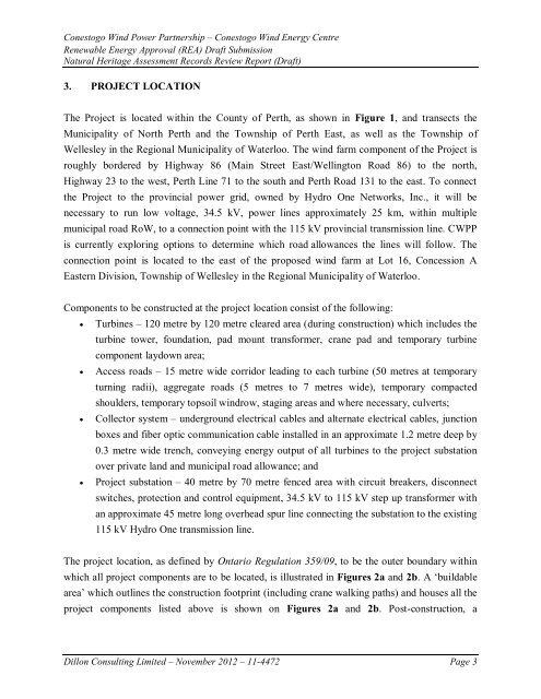
The Project is located within the County of Perth, as shown in Figure 1, and transects the<br />
Municipality of North Perth and the Township of Perth East, as well as the Township of<br />
Wellesley in the Regional Municipality of Waterloo. The wind farm component of the Project is<br />
roughly bordered by Highway 86 (Main Street East/Wellington Road 86) to the north,<br />
Highway 23 to the west, Perth Line 71 to the south and Perth Road 131 to the east. To connect<br />
the Project to the provincial power grid, owned by Hydro One Networks, Inc., it will be<br />
necessary to run low voltage, 34.5 kV, power lines approximately 25 km, within multiple<br />
municipal road RoW, to a connection point with the 115 kV provincial transmission line. CWPP<br />
is currently exploring options to determine which road allowances the lines will follow. The<br />
connection point is located to the east of the proposed wind farm at Lot 16, Concession A<br />
Eastern Division, Township of Wellesley in the Regional Municipality of Waterloo.<br />
Components to be constructed at the project location consist of the following:<br />
<br />
<br />
<br />
<br />
Turbines – 120 metre by 120 metre cleared area (during construction) which includes the<br />
turbine tower, foundation, pad mount transformer, crane pad and temporary turbine<br />
component laydown area;<br />
Access roads – 15 metre wide corridor leading to each turbine (50 metres at temporary<br />
turning radii), aggregate roads (5 metres to 7 metres wide), temporary compacted<br />
shoulders, temporary topsoil windrow, staging areas and where necessary, culverts;<br />
Collector system – underground electrical cables and alternate electrical cables, junction<br />
boxes and fiber optic communication cable installed in an approximate 1.2 metre deep by<br />
0.3 metre wide trench, conveying energy output of all turbines to the project substation<br />
over private land and municipal road allowance; and<br />
Project substation – 40 metre by 70 metre fenced area with circuit breakers, disconnect<br />
switches, protection and control equipment, 34.5 kV to 115 kV step up transformer with<br />
an approximate 45 metre long overhead spur line connecting the substation to the existing<br />
115 kV Hydro One transmission line.<br />
The project location, as defined by Ontario Regulation 359/09, to be the outer boundary within<br />
which all project components are to be located, is illustrated in Figures 2a and 2b. A ‘buildable<br />
area’ which outlines the construction footprint (including crane walking paths) and houses all the<br />
project components listed above is shown on Figures 2a and 2b. Post-construction, a<br />
Dillon Consulting Limited – November 2012 – 11-4472 Page 3


