Download - GRaBS
Download - GRaBS
Download - GRaBS

Create successful ePaper yourself
Turn your PDF publications into a flip-book with our unique Google optimized e-Paper software.
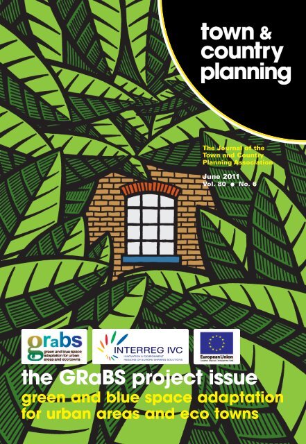
The Journal of the<br />
Town and Country<br />
Planning Association<br />
June 2011<br />
Vol. 80 l No. 6<br />
the <strong>GRaBS</strong> project issue<br />
green and blue space adaptation<br />
for urban areas and eco towns
information and subscriptions<br />
Town & Country Planning<br />
The Journal of the<br />
Town and Country Planning Association<br />
ISSN 0040-9960 Published monthly<br />
June 2011 ● Volume 80 ● Number 6<br />
Editorial and Subscriptions Office:<br />
Town and Country Planning Association<br />
17 Carlton House Terrace<br />
London SW1Y 5AS<br />
t: +44 (0)20 7930 8903<br />
f: +44 (0)20 7930 3280<br />
Editorial: Nick.Matthews@tcpa.org.uk<br />
Subscriptions: tcpa@tcpa.org.uk<br />
Advertising: Michael.McLean@tcpa.org.uk<br />
The TCPA may not agree with opinions expressed in<br />
Town & Country Planning but encourages publication<br />
as a matter of interest and debate. Nothing printed<br />
may be construed as representative of TCPA policy<br />
or opinion unless so stated.<br />
Editor: Nick Matthews<br />
Editorial Board: David Pike (Chair), Graeme Bell,<br />
John Blake, Andrew Blowers, David Boyle, Paul Burall,<br />
Ian Christie, John Deegan, Anthony Fyson, Peter Hall,<br />
Mayer Hillman, Andrew Lainton, Roger Levett,<br />
David Lock, Janice Morphet, Lucy Murfett,<br />
Stephen Potter, Peter Roberts, Brian Robson,<br />
Yvonne Rydin, Geoff Steeley, Diane Warburton<br />
Contributions: Articles for consideration are welcome.<br />
Material should be submitted to the Editor, by e-mail or on<br />
(Word-readable) disk where possible. Reproduction-quality<br />
illustrations are welcome.<br />
Town & Country Planning is the Journal of the<br />
Town and Country Planning Association, a Company<br />
Limited by Guarantee. Registered in England under<br />
No. 146309. Registered Charity No. 214348<br />
Copyright © TCPA and the authors, 2011<br />
Advertising: Rates (not including VAT): Full page £800.<br />
Inserts from £400 (weight-dependent). Half page £400.<br />
Quarter page £300. Ten per cent reduction for agents.<br />
Subscriptions: £106 in the UK; £131 overseas (mailed by<br />
accelerated surface post/airmail Europe).<br />
Subscription orders and inquiries should be addressed to:<br />
Subscriptions, TCPA, 17 Carlton House Terrace,<br />
London SW1Y 5AS<br />
t: +44 (0)20 7930 8903<br />
e: tcpa@tcpa.org.uk<br />
Payment with order. All cheques should be made payable<br />
on a UK bank. Payment may be made by transfer to:<br />
The Bank of Scotland (account number 00554249,<br />
sort code 12-11-03). MasterCard and Visa accepted.<br />
Town & Country Planning is also available through TCPA<br />
membership. See the TCPA website, at www.tcpa.org.uk,<br />
for membership rates, or e-mail membership@tcpa.org.uk<br />
for details.<br />
TCPA membership benefits include:<br />
● subscription to Town & Country Planning;<br />
● discounted fees for TCPA events and conferences;<br />
● opportunities to become involved in policy-making;<br />
● monthly e-bulletin;<br />
● access to the members area on the TCPA website.<br />
Printed by RAP Spiderweb Ltd, Clock Street,<br />
Oldham OL9 7LY<br />
Printed with vegetable-based inks on chlorine-free paper<br />
from sustainably managed sources.<br />
Town & Country Planning June 2011 : <strong>GRaBS</strong> Project – INTERREG IVC; ERDF-funded
contents<br />
June 2011 ● Vol. 80 ● No. 6<br />
regulars<br />
242 Inside Stories<br />
244 Planning World<br />
Peter Hall:<br />
Clusters to one side,<br />
retreat to the other?<br />
246 Enough is Enough<br />
Dr E Nuf:<br />
Farce, foul-up, or<br />
fairy tale?<br />
248 Off the Fence<br />
David Lock:<br />
Cash for planning<br />
permission<br />
298 Going Local<br />
David Boyle:<br />
Time to be a bit more<br />
sophisticated about<br />
money<br />
300 Earth Rights<br />
Martin Stott:<br />
Gardening – a key<br />
idea for sustainable<br />
development?<br />
IBC Connections<br />
Paul Burall<br />
Special issue on the <strong>GRaBS</strong> project<br />
(Green and Blue Space Adaptation<br />
for Urban Areas and Eco Towns),<br />
pages 250-298.<br />
Cover illustration by Clifford Harper.<br />
www.agraphia.com<br />
features<br />
250 The <strong>GRaBS</strong> project issue<br />
Diane Smith introduces the special issue on the<br />
<strong>GRaBS</strong> project<br />
252 The adaptation imperative – exploring the<br />
planning response<br />
John Handley and Jeremy Carter on climate change,<br />
adaptation and the role of green and blue infrastructure<br />
259 Preparedness for climate change – ASC land use<br />
planning study<br />
David Thompson on the forthcoming ASC study<br />
260 Towards policies and plans<br />
Henry Smith on some key <strong>GRaBS</strong> outputs<br />
262 Grabbing the opportunity<br />
TCPA Trustee John Deegan offers a personal view on<br />
the <strong>GRaBS</strong> project<br />
264 Tooling up for risk and vulnerability assessment<br />
Richard Kingston on the development and operation<br />
of the <strong>GRaBS</strong> risk and vulnerability Assessment Tool<br />
269 A critical role for green and blue infrastructure<br />
Lindsay McCulloch and Melanie Robertson on the<br />
multi-functional role of green and blue infrastructure<br />
274 Building consensus for high-level policy<br />
Hugh Ellis and Alex House on collaboration, consensusbuilding,<br />
and the Planning and Climate Change Coalition<br />
277 Delivering green infrastructure to combat<br />
climate change<br />
Susannah Gill on planning and delivering green<br />
infrastructure for adaptation in the North West<br />
282 Developing an Adaptation Action Plan<br />
Jeff Wilson on how climate change adaptation and planmaking<br />
has evolved in the London Borough of Sutton<br />
287 The Green Space Factor and Green Points<br />
Annika Kruuse outlines the operation and impact of<br />
the Green Space Factor and Green Points systems<br />
291 Participation in adaptation – an urgent challenge<br />
Age Niels Holstein on participation in drawing up<br />
adaptation strategies<br />
294 In it for the long haul<br />
Robin Jones on green infrastructure lessons from the<br />
Colne Valley Partnership experience<br />
Town & Country Planning June 2011 : <strong>GRaBS</strong> Project – INTERREG IVC; ERDF-funded 241
inside stories<br />
Town and Country Planning Association, 17 Carlton House Terrace, London SW1Y 5AS<br />
+44 (0)20 7930 8903 ● tcpa@tcpa.org.uk ● www.tcpa.org.uk<br />
we are: independent and open<br />
to all who want better places<br />
inside stories<br />
we have achieved: greener<br />
cities, new towns, and better<br />
homes<br />
we create: ideas, knowledge,<br />
publications, campaigns, and<br />
independent policies<br />
we aim to: secure homes,<br />
empower communities, and<br />
deliver a sustainable future<br />
...through planning<br />
TCPA membership<br />
The benefits of TCPA membership include:<br />
● subscription to Town & Country Planning;<br />
● discounted fees for TCPA events and conferences;<br />
● opportunities to become involved in policymaking;<br />
● monthly e-bulletin;<br />
● access to the members area on the TCPA<br />
website.<br />
Contact Brian Moffat, Membership Officer<br />
t: (0)20 7930 8903<br />
e: membership@tcpa.org.uk<br />
w: www.tcpa.org.uk<br />
TCPA policy statements, available<br />
as free downloads from the TCPA<br />
website, at www.tcpa.org.uk<br />
● Accessible and Sustainable Transport<br />
● Accessible and Sustainable Retail<br />
● Aviation<br />
● Climate Change<br />
● Green Belts<br />
● Housing<br />
● Housing Market Renewal<br />
● New Towns and Town Extensions<br />
● Planning and Sustainable Energy<br />
● Strategic and Regional Planning<br />
● Residential Densities<br />
● Urban Renaissance in England<br />
TCPA issues warning over ‘Proposed<br />
Draft’ NPPF<br />
Responding to the publication of the ‘Proposed<br />
Draft’ of the National Planning Policy Framework<br />
(NPPF) – issued by the the Practitioners Advisory<br />
Group and submitted to the Minister for<br />
Decentralisation and Planning, together with a set<br />
of recommendations, on 20 May – the TCPA has<br />
warned that, overall, the proposed framework falls<br />
short of the kind of guidance that is necessary to<br />
create an effective planning framework for England.<br />
The TCPA highlighted three key areas of concern:<br />
● The proposed definition of sustainable<br />
development is not aligned with the UK<br />
Government definition in the 2005 Sustainable<br />
Development Strategy, and is, in fact, far weaker.<br />
While the Advisory Group places emphasis on<br />
achieving a sustainable economy through<br />
‘planning for prosperity’, it fails to address the<br />
other fundamental principles of sustainable<br />
development – namely:<br />
● living within environmental limits;<br />
● ensuring a strong, healthy and just society;<br />
● promoting good governance; and<br />
● using sound science responsibly.<br />
● Secondly, there is insufficient detail on<br />
implementation. The Proposed Draft NPPF does<br />
not provide adequate guidance on evidence,<br />
mechanisms and detail, all of which are essential<br />
for delivery on key issues such as housing and<br />
climate change. For example, the Proposed Draft<br />
walks away from a lot of valuable policy and<br />
comprehensive guidance needed to take action<br />
on climate change adaptation.<br />
● Thirdly, crucial policy elements are missing, such<br />
as human health and social justice. For example,<br />
the Draft NPPF fails to recognise the contribution<br />
that well-planned developments can make in<br />
delivering long-term health and well-being benefits.<br />
The TCPA has urged the Government to move<br />
quickly to ensure that there is genuine cross-sector<br />
support for the new framework based on a robust<br />
policy to deliver a fair and low-carbon society.<br />
Further detail on the Practitioners Advisory Group<br />
and the draft streamlined and consolidated National<br />
Planning Policy Framework (NPPF) is available at<br />
www.nppfpractitionersadvisorygroup.org/<br />
242 Town & Country Planning June 2011 : <strong>GRaBS</strong> Project – INTERREG IVC; ERDF-funded
inside stories<br />
Town and Country Planning Association, 17 Carlton House Terrace, London SW1Y 5AS<br />
+44 (0)20 7930 8903 ● tcpa@tcpa.org.uk ● www.tcpa.org.uk<br />
TCPA leads new European energy project to help deliver on UK<br />
carbon targets<br />
In week following the Energy and Climate Change<br />
Secretary’s announcement of radical new targets to<br />
halve the UK’s carbon emissions by 2025, the TCPA<br />
announced that the LEAP (Leadership for Energy<br />
Action and Planning) project, with the TCPA as lead<br />
partner, had been given the go-ahead and won<br />
funding through the Intelligent Energy – Europe (IEE)<br />
programme, which is managed by the Executive<br />
Agency for Competitiveness and Innovation (EACI)<br />
on behalf of the European Commission.<br />
The LEAP project recognises that local authorities,<br />
their communities and their partners are at the<br />
heart of delivering new sustainable energy projects<br />
through the planning system. With local authority<br />
partners from the UK, Croatia, Bulgaria, Lithuania,<br />
Slovenia, Germany and the Republic of Ireland, the<br />
project aims to build the capacity of EU local<br />
authorities as key actors in accelerating the local<br />
uptake of sustainable energy measures and the<br />
move towards a low-carbon local economy. It will<br />
address barriers to progress in tackling climate<br />
change and sustainable energy deployment.<br />
As well as sharing skills and knowledge,<br />
promoting policy and providing some of the<br />
resources for enabling change, the project will place<br />
a particular emphasis on professional and political<br />
leadership at the local level in driving through new<br />
and innovative energy projects that cut carbon<br />
emissions.<br />
The LEAP project objectives are:<br />
● To enable a process of direct exchange of<br />
experience and expertise in sustainable energy<br />
management between LEAP partner local<br />
authorities in various stages of development, from<br />
‘cutting edge’ to ’new comer’.<br />
● To build the technical and institutional capacities<br />
of all LEAP partner authorities in order for all<br />
partners to institutionalise sustainable energy<br />
policies in their operations and deliver effective<br />
local energy leadership. ‘Learning’ LEAP partners<br />
will have the opportunity to gain practical<br />
experience from their collaboration with both the<br />
other ‘learning’ and ‘experienced’ LEAP partners.<br />
● For three partner authorities to develop<br />
integrated energy and spatial planning policies –<br />
known in the project as ‘Sustainable Energy<br />
Action Plans’ (SEAPs) – and to follow this up with<br />
implementation of actions; and for six partner<br />
authorities to support the implementation of their<br />
existing SEAPs through concrete actions. The<br />
LEAP project ‘learning’ partners will be supported<br />
by the more experienced project partners in the<br />
SEAP development and implementation process.<br />
● For each LEAP partner to demonstrate their local<br />
energy leadership by delivering a number of key<br />
SEAP priority actions, including, for ‘learning’<br />
project partners, a ‘Benchmark of Excellence’ for<br />
their area.<br />
● For three experienced project partners to pilot<br />
improved integration of energy planning with<br />
spatial planning and to disseminate their experience<br />
to other partners and other EU local authorities.<br />
The LEAP project partners are: the City of Hagen,<br />
the City of Hannover, the City of Zagreb, Cornwall<br />
Council, Kaunas District Municipality, the<br />
Municipality of Maribor, Sofia Municipality, South<br />
Dublin County Council, Southampton City Council,<br />
and the TCPA, as lead partner.<br />
Commenting on the announcement of the start of<br />
the LEAP project, Kate Henderson, TCPA Chief<br />
Executive, said: ‘After a highly competitive bidding<br />
process we are delighted that the LEAP project has<br />
won funding from the EU’s Intelligent Energy –<br />
Europe funding stream. It is a testimony to the<br />
TCPA’s growing experience in European projects and<br />
the hard work of all our partners. European projects<br />
such as LEAP allow the furthering of knowledge and<br />
exchange of best practice that are essential if we<br />
are to deliver a step-change in how we plan for our<br />
future energy needs.’<br />
The project begins at a crucial time for local<br />
councils, given the challenges of public spending<br />
cuts and the need to meet tighter regulatory<br />
frameworks. Partners met for the first time at the<br />
end of May in Croatia to kick off the project, which<br />
will run from May 2011 until October 2013.<br />
Further information on the LEAP project<br />
is available from Stephanie Broadley, on<br />
stephanie.broadley@tcpa.org.uk, or<br />
(tel.) 020 7930 8903. A website will be available in<br />
due course at www.leap-eu.org<br />
Town & Country Planning June 2011 : <strong>GRaBS</strong> Project – INTERREG IVC; ERDF-funded 243
planning world<br />
Peter Hall on high-technology and scientific research clustering, and the desperate need for<br />
new, original options for those places facing decline<br />
clusters to one side,<br />
retreat to the other?<br />
By one of those bizarre coincidences that invariably<br />
seem to happen, just as last month’s column on<br />
science and regional development descended on to<br />
your doormat, there came the report of the House<br />
of Commons Select Committee on Science and<br />
Technology concerning the new UK Centre for<br />
Medical Research, 1 henceforth to be known as the<br />
Francis Crick Institute.<br />
Occupying a huge vacant site behind the British<br />
Library – alighting from the Eurostar, you stare at it<br />
while waiting for your taxi – it’s a mega joint venture<br />
between Cancer Research UK, the Medical<br />
Research Council, the Wellcome Trust and UCL,<br />
which aims to compete with the best coming out of<br />
the United States, China and all-comers worldwide.<br />
In other words, for UK plc it’s precisely where an<br />
important part of our future lies.<br />
So the Committee could only stand and applaud<br />
the idea. But, they added, they ‘remain unconvinced<br />
that a project of such national importance should be<br />
located within the ‘golden triangle’ of the South<br />
East, where a high concentration of research<br />
already exists’.<br />
UCL’s Provost Malcolm Grant, himself a prominent<br />
lawyer-planner, promptly hit back: ‘This is a troubling<br />
reservation,’ he told the UCL community in his<br />
weekly newsletter, ‘if its purpose is to suggest that<br />
regional equity should trump research excellence<br />
when public money is invested in UK science.’ And<br />
there, precisely, you have the dilemma that lay at<br />
the heart of last month’s column. 2<br />
The St Pancras site lies at the very apex of that<br />
golden triangle, three minutes from the Thameslink<br />
station that by 2018 (a few years after the new<br />
Centre opens) will directly connect with Cambridge<br />
– another corner of the triangle, to which Francis<br />
Crick, a UCL graduate, moved himself after the<br />
Second World War, there to discover the structure<br />
of DNA. There could be no better example of the<br />
importance of clustering for scientific innovation and<br />
all that can spin off from it – as Silicon Fen, the<br />
cluster of high-technology start-up firms north of<br />
Cambridge, amply illustrates.<br />
If you need an apt contrast, look to Sandwich, a<br />
charming but isolated small town on the East Kent<br />
coast, where the international pharmaceuticals giant<br />
Pfizer plans to shut its entire R&D operation over<br />
the next two years, threatening the jobs of 2,400<br />
scientists. A few will find work at other Pfizer labs;<br />
the rest will find themselves on the job market.<br />
Southeastern Trains have announced extra highspeed<br />
services from the local station to St Pancras.<br />
Unfortunately the new centre won’t quite be ready<br />
for them.<br />
In the particular case of the Crick Centre, there’s<br />
an obvious answer to the argument of the Select<br />
Committee: this cluster of research expertise is<br />
already in London, scattered on different sites which<br />
the new centre will bring together. There, the hope<br />
is that the water cooler (or coffee percolator) effect<br />
takes hold: random conversations between<br />
scientists from different backgrounds produce a kind<br />
of existential spark effect. (In support of this, Crick<br />
himself was a special kind of scientist: graduating<br />
from UCL in physics, he only turned to biology later,<br />
thus constituting a one-person hybrid.) Yes, if it is as<br />
successful as planned, the Crick Centre will grow –<br />
and will thus face the constraints of its site. But<br />
with one of the largest urban regeneration schemes<br />
in Europe starting next door, this should present no<br />
real problem.<br />
The real point is that it would be virtually<br />
impossible to move a scientific cluster of this<br />
quality, and this scale, anywhere else without real<br />
pain – most notably, the scientists would simply<br />
transfer themselves elsewhere. A minor example<br />
comes from the Patent Office, whose move from<br />
London to Newport, 20 years ago, resulted in the<br />
loss of 30% of their top staff. Hell, no, they<br />
wouldn’t go – and hell, no, they didn’t have to,<br />
because they could readily find another job in the<br />
South East.<br />
So there’s a key difference here as against<br />
Daresbury, subject of last month’s column, where a<br />
major scientific cluster was uprooted in the reverse<br />
direction, to Harwell outside Oxford. The key for<br />
policy should be to try to identify the really new<br />
areas of scientific research, like molecular biology in<br />
1953, when Crick and Watson published their<br />
244 Town & Country Planning June 2011 : <strong>GRaBS</strong> Project – INTERREG IVC; ERDF-funded
planning world<br />
historic paper in Nature, and create new centres of<br />
excellence at that point – not after the clustering<br />
effect has already begun to take hold. And this<br />
should be the key objective of the Northern<br />
universities’ Science Cities project.<br />
But there’s a risk, here, of over-enthusiasm. Let<br />
the science produce the results, and then help<br />
promote the spin-offs Cambridge style – but don’t<br />
believe it can all be done at once.<br />
Meanwhile, there are other more mundane ways<br />
to grow the economies of Northern cities and<br />
towns. One, stressed by the Centre for Cities<br />
research reported last month, 3 is simply through<br />
universities and the direct benefits they bring in<br />
student and faculty spending. Here, though, the real<br />
threat is that the radical restructuring of student<br />
fees will bear hardest on the newest universities,<br />
which lack either a strong research funding base or<br />
a large high-fee overseas student body.<br />
‘The key for policy should be to<br />
try to identify the really new<br />
areas of scientific research, like<br />
molecular biology in 1953,<br />
when Crick and Watson<br />
published their historic paper<br />
in Nature, and create new<br />
centres of excellence at that<br />
point – not after the clustering<br />
effect has already begun to<br />
take hold. And this should be<br />
the key objective of the<br />
Northern universities’ Science<br />
Cities project’<br />
If this all-too-likely scenario proves correct, then<br />
what could be the future for these other places? For<br />
some, planned contraction may be the only answer<br />
– and, that indeed, was already observable during<br />
the boom years that ended in 2007-08. For others,<br />
there may be hope in new and still-expanding<br />
sectors of the economy, driven by demographics:<br />
health care, old people’s care. (Ironically, this could<br />
have been one outcome of Andrew Lansley’s plans<br />
for competition in the NHS, now being<br />
comprehensively consigned to the Government’s<br />
rubbish bin.)<br />
In the United States, such declining places have<br />
been hugely aided by the sensational increase in the<br />
prison population over the last two decades: rather<br />
like military bases in the Cold War, new gaols may<br />
make little sense in terms of crime prevention but a<br />
great deal of sense in job creation. But mercifully,<br />
many would think, while Kenneth Clarke remains in<br />
charge at the Justice Department that is not an<br />
option this Government seems likely to exercise. No<br />
accident, perhaps, that Labour remains scandalously<br />
ambiguous on this particular issue.<br />
New and original options are what these places<br />
desperately need. But they will not be easy to find.<br />
● Sir Peter Hall is Professor of Planning and Regeneration at<br />
the Bartlett School of Planning, University College London, and<br />
President of the TCPA. The views expressed here are personal.<br />
Notes<br />
1 UK Centre for Medical Research and Innovation<br />
(UKCMRI). Sixth Report, Science and Technology<br />
Committee. House of Commons, May 2011.<br />
www.publications.parliament.uk/pa/cm201012/cmselect/<br />
cmsctech/727/72702.htm - Sixth Report<br />
2 Peter Hall: ‘The science dimension and the regional<br />
divide’. Town & Country Planning, 2011, Vol. 80, May,<br />
212-3<br />
3 Paul Swinney: Starter for Ten: Five Facts and Five<br />
Questions about the Relationship between Universities<br />
and City Economies. Centre for Cities, May 2011.<br />
www.centreforcities.org/assets/files/2011%20Research/<br />
11-05-05%20Starter%20for%20ten.pdf<br />
Already, in planning education, reports are<br />
circulating of staff cuts in some departments, while<br />
others – including UCL’s – are still expanding. The<br />
risk is that, reproduced throughout the higher<br />
education sector, this pattern will cement the<br />
position of universities in the golden triangle, will –<br />
hopefully – protect the leading redbrick research<br />
universities of the big Northern cities, but will<br />
massively erode the resource base of the former<br />
polytechnics and training colleges, many of them<br />
located in smaller towns and cities that are now<br />
most vulnerable to public expenditure cuts.<br />
Town & Country Planning June 2011 : <strong>GRaBS</strong> Project – INTERREG IVC; ERDF-funded 245
enough is enough<br />
Dr E Nuf travels a few years into the future and brings back excerpts from an edition of<br />
Question Time, focusing on housing in London – and it’s not a pretty picture...<br />
farce, foul-up, or fairy tale?<br />
Thursday 14 January 2016<br />
BBC 1 Question Time, City Hall, London<br />
Last year, David Cameron’s Conservative Party won the general election and secured an absolute majority<br />
in the House of Commons. With new housing completions running at an average of around 95,000 homes<br />
per annum since 2012 and housing waiting lists at an all-time high, the nation’s housing shortage became<br />
an important campaign issue. Some 230,000 new households were forming every year. However, neither<br />
the Labour Party nor what was left of the Liberal Democrats had been able to persuade the voters that<br />
they could solve the nation’s housing shortage.<br />
Now, with the London mayoral election less than four months away, housing is the political issue. Polls<br />
suggest that the winner will be the candidate who convinces London voters that he has a solution to<br />
London’s housing crisis.<br />
In response, the BBC programmers broadcast a rerun of Cathy Come Home, followed by Panorama’s<br />
Hannah and Her Houses – a new documentary chronicling the traumas facing a working family of four as<br />
they move 14 times over a decade. The relentless real increases in house prices mean that they cannot<br />
afford to buy, even though both parents work. The Conservatives’ ‘Affordable Rent’ policies and local<br />
planning policies allow all the local authorities in South London and Kent to avoid having to take<br />
responsibility for providing a home for Hannah and her family.<br />
In the audience – and in the Twitterati<br />
The 100 or so people in the audience are a diverse mix of households representing a cross-section of<br />
London. The studio audience are joined by 10,000 people in the Twitterati – following the programme and<br />
commenting on the big screen behind the Panel.<br />
The Panel<br />
David Dimbleby introduces the Panel: Boris Johnson, the Mayor of London (standing for election for a<br />
third time in May); Eric Pickles (again the Secretary of State for Communities and Local Government after<br />
a (very) short spell as Foreign Secretary); Paul Carter (now Mayor of Kent County); and Ed Balls (now<br />
Labour’s candidate for Mayor of London and former Shadow Chancellor). This is how it plays...<br />
Highlights<br />
David Dimbleby starts the discussion by asking all the Panel members to set out their views on whether<br />
the Panorama programme presented a fair picture and, if so, what was the main reason for the current<br />
situation.<br />
Johnson jumps in: ‘Back in 2011, my London Plan was deemed sound, and this set out my programme<br />
to meet the capital’s housing needs over the next two decades within London’s boundaries. We are on<br />
course to do this.’<br />
Pickles adds: ‘Yes, London shows how localism works in practice. London sets their targets showing<br />
how they can meet their own needs, Government does not disagree, and off they go. It is up to London –<br />
nothing to do with the Government.’<br />
Carter says: ‘Yes, I believe in localism too – it does work; but... Kent is really struggling here. Over the<br />
past decade, over 100,000 households moved from London to Kent. Some of these moved in pursuit of a<br />
home that they could afford. Others were forced into bed and breakfast accommodation in seaside towns<br />
like Margate. Because of the Government caps on Housing Benefit, these were (and still are) the only<br />
places that the London boroughs can place their homeless families.’<br />
Everyone looks at Pickles: ‘As I said, localism, localism, localism. This is a great example of how Greater<br />
London and Kent County can work together.’<br />
Balls butts in: ‘Eric, get a grip. Are you really saying it is the responsibility of the Kent authorities to<br />
provide 10,000 homes each year, every year, for Londoners? Are Kent ratepayers supposed to finance the<br />
costs of the schools and the social services that these families need. Is this what you mean by localism?’<br />
246 Town & Country Planning June 2011 : <strong>GRaBS</strong> Project – INTERREG IVC; ERDF-funded
enough is enough<br />
Pickles chants: ‘Localism, localism, localism.’<br />
The Twitterati awake. The big screen behind the Panel lights up with thousands of Twits: ‘Get a grip Eric.<br />
Get a grip Eric…’<br />
Johnson sees where this is going: ‘Ed, Eric (not Ernie and Eric of Morecombe and Wise fame), look at<br />
this from my perspective. In my first term, I set a target for affordable housing for London, and I delivered.<br />
In 2012, I set a new target of 15,000 a year and I am delivering. In my third term, I will do the same.’<br />
Pickles keeps chanting: ‘Localism, localism, localism.’<br />
Balls bounces up out of his chair, looks Boris in the eye and shouts: ‘Yes, you are building 15,000 homes<br />
a year, but London needs 50,000 a year.’ He points at Carter: ‘And that is why 10,000 families move to<br />
Kent, and another 15,000 to Essex, and a further 10,000 to the other shire counties. Does that work for<br />
you?’<br />
A thousand new Twits appear on the big screen: ‘Come on Paul, what works for you? What works for<br />
you? …’<br />
Carter is startled, and with remarkable honesty says: ‘Yes, I know, many of those now living in Kent<br />
moved from London, or their parents did, and now they want to halt the flow of in-migrants. On the other<br />
hand, we have to plan for the possibility that London cannot build enough homes. That is why we are<br />
promoting the expansion of Ashford and the Thames Gateway. But we need the Government to meet the<br />
costs of the new roads and schools that we need for these new families.’<br />
Pickles keeps chanting: ‘Localism, localism, localism.’<br />
Ignoring the background rumble, Balls sees a real opportunity to score. He looks at Carter: ‘Are you<br />
saying we need some sort of regional plan which sets out how many homes we need in London and Kent,<br />
and shows where these homes need to be built? Otherwise London’s housing crisis will get worse and<br />
worse?’<br />
Carter looks bemused: ‘Yes, Ed, I guess I am saying that we need a new regional plan. It should start<br />
from the premise that the shire counties are part of the effort to meet the housing needs of Londoners. It<br />
should recognise that London provides employment for many of those living in South East. In return, the<br />
shire counties provide housing for Londoners. This pattern was established 100 years ago – nothing has<br />
really changed.’<br />
A new tsunami of Twits floods in: ‘Balls and Carter agree on the need for regional planning, Balls and<br />
Carter for regional planning... Labour and Tory leaders join forces on how best to solve London’s housing<br />
crisis.’<br />
Pickles keeps chanting: ‘Localism, localism, localism.’<br />
Dimbleby tries to regain control of the programme and fails. The Director cuts to classic BBC<br />
promotional video – Morecombe and Wise singing Give Me Sunshine...<br />
Enough is enough<br />
Farce, foul-up or fairy tale? Probably a mixture of all three.<br />
Today, as the Government progresses the reforms of the planning system through Parliament, there is<br />
still no clear definition of what the ‘duty to co-operate’ will mean in practice. Indeed, in light of this<br />
ambiguity, in due course efforts to test whether local authorities in London and the South East are<br />
exercising this duty will feel like a farce – or maybe even a big foul-up.<br />
Today, London and Kent face the challenge described above, but there is no evidence that either the<br />
Greater London Authority or the Kent district, county and unitary authorities (they are not yet entitled to<br />
elect a mayor… ) have the courage to acknowledge that their housing needs are truly interlinked. So it<br />
feels like a fairy tale to expect that this co-operation will take place.<br />
Today, it is not a fairy tale for those Londoners facing the relentless rise in house prices and for those<br />
deprived families who will have to move away from their support networks because of the caps on<br />
Housing Benefit. This is real life.<br />
Enough is enough. London deserves some real leadership from the Government. The chanting must<br />
stop.<br />
● These are Dr E Nuf’s personal views and do not necessarily represent those of the TCPA.<br />
Town & Country Planning June 2011 : <strong>GRaBS</strong> Project – INTERREG IVC; ERDF-funded 247
off the fence<br />
Making the financial consequences of a development proposal a ‘first among equals’ in<br />
planning considerations opens the door to gangsterism, corruption and unrest, says David Lock<br />
cash for planning<br />
permission<br />
There has been a particularly explosive outburst of<br />
outrage from many quarters of the town planning<br />
establishment – including our very own TCPA – at<br />
the provision in the Localism Bill by which the<br />
financial consequences of a development<br />
proposal are to be made a specifically named<br />
‘material consideration’ in determining a planning<br />
application. A sort of ‘first among equals’ of<br />
considerations.<br />
Minister Greg Clark protested in increasingly<br />
irritated terms to Opposition speakers in the House<br />
of Commons that the financial benefits of a<br />
planning application – the planning gain – had<br />
always been a key consideration, and that there was<br />
nothing new in what was proposed in the Bill.<br />
If Mr Clark is right, why did he feel the need to<br />
introduce words about in the Bill, and why were his<br />
opponents so excited about it? This needs<br />
unpacking.<br />
The financial benefits to be derived from a<br />
planning application have indeed been a major<br />
determining issue for as long as most of us<br />
remember. In the absence of a transparent, simple<br />
and equitable national method of collecting a share<br />
of the increase in land value arising from the grant<br />
of planning permission since the Tories knocked the<br />
concept out of the founding 1947 Town and Country<br />
Planning Act when they came to power in 1953,<br />
some arrangement or other has been made to get<br />
development to contribute some cash to the public<br />
purse.<br />
The generosity of payments, perhaps to induce a<br />
favourable response from the local planning<br />
authority when an application came to be decided,<br />
was sometimes shamelessly blatant. So much so<br />
that regulations were made to try to contain the<br />
excesses by insisting that such payments were to<br />
‘mitigate impacts’ and absolutely not simply to ‘buy<br />
support’. The current version of these constraints is<br />
set out in Circular 5/05, and the tests are good<br />
ones: in broad terms, payments must be directly<br />
related to the development, and must be in<br />
proportion.<br />
The regulations in the Circular were under strain<br />
through the property boom of recent years. The<br />
offers from developers became larger and wider in<br />
their effect, it being easy to relate many things<br />
directly to the development. A good example would<br />
be money for town centre regeneration two or<br />
three miles away, or a nature conservation project<br />
ten miles away, to come from a major urban<br />
expansion scheme. With so much money being<br />
made from housing for sale in some periods, the<br />
proportion of subsidised housing – ‘social’ or<br />
‘affordable’ housing – sometimes reached 50%.<br />
In the years immediately prior to the recession,<br />
when the property market was particularly hot, local<br />
planning authorities became more and more bold in<br />
demanding money in return for planning permission.<br />
The gamekeeper turned poacher. This was actively<br />
encouraged by central government, and councils<br />
were exhorted to hire consultants to do their<br />
negotiating for them.<br />
You could hear Circular 5/05 squeak, as tariff-type<br />
horse-deals were set up behind closed doors, and<br />
shameless and irresponsible demands were<br />
whipped up by each local authority department,<br />
county council and quango in sight. My favourite<br />
true experience was the demand from a council’s<br />
Museum Director who had calculated the cost of<br />
the wear of his lino by the extra residents that<br />
would come if one of our client’s projects was<br />
permitted. Planning officers typically passed on<br />
these demands to the applicant, unedited, and<br />
unmoderated. If this wasn’t ‘buying planning<br />
permission’ it was as near to blackmail as you could<br />
get: pay up, or you don’t get your planning<br />
permission. It was easy to justify, as the money<br />
would go to some council department, and thus it<br />
could be said the public would benefit from the<br />
development.<br />
This was the period in which the resulting<br />
‘Section 106 Agreements’ attached to a planning<br />
permission were not available to the public. This<br />
was probably out of fear of embarrassment – one<br />
side or other might have felt they had been skinned<br />
in the negotiation, or both might have felt they were<br />
at the outer limits of the elastic in the governing<br />
Circular. Few Section 106 deals were reported to<br />
248 Town & Country Planning June 2011 : <strong>GRaBS</strong> Project – INTERREG IVC; ERDF-funded
off the fence<br />
Committee even in headline terms in those days.<br />
Ordinary foot soldier councillors must have been<br />
quietly assured that all was OK, and the local<br />
authority would greatly benefit, so don’t rock the<br />
boat.<br />
To that extent, Minister Greg Clark is certainly<br />
right. The leveraging of planning permission, and the<br />
lubrication of planning processes, by the paying of<br />
money by applicants has been around a long time.<br />
Where I suspect the fault line lies, however, is in<br />
the political narrative begun with the Conservatives’<br />
Open Source Planning, which is that in the new<br />
localism, payments can be made to local people and<br />
‘Believing that money is<br />
ultimately the sole<br />
determinant, and consequently<br />
to feed people to developers,<br />
whether individually, in groups,<br />
or under the carapace of a<br />
thing called a ‘neighbourhood’,<br />
starts from an alien place in<br />
our culture. It is not where we<br />
are now, and it is not a place<br />
to be heading’<br />
to the local community (whatever that means). This<br />
is new ground, and it is correct for bodies such as<br />
the TCPA to be very agitated about them, for two<br />
reasons:<br />
● First, the recipient may not necessarily be the<br />
public purse. It might be private people – stroppy<br />
neighbours, or a nearby business, for example.<br />
The public controls the development of land, but<br />
the benefits flow to private individuals. The<br />
developer deals with individuals, not the council.<br />
Nightmare scenarios are easy to imagine – knocks<br />
on the door in the middle of the night; a cash<br />
offer becomes a physical threat. This is the<br />
doorway to gangsterism. Another scenario is that<br />
a small group of objectors get bought off with big<br />
wodges of money, leaving everyone else as<br />
victims of a planning process from which they<br />
have been excluded. This is the doorway to<br />
corruption.<br />
● Second, the benefit may be focused very locally –<br />
to a neighbourhood (whatever that is) – thus<br />
enriching that locality but conferring no<br />
betterment on the wider area where the effects<br />
of the development might nevertheless be felt.<br />
The posh area where developers want to develop<br />
gets the new school, or the new bus or the new<br />
park. The poor ‘neighbourhood’ on the other side<br />
of town, where there is no developer interest,<br />
gets nothing out of it at all. Better areas get better<br />
and bad areas sink deeper. This is the doorway to<br />
social unrest.<br />
This Government will learn that planning systems<br />
primarily exist to mediate between conflicting<br />
interests over the use of land, and that in the UK<br />
people prefer to think that there is some sort of<br />
planning department to whom they can make their<br />
representations – preferably quietly or even<br />
anonymously – and who will act reasonably<br />
responsibly on their behalf and not be bribed.<br />
This Government will also learn that not all<br />
planning issues can be related to cash. Not all<br />
arguments, assessments, impacts and feelings can<br />
be bought and sold.<br />
Believing that money is ultimately the sole<br />
determinant, and consequently to feed people to<br />
developers, whether individually, in groups, or under<br />
the carapace of a thing called a ‘neighbourhood’,<br />
starts from an alien place in our culture. It is not<br />
where we are now, and it is not a place to be<br />
heading. The battle over these words in the<br />
Localism Bill is not a battle worth fighting, as the<br />
war will be lost, Mr Clark.<br />
● David Lock CBE is a Vice-President and Trustee of the TCPA,<br />
and is Chair of consultancy David Lock Associates. The views<br />
expressed here are personal.<br />
Town & Country Planning June 2011 : <strong>GRaBS</strong> Project – INTERREG IVC; ERDF-funded 249
the <strong>GRaBS</strong><br />
project issue<br />
Diane Smith, European and Corporate Affairs Manager at<br />
the TCPA, introduces the special issue on the TCPA-led<br />
<strong>GRaBS</strong> project<br />
From the northern shores of Lithuania, the Swedish<br />
City of Malmö and the Nieuw-West City District of<br />
Amsterdam, the UK partners of <strong>GRaBS</strong> – the<br />
Northwest Regional Development Agency, the<br />
London Borough of Sutton, and Southampton City<br />
Council – might have found much in common with<br />
the climate change adaptation challenges that they<br />
themselves faced. But combine the North West<br />
European climate scenarios with those of the landlocked<br />
cities of Graz in Austria and Bratislava in<br />
Slovakia, with their regular extreme heat and<br />
extreme cold; and put three Southern European<br />
areas into the mix – Kalamaria in Greece, the<br />
Province of Genoa in Italy, and the region of Catania<br />
in Sicily – and the range and diversity of climate<br />
change impacts and extreme weather conditions are<br />
as diverse as possible in a European context.<br />
And so the task for the <strong>GRaBS</strong> partners (set out<br />
in the panel on the facing page) was a mighty one –<br />
find a common approach to developing Adaptation<br />
Action Plans and the effective use of green and blue<br />
infrastructure to combat the impact of extreme<br />
weather in urban areas. And significantly different in<br />
the <strong>GRaBS</strong> approach was the priority given to the<br />
impact of climate change on the people living in<br />
urban areas, and not just the impact on biodiversity<br />
and ecosystems. The <strong>GRaBS</strong> project concentrated<br />
on the multiple benefits of green infrastructure and<br />
effective water management to show that there are<br />
economic and social benefits to planning for<br />
adaptation, as well as environmental ones.<br />
And we did it! After three years of intense work –<br />
travelling, reading, writing, exchanging ideas,<br />
mentoring, holding community events and<br />
stakeholder discussions, giving political briefings<br />
and undertaking media activities – the end of the<br />
<strong>GRaBS</strong> project is in sight. To have one of the rare<br />
‘special’ issues of Town & Country Planning devoted<br />
to the project is a fitting reflection of the<br />
significance of this project for the TCPA.<br />
The issue opens with an excellent article by John<br />
Handley and Jeremy Carter from the University of<br />
Manchester, who provide an insight into why the<br />
project was conceived – in effect to respond to the<br />
adaptation imperatives that urban areas face – and<br />
consider the issues of planning for this agenda.<br />
This is followed by a preview from David<br />
Thompson of the Committee for Climate Change<br />
Adaptation Sub-Committee’s report on the<br />
importance of land use planning for adaptation to<br />
climate change.<br />
Richard Kingston, also from the University of<br />
Manchester, describes the development and use of<br />
the risk and vulnerability Assessment Tool, and five of<br />
the project partners share their experiences of <strong>GRaBS</strong><br />
– Lindsay McCulloch and Melanie Robertson from<br />
Southampton City Council describes the multifunctionality<br />
of green infrastructure; Jeff Wilson<br />
from the London Borough of Sutton explains how<br />
<strong>GRaBS</strong> has helped in the development of the<br />
Hackbridge Adaptation Action Plan; Susannah Gill,<br />
from the Mersey Forest, looks at routes to delivery<br />
of climate change adaptation planning in the wake<br />
of the removal of the regional tier of planning; Age<br />
Niels Holstein, from the Nieuw-West City District<br />
of Amsterdam, looks at some of the lessons learnt<br />
from the <strong>GRaBS</strong> partners’ attempts to engage urban<br />
communities in climate change adaptation; and from<br />
Malmö, Annika Kruuse, describes the Green Space<br />
Factor and the system of Green Points, which are<br />
both valuable tools for securing green infrastructure<br />
benefits in new development.<br />
From the TCPA, Hugh Ellis and Alex House<br />
outline the development of the UK’s Planning and<br />
Climate Change Coalition; Henry Smith explains<br />
the principles underlying the development of<br />
Adaptation Action Plans by the <strong>GRaBS</strong> partners; and<br />
John Deegan, lead TCPA Trustee for <strong>GRaBS</strong>, gives a<br />
thoughtful perspective on the benefits of the project<br />
and sets out some ideas for next steps.<br />
The issue closes with an interesting article by<br />
Robin Jones from Groundwork on sustaining and<br />
managing green infrastructure through the Colne<br />
Valley Partnership.<br />
250 Town & Country Planning June 2011 : <strong>GRaBS</strong> Project – INTERREG IVC; ERDF-funded
The <strong>GRaBS</strong> project<br />
The <strong>GRaBS</strong> (Green and Blue Space Adaptation for Urban Areas and Eco Towns) project is a<br />
network of leading pan-European organisations involved in integrating climate change<br />
adaptation into regional planning and development.<br />
The 14 project partners, drawn from eight EU Member States, represent a broad spectrum of<br />
authorities and climate change challenges, all with varying degrees of strategic policy and<br />
experience. The <strong>GRaBS</strong> project partners are:<br />
Austria:<br />
● Provincial Government of Styria<br />
Greece:<br />
● Municipality of Kalamaria<br />
Italy:<br />
● Etnambiente SRL<br />
● Province of Genoa<br />
● University of Catania<br />
Lithuania:<br />
● Klaipeda University Coastal Research<br />
and Planning Institute<br />
Netherlands:<br />
● Nieuw-West City District of Amsterdam<br />
Slovakia:<br />
● Regional Environmental Centre for<br />
Central and Eastern Europe, Country<br />
Office Slovakia<br />
Sweden:<br />
● City of Malmö<br />
UK:<br />
● London Borough of Sutton<br />
● Northwest Regional Development<br />
Agency<br />
● Southampton City Council<br />
● Town and Country Planning Association<br />
● University of Manchester<br />
The project has been co-financed by the European Union European Regional Development Fund<br />
(ERDF) and made possible by the INTERREG IVC Programme.<br />
The <strong>GRaBS</strong> project had four main objectives:<br />
● To raise awareness and increase the expertise of key bodies responsible for spatial<br />
planning and development on how green and blue infrastructure can help new and existing<br />
mixed-use urban development adapt to projected climate scenarios.<br />
● To assess the delivery mechanisms that exist for new urban mixed-use development and<br />
urban regeneration in each partner country and to develop good practice adaptation action<br />
plans to co-ordinate the delivery of urban greening and adaptation strategies, as well as<br />
co-operation among planners, policy-makers, stakeholders, and local communities.<br />
● To develop an innovative, cost-effective and user-friendly risk and vulnerability<br />
assessment tool, to aid the strategic planning of climate change adaptation responses.<br />
● To improve stakeholder and community understanding of and involvement in<br />
planning, delivering and managing green and blue infrastructure in new and existing urban<br />
mixed-use development, based on positive community involvement techniques.<br />
Further information about the <strong>GRaBS</strong> project is available from www.grabs-eu.org<br />
This issue is published to coincide with the final<br />
conference for <strong>GRaBS</strong> on 8 June, addressed by all<br />
the <strong>GRaBS</strong> partners featured in these pages. But for<br />
those readers who were unable to attend in person,<br />
these articles give an introductory overview of the<br />
project; and we at the TCPA and all the <strong>GRaBS</strong><br />
partners to encourage you to find out more – see<br />
www.grabs-eu-org.<br />
● Diane Smith is European and Corporate Affairs Manger at<br />
the TCPA. The views expressed here are personal.<br />
Town & Country Planning June 2011 : <strong>GRaBS</strong> Project – INTERREG IVC; ERDF-funded 251
the adaptation<br />
imperative –<br />
exploring the<br />
planning response<br />
John Handley and Jeremy Carter explain why adaptation to<br />
climate change is vital for our towns and cities, and look at the<br />
role of planning for green and blue infrastructure in moderating<br />
the risks associated with a changing climate<br />
Climate change is one of the most widely<br />
researched of the major challenges facing humanity.<br />
Natural and social scientists have collectively built<br />
a strong canon of data and analysis that, among<br />
other things, highlights a strong adaptation<br />
imperative. The <strong>GRaBS</strong> project brought together a<br />
group of 14 organisations from eight member<br />
states to develop proactive responses to the risks<br />
and potential opportunities associated with the<br />
projected changes to the climate.<br />
This article provides an insight into why the<br />
project was conceived – in effect to respond to<br />
the adaptation imperative that faces urban areas –<br />
and considers the issue of planning for this<br />
agenda. A particular focus is placed on green and<br />
blue infrastructure approaches in the context of<br />
adaptation. The experiences of the partners<br />
working within the <strong>GRaBS</strong> project demonstrate<br />
that just as climate risks vary across spatial scales<br />
and jurisdictions, so do approaches to planning for<br />
climate change.<br />
The adaptation imperative<br />
Although there are doubtless other important<br />
considerations, there are certainly four key issues<br />
that are central in understanding the adaptation<br />
imperative – i.e. the need to develop a framework of<br />
integrated and spatially appropriate adaptation<br />
responses to address the risks and potential<br />
opportunities associated with a changing climate.<br />
These are:<br />
● Significant and accelerating climate change over<br />
recent decades, raising the prospect of rapid and<br />
severe climate change.<br />
● A downward revision of thresholds for significant<br />
impacts relative to global temperature rise.<br />
● Greater appreciation of the complexity of the<br />
global climate system.<br />
● Evidence of rapid carbonisation of economies and<br />
societies.<br />
Significant accelerating climate change over recent<br />
decades, raising the prospect of rapid and severe<br />
climate change<br />
Recent studies reported in Nature 1 demonstrate<br />
through analysis of Antarctic ice cores dating back<br />
800,000 years that two key greenhouse gases<br />
(GHGs) (carbon dioxide and methane) have, looking<br />
back over that period, not reached recent<br />
atmospheric levels. Concentrations of these gases<br />
over the last several centuries have increased at a<br />
pace far beyond that seen before humans began to<br />
intensively clear forests and burn fossil fuels.<br />
With the links between the release of GHGs<br />
through human activities and recent climate change<br />
now well established, 2 it becomes easier to explain<br />
the changes in climate and weather patterns that<br />
are now being recorded. A study of recent climate<br />
change observations compared with the<br />
Intergovernmental Panel on Climate Change (IPCC)<br />
252 Town & Country Planning 2011 June 2011 : <strong>GRaBS</strong> Project – INTERREG IVC; ERDF-funded
projections found that: ‘The data now available raise<br />
concerns that the climate system, in particular sea<br />
level, may be responding more quickly than climate<br />
models indicate.’ 3 Numerous examples can now be<br />
cited of shifts in climate and ecological systems that<br />
reflect these recent changes. They include the more<br />
rapid melting of Antarctic ice and increased<br />
hurricane and cyclone activity.<br />
The message emerging from the climate science<br />
community is that the chance of keeping<br />
temperatures no more than 2°C above pre-industrial<br />
levels – the guardrail over which organisations<br />
including the European Commission agree<br />
constitutes ‘dangerous climate change’ – is at best<br />
low. 4 Indeed, one recent study states that if GHG<br />
emissions were frozen at 2005 levels, we are<br />
already committed to 2.4°C warming (within a range<br />
of 1.3°C-4.3°C) above pre-industrial levels. 5 Recent<br />
research raises the prospect of rapid and dangerous<br />
climate change at levels of 4°C and beyond above<br />
current levels. 6<br />
A downward revision of thresholds for<br />
significant impacts relative to global<br />
temperature rise<br />
At the same time that scientists are projecting<br />
the increased likelihood of higher-end climate<br />
change, research is also suggesting that harmful<br />
impacts linked to this change could be felt at lower<br />
levels of temperature rise than was previously<br />
expected. In 2008, an update was produced for the<br />
IPCC’s ‘Reasons for Concern’ assessment, which<br />
was originally developed eight years earlier. 7 More<br />
commonly known as the ‘burning embers diagram’,<br />
the assessment reflects an understanding of the<br />
potential impacts associated with different levels of<br />
global temperature rise on five factors thought to<br />
represent key risks linked to a changing climate. The<br />
five reasons for concern are:<br />
● risk to unique and threatened species;<br />
● risk of extreme weather events;<br />
● risk of large-scale discontinuities (for example<br />
disruption to the Gulf Stream);<br />
● aggregate damages (principally measured in<br />
monetary terms); and<br />
● the spatial distribution of impacts.<br />
Comparison of the updated burning embers<br />
diagram against the original demonstrates that in<br />
the case of each reason for concern, the risk of<br />
negative impacts is now greater at lower levels of<br />
global temperature rise. This risk is assessed as<br />
‘substantial and severe’ for all five reasons for<br />
concern at a global mean temperature rise of just<br />
less than 3°C above 1990 levels, and in three cases<br />
at a level around 1°C above this baseline. Given the<br />
recent projections for a temperature rise of 4°C and<br />
beyond, 6 the magnitude of the risks associated with<br />
climate change become clear.<br />
Greater appreciation of the complexity of the<br />
global climate system<br />
A key reason that the prognosis from climate<br />
scientists is looking increasingly worrying relates to<br />
a greater appreciation of the complexity of the<br />
global climate system. The notion that humans may<br />
be able to control the global climate is likely to be<br />
misplaced, and instead the chances are that the<br />
climate will govern our behaviour, as it has done for<br />
millennia. The biophysical processes influencing the<br />
global climate are not fully understood, which<br />
challenges the ‘dose-response’ relationship<br />
approach around which climate policy is framed.<br />
‘Comparison of the updated<br />
burning embers diagram<br />
against the original<br />
demonstrates that in the case<br />
of each reason for concern, the<br />
risk of negative impacts is now<br />
greater at lower levels of<br />
global temperature rise’<br />
An appreciation of the complex and non-linear<br />
processes involved calls into question the idea that<br />
we can ‘stabilise’ the climate through achieving a<br />
defined level of emissions reduction. 8 Central to this<br />
is the issue of positive feedback loops, which work<br />
to intensify a variable or process. They may not be<br />
positive or desirable in terms of their impact, which<br />
is the case with climate science, where positive<br />
feedbacks are increasing GHG emissions and<br />
intensifying climate change impacts. Examples<br />
include the melting of the polar ice sheets and the<br />
replacement of reflective ice with sea and/or land<br />
which absorbs solar radiation, leading to further<br />
warming; and tundra melt with associated release<br />
of methane, which is a far more potent GHG than<br />
carbon dioxide.<br />
Evidence of rapid carbonisation of economies and<br />
societies<br />
The failure of the 2009 Copenhagen Summit<br />
(COP15) to reach a common consensus on<br />
reducing GHG emissions means that post-2012,<br />
after the end of the current commitment period of<br />
the Kyoto Protocol, there will be no global<br />
mechanism in place for managing GHG emissions.<br />
Although some commentators argue that top-down<br />
mechanisms such as this may not be the most<br />
appropriate way of managing emissions, the policy<br />
vacuum that we find ourselves in at all scales is<br />
associated with a period of unprecedented global<br />
carbonisation.<br />
Town & Country Planning June 2011 : <strong>GRaBS</strong> Project – INTERREG IVC; ERDF-funded 253
De-carbonisation, as the science suggests should<br />
be happening as a matter of urgency, is not<br />
apparent. Indeed, one study found that the rate of<br />
growth in carbon dioxide emissions between 2000<br />
and 2007 was four times that experienced during<br />
the 1990s. 9 As a result of this situation, research by<br />
Anderson and Bows 10 suggests that even ‘an<br />
optimistic interpretation of the current framing of<br />
climate change’ leads to a scenario associated with<br />
GHG concentrations equating to around a 3.5°C<br />
global mean temperature rise by the end of this<br />
century. Stafford Smith et al. 11 concur with this<br />
analysis, noting that ‘With weakening prospects of<br />
prompt mitigation, it is increasingly likely that the<br />
world will experience 4°C and more of global<br />
warming.’<br />
We are left with a situation where climate change<br />
impacts are being experienced more quickly and<br />
intensely than predicted, the thresholds for<br />
significant impacts relative to temperature increases<br />
are being revised downwards, the non-linear<br />
complexity of the climate system is increasingly<br />
being acknowledged, and projections for future<br />
changes in the climate are being ratcheted upwards<br />
as a consequence of a lack of action by policymakers<br />
and resulting rapid carbonisation. These<br />
‘The severe heatwave of 2003<br />
may have resulted in 35,000<br />
excess deaths in Europe,<br />
especially among the<br />
elderly, but this extreme<br />
event is not untypical of<br />
conditions projected by<br />
climate change models for<br />
later in the 21st century’<br />
factors encapsulate the adaptation imperative. The<br />
discussion now turns to the consideration of<br />
adaptation planning and response development,<br />
with a focus on the built environment – and with<br />
particular reference to the role of green and blue<br />
infrastructure as a means of moderating risks<br />
associated with a changing climate.<br />
Climate change impacts in the built environment<br />
A key step in developing an adaptation response<br />
in policy and practice is to understand the likely<br />
interaction between climate change and the system<br />
in question. In broad terms, the IPCC has<br />
concluded 12 that Europe is most sensitive to:<br />
● extreme seasons, in particular exceptionally hot<br />
and dry summers and mild winters;<br />
● short-duration events such as wind-storms and<br />
heavy rains; and<br />
● slow, long-term changes in climate which will put<br />
particular pressures on coastal areas, for example<br />
sea level rise.<br />
The impacts from these changes will be keenly<br />
felt in the built environment, for it is here that<br />
people and property are most concentrated. For<br />
example, the climate change impacts identified as<br />
of primary interest by the <strong>GRaBS</strong> partners, listed by<br />
frequency of response, were high temperature (10),<br />
flood risk (8), water resources and quality (5),<br />
ground conditions (3), and fire risk (1).<br />
It needs to be emphasised that natural processes<br />
such as energy exchange and the water cycle<br />
continue to operate in the urban environment, but<br />
here they are modified and in some respects<br />
amplified. In particular, the extent of vegetation<br />
cover is reduced by urbanisation, and with it the<br />
potential for evaporative cooling from plant surfaces.<br />
Conversely, the built environment has a high<br />
thermal capacity so that heat conductance and<br />
storage increases. These and other factors, such as<br />
multiple reflectance within street canyons,<br />
contribute to a pronounced urban heat island,<br />
especially at night, when temperatures may be<br />
significantly higher than in the surrounding<br />
countryside. In addition to energy input from solar<br />
radiation, heat input from human sources (transport,<br />
buildings and even human metabolism) also<br />
contributes to the heat island effect, especially in<br />
winter. Climate change strengthens the urban heat<br />
island and increases the risk of heat stress among<br />
vulnerable populations. The severe heatwave of<br />
2003 may have resulted in 35,000 excess deaths in<br />
Europe, especially among the elderly, but this<br />
extreme event is not untypical of conditions<br />
projected by climate change models for later in the<br />
21st century. 13<br />
Another consequence of urbanisation is surface<br />
sealing, which reduces infiltration of rain water and<br />
increases surface run-off. As the climate warms,<br />
more evaporation occurs from the oceans and wet<br />
surfaces, and the atmosphere is able to hold more<br />
of that water – around 7% for each 1°C centigrade<br />
rise in global temperature. One consequence is<br />
greater rainfall intensity, which may already be<br />
contributing to increased surface water flooding in<br />
Europe. Urbanisation interacts with climate change<br />
to increase this risk. For example, modelling work in<br />
Greater Manchester suggests that a high-intensity<br />
rainfall event which may bring 56% more rainfall in<br />
the 2080s will result in 82% more run-off (from the<br />
current urban form). 14<br />
These and other potential climate change impacts<br />
in the urban environment – such as the risk of<br />
riverine flooding, tidal inundation, problems of<br />
ground stability and water shortage – are beginning<br />
254 Town & Country Planning June 2011 : <strong>GRaBS</strong> Project – INTERREG IVC; ERDF-funded
Building adaptive capacity<br />
Review existing<br />
plans and policies<br />
Control<br />
development in<br />
high-risk areas<br />
Climateconscious<br />
urban<br />
regeneration<br />
Climateconscious<br />
new<br />
development<br />
Screening risks at<br />
the conurbation scale<br />
Mitigate climate<br />
change drivers<br />
Modify urban<br />
form and function<br />
Influence general<br />
behaviour<br />
Hazard<br />
Urban system<br />
Elements at risk<br />
Reduce<br />
exposure<br />
Exposure<br />
Reduce<br />
risk<br />
Vulnerability<br />
Reduce<br />
vulnerability<br />
Risk<br />
Above<br />
Fig. 1 Pathways to climate change adaptation<br />
Source: ‘The role of spatial risk assessment in the context of planning for adaptation in UK urban areas’ 16<br />
to be well documented and understood. 12,15 There is<br />
also a growing realisation that the indirect effects of<br />
climate change may be even more significant for<br />
Europe, especially forced migration of human<br />
populations from regions severely impacted by<br />
climate change to more favourable environments.<br />
The question is, how best to prepare and respond?<br />
Pathways to climate change adaptation<br />
Fig. 1 provides a helpful, schematic framework for<br />
illustrating pathways to climate change adaptation in<br />
the urban environment. 16 Here the risk to people,<br />
property and other assets (sometimes referred to as<br />
‘receptors’) is considered to be a function of<br />
climate-related hazard, the likelihood of exposure to<br />
that hazard, and the vulnerability of the receptors<br />
concerned.<br />
The vulnerability term, as interpreted within<br />
<strong>GRaBS</strong>, refers to inherent vulnerability of receptors<br />
within the urban system. In the case of people this<br />
is ‘social vulnerability’, which can be characterised<br />
and mapped independently of risk of exposure to<br />
the climate-related hazard. It is this approach which<br />
informed the development of the <strong>GRaBS</strong><br />
Assessment Tool. 17 In developing adaptation<br />
strategies and formulating action plans we need to<br />
recognise that we can build adaptive capacity by<br />
reducing the likelihood of exposure to a climaterelated<br />
hazard and/or by reducing the sensitivity of<br />
vulnerable people and assets (for example buildings<br />
and critical infrastructure) should exposure to the<br />
hazard be realised: these two approaches are<br />
complementary. This approach has distinct<br />
advantages but differs somewhat from the ‘hazards<br />
and impacts’ approach of the IPCC. 18<br />
It is clear from Fig. 1 that the form of the urban<br />
system is critically important in determining the<br />
potential for exposure to climate-related impacts.<br />
The same may be true of ‘vulnerability’, because all<br />
too often key parts of the emergency response<br />
system are sited in exposed locations. Climate<br />
Adaptation by Design, the TCPA guidance document<br />
on climate adaptation, 19 emphasises the need for an<br />
approach which takes in three interconnected levels<br />
Town & Country Planning June 2011 : <strong>GRaBS</strong> Project – INTERREG IVC; ERDF-funded 255
of scale – conurbation or watershed,<br />
neighbourhood, and building.<br />
As shown in Fig. 1, the first priority is to ensure, if<br />
possible, that new development does not increase<br />
climate-related risk by selecting a hazardous<br />
location. If development in such locations (for<br />
example a flood plain) is essential, then the<br />
development should be climate-proofed as far as<br />
possible by construction of flood defences and<br />
through careful building design. However, it should<br />
be recognised that development in a flood plain<br />
which may itself be climate-proofed may in fact<br />
increase risk elsewhere by removing adaptive<br />
capacity from the system.<br />
Such considerations may also apply to the urban<br />
atmosphere. In cities such as Stuttgart, where coldair<br />
drainage from surrounding hills is vital to protect<br />
air quality and human comfort, development is<br />
strictly controlled to sustain climate functionality in<br />
line with a proactive ‘climate plan’. 20 Similar<br />
measures have been adopted by one of the <strong>GRaBS</strong><br />
partners in Graz, Austria, and may need to be<br />
considered more widely in Europe as climate<br />
change makes conditions increasingly<br />
uncomfortable in cities where natural ventilation has<br />
been taken for granted in the past.<br />
At a more local scale, urban design which takes<br />
proper account of solar climate can optimise living<br />
conditions, and with that energy use, by capturing<br />
sunlight in winter and restricting solar gain and<br />
overheating in summer. Traditional approaches to<br />
‘The first priority is to ensure,<br />
if possible, that new<br />
development does not<br />
increase climate-related risk<br />
by selecting a hazardous<br />
location. If development in<br />
such locations is essential,<br />
then the development should<br />
be climate-proofed as far as<br />
possible through careful design’<br />
urban design in Southern Europe have taken these<br />
factors into account, but this is now a high priority<br />
in more northern latitudes, where working<br />
conditions in poorly adapted buildings are set to<br />
become even more uncomfortable. Interventions<br />
are also appropriate where it can be shown that use<br />
of advanced passive features (shade, control of<br />
ventilation, and thermal mass) can climate-proof<br />
buildings and reduce the need for energydemanding<br />
mechanical cooling.<br />
The role of green infrastructure<br />
One of the challenges faced in preparing climate<br />
Adaptation Action Plans is that the urban form is<br />
often relatively fixed or pre-determined and the rate<br />
of turnover within the building stock is rather slow.<br />
This is one of the reasons why climate adaptation<br />
via ‘green infrastructure’ is such an attractive option<br />
and a central theme within <strong>GRaBS</strong>. The development<br />
and implementation of ‘green infrastructure’ strategies<br />
is a classic ‘no-regrets’ option, in adaptation<br />
planning parlance. It brings with it a variety of other<br />
benefits (see the articles by Lindsay McCulloch and<br />
Melanie Robertson and by Susannah Gill in this<br />
issue), as has long been recognised within the town<br />
and country planning movement. Furthermore, we<br />
have seen within <strong>GRaBS</strong> that practical measures for<br />
achieving green infrastructure provision in<br />
association with new development are now<br />
becoming available – for example the ‘Green Space<br />
Factor’, described by Annika Kruuse in this issue.<br />
As we have seen, the relative extent of urban<br />
green space will influence key processes such as<br />
energy exchange and hydrology. Modelling studies<br />
suggest that a 10% increase in green cover in the<br />
city centres and high-density residential areas of<br />
Greater Manchester, for example, would hold<br />
surface temperatures at current levels against<br />
climate change until well into the 21st century. 14 The<br />
benefits of generalised greening should not be<br />
overstated, however, because, while surface<br />
temperature is a key component in human comfort,<br />
it is more subtle effects such as shading through<br />
judicious tree planting that will provide the greatest<br />
adaptation benefits to both people and buildings. As<br />
Oke 21 observes, it is the ‘radiative, aerodynamic,<br />
thermal and moisture properties of trees that so<br />
clearly set them apart from other urban materials in<br />
terms of their exchanges of heat, mass and<br />
momentum with the atmosphere. Their resulting<br />
ability to produce shade, coolness, shelter, moisture<br />
and air filtration makes them flexible tools for urban<br />
design.’ Bioclimatic design at the city scale requires<br />
an understanding of both the moderating role of<br />
vegetation and the need to maintain ventilation and<br />
cool air exchange.<br />
Similar considerations apply to the benefits of<br />
urban greening for moderating surface run-off and<br />
reducing flood risk. While the role of green<br />
infrastructure, and measures such as large-scale<br />
afforestation of catchments, have sometimes been<br />
overstated, there is no doubt that carefully designed<br />
green infrastructure, including woodland planting,<br />
can be highly beneficial in the right location. 22<br />
Furthermore, the role of green infrastructure in<br />
managing flood water through conserving and<br />
enhancing storage, and dealing with conveyance<br />
and attenuation of flow, is critically important in a<br />
changing climate. This was well illustrated within<br />
<strong>GRaBS</strong> by the green structure plan for Graz and the<br />
256 Town & Country Planning June 2011 : <strong>GRaBS</strong> Project – INTERREG IVC; ERDF-funded
implementation of sustainable drainage systems<br />
through construction of flood storage basins etc.<br />
within its catchment. Within the urban environment<br />
the conservation of unsealed surfaces for infiltration<br />
and storage of rain water, and incorporation of<br />
sustainable urban drainage within the urban green<br />
space, are important measures in controlling<br />
surface run-off, especially on soils with high<br />
permeability (for example sandy soils). 14<br />
A key consideration in planning for climate<br />
adaptation is the relationship between adaptive<br />
measures and climate mitigation (the reduction of<br />
GHG emissions). In many respects, adaptation via<br />
‘green infrastructure’ provides an example of a<br />
Adaptation policy and practice<br />
Only relatively recently has climate change<br />
adaptation become a policy issue for governments<br />
and other organisations. Nevertheless, in a short<br />
space of time, adaptation agendas have penetrated<br />
a range of policy arenas at different spatial scales<br />
and within diverse sectors.<br />
Spatially responsive policy exists across the full<br />
range of scales from the EU Adaptation White<br />
Paper 25 and the UK Climate Change Act, through to<br />
emerging strategies and policies produced by local<br />
planning authorities. 26 The UK Climate Change Act<br />
of 2008 requires ‘bodies with functions of a public<br />
nature’ and ‘statutory undertakers’ to identify and<br />
Left<br />
‘In many respects,<br />
adaptation via<br />
‘green<br />
infrastructure’<br />
provides an<br />
example of a<br />
measure that<br />
occupies the<br />
‘sweet spot’ in the<br />
Venn diagram<br />
where adaptation<br />
and mitigation<br />
overlap’<br />
measure that occupies the ‘sweet spot’ in the Venn<br />
diagram where adaptation and mitigation overlap. 23<br />
For example, the urban forest not only captures<br />
carbon dioxide (arising from tree pruning etc. which<br />
can be harvested and used to substitute for fossil<br />
fuels in heating and power generation), but can<br />
result in energy savings through reducing cooling<br />
demand in buildings and, via rainfall interception,<br />
the energy load of waste water treatment. 22 In the<br />
<strong>GRaBS</strong> Expert Paper on transport planning,<br />
Giuseppe Inturri and colleagues also begin to<br />
identify some encouraging synergies between<br />
adaptation and mitigation in this sector. 24<br />
However, as Jeff Howard makes clear in his<br />
critical perspective on the ‘adaptation turn’ in urban<br />
climate planning, the most effective adaptation<br />
response is to recognise the likely severity and<br />
magnitude of climate feedbacks, as discussed in the<br />
first part of this article, as a critique on current<br />
practice, and to press for not only a serious<br />
adaptation response but, at the same time, a far<br />
deeper public commitment to mitigation. 23 Action<br />
on these fronts will require effective policy and<br />
governance frameworks, and it is to this issue that<br />
we turn next.<br />
report on the key climate change risks that they are<br />
facing and on how they propose to address these<br />
risks. It encompasses organisations that include<br />
certain utilities, transport and telecommunications<br />
providers. The Act demonstrates that legislators<br />
perceive adaptation planning as an important exercise<br />
to be undertaken across a range of different sectors.<br />
As a result of policies and programmes such as<br />
these and, one would hope, an increasing recognition<br />
of the ‘adaptation imperative’, adaptation planning is<br />
starting to emerge in practice across different<br />
spatial scales. Within Europe for example, National<br />
Adaptation Strategies are becoming more common, 27<br />
and there is evidence that some European cities are<br />
beginning to provide leadership in this area. 28<br />
However, Tompkins et al. 29 observe, in the case of<br />
the UK, that although central government’s topdown<br />
adaptation approach has stimulated action in<br />
some areas, such as the water supply and flood<br />
defence sectors, this has yet to filter through to<br />
stimulate widespread activity at the local level. The<br />
UK Government’s Adaptation Sub Committee<br />
concurs with this finding, highlighting that there is<br />
little real evidence of widespread tangible<br />
adaptation activity in the public or private sectors. 30<br />
Town & Country Planning June 2011 : <strong>GRaBS</strong> Project – INTERREG IVC; ERDF-funded 257
Seen within this context, the <strong>GRaBS</strong> project,<br />
which has resulted in ‘Adaptation Action Plans’<br />
(AAPs) being produced for a number of European<br />
urban areas and regions, provides a valuable<br />
resource to help build a better understanding of<br />
adaptation planning in practice. Several important<br />
lessons can be drawn from <strong>GRaBS</strong> in this respect.<br />
Perhaps most significantly, the project has<br />
demonstrated the inherent diversity of adaptation<br />
planning. Real variety was apparent in the<br />
processes and outputs that emerged from the<br />
adaptation planning activities of the 11 organisations<br />
that produced AAPs.<br />
In terms of the adaptation planning process, this<br />
concerned issues such as different levels of<br />
involvement of stakeholder groups in plan<br />
development and the varying availability (and therefore<br />
use) of spatial data on climate change hazards and<br />
vulnerabilities to inform the development of<br />
adaptation responses. In terms of the outputs of<br />
the adaptation planning process, that is the AAPs<br />
themselves, a range of approaches emerged. In terms<br />
of their status, some AAPs are guidance documents,<br />
while others carry statutory status, principally through<br />
links to spatial planning legislation. The position of<br />
the AAPs also differs according to whether they are<br />
stand-alone documents or integrated as sections<br />
within other initiatives, for example overarching<br />
climate change or sustainability strategies.<br />
The content of the AAPs also varies significantly.<br />
For example, some are based around generic<br />
principles, while others include location-specific<br />
content such as specific areas where flood risk<br />
management solutions are needed. Similarly, green<br />
and blue infrastructure forms the heart of the<br />
adaptation responses of some AAPs (this was the<br />
focus of the <strong>GRaBS</strong> project), whereas others take a<br />
broader perspective to encompass other responses<br />
such as strategic spatial planning and building design.<br />
The failure to find a solution to the political<br />
deadlock that has ossified the search for a<br />
successor to the Kyoto Protocol demonstrates, as<br />
Hulme 31 notes, that ‘climate change may ultimately<br />
prove to be a crisis of governance’. Hulme argues<br />
that the top-down approach to climate change<br />
governance enacted through international and<br />
national institutions and policies may be less<br />
effective than simpler but nevertheless more<br />
attainable bottom-up approaches that mix policy<br />
styles and principles. <strong>GRaBS</strong> has stimulated a<br />
number of such responses focusing on different<br />
spatial scales and on a diverse range of climate risk.<br />
Given that patterns of climate risk and<br />
vulnerability differ significantly, sometimes at a fine<br />
spatial scale, it seems appropriate that planning for<br />
adaptation to a changing climate must be firmly<br />
rooted in local-scale decisions and actions. <strong>GRaBS</strong><br />
demonstrates that adaptation planning and<br />
responding to the adaptation imperative is not a<br />
‘one size fits all’ exercise. Factors ranging from the<br />
availability of financial resources, skills and relevant<br />
data, to the existence of adaptation ‘champions’<br />
within organisations and their previous experiences<br />
of extreme climate and weather all influence the<br />
nature of adaptation planning approaches.<br />
Nevertheless, <strong>GRaBS</strong> also emphasises that<br />
adhering to certain principles, including community<br />
involvement and the use of adaptation-relevant<br />
spatial data (where available), can improve the<br />
effectiveness of the adaptation planning process<br />
and its outputs. Lessons such as these can assist in<br />
the challenge of planning for a changing climate.<br />
● Professor John Handley OBE is with the Centre for Urban<br />
and Regional Ecology, University of Manchester. Dr Jeremy<br />
Carter is Research Fellow in the School of Environment and<br />
Development, University of Manchester. The views expressed<br />
here are personal.<br />
Notes<br />
1 D. Lüthi et al.: ‘High-resolution carbon dioxide<br />
concentration record 650,000-800,000 years before<br />
present’. Nature, 2008, Vol. 453, 379-82; and<br />
L. Loulergue et al.: ‘Orbital and millennial-scale features<br />
of atmospheric CH4 over the past 800,000 years’.<br />
Nature, 2008, Vol. 453, 383-6<br />
2 Climate Change 2007: Synthesis Report. Contribution of<br />
Working Groups I, II and III to the Fourth Assessment<br />
Report of the Intergovernmental Panel on Climate<br />
Change. IPCC, 2007<br />
3 S. Rahmstorf et al.: ‘Recent climate observations<br />
compared to projections’. Science, 2007, Vol. 316, 709<br />
4 K. Anderson and A. Bows: ‘Beyond dangerous climate<br />
change: emissions scenarios for a new world’.<br />
Philosophical Transactions of the Royal Society, 2011,<br />
Vol. 369, 20-44<br />
5 V. Ramanathan and Y. Feng: ‘On avoiding dangerous<br />
anthropogenic interference with the climate system:<br />
Formidable challenges ahead’. Proceedings of the<br />
National Academy of Sciences, 2008, Vol. 105, 14245-50<br />
6 R. Betts et al.: ‘When could global warming reach 4°C’.<br />
Philosophical Transactions of the Royal Society, 2011,<br />
Vol. 369, 67-84<br />
7 J. Smith et al.: ‘Assessing dangerous climate change<br />
through an update of the Intergovernmental Panel on<br />
Climate Change (IPCC) ‘reasons for concern’’.<br />
Proceedings of the National Academy of Sciences,<br />
2009, Vol. 106 (11), 4133-7<br />
8 C. Hamilton: Requiem for a Species: Why We Resist the<br />
Truth about Climate Change. Earthscan, 2010; and<br />
M. Hulme: Why We Disagree about Climate Change:<br />
Understanding Controversy, Inaction and Opportunity.<br />
Cambridge University Press, 2009<br />
9 ‘Growth in the global carbon budget: Updated global<br />
carbon budget released’. EurekAlert! Global Carbon<br />
Project, 2008. www.eurekalert.org/pub_releases/2008-<br />
09/gcp-git092408.php<br />
10 K. Anderson and A. Bows: ‘Reframing the climate<br />
change challenge in light of post-2000 emissions<br />
trends’. Philosophical Transactions of the Royal Society,<br />
2008, Vol. 366, 3863-82<br />
11 M. Stafford Smith et al.: ‘Rethinking adaptation for a<br />
4°C world’. Philosophical Transactions of the Royal<br />
Society, 2011, Vol. 369, 196-216<br />
258 Town & Country Planning June 2011 : <strong>GRaBS</strong> Project – INTERREG IVC; ERDF-funded
12 Climate Change 2007: Impacts, Adaptation and<br />
Vulnerability. Contribution of Working Group II to the<br />
Fourth Assessment Report of the Inter Governmental<br />
Panel on Climate Change. IPPC. Cambridge University<br />
Press, 2007<br />
13 P. Stott, D. Stone and M. Allen: ‘Human contribution to the<br />
European heat wave of 2003’. Nature, 2004, Vol. 432, 610-4<br />
14 S. Gill, J. Handley, A. Ennos and S. Pauleit: ‘Adapting<br />
cities for climate change: the role of green<br />
infrastructure’. Built Environment, 2007, Vol. 33, 115-33<br />
15 R. Wilby: ‘A review of climate change impacts on the<br />
built environment’. Built Environment, 2007, Vol. 33, 31-45<br />
16 S. Lindley et al.: ‘The role of spatial risk assessment in<br />
the context of planning for adaptation in UK urban<br />
areas’. Built Environment, 2007, Vol. 33, 46-69<br />
17 G. Cavan et al.: Climate Change and Urban Areas:<br />
Development of a Climate Change Risk and<br />
Vulnerability Assessment Tool. Royal Institute of<br />
Chartered Surveyors, 2010<br />
18 For a fuller discussion, see A. Kazmierczak and<br />
J. Handley: The Vulnerability Concept: Use within<br />
<strong>GRaBS</strong>. <strong>GRaBS</strong> Project Paper. TCPA, 2011. www.grabseu.org/news.php<br />
19 R. Shaw, M. Colley and R. Connell: Climate Change<br />
Adaptation by Design: A Guide for Sustainable<br />
Communities. TCPA, 2007<br />
20 A. Kazmierczak and J. Carter: Adaptation to Climate<br />
Change Using Green Infrastructure: A Database of<br />
Case Studies. <strong>GRaBS</strong> Project Paper. TCPA, 2010.<br />
www.grabs-eu.org/news.php<br />
21 T. Oke: ‘The micrometeorology of the urban forest’.<br />
Philosophical Transactions of the Royal Society of<br />
London, B Series, 1989, Vol. 324, 335-49<br />
22 J. Handley and S. Gill: ‘Woodlands helping society to<br />
adapt’. In D. Reed et al. (Eds): Combating Climate Change:<br />
A Role for UK Forests. An Assessment of the Potential<br />
of the UK’s Trees and Woodlands to Mitigate and Adapt<br />
to Climate Change. The Stationery Office, 2009<br />
23 J. Howard: ‘Climate change mitigation and adaptation<br />
in developed nations: a critical perspective on the<br />
adaptation turn in urban climate planning’. In<br />
S. Davoudi, J. Crawford and I. Mehmoud: Planning for<br />
Climate Change: Strategies for Mitigation and<br />
Adaptation for Spatial Planners. Earthscan, 2009<br />
24 G. Inturri and M. Ignaccolo: Policy Guidelines on Adapting<br />
Transport Systems to Climate Change. <strong>GRaBS</strong> Project<br />
Expert Paper. TCPA, 2011. www.grabs-eu.org/news.php<br />
25 Adapting to Climate Change: Towards a European<br />
Framework for Action. White Paper. COM 147 Final.<br />
Commission of the European Communities, 2009<br />
26 E. Wilson: ‘Adapting to climate change at the local level:<br />
the spatial planning response’. Local Environment,<br />
2006, Vol. 11 (6), 609-25<br />
27 G. Biesbroek et al.: ‘Europe adapts to climate change:<br />
comparing national adaptation strategies’. Global<br />
Environmental Change, 2010, Vol. 20 (3), 440-50<br />
28 J. Carter: ‘Climate change adaptation in European<br />
cities’. Current Opinion in Environmental Sustainability,<br />
2011, Vol. 3, 193-8<br />
29 E. Tompkins et al.: ‘Observed adaptation to climate change:<br />
UK evidence of transition to a well-adapting society’.<br />
Global Environmental Change, 2010, Vol. 20, 627-35<br />
30 How Well Prepared is the UK for Climate Change?<br />
Adaptation Sub-Committee, Committee on Climate<br />
Change Adaptation, 2010<br />
31 M. Hulme: Why We Disagree about Climate Change<br />
(see note 8)<br />
Preparedness for<br />
climate change –<br />
ASC land use<br />
planning study<br />
A forthcoming report by the Committee on Climate<br />
Change’s Adaptation Sub-Committee (ASC) will<br />
highlight the importance of the land use planning<br />
system for adaptation to climate change.<br />
The ASC has commissioned Arup to carry out<br />
research into how development decisions are<br />
currently affecting vulnerability to risks such as<br />
flooding, heatwaves and drought in England. Land<br />
use planning decisions can directly increase<br />
resilience to climate risks, for example by requiring<br />
adaptation measures in new development. But if<br />
not well thought-through, planning decisions can<br />
lock future generations into a pathway that<br />
increases vulnerability and could be very costly to<br />
maintain or reverse.<br />
The project has used Geographical Information<br />
Systems (GIS) to analyse the amount of<br />
development in flood-risk zones and areas at risk<br />
from coastal erosion and the change in area of hard<br />
surfacing in a number of locations across England<br />
between 2001 and 2011. To complement the spatial<br />
analysis, Arup reviewed a sample of major planning<br />
applications to see if there has been any take-up of<br />
adaptation measures, such as raised floors in floodrisk<br />
areas, green roofs and sustainable drainage<br />
systems to reduce surface run-off rates, and<br />
measures to reduce heat stress.<br />
The ASC has also reviewed a sample of Local<br />
Development Frameworks to understand how<br />
climate change adaptation has been accounted for<br />
in the preparation of local planning policies. The<br />
review examines whether local planning authorities<br />
are working in partnership on issues that require<br />
strategic, cross-boundary co-operation – for<br />
instance, along stretches of shared coastline or<br />
across river catchments.<br />
The results of this analysis will be part of the<br />
ASC’s wider assessment of the UK’s preparedness<br />
for climate change which will be published on<br />
14 July at an event hosted by Lord Krebs, Chair of<br />
the ASC, and with a keynote speech by Caroline<br />
Spelman MP, Secretary of State at the Department<br />
for Environment, Food and Rural Affairs.<br />
David Thompson<br />
● David Thompson is Senior Analyst for the Committee on<br />
Climate Change.<br />
Town & Country Planning June 2011 : <strong>GRaBS</strong> Project – INTERREG IVC; ERDF-funded 259
towards policies<br />
and plans<br />
Henry Smith looks at the guidance that has driven the<br />
production of two key <strong>GRaBS</strong> outputs – Adaptation Action<br />
Plans, and High-Level Policy Statements<br />
The transfer of good practice principles and the<br />
exchange of experience across partners are<br />
fundamental components of the <strong>GRaBS</strong> project and<br />
of the INTERREG programme. Such knowledgesharing<br />
is of particular relevance in the production of<br />
the partner Adaptation Action Plans (AAPs) and the<br />
accompanying High-Level Policy Statements (HLPSs),<br />
which are at the heart of the <strong>GRaBS</strong> project.<br />
To assist with the development of the partner AAPs<br />
and HLPSs, guidance documents were produced<br />
early on in the project by the TCPA, as <strong>GRaBS</strong> lead<br />
partner. Importantly, these guidance documents were<br />
not intended to provide a prescriptive format for all<br />
partners to follow; instead they focused on the<br />
necessary processes involved in producing AAPs and<br />
HLPSs and set out generic good practice principles.<br />
The principles of an AAP are to protect and<br />
enhance the quality of life in the plan area, and to help<br />
partner organisations and their communities prepare<br />
for the impacts of climate change and extreme<br />
weather events on the urban environment. These<br />
principles underlie the key <strong>GRaBS</strong> objective of building<br />
capacity among the partners and their community<br />
of stakeholders to deliver adaptation responses<br />
relevant to their local area. The varied political and<br />
climate change scenarios faced by each partner<br />
required a flexible approach in the AAP Guidance<br />
document, 1 so that the process of drawing up an<br />
AAP could be tailored to individual circumstances.<br />
The AAP Guidance poses questions for partners<br />
on the focus of the plan, the format it should take,<br />
and the spatial scale it relates to. Partners were<br />
Box 1<br />
AAP cycle stages<br />
● 1 – Baseline review: The first stage involves carrying out a SWOT analysis to identify the strengths, weaknesses,<br />
opportunities and threats within the area relating to the AAP and the organisation responsible for its creation.<br />
Challenges and priorities can also be assessed using the <strong>GRaBS</strong> risk and vulnerability Assessment Tool and any<br />
prior evidence that is available. (Interestingly, for <strong>GRaBS</strong> the key weakness for all the partners was the lack of<br />
political will and awareness on adaptation policies and measures.)<br />
● 2 – Raise awareness and explore adaptation responses: This stage explores and identifies potential climate<br />
change adaptation responses – including building adaptive capacity through policy and operational measures,<br />
and delivering adaptation actions; both of which are informed by the best practice examples given in the Case<br />
Study Database (see Box 2). Crucially, this stage involves engagement with internal and external stakeholders.<br />
● 3 – Agree high-level aim and objectives: This stage identifies the high-level aim of the AAP, setting deliverable<br />
and effective objectives by considering the required adaptation measures and the parties responsible for<br />
delivery. The success of this stage depends on securing political commitment, symbolised publicly by the HLPS.<br />
● 4 – Agree the delivery programme: In this stage the necessary activities for adaptation action are agreed,<br />
involving assigning responsibilities and programming deadlines. Here, the <strong>GRaBS</strong> Mentoring Programme<br />
provided advice on how to reach a compromise between different stakeholders and interests.<br />
● 5 – Implementation and monitoring: The delivery of the programme occurs at this point, with subsequent<br />
review by the programme co-ordinator.<br />
● 6 – Evaluating and reporting: An evaluation of achievements and an assessment of the findings are carried<br />
out in the final stage, contributing to the preparation of a new SWOT analysis to restart the AAP cycle and<br />
progress adaptation efforts further.<br />
260 Town & Country Planning June 2011 : <strong>GRaBS</strong> Project – INTERREG IVC; ERDF-funded
encouraged to consider from the outset whether<br />
the AAP would fit within existing policy documents,<br />
be produced as a stand-alone document, or take the<br />
form of ‘guidance’. The Guidance document<br />
emphasises that the format of the AAP is flexible.<br />
Additionally, the Guidance encourages the partners<br />
to decide who is responsible for the AAP, how it fits<br />
into the organisation, and what monitoring and<br />
review mechanisms are required.<br />
The Guidance document shows how the process<br />
of developing an AAP is as important as the end<br />
product for the <strong>GRaBS</strong> partners involved. To this<br />
end, the ‘AAP cycle’ (see Box 1) outlines the<br />
processes involved and promotes an iterative<br />
approach to climate change adaptation, which helps<br />
partners to gradually advance their capacity as the<br />
cycle is periodically repeated. This cycle again<br />
supports partner flexibility by allowing local and<br />
regional governments to respond to changing<br />
conditions such as political change, new technology,<br />
the evolution of climate science, and, of course,<br />
more extreme weather conditions.<br />
Other <strong>GRaBS</strong> outputs are also instrumental in the<br />
development of an AAP, and the AAP Guidance<br />
explains how the AAP should evolve with the<br />
progression of these outputs. The <strong>GRaBS</strong> risk and<br />
vulnerability Assessment Tool enables the partners<br />
to make better-informed decisions on the context<br />
for climate change adaptation, and aids the capacitybuilding<br />
and strategic planning that are central to<br />
AAP development. The <strong>GRaBS</strong> Mentoring<br />
Programme followed the stages of the AAP cycle<br />
and assisted in the process of exchanging good<br />
practice, expertise and knowledge between <strong>GRaBS</strong><br />
project partners as they created their plan – study<br />
visits, expert papers, the Case Study Database (see<br />
Box 2), seminars and the expert panel have all<br />
contributed to the development of the AAPs.<br />
However, the effectiveness of an AAP will be<br />
limited without a high-level commitment to provide<br />
the resources necessary to deliver the AAP’s<br />
objectives. Thus each <strong>GRaBS</strong> partner was also<br />
required to produce a High-Level Policy Statement<br />
supporting the implementation of the AAP, and<br />
committing the partner organisation to prioritise<br />
action on adaptation.<br />
Guidance to assist with the development of the<br />
HLPS, included in the AAP Guidance, outlines the<br />
objectives and principles that might underpin the<br />
statement, while providing advice on potential<br />
processes for its preparation. The objective of the<br />
HLPS, as set out in the Guidance, is to demonstrate<br />
commitment to deliver the AAP. The HLPS should fit<br />
within broader policy objectives and core strategies<br />
such as sustainable development and social justice,<br />
and should be written in language that can be<br />
endorsed by political and corporate leaders while<br />
resonating with a much wider audience of<br />
stakeholders and communities. The HLPS can be<br />
Box 2<br />
Case Study Database<br />
Another key <strong>GRaBS</strong> output is the Case Study Database<br />
developed by Aleksandra Kazmierczak and Jeremy<br />
Carter at the University of Manchester. The Database<br />
describes in detail processes that have supported<br />
adaptation responses in urban areas around the world.<br />
Rather than focusing solely on physical outcomes,<br />
each of the 15 in-depth case studies identifies key<br />
factors in the success of adaptation responses,<br />
including stakeholder collaboration, strong leadership,<br />
public awareness and access to funding – which all<br />
link closely with stages 1 and 2 of the AAP cycle.<br />
The Database includes a description of the<br />
geographical location of each initiative studied, an<br />
outline of themes driving the initiative, and details of<br />
its development and implementation. The Executive<br />
Summary of the Database report provides a snapshot<br />
of each case study, and includes a summary of the<br />
transferable lessons. The Database is available at<br />
www.grabs-eu.org/casestudies.php<br />
adopted across a range of spatial scales as required,<br />
from community plans through to regional or<br />
national levels – with a transcending common<br />
message to powerfully reinforce acceptance of the<br />
need to adapt to climate change.<br />
The HLPS can be informed by a wide range of<br />
sources at European and global levels, such as the<br />
Copenhagen Accord and the 10:10 Agreement. The<br />
Guidance document recommends pre-empting<br />
questions often asked by politicians, such as ‘Why<br />
should we take action?’, ‘What can we do?’, and<br />
‘Will it benefit us economically?’. An HLPS needs to<br />
touch on these questions, while the AAP goes into<br />
the narrative in more detail. By taking a collaborative<br />
approach towards the development of the HLPS, a<br />
wide range of expertise and knowledge can be<br />
captured to develop a shared vision and ownership<br />
of the AAP. This collaborative approach was a key<br />
component of the entire <strong>GRaBS</strong> project and is<br />
exemplified in the production of the HLPS.<br />
The Guidance document was intended to give a<br />
lead to the <strong>GRaBS</strong> partners in adaptation planning.<br />
Feedback received from partners throughout the<br />
AAP process has been used to review and update<br />
the Guidance, to ensure that it remains a valuable<br />
resource for improving adaptation planning beyond<br />
the lifespan of the <strong>GRaBS</strong> project.<br />
● Henry Smith is <strong>GRaBS</strong> Assistant at the TCPA.<br />
Note<br />
1 Climate Change Adaptation Action Plan Guidance. <strong>GRaBS</strong><br />
Paper. TCPA. www.grabs-eu.org/downloads/<strong>GRaBS</strong>3-<br />
4%20Adaptation%20Action%20Plan%20Guidance.pdf<br />
Town & Country Planning June 2011 : <strong>GRaBS</strong> Project – INTERREG IVC; ERDF-funded 261
grabbing the<br />
opportunity<br />
John Deegan, who acted as lead TCPA Trustee on the <strong>GRaBS</strong><br />
project, looks at the benefits delivered by the project – and at<br />
how the outputs might be taken forward<br />
Left<br />
Mentoring visits<br />
and study tours<br />
were key<br />
components of<br />
the <strong>GRaBS</strong> project<br />
It would be quite difficult to take issue with the<br />
rationale underpinning the <strong>GRaBS</strong> project. Although<br />
members of the relevant scientific and professional<br />
communities nearly all regarded climate change as<br />
inevitable well before <strong>GRaBS</strong> was conceived, the<br />
need to adapt our environment to accommodate<br />
climate change had had much less attention than<br />
the mitigation agenda. The particular impacts of<br />
climate change on urban areas – the heat island<br />
effects; the risks to large centres of population from<br />
rising sea levels and river flooding – also needed<br />
highlighting, and the management of green space<br />
and water, whether for adaptation or mitigation,<br />
seemed important at the city level.<br />
How <strong>GRaBS</strong> can assist in furthering general<br />
understanding of these matters seems to be the<br />
key question that we should be asking now that<br />
the project is reaching its conclusion. However,<br />
because there have been so many other<br />
operational questions which have up to now<br />
demanded attention from partners, it hasn’t yet<br />
been answered.<br />
The TCPA has not been immune from these<br />
practical matters. The most obvious issue from the<br />
Association’s operational perspective has been<br />
whether or not the significant commitment of<br />
scarce resources to a lead partner role is warranted,<br />
especially at a time when we are having to tighten<br />
our belts so much because of other financial<br />
pressures on the organisation. Actually, this is an<br />
easy one to answer because our role in <strong>GRaBS</strong> is<br />
being fairly rewarded, and the financial risks are<br />
small.<br />
More significant to our particular agenda is the<br />
question of how our engagement can advance the<br />
TCPA ‘mission’ in relation to the promotion of our<br />
core aims – securing homes, empowering<br />
communities and delivering a sustainable future<br />
through planning. I think <strong>GRaBS</strong> has helped in a<br />
number of ways:<br />
● It has enabled the TCPA to grow its role as a<br />
champion for adaptation: our knowledge and<br />
understanding is now much greater. We have<br />
seen with our own eyes a range of climate<br />
262 Town & Country Planning June 2011 : <strong>GRaBS</strong> Project – INTERREG IVC; ERDF-funded
change problems, and adaptation measures which<br />
seem to work in different places across the<br />
continent. (As planners all know, there’s nothing<br />
like a site visit for helping understanding.)<br />
● We have shared and benefited from others’<br />
experiences of the difficult task of engaging the<br />
general public in the climate change agenda.<br />
● We have enhanced our network of professional<br />
and academic contacts at home and abroad, with<br />
whom we have developed an administrative<br />
methodology, through High-Level Policy<br />
Statements, Adaptation Action Plans, and the<br />
diagnostic tool, in work led by the University of<br />
Manchester.<br />
‘For me personally, the single<br />
most important insight from<br />
the project has been the<br />
realisation that adaptation to<br />
climate change is<br />
fundamentally a question<br />
about its social impact, which<br />
in itself is reason enough to<br />
encourage a follow-up’<br />
Stepping aside from our own agenda, a striking<br />
feature of the <strong>GRaBS</strong> project – which I believe is<br />
common to the INTERREG IVC programme in<br />
general – is the focus on outputs. Most planners in<br />
the UK will be more familiar with national and local<br />
performance indicators than with INTERREG<br />
requirements, but the underlying concept seems to<br />
be the same in both cases, albeit that INTERREG<br />
IVC is wrapped around with the usual, sometimes<br />
impenetrable EU language. <strong>GRaBS</strong> therefore faces<br />
the same risk – that what we measure is the<br />
measurable, and we succeed only when we can<br />
show we have achieved the measurable targets.<br />
This is not to underplay the importance of<br />
achieving (and over-achieving) the <strong>GRaBS</strong> project<br />
targets; the performance across a range of<br />
languages and cultures has been immense. At<br />
times, the delivery of the outputs has looked to be<br />
very challenging, but one of the most satisfying<br />
elements of the project has been the way in which<br />
the <strong>GRaBS</strong> partners have worked collaboratively<br />
with each other and delivered when it mattered.<br />
However, the challenge now is how to move<br />
beyond the essentially tick-box requirements of the<br />
INTERREG secretariat and embed those outputs<br />
into an initiative that is, well, sustainable. One may<br />
question whether this is necessary, but, for me<br />
personally, the single most important insight from<br />
the project has been the realisation that adaptation<br />
to climate change is fundamentally a question about<br />
its social impact, which in itself is reason enough to<br />
encourage a follow-up. Assessing the risks<br />
associated with climate change should not be an<br />
impossible technical challenge, but these risks are<br />
unevenly distributed across the population at large.<br />
Unless we are successful in both our mitigation and<br />
adaptation programmes, the impact of climate<br />
change will fall disproportionately on the most<br />
vulnerable groups in society – for example elderly<br />
people and urban poor who cannot escape from<br />
excessive heat in summer.<br />
<strong>GRaBS</strong> is, in the jargon, a ‘Regional Initiative<br />
Project’ conducted under the ‘Environment and Risk<br />
Prevention’ priority. In these projects, partners work<br />
together to exchange experience in a policy field of<br />
their interest. By contrast, in ‘Capitalisation Projects’<br />
partners build on already identified good practice to<br />
transfer such practice into mainstream programmes<br />
of EU Structural Funds. It may be that a follow-up<br />
Capitalisation Project is not feasible in the case of<br />
<strong>GRaBS</strong>, but something like that needs to be taken<br />
forward, which means that funding needs to be<br />
secured.<br />
The project should be progressed in two ways,<br />
the first of which is further development of the<br />
already impressive University of Manchester<br />
diagnostic tool. I suspect that this would need to be<br />
primarily an exercise for our academic colleagues,<br />
albeit with potential financial payback in due course<br />
if it can be spun off commercially as an aid to<br />
decision-making.<br />
The second strand needs to be concerned with<br />
embedding Adaptation Action Plans into national<br />
planning guidance and frameworks. This will not be<br />
straightforward, especially since the most common<br />
threats to the success of the project were the<br />
generally low priority given in practice to climate<br />
change issues by local politicians, and a lack of<br />
awareness, even outright scepticism, among the<br />
population at large. However, the fact that <strong>GRaBS</strong><br />
partners were successful in delivering their share of<br />
the project in the variety of circumstances,<br />
administrative cultures and resources that they<br />
faced should be a cause for optimism.<br />
In the UK we already have complex and changing<br />
planning and environmental legislation which our<br />
underfunded local planning authorities have to deal<br />
with. It is therefore probably unrealistic to expect, or<br />
even to want, to add to that burden with Adaptation<br />
Action Plans at local level in the immediate future.<br />
However, <strong>GRaBS</strong> has shown that their development<br />
can help the profile of and response to climate<br />
change issues, and so a way forward needs to be<br />
found.<br />
● John Deegan is a Trustee of the TCPA. The views expressed<br />
here are personal..<br />
Town & Country Planning June 2011 : <strong>GRaBS</strong> Project – INTERREG IVC; ERDF-funded 263
tooling up for risk<br />
and vulnerability<br />
assessment<br />
Richard Kingston outlines the development and operation of<br />
the <strong>GRaBS</strong> risk and vulnerability Assessment Tool<br />
Building on research originally carried out in the<br />
Centre for Urban and Regional Ecology at the<br />
University of Manchester, a major aim of the<br />
<strong>GRaBS</strong> project has been to develop an innovative,<br />
cost-effective and user-friendly risk and vulnerability<br />
Assessment Tool, to aid the strategic planning of<br />
climate change adaptation responses in towns,<br />
cities and regions across Europe. The main aim of<br />
the <strong>GRaBS</strong> Assessment Tool has been to assess the<br />
current vulnerability of urban areas to climate<br />
change impacts, with an additional assessment of<br />
relative patterns of spatial risk where suitable data<br />
is available.<br />
The Assessment Tool is based on a Geographical<br />
Information System and has been built on top of the<br />
Google Maps interface, using a range of spatial data<br />
for the whole of Europe together with specific<br />
spatial data from project partners – in total over 340<br />
different map layers. From the start of the project<br />
there has been a desire to develop a tool which<br />
would be easily accessible to a wide range of<br />
stakeholders involved in climate change adaptation,<br />
including the general public. With 11 partners<br />
responsible for developing Adaptation Action Plans,<br />
developing a tool which would meet the needs of all<br />
project partners has been quite a challenge.<br />
At the heart of the <strong>GRaBS</strong> project has been an<br />
understanding that climate change is a global<br />
problem, and within a European context being able<br />
to understand that Europe’s climate is changing is<br />
important. Associated impacts have been<br />
experienced over recent decades, and projections<br />
highlight the magnitude of change likely to be<br />
experienced over the coming decades. The <strong>GRaBS</strong><br />
project looked in detail at the potential impacts of<br />
climate change across the continent. This<br />
understanding helped to provide a context for the<br />
Assessment Tool from the perspective of<br />
vulnerability to climate change in the partner cities<br />
and regions. Two key issues are:<br />
● Temperatures are projected to increase over<br />
Europe at levels higher than the global average.<br />
Increases of between 2-6°C are expected,<br />
depending on the greenhouse gas emissions<br />
scenario considered. The North is projected to<br />
warm at a slightly faster pace than the South.<br />
● Precipitation patterns are expected to change<br />
significantly. Recent seasonal and geographic<br />
changes in rainfall are projected to intensify.<br />
Northern Europe has become wetter over the last<br />
century – a trend that is likely to continue,<br />
particularly over the winter. However, Southern<br />
Europe has become drier, with further reductions<br />
in precipitation expected. Increases in<br />
precipitation extremes are also likely.<br />
These changes in temperature and precipitation<br />
will generate a range of impacts, including the<br />
following: 1<br />
● Flooding events are expected to increase in<br />
frequency and magnitude, especially over<br />
Northern and Western Europe during the winter<br />
months, where river discharges are projected to<br />
increase. Extreme rainfall events will increase the<br />
threat of flash floods across most of Europe.<br />
● Lower rainfall and associated river discharge/<br />
aquifer recharge will increase drought risk,<br />
particularly over Southern and Eastern Europe.<br />
The threat of longer dry spells is lower in<br />
Northern Europe.<br />
● Central and Eastern Europe in particular are likely<br />
to experience summer heatwaves of increasing<br />
intensity and duration. By 2050, the Mediterranean<br />
could have an extra month with days over 25°C.<br />
● During the 1990s, the number of extreme<br />
weather events (floods, storms, droughts)<br />
264 Town & Country Planning June 2011 : <strong>GRaBS</strong> Project – INTERREG IVC; ERDF-funded
Implementation<br />
l<br />
l<br />
l<br />
Undertake a<br />
‘requirements analysis’<br />
l what do you want the<br />
tool to do?<br />
l assess vulnerability<br />
l types of data<br />
l spatial scale<br />
l types of analysis<br />
Identify key stakeholders<br />
You couldn’t have a<br />
<strong>GRaBS</strong> web portal that<br />
didn’t...?<br />
Refinement<br />
User testing<br />
l<br />
l<br />
Literature review of tools<br />
Available technology<br />
Develop/refine a<br />
functional specification<br />
Left<br />
Fig. 1 Assessment Tool development<br />
doubled. This increase in frequency has continued<br />
into the 21st century and is projected to continue<br />
to do so. It is extreme events, not gradual<br />
changes in climate, which have the most<br />
significant impacts on human and natural<br />
systems.<br />
● Sea level rise is a key threat to coastal<br />
communities and ecosystems. Globally, increases<br />
of 18-59centimetres are projected, with regional<br />
variations also likely. The prospect of more<br />
significant increases cannot be ruled out, for<br />
example relating to the melting of the polar ice<br />
caps.<br />
● Climate change is expected to bring with it<br />
changes in wind speeds, with significant regional<br />
variation. Increases of 10-15% in average and<br />
extreme wind speeds are possible over Northern<br />
Europe, with a 10-15% decline in speeds in<br />
Southern Europe. An increase in storminess over<br />
Western Europe during the winter months is also<br />
possible.<br />
The most up-to-date information on recent and<br />
projected future change to Europe’s climate can be<br />
found in the European Environment Agency<br />
publication Impacts of Europe’s Changing Climate –<br />
2008 Indicator-Based Assessment. 1<br />
With this overview setting the context for the<br />
project and feeding in to the requirements of the<br />
Assessment Tool, individual partners set about<br />
assessing their own climate impact priorities and<br />
deciding what the priorities were within their<br />
municipalities.<br />
Development of the Tool<br />
The Assessment Tool is based on, but further<br />
develops, the findings of the University of<br />
Manchester’s ASCCUE (Adaptation Strategies for<br />
Climate Change in the Urban Environment) project. 2<br />
Its development follows the principles of an online<br />
Public Participation Geographical Information<br />
Systems (GIS). 3, 4 Here, the main aim is to develop<br />
web-based GIS to enhance public involvement and<br />
participation in environmental planning and decisionmaking.<br />
These systems are referred to as PPGIS<br />
and are a form of planning support system. The<br />
main objective is based on the belief that if all<br />
stakeholders, including the public, are given access<br />
to information and data in the form of maps and<br />
visualisations, they can make better informed<br />
decisions about the natural and built environment<br />
around them.<br />
The nature of the <strong>GRaBS</strong> project, with its pan-<br />
European user-base, meant that the Tool had to be<br />
built using a common map base for all partners.<br />
Using Google Maps’ API (Application Programming<br />
Interface) – which is ‘free’, generic, highly<br />
customisable, and (probably most importantly from<br />
a user perspective) very simple to use and navigate<br />
around – meant that we were able to build a single<br />
generic tool for all partners.<br />
At the start of the project it was difficult to<br />
anticipate the amount and complexity of the data<br />
layers which would be used in the Tool. Indeed, we<br />
involved all partners in assessing what the key<br />
climate impact factors and climate-related issues<br />
were in their areas, so that the Tool was fit for<br />
purpose in each of the municipalities and regions<br />
across Europe.<br />
Thus the project team embarked on a<br />
collaborative process of development with all the<br />
partners in order to shape the exact form and<br />
function of the final Assessment Tool (see Fig. 1).<br />
Through the use of a user needs and requirements<br />
analysis (UNRA), partners were asked to identify the<br />
types of functionality desired and their anticipated<br />
requirements of the Tool; to determine their climate<br />
change impact priorities; to answer a series of<br />
questions on the availability of data to input into the<br />
Assessment Tool; and to identify the origin and<br />
source of the spatial data and report any copyright<br />
issues on the data provided.<br />
There are currently over 340 different spatial layers<br />
in the tool, with partner level data ranging from 7 to 50<br />
Town & Country Planning June 2011 : <strong>GRaBS</strong> Project – INTERREG IVC; ERDF-funded 265
Table 1<br />
Data types<br />
Partner level<br />
Social Infrastructure (schools, hospitals, emergency services, care homes, prisons, etc.)<br />
Civil infrastructure (utility services, railway stations, roads at risk of flooding, waste<br />
disposal facilities, etc.)<br />
Population structure (population density, areas of deprivation)<br />
Green and blue space (parks, trees, playgrounds, sports fields, water bodies,<br />
cemeteries, etc.)<br />
Vulnerability (population ages over 75 and under 4, people with poor health, people on<br />
low income, people vulnerable to high temperatures and to flooding, properties<br />
vulnerable to flooding, population living on a ground floor or basement and living on<br />
a third floor or higher)<br />
Hazards (flood zones, historic flooding events, surface water flooding, groundwater<br />
flooding, sewer flood risk)<br />
Urban development (current and proposed residential and industrial development,<br />
historic and cultural buildings)<br />
European level<br />
Climate (including the 2080 IPCC A2 emissions scenarios and PRUDENCE 1961-1990<br />
mean temperature and precipitation)<br />
Climate hazards (drought, extreme temperature, river flooding, forest fires, storm surge,<br />
storm events)<br />
Civil infrastructure (airports, major roads and railway lines)<br />
Population structure (density, growth, 0-14 and 60+ years)<br />
Urban development (degree of urbanisation, urban areas)<br />
Green and blue space (urban green space, blue space, protected areas)<br />
Number of<br />
layers<br />
55<br />
55<br />
14<br />
79<br />
60<br />
45<br />
7<br />
15<br />
5<br />
3<br />
4<br />
2<br />
3<br />
layers (see Table 1). This reflects the extent to which<br />
different municipalities have been collecting relevant<br />
data and their ability to work across departmental<br />
boundaries to obtain necessary data. In the UK the<br />
Cabinet Office’s PAT 17 and 18 reports 5,6 have<br />
helped local authorities to put in place robust<br />
systems for the collection and storage of spatial<br />
data. At the EU level 32 spatial layers are available.<br />
To complement the UNRA, a review of climate<br />
change vulnerability, risk and adaptation assessment<br />
tools was undertaken. 7 This review concluded that a<br />
wide range of online tools are available for risk<br />
assessment and risk management, but that there<br />
was debate surrounding what comprises such a tool<br />
in relation to climate adaptation. The review also<br />
identified that there was no existing tool specifically for<br />
vulnerability assessment, and that there was a scarcity<br />
of tools specifically focused on cities and urban areas.<br />
This assessment was further enhanced by a<br />
review of the available technology: at the time of<br />
development only the Google Maps platform<br />
provided an API, allowing software developers to<br />
customise and build other tools on top of a<br />
common map base. Given the popularity and<br />
familiarity of the Google Maps interface, this was<br />
deemed a suitable platform on which to build the<br />
Tool. The combination of the above aspects of<br />
development revealed that the Tool needed to:<br />
● map risk (where data is available) and vulnerability<br />
to climate change hazards and show spatial<br />
distributions;<br />
● allow map overlay to enable identification of<br />
priority areas for adaptation actions;<br />
● identify relative patterns of risk in urban<br />
environments;<br />
● show the severity of the impacts;<br />
● generate a list of climate hazards and receptors;<br />
● inform preparation of planning documents to<br />
enable accounting of climate change impacts on<br />
people, property, assets and infrastructure (i.e.<br />
the AAPs); and<br />
● be fully accessible to all stakeholders online,<br />
including residents, developers, local business,<br />
utilities, and councils.<br />
User testing<br />
The Tool has been built in a single technical<br />
environment which can be used seamlessly across<br />
Europe – both during the project and after its lifetime.<br />
The project budget and timetable did not allow for<br />
11 individual partner approaches to the underlying<br />
technical development of the Tool, but the approach<br />
266 Town & Country Planning June 2011 : <strong>GRaBS</strong> Project – INTERREG IVC; ERDF-funded
Above<br />
Fig. 2 Pilot interface<br />
used was devised to enable the Tool to provide a<br />
common framework for use by each of the partners<br />
and in its application across Europe. This also provides<br />
flexibility for other municipalities to implement the Tool<br />
with their own data. A pilot version was tested in<br />
March 2010 by three of the partners (see Fig. 2).<br />
Most of the initial user testing focused on the design<br />
of the interface in terms of the ‘look and feel’, and<br />
this fed in to an initial redesign of the Tool’s interface.<br />
The Tool was then introduced to all other partners<br />
at a workshop in Graz, Austria. This part of the testing<br />
made use of the concept of a ‘storyline’, in which all<br />
partners followed a scenario presenting a realistic<br />
climate change impact situation that demanded<br />
action from decision-makers. This included: the risk of<br />
flooding in the London Borough of Sutton; protection<br />
of critical infrastructure from climate impacts in<br />
Styria, Austria; and risk of high temperatures in<br />
Catania, Sicily. These storylines contained step-bystep<br />
instructions on how to use the Tool, its<br />
functionality, data and information in the Tool, and<br />
how this could be used to support partner Adaptation<br />
Action Plans. Partners then filled in a questionnaire<br />
to provide further feedback on the Tool’s menu<br />
system, its functionality and data display capabilities.<br />
Being present at the workshop to observe the<br />
partners using the Tool also provided valuable<br />
feedback, which fed in to further improvements.<br />
The feedback from the Graz workshop provided<br />
over 60 specific comments on ways the Tool could<br />
be improved, and this approach formed an important<br />
part of the methodology of engaging the project<br />
partners in the Tool’s development and refinement.<br />
Again, the majority of comments were related to the<br />
Tool’s interface rather than fundamental problems with<br />
the underlying approach. This further supported the<br />
approach taken in the early stages of development.<br />
Using the Tool<br />
At the start of the <strong>GRaBS</strong> project there was some<br />
scepticism among many of the partners over the<br />
usefulness of a web-based tool to support climate<br />
change adaptation. Following a defined<br />
methodology of collaborative development with all<br />
the partners and extensive user testing, the<br />
application of the Assessment Tool by partners is<br />
being reported in a further questionnaire survey,<br />
which is currently under way. The aim of the<br />
questionnaire has been to enable reporting on the<br />
use of the Tool by the partners. So far we have<br />
received responses from six of the partners,<br />
including:<br />
‘It has been used internally by officers, already<br />
familiar with climate related risks, to help inform<br />
strategy work that is currently under way. In<br />
particular, it has been used to test the validity of<br />
assumptions about areas of the city that were<br />
believed to experience problems.’<br />
This supports the case for using the Tool to aid<br />
strategic decision-making and in supporting the<br />
development of the Adaptation Action Plans by the<br />
partners.<br />
From the outset of the project it was envisaged<br />
that the Tool would be very useful in supporting<br />
stakeholder engagement:<br />
‘We have included the Tool as an activity to be<br />
used with community groups in the training<br />
material we have developed. At present, this<br />
training material includes a reference to the Tool<br />
which directs users to the above web address;<br />
we intend to add further guidance to this web<br />
address to help community practitioners in using<br />
the Tool with their community groups.’<br />
This aspect of the Tool interacts closely with a<br />
further aim of the <strong>GRaBS</strong> project – to improve<br />
stakeholder and community understanding and<br />
involvement in planning, delivering and managing<br />
green infrastructure in new and existing urban<br />
mixed-use development, based on positive<br />
community involvement techniques.<br />
For one partner a lack of access to relevant data<br />
in relation to climate change vulnerability has been a<br />
pertinent issue, and part of the Tool’s job has been<br />
to identify the gaps in necessary data as much as it<br />
is to support adaptation responses:<br />
‘Ease of use is the main positive [aspect] of the<br />
system, and awareness raising may be the most<br />
important use. The general lack of data on our<br />
behalf grabbed the attention of the attendees.’<br />
While we did manage to build the Assessment<br />
Tool, the final stages of the project are opening up<br />
more questions. Now that some of the partners are<br />
demonstrating the Tool to their colleagues and wider<br />
stakeholder groups, further issues are being raised,<br />
related to how the Tool will be sustained into the<br />
future.<br />
One partner has highlighted that ‘it would be<br />
useful to have a tool that individual authorities could<br />
be fully in control of’. At the moment the Tool is<br />
Town & Country Planning June 2011 : <strong>GRaBS</strong> Project – INTERREG IVC; ERDF-funded 267
Left<br />
Fig. 3 Final interface<br />
hosted as an open source project at the University<br />
of Manchester and is available for use in other local<br />
authorities by changing the spatial data and<br />
associated meta-data – although this requires<br />
knowledge of the Google Maps API and JavaScript<br />
programming. Further work in the future will<br />
investigate how the Tool could be easily updated<br />
and edited by non-specialists, so as to keep it up to<br />
speed with changing knowledge and the underlying<br />
data.<br />
Others have raised questions in relation to<br />
apparent missing data which was not identified at<br />
the time of the UNRA – which shows that not<br />
knowing who to ‘talk to’ within your own<br />
municipality and partner organisations can leave<br />
gaps in the knowledge base.<br />
Other issues raised related to the lack of climate<br />
modelling capabilities within the Tool – an extremely<br />
tricky nut to crack in its own right, and even more<br />
so with a web-based tool.<br />
Finally, the process of developing the Tool has<br />
been valuable in terms of partners building bridges<br />
between departments during data collection and<br />
bringing together different datasets. A key finding of<br />
the project has been the need to break down silos<br />
between departments in order to gather evidence<br />
of the need to act on adaptation. While the Tool in<br />
its current form could only deal with current<br />
vulnerability to climate change, it helps to improve<br />
awareness among decision-makers of what the<br />
issues are within their locality, and acts to stimulate<br />
conversations around the resources required for<br />
action.<br />
Development of the Tool has also highlighted the<br />
need for a common approach throughout Europe on<br />
identifying and collecting datasets to enable<br />
successful spatial planning for adaptation to climate<br />
change. This would also have cost benefits – a key<br />
consideration in the current financial climate.<br />
With the <strong>GRaBS</strong> project coming to an end, we<br />
are investigating the possibilities for further funding<br />
to add ‘What if?’ capabilities to the Tool to allow<br />
modelling of different climate scenarios over 5-, 10-,<br />
15- and 20-year time horizons. This is a difficult task<br />
when dealing with fine grain data at the<br />
neighbourhood scale and its relationship with<br />
climate modelling outputs.<br />
In the meantime, everyone is encouraged to use<br />
the Assessment Tool, which is available online at<br />
www.ppgis.manchester.ac.uk.<br />
● Richard Kingston is a Lecturer in GIS and Spatial Planning<br />
in the School of Environment and Development at the<br />
University of Manchester. For the past 15 years he has been<br />
researching, developing, testing and implementing web-based<br />
planning support systems. He would like to acknowledge the<br />
immense and valuable contribution to the <strong>GRaBS</strong> Tool made by<br />
Gina Cavan and Yi Gong at the University of Manchester.<br />
Notes<br />
1 Impacts of Europe’s Changing Climate – 2008 Indicator-<br />
Based Assessment. European Environment Agency, 2008.<br />
www.eea.europa.eu/publications/eea_report_2008_4<br />
2 S.J. Lindley, J.F. Handley, D. McEvoy, E. Peet and<br />
N. Theuray: ‘The role of spatial risk assessment in the<br />
context of planning for adaptation in UK urban areas’.<br />
Built Environment, 2007, Vol. 33 (1), 46-69<br />
3 R. Kingston, S. Carver, A. Evans and I. Turton: ‘Web-based<br />
public participation Geographical Information Systems: An<br />
aid to local environmental decision-making’. Computers,<br />
Environment & Urban Systems, 2000, Vol. 24 (2), 109-25<br />
4 R. Kingston: ‘Public participation in local policy<br />
decision-making: the role of web-based mapping’. The<br />
Cartographic Journal, 2007, Vol. 44 (2), 138-44<br />
5 National Strategy for Neighbourhood Renewal. Report of<br />
Policy Action Team 17: Joining it up Locally. Department<br />
of the Environment, Transport and the Regions, 2000.<br />
www.communities.gov.uk/archived/publications/<br />
localgovernment/nationalstrategyneighbourhoodren<br />
6 National Strategy for Neighbourhood Renewal. Report of<br />
Policy Action Team 18: Better Information. Cabinet Office.<br />
TSO, 2000. www.neighbourhood.statistics.gov.uk/<br />
HTMLDocs/downloads/better_information.pdf<br />
7 S.J. Lindley: Review of Climate Change Risk and<br />
Adaptation Assessment Tools. Expert Paper for the<br />
<strong>GRaBS</strong> project, 2009<br />
268 Town & Country Planning June 2011 : <strong>GRaBS</strong> Project – INTERREG IVC; ERDF-funded
a critical role for<br />
green and blue<br />
infrastructure<br />
Lindsay McCulloch and Melanie Robertson look at the multifunctional<br />
role and benefits of green and blue infrastructure in our<br />
towns and cities as we adapt to climate change<br />
Photos courtesy of Southampton City Council<br />
Above<br />
Southampton city centre – waterfront location and green infrastructure to the fore<br />
Cities, or more accurately urban areas, are the places<br />
to be. Currently around 90% of the UK population live<br />
in urban areas, which compares with 50% globally<br />
(in 2008). In the UK, urban areas are generally<br />
convenient places in which to live – easy to move<br />
around in with much of what we need (shops,<br />
schools, leisure opportunities) readily available. But<br />
are they as good as they could be, and, with their<br />
high levels of sealed surfaces and tendency to soak<br />
up heat, will they be able to cope with a changing<br />
climate?<br />
To maintain a good quality of life, city living will<br />
increasingly have to more than cope with climate<br />
change. Good-quality infrastructure is the key to<br />
Town & Country Planning June 2011 : <strong>GRaBS</strong> Project – INTERREG IVC; ERDF-funded 269
successful urban areas. This usually means<br />
transport infrastructure such as roads or railways,<br />
social infrastructure such as schools and hospitals,<br />
and economic infrastructure. However, this is all<br />
very grey and doesn’t encompass another<br />
significant element of our towns and cities – namely<br />
their green and blue infrastructure.<br />
The growth agenda of the last decade has led to<br />
much work on green and blue infrastructure,<br />
resulting in many strategies detailing how it can be<br />
incorporated into new and existing urban areas.<br />
However, in the current climate of spending cuts<br />
and low economic growth, why would we wish to<br />
spend scarce resources on such infrastructure?<br />
Green infrastructure (GI) is defined within<br />
Planning Policy Statement 12: Local Spatial Planning<br />
as: ‘a network of multi-functional green space, both<br />
new and existing, both rural and urban, which<br />
supports the natural and ecological processes and is<br />
integral to the health and quality of life of sustainable<br />
communities’. This definition encompasses both<br />
public land and private land, and typical examples<br />
include parks, allotments, sports pitches, road<br />
verges, domestic gardens, nature reserves, etc. Blue<br />
infrastructure refers to rivers, streams, lakes, ponds<br />
and the coast. GI can be found at different scales, from<br />
the ‘doorstep’ and neighbourhood, through towns and<br />
cities and up to sub-regional scale. With newer forms<br />
of GI such as green roofs or walls, the scale can be<br />
reduced down to the level of individual buildings.<br />
In the current economic climate, when<br />
considering investing scarce resources in GI the key<br />
word to consider in the PPS12 definition is ‘multifunctional’.<br />
Each area of green space provides a<br />
range of benefits (see Box 1), many of them<br />
simultaneously, making GI an extremely efficient<br />
land use. This is a critical point when considering<br />
the increasing intensity with which we are using our<br />
urban areas and the many competing demands for<br />
space.<br />
Box 1<br />
‘Ecosystem services’<br />
‘Green infrastructure benefits’ is the day-to-day term<br />
used to describe ‘ecosystem services’. These are<br />
defined as the benefits that human populations<br />
derive, directly or indirectly, from ecosystems. While<br />
heavily modified as compared with ecosystems in<br />
rural areas, urban green infrastructure in its various<br />
forms still comprises ecosystems.<br />
The benefits of GI can be divided into three types:<br />
● Environmental benefits, principally covering:<br />
● safeguarding areas for biodiversity conservation<br />
and creating or retaining linkages between<br />
urban and rural areas;<br />
● adaptation capacity against the impacts of<br />
climate change, particularly water attenuation<br />
and reducing the impacts of the urban heat<br />
island effect;<br />
● climate mitigation, particularly carbon<br />
sequestration; and<br />
● maintenance of environmental quality – for<br />
example better air and water quality and noise<br />
attenuation.<br />
● Social benefits, covering:<br />
● opportunities for recreation such as walking and<br />
cycling;<br />
● health benefits, both physical and psychological;<br />
● space for spiritual well-being and quiet<br />
contemplation; and<br />
● a focus for community cohesion, helping to<br />
establish a local identity or sense of place.<br />
● Economic benefits, covering:<br />
● support for property values;<br />
● provision of a high-quality environment to<br />
attract and retain businesses; and<br />
● provision of raw materials.<br />
The environmental benefits of green<br />
infrastructure<br />
Biodiversity – the fabric of green infrastructure<br />
Biodiversity is often identified as a benefit of GI.<br />
However, this misses the point; biodiversity is the<br />
fabric, the ‘green’ in GI. In this context it is biodiversity<br />
in its widest sense: ‘the variety of life’ – a range of<br />
common species rather than simply the rare or<br />
endangered wildlife we might expect to see in a<br />
nature reserve. In understanding that the benefits<br />
we seek arise from biodiversity and ecosystems we<br />
are better placed to decide what is required – both<br />
in terms of sites and management practices – to<br />
deliver what we need.<br />
The role of biodiversity is particularly evident in<br />
managing a number of problems arising from the<br />
physical state of our urban areas. For many towns<br />
and cities, management of surface water is already<br />
a challenge. Extensive areas of sealed surfaces<br />
direct rainwater into drainage systems at great<br />
speed. The anticipated increase in rainfall due to<br />
climate change will place existing drainage systems,<br />
which often date from Victorian times, under even<br />
greater pressure. Vegetated surfaces, particularly<br />
woodlands, have higher infiltration rates than tarmac<br />
and are able to reduce surface flow, while the vast<br />
surface area provided by leaves can intercept water,<br />
further increasing the time that the water takes to<br />
reach the ground. The physical presence of<br />
vegetation can also help to reduce particulate levels<br />
in the air and lower noise levels. Studies have<br />
shown a 60% reduction in particulates from exhaust<br />
fumes on tree-lined streets.<br />
270 Town & Country Planning June 2011 : <strong>GRaBS</strong> Project – INTERREG IVC; ERDF-funded
Vegetation can also be harnessed to deal with<br />
another key problem experienced by urban areas –<br />
namely, the ‘urban heat island’ effect. This<br />
phenomenon arises because built structures and<br />
surfaces absorb heat more readily than vegetated<br />
surfaces and then release this heat at night,<br />
resulting in urban areas being warmer than the<br />
surrounding rural areas. This can have serious<br />
consequences for health and can lead to higher<br />
levels of carbon dioxide emissions as residents<br />
resort to air-conditioning. Vegetation retains less<br />
The ‘biophilia effect’ shows that contact with<br />
nature has a beneficial effect on health and reduces<br />
symptoms of anxiety, depression, tension, insomnia<br />
and other illnesses. This is in addition to the benefits<br />
of physical exercise in green spaces that can<br />
improve fitness levels and contribute to a healthy<br />
lifestyle. The precise role of biodiversity is unclear,<br />
but research undertaken in Sheffield has shown that<br />
the psychological benefits of using green space<br />
increase with species richness, i.e. that biodiverse<br />
sites are better for mental well-being. 1<br />
Left<br />
High-quality<br />
public spaces<br />
have significant<br />
health, well-being,<br />
cultural and<br />
economic<br />
impacts<br />
heat, while water emitted during evapotranspiration<br />
reduces the ambient air temperature by converting<br />
solar radiation to latent heat. Trees and shrubs also<br />
provide protection from both heat and ultraviolet<br />
radiation by direct shading of both buildings and<br />
outdoor spaces.<br />
The social benefits of green infrastructure<br />
Recreation, health and well-being<br />
Access to good-quality, well-maintained public<br />
spaces can help to improve both physical and<br />
mental health by encouraging us to walk more, to<br />
play sport, or simply to enjoy a green and natural<br />
environment. Public parks are also a vital resource<br />
for children, providing them with opportunities for<br />
fun, exercise and learning.<br />
The ‘well-being’ value of parks is not a new<br />
concept. Many parks were originally provided back in<br />
the 19th century as places where the urban dweller<br />
would be able to benefit from fresh air and exercise.<br />
This still holds true today. The national increase in<br />
obesity is linked to ever more sedentary lifestyles<br />
and a reduction in outdoor activity. Parks can<br />
therefore make a valuable contribution to reducing<br />
obesity by providing opportunity for exercise.<br />
Social cohesion and sense of identity<br />
Many public spaces are free and open to all 365<br />
days a year, regardless of ethnic origin, age, gender<br />
or economic background. At a time when we have<br />
become more isolated from our neighbours, they<br />
are places where communities can come together<br />
and foster social ties of a kind that have been<br />
disappearing in many urban areas.<br />
This can be at the level of individual dog-walkers<br />
or joggers meeting fellow regulars on their route<br />
around the park or through more organised groups<br />
that come together with a shared interest in caring<br />
for a park. Such spaces shape the cultural identity of<br />
an area, are part of its unique character, and provide<br />
a sense of place for local communities (see Box 2).<br />
The economic benefits of green infrastructure<br />
Economic value<br />
High-quality public open spaces can have a<br />
significant impact on the economic success of<br />
cities. It is therefore essential that parks and green<br />
spaces are part of the regeneration and economic<br />
development of a city. As towns and cities<br />
increasingly compete with their neighbours to<br />
attract investment, the presence of good parks,<br />
Town & Country Planning June 2011 : <strong>GRaBS</strong> Project – INTERREG IVC; ERDF-funded 271
squares, gardens and other public spaces becomes<br />
a vital business and marketing tool: companies are<br />
attracted to locations that offer well-designed, wellmanaged<br />
public places, and these in turn attract<br />
customers, employees and services. Making sure<br />
that city and district centres are pleasant and wellmaintained<br />
environments will help to increase the<br />
number of people visiting these areas.<br />
A good public landscape also offers clear benefits<br />
to the local economy in terms of stimulating<br />
increased house prices, since house-buyers are<br />
willing to pay to be near green space. Properties<br />
close to good-quality parks and green spaces attract<br />
higher property values. This provides an overall<br />
economic gain to the city where there are more<br />
opportunities for developments close to high-quality<br />
green spaces.<br />
The future<br />
No space for green space<br />
Cities are seriously constrained for space. Future<br />
development is likely to occur at higher densities,<br />
leaving little or no space for conventional GI.<br />
Adaptation measures will need to exploit all<br />
available spaces, including roofs, walls and even<br />
transport infrastructure.<br />
Green roofs, with their ability to replicate many of<br />
the benefits provided by more conventional GI, can<br />
be in particularly effective, as described below:<br />
● Supporting biodiversity conservation: The<br />
absence of people gives extensive green roofs<br />
the potential to be very good undisturbed habitat<br />
for plants, birds and insects. Green roofs can<br />
supplement ground-based habitats by acting as<br />
‘stepping stones’ through the built environment. 2<br />
● Reducing stormwater run-off: Green roofs have<br />
the capacity to store stormwater in their substrate<br />
– a substrate depth of 60-100 millimetres with<br />
sedum/moss/herb vegetation has an annual<br />
water retention average of 50%. 3<br />
Box 2<br />
Case study: Friends of St James’<br />
Park, Southampton<br />
St James’ Park, Southampton is a small neighbourhood<br />
park of 2.3 hectares. It is located within one of the<br />
city’s 11 priority neighbourhoods, within which there<br />
are high levels of deprivation. The park is well used<br />
and valued by local people, to the extent that its<br />
Friends Group numbers over 400 members – the<br />
largest such group in the city. The group recently<br />
helped to determine the priorities for the restoration<br />
scheme marking the park’s centenary and have set<br />
up a trading company to run the café that has been<br />
provided.<br />
● Reducing the urban heat island effect:<br />
Vegetation on green roofs is able to lower ambient<br />
air temperatures through evaporative cooling.<br />
● Improving air quality: Local air quality is<br />
improved through the removal of airborne<br />
particles, heavy metals and volatile organic<br />
compounds from the local atmosphere – 1 square<br />
metre of green roof can remove 0.2 kilogrammes<br />
of air-borne particulates from the air each year.<br />
● Providing cooling and insulation: Green roof<br />
systems are able to improve the thermal insulation<br />
of a building, keeping heat out in warm weather,<br />
and so reducing demand for air-conditioning, while<br />
in winter the extra insulation helps to keep the<br />
building warm, reducing energy demands. 4<br />
‘Adaptation measures will need<br />
to exploit all available spaces,<br />
including roofs, walls and even<br />
transport infrastructure’<br />
● Extending the life of the roof: A green roof<br />
system protects the waterproofing membrane<br />
from climatic extremes, ultraviolet light and<br />
mechanical damage, and in so doing almost<br />
doubles its life expectancy. 5<br />
● Providing sound insulation: The combination of<br />
soil, plants and trapped layers of air within green<br />
roof systems can act as a sound insulation barrier.<br />
Sound waves are absorbed, reflected or<br />
deflected. The growing medium tends to block<br />
lower sound frequencies, while the plants block<br />
higher frequencies. 5<br />
Concerns about the additional cost of green roofs<br />
need to be considered in relation to the multiple<br />
benefits that they can provide. In addition to its work<br />
undertaken as a partner in the <strong>GRaBS</strong> project,<br />
Southampton City Council has identified a number of<br />
aspects of the Code for Sustainable Homes (including<br />
sustainable drainage system, rainwater harvesting,<br />
ecological requirements, thermal performance and<br />
private open space) that can be delivered by green<br />
roofs – a good example of GI multi-functionality.<br />
Implementing GI in new developments can<br />
therefore assist in achieving existing mandatory<br />
council requirements.<br />
A changing climate<br />
In placing a heavy reliance on GI to provide<br />
adaptation measures, we will need to be aware that<br />
the biodiversity upon which we are depending will<br />
itself be affected by climate change. There will need<br />
to be a greater understanding of which species are<br />
able to cope with the changed environments, and of<br />
the measures required to protect and support them.<br />
272 Town & Country Planning June 2011 : <strong>GRaBS</strong> Project – INTERREG IVC; ERDF-funded
Biodiversity conservation and management will<br />
need to be regarded as a key investment rather<br />
than a luxury we can do without.<br />
Conflicts<br />
Where more ecological approaches to parks<br />
management are promoted, there are inevitably<br />
conflicts. As a nation, our approach to management<br />
of the environment is largely from the perspective<br />
of gardening, and there is a tricky balance to be<br />
achieved between appropriate management of<br />
habitats to maximise benefits such as water<br />
attenuation and atmospheric cooling and the<br />
formality with which many people are comfortable.<br />
These are conflicts that we must resolve to get<br />
the best from our green infrastructure.<br />
Lessons from <strong>GRaBS</strong><br />
The <strong>GRaBS</strong> project has generated a body of<br />
knowledge and tools that have been and will<br />
continue to be used to improve and expand the<br />
existing GI resource. The list of projects currently<br />
being undertaken in Southampton includes:<br />
● The Green Grid: Building on the successful<br />
‘Greenways Project’ of the 1980s, a city-wide<br />
network of GI will be mapped and incorporated<br />
into spatial planning documents.<br />
● Urban Canopy Initiative: There is already a<br />
significant urban tree canopy, including<br />
approximately 12,500 highway trees, providing<br />
benefits such as shading, evaporative cooling and<br />
water attenuation. The mapping process will be<br />
completed and a strategy for long-term protection<br />
and management will be produced.<br />
● Masterplanning/City Centre Action Plan work:<br />
The Green Space Factor tool (see the article by<br />
Annika Kruuse in this issue) will be used to<br />
assess the current situation and identify<br />
appropriate levels of green space to be provided<br />
through regeneration of the city centre.<br />
● Estates regeneration: The <strong>GRaBS</strong> risk and<br />
vulnerability Assessment Tool (see the article by<br />
Richard Kingston in this issue) will be used in<br />
combination with Green Space Factor tool to<br />
highlight the risks of climate change and assist<br />
residents in redesigning the GI within a number<br />
of housing estates.<br />
● Reducing flood risk: Projects will be developed<br />
within the greenways using principles<br />
demonstrated by the ‘Streams of Graz’ project 6 to<br />
help address problems identified in the<br />
Southampton Surface Water Management Plan.<br />
Conclusion<br />
Southampton City Council’s journey through the<br />
<strong>GRaBS</strong> project has highlighted the current value of<br />
green infrastructure and the increasingly critical role<br />
that it will play in the face of increasing urbanisation<br />
and changing climates. The tools and knowledge<br />
Above<br />
Tree canopies offer significant shading, evaporative cooling<br />
and water attenuation benefits – Southampton already has<br />
around 12,500 highway trees<br />
generated by the project partners will greatly aid the<br />
effective planning of GI in the future.<br />
● Lindsay McCulloch is a Planning Ecologist and Melanie<br />
Robertson is a Sustainable Development Officer with<br />
Southampton City Council (a <strong>GRaBS</strong> project partner). The<br />
views expressed here are personal.<br />
Notes<br />
1 R.A. Fuller, K.N. Irvine, P. Devine-Wright, P.H. Warren<br />
and K.J. Gaston: ‘Psychological benefits of greenspace<br />
increase with biodiversity’. Biology Letters, 2007,<br />
Vol. 3 (4), 390-4<br />
2 N. Dunnett and N. Kingsbury: Planting Green Roofs and<br />
Living Walls. Timber Press Inc., Portland, Oregon, 2004<br />
3 Guidelines for the Planning, Construction and<br />
Maintenance of Green Roofing. Forschungsgesellschaft<br />
Landschaftsentwicklung Landschaftsbau (FLL)<br />
(Landscape Research, Development and Construction<br />
Society), Germany, 2008<br />
4 G. Grant: Green Roofs and Façades. IHS BRE Press,<br />
2006<br />
5 ‘Introduction to green roof benefits’. Webpage.<br />
Livingroofs.org, 2010.<br />
http://livingroofs.org/2010030565/green-roofbenefits/greenroof-benefits.html<br />
6 C. Schwaberger: Green and Blue Infrastructure<br />
Exemplars from the City of Graz. <strong>GRaBS</strong> Project Expert<br />
Paper 3. TCPA, 20111. www.grabs-eu.org/news.php<br />
Town & Country Planning June 2011 : <strong>GRaBS</strong> Project – INTERREG IVC; ERDF-funded 273
uilding<br />
consensus for<br />
high-level policy<br />
Hugh Ellis and Alex House explain how collaboration and<br />
consensus-building have been fundamental to the Planning and<br />
Climate Change Coalition’s approach to producing draft policies<br />
and model guidance on planning and climate change<br />
An important objective of the <strong>GRaBS</strong> project has<br />
been to produce high-level policy guidance on<br />
adaptation to climate change through planning. In<br />
the UK, the Planning and Climate Change Coalition<br />
(PCCC) – led and facilitated by the TCPA, through<br />
the support of the <strong>GRaBS</strong> project, and Friends of<br />
the Earth (FoE) – has demonstrated how disparate<br />
organisations can come together over a shared<br />
cause to lobby for effective policy action at the<br />
highest level.<br />
Identifying the policy window<br />
To bring about policy change, it is first necessary<br />
to identify and take advantage of relevant policy<br />
opportunities. The PCCC was formed to address the<br />
lack of action on the ground to meet the targets set<br />
by the Climate Change Act 2008 – specifically the<br />
lack of action produced by national planning policy.<br />
The Climate Change Act set out a legally-binding,<br />
long-term framework for cutting carbon dioxide<br />
emissions, and for building the UK’s capacity to<br />
adapt to climate change. However, national drivers<br />
were not delivering the necessary change through<br />
local level planning.<br />
National planning guidance in the form of Planning<br />
and Climate Change – Supplement to Planning<br />
Policy Statement 1 was published in 2007, but<br />
climate science and the policy environment moved<br />
on at an unprecedented rate following its<br />
publication. Similarly, Planning Policy Statement 22<br />
(PPS22): Renewable Energy was not delivering<br />
enough renewable energy. This was the context in<br />
which the TCPA and FoE decided, in conversation<br />
with civil servants in the Department for<br />
Communities and Local Government (DCLG) in May<br />
2009, that these two policies needed to be<br />
reassessed to improve delivery on their objectives.<br />
Mobilising the Coalition<br />
Once the ‘policy window’ was identified, the<br />
TCPA and FoE started work on forming a crosssector<br />
coalition to press for increased climateresponsiveness<br />
in the planning system and greener<br />
development. The TCPA and FoE made contact with<br />
and built consensus among private sector<br />
companies, third-sector groups, professional bodies,<br />
academics, and government agencies. Invitations to<br />
join the Planning and Climate Change Coalition were<br />
made under the understanding that discussion and<br />
debate would be open and honest. The TCPA and<br />
FoE’s efforts were met with much enthusiasm by<br />
those conscious of the lack of opportunity and<br />
mechanisms to input into the climate change policymaking<br />
agenda.<br />
A network of organisations and individuals was<br />
developed, which included influential bodies such as<br />
the Royal Society for the Protection of Birds (RSPB),<br />
which has over 1 million individual members, and<br />
the National Trust, with over 3.5 million members.<br />
The PCCC is currently made up of over 50<br />
members.<br />
The PCCC established its aims as:<br />
● making recommendations for new strategic<br />
planning guidance on climate change in England,<br />
bringing together the PPS on planning and climate<br />
change and PPS22 on renewable energy;<br />
● building consensus among a wide range of<br />
stakeholders on the benefits of new guidance; and<br />
● working with government to ensure the fastest<br />
possible implementation of the new guidance.<br />
274 Town & Country Planning June 2011 : <strong>GRaBS</strong> Project – INTERREG IVC; ERDF-funded
A collaborative cross-sector approach was<br />
employed to draw up draft planning guidance that<br />
would transform the system’s ability to meet the<br />
challenge of tackling climate change, with the aim of<br />
persuading the Government to put climate change at<br />
the heart of the English planning system. Comment<br />
and compromise were encouraged, in order to<br />
achieve a consensus among the members of the<br />
PCCC on the benefits of a new climate change PPS.<br />
Developing a common policy position<br />
Following two policy meetings held in July and<br />
September 2009, and with the benefit of extensive<br />
feedback from around 100 stakeholders, the PCCC –<br />
working with no core funding, and with no political<br />
or corporate affiliations – developed a Position<br />
Statement 1 setting out principles for the Government<br />
to adopt in an updated climate change PPS. The<br />
Position Statement was launched in the House of<br />
Commons at the end of October 2009, where the<br />
launch meeting was addressed by the then Housing<br />
and Planning Minister, John Healey MP.<br />
Detailed solutions were put forward to ensure<br />
that the planning system played its part in slashing<br />
carbon dioxide emissions and meeting the targets<br />
set out in the Climate Change Act. The Position<br />
Statement proposed that a new climate PPS must<br />
be informed by the following principles:<br />
● a restatement of the importance of sustainable<br />
development as the key objective for the planning<br />
system;<br />
● a strong commitment to the plan-led system,<br />
which can produce certainty and transparency for<br />
all sectors;<br />
● a commitment to make climate change a vital<br />
factor in all planning decision-making;<br />
● a strong commitment to environmental justice<br />
and open, transparent and participative decisionmaking;<br />
● a recognition of the importance of adaptation and<br />
the need to integrate mitigation and adaptation<br />
solutions;<br />
● the creation of a new technical advice body to<br />
ensure the integration of data sets,<br />
methodologies and target regimes; and<br />
● the introduction of a new energy paradigm which<br />
requires holistic and positive approaches to<br />
minimising energy demand and to large-scale,<br />
community level and micro-renewables energy<br />
opportunities.<br />
Coalition principles adopted<br />
The Position Statement proved to be very<br />
influential and laid the foundation for a new draft<br />
Government policy, set out in a draft climate change<br />
PPS unveiled for consultation by officials from DCLG<br />
at a meeting of the PCCC in March 2010. 2 The draft<br />
PPS combined and updated existing PPSs on climate<br />
change (Supplement to PPS1) and renewable energy<br />
(PPS22), and set out how planning should be used in<br />
mitigating climate change and adapting to its impacts.<br />
This policy was one the most dramatic and significant<br />
steps forward in the development of spatial planning<br />
as a tool for tackling the climate change agenda.<br />
Adapting to changing politics<br />
Notwithstanding the success of the PCCC’s<br />
Position Statement in influencing policy, the election<br />
of a new Coalition Government in May 2010 led to<br />
an immediate transformation of the policy window,<br />
setting the PCCC a new challenge.<br />
The Coalition Government embarked on a radical<br />
shift of responsibility to the local authority and<br />
community level, and set out its intention to abolish<br />
national and regional planning guidance through the<br />
Localism Bill, subsequently published in November<br />
2010. 6 It announced that national planning policies,<br />
including PPS1 and PPS22, were to be streamlined<br />
and consolidated in a National Planning Policy<br />
Framework (NPPF), while Regional Strategies were<br />
to be revoked and regional evidence-gathering<br />
ended. While there was uncertainty about how the<br />
new planning framework would operate, the PCCC<br />
felt that this could not be allowed to delay action on<br />
climate change.<br />
Initially, the PCCC had directed its efforts at<br />
influencing the new climate PPS and the UK<br />
Renewable Energy Strategy, and producing guidance<br />
with the regional scale of delivery in mind. However,<br />
with the change in government after the general<br />
election and the abolition of regional planning, it had<br />
to switch its focus to the local authority scale.<br />
Adapting to this change, a new consensus was<br />
formed at a meeting of the PCCC in September<br />
2010, which agreed to this change of direction, and<br />
the PCCC set about producing and publishing draft<br />
climate planning policy standards, removing the<br />
regional element, so that local authorities could<br />
adopt them if they wanted to (reflecting a shift in<br />
governance paradigm). It was important that the<br />
PCCC was able to adapt to these changing<br />
circumstances in order to sustain its influence.<br />
The resulting Guidance and Model Polices for<br />
Local Authorities, 3 based on the widely supported<br />
draft climate change PPS, was launched at the<br />
House of Commons in November 2010. The<br />
Guidance was designed primarily for local authorities<br />
and Local Enterprise Partnerships seeking to tackle<br />
climate change and bring about a low-carbon future<br />
– and reap the benefits that renewable energy and<br />
effective adaptation can bring.<br />
The model policies were developed through<br />
cross-sector dialogue, drawing on the wide-ranging<br />
expertise of the PCCC partners. The Guidance gives<br />
detailed advice on the principles that should<br />
underpin plan-making and development<br />
management, and is intended to provide a basis for<br />
comprehensive policy in the new, community-based<br />
Town & Country Planning June 2011 : <strong>GRaBS</strong> Project – INTERREG IVC; ERDF-funded 275
local plans. It could also be used as a start point for<br />
local supplementary planning.<br />
In November 2010 the policy window was<br />
transformed again when the Localism Bill was<br />
published. In response, the PCCC focused on<br />
influencing planning law by proposing amendments<br />
to the Bill during its passage through Parliament, as<br />
well as suggesting content for the new NPPF. The<br />
Localism Bill was seen as an opportunity to set up<br />
an effective and open system, allowing<br />
communities to face up to and tackle major climate<br />
challenges, as well as deliver visionary sustainable<br />
development. The PCCC prepared a briefing paper 4<br />
for Ministers, highlighting key principles and putting<br />
forward amendments to the Localism Bill calling for<br />
the duty on climate change to cover neighbourhood<br />
planning. Once again, the PCCC was able to obtain<br />
over 30 signatories for the briefing, which was a<br />
vital tool in seeking to have proposed amendments<br />
to the Bill tabled.<br />
However, the Coalition Government has so far<br />
resisted the PCCC’s amendments; consequently, it<br />
is unlikely that the new legislation will drive the kind<br />
of change at the local level that the PCCC had<br />
hoped to see. It is also clear that the new NPPF will<br />
be a significant step back from existing<br />
commitments and guidance on climate change.<br />
Further outright deregulation of the English planning<br />
system on issues such as change of use also<br />
undermines the system’s ability to shape lowcarbon<br />
and resilient places. Local authorities will<br />
now be ‘free’ to take a wide range of actions, but<br />
without targets to enable monitoring of outcomes;<br />
and with no effective strategic planning framework,<br />
the future of delivery is extremely bleak.<br />
Technical progress and policy development can<br />
easily be wiped away with changes in the political<br />
context. For adaptation to climate change this can<br />
be particularly problematic, given its extensive<br />
timescales and complex impacts. It is clear that<br />
the UK needs a strong, detailed and enduring<br />
national plan to deal with adaptation and the<br />
social justice dimension of the intensifying climate<br />
crisis. This, in turn, requires commitment from<br />
politicians to take hard decisions with the long term<br />
in mind.<br />
Enduring influence?<br />
Despite these setbacks, the PCCC continues to<br />
have influence at the local, national and international<br />
scales. In February 2011, Southampton City Council,<br />
one of the <strong>GRaBS</strong> partners, began the process of<br />
endorsing the PCCC’s model policies as a<br />
framework to guide the development of future<br />
policy in the Council. In the same month the PCCC<br />
was awarded a Royal Town Planning Institute Award<br />
in recognition of how the Coalition brought the<br />
wider planning community together to reach<br />
consensus on policy issues vital to the future of our<br />
communities. And at the international scale, building<br />
on the extensive experience gained through leading<br />
the PCCC and the <strong>GRaBS</strong> project, the TCPA, in<br />
collaboration with the OECD, held a high-level<br />
stakeholder roundtable meeting to discuss the role<br />
of planning in delivering sustainable, vibrant and<br />
low-carbon cities.<br />
Conclusion<br />
The achievement of the PCCC, with very little<br />
resources, is a rare example of how a cross-sector<br />
grouping of organisations can collaborate and<br />
robustly debate challenging policy areas. The PCCC<br />
worked well because of a clear understanding that<br />
debate would be honest, open and fair, with<br />
progress being consensual, and with differing<br />
options of involvement to accommodate all sectors.<br />
A key issue was one of conflicting interests,<br />
inherent in a coalition of this size. However, the<br />
TCPA and Friends of the Earth were able to<br />
overcome this through negotiation and compromise,<br />
and were able to achieve a high rate of sign-on to<br />
the PCCC’s publications. The process was a model<br />
of its kind in seeking ways forward that are inclusive<br />
and respectful of the diversity of opinion, and is a<br />
template which could be replicated in other<br />
countries.<br />
However, despite all this excellent work and<br />
progress, delivery of the PCCC’s aims was<br />
ultimately determined by ‘big’ politics. The failure of<br />
politicians to understand the value of spatial<br />
planning in dealing with adaptation has led to<br />
retrenchment, which has set back progress by<br />
perhaps a decade. It is to be hoped that politicians<br />
recognise the economic and social value of dealing<br />
with climate change before we move beyond the<br />
point of no return. Scientific evidence suggests that<br />
point is breathtakingly close.<br />
● Dr Hugh Ellis is Chief Planner and Alex House is Projects<br />
and Policy Officer at the TCPA. The views expressed here are<br />
personal.<br />
Notes<br />
1 Planning and Climate Change Coalition: Position<br />
Statement. TCPA, Oct. 2009. www.tcpa.org.uk/data/files/<br />
pccc_position_statement.pdf<br />
2 Consultation on a Planning Policy Statement: Planning<br />
for a Low Carbon Future in a Changing Climate.<br />
Department for Communities and Local Government,<br />
Mar. 2010. www.communities.gov.uk/documents/<br />
planningandbuilding/pdf/1499780.pdf<br />
3 Planning for Climate Change – Guidance and Model<br />
Polices for Local Authorities. Planning and Climate<br />
Change Coalition. TCPA, Nov. 2010.<br />
www.tcpa.org.uk/data/files/pccc_guidance_web.pdf<br />
4 Localism Bill Parliamentary Briefing: Planning and<br />
Climate Change Coalition. New Clause 5: Mitigation<br />
and Adaptation to Climate Change. Planning and<br />
Climate Change Coalition. TCPA, Feb. 2011.<br />
www.tcpa.org.uk/data/files/localism_bill_planning_and_<br />
climate_change_coalition_briefing.pdf<br />
276 Town & Country Planning June 2011 : <strong>GRaBS</strong> Project – INTERREG IVC; ERDF-funded
delivering green<br />
infrastructure to<br />
combat climate<br />
change<br />
Susannah Gill looks at the framework, developed with<br />
support from the <strong>GRaBS</strong> project, for planning and delivering<br />
green infrastructure to adapt to and mitigate climate change in<br />
the North West of England – and at routes to delivery in the<br />
wake of the removal of the regional tier of planning<br />
The latest scientific evidence has reinforced the<br />
strength of assessments that climate change is the<br />
greatest threat to our social well-being and economic<br />
future. 1 We must act now to reduce greenhouse<br />
gas emissions in order to limit the severity of future<br />
changes. It is also imperative that we take action now<br />
to ensure that we are adapting to the anticipated<br />
impacts of climate change; these are already being felt<br />
and will intensify. The Stern Review on the Economics<br />
of Climate Change 2 stressed that ‘the benefits of<br />
strong, early action on climate change outweigh the<br />
costs’. Taking river and coastal flooding alone, the<br />
current cost of damage to businesses across the<br />
North West of England is on average £43 million per<br />
year; with projected climate change this increases by<br />
223% to £138 million per year. 3 Timely adaptation<br />
action could halve the costs and damage associated<br />
with moderate amounts of climate change. 4<br />
In the UK, it is anticipated that climate change will<br />
lead to warmer and wetter winters, hotter and drier<br />
summers, and sea level rises; and that incidences<br />
of extreme weather such as heatwaves, heavy<br />
rainfall, and droughts will increase. This will have<br />
wide-ranging impacts for society, the economy, and<br />
wildlife, including increased flooding, increased heat<br />
stress and heat-related deaths, and reduced water<br />
availability in summer.<br />
Green infrastructure interventions can assist in<br />
combating climate change. The use of green<br />
infrastructure is gaining increasing recognition as a<br />
‘win-win’ or ‘low-regrets’ solution, as it provides<br />
other social, environmental and economic benefits<br />
and therefore helps to deliver on wider agendas 5,6<br />
(see, for example, Fig. 1 7 ). A recently developed<br />
Valuation Toolkit 8 trialled in Liverpool’s Knowledge<br />
Quarter indicated that a £10million investment in<br />
green infrastructure could realise £30 million in<br />
benefits. 9 The UK’s Committee on Climate Change<br />
Adaptation Sub-Committee states that ‘the minimum<br />
we would expect from a society that is adapting well<br />
is that low-regrets adaptation options are being<br />
implemented’; it suggests that green infrastructure<br />
planning in the built environment is such an option. 4<br />
Green infrastructure has been defined in the North<br />
West of England as our ‘life support system – the<br />
network of natural environmental components and<br />
green and blue spaces that lie within and between<br />
our cities, towns and villages and provide multiple<br />
social, economic and environmental benefits’. 10 It<br />
has been argued that it should be strategically<br />
planned and managed as critical infrastructure in<br />
order to best ensure that it delivers these benefits. 11<br />
Green infrastructure includes urban and rural<br />
components, ranging from the designed to the<br />
more natural, as well as public and privately owned<br />
land – agricultural land, allotments, churchyards,<br />
natural habitats, derelict land, amenity spaces,<br />
green roofs, institutional grounds, outdoor sports<br />
Town & Country Planning June 2011 : <strong>GRaBS</strong> Project – INTERREG IVC; ERDF-funded 277
Recreation<br />
& leisure<br />
Climate<br />
change<br />
adaptation &<br />
mitigation<br />
Flood<br />
alleviation &<br />
management<br />
Products<br />
from<br />
the land<br />
Quality of<br />
place<br />
Tourism<br />
Green<br />
infrastructure<br />
interventions<br />
Health &<br />
well-being<br />
Above<br />
The Framework for Action<br />
document<br />
Economic<br />
growth &<br />
investment<br />
Land &<br />
property<br />
values<br />
Productivity<br />
Land &<br />
biodiversity<br />
Left<br />
Fig. 1 The Natural Economy Northwest<br />
programme grouped the economic<br />
benefits provided by green<br />
infrastructure into 11 categories 7<br />
facilities, parks, public and private gardens, street<br />
trees, woodlands, and water bodies and courses.<br />
Green infrastructure makes a substantial<br />
contribution towards climate change adaptation and<br />
a limited yet important contribution towards<br />
mitigation. 12 In this respect, the services that it<br />
provides include: managing surface water, river and<br />
coastal flooding; managing high temperatures;<br />
carbon storage and sequestration; food production;<br />
material substitution and providing low-carbon fuels;<br />
reducing the need to travel by car; helping other<br />
species to adapt; managing visitor pressure;<br />
reducing soil erosion; and managing water resources.<br />
A Framework for Action<br />
Green Infrastructure to Combat Climate Change: A<br />
Framework for Action 13 is a guidance document to aid<br />
policy development and delivery on this issue in<br />
Cheshire, Cumbria, Greater Manchester, Lancashire,<br />
and Merseyside. It sets out a number of actions,<br />
potential partners and mechanisms to deliver a<br />
vision of ‘Green infrastructure… planned, designed,<br />
and managed by all relevant stakeholders, involving<br />
and engaging local communities, in order to combat<br />
climate change and deliver other economic, social and<br />
environmental benefits. All opportunities are taken to<br />
safeguard, create, enhance, maintain and promote<br />
green infrastructure in ways that optimise the climate<br />
change adaptation and mitigation services it provides.’<br />
The Framework for Action has been in<br />
development since 2007 through the Northwest<br />
Climate Change Action Plan, 14 with support from the<br />
<strong>GRaBS</strong> project. Community Forests Northwest was<br />
commissioned to develop the Framework by the<br />
Northwest Regional Development Agency on behalf<br />
of the Northwest Climate Change Partnership.<br />
Initial support for the Framework for Action came<br />
from the then Regional Spatial and Economic<br />
Strategies for the North West (both of 2006). It was<br />
intended that the emerging integrated Regional<br />
Strategy (which was to be published in 2010) would<br />
mandate the Northwest Climate Change Action Plan<br />
and support the development of green infrastructure<br />
plans and delivery in the region. This, in theory at<br />
least, would have then cascaded down to delivery at<br />
local levels, through inclusion in Local Development<br />
Frameworks and the potential provision of funds.<br />
However, as the development of the Framework for<br />
Action has coincided with the removal of the regional<br />
tier of planning and changes to the national planning<br />
system, there is currently no clear mandate for it.<br />
The Framework for Action was consulted on in<br />
2010, in a process that proved invaluable at a time<br />
of change and restructuring. It indicated that there<br />
remains a strong recognition of the long-term<br />
importance of using green infrastructure to combat<br />
climate change; that there is an ongoing need to<br />
work across administrative boundaries to address<br />
many of the issues (and hence that pan-authority or<br />
sub-regional partnerships will be important); and that<br />
there is value in the information gathered within the<br />
Framework to inform delivery by local stakeholders.<br />
The Framework should be delivered by a range of<br />
organisations and professions at pan-authority,<br />
278 Town & Country Planning June 2011 : <strong>GRaBS</strong> Project – INTERREG IVC; ERDF-funded
district, and neighbourhood levels – with the best<br />
results achieved when delivery takes place across<br />
these three levels. However, with no clear mandate<br />
for delivery at these levels, one approach is to find<br />
‘champions’ – dedicated individuals or organisations<br />
who see it as part of their remit or responsibility –<br />
to encourage uptake of the Framework and its<br />
inclusion within plans and implementation in their<br />
areas. This will ensure that this important agenda<br />
and the wealth of information gathered so far is not<br />
overlooked. Without such champions, it will be<br />
difficult to embed the Framework across these<br />
levels, and delivery is likely to be piecemeal.<br />
Who is best to placed to champion the<br />
Framework for Action?<br />
The short answer is: anyone who wants to be!<br />
Over recent years, there has been significant green<br />
infrastructure development and planning across the<br />
North West. This has, to date, been championed by<br />
individuals across a range of organisations, including<br />
government agencies such as Natural England, the<br />
Environment Agency and the Forestry Commission,<br />
local authorities, non-governmental organisations,<br />
and academic institutions. The region’s Community<br />
Forests, the Mersey Forest and Red Rose Forest,<br />
have played a key role in developing and delivering<br />
the agenda. These organisations should play an<br />
important role in championing the ongoing delivery<br />
of the Framework for Action.<br />
A range of components, each with different<br />
remits and members, facilitate this approach (see<br />
Table 1). 15 Each sub-region has also been<br />
undertaking green infrastructure development and<br />
planning activity of their own. This has been<br />
different in each case, but generally each has a<br />
green infrastructure partnership or group which has<br />
been championing policy development and delivery<br />
in their areas. In most cases, this has included<br />
working towards their own green infrastructure<br />
frameworks or strategies.<br />
The sub-regional green infrastructure partnerships<br />
would therefore appear to be potential champions<br />
for the Framework for Action in their areas; but it<br />
will be entirely up to sub-regional actors to<br />
determine the extent to which they will embed the<br />
actions in the Framework into their own structures,<br />
frameworks and strategies.<br />
The sub-regional green infrastructure partnerships<br />
could also be responsible for co-ordinating<br />
champions within the local authorities in their area,<br />
so as to get suitable actions embedded within Local<br />
Development Frameworks and other local plans and<br />
strategies. Prompted by the inclusion of a policy<br />
(EM3) on green infrastructure in the Regional Spatial<br />
Strategy of 2006, many local authorities have<br />
already built green infrastructure policies into their<br />
Local Development Frameworks, and these will<br />
continue to be taken forward. These local authorities<br />
Table 1<br />
Components in the partnership approach to<br />
developing the green infrastructure agenda<br />
in the North West of England<br />
Component<br />
Unit<br />
Think-tank<br />
Steering group<br />
Forum<br />
Investment<br />
forum<br />
Website*<br />
* At www.ginw.org.uk<br />
Role of component<br />
Co-ordinates activity and acts as<br />
a task and finish group to take<br />
forward the green infrastructure<br />
agenda<br />
Engages academics and<br />
consultants as well as the public<br />
sector in discussion to resolve<br />
key issues and take the agenda<br />
forward on a sound evidence and<br />
logic base<br />
Draws together key organisations<br />
and agencies to develop and<br />
influence strategies and practices<br />
Brings together partner<br />
organisations from all sectors and<br />
sub-regions to share information<br />
and exchange best practice<br />
Assists partners in gaining<br />
maximum alignment and<br />
coherence in their investment<br />
decisions, including joint working<br />
on funding bids<br />
Acts as a repository for reports,<br />
presentations, and other<br />
information<br />
could be champions of green infrastructure delivery<br />
at this level. Champions within local authorities<br />
would then, in turn, be responsible for championing<br />
the Framework within their neighbourhoods and<br />
trying to embed it in Neighbourhood Plans.<br />
Embedding the thinking across different levels<br />
As mentioned above, the Framework for Action<br />
was developed alongside other green infrastructure<br />
activity. It is intended to be used by others to<br />
strengthen climate change aspects of broader green<br />
infrastructure plans and strategies, as well as to<br />
strengthen green infrastructure aspects of broader<br />
climate change plans and strategies. The examples<br />
below show how this is beginning to take place<br />
across pan-authority, district, and neighbourhood<br />
levels.<br />
Pan-authority level<br />
The emerging Liverpool City Region Green<br />
Infrastructure Framework is being developed by the<br />
Mersey Forest and is mandated by the Environment<br />
and Waste Board, a sub-group of the City Region<br />
Board, as an issue requiring co-ordinated activity<br />
Town & Country Planning June 2011 : <strong>GRaBS</strong> Project – INTERREG IVC; ERDF-funded 279
across administrative boundaries, with implications<br />
for the economic success, quality of life and<br />
sustainable development of the City Region. Jim<br />
Wilkie, Chief Executive of Wirral Council, one of the<br />
Liverpool City Region local authorities, has said that<br />
the Framework for Action ‘is an important piece of<br />
work for us. Organisations across Merseyside can<br />
use this Framework to guide and co-ordinate their<br />
actions in order to face up to the challenges of<br />
climate change.’<br />
The Liverpool City Region Green Infrastructure<br />
Framework has six priorities:<br />
● setting the scene for growth;<br />
● supporting health and well-being;<br />
● providing recreation, leisure and tourism;<br />
● developing the rural economy;<br />
● supporting adaptation to climate change; and<br />
● enhancing the ecological framework<br />
It will make direct reference to the Framework for<br />
Action, focusing on the climate change services<br />
provided by green infrastructure of most relevance<br />
to the Liverpool City Region, and actions within it<br />
identified as requiring pan-authority delivery. For<br />
example, in the Framework for Action, action 5b is<br />
concerned with managing the upper catchments of<br />
rivers to reduce flood risk while delivering other<br />
services; this has been identified as an issue for<br />
pan-authority delivery as rivers cross administrative<br />
boundaries.<br />
District level<br />
Liverpool City Council also has its own Green<br />
Infrastructure Strategy (of 2010), 16 commissioned<br />
from the Mersey Forest by Liverpool City Council<br />
Planning Business Unit and Liverpool Primary Care<br />
Trust. This has a wider focus than climate change,<br />
which is one of five priorities:<br />
● a sustainable city;<br />
● a city providing natural choices for health;<br />
● a cool city;<br />
● a green and biodiverse city; and<br />
● a city where green infrastructure is well-planned.<br />
Councillor Tim Moore, Liverpool’s Cabinet<br />
member for environment and climate change, has<br />
said: ‘This is an innovative and important report<br />
which has the potential to influence the way we<br />
think about the green assets of all our cities, and<br />
how they can be used to reduce the effects of a<br />
changing climate, and make the city a better place<br />
to live, work, invest and enjoy life.’<br />
The actions focus on influencing the planning and<br />
health sectors in particular. Within the ‘cool city’<br />
priority, mapping demonstrates where existing<br />
green infrastructure is especially important for<br />
combating climate change, and where interventions<br />
to create new or enhance existing green<br />
infrastructure could be especially important. Ten<br />
actions are set out for this priority, covering issues<br />
such as reducing urban heat, encouraging<br />
sustainable drainage systems, green roofs and<br />
increased tree cover, and sustainably sourcing<br />
irrigation water to ensure that green infrastructure<br />
provides evaporative cooling during droughts.<br />
Owing to the cross-cutting nature of the climate<br />
change priority, a number of actions relevant to<br />
climate change are also set out under different<br />
priorities. The Green Infrastructure Strategy was<br />
developed alongside the Framework for Action, and<br />
so is informed by similar thinking and actions.<br />
‘With no clear mandate for<br />
delivery at pan-authority,<br />
district, and neighbourhood<br />
levels, one approach is to find<br />
‘champions’ to encourage<br />
uptake of the Framework’<br />
Neighbourhood level<br />
RopeWalks is an historic area in Liverpool city<br />
centre, containing buildings from the late 1700s and<br />
early 1800s associated with trades linked to the<br />
docks and lying, in part, within the World Heritage<br />
Site. Redevelopment and investment in the area<br />
provides an opportunity to incorporate green<br />
infrastructure to address some of the issues raised<br />
in Liverpool’s Green Infrastructure Strategy and add<br />
value to the area (see Fig. 2). The expanding<br />
creative industries sector in the area also offers an<br />
opportunity to explore new approaches to green<br />
infrastructure delivery and celebrate the area’s unique<br />
character by engaging with a variety of organisations<br />
and residents groups. The mapping undertaken for<br />
Liverpool’s Green Infrastructure Strategy has shown<br />
that, among other issues, there is a need to address<br />
climate change adaptation in the area.<br />
Matt Biagetti, Senior Development Manager at<br />
Liverpool Vision, has said: ‘Green infrastructure will<br />
be a crucial aspect in the continuing regeneration of<br />
RopeWalks. We intend to use the Liverpool Green<br />
Infrastructure Strategy and the Framework for<br />
Action as a starting point to guide green<br />
infrastructure delivery so that we can maximise its<br />
benefits – including for climate change adaptation,<br />
as well as encouraging more animation and activity<br />
in our spaces, encouraging community involvement,<br />
and visually enhancing the local environment.’<br />
Conclusion<br />
Using green infrastructure has been identified as<br />
a ‘win-win’ approach to combating climate change.<br />
In the North West of England, Green Infrastructure<br />
to Combat Climate Change: A Framework for Action<br />
280 Town & Country Planning June 2011 : <strong>GRaBS</strong> Project – INTERREG IVC; ERDF-funded
Above<br />
Fig. 2 Visualisations of the RopeWalks area of Liverpool – images such as these will be used to engage stakeholders and<br />
local communities on potential green infrastructure improvements<br />
sets out guidance to aid policy development and<br />
delivery on this issue. Although there is no clear<br />
mandate for the delivery of the Framework in the<br />
wake of the removal of the regional tier of planning<br />
and changes to the national planning system, there<br />
remains a strong recognition of the importance of<br />
this agenda and of the value of the information<br />
gathered for local delivery – and of the need to work<br />
across administrative boundaries. Finding<br />
champions to take forward this agenda may be<br />
crucial – without them delivery is likely to be<br />
piecemeal.<br />
● Dr Susannah Gill is Green Infrastructure Planning Officer<br />
with The Mersey Forest, and an Honorary Research Fellow at<br />
the University of Manchester. She was a member of the team<br />
commissioned by Northwest Regional Development Agency (a<br />
<strong>GRaBS</strong> project partner), on behalf of the Northwest Climate<br />
Change Partnership, to work on the <strong>GRaBS</strong> project in the<br />
North West of England, which included producing Green<br />
Infrastructure to Combat Climate Change: A Framework for<br />
Action in Cheshire, Cumbria, Greater Manchester, and<br />
Lancashire, and Merseyside. The views expressed here are<br />
personal.<br />
Notes<br />
1 Climate Change 2007: Synthesis Report.<br />
Intergovernmental Panel on Climate Change, 2007.<br />
www.ipcc.ch/pdf/assessment-report/ar4/syr/ar4_syr.pdf<br />
2 The Economics of Climate Change. Report of the Stern<br />
Review on the Economics of Climate Change. Cabinet<br />
Office/HM Treasury, 2006 (Cambridge University Press,<br />
2007). www.hm-treasury.gov.uk/sternreview_index.htm<br />
3 Economic Impacts of Increased Flood Risk Associated<br />
with Climate Change in the North West. URS, for<br />
Northwest Regional Development Agency, Sept. 2009.<br />
www.climatechangenorthwest.co.uk/assets/_files/<br />
documents/oct_09/cli__1256311710_URS_Ecoimpact_<br />
report_ finalOct2.pdf – figures from the study are based<br />
on an assumption of flood defences maintained at<br />
current levels, with a 20% increase in river flows by 2100<br />
4 How Well Prepared is the UK for Climate Change? First<br />
Report of the Adaptation Sub-Committee, Committee<br />
on Climate Change, Sept. 2010.<br />
www.theccc.org.uk/reports/adaptation<br />
5 Planning for Climate Change – Guidance and Model<br />
Policies for Local Authorities. Planning and Climate<br />
Change Coalition. TCPA, Nov. 2010. www.tcpa.org.uk/<br />
pages/planning-for-climate-change-guide.html (winner<br />
of a Royal Town Planning Institute Planning Award, 2010)<br />
6 Benefits of Green Infrastructure. Report to Defra and<br />
DCLG. Forest Research, Oct. 2010.<br />
www.forestresearch.gov.uk/fr/INFD-8A9A2W; and<br />
‘Green infrastructure’. Sustainable Places webpage.<br />
Commission for Architecture and the Built<br />
Environment, 2009. www.cabe.org.uk/sustainableplaces/green-infrastructure<br />
7 The Economic Value of Green Infrastructure. Natural<br />
Economy Northwest programme. Natural England/<br />
Northwest Regional Development Agency/SITA Trust, 2009.<br />
www.nwda.co.uk/PDF/EconomicValueof<br />
GreenInfrastructure.pdf<br />
8 Green Infrastructure Valuation Toolkit – available at<br />
www.bit.ly/givaluationtoolkit<br />
9 Green Infrastructure Valuation Toolbox – Value for<br />
Money Test. GENECON for Green Infrastructure<br />
Northwest. www.merseyforest.org.uk/files/<br />
LKQ VFM test - GENECON.doc<br />
10 North West Green Infrastructure Guide. North West<br />
Green Infrastructure Think Tank, 2008.<br />
www.ginw.co.uk/resources/GIguide.pdf (winner of a<br />
Royal Town Planning Institute Planning Award, 2008)<br />
11 Green Infrastructure Prospectus. Natural Economy<br />
Northwest. Jan. 2010.<br />
www.ginw.co.uk/resources/Prospectus_V6.pdf<br />
12 Green Infrastructure: How and Where Can it Help the<br />
Northwest Mitigate and Adapt to Climate Change? Part<br />
of the Northwest Climate Change Action Plan/<strong>GRaBS</strong><br />
project. Community Forests Northwest et al., Jun. 2010.<br />
www.ginw.co.uk/climatechange/report<br />
13 Green Infrastructure to Combat Climate Change: A<br />
Framework for Action in Cheshire, Cumbria, Greater<br />
Manchester, Lancashire, and Merseyside. Community<br />
Forests Northwest, for the Northwest Climate Change<br />
Partnership, Mar. 2011.<br />
www.ginw.co.uk/climatechange/framework<br />
14 Rising to the Challenge: A Climate Change Action Plan<br />
for England’s North West 2010-2012. Climate Change<br />
Northwest. Northwest Regional Development Agency et<br />
al., 2010. www.climatechangenorthwest.co.uk/assets/_<br />
files/documents/feb_10/cli__1265921054_NW_Climate_<br />
Change_Action_Plan.pdf – see<br />
www.climatechangenorthwest.co.uk/1611/<br />
adaptation.html for updates on the actions<br />
15 At www.ginw.co.uk<br />
16 See www.ginw.co.uk/liverpool<br />
Town & Country Planning June 2011 : <strong>GRaBS</strong> Project – INTERREG IVC; ERDF-funded 281
developing an<br />
adaptation<br />
action plan<br />
Jeff Wilson explains how climate change adaptation and planmaking<br />
has evolved – aided by experience gained as a partner<br />
in the <strong>GRaBS</strong> project – in the London Borough of Sutton<br />
Photos and diagrams courtesy of London Borough of Sutton<br />
The London Borough of Sutton had already made<br />
progress in dealing with the challenges of climate<br />
change adaptation following the introduction of<br />
national indicators through the Climate Change Act<br />
2008, but it was clear from early discussions with<br />
the TCPA about becoming a partner in <strong>GRaBS</strong> that<br />
this project provided an ideal opportunity to take<br />
forward the Council’s corporate policies and<br />
proposals on climate change adaptation through the<br />
planning system as part of Sutton’s Local<br />
Development Framework (LDF).<br />
At the start of the <strong>GRaBS</strong> project in September<br />
2008, the Council’s Core Strategy Development<br />
Plan Document (DPD) was already fairly well<br />
advanced, having reached the Preferred Options<br />
Left<br />
Surface water<br />
flooding in<br />
Wallington town<br />
centre, within the<br />
London Borough<br />
of Sutton, in 2007<br />
stage in November 2007, and with approval of the<br />
Proposed Submission document scheduled for<br />
November 2008.<br />
The major thrust of policy on climate change<br />
at that time concerned mitigation and the<br />
adoption of ‘One Planet Living’ principles within<br />
Sutton, covering zero-carbon buildings, zero waste,<br />
sustainable transport, local and sustainable<br />
materials etc., as well as seeking to deliver<br />
sustainable regeneration and growth in the<br />
Hackbridge neighbourhood and Sutton town centre.<br />
The Council’s policy on climate change adaptation<br />
focused primarily on flood risk management and<br />
promoting effective adaptation measures as part of<br />
new development.<br />
282 Town & Country Planning June 2011 : <strong>GRaBS</strong> Project – INTERREG IVC; ERDF-funded
Left<br />
London Borough of Sutton’s assessment<br />
of flood risk from the River Wandle<br />
The most significant future potential impacts from<br />
river (fluvial) flooding within the Borough are from<br />
the River Wandle, a tributary of the Thames, which<br />
affects a large part of the Borough to the north east,<br />
including the preferred redevelopment opportunities<br />
within the proposed Hackbridge sustainable suburb<br />
and proposals for a new district shopping centre.<br />
Hackbridge is also affected by significant risks of<br />
surface water flooding, with many locations<br />
experiencing problems during the severe storm<br />
event of July 2007.<br />
The draft LDF Core Policies very much reflected<br />
national policy, set out in Planning Policy Statement:<br />
Planning and Climate Change. Supplement to<br />
Planning Policy Statement 1 (2007), and the Mayor’s<br />
Replacement London Plan of 2008, and were not<br />
seriously challenged at the Examination into the<br />
Core Strategy in June 2009. Equally, based on the<br />
recommendations of the joint Strategic Flood Risk<br />
Assessment (SFRA) for the River Wandle catchment<br />
undertaken with the London Boroughs of<br />
Wandsworth, Croydon and Merton in 2008, the<br />
Council was able to agree its broad policy approach<br />
on flood risk with the Environment Agency.<br />
The benefits of the Council’s ongoing involvement<br />
in the <strong>GRaBS</strong> project became much more apparent in<br />
the preparation of Sutton’s detailed ‘Site Allocations<br />
and Development Management’ DPD, which followed<br />
on from and supported the adopted Core Strategy.<br />
The Proposed Submission document, approved<br />
for consultation in January 2010, included a discrete<br />
policy on climate change adaptation, which integrated<br />
the core principles of the <strong>GRaBS</strong> project by seeking<br />
to ensure that the location, layout and design of all<br />
developments promote effective adaptation to the<br />
future impacts of climate change by:<br />
● ‘maximising the role of green infrastructure,<br />
including open spaces, parks, wildlife corridors,<br />
tree planting, communal and private gardens and<br />
green roofs/walls as part of wider green space<br />
networks (‘green grid’), in urban cooling and in<br />
achieving a range of additional benefits for flood<br />
storage/SUDS, environmental enhancement, local<br />
amenity, recreation, biodiversity and habitats and<br />
sustainable transport’; and<br />
● ‘maximising the role of blue infrastructure,<br />
including river corridors, natural floodplains, ponds<br />
and other water features in urban cooling and<br />
achieving a number of additional benefits for flood<br />
storage/SUDS, environmental enhancement, local<br />
amenity, recreation and biodiversity and habitats’.<br />
The formulation of this policy and its refinement<br />
in the Submission document for purposes of the<br />
Examination in Public later in 2011 owes a great deal<br />
to work undertaken in relation to two of the main<br />
outputs from the <strong>GRaBS</strong> project.<br />
First, the online climate change risk and<br />
vulnerability ‘Assessment Tool’, developed in<br />
collaboration with the University of Manchester<br />
using spatial data on a wide range of climate<br />
impacts affecting Sutton, helped the Council to<br />
acquire a thorough understanding of the specific<br />
problems and opportunities which needed to be<br />
addressed in different parts of the Borough. The<br />
Council also recognised the Assessment Tool’s<br />
significant potential as a vehicle for community<br />
engagement and awareness-raising on climate<br />
change impacts.<br />
Secondly, the blue and green space adaptation<br />
principles underlying this policy have largely been<br />
shaped by the emerging Adaptation Action Plan<br />
(AAP) for Sutton.<br />
In addition – and equally important – partner<br />
meetings, mentoring visits and work undertaken by<br />
the other <strong>GRaBS</strong> partners in the course of the<br />
Town & Country Planning June 2011 : <strong>GRaBS</strong> Project – INTERREG IVC; ERDF-funded 283
Left<br />
Illustrative<br />
masterplan<br />
diagram showing<br />
proposed<br />
development at<br />
Hackbridge<br />
project provided many useful examples of both<br />
strategic and local adaptation measures, particularly<br />
green space measures dealing with exposure to<br />
high temperatures and the urban heat island effect.<br />
Initial data-gathering for the Assessment Tool,<br />
together with the SWOT (strengths-weaknessesopportunities-threats)<br />
analysis of Sutton’s situation,<br />
undertaken by the Council at the outset of the<br />
<strong>GRaBS</strong> project, provided the basis for preparing a<br />
‘Study of Climate Change Impacts’ affecting Sutton<br />
in September 2010. This constituted the evidence<br />
base to support and justify the Council’s emerging<br />
LDF policies on flood risk management and climate<br />
change adaptation. It was also hoped that the<br />
interactive Assessment Tool would assist in the<br />
process of engaging with the local community on<br />
climate change issues in September-November<br />
2010. However, in the event, data/mapping licensing<br />
difficulties inhibited its use for consultation, and the<br />
Council is now developing a similar interactive<br />
‘Community Map’ on its own website to enable all<br />
stakeholders to access climate change information.<br />
Sutton’s Climate Change AAP consists of a<br />
Borough Climate Change Adaptation Strategy (in<br />
<strong>GRaBS</strong> terms, the High-Level Policy Statement) and<br />
a Climate Change AAP for the Hackbridge<br />
neighbourhood.<br />
The Borough Adaptation Strategy was published<br />
in draft form in July 2010 for public consultation,<br />
taking account of TCPA guidance, current best<br />
practice among <strong>GRaBS</strong> partners, and adaptation<br />
strategies produced elsewhere. The finalised<br />
Strategy contains a clear corporate statement of the<br />
need for action and puts forward an adaptation<br />
Vision for the Borough. This Vision is to be delivered<br />
by gaining a better understanding of the future<br />
challenges faced by Sutton; by building adaptive<br />
capacity through partnership working, enhanced<br />
community engagement and better decisionmaking;<br />
and by delivering a number of key outputs,<br />
including the Borough Climate Change Adaptation<br />
Strategy, the Hackbridge AAP, and LDF policies<br />
soundly based on green and blue space adaptation<br />
principles.<br />
The Strategy also sets out a range of adaptation<br />
principles dealing specifically with heatwaves and<br />
high temperatures, flooding, water resources and<br />
maintaining habitats and biodiversity in the face of a<br />
changing climate. These principles form the basis for<br />
the Council’s LDF policies on flood risk management<br />
and climate change adaptation, which indicate the<br />
Council’s intention to work with developers and<br />
their agents to promote these adaptation measures<br />
at the area-wide, neighbourhood and building scales.<br />
284 Town & Country Planning June 2011 : <strong>GRaBS</strong> Project – INTERREG IVC; ERDF-funded
Left<br />
Workshop session<br />
using the ‘board<br />
game’ during<br />
consultations<br />
within Hackbridge<br />
As a first stage in preparing the Hackbridge AAP,<br />
the Council commissioned consultants BACA<br />
Architects and Global to Local, respectively, to<br />
produce Blue and Green Infrastructure Toolkits in<br />
September 2010, detailing the range of adaptation<br />
measures that might be applied in relation to the<br />
development or management of blue and green<br />
spaces within Hackbridge.<br />
The Blue Infrastructure Toolkit considered<br />
opportunity sites identified as proposed allocations<br />
for development in Hackbridge in the LDF, and set<br />
out design guidance on managing flood risk by<br />
‘making space for water’ as part of proposals for<br />
flood-resilient development. This work built on an<br />
earlier Defra-funded study on ‘Long-term Initiatives<br />
for Flood-risk Environments’ (LifE), which included<br />
‘The next step should be a<br />
further EU project covering the<br />
implementation and<br />
management of climate<br />
change adaptation measures,<br />
in order to build on the<br />
successes achieved through<br />
<strong>GRaBS</strong> and to realise the<br />
opportunities for adaptation’<br />
Hackbridge as a case study example of an uppercatchment<br />
location. The Toolkit took account of the<br />
impact of both river (fluvial) and surface water<br />
(pluvial) flooding on opportunity sites, based on the<br />
latest modelling data and updated flood risk zones<br />
released by the Environment Agency in August 2010<br />
and on new modelling data on surface water flood<br />
risk areas researched on behalf of the Council by<br />
Scott Wilson as part of the Surface Water<br />
Management Plan for Sutton.<br />
One interesting spin-off from the LifE approach<br />
used for the Blue Infrastructure Toolkit was the<br />
development of a ‘board game’ which enabled<br />
community groups to become directly involved in<br />
the planning and design of development on a<br />
fictional site affected by fluvial/pluvial flooding as<br />
part of the consultation programme.<br />
The Green Infrastructure Toolkit identified local<br />
parks, open spaces, and green corridors within the<br />
Wandle Valley Regional Park close to Hackbridge, as<br />
designated in Sutton’s Core Strategy, and put<br />
forward a range of landscape improvement,<br />
townscape design and planting proposals<br />
appropriate for the future management of such<br />
green spaces to take account of the impacts of<br />
climate change.<br />
In as much as there was limited first-hand<br />
knowledge of the adaptation responses to the<br />
effects of exposure to high temperatures, the<br />
experience of visiting partner towns and cities was<br />
invaluable in putting the Green Infrastructure Toolkit<br />
together. In particular, the Toolkit was informed by<br />
good practice witnessed on:<br />
● a tour of a residential refurbishment/regeneration<br />
scheme in Augustenborg, Malmö, incorporating<br />
retro-fit housing with sustainability features,<br />
together with flood risk management and<br />
landscape improvement measures, and a visit to<br />
the Green Roof Institute, Malmö, dealing with the<br />
technical specifications/construction of green<br />
roofs;<br />
● a visit to the ‘inner courtyards’ in Graz, dealing<br />
with the conservation and revitalisation of green<br />
Town & Country Planning June 2011 : <strong>GRaBS</strong> Project – INTERREG IVC; ERDF-funded 285
spaces and the wider strategic development of<br />
the ‘Green Net of Graz’;<br />
● a visit to a river restoration project in Basel,<br />
incorporating flood protection, nature<br />
conservation, and recreation/leisure<br />
improvements;<br />
● a tour of Freiburg town centre, highlighting<br />
measures used to cool the urban area, and visits<br />
to social housing modernisation projects providing<br />
decentralised renewable energy for heating/power<br />
and sustainable water management; and<br />
● mentoring visits to Catania in Sicily and Kalamaria<br />
in Greece.<br />
Through the <strong>GRaBS</strong> project, Malmö carried out<br />
original work to assess the amount of green cover<br />
on sites and the contribution that additional<br />
adaptation measures could make, which has been<br />
published as a <strong>GRaBS</strong> Expert Paper 1 and has been<br />
further developed by the Mersey Forest/Northwest<br />
Regional Development Agency and in Southampton.<br />
The Council has sought to incorporate this approach<br />
by putting forward Borough-wide planning guidance<br />
on standards for extending and improving green<br />
space as part of redevelopment proposals, and it<br />
has approved a policy within the LDF which protects<br />
back garden land that is important for reasons of<br />
maintaining the character, ecological value or<br />
amenities of the area, or for mitigating the impacts<br />
of climate change – thereby maintaining adaptive<br />
capacity within the suburban built-up area.<br />
The draft Hackbridge AAP incorporates the<br />
approaches set out in both the Blue and Green<br />
Infrastructure Toolkits and puts forward guidance for<br />
developers, landowners (including the Council in<br />
relation to managing and maintaining parks, the<br />
public realm and highways) and residents on<br />
development opportunity sites, parks and open<br />
spaces, the public realm, and private gardens.<br />
In particular, there is site-specific guidance on the<br />
flood risk management issues affecting the future<br />
development of the Wandle Valley Trading Estate,<br />
which is located along the River Wandle within<br />
Hackbridge, and the application of such guidance to<br />
other opportunity sites in Hackbridge. The draft AAP<br />
also includes outline proposals for the future<br />
management of all local parks and major open<br />
spaces comprising the Regional Park close to<br />
Hackbridge.<br />
The Hackbridge AAP, when approved following<br />
public consultation, will be a material consideration<br />
in deciding planning applications in Hackbridge. The<br />
Council had also intended, under the approved Local<br />
Development Scheme, to produce a Hackbridge<br />
Supplementary Planning Document (SPD) as part of<br />
the LDF, and has already approved an SPD ‘Issues<br />
and Options’ Report for Hackbridge, in September<br />
2007, and a draft Hackbridge Masterplan, in<br />
December 2009. However, the Council was<br />
selected under the Department for Communities<br />
and Local Government’s Neighbourhood Planning<br />
Front Runners scheme, 2 and it is now hoped that<br />
the Hackbridge AAP will inform future work on a<br />
Hackbridge Neighbourhood Development Plan,<br />
which will be produced in conjunction with the<br />
Hackbridge Community Forum.<br />
In addition, the Council will be producing a<br />
Climate Change SPD as part of the LDF. This will<br />
incorporate previously approved Interim Planning<br />
Guidance on Climate Change Mitigation, which has<br />
provided the basis of changes to the ‘Site<br />
Allocations and Development Management’ DPD<br />
prior to submission – including proposals to<br />
promote a low- or zero-carbon decentralised energy<br />
network to serve new and existing developments<br />
within Hackbridge, and to set up a ‘Carbon Offset<br />
Fund’ mechanism 3 to be funded through developer<br />
contributions. The SPD will also include Boroughwide<br />
guidance on climate change adaptation, based<br />
on the outputs from the <strong>GRaBS</strong> project and set out<br />
along the lines of the Planning and Climate Change<br />
Coalition’s Planning for Climate Change – Guidance<br />
and Model Policies for Local Authorities. 4<br />
Of course, the implementation of Sutton’s policies<br />
and proposals on climate change adaptation is now<br />
somewhat uncertain because of cutbacks in public<br />
sector budgets – particularly in relation to green<br />
infrastructure improvements in the Borough’s parks<br />
and open spaces, where the long-term maintenance<br />
of such measures is dependent upon future Council<br />
funding. However, notwithstanding the current<br />
downturn in building, the use of planning obligations<br />
and developer contributions and the introduction of<br />
the Community Infrastructure Levy offer some<br />
hope.<br />
Clearly, the next step should be a further EU<br />
project covering the implementation and<br />
management of climate change adaptation<br />
measures, in order to build on the successes<br />
achieved through <strong>GRaBS</strong> and to realise the<br />
opportunities for adaptation.<br />
● Jeff Wilson is Head of Strategic Planning and Projects at the<br />
London Borough of Sutton (a partner in the <strong>GRaBS</strong> project).<br />
The views expressed here are personal.<br />
Notes<br />
1 A. Kruuse: The Green Space Factor and the Green<br />
Points System. <strong>GRaBS</strong> Expert Paper 6. TCPA. May 2011.<br />
www.grabs-eu.org/news.php (see also the article by<br />
Annika Kruuse in this issue of Town & Country<br />
Planning)<br />
2 See www.communities.gov.uk/news/corporate/1879129<br />
3 See www.sutton.gov.uk/CHttpHandler.ashx?id=<br />
14128&p=0<br />
4 Planning for Climate Change – Guidance and Model<br />
Policies for Local Authorities. Planning and Climate<br />
Change Coalition. TCPA, Nov. 2010. www.tcpa.org.uk/<br />
pages/planning-for-climate-change-guide.html<br />
286 Town & Country Planning June 2011 : <strong>GRaBS</strong> Project – INTERREG IVC; ERDF-funded
the green space<br />
factor and green<br />
points<br />
Annika Kruuse outlines the operation and impact of the<br />
Green Space Factor and Green Points systems, used in<br />
the development of Western Harbour in Malmö<br />
Photos courtesy of the City of Malmö<br />
The development of Malmö’s mixed-use Western<br />
Harbour (Västra Hamnen) – on a former industrial<br />
site – began with the European Housing Exposition<br />
Bo01, which ran under the banner of ‘The City of<br />
Tomorrow’. The focus of the Bo01 development was<br />
on sustainability. High standards were set for park<br />
areas, energy production and use, waste<br />
management, mobility, and green and blue structures<br />
in the first phase of the Western Harbour<br />
development of around 500 housing units – mostly<br />
built as multi-family housing. Innovative stormwater<br />
Left<br />
Ponds and green roofs feature heavily<br />
within Malmö’s Western Harbour<br />
development<br />
management techniques and green roofs were also<br />
used in Bo01. The development of the Western<br />
Harbour has continued in further phases, always<br />
with the intention of producing a leading example of<br />
sustainable city development.<br />
To assist developers in interpreting the<br />
masterplan for the area, a ‘Quality Programme’ was<br />
drawn up, setting out the base level of design<br />
quality requirements. Biological diversity was a key<br />
component of all the open spaces on the site. Much<br />
of the housing was built around courtyards, and to<br />
Town & Country Planning June 2011 : <strong>GRaBS</strong> Project – INTERREG IVC; ERDF-funded 287
guarantee the delivery of a minimum level of<br />
greenery and special green and blue features in the<br />
courtyards, two new planning instruments were<br />
devised and used: the ‘Green Space Factor’ and a<br />
system of ‘Green Points’.<br />
The most important goals when implementing<br />
these green planning instruments were to deliver an<br />
attractive, healthy environment for residents; to<br />
promote biodiversity; and to minimise stormwater<br />
run-off. Stormwater from all the different surfaces<br />
within Bo01 is managed in an open system,<br />
consisting of narrow concrete canals and ponds<br />
with or without vegetation. Each courtyard has its<br />
own stormwater pond. The courtyard and roof runoff<br />
flows into narrow canals integrated into the<br />
streets, alleys and squares.<br />
Green Space Factor<br />
The Green Space Factor is a system designed to<br />
secure green cover to at least an agreed minimum –<br />
and to minimise the degree of sealed or paved<br />
surfaces – on every building development lot. The<br />
system was adapted from an approach used in<br />
Berlin and Hamburg, among other German cities. 1 It<br />
has also been used in Seattle and, through the<br />
<strong>GRaBS</strong> project, some of the UK partners have been<br />
considering how to adapt it to their own situation.<br />
The approach essentially assigns scores or<br />
‘factors’ to different surface types, according to the<br />
opportunities they offer for vegetation, biodiversity<br />
and stormwater management. The factors assigned<br />
to surface types vary from 1 for open water and<br />
vegetation in contact with ground water (i.e. where<br />
there are no built structures beneath the soil surface,<br />
such as underground car parking facilities used at<br />
the Western Harbour), to 0 for sealed surfaces.<br />
High-value factors are also assigned to green roofs,<br />
large trees, and walls with climbing plants. The<br />
range of factors in current use is given in Table 1.<br />
The total area of each surface type in a given plot<br />
is then multiplied by the corresponding surface<br />
factor; the results are summed and the total is<br />
divided by the total area of the plot to give an<br />
overall Green Space Factor (GSF):<br />
Green Points<br />
Use of the Green Space Factor results in a certain<br />
amount of green cover on a building plot, and to<br />
some degree rewards surface cover types that tend<br />
to be of a higher functionality by assigning them a<br />
higher factor. However, it does not fully encompass<br />
the quality of the green cover produced. For<br />
example, it assigns a mown and manicured lawn a<br />
value equal to that of a more natural meadow which<br />
supports greater biodiversity, and an extensive<br />
green roof with a thin growing substrate is deemed<br />
of equal value to an intensive green roof with a<br />
thicker substrate that supports increased biodiversity<br />
and is of greater use in intercepting rainwater,<br />
thereby reducing the volume of stormwater run-off.<br />
To address such deficiencies, a system of ‘Green<br />
Points’ was added to the Green Space Factor.<br />
Developers of the housing courtyards in the Western<br />
Harbour were required to implement ten from a list<br />
of 35 measures, or ‘Green Points’. As with the Green<br />
Space Factor, the chosen ten Green Points were to<br />
be set out in the detailed plans of the development.<br />
Some of the Green Points were intended to support<br />
or boost biodiversity, such as the inclusion of bat<br />
boxes and wild flowers in the courtyards, while others<br />
had the aim of improving the architectural/aesthetic<br />
qualities of the courtyards or supporting stormwater<br />
management. A full list of the 35 Green Points<br />
presented to developers is shown in Box 1.<br />
Evaluation of the green schemes at Bo01<br />
When evaluated a year after the Housing Expo,<br />
most of the developments at Bo01 were found to<br />
have more or less achieved the required Green<br />
Space Factor. All the developers had shown in their<br />
detailed plans how they would achieve a Green<br />
Space Factor of at least 0.5, and almost all had, or<br />
had very nearly, reached 0.5. Most cases in which<br />
the actual Green Space Factor was lower than<br />
planned were the result of climbing plants having<br />
died and not been replaced. The lowest Factor<br />
achieved was 0.24 (resulting from a change in the<br />
agreed plan), while the highest was 0.84. A survey<br />
of residents’ views on Bo01’s parks, housing<br />
GSF =<br />
((area of A x factor A) + (area of B x factor B) + (area of C x factor C) + ... )<br />
total area<br />
The system is applied to each building plot as a<br />
whole, encompassing both built and open areas,<br />
and developers are required to set out in detail in<br />
their development plans how they will achieve the<br />
required Green Space Factor. If plans are judged<br />
inadequate by landscape architects at the city<br />
planning office, the developers are asked to revise<br />
them. When the Green Space Factor was<br />
introduced, a Green Space Factor of 0.5 was<br />
required for the housing areas in the Western<br />
Harbour.<br />
courtyards and stormwater system found that the<br />
green and blue aspects were rated very highly.<br />
A competition arranged to find the courtyard most<br />
beneficial for biodiversity while still offering a good<br />
environment for residents awarded first prize to a<br />
rather small courtyard with the vegetation arranged<br />
in biotopes – the stormwater pond was judged to be<br />
particularly impressive, with 40 different species of<br />
wild and regional wetland plants. The jury (made up<br />
of representatives from the Swedish National Board<br />
of Housing, Building and Planning, the Swedish<br />
288 Town & Country Planning June 2011 : <strong>GRaBS</strong> Project – INTERREG IVC; ERDF-funded
Agricultural University, the Swedish Biodiversity<br />
Centre, and the Swedish Nature Conservation<br />
Association) was slightly disappointed with the overall<br />
biodiversity. The jurors concluded that much more<br />
could have been achieved through little effort at very<br />
low cost, but that an important first step in green<br />
and blue infrastructure planning had been achieved,<br />
and could be further developed in the future.<br />
Unfortunately, no baseline survey of biodiversity<br />
was made prior to the Bo01 development. However,<br />
surveys conducted during the years 2002-2005 found<br />
a total of 12 nesting species in the 9 hectare housing<br />
area and that bats had occupied one of the several<br />
Above<br />
Balconies with trailing/climbing plants at Western Harbour<br />
bat nesting boxes in the area. The rate of plant<br />
species colonisation had been high in three biotopes<br />
studied in one of the parks, leading to high levels of<br />
biodiversity – but the biotopes were of woodland<br />
character and the colonising plants were weeds and<br />
had not helped to accomplish the biotopes’ goals.<br />
Further development of the Green Space Factor<br />
and Green Points<br />
The environmental and architectural qualities of<br />
the Bo01 district were regulated by an extensive<br />
‘Quality Programme’, produced by the Bo01 company<br />
in conjunction with the city authorities and developer<br />
representatives. For the Flagghusen phase of the<br />
Western Harbour development, a different approach<br />
was adopted, involving a process of ‘Creative<br />
Dialogue’ among stakeholders to set environmental<br />
goals achievable at a realistic cost. 2 The city authorities<br />
and the developers reached an agreement to focus<br />
on four aspects of sustainability, one of which was<br />
greenery and urban biodiversity.<br />
The Green Space Factor was applied less stringently<br />
compared with the Bo01 process. The overall goal of<br />
Box 1<br />
Green Points for housing and<br />
housing courtyards<br />
● A bird box for every apartment.<br />
● A biotope for specified insects in the courtyard.<br />
● Bat boxes in the courtyard.<br />
● No sealed surfaces in the courtyard, with all<br />
surfaces permeable to water.<br />
● All non-paved courtyard surfaces have sufficient<br />
soil depth and quality for growing vegetables.<br />
● Courtyard includes a rustic garden with different<br />
sections.<br />
● All walls, where possible, have climbing plant cover.<br />
● 1 square metre of pond area for every 5 square<br />
metres of hard-surface courtyard area.<br />
● Vegetation in the courtyard selected to be nectar<br />
rich, and to act as a ‘butterfly restaurant’.<br />
● No more than five plants of any the courtyard’s tree<br />
and shrub species.<br />
● Biotopes within the courtyard designed to be moist.<br />
● Biotopes within the courtyard designed to be dry.<br />
● Biotopes within the courtyard designed to be seminatural.<br />
● All stormwater flows for at least 10 metres on the<br />
surface of the ground before it is diverted into pipes.<br />
● Green courtyard, but with no mown lawns.<br />
● All rainwater from buildings and hard surfaces in the<br />
courtyard is collected and used for irrigation.<br />
● All plants have some household use.<br />
● Frog habitats within the courtyard, as well as places<br />
for hibernation.<br />
● At least 5 square metres of conservatory or<br />
greenhouse for each apartment.<br />
● Courtyard offers food for birds all year round.<br />
● At least two different old-crop varieties of fruits and<br />
berries for every 100 square metres of courtyard.<br />
● Facades of buildings with swallow nesting facilities.<br />
● The whole courtyard is used for the cultivation of<br />
vegetables, fruit and berries.<br />
● The developers liaise with ecological experts.<br />
● Greywater is treated in the courtyard and re-used.<br />
● All biodegradable household and garden waste is<br />
composted.<br />
● Only recycled construction materials are used in<br />
the courtyard.<br />
● Each apartment has at least 2 square metres of<br />
built-in growing plots on the balcony or in flower<br />
boxes.<br />
● At least half the courtyard area consists of water.<br />
● Courtyard with a colour (or texture) as a theme.<br />
● All courtyard trees and bushes bear fruit and berries.<br />
● Courtyard with trimmed and shaped plants as a<br />
theme.<br />
● A section of the courtyard is left for natural<br />
succession (i.e. to grow naturally and regenerate).<br />
● Courtyard with at least 50 flowering Swedish wild<br />
herbs.<br />
● All buildings have green roofs.<br />
Town & Country Planning June 2011 : <strong>GRaBS</strong> Project – INTERREG IVC; ERDF-funded 289
Table 1<br />
Green Space Factor values<br />
Surface type<br />
Vegetation on the ground<br />
Vegetation on a trellis or facade<br />
Green roof<br />
Surface with vegetation unconnected to<br />
unmade ground (for example above<br />
underground parking) – soil depth<br />
200-800 millimetres<br />
Surface with vegetation unconnected to<br />
unmade ground (for example above<br />
underground parking) – soil depth<br />
greater than 800 millimetres<br />
Water surface<br />
Surface for collection and retention of<br />
stormwater<br />
Surface draining run-off water from sealed<br />
surfaces to surrounding vegetation<br />
Sealed area<br />
Paved area with joints<br />
Area covered with gravel or sand<br />
Factor<br />
1.0<br />
0.7<br />
0.6<br />
0.7<br />
0.9<br />
1.0<br />
0.2<br />
0.2<br />
0.0<br />
0.2<br />
0.4<br />
High factors are also assigned to green roofs, large trees,<br />
and wall areas covered with climbing plants<br />
a minimum Factor of 0.5 was abandoned; instead,<br />
the Green Space Factor was set relative to the<br />
building footprint. For example, if the buildings<br />
covered 60% of the site, the Green Space Factor<br />
was set at only 0.4; whereas if the buildings covered<br />
50% the required Green Space Factor was 0.5.<br />
The Green Points were developed so as to<br />
enhance biodiversity, and instead of a set of 35 to<br />
choose from, developers were asked to create at<br />
least one from a list of biotopes and three from a<br />
number of animal habitats or ‘housing’ features,<br />
while the plant species used were required to be<br />
rich in nectar and/or berries, seeds and nuts. Again,<br />
a competition was held to find the best biodiversity<br />
courtyard, with almost the same jury as judged<br />
Bo01. The jurors found that although the Green<br />
Points focused on biodiversity more than at Bo01,<br />
not a single developer had accomplished an<br />
acceptable result, although there had been some<br />
very interesting solutions – the most spectacular<br />
being the ‘Urbana Villor’ project, 3 with a sandy<br />
biotope on the rooftops, large balconies with<br />
300 millimetre substrate surfaces, and a greenhouse<br />
and allotments for residents’ use.<br />
The general disappointment with the green<br />
spaces in the Flagghusen courtyards led to further<br />
revision and strengthening of the the Green Space<br />
Factor in 2009. The minimum factor required was<br />
set at 0.6 (compared with 0.5 for Bo01), and several<br />
of the individual factor values were reduced – for<br />
example, the green roofs factor was reduced from<br />
0.8 to 0.6 (the factor for green roofs in Bo01 was<br />
set high in order to encourage their uptake). The<br />
Green Space Factor values used today in the<br />
continuing development of the Western Harbour<br />
and in a number of smaller new developments in<br />
Malmö are shown in Table 1.<br />
Environmental Building Programme<br />
Together with its smaller neighbour, Lund, the<br />
City of Malmö has developed an Environmental<br />
Building Programme, which was adopted during<br />
2009 and sets standards for development on<br />
municipally owned land and forms a basis for<br />
discussions with developers for development on<br />
privately owned land. It is based on the<br />
environmental programme developed for the<br />
Flagghusen phase of the Western Harbour, but uses<br />
a standardised three-level classification system to<br />
compare building criteria: level ‘C’ requirements are<br />
only slightly higher than national regulation levels,<br />
while level ‘A’ sets out leading-edge environmental<br />
standards. The Environmental Building Programme<br />
requires a Green Space Factor of 0.5 for housing at<br />
level A, 0.45 at level B, and 0.4 at level C. The Green<br />
Points are as used for Flagghusen for level A, with<br />
reduced requirements for levels B and C.<br />
The Green Space Factor values used in the<br />
Environmental Building Programme differ from<br />
those used for the Western Harbour, where a higher<br />
Green Space Factor of 0.6 must be achieved – this<br />
has caused some confusion among developers and<br />
others.<br />
The Environmental Building Programme is being<br />
revised during 2011, and it is likely that in the future<br />
the ‘green’ section will set out a Green Space<br />
Factor that includes biodiversity as well as social<br />
quality and stormwater management measures. No<br />
Green Points will be needed as they are to be<br />
included in the Green Space Factor – for example,<br />
meadows or other biotopes will be given higher<br />
ratings than mown lawns. Inspiration for this work<br />
comes from Stockholm, where the large, new<br />
development of Norra Djurgårdsstaden 4 is being<br />
planned with very high environmental ambitions.<br />
● Dr Annika Kruuse is Project Manager at the Institute for<br />
Sustainable Urban Development, City of Malmö. The views<br />
expressed here are personal.<br />
Notes<br />
1 For details of the Berlin Biotope Area Factor, see<br />
www.stadtentwicklung.berlin.de/umwelt/<br />
landschaftsplanung/bff/index_en.shtml<br />
2 See ‘The Creative Dialogue concerning Flagghusen’, at<br />
www.malmo.se/download/18.af27481124e354c8f180001<br />
5973/Flagghus+broschyr+ENG+tryckkvl.pdf<br />
3 See www.hauschild-siegel.com/<br />
4 See www.stockholm.se/Fristaende-webbplatser/<br />
Fackforvaltningssajter/Exploateringskontoret/<br />
Ovriga-byggprojekt-i-innerstaden/Hjorthagen-<br />
Vartahamnen-Frihamnen-Loudden/In-english1/<br />
290 Town & Country Planning June 2011 : <strong>GRaBS</strong> Project – INTERREG IVC; ERDF-funded
participation in<br />
adaptation – an<br />
urgent challenge<br />
Age Niels Holstein looks at some of the results of efforts to<br />
engage urban communities in climate change adaptation, and<br />
at the conditions necessary for sound participation in<br />
adaptation strategies<br />
As the effects of climate change have become<br />
increasingly apparent in our everyday lives, so<br />
awareness has been growing that, in addition to<br />
continued determined action to mitigate climate<br />
change, we will also need to improve our adaptive<br />
capacities. We cannot afford to passively await major<br />
flooding of our rivers as a result of increased rainfall,<br />
or simply accept exacerbated health problems – and<br />
even growing numbers of deaths – in our inner<br />
cities as a result of heat stress in hot summers (as<br />
experienced in the extremely hot summer of 2003).<br />
Regional planning systems and urban spatial<br />
planning can help to reduce the vulnerability to<br />
these types of risk. Green infrastructure (including<br />
public and private parks, productive landscapes,<br />
green corridors and networks, and green roofs and<br />
facades) and blue infrastructure (such as water<br />
bodies, rivers, streams, and sustainable drainage<br />
systems) are essential resources within the urban<br />
landscape as we respond to the present and likely<br />
future impacts of climate change.<br />
The <strong>GRaBS</strong> project has resulted in a series of<br />
Adaptation Action Plans for European regions and<br />
cities, produced by the <strong>GRaBS</strong> partners and making<br />
use of a <strong>GRaBS</strong>-developed climate change risk and<br />
vulnerability Assessment Tool. But from the outset<br />
of the <strong>GRaBS</strong> project it was clear that it would not<br />
be sufficient simply to implement technical<br />
adaptation responses within our urban landscapes.<br />
The project’s justified focus on planning systems as<br />
the appropriate institutional environment to deliver<br />
lasting adaptation capacity was equalled by a sense<br />
of urgency to involve and engage our local<br />
communities in articulating, formulating and<br />
implementing adaptation measures.<br />
Adaptation is a basic mode of citizens’ interaction<br />
with their living environment. By delivering socially<br />
inclusive adaptation plans, we promote our cities as<br />
environments that both flexibly absorb the<br />
challenges of climate change and provide productive<br />
and inspiring living conditions for current and future<br />
residents and working communities.<br />
This article 1 presents some of the results of a<br />
continuing effort to engage local communities in<br />
urban areas in climate change adaptation, and outlines<br />
the conditions necessary for sound participation<br />
processes in developing climate change adaptation<br />
strategies. Even though, as yet, few of the <strong>GRaBS</strong><br />
project participation processes involving communities,<br />
NGOs (non-governmental organisations) and<br />
individual residents in climate change adaptation<br />
strategies have been completed, the work done by<br />
the <strong>GRaBS</strong> partners to promote community<br />
engagement has nevertheless proved to be highly<br />
relevant, demonstrating important drivers for and<br />
barriers to urban participation practice on the ground.<br />
Key dilemmas<br />
When we begin to consider a planned response to<br />
the challenge of climate, some important dilemmas<br />
immediately come to the fore if we are also serious<br />
about involving communities within the planning<br />
process. These dilemmas are connected to some of<br />
the characteristics of the multi-layered planning<br />
tasks that responding to climate change entails:<br />
● Timescales – long-term problems and<br />
changing communities: Sometimes the link<br />
between the solutions to a problem offered by a<br />
plan and the interests of contemporary<br />
stakeholders is not well established. A majority of<br />
Town & Country Planning June 2011 : <strong>GRaBS</strong> Project – INTERREG IVC; ERDF-funded 291
Step 1:<br />
Determine what<br />
information is<br />
necessary<br />
MONITORING<br />
& REVIEW<br />
Step 5:<br />
Final<br />
communication<br />
strategy – the<br />
goal of process<br />
Step 4:<br />
Map out the<br />
participation<br />
process<br />
Draft<br />
communication<br />
strategy<br />
Step 3:<br />
Determine the<br />
investment<br />
required for<br />
capacity-building<br />
Step 2:<br />
Design the<br />
outreach<br />
strategy<br />
Feedback loops:<br />
● From step 2 to step 1:<br />
Calibrate information in<br />
relation to target group<br />
characteristics<br />
● From step 3 to step 1<br />
and from step 3 to<br />
step 2: Feasibility check<br />
● From step 4 to step 3:<br />
Proportionality check<br />
● From step 4 to step 2:<br />
Fine-tuning check<br />
● From step 4 to step 1:<br />
Congruency check<br />
Above<br />
Fig. 1 Step-by-step ‘Participation Pathway’<br />
adaptation strategies will set out proposals for the<br />
long term, offering solutions for problems that<br />
might manifest themselves as urgent only after a<br />
very long period of time (often 20-50 years).<br />
Engaging communities on these issues now<br />
might be very difficult, because they will not be<br />
the key beneficiaries of the adaptation plans and<br />
so are unlikely to perceive a direct interest.<br />
● Values – community attachment to the present<br />
day, and the necessity of change: Communities<br />
may attach values to places judged vulnerable to<br />
serious climate change impacts and therefore in<br />
need of adaptation. The value attached to places<br />
as they are now could undermine support for<br />
changes necessary to counter negative climate<br />
impacts. Community involvement strategies must<br />
be sensitive to the ways in which values can be<br />
drivers for action or counteraction.<br />
● Degree of community influence: Meaningful<br />
participation practice must allow scope for those<br />
participating to have substantial influence.<br />
Tensions may arise over the restricted planning<br />
options offered and the perceived openness to<br />
serious community influence. This difficulty must<br />
be resolved by determining the level of community<br />
involvement that is appropriate at the outset of<br />
the climate change adaptation planning process.<br />
Connecting process and content<br />
These dilemmas call for intelligent design of<br />
participation processes in adaptation planning.<br />
Timescale dependency and target group<br />
characteristics – engaging the young<br />
For example, <strong>GRaBS</strong> project partner the New<br />
West City District of Amsterdam addressed the<br />
timescale dimension of adaptation planning by<br />
taking greater account of the age of target groups<br />
when reaching out in community engagement<br />
exercises. It is clear that perception of weather<br />
patterns is influenced by individuals’ recurrent<br />
experience over the years. In this respect, young<br />
people are a very interesting target group for<br />
participation strategies in climate change adaptation:<br />
● their personal climate experience is not yet<br />
mapped out in detail;<br />
292 Town & Country Planning June 2011 : <strong>GRaBS</strong> Project – INTERREG IVC; ERDF-funded
● they might observe a discrepancy between<br />
traditional stories that they hear about local<br />
climate and personal experience; and<br />
● they have a higher chance of experiencing<br />
serious climate change impacts within their own<br />
lifetimes.<br />
This thinking underpinned the City District’s<br />
exploration of better ways to involve young people<br />
in area-specific developments that would also<br />
anticipate climate change. An important lesson<br />
learned in a participation exercise undertaken as<br />
part of the regeneration of Bretten Park – a green<br />
infrastructure project with strategic importance for<br />
the Amsterdam metropolitan area – was that it is<br />
vital to translate continuously between climate<br />
issues and target group interests: climate themes<br />
can be of interest to young people if clear and<br />
tangible connections are made to their world.<br />
Values in cultural frames of reference<br />
The example above also illustrates that age<br />
characteristics of participation target groups are<br />
closely connected to the value assigned to climate<br />
change as a relevant planning issue. As culture<br />
endows meaning and value to the world we live in,<br />
planners must also become aware that thinking<br />
about ‘climate’ is part of a larger cultural system in<br />
which target groups participate. This observation on<br />
climate and culture is important and relevant<br />
because it highlights frames of reference which are<br />
collectively shared and thus come into play when<br />
people are asked to become involved in climate<br />
change adaptation. An effective communications<br />
strategy will have to take into account the workings<br />
of these frames of reference.<br />
For this reason, <strong>GRaBS</strong> partner Community<br />
Forests Northwest, working on behalf of the<br />
Northwest Regional Development Agency, carefully<br />
designed visual material to be used in community<br />
training courses so as to highlight the relevance of<br />
green infrastructure for adaptation strategies. The<br />
cultural meanings that people attach to climate<br />
change were used as a resource for graphic design<br />
decisions.<br />
The proper valuation or framing of planning<br />
initiatives is essential for the involvement of local<br />
communities. <strong>GRaBS</strong> partners have observed that<br />
climate change adaptation may not always be<br />
perceived as the most pressing planning issue. A<br />
key task may be to demonstrate how rising to the<br />
adaptation challenge (for example by improving local<br />
green infrastructure) can also help to address other<br />
concerns. In such cases, careful consideration<br />
should be given to whether it is best to frame<br />
climate change adaptation as a separate message<br />
within a wider appeal for community involvement,<br />
or to focus on the concrete measures that deliver<br />
physical adaptation.<br />
Links in the climate change participation process<br />
<strong>GRaBS</strong> partner work on participation in climate<br />
change adaptation has demonstrated that the level of<br />
involvement of local communities depends on many<br />
factors in the planning process. To raise this level, a<br />
stepped approach designed to strengthen the role and<br />
position of participation within the overall adaptation<br />
process has emerged. Here, specific methods and<br />
planning tools have proved to be helpful. For example,<br />
the ‘Participation Pyramid’ is a tool derived from the<br />
well known Arnstein Ladder of Participation. It<br />
distinguishes different levels of community<br />
involvement and might be helpful in judging the<br />
required level in any particular participation exercise.<br />
For more thorough consideration of the essential<br />
consecutive steps within climate change adaptation<br />
participation processes, <strong>GRaBS</strong> partners have made<br />
use of a ‘Participation Pathway’ (see Fig. 1). Its aim is<br />
to guarantee proper connection between participation<br />
as a process, the input and proposals of all<br />
participants in this process, and the final decision<br />
stage in which the planned adaptation measures<br />
and strategies are eventually approved. 2 The work of<br />
the <strong>GRaBS</strong> partner REC Slovakia on the Bratislava<br />
Strategic Development Plan 2010-2020 has shown<br />
that, in developing such a stepped approach,<br />
community events at various scales – such as public<br />
hearings, discussion forums, and community<br />
meetings – play an important role in helping to<br />
establish a proper link between stakeholders and<br />
communities and sound integration of adaptation<br />
issues within the strategic planning context.<br />
Conclusion<br />
Work on participation in climate change<br />
adaptation is progressing, as a result of a growing<br />
awareness that we will have to act now to be able<br />
to respond to harmful impacts. But critical<br />
assessment of this work in progress has<br />
demonstrated that good practice can already be<br />
identified: an art of climate change participation is<br />
emerging that will help to guide how we deliver<br />
inclusive adaptation planning. If we want to secure<br />
the sustainability of our European regions, cities and<br />
towns, I am convinced that this art will be an<br />
essential cornerstone.<br />
● Age Niels Holstein is Programme Manager at Stadsdeel<br />
Nieuw-West, Amsterdam (New West City District of<br />
Amsterdam) (a <strong>GRaBS</strong> project partner). The views expressed<br />
here are personal.<br />
Notes<br />
1 This article summarises important findings published in<br />
<strong>GRaBS</strong> Expert Paper 2, Participation in Climate Change<br />
Adaptation – see www.grabs-eu.org/news.php<br />
2 Full descriptions of both the Participation Pyramid and<br />
the Participation Pathway can be found in A.N. Holstein:<br />
Participation in Climate Change Adaptation. <strong>GRaBS</strong><br />
Expert Paper 2. TCPA, for the <strong>GRaBS</strong> project, 2010,<br />
pp.17 & 22. www.grabs-eu.org/news.php<br />
Town & Country Planning June 2011 : <strong>GRaBS</strong> Project – INTERREG IVC; ERDF-funded 293
in it for the long<br />
haul<br />
Robin Jones draws lessons from the Colne Valley Partnership’s<br />
experience of facing up to the challenges of sustaining and<br />
managing green infrastructure around our towns and cities<br />
Left<br />
Photos courtesy of Groundwork<br />
In the cold light of the new economic and political<br />
landscape, it is no surprise to come across<br />
numerous instances of local authorities being<br />
reluctant to agree to any new commitment to<br />
manage green infrastructure on any scale. But,<br />
faced with the necessity of making unprecedented<br />
budget savings, the reality is even more disturbing.<br />
Many authorities are having to make difficult (and<br />
unpopular) decisions about cutting back or even<br />
withdrawing completely from existing management<br />
responsibilities.<br />
When this involves shared responsibility for public<br />
space, as is likely to be the case in landscapes of<br />
regional significance, the pressures are even more<br />
acute, as it is easier to put the onus on other<br />
partners to keep things going. Typically, such<br />
‘retreat’ is manifesting itself as falling back to<br />
statutory responsibilities alone; is this the best or<br />
only response that is possible?<br />
Such a scenario was emerging in the Colne Valley<br />
on London’s western edge (see Box 1) – a Regional<br />
Park whose origins in the 1960s represented a bold<br />
The Colne Valley<br />
Park was<br />
conceived to offer<br />
new recreational<br />
facilities – but it<br />
was never<br />
designated on a<br />
statutory basis<br />
with an<br />
associated<br />
strategic funding<br />
mechanism<br />
experiment in planning and managing a multifunctional<br />
landscape (what we would now<br />
recognise as ‘green infrastructure’) around the<br />
capital. Straddling the Greater London boundary and<br />
stretching some 14 miles from Hertfordshire in the<br />
north to Surrey in the south, the local authority-led<br />
Colne Valley Partnership was haemorrhaging<br />
members. There was a realisation that the critical<br />
mass of support needed to sustain the Regional<br />
Park concept into the future was being undermined,<br />
and a swift change of direction was required.<br />
But which way to go? Although still only part way<br />
through the redirection process, experience gained<br />
so far demonstrates that there are alternatives to<br />
merely shrinking back to statutory provision alone;<br />
and it might provide pointers for how others could<br />
attempt to maintain the integrity of similar green<br />
infrastructure resources.<br />
The Park’s current dilemmas are a product of its<br />
genesis and subsequent history. In the 1970s, a<br />
Standing Conference of nine local authorities<br />
created an ambitious spatial vision for a park of<br />
294 Town & Country Planning June 2011 : <strong>GRaBS</strong> Project – INTERREG IVC; ERDF-funded
Box 1<br />
The Colne Valley Park at a glance<br />
● 43 square miles<br />
(10,000 hectares) of Green<br />
Belt.<br />
● Over 60 lakes, several<br />
reservoirs, eight rivers, and the<br />
Grand Union Canal.<br />
● Six distinctive Country Parks,<br />
and 20 other significant visitor<br />
attractions.<br />
● 13 designated Sites of Special<br />
Scientific Interest.<br />
● Seven Local Nature Reserves.<br />
● Over 200 kilometres of rivers<br />
and canals.<br />
● Over 270 kilometres of public<br />
rights of way.<br />
‘An understanding of<br />
the more holistic<br />
benefits of green<br />
infrastructure opens<br />
up possibilities of<br />
new forms of<br />
investment in the<br />
landscape’<br />
regional significance in the Green Belt. Although<br />
parts of the Colne Valley consisted of attractive<br />
farmed landscape and historic private estates, it<br />
was also scarred by derelict or under-utilised land<br />
and uses typical of the urban fringe, and was<br />
especially dominated by the consequences of<br />
extensive gravel extraction.<br />
The Park was conceived as an antidote to this,<br />
with new recreational facilities thought primarily to<br />
be for the benefit of Londoners – no less than<br />
3 million people live within ten miles of the Colne<br />
Valley. But although of a comparable ambition and<br />
size to the Lee Valley Park in the north east<br />
quadrant of the capital, it was never designated on<br />
the same statutory basis and with an associated<br />
strategic funding mechanism.<br />
Until the 1980s, the Colne Valley Park remained<br />
an exclusively local authority concept, principally<br />
relying on planning policy and control to affect<br />
change in support of the objectives that had been<br />
set. Only with the advent of one of the Countryside<br />
Commission’s new urban fringe management<br />
projects was there any dedicated mechanism to<br />
implement projects. This was, in effect, a precursor<br />
to the Colne Valley Park Groundwork Trust, which<br />
was created in 1987 to enable a ‘step-change’ in<br />
this type of activity. Since expanded in scope as<br />
Groundwork Thames Valley, the Trust became the<br />
first (and until recently the only) non-local authority<br />
member of the Colne Valley Partnership.<br />
Specifically charged with acting as the delivery<br />
agent of the Park on behalf of the Partnership<br />
members, Groundwork utilises the financial<br />
contributions made by the remaining active<br />
members – pooled as the ‘Colne Valley Levy’ and<br />
totalling in the order of only £40,000 per annum – to<br />
typically multiply-up ten times that value in<br />
investment in the Park each year. This has been<br />
used for everything from running the principal Park<br />
visitor centre and delivering a rolling programme of<br />
infrastructure improvements, to promoting leisure<br />
activity and running volunteering programmes.<br />
The starting point for the change process was<br />
being able to achieve a consensus on the scale of<br />
the challenge, priorities (in relation to the emerging<br />
new localism and ‘Big Society’ agendas), and<br />
options for taking things forward. With the support<br />
of the South East Green Infrastructure Partnership,<br />
the Colne Valley Partnership engaged consultants<br />
URBED (Urban and Economic Development Group)<br />
to review the strengths and weaknesses of the<br />
Colne Valley Park and its management arrangements<br />
and the degree to which it was valued by existing<br />
and potential new stakeholders – and to draw upon<br />
current ‘best practice’ in the UK and Europe.<br />
The outcomes were stark: a radical response was<br />
needed.<br />
Three local authority members had already given<br />
notice to withdraw from the Partnership, and others<br />
were having to consider their futures. Although the<br />
two most significant contributors (Buckinghamshire<br />
County Council and the London Borough of<br />
Hillingdon) both remained fully committed, and a<br />
new non-local authority member in the Chiltern<br />
Society had been brought on board, the imminent<br />
loss of the smaller authorities was in danger of<br />
Town & Country Planning June 2011 : <strong>GRaBS</strong> Project – INTERREG IVC; ERDF-funded 295
undermining the shared rationale of the Park. The<br />
engagement of senior officers and members,<br />
hitherto one of the Park’s strengths, was inevitably<br />
diminishing.<br />
Although the existence of the Park was clearly<br />
valued by existing members and other external<br />
stakeholders, other competing priorities in delivering<br />
public services meant that it was disappearing off<br />
the policy agenda. And what it was able to offer to<br />
its visitors was falling short of what is expected in<br />
the 21st century.<br />
In spite of being in existence for over 40 years,<br />
there had always been a significant mis-match<br />
between the level of investment needed to fulfil the<br />
vision and what was available in reality; there was<br />
no mechanism for securing compensatory benefit<br />
from even major infrastructure, such as construction<br />
of the M25 and M40 motorways, let alone smaller<br />
developments that were impacting on the Park’s<br />
amenity value.<br />
of a woodland burial park to jointly address these<br />
realities. Supported by Natural England and chaired<br />
by its Director for London and the South East, Alan<br />
Law, it overwhelmingly endorsed the benefits that<br />
green infrastructure can deliver and what specifically<br />
could be done in the Colne Valley context.<br />
Among the key learning points were:<br />
● Good solutions depend on local people caring<br />
enough about what happens ‘on their doorsteps’ –<br />
widening stakeholding and leadership is essential.<br />
● There is too much unproductive land.<br />
Enforcement of Green Belt policy has resisted<br />
some inappropriate development, but in itself has<br />
not been a catalyst for positive change.<br />
● The extent of volunteering related to management<br />
of the Park and its landscape – including an active<br />
‘Friends’ organisation – was already huge (over<br />
3,000 days equivalent, representing a value of<br />
some £160,000 per annum), but supporting this<br />
doesn’t come for free.<br />
Left<br />
‘It is clear that the<br />
Colne Valley has<br />
lost out over the<br />
years in terms of<br />
compensation for<br />
the detrimental<br />
impact of<br />
developments<br />
that have taken<br />
place’<br />
Overall, URBED concluded that there were three<br />
principal strategic directions for taking things forward:<br />
● through voluntary initiative and catalysing social<br />
enterprise;<br />
● through public-private partnerships; and<br />
● through utilising local authority powers and assets<br />
more proactively.<br />
In practice, a combination of these features would<br />
need to be brought to bear.<br />
Having created the mood and context for change,<br />
Groundwork and URBED jointly organised a<br />
symposium designed to maintain the momentum<br />
and start the process of drawing-in new ideas,<br />
partners and investment. In February 2011, over 60<br />
participants from the public, private and voluntary<br />
sectors, as well as individual landowners, spent a<br />
day in the inspiring (if slightly unusual) surroundings<br />
● There was a need to make more overt<br />
connections between social and economic as well<br />
as the more obvious environmental goals.<br />
● Investment in green infrastructure does itself<br />
create value through uplift in land values, but<br />
there is no mechanism for capturing and reinvesting<br />
this in the public realm.<br />
From all this analysis, solutions are emerging that<br />
members of the Colne Valley Partnership can act<br />
upon, and which might also provide pointers of help<br />
to others in similar circumstances:<br />
● Being ‘fit-for-purpose’ in the 21st century: In<br />
the 1960s and 1970s the Colne Valley was viewed<br />
exclusively in terms of its potential to provide<br />
opportunities for public access and recreation and<br />
to resist urbanisation. Now, an understanding of<br />
the more holistic benefits of green infrastructure –<br />
296 Town & Country Planning June 2011 : <strong>GRaBS</strong> Project – INTERREG IVC; ERDF-funded
including underpinning a green local economy,<br />
mitigating the impacts of climate change,<br />
promoting good health in the local population,<br />
maintaining biodiversity, and valuing the<br />
production of local food – opens up possibilities of<br />
new forms of investment in the landscape.<br />
● Broadening the stakeholding: Being wholly<br />
reliant on public sector patronage is clearly a risky<br />
strategy in the current climate. The process of<br />
finding a meaningful role for landowners, utilities,<br />
user groups and others with a legitimate interest<br />
in furthering the Park is already providing fresh<br />
impetus and funding.<br />
● Having an asset base: It is no coincidence that<br />
most large-scale landscape management<br />
initiatives that have been sustained over a long<br />
period have the means to generate revenue under<br />
their own direct control. Although this<br />
responsibility brings with it other significant<br />
management challenges, examples such as<br />
Milton Keynes Parks Trust, River Nene Regional<br />
Park and some of the Areas of Outstanding<br />
Natural Beauty and Community Forests are<br />
demonstrating what can be done.<br />
‘Investment in green<br />
infrastructure does itself<br />
create value through uplift<br />
in land values, but there is<br />
no mechanism for capturing<br />
and re-investing this in the<br />
public realm’<br />
● Being open to social enterprise solutions: The<br />
Colne Valley has an established brand to build<br />
on – Colne Valley Foods, established by<br />
Groundwork Thames Valley, is already providing a<br />
new outlet for local producers – and other<br />
businesses in the Park could buy in to the brand.<br />
And there are clearly other opportunities for<br />
service provision, including managing aspects of<br />
the ‘green estate’, which would lend themselves<br />
to being delivered with social objectives alongside<br />
commercial ones.<br />
● Securing adequate reparation from<br />
development: It is clear that the Colne Valley has<br />
lost out over the years in terms of compensation<br />
for the detrimental impact of developments that<br />
have taken place. A tie-in with the new<br />
Community Infrastructure Levy may address this<br />
in the future, but deriving financial benefit from<br />
approved developments can clearly create<br />
different types of dilemma that need to be<br />
reconciled.<br />
Above<br />
The Grand Union Canal is one of many water features in the<br />
Colne Valley Park<br />
So what conclusions can we draw about<br />
sustaining green infrastructure from this<br />
experience?<br />
● We need to challenge the perception that ‘the<br />
countryside manages itself’ – the town has to<br />
contribute to the health of country for mutual<br />
benefit. Development needs to contribute to the<br />
creation and stewardship of these shared public<br />
resources.<br />
● Public realm on this scale needs to have assets<br />
through which it can generate its own income.<br />
● Green infrastructure principles are still relevant in<br />
the current climate – but don’t rely on the public<br />
sector to pay for them alone!<br />
● Diverse land uses can be a good thing (saying ‘no’<br />
to all development is not a viable option) – the key<br />
is achieving quality.<br />
● Expanding the breadth of stakeholders over time<br />
is essential – shared ownership maintains the<br />
legitimacy of the concept. But it has to be<br />
recognised that this in itself takes resources.<br />
As for the Colne Valley Park, there is some way to<br />
go before it secures its future into its second halfcentury,<br />
but the foundations are being laid. Even in<br />
these challenging times, if local authorities are obliged<br />
to withdraw from direct funding/involvement in<br />
management of these precious landscape<br />
resources, there are still ways in which they can<br />
proactively enable transition or alternative<br />
mechanisms to take their place – there is another<br />
way!<br />
● Robin Jones is Regional Development Manager with<br />
Groundwork South East. The views expressed are those of the<br />
author and do not necessarily represent those of the Colne<br />
Valley Partnership as a whole.<br />
Town & Country Planning June 2011 : <strong>GRaBS</strong> Project – INTERREG IVC; ERDF-funded 297
going local<br />
The UK doesn’t have small, local banks any more, but things might just be beginning to<br />
shift – the time for UK-style local banking is almost nigh, says David Boyle<br />
time to be a bit more<br />
sophisticated about money<br />
We are, let’s face it, not very sophisticated about<br />
money in this country. There is a general sense that<br />
the banking system descended on a cloud<br />
somewhere around the sixth day of creation.<br />
If the bankers screw up, or pay themselves<br />
outrageous amounts, that is very regrettable, but it<br />
hardly seems to occur to us to do anything about it<br />
– or anything that might upset the status quo of a<br />
system that was actually created by the longstanding<br />
Bank of England Governor Montagu<br />
Norman. Norman was an early patient of Jung’s,<br />
who proclaimed later that he thought he was<br />
probably insane, but that is beside the point.<br />
And we were assured a few years ago by the<br />
Washington editor of one of our national<br />
newspapers that all money was based on gold,<br />
when it hasn’t been since 1931. Admittedly, he was<br />
from the Sun.<br />
The point I want to make here is that it is different<br />
in the USA, where banking and money creation is at<br />
the very heart of politics, and has been since the<br />
days of Alexander Hamilton. Since before that, in<br />
fact – one of the causes of the War of<br />
Independence was the habit some states had of<br />
printing their own money.<br />
So when the Huffington Post ran a campaign last<br />
year called ‘Move Your Money’, tens of thousands<br />
did as requested and moved their money from big<br />
banks to small ones (and half of all the money in the<br />
USA is still in small banks).<br />
In the UK, thanks to Montagu Norman, who<br />
disapproved of them – and created the Big Five, as<br />
it was then – we don’t really have small banks any<br />
more, certainly not local ones. But things might just<br />
be beginning to shift.<br />
After Essex and Birmingham set up their own<br />
local banks, other local authorities are thinking about<br />
it. With the Icelandic banks pretty much defunct,<br />
they do have a need for somewhere useful to lodge<br />
their money – and why not near home, where it<br />
might be available for useful investment? Even the<br />
Local Government Association has been discussing<br />
the idea.<br />
The lesson of New Mexico, which admittedly is<br />
not well known in this country, might weigh heavily.<br />
The state decided that its own money should be<br />
lodged only in local banks, turbo-charging the<br />
amount of money available for lending to local<br />
business. This is not at the moment a trick open, for<br />
example, to Devon County Council, because –<br />
thanks to Montagu Norman and his successors –<br />
there aren’t any local banks to shift to.<br />
But the real lesson that has been exercising the<br />
USA is the example of North Dakota. Why is it,<br />
people have been asking, that when most of the 50<br />
states are close to bankruptcy, North Dakota is<br />
thriving?<br />
‘North Dakota is a state which<br />
just happens to own its own<br />
bank...The state bank provides<br />
the answer why North Dakota<br />
has no debt and its largestever<br />
budget surplus,<br />
contributing over $300 million<br />
in dividends to the state’s<br />
coffers over the past decade’<br />
North Dakota is a deeply conservative Republican<br />
state which just happens to own its own bank. The<br />
Bank of North Dakota was set up in 1919 (the same<br />
year, ironically, as Neville Chamberlain’s Birmingham<br />
Municipal Savings Bank) in response to a wave of<br />
farm foreclosures at the hands of out-of-state Wall<br />
Street banks. The state bank provides the answer<br />
why North Dakota has no debt and its largest-ever<br />
budget surplus, contributing over $300 million in<br />
dividends to the state’s coffers over the past<br />
decade.<br />
It also partners with local banks, providing the<br />
loan finance for small-business lending, which – as<br />
everyone knows but nobody will say publicly – is no<br />
longer possible for big banks.<br />
298 Town & Country Planning June 2011 : <strong>GRaBS</strong> Project – INTERREG IVC; ERDF-funded
going local<br />
tcpa publications mail order form<br />
Other states have seen the writing on the wall.<br />
Oregon, Washington and Massachusetts introduced<br />
bills in their state legislatures in January to launch<br />
their own state banks. Maryland has followed suit<br />
since. Illinois, Hawaii and Virginia are already looking<br />
into the idea. In fact, Virginia has gone even further,<br />
giving itself the power to issue its own currency in<br />
the event that the Federal Reserve defaults – which<br />
is, in US political terms, a deeply conservative<br />
measure.<br />
But state banks alone are, as far as I know, a far<br />
more ambitious idea than any city is thinking of in<br />
the UK. But the existence of council-owned banks<br />
would make a big difference here, potentially – for<br />
small-business lending, for council employee<br />
mortgages (vital for keeping essential public service<br />
staff), and for financing new development.<br />
They could also potentially provide a way that we<br />
might eventually break up the Big Lottery and Big<br />
Society Bank and devolve its functions locally.<br />
I can’t say anything against the Big Society Bank –<br />
we haven’t even met yet – but the Big Lottery is<br />
one of the most bureaucratic, slow-moving<br />
dinosaurs in existence and seriously needs<br />
devolution before its own Ice Age sets in.<br />
But if you want to look at the future of banking, it<br />
is worth looking at the USA. We have borrowed the<br />
US’s community development finance institutions<br />
(CDFIs), which have had such an impact in places<br />
like Chicago – although not yet on anything like the<br />
same scale.<br />
My feeling is that the time for UK-style local<br />
banking is almost nigh. It is time we sent Montagu<br />
Norman revolving in his grave.<br />
● David Boyle is a fellow of the New Economics Foundation,<br />
the co-author of Eminent Corporations and of the forthcoming<br />
Human Element. www.david-boyle.co.uk<br />
Please supply the following publications<br />
(all prices are inclusive of UK postage and<br />
packaging; overseas customers should<br />
order via the TCPA website, at<br />
www.tcpa.org.uk/publications.php). TCPA<br />
member prices are in brackets where<br />
applicable – please tick the appropriate<br />
boxes and supply your TCPA membership<br />
number below, at the point marked *<br />
Cities in Civilization<br />
By Peter Hall<br />
Cities That Don’t Cost<br />
The Earth<br />
By Dennis Hardy<br />
Handbook to the Housing &<br />
Town Planning Act 1909 –<br />
Facsimile Limited Edition<br />
Poundbury: The Town That<br />
Charles Built<br />
By Dennis Hardy<br />
To-morrow: A Peaceful Path<br />
to Real Reform<br />
By Ebenezer Howard.<br />
With commentary by<br />
Peter Hall, Dennis Hardy<br />
and Colin Ward<br />
..... copies<br />
at £16.00<br />
( £14) each<br />
..... copies<br />
at £13.99 each<br />
..... copies<br />
at £17.00 each<br />
( £12) each<br />
..... copies<br />
at £16.99 each<br />
..... copies<br />
at £73.00<br />
( £68) each<br />
For a full list of available publications, including free<br />
publications and downloads, please visit the TCPA<br />
website at www.tcpa.org.uk/publications.php<br />
* TCPA members: Please tick the appropriate box(es)<br />
within brackets in the price list and supply your TCPA<br />
membership number here:<br />
I enclose a cheque (payable to TCPA) for £<br />
Name:<br />
Address:<br />
Please return this form to: Membership Officer, TCPA,<br />
17 Carlton House Terrace, London SW1Y 5AS<br />
For credit card sales, please ring 020 7930 8903<br />
Or buy online at www.tcpa.org.uk<br />
Town & Country Planning June 2011 : <strong>GRaBS</strong> Project – INTERREG IVC; ERDF-funded 299
earth rights<br />
Martin Stott on a sustainability agenda for gardening – and for the gardening retail industry<br />
gardening – a key idea for<br />
sustainable development?<br />
The lengthy warm, dry spell during March and April<br />
enabled me to get my garden and allotment looking<br />
a lot more ‘ship shape’ than for many years. But it<br />
hasn’t been great for plants. Long-established<br />
apple trees have been exhibiting signs of drought<br />
stress in mid-May – a worry if my hopes of a<br />
bumper fruit crop this year are to be anywhere near<br />
fulfilled.<br />
In this frame of mind I attended Garden Organic’s<br />
first ever ‘Industry Day’ conference in May at its<br />
national headquarters at Ryton-on-Dunsmore near<br />
Coventry. Along with a good sprinkling of NGOs,<br />
Defra officials and gardening journalists, it was<br />
attended by a lot of representatives of the<br />
gardening retail sector.<br />
Superficially, there is a bit of a conflict between<br />
selling garden products – from plants and seeds to<br />
garden furniture and wildlife-friendly products – and<br />
promoting sustainability, but the mood at the<br />
conference was upbeat. There was something of a<br />
theme of ‘gardening is the best idea for sustainable<br />
development’ in the air – and one participant quoted<br />
Audrey Hepburn as saying ‘To plant a garden is to<br />
believe in tomorrow’, while others pointed out that<br />
the great gardeners of the past, like ‘Capability’<br />
Brown, planted gardens that they knew they would<br />
never live to see to maturity.<br />
According to the broadcasters and journalists<br />
present at the conference, there are about 10million<br />
people in Briton who consider themselves<br />
gardeners – as opposed to people who merely own<br />
a property with a garden. Gardeners are natural<br />
sustainability practitioners – and the retail trade<br />
should not only recognise this but foster it. That is<br />
not to say that gardeners will never use pesticides,<br />
herbicides or artificial lawn improvers; but that a lot<br />
of them will use them only in exceptional<br />
circumstances, and are far more interested in<br />
promoting wildlife, and in engaging in practices that<br />
are ‘safe’. After all, most of them have children (or<br />
grandchildren) and pets.<br />
The retail gardening sustainability agenda is about<br />
providing value-for-money offers which are also<br />
sustainable – such as peat-free compost, rather<br />
than simply assuming that gardeners don’t care<br />
whether compost has peat in it or not.<br />
The conference discussions were about choice<br />
versus ‘choice editing’. The consensus was that the<br />
real goal was ‘appropriate choices’ – so, for<br />
instance, selling a garden bench sourced from<br />
‘slash and burn’ forestry practice rather than one<br />
that is sustainably sourced is an inappropriate<br />
choice for the target market. ‘Choice editing’<br />
sounds a bit ‘Big Brother-ish’, but, as one contributor<br />
pointed out, there are 1,500 varieties of apple<br />
available, but Tesco sells only three. The other 1,497<br />
have been ‘choice edited’ out already.<br />
Several industry participants commented that<br />
they had never had a customer ask about<br />
‘sustainability’; but, as former Sustainable<br />
Development Commissioner Alan Knight pointed<br />
out, that has something to do with a lot of the<br />
current sustainability narrative carrying too much of<br />
a ‘this is wrong, it’s your fault and you’re evil’<br />
message. This is toxic and doesn’t help to change<br />
hearts and minds, let alone spending choices.<br />
What the industry needs is an approach that<br />
doesn’t sell ‘bad things’ but is clear about<br />
standards, source identification, certification and<br />
labelling – but without a confusing plethora of<br />
standards and labels. This makes sustainable<br />
development all about product innovation and<br />
supply chain innovation – to make sustainable<br />
development available to everybody, so that the<br />
industry narrative is no longer about how to do ‘less<br />
bad’ and all about the business opportunities to be<br />
found in answers to the question ‘What is your<br />
contribution to making 9 billion quality and<br />
sustainable lifestyles by 2050?’<br />
I think the participants went away with a lot of<br />
good ideas about how to make the gardeners of<br />
Britain the best practitioners of sustainable<br />
development – all we need now to make it work is a<br />
bit of rain!<br />
● Martin Stott is Head of Environment & Resources at<br />
Warwickshire County Council. The views expressed here are<br />
personal.<br />
300 Town & Country Planning June 2011 : <strong>GRaBS</strong> Project – INTERREG IVC; ERDF-funded
connections<br />
Paul Burall on recycling and rubbish separation; and the open-door policy on wasted<br />
energy adopted by high street retailers<br />
Too much of a good thing<br />
I recently visited a municipal recycling facility where<br />
thousands of tonnes of mixed domestic waste is<br />
sorted each month. The first part of the process was<br />
technically impressive, with machines removing<br />
easily-identified materials, such as metal, from the<br />
waste stream.<br />
But this left a large quantity that was sorted by<br />
hand, with a team of hard-working people (all young<br />
and East European) lined up along a fast-moving<br />
conveyor belt picking out specific kinds of waste for<br />
recycling: theirs was a job that was both physically<br />
tiring and mind-numbing.<br />
So spreading the sorting burden to the thousands<br />
of households who originate the waste may seem<br />
like a good idea.<br />
But you can have too much of a good thing. A<br />
recent survey found that some 20 local authorities<br />
provide seven or more different containers for<br />
households to separate their rubbish; one council<br />
offers nine. Apart from the challenge faced by<br />
householders who are expected to distinguish so<br />
many different types of material for recycling, I<br />
wonder if those who devised these schemes have<br />
considered where so many different containers can<br />
be housed in an age when space in modern homes<br />
and gardens is at a premium.<br />
Have the recycling enthusiasts who have come<br />
up with these schemes consulted the planners<br />
down the corridor in their authorities about providing<br />
facilities in new developments for so many bins?<br />
Have they considered what effect the array of bins<br />
on the street on collection day is likely to have, both<br />
visually and in terms of obstructing pavements?<br />
I also wonder about the efficacy of such a<br />
sophisticated system. My guess is that so many<br />
different bins is likely to lead to problems with<br />
contamination as many people are likely to find the<br />
system so confusing that they will put at least some<br />
of their rubbish in the wrong bin.<br />
Fortunately, technology may come to the rescue.<br />
Researchers at ZenRobotics in Helsinki have<br />
developed a robot that uses data from visual<br />
sensors, metal detectors, weight measurements<br />
and tactile feedback to pick out individual items<br />
from the waste stream and categorise them. The<br />
machine has learning software to improve<br />
performance and can already recognise around a<br />
dozen types of material, including different plastics.<br />
It can even distinguish a plank with a nail stuck in it<br />
from plain wood.<br />
Bad news for bin manufacturers, but good news<br />
for householders.<br />
Open door, open wallet<br />
One technology that we could well do without is<br />
the hot air curtain so beloved of some retailers.<br />
Research by Cambridge University Engineering<br />
Department has found that stores that deliberately<br />
leave entrance doors open and use energy-guzzling<br />
air curtains instead can double their total winter<br />
energy consumption. Even stores in sheltered<br />
locations increase energy usage by 30% compared<br />
with a store with a closed-door policy.<br />
The retailers are well aware of the extra costs,<br />
but increases in turnover more than outweigh<br />
higher fuel bills. Nevertheless, this policy hardly sits<br />
well with claimed environmental commitments: the<br />
health food chain Holland & Barrett, for example,<br />
says that it ’Wants to be good for the planet’, while<br />
the book chain Waterstones professes to be<br />
‘Committed to continually improving our<br />
environmental performance’; yet both operate open<br />
door policies even in very cold weather.<br />
It seems likely that each store would like to close<br />
its doors to save energy but dare not be the only<br />
one on the high street to do so because of the<br />
consequent loss of trade. But if all stores adopted a<br />
closed-door policy, customers would have nowhere<br />
else to go. Perhaps the British Retail Consortium –<br />
which self-proclaims its ‘powerful campaigning’ –<br />
should co-ordinate such a move to save its<br />
members money and help curb global warming?<br />
But perhaps the best argument comes from<br />
Marks & Spencer, which late last month bucked the<br />
retailing trend and announced increased profits of<br />
6% despite operating a closed-door policy. Indeed,<br />
M&S is a genuine environmental leader, being well<br />
on course to cut its energy consumption by a<br />
quarter by next year and aiming to reach a 35%<br />
reduction by 2015.<br />
● Paul Burall is a freelance writer specialising in business,<br />
environmental and design issues. He is also a Board Member<br />
of the East of England Development Agency. The views<br />
expressed here are personal.<br />
Town & Country Planning June 2011 : <strong>GRaBS</strong> Project – INTERREG IVC; ERDF-funded
central london<br />
meeting rooms<br />
for hire<br />
The TCPA has two meeting rooms for hire<br />
in the centre of London for conferences,<br />
meetings and training events.<br />
is this your copy of<br />
town &<br />
country<br />
planning?<br />
The Boardroom, which overlooks the Mall,<br />
was refurbished in January 2010. It can<br />
accommodate up to 40 people in a theatrestyle<br />
layout and up to 28 in boardroom/<br />
roundtable style. A small meeting room,<br />
which can accommodate up to 10 people,<br />
is also available for hire. A laptop and<br />
projector can be hired, subject to<br />
availability. Refreshments and lunch (not<br />
included in the room hire) can also be<br />
ordered at the time of booking.<br />
subscribe<br />
The TCPA’s premises are situated in the<br />
Grade I listed 17 Carlton House Terrace,<br />
close to Trafalgar Square, and a few<br />
minutes’ walk from Charing Cross and<br />
Piccadilly Circus Underground stations.<br />
The TCPA has no parking facilities, but a<br />
National Car Park at the end of the Terrace<br />
in Spring Garden can be accessed via<br />
Trafalgar Square.<br />
The rooms are available for hire all year<br />
round during office hours. Evening or<br />
weekend hire may be available by<br />
arrangement.<br />
Booking priority and preferential rates are<br />
given to TCPA members.<br />
For further information and hire rates and<br />
to check availability, ring 020 7930 8903 or<br />
e-mail roomhire@tcpa.org.uk<br />
TCPA<br />
17 Carlton House Terrace<br />
London SW1Y 5AS<br />
www.tcpa.org.uk<br />
If not, then why not become a<br />
member of the TCPA or take out a<br />
personal subscription?<br />
Each issue of Town & Country<br />
Planning is packed with informed<br />
opinion; the latest on policy<br />
thinking and guidance; and<br />
updates on recent news, projects,<br />
and publications.<br />
For full details on TCPA<br />
membership and subscriptions,<br />
please contact: Brian Moffat,<br />
Membership/Subscriptions Officer,<br />
TCPA, 17 Carlton House Terrace,<br />
London SW1Y 5AS<br />
020 7930 8903<br />
tcpa@tcpa.org.uk<br />
Or see the tcpa website at<br />
www.tcpa.org.uk