closely monitored the moratorium's implementation - Greenpeace
closely monitored the moratorium's implementation - Greenpeace
closely monitored the moratorium's implementation - Greenpeace

You also want an ePaper? Increase the reach of your titles
YUMPU automatically turns print PDFs into web optimized ePapers that Google loves.
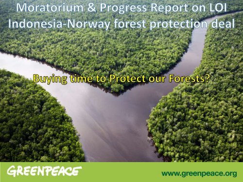
Moratorium & Progress Report on LoI Indo-<br />
Norway forest protection deal<br />
Key performance indicators<br />
not met:<br />
National REDD+ Agency<br />
Independent MRV system<br />
Institutional and financial<br />
mechanisms<br />
Degraded lands database
Moratorium & Progress Report on LoI Indo-<br />
Norway forest protection deal<br />
Key performance indicators<br />
delayed/ partially met:<br />
Moratorium<br />
National REDD+ Strategy<br />
Pilot province (Central<br />
Kalimantan)<br />
Safeguards (under<br />
financing instrument)
Moratorium & Progress Report on LoI Indo-<br />
Norway forest protection deal: Conclusions<br />
Need to extend & streng<strong>the</strong>n <strong>the</strong><br />
moratorium to ensure that:<br />
‣ All key reforms are completed<br />
(forest governance,<br />
harmonization of<br />
laws/regulations), inc. review<br />
of existing concession permits<br />
‣ Enforceable land cover/land<br />
use maps, to resolve<br />
indigenous land claims
Analysis of moratorium map revision 3<br />
What does <strong>the</strong> Moratorium map<br />
Jigsaw Puzzle mean for Forests and Peat?
Indicative Moratorium Map (IMM)Revision 2<br />
(SK 2771/Menhut-VII/IPSDH/2012)<br />
AREAS OF IMM REVISION 2 (SK 2771/Menhut-VII/IPSDH/2012): 65,12 Million Hectare<br />
Primary forest: 59,29 MHa (Primary forest: 8,22 MHa & Primary forest (HL/KSPA): 51,07 MHa)<br />
Peat: 5,83 MHa<br />
Source : Indicative Moratorium Map Revision 2, digital data downloaded from UKP4 website : http://ukp.go.id/informasi-publik/cat_view/20-geospasial<br />
on May 28, 2012
Indicative Moratorium Map (IMM)Revision 3<br />
(SK. 6315/Menhut-VII/IPSDH/2012)<br />
AREAS OF IMM REVISION 3 (SK 6315/Menhut-VII/IPSDH/2012): 64,64 Million Hectare<br />
Primary forest : 59,23 MHa (Primary forest : 7,72 MHa & Primary forest(HL/KSPA): 51,51 MHa)<br />
Peat: 5,41 MHa<br />
Source : Indicative Moratorium Map Revision 3, digital data downloaded from UKP4 website : http://ukp.go.id/informasi-publik/cat_view/20-geospasial<br />
on November 28, 2012
Analysis of changes from IMM2 to IMM3
Analysis of changes from IMM2 to IMM3<br />
‣MoF map release shows reduction in moratorium<br />
area<br />
‣MOF map doesn’t specify locations or <strong>the</strong><br />
classification /status/function of areas where<br />
changes occurred<br />
‣Some changes in different status and function of<br />
areas protected forest/conservation forest<br />
Production forest/o<strong>the</strong>r purpose area<br />
‣Also changes in classification: Peatland <br />
Primary forest
More missing pieces in <strong>the</strong> Jigsaw Puzzle
OVERLAP WITH 2010 LOGGING CONCESSIONS IN IMM 3<br />
Logging concessions 2010 inside IMM 3: 2.62 Million Hectare<br />
(in Primary forest: 886.856 Ha ; Primary forest(HL/KSPA): 1.460.448 Ha; Peat: 273.996 Ha)<br />
Sources: Logging concessions map (IUPHHK-HA) 2010 issued by <strong>the</strong> Directorate General of Forestry Planning, Ministry of Forestry Republic of Indonesia, downloaded on<br />
July 30, 2010 from MoF wesite http://appgis.dephut.go.id/appgis/kml.aspx
OVERLAP WITH 2010 INDUSTRIAL FOREST CONCESSIONS IN IMM 3<br />
Industrial forest concessions 2010 inside IMM 3: 589.922 Ha<br />
(in Primary forest : 123.358 Ha; Primary forest (HL/KSPA): 391.522 Ha; Peat: 75.041 Ha)<br />
Sources: Industrial forest concessions map (IUPHHK-HT) 2010 issued by <strong>the</strong> Directorate General of Forestry Planning, Ministry of Forestry Republic of Indonesia,<br />
downloaded on July 30, 2010 from MoF wesite http://appgis.dephut.go.id/appgis/kml.aspx
OVERLAP WITH 2010 PALM OIL CONCESSIONS IN IMM 3<br />
Palm oil concessions 2010 inside IMM 3: 856.418 Ha<br />
( in Primary forest: 85.289 Ha; Primary forest (HL/KSPA): 325.426 Ha; Peat: 445.704 Ha)<br />
Sources:<br />
1. HGU Map and Location Permit issued by <strong>the</strong> National Land Agency (BPN) in collected in 2007-2009<br />
2. Palm oil concessions map 2010 issued by <strong>the</strong> Directorate General of Forestry Planning, Ministry of Forestry Republic of Indonesia, downloaded on July 30, 2010<br />
from MoF wesite http://appgis.dephut.go.id/appgis/kml.aspx
OVERLAP WITH 2009 COAL CONCESSIONS IN IMM 3<br />
Coal concessions 2009 inside IMM 3: 903.275 Ha<br />
( in Primary forest: 87.360 Ha; Primary forest (HL/KSPA): 802.967 Ha; Peat: 12.948 Ha)<br />
Sources: Map of Coal Mining concessions 2009 issued by <strong>the</strong> Indonesian Coal Mining Association in June 2009
SUMMARY OF OVERLAP WITH ALL 4 CONCESSION TYPES IN IMM3<br />
The 4 th concessions inside IMM 3 : 4,97 Million Hectare<br />
( Logging concessions: 2,62 MHa; Industrial forest: 0,59 MHa; Palm Oil: 0,86 Mha; Coal concessions: 0,90 MHa)
• Overlap of logging concessions ; Industrial Forest Plantation<br />
with Moratorium area is increasing<br />
• Overlap of Palm Oil concessions; coal mines with Moratorium<br />
area is decreasing<br />
• The harmonisation of sectoral maps and concessions data with<br />
moratorium map has still not been done<br />
• URGENT REVIEW OF ALL EXISTING PERMITS NEEDED
RESULT OF GROUND-TRUTHING<br />
INSIDE IMM3 MORATORIUM AREA<br />
IN CENTRAL KALIMANTAN PROVINCE
Ground-Truthing Conclusions:<br />
‣Ground-truthing proves that overlaps between<br />
concessions and moratorium areas already<br />
identified in IMM2 are still in IMM3<br />
‣Classifications used in <strong>the</strong> IMMs do not<br />
accurately reflect <strong>the</strong> situation on <strong>the</strong> ground<br />
‣Some of <strong>the</strong> fragmented moratorium areas are<br />
under threat of deforestation<br />
‣Local communities are not well informed about<br />
which areas <strong>the</strong> Moratorium is supposed to<br />
protect
• Much can be<br />
achieved if civil<br />
society orgs and<br />
Government work<br />
with local<br />
communities<br />
• Local communities<br />
can help with<br />
monitoring of <strong>the</strong><br />
Moratorium
Tigers’ Eyes Forest Patrol<br />
http://forestpatrol.greenpeace.or.id/
Tigers’ Eyes Forest Patrol
Tigers’ Eyes Forest Patrol
Tigers’ Eyes Forest Patrol
Tigers’ Eyes Forest Patrol
URGENT ACTION NEEDED:<br />
Moratorium based on performance (not<br />
limited by time) including streng<strong>the</strong>ning<br />
moratorium by reviewing all existing permits;<br />
Complete gazetting of Forest areas;<br />
Include all Peatlands and Forest in <strong>the</strong><br />
Moratorium