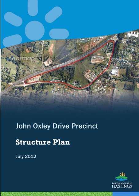
John Oxley Drive Precinct Structure Plan, July 2012 - Hastings ...
John Oxley Drive Precinct Structure Plan, July 2012 - Hastings ...
John Oxley Drive Precinct Structure Plan, July 2012 - Hastings ...

You also want an ePaper? Increase the reach of your titles
YUMPU automatically turns print PDFs into web optimized ePapers that Google loves.
JOHN OXLEY DRIVE PRECINCT - <strong>Structure</strong> <strong>Plan</strong>, <strong>July</strong> <strong>2012</strong><br />
Document status (for this copy)<br />
Stage<br />
Version Date<br />
(blank until achieved)<br />
Draft under discussion within Council 15/03/<strong>2012</strong><br />
Adopted by Council for public exhibition 28/03/<strong>2012</strong><br />
Public Exhibition 29/03/<strong>2012</strong><br />
For Council review 14/05/<strong>2012</strong><br />
Adopted by Council 25/07/<strong>2012</strong><br />
Council reference: PP2011-0007<br />
2
JOHN OXLEY DRIVE PRECINCT - <strong>Structure</strong> <strong>Plan</strong>, <strong>July</strong> <strong>2012</strong><br />
Table of Contents<br />
1 Summary ....................................................................................................................... 5<br />
2 Background ................................................................................................................... 6<br />
3 Site description .............................................................................................................. 7<br />
4 Development Considerations ........................................................................................ 8<br />
4.1 Locational context ........................................................................................................... 8<br />
4.2 Existing land uses ............................................................................................................ 9<br />
4.2.1 Sub-precincts ........................................................................................................................... 9<br />
4.2.2 Northeast sub-precinct ........................................................................................................... 9<br />
4.2.3 Western sub-precinct ............................................................................................................ 11<br />
4.3 <strong>John</strong> <strong>Oxley</strong> <strong>Drive</strong> ............................................................................................................ 12<br />
4.3.1 Role and future upgrade ....................................................................................................... 12<br />
4.3.2 Access .................................................................................................................................... 14<br />
4.4 Flooding ......................................................................................................................... 16<br />
4.5 Drainage and soil capabilities ....................................................................................... 18<br />
4.6 Natural environment ..................................................................................................... 20<br />
4.7 Bush fire ........................................................................................................................ 21<br />
4.8 Social impacts ............................................................................................................... 21<br />
4.8.1 Housing .................................................................................................................................. 21<br />
4.8.2 Access .................................................................................................................................... 22<br />
4.8.3 Community services .............................................................................................................. 22<br />
4.8.4 Employment ........................................................................................................................... 22<br />
4.8.5 Amenity .................................................................................................................................. 23<br />
4.9 Infrastructure ................................................................................................................. 23<br />
4.9.1 Water ..................................................................................................................................... 23<br />
4.9.2 Sewer ..................................................................................................................................... 23<br />
5 <strong>Plan</strong>ning Framework .................................................................................................... 24<br />
5.1 Port Macquarie-<strong>Hastings</strong> LEP 2011 .............................................................................. 24<br />
5.2 Strategies ...................................................................................................................... 24<br />
5.2.1 Mid North Coast Regional Strategy 2006-31 ...................................................................... 24<br />
5.2.2 Urban Growth Management Strategy 2011-2031 .............................................................. 25<br />
5.3 Financing infrastructure ................................................................................................ 26<br />
5.3.1 General .................................................................................................................................. 26<br />
5.3.2 Specific local infrastructure .................................................................................................. 27<br />
5.3.3 <strong>Plan</strong>ning Agreements ............................................................................................................ 27<br />
6 <strong>Structure</strong> <strong>Plan</strong> .............................................................................................................. 29<br />
6.1 Principles ....................................................................................................................... 29<br />
6.2 Proposed Land Use Outcomes ...................................................................................... 29<br />
6.3 Implementation ............................................................................................................. 31<br />
7 Glossary ....................................................................................................................... 33<br />
3
JOHN OXLEY DRIVE PRECINCT - <strong>Structure</strong> <strong>Plan</strong>, <strong>July</strong> <strong>2012</strong><br />
Maps<br />
Map 1 <strong>John</strong> <strong>Oxley</strong> <strong>Drive</strong> <strong>Precinct</strong> .............................................................................................. 7<br />
Map 2 Location of <strong>Precinct</strong> ....................................................................................................... 8<br />
Map 3 Sub-precincts ................................................................................................................. 9<br />
Map 4 Northeast sub-precinct ............................................................................................... 10<br />
Map 5 Western sub-precinct ................................................................................................. 11<br />
Map 6 Location of access options 2 to 5 described in Table ............................................. 15<br />
Map 7 Flooding ....................................................................................................................... 17<br />
Map 8 Vegetation Mapping and Endangered Ecological Communities ............................. 20<br />
Map 9 Bush Fire Prone Land ................................................................................................. 21<br />
Map 10 Extract from UGMS Summary Map 1 ...................................................................... 25<br />
Map 11 <strong>Structure</strong> <strong>Plan</strong> Proposals ......................................................................................... 29<br />
Figures<br />
Figure 1 <strong>John</strong> <strong>Oxley</strong> <strong>Drive</strong> - Typical Section, planned upgrade north of Major Innes <strong>Drive</strong> 12<br />
Figure 2 <strong>John</strong> <strong>Oxley</strong> <strong>Drive</strong> - Typical Section, planned upgrade west of The Ruins Way ..... 13<br />
4
JOHN OXLEY DRIVE PRECINCT - <strong>Structure</strong> <strong>Plan</strong>, <strong>July</strong> <strong>2012</strong><br />
1 SUMMARY<br />
The <strong>John</strong> <strong>Oxley</strong> <strong>Drive</strong> <strong>Precinct</strong> has developed incrementally over many years on the fringe<br />
of Port Macquarie. Development pressures within Port Macquarie have now grown to<br />
surround the precinct, which remains zoned for rural use.<br />
The redevelopment of the <strong>Oxley</strong> Highway to the north of the precinct provides an<br />
opportunity to review its future development, having regard to land uses, transport<br />
connections and natural constraints.<br />
The purpose of this <strong>Structure</strong> <strong>Plan</strong> is to provide a planning framework, against which<br />
future land use decisions can be assessed and as a basis for coordinated outcomes in<br />
the long term.<br />
Its location and accessibility make it potentially suitable for both further residential<br />
development, and for some employment-generating uses, including bulky goods retailing<br />
(as proposed in Council‘s Urban Growth Management Strategy 2011-2031).<br />
Future development plans need to address issues such as:<br />
flooding,<br />
conservation of endangered ecological communities,<br />
future requirements for the safe function of <strong>John</strong> <strong>Oxley</strong> <strong>Drive</strong>,<br />
managing traffic noise from the new <strong>Oxley</strong> Highway,<br />
managing potential conflicts between land uses,<br />
promoting connectivity to surrounding uses,<br />
accommodating population growth sustainably, and<br />
facilitating redevelopment in a financially responsible manner for Council.<br />
This <strong>Structure</strong> <strong>Plan</strong> paper reviews the relevant issues affecting redevelopment in the<br />
precinct, and proposes a course that seeks to address the competing issues.<br />
5
JOHN OXLEY DRIVE PRECINCT - <strong>Structure</strong> <strong>Plan</strong>, <strong>July</strong> <strong>2012</strong><br />
2 BACKGROUND<br />
The area identified as the <strong>John</strong> <strong>Oxley</strong> <strong>Drive</strong> <strong>Precinct</strong> traditionally was on the approach<br />
road to Port Macquarie – the original subdivisions around 1950 were approved by the<br />
former <strong>Hastings</strong> Shire for land fronting the then Pacific Highway as it approached Port<br />
Macquarie (Municipality).<br />
The properties hugged the old highway along a low saddle, just above wetlands and<br />
floodplain.<br />
Over the following 60 years Port Macquarie has grown from a population of around 3,500<br />
people to over 40,000 people. The precinct is no longer simply a rural area on the final<br />
approach to Port Macquarie, but has seen the town grow around it and been bypassed<br />
by the highway – initially with the Pacific Highway being relocated, and in February <strong>2012</strong><br />
with the <strong>Oxley</strong> Highway being relocated.<br />
However, the newly-named <strong>John</strong> <strong>Oxley</strong> <strong>Drive</strong> will retain a sub-arterial traffic role, and care<br />
will be needed with any new development to manage traffic safety and flows.<br />
Associated with the growth of the area are regional and local strategies for future growth.<br />
Council‘s Urban Growth Management Strategy 2011-2031 proposes that this precinct<br />
could contain bulky goods development.<br />
This plan uses the new <strong>John</strong> <strong>Oxley</strong> <strong>Drive</strong> street name and property numbering, as shown<br />
on Map 1.<br />
6
JOHN OXLEY DRIVE PRECINCT - <strong>Structure</strong> <strong>Plan</strong>, <strong>July</strong> <strong>2012</strong><br />
3 SITE DESCRIPTION<br />
The <strong>John</strong> <strong>Oxley</strong> <strong>Drive</strong> <strong>Precinct</strong> is bounded on the north-west by the new alignment of the<br />
<strong>Oxley</strong> Highway, and on the east and south by the former alignment, now known as <strong>John</strong><br />
<strong>Oxley</strong> <strong>Drive</strong>. The north-eastern corner is a roundabout for the <strong>Oxley</strong> Highway, <strong>John</strong> <strong>Oxley</strong><br />
<strong>Drive</strong> and Wrights Road (which provides access to the Port Macquarie Base Hospital).<br />
The south-western corner is where Philip Charley <strong>Drive</strong> crosses <strong>John</strong> <strong>Oxley</strong> <strong>Drive</strong> and links<br />
to the new <strong>Oxley</strong> Highway.<br />
The western end, comprising two lots separated by the southern end of Lindfield Park<br />
Road, is also part of an urban release area now known as South Lindfield, which also<br />
includes land on the southern side of <strong>John</strong> <strong>Oxley</strong> <strong>Drive</strong>, west to the new <strong>Oxley</strong> Highway<br />
(Council reference PP2002-0006).<br />
Map 1 <strong>John</strong> <strong>Oxley</strong> <strong>Drive</strong> <strong>Precinct</strong><br />
7
JOHN OXLEY DRIVE PRECINCT - <strong>Structure</strong> <strong>Plan</strong>, <strong>July</strong> <strong>2012</strong><br />
4 DEVELOPMENT CONSIDERATIONS<br />
4.1 Locational context<br />
The precinct is located 4.5 to 6.5 kilometres from the Port Macquarie town centre. It is on<br />
the route to the new urban area of Thrumster, to the Pacific Highway, and to Wauchope,<br />
although it can be bypassed using the new <strong>Oxley</strong> Highway.<br />
The 4,500 square metre Lake Innes Shopping Centre is located on the corner of <strong>John</strong><br />
<strong>Oxley</strong> <strong>Drive</strong> and Major Innes Road. The Port Macquarie Base Hospital and associated<br />
medical precinct is located just east of the northeast corner of the <strong>John</strong> <strong>Oxley</strong> <strong>Drive</strong><br />
<strong>Precinct</strong>.<br />
A comprehensive private school is within walking distance, and Government schools are<br />
located towards town, off the <strong>Oxley</strong> Highway.<br />
Map 2 Location of <strong>Precinct</strong><br />
8
4.2 Existing land uses<br />
4.2.1 Sub-precincts<br />
JOHN OXLEY DRIVE PRECINCT - <strong>Structure</strong> <strong>Plan</strong>, <strong>July</strong> <strong>2012</strong><br />
The precinct is broadly split in two by a low lying natural drainage path from The Ruins<br />
Way to the new <strong>Oxley</strong> Highway. This land is undeveloped, along with low lying land<br />
adjacent to the new <strong>Oxley</strong> Highway.<br />
Map 3 Sub-precincts<br />
Given the physical separation of the area it is appropriate to focus on the two areas<br />
separately, as shown in Map 3.<br />
4.2.2 Northeast sub-precinct<br />
A detailed aerial view of the northeast sub-precinct is in Map 4. The <strong>John</strong> <strong>Oxley</strong> <strong>Drive</strong><br />
road reserve is wider, although the constructed road pavement currently has only two<br />
traffic lanes.<br />
In the northeast corner, next to the Wrights Road roundabout is the Port Gateway<br />
Residential Park, which is a mobile home and caravan park providing low-cost<br />
accommodation. The owners have advised that it will be closed in August <strong>2012</strong> and have<br />
submitted concept plans for future bulky goods commercial development. Note at the<br />
time of preparation of this <strong>Structure</strong> <strong>Plan</strong>, this proposal had not been considered in detail<br />
or approved by Council.<br />
The newest development is the Sienna Grange retirement village, which is being<br />
constructed in stages. When complete it will have 68 units.<br />
South of Sienna Grange are a series of 12 residential lots, ranging in size from 1,660 m²<br />
to 8,095 m², interspersed with 3 smaller lots, two with dwelling houses, and one with a<br />
vehicle body repair workshop. At the south-western end are two lots containing a mix of<br />
light industrial or warehouse uses.<br />
9
JOHN OXLEY DRIVE PRECINCT - <strong>Structure</strong> <strong>Plan</strong>, <strong>July</strong> <strong>2012</strong><br />
Apart from Sienna Grange and the vehicle body repair workshop the established land<br />
uses appear to have some capacity for redevelopment.<br />
Map 4 Northeast sub-precinct<br />
Due to the construction of the new <strong>Oxley</strong> Highway close to the Port Gateway Residential<br />
Park and Sienna Grange, an acoustic noise barrier wall has been placed along the<br />
highway boundary with this sub-precinct.<br />
Public stormwater drainage systems traverse Nos 18 & 54 <strong>John</strong> <strong>Oxley</strong> <strong>Drive</strong>. These<br />
systems service both <strong>John</strong> <strong>Oxley</strong> <strong>Drive</strong> itself and adjoining land to the east.<br />
10
JOHN OXLEY DRIVE PRECINCT - <strong>Structure</strong> <strong>Plan</strong>, <strong>July</strong> <strong>2012</strong><br />
Any redevelopment of these properties (or downstream) will need to have regard for<br />
these existing drainage lines.<br />
4.2.3 Western sub-precinct<br />
A detailed aerial view of this sub-precinct is in Map 5.<br />
In this sub-precinct the <strong>John</strong> <strong>Oxley</strong> <strong>Drive</strong> road reserve is narrower, ranging from approx<br />
70m down to 20m, with most of the adjoining development close to the front boundary,<br />
complicating any plans to improve traffic flow and safety by road widening.<br />
Map 5 Western sub-precinct<br />
Fronting the road are 25 lots, ranging in area from 1,735 m² to 2,510 m², and generally<br />
around 20 m wide and 100 m deep. All but two have dwelling houses and some also<br />
contain home businesses or home-based support for off-site employment.<br />
To the north of the 25 lots is a large undeveloped lot, which is discussed further under<br />
the Natural Environment. This undeveloped lot contains a natural drainage path for the<br />
local drainage catchment of approximately 28 Ha of land which is predominantly<br />
developed.<br />
Additionally, given the alignment of the new <strong>Oxley</strong> Highway, there is a need for this<br />
upstream development to drain via the culverts beneath the new <strong>Oxley</strong> Highway.<br />
To the west are two vacant lots, split by the southern stub of Lindfield Park Road. Given<br />
their proximity to the new <strong>Oxley</strong> Highway alignment, traffic noise generally would limit<br />
11
JOHN OXLEY DRIVE PRECINCT - <strong>Structure</strong> <strong>Plan</strong>, <strong>July</strong> <strong>2012</strong><br />
future residential use. Recently the western lot has been used as a works depot for the<br />
construction of the new <strong>Oxley</strong> Highway, but will be available for land uses following<br />
remediation.<br />
Future planning for these two lots is being assessed in the South Lindfield urban release<br />
area. Regard needs to be given to potential future land use conflicts between No 2<br />
Lindfield Park Road, and No 158 <strong>John</strong> <strong>Oxley</strong> <strong>Drive</strong>. While the Urban Growth Management<br />
Strategy 2011-2031 suggests investigation for bulky goods development in this area, no<br />
decisions have been made at this stage.<br />
There is no acoustic barrier along this section of the new <strong>Oxley</strong> Highway. The provisions<br />
of clause 7.9 Acoustic Controls in LEP 2011 apply (at least in part) to the lots from<br />
No 140 <strong>John</strong> <strong>Oxley</strong> <strong>Drive</strong> westward. This requires Council to be satisfied that any<br />
proposed noise-sensitive development will not be subject to excessive noise from the new<br />
<strong>Oxley</strong> Highway ( eg through the use of noise mitigation measures).<br />
4.3 <strong>John</strong> <strong>Oxley</strong> <strong>Drive</strong><br />
4.3.1 Role and future upgrade<br />
After the removal of through traffic onto the new <strong>Oxley</strong> Highway, <strong>John</strong> <strong>Oxley</strong> <strong>Drive</strong> between<br />
Wrights Road and Philip Charley <strong>Drive</strong> will still retain a role as a sub-arterial road, carrying<br />
traffic to and from:<br />
the residential areas of Innes Peninsula area via Major Innes Road or The Ruins<br />
Way,<br />
the Lake Innes Shopping Centre,<br />
Council‘s Waste Transfer Station and the Grace Church on Kingfisher Road,<br />
St Columba Anglican School via Major Innes Road, and<br />
the crematorium and future development of Mahers Headland (via Philip Charley<br />
<strong>Drive</strong>).<br />
Traffic studies undertaken by traffic consultants SMEC Australia Pty Ltd for the<br />
Thrumster land releases project by the year 2036 up to 21,000 daily vehicle movements<br />
in <strong>John</strong> <strong>Oxley</strong> <strong>Drive</strong> north of Major Innes Road and around 11,000 daily movements west<br />
of the Ruins Way.<br />
Figure 1 <strong>John</strong> <strong>Oxley</strong> <strong>Drive</strong> - Typical Section, planned upgrade north of Major Innes <strong>Drive</strong><br />
12
JOHN OXLEY DRIVE PRECINCT - <strong>Structure</strong> <strong>Plan</strong>, <strong>July</strong> <strong>2012</strong><br />
The 2036 forecasted traffic volumes (SMEC <strong>2012</strong>) for <strong>John</strong> <strong>Oxley</strong> <strong>Drive</strong> will require<br />
upgrades of the existing road formation to provide:<br />
Wrights Rd to The Ruins Way – four lane divided carriageway, on road cycleway,<br />
parking lanes and footpaths;<br />
The Ruins Way to <strong>Oxley</strong> Highway overbridge – two lane undivided carriageway, on<br />
road cycleway, footpath where residential lots front <strong>John</strong> <strong>Oxley</strong> <strong>Drive</strong>.<br />
The existing road reserve width varies from 105 m south of Wrights Road to 20 m west of<br />
The Ruins Way. Some road widening may be required between 78 to 82, and 106 to 158<br />
<strong>John</strong> <strong>Oxley</strong> <strong>Drive</strong>.<br />
Figure 1 shows a typical proposed cross-section across <strong>John</strong> <strong>Oxley</strong> <strong>Drive</strong>, Wrights Road to<br />
Major Innes Road, and is based on a minimum 36 m width. An optional noise barrier<br />
mound would require extra width.<br />
Figure 2 shows a typical proposed cross-section across <strong>John</strong> <strong>Oxley</strong> <strong>Drive</strong> to the west of<br />
The Ruins Way, and is based on a minimum 25.5m road reserve width. Only 20 m road<br />
reserve width is available in some locations and widening for the road upgrade will be<br />
required, particularly the western section, with potentially 6 to 10 m widening required.<br />
Figure 2 <strong>John</strong> <strong>Oxley</strong> <strong>Drive</strong> - Typical Section, planned upgrade west of The Ruins Way<br />
Note that the dimensions shown on Figures 1 and 2 above are indicative only and subject<br />
to detailed investigation and design to be carried at in conjunction with future<br />
development proposals for the area.<br />
The timing of the planned road upgrades will essentially be driven traffic generated from<br />
land developments within the <strong>John</strong> <strong>Oxley</strong> <strong>Drive</strong> precinct, the Innes Peninsula and<br />
Thrumster. Based on the traffic forecasts provided by SMEC Australia Pty Ltd, the road<br />
upgrades are predicted to occur initially with intersection upgrades followed by upgrades<br />
of the existing roads between each intersection, commencing at Wrights Road and<br />
working west towards Phillip Charley <strong>Drive</strong>. It is not possible at this stage to forecast with<br />
accuracy when the upgrades will commence. Often a major commercial development or<br />
13
JOHN OXLEY DRIVE PRECINCT - <strong>Structure</strong> <strong>Plan</strong>, <strong>July</strong> <strong>2012</strong><br />
large scale subdivision will bring forward the need for road upgrades. Road widening to<br />
facilitate major road upgrades is not likely to occur in the <strong>John</strong> <strong>Oxley</strong> <strong>Drive</strong> precinct within<br />
the next 10 to 15 years, unless a major development proposal that warrants these works<br />
is approved by Council. In the meantime it is anticipated some intersection<br />
improvements may occur.<br />
Funding of the planned road upgrades will generally be sourced from Council‘s Regional<br />
Roads Contribution <strong>Plan</strong> as well as any roads servicing plan developed as part of the <strong>John</strong><br />
<strong>Oxley</strong> <strong>Drive</strong> precinct planning<br />
It is also noted that this precinct lies within the area subject to Council‘s Innes Peninsula<br />
Contributions <strong>Plan</strong> - Road Works Version 1.3. Development contributions will be required<br />
from applicable development towards road works within the area. These works include<br />
the intersection upgrades on <strong>John</strong> <strong>Oxley</strong> <strong>Drive</strong> at Major Innes Road and The Ruins Way.<br />
4.3.2 Access<br />
Part of the precinct planning requires Council to ensure safe and functional vehicle and<br />
pedestrian access is provided to each property.<br />
Vehicle Access<br />
Some properties may be accessed directly from <strong>John</strong> <strong>Oxley</strong> <strong>Drive</strong> and others may need to<br />
be accessed from internal access roads or via a ―shared accessway‖.<br />
Options for managing access onto <strong>John</strong> <strong>Oxley</strong> <strong>Drive</strong> are summarised in the table<br />
following.<br />
Access option Advantages Disadvantages Supported?<br />
1. Retain individual<br />
driveways<br />
2. Local access road<br />
from Major Innes<br />
Rd roundabout<br />
3. Local access road<br />
from The Ruins<br />
Way intersection,<br />
around the back of<br />
properties to NE<br />
4. Rear access road<br />
for western lots<br />
(from east or west)<br />
Low cost<br />
easily done incrementally<br />
Allows for rear access to<br />
multiple properties<br />
Doesn‘t create additional<br />
intersection onto <strong>John</strong><br />
<strong>Oxley</strong> Dr.<br />
Allows for rear access to<br />
multiple properties<br />
Doesn‘t create additional<br />
intersection onto <strong>John</strong><br />
<strong>Oxley</strong> Dr.<br />
Located on land with<br />
some development<br />
potential<br />
Channels increased<br />
vehicle movements from<br />
redevelopment via single<br />
intersection (possibly<br />
existing or suggested<br />
under option 3)<br />
Provides bushfire buffer<br />
Multiple potential traffic<br />
conflict points<br />
Doesn‘t provide access<br />
where no road frontage<br />
Cost of resumption of<br />
properties<br />
Requires some linkages<br />
across properties<br />
Needed in conjunction<br />
with development<br />
Needed in conjunction<br />
with development<br />
Partly located on soft soil<br />
with higher construction<br />
cost<br />
Potential environmental<br />
impact on endangered<br />
species<br />
Needed in conjunction<br />
with development<br />
Conflict with endangered<br />
species<br />
Located on soft soil with<br />
higher construction cost<br />
Possible cost of<br />
resumption of properties<br />
Only for small<br />
lots where<br />
other<br />
alternatives<br />
are not viable<br />
Not supported<br />
Supported<br />
(only if<br />
environmental<br />
impact is<br />
minimal)<br />
Not supported<br />
14
JOHN OXLEY DRIVE PRECINCT - <strong>Structure</strong> <strong>Plan</strong>, <strong>July</strong> <strong>2012</strong><br />
Access option Advantages Disadvantages Supported?<br />
5. Western lots – local<br />
service road at<br />
front<br />
6. Western lots –<br />
limited access<br />
points (eg 6)<br />
shared by (eg 12)<br />
consolidated lots<br />
Manageable in stages<br />
Avoids significant<br />
acquisitions,<br />
construction costs and<br />
endangered species<br />
Doesn‘t require coordination<br />
of Option 6<br />
Minimises acquisitions<br />
and construction costs<br />
Avoids endangered<br />
species<br />
Reduces potential<br />
vehicle conflict points on<br />
<strong>John</strong> <strong>Oxley</strong> <strong>Drive</strong><br />
Still several access points<br />
to/from <strong>John</strong> <strong>Oxley</strong> <strong>Drive</strong><br />
Additional road widening<br />
may be required<br />
Consolidation of lots and<br />
shared access points<br />
requires co-ordination of<br />
redevelopment of<br />
adjoining lots.<br />
Still some (6) access<br />
points onto <strong>John</strong> <strong>Oxley</strong><br />
<strong>Drive</strong><br />
Possible, but<br />
requires more<br />
land for road<br />
purposes.<br />
Supported<br />
Map 6 Location of access options 2 to 5 described in Table<br />
Map 6 shows access options 2 to 5 diagrammatically.<br />
The proposed new road (numbered 3 on Map 6) from the Ruins Way intersection will<br />
require upgrade of this intersection (possibly construction of a roundabout) and a ―lead<br />
in‖ road to access the rear of the existing lots. The works would be funded from new<br />
developments within this precinct that benefit from the road, with partial funding for the<br />
intersection upgrade from current section 94 road contributions schemes.<br />
For the western lots the local service road option will depend in part on the pattern of<br />
consolidation of the lots in that section, and on whether continuing current use of some<br />
lots blocks provision of a local service road.<br />
The choice for the western sub-precinct comes down to three options for road access:<br />
15
JOHN OXLEY DRIVE PRECINCT - <strong>Structure</strong> <strong>Plan</strong>, <strong>July</strong> <strong>2012</strong><br />
4. New road to the rear of the lots, also providing access to the adjoining low land<br />
and sewer pumping station.<br />
5. A 4 m wide service access road, separate from any road upgrades within <strong>John</strong><br />
<strong>Oxley</strong> <strong>Drive</strong> and contained within the front section of the existing lots.<br />
6. Consolidation of lots for redevelopment, with predetermined common access<br />
locations (say 4 to 6 combined accessways).<br />
Options 4 and 5 are likely to be cost prohibitive and difficult to implement due to existing<br />
fragmentation of ownership, although they provide the safer and more functional level of<br />
service. Option 6, although not as desirable, is likely to provide a practical and function<br />
level of service. Option 6 is preferred at this stage and will require more detailed<br />
investigation and design in conjunction with further planning required for the precinct.<br />
Pedestrian Access<br />
Safe and functional pedestrian access to individual properties, particularly to key<br />
destinations such as the local neighbourhood shopping centre, schools, church and base<br />
hospital, must be planned. The planned road upgrades will include provision for<br />
footpaths and safe crossings at functional locations to ensure connectivity between<br />
residential origins and commercial/community facility destinations. Major commercial<br />
building or subdivision developments may drive the need to bring forward the provision of<br />
pedestrian facilities within the precinct in advance of the construction of the planned<br />
road upgrades.<br />
4.4 Flooding<br />
The main planning control in relation to flooding is the Flood <strong>Plan</strong>ning Area (FPA), which<br />
incorporates land affected by:<br />
the estimated 1% Annual Exceedance Probability (AEP) flood event, which is<br />
commonly understood to be the 1 in 100 year flood, which includes an allowance<br />
for sea level rise from predicted climate change, and<br />
an additional freeboard height of 0.5 m for residential development – to allow for<br />
errors in topographic data, modelling, and buffers for wave effects.<br />
Land within the FPA is subject to clause 7.3 of Port Macquarie-<strong>Hastings</strong> Local<br />
Environmental <strong>Plan</strong> 2011.<br />
A supplementary planning control relates to additional land which is identified as being<br />
subject to the Probable Maximum Flood (PMF). Clause 7.4 of the LEP applies to such<br />
land, and is used to ensure that emergency services and evacuation-critical development<br />
are accessible even in extreme flood events.<br />
Map 7 shows the land subject to:<br />
the 1% AEP event,<br />
the Flood <strong>Plan</strong>ning Area, and<br />
the Probable Maximum Flood.<br />
16
JOHN OXLEY DRIVE PRECINCT - <strong>Structure</strong> <strong>Plan</strong>, <strong>July</strong> <strong>2012</strong><br />
Map 7 Flooding<br />
Current mapping of the extent of flooding does not take into account any impacts from<br />
the construction of the new <strong>Oxley</strong> Highway alignment. The planning and design by Roads<br />
and Maritime Services (previously known as Roads and Traffic Authority) was based on<br />
having no impact on flooding. In theory this means that the extent of flooding is not<br />
affected by the new road, except that the land filled for the new road should now be flood<br />
free.<br />
Note that there are a series of culverts under the new highway which would allow free<br />
flow of flood waters, even for flood fringe storage from a major flood on the <strong>Hastings</strong><br />
River.<br />
Broadly within the precinct, the land subject to the 1% AEP and FPA excludes all existing<br />
development fronting <strong>John</strong> <strong>Oxley</strong> <strong>Drive</strong>. The impact of some approved filling in this area<br />
has not been incorporated in the flood mapping. This particularly applies to two larger<br />
properties in the northeast corner.<br />
While most of the precinct is within the PMF area, this only becomes significant for a<br />
limited range of development and is addressed by LEP provisions. It is not considered to<br />
be significant to the <strong>Structure</strong> <strong>Plan</strong> for this precinct.<br />
It is important to be aware that, in relation to flooding, planning seeks to compromise<br />
protection from flooding impacts and the severity and frequency. Land that is classed as<br />
―flood free‖ may not be immune from extremely rare flood events, or localised storm<br />
impacts.<br />
<br />
It may be possible for some development to take place within land subject to flooding,<br />
where it is assessed that the development is above the flood planning level (eg due to<br />
land filling) and there are no adverse impacts elsewhere (ie from increased flood levels or<br />
water velocities). Council does not propose to investigate this. However, there is scope<br />
for landowners to fund professional assessments that could allow consideration of<br />
development of land excluded here.<br />
17
4.5 Drainage and soil capabilities<br />
JOHN OXLEY DRIVE PRECINCT - <strong>Structure</strong> <strong>Plan</strong>, <strong>July</strong> <strong>2012</strong><br />
The culverts under the new <strong>Oxley</strong> Highway serve a total catchment area of around 90 Ha,<br />
most of which is already developed. While not the only drainage line, the primary natural<br />
drainage line runs through the middle of the precinct from The Ruins Way to the northwest<br />
through culverts under the new <strong>Oxley</strong> Highway.<br />
For water quality, environmental and flood management reasons, the approach used with<br />
new development is to ensure that new development does not intensify water flows nor<br />
degrade water quality to downstream areas, and where possible, improves those flows<br />
through new drainage works.<br />
Council‘s AUS-SPEC Specifications set standards for water quality and quantity for<br />
development in this regard.<br />
Developments to the east and south of the precinct include their own detention basins to<br />
control the rate of water discharge into this precinct.<br />
<strong>Plan</strong>s for the proposed South Lindfield residential land release include stormwater<br />
detention basins. Discharge from this upstream basin will need to drain via the subject<br />
development precinct to the common point of stormwater discharge – the culverts<br />
beneath the new <strong>Oxley</strong> Highway.<br />
The key issue for the site is to ensure that the existing drainage paths are retained and<br />
function in accordance with current best practice. Drainage of the site will need to be<br />
managed generally in accordance with Council‘s DCP 2011 Stormwater objectives as<br />
follows:<br />
To control and manage all stormwater generated within the development.<br />
To control and manage all stormwater passing through the development from the<br />
surrounding catchment.<br />
To provide an effective legal point of discharge for all collected stormwater, from the<br />
development to a natural watercourse, Council‗s drainage system or approved<br />
outfall.<br />
To achieve these objectives without detrimentally affecting the environment,<br />
surface and subsurface water quality, groundwater infiltration characteristics, the<br />
adjoining landowners and other landowners downstream of the development.<br />
To provide a safe and convenient environment for pedestrians and traffic.<br />
To incorporate principles of ecological sustainable development.<br />
To provide detailed design provisions in line with ecologically sustainable<br />
development, water sensitive urban design and total water cycle management and<br />
principles.<br />
To provide an effective major and minor stormwater system that is cost effective<br />
and incorporates life cycle costs of investigation, design, operation, maintenance<br />
and replacement of stormwater infrastructure.<br />
Any redevelopment within the precinct will need to address the impacts of the<br />
development on downstream water quality and flows, with a likely result being the need<br />
for the provision of stormwater quality control and detention facilities.<br />
Individual developments can provide on-site water quality treatment and detention within<br />
the development footprint.<br />
18
JOHN OXLEY DRIVE PRECINCT - <strong>Structure</strong> <strong>Plan</strong>, <strong>July</strong> <strong>2012</strong><br />
An alternative is a shared water quality treatment and detention basin. The most suitable<br />
location appears to be at the downstream end of the catchment close to the culverts<br />
under the <strong>Oxley</strong> Highway. Council has no current plans to provide such a facility, and it<br />
would be necessary to determine design concepts, costing, funding and construction<br />
timing prior to any relevant development occurring.<br />
The low lying land running from The Ruins Way, and adjoining the <strong>Oxley</strong> Highway also has<br />
a high water table. This provides a poor quality base for any construction and<br />
significantly higher construction costs.<br />
Low lying ground can also contain acid sulfate soils, which, if disturbed, can lead to<br />
damage to the environment, infrastructure and building footings. In this case there are<br />
no mapped acid sulfate soils within the precinct, though it is identified that care is<br />
required not to lower the water table for the low lying land in case this disturbs acid<br />
sulfate soils to the north-west of the <strong>Oxley</strong> Highway. This will be a consideration in the<br />
design and construction of any required detention basin/water quality facilities, and<br />
associated excavations for pipelines.<br />
19
JOHN OXLEY DRIVE PRECINCT - <strong>Structure</strong> <strong>Plan</strong>, <strong>July</strong> <strong>2012</strong><br />
4.6 Natural environment<br />
Council has completed systematic mapping of vegetation communities across the Council<br />
area. As shown on Map 8 this mapping has identified that the parcel of land to the north<br />
of 124-158 <strong>John</strong> <strong>Oxley</strong> <strong>Drive</strong> contains Swamp Oak Open Forest and a Flax-leaved<br />
Paperbark - mixed Eucalypt Forests Complex. Both vegetation communities are<br />
endangered ecological communities under the Threatened Species Conservation Act<br />
1995.<br />
Map 8 Vegetation Mapping and Endangered Ecological Communities<br />
Swamp Sclerophyll Forest on Coastal Floodplains EEC<br />
33 - Broad-leaved Paperbark Woodlands & Forests<br />
38 - Swamp Oak Open Forests<br />
42 - Flax-leaved Paperbark - Mixed Eucalypt Forests Complex<br />
Not EEC<br />
15 - Tallowwood - Grey Gum Open Forests<br />
For this land any rezoning or development application will require an assessment of the<br />
likely impacts. Given the status as endangered ecological communities of these areas, it<br />
is highly unlikely that there relevant approvals could be obtained.<br />
There are indications that the low-lying land through the middle of the precinct may<br />
contain endangered frog species (Wallum Froglet and Green and Golden Bell Frog) which<br />
would also require an assessment of the impact of any proposed change.<br />
These assessments would be required in conjunction with any planning proposal to<br />
rezone the land.<br />
The <strong>Structure</strong> <strong>Plan</strong> for the precinct avoids development in these areas. However, if<br />
specific proposals are supported by environmental, flooding and drainage investigations<br />
that the land can be developed without adverse environmental impacts, then Council may<br />
consider amendment to this <strong>Structure</strong> <strong>Plan</strong>.<br />
20
4.7 Bush fire<br />
JOHN OXLEY DRIVE PRECINCT - <strong>Structure</strong> <strong>Plan</strong>, <strong>July</strong> <strong>2012</strong><br />
Map 9 shows that the vegetated land to the north of 124-158 <strong>John</strong> <strong>Oxley</strong> <strong>Drive</strong> is<br />
identified as Category 1 bush fire prone land on the bush fire prone land mapping under<br />
section 146 of the Environmental <strong>Plan</strong>ning and Assessment Act 1979. Land adjoining<br />
within 100 metres (including Nos 112-158 <strong>John</strong> <strong>Oxley</strong> <strong>Drive</strong>) is identified as buffer on<br />
that mapping.<br />
This triggers a requirement that development conforms with <strong>Plan</strong>ning for Bush Fire<br />
Protection (NSW Rural Fire Service, 2006). It is understood that construction of the new<br />
<strong>Oxley</strong> Highway alignment is not expected to modify this mapping when it is next reviewed.<br />
Map 9 Bush Fire Prone Land<br />
4.8 Social impacts<br />
4.8.1 Housing<br />
The owner, of the Port Gateway Residential Park at 18 <strong>John</strong> <strong>Oxley</strong> <strong>Drive</strong>, has advised<br />
Council that the Park will be closed in August <strong>2012</strong>. The owner proposes to redevelop<br />
the site for bulky goods retail and has assisted residents at the Park to find alternative<br />
accommodation. The proposed redevelopment is yet to be considered by Council.<br />
Closure of the Park will lead to the loss of affordable, low cost housing stock in the Port<br />
Macquarie area, which is likely to be only partially offset by new residential development<br />
in the <strong>Precinct</strong>. Council does not have control over the operation of the Park.<br />
Nevertheless, Council must assess the social impact of the loss of affordable housing in<br />
the preparation of this <strong>Structure</strong> <strong>Plan</strong>.<br />
The State government is the primary authority for the provision of affordable housing.<br />
Council has an affordable housing strategy and is committed reviewing its policies to<br />
encourage affordable housing outcomes.<br />
21
JOHN OXLEY DRIVE PRECINCT - <strong>Structure</strong> <strong>Plan</strong>, <strong>July</strong> <strong>2012</strong><br />
Council has reviewed a preliminary Social Impact Assessment from the owners of the Port<br />
Gateway and Council staff have met with representatives of State and community<br />
Housing during preparation of the <strong>Structure</strong> <strong>Plan</strong>. The initiatives that the proponent has<br />
taken to find alternative accommodation for existing residents have been supported by<br />
the Housing NSW and community housing.<br />
Whilst there are no similar suppliers of affordable housing nearby, the assessment of<br />
constraints and opportunities by Council in this <strong>Structure</strong> <strong>Plan</strong> leads to a conclusion that<br />
the site is not ideal for residential development. In addition, there is significant<br />
development potential for non-residential uses on the site and bulky goods retail is likely<br />
to be an appropriate outcome in the circumstances.<br />
Council will continue to work with other agencies towards the provision of affordable<br />
housing in the Port Macquarie-<strong>Hastings</strong>.<br />
4.8.2 Access<br />
Both with Sienna Grange and with some housing projects on the western side of the <strong>Oxley</strong><br />
Highway there are concentrations of older people (some using motorised chairs) who<br />
require good public transport and footpaths and safe road crossings.<br />
The relocation of the <strong>Oxley</strong> Highway has meant that some bus services will no longer pass<br />
the properties on <strong>John</strong> <strong>Oxley</strong> <strong>Drive</strong>, however, the precinct will still be served by local<br />
services for the Innes Peninsula, Thrumster and (in the future off Philip Charley <strong>Drive</strong>)<br />
Maher‘s Headland. Road upgrades will need to make provision for bus bays.<br />
New development in the precinct will increase pedestrian and cyclist movements along<br />
<strong>John</strong> <strong>Oxley</strong> <strong>Drive</strong>, with pedestrian movements being particularly related to the Lake Innes<br />
Shopping Centre. Council‘s concepts for the upgrade of <strong>John</strong> <strong>Oxley</strong> <strong>Drive</strong> provide for<br />
constructed pathways and cycle lanes – the timing of construction will be dependent on<br />
what is included with new development work and when road upgrades can be given<br />
priority in Council‘s construction programme.<br />
A particular need will be provision for safe crossing of <strong>John</strong> <strong>Oxley</strong> <strong>Drive</strong> to access the<br />
shops and links required between the existing shops and any future bulky goods<br />
commercial developments.<br />
There may be a need to monitor the amount of pedestrian traffic crossing the <strong>Oxley</strong><br />
Highway at the northern end of (or beyond) the precinct, as this could be unsafe,<br />
particularly for older pedestrians.<br />
4.8.3 Community services<br />
There are no community, recreational or sporting facilities in the vicinity.<br />
While there is likely to be an increased demand for community facilities and services, the<br />
increased demand from within the precinct will not warrant the provision of the facilities<br />
within the precinct. Overall demand needs to be assessed by Council in planning for<br />
community facilities within Port Macquarie.<br />
4.8.4 Employment<br />
The proposed provision of land for business investigation development will lead to<br />
increased employment within the precinct. This could be at the short-term expense of<br />
other employment within the area, but will add to the long-term total employment within<br />
the area.<br />
22
JOHN OXLEY DRIVE PRECINCT - <strong>Structure</strong> <strong>Plan</strong>, <strong>July</strong> <strong>2012</strong><br />
4.8.5 Amenity<br />
The plans for road upgrade will make a significant improvement to the precinct, although<br />
there is no certainty when this will occur. The rate of redevelopment of the western end<br />
of the precinct will affect when the upgrade can occur there with least adverse impact on<br />
existing housing.<br />
The other key amenity issue is the impact between different adjoining land uses, such as<br />
where commercial uses (eg bulky goods commercial development) adjoin residential<br />
areas.<br />
Residents of Sienna Grange have expressed concern that their quality of life will be<br />
affected by the proposed bulky goods commercial development, due to loss of privacy,<br />
noise, fumes and large buildings close to their boundary.<br />
Conflict between adjoining land uses will need to be addressed in the design of proposed<br />
developments and through appropriate zonings, Development Control <strong>Plan</strong> provisions,<br />
and/or conditions of any development consent.<br />
4.9 Infrastructure<br />
Earlier sections discussed issues relating to:<br />
<strong>John</strong> <strong>Oxley</strong> <strong>Drive</strong> role and future upgrade – Section 4.3.1, and<br />
Drainage – Section 4.5.<br />
4.9.1 Water<br />
There are no difficulties expected with provision of water services to new development<br />
within the precinct.<br />
4.9.2 Sewer<br />
Sewage from existing development within the precinct currently drains to a sewage<br />
pumping station within the precinct, in the vicinity of The Ruins Way. From there the<br />
sewage travels via a rising main to the larger Wangi Place pumping station and eventually<br />
to the Port Macquarie Sewage Treatment <strong>Plan</strong>t off Koala Street.<br />
It is anticipated that the increased sewage loads from the ultimate development within<br />
the precinct can be managed by the existing infrastructure, with some increase in the<br />
capacity of the sewage pumping station. The key is ensuring the system is not infiltrated<br />
by wet weather flows.<br />
Note that 18 <strong>John</strong> <strong>Oxley</strong> <strong>Drive</strong> can connect to a different part of the reticulation network.<br />
23
JOHN OXLEY DRIVE PRECINCT - <strong>Structure</strong> <strong>Plan</strong>, <strong>July</strong> <strong>2012</strong><br />
5 PLANNING FRAMEWORK<br />
5.1 Port Macquarie-<strong>Hastings</strong> LEP 2011<br />
The primary legislation that governs future development of the precinct is the<br />
Environmental <strong>Plan</strong>ning and Assessment Act 1979, and associated environmental<br />
planning instruments (EPIs), such as State Environmental <strong>Plan</strong>ning Policies (SEPPs) and<br />
Local Environmental <strong>Plan</strong>s (LEPs).<br />
Land within the precinct is currently zoned RU1 – Primary Production in Port Macquarie-<br />
<strong>Hastings</strong> Local Environmental <strong>Plan</strong> 2011 (LEP 2011), and has a minimum lot size<br />
restriction of 40 hectares. This reflects the situation decades ago when the precinct was<br />
beyond the outskirts of Port Macquarie, together with a reluctance to intensify land use<br />
while <strong>John</strong> <strong>Oxley</strong> <strong>Drive</strong> was still the arterial <strong>Oxley</strong> Highway.<br />
Implementation of the <strong>Structure</strong> <strong>Plan</strong> would primarily involve amending the LEP, with<br />
particular attention to appropriate changes to:<br />
the Land Zoning Map,<br />
the Lot Size Map (and associated updates to the Dwelling Opportunity Map),<br />
Floor Space Ratio Map,<br />
Height of Buildings Map, and<br />
potentially the Land Acquisition Reservation Map.<br />
Amendments to the LEP have to be approved by the State Government. Council can also<br />
have supporting policy requirements in a Development Control <strong>Plan</strong> (DCP).<br />
Other relevant statutory provisions that apply to lesser degrees include:<br />
Roads Act 1993,<br />
Threatened Species Conservation Act 1995,<br />
State Environmental <strong>Plan</strong>ning Policies.<br />
5.2 Strategies<br />
5.2.1 Mid North Coast Regional Strategy 2006-31<br />
Council‘s strategic land use planning is required to be consistent with the Mid North<br />
Coast Regional Strategy 2006-31, which was released by the State Government in 2009.<br />
The land within the precinct is not shown within any existing urban or proposed growth<br />
area, although these are shown to the east, south and west.<br />
The Strategy does provide:<br />
Where demonstrated through the local growth management strategy or rezoning<br />
process that a reasonable adjustment to a growth area boundary is desirable and is<br />
consistent with the Regional Strategy, then a variation of the boundary may be<br />
considered. In determining the extent of any variation, consideration will be given to<br />
the efficient use of infrastructure/services, avoidance of significant environmental<br />
constraints and natural resources, and reinforcement of the regional settlement<br />
hierarchy. Any variation will be determined through a joint analysis undertaken<br />
between the Department of <strong>Plan</strong>ning and the local council.<br />
MNCRS Chapter 4 Settlement and Housing – page 18.<br />
It is anticipated that the proposals of this <strong>Structure</strong> <strong>Plan</strong> will satisfy the requirements for<br />
a variation to the growth area boundary.<br />
24
JOHN OXLEY DRIVE PRECINCT - <strong>Structure</strong> <strong>Plan</strong>, <strong>July</strong> <strong>2012</strong><br />
5.2.2 Urban Growth Management Strategy 2011-2031<br />
The Regional Strategy requires Councils to prepare more detailed local growth<br />
management strategies. In May 2011 the NSW Department of <strong>Plan</strong>ning and<br />
Infrastructure approved Council‘s Urban Growth Management Strategy 2011-2031<br />
(UGMS). Specific matters relating to this precinct and surrounding land include:<br />
15. Establish a medical services cluster, centred on the Port Macquarie Base<br />
Hospital. [Dashed red line and ―2‖ on Map 10]<br />
33. Consider potential for bulky goods development at Lindfield Park Road and<br />
between the old and new <strong>Oxley</strong> Highway alignments. [Dashed red line and ―31‖ on<br />
Map 10]<br />
The UGMS mapping (see extract in Map 10) shows the whole precinct as an area for<br />
economic initiatives, with the Lindfield Park Road section as an ‗Employment<br />
Investigation‘ area.<br />
Map 10 Extract from UGMS Summary Map 1<br />
The provisions relevant to this precinct occur in Chapter 5 Economic Development and<br />
Employment under the heading Bulky Goods Retail, and extensively quote from the<br />
background Port Macquarie <strong>Hastings</strong> Retail Strategy Review 2010 study prepared for<br />
Council by Hill PDA.<br />
Relevant provisions from that study quoted in the UGMS are:<br />
―There is a shortage of sites for future growth of bulky goods retailing. In the Port<br />
Macquarie market the usual form for bulky goods retailing is low cost single storey<br />
construction with outdoor at grade car parking. Parking under the retail level in a<br />
semi-basement car park is possible but the feasibility becomes questionable in nonmetropolitan<br />
areas. Since parking is provided outdoors the FSR is usually no more<br />
than around 0.4:1.‖<br />
―Demand for bulky goods in Port Macquarie will increase at around 1,000sqm to<br />
1,200sqm (GLA) every year which translates to a required land area of around 1ha<br />
every four years. Around 24,000sqm is required between 2009 and 2031.‖<br />
―Notwithstanding that demand increases gradually, supply often steps up in<br />
quantum increases due to the large formats of bulky goods retailers. A super centre<br />
with one or two anchor tenants and 15 to 20 specialties could be say 20,000sqm.<br />
25
JOHN OXLEY DRIVE PRECINCT - <strong>Structure</strong> <strong>Plan</strong>, <strong>July</strong> <strong>2012</strong><br />
A scenario like this would have strong impacts on existing bulky goods retailers but<br />
the impacts on centres are not necessarily significantly adverse. A super centre of<br />
this scale would also attract more expenditure from Kempsey and Greater Taree<br />
which could have some minor positive benefits with day trippers doing dual<br />
shopping in the Port Macquarie CBD.‖<br />
―Furthermore a single retailer such as the new Woolworths hardware house concept<br />
requires a significant floor area of 13,500sqm and site area of around 3ha. A large<br />
proportion of the building is used for storage of home building supplies and a<br />
significant proportion of trade relates to wholesale trade. This is a model which<br />
blurs the boundary between retailing and industrial use.‖<br />
―An ideal model is a super centre with the Woolworths hardware house<br />
(13,500sqm), a large furniture retailer (such as Domayne or Nick Scali of<br />
3,000sqm) and around 15 specialties including bedding stores, electrical<br />
appliances and home entertainment, outdoor furniture and barbeques, indoor<br />
furniture stores, floor coverings, curtains, kitchens, lighting, tiles, etc. Total floor<br />
area would be around 25,000sqm. The supercentre need not be in single<br />
ownership but it should be in a cluster thereby enabling or encouraging shoppers to<br />
walk, rather than drive, between stores. Around 6-8ha would be required to<br />
accommodate this option.‖<br />
―Given that there are very few, if any, remaining opportunities in Lake Road and<br />
<strong>Hastings</strong> River <strong>Drive</strong> the best location for a significant expansion of bulky goods<br />
(super centre or cluster) is along <strong>Oxley</strong> Highway between the Pacific Highway and<br />
Innes Lake. This is the main entry point to Port Macquarie from the highway. The<br />
site has considerable visual exposure from the road and accessibility is very good.<br />
Bulky goods would also provide a buffer between the main road and residential.<br />
Furthermore bulky goods contribute little problem to traffic on working days.<br />
Generally the majority of trade is weekend trade.‖ (Hill PDA, 2010; p.30)<br />
The UGMS continues:<br />
Land at Lindfield Park Rd has been zoned IN2 Light Industrial in recognition of the<br />
need for service industrial uses in conjunction with development at Thrumster (Area<br />
13). The development of this industrial land for bulky goods retail would require an<br />
amendment to the Local Environmental <strong>Plan</strong> and would result in some loss of zoned<br />
industrial land supply.<br />
There is some potential for bulky goods development to the south of the Lindfield<br />
Park Rd intersection with the new <strong>Oxley</strong> Highway alignment, on land that is affected<br />
by highway noise. Bulky goods retail would potentially provide a buffer between the<br />
main road and residential development in this location. A draft local environmental<br />
plan is currently in preparation for this area in consultation with affected land<br />
owners and will have an opportunity to consider the relationship between uses in<br />
this location in the short term.<br />
5.3 Financing infrastructure<br />
5.3.1 General<br />
<strong>Plan</strong>ning for redevelopment within the precinct is not sustainable if the supporting<br />
infrastructure for that redevelopment is not available when required.<br />
26
JOHN OXLEY DRIVE PRECINCT - <strong>Structure</strong> <strong>Plan</strong>, <strong>July</strong> <strong>2012</strong><br />
Various statutory systems are available to co-ordinate the financing of infrastructure,<br />
though ultimately the cost is usually borne by the end user, even if payment is formally<br />
made by the developer.<br />
In relation to water and sewer, the most common arrangements are Developer Servicing<br />
<strong>Plan</strong>s (DSPs) under the Water Management Act 2000. In relation to other infrastructure<br />
the most common arrangements are Development Contribution <strong>Plan</strong>s (CPs) under section<br />
94 of the Environmental <strong>Plan</strong>ning and Assessment Act 1979.<br />
Primarily these are used for large scale infrastructure with broadly predictable costs<br />
which are then apportioned across the future users on a standardised dwelling (or<br />
‗tenement‘) basis, with adjustments for the passage of years. Some CPs cover:<br />
Major road improvements<br />
Local parks and regional sporting facilities<br />
<strong>Precinct</strong>-based facilities (eg roads, community facilities, car parking).<br />
Council also applies section 94A levies on commercial and industrial development<br />
towards the cost of local public facilities.<br />
There are a range of DSPs, CPs and section 94A levies that would be applicable for likely<br />
development in the precinct, covering:<br />
Water Supply<br />
Sewerage Services<br />
Major Roads<br />
Innes Peninsula Road Works (covers intersection upgrades at Major Innes road and<br />
The Ruins Way)<br />
Open Space<br />
Community, Cultural & Emergency Service Facilities<br />
Note that the contribution rates are adjusted quarterly in line with movements in the<br />
Consumer Price Index.<br />
5.3.2 Specific local infrastructure<br />
There is a need for the following specific local infrastructure within the precinct to<br />
facilitate redevelopment:<br />
drainage (in particular a detention basin/water quality facilities - or an alternative<br />
system approved by Council),<br />
local access road in the north-east sub-precinct, and<br />
provision of co-ordinated access within the western sub-precinct.<br />
These are not currently covered in any of the DSPs or CPs or section 94 levies.<br />
Council is unlikely to accept the use of a Development Contributions <strong>Plan</strong> to fund the<br />
proposed local access roads and major stormwater drainage facilities because Council is<br />
not in a position to expend the money to provide the service ahead of collecting the<br />
associated contributions or levy.<br />
5.3.3 <strong>Plan</strong>ning Agreements<br />
Since 2005 there has been another approach, called <strong>Plan</strong>ning Agreements (or Voluntary<br />
<strong>Plan</strong>ning Agreements – VPAs), as set out in sections 93F to 93L of the Environmental<br />
<strong>Plan</strong>ning and Assessment Act 1979.<br />
27
JOHN OXLEY DRIVE PRECINCT - <strong>Structure</strong> <strong>Plan</strong>, <strong>July</strong> <strong>2012</strong><br />
In simplified terms a planning agreement is a voluntary agreement, between a Council<br />
and a person:<br />
(a) who has sought a change to an environmental planning instrument, or<br />
(b) who has made, or proposes to make, a development application,<br />
under which the person imay dedicate land free of cost, pay a monetary contribution, or<br />
provide any other material public benefit, to be used for a public purpose.<br />
The preparation of planning agreements can be complex (particularly when there are<br />
multiple parties each with their own agreement), and is subject to statutory processes to<br />
ensure transparency and equity.<br />
However, planning agreements can still facilitate relatively quick and flexible<br />
arrangements to suit a small area, and can reduce expenditure on infrastructure before it<br />
is needed.<br />
<strong>Plan</strong>ning agreements have been used elsewhere by Council to resolve similar issues.<br />
Arrangements for the funding for the provision of the local infrastructure will need to be<br />
resolved prior to any rezoning being finalised.<br />
<strong>Plan</strong>ning agreements could be one option for managing the funding and timing of the<br />
construction of the required local infrastructure.<br />
More information on utilising planning agreements is in Council‘s <strong>Plan</strong>ning Agreements<br />
Policy, adopted June 2006.<br />
28
JOHN OXLEY DRIVE PRECINCT - <strong>Structure</strong> <strong>Plan</strong>, <strong>July</strong> <strong>2012</strong><br />
6 STRUCTURE PLAN<br />
6.1 Principles<br />
Key guiding principles in the implementation of the <strong>Structure</strong> <strong>Plan</strong> are:<br />
Consider options for business investigation development (or other economic<br />
initiative), as proposed in Council‘s Urban Growth Management Strategy 2011-<br />
2031,<br />
Recognise the intended function of <strong>John</strong> <strong>Oxley</strong> <strong>Drive</strong> as a sub-arterial road,<br />
Minimise potential land use conflicts (e.g. through development control measures),<br />
Provide for compatible land uses within existing fragmented lots,<br />
Avoid urban development on land subject to environmental hazards or other<br />
significant constraints,<br />
Enhance Lake Innes Shopping Centre as a neighbourhood hub,<br />
Facilitate good urban design,<br />
Facilitate co-ordinated and efficient provision of infrastructure,<br />
Assume all properties, excluding Sienna Grange Retirement Village, are available for<br />
redevelopment. (This does not presume that all owners wish to redevelop in the<br />
near future).<br />
6.2 Proposed Land Use Outcomes<br />
The recommended development structure plan proposed for <strong>John</strong> <strong>Oxley</strong> <strong>Drive</strong> <strong>Precinct</strong> is<br />
shown on Map 11 <strong>Structure</strong> <strong>Plan</strong> Proposals (<strong>July</strong> <strong>2012</strong>).<br />
Map 11 <strong>Structure</strong> <strong>Plan</strong> Proposals<br />
The map shows three potential locations labelled Business Investigation (ie for bulky<br />
goods or other appropriate commercial development) and two areas, which can<br />
accommodate future redevelopment for residential use, in locations where existing<br />
29
JOHN OXLEY DRIVE PRECINCT - <strong>Structure</strong> <strong>Plan</strong>, <strong>July</strong> <strong>2012</strong><br />
residential development and fragmentation of ownership makes alternative uses unlikely<br />
and undesirable.<br />
These proposed outcomes are summarised below:<br />
1. No 18 –Business Investigation (eg Zone B5 for bulky goods development)<br />
Key considerations:<br />
Isolated from the balance of the precinct by Sienna Grange.<br />
Proposed Residential Park closure in August <strong>2012</strong>.<br />
Must be subject to development controls in relation to noise, access, privacy and<br />
overshadowing to protect the residential amenity of residents of No 28 <strong>John</strong><br />
<strong>Oxley</strong> <strong>Drive</strong>.<br />
Relationship to adjoining arterial and sub-arterial roads.<br />
Urban design – The site is visually prominent.<br />
Road and pedestrian access.<br />
Connectivity to neighbourhood centre and other surrounding uses.<br />
2. Nos 28 to 66 plus part of land behind – residential development (eg Zone R3)<br />
Key considerations:<br />
Promote increased density residential development density to take advantage of<br />
proximity to neighbourhood hub.<br />
Maximum development height (eg 11.5 metres).<br />
Coordinated access points required to <strong>John</strong> <strong>Oxley</strong> <strong>Drive</strong>.<br />
Limit further fragmentation into single dwelling lots.<br />
Encourage consolidation of lots, (redevelopment should ideally consolidate at<br />
least two lots).<br />
Some flood-free land behind Nos 46 to 82 <strong>John</strong> <strong>Oxley</strong> <strong>Drive</strong> could be rezoned for<br />
uses consistent with the land uses fronting <strong>John</strong> <strong>Oxley</strong> <strong>Drive</strong>.<br />
Review of environmental significance.<br />
New development should utilise the proposed access road, starting from The<br />
Ruins Way intersection, to minimise intersections and traffic movements with<br />
<strong>John</strong> <strong>Oxley</strong> <strong>Drive</strong>.<br />
3. Nos 72 to 82 plus part of land behind – Business Investigation<br />
Key considerations:<br />
This site also has potential for future business investigation development,<br />
particularly if the total area is expanded with the inclusion of No 72.<br />
Minimise land use conflicts with residential land uses to the north-east and west.<br />
The upgrade of <strong>John</strong> <strong>Oxley</strong> <strong>Drive</strong> may require some of the frontage for road<br />
widening.<br />
Some flood-free land behind Nos 46 to 82 <strong>John</strong> <strong>Oxley</strong> <strong>Drive</strong> could be rezoned for<br />
uses consistent with the land uses fronting <strong>John</strong> <strong>Oxley</strong> <strong>Drive</strong>, subject to flood<br />
impact assessment.<br />
Review of environmental significance.<br />
New development should utilise the proposed access road, starting from The<br />
Ruins Way intersection, to minimise intersections and traffic movements with<br />
<strong>John</strong> <strong>Oxley</strong> <strong>Drive</strong>.<br />
30
JOHN OXLEY DRIVE PRECINCT - <strong>Structure</strong> <strong>Plan</strong>, <strong>July</strong> <strong>2012</strong><br />
4. Nos 106 to 158 – residential development (eg Zone R1)<br />
Key considerations:<br />
Promote increased residential development density.<br />
Maximum development height (eg 8.5 metres).<br />
Subject to road upgrade (including possible widening) and controls over access<br />
points onto <strong>John</strong> <strong>Oxley</strong> <strong>Drive</strong>. Coordinated access points required (preferred<br />
option outlined previously under - Infrastructure – Roads).<br />
Limit further fragmentation into single dwelling lots.<br />
Encourage consolidation of lots, (redevelopment should ideally consolidate at<br />
least two lots).<br />
Revised bushfire hazard assessment required.<br />
5. Lots west of No 158 <strong>John</strong> <strong>Oxley</strong> <strong>Drive</strong> - Business Investigation<br />
Key considerations:<br />
Outcomes of the current planning process for the South West Lindfield Urban<br />
Investigation Area.<br />
Satisfactory resolution of stormwater management issues.<br />
Address potential impacts upon adjoining residential uses and appearance from<br />
the <strong>Oxley</strong> Highway.<br />
Noise attenuation requirements.<br />
Development interface with the <strong>Oxley</strong> Highway and <strong>John</strong> <strong>Oxley</strong> <strong>Drive</strong>.<br />
Review of environmental significance.<br />
6. Lot 12 and part lot 10<br />
Key considerations for the residue area within the precinct:<br />
These areas appear to have major constraints over development, particularly<br />
flooding and environmental conservation. As such no development is proposed.<br />
The owners would like to achieve development. Accordingly there is the option<br />
for submission of detailed proposals that demonstrate satisfactory outcomes in<br />
relation to the constraints and development of the land. Filling may be possible<br />
west of areas 2 and 3, allowing extension of these areas.<br />
Council will consider whether to amend the <strong>Structure</strong> <strong>Plan</strong> to incorporate such<br />
proposals where acceptable solutions to the constraints are provided.<br />
6.3 Implementation<br />
Following adoption of a <strong>Structure</strong> <strong>Plan</strong> by Council, implementation will require the<br />
resolution of key issues, as described above, and the amendment of planning controls to<br />
facilitate new development.<br />
The amendment of planning controls will include amendments to Port Macquarie-<br />
<strong>Hastings</strong> Local Environmental <strong>Plan</strong> 2011 (LEP 2011), which includes the zones applying<br />
to the precinct and the preparation of Development Control <strong>Plan</strong> (DCP) provisions for the<br />
precinct. The <strong>Structure</strong> <strong>Plan</strong>, LEP 2011 and DCP will be prepared to inform the<br />
preparation and assessment of development applications.<br />
LEP amendments will be undertaken for the parts of the <strong>John</strong> <strong>Oxley</strong> <strong>Drive</strong> precinct<br />
described in 6.2.2 above to ensure that the key issues for consideration are satisfactorily<br />
addressed in each case.<br />
31
JOHN OXLEY DRIVE PRECINCT - <strong>Structure</strong> <strong>Plan</strong>, <strong>July</strong> <strong>2012</strong><br />
Note that a proposal has been lodged with Council for rezoning of No 18 <strong>John</strong> <strong>Oxley</strong> <strong>Drive</strong><br />
to allow a bulky goods development (with a hardware and building supplies major tenant)<br />
in anticipation of Council‘s completion of this <strong>Structure</strong> <strong>Plan</strong>.<br />
In relation to the two lots west of No 158 <strong>John</strong> <strong>Oxley</strong> <strong>Drive</strong>, more detailed planning has<br />
been carried out within the South Lindfield release study area. This work is nearing<br />
completion, and changes to planning controls for those lots may be part of the<br />
implementation of that strategy.<br />
A<br />
Prerequisites to approval of LEP amendment<br />
1. Agreement from the Department of <strong>Plan</strong>ning and Infrastructure to permit a minor<br />
variation to the growth area boundary in the Mid North Coast Regional Strategy as<br />
proposed in this <strong>Structure</strong> <strong>Plan</strong> (particularly for zoning of residential land).<br />
2. Satisfactory resolution of the design, timing and funding for management of local<br />
stormwater. Council requires a coordinated approach which minimises the number<br />
of facilities to be maintained by Council in the long term.<br />
3. Where appropriate, preparation of road improvement design for <strong>John</strong> <strong>Oxley</strong> <strong>Drive</strong><br />
sufficient to identify the extent of any road widening required, to establish boundary<br />
levels, and firm up details for road access locations.<br />
4. Satisfactory resolution of the design, timing and funding of local road access and<br />
streetscape improvements, consistent with long term road upgrade proposals by<br />
Council.<br />
5. Determining appropriate methods of achieving:<br />
consolidations of small or narrow lots,<br />
medium density residential development, and<br />
co-ordinated access points onto <strong>John</strong> <strong>Oxley</strong> <strong>Drive</strong>.<br />
This may be by LEP provisions, planning agreements or other means.<br />
6. Preparation of draft amendments to the Development Control <strong>Plan</strong> to supplement<br />
the draft LEP amendments. The DCP will contain provisions relating to the<br />
prerequisites above, and that aid mitigation of any adverse land use conflicts in the<br />
determination of development applications.<br />
7. Completion of statutory processes, including public exhibition and review by Council.<br />
It is expected that the draft LEP and DCP amendments would be exhibited together.<br />
B<br />
Prerequisites to approval of development applications<br />
7. Commencement of precinct-specific amendments to Port Macquarie-<strong>Hastings</strong> Local<br />
Environmental <strong>Plan</strong> 2011 and Port Macquarie-<strong>Hastings</strong> Development Control <strong>Plan</strong><br />
2011 by Council.<br />
The formal initial steps are for Council to resolve to prepare a ―<strong>Plan</strong>ning Proposal‖ under<br />
Section 55 of the Environmental <strong>Plan</strong>ning and Assessment Act 1979, which explains the<br />
intended effect of the proposed draft LEP and sets out the justification for making the<br />
proposed draft LEP. This will commence the process of investigations and negotiations to<br />
that will lead to specific draft LEP changes and associated draft DCP changes that are<br />
exhibited for public comment.<br />
Resolution of the prerequisites may proceed at different rates for differing areas within<br />
the precinct, with the <strong>Plan</strong>ning Proposal being split into parts for separate finalisations.<br />
Rezoning for bulky goods development on No 18 <strong>John</strong> <strong>Oxley</strong> <strong>Drive</strong> is likely to satisfy the<br />
relevant requirements and could proceed prior to the balance of the precinct.<br />
32
JOHN OXLEY DRIVE PRECINCT - <strong>Structure</strong> <strong>Plan</strong>, <strong>July</strong> <strong>2012</strong><br />
7 GLOSSARY<br />
Further information on most of the following can be found on (or through links on)<br />
Council’s website - www.pmhc.nsw.gov.au.<br />
Arterial road – road that predominantly carries through traffic from one region to another,<br />
forming the principal avenue of communication for traffic movements.<br />
AUS-SPEC – the series of standard technical engineering design, construction, drawing<br />
and information documents used by Port Macquarie-<strong>Hastings</strong> Council, based on a<br />
national template. More information is available on Council‘s website.<br />
Bulky goods development – a generic term encompassing land uses defined in the LEP,<br />
such as Bulky goods premises*, Garden centres, Hardware and building supplies*,<br />
Landscaping material supplies, <strong>Plan</strong>t nurseries, Timber yards, and Vehicle sales or hire<br />
premises. (* See definitions included here.)<br />
Bulky goods premises – this is defined in LEP 2011 as:<br />
bulky goods premises means a building or place the principal purpose of which is the<br />
sale, hire or display of bulky goods, being goods that are of such size or weight as to<br />
require:<br />
(a) a large area for handling, display or storage, and<br />
(b) direct vehicular access to the site of the building or place by members of the<br />
public for the purpose of loading or unloading such goods into or from their<br />
vehicles after purchase or hire,<br />
and including goods such as floor and window supplies, furniture, household electrical<br />
goods, equestrian supplies and swimming pools, but does not include a building or<br />
place used for the sale of foodstuffs or clothing unless their sale is ancillary to the sale<br />
or hire or display of bulky goods.<br />
Note. Bulky goods premises are a type of retail premises—see the definition of that term in the<br />
Dictionary.<br />
Business Investigation - These areas may be suitable for future business use such as<br />
bulky goods retail and light industry, as defined in Port Macquarie-<strong>Hastings</strong> LEP 2011.<br />
The types of land use permitted will be determined in future LEP amendments with<br />
regard to site characteristics and constraints, existing and future development on<br />
adjoining land and an economic assessment of supply and demand for business uses at<br />
the time the LEP is prepared.<br />
Council will consider the use of a B6 Business Enterprise zone, subject to the LEP aims,<br />
which include: ―to ensure that development does not conflict with the hierarchy of<br />
business and retail centres in the Port Macquarie-<strong>Hastings</strong> area and the role of the<br />
Greater Port Macquarie Central Business District as the focus for sub-regional functions<br />
and service delivery‖.<br />
CP – see Development Contribution <strong>Plan</strong>.<br />
DCP – see Development Control <strong>Plan</strong>. Depending on context, may instead refer to<br />
Development Contribution <strong>Plan</strong>.<br />
Department of <strong>Plan</strong>ning and Infrastructure (or DP&I) – the NSW Government department<br />
most associated with administering the EP&A Act and Government approvals associated<br />
with implementation of any adopted structure plan for the <strong>John</strong> <strong>Oxley</strong> <strong>Drive</strong> <strong>Precinct</strong>.<br />
Development Contribution <strong>Plan</strong> (or CP) – a Council prepared and adopted plan for the<br />
funding and provision of specified public services, involving payments from relevant<br />
developments. There are several local CPs, and the preparation and operation is tightly<br />
33
JOHN OXLEY DRIVE PRECINCT - <strong>Structure</strong> <strong>Plan</strong>, <strong>July</strong> <strong>2012</strong><br />
regulated under the EP&A Act. Contributions for water, sewer and drainage services are<br />
managed under Development Servicing <strong>Plan</strong>s.<br />
Development Control <strong>Plan</strong> (or DCP) – a Council prepared and adopted planning control to<br />
supplement the provisions of LEPs. The relevant DCP for the precinct is Port Macquarie-<br />
<strong>Hastings</strong> Development Control <strong>Plan</strong> 2011, commonly referred to as DCP 2011.<br />
Development Servicing <strong>Plan</strong> (or DSP) - a Council prepared and adopted plan for the<br />
funding and provision of water, sewer and drainage services, involving payments from<br />
relevant developments. The operation of CPs is tightly regulated under the Water<br />
Management Act 2000.<br />
DSP – see Development Servicing <strong>Plan</strong>.<br />
Endangered Ecological Community (or EEC) – one component of threatened species,<br />
populations and ecological communities, which are subject to conservation requirements<br />
under the NSW Threatened Species Conservation Act 1995. (Fish and marine plants<br />
have similar protection under the Fisheries Management Act 1994.)<br />
EP&A Act – the Environmental <strong>Plan</strong>ning and Assessment Act 1979, which is the primary<br />
legislative control over planning and development in New South Wales.<br />
Hardware and building supplies – this is defined in LEP 2011 as:<br />
hardware and building supplies means a building or place the principal purpose of<br />
which is the sale or hire of goods or materials, such as household fixtures, timber,<br />
tools, paint, wallpaper, plumbing supplies and the like, that are used in the<br />
construction and maintenance of buildings and adjacent outdoor areas.<br />
Note. Hardware and building supplies are a type of retail premises—see the definition of that term in<br />
the Dictionary.<br />
LEP – see Local Environmental <strong>Plan</strong>.<br />
Local Environmental <strong>Plan</strong> (or LEP) – a Council-prepared and State Government-approved<br />
environmental planning control under the EP&A Act. The operation of LEPs is subject to<br />
the provisions of the Act and SEPPs. The relevant LEP for the precinct is Port Macquarie-<br />
<strong>Hastings</strong> Local Environmental <strong>Plan</strong> 2011, commonly referred to as LEP 2011.<br />
Medium density residential – designation of residential development or areas<br />
characterised by villas, town houses and walk-up flats, as opposed to detached dwelling<br />
houses or high-rise areas utilising lifts.<br />
Mid North Coast Regional Strategy 2006-31 – Released by the NSW Government in<br />
2009, it sets a framework for development to 2031 for the Mid North Coast – from Great<br />
Lakes to Clarence Valley. It is used as part of the assessment by the NSW Department of<br />
<strong>Plan</strong>ning & Infrastructure of proposals for new urban and rural residential land releases<br />
within the region.<br />
SEPP – see State Environmental <strong>Plan</strong>ning Policy.<br />
State Environmental <strong>Plan</strong>ning Policy (or SEPP) - a State Government prepared and<br />
approved environmental planning control under the EP&A Act. There are 27 SEPPs<br />
applying in varying ways to the Council area – they are listed on Council‘s website.<br />
Sub-arterial road – road which connects arterial or main roads to areas of development<br />
within a region, or which carry traffic directly from one part of a region to another part.<br />
UGMS – see Urban Growth Management Strategy 2011-2031.<br />
Urban Growth Management Strategy 2011-2031 (or UGMS) – part of Council‘s Towards<br />
2030 Community Strategic <strong>Plan</strong> (as required under the Local Government Act 1993) and<br />
34
JOHN OXLEY DRIVE PRECINCT - <strong>Structure</strong> <strong>Plan</strong>, <strong>July</strong> <strong>2012</strong><br />
also approved by the NSW Department of <strong>Plan</strong>ning and Infrastructure as satisfactorily<br />
expanding on the local provisions under the Department‘s Mid North Coast Regional<br />
Strategy 2006-31.<br />
Zoning – a primary form of control over the location of land uses within LEPs, through<br />
classification of land to various subtypes of rural, residential, business, industrial,<br />
recreational, environmental etc zones.<br />
35