John Oxley Drive Precinct Structure Plan, July 2012 - Hastings ...
John Oxley Drive Precinct Structure Plan, July 2012 - Hastings ...
John Oxley Drive Precinct Structure Plan, July 2012 - Hastings ...

Create successful ePaper yourself
Turn your PDF publications into a flip-book with our unique Google optimized e-Paper software.
JOHN OXLEY DRIVE PRECINCT - <strong>Structure</strong> <strong>Plan</strong>, <strong>July</strong> <strong>2012</strong><br />
4 DEVELOPMENT CONSIDERATIONS<br />
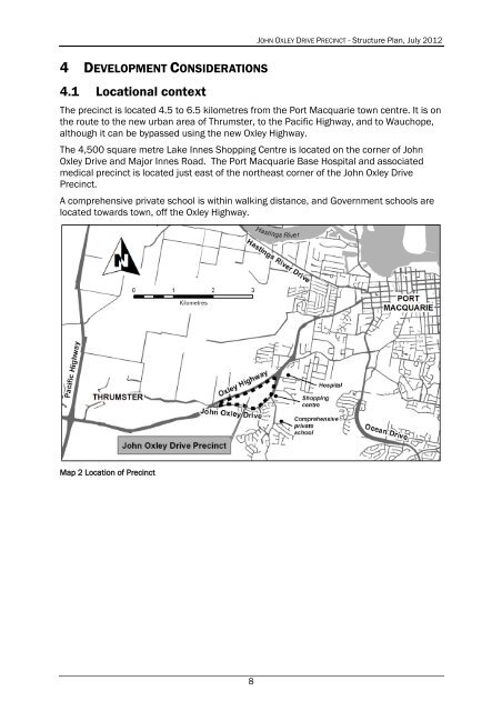
4.1 Locational context<br />
The precinct is located 4.5 to 6.5 kilometres from the Port Macquarie town centre. It is on<br />
the route to the new urban area of Thrumster, to the Pacific Highway, and to Wauchope,<br />
although it can be bypassed using the new <strong>Oxley</strong> Highway.<br />
The 4,500 square metre Lake Innes Shopping Centre is located on the corner of <strong>John</strong><br />
<strong>Oxley</strong> <strong>Drive</strong> and Major Innes Road. The Port Macquarie Base Hospital and associated<br />
medical precinct is located just east of the northeast corner of the <strong>John</strong> <strong>Oxley</strong> <strong>Drive</strong><br />
<strong>Precinct</strong>.<br />
A comprehensive private school is within walking distance, and Government schools are<br />
located towards town, off the <strong>Oxley</strong> Highway.<br />
Map 2 Location of <strong>Precinct</strong><br />
8