List of Annexes - ICPDR
List of Annexes - ICPDR
List of Annexes - ICPDR

You also want an ePaper? Increase the reach of your titles
YUMPU automatically turns print PDFs into web optimized ePapers that Google loves.
<strong>Annexes</strong><br />
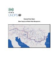
The Danube River Basin District<br />
River basin characteristics, impact <strong>of</strong> human activities and economic<br />
analysis required under Article 5, Annex II and Annex III, and<br />
inventory <strong>of</strong> protected areas required under Article 6, Annex IV<br />
<strong>of</strong> the EU Water Framework Directive (2000/60/EC)<br />
Part A – Basin-wide overview<br />
Short: “Danube Basin Analysis (WFD Ro<strong>of</strong> Report 2004)”
<strong>List</strong> <strong>of</strong> <strong>Annexes</strong><br />
ANNEX 1: <strong>List</strong> <strong>of</strong> rivers and lakes selected for the basin-wide overview <strong>of</strong> the Danube<br />
River Basin District<br />
ANNEX 2: Overview <strong>of</strong> river types in the Danube River Basin District<br />
ANNEX 3: Typology <strong>of</strong> the Danube River and its reference conditions<br />
ANNEX 4: Significant point sources <strong>of</strong> pollution in the Danube River Basin District<br />
ANNEX 5: Major Hydraulic Structures in the Danube River Basin District<br />
ANNEX 6: Future Infrastructure Projects affecting Hydromorphological Conditions in the<br />
Danube River Basin<br />
ANNEX 7: Alert thresholds for water pollution incidents in the framework <strong>of</strong> the<br />
international Danube Accident Emergency Warning System<br />
ANNEX 8: <strong>List</strong> <strong>of</strong> determinands and water quality classifications used in TNMN<br />
ANNEX 9: Interim scheme for water and sediment quality classification for TNMN<br />
purposes<br />
ANNEX 10: <strong>List</strong> <strong>of</strong> TNMN Monitoring Sites located on the Danube River and its tributaries<br />
ANNEX 11: Important Heavily Modified Surface Waters (Provisional Identification)<br />
ANNEX 12: <strong>List</strong> <strong>of</strong> nominated transboundary groundwater bodies and groups <strong>of</strong><br />
groundwater bodies<br />
ANNEX 13: Important Water-related Protected Areas for Species and Habitat Protection
ANNEX 1 <strong>List</strong> <strong>of</strong> rivers and lakes selected for the basin-wide overview <strong>of</strong> the<br />
Danube River Basin District<br />
This annex includes all rivers with a catchment size > 4 000 km², and all lakes and lagoons<br />
with a surface area > 100 km². These are all shown on the DRBD overview map (Map 1).<br />
Table 1 <strong>List</strong> <strong>of</strong> rivers selected for the basin-wide overview<br />
Name <strong>of</strong> river<br />
Size <strong>of</strong> river basin<br />
[km²]<br />
Countries<br />
(from source to mouth)<br />
Donau/Dunaj/Duna/Dunav/Dunărea 801,463 DE, CH, CZ, PL, SK, IT, AT,<br />
SI, HR, BA, CS, HU, RO,<br />
BG, AL, MK, MD, UA<br />
Lech 4,125 AT, DE<br />
Naab 5,530 CZ, DE<br />
Isar 8,964 AT, DE<br />
Inn 26,130 CH, IT, AT, DE<br />
Salzach 6,680 AT, DE<br />
Traun 4,257 AT<br />
Enns 6,185 AT<br />
Morava/March 26,658 CZ, SK, AT<br />
Dyje/Thaya 13,190 CZ, AT<br />
Svratka 4,117 CZ<br />
Raab/Rába 10,113 AT, HU<br />
Rabnitz/Rábca/Répce 4,825 AT, HU<br />
Váh 18,296 PL, SK<br />
Nitra 4,993 SK<br />
Hron 5,463 SK<br />
Ipel/Ipoly 5,108 SK, HU<br />
Sió 9216 HU<br />
Drau/Drava 41,238 IT, AT, SI, HR HU<br />
Mur/Mura 14,149 AT, SI, HR, HU<br />
Tysa/Tisza/Tisa 157,186 UA, RO, HU, SK, CS<br />
Bega/Begej 4,458 RO, CS<br />
Mureş/Maros 30,332 RO, HU<br />
Târnava 6,253 RO<br />
Körös 27,537 RO, HU<br />
Hortobágy-Berettyó 5,771 HU<br />
Kettős-Körös (Fekete+Fehér) 9,600 RO, HU<br />
Crişul Alb/Fehér-Körös 4,275 RO, HU<br />
Crişul Negru/Fekete-<br />
4,645 RO, HU<br />
Körös<br />
Barcău/Berettyó 5,812 RO, HU<br />
Crişul Repede/Sebes-<br />
9,119 RO, HU<br />
Körös<br />
Zagyva 5,578 HU<br />
Slaná/Sajó 12,708 SK, HU<br />
Hornád/Hernád 5,436 SK, HU<br />
Bodrog 13,579 UA, SK, HU<br />
Ondava 3,973 SK<br />
Latorica 7,680 SK, UA
Name <strong>of</strong> river<br />
Size <strong>of</strong> river basin<br />
[km²]<br />
Countries<br />
(from source to mouth)<br />
Someş/Szamos 18 146 RO, HU<br />
Someşul Mare 5,033 RO<br />
Someşul Mic 3,773 RO<br />
Zala (with Balaton) 5,752 HU<br />
Sava 95,719 HR, SI, BH, CS, AL<br />
Drina 19,483 AL, BH, CS<br />
Lim 5,785 AL, CS, BH<br />
Bosna 10,457 BH<br />
Vrbas 6,380 BH<br />
Una 9,368 HR, BH<br />
Kolpa/Kupa 10,236 SI, HR<br />
Timiş/Tamiš 10,147 RO, CS<br />
Velika Morava 37,444 MK, BG, CS<br />
Zapadna Morava 15,680 CS<br />
Ibar 7,925 CS<br />
Juzna Morava 15,400 MK, BG, CS<br />
Nišava 4,000 BG, CS<br />
Timok 4,630 CS, BG<br />
Jiu 10,080 RO<br />
Ogosta 4,268 BG<br />
Iskâr 8,684 BG<br />
Olt 24,050 RO<br />
Yantra 7,879 BG<br />
Vedea 5,430 RO<br />
Argeş 12,550 RO<br />
Ialomiţa 10,350 RO<br />
Seret/Siret 47,610 UA, RO<br />
Buzău 5,246 RO<br />
Barlad 7,220 RO<br />
Trotuş 4,456 RO<br />
Bistriţa 7,039 RO<br />
Moldova 4,200 RO<br />
Prut 27,540 UA, MD, RO<br />
Jijia 5,757 RO<br />
Ialpug 4,430 MD, UA<br />
Bold font: main tributaries to the Danube River, single indent: 2 nd order tributaries, double indent: 3 rd order<br />
tributaries, triple indent: 4 th order tributaries, quadruple indent: 5 th order tributaries<br />
Table 2 <strong>List</strong> <strong>of</strong> lakes and lagoons selected for the basin-wide overview<br />
Lakes and lagoons<br />
Surface area<br />
[km²]<br />
Mean depth<br />
[m]<br />
Neusiedler See / Fertő-tó 315 1,10 AT, HU<br />
Balaton 605 3,60 HU<br />
Ozero Ialpug 149 na UA<br />
Lacul Razim 392 2,05 RO<br />
Lacul Sinoe (lagoon) 162 1,25 RO<br />
Countries
ANNEX 2 Overview <strong>of</strong> river types in the Danube River Basin District<br />
This annex gives an overview for 11 countries <strong>of</strong> the Danube River Basin District.<br />
Country Code Name <strong>of</strong> river type<br />
Germany<br />
Austria<br />
DE_Typ 1<br />
DE_Typ 2<br />
DE_Typ 3<br />
DE_Typ 4<br />
DE_Typ 5<br />
DE_Typ 5.1<br />
DE_Typ 6<br />
DE_Typ 7<br />
DE_Typ 9<br />
DE_Typ 9.1<br />
DE_Typ 9.2<br />
DE_Typ 10<br />
DE_Typ 11<br />
DE_Typ 12<br />
DE_Typ 21<br />
AT_ST_Large<br />
Rivers_Danube_Type d-1,75<br />
AT_ST_Large<br />
Rivers_Danube_Type e-2,00<br />
AT_ST_Large<br />
Rivers_Thaya_Type d-1,75<br />
AT_ST_Large<br />
Rivers_Thaya_Type e-2,00<br />
AT_ST_Large<br />
Rivers_Morava_Type e-2,00<br />
AT_ ST_Large Rivers_Alpine<br />
River_Type c-1,50<br />
AT_ ST_Large Rivers_Alpine<br />
River_Type d-1,75<br />
watercourses <strong>of</strong> the Alps<br />
watercourses <strong>of</strong> the Alpine foothills<br />
watercourses <strong>of</strong> the young moraines <strong>of</strong> the Alpine foothills<br />
large watercourses <strong>of</strong> the Alpine foothills<br />
siliceous brooks <strong>of</strong> the highlands dominated by coarse sediments<br />
siliceous brooks <strong>of</strong> the highlands dominated by fine sediments<br />
calcareous brooks <strong>of</strong> the highlands dominated by fine sediments<br />
calcareous brooks <strong>of</strong> the highlands dominated by coarse sediments<br />
siliceous streams <strong>of</strong> the highlands dominated by fine to coarse sediments<br />
calcareous streams <strong>of</strong> the highlands dominated by fine to coarse<br />
sediments<br />
large streams <strong>of</strong> the highlands<br />
pebble-dominated rivers<br />
organic brooks<br />
organic streams<br />
watercourses characterised by lake outflow<br />
River Danube, Saprobiological Basic Condition = 1,75<br />
River Danube, Saprobiological Basic Condition = 2,00<br />
River Thaya Saprobiological Basic Condition = 1,75<br />
River Thaya Saprobiological Basic Condition = 2,00<br />
River Morava Saprobiological Basic Condition = 2,00<br />
Alpine Rivers (Mur, Drau, Salzach, Inn), Saprobiological Basic Condition =<br />
1,50<br />
Alpine Rivers (Mur, Drau, Salzach, Inn), Saprobiological Basic Condition =<br />
1,75<br />
AT_UZA_Type b-1,25 Non-glaciated Crystalline Alps, Saprobiological Basic Condition = 1,25<br />
AT_UZA_Type c-1,50 Non-glaciated Crystalline Alps, Saprobiological Basic Condition = 1,50<br />
AT_UZA_Type d-1,75 Non-glaciated Crystalline Alps, Saprobiological Basic Condition = 1,75<br />
AT_BR_Type c-1,50<br />
Ridges and Foothills <strong>of</strong> the Crystalline Alps, Saprobiological Basic<br />
Condition = 1,50<br />
AT_BR_type d-1,75<br />
Ridges and Foothills <strong>of</strong> the Crystalline Alps, Saprobiological Basic<br />
Condition = 1,75<br />
AT_KV_Type d-1,75 Limestone Foothills, Saprobiological Basic Condition = 1,75<br />
AT_KH_Type b-1,25 Limestone Alps, Saprobiological Basic Condition = 1,25<br />
AT_KH_Type c-1,50 Limestone Alps, Saprobiological Basic Condition = 1,50<br />
AT_AV_Type d-1,75 Bavarian Austrian Piedmont, Saprobiological Basic Condition = 1,75<br />
AT_FH_Type d-1,75 Eastern Ridges and Lowlands, Saprobiological Basic Condition = 1,50<br />
AT_GG_Type c-1,50<br />
AT_GG_Type d-1,75<br />
Granite and Gneiss Region <strong>of</strong> Bohemian Massif, Saprobiological Basic<br />
Condition = 1,50<br />
Granite and Gneiss Region <strong>of</strong> Bohemian Massif, Saprobiological Basic<br />
Condition = 1,75
2<br />
Country Code Name <strong>of</strong> river type<br />
Czech Republic<br />
Hungary<br />
CZ=Typ 1<br />
CZ=Typ 2<br />
CZ=Typ 3<br />
CZ=Typ 4<br />
CZ=Typ 5<br />
CZ=Typ 6<br />
CZ=Typ 7<br />
CZ=Typ 8<br />
CZ=Typ 9<br />
CZ=Typ 10<br />
CZ=Typ 11<br />
CZ=Typ 12<br />
CZ=Typ 13<br />
CZ=Typ 14<br />
CZ=Typ 15<br />
CZ=Typ 16<br />
CZ=Typ 17<br />
CZ=Typ 18<br />
CZ=Typ 24<br />
CZ=Typ26<br />
CZ=Typ 27<br />
CZ=Typ 32<br />
CZ=Typ 34<br />
CZ=Typ 35<br />
CZ=Typ 36<br />
CZ=Typ 37<br />
HU-Typ 1<br />
HU-Typ 2<br />
HU-Typ 3<br />
HU-Typ 4<br />
HU-Typ 5<br />
HU-Typ 6<br />
HU-Typ 7<br />
HU-Typ 8<br />
HU-Typ 9<br />
HU-Typ 10<br />
HU- Typ 11<br />
HU-Typ 12<br />
HU-Typ 13<br />
HU-Typ 14<br />
HU-Typ 15<br />
HU- Typ 16<br />
HU- Typ 17<br />
HU-Typ 18<br />
HU-Typ 19<br />
HU-Typ 20<br />
HU-Typ 21<br />
HU-Typ 22<br />
HU-Typ 23<br />
HU-Typ 24<br />
HU-Typ 25<br />
small, siliceous, Carpaticum, lowland streams<br />
greater, siliceous, Carpaticum, lowland streams<br />
great, siliceous, Carpaticum, lowland streams<br />
small, calcareous, Carpaticum, lowland streams<br />
greater, calcareous, Carpaticum, lowland streams<br />
small, siliceous, Carpaticum, foothill streams<br />
small, siliceous, Carpaticum, foothill streams<br />
small, calcareous, Carpaticum, foothill streams<br />
greater, siliceous, Carpaticum, foothill streams<br />
small, siliceous, Panonicum, lowland streams<br />
greatest, siliceous, Panonicum, lowland streams<br />
greater, siliceous, Panonicum, lowland streams<br />
great, siliceous, Panonicum, lowland streams<br />
small, calcareous, Panonicum, lowland streams<br />
greater, calcareous, Panonicum, lowland streams<br />
great, calcareous, Panonicum, lowland streams<br />
small, siliceous, Panonicum, foothill streams<br />
small, calcareous, Panonicum, foothill streams<br />
small, siliceous, Hercynium, lowland stream<br />
greater, siliceous, Hercynium, lowland stream<br />
great, siliceous, Hercynium, lowland streams<br />
small, siliceous, Hercynium, foothill streams<br />
greater, siliceous, Hercynium, foothill streams<br />
great siliceous, Hercynium, foothill streams<br />
small, calcareous, Hercynium, foothill streams<br />
greater, calcareous, Hercynium, foothill streams<br />
small siliceous mountainous stream dominated by coarse sediments<br />
small calcareous mountainous stream dominated by coarse sediments<br />
medium calcareous mountainous stream dominated by coarse sediments<br />
small calcareous hilly stream dominated by coarse sediments<br />
medium calcareous hilly stream dominated by coarse sediments<br />
large calcareous hilly stream dominated by coarse sediments<br />
very large calcareous hilly stream dominated by coarse sediments<br />
small calcareous hilly brook dominated by medium-fine sediments<br />
medium calcerous hilly stream dominated by medium-fine sediments<br />
large calcareous hilly stream dominated by medium-fine sediments<br />
small calcareous lowland stream dominated by coarse sediments<br />
medium calcareous lowland stream dominated by coarse sediments<br />
large calcareous lowland stream dominated by coarse sediments<br />
very large calcareous lowland stream dominated by coarse sediments<br />
small calcareous lowland brook dominated by medium-fine sediments<br />
small with low slope calcerous lowland stream dominated by medium-fine<br />
sediments<br />
medium with low slope calcerous lowland stream dominated by medium-fine<br />
sediments<br />
medium calcareous lowland stream dominated by medium-fine sediments<br />
large calcareous lowland streams dominated by medium-fine sediments<br />
very large calcareous lowland stream dominated by medium-fine sediments<br />
small organic lowland brook<br />
medium organic lowland stream<br />
Danube upstream from Gönyü<br />
Danube between Gönyü and Baja<br />
Danube downstream from Baja
3<br />
Country Code Name <strong>of</strong> river type<br />
Slovakia<br />
Slovenia<br />
SK_Typ1<br />
SK_Typ2<br />
SK_Typ3<br />
SK_Typ4<br />
SK_Typ5<br />
SK_Typ6<br />
SK_Typ7<br />
SK_Typ8<br />
SK_Typ9<br />
SK_Typ10<br />
SK_Typ11<br />
SK_Typ12<br />
SK_Typ17<br />
SK_Typ18<br />
SK_Typ19<br />
SK_Typ20<br />
SK_Typ21<br />
SK_Typ22<br />
SK_Typ23<br />
SK_Section Type 1<br />
SK_Section Type 2<br />
SK_M1<br />
SK_V1<br />
SK_V2<br />
SK_V3<br />
SK_H1<br />
SK_I1<br />
SK_R1<br />
SK_R2<br />
SK_S1<br />
SK_B1<br />
SK_B2<br />
SI_Typ A1<br />
SI_Typ A2<br />
SI_Typ A3<br />
SI-Typ D1<br />
SI-Typ H1<br />
SI-Typ H2<br />
SI-Typ H3<br />
SI-Typ H4<br />
SI-Typ H5<br />
Lowland rivers located in the Danubian area <strong>of</strong> Carpathian region with<br />
predominant siliceous rocks.<br />
Mid-altitude rivers located in the Danubian area <strong>of</strong> Carpathian region with<br />
predominant siliceous rocks.<br />
High-altitude rivers located in the Danubian area <strong>of</strong> Carpathian region with<br />
predominant siliceous rocks.<br />
Mid-altitude rivers located in the Danubian area <strong>of</strong> Carpathian region with<br />
predominant calcareous rocks.<br />
Mid-altitude rivers located in the Danubian area <strong>of</strong> Carpathian region with<br />
predominant siliceous rocks <strong>of</strong> neovolcanics.<br />
High-altitude rivers located in the Danubian area <strong>of</strong> Carpathian region with<br />
predominant siliceous rocks <strong>of</strong> neovolcanics.<br />
Mid-altitude rivers located in the Upper Vah area, in the Carpathian region, with<br />
predominant siliceous rocks.<br />
High-altitude rivers located in the Upper Vah area, in the Carpathian region,<br />
predominant are siliceous rocks.<br />
Rivers located in the Upper Vah area in Carpathian region, with predominant<br />
siliceous rocks and altitude above 1500 m.<br />
High-altitude rivers located in the Upper Vah area in the Carpathian region,<br />
with predominant calcareous rocks.<br />
Rivers located in the Danubian area <strong>of</strong> Hungarian lowlands with predominant<br />
siliceous rocks.<br />
Rivers located in the Danubian area <strong>of</strong> Hungarian lowlands, with predominant<br />
siliceous rocks and altitude 200-500m.<br />
Mid-altitude rivers located in the Slana section <strong>of</strong> Carpathian ecoregion with<br />
predominant siliceous rocks.<br />
High-altitude rivers located in the Slana section <strong>of</strong> Carpathian ecoregion with<br />
predominant siliceous rocks.<br />
Mid-altitude rivers located in the Slana section in Carpathian ecoregion with<br />
predominant calcareous rocks.<br />
Mid-altitude rivers located in the Slana section in Carpathian ecoregion with<br />
predominant siliceous rocks <strong>of</strong> neovolcanics.<br />
Mid-altitude rivers located in the Latorica section in Carpathian ecoregion, with<br />
predominant siliceous rocks.<br />
Mid-altitude rivers located in the Latorica section in Carpathian ecoregion, with<br />
predominant siliceous rocks <strong>of</strong> neovolcanics.<br />
Rivers located in the Latorica section in Hungarian lowlands with predominant<br />
siliceous rocks.<br />
Lower Alpine Foothills Danube<br />
Hungarian Danube Bend<br />
Lower part <strong>of</strong> Morava River<br />
Upper part <strong>of</strong> Vah River; Orava and Turiec rivers<br />
Middle part <strong>of</strong> Vah River<br />
Lower part <strong>of</strong> Vah and Nitra rivers<br />
Lower part <strong>of</strong> Hornad River<br />
Lower part <strong>of</strong> Ipel River<br />
Middle part <strong>of</strong> Hron River<br />
Lower part <strong>of</strong> Hron River<br />
Lower part <strong>of</strong> Slana River<br />
Middle part <strong>of</strong> Ondava, Topla and Laborec rivers<br />
Slovak part <strong>of</strong> Latorica and Bodrog rivers; lower part <strong>of</strong> Ondava, Topla and<br />
Laborec rivers<br />
small alpine & hilly river<br />
small to medium alpine & hilly intermittent river<br />
small to medium alpine & hilly river<br />
medium Dinaric & hilly river<br />
large Pannonian & hilly siliceous river<br />
large Pannonian & lowland siliceous river<br />
medium Pannonian & hilly river<br />
medium Pannonian & lowland river<br />
large Pannonian & lowland river
4<br />
Country Code Name <strong>of</strong> river type<br />
Croatia<br />
Romania<br />
HR_Section Type 6<br />
Pannonian Plain Danube<br />
HR_Type 1 Metapotamal river part (low concentration <strong>of</strong> CaCO 3)<br />
HR_Type 2 Epipotamal part <strong>of</strong> river (low concentration <strong>of</strong> CaCO 3)<br />
HR_Type 3<br />
Undefined potamal river part*<br />
HR_Type 4 Lower metapotamal river part (medium concentration <strong>of</strong> CaCO 3)<br />
HR_Type 5 Upper metapotamal river part (medium concentration <strong>of</strong> CaCO 3)<br />
HR_Type 6 Epipotamal river part (medium concentration <strong>of</strong> CaCO 3)<br />
HR_Type 7 Metapotamal river part (higher concentration <strong>of</strong> CaCO 3)<br />
HR_Type 8 Undefined potamal river part (very high concentration <strong>of</strong> CaCO 3)<br />
HR_Type 9<br />
HR_Type 10<br />
HR_Type 11<br />
Hyporhitral river part<br />
Karst river<br />
Crenal stream<br />
RO_01 Mountain stream - Ecoregion 10<br />
RO_02 Stream in piedmont or high plateau area -Ecoregion 10<br />
RO_03<br />
Stream sector in piedmont or high plateau area--Thymallus thymallus-grayling,<br />
Chondrostoma nasus-nase - Ecoregion 10<br />
Stream sector in piedmont or high plateau area-Romanichys valsanicolaendemic<br />
RO_03<br />
٭ species - Ecoregion 10<br />
RO_04 Stream sector in hilly or plateau area - Ecoregion 10<br />
RO_05 Stream sectors in intramountain depression - Ecoregion 10<br />
RO_06 Stream sector with wetlands in hilly or plateau area - Ecoregion 10<br />
RO_07 Stream in hilly or plateau area -Sub-Ecoregion 10<br />
RO_08 Stream sector in hilly or plateau area –Sub-Ecoregion 10<br />
RO_09 Stream in hilly or plateau area - Ecoregion 11<br />
RO_10 Stream in plain area - Ecoregion 11<br />
RO_11 Stream sector in plain area (1000 - 3000 km 2 ) - Ecoregion 11<br />
RO_12<br />
Stream sector in plain area ( > 3000 km 2 ) - Ecoregion11<br />
RO_13 Stream sector with wetlands in plain area- Ecoregion 11<br />
RO_14 Stream in hilly or plateau area - Ecoregion 12<br />
RO_15 Stream in plain area - Ecoregion 12<br />
RO_16 Stream sector in plain area (1000 - 5000km 2 ) - Ecoregion 12<br />
RO_17 Stream sector in plain area (> 5000 km 2 )- Ecoregion 12<br />
RO_18 Stream sector with wetlands in plain area - Ecoregion 12<br />
RO_19/Section type 6 The Danube river –Iron Gate Danube - Ecoregion 12<br />
RO_20/Section type 7 The Danube river – Romanian Plain Danube - Ecoregion 12<br />
RO_21/Section type 8 The Danube river –Eastern Wallachian Danube - Ecoregion 12<br />
RO_22/Section type 9 The Danube river - The Danube Delta - Ecoregion 12<br />
RO_23 Stream in hilly or plateau area - Ecoregion 16<br />
RO_24 Stream in plain area - Ecoregion 16<br />
RO_25<br />
Stream sector with wetlands in plain area (1000 – 5000 km 2 ) - Ecoregion16<br />
RO_26 Stream sector in plain area - Ecoregion 16<br />
RO_27 Stream sector with wetlands in plain area (> 5000 km 2 ) - Ecoregion 16<br />
RO_28<br />
Stream influenced from qualitative point <strong>of</strong> view by natural causes<br />
RO_29<br />
Temporary stream in mountain area<br />
RO_30<br />
Temporary stream in piedmont or high plateau area<br />
RO_31<br />
Temporary stream in hilly and plateau area<br />
RO_32<br />
Temporary stream in plain area
5<br />
Country Code Name <strong>of</strong> river type<br />
Serbia and Montenegro<br />
Bulgaria<br />
CS_Typ1.1<br />
Very large rivers, lowland, siliceous, fine sediments<br />
CS_Typ1.2<br />
Very large rivers, lowland, siliceous, medium sediments<br />
CS_Typ1.3<br />
Very large rivers, hilly, siliceous, medium sediments<br />
CS_Typ1.4<br />
Large, lowland, siliceous, medium sediments<br />
CS_Typ1.5<br />
Large, hilly, calcareous, medium sediments<br />
CS_Typ1.6<br />
Large, hilly, siliceous, medium sediments<br />
CS_Typ1.7<br />
Large, mid-altitude, siliceous, medium sediments<br />
CS_Typ1.8<br />
Large, high-altitude, siliceous, medium sediments<br />
CS_Typ2<br />
Medium rivers, lowland, siliceous, fine sediments<br />
CS_Typ3<br />
Medium rivers, lowland, siliceous, coarse sediments<br />
CS_Typ4<br />
Small rivers and streams, lowland, siliceous, fine sediments<br />
CS_Typ5<br />
Small rivers and streams, lowland, siliceous, coarse sediments<br />
CS_Typ6<br />
Streams, lowland, organic, silt<br />
CS_Typ7<br />
Small rivers and streams, hilly, siliceous, fine sediments<br />
CS_Typ8<br />
Small rivers and streams, hilly, siliceous, coarse sediments<br />
CS_Typ9<br />
Small rivers and streams, hilly, calcareous, fine sediments<br />
CS_Typ10<br />
Small rivers and streams, hilly, calcareous, coarse sediments<br />
CS_Typ11<br />
Small rivers and streams, mid-altitude, siliceous, coarse sediments<br />
CS_Typ12<br />
Small rivers and streams, mid-altitude, calcareous, coarse sediments<br />
CS_Typ13<br />
Small rivers, high-altitude, siliceous, coarse sediments<br />
CS_Typ14<br />
Streams, high-altitude, siliceous, coarse sediments<br />
CS_Typ15<br />
Small rivers, high-altitude, calcareous, coarse sediments<br />
CS_Typ16<br />
Streams, high-altitude, calcareous, coarse sediments<br />
CS_Typ17<br />
Streams, high-altitude, organic, silt and sand<br />
BG-TypR1<br />
small, foothill, siliceous, Ecoregion-12<br />
BG-TypR2 small, foothill, siliceous, Ecoregion -7<br />
BG-TypR3 small, mountain, siliceous, Ecoregion -7<br />
BG-TypR4 middle, plain, siliceous, Ecoregion -12<br />
BG-TypR5 middle, plain, calcareous, Ecoregion -12<br />
BG-TypR6 middle, foothill, siliceous, Ecoregion -12<br />
BG-TypR7 middle, foothill, siliceous, Ecoregion -7<br />
BG-TypR8 middle, foothill, calcareous, Ecoregion -12<br />
BG-TypR9 middle, foothill, calcareous, Ecoregion -7<br />
BG-TypR10 middle, foothill, organic, Ecoregion -7<br />
BG-TypR11 middle, mountain, siliceous, Ecoregion -7<br />
BG-TypR12 middle, mountain, calcareous, Ecoregion -7<br />
BG-TypR13 large, plain, siliceous, Ecoregion -12<br />
BG-TypR14 large, plain, calcareous, Ecoregion -12<br />
BG-TypR15 large, foothill, siliceous, Ecoregion -12<br />
BG-TypR16 large, foothill, siliceous, Ecoregion -7<br />
BG-TypR17 large, foothill, calcareous, Ecoregion -12<br />
BG-TypR18 large, foothill, calcareous, Ecoregion -7<br />
BG-TypR19 large, foothill, organic Ecoregion -7<br />
BG-TypR20 large, foothill, siliceous, Ecoregion -7<br />
BG-TypR21 large, foothill, calcareous, Ecoregion -7<br />
BG-TypR22 very large, plain, siliceous, Ecoregion -12<br />
BG-TypR23 middle, mountain, organic, Ecoregion -7<br />
Moldova<br />
RO_26/MD_02<br />
RO_27/MD_03<br />
RO_18/MD_06<br />
stream sector in plain area<br />
stream sector with wetlands in plain area<br />
stream sector with wetlands in plain area
ANNEX 3 Typology <strong>of</strong> the Danube River and its reference conditions<br />
1. Brief characterisation <strong>of</strong> the abiotic characteristics <strong>of</strong> the Danube section types<br />
Section Type 1: Upper course <strong>of</strong> the Danube<br />
(rkm 2786: confluence <strong>of</strong> Brigach and Breg – rkm 2581: Neu Ulm)<br />
Canyon reaches alternate with plain floodplain sections dominating at the right. Channel form is<br />
sinuous to meandering and braided. The slope varies between 0.75 ‰ and 1.38 ‰.<br />
The main channel substrates are composed <strong>of</strong> bedrock, head-sized boulders with a variable percentage<br />
<strong>of</strong> cobble, gravel and sand. In the floodplain section (with more than 300 m width) riffle and pool<br />
sections vary moderately. The bank structure is abort and sliding.<br />
Due to the karst landscape the highly dynamic discharge regime is characterised by water exfiltration<br />
at section Immendingen to Möhringen and sporadically until Fridingen (MNQ 3 m 3 /s; MQ 7-8 m 3 /s;<br />
MHQ approx. 20 m 3 /s). In case <strong>of</strong> total exfiltration the loss <strong>of</strong> water is substituted by tributaries and<br />
springs.<br />
The hydrological regime is characterised by a high water level in February and March and a low water<br />
level between August and September.<br />
The river shows a high percentage <strong>of</strong> eupotamon with primarily lotic side arms on the right side <strong>of</strong> the<br />
floodplain section.<br />
Section Type 2: Western Alpine Foothills Danube<br />
(rkm 2581: Neu Ulm – rkm 2225: Passau)<br />
In this section the Danube shows an anabranching channel form (more than 65 percent) interspersed<br />
with a meandering morphology. Trough valley reaches alternate with meandering valley sections. A<br />
highly dynamic breadth erosion causes varying widths <strong>of</strong> the channels and shallow water depths.<br />
Gorge sections are at Steppberg (km 2486 - 2478) and the Weltenburger Enge (km 2422 - 2414).<br />
The channel substrates are dominated by cobbles, gravel or sand. Sporadically a mixture <strong>of</strong> sand and<br />
gravel is present.<br />
The slope varies between 1.1 ‰ at Ulm and 0.3 ‰ at Regensburg.<br />
The river shows a high percentage <strong>of</strong> eupotamon. The anabranching reaches are characterised by<br />
numerous side channels providing predominantly lotic habitats. Due to highly dynamic channel<br />
routing the in-channel islands are naturally unvegetated or covered by annuals.<br />
The floodplain vegetation consists <strong>of</strong> alluvial s<strong>of</strong>twood and hardwood forests and wetlands (mires and<br />
swamps).<br />
Section Type 3: Eastern Alpine Foothills Danube<br />
(rkm 2225: Passau – rkm 2001: Krems)<br />
This section type is composed <strong>of</strong> two main parts: the breakthrough section “Oberes<br />
Donautal“ (km 2225 - 2160) and the anabranching stretch “Austrian Machland region“ (km 2094 -<br />
2084).<br />
The breakthrough section is characterised by a steep, narrow incised meander valley that confines the<br />
lateral development <strong>of</strong> the river channel. Bedrocks interspersed with gravel are the dominant channel<br />
substrates.<br />
Four short river reaches with chutes formed by outcropping bedrocks (Kachlets) are present. Such<br />
reaches feature high flow velocities and complex flow patterns. Gravel areas which fall dry in times <strong>of</strong><br />
extreme low water amount to 5 ha per km.<br />
The average slope value for this section is 0.43 ‰.<br />
The channel system <strong>of</strong> the Machland stretch is branched by several islands and gravel bars. This reach<br />
can be designated as a gravel-dominated, laterally active anabranching section. The sinuosity <strong>of</strong> the<br />
main channel is 1.32, its mean width amounted to 550 m at low flow and 730 m at summer mean<br />
water, and mean depth could reach 3.8 m along the thalweg.<br />
Danube discharge is mainly influenced by alpine flow conditions and peaks in spring/summer due to<br />
the snowmelt in the Alps. Shallow-water zones with gentle bed gradients are a formative element. This<br />
enables a high diversity <strong>of</strong> depths, flow velocities and substrate conditions, resulting in a broad<br />
spectrum <strong>of</strong> micro- and meso-habitats with extensive shorelines.
The gravel banks/islands and highly outcropping rocks in the breakthrough area <strong>of</strong>fer a lotic<br />
environment almost throughout the whole reach. Most tributaries discharge into the Danube River at<br />
locations with large gravel bars and therefore provide valuable spawning habitats for rheophilic fish<br />
species. The backwaters <strong>of</strong>fer interesting refuge habitats during floods and special lentic habitats for<br />
stagnophilic species.<br />
In the anabranching stretch the river-floodplain system is characterised by eupotamon water bodies<br />
(main channel and side arms) to a very high extend, <strong>of</strong>fering a primarily lotic environment (97 percent<br />
<strong>of</strong> the overall water surface area at low flow). Para-, plesio- and palaeopotamon water bodies are less<br />
frequent in relation to eupotamon ones. They represent a great variety <strong>of</strong> distinct lentic habitats and<br />
contribute to the high extend <strong>of</strong> aquatic/terrestrial interfaces. The various floodplain elements are in<br />
constant modification and renewal due to the strong erosion/sedimentation processes.<br />
Section Type 4: Lower Alpine Foothills Danube<br />
(rkm 2001: Krems – rkm 1789.5: Gönyű / Kližská Nemá)<br />
The section type represents the beginning <strong>of</strong> lowland reaches with meandering, anabranching and<br />
braided channels exceptive two small breakthrough valleys at the Vienna Gate (km 1949 - 1935) and<br />
Devin Gate (km 1880). Anabranching reaches are situated in the Vienna Basin and the Danube<br />
Lowland downstream Bratislava. Here, the Danube forms an inland delta with three main river<br />
branches <strong>of</strong> braided or anastomosing-meandering character: the Great Danube branch (middle), Malý<br />
(Little/Lesser) Danube (north, km 1869 - 1768), Mosoni Danube (south, up to Gönyü km 1791). These<br />
branches form a large accumulation zone composed by the Danubian islands: Large Danube Island<br />
“Zitný ostrov“ (on the north side) and Little Danube Island “Szigetköz“ (on the south side). Low<br />
current velocities and high groundwater levels generate a large wetland area. Some <strong>of</strong> the branches are<br />
only active during floods. The slope value decreases from 0.35 ‰ to 0.10 ‰ at Gönyü.<br />
The dominant main channel substrates are represented by large cobbles and gravel in the breakthrough<br />
sections, and medium to coarse gravel layered by sands and loam in the accumulation zone <strong>of</strong> the<br />
Danube Lowland. The gravel bed near Bratislava is characterised by rapid rates <strong>of</strong> lateral erosion and<br />
an extensive area <strong>of</strong> point bars and gravel bars. These bars are partially covered by incipient and older<br />
woodlands.<br />
The active floodplain varies between 10 km upstream and downstream Vienna to 6 km upstream Váh.<br />
The floodplain area <strong>of</strong> the inland delta (Schütt/Ostrov) amounts to more than 20,000 ha and is covered<br />
by one <strong>of</strong> the largest floodplain forests in central and south-eastern Europe. It represents the habitat <strong>of</strong><br />
numerous macrophyte communities, humid willow-poplar forests, ash-elm stands and drier elm-oak<br />
formations.<br />
The breakthrough reaches show primarily lotic environments composed <strong>of</strong> gravel banks and islands.<br />
Backwater sections form lentic habitats during floods for stagnophilic species.<br />
In the anabranching reaches former braided segments that became disconnected from the main channel,<br />
and old meanders or similar forms resulting from another morphological type without direct<br />
connection to the main channel are frequent.<br />
Section Type 5: Hungarian Danube Bend<br />
(rkm 1789.5: Gönyű / Kližská Nemá – rkm 1497: Baja)<br />
In this section the Danube passes breakthrough sections (the Danube bend) and lowland areas<br />
(Hungarian plain), and changes its watercourse from eastward to southward. In the lowland area the<br />
Danube flows in a plain floodplain valley and shows high anabranching (mainly cut-<strong>of</strong>f loops)<br />
intensity (35 to 65 percent) or meandering (>1.26 sinuosity degree).<br />
The dominant main channel substrate consists <strong>of</strong> gravel in different sizes (from coarse gravel to fine<br />
and medium sized gravel), frequently interspersed with sand and hand sized cobbles, organic sludge,<br />
mud, silt and clay in small percentages. In the breakthrough section coarse blocks with variable<br />
percentages <strong>of</strong> cobble and sand are present.<br />
The average slope value varies between 0.10 ‰ at Gönyü and 0.17 ‰ to 0.07 ‰ in the Hungarian<br />
bend.<br />
The average width <strong>of</strong> the main channel amounts to 350 m; the mean depth is 4 to 5 m. The main<br />
channel shows moderate breadth erosion. This section is characterised by a mean current velocity <strong>of</strong><br />
0.5 m/s.
After passing the breakthrough section (Danube bend) the Danube forms two important isles:<br />
Szentendre (km 1692 - 1657) and Csepel (km 1642 - 1586).<br />
The bank structure is variable with multiple sliding banks, isolated fallen trees, wood collections and<br />
spur banks.<br />
The floodplain is between 300 m (upstream Budapest) and 1500 m (downstream Budapest) wide.<br />
Lotic side arms and dead arms, cut <strong>of</strong>f channels and oxbow lakes, temporary side arms and standing<br />
water bodies fed by the tributaries are present in the floodplain.<br />
The floodplain vegetation is represented by a dominant alluvial s<strong>of</strong>twood forest. Isolated alluvial<br />
hardwood forests and mixed native forests are also present.<br />
The dominant aquatic habitat in this section is the eupotamon which has a mean width <strong>of</strong> 500 m. Less<br />
than 10 percent parapotamon, plesiopotamon and palaeopotamon types are present. The percent area<br />
<strong>of</strong> terrestrial habitats (e.g. banks, islands) makes up approx. 10 percent <strong>of</strong> the entire eupotamon.<br />
Biotic microhabitats are frequently formed by living parts <strong>of</strong> terrestrial plants and tree trunks, rarely<br />
accompanied by macrophytes, submerged plants, CPOM, FPOM and debris.<br />
Section Type 6: Pannonian Plain Danube<br />
(rkm 1497 : Baja – rkm 1075 : Bazias)<br />
The Danube in this section is passing through a floodplain landscape with areas <strong>of</strong> accumulation,<br />
having a meandering and plain floodplain valley with an anabranching channel (mainly cut-<strong>of</strong>f loops)<br />
and meandering sections (degree <strong>of</strong> sinuosity: 1.06 – 1.25 and partially more than 2).<br />
A moderate breadth erosion is present in the main channel (average width: approx. 750 m, mean depth:<br />
6 m). The main channel substrates are dominated by sand, and frequently fine to medium-sized gravel<br />
occurs. Mud, sludge, silt, loam, and clay are rare. The average slope value remains 0.04 ‰, varying<br />
between Baja and Drava from 0.07 ‰ to 0.05 ‰.<br />
Wood and fallen trees are frequently present on the river bank, the structure is partially sliding.<br />
The large floodplain (max. width: 30 km) is characterised by a diversity <strong>of</strong> water bodies close to the<br />
stream: lotic side arms and dead arms, cut <strong>of</strong>f channels, oxbow lakes and standing water bodies fed by<br />
the tributaries. Alluvial hardwood and s<strong>of</strong>twood forests are dominant. Mixed native forests represent<br />
the frequent vegetation types in the floodplain. The vegetation in few sections is sporadically<br />
composed by meadow, wetland (mire) and reeds.<br />
In the lower reach <strong>of</strong> this Danube-section (Croatia/Serbia and Montenegro) the largest tributaries<br />
(Tisza and Sava) substantially increase the catchment area and changes the alpine run<strong>of</strong>f character <strong>of</strong><br />
the Danube.<br />
The average current velocity in this section is 0.4 m/s.<br />
The dominant aquatic habitat in this section is the eupotamon, frequently accompanied by para- and<br />
palaeopotamon. The percent area <strong>of</strong> terrestrial habitats (e.g. banks, islands) represents approx.<br />
20 percent <strong>of</strong> the entire eupotamon.<br />
The biotic microhabitats are frequently represented by debris, CPOM, FPOM and sludge. Less than<br />
30 percent submerged plants, filamentous algae, macrophytes, living parts <strong>of</strong> terrestrial plants as well<br />
as dead wood (tree trunks) are present.<br />
Section Type 7: Iron Gate Danube<br />
(rkm 1075: Bazias – rkm 943: Turnu Severin)<br />
Djerdap/Iron Gates canyon is composed <strong>of</strong> four canyons (necks) and three extensions.<br />
The braided channel is mostly rocky and shows areas with deposits <strong>of</strong> medium and small particles <strong>of</strong><br />
alluvial materials (banks and islands). The main channel has an average width <strong>of</strong> about 750 m and runs<br />
in a canyon or trough valley form. Its mean depth amounts to approx. 5.5 m. Slope values range from<br />
0.04 ‰ to above 0.25 ‰.<br />
The dominant main channel substrates are represented by large cobbles, boulders and bedrocks<br />
(numerous rocks are situated directly under the water surface), and frequent coarse, medium and<br />
partial fine gravel interspersed with sand and mud in the slow-flowing parts.<br />
The river bank is isolated abort and sliding, and fallen trees and wood collections are frequently<br />
present. The breadth erosion is moderate. Spur banks are present. The section is characterised by high<br />
current velocity (1.8 up to 5 m/s) and by longitudinal erosion. Shallow-water zones with gentle bed<br />
gradients are dominant. This enables a high diversity <strong>of</strong> depth, flow velocity and substrate condition.
The flooded area is reduced to an average width <strong>of</strong> about 150 m. Temporarily flooded areas (mostly to<br />
the outflow <strong>of</strong> the Nera tributary) are present in the floodplain as well as deciduous native forest along<br />
with the hardwood alluvial forest and meadow.<br />
The potamon <strong>of</strong>fers a primarily lotic environment. The area <strong>of</strong> terrestrial habitats represents only<br />
10 percent <strong>of</strong> the entire eupotamon area. Living parts <strong>of</strong> terrestrial plants, FPOM and debris are rare.<br />
Section Type 8: Western Pontic Danube<br />
(rkm 943: Turnu Severin – rkm 375.5: Chiciu/Silistra)<br />
The Danube is passing a floodplain landscape with higher plains <strong>of</strong> terraced accumulation in a<br />
meander and plain floodplain valley. The right bank is high and steep, the left bank is low and terraced<br />
with wide floodplains.<br />
The channel is partially braided with bars and islands and partially anabranching (mainly cut-<strong>of</strong>f<br />
loops). Meandering reaches are also present (degree <strong>of</strong> sinuosity 1.06-1.25). The main channel has<br />
moderate breadth erosion (average width <strong>of</strong> 830 m and mean depth <strong>of</strong> 8.5 m). Main channel substrates<br />
frequently vary from fine and medium gravel to sand accompanied by small percentages <strong>of</strong> coarse<br />
gravel and mud. The average slope values remains 0.04 ‰.<br />
Multiple wood collections and isolated fallen trees are present on the river banks. Their structure<br />
varies: abort and sliding banks are present as well as bank spurs and nest banks. This section is<br />
characterised by moderate values <strong>of</strong> current velocity (1.30 m/s).<br />
The average width <strong>of</strong> the floodplain is about 8000 m and the diversity <strong>of</strong> water bodies in this area<br />
close to the stream is large: lotic side arms connected to the main channel at both ends, cut <strong>of</strong>f<br />
channels, oxbow lakes and standing water bodies fed by the tributaries.<br />
Deciduous native forest, wetlands (mire) and open grass is the dominant vegetation in the floodplain,<br />
<strong>of</strong>ten accompanied by alluvial s<strong>of</strong>t wood forest, meadow and reeds. Sporadically the vegetation is<br />
missing.<br />
Average width <strong>of</strong> the eupotamon is 1500 m. The area <strong>of</strong> terrestrial habitats represents 75 % <strong>of</strong> the<br />
entire eupotamon.<br />
The biotic microhabitats are frequently represented by filamentous algae and macrophytes as well as<br />
CPOM and debris. In less than 30 percent living parts <strong>of</strong> terrestrial plants and FPOM are present.<br />
Section Type 9: Eastern Wallachian Danube<br />
(rkm 375.5: Chiciu/Silistra – rkm 100: Isaccea)<br />
The Danube changes its watercourse northward forming a wetland area with two large isles (374-<br />
248 km Balta Ialomita and 238-169 km Balta Braila) and many natural lakes. The valley form is a<br />
meander and plain floodplain valley with a braided channel (mostly long and narrow islands),<br />
composite anabranching channel and meandering sections (>1.26 <strong>of</strong> sinuosity degree).<br />
The main channel has an average width <strong>of</strong> 650 m, a mean depth <strong>of</strong> 10.5 m and shows moderate<br />
breadth erosion. The dominant channel substrate is sand, frequently interspersed with mud, organic<br />
sludge, silt, loam and clay. In small percentages gravel is present in fine to medium size.<br />
The bank structure is variable with multiple abort and nesting banks and bank spurs. Fallen trees and<br />
sliding banks are sporadically present.<br />
The floodplain has an average width <strong>of</strong> 5500 m. Lotic side arms and dead arms, cut <strong>of</strong>f channels and<br />
oxbow lakes, temporary side arms and standing water bodies fed by the tributaries form the water<br />
bodies in the floodplain. The average slope value remains 0.04 ‰. The section is characterised by<br />
slow current velocity (0.8 m/s).<br />
More then 60 percent <strong>of</strong> the floodplain vegetation is represented by deciduous native forest, wetland<br />
(mire) and open grass frequently accompanied by alluvial s<strong>of</strong>twood forest, meadows and reeds.<br />
Isolated mixed native forest and naturally unvegetated areas are present.<br />
Eupotamon is the dominant aquatic habitat type and shows an average width <strong>of</strong> 1000 m. The percent<br />
area <strong>of</strong> terrestrial habitats amounts to 60 percent <strong>of</strong> the entire eupotamon. Parapotamon,<br />
plesiopotamon and the palaeopotamon types are frequently present.<br />
The FPOM is the dominant biotic microhabitat in this section, frequently accompanied by<br />
macrophytes, living parts <strong>of</strong> terrestrial plants, CPOM and debris. Tree trunks, branches and roots are<br />
rarely present.
Section Type 10: Danube Delta<br />
(rkm 100: Isaccea – rkm 20 on Chilia arm, rkm 19 on Sulina arm and rkm 7 on Sf. Gheorghe arm)<br />
The Danube Delta is Danube’s “youngest” territory having three main water channels: Chilia/Kilia,<br />
Sulina and Sf. Gheorghe, and numerous canals and floating islands (“plauri”). Close to the estuary the<br />
three main branches are divided into numerous branches creating their own delta. At mean water<br />
levels 60 percent <strong>of</strong> this area is covered by waters (90 percent at high levels). The shape <strong>of</strong> the delta is<br />
triangular. A large variety <strong>of</strong> distinct lentic habitats is developed.<br />
The valley form is plain floodplain and the channel form is diverse due to the complexity <strong>of</strong> the delta:<br />
braided channel (braiding intensity 65 percent); split, sinuous and composite anabranching;<br />
meandering channel (degree <strong>of</strong> sinuosity >1.26). The average width <strong>of</strong> the main channels is 450 m at<br />
Chilia/Kilia, 400 m at Sulina and 450 m at Sf. Gheorghe. The mean depth <strong>of</strong> the three branches<br />
amounts to 13 m. Slope values vary between 0.04 ‰ and 0.001 ‰.<br />
The dominant substrates are sand, mud, sludge, silt, loam and clay.<br />
Multiple wood collections are present on the river bank; fallen trees are sporadic. At several reaches<br />
the bank structure is abort. Lotic side arms and dead arms, cut <strong>of</strong>f channels and oxbow lakes,<br />
temporary side arms and standing water bodies fed by the tributaries constitute water bodies in the<br />
floodplain. The average width <strong>of</strong> the floodplain is about 100 km.<br />
This section is characterised by a medium current velocity <strong>of</strong> 0.7 m/s (Chilia/Kilia 0.7 m/s, Sulina<br />
0.65 m/s, Sf. Gheorghe 0.68 m/s). Accumulations <strong>of</strong> sediment produce progression <strong>of</strong> the delta which<br />
is permanently shaped by maritime currents.<br />
The vegetation in this area is very complex, wetlands (mire) and reeds are dominant. Alluvial<br />
hardwood forest, deciduous native forest and open grass land are frequently present. Alluvial s<strong>of</strong>twood<br />
forest, mixed native forest, meadow and naturally unvegetated areas are rare.<br />
The percent area <strong>of</strong> terrestrial habitats represents 40 percent <strong>of</strong> the entire eupotamon. Para-, plesioand<br />
palaeopotamon show equal shares.<br />
Living parts <strong>of</strong> terrestrial plants, FPOM and debris as biotic microhabitats are rare.<br />
2. Reference conditions <strong>of</strong> the Danube River (biological elements)<br />
The reference conditions <strong>of</strong> the Danube River have been defined in a very first draft. These will need<br />
to be further developed and validated with other biological data.<br />
The macroinvertebrate reference communities for the individual section types have mainly been<br />
compiled from data on existing “reference” sites and from literature sources. Results <strong>of</strong> the Joint<br />
Danube Survey (JDS, LITERÁTHY 2002) have been used, not regarding data on impounded sections. In<br />
this survey more than 100 sampling sites have been investigated. As additional historical information<br />
the huge taxa list for the whole Danube compiled by DUDICH (1967) has been used which goes back<br />
beyond 1920. Many <strong>of</strong> the major hydromorphological alterations (dams, hydropower plants etc.) have<br />
been established later than DUDICH’s review.<br />
The information given here provides a first overview <strong>of</strong> macroinvertebrate reference data.<br />
The JDS data have been analysed by checking the presence/absence and abundances <strong>of</strong> species to<br />
identify these taxa which are mainly occurring in certain sections.<br />
Four groups <strong>of</strong> species have been distinguished:<br />
• section type-specific species, occurring predominantly in a certain section type, e. g. the<br />
Danube Delta (example: the Venus mussel Chamelea gallina)<br />
• reach specific species, occurring predominantly in a certain region, e. g. Upper Danube River<br />
(example: the snail Ancylus fluviatilis)<br />
• Danube-specific species, predominantly restricted to the Danube (e. g. pontic fauna elements<br />
like the snail Theodoxus danubialis)<br />
• large river-specific species, occurring predominantly in large rivers, e. g. river Rhine (example:<br />
the caddisfly Hydropsyche contubernalis).<br />
To get a first impression <strong>of</strong> the macroinvertebrate fauna <strong>of</strong> a certain section type not only the ‘section<br />
type-specific species’ should be considered. Additionally, the taxa <strong>of</strong> the ‘reach specific species’, the<br />
‘Danube specific species’, and the ‘large river specific species’ may occur.<br />
The results <strong>of</strong> the analysis are presented in table 1.
6<br />
Table 1: Preliminary list <strong>of</strong> macroinvertebrate “reference species” for the section types and reaches <strong>of</strong> the Danube river. Species selected from data <strong>of</strong> the Joint Danube Survey<br />
(2001) and from literature (DUDICH 1967, KUSEL-FETZMANN et al. 1998, RUSSEV et al. 1998). Large river type-specific species after SCHÖLL & HAYBACH (2001).<br />
River km<br />
(from – to)<br />
Name <strong>of</strong><br />
section<br />
Section<br />
typespecific<br />
species<br />
Section type 1 Section type 2 Section type 3 Section type 4 Section type 5 Section type 6 Section type 7 Section type 8 Section type 9 Section type 10<br />
2786 - 2581 2581 - 2225 2225 - 2001 2001 - 1789.5 1789.5 - 1497 1497 - 1075 1075 - 943 943 – 375.5 375.5 - 100<br />
Upper course <strong>of</strong><br />
the Danube<br />
Dendrocoelum<br />
lacteum<br />
Gammarus<br />
fossarum<br />
Baetis alpinus<br />
Baetis lutheri<br />
Caenis rivulorum<br />
Ecdyonurus<br />
torrentis<br />
Dinocras<br />
cephalotes<br />
Leuctra fusca<br />
Brychius elevatus<br />
Limnius volckmari<br />
Riolus subviolaceus<br />
Micropterna<br />
lateralis<br />
Polycentropus<br />
flavomaculatus<br />
Rhyacophila<br />
dorsalis<br />
Sericostoma<br />
flavicorne<br />
Silo nigicornis<br />
Atherix ibis<br />
Western Alpine<br />
Foothills Danube<br />
Dugesia lugubris<br />
Gammarus<br />
fossarum<br />
Gammarus pulex<br />
Gammarus roeseli<br />
Baetis alpinus<br />
Baetis fuscatus<br />
Ephoron virgo<br />
Heptagenia<br />
sulphurea<br />
Potamanthus luteus<br />
Dinocras<br />
cephalotes<br />
Leuctra fusca<br />
Aphelocheirus<br />
aestivalis<br />
Elmis maugetii<br />
Elmis rietscheli<br />
Hydropsyche<br />
contubernalis<br />
Hydropsyche<br />
exocellata<br />
Hydropsyche<br />
pellucidula-Gr.<br />
Rhyacophila<br />
dorsalis<br />
Tinodes pallidulus<br />
Eastern Alpine<br />
Foothills Danube<br />
Ephoron virgo<br />
Heptagenia<br />
coerulans<br />
Brachyptera<br />
trisfasciata<br />
Isogenus nubecula<br />
Xantoperla apicalis<br />
Ceraclea dissimilis<br />
C. annulicornis<br />
Hydropsyche<br />
contubernalis<br />
Oecetis notata<br />
Psychomyia pusilla<br />
Lower Alpine<br />
Foothills Danube<br />
Erpobdella<br />
nigricollis<br />
Ecdyonurus<br />
aurantiacus<br />
Ephoron virgo<br />
Heptagenia flava<br />
Isogenus nubecula<br />
Brachyptera<br />
trisfasciata<br />
Xantoperla apicalis<br />
Agapetus laniger<br />
Ceraclea<br />
annulicornis<br />
C. dissimilis<br />
Hydropsyche<br />
bulgaromanorum<br />
Hydropsyche<br />
contubernalis<br />
Psychomyia pusilla<br />
Hungarian<br />
Danube Bend<br />
Ephoron virgo<br />
Heptagenia flava<br />
Pannonian Plain<br />
Danube<br />
Paludicella<br />
articulata<br />
Iron Gate Danube<br />
Western Pontic<br />
Danube<br />
Isochaetides<br />
michaelseni<br />
Propappus volki<br />
Lithoglyphus<br />
naticoides<br />
Dreissena<br />
polymorpha<br />
Corophium<br />
curvispinum<br />
Pontogammarus<br />
obesus<br />
Pontogammarus<br />
sarsi<br />
Jaera sarsi<br />
Dikerogammarus<br />
haemobaphes<br />
Hydropsyche<br />
bulgaromanorum<br />
Eastern<br />
Wallachian<br />
Danube<br />
Mytilus<br />
galloprovincialis<br />
Ostrea<br />
sublamellosa<br />
Pseudoanodonta<br />
complanata<br />
100-20 Chilia arm.<br />
100-19 Sulina arm<br />
100-7 Sf Gheorghe a<br />
Danube Delta 1<br />
Angulus exiguus<br />
Anodonta cygnea<br />
Chamelea gallina<br />
Mytilus<br />
galloprovincialis<br />
Ostrea<br />
sublamellosa<br />
Unio pictorum<br />
Gyraulus laevis<br />
Corophium<br />
volutator<br />
Hemimysis<br />
anomala<br />
Caenis horaria<br />
1<br />
Within this section the Danube divides into the three main branches <strong>of</strong> the Danube Delta. Each arm also has transitional waters with the following limits: Chilia arm: rkm 20 – 0, Sulina arm: km 19 – 0, Sf.<br />
Georghe arm: rkm 7 – 0.<br />
Table 1 (continued)
7<br />
River km<br />
(from – to)<br />
Name <strong>of</strong><br />
section<br />
Section type 1 Section type 2 Section type 3 Section type 4 Section type 5 Section type 6 Section type 7 Section type 8 Section type 9 Section type 10<br />
2786 - 2581 2581 - 2225 2225 - 2001 2001 - 1789.5 1789.5 - 1497 1497 - 1075 1075 - 943 943 – 375.5 375.5 - 100<br />
Upper course <strong>of</strong><br />
the Danube<br />
Western Alpine<br />
Foothills Danube<br />
Eastern Alpine<br />
Foothills Danube<br />
Lower Alpine<br />
Foothills Danube<br />
Hungarian<br />
Danube Bend<br />
Pannonian Plain<br />
Danube<br />
Iron Gate<br />
Danube<br />
Western Pontic<br />
Danube<br />
Eastern<br />
Wallachian<br />
Danube<br />
Upper Danube reach Middle Danube reach Lower Danube reach<br />
100-20 Chilia arm.<br />
100-19 Sulina arm<br />
100-7 Sf Gheorghe a<br />
Danube Delta 1<br />
Reach<br />
specific<br />
species<br />
Ancylus fluviatilis<br />
Baetis rhodani<br />
Ephemera danica<br />
Heptagenia sulphurea<br />
Calopteryx splendens<br />
Brachycentrus subnubilus<br />
Ceraclea dissimilis<br />
Hydropsyche pellucidula<br />
Psychomyia pusilla<br />
Tinodes waeneri<br />
Branchiura sowerbyi<br />
Stylaria lacustris<br />
Cordylophora caspia<br />
Esperiana esperi<br />
Lymnaea stagnalis<br />
Stagnicola palustris<br />
Theodoxus danubialis<br />
Theodoxus fluviatilis<br />
Limnomysis benedemi<br />
Ephemera danica<br />
Calopteryx splendens<br />
Gomphus flavipes<br />
Ischnura elegans<br />
Brachycentrus subnubilus<br />
Cordylophora caspia<br />
Dugesia tigrina<br />
Branchiura sowerbyi<br />
Stylaria lacustris<br />
Esperiana esperi<br />
Ferrissia wautieri<br />
Hydrobia ventrosa<br />
Lymnaea stagnalis<br />
Stagnicola palustris<br />
Theodoxus danubialis<br />
Theodoxus fluviatilis<br />
Cardium edule<br />
Unio pictorum<br />
Limnomysis benedeni<br />
Caenis horaria<br />
Caenis robusta<br />
Gomphus flavipes<br />
Ischnura elegans<br />
Danube -<br />
specific<br />
species<br />
Large<br />
riverspecific<br />
species<br />
Cordylophora caspia, Microcolpia daudebartii, Lithoglyphus naticoides, Theodoxus danubialis, Theodoxus transversalis, Viviparus acerosus, Dreissena polymorpha, Corophium curvispinum,<br />
Dikerogammarus haemobaphes, Dikerogammarus villosus, Echinogammarus ischnus, Obesogammarus obesus, Jaera istri<br />
Dina lineata, Dina punctata, Erpobdella nigricollis, Pisidium supinum, Sphaerium rivicola, Heptagenia flava, Gomphus flavipes, Gomphus vulgatissimus, Brychius elevatus, Limnius spec., Orectochilus<br />
villosus, Brachycentrus subnubilus, Ceraclea annulicornis, Ceraclea dissimilis, Hydropsyche bulgaromanorum, Hydroptila sparsa, Psychomyia pusilla<br />
1<br />
Within this section the Danube divides into the three main branches <strong>of</strong> the Danube Delta. Each arm also has transitional waters with the following limits: Chilia arm: rkm 20 – 0, Sulina arm: km 19 – 0, Sf.<br />
Georghe arm: rkm 7 – 0.
Section type 1 (Upper course <strong>of</strong> the Danube) The macroinvertebrate fauna <strong>of</strong> this section type is<br />
characterised by lithophilous species adapted to higher stream flow velocities. The macroinvertebrate<br />
community can be regarded as ‘alpine-influenced’. Typical species are the amphipod Gammarus<br />
fossarum, the mayflies Baetis alpinus, B. lutheri and Ecdyonurus torrentis, the stoneflies Dinocras<br />
cephalotes and Leuctra fusca, the beetles Brychius elevatus and Limnius volckmari, the caddisflies<br />
Polycentropus flavomaculatus, Rhyacophila dorsalis and Sericostoma flavicorne and the true fly<br />
Atherix ibis.<br />
Section type 2 (Western Alpine Foothills Danube). Occurrence <strong>of</strong> rhithral to epipotamal species,<br />
which in part are transported into the main river from tributaries. Species composition provides in<br />
conjunction with the high habitat diversity a very diverse aquatic fauna. Grazers dominate the<br />
community, which also hosts many detritus and sediment feeders. Stone dwelling species are most<br />
abundant, few fine sediment inhabitants occur as well. Typical species are the triclad Dugesia<br />
lugubris, the Amphipods Gammarus pulex and Gammarus roeseli, the mayflies Potamanthus luteus,<br />
Heptagenia sulphurea, and Baetis fuscatus, the water bug Aphelocheirus aestivalis,the beetles Elmis<br />
maugetii and E. rietscheli, and the caddisflies Rhyacophila nubila, Hydropsyche pellucidula and<br />
Tinodes pallidulus.<br />
Section type 3 (Eastern Alpine Foothills Danube). Also this section type is mainly influenced by<br />
prealpine features, typical species are mainly lithophilous species e. g. the mayfly Heptagenia<br />
coerulans which are supplemented by other species <strong>of</strong> larger rivers like the mayfly Ephoron virgo and<br />
a Danube-specific element, the flatworm Dendrocoelum romanodanubiale.<br />
Section type 4 (Lower Alpine Foothills Danube). In this section type the morphological features<br />
change to a lowland situation. Beside the caddisfly Psychomyia pusilla several taxa which are not<br />
restricted to this section but live in all three sections <strong>of</strong> the upper Danube can be found, e. g. the sandliving<br />
mayfly Ephemera danica, the dragonfly Calopteryx splendens and some caddisfly species<br />
which are specific for larger rivers in general e. g. Brachycentrus subnubilus, Ceraclea dissimilis and<br />
Tinodes waeneri.<br />
The Section types 5 – 7 are difficult to differentiate in terms <strong>of</strong> macroinvertebrate community.<br />
Specific for all three sections are taxa which inhabit finer substrate types (sand, mud) and<br />
macrophytes, e. g. the aquatic earthworms (Oligochaeta) Stylaria lacustris and Branchiura sowerbyi,<br />
the snails Esperiana (Fagotia) esperi, Stagnicola palustris, Lymnaea stagnalis, Theodoxus danubialis<br />
and T. fluviatilis, the dragonflies Gomphus flavipes and Calopteryx splendens and Ischnura elegans.<br />
The shrimp Limnomysis benedemi is an important brackish element which intruded into this area from<br />
the Black Sea via the Danube Delta.<br />
Section type-specific for Section type 5 (Hungarian Danube Bend) with its naturally constrained<br />
channel form and gravelly or sandy substrates are the mayfly Heptagenia flava and the shrimp<br />
Dikerogammarus villosus. In Section type 6 (Pannonian Plain Danube) with its finer substrates<br />
(sand, loam and clay) and macrophytes e. g. the Hydrozoan Hydra spec. and Paludicella articula, a<br />
river-specific Bryozoan, are to be found. In Section type 7 (Iron Gate Danube) with coarse blocks<br />
and gravels in the breakthrough itself most lowland and large species rivers which are usually to be<br />
found upstream and downstream <strong>of</strong> this section are lacking (most leeches, snails, shrimps,<br />
dragonflies). There are no specific taxa which are restricted to this section type.<br />
With Section type 8 (Western Pontic Danube) the Danube flows through the Romanian plain. This<br />
section is completely located in ecoregion 12 (Pontic Province). Only a few species are characteristic<br />
for this section, additionally a lot <strong>of</strong> species which are characteristic for the lower reach <strong>of</strong> the<br />
Danube in general are to be found, e.g. the flatworm Dugesia tigrina, the mussel Unio pictorum, the<br />
mayflies Caenis robusta and C. horaria and the snails Theodoxus danubialis and Ferrissia wautieri.<br />
With Cardium edule, Cordylophora caspia and Hydrobia ventrosa mussels from the Black Sea are<br />
intruding into these sections types.
9<br />
In Section type 9 (Eastern Wallachian Danube) the river is divided into several channels forming<br />
extended wetland areas, the dominant substrates are sand or finer substrates. Additional species for<br />
this section are the mussels Pseudanodonta complanata, Mytilus galloprovincalis and Ostrea<br />
sublamellosa, which can also be found in Section type 10.<br />
Section type 10 (Danube Delta) represents the Danube Delta where the Danube is divided into 3<br />
major arms, the dominant substrates are <strong>of</strong> a very fine grain size (clay, loam). The share <strong>of</strong> brackish<br />
species invading from the Black Sea increases, beside the species mentioned above there are several<br />
species which seem to be restricted to this section type like the mussels Chamelea gallina, Donax<br />
trunculus, and Angulus exiguus, and the shrimps Hemismysis anomala and Corophium volutator.<br />
Typical insect species are the dragonflies Gomphus flavipes and Ischnura elegans and mayflies<br />
Caenis horaria and C. robusta. C. robusta is tolerant against higher salinity and is to be found in<br />
Delta areas in general (e. g. the Delta <strong>of</strong> the Odra on the Baltic Sea).<br />
Danube-specific taxa: Beside the species mentioned above which are more or less specific for<br />
certain section types or certain reaches <strong>of</strong> the Danube (Upper-, Middle-, Lower Danube) there are<br />
several macroinvertebrate species which are to looked at as “Danube-specific”. They have their main<br />
distribution area within the Danube river (some <strong>of</strong> them are restricted to the Danube) e.g. the snails<br />
Fagotia acicularis, Lithoglyphus naticoides, Theodoxus danubialis, the isopod Jaera istri, and the<br />
shrimps Corophium curvispinum, Dikerogammarus haemobaphes and Echinogammarus ischnus.<br />
According to SCHÖLL & HAYBACH (2001) several macroinvertebrates (most <strong>of</strong> them widespread and<br />
common in the Danube River) can be regarded as typical species for large rivers in general. They<br />
inhabite the different longitudinal zones <strong>of</strong> the Potamal, e.g. the leeches Dina punctata, D. lineata and<br />
Erpobdella nigricollis, the mussels Pisidium supinum and Sphaerium rivicola, the dragonflies<br />
Gomphus flavipes and G. vulgatissimus, the beetle Brychius elevatus and the caddisflies Hydroptila<br />
sparsa, Psychomyia pusilla, Hydropsyche bulgaromanorum, Brachycentrus subnubilus, Ceraclea<br />
anulicornis and C. dissimilis.<br />
REFERENCES<br />
DUDICH, E. (1967): Systematisches Verzeichnis der Tierwelt der Donau mit einer zusammenfassenden<br />
Erläuterung. In: Liepolt, R. (ed.): Limnologie der Donau – Eine monographische<br />
Darstellung. Kapitel V: 4-69, Schweizerbart, Stuttgart.<br />
KUSEL-FETZMANN, E., NAIDENOW, W. & B. RUSSEV (1998): Plankton und Benthos der Donau.<br />
Ergebnisse der Donauforschung, Band 4. E.d. by Internationale Arbeitsgemeinschaft<br />
Donauforschung, WUV, Wien.<br />
LITERÁTHY, P., KOLLER-KREIMEL, V. & I. LISKA (eds.) (2002): Joint Danube Survey.- Technical<br />
Report <strong>of</strong> the International Commission for the Protection <strong>of</strong> the Danube River, 261 pp.<br />
RUSSEV, B., PETROVA, A., JANEVA, I. & S. ANDREEV (1998): Diversity <strong>of</strong> Zooplankton and<br />
Zoobenthos in the Danube River, its tributaries, and adjacent water bodies. Bulgaria's<br />
Biological Diversity: Conservation Status and Needs Assessment. Biodiversity Support<br />
Program. Volumes I and II.<br />
POTTGIESSER, T. & M. SOMMERHÄUSER (2004): Steckbriefe der bundesdeutschen Fließgewässertypen.<br />
- http://www.wasserblick.net/servlet/is/18727/?lang=de<br />
SCHÖLL, F. & A. HAYBACH (2001): Bewertung von großen Fließgewässern mittels Potamon-Typie-<br />
Index (PTI). Verfahrensbeschreibung und Anwendungsbeispiele. BfG-Mitteilungen Nr. 23.<br />
Bundesanstalt für Gewässerkunde, Koblenz.
Annex 4 Significant point sources <strong>of</strong> pollution in the Danube River Basin District<br />
1. SIGNIFICANT MUNICIPAL POINT SOURCES<br />
1.1 Waste Water Treatment Plants with significant discharges according to agreed criteria<br />
AV Code Country Discharger / location Recipient river (river km)<br />
Current capacity <strong>of</strong><br />
WWTP (TPE)<br />
6019 Germany Memmingen Iller 275<br />
6105 Germany Muenchen I Iser 1950<br />
1009 Austria Spittal a.d.Drau Drau 110<br />
1023 Austria Krems Danube 184<br />
1033 Austria Wr.Neustadt Süd Leitha 230<br />
1053 Austria Graz Mur 400<br />
1071 Austria Wien-Simmering Danube 2500<br />
5003 Czech Republic Olomouc Morava (160.0) 210<br />
10002 Slovak Republic Bratislava Petrzalka Danube(1862,5) 239<br />
10011 Slovak Republic Bratislava Vrakuna Maly Dunaj (123,4) 288<br />
10017 Slovak Republic Liptov. Mikulás Váh ( ) 292<br />
10026 Slovak Republic Zilina-Hricov Váh ( , ) 186<br />
10039 Slovak Republic Trnava Trnávka ( , ) 108<br />
10101 Slovak Republic Nitra Nitra (52,5) 51<br />
10103 Slovak Republic Banska Bystrica Hron (168,4) 137<br />
10108 Slovak Republic Ruzomberok Vah (314,8) 287<br />
10110 Slovak Republic Kosice Hornád ( , ) 221<br />
7001 Hungary Budapest south Danube 293<br />
7002 Hungary Budapest north Danube 508<br />
7004 Hungary Szeged Tisa 200<br />
7005 Hungary Miskolc Tisa, Sajó 300<br />
7006 Hungary Gyor Danube 150<br />
7008 Hungary Pécs Dráva 340<br />
7011 Hungary Szombathely Sorok-Perint, Rába 262<br />
7013 Hungary Debrecen Kösely/Tisza 300<br />
7014 Hungary Békéscsaba Kettos-Körös/Tisza 224<br />
7015 Hungary Székesfehérvár Nádor canal Gaja creek - Jancsár creek - 277<br />
7018 Hungary Kecskemét Csukás Ch. 240<br />
11001 Slovenia Ljubljana Ljubljanica 360<br />
11003 Slovenia Domžale Kamniška Bistrica 200<br />
1
AV Code Country Discharger / location Recipient river (river km)<br />
Current capacity <strong>of</strong><br />
WWTP (TPE)<br />
11007 Slovenia Ptuj Drava 105<br />
4001 Croatia Cakovec Drava 91<br />
4002 Croatia Varazdin Drava 200<br />
4003 Croatia Koprivnica Bistra,Drava 100<br />
4004 Croatia Virovitica Martec,Zupanijski kanal,Drava 265<br />
4005 Croatia Belisce Drava 220<br />
4012 Croatia Bjelovar Bjelovacka,Cesma,Lonja,Trebez,Sava 100<br />
4016 Croatia Samobor kanal Gradna (2),Sava 23<br />
4018 Croatia Krizevci Glogovnica,Cesma,Lonja,Trebez,Sava 20<br />
4019 Croatia Kutina Kutinica,Ilova,Trebez,Sava 20<br />
4029 Croatia Beli Manastir Karasica,Dunav 20<br />
2001 Bosnia-Herzegovina Sarajevo Bosna/Sava 600<br />
2026 Bosnia-Herzegovina Gradacac Gradasnica/Tolisa/Sav 30<br />
2031 Bosnia-Herzegovina Srebrenik 12<br />
13020 Serbia and Montenegro Subotica Palic & Ludos Lak 110<br />
13033 Serbia and Montenegro Kraljevo Ibar (x) Z. Morava 156<br />
13036 Serbia and Montenegro Pozarevac V. Morava 10<br />
13057 Serbia and Montenegro Kragujevac Lepenica (x) V. Morava 125<br />
3001 Bulgaria S<strong>of</strong>ia Iskar 1300<br />
3003 Bulgaria Veliko Tarnovo Yantra 120<br />
3006 Bulgaria Pleven Vit 160<br />
3008 Bulgaria Gabrovo Yantra 100<br />
3011 Bulgaria Vratza Ogosta 140<br />
3042 Bulgaria Kubrat Suha 11<br />
9001 Romania Calarasi Danube 90<br />
9006 Romania Botosani Prut-Sitna 140<br />
9007 Romania Iasi Prut-Bahlui 400<br />
9009 Romania Vaslui Siret-Vasluiet 90<br />
9011 Romania Roman Siret 90<br />
9012 Romania Focsani Siret-Putna 110<br />
9013 Romania Suceava Siret-Suceava 130<br />
9014 Romania Piatra Neamt Siret-Bistrita 160<br />
9015 Romania Bacau Siret-Bistrita 206<br />
9016 Romania Buzau Buzau 207<br />
9018 Romania Targoviste Ialomita 120<br />
2
AV Code Country Discharger / location Recipient river (river km)<br />
Current capacity <strong>of</strong><br />
WWTP (TPE)<br />
9019 Romania Slobozia Ialomita 60<br />
9020 Romania Ploiesti Ialomita-Dâmbu 260<br />
9024 Romania Sibiu Olt-Cibin 213<br />
9025 Romania Brasov Olt-Ghimbasel 320<br />
9026 Romania Petrosani Jiu 154<br />
9027 Romania Tg. Jiu Jiu 125<br />
9029 Romania Lugoj Timis 60<br />
9030 Romania Resita Timis-Bârzava 30<br />
9031 Romania Timisoara Bega 300<br />
9034 Romania Deva Mures 85<br />
9036 Romania Alba Iulia Mures 80<br />
9037 Romania Hunedoara Mures-Cerna 90<br />
9040 Romania Tg. Mures Mures 200<br />
9041 Romania Arad Mures 210<br />
9042 Romania Oradea Cris-Cris Repede 240<br />
9043 Romania Zalau Somes - Zalau 69<br />
9045 Romania Bistrita Somes 90<br />
9047 Romania Satu Mare Somes 125<br />
9048 Romania Baia Mare Somes-Sasar 150<br />
9049 Romania Cluj Somes-Somes Mic 380<br />
9053 Romania Pitesti Arges 210<br />
9064 Romania Blaj Mures - Tarnava Mare 25<br />
9073 Romania Codlea Olt - Vulcanita 26<br />
9074 Romania Cisnadie Olt-Cibin 20<br />
9078 Romania Mioveni Arges-Doamnei 35<br />
9092 Romania Oltenita Danube 35<br />
9095 Romania Beius Cris -Cris Negru 14<br />
9096 Romania Gheorgheni Mures 30<br />
9098 Romania Sovata Mures - Tarnava Mica 18<br />
9099 Romania Orsova Danube 20<br />
9106 Romania Jimbolia Bega Veche 12<br />
9116 Romania Bals Oltet 17<br />
9117 Romania Corabia Danube 15<br />
Romania Constanta Black Sea 300<br />
12005 Ukraine Uzhgorod Uzh 188<br />
3
1.2 Untreated waste water from agglomerations > 10,000 PE<br />
AV<br />
Code<br />
Country Discharger/location Recipient river (river km)<br />
Estimated raw water<br />
load (TPE)<br />
10004 Slovak Republic Stúrovo Danube (1718,1) 17<br />
10041 Slovak Republic Komárno Váh ( , ) 23<br />
7003 Hungary Budapest Danube 855<br />
11002 Slovenia Maribor Drava 190<br />
11005 Slovenia Celje Sava 85<br />
11018 Slovenia Rogaška Slatina Sava 12<br />
4006 Croatia Osijek Drava 206<br />
4007 Croatia Vukovar Dunav 100<br />
4008 Croatia Zagreb Sava 1074<br />
4009 Croatia Sisak Sava 53<br />
4010 Croatia Karlovac Kupa 75<br />
4011 Croatia Slavonski Brod Sava 60<br />
4013 Croatia Zapresic Krapina (1), Sava na<br />
4015 Croatia Sesvete Crnec(20) ka.Lonja-Strug,Sava na<br />
4020 Croatia Petrinja Kupa, Sava 6<br />
4021 Croatia Nova Gradiska Šumetlica,Sava 10<br />
4022 Croatia Pozega Orljava,Sava 7<br />
4023 Croatia Dakovo Kanal Ribnjak,Josava,Bid, Bosut,Sava 10<br />
4024 Croatia Vinkovci Bosut,Sava 10<br />
4025 Croatia Zupanja Sava 6<br />
4027 Croatia Slatina Slatinska Cadavica,Drava 8<br />
4028 Croatia Nasice Nasicka rijeka,Vucica,Drava 7<br />
2002 Bosnia-Herzegovina Zenica Bosna/Sava 163.2<br />
2004 Bosnia-Herzegovina Tuzla Jala/Spreca/Bosna/Sava 89.404<br />
2007 Bosnia-Herzegovina Hadzici Bosna/Sava 17.378<br />
2008 Bosnia-Herzegovina Ilijas Bosna/Sava 11.4<br />
2009 Bosnia-Herzegovina Kakanj Bosna/Sava 29.8<br />
2010 Bosnia-Herzegovina Zavidovici Bosna/Sava 646.5<br />
2018 Bosnia-Herzegovina Visoko Bosna/Sava 163.2<br />
2024 Bosnia-Herzegovina Jajce Vrbas/Sava 14.4<br />
2025 Bosnia-Herzegovina Tuzla Jala/Spreca/Bosna/Sava 89.4<br />
2028 Bosnia-Herzegovina Gracanica 13.6<br />
4
AV<br />
Code<br />
Country Discharger/location Recipient river (river km)<br />
Estimated raw water<br />
load (TPE)<br />
2029 Bosnia-Herzegovina Banovici Litva/Spreca/Bosna/Sava 16.3<br />
2039 Bosnia-Herzegovina Bihac Una/Sava 71.1<br />
2040 Bosnia-Herzegovina Bosanska Krupa Una/Sava 14.9<br />
2041 Bosnia-Herzegovina Cazin /Korana/Sava 18.8<br />
2042 Bosnia-Herzegovina Velika Kladusa Glina/Kupa/Sava 13.7<br />
13001 Serbia and Montenegro City <strong>of</strong> Belgrade Danube 2078<br />
13006 Serbia and Montenegro Novi Sad I (Left Bank) Danube 311<br />
13007 Serbia and Montenegro Nis Nisava 269<br />
13010 Serbia and Montenegro Pancevo Danube 73<br />
13012 Serbia and Montenegro Leskovac J. Morava 81<br />
13016 Serbia and Montenegro Sabac Sava 56<br />
13018 Serbia and Montenegro Valjevo (CW) Kolubra 42<br />
13024 Serbia and Montenegro Bor Borska r. 16<br />
13025 Serbia and Montenegro Pirot Nisava 58<br />
13032 Serbia and Montenegro S. Mitrovica Sava 58<br />
13034 Serbia and Montenegro Smederevo Danube 41<br />
13049 Serbia and Montenegro Loznica Drina 15<br />
13050 Serbia and Montenegro Novi Sad II (Right Bank) Danube 18<br />
13055 Serbia and Montenegro Vrbas DTD Kanal 14<br />
3002 Bulgaria Rousse Danube 183<br />
3004 Bulgaria Gorna Oriahowitza Yantra 85<br />
3005 Bulgaria Montana Ogosta 55<br />
3013 Bulgaria Lovech Osam 61<br />
3014 Bulgaria Svistov Danube 50<br />
3015 Bulgaria Sevlievo Rositza/Yantra 48<br />
3016 Bulgaria Silistra Danube 47<br />
3017 Bulgaria Cherven briag Iskar 20<br />
3018 Bulgaria Popovo Russenski Lom 23<br />
3019 Bulgaria Vidin Danube 72<br />
3020 Bulgaria Lom Danube 33<br />
3030 Bulgaria Dulovo Suha 14<br />
3033 Bulgaria Lukovit Iskar 15<br />
3034 Bulgaria Belene Danube 15<br />
3035 Bulgaria Biala Yantra 15<br />
3036 Bulgaria Omurtag Yantra 11<br />
5
AV<br />
Code<br />
Country Discharger/location Recipient river (river km)<br />
Estimated raw water<br />
load (TPE)<br />
3037 Bulgaria Drianovo Yantra 11<br />
3039 Bulgaria Svoge Iskar 11<br />
3040 Bulgaria Bankia Osam 11<br />
3045 Bulgaria Berkovitsa Ogosta 24<br />
3046 Bulgaria Kozloduy Danube 23<br />
3047 Bulgaria Biala Slatina Ogosta 21<br />
3048 Bulgaria Novi Iskar Iskar 20<br />
3049 Bulgaria Pavlikeni Yantra 20<br />
3050 Bulgaria Knezha Iskar 19<br />
3051 Bulgaria Mezdra Iskar 19<br />
3052 Bulgaria Kostinbrod Iskar 18<br />
3053 Bulgaria Teteven Vit 17<br />
3054 Bulgaria Etropole Iskar 17<br />
3055 Bulgaria Triavna Yantra 20<br />
3056 Bulgaria Tutrakan Danube 16<br />
9003 Romania Tulcea Danube 104<br />
9004 Romania Drobeta Tr. Severin Danube 158<br />
9005 Romania Braila Danube 244<br />
9017 Romania Galati Danube 315<br />
9028 Romania Craiova Jiu 385<br />
9054 Romania Bucuresti Arges-Dâmbovita 2400<br />
9055 Romania Cernavoda Danube 19<br />
9093 Romania Fetesti Danube - Borcea 40<br />
9103 Romania Bocsa Timis-Bârzava 20<br />
9105 Romania Moldova Noua Danube 16<br />
9108 Romania Oravita Caras-Oravita 17.5<br />
9110 Romania Rovinari Jiu 14<br />
9113 Romania Bailesti Balasan 21<br />
9114 Romania Calafat Danube 15<br />
6
II. SIGNIFICANT INDUSTRIAL POINT SOURCES<br />
AV<br />
Code<br />
Country Discharger / location Recipient river (river km) Sector<br />
6501 Germany Sappi Ehingen AG Danube pulp and paper industry<br />
6503 Germany Wacker Chemie GmbH Inn chemical industry<br />
6506 Germany MD Papier Plattling Isar pulp and paper industry<br />
6507 Germany Haindl Papier Schongau Lech pulp and paper industry<br />
6508 Germany Gebr. Lang AG Ettringen Lech pulp and paper industry<br />
1502 Austria Jungbunzlauer GmbH&CoKG March (Morava) food industry<br />
1503 Austria Lenzing AG Traun (T) pulp and paper industry<br />
1504 Austria Steyrermühl AG Traun pulp and paper industry<br />
1505 Austria SCA Laakirchen Traun pulp and paper industry<br />
1506 Austria MReal AG Hallein Salzach pulp and paper industry<br />
1507 Austria Leykam Gratkorn Mur pulp and paper industry<br />
1508 Austria Norske Skog Bruck/Mur Mur pulp and paper industry<br />
1509 Austria Zellst<strong>of</strong>f Pöls Mur (T) pulp and paper industry<br />
1510 Austria Biochemie GmbH Kundl Inn chemical industry<br />
1512 Austria Neusiedler AG Kematen Ybbs/Danube pulp and paper industry<br />
5501 Czech Republic JEDU - Dukovany Skryjsky brook other relevant industry<br />
5502 Czech Republic Kozeluzny (SPECO) Otrokovice Morava leather industry<br />
5503 Czech Republic FOSFA-Breclav-Postorna Dyje/Morava chemical industry<br />
5504 Czech Republic ENERGOAQUA, a.s. Roznov pod Radhostem other relevant industry<br />
5505 Czech Republic STV GLASS, a.s. Valasské Mezirici other relevant industry<br />
5506 Czech Republic DEZA, a.s. Valasske Mezirici chemical industry<br />
5507 Czech Republic LG.Philips Displays s.r.o. Hranice other relevant industry<br />
5508 Czech Republic<br />
Ales Koutny - ALFACHROM Litovel (provozovna<br />
Plackeho 34)<br />
other relevant industry<br />
5509 Czech Republic ALIACHEM, a.s. - o.z. Fatra Napajedla chemical industry<br />
5510 Czech Republic MESIT energo, s.r.o. Uherske Hradiste other relevant industry<br />
10501 Slovak Republic Istrochem Bratislava Danube (1863,8) chemical industry<br />
10502 Slovak Republic KAPPA Sturovo Danube (1722) pulp and paper industry<br />
10503 Slovak Republic Slovnaft, bl. 17, Bratislava Small Danube - , (Váh) chemical industry<br />
10504 Slovak Republic Novaky Chem. Plants Nitra (129,7) chemical industry<br />
10505 Slovak Republic Power Plant Vojany Laborec-10,5 (Bodrog) other relevant industry<br />
10506 Slovak Republic Bukocel Hencovce Ondava - 48,65 (Bodrog) other relevant industry<br />
7501 Hungary Dunapack (Dunaújváros) Danube pulp and paper industry<br />
7502 Hungary Wood Ind. (Mohács) Danube other relevant industry<br />
7
AV<br />
Code<br />
Country Discharger / location Recipient river (river km) Sector<br />
7503 Hungary Dunaferr I. Danube iron and steel industry<br />
7504 Hungary MOL Rt. (Százhalombatta) Danube other relevant industry<br />
7505 Hungary Nitrokémia (Balatonfuzfo) Séd/Danube fertiliser industry<br />
7507 Hungary Sugar Factory (Szolnok) Tisza food industry<br />
7508 Hungary Agr<strong>of</strong>erm (Kaba) Kösely/Tisza food industry<br />
7509 Hungary Paper Fact. (Lábatlan) Danube pulp and paper industry<br />
7510 Hungary Thermal Water (Szarvas) Körös/Tisza other relevant industry<br />
7511 Hungary ICN Alkaloida Tisza other relevant industry<br />
7513 Hungary Richter G. Ch. W. (Dorog) Danube chemical industry<br />
7514 Hungary Leather Factory (Pécs) Dráva leather industry<br />
7516 Hungary Agroindustry Ltd (Környe) Danube food industry<br />
7517 Hungary Flóratom Kft. Szeged-Szentmihálytelep Tisza food industry<br />
7520 Hungary Yeast and Alc. Fact. (Gyor) Danube food industry<br />
7521 Hungary ZOLTEK plc (Nyergesújfalu) Danube chemical industry<br />
7522 Hungary Nitrogen Works (Pétfürdo) Séd/Danube fertiliser industry<br />
7523 Hungary Yeast and Alcohol Fact. (Budapest) Danube food industry<br />
7524 Hungary SZOLE-MEAT Ltd (Szolnok) Tisza food industry<br />
7526 Hungary Waste Management (Sajóbábony) Sajó/Tisza other relevant industry<br />
7531 Hungary Csepel Works Danube iron and steel industry<br />
7533 Hungary Tisza Chemical Works (Szolnok) Tisza chemical industry<br />
7548 Hungary MC plc Sugar Factory (Petoháza) Rábca/Danube food industry<br />
7549 Hungary DUNAPACK plc (Csepel) Danube pulp and paper industry<br />
11501 Slovenia Paloma/Sladki vrh Mura pulp and paper industry<br />
11507 Slovenia VIPAP Videm Krsko Sava pulp and paper industry<br />
4503 Croatia Complex "Belisce", Belisce Drava pulp and paper industry<br />
4504 Croatia Sugar factory Osijek (*) Drava food industry<br />
4506 Croatia "Pliva" Savski Mar<strong>of</strong> Gorjak,Sava chemical industry<br />
4508 Croatia "Petrokemija Kutina", Kutina Kutinica,Ilova,Trebez,Sava fertiliser industry<br />
4509 Croatia Sugar factory "Zupanja", Zupanja Sava food industry<br />
4513 Croatia "Pliva" Zagreb (*) Sava chemical industry<br />
4515 Croatia Zagreb brewery, Zagreb (*) Sava food industry<br />
4516 Croatia "Kras" Zagreb (*) Sava food industry<br />
4527 Croatia PAN (*) Sava pulp and paper industry<br />
4528 Croatia Herbos Sisak (*) Sava chemical industry<br />
2502 Bosnia-Herzegovina BH Steel -Zeljezara, Iron and steel, Zenica Bosna/Sava iron and steel industry<br />
2506 Bosnia-Herzegovina Termoelektrana, Tuzla Jala/Spreca/Bosna/Sava other relevant industry<br />
8
AV<br />
Code<br />
Country Discharger / location Recipient river (river km) Sector<br />
2533 Bosnia-Herzegovina Termoelektrana, Kakanj Bosna/Sava other relevant industry<br />
2555 Bosnia-Herzegovina Tvornica alata, Gorazde Drina/Sava other relevant industry<br />
2556 Bosnia-Herzegovina Unis Pobjeda, Gorazde Drina/Sava other relevant industry<br />
13502 Serbia and Montenegro RTB Bor, mining and flotation Bor Borska reka (x) Timok (x) Danube mining<br />
13505 Serbia and Montenegro TENT-A, Obrenovac Sava other relevant industry<br />
13506 Serbia and Montenegro Sugar Mill "Crvenka", Crvenka DTD canal food industry<br />
13507 Serbia and Montenegro Sugar Mill "Backa" , Vrbas DTD kanal food industry<br />
13508 Serbia and Montenegro RTB Bor, mining and flotation, Majdanpek Pek (x) Dunav mining<br />
13509 Serbia and Montenegro Carnex, Vrbas DTD canal food industry<br />
13510 Serbia and Montenegro Viskoza, Loznica Drina (x) Sava pulp and paper industry<br />
13511 Serbia and Montenegro AD ALLTECH-Fermin , Senta Tisa other relevant industry<br />
13512 Serbia and Montenegro Sugar Mill "TE-TO", Senta DTD canal food industry<br />
13515 Serbia and Montenegro TENT-B, Obrenovac Sava other relevant industry<br />
13518 Serbia and Montenegro DP HIP Petrohemija, Pancevo canal (x) Danube chemical industry<br />
13519 Serbia and Montenegro NIS RNP, Pancevo canal (x) Danube chemical industry<br />
13520 Serbia and Montenegro "Jagodinska pivara" AD, Jagodina Lugomir (x) V. Morava food industry<br />
13523 Serbia and Montenegro Oil refinery, Novi Sad kolektor Sever IV (x) Danube chemical industry<br />
3501 Bulgaria Sviloza/Svishtov (1) Danube chemical industry<br />
3505 Bulgaria Lesoplast/Trojan (1) Osam other relevant industry<br />
3506 Bulgaria Velur/Lovetch (1) Osam leather industry<br />
3507 Bulgaria Sugar Factory/G.Orjachovtza(3) Yantra food industry<br />
9501 Romania Phoenix Baia Mare Somes-Sasar mining<br />
9502 Romania Somes Dej Somes pulp and paper industry<br />
9503 Romania Terapia Cluj Somes-Somes Mic chemical industry<br />
9506 Romania Sometra Copsa Mica Mures-Tarnava Mare chemical industry<br />
9508 Romania E.M.Abrud Mures-Aries mining<br />
9510 Romania E.M. Rosia Montana Mures-Abrudel mining<br />
9511 Romania Ind. Sarmei Campia Turzii Mures-Racosa iron and steel industry<br />
9513 Romania Nitramonia Fagaras Olt-Berivoi fertiliser industry<br />
9514 Romania Oltchim Rm. Valcea Olt chemical industry<br />
9520 Romania Viromet Victoria Olt-Ucea-Corbul Ucei chemical industry<br />
9521 Romania Dacia Pitesti Arges-Doamnei iron and steel industry<br />
9522 Romania Arpechim Pitesti Arges-Dâmbovnic chemical industry<br />
9523 Romania Petrobrazi Ploiesti Ialomita-Prahova chemical industry<br />
9525 Romania Astra Romana Ploiesti Ialomita-Dâmbu chemical industry<br />
9527 Romania SC Letea SA Bacau Siret-Bistrita pulp and paper industry<br />
9
AV<br />
Code<br />
Country Discharger / location Recipient river (river km) Sector<br />
9532 Romania SC Carom SA Onesti Siret-Trotus chemical industry<br />
9533 Romania Sidex Galati Siret-Malina iron and steel industry<br />
9536 Romania Alum Tulcea Danube metal surface treatment<br />
9537 Romania S.C.TURNU S.A. Tr. Magurele Danube fertiliser industry<br />
9557 Romania Spirt Ghidigeni Siret-Bârlad food industry<br />
9563 Romania E.M.Baia Borsa Tisa-Viseu mining<br />
9564 Romania E.M.Cavnic Somes-Cavnic mining<br />
9565 Romania E.M.Herja Somes-Firiza mining<br />
9566 Romania E.M.Baia Sprie Somes-Sasar mining<br />
9567 Romania Romplumb Baia Mare Somes-Sasar mining<br />
9568 Romania E.M.Brad-Barza Cris-Cris Alb mining<br />
9573 Romania Ampellum Zlatna Mures-Ampoi mining<br />
9574 Romania E.M.Baia de Aries Mures-Aries mining<br />
9575 Romania E.M.Coranda Certej Mures-Certej mining<br />
9576 Romania UCMR Resita Timis-Bârzava iron and steel industry<br />
9577 Romania C.S.Resita Timis-Bârzava iron and steel industry<br />
9578 Romania Gavazzi Steel Otelu Rosu Timis-Bistra Marului iron and steel industry<br />
9579 Romania Celrom Tr.Severin Danube other relevant industry<br />
9580 Romania S.C.Balan Olt-Varsaraia mining<br />
9581 Romania Alro Slatina Olt-Milcov iron and steel industry<br />
9587 Romania S.C.Cotnari Prut-Bahlui food industry<br />
9588 Romania I.M.Moldova Noua Danube mining<br />
9591 Romania S.C.CUG Cluj Somes-Somes Mic iron and steel industry<br />
9593 Romania Flotatia Centrala Baia Mare Somes-Lapus mining<br />
9594 Romania E.M.Baiut Somes-Lapus mining<br />
9596 Romania Bicapa Târnaveni Mures-Târnava Mica chemical industry<br />
9614 Romania E.M.Rodna Somes mining<br />
9615 Romania "Cominco"S.A.Bucovina Frasin-Ape mina Somes - V. Vinului mining<br />
9616 Romania SC"Intrepr.Montaj-Instalatii"SA Baia Mare Somes - Baita metal surface treatment<br />
9617 Romania E.M.Turt Tisa - Turt mining<br />
9619 Romania S.C.Metrom S.A. Canal Timis metal surface treatment<br />
9620 Romania S.C. Mecanica S.A. Marsa Olt-Marsa metal surface treatment<br />
9622 Romania Celhart-Donaris Danube pulp and paper industry<br />
Romania S.C Rompetrol Petromidia Black Sea chemical industry<br />
12501 Ukraine Cardboard factory, Rachiv Tisa pulp and paper industry<br />
12502 Ukraine Forest exploration factory, Velyky Bichkov Tisa pulp and paper industry<br />
10
AV<br />
Code<br />
Country Discharger / location Recipient river (river km) Sector<br />
12503 Ukraine Forest exploration factory, Teresva Tisa pulp and paper industry<br />
12504 Ukraine Cardboard - Paper factory, Izmail Danube (78) pulp and paper industry<br />
12505 Ukraine "PolisTok", Kiliya Danube (45)<br />
III. SIGNIFICANT AGRICULTURAL POINT SOURCES (ANIMAL FARMS)<br />
AV<br />
Code<br />
Country Discharger / location Recipient river (river km) Type<br />
11508 Slovenia Farme Ihan Kamniška Bistrica / Sava pigs<br />
9543 Romania Agr<strong>of</strong>lip Bontida Somes-Somes Mic pigs<br />
9544 Romania Nutrisam M<strong>of</strong>tin Somes-Crasna pigs<br />
9550 Romania Comtim Group Beregsau Bega-Bega Veche pigs<br />
9556 Romania SC Agricola International SA Bacau Siret chicken<br />
9572 Romania Agr<strong>of</strong>lip Gornesti Mures pigs<br />
9597 Romania Suinprod Let Olt-Raul Negru pigs<br />
9598 Romania Europig Sercaia Olt-Sercaia pigs<br />
9599 Romania Prodsuis Stanilesti Prut pigs<br />
9601 Romania Luca Suinprod Codlea Olt-Vulcanita pigs<br />
9602 Romania Suinprod Babeni Olt-Luncavat pigs<br />
9606 Romania Comtim Group Periam Mures pigs<br />
9607 Romania Avia Agrobanat Bocsa Barzava chicken<br />
9609 Romania Avicola Babeni Olt-Luncavat chicken<br />
9610 Romania Suintest Oarja Arges-Dambovnic pigs<br />
9612 Romania Suinprod Zimnicea Danube pigs<br />
9613 Romania Complex Braila Danube pigs<br />
9623 Romania Carniprod Tulcea Danube-Sf.Gheorghe Branch pigs<br />
11
1<br />
ANNEX 5 Major Hydraulic Structures in the Danube River Basin District<br />
GERMANY<br />
Name<br />
River section<br />
rkm-rkm<br />
DANUBE<br />
2,780 – 2,581<br />
2,581 – 2,200<br />
(580 km)<br />
Free-flowing<br />
section<br />
rkm-rkm<br />
183 km 139 km<br />
Regulated/<br />
Impounded river section<br />
canalised<br />
artificial bank, dike Storage volume<br />
line along main river rkm – rkm<br />
bed etc.<br />
rkm-rkm<br />
Name<br />
44.57 hm³ Jochenstein 2,203,33<br />
MAIN Hiltpoldstein, Riedenburg, Kelheim<br />
<strong>of</strong> dam, polder or reservoir<br />
at rkm<br />
Series <strong>of</strong> 27 weirs between Donaueschingen (rkm 2,780) and Ulm (rkm 2,588)<br />
Then, the following 22 dams:<br />
1,66 hm³ Ulm/Böfinger Halde 2,581<br />
2,17 hm³ Oberelchingen 2,575<br />
2,21 hm³ Leipheim 2,568<br />
1,75 hm³ Günzburg 2,562<br />
1,92 hm³ Offingen 2,556<br />
130 hm³ Gundelfingen 2,551.95<br />
4,02 hm³ Faimingen 2,545,6<br />
2,06 hm³ Dillingen 2,538<br />
2,93 hm³ Höchstädt 2,530<br />
2,25 hm³ Schwenningen 2,522<br />
4,36 hm³ Donauwörth 2,511<br />
5,56 hm³ Bertoldsheim 2,490<br />
4,04 hm³ Bittenbrunn 2,480<br />
4,82 hm³ Bergheim 2,466.7<br />
6,49 hm³ Ingolstadt 2,459<br />
9,70 hm³ Vohburg 2,444<br />
5,30 hm³ Bad Abbach 2,401<br />
15.68 hm³ Regensburg at 2,381.3<br />
Triebwerk Regensburg 2,381.,1<br />
36.20 hm³ Geisling at 2,354.00<br />
23.00 hm³ Straubing at 2,324.00<br />
27.08 hm³ Kachlet at 2,230.70
2<br />
Name<br />
River section<br />
rkm-rkm<br />
DANUBE Canal<br />
LECH<br />
167.5km<br />
NAAB<br />
98.3 km<br />
ISAR<br />
263.3 km<br />
INN<br />
217.6 km<br />
Free-flowing<br />
section<br />
rkm-rkm<br />
Except for 15 km<br />
German section is<br />
almost completely<br />
impounded<br />
Regulated/<br />
Impounded river section<br />
canalised<br />
artificial bank, dike Storage volume<br />
line along main river rkm – rkm<br />
bed etc.<br />
rkm-rkm<br />
Name<br />
<strong>of</strong> dam, polder or reservoir<br />
at rkm<br />
167.5 153.5<br />
There are altogether 32 dams on the Lech (out <strong>of</strong> it 3 with running mode – e.g. Gersth<strong>of</strong>en and<br />
Meitingen and 29 with hydro-peaking): Feldheim, Rain, Oberpeiching, Ellgau, Meitingen,<br />
Langweid, Gersth<strong>of</strong>en, Wolfzahnau, Merching, Unterbergen, Prittriching, Scheuring,<br />
Schwabstadl, Kaufering, Landsberg, Pitzling, Dornstettten, Lechmühlen, Lechblick, Epfach,<br />
Apfeldorf, Sperber, Finsterau, Dornau, Dessau, Urspring, Lechbruck,Prem,FüssenHorn,<br />
Hanfwerke, Forggensee/Roßhaupten, Kinsau, Dornau am Lech, Schongau,<br />
Mainly freeflowing<br />
59 km Dyke system: 86 km,<br />
diversion system 55<br />
km<br />
Practically none in<br />
D (22 km)<br />
Regulated, 22,8 km<br />
diverted<br />
There are altogether 17 dams on the Isar: Pielweichs, Ettling, Landau, Gottfrieding,<br />
Dingolfing, Gummering, Niederaichbach, Altheim, UppenbornI u. II., Pfrombach, Eitting,<br />
Aufkirchen, Finsing, Südwerke, Pullach, Höllriegelskreuth, Mühltal,Bad Tölz,<br />
Sylvensteinwerk, Walchenseekraftwerk, Aufkirchen, Obernachkraftwerk, Maxwehr,<br />
Hammerinsel<br />
There are altogether 15 dams on the Inn: Passau-Ingling, Schärding Neuhaus, Egglfing,<br />
Ering,, Braunau-Simbach, Stammham, Perach, Töging, Gars, Teufelsbruck, Soyenseerwerk,<br />
Wasserburg, Feldkirchen, Rosenheim,; Nußdorf and Oberaudorf-Ebbs (together with Austria),<br />
Neuötting<br />
AUSTRIA<br />
Name<br />
River section<br />
from rkm - rkm<br />
DANUBE<br />
Free-flowing<br />
section<br />
from rkm - rkm<br />
Strongly regulated Impounded river section Name <strong>of</strong> impoundment<br />
Canalized; artificial<br />
bank, dike line along<br />
main river bed etc.<br />
from rkm - rkm<br />
Length <strong>of</strong> impoundment<br />
from rkm - rkm<br />
Rkm 2,203-2,214 Jochenstein<br />
2,186-2,203 Rkm 2,162-2,187 Aschach<br />
2,156-2,162 Rkm 2,146-2,156 Ottensheim<br />
e.g. dam for power generation, or reservoir for water supply
3<br />
Name<br />
River section<br />
from rkm - rkm<br />
Free-flowing<br />
section<br />
from rkm - rkm<br />
Strongly regulated Impounded river section Name <strong>of</strong> impoundment<br />
Canalized; artificial<br />
bank, dike line along<br />
main river bed etc.<br />
from rkm - rkm<br />
Length <strong>of</strong> impoundment<br />
from rkm - rkm<br />
21,2 km<br />
e.g. dam for power generation, or reservoir for water supply<br />
2,130-2,146 Rkm 2,119-2,130 Abwinden<br />
327 km<br />
2,106-2,119 Rkm 2,096-2,107 Wallsee<br />
2,072-2,095 Rkm 2,060-2,072 Ybbs-Persenbeug<br />
2,049-2,060 Rkm 2,038-2,049 Melk<br />
2,200-1,873 Rkm 2,038-2,010 Wachau<br />
1,998-2,038 Rkm 1,980-1,998 Altenwörth<br />
1,963-1,979 Rkm 1,949-1,963 Greifenstein<br />
1,929-1,949 Rkm 1,921-1,929 Freudenau<br />
INN<br />
There are altogether 4 dams on the Inn in Austria– one (Nussdorf) is situated in Germany<br />
with it’s impoundment reaching into Austria.<br />
3 km Imst<br />
281 km 245,9 km<br />
2,7 km Kirchbichl<br />
10 km Langkampfen<br />
14,7 km Oberaudorf-Ebbs<br />
4,7 km (in Austria) Nussdorf, (Germany)<br />
SALZACH<br />
There are altogether 10 dams on the Salzach; 6 <strong>of</strong> them cause a continuous chain <strong>of</strong><br />
impoundments.<br />
1,2 km Schwarzach<br />
1,5 km Wallnerau<br />
3,3 km St. Johann<br />
220 km 189 km<br />
3 km St. Veit<br />
4,6 km Urreiting<br />
4,4 km Bisch<strong>of</strong>sh<strong>of</strong>en<br />
4,4 km Kreuzbergmaut<br />
1,8 km Hallein Papierfabrik<br />
1,5 km Hallein Sohlstufe<br />
5,5 km Urstein<br />
TRAUN There are altogether 21 dams on the Traun.<br />
130 km Haas (Traun upper reach)
4<br />
Name<br />
River section<br />
from rkm - rkm<br />
ENNS<br />
Free-flowing<br />
section<br />
from rkm - rkm<br />
252 km 161,4 km<br />
Strongly regulated Impounded river section Name <strong>of</strong> impoundment<br />
Canalized; artificial<br />
bank, dike line along<br />
main river bed etc.<br />
from rkm - rkm<br />
Length <strong>of</strong> impoundment<br />
from rkm - rkm<br />
Stögermühle (Traun upper reach)<br />
KW Bad Aussee (Traun upper reach)<br />
Eiselmühle (Bad Goisern)<br />
Goiserer Mühle (Bad Goisern)<br />
KW Lauffen (Bad Goisern-Anzenau)<br />
KW Gmunden (Gmunden)<br />
Danzermühle (Laakirchen)<br />
Kohlwehr (Laakirchen)<br />
Papierfabrik Steyrermühl (Steyrermühl)<br />
e.g. dam for power generation, or reservoir for water supply<br />
Gschröff (Steyrermühl)<br />
Siebenbrunn (Ficht)<br />
KW Traunfall (Traunfall)<br />
KW Kemating (Kemating)<br />
HITIAG links (Stadl Paura)<br />
HITIAG rechts (Stadl Paura)<br />
KW Lambach (Lambach)<br />
KW Wels (Gunskirchen)<br />
KW Marchtrenk (Marchtrenk)<br />
KW Traun-Pucking (Traun-Haid)<br />
KW ESG (Linz)<br />
There are altogether 16 dams on the Enns– 2 are small with no significant impoundment, 8<br />
cause a continuous chain <strong>of</strong> impoundments.<br />
no impoundment Pewny (Flachau)<br />
no impoundment Lackner (Radstadt)<br />
1,5 km Hieflau<br />
2 km Wandau (Landl)<br />
1,3 km Großreifling (Krippau)<br />
1,9 km Essling/Altenmarkt<br />
7 km Schönau<br />
9 km Weyer
5<br />
Name<br />
River section<br />
from rkm - rkm<br />
MUR<br />
356,5 km 278,8<br />
Free-flowing<br />
section<br />
from rkm - rkm<br />
Strongly regulated Impounded river section Name <strong>of</strong> impoundment<br />
Canalized; artificial<br />
bank, dike line along<br />
main river bed etc.<br />
from rkm - rkm<br />
Length <strong>of</strong> impoundment<br />
from rkm - rkm<br />
e.g. dam for power generation, or reservoir for water supply<br />
13 km Großraming<br />
9 km Losenstein<br />
7,8 km Ternberg<br />
7,5 km Rosenau<br />
5,2 km Garsten-St. Ulrich<br />
13,7 km Staning<br />
6 km Mühlrading<br />
5,7 km St. Pantaleon<br />
There are altogether 28 dams on the Mur in Austria – one is situated in Slovenia with its<br />
impoundment reaching into Austria - ; there are 2 continuous chains <strong>of</strong> impoundments (one<br />
with 3 dams and the other with 6 dams).<br />
0,3 km Hintermuhr-Plölitzen<br />
0,5 km Murfallwerk.Speicher Ölschützen<br />
1,6 km Bodendorf<br />
1,9 km St. Georgen<br />
0,8 km St. Ägidi<br />
2,3 km Unzmarkt<br />
67,9 km<br />
3,3 km Judenburg I<br />
0,9 km Judenburg II - Murdorf<br />
5 km Fisching<br />
0,3 km Mühlbach Judendorf<br />
0,5 km Leoben<br />
0,8 km Mühlbach Gstattmoarh<strong>of</strong><br />
1,2 km St. Dionysen<br />
1,2 km weir in Unteraich<br />
5,1 km Pernegg<br />
2,5 km Laufnitzdorf<br />
1,1 km Papierfabrik Peugen<br />
1,5 km weir in Wannersdorf<br />
9,2<br />
km<br />
4,5 km Rabenstein
6<br />
Name<br />
River section<br />
from rkm - rkm<br />
DRAU<br />
Free-flowing<br />
section<br />
from rkm - rkm<br />
258,5 km 139,5 km<br />
LECH<br />
Strongly regulated Impounded river section Name <strong>of</strong> impoundment<br />
Canalized; artificial<br />
bank, dike line along<br />
main river bed etc.<br />
from rkm - rkm<br />
Length <strong>of</strong> impoundment<br />
from rkm - rkm<br />
30,3 km<br />
e.g. dam for power generation, or reservoir for water supply<br />
2,4 km Peggau<br />
1,8 km Friesach<br />
5,3 km weir in Weinzödl(Grazer Mühlbach)<br />
3 km Mellach<br />
7,6 km Lebring<br />
4 km Gralla<br />
5,4 km Grabersdorf<br />
4,7 km Obervogau<br />
5,6 km Spielfeld<br />
2,6 km (in Austria) dam in Slovenia with it’s impoundment reaching into Austria<br />
There are all together 10 dams on the DRAU– at the deadline <strong>of</strong> this paper only the following<br />
information was found (see Map 12):<br />
5,9 km Paternion<br />
6,3 km Kellerberg<br />
7,6 km Villach<br />
15,5 km Rossegg-St. Jakob<br />
15 km Feistritz-Ludmannsdorf<br />
10,6 km Ferlach-Maria Rain<br />
14,6 km Annabrücke<br />
21 km Edling<br />
16,4 km Schwabeck<br />
6,1 km Lavamünd<br />
There are all together 5 dams on the Lech in Austria; 3 <strong>of</strong> them are situated in the upper<br />
reaches <strong>of</strong> the river, do not cause any impoundments and are passable for fish (Tirolerwehr);<br />
the other two have unknown lengths <strong>of</strong> impoundments - at the deadline <strong>of</strong> this paper only the<br />
following information was found (see Map 12):<br />
no impoundment Tirolerwehr 1 in upper reach<br />
no impoundment Tirolerwehr 2 in upper reach<br />
no impoundment Tirolerwehr 3 in upper reach<br />
length not known Weir in Platten-Ehenbichl
7<br />
Name<br />
River section<br />
from rkm - rkm<br />
Free-flowing<br />
section<br />
from rkm - rkm<br />
Strongly regulated Impounded river section Name <strong>of</strong> impoundment<br />
Canalized; artificial<br />
bank, dike line along<br />
main river bed etc.<br />
from rkm - rkm<br />
Length <strong>of</strong> impoundment<br />
from rkm - rkm<br />
e.g. dam for power generation, or reservoir for water supply<br />
length not known KW Kniepaß<br />
THAYA na<br />
RAAB<br />
There are all together 17 dams on the Raab; 10 are not known by name but only by location -<br />
at the deadline <strong>of</strong> this paper only the following information was found (see Map 12):<br />
0,4 km KW Raabklamm<br />
0,2 km weir in Oberndorf<br />
99,4 km 85,3 km<br />
0,4 km weir in St. Ruprecht<br />
0,4 km weir in Gleisdorf<br />
0,3 km weir south <strong>of</strong> Gleisdorf<br />
0,3 km weir in Sulz bei Gleisdorf<br />
0,8 km weir in Morgensdorf<br />
0,3 km weir in Zöbing an der Raab<br />
0,5 km Clementmühle<br />
0,2 km weir in Fladnitzberg<br />
1,1 km KW Raab Lugitsch<br />
1 km KW Clement KG<br />
0,4 km KW Ertlermühle<br />
0,3 km weir in Lödersdorf<br />
1,2 km KW Pertlsteinmühle in Johnsdorf<br />
3,8 km weir in Fehring<br />
2,5 km KW Hohenbrugg<br />
RABNITZ There are no dams on the Rabnitz.
8<br />
CZECH REPUBLIC<br />
Name<br />
River section<br />
from rkm-rkm<br />
MORAVA<br />
Czech territory<br />
DYJE<br />
Czech territory<br />
Free-flowing<br />
section<br />
from rkm-rkm<br />
Strongly regulated Impounded river section Name <strong>of</strong> impoundment<br />
Canalized; artificial<br />
bank, dike line along<br />
main river bed<br />
from rkm-rkm<br />
69 – 108<br />
Length <strong>of</strong> impoundment<br />
from rkm – rkm<br />
e.g. dam or reservoir<br />
109 – 121 115.2 – 123.7 HODONIN<br />
121 – 221<br />
135.6 – 141.6 VNOROVY<br />
141.6 – 146.8 VESELI<br />
169.7 – 178.6 SPYTHNEV<br />
179.6 – 189.2 BELOV<br />
195.9 – 204.1 KROMERIZ<br />
221 – 230 Short reaches 221.0 – 225.9 BOLELOUC<br />
regulated (0 -4km)<br />
230 – 243 233.6 – 241.7 OLOMOUC<br />
243 – 260<br />
260 - 328 Short reaches 262.1 – 265.1 LITOVEL<br />
regulated (0 - 4 km)<br />
328 – 336<br />
336 – 347<br />
347 – 353<br />
353 - 354<br />
0 -18 Short reaches<br />
regulated (0 -3 km)<br />
18 - 22<br />
22 – 46<br />
97 - 99<br />
64 – 97<br />
99-109<br />
46 – 53 Nove Mlyny 1<br />
53 – 58 N. Mlyny II<br />
58 – 67 N.Mlyny III
9<br />
Name<br />
River section<br />
from rkm-rkm<br />
Svratka<br />
Free-flowing<br />
section<br />
from rkm-rkm<br />
Strongly regulated Impounded river section Name <strong>of</strong> impoundment<br />
Canalized; artificial<br />
bank, dike line along<br />
main river bed<br />
from rkm-rkm<br />
Length <strong>of</strong> impoundment<br />
from rkm – rkm<br />
e.g. dam or reservoir<br />
109 - 131<br />
132 – 138 Znojmo<br />
138 - 174<br />
174 –204 Vranov<br />
204 - 210<br />
0 – 3 Backwater <strong>of</strong> Nove Mlyny I. reservoir<br />
3 – 10<br />
10 - 15<br />
15 – 18<br />
18 – 28 Short reaches<br />
regulated (0 -1 km)<br />
28 – 42<br />
42 – 54<br />
54 – 56<br />
56 – 66 Brno<br />
67 - 112 Short reaches<br />
regulated (0 -2 km)<br />
112 – 113 VIR II<br />
112 – 125 VIR I<br />
125 - 165<br />
165 – 167<br />
167 - 174
10<br />
SLOVAK REPUBLIC<br />
Name<br />
River section<br />
Rkm-rkm<br />
DANUBE<br />
1,880 - 1,700<br />
MORAVA<br />
0 - 106<br />
VAH<br />
0 – 367,5<br />
(Cierny Vah –<br />
trib.<strong>of</strong> Vah)<br />
Free-flowing<br />
section<br />
rkm-rkm<br />
Regulated/<br />
canalised<br />
artificial bank, dyke<br />
line along main river<br />
bed etc.) rkm-rkm<br />
Dyke lines along the<br />
left river bank<br />
Regulated, dyke lines<br />
locally along or near<br />
the whole river<br />
Dyke Lines along the<br />
whole river<br />
Impounded river section<br />
Storage volume (mil. m³)<br />
rkm – rkm<br />
Name*<br />
<strong>of</strong> dam, polder or reservoir<br />
at rkm<br />
35 mil. m³<br />
Cunovo Gabcikovo<br />
41 km<br />
/ /<br />
rkm 336,3 – 345<br />
320,1 Mil. m³<br />
rkm 333,2 – 336,2<br />
7,33 Mil. m³,<br />
rkm 294,3 – 301,3<br />
4,4 Mil. m³<br />
rkm 256,8 – 264,3<br />
8,07 Mil. m³,<br />
rkm 247,1 –253,1<br />
6,4 Mil. (2,53 km² flooded<br />
area)<br />
rkm 209,2 – 221,2<br />
24 Mil. (5,7km² flooded<br />
area)<br />
rkm 201,4 203,0<br />
2,0 Mil. (0,5 km² flooded<br />
area)<br />
rkm 11,5<br />
3,7 mil. m³,<br />
rkm 163,1 –165,0<br />
1,8 Mil. (0.9km²)<br />
rkm 114,6 – 120,4<br />
3,9 Mil. (4,3 m²)<br />
rkm 64,0-76,0<br />
20,4 Mil. (11,7 km²)<br />
Liptovska Mara<br />
Bešeňová<br />
Krpeľany<br />
Žilina<br />
Hricov<br />
Nosice<br />
Dolne Kockovce<br />
Cierny Vah<br />
Trencianske<br />
Biskupice<br />
Slinava<br />
Kralova
11<br />
Name<br />
River section<br />
Rkm-rkm<br />
HRON<br />
0 - 278<br />
Free-flowing<br />
section<br />
rkm-rkm<br />
15-16<br />
17-35<br />
37-39<br />
40-44<br />
45-47<br />
48-53<br />
58-63<br />
64-69<br />
74-76<br />
78-80<br />
84- 94<br />
95-99<br />
100-130<br />
Regulated/<br />
Impounded river section<br />
canalised<br />
artificial bank, dyke Storage volume (mil. m³)<br />
line along main river rkm – rkm<br />
bed etc.) rkm-rkm<br />
rkm 44,9 –54,0<br />
6,5 mill. m³,<br />
0-15<br />
16-17<br />
35-37<br />
39-40<br />
44-45<br />
47-48<br />
53-58<br />
63-64<br />
69-74 rkm 73,5 – 76,1<br />
2,0 Mil. (1,48 km²)<br />
76-78<br />
80-84<br />
94-95<br />
99-100<br />
130-134<br />
Name*<br />
<strong>of</strong> dam, polder or reservoir<br />
at rkm<br />
Selice<br />
Vel’ké Kozmalovce
12<br />
Name<br />
River section<br />
Rkm-rkm<br />
Free-flowing<br />
section<br />
rkm-rkm<br />
134-136<br />
144-153<br />
162-167<br />
170-172<br />
176-179<br />
184-189<br />
190-191<br />
193-195<br />
196-198<br />
199-202<br />
205-210<br />
214-215<br />
224-225<br />
226-230<br />
231-243<br />
245-276<br />
Regulated/<br />
canalised<br />
artificial bank, dyke<br />
line along main river<br />
bed etc.) rkm-rkm<br />
136-144<br />
153-162<br />
167-170<br />
172-176<br />
179-184<br />
189-190<br />
191-193<br />
195-196<br />
198-199<br />
202-205<br />
210-214<br />
215-224<br />
225-226<br />
230-231<br />
243-245<br />
Impounded river section<br />
Storage volume (mil. m³)<br />
rkm – rkm<br />
Name*<br />
<strong>of</strong> dam, polder or reservoir<br />
at rkm
13<br />
Name<br />
River section<br />
Rkm-rkm<br />
HORNAD<br />
0 - 179<br />
Free-flowing<br />
section<br />
rkm-rkm<br />
277-278<br />
0 - 13<br />
13-24<br />
40-66<br />
86-86<br />
87-92<br />
93-94<br />
95-97<br />
99-100<br />
101-107<br />
112-130<br />
135-154<br />
155-173<br />
174-179<br />
Regulated/<br />
canalised<br />
artificial bank, dyke<br />
line along main river<br />
bed etc.) rkm-rkm<br />
276-277<br />
13-22<br />
24-40<br />
86-87<br />
92-93<br />
94-95<br />
97-99<br />
100-101<br />
107-112<br />
130-135<br />
154-155<br />
173.174<br />
Impounded river section<br />
Storage volume (mil. m³)<br />
rkm – rkm<br />
rkm 66,3 – 70,7<br />
2,45 mil. m³,<br />
rkm 70,7 –85,3<br />
43,53 mil. m³<br />
Name*<br />
<strong>of</strong> dam, polder or reservoir<br />
at rkm<br />
Mala Lodina<br />
Ruzín
14<br />
Name<br />
River section<br />
Rkm-rkm<br />
BODROG<br />
0 - 15<br />
LATORICA<br />
0 - 31<br />
LABOREC<br />
0 - 131<br />
Free-flowing<br />
section<br />
rkm-rkm<br />
43 - 45<br />
48 - 56<br />
59 - 65<br />
68 - 83<br />
84 - 93<br />
94 - 96<br />
97 - 100<br />
101 - 108<br />
112 - 116<br />
117 - 119<br />
121 - 130<br />
Regulated/<br />
canalised<br />
artificial bank, dyke<br />
line along main river<br />
bed etc.) rkm-rkm<br />
Dyke Lines along<br />
Bodrog 0 - 15<br />
0 - 31<br />
0 - 43<br />
45 -48<br />
56 - 59<br />
65 - 68<br />
83 - 84<br />
93 - 94<br />
96 - 97<br />
100 - 101<br />
108 - 112<br />
116 - 117<br />
119 - 121<br />
Impounded river section<br />
Storage volume (mil. m³)<br />
rkm – rkm<br />
Name*<br />
53,0 mil.m³ Besa<br />
rkm 45 (inlet) (Siravsky<br />
kana; 177,0 Mil m 3 , rkm<br />
37,1 (outlet)<br />
<strong>of</strong> dam, polder or reservoir<br />
at rkm<br />
Zemplínska Šírava
15<br />
Name<br />
River section<br />
Rkm-rkm<br />
ONDAVA<br />
0 - 149<br />
Free-flowing<br />
section<br />
rkm-rkm<br />
41 - 47<br />
91,5 - 96<br />
97 - 99<br />
103 - 106<br />
107 - 115<br />
119 - 124<br />
125 - 131<br />
132 - 135<br />
138 - 149<br />
Regulated/<br />
canalised<br />
artificial bank, dyke<br />
line along main river<br />
bed etc.) rkm-rkm<br />
0 - 41<br />
47 - 54<br />
96 - 97<br />
99 - 103<br />
106 - 107<br />
115 - 119<br />
124 - 125<br />
131 - 132<br />
135 - 138<br />
Impounded river section<br />
Storage volume (mil. m³)<br />
rkm – rkm<br />
rkm 67,5 – 72,6<br />
0,9 mil.m³<br />
rkm 72,6 – 91,5<br />
136,6.mil.m³<br />
Name*<br />
<strong>of</strong> dam, polder or reservoir<br />
at rkm<br />
Mala Domasa<br />
Velka Domasa<br />
IPEL<br />
rkm 0 - 198<br />
0 - 8<br />
8 – 179,8
16<br />
Name<br />
River section<br />
Rkm-rkm<br />
NITRA<br />
0 - 168<br />
SLANA<br />
0 - 93<br />
Free-flowing<br />
section<br />
rkm-rkm<br />
184 - 189<br />
193 - 198<br />
134 - 138<br />
140 – 142<br />
145 - 151<br />
155 - 168<br />
56 -60<br />
Regulated/<br />
Impounded river section<br />
canalised<br />
artificial bank, dyke Storage volume (mil. m³)<br />
line along main river rkm – rkm<br />
bed etc.) rkm-rkm<br />
179,8 – 184,0<br />
23,7 Mil. (1,38 km²)<br />
189 - 193<br />
0 – 134 r<br />
138 - 140<br />
142 – 145<br />
151 – 155<br />
0 - 56<br />
Name*<br />
<strong>of</strong> dam, polder or reservoir<br />
at rkm<br />
Malinec<br />
60 - 62<br />
62 - 66<br />
66 - 69<br />
69 - 76<br />
76 - 78<br />
78 - 93<br />
* also: Bukovec (10-50 mil.m³), Pod Bukovcom (1-10 m³), Hrhov (1-10 mill m³), Palcmanská Masa (10-50 mill.m³), Teply Vrch (1-10 mill m³), Klenovec (1-10<br />
mill m³), Luborec (1-10 mill m³), Orava (300 mil.m³), Nova Bystrica (27 mil.m³), Ruzina (14 mil.m³), Turcek (9,1 mil.m³), Hrinova (7,1 mil.m³), Nitrianske<br />
Rudno (3,2 mil.m³), Starina (45,1 mil.m³), Zemplínska Sirava (177 mil.m³).
17<br />
HUNGARY<br />
Name<br />
River section<br />
from rkm - rkm<br />
DANUBE<br />
417 km 1433.2-<br />
1850.2 rkm<br />
RABA<br />
0-187.6 rkm<br />
Free-flowing<br />
section<br />
from rkm - rkm<br />
417 km<br />
Strongly regulated<br />
Canalized; artificial bank, dike line along main<br />
river bed etc.)<br />
from rkm - rkm<br />
Country border-Dunakiliti, dams/weirs,<br />
hydropower, flood protection<br />
1835-1850 rkm<br />
Gönyü-Esztergom navigation, flood protection,<br />
urbanisation, bank reinforcement,<br />
1719-1788 rkm<br />
Budapest Nord-Halásztelek, navigation, flood<br />
protection, urbanisation, bank reinforcement,<br />
1622-1657 rkm<br />
Soroksári-Duna, hydropower, urbanisation,<br />
dams/weirs,<br />
0-57 rkm<br />
country border- Szentgotthárd hydropower, flood<br />
protection, urbanisation, straightening, bank<br />
reinforcement,<br />
216-203 rkm<br />
104.68-203 rkm<br />
0-68.25 rkm Ikervár üzemcsatorna kezdete/Beginning <strong>of</strong> the<br />
diversion canal, Ikervár - Mosoni Duna<br />
hydropower, flood protection, dams/weirs, bank<br />
reinforcement,<br />
0-100.68 rkm<br />
RÉPCE-RABCA<br />
0-70 rkm 70 rkm spillway-Mosoni-Duna flood protection,<br />
staightening, bank reinforcement, 0-70 rkm<br />
IPOLY/ IPEL<br />
0-133 rkm<br />
133 rkm<br />
Impounded river section Name <strong>of</strong> impoundment<br />
Length <strong>of</strong> impoundment<br />
from rkm - rkm<br />
100.68-104.68 rkm Ikervár<br />
68.25-73.3 rkm Nick<br />
e.g. dam for power generation, or<br />
reservoir for water supply
18<br />
Name<br />
River section<br />
from rkm - rkm<br />
SIÒ<br />
0-121 rkm<br />
DRAVA<br />
0-237 rkm<br />
TISZA<br />
585.25<br />
159.6-744.85 rkm<br />
Free-flowing<br />
section<br />
Strongly regulated<br />
from rkm - rkm Canalized; artificial bank, dike line along main<br />
river bed etc.)<br />
from rkm - rkm<br />
121 rkm navigation, flood protection, dams/weirs<br />
straightening, bank protection, 0-120 rkm<br />
237 rkm<br />
544-744.85 rkm Dombrád-Tiszalök hydropower, navigation, flood<br />
protection, dams/weirs, bank reinforcement,<br />
straightening,<br />
518.2-593 rkm<br />
Tiszalök- Kiskörei-víztározó, hydropower,<br />
navigation, flood protection, straightening, bank<br />
reinforcement, 440-516 rkm<br />
Kiskörei-víztározó/ Kisköre reservoir hydropower,<br />
navigation, flood protection, dams/weirs,<br />
straightening,<br />
403-440 rkm<br />
Kiskörei-tározó, river bays hydropower,flood<br />
protection dams/weirs, bank reinforcement,<br />
403-440<br />
180-403 rkm Kisköre-Szolnok, hydropower, navigation, flood<br />
protection, urbanisation, straightening, bank<br />
reinforcement,<br />
335-403 rkm<br />
Szeged-country border hydropower, navigation,<br />
flood protection, urbanisation, dams/weirs,<br />
straightening, bank reinforcement,<br />
160-180 rkm<br />
SZAMOS<br />
0-50 rkm 50 rkm flood protection/ straightening, bank reinforcement,<br />
0-50 rkm<br />
BODROG<br />
0-51 rkm<br />
51 rkm flood protection, staightening, bank reinforcement,<br />
0-51 rkm<br />
Impounded river section Name <strong>of</strong> impoundment<br />
Length <strong>of</strong> impoundment<br />
from rkm - rkm<br />
e.g. dam for power generation, or<br />
reservoir for water supply<br />
518.2-593 rkm Tiszalök (518.2 rkm)<br />
403-440 Kisköre 403<br />
180- YU<br />
0-37 rkm Tiszalök (518.2 rkm)
19<br />
Name<br />
River section<br />
from rkm - rkm<br />
Free-flowing<br />
section<br />
from rkm - rkm<br />
Strongly regulated<br />
Canalized; artificial bank, dike line along main<br />
river bed etc.)<br />
from rkm - rkm<br />
SAJÓ<br />
0-125 rkm<br />
125 rkm<br />
Bódva mouth-Tisza river flood protection,<br />
staightening, bank reinforcement, 0-69 rkm<br />
HERNAD<br />
0-118 rkm<br />
Impounded river section Name <strong>of</strong> impoundment<br />
Length <strong>of</strong> impoundment<br />
from rkm - rkm<br />
7.27-13.55 rkm Kesznyeten<br />
13.55-21 rkm Bőcs<br />
54.3-62 rkm Felsödobsza<br />
65.9-73 rkm Gibart<br />
93.23-95.5 rkm Hernádszurdok<br />
ZAGYVA 169-180 rkm<br />
0-180 rkm Mátraverebély-Szolnok flood protection, 152.73-154.15 Maconka<br />
urbanisation, dams/weirs, straightening, bank<br />
reinforcement,<br />
0-169 rkm<br />
145.95-147.75 Mátraverebély<br />
HÁRMAS-<br />
KÖRÖS<br />
0-91 rkm<br />
BERETTYO<br />
0-74 rkm<br />
HORTOBAGY-<br />
BERETTYO<br />
0-79 rkm<br />
SEBES KÖRÖS<br />
0-59 rkm<br />
KETTOS<br />
KÖRÖS<br />
0-37 rkm<br />
FEKETE<br />
KÖRÖS<br />
0-20 rkm<br />
0-47.5 rkm<br />
e.g. dam for power generation, or<br />
reservoir for water supply<br />
hydropower, flood protection, dams/weirs, 47.5-91.27 rkm Békésszentandrás<br />
straightening, bank reinforcement,<br />
0-91.27 rkm<br />
0-74 rkm 0-22.1 rkm Körösladány<br />
79 rkm Hortobagy-főcsatorna - Hármas-Körös flood<br />
protection, dams/weirs, straightening, bank<br />
reinforcement, 79-0 rkm<br />
country border-Hármas-Körösflood protection,<br />
staightening, bank reinforcement,<br />
0-59 rkm<br />
0-45.55 rkm Békésszentandrás<br />
0-13.7 rkm Békésszentandrás<br />
13.7-30.1 rkm Körösladány<br />
0-26.31 rkm Békésszentandrás<br />
26.31-37.26 rkm Békés<br />
0-20.49 rkm Békés
20<br />
Name<br />
River section<br />
from rkm - rkm<br />
Free-flowing<br />
section<br />
from rkm - rkm<br />
Strongly regulated<br />
Canalized; artificial bank, dike line along main<br />
river bed etc.)<br />
from rkm - rkm<br />
Impounded river section Name <strong>of</strong> impoundment<br />
Length <strong>of</strong> impoundment<br />
from rkm - rkm<br />
FEHER KÖRÖS<br />
0-7.32 rkm Békés<br />
0-10 rkm 7.32-9.78 rkm Gyula<br />
MAROS<br />
0-50 rkm<br />
50 rkm<br />
e.g. dam for power generation, or<br />
reservoir for water supply<br />
SLOVENIA<br />
Name<br />
River section<br />
rkm-rkm<br />
SAVA<br />
Drava<br />
Mura<br />
Free-flowing<br />
section<br />
rkm-rkm<br />
Regulated/ canalized<br />
artificial bank, dyke line along main river bed<br />
etc.<br />
rkm-rkm<br />
Impounded river Name<br />
section<br />
Storage volume <strong>of</strong> dam, polder or reservoir<br />
(mil. m³)<br />
rkm – rkm<br />
at rkm<br />
Total (available) rkm<br />
6,2 (3,2) 907 - 912 Moste<br />
10,7 (1,7) 857 - 864 Mavcice<br />
3,1 (1,1) 853 - 857 Medvode<br />
8,6 (1.4) 767 -778 Vrhovo<br />
7 (1) 758 - 767 Bostanj<br />
0 142 Total (available) rkm<br />
5,6 (1,034) - 451 Dravograd<br />
7,1 (1,599) - 439 Vuzenica<br />
10,3 (1,563) - 426 Vuhred<br />
10,5 (1,351) - 414 Ozbalt<br />
4,2 (0,542) - 405 Fala<br />
13,1 (2,206) - 390 Mariborski Otok<br />
4,3 (0,181) - 383 Zlatoličje<br />
17,1 (3,929) - 349 Formin
21<br />
CROATIA<br />
Name<br />
River section<br />
from rkm - rkm<br />
DANUBE<br />
1.433–1.295<br />
SAVA<br />
725-207<br />
DRAVA<br />
323-0<br />
MURA<br />
79-0<br />
KUPA<br />
294-0<br />
UNA<br />
212-153<br />
70-0<br />
Free-flowing<br />
section<br />
from rkm - rkm<br />
Strongly regulated<br />
Canalized; artificial bank,<br />
dike line along main river bed etc.)<br />
from rkm - rkm<br />
1.433-1.295 in total about 45 km right bank dykes along the<br />
Danube mainly upstream <strong>of</strong> the Drava mouth and<br />
about 36 km impoundment dykes along the<br />
tributary Baranjska Karašica; international<br />
navigable waterway (138 km); not strongly<br />
regulated<br />
725-705<br />
698-207<br />
in total about 566 km left and right bank dykes on<br />
Croatian territory;international navigable<br />
waterway downstream <strong>of</strong> Sisak (376 km); not<br />
strongly regulated<br />
242-0 in total about 307 km left and right bank dykes on<br />
Croatian territory; international navigable<br />
waterway downstream <strong>of</strong> Osijek (15 km); not<br />
strongly regulated downstream <strong>of</strong> the Mura mouth<br />
79-0 in total about 40 km right bank dykes along the<br />
Mura and about 7 km impoundment dykes along<br />
the tributary Trnava; not strongly regulated<br />
294-165<br />
in total about 38 km left and right bank dykes; not<br />
162-0<br />
212-153<br />
70-0<br />
strongly regulated<br />
in total about 20 km left bank dykes on the<br />
downstreammost section <strong>of</strong> the river; not strongly<br />
regulated<br />
Impounded river<br />
section<br />
Length <strong>of</strong> impoundment<br />
from rkm - rkm<br />
- -<br />
Name <strong>of</strong> impoundment<br />
e.g. dam for power generation, or<br />
reservoir for water supply<br />
705-698 Sills near Zagreb Cogeneration Plant<br />
for enabling cooling water<br />
323-242 Chain <strong>of</strong> the three derivative type<br />
HPPs upstream <strong>of</strong> the Mura mouth:<br />
Varazdin HPP (reservoir <strong>of</strong> 7,4 mil.<br />
m 3 ), Cakovec HPP (reservoir <strong>of</strong> 51,0<br />
mil. m 3 ), and Dubrava HPP (reservoir<br />
<strong>of</strong> 93,5 mil. m 3 )<br />
- -<br />
165-162 Ozalj HPP (reservoir <strong>of</strong> 1,4 mil. m 3 )<br />
- -
22<br />
SERBIA AND MONTENEGRO<br />
Name<br />
River section<br />
rkm-rkm<br />
Danube<br />
Tisa<br />
Timis<br />
Free-flowing<br />
section<br />
rkm-rkm<br />
Regulated/canalized<br />
Impounded river<br />
section<br />
Name<br />
artificial bank, dyke line along main river bed Storage volume <strong>of</strong> dam, polder or reservoir<br />
etc.; rkm-rkm<br />
(mil. m³); rkm – rkm at rkm<br />
Reservoir 2550 Mil . m³ Iron Gate I<br />
Barrage, weir 868 Mil . m³ Iron Gate II<br />
Diversion works, intakes<br />
Dunav-Tisa-Dunav<br />
Thermal Power Plant "Kostolac A"<br />
Intake<br />
Thermal Power Plant "Kostolac B"<br />
Intake<br />
Dikes:<br />
Danube Left bank: State border - Bogojevo km 1433 - km 1367.5<br />
Danube Left bank: Bogojevo - Novi Sad km 1367.5 - km 1260<br />
Danube Left bank: Novi Sad - mouth <strong>of</strong> the Tisa km 1260 – km 1215<br />
river<br />
Danube Left bank: Mouth <strong>of</strong> the Tisa river km 1215 – km 1208<br />
Danube Left bank: Pancevo km 1208 – km 1154<br />
Danube Left bank: Pancevo km 1154 - km 1086<br />
Danube Right bank: S. Karlovci ( (Petrovaradin km 1270 - km 1243<br />
Danube Right bank: Smederevo (mouth <strong>of</strong> the km 1116 - km 1105<br />
Morava river (<br />
Danube Right bank: Mouth <strong>of</strong> the Morava river km 1105 - km 1048<br />
Danube Right bank: km 943 - km 847<br />
Barrage, weir 229 Mil . m³ Tisa<br />
Dikes:<br />
Tisza Left bank State border - mouth km161+000 - km 0+000<br />
Tisza Right bank State border mouth km161+000 - km 0+000<br />
Dikes:<br />
Timis Left bank Upstream <strong>of</strong> Hydrosistem DTD km 115 - km 81<br />
Timis Right bank Upstream <strong>of</strong> Hydrosistem DTD km 115 - km 81<br />
Hydrosystem DTD<br />
Sava Diversion works, intakes Thermal Power Plant "TENT A"<br />
Intake
23<br />
Name<br />
River section<br />
rkm-rkm<br />
Drina<br />
Morava<br />
Free-flowing<br />
section<br />
rkm-rkm<br />
Regulated/canalized<br />
artificial bank, dyke line along main river bed<br />
etc.; rkm-rkm<br />
Impounded river<br />
section<br />
Storage volume<br />
(mil. m³); rkm – rkm<br />
Name<br />
Dikes:<br />
Sava Left bank: state border mouth km 209+800 - km 0+000<br />
Sava Right bank: mouth <strong>of</strong> the Drina river - mouth km 177+000 - km 0+000<br />
Reservoir 89 Mil . m³ Zvornik<br />
Reservoir 340 Mil . m³ Bajina Bašta<br />
Dike Drina Right bank<br />
Dikes:<br />
Morava Left bank<br />
Morava Right bank<br />
South Morava Left bank<br />
South Morava Right bank<br />
West Morava Left bank<br />
Zapadna<br />
West Morava Right bank<br />
Reservoir 18 Mil . m³ Međuvršje<br />
Morava Barrage, weir 3 Mil . m³ Ovčar Banja<br />
Timok<br />
Dikes:<br />
Timok Right bank<br />
Timok Left bank<br />
Lim Reservoir 44 Mil . m³ Potpeć<br />
Ibar Reservoir 370 Mil . m³ Gazivode<br />
<strong>of</strong> dam, polder or reservoir<br />
at rkm<br />
Thermal Power Plant "TENT B"<br />
Intake<br />
Water Plant "Makiš" Intake<br />
BULGARIA<br />
Name<br />
Riversection<br />
rkm - rkm<br />
Free-flowing<br />
section<br />
from rkm - rkm<br />
Strongly regulated<br />
Canalized; artificial bank, dike line along main<br />
river bed etc.)<br />
from rkm - rkm<br />
Impounded river<br />
section<br />
Length <strong>of</strong><br />
impoundment<br />
from rkm - rkm<br />
Name <strong>of</strong> impoundment<br />
e.g. dam for power generation, or<br />
reservoir for water supply
24<br />
Name<br />
Riversection<br />
rkm - rkm<br />
DANUBE<br />
rkm 845,5-<br />
375,5<br />
Free-flowing<br />
section<br />
Strongly regulated<br />
Impounded river<br />
section<br />
from rkm - rkm Canalized; artificial bank, dike line along main Length <strong>of</strong><br />
river bed etc.)<br />
impoundment<br />
from rkm - rkm<br />
from rkm - rkm<br />
The “Iron Gate” I at km 942.95 and “Iron Gate” II at km 863.00 upstream the BG reach (845 - 375)<br />
have a big influence on the entire hydraulic and sediment regime as well as on the biodiversity <strong>of</strong><br />
the aquatic ecosystem. Unsteady flow as a result <strong>of</strong> specific dam operation for power production<br />
causes severe bottom and bank erosion. The natural river flow is strongly disturbed 1 .<br />
845,5 - 810<br />
810 - 808.5<br />
808.5 - 804<br />
804 - 802<br />
791 - 790<br />
776.8 - 775.3<br />
742.4 - 744<br />
Name <strong>of</strong> impoundment<br />
e.g. dam for power generation, or<br />
reservoir for water supply<br />
Nikopol-Turnu Magurele<br />
ISKAR<br />
0-368<br />
OGOSTA<br />
Rkm 0-144<br />
YANTRA<br />
Rkm 0-286<br />
742 – 740<br />
264 – 267; 6.7 mil m³ Pancharevo reservoir – flood protection<br />
and recreation<br />
299 – 308; 655 mil m 3 Iskar reservoir – water supply<br />
80 – 91; 506 mil m 3 Ogosta reservoir – originally built for<br />
irrigation, today used for recreation<br />
1 *regulated BG banks (longer than 1 km): at km 810 - 808.5, at km 804 - 802, at km 791 - 790, at km 776.8 - 775.3, at km 742.4 - 744, at km 742 – 140 km, at km 678 – 320 +<br />
5,900 m, at km 607.5 - 550 + 6,600 m, at km 597.5 - 100 + 3,000 m, at km 558.6 - 200 + 1,500 m ,at km 554.65 - 553.7 - 950 m, at km 520 - 516 - 4,000 m; at km 497 - 496 –<br />
1,900 m, at km 99 - 498 – 1,000 m, at km 497.6 - 494, at km 490 - 489 – 1 km, at km 485 - 484 - 1 km, at km 486 - 482, at km 389.6 - 399.4 – 1,200 m, at km 382 - 380 – 2,000<br />
m, at km 379 - 375.5 - 250 + 3,250 m. All lowlands on the Danube Bulgarian terrace are protected by dikes and levees.
25<br />
ROMANIA<br />
Name Free flowing section Strongly regulated Impounded river<br />
section<br />
River section from rkm - rkm<br />
from rkm - rkm<br />
Danube<br />
Canalized; artificial bank, dike line<br />
along main river bed etc.)<br />
from rkm - rkm<br />
Length <strong>of</strong><br />
impoundment<br />
from rkm - rkm<br />
Name <strong>of</strong> impoundment<br />
e.g. dam for power generation, or<br />
reservoir for water supply<br />
943-863_Left - - 943-863 Iron Gate II, 943-863 km<br />
863-854_Left 863-854 -<br />
854-845_Left - 854-845<br />
845-824_Left 845-824 -<br />
824-815_Left - 824-815<br />
815-811_Left 815-811 -<br />
811-805_Left - 811-805<br />
805-782_Left 805-782 -<br />
782-778_Left - 782-778<br />
778-744_Left 778-744 -<br />
744-680_Left - 744-680<br />
680-665_Left 680-665 -<br />
665-632_Left - 665-632<br />
632-630_Left 632-630 -<br />
630-628_Left - 630-628<br />
628-604_Left 628-604 -<br />
604-182,5_Left - 604-182,5<br />
182,5-181_Left 182,5-181 -<br />
181-178_Left - 181-178<br />
178-176_Left 178-176 -<br />
176-174_Left - 176-174<br />
174-167_Left 174-167 -<br />
167-155_Left - 167-155<br />
155-134_Left - 155-134<br />
375,5-358_Right 375,5-358 -<br />
358-355_Right - 358-355<br />
355-340,5 Right 355-340,5 -
26<br />
Name Free flowing section Strongly regulated Impounded river<br />
section<br />
River section from rkm - rkm Canalized; artificial bank, dike line<br />
from rkm - rkm<br />
along main river bed etc.)<br />
from rkm - rkm<br />
340,5-335,5 Right - 340,5-335,5<br />
335,5-329 Right 335,5-329 -<br />
329-327_Right - 329-327<br />
327-319_Right 327-319 -<br />
319-315_Right - 319-315<br />
315-296_Right 315-296 -<br />
296-295_Right - 296-295<br />
295-287_Right 295-287 -<br />
287-282_Right - 287-282<br />
282-271_Right 282-271 -<br />
271-265_Right - 271-265<br />
265-249_Right 265-249 -<br />
249-237_Right - 249-237<br />
237-169_Right - 237-169<br />
237-169 Macin arm - 237-169<br />
169-106_Right 169-106<br />
106-81_Right 106-81 -<br />
81-63 Tulcea arm - 81-63<br />
63-39 Sulina arm - 63-39<br />
39-34,6 Sulina arm 39-34,6 -<br />
34,6-15 Sulina arm - 34,6-15<br />
15-3,7 Sulina arm 15-3,7 -<br />
3,7-0 Sulina arm - 3,7-0<br />
63-30 Sf. Gheorghe - 63-30<br />
arm<br />
30-5 Sf. Gheorghe 30-5 -<br />
arm<br />
5-3 Sf. Gheorghe - 5-3<br />
arm<br />
3-0 Sf. Gheorghe<br />
arm<br />
3-0 -<br />
Length <strong>of</strong><br />
impoundment<br />
from rkm - rkm<br />
Name <strong>of</strong> impoundment<br />
e.g. dam for power generation, or<br />
reservoir for water supply
27<br />
Name Free flowing section Strongly regulated Impounded river<br />
section<br />
River section from rkm - rkm Canalized; artificial bank, dike line Length <strong>of</strong><br />
from rkm - rkm<br />
along main river bed etc.)<br />
impoundment<br />
from rkm - rkm<br />
from rkm - rkm<br />
81-75 Chilia 81-75 -<br />
arm_Right<br />
75-32 Chilia - 75-32<br />
arm_Right<br />
32-9 Chilia<br />
32-9 -<br />
arm_Right<br />
9-0 Chilia arm_Right - 9-0<br />
Danube-Black Sea - - total<br />
Canal<br />
Name <strong>of</strong> impoundment<br />
e.g. dam for power generation, or<br />
reservoir for water supply<br />
Tisa<br />
659-642 659-642 -<br />
642-604 – 642-604 -<br />
604-598 604-598 -<br />
Somesul Mic<br />
178-161 178-161<br />
161-153 161-153 Fantanele reservoir for power<br />
generation<br />
153-135 153-135<br />
135-130 135-130 Tarnita and Somes Cald reservoirs<br />
for power generation<br />
130-127 130-127 Gilau reservoir for water supply and<br />
power generation<br />
127-120 127-120<br />
120-119 120-119<br />
119-96 119-96<br />
96-92 96-92<br />
92-87 92-87<br />
87-72 87-72<br />
72-70 72-70<br />
70-68 70-68<br />
68-65 68-65
28<br />
Name Free flowing section Strongly regulated Impounded river<br />
section<br />
River section from rkm - rkm Canalized; artificial bank, dike line<br />
from rkm - rkm<br />
along main river bed etc.)<br />
from rkm - rkm<br />
65-64 65-64<br />
64-55 64-55<br />
55-52 55-52<br />
52-48 52-48<br />
48-47 48-47<br />
47-37 47-37<br />
37-33 37-33<br />
33-27 33-27<br />
27-18 27-18<br />
18-12 18-12<br />
12-3 12-3<br />
3-0 3-0<br />
Somes<br />
427-396 427-396 -<br />
396-395 396-395 -<br />
395-386 395-386 -<br />
386-385 386-385 -<br />
385-381 385-381 -<br />
381-380 381-380 -<br />
380-378 380-378 -<br />
378-377 378-377 -<br />
377-369 377-369 -<br />
369-367 369-367 -<br />
367-365 367-365 -<br />
365-362 365-362 -<br />
362-359 362-359 -<br />
359-356 359-356 -<br />
356-355 356-355 -<br />
355-354 355-354 -<br />
354-351 354-351 -<br />
351-343 351-343 -<br />
Length <strong>of</strong><br />
impoundment<br />
from rkm - rkm<br />
Name <strong>of</strong> impoundment<br />
e.g. dam for power generation, or<br />
reservoir for water supply
29<br />
Name Free flowing section Strongly regulated Impounded river<br />
section<br />
River section from rkm - rkm Canalized; artificial bank, dike line Length <strong>of</strong><br />
from rkm - rkm<br />
along main river bed etc.)<br />
impoundment<br />
from rkm - rkm<br />
from rkm - rkm<br />
343-341 343-341 -<br />
341-340 341-340 -<br />
340-332 340-332 -<br />
332-323 332-323 -<br />
323-322 323-322 -<br />
322-321 322-321 -<br />
321-302 321-302 -<br />
302-297 302-297 -<br />
297-292 297-292 -<br />
292-290 292-290 -<br />
290-286 290-286 -<br />
286-285 286-285 -<br />
285-281 285-281 -<br />
281-277 281-277 -<br />
277-275 277-275 -<br />
275-270 275-270<br />
270-202 270-202<br />
202-196 202-196<br />
196-168 196-168<br />
168-156 168-156<br />
156-154 156-154<br />
154-153 154-153<br />
153-152 153-152<br />
152-151 152-151<br />
151-149 151-149<br />
149-146 149-146<br />
146-141 146-141<br />
141-140 141-140<br />
140-137 140-137<br />
137-136 137-136<br />
136-135 136-135<br />
Name <strong>of</strong> impoundment<br />
e.g. dam for power generation, or<br />
reservoir for water supply
30<br />
Name Free flowing section Strongly regulated Impounded river<br />
section<br />
River section from rkm - rkm Canalized; artificial bank, dike line<br />
from rkm - rkm<br />
along main river bed etc.)<br />
Length <strong>of</strong><br />
impoundment<br />
from rkm - rkm<br />
Name <strong>of</strong> impoundment<br />
e.g. dam for power generation, or<br />
reservoir for water supply<br />
from rkm - rkm<br />
135-129 135-129<br />
129-126 129-126<br />
126-125 126-125<br />
125-121 125-121<br />
121-119 121-119<br />
119-118 119-118<br />
118-51 118-51<br />
Crisul Alb<br />
244.0 - 221 244 - 221 - -<br />
221.0 – 218.0 - - 221.0 – 218.0 Mihaileni (dam under constr,)<br />
218.0 – 216.0 218.0 – 216.0 - -<br />
216.0 – 214.0 - 216.0 – 214.0 -<br />
214.0 – 210.4 214.0 – 210.4 - -<br />
210.4 – 198.3 - 210.4 – 198.3 -<br />
198.3 – 148.9 198.3 – 148.9 - -<br />
148.9 – 141.4 - 148.9 – 141.4 -<br />
141.4 – 130.5 141.4 – 130.5 - -<br />
130.5 – 129.7 - 130.5 – 129.7 -<br />
129.7 – 108.5 129.7 – 108.5 - -<br />
108.5 – 103.4 - 108.5 – 103.4 -<br />
103.4 – 76.9 103.4 – 76.9 - -<br />
76.9 – 10.0 - 76.9 - 10 -<br />
Crisul Negru<br />
180 - 164.1 180 - 164.1 - -<br />
164.1 - 159 - 164.1 - 159 -<br />
159 - 147 159 - 147 - -<br />
147 - 144.5 - 147 - 144.5 -<br />
144.5 - 138 144.5 - 138 - -<br />
138 - 117 - 138 - 117 -<br />
117 - 63 117 - 63 - -<br />
63 - 16 - 63 - 16 -
31<br />
Name Free flowing section Strongly regulated Impounded river<br />
section<br />
River section from rkm - rkm<br />
from rkm - rkm<br />
Canalized; artificial bank, dike line<br />
along main river bed etc.)<br />
from rkm - rkm<br />
Length <strong>of</strong><br />
impoundment<br />
from rkm - rkm<br />
Name <strong>of</strong> impoundment<br />
e.g. dam for power generation, or<br />
reservoir for water supply<br />
Crisul Repede<br />
230 - 206 - 230 - 206 -<br />
206 - 181.4 206 - 181.4 - -<br />
181.4 - 180.6 - 181.4 - 180.6 -<br />
180.6 - 162.7 180.6 - 162.7 - -<br />
162.7 - 161.2 - 162.7 - 161.2 -<br />
161.2 - 140.7 161.2 - 140.7 - -<br />
140.7 - 138 - 140.7 - 138 -<br />
138 - 123.5 - - 138 - 123.5 Ac.Lugasu si ac.Tileagd<br />
123.5 - 59 - 123.5 - 59 -<br />
Barcau<br />
208 - 168 208 - 168 - -<br />
168 - 163.6 - 168 - 163.6 -<br />
163.6 - 142 163.6 - 142 - -<br />
142 - 74 - 142 - 74 -<br />
Bega<br />
243-214 243-214 - -<br />
214-150 - 214-150 -<br />
150-149 - - 150-149 Topolovat weir<br />
149-137 149-137 - -<br />
137-127 - 137-127 -<br />
124-118 - - 124-118 UHE Timisoara weir<br />
118-73 - 118-73 -<br />
Timis<br />
339-335 339-335 - -<br />
335-333 - - 335-333 Trei Ape Reservoir<br />
333-281 333-281 - -<br />
281-277 - 281-277 -<br />
277-225 277-225 - -<br />
225-208 - 225-208 -<br />
208-207 - - 208-207 Costei sill
32<br />
Name Free flowing section Strongly regulated Impounded river<br />
section<br />
River section from rkm - rkm Canalized; artificial bank, dike line Length <strong>of</strong><br />
from rkm - rkm<br />
along main river bed etc.)<br />
impoundment<br />
Name <strong>of</strong> impoundment<br />
e.g. dam for power generation, or<br />
reservoir for water supply<br />
from rkm - rkm<br />
from rkm - rkm<br />
207-103 - 207-103 -<br />
103-99 - - 103-99 Tomasevat weir – in SM Republic<br />
Tarnava Mare<br />
246-220,9 246-220,9<br />
220,9-219,5 220,9-219,5 Zetea dam<br />
219,5-200,2 219,5-200,2<br />
200,2-179,4 200,2-179,4<br />
179,4-155,8 179,4-155,8<br />
155,8-144,5 155,8-144,5 155,8-144,5 Vanatori Intake dam<br />
144,5-144,3 144,5-144,3 144,5-144,3 Albesti Intake dam<br />
144,3-140,07 144,3-140,07<br />
140,07-127,57 140,07-127,57<br />
127,57-113,65 127,57-113,65<br />
113,65-104,35 113,65-104,35<br />
104,35-95,33 104,35-95,33<br />
95,33-94,01 95,33-94,01<br />
94,01-79,24 94,01-79,24<br />
79,24-73,04 79,24-73,04<br />
73,04-71,54 73,04-71,54<br />
71,54-62,5 71,54-62,5<br />
62,5-62,2 62,5-62,2 62,5-62,2 Copsa Mica Intake dam<br />
62,2-61,34 62,2-61,34<br />
61,34-53,6 61,34-53,6<br />
53,6-50,76 53,6-50,76<br />
50,76-30,43 50,76-30,43<br />
30,43-22,44 30,43-22,44<br />
22,44-8,94 22,44-8,94<br />
8,94-5,74 8,94-5,74<br />
5,74-0<br />
Mures<br />
789-775.8 789-775.8
33<br />
Name Free flowing section Strongly regulated Impounded river<br />
section<br />
River section from rkm - rkm Canalized; artificial bank, dike line<br />
from rkm - rkm<br />
along main river bed etc.)<br />
Length <strong>of</strong><br />
impoundment<br />
from rkm - rkm<br />
Name <strong>of</strong> impoundment<br />
e.g. dam for power generation, or<br />
reservoir for water supply<br />
from rkm - rkm<br />
775.8-746.8 775.8-746.8<br />
746.8-653.4 746.8-653.4<br />
653.4-651.4 653.4-651.4<br />
651.4-634.4 651.4-634.4<br />
634.4-624.9 634.4-624.9<br />
624.9-597 624.9-597<br />
597-595.5 597-595.5 595.5-595 Târgu Mureş1 Intake dam<br />
595-589.2 595-589.2 589.2-588.5 Târgu Mureş2 Intake dam<br />
588.5-587 588.5-587<br />
587-551,5 587-551.5<br />
551.5-551 551.5-551 Cipau Intake dam<br />
551-539 551-539<br />
539-538.5 539-538.5 Iernut Intake dam<br />
538.5-515 538.5-515<br />
515-508 515-508<br />
508-472.5 508-472.5<br />
472.5-470.8 472.5-470.8<br />
470.8-469 470.8-469<br />
469-464.5 469-464.5<br />
464.5-437.7 464.5-437.7<br />
437.7-434.7 437.7-434.7<br />
434.7-400.2 434.7-400.2<br />
400.2-398.7 400.2-398.7<br />
398.7-397 398.7-397<br />
397-390.6 397-390.6<br />
390.6-382.5 390.6-382.5<br />
382.5-378.6 382.5-378.6<br />
378.6-377.5 378.6-377.5<br />
377.5-372.5 377.5-372.5<br />
372.5-371.5 372.5-371.5<br />
371.5-362.9 371.5-362.9
34<br />
Name Free flowing section Strongly regulated Impounded river<br />
section<br />
River section from rkm - rkm<br />
from rkm - rkm<br />
Canalized; artificial bank, dike line<br />
along main river bed etc.)<br />
from rkm - rkm<br />
Length <strong>of</strong><br />
impoundment<br />
from rkm - rkm<br />
Name <strong>of</strong> impoundment<br />
e.g. dam for power generation, or<br />
reservoir for water supply<br />
362.9-358.9 362.9-358.9<br />
358.9-342.01 358.9-342.01<br />
342.01-338.1 342.01-338.1<br />
338.1-335.1 338.1-335.1<br />
335.1-333.8 335.1-333.8<br />
333.8-332.3 333.8-332.3<br />
332.3-328.2 332.3-328.2<br />
328.2-325.5 328.2-325.5<br />
325.5-318.9 325.5-318.9<br />
318.9-316.8 318.9-316.8<br />
316.8-311.78 316.8-311.78<br />
311.78-310.4 311.78-310.4<br />
310.4-310 310.4-310<br />
310-301.6 310-301.6<br />
301.6-299 301.6-299<br />
299-297.5 299-297.5 Mintia Intake dam<br />
297.5-295.5 297.5-295.5<br />
295.5-292.7 295.5-292.7<br />
292.7-280 292.7-280<br />
280-273.01 280-273.01<br />
273.01-272 273.01-272<br />
272-267.1 272-267.1<br />
267.1-266.7 267.1-266.7<br />
266.7-262 266.7-262<br />
262-253.2 262-253.2<br />
253.2-248.7 253.2-248.7<br />
248.7-183.66 248.7-183.66<br />
183.66-181.03 183.66-181.03<br />
181.03-171.5 181.03-171.5<br />
171.5-164.06 171.5-164.06<br />
164.06-163.4 164.06-163.4
35<br />
Name Free flowing section Strongly regulated Impounded river<br />
section<br />
River section from rkm - rkm Canalized; artificial bank, dike line<br />
from rkm - rkm<br />
along main river bed etc.)<br />
Length <strong>of</strong><br />
impoundment<br />
from rkm - rkm<br />
Name <strong>of</strong> impoundment<br />
e.g. dam for power generation, or<br />
reservoir for water supply<br />
from rkm - rkm<br />
163.4-159.4 163.4-159.4<br />
159.4-151.7 159.4-151.7<br />
151.7-147 151.7-147<br />
147-139 147-139<br />
139-136.8 139-136.8<br />
136.8-135.9 136.8-135.9<br />
135.9-120.3 135.9-120.3<br />
120.3-115.4 120.3-115.4<br />
115.5-28 115.5-28<br />
Jiu<br />
339-302.1 339-302.1 - - -<br />
302.1-295.7 - 302.1-295.7 - -<br />
295.7-295.2 - - 295.7-295.2 Paroseni<br />
intake<br />
295.2-288.6 295.2-288.6 - - -<br />
288.6-285 - 288.6-285 - -<br />
285-257.5 285-257.5 - - -<br />
257.5-253 - - 257.5-253 Valea Sadului – dam under<br />
construction<br />
253-231 253-231 - - -<br />
231-226.3 - - 231-226.3 Vadeni and Tg. Jiu<br />
226.3-216.5 - 226.3-216.5 - -<br />
216.5-209.5 - - 216.5-209.5 Rovinari<br />
(temporary reservoir)<br />
209.5-154 - 209.5-154 0.569 Rovinari reservoir intake<br />
154-146.5 - - 154-146.5 Turceni<br />
146.5-141.5 - 146.5-141.5 0.250 Turceni reservoir intake<br />
141.5-119.9 141.5-119.9 - - -<br />
119.9-98.9 - 119.9-98.9 - -<br />
98.9-94 - - 98.9-94 Isalnita<br />
94-0 - 94-0 - -
36<br />
Name Free flowing section Strongly regulated Impounded river<br />
section<br />
River section from rkm - rkm Canalized; artificial bank, dike line<br />
from rkm - rkm<br />
along main river bed etc.)<br />
Length <strong>of</strong><br />
impoundment<br />
from rkm - rkm<br />
Name <strong>of</strong> impoundment<br />
from rkm - rkm<br />
Olt (impounded sections are included in the regulated sections <strong>of</strong> the Olt river)<br />
615 - 607 615 - 607<br />
607 - 605.8 607 - 605.8 Mesteacan<br />
605.8 - 604.7 605.8 - 604.7<br />
604.7 - 598.7 604.7 - 598.7<br />
598.7 - 582 598.7 - 582<br />
582 - 535.9 582 - 535.9<br />
535.9 - 527 535.9 - 527<br />
527 - 526 527 - 526 Bixad<br />
526 - 512 526 - 512<br />
512 - 511 512 - 511<br />
511 - 505.9 511 - 505.9<br />
505.9 - 487 505.9 - 487<br />
487 - 482 487 - 482<br />
482 - 383.8 482 - 383.8<br />
383.8 - 366 383.8 - 366<br />
366 - 364.5 366 - 364.5<br />
364.5 - 330.5 364.5 - 330.5<br />
330.5 - 325 330.5 - 325<br />
325 - 309 325 - 309 Voila<br />
309 - 296 309 - 296 Vistea<br />
296 - 285 296 - 285 Arpasu<br />
285 - 273 285 - 273 Scorei<br />
273 - 258 273 - 258 Avrig<br />
258 - 211 258 - 211<br />
211 - 202 211 - 202 G.Lotrului<br />
202 - 193 202 - 193 Turnu<br />
193 - 188 193 - 188 Calimanesti<br />
188 - 181 188 - 181 Daesti<br />
181 - 172 181 - 172 Rm.Valcea<br />
172 - 163 172 - 163 Raureni<br />
e.g. dam for power generation, or<br />
reservoir for water supply
37<br />
Name Free flowing section Strongly regulated Impounded river<br />
section<br />
River section from rkm - rkm Canalized; artificial bank, dike line Length <strong>of</strong><br />
from rkm - rkm<br />
along main river bed etc.)<br />
impoundment<br />
Name <strong>of</strong> impoundment<br />
from rkm - rkm<br />
from rkm - rkm<br />
163 - 156 163 - 156 Govora<br />
156 - 145 156 - 145 Babeni<br />
145 - 139 145 - 139 Ionesti<br />
139 - 130 139 - 130 Zavideni<br />
130 - 119 130 - 119 Dragasani<br />
119 - 102 119 - 102 Strejesti<br />
102 - 91 102 - 91 Arcesti<br />
91 - 86 91 - 86 Slatina<br />
86- 72 86 - 72 Ipotesti<br />
72 - 60 72 - 60 Draganesti<br />
60 - 46 60 - 46 Frunzaru<br />
46 - 32 46 - 32 Rusanesti<br />
32 - 18 32 - 18 Izbiceni<br />
18 - 0 18 - 0<br />
Vedea<br />
227-30 227-30 - - -<br />
30-0 - 30-0 - -<br />
Arges<br />
317,5-298,8 317,5-298,8 - - -<br />
298,8-287,9 - - 298,8-287,9 Vidraru<br />
287,9-272,3 287,9-272,3 - - -<br />
272,3-271,3 - - 272,3-271,3 Oiesti;<br />
271,3-265,0 – 271,3-265,0 - -<br />
265,0-264,2 - - 265,0-264,2 Cerbureni<br />
264,2-258,4 - 264,2-258,4 - -<br />
258,4-257,9 - - 258,4-257,9 Curtea de Arges<br />
257,9-255,4 - 257,9-255,4 - -<br />
255,4-252,2 - - 255,4-252,2 Zigoneni<br />
252,2-243,2 252,2-243,2 - - -<br />
243,2-238,1 - - 243,2-238,1 Valcele<br />
238,1-233,8 238,1-233,8 – - -<br />
e.g. dam for power generation, or<br />
reservoir for water supply
38<br />
Name Free flowing section Strongly regulated Impounded river<br />
section<br />
River section from rkm - rkm Canalized; artificial bank, dike line Length <strong>of</strong><br />
from rkm - rkm<br />
along main river bed etc.)<br />
impoundment<br />
Name <strong>of</strong> impoundment<br />
e.g. dam for power generation, or<br />
reservoir for water supply<br />
from rkm - rkm<br />
from rkm - rkm<br />
233,8-227,8 - - 233,8-227,8 Budeasa<br />
227,8-225,5 - - 227,8-225,5 Bascov<br />
225,5-220,2 225,5-220,2 - - -<br />
220,2-217,9 - - 220,2-217,9 Prundu<br />
217,9-214,2 217,9-214,2 - - -<br />
214,2-208,8 - - 214,2-208,8 Golesti<br />
208,8-172,3 208,8-172,3 - - -<br />
172,3-168,6 - - 172,3-168,6 Zavoiu Orbului<br />
168,6-120,0 168,6-120,0 - - -<br />
120,0-116,8 - - 120,0-116,8 Ogrezeni – under construction<br />
116,8-97,7 116,8-97,7 - - -<br />
97,7-85,8 - - 97,7-85,8 Mihailesti<br />
85,8-0 - 85,8-0 - -<br />
Ialomita<br />
417-408 417-408 - -<br />
408-405 - - 408-405 Bolboci<br />
405-376 405-376 - -<br />
376-374 - - 376-374 Pucioasa<br />
374-209 374-209 - -<br />
209-198 - - 209-198 Dridu<br />
198-147 - 198-147 -<br />
147-77 147-77 - -<br />
77-0 - 77-0 -<br />
Siret<br />
559-555 559-555 - -<br />
555-545 555-553 555-545 Rogojesti - dam for power generation<br />
545-538 545-538 - -<br />
538-536 - 538-536 -<br />
536-510 536-510 - -<br />
510-505 - 506-505 510-505 Bucecea reservoir for water supply;<br />
dam for power generation
39<br />
Name Free flowing section Strongly regulated Impounded river<br />
section<br />
River section from rkm - rkm Canalized; artificial bank, dike line Length <strong>of</strong><br />
from rkm - rkm<br />
along main river bed etc.)<br />
impoundment<br />
Name <strong>of</strong> impoundment<br />
e.g. dam for power generation, or<br />
reservoir for water supply<br />
from rkm - rkm<br />
from rkm - rkm<br />
505-400 505-400 - - -<br />
400-391 - 400-391 - Priza Pascani - water supply intake<br />
391-369 391-369 -<br />
369-349 369-349 -<br />
349-346 349-346 -<br />
346-324 346-324 -<br />
324-322 324-322 -<br />
322-320 322-320 -<br />
320-314 320-314 -<br />
314-311 314-311 -<br />
311-307 311-307 -<br />
307-289 307-289 -<br />
289-218 289-218 -<br />
218-203 - 218-203 218-212 Galbeni reservoir for water supply;<br />
dam for power generation<br />
203-193 - 203-193 211-198 Racaciuni reservoir for water supply;<br />
dam for power generation<br />
193-182 - 193-182 -<br />
182-179 182-179 - -<br />
179-161 - 179-161 179-163 Beresti reservoir for water supply;<br />
dam for power generation<br />
161-141 161-141 - -<br />
141-134 - 141-134 141-134 Calimanesti reservoir for water<br />
supply<br />
134-118 134-118 - -<br />
118-115 - 118-115 -<br />
115-106 115-106 - -<br />
106-105 - 106-105 -<br />
105-97 105-97 - -<br />
97-0 - 97-0 -
40<br />
Name Free flowing section Strongly regulated Impounded river<br />
section<br />
River section from rkm - rkm<br />
from rkm - rkm<br />
Canalized; artificial bank, dike line<br />
along main river bed etc.)<br />
from rkm - rkm<br />
Length <strong>of</strong><br />
impoundment<br />
from rkm - rkm<br />
Name <strong>of</strong> impoundment<br />
e.g. dam for power generation, or<br />
reservoir for water supply<br />
Moldova<br />
213-171 213-171 - -<br />
171-160 - 171-160 -<br />
160-116 160-114 - -<br />
138-116 - 138-116 -<br />
116-45 116-45 - -<br />
45-38 - 45-38 -<br />
38-30 38-30 - -<br />
30-28 - 30-28 -<br />
28-16 28-16 - -<br />
16-0 - 16-0 -<br />
Bistrita<br />
283-230 283-230 - - -<br />
230-229 230-229<br />
229-217 229-217<br />
217-215 217-215<br />
215-135 215-135<br />
135-105 - - 135-105 Izvorul Muntelui dam for power<br />
generation reservoir for water supply;<br />
105-89 105-89 - - -<br />
89-86 - - 89-86 Pingarati dam for power generation<br />
86-82 - - 86-82 Vaduri dam for power generation<br />
82-79 82-79 - - -<br />
79-75 79-75<br />
75-71 - - 75-73<br />
73-71<br />
Bitca Doamnei: Dam for power<br />
generation; reservoir for water supply<br />
71-69 71-69<br />
69-40 69-40 - - -<br />
40-39 40-39<br />
39-34 39-34<br />
34-31 - 34-31 34-31 Racova dam for power generation
41<br />
Name Free flowing section Strongly regulated Impounded river<br />
section<br />
River section from rkm - rkm Canalized; artificial bank, dike line Length <strong>of</strong><br />
from rkm - rkm<br />
along main river bed etc.)<br />
impoundment<br />
Name <strong>of</strong> impoundment<br />
e.g. dam for power generation, or<br />
reservoir for water supply<br />
from rkm - rkm<br />
from rkm - rkm<br />
31-25 - 31-25 - -<br />
25-21 - - 25-21 Girleni dam for power generation<br />
21-17 - - 21-17 Lilieci dam for power generation<br />
17-11 17-11 - -<br />
11-6 - - 11-6 Bacau dam for power generation<br />
6-4 - - 6-4 Redresare UHE Bacau<br />
4-0 - 4-0 -<br />
Trotus<br />
162-136 162-136 - -<br />
136-134 - 136-134 -<br />
134-127 134-127 - -<br />
127-124 - 127-124 -<br />
124-122 124-122 - -<br />
122-121 - 122-121 -<br />
121-118 121-118 -<br />
118-117 - 118-117 -<br />
117-12 117-12 - -<br />
12-3 - 12-3 -<br />
3-0 3-0 - -<br />
Barlad<br />
207 - 190 207 - 190 - -<br />
190 - 183 - 190 - 183 -<br />
183 - 167 183 - 167 - -<br />
167 - 0 - 167 - 0 -<br />
Buzau<br />
302-253 302253 -<br />
253-244 - - 253-244 Siriu<br />
244191 244-191 - -<br />
191-189 191-189 Candesti<br />
189-166 - 189-166 -<br />
166-123 166-123 - -
42<br />
Name Free flowing section Strongly regulated Impounded river<br />
section<br />
River section from rkm - rkm Canalized; artificial bank, dike line Length <strong>of</strong><br />
from rkm - rkm<br />
along main river bed etc.)<br />
impoundment<br />
Name <strong>of</strong> impoundment<br />
from rkm - rkm<br />
from rkm - rkm<br />
123-102 - 123-102 -<br />
102-87 102-87 - -<br />
87-76 - 87-76 -<br />
76-23 76-23 - -<br />
23-0 - 23-0 -<br />
Prut<br />
742 - 646 742 - 646 - -<br />
646 – 576 - - 646 - 576 Stanca-Costesti<br />
576 - 497 576 - 497 - -<br />
497 - 319 - 497 - 319 -<br />
319 - 300 319 - 300 - -<br />
300 - 296 - 300 - 296 -<br />
296 - 289 296 - 289 - -<br />
289 - 161 - 289 - 161 -<br />
161 - 146 161 - 146 - -<br />
146 - 129 - 146 - 129 -<br />
129 - 76 129 - 76 - -<br />
76 - 0 - 76 - 0<br />
Jijia (Jijia river is deviated through a 5 km channel to the Prut River)<br />
275 - 263 275 - 263 - -<br />
263 - 259 - - 263 - 259 Ezer<br />
259 - 110 259 - 110 - -<br />
110 - 55 - 110 - 55 -<br />
55 – * 55 - *<br />
55 - 0 –55 - 0 - -<br />
e.g. dam for power generation, or<br />
reservoir for water supply
ANNEX 6 Future Infrastructure Projects affecting Hydromorphological Conditions in the Danube River Basin<br />
The following list <strong>of</strong> projects is a preliminary list <strong>of</strong> navigation projects, dams and flood control works, which would add to the hydro-morphological alterations in the Danube<br />
River Basin.<br />
This list is not (and is not intended to be) an exhaustive list <strong>of</strong> planned projects or projects in development but an indicative list giving an information about some <strong>of</strong> the<br />
larger and more important projects or developments, which could affect the hydro-morphological situation along the Danube and its tributaries.<br />
PROJECT NAME / LOCATION COUNTRY PROJECT TYPE PROJECT STATUS SHORT DESCRIPTION / COMMENTS<br />
Danube – Straubing-Vilsh<strong>of</strong>en Germany Navigation - TENs Plan – Project assessment<br />
for regional planning<br />
(‘Raumordnungsverfahren’)<br />
started in December 2003<br />
and is expected to be<br />
finished in 2005.<br />
Danube – Vienna-Bratislava Austria Navigation – TENs, River-bedstabilisation<br />
and ecological<br />
improvement<br />
Danube-Odra-Elbe Canal<br />
Czech Republic, Slovakia,<br />
Austria, Poland, Germany<br />
Navigation<br />
Plan – Environmental<br />
assessment to be<br />
prepared.<br />
Preliminary study for<br />
urbanistic reserve<br />
Part <strong>of</strong> Corridor VII <strong>of</strong> the TENs list<br />
(Eliminating bottlenecks on the Rhine-<br />
Main-Danube-Waterway) <strong>of</strong> priority<br />
projects. The project assessment<br />
includes 3 alternative solutions: 1) by<br />
fluvial methods only (i.e. groynes,<br />
dredging), and 2) by dams/weirs (1 or<br />
3) to improve navigation in the 70 km<br />
long stretch <strong>of</strong> the Danube.<br />
Part <strong>of</strong> Corridor VII <strong>of</strong> the TENs list<br />
(Eliminating Bottlenecks on the Rhine-<br />
Main-Danube-Waterway) <strong>of</strong> priority<br />
projects. The project involves a variety<br />
<strong>of</strong> infrastructural and ecological<br />
measures to improve navigation, the<br />
stability <strong>of</strong> the river bed as well as the<br />
ecological conditions along the 50 km<br />
stretch <strong>of</strong> the Danube.<br />
Preliminary study on connecting the<br />
Danube, Odra and Elbe, supported by<br />
the water transport development policy,<br />
opposed by the environment policy. It<br />
has been discussed for a very long time<br />
and is highly controversial.<br />
Implementation is not expected in the<br />
near future.<br />
1
PROJECT NAME / LOCATION COUNTRY PROJECT TYPE PROJECT STATUS SHORT DESCRIPTION / COMMENTS<br />
Port Devinska Nova Ves Slovakia Navigation - Port Baseline study and plan<br />
Danube – Bratislava / Wolfsthal Slovakia, Austria Navigation - Dam Plan Supported by the water transport<br />
development policy in the Slovak<br />
Republic.<br />
Danube - Bratislava Slovakia Flood protection Plan Flood protection measure<br />
Danube -<br />
Gabcikovo/Nagymaros<br />
Slovakia, Hungary<br />
Gabcikova Dam (Slovakia) for<br />
power production and<br />
navigation<br />
Built – remedial measures<br />
needed; ongoing<br />
discussion about alternative<br />
scheme <strong>of</strong> operation<br />
Negations are ongoing for the<br />
implementation <strong>of</strong> the decisions <strong>of</strong> The<br />
Hague International Court.<br />
Danube - Palkovicovo - Mohacs Hungary Navigation - TENs Plan Applied for support for eligible studies<br />
on transport, hydraulically and<br />
regulatory aspects aiming at the<br />
improvement <strong>of</strong> the navigability <strong>of</strong> the<br />
Danube (eliminating bottlenecks on the<br />
Slovak-Hungarian and Hungarian<br />
stretches <strong>of</strong> the Danube).<br />
The New Vásárhelyi Plan/<br />
River Tisza– Hungarian Part<br />
Sava<br />
Sava<br />
Hungary<br />
Slovenia, Croatia, Bosnia and<br />
Herzegovina and Serbia and<br />
Montenegro<br />
Slovenia, Croatia, Bosnia and<br />
Serbia<br />
Flood protection, regional<br />
development<br />
Plan<br />
Navigation Plan<br />
The proposal comprises a complex<br />
programme, which covers the creation<br />
<strong>of</strong> a higher level <strong>of</strong> flood safety, the<br />
improvement <strong>of</strong> the living standards <strong>of</strong><br />
rural and urban population in the region,<br />
the formulation and introduction <strong>of</strong> new<br />
types <strong>of</strong> agro-ecological land use in the<br />
area <strong>of</strong> the emergency flood retention<br />
reservoirs and the modernisation <strong>of</strong> the<br />
infrastructure in the settlements along<br />
the Tisza River.<br />
Navigation Strategy Potential location <strong>of</strong> harbour mentioned<br />
in the Spatial Development Strategy <strong>of</strong><br />
Slovenia, possibly on the border section<br />
2
PROJECT NAME / LOCATION COUNTRY PROJECT TYPE PROJECT STATUS SHORT DESCRIPTION / COMMENTS<br />
Blanca Dam Slovenia Dam for power production Project Plan and<br />
Environmental Assessment<br />
Croatian State Physical<br />
Multipurpose hydrotechnical<br />
Power generation, irrigation,<br />
Croatia, Hungary<br />
Planning Programme<br />
system/the Drava river<br />
flood protection, navigation<br />
(1999); design developed<br />
Multipurpose hydrotechnical<br />
system/Mura river<br />
Multipurpose hydrotechnical<br />
system/Sava river<br />
Croatia, Hungary, Slovenia<br />
Croatia<br />
Power generation, irrigation,<br />
flood protection<br />
Power generation, navigation,<br />
water supply, irrigation, flood<br />
protection<br />
Croatian State Physical<br />
Planning Programme<br />
(1999); design developed<br />
State Physical Planning<br />
Programme (1999); design<br />
developed<br />
<strong>of</strong> Sava between Slovenia and Croatia.<br />
Preparation <strong>of</strong> technical documentation<br />
in progress for one hydropower plant.<br />
Cooperation with Bosnia i Herzegovina,<br />
downstream <strong>of</strong> the Una River mouth.<br />
Danube-Sava navigable canal Croatia<br />
Design developed, initial<br />
programme (1999)<br />
Multipurpose hydrotechnical environmental assessment;<br />
system (navigation, irrigation) state physical planning<br />
Drina Serbia and Montenegro Dams on Drina River Plan Several cascade dams on Drina River<br />
Danube between Bulgaria and<br />
Romania<br />
for hydropower utilization.<br />
Bulgaria, Romania Navigation - TENs Plan Negotiations foreseen between the<br />
Romanian and Bulgarian Environment<br />
and Transport Authorities in order to<br />
mitigate the adverse impact on the<br />
water status.<br />
Danube Port <strong>of</strong> Moldova Moldova Navigation Plan – partially begun<br />
Ukrainian Danube Delta Canal Ukraine Navigation Under construction<br />
3
ANNEX 7 Alert thresholds for water pollution incidents in the<br />
framework <strong>of</strong> the international Danube Accident Emergency Warning<br />
System<br />
The following tables provide guideline for the determination <strong>of</strong> alert thresholds levels<br />
for the Principal International Alert Centres (PIAC) and warning messages. If the<br />
values in the tables are exceeded in the case <strong>of</strong> an accidental release <strong>of</strong> some<br />
substances into surface waters a warning message has to be launched by relevant<br />
PIAC according to AEWS International Operation Manual.<br />
Thresholds for warning message<br />
Water<br />
Risk<br />
Class<br />
Substance classifications<br />
R - phrases<br />
flow rates<br />
below 1000 m 3 /s<br />
Substance amount<br />
(kg) or (l)<br />
flow rates<br />
above 1000 m 3 /s<br />
Substance amount<br />
(kg) or (l)<br />
“0” - 22 ≥ 100 000 ≥ 1 000 000<br />
1 - 25, 52/53, 52 or 53 ≥ 10 000 ≥ 100 000<br />
2<br />
3<br />
- 50, 51/53, 28 or 45<br />
- (52/53, 52 or 53)<br />
and (22 or 25)<br />
- 50/53<br />
- (50, 51/53, 52/53, 52 or 53)<br />
and (45 or 28)<br />
- 45 and 28<br />
≥ 1 000 ≥ 10 000<br />
≥ 100 ≥ 1 000<br />
Water Risk Index (WRI) ≥ 2 ≥ 3<br />
The substances most frequently released by accidents in the Danube catchment area<br />
are heterogeneous groups <strong>of</strong> substances and mixtures and dominating substances are<br />
the oil compounds. The alert thresholds for the substance mixture can be<br />
characterized by classifying the corresponding indicator substance.<br />
For non-specified oils, quench water suspended ash and slurry the following alert<br />
thresholds are applied:
2<br />
Thresholds for warning message<br />
Released substance mixture<br />
flow rates<br />
below 1000 m 3 /s<br />
Substance mixture<br />
amount<br />
(kg) or (l)<br />
flow rates<br />
above 1000 m 3 /s<br />
Substance mixture<br />
amount<br />
(kg) or (l)<br />
Oils (non-specified) ≥ 1 000 ≥ 10 000<br />
Quench water (fire extinguishing water) ≥ 10 000 ≥ 100 000<br />
Slurry and Sewage (animal) ≥ 10 000 ≥ 100 000<br />
Suspended ash ≥ 100.000 ≥ 1.000.000
ANNEX 8 <strong>List</strong> <strong>of</strong> determinands and water quality classifications used in TNMN<br />
Determinand Unit Class<br />
Oxygen/Nutrient regime<br />
I II - TV III IV V<br />
Class limit values<br />
Dissolved oxygen * mg.l -1 7 6 5 4 < 4<br />
BOD 5 mg.l -1 3 5 10 25 > 25<br />
COD Mn mg.l -1 5 10 20 50 > 50<br />
COD Cr mg.l -1 10 25 50 125 > 125<br />
pH - > 6.5 * and<br />
< 8.5<br />
Ammonium-N mg.l -1 0.2 0.3 0.6 1.5 > 1.5<br />
Nitrite-N mg.l -1 0.01 0.06 0.12 0.3 > 0.3<br />
Nitrate-N mg.l -1 1 3 6 15 > 15<br />
Total-N mg.l -1 1.5 4 8 20 > 20<br />
Ortho-phosphate-P mg.l -1 0.05 0.1 0.2 0.5 > 0.5<br />
Total-P mg.l -1 0.1 0.2 0.4 1 > 1<br />
Chlorophyll-a µg.l -1 25 50 100 250 > 250<br />
Metals (dissolved) **<br />
Zinc µg.l -1 - 5 - - -<br />
Copper µg.l -1 - 2 - - -<br />
Chromium (Cr-III+VI) µg.l -1 - 2 - - -<br />
Lead µg.l -1 - 1 - - -<br />
Cadmium µg.l -1 - 0.1 - - -<br />
Mercury µg.l -1 - 0.1 - - -<br />
Nickel µg.l -1 - 1 - - -<br />
Arsenic µg.l -1 - 1 - - -<br />
Metals (total)<br />
Zinc µg.l -1 bg 100 200 500 > 500<br />
Copper µg.l -1 bg 20 40 100 > 100<br />
Chromium (Cr-III+VI) µg.l -1 bg 50 100 250 > 250<br />
Lead µg.l -1 bg 5 10 25 > 25<br />
Cadmium µg.l -1 bg 1 2 5 > 5<br />
Mercury µg.l -1 bg 0.1 0.2 0.5 > 0.5<br />
Nickel µg.l -1 bg 50 100 250 > 250<br />
Arsenic µg.l -1 bg 5 10 25 > 25<br />
Toxic substances<br />
AOX µg.l -1 10 50 100 250 > 250<br />
Lindane µg.l -1 0.05 0.1 0.2 0.5 > 0.5<br />
p,p´-DDT µg.l -1 0.001 0.01 0.02 0.05 > 0.05<br />
Atrazine µg.l -1 0.02 0.1 0.2 0.5 > 0.5<br />
Trichloromethane µg.l -1 0.02 0.6 1.2 1.8 > 1.8<br />
Tetrachloromethane µg.l -1 0.02 1 2 5 > 5<br />
Trichloroethene µg.l -1 0.02 1 2 5 > 5<br />
Tetrachloroethene µg.l -1 0.02 1 2 5 > 5<br />
Biology<br />
Saprobic Index -<br />
- ≤ 1.8 1.81 – 2.3 2.31 – 2.7 2.71 – 3.2 > 3.2<br />
macrozoobenthos<br />
*<br />
values concern 10-percentile value bg background values<br />
**<br />
for dissolved metals only guideline values are indicated TV target value
ANNEX 9 Interim scheme for water and sediment quality classification<br />
for TNMN purposes*<br />
Interim scheme for water and sediment quality classification for TNMN<br />
purposes *<br />
Determinands in water (90-Percentiles)<br />
reference TV 1- 2x TV<br />
2- 5x<br />
TV<br />
> 5x<br />
TV<br />
CLASS<br />
class limit values unit I II III IV V<br />
oxygen/nutrient regime<br />
temperature<br />
C<br />
dissolved oxygen ** mg/l 7 6 5 4 25<br />
COD-Mn mg/l 5 10 20 50 >50<br />
COD-Cr mg/l 10 25 50 125 >125<br />
TOC - - - - -<br />
pH (acid.) - >6.5<br />
pH (alkal.) - and 1,5<br />
nitrite-N mg/l 0.01 0.06 0.12 0.3 >0,3<br />
nitrate-N mg/l 1 3 6 15 >15<br />
total-N mg/l 1.5 4 8 20 >20<br />
organic-N<br />
mg/l<br />
ortho-P mg/l 0.05 0.1 0.2 0.5 >0,5<br />
total-P mg/l 0.1 0.2 0.4 1 >1<br />
chlorophyll -a ug/l 25 50 100 250 >250<br />
ions<br />
calcium (Ca) mg/l - - - -<br />
sulphate (SO4) mg/l - - - -<br />
magnesium (Mg) mg/l - - - - -<br />
potassium (K) mg/l - - - - -<br />
sodium (Na) mg/l - - - - -<br />
manganese (Mn) mg/l - - - - -<br />
iron (Fe) mg/l - - - - -<br />
chloride (Cl) mg/l - - - - -<br />
metals (dissolved) ***<br />
Zinc (Zn) ug/l - 5 - - -<br />
Copper (Cu) ug/l - 2 - - -<br />
Chromium /Cr-III+VI) ug/l - 2 - - -<br />
Lead (Pb) ug/l - 1 - - -<br />
Cadmiun (Cd) ug/l - 0.1 - - -<br />
Mercury (Hg) ug/l - 0.1 - - -<br />
Nickel (Ni) ug/l - 1 - - -<br />
Arsenic (As) ug/l - 1 - - -<br />
Aluminium (Al) ug/l - - - - -
2<br />
Interim scheme for water and sediment quality classification for TNMN<br />
purposes *<br />
metals (total)<br />
Zinc (Zn ) ug/l bg 100 200 500 > 500<br />
Copper (Cu) ug/l bg 20 40 100 > 100<br />
Chromium (Cr-III+VI) ug/l bg 50 100 250 > 250<br />
Lead (Pb) ug/l bg 5 10 25 > 25<br />
Cadmium (Cd) ug/l bg 1 2 5 > 5<br />
Mercury (Hg) ug/l bg 0.1 0.2 0.5 > 0,5<br />
Nickel (Ni) ug/l bg 50 100 250 > 250<br />
Arsenic (As) ug/l bg 5 10 25 > 25<br />
Aluminium (Al)<br />
ug/l<br />
toxic substances<br />
phenol index<br />
Anionic active surfactants<br />
AOX ug/l 10 50 100 250 >250<br />
Petroleum hydrocarbons - - - - -<br />
PAH (sum <strong>of</strong> 6) - - - - -<br />
PCB (sum <strong>of</strong> 7) - - - - -<br />
lindane/c-HCH ug/l 0.05 0.1 0.2 0.5 > 0.5<br />
pp'-DDT ug/l 0.001 0.01 0.02 0.05 > 0.05<br />
atrazine ug/l 0.02 0.1 0.2 0.5 > 0.5<br />
trichloromethane ug/l 0.02 0.6 1.2 1.8 >1.8<br />
tetrachloromethane ug/l 0.02 1 2 5 > 5<br />
trichloroethane ug/l 0.02 1 2 5 > 5<br />
tetrachloroethane ug/l 0.02 1 2 5 > 5<br />
biology<br />
aprobic index MZB 3,2<br />
microbiology<br />
total coliformes<br />
/100<br />
ml - - - - -<br />
faecal coliforms<br />
/100<br />
ml - - - - -<br />
* - This classification system was elaborated for the general presentation <strong>of</strong> the situation in the Danube river basin<br />
(assessment <strong>of</strong> TNMN stations) and not to be a tool for implementation <strong>of</strong> national water policy<br />
** - values concern 10-percentile value<br />
*** - for dissolved metals only guideline values are indicated<br />
bg - background values<br />
TV - target value<br />
The following colours express water quality classes:<br />
blue colour<br />
green colour<br />
yellow colour<br />
orange colour<br />
red colour<br />
class I<br />
class II<br />
class III<br />
class IV<br />
class V
ANNEX 10 <strong>List</strong> <strong>of</strong> TNMN Monitoring Sites located on the Danube River and its<br />
tributaries<br />
Country<br />
Code<br />
River Town/Location Distance<br />
(km)<br />
River km<br />
DEFF<br />
Code<br />
D01 Danube Neu-Ulm 2581 2581 L2140 L<br />
D03 / Inn Kirchdorf 195 / 2225 L2150 M<br />
D04 / Inn / Salzach Laufen 47 - L2160 M<br />
D02 Danube Jochenstein 2204 2204 L2130 M<br />
A01 Danube Jochenstein 2204 2204 L2220 M<br />
A02 Danube Abwinden-Asten 2120 2120 L2200 R<br />
A03 Danube Wien-Nussdorf 1935 1935 L2180 R<br />
CZ01 / Morava Lanzhot 79 / 1880 L2100 R<br />
CZ02 / Morava / Dyje Breclav 17 - L2120 R<br />
A04 Danube Wolfsthal 1874 1874 L2170 R<br />
SK01 Danube Bratislava 1869 1869 L1840 M<br />
SK02 Danube Medvedov/Medve 1806 1806 L1860 M<br />
H01 Danube Medve/Medvedov 1806 1806 L1470 M<br />
SK03 Danube Komarno/Komarom 1768 1768 L1870 M<br />
H02 Danube Komarom/Komarno 1768 1768 L1475 M<br />
SK04 / Vah Komarno 1 / 1766 L1960 M<br />
Location<br />
in<br />
H03 Danube Szob 1708 1708 L1490 LMR<br />
H04 Danube Dunafoldvar 1560 1560 L1520 LMR<br />
H06 / Sio Szekszard - Palank 13 / 1497 L1604 M<br />
H05 Danube Hercegszanto 1435 1435 L1540 LMR<br />
HR01 Danube Batina 1429 1429 L1315 M<br />
SL01 / Drava Ormoz 300 - L1390 L<br />
HR03 / Drava Varazdin 288 - L1290 M<br />
HR04 / Drava Botovo 227 - L1240 M<br />
HR05 / Drava D. Miholjac 78 / 1379 L1250 R<br />
H07 / Drava Dravaszabolcs 78 / 1379 L1610 M<br />
HR02 Danube Borovo 1337 1337 L1320 R<br />
H08 / Tisza Tiszasziget 163 / 1215 L1700 LMR<br />
H09 / Tisza/ Sajo Sajopuspoki 124 - L1770 M<br />
SL02 / Sava Jesenice 729 - L1330 R<br />
HR06 / Sava Jesenice 729 - L1220 R<br />
HR07 / Sava Us. Una Jasenovac 525 - L1150 L<br />
HR08 / Sava Ds. Zupanja 254 / 1170 L1060 M<br />
Section<br />
UPPER<br />
MIDDLE
2<br />
Country<br />
Code<br />
River Town/Location Distance<br />
(km)<br />
River km<br />
DEFF<br />
Code<br />
Location<br />
in<br />
RO01 Danube Bazias 1071 1071 L0020 LMR<br />
RO02 Danube Pristol/Novo Selo 834 834 L0090 LMR<br />
BG01 Danube Novo Selo/Pristol 834 834 L0730 LMR<br />
BG02 Danube Us. Iskar - Bajkal 641 641 L0780 M<br />
BG06 / Iskar Orechovitza 28 637 L0930 M<br />
BG03 Danube Ds. Svishtov 554 554 L0810 MR<br />
BG07 / Jantra Karantzi 12 537 L0990 M<br />
BG04 Danube Us. Russe 503 503 L0820 MR<br />
BG08 / Russenski Lom Basarbovo 13 498 L1010 M<br />
RO03 Danube Us. Arges 432 432 L0240 LMR<br />
RO04 Danube Chiciu/Silistra 375 375 L0280 LMR<br />
RO09 / Arges Conf. Danube 0 / 432 L0250 M<br />
BG05 Silistra/Chiciu 375 L0850 LMR<br />
RO10 / Siret Conf. Danube - 0 / 154 L0380 M<br />
MD01 / Prut Lipcani 658 - L02230 L<br />
MD02 / Prut Leuseni 292 - L02250 M<br />
MD03 / Prut Conf. Danube - 0 / 135 L02270 M<br />
RO11 / Prut Conf. Danube - 0 / 135 L0420 M<br />
RO05 Danube Reni-Chilia/KiliaArm 132 132 L0430 LMR<br />
UA01 Danube Reni-Kilia Arm/Chilia 132 132 L0630 M<br />
RO06 Danube Vilkov-Chilia 18 18 L0450 LMR<br />
UA02 Danube Vilkov-Kilia 18 18 L0690 M<br />
RO07 Danube Sulina – Sulina Arm 0 0 L0480 LMR<br />
RO08 Danube Sf. Gheorghe – Sf. 0 0 L0490 LMR<br />
Section<br />
LOWER<br />
- River: The water course where the sampling site is located<br />
- Distance: The distance (km) from the mouth <strong>of</strong> the considered river<br />
- River km (rkm): The Danube River km (from confluence with the Black Sea) where the sampling<br />
site is located<br />
- / Tributary<br />
- Us. – Upstream <strong>of</strong><br />
- Ds. – Downstream <strong>of</strong><br />
- Conf.: Confluence tributary / main river<br />
- Location in pr<strong>of</strong>ile:<br />
o L – left bank <strong>of</strong> the river<br />
o M – middle <strong>of</strong> the river<br />
o R – right bank <strong>of</strong> the river<br />
- Section:<br />
o Upper Danube<br />
o Middle Danube<br />
o Lower Danube
ANNEX 11 Important Heavily Modified Surface Waters (Provisional Identification)<br />
Table 1 <strong>List</strong> <strong>of</strong> heavily modified water sections meeting basin-wide harmonised criteria on the Danube River<br />
Code <strong>of</strong> stretch or water<br />
body<br />
Country Name <strong>of</strong> stretch or water body Length<br />
(km)<br />
Main uses<br />
Significant physical<br />
alterations<br />
Reasons for risk to reach GES (expert<br />
judgement)<br />
Hydropower<br />
Navigation<br />
Flood protection<br />
Urbanisation<br />
Dams/weirs<br />
Channelisation/<br />
straightening<br />
Bank<br />
reinforcement/<br />
fixation<br />
Not passable<br />
obstacles<br />
(weirs/dams)<br />
Change <strong>of</strong> water<br />
category<br />
Impoundment with<br />
significant flow<br />
reduction<br />
Disruption <strong>of</strong><br />
lateral connectivity<br />
Others<br />
1. DE1_438971_514553 DE Donau_DE1_437941_514553 76.6 X X X X X<br />
2. DE1_370651_423305 DE Donau_DE1_370651_423305 52.7 X X X X X<br />
3. DE1_312047_341487 DE Donau_DE1_312047_341487 29.4 X X X X X<br />
4. DE1_255218_312047 DE Donau_DE1_255218_312047 56.8 X X X X X<br />
5. DE1_157710_183099 DE Donau_DE1_157710_183099 25.4 X X X X X<br />
6. DE1_183099_255218 DE Donau_DE1_183099_255218 72.1 X X X X (X) X<br />
7. DE1_134693_157710 DE Donau_DE1_134693_157710 23.0 X X X X X<br />
8. ATD1 AT AT_4103600 (Jochenstein to<br />
beginning <strong>of</strong> Wachau)<br />
9. ATD2 AT AT_4090300 (Headrace HPS<br />
Altenwörth to Freudenau)<br />
165 X X X X X X X X X X<br />
81 X X X X X X X X X X<br />
10. SK01 SK Dunaj 28.2 X X X X X X X X X X X<br />
11. SK02/HU01 SK/HU Dunaj 62.3 X X X X X X X<br />
12. SK03/HU02 SK/HU Dunaj 81.3 X X X X X X<br />
13. HR D1/CS_D9 1 HR/CS - 51/51 X/X X/X X/- X/X X/X D/-<br />
14. HR D2/CS_D8 2 HR/CS - 87/127 X/X X/X X/- X/X X/X D/-<br />
1<br />
HR D1 and CS_D9 are on the border <strong>of</strong> Croatia and Serbia-Montenegro. The two sections coincide. The right side <strong>of</strong> the slash refers to the Serbian and the left side <strong>of</strong> the slash to the Croatian<br />
section. Information needs to be updated after the harmonisation <strong>of</strong> data.<br />
1
Code <strong>of</strong> stretch or water<br />
body<br />
Country Name <strong>of</strong> stretch or water body Length<br />
(km)<br />
Main uses<br />
Significant physical<br />
alterations<br />
Reasons for risk to reach GES (expert<br />
judgement)<br />
Hydropower<br />
Navigation<br />
Flood protection<br />
Urbanisation<br />
Dams/weirs<br />
Channelisation/<br />
straightening<br />
Bank<br />
reinforcement/<br />
fixation<br />
Not passable<br />
obstacles<br />
(weirs/dams)<br />
Change <strong>of</strong> water<br />
category<br />
Impoundment with<br />
significant flow<br />
reduction<br />
Disruption <strong>of</strong><br />
lateral connectivity<br />
Others<br />
15. CS_D4 CS Iron Gate I 30 X X X X X X X X L, D<br />
16. CS_D5 CS Iron Gate I 65 X X X X X X X D<br />
17. CS_D6 CS Iron Gate I 45 X X X X X X X D<br />
18. CS_D7 CS Iron Gate I 40 X X X X X X X X D<br />
19. ROD1/CS-D3 3 RO/CS Iron Gate I 132/132 X/X X/X X/- X/X -/X X/X X/X X/- -/S<br />
20. ROD2/CS_D2 4 RO/CS Iron Gate II 80/80.2 X/X X/X X/- X/- X/X -/X X/X X/- X/- -/H<br />
21. ROD3a/CS_D1 5 RO/ CS Downstr. Iron Gate II 17.5/17.3 -/X X/X X/- X/X X/X X/X -/X -/X X/- D/H<br />
22. ROD3b/BGD1 6 RO/BG Downstr. Iron Gate II / Novo Selo-<br />
Chiciu/Silistra<br />
470/470 X X X X X X D<br />
23. ROD4 RO Chiciu/Silistra - Isaccea 278 X X X X X<br />
D = Dredging, H = Changed discharge (effects caused by hydropeaking), L = Levees, S = Sediment<br />
2<br />
3<br />
4<br />
5<br />
6<br />
The Serbian section CS_D8 is on the border <strong>of</strong> Serbia-Montenegro and Croatia and it includes the Croatian section HR D2. The right side <strong>of</strong> the slash refers to the Serbian and the left side <strong>of</strong> the<br />
slash to the Croatian section. Information needs to be updated after the harmonisation <strong>of</strong> data.<br />
ROD1 and CS_D3 are on the border <strong>of</strong> Romania and Serbia-Montenegro. The two sections coincide. The right side <strong>of</strong> the slash refers to the Serbian and the left side <strong>of</strong> the slash to the<br />
Romanian section. Information needs to be updated after the harmonisation <strong>of</strong> data.<br />
ROD2 and CS_D2 are on the border <strong>of</strong> Romania and Serbia-Montenegro. The two sections coincide. The right side <strong>of</strong> the slash refers to the Serbian and the left side <strong>of</strong> the slash to the<br />
Romanian section. Information needs to be updated after the harmonisation <strong>of</strong> data.<br />
ROD3a and CS_D1 are on the border <strong>of</strong> Romania and Serbia-Montenegro. The two sections coincide. The right side <strong>of</strong> the slash refers to the Serbian and the left side <strong>of</strong> the slash to the<br />
Romanian section. Information needs to be updated after the harmonisation <strong>of</strong> data. (The Romanian section ROD3 has been separated into ROD3a and ROD3b only for the purposes <strong>of</strong> the Ro<strong>of</strong><br />
Report in order to reflect its transboundary character with Serbia-Montenegro and Bulgaria).<br />
ROD3b and BGD1 are on the border <strong>of</strong> Romania and Bulgaria. The two sections coincide. The right side <strong>of</strong> the slash refers to the Bulgarian and the left side <strong>of</strong> the slash to the Romanian section.<br />
2
Table 2 <strong>List</strong> <strong>of</strong> heavily modified water sections meeting basin-wide harmonised criteria on the tributaries <strong>of</strong> the DRBD<br />
Code <strong>of</strong> stretch or water<br />
body<br />
Country<br />
River<br />
name<br />
Name <strong>of</strong> water body or<br />
stretch<br />
Length<br />
(km)<br />
Main uses<br />
Significant physical<br />
alterations<br />
Reasons for risk to reach GES (expert<br />
judgement)<br />
Hydropower<br />
Navigation<br />
Flood protection<br />
Urbanisation<br />
Dams/weirs<br />
Channelisation/<br />
straightening<br />
Bank<br />
reinforcement/<br />
fixation<br />
Not passable<br />
obstacles<br />
(weirs/dams)<br />
Change <strong>of</strong> water<br />
category<br />
Impoundment<br />
with significant<br />
flow reduction<br />
Disruption <strong>of</strong><br />
lateral<br />
connectivity<br />
Others<br />
1. DE12_0_19594 DE Lech Lech_DE12_0_19594 19.6 X X X X X X<br />
2. DE12_123906_130257 DE Lech Lech_DE12_123906_130257 6.4 X X X X X X<br />
3. DE12_130257_136620 DE Lech Lech_DE12_130257_136620 6.4 X X X X X X<br />
4. DE12_136620_150940 DE Lech Lech_DE12_136620_150940 14.3 X X X X X X<br />
5. DE12_150940_160199 DE Lech Lech_DE12_150940_160199 9.3 X X X X X X<br />
6. DE12_160199_162022 DE Lech Lech_DE12_160199_162022 1.8 X X X X X X<br />
7. DE12_162022_164994 DE Lech Lech_DE12_162022_164994 3.0 X X X X X X<br />
8. DE12_19594_39107 DE Lech Lech_DE12_19594_39107 19.5 X X X X X X<br />
9. DE12_39107_46896 DE Lech Lech_DE12_39107_46896 7.8 X X X X X X X<br />
10. DE12_46896_56762 DE Lech Lech_DE12_46896_56762 9.9 X X X X X X<br />
11. DE12_56762_123906 DE Lech Lech_DE12_56762_123906 67.1 X X X X X X<br />
12. DE16_3962_77991 DE Isar Isar_DE16_3962_77991 74.0 X X X X<br />
13. DE18_127888_183539 DE Inn Inn_DE18_127888_183539 55.7 X X X<br />
14. DE18_183539_216152 DE Inn Inn_DE18_183539_216152 32.6 X X X<br />
15. DE18_4560_67807 DE Inn Inn_DE18_4560_67807 63.2 X X X<br />
16. DE18_67807_100691 DE Inn Inn_DE18_67807_100691 32.9 X X X<br />
17. ATT1 AT Inn HMWB Water Stretch 281.3 X (X) X X H<br />
18. ATT2 AT Traun HMWB Water Stretch 105.7 X X X X H<br />
19. ATT3 AT Enns HMWB Water Stretch 122.6 X X X X X X X X R<br />
20. ATT4 AT Morava AT_5000200 69.1 X X (X) X X X X X R<br />
3
Code <strong>of</strong> stretch or water<br />
body<br />
Country<br />
River<br />
name<br />
Name <strong>of</strong> water body or<br />
stretch<br />
Length<br />
(km)<br />
Main uses<br />
Significant physical<br />
alterations<br />
Reasons for risk to reach GES (expert<br />
judgement)<br />
Hydropower<br />
Navigation<br />
Flood protection<br />
Urbanisation<br />
Dams/weirs<br />
Channelisation/<br />
straightening<br />
Bank<br />
reinforcement/<br />
fixation<br />
Not passable<br />
obstacles<br />
(weirs/dams)<br />
Change <strong>of</strong> water<br />
category<br />
Impoundment<br />
with significant<br />
flow reduction<br />
Disruption <strong>of</strong><br />
lateral<br />
connectivity<br />
Others<br />
21. ATT5 AT Thaya AT_5000101 101.2 X X (X) X X X X X H,R<br />
22. ATT6 AT Raab AT_7002101 63.0 (X) X (X) X X<br />
23. ATT7 AT Drau HMWB Water Stretch 162.5 X X (X) X X X X<br />
24. ATT8 AT Drau HMWB Water Stretch 49.4 X X (X) X X X X X R<br />
25. ATT9 AT Mur AT_8011801 49.0 X X X X X X X X R,H<br />
26. ATT10 AT Mur AT_8027102 72.0 X X (X) X X X X X R,H<br />
27. ATT11 AT Salzach HMWB Water Stretch 68.7 X X X X X X X X R<br />
28. ATT12 AT Salzach HMWB Water Stretch 84.7 X X X X<br />
29. CZ_M9 CZ Morava Morava confluence with Dyje 85.6 X X X X X X X<br />
30. SKT1 SK Vah - 88.3 X X X X X X X X X X<br />
31. SKT2 SK Vah - 154.9 X X X X X X X X X X<br />
32. SKT3 SK Vah - 76 X X X X X X X X X X X<br />
33. SKT4 SK Hornad - 68.6 X X X X X X X<br />
34. SKT5 SK Hornad - 66.3 X X X X X X X<br />
35. HU_RW_AAA580_0000-<br />
0057_S<br />
36. HU_RW_AAB622_0087-<br />
0119_S<br />
37. HU_RW_AAB622_0015-<br />
0087_M<br />
HU<br />
HU<br />
HU<br />
Soroksár<br />
i-<br />
(Ráckev<br />
ei) Duna<br />
Mosoni-<br />
Duna<br />
Mosoni-<br />
Duna<br />
Soroksári-Duna, teljes szakasz 57 X X X X<br />
országhatár - Lajta torkolat 32 X X X X X<br />
Lajta torkolat - Rába torkolat 72 X X X<br />
38. HU_RW_AAB622_0000- HU Mosoni- Rába torkolat - Duna 15 X X X X X<br />
4
Code <strong>of</strong> stretch or water<br />
body<br />
Country<br />
River<br />
name<br />
Name <strong>of</strong> water body or<br />
stretch<br />
Length<br />
(km)<br />
Main uses<br />
Significant physical<br />
alterations<br />
Reasons for risk to reach GES (expert<br />
judgement)<br />
0015_S<br />
Duna<br />
39. HU_RW_AAA921_0048- HU Répce árapasztó - Kis Rába torkolat 38 X X X X X X<br />
0086_S<br />
40. HU_RW_AAB683_0000-<br />
0048_S<br />
41. HU_RW_AAA248_0000-<br />
0133_S<br />
42. HU_RW_AAB026_0079-<br />
0121_S<br />
43. HU_RW_AAB026_0000-<br />
0079_S<br />
44. HU_RW_AAA506_0521-<br />
0569_S<br />
45. HU_RW_AAA506_0402-<br />
0521_S<br />
46. HU_RW_AAA506_0160-<br />
0243_S<br />
47. HU_RW_AAA614_0000-<br />
0051_S<br />
48. HU_RW_AAA532_0000-<br />
0094_S<br />
49. HU_RW_AAB074_0063-<br />
0127_S<br />
50. HU_RW_AAA250_0000-<br />
0020_S<br />
51. HU_RW_AAA510_0000-<br />
0010_S<br />
52. HU_RW_AAA198_0000-<br />
0037_S<br />
Hydropower<br />
Navigation<br />
Flood protection<br />
Urbanisation<br />
Dams/weirs<br />
Channelisation/<br />
straightening<br />
Bank<br />
reinforcement/<br />
fixation<br />
Not passable<br />
obstacles<br />
(weirs/dams)<br />
Change <strong>of</strong> water<br />
category<br />
Impoundment<br />
with significant<br />
flow reduction<br />
HU Rábca Kis-Rába torkolat - Mosoni Duna 48 X X X X X X<br />
HU Ipoly országhatár - Duna 133 X X X X X X<br />
Disruption <strong>of</strong><br />
lateral<br />
connectivity<br />
HU Sió Balaton - Kapos torkolatig 42 X X X X X X X X 1<br />
HU Sió Kapos torkolattól - Duna 79 X X X X X X X 2<br />
HU Tisza Belfő-csatorna - Tiszalök 48 X X X X X X X X X<br />
HU Tisza Tiszalök - Kisköre 119 X X X X X X X X X<br />
HU Tisza Csongrád - országhatár 83 X X X X X X X X X X<br />
HU Bodrog országhatár - Tisza 51 X X X X X<br />
HU Hernád Szartos-patak -Sajó 94 X X X X X X X X<br />
HU Zagyva Jobbágyi - Tarna torkolat 64 X X X X X X X<br />
HU<br />
HU<br />
HU<br />
Fekete-<br />
Körös<br />
Fehér-<br />
Körös<br />
Kettős-<br />
Körös<br />
országhatár - Kettős-Körös 20 X X X X X X<br />
országhatár - Kettős-Körös 10 X X X X X X X X<br />
kezdet - Hármas-Körös 37 X X X X X X X<br />
Others<br />
5
Code <strong>of</strong> stretch or water<br />
body<br />
Country<br />
River<br />
name<br />
Name <strong>of</strong> water body or<br />
stretch<br />
Length<br />
(km)<br />
Main uses<br />
Significant physical<br />
alterations<br />
Reasons for risk to reach GES (expert<br />
judgement)<br />
Hydropower<br />
Navigation<br />
Flood protection<br />
Urbanisation<br />
Dams/weirs<br />
Channelisation/<br />
straightening<br />
Bank<br />
reinforcement/<br />
fixation<br />
Not passable<br />
obstacles<br />
(weirs/dams)<br />
Change <strong>of</strong> water<br />
category<br />
Impoundment<br />
with significant<br />
flow reduction<br />
Disruption <strong>of</strong><br />
lateral<br />
connectivity<br />
Others<br />
53. HU_RW_AAB680_0015-<br />
0058_S<br />
54. HU_RW_AAB680_0000-<br />
0015_S<br />
55. HU_RW_AAA582_0000-<br />
0091_S<br />
56. HU_RW_AAB724_0065-<br />
0093_S<br />
57. HU_RW_AAB724_0000-<br />
0065_S<br />
58. HU_RW_AAA160_0000-<br />
0079_S<br />
HU<br />
HU<br />
HU<br />
HU<br />
HU<br />
HU<br />
Sebes-<br />
Körös<br />
Sebes-<br />
Körös<br />
Hármas-<br />
Körös<br />
országhatár - Berettyó torkolat 43 X X X X X X X<br />
Berettyó torkolat - Hármas Körös 15 X X X X X X<br />
kezdet - Tisza 91 X X X X X X X X<br />
Hortobág Keleti-főcsatorna - Hortobágyy-<br />
Kadarcs<br />
főcsatorn<br />
a<br />
Hortobág Hortobágy-Kadarcs. - Hortobágyy-<br />
Berettyó<br />
főcsatorn<br />
a<br />
Hortobág<br />
y-<br />
Berettyó<br />
Hortobágy főcs. torkolat -<br />
Hármas-Körös<br />
28 X X X F<br />
65 X X X X F<br />
79 X X X X X F<br />
59. HR T1 HR Drava - 86.3 X X X X X X X X<br />
60. SIT1 7 SI Drava Drava SI-AT border - Maribor 67 X X X<br />
61. CS_T1 CS Sava CS_SA_1 102 X X X X X X D<br />
62. CS_T2 CS Sava CS_SA_2 75 X X X X D<br />
63. CS_T3 CS Sava CS_SA_3 32 X X X X D<br />
64. CS_T4 CS Drina CS_DR_1 91 X X X H<br />
65. CS_T5 CS Drina CS_DR_2 29 X X X X<br />
66. CS_T6 CS Drina CS_DR_3 79.5 P P P P H<br />
7<br />
No information available yet on ‘reasons for risk to reach GES’<br />
6
Code <strong>of</strong> stretch or water<br />
body<br />
Country<br />
River<br />
name<br />
Name <strong>of</strong> water body or<br />
stretch<br />
Length<br />
(km)<br />
Main uses<br />
Significant physical<br />
alterations<br />
Reasons for risk to reach GES (expert<br />
judgement)<br />
Hydropower<br />
Navigation<br />
Flood protection<br />
Urbanisation<br />
Dams/weirs<br />
Channelisation/<br />
straightening<br />
Bank<br />
reinforcement/<br />
fixation<br />
Not passable<br />
obstacles<br />
(weirs/dams)<br />
Change <strong>of</strong> water<br />
category<br />
Impoundment<br />
with significant<br />
flow reduction<br />
Disruption <strong>of</strong><br />
lateral<br />
connectivity<br />
Others<br />
67. CS_T7 CS Drina CS_DR_4 56.8 X X X X<br />
68. CS_T8 CS Velika<br />
Morava<br />
69. CS_T9 CS Velika<br />
Morava<br />
70. CS_T10 CS Velika<br />
Morava<br />
71. CS_T11 CS Zapadna<br />
Morava<br />
72. CS_T12 CS Juzna<br />
Morava<br />
73. CS_T13 CS Juzna<br />
Morava<br />
74. CS_T14 CS Juzna<br />
Morava<br />
75. CS_T15 CS Juzna<br />
Morava<br />
CS_VMOR_1 21.7 X X X X X X D<br />
CS_VMOR_2 76.3 X X X X<br />
CS_VMOR_3 76 X X X X<br />
CS_ZMOR_3 39 X X X X X X X<br />
CS_JMOR_2 63 X X X X D<br />
CS_JMOR_3 20 X X X X D<br />
CS_JMOR_4 49 X X X X D<br />
CS_JMOR_6 47 X X<br />
76. CS_T16 CS Nisava CS_NIS_1 29 X X X X X<br />
77. CS_T19 CS Timok CS_TIM_1 10 X X S<br />
78. CS_T20 CS Timok CS_TIM_2 30 S<br />
79. CS_T21 CS Timok CS_TIM_3 19 S<br />
80. CS_T22 CS Timok CS_TIM_4 19 X X S<br />
81. CS_T23 CS Timok CS_TIM_5 12 P P P<br />
82. CS_T24 CS Tamis CS_TAM_1 80.9 X X X X X X X X X<br />
83. CS_T25 CS Tamis CS_TAM_2 36.4 X X X X X<br />
84. CS_T26 CS Tisza CS_TIS_1 63 X X X X D<br />
7
Code <strong>of</strong> stretch or water<br />
body<br />
Country<br />
River<br />
name<br />
Name <strong>of</strong> water body or<br />
stretch<br />
Length<br />
(km)<br />
Main uses<br />
Significant physical<br />
alterations<br />
Reasons for risk to reach GES (expert<br />
judgement)<br />
Hydropower<br />
Navigation<br />
Flood protection<br />
Urbanisation<br />
Dams/weirs<br />
Channelisation/<br />
straightening<br />
Bank<br />
reinforcement/<br />
fixation<br />
Not passable<br />
obstacles<br />
(weirs/dams)<br />
Change <strong>of</strong> water<br />
category<br />
Impoundment<br />
with significant<br />
flow reduction<br />
Disruption <strong>of</strong><br />
lateral<br />
connectivity<br />
Others<br />
85. CS_T27 CS Tisza CS_TIS_2 98 X X X X X X X X<br />
86. ROT1 RO Crisul<br />
Alb/<br />
confluence Sebis- RO-HU border 91 X X X X<br />
Feher<br />
Koros<br />
87. ROT2 RO Crisul<br />
Negru/<br />
Fekete<br />
Koros<br />
88. ROT3 RO Barcau/<br />
Berettyo<br />
89. ROT4 RO Mures/<br />
Maros<br />
90. ROT5 RO Timis/<br />
Tamis<br />
confluence Poclusa-RO-HU<br />
border<br />
confluence Camar- RO-HU<br />
border<br />
91 X X X<br />
68 X X X<br />
Arad - RO-HU border 65 X X X<br />
Timisana confluence-RO-SMR<br />
border<br />
91. ROT6 RO Olt upstream Voila - downstream<br />
Avrig Reservoirs<br />
92. ROT7 RO Olt upstream Cornetu - downstream<br />
Babeni Reservoir<br />
93. ROT8 RO Olt upstream Ionesti - downstream<br />
Frunzaru Reservoirs<br />
94. ROT9 RO Arges downstream Mihailesti Reservoir -<br />
confl. Dambovita<br />
87 X X X X<br />
67 X X X X X<br />
73 X X X X X X<br />
87 X X X X X X<br />
55.8 X X X X X<br />
95. ROT10 RO Ialomita Slobozia-confl. with Danube 77 X X X<br />
96. ROT11 RO Buzau downstream confluence with<br />
Costei-confluence with Siret<br />
131 X X X<br />
8
Code <strong>of</strong> stretch or water<br />
body<br />
Country<br />
River<br />
name<br />
Name <strong>of</strong> water body or<br />
stretch<br />
Length<br />
(km)<br />
Main uses<br />
Significant physical<br />
alterations<br />
Reasons for risk to reach GES (expert<br />
judgement)<br />
Hydropower<br />
Navigation<br />
Flood protection<br />
Urbanisation<br />
Dams/weirs<br />
Channelisation/<br />
straightening<br />
Bank<br />
reinforcement/<br />
fixation<br />
Not passable<br />
obstacles<br />
(weirs/dams)<br />
Change <strong>of</strong> water<br />
category<br />
Impoundment<br />
with significant<br />
flow reduction<br />
Disruption <strong>of</strong><br />
lateral<br />
connectivity<br />
Others<br />
97. ROT12 RO Barlad confl. Garboveta - confl. Crasna 72 X X X X X<br />
98. ROT13 RO Barlad confl. Crasna - confl. Siret 116 X X X X X<br />
99. ROT14 RO Prut downstream Stanca Reservoirconfl<br />
Solonet/Pruteni<br />
100. ROT15 RO Prut downstream confl Solonet/Pruteni<br />
- confl Jijia/Nemteni<br />
78 X X X X<br />
180 X X X X X<br />
101. ROT16 RO Jijia Chiperesti - former confluence 55 X X X X X<br />
Prut<br />
P = Planned, D = Dredging, H = Changed discharge (effects caused by hydropeaking), R = Changed discharge (effects caused by residual water discharge), S = Sediment, F= Flow regime is a<br />
function <strong>of</strong> the water regime <strong>of</strong> neighbouring water bodies<br />
9
ANNEX 12 <strong>List</strong> <strong>of</strong> nominated transboundary groundwater bodies and groups <strong>of</strong><br />
groundwater bodies<br />
NAME MS_CD Size<br />
Aquifer<br />
characterisation<br />
National<br />
size<br />
Aquifer<br />
Type<br />
Confined<br />
Main<br />
use<br />
Overlying strata<br />
Criteria for<br />
importance<br />
Quality<br />
Risk<br />
Quantity<br />
bilaterally agreed with<br />
1: Deep<br />
Groundwater<br />
Body –<br />
Thermal Water<br />
DEGK1110 5,900 4,250<br />
ATGK100158<br />
1,650<br />
K Yes SPA,<br />
CAL<br />
100-1000 Intensive use No No AT,<br />
DE<br />
2: Upper<br />
Jurassic –<br />
Lower<br />
Cretaceous<br />
GWB<br />
BG_DGW02 26,903 15,476<br />
RO_DL06<br />
11,427<br />
F, K Yes DRW,<br />
AGR,<br />
IND<br />
0-600 > 4,000 km² No No RO,<br />
BG<br />
3: Middle<br />
Sarmatian -<br />
Pontian GWB<br />
ROPR05 21,626 11,964<br />
MDPR01<br />
9,662<br />
P Yes DRW,<br />
AGR/D<br />
RW,<br />
AGR,<br />
IND<br />
0-150 > 4,000 km² No/<br />
Yes<br />
No<br />
MD,<br />
RO<br />
4: Sarmatian<br />
GWB<br />
RODL04 6,356 2,178<br />
BGBSGW01<br />
4,178<br />
K,<br />
F-P<br />
No<br />
DRW,<br />
AGR,<br />
IND<br />
0-60 > 4,000 km² No/<br />
Yes<br />
No<br />
BG,<br />
RO<br />
5: Mures /<br />
Maros<br />
RO_MU20<br />
RO_MU22<br />
HU_P.2.12.1<br />
6,553<br />
2,200<br />
1,620<br />
1,308<br />
P<br />
No/Y<br />
es<br />
DRW,<br />
IRR,<br />
IND<br />
2-30 Important GW<br />
resource,<br />
protection <strong>of</strong><br />
DRW res.<br />
No/<br />
Poss<br />
No/<br />
Poss<br />
HU,<br />
RO<br />
HU_P.2.12.2<br />
3,011<br />
6: Somes /<br />
Szamos<br />
RO_SO01<br />
RO_SO13<br />
HU_P.2.1.2<br />
2,416<br />
1,380<br />
1,380<br />
976<br />
P<br />
No/Y<br />
es<br />
DRW,<br />
AGR,<br />
IRR<br />
5-30 Important GW<br />
resource,<br />
protection <strong>of</strong><br />
DRW res.<br />
No<br />
No/<br />
Poss<br />
HU,<br />
RO<br />
7: Upper<br />
Pannonian-<br />
Lower<br />
Pleistocene<br />
GWB from<br />
Backa and<br />
Banat / Dunav /<br />
Duna-Tisza<br />
köze déli r.<br />
ROBA18 28,608 11,408<br />
CS_DU10 17,200<br />
HU_P.1.17.1<br />
1,272<br />
HU_P.1.17.2<br />
1,787<br />
HU_P.1.18.1<br />
963<br />
HU_P.2.10.1<br />
2,617<br />
P<br />
Yes/<br />
Yes/<br />
No<br />
DRW,<br />
AGR,<br />
IND,<br />
IRR<br />
0-30, 2-<br />
125<br />
> 4,000 km²,<br />
GW use,<br />
Important GW<br />
resource,<br />
protection <strong>of</strong><br />
DRW res.<br />
No/<br />
Poss<br />
No/<br />
Yes<br />
RO,<br />
CS,<br />
HU<br />
HU_P.2.10.2<br />
2,907<br />
8: Podunajska<br />
Basin, Zitny<br />
Ostrov /<br />
Szigetköz,<br />
Hanság-Rábca<br />
SK1000300P<br />
SK1000200P<br />
HU_P.1.1.1<br />
HU_P.1.1.2<br />
3,353<br />
1,669<br />
524<br />
876<br />
284<br />
P No DRW,<br />
IRR,<br />
AGR,<br />
IND<br />
2-5 Important GW<br />
resources,<br />
protection<br />
drinking water<br />
Poss/<br />
Yes<br />
No/Yes<br />
SK,<br />
HU<br />
9: Bodrog<br />
SK1001500P 2,666 1,466<br />
HU_P2.4.2<br />
566<br />
P Yes DRW,<br />
IRR<br />
2-10 Important GW<br />
resource<br />
Yes/<br />
Poss<br />
No<br />
SK,<br />
HU<br />
HU_P2.5.2<br />
734
NAME MS_CD Size<br />
Aquifer<br />
characterisation<br />
National<br />
size<br />
Aquifer<br />
Type<br />
Confined<br />
Main<br />
use<br />
Overlying strata<br />
Criteria for<br />
importance<br />
Quality<br />
Risk<br />
Quantity<br />
bilaterally agreed with<br />
10: Slovensky<br />
kras / Aggtelekhgs.<br />
SK200480KF 1,069 598<br />
HU_K2.2.1<br />
471<br />
K,F<br />
K<br />
Yes/<br />
No<br />
DRW,<br />
OTH<br />
0-500 Protection <strong>of</strong><br />
drinking water<br />
resources, GW<br />
dependent<br />
ecosystems<br />
(springs, caves)<br />
No No SK,<br />
HU<br />
11:<br />
Komarnanska<br />
Vysoka Kryha /<br />
Dunántúlikhgs.<br />
északi r.<br />
SK300010FK<br />
SK300020FK<br />
HU_K.1.3.1<br />
HU_K.1.3.2.<br />
3,601<br />
250<br />
313<br />
1,445<br />
427<br />
F,K<br />
K<br />
Yes/<br />
No<br />
DRW,<br />
SPA,<br />
CAL<br />
0-2500 Thermal water<br />
resource<br />
Poss Poss SK,<br />
HU<br />
HU_K.1.5.1<br />
855<br />
HU_K.1.5.2<br />
311<br />
12: Sava** CS_SA10 2,700 P Yes DRW,<br />
AGR,<br />
IND<br />
5-20 GW use Poss Yes CS,<br />
HR?<br />
NAME<br />
MS_CD<br />
Size: km²<br />
National size: km²<br />
Aquifer<br />
characterisation<br />
Main use<br />
Overlying strata<br />
Criteria for<br />
importance<br />
Name <strong>of</strong> the important transboundary groundwater body. Max. 100 digits, no restrictions concerning<br />
language, central European encoding (CEE), national names divided by slash<br />
Member State Code which is a unique identifier. ISO-Code 2-digits & max. 22 digits. National codes from all<br />
countries sharing the GW body have to be named to identify the bodies in the respective part B (National<br />
Reports).<br />
Whole area <strong>of</strong> the transboundary groundwater body covering all countries concerned in km²<br />
Each country indicates the size on the national territory in km²<br />
[Aquifer Type: Predom. P = porous/ K = karst/ F = fissured] Multiple selection possible: Predominantly<br />
porous, karst, fissured and combinations are possible. Main type listed first.<br />
[Confined: Yes / No]<br />
[DRW = drinking water / AGR = agriculture / IRR = irrigation / IND = Industry / SPA = balneology / CAL<br />
= caloric energy / OTH = other] Multiple selection possible.<br />
Range in metres. Indicates a range <strong>of</strong> thickness min, max in metres.<br />
If size < 4 000 km² criteria for importance <strong>of</strong> the GW body have to be named, they have to be bilaterally<br />
agreed upon.<br />
Risk Indicates whether a groundwater body is at risk <strong>of</strong> failing good status. [Yes = at risk / No = not at risk / Poss =<br />
possibly at risk; insufficient data/knowledge]<br />
Bilaterally agreed<br />
with<br />
Responsibility for<br />
data delivery<br />
Country which has been bilaterally agreed with has to be indicated, two digit country code after ISO 3166<br />
Indicate two digit country code after ISO 3166 and institution which is responsible for the data delivery. AT:<br />
Austrian Ministry for Agriculture, Forestry, Environment and Water Management. BG: MoEW. DE:<br />
Bavarian Water Management Agency. MD: Ministry <strong>of</strong> Ecology, Constructions and Territorial Development.<br />
RO: National Administration ‘Apele Romane’. SK: Ministry <strong>of</strong> Environment Slovak Republic, Slovak<br />
Hydrometeorological Institute, Bratislava. HU: Ministry <strong>of</strong> Environment and Water management. CS:<br />
Ministry for agriculture, forestry and water management – Directorate for water<br />
** The groundwater body is not bilaterally agreed yet and figures for one national part are missing. Therefore it is not<br />
included in the report (Chapter 5).<br />
2 <strong>of</strong> 25
Descriptive information:<br />
1: Deep Groundwater Body – Thermal Water<br />
MS_Code<br />
descriptive text<br />
on the important<br />
transboundary<br />
groundwater<br />
body<br />
description <strong>of</strong><br />
methodology for<br />
estimating the<br />
risk <strong>of</strong> failure to<br />
achieve the good<br />
status<br />
GW body<br />
identified as<br />
being at risk <strong>of</strong><br />
failing to meet<br />
the objectives<br />
under Art. 4<br />
Lower objectives<br />
identified<br />
according to Art.<br />
4 and Annex II<br />
2.4 and 2.5<br />
Gaps and<br />
uncertainties in<br />
the underlying<br />
data<br />
DEGK11110, ATGK100158<br />
The thermal groundwater <strong>of</strong> the Malmkarst (Upper Jurassic) in the Lower Bavarian and<br />
Upper Austrian Molasse Basin is <strong>of</strong> transboundary importance. It is used for spa purposes<br />
and to gain geothermal energy. The geothermal used water is totally re-injected in the same<br />
aquifer.<br />
The transboundary GW-body covers a total area <strong>of</strong> 5900 km²; the length is 155 km and the<br />
width is up to 55 km. The aquifer is Malm (karstic limestone); the top <strong>of</strong> the Malm reaches a<br />
depth <strong>of</strong> more than 1000 m below sea level in the Bavarian part and 2000 m in the Upper<br />
Austrian part. The groundwater recharge is mainly composed <strong>of</strong> subterranean inflow <strong>of</strong> the<br />
adjacent Bohemian Massif and infiltration <strong>of</strong> precipitation in the northern part <strong>of</strong> the<br />
groundwater body area. The total groundwater recharge was determined to 820 l/s. The<br />
GW-body is included in the RR because <strong>of</strong> its intensive use. An expert group takes care for<br />
the permanent bilateral exchange <strong>of</strong> information and a sustainable transboundary use.<br />
Quantity: Within the framework <strong>of</strong> the Regensburg Treaty a hydro-geological model and<br />
mathematical model for the determination <strong>of</strong> the groundwater recharge were established. It<br />
could be shown that there has been no overuse up to now. An expert group worked out<br />
guidelines where joint protection and utilisation strategies are laid down. Thus a<br />
sustainable use is assured.<br />
Quality: The good status is still existing because the confined deep groundwater is well<br />
protected by thick overlying layers (several hundred meters up to more than 1000 m thick<br />
tertiary and cretaceous sediments) and reaches an age up to more than 1000 years.<br />
Therefore the thermal water is well protected from pollutants <strong>of</strong> civilisation.<br />
The thermal water is only used by water extractions for spa purposes and water extractions<br />
and re-injections for geothermal use. Except <strong>of</strong> the decreased temperature the re-injected<br />
thermal water is <strong>of</strong> the same quality as the extracted water. There is no other use that might<br />
cause groundwater contamination. So there is no risk that groundwater will be<br />
contaminated.<br />
The thermal water users / operators <strong>of</strong> geothermal plants have to carry out inspections to<br />
provide information on the thermal water quality. Yearly they have to report chemical<br />
values <strong>of</strong> the thermal water and after 5 years they have to provide authorities with an expert<br />
opinion about the development <strong>of</strong> the thermal water quality. So possible changes in the<br />
chemistry <strong>of</strong> the thermal water can be observed/detected early. Anthropogenic pollution can<br />
be excluded, changes in quality can be caused only by geogenic effects depending on water<br />
extraction.<br />
Up to now no significant changes <strong>of</strong> chemical values occurred.<br />
The groundwater body is well protected, there are no uses with a risk <strong>of</strong> groundwater<br />
pollution. So the groundwater body is not and will not be at risk.<br />
Quantity: As a sustainable use is assured the transboundary GW-body is not and will not be<br />
at risk.<br />
Quality: Due to the above mentioned uses <strong>of</strong> the thermal water there is no impact on the<br />
groundwater quality. So the GW-body is not and will not be at risk<br />
No<br />
No<br />
3 <strong>of</strong> 25
2: Upper Jurassic – Lower Cretaceous Groundwater Body<br />
MS_Code<br />
descriptive text<br />
on the<br />
important<br />
transboundary<br />
groundwater<br />
body<br />
description <strong>of</strong><br />
methodology<br />
for estimating<br />
the risk <strong>of</strong><br />
failure to<br />
achieve the<br />
good status<br />
GW body<br />
identified as<br />
being at risk <strong>of</strong><br />
failing to meet<br />
the objectives<br />
under Art. 4<br />
Lower objecttives<br />
identified<br />
according to<br />
Art. 4 and<br />
Annex II 2.4<br />
and 2.5<br />
Gaps and<br />
uncertainties in<br />
the underlying<br />
data<br />
BG_DGW02 / RO_DL06<br />
Criteria for delineation is development <strong>of</strong> Upper Jurassic-Lower Cretaceous permeable<br />
deposits and water content in these deposits,<br />
Geological overview - The stratigraphic age is Upper Jurassic-Lower Cretaceous.<br />
The lithological composition is limestones, dolomitic limestones and dolomites. Overlying<br />
strata consists <strong>of</strong> marls, clays, sands, limestones, pebbles and loess. The age <strong>of</strong> the above<br />
mentioned deposits is Hauterivian, Sarmatian, Pliocene and Quaternary. Excluding small<br />
cropped out areas the GWB is very well protected. GWB main use is for drinking water<br />
supply, agriculture and industry supply.<br />
There is no significant impact on the GWB in both countries.<br />
In Romania the GWB has an interaction with Sintghiol lake situated near Black Sea. In<br />
Bulgaria an interaction exists with Srebarna lake.<br />
The criterion for selection as ‘important’ is size which exceeds 4000 km².<br />
The criteria and approach for quality status assessment is using <strong>of</strong> the available quality<br />
groundwater monitoring data and the existing pressure. The criteria and approach for risk<br />
assessment for quantity status is based on trend assessment.<br />
No risk for the quality and quantity status is detected in the both countries based on data<br />
available.<br />
In both countries there is some data for defining <strong>of</strong> the GWB structure and monitoring data<br />
for the assessment <strong>of</strong> quantity and quality status.<br />
In the future it is necessary to improve the GW monitoring network along the border between<br />
the two countries.<br />
3: Middle Sarmatian – Pontian Groundwater Body<br />
MS_Code<br />
descriptive text<br />
on the<br />
important<br />
transboundary<br />
groundwater<br />
body<br />
description <strong>of</strong><br />
methodology<br />
for estimating<br />
the risk <strong>of</strong><br />
failure to<br />
achieve the<br />
good status<br />
RO_PR05/MD_PR01<br />
Criterion for delineation <strong>of</strong> the GWB was the development <strong>of</strong> the Sarmatian aquiferous<br />
deposits on the territories <strong>of</strong> Neamt, Bacau and Vaslui districts, situated in the Siret and<br />
Prut River Basins. Lithologically, the water-bearing deposits are constituted <strong>of</strong> sands and<br />
sandstones thin layer . The overlying stratum is represented by clay <strong>of</strong> about 50 meters<br />
thickness. GWB is locally used for drinking water supply. The criterion for selection as<br />
“important” is its size, which exceeds 4000 km².<br />
The criteria for the quality status assessment were: overlying strata for litho-protection,<br />
groundwater actual quality, pressures and their possible impacts.<br />
4 <strong>of</strong> 25
MS_Code<br />
GW body<br />
identified as<br />
being at risk <strong>of</strong><br />
failing to meet<br />
the objectives<br />
under Art. 4<br />
Lower<br />
objectives<br />
identified<br />
according to<br />
Art. 4 and<br />
Annex II 2.4<br />
and 2.5<br />
Gaps and<br />
uncertainties in<br />
the underlying<br />
data<br />
RO_PR05/MD_PR01<br />
Based on available data, GWB is not at quantitative and qualitative risk.<br />
There are relatively insufficient data for defining <strong>of</strong> the GWB structure and only some<br />
quality and piezometric levels monitoring wells.<br />
4: Sarmatian Groundwater Body<br />
MS_Code<br />
descriptive text<br />
on the important<br />
transboundary<br />
groundwater<br />
body<br />
description <strong>of</strong><br />
methodology for<br />
estimating the<br />
risk <strong>of</strong> failure to<br />
achieve the<br />
good status<br />
GW body<br />
identified as<br />
being at risk <strong>of</strong><br />
failing to meet<br />
the objectives<br />
under Art. 4<br />
Lower<br />
objectives<br />
identified<br />
according to<br />
Art. 4 and<br />
Annex II 2.4<br />
and 2.5<br />
RO_DL04/BG_BSGW01<br />
Criteria for delineation are the development <strong>of</strong> Sarmatian permeable deposits and water<br />
resources in these deposits. The lithological composition <strong>of</strong> water-bearing deposits is:<br />
in Bulgaria: limestones, sands;<br />
in Romania: oollitic limestones and organogenic limestone.<br />
Overlying strata consists <strong>of</strong> loess and clays.<br />
The GWB is well protected in the clay covered areas, but is vulnerable to pollution in predominantly<br />
loess and sands covered areas. This explains nitrate contamination in some<br />
areas.<br />
GWB main use is for drinking water supply, and also agricultural and industrial purposes.<br />
The main pressures are agriculture activities, waste landfills and less industrial plants.<br />
The GWB has an interaction with a couple <strong>of</strong> small lakes in Bulgaria. The criterion for<br />
selection as “important” is the size, which exceeds 4000 km².<br />
The criteria for quality status assessment are using the groundwater quality monitoring<br />
available data and existing pressures.<br />
Some risk for quality is detected concerning nitrate content in some monitoring sampling<br />
sites in Bulgaria. We consider achieving good quality status until 2015 possible by<br />
appropriate measures implementation.<br />
There is not the risk <strong>of</strong> quality concerning GWB in Romania.<br />
In both countries there is no detected risk for quantity status <strong>of</strong> the GWB.<br />
The criterion for risk assessment <strong>of</strong> quantity status is based on evolution trend<br />
determination <strong>of</strong> the groundwater piezometric levels.<br />
5 <strong>of</strong> 25
MS_Code<br />
Gaps and<br />
uncertainties in<br />
the underlying<br />
data<br />
RO_DL04/BG_BSGW01<br />
In both countries there are some data for defining <strong>of</strong> GWB structure and monitoring data<br />
for the assessment <strong>of</strong> quantitative and qualitative status.<br />
In the future, it is necessary to improve the GWB monitoring network along the border<br />
between the two countries.<br />
5: Mures /Maros<br />
MS_Code<br />
descriptive text<br />
on the important<br />
transboundary<br />
groundwater<br />
body<br />
description <strong>of</strong><br />
methodology for<br />
estimating the<br />
risk <strong>of</strong> failure to<br />
achieve the<br />
good status<br />
RO_MU20, RO_MU22 / HU_P.2.12.1, HU_P.2.12.2<br />
RO & HU: Reasons for selecting as important transboundary groundwater body<br />
The alluvial deposit <strong>of</strong> the Maros/Mures River is lying along both sides <strong>of</strong> the southern<br />
Hungarian-Romanian border, to the North <strong>of</strong> the actual river bed <strong>of</strong> the Maros/Mures. It is<br />
an important water resource in particular for drinking water purposes for both countries<br />
and the water abstractions influences the water availability <strong>of</strong> the other country.<br />
General description<br />
The basin <strong>of</strong> the east-southern part <strong>of</strong> the Great Hungarian Plain is filled up with more than<br />
2000 m thick deposits <strong>of</strong> different ages, which is progressively thinning in Romania. The<br />
alluvial fan <strong>of</strong> the Maros/Mures River formed the Pleistocene part <strong>of</strong> the strata. The<br />
Hungarian approach does not separate vertically the multilayered aquifer system, thus the<br />
cold part <strong>of</strong> the Upper-Pannonian and the Pleistocene and the Holocene layers are<br />
vertically unified in Hungary, but divided horizontally separating the characteristic<br />
downward and transition flow system (GWB HU_P.2.12.1) from the upward one (GWB<br />
HU_P.2.12.2). In the Romanian side also two water bodies are included in the<br />
transboundary evaluation because in the Romanian method there is a separating horizon at<br />
the limit <strong>of</strong> Upper- (GWB RO_MU20) and Lower-Pleistocene (GWB RO_MU22) age <strong>of</strong> the<br />
strata. Both water bodies can be lithologically characterised by pebbles, sands and clayey<br />
interlayers, but the upper part is significantly coarser with better permeability. Virtually<br />
following the same separation in the Hungarian side, the lower 100 m <strong>of</strong> the 250 – 300 m<br />
thick Pleistocene strata is silty-sand, sandy-silt, sand and clay, and the upper part is mainly<br />
sand with gravel, so the permeability is improving towards the surface (the hydraulic<br />
conductivity <strong>of</strong> the aquifers is ranging between 5 – 30 m/day). The covering layer is mainly<br />
sandy silt and clay <strong>of</strong> 3-5 m. In the Romanian side the upper water body is unconfined and<br />
the lower is confined. In Hungary both confined and unconfined conditions occur in the<br />
southern water body and mainly confined condition is characteristic for the water body <strong>of</strong><br />
upward flow system. The groundwater table is 2-4 m below the surface in Hungary. The<br />
main direction <strong>of</strong> the groundwater flow is from the South-East to the North-West.<br />
In Hungary recharge in sandy areas have only local importance (15 M m 3 /year). Now,<br />
because <strong>of</strong> the considerable amount <strong>of</strong> water abstracted from the deep layers, there is a<br />
permanent recharge from shallow groundwater to the deep groundwater system (app. 15 M<br />
m 3 /year) and large areas with sandy-silty covering layers contribute also to the recharge <strong>of</strong><br />
the abstracted amount in Hungary. Another important element <strong>of</strong> the global recharge <strong>of</strong> the<br />
Hungarian part is the lateral flow across the border, estimated at 15 - 20 M m 3 /d (uncertain<br />
value based on the limited available knowledge). The direction <strong>of</strong> the groundwater flow is<br />
from the recharge area to the discharge areas (main river valleys and zones with<br />
groundwater level close to the surface), i.e. from SE to N and NW.<br />
RO: The Romanian method for the delineation leads to the following type <strong>of</strong> water bodies:<br />
1. The groundwater systems are vertically divided in three floors according to ages:<br />
• Holocene and Upper-Pleistocene (shallow) porous groundwater bodies,<br />
• Lower Pleistocene porous groundwater bodies,<br />
• Upper Pannonian porous groundwater bodies containing cold waters<br />
• Lower Pannonian and Pre-Pannonian (including porous, fissured and<br />
karstic) thermomineral (> 23 o C) and thermal (> 70 o C) groundwater<br />
bodies.<br />
2. Further separation is based on surface catchment areas in the shallow<br />
groundwater bodies, while in the case <strong>of</strong> deeper aquifers according to the<br />
development <strong>of</strong> geological formation.<br />
6 <strong>of</strong> 25
MS_Code<br />
RO_MU20, RO_MU22 / HU_P.2.12.1, HU_P.2.12.2<br />
The criterion for risk assessment <strong>of</strong> quantitative status is based on evolution trend<br />
assessment <strong>of</strong> the groundwater piezometric levels.<br />
The criteria for quality status assessment are:<br />
• Natural protection characteristic <strong>of</strong> the overlying strata,<br />
• Actual groundwater quality,<br />
• Pressures and their possible impact.<br />
HU: Delineation <strong>of</strong> groundwater bodies in Hungary has been carried out by:<br />
1. Separation <strong>of</strong> the main geological features: porous aquifers in the basins, karstic<br />
aquifers, mixed formations <strong>of</strong> the mountainous regions, other than karstic aquifers.<br />
2. Thermal water bodies are separated according to the temperature greater than<br />
30 o C. In the case <strong>of</strong> porous aquifers it is done vertically, while in karstic aquifers<br />
horizontally. There are no thermal aquifers in the mountainous regions other than<br />
karstic.<br />
3. Further division is related to the subsurface catchment areas and vertical flow<br />
system (in the case <strong>of</strong> porous aquifers) and to the structural and hydrological units<br />
(in the case <strong>of</strong> karstic aquifers and mountainous regions).<br />
For transboundary water bodies the more detailed further characterisation is carried out<br />
(n.b. because <strong>of</strong> the numerous transboundary water bodies and the expected further 20 - 30<br />
% due to the risk <strong>of</strong> failing good status, Hungary decided to apply the methodology <strong>of</strong><br />
further characterisation for all water bodies)<br />
The quantitative status is primarily evaluated by comparing the available groundwater<br />
resources and the actual groundwater abstraction (considered as valid for the coming years<br />
as well). The available groundwater resources is calculated for each groundwater body as<br />
the average recharge <strong>of</strong> the period 1991-2000 decreased by the water demand <strong>of</strong> springs,<br />
rivers in low flow period and vegetation in summer, furthermore the lateral flow from<br />
recharge to discharge area. The recharge is estimated by a national scale water balance<br />
model, while the water demands <strong>of</strong> the ecosystems are estimated in function <strong>of</strong> the<br />
morphology and groundwater flow system. Where the available information allow, area<br />
affected by decreasing groundwater levels due to groundwater abstraction are also<br />
delineated. Known requirements related to the good status <strong>of</strong> the groundwater dependent<br />
ecosystems can also be applied.<br />
Groundwater body is at risk from quantitative point <strong>of</strong> view, if (i) the area identified as<br />
affected by decreasing tendency <strong>of</strong> groundwater levels is larger than 20 % <strong>of</strong> the area <strong>of</strong> the<br />
groundwater body; or (ii) the actual abstraction is more than 80 % <strong>of</strong> the estimated<br />
available groundwater resources <strong>of</strong> the water body, or (iii) important groundwater<br />
dependent ecosystem is significantly damaged by anthropogenic alterations.<br />
Evaluation <strong>of</strong> the chemical status is based on the analysis <strong>of</strong> N-load from different diffuse<br />
sources (fertilizers and manure in agricultural area and in settlements as well as infiltrated<br />
communal waste water from unsewered settlements and on the assessment <strong>of</strong> hazard from<br />
point sources <strong>of</strong> pollution.<br />
For each groundwater body the ratio <strong>of</strong> area where higher Nitrate-concentration than 37,5<br />
mg/l is expected until 2015. The estimated concentration corresponds to the weighted<br />
average <strong>of</strong> the upper 50 m <strong>of</strong> the water body. It is estimated in the case <strong>of</strong> different land<br />
uses (using data <strong>of</strong> 3200 settlements and information on 2,500 locations where N-balance<br />
have been established between 1999-2003, grouped into 12 types <strong>of</strong> crop and 12<br />
agriculturally homogeneous regions).<br />
Data <strong>of</strong> existing monitoring in agricultural land is also used for the evaluation, if the<br />
density allows reliable identification <strong>of</strong> the areas where the weighted Nitrate-concentration<br />
<strong>of</strong> the upper 50 m greater than 37,5 mg/l. At present pollution <strong>of</strong> pesticides can not be<br />
assessed at groundwater body level.<br />
Water body is at risk due to diffuse sources <strong>of</strong> pollution if in 12 years the weighted<br />
concentration <strong>of</strong> the upper 50 m is greater than 37,5 mg/l in more than 20 % <strong>of</strong> the water<br />
body. The urban land use and the arable lands can be evaluated separately, in order to see<br />
their contribution.<br />
7 <strong>of</strong> 25
MS_Code<br />
RO_MU20, RO_MU22 / HU_P.2.12.1, HU_P.2.12.2<br />
For the evaluation <strong>of</strong> the risk related to the point sources <strong>of</strong> pollution significant pollution<br />
sources are selected from the national database containing information on 15000 potential<br />
and existing pollution sources. Criteria for selection: hazardous substances or pollutants in<br />
large extent and soluble and mobile in water, groundwater or soil already polluted, no<br />
appropriate technical protection. A factor <strong>of</strong> hazard for each pollution sources is<br />
determined considering the hazard <strong>of</strong> the pollutants, size <strong>of</strong> the source <strong>of</strong> pollution,<br />
recharge and groundwater flow system, protection zone <strong>of</strong> groundwater abstraction sites,<br />
probability <strong>of</strong> pollution <strong>of</strong> groundwater, uncertainty <strong>of</strong> the existing information This factors<br />
<strong>of</strong> hazard can be considered as an estimate <strong>of</strong> the affected volume <strong>of</strong> groundwater, whom<br />
the average concentration after 12 years is equal to a threshold value.<br />
The water body is at risk because <strong>of</strong> point sources <strong>of</strong> pollution, if the sum <strong>of</strong> the affected<br />
volumes is larger than 20 % <strong>of</strong> the total volume <strong>of</strong> the upper 50 m <strong>of</strong> the water body.<br />
The overall risk corresponding to the achievement <strong>of</strong> chemical status is determined based<br />
on the sum <strong>of</strong> the affected volume determined for both point and diffuse sources <strong>of</strong><br />
pollution. In the case <strong>of</strong> diffuse pollution the volume can be estimated from the ratio <strong>of</strong><br />
area, considering the 50 m thick upper part <strong>of</strong> the water body.<br />
The water body is considered at risk, if the sum <strong>of</strong> the affected volume corresponding to<br />
point and diffuse sources is larger than 20 % <strong>of</strong> the total volume <strong>of</strong> the upper 50 m <strong>of</strong> the<br />
water body.<br />
As a result <strong>of</strong> the risk assessment, the groundwater bodies in Hungary will be classified in<br />
one <strong>of</strong> the four classes:<br />
1. The good status can be achieved in 2015 (based on reliable, sufficient<br />
information).<br />
2. Achievement <strong>of</strong> the good status is at risk (based on reliable, sufficient information).<br />
3. Achievement <strong>of</strong> the good status is possibly at risk (the available information<br />
suggests risky situation, but the decision is not obvious either because the<br />
reliability <strong>of</strong> the data, or the uncertainty <strong>of</strong> the methodology),<br />
4. Decision is not possible, because the uncertainty <strong>of</strong> the available information<br />
(insufficient data and knowledge) makes larger interval <strong>of</strong> the possible results than<br />
acceptable, i.e., any <strong>of</strong> the above 3 types decision can be taken.<br />
RO & HU: Major pressures and impacts<br />
In Hungary the actual abstraction is around 30 Mm 3 /year, which is used mainly for<br />
drinking water (app. 350 thousand people are supplied from that source) and irrigation, but<br />
there is some water demand <strong>of</strong> the industry and animal farms as well. 110 shallow and 35<br />
deep observation wells are available in the Hungarian part, the majority with sufficiently<br />
long observation period for trend analysis. There is no evidence whether the groundwater<br />
abstraction or the dry period is the cause <strong>of</strong> observed slight declining trend in some wells.<br />
In the Hungarian part, the drinking water supply is facing to a considerable quality<br />
problem due to the naturally high arsenic, iron, manganese and ammonium content <strong>of</strong> the<br />
water.<br />
Arable lands cover the majority <strong>of</strong> the area, where the use <strong>of</strong> chemicals and manure<br />
endangers the quality <strong>of</strong> the groundwater, since the upper water body in Romania and the<br />
majority <strong>of</strong> the southern water body (HU_P.2.12.1) in Hungary is vulnerable against<br />
surface originated pollutions.<br />
In this Hungarian region 70 kg/ha Nitrogen is used in the arable lands in the form <strong>of</strong><br />
fertilizer and from that low amount no surplus Nitrogen is occurring. Use <strong>of</strong> animal manure<br />
involves a further 12 kgN/ha. The infiltrated communal waste water contribute to the<br />
Nitrogen-load with 170 t, but its impact on the overall area is insignificant. Eight<br />
significant point sources <strong>of</strong> pollution were found in the region.<br />
In Hungary out <strong>of</strong> the 36 monitoring wells in arable land, 4 show higher maximum Nitratecontent<br />
than 50 mg/l, and a further 5 maximum content range between 25 and 50 mg/l.<br />
Nitrate content <strong>of</strong> the groundwater under settlements is generally higher than 50 mg/l.<br />
8 <strong>of</strong> 25
MS_Code<br />
GW body<br />
identified as<br />
being at risk <strong>of</strong><br />
failing to meet<br />
the objectives<br />
under Art. 4<br />
Lower<br />
objectives<br />
identified<br />
according to<br />
Art. 4 and<br />
Annex II 2.4<br />
and 2.5<br />
Gaps and<br />
uncertainties in<br />
the underlying<br />
data<br />
RO_MU20, RO_MU22 / HU_P.2.12.1, HU_P.2.12.2<br />
In Romania there is no detected risk neither for quantitative nor for qualitative status.<br />
In Hungary the available groundwater resource is in the range <strong>of</strong> 20 - 40 Mm 3 /year<br />
depending on the amount <strong>of</strong> the lateral flow from Romania (15 - 20 Mm 3 /year) and the<br />
water demand <strong>of</strong> the groundwater dependent ecosystems (10 - 25 Mm 3 /year). The<br />
uncertainty is very large and comparing with the actual abstracted amount (30 M m 3 /year)<br />
the range <strong>of</strong> the use ratio can be from 0.75 (not at risk) to 1.5 (at risk). So, the classification<br />
is not reliable, therefore more detailed assessment is needed. To be noted, that the<br />
additional recharge highly depends on meteorological conditions and therefore the<br />
situation is very sensitive to droughts. The trend analysis <strong>of</strong> the water level time series is<br />
also uncertain, because it is difficult to separate the impact <strong>of</strong> the abstraction from that <strong>of</strong><br />
the variation <strong>of</strong> climate.<br />
The point sources <strong>of</strong> pollution do not represent risk, since the total risk-factor is 0.007,<br />
much less than the threshold value.<br />
The smaller water body in Hungary (HU_P.2.12.1) is entirely Nitrate-sensitive area. The<br />
preliminary risk assessment for diffuse Nitrate-sources shosw that in this part <strong>of</strong> the water<br />
body nitrate-pollution exceeding the threshold value from diffuse sources (settlements,<br />
agricultural areas) covers more than 20 % <strong>of</strong> the water body. In the water body characterised<br />
by upward flow, the Nitrogen-load is similar, but the danger is lower. For final<br />
classification, further analysis is needed, thus the water body complex is “possibly at risk”.<br />
Four nature conservation areas are in the region where the groundwater status is<br />
considered as important for the vegetation. Their actual status is fitting to the requirements<br />
<strong>of</strong> the ecosystems to be protected.<br />
No lower objective is needed.<br />
The estimation <strong>of</strong> the available groundwater resources is uncertain. A common (Hungarian,<br />
Romanian) research is necessary to specify the amount <strong>of</strong> lateral flow from Romania to<br />
Hungary taking into account the planned water abstraction in Romania and to estimate<br />
more precisely the water demand <strong>of</strong> the groundwater dependent ecosystems.<br />
6: Somes / Szamos (only Romanian part)<br />
MS_Code<br />
descriptive text<br />
on the important<br />
transboundary<br />
groundwater<br />
body<br />
RO_SO01, RO_SO13 / HU_P.2.1.2<br />
RO & HU: Reasons for selecting as transboundary groundwater body<br />
The alluvial deposit <strong>of</strong> the Somes/Szamos River extends on both sides <strong>of</strong> the northern part <strong>of</strong><br />
the Hungarian-Romanian border. It is also connected to the aquifer system lying in Ukraine<br />
close to the borders. The aquifer system supplies drinking water to a population <strong>of</strong> about<br />
400,000 inhabitants in Romania and 50,000 inhabitants in Hungary. In the Hungarian side<br />
due to the lowland character and the upward flow system, the terrestrial ecosystems need<br />
surplus transpiration from the groundwater; 7 % <strong>of</strong> the area <strong>of</strong> the water body is under<br />
nature conservation. The recharge zone is in Romania and in Ukraine, thus the available<br />
groundwater resource and the status <strong>of</strong> the terrestrial ecosystems in the Hungarian side<br />
depend on the lateral flow from the neighbouring countries. In the following the Romanian<br />
and the Hungarian part <strong>of</strong> the water body complex will be described.<br />
General description<br />
The Somes/Szamos River has formed a 30 - 250 m thick alluvial deposit This Holocene-<br />
Pleistocene formation is divided vertically in Romania by the horizon separating the Upperand<br />
Lower-Pleistocene strata. In Romania two water bodies are considered, overlapping<br />
9 <strong>of</strong> 25
MS_Code<br />
description <strong>of</strong><br />
methodology for<br />
estimating the<br />
risk <strong>of</strong> failure to<br />
achieve the<br />
good status<br />
GW body<br />
identified as<br />
being at risk <strong>of</strong><br />
failing to meet<br />
the objectives<br />
under Art. 4<br />
RO_SO01, RO_SO13 / HU_P.2.1.2<br />
each other, covering a surface <strong>of</strong> 1440 km 2 . According to the Hungarian approach <strong>of</strong><br />
delineation, the cold part <strong>of</strong> the Upper-Pannonian and the Pleistocene and Holocene layers<br />
are vertically unified. The Hungarian part can be characterised only by upward flow<br />
system, thus no further horizontal separation is applied. The area covered by the water<br />
body is 976 km 2 .<br />
In Romania, the shallow (Holocene-Upper-Pleistocene) aquifer is unconfined, consisting <strong>of</strong><br />
sands, argillaceous sands, gravels and even boulders in the eastern part, and has a depth<br />
<strong>of</strong> 25 - 35 m. The silty-clayey covering layer is 5 - 15 m thick.<br />
The deeper (Lower-Pleistocene) aquifer is confined (it is separated from the Upper-<br />
Pleistocene part by a clay layer); its bottom is declining from 30 m to 130 m below the<br />
surface from East to West. The gravely and sandy strata (characteristic to westwards from<br />
Satu-Mare town) represent the main aquifer for water supply in the region.<br />
In Hungary (as part <strong>of</strong> the cold water body, the Quaternary (Pleistocene) and the Holocene<br />
strata are 50 m thick at the Ukrainian border and its continuously declining bottom is<br />
around 200 m bellow the surface at the western boundary. Mainly confined conditions<br />
characterise the Hungarian part, with a silty clayey covering layer <strong>of</strong> 5 – 30 m (increasing<br />
from the NE to the SW). The quaternary aquifer is sand or gravely sand, and the hydraulic<br />
conductivity is ranging between 10 - 30 m/d. To be noted that the Hungarian water body<br />
includes the cold water bearing part <strong>of</strong> the Pannonnian formation as well, to the depth <strong>of</strong><br />
400 - 450 m (below this level thermal water <strong>of</strong> more than 30 o C temperature can be found).<br />
Depth <strong>of</strong> the groundwater level (mainly pressure in confined area) below the surface is<br />
ranging between 2 and 5 m in Hungary. The flow direction is from the NEE to the SWW in<br />
both countries, corresponding to the recharge and main discharge zones (rivers and area<br />
with groundwater level close to the surface).<br />
The recharge area is in the Romanian part <strong>of</strong> the water body (and in Ukraine). In Hungary<br />
the infiltrated amount from the local recharge zones are supplying the neighbouring<br />
discharge zones and can not be considered as part <strong>of</strong> the available groundwater resources.<br />
See also Body 5<br />
RO & HU: Major pressures and impacts<br />
In Romania two large groundwater abstraction sites provide 33 Mm 3 /year <strong>of</strong> drinking water<br />
(in Satu-Mare area 64 wells, 25 Mm 3 /year and between Satu-Mare and Carei town 32 wells<br />
8 Mm 3 /year). Other abstractions for smaller waterworks and for irrigation.<br />
In Hungary 5 Mm 3 /year is abstracted for different purposes, mainly for drinking water.<br />
In Romania, the groundwater monitoring network in the alluvial fan <strong>of</strong> Somes River<br />
includes 98 observation wells for the shallow aquifer, while about 20 monitoring wells<br />
provide water level measurements in the Hungarian side. Continuous declining trend is not<br />
observed neither in Hungary nor in Romania.<br />
Arable land is the main land use in both countries. In the Hungarian region 86 kg/ha<br />
Nitrogen fertilizer is applied, and surplus Nitrogen from that source is estimated at 20<br />
kgN/ha. The animal manure adds a further 22 kgN/ha. In the unsewered settlements app. 90<br />
t N is infiltrating with the wastewater into the groundwater, but it is insignificant at water<br />
body level. The inventory has registered five significant point sources <strong>of</strong> pollution.<br />
Ammonium in some wells exceeds the drinking water standard.<br />
In Hungary 7 wells are available for regular quality monitoring. Additional wells used for<br />
nitrate-survey in the arable land have not shown nitrate pollution. Groundwater under<br />
settlements are generally polluted.<br />
No quantitative risk is assessed in the Romanian side.<br />
(In Hungary the 5 Mm 3 /year abstracted amount is compared to the estimated available<br />
groundwater resources. The overall recharge <strong>of</strong> the Hungarian groundwater body mainly<br />
depends on the lateral flow from Romania and Ukraine, which is uncertain. The water<br />
demand <strong>of</strong> the ecosystems is estimated at 8 - 15 Mm 3 /year.<br />
10 <strong>of</strong> 25
MS_Code<br />
RO_SO01, RO_SO13 / HU_P.2.1.2<br />
In Romania, the deeper confined aquifer is naturally protected against surface pollution. In<br />
the shallow aquifer, ammonium-content exceeding the drinking water standard value<br />
appears in some observation wells, but this problem exists in less than 30 % <strong>of</strong> the wells<br />
and generally isolated. In conclusion, the upper Romanian groundwater body also not at<br />
risk.<br />
In Hungary, despite the considerable diffuse Nitrogen-load from fertilizer and from manure,<br />
the real pressure, i.e. the expected polluted area above the threshold is small, because the<br />
upward flow system, providing natural protection against deep penetration, even if the<br />
shallow part <strong>of</strong> the groundwater is polluted. The point sources <strong>of</strong> pollution do not represent<br />
risk, since the total risk-factor is insignificant (around 0.004).<br />
Considering all the above information together, it can be concluded, that the Hungarian<br />
water body is also not at risk from chemical point <strong>of</strong> view.<br />
Four nature conservation areas are in the region where the groundwater status is<br />
considered as important for the vegetation. Their actual status is fitting to the special<br />
requirements, no significant damage is registered.<br />
Lower<br />
objectives<br />
identified<br />
according to<br />
Art. 4 and<br />
Annex II 2.4<br />
and 2.5<br />
Gaps and<br />
uncertainties in<br />
the underlying<br />
data<br />
No need for lower objectives.<br />
More information is needed about the lateral flow from Ukraine and a more precise<br />
estimation <strong>of</strong> the water demand <strong>of</strong> the groundwater dependent ecosystem is required.<br />
Although the pressure from the diffuse sources <strong>of</strong> pollution was assessed as not significant,<br />
more information is needed about their real impact; development <strong>of</strong> the actual monitoring<br />
is necessary.<br />
7: Upper Pannonian-Lower Pleistocene GWB from Backa and Banat / Dunav / Duna-<br />
Tisza köze déli r.<br />
MS_Code<br />
descriptive text<br />
on the important<br />
transboundary<br />
groundwater<br />
body<br />
ROBA18 / CS_DU10 / HU_P.1.17.1, HU_P.1.17.2, HU_P.1.18.1, HU_P.2.10.1,<br />
HU_P.2.10.2<br />
RO: Criterion for delineation <strong>of</strong> this regional body was the development <strong>of</strong> fluviallacustrine<br />
Pannonian-Pleistocene aquiferous deposits, in the Bega and Timis River Basins.<br />
Lithologically, the water-bearing deposits are constituted <strong>of</strong> thin layers with fine towards<br />
medium grain-size (sands, rarely gravels), sometimes with lens aspect, situated at depth <strong>of</strong><br />
30 - 350 m.<br />
The overlying strata are predominantly represented by detritic Quaternary deposits.<br />
GWB is mainly used for drinking water supply, agricultural and industrial supplies.<br />
The criterion for selection as “important” consists in its size that exceeds 4000 km².<br />
CS: The criteria for the identification <strong>of</strong> this group <strong>of</strong> water bodies were the following:<br />
<br />
<br />
<br />
<br />
Effective porosity <strong>of</strong> the aquifers;<br />
Permeability and transmissivity <strong>of</strong> the aquifers;<br />
Continuity <strong>of</strong> areal extent;<br />
Quantitative and chemical status <strong>of</strong> the groundwater body;<br />
Importance <strong>of</strong> the water body to municipal and industrial water supply.<br />
HU: Delineation <strong>of</strong> groundwater bodies in Hungary has been carried out by:<br />
1. Separation <strong>of</strong> the main geological features: porous aquifers in the basins, karstic<br />
aquifers, mixed formations <strong>of</strong> the mountainous regions, other than karstic aquifers.<br />
11 <strong>of</strong> 25
MS_Code<br />
description <strong>of</strong><br />
methodology for<br />
estimating the<br />
risk <strong>of</strong> failure to<br />
achieve the<br />
good status<br />
ROBA18 / CS_DU10 / HU_P.1.17.1, HU_P.1.17.2, HU_P.1.18.1, HU_P.2.10.1,<br />
HU_P.2.10.2<br />
2. Thermal water bodies are separated according to the temperature greater than 30<br />
ºC. In the case <strong>of</strong> porous aquifers it is done vertically, while in karstic aquifers<br />
horizontally. There are no thermal aquifers in the mountainous regions other than<br />
karstic.<br />
3. Further division is related to the subsurface catchment areas and vertical flow<br />
system (in the case <strong>of</strong> porous aquifers) and to the structural and hydrological units<br />
(in the case <strong>of</strong> karstic aquifers and mountainous regions).<br />
For transboundary water bodies the more detailed further characterisation is carried out<br />
(n.b. because <strong>of</strong> the numerous transboundary water bodies and the expected further 20 - 30<br />
% due to the risk <strong>of</strong> failing good status, Hungary decided to apply the methodology <strong>of</strong><br />
further characterisation for all water bodies)<br />
RO: The criteria for the quality status assessment were: overlying strata for lithoprotection,<br />
groundwater actual quality, pressures and their possible impacts.<br />
CS: The groundwater status assessment (quantitative and chemical) will involve several<br />
steps:<br />
Collection and mapping <strong>of</strong> major diffuse and point sources, and abstraction and<br />
discharge points<br />
Preparation <strong>of</strong> groundwater body vulnerability maps;<br />
Identification <strong>of</strong> dependent surface water bodies and dependent terrestrial<br />
ecosystems;<br />
Use <strong>of</strong> monitoring data for the determination <strong>of</strong> trends <strong>of</strong> groundwater level and<br />
chemical status variation;<br />
Risk assessment to determine whether the groundwater body is at risk <strong>of</strong> failing to<br />
meet Article 4 status objectives;<br />
Comparison with and verification <strong>of</strong> groundwater status assessments against<br />
available monitoring data;<br />
Combining the chemical risk assessment outcome with the quantity risk assessment<br />
outcome to define the overall risk, the end result being the lower <strong>of</strong> the two.<br />
HU: The quantitative status is primarily evaluated by comparing the available groundwater<br />
resources and the actual groundwater abstraction (considered as valid for the coming years<br />
as well). The available groundwater resources is calculated for each groundwater body as<br />
the average recharge <strong>of</strong> the period 1991-2000 decreased by the water demand <strong>of</strong> springs,<br />
rivers in low flow period and vegetation in summer, furthermore the lateral flow from<br />
recharge to discharge area. The recharge is estimated by a national scale water balance<br />
model, while the water demands <strong>of</strong> the ecosystems are estimated in function <strong>of</strong> the<br />
morphology and groundwater flow system. Where the available information allow, area<br />
affected by decreasing groundwater levels due to groundwater abstraction are also<br />
delineated. Known requirements related to the good status <strong>of</strong> the groundwater dependent<br />
ecosystems can also be applied.<br />
Groundwater body is at risk from quantitative point <strong>of</strong> view, if (i) the area identified as<br />
affected by decreasing tendency <strong>of</strong> groundwater levels is larger than 20 % <strong>of</strong> the area <strong>of</strong> the<br />
groundwater body; or (ii) the actual abstraction is more than 80 % <strong>of</strong> the estimated<br />
available groundwater resources <strong>of</strong> the water body, or (iii) important groundwater<br />
dependent ecosystem is significantly damaged by anthropogenic alterations.<br />
Evaluation <strong>of</strong> the chemical status is based on the analysis <strong>of</strong> N-load from different diffuse<br />
sources (fertilizers and manure in agricultural area and in settlements as well as infiltrated<br />
communal waste water from unsewered settlements and on the assessment <strong>of</strong> hazard from<br />
point sources <strong>of</strong> pollution.<br />
For each groundwater body the ratio <strong>of</strong> area where higher Nitrate-concentration than 37,5<br />
mg/l is expected until 2015. The estimated concentration corresponds to the weighted<br />
average <strong>of</strong> the upper 50 m <strong>of</strong> the water body. It is estimated in the case <strong>of</strong> different land<br />
uses (using data <strong>of</strong> 3200 settlements and information on 2,500 locations where N-balance<br />
have been established between 1999-2003, grouped into 12 types <strong>of</strong> crop and 12<br />
agricultural homogeneous regions).<br />
12 <strong>of</strong> 25
MS_Code<br />
GW body<br />
identified as<br />
being at risk <strong>of</strong><br />
failing to meet<br />
the objectives<br />
under Art. 4<br />
Lower<br />
objectives<br />
identified<br />
according to<br />
Art. 4 and<br />
Annex II 2.4<br />
and 2.5<br />
Gaps and<br />
uncertainties in<br />
the underlying<br />
data<br />
ROBA18 / CS_DU10 / HU_P.1.17.1, HU_P.1.17.2, HU_P.1.18.1, HU_P.2.10.1,<br />
HU_P.2.10.2<br />
Data <strong>of</strong> existing monitoring in agricultural land is also used for the evaluation, if the<br />
density allows reliable identification <strong>of</strong> the areas where the weighted Nitrate-concentration<br />
<strong>of</strong> the upper 50 m greater than 37,5 mg/l. At present, pollution <strong>of</strong> pesticides can be<br />
assessed only at national level.<br />
Water body is at risk due to diffuse sources <strong>of</strong> pollution if in 12 years the weighted<br />
concentration <strong>of</strong> the upper 50 m is greater than 37,5 mg/l in more than 20 % <strong>of</strong> the water<br />
body’s area. The urban land use and the arable lands can be evaluated separately, in order<br />
to see their contribution.<br />
For the evaluation <strong>of</strong> the risk related to the point sources <strong>of</strong> pollution significant pollution<br />
sources are selected from the national database containing information on 15000 potential<br />
and existing pollution sources. Criteria for selection: hazardous substances or pollutants in<br />
large extent and soluble and mobile in water, groundwater or soil already polluted, no<br />
appropriate technical protection. A factor <strong>of</strong> hazard for each pollution sources is<br />
determined considering the hazard <strong>of</strong> the pollutants, size <strong>of</strong> the source <strong>of</strong> pollution,<br />
recharge and groundwater flow system, protection zone <strong>of</strong> groundwater abstraction sites,<br />
probability <strong>of</strong> pollution <strong>of</strong> groundwater, uncertainty <strong>of</strong> the existing information This factors<br />
<strong>of</strong> hazard can be considered as an estimate <strong>of</strong> the affected volume <strong>of</strong> groundwater, whom<br />
the average concentration after 12 years is equal to a threshold value.<br />
The water body is at risk because <strong>of</strong> point sources <strong>of</strong> pollution, if the sum <strong>of</strong> the affected<br />
volumes is larger than 20 % <strong>of</strong> the total volume <strong>of</strong> the upper 50 m <strong>of</strong> the water body.<br />
The overall risk corresponding to the achievement <strong>of</strong> chemical status is determined based<br />
on the sum <strong>of</strong> the affected volume determined for both point and diffuse sources <strong>of</strong><br />
pollution. In the case <strong>of</strong> diffuse pollution the volume can be estimated from the ratio <strong>of</strong><br />
area, considering the 50 m thick upper part <strong>of</strong> the water body.<br />
The water body is considered at risk, if the sum <strong>of</strong> the affected volume corresponding to<br />
point and diffuse sources is larger than 20 % <strong>of</strong> total volume <strong>of</strong> the upper 50 m <strong>of</strong> the water<br />
body.<br />
As a result <strong>of</strong> the risk assessment, the groundwater bodies in Hungary will be classified in<br />
one <strong>of</strong> the four classes:<br />
1. The good status can be achieved in 2015 (based on reliable, sufficient<br />
information).<br />
2. Achievement <strong>of</strong> the good status is at risk (based on reliable, sufficient information).<br />
3. Achievement <strong>of</strong> the good status is possibly at risk (the available information<br />
suggests risky situation, but the decision is not obvious either because the<br />
reliability <strong>of</strong> the data, or the uncertainty <strong>of</strong> the methodology),<br />
4. Decision is not possible, because the uncertainty <strong>of</strong> the available information<br />
(insufficient data and knowledge) makes larger interval <strong>of</strong> the possible results than<br />
acceptable, i.e., any <strong>of</strong> the above 3 types <strong>of</strong> decision can be taken.<br />
RO: Based on available data, GWB is not at quantitative and qualitative risk.<br />
RO: There are almost sufficient data for defining <strong>of</strong> GWB structure and few quality and<br />
piezometric levels monitoring wells<br />
13 <strong>of</strong> 25
8: Podunajska Basin, Zitny Ostrov / Szigetköz, Hanság-Rábca<br />
MS_Code<br />
descriptive text<br />
on the important<br />
transboundary<br />
groundwater<br />
body<br />
SK1000300P, SK1000200P / HU_P.1.1.1, HU_P.1.1.2<br />
SK: Delineation <strong>of</strong> water bodies in Slovakia consists <strong>of</strong> the following steps:<br />
3. The aquifers are vertically divided in three floors: Quaternary sediments, Prquaternary<br />
strata containing cold waters, thermal aquifers (temperature > 25 o C<br />
or it is considered as thermal by classification).<br />
4. The pre-quaternary strata are further divided horizontally by geological types <strong>of</strong><br />
the aquifer: volcanic rocks, other fissured rocks, karstic rocks, porous sediments.<br />
5. Further separation is due to the borders <strong>of</strong> the surface catchment areas considered<br />
as river basin management units.<br />
HU: Delineation <strong>of</strong> groundwater bodies in Hungary has been carried out by:<br />
4. Separation <strong>of</strong> the main geological features: porous aquifers in the basins, karstic<br />
aquifers, mixed formations <strong>of</strong> the mountainous regions, other than karstic aquifers.<br />
5. Thermal water bodies are separated according to the temperature greater than<br />
30 o C. In the case <strong>of</strong> porous aquifers it is done vertically, while in karstic aquifers<br />
horizontally. There are no thermal aquifers in the mountainous regions other than<br />
karstic.<br />
6. Further division is related to the subsurface catchment areas and vertical flow<br />
system (in the case <strong>of</strong> porous aquifers) and to the structural and hydrological units<br />
(in the case <strong>of</strong> karstic aquifers and mountainous regions).<br />
For transboundary water bodies the more detailed further characterisation is carried out<br />
(n.b. because <strong>of</strong> the numerous transboundary water bodies and the expected further 20 – 30<br />
% due to the risk <strong>of</strong> failing good status, Hungary decided to apply the methodology <strong>of</strong><br />
further characterisation for all water bodies).<br />
Reasons for selecting as important transboundary groundwater body<br />
The large alluvial deposit <strong>of</strong> the River Danube downstream Bratislava lies in three<br />
countries: Slovakia (Podunajská lowland and its part: Žitný ostrov), Hungary (Northern<br />
part <strong>of</strong> Kisalföld including the Szigetköz) and in Austria. The aquifer system has been<br />
considered by Slovakia and Hungary as an important transboundary aquifer because <strong>of</strong> (i)<br />
its size, (ii) the unique amount <strong>of</strong> available groundwater resource and the important actual<br />
use for drinking water and other purposes as well (iii) the groundwater dependent<br />
terrestrial ecosystem <strong>of</strong> the floodplain, (iv) majority <strong>of</strong> the area is protected (protection<br />
zones <strong>of</strong> drinking water abstraction sites, nitrate sensitive areas, nature conservation<br />
areas), (v) the existence <strong>of</strong> the Gabcikovo Hydropower System. Parts lying in these two<br />
countries will be described in the following.<br />
General description<br />
The Danube has been playing the decisive role in the formation <strong>of</strong> the aquifer system. The<br />
main aquifer is made up <strong>of</strong> 15-500 m thick Quaternary alluvia: hydraulically connected<br />
mixture <strong>of</strong> sands, gravels, intercalated with numerous clay and silt lenses. The average<br />
hydraulic conductivity is in the range <strong>of</strong> 100 – 500 m/day providing extremely high<br />
transmissivity, especially in the centre <strong>of</strong> the basin. Here, the bottom <strong>of</strong> the underlying<br />
Pannonian deposits is at a depth <strong>of</strong> 3500 m.<br />
The aquifer is divided into several groundwater bodies in both countries. Despite the<br />
differences in the delineation method <strong>of</strong> the two countries, it was possible to select the<br />
relevant water bodies from transboundary point <strong>of</strong> view: two water bodies containing cold<br />
water in Hungary, which beside the Quaternary strata include some part <strong>of</strong> the Upper-<br />
Pannonian deposits as well, to the depth <strong>of</strong> 400 - 500 m corresponding to the surface<br />
separating cold and thermal waters (1160 km 2 ) and two Quaternary water bodies in<br />
Slovakia (2193 km 2 ) have been selected, i.e. 3353 km 2 in total (see the summary table<br />
above).<br />
The aquifer can be considered as unconfined, despite the considerable area where the water<br />
level is in the semi-permeable covering layer.<br />
Due to the high transmissivity <strong>of</strong> the aquifer, the groundwater regime and groundwater<br />
quality mainly depend on the surface water. The flow system and the type <strong>of</strong> covering layer<br />
provide surplus recharge condition in the majority <strong>of</strong> the area, but the main source <strong>of</strong><br />
14 <strong>of</strong> 25
MS_Code<br />
SK1000300P, SK1000200P / HU_P.1.1.1, HU_P.1.1.2<br />
groundwater recharge is the Danube. Before the construction <strong>of</strong> the hydropower system<br />
(1992), the riverbed had been the infiltration surface, and the Danube’s line had been the<br />
hydraulic boundary between the countries as well (in upper parts <strong>of</strong> Danube stream<br />
between Devín and Hrušov, approximately since 1970’s, river bed started to drain<br />
groundwater). In the actual situation, the artificial recharge system is the main source for<br />
the vicinity <strong>of</strong> the Danube, but a remaining part <strong>of</strong> the aquifers in the Hungarian territory is<br />
recharged by the Čunovo reservoir. Where the reservoir is in the neighbourhood <strong>of</strong> the<br />
main channel (between Rajka and Dunakiliti) considerable transboundary groundwater<br />
flow appears under the Danube. The Danube’s river bed downstream the reservoir – due to<br />
the derived flow and the consequently decreased average water level - drains the<br />
neighbouring groundwater, causing considerable drop <strong>of</strong> groundwater level in the<br />
imminent vicinity <strong>of</strong> the river bed. Both the quantity and the quality <strong>of</strong> the recharge from the<br />
reservoir highly depend on the continuously increasing deposit in the reservoir and the<br />
developing physico-chemical processes. Deposits in the reservoir are extracted. Signs <strong>of</strong><br />
long-term changes <strong>of</strong> quantity and quality <strong>of</strong> recharge caused by continuously increasing<br />
deposit in the reservoir were not observed in the Slovak part <strong>of</strong> the aquifer yet.<br />
The depth <strong>of</strong> the groundwater table varies between 2 and 5 m. The wetting conditions <strong>of</strong> the<br />
covering layer has substantially changed along the Danube and in the lower Szigetköz,<br />
where prior to the derivation <strong>of</strong> the Danube the groundwater has fluctuated in the covering<br />
layer and the existing artificial recharge system does not compensate sufficiently the former<br />
influence <strong>of</strong> the Danube. On the Slovak territory, annual artificial flooding <strong>of</strong> the river<br />
system in the high water periods seems to efficiently supply groundwater as well as the soil<br />
moisture resources.<br />
Major pressures and impacts<br />
As a result <strong>of</strong> the favourable hydro-geological conditions, large amount <strong>of</strong> groundwater is<br />
abstracted in both countries. The actual abstraction is 19.5 Million and 75.7 Million<br />
m 3 /year respectively in Hungary and in Slovakia. The groundwater is mainly used for<br />
drinking water and irrigation. On the Slovak side, water supply from this area covers<br />
almost all the water demand <strong>of</strong> Bratislava area, which means about 500 000 inhabitants. In<br />
Hungary 220 000 people are supplied from that source. The area is considered as<br />
important future water resources as well. The estimated total available groundwater<br />
resource (including forced bank filtration) is about 600 Mm 3 /y in Slovakia and<br />
approximately 300 Mm 3 /y in Hungary, suitable for supplying large regional pipeline<br />
system, which can provide healthy drinking water beyond the region as well.<br />
The groundwater level monitoring is very much extended in both countries. In Hungary<br />
around 330 monitoring wells (out <strong>of</strong> app. 10 % medium and deep wells) provide water level<br />
time series. Piezometric levels are monitored on 320 monitoring wells in Slovakia, where<br />
approximately 30% <strong>of</strong> time series data reaches 40 years <strong>of</strong> not interrupted monitoring. This<br />
amount <strong>of</strong> data is sufficient for analysing all changes and tendencies.<br />
Vegetation <strong>of</strong> the Danube’s floodplain consists mainly <strong>of</strong> forest, which has been largely<br />
influenced by the depth <strong>of</strong> groundwater table. Since close to the Danube the original level<br />
and fluctuation has not yet been restored by measures, this part <strong>of</strong> the water body needs<br />
special attention in the future, focusing on the determination <strong>of</strong> appropriate criteria <strong>of</strong> the<br />
ecosystem and the monitoring. No trend due to groundwater abstraction has been detected<br />
in the Hungarian side.<br />
The groundwater quality is influenced by various factors such as surface waters connected<br />
to the aquifer, household wastes from settlements, but also contaminants from stockyards<br />
and from agricultural practices, since the region is important agricultural area in both<br />
countries. In geologically vulnerable area a few settlements without sewage system must be<br />
considered as potential source <strong>of</strong> pollution as well.<br />
8 significant point sources <strong>of</strong> pollution can be accounted from the Hungarian national<br />
database. The nitrogen fertilizer use is 80 kgN/ha, and together with the 16 kg N/ha manure<br />
it leads to an average surplus-Nitrogen <strong>of</strong> 4 kg N/ha/year. In the settlements without sewer<br />
system 160 t Nitrogen is infiltrated to the groundwater, which result polluted groundwater<br />
under the settlements, but do not endanger the whole groundwater body.<br />
Water quality monitoring has been installed in both countries. In Hungary, the monitoring<br />
programme includes 130 wells, which are observed 1-4 times per year for regular<br />
15 <strong>of</strong> 25
MS_Code<br />
description <strong>of</strong><br />
methodology for<br />
estimating the<br />
risk <strong>of</strong> failure to<br />
achieve the good<br />
status<br />
SK1000300P, SK1000200P / HU_P.1.1.1, HU_P.1.1.2<br />
components. In Slovakia the monitoring programme in this area is subdivided into basic<br />
programme (15 multi-levelled monitoring sites with the frequency <strong>of</strong> sampling 4 times per<br />
year) and supplementary programme (19 sampling sites with the frequency <strong>of</strong> sampling 2<br />
times per year).<br />
It is valid for both countries that lower levels <strong>of</strong> dissolved oxygen (indicating reducing<br />
conditions) cause relatively high concentrations <strong>of</strong> iron and manganese. Exceeded limit<br />
values <strong>of</strong> organic substances in Slovakia occur only sporadically (nonpolar extractable<br />
substances, 1,1-dichloroethane).<br />
In the eastern part <strong>of</strong> Hungary, in the vicinity <strong>of</strong> the Austrian border the monitoring wells<br />
show higher Nitrate-concentration than 50 mg/l. The extension is not known exactly, but the<br />
similar pollution in the Austrian side and the direction <strong>of</strong> the flow (from Austria to<br />
Hungary) makes evident that the trend is increasing.<br />
In Slovakia the area is a protected water management area. The high vulnerability and the<br />
intensive water abstraction and agricultural activities require high level <strong>of</strong> protection <strong>of</strong> the<br />
available resources. In Hungary the entire area is nitrate-sensitive, 12 % belong to<br />
protected zones <strong>of</strong> vulnerable drinking water abstraction sites, and 15 % to nature<br />
conservation areas.<br />
SK: To evaluate the quantitative status <strong>of</strong> GWB and to estimate the risk <strong>of</strong> failure <strong>of</strong><br />
achieving good quantitative status, two mainstream approaches were applied:<br />
(1) COMPLEX SETTING OF THE RATIO OF ACCEPTABLE WITHDRAWALS LOAD FROM THE AVAILABLE<br />
GROUNDWATER RESOURCES WITHIN GROUNDWATER BODIES.<br />
Data <strong>of</strong> the State water management balance <strong>of</strong> groundwater for pertinent GWB - available<br />
groundwater resources and data on groundwater withdrawal are used. The available<br />
groundwater resources are determined either according to the hydrological balance <strong>of</strong> the<br />
area, or on the basis <strong>of</strong> documented groundwater sources inventory (pumping tests in the<br />
wells, long-term data about spring discharges). Data on groundwater withdrawals are<br />
based on the state database <strong>of</strong> realized withdrawals according to the applicable legislation<br />
(registration <strong>of</strong> withdrawals over 1250 m 3 per months, 9000 points).<br />
Groundwater body is at risk to reach good quantitative status if :<br />
- the annual groundwater withdrawals during last 5 years for the whole GWB exceed 50 %<br />
<strong>of</strong> the documented available groundwater resources;<br />
or<br />
- inside <strong>of</strong> GWB there are localities with groundwater abstraction more than 85% <strong>of</strong><br />
documented groundwater sources (ecological aspect <strong>of</strong> abstraction) .<br />
(2) TREND ANALYSES OF MONITORED GROUNDWATER TABLE LEVELS WITHIN GROUNDWATER<br />
BODIES AND ASSESSMENT OF POTENTIAL DECREASING TRENDS,<br />
Groundwater body is also at risk to reach good quantitative status if :<br />
- the linear trend evaluation <strong>of</strong> long term monitoring data <strong>of</strong> groundwater regime show<br />
important decreasing trend and in the same time there is documented influence on the<br />
dependent ecosystems.<br />
The evaluation <strong>of</strong> chemical status and estimating the risk <strong>of</strong> failure to achieve good status <strong>of</strong><br />
GWB were based on :<br />
• Evaluation <strong>of</strong> present qualitative status <strong>of</strong> groundwater<br />
• Determination <strong>of</strong> potential risk owing to which groundwater does not reach “good<br />
chemical status”<br />
Evaluation <strong>of</strong> present qualitative status <strong>of</strong> groundwater in Slovakia is realized<br />
according to the chemical composition <strong>of</strong> groundwater consisted <strong>of</strong> 16 359 analyses<br />
(statistical density <strong>of</strong> sampling was 3 samples/1 km 2 ) divided into the delineated<br />
groundwater bodies. As quality criterium a “contamination index” is selected (Backman-<br />
Bodiš-Lahermo-Rapant-Tarvainen, 1998), which were calculated for each analysed<br />
component that exceed limit value <strong>of</strong> National Dinking Water Standard. For calculation <strong>of</strong><br />
contamination index <strong>of</strong> each sample, the following input indicators <strong>of</strong> groundwater were<br />
used: total dissolved solids (TDS), NO 3 , Cl, SO 4 , As, F, Cd, Cu, Cr, Pb, Hg, Se, NH 4 , Al,<br />
Mn, Zn, Fe, Na and Sb.<br />
16 <strong>of</strong> 25
MS_Code<br />
SK1000300P, SK1000200P / HU_P.1.1.1, HU_P.1.1.2<br />
Potential risk <strong>of</strong> delineated groundwater bodies is estimated on the basis <strong>of</strong> evaluation <strong>of</strong><br />
potential impacts <strong>of</strong> diffuse and point sources <strong>of</strong> pollution and groundwater vulnerability.<br />
Particular information layers are:<br />
• Land use classes (Corine Land Cover)<br />
• Point sources <strong>of</strong> contamination (GeoEnviron system)<br />
• Present groundwater quality map <strong>of</strong> Slovakia<br />
• Map <strong>of</strong> groundwater vulnerability<br />
For estimation <strong>of</strong> potential risk from diffuse sources <strong>of</strong> contamination classification <strong>of</strong><br />
land use classes is used. Map <strong>of</strong> loads is combined with vulnerability map.<br />
Evaluation <strong>of</strong> potential risk from point sources for whole area <strong>of</strong> Slovakia is based on a<br />
complex methodology, processed by GeoEnviron system by means <strong>of</strong> final risk score. Sum<br />
<strong>of</strong> groundwater risk was determined based on the final risk scores. Database <strong>of</strong> this system<br />
contains the following data sources (7764 sites) - database <strong>of</strong> landfills and point sources <strong>of</strong><br />
pollution.<br />
Cumulative potential risk map from diffuse and point sources is compared with present<br />
groundwater quality map <strong>of</strong> Slovakia.<br />
Groundwater body is at risk to reach good qualitative status if :<br />
• poor groundwater quality according to the map <strong>of</strong> present qualitative status<br />
• moderate and high potential cumulative risk <strong>of</strong> point and diffuse sources <strong>of</strong><br />
pollution according to they potential impact and properties <strong>of</strong> aquifer<br />
(vulnerability).<br />
Independent potential risk point sources <strong>of</strong> pollution are located in moderate and highly<br />
vulnerable environment and show high potential impact on groundwater, whereas are not<br />
located in higher defined areas. While identification <strong>of</strong> groundwater bodies at risk, at risk is<br />
water body with following criteria:<br />
• Potential area <strong>of</strong> pollution for one point source is 79 km 2 (by 5 km radius <strong>of</strong><br />
potentially polluted area around point source)<br />
Allowed number <strong>of</strong> point sources in gw body = (gw body area / 79).0,5<br />
HU: The quantitative status is primarily evaluated by comparing the available groundwater<br />
resources and the actual groundwater abstraction (considered as valid for the coming years<br />
as well). The available groundwater resources is calculated for each groundwater body as<br />
the average recharge <strong>of</strong> the period 1991-2000 decreased by the water demand <strong>of</strong> springs,<br />
rivers in low flow period and vegetation in summer, furthermore the lateral flow from<br />
recharge to discharge area. The recharge is estimated by a national scale water balance<br />
model, while the water demands <strong>of</strong> the ecosystems are estimated in function <strong>of</strong> the<br />
morphology and groundwater flow system. Where the available information allow, area<br />
affected by decreasing groundwater levels due to groundwater abstraction are also<br />
delineated. Known requirements related to the good status <strong>of</strong> the groundwater dependent<br />
ecosystems can also be applied.<br />
Groundwater body is at risk from quantitative point <strong>of</strong> view, if (i) the area identified as<br />
affected by decreasing tendency <strong>of</strong> groundwater levels is larger than 20 % <strong>of</strong> the area <strong>of</strong> the<br />
groundwater body; or (ii) the actual abstraction is more than 80 % <strong>of</strong> the estimated<br />
available groundwater resources <strong>of</strong> the water body, or (iii) important groundwater<br />
dependent ecosystem is significantly damaged by anthropogenic alterations.<br />
Evaluation <strong>of</strong> the chemical status is based on the analysis <strong>of</strong> N-load from different diffuse<br />
sources (fertilizers and manure in agricultural area and in settlements as well as infiltrated<br />
communal wastewater from unsewered settlements and on the assessment <strong>of</strong> hazard from<br />
point sources <strong>of</strong> pollution.<br />
For each groundwater body the ratio <strong>of</strong> area where higher Nitrate-concentration than 37,5<br />
mg/l is expected until 2015. The estimated concentration corresponds to the weighted<br />
average <strong>of</strong> the upper 50 m <strong>of</strong> the water body. It is estimated in the case <strong>of</strong> different land<br />
uses (using data <strong>of</strong> 3200 settlements and information on 2500 locations where N-balance<br />
has been established between 1999-2003, grouped into 12 types <strong>of</strong> crop and 12 agricultural<br />
homogeneous regions).<br />
17 <strong>of</strong> 25
MS_Code<br />
GW body<br />
identified as<br />
being at risk <strong>of</strong><br />
failing to meet<br />
the objectives<br />
under Art. 4<br />
SK1000300P, SK1000200P / HU_P.1.1.1, HU_P.1.1.2<br />
Data <strong>of</strong> existing monitoring in agricultural land is also used for the evaluation, if the<br />
density allows reliable identification <strong>of</strong> the areas where the weighted Nitrate-concentration<br />
<strong>of</strong> the upper 50 m greater than 37,5 mg/l. At present pollution <strong>of</strong> pesticides can be assessed<br />
only at national level.<br />
Water body is at risk due to diffuse sources <strong>of</strong> pollution if in 12 years the weighted<br />
concentration <strong>of</strong> the upper 50 m is greater than 37,5 mg/l in more than 20 % <strong>of</strong> the water<br />
body’s area. The urban land use and the arable lands can be evaluated separately, in order<br />
to see their contribution.<br />
For the evaluation <strong>of</strong> the risk related to the point sources <strong>of</strong> pollution significant pollution<br />
sources are selected from the national database containing information on 15000 potential<br />
and existing pollution sources. Criteria for selection: hazardous substances or pollutants in<br />
large extent and soluble and mobile in water, groundwater or soil already polluted, no<br />
appropriate technical protection. A factor <strong>of</strong> hazard for each pollution sources is<br />
determined considering the hazard <strong>of</strong> the pollutants, size <strong>of</strong> the source <strong>of</strong> pollution,<br />
recharge and groundwater flow system, protection zone <strong>of</strong> groundwater abstraction sites,<br />
probability <strong>of</strong> pollution <strong>of</strong> groundwater, uncertainty <strong>of</strong> the existing information. This factor<br />
<strong>of</strong> hazard can be considered as an estimate <strong>of</strong> the affected volume <strong>of</strong> groundwater, whom<br />
the average concentration after 12 years is equal to a threshold value.<br />
The water body is at risk because <strong>of</strong> point sources <strong>of</strong> pollution, if the sum <strong>of</strong> the affected<br />
volumes is larger than 20 % <strong>of</strong> the total volume <strong>of</strong> the upper 50 m <strong>of</strong> the water body.<br />
The overall risk corresponding to the achievement <strong>of</strong> chemical status is determined based<br />
on the sum <strong>of</strong> the affected volume determined for both point and diffuse sources <strong>of</strong><br />
pollution. In the case <strong>of</strong> diffuse pollution the volume can be estimated from the ratio <strong>of</strong><br />
area, considering the 50 m thick upper part <strong>of</strong> the water body.<br />
The water body is considered at risk, if the sum <strong>of</strong> the affected volume corresponding to<br />
point and diffuse sources is larger than 20 % <strong>of</strong> the total volume <strong>of</strong> the upper 50 m <strong>of</strong> the<br />
water body.<br />
As a result <strong>of</strong> the risk assessment, the groundwater bodies in Hungary will be classified in<br />
one <strong>of</strong> the four classes:<br />
1. The good status can be achieved in 2015 (based on reliable, sufficient<br />
information).<br />
2. Achievement <strong>of</strong> the good status is at risk (based on reliable, sufficient information).<br />
3. Achievement <strong>of</strong> the good status is possibly at risk (the available information<br />
suggests risky situation, but the decision is not obvious either because the<br />
reliability <strong>of</strong> the data, or the uncertainty <strong>of</strong> the methodology),<br />
Decision is not possible, because the uncertainty <strong>of</strong> the available information (insufficient<br />
data and knowledge) makes larger interval <strong>of</strong> the possible results than acceptable, i.e., any<br />
<strong>of</strong> the above 3 types <strong>of</strong> decision can be taken.<br />
The actual abstraction from the groundwater is much less than the estimated available<br />
groundwater resource. The use ratio is only 12 - 13 % in Slovakia and 7 % in Hungary.<br />
From groundwater abstraction point <strong>of</strong> view the water bodies are not at risk in both<br />
countries.<br />
Even if the water balance shows globally a good quantitative status, according to Hungary<br />
the present groundwater table and fluctuation does not meet the requirements <strong>of</strong> the<br />
ecosystem characterising the period prior the damming. Referring to the WFD’s general<br />
criteria <strong>of</strong> the good quantitative status regarding groundwater dependent ecosystems, the<br />
water body is considered at risk.<br />
According to risk assessment results, groundwater quantitative status is not at risk on<br />
Slovak side, also groundwater dependent ecosystems are not reported to be under the threat<br />
on the Slovak side – as explained by some previous comments.<br />
In part <strong>of</strong> Podunajská lowland (Žitný ostrov and the right part <strong>of</strong> Danube River) the bodies<br />
<strong>of</strong> Quaternary sediments from aspect <strong>of</strong> chemical status are divided into two groups:<br />
groundwaters with poor chemical status in upper part and with good chemical status in<br />
deeper parts. Main contaminants in case <strong>of</strong> upper part are nitrates; iron and manganese do<br />
to prevailing reducing conditions and present <strong>of</strong> potentially risk diffuse sources.<br />
18 <strong>of</strong> 25
MS_Code<br />
Lower objectives<br />
identified<br />
according to Art.<br />
4 and Annex II<br />
2.4 and 2.5<br />
Gaps and<br />
uncertainties in<br />
the underlying<br />
data<br />
SK1000300P, SK1000200P / HU_P.1.1.1, HU_P.1.1.2<br />
In Hungary, the point sources <strong>of</strong> pollution don’t make the water body “at risk” since the<br />
potentially affected volume <strong>of</strong> water is 8 % <strong>of</strong> the total volume <strong>of</strong> the upper 50 m (the<br />
threshold is 20 %). Although the actual use <strong>of</strong> fertilizers is decreasing and do not endanger<br />
large area, the water body is at risk from the chemical status point <strong>of</strong> view, due to the<br />
Nitrate-pollution originating from Austria.<br />
An additional element <strong>of</strong> the chemical risk is related to the insufficient knowledge on the<br />
long-term impact <strong>of</strong> the reservoir on groundwater quality, which is still uncertain and can<br />
influence the water quality <strong>of</strong> large volume <strong>of</strong> groundwater. Until the uncertainty is not<br />
eliminated by sufficiently long monitoring, achievement <strong>of</strong> the good status would not be<br />
reliably declared.<br />
No lower objective is necessary at the moment.<br />
In Hungary the data provided by the qualitative monitoring are considered as not<br />
sufficiently long for estimating future impacts <strong>of</strong> the clogging reservoir.<br />
Considering the requirements <strong>of</strong> the groundwater dependent ecosystems (surplus water for<br />
transpiration) close to the natural river bed <strong>of</strong> the Danube, analysis <strong>of</strong> the optimal<br />
fluctuation <strong>of</strong> the groundwater level – corresponding to good ecological status <strong>of</strong> the<br />
groundwater dependent terrestrial ecosystem – is also required.<br />
9: Bodrog<br />
MS_Code<br />
descriptive text<br />
on the important<br />
transboundary<br />
groundwater<br />
body<br />
SK1001500P / HU_P2.4.2, HU_P2.5.2<br />
Delineation: see Body 8<br />
Reasons for selecting as important transboundary groundwater body<br />
At the common eastern border <strong>of</strong> Slovakia and Hungary, the alluvial aquifer system<br />
corresponding to the Bodrog River catchment area in Slovakia and the Tisza-valley between<br />
Záhony and Tokaj (confluence with the Bodrog River) has been selected as important due to<br />
(i) its significance in meeting the water demand <strong>of</strong> the region, (ii) contamination threat <strong>of</strong><br />
the groundwater in the vicinity <strong>of</strong> state border between Slovakia and Hungary. Some part <strong>of</strong><br />
the water aquifer system is in Ukraine.<br />
General description<br />
The aquifer is the alluvial deposit <strong>of</strong> the Bodrog River and its tributaries. The Tisza divides<br />
the lowland area in Hungary into Bodrogköz (northern part) and Rétköz (Southern part).<br />
Holocene silty-clayey layers cover the surface with peaty areas. The Quaternary aquifer is<br />
around 60 m thick in the Slovakian side and its thickness gradually increases in Hungary<br />
towards the South (50-200 m). The fluvial sediments (from sandy gravels in the North to<br />
sands is the South with intercalated silt and clay lenses) can be characterized by 5 – 30 m/d<br />
hydraulic conductivity.<br />
In the Slovakian part only the Quaternary aquifer system is part <strong>of</strong> the transboundary water<br />
body-complex while in Hungary the Upper part <strong>of</strong> the Pannonian formation is also attached<br />
(depth is app. 500 m, corresponding to water temperature less than 30 o C). The horizontal<br />
extension <strong>of</strong> the water body in the Slovak side is 1466 km 2 , while in Hungary the two water<br />
bodies cover an area <strong>of</strong> 1300 km 2 .<br />
The main recharge area is in the Slovakian territory. The rain waters infiltrate at the<br />
marginal mountains and penetrate into permeable deep aquifers. In the upstream part <strong>of</strong> the<br />
catchment area surface waters also contribute to the recharge. In the Slovakian side the<br />
water bodies are mainly unconfined or in some places partly confined. In Hungary both<br />
water bodies are in discharge position and the main aquifers can be considered as<br />
confined. Here the groundwater level lies close to (between 2 and 4 m below) the surface.<br />
Where it is around 2 m below the surface, the groundwater can considerably contribute to<br />
the transpiration need <strong>of</strong> the vegetation, which are adapted to that condition, and<br />
19 <strong>of</strong> 25
MS_Code<br />
SK1001500P / HU_P2.4.2, HU_P2.5.2<br />
consequently they are very sensitive to the status <strong>of</strong> the groundwater. The surplus <strong>of</strong><br />
evapotranspiration and the artificial drainage system (canals) collect the upward<br />
groundwater flow. From South, the sandy hills <strong>of</strong> Nyírség contribute to the discharged<br />
groundwater as well, but the boundary <strong>of</strong> the waters <strong>of</strong> different origin is not exactly known<br />
(that is why both discharge areas in Hungary have been attached to the transboundary<br />
aquifer). The general direction <strong>of</strong> the groundwater flow is N-S (NE-SW) to the North <strong>of</strong> the<br />
Tisza River and SE-NW in the Rétköz and uncertain below the Tisza.<br />
The regional hydro-geochemical picture follows the flow system. Close to the river bed<br />
sections recharging groundwater, the water quality is almost the same as in surface<br />
streams. Generally low TDS, Ca-Mg-HCO 3 type waters occur in the recharge areas, Na-<br />
HCO 3 waters dominate in the middle and western part <strong>of</strong> Rétköz, and mixture <strong>of</strong> these two<br />
types in the western part <strong>of</strong> Bodrogköz region. At the centre <strong>of</strong> the Bodrogköz, elevated Clcontent<br />
indicates strong upward migration from the deeper zones.<br />
The major water quality problem <strong>of</strong> natural origin in the Bodrogköz Quaternary aquifer<br />
complex is the high iron and manganese content (reducing conditions). In the Rétköz<br />
elevated (10 - 30 µ/l) arsenic-content occurs.<br />
The estimated amount <strong>of</strong> available groundwater resources is almost 50 Mm 3 /year in the<br />
Slovakian part, out <strong>of</strong> that 10 – 15 Mm 3 /year should be maintained as lateral flow towards<br />
the Hungarian part. It is to be mentioned, that the southern part <strong>of</strong> the Hungarian discharge<br />
area receives water from the southern recharge areas as well, but no local recharge can be<br />
considered available for abstraction in the Bodrogköz and Rétköz.<br />
Major pressures and impacts<br />
The groundwater is mainly used for drinking water supply, but partially for industrial and<br />
agricultural purposes (inc. irrigation) as well. The use ratio is quite low in Slovakia: only<br />
10 %. The development is limited by occurrence <strong>of</strong> technologically inappropriate<br />
substances in water (Mn, Fe) and sometimes also by groundwater pollution from surface<br />
waters, industry, agriculture and transport infrastructure (Strážske, Hencovce, Michalovce,<br />
Čierna nad Tisou).<br />
In Hungary the available groundwater resources <strong>of</strong> the two water bodies are quite different.<br />
In the northern part, which is in close relation to the Slovakian part, the water demand <strong>of</strong><br />
the groundwater dependent aquatic and terrestrial ecosystems can be estimated at 5 - 8<br />
Mm 3 /d, thus the available groundwater resources is in the range <strong>of</strong> 5 - 7 Mm 3 /year. The<br />
abstracted amount <strong>of</strong> groundwater is 3 Mm 3 /year, so the ratio is around 50 %, but the<br />
majority is concentrated to Ronyva/Roňava river valley. In the southern part, the lateral<br />
flow from the recharge zone <strong>of</strong> Nyírség (app. 30 Mm 3 /year) provides sufficient water for the<br />
minimum water demand <strong>of</strong> ecosystems (8-12 Mm 3 /year) and for 8 Mm 3 /year <strong>of</strong> abstraction.<br />
The groundwater quality in the Slovakian part (mainly the alluvial sediments along<br />
Laborec) is strongly influenced by potentially risk diffuse (mainly agricultural activities)<br />
and point sources (chemical industry Chemko Strážske etc.). In Hungary 10 significant<br />
point sources <strong>of</strong> pollution have been registered. The shallow groundwater has usually high<br />
nitrate under the settlements, because <strong>of</strong> the inappropriate handling <strong>of</strong> manure and the<br />
totally or partially missing sewer systems. The agriculture contributes to the pollution as<br />
well, through use <strong>of</strong> chemicals. The estimated amunt <strong>of</strong> surplus Nitrogen is 15 kgN/ha/year<br />
originated from the use <strong>of</strong> 88 kgN/ha/year fertilizer and 13 kgN/year manure.<br />
The groundwater quality in Slovakia is monitored in 21 sampling sites, groundwater<br />
samples are taken from the first aquifer once a year (in the autumn). In agricultural area<br />
nitrogen substances and micro-pollutants have been found exceeding limit values. The<br />
Hungarian water quality monitoring is concentrating in the surrounding <strong>of</strong> waterworks. The<br />
quality <strong>of</strong> the Ronyva/Roňava aquifer close to the waterworks <strong>of</strong> Sátoraljaújhely shows<br />
increasing tendency <strong>of</strong> Nitrate pollution: the average concentration is around 30 mg/l, and<br />
in one production well the Nitrate-concentration exceeds the limit value <strong>of</strong> 50 mg/l.<br />
Information on pollution in arable lands is practically missing in this region.<br />
The high vulnerability <strong>of</strong> groundwater and the expected future development in water<br />
demand requires high level <strong>of</strong> protection in the Slovakian part <strong>of</strong> the region mainly oriented<br />
to measures focused on industrial pollution sources. In Hungary the protection zones <strong>of</strong> the<br />
waterworks (5 %) need special attention.<br />
20 <strong>of</strong> 25
MS_Code<br />
description <strong>of</strong><br />
methodology for<br />
estimating the<br />
risk <strong>of</strong> failure to<br />
achieve the good<br />
status<br />
GW body<br />
identified as<br />
being at risk <strong>of</strong><br />
failing to meet<br />
the objectives<br />
under Art. 4<br />
Lower objectives<br />
identified<br />
according to Art.<br />
4 and Annex II<br />
2.4 and 2.5<br />
Gaps and<br />
uncertainties in<br />
the underlying<br />
data<br />
SK1001500P / HU_P2.4.2, HU_P2.5.2<br />
See Body 8<br />
Despite the local problem <strong>of</strong> the Ronyva/Roňava aquifer where the exploitation is 100 %<br />
and the demand would be higher than the available amount, the water bodies are not at risk<br />
from quantitative point <strong>of</strong> view. However this aquifer needs special attention.<br />
According to the Slovakian method <strong>of</strong> identification <strong>of</strong> delineated groundwater bodies at<br />
risk as a summary, the groundwater body in the Slovakian part is considered at risk from<br />
potentially risk diffuse, point sources and present chemical state point <strong>of</strong> view. Main<br />
contaminants are nitrates, manganese coupled with elevated TDS values.<br />
In Hungary the estimated danger related to the point sources <strong>of</strong> pollution does not show<br />
risk (the ratio is 0,006 against 0,1 <strong>of</strong> threshold value) The preliminary evaluation <strong>of</strong> the<br />
Nitrate-load from settlements and from agriculture does not show risky situation, especially<br />
because <strong>of</strong> the confined conditions and the regionally characteristic upward flow system.<br />
The Nitrate pollution <strong>of</strong> the Ronyva/Roňava aquifer represents potential danger for the half<br />
<strong>of</strong> the resources originated from Slovakia, but the actual extent <strong>of</strong> the problem compared to<br />
the whole groundwater body should be further assessed. Therefore the water body is<br />
classified in the category “possibly at risk”.<br />
No lower objective is needed.<br />
Although the pressure from the diffuse sources <strong>of</strong> pollution was assessed as not significant,<br />
more information is needed about their real impact; development <strong>of</strong> the actual monitoring<br />
is necessary.<br />
10: Slovensky kras / Aggtelek-hgs.<br />
MS_Code<br />
descriptive text<br />
on the important<br />
transboundary<br />
groundwater<br />
body<br />
SK200480KF / HU_K2.2.1<br />
Delineation: see Body 8<br />
Reasons for selecting as important transboundary groundwater body<br />
The Aggtelek Mountain and the Slovensky kras form a large common karstic aquifer system<br />
in the Eastern part <strong>of</strong> the counrtries. It is selected for presenting in the Danube-basin report<br />
as important transboundary water body: (i) National Park covers the majority <strong>of</strong> its<br />
surface, where the role <strong>of</strong> the groundwater is presented by springs and stalactite caves, (ii)<br />
significant drinking water resource in Slovakia, regionally important in Hungary (iii)<br />
vulnerable area requiring protection.<br />
General description<br />
The groundwater body is in a Mesozoic complex with morphologically visible karstic<br />
plateau and canyon-like valleys <strong>of</strong> water courses, separating different units.<br />
Hydrogeological units are very different according to the character <strong>of</strong> permeability,<br />
character <strong>of</strong> groundwater circulation, type <strong>of</strong> groundwater regime, and also in the resulting<br />
yield <strong>of</strong> groundwater springs. From hydro-geological point <strong>of</strong> view, the most important<br />
tectonic unit in the area is the Silicicum unit, mainly its Middle Triassic and Upper Triassic<br />
part. The most important aquifer here is the Middle and Upper Triassic limestone and<br />
dolomites with karst-fissure type <strong>of</strong> permeability. Similarly important hydrogeological units<br />
in the Hungarian side are Alsóhegy, Nagyoldal, Hasagistya and Galyaság, which contain<br />
the Aggtelek-Domica cave system. Tertiary basins act as a regional impermeable barrier<br />
for the groundwater accumulated in Triassic limestone.<br />
21 <strong>of</strong> 25
MS_Code<br />
description <strong>of</strong><br />
methodology for<br />
estimating the<br />
risk <strong>of</strong> failure to<br />
achieve the good<br />
status<br />
GW body<br />
identified as<br />
being at risk <strong>of</strong><br />
failing to meet<br />
the objectives<br />
under Art. 4<br />
SK200480KF / HU_K2.2.1<br />
The transboundary karstic aquifer is divided into two water bodies by the state-border. The<br />
horizontal extensions are 598 km 2 and 471 km 2 respectively in Slovakia and in Hungary,<br />
thus the total size is 1069 km 2 .<br />
Groundwater circulation in these rocks is controlled by extreme heterogeneity <strong>of</strong> carbonate<br />
rocks, following the tectonic development. These tectonically pre-destinated drainage<br />
structures show the major influence on the directions <strong>of</strong> groundwater flow. Majority <strong>of</strong><br />
groundwater is drained towards big karstic springs. Areas between such tectonic faults are<br />
less karstified and also less permeable. If not drained by cave systems or permeable<br />
tectonic faults, groundwater usually feeds the Quaternary coverage. Specific hydraulic<br />
feature <strong>of</strong> the karstified carbonate complex with preferred drainage structures is that no<br />
continuous groundwater table ca be defined within the rock mass. Groundwater in many<br />
cases only fills up karstic openings – conduits, sometimes enlarged into the cave systems,<br />
while segments between the preferred groundwater routes are unsaturated. On the other<br />
hand, groundwater level changes in these zones are sharp and show quick response to the<br />
meteorological situation. Typical amplitude <strong>of</strong> groundwater level change is from 5 to 15 m.<br />
In such levels above the erosion base perennial springs occur after an intensive rainfall<br />
events or sudden snowmelts. Hidden outflow to the deeper structures within and outside <strong>of</strong><br />
the area the territory (generally <strong>of</strong> westward direction under the Tertiary sediments <strong>of</strong> the<br />
Rimavská kotlina Basin) is considered to be quite important from the water management<br />
point <strong>of</strong> view. Groundwater abstraction for various purposes is concentrated at the natural<br />
outflows <strong>of</strong> springs – relatively small portion is abstracted by pumping from boreholes and<br />
wells.<br />
Major pressures and impacts<br />
The estimated amount <strong>of</strong> available resources in Slovenský kras is 40,4 Mm 3 /year, the actual<br />
use is 21 % <strong>of</strong> available resources, mainly for drinking water purposes.<br />
In the Hungarian side only the amount <strong>of</strong> karstic water is utilized, which flows out naturally<br />
from karstic springs in Jósvafő, Szögliget, Komjáti, Égerszög and Aggtelek. There are<br />
enough data about karst spring discharge. Observed discharge data are available for a<br />
period <strong>of</strong> nearly 30 years. Because <strong>of</strong> the National Park no important karstic water<br />
abstraction will be planned on the area.<br />
On the plateaux, forestry is predominant, with some agriculture, settlements and related<br />
economic activities are concentrated in the basins and river valleys. In both countries only<br />
a few point sources <strong>of</strong> pollution occur and the intensive agriculture is also insignificant.<br />
National Parks cover the majority <strong>of</strong> the area. In addition, in Hungary the total area <strong>of</strong> the<br />
groundwater body is considered as Nitrate-sensitive.<br />
The groundwater quality in the Slovakian side has been monitored in 16 sampling sites,<br />
groundwater samples are taken from the first aquifer once a year (in the autumn). Quality<br />
monitoring shows no deterioration <strong>of</strong> the water quality compared to drinking water<br />
standard.<br />
6 karst springs are monitored 4 times per year for quality sampling in Hungary, which do<br />
not show signs <strong>of</strong> pollution.<br />
See Body 8<br />
In respect to quantitative status, both parts <strong>of</strong> the transboundary aquifer is not at risk, even<br />
if the ecological criteria corresponding to minimal flow <strong>of</strong> springs are not yet precisely<br />
determined.<br />
According to the Slovakian method <strong>of</strong> identification <strong>of</strong> delineated groundwater bodies at<br />
risk, Slovakia classifies its part not at risk from qualitative point <strong>of</strong> view. In Hungary the<br />
protected area (National Park and Nitrate sensitive areas) cover the total territory, and the<br />
open karstic area belongs to the very vulnerable category, but the Hungarian methodology<br />
for risk assessment does not consider the vulnerable area automatically at risk.<br />
22 <strong>of</strong> 25
MS_Code<br />
Lower objectives<br />
identified<br />
according to Art.<br />
4 and Annex II<br />
2.4 and 2.5<br />
Gaps and<br />
uncertainties in<br />
the underlying<br />
data<br />
SK200480KF / HU_K2.2.1<br />
No lower objective should be determined, but the nature conservation areas would need<br />
special requirements<br />
The ecologically necessary spring rates for corresponding surface waters are not yet<br />
known, but the precautionary approach, i.e. the use <strong>of</strong> natural spring yield only, makes the<br />
critical situation easily manageable<br />
11: Komarnanska Vysoka Kryha / Dunántúli-khgs. északi r.<br />
MS_Code<br />
descriptive text<br />
on the important<br />
transboundary<br />
groundwater<br />
body<br />
SK300010FK, SK300020FK / HU_K.1.3.1, HU_K.1.3.2, HU_K.1.5.1, HU_K.1.5.2<br />
Delineation: see Body 8<br />
Reasons for selecting as important transboundary groundwater body<br />
The Middle and Upper-Triassic karstic dolomite and limestone formation <strong>of</strong> the northern<br />
part <strong>of</strong> the Transdanubian Mountain (Hungary) and the Komarnanská Výsoká Kryha<br />
(Slovakia) belong to one <strong>of</strong> the largest karstic aquifer systems in Central Europe. It<br />
provides good quality drinking water for the population <strong>of</strong> the region in Hungary,<br />
contributes to the characteristic landscape by supplying springs and the deeper part <strong>of</strong> the<br />
aquifer system is very important thermal water resources in both countries.<br />
General description<br />
The karstic formation <strong>of</strong> the northern part <strong>of</strong> the Transdanubian Mountains is composed<br />
mainly <strong>of</strong> Upper-Triassic dolomite and limestone. The considerable matrix porosity <strong>of</strong> the<br />
dolomite is due to the dense fissure-system, while in the limestone large fractures are<br />
characteristic along the faults. The elevated open karstic zones are separated by sunken<br />
basins, where the thickness <strong>of</strong> the covering layer is several hundred meter. Above the<br />
thermal part it exceeds 500 m <strong>of</strong> thickness (in some places it reaches even 2500 m)<br />
consisting <strong>of</strong> different types <strong>of</strong> sediments: sand, clay, marl, sandstone, Eocene karstic<br />
formation with brown coal.<br />
The Slovakian part (the Komarno block) extends between Komarno and Sturovo. It is<br />
fringed by the Danube River in the South and by the E-W Hurbanovo fault in the North. The<br />
southern limit along the Danube is tectonic as well and therefore the Komarno block is a<br />
sunken tract <strong>of</strong> the northern slope <strong>of</strong> the Gerecse and Pilis Mountains. The Komarno block<br />
consists largely <strong>of</strong> Triassic dolomites and limestones up to 1 000 m in thickness. The surface<br />
<strong>of</strong> the pre-Tertiary substratum plunges towards the north from a depth <strong>of</strong> approximately<br />
100 m near the River Danube to as much as 3 000 m near the Hurbanovo fault.<br />
The karstic aquifer is divided into six water bodies. In Hungary, where the recharge area<br />
appears, two water bodies bearing cold waters (HU_K.1.3.1 and HU_K1.5.1) have been<br />
delineated according to the flow system. The thermal water bodies (in Hungary waters with<br />
temperature more than 30 o C is considered as thermal, while in Slovakia the limit is 25 o C:<br />
HU_K.1.3.2, HU_K1.5.2, SK_300010FK and SK_300020FK) are in close hydraulic<br />
connection with the cold ones. To be noted, that the missing continuation <strong>of</strong> the cold water<br />
bodies in the Slovakian part is mainly due to the different consideration <strong>of</strong> the limit <strong>of</strong><br />
temperature. Taking into account hydro-geothermal aspects, the deep Slovakian karstic<br />
aquifer is divided into the Komarno high block (SK 300010FK) and the Komarno marginal<br />
block (SK300020FK). The total area <strong>of</strong> the transboundary water body-complex is 3601 km 2<br />
(563 km2 in Slovakia and 3138 km 2 in Hungary).<br />
The Danube River is the regional erosion base <strong>of</strong> the water bodies. The water level<br />
fluctuation is in strong relation with the water level changes in the river. The water bodies<br />
are hydraulically connected. It is valid at the border <strong>of</strong> the countries as well, i.e. under the<br />
Danube and the Ipoly/Ipel Rivers, making the abstractions <strong>of</strong> water in both countries highly<br />
interrelated.<br />
The recharge area is in the Hungarian side and the total recharge is estimated at 60 Mm 3 /y.<br />
Without abstraction this amount <strong>of</strong> water is discharged by the springs and by the upward<br />
23 <strong>of</strong> 25
MS_Code<br />
description <strong>of</strong><br />
methodology for<br />
estimating the<br />
risk <strong>of</strong> failure to<br />
achieve the good<br />
status<br />
GW body<br />
identified as<br />
being at risk <strong>of</strong><br />
failing to meet<br />
the objectives<br />
under Art. 4<br />
SK300010FK, SK300020FK / HU_K.1.3.1, HU_K.1.3.2, HU_K.1.5.1, HU_K.1.5.2<br />
flow towards the covering layer, and some part is infiltrating to the deeper, thermal part.<br />
The temperature <strong>of</strong> the water abstracted (captured) from the Hungarian thermal water<br />
bodies does not exceed 50 o C. Heat-flow densities suggest that the Komarno high block can<br />
be characterised by a fairly low (thermal spring at Sturovo and Patince are 39 and 26 o C<br />
warm) and the marginal block by a medium geothermal activity (40 – 68 o C). Heat flow<br />
given in mW/m 2 is 50- 60 in Komárno high block and 60 – 70 mW/m 2 in Komárno marginal<br />
block, both considered as low values.<br />
Coefficient <strong>of</strong> transmissivity in the high block varies from 13 to 100 m 2 /d, while in the<br />
marginal block between 4 to 20 m 2 /d. Prognostic recoverable amount <strong>of</strong> thermal water in<br />
the high block is estimated at 12,000 m 3 /d water <strong>of</strong> 20 to 40 o C warm. In the marginal block<br />
the abstracted thermal water should be re-injected after use.<br />
Major pressures and impacts<br />
In Hungary the actual abstractions are apr. 30 M m 3 /y from the cold part and 2 M m 3 /y<br />
from the thermal part. In Slovakia the thermal water abstraction is 0,6 M m 3 /y mainly in<br />
area Komárno-Patince-Štúrovo. The cold karstic water is used for drinking water, the<br />
thermal water for balneology (in Hungary and in Slovakia) and for energy production (in<br />
Slovakia). Disposal <strong>of</strong> used geothermal water is solved in Slovakia by discharge into<br />
surface water (River Danube and Váh) after dilution with groundwater on acceptable<br />
qualitative parameters.<br />
Due to the mining activities in the 20 th century, the actual water levels - especially in the<br />
cold water bodies in the Hungarian side - are significantly lower than the long-term natural<br />
averages and as a consequence all cold and lukewarm karstic springs dried out. In the<br />
Slovak side the regime <strong>of</strong> geothermal water (decreasing discharges <strong>of</strong> wells) was also<br />
affected by the extensive pumping <strong>of</strong> karstic water from coal mines in Tatabánya and Dorog<br />
(Hungary). After the mining was stopped (in 1993), the water levels have been showing<br />
increasing trend and the gradual reappearance <strong>of</strong> the springs is forecasted in the coming 5-<br />
15 years.<br />
The abandoned cuts and fields <strong>of</strong> mine submerged by the rising karstic water represent a<br />
potential pollution source. Water quality monitoring has been installed, but data are not<br />
sufficient for estimating future impacts.<br />
In extremely vulnerable open karstic area a few settlements should be considered as<br />
potential source <strong>of</strong> pollution. Relatively a high number <strong>of</strong> significant pollution exists in the<br />
area (40). The majority is lying above the not vulnerable covered part. The average amount<br />
<strong>of</strong> Nitrogen fertilizer is 86 kgN/ha/year, the use <strong>of</strong> manure is insignificant (3 kgN/ha/year).<br />
The surplus Nitrogen from agriculture is 17 kgN/ha/year, but in the majority <strong>of</strong> the area the<br />
thick covering layers provide natural protection. (Localities in real danger should be<br />
assessed at smaller scale, focusing on open karstic zones).<br />
See Body 8<br />
In Hungary the use ratio can be 70 % - 130 % <strong>of</strong> the available groundwater resource<br />
depending on the consideration <strong>of</strong> the following water demands: (i) spring rates to assure<br />
the ecologically necessary low flow in the creeks <strong>of</strong> the region and used and to provide<br />
water for balneological and recreational purpose as well, (ii) the natural upward flow from<br />
the karstic aquifers contributing to the groundwater levels in the lowland close to the<br />
Danube, providing suitable conditions for terrestrial ecosystems <strong>of</strong> high demand <strong>of</strong><br />
transpiration. The total amount can range between 15 and 35 Mm 3 /year (mostly depending<br />
on the requested rate <strong>of</strong> the karstic springs around Tata town. So, the uncertainty is very<br />
high, especially considering that the actual state still shows the impact <strong>of</strong> the former<br />
lowering <strong>of</strong> water levels related to the mining.<br />
In Hungary the authorisation <strong>of</strong> thermal water abstraction is very limited, the control is<br />
strict, therefore the abstraction is less than the available amount, but the increasing<br />
demand still represents a continuous pressure.<br />
24 <strong>of</strong> 25
MS_Code<br />
Lower objectives<br />
identified<br />
according to Art.<br />
4 and Annex II<br />
2.4 and 2.5<br />
Gaps and<br />
uncertainties in<br />
the underlying<br />
data<br />
SK300010FK, SK300020FK / HU_K.1.3.1, HU_K.1.3.2, HU_K.1.5.1, HU_K.1.5.2<br />
Information about long-term geothermal water regime (pressure), abstraction and quality<br />
aspects are not sufficient in Slovak side.<br />
Considering the actual pressures, status and the uncertainty together, the risk assessment<br />
can not be done in reliable way neither for the qualitative nor the quantitative status. About<br />
missing information see the corresponding chapter below.<br />
At the moment no lower objective is foreseen. In the Hungarian side the overexploitation <strong>of</strong><br />
groundwater by mining caused problems, which could be handled by lower objectives, but<br />
considering the stop <strong>of</strong> the mining activity and the recovering water levels, the achievement<br />
<strong>of</strong> the good quantitative status is not at risk. Further monitoring is required for<br />
confirmation <strong>of</strong> real achievement <strong>of</strong> good quantitative and qualitative status, as the results<br />
were not proven yet.<br />
In Hungary the environmental requirements (minimum yield) towards the reappearing<br />
karstic spring has to be determined, which deeply influences the available groundwater<br />
resources. The recovery <strong>of</strong> the water levels is also to be analysed.<br />
The real impact on the water quality <strong>of</strong> the abandoned mine should be investigated by<br />
adequate monitoring.<br />
This resource serves to recharge the abstractions from the thermal aquifers too, whose<br />
mechanism is not very well known. The flow system (communication and recharge<br />
conditions) between the cold and the thermal part and inside the thermal blocs is to be<br />
studied in order to estimate the available thermal resources in a more appropriate way. In<br />
Hungary the monitoring data are insufficient, while in Slovakia there is no national<br />
geothermal monitoring network.<br />
25 <strong>of</strong> 25
ANNEX 13 Important Water-related Protected Areas for Species and Habitats <strong>of</strong> Basin-wide Importance<br />
The water-related protected areas for species and habitat protection shown here represent provisional national designations. The final designation depends on the EU approval process.<br />
Country<br />
Code*<br />
River basin Name <strong>of</strong> protected area Description Protection type Area (ha) Legal basis<br />
GERMANY<br />
DE15 Donau Donau zwischen Sigmaringen und Tuttlingen River gorge and gallery forests <strong>of</strong> the Upper Danube FFH area 4,896 Fauna-Flora-Habitat-Richtlinie<br />
(92/43/EWG)<br />
DE16 Donau<br />
Donauauen zwischen Ingolstadt und<br />
Danube gorge FFH area 2,715 Fauna-Flora-Habitat-Richtlinie<br />
Weltenburg<br />
(92/43/EWG)<br />
DE17 Donau Donauauen zwischen Straubing und Vilsh<strong>of</strong>en<br />
FFH area with overlapping<br />
4,548 Fauna-Flora-Habitat-Richtlinie<br />
bird area<br />
(92/43/EWG)<br />
Isar Untere Isar zwischen Landau und Plattling FFH area incl. bird area 1,203 Fauna-Flora-Habitat-Richtlinie<br />
(92/43/EWG)<br />
DE18 Isar Isarmündung<br />
FFH area with overlapping<br />
intact floodplain forest at the confluence <strong>of</strong> Isar and Danube 1,796 Fauna-Flora-Habitat-Richtlinie<br />
bird area<br />
(92/43/EWG)<br />
Isar Untere Isar oberhalb Mündung Isar above the confluence with the Danube<br />
FFH area including bird<br />
964 Fauna-Flora-Habitat-Richtlinie<br />
area<br />
(92/43/EWG)<br />
DE19 Isar Starnberger See important lake <strong>of</strong> alpine foothills<br />
FFH area partly<br />
overlapping with bird area<br />
5,670 Vogelschutzrichtlinie (79/403/EWG)<br />
DE20 Inn Chiemseegebiet alpine foothill lake with typical lowland, mires and reed belt<br />
bird area with overlapping<br />
partly FFH area<br />
13,052 Vogelschutzrichtlinie (79/403/EWG)<br />
DE21 Salzach Nationalpark Berchtesgaden northern limestone Alps (headwaters and lake Königssee) FFH area and bird area 21,336 Fauna-Flora-Habitat-Richtlinie<br />
(92/43/EWG)<br />
AUSTRIA<br />
AT1<br />
AT2T<br />
Salzach/Drau/Is Nationalpark Hohe Tauern without Bundesland<br />
important headwaters for many alpine rivers National Park 119,000 Nature protection Law (Länder/Bund)<br />
el/Möll Tirol<br />
Nationalpark, Biosphärenreservat und Ramsar-<br />
Raab<br />
shallow steppe lake; internationally important bird site National Park 22,200 Nature protection Law (Länder/Bund)<br />
Gebiet Neusiedler See - Seewinkel<br />
AT3T Thaya Nationalpark Thayatal transboundary gorge valley with meanders National Park 1,330 Nature protection Law (Länder/Bund)<br />
AT4T<br />
Donau<br />
Donau<br />
Nationalpark Donauauen im Ramsar-Gebiet<br />
Donau-March-Auen<br />
Ramsar-Gebiet Untere Lobau im Nationalpark<br />
Donauauen<br />
trilateral Ramsar site with floodplain forests and meadows National Park 9,300 Nature protection Law (Länder/Bund)<br />
last intact floodplains <strong>of</strong> the Upper Danube Biosphere Reserve 10,000 Nature protection Law (Länder/Bund)<br />
Donau/March Ramsar-Gebiet Donau- Marchauen (see above) Ramsar 38,500 Nature protection Law (Länder/Bund)<br />
AT5 Lafnitz/Raab Ramsar-Gebiet Lafnitztal meandering prealpine river landscape with large meadows Ramsar 2,180 Nature protection Law (Länder/Bund)<br />
Page 1
Country<br />
Code*<br />
River basin Name <strong>of</strong> protected area Description Protection type Area (ha) Legal basis<br />
CZECH REPUBLIC<br />
CZ3T Morava Národní park Podyjí transboundary gorge valley with meanders National Park 6,300<br />
CZ13 Morava Chránená krajinná oblast Litovelské Pomoraví Extended floodplains <strong>of</strong> the middle Morava Protected Landscape Area 9,600<br />
CZ14 Morava Chránená krajinná oblast Pálava Dyje floodplain and Limestone rocks with steppe habitats Protected Landscape Area 8,300<br />
SLOVAK REPUBLIC<br />
SK4T Morava Niva Moravy Extended floodplain meadows <strong>of</strong> the lower Morava prel. Natura 2000 5,380<br />
SK45T Vah Horná Orava peatlands <strong>of</strong> the Western Carpathians<br />
Ramsar Site, Protected<br />
Landscape Area<br />
9,264<br />
Natural World Heritage<br />
SK26T Slana, Hornad Slovenský kras, plus Domica<br />
transboundary karst caves and subterranean wetland Site, Biosphere Reserve,<br />
Domica<br />
National Park (including<br />
36,166<br />
Ramsar Site)<br />
SK46T Dunaj Šúr<br />
largest preserved, primeval alder swamp forest in Central Ramsar Site, National<br />
Europe<br />
Nature Reserve<br />
1,137<br />
SK47T Bodrog Latorica lowland floodplain meadows, forests and oxbow system<br />
Ramsar Site, Potected<br />
Landscape Area<br />
4,400<br />
SK48<br />
Vah, Poprad a<br />
Biosphere Reserve,<br />
Vysoké Tatry<br />
alpine headwaters <strong>of</strong> the Tatra mountains, alpine lakes<br />
Dunajec<br />
National Park<br />
74,100<br />
SK49 Hron Slovensky raj gorges valleys and caves <strong>of</strong> the central Slovak mountains National Park 32,774<br />
SK50 Dunaj Dunajské luhy<br />
HUNGARY<br />
The largest Danube inland delta in Central Europe with<br />
artificial hydrological system, floodplain forests, oxbows<br />
Ramsar, protected<br />
landscape area<br />
HU25 Sio Balaton largest (steppe) lake <strong>of</strong> the DRB Ramsar 59,800<br />
Sio Kis-Balaton reed bed and succession area <strong>of</strong> the western Balaton National Park, Ramsar 14,745<br />
HU26T Sajo Baradla transboundary karst cave system National Park, Ramsar 2,075<br />
Duna<br />
Gemenc (within Duna-Drava national park)<br />
large Danube hardwood floodplain forests and old meander<br />
arms<br />
National Park, Ramsar 16,873<br />
HU22T Duna<br />
Béda-Karapancsa (within Duna-Drava NP)<br />
large Danube hardwood floodplain forests and old meander<br />
arms<br />
National Park, Ramsar 1,150<br />
Drava Szaporcai Ó-Dráva-meder lower Drava oxbow lake system within the Duna-Drava NP National Park, Ramsar 257<br />
HU27 Tisza Hortobágy-Halastó puszta grasslands and bird site <strong>of</strong> inner Pannonian plain National Park, Ramsar 2,072<br />
HU2T Rabca Ferto-tó transboundary steppe lake NP and Hansag reed beds National Park, Ramsar 8,432<br />
HU28 Dunav Izsáki Kolon-tó remaining former floodplain lake <strong>of</strong> the Danube National Park, Ramsar 2,962<br />
HU29 Bodrog Bodrogzug mouth <strong>of</strong> Bodrog river into Tisza floodplains<br />
Ramsar, landscape<br />
protection area<br />
3,782<br />
14,488<br />
Nature protection Law no. 114/1992<br />
designed by CR government decree<br />
no. 164/1999<br />
Nature protection Law no. 114/1992<br />
CR Ministry <strong>of</strong> Environment Decree t<br />
no. 464/1990<br />
Nature protection Law no. 114/1992<br />
CR Ministry <strong>of</strong> Culture act no.<br />
5790/1976<br />
Page 2
Country<br />
Code*<br />
River basin Name <strong>of</strong> protected area Description Protection type Area (ha) Legal basis<br />
SLOVENIA<br />
SI51 Sava Triglavski narodni park & Zelenci<br />
headwaters <strong>of</strong> the Sava Dolinka and Sava Bohinjka, raised<br />
bogs, Triglav mountain lakes and Bohinj lake<br />
National Park 84,000<br />
SI52 Ljubljanica<br />
Notranjski trikotnik (including Cerkniško jezero,<br />
karst catchment <strong>of</strong> the Ljubljanica River a tributary to the<br />
Planinsko polje, Pivška jezera, Planinska jama,<br />
Sava River, endemic species<br />
Križna jama, Rakov Škocjan)<br />
National Park<br />
SI53 Sava Krakovski gozd floodplain forest, wet meadows, endangered species partly, Nature Reserve<br />
SI54 Mura Mura z mrtvicami ox-bows, riparian forest, floodplain wetlands planned RP<br />
CROATIA<br />
HR22T Dunav Kopacki rit<br />
mouth <strong>of</strong> Drava into Danube, most important s<strong>of</strong>twood<br />
floodplain in DRB<br />
Nature Park<br />
22,894 Low <strong>of</strong> Nature protection<br />
HR23 Sava Lonjsko polje<br />
largest floodplain with meadows and woods in the Sava<br />
basin<br />
Nature Park<br />
50,600 Low <strong>of</strong> nature protection<br />
HR24 Korana Plitvicka jezera unique karst wetland with limestone-sinter terraces National Park 29,482 Low <strong>of</strong> Nature Protection<br />
BOSNIA I HERZEGOVINA<br />
BA6 Vrbas Ornitološki rezervat Bardaca Lower Sava floodplains Nature Reserve 700 Law on Nature Protection, 1963<br />
SERBIA AND MONTENEGRO<br />
The Law on National Parks, RS Off.<br />
CS38 Tara/Drina Tara Balkan mountains with gorge valley National Park 19,175<br />
Gazette No. 39/93<br />
Decree on Protection <strong>of</strong> Gornje<br />
CS22T Danube Gornje podunavlje important floodplains <strong>of</strong> the middle Danube Nature Reserve 19,648 Podunavlje Special Nature Reserve<br />
(Off. Gazette RS, 45/01)<br />
CS39 Tisa Slano kopovo<br />
Salt water pool surrounded with the seasonally wet<br />
Decree on Protection <strong>of</strong> Slano kopovo<br />
Nature Reserve<br />
976<br />
halophilous meadows<br />
Special Nature Reserve<br />
Decree on Protection <strong>of</strong> Koviljsko-<br />
CS40 Dunav Koviljsko-Petrovaradinski rit important floodplains <strong>of</strong> the middle Danube Nature Reserve 4,841 Petrovaradinski rit Special Nature<br />
Reserve (Off. Gazette RS, 1998)<br />
CS41 Sava Obedska bara old Sava meander with floodplain forests and reed beds Ramsar 9,820<br />
CS42 Sava Zasavica groundwater-fed floodplain habitats next to Sava Nature Reserve 1,150<br />
CS43 Tisa Ludasko Jezero Shallow lowland lake <strong>of</strong> aeolian type Ramsar<br />
Decree on Protection <strong>of</strong> Ludasko<br />
328 jezero Special Nature Reserve (Off.<br />
Gazette RS, 1994)<br />
CS44 Tisa Stari Begey-Carska Bara Floodplain between Tisa and Begej Ramsar<br />
Decree on Protection <strong>of</strong> Stari Begej -<br />
1,767 Carska bara Special Nature Reserve<br />
(Off. Gazette RS, 1994)<br />
Page 3
Country<br />
Code*<br />
River basin Name <strong>of</strong> protected area Description Protection type Area (ha) Legal basis<br />
BULGARIA<br />
BG7 Iskar river Rila National park eastern Balkan Karst with headwaters National Park 81,046<br />
Protected Areas Act from 11.11.1998<br />
(PAA - 1998) Designated with a<br />
decree N 114 <strong>of</strong> the Bulgarian Ministry<br />
<strong>of</strong> Environment and Water<br />
BG8 Jantra river Central Balkan National Park eastern Balkan Karst with headwaters National Park<br />
(PAA - 1998), Designated with a<br />
71,669 decree N 843 <strong>of</strong> the Bulgarian Min. <strong>of</strong><br />
Environment and Water<br />
(PAA - 1998),Designated with a<br />
BG9<br />
Danube river Persina Intact example <strong>of</strong> the Lower Danube floodplains Nature Park 21,762 decree N RD 684 <strong>of</strong> the Bulgarian<br />
Min. <strong>of</strong> Environment and Water<br />
Danube river Belene island complex Example <strong>of</strong> Lower Danube floodplain islands Ramsar 6,898<br />
BG10<br />
(PAA - 1998), Designated with a<br />
Beli Lom,<br />
Rusenski Lom special river valley (Danube tributary) Nature Park 3,259 decree N 567<strong>of</strong> the Bulgarian Min. <strong>of</strong><br />
Cherni Lom<br />
Environment and Water<br />
BG11 Danube river Kalimok Brashlen Intact example <strong>of</strong> the Lower Danube floodplains Protected Site 5,952<br />
BG12 Danube river Srebarna lake Important example <strong>of</strong> Lower Danube floodplain lakes Maintained reserve 1,357<br />
ROMANIA<br />
RO32 Crisul Negru Parcul Natural Apuseni Carpathian mountains, headwaters Natural Park 76,064 Order <strong>of</strong> Minister<br />
(PAA - 1998), Designated with a<br />
decree, No RD 451<strong>of</strong> the Bulgarian<br />
Ministry <strong>of</strong> Environment and Water<br />
(PAA - 1998), Designated with a<br />
decree No 11931<strong>of</strong> the Bulgarian<br />
Ministry <strong>of</strong> Environment and Water<br />
RO33 Dunarea Parcul Natural Balta Mica a Brailei extended floodplain island on the lower Danube Natural Park - Ramsar Site 20,455 Decision <strong>of</strong> the County Council<br />
RO34 Jiu Parcul National Retezat Carpathian mountains, headwaters National Park 38,138 Journal <strong>of</strong> the Ministries`s Council<br />
RO35 Somesul Mare Parcul National Muntii Rodnei Carpathian mountains, headwaters National Park 47,227 Order <strong>of</strong> Minister<br />
RO36 Dunarea Parcul National Domogled - Valea Cernei Carpathian mountains, headwaters National Park 61,211 Decision <strong>of</strong> the County Council<br />
RO37T Dunarea Rezervatia Biosferei Delta Dunarii Danube delta<br />
Biosphere Reserve, World<br />
Heritage and Ramsar Site<br />
576,216 Decree<br />
MOLDOVA<br />
Law on Fund <strong>of</strong> Natural Areas<br />
MD30 Prut Lacurile Prutului Inferior riverine wetlands <strong>of</strong> the pontic ecoregion Ramsar 19,153<br />
Protected by State<br />
Law on Fund <strong>of</strong> Natural Areas<br />
MD31 Prut Rezervatia stiintifica "Padurea Domneasca" Scientific reservation "Padurea Domneasca" Nature Reserve 6,032<br />
Protected by State<br />
Page 4
Country<br />
Code*<br />
River basin Name <strong>of</strong> protected area Description Protection type Area (ha) Legal basis<br />
UKRAINE<br />
UA55 Dunav Kugurlui lake unique liman lakes <strong>of</strong> the lower Danube Ramsar 6,500<br />
UA37T Dunav Kyliiske mouth (Danube delta) morphologically most active part <strong>of</strong> the Danube delta Biosphere reserve, Ramsar 32,800<br />
* T = transboundary cooperation<br />
Page 5