Geophysical Institute of the ASCR
Geophysical Institute of the ASCR
Geophysical Institute of the ASCR

You also want an ePaper? Increase the reach of your titles
YUMPU automatically turns print PDFs into web optimized ePapers that Google loves.
Observatories <strong>of</strong> <strong>the</strong> <strong>Geophysical</strong> <strong>Institute</strong><br />
Czech Regional Seismic Network (CRSN)<br />
Seismological observations <strong>of</strong> <strong>the</strong> <strong>Geophysical</strong> <strong>Institute</strong> (GI) have a long tradition and form <strong>the</strong> basis<br />
<strong>of</strong> its research. Numerous projects are based on using <strong>the</strong> data provided by <strong>the</strong> observatories <strong>of</strong> <strong>the</strong> GI.<br />
The <strong>Geophysical</strong> <strong>Institute</strong> operated seven stations <strong>of</strong> <strong>the</strong> CRSN in 2004-2005: Průhonice (PRU, since<br />
1957), Kašperské Hory (KHC, since 1961), Dobruška/Polom (DPC, since 1992), Nový Kostel (NKC,<br />
since 1997), Úpice (UPC, since 1987), Panská Ves (PVCC, since 2003), Třešť (TREC, since 2005).<br />
Digital data from all stations are transferred to <strong>the</strong> GI in real time by Internet. S<strong>of</strong>tware packages<br />
Antelope and SeisComP are used for automated data acquisition and exchange. The GI is largely<br />
involved in international data exchange with global data centers and a number <strong>of</strong> European national<br />
data centers and observatories.<br />
Virtual network <strong>of</strong> <strong>the</strong> GI consists at present <strong>of</strong> about 40 real-time seismological stations in central<br />
and sou<strong>the</strong>rn Europe. About 20 new stations have been added to <strong>the</strong> virtual network in 2004-2005 as<br />
a result <strong>of</strong> broad international cooperation <strong>of</strong> <strong>the</strong> GI in <strong>the</strong> frame <strong>of</strong> EC project Meredian (2000-<br />
2005). Improved reliability <strong>of</strong> <strong>the</strong> automated regional locations <strong>of</strong> <strong>the</strong> virtual network <strong>of</strong> <strong>the</strong> GI has<br />
been achieved.<br />
Seismological Data Center <strong>of</strong> <strong>the</strong> GI provides <strong>the</strong> following services:<br />
• Automated near-real time data acquisition <strong>of</strong> continuous broadband and short-period seismic data<br />
by Antelope and SeedLink s<strong>of</strong>tware packages.<br />
• Global data exchange <strong>of</strong> both seismic phase readings and digital records with major international<br />
data centers (ISC, NEIC, IRIS, ORFEUS, EMSC) and a number <strong>of</strong> neighbouring observatories,<br />
• Daily analysis <strong>of</strong> digital seismograms by Unix program Seismic Handler. Rapid location <strong>of</strong> strong<br />
seismic events in Central Europe by program LocSat.<br />
• Archiving <strong>of</strong> digital records: continuous records are stored on a large raid system and archived on<br />
a tape robot device with a capacity <strong>of</strong> 2 TB.<br />
• Compiling and publishing seismological catalogues and bulletins on <strong>the</strong> web, collection and<br />
evaluation <strong>of</strong> macroseismic reports about earthquakes felt on <strong>the</strong> territory <strong>of</strong> <strong>the</strong> Czech Republic.<br />
• Recent automated locations <strong>of</strong> <strong>the</strong> CRSN and live seismograms <strong>of</strong> selected stations are displayed<br />
on <strong>the</strong> web pages <strong>of</strong> <strong>the</strong> GI (http://www.ig.cas.cz).<br />
• Informing <strong>the</strong> public through TV and radio interviews and articles in press about prominent strong<br />
earthquakes and strong regional events.<br />
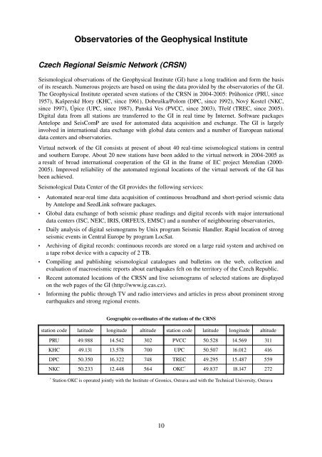
Geographic co-ordinates <strong>of</strong> <strong>the</strong> stations <strong>of</strong> <strong>the</strong> CRNS<br />
station code latitude longitude altitude station code latitude longitude altitude<br />
PRU 49.988 14.542 302 PVCC 50.528 14.569 311<br />
KHC 49.131 13.578 700 UPC 50.507 16.012 416<br />
DPC 50.350 16.322 748 TREC 49.295 15.487 559<br />
NKC 50.233 12.448 564 OKC * 49.837 18.147 272<br />
*<br />
Station OKC is operated jointly with <strong>the</strong> <strong>Institute</strong> <strong>of</strong> Geonics, Ostrava and with <strong>the</strong> Technical University, Ostrava<br />
10