

Townsville Region National parks, conservation parks and State ...
Townsville Region National parks, conservation parks and State ...
Townsville Region National parks, conservation parks and State ...

Create successful ePaper yourself
Turn your PDF publications into a flip-book with our unique Google optimized e-Paper software.
Girringun <strong>National</strong> Park<br />
The forces of<br />
nature at work.<br />
Rugged ranges, spectacular<br />
waterfalls <strong>and</strong> lush tropical<br />
rainforests contrast with the<br />
drier tropical savanna of<br />
Mount Fox.<br />
Treat all water before drinking<br />
Culture<br />
Girringun <strong>National</strong> Park forms part of<br />
the traditional l<strong>and</strong>s of five Aboriginal<br />
groups—the B<strong>and</strong>jin, Girramay, Gugu-<br />
Badhun, Warrgamay <strong>and</strong> Warungnu.<br />
They hope you enjoy your visit <strong>and</strong><br />
respect these sacred places.<br />
Wallaman Falls<br />
Natural values<br />
At 268 m, Wallaman Falls is the largest,<br />
permanent, single-drop waterfall in<br />
Australia.<br />
Walking<br />
Wet Tropics Great Walk<br />
Refer to the Wet Tropics Great Walk<br />
Wallaman Falls brochure or visit<br />
.<br />
Banggurru walk 800 m return<br />
(45 mins) Grade: easy<br />
The Banggurru (bun-gu-roo—turtle) walk<br />
begins at the day-use area <strong>and</strong> explores<br />
the banks of Stony Creek.<br />
Djyinda walk 3.2 km return (2 hrs)<br />
Grade: moderate<br />
The Djyinda (yin-da—falls) walk, which<br />
goes to the base of the falls, begins<br />
300 m from the lookout. Be prepared for<br />
a steep slope on unstable surfaces.<br />
Camping<br />
There is an open camping area near<br />
Stony Creek. Cars must be parked a<br />
short distance away from camp sites.<br />
The camping area is not suitable for<br />
caravans or camper trailers.<br />
Wildlife viewing<br />
Look for platypus, eastern water dragons<br />
<strong>and</strong> saw-shelled turtles in creeks, <strong>and</strong><br />
crimson rosellas, golden whistlers <strong>and</strong><br />
b<strong>and</strong>icoots around the camping area.<br />
Safety<br />
Safety is our concern but your<br />
responsibility (see page 15).<br />
Stinging trees can be found along the<br />
tracks. Never touch this plant as it will<br />
result in a painful sting. If stung <strong>and</strong><br />
symptoms are severe, seek medical advice.<br />
Wallaman Falls.<br />
Access<br />
Wallaman Falls is 51 km south-west of<br />
Ingham. Travel west from Ingham along<br />
Abergowrie Road to Trebonne. From here<br />
the route is well signposted. The unsealed<br />
part of the road can be accessed using a<br />
conventional vehicle. Towing caravans is<br />
not recommended.<br />
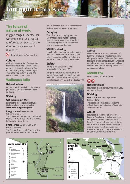
Mount Fox<br />
Visitors must be self-sufficient.<br />
Mount Fox.<br />
Natural values<br />
Mount Fox is an isolated, well-preserved,<br />
dormant volcano.<br />
Walking<br />
Mount Fox 2 km return (1.5 hrs)<br />
Grade: difficult<br />
This steep, 160 m climb ascends the<br />
side of Mount Fox to the top of the crater.<br />
There is no track.<br />
Access<br />
Mount Fox is 75 km south-west of<br />
Ingham. Travel west from Ingham along<br />
Abergowrie Road to Trebonne. From<br />
here the route is well signposted. Some<br />
of the route is unsealed <strong>and</strong> the range<br />
road is narrow, windy <strong>and</strong> unsuitable for<br />
caravans. Heavy rain may restrict access<br />
to four-wheel-drive vehicles only.<br />
Wallaman Falls<br />
Girringun<br />
<strong>National</strong><br />
Park<br />
6<br />
6


