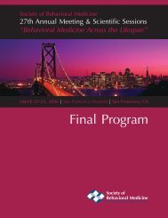
2007 Final Program - Society of Behavioral Medicine
2007 Final Program - Society of Behavioral Medicine
2007 Final Program - Society of Behavioral Medicine

Create successful ePaper yourself
Turn your PDF publications into a flip-book with our unique Google optimized e-Paper software.
SOCIETY <strong>of</strong> BEHAVIORAL MEDICINE<br />
Activities and Resturants guide for washington, D.c.<br />
The Capital Crescent Trail<br />
A new addition to the running paths<br />
<strong>of</strong> Washington is the Capital Crescent<br />
Trail. Located on an abandoned railroad<br />
bed, the trail looped through Maryland’s<br />
suburbs just outside the DC line from<br />
Bethesda to above Georgetown. The trail<br />
is an eight-mile long, flat, smooth surface<br />
that is generally shaded with more and<br />
more bridge crossings over the busy<br />
roads. The trail gets heavy usage from<br />
bike commuters, so keep to the right.<br />
You can access the North end <strong>of</strong> the<br />
Capital Crescent in Bethesda <strong>of</strong>f Bethesda<br />
Avenue. The South end <strong>of</strong> the trail has a<br />
few miles that parallel the Potomac River<br />
and the C&O Towpath.<br />
Glover Archbold Trail<br />
Another north-south trail through North-<br />
West DC, Glover-Archbold is much less<br />
known or developed. Glover-Archibald<br />
runs from the Georgetown waterfront<br />
to the Van Ness area <strong>of</strong> Washington,<br />
running through a mostly wild stream<br />
valley. On the north end, you can connect<br />
with Rock Creek by running east on<br />
Van Ness Road until you hit the Melvin<br />
Hazen spur <strong>of</strong> Rock Creek Park at 34th<br />
Street and Tilden. Heading out the other<br />
direction, you can connect to Battery<br />
Kemble Park<br />
The C&O Canal Towpath<br />
Beginning in Georgetown, the C&O<br />
heads west for 186 miles, so this could<br />
be a fine location for your long run. A<br />
packed dirt trail, it generally is next to the<br />
river and is flat and fairly smooth. The<br />
two major floods <strong>of</strong> 1996 submerged<br />
the trail, but work is on-going to repair<br />
the damage. The Towpath is one <strong>of</strong> the<br />
quickest ways to escape the bustle <strong>of</strong> the<br />
city, at times getting fairly remote. The<br />
first group runs for the M@Deads were on<br />
the Towpath from Fletcher’s Boathouse.<br />
There are water fountains during the<br />
summer for much <strong>of</strong> the early sections <strong>of</strong><br />
the trail. The C&O Canal Towpath is also<br />
popular with biking groups.<br />
Teddy Roosevelt Island<br />
Accessible from Virginia along the George<br />
Washington Parkway, Teddy Roosevelt<br />
is an island preserved as a memorial<br />
to the President who created the first<br />
National Park. A fitting memorial for this<br />
Roosevelt, the island also provides some<br />
excellent running opportunities. While<br />
only 88 acres, the trails looping the island<br />
are very runnable trails through near<br />
wilderness within the city. Occasionally,<br />
you will be greeted with monumental<br />
views <strong>of</strong> Washington. These trails,<br />
especially the well-named Swamp Trail,<br />
can be very moist after rains.<br />
The W&OD Regional Park<br />
Another converted railway line, the<br />
W&OD (Washington and Old Dominion)<br />
is a flat 42 mile long trail through<br />
Northern Virginia. Beginning in the urban<br />
Arlington and heading out <strong>of</strong> town to the<br />
rural areas <strong>of</strong> Loudoun County near the<br />
mountains.<br />
D.C. Online Trail Guide<br />
The D.C. Online Trail Guide covers the<br />
more than 50 miles <strong>of</strong> hiking trails in<br />
northwest Washington, DC that are within<br />
easy walking distance <strong>of</strong> Metro stations.<br />
Visit www.trails.com for more information<br />
and to locate trails in the D.C. area.<br />
Rock Creek Parkway<br />
D.C. Front Runners.org - Come run Rock<br />
Creek Parkway with us.<br />
Out-and-back route starting and ending at<br />
23rd and P St. NW<br />
• 3 miles: turn around at the kiosk right<br />
at the exit to Conn. Ave.<br />
• 4 miles: turn around at the Nat’l Zoo<br />
Amazonia Exhibit.<br />
• 6 miles: turn right at Covered Bridge<br />
past the Nat’l Zoo. Turn around before the<br />
tunnel.<br />
• 7 miles: turn around at Pierce Mill Rd.<br />
• 8 miles: turn around at parking lot after<br />
Pierce Mill Rd.<br />
• 9 miles: turn around at the Stone<br />
Bridge.<br />
• 11.5 miles: turn around at the Ranger<br />
Station.<br />
• 13 miles: turn around at Sherrill Rd. (1st<br />
right after Ranger Station).<br />
• 14 miles: turn around at Picnic Area 10.<br />
• 17 miles: turn around at DC - MD line<br />
at barricade.<br />
Healthy Eating Tips for the SBM<br />
Traveler<br />
Tips for Eating Out<br />
You can eat out and eat healthy, too.<br />
Many restaurants <strong>of</strong>fer delicious meals<br />
that are low in saturated fat, trans fat and<br />
cholesterol. That’s good news for your<br />
health because a diet high in saturated<br />
and trans fats raises blood cholesterol.<br />
High blood cholesterol is a major risk<br />
factor for heart disease, and it’s also a risk<br />
factor for stroke.<br />
~ 136 ~<br />
When eating out, ask which type <strong>of</strong> fat<br />
the restaurant uses. Try to replace the<br />
saturated and trans fats in your food with<br />
more healthful unsaturated oils. Canola,<br />
olive and corn oil are among the most<br />
desirable. Request s<strong>of</strong>t and trans-fat-free<br />
margarine.<br />
Equally important is the portion size.<br />
Help control your weight by asking for<br />
smaller portions, or sharing entrees with a<br />
companion.<br />
A guide to choosing healthy meals<br />
away from home<br />
• Fried, au gratin, crispy, escalloped, panfried,<br />
sautéed or stuffed foods are high in<br />
fat and calories. Instead, look for steamed,<br />
broiled, baked, grilled, poached or roasted<br />
foods. If you’re not sure about a certain<br />
dish, ask your server how it’s prepared.<br />
• Even if dishes low in saturated fat and<br />
cholesterol aren't on the menu, you may<br />
still be able to get a healthy meal, because<br />
many restaurants will prepare foods to<br />
order. If you’re not sure about a particular<br />
restaurant, phone before you go.<br />
• High-sodium foods include those that are<br />
pickled, in cocktail sauce, smoked, in broth<br />
or au jus or in soy or teriyaki sauce. Steer<br />
clear <strong>of</strong> these.<br />
Make Healthy Food Choices<br />
Fruits, vegetables, grains and legumes tend<br />
to be low in fat and have no cholesterol.<br />
Most are also good sources <strong>of</strong> dietary fiber,<br />
complex carbohydrates and vitamins. The<br />
American Heart Association suggests that<br />
you eat foods high in complex carbohydrates<br />
and fiber. (Some kinds <strong>of</strong> soluble fiber, such<br />
as pectin and oat bran, when eaten in large<br />
amounts in a diet low in saturated fat, may<br />
reduce total cholesterol and LDL cholesterol).<br />
The American Heart Association suggests<br />
eating 25–30 grams <strong>of</strong> dietary fiber per day.<br />
Here are some tips for healthy eating:<br />
• Coconut is high in saturated fat; olives<br />
and avocados are high in monounsaturated<br />
fat and calories. Use these items sparingly<br />
to avoid getting too many calories from fat.<br />
• When vegetables, grains or legumes are<br />
cooked or processed, saturated fats or<br />
cholesterol are <strong>of</strong>ten added. For instance,<br />
egg yolks may be added to breads or<br />
pastas.<br />
• Canned, processed and preserved<br />
vegetables also may contain added sodium.<br />
And in some people, too much sodium<br />
(salt) can lead to high blood pressure. Some<br />
food companies are canning vegetables