AST-12 meeting report posted - Argo
AST-12 meeting report posted - Argo
AST-12 meeting report posted - Argo

Create successful ePaper yourself
Turn your PDF publications into a flip-book with our unique Google optimized e-Paper software.
<strong>12</strong> th <strong>meeting</strong> of the<br />
International <strong>Argo</strong> Steering Team<br />
Buenos Aires, Argentina<br />
March 15-17, 2011
Contents<br />
Meeting Summary<br />
1. Welcome and Introduction ……………………………………………………… 4<br />
2. Objectives of the <strong>meeting</strong> ……………………………………………………..... 4<br />
3. Action items from <strong>AST</strong>-11 ……………………………………………………… 4<br />
4. Implementation issues<br />
4.1 Status of <strong>Argo</strong> ………………………………………………………….. 4<br />
4.2 Sustaining and evolving <strong>Argo</strong>: Following up the<br />
OceanObs’09 consensus ………………………………………….. 8<br />
4.3 Euro<strong>Argo</strong> update ………………………………………………………. 9<br />
4.4 New Brazil plans ………………………………………………………. 9<br />
4.5 Update commitments table ………………………………………….. 10<br />
4.6 Float deployment opportunities …………………………………… 10<br />
4.7 Discussion on beached floats ……………………………………… <strong>12</strong><br />
4.8 Forum for the future of Japan <strong>Argo</strong> ……………………………….. 13<br />
4.9 Bio<strong>Argo</strong> update ………………………………………………………… 14<br />
4.10 AIC and JCOMM Observing Program Support Centre ………… 15<br />
4.11 Discussion items from National Reports ………………………… 16<br />
5. Data Management Issues<br />
5.1 Feedback from ADMT-11 …………………………………………….. 17<br />
5.2 Impact of pressure errors on the <strong>Argo</strong> dataset ………………….. 18<br />
5.3 Status of trajectory data ……………………………………………… 19<br />
5.4 Transition to new ARGOS location method ………………………. 21<br />
5.5 CCHDO and NODC activity .………………………………………….. 21<br />
6. Technical Issues<br />
6.1 Float technology progress .……………………………………………. 21<br />
6.2 Status of oxygen measurement and QC ...…………………………. 24<br />
6.3 Thermally powered floats and gliders ………………………………. 24<br />
6.4 Update on near surface temperature ……..………………………… 24<br />
6.5 <strong>Argo</strong> floats in the ice-zone ……………………………………………. 25<br />
7. Demonstrating <strong>Argo</strong>’s value<br />
7.1 Upcoming science <strong>meeting</strong>s<br />
7.1.1 IUGG ( 27 June – 8 July 2011 in Melbourne, Australia ) 27<br />
7.1.2 WCRP () ………………….…………………………………… 27<br />
7.1.3 OSTST ( 19 – 21 October 2011 in San Diego, CA, USA ) 27<br />
7.2 <strong>Argo</strong> bibliography ………………………………………………………. 27<br />
7.3 Google Ocean …………………………………………………………… 28<br />
7.4 <strong>Argo</strong>nautics Newsletter ……………………………………………….. 29<br />
7.5 <strong>Argo</strong> outreach activities<br />
7.5.1 Education outreach in South Africa ………………………. 29<br />
7.5.2 Global <strong>Argo</strong> Marine Atlas ………………………………….. 31<br />
7.6 1-page document on sustaining <strong>Argo</strong> ……………………………… 31<br />
8. Future <strong>meeting</strong>s<br />
8.1 ADMT-<strong>12</strong> ( Korea ) ………………………………………………………. 32<br />
8.2 <strong>AST</strong>-13 ……………………………………………………………………. 32<br />
9. <strong>AST</strong> memberships ……………………………………………………………….. 32<br />
10. Other business …………………………………………………………………… 32
Appendices<br />
1. Agenda ………………………………………………………………………………. 33<br />
2. Attendance List ……………………………………………………………………. 35<br />
4. Action items from <strong>AST</strong>-<strong>12</strong> ……………………………………………………….. 37<br />
5. Commitments Table ………………………………………………………………. 41<br />
6. National Reports …………………………………………………………………… 43
Meeting Summary<br />
The <strong>12</strong> th <strong>meeting</strong> of the international <strong>Argo</strong> Steering Team was held in Buenos Aires,<br />
Argentina on March 15-17, 2011. <strong>AST</strong>-<strong>12</strong> focused on how <strong>Argo</strong> will be sustained and enhanced<br />
in the coming years. As <strong>Argo</strong> begins considering how to implement changes suggested at<br />
OceanObs’09, there remains a push for sustained funding and for ensuring the highest possible<br />
quality data.<br />
Implementation issues<br />
The <strong>Argo</strong> Technical Coordinator <strong>report</strong>ed that <strong>Argo</strong> is nearly reached its core array goal<br />
of 3000 floats but that maintaining this array is going to prove to be quite challenging. Some<br />
countries have reached their limit on funding, so new ones need to be brought in to help sustain<br />
and grow <strong>Argo</strong>. On the other hand, most float types have reached original float lifetime goals<br />
and the percentage of delayed mode profiles as risen to 86% of eligible profiles. One change<br />
over the past year that is likely to occur even more is the expansion of floats equipped with<br />
Iridium sensors. In 2010, 18% of floats being deployed had Iridium communications.<br />
Euro-<strong>Argo</strong> will transition in early 20<strong>12</strong> into a long term European research infrastructure<br />
with a legal status (Euro-<strong>Argo</strong> ERIC). ERIC will provide strong visibility for <strong>Argo</strong> in Europe and<br />
will allow European countries to consolidate and improve their contribution to <strong>Argo</strong> international.<br />
Overall, Euro-<strong>Argo</strong> hopes to contribute 250 floats per year. In addition to the <strong>Argo</strong> core array<br />
requirements, Euro<strong>Argo</strong> has requirements for marginal seas, high latitudes and additional<br />
sensors. There is also a recommendation for a deep float pilot program and design study.<br />
<strong>AST</strong> members updated the commitments table and the expected number of<br />
deployments for 2011 is again large (~1000). About 800 floats were deployed last year, less<br />
than the almost <strong>12</strong>00 expected. This was mainly due to difficulty finding and arranging<br />
deployment opportunities or a lack of available CTDs for floats. SeaBird has said there should<br />
no longer be a shortage of CTDs. Even with so many floats in inventory, it will likely take a<br />
couple of years to deploy all the backlogged floats.<br />
To help find and coordinate deployment opportunities, the ATC is xploring funding a<br />
position to track cruises and make that information available to <strong>Argo</strong>, DBCP, etc. The Lady<br />
Amber is now an option, in addition to the Kaharoa, for a dedicated ship to deploy <strong>Argo</strong> floats. It<br />
has already taken its first voyage to deploy floats and is ready to accept more in September.<br />
Hosoda presented on beached floats – both those beached on Japan’s coasts and<br />
Japanese floats beached elsewhere. He noted that several Japanese fishermen have picked<br />
up floats and have been unsure what to do with them since the float label does not have<br />
Japanese on it. A flyer has been made to hand out to Japanese fisherman to help inform them<br />
on <strong>Argo</strong> floats and to make it easier to notify the owner. Concern was expressed that the<br />
procedure to handle beached <strong>Argo</strong> floats was still not agreed upon among relevant government<br />
agencies/institutes in Japan, which may hinder smooth handling and cause trouble between the<br />
finders and owners of floats. For Japanese floats beached elsewhere, a technician has been<br />
dispatched to retrieve the float and/ or make it safe for redeployment or return to Japan.<br />
Hosoda presented on two forums that were held in Japan in 2010 to build consensus on<br />
the future direction of Japan <strong>Argo</strong>. Two conclusions were agreed upon at the forums. The first<br />
being that Japan <strong>Argo</strong> should continue to contribute the core <strong>Argo</strong> by sustaining current level of<br />
float deployment and data management activities. The second being that Japan <strong>Argo</strong> should<br />
contribute to construct new integrated ocean observing systems, based upon the <strong>Argo</strong> core<br />
array, which will increase the climate monitoring and research capability and provide information<br />
on the marine environment to meet society’s needs better. To help fulfill the second consensus,<br />
twenty-five dissolved oxygen floats will be deployed as <strong>Argo</strong> equivalent floats in the<br />
experimental area of 150 km x 150 km in collaboration with other observational platforms such<br />
as moorings, ships and satellites.<br />
1
H. Claustre <strong>report</strong>ed on the progress of the Bio-<strong>Argo</strong> working group. As a result of two<br />
<strong>meeting</strong>s attended by scientists from complementary expertise, three main classes of bio-optical<br />
and / or biogeochemical floats have been proposed. The Bio-<strong>Argo</strong> float is proposed as a rather<br />
simple float with respect to optical package [Chla fluorescence, backscattering (proxy of POC)]<br />
that could become part of the <strong>Argo</strong> array, respecting the core <strong>Argo</strong> mission rules. Presently<br />
~150 floats are to be deployed within the next 18 months. The Bio-<strong>Argo</strong> community is also<br />
involved in the various aspects of data management and delayed mode quality control.<br />
Data Management related issues<br />
Overall, <strong>Argo</strong>’s data management infrastructure is stable, but requires monitoring tools at<br />
the AIC, GDAC, and ARC levels and requires manpower at the DACs to correct the detected<br />
anomalies. The current ADMT efforts are focused on reducing delays, delayed mode quality<br />
control, improving data consistency and completeness and detection and correction of<br />
systematic errors/biases. The pressure offset correction and TNPD identification was<br />
recognized as the highest priority for DM operators. Much work has been done on this, but it<br />
still needs to be finished. The DM file checker is still under validation at the US GDAC. Its<br />
completion is critical to reduce the submission of DM files with anomalies. The next priority for<br />
the ADMT will be trajectory data. It was agreed that a trajectory workshop for DACs and<br />
operators engaged in preparing traj.nc files should be organized alongside the next ADMT.<br />
The <strong>Argo</strong> DACs are working hard on identifying, correcting and labeling <strong>Argo</strong> profiles<br />
that might be affected by pressure sensor bias. This involves correctly populating technical files<br />
with <strong>report</strong>ed pressure offsets, correcting profiles that require it and identifying APEX floats with<br />
APF8 or earlier controllers and possibly negative drifting pressure sensors, known as Truncated<br />
Negative Drifting Pressure (TNDP) profiles. Great progress has been made by DACs on<br />
pressure drifts where known. However, <strong>Argo</strong> did not achieve its goal of having all corrections<br />
and TNDP labeling completed by December 2010. Even so, most large DACs are nearly<br />
complete and most egregious cases have been treated. TNDP identification and treatment is<br />
not as far along, but is progressing. This may require further focus by the DACs and smaller<br />
DACs might need assistance in finishing compliance and improving decoders.<br />
B. King presented a status update on the work of J-P Rannou and M. Ollitrault who<br />
continue to re-decode <strong>Argo</strong>s hex files provided by DACs and to correct errors. The goal is to<br />
complete all <strong>Argo</strong> data through December 2009 by the end of 2011. Additionally, work has<br />
been done to extract and save extra information not stored in existing traj.nc files. B. King and a<br />
small group are working on a proposal for a traj_version2.nc file which will include extra timing<br />
information to easily enable users to pull out data useful to velocity calculations. This will be<br />
discussed at the trajectory DM workshop in conjunction with the next ADMT.<br />
Technical issues<br />
An update was given on PROVOR and ARVOR float technology. Both floats are being<br />
equipped with new sensors and communications. As for the PROVOR float, oxygen sensor<br />
technology is now considered mature and work is being done to implement a nitrate sensor and<br />
a “NOSS” density sensor. Both Arvor and Provor floats have been successfully equipped with<br />
iridium transmission. The Iridium float is thus currently programmed to acquire 200 to 300 PTS<br />
triplets, but this number can be increased to 1000 if required (1 sampling every 2dbar). <strong>Argo</strong>s<br />
3rd generation transmission is being embedded on Arvor. Additionally, a deep Arvor float is<br />
being developed that will reach 3500m depth. Finally, developments will be done on PROVOR<br />
and ARVOR floats within the French NAOS project to reduce costs and to improve float<br />
reliability and lifetime.<br />
S. Riser presented on four developments including APEX air pump solenoid problems,<br />
some first tests of ARGOS-3, and SBE conductivity drift. The air pump is controlled by a<br />
solenoid, many of which, for reasons unknown, have failed in lab tests at UW in recent months.<br />
2
A failure would mean the air bladder would not inflate, resulting in the possible loss of the ability<br />
to communicate with a satellite. This is especially problematic for Iridium floats. The problem<br />
can be corrected by adding a small, inexpensive, printed circuit board near the solenoid. This fix<br />
has been added to all UW and PMEL floats since February 2011. As of March 2011,<br />
Teledyne/Webb have not instituted the remedy and it is not clear whether or not they intend to<br />
add the auxiliary PCB in their production process. UW has developed a prototype float that<br />
uses a Kenwood PMT to communicate with ARGOS-3 satellites. The first tests of the Kenwood<br />
PMT have shown that energy use is larger than with present ARGOS-2 PTTs. Finally, both<br />
Jamstec and PMEL have noted APEX floats with unacceptable conductivity drift after<br />
deployment (> 0.01 PSU equivalent). The cause of the problem has been found and new QC<br />
procedures have been installed at SBE. It is believed that this problem occurred in an isolated<br />
group of floats (CTDs built in late 2010) but all groups should check for this.<br />
D. Roemmich presented an update on the SOLO-II which is now commercially available<br />
through MRV Systems (http://www.mrvsys.com). The SOLO-II is engineered to complete<br />
around 300 dives anywhere in the world ocean using Iridium. It weighs less and is shorter than<br />
the SOLO making it easier to deploy. Two SOLO-II prototypes have been deployed and<br />
completed many successful cycles. US production of the SOLO-II will be done by both SIO and<br />
MRV. 15 SOLO-II floats have been sent to Papeete for deployment along the equator with<br />
more than 150 floats to be built in 2011.<br />
Jon Turton outlined some results from preliminary analysis of data from eight Near<br />
Surface Temperature-capable (NST-capable) Apex floats deployed by UK. Although relatively<br />
few stratified profiles were observed, the results show the NST-capable Apex floats are able to<br />
observe near-surface temperature stratification that would otherwise remain undetected and so<br />
do provide useful additional information. More work is needed to further explore the NSTcapable<br />
floats.<br />
S. Wijffels <strong>report</strong>ed on work done by E. Van Wijk and others on the prospects for<br />
extending <strong>Argo</strong> into the seasonal and fast ice zone. Mortality rates of newer ice floats are now<br />
equivalent to those deployed in less demanding conditions, but the short surface time<br />
associated with Iridium is also a likely factor. A quick comparison among ice-float deploying<br />
groups shows a survival rate of around 80%. Extending <strong>Argo</strong> into the seasonal ice zone would<br />
require an additional ~600 floats. It was suggested that <strong>Argo</strong> continue to pilot ice-capable floats<br />
in order to refine the technology, but to also explore alternative sampling platforms.<br />
Demonstrating <strong>Argo</strong>’s value<br />
Dr Juliet Hermes presented the South African Environmental Observation Network<br />
education program, of which <strong>Argo</strong> floats form a key component. This program creates a platform<br />
where Marine Science Research can be integrated into School Sciences curriculum (with buy-in<br />
from the Department of Education). There are three main thrusts: educator/teacher support<br />
through workshops, school based monitoring programs and additional student support in<br />
Science Camp. Dr. Hermes also gave details of South African activities of interest to the <strong>Argo</strong><br />
community and highlighted that all South African marine institutes have potential to be more<br />
involved with <strong>Argo</strong> over the next five years. A new vessel is commissioned for 20<strong>12</strong> and there<br />
will be more float deployment opportunities aboard ASCLME cruises.<br />
M. Scanderbeg presented on the development of the Global Marine <strong>Argo</strong> Atlas which uses<br />
Ferret to create plots of gridded data. Currently, the PC version of the Atlas comes with the 4-D<br />
gridded <strong>Argo</strong> dataset made at Scripps Institution of Oceanography (Roemmich and Gilson,<br />
2009), the Reynolds SST dataset, and the AVISO dataset. It is possible to create map plots,<br />
section plots, time series, line drawings and a few simple products. Both postscript and jpg<br />
outputs are available for plots that are created using the Atlas. Both NetCDF and ASCII outputs<br />
are available containing the data used to create the plots. Besides giving a quick view of the<br />
3
datasets, the Atlas is a great way to compare datasets quickly. A Mac and Linux version should<br />
be available soon.<br />
S. Diggs and the <strong>Argo</strong> TC presented work done on the <strong>Argo</strong> layers for Google Earth.<br />
The application is ideal for network tracking, searching/ retrieving beached floats, planning float<br />
deployments, as well as demonstrating and promoting <strong>Argo</strong> to the general public. Besides<br />
information balloons on each individual float, a layer of float stories has been added and<br />
overlays of temperature, salinity and steric height (data from 100% <strong>Argo</strong> gridded product from<br />
Scripps Institution of Oceanography) are now possible. Once the final version is finished, it will<br />
be proposed to Google for inclusion into their Google Ocean layer.<br />
1 Welcome and introduction<br />
Capitán Javier Valladares, Chairman of the IOC, welcomed the <strong>Argo</strong> Steering Team to Buenos<br />
Aires. He commended the <strong>AST</strong> on the work they have already done and looks forward to<br />
learning how the <strong>AST</strong> will decide to shape <strong>Argo</strong>’s future. Local arrangements were discussed<br />
as well as an invitation to the reception dinner the following evening.<br />
Action item 1: <strong>AST</strong> co-chairs to send a letter of thanks to Ariel Troisi and Servício de<br />
Hídrografia Naval for hosting <strong>AST</strong>-<strong>12</strong>.<br />
2 Objectives of the <strong>meeting</strong><br />
S. Wijffels opened the <strong>AST</strong>-<strong>12</strong> <strong>meeting</strong> by summarizing the main challenges facing <strong>Argo</strong>:<br />
(i) How will <strong>Argo</strong> be sustained and enhanced in the next few years?<br />
(ii) What actions are needed to ensure that the quality of <strong>Argo</strong> data is sufficient for global<br />
change studies?<br />
3 Action items from <strong>AST</strong>-11<br />
M. Scanderbeg presented the Action items from <strong>AST</strong>-11. Most items were completed, with<br />
several <strong>report</strong>ed on at the <strong>meeting</strong>. Some items relating to the data files were still ongoing such<br />
as DACs correcting their technical files and completing pressure corrections on APEX floats.<br />
Additionally, work still needs to be done on the trajectory files, but a new working group has<br />
been formed to begin solving the problems associated with the trajectory files.<br />
Implementation issues<br />
4.1 Status of <strong>Argo</strong><br />
The <strong>Argo</strong> Technical Coordinator. M. Belbeoch <strong>report</strong>ed on the status of the <strong>Argo</strong> array. He<br />
recalled first that the <strong>Argo</strong> array was basically implemented by a dozen of countries while 20<br />
more were assisting in filling regional gaps. With 54% of the array maintained by the USA who<br />
is reaching its contribution limit, the growing involvement of Europe will be crucial. The<br />
Euro<strong>Argo</strong> initiative is starting to be fruitful with a number of new comers and Asia keeps<br />
contributing its part. The TC noted however that a number of partners had difficulties to sustain<br />
or augment their contribution and underlined the impressive effort happening in Australia, which<br />
recently became the first <strong>Argo</strong> participating country when considering the number of active<br />
floats per habitant.<br />
Country Active floats Floats/million habitants<br />
AU 295 13.71<br />
USA 1710 5.51<br />
CA <strong>12</strong>4 3.67<br />
4
FR 162 2.53<br />
JAP 278 2.19<br />
KOREA 91 1.87<br />
GER 152 1.85<br />
NETH 31 1.85<br />
UK 104 1.70<br />
INDIA 83 0.07<br />
CHINA 45 0.03<br />
With the <strong>meeting</strong> being held in Argentina, the TC invited other South American countries to help<br />
in a regional effort. It was learned in the <strong>meeting</strong> that Brazil is working to contribute to <strong>Argo</strong> with<br />
about 30 floats via a multi-disciplinary project.<br />
The TC remarked then that after a drop in 2009/2010, <strong>Argo</strong> was finally approaching its initial<br />
target with the “core mission” being 90% achieved, noting some progress compared to 2010<br />
(85%).<br />
He asked the <strong>AST</strong> if an “expanded <strong>Argo</strong>” could be feasible, with about 4000 floats, including<br />
high latitudes and main marginal seas.<br />
The challenge for <strong>Argo</strong> in 2011/20<strong>12</strong> will be to address the 2009 year deficit in deployments<br />
(300 units).<br />
Deployment / year 2000 2001 2002 2003 2004 2005 2006 2007 2008 2009 2010<br />
Arctic Ocean 0 7 1 0 5 5 1 8 <strong>12</strong> 10 10<br />
Atlantic Ocean 65 97 148 190 243 307 301 165 284 139 269<br />
Indian Ocean 13 24 106 <strong>12</strong>4 158 113 149 139 144 147 155<br />
Mediterranean Sea 6 4 9 13 18 17 <strong>12</strong> 7 11 11 5<br />
Pacific Ocean 32 163 188 345 446 566 470 431 432 228 368<br />
Southern Ocean (< - 0 16 76 145 242 336 254 239 270 148 306<br />
30°)<br />
Total 116 295 452 672 870 1008 933 750 883 535 807<br />
The TC then presented the density of the array. He reminded the <strong>AST</strong> how vital the notification<br />
procedure was to plan all deployments via the central AIC interface so the strategy can be<br />
optimized to fill the existing and anticipated gaps.<br />
5
Regarding the <strong>Argo</strong> data stream, the TC noted that 2010 was the first year since 2000 where we<br />
observed a decrease in the number of profiles distributed. However the efforts in processing the<br />
backlog of delayed mode files was substantial (83% achieved as of 03/2011 compared to 76%<br />
as of 03/2010). In addition, the issue of additional delays introduced by the GDAC Coriolis,<br />
seems under control. After a first correction early 2011, Coriolis is preparing a new patch to<br />
their collect system that should remove most of this additional delay. The TC requested again<br />
that the US GDAC provide appropriate information (detailed index files) so such delays can also<br />
be monitored on that mirror.<br />
The TC presented finally a set of metrics showing how float reliability was progressing, for all<br />
float models, how iridium telecommunication system is gradually being adopted (18% of yearly<br />
deployments), how ARGOS-3 was tested at sea, and how the Bio<strong>Argo</strong> ancillary array is<br />
developing (including dissolved oxygen, bio-optics and nitrate sensors).<br />
He concluded by inviting <strong>AST</strong> members to do better than ever in term of planning so that more<br />
than 1000 units can be deployed in 2011. It is still a challenge to maintain <strong>Argo</strong> at its current<br />
level. More international cooperation will be required to secure the core array and is crucial to<br />
expand it.<br />
In particular, given the world economy constraints, and given the fact that float reliability is lower<br />
in those areas of expansion, the growth of the array to 4000 units will be a huge challenge. If<br />
this expansion requires clear commitments for floats and ship time, it will also require resources<br />
for the data management and for the infrastructure (Information Centre/Project Office).<br />
6
In the conversation that followed the presentation, the roughly 30,000 float profiles from <strong>Argo</strong><br />
equivalent floats in the US that need to be delay mode quality controlled were discussed. The<br />
floats were discussed at the US <strong>Argo</strong> <strong>meeting</strong> a few months prior and it became clear that it was<br />
difficult to quality control these floats within the US program. The only APEX dmode operator is<br />
Annie Wong and this is simply too big a task for her to do without any extra funding. D.<br />
Roemmich said that it essentially boils down to a time and resource problem for US <strong>Argo</strong> and<br />
any help would be welcomed. B. Klein said she would look at the old temperature only floats in<br />
the tropical Atlantic to see if it would be feasible for her group to dmode.<br />
7
M-S Suk stated that he does not have any Antarctic CTD data to compare to for DMQC and that<br />
he is not an expert in the region. The TC confirmed that some countries deploy floats to fill gaps<br />
that are not in their area of expertise and suggested looking at sharing dmode across nations.<br />
Action item 2: Define more specifically what <strong>Argo</strong> core means to help the <strong>Argo</strong><br />
Technical Coordinator make more useful statistics. <strong>AST</strong> co-chairs<br />
4.2 Sustaining and evolving <strong>Argo</strong>: Following up the OceanObs’09 consensus<br />
Alberto Piola gave Eric Lindstrom’s presentation on sustaining and evolving <strong>Argo</strong> based on<br />
follow up work to OceanObs’09. OceanObs’09 goal was to build a common vision for ocean<br />
observations. It called for a provision of routine and sustained global information on the marine<br />
environment sufficient to meet society’s needs for describing, understanding and forecasting<br />
marine variability (including physical, biogeochemical, ecosystems and living marine resources),<br />
weather, seasonal to decadal climate variability, climate change, sustainable management of<br />
living marine resources, and assessment of longer term trends. From OceanObs’09 there were<br />
several conclusions to be drawn about <strong>Argo</strong>. The first was clear recognition of the importance<br />
of sustaining <strong>Argo</strong> at its design network density. There was also a high level of interest in using<br />
the profiling float platform with other sensors like rainfall, oxygen and bio-optical sensors. It was<br />
recognized that there is a potential tradeoff in float lifetime and array maintenance costs for<br />
these additional sensors. New deeper profiling floats could play a key role in deep ocean<br />
observations. It was noted that a strategy is needed to meet a wider variety of scientific and<br />
societal goals that carry a higher cost.<br />
There were several calls for action from OceanObs’09 with the third one highlighting <strong>Argo</strong>’s role:<br />
Invites governments and organizations to embrace a framework for planning and moving<br />
forward with an enhanced global sustained ocean observing system over the next decade,<br />
integrating new physical, biogeochemical, biological observations while sustaining present<br />
observations. Recommendations on this Framework, considering how to best take advantage<br />
of existing structures, will be developed by a post-conference working group of limited duration.<br />
This working group was to consider the outcomes and recommendations from OceanObs’09<br />
and recommend a framework to fulfill the goals and <strong>report</strong> back to sponsors by late 2010. The<br />
Framework asks <strong>Argo</strong> to actively work on interfacing with other communities. For example, to<br />
work with teams focused on particular variables such as SST. Also to work with other observing<br />
networks on common issues as is already being done through JCOMM. <strong>Argo</strong> is also being<br />
asked to feed information up to OOPC and other bodies working on requirements for societal<br />
benefits. <strong>Argo</strong> is also being asked to be open to new communities that want to explore profiling<br />
floats as a platform for observation of new variables beyond the <strong>Argo</strong> core. Finally, it was noted<br />
that <strong>Argo</strong> has limitations, but to be open to new sources of funding that can achieve multiple<br />
sets of requirements. Feedback is to be sent to Eric Lindstrom or Albert Fischer.<br />
In the discussion that followed, several steering team members were worried about the lack of<br />
new funding coming into <strong>Argo</strong> that will make expanding and/ or adding new sensors quite<br />
difficult. A. Piola encouraged the <strong>AST</strong> to make these concerns known to the OOPC.<br />
Action item 3: <strong>AST</strong> co-chairs to send a letter from <strong>Argo</strong> to the OOPC and E. Lindstrom<br />
expressing <strong>Argo</strong>’s concern about a lack of funding to help <strong>Argo</strong> follow up on enhancements from<br />
OceanObs’09. <strong>AST</strong> co-chairs<br />
4.3 Euro<strong>Argo</strong> update<br />
8
P.Y. Le Traon gave an overview of Euro-<strong>Argo</strong> activities. Euro-<strong>Argo</strong> will transition in early 20<strong>12</strong><br />
into a long term European research infrastructure with a legal status (Euro-<strong>Argo</strong> ERIC). This<br />
new European legal structure will provide strong visibility for <strong>Argo</strong> in Europe and will allow<br />
European countries to consolidate and improve their contribution to <strong>Argo</strong> international.<br />
Agreements are at the ministerial level and this will help to ensure long term sustainability. The<br />
existence of a European legal entity will facilitate the access to long term European funding<br />
through GMES. As of today, Euro-<strong>Argo</strong> countries contribute to <strong>Argo</strong> international about 150<br />
floats/year and with an important contribution to the data system. Euro-<strong>Argo</strong> target is 250<br />
floats/year and plans for the coming years show a significant increase of European contributions<br />
to <strong>Argo</strong>. It is expected that by 2014 new funding from the European commission will provide<br />
further improvements.<br />
The long term evolution of <strong>Argo</strong> was recently discussed by Euro-<strong>Argo</strong> partners. At European<br />
level, we need to meet requirements both from the research and operational oceanography<br />
(GMES) communities. There is a strong requirement for marginal seas (Mediterranean and<br />
Black Seas) and there are also important European research activities in high latitudes.<br />
Implementation is on going and an <strong>Argo</strong> « extended mission » for marginal seas and for high<br />
latitudes should now be defined at the international level. There is also a strong interest for an<br />
extension to biogeochemical variables. Several pilot experiments are ongoing or planned.<br />
There is a need to work on an international strategy for oxygen and Bio <strong>Argo</strong> (e.g. agree on a<br />
common sensor package, start with pilot experiments to share best practices and develop the<br />
data system and technology, define a target for the addition of biogeochemical sensors for the<br />
global and regional arrays to be implemented in a second phase). As far as deep floats are<br />
concerned, pilot experiments should be organized and design studies conducted.<br />
4.4 New Brazil plans<br />
O. Sato and P. Polito presented on their master project submitted to the Brazilian Federal<br />
Agency called CARBOM-OCEANS. The main theme of the project is to study the budget of<br />
carbon and chemical elements associated with the production of organic matter in the South<br />
Atlantic ocean as well as the annual flux between biogeochemical compartments of the<br />
Brazilian continental margin and adjacent deep-ocean areas. <strong>Argo</strong> floats will be used along<br />
with CTDs, ADCPs, gliders, moorings, and satellites to try to understand the circulation and<br />
material transport. The goal is to deploy groups of <strong>Argo</strong> floats simultaneously that will be<br />
programmed to dive to different depths. This will help to investigate the divergence and<br />
convergence of the mass flux. The trajectories at different levels will provide a description of<br />
the baroclinicity of the flow responsible for the transport of organic and inorganic materials in<br />
the ocean. In particular, <strong>Argo</strong> floats will be deployed in regions where satellite images indicate<br />
the presence of meanders and eddies. The vertical velocity anisotropy of these features can<br />
significantly change the final destination of particles carried by the flow from a common<br />
geographic point of origin.<br />
After the presentation, the Technical Coordinator asked if Brazil is interested in becoming a<br />
sustained funder of <strong>Argo</strong> floats. Dr. Sato said that this project will hopefully begin a more<br />
sustained structure as it calls for the creation of an institute. A few other tips were pointed out<br />
such as allocating money for data management as well as using Iridium to keep the floats<br />
below surface as much as possible.<br />
4.5 Commitments table<br />
9
<strong>AST</strong> members updated the commitments table and the expected number of float deployments<br />
for 2011 is again large (~1000). The number of estimated float deployments for 2010 was about<br />
1100 and only about 800 ended up being deployed. This was mainly due to difficulty finding<br />
deployment opportunities, difficulty arranging for deployments or a lack of available CTDs.<br />
SeaBird has said that there should no longer be a shortage of CTDs, so hopefully that will not<br />
slow down deployments this year. Therefore it becomes even more important for <strong>AST</strong> members<br />
and other float deployers to work together to raise awareness about deployment opportunities.<br />
The ATC reminded everyone that he has established an email list to advertize deployment<br />
opportunities and he urged everyone to notify him of known opportunities. Even with so many<br />
floats in inventory, it will likely take a couple of years to catch up and find deployment<br />
opportunities for all the backlogged floats.<br />
4.6 Float deployment opportunities<br />
An attempt to represent a year of ship based observations showing where the ships are not going. (float<br />
deployments in red).<br />
The <strong>Argo</strong> TC <strong>report</strong>ed on the issue of deployment opportunities and ship time. Ships are the<br />
common denominator of all observing systems. They provide observations (e.g. CTD) and are<br />
used for deploying instruments or maintenance operations (e.g. ~1000 floats, ~1000 buoys,<br />
~500 moorings). There is a need to optimize the use of existing opportunities (in particular<br />
below 40°S) and identify new opportunities to address regional gaps. While ship time funding is<br />
substantial for some countries, it is impossible to deploy all those instruments without a strong<br />
cooperative effort (for logistics but also funding).<br />
The key issue is that there is no international central node to gather cruise plans enough in<br />
advance, even though there are good national resources. In addition, about 2 months are<br />
required to deploy a few units, while 6-<strong>12</strong> months are needed for a batch deployment of 50<br />
units.<br />
So there is some progress to be made for cruise metadata sharing and the TC proposed some<br />
elements of solution:<br />
• Communication: JCOMMOPS set up a dedicated mailing list for float/buoy/mooring<br />
operators and “deployment managers”: ships@jcommops.org<br />
10
Any opportunity, any new ship recruited should be promoted though this channel in a<br />
timely manner.<br />
• Cross-program cooperation: while <strong>Argo</strong> maintains deployment plans on-line, the<br />
DBCP is invited to do the same. The <strong>Argo</strong> TC will encourage the new DBCP TC to<br />
address this issue.<br />
• The monitoring of ~3000 SOT ships needs to be improved and Port Meteorological<br />
Officers expertise could be used further (professionals of ship recruitment for ocean<br />
observations).<br />
• International cooperation, (like the “donor programmes”) has to be developed so that<br />
partners can offer us ship time at regional levels while we can offer instruments, experts,<br />
trainers, etc. Such initiatives should be conducted with a JCOMM oriented approach<br />
(very “time demanding” for modest results).<br />
• Specific chartering opportunities can make the difference. The Kaharoa (28m length,<br />
5 crew) that has deployed more than 800 units is a good example. JCOMMOPS is also<br />
chartering a sailing ship (Lady Amber, 20 m, 4 crew) that is operating for now in the<br />
Indian Ocean for CSIRO. This charter can operate anywhere for 20k€ per month<br />
(overhead included for coordination at JCOMMOPS) or 500€/unit given ship capacity<br />
and autonomy. The ship will be ready for new contracts in early September in Perth.<br />
Similarly and following up on Maria Hood (former IOC/IOCCP Project Office)<br />
suggestions and contact points in the sailing community, JCOMMOPS is trying to set up<br />
deployment opportunities through sailing races or individuals (Yves Parlier was<br />
interested in launching floats on his around-the-world trip in 20<strong>12</strong> or 13, and Mike Horn,<br />
the Swiss explorer, as well). These connections could be useful in the long run also for<br />
instrument retrieval.<br />
The Lady Amber is deploying about 60 floats for CSIRO in the Indian Ocean.<br />
Such initiatives have also a strong outreach potential. The crew flies the flag of global<br />
ocean observation, on a green platform.<br />
11
• Dedicated resource: we will also need a focal point, tracking existing ships, one by one,<br />
identifying new ships including charters, coordinating logistics when necessary, and<br />
channeling the information as appropriate within the community. Such “Cruise<br />
Coordinator” position is being documented and funded.<br />
Action item 4: Explore ways to more effectively share deployment opportunities among<br />
<strong>Argo</strong> float providers, including navy ships in pirate prone areas. ATC, float deployers, PIs / <strong>AST</strong><br />
members with navy connections.<br />
4.7 Discussion on beached floats<br />
Handling of beached floats is one of the <strong>Argo</strong> implementation issues with which many<br />
countries have been involved. Some of JAMSTEC floats deployed in the open ocean such as<br />
the Pacific and Indian Oceans occasionally are caught by fishermen or beached on the shore<br />
not only in Japan but also in foreign countries. On the other hand, since Japan has long<br />
coastal lines, foreign PIs’ floats are sometimes beached or picked up by Japanese fishermen.<br />
Here is a brief <strong>report</strong> on our experiences, which are categorized into the following two cases:<br />
1) Recovery of JAMSTEC’s floats at the coast of foreign countries<br />
2) Recovery of the other countries’ (foreign PIs’) floats at the coast of Japan<br />
As for the case (1), JAMSTEC has three experiences. (a) On March 2006, Coast Guard of<br />
Philippines contacted us via AIC to inform us about a beached float which was picked up by a<br />
fisherman at the coast of Philippines. JAMSTEC’s scientist went to Philippines to switch off the<br />
float and received it from the Coast Guard. (b) On March 2007, US Navy contacted us via AIC<br />
and informed us about recovery of a float at Hawaii. JAMSTEC’s technician went to Hawaii to<br />
switch off the float and received it. (c) On April 2009, a fisherman picked up JAMSTEC’s float<br />
at the coast of Oregon, U.S. and asked to keep it at US NOAA Fisheries service at Oregon.<br />
NOAA Fisheries Services contacted us via AIC. Since the battery of the float had already run<br />
out, we asked NOAA Fisheries Services to send it back to us under our arrangement of<br />
international shipping.<br />
As for the case (2), JAMSTEC has three experiences. (a) On April 2005, a fisherman picked<br />
up a float by his fishing net. A regional station of Japan Maritime Self-Defense Force at<br />
Hakodate kept it and contacted Japan Fisheries Research Agency at Niigata. Upon request of<br />
the Fisheries Research Agency, JAMSTEC found that the PI of the float was KORDI. The<br />
Fisheries Research Agency contacted KORDI and sent it back under KORDI’s arrangement of<br />
international shipping. (b) November 2007, Coast Guard of Japan found a beached float at the<br />
coast of Nansei (Ryukyu) Islands. Upon request of the Coast Guard, JAMSTEC found its PI<br />
was US NavOcean. Following a request from NavOcean, the float was redeployed off the<br />
islands by the Coast Guard. (c) On October 2009, a local fisherman picked up a float at the<br />
coast of Japan Sea and notified Japan Coast Guard. The Coast Guard asked JAMSTEC to<br />
find its PI and inform to AIC. JAMSTEC contacted PI (PI: KMA) via AIC and advised the PI<br />
about shipping procedure.<br />
There may be more beached or picked up floats around Japan because some people who<br />
found floats possibly contacted PIs directly or disposed of them without notifying PIs. There<br />
are also some JAMSTEC floats beached on the foreign coastal area, which are not found or<br />
difficult to be picked up due to unknown correct positions.<br />
<strong>12</strong>
A sticker describing <strong>Argo</strong> and PI information in Japanese is attached to floats deployed around<br />
Japan. However, <strong>Argo</strong> floats are not very well known among Japanese fishermen or local<br />
Coast Guard offices. To inform them about the <strong>Argo</strong> floats, JAMSTEC and the Japan Coast<br />
Guard made a leaflet about <strong>Argo</strong> floats (in Japanese).<br />
The leaflet describes (a) purpose of the <strong>Argo</strong> program, (b) characteristics of <strong>Argo</strong> floats,<br />
highlighting its non-explosive nature and (c) contact point/person. Most important message is<br />
“<strong>Argo</strong> floats are not dangerous objects” because the shape of floats tends to give an<br />
impression that it is something dangerous. The leaflets were distributed to local Coast Guard<br />
offices to inform the public about <strong>Argo</strong> floats.<br />
Smooth communication between finders and owners of floats should be facilitated in order to<br />
prevent possible trouble between them. However, the procedure to handle beached <strong>Argo</strong><br />
floats is still not agreed upon among relevant government agencies/institutes in Japan.<br />
Discussions about this matter are ongoing to avoid any trouble that may arise.<br />
Action item 5: If a beached float has been reset and is to be redeployed, a new WMO<br />
ID needs to be assigned to the float and it needs to be re-notified. If the float has not been<br />
reset, it is permissible to redeploy the float with the same WMO ID. ATC, float owner<br />
4.8 Forum for the future of Japan <strong>Argo</strong><br />
Japan <strong>Argo</strong> was initiated in 2000 and conducted for five years as an institutional national<br />
project (a part of Millennium Project of the Japanese government) aiming to build the core<br />
<strong>Argo</strong> array. After the project was over in 2004, part of its framework such as a “liaison and<br />
13
coordination committee” has been sustained, which facilitated Japanese contribution to the<br />
core <strong>Argo</strong>. However, lack of effective mechanisms to define new clear objectives of Japan<br />
<strong>Argo</strong> tended to cause vulnerable funding situation especially after the “completion” of the 3000<br />
float array. In 2010, two forums were held to build consensus on the future direction of Japan<br />
<strong>Argo</strong> among scientists, governmental officers and relevant private sectors, following the vision<br />
built as an outcome of OceanObs`09.<br />
The consensus on the future of Japan <strong>Argo</strong> developed by the forums is summarized as<br />
follows.<br />
1) Japan <strong>Argo</strong> should continue to contribute the core <strong>Argo</strong> by sustaining current<br />
level of float deployment and data management activities.<br />
2) Japan <strong>Argo</strong> should contribute to construct new integrated ocean observing<br />
systems, based upon the <strong>Argo</strong> core array, which will increase the climate<br />
monitoring and research capability and provide information on the marine<br />
environment to meet society’s needs better.<br />
As part of efforts in line with the consensus above, in 2011, JAMSTEC will start a project on<br />
regional integrated ocean observation, “Western North Pacific Integrated Physical-<br />
Biogeochemical Ocean Observation Experiment (INBOX)”. The purpose of this project is to<br />
investigate effects of mesoscale variabilities on biogeochemical processes by acquiring<br />
physical – biogeochemical parameters intensively in space and time in the western North<br />
Pacific. Twenty-five dissolved oxygen floats will be deployed as <strong>Argo</strong> equivalent floats in the<br />
experimental area of 150 km x 150 km in collaboration with other observational platforms such<br />
as moorings, ships and satellites.<br />
4.9 Bio<strong>Argo</strong> update<br />
In 2008, the International Ocean Color Coordinating Group (IOCCG) launched the Bio-<strong>Argo</strong><br />
working group. Its general objective was to make recommendations in view of implementing<br />
optical sensors on profiling floats as a way to increase in situ data acquisition of bio-optical /<br />
biogeochemical variables with the ultimate aim to develop synergetic applications with remote<br />
sensing of ocean color.<br />
The overarching goal of this effort is to obtain a better understanding of biogeochemical cycles<br />
at a regional and/or global scale and of their evolution under a changing climate. Additional<br />
goals are to provide more synoptic data to ecosystem modeling activities (data for initialization,<br />
validation and assimilation), improve the coverage of ocean color by adding a depth<br />
dimension, and providing quality data to evaluate ocean color remote sensing and products<br />
derived from it.<br />
As a result of two <strong>meeting</strong>s attended by scientists from complementary expertise with respect<br />
to this emerging field, the Bio-<strong>Argo</strong> WG submitted its <strong>report</strong> to IOCCG early this year (it should<br />
be published within the next few months). Three main classes of bio-optical and / or<br />
biogeochemical floats have been proposed.<br />
The Val-float is totally dedicated to Calibration and Validation activities for Ocean Color<br />
satellite sensors. The emphasis is put in particular on the radiometric package (downward<br />
irradiance and upwelling radiance and on spectral resolution).<br />
14
The carbon-explorer float is dedicated to carbon flux studies. It emphasizes (1) sensors<br />
allowing quantification of various particle carbon pools and (2) on mission configuration (e.g.<br />
resolving the diel cycle of these variables to infer carbon fluxes).<br />
Finally, the Bio-<strong>Argo</strong> float is proposed as a rather simple float with respect to optical package<br />
[Chla fluorescence, backscattering (proxy of POC)] that could become part of the <strong>Argo</strong> array,<br />
respecting the core <strong>Argo</strong> mission rules. Optimally, these measurements should be associated<br />
to other key variables whose measurements are already implemented and operational, or<br />
nearly so, on floats (i.e. O2, NO3). The purpose of such floats is to increase the profile density<br />
of these variables that are of great biogeochemical / ecosystem relevance. Presently the Bio-<br />
<strong>Argo</strong> community is growing steadily with ~150 floats (already funded) to be deployed within the<br />
next 18 months. The community is also highly involved in the various aspects of data<br />
management and QC. Presently, a prototype of real-time QC for Chla has been developed<br />
and implemented at Coriolis. Delayed-mode QC is on the way. The community wishes to<br />
participate to the future ADMT <strong>meeting</strong>s to progressively interact and develop synergy with the<br />
<strong>Argo</strong> community at the early stage of Bio-<strong>Argo</strong> development.<br />
The submitted <strong>report</strong> to IOCCG can be obtained from Hervé Claustre. A summary of it was<br />
presented as a community white paper at the OceanObs09 conference ().<br />
Dean Roemmich welcomed the <strong>report</strong> and said that scientists within <strong>Argo</strong> would really like to<br />
embrace Bio-<strong>Argo</strong> and see that it happens, but there are a couple concerns to be addressed<br />
before that can happen. The first concern is data management and how can <strong>Argo</strong> and Bio-<br />
<strong>Argo</strong> work together to ensure that data management costs for new sensors do not eat away at<br />
<strong>Argo</strong>’s core data management costs. H. Claustre said that a person is being hired to work full<br />
time on data management with Coriolis. The second concern is EEZs and how to deal with<br />
floats equipped with bio sensors that drift into EEZs. A discussion followed with no clear<br />
outcomes, but with agreement that this issue needs to be explored more within the Bio-<strong>Argo</strong><br />
community.<br />
Action item 6: <strong>AST</strong> co-chairs to write letter to Bio<strong>Argo</strong> and IOCCG: the <strong>AST</strong> welcomed<br />
the <strong>report</strong> of the Bio<strong>Argo</strong> group, consistent with the recommended <strong>Argo</strong> enhancements from<br />
OceanObs’09, and endorses the continued development of the technology, data management<br />
and the plans in consultation with the <strong>AST</strong>. <strong>AST</strong> co-chairs.<br />
4.10 AIC and JCOMM Observing Program Support Centre<br />
M. Belbeoch, the AIC/JCOMMOPS manager, <strong>report</strong>ed on the development of the centre. The<br />
<strong>AST</strong> welcomed the new financial support from Japan (JAMSTEC) to the infrastructure. The TC<br />
recalled the centre mandate, services, and updated the <strong>AST</strong> on the staff turnover that was<br />
affecting JCOMMOPS functioning. He mentioned that his main collaborator (the<br />
DBCP/OceanSITES TC) left JCOMMOPS in August 2010 and the position should be renewed<br />
in August 2011.<br />
Nevertheless, the I.T team was strengthened by the arrival of an intern at JCOMMOPS in<br />
November (for two years). The team is now fully productive and the Google Earth application is<br />
a good example of the progress done.<br />
<strong>AST</strong> members strongly requested the TC to ensure a regular maintenance of the float database,<br />
crucial for implementation planning. The <strong>AST</strong> requested the TC make the necessary<br />
developments to finalize the “EEZ warning system” so that implementers have a minimum of<br />
15
work to notify bilaterally the Member States that requested it. The <strong>AST</strong> encouraged the TC to<br />
finalize the float donation contracts with the IOC.<br />
The TC remarked that the arrangement with SOT, and the cooperation with the DBCP, helped<br />
to cover some extras expenses in 2011 for the GIS licenses (30k$) without needing to request<br />
<strong>AST</strong> financial assistance.<br />
The TC also mentioned that JCOMMOPS was starting to sell some services, to cover some<br />
functioning expenses and develop some activities. In that line, the <strong>AST</strong> agreed to have the<br />
official <strong>Argo</strong> sticker (small or large size) sold to manufacturers for a symbolical amount of<br />
3€/unit. To be noted, the ship chartering (Lady Amber) should generate about 40k$ in 2011.<br />
This chartering is also a new step forward for JCOMMOPS that wishes to be further involved in<br />
an activity essential to the global array maintenance. What is explored today is a mechanism<br />
that could be used more routinely in the next decade.<br />
Regarding the “Cruise Coordinator” position, some TOR’s are being drafted by the concerned<br />
partners and almost enough funding sources have been identified to start the position.<br />
Discussions have been made with JCOMMOPS host (CLS) to potentially start the position as of<br />
20<strong>12</strong>.<br />
The TC concluded that JCOMMOPS is at a crossroads, and that focal points, supported by a<br />
modest functioning budget, are not sufficient to deliver proper services to 4 programmes. The<br />
centre must be strengthened in its host country and expand its activities, not only on paper.<br />
JCOMMOPS is working with IOC/UNESCO on the renewal of the MoU with France for the<br />
hosting of the centre and will prepare a “strategic plan” in 2011, including clear deliverables,<br />
performance targets, and indicators on how those targets are being met. This should help<br />
attracting new partners and funds.<br />
For more information, see:<br />
http://www.jcomm.info/index.php?option=com_oe&task=viewDocumentRecord&docID=7097<br />
Action item 7: H. Freeland to ask countries who are not contributing to the AIC to<br />
consider contributing. H. Freeland to ask countries who are contributing if they can increase<br />
and/ or change their contributions to be based on a percentage rather than a flat amount. H.<br />
Freeland<br />
Action item 8: ATC to add floats to his system and produce a simpler <strong>report</strong> each<br />
month. ATC to produce a more detailed <strong>report</strong> every 3-4 months. ATC<br />
Action item 9: ATC to fully implement the EEZ monitoring system so that implementers<br />
can notify Member States bilaterally according to Res. XLI-14. ATC<br />
ATC<br />
Action item 10: ATC to finalize the float donation contracts with IOC legal experts.<br />
4.11 Discussion items from National Reports<br />
D. Gilbert from Canada said that binding resolutions regarding <strong>Argo</strong> would help secure funding<br />
and wondered if any such official resolutions were available. The short answer was no. Some<br />
suggested drafting a statement that <strong>Argo</strong> is officially part of GOOS and no longer a pilot<br />
16
project. J. Bardeem suggested that the <strong>AST</strong> members work within <strong>Argo</strong> to construct a<br />
resolution and then raise it within their own country’s IOC delegation.<br />
5 Data Management Issues<br />
5.1 Feedback from ADMT-11<br />
S. Wijffels <strong>report</strong>ed on the ADMT-11 <strong>meeting</strong> for S. Pouliquen and M. Ignaszewski. Overall,<br />
<strong>Argo</strong>’s data management infrastructure is stable, but requires monitoring tools at the AIC,<br />
GDAC, and ARC levels and requires man power at the DACs to correct the detected anomalies.<br />
The current ADMT efforts are focused on reducing the delays, delayed mode quality control,<br />
improving data consistency and completeness and detection and correction of systematic<br />
errors/biases.<br />
The real time data stream is working well with 91% of data on the GTS within 24 hours. DACs<br />
are transitioning to BUFR data transmissions and should be done by the end of 2011.<br />
Additional manual QC checks have proven to be very effective at removing egregious errors in<br />
the real time version of the dataset. The delayed mode data stream is about 70-80% quality<br />
controlled at most DACs except in Korea. The pressure offset correction and TNPD<br />
identification was recognized as the highest priority for DM operators. Much work has been<br />
done on this, but it still needs to be finished. The technical file name standardization has gone<br />
very well and the next task will be to do the same standardization for the metadata files. M.<br />
Belbeoch and E. van Wijk will lead this effort. The DM file checker is still under validation at the<br />
US GDAC. Its completion is critical to reduce the submission of DM files with anomalies.<br />
The next priority for the ADMT will be trajectory data. A clean-up/consistency check is under<br />
way with collaboration between M. Ollitrault / JP Rannou and the DACs for data through 2009.<br />
Another mechanism is required to complete the DMQC and maintain high quality delayed mode<br />
trajectory files. A first run to check the status of the trajectory files was done by M. Scanderbeg.<br />
Several DACs are filling information inconsistent with the data manual. It was also noted that<br />
additional timing information is needed in order to make velocity calculations. A team of<br />
scientists is being set up to define what is needed in the trajectory files in order to make the best<br />
possible calculation of surface and subsurface ocean velocity. The group will provide<br />
refinements to the traj.nc files and will try to work with float manufacturers to see if all important<br />
data for velocity calculations can be sent back by the floats. It was recognized that a workshop<br />
for DACs and operators engaged in preparing traj.nc files should be organized.<br />
No ARC <strong>meeting</strong>s were held this year in conjunction with the ADMT <strong>meeting</strong>. Some actions<br />
have progressed, but most of the ARCs are short on funding. Some new products have been<br />
developed and should be added to the table maintained by M. Scanderbeg on the <strong>AST</strong> website.<br />
In Europe, many activities have progressed within the Euro<strong>Argo</strong> project. Some ARCs have set<br />
up monitoring tools and are providing the ATC with the results. Claudia Schmidt will continue<br />
monitoring the action item list and animating communication between ARCs.<br />
The ADMT had two recommendations that should by carried by the <strong>AST</strong> to the scientific<br />
community:<br />
Communicate to the scientific community that not all profilers are <strong>Argo</strong> or <strong>Argo</strong><br />
equivalent. If a user has a profiler with an <strong>Argo</strong> WMO number, the user must notify it<br />
through the AIC to be consistent with the IOC resolution.<br />
17
Ensure that national mirrors of <strong>Argo</strong> datasets should be of the highest fidelity possible<br />
and a copy of the GDACs.<br />
Action item 11: Ask float expert for each float type to clearly document how technical<br />
data <strong>report</strong>ed by each float matches variables in the technical file. PROVOR: S. LeReste,<br />
APEX: A. Wong, SOLO: J. Gilson, P. Robbins, NEMO: B. Klein, NINJA: T. Suga.<br />
Action item <strong>12</strong>: KORDI requests Australia’s help and expertise to perform delayed<br />
mode quality control on its floats in the Southern Ocean. Australia, KORDI.<br />
Action item 13: Clearly state that in the upcoming <strong>Argo</strong>nautics and on <strong>Argo</strong> websites,<br />
including national websites, that <strong>Argo</strong> users should download <strong>Argo</strong> data from the GDACs. M.<br />
Scanderbeg, <strong>Argo</strong> webpage managers.<br />
Action item 14: Change wording of how to acknowledge <strong>Argo</strong> on the <strong>AST</strong> website to:<br />
These data were collected and made freely available by the International <strong>Argo</strong> Program and the<br />
national programs that contribute to it. (http://www.argo.ucsd.edu, http://argo.jcommops.org).<br />
The <strong>Argo</strong> Program is part of the Global Ocean Observing System. M. Scanderbeg<br />
5.2 Impact of pressure errors on <strong>Argo</strong> dataset<br />
The <strong>Argo</strong> DACs are working hard on identifying, correcting and labeling <strong>Argo</strong> profiles that might<br />
be affected by pressure sensor bias. This involves correctly populating technical files with<br />
<strong>report</strong>ed pressure offsets, correcting profiles that require it and identifying APEX floats with<br />
APF8 or earlier controllers and possibly negative drifting pressure sensors, known as Truncated<br />
Negative Drifting Pressure (TNDP) profiles.<br />
See Barker et al, JOAT, 2011 (accepted) for a detailed description of this issue. The aim is to<br />
have QC flags and profiles labeled so that users requiring the most accurate pressure readings<br />
(e.g. studies of mixed layers or global heat content change) can confidently filter the data<br />
according to advice from the <strong>AST</strong> <strong>posted</strong> at the GDACs and <strong>AST</strong> websites.<br />
The DAC’s progress in compliance has been checked and assisted through ongoing audits by<br />
SIO’s John Gilson and CSIRO’s Jeff Dunn, who have collaborated with DACs on defining float<br />
model behavior. Past CSIRO audits and the most up to date can be found at<br />
http://www.cmar.csiro.au/argo/dmqc/<br />
The most recent CSIRO audit was completed on Feb 22, 2011.<br />
Technical file compliance is now largely good, but there are a few loose ends to tie up, such as<br />
correct population of pressure sensor serial number and type.<br />
Surface Offset corrections: In APEX data affected by positive pressure biases, there has been a<br />
great improvement, but corrections are not yet complete. Most DACs have corrected the worst<br />
cases of uncorrected pressure drift. DACs are slowly treating profiles which fell between the gap<br />
of DM processing and when RT pressure correction started. DACs need to work through the<br />
remaining disagreements with the audit and focus on cases where no surface correction can be<br />
assessed (due to lacking technical/meta data). In the self-correcting float models, much<br />
progress has been made in better documenting the technical data/float behavior to improve<br />
18
consistency.<br />
TNDP compliance<br />
The audit identifies around 800 TNPD cases in the 7700 floats (~10%) and about 500/800 of<br />
these have been identified by DACs in the comments for at least part of their time series. Only<br />
10% of floats have received an error of 20db for some profiles [sensors with high risk of<br />
microleaks-known by sensor SN], while 25% have had a "4" flag at some stage, but of course<br />
that may not be related to TNPD.<br />
By DAC we find that:<br />
• BODC does well: 92 TNDP-6month, 87 have some QC=2, 41 have some QC=4, 91<br />
have some comments, only 18 have some without comments, good for min ERROR too.<br />
• AOML is pretty good but has not used ERROR=20db<br />
• Coriolis is quite good, and improving.<br />
• CSIRO is good.<br />
• JMA making good progress but still only have about a quarter of the cases we identify<br />
• MEDS is pretty average for QC, there is no use of COMMENTS (they do have 18<br />
commented, but not with the correct comment string)<br />
• CSIO has done nothing<br />
• INCOIS is doing well.<br />
• KMA also has some incorrect comment strings. The QC=2 and 4 may or may not be<br />
related to TNPD flagging - looks like they have made a start but not got too far.<br />
• KORDI has no DM files, so no corrections have been done.<br />
Summary<br />
Great progress has been made by DACs on pressure drifts where known. However, <strong>Argo</strong> did<br />
not achieve its goal of having all corrections and TNDP labeling completed by December 2010.<br />
Even so, most large DACs are nearly complete and most egregious cases have been treated.<br />
The few remaining cases of disagreement need to be urgently analyzed and fixed (either at the<br />
DAC or in the audit). There are still a substantial number of floats for which the audit cannot<br />
assess a pressure offset – these need to be investigated.<br />
TNDP identification and treatment is not as far along, but is progressing. This may require<br />
further focus by the DACs. Some smaller DACs might need assistance in finishing compliance<br />
and improving decoders.<br />
DACs.<br />
Action item 15: DACs to correctly fill the pressure sensor serial number in the metafiles.<br />
Action item 16: DACs to finish pressure corrections and TNDP identification and<br />
labeling on their floats, with assistance where needed. To be completed by ADMT<strong>12</strong>. DACs<br />
5.3 Status of trajectory data<br />
B. King presented on the status of the trajectory files and began with a status update on the<br />
work of J-P Rannou and M. Ollitrault who continue to re-decode <strong>Argo</strong>s hex files provided by<br />
DACs. Presently they have reprocessed 470,000 cycles with 170,000 cycles remaining in order<br />
to complete all <strong>Argo</strong> data up through December 2009. The goal is to complete all <strong>Argo</strong> data to<br />
the end of 2009 by the end of 2011.<br />
19
Rannou and Ollitrault are re-decoding <strong>Argo</strong>s hex files and correcting errors, especially where<br />
there are different versions of similar float hardware with slightly different engineering<br />
messages. Extensive work has been done unpacking PROVOR timing and technical data.<br />
They have also spent time identifying extra data like extra surface locations missed in real-time<br />
decoding and correcting some cycle number errors. Feedback is given to the DACs which has<br />
enabled many errors to be corrected in the traj.nc files and in metadata files (e.g. in park<br />
pressure). Additionally, they have spent time extracting and saving extra information not stored<br />
in existing traj.nc files. In particular labeling of the time series data (dimension<br />
N_MEASUREMENT) with information about cycle stage (drift, rise, surface, etc). Storing this<br />
information in an easily retrievable form will greatly simplify use of data for non-expert users.<br />
Rannou and Ollitrault will produce a new Atlas called ANDRO which will be comparable to<br />
YoMaHa but with the cleanest possible content. The ANDRO Atlas will not contain all drift<br />
measurements. M. Ollitrault has supplied B. King with sample ‘displacement’ (DEP) files which<br />
contain all the information on each float. B. King proposes translating these into a<br />
traj_version2.nc file which will be sufficiently different from the traj.nc file that small changes to<br />
the traj.nc file will not work.<br />
B. King and a small group are working on a proposal for a traj_version2.nc file which will merge<br />
all time series data and identify with a flag variable what part of the cycle each measurement is.<br />
Work will also be done to easily enable users to pull out data that are useful to velocity<br />
calculations. These files can be considered a product, analogous to the appended prof.nc files<br />
and served at the DACs.<br />
It is hoped that traj_version2.nc files for data up to December 2009 can be generated from the<br />
DEP files made for the ANDRO Atlas. For data after December 2009, King and Scanderbeg will<br />
consider whether the basic information can be populated from existing traj.nc files. If the files<br />
can be filled automatically, even if imperfectly, then this could be done in real time, just as the<br />
prof.nc files are made in real time. Recall that DACs upload a new single traj.nc file each time a<br />
float <strong>report</strong>s a new cycle. Merging this with data that have had some sort of trajectory DMQC<br />
needs care.<br />
For the future, it is important the ANDRO group is able to finish the Atlas through December<br />
2009. BODC has proposed an activity for preparing a trajectory DM manual in the Euro-<strong>Argo</strong><br />
follow-on proposal SIDERI. This could be the basis for DACs learning to undertake the task<br />
themselves. It seems likely that a trajectory DM workshop is needed in conjunction with the<br />
2011 ADMT <strong>meeting</strong> to progress DAC training. It is expected that DACs will develop the<br />
capability to write clean and complete trajectory files with differing amounts of delay. Finally,<br />
Iridium-type floats will likely have different problems which should be thought through as much<br />
as possible to prevent a similar problem in the future.<br />
Action item 17: Form a small scientific group to design a new trajectory file format to<br />
present at the upcoming ADMT <strong>meeting</strong>. B. King, M. Scanderbeg.<br />
Action item 18: <strong>AST</strong> co-chairs to write a letter of support to finish ANDRO through<br />
2009. B. King will draft contents of letter. <strong>AST</strong> co-chairs, B. King<br />
Action item 19: Ask B. King to consider organizing a trajectory workshop alongside the<br />
upcoming ADMT <strong>meeting</strong> to familiarize DACs with new trajectory file format. Consider inviting<br />
M. Ollitrault/JP Rannou to attend the <strong>meeting</strong>. B. King, M. Scanderbeg<br />
20
5.4 Transition to new ARGOS location method<br />
The TC presented, on behalf of CLS, the new method for <strong>Argo</strong>s locations calculation based on<br />
Kalman filtering. Basically the method uses historical locations to improve the positioning.<br />
This method provides more positions (+~10%) and better accuracy (+ 100% class 3) than the<br />
least squares processing and automatically corrects unrealistic positions. It is to be noted that<br />
when this new method fails, the processing is reinitialized with the classic least square system<br />
(as for a first location calculation).<br />
Documentation, including a set of tests on 20 floats comparing both methods, is available at:<br />
ftp://ftp.jcommops.org/<strong>Argo</strong>/ARGOS.<br />
The TC invited the <strong>AST</strong> to decide a date for the community to switch to this new method so that<br />
datasets are improved homogeneously. The panel agreed on early June for the switch date and<br />
invited trajectory experts to explore further the new method before the deadline.<br />
Action item 20: Ask DACs and interested PIs to evaluate the new <strong>Argo</strong>s positioning<br />
system to decide if <strong>Argo</strong> wants to adopt it. Report results back to M. Scanderbeg by 20 May<br />
2011. Unless a problem is found, all of <strong>Argo</strong> will switch to the new system in June 2011. DACs<br />
and interested PI’s, M. Scanderbeg.<br />
Action item 21: If <strong>Argo</strong> decides to adopt the new <strong>Argo</strong>s positioning system, explore the<br />
offer of CLS to reprocess all <strong>Argo</strong>s data from 2008 onwards. ATC, <strong>AST</strong> co-chairs.<br />
5.5 CCHDO and NODC activity<br />
Action item 22: Coriolis to make a new historical reference database for DMQC<br />
purposes on a twice yearly basis. Explore why this has not occurred in the past. S. Pouliquen<br />
Action item 23: Ask J. Gilson to repeat his comparison of <strong>Argo</strong> profile reference<br />
database to updated historical reference database to see if it is improving in the Southern<br />
Ocean. J. Gilson.<br />
Action item 24: Provide CCHDO known upcoming CTD cruise track and dates to enter<br />
into the CruiseTracker database. PIs, CCHDO<br />
Action item 25: AIC to invite float operators to also give information when notifying<br />
deployment plans on whether CTD and oxygen will be done on deployment cruises. ATC.<br />
6 Technical issues<br />
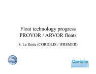
6.1 Float technology progress<br />
Float technology progress on PROVOR / ARVOR floats presented by V. Thierry and<br />
prepared by S. Le Reste<br />
Oxygen sensor: Thirteen PROVOR floats equipped with Aanderaa optode oxygen sensors<br />
have been deployed in the North-Atlantic in June 2010 and are working well. The float<br />
technology is now mature. Work is on-going to improve measurements accuracy. A <strong>meeting</strong> on<br />
this issue will be held in May in Brest, France.<br />
21
Nitrate sensor: We are also working on the implementation of a nitrate sensor on a PROVOR<br />
float (PROVNUTS float). The ISUS and SUNA sensors have been compared in laboratory and<br />
should be implemented on PROVOR floats soon and tested at sea.<br />
Density sensor: The “NOSS” sensor is dedicated to get density and salinity of seawater, by<br />
measuring the refractive index (position sensing detector) of a laser beam passing through the<br />
water sample to analyze. Tests have been carried out to assess its ability to be embedded on a<br />
float (accuracy, pressure withstanding, turbidity & temperature & light influence).<br />
Deep Arvor float: The objective is to reach 3500m depth with CTD and oxygen sensors. Work<br />
has been done to size the subsystems like the hydraulic engine, the pressure hull. The tests of<br />
2 hydraulic endcaps and several hull samples are on going. The CTD endcap has been<br />
designed and partially tested in our metrology laboratory.<br />
Arvor and Provor equipped with iridium transmission: Three Arvor-I (Arvor- Iridium) have<br />
been deployed since Dec 2009. Those deployments have proven the float capability to change<br />
its mission parameters and the utility of the “end of life” command that allows the recovery of the<br />
float. From a technical point of view, the float transmits 240 PTS triplets in 3 minutes but it stays<br />
30 minutes at the sea surface because it has to increase its buoyancy to improve transmission.<br />
To answer questions from the <strong>AST</strong> members: the Iridium transmission has been implemented to<br />
reduce surface time. The float is thus currently programmed to acquire 200 to 300 PTS triplets.<br />
This number can be increased to 1000 if required (1 sampling every 2dbar).<br />
Arvor with <strong>Argo</strong>s 3 transmission, development and first tests: <strong>Argo</strong>s 3rd generation<br />
transmission is being embedded on Arvor. It is intended to use the interactive mode capability<br />
(low data rate) of the MetopA satellite, using its prediction pass tables to <strong>meeting</strong> the satellite at<br />
surface. The objective is to send all the profile data while the MetopA pass. <strong>Argo</strong>s2 standard<br />
communication is maintained in case of interactive mode failure. The transmission was<br />
successfully tested in the Bay of Brest in October 2010. Two prototypes have been deployed in<br />
the Mediterranean Sea at the end of February. Analysis is on going because transmission<br />
duration is longer than expected.<br />
Future developments within the NAOS project: Some developments will be done on<br />
PROVOR and ARVOR floats within the French NAOS project to reduce costs and to improve<br />
float reliability and lifetime.<br />
Recent Technical Developments with APEX <strong>Argo</strong> Floats by S. Riser<br />
S. Riser presented on four developments including APEX air pump solenoid problems, some<br />
first tests of ARGOS-3, pressure sensor updates and SBE conductivity drift. The Apex air pump<br />
is used to inflate the air bladder at low pressures (< 100 dbar) so that the float rides on the sea<br />
surface with the antenna well out of the water. The air pump is controlled by a solenoid. For<br />
reasons unknown, a number of these solenoids, which cost less than $100, have failed in lab<br />
tests at UW in recent months. A failure in the field would mean the air bladder would not inflate,<br />
resulting in a possible loss of the ability to communicate with a satellite. This is especially<br />
problematic for Iridium floats. So far, the cause was found by D. Swift to be an inability of the<br />
solenoid to latch closed over the duration of an applied transient current. If the duration of the<br />
transient current was increased, the solenoid would always latch properly. There are no known<br />
changes in the controller electronics or the solenoid itself that would lead to this problem. The<br />
problem can be corrected by adding a small, inexpensive (less than $50), printed circuit board<br />
near the solenoid that regulates the current to the solenoid and insures that it always opens and<br />
22
closes on command. The board was designed by D. Swift and 100 units were built<br />
commercially in Seattle. This fix has been added to all UW and PMEL floats since February<br />
2011. Individual floats can be tested for this problem by connecting a laptop prior to deployment<br />
and inflating the bladder. Teledyne/Webb has been notified of this problem and the suggested<br />
remedy. As of March 2011, they have not instituted the remedy and they continue to build and<br />
ship floats with this potential problem. It is not clear whether or not they intend to add the<br />
auxiliary PCB in their production process.<br />
UW has developed a prototype float that uses a Kenwood PMT to communicate with ARGOS-3<br />
satellites. There were a couple of reasons for doing this. The first being that ARGOS-3 will<br />
someday provide bidirectional communications and could be a possible alternative to Iridium.<br />
The second being that the Seimac PTT used in Apex floats is no longer being manufactured so<br />
alternative communication methods for Apex ARGOS floats need to be explored. The first tests<br />
of the Kenwood PMT have shown that energy use is larger than with present ARGOS-2 PTTs.<br />
The PMT float has been running on a simulator at UW for several months and the PMT<br />
consumes more than twice the energy per transmission of the present ARGOS-2 Seimac PTT<br />
or Telonics PTT units.<br />
Finally, S. Riser presented on SeaBird CTD issues. SBE claims the microleak problem is now<br />
understood and fixed at the Druck factory. The glass/metal seals that caused the problem have<br />
been re-engineered and will be installed in SBE float CTDs beginning in July 2011. Until then,<br />
SBE is screening all Druck pressure sensors that are installed in float CTD units (possibly<br />
resulting in continued reduced production of CTD units). Some groups have tried the Kistler<br />
pressure sensors with good results so far in a limited number of floats for a limited time. SBE<br />
claims lab tests show the Kistler sensor to be as good or better than the new Druck sensors.<br />
Both Jamstec and PMEL have noted floats with unacceptable conductivity drift after deployment<br />
(> 0.01 PSU equivalent). This problem was traced to erosion of the platinum in the CTD<br />
electrodes. The cause of the problem has been found and new QC procedures have been<br />
installed at SBE. It is believed that this problem occurred in an isolated group of floats (CTDs<br />
built in late 2010) but all groups should check for this.<br />
Action item 26: S. Riser to draft a statement concerning solenoid problems on APEX<br />
floats to be <strong>posted</strong> on <strong>AST</strong> website and sent out on <strong>Argo</strong> email lists. S. Riser, M. Scanderbeg<br />
Action item 27: Ask SBE for serial numbers of CTDs having difficulty with conductivity<br />
sensor drift immediately after deployment and for serial numbers of CTDs with new, improved<br />
Druck sensor. S. Riser<br />
SOLO-II<br />
D. Roemmich updated everyone on the SOLO-II which is the newly redesigned SOLO float that<br />
is now commercially available through MRV Systems (http://www.mrvsys.com). The SOLO-II is<br />
engineered to complete around 300 dives anywhere in the world ocean using Iridium. It weighs<br />
less and is shorter than the SOLO making it easier to deploy.<br />
The first prototype SOLO-II was deployed in September 2009 and completed 20 three day<br />
cycles before being recovered. It was redeployed in February 2010 (WMO 490<strong>12</strong>42) and ran<br />
until its batteries were depleted in September 2010. During that time, it completed 324 deep<br />
cycles to 1750m with a 2 dbar sampling scheme on the rise all the way up to 3 dbar when the<br />
pump was turned off. The rise rate was around 13 cm/s. The second SOLO-II prototype had a<br />
new antenna and a redesigned bottom hemisphere and bladder. This one was deployed in<br />
23
October 2010 (WMO 490<strong>12</strong>77) and was recovered in January 2011. It completed about 100<br />
deep cycles (2000 m) along with about 30 shallow cycles for engineering tests. It again had a 2<br />
dbar sampling scheme, but the pump was shut off at 1 dbar. This float was refurbished to be<br />
identical to production floats and was redeployed in March 2011 (WMO 4901408).<br />
US production of the SOLO-II will be done by both SIO and MRV. 15 SOLO-II floats have been<br />
sent to Papeete for deployment along the equator with more than 150 floats to be built in 2011.<br />
D. Roemmich suggested trying to reach an agreed upon sampling scheme for Iridium/ high<br />
bandwidth floats that can more easily send back large amounts of data. He suggested sampling<br />
every 2 dbar for high resolution sampling which would give ocean mixing researchers more<br />
data. For SST and SSS sampling, he suggested turning the pump off closer to the surface,<br />
such as at 1 dbar. This can always be changed using Iridium if problems occur. It was agreed<br />
that getting measurements closer to the surface like that is better than continuing to take<br />
unpumped temperature measurements.<br />
6.2 Status of oxygen measurement and QC<br />
There will be an <strong>Argo</strong> Oxygen <strong>meeting</strong> in Brest, France 25-27 May 2011. The website is<br />
http://wwz.ifremer.fr/lpo/SO-<strong>Argo</strong>-France/<strong>Argo</strong>-oxygen-<strong>meeting</strong>. The conveners are Denis<br />
Gilbert, Steve Riser and Virginie Thierry. The topics include technical discussions on the use of<br />
dissolved oxygen sensors on floats and gliders, errors in measurement of dissolved oxygen,<br />
errors inherent in the various sensor types, correction methods and general QC procedures for<br />
float-based oxygen data.<br />
6.3 Thermally powered floats and gliders<br />
6.4 Update on near surface temperature<br />
There is a need from the SST community for measurements close to the surface to better<br />
observe the variation in near-surface temperatures under light winds. The diurnal variation in<br />
near-surface temperature is typically 1 to 2 K, but can reach 5 K. Normally, pumping of the CTD<br />
sensor on Apex is turned off around 4dbar to avoid contamination by pollutants at the surface.<br />
Near surface temperature (NST) capable (<strong>Argo</strong>s) Apex floats continue to sample temperatures<br />
after the CTD pump has been switched off. Cross-calibration samples are collected at 20 dbar,<br />
15 dbar, 10 dbar and 5 dbar which consist of a non-pumped PT immediately followed by a<br />
pumped PTS. At depths less than 5 dbar, <strong>12</strong> non-pumped PT samples are taken at 6 seconds<br />
intervals, this allows for sampling up to (and at) the surface at ~0.6 dbar intervals where the<br />
additional data can be transmitted with 2 extra <strong>Argo</strong>s messages.<br />
The GHRSST ‘goal’ (ideal) requirements are 10 cm sampling in the upper 3 m with 2.5 cm<br />
depth accuracy, and 50 cm sampling below 3 m to ~10-15 m with 10 cm depth accuracy. But<br />
where 50 cm sampling in the upper 3 m with 10 cm depth accuracy, and 100 cm sampling from<br />
3 m to ~10-15 m with 15 cm depth accuracy would be useful. GHRSST have clarified that<br />
pressure measurement is appropriate for depth. The largest stratification/diurnal variation is<br />
with very low winds, so waves should be small (although there may be longer wavelength<br />
swell). With higher waves (stronger winds) depth attribution will be harder but conditions are<br />
likely to be well-mixed.<br />
Jon Turton outlined some results from preliminary analysis of data from 8 NST-capable Apex<br />
floats deployed by UK. However, only 2 of these floats sampled the near-surface during the<br />
24
afternoon, when surface warm layers were most likely to occur. Comparison of the crosscalibration<br />
measurements showed very small differences between the pumped and nonpumped<br />
measurements (apart from one float where the non-pumped temperatures were<br />
consistently warmer). However, the good agreement was not surprising as in most profiles there<br />
was little or no temperature gradient, so any lag in the non-pumped measurements was<br />
impossible to identify.<br />
For the 2 floats that surfaced during the afternoon, the data showed the existence of nearsurface<br />
temperatures up to 2.5 °C warmer than the uppermost pumped temperature (at<br />
nominally 4 or 5m depth). Although relatively few stratified profiles were observed, the results<br />
show the NST capable Apex floats are able to observe near-surface temperature stratification<br />
that would otherwise remain undetected and so do provide useful additional information.<br />
To better quantify the benefit and accuracy of such near-surface temperature measurements,<br />
more NST capable Apex floats need to be deployed in regions where stratification is most likely<br />
and ‘timed’ to surface during the afternoon when stratification is likely to be strongest. More<br />
such floats are now in the water with 107 NST-capable floats having been deployed in the last 3<br />
years by US, UK, Japan and India. The number is likely to increase over the coming years. It<br />
was planned to continue the analysis, either with a soon to be recruited scientist at the Met<br />
Office or as a summer MSc dissertation project at the University of Reading (with Jon Turton<br />
and Andrea Kaiser-Weiss (GHRSST PO) as supervisors). The <strong>AST</strong> requested that the NSTcapable<br />
float data, from all countries, should be assembled and made available on a publically<br />
accessible website. <strong>AST</strong> also requested that an analysis of all the available data should be<br />
<strong>report</strong>ed to ADMT-<strong>12</strong>, to inform a decision on dissemination of the data via the GDACs.<br />
It was recognised the optimum longer-term approach was to <strong>report</strong> near-surface data from<br />
Iridium floats. Iridium floats typically record at 2 dbar vertical resolution; given the response of<br />
the T sensor (~½ s) it’s possible to sample every second (~0.1 dbar) but with the resolution of<br />
the P sensor (0.1 dbar) it is probably not worth sampling faster than every 2 s (~0.2 dbar<br />
spacing). Hence with Iridium floats it would be possible to meet the GHRSST ‘goal’ of 50 cm<br />
sampling from 5 to 15m depth and the ‘useful’ sampling of 50 cm for less than 5 m depth, but<br />
unlikely to be possible to achieve the 10 cm ‘goal’ accuracy above 5m. However, the accuracy<br />
of <strong>Argo</strong> temperature measurements is likely to be better than standard SST measurements from<br />
drifting buoys and Voluntary Observing Ships and although <strong>Argo</strong> would provide fewer <strong>report</strong>s<br />
they are of high accuracy with vertical information, so would be complimentary to these other<br />
sources.<br />
Action item 28: J. Turton to coordinate gathering unpumped temperature data from<br />
<strong>Argo</strong> PIs and work with GHRSST to place data in a public place and advertise it throughout their<br />
community. J. Turton, Y. Chao.<br />
Action item 29: J. Turton and GHRSST to analyze pumped and unpumped<br />
temperatures. Report back by the time of ADMT. J. Turton, Y. Chao<br />
6.5 <strong>Argo</strong> floats in the ice-zone<br />
S. Wijffels <strong>report</strong>ed on work done by E. Van Wijk and others (see more detailed paper in<br />
appendix) on the prospects for extending <strong>Argo</strong> into the seasonal and fast ice zone.<br />
Seasonal Ice Zone:<br />
There are several options for floats to operate successfully in the seasonal ice zone:<br />
1. Use Iridium/GPS with an ice-avoidance algorithm (AWI or U. Washington)<br />
25
-Short surface times [older Service <strong>Argo</strong>s/ice floats appear to have shorter lives]<br />
-Store iced-over profiles on board to return on next surfacing –no position<br />
2. Use iridium plus a RAFOS acoustic location network (AWI)<br />
Well over 100 floats are operating poleward of 60° and so <strong>Argo</strong> already collects a substantial<br />
amount of profile data in this high latitude ice-prone region. For the Southern Ocean, <strong>Argo</strong> has<br />
already collected more than 5 times the number of profiles than has been collected from ships.<br />
Little of the ship-based data will be from wintertime.<br />
How have these ice floats performed? The failure rate of early floats was high as the icecapable<br />
technology was developed and tested, and they used Service <strong>Argo</strong>s and thus would<br />
have long surface times. Mortality rates of newer ice floats are now equivalent to those<br />
deployed in less demanding conditions, but the short surface time associated with Iridium is also<br />
a likely factor. A number of floats deployed in the Weddell Sea have survived for 7 years.<br />
Several ice floats in the Australian array have survived for six winters and of the 43 ice floats<br />
deployed, 77% are currently active. Of the 17 floats that have been out for longer than two<br />
years, 16 have survived at least two or more winters and a further 7 floats have survived four or<br />
more winters. The University of Washington <strong>Argo</strong> group <strong>report</strong>s similar statistics with 104 ice<br />
floats deployed south of 60 ºS and 83% of these currently active (Riser, pers., comm.). Klatt<br />
<strong>report</strong>ed an 80% winter survival rate for the AWI fleet of 58 ice floats deployed in the Weddell<br />
Gyre. AWI has <strong>report</strong>ed a slight decline in float reliability in the Weddell Gyre in the last 3 years.<br />
This is due to several factors including; more southerly deployments and non ice-related issues<br />
such as firmware problems and Druck microleaks (Klatt, pers. comm.).<br />
AWI is working on further improvements to the ice detection algorithm. In addition they have<br />
equipped some recent ice floats with light detectors and are hoping to find a correlation between<br />
ice cover and light conditions.<br />
What do we need to extend <strong>Argo</strong> into the seasonal ice zone?<br />
At the nominal design density,<br />
1. 360 active floats would be required in the Southern Ocean (85 floats require acoustic<br />
receivers in the Weddell Gyre and 110 floats in the Ross Gyre).<br />
2. 300 active floats in the Arctic.<br />
Calculations are based on the number of floats required to populate the area between 60˚ of<br />
latitude and the fast ice edge with an assumed profiling depth of 2000 m in the Antarctic and<br />
900 m in the Arctic. Note –to maintain an array of 300 floats with a 20%/year loss rate requires<br />
100 deployments/year.<br />
Can we extend <strong>Argo</strong> to the Fast ice zone?<br />
This requires consideration of alternative sampling platforms, as profiling floats require free<br />
water to surface and reach satellite communication systems.<br />
A number of instruments have been developed for the fast-ice zone:<br />
-Ice Tethered Profilers (ITP)<br />
-Polar Ocean Profiling System (POPS)<br />
-acoustically-tracked floats with ice thickness sonars.<br />
Moving forward<br />
<strong>Argo</strong> should continue to pilot ice-capable floats in order to refine the technology and build<br />
experience to improve our understanding of float limitations/strengths in this zone. This is the<br />
only means of arriving at a robust implementation plan and budget. The idea was mooted to<br />
26
hold a Sea Ice/Oceans Observational Strategy Workshop in 20<strong>12</strong>. Several <strong>AST</strong> members<br />
supported this idea. The newly established Southern Ocean Observing System Project Office in<br />
Hobart will be approached to host the workshop.<br />
In the discussion following the presentation, it was suggested that any floats deployed near the<br />
ice zone should have the ice avoidance algorithm which is a free feature of APEX floats. It was<br />
also noted that both the US and German groups are having more trouble in the Arctic region.<br />
7 Demonstrating <strong>Argo</strong>’s value<br />
7.1 Upcoming science <strong>meeting</strong>s<br />
7.1.1 IUGG<br />
The IUGG <strong>meeting</strong> will be held in Melbourne, Australia ( 27 June – 8 July 2011) and there will<br />
be a session that will focus on <strong>Argo</strong> and other ocean observing systems.<br />
7.1.2 WCRP<br />
There is an upcoming WCRP <strong>meeting</strong><br />
7.1.3 OSTST<br />
A joint <strong>Argo</strong> and Altimetry workshop will precede the next Ocean Surface Topography Science<br />
Team Meeting which will be 19-21 October, 2011. The workshop, entitled “Jason and the<br />
<strong>Argo</strong>nauts: Exploiting the Synergy Between <strong>Argo</strong> and Satellite Altimetry” will be on 18 October,<br />
2011 in San Diego, CA. D. Roemmich asked for volunteers to serve on the science organizing<br />
committee to help with planning and promoting the OSTST/<strong>Argo</strong> workshop.<br />
Action item 30: Create a science organizing committee to help with planning and<br />
promoting the OSTST/<strong>Argo</strong> workshop, P-Y LeTraon, B. Owens, P. Polito, <strong>AST</strong> members.<br />
7.2 <strong>Argo</strong> bibliography<br />
M. Scanderbeg presented work done in the last year on the bibliography pages on the <strong>AST</strong><br />
website. Everyone was reminded that now only the <strong>Argo</strong> bibliography and the <strong>Argo</strong> in press<br />
bibliography pages are maintained. A couple different cases were discussed and it was agreed<br />
that papers who use model outputs based on <strong>Argo</strong> data, but where <strong>Argo</strong> data are not<br />
specifically mentioned in the paper will not be included in the bibliography. This is mainly to<br />
equally exclude all such papers since it is a large job to find all the papers based on model<br />
outputs where <strong>Argo</strong> data is used. The second case brought up was where it is mentioned that<br />
<strong>Argo</strong> data will make future work more feasible. M. Scanderbeg said that these papers were also<br />
excluded from the bibliography. The reasoning here being that the bibliography is meant to<br />
accurately portray the number of papers published using <strong>Argo</strong> data and not using the possibility<br />
of <strong>Argo</strong>.<br />
M. Scanderbeg also maintains graphs showing the number of papers published per year and<br />
the numbers of papers published per country as designated by the country of the first author on<br />
the paper. There were almost 90 more papers published in 2010 (202) than in 2009 (114).<br />
About half of these additional papers came from OceanObs’09 plenary papers and from articles<br />
written in languages other than English. It was also noted that maintaining the in press page is<br />
becoming easier as more journals are listing in press citations on their websites.<br />
27
Several national <strong>report</strong>s for the <strong>AST</strong>-<strong>12</strong> <strong>meeting</strong> contained lists of citations which allowed<br />
comparison with the <strong>Argo</strong> bibliography. In most cases, M. Scanderbeg had found the majority<br />
of the citations. The exceptions were citations in biological journals, journals within the country,<br />
especially in other languages and book chapters. Therefore, it appears that the search criteria<br />
are working well for physical oceanographic papers, but work needs to be done to expand to<br />
other areas like biological papers and books. Google Scholar should be able to help with this<br />
and it has become a main search engine to find <strong>Argo</strong> citations. To maintain the bibliography<br />
and the in press page, all <strong>AST</strong> members were again encouraged to continue sending any<br />
citations of <strong>Argo</strong> papers to argo@ucsd.edu.<br />
7.3 Google Ocean<br />
S. Diggs introduced the use of web-based interfaces such as Google Earth to promote ocean observations<br />
to a larger public and mentioned the existing partnership Scripps/Google on that regard.<br />
The <strong>Argo</strong> TC presented the work achieved within JCOMMOPS, in cooperation with Scripps colleagues<br />
(M. Scanderbeg, S. Diggs, J. Gilson) on the <strong>Argo</strong> layers for Google Earth.<br />
This application is ideal for network tracking, promotion and demonstration to a lager public. It is also<br />
used extensively by <strong>Argo</strong>nauts to retrieve beached floats, plan their deployments, relay feedback on data<br />
QC, etc. In addition the application provides map access to the <strong>Argo</strong> Marine Atlas (data source: Scripps,<br />
100% <strong>Argo</strong>) with temp, salinity, steric height and anomalies layers, over ten depth levels and since 2004.<br />
In addition to assembling all web tools available for floats and related observations on the web (made by<br />
<strong>Argo</strong> PIs, agencies, global/regional data centres) it provides a set of “float stories” ( “float of the month”<br />
news items), forming gradually a rich educational content. Some “climate change” oriented stories could<br />
also be added along with the T/S/SH layers and the application could be linked with e.g. OOPC ocean<br />
climate indices.<br />
The work will soon be ready to be presented to Google for a potential partnership. The <strong>AST</strong> thanked the<br />
TC and the team for making this tool available to the community.<br />
On a different outreach note, the BBC World News, following an IOC/GOOS initiative, has set up a 30<br />
minute movie to tell the story of GOOS and <strong>Argo</strong> in particular. The movie includes sequences in Hobart<br />
(CSIRO, with S. Wijffels as “earth <strong>report</strong>er” and movie focal point), Toulouse (JCOMMOPS office, <strong>Argo</strong><br />
TC, and a duplex with Hobart), and Buenos Aires (<strong>AST</strong> <strong>meeting</strong> 2011, key <strong>AST</strong> members). This is great<br />
promotional material for GOOS and <strong>Argo</strong>. The Google Earth displays have been used throughout the<br />
movie.<br />
28
http://argo.jcommops.org/argo.kml<br />
see demo videos at: http://w3.jcommops.org/FTPRoot/<strong>Argo</strong>/TMP/Google<br />
Action item 31: Euro<strong>Argo</strong> to identify someone to enter educational stories into the<br />
Google Earth <strong>Argo</strong> layer. M. Scanderbeg<br />
Action item 32: Finish the Google Earth <strong>Argo</strong> layer development and approach Google<br />
to include it in Earth layers. Diggs, ATC, Japan<br />
7.4 <strong>Argo</strong>nautics Newsletter<br />
M. Scanderbeg presented ideas for the next <strong>Argo</strong>nautics Newsletter which will likely be<br />
published by the end of June. Proposed articles include trajectory work done by M. Ollitrault and<br />
JP Rannou, the new Google Earth layer showcasing <strong>Argo</strong> and a surface pressure offset<br />
updated. Additional articles include float technology updates for the ARVOR, SOLO-II and<br />
Deep NINJA floats, an explanation of the Euro<strong>Argo</strong> educational website, <strong>meeting</strong> summaries<br />
and a description of the newest ship to deploy floats – the Lady Amber.<br />
7.5 <strong>Argo</strong> outreach activities<br />
7.5.1 Education outreach in South Africa<br />
Dr Juliet Hermes of the South African Environmental Observation Network (SAEON), gave a<br />
presentation on <strong>Argo</strong> Outreach activities in South Africa (and a quick SA/regional update!) on<br />
behalf of Thomas Mtontsi, SAEON; Isabelle Ansorge and Chris Reason, University of Cape<br />
29
Town and South African National Antarctic Program and Johan Stander, South African Weather<br />
Service. Juliet focussed on the SAEON education program, of which <strong>Argo</strong> floats form a key<br />
component. This program creates a platform where Marine Science Research can be integrated<br />
into School Sciences curriculum (with buy-in from the Department of Education). There are<br />
three main thrusts:<br />
• Educator/teacher support through workshops and forum <strong>meeting</strong>s (train the trainer)<br />
• School based monitoring programmes similar: <strong>Argo</strong> Floats and Adopt a Drifter<br />
Programme and weather and climate monitoring with weather station.<br />
• Additional learner/ student support in Science Camp = Short leg sea cruises<br />
The program currently works with 5 previously disadvantaged schools, 4 of which are from<br />
coastal communities, we aim to add a further coastal school by end of this year. The schools<br />
work on individual projects but monitoring groups get together at weekend camps to exchange<br />
ideas and problems. Since SAEON has 6 different focal nodes with similar education programs<br />
(1 is coastal) the aim is to take the program to inland schools some of which have no concept of<br />
the oceans.<br />
The education program provides a focal point for marine education activities and collaborates<br />
with all marine institutes to provide support and prevent duplication. There is also active<br />
involvement in marine awareness activities, reaching 1000’s of learners, as well as the general<br />
public.<br />
Juliet went on to describe who works with the data, highlighting areas of the South African<br />
curriculum where <strong>Argo</strong> floats and the data could be integrated:<br />
• Focused groups at the school community – monitoring teams and the teacher/educator<br />
are responsible for downloading data<br />
• For use in Mathematics, physical science, life sciences, Geography and Natural Science<br />
activities<br />
• Grade 10 and 11 (ages 15 & 16)<br />
• Excellent, fun tool for awareness activities<br />
Juliet described in detail some of the key activities as well as giving information about<br />
awareness programs, the staff involved and the technology used (Magic Planet). Juliet finished<br />
up with brief details of South African activities of interest to the <strong>Argo</strong> community and highlighted<br />
that all SA marine institutes highlighted their potential to be more involved with <strong>Argo</strong> over the<br />
next 5 years:<br />
• New vessel commissioned for 20<strong>12</strong><br />
• Further ASCLME cruises – looking for floats to deploy along Kenya/Somalia all floats<br />
received from NOAA<br />
• Government focus – Global Change Grand Challenge, shift in Departments and a new<br />
Department of Environmental Affairs - with focus on ocean research in particular<br />
operational oceanography<br />
• Southern Ocean Carbon Monitoring – 6-8 gliders this year<br />
• Continue to support <strong>Argo</strong> activities where possible and continue to deploy <strong>Argo</strong> floats<br />
when requested<br />
30
7.5.2 Global Marine <strong>Argo</strong> Atlas<br />
M. Scanderbeg presented on the development of the Global Marine <strong>Argo</strong> Atlas which uses<br />
Ferret to create plots of gridded data. Currently we have a PC version of the Atlas which comes<br />
with the 4-D gridded <strong>Argo</strong> dataset made at Scripps Institution of Oceanography (Roemmich and<br />
Gilson, 2009), the Reynolds SST dataset, and the AVISO dataset. The <strong>Argo</strong> grid and the<br />
Reynolds grids are available from 2004 to the previous month, with updates available after the<br />
15 th of the month. The AVISO dataset covers the period of 2004 to October 2009 (soon to be<br />
updated through March 2010). Additionally, there is a near real time <strong>Argo</strong> dataset available with<br />
the most recent data in the past 10 days for the equatorial region. It is possible to create map<br />
plots, section plots, time series, line drawings and a few simple products. Both postscript and<br />
jpg outputs are available for plots that are created using the Atlas. Besides giving a quick view<br />
of the datasets, the Atlas is a great way to compare datasets quickly. The user can easily<br />
create similar plots with different datasets within the Atlas or the user can output a plot similar to<br />
one from another dataset. The intended audience for the Atlas includes teachers and students,<br />
government officials and scientists. To make the Atlas more appealing to classrooms, we are<br />
developing a MAC version which should be available soon. Another new feature that will be<br />
ready soon is the option to create an output file in ascii or netcdf that contains the data used to<br />
make the desired plot. We are also working on maps of temperature and salinity on density<br />
surfaces. To find out more details, visit the website at:<br />
http://www.argo.ucsd.edu/Marine_Atlas.html. Feedback is always welcome.<br />
7.6 1-page document on sustaining <strong>Argo</strong><br />
D. Roemmich reminded the <strong>AST</strong> of the 1-page document on sustaining <strong>Argo</strong> that was prepared<br />
for <strong>AST</strong>-11. He said that he had used it during the year and that it had been recently updated<br />
after other <strong>AST</strong> members had reviewed it. He acknowledged that it was very dense and not<br />
appropriate for a lay person and wondered if <strong>Argo</strong> needed something else that could be simpler<br />
and given out to lay people. A few <strong>AST</strong> members agreed to review the document further and to<br />
see if a separate document could be created for lay people.<br />
31
Action item 33: M. Scanderbeg to post updated document (word version) on <strong>AST</strong><br />
<strong>meeting</strong> website. Interested PIs can review the 1 page document and <strong>report</strong> back to D.<br />
Roemmich. <strong>AST</strong> members are encouraged to develop a separate document for lay people.<br />
8 Future <strong>meeting</strong>s<br />
8.1 ADMT-<strong>12</strong><br />
ADMT-<strong>12</strong> will be hosted by KMA in Seoul, Korea in November 2011.<br />
Action item 34: Discuss with ADMT co-chairs and Korea to set the dates of the ADMT<br />
<strong>meeting</strong> in November. S. Wijffels, Korea/KMA<br />
8.2 <strong>AST</strong>-13<br />
<strong>AST</strong>-13 will be hosted by Euro<strong>Argo</strong> in Paris in March 20<strong>12</strong>.<br />
9 <strong>AST</strong> Membership<br />
After several requests for some countries to have more than one <strong>AST</strong> member, mainly for<br />
funding purposes, it was recognized that two people can now be listed on the <strong>AST</strong> website as<br />
<strong>AST</strong> members for one country. It will still be important to have one main person who will be the<br />
point of contact for the country, so the first name listed will be the main contact. If a country<br />
wishes to add another <strong>AST</strong> member, please contact M. Scanderbeg.<br />
Action item 35: Institute a shared <strong>AST</strong> membership for countries who so desire. The<br />
first name listed on the <strong>AST</strong> website will be the main point of contact. <strong>AST</strong> countries, M.<br />
Scanderbeg<br />
10 Other business<br />
It was recognized that the issue of a float sampling scheme is becoming more important as<br />
more floats are being equipped with Iridium and other high bandwidth communications. It would<br />
beneficial to have as many <strong>Argo</strong> floats following the same sampling protocols as possible and<br />
so it was asked that <strong>AST</strong> members come to <strong>AST</strong>-13 ready to discuss this.<br />
Action item 36: <strong>AST</strong> members to consider to discuss at <strong>AST</strong>-13 harmonizing sampling<br />
protocols. <strong>AST</strong> members.<br />
Additionally, it was recognized that many groups are interested in extending <strong>Argo</strong> to other<br />
areas, like the marginal seas, the ice zones, and to add other sensors. These groups are<br />
interested in proceeding with the acceptance of <strong>Argo</strong> at the international level. To that end, it<br />
was requested that groups wishing to expand <strong>Argo</strong> need to prepare specific scientific plans on<br />
how to do this.<br />
Action item 37: Ask Euro<strong>Argo</strong> and others to prepare presentations on science plan for<br />
marginal seas for <strong>AST</strong>-13. Euro<strong>Argo</strong> and others interested in marginal seas.<br />
32
<strong>Argo</strong> Steering Team Meeting (<strong>AST</strong>-<strong>12</strong>)<br />
Regente Palace Hotel, Buenos Aires Argentina March 15-17, 2011<br />
Host: <strong>Argo</strong> Argentina<br />
1. Welcome (9 am March 15)<br />
2. Local arrangements (Troisi)<br />
3. Objectives of the <strong>meeting</strong>/adoption of the agenda<br />
How will <strong>Argo</strong> be sustained and enhanced in the next few years?<br />
What actions are needed so that <strong>Argo</strong> data quality is sufficient for global change studies?<br />
4. Status of action items from <strong>AST</strong>-11 (Scanderbeg)<br />
5. Implementation issues<br />
5.1 Status of <strong>Argo</strong> (Belbéoch)<br />
5.2 Sustaining and evolving <strong>Argo</strong>: Following up the OceanObs’09 consensus. (Lindstrom)<br />
5.3 Euro<strong>Argo</strong> update (LeTraon)<br />
5.4 New Brazil plans (Polito, Sato)<br />
5.5 Update commitments table (Scanderbeg)<br />
Will the missed 2009/2010 deployments be made up in 2011?<br />
5.6 Float deployment opportunities (Belbéoch)<br />
5.7 Discussion on beached floats (Hosoda)<br />
5.8 Forum for the future of Japan <strong>Argo</strong> (Suga)<br />
5.9 Bio-<strong>Argo</strong> update (Claustre)<br />
5.10 AIC and JCOMM Observing Program Support Centre (Freeland, Belbéoch).<br />
5.11 Discussion items from National Reports?<br />
6. Data Management related issues<br />
6.1 Feedback from ADMT-11 (Ignaszewski/Pouliquen)<br />
6.2 Impact of pressure errors on the <strong>Argo</strong> dataset (Wijffels)<br />
6.3 Status of trajectory data (B. King/Ollitrault)<br />
6.4 Transition to new ARGOS location method (Belbéoch)<br />
6.5 CCHDO and NODC activity (S. Diggs, T. Boyer)<br />
7. Science talks:<br />
7.1 M. Ravichandran “Recent sea level trend in the Indian Ocean revealed from <strong>Argo</strong>,<br />
Altimetry and GRACE”<br />
7.2 Phil Sutton “Decadal Steric and Sea Surface Height Changes in the Southern<br />
Hemisphere”<br />
7.3 Martin Saraceno “<strong>Argo</strong> and satellite observations of the anticyclonic circulation around<br />
the Zapiola Rise in the South Atlantic”<br />
8. Technical issues<br />
8.1 Float technology progress (Riser, Thierry, Suga, Roemmich)<br />
8.2 Status of oxygen measurement and QC (Riser, Thierry/Gilbert/Kobayashi)<br />
8.3 Thermally-powered floats and gliders (Chao)<br />
8.4 Update on near-surface temperature (Turton)<br />
8.5 <strong>Argo</strong> floats in the ice-zone (Wijffels)<br />
9. Demonstrating <strong>Argo</strong>’s value/evolving for <strong>Argo</strong>’s future<br />
9.1 Upcoming science <strong>meeting</strong>s: IUGG, WCRP, OSTST<br />
9.2 <strong>Argo</strong> bibliography (Scanderbeg)<br />
9.3 Google Ocean (Diggs/Belbeoch)<br />
33
9.4 <strong>Argo</strong>nautics Newsletter (Scanderbeg)<br />
9.5 <strong>Argo</strong> outreach activities – (J. Hermes), (Scanderbeg on Atlas progress)<br />
9.6 1-page document on sustaining <strong>Argo</strong> (Roemmich)<br />
10. Future <strong>meeting</strong>s<br />
10.1 ADMT-<strong>12</strong><br />
10.2 <strong>AST</strong>-13<br />
11. <strong>AST</strong> Membership – proposal for “shared” memberships<br />
<strong>12</strong>. Other business<br />
34
first name name Institution and Address e-mail address<br />
Mathieu BELBEOCH JCOMMOPS, 8-10, rue Hermès,Parc belbeoch@jcommops.org<br />
technologique du Canal , 1526 Ramonville<br />
Cédex<br />
Yi CHAO Jet Propulsion Laboratory, 4800 Oak Grove<br />
Drive, Pasadena, CA USA 91109<br />
Yi.Chao@jpl.nasa.gov<br />
howard.freeland@dfompo.gc.ca<br />
Yoshiaki KANNO Japan Meteorological Agency, 1-3-4<br />
Otemachi, Chiyoda ward, Tokyo, 100-8<strong>12</strong>2<br />
Japan<br />
Brian KING National Oceanography Centre,<br />
Southampton, Empress Dock,<br />
Southampton, Hampshire, S014 3ZH UK<br />
Birgit KLEIN Bundesamt fuer Seeschifffahrt und<br />
Hydrographie, bernhard-Nocht-str. 78,<br />
Hamburg, Germany 20359<br />
Pierre- LE TRAON IFREMER, Centre de Brest BP70, Plouzane,<br />
Yves<br />
France 29280<br />
Emina MAMACA IFREMER, Technopole Brest Iroise BP70,<br />
Plouzane, France 29280<br />
Alberto PIOLA Servicio de Hidrografia Naval,<br />
Depatamento Oceanografia, Av. Montes de<br />
Oca 2<strong>12</strong>4, Buenos Aires Argentina<br />
C<strong>12</strong>70ABV<br />
Steve PIOTROWICZ National Oceanic and Atmospheric<br />
Administration, 1100 Wayne Ave, Suite<br />
<strong>12</strong>02, Silver Spring, MD 20910 USA<br />
Paulo POLITO Instituto Oceanografico da Univ. de Sao<br />
Paulo, Praca do Oceanografico 191, Sao<br />
Paulo, 05508-<strong>12</strong>0, Brazil<br />
Muthalagu RAVICHANDRAN Indian National Centre for Ocean<br />
Information Services, Post Bag No. 21,<br />
IDA Jeedimetla, Ocean Valley, Hyderabad,<br />
Andhra Pradesh, 500055, India<br />
Stephen RISER University of Washington, School of<br />
Oceanography, Seattle, WA 98195, USA<br />
Dean ROEMMICH Scripps Institution of Oceanography, 9500<br />
Gilman Dr., #0230, La Jolla, CA 92093-<br />
0230, USA<br />
claustre@obs-vlfr.fr<br />
sdiggs@ucsd.edu<br />
Herve CLAUSTRE Laboratory of Oceanography, Quai de la<br />
Darse, Villefranche sur mer, PACA 06230<br />
France<br />
Steve DIGGS Scripps Institution of Oceanography, 9500<br />
Gilman Dr., #0214, La Jolla, CA 92093-<br />
0214, USA<br />
Howard FREELAND Fisheries and Oceans Canada, Institute of<br />
Ocean Sciences, North Saanich, BC V8L<br />
4B2 CANADA<br />
Denis GILBERT Fisheries and Oceans Canada, 850 route<br />
de la mer, P.O. Box 1000, Mont-Joli,<br />
Quebec, G5H 3Z4 Canada<br />
Juliet HERMES South African Environmental Observation<br />
Network, Martin Hammerschlag Way,<br />
Roggebaai, Cape Town, Western Cape,<br />
80<strong>12</strong> South Africa<br />
Shigeki HOSODA JAMSTEC, 2-15, Natsushima-cho,<br />
Yokosuka, Kanagawa, 237-0061 Japan<br />
denis.gilbert@dfo-mpo.gc.ca<br />
juliet@saeon.ac.za<br />
hosodas@jamstec.go.jp<br />
k_sato@jamstec.go.jp<br />
b.king@noc.soton.ac.uk<br />
Birgit.klein@bsh.de<br />
pierre.yves.le.traon@ifremer.fr<br />
emina.mamaca@ifremer.fr<br />
apiola@hidro.gov.ar<br />
steve.piotrowicz@noaa.gov<br />
polito@usp.br<br />
ravi@incois.gov.in<br />
riser@ocean.washington.edu<br />
droemmich@ucsd.edu<br />
35
Sang<br />
Boom<br />
RYOO National Institute of Meteorological<br />
Research, Sindaebang 2-dong, 460-18,<br />
Dongjak-gu, Seoul, 156-720 Korea<br />
Martin SARACENO Universidad de Buenos Aires, Intendente<br />
Guiraldes 2160, Ciudad de Buenos Aires,<br />
C1428EGA Argentina<br />
Olga SATO Oceanographic Institute - University of Sao<br />
Paulo, Praca do Ocenografico, 191, Cidade<br />
Universitaria, Sao Paulo, 05508-<strong>12</strong>0 Brazil<br />
Kanako SATO JAMSTEC, 2-15, Natsushima-cho,<br />
Yokosuka, Kanagawa, 237-0061 Japan<br />
Megan SCANDERBEG Scripps Institution of Oceanography, 9500<br />
Gilman Dr., #0230, La Jolla, CA 92093-<br />
0230, USA<br />
Moon-Sik SUK <strong>12</strong>70 Sa-dong, Sangnok-ku, Ansan, Seoul,<br />
Rep. of Korea 425-600<br />
Phil SUTTON NIWA, 301 Evans Bay Parade, Greta Point,<br />
Wellington, New Zealand, 6021<br />
Virginie THIERRY IFREMER, Laboratoire de Physique des<br />
Oceans, BP70, Plouzane, France 29280<br />
Ariel TROISI Servicio de Hidrografia Naval, A. Montes<br />
de Oca 2<strong>12</strong>4, Buenos Aires, ARGENTINA<br />
C<strong>12</strong>70ABV<br />
Jonathan TURTON Met Office, FitzRoy Rd, Exeter, Devon EX1<br />
3PB UK<br />
Susan WIJFFELS Centre for Australian Weather and Climate<br />
Research, CSIRO, Castray Esplanade,<br />
Hobart, Tasmania, 7004 Australia<br />
sbryoo@korea.kr<br />
saraceno@cima.fcen.uba.ar<br />
olga.sato@usp.br<br />
k_sato@jamstec.go.jp<br />
mscanderbeg@ucsd.edu<br />
msuk@kordi.re.kr<br />
p.sutton@niwa.co.nz<br />
vthierry@ifremer.fr<br />
ahtroisi@gmail.com<br />
jon.turton@metoffice.gov.uk<br />
susan.wijffels@csiro.au<br />
36
Action Responsibility Status<br />
1 <strong>AST</strong> co-chairs to send a letter of <strong>AST</strong> co-chairs<br />
thanks to Ariel Troisi for hosting<br />
<strong>AST</strong>-<strong>12</strong><br />
2 Define more specifically what <strong>Argo</strong> <strong>AST</strong> co-chairs<br />
core means to help the <strong>Argo</strong><br />
Technical Coordinator to make<br />
more useful statistics<br />
3 <strong>AST</strong> co-chairs to send a letter from <strong>AST</strong> co-chairs<br />
<strong>Argo</strong> to the OOPC and Lindstrom<br />
expressing <strong>Argo</strong>’s concern about a<br />
lack of funding to help <strong>Argo</strong> follow<br />
up on enhancements from<br />
OceanObs’09<br />
4 Explore ways to more effectively<br />
share deployment opportunities<br />
among <strong>Argo</strong> float providers,<br />
ATC, float deployers,<br />
PIs/<strong>AST</strong> members<br />
with navy connections<br />
including navy ships in pirate prone<br />
areas.<br />
5 If a beached float has been reset ATC, float owner<br />
and is to be redeployed, a new<br />
WMO ID needs to be assigned to<br />
the float and it needs to be renotified.<br />
If the float has not been<br />
reset, it is permissible to redeploy<br />
the float with the same WMO ID<br />
6 <strong>AST</strong> co-chairs to write letter to <strong>AST</strong> co-chairs<br />
Bio<strong>Argo</strong> and IOCCG: the <strong>AST</strong><br />
welcomed the <strong>report</strong> of the Bio<strong>Argo</strong><br />
group, consistent with the<br />
recommended <strong>Argo</strong> enhancements<br />
from OceanObs’09, and endorses<br />
the continued development of the<br />
technology, data management and<br />
the plans in consultation with the<br />
<strong>AST</strong>.<br />
7 H. Freeland to ask countries who H. Freeland<br />
are not contributing to the AIC to<br />
consider contributing. H. Freeland<br />
to ask countries who are<br />
contributing if they can increase<br />
and/ or change their contributions<br />
to be based on a percentage rather<br />
than a flat amount.<br />
8 <strong>Argo</strong> TC to add floats to his system <strong>Argo</strong> TC<br />
and produce a simpler <strong>report</strong> each<br />
month. <strong>Argo</strong> TC to produce a more<br />
detailed <strong>report</strong> every 3-4 months<br />
9 <strong>Argo</strong> TC to fully implement the EEZ<br />
monitoring system so that<br />
<strong>Argo</strong> TC<br />
37
implementers can notify Member<br />
States bilaterally according to Res.<br />
XLI-14.<br />
10 <strong>Argo</strong> TC to finalize the float<br />
donation contracts with IOC legal<br />
experts<br />
11 Ask float expert for each float type<br />
to clearly document how technical<br />
data <strong>report</strong>ed by each float<br />
matches variables in the technical<br />
file.<br />
<strong>12</strong> KORDI requests Australia’s help<br />
and expertise to perform delayed<br />
mode quality control on its floats in<br />
the Southern Ocean<br />
13 Clearly state that in the upcoming<br />
<strong>Argo</strong>nautics and on <strong>Argo</strong> websites,<br />
including national websites, that<br />
<strong>Argo</strong> users should download <strong>Argo</strong><br />
data from the GDACs<br />
14 Change wording of how to<br />
acknowledge <strong>Argo</strong> on the <strong>AST</strong><br />
website to:<br />
These data were collected and<br />
made freely available by the<br />
International <strong>Argo</strong> Program and the<br />
national programs that contribute to<br />
it. (http://www.argo.ucsd.edu,<br />
http://argo.jcommops.org). The<br />
<strong>Argo</strong> Program is part of the Global<br />
Ocean Observing System<br />
15 DACs to correctly fill the pressure<br />
sensor serial number in the<br />
metafiles<br />
16 DACs to finish pressure corrections<br />
and TNDP indentification and<br />
labeling on their floats, with<br />
assistance where needed. To be<br />
completed by ADMT<strong>12</strong><br />
17 Form a small scientific group to<br />
design a new trajectory file format<br />
to present at the upcoming ADMT<br />
<strong>meeting</strong><br />
18 <strong>AST</strong> co-chairs to write a letter of<br />
support to finish ANDRO through<br />
2009. B. King will draft contents of<br />
letter.<br />
<strong>Argo</strong> TC<br />
PROVOR: S.<br />
LeReste<br />
APEX: A. Wong<br />
SOLO: J. Gilson, P.<br />
Robbins<br />
NEMO: B. Klein<br />
NINJA: T. Suga<br />
Australia, KORDI<br />
M. Scanderbeg, <strong>Argo</strong><br />
webpage managers<br />
M. Scanderbeg<br />
DACs<br />
DACs<br />
B. King, M.<br />
Scanderbeg<br />
<strong>AST</strong> co-chairs, B.<br />
King<br />
19 Ask B. King to consider organizing B. King, M.<br />
38
a trajectory workshop alongside the<br />
upcoming ADMT <strong>meeting</strong> to<br />
familiarize DACs with new<br />
trajectory file format. Consider<br />
inviting M. Ollitrault/JP Rannou to<br />
attend the <strong>meeting</strong><br />
20 Ask DACs and interested PIs to<br />
evaluate the new <strong>Argo</strong>s positioning<br />
system to decide if <strong>Argo</strong> wants to<br />
adopt it. Report results back to<br />
M. Scanderbeg by 20 May 2011.<br />
Unless a problem is found, all of<br />
<strong>Argo</strong> will switch to the new system<br />
in June 2011.<br />
21 If <strong>Argo</strong> decides to adopt the new<br />
<strong>Argo</strong>s positioning system, explore<br />
the offer of CLS to reprocess all<br />
<strong>Argo</strong>s data from 2008 onwards.<br />
22 Coriolis to make a new historical<br />
reference database for DMQC<br />
purposes on a twice yearly basis.<br />
Explore why this has not occurred<br />
in the past.<br />
23 Ask J. Gilson to repeat his<br />
comparison of <strong>Argo</strong> profile<br />
reference database to updated<br />
historical reference database to<br />
see if it is improving in the<br />
Southern Ocean<br />
24 Provide CCHDO known upcoming<br />
CTD cruise track and dates to enter<br />
into the CruiseTracker database<br />
25 AIC to invite float operators to also<br />
give information when notifiying<br />
deployment plans on whether CTD<br />
and oxygen will be done on<br />
deployment cruises<br />
26 S. Riser to draft a statement<br />
concerning solenoid problems on<br />
APEX floats to be <strong>posted</strong> on <strong>AST</strong><br />
website and sent out on <strong>Argo</strong> email<br />
lists<br />
27 Ask SBE for serial numbers of<br />
CTDs having difficulty with<br />
conductivity sensor drift<br />
immediately after deployment and<br />
for serial numbers of CTDs with<br />
new, improved Druck sensor<br />
28 J. Turton to coordinate gathering<br />
unpumped temperature data from<br />
Scanderbeg<br />
DACs and interested<br />
PIs, M. Scanderbeg<br />
ATC, <strong>AST</strong> co-chairs<br />
S. Pouliquen<br />
J. Gilson<br />
PIs, CCHDO<br />
ATC<br />
S. Riser, M.<br />
Scanderbeg<br />
S. Riser<br />
J. Turton, Y Chao<br />
39
<strong>Argo</strong> PIs and work with GHRSST to<br />
place data in a public place and<br />
advertise it throughout their<br />
community<br />
29 J. Turton and GHRSST to analyze<br />
pumped and unpumped<br />
temperatures. Report back by the<br />
time of ADMT.<br />
30 Create a science organizing<br />
committee to help with planning<br />
and promoting the OSTST/<strong>Argo</strong><br />
workshop<br />
31 Euro<strong>Argo</strong> to identify someone to<br />
enter educational stories into the<br />
Google Earth <strong>Argo</strong> layer<br />
32 Finish the Google Earth <strong>Argo</strong> layer<br />
development and approach Google<br />
to include it in Earth layers<br />
33 M. Scanderbeg to post updated<br />
document (word version) on <strong>AST</strong><br />
<strong>meeting</strong> website. Interested PIs<br />
can review the 1 page document<br />
and <strong>report</strong> back to D. Roemmich.<br />
Could also develop a separate<br />
document for lay people.<br />
34 Discuss with ADMT co-chairs and<br />
Korea to set the dates of the ADMT<br />
<strong>meeting</strong> in November.<br />
35 Institute a shared <strong>AST</strong> membership<br />
for countries. First name listed on<br />
website is main point of contact.<br />
36 <strong>AST</strong> members to consider to<br />
discuss at <strong>AST</strong>-13 harmonizing<br />
sampling protocols<br />
37 Ask Euro<strong>Argo</strong> and others to<br />
prepare presentations on science<br />
plan for marginal seas for <strong>AST</strong>-13<br />
J. Turton, Y Chao<br />
P-Y LeTraon, B.<br />
Owens, P. Polito,<br />
possible G. Han, <strong>AST</strong><br />
members<br />
M. Scanderbeg<br />
Diggs, ATC, Japan<br />
M. Scanderbeg, PIs,<br />
D. Roemmich, B.<br />
Owens<br />
S. Wijffels,<br />
Korea/KMA<br />
<strong>AST</strong> countries, M.<br />
Scanderbeg<br />
<strong>AST</strong> members<br />
Euro<strong>Argo</strong>, others<br />
interested in marginal<br />
seas<br />
40
Sheet1<br />
2004<br />
<strong>Argo</strong><br />
deployed<br />
2004<br />
<strong>Argo</strong><br />
equiv<br />
2005<br />
<strong>Argo</strong><br />
deployed*<br />
2005<br />
<strong>Argo</strong><br />
equiv<br />
2006<br />
<strong>Argo</strong><br />
deployed<br />
2006<br />
<strong>Argo</strong><br />
equiv<br />
2007<br />
<strong>Argo</strong><br />
estimated<br />
2007<br />
<strong>Argo</strong><br />
deployed<br />
2007<br />
<strong>Argo</strong><br />
equiv<br />
% deployed<br />
vs.<br />
estimated<br />
2008<br />
estimated<br />
2008<br />
<strong>Argo</strong><br />
deployed<br />
2008 <strong>Argo</strong><br />
equiv<br />
deployed<br />
% deployed<br />
vs.<br />
estimated<br />
Argentina <strong>12</strong><br />
Australia 4 64 45 65 47 0 72 55 65 118<br />
Brazil 0 3 4<br />
Canada 30 29 38 25 18 72 22 25 114<br />
Chile 0 2** 2 4 4<br />
China 8 0 6 50 0 32 16 50<br />
Costa Rica 0 2***<br />
Denmark 0 0<br />
Ecuador 3<br />
European Union 15 7 3 8<br />
France 85 89 51 65 36 55 68 90 132<br />
Gabon<br />
Germany 27 18 56 19 35 1 37 22 13 95 50 61 10 142<br />
Greece<br />
India 33 43 15 50 38 76 40 15 38<br />
Ireland 0 0 4 4 100<br />
Italy<br />
Japan 119 98 <strong>12</strong> 98 18 95 80 15 100 95 76 16 97<br />
Kenya<br />
Korea (Republic of 32 37 33 27 13 48 29 29 100<br />
Mauritius 2• 0 2<br />
Mexico 0 2°<br />
Netherlands 3 4 4 6 4 67 9 13 144<br />
New Zealand 2 1 3 2 2 100 2<br />
Norway 0 0 2<br />
Poland<br />
Russia 2 0<br />
South Africa 0 0<br />
Spain 2 4 1 20 0<br />
UK 45 28 24 45 31 2 73 35 29 83<br />
10<br />
USA 396 38 455 38 475 21 410 381 29 100 360 326 42 102<br />
Subtotals 803 56 854 71 847 44 687 59 751 82<br />
Total 859 925 891 877 746 92 819 833 1<strong>12</strong><br />
2004<br />
<strong>Argo</strong><br />
deployed<br />
2004<br />
<strong>Argo</strong><br />
equiv<br />
2005<br />
<strong>Argo</strong><br />
deployed*<br />
2005<br />
<strong>Argo</strong><br />
equiv<br />
2006<br />
<strong>Argo</strong><br />
deployed<br />
2006<br />
<strong>Argo</strong><br />
equiv<br />
2007<br />
<strong>Argo</strong><br />
estimated<br />
·Donated by UK ***Donated by Spain **Donated by Canada<br />
*Numbers compiled from AIC website °1 float donated by Spain<br />
2007<br />
<strong>Argo</strong><br />
deployed<br />
2007<br />
<strong>Argo</strong><br />
equiv<br />
% deployed<br />
vs.<br />
estimated<br />
2008<br />
estimated<br />
2008<br />
<strong>Argo</strong><br />
deployed<br />
2008 <strong>Argo</strong><br />
equiv<br />
deployed<br />
% deployed<br />
vs.<br />
estimated<br />
Page 1<br />
41
Sheet1<br />
2009<br />
estimated<br />
2009<br />
estimated<br />
2009<br />
<strong>Argo</strong><br />
deployed<br />
2009<br />
<strong>Argo</strong><br />
equiv<br />
% deployed<br />
vs.<br />
estimated<br />
2010<br />
estimated<br />
2010 <strong>Argo</strong><br />
deployed<br />
2010 <strong>Argo</strong><br />
equiv<br />
deployed<br />
% deployed<br />
vs.<br />
estimated<br />
2011<br />
estimated<br />
4 Argentina<br />
50 35 70 95 72 76 90 Australia at least 50/year until 2011<br />
4 16 Brazil 16 possible in 20<strong>12</strong><br />
2 0 3 Bulgaria<br />
28 23 82 25 28 1<strong>12</strong> 16 Canada<br />
Chile<br />
60 16 27 50 23 46 50 China 50 per year 2008-20<strong>12</strong><br />
Costa Rica<br />
Denmark<br />
Ecuador<br />
European Union<br />
2 Finland<br />
65 35 54 95 55 58 80 France<br />
Notes<br />
Could deploy 20 more but hard to find<br />
opportunities in Atlantic Ocean in 2011. Plan<br />
for 65 floats/year for 20<strong>12</strong> and beyond<br />
3 Gabon<br />
57 33 58 110 41 37 48 Germany 50 floats per year during 2007 to 20<strong>12</strong><br />
1 1 100 3 Greece<br />
40 7 18 40 26 65 45 India 40 floats per year during 2008-20<strong>12</strong><br />
4 3 3 100 3 Ireland<br />
2 1 50 30 Italy funding for 30, may not get all out in 2011<br />
101 55 18 72 116 51 44 82 <strong>12</strong>7 Japan<br />
5 Kenya<br />
18 17 94 <strong>12</strong> <strong>12</strong> 100 14 Korea (Republic of) 15 in 20<strong>12</strong><br />
2 0 4 Mauritius 4 in 20<strong>12</strong><br />
1 Mexico<br />
6 4 67 8 9 113 7 Netherlands<br />
2 2 100 2 2 100 2 New Zealand<br />
4 4 100 8 Norway<br />
2 3 0 2 Poland<br />
2 Russia<br />
1 Saudi Arabia<br />
2 2 South Africa<br />
20 0 <strong>12</strong> 10 83 5 Spain<br />
35 20 57 40 25 63 40 UK 40 floats per year during 2011<br />
UN (ice tethered profilers)<br />
360 148 61 58 500 333 28 72 450 USA<br />
418 79 1<strong>12</strong>2 699 72 1049<br />
842 497 59 771 62<br />
2009<br />
<strong>Argo</strong><br />
deployed<br />
2009<br />
<strong>Argo</strong><br />
equiv<br />
% deployed<br />
vs.<br />
estimated<br />
2010<br />
estimated<br />
2010 <strong>Argo</strong><br />
deployed<br />
2010 <strong>Argo</strong><br />
equiv<br />
deployed<br />
% deployed<br />
vs.<br />
estimated<br />
2011<br />
estimated<br />
Page 2<br />
42
<strong>Argo</strong> Australia – 2010 Activities<br />
Report to the <strong>Argo</strong> Steering Team<br />
Susan Wijffels, Ann Thresher, Esmee Van Wijk, Vito Dirita<br />
The Australian Centre for Atmosphere, Weather and Climate Research: a joint partnership between the<br />
Australian Bureau of Meteorology and CSIRO<br />
1. Status of implementation<br />
Floats deployed and their performance<br />
Australia currently has 297 active floats distributed across the Indian and South Pacific<br />
Oceans (Figure 1)<br />
Figure 1. Locations of active <strong>Argo</strong> Australia floats (colours) with active international floats in gray.<br />
Australian floats using Iridium Communications are in blue and those equipped with oxygen sensors are<br />
in green.<br />
In the calendar year 2010, the program deployed 78 floats in the South Pacific, Indian and<br />
Southern Oceans. Of those deployed in 2010, 46 were equipped with Iridium transmitters and<br />
the rest had standard <strong>Argo</strong>s transmitters, reflecting a move towards the increased use of<br />
Iridium communications to about 50% of new acquisitions. Ice-avoidance algorithms are<br />
active on 21 of these. Oxygen sensors are on 11 floats (optodes).<br />
We continued to partner with the US and New Zealand programs to secure deployments of<br />
both US and Australian floats into the Pacific and Indian Oceans. The program also worked<br />
with the AIC to do test deployments of a small vessel out of South Africa, Lady Amber.<br />
Deployments went well, and the program is proceeding with further leases of this inexpensive<br />
vessel to help overcome the float backlog caused by the 2009 deployment hiatus (see below).<br />
Technical problems encountered and solved<br />
Our use of Iridium communications has risen sharply as we plan on 50% of new acquisitions<br />
to use this system. Problems encountered in the second half of 2010 with our Iridium fleet<br />
have largely been solved. These included expensive and incomplete calls (solved by reducing<br />
43
the log file size), unpredictable costs (solved by changing suppliers) and the need to build<br />
more redundancy into the data stream (we are solving this by moving to RUDICS). We now<br />
feel that using Iridium is extremely good value and past reliability issues are hopefully behind<br />
us. Using Iridium in the floats being piloted in the sea-ice zone in particular looks very<br />
promising, with winter profiles taken over many months below the ice returned to us in<br />
spring.<br />
The program is also working with Seabird P/L on testing Kistler pressure sensors. These<br />
sensors may show superior stability, accuracy and the ability to be deployed on deep reaching<br />
floats. A CTD equipped with a Kistler sensor acquired data in parallel with a standard<br />
SeaBird CTD on a recent full depth repeat hydrographic cruise between Australia and the<br />
Antarctic. We are currently analyzing this data set to look for and characterize and<br />
differences between the sensors.<br />
Float Failure Mode Analysis<br />
As of the 24 th of Feb 2011, the Australian <strong>Argo</strong> program had deployed 389 floats. From the<br />
total number of floats deployed; 57 are dead. Of the remaining 332 operational floats, 319 are<br />
returning good data, a further 11 are producing suspect or bad data and are under review and<br />
a further 2 floats are confirmed as suffering from the Druck microleak issue. Of the dead<br />
floats, 19% ceased to operate due to natural causes when they ran down their battery packs. A<br />
further 16% died due to unknown reasons. The remainder of floats ceased to operate<br />
prematurely mainly due to environmental reasons such as grounding (21%) and loss or<br />
damage under sea ice (10.5%). Other contributing factors were hardware failures such as<br />
communications problem, CTD/pressure sensor damage or fault and leakage (<strong>12</strong>%); software<br />
issues such as firmware bugs (10.5%) or human error (e.g. turning on the float too early<br />
resulting in buoyancy problems and subsequent loss, picked up by fisherman or deployed in<br />
the plastic bag (10.5%),.<br />
Float failure mode for dead floats Number of<br />
floats (57)<br />
% of dead<br />
floats<br />
Unknown 9 16<br />
Grounded <strong>12</strong> 21<br />
End of life 11 19<br />
Firmware issues 6 10.5<br />
Lost under ice 6 10.5<br />
Turned on too early – went too deep 4 7<br />
CTD failure/damage 2 3.5<br />
Communications failure 1 1.75<br />
Leak 1 1.75<br />
Deployed in plastic bag 1 1.75<br />
Druck snowflake 1 1.75<br />
Potentiometer failure 1 1.75<br />
Picked up by fisherman 1 1.75<br />
Transmissometer leak 1 1.75<br />
Float failure mode for floats with Number of % of suspect<br />
44
suspect or bad data floats (13) floats<br />
Unknown 3 23<br />
Grounded and contaminated CTD 3 23<br />
Biofouling 2 15<br />
Druck microleak 2 15<br />
Suspect conductivity cell 1 8<br />
Buoyancy problems 1 8<br />
Ice damage 1 8<br />
Summary of Technical Issues<br />
Faulty Solenoids<br />
We have been having problems with the solenoid switch on the air pumps not working<br />
properly so that the valve does not shut off and does not maintain air pressure in the bladder.<br />
The problem can be identified in the lab when the bladder pressure equals the vacuum<br />
pressure. A couple of floats (2-3) have been identified with this problem in the lab during<br />
pre-deployment testing. The problem cannot be easily identified once floats are in the field as<br />
it is not possible to determine the difference between a failed air pump and a failed air pump<br />
switch.<br />
The failure rate for solenoids from the Italian supplier went up drastically after they changed<br />
their manufacturing process to eliminate oil on the switch (previously Webb had been<br />
cleaning this off themselves). The manufacturing process has now been changed but at least<br />
54 of our floats are potentially affected. Solenoids will be replaced where possible, depending<br />
on the amount of replacement solenoids available from the manufacturer. Priority for<br />
replacement will be given to Iridium floats and those deployed in the tropics.<br />
Miscellaneous Float Problems:<br />
• Two floats had faulty CPUs, the boards were returned to Webb. This seems to be a<br />
relatively rare problem.<br />
• One oxygen calibrated float had a corroded seal; the source of corrosion was unclear.<br />
• One float delivered with the wrong model GPS hardware that was not compatible<br />
with the version of firmware and did not work at all. This was picked up in the lab<br />
before deployment and was replaced.<br />
• Two Iridium floats have had GPS problems – they had low signal strength and the<br />
GPS units were replaced in the lab.<br />
• One float had a weak Iridium signal caused by an unreliable low frequency band<br />
transmitter not communicating with the CPU and resulting in poor uplink.<br />
• Poor Iridium communications – we reduced the log file size from 60K to 5K which<br />
has helped make the communications more reliable but sometimes results in not all<br />
the diagnostics we need being transmitted if the message file doesn’t arrive.<br />
• We have also had problems with inadequate fluorometer calibrations on the<br />
Fluorometer Backscattering Meter (FLBB) sensors. Testing in the lab when the floats<br />
arrived showed the sensors were not calibrated properly. We found differences<br />
between the data readings from the sensor and those transmitted through the float.<br />
Also, there was a significant warming up period required before the readings<br />
stabilised. The problem sensors were sent back to Webb for recalibration and in some<br />
cases were sent back a second time.<br />
45
• Three floats were received with incorrect CPU IDs programmed into the floats, these<br />
were detected in the lab and re-programmed here.<br />
Status of contributions to <strong>Argo</strong> data management<br />
Collaboration with <strong>Argo</strong> India: The program has continued to work with the Indian <strong>Argo</strong><br />
program in the continuing bedding down of their use of the Australian realtime data<br />
processing software (http://www.marine.csiro.au/~gronell/<strong>Argo</strong>RT/). Unresolved issues<br />
being worked on include processing some kinds of PROVOR data and encoding TESAC<br />
messages so that GTS insertion by the Indian Meteorological Service can begin. India’s DM<br />
operator, Uday, also visited with us for several weeks in March for training on and to help<br />
modify our DM software and tools in order to process the Indian <strong>Argo</strong> float data.<br />
Collaboration with KORDI: We are working with KORDI on installing Australia RT<br />
software. While still not operational due to software bugs, much progress has been made. It<br />
was realized that some older hex data (from around 10 floats over a period of a few years)<br />
was distributed with the wrong number of bytes by CLS <strong>Argo</strong>s. CLS has reprocessed this<br />
data and now we expect that we can decode and deliver a fuller error and gap-free data set.<br />
Pressure Biases in the Global <strong>Argo</strong> data set: An analysis and correction of pressure drift<br />
errors in the global data set as available at the end of 2008 has now been accepted by the<br />
Journal of Atmospheric and Ocean Technology (soon available as an online early release at<br />
http://journals.ametsoc.org/loi/atot )<br />
Jeff Dunn has applied the methods described in the above paper in building software that<br />
checks pressure corrections carried out by DACs and also compliance with ADMT<br />
recommendations around the treatment of Truncating Negative Drifting Pressure floats. This<br />
audit can be carried out monthly, and its latest results will be <strong>report</strong>ed on at <strong>AST</strong>-<strong>12</strong>. The<br />
latest audit can be accessed at<br />
http://www.marine.csiro.au/argo/dmqc/audits_2011_02_22/tnpd_<strong>report</strong>.html<br />
Technical Naming Table: Ann Thresher has been working with the DACs to build and<br />
maintain a fixed table of technical parameter names for use in <strong>Argo</strong> data files. A common<br />
approach to naming these parameters is vital if these files are to be machine parseable.<br />
Previously each DAC had an almost non-overlapping set of names for parameters.<br />
Status of delayed mode quality control process<br />
Comprehensive documentation of float data and quality control decisions is available at:<br />
http://www.cmar.csiro.au/argo/dmqc/index.html<br />
Australian DM Statistics (as at 31/<strong>12</strong>/2010)<br />
D files submitted to GDAC 27552<br />
Total R files <strong>12</strong>641<br />
R files eligible for DMQC 5486<br />
Total eligible files for DMQC 33038<br />
Total files at GDAC 40193<br />
46
Table 1. Delayed Mode processing statistics for the Australian array.<br />
The Australian <strong>Argo</strong> array continues to grow rapidly with an 18% increase in the total<br />
number of profiles delivered to the GDAC in the past quarter. A total of 399 floats have been<br />
deployed to date since the beginning of the <strong>Argo</strong> program and of these, 332 floats are still<br />
operational. As at 31/<strong>12</strong>/2010, 82% of eligible profiles (those that are greater than 6 months<br />
old) have been processed in delayed mode quality control.<br />
The re-write of the DMQC processing software is now largely complete and the integration<br />
of the SIO GIO and OW software is fully implemented. The next <strong>12</strong> months will see effort<br />
focusing on incorporating new formats, variables and multi-profile files into the DM process<br />
as well as trajectory files, oxygen data and delivery of <strong>Argo</strong> products.<br />
A total of 285 floats have been assessed through the DMQC process for drift of the salinity<br />
sensor. Of these, 6 floats (2 %) returned no data from deployment and 8 floats (3 %) returned<br />
bad data for the entire record due to pressure sensor issues or other hardware problems. Of<br />
the remaining 271 assessable floats, 235 (87 %) show no salinity drift for the life of the float.<br />
A further 33 or <strong>12</strong>% of floats show a positive salinity drift. These floats can be subdivided<br />
into those floats that drift gradually towards the end of life (18 floats or 7 %) and those that<br />
are salt offset from the start of the record (15 floats or 5 %). A small number of floats (3<br />
instruments or 1 %) are affected by a fresh offset or biofouling. Of the floats that are either<br />
salt or fresh offset, most were corrected using the OW salinity drift correction. 15 floats (5 %)<br />
suffered from TBTO fouling at the start of the record, generally only the first or second<br />
profiles but in some cases up to 7 profiles.<br />
2. Present level of and future prospects for national funding for<br />
<strong>Argo</strong><br />
<strong>Argo</strong> Australia has been part of Australian Government initiative: an Australian Integrated<br />
Marine Observing System (IMOS; www.imos.org.au) for research infrastructure funded<br />
under the National Collaborative Research Infrastructure Initiative (NCRIS) and now the<br />
Education Infrastructure Fund (EIF). EIF funding for <strong>Argo</strong> Australia is now secured through<br />
June 2013 and work is beginning on the follow-on.<br />
Through IMOS, and if levels of support from our partners remains steady, <strong>Argo</strong> Australia<br />
will sustain deployments of 50-60 floats per year and maintain an array of around 220-240<br />
active floats. However, longer float lifetimes may mean the standing array size could grow<br />
much larger. If this is the case, increased communication costs may require a slight reduction<br />
in the numbers of floats deployed in future years.<br />
3. Summary of deployment plans (level of commitment, areas of<br />
float deployment)<br />
We aim to deploy over 90 floats in 2011, most in the Indian and Southern Oceans, and some<br />
in the Pacific Ocean (Figure 2). We plan to lease the Lady Amber for many deployments in<br />
the Indian Ocean. However, we have had to modify plans to deploy in the northwestern<br />
sector due to the expanding activities of pirates in the region. Navy and very large container<br />
ships may be the only means of deploying floats into this dangerous region at present. On<br />
completion of her tour out of Fremantle, the Lady Amber may be available for follow-on<br />
leases by other <strong>Argo</strong> programs.<br />
47
In the Pacific, floats will be deployed from both ships of opportunity but also the RV<br />
Kaharoa, in partnership with US <strong>Argo</strong> and New Zealand’s NIWA.<br />
Figure 2. Locations of planned float deployments over the next year – white open pentagons. Red marks<br />
the proposed track for the deployment vessel Lady Amber. Blue squares indicate US <strong>Argo</strong> deployments on<br />
the RV Kaharoa.<br />
4. Summary of national research and operational uses of <strong>Argo</strong> data<br />
as well as contributions to <strong>Argo</strong> Regional Centres.<br />
• <strong>Argo</strong> data are routinely used in the operational upper ocean analyses of Neville Smith at the<br />
Australian Bureau of Meteorology (http://www.bom.gov.au/bmrc/ocean/results/climocan.htm).<br />
These analyses are also used to initialize an experimental seasonal rain forecasting system.<br />
• The dynamical seasonal forecasting system POAMMA heavily uses <strong>Argo</strong> data – Oscar Alves,<br />
Australian Bureau of Meteorology<br />
• CSIRO Marine and Atmospheric Research, in collaboration with the Bureau of Meteorology<br />
Research Center, has developed an ocean model/data assimilation system for ocean forecasting<br />
and hindcasting. <strong>Argo</strong> data is the largest in situ data source for this system. Ocean forecasts and<br />
reanalysis products are now routinely published and are available via the Bureau of Meteorology<br />
website or the PI ( www.marine.csiro.au\~griffin): David.Griffin@csiro.au<br />
• Many students in the CSIRO/University of Tasmania graduate program are utilizing <strong>Argo</strong> data in<br />
their thesis studies. It’s use is becoming widespread for studies of subduction in the Southern<br />
Ocean (Sallee, Sloyan, Rintoul), generation of modern era climatologies (Ridgway, Dunn, Barker,<br />
McDougall), ocean warming and its role in sea level rise (Church, Domingues, Wijffels, Barker),<br />
in ocean observing system studies (Oke and Schiller), Ocean salinity changes (Durack/Wijffels)<br />
• Developing model-based gridding techniques to produce an <strong>Argo</strong>-gridded data set (Dunn,<br />
Monselan, Wijffels,Church)<br />
5. Issues to be raised with the <strong>Argo</strong> Steering Team<br />
Pressure Bias Corrections: The national DACs have made tremendous progress in<br />
removing the pressure errors in float data, improving their technical files and their<br />
identification and treatment of TNDP floats. Many were also very helpful in improving the<br />
pressure bias auditing system. We urge them to complete this task as soon as possible so that<br />
<strong>Argo</strong> may be confidently be used to track the evolution of the global ocean heat content.<br />
48
6. CTD Data Delivered to CCHDO<br />
Data from one Tasman Sea hydrographic cruise (ss2010_v01) was tracked down and<br />
permission gained from the PI for its release to <strong>Argo</strong>. These data were then delivered to<br />
CCHDO.<br />
Data from the recently completed Tasmania to Antarctic repeat hydrographic line will also be<br />
sent to CCHDO soon.<br />
7. <strong>Argo</strong> Publications by Australian Authors<br />
Holbrook, N. J., I. D. Goodwin, S. McGregor, E. Molina, and S. B. Power, 2010: ENSO to<br />
multi-decadal time scale changes in East Australian Current transports and Fort Denison sea<br />
level: Oceanic Rossby waves as the connecting mechanism. Deep-Sea Research II,<br />
doi:10.1016/j.dsr2.2010.06.007.<br />
Holbrook, N. J., 2010: South Pacific Ocean dynamics: potential for enhancing sea level and<br />
climate forecasts. Chapter 10 in: ‘Climate Alert: Climate Change Monitoring and Strategy’,<br />
eds. Y. You and A. Henderson-Sellers, Sydney University Press, pp.313-342, ISBN 978-1-<br />
920899-41-7.<br />
Zika, J. D., T. J. McDougall and B. M. Sloyan, 2010: Weak mixing in the eastern North<br />
Atlantic: An application of the tracer-contour inverse method. J. Physical Oceanography. in<br />
press.<br />
Feng, F., M. J. McPhaden and T. Lee, 2010: Decadal variability of the Pacific subtropical<br />
cells and their influence on the southeast Indian Ocean. Geophys. Res. Lttrs., 37, L09606,<br />
doi:10.1029/2010GL042796.<br />
Sloyan, B. M., L. D. Talley, T. K. Chereskin, R. Fine and J. Holte, 2010, Antarctic<br />
Intermediate Water and Subantarctic Mode Water Formation in the southeast Pacific: the role<br />
of turbulent mixing. Journal of Physical Oceanography, 40, 1558-1574<br />
Williams, G.D., A.J.S. Meijers, A. Poole, P. Mathoit, T. Tamura, A. Klocker, 2010, Late<br />
winter oceanography beneath East Antarctic sea ice during SIPEX. Accepted, Journal of<br />
Deep Sea Research II<br />
Meijers, A. J. S., N. L. Bindoff and S. R. Rintoul, 2010. Combining a Southern Ocean<br />
gravest empirical mode with satellite altimetry. Journal of Atmospheric and Oceanic<br />
Technology. Submitted.<br />
van Wijk, E. M., S. R. Rintoul, B. M. Ronai and G. D. Williams, 2010. Regional circulation<br />
around Heard and McDonald Islands and through the Fawn Trough, central Kerguelen<br />
Plateau. Deep-Sea Research I, 57, 653-669.<br />
49
Turner, J. and 57 others, including S. Rintoul, 2010. Chapter 2: Observations, Data<br />
Accuracy and Tools, In: Antarctic Climate Change and the Environment. Edited by Turner,<br />
J., Bindschadler, R.A., Convey, P., Di Prisco, G., Fahrbach, E., Gutt, J., Hodgson, D.A.,<br />
Mayewski, P.A., and Summerhayes, C.P.: 526 pp., Cambridge, SCAR. ISBN 978 0 948277<br />
22 1.<br />
Turner, J. and 64 others, including S. Rintoul, 2010. Chapter 4: The Instrumental Period, In:<br />
Antarctic Climate Change and the Environment. Edited by Turner, J., Bindschadler, R.A.,<br />
Convey, P., Di Prisco, G., Fahrbach, E., Gutt, J., Hodgson, D.A., Mayewski, P.A., and<br />
Summerhayes, C.P.: 526 pp., Cambridge, SCAR. ISBN 978 0 948277 22 1.<br />
Herraiz-Borreguero , L., and S. R. Rintoul, 2010. Regional circulation and its impact on<br />
upper ocean variability south of Tasmania (Australia). Deep-Sea Research II, in press.<br />
Herraiz-Borreguero , L., S. R. Rintoul and R. Coleman, 2010. Subantarctic Mode Water<br />
variability influenced by mesoscale eddies south of Tasmania. Journal of Geophysical<br />
Research – Oceans, 115, C04004.<br />
Rintoul, S. R., 2010. The Southern Ocean in the Earth System. In: Science Diplomacy:<br />
Antarctica, Science and the Governance of International Spaces. Berkman, P.A., Lang, M.A.,<br />
Walton, D.W.H., and Young O.R. (Eds.). Smithsonian Institution Scholarly Press,<br />
Washington, in press.<br />
Clark, M. R., Althaus, F., Williams, A., Niklitschek, E., Menezes, G. M., Hareide, N.-R.,<br />
Sutton, P. & O’Donnell, C. (2010). Are deep-sea demersal fish assemblages globally<br />
homogenous? – Insights from seamounts. Marine Ecology (an Evolutionary Perspective) 31,<br />
39-51.<br />
Williams, A., Althaus, F., Dunstan, P., K. , Poore, G. C. B., Bax, N. J., Kloser, R. J. &<br />
McEnnulty, F. (2010). Scales of habitat heterogeneity and megabenthos biodiversity on an<br />
extensive Australian continental margin (100-1100 m depths). Marine Ecology (an<br />
Evolutionary Perspective) 31, 222-236.<br />
Williams, A., Dunstan, P., Althaus, F., Barker, B., McEnnulty, F., Gowlett-Holmes, K.,<br />
Keith, G. 2010 characterising the seabed biodiversity and habitats of the deep continental<br />
shelf and upper slope off the Kimberley coast, NW Australia. Final <strong>report</strong> to Woodside<br />
Energy Ltd. 94pp.<br />
Holbrook, N. J., 2010: South Pacific Ocean dynamics: potential for enhancing sea level and<br />
climate forecasts. Chapter 10 in: ‘Climate Alert: Climate Change Monitoring and Strategy’,<br />
eds. Y. You and A. Henderson-Sellers, Sydney University Press, pp.313-342, ISBN 978-1-<br />
920899-41-7.<br />
http://purl.library.usyd.edu.au/sup/9781920899417<br />
Nairn, R., Bateman, S., Woodham, R. H., 2010. Oceanography and Force 2030: harnessing<br />
Australian marine science as a force multiplier. Australian Defence Force Journal, 182, 5-15.<br />
50
Woodham, R. H., Exelby, J., 2010. Using ocean forecast data to improve sonar range<br />
prediction: harnessing advances in operational oceanography for Anti-Submarine Warfare,<br />
and other naval applications. Sea Technology, November 2010.<br />
Meijers, A. J. S., N. L. Bindoff and S. R. Rintoul, 2010. Estimating the 4-dimensional<br />
structure of the Southern Ocean using satellite altimetry. Journal of Atmospheric and<br />
Oceanic Technology, in press.<br />
Rintoul, S. R., 2010. The Southern Ocean in the Earth System. In: Science Diplomacy:<br />
Antarctica, Science and the Governance of International Spaces. Berkman, P.A., Lang, M.A.,<br />
Walton, D.W.H., and Young O.R. (Eds.). Smithsonian Institution Scholarly Press,<br />
Washington, in press.<br />
Sallée, J.-B., K.Speer, S. R. Rintoul, 2010. Response of the Southern Ocean mixed-layer<br />
depth to climate variability. Nature Geoscience, 3, 273-279, doi:10.1038/ngeo8<strong>12</strong><br />
Herraiz-Borreguero , L., S. R. Rintoul and R. Coleman, 2010. Subantarctic Mode Water<br />
variability influenced by mesoscale eddies south of Tasmania. Journal of Geophysical<br />
Research – Oceans, 115, C04004.<br />
van Wijk, E. M., S. R. Rintoul, B. M. Ronai and G. D. Williams, 2010. Regional circulation<br />
around Heard and McDonald Islands and through the Fawn Trough, central Kerguelen<br />
Plateau. Deep-Sea Research I, 57, 653-669<br />
Williams, G. D., Hindell, M., Houssais, M.-N.,Tamura, T, and Field I. C. . 2010. Upper<br />
ocean stratification and sea ice growth rates during the summer-fall transition, as revealed by<br />
Elephant seal foraging in the Adélie Depression, East Antarctica Ocean Sci.<br />
Discuss., 7, 1913-1951<br />
Kloser, R.J., Penrose, J.D. and Butler, A.J. (2010). Multi-beam backscatter measurements<br />
used to infer seabed habitats. Continental Shelf Research 30: 1772-1782.<br />
Williams, A., Althaus, F., Dunstan, P.K., Poore, G.C.B., Bax, N.J., Kloser, R.J., and<br />
McEnnulty, F.R. (2010) Scales of habitat heterogeneity and megabenthos biodiversity on an<br />
extensive Australian continental margin (100-1100 m depths). Marine Ecology-an<br />
Evolutionary Perspective, 31, 222-36.<br />
Feng, M. D. Slawinski, L. Beckley, J. Keesing (2010). Retention and dispersal of shelf waters<br />
influenced by interactions of ocean boundary current and coastal geography. Marine and<br />
Freshwater Research, 61, <strong>12</strong>59-<strong>12</strong>67.<br />
Durack, P. J. and S. E. Wijffels, 2010: Fifty year trends in Global Ocean Salinity and its<br />
relationship to Broadscale Ocean Warming. J. Climate, 23, 4342-4362.<br />
Salle, J.B., K. Speer, S. R. Rintoul, S. Wijffels, 2010: Southern Ocean thermocline<br />
ventilation. J. Phys. Oceanogr., 40 (3), 509-529<br />
Cai, W., T. Cowan, J. S. Godfrey and S. Wijffels, 2010: Simulations of processes associated<br />
with the fast warming rate of the southern midlatitude ocean, J. Climate, 23,197-206.<br />
51
Ganachaud, A., A. Sen Gupta, J. Orr, S. Wijffels, K. Ridgway, M. Hemer, C. Maes, C.<br />
Steinberg, A. Tribollet, B. Qiu, J. Kruger, 2010. Observed and Expected Changes to the<br />
Pacific Ocean. Submitted to : Vulnerability of Fisheries and Aquaculture in the Pacific to<br />
Climate Change (J.D. Bell, ed.). Secretariat of the Pacific Community, Noumea, New<br />
Caledonia, in press.<br />
Rintoul, S. R. 2011. The Southern Ocean Observing System: Initial Science and<br />
Implementation Strategy. Scientific Committee for Antarctic Research (under review).<br />
Williams, A., F. Althaus, M.R. Clark and K. Gowlett-Holmes. (2011). Composition and<br />
distribution of deep-sea benthic invertebrate megafauna on the Lord Howe Rise and Norfolk<br />
Ridge, southwest Pacific Ocean. Deep Sea Research (Lord Howe special issue).<br />
Hill, K. L., S. R. Rintoul, K. Ridgway, and P. Oke, 2011. Decadal changes in the South<br />
Pacific western boundary current system revealed in observations and reanalysis state<br />
estimates. Journal of Geophysical Research, 116, C01009, doi:10.1029/2009JC005926.<br />
Liu, Q., M. Feng, and D. Wang: 2011. ENSO-induced interannual variability in the<br />
southeastern South China Sea. Journal of Oceanography, in press.<br />
Feng, M., Caputi, N., Penn, J., Slawinski, D., de Lestang, S., Weller, E., Pearce, A. (under<br />
revision), Ocean circulation, Stokes drift and connectivity of western rock lobster population,<br />
Canadian Journal of Fisheries and Aquatic Sciences.<br />
Cai, W. T. Cowan,J. M. Arblaster and S. Wijffels, 2010: On potential causes for an<br />
under‐estimated global ocean heat content trend in CMIP3 models. Geophys. Res. Lttrs, 37,<br />
L17709, doi:10.1029/2010GL044399.<br />
Helm, K. P., N. L. Bindoff, and J. A. Church, 2010: Changes in the global hydrological-cycle<br />
inferred from ocean salinity. Geophysical Research Letters, 37, L18701.<br />
Oke, P. and co-authors, 2010: Ocean Observing System Evaluation. Proceedings of<br />
OceanObs'09: Sustained Ocean Observations and Information for Society, J. Hall, D. E.<br />
Harrison, and D. Stammer, Eds., ESA Publication.<br />
Palmer, M. D. and co-authors, 2010: Future Observations for Monitoring Global Ocean Heat<br />
Content. Proceedings of OceanObs'09: Sustained Ocean Observations and Information for<br />
Society, J. Hall, D. E. Harrison, and D. Stammer, Eds., ESA Publication.<br />
Ridgway, K. R. and J. R. Dunn, 2010: Using satellite altimetry to correct mean temperature<br />
and salinity fields derived from <strong>Argo</strong> floats in the ocean regions around Australia. Deep-Sea<br />
Research Part I-Oceanographic Research Papers, 57, 1137-1151.<br />
Liu, Y., J. A. T. Bye, Y. You, X. Bao, and D. Wu, 2010: The flushing and exchange of the<br />
South China Sea derived from salt and mass conservation. Deep Sea Research Part II:<br />
Topical Studies in Oceanography, 57, <strong>12</strong><strong>12</strong>-<strong>12</strong>20.<br />
52
Wijffels, S. and co-authors, “Global Progress and Challenges in Monitoring Ocean<br />
Temperature and Heat Content”, 2010: In Proceedings of the “OceanObs’09: Sustained<br />
Ocean. Observations and Information for Society” Conference (Vol. 2), Venice, Italy, 21-25<br />
September 2009, Hall, J., Harrison D.E. and Stammer, D., Eds., ESA Publication WPP-306,<br />
in press.<br />
Herraiz-Borreguero, L. and S. R. Rintoul, 2010. Subantarctic Mode Water: distribution and<br />
circulation. Ocean Dynamics, in press.<br />
Herraiz-Borreguero , L., and S. R. Rintoul, 2010. Regional circulation and its impact on<br />
upper ocean variability south of Tasmania (Australia). Deep-Sea Research II, in press.<br />
Sandery, P. A., G. B. Brassington, A. Craig, and T. Pugh, 2010: Impacts of Ocean-<br />
Atmosphere Coupling on Tropical Cyclone Intensity Change and Ocean Prediction in the<br />
Australian Region. Monthly Weather Review, 138, 2074-2091.<br />
Santoso, A., A. Sen Gupta, and M. H. England, 2010: Genesis of Indian Ocean Mixed Layer<br />
Temperature Anomalies: A Heat Budget Analysis. Journal of Climate, 23, 5375-5403.<br />
Schiller, A., S. E. Wijffels, J. Sprintall, R. Molcard, and P. R. Oke, 2010: Pathways of<br />
intraseasonal variability in the Indonesian Throughflow region. Dynamics of Atmospheres<br />
and Oceans, 50, 174-200.<br />
Thresher, R. E., N. C. Wilson, C. M. MacRae, and H. Neil, 2010: Temperature effects on the<br />
calcite skeletal composition of deep-water gorgonians (Isididae). Geochimica et<br />
Cosmochimica Acta, 74, 4655-4670.<br />
53
Canadian National Report on <strong>Argo</strong>-2010<br />
(Submitted by Denis Gilbert; email: denis.gilbert@dfo-mpo.gc.ca)<br />
1. Status of implementation (Major achievements and problems encountered in 2010)<br />
1.1 Floats deployed and their performance<br />
During 2010, Canada deployed 28 floats: of these 16 were deployed in the Atlantic and <strong>12</strong> in the<br />
Pacific. All were APEX floats with ARGOS telemetry. Eight floats had oxygen sensors, 4 in the<br />
Atlantic and 4 in the Pacific. The Atlantic effort focussed on the Slope Water and Labrador Sea,<br />
whereas the Pacific effort focussed on the Gulf of Alaska. Significant financial support (15<br />
floats) from the Canadian Ice Service, Environment Canada, permitted enhanced coverage of the<br />
northern Labrador Sea. As of writing in February 2011 none of the floats deployed in 2010 failed.<br />
1.2 Technical problem encountered<br />
One peculiar incident with a float (WMOID 49011<strong>12</strong>, APEX sn 4503, apf9a controller) is worth<br />
sharing with other <strong>Argo</strong> groups. We set that float for launch on pressure activation and it<br />
somehow decided that it had been launched while it was still in its wooden case. It started its<br />
mission, retracted the piston to try and dive, and fully retracted because it was having difficulty<br />
getting to 2000 decibars while still in the box. The result was that when it was launched, it had<br />
started itself 4 days earlier and on launch it dropped like a stone. Miraculously it did not get<br />
beyond its crushing pressure and supplied a perfect profile 6 days later.<br />
1.3 Status of contributions to <strong>Argo</strong> data management<br />
ISDM (formerly MEDS) continues to acquire data from <strong>12</strong>7 active <strong>Argo</strong> floats. Data are issued<br />
to the GTS and GDACs every 6 hours in TESAC, BUFR and netCDF formats. We increase the<br />
frequency of acquiring data from the <strong>Argo</strong>s server to hourly if we fail to access the system at a<br />
specific 6 hour interval. On average 85% of 2010 data were issued to the GTS within 24 hours of<br />
the float <strong>report</strong>ing. The observation time and location for all the profiles <strong>report</strong>ed by APF9 floats<br />
since January 2011 were calculated based on Michel Ollitrault’s methods as discussed at<br />
ADMT11. The observation time and location of profiles <strong>report</strong>ed before January 2011 has not<br />
been updated. Data are corrected for pressure and salinity drifts in real-time. The trajectory<br />
netCDF files with format version 2.3 are ready to be sent to GDACs. However, currently,<br />
GDACs only accept version 2.2. The transition of our system to handle 6 digit <strong>Argo</strong>s ID numbers<br />
back in March 2010 went smoothly. We also received and processed <strong>Argo</strong> BUFR files from<br />
other data centers via GTS for GTS monitoring purposes.<br />
Our website, http://www.meds-sdmm.dfo-mpo.gc.ca/isdm-gdsi/index-eng.html, is updated daily<br />
automatically. The website is currently in the process of moving to CLF2.0 to be compliant with<br />
Canada’s Treasury Board requirements.<br />
54
1.4 Delayed mode quality control<br />
Since May 2010, a total of 62 floats were delayed-mode quality controlled (DMQC) for salinity<br />
and pressure. Prior to this DMQC, the individual profiles (over 8000) from the floats were<br />
visually and individually quality controlled for the first time since the implementation of a<br />
procedure to record changes in raw quality flags. The percentage of eligible profiles which have<br />
been DMQCed for salinity (and sometimes pressure) at least once is currently 61%. However,<br />
only 22% of all eligible floats (20% of all eligible profiles) have been corrected with the latest<br />
pressure correction method. One reason for this delay is that ISDM is currently migrating its<br />
DMQC environment to a platform with increased memory, in order to successfully run the latest<br />
DMQC software.<br />
2. Present level of, and future prospects for, national funding for <strong>Argo</strong> including a<br />
summary of the level of human resources devoted to <strong>Argo</strong>.<br />
2.1 Funding<br />
During 2010 the Canadian <strong>Argo</strong> program was primarily funded as a research effort. It has been<br />
our early intention to move funding to a more routine or operational basis but that has not yet<br />
occurred. We are continuing to pursue this. In the present <strong>Argo</strong> Canada funding scheme, funds to<br />
purchase floats typically appear very late in our fiscal year. The funding in 2010 including the<br />
much appreciated contribution from the Canadian Ice Service was adequate to maintain the<br />
Canadian contribution to the international <strong>Argo</strong> effort.<br />
Funding to cover recurring <strong>Argo</strong>s communications costs is not provided as a line budget item at<br />
the beginning of fiscal years. This requires frequent and time-consuming requests to <strong>Argo</strong> data<br />
users in Canada to contribute small amounts of money for satellite communications. We are<br />
thankful that the Department of National Defence and individual DFO scientists made voluntary,<br />
vital contributions to our communications costs from their operations or research budgets.<br />
An <strong>Argo</strong> Townhall <strong>meeting</strong> was held in Ottawa on June 3, 2010 during the annual congress of<br />
the Canadian Meteorological and Oceanographic Society (CMOS). About 40 attendees from<br />
federal government departments (DFO, Environment Canada, National Defence) and universities<br />
across the country participated. Several ideas were then proposed for consolidating the <strong>Argo</strong><br />
Canada program and we will explore some of the most promising ones in the coming years.<br />
2.2 Human resources<br />
Five persons from the Department of Fisheries and Oceans Canada (DFO) work part-time on the<br />
<strong>Argo</strong> project. Anh Tran (Ottawa, Ontario) is responsible for decoding the data, performing the<br />
real-time quality control, uploading the data to the GTS and GDACs and maintaining the <strong>Argo</strong><br />
Canada website. Mathieu Ouellet (Ottawa, Ontario) conducts the delayed mode quality control<br />
on eligible floats. Howard Freeland (Sidney, British Columbia) plans float deployments,<br />
develops and maintains oceanographic products in the northeast Pacific. Igor Yashayaev (Halifax,<br />
Nova Scotia) plans float deployments, develops and maintains oceanographic products in the<br />
northwest Atlantic. Denis Gilbert (Mont-Joli, Québec) is the overall program coordinator.<br />
55
3. Summary of deployment plans (levels of commitment, areas of float deployment) and<br />
other commitments to <strong>Argo</strong> (data management) for the coming year (and beyond where<br />
possible).<br />
We have 16 floats available for launch starting March 31 st , 2011. However, 15 of them are<br />
targeted for deployment in the Labrador Sea at the request of the Canadian Ice Service that<br />
purchased these floats. This leaves us with a single float for deployment in the Gulf of Alaska<br />
and zero float available for deployment in the Slope Water region of the northwest Atlantic. But<br />
we do have ship surveys going to the latter two areas and would be happy to receive floats from<br />
other <strong>Argo</strong> groups to avoid gaps from appearing as old floats stop functioning.<br />
4. Summary of national research and operational uses of <strong>Argo</strong> data<br />
<strong>Argo</strong> temperature and salinity data are assimilated in operational meteorological and<br />
oceanographic forecasts at Environment Canada (Dorval, Québec) and at the Department of<br />
Fisheries and Oceans. Numerous researchers at Canadian universities regularly download <strong>Argo</strong><br />
T & S data for scientific projects.<br />
5. Issues that Canada wishes to be considered and resolved by <strong>AST</strong> regarding the<br />
international operation of <strong>Argo</strong>.<br />
The delivery of delayed mode, quality controlled <strong>Argo</strong> data to GDACs has improved<br />
significantly in the past <strong>12</strong> months. Despite this, we believe that there is still some room for<br />
improvement in the timely delivery of delayed mode data.<br />
International governance issues or programs (IPCC, GOOS, GCOS, ICES, PICES, etc.) that<br />
require <strong>Argo</strong> temperature and salinity data would need to be formally identified and clarified, as<br />
this may help consolidate <strong>Argo</strong> funding in Canada.<br />
6. Bibliography<br />
N/A<br />
56
Appendix – summary of Canadian float launches during calendar 2010.<br />
Launch<br />
Date WMO-ID Comms<br />
Ocean<br />
Basin<br />
Launching<br />
Vessel Still Operating?<br />
1 2010-02-08 4901135 <strong>Argo</strong>s P Tully Yes<br />
2 2010-02-11 4901134 <strong>Argo</strong>s P Tully Yes<br />
3 2010-04-18 4901139 <strong>Argo</strong>s A Hudson Yes<br />
4 2010-04-20 4901155 <strong>Argo</strong>s A Hudson Yes<br />
5 2010-04-21 4901143 <strong>Argo</strong>s A Teleost Yes<br />
6 2010-05-03 4901140 <strong>Argo</strong>s A Hudson Yes<br />
7 2010-05-03 4901149 <strong>Argo</strong>s A Hudson Yes<br />
8 2010-05-17 4901156 <strong>Argo</strong>s A Hudson Yes<br />
9 2010-05-17 4901142 <strong>Argo</strong>s A Hudson Yes<br />
10 2010-05-18 4901141 <strong>Argo</strong>s A Hudson Yes<br />
11 2010-05-18 4901150 <strong>Argo</strong>s A Hudson Yes<br />
<strong>12</strong> 2010-05-19 4901158 <strong>Argo</strong>s A Hudson Yes<br />
13 2010-05-20 4901157 <strong>Argo</strong>s A Hudson Yes<br />
14 2010-05-21 4901154 <strong>Argo</strong>s A Hudson Yes<br />
15 2010-05-21 4901153 <strong>Argo</strong>s A Hudson Yes<br />
16 2010-05-21 4901159 <strong>Argo</strong>s A Hudson Yes<br />
17 2010-05-21 4901151 <strong>Argo</strong>s A Hudson Yes<br />
18 2010-05-22 4901152 <strong>Argo</strong>s A Hudson Yes<br />
19 2010-06-09 4901137 <strong>Argo</strong>s P Tully Yes<br />
20 2010-06-18 4901138 <strong>Argo</strong>s P Tully Yes<br />
21 2010-07-08 4901136 <strong>Argo</strong>s P Laurier Yes<br />
22 2010-07-09 4901144 <strong>Argo</strong>s P Laurier Yes<br />
23 2010-07-10 4901145 <strong>Argo</strong>s P Laurier Yes<br />
24 2010-07-11 4901146 <strong>Argo</strong>s P Laurier Yes<br />
25 2010-07-28 49011<strong>12</strong> <strong>Argo</strong>s P Tully Yes. Began its mission<br />
in the wooden crate<br />
26 2010-07-29 4901117 <strong>Argo</strong>s P Tully Yes<br />
27 2010-08-13 4901118 <strong>Argo</strong>s P Tully Yes<br />
28 2010-08-27 4901148 <strong>Argo</strong>s P Tully Yes<br />
57
The <strong>12</strong> th <strong>Argo</strong> Steering Team Meeting, Buenos Aires, Argentina, March 15-17, 2011<br />
Chinese National Report<br />
(submitted by Xu Jianping)<br />
1. The status of implementation in 2010<br />
1.1 Float deployed and their performance<br />
In 2010 China deployed 23 floats in the Indian Ocean and the northwest Pacific Ocean, in which<br />
15 PROVOR floats were deployed by the East China Sea Branch, State Oceanic Administration<br />
(SOA) and the rest 8 APEX floats by the Second Institute of Oceanography, SOA. Of these floats,<br />
2 were iridium floats first used by China <strong>Argo</strong>, in which one is still active. The operator<br />
successfully changed its sampling cycle and continuous profiling depth. But the other one did<br />
not <strong>report</strong> data after deployment. Generally the deployment was delayed because of no suitable<br />
cruise in 2010.<br />
Fig.1 Launch positions of Chinese <strong>Argo</strong> floats in 2010.<br />
Red dots are Apex floats, and yellow dots are PROVOR floats.<br />
We installed lithium battery packs in 15 APEX floats in which two were deployed and are<br />
performing normally.<br />
Since 2002, China has deployed totally 89 <strong>Argo</strong> floats, and 48 are still active as of Jan. 14, 2011,<br />
in which 2 are equipped with Aanderaa Optode. Fig. 2 shows the survival rate of China <strong>Argo</strong><br />
floats, from which you can see that about 50% floats could make 40 cycles.<br />
58
Fig.2 Survival rate estimated for all Chinese <strong>Argo</strong> floats as of 14 January, 2011.<br />
1.2 Technical problems encountered and solved<br />
The 10 APEX floats called back for Druck pressure sensor microleaks were sent back to<br />
Hangzhou in 2010. No technical problems were met so far.<br />
1.3 <strong>Argo</strong> data management<br />
In 2010, China <strong>Argo</strong> Real-Time Data Center received 1069 temperature and salinity profiles and a<br />
few oxygen profiles, which were submitted to GDAC, France within 24 hours after real-time QC,<br />
and further to the GTS by CLS. At the end of the last year, we deployed 2 iridium floats and<br />
successfully acquired and processed data from one of the floats. Assistance of Mr. Dana Swift<br />
from UW and Mr. Bill Woodward from CLS America is greatly appreciated. Data acquisition<br />
and processing of 15 PROVOR floats deployed by the East China Sea Branch, SOA is done by<br />
Coriolis data center.<br />
So far pressure correction has not been carried out at China Real-Time Data Center, and we plan<br />
to begin this work before May this year.<br />
1.4 Status of delayed mode quality control process<br />
China <strong>Argo</strong> Real-Time Data Center has submitted 3305 D-files to GDAC, which make up 72% of<br />
the total.<br />
OW method and thermal mass correction were used for salinity adjustment.<br />
2. Present level of and future prospects for national funding for <strong>Argo</strong><br />
China <strong>Argo</strong> is financially supported by the Ministry of Science and Technology and the State<br />
Oceanic Administration. The deployment of 50 floats each year will be funded for the next two<br />
years. At present there are 59 floats in storage (including 35 from the East China Sea Branch).<br />
Besides, 20 APEX floats and 10 ARVOR floats were ordered at the end of 2010, which makes the<br />
59
storage up to 90 totally. Just like before, the funding of <strong>Argo</strong> deployments is from scientific<br />
research projects.<br />
3. Summary of deployment plans<br />
Because of something out of our own control, a special cruise for <strong>Argo</strong> deployments has to be<br />
cancelled in 2010. We plan to make a deployment cruise before May this year in the<br />
northwestern Pacific Ocean, but there are still something uncertain such as ship availability and<br />
fund. We also plan to get onboard the Navy convoy ship to deploy 10 <strong>Argo</strong> floats in Gulf of<br />
Aden.<br />
4. Summary of national research and operational uses of <strong>Argo</strong> data as well as<br />
contributions to <strong>Argo</strong> Regional Centers.<br />
<strong>Argo</strong> data have been widely used in the study of ocean circulation, water mass, heat content and<br />
tropical cyclone, and some marine and atmospheric operational centers have used <strong>Argo</strong> data in<br />
their data assimilation system. For example, the National Marine Data and Information Service<br />
has used <strong>Argo</strong> data in its assimilation system and developed reanalysis products of temperature,<br />
salinity and current for the coastal seas of China and their adjacent waters, which is named as<br />
CORA; the reanalysis data sets of the Indian and western Pacific Oceans developed by the<br />
Institute of Atmospheric Physics, Chinese Academy of Sciences also use <strong>Argo</strong> data; and <strong>Argo</strong><br />
data is widely used in the operational forecasting system of the tropical Pacific Ocean at the<br />
National Marine Environmental Forecasting Center.<br />
China Real-Time Data Center is still collecting global <strong>Argo</strong> data every month, which are shared<br />
through FTP and network database (http://ww.argo.org.cn) after visual QC. This is well received<br />
by many domestic users in China.<br />
5. Collection of CTD data<br />
China <strong>Argo</strong> Real-Time data Center continues to make CTD observation at the site where each<br />
<strong>Argo</strong> float is deployed. 8 CTD casts were made in 2010. Since the data were obtained in Jan.<br />
2011, they have not been submitted to CCHDO.<br />
6. List of publications in which Chinese scientists are involved<br />
(1)Xu Jianping. A Collection of Papers on the Observation and Application of <strong>Argo</strong> profiling<br />
floats in the West Pacific Ocean (in Chinese). 2010, Ocean press, Beijing, pp344.<br />
(2) Liu Z. H., Zhang T., Zhu B. K. A method to extend the lifetime of APEX <strong>Argo</strong> profiler (in<br />
Chinese). 2010, Ocean Technology, 29(3):115-118.<br />
(3) Zhang S. M., Wu Y. M., Yang S. L. Analysis of Spatial Distribution and Change about <strong>Argo</strong><br />
Floats Observation Numbers (in Chinese). 2010, Ocean Technology, 29(3):108-114.<br />
(4) Zhou H., Yuan D.L., Li R.X., et. al.. The Western South China Sea Currents from<br />
Measurements by <strong>Argo</strong> Profiling Floats during October to December 2007. 2010, Chinese Journal<br />
60
of Oceanology and Limnology,28(2):398-406.<br />
(5)Yin X.Q., Qiao F. L., Yang Y.Z., et. al.. An Ensemble adjustment Kalman Filter Study for<br />
<strong>Argo</strong> Data. 2010, Chinese Journal of Oceanology and Limnology,28(3):626-635.<br />
(6) Jin G.D., Tao Z., Liu X.M., et. Al., Analysis of temperature and salinity of sea based on <strong>Argo</strong><br />
data(in Chinese). 2010, Marine Environmental Science, 29(3):415-419.<br />
(7)Chi J.J., Sun C.N., Luo Y.J., The research on satellite remote sensing SSH data in<br />
describing the vertical distributing in the underwater(in Chinese). 2010, Marine Forecast,<br />
27(1):59-61.<br />
(8)Yin X.Q., Qiao F.L., Xia C.S., et. al. , The Compare of the Temperature in Gulf of Aden<br />
between model forecast and <strong>Argo</strong> Profiling Data(in Chinese). 2010, Advance in Marine<br />
Science, 28(4):42-48.<br />
(9)Yang Y.J., Fu Y. F., Sun L. et. al., Responses of the upper ocean to Typhoon Tingting observed<br />
from multiplatform satellites and <strong>Argo</strong> float(in Chinese),2010, Journal of university of science and<br />
technology of china , 40(1):1-7<br />
(10) Yang S.L., Zhou G. F., Zhou W.F., et. al.. The relationship between skipjack Katsuwonus<br />
pelamis catch and water temperature and surface salinity in the west—central Pacific Ocean based<br />
on <strong>Argo</strong> data(in Chinese),Journal of Dalian Fisheries University,25(1):34-40.<br />
(11)Xu X.H., Liao G.H., Xu D.F.. Analysis of the Anticyclone eddy in the Northwest Pacific with<br />
<strong>Argo</strong>s Drifters Data.(in Chinese).2010,Journal of Marine Science,28(4):1-13.<br />
(<strong>12</strong>)Wu X.F., Xu J.P., A summary of upper ocean heat content in the tropical western Pacific and<br />
its distribution features, variations and observations(in Chinese),2010, Journal of Marine Science,<br />
28(1):46-54.<br />
61
ARGO National Report 2011 – The Netherlands<br />
1) Status of implementation<br />
The Dutch <strong>Argo</strong> program, run by the Royal Netherlands Meteorological Institute<br />
(KNMI), started with three deployed floats in 2004. Since then 41 floats have been<br />
purchased and deployed, 30 of which are still working correctly.<br />
KNMI is involved in Euro<strong>Argo</strong> and has decided to join a European <strong>Argo</strong> consortium<br />
that will probably be founded in 2011.<br />
2) Present level of (and future prospects for) national funding for <strong>Argo</strong> including<br />
summary of human resources devoted to <strong>Argo</strong>.<br />
In their observation strategy adopted in 2006 KNMI has expressed the intention to<br />
sustain a fleet of approx. 30 floats. Given a lifetime of about 4 years for a float this<br />
means purchase of about eight floats per year, plus communication. This level of<br />
funding appears on the regular budget of KNMI and is thus semi-permanent.<br />
One person (Andreas Sterl) is working on ARGO. He does so besides his other duties.<br />
3) Summary of deployment plans (level of commitment, areas of float deployment)<br />
and for other commitments to <strong>Argo</strong> for the coming year (and beyond where possible).<br />
4-8 floats will be purchased. Deployment is not yet planned, but preferably in the<br />
Atlantic Ocean.<br />
4) Summary of national research and operational uses of <strong>Argo</strong> data<br />
Nothing done yet.<br />
5) Issues that your country wishes to be considered (and resolved) by <strong>AST</strong><br />
regarding the international operation of <strong>Argo</strong><br />
Nothing.<br />
6) CTD data uploaded to CCHDO<br />
Unknown.<br />
7) Bibliography<br />
-<br />
62
French National <strong>report</strong> on <strong>Argo</strong> – 2010<br />
<strong>12</strong> th <strong>Argo</strong> Steering Team <strong>meeting</strong><br />
March 2011<br />
1. Organization of the <strong>Argo</strong> France program<br />
<strong>Argo</strong> France gathers all the French activities related to <strong>Argo</strong> and its extension toward biogeochemical<br />
measurements. <strong>Argo</strong> France is the French contribution to the Euro-<strong>Argo</strong> European research<br />
infrastructure that organizes and federates European contribution to <strong>Argo</strong>. Euro-<strong>Argo</strong> will evolve in<br />
2011 into a sustained long-term European organization and legal structure (Euro-<strong>Argo</strong> ERIC) that will<br />
be hosted by France. Euro-<strong>Argo</strong> and its French component (<strong>Argo</strong> France) is part of the Ministry of<br />
Research national roadmap on large research infrastructures (TGIR). To complement <strong>Argo</strong> France and<br />
Euro-<strong>Argo</strong> ERIC, the NAOS project has been recently funded by the Ministry of Research to<br />
consolidate and improve the French contribution to <strong>Argo</strong> and to prepare the next scientific challenges<br />
for <strong>Argo</strong>. At national level, <strong>Argo</strong> France is organized through the Coriolis partnership (CNES, Ifremer,<br />
INSU, IPEV, IRD, Météo-France et SHOM) and has been recognized in January 2011 as a long-term<br />
research observatory. The agreement is valid for 10 years. At regional scale, <strong>Argo</strong> France is supported<br />
by the IUEM Observatory and funded by the Brittany region. A European Research Council (ERC)<br />
advanced grant has also been recently obtained by LOV to work on the development of a<br />
biogeochemical component for <strong>Argo</strong>.<br />
2. The status of implementation (major achievements and problems in 2010)<br />
- floats deployed and their performance<br />
59 floats have been<br />
deployed in 2010.<br />
The current position of<br />
the French floats<br />
deployed in 2010 and of<br />
the French active floats<br />
are displayed Figure 1.<br />
OV<br />
IDE<br />
• ASPEX • H<br />
• MEDARGO Y<br />
•<br />
• M<br />
PIRATA<br />
O<br />
C<br />
O<br />
P<br />
O<br />
X<br />
• GOODHOPE S<br />
E<br />
D<br />
• TRACK<br />
• SECARGO<br />
Figure 1: Floats deployed in 2010 and french active floats (red dots).<br />
63<br />
1
- technical problems encountered and solved<br />
At Sea Monitoring Tool: A monitoring tool has been set up to follow PROVOR and ARVOR<br />
performances while at sea. This tool provides alert on monthly basis and one person is in charge of the<br />
analysis of those alerts. This person is also in charge of understanding premature float death to help<br />
improve PROVOR and ARVOR lifetime.<br />
ARVOR-I floats: A first Arvor float (6900794) has been fitted with an Iridium modem coupled with a<br />
GPS receiver and a high pressure antenna, for <strong>Argo</strong> marginal seas requirements:<br />
• Extra information about the behavior of the float is sent<br />
• A last CTD raw data is acquired before stopping the CTD pump at the end of the rising profile<br />
(useful for the knowledge of the surface properties)<br />
• Improved vertical resolution (2 dbars), improved power balance<br />
• Remote control available during operation (modification of cycling period, parking depth,<br />
profile depth)<br />
• Capability to manage seabed stationing proven at sea.<br />
A 2 nd Arvor-I (WMO 1900848) was launched in Adriatic sea by OGS team (Feb. 2010). Initially, the<br />
float was programmed to cycle every 5 days, drifting at 350m and profiling from700m depth. Every 10<br />
cycles it was programmed to dive at 1100m depth.<br />
Several remote commands have been sent to the float in order to modify the cycling period and the<br />
profile depth. At the end of the year, the float has drifted<br />
northward, moving away from the south Adriatic Basin.<br />
In December, in order to reverse this drift, the parking<br />
and starting profile depths have been reprogrammed to<br />
respectively 150m and 200m. This float is cycling in an<br />
area where depth changes very often from shallow to<br />
deep scheme. The float “follows” the ground and<br />
samples all the water column, proving its good capability<br />
to manage very frequent grounding behavior (53 on 66<br />
cycles). In early 2011, this float has done 66 cycles.<br />
A third Arvor-I (WMO6900800 then 190<strong>12</strong>03) has been bought by OGS and deployed in the Ligurian<br />
sea in July 2010. Several remote commands have been sent to the float in order to modify the cycling<br />
period and the profile depth. Particularly, the float has been recovered 2 times and redeployed thanks<br />
to a new specific remote command allowing the float to stay at surface at the end of a cycle.<br />
The three ARVOR-I floats are able to better sample the water column. They have been programmed to<br />
transmit 240 PTS (pressure, temperature, salinity) triplets between 2000m depth and surface, instead<br />
64<br />
2
of 100 triplets for standard <strong>Argo</strong> float. Particularly, the upper area is sampled every 2m. When the<br />
float has reached the surface, only 3 minutes are needed to transmit the profile. The total time at<br />
surface is approximatively 30 minutes, including the time to increase the buoyancy for good satellite<br />
transmission, and afterwards to reduce buoyancy to start a new cycle. This performance has to be<br />
compared to more than 8 hours with <strong>Argo</strong>s2.<br />
ARVOR with <strong>Argo</strong>s-3 satellite transmission: <strong>Argo</strong>s 3rd generation transmission is being embedded on<br />
Arvor. It is intended to use the interactive mode capability (low data rate) of the MetopA satellite,<br />
using its prediction pass tables to make a <strong>meeting</strong> point at surface. <strong>Argo</strong>s2 standard communication is<br />
maintained in case of interactive mode failure. The issue of the double band antenna has been resolved<br />
and the new design has been successfully tested in our pressure tank. Two floats have been assembled<br />
and tested in pressure tank and in seawater pool. Then, satellite transmission has been tested at sea,<br />
near Ifremer institute, in order to get results in real environmental conditions (sea water, buoyancy,<br />
satellite visibility,…) in October 2010. Some trouble on the electronic PCB of the float (Eeprom<br />
default), and a default on one antenna (RF wire solder) have been detected and corrected. The two<br />
Arvor A3 floats are now ready to be deployed at sea for a real mission. This will be done by OGS in<br />
Mediterranean Sea when an opportunity vessel will be found. After deployment, we will have to<br />
analyze all the data transmitted by the floats, including specific statistic messages that are generated by<br />
the float to assess the quality and performance of the transmission.<br />
<br />
Arvor fitted with <strong>Argo</strong>s3 satellite transmission during tests at sea in October 2010<br />
- status of contributions to <strong>Argo</strong> data management<br />
Within <strong>Argo</strong>-France, Coriolis plays three roles in the <strong>Argo</strong> data management organization: <strong>Argo</strong> Data<br />
Assembly Centre, Global Data Centre, and leader of the North Atlantic <strong>Argo</strong> Regional Centre.<br />
As <strong>Argo</strong> Data Assembly Center, Coriolis processes in Real Time and Delayed Mode float data<br />
deployed by France, by 5 European countries (Germany, Spain, Netherlands, Norway, Italy) and by 3<br />
non European countries (Chili, Costa Rica, Mexico). Coriolis data center processes data coming from<br />
<strong>12</strong>46 floats (562 Provor, 554 Apex, 119 Nemo and 11 Metocean floats) including 376 active floats in<br />
February 2011 (151 Provor, 204 Apex and 21 Nemo floats). Some floats are deployed as part of<br />
scientific projects. Data are processed and distributed according to <strong>Argo</strong> recommendations.<br />
Coriolis also coordinates the North-Atlantic ARC activities and in particular the float deployment in<br />
Atlantic. France has taken the lead in establishing the NA-ARC, which is a collaborative effort<br />
between Germany (IFM-HH, BSH), Spain (IEO), Italy (OGS), Netherlands (KNMI), UK (NOCS,<br />
UKHO), Ireland (IMR), Norway (IMR), Canada (DFO), and USA (AOML). Work has concentrated<br />
65<br />
3
on acquiring recent CTD data to improve the reference data set for the North Atlantic Ocean needed<br />
for scientific QC of the float data and setting up the delayed mode processing in the different institutes.<br />
Work on consistency of the <strong>Argo</strong> dataset over the basin has started and it's promising and will be<br />
finalized within EURO-ARGO. Collaboration with the Southern Ocean and South Atlantic Ocean<br />
ARCs is also performed.<br />
- status of delayed mode quality control process<br />
Statistics on all delayed mode data loaded in the Coriolis database for beginning of February (02/08/2011)<br />
are presented on Figure 2. 7<strong>12</strong>44 delayed mode profiles are present in the Coriolis DAC that represents<br />
about 72% of the total number of profiles available at the Coriolis DAC.<br />
Figure 2: Histogram of profiles available for delayed-mode on <strong>Argo</strong> GDAC. (Left) Number of<br />
pofiles; (Right) percentage.<br />
Figure 3 presents the status of the Coriolis floats. 72% of the floats have been processed, while less<br />
than 15% of the floats cannot be processed for various reasons (problem with floats which need to be<br />
review by decoding, floats too young, etc.). Among the remaining floats that must be controlled in<br />
delayed mode, 13% of the floats are currently under consideration by the PIs and should be processed<br />
in delayed mode very soon.<br />
66<br />
4
Figure 3: Status of the delayed mode process at the Coriolis DAC.<br />
In terms of project, some of them are well updated and others have needed complementary studies<br />
(location studies of the various front) to provide delayed mode data, especially those that deployed<br />
floats in the southern ocean. Even if the OW’s method has now an option to take into account the<br />
subarctic Front, sometimes we do not have enough data to provide significant results with the method.<br />
The delayed mode profiles for some floats should be available in the next months. The method has<br />
been run on some of them and now we are waiting for the PI’s answer.<br />
In others projects (as that was done for the Ovide project), some <strong>report</strong>s are available and contain a<br />
complete overview of the behavior of the float, of the changes on real-time flags, as well as<br />
information about the correction applied to the data.<br />
Those <strong>report</strong>s should be available on the new <strong>Argo</strong> web site. The <strong>report</strong>s for the OVIDE floats are<br />
available on the following Web page:<br />
http://www.ifremer.fr/lpo/ovide/data/argo_profiling_floats.htm.<br />
Some corrections have also been done by BSH for different countries, not only Germany. Those<br />
corrections correspond to a large account of DM profiles since they have some floats in the DAC<br />
Coriolis (Figure 6).<br />
Figure 4: Percentage of float by country.<br />
APEX Pressure correction:<br />
Some corrections have been revisited and updated by BSH to take into account recommendations of<br />
the ADMT/<strong>AST</strong>. Others corrections have also been done by OGS for the Mediterranean floats.<br />
67<br />
5
Corrections of the French APEX floats deployed by SHOM are underway as well as those of the<br />
Spanish floats. Pressure of the Coriolis APEX fleet should be corrected before end of August 2011.<br />
3. Present level of and future prospects for national funding for <strong>Argo</strong> including a<br />
summary of the level of human resources devoted to <strong>Argo</strong><br />
Since 2000, France has provided a significant contribution to the growing <strong>Argo</strong> array. 509 French<br />
floats and 68 floats co-funded by European Union have been deployed in different geographic areas.<br />
The deployments meet specific French requirements but they also contribute to the global array<br />
Year Man/Year French floats Co-funded EU Total<br />
floats<br />
2000 11 11<br />
2001 3 <strong>12</strong> <strong>12</strong><br />
2002 6 7 4 11<br />
2003 9 34 20 54<br />
2004 15 85 18 103<br />
2005 15 89 11 100<br />
2006 <strong>12</strong> 51 14 65<br />
2007 <strong>12</strong> 36 36<br />
2008 <strong>12</strong> 90 90<br />
2009 <strong>12</strong> 35 35<br />
2010 <strong>12</strong> 59<br />
Total(2000-2010) 509 63 572<br />
2010 <strong>12</strong> 60<br />
Tableau 1: (Man/year column) Man power dedicated to <strong>Argo</strong> for coordination activities, float<br />
preparation, deployment and data management activities (GDAC,DAC, NAARC, DMQC)<br />
within <strong>Argo</strong>-France. (French floats column) French floats contributing to <strong>Argo</strong> deployed by<br />
year. (Co-funded EU floats column) EU floats are the additional floats co-funded by European<br />
Union within the Gyroscope, Mersea and MFSTEP projects. Estimated value is given for 2010.<br />
The French <strong>Argo</strong> Project is funded by the ministry of Research and by local administrations (Britanny<br />
region, Finistère department, city of Brest) mostly through Ifremer but also through other french<br />
institutes involved in oceanography (CNES, IRD, INSU, Météo-France) and in a lesser proportion by<br />
the ministry of Defense through SHOM. Until now, the French contribution to the <strong>Argo</strong> global array<br />
was at the level of about 65 floats per year with funding from Ifremer (about 50 floats/year) and<br />
SHOM (about 15 floats/year). A new funding of 15 floats per year from 2011 to 2019 was recently<br />
accepted within the scope of the EQUIPEX call for proposal (NAOS proposal). This will allow<br />
Ifremer to increase its long term contribution to <strong>Argo</strong> from 50 to 65 floats/year.<br />
As part of the Euro-<strong>Argo</strong> preparatory phase, Ifremer (for the <strong>Argo</strong>-France project) works with its<br />
funding ministry (mainly research ministry) to agree on a long-term funding level and commitment.<br />
Together with its European partners, Ifremer also works with the European commission to set up a<br />
long term EC funding to <strong>Argo</strong>.<br />
In parallel to the Euro-<strong>Argo</strong> initiatives and to sustain the commitments of France in <strong>Argo</strong>, a proposal<br />
has been submitted to the French agencies to identify <strong>Argo</strong>-France project as a research observatory.<br />
The agreement has been obtained in January 2011. It is valid for 10 years.<br />
68<br />
6
Overall the level of support, additional to float purchase, is as indicated in Tableau 1 (man power for<br />
coordination activities, float preparation, deployment and data management activities).<br />
4. Summary of deployment plans (level of commitment, areas of float deployment)<br />
and other commitments to <strong>Argo</strong> (data management) for the upcoming year and<br />
beyond where possible.<br />
According to the current deployment plan, 60 floats will be deployed in 2011. Deployments plans of<br />
few floats are already known and shown Figure 5.<br />
Figure 5: Deployment plan. The orange stars represent the French deployment plan for 2010.<br />
Coriolis will continue to run the Coriolis Dac and the European GDAC as well as coordinating the<br />
North Atlantic Arc activities. Within the Euro-<strong>Argo</strong> project development will be carried out to<br />
improve anomalies detection at GDAC both in RT and DM, to monitor in real time the behaviour of<br />
the European fleet and to improve data consistency check within NA-ARC.<br />
France also contributes to the funding of the AIC.<br />
5. Summary of national research and operational uses of <strong>Argo</strong> data as well as<br />
contributions to <strong>Argo</strong> Regional Centers<br />
Operational ocean forecasting. All <strong>Argo</strong> data (alongside with other in-situ and remotely sensed ocean<br />
data) are routinely assimilated into the MERCATOR operational ocean forecasting system run by the<br />
MERCATOR-Ocean structure.<br />
Ocean science. <strong>Argo</strong> data are being used by many researchers in France to improve the understanding<br />
of ocean properties (e.g. circulation, heat storage and budget, and mixing), climate monitoring and on<br />
how they are applied in ocean models (e.g. improved salinity assimilation, …). List of scientific<br />
publications is available trough the <strong>Argo</strong> web site (http://www-argo.ucsd.edu/FrBibliography.html)<br />
69<br />
7
The French <strong>Argo</strong> Users’ Group provides a forum for engagement between these scientists and the<br />
French <strong>Argo</strong> program. More than 60 peer-reviewed papers using <strong>Argo</strong>-data have a leading author<br />
based in a French laboratory.<br />
<strong>Argo</strong> France coordinates the North-Atlantic <strong>Argo</strong> Regional Center. Besides coordinating deployment<br />
in the North-Atlantic, <strong>Argo</strong> France is working on method to improve data consistency check in the<br />
North-Atlantic and to detect TNPD Apex floats with large negative pressure sensor drift.<br />
6. Issues that your country wishes to be considered and resolved by the <strong>Argo</strong> Steering<br />
Team regarding the international operation of <strong>Argo</strong>. These might include tasks<br />
performed by the AIC, the coordination of activities at an international level and<br />
the performance of the <strong>Argo</strong> data system. If you have specific comments, please<br />
include them in your national <strong>report</strong><br />
One of the <strong>Argo</strong> project priority is data quality. Ensuring a good decoding is the first step to guarantee<br />
data quality but some decoding errors have already been discovered in profile, trajectory and technical<br />
files. One problem is that the decoding is not straightforward because of subtle encoding, because<br />
some floats manuals are not complete or up to date and because the number of float version keeps<br />
growing. We are particularly aware that decoding PROVOR floats is rather complex. What could be<br />
the solutions ?<br />
• To keep raw <strong>Argo</strong>s data in case of a new decoding is required (maybe such<br />
recommendation has already been done).<br />
• To limit the number of float version and to stabilize the “regular” one.<br />
• To keep somewhere a database on the floats functioning with manuals, decoders, etc..<br />
This probably requires a float “referee” (a person or maybe a DAC). This referee could<br />
be the reference for decoding a float type and could be, for instance, the one who<br />
propose a name for the associated technical variables.<br />
Ann Thresher has done a huge work on the issue of technical variables names but there is still no<br />
guarantee that there is consistency between DACs on the way names are attributed. I’m not sure we<br />
find the same name for the same parameter for the same float in two different DACS. Indeed, few<br />
months have been necessary to provide a simple table that summarizes the way each float managed the<br />
surface pressure data and to define a name of the surface pressure variable that corresponds to each<br />
different case. This work has been done for one technical parameter only and should be done for the<br />
50 (or more) other technical parameters.<br />
70<br />
8
7. To continue improving the number of CTD cruise data being added to the reference<br />
database by <strong>Argo</strong> PIs, it is requested that you include the number and location of<br />
CTD cruise data uploaded by PIs within your country to the CCHDO website in the<br />
past year. These cruises could be used for <strong>Argo</strong> calibration purposes only or could<br />
be cruises that are open to the public as well<br />
The number of CTD cruise data uploaded by PIs within France in 2010 to the CCHDO website is not<br />
known.<br />
No feedback from the CCHDO has been provided to Coriolis to update the reference database.<br />
8. List of publications in which a french scientist is involved.<br />
Peer reviewed publications in 2010 and 2011 (in bold publications that are not in the <strong>Argo</strong><br />
Bibliography available on <strong>Argo</strong> web site)<br />
2011<br />
Delcroix,T., G. Alory, S. Cravatte, T. Corrège, and M. McPhaden, 2011. A gridded sea surface<br />
salinity data set for the tropical Pacific with sample applications (1950-2008). Deep Sea Res., 58,<br />
38-48 doi:10.1016/j.dsr.2010.11.002.<br />
2010<br />
Bindoff, N.L., D. Stammer, P.Y. Le Traon, K. Trenberth, C. Mauritzen, J.A. Church, N. Smith,<br />
T. Malone, T. Suga, J. Tintoré and S. Wilson, 2010. Capabilities of Global Ocean Programmes to<br />
Inform Climate Services, World Climate Conference-3, Procedia Environmental Sciences,<br />
Volume 1, 2010, Pages 342-353.<br />
Claustre, H. and co-authors, 2010: Bio-optical Profiling Floats as New Observational Tools for<br />
Biogeochemical and Ecosystem Studies. Proceedings of OceanObs'09: Sustained Ocean Observations<br />
and Information for Society J. Hall, D. E. Harrison, and D. Stammer, Eds., ESA Publication.<br />
Church, J.A., D. Roemmich, C. M. Domingues, J. K. Willis, N. J. White, J. E. Gilson, D.<br />
Stammer, A. Köhl, D. P. Chambers, F. W. Landerer, J. Marotzke, J. Gregory, T. Suzuki, A.<br />
Cazenave, and P.Y. Le Traon, 2010. Ocean Temperature and Salinity Contributions to Global<br />
and Regional Sea-Level Change, 143-168, in Understanding sea level rise and variability, Editors<br />
J.A. Church, P.L. Woodworth, T. Aarup and W.S. Wilson.<br />
de Boisseson, E., V. Thierry, H. Mercier, and G. Caniaux, 2010: Mixed layer heat budget in the<br />
Iceland Basin from <strong>Argo</strong>. J. Geophys. Res., 115, C10055.<br />
Dobricic, S., N. Pinardi, P. Testor, and U. Send, 2010: Impact of data assimilation of glider<br />
observations in the Ionian Sea (Eastern Mediterranean). Dynamics of Atmospheres and Oceans, 50,<br />
78-92.<br />
Foltz, G. R., J. Vialard, B. Praveen Kumar, and M. J. McPhaden, 2010: Seasonal Mixed Layer Heat<br />
Balance of the Southwestern Tropical Indian Ocean. Journal of Climate, 23, 947-965.<br />
71<br />
9
Freeland, H. J. and co-authors, 2010: <strong>Argo</strong> - A Decade of Progress. Proceedings of OceanObs'09:<br />
Sustained Ocean Observations and Information for Society, J. Hall, D. E. Harrison, and D. Stammer,<br />
Eds., ESA Publications.<br />
Ganachaud, A., A. Vega, M. Rodier, C. Dupouy, C. Maes, P. Marchesiello, G. Eldin, K. Ridgway, and<br />
R. Le Borgne, 2010: Observed impact of upwelling events on water properties and biological activity<br />
off the southwest coast of New Caledonia. Marine Pollution Bulletin, 61, 449-464.<br />
Henocq, C., J. Boutin, F. Petitcolin, G. Reverdin, S. Arnault, and P. Lattes, 2010: Vertical Variability<br />
of Near-Surface Salinity in the Tropics: Consequences for L-Band Radiometer Calibration and<br />
Validation. Journal of Atmospheric and Oceanic Technology, 27, 192-209.<br />
Koch-Larrouy, A., R. Morrow, T. Penduff, and M. Juza, 2010: Origin and mechanism of Subantarctic<br />
Mode Water formation and transformation in the Southern Indian Ocean. Ocean Dynamics.<br />
Le Traon, P. Y. and co-authors, 2010: GODAE OceanView: From an Experiment Towards a Longterm<br />
Ocean Analysis and Forecasting International Program. Proceedings of OceanObs'09: Sustained<br />
Ocean Observations and Information for Society, J. Hall, D. E. Harrison, and D. Stammer, Eds., ESA<br />
Publication.<br />
Lee, T., T. Awaji, M. Balmaseda, N. Ferry, Y. Fujii, I. Fukumori, B. Giese, P. Heimbach, A. Kohl, S.<br />
Masina, E. Remy, A. Rosati, M. Schodlok, D. Stammer, and A. Weaver, 2010: Consistency and<br />
fidelity of Indonesian-throughflow total volume transport estimated by 14 ocean data assimilation<br />
products. Dynamics of Atmospheres and Oceans, 50, 201-223.<br />
Llovel, W., S. Guinehut, and A. Cazenave, 2010: Regional and interannual variability in sea level over<br />
2002Ð2009 based on satellite altimetry, <strong>Argo</strong> float data and GRACE ocean mass. Ocean Dynamics, 1-<br />
<strong>12</strong>.<br />
Morel, A., Claustre, H., and B. Gentili (2010) The most oligotrophic subtropical zones of the<br />
global ocean: similarities and differences in terms of chlorophyll and yellow<br />
substance. Biogeosciences, 7, 3139–3151,doi:10.5194/bg-7-3139-2010<br />
Pouliquen, S. and co-authors, 2010: <strong>Argo</strong> Data Management. Proceedings of OceanObs'09: Sustained<br />
Ocean Observations and Information for Society, J. Hall, D. E. Harrison, and D. Stammer, Eds., ESA<br />
Publication.<br />
Roemmich, D., L. Boehme, H. Claustre, H. J. Freeland, G. Fukasawa, G. J. Goni, J. Gould, N. Gruber,<br />
M. Hood, E. Kent, R. Lumpkin, S. Smith, and P. Testor, 2010: Integrating the ocean observing system:<br />
Mobile platforms.<br />
Swart, S., S. Speich, I. J. Ansorge, and J. R. E. Lutjeharms, 2010: An altimetry-based gravest<br />
empirical mode south of Africa: 1. Development and validation. J. Geophys. Res., 115, C03002.<br />
Taillandier, V., S. Dobricic, P. Testor, N. Pinardi, A. Griffa, L. Mortier, and G. P. Gasparini, 2010:<br />
Integration of <strong>Argo</strong> trajectories in the Mediterranean Forecasting System and impact on the regional<br />
analysis of the western Mediterranean circulation. Journal of Geophysical Research-Oceans, 115, 17.<br />
Tanguy, Y., S. Arnault, and P. Lattes, 2010: Isothermal, mixed, and barrier layers in the subtropical<br />
and tropical Atlantic Ocean during the ARAMIS experiment. Deep-Sea Research Part I-<br />
Oceanographic Research Papers, 57, 501-517.<br />
72<br />
10
Vivier, F., D. Iudicone, F. Busdraghi, and Y.-H. Park, 2010: Dynamics of sea-surface temperature<br />
anomalies in the Southern Ocean diagnosed from a 2D mixed-layer model. Climate Dynamics, 34,<br />
153-184.<br />
73<br />
11
German national <strong>report</strong> for 2010/2011:<br />
1. The status of implementation (major achievements and problems in 2010)<br />
- floats deployed and their performance<br />
Most of the floats deployed by Germany will be operated by BSH but additional funding has<br />
been acquired by various research institutes. Deployments in 2010 lagged behind the<br />
original plans due to time delays in float procurement. 21 floats purchased in 2010 by BSH<br />
which could not be sent to cruises in 2010 will be deployed early 2011. Since the price of<br />
floats increased due to the dollar exchange rate a slightly smaller amount of floats could be<br />
purchased. The float deployment from the science community is also lagging behind the<br />
original plans for 2010. The deployments in the Southern Ocean have started in 2010 and<br />
are continuing in 2011. Until the end of 2010 the deployments have reached 45 floats in the<br />
Northern, tropical and Southern Atlantic.<br />
Macintosh HD:Users:mcs:Documents:<strong>AST</strong><strong>12</strong>:German_Nat_Rep_<strong>AST</strong><strong>12</strong>.doc<br />
74
- technical problems encountered and solved<br />
No major technical problems were encountered in 2010. Software problems associated with<br />
new firmware in NEMO floats encountered in 2009 seem to be solved.<br />
- status of contributions to <strong>Argo</strong> data management ( including status of pressure<br />
corrections, technical files, etc)<br />
The majority of pressure corrections for German floats have been finished with the exception<br />
of floats operating in the Southern Ocean. DMQC for these floats will be performed by the<br />
Alfred-Wegner Institute after the field cruises in the Southern Ocean are finished in February<br />
2011. BSH has adopted most orphaned floats in the Nordic Seas belonging to the national<br />
programmes from Denmark, Norway, Finland and Poland. The pressure corrections for these<br />
floats have also been performed. BSH has also adopted floats from the German research<br />
community from research projects for which funding has ceased. DMQC for these floats has<br />
been performed.<br />
- status of delayed mode quality control process<br />
The delayed quality control process is well underway and no major delays have been<br />
encountered.<br />
2. Present level of and future prospects for national funding for <strong>Argo</strong> including a<br />
summary of the level of human resources devoted to <strong>Argo</strong>.<br />
The German <strong>Argo</strong> Project has been receiving its operational funding by the Ministry of<br />
Transportation from 2008 onwards. Overall the level of support is indicated in the table<br />
below. It is anticipated to contribute 40-50 floats per year to the global array by Germany, but<br />
the exact amount will depend on the actual purchase conditions. The research community<br />
has also secured funding for floats in the order of 20 floats per year for the next 3 years<br />
which will mostly be used for regional enhancements.<br />
Float purchases in 2010 were marked by an increase in prices which can only be adjusted in<br />
the operational budgets after 20<strong>12</strong>. Funding from the Ministry of Transportation covers only<br />
costs related to float procurement and transmission costs, personnel will be provided by<br />
BSH. This will consist of 1 scientist and 1 technician.<br />
Year Float related costs Manmonth/Year<br />
2008<br />
2009<br />
2010<br />
2011<br />
20<strong>12</strong><br />
2013<br />
550k€<br />
600k€<br />
600k€<br />
600k€<br />
600k€<br />
650k€<br />
24<br />
24<br />
24<br />
24<br />
24<br />
24<br />
Table 1. Previous and future operational funding for German <strong>Argo</strong>.<br />
3. Summary of deployment plans (level of commitment, areas of float deployment)<br />
and other commitments to <strong>Argo</strong> (data management) for the upcoming year and<br />
beyond where possible.<br />
Macintosh HD:Users:mcs:Documents:<strong>AST</strong><strong>12</strong>:German_Nat_Rep_<strong>AST</strong><strong>12</strong>.doc<br />
75
Together with the remaining floats out of the 2010 budget the deployment plans for 2011 will<br />
comprise 48 floats. 8 additional floats will be purchased from research grants and will be<br />
deployed in the tropical Pacific. The main goal is to support the global array in the Atlantic<br />
Ocean and will focus on data sparse regions, specifically in the southern Atlantic. A map of<br />
the expected deployment positions is given below. 15 more floats will be purchased in 2011,<br />
but will remain in the storage facility for deployment in early 20<strong>12</strong>.<br />
4. Summary of national research and operational uses of <strong>Argo</strong> data as well as<br />
contributions to <strong>Argo</strong> Regional Centers.<br />
<strong>Argo</strong> data are being used by many researchers in Germany to improve the understanding of<br />
ocean variability (e.g. circulation, heat storage and budget, and convection), climate<br />
monitoring and application in ocean models (assimilations, boundary conditions).<br />
Macintosh HD:Users:mcs:Documents:<strong>AST</strong><strong>12</strong>:German_Nat_Rep_<strong>AST</strong><strong>12</strong>.doc<br />
76
Germany contributes to the NARC and contributes recent CTD data to the <strong>Argo</strong> climatology.<br />
5. Issues to be considered:<br />
The data transmission for almost all German floats is still using ARGOS. The few tests with<br />
Iridium floats showed mixed results probably due to antenna problems. It would be useful to<br />
receive continued updates about the technical progress with Iridium transmission from other<br />
programmes. A detailed cost analysis showing costs for the different Iridium transmission<br />
options (SBM, Rudics server) would be welcome.<br />
6. Improve the CTD data base<br />
A request has been send to the research community to list the recent CTD data uploaded to<br />
CCHDO.<br />
7. Keeping the <strong>Argo</strong> bibliography<br />
A request has been send out to the our national mailing list to update the <strong>Argo</strong> bibliography.<br />
Macintosh HD:Users:mcs:Documents:<strong>AST</strong><strong>12</strong>:German_Nat_Rep_<strong>AST</strong><strong>12</strong>.doc<br />
77
1. The status of implementation<br />
<strong>Argo</strong> Steering Team Meeting (<strong>AST</strong>-<strong>12</strong>)<br />
National Report – India<br />
(Submitted by M Ravichandran – ravi@incois.gov.in)<br />
1.1a Floats deployment<br />
During the year 2010–11, India deployed 26 floats in the Indian Ocean taking the total to<br />
206. The deployment location in the North Indian Ocean and Southern ocean are shown<br />
below.<br />
1.1b performance Analysis of Floats deployed<br />
Out of 206 floats deployed so far, 83 floats are active. Out of these 83 active floats, 39<br />
floats are less than 3 years old.<br />
1.1c Software support of CSIRO for DMQC<br />
CSIRO extended whole hearted support by providing the Delayed Mode Quality Control<br />
processing software to INCOIS. One scientist from INCOIS visited CSIRO and had<br />
hands on experience with the DMQC s/w. Subsequently all the eligible floats were<br />
DMQCed and uploaded to GDAC. We take this opportunity to thanks the CSIRO team<br />
for sharing the software and support.<br />
1.2 Technical problems encountered and solved<br />
None<br />
1.3 Status of contributions to <strong>Argo</strong> data management<br />
• Data acquired from floats<br />
India had deployed 206 floats so far. Out of these 83 floats are active. All the<br />
active floats data are processed and sent to GDAC.<br />
• Data issued to GTS<br />
Presently we do not have GTS access. Up on our request CLS ARGOS is<br />
continuing to send Indian floats data in TESAC format to GTS.<br />
• Data issued to GDACs after real-time QC<br />
All the active floats (83) data are subject to real time quality control and are being<br />
sent to GDAC.<br />
78
• Web pages<br />
INCOIS is maintaining Web-GIS based site for Indian <strong>Argo</strong> Program. It contains<br />
entire Indian Ocean floats data along with trajectories. Further details can be<br />
obtained by following the link:<br />
http://www.incois.gov.in/incois/argo/argo_home.jsp.<br />
• Statistics of <strong>Argo</strong> data usage<br />
<strong>Argo</strong> data is widely put to use by various Organisations/<br />
Universities/Departments. INCOIS <strong>Argo</strong> web page statistics (for the past one<br />
year) are as shown below<br />
Page Views Visitor<br />
<strong>Argo</strong> Web-Gis 827 395<br />
Data downloads 784 1092<br />
Live Access Server 1,62,034 74,091<br />
<strong>Argo</strong> products 1169 444<br />
1.4 Status of Delayed Mode Quality Control process<br />
With the support from CSIRO, DMQC s/w developed at CSIRO is installed at INCOIS<br />
and majority of the problems are resolved.<br />
Using this s/w reprocessing of all the eligible floats data is done. Around 140<br />
floats were passed through the DMQC s/w and the following problems are tackled<br />
o Pressure Sensor offsets.<br />
o Salinity drift.<br />
o Salinity Hooks.<br />
o TBTO problems.<br />
o TNPD problems. etc<br />
Around 81 % of FLOATS are DMQCied for INCOIS DAC.<br />
o Lack of CTD profiles in some of the region in North Indian Ocean is still a<br />
critical problem when decision is to be taken for the complicated cases.<br />
1.5 Trajectory files status:<br />
A total of 206 trajectory netcdf files were processed and uploaded to the GDAC. The<br />
process of generation of trajectory netcdf files undergoes quality checks like position,<br />
time, cycle number, etc., and corresponding quality status is assigned to each parameter.<br />
2. Present level of and future prospects for national funding for <strong>Argo</strong> including a<br />
summary of the level of human resources devoted to <strong>Argo</strong>.<br />
Indian <strong>Argo</strong> Project is a 5 year Program started from April 2007 to March 20<strong>12</strong> and it is<br />
fully funded by Ministry of Earth Sciences, Govt. of India. Funding is secured upto 20<strong>12</strong><br />
for deployment of 45 <strong>Argo</strong> floats, Data management activities, Data analysis, etc. Efforts<br />
are underway to secure funds for 200 floats during the years 20<strong>12</strong>-17.<br />
3. Summary of deployment plans (level of commitment, areas of float deployment)and<br />
other commitments to <strong>Argo</strong> (data management) for the upcoming year and beyond where<br />
possible.<br />
79
India committed to deploy floats in North Indian Ocean wherever gap exists. Also plans<br />
to deploy few tens of floats in the Southern Indian Ocean. During the year 2011-<strong>12</strong>, India<br />
plans to deploy 45 floats and the locations of deployment plan are shown below:<br />
For the above 45 floats to be deployed, 25 floats are in hand and order has been placed<br />
for the remaining 20 floats. All these floats will be deployed using Indian research<br />
vessels.<br />
4. Summary of national research and operational uses of <strong>Argo</strong> data as well as<br />
contributions to <strong>Argo</strong> Regional Centers.<br />
<strong>Argo</strong> data has been widely utilized to understand the Indian Ocean dynamics, especially<br />
Dipole event, understanding the monsoon system in relation to heat content, buoyancy<br />
flux of the Indian Ocean and for validation of OGCM.<br />
In a major initiative, INCOIS started providing global ocean analysis products with<br />
assimilation of all in situ data (<strong>Argo</strong>, XBT and Moorings). These products are<br />
generated using OGCM (MOM) with GODAS assimilation system. These products are<br />
being made available at INCOIS Live Access Server (las.incois.gov.in).<br />
INCOIS is hosting Indian Ocean ARC, wherein all floats data from Indian Ocean<br />
region are archived and distributed apart from many products<br />
5. Issues that your country wishes to be considered and resolved by the <strong>Argo</strong> Steering<br />
Team regarding the international operation of <strong>Argo</strong>. These might include tasks performed<br />
by the AIC, the coordination of activities at an international level and the performance of<br />
80
the <strong>Argo</strong> data system. If you have specific comments, please include them in your national<br />
<strong>report</strong>.<br />
Nil<br />
6. Bibliography<br />
Subrahmanyam, B., V. S. N. Murty, and D. M. Heffner, 2011: Sea surface salinity variability in<br />
the tropical Indian Ocean. Remote Sensing of Environment, 115, 944-956.<br />
Bhaskar, T. V. S. U., D. Swain, and M. Ravichandran, 2010: Sonic Layer Depth variability in the<br />
Arabian Sea. International Journal of Oceans and Oceanography, 4, 17-28.<br />
Bhaskaran, P. K., R. R. Kumar, R. Barman, and R. Muthalagu, 2010: A new approach for<br />
deriving temperature and salinity fields in the Indian Ocean using artificial neural networks.<br />
Journal of Marine Science and Technology, 15, 160-175.<br />
Sharma, R., N. Agarwal, I. M. Momin, and V. K. Agarwal, 2010: Mixed Layer Depth and its<br />
Variability in the Eastern Equatorial Indian Ocean as Revealed by Observations and Model<br />
Simulations. Marine Geodesy, 33, 154-163.<br />
Sharma, R., N. Agarwal, I. M. Momin, S. Basu, and V. K. Agarwal, 2010: Simulated Sea Surface<br />
Salinity Variability in the Tropical Indian Ocean. Journal of Climate, 23, 6542-6554.<br />
7. CTD data base<br />
Efforts are underway to archive all CTD acquired by different PIs.<br />
81
1. The status of implementation (major achievements and problems in 2010)<br />
- floats deployed and their performance<br />
During February 2010 three <strong>Argo</strong> floats were deployed during the standard section<br />
ICES cruise on the R.V. Celtic Explorer in the Rockall Trough. The JCOMMMOPs<br />
float density map was consulted prior to choosing the deployment locations. Three<br />
more floats will be deployed on a transect to Newfoundland in February 2011.<br />
- technical problems encountered and solved<br />
None that I am aware of.<br />
- status of contributions to <strong>Argo</strong> data management (including status of<br />
pressure corrections, technical files, etc)<br />
N/A<br />
- status of delayed mode quality control process<br />
The first of the <strong>Argo</strong> Ireland floats (ARGOS 79616, WMO 6900649) went through<br />
the BODC DMQC in 2010.<br />
The results from the OW software are in:<br />
ftp://ftp.pol.ac.uk/pub/bodc/argo/argo_ireland_dmqc/<br />
and the initial decision is that OW indicates offsets of up to 0.05 in salinity but error<br />
bars on the mapped salinity are large and at theta level 7.9C the raw data is within the<br />
error bars of the mapped salinity. Conclusion, no correction, PSAL error = 0.01.<br />
There are two runs of the OW software; the run including <strong>Argo</strong> profile climatology is<br />
for guidance only. The plot on page 5 seems to indicate large offsets (0.05 salinity)<br />
but the plots on page 8 indicate the raw salinity is within the error bars on the mapped<br />
salinity (indicating a high natural variability).<br />
The remainder of the <strong>Argo</strong> Ireland floats deployed to date were processed in 2010.<br />
2. Present level of and future prospects for national funding for <strong>Argo</strong> including<br />
a summary of the level of human resources devoted to <strong>Argo</strong>.<br />
The Irish Marine Institute has indicated to the Euro <strong>Argo</strong> co-ordinator that we intend<br />
becoming Observer Members of the Euro-<strong>Argo</strong> ERIC (legal consortium). This<br />
requires an annual contribution of €8k per annum with an intention to deploy some<br />
floats also.<br />
At this point in time, there is no national “pot” of funding available for Ireland’s<br />
participation in any of the large Research Infrastructures on the ESFRI Roadmap 1 .<br />
Indications from the science funding agencies are that any commitments to Euro-<strong>Argo</strong><br />
will have to be met from the annual budgets of the Marine Institute. While we cannot<br />
make a long-term commitment to the deployment of floats on an annual basis, we<br />
intend to make every effort to deploy three floats per annum over the short-medium<br />
term as an indication of our commitment to the project and the Euro-<strong>Argo</strong> ERIC.<br />
1 http://ec.europa.eu/research/infrastructures/index_en.cfm?pg=esfri<br />
82
One section manager (Glenn Nolan), one team leader (Fiona Grant) and two Science<br />
and Technical Officers (Kieran Lyons and Sheena Fennell) are responsible for the<br />
delivery of the Euro <strong>Argo</strong> programme in Ireland. The programme is overseen by the<br />
Director of Ocean Science Services, Michael Gillooly.<br />
3. Summary of deployment plans (level of commitment, areas of float<br />
deployment) and other commitments to <strong>Argo</strong> (data management) for the<br />
upcoming year and beyond where possible.<br />
As before, we do not have a long term commitment to the deployment of floats as yet.<br />
It is our intention to deploy 3 floats per annum over the short-medium term. These are<br />
generally deployed on cruises aboard the national research vessel, the Celtic Explorer.<br />
The cruises tend to be focussed in the North Atlantic but every effort is made to<br />
deploy in areas with less than 100% coverage.<br />
Ireland will pay an annual subscription to the Euro-<strong>Argo</strong> ERIC and the Marine<br />
Institute has an arrangement with BODC for a contribution to the DMQC processing.<br />
4. Summary of national research and operational uses of <strong>Argo</strong> data as well as<br />
contributions to <strong>Argo</strong> Regional Centers.<br />
We monitor the performance of our Northeast Atlantic Operational Model by<br />
performing routine validation against real-world measurements. Validation allows us<br />
to quickly identify problems in the model as well as increasing our understanding of<br />
the model's abilities and limitations. It also helps us to fine-tune the model for optimal<br />
performance. We calculate quantitative model skill metrics such as the correlation<br />
coefficient (r) between measured and modelled parameters, and the rms error. We are<br />
currently using data from the following sources for validation: <strong>Argo</strong> floats;<br />
Microwave sea surface temperature; Irish National Tide Gauge Network; and Irish<br />
Marine Weather Buoy Network.<br />
Some additional research has been conducted jointly between the Oceanographic<br />
Services team in the Marine Institute and collaborators at the NUI, Galway. Over<br />
10,000 ARGO profiles are available for the Atlantic Ocean adjacent to Ireland since<br />
float deployments began a decade ago. Querying and interpreting this amount of data<br />
presents challenges in itself. A suite of tools were developed in Matlab to allow rapid<br />
sub-setting of the data, calculation of key parameters including stratification and<br />
mixed layer depth and the subsequent plotting of this data. The research findings will<br />
be detailed in a peer-reviewed journal paper currently in preparation.<br />
5. Issues that your country wishes to be considered and resolved by the <strong>Argo</strong><br />
Steering Team regarding the international operation of <strong>Argo</strong>. These might<br />
include tasks performed by the AIC, the coordination of activities at an<br />
international level and the performance of the <strong>Argo</strong> data system. If you have<br />
specific comments, please include them in your national <strong>report</strong>.<br />
N/A – all issues are dealt with through the Euro-<strong>Argo</strong> coordinator.<br />
6. To continue improving the number of CTD cruise data being added to the<br />
reference database by <strong>Argo</strong> PIs, it is requested that you include the number and<br />
location of CTD cruise data uploaded by PIs within your country to the CCHDO<br />
website in the past year. These cruises could be used for <strong>Argo</strong> calibration<br />
purposes only or could be cruises that are open to the public as well.<br />
83
Annually, the Marine Institute uploads all CTD cruise data to the ICES database<br />
(http://www.ices.dk/ocean/data.asp).<br />
7. Keeping the <strong>Argo</strong> bibliography<br />
(http://www.argo.ucsd.edu/FrBibliography.html) up to date and accurate is an<br />
important part of the <strong>Argo</strong> website. This document helps demonstrate the value<br />
of <strong>Argo</strong> and can possibly help countries when applying for continued <strong>Argo</strong><br />
funding. Please include a list of all papers published by scientists within your<br />
country in the past year using <strong>Argo</strong> data, including non-English publications.<br />
N/A for 2010.<br />
8. I am also attaching a spreadsheet of the commitments table which I updated<br />
on January 5, 2011 using the AIC website. It is clear that more deployments<br />
were possible this year, but not as many as had been estimated. Please correct<br />
any errors on float totals in the past year and send me an estimate of the<br />
expected number of deployments for 2011.<br />
Attached as requested.<br />
It would be helpful to receive these national <strong>report</strong>s by *1 March 2011*.<br />
84
The <strong>12</strong> th <strong>Argo</strong> Steering Team Meeting, Buenos Aires, March 15-17, 2011<br />
Japan National Report<br />
(Submitted by Toshio Suga)<br />
1. The Status of implementation (major achievements and problems in 2010)<br />
1.1 Floats deployed and their performance<br />
The current positions of all the active Japanese floats are shown in Fig.1.<br />
Japan Agency for Marine-Earth Science and Technology (JAMSTEC) deployed 63 floats from<br />
January 2010 to December 2010: 46 APEXs, 5 PROVORs, 11 NEMOs and 1 POPS (Polar Ocean<br />
Profiling System). All the floats except POPS were deployed with the aid of R/Vs of 7 domestic<br />
organizations.<br />
POPS is an ice-based drifting buoy with a PROVOR float moving up and down along a 1000m<br />
cable. The observed data (temperature-salinity profiles of every day, hourly GPS position,<br />
atmospheric temperature and pressure) are transmitted to Iridium Satellites and distributed to GTS<br />
via JMA. One POPS was deployed in the Arctic Sea in April 2010. Unfortunately, this POPS<br />
terminated the mission in October 2010. Another POPS is planned to be deployed near the North<br />
Pole in April 2011.<br />
Eight NEMO floats were deployed in the western tropical Pacific in April and May 2010 in order<br />
to investigate oceanic mixed layer structure and tropical air-sea interaction. The floats use the<br />
Iridium transmitter, measuring temperature and salinity from 500 dbar depth to the sea surface<br />
every day. Six floats among these floats operated for 8 months. Another NEMO float is planned to<br />
deployed in the tropical Indian Ocean in 2011 as part of Cooperative Indian Ocean Experiment on<br />
intraseasonal variability in the year 2011 (CINDY2011).<br />
Figure 1: The distribution of active <strong>Argo</strong> floats. The red dots represent active Japanese floats.<br />
Five floats (2 APEXs and 3 NEMOs) equipped with dissolved-oxygen sensors (Aanderaa<br />
Optode3830) were deployed in September and October 2010 around a biogeochemical observing<br />
85
mooring site S1 (30N, 145E) maintained by JAMSTEC (Fig. 2). The purposes of the deployments<br />
are to investigate changes in biogeochemical parameters associated with mesoscale physical<br />
variability as a preliminary experiment for developing an integrated physical and biogeochemical<br />
ocean observation system, in collaboration with other observation systems such as moorings and<br />
research vessels. The floats measure temperature, salinity and dissolved oxygen from surface to<br />
2000 dbar every 3 days, transmitting a large amount of data using the Iridium interactive<br />
telecommunication system. The time series data from these floats already detected biogeochemical<br />
responses to mesoscale disturbances. To enhance the measurement of biogeochemical variability<br />
associated with mesoscale and sub-mesoscale physical variability, another 25 oxygen floats are<br />
planned to be deployed around the S1 site in July 2011.<br />
SSH anomaly (cm; 11 Dec. 2010)<br />
Figure 2. NEMO and APEX floats with dissolved oxygen sensor (left), Optode3830 oxygen sensor (middle)<br />
and the positions (circles) of the 5 floats around S1 (diamond) plotted on the of sea surface height anomaly<br />
map from a merged altimeter satellite product distributed by AVISO (http://www.aviso.oceanobs.com)<br />
(right).<br />
Two APEXs equipped with two different oxygen sensors (Optode3830 and SBE43) were<br />
deployed in the Yamato Basin, Japan Sea late January 2009. The main purpose of this deployment<br />
was to evaluate sensor biases, drifts, etc. The layer below 300-500 m in this basin is occupied by<br />
Japan Sea Proper Water, which is vertically and horizontally homogeneous deep water with small<br />
temporal variability. One of them was recovered after drifted close to the Japanese coast in 2009 as<br />
<strong>report</strong>ed last year. The other float was also recovered on October 11, 2010 with the aid of Akita<br />
branch of Japan Coast Guard after drifted close to the northern coast of Honshu (the main island of<br />
Japan). The two types of sensors on these floats have been sent back to the manufacturers for<br />
calibration. We expect the calibration results for the recovered floats will provide useful<br />
information about performance of the sensors.<br />
Among JAMSTEC’s 8<strong>12</strong> floats (708 APEXs, 77 PROVORs, 11 NEMOs, 11 NINJAs, and 5<br />
POPSs) deployed in the Pacific, Indian and Southern Oceans, from 1999 to the end of January 2011,<br />
249 floats (240 APEXs and 9 NEMOs) are now in normal operation. The other 563 floats (468<br />
APEXs, 77 PROVORs, 2 NEMO, 11 NINJAs, and 5 POPSs) terminated their mission, including 6<br />
floats (all of them are APEXs) transmitting on the beaches after stranding, two floats drifting at the<br />
sea surface (1 APEX and 1 NEMO) and 11 floats (8 APEXs, 2 PROVORs, 1 NINJA) recovered.<br />
The Japan Meteorological Agency (JMA) deployed 30 <strong>Argo</strong> equivalent floats (14 APEXs and 16<br />
ARVORs) in the seas around Japan from January 2010 to December 2010. The floats get 2,000m<br />
T/S profiles every 5-day for operational ocean analysis and forecast. Among 89 floats (14<br />
PROVORs, 59 APEXs and 16 ARVORs) which JMA deployed from 2005 to 2010, 38 floats (22<br />
APEXs and 16 ARVORs) are active as of the end of December 2010, while 15 floats (all of them<br />
are APEXs) terminated the transmission in 2010. JMA deployed 3 ARVORs in January 2011.<br />
Four isopycnal-APEX floats among 9 floats deployed by the Fisheries Research Agency<br />
86
(FRA) in 2005 and 2008 are active at the end of January 2011. One of them has been operating for<br />
longer than 2000 days. FRA developed lithium buttery for a Slocum glider (1-km model;<br />
manufactured by Webb Research) to extend its life time to 3 months. They conducted observation<br />
using this glider in the Kuroshio-Oyashio mixed water region in the North Pacific for 5days in July<br />
and 8 days in September 2010.<br />
Among Tohoku University’s 8 floats deployed during 2008 as <strong>Argo</strong> equivalent floats (3<br />
NINJAs having a ECO FLNTU (Fluorometer and Turbidity Sensor) manufactured by WET Labs<br />
and an anti-biofouling shutter with the parking depth of 40 dbar and 5-day cycle, 4 APEXs having a<br />
Sea-Bird oxygen sensor and an ECO FLNTU with 3-day cycle, and an APEX with an AANDERAA<br />
oxygen sensor with 3-day cycle), one APEX float is active at the end of January 2011. All the<br />
FLNTUs except one on the NINJA failed after 3-26 profiles as <strong>report</strong>ed last year. Two APEXs<br />
recovered in 2008 have been repaired, equipped with a new sensor, ECO FLbb-AP (Combination<br />
Fluorometer-Scattering Sensor) and ready for redeployment in 2011.<br />
1.2 Technical problems encountered and solved<br />
Last year JAMSTEC purchased 73 PROVOR floats, which was planned to be deployed in 2010.<br />
However, several problems were found in almost all the floats, namely, unsatisfied accuracy of<br />
conductivity sensor, deep scratch on a float body, oil bladder trouble, and data acquisition trouble.<br />
In June, all the floats except for 5 already deployed were recalled by the manufacturer. Because of a<br />
lack of deployable JAMSTEC floats until the end of summer in 2010, when the floats purchased<br />
this year were delivered, the number of active Japanese float has been decreased. Regarding the<br />
recalled floats, the causes of most of the problems were identified by late 2010 and all the floats<br />
will be fixed and sent back to JAMSTEC by the end of March 2011, after large effort in discussion<br />
among and investigation by NKE, SBE and JAMSTEC.<br />
Among the 73 APEX floats with APF9 controllers deployed by Japan before the SBE41 and<br />
41cp recall due to micro-leak problem, 8 floats have the negative surface pressure drift larger than<br />
-2.4 dbar. Among these floats, 3 floats have the extreme negative surface pressure drift, exceeding<br />
-10 dbar. The floats repaired and sent back or those purchased after the problem was fixed have<br />
either a Kistler pressure or a Druck pressure sensor. The Kistler sensors show slight positive drift<br />
smaller than 1dbar; the Druck sensors show no drift.<br />
Tsurumi Seiki Co. and JAMSTEC are developing a new profiling float for deep ocean, Deep<br />
NINJA, which has an ability to measure PTS profiles at the depth of up to 4000 dbar. We are<br />
planning the first field test in the southeast of Japan this year.<br />
1.3 Status of contributions to <strong>Argo</strong> data management<br />
The Japan DAC, JMA has operationally processed data from all the Japanese <strong>Argo</strong> and<br />
<strong>Argo</strong>-equivalent floats including 275 active floats as of January 17, 2011. Nine Japanese PIs agree<br />
to provide data to the international <strong>Argo</strong>. All profiles from those floats are transmitted to GDACs in<br />
netCDF format and issued to GTS using TESAC and BUFR code after real-time QC on an<br />
operational basis. <strong>Argo</strong> BUFR messages have been put on GTS since May 2007.<br />
1.4 Status of delayed mode quality control process<br />
JAMSTEC has submitted the delayed-mode QCed data of 71,089 profiles to GDACs as of<br />
January 2011. Among these data, 20,277 profiles were provided within a year. JAMSTEC has<br />
continued the operation of delayed-mode QC for the floats of Japanese PIs other than JAMSTEC.<br />
The remaining backlog of about 24,000 profiles will be cleared by this operation.<br />
At the 11 th <strong>Argo</strong> Data Management Meeting, the definition of APEX Truncated Negative<br />
Pressure Drift (TNPD) was decided. In according to the new definition of APEX TNPD, JAMSTEC<br />
87
updated processing program and is now re-creating D files of target floats.<br />
2. Present level of and future prospects for national funding for <strong>Argo</strong> including a summary<br />
of the level of human resources devoted to <strong>Argo</strong>.<br />
Japan <strong>Argo</strong> had been conducted in a 5-year program from FY1999 to FY2004, as a part of<br />
Millennium Project implemented under cooperation among the Ministry of Education, Culture,<br />
Sports, Science and Technology (operation: by JAMSTEC), the Ministry of Land, Infrastructure<br />
and Transport, JMA and Japan Coast Guard. After the Millennium Project terminated in March<br />
2005, JAMSTEC continued the operation until FY2008 nearly in the same scale (about 80 floats to<br />
be deployed every year) under its mid-term program. While new mid-term program for<br />
FY2009-2013 started in April 2009, JAMSTEC has been trying to continue the operation nearly in<br />
the same scale as part of its research activity. JMA allocates operational budget for 27 floats every<br />
fiscal year.<br />
3. Summary of deployment plans (level of commitment, areas of float deployment) and other<br />
commitments to <strong>Argo</strong> (data management) for the upcoming year and beyond where possible.<br />
In FY2011, it has been proposed that JAMSTEC will deploy about 70 floats in total in the<br />
Pacific, Indian, and Southern Oceans for the <strong>Argo</strong> core mission. Twenty five <strong>Argo</strong> equivalent floats<br />
with dissolved oxygen sensor Optode3830 will be deployed near 30N 145E in June 2011 as part of<br />
Western North Pacific Integrated Physical-Biogeochemical Ocean Observation Experiment<br />
(INBOX). One POPS is planned to be deployed as an <strong>Argo</strong> equivalent float near the North Pole in<br />
April 2011. One NEMO float is planned to be deployed also as an <strong>Argo</strong> Equivalent float in the<br />
tropical Indian Ocean in 2011 as part of CINDY2011. JMA will deploy 27 <strong>Argo</strong> equivalent floats<br />
around Japan in FY2011 and in the coming years. All the JMA floats are same with Core <strong>Argo</strong> floats<br />
but in 5day cycle, which is identical with real time model cycle. Tohoku University will deploy 3 <strong>Argo</strong><br />
equivalent floats equipped in or near the Kuroshio Extension region.<br />
JMA continues serving as the Japan DAC. JAMSTEC continues running the Pacific <strong>Argo</strong><br />
Regional Center for the upcoming year.<br />
4. Summary of national research and operational uses of <strong>Argo</strong> data as well as contributions to<br />
<strong>Argo</strong> Regional Centers.<br />
Many groups in JAMSTEC, JMA, FRA and Japanese universities are using <strong>Argo</strong> data for<br />
oceanographic researches on water mass formation and transport in the Pacific Ocean, the<br />
mid-depth circulation, the mixed layer variation, the barrier layer variation, and tropical<br />
atmosphere-ocean interaction in the Pacific and Indian Ocean and so on. Japanese fisheries research<br />
community is conducting their biogeochemical studies using <strong>Argo</strong> floats equipped with chlorophyll<br />
and/or oxygen sensors.<br />
The global <strong>Argo</strong> TESAC messages are used for operational ocean analysis and forecasts by<br />
JMA. Daily and monthly products of subsurface temperatures and currents for the seas around<br />
Japan and western North Pacific, based on the output of the real-time ocean data assimilation<br />
system (MOVE/MRI.COM-WNP), are distributed through the JMA web site (in Japanese).<br />
Numerical outputs of the system are available from the NEAR-GOOS Regional Real Time Data<br />
Base (http://goos.kishou.go.jp/) operated by JMA. Monthly Diagnosis and Outlook of El<br />
Nino-Southern Oscillation based on the outputs of the Ocean Data Assimilation System and the El<br />
Nino Prediction System (an ocean-atmosphere coupled model) are also operationally distributed<br />
through the JMA web site (in Japanese) and the Tokyo Climate Center (TCC) web site<br />
(http://ds.data.jma.go.jp/tcc/tcc/products/elnino/). JMA has introduced the ocean-atmosphere<br />
coupled model, which is the same as that for El Nino prediction, into seasonal forecast of climate in<br />
Japan since February 2010. The model products for seasonal forecast are available from the TCC<br />
88
web site (http://ds.data.jma.go.jp/tcc/tcc/products/model/).<br />
JAMSTEC is providing a variety of products including objectively mapped temperature and<br />
salinity field data (Grid Point Value of the Monthly Objective Analysis using <strong>Argo</strong> float data:<br />
MOAA-GPV: http://www.jamstec.go.jp/ARGO/argo_web/MapQ/Mapdataset_e.html) and<br />
objectively mapped velocity field data based on YoMaHa’07 (version September 2010)<br />
(http://www.jamstec.go.jp/ARGO/argo_web/G-YoMaHa/index_e.html). JAMSTEC is also<br />
providing information about consistency check of float data related to delayed-mode QC for the<br />
Pacific <strong>Argo</strong> Regional Center (PARC) web site as a main contributor. JAMSTEC will support the<br />
activities of the Southern Ocean ARC (SOARC) in the Pacific sector. JAMSTEC is now upgrading<br />
the site which provides the float monitoring information and the upgraded site will be open soon.<br />
New Google Earth application has been created by <strong>Argo</strong> Information Center (AIC) and JAMSTEC.<br />
The application can show the recent location of <strong>Argo</strong> floats and various information of each float.<br />
JAMSTEC has created contents which show profile plot for not only Japanese floats but also all the<br />
<strong>Argo</strong> floats (Fig. 3).<br />
Figure 3. Display of trajectory and profile of <strong>Argo</strong> float on the Google Earth.<br />
Based upon the accomplishment of the JAMSTEC research project “Japan Coastal Ocean<br />
Predictability Experiment (JCOPE)”, Forecast Ocean Plus, INC (FOP) was established as a JAMSTEC<br />
venture in March 2009. FOP has been providing the ocean current forecast information over the global<br />
ocean based on the state of the art ocean models, including real time forecasts for the shipping<br />
companies, offshore industries, coastal engineering works, and the weather information company. <strong>Argo</strong><br />
is one of important sources of in-situ data for the FOP data assimilation system.<br />
Following the accomplishment of the FRA-JAMSTEC joint research project “A new operational<br />
ocean prediction system with hydrographic data of coastal repeated observation lines and its linkage for<br />
ecosystem problems”, FRA has been operating the ocean prediction system FRA-JCOPE since 2007.<br />
FRA-JCOPE has been providing the hydrographic forecast information around Japan both to the<br />
fisheries research/management community and the general public. <strong>Argo</strong> is one of important sources<br />
of in-situ data for the FRA-JCOPE data assimilation system.<br />
5. Summary of the number and location of CTD cruise data to the CCHDO website.<br />
Data of 631 CTD casts conducted by JMA in the western North Pacific from autumn 2009 to<br />
winter 2010 were uploaded to the CCHDO website.<br />
6. <strong>Argo</strong> bibliography<br />
89
Doi, T., T. Tozuka, and T. Yamagata, 2010: The Atlantic Meridional Mode and its coupled<br />
variability with the Guinea Dome, Journal of Climate, 23(2), 455-475.<br />
Freeland, H., D. Roemmich, S. Garzoli, P. LeTraon, M. Ravichandran, S. Riser, V. Thierry, S.<br />
Wijffels, M. Belbeoch, J. Gould, F. Grant, M. Ignazewski, B. King, B. Klein, K. Mork, B. Owens, S.<br />
Pouliquen, A. Sterl, T. Suga, M. Suk, P. Sutton, A. Troisi, P. Velez-Belchi , and J. Xu, 2010 : <strong>Argo</strong><br />
- A Decade of Progress, In Proceedings of OceanObs'09: Sustained Ocean Observations and<br />
Information for Society (Vol. 2), Venice, Italy, 21-25 September 2009, Hall, J., Harrison, D.E. &<br />
Stammer, D., Eds., ESA Publication WPP-306, in press.<br />
Gruber, N., S. C. Doney, S. R. Emerson, D. Gilbert, T. Kobayashi, A. Kortzinger, G. C. Johnson, K.<br />
S. Johnson, S. C. Riser, and O. Ulloa, 2010: Adding oxygen to <strong>Argo</strong>: Developing a global in-situ<br />
observatory for ocean deoxygenation and biogeochemistry, In Proceedings of the OceanObs'09:<br />
Sustained Ocean Observations and Information for Society Conference (Vol. 2), Venice, Italy,<br />
21-25 September 2009, Hall, J., Harrison D. E. and Stammer, D., Eds., ESA Publication WPP-306,<br />
in press.<br />
Hasumi, Y., 2010: Wishes from a physical ocean modeler on the future steps forward from <strong>Argo</strong>,<br />
Kaiyo Monthly, 42(<strong>12</strong>), 696-701 [in Japanese].<br />
Hosoda, S., 2010: <strong>Argo</strong> program: A new observing system for ocean research and real time<br />
monitoring, Blue Earth, 22(1), <strong>12</strong>-13 [in Japanese].<br />
Hosoda, S., 2010: Surface layer salinity change in the global ocean – Hydrological cycle change<br />
detected by <strong>Argo</strong> -, Kaiyo Monthly, 42(11), 621-627 [in Japanese].<br />
Hosoda, S. and M. Hirano, 2010: <strong>Argo</strong> float maintenance and checking at JAMSTEC, BlueEarth<br />
Special Issue 2010, 22-23 [in Japanese].<br />
Hosoda, S., T. Ohira, K. Sato, and T. Suga, 2010: Improved description of global mixed-layer depth<br />
using <strong>Argo</strong> profiling floats, Journal of Oceanography, 66(6), 773-787.<br />
Hosoda, S., Suga, T., Shikama, N. & Mizuno, K., 2010: Recent Change in Global Sea Surface<br />
Layer Salinity Detected by <strong>Argo</strong> Float Array, In Proceedings of OceanObs'09: Sustained Ocean<br />
Observations and Information for Society (Annex), Venice, Italy, 21-25 September 2009, Hall,<br />
J.,Harrison, D.E. & Stammer, D., Eds., ESA Publication WPP-306, in press.<br />
Ito, S., Y. Shimizu, S. Kakehi, T. Wagawa, and M. Sato, 2010: Current status of underwater glider<br />
observations, Kaiyo Monthly, 42(11), 658-667 [in Japanese].<br />
Katsumata, K. and H. Yoshinari, 2010: Uncertainties in global mapping of <strong>Argo</strong> drift data at the<br />
parking level, Journal of Oceanography, 66, 553-559.<br />
Katsumata, K. and H. Yoshinari, 2010: Grid data of intermediate-depth velocity<br />
estimated from <strong>Argo</strong> drift: G-YoMaHa, Kaiyo Monthly, 42(<strong>12</strong>), 709-714 [in Japanese].<br />
Kawai, Y., 2010: New-surface temperature and salinity observations by <strong>Argo</strong> for air-sea interaction<br />
research, Kaiyo Monthly, 42(<strong>12</strong>), 678-683 [in Japanese].<br />
Kawamiya, M. 2010: Suggestions from a biogeochemical-modeling point of view, Kaiyo Monthly,<br />
42(<strong>12</strong>), 702-708 [in Japanese].<br />
Kikuchi, T., O. Klatt, and E. Fahrbach, 2010: Application of <strong>Argo</strong> profiling float for the Polar<br />
Ocean monitoring, Kaiyo Monthly, 42(<strong>12</strong>), 671-677[in Japanese].<br />
Ishii, M., 2010: <strong>Argo</strong> and historical ocean heat content changes, Kaiyo Monthly, 42(11), 614-620.<br />
90
Kobayashi, T., 2010: Development of a profiling float for deep ocean observation, Kaiyo Monthly,<br />
42(<strong>12</strong>), 689-695 [in Japanese].<br />
Kobayashi, T., K. Asakawa, K. Watanabe, T. Ino, K. Amaike, H. Iwamiya, M. Tachikawa, N.<br />
Shikama, and K. Mizuno, 2010: New buoyancy engine for autonomous vehicles observing deeper<br />
oceans, Proceedings of The 20th (2010) International Offshore and Polar Engineering Conference,<br />
2, 401-405.<br />
Kobayashi, T., K. Mizuno, and T. Suga, 2010: Long-term variations of Subantarctic Mode Water at<br />
32°S in the Indian Ocean, In Proceedings of the OceanObs'09: Sustained Ocean Observations and<br />
Information for Society Conference (Annex), Venice, Italy, 21-25 September 2009, Hall, J.,<br />
Harrison D. E. and Stammer, D., Eds., ESA Publication WPP-306, in press.<br />
Kobayashi, T., T. Nakamura, N. Ogita, and H. Nakajima, 2010: Quality control of <strong>Argo</strong> surface<br />
trajectory data considering position errors fixed by <strong>Argo</strong>s system, In Proceedings of the<br />
OceanObs'09: Sustained Ocean Observations and Information for Society Conference (Annex),<br />
Venice, Italy, 21-25 September 2009, Hall, J., Harrison D. E. and Stammer, D., Eds., ESA<br />
Publication WPP-306, in press.<br />
Masuda, S., T. Awaji, N. Sugiura, J. P.Matthews, T. Toyoda, Y.Kawai, T. Doi, S. Kouketsu, H.<br />
Igarashi, K. Katsumata, H. Uchida, T. Kawano, and M. Fukasawa, 2010: Simulated Rapid Warming<br />
of Abyssal North Pacific Waters, Science, 329, 319-322, 10.1<strong>12</strong>6/science.1188703.<br />
Mizuno, K., 2010: <strong>Argo</strong> Chronicle, Kaiyo Monthly, 42(<strong>12</strong>), 715-721 [in Japanese].<br />
Nakano, Y., T. Fuhuki, and S. Watanabe, 2010: Observation of seawater carbonate species by in<br />
situ sensor, Kaiyo Monthly, 42(<strong>12</strong>), 684-688 [in Japanese].<br />
Nakanowatari, T., F. Mitsudera, T. Motoi, K.I. Ohshima, and I. Ishikawa, 2010: 50-yr scale cooling<br />
in North Pacific Intermediate Water simulated by eddy resolving ice-ocean coupled model, Umi To<br />
Sora, 85(4), 141-150 [in Japanese].<br />
Nonaka, M. & Co-Authors, 2010: A revisit of the reason why the properties of the Central Mode<br />
Water in the North Pacific changed in regime shifts, In Proceedings of OceanObs'09: Sustained<br />
Ocean Observations and Information for Society (Annex), Venice, Italy, 21-25 September 2009,<br />
Hall, J., Harrison, D.E. & Stammer, D., Eds., ESA Publication WPP-306, in press.<br />
Ohshima, K.I., T. Nakanowatari, S.C.Riser, and M. Wakatsuchi, 2010: Float observations in the<br />
ice-covered Sea of Okhotsk, Kaiyo Monthly, 42(11), 643-653 [in Japanese].<br />
Oka, E., 2010: Seasonal and Interannual Variation of North Pacific Subtropical Mode Water in<br />
2003-2006, In Proceedings of OceanObs'09: Sustained Ocean Observations and Information for<br />
Society (Annex), Venice, Italy, 21-25 September 2009, Hall, J., Harrison, D.E. & Stammer, D.,<br />
Eds., ESA Publication WPP-306, in press.<br />
Oka, E., 2010: Mode Waters in the North Pacific Ocean, Aquabiology, 32, 205-210 [in Japanese].<br />
Oka, E., 2010: New aspects on the circulation of Subtropical and Central Mode Waters in the North<br />
Pacific Ocean, Kaiyo Monthly, 42(11), 628-637 [in Japanese].<br />
Osafune, S. and I. Yasuda, 2010: Bidecadal variability in the Bering Sea and the relation with 18.6<br />
year period nodal tidal cycle, Journal of Geophysical Research, 115, C02014,<br />
10.1029/2008JC005110.<br />
Sasaki, Y. N., N. Schneider, N. Maximenko, and K. Lebedev, 2010: Observational evidence for<br />
propagation of decadal spiciness anomalies in the North Pacific, Geophysical Research Letters, 37,<br />
91
L07708, doi:10.1029/2010GL042716.<br />
Suga, T., 2010: <strong>Argo</strong>: Its Accomplishment and Potensial, Tenki, 57 (10), 762-767 [in Japanese].<br />
Suga. T., 2010: Influence of subtropical mode waters on primary production, Aquabiology, 32 (3),<br />
218-225 [in Japanese].<br />
Suga, T., 2010: Overview of OceanObs’09 and the future of <strong>Argo</strong>, Kaiyo Monthly, 42(11), 609-613<br />
[in Japanese].<br />
Suga, T., 2010: Strategic Ocean Monitoring Research: An Approach to Expanding <strong>Argo</strong>, Kaiyo<br />
Monthly, 42(11), 654-657 [in Japanese].<br />
Sukigara, C., K. Toyama, and T. Suga, 2010: Physical processes from biogeochemical data<br />
observed by an <strong>Argo</strong> float, Kaiyo Monthly, 42(11), 638-642 [in Japanese].<br />
Suga, T., C. Sukigara, T. Saino, K. Toyama, D. Yanagimoto, K. Hanawa, and N. Shikama, 2010:<br />
Physical-Biogeochemical Study Using a Profiling Float: Subsurface Primary Production in the<br />
Subtropical North Pacific, In Proceedings of OceanObs'09: Sustained Ocean Observations and<br />
Information for Society (Annex), Venice, Italy, 21-25 September 2009,Hall, J., Harrison, D.E. &<br />
Stammer, D., Eds., ESA Publication WPP-306, in press.<br />
Sugimoto, S. and K. Hanawa, 2010: Impact of Aleutian Low activity on the STMW formation in<br />
the Kuroshio recirculation gyre region, Geophysical Research Letters, 37, L07708,<br />
doi:10.1029/2009GL041795.<br />
Toyama, K. and T. Suga, 2010: Vertical structure of North Pacific mode waters, Deep Sea Research<br />
II, 57, 1152-1160, 10.1016/j.dsr2.2009.<strong>12</strong>.004.<br />
92
<strong>Argo</strong> Steering Team Meeting (<strong>AST</strong>-<strong>12</strong>), Buenos Aires, March 15-17, 2011<br />
National Report on <strong>Argo</strong>-2010<br />
by Republic of Korea<br />
Deployment in 2010 and Future Plan<br />
National Institute of Meteorological Research of Korea<br />
Meteorological Administration (METRI/KMA) and Korea Ocean<br />
Research and Development Institute (KORDI) are involved in the<br />
International <strong>Argo</strong> Program since 2001. In 2010, METRI/KMA<br />
deployed total of <strong>12</strong> floats in the East/Japan Sea (8 floats) and<br />
southwestern region of Kamchatka peninsula (4 floats).<br />
Total 14 floats will be deployed in the Northwestern Pacific Ocean<br />
(6 floats) and the East/Japan Sea (8 floats) in 2011. METRI/KMA has<br />
also a plan to deploy 15 floats (one float with DO sensor) in 20<strong>12</strong>.<br />
It is expected that METRI is able to secure funding to maintain the<br />
current level of float launch for the next several years. KORDI’s<br />
strategy regarding the <strong>Argo</strong> program is under revised in terms of<br />
contribution toward the global ocean observation.<br />
Status of <strong>Argo</strong> data management<br />
METRI’s RTQC <strong>Argo</strong> data with TESAC and NetCDF format are<br />
transmitted thru GTS network and GDAC, respectively. Currently, we<br />
distribute the pressure-corrected profile data, and SP is given in the<br />
technical file. We also have a plan to transmit Bufr-formatted message<br />
this year using the perl program developed by Japan.<br />
National Fisheries Research and Development Institute<br />
(NFRDI)/Korea Oceanographic Data Center (KODC) is responsible for<br />
Delayed Mode QC (DMQC). KODC has been preparing algorithms for<br />
the renewal of Korean DMQC data including KORDI’s data in line<br />
with new version of <strong>Argo</strong> QC manual. This work will be finished by<br />
the end of this March, and thereafter Korean DMQC data will be<br />
provided normally.<br />
Research and operational uses of <strong>Argo</strong> data<br />
93
METRI/KMA has a three-year plan to develop the operational ocean<br />
forecasting system for the global ocean. We will develop an OI-based<br />
ocean data assimilation system using NEMO ocean model in 2011.<br />
Also, we have started to generate reanalysis fields for the East/Japan<br />
Sea since 2010, and we will perform observing system experiments to<br />
investigate the impact of <strong>Argo</strong> data for the reanalysis fields in the<br />
East/Japan Sea, where <strong>Argo</strong> observation is the most dense region in<br />
the world ocean. We confirm that the <strong>Argo</strong> data are very effective to<br />
improve modeled ocean fields, based on the comparison with the<br />
surface velocity from drifter buoy (see Figure 1 and 2).<br />
Figure 1 Comparison of surface temperature and velocity distributions<br />
between model results assimilated with SST, SSH, temperature profiles<br />
including <strong>Argo</strong> (left panel) and No-<strong>Argo</strong> data (right panel).<br />
Figure 2 Time variation of surface velocity at 15 m depth (zonal<br />
component). Black dot line indicates velocity of surface drifter (see its<br />
94
trajectory at right panel). Red and blue solid lines show the model<br />
results assimilated with all data (including <strong>Argo</strong>) and withheld <strong>Argo</strong><br />
data along the trajectory, respectively.<br />
Also, KORDI uses <strong>Argo</strong> data for scientific research and a data<br />
assimilating-model to understand circulation in East/Japan Sea.<br />
Researches on the variability of heat content in the mixed layer, data<br />
assimilation and other application for ocean modeling are actively<br />
carried out by several universities in Korea.<br />
The float of WMO_Id 3900197 made its first profile at the Drake<br />
Passage on 4th December 2003, and it is working for more than 7<br />
years following the ACC somehow, which covers about 60 % of a<br />
whole ACC system (Figure 3). We have its last profile on 16 January<br />
2011 with heading as below.<br />
02096 042558 73 31 K 3 2011-01-16 08:10:04 -38.560 147.479 ….<br />
It looks like it is already ashore or dead. Its last position is (-38.560<br />
N, 147.479 E), of very shallow profile about 40m.<br />
95
Figure 3 Trajectory (upper panel) and time-plots of salinity (middle)<br />
and temperature (lower) obtained from the float deployed at Drake<br />
Passage (WMO ID 3900197).<br />
96
New Zealand National Report March 2011<br />
NIWA is the New Zealand participant in <strong>Argo</strong>. NIWA has purchased 2 floats per year<br />
since 2001, with no floats being purchased in 2003 because of float availability. We have<br />
also deployed floats for other providers and are collaborating on large deployments by<br />
contributing towards vessel costs.<br />
New Zealand’s floats<br />
NIWA has purchased 20 floats and deployed 18 floats to date. Purchases and<br />
deployments are likely to continue at the 2 floats/year level.<br />
Information on the New Zealand floats, designated (WMO#) 2039 (5900106), 2042<br />
(5900109), 2137 (5900205), 2138 (5900206), 2331 (5900631), 2332 (5900632), 2463<br />
(5901028), 2547 (590<strong>12</strong>27), 2555 (590<strong>12</strong>39), 2585 (590<strong>12</strong>71), 2693 (5901763), 2659<br />
(5901804), 2739 (5901843), 2750 (5901853), 2859 (5902224), 2860 (5902225), 2872<br />
(5903332) and 2873 (5903333) can be found at: http://sioargo.ucsd.edu/weqpac_web.html.<br />
The data from the NZ floats are administered by Scripps Institution of Oceanography and<br />
are available on the <strong>Argo</strong> Global Data Assembly Centers (GDACS).<br />
Providing deployment opportunities<br />
NIWA has provided deployment opportunities for other nation’s floats in the southwest<br />
Pacific and Southern Ocean. This is a very important contribution to <strong>Argo</strong>, given that<br />
these regions had poor float coverage and limited deployment opportunities from<br />
commercial vessels.<br />
In an ongoing collaboration, NIWA is funding 15% of the vessel costs of R/V Kaharoa<br />
deploying floats for University of Washington and Scripps Institution of Oceanography.<br />
CSIRO (Australia) has now joined this collaboration.<br />
NIWA’s larger research vessel, R/V Tangaroa has also deployed floats in the southern<br />
ocean, both as part of the same collaboration and opportunistically when other research<br />
takes place in the southern ocean.<br />
These voyages, dating back to 2004 have deployed around 850 floats, primarily in the<br />
South Pacific but also in the eastern Tropical Pacific and Indian oceans.<br />
Additional R/V Kaharoa deployment voyages are in planning stages.<br />
Finally, NIWA is also available to facilitate float deployments being mobilized out of<br />
New Zealand ports.<br />
97
Status of <strong>Argo</strong> Norway, Feb-2011<br />
The Institute of Marine Research (IMR) is involved in the international <strong>Argo</strong><br />
programme with contribution of <strong>Argo</strong> floats, ship time for deployment and user of the<br />
data. At present, IMR is the only institution in the <strong>Argo</strong> Norway.<br />
1. The status of implementation<br />
At present we have in total purchased and deployed 15 floats, all in the Norwegian<br />
Sea. Three floats were deployed in 2002, six floats in 2003, two floats in 2006 that<br />
included oxygen and fluorescence sensors, and four floats in 2010 that also included<br />
oxygen and fluorescence sensors. All floats are APEX floats and the latest four<br />
deployed floats have Iridium telemetry. The floats with additional sensors have so far<br />
performed well.<br />
Figure. Locations of all <strong>Argo</strong> deployments from <strong>Argo</strong> Norway.<br />
Delayed mode<br />
Regarding the “Delayed mode” the <strong>Argo</strong> German do delayed mode quality control for<br />
all floats in the Nordic Seas including our floats.<br />
2. Present level of and future prospects for national funding for <strong>Argo</strong><br />
98
The funding has so far been self-financed (i.e. funded by our institute). The total float<br />
purchase has cost about 260kEURO. There are not devoted any funding for scientific<br />
analysis, but some persons are partly working with the <strong>Argo</strong> floats regarding data<br />
collection and management. The scientific analysis is done in other external financed<br />
projects.<br />
In 2010, IMR received funding from the IMR’s annual budget for purchasing of four<br />
floats with oxygen and fluorescence sensors. These floats were all deployed in the<br />
Norwegian Sea during 2010.<br />
In October 2010, IMR submitted a proposal to the Norwegian Research Council<br />
(NRC, Ministry of Education and Research) for long-term funding of <strong>Argo</strong> floats and<br />
to be a full member of the Euro-<strong>Argo</strong> European Research Infrastructure Consortium<br />
(ERIC). The proposal has a target of purchasing and deploying eight floats per year<br />
over five years. An answer from the NRC is expected during the spring 2011.<br />
3. Summary of deployment plans<br />
At present we have no deployment plans due to lack of funding.<br />
4. Summary of national research and operational uses of <strong>Argo</strong> data<br />
ARGO Norway focuses on both research topics and marine climate monitoring of the<br />
Nordic Seas. Approximately 3 scientists in 3 projects are directly involved in <strong>Argo</strong><br />
Norway but also other people contribute with technical expertise, data management,<br />
ship time for deployments, and processing and analysing the data. There is an<br />
increasing interest in using <strong>Argo</strong> data in Norway. Several institutes are involved in the<br />
EU-project MyOcean where <strong>Argo</strong> data are central, and within this project two climate<br />
centres are now using the data operationally in climate models.<br />
The present scientific topics are mainly within the Nordic Seas (Norwegian, Iceland<br />
and Greenland Seas) and include:<br />
<br />
<br />
<br />
Studies of the deep ocean circulation in the Nordic Seas. These studies have so far<br />
brought new insights in the circulation of the Nordic Seas.<br />
Water mass changes and also in relation with biological activities. This topic is<br />
also one of the reasons that we have included both oxygen and fluorescence<br />
sensors on our <strong>Argo</strong> floats.<br />
Studies that involve changes in the mixed layer.<br />
5. Issues we wish to be considered and resolved<br />
At the moment we have no suggestion.<br />
99
South African <strong>Argo</strong> Report<br />
Juliet@saeon.ac.za, johan.stander@weathersa.co.za, isabelle.ansorge@uct.ac.za<br />
South Africa has not purchased any further <strong>Argo</strong> floats but remains active and<br />
committed to the <strong>Argo</strong> program through deployment of floats and also outreach<br />
programs. There is a certain amount of commitment to become more actively<br />
involved in the next 5 years. <strong>Argo</strong> floats remain a line item on the budget, but as yet<br />
funding has not been approved. Thus instead of the national <strong>report</strong> template requested,<br />
please find below a detail of current marine activities of relevance to <strong>Argo</strong>.<br />
SAEON – South African Environmental Observation Network,<br />
Juliet@saeon.ac.za<br />
Initiated the purchase of the first South African owned <strong>Argo</strong> floats in 2009, along<br />
with funding from the South African National Antarctic Program. SAEON provided<br />
all logistics and maintained support for the two floats. Additional floats remain on the<br />
budget each year but have not been given priority.<br />
The <strong>Argo</strong> float program and data remains the key focus of the education program.<br />
DEA OC – Department of Environmental Affairs, Oceans and Coasts,<br />
ajohnson@dea.gov.za, cc oceangeoff@iafrica.com<br />
DEA Oceans and Coasts has a mandate involving ocean research, with one focus on<br />
operational oceanography. As a new government department, funding for <strong>Argo</strong> will<br />
be seriously assessed and it is anticipated that within the next 5 years DEA_O&C will<br />
contemplate investing in <strong>Argo</strong> floats. Numerous <strong>Argo</strong> floats have already been<br />
deployed by DEA staff on South African vessels as part of international efforts, and<br />
this support for <strong>Argo</strong> will continue where possible.<br />
SAWS – South African Weather Service,<br />
johan.stander@weathersa.co.za<br />
SAWS is the official mandated Government organisation with regards to <strong>Argo</strong>. SA<br />
focus on marine meteorology and oceanography has changed significantly to such an<br />
extent that one of the Government Department’s sole mandate involves ocean<br />
research, with one focus on operational oceanography. For this reason Johan works<br />
closely with key oceanographers (in particular Juliet Hermes, SAEON, Isabelle<br />
Ansorge, UCT and Mike Roberts, DEA_OC) to support <strong>Argo</strong> and other operational<br />
oceanography. As such, Juliet was nominated by Johan to attend the <strong>Argo</strong> <strong>meeting</strong>.<br />
UCT - University of Cape Town,<br />
Chris.Reason@uct.ac.za, Isabelle.Ansorge@uct.ac.za<br />
Remains the key oceanographic research and teaching organisation in SubSaharan<br />
Africa and continues to do research in the science underpinning operational activities,<br />
collaborating with operational organisations like SAWS and DEA_OC in helping SA<br />
to contribute towards operational global efforts like <strong>Argo</strong>.<br />
UCT also hosts the Nansen-Tutu centre where we are working towards ocean state<br />
estimation in the ocean regions neighbouring SA in collaboration with NERSC in<br />
Bergen and other local and international institutions (see OceanSAfrica).<br />
Students and postdocs often go on cruises and help with the deployment of <strong>Argo</strong> and<br />
surface drifters for operational purposes<br />
100
OceanSAfrica,<br />
Bjorn.backeberg@uct.ac.za, jennifer.veitch@uct.ac.za,<br />
Mike Roberts squid@metroweb.co.za<br />
Predominantly a network driven from the bottom-up to grow and support operational<br />
oceanography in South Africa. Members of all marine organisations sit on the<br />
technical task group. At present <strong>Argo</strong> is not being used, however it is recognised as<br />
being necessary for model validation and assimilation as we require more information<br />
about the ocean interior to properly assess and "tune" our models. The data is integral<br />
in the development of ocean model simulations that will eventually be run in nowcast<br />
and forecast mode. There is also the aspect of ground truthing satellite observations<br />
and developing 3-d ocean monitoring aspects combining proxies derived from vertical<br />
profiles and relating these to surface expressions observed from satellite platforms.<br />
ACEP and ASCLME - African Coelacanth Ecosystems Program and Agulhas<br />
Somali Current Large Marine Ecosystem, tommy.bornman@asclme.org<br />
Support the <strong>Argo</strong> program, primarily from deployment of <strong>Argo</strong> floats through NOAA,<br />
ongoing cruises in the SW Indian Ocean.<br />
CSIR, SOCO - Centre for Scientific and Industrial Research and Southern<br />
Ocean Carbon Observations, sbernard@csir.co.za, PMonteir@csir.co.za<br />
Input to the IOCCG Bio-<strong>Argo</strong> WG,<br />
http://www.ioccg.org/groups/argo.html of which the last draft <strong>report</strong><br />
is currently being edited and the final <strong>report</strong> should be produced<br />
within the next few months.<br />
Currently concentrating on gliders (6 - 8) starting this year and only go for designspecific<br />
(eg; bio<strong>Argo</strong>) floats in the context of seasonal and multi-year experiments in<br />
about 2013 or 2014. Our gliders will concentrate on regular missions in the upper<br />
water column 0-1000m between 40 - 50oS & 40W - 40E for a period of 3 - 5 years<br />
over the spring - autumn period. There will be periodic adhoc missions around<br />
experiments and process observations.<br />
ACCESS – Applied Centre for Climate and Earth System Science,<br />
nsweijd@access.ac.za<br />
Newly formed Centre of Excellence (funded by the Department of Science and<br />
Technology) to support the Governments Global Change Grand Challenge and focus<br />
on capacity building of graduates as well as acting as a platform for Earth System<br />
Science Research. There is no involvement in <strong>Argo</strong> yet, but potentially in future.<br />
SADCO – Southern African Data Centre for Oceanography,<br />
mgrundli@csir.co.za, cc RvBalleg@csir.co.za<br />
From here there is access to all validated CTD data collected in the southern African<br />
region. When <strong>Argo</strong> floats pass through SADCO target area, delayed mode data is<br />
loaded and available through SADCO.<br />
101
South African Environmental Observation Network (SAEON)<br />
<strong>report</strong> on <strong>Argo</strong> floats from 2010<br />
1 Description of Research Work<br />
1. Introduction<br />
The importance of the Southern Ocean with regards to our weather and climate, as<br />
well as global change, has recently been identified, yet observations in this region<br />
(especially south of South Africa) are sparse. The Southern Annular Mode is<br />
becoming increasingly topical and measurements from programs such as <strong>Argo</strong> will<br />
prove invaluable to its understanding. <strong>Argo</strong> plays a crucial role in monitoring climate<br />
change signals in the oceans and also in long range climate prediction (30 days to 2<br />
years). <strong>Argo</strong> is capable of monitoring signals on intraseasonal and longer scales.<br />
<strong>Argo</strong> floats allow continuous monitoring of the temperature, salinity, and velocity of<br />
the upper ocean, with all data being relayed and made publicly available within hours<br />
after collection. Unlike satellites, Agro floats are able to measure subsurface ocean<br />
variables. These measurements are essential because the ocean’s upper layers can<br />
store 1,000 times more heat than the atmosphere does. Changes in subsurface<br />
currents, temperature, and salinity eventually change conditions at the surface, where<br />
the ocean interfaces with the atmosphere. Such data is necessary to improve our<br />
understanding of both long term anthropogenic climate change and natural modes of<br />
variability in the oceans. This will benefit not just researchers but also governments,<br />
policy makers and industries. <strong>Argo</strong> data provides a vital input for ocean models which<br />
will lead to a more accurate prediction of the ocean state and how it will change over<br />
time and with different forcing. Recent work has shown the importance of <strong>Argo</strong> float<br />
data for realistic model assimilations (Oke and Schiller * ).<br />
2. SAEON involvement<br />
Obtaining South African owned <strong>Argo</strong> floats is of importance primarily because the<br />
oceans surrounding South Africa are sparse of observations and floats. Another<br />
important reason behind funding an <strong>Argo</strong> float is to enable South Africa (SAEON and<br />
SANAP) to be more involved in the <strong>Argo</strong> project by being recognized on the <strong>Argo</strong><br />
website, increasing South Africa’s scientific capabilities internationally.<br />
SAEON has led this project from the beginning, instigating the initial funding and<br />
motivation to SANAP. SAEON also provided all of the support to purchase and<br />
import the floats and then worked closely with UCT and SANAP to deploy them.<br />
A final, minor yet important, aspect to deploying South African owned <strong>Argo</strong> floats, is<br />
the possible use of the program in education. For example, school children would be<br />
able to track the South African float, download the data and manipulate it.<br />
* P. R. Oke and A Schiller, 2007: Impact of <strong>Argo</strong>, SST, and altimeter data on an eddy-resolving ocean<br />
reanalysis. Geophysical Research Letters, 34, L19601, doi:10.1029/2007GL031549.<br />
102
3. Progress to date<br />
The logistics of setting up the South African <strong>Argo</strong> programme were varied and proved<br />
challenging at times but with the help of the French and South African teams, these<br />
challenges were overcome. The South African science and support vessel, the SA<br />
Agulhas, was the platform from which the floats were deployed. Scientists from<br />
SAEON and UCT decided that the floats would be deployed at specific locations,<br />
along the ship’s course, coinciding with interesting ocean features. The deployment of<br />
the two floats occurred at 41°S, 10°E, within an ocean eddy and ~60°S, at the<br />
Antarctic Polar Front, as planned. Young researchers and students were trained, by Dr<br />
Isabelle Ansorge of UCT, in the techniques of deployment of the floats and they<br />
successfully completed the launching of the two floats from the SA Agulhas.<br />
Since purchasing and deploying the floats, South Africa has been welcomed into the<br />
<strong>Argo</strong> community, invited to sit on the <strong>Argo</strong> steering Committee and a representative<br />
from the South African Weather Services will be attending the steering committee<br />
<strong>meeting</strong> in Scripts, California at the end of March.<br />
SAEON Egagasini’s education officer, Thomas Mtontsi, has been actively engaging<br />
with educators to develop the scope of how the <strong>Argo</strong> floats are able to aid and expand<br />
science education. He organized an educators’ workshop, where he invited Dr Isabelle<br />
Ansorge to present information about <strong>Argo</strong> floats and their impact on the<br />
understanding of the world’s oceans and climate. He has also made strong links with<br />
the <strong>Argo</strong> education community, specifically with Lisa Beal from the Rosenstiel<br />
School of Marine and Atmospheric science, and these will be taken forward in the<br />
upcoming weeks. Furthermore, a move to design an educational poster for learners is<br />
underway and will be created to stimulate science learning and education.<br />
The data that has been collected by the South African floats can be viewed online.<br />
Data from the floats (identity numbers 1901470 and 1901469) can be viewed and<br />
downloaded at the following website http://www.coriolis.eu.org/cdc/ and the ftp site<br />
ftp://ftp.ifremer.fr/ifremer/argo/dac/coriolis/.<br />
2 Expected Impacts<br />
The data collected by these <strong>Argo</strong> floats will feed into a network of floats around the<br />
world and add to the data being used to research the world’s ocean systems. Dr<br />
Sebastian Swart is one of the South African scientists who used <strong>Argo</strong> data in his PhD<br />
research. Dr Swart’s focus was on the Southern Ocean heat and salt fluxes, an area<br />
which has many unanswered questions. With the help of <strong>Argo</strong> data he was able to add<br />
new understanding to this topic. South African and international research being<br />
conducted south of South Africa and in the Southern Ocean region will benefit from<br />
the deployment of these floats as they provide more observations in a data poor area.<br />
Scientists, Oke & Schiller (2007), from the Commonwealth Scientific and Industrial<br />
Research Organization of Australia (CSIRO) have shown that <strong>Argo</strong> drifter paths play<br />
a vital role in the re-analysis and forecasting of meso-scale ocean systems. The<br />
103
addition of the <strong>Argo</strong> drifter paths to the model creates a significantly more accurate<br />
representation of the ocean system.<br />
<strong>Argo</strong> floats will assist in the development of the understanding of the importance of<br />
long term monitoring of the oceans, specifically with the public and learners. <strong>Argo</strong><br />
floats generate excitement and curiosity and thus aid bringing the public and learners<br />
closer to scientific research. Furthermore, the involvement of South Africa in the<br />
<strong>Argo</strong> programme also brings exposure and recognition for our local scientists to the<br />
international scientific community.<br />
3 Research team<br />
SAEON, SANAP and UCT.<br />
4 Additional Information<br />
This project has been endorsed and received feedback from a number of scientific<br />
stakeholders and organizations: South African Weather Services, (SAWS) University<br />
of Cape Town (UCT), the South African Weather Service and Climate Variability<br />
Africa (CLIVAR Africa).<br />
Photo 1 <strong>Argo</strong> float being held just before it is deployed off a ship<br />
Photo 2 Students aboard a research vessel learn about the marine environment from a<br />
marine scientist.<br />
104
1.-‐ Status of implementation <br />
ARGO National Report 2011 – Spain <br />
The <strong>Argo</strong>-‐Spain program is coordinated by the Instituto Español de Oceanografía <br />
(Spanish Oceanographic Institute, IEO). <br />
It started with the deployment of 7 floats in the Iberian Basin in 2003. Since then, 43 <br />
have been deployed, 14 of which are still working correctly. <br />
Additionally, the <strong>Argo</strong>-‐Spain program gives support to research groups in Spain that <br />
purchase <strong>Argo</strong> profilers as part of the observational strategy of their research projects. <br />
During 2010, eight profilers were deployed in in the Iberian Basin, Tropical Atlantic <br />
and South Atlantic. Three of the profilers had oxygen sensors. <br />
Delayed mode calibration is underway. <br />
IEO is involved in Euro<strong>Argo</strong> and Spain has decided to join a European <strong>Argo</strong> consortium <br />
that will establish in 20<strong>12</strong>. <br />
2. -‐ Present level of (and future prospects for) national funding for <strong>Argo</strong> <br />
including summary of human resources devoted to <strong>Argo</strong>. <br />
When the Spanish participating in the Euro-‐<strong>Argo</strong> consortium was evaluated, and <br />
observational strategy consisting in a fleet of approximate 20 floats was established. <br />
Given a lifetime of about 4 years for a float this means purchase of about five floats per <br />
year. This level of funding is actually renewed on a yearly basic, however since Spain <br />
will join the Euro-‐<strong>Argo</strong> contribution it is planned that the funding will be semi-permanent<br />
in the budget of the IEO. <br />
One person (Pedro Vélez) is working on <strong>Argo</strong>-‐España. <br />
3.-‐ Summary of deployment plans level of commitment, areas of float<br />
deployment) and for other commitments to <strong>Argo</strong> for the coming year (and<br />
beyond where possible).<br />
2011. <br />
-‐ 10 floats will be deployed in the subtropical Atlantic along the parallel 24.5ºN. <br />
-‐ 7 floats will be deployed in the western Mediterranean. <br />
20<strong>12</strong> <br />
-‐ 5/6 floats will be deployed in the tropical Atlantic. <br />
105
The deployment plans are properly uploaded to the <strong>Argo</strong> information Centre, at least, 6 <br />
month in advance. <br />
4) Summary of national research and operational uses of <strong>Argo</strong> data <br />
<strong>Argo</strong> data is used in several research projects in Spain. published results are update in <br />
the <strong>Argo</strong> Bibliography web page of the <strong>AST</strong>. <br />
Regarding the operational uses, the <strong>Argo</strong> data is not yet used.<br />
5) Issues that your country wishes to be considered (and resolved) by <strong>AST</strong> <br />
regarding the international operation of <strong>Argo</strong> <br />
Nothing.<br />
6) CTD data uploaded to CCHDO <br />
At most of the <strong>Argo</strong>-Spain deployments, a CTD profile is carried out. The<br />
upload o the CCHDO is underway.<br />
106
UK ARGO PROGRAMME<br />
REPORT FOR ARGO STEERING TEAM <strong>12</strong> TH MEETING, MARCH 2011<br />
The UK <strong>Argo</strong> programme is undertaken by a partnership between the Met Office (who<br />
manage the programme), the National Oceanography Centre Southampton (NOCS) and the<br />
British Oceanographic Data Centre (BODC).<br />
The most pressing issue for the UK programme remains on securing continuing and ongoing<br />
funding for UK <strong>Argo</strong> and internationally on ensuring the long-term delivery of data from the<br />
global 3,000 float <strong>Argo</strong> array.<br />
Floats deployed and their performance<br />
Floats deployed. Since 2001, over 315 floats have been deployed (including 5 floats<br />
donated to Mauritius) in support of the <strong>Argo</strong> array since January 2001. Of these 23 floats<br />
have been <strong>Argo</strong>-equivalent floats as they have been procured using research grants rather<br />
than from designated UK <strong>Argo</strong> funding. As can be seen from the figures below the number of<br />
floats purchased each year has been very variable, often due to funding being supplemented<br />
by end-of-year under-spend monies. As a result, the number of deployments each year has<br />
also been rather variable. In 2010 we had hoped to deploy around 40 floats but actually only<br />
deployed 25 floats, this being due to funding issues that were not resolved until end 2010.<br />
As can be seen funding for floats (as opposed to personnel effort) has not been a problem<br />
and we presently have over 100 floats available for deployment.<br />
80<br />
70<br />
Floats purchased<br />
60<br />
50<br />
40<br />
30<br />
20<br />
10<br />
0<br />
2000 2001 2002 2003 2004 2005 2006 2007 2008 2009 2010 2011 20<strong>12</strong><br />
Financial year<br />
Floats deployed<br />
50<br />
45<br />
40<br />
35<br />
30<br />
25<br />
20<br />
15<br />
10<br />
5<br />
0<br />
2000 2001 2002 2003 2004 2005 2006 2007 2008 2009 2010 2011 20<strong>12</strong><br />
Year<br />
Figure 1. Showing (top) the number of floats procured each financial year (Apr-Mar) and (bottom)<br />
deployed in each calendar year.<br />
107
At the end of February 2011 the <strong>Argo</strong> Information Centre listed 109 active UK floats (as<br />
shown below in red) contributing to the global <strong>Argo</strong> array, plus 2 active floats (shown in blue)<br />
that were provided to Mauritius and deployed by them in 2006.<br />
Figure 2. Showing the locations of operating UK floats (in red) and the two surviving Mauritian floats<br />
(in blue) at end February 2011.<br />
Float performance. However, despite the lower number of floats deployed in the last 6<br />
years, the number of operating floats still appears to be on an upward trajectory due to<br />
improved reliability and lifetime, as shown in Figure 3 below.<br />
<strong>12</strong>0<br />
no. of UK floats operating<br />
100<br />
80<br />
60<br />
40<br />
20<br />
0<br />
Jan-01 Jan-02 Jan-03 Jan-04 Jan-05 Jan-06 Jan-07 Jan-08 Jan-09 Jan-10 Jan-11<br />
Figure 3. Number of active UK floats contributing to <strong>Argo</strong> by month.<br />
There has been a distinct improvement in the survival of our Apex floats deployed since<br />
2004 compared to those deployed in the earlier years in terms of cycles completed<br />
(normalised to 2,000m for floats that make shallower profiles or only profile to 2,000m<br />
intermittently, with invalid cycles due to pressure transducer failure discounted and<br />
deployment failures omitted), as shown in Figure 4.<br />
108
15<br />
No of floats<br />
10<br />
5<br />
0<br />
0<br />
11 to 20<br />
31 to 40<br />
51 to 60<br />
71 to 80<br />
91 to 100<br />
111 to <strong>12</strong>0<br />
131 to 140<br />
151 to 160<br />
171 to 180<br />
191 to 200<br />
No of cycles made<br />
15<br />
No of floats<br />
10<br />
5<br />
0<br />
0<br />
11 to 20<br />
31 to 40<br />
51 to 60<br />
71 to 80<br />
91 to 100<br />
111 to <strong>12</strong>0<br />
131 to 140<br />
151 to 160<br />
171 to 180<br />
191 to 200<br />
No of cycles made<br />
15<br />
No of floats<br />
10<br />
5<br />
0<br />
0<br />
11 to 20<br />
31 to 40<br />
51 to 60<br />
71 to 80<br />
91 to 100<br />
111 to <strong>12</strong>0<br />
131 to 140<br />
151 to 160<br />
171 to 180<br />
191 to 200<br />
No of cycles made<br />
Figure 4. Number of (normalised) cycles made by UK Apex floats deployed in 2001-2003 (top), 2004-<br />
2006 (centre) and 2007-2010 (bottom). Operating floats are shown in green, with dead/failed floats in<br />
red.<br />
Only 30-40% of floats deployed before 2004 made more than 100 cycles. However, for<br />
floats deployed between 2004 and 2006 around 72% of floats exceeded the 110 cycle mark.<br />
This performance is also likely to be achieved for those floats deployed since 2007.<br />
109
Float enhancements. In 2007 we deployed our first 14 Apex floats with lithium batteries and<br />
have now deployed 39 such floats with lithiums. 4 of the first 14 floats failed early: 1 on<br />
deployment and 1 after 29 cycles (suspected failure due to a slow water leak), the 2 other<br />
early failures were after 21 cycles and almost certainly due to damage from Antarctic ice.<br />
Since then another 2 have stopped after 101 cycles (nearly 3 years operation) again almost<br />
certainly due to Antarctic ice damage. In 2008 we deployed another 14 floats with lithiums, 1<br />
failed early after 3 cycles and 1 stopped after 2 years (77 cycles), the other <strong>12</strong> are all<br />
working normally. In 2009 and 2010 we deployed 11 floats with lithiums, with 10 working<br />
normally, the other failed on deployment. At this stage it is too early to demonstrate<br />
extended longevity from fitting lithium batteries (although data from University of Washington<br />
floats does show an extended average lifetime should be expected).<br />
Following the early float losses to ice damage in 2007, from 2008 all new Southern Ocean<br />
floats considered at risk of ice have been specified with ice-avoidance capability. So far 11<br />
floats with ice-avoidance have been deployed and none have failed due to ice damage.<br />
From 2008 all our new Apex floats have been with the newer apf9 controller, although we<br />
still have 4 older apf8 floats awaiting deployment.<br />
In 2008 our first 2 Apex floats with near surface temperature measurement capability (unpumped<br />
measurements) were deployed, with another 4 deployed in 2009 and <strong>12</strong> in 2010<br />
(plus another 2 in Jan 2011). All are working normally at present. All those floats (apart from<br />
those with ice-avoidance) ordered in 2009 and 2010 have this capability as standard. As yet<br />
only an initial evaluation (June 2010) of the data has been made, with 2 of the floats clearly<br />
measuring marked near surface warm layers that would otherwise be unobserved.<br />
Figure 5. Temperature profiles showing the corresponding pumped and non-pumped measurements<br />
and the non-pumped near-surface measurements (pumped measurements in black with crosses and<br />
non-pumped measurements in blue with triangles) for (left) float 1901072 on 20/<strong>12</strong>/2008 15:51 GMT<br />
and (right) float 1901073 on 10/1/2009 15:31 GMT.<br />
110
Figure 6. For float 1901072 (left) and 1901073 (right) non-pumped minus the uppermost pumped<br />
temperature differences showing the existence of temperatures up to 2.5 °C warmer than the<br />
uppermost pumped temperature (at nominally 4 or 5m depth).<br />
Examination of these data has revealed one float (190<strong>12</strong>43) where the un-pumped<br />
temperatures were consistently warmer than the pumped temperatures (at the same<br />
depths). These data were referred to Dana Swift at the University of Washington who has<br />
suggested it is a problem with the electronics and the same cause as "pressure divergence"<br />
errors in SBE41s where <strong>report</strong>ed pressures can differ depending on whether they are P-only<br />
sample-requests or STP-sample requests.<br />
Technical/engineering web-site. We have established a partnership with CSIRO, Australia<br />
to develop an engineering web-site for UK and Australian Apex floats (see<br />
http://www.cmar.csiro.au/argo/) enabling the performance of deployed UK (and Australian)<br />
Apex floats to be monitored and assisting failure cause diagnosis. However the web-site is<br />
presently inoperable and this needs to be discussed with CSIRO.<br />
BODC are currently developing a UK <strong>Argo</strong> website which will bring together much of the<br />
<strong>Argo</strong> information spread across multiple UK sites. The need for the site came out of the UK<br />
<strong>Argo</strong> user group <strong>meeting</strong> in spring 2010. This will likely include a technical monitoring<br />
section so additional detailed technical information is more accessible.<br />
Deployment plans for 2011 and 20<strong>12</strong><br />
As at the end of Feb 2011 we have over 100 Apex floats available for deployment for the<br />
coming years. Proposed deployments for 2011 are shown in Table 1, with further<br />
deployments in 2011 still to be arranged.<br />
Our aspiration is to make between 35 to 45 deployments in 2011 and maintain this level into<br />
20<strong>12</strong> and 2013, however achieving this will be subject to adequate funding to cover the<br />
personnel time involved in planning and arranging deployments.<br />
111
Proposed deployments<br />
2 Apex for Mauritius March 2011<br />
4 Apex for north-east Atlantic (Iceland Basin/Rockall Trough) May 2011 (RRS Discovery)<br />
6 Apex for south-east Atlantic (~36S) Sept 2011 (SA Agulhas)<br />
6 Apex for South Atlantic(~15S) AMT cruise autumn 2011<br />
2 Apex for Mauritius Autumn 2011<br />
6 Apex for Drake Passage Autumn/Winter 2011<br />
Other floats available for deployment<br />
6 Apex for Mauritius<br />
5 Apex for north-east Atlantic (Iceland Basin/Rockall Trough)<br />
15 Apex for Arabian Sea<br />
<strong>12</strong> Apex for Somali Basin<br />
6 Apex for South Indian Ocean (~40S)<br />
13 Apex for North Atlantic (~26N)<br />
11 Apex for Southern Ocean<br />
5 Apex for the south-east Atlantic<br />
5 Apex for the South Atlantic (~15S)<br />
Table 1. Floats available for deployment.<br />
Data management<br />
The UK <strong>Argo</strong> Data Centre, established at BODC, processes all our float data (including the<br />
floats donated to Mauritius and also floats for the Irish <strong>Argo</strong> programme).<br />
Real-time. An automatic system processes the data in real-time and generates the profile<br />
data in WMO TESAC and BUFR and <strong>Argo</strong> netCDF formats. The TESAC/BUFR messages<br />
are relayed to GTS via the Met Office (EGRR). Almost 100% of GTS messages are available<br />
within 24h. Occasional disruptions happen due to email server failures and server problems.<br />
Data in netCDF format are also sent (by FTP) to the two GDACs. The real-time processing<br />
system operates every <strong>12</strong> hours and delivers data twice daily. The data are also available<br />
from the UK <strong>Argo</strong> Data Centre web-site via an interactive map interface. In addition the<br />
technical files are updated once a week and these files are provided to CSIRO Marine to<br />
populate the technical web-site.<br />
Delayed-mode. Delayed-mode processing is carried out by BODC using the OW software<br />
and the CTD_for_DMQC_V1 and ARGO_for_DMQC_V02 reference datasets. Reference<br />
data are updated when new versions are available. During the summer of 2010 the backlog<br />
in DMQC of BODC hosted (<strong>Argo</strong> UK, Ireland, Mauritius, Saudi Arabia) <strong>Argo</strong> profiles was<br />
cleared. As of February 2011, 99.8% of eligible BODC profiles (profiles older than one year)<br />
had been submitted to the GDACs in delayed mode. This equates to 90.0% of BODC hosted<br />
profiles.<br />
Work in 2010 included the following improvements to the BODC data system and delayedmode<br />
data files:<br />
• The resolution of existing format errors identified by John Gilson’s format checker. A<br />
format checker has not currently been implemented at the DAC level meaning a few<br />
profiles that fail the checks get to the GDACs. It is hoped that that this check can be<br />
introduced operationally at GDAC level in the near future.<br />
• Resolution of issues in BODC technical files identified by Jeff Dunn’s (CSIRO) audit<br />
of pressure corrections applied to <strong>Argo</strong> profiles.<br />
• The flagging of data for APEX TNPD issues is complete.<br />
1<strong>12</strong>
• Jointly reviewing the definition of TNPD with other members of the ADMT (primarily<br />
CSIRO and UW) and (re)adjustment of floats according to the new definition.<br />
• Production of notes for the historic “sharing of regional DMQC expertise” ADMT<br />
action item.<br />
• The cell thermal lag corrections are not applied by BODC yet.<br />
Southern Ocean. BODC works with three other organizations to operate a Southern Ocean<br />
<strong>Argo</strong> Regional Centre (SOARC) covering the entire Southern Ocean. Responsibilities are:<br />
BODC - Atlantic Ocean Sector, CSIRO - ‘Australian’ sector, JAMSTEC - Pacific Ocean<br />
Sector and the University of Washington - Indian Ocean Sector. BODC hosts the main<br />
SOARC data and information web pages. These pages contain an animation of the Met<br />
Office Forecast Ocean Assimilation Model (FOAM) outputs (potential temperature, salinity<br />
and velocity at 5m and around 1,000m depth) and an interactive map giving information on<br />
last known positions, deployment positions and direct links to both GDACs ftp sites.<br />
Under the EC-funded MyOcean project the level of SOARC activities at BODC is increasing.<br />
So far, the following activities have been initiated at BODC:<br />
• Working up and submission of relevant CTD profiles to the CCHDO and US NODC<br />
which will then filter through to the <strong>Argo</strong> delayed-mode QC reference data.<br />
• An increase in support for the Partnership for Observation of the Global Oceans<br />
(POGO) research cruise programme information system with the goal of improving<br />
knowledge of potential <strong>Argo</strong> deployment opportunities within the <strong>Argo</strong> community.<br />
• Collaborative work with the Environmental Systems Science Centre (ESSC) at<br />
Reading is beginning that will compare the results of <strong>Argo</strong> QC to several Met Office<br />
operational assimilation QC tests. It is hoped to identify potential improvements for<br />
both the <strong>Argo</strong> QC and operational data assimilation QC systems.<br />
Operational and scientific use of <strong>Argo</strong> data<br />
<strong>Argo</strong> has an open data policy which means that all <strong>Argo</strong> data are freely available without any<br />
restrictions, for both scientific research and operational applications. The data are used<br />
extensively in a wide range of research projects in UK Universities and research laboratories<br />
and is a central component of several PhD and MSc projects covering a broad range of<br />
topics including water mass properties and formation, air-sea interaction, ocean circulation,<br />
mesoscale eddies, ocean dynamics and seasonal-to-decadal variability. In recent years<br />
there have been between 100 and <strong>12</strong>0 <strong>Argo</strong> based papers per year, of which between 10<br />
and 15% have a UK lead author or co-author.<br />
Operational and scientific use of <strong>Argo</strong> data at the Met Office<br />
Operational ocean forecasting. FOAM is the “Forecasting Ocean Assimilation Model” which<br />
is the Met Office deep ocean forecasting system. It comprises a global ¼ degree model<br />
(ORCA025) and nested 1 / <strong>12</strong> degree North Atlantic, Mediterranean and Indian Ocean limited<br />
area models. A recent description of the system can be found in Storkey et al. 2010.<br />
(Storkey, D., Barciela, R.M., Blockley, E.W., Furner, R., Guiavarc’h, C., Hines, A., Lea, D., Martin,<br />
M.J., Siddorn, J.R. 2010. Forecasting the ocean state using NEMO: The new FOAM system.<br />
J. Operational Oceanography, 3(1), pp. 3-15.)<br />
The system is run operationally at around 0500 UTC every day. The system assimilates insitu<br />
profile temperature and salinity data (e.g. <strong>Argo</strong> data obtained over the WMO GTS), sea<br />
surface temperature (in-situ and satellite), sea level anomaly data, and sea-ice concentration<br />
113
data. The system was recently developed to improve its use of <strong>Argo</strong> data by going back an<br />
extra day in order to assimilate <strong>Argo</strong> observations which would otherwise be missed<br />
(because of the receipt time delay which can be up to 24 hours between the float surfacing<br />
and transmitting its data and it being available for use), as shown in the table and figures<br />
below.<br />
Delay<br />
% of <strong>Argo</strong> floats<br />
received<br />
0 to 6 hours: 9%<br />
6 to <strong>12</strong> hours: 39%<br />
<strong>12</strong> to 18 hours: 31%<br />
Table 2. Receipt time delays for <strong>Argo</strong> data on GTS.<br />
Figure 7. Left, <strong>Argo</strong> profiles received from the previous day (6 July 2010) at 05:00UTC 7 July 2011;<br />
right, <strong>Argo</strong> profiles received over previous 2 days (6 and 7 July 2010) at 05:00UTC 8 July 2010.<br />
This change results in a significant (5-10% RMS) reduction in the model forecast errors in<br />
temperature and salinity.<br />
For further details on ocean forecasting research at the Met Office see<br />
http://www.metoffice.gov.uk/research/weather/ocean-forecasting.<br />
Seasonal to decadal prediction. <strong>Argo</strong> data are also used in the GloSea (Global Seasonal)<br />
coupled model run by the Met Office to make seasonal forecasts for several months ahead.<br />
Such forecasts are more reliable for tropical regions (such as the Sahel, East Africa and<br />
north-east Brazil) than for temperate climates and seasonal forecasting is still an area in<br />
which the science is being developed.<br />
A recent paper by Nick Dunstone, Doug Smith and Rosemary Eade (Hadley Centre)<br />
describes some idealised experiments which demonstrate predictability of the tropical<br />
Atlantic atmosphere in the hurricane development region on inter-annual timescales. Data<br />
denial experiments highlight the importance of knowing the sub-surface conditions<br />
(temperature and salinity – as is currently delivered by <strong>Argo</strong>) of the high latitude north<br />
Atlantic for making such predictions.<br />
Dunstone, N.J., Smith, D.M. and Eade, R. 2011: Multi-year predictability of the tropical Atlantic<br />
atmosphere driven by the high latitude north Atlantic Ocean. Submitted to Geophysical Research<br />
Letters.<br />
On longer timescales the Hadley Centre DePreSys (Decadal Prediction System) is being<br />
developed for climate predictions on decadal timescales, where the impact of <strong>Argo</strong> data on<br />
decadal climate forecasts has been assessed in idealised experiments (Dunstone and<br />
Smith, 2010).<br />
114
Dunstone, N.J. and Smith, D.M. 2010: Impact of atmosphere and sub-surface ocean data on decadal<br />
climate prediction. Geophysical Research Letters. Vol. 37, No 2.<br />
For further information and experimental forecasts see<br />
http://www.metoffice.gov.uk/research/climate/seasonal-to-decadal.<br />
Climate monitoring and prediction. The Hadley Centre maintains the HadGOA (sub-surface<br />
global analysis) dataset of historical temperature and salinity. Variables are on a 2-degree<br />
grid and computed on number of fixed isotherms and fixed depths at monthly resolution.<br />
The dataset includes available <strong>Argo</strong> data and will include near real-time updates using <strong>Argo</strong><br />
data. The dataset is used for global ocean heat content analyses.<br />
For further information see<br />
http://www.metoffice.gov.uk/research/climate/climate-monitoring/oceans-and-sea-ice.<br />
Research using <strong>Argo</strong> data at NOC<br />
Research using <strong>Argo</strong> data at NOC is carried forward mainly, though not exclusively, through<br />
graduate students. Current projects include:<br />
Upper ocean circulation and variability in the North Atlantic. Alex Brearley, a PhD student at<br />
the National Oceanography Centre, Southampton, has been using <strong>Argo</strong> data to investigate<br />
processes that control the variability at 36°N. Can everything be explained by variations in<br />
local winds, or are other processes at work ? Brearley’s work has shown that on time scales<br />
up to the annual cycle, the ocean responds mainly to local wind forcing. On longer time<br />
scales, the ocean responds to basin-scale changes in the winds, including changes due to<br />
the North Atlantic Oscillation (NAO). Brearley’s work has also shown the power of combining<br />
data from <strong>Argo</strong>, which provides good coverage away from ocean boundaries, with data from<br />
‘Line W’, a set of moorings maintained on the western boundary at that latitude by the<br />
Woods Hole Oceanographic Institution. Further addition of satellite altimeter data provides a<br />
more complete picture of mid-latitude Gulf Stream variability than could be achieved form<br />
any of the three techniques alone.<br />
Brearley, J.A. 2010, Upper Ocean Transport Variability in the subtropical North Alantic. University of<br />
Southampton, PhD thesis, 242pp.<br />
Ocean correlation scales in the Pacific and Atlantic oceans. Assimilation of observations is a<br />
critical element in either present state estimation or forecasting using atmosphere or ocean<br />
numerical models. A model representation of the ocean at some location in space and time<br />
should be improved by adjusting it to be in closer agreement with nearby observations. But<br />
what does ‘nearby’ mean in practice? A data assimilation procedure must have a way of<br />
assigning importance (or ‘weight’) to an observation. Nearby observations are highly<br />
correlated with the point of interest and are given a high weight. Distant observations are<br />
uncorrelated and are given a low weight. The rate at which the weight should be reduced<br />
with distance is the correlation length scale. Previous studies disagree about whether the<br />
scales are the same in all directions, or whether for example variability is more correlated in<br />
an east-west direction than north-south, and whether the scales are the same at all ocean<br />
depths. The most comprehensive study of this question to date has been undertaken by<br />
Lorna Mclean, a PhD student at the National Oceanography Centre, Southampton. Using<br />
the best-quality <strong>Argo</strong> temperature and salinity data, McLean has described the difference in<br />
correlation scales between east-west and north-south, (east-west scales are generally<br />
longer, as expected from ocean dynamics), and the variation of scales in the vertical. The<br />
majority of previous studies have used just temperature data from the historical databases.<br />
McLean’s work exploits the availability of <strong>Argo</strong> salinity data to show that the most effective<br />
115
way to assimilate salinity observations is to do so at ocean depths defined by temperature<br />
rather than by pressure.<br />
McLean, L.M. 2010 The Determination of Ocean Correlation Scales Using <strong>Argo</strong> Float Data. University<br />
of Southampton, PhD thesis, 185pp.<br />
Sally Close is studying seasonal to decadal variations in water mass properties (SAMW,<br />
AAIW, NADW, UCDW) in the SE Pacific/Drake Passage/Atlantic sector of the Southern<br />
Ocean. All available data are being used, including repeat hydrography, <strong>Argo</strong> profiles and<br />
animal-borne sensors.<br />
Gerard McCarthy is studying decadal changes in intermediate and thermocline water<br />
properties in the subtropical South Atlantic, from CLIVAR/GO-SHIP repeat hydrography<br />
lines. <strong>Argo</strong> profile data are being used in support of this study to determine the magnitude of<br />
interannual variability and hence to clarify the timescale of observed changes.<br />
The NOC satellite oceanography group is involved in ground truth for SMOS and is<br />
evaluating ways in which <strong>Argo</strong> near-surface data can be used for SMOS evaluation.<br />
Funding<br />
It was initially agreed in 1999 that MoD and DETR (then Defra, Dept of Environment,<br />
Fisheries and Rural Affairs and now DECC, Dept of Energy and Climate Change) would<br />
provide matching funding (through the Met Office) for UK <strong>Argo</strong>, and that NERC would also<br />
provide funding and support through NOCS and BODC. Figure 8 shows the funding for UK<br />
<strong>Argo</strong> on an annual basis since 2000.<br />
As can be seen the funding from MoD has declined from 2005 and ceased after March 2010.<br />
Regular funding from DECC (ex Defra) has also reduced since then, although it has been<br />
supplemented in some years with year-end under-spend funding for floats. Hence the<br />
funding through the Met Office has exhibited large year-to-year variations. The MoD support<br />
for <strong>Argo</strong> data processing at the UK Hydrographic Office has also now ceased.<br />
DECC MoD NERC<br />
<strong>12</strong>00<br />
1000<br />
Funding (£k)<br />
800<br />
600<br />
400<br />
200<br />
0<br />
2000 2001 2002 2003 2004 2005 2006 2007 2008 2009 2010<br />
Financial year<br />
Figure 8. Showing the variability in annual funding for UK <strong>Argo</strong> from DECC, MoD and NERC.<br />
Securing an adequate level of regular funding for UK <strong>Argo</strong> activities at the Met Office<br />
continues to be an issue, particularly with the cessation of the MoD funding line in 2010. In<br />
the last few years, funding for personnel (programme management, coordination and<br />
technical support) has been at a minimum level (hence the relatively low number of float<br />
deployments in recent years) and has not kept up with the funding for floats; hence the<br />
116
acklog of floats to be deployed. At this time (March 2011) the level of DECC funding for UK<br />
<strong>Argo</strong> for FY2011 and subsequent years is not known.<br />
NERC funding has also been variable due to funding for floats relying largely on bids to<br />
thematic programmes and end-of-year under-spends, although the regular funding for<br />
support activities (e.g. data processing, science leadership) has been relatively stable. In<br />
2010 additional staff resource was provided at BODC such that there are now two people<br />
involved in <strong>Argo</strong> data processing and this has been instrumental in enabling them to clear in<br />
2010 the backlog of UK floats that needed to be subjected to delayed-mode QC. NERC<br />
funding for these support activities has been allocated to March 20<strong>12</strong> through the<br />
Oceans2025 settlement, with the expectation it will continue after the 5-year Oceans2025<br />
period. Significant capital funding was provided by NERC for floats in FYs 2009 and 2010<br />
and there are reasonable prospects of ongoing capital from NERC for floats.<br />
With the variable funding the number of floats procured each year has also been variable, as<br />
shown in Figure 1 earlier.<br />
Considerable time and effort has been (and continues to be) expended in trying to secure<br />
longer-term funding for UK ocean observations that have been committed to international<br />
programmes such as the GOOS, GCOS and the GEOSS; with <strong>Argo</strong> as a pressing example<br />
for the need for a solution. This has so far been unsuccessful as there is no mechanism<br />
within UK Government to transition funding from research to operational funding lines. In<br />
2009 a new high-level cross departmental Marine Science Coordination Committee (MSCC)<br />
was established, <strong>report</strong>ing to a Ministerial Marine Science Group. One of the priority tasks<br />
of the MSCC is to “develop a transparent prioritisation tool to help inform decisions on the<br />
funding of observation systems (for both starting and stopping observation systems)” and to<br />
“also develop practical proposals to provide cross-cutting, longer-term funding for priority<br />
long term monitoring systems” to help address this problem. This is being carried out by a<br />
Long Term Monitoring Working Group which is due to <strong>report</strong> to MSCC in 2011. However,<br />
securing adequate long-term funding for <strong>Argo</strong> is likely to remain a challenge particularly<br />
given the significant reductions in UK government spending (an average 19% cut in<br />
departmental budgets) outlined for the coming four-year period.<br />
Euro-<strong>Argo</strong><br />
Both the Met Office and NERC are involved in the Euro-<strong>Argo</strong> project (January 2008 to end<br />
June 2011) to develop and establish a longer-term European infrastructure for <strong>Argo</strong> with<br />
longer-term commitments from both the member countries and the EU (e.g. through GMES).<br />
It has been agreed by DECC (and supported by NERC) that UK should become full<br />
members of Euro-<strong>Argo</strong> and expected that the Met Office will lead on representing UK in<br />
Euro-<strong>Argo</strong>, with the support of NERC (NOCS). The expected timescale for formal UK<br />
agreement to sign-up to the Euro-<strong>Argo</strong> ERIC (European Research Infrastructure<br />
Consortium) is likely to be mid-summer 2011.<br />
117
USA Report to <strong>AST</strong>-<strong>12</strong>, March 2011. (Submitted by D. Roemmich)<br />
Organization of U.S. <strong>Argo</strong>:<br />
U.S. <strong>Argo</strong> is supported through the multi-agency National Ocean Partnership Program (NOPP),<br />
with major funding provided by the National Oceanic and Atmospheric Administration (NOAA). It<br />
is implemented by a U.S. Float Consortium that includes principal investigators from six<br />
institutions: Scripps Institution of Oceanography (SIO), Woods Hole Oceanographic Institution<br />
(WHOI), the University of Washington (UW), the Atlantic Oceanographic and Meteorological<br />
Laboratory (AOML), the Pacific Marine Environmental Laboratory (PMEL), and the Fleet<br />
Numerical Meteorology and Oceanography Center FNMOC). Float production, deployment and<br />
data system functions are distributed among these institutions on a collaborative basis.<br />
In addition to U.S. <strong>Argo</strong> floats, <strong>Argo</strong>-equivalent floats have been provided from a number of U.S.<br />
float groups and programs, including the University of Hawaii, PMEL, AOML, NAVOCEANO,<br />
and Florida State University.<br />
The present 5-year cycle of U.S. <strong>Argo</strong> implementation will end in mid-2011, to be followed by a<br />
4-year cycle having the same multi-institutional structure.<br />
Objectives:<br />
Primary objectives identified in the 4-year Work Plan (2011-2015) for U.S. <strong>Argo</strong> are:<br />
i. In float technology, an evolution of the <strong>Argo</strong> array to bi-directional communications (Iridium,<br />
ARGOS-3) will provide energy savings, reduction of surface time and hazards, greater data<br />
throughput and enhanced profile resolution, and new applications.<br />
ii. Float lifetime will be extended beyond 4 years 1 by deployment of next generation floats<br />
(SOLO-II) and through improvements to existing (APEX) float models. The technology<br />
improvements will also result in a greater fraction of active float cycles providing high quality<br />
profile data.<br />
iii. Working together with international <strong>Argo</strong> partners, overall data quality will be improved by<br />
insuring (through repeated audits of the data system, and by automated checking at global data<br />
centers) the completeness and consistency of metadata, technical, profile, and trajectory files.<br />
iv. U.S. <strong>Argo</strong> will respond to community consensus recommendations regarding enhancements<br />
in float coverage and new sampling protocols to meet user requirements. Recommendations<br />
are made through recognized community forums such as OceanObs’09, or by the major <strong>Argo</strong><br />
user groups including CLIVAR, GODAE OceanView, and the operational centers. OceanObs’09<br />
recommendations for temperature/salinity profile measurements from <strong>Argo</strong> include extension of<br />
coverage to include the seasonally ice-covered oceans, increased density of observations in<br />
western boundary regions, enhanced vertical resolution of profiles, profiling to the ocean floor<br />
(as deep as 6000 m) with a subset of floats, and taking measurements nearer to the sea<br />
1 The 515 U.S. floats deployed in 2005 have completed an average of 174 cycles (= 4.8 years mean<br />
lifetime), with 42% still active as of 03/2011. Source: <strong>Argo</strong> Information Center<br />
118
surface. Enhancements will only be undertaken if they do not compromise the present core<br />
<strong>Argo</strong> sampling of 3 o resolution every 10 days between 60 o N and 60 o S<br />
Support level:<br />
The support level for U.S. <strong>Argo</strong> is aimed at providing half of the global <strong>Argo</strong> array. The target<br />
level is 1600 active floats, based on a deployment rate of about 410 floats per year. Due to level<br />
funding, the number of floats decreased to about 360 in FY2010. For FY2011, the budget is not<br />
yet known and a substantial decrease in the number of US floats provided, perhaps to as few as<br />
240, is possible.<br />
The U.S. <strong>Argo</strong> effort includes float production and deployment, technology improvement,<br />
communications, data system development and implementation for real-time and delayed-mode<br />
data streams, and participation in international <strong>Argo</strong> coordination, Regional Centers and<br />
outreach activities. All of these activities would be impacted by the possible budget reduction.<br />
Status:<br />
As of March, 2011, there are 1799 active U.S. Floats (source AIC) and these have completed<br />
an average of <strong>12</strong>2 cycles. Of the active floats (Fig 1), 1729 are provided by U.S. <strong>Argo</strong> and 70 by<br />
partnering programs. Following the 2009 hiatus in deployment (240 U.S. floats deployed), the<br />
number of US floats increased to 379 in 2010 (Fig 2). There remains a backlog of approximately<br />
100 floats, to be deployed in addition to those funded in FY11. A concern for the international<br />
array is that the number of U.S. floats may decrease in the future below the 1600 float target<br />
number.<br />
Fig 1 Positions of 1799 active U.S. floats (blue dots) as of March 2011.<br />
The highest priority for U.S. <strong>Argo</strong> is to sustain a global <strong>Argo</strong> array. Specific plans for 2011 float<br />
deployments, as they evolve, are <strong>posted</strong> on the AIC deployment planning links. A major<br />
U.S./New Zealand/Australia deployment cruise in the South Pacific Ocean was carried out in<br />
late 2010 on R/V Kaharoa, and another is planned beginning in August 2011. RV Kaharoa has<br />
deployed 850 <strong>Argo</strong> floats since 2004.<br />
119
Fig 2. Yearly deployment of U.S. floats. (Source: AIC)<br />
The U.S. <strong>Argo</strong> Data Center is based at NOAA/AOML. Real-time data from all U.S. <strong>Argo</strong> floats<br />
are transmitted via the GTS. GTS transmission uses parallel systems developed at AOML and<br />
housed at AOML and at Collect Localisation Satellites (CLS), implementing internationallyagreed<br />
quality control tests. The AOML data center serves as the national focus for data<br />
management and is the conduit for delayed-mode data to pass between the PIs and the<br />
GDACs. During 2010 further progress was made in delayed-mode quality control (Fig 3).<br />
In addition to the national DAC, a Global Data Assembly Center (GDAC) is run as part of the<br />
GODAE server, located at FNMOC/Monterey. The two GDACs at FNMOC/Monterey and<br />
IFREMER/Brest are mirror images in their assemblies of <strong>Argo</strong> data from all international<br />
partners, and are responsible for dissemination of the data. Several U.S. institutions participate<br />
in <strong>Argo</strong> Regional Center activities, including AOML's role as focus for the South Atlantic ARC.<br />
Fig 3. Number of profiles held at GDACs for U.S. floats (source: AIC), including those with<br />
delayed-mode and real-time levels of quality control. Roughly 65,000 of the RT profiles are less<br />
than one year old and not yet eligible for DM processing.<br />
<strong>12</strong>0