Geomorphology and bottom sediments of the Pylos area
Geomorphology and bottom sediments of the Pylos area
Geomorphology and bottom sediments of the Pylos area

You also want an ePaper? Increase the reach of your titles
YUMPU automatically turns print PDFs into web optimized ePapers that Google loves.
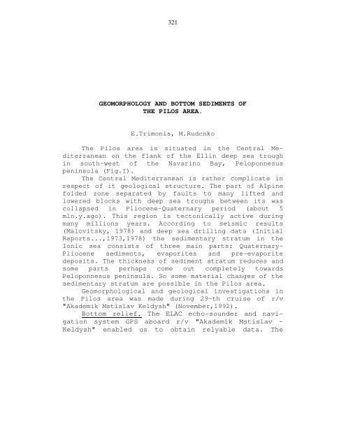
321<br />
GEOMORPHOLOGY AND BOTTOM SEDIMENTS OF<br />
THE PILOS AREA.<br />
E.Trimonis, M.Rudcnko<br />
The Pilos <strong>area</strong> is situated in <strong>the</strong> Central Mediterranean<br />
on <strong>the</strong> flank <strong>of</strong> <strong>the</strong> Ellin deep sea trough<br />
in south-west <strong>of</strong> <strong>the</strong> Navarino Bay, Peloponnesus<br />
peninsula (Fig.I).<br />
The Central Mediterranean is ra<strong>the</strong>r complicate in<br />
respect <strong>of</strong> it geological structure. The part <strong>of</strong> Alpine<br />
folded zone separated by faults to many lifted <strong>and</strong><br />
lowered blocks with deep sea troughs between its was<br />
collapsed in Pliocene-Quaternary period (about 5<br />
mln.y.ago). This region is tectonically active during<br />
many millions years. According to seismic results<br />
(Malovitsky, 1978) <strong>and</strong> deep sea drilling data (Initial<br />
Reports...,1973,1978) <strong>the</strong> sedimentary stratum in <strong>the</strong><br />
Ionic sea consists <strong>of</strong> three main parts: Quaternary-<br />
Pliocene <strong>sediments</strong>, evaporites <strong>and</strong> pre-evaporite<br />
deposits. The thickness <strong>of</strong> sediment stratum reduces <strong>and</strong><br />
some parts perhaps come out completely towards<br />
Peloponnesus peninsula. So some material changes <strong>of</strong> <strong>the</strong><br />
sedimentary stratum are possible in <strong>the</strong> Pilos <strong>area</strong>.<br />
Geomorphological <strong>and</strong> geological investigations in<br />
<strong>the</strong> Pilos <strong>area</strong> was made during 29-th cruise <strong>of</strong> r/v<br />
"Akademik Mstislav Keldysh" (November,1992).<br />
Bottom relief. The ELAC echo-sounder <strong>and</strong> navigation<br />
system GPS aboard r/v "Akademik Mstislav -<br />
Keldysh" enabled us to obtain relyable data. The
322<br />
boundaries <strong>of</strong> <strong>the</strong> Pilos <strong>area</strong> .included a strip or<br />
Sapiendza Isl<strong>and</strong> slope to depth <strong>of</strong> 3000 m <strong>and</strong> a vaster<br />
<strong>area</strong> to depth <strong>of</strong> 4500 m. Relief record has made up a<br />
little over 200 miles totally. Reconnaissance survey<br />
was performed within a mile interval, while in <strong>the</strong><br />
<strong>area</strong>s <strong>of</strong> more detailed investigation sounding tracks<br />
were performed every 0,5 mile. The data obtained<br />
enabled us to compile a bathymetric map (scale 1:100<br />
000) (Fig.2), in which a number <strong>of</strong> structural elements<br />
are singled out; <strong>the</strong>y are - slope-scrap, extended<br />
cutting, stepped surface <strong>and</strong> a small depression in <strong>the</strong><br />
south-western part <strong>of</strong> <strong>the</strong> Pilos <strong>area</strong>.<br />
Though <strong>the</strong> slope surface is ra<strong>the</strong>r homogeneous,<br />
<strong>the</strong> lengthwise ridges 60-100 m high appear in some<br />
places (Fig.3). Apparently, <strong>the</strong>y are widely spread but<br />
not registered distinctly enough on <strong>the</strong> echo-tape. In<br />
some cases this is connected with presence <strong>of</strong><br />
<strong>sediments</strong>, in o<strong>the</strong>rs - with <strong>the</strong> low altitude. But <strong>the</strong><br />
character <strong>of</strong> <strong>the</strong> recording, however, testifies to <strong>the</strong><br />
presence <strong>of</strong> <strong>the</strong> ridges. The calculations <strong>of</strong> angles <strong>of</strong><br />
gradient show, that against <strong>the</strong> background <strong>of</strong><br />
homogeneous field data for this parameter (10-15° up to<br />
20°) <strong>the</strong> individual values <strong>of</strong> angles <strong>of</strong> gradient exceed<br />
30° in some places (Fig.4). Zero values on <strong>the</strong> map<br />
should be related to <strong>the</strong> methods <strong>of</strong> processing, i.e. to<br />
making a denser matrix base. This does not, however,<br />
affect <strong>the</strong> basic field <strong>of</strong> <strong>the</strong> angles. More detailed<br />
research should consider <strong>the</strong> angles for individual<br />
surfaces enclosed between <strong>the</strong> bending points.
323<br />
The central part <strong>of</strong> <strong>the</strong> Pilos <strong>area</strong> is occupied by<br />
<strong>the</strong> valley, limited in <strong>the</strong> north-west <strong>and</strong> south-east<br />
with isobaths <strong>of</strong> 3400-3700 m, on <strong>the</strong> slope <strong>and</strong> at <strong>the</strong><br />
base respectively. The <strong>bottom</strong> width increaces from 1,5<br />
to 4 miles. The valley's length within limiting isobath<br />
does not exceed 4 miles. Both pr<strong>of</strong>iles <strong>of</strong> preliminary<br />
survey <strong>and</strong> additional tacks reveal weakly rolling<br />
surface <strong>of</strong> <strong>the</strong> valley <strong>bottom</strong> <strong>area</strong>. This fact was also<br />
proved by <strong>the</strong> photographs <strong>of</strong> <strong>the</strong> <strong>bottom</strong>. In <strong>the</strong> southwest<br />
<strong>the</strong> valley develops into a terraced <strong>area</strong> 1,5 miles<br />
wide, represented by three steps stretching from northwest<br />
to south-east along <strong>the</strong> entire investigated <strong>area</strong><br />
width. Apparently, <strong>the</strong>y originated from <strong>the</strong> fault <strong>and</strong><br />
represent a result <strong>of</strong> structural reconstruction, as <strong>the</strong><br />
strike <strong>of</strong> subsequent elements is subjected to <strong>the</strong><br />
position <strong>of</strong> <strong>the</strong> Ellin trough system.<br />
A three-radial depression is <strong>the</strong> last among<br />
structural elements <strong>of</strong> <strong>the</strong> Pilos <strong>area</strong>. Its general<br />
outline is contoured with isobath <strong>of</strong> 4100 m <strong>and</strong> its<br />
<strong>bottom</strong> - with isobath <strong>of</strong> 4350 m. At <strong>the</strong> <strong>bottom</strong> level,<br />
along north-west <strong>and</strong> south-east axis it is about 4<br />
miles long, while along a smaller axis it is 2 miles<br />
long. The morphology <strong>of</strong> its floor does not differ much<br />
from that <strong>of</strong> <strong>the</strong> valley that is why <strong>the</strong> rolling surface<br />
is contoured with isobath <strong>of</strong> 4350 m, i.e. individual<br />
relief forms are 40-80 m higher.<br />
Summarizing <strong>the</strong> processed data we provide a three<br />
- dimensional picture <strong>of</strong> <strong>the</strong> Pilos <strong>area</strong> relief, in<br />
which its individual elements are represented more<br />
vividly (Fig.5).
324<br />
Bottom <strong>sediments</strong>. Sampling or <strong>the</strong> <strong>bottom</strong> <strong>sediments</strong><br />
was carried out by grab "Ocean-50" <strong>and</strong> gravity corer<br />
(diameter 72 mm). In total, geological investigations<br />
was made at 9 stations (Table I), which was located on<br />
<strong>the</strong> comparatively small plateau within isobaths <strong>of</strong><br />
3700 m <strong>and</strong> 3800 m (Fig.6). Preliminary processing <strong>of</strong><br />
<strong>the</strong> <strong>bottom</strong> <strong>sediments</strong> on <strong>the</strong> board included visual<br />
description, selection <strong>of</strong> samples for different<br />
analytical treatments in <strong>the</strong> shore laboratories <strong>and</strong><br />
determination <strong>of</strong> density <strong>and</strong> moisture <strong>of</strong> <strong>the</strong> <strong>sediments</strong><br />
(Table 2). The moisture <strong>of</strong> <strong>sediments</strong> (W) was calculated<br />
using formula W=m I /mIOO%, where m I - mass <strong>of</strong> water in<br />
<strong>bottom</strong> <strong>sediments</strong> <strong>and</strong> m - mass <strong>of</strong> natural <strong>sediments</strong>.<br />
Bottom surface in <strong>the</strong> investigated <strong>area</strong> is covered<br />
by <strong>the</strong> light brownish-grey calcareous mud which<br />
gradually turn into light brown clay within some cm.<br />
Nature <strong>of</strong> <strong>the</strong> upper layer is not changing practically,<br />
density is equal to 1,47-1,49 g/cm 3 , moisture - 49,9-<br />
51,4% (Table 2). Thickness <strong>of</strong> <strong>the</strong> surface layer is<br />
varying from 7 up to 18 cm (Fig. 6). Individual small<br />
black lava pieces are found sometimes on <strong>the</strong> top <strong>of</strong> <strong>the</strong><br />
sediment layer (station AMK-2831). As usual <strong>the</strong> thin<br />
pteropod-forami-niferal layer is underlying at <strong>the</strong><br />
<strong>bottom</strong> <strong>of</strong> clay. Nearly such pteropod layers were<br />
described in a number cores from Mediterranean where<br />
its age determined by<br />
14 C dating was approximately<br />
equal to 3 thous<strong>and</strong>s years (Shimkus,I98I). Below dark<br />
greenish-grey laminated muds with microlayers <strong>and</strong><br />
lenses <strong>of</strong> silt are deposited. The muds are underlying<br />
by bluish-grey to light grey clay with distinctive<br />
spots <strong>and</strong> thin silty laminas in <strong>the</strong> lower part <strong>of</strong>
325<br />
this layer- Presumably <strong>the</strong> Interval recovered is not older than<br />
Holocene (10 th.y.) but it need confirm by analytical<br />
determination <strong>of</strong> absolute age.<br />
Lower cyclic alternation <strong>of</strong> clays <strong>and</strong> silts partially<br />
turbidites are deposited (Fig.6). More detail lithological<br />
characteristic <strong>of</strong> <strong>bottom</strong> <strong>sediments</strong> is given in table I.<br />
So <strong>the</strong> character <strong>of</strong> <strong>bottom</strong> <strong>sediments</strong> indicates that<br />
this region had relatively uniform environment during modern<br />
<strong>and</strong> Late Holocene sedimentation. Preliminary visual<br />
description <strong>of</strong> <strong>bottom</strong> <strong>sediments</strong> makes it possible to suppose<br />
that <strong>the</strong> rate <strong>of</strong> accumulation was low <strong>and</strong> <strong>the</strong> investigated<br />
<strong>area</strong> was transit zone <strong>of</strong> sedimentary matter mostly. The<br />
<strong>bottom</strong> surface is smooth with a rare <strong>and</strong> small (some cm)<br />
knobs (Fig. 7). There are not s<strong>of</strong>t recent <strong>sediments</strong> on <strong>the</strong><br />
more steep slopes <strong>and</strong> <strong>the</strong> deposits which was met <strong>the</strong>re are<br />
slightly lithified <strong>and</strong> indurated (Fig.8).<br />
References<br />
Initial Reports <strong>of</strong> <strong>the</strong> Deep Sea Drilling Project.<br />
vol. 13,Washington, U.S.Govern.Print.Office , 1973.<br />
Initial Reports <strong>of</strong> <strong>the</strong> Deep Sea Drilling Project.<br />
vol. 42, p.I,Washington,U.S.Govern.Print.Office, 1978.<br />
Malovitsky Ya.P. Tectonic <strong>of</strong> <strong>the</strong> <strong>bottom</strong> <strong>of</strong> <strong>the</strong> Mediterranean<br />
Sea (in Russian),Moscow,Nauks, 1978, 96p.<br />
Shimkus K.M. Sedimentation in <strong>the</strong> Mediterranean Sea in Late<br />
Quaternary (in Russian), Moscow,Nauka, 1981, 240p.
326<br />
Horizone<br />
From top<br />
Of <strong>the</strong> sea<br />
Bottom, cm<br />
PRELIMINARY LITHOLOGICAL DATA OF THE<br />
BOTTOM SEDIMENTS IN THE PILOS AREA<br />
Types <strong>of</strong> sendiments<br />
Table I<br />
I 2<br />
Station AMK-2804, grab<br />
(36°36.8'N, 2I°33.8'E, depth 3737m)<br />
0-8 Light brown calcareous mud with admixture<br />
<strong>of</strong> pteropod's detritus<br />
8-13 Light brown clay<br />
Station AMK-2804, gravity corer<br />
(36°37.3'N, 2I°33.3'E, depth 3709m)<br />
0-16 Light brown calcareous mud <strong>and</strong> clay in<br />
lower part. Consists thin silt layers <strong>of</strong><br />
pteropods <strong>and</strong> foraminifera detritus<br />
16-68 Dark greenish-grey mud, cyclic laminated<br />
(turbidites)<br />
68-90 Light grey clay with thin silty layers <strong>and</strong><br />
lenses<br />
90-165 Cyclic alternation clay <strong>and</strong> silt layers<br />
Station AMK-2810, gravity corer<br />
(36°38.0 l N, 2I°34.7'E, depth 3740m)<br />
0-10 Light brown calcareous mud<br />
10-98 Dark greenish-grey mud, cyclic laminated,<br />
enriched in organic matter
327<br />
Table I (continued)<br />
I 2<br />
Consists two pteropods layers (49-50 cm<br />
<strong>and</strong> 96-96,8 cm) with sharp boundaries<br />
98-132 Bluish-grey, light grey clay<br />
132-134 Light grey silt (foraminiferal layer)<br />
134-134,6 Light blue clay<br />
134,6-140 Dark greenish-grey clay<br />
Station AMK-2812, gravity corer<br />
(36°35.7'N, 2I°32.3'E, depth 3850m)<br />
0-8 Light brown calcareous mud<br />
8-10 Pteropods layer with sharp boundaries<br />
10-40 Dark greenish-grey laminated mud<br />
40-62 Light grey clay<br />
62-107 Greyish-brown to light brown clay with<br />
small spots, lenses <strong>and</strong> thin layers <strong>of</strong><br />
silt (foraminiferal detritus)<br />
107-115 Thin laminated clay, brown, green, light<br />
grey <strong>and</strong> grey with thin silty lamina in<br />
lower part<br />
115-128 Light greenish clay<br />
128-168 Dark grey mud with rare thin<br />
foraminiferal lamina<br />
Station AMK-2817, gravity corer<br />
(36°37.0'N, 2I°31.7'E, depth 3759m)<br />
0-10 Light brown calcareous mud<br />
10-12 Light brown clay<br />
12-13 Light grey calcareous (foraminiferal)<br />
silt
328<br />
Table I (continued)<br />
I 2<br />
Station AMK-2824, gravity corer<br />
(36°36.1'N, 2I°34.5'E, depth 3735m)<br />
0-7 Light brown calcareous mud<br />
7-9 Pteropods layer<br />
9-14 Slump block <strong>of</strong> light bluish-grey clay<br />
with foraminiferal-pteropods silty<br />
clay near boundaries<br />
14-18,5 Light brown to light brownish-grey clay,<br />
thin laminated<br />
18,5-99 Dark greenish-grey mud, laminated<br />
99-110 Light bluish-grey clay<br />
110-137 Light brownish-grey clay with lenses<br />
<strong>and</strong> thin lamina <strong>of</strong> silt<br />
Station AMK-2827, gravity corer<br />
(36°36.5'N, 2I°33.2'E, depth 3765m)<br />
0-18 Light brown calcareous mud transitional to<br />
clay<br />
18-34 Dark greenish-grey laminated mud<br />
34-60 Light bluish-grey to light grey clay<br />
60-61 Light grey pteropod-foraminiferal silty<br />
s<strong>and</strong><br />
61-101 Cyclic alternation brownish-grey to light<br />
brown clay <strong>and</strong> foraminiferal silt or silty<br />
s<strong>and</strong><br />
Station AMK-2831, grab<br />
(36°37.0'N, 2I°33.9'E, depth 3738m)<br />
0-11 Light brown calcareous mud transitional<br />
to clay
329<br />
Table I (continued)<br />
I 2<br />
11-12 Light brownish-grey foraminiferalpteropod<br />
layer<br />
Station AMK-2837, gravity corer<br />
(36°36.2'N, 2I°34.3'E, depth 3744m)<br />
0-11 Light brown calcareous mud transitional<br />
to clay<br />
11-15 Light grey pteropod-foraminiferal<br />
silty s<strong>and</strong><br />
15-21 Thin laminated <strong>and</strong> b<strong>and</strong>ed manycoloured<br />
clay<br />
21-78 Dark greenish-grey laminated mud<br />
78-85 Light bluish-grey clay<br />
85-100 Light grey clay<br />
100-115 Light yellowish-grey clay
330<br />
DENSITY AND MOISTURE OF BOTTOM SEDIMENTS<br />
IN THE PILOS AREA<br />
(Location <strong>of</strong> stations <strong>and</strong> types <strong>of</strong><br />
<strong>sediments</strong> is given in table I)<br />
Table 2<br />
Station Sampling<br />
gear<br />
Horizone from top <strong>of</strong><br />
<strong>the</strong> sea <strong>bottom</strong>, cm<br />
Density,<br />
g/cm 3<br />
Moisture<br />
%<br />
AMK-2804 Grab 0-4 1.48 50.2<br />
AMK-2804 Grab 10-13 1.63 39.4<br />
AMK-2804 Gr.corer 45-48 1.54 48.1<br />
AMK-2804 Gr.corer 160-163 1.68 35.3<br />
AMK-281O Gr.corer 16-19 1.40 52.9<br />
AMK-281O Gr.corer 105-108 1.62 38.2<br />
AMK-2812 Gr.corer 20-23 1.44 50 . 4<br />
AMK-2812 Gr.corer 97-100 1.58 41.6<br />
AMK-2812 Gr.corer 150-153 1.31 59.6<br />
AMK-2817 Grab 0-4 1.47 51.4<br />
AMK-2824 Gr.corer 25-28 1.49 47.2<br />
AMK-2824 Gr.corer 105-108 1.68 36.2<br />
AMK-2824 Gr.corer 130-133 1.81 27.1<br />
AMK-2827 Gr.corer 5-8 1.65 37.6<br />
AMK-2827 Gr.corer 22-25 1.48 49.9<br />
AMK-2827 Gr.corer 40-43 1.66 37.5<br />
AMK-2827 Gr.corer 97-100 1.62 38.2<br />
AMK-2831 Grab 0-4 1.49 49.9
331<br />
LIST OF FIGURES<br />
Fig.1 Location <strong>of</strong> <strong>the</strong> Pilos <strong>area</strong><br />
Fig.2 Bathymetric map <strong>of</strong> <strong>the</strong> Pilos <strong>area</strong>.<br />
Scale 1:100,000. Track <strong>of</strong> <strong>the</strong> ship is shown by<br />
dot lines<br />
Fig.3 Pr<strong>of</strong>iles <strong>of</strong> <strong>the</strong> Sapiendza slope<br />
Fig.4 Distribution <strong>of</strong> <strong>the</strong> angles in <strong>the</strong> Pilos<br />
<strong>area</strong><br />
Fig.5 3D histogram <strong>of</strong> <strong>the</strong> Pilos <strong>area</strong><br />
Fig.6 Bottom <strong>sediments</strong> in <strong>the</strong> Pilos <strong>area</strong><br />
1 - Light brown mud transitional to clay;<br />
2 - Dark greenish-grey mud;<br />
3 - Light grey, bluish-grey clay;<br />
4 - Light brown clay;<br />
5 - Many-coloured laminated clay;<br />
6 - Dark grey (black) mud<br />
Fig.7 Recent muds in <strong>the</strong> Pilos <strong>area</strong><br />
(position 36°35.1'N, 2I°35.4'E,depth 3604m)<br />
Photo by V.Kolchugin<br />
Fig.8 Bottom <strong>sediments</strong> on <strong>the</strong> slope <strong>of</strong> <strong>the</strong> Pilos<br />
<strong>area</strong> (position 36°39.3'N,21°30.3'E, depth<br />
3265m) Photo by V.Kolchugin
332<br />
Fig.1 Location <strong>of</strong> <strong>the</strong> Pilos <strong>area</strong>
333<br />
Fig.2 Bathymetric map <strong>of</strong> Pilos <strong>area</strong><br />
Track <strong>of</strong> ship is shown by dot lines
334<br />
Fig.3 Pr<strong>of</strong>iles <strong>of</strong> <strong>the</strong> Sapiendza slope
335<br />
Fig.4 Distribution <strong>of</strong> <strong>the</strong> angles in <strong>the</strong> Pilos <strong>area</strong>
336<br />
Fig.5 3D histogram <strong>of</strong> <strong>the</strong> Pilos <strong>area</strong>
337<br />
Bottom <strong>sediments</strong> in <strong>the</strong> Pilos <strong>area</strong><br />
1 - Light brown mud transitional to clay;<br />
2 - Dark greenish-grey mud;<br />
3 - Light grey, bluish-grey clay;<br />
4 - Light brown clay;<br />
5 - Many-coloured laminated clay;<br />
6 - Dark grey (black) mud
338<br />
Fig.7 Recent muds in <strong>the</strong> Pilos <strong>area</strong><br />
(position 36°35.1'N, 2I°35.4'E,depth 3604m)<br />
Photo by V.Kolchugin
339<br />
Fig.8 Bottom <strong>sediments</strong> on <strong>the</strong> slope <strong>of</strong> <strong>the</strong> Pilos<br />
<strong>area</strong> (position 36°39.3'N,21°30.3'E, depth<br />
3265m) Photo by V.Kolchugin