A Feasibility Study for the Establishment of Xuan Lien Nature ...
A Feasibility Study for the Establishment of Xuan Lien Nature ...
A Feasibility Study for the Establishment of Xuan Lien Nature ...

Create successful ePaper yourself
Turn your PDF publications into a flip-book with our unique Google optimized e-Paper software.
Section 5 - Management Recommendations<br />
Hon Han (1,208 m) and Ban Mua (1,100 m) mountains and peaks at 315 m, 1,178 m, 1,397 m and 1,442 m,<br />
as far as <strong>the</strong> provincial border. The sou<strong>the</strong>rn boundary follows <strong>the</strong> border between Thanh Hoa and Nghe An<br />
provinces <strong>for</strong> about 26 km (Map 3).<br />
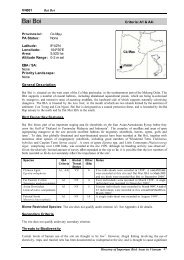
With this boundary, <strong>Xuan</strong> <strong>Lien</strong> <strong>Nature</strong> Reserve would have <strong>the</strong> following characteristics:<br />
32<br />
• A total area <strong>of</strong> about 16,500 ha, including 2,500 ha <strong>of</strong> evergreen <strong>for</strong>est.<br />
• No human settlements in <strong>the</strong> nature reserve after <strong>the</strong> construction <strong>of</strong> Cua Dat dam.<br />
However, under option one, an area <strong>of</strong> 7,100 ha south <strong>of</strong> <strong>the</strong> Cao River, including 2,000 ha <strong>of</strong> evergreen <strong>for</strong>est,<br />
would not be included in <strong>the</strong> nature reserve. There<strong>for</strong>e, option two is proposed 1 .<br />
Option Two<br />
The sou<strong>the</strong>rn and eastern boundary are <strong>the</strong> same as <strong>for</strong> option one. The nor<strong>the</strong>rn boundary follows <strong>the</strong> Cao<br />
River and its tributary, <strong>the</strong> Ken River, from <strong>the</strong> border between Nghe An and Thanh Hoa provinces (19°59’N<br />
104°57’E) to <strong>the</strong> confluence with <strong>the</strong> Chu River (Map 3).<br />
With <strong>the</strong> boundary proposed under option two, <strong>the</strong> nature reserve would cover an area <strong>of</strong> 23,610 ha, an increase<br />
<strong>of</strong> 7,100 ha in comparison with option one. This increased area would enhance <strong>the</strong> conservation value <strong>of</strong> <strong>Xuan</strong><br />
<strong>Lien</strong> <strong>Nature</strong> Reserve in <strong>the</strong> following ways:<br />
• Expanded habitat <strong>for</strong> large mammal species with populations in <strong>the</strong> area south <strong>of</strong> <strong>the</strong> Ken and Cao<br />
Rivers, such as Gaur, Tiger, Asiatic Black Bear, Sun Bear and Roosevelt’s Muntjac.<br />
• Expanded habitat <strong>of</strong> several nationally and globally threatened bird species.<br />
• More areas <strong>of</strong> <strong>for</strong>est in <strong>the</strong> watershed <strong>of</strong> Cua Dat dam are af<strong>for</strong>ded Special-use Forest status.<br />
Nei<strong>the</strong>r option <strong>for</strong> <strong>the</strong> boundary <strong>of</strong> <strong>Xuan</strong> <strong>Lien</strong> <strong>Nature</strong> Reserve includes areas to <strong>the</strong> north-west adjacent to <strong>the</strong><br />
national border between Vietnam and Laos <strong>for</strong> to <strong>the</strong> following reasons:<br />
• Local people in Bat Mot commune have settled <strong>the</strong> area north <strong>of</strong> <strong>the</strong> Ken River and are cultivating<br />
wet rice in <strong>the</strong> valleys and dry rice on <strong>the</strong> hills. This has led to exploitation or clearance <strong>of</strong> <strong>for</strong>est in<br />
this area.<br />
• Nam Xam <strong>Nature</strong> Reserve in Laos is about 12 km from <strong>the</strong> international border with Vietnam.<br />
The <strong>for</strong>est in <strong>the</strong> intervening areas has been extensively cleared by settlers practising shifting<br />
cultivation. The isolated and degraded patches <strong>of</strong> <strong>for</strong>est which remain do not represent a viable<br />
habitat corridor between <strong>Xuan</strong> <strong>Lien</strong> and Nam Xam <strong>Nature</strong> Reserves.<br />
<strong>Xuan</strong> <strong>Lien</strong> <strong>Nature</strong> Reserve will share a common boundary with Pu Hoat proposed nature reserve to <strong>the</strong> south in<br />
Nghe An province.<br />
As a result <strong>of</strong> future emigration <strong>of</strong> people from <strong>Xuan</strong> My and <strong>Xuan</strong> <strong>Lien</strong> communes, following <strong>the</strong> construction<br />
<strong>of</strong> Cua Dat dam, <strong>the</strong>re will be no human settlement or fixed cultivation within <strong>the</strong> nature reserve under ei<strong>the</strong>r<br />
option. Option two will provide greater protection <strong>of</strong> <strong>for</strong>est habitat and <strong>the</strong> biodiversity dependent upon it, as<br />
well as increased watershed protection.<br />
1 Following <strong>the</strong> publication <strong>of</strong> <strong>the</strong> original Vietnamese version <strong>of</strong> this report, a workshop was held in Thanh Hoa province<br />
in February 1999 attended by representatives <strong>of</strong> FIPI, <strong>the</strong> provincial people’s committee and <strong>the</strong> Provincial FPD to discuss<br />
<strong>the</strong> two options <strong>for</strong> <strong>the</strong> boundary at which option two was decided upon.