


Create successful ePaper yourself
Turn your PDF publications into a flip-book with our unique Google optimized e-Paper software.
Unione Europea Repubblica Italiana Regione Veneto Provincia di Belluno<br />
ITALO ZANDONELLA<br />
CALLEGHER<br />
Cofinanziato nell’ambito dell’Iniziativa Comunitaria Interreg IIIA Italia/Austria 2000 - 2006<br />
Fondo FESR (Cod.Progetto VEN222014)
ITALO ZANDONELLA CALLEGHER<br />
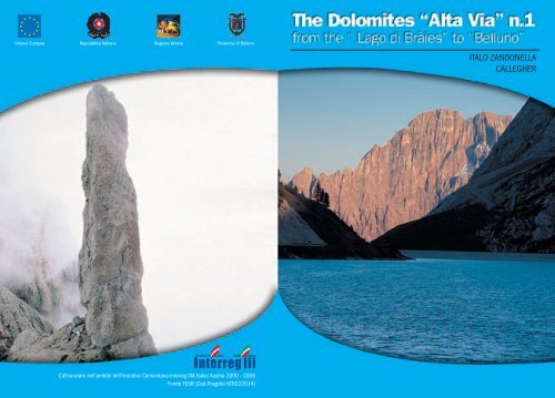
The Dolomites “Alta Via” n.1<br />
as created by Toni Sanmarchi<br />
High Mountain Paths<br />
from the Lago di Bràies to Belluno
on the cover:<br />
from Alleghe lake to the Civetta<br />
inside cover:<br />
Croda da Lago and Civetta<br />
back cover:<br />
Gusela del Vescovà<br />
General notes<br />
In 1969, taking inspiration from the programme of Dolomite<br />
itineraries presented by Mario Brovelli in the article which had<br />
appeared in “Lo Scarpone” on September 1st 1966, Piero Rossi<br />
proposed this superb traverse which from the beautiful Bràies valley<br />
in Pusteria crosses through imposing, world-famous Dolomite<br />
structures and leads to Belluno. His invaluable little volume, which<br />
appeared in the same year and was the first of its kind, was entitled<br />
“Alta Via delle Dolomiti” and bore the number 1. It was published<br />
by Tamari Editori of Bologna, with several further editions in subsequent<br />
years.<br />
This Alta Via, just like its famous sister routes, has the peculiar<br />
characteristics of a long hike which can be divided up into various<br />
days. Refuges and fixed bivouacs can offer comfort at the stop-off<br />
points, but for those wishing to emulate the pioneers a tent or a<br />
sleeping bag can suffice.<br />
2005© Provincial Administration of Belluno<br />
TOURISM, AGRITOURISM AND PRODUCTIVE ACTIVITIES SECTOR<br />
SERVICES, COMMUNICATIONS AND PROMOTION<br />
Service for communication and promotion<br />
Via Psaro, 21 - 32100 Belluno<br />
www.infodolomiti.it<br />
Edition by<br />
Italo Zandonella Callegher<br />
Translation: Scuola di lingua Europa<br />
Photos Manrico Dell’Agnola<br />
Graphic Evidenzia<br />
Printed by Linea Grafica<br />
The basic route follows paths that are not particularly difficult for<br />
an experienced hill-walker, at least those of the Croda dei Tóni and<br />
the Antelao; in addition, passages or stretches that are a little rough<br />
are always equipped.<br />
Here and there where the mountain has remained as it was in<br />
pioneer times and where only the chamois live undisturbed, there<br />
are more difficulties. These are more or less of a psychological<br />
nature due to isolation, extreme gradients, severe surroundings,<br />
lack of water, complete silence and the fog that often forms quickly<br />
and envelops the surroundings! In any case, this Alta Via passes<br />
through places which are truly extraordinary and unique, in the<br />
wild heart of the Dolomites.<br />
THE DOLOMITES “ALTA VIA” N.1 3
To suit the tastes of more expert hikers, some alternatives to the<br />
classic route are suggested. These variants are more technical and<br />
gratifying hikes, as they go along vie ferrate (equipped paths) or climb<br />
up to reach the famous peaks of the various mountain groups.<br />
“This Alta Via crosses some well-known Dolomite groups that<br />
have stayed almost immune to the often disorderly ‘miscellaneous<br />
crowd’ of so-called occasional tourists. At the heart of this mountain<br />
group, cars cannot arrive; therefore, apart from the unfortunate<br />
exception, there are no huge “invasions”. Here you only have to go<br />
a bit further on from the bottom of the valley to be in peace and to<br />
find yourself in the real mountains, primitive and uncorrupted…”<br />
This was in 1973. Thirty years on, the words of Toni Sanmarchi<br />
(another “Alta Via inventor”) are still true.<br />
The Provincial Administration of Belluno’s Tourism Sector,<br />
which we have to thank for this publication, does its best to promote<br />
“local mountains” and to supply hikers with information that is<br />
as up to date as possible.<br />
We feel obliged to point out that some authors have modified the<br />
original route, adapting it to their own personal taste, for general<br />
tourism needs and those of their guidebook users. In some places the<br />
original Italian route has been altered, and would take 18-20 days<br />
with some excessively short stretches. It’s true that this would be<br />
ideal for holidays, relaxing and enjoyable, but we have preferred to<br />
remain faithful to the traditions of “the old days”, even if this means<br />
that some stretches may seem a bit severe in length.<br />
In comparison with Piero Rossi’s guide, published in several editions,<br />
at this point 35 years’ old and now unobtainable, we too have<br />
made some changes and minor updates to the original route. During<br />
the last few years, there have been some morphological changes, as<br />
well as changes as a result of interventions carried out by the organisations<br />
responsible for maintaining and equipping the various<br />
stages of the route. Having said this, nothing has been taken away<br />
from the originality of the work and the idea; if anything there has<br />
been a willingness to improve on and to further define it, respecting<br />
the memory of Piero, who lived for these mountains.<br />
Recommended period<br />
The rifugi (refuges) normally open towards 20th June, so if you<br />
want to book a place in them you should plan your trip on the Alta<br />
Via after this date. Normally the route is practicable until the end<br />
of September. Once this was the ideal month for enjoying stable<br />
weather, visibility and clarity, above all because the route was less<br />
crowded, but nowadays much has changed and autumn is not<br />
always sunny and dry. Keep in mind that as a general rule, the huts<br />
close on about the 20-25th September. Therefore, after this date, it is<br />
indispensable to bring a tent and a sleeping bag or rely on the fixed<br />
bivouacs scattered along the route and the spartan, winter season<br />
shelter offered by the CAI (Italian Alpine Club) mountain huts.<br />
At the height of the summer season it is advisable to book places<br />
in the refuges well in advance.<br />
Out of respect for others’ needs, you should cancel as early as<br />
possible if you are unable to honour your booking, even if you have<br />
already paid.<br />
Useful advice for hikers<br />
Precautions – Equipment<br />
The network of paths used by the “Alta Via delle Dolomiti n.1”<br />
allows hikers to access various zones at the heart of the Dolomite<br />
groups where they can experience extraordinary walks at altitude.<br />
As the paths can be very tiring at times and are conducted above 2500<br />
metres, experience, good equipment, sure footing, absence of vertigo<br />
and good physical condition are indispensable to ensure safety.<br />
Often dangers are undervalued in the mountains: a rapid change in<br />
weather, an unexpected storm, a premature snowfall, an icy patch<br />
of ground, fast-moving rivers….can all turn a pleasant, light-hearted<br />
trip into a ordeal, even on well-marked stretches of path. Good selfcontrol<br />
can be indispensable. A fundamental condition for trekking<br />
along the “Alta Via” paths is good weather! Therefore you should<br />
find out weather conditions first from the available sources (Arraba<br />
Weather Station, TV, Radio etc.). Finally, hikers should be equipped<br />
4 FROM THE LAGO DI BRÀIES TO BELLUNO THE DOLOMITES “ALTA VIA” N.1 5
with a good mountain kit (nowadays thousands of products of<br />
various styles, colours and technical specialities are available on<br />
the market), with several vital changes, warm, waterproof clothing,<br />
good quality climbing boots and socks, as well as all those other little<br />
bits and pieces that a good hiker’s experience advises.<br />
It is a good idea to carry some medicine and first aid equipment<br />
with you, especially painkillers, Vitamin C, supplements, plasters,<br />
gauze, bandages…. and never forget to bring water.<br />
If, despite the above precautions, an accident should happen (a<br />
slip, a twist, a fracture, an injury from falling rocks, a lightning<br />
strike, vertigo, etc), try not to panic and follow the indications in the<br />
following chapter where possible.<br />
Alpine rescue Service<br />
(by Fabio Bristot, Director of the CNSAS, Veneto Region)<br />
In this section, the C.N.S.A.S. (National Corporation of Alpine<br />
and Speleological Rescue) would like to<br />
explain what the aims of the organisation<br />
are: in other words, what Alpine Rescue<br />
is and what it does.<br />
Below you will find some information<br />
and advice, as well asvarious kinds of<br />
tips.<br />
Although not yet perfect, this piece of<br />
work is a first step towards promoting a<br />
new culture of the mountains, based on safety and prevention and<br />
also on a few procedures to adopt in case of necessity.<br />
What is the C.N.S.A.S.?<br />
The National Corporation of Alpine and Speleological Rescue<br />
is a special section of the Italian Alpine Club whose members, all<br />
Volunteers Technicians, have the specific task of rescuing people<br />
who are injured or in danger both in an efficient and quick way.<br />
This can include the recovery of bodies when necessary and searching<br />
for people who are lost in difficult to get areas (not always at<br />
altitude), which requires staff specialised in both mountaineering<br />
techniques and mountain rescue.<br />
The Italian Law n. 74/2001 officially recognises the work of the<br />
C.N.S.A.S. as having a function of public activity and service.<br />
As a result of this official legislative definition, Alpine Rescue<br />
has strong links with the Italian National Health Service, and with<br />
Pieve di Cadore’s S.U.E.M. 118 EMERGENCY SERVICE a close<br />
working synergy has been created in the last fifteen years, which<br />
has become more and more consolidated up to the point where it<br />
has been institutionalized with a specific convention and operative<br />
protocol within the various intervention sections.<br />
The C.n.s.a.s.Technical Staff guarantee 24 Hr, year- round (particularly<br />
in the summer months) service, with on-going training and<br />
compulsory drills on the rock face (with or without helicopter), on<br />
snow, avalanches and ice falls, search and rescue, evacuation from<br />
cable cars, first aid techniques and general logistic problems (radio<br />
and communication, operation planning etc.)<br />
Both Law 74/01 and in particular also Law 298/02 entrust the<br />
C.n.s.a.s. staff with the task of primary rescue in the mountains,<br />
in caves and in hostile or difficult to reach environments. The<br />
C.n.s.a.s. is also responsible for rescue coordination when there<br />
are other State or Civil Protection organisations involved, except<br />
in the case of large emergencies or calamities.<br />
Where does the C.N.S.A.S. operate?<br />
The C.N.S.A.S. normally operates in so-called hostile environments<br />
and in all inaccessible areas of the district. This does not only<br />
mean – as is generally believed - areas such as cliff faces or vie ferrate<br />
(equipped paths), but also and above all snowfields and glaciers,<br />
ice falls, avalanches, cable cars, ski slopes, caves, ravines, gorges and<br />
gullies, rivers and all other types of environment not necessarily<br />
at high altitude (hills, woods, etc.), that due to difficulties of access<br />
6 FROM THE LAGO DI BRÀIES TO BELLUNO THE DOLOMITES “ALTA VIA” N.1 7
or movement, or in special weather conditions, require the work of<br />
qualified personnel with expertise in all areas of mountaineering<br />
and speleological techniques and rescue.<br />
Prevention<br />
Aside from the above factors, which require a strong presence in<br />
the area in order to guarantee primary rescue , the C.N.S.A.S.<br />
also has a precise obligation to guarantee accident prevention.<br />
For this reason the brief notes below, (although they seem<br />
obvious, our experience year in year out shows they are often ignored),<br />
aim to supply some points to consider.<br />
Basic rules for improved safety in the mountains and<br />
other hostile environments.<br />
Never underestimate the dangers and risks associated with<br />
any type of activity connected to the mountains and to hostile<br />
environments in general (mountaineering, speleology, skiing,<br />
mountain biking, hunting, mushroom picking, delta plane<br />
flying and parachuting etc.): the rapid changes in weather,<br />
the difficulty of the route, walking time, etc.<br />
Good mental-physical condition and adequate preparation<br />
and training for the task to be undertaken are essential.<br />
Avoid attempting routes that are beyond your technical<br />
ability and physical and mental preparation.<br />
Never walk alone; whenever possible be accompanied<br />
and/or advised by qualified organisations (Alpine Guides ,<br />
C.A.I. and C.N.S.A.S. Stations).<br />
Obtain adequate information about the route’s features<br />
and difficulty as well as the area in general. Study all the<br />
necessary information regarding destination or route in<br />
advance, using the appropriate guides and maps.<br />
Always leave precise information about where you are<br />
going and which route you intend to take, using visitors<br />
books in huts and bivouacs when appropriate.<br />
Find out the weather conditions in advance, especially the<br />
local forecast.<br />
Bring adequate footwear and clothing: avoid wearing<br />
training shoes and shoes with smooth soles; bring warm<br />
clothing, anorak and a change of underwear.<br />
Bring a head torch, food which is light and easily absorbed<br />
by the body and extra fluids (preferably water with perhaps<br />
added saline integrators).<br />
Bring a small first aid kit.<br />
Basic rules on how to behave in the event of an accident<br />
Stay calm and do not act impulsively.<br />
Evaluate the general situation (environment) and the<br />
specific situation (the accident). Try to identify actual and<br />
possible dangers.<br />
Immediately adopt measures to avoid and prevent further<br />
risks.<br />
Call S.U.E.M. 118. for help immediately. If this is not<br />
possible use the following intermittent visual signalling<br />
method: - 6 times a minute – once every 10 seconds - pause<br />
for 1 minute, then repeat the operation until you are sure<br />
you have been seen, or use any other system to mark your<br />
presence.<br />
How to alert S.U.E.M. 118/C.N.S.A.S.<br />
To request an intervention by the C.N.S.A.S., you must always<br />
dial 118 and follow the advice below.<br />
General instructions to follow when you call 118<br />
Supply precise information about the injured person/s<br />
(name, surname, residence) and the telephone number from<br />
which you are calling.<br />
Give details on the location of the accident or visual<br />
references that can help easily identify the spot.<br />
Give a brief summary of the accident stating the time it<br />
happened.<br />
8 FROM THE LAGO DI BRÀIES TO BELLUNO THE DOLOMITES “ALTA VIA” N.1 9
Specify the number of injured and their condition.<br />
Describe the weather conditions, especially visibility.<br />
Highlight any obstacles in the area with particular reference<br />
to power lines and cables, chair lifts and ski lifts and any<br />
other overhanging cables that could get in the way.<br />
Give any other information that could aid the operation<br />
(people present, particular difficulties etc.)<br />
Interventions for injured persons or persons in a situation of<br />
danger<br />
As for point 1 of the general instructions.<br />
Supply the exact location of the accident or where the<br />
injured can be found (mountain group, slope, path, via<br />
ferrata, valley, gully, ledge, crest, gorge, etc).<br />
Mention the presence of any other people who were<br />
present at the accident and, in particular, if they are able to<br />
collaborate (Alpine Guides, C.N.S.A.S. staff, others etc.).<br />
Interventions for missing or lost persons<br />
Give information regarding the identity of the victim/s.<br />
Specify date and time of departure.<br />
Describe the method of transport used (i.e. Car: number<br />
plate, model, colour etc.).<br />
Indicate destination and chosen route and/or probable or<br />
possible fixed objectives (hill walking, climbing etc.).<br />
Give the number of companions and their hill-walking or<br />
mountaineering abilities and experience.<br />
Describe clothing (paying attention to colour and material)<br />
and what supplies they have with them.<br />
Inform of any problems: psychological - physical – family<br />
– social – etc.<br />
Communicate information already given to other<br />
organisations (including C.N.S.A.S.).<br />
Supply any other useful information regarding the<br />
subject(s), location and general environmental conditions.<br />
Interventions in cases of avalanche<br />
1. Give information regarding the identity of the victim/s,<br />
date, time.<br />
2. Give the exact or presumed number of people swept<br />
away or buried.<br />
3. Specify the brand and model of A.R.V.A. apparatus and/or<br />
other research technology.<br />
4. Identify the presence of any witnesses able to give an<br />
exact account of what happened:<br />
- If a visual-auditory- A.R.V.A., search has been carried out;<br />
- Provide a brief description of the avalanche (size and<br />
characteristics) and the exact point where the people were<br />
swept away and/or disappeared (right, left, high, low etc.);<br />
- subjects already extracted and their position;<br />
- other information and details that might help the<br />
intervention.<br />
Keep in mind that all the refuges located along the Alta Via delle<br />
Dolomiti n. 1 are equipped with a public telephone; in addition,<br />
the refuge managers are trained to help send correct and quick<br />
requests to Alpine Rescue.<br />
International mountain rescue signals<br />
International mountain rescue signals are still the same today<br />
as they were in the past, and often the only means possible in the<br />
immensity of the mountains is sending a visual or acoustic signal 6<br />
times per minute, at regular intervals, and then every 10 seconds.<br />
Pause for a minute and repeat the same signal until you receive a<br />
response. This is done three times in a minute at a distance of 20<br />
seconds in a visual or audible way. By acoustic we mean shouting<br />
or whistling or any other perceptible noises; by visual signals we<br />
mean waving handkerchiefs, items of clothing or mirror signals; at<br />
night you can use a torch or, if possible, a fire (obviously with caution,<br />
especially if you are in a wooded area). Over the last few years<br />
the ever more frequent use of helicopters by Alpine Rescue has<br />
10 FROM THE LAGO DI BRÀIES TO BELLUNO THE DOLOMITES “ALTA VIA” N.1 11
endered new signalling methods necessary. Colourful sleeping<br />
bags or anoraks spread out on the ground or marks in the snow can<br />
help you be located from above. The SOS rescue sign can be made<br />
with letters of about 2m high using contrasting stones placed on<br />
the ground, or footprints in the snow.<br />
In order to be seen from above, i.e. by helicopter, you need to<br />
make the following signals with your arms, or with lights at night:<br />
Lift and spread out both<br />
arms<br />
Green light<br />
Lift and spread out left<br />
arm<br />
Right arm pointing down<br />
Red light<br />
-Yes, to the pilot’s questions.<br />
-Land here<br />
-Help is needed<br />
-No, to the pilot’s questions.<br />
-Don’t land here.<br />
-No help needed<br />
When giving the helicopter instructions to land, keep the following<br />
in mind: with your arms outspread, remain still at the edge of<br />
the landing place; where possible the area surrounding the landing<br />
place should be clear of obstacles up to a space of 20x20 metres.<br />
a) Red triangle with the Alta Via number inside (in this<br />
case 1); this type of sign is less common than the following:<br />
b) Path sign consisting of two horizontal red stripes with<br />
a white stripe in the middle of which you can find the<br />
path number in black. Along paths that require more<br />
frequent signs, in between those above, you can find<br />
simple red or red and white signs.<br />
c) Wooden chart signs on fixed poles (old types in metal).<br />
The coordination of signposts on the busy network of alpine<br />
paths in the Veneto Region is constantly monitored, sector by sector.<br />
Where the triangles, path signs and charts are found to be in poor<br />
condition (unfortunately also as a result of vandalism!) and thus<br />
difficult or impossible to see, the hiker should pay careful attention<br />
to the indications set out in this guide. However, an attentive<br />
walker should not have problems of orientation if they constantly<br />
refer to a good map or put into practice information given by refuge<br />
managers along the route.<br />
Difficulty Scale<br />
T, for tourists, i.e. elementary difficulty<br />
E, for hikers<br />
EE, for expert hikers<br />
EEA, for expert hikers with via ferrata equipment<br />
A, for climbers<br />
TAKE NOTE! Don’t move away until the rotor blades have<br />
stopped: you are an important fixing point for the pilot.<br />
Any items of clothing laid on the floor to help the pilot should<br />
be held down with stones to protect against the strong airflow<br />
given off by the helicopter’s blades!<br />
Route Signs<br />
Everywhere along the route, the hiker can find three types of<br />
signs at all the main points:<br />
12 FROM THE LAGO DI BRÀIES TO BELLUNO THE DOLOMITES “ALTA VIA” N.1 13
Itinerary<br />
Technical details<br />
Itinerary<br />
Recommended Period: from the end of June until the end of September<br />
Departure Point:<br />
Lago di Bràies in Pusterìa<br />
Arrival Point:<br />
Belluno<br />
Walking days: 12<br />
Route Length:<br />
about 125 kilometres<br />
Refuges on the main route: 15<br />
Bivouacs on the main route: 1<br />
Refreshments on the way: 6<br />
Longest stretch:<br />
the seventh, 6 hours, from Palafavèra to the Rifugio Vazzolèr<br />
Shortest stretch:<br />
the first, 3,30 hours, from Lago di Bràies to the Rifugio Biella<br />
Total time required (excluding variants): about 57 hours<br />
Difficulty:<br />
EE and EEA , brief stretch of A in the Màrmol area<br />
Total gradient in ascent: about 7300 metres<br />
Total gradient in descent: about 8400 metres<br />
Maximum gradient in ascent: 1070m, third day, Fànes - Lagazuòi<br />
Maximum gradient in descent: 1900m, last day, Màrmol – Belluno (1570m until Case Bortot)<br />
Maximum altitude: Rifugio Lagazuòi, 2752m<br />
Minimum altitude: Belluno, 389m (Case Bortot, 568m)<br />
Dolomite Groups involved: 11<br />
Opening period of the refuges: c. 20 June – 20 September<br />
Signs :<br />
Good everywhere<br />
Recommended Maps (in order of use):Tabacco maps 1:25.000<br />
n. 031 “Dolomiti di Bràies”, for the stretch from the Lago di Bràies to the Rifugio Fànes<br />
n. 03 “Cortina d’Ampezzo e Dolomiti Ampezzane” for the stretch from the Rifugio Biella to the<br />
Forcella Ambrizzòla<br />
n. 015 “Marmolada-Pelmo-Civetta-Moiazza” for the stretch from the Passo Falzarego to the<br />
Rifugio Carestiato<br />
n. 025 “Dolomiti di Zoldo Cadorine e Agordine” for the stretch from the Forcella Ambrizzòla to<br />
the Bivacco del Màrmol<br />
n. 024 “Prealpi e Dolomiti Bellunesi”, for the stretch from the Bivacco del Màrmol to<br />
Belluno<br />
The “Alta Via delle Dolomiti n.1”, which winds its way from Bràies<br />
in Pusteria to Belluno, can be divided up into three distinct parts :<br />
- From the Lago di Bràies to the Tofàne with the Dolomite<br />
groups of the Croda Rossa d’Ampezzo, Fànis, Tofàne<br />
- From the Tofàne to the Civetta with the Dolomite groups of<br />
the Nuvolàu, Croda da Lago, Pelmo and Civetta<br />
- From the Civetta to Belluno, with the Dolomite groups of the<br />
Moiazza, Tàmer-San Sebastiano, Prampèr-Mezzodì, Schiara<br />
From the SS49 road of Pusterìa between Villabassa-Niederdorf and<br />
Monguelfo-Welsperg, the asphalt road number 47 breaks off to the south-east<br />
and penetrates for some 12 kilometres into the verdant Bràies valley, scattered<br />
with small, picturesque groups of houses in typical local style. Particularly beautiful<br />
and interesting is the small church of San Vito di Bràies with its adjoining<br />
cemetery, where some famous mountaineers are buried. The silhouette of the<br />
Croda Rossa Group can be seen opposite.<br />
At the bottom of the valley, after the characteristic Hotel Lago di Bràies<br />
– Pragser Wildsee, 1494m (parking, restaurant facilities, shop), is the sparkling<br />
expanse of the Lago (lake) di Bràies, one of the most famous spots in the<br />
Dolomites and the departure point of our itinerary. The maximum depth of the<br />
lake is 36m, the surface area 31 hectares and it is surrounded by thick firwoods.<br />
In its waters is reflected the imposing Torre del Signore.<br />
14 FROM THE LAGO DI BRÀIES TO BELLUNO THE DOLOMITES “ALTA VIA” N.1 15
S. Vito di Bràies<br />
Description of the walk<br />
Day one<br />
From the Lago di Bràies to the Rifugio Biella at the<br />
Croda del Becco<br />
Gradient: 900m in ascent, 60m in descent<br />
Length: about 6 kilometres<br />
Time required: 3,30 hours<br />
Path: n.1<br />
Difficulty: T and E<br />
From the Hotel, take the little road to the south which goes<br />
along the western edge of the romantic Lago di Bràies until the first<br />
inlet, then go onto the convenient path marked n.1 which follows<br />
the river bank until its most southerly point. From here begins a<br />
climb which becomes increasingly steep and tiring along the valley<br />
overlooked by the first spurs of the Croda del Becco. After going<br />
up a basin thick with mugo pine trees you reach a narrow passage<br />
created by two rocks, from where you go round the leap passing<br />
to the left and then reaching the upper furrow.<br />
After a wood you come to a concave clearing, go up an easy<br />
rock plate and reach an area scattered with boulders where, if you<br />
look carefully, you will see a small spring. Proceeding in zigzags<br />
you will then reach the opening known as Porta sora’l Forn (or<br />
Forcella Sora Forno-Ofenscarte), 2388m near a votive chapel.<br />
Going down a little you come to the Rifugio Biella at the Croda<br />
del Becco, 2327m, over which looms the huge sheer rock face of the<br />
characteristic, extremely peculiar Croda del Becco, 2810m, easily<br />
reachable along a fairly good path in the rock in about 1hr15 mins<br />
from the refuge. Superb view from the top.<br />
3,30 hours from the Lago di Bràies to the refuge.<br />
16 FROM THE LAGO DI BRÀIES TO BELLUNO THE DOLOMITES “ALTA VIA” N.1 17
To get from the Rifugio Biella to the Rifugio Sénnes you can follow<br />
either of the following routes:<br />
a) Take the convenient road marked n.6 which goes round in a<br />
huge “s” shape and takes you easily to Sénnes in about an hour,<br />
or<br />
b) Go along the above road for about 1km, then take the path<br />
which branches off to the right (south-west; altitude 2260m; also<br />
marked n.6) and goes up through moorland to the nearby wide<br />
crest. Then go down the grassy depressions opposite or go down<br />
to the south-west, then to the south, until the dirt-track from<br />
where you will soon reach the Rifugio Sénnes, 2116m. This route<br />
takes about the same time as route a), but it offers more interesting<br />
flora and better views. 1 hour from the Rifugio Biella<br />
1 Hour from the Rifugio Biella.<br />
The Rifugio Biella, a solid three-storey brick construction standing all alone<br />
in a clearing in a lunar landscape, is owned by the Treviso Section of the CAI<br />
(Italian Alpine Club). It was built in 1906 and renovated in 1926. It offers the<br />
same services as a small hotel (with a Nepalese cook) and is open from 20th<br />
June – 20th September. It can sleep 46 people, plus another 6 in the winter<br />
shelter. Lighting with generator, water and toilets inside. CNSAS “118” Rescue<br />
Station. Tel: +39 0436 866991<br />
Day two<br />
From the Rifugio Biella to the Rifugio Fanes<br />
Gradient: in ascent 565m; in descent 830m<br />
Length: about 14km<br />
Time required: 4,30 hours<br />
Paths: n.6 and 7<br />
Difficulty: T<br />
Lago di Bràies<br />
The Rifugio Sénnes, which is privately owned, lies near the characteristic<br />
group of Alpine huts which are dotted around the pastureland plateau of the<br />
Alpe di Sénnes, a place of calm and peace with the backdrop of the Croda<br />
Rossa d’Ampezzo, the Cristallo and the Fànes. It offers the same services<br />
as a small hotel, and is open from 1st June – 15th October, from 26th<br />
December – 9th January and from 1st February – 30th April. It sleeps about<br />
50; no winter shelter; tel: +39 0474 50 10 92.<br />
From the Sénnes, take the road marked n.7 and go southwards,<br />
firstly slightly downhill via the grassy depressions across the vast<br />
Pian della Lasta. Then, after leaving to the left (south-south-east)<br />
the path (also marked n.7) for the Rifugio Fodàra Vedla, continue<br />
south- west , remaining on the road. Then go into the narrow gorge<br />
between the Pici Parëis and the Col di Rü and goes rapidly down<br />
the valley in sharp bends to the flat stretch where you will find the<br />
Rifugio Pederü, 1548m.<br />
1,30 hours from the Sénnes<br />
2,30 hours from the Biella<br />
The Rifugio Pederü is also privately owned and offers basic hotel services<br />
from the beginning of June to 20th October and from 26th December to 20th<br />
April. Sleeps c.30; no winter shelter. Tel: +39 0474 50 10 86.<br />
18 FROM THE LAGO DI BRÀIES TO BELLUNO THE DOLOMITES “ALTA VIA” N.1 19
The Rifugio Fànes is a fine, comfortable wood-panelled building. It is privately<br />
owned and sleeps c.60. Bar, guesthouse, restaurant, tavern. Open from<br />
the beginning of June to the middle of October and from 26th December to the<br />
end of April; no winter shelter; tel : +39 0474 50 10 97<br />
Croda del Becco<br />
From the Rifugio Pederü the Alta Via n. 1 continues through the<br />
Valùn de Fànes along a fairly boring carriage – road, although the<br />
surroundings are quite interesting.<br />
It is advisable to ask the refuge manager to take you to the<br />
Rifugio Fànes in his landrover.<br />
If you decide to continue on foot, you can follow either the<br />
road or the shortcuts on path n.7, passing through a fascinating,<br />
desolate, almost lunar environment . The surrounding peaks are<br />
strangely coloured and have a peculiar charm.<br />
Once past the beautiful little lake of Le Piciodèl, 1819m, you pass<br />
alongside the Rü dal Plan (Torrente del Piano), up some bends, and at<br />
an altitude of 1988m, you turn decisively south. At 2022m, leave to<br />
the right (south-west) the road for the nearby Ücia Lavaréla (Rifugio<br />
Lavarella, 2042m), go over a little bridge and reach Ücia de Fànes or<br />
the Rifugio Fànes, 2060m.<br />
2 hours from the Pederü<br />
4,30 hours from the Biella<br />
The nearby Rifugio Lavarella is somewhat smaller and more modest, but<br />
comfortable. Open from the beginning of June to the beginning of October and<br />
from the middle of February to the middle of April. Basic hotel services. Sleeps<br />
about 30. The 7-12 path links it to the Alta Via just south of the Rifugio Fànes.<br />
Winter shelter. Tel: +39 0474 50 10 79.<br />
Day three<br />
From the Rifugio Fànes to the Rifugio Lagazuòi<br />
Gradient: in ascent 1070m; in descent 375m<br />
Length: about 11 km<br />
Time required: 5 hours<br />
Path: n. 10-11, 20b, 20<br />
Difficulty: EE<br />
From the Rifugio Fànes (known locally as Ücia de Fànes), follow the<br />
road marked n.10-11, which, after three sharp bends uphill, comes out<br />
onto the lunar plateau which leads to the Passo (pass) di Limo (Ju de<br />
Limo), 2174m, and to the nearby Lago di Limo (Lé de Limo), 2159m.<br />
South of the lake you meet first path n.10, then the road with the<br />
same number; both branch off to the left (east) and go towards the Val<br />
di Fànes and Cortina d’Ampezzo.<br />
You should instead continue to the right (south) along the dirt-track<br />
road, marked n.11, following the pastureland hillocks, which soon<br />
lead to the Ücia di Gran Fànes (Malga Fànes Grande), c.2100m.<br />
Just after the malga (alpine hut), path n.17 branches off to the left.<br />
Ignore it, and follow path n.11 to the south-west. This leads to the Ju<br />
da l’Ega (Passo Tadéga), 2157m; from here you go up to the south along<br />
the Gran Pian.<br />
At a height of 2117m, just before the end of the dirt-track road,<br />
take path 20b to the left (south-east), which goes up decisively to the<br />
20 FROM THE LAGO DI BRÀIES TO BELLUNO THE DOLOMITES “ALTA VIA” N.1 21
The area between the Rifugio Lavarèlla and the Rifugio Fànes<br />
22 FROM THE LAGO DI BRÀIES TO BELLUNO THE DOLOMITES “ALTA VIA” N.1 23
On the Fànes plateau<br />
Forcella del Lago, 2486m, between the bold Torre del Lago and the grand<br />
Cima Scotóni in the Fànis Group.<br />
From the forcella (saddle), go down southwards through steep scree,<br />
among boulders, until you reach the splendid oasis dell’Alpe or Monte<br />
de Lagazuòi, with the magical, sparkling Lago di Lagazuòi, 2182m, in<br />
whose waters is reflected the bold structure of the Torre del Lago and the<br />
Cima (peak)Scotóni, with the immense rock gate of the Cima Fànis Sud.<br />
Follow the shore of the lake on the western side and, just after,<br />
leave path n.20b, which branches off to the east and continue on n.20<br />
southwards.<br />
The good path covers all of the charming Monte de Lagazuòi and<br />
reaches the Forcella Lagazuòi, 2573m. From here it then goes up to the<br />
Rifugio Lagazuòi, 2752m, and to the arrival station of the cableway<br />
coming from the Passo Falzàrego.<br />
5 hours from the Rifugio Fànes.<br />
The Rifugio Lagazuòi is a comfortable building connected to the Passo<br />
Falzàrego by the cableway. Almost always open, privately owned, basic hotel<br />
services, sleeps 74. Excellent stop-of point, not least because of the spectacular<br />
views, particularly attractive at dawn and at dusk. Tel : +39 0436 86 73<br />
03, rifugio.lagazuoi@dolomiti.org.<br />
Day four<br />
From the Rifugio Lagazuòi to the Rifugio Nuvolàu<br />
Gradient: in ascent 635m, in descent 810m<br />
Length: about 15 km<br />
Time required: 5,30 hours<br />
Path: n.20, 401, 402, 404, 403, 412, 440<br />
Difficulty: EE<br />
From the Rifugio Lagazuòi you follow path n.20 northwards and<br />
return to the Forcella Lagazuòi, 2573m. Here you take path n.401 to<br />
the east, which soon takes you to the Forcella Travenànzes, 2507m,<br />
from where you look out on to the characteristic Val Travenànzes,<br />
surrounded by austere peaks and famous rock walls streaked with<br />
a myriad of colours.<br />
24 FROM THE LAGO DI BRÀIES TO BELLUNO THE DOLOMITES “ALTA VIA” N.1 25
Descending towards the Laghetto (little lake) of Lagazuòi<br />
From the Forcella Travenànzes you can go down directly and easily<br />
to the Passo Falzàrego by path n.402 and from there continue on the<br />
Alta Via, but this would mean missing out one of the most beautiful<br />
stretches. Therefore, we recommend continuing as described below.<br />
Proceeding northwards on the northern side of the Cima Falzàrego<br />
and the Col dei Bòs, keeping on path 401-402 which here has double<br />
signposting, you reach the Forcella Col dei Bòs, 2331m, at the foot of<br />
the tragically famous rock fortress of Castelletto, theatre of heroic<br />
battles during the Great War. (see Variant 1).<br />
Meeting point of paths. The 402 goes down directly to the locality<br />
of Ra Nona (where we will in any case arrive later), while a path<br />
goes up northwards towards Castelletto and then onto the Ferrata<br />
(equipped mountain route)Livella.<br />
Take path n.404 which runs eastwards beneath the beautiful rock<br />
face of the Tofàna di Rozes, and offers excellent views. It is possible,<br />
along this stretch, to visit the Grotta della Tofàna, which opens out<br />
above a leap which can easily be reached (signs, secure inexperienced<br />
walkers, lamp).<br />
Keep on the 404 until the Valon de Tofàna at a height of 2375m at<br />
the meeting point with the 403 which from the Rifugio Dibona goes<br />
up to the Rifugio Giussani. With a clear diversion south, go down by<br />
the 403, zigzagging until you meet the road which comes from the<br />
Dibona and ends here.<br />
It is not absolutely necessary to reach the nearby Rifugio Angelo Dibona,<br />
2037m, but, as it was built in honour of the great guide from Cortina, a visit<br />
is highly recommended. Privately owned, comfortable, open almost all year,<br />
basic hotel services and overnight accommodation for 68 people; tel +39<br />
0436 86 02 94.<br />
From the road above, take path 412 which takes you decisively<br />
south-west, passing under the bank of rocks which support the path<br />
404, which we have just left. This stretch is also called “sóte còrdes” in<br />
Cortina dialect, i.e. under the ropes, because the rocky rib appears just<br />
like a cordon of ropes.<br />
The path continues quite high up, passes the ruins of a shepherds’<br />
shelter and, at Rozes, 2183m, meets the military road which goes<br />
26 FROM THE LAGO DI BRÀIES TO BELLUNO THE DOLOMITES “ALTA VIA” N.1 27
La parete sud della Cima<br />
up towards the Forcella Col<br />
Tofana di Rózes<br />
Scotóni<br />
dei Bòs. Now, partly following<br />
the road and partly<br />
following the shortcuts,<br />
the 402 goes down to the<br />
south-west and comes on<br />
to the SS48 delle Dolomiti<br />
at Ra Nona (the ninth bend<br />
of the road), 1985m, where<br />
you can stop for refreshment.<br />
Follow the SS road for<br />
about 300m southwards<br />
and, at a bend which cuts<br />
through a marshy area,<br />
take path 440 which goes<br />
sharply south, then east<br />
and then south-east for<br />
I Casonàte. Then, go up<br />
quite steeply, on a basically<br />
good path, firstly through<br />
sparse woodland, then<br />
through the little Potòr<br />
valley, reaching the large<br />
knoll of rock slabs mixed<br />
with scree, sparse pastureland and a dirt-track road north of the<br />
Monte Averàu, not far from the Rifugio Scoiattoli, 2255m. You can<br />
avoid the road (numbered 439), by following the 440 which soon<br />
reaches the Rifugio Averàu, 2413m, near the Forcella Nuvolàù.<br />
Following a good path up the sloping side of the mountain, you<br />
soon reach the beautiful esplanade of the summit with the Rifugio<br />
Nuvolàu, 2575m.<br />
The south wall of the Cima Scottoni<br />
The Rifugio Nuvolàu, owned by the Cortina d’Ampezzo Section of the CAI,<br />
was built on the look out point of the Cima Nuvolàu in 1883 and later rebuilt<br />
in 1970. Exceptional stop-off point, offering fine hospitality and spectacular<br />
views at dawn and dusk. One of the most spectacular, boldest structures in<br />
28 FROM THE LAGO DI BRÀIES TO BELLUNO THE DOLOMITES “ALTA VIA” N.1 29
From the Rifugio Lagazuói towards the Pelmo<br />
30 FROM THE LAGO DI BRÀIES TO BELLUNO THE DOLOMITES “ALTA VIA” N.1 31
Going up to the Rifugio Nuvolàu; on the left, the Cinque Torri<br />
the Dolomites (high precipices drop down on three sides), it is open from 20th<br />
June – 30th September and offers basic hotel services. Sleeps 24; water inside;<br />
toilets outside; lighting with generator; CNSAS “118” Rescue Station. Tel :<br />
+39 0436 86 79 38.<br />
Variant I<br />
Through the Galleria del Castelletto<br />
From the Forcella Col de Bòs, 2331m, where path 402 goes down to<br />
the south east and the 404 continues to the east, take the path (sign<br />
table) which goes north-east and leads to the Galleria del Castelletto,<br />
a rock spur famous for its role in the Great War.<br />
It was the pillar of the Austrian defence towards the Val<br />
Travenànzes and dominated the Italian positions of Val Costeàna. At<br />
3 o’clock on July 11th 1916, the peak of the Castelletto was blown up<br />
with 35 tonnes of nitrogelatine, with many casualties among the<br />
Austrian troops.<br />
The gallery can be visited, obviously with a lamp, first conquering<br />
a rock wall equipped with metal ropes (traces of an encampment),<br />
then entering into the belly of the mountain, zigzagging up<br />
with a gradient of 100m in ascent and a development of some 500m,<br />
with the help of wooden steps and a handrail. There are signs indicating<br />
the various weapon pits. You finally come out onto the rock<br />
face not far from the crater of the explosion.<br />
If you would like to continue on to the Ferrata Lipella, proceed on<br />
the Val Travenànzes side along a long ledge downhill to the beginning<br />
of the metal ropes.<br />
If you want to get back onto the Alta Via n.1, follow a ledge and<br />
go down by a route equipped with a metal rope, until you re-take<br />
the path which leads back to the Forcella Col dei Bòs, from where you<br />
continue as indicated for day four.<br />
Day five<br />
From the Rifugio Nuvolàu to the Rifugio Città di<br />
Fiume<br />
Gradient: in ascent 260m, in descent 915m<br />
Length: about 11 km<br />
Time required: 5,30 hours<br />
Path: n. 438, 443, 436, 458, 467<br />
Difficulty: EE, EEA in the descent from the Rifugio Nuvolàu to the Passo Giàu.<br />
From the Rifugio Nuvolàu, after a few metres, you go on to the southwest<br />
side of the summit esplanade where you go immediately down by<br />
a rock leap with the help of a ladder and some metal ropes. The trace of<br />
the path which follows is marked 438 and leads to a large valley scattered<br />
with grooved rock slabs, from which you go briefly up to a little<br />
crest ridge which leads to a gorge which goes down towards the Giàu.<br />
The gorge is crossed by a path which conquers easy rock leaps<br />
(the less experienced should be prudent) and, at the bottom there are<br />
even some fixed ropes. Finally, the road leads to the left, at the top of a<br />
steep grassy ridge, parallel to the gorge, which you go down in sharp<br />
zigzags. At the bottom you touch on the gorge again, which you then<br />
immediately leave behind and go on to a convenient path which leads<br />
you through boulders and then pastureland, and finally onto the knoll<br />
which descends smoothly and easily down to the Passo Giàu, 2236m,<br />
where there is an excellent hotel and restaurant.<br />
1,15 hours from the Rifugio Nuvolàu.<br />
32 FROM THE LAGO DI BRÀIES TO BELLUNO THE DOLOMITES “ALTA VIA” N.1 33
The Rifugio Nuvolàu from the peak of the Averàu<br />
Towards Forcella Ambrizzóla<br />
At the Passo Giau you immediately take to the south-east, beyond<br />
the road, path 436, which crosses the vast area of grassland and leads<br />
to the Forcella di Zonia and then enters and climbs up a valley west<br />
of the Col Piombìn until the saddle of the same name, 2239m. Beyond<br />
the saddle you cross until you enter the wild Val Cernèra, which you<br />
cross to the east. With a final, easy, zigzagging climb you reach the<br />
large Forcella Giàu, 2360m, which was already visible from the Passo<br />
Giàu and from where there is an extraordinary view over the Lastoni di<br />
Formìn, the imposing base of the Croda da Lago, and the pock-marked<br />
stretch of pastureland which goes as far as the Forcella Ambrizzòla.<br />
Passing under the vertical Dolomite walls of the Lastoni (or Lastöi),<br />
you pass some 50 metres of gradient above the clear waters of the<br />
Lago Delle Baste, 2281m, and then (at an altitude of 2175m), close by<br />
the mesolithic site of Mondevàl (worth a visit; it is fascinating) and the<br />
nearby Casèra (hut) di Mondevàl di sopra, 2158m, where you can find<br />
some simple shelter in case of necessity.<br />
If you have stayed at altitude (i.e if you didn’t go down to the site<br />
and the casèra), continue eastwards on path 436, until you go up a<br />
little and reach the Forcella Ambrizzòla, 2277m; if you set off from the<br />
casèra and then from the site, you cross the pasture, first to the southeast,<br />
then to the north-east on path n.446, and this will take you to<br />
the same saddle.<br />
2,45 hours from the Rifugio Nuvolàu.<br />
34 FROM THE LAGO DI BRÀIES TO BELLUNO THE DOLOMITES “ALTA VIA” N.1 35
Rif. Sénnes Rif. Biella<br />
Rif. Pederü<br />
Rif. Fànes<br />
Rif. Giussau<br />
Rif. Lagazuòi<br />
Rif. Pomedes<br />
Rif. Nuvolàu<br />
Rif. Passo Giau<br />
Rif. Palmieri<br />
Rif. Città di Fiume<br />
Rif. Coldai Rif. Venezia<br />
Rif. Tissi<br />
Rif. Vazzolèr<br />
Rif. Carestiato<br />
Rif. Tomè<br />
Main road<br />
Secondary road<br />
Refuge<br />
Bivouac<br />
Alta Via route<br />
Variant route<br />
Peak, mountain, range<br />
Water, basin<br />
Village, town<br />
Pass or saddle<br />
Mountain hut<br />
Rif. Bianchet<br />
Biv. Sperti<br />
Rif. Sommariva<br />
Biv. Dal Mas<br />
Biv. Bocco<br />
Rif. 7°Alpini
From the Forcella Ambrizzòla (from the saddle, go down path n.434<br />
to the north for the Rifugio Palmieri and the Lago de Fedèra or Lago da<br />
Lago; see Variant 2), continue south, almost at altitude, on path n.436,<br />
which soon passes across the Forcella Col Duro, 2293m, from which you<br />
go down first among boulders, then pastureland, towards the Casèra<br />
Prendèra, 2148m.<br />
Here the n.436 goes eastwards, and after passing under the four<br />
peaks of the Rocchetta, goes down to San Vito di Cadore.<br />
Take the n.458 to the south -east, which goes to the Forcella di Col<br />
Roàn, 2075m, and then to the Forcella Roàn, 1999m. After a wooded<br />
hillock, it reaches a pastureland shelf where you will find the Forcella de<br />
la Puìna (= ricotta), 2034m, from where you can easily continue southwest<br />
until you reach the Rifugio Città di Fiume, 1918m.<br />
4,30 hours from the Rifugio Nuvolàu<br />
Owned by the Fiume Section of the CAI, the Rifugio Fiume is a renovation<br />
of the Malga Durona, carried out in 1964. Open from 15th June to 15th<br />
September (temporarily closed for maintenance work), it offers basic hotel services.<br />
Sleeps 25; electricity; hot water and shower; inside toilets; winter shelter<br />
sleeping 6; CNSAS 118 Rescue Station. Tel +39 0437 720268<br />
The Pelmo from Palafavèra<br />
38 FROM THE LAGO DI BRÀIES TO BELLUNO THE DOLOMITES “ALTA VIA” N.1 39
Variant II<br />
From the Rifugio Nuvolàu to the Rifugio Fiume via<br />
the Rifugio Cinque Torri and the Rifugio Croda da<br />
Lago Palmieri<br />
This stage is useful for those who prefer not to tackle the equipped route<br />
which goes down to the Passo Giàu, or for those who intend visiting the charming<br />
spot where the Rifugio Croda da Lago Palmieri is situated. This stage is<br />
straightforward and easy, but a bit longer than the one above, and it also does<br />
not contemplate the visit to the mesolithic site of Mondevàl (unless you go<br />
down for the purpose from the Forcella Ambrizzòla).<br />
From the Rifugio Nuvolàu, go back northwards, on path 439, to the<br />
Forcella Nuvolàu, and take the little road (keeping to the 439) northeast<br />
until you come to a fork. To the left (north) you can soon reach<br />
the Rifugio Scoiattoli, 2255m (privately owned, basic hotel services,<br />
sleeps 42, open also in winter tel. 0436 867939), where the Rifugio<br />
Bàin de Dònes chairlift arrives at the SS48 Dolomiti road, convenient<br />
for anyone wanting to “give up”. Continue to the right (north-east)<br />
and you will soon reach the Rifugio Cinque Torri, 2137m.<br />
go up, first following some steep hairpin bends and then almost on<br />
the flat, through the Val Negra, until you reach the lovely spot where<br />
the Rifugio Croda da Lago “Gianni Palmieri” is situated, 2046m, on the<br />
southern edge of the romantic Lago Fedéra or Lago da Lago.<br />
About 4 hours from the Rifugio Nuvolàu.<br />
The Rifugio Croda da Lago is owned by the Cortina Section of the CAI<br />
and is named in honour of Gianni Palmieri, who was awarded the Gold Medal<br />
of the resistance. It is built on the banks of a beautiful alpine lake, in whose<br />
waters are reflected the bold pinnacles of the Croda da Lago Group. Built<br />
in 1901 and renovated in 1947, it offers basic hotel services for 45 people<br />
and is open from 15th June to 20th September. Water inside; inside and<br />
outside toilets; shower; winter shelter for two people; CNSAS 118 Rescue<br />
station. Tel: +39 0436 20 85, info@crodadalago.it, www.crodadalago.it.<br />
From the Rifugio Croda da Lago – Palmieri, take the convenient<br />
mule-track marked 434 to the south, which in about an hour will<br />
take you to the Forcella Ambrizzòla, 2277m, from where you continue<br />
for the Rifugio Città di Fiume as already described on day five.<br />
6,30 from the Rifugio Nuvolàu.<br />
The Rifugio Cinque Torri, just behind the small, majestic Dolomite<br />
towers, the pride of the Cortina basin, is privately owned. Open from June to<br />
September, basic hotel services, sleeps 16. Tel +39 0436 29 02.<br />
From the Rifugio Cinque Torri, go down for a bit until you reach a<br />
fork. From here, follow to the right (east) a little road (still marked<br />
439), which soon afterwards turns northwards in the direction of<br />
the SS48 road. You should instead continue to the east on path<br />
n.437 which goes down to the Ponte (bridge) de Rucurto, 1708m, on<br />
the SS638 road from the Passo Giàu.<br />
After crossing the road, you should immediately re-take the 437<br />
eastwards and go up a wooded hillock and a rock terrace, then pass<br />
the torrent of the Val Formìn, north of the Croda da Lago group. Here<br />
you will meet the good path – mule-track n.434. Take this path and<br />
40 FROM THE LAGO DI BRÀIES TO BELLUNO THE DOLOMITES “ALTA VIA” N.1 41
Day six<br />
From the Rifugio Città di Fiume to the Rifugio<br />
Venezia and Palafavèra<br />
Gradient: in ascent 580m, in descent 990m<br />
Length: about 12 km<br />
Time required: 5,30 hours<br />
Path: n. 480, 472, 474<br />
Difficulty: EEA on the “Gino Flaibani” Path, then E<br />
From the Rifugio Città di Fiume, follow the good mule-track<br />
marked 480 to the south, which will soon take you to the Forcella<br />
Foràda (Foràta, on the map), 1977m. Leave the mule-track, which<br />
continues north-east for the Val de Foràda, and go southwards, still<br />
on the 480, on the “Gino Flaibani Path (looked after by the Fiume<br />
Section of the CAI), which allows you to cross, and thus also to<br />
“circumnavigate” the massif of the Pelmo.<br />
Go back on to the south-east and go up a steep gorge, follow<br />
sparse pastureland at altitude and go down a little until you reach<br />
a grassy shoulder which starts from the Cima Foràda.<br />
On the right (south), the wild Circo di Val d’Arcia opens out; until<br />
just a few years ago it contained a small glacier.<br />
From here a tiring ascent up the subsidence-prone cirque (with<br />
a splendid view over the superb northern walls of the Pelmo) and a<br />
final effort will take you to the Forcella di Val d’Arcia, 2476m, a little<br />
window on the great Cadore area.<br />
2,15 hours from the Rifugio Città di Fiume<br />
From the saddle, go down on the right (south-east), cross two<br />
imposing gravelly gorges and follow the good tracks to a large, clearly<br />
evident col with a large rock spur. From the col, descend diagonally<br />
down the huge stream of scree which comes down from the Forca<br />
Rossa, pass nearby the beginning of the Cengia di Ball (normal route for<br />
the peak of the Pelmo) and, continuing in a southerly direction, you<br />
reach the Rifugio Venezia “Albamaria De Luca”, 1946m.<br />
1,15 hors from the Forcella Val d’Arcia<br />
3,30 hours from the Rifugio Città di Fiume<br />
The Rifugio Venezia is an excellent stop-off point for those who wish to<br />
extend by one day their Alta Via trip, or extend by a couple of hours the easy,<br />
fantastic next stage. The refuge is situated on a knoll at the Sella (or Passo) di<br />
Ruturto, 1931m, in an enviable position offering fabulous views over the nearby<br />
Cadore Dolomites and at the base of the superb north-east pillar of the Pelmo.<br />
Departure point for the Cengia di Ball and the peak of the Pelmo.<br />
Owned by the Venice Section of the CAI, the refuge was built in 1892<br />
and renovated in 1954. Open from 20th June to 20th September, it offers<br />
basic, friendly hotel services. Sleeps 55, plus 9 in the winter shelter. Inside<br />
bathroom services with hot water and shower; lighting with generator; CNSAS<br />
118 Rescue station. Tel : +39 0436 9684, email rifugiovenezia@libero.it.<br />
From the refuge a moderate climb southwards on path n.472 will<br />
soon take you to the Sella di Ruturto.<br />
From here, continue to the south-west, with an easy traverse under<br />
the imposing walls of the southern shoulder of the Pelmo until the Lac<br />
(Lach), where the Val de Cuna and the Costàuta meet at an altitude of<br />
c. 1968m. Now turn west, pass at the southern base of the imposing<br />
Pelmetto in the locality of Le Mandre, and you will come close to the Col<br />
delle Crepe Cavaliere, where path 472 continues for the Passo Staulanza.<br />
Take path 474 to the left (north-west), on marshy ground, which<br />
just afterwards turns decisively to the south-west and goes down<br />
the Val del Ru Bianco until it comes out onto the SS251 road at<br />
Palafavèra, 1507m (Pala Favera, on the map), where you can find a<br />
few hotels-refuges and a campsite.<br />
2 hours from the Rifugio Venezia<br />
5,30 hours from the Rifugio Città del Fiume.<br />
At Palfavèra the Rifugio Monte Pelmo, open from June to October, sleeps<br />
9 and offers basic, friendly hotel services. Tel: +39 0437 78 93 59 ; email<br />
sioux2001@tiscali.it<br />
The Rifugio Palafavèra, which is a littler bigger, is open from June to<br />
October and in the winter season; it sleeps 25 and offers hotel services.<br />
Tel +39 0437 78 91 33 ; email: info@palafavera.com<br />
website: www.palafavera.com<br />
42 FROM THE LAGO DI BRÀIES TO BELLUNO THE DOLOMITES “ALTA VIA” N.1 43
The Palafavèra Campsite has 200 spaces (they do not rent tents) and a<br />
grocer’s shop (useful for stocking up on any necessary supplies before the long<br />
Civetta-Moiazza traverse); tel +39 0437 78 85 06<br />
Variant III<br />
From the Rifugio Città di Fiume to the Passo<br />
Staulanza<br />
If for any reason you wish to end your Alta Via trip at the Rifugio<br />
Città del Fiume, or in the event of bad weather, for example, you prefer<br />
not to risk going round the Pelmo through the Forcella Val d’Arcia<br />
and the Flaibani Path, you can take, from the refuge, path n.472 (but<br />
also the road which goes via Malga Fiorentina, 1799m), which in an<br />
hour and a half takes you, after skirting to the west the scree of the<br />
large basin of the Val d’Arcia, to the Passo Staulanza, 1766m, on the<br />
SS251 road.<br />
Refreshment available in the Rifugio Passo Staulanza (sleeps 25; Tel :<br />
+39 0437 78 85 66, email info@staulanza.it, website www.staulanza.it).<br />
Palafavèra is just over 4km south from here and can be reached<br />
by the SS251 road.<br />
2,30 hours from the Rifugio Città di Fiume.<br />
Variant IV<br />
From the Rifugio Fiume to the Rifugio Venezia and<br />
Palafavèra<br />
Until the Passo Staulanza, as for variant 3 in 1,30 hours.<br />
From the pass, keep on the 472 (Anello Zoldano), pass the Col delle<br />
Crepe Cavaliere and, via the Triól dei Cavai (Horses’ Path) and the<br />
Sella di Ruturto, you reach the Rifugio Venezia, 1946m.<br />
From here, retracing your steps, you will reach Palafavèra in 2<br />
hours, as described in Day Six.<br />
5,30 hours from the Rifugio Città di Fiume.<br />
Variant V<br />
From the Rifugio Fiume to the Rifugio Coldài via the<br />
Casèra Bèla Mont or Vescovà and Pioda<br />
From the Rifugio Fiume to the Passo Staulanza as for Variant 3;<br />
1,30 hours.<br />
From the pass, follow the SS251 road south –west for about 750m<br />
until you come to a fork on the right (west) from where a little road takes<br />
off, marked 568. Follow it until the fork at an altitude of c.1700m.The<br />
right branch (west) continues towards the Casèra Fontanafredda. Take the<br />
left branch (south-west), which goes to the Casèra Monte Bòi Vescovà or<br />
Bela Mont 1722m (refreshment), an hour from the Staulanza.<br />
After you leave the road, follow path n.561 (Anello Zoldano) to the<br />
south-west, then south-east until you get back onto a little road at an<br />
altitude of 1885m. From here, about 400 metres further on, a path takes<br />
off to the right (west) which leads to the Forcella di Alleghe, 1816m, and to<br />
the nearby Casèra di Pioda; about one hour from the Casèra Vescovà.<br />
From Pioda, take the good mule-track marked 556 and in less than an<br />
hour you will reach the Rifugio Coldài, 2132m.<br />
4,30 from the Rifugio Città di Fiume.<br />
Day seven<br />
From Palafavèra to the Rifugio Sonino al Coldài, the<br />
Rifugio Tissi and the Rifugio Vazzolèr<br />
Gradient: in ascent 850m, in descent 650m<br />
Length: about 14 km<br />
Time required: 6 hours<br />
Path: n. 564,556,560(563)<br />
Difficulty: E<br />
From the SS251 road, after the Palafavèra Campsite, a little military<br />
road marked 564 (closed to cars) branches off to the west and<br />
leads to the Casèra di Pioda. From here, follow the good mule-track<br />
44 FROM THE LAGO DI BRÀIES TO BELLUNO THE DOLOMITES “ALTA VIA” N.1 45
North-west wall of the Civetta<br />
46 FROM THE LAGO DI BRÀIES TO BELLUNO THE DOLOMITES “ALTA VIA” N.1 47
marked 556 which goes up the wide, sparse pastureland to the<br />
Rifugio “Adolfo Sonino” at Coldài, 2123m.<br />
About 2 hours from Palafavèra.<br />
North-west wall of the Civetta from the Piccola (little) Civetta<br />
-at the bottom you can see the Laghetto (little lake) of Coldai<br />
The Rifugio Sonino al Coldài, built in 1911 and renovated in 1999, lies<br />
on the northern edge of the grand Civetta Group, at the head of the Val de le<br />
Ziolère, near the Forcella Coldài. It is owned by the Venice Section of the CAI,<br />
and is open from 20th June to 20th September. Basic hotel services, sleeps<br />
83, plus 8 in the winter shelter. Inside toilets with hot water and shower;<br />
lighting with generator, CNSAS 118 Rescue Station. Tel: +39 0437 78 91 60<br />
At the Rifugio Sonino al Coldài begins one of the most majestic<br />
stretches of the Alta Via n.1; it is not particularly tiring and presents no<br />
difficulties, and it includes the opportunity to see the great northern<br />
wall of the Civetta, the “Wall to end all Walls”, the Wand der Wände, as<br />
it is called by the Germans, who are great lovers of this mountain.<br />
From the refuge, you go up in a short time to the Forcella Coldài,<br />
2191m, and descend the opposite side down the gravelly basin right<br />
on to the banks of the pretty Lago Coldài, 2143m, which reflects the bold<br />
rock walls above.<br />
Going round the west bank of the lake you go up to the Forcella di<br />
Col Negro, 2203m, from where there is a magnificent view of the Torre<br />
d’Alleghe at the peak of the Civetta.<br />
Now the path goes down a little into the Val Civetta proper, ignoring<br />
the traces which lead in the direction of the walls which are clearly visible<br />
from here, superb and striking. Then, from the hollow at 2030m, the<br />
path goes up again to the wide Forcella del Col Reàn, 2107m. Just before<br />
the saddle path n.563 takes off to the right (north-west) and leads, after<br />
a brief climb, to the Rifugio “Attilio Tissi”, 2250m, almost at the top of<br />
the Col Reàn, from where there is an incomparable view over the Lago di<br />
Alleghe to the north-west and the huge Civetta to the east.<br />
2 hours from the Rifugio Sonino al Coldài<br />
4 hours from Palafavèra.<br />
The Rifugio Tissi is named after the excellent mountaineer and politician<br />
from Belluno and is owned by the Belluno Section of the CAI. It was built almost<br />
at the top of the Col Reàn in 1963 and extended in 1986. It is open from 20th<br />
48 FROM THE LAGO DI BRÀIES TO BELLUNO THE DOLOMITES “ALTA VIA” N.1 49
Cantóni di Pelsa with the Torre Venezia (on<br />
the left) and the Torre Trieste (on the right)<br />
50 FROM THE LAGO DI BRÀIES TO BELLUNO THE DOLOMITES “ALTA VIA” N.1 51
From the Rifugio Vazzolèr to the<br />
Rifugio Carestiato<br />
June to 20th September, offers basic hotel services and sleeps 49, plus 6 in<br />
the winter shelter. Toilets and shower with hot water inside; lighting with generator,<br />
CNSAS 118 Rescue Station. Tel : +39 0437 72 16 44<br />
From the Tissi it is best to go back to the Forcella Col de Reàn and<br />
take path n. 560 which descends firstly towards the south-west and<br />
then to the south towards the picturesque Pian de la Lora, passing by<br />
the what is left of the Casòn de Col Reàn, 1895m, dominated by the<br />
gigantic rock barriers of the Cima De Gasperi, Su Alto and Terranova.<br />
Going easily up, you reach the Sella di Pelsa, 1914m, with a charming<br />
view over the Cantoni di Pelsa, huge needles of twisted dolomite<br />
rock.<br />
The splendid walk continues across the Pian di Pelsa under the<br />
western wall of the Torre Venezia, then you go down near the nearby<br />
green pastureland plain of the Case Faretti from where you enter a little<br />
road which runs under the imposing south wall of the Torre Venezia.<br />
Lastly, you cross a thick wood and suddenly find yourself in<br />
the peaceful oasis where the Rifugio “Mario Vazzolèr” is situated,<br />
1714m.<br />
c.2 hours from the Rifugio Tissi<br />
6 hours from Palafavèra.<br />
The Rifugio Vazzolèr, owned by the Conegliano Veneto Section of the CAI,<br />
was built in 1929 and renovated in 1992. It is open from 15th June to 20th<br />
September, offers basic hotel services and sleeps 52, plus 8 in the winter shelter.<br />
Electricity. Outside and inside toilets, hot water and shower; CNSAS 118<br />
Rescue Station. Tel: +39 0437 66 00 08, email vazzoler@email.it.<br />
52 FROM THE LAGO DI BRÀIES TO BELLUNO THE DOLOMITES “ALTA VIA” N.1 53
Day eight<br />
From the Rifugio Vazzolèr to the Rifugio Carestiato<br />
Gradient: in ascent 550m, in descent 430m<br />
Length: about 8 km<br />
Time required: 4 hours<br />
Path: n. 555,554<br />
Difficulty: E<br />
On the Forcella del Camp<br />
After you leave the peaceful oasis of the Rifugio Vazzolèr, take the<br />
road which goes north for a bit, inside the wood, until you reach<br />
the bed of the torrent of the Val dei Cantoni, at an altitude of 1685m,<br />
where the path veers abruptly eastwards and continues towards the<br />
Pian de le Taie where there is the fork with path n.558 which goes up<br />
towards the huge Torre Trieste.<br />
Continue down the dirt-track road which goes down the Val<br />
Corpassa until the Capanna Trieste and Listolàde, on the SS203 road, in<br />
the Agordino area. At the second large bend at an altitude of 1430m,<br />
at Sass de la Dispensa, with a little green pastureland clearing, path<br />
554 breaks off to the left (south). Follow it, and after a stream of<br />
scree, the path goes up slowly across the hillside among the mugo<br />
pines under the high precipices of the Castello delle Nevère, then<br />
crosses a little valley, reaches a small shelf and continues under the<br />
threatening streams of scree (Giarói or Ghiaoini del Palanzìn), until it<br />
reaches the grassy Forcella di Col Palanzìn, c. 1700m<br />
The path continues among the trees, then cuts through the scree<br />
on reddish outcrops and reaches the Forcella Col dell’Orso, c.1700m.<br />
Go through a grassy bank with some trees and continue behind the<br />
rocks to the Forcella del Camp, 1933m, from where the path, beyond<br />
the spur, goes northwards.<br />
Up to this point, about 2,30 hours from the Rifugio Vazzolèr.<br />
Now cross under the Tridente and the beautiful Torri del Camp,<br />
from where the southern sector of the Moiazza is already visible. Go<br />
down to the east in the Van dei Cantòi, cross a wooded area, pass<br />
through Le Stamère and then, under the Pala delle Masenàde, without<br />
54 FROM THE LAGO DI BRÀIES TO BELLUNO THE DOLOMITES “ALTA VIA” N.1 55
excessive gradients, go up the debris and trees to the Col dei Pass,<br />
where you will find the Rifugio “Bruno Carestiato”, 1834m.<br />
4 hours from the Rifugio Vazzolèr.<br />
The Rifugio Carestiato, owned by the Agordo Section of the CAI, was built<br />
in 1948 and renovated in 1971 on the Col dei Pass in a splendid position.<br />
It is open from 20th June to 20th September, offers basic hotel services<br />
and sleeps 34, plus 9 in the winter shelter (closed for maintenance work).<br />
Accomodation can be found at Passo Duran. Electricity with generator. Inside<br />
toilets, hot water and shower; CNSAS 118 Rescue Station. Tel: +39 0437<br />
629 49.<br />
Day nine<br />
From the Rifugio Carestiato to the Rifugio<br />
Sommariva al Pramperét<br />
Gradient: in ascent 450m, in descent 430m<br />
Length: about 13 km<br />
Time required: 5 hours<br />
Path: n. 549, (SS347), 543<br />
Difficulty: E<br />
From the Rifugio Carestiato, continue on the little road marked<br />
n.549, first steeply north, then easily south and east. Cross the<br />
beautiful fields with gentle ups and downs, leave the road and take<br />
to the south east the path which goes decisively down towards the<br />
Passo Duràn, 1601m, which you will reach in about 45 minutes from<br />
the Rifugio Carestiato.<br />
The Rifugio Passo Duràn “Cesare Tomé” is located right on the pass. It<br />
used to be owned by the Agordo Section of the CAI, and is now the property<br />
of the Alpine guide Soro Dorotei. It is open from 1st June to 30th September,<br />
and on non working days in May and October. It offers basic hotel services with<br />
local cooking and sleeps 22; no winter shelter. Electricity. Toilets and shower.<br />
Tel: +39 0437 651 99 or the manager on +39 0437 320 34,<br />
email soro.dorotei@libero.it.<br />
Malga Moschesìn<br />
Near the pass you can also find the Rifugio San Sebastiano al Passo<br />
Duran, privately owned, sleeps 25 and is open all year; tel +39 0437 623 60,<br />
email info@passoduran.it, website www.passoduran.it.<br />
From the Passo Duràn, go along the SS347 to the south, i.e. towards<br />
the Agordino area, for just over one and a half kilometres until the wide<br />
bend in the road at Ponte sul Ru de Calèda, c. 1500m, 20 minutes from the<br />
pass. From here you can look up and see the imposing towered bulk of<br />
the Sass de Calèda.<br />
Leave the SS347 road and take path n.543 to the south, which in a<br />
short time goes up to the Forcella Dagarèi, 1620m, from where the path<br />
continues south east, keeping at an average altitude of between 1600 and<br />
1700m. Beneath the Tàmmer Grande, you meet path n.594 which comes<br />
up from the Casèra de la Rova. Continue on the 543 which now goes southwards<br />
and climbs moderately up until it meets, at an altitude of about<br />
1770m, path 544 which also comes from the Casèra de la Rova.<br />
Keep to path n.543, which, towards the south-east, goes past the<br />
beginning of the 542 of the Valle Ru and goes on to the Malga (or Casèra)<br />
del Moschesìn, 1800m (a reasonable shelter option in case of necessity) and<br />
then, uphill, the Forcella del Moschesìn, 1940m, which looks out on to the<br />
harsh Val Prampèr; remains of a small barracks.<br />
4 hours from the Rifugio Carestiato<br />
56 FROM THE LAGO DI BRÀIES TO BELLUNO THE DOLOMITES “ALTA VIA” N.1 57
Make sure you know how walkers must behave within the park,<br />
and remember the wardens keep a careful and strict watch over<br />
visitors.<br />
Crossing the San Sebastiano group<br />
Once you come down the saddle, after a few zigzags, take the<br />
Sentiero (path) de le Balanzòle to the right (east), which runs beneath<br />
the peak of the same name, at the edge of the scree, with gentle ups<br />
and downs, until you reach the ample grassy shelf of the Pra de la<br />
Vedova and the romantic Rifugio Sommariva al Pramperét, 1857m.<br />
5 hours from the Rifugio Carestiato.<br />
The Rifugio Passo Duràn “Cesare Tomé” is the property of the<br />
Oderzo Section of the CAI. The original structure dates back to 1923, and it<br />
was renovated in 1995. The beautiful, peaceful setting, the friendliness of the<br />
owner and the fine cooking make it a place to remember. It is open from 20th<br />
June to 20th September. It offers basic hotel services and sleeps 36 plus 6<br />
in the winter shelter. Lighting with generator. Outside toilets and water inside.<br />
CNSAS 118 Rescue station. Tel: +39 337 528403.<br />
N.B. From the Val Prampèr to the Case Bortòt, you will be moving<br />
within the Dolomiti Bellunesi National Park, where it is compulsory<br />
to keep always on the marked paths and where you must behave<br />
appropriately in what is a veritable sancta sanctorum of Nature.<br />
Variant VI<br />
The Zoldana Variant: from the Rifugio Passo Duràn<br />
Tomè to the Rifugio Sommariva al Pramperét.<br />
From the Rifugio Carestiato to the Rifugio al Passo Duràn “Cesare<br />
Tomè”, as for the beginning of Day Nine.<br />
From the Passo Duràn, go down a little to the north, about 300<br />
metres, on the Val di Zoldo side, until you meet a flat mule-track<br />
which breaks off on the right (north-east) and which is marked 536<br />
(Anello Zoldano; difficulty of the variant: EE)<br />
The mule-track goes onto ridges covered with field and woodland,<br />
passes by a little torrent at an altitude of 1568m, and just after that<br />
meets path 539 which goes down into the Zoldano area. Keep on the<br />
536, which goes east for a bit, then south until the Forcella de le Barance,<br />
1688m, and after crossing the Van dei Gravinài almost at altitude, it<br />
zigzags up to the Forcella de la Càure (Càure = Goats), 1725m.<br />
From the saddle, a short descent will take you to the shelter<br />
“Baita Valentino Angelini”, 1680m, at the locality of I Scarselóin.<br />
2,30 hours from the Passo Duràn Rifugio Tomè.<br />
The Baita Angelini is an attractive little wood and brick construction owned<br />
by the Val di Zoldo Section of the CAI, named after the brave mountaineer and<br />
academic Valentino Angelini, brother of Giovanni. Built in 1982, it can be used<br />
for an emergency stop and is always open. Water just a few metres away. For<br />
information, contact the Val di Zoldo section of the CAI on 0437 78100.<br />
Path n.536, after a brief traverse, goes down steeply towards the<br />
area of sòra’l Sass de San Bastiàn and, at 1480m, turns east until it<br />
meets the 524 which comes up from Pralongo. Keep on the right, on<br />
the 536, which goes towards the north spur of the Petorgnòn. After<br />
passing the Viàz de l’Ariosto along a ledge and exposed rocks (EE),<br />
you will find yourself beyond the spur and the reach the bottom of<br />
58 FROM THE LAGO DI BRÀIES TO BELLUNO THE DOLOMITES “ALTA VIA” N.1 59
a large couloir. Go up it for a bit, and, at about 1600m, you come<br />
easily out onto a promontory. With some ups and downs, continue<br />
north-east and the east until the Forcella Col de Michiel, 1491m, which<br />
dominates the Val Prampèr, the Pian dei Palùi and offers a magnificent<br />
view over the Piz di Mezzodì.<br />
After the saddle the 536 goes down through a narrow couloir,<br />
then crosses southwards, high on the Masarèi, and joins the dirt-track<br />
road of the Val Prampér, marked 523, at an altitude of 1480.<br />
Follow the dirt-track southwards and you will reach the beautiful<br />
Casèra (or Malga) Prampèr, 1540m, which offers emergency shelter<br />
and outstanding views.<br />
Continue south-east on the 523 along a good mule-track which goes<br />
diagonally up the slopes of the Cima Prampèr until it easily reaches the<br />
Pra de la Vedova and the Rifugio Sommariva al Pramperèt, 1857m.<br />
c.7 hours from the Rifugio Carestiato.<br />
Day ten<br />
From the Rifugio Sommariva al Pramperet to the<br />
Rifugio Pian de Fontana<br />
Gradient: in ascent 540m, in descent 760m<br />
Length: about 6 km<br />
Time required: 3 hours<br />
Path: n. 514<br />
Difficulty: EE<br />
From the Rifugio Sommariva al Pramperet, cross the Pra de le Vedova<br />
back again towards east for a bit, then take the first path which<br />
breaks off to the left (south-west), marked 514. This path goes up the<br />
knolls among the mugo pines and then, higher up, cuts across the<br />
slopes of the western peak of the Balanzòle on the Pramperét side.<br />
When you come to a ravine with strange rock slabs and little<br />
basins (water at the bottom), the path goes up the sloping pastures<br />
to the Portèla del Piazedèl, 2097m, south of the rocks of the eastern<br />
peak of the Balanzòle.<br />
Towards the Schiara<br />
Now proceed southwards, on the side of the Dantesque Val Clusa,<br />
and go through I Piazedìai with its green oases and stretches of scree<br />
with rock slabs, until you come to a high clearing with tufts of grass<br />
and patches of flowers, scree and patches of snow at the beginning<br />
of the season, called the Vant dei Piazedìai, c. 2050m.<br />
From here, cross southwards in the direction of the green side of<br />
the Baranciòn, then go up through debris and little rocks, zigzagging<br />
up to a little saddle at 2330m, from where the grand, wild Valòn dei<br />
Erbàndoi looms up.<br />
Go up along the crest until you come to a grassy shoulder, then<br />
step-cut rocks, not difficult, from where a good, flat track cuts<br />
through the scree and reaches the Forcella Sud dei Van de Città,<br />
c.2395m. An imposing view opens out over the Van de Città, high<br />
basins which seem moon craters of a strange, harsh beauty; surely<br />
one of the most romantic places in the mountains.<br />
Le Presòn (= the Prison), so-called because of some “cells” hollowed<br />
out into the rock, separates the Van de Città (Zità) de entro from<br />
the Van de Città de fòra ; the Alta Via goes through the Van de fòra.<br />
From the saddle, go down sparse pastureland and easy slabs<br />
until the bottom of the Van, under the Forcella de Erbàndoi, then go<br />
60 FROM THE LAGO DI BRÀIES TO BELLUNO THE DOLOMITES “ALTA VIA” N.1 61
up a first step and touch the underlying ravine, which you cross to<br />
the north-east until a grassy crag at 2030m, under Le Presòn.<br />
Through harsh surroundings, rich in all kinds of flora, go down<br />
steep grassy cliffs (be careful if they are wet), until the underlying<br />
Rifugio Pian de Fontana and the Bivacco “Renzo Dal Mas” next to it,<br />
1632m.<br />
3 hours from the Rifugio Sommariva al Pramperét.<br />
The Rifugio Pian de Fontana is located where there used to be an<br />
old shepherds’ hut, built in 1935. The refuge was built in 1993 and the<br />
bivouac in 1994, from a rural building next to the refuge. It is owned by the<br />
Longarone Section of the CAI. It is open from 20th June to 20th September.<br />
It offers basic hotel services with local cooking and sleeps 26, plus 12 in<br />
the winter shelter and 6 in the Bivacco “Renzo Dal Mas” nearby. Lighting<br />
with generator. Inside and outside toilets with hot water and shower. CNSAS<br />
“118” Rescue Station . Tel. +39 335 6096819, website www.goldnet.<br />
it/piandefontana<br />
Day eleven<br />
From the Rifugio Pian de Fontana to the Bivacco del<br />
Màrmol<br />
Gradient: in ascent 830m, in descent 195m<br />
Length: about 6 km<br />
Time required: 4 hours<br />
Path: n. 514<br />
Difficulty: EE and brief stretches of EEA at the Màrmol (Grades 1 and 2)<br />
From the Rifugio Pian de Fontana, go south on path 514, cross the<br />
pasture and go to the col at 1592m, then zigzag rapidly down the<br />
wooded mountainside until you come to a fork at about 1500m.<br />
Path 520 goes down to the south, then the east, through the Val de<br />
Ross, while the 514 continues to the west and then to the south-east.<br />
Follow the 514, going immediately up to the south-west and then<br />
crossing south along the side of the mountain, zigzagging until you<br />
reach the precipitous edge with the Forcella la Varetta, 1704m, which<br />
looks out onto a charming basin full of flowers and overlooked by<br />
the red crags of the Talvèna.<br />
Opposite you can see the superb Schiara. Not far away is the Casèra La<br />
Varetta, 1709m, which can offer basic shelter if need be. Water nearby.<br />
Now the excellent path cuts across the head of the Val Vescovà at<br />
altitude, passing beneath the Cima della Scala, above the crags, then<br />
zigzags steeply down to a fork where the 514 meets the 518 which<br />
comes from the Rifugio Bianchet (see Variant 7).<br />
If you want to continue on to the Bivacco del Màrmol, follow path<br />
514 which goes south, slightly uphill, to the Casonèt de Nerville,<br />
1641m, a modest emergency shelter.<br />
From the Casonèt, go up the head of the valley towards the<br />
Forcella de Nerville (but don’t go as far as the Forcella), meeting a<br />
boulder with an old shepherds’ hut. Then go into the ravine which<br />
is the base of the gully which goes down to the north, from the<br />
Forcella del Màrmol, between Schiara and Pelf.<br />
Across karstic terraces you go into the gully which higher up presents<br />
rock leaps which are not difficult, and some patches of snow,<br />
and finally reach the Forcella del Màrmol, 2262m, immersed in harsh,<br />
wild surroundings. From here a fearsome icy gorge goes down to the<br />
north, which must be avoided at all costs, inviting as it may appear.<br />
From the saddle, go slightly upwards to the right across rocks,<br />
following the good signs and, after a few little couloirs, go a little to<br />
the left and tackle a chimney. Now you are about 60 metres above<br />
the saddle and you must follow an equipped ledge to the left, then<br />
some chimneys, until, at a fork, you will see the signs for the climb<br />
to the peak of the Schiara.<br />
From the fork (be careful in case of fog or snow), go down the<br />
Belluno side through rocks and grass until the edge of a large fissure<br />
with snow on the bottom. From here stretches of rock equipped<br />
with fixed ropes will soon take you to the Bivacco del Màrmol<br />
“Sandro Bocco”, 2266m (some say 2280m).<br />
4 hours from the Rifugio Pian de Fontana.<br />
62 FROM THE LAGO DI BRÀIES TO BELLUNO THE DOLOMITES “ALTA VIA” N.1 63
The Bivacco del Marmol, owned by the Dolo Section of the CAI, was set<br />
up in 1968 and is dedicated to a member of the Alpine Regiment killed in<br />
action. It has 9 bunks; always open and unstaffed; water nearby, five minutes<br />
in the direction of the via ferrata. From the nearby eastern crest of the<br />
Schiara there is a magnificent view.<br />
The Gusèla del Vescovà.<br />
At the bottom, Bivacco della Bernardina<br />
The bivouac offers the extraordinary opportunity to climb the peak of<br />
the Schiara, 2565m, in the morning, and enjoy one of the best views in the<br />
Dolomites. The climb takes about an hour, and there are some exposed<br />
stretches, but they are not particularly difficult from a mountaineering point<br />
of view. From the peak of the Schiara you can descend in four ways :<br />
1- return to the Bivacco del Màrmol and continue on the trail of the Alta Via<br />
1 as described for Day Twelve;<br />
2- take the Ferrata Berti (South-west crest) down from the peak until the<br />
Forcella della Gusèla and the Bivacco Della Bernardina, and from here<br />
take the Ferrata Zacchi to the Rifugio 7° Alpini<br />
3- from the Forcella della Gusèla along the Sentiero Alpinistico (Mountaineering<br />
Path) Sperti, the Bivacco Sperti and the Rifugio 7° Alpini<br />
4- from the Forcella della Gusèla to the Rifugio Bianchet.<br />
Variant VII<br />
From the Rifugio Pian de Fontana to the Rifugio<br />
Bianchet, the Val Vescovà and the SS Agordino Road<br />
From the Rifugio Pian de Fontana until the fork where paths 514<br />
and 518 meet, i.e. just before the Casonét de Nerville, as for Day<br />
Eleven.<br />
Then you take path 518, which takes off to the right (southwest),<br />
around an altitude of 1600m, and goes steeply down into the<br />
Val Vescovà, Initially down a steep wooded mountainside, then a<br />
grassy basin surrounded by high crags which form the head of the<br />
valley. After the dry bed of a torrent and a grassy area, the path<br />
becomes good, goes through the wood and continues under the<br />
ruins of the Casèra della Valle, 1396m. It then comes out onto a field,<br />
crosses a little valley and soon reaches the Pian dei Gatt with the<br />
Rifugio “Furio Bianchet”, 1245m.<br />
64 FROM THE LAGO DI BRÀIES TO BELLUNO THE DOLOMITES “ALTA VIA” N.1 65
The Rifugio Bianchet is in the beautiful clearing of the Pian dei Gatt, with<br />
the imposing walls of the Schiara and the charming Gusèla del Vescovà in the<br />
background. It is run by the Belluno Section of the CAI. It is open from 20th June<br />
to 20th September. It offers basic hotel services and sleeps 40, plus 6 in the<br />
winter shelter. Water inside; toilets with hot water and shower. CNSAS “118”<br />
Rescue Station. Telephone +39 0437 66 92 26.<br />
From the refuge, take the dirt-track road through the forest,<br />
marked 503, which goes west, initially fairly straight and then with<br />
several bends, along the wooded Val Vescovà, until it reaches the<br />
SS203 Agordino road, at the locality of Pinèi, 486m.<br />
4 hours from the Rifugio Pian de Fontana.<br />
With this variant, you can conclude, in just eleven days, your<br />
adventure on the Alta Via delle Dolomiti n.1<br />
Day twelve<br />
From the Bivacco del Màrmol to the Rifugio 7° Alpini,<br />
Case Bortòt and Belluno<br />
Gradient: in ascent 100m, in descent 1570m until the Case Bortòt,<br />
1770m until Bolzano Bellunese, 1900m until Belluno<br />
Length: about 9 km<br />
Time required: 5 hours to Case Bortòt, 7 hours to Belluno<br />
Path: n. 514, 503, 501<br />
Difficulty: EE and EEA on the Ferrata del Màrmol<br />
From the Bivacco del Marmol, the simplest and most logical<br />
way to get down to the Rifugio 7° Alpini is to go via the Ferrata del<br />
Marmol. As is true for all the ferrate, intelligence, determination and<br />
common sense are essential, especially in foggy weather (which is<br />
common) or rain, or snow, which can happen even the middle of<br />
summer. The ferrata, which must not be underestimated (remember<br />
it is a rocky route with a gradient of 500 metres, in a harsh environment),<br />
is however safe, well maintained and well marked.<br />
We feel obliged to point out that some hikers have found<br />
themselves in serious difficulty here, because, having reached the<br />
bivouac late in the afternoon, and thinking that, with the help of<br />
the fixed ropes, the underlying refuge could be reached in the blink<br />
of an eye, they were caught unawares by nightfall or bad weather;<br />
the refuge is in fact at least two and a half hours from the bivouac<br />
(best to take into account three hours), and is not to be taken lightly<br />
even in ideal conditions.<br />
In any case, Variant 7 remains a valid shortcut, but it is best to<br />
decide beforehand, without reaching the bivouac and from there<br />
doubling back.<br />
From the bivouac, turn right (west), along a grassy ledge, then in<br />
a corridor with a fixed rope followed by a little hanging garden. Still<br />
following the fixed ropes, go down a few chimneys (ladders; exposed)<br />
and you will come to a little saddle. Nearby there is water in a cave.<br />
The surroundings are spectacular, dominated by the yellow<br />
walls of the Schiara.<br />
Avoid a gorge, keeping to the left (east) over scree and little<br />
drops (equipped). When you come to a ladder, you land on a grassy<br />
slope which you go down for a bit, then go right, where you<br />
will meet three ladders in succession (exposed stretch), which take<br />
you to the bottom of the deep gorge (at the beginning of the season<br />
there is still snow).<br />
After a narrow ledge, you go onto the Ferrata Zacchi on the south<br />
wall of the Schiara. Go down it (it is well equipped where necessary,<br />
there are some exposed stretches). When you come into a deep gorge,<br />
you will find water and a marvellous view. Then you will suddenly<br />
find yourself at the end of the wall, right at the base, on grass, next<br />
to the characteristic, monumental Portón, at about 1780m.<br />
From the base, in about an hour’s descent down well marked<br />
grassy rock formations, you reach the Rifugio 7° Alpini, with the<br />
Capanna Bivacco “Severini Lussato” next to it.<br />
About 3 hours from the Bivacco del Màrmol.<br />
The Rifugio 7° Alpini was built at the Pis Pilòn in 1951 and renovated<br />
in 1970-75, while the nearby Lussato shelter dates from 1967, built on the<br />
66 FROM THE LAGO DI BRÀIES TO BELLUNO THE DOLOMITES “ALTA VIA” N.1 67
emains of an old shepherds’ hut. It is owned by the Belluno Section of the CAI.<br />
It is open from 15th June to 25th September. It offers basic hotel services and<br />
sleeps 65, plus 5 in the winter shelter. Water inside; inside and outside toilets,<br />
hot water and shower; lighting with generator. CNSAS “118” Rescue Station.<br />
Telephone +39 0437 94 16 31, website www.rifugiosettimoalpini.it .<br />
The “Severino Lussato” hut / bivouac, dedicated to a mountaineer<br />
from Belluno who was killed on the Tofàne, is an unstaffed shelter<br />
which can be used when the refuge is closed, or full.<br />
From the Rifugio 7°Alpini, go down the col, known as Il Calvario<br />
or Col de le Silimandre, across the grassy rock plate along path 501,<br />
to the south, until you enter the romantic, solitary Val d’Ardo, in a<br />
deep hollow rich in woodland, craggy, cut across by a torrent which<br />
forms several emerald cascades: here, peace reigns.<br />
When you come to the Mariano basin, 681m, cross a bridge and<br />
take the wide mule-track, high above the Ardo, which goes up a<br />
bit to an altitude of 770m, then goes gently down to the Case Bortòt,<br />
707m, where the valley opens out.<br />
2 hours from the Rifugio 7° Alpini<br />
5 hours from the Bivacco del Màrmol<br />
15th centre and today houses the Prefecture – a veritable jewel of refined art.<br />
Then there is the Municipio (Town Hall), in Veneto style, and the cathedral with<br />
its noteworthy Baroque belltower, by Juvarra, 68 metres high and completed in<br />
1743. Also interesting is the Museo Civico (Municipal Museum), in the same<br />
square, which contains interesting Roman and Pre-Roman relics, important<br />
paintings, sculptures and engravings and local historical relics from various<br />
eras.<br />
Another charming spot is the Piazza del Mercato (Market Square), The<br />
most characteristic medieval and Renaissance corner of Belluno, with a typical<br />
Belluno-style fountain and the nearby Porta Dojona (Dojona Gate).<br />
The Chiesa di Santo Stefano (St. Stephen’s Church) is one of the most<br />
important monuments in the city, a fine example of Italian Gothic architecture,<br />
completed in 1486, with the Roman sarcophagus of Flavio Ostilio at the side,<br />
bearing the motto “Ricordati sempre dei monti” (Always remember the mountains).<br />
The heart of the city is the grand “Piazza dei Martiri” (Martyrs’ Square),<br />
where the locals enjoy an evening stroll alongside beautiful, well-maintained<br />
gardens.<br />
From Bolzano Bellunese, you can reach Belluno by taxi,<br />
hitchhiking or public transport.<br />
If you are still determined to continue on foot, follow the road<br />
which goes down through pleasant fields until you make your<br />
“triumphal” entrance into the capital of the Dolomites, Belluno,<br />
389m, where the Alta Via delle Dolomiti n.1 comes to an end.<br />
Belluno, with 70% of the Dolomite mountains, truly merits the definition of<br />
capital of the Dolomites. The city is beautiful, bright, industrious and hospitable.<br />
The old part of the city has several splendid monuments which range from<br />
Pre-Roman and Roman to medieval and Renaissance, all of which are surrounded<br />
by beautiful squares and large gardens.<br />
The historical centre can easily be visited in a few hours, perhaps at the<br />
end of your hike, when everything appears more beautiful, more interesting.<br />
Well worth a visit is the beautiful Piazza del Duomo (Cathedral Square),<br />
with the splendid Palazzo dei Rettori (Rectors’ Palace), which dates from the<br />
68 FROM THE LAGO DI BRÀIES TO BELLUNO THE DOLOMITES “ALTA VIA” N.1 69
Bibliography (in order of publication)<br />
BROVELLI MARIO, Le Alte Vie delle Dolomiti, Lo Scarpone, 1 settembre 1966<br />
LECHNER SIGI, Von Stunden der Wahrheit auch in den Bergen, 1967<br />
LECHNER SIGI, Die Hochwege der Dolomiten-eine neue Mode des Alpinismus,<br />
1968<br />
LECHNER SIGI, Le Alte Vie delle Dolomiti, La Rivista del CAI, luglio 1969<br />
ROSSI PIERO, Alta Via delle Dolomiti n. 1, Tamari, Bologna, 1969, 1971, 1974,<br />
1978, 1985<br />
CIMA CLAUDIO, Le Alte Vie delle Dolomiti, Rassegna Alpina, n. 16, 1970<br />
BERTI ANTONIO, Dolomiti Orientali vol. I, parte 1°, 1971<br />
HAULEITNER FRANZ, Die Dolomiten-Höhenwege, n. 1-6, Alpinismus, settembre<br />
1976<br />
BERTOLDIN-DE BORTOLI-CLAUT, Le Alpi Feltrine, Castaldi 1972 e Ghedina 1977<br />
ROSSI PIERO, Schiara Dolomiti Bellunesi, CAI-TCI, 1982<br />
ANGELINI-SOMMAVILLA, Pelmo e Dolomiti di Zoldo, CAI-TCI, 1983<br />
HAULEITNER FRANZ, Dolomiten-Höhenwege n. 1-3, Rhoter, Monaco, 1985<br />
BERTI-SOMMAVILLA, Rifugi e sentieri Val di Zoldo e Canal del Piave, CM Centro<br />
Cadore, 1985<br />
BERTI CAMILLO, Dolomiti della Val del Boite, Ed. Dolomiti, 1986 e 2004<br />
HAULEITNER FRANZ, Dolomiti sconosciute, Athesia, Bolzano, 1987<br />
CIMA CLAUDIO, Alte Vie delle Dolomiti, Edizioni Mediterranee, 1988<br />
MENARA HANSPAUL, Alti sentieri delle Dolomiti, Athesia, 1989<br />
HAULEITNER FRANZ, Le Alte vie delle Dolomiti, Zanichelli, 1989<br />
ZANDONELLA CALLEGHER ITALO, Dolomiti del Piave, Athesia, 1991<br />
SCANDELLARI ARMANDO, Guida ai sentieri di Cortina e Misurina, Panorama,<br />
1994<br />
DAL MAS-BERTI, Dolomiti dell’Agordino, Nuovedizionidolomiti 1995-1999 e<br />
Panorama 2004<br />
ZANDONELLA CALLEGHER ITALO, Dolomiti escursioni scelte, Panorama, 1995<br />
BONETTI PAOLO, Parco Nazionale Dolomiti Bellunesi, Panorama, 1997<br />
SOPPELSA TEDDY, Parco Nazionale Dolomiti Bellunesi, Cierre ed., 2000<br />
VISENTINI-CRESPAN, Gruppo della Civetta, Visentini Editore, 2000<br />
BO FRANCO, Rifugi e Bivacchi del CAI, Priuli & Verlucca, 2002<br />
ZANDONELLA CALLEGHER ITALO, Dolomiti, Panorama, 2002<br />
DAL MAS-GALANTE, Dolomiti della Val Belluna, Panorama, 2003<br />
Maps consulted<br />
Carte Tabacco 1:25.000<br />
Map n. 031 “Dolomiti di Bràies”,<br />
for the stretch from the Lago di Bràies to the Rifugio Fànes;<br />
Map n. 03 “Cortina d’Ampezzo e Dolomiti Ampezzane”,<br />
for the stretch from the Rifugio Biella to the Forcella Ambrizzòla<br />
Map n. 015 “Marmolada-Pelmo-Civetta-Moiazza”,<br />
for the stretch from the Passo Falzarego to the Rifugio Carestiato<br />
Map n. 025 “Dolomiti di Zoldo Cadorine e Agordine”,<br />
for the stretch from the Forcella Ambrizzòla to the Bivacco del Màrmol<br />
Map n. 024 “Prealpi e Dolomiti Bellunesi”,<br />
for the stretch from the Bivacco del Màrmol to Belluno<br />
70 FROM THE LAGO DI BRÀIES TO BELLUNO THE DOLOMITES “ALTA VIA” N.1 71
Index<br />
General notes ..................................................................................pag. 3<br />
Recommended period ...................................................................pag. 5<br />
Useful advice for hikers ..................................................................pag. 5<br />
Precautions – Equipment ...............................................................pag. 5<br />
Alpine rescue Service .....................................................................pag. 6<br />
What is the C.N.S.A.S.? ................................................................pag. 6<br />
Where does the C.N.S.A.S. operate? .............................................pag. 7<br />
Prevention ........................................................................................pag. 8<br />
Basic rules for improved safety in the mountains<br />
and other hostile environments. ....................................................pag. 8<br />
Basic rules on how to behave in the event of an accident ..............pag. 9<br />
How to alert S.U.E.M. 118/C.N.S.A.S. ...........................................pag. 9<br />
International mountain rescue signals ............................................pag. 11<br />
Route Signs .................................................................................pag. 12<br />
Technical details ..............................................................................pag. 14<br />
Itinerary ............................................................................................pag. 15<br />
Description of the walk<br />
Day one<br />
From the Lago di Bràies to the Rifugio Biella<br />
at the Croda del Becco .................................................................pag. 17<br />
Day two<br />
From the Rifugio Biella to the Rifugio Fanes ...................................pag. 18<br />
Day three<br />
From the Rifugio Fànes to the Rifugio Lagazuòi ..............................pag. 21<br />
Day four<br />
From the Rifugio Lagazuòi to the Rifugio Nuvolàu ...........................pag. 25<br />
Variante I<br />
Through the Galleria del Castelletto ...............................................pag. 32<br />
Day five<br />
From the Rifugio Nuvolàu to the Rifugio Città di Fiume ....................pag. 33<br />
Variant II<br />
From the Rifugio Nuvolàu to the Rifugio Fiume<br />
via the Rifugio Cinque Torri and the Rifugio Croda da Lago Palmieri ......pag. 40<br />
Index<br />
Day six<br />
From the Rifugio Città di Fiume<br />
to the Rifugio Venezia and Palafavèra ............................................pag. 42<br />
Variante III<br />
From the Rifugio Città di Fiume to the Passo Staulanza ..................pag. 44<br />
Variante IV<br />
From the Rifugio Fiume to the Rifugio Venezia and Palafavèra ........pag. 44<br />
Variant V<br />
From the Rifugio Fiume to the Rifugio Coldài<br />
via the Casèra Bèla Mont or Vescovà and Pioda ............................pag. 45<br />
Day seven<br />
From Palafavèra to the Rifugio Sonino al Coldài,<br />
the Rifugio Tissi and the Rifugio Vazzolèr .......................................pag. 45<br />
Day eight<br />
From the Rifugio Vazzolèr to the Rifugio Carestiato .........................pag. 54<br />
Day nine<br />
From the Rifugio Carestiato<br />
to the Rifugio Sommariva al Pramperét ..........................................pag. 56<br />
Variant VI<br />
The Zoldana Variant: from the Rifugio Passo Duran<br />
Tomè to the Rifugio Sommariva al Pramperét. ................................pag. 59<br />
Day ten<br />
From the Rifugio Sommariva al Pramperét<br />
to the Rifugio Pian de Fontana .......................................................pag. 60<br />
Day eleven<br />
From the Rifugio Pian de Fontana to the Bivacco del Màrmol ..........pag. 62<br />
Variant VII<br />
From the Rifugio Pian de Fontana to the Rifugio Bianchet,<br />
the Val Vescovà and the SS Agordino Road ...................................pag. 64<br />
Day twelve<br />
From the Bivacco del Màrmol to the Rifugio 7° Alpini,<br />
Case Bortòt and Belluno ...............................................................pag. 66<br />
Bibliography .................................................................................................... pag. 70<br />
Maps consulted .......................................................................................... pag. 71<br />
72 FROM THE LAGO DI BRÀIES TO BELLUNO THE DOLOMITES “ALTA VIA” N.1 73
Refuge stamps<br />
Refuge stamps<br />
74 FROM THE LAGO DI BRÀIES TO BELLUNO THE DOLOMITES “ALTA VIA” N.1 75
Refuge stamps<br />
Refuge stamps<br />
76 FROM THE LAGO DI BRÀIES TO BELLUNO THE DOLOMITES “ALTA VIA” N.1 77
Refuge stamps<br />
Refuge stamps<br />
78 FROM THE LAGO DI BRÀIES TO BELLUNO THE DOLOMITES “ALTA VIA” N.1 79
Information<br />
Provincial administration<br />
Tourism Sector – Belluno - Communication and promotion Service<br />
Via Psaro 21 – 32100 Belluno. Tel. +39 0437 940084<br />
Fax +39 0437 940073, mail@infodolomiti.it, www.infodolomiti.it<br />
Alto Adige Information – Bolzano<br />
Piazza Parrocchia, 11 – 39100 Bolzano – Tel. +39 0474 999999<br />
Fax +39 0471 999900, info@suedtirol.info, www.suedtirol.info<br />
Tourist Association – Dobbiaco<br />
Via Dolomiti,3 – 39034 Dobbiaco (BZ)- Tel. +39 0474 972132<br />
Fax +39 0474 972730, info@toblach.info, www.toblach.it<br />
Provincial Tourist Office – Cortina d’Ampezzo<br />
Piazza San Francesco,8 and Piazza Roma, 1<br />
32043 Cortina d’Ampezzo (BL), tel. +39 0436 3231, fax +39 0436 3235,<br />
cortina@infodolomiti.it www.infodolomiti.it<br />
Provincial Tourist Office – San Vito di Cadore<br />
Via Nazionale, 9 – 32046 San Vito di Cadore (BL)<br />
Tel. +39 0436 9119, fax +39 0436 99345,<br />
sanvito@infodolomiti.it www.infodolomiti.it<br />
Provincial Tourist Office – Agordo<br />
Via XXVII Aprile, 5/a – 32021 Agordo (BL)<br />
Tel. +39 0437 62105, fax +39 0437 65205,<br />
agordo@infodolomiti.it, www.infodolomiti.it<br />
Provincial Tourist Office – Feltre<br />
Piazza Trento e Trieste, 9 – 32032 Feltre (BL)<br />
Tel. +39 0439 2540, Fax +39 0439 2839,<br />
feltre@infodolomiti.it, www.infodolomiti.it<br />
Provincial Tourist Office – Belluno<br />
Piazza Duomo, 2 - 32100 BL - Tel. +39 0437 940083<br />
fax +39 0437 958716, belluno@infodolomiti.it - www.infodolomiti.it<br />
For problems regarding bookings, confirmations, cancellations, opening and closing<br />
periods of mountain huts, etc., you can also contact, apart from the respective managers<br />
of course, the Italian Alpine Club Sections who own the properties. For the refuge<br />
telephone numbers and those of their managers refer to the text<br />
80 FROM THE LAGO DI BRÀIES TO BELLUNO
Italian<br />
Alpine Club Sections<br />
Treviso<br />
31100 Piazza dei Signori, 4 - Tel. +39 0422 54 08 55 from the Rifugio Biella<br />
Cortina d’Ampezzo (BL)<br />
32043 Via G. Marconi, 18a - C.P. 239<br />
for the Nuvolàu and Croda da Lago refuges<br />
Fiume-Venezia<br />
30124 Venezia San Marco 2725- Tel. +39 041 5 22 12 54<br />
for the Rifugio Città di Fiume<br />
Venezia<br />
30124 San Marco 2725 - Tel. +39 041 5 22 12 54<br />
for the Venezia and Coldài refuges<br />
Belluno<br />
32100 Piazza San Giovanni Bosco, 11- Tel. +39 0437 93 16 55<br />
for the Tissi, Bianchet, 7° Alpini, Capanna Lussato refuges<br />
Conegliano Veneto (TV)<br />
31015 Via Rossigni, 2A- C.P. 54 - Tel. +39 0438 2 40 41<br />
for the Rifugio Vazzolèr<br />
Àgordo (BL)<br />
32021 Piazzale G. Marconi, 13 - Tel. +39 0437 6 29 04<br />
for the Rifugio Carestiato<br />
Oderzo (TV)<br />
31046 Via Comunale di Fratta, 35 - Tel. +39 0422 71 63 54<br />
for the Rifugio Sommariva al Pamperét<br />
Forno di Zoldo (BL)<br />
32012 Via Roma, 70 - Tel. +39 0437 7 81 00<br />
for the “Valentino Angelini” hut<br />
Longarone (BL)<br />
32013 Piazza IV Novembre, 1 - Tel. +39 0437 57 65 61<br />
for the Rifugio Pian de Fontana and Bivacco “Renzo Dal Mas”<br />
Dolo (VE)<br />
30031 Via Brusaura, C.P. 87<br />
for the Bivacco del Màrmol “Sandro Bocco”


